By clicking "ACCEPT", you agree to be the terms and conditions of each policy linked to above. You also agree to the storing of cookies on your device to facilitate the operation and functionality of our site, enhance and customize your user experience, and to analyze how our site is used.
Arizona Trails


Most Recent Trail Reviews
Most Popular
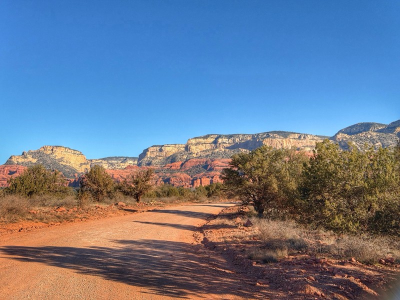
Schnebly Hill Road
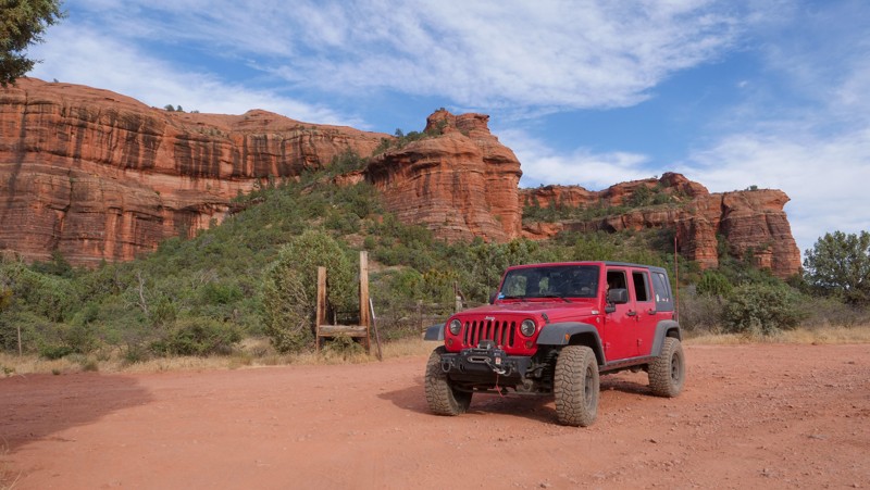
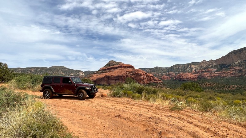
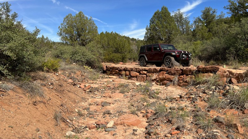
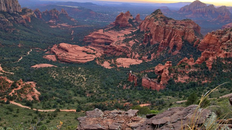
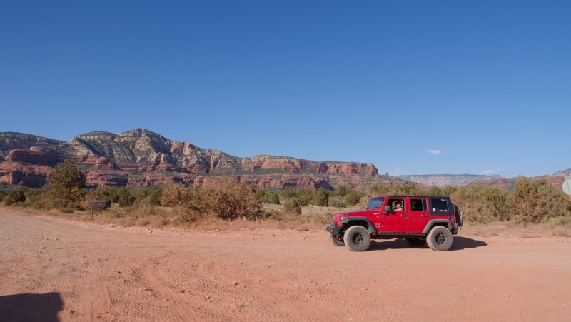
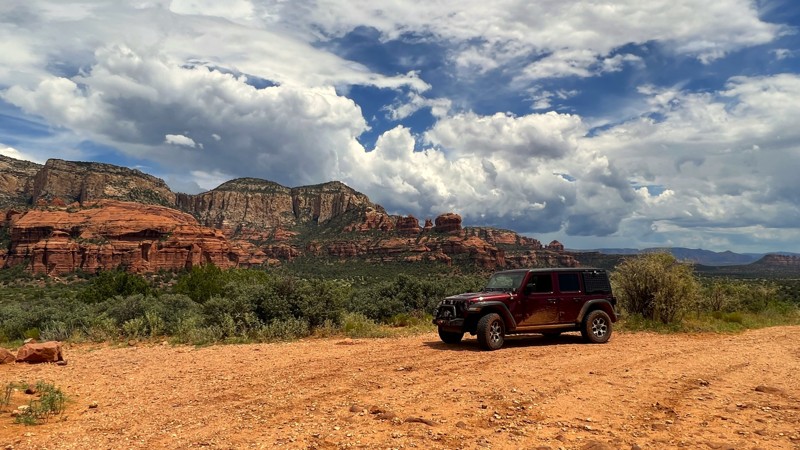
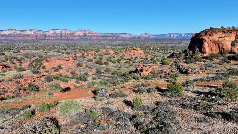
“The finest workers in stone are not copper or steel tools, but the gentle touches of air and water working at their leisure with a liberal allowance of time,” said Thoreau in his 1854 book Walden. Sadly, he never saw Sedona. Sand dunes and seabed sediments were laid and then covered by more of the same over 300 million years ago. Under unimaginable compression, they became the sandstone we see today. A massive 3000-foot uplift 13 million years ago created the Mogollon Rim, running from central New Mexico to western Arizona, exposing the ancient sandstone layers. Walden’s gentle erosion took over. The ethereal beauty of Sedona’s many sandstone formations emerged. Today, tourists from all over the world flock to charming and captivatingly scenic Sedona. Offroaders come, too, running the many famous rocky trails in the area. Schnebly Hill Road is both a road and a rite of passage. The road is crowded and annoyingly bumpy on the descent from the Rim into Sedona. But the views always delight, all that red and buff sandstone formed into monuments ranging from massive to whimsical. Despite being a Jeep Badge of Honor Trail, Schnebly Hill Road is a once-and-done for many. But it is one that you need to do and will always remember, a touchstone of the community, if you will. Thoreau never did Schnebly Hill Road. You should.
Backway to Crown King
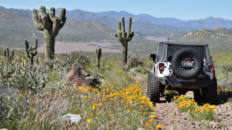
Located northwest of Lake Pleasant and traversing through three different life zones and multiple biomes, Backway to Crown King is a thrilling off-road adventure that offers a unique perspective on Arizona's rugged and beautiful landscape. This extremely popular 4-wheel drive trail is known for its challenging terrain, steep inclines, and narrow shelf roads. Obstacles, mines, and great views await as you climb from the Sonora Desert into the Prescott National Forest.
Box Canyon - Florence
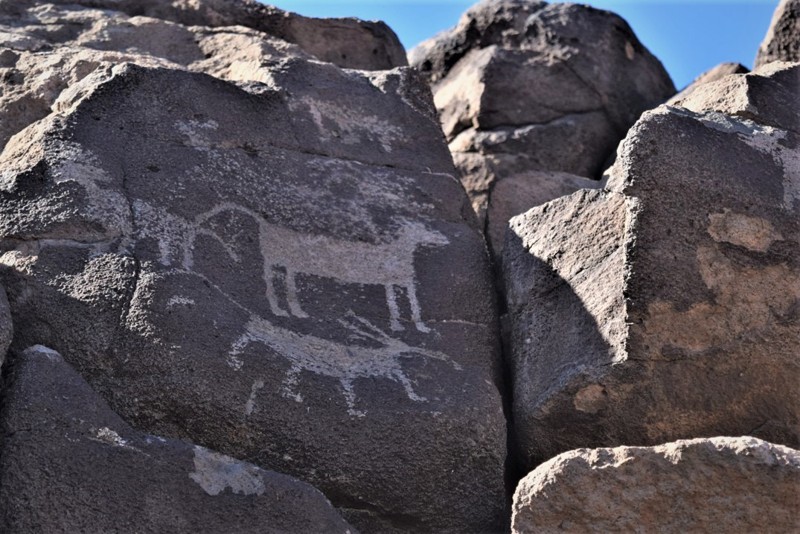
Located northeast of Florence, Box Canyon is a scenic trail that passes through a spectacular, narrow canyon with geological features and bright, colorful vegetation you wouldn't commonly associate with the desert, such as acarosporaceae fungi. Beyond the sheer, towering canyon walls, drivers can find petroglyphs, and historical stagecoach stops making this trail a truly unique Arizona offroad experience. A favorite amongst many offroad enthusiasts, this trail is a popular access point to many other trails within the Florence Junction area.
Broken Arrow
Bulldog Canyon 10
Located within the Bulldog Canyon OHV Recreation Area, FR 10 travels through the Tonto National Forest, offering incredible views of the towering cliffs and rugged canyons that make up the Goldfield Mountains. This area is home to one of Arizona's most infamous legends, the Lost Dutchman's Gold. Countless treasure hunters have explored the countless Sonoran Desert canyons in hopes that one might be hiding that mythical treasure.
Telegraph Line Trail
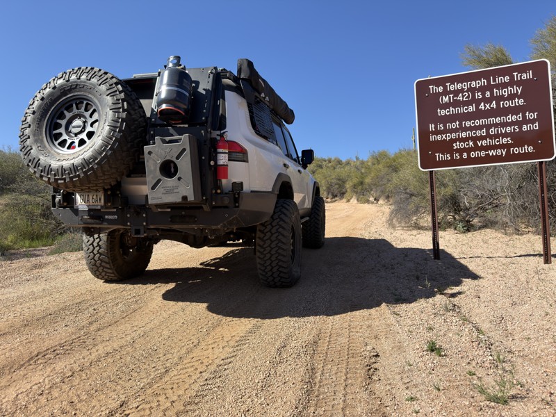
Whether it was a telegraph line, early communications between Horseshoe and Bartlett dams, or even a way to speak with the power plant in Childs, we are left with a line of stumps in the ground attempting to tell us the story of what’s known as Telegraph Line Trail.
The story goes that in the 1880s, when Prescott was the capital of the Arizona territory, a telegraph line was erected for communication between Fort Whipple and Fort McDowell. In 1890, when it became the Fort McDowell Reservation, telegraph communication was no longer necessary as the Army personnel were relocated, and the line was ordered to be chopped down.
In May 2005, the Bart Fire closed the entire St. Clair area. One month later, the Cave Creek Complex Fire took center stage. St. Clair faded into obscurity until 2007, when the Tonto National Forest made a brief effort to rehabilitate the area, which was ultimately delayed. Very little happened for the next seven years.
In early 2014, Tonto Recreation Alliance volunteers began brushing work to clear overgrown areas. In late 2015, TRAL started on repairs to sections of the trail and, by February 2016, had connected both ends by repairing the Edge of Earth obstacle. In 2019, the Mountain and Clair fires put a temporary stall on the project. After all the time, energy, and effort, Telegraph Line Trail is open and ready for you to drive!
New River Canyon
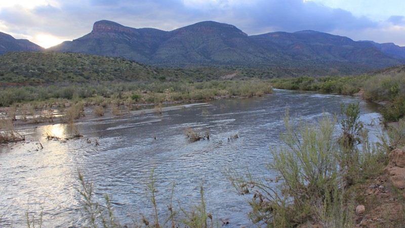
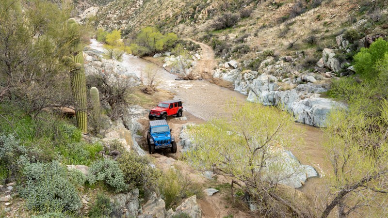
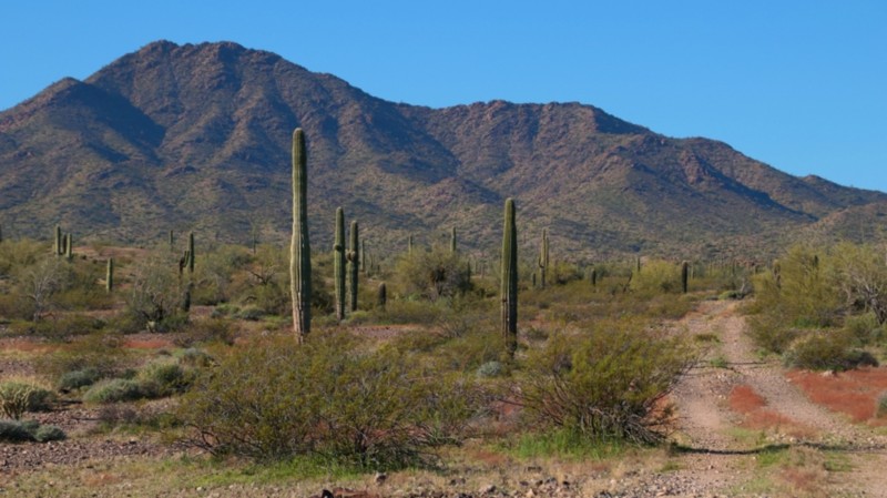
When you think of rugged off-road trails, you typically conjure up images of a trail in a land far away and not right near a major metro area such as just Phoenix, Arizona. New River is rugged and will have you feeling like you are in a remote part of the world rather than a quick drive from the Valley of the Sun. Stretching over 19 miles long across the New River Mountains and Mesa, you will feel enveloped inside the mountains and surrounded by saguaro and other cacti of the area. On a good day, you can cross the New River several times when it is flowing.
Bloody Basin Road
Table Mesa Road - West
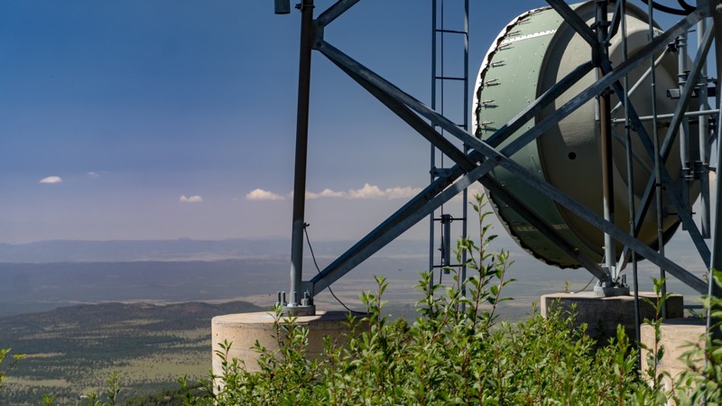
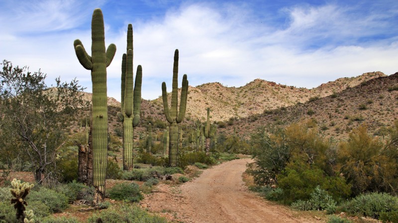
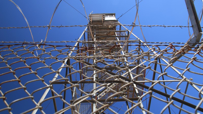
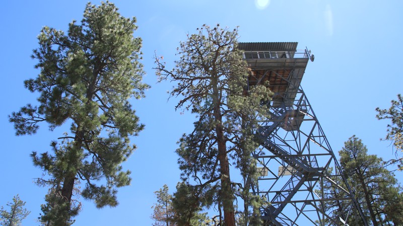
Table Mesa Road West runs through a verdant portion of central Arizona's Sonoran Desert with cacti, including saguaro, prickly pear, and various cholla species. Numerous hills and mesas create a jagged scenic horizon. The trail's namesake mesa, with a lone tower astride its flat top, sits on the east side of I-17 near the trailhead.
Mild-mannered Table Mesa Road provides access to a broad area packed with trails ranging from mild to wild. Little Pan Mine Road crosses the seasonably variable Agua Fria River. The wickedly difficult Terminator trails result in a lot of bent metal. Scattered campsites make for great nights under the stars.
Four Peaks Trail
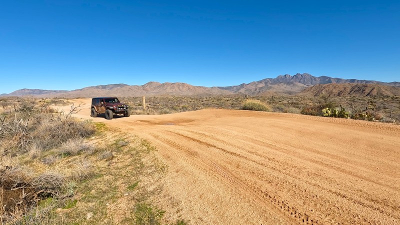
The Four Peaks trail in the Tonto National Forest is an iconic offroad adventure near Phoenix. The trail delivers breathtaking views of the Mazatzal Mountains and Roosevelt Lake, taking you through a diverse desert landscape. The Four Peaks area is a paradise for outdoor enthusiasts with an extensive range of adventure activities and historical sites.
The trail is an easy offroad drive with several scenic vistas and campsites. The area is popular for shooting activities, with numerous designated sites where you can legally shoot approved targets. Please be responsible and clean up all the target debris and discharged shells.
Four Peaks comes from the four prominent peaks forming the massif's summit. Brown's Peak is the tallest of the four at 7,659 feet. It's the northernmost peak and the only named one. It is also the highest point in Maricopa County.
El Camino del Diablo
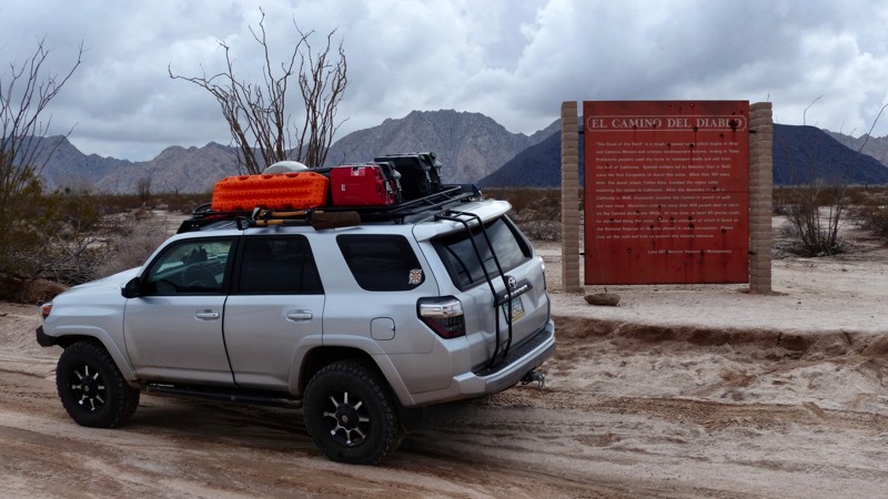
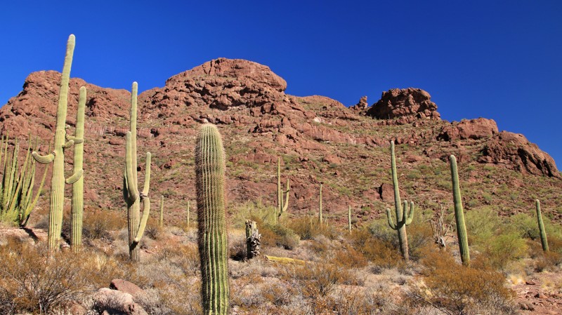
Serving as the southern route to California for hundreds of years, the El Camino Del Diablo (or sometimes called Camino Muerte - Road of Death and also as the Devil's Highway) has carried travelers from the days of the Spanish conquistadors across the sweltering desert from water source to water source until they reached Yuma. The road saw heavy use by the gold rush pioneers in 1849 as it was the only route that even the Apache's wouldn't travel in the summer, which drastically reduced the number of ambushes the pioneers suffered. Today, the original route (which started in Caborca Mexico) has been modified to pass through the Organ Pipe Cactus National Monument, the Cabeza Prieta Wildlife Refuge, and the Barry Goldwater Gunnery Range to exit on the Yuma side of the Tijinas Altas Mountains. This road is iconic and should provide some of the finest views of the Sonoran Desert you can find. The sense of self-reliance only surpasses the scenery you will experience as you must carry everything you will need with you. There's no gas, phones, electricity to rely on here. However, there is a sprinkling of watering holes, wells, and rock water tanks that you could depend on just like the pioneers did. Many of these unfortunate travelers did not make it across the El Camino Del Diablo alive; You may encounter some of the hundreds of graves that are rumored to line the road during your trip. (About 50 are marked). For more interesting detail about El Camino Del Diablo -
You can read about
Raphael Pumpelly's trek across Arizona Here.
(pp. 31-98 in particular)
Log Corral Trail
Soldier's Pass Trail
Located just outside of downtown Sedona, in the Coconino National Forest, Soldiers Pass Trail is one of only a few offroad trails that gets your vehicle on top of the famous red rocks. Photo opportunities abound on this iconic trail named after General George Crook's army scouts, who used this trail to travel through the territory.
In addition to the red rock scenery, there are other amazing sites along the trail. The first is Devil's Kitchen Sinkhole. It is the largest sinkhole in Arizona. Initially formed in the late 1880s, it collapsed again in 1989. Based on current surface cracks, geologists believe more sections could collapse. The second awesome site is the Seven Sacred Pools. These are naturally formed pools in the sandstone and are considered sacred by the Apache and Yavapai Native Americans. If you catch the trail at the right time, you may see water running into the pools.
While short for an offroad trail, this one isn't about the number of miles but the quality of the trail, and its otherworldly surrounding. Plan ahead, a permit is required, and you don't want to miss this one!
Apache Trail
Just outside of Phoenix, Arizona, lies the historic Apache Trail, which winds through the Superstition Mountains region of the Tonto National Forest. The mountains are rugged and unforgiving but have a strong and mysterious draw for the adventurous type. The Apache Trail was originally a wagon haul road used to transport supplies from Mesa to the construction site of the Roosevelt Dam, which created Roosevelt Lake. Construction of the trail began in 1903 and was finished in 1905. It is believed that the route follows an ancient footpath that was used by Native Americans as a trade route. Traveling along the Apache Trail allows access to different regions that offer various desert experiences.
President Theodore Roosevelt once said, "The Apache Trail combines the grandeur of the Alps, the glory of the Rockies, the magnificence of the Grand Canyon, and then adds an indefinable something none of the others have".
Cave Creek
Senator Highway
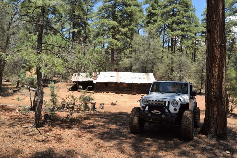
Let’s get something straight right now. Senator Highway isn’t a highway. And it has nothing to do with politics, well, almost nothing. But the Senator is an amazing trail through a beautiful, rugged land with a great history. In 1863 William Bradshaw discovered gold and other mineral deposits in a largely unexplored Arizona mountain range that would one day bear his name. By 1871 the Senator Mine southeast of Prescott, the off-and-on territorial capital of Arizona, was producing fine-grade gold ore. One of the partners in the Senator Mine was the then Territorial Governor John Goodwin, who may or may not have had aspirations to be Arizona’s first Senator once it achieved statehood. A toll road, begun in 1866 from Prescott towards Groom Lake, was continued on to the mine in 1875 and became known locally as Senator Highway. By then, the first mining claim was established near what would become the bustling new town of Crown King. By fits and starts, Senator Highway was extended across the spine of the Bradshaws to connect the Crown King to Prescott. Today Senator Highway troops through verdant pine forests and classic high desert chaparral, climbing and descending the varied topography. Portions of the trail are nicely maintained, while others are often rutted and rough, receiving little attention. Sections of shelf road offer broad vistas across the rugged Bradshaws. Approximately at the halfway point of the trail lies the historic log cabin known as Palace Station. Built as a homestead in 1875 by Alfred and Matilda Spence, the cabin was used as a stage stop until 1910. Today it is an administrative site for the Prescott National Forest and is not open to the public. As one of the oldest structures in Arizona still in use, the cabin is a treasure and a highlight of the Senator Highway.
Crown King Road
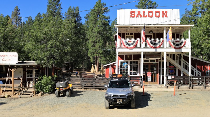
In 1863 the Bradshaw brothers, William and Isaac, came to Arizona from the declining goldfields of California. By 1864 they found gold in the forbidding mountains that would eventually bear their family name. Miners and prospectors flocked to the area despite the ruggedness of the mountains and the fierceness of the Yavapai natives, that still claimed the lands as their home. William, more an entrepreneur than a miner, laid out the Bradshaw Trail and started a ferry across the Colorado River at Ehrenburg, charging unsuccessful California miners a nice fee for access to the new goldfields of Arizona. Mines like Senator, Tip Top, Blue Bell, Tiger, and Ora Belle began highly profitable operations. Rod McKinnon located gold in July 1875 deeper into the Bradshaws than any find to date. The resulting Crowned King Mine became the largest operation in the Bradshaws and spawned the bustling town of Crown King. Crown King got its post office in 1888. Electricity and the telephone arrived in 1897, both still a rarity in Arizona. The Saloon was moved from Oro Belle board by board in 1906 and reassembled on the present site, which was at the time beside two Chinese Restaurants and the feed store. The upstairs featured seven cribs where the town's soiled doves practiced the world's oldest profession. It is now Arizona's longest-operating saloon. The historic photos lining the walls of the bar serve as a museum of sorts. The Bradshaw Mountain Railroad, a true feat of engineering, reached Crown King in 1904 via switchbacks and tall trestles. The railroad ceased operation in 1926 after the mines played out and most of the population left. The rail bed was converted into the scenic Crown King Road with its dual ghost towns of Bumble Bee and Cleator. Today there's only sporadic mining in the Bradshaws. But Crown King has become its jewel. With roughly a hundred full-time residents and perhaps a thousand that have cabins and summer homes atop the mountains, Crown King's population swells every weekend as offroaders and adventurers come to the mountaintop town for a taste of Arizona history. The Magic Bridge transports visitors from the desert below to the towering pines and cool breezes of Crown King. The saloon has live music most weekends. The general store sells a lot more t-shirts than mining pans these days. Campsites near town are filled with happy campers. Even with most of the gold gone, the mountains of the Bradshaw brothers remain full of treasures. Drive on up the iconic Crown King Road and see what you can discover.
Vultee Arch
The Vultee Arch trail in Sedona is the perfect place for your next offroad adventure. The trail runs through the beautiful red rocks, leading to a vast network of hiking trails in the Coconino National Forest and the Red Rock Secret Mountain Wilderness. The area is home to many natural wonders, including stone arches, natural bridges, pinnacles, cliffs, and slot canyons, all waiting to be explored.
If you have a high-clearance vehicle, you can easily drive to the hiking trailheads of Devil's Bridge, Brin's Mesa, Secret Canyon, and Vultee Arch. Even if hiking is your main attraction, off-roaders can take unique photos of their vehicle against the beautiful red rock backdrop along the Vultee Arch Trail. For the best photos, you should take the trail in the afternoon when the sun casts its warm light on Capital Butte and the surrounding ridgelines.
If you want to explore the area's history, head down the trail and take a short side trip on Forest Road 9917 to the nearly century-old Van Deran Cabins. These cabins were used in two movies back in the 1940s: "Riders of the Purple Sage" and "Blood on the Moon." A plaque at the site provides additional history of the previous owners and building materials used.
Morgan City Wash
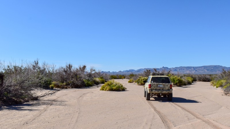
Before heavy equipment made road-building easy, wide desert washes served as semi-reliable substitutes in the Sonoran Desert. Ranchers, miners, and travelers of all sorts used the smooth sandy bottoms to traverse the rugged landscape. Morgan City Wash is named for a small mining community near Pikes Peak, one of the many mines and towns that sprung up in the mid and late 1800s in the Hieroglyphic Mountains only to quickly disappeared back into the landscape. The wash was the only thoroughfare to the tiny community. Today the offroad community still uses the wash to travel deep into this rough and beautiful area. The southern part of the trail follows the meandering sandy bottom of the broad wash. Summer monsoon floods continually reshape the trail. Springs create lush riparian areas populated with coveys of Gambel quail that flush noisily when you approach. Classic cactus-laden desert landscapes rule above the rim of the canyon. The jagged peaks of the Hieroglyphic Mountains dominate the horizon. A narrow rocky section of the wash between high walls of granite makes for fun wheeling. Several springs and seeps normally keep this section wet. Thus the sand is well-packed. The trail exits the wash after about nine miles. From there, it rides along the crest of a winding ridge offering fantastic 360-degree views. Pikes Peak looms to the east, Garfias Mountain rising to the north, both in the seldom visited Hells Canyon Wilderness. The Horse Creek Trailhead and Garfias Wash offer intrepid hikers an opportunity to delve deep into this remote wilderness. Pack a lunch. Bring the kids. Air down. Enjoy the Morgan City Wash.
Sycamore Creek Loop
This route is a wonderful get away from the Phoenix congestion and is a VERY popular place for the locals. The area is comprised of many different trails connecting for an incredibly beautiful, yet challenging tour of the desert. The large Sycamore Wash has the challenging Widowmaker hill climb as well as sweeping panoramas of the Four Peaks Region in Tonto National Forest. The Sycamore Creek and Four Peaks region combined, create an incredible place to play at any time of the year. The region has many double and single track trails to explore for days. The trails in the area wind through sandy wash canyons, up steep hill climbs and over rock strewn mountain tops, all while being within an hours drive of the Phoenix valley. The entire area has limitless free camping, but please try to reduce your impact by using an existing campsite area. The area is popular for target shooting and can become crowded on holiday weekends. Please be very cautious when traveling the trails, all trails are TWO WAY and collisions do occur, resulting in deaths, please slow down!
Mineral Mountain Road
Mineral Mountain Road is the northern entrance to the famous Florence, AZ, OHV area. From Mineral Mountain Road, offroad enthusiasts can plan a full day's adventure with any number of the local trails. This expansive area is littered with mining claims, petroglyphs, wagon stops, and beautiful scenic views. Occasionally, there are deer, big horn sheep, Gila monsters, and endangered desert tortoise sightings. Mineral Mountain Road can access several of Arizona's most famous rock crawling trails. Ajax Mine, Axle Alley, and Highway to Hell are just a few of the area's legendary trails. If you're looking for a great scenic 4x4 tour, Box Canyon and Price Road make for a fantastic and moderate day.
The route was once a maintained gravel road connecting several mines and the old town of Reymert. After the mining years ended, the land was used for military artillery training. The local Arizona National Guard would notify the public when the firing was live by raising a red flag at the trailhead. Over the years, the military stopped firing into the mountains, and this rugged Sonoran desert landscape found a new purpose.
Castle Hot Springs
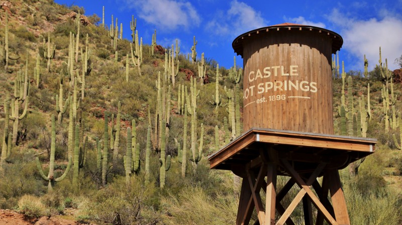
Confusion between indigenous petroglyphs and Egyptian hieroglyphs led to the name of a sprawl of rugged Hieroglyphic Mountains west of present-day Phoenix. In 1865, Army Colonel Charles Craig led a troop of soldiers pursuing Yavapai Indians through the misnomered mountains and remarked that the peaks looked like castles. The troop stumbled upon hot springs that flowed into a desert wash and named them Castle Hot Springs and Castle Creek. The wash became a road, and the hot springs became a resort.
An underground reservoir pushes out 200,000 gallons of 122-degree water daily. Indigenous peoples had long frequented the hot spring for its supposed healing powers. In 1896, the enterprising Arizonan Frank Murphy began luring people to the Castle Hot Springs, and they've been coming ever since. Eastern dandies wintered at the remote hot springs resort, including Theodore Roosevelt, the Wrigleys, Rockefellers, Cabots, and Carnegies. During World War II, the Defense Department commandeered the spa to serve as a recuperation facility for wounded servicemen. Its most famous patient was future President John F Kennedy, who spent the winter of 1945 recovering from injuries suffered when his boat, PT109, was destroyed. A 1976 fire destroyed much of the resort, but it has reopened. The palm trees around the resort are not native to Arizona.
The resort is not the only feature of this highly scenic drive. Castle Hot Spring Road passes the scenic Lake Pleasant Reservoir before dropping into Castle Creek. Feral burros roam the rugged landscape and are often seen from the trail. The center of the trail follows a colorful canyon formed by Bitter Creek. Remnants of present and past mining operations and cattle ranches dot the surrounding hills and mountains. Each switchback reveals another vast vista of a rugged mountainous landscape, and connecting trails beg for further exploration.
Superstition Loop
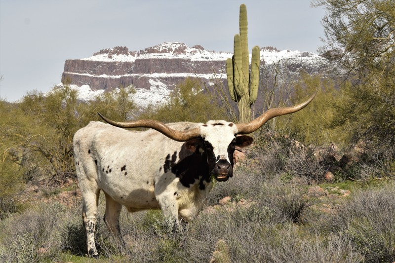
The Superstition Mountain Range is a unique and vast region located in central Arizona. The rugged peaks can be seen from miles away, seeming to invite outdoor enthusiasts to explore its many hidden canyons. Located along the southern rim, Superstition Loop allows 4x4 users to enjoy the towering peaks while driving along an easy off-road trail. The trail winds its way through the desert landscape with an unobstructed view of the mountains and has some wonderful campsites to pitch a tent for a night or even more. The area is filled with some of the most challenging and scenic hiking on the planet. If you want a real challenge, pound in your tent stakes and head over to Peralta Hiking Trail to climb up to the top of the Superstitions. Of course, you can choose to merely drive along the loop, and maybe you'll catch a glimpse of the Longhorn cattle belonging to a local rancher.
Elvis Trail
The OHV region near Florence, Arizona, is loaded with legendary offroad trails for all types of vehicles. Hidden in one of the many washes, Elvis is widely known for its numerous rock waterfalls that challenge even the best-built rigs. There are many abandoned as well as active mines in the area. Legend has it the trail's name comes from a local miner’s dog that traveled along the route with him many years ago. Along the way, there are towering saguaros clinging to the rocky banks as you twist through a lush Sonoran desert. The terrain along this route is harsh, the rocks are sharp, and everything out there wants to poke or sting you. Continuing that theme, the rocky waterfalls are massive and intimidating, but with careful tire placement and a trusted spotter, navigating through the rocky maze is achievable. Stopping after conquering an obstacle and feeling a sense of accomplishment is the memorable part about Elvis.
Redington Pass
Hieroglyphic Mountain Loop
Point Sublime
Camp Creek to Verde River
Close to Phoenix and fun! This offroad trail follows the Camp Creek Wash to the Needle Rock Recreation Area on the Verde River. As you progress down the sandy trail, the wash narrows, and cliffs rise above you into a narrow canyon. There are many opportunities to stop and explore by foot or rest for lunch under the towering cliffs. When you reach the end of the trail, you will enter the Needle Rock Recreation Area, a popular swimming hole in the summer. There are plenty of opportunities for fishing, kayaking, or just enjoying the beautiful riparian scenery.
Rim Road
Black Canyon OHV Trail
Trekking between the Table Mesa Recreation Area and Black Canyon City, west of I-17, Black Canyon OHV Trail is a scenic, rocky, and narrow 4x4 trail that follows an ancient pack trail over steep rolling hills and deep dry river beds through thick and thriving high desert vegetation. This trail provides a great mix of challenges and views and is a fantastic adventure-filled day when combined with AZCO Mine Trail.
Smiley Rock
Just outside of Jerome, one of the most famous and ghostly mining towns in all Arizona, sits a rock that never stops smiling. Smiley Rock is one of the more famous off-road trails in the State and for good reason. The drive is challenging, but not overly difficult and provides inspiring scenery as you travel along the south edge of the Woodchute Wilderness Area inside the cool and shaded Martin Canyon. The main attraction is the rock with a smile set in stone. It sits there smiling at you and this is the type of trail in which you could honestly smile back.
Cherry Creek
Charouleau Gap/FR 736
Cottonwood Canyon Road
Cottonwood Canyon Road serves as one of, if not the main entrance to, the famous Florence OHV area. This rugged region is littered with old mines, wagon stops, petroglyphs, and beautiful Sonoran Desert landscapes. During the busy winter months, the early portion of the route is considered the boondockers midway. Countless RVs and large family groups line the well-maintained gravel road. The fun begins once you pass all the traffic. The trail travels through a rocky wash before climbing into the southern foothills of the Superstition Mountains with spectacular panoramas of the surrounding Sonoran Desert. Cottonwood Canyon Road ends at 5 Points, the central hub of the region's trail network. You can choose from various routes, like rock crawling on the Ajax Mine trail for lunch at the ruins or continuing south through the beautiful narrow walls of Box Canyon.
Loy Butte Road
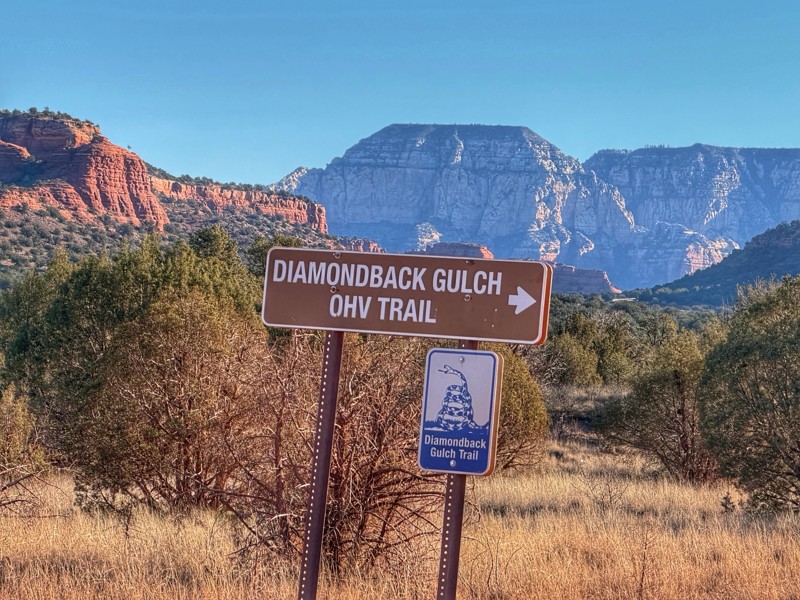
As you drive in, the impressive views of the Red Rock Secret Mountain Wilderness Area and the Sycamore Canyon Wilderness area abound throughout most of this easy dirt road, begging you to drive even deeper. Located near Sedona and named after Loy Butte, the more prominent rock formation nearest the Honanki Ruin, this road also connects to several of the most notable offroad routes near Sedona, including The Outlaw OHV Trail and Diamondback Gulch. You could easily spend a few days in this area, wheeling and hiking many foot trails that lead into the Wilderness Area.
Turkey Creek Trail Cleator
Located about 30 miles north of Phoenix, near Bumble Bee Ranch, scenic Turkey Creek Trail winds like a rollercoaster through and above several canyons, including Black Canyon, Dead Cow Gulch, and Turkey Creek Canyon. This trail along the base of the Bradshaw Mountains passes through many silver and gold mining areas established as far back as the early 1900s. Fantastic views, rocky terrain, and multiple water crossings await those adventurous enough to take the long way to the unique Cleator Bar and Yacht Club.
Mount Lemmon Control Road
This is the trail that many choose to test their rig on for the first time. That being said, it's not a difficult trail at all; in fact, hearty passenger car drivers with little regard for their undercarriage tackle this trail all the time. But don't be fooled, there are still steep climbs, switchbacks, and several spots that get washed out, Designated by many names, the Mount Lemmon Control Road, Oracle Control Road, the Old Mt. Lemmon Road, or USFS 38, this was once the only way to the top of Mount Lemmon. In the 1920s, it was a popular escape from Tucson, but it was woefully inadequate for the amount of traffic attempting to use it. Steep inclines, narrow switchbacks, and occasional rock slides were all real problems for those early travelers. In those early days, the road was so narrow that traffic was only allowed in one direction of travel for an hour and a half at a time. This is where the 'Control' part of the name came from. Today, it's hardly a road needing any 'Control'; however, there is much trepidation about driving on the "Backside of Mount Lemmon." The steepness is still there, the switchbacks are still there (But much wider), and certainly, the same views and towering pines delight those who complete the journey. You can experience multiple biological zones from desert scrub to juniper grasslands and ponderosa pine forest on this wonderful 30-mile trek. There are caves, a quaint town, zip line adventures, mines, and much cooler weather as you climb. In evidence, as you ascend, is damage from multiple major forest fires that have devastated much of the timber but have opened a wider view of the valley floor below.
Outlaw Trail
Sedona is a wonderful destination for offroad enthusiasts. It boasts a variety of trails with varying degrees of difficulty, all offering stunning views of the area's famous red rocks. Among the top 10 iconic 4x4 trails in Sedona is the Outlaw Trail.
In addition to the offroad trails in Sedona, the Coconino National Forest extends to Flagstaff, offering endless trails in the pine forests that reach up to 7,000 feet in elevation at the top of the Mogollon Rim. It's a great escape from the summer heat in the Verde Valley.
Sedona has over 200 hiking trails covering more than 400 miles, providing plenty of options for hikers. You can venture deep into the wilderness of Red Rock Secret Mountain or Sycamore Canyon or explore the urban trails just a stone's throw away from downtown Sedona.
If you're interested in history, Sedona is home to several ancient ruin sites, where you can glimpse life in cliff dwellings dating back to AD 1150 - 1350. Honanki, located at the end of the Outlaw Trail, and Palatki, just down Loy Butte Road, are two such sites.
Diamondback Gulch aka Greasy Spoon
Rug Road
Woody Mountain Road
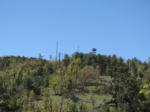
Situated near Flagstaff, Arizona, Woody Mountain Road is a favorite among campers and sightseers, especially near the end as they venture into the East Pocket area atop the Mogollon Rim and the famed Edge of the World camping area. The places it takes you to are scenic and full of potential. As you head south, you can see a radio tower atop Woody Mountain, then past The Arboretum at Flagstaff and Northern Arizona University Centennial Forest, Coconino County's Rogers Lake, through Mill Park with its scenic meadows, and further south to the top of the Mogollon Rim with incredible views and dispersed camping. There are also a lot of other connecting forest roads and trails that give you access to camping and many great places to enjoy the Coconino National Forest.
Box Canyon - Wickenburg
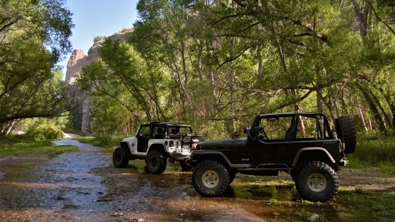
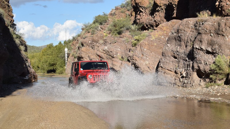
Box Canyon is an Arizona four-wheeler's hidden oasis. It offers a unique four-wheeling experience by allowing users to drive through a wet and sandy cliff-lined canyon. Most times of the year, there is just enough water to let you splash your way through the canyon. You can also explore side trails or hang out under one of the several giant shade trees. The Hassayampa River flows mostly underground. It starts at the Bradshaw Mountains and continues through Wickenburg, Arizona. Depending on the day and recent rainfall, the water depth typically ranges from non-existent to 15" deep (sometimes even deeper).
China Dam/Tule Creek Homestead
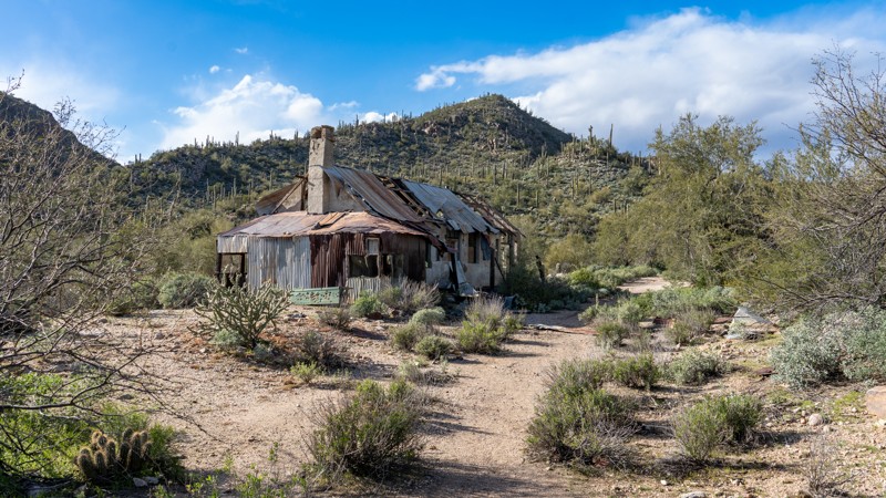
Close to Phoenix, the historical mining areas north of Lake Pleasant, China Dam, and the Tule Creek Homestead are a fascinating look back into the early settlement of the Bradshaw Mountain Foothills. Branching off the popular Backway to Crown King trail, this track leads to the China Dam, built in the late 1880s by immigrant Chinese laborers for hydraulic mining operations on Humbug Creek. The trail continues to an old mining homestead deep in the mountains on Tule Creek, slowly reclaimed by the desert landscape. Be sure to spend a day visiting these fantastic relics of the past before they are forever gone.
Cliffhanger
Sedona is a fantastic destination for offroad enthusiasts. It offers a variety of trails with varying degrees of difficulty. One of the top 10 iconic 4x4 trails in Sedona is the Cliffhanger Trail, which has a name that instills curiosity and intrigue. Once you make your way down the narrow and suspension-banging Cliffhanger hill, you will want to take a 1/2-mile hike to the old homestead along Oak Creek and dip your feet in the water. Remember to bring your hiking shoes, as the hike back to your vehicle will be a bit of a climb.
Apart from the offroad trails in Sedona, the Coconino National Forest extends to Flagstaff, offering endless trails in the pine forests that reach up to 7,000 feet in elevation at the top of the Mogollon Rim. It is a perfect escape from the summer heat in the Verde Valley.
Sedona has over 200 hiking trails covering more than 400 miles, providing plenty of options for hikers. You can venture deep into the wilderness of Red Rock Secret Mountain or Sycamore Canyon or explore the urban trails just a stone's throw away from downtown Sedona.
If you are interested in history, Sedona is home to several ancient ruin sites where you can glimpse life in cliff dwellings dating back to AD 1150 - 1350. Honanki, located at the end of the Outlaw Trail, and Palatki, just down Loy Butte Road, are two such sites.
Bartlett Powerline
Rolls 1863
The Rolls OHV Area is located just outside the Phoenix Valley, in Tonto National Forest, and covers 27,000 acres. It features 65 miles of varied-width trails, offering breathtaking views and hiking trails around the Four Peaks, along with camping, fishing, and water sports at the back coves of Saguaro Lake.
Many of the trails in The Rolls are suitable for stock 4x4 vehicles. This trail provides an opportunity to explore the narrow canyons of the region.
This area is popular among those who enjoy riding ATVs and dirt bikes because of the sandy washes and winding canyons. You can spend a weekend exploring the region and camp at one of the coves located on Saguaro Lake. Alternatively, you can follow one of the routes leading north to the Four Peaks region and enjoy spectacular panoramas before returning to the coves for dinner and a bonfire on the shoreline.
Southern Pipeline Trail
Officially known as El Paso Gas Pipeline Rd., this off-road trail goes north to south on the western side of New River. The trail is also a route for the El Paso Gas Pipeline, and fiber cables are buried along the route. This is a great trail for overland adventures but also has some mildly challenging obstacles along the way. It can also provide an alternative route for high clearance vehicles that want to avoid a shutdown or heavily congested I-17.
Horseshoe Lake
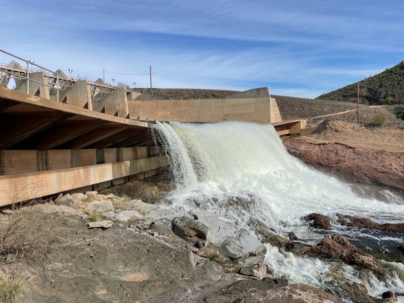
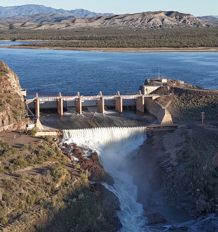
Water in the desert means life. The beautiful and wild Verde River flows 170 miles through the center of Arizona before emptying into the Salt River. Two dams create broad lakes near the river's southern terminus, the first being Horseshoe Dam. Less crowded than the lower Bartlett Lake, Horseshoe Lake offers boating, kayaking, fishing, camping, wildlife watching, broad desert vistas, and quiet relaxation, The sandy saguaro-lined road to Horseshoe Lake passes below St. Clair Mountain on its descent through the rugged Tonto National Forest into the Verde River's deep valley and then on the lake. Numerous trails branch off for those looking for some adventurous wheeling. The K A Ranch appears wonderfully bucolic on the eastern bank of the river. Easy access to the Verde River below the dam offers fishing and dispersed camping opportunities. Numerous species of catfish, crappie, and bass, along with bluegills and carp, are plentiful. Anglers may find themselves competing with bald eagles who frequently fish the river and lake. The trail ends at a boat ramp often used as a takeout for kayakers coming down the Verde as well as those wishing to troll the lake. Be sure to take the short detour to visit the dam and Catfish Point, a great place to watch the river's precious water cascading from the dam's spillway.
Whitmore Overlook
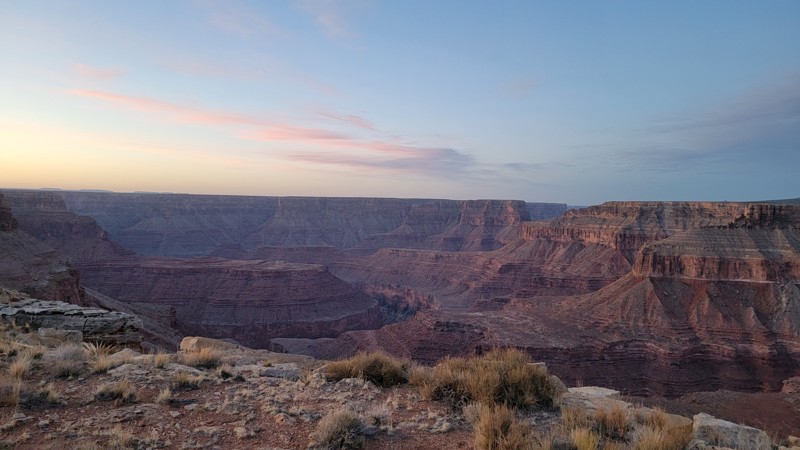
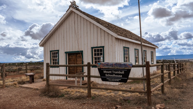
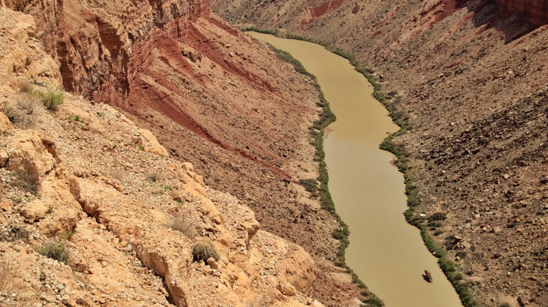
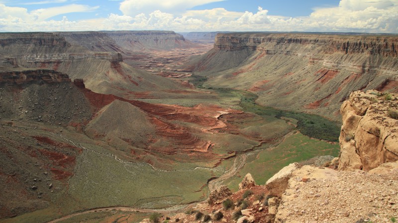
Located in the remote and mostly uninhabited Arizona Strip, Whitmore Overlook is an iconic Overlanding destination. The trail ends at an uber-impressive viewpoint 500 feet above the Colorado River as it snakes through the western end of the Grand Canyon. The ambitious can hike down to the river. But most will be content to sit on the cliff's edge admiring the scenery and possibly seeing a group of river rafters passing below. While the end of the trail is a worthy destination, getting there is special too. The trail begins at the historic Mount Trumbull Schoolhouse. Constructed in 1922, the schoolhouse was the civic focal point for the hardy residents of the area until 1966. Today it houses artifacts and photographs of the era. Passing through a pinion-juniper forest, every curve on the trail presents a new and impressive view of the Uinkaret Mountains to the east and the Whitmore Plateau and flat-topped 6,500-foot Grassy Mountain to the west. The sandstone cliffs glow in a rainbow of reds, oranges, pinks, grays, and white. Traveling farther south, ominous dark lava flows spill over the sandstone heights. Part of the Uinkaret Volcanic Field, the lava flows range from 850,000 to 72,000 years old. Uinkaret flows dammed the Colorado River at least 17 times, forming a lake that spanned back to the present-day Phantom Ranch. Each time the river overflowed the dams. The silt-laden water of the Colorado River eroded the basalt dams allowing the river to return to its voyage to the Gulf of California. From the Whitmore Overlook, you can see the remains of one of the lava dams across the river. The climax of the trail is obviously a night spent under the stars on the edge of a cliff above the mighty Colorado. With no light pollution, the night sky comes alive with a blanket of twinkling billions of stars and galaxies overhead. Sunrise and sunset views are nearly unparalleled. It's worth the trip.
Casner Mountain Trail
Casner Mountain Trail runs between the Sycamore Canyon Wilderness and the Red Rock Secret Mountain Wilderness. It is an exceptional vantage point for viewing the Red Rock Country. The Sedona region is widely known for its natural beauty, and the Casner Mountain Trail, which reaches an altitude of 6,821 feet, offers a unique perspective that few people have experienced. Although the narrow and twisting switchbacks, sheer cliff shelf road, and steep hill climbs can be challenging, it is worth taking a break to appreciate the stunning views of the Sycamore Basin to the west and Mooney Canyon to the east.
With advanced planning, you can spend a day or two exploring the most famous offroad trails in the Sedona area. The next day, you can climb the Casner Mountain Trail to reach the top of the rim and then explore the extensive network of trails in the upper Coconino National Forest.
Ghost Town Loop
Queen Creek Canyon
Situated at the southern end of the Tonto National Forest and close to a myriad of other OHV trails, Queen Creek Canyon shouldn't be missed. The scenery along this trail is breathtaking! The thrill of riding along the ridgeline and shelf road keeps you holding tightly onto your steering wheel as you look in amazement out the windshield at the mountain peaks and low desert valley in front of you.
Right out of the gate, you are fully immersed in the challenges of this trail. A steep hill descends the mountainside and immediately climbs back out as you go up, over, and around the rugged landscape. The trail peaks at over 5,200 feet, a solid climb from the desert floor.
This trail is less traveled than the three trails that make up the Montana Mountain Loop: Hewitt Canyon Road, Rogers Trough, and Happy Camp Road. With the significant amount of camping in this area, adding Queen Creek Canyon can make for a great weekend trip.
Haigler Creek
Arizona does not have many places that offer a chance to enjoy a year-round, natural mountain stream. Located just a little north of Payson, the Tonto National Forest has a hidden gem for 4x4 enthusiasts. During the summer months, the crystal clear water offers a welcome reprieve from the desert heat while offering a perfect staging point for exploring hundreds of miles of nearby trails.
If you get there early enough, you can grab one of the limited camping spots located right on the creek. This trail may not be well known, but it is certainly popular with people visiting there for decades. The creek offers fishing for trout and a wonderful wet canyon hike to Colcord Falls, located upstream about 1/2 mile east of the camping area. The waterfall is by far one of the best-preserved swim holes in the entire state. The waterfall isn't always running, but with the heavy snows in 2016 and rains in 2017, the region has had plenty of moisture to keep the falls running all year. It's an easy hike through a narrow wet canyon with a couple of hidden springs to look for along the way.
Toroweap
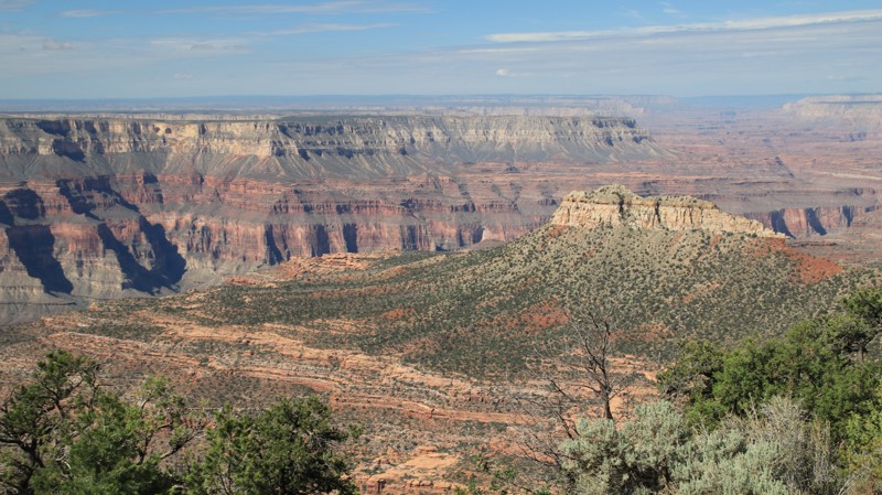
You've undoubtedly seen the photographs though you might not have known where they were taken. The dramatic sandstone cliff dropping 3000 feet straight down to the Colorado River below is an iconic image. The location is the Toroweap Overlook. It sits in one of the most remote areas of Arizona, the Arizona Strip. Toroweap and Tuweep are used interchangeably. Both are derivations of a Paiute word meaning dry, barren valley. The long drive to Toroweap bears out the applicability of the name. But even barren locals can be dramatically beautiful. Multihued sandstone cliffs rise on either side of the Paiute's barren valley. To the south lies cinder cones and lava flows from the ancient Uinkaret Volcanic Field. Long views abound as the road descends towards the canyon cut by the Colorado River, the grandest canyon of them all. Walking to the edge of the Toroweap Overlook is a profound experience. The views are breathtaking. The immenseness of your surroundings is almost incomprehensible in human terms. The view here is like no other along the entire Grand Canyon. You have to work to get here, but it's worth the effort.
In an effort to manage the number of visitors to the area, all motor vehicles entering the Toroweap area of the Grand Canyon National Park require a backcountry permit or a day-use ticket available through Recreation.gov.
Smasher Canyon
FR 153A
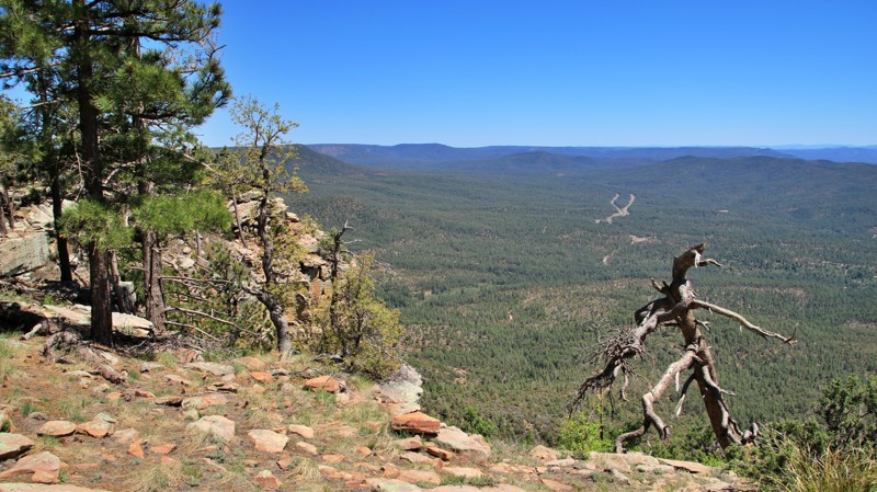
FR 153A is an exciting drive that gets you away from the Sedona crowds. That alone is reason enough to give it a try. However, the true worth of this short trail lies in its first mile, which runs along the dramatic edge of the Mogollon Rim, the geological feature that gave birth to the red rock geology that made Sedona famous. That one mile of eye-popping scenery is unforgettable. Even better is the handful of campsites perched right on the edge of the Rim, each with those imagination-defying views. But FR 153A guards her precious scenic and camp jewels jealously. The road to these epic sites is pure rock, and we aren't talking slick rock either. Plenty rough enough to turn away the faint of heart, the crowds never venture to these little-known edge-of-the-world gems. That just means the worthy can sit on the 1000' edge of the cliff sipping a beverage and watching the ant-like traffic crawl along Schnebly Hill Road below as sunset glistens off the enormous red rock formations below. And the next morning, you can crawl out of your sleeping bag and treat yourself to the sunrise view after a walk of only a few feet.
Tortilla Ranch
The Tortilla Flat region in the Superstition Wilderness is known for its challenging and isolated hiking trails. If you want to explore this rugged area, the Tortilla Ranch Trail is an excellent option. The trail takes you further into the remote wilderness, where you can set up a serene and stunning campsite after a long day of hiking.
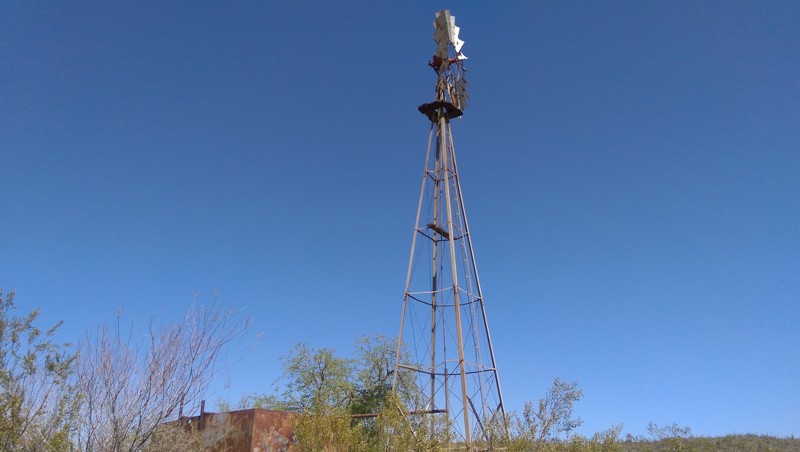
History seekers enjoy exploring the remains of the Tortilla Ranch. Situated along Tortilla Creek, an old rock cistern, well, fallen windmill, concrete pad, and watering trough are remnants of days gone by.
Hiking trail JF 106 is named for John "Jack" Fraser, who owned the JF Ranch in Fraser Canyon and eventually took over the Reavis Ranch property in 1896.
Happy Camp
Happy Camp is the third section of the popular Montana Mountain Loop. Winding along the border of the Superstition Wilderness deep within the Tonto National Forest Hewitt Station OHV area, Happy Camp is a fantastic trail for the scenery alone. The Montana Mountain Loop could easily be a weekend trip with the many campsites along the trail.
Newer offroaders can cut their teeth and build their confidence on Happy Camp with a few off-camber situations, shelf roads, minor rock obstacles, switchbacks, potential water crossings, and feeling very remote.
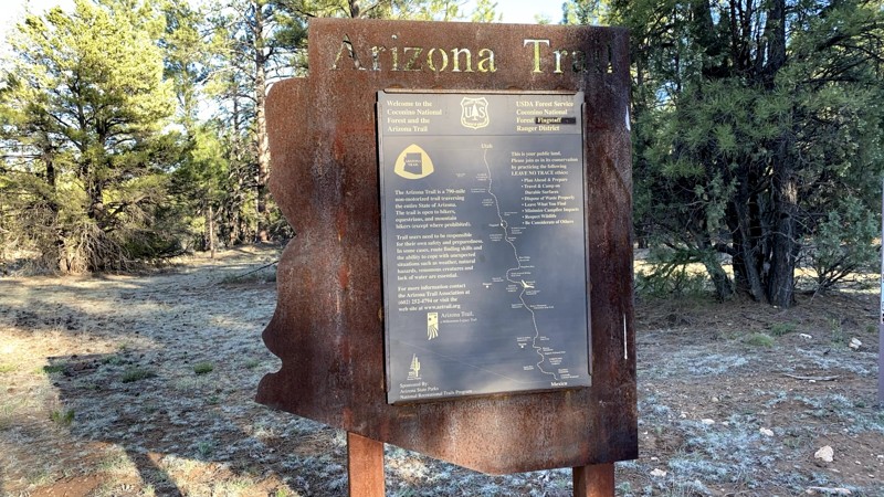
Happy Camp provides access to over 170 miles of networked hiking trails deep into the Superstition Wilderness. The Arizona Trail crosses Happy Camp Road at three different points. It is an 800-mile hiking trail traversing Arizona from the Mexico border to Utah. The crossings are part of Passage 18, Reavis Canyon, which runs from Picketpost Trailhead to Rogers Trough Trailhead.
Sandman Road
Located a short distance east of Florence and just outside the Phoenix Metro area, Sandman Road offers incredibly beautiful views of the Sonoran Desert and the Mineral Mountains. Travel through fields of teddy bear cholla and towering saguaro as you crest picturesque ridgelines that overlook miles of connecting OHV trails. Sandman Road should be near the top of your adventure list whether you are looking for a beginner offroad trail that's more than just a dirt road or looking to photograph amazing scenery.
Dupont Cabin
Jerome-Perkinsville Road
The Jerome-Perkinsville Road provides amazing views of the Mogollon Rim, the striking colors of Red Rock Country, and the rolling desert hills just east of Chino Valley. You also drive alongside the Woodchute Mountain Wilderness Area on the southern portion of this trail. To the north are Perkinsville and the Verde River. From there, you can continue further north to Williams or west to Chino.
Apache Land Trail
Highway To Hell
Telegraph Canyon Road
Telegraph Canyon Road is a scenic day ride weaving through the rugged beauty of Arizona's Mineral Mountain Mining District. Starting near the historic town of Superior, the trail meanders southwest, offering breathtaking views of iconic landmarks like Picketpost Mountain, Weaver’s Needle, Apache Leap, and the Superstition Wilderness. It intersects with the famed Arizona Trail before concluding at the intriguing Ajax Mine, a site steeped in history and frontier drama.
The Ajax Mine, established in 1915, was once rich in lead and zinc ore, estimated at 20,000 tons by its original operator, B.D. Johnson. Ownership disputes and legal battles defined its turbulent past, including a notorious eviction of the Wallace brothers in 1926. Despite being listed for sale in the 1940s, disagreements among heirs left it idle, with its asking price of $45,000 and unique no-down-payment terms never fulfilled. Visitors can explore its impressive remnants but should use extreme caution as you are likely to encounter open, vertical shafts.
Lower Terminator
Lower Terminator is a short Technical Vehicle route located within the Table Mesa Recreation Area about 45 minutes north of Phoenix. This popular rock crawling trail follows a rocky wash and offers numerous challenges as you attempt huge obstacles, maneuver tight turns, and climb jagged ledges with steep drop-offs. Lower Terminator is an exceptionally rewarding driving experience where any vehicle can find a route that will push the vehicle to its mechanical limits.
Hewitt Canyon Road
Hewitt Canyon Trail, Forest Road 172, is located in the Hewitt Station OHV area of Tonto National Forest. This is a popular area for hiking, dispersed camping, and offroad driving.
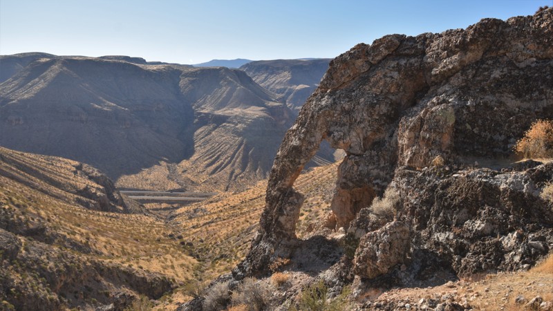
The beginning of the trail will take you across Queen Creek Wash. Have your camera ready. Hewitt Canyon treats visitors with towering rock cliffs and buttes. With a good eye, you can spot Elephant Arch, a natural rock arch resembling an elephant's head and trunk.
Further along the trail is a selection of dispersed camping sites, an old cattle coral with a windmill, and a rock water catchment. While the trail ends at the Woodbury Hiking Trailhead, Hewitt Canyon can be combined with several others to create the Montana Mountain Loop.
Agua Caliente Road
Sunflower Mine Loop
Sunflower Mine Trail combines several trails for a great day in the Arizona desert. The trail works through a lush and rocky canyon leading to Sunflower Mine, also known as the National Mine. It operated from 1913-1965, mainly producing Cinnabar, used in the production of mercury and the extraction of gold. The mine also had smaller amounts of gold and silver before closing for good in 1985. The ruins at the mine used to be much larger than they are now. In 2014 most of the structures were removed, leaving only a tiny portion of the actual operation.
The real draw is the trail itself. It offers welcome shade while you're rock-crawling your way through Sycamore Wash. You get to push yourself and your vehicle with numerous optional obstacles along the way. The shelf roads may be narrow, but they offer incredible views of the surrounding canyons. Pack for an all-day trip because this trail might surprise you!
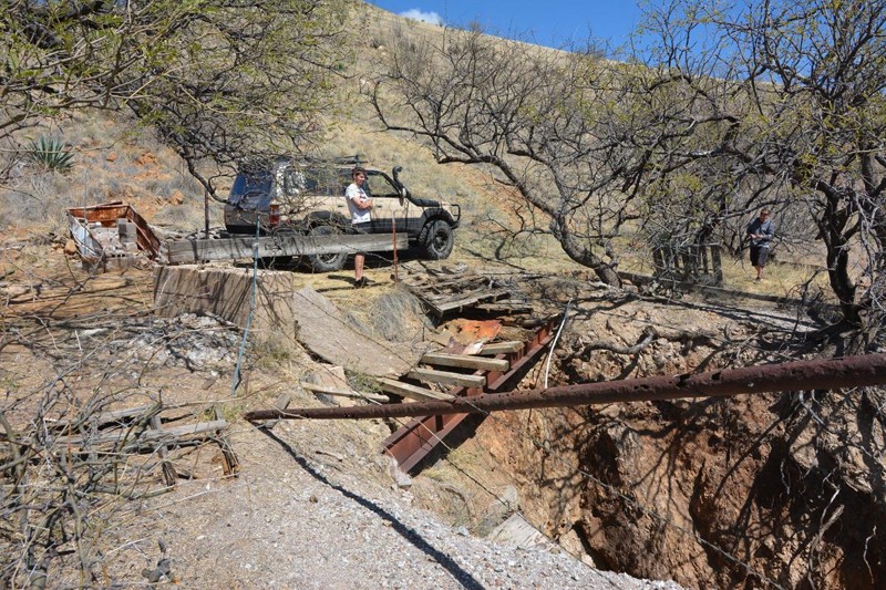
ATTENTION: The bridge at Waypoint 6 is scheduled for closure or repairs. Use at your own risk.
Hull Cabin
Hackberry Creek Loop
Chimney Rock
This trail has about all the kinds of four wheeling that Southern Arizona has to offer. Vehicles will encounter high desert oak scrubland, deep washes, rocky climbs, deep V washouts, route finding challenges, woodlands, waterholes, boulder crawls, crazy gates and many points of interest along the way.
Part of it can be accomplished in a 2 wheel drive vehicle with good ground clearance, but to do the entire trail you should count on needing some rock rails, skid plates, and capable driving skills. Arizona pinstripes are guaranteed on this trail as the wash is choked with bushes that will reach out and put these little badges of honor on the side of your rig. But above all of this, the scenery of the eastern Catalina Mountain foothills and the astounding geology make this one of the classic Tucson area trails.
Chiva Falls
Constellation Road
Wickenburg has a rich history in mining and cattle ranching. Constellation Road, one of the main routes in the region, passes several old mines and working ranches before finally reaching the Hassayampa River Canyon Wilderness Region. The trail passes numerous mines, including the photogenic Monte Cristo, and many of its original structures remain. The trail ends at the Hassayampa River Wilderness Area, with several miles of great hiking through beautiful remote canyons. An active cattle ranch still operated along the edge of the wilderness. This easy but rugged, remote trail makes for an exciting day trip deep into the area's remote history.
Elephant Butte
Buckhorn Springs
Buckhorn Springs is a remote and scenic overland route through the rugged Hieroglyphic Mountains of central Arizona. The namesake Buckhorn Springs is a short hike through a desert oasis well worth the effort. The natural spring flows through a narrow rocky canyon with several crystal-clear water holes. Stately saguaro, spindly ocotillo, and thorny cholla cacti dot the slopes of the rugged rocky landscape. Late winter showers bring color in the form of wildflowers. The route also serves several old ranches and mines tucked away in the desert scrub.
Perkinsville Old 354 Road
Crackerjack
In his 1859 novel, A Tale of Two Cities, Charles Dickens compared London and Paris and spawned the phrase, "it was the best of times, it was the worst of times." Crackerjack is like that. The best of times comes early on Crackerjack. The winding trail passes through juniper, pinion, and sycamore forests, broken at intervals by towering grey and red stone bluffs. Campsites sit near the broad dirt road. A concrete bridge set just at water level with no side railings eases you across the humorously splashy East Verde River, lots of places to picnic or camp nearby. Someone's tow strap became a rope swing over a deeper pool. If your windows are down, you'll likely hear laughter, and smell someone's barbeque grill. The trail climbs along the river's canyon's northern wall, offering glimpses down into the river's rocky course, passing its namesake mine along the way. And then, after the intersection with Cedar Flat, Crackerjack's mood changes. The best gives way to the worst. Turning away from the picturesque river, the trail tightens on itself, snakes uphill, begins to make your suspension groan, and tosses passengers and loose cargo from side to side. There is little space between the bowling ball-sized embedded rocks. Rock shelves barricade the passage at intervals. It seems never to end. But it does. Just as in Dickens' novel, there is redemption at the end. And satisfaction, too. It was the best of roads. It was the worst of roads. But now you are through both.
El Paso Pipeline Road
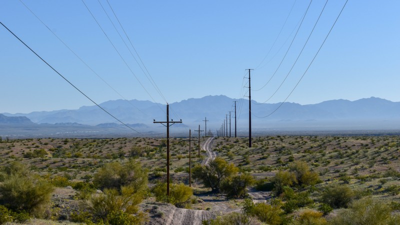
52 plus miles of dirt and you can avoid I-10, what more could you want? El Paso Pipeline Road plays a major part in building area offroad trips for the day, the weekend, or even longer routes connecting the Phoenix Valley and the Salton Sea. Beautiful desert landscapes filled with washes and jagged peaks are interrupted by pipeline markers and powerlines, but that should not stop you from wanting to use this road. Impressive views of the Eagletail Mountains Wilderness Area, including the mysterious-looking Courthouse Rock, greet you at either the beginning or the end of the trail depending on which direction you choose to drive it. Once you train your eyes to look past the utilities, you find all the opportunities for overland adventure that is abundant directly from this road. Tip: Up above, increase the "Nearby Trails" tab view to 35 miles to see the route potentials you can explore!
Rocker Panel Pass
Sunshine Loop
The Sunshine Trail was created by the first Mormon settlers in the region. They used sections of this loop to transport timber from Mount Trumbull to the south. This loop is an easy way to get out into the Arizona Strip to enjoy the colorful rock formations, hunt for crystals, or take an easy drive through a picturesque desert landscape. The loop combines numerous BLM trails that travel through and above several canyons with vertical rocky cliffs. Because of rains and the lack of trail maintenance, the route has changed over the years. The Arizona Strip is a vast arid region north of the Grand Canyon. Within its nearly 3 million acres, you will enjoy a variety of colorful landscapes and climates. To this day, the difficulty of crossing the Canyon continues to isolate the Arizona Strip from the rest of the state. Despite that fact, the area has played an important role in the natural and cultural history of the Grand Canyon State. Artifacts dating back more than 8,000 years indicate how long human habitation has been on this harsh landscape.
Planet Ranch Road
Copper discoveries on the north side of the Buckskin Mountains near the Bill Williams River in 1863 led to one of the earliest copper mines in Arizona. A small town named Planet grew up around the copper mine and, in 1902, got its own post office. The mine played out in 1921, and the town was abandoned. Meanwhile, down in the river valley, a large ranch had sprung up. Planet Ranch raised cattle and hay. In 2015, a large portion of the ranch was handed over to Arizona's Game and Fish Commission to establish and preserve riparian habitat for wildlife and ponds for fish, primarily the endangered razorback suckers and bonytail. The acquisition also ensured full access along the historic Planet Ranch Road. Planet Ranch Road is a drive-through history as well as several unique Arizona landscapes. The broad Dutch Flat and Cactus Plain highlight lower desert life. The Buckskin Mountains offer multi-hued geology for your contemplation. The absence of light pollution makes for magnificent stargazing from one of the many campsites along the trail.
Bulldog Canyon 1356
Traveling through the scenic Bulldog Canyon Off-Highway Vehicle Area, Trail 1356, is an ideal opportunity to have a memorable 4x4 experience without an all-day commitment. Over the years, the area's trails have become more worn and, in most cases, more enjoyable. This route, in particular, is more challenging because of its use and natural erosion. Stock 4x4 owners will find the 20-degree rocky hill climb and tippy ledges both exhilarating and challenging. Low-range gearing, high clearance, and durable tires are needed for this route. Camping is sparse along the route, with only a few primitive campsites. Due to Forest Order 03-12-03-22-34, camping is prohibited within 1 mile from the Dutchman Staging Area and the Wolverine Staging Area until at least January 12, 2026. Please stay on the clearly marked trail. A Tonto Motorized Vehicle Use Permit is required to access this road, which is only available online. Permits are not available at the District Office.
Sycamore Canyon Cliff Dwellings (Henderson Road)
Cinder Hills OHV
People come here for a one-of-a-kind experience: climbing "dunes" made of volcanic cinder at 7000-8000 feet elevation, with amazing views. This is a really unique and excellent attraction. It is also not for the faint of heart or those with low clearance or street tires. Most users come to camp along FR776 and tear it up around FR777 on quads, razors, dirt bikes, and rails. Some professional-grade hill-climbing is done here, including the 900-foot critical slope (e.g., falling-down-slope) "Hundred Dollar Hill" on the west side of Double Crater. The hill was named after the cost of broken parts on every attempted climb; today, it should probably be called a "five-thousand-dollar hill." There are dozens of other climbs with the same risk and challenge as Hundred Dollar Hill. And isn't the climb that breaks your rig the one you should call Hundred Dollar Hill? Some of us, more casual offroad enthusiasts, show up in jeeps or something similar - and will not be climbing these epic slopes. Those who come in RVs will stay close to FR776. This OHV area is right on the city limits of Flagstaff, so you can get out, have fun, and be back at home or the hotel in time for lunch. Deep snow adds another dimension to the fun and risk. This is also one of the best places to camp in Arizona because of the unlimited and uncrowded dispersed camping options all over the dunes- especially if you're an overlander capable of climbing a hill and camping along FR777 away from the groups on FR776.
FR 535
If your looking for a good way to get up on top of the Mogollon Rim to camp in the Ponderosa Pines, you've come to the right place. FR 535 connects with a plethora of trails and camping spots.
Buffalo Ranch Road
Poland Road
Poland Road is a sampler menu of all that the Bradshaw Mountains offer. The salad bar profers Ponderosa Pine forests, scrub oak and manzanita chaparral, and high desert grasslands. The spread features mashed potatoes in the form of a nicely graded road but topped off by some spicy chorizo when you crawl your way through rock obstacles. For protein, just watch the edges of the roadside forests for venison on the hoof or turkeys trotting into the scrub brush. After the feast, kick back in a nice campsite to listen to a concert of the wind singing in the upper branches of the tall pines. Or, if you feel like a bit of an after-dinner stroll, amble into the Poland Walker Tunnel and muse on the history of the hardy prospectors and entrepreneurs that fought their way into these mountains. But don't leave without the satisfying dessert of finding a suitable viewpoint to admire the long vista of a wonderfully rugged landscape. In summer, the maitre d' suggests the view from the lookout tower atop Mount Union but kindly ask the doorman for entry. Poland Road. It's a satisfying meal.
Camp Wood Road
Camp Wood Road gives the adventurous overlander a smorgasbord of all that central Arizona has to offer. From the grassy plains of Williamson Valley to the pine forests of the Prescott National Forest, you experience Arizona’s ranching history with views of the historic Cross U and Yolo ranches. The central Arizona experience continues with miles of dirt road through high desert chaparral, with its pygmy forest of junipers, before descending into Wild Horse Basin, which, with its backdrop of the majestic Shipp Mountains, reminds one of Colorado. No authentic Arizona experience is complete without a copper mine, and this journey does not disappoint, ending in the copper mining hamlet of Bagdad with its giant copper mine, formed in 1882. The remoteness of Camp Wood Road gives the journey a special flavor. With constantly changing biomes and scenery, the miles fly by. Try it for yourself.
Mud Mountain Road
The Grand Canyon - Parashant region in the Arizona Strip is still one of the most remote places in the United States. The monument’s name derives from an early translation of a Paiute family name “Parashonts,” meaning “elk or large deer standing in water.” While traveling through this majestic landscape you'll experience what remote really feels like, you can explore for days and possibly never run into another vehicle. CR 101 is the easiest and main route that travels north-south from Nevada to Utah. Because of the remoteness of the region the wildlife is abundant. You can expect to see golden eagles, bald eagles, prairie hawks, elk and deer, just to name a few.
Cochran Road
Horsethief Basin
In the late 1800s, a few industrious horse thieves began using a lush and largely inaccessible valley in the southeastern Bradshaw Mountains as their hideaway. The remoteness kept them one step ahead of the law. A lake and plenty of grass kept the horses fed while altering the brands for later sale. The area became informally known as Horsethief Basin. Horses gave way to motorized vehicles. The depression of the 1930s produced the Civilian Conservation Corps, which, among many projects nationwide, built a road into rugged Horsethief Basin. They also built an arch dam on the small lake as well as several first-rate campgrounds. In 1934 Horsethief Lookout was erected on a promontory at the end of the road to monitor the area for forest fires. Today, intrepid off-roaders drive the remote Horsethief Basin road. While boondocking at the scenic spot of your choice or camping at the quaint Hazlett Hollow Campground, you can fish in the picturesque Horsethief Lake. Hopefully, you'll even be invited to scale the Horsethief Lookout for what is arguably the best view in Arizona outside the Grand Canyon.
Elbow Canyon
There are numerous ways to gain entry into the remote Grand Canyon-Parashant region. One of the most challenging is Elbow Canyon outside Mesquite, Nevada. This trail is ideal for those looking for an authentic 4x4 experience without needing a heavily modified vehicle. It climbs up from the flat desert through the scenic Elbow Canyon within the Virgin Mountains. The trail passes a couple of primitive campsites, with the best being an old ranch that offers spectacular views of the valley below and room for a small group to relax under the stars. The trail continues to climb along narrow ledge switchbacks that expose even more impressive views of the desert below. Once you're over the pass, the route will connect you with 1004 Black Rock Mountain, where you'll choose how to continue your memorable adventure within the Arizona Strip.
Anderson Mesa South
Anderson Mesa lies between the vast Ponderosa pine forests at the edge of the Mogollon Rim and the barren badlands and painted deserts of northeastern Arizona. The topography of vast grasslands with a few scattered trees evokes Africa's Serengeti more than most people's ideas of Arizona. There are no major roads that cross Anderson Mesa. You have to work to get here. It is one of Arizona's most remote and unvisited landscapes. Forest Road 82 is called Anderson Mesa Road by the locals. Anglers and weekend ATV riders use the ends of this southern stretch to reach Long Lake and Kinnikinnick Lake. The lakes, even modest Cow Lake, are wonders in their own right. Elk, pronghorn, and sometimes eagles are drawn to their reliable water sources. The rough, rocky, suspension-crunching middle section seldom sees anyone save a few lonesome ranch hands or extremely dedicated hunters. The tan savannah grasslands periodically give way to thick juniper forests, forcing the trail to twist, split, merge, and meander before opening again to another broad vista. A sudden outcropping of rough boulders forces you to choose a line. You are more likely to see a dozen elk racing across the two-track in front of you than running across another human.
Verde Hot Springs
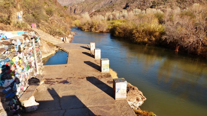
Floyd Williams built the Verde Hot Springs Hotel on the west bank of the Verde River. The resort had several rock and concrete pools fed by the mineral hot springs. One legend has it that Al Capone once visited the Verde Hot Springs. The hotel burned in 1962, but the hot springs and its pools survive. The walls of the enclosed pools are decorated with pretty decent graffiti artwork. There's an abandoned ranch near the hot springs. While vehicles can't reach the river any longer, you are welcome to hike the remaining distance to the river and hot springs. With declining ranching and mining in the area, the roads leading to the hot springs on the west side of the Verde River have either been abandoned or deteriorated. Most maps of the area are outdated and inaccurate. Beginning at Bloody Basin Road, the drive is not overly technical. However, this is an extremely remote area.
Martinez Canyon Road
Schultz Pass
The heavily used western portion of the road over Schultz Pass is a scenic and easy trip up from town to the cool pines between Mount Elden and the San Francisco Peaks. This is your ticket to the top of the excellent Schultz Creek mountain biking trail, and to the trailheads of Sunset Trail, Kachina Trail, and Weatherford Trail, three of the best hikes in alpine Arizona. The dispersed camping is also excellent, although limited to a few locations. Since 2010 the less-used eastern half of the road over Schultz Pass has become a world-class tour in the effects of devastating forest fires and in the work required to restore a landscape after these hot all-consuming blazes.
Jackson Cabin/Muleshoe Ranch Road
Kofa Manganese Road
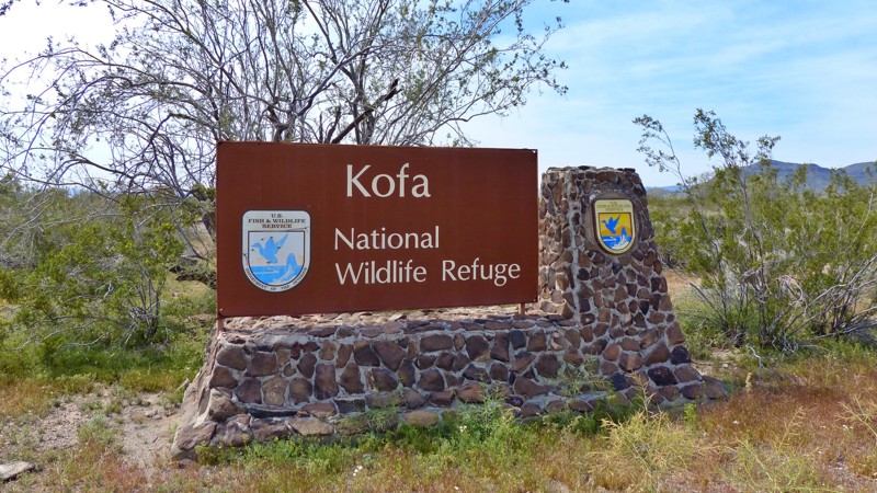
Solitude. Jagged mountain horizons. Dark star-filled skies. Towering saguaro cacti. Broad desert plains. Sandy washes densely lined with ironwood, palo verde, and mesquite. Campfire smoke wafting skyward. Plaintive coyote songs in the night. Kofa Manganese offers all these in abundance. Threading a thin corridor between beautiful wilderness areas of the Kofa National Wildlife Refuge, Kofa Manganese climbs steadily to scenic Red Rock Pass. Squeezed between the ancient Kofa Mountains to the west and the rugged Little Horn Mountains to the east, views from the pass offers are simply astounding. The trail drops quickly after Red Rock Pass and begins weaving in and out of the wide meandering Hoodoo Wash. Leaving Hoodoo Wash, Kofa Manganese traces the edge of the broad Palomas Plain before angling westward towards the Kofa Mountains. Ocotillo cacti thrive in this area and stretch their thorny octopus arms skyward, some impressively over 25 feet tall. Cholla grows in dense gardens, beautifully silver-green in the sunlight. But beware. The thorns will make you say bad words. If you crave a remote wheeling adventure with tons of dramatic scenery, leave the crowds behind and head into southwestern Arizona's vast wilderness on the Kofa Manganese.
Devils Canyon To Pinal Peak
Copper Canyon
In 1871, General George Crook came to the Arizona Territory with orders to end the conflict between the growing population of settlers and the natives of the area. General Crook immediately realized he needed the ability to move men and supplies quickly through the rough country of central Arizona. By 1872 he had established a pack trail from Fort Apache in the east to Fort Wipple, modern-day Prescott, in the west. By late 1874 the pack trail had been expanded into a wagon road. That wagon road opened central Arizona to exploration, commerce, and settlement. Many of today's roads closely follow General Crook's trail, including Highway 260 from Camp Verde to the Mogollon Rim and the extremely scenic Forest Road 300, known as Rim Road. Copper Canyon is another segment of the famed General Crook Trail. Situated in the Prescott National Forest, Copper Canyon parallels Interstate 17. Its fast-moving traffic can be heard, and sometimes seen, from the rugged trail. The two roads are physically close but light years apart in many ways. The interstate is new, fast, placid, and boring as it descends into the Verde Valley. Copper Canyon is slow, rocky, rugged, and demanding. One can only imagine navigating this trail in a horse or mule-drawn wagon instead of a capable and comfortable modern offroad vehicle. While debating which line to take at one of the many obstacles, take a moment to reflect and remember how this little trail came to be. You are driving history.
Kofa Cabin - Jasper Springs
Solero & Bull Springs
This road will treat you to a visual splendor only found in the Old West. People have been ranching, hunting, mining, and living in these valleys for hundreds of years. The Spanish Jesuit priests mined silver here in the 17th century, and the Apaches ranged far and wide over these canyons, raiding continuously. This overland-type backcountry road with a white-knuckle shelf road will surely inspire you!
Rincon Road
Flag Mine Road
Flag Mine Trail is a must for any offroader in the area. This trail is a part of the Arizona Peace Trail, a 650-plus-mile off-highway vehicle trail in western Arizona. The trail follows mountain ridgelines for miles offering exceptional views and scenery. Flag Mine Road is run in conjunction with the Boriana Mine trail, offering spectacular changes in scenery starting at the desert floor with saguaros, Joshua trees, and other various cacti, to the tops of mountains with tall pines, cool temps, and views for hundreds of miles.
Flag Mine Road runs between Kingman and Yucca, AZ, just east of the Colorado River. These trails were built for mining and still offer access to many popular destinations, such as Moss Wash and Gold King Mansion. No matter the skill level or trail rig, there are trails in this area for all to enjoy!
Wagoner Road
Wagoner Road, FR 362, is a 24-mile route that connects the paved Wagoner Road off State Route 89 near Congress, AZ, to the Senator Highway near Crown King. There are many opportunities for dispersed camping and photography. Many side trails branch off Wagoner Road into the Bradshaw Mountains, begging to be explored. There are numerous active and past mine claims in the area. The route is not technical, however current forest road conditions may present mild challenges to stock vehicles. Two non-county road sections of Wagoner Rd cross Arizona State Trust Land, and an Arizona State Trust Land Recreation Permit should be obtained if you plan to camp on those sections. The western portion of Wagoner Road between SR 89 and the Prescott National Forest boundary crosses Arizona State Trust Land. But, as a county road, it does not require a permit unless you want to camp or explore side trails outside the western border of the Prescott National Forest.
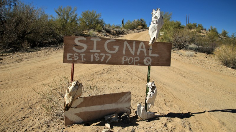
Woolsey Peak and Signal Mountain Wilderness Trail
House Rock Road
Walker Gulch
AZCO Mine Road
Surrounded by towering saguaro cacti, AZCO Mine Road is a main access point for many exciting trails throughout the BLM's Table Mesa Recreation Area, managed by the BLM's Hassayampa Field Office. This road leads to a wide variety of trails designed to be enjoyed by various outdoor enthusiasts. It includes motorcycles, ATVs, rock crawling, shooting, and hiking areas. The area has excellent dispersed camping, but expect crowds on the weekends.
Kanabownits Road
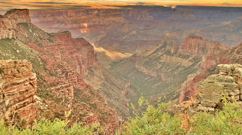
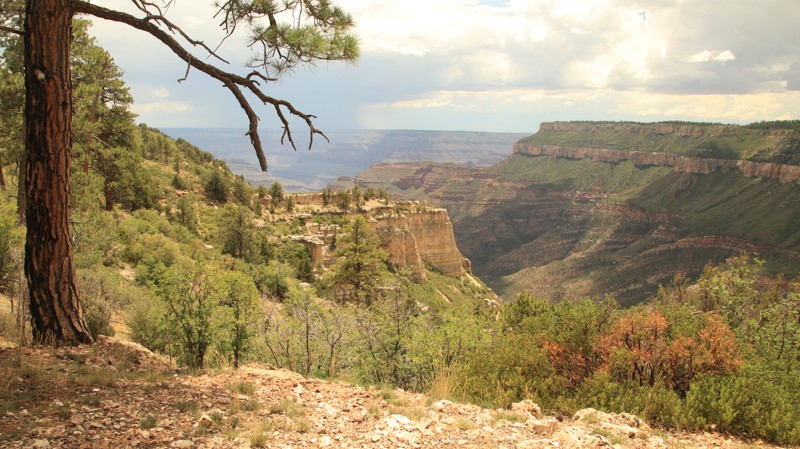
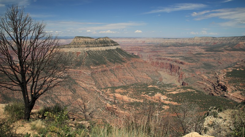
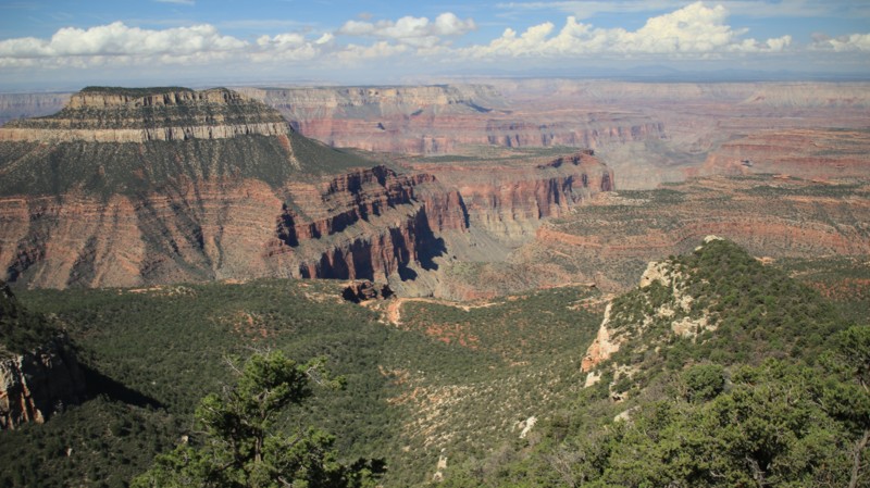
In the late 1870s, Edward Dutton led various geological survey teams deep into what was then the unmapped northern side of the Grand Canyon. He found a long narrow promontory extending far out into the canyon with views he called "most sublime." Today there are only two routes to Dutton's Point Sublime. The first originates at the Grand Canyon's North Rim Village and is appropriately named Point Sublime. The second route comes in from the north and is named Kanabownits for a picturesque spring along the trail. Kanabownits Road passes through a fertile forest with ferns towered over by old-growth Ponderosa pines. Spruce and aspens dot the forest. The tight trail drops into small tight canyons, grips hillsides on narrow shelves, and bursts into open glades fed by springs. Once a ranger lived along the trail watching for wildfires. Today only the small deteriorating cabin remains up a small spur trail. While Point Sublime is the objective of the area, should you choose to enter or depart by the north, Kanabownits Road is a worthy part of the adventure.
Parker Point
Upper Terminator
Upper Terminator is a Technical Vehicle route located within the Table Mesa Recreation Area, about 45 minutes north of Phoenix. The trail follows a desert wash and travels over numerous water-chiseled rock obstacles. This challenging trail offers a great mixture of boulders, water, off-camber notches, tight squeezes, and an uncountable number of speed-controlling rock ledges. Upper Terminator is sure to test your mental fortitude and your vehicle's capabilities.
Sycamore Point
Surrounded by three of Arizona's six National Forests, the Sycamore Canyon Wilderness encompasses 50,000 acres of rugged beauty. With only 15 moderately strenuous hiking trails leading into the wilderness, few people venture into the remote and wild landscape. The canyon cuts into the same pinkish-red sandstone that made Sedona famous. For those who wish for a glimpse into this magnificent canyon wilderness without the travails of a demanding hike, Sycamore Point may be just your ticket. Forest Road 110, known as Sycamore Point for its ultimate destination, is a gem in itself. The trail begins in an almost parklike setting in the tall Ponderosa Pines of the Kaibab National Forest. Here the forest is teasingly open, whispering vague promises of sightings of deer, elk, javelina, foxes, or coyotes if you'll keep an eye peeled. Pairs of ravens regularly patrol the many large inviting campsites, just in case someone left something interesting lying about. The route passes open meadows used as summer livestock grazing by early settlers. Later the wide trail narrows, and you might notice the pines getting shorter. The trail gently drops you down in elevation, transporting you into a grassland dotted with junipers, some young and flush with green foliage and waxy berries. In contrast, others aged and gnarled by winds, harsh winters, and wildfires of the past. Finally, the trail deposits you on the rim of the vast canyon, which, along with its tributary side canyons, forms the Sycamore Canyon Wilderness. From the overlook, rose and coral spires soar on the far opposite canyon wall, catching the afternoon sun. You instinctively know Sedona is just over there somewhere. The normally dry watercourse snakes through the canyon's bottom. The infrequent rains have patiently carved out this huge canyon over a few millennia. Somewhere nearby, a canyon wren sings the cascading downward notes of its distinctive warble. Pack a lunch. You will want to stay here for a while.
FR 11
Nestled within the Tonto National Forest lies a paradise for offroad enthusiasts seeking a challenging trail run. The area is known for its rocky terrain, stunning vistas, and untamed wilderness.
However, if you're looking for a more leisurely experience, a shorter and easier trail is available. FR 11 allows you to explore the area without navigating the more difficult trails.
For those interested in historical experiences, FR 11 is an excellent option. This trail takes you back to when Highway 87 had not yet been constructed, offering a glimpse into the past of what it would have been like to travel through the desert mountain wilderness. The first trail marker is labeled "Old Highway 87," which further adds to the intrigue of the journey.
The area has a rich native American history. The Yavapai and Tonto Apache tribes left their mark on the land. American trappers and miners also frequented the area during the 19th and 20th centuries, leaving remnants of their presence behind. Today, the area is teeming with Arizona's signature flora and fauna, including the palo verde bush, prickly pear cacti, roadrunners, quail, and coyotes. The area's sights, sounds, and smells will leave you feeling invigorated and connected to nature.
Orville's Loop
Twisting its way through a rocky and narrow canyon, Orville's Loop is an exhilarating and scenic roller coaster ride through the Sonoran desert. Dense desert vegetation hangs overhead off the tall canyon walls. During winter, water often trickles down the canyon's walls, pooling at the base of the rocky waterfall you will have to climb. The waterfall is Orville's Loop's standout obstacle, a favorite with local crawlers. The climb up the steep and super narrow ledge road provides spectacular panoramas before the trail merges with Jack Handle.
Cedar Flat Road
Cedar Flat Road is a tale of two trails. On its southern end, the well-behaved road climbs out of the desert to offer camping with views, driving with views and hiking with views. Looking west, the sacred red rocks of Sedona are below you. Mingus Mountain tents horizon due west. Farther south the rugged Bradshaws stand out above the haze. North you catch glimpses of the San Francisco Peaks towering above Flagstaff. Closer in you get a look deep into the canyon of West Clear Creek and Blodgett Basin. The tall stalks of century plants stand sentinel over prickly pears with their crimson fruits. Ocotillo spread their firesticks skyward along the roadside. The daggers of the agaves make you watch your step. And then Cedar Flat Road throws a temper tantrum, all be it a beautiful outburst. The finely graded road becomes a rock-strewn two-track weaving among junipers, testing your tires, your suspension, your kidneys, and your ability to pick a good line. But the rugged beauty of the place, the sudden openings onto wide tree-dotted savannah grasslands, and a short stretch through a pristine pine forest make you forget to keep your eyes on the trail. Apache Maid Mountain begins to appear larger and larger until it looms over the mesa. Too soon, it seems you reach the junction with Apache Maid. You'll want to stop and catch your breath. Nice is good. Naughty is fun. Why not have a little of both?
Dugas Road
Dugas Road cuts through the geographic center of Arizona and slices deep into the area’s history. The old road passes through rolling high desert grasslands with scattered buttes and peaks, yielding an always interesting vista. Louis Dugas and his son Fred arrived in Arizona via wagon train in 1877. In 1879 they started Dugas Ranch on the banks of Sycamore Creek, a rare reliable water source. Fred began running the ranch at age 13 when Louis opened the Lucky 7 Bar on the famed Whiskey Row in Prescott. By 1925 the area around the ranch had enough residents to warrant a post office, two boarding houses, a blacksmith shop, and a school. By 1938 the population had dwindled, and the post office closed. Today Dugas is still a working ranch with numerous residents. The old town remnants are right beside the road after you cross Little Sycamore Creek, but they are on private property. Feel free to stop and look. Just stay on the road and don’t touch.
Little Grand Canyon
You know you are grand when everyone wants to be a little version of you. Here in Arizona, we have the Grandest of Canyons and a lot of little ones too. This trail leads you to one of the little ones, but it still doesn't disappoint. Nestled in the heart of the popular 11,400-acre Table Mesa Recreation Area, this short trail passes through a prototypical Sonoran Desert landscape of cacti and palo verde before dramatically unveiling its destination. The end of the trail drops rapidly into the canyon cut by the Agua Fria River. When the afternoon sun hits the canyon walls, the colors of the various layers of stone pop nicely. The canyon's solitude, complete with canyon wren serenades, makes for an idyllic overnight camp. It may be little, but hey, just how much canyon do you really need to be happy?
White Pocket
Going north out of the active ranch at Pine Tree Pockets, BLM 1087 and 1086 is the northbound portion of the most popular route to White Pocket, a geological marvel in the middle of the desert! This track has very deep sand. 4WD, not AWD, and lower air pressure are an absolute must. Dispersed camping is available along this route and at the parking lot for White Pocket.
Boriana Mine
Fry Canyon Trail
Situated in the vast ponderosa pine woodlands of the Coconino National Forest, Fry Canyon Trail offers peaceful serenity only minutes from downtown Flagstaff. The numerous designated shady campsites on the western end of the trail make excellent base camps for exploring the area while still providing easy access to all the services found in Flagstaff. The high country abounds with elk, deer, and wild turkey, often seen when hiking one of the many area trails. The road's namesake, Fry Canyon, is a favorite with the canyoneering and climbing crowd. Beautiful red rock Sedona is just a 30-minute drive south through the scenic Oak Creek Canyon. There are plenty of forest roads to explore through the high country pinelands and wide-open prairies. There are even a few gnarly trails to provide offroading challenges for those so inclined. Whatever you are looking for, it isn't far away from the Fry Canyon Trail.
Ruby Wash
The solitude and a rock-crawling adventure within an hour of Phoenix, Arizona, make Ruby Wash a great place to explore and spend the day. Located in the Buckhorn Mountains, this trail offers a gateway into an entire network of trails with various difficulty levels and optional routes. The area is filled with old mining activity, with the most prominent being the Independence Mine which started its operations nearly 100 years ago in 1919. The entire off-road trail is interesting and challenging, even for modified vehicles. The route has a little bit of everything from sandy washes, rocks, boulders, canyons, and hill climbs.
Milk Ranch Point
Between 15 and 20 million years ago, a geologic uplift created the rugged and dramatic escarpment we now call the Mogollon Rim. The Rim rises 3000 feet above the Sonoran Desert floor below and marks the beginning of the Colorado Plateau. North of Payson, the scenic pine-forested peninsula known as Milk Ranch Point extends south from the Mogollon. Milk Ranch Point is all about great views and wonderful campsites. At just over 7000 feet elevation, summers are downright cool when compared to the desert below. Campsites right on the edge of the Rim offer amazing vistas of jagged sandstone slopes leading down to the country where Zane Grey based his novels. The distant Matazal Mountains form a jagged horizon. Elk bugle in the early evenings. Sightings of deer and wild turkeys are common. Abert's squirrels scamper around the many shaded campsites. Those more adventurous can take the trail all the way to the southern tip of the Point and enjoy an unparalleled view.
McPherson Pass
McPherson Pass connects the broad King Valley with the very flat Castle Dome Plain by crossing the low but ruggedly beautiful Castle Dome Mountains. The entire trail is inside the remote and sparsely visited Kofa National Wildlife Refuge, the second-largest wilderness area in Arizona. The trail crosses broad scenic valleys, pushes through a sandy wash, and climbs through a majestic mountain pass. The best part of all that is that along the way, you are likely to encounter more desert bighorn sheep than people. The Lower Sonoran Desert of this part of southwestern Arizona receives very little rainfall. That doesn't mean life is not abundant here. Both plants and animals have adapted to the harsh environment. Cacti include the stately saguaros and spindly ocotillo called fire sticks by natives for their bright red flowers, which seem to pop out purely randomly. Several species of cholla cactus call this area home. The teddy bear cholla looks cute, but the spines stick like velcro on steroids and hurt like Hades. Owls, various hawks, doves, and hummingbirds abound. Small mule deer hang close to the few available water sources. Coyote serenades at night are common. But the reclusive desert bighorn sheep reign supreme here. The entire purpose of the Kofa NWR was to preserve habitat for the surefooted mountain denizens. Keep your eyes on the slopes, and you might catch a glimpse of a few of them near McPherson Pass.
Engesser Pass
Engesser Pass is likely the most remote trail in Arizona based on travel distance to the nearest human habitation. Engesser Pass traverses the midsection of the beautifully rugged Kofa National Wildlife Refuge, which covers over 1,000 square miles with not a single human inhabitant. The 2,000 square miles of the Yuma Proving Grounds cradle the bottom of the refuge. No one lives there either since the Proving Ground is where the Marines test things that explode. Approximately 3,000 square miles of uninhabited BLM land lie east of the refuge. That is 6,000 square miles. Four states, Hawaii, Rhode Island, Delaware, and Connecticut, are smaller. In all that space, no human resides full-time. No light bulb burns at night. Very few roads exist. And in the middle of all that splendid remoteness is Engesser Pass. When traveled east to west, Engesser Pass begins as an easy two-track on a ridgeline above the vast saguaro-studded Palomas Plain to the east. Mountain ranges sawtooth the horizon in every direction, near and far. Ocotillos reach skyward, flaming red flowers on the ends of their long tendril shafts. Thickets of thorny silver cholla scatter their pin cushion droppings to painfully attach to the unwary. To the west looms the multi-hued sawtoothed Kofa Mountains. Before long, Engesser begins its slow rise to the mountain pass that gives the trail its name. Cutting through the ruggedly beautiful Kofa Mountains, the view westward from the pass is unsurpassed. The trail dives steeply to join Engesser Wash, brushy and sandy, as it slolams down and out of the mountains. Turning northward, Engesser parallels the colorful west side of the ancient volcanic Kofas. To the west across the broad King Valley lies the Castle Dome Mountains, the round spire of Castle Dome clearly identifiable. Engesser Pass ends near the King of Arizona mine, whose initials gave became the name of the area. It is far more likely that you will see a desert bighorn sheep, the reason for the refuge's existence, or perhaps a tiny kit fox than it is you'll see another human on your traverse of Engesser Pass. Solitude. Beauty. Good wheeling. All fine reasons to explore one of Arizona's most remote trails.
Rim Road East
Moss Wash Trail
Copper Bottom Pass
Trails that distantly wind out in front for miles disappearing briefly into gullies or hiding on the backsides of hills only to emerge even farther away, snaking seductively up the side of a distant ridgeline until it blends into the far horizon always seem to beckon me more urgently than those hidden away in deep forests or on land so flat that no detail beyond a stone's throw is evident. That type of trail is a seductress, offering you a distant glimpse of her charms, a hint of adventure and treasure if you will devotedly follow her labyrinthine path. Copper Bottom Pass sings that siren song of adventure. From the start, you see the thin white ribbon of trail winding and coiling up the slopes of the Dome Rock Mountains. Cunningham Mountain sits near the high pass with a crown of antennae, a beacon to guide you, staring down as you climb toward the trail's summit. A desert floor of hard igneous gravel cast off the mountain slopes in the erosion of a few million years is covered with ocotillo, cholla, ironwood, and brittlebush cover. They enthusiastically ignore your passing. Copper Bottom sits between two passes of near equal elevation, a bowl atop a mountain range. Copper Bottom Mine on the north side of the bowl is gated off, but the shaft entrances and old structures are easily visible. The two passes offer long views, east over La Paz Valley and into Kofa, west to the green belt of the Colorado River and California. The only wart on this beauty is the powerline that climbs into the pass alongside you. Ignore it and enjoy the plentiful charms and adventure on this winding seductress of a trail.
Thelma and Louise Overlook
House Mountain Trail
Rice Peak FR 29
Woodpecker Trail
Walnut Canyon
Supai Village Old 328 Road
Bulldog Canyon 3554
Located within the Bulldog Canyon OHV Recreation area in Tonto National Forest, 3554 is an almost beach-like oasis in the desert. This scenic drive connects FR 10 and Bulldog Canyon to Usery Pass by traveling along a dry creek bed filled with coarse sand. The sand is well-traveled and thus very packed but can quickly become a deep sand pit outside the main tracks. The wash passes several towering rock faces that make great photo backdrops. There are numerous areas along the wash used for dispersed camping. However, those campsites could flood during a moderate rain event. As the road exits the wash and treks westward towards the Usery entrance, it becomes a mix of hard granite and packed dirt. Due to Forest Order 03-12-03-22-34, camping is prohibited within 1 mile from the Usery steel gate until at least January 12, 2026.
Most of this road can be completed with a high clearance 2WD vehicle, but 4WD drive is highly recommended for the sandy wash section.
A Tonto National Forest Off-Highway Vehicle Permit is required to travel this road.
The Desert Bar
Leave it to Arizona to have what could easily be the coolest desert destination in the U.S. The Desert Bar, aka "Nellie E Saloon," is just what it sounds like, a bar in the middle of the desert. But this isn't any old bar.
In 1975, Ken, a self-described hippy and societal dropout, bought an old mining claim with a few dilapidated buildings. He soon noticed numerous ATVs and Jeeps driving past on weekends. Acquiring a liquor license from a defunct local establishment, Ken began selling beer from a small three-walled trailside shack out of a cooler. Being an industrious hippy, Ken began building outlandish structures on the old mine claim, including a church. Solar power and batteries replaced the ice cooler, and the rest, as they say, is history. Today the mining claim looks a lot like Thunderdome from the Mad Max movies and draws huge weekend crowds. There's usually a band, food, and various libations. And it is still completely off-grid.
The surrounding desert boasts great wheeling and rock crawling. And then there's this totally crazy place to kick back and enjoy. Who offroader could ask for more?
Box Canyon Road
Box Canyon is a visual delight, assuming you like shelf roads, mountain views, and distant vistas. The road cuts across the ruggedly handsome Santa Rita Mountains via Box Canyon's deep pass before breaking out with long views across Green Valley and the distant Twin Buttes Copper Mine. The slopes in the pass are thick with spindly ocotillo cacti. Called "fire sticks" by natives, the long branches of the ocotillo lay gray and dormant much of the time before quickly and randomly growing small green leaves on the branches and firey red blossoms at the top. Much of the trail is in the vast Coronado National Forest, with the eastern end on Arizona State Trust Land set aside as the Santa Rita Experimental Range and Wildlife Area.
The trail ends on the paved Madera Canyon Road, a lovely drive and a bird-watcher's favorite.
Behind the Peaks
Behind the Peaks is a scenic gem accessible by all kinds of vehicles! In the Spring, there are alpine meadows and wildflowers aplenty. The Fall brings glorious golden aspen on the slopes of the San Francisco Peaks, which dominate the skyline. You’ll have better views of the San Francisco Peaks along this route than anywhere else in the Flagstaff area and without the crowds. This route also provides access to major hiking trails like Bear Jaw, Abineau, Alto Spring, and the Arizona Trail. Like most of Flagstaff, this area is also great for mountain biking.
Hovatter Road
Ray Hovatter patented mining claims in the Little Horn Mountains around 1950. Ray and his workers built a coarse road connecting the Hovatter homestead to the Harquahala mining district. Ray, his wife Barbara, and three daughters lived at their remote homestead from 1951 to 1974, managing and working the mines that produced mostly manganese. Barbara kept a glass jar of captured scorpions on the kitchen table and planted extensive cactus gardens at the homestead. A propane tank explosion killed the eldest daughter in 1968. Ray died on the property in 1974. Both a buried on the ridge just south of the homestead. Barbara's ashes were scattered over the graves in the 1990s. The site was reclaimed by the KOFA National Wildlife Refuge, and all the buildings were removed. The cactus gardens and a unique saguaro-lined driveway remain. Today the Hovatter road is a path to beauty. Rugged enough to keep the faint of heart at bay, a trip along the Hovatter rewards the intrepid with solitude and adventure. The trail begins as a smooth but very sandy road aimed southwest and straight at the prominent Coyote Peak. To the south, across a broad plain of saguaro cactus and creosote bush, the jagged multihued outline of the rugged Little Horn Mountain range hints at the adventure ahead. A slight left turn at Coyote Peak points you straight at the heart of the Little Horns, and soon the road obligingly begins a gentle climb. That gentleness is fully wrung out of the trail after you cross the first of the mountain passes. The Hovatter twist climbs, descends, and crosses rocky washes while providing geologic eye candy as it traverses the Little Horns. Keep an eye to the right for Conflagration Arch, a twisted testament to the powerful forces that raised these mineral-rich mountains. Massive saguaros find precarious perches on the edges of steep cliffs. A keen eye may spot desert bighorn sheep clattering up steep grades. The remnants of old mines dot the wild landscape. A small kiosk and old signage signal you are leaving BLM land and entering the KOFA National Wildlife Refuge, set aside by Presidential decree in 1939 and expanded over the years with the mission of providing habitat for those bighorn sheep you may or may not have seen. From the kiosk, it is just a short way to the Hovatter homestead and its saguaro-lined driveway. The homesite is a fantastic place to camp. If you do, walk up the hill and pay your respects to Ray and the family. Then kick back and imagine living out here in this remote, rugged, and beautiful part of Arizona.
Allen Spring - Mingus Mountain
Maggie Mine Road
With more curves than a 1940s-era pinup model, Maggie Mine Road snakes upwards into the foothills of the Bradshaw Mountains. Along the way, it passes its namesake, the Maggie Mine, a small gold operation first prospected in the 1870s. Today it sits on private land and is not open to visitors. The rutted and rocky trail skirts gardens of prickly pear with their red fruits and the very thorny silver cholla. Forests of stately saguaros stand like so many sentinels, always on watch over their desert. To the west, the handsome Bradshaw Mountains dominate the jagged horizon. Glance east now and then, and you will see traffic on the interstate. Smile. They aren't having as much fun as you.
Elephant Arch
Within the Arizona Strip, high above the Virgin River Gorge and I-15, there is a very scenic 4x4 trail leading to a naturally formed Elephant Arch. The trail offers mild challenges for stock 4x4 vehicles while providing breathtaking vistas of the surrounding Virgin and Beaver Dam Mountains. The Virgin River has created several impressive Southwestern landscapes, beginning within the great white cliffs and canyons of Utah's Zion National Park, before ending at Lake Mead, where it eventually meets the Colorado River. Deep within the Virgin River Gorge, the river flows across the northwestern tip of Arizona for 30 miles, creating Grand Canyon-like scenery of eroded cliffs and terraces of metamorphosed sandstone. This easy 4x4 trail travels high above the gorge, along the edge of the rim leading to various scenic points where you can see for miles through the gorge.
Vulture Mine Road
While the actual Vulture Mine is well north, the unpaved remainder of that road runs through the heart of the ruggedly beautiful Belmont Mountains, a seldom visited portion of south-central Arizona. The trail starts in the north as a nicely maintained dirt road that services the Belmont Pit, a rock quarry. Between the quarry and the intersection with Belmont Mine Road, the road is easily traveled rough dirt, crossing numerous sandy washes. The northern trailhead has two large staging areas.
The road deteriorates south of the intersection with Belmont Mine Road as it crosses a rough pass through the mountains. There are several steep climbs with loose rock and a narrow off-camber shelf road obstacle. The trail precariously tilts 28 degrees down the side slope crossing the obstacle. This section of trail is not suitable for full-width vehicles. Use Belmont Mine Road and W. W. Enterprize Mine to bypass this challenging section of trail. Vulture Mine ends in the south at Canal Road.
Abundant spring rains bring colorful wildflowers to the austere Belmonts. Look for the rock window on the west side of the trail just south of the intersection with Belmont Mine Road.
The northern 6 miles of the trail host abundant large flat campsites suitable for groups, large rigs, and toy haulers.
Moores Gulch
Moores Gulch runs from AZCO Mine Road in the BLM's Table Mesa Recreation Area through Arizona State Trust Land into the Tonto National Forest, ending at a scenic overlook above Black Canyon City. The trail drops into the ordinarily dry Moores Gulch and crosses under Interstate 17. Stately saguaro and thickets of mesquite line the Moores Gulch drainage. The trail turns northeast climbing steeply out of the drainage following ridgelines along the western slopes of the rugged and nearly impenetrable New River Mountains. A gate and signage mark the trail's entry into the Tonto National Forest. Cattle graze almost the entire length of the trail. Please close the gates along the trail.
The trail is rocky, with numerous significant climbs and descents approaching 20 degrees. Low-range gearing is helpful. Several deep washes are prone to flash flooding after significant precipitation.
There are three campsites along the trail in the Table Mesa Recreation Area. Small campsites are scattered along the remainder of the trail. Camping in the Arizona State Trust Land segment requires a permit.
Blue Bell Mine
Three pieces of Central Arizona history collide with fantastic views of the Bradshaw Mountains along a fun little trail in the Prescott National Forest. Leaving the small hamlet of Mayer, the trail works slightly upward across the rolling desert chaparral to the Blue Bell Mine. In the 1870s, prospectors discovered an outcropping of schist-bearing gold, silver, and copper. The Blue Bell was a successful mine and operated intermittently until recently. Following the trail a mile more to the south brings the traveler to the second bit of Arizona history, the railbed of the Bradshaw Mountain Railroad, often called Murphy's Impossible Railroad. Mr. Murphy engineered the seemingly impossible by connecting Prescott with Crown King through the rugged and inhospitable Bradshaw Mountains. Supplies went up the mountain, and ore came down. The Blue Bell was connected to the railroad by a mile-long aerial tramway to dump the ore carts into the railroad cars. The railroad operated for a decade before the mines in Crown King became unprofitable. Following the obvious railbed downward, the trail ends at the ghost town of Cleator, the final portion of the historic trifecta. The small town was established in 1864 to support the mines and prospects of the Turkey Creek Mining District and was a stop on the Bradshaw Mountain Railroad. James P. Cleator bought the town in 1925, renamed it for himself, and established a post office, appointing himself postmaster. The post office closed in 1954. Today, Cleator remains a stop for thirsty travelers. While appreciating the history, don't forget to admire the seemingly endless views of the southeastern slopes of the Bradshaws. Stop to enjoy the abundant trailside wildflowers in late spring. But keep your eyes on the trail along the shelf roads. Saying things collide on the Blue Bell was meant to be metaphorical, not literal.
Ajax Mine Trail
1004 Black Rock Mountain
1069 Rock Crossing
Your gateway to adventure within the Grand Canyon - Parashant region begins on this scenic access road. The trail is the most direct and easiest way to access some of the most remote backcountry trails in the United States. The region has numerous side trails leading to petroglyphs, slot canyon hiking and excellent primitive camping. From this trail, you'll have access to the multiple trails leading to very popular destinations like Pakoon Basin, Mt. Trumbull and the north rim of the Grand Canyon. While climbing up to the plateau, you'll have sweeping panoramas of the red rocks and mountains that surround the St. George region. Be sure to go prepared for a truly remote off-road experience.
HS290 - True Grit - Parker
Silver Creek
Ajo Mountain Loop
A Saudi prince once visited the Sonoran Desert. The Saudis are experts on the desert. Upon his first view of the Sonoran, he exclaimed, "This is not a desert. This is a garden." Organ Pipe Cactus National Monument's 516 square miles are devoted to preserving a verdant lower Sonoran Desert landscape, home to its namesake organ pipe cactus. The monument is also an International Biosphere Reserve. The Ajo Mountain Loop is the monument's most popular and easiest drive.
The 20-mile loop crosses a valley landscape filled with forests of stately saguaro cacti set against the backdrop of the rugged Ajo Mountain Range. The winding climb through the narrow scenic Diablo Canyon sets the stage for your first look at the Ajo Wondow, a double arch high on a volcanic cliff. Arch Canyon is an easy, popular hike to better view this geologic oddity. Skirting the western slope of Ajo Mountain, the trailhead for the very strenuous Bull Pasture hike has picnic tables and a vault toilet. It's a great area to stop, stretch your legs, and admire the rugged mountainous landscape.
Middlemarch Pass
Hart Prairie
Forming the west leg of the “Around the Peaks” loop, Hart Prairie Road is an Arizona gem. The eponymous Hart Prairie sits east of Fern Mountain at the midpoint of this drive and offers superb views and the finest ecological beauty in the Flagstaff area. Aspen groves, alpine meadows, springs, diverse terrain, and varied ecosystems flank the trail. Fern Mountain offers a short and beautiful hike with sweeping views of the San Francisco Peaks. The road is also part of the “Hart Prairie Loop” mountain biking trail. Quite a few lucky private property owners, including a youth camp and The Nature Conservancy, enjoy the west slope of the Peaks via this road.
Hewitt Station Bypass
Table Mesa 9952
Table Mesa 9952 connects Table Mesa Road to 9954 and forms the first half of a route locally referred to as "Crapshoot". It would be an easy trail but for two obstacles that merit a difficult rating.
Running the trail north to south, the first obstacle is a steep, uneven loose dirt climb. The second obstacle is a steep, loose rock descent with a potentially belly-dragging drop-off in the middle part of the hill. Between the two, steady throttle and steady braking are highly useful.
While anytime is a good time for photography along this route, springtime can be an especially great opportunity to capture iconic Arizona desert photography with the post-monsoon season flower bloom.
Two Bar Ridge Trail
Within a stone's throw of the Phoenix Valley, the Superstition Mountains are full of opportunities for adventure. The mountains are rugged and unforgiving while still having a strong and mysterious draw on the adventurous type. While traveling along the historic Apache Trail, you will be able to access different regions that offer a variety of desert experiences. There are sky-high, sheer cliff canyons that you can explore for years. Three wonderful lakes are traversing through the Salt River region. During the scorching hot summer months, Canyon, Apache, and Roosevelt lakes offer a wonderful reprieve from the desert heat. Two Bar Ridge Trail is an old power line access road that eventually connects to a beautiful ridgeline trail, high above the Burnt Corral region. The trail will challenge some stock-type vehicles with its steep and loose hill climbs, but it rewards you with what I feel is the best vistas of all the trails in the region. You'll pass a few points along the trail where you can see for miles. Once at the end, you are in a very secluded camp area that offers unforgettable nighttime interstellar views.
King Road
Charles E. Eichelberger discovered gold in an unnamed string of low rugged mountains in southwestern Arizona in 1986. The resulting mine was named the King of Arizona Mine. Rail shipments of supplies and equipment were brought in by wagon over Engesser Pass, the nearest rail siding being over 50 miles away. Soon the crates of gear and supplies were simply marked K of A, the mine's initials. The acronym stuck and soon, the entire area was simply known as Kofa. The short-lived mining town had 300 residents, a post office, and even a dam to store the runoff from limited seasonal rains. The gold rush in the area died off slowly in the early 1900s. In 1939 the Boy Scouts led an effort to preserve 666,640 acres in the area as habitat for desert bighorn sheep and other wildlife. Their efforts resulted in the Kofa National Wildlife Refuge, which covers four mountain ranges and vast low Sonoran Desert valleys. Today a wide dirt road crosses the broad King Valley ending at the entrance to the mine, which is on a small island of private property and is sporadically operated today. King Road is used as the main western entrance into the Kofa National Wildlife Refuge. While an easy drive, the road offers scenic views of the Kofa Mountains to the northeast and the Castle Dome Mountains to the southwest. Looking northeast, you can easily spot Kofa Butte, a steep-sided flat-top promontory. King Road ends near Kofa Butte.
Rolls 1813
Rolls 1813 will provide you with breathtaking views of Saguaro Lake, the ridgelines and valleys of the Rolls OHV area, and Four Peaks. There is a long, steep descent when driving the trail from north to south. This is one of the longest climbs or descents on any Rolls trails. 1813 was once the gateway trail to the Butcher Jones beach area. However, this access gate on the south end is now permanently locked. Near the southern end of the trail is a large sandy camping area suitable for many vehicles to gather. There is also a large area at the high point of the trail where several vehicles could also stop and use for camping. This spot would provide incredible views of the entire area. The trail is mostly made of loose rock. The summer monsoon rain of 2022 has eroded the big hill significantly enough to make the rating difficult for the newer offroad driver.
Please note that an OHV permit is now required on this trail.
Buckskin Mountain Trail - AKA Back Way To The Desert Bar - Parker
Who doesn’t love going off the beaten path, the road less traveled? Buckskin Mountain Trail is just that, when leaving The Desert Bar, this trail offers drivers a way out of the bar that is relatively remote and at the same time offers some of the best sunset views of the valley. This is no easy 4x4 trail, the trail is a solid intermediate path with several long loose hill climbs and even a waterfall obstacle. Thus the next time you are looking to spice up your drive to The Desert Bar or thinking about taking a different way home, check out Buckskin Mountain Off-road Trail near Parker Arizona.
Swansea Road
If you like old ghost towns and stories of the boom and bust mining cycles in the Southwest, Swansea is for you. Mining began in the area of Swansea around 1862, but the site was so remote that getting ore to a smelter was extremely difficult. In 1904 the Arizona & California Railroad connected the nearby hamlet of Bouse to the rest of the world. Investors began building the Arizona & Swansea Railroad to connect to Bouse and construct infrastructure in Swansea. By 1909 Swansea had 500 residents. The mines operated under differing owners until 1937. The Great Depression signaled the end of Swansea. Today, primarily foundations remain. Some of the worker's quarters still stand. BLM has done an admirable job marking each of the sites with the purpose of the original building. It is easy to trace the railroad bed as it winds through the ghost town. Few visitors venture past the Swansea ghost town, but Swansea Road continues through a remote and rugged landscape to the banks of the Bill Williams River.
Asbestos Mine
This iconic 4x4 trail to Asbestos Mine, on the southern edge of the Sierra Anche Mountains, climbs a difficult trail along Pocket Creek. Those who are familiar with the region will recognize Asbestos Point by its white mine tailings. They look like giant white angel wings from Highway 288. The mine began operating in 1915 but is now abandoned. While you're exploring the large site, there are spectacular views of the Tonto Basin thousands of feet below. You can hike out the shelf road right on top of the white mine tailings and take pictures of the really old excavator. There are a couple of nice campsites with fire pits to enjoy incredible star gazing.
Asbestos Mine is quite a challenge for slightly modified vehicles, but the views when you finally reach the top almost take your breath away.
FR 71 Tonto National Forest
Kingman Wash
Buck Springs Ridge
Buck Spring Ridge begins at the scenic Mogollon Rim and the iconic Rim Road, one of Arizona's best trails. Running through the eastern portion of the vast Coconino National Forest, the trail first traverses an alpine woodland of spruce, fir, and Ponderosa pines. As the trail descends northward, the spruce and fir fall away, and the pines become smaller because of the rain shadow caused by the Mogollon Rim's massive uplift. Take the time to visit the historic Buck Springs Cabin via the spur trails at Waypoints 5 and 6. These remote cabins, first used by ranchers almost 100 years ago, were summer quarters for fireguards who battled wildfires in this massive forest. The cabins sit on a picturesque mountain meadow that hosts the springs that give this area its name. Deer and elk often graze nearby in the mornings and later afternoons. Descending northward, the trail gets a bit rougher and enters an area burned in the 2018 Tinder Fire. The forest is slowly recovering from the fire, but the new openness allows quick views down into the deep East Clear Creek gorge giving explores a real feel for the true scope and ruggedness of this diverse landscape.
Apache Maid
Historians agree that during the area's pioneer days, an incident involving an Apache girl made her a local legend. The specifics are lost to time, but the name Apache Maid has been applied to a mountain, a ranch, a cabin, a road, and the area in general. Apache Maid Ranch was owned by the Babbitts, a prominent northern Arizona family that created a mercantile company, numerous local leaders, and a Senator. The Apache Maid road travels through the center of today's geography and the era's history. In the east, Apache Maid winds through the tall, stately ponderosa forest that dominates the vast Coconino National Forest. As the road loses elevation, the pines give way to scattered juniper, canvas-tan grasslands, and beautiful views. The Apache Maid cabin, an old ranch house, sits up a short lane. With its fire watchtower, Apache Maid Mountain looms over the trail's western end. With plenty of camping available and a trail offering a few challenges, Apache Maid makes for a great Arizona wheeling experience.
Rye Cypress
Rye Cypress unveils the rugged beauty of Arizona's chaparral country. Located in the Tonto National Forest, at 2,873,200 acres, the largest of Arizona's National Forests and seventh largest in the nation, the trail is in the looming shadow of the jagged Mazatzal Mountains. The name Mazatzal is difficult to pronounce. Locals often refer to the Mazatzal Mountains as the Mazzies. The name is attributed to an obscure native language now only spoken in central Mexico. It means "place of the deer." As difficult as the name may be, traversing the Mazzies is infinitely harder. The rugged and nearly impenetrable mountains, encased in the Mazatzal Wilderness Area, form a north/south spine in central Arizona crossed by no roads and very few foot trails. Rye Cypress gathers part of its name from the small hamlet in which it originates. A creek shares that name as well, and the trail crosses it often. The Cypress portion refers to an area called the Cypress Thicket that begins roughly at Waypoint 10. It's misnamed since the thickly growing cypress forests are actually a species of the juniper tree. The effects of the 2004 Willow Fire are very apparent in the center portion of this trail. But the "cypress" are having their revenge and growing back thick and fast. Rye Cypress provides great views, nice camping, and a tour through Arizona's chaparral above its cactus-studded Sonoran Desert and below the pine-forested high country above the Mogollon Rim. The easy trail connects to other scenic tracks. It's certainly a slower-paced relaxing alternative to the paralleling paved highways full of speeding cars.
Little Pan Mine Road
Little Pan Mine Road passes through the BLM's Table Mesa Recreation Area in the beautiful cactus-studded Sonoran Desert. The Bradshaw Mountains dominate the skyline to the northwest, while the New River Mountains define the eastern horizon. The area is popular with outdoor enthusiasts who enjoy wheeling, rock crawling, OHVs, shooting, dirt biking, and hiking. The region has a rich history of mining and cattle ranching. Being close to Phoenix, the area can get crowded on weekends. Little Pan Mine Road offers excellent views, good campsites, a river crossing, and hills steep enough to make you pay attention to the off-camber shelf road. Shade trees abutting a high cliff face near the Agua Fria River make for an excellent picnic site. A wide variety of cacti native to the Sonoran Desert line the trail. Just north of the river crossing, a magnificent stand of Saguaro dominates a hillside. Whatever type of adventure you are seeking, Little Pan Mine Road can take you there.
Horse Park Road
Roads and trails in this area are often named after early pioneers or important geographical features along the way. Alpine meadows are called parks in local parlance. Horse Park Road draws its name from a particularly picturesque meadow, one of three along this easy scenic drive. Horse Park Road begins just south of Flagstaff in the bedroom community of Mountainaire. The well-maintained road travels through an OHV area ripe with interesting ATV tracks. There are seemingly countless campsites along the trail, many located near the three parks. Combine those two attributes with the native beauty of the pine-forested Coconino National Forest, and you have a top-rated destination on weekends. If you are looking for fun and a chance to meet up with other offroad enthusiasts, Horse Park Road might just be the path you want to follow.
Happy Valley
FR 226
Immediately you are ensconced in tall pines and an abundance of campsites. That's just what you'd expect from a well-groomed trail in the Coconino National Forest with easy access off the interstate. But just a few miles into Forest Road 226, you begin to find silence broken only by the wind singing a soothing melody in the tops of the Ponderosas and the crunch of your tires on the dirt. Squirrels scamper across the road, and that might have been an elk in the shadows watching you pass by. At picturesque Bar M Canyon, named for an old ranch that once operated in the area, is an unexpected one-lane bridge. Just beyond the bridge is a campsite snuggled up to the canyon. An enterprising camper cut large pine logs into camp furniture fit for Paul Bunyan. The site makes for a cozy overnight camp or perhaps just an amusing and timely picnic spot. With links to a complete network of other fun trails, Forest Road 226 might be a pivotal segment of a longer overland journey. But even alone, it is worth checking out.
FR 801
The wonderous geologic beauty of Sedona's red sandstone monoliths brings visitors from far and wide. That same sandstone creates challenging offroad trails that draw their own flocks of eager visitors. Jeep tour companies bounce wide-eyed giggling tourists along many of those. It's all fun and beautiful. But you may begin to crave a quieter adventure that includes a bit of solitude. Atop the Mogollon Rim, past the jeep tours and the crowded overlook parking lots, FR 801 veers off Schnebly Hill Road into the Coconino National Forest. Most just zip by the intersection without noticing. FR 801 hides her treasures well. The track leads deep into a Ponderosa pine forest, offers some excellent camping, and connects with other small trails that lead to amazing and seldom-seen views out on the edge of the Rim. In summer, cattle graze on the high alpine grasses. An inordinate number of hummingbirds seem to like this area. Watch closely for elk peering at you from the shadows. There are a lot of wonders to find in this forest, but crowds aren't one of those.
FR 9496F
FR 9496F is a rarity in the Coconino National Forest. The Coconino is renowned for its vast Ponderosa pine forests. FR 9496F begins in that forest but transitions quickly to a more open grassland studded with Alligator Juniper, one of the oldest living plant species in Arizona. The canvas tan grasses evoke images of an African savanna. Just substitute the junipers for Boabab trees and any elk or deer you see for wildebeest and gazels and, voila, you are in your own National Geographic safari episode. The trail passes near the head of the rugged Woods Canyon. The chasm slices down through multihued layers of sandstone opening views across the broad Verde River Valley. To the southwest, the long slopes of the Mingus Mountains define the horizon. The solitary rounded prominence to the southeast is Apache Maid, the forest tower atop it visible only with binoculars. Trundling beyond Wood Canyon brings on Jacks Point Tank and the end of the trail. A quiet approach to the tank might permit a glimpse of watering wildlife before they scurry back into the shelter of the Alligators.
Porcupine Peak
Located in central Arizona's Prescott National Forest, Porcupine Peak provides access to one of the area's highest promontories with amazing views. Along the way are good campsites, a juniper forest peppered with stately century plants, and a small seasonal stream with cottonwoods and sycamores. The summit provides an unparalleled view of central Arizona and the Verde River basin. There's also great cell phone reception at the top, courtesy of the massive antennae farm. The first 5 miles of the road are also part of the Great Western Trail that runs from Arizona to Montana.
A Cross Road
Immerse yourself in the captivating views of Tonto National Forest's FR 60, also known as A Cross Road. With a mixture of dirt roads and slightly rocky terrain, anyone with a high clearance 2WD can enjoy this trail. There may be shallow water crossings depending on the lake's water level.
Scattered campsites offer awe-inspiring views of Theodore Roosevelt Lake and the majestic Four Peaks. If hiking is your thing, embark on the enigmatic Lost Goldmine Trail. For thrill-seekers, the Jug canyoneering route presents a daring challenge, rewarding adventurers with invigorating natural water slides, cliff jumping, and repelling down steep canyon faces into the crystal clear water below. A Cross Road is truly a gateway to Arizona's natural wonders.
Pine Mountain
A drive up Pine Mountain unveils the rugged beauty of Arizona's chaparral country. Located in the Tonto National Forest, at 2,873,200 acres, the largest of Arizona's National Forests, the drive offers long views across a vast landscape of rolling hills and deep sycamore-lined canyons carved by small streams fed by runoff from the looming Mazatzal Mountains. The name Mazatzal is difficult to pronounce. Locals often just refer to the Mazatzal Mountains as the Mazzies. The name is attributed to an obscure native language now only spoken in central Mexico. It means "place of the deer." As difficult as the name may be, traversing the Mazzies is infinitely harder. The rugged and nearly impenetrable mountains, encased in the Mazatzal Wilderness Area, form a north/south spine in central Arizona crossed by no roads and very few foot trails. Pine Mountain leads to one of those trails, the famed Arizona Trail, a National Scenic Trail that traverses the entirety of Arizona from Mexico to Utah. Pine Mountain climbs steadily, beginning in the chaparral of grasses, pinion pines, juniper, agave, and prickly pear cactus and ending at the Mount Peely trailhead amongst the tall Ponderosa Pines of Arizona's high country. Mount Peeley, at 7030 feet, towers over the trailhead. Portions of the trail were affected by the 2004 Willow Fire and the 2012 Sunflower Fire. The evidence of regrowth in this area is impressive as nature seeks to heal itself. While you might not be hiking the Arizona Trail, a drive up Pine Mountain reveals much of the rugged and diverse beauty of central Arizona.
Edward's Park
Edward’s Park, FR 422, is a rocky, aggressive, out-and-back trail in Tonto National Forest. It begins at an intersection with Four Peaks, FR 143, northwest of Four Peaks Pass. Unlike the easy drive to the top of Four Peaks, this trail immediately gets difficult with loose rock, washouts, steep hill climbs, descents, and off-camber tracks. The loop at the north end is steep, off-camber, and deteriorated.
Edward’s Park has seasonal stream crossings and offers views of Bull Mountain and Edward’s Peak, among others. Occasionally, there's a peek of Roosevelt Lake and the surrounding Tonto Basin to the east.
The road is also a segment of the Arizona Trail, a hiking trail covering over 800 miles from the Mexican border north to the Utah state line. Be kind to any hikers you see. They have a long way to go.
There are multiple dispersed campsites on this trail. Most will accommodate a few vehicles and have rock fire rings. These are great sites, well off of the beaten path, with pine trees providing a small slice of shade from the Arizona sun.
While this is not a “rock crawling” trail, it is aggressive. A lift and good off-road tires are recommended.
Continental Copper Access
Alamo Road
Cedar Flat
Nestled in the nearly 2.9 million-acre Tonto National Forest, Cedar Flat is a true central Arizona experience. On the way to the trailhead, you pass the historic Doll Baby Ranch. The ranch was purchased a few years back by a nature conservancy and put under Forest Service jurisdiction. Cattle still roam on the ranch's land, but continued access to the Baby Doll Trailhead for hikes into the Mazatzal Wilderness was ensured. Even more importantly, the section of the East Verde River that runs through the ranch property was protected. The ranch's original windmill still stands and turns in the breeze. Welcome to Arizona the way it used to be. There aren't many trails in Arizona that offer a smorgasbord of experiences. Besides the Old West vibe of just getting to the trail, having a cottonwood-lined perennial river to soak your feet in, listen to its ripples, camp beside, and perhaps even take a cooling dip in one of the deep pools is an extremely unique experience in the deserts of Arizona. The buffet continues with vast views of one of Arizona's most intimidating mountain ranges, the rugged Mazatazals. There isn't a single road that crosses that impenetrable range. You can see why as you gaze across at the looming presence, a wilderness only penetrated by a handful of difficult hiking trails. Even the name, Cedar Flat, is interesting. There isn't a single cedar tree on Cedar Flat. Early settlers were familiar with European cedars and mistook the western junipers as a species of cedar. Thus there are many Cedar Flats, Mesas, and Creeks across the West and about a trillion unappreciated juniper trees. Go check out Cedar Flat and take in all the items on the menu. You'll leave a fuller person for it.
Paw Hole
Paw Hole is a deep sand trail from House Rock Road to the geologically stunning White Pocket. It is the northern route and the more technical route to White Pocket. It is also more scenic! This route also passes sights like the Paw Hole Teepees and Poverty Flat Ranch. It is also the access road to the Cottonwood Teepees trailhead. This trail requires 4WD because of the deep sand. There isn't any camping along this route. A permit is required to hike into Coyote Buttes South, the area with the teepee-shaped rock formation just north of Paw Hole. A permit is not necessary to drive Paw Hole or to explore White Pocket.
Harquahala Mountain Summit Road
FR 301 to Fisher Point Trailhead
FR301 is a dirt road trail that will take you under an hour out and back, and it starts right at the city limits of Flagstaff! This is great for a quick family outing or to get in a hike when you're on the east side of Flagstaff. The mudding is good after a soaking rain or when the snow is melting (avoid this trail in-stock vehicles when it's wet!). At the end of the guide's trail you'll find parking and a USFS trailhead for a nice half-mile hike to Fisher Point with epic views of Walnut Canyon. FR301 is a more interesting drive and a quicker hike to the canyon than the Arizona Trail trailhead, located a mile east down Old Walnut Canyon Road. You are likely to see Elk along FR301 or FR301D during their migration season, especially in late fall and early winter. This area is heavily affected by bark beetles; you can hear them work on the trees in the summer if you are quiet.
9014 Brooklyn Mine and Aqua Fria Ruins
Bradberry Cabin
Sawtooth Mountains Widow Maker Pass
The Sawtooth Mountain Widow Maker Pass trail is south of Casa Grande near Arizona City. This beautiful trail winds through the remote Sawtooth Mountain Range, part of the 129,000-acre Ironwood Forest National Monument established in 2000 by presidential proclamation.
The trail begins at the steel gate just past the intersection of West Harmon and South Lamb Roads. Shortly down the trail is a cattle gate. Please close it after passing at the request of the rancher. The trail crosses Greene Wash. Use caution after rain as this area floods and quickly turns to deep mud. You will find one of the original 267 concrete Corona Satellite calibration markers.
The trails in this area are not marked with signs or trail markers, so ensure you download the GPX track. As you wind through the foothills and into the mountains, there are many opportunities to capture photos of the Sonoran Desert landscape. From the crest of Widow Maker Pass, there are great views of farm fields, Picacho Peak, the Santa Catalina Mountains, and Mount Lemon in the distance.
There are a few locations along the trail suitable for camping. These come with space for several vehicles and outstanding views of the Sawtooth Mountains.
This trail runs primarily through BLM land but crosses private property on the north end and Arizona State Trust Land. Please know the boundaries of private landowners before traveling this trail and respect the access they provide. You will need an Arizona State Trust Land recreation permit in this area.
Pyeatt Draw
Black Canyon Creek
Black Canyon Creek Trail is an exciting adventure along narrow roads with outstanding scenic views. However, this trail will challenge anyone's confidence with long, steep, rocky ascents, intimidating washouts, and seriously off-camber shelf roads. The thick brush lining the trail will leave pinstriping in your vehicle's paint.
This trail is best to be driven when dry. Slippery conditions make washouts extremely dangerous. This trail is not for the novice driver or anyone who fears steep, narrow shelf roads. The trail is best suited for narrow, high clearance vehicles with skid plates, traction aid devices, and winches. Full-width vehicles should avoid this trail.
Route finding can be difficult, but the official trail only crosses Black Canyon Creek once. It then begins a short trek west before heading north. Three miles in, you must conquer loose, beachball-sized boulders. One mile later, the trail traverses the narrowest of the washouts.
At 1.3 miles from the trail's southern end are several great dispersed campsites along Black Canyon Creek.
Expect 3-4 hours to complete this trail.
1009 Black Rock Gulch
Robert's Camp
Palomas Harquahala Road
The sun woke me. In compensation for interrupting my dreams, it offered the quintessential western skyline for my consideration. Backlit in hues of burned orange, melted copper, and baby blue, jagged peaks of the Eagletail Mountains sawtoothed the eastern sky. Silhouetted on closer hills, saguaros stood as silent sentinels of the dawn. The lower Sonoran Desert is at its best at sunrise, all peace and stillness and beauty. The Palomas Harquahala Road crosses the expansive Palomas Plain to the Clanton Hills, traces the western edge of the Eagletail Mountains Wilderness, parallels sandy Deadman Wash up into Nottbusch Valley, and skirts the western edge of Cemetary Ridge before passing in the shadow of Deadman Mountain. The names alone bespeak adventure. The trail cuts through a flat desert sea of creosote bush, bursage, and brittlebush. The sameness is broken here and there by saguaro and ocotillo. Like green ribbons, the washes snake through the desert with their overgrown banks of palo verde, mesquite, and ironwood. Corrals and windmills, many still in use, evoke an earlier time when rugged men came here to eke out a living in this arid landscape. In that pursuit, they cut the trails we drive today. Download the track. Pack your gear. Gas up the rig. Take a ride on a long trail.
Wilbanks Road
Buckhorn Cabin
Rolls 401A
Rolls 401A is a rocky and somewhat challenging trail on the eastern edge of The Rolls area, beginning just past where 401 and 13 intersect. The trail provides access to various hiking and horse-riding trails and is enjoyable, with beautiful views of the Four Peaks and Salt River Valley areas. The trail is rarely used much and has significant wash-out areas, with the very end blocked off about 300 yards early due to what appears to have been a flash flood. Expect pinstripes with 20+ degree rocky climbing, off-camber spots, and tight turns. There's no camping available along the trail.
Please note that an OHV permit is now required on this trail.
Rolls 13
Rolls 13 bisects The Rolls OHV area with connections to most other trails. Access the trail through the Probrecito entrance off Bush Highway just north of Saguaro Lake. The trail has some camping and can be busy at times. The track is rocky, with large bumps and berms in some areas. Expect new pinstriping.
Please note that an OHV permit is now required on this trail.
Reymert Mine
Big Bug Mesa
The Southwest can have the most interesting and unlikely names for places. That is probably a result of native history, Spanish influence, and European exploration all adding and mixing names onto the maps. Often, the origins of many names are lost to history. So how did Big Bug Mesa, set high in the Prescott National Forest, get that moniker? There is also a Big Bug Creek, and once was a small mining village in the late 1800s along the creek with the same name. Likely, it was an encounter between a giant beetle and Theodore Boggs, who founded his small settlement of Big Bug and mined in the area. Boggs had survived as a 10-year-old member of the ill-fated Donner Party and was the great-grandson of Daniel Boone. That he would be so inspired by a large insect either says much about the insect or a little about him. Only Boggs knows for sure, and he is no longer available to tell us the story. Big Bug Mesa is a relatively broad, flat feature along the northeastern slopes of the Bradshaw Mountains. The area is seldom visited except by hardy ranchers and a few hunters searching for the mesa's plentiful deer and turkey. Covered in Ponderosa pines, juniper, and even the ancient alligator juniper, the mesa is green and high enough into the mountains to see heavy winter snow and have relatively mild summer temperatures. The main trail into Big Bug Mesa starts easy enough but turns rocky towards the end, providing a workout for both your suspension and kidneys. The trail becomes smoother in the open pine forest but is often beset by rutted mudholes. All that means you will likely experience solitude on Big Bug Mesa, except for the deer, turkeys, and apparently, at least one very large bug.
Blue Grade Road
In 1864, President Lincoln tasked Lieutenant Colonel J. Francis Chavez to escort the new territorial governor of Arizona from Santa Fe, New Mexico, to Prescott, Arizona. Unfortunately, there was no road between the two cities. One major obstacle was the descent off Arizona's Mogollon Rim into the Verde Valley. Chavez's navigation skills led to a stage route and thus was born the path of the Blue Grade Road. Today's hearty traveler can exit the interstate and climb the scenic Blue Grade in far more comfort than those who once negotiated the rocky passage in a rickety stagecoach. With excellent views along the way, the road leads you up from the lush Wet Beaver Creek area into a pine and juniper forest. Located in the Coconino National Forest, be on the lookout for elk, deer, bear, and wild turkeys. And yes, this is also cattle country, so watch out for cows on the road as well as where you step.
Big Maggie May Trail
Dog Saddle
Back Way to Mt. Ord
Rucker Canyon
Kofa Queen Canyon
Every king needs a queen. Kofa got its name from the abbreviation for the large King of Arizona Mine. So it wasn't much of an imaginary stretch when prospectors named their small nearby mine the Kofa Queen. Today only the mineshafts and a few small stone walls remain where miners once toiled in the Kofa Queen. But the scenic sandy canyon that provided access to the mine back in the day now provides hikers and offroaders access deep into the Kofa Mountains. Beginning on the King Valley's vast plain, the trail marches relentlessly toward the low jagged ridgelines of the igneous Kofa Mountains. These are not gentle wind-sculpted sandstone bluffs. Rather these edifices were violently created from near-molten heavy minerals violently pushed up from deep below the earth's mantle, bringing with them the precious gold, silver, and manganese that the miners came here to find. Today those formations are valued for their rugged, angular beauty by the hardy folk who venture here. Dropping into the wide sandy canyon takes you into the depth of the mountains. Formations in many improbable shapes surround you. Scary Skull Rock is just one apparition formed by the immeasurable forces that created this landscape. Side canyons invite you to explore deeper on foot. The many campsites beckon you to spend time and take it all in. The trail ends near the site of the Kofa Queen Mine. The Kofa Mountains gave the miners gold. What will the mountains and Kofa Queen Canyon give you?
Deer Hill
Antelope Creek Road
Located in central Arizona, Antelope Creek Road was a key transportation route for ranchers and miners before paved roads were introduced into the area. Driving along the winding desert road today, you still see ranchers with large stock trailers moving cattle to market or greener pastures along with hikers and mountain bikers headed to one of several trailheads for the Black Canyon National Trail. Located almost exclusively on BLM land, the road follows Antelope Creek to the historic ghost town of Cordes Station. The trail crosses Antelope Hill before slaloming downhill to join the Crown King Road. Antelope Hill offers impressive views of the nearby Bradshaw Mountains and the modern-day mining operations in its foothills. The campsites atop Antelope Hill look down on the captivating tableau of the canvas-tan, dried grass flatlands of Perry Mesa, and the Agua Fria National Monument.
Marble Canyon Overlook
Pyeatt Draw Parallel
Pine Flats
Flat places. Many of us live in flat places with their perfectly surveyed checkerboard of straight roads, all leading to properly homogenized and carefully structured sameness. But our souls live in the mountains. We feel ourselves coming alive when we point our rigs up a twisting, winding snake of a road that leads up into a wildly disorganized and jumbled mountain range. Add a few gurgling mountain streams and the whistling song of the wind in the tops of tall pines, and we are happy boys and girls again. Pine Flats, so named for the level Ponderosa studded valley about 8 miles up the trail, is not an overly exciting road. There are no challenging obstacles. You won't shift in and out of low range. There are a lot of things this trail isn't. But Pine Flats possesses unmistakably fine attributes. The views are long across the valleys below. Looking upward, there's always a ridgeline teasing you to climb higher yet. Splashing through the water crossings is somehow childishly satisfying. Catching a glimpse of a doe and fawn amongst the trailside brush makes you smile. Listening to the relaxing harmony of a mountain stream sluicing over multihued granite boulders as you picnic or camp soothes the frayed nerves of we flat land dwellers. Take an easy ride up Pine Flats into the Bradshaw Mountains. There's lots of adventure beyond the end of the trail if that's what you're after. But your soul will appreciate what Pine Flats isn't.
BLM 9094
Black Canyon Road
Black Canyon Road is a very easy trail and a delightful way to spend an afternoon exploring the Mogollon Rim and learning about the area's long and diverse history. The trail begins at Black Canyon Lake, a picturesque mountain lake much less crowded than the nearby popular Woods Canyon Lake. A 1-mile hike takes you to the gravesite of three cowboys lynched and hung from a ponderosa tree nearby, unfortunate victims of the Pleasant Valley War between feuding ranchers. Further down the road are pullouts for old homesteads, native american ruins, and ancient petroglyphs. The trail offers numerous historical markers with informational signage. Black Canyon Road is a great day trip for a family with young children or anyone interested in the region's colorful history.
Gardner Canyon Road
Gardner Canyon Road packs a lot into its 8.7 miles. There's world-class camping in both designated and dispersed sites. The lack of nearby cities means dark skies and a carpet of twinkling stars above that campsite. The views of the Santa Rita Mountains looming above the trail's end are inspiring. Bucolocly beautiful Apache Springs Ranch reminds you of that early ambition to be a cowboy. The splashy crossing of Cave Creek is just bumpy enough to be fun. Trailheads for a myriad of hiking trails, including the world-class Arizona Trail, remind you that you should get out and stretch your legs in the crisp, clean air of this vast countryside.
Battleground Ridge
In 1882, White Mountain Apache warriors, led by Na-tio-tish, got into an altercation with and killed several policemen in San Carlos, Arizona. Eighty warriors, chased by U.S. cavalry, crossed the Tonto Basin and climbed onto the Mogollon Rim. They laid a trap for the pursuing cavalry on a rugged side canyon of East Clear Creek. The cavalry's scout ferreted out the trap. The fight raged for an afternoon until a severe afternoon thunderstorm halted hostilities. The warriors escaped in the night and returned to the reservation, leaving behind 20 dead Apaches, with two dead and six wounded among the cavalry troops. Nearly lost to history, today, a lonely marker stands on the site, and the entire area is called Battleground Ridge. Battleground Ridge, also known as FR 123, is a distinctive trail for two reasons. First is the obvious connection to the obscure bloody battle fought here. Secondly, an aqueduct that pumps water from the C.C. Cragin Reservoir down to Payson runs along a portion of the trail. You can see the roadside access points; round metal covers every hundred yards along the trail. A small power line brings electricity to the pump station near Waypoint 10. But take a step away from both the history and the modern, and you overwhelmingly sense the remoteness of this place deep in the uplifted country of the Mogollon Rim. The wind, as it always has, sings through the upper branches of the tall Ponderosa Pines. Elk bugle on the ridges and down in the deep canyons. Flocks of shy wild turkeys scratch the forest floor for a meal. Gazing across the deep canyon at the trail's end to the distant forest-blanketed ridgelines of this wild landscape, both the past and present seem very far away.
New River Mesa
New River Mesa, FR 17, is an out and back trail that offers several opportunities for secluded camping and great photography along the mesa's eastern and southern edges. The trail starts easy and remains so for the first two miles. Once you turn west into the gate to go up on the mesa, the trail becomes more challenging and bumpy. Up on the mesa, sections of the trail become difficult to follow. Sometimes, the main trail is washed out, and you must work around the damage. The trail has faded into grass and scrub growth in other areas. The payoff is fantastic views south in the Valley of the Sun.
Fish Canyon
Italian Trap
Workman Creek
Secret Pass
Marshall Lake
On FR128 to Marshall Lake, or the "South of Walnut Canyon," you will discover Boondocking and ATV heaven, with scattered views of the San Francisco Peaks! There are many side roads and dispersed campsites accessible to more robust RVs and trailers for camping. Usage on the trail's northern end close to I-40 is low even during peak season when the rest of Flagstaff is bonkers.
Price Road
Price Road is the primary southern entry into the Florence OHV area. The road also serves the two small ranch communities and mining operations. The views of the Rincon Mountains on the eastern horizon loom higher as you travel the desert road. Nearby Box Canyon, Martinez Canyon, Old Silverbell Mine, and many other sites provide visitors with fantastic scenic views and opportunities to hike, explore, offroad, and enjoy the Sonoran Desert. Price Road is a gravel and semi-maintained dirt road that all vehicles can navigate. Durable off-road tires are highly recommended.
Dispersed campsites are located all along Price Road. Camping on Arizona State Trust Land requires a permit. State Trust Land is normally well marked, but a land use map is helpful. The area has abundant primitive campsites and multiple large staging areas. There are no services, facilities, or potable water in the area for campers.
Jack Handle
Jack Handle is one of those trails that's earned legendary status with local rock crawlers. The trail's name comes from the first difficult waterfall obstacle, Jack Handle. Back when the rock gap was thinner, if your hi-lift jack was on the passenger rear, it would get hung up on the rocks. Hence the name. The trail offers multiple optional rock crawling obstacles, including a difficult and super off-camber rock waterfall appropriately named Jackass.
For over a century, the surrounding mineral-rich area has been profitable for the region. There are many abandoned as well as active mines in the area. Along the route is a spectacular array of desert plant life, from massive saguaros to towering cottonwoods hidden deep in one of many secluded canyons that litter the region. The area is remote. The rocks are sharp. And everything here wants to poke or bite you. Be cautious. This is a desert, and it's not very forgiving, especially in the summer. But it does have an irresistible rugged charm.
North Box Canyon
Also known as the Waterfall Bypass, this northern section of Box Canyon winds its way up narrow ledges and over the mountains for an alternative way around the waterfall obstacle on Mineral Mountain Road. The trail is ideal for stock-type 4x4 owners who want a mild challenge while exploring the Florence OHV area. The trail has narrow ledge switchbacks and steep rocky climbs requiring low range, high clearance, and durable offroad tires. The trail is excellent for beginners looking to cut their teeth on Arizona desert trails without difficult rock crawling. You'll climb high up into the mountains with immersive panoramas of the surrounding peaks before dropping into Box Canyon.
Camping is minimal. There are only a few old mine platforms where you could set up tents for the night.
Control Road
Doll Baby
Buck Farm Point
Traveling along the edge of Buck Farm Canyon, this is an easy route that leads to Buck Farm Point and the edge of the north rim of the Grand Canyon. Here you can find epic campsites and amazing views above the Colorado River. The trail surface is primarily hard-packed dirt with occasional small rocks. Suitable for any high clearance vehicle.
Chloride Big Wash Road Loop
Clover Springs
Clover Springs is a tale of two trails, and thus more interesting. One part of the trail is as rough as a corncob enema. The other portion is as silky smooth as your grandmother's buttermilk pie. Turning off Highway 260 onto the west end of the trail brings you almost immediately into some fun little obstacles. Most have several choices of lines. Decisions based on your rig's unique characteristics may leave you scratching your head. They aren't overly difficult, just enough to make it fun and interesting. In a few places, erosion has cut nice washouts, which will test the level of travel in your suspension. Bone-jarring sections of trail consist of nothing more than cannonballs and larger-sized rocks jarring your rig, you, and everything else. There are a few bypasses. Just when you have had enough, the trail becomes as easy as pie. Clover Springs becomes a stroll through a huge Ponderosa Pine studded park. Deer, elk, javelina, turkey, and the occasional cow may cross the road in front of you or be lurking in the brush nearby. Wonderful campsites beckon you to slow down and spend some time around a campfire. So what's it gonna be? Corncob? Pie? Why not both?
Winter Road
Crimson Road
In its day, Crimson Road was the main thoroughfare between Flagstaff and the Mormon Lake area. Bypassed by the paved Lake Mary Road, today it simply transports you quickly into the magnificent ponderosa pine woodland that is the heart of the 1.8 million-acre Coconino National Forest. The well-maintained road meanders gently along the contours of an otherwise rugged landscape. After 11 miles, the forest gives way to Antelope Park, a large alpine meadow at an elevation of 7,000 feet. The meadow begs you to camp along its wooded edges to watch elk, deer, and pronghorn graze early and late in the lazy day. Crimson Road leaves the open meadow, plunging back into the forest and Newman Canyon. The road passes a picturesque old cattle corral, unused these days. Before you are ready, the road deposits you back onto the pavement.
Cedar Pocket
Rolls 1829
Trail 1829 can be run as an out-and-back or as a loop when connected with trail 1345. This trail is rocky and has aggressive hills, narrow sections between trees and cacti, and a fence line. The 360-degree scenic views from the top of the ridgeline are amazing. There are several steep rocky hills to contend with on this trail. One of which has crater-sized holes that can lead to body and bumper damage if not maneuvered correctly. High clearance and 4Low are required on Crater Hill. Lockers are recommended, and a spotter would be helpful. The top of Crater Hill is located at coordinates 33.60405, -111.46011. Running as an out-and-back will have you going downhill first and then uphill on your return. Take connecting trail 1345 on the right after 1.3 miles to run the hills only upwards. This will reconnect with 1829 at the bottom of the hills. Rated difficult due to "Crater Hill." The rest of the trail is moderate. There is a large camping area at the lower junction of trail 1829 and 1345. This area can accommodate many vehicles and has a large rock fire ring.
Please note that an OHV permit is now required on this trail.
Rogers Trough
The vast 2.9 million acres of the Tonto National Forest provide many opportunities to experience everything from the desert floor to mountain peaks over 7,000 feet. Whether you want to run the full Montana Mountain Loop in your offroad vehicle or head to the Superstition Wilderness's vast network of hiking trails, Rogers Trough helps you fully experience all the Tonto offers.
Connecting Rogers Trough with Hewitt Canyon Trail and Happy Camp Road creates the Montana Mountain Loop OHV route. The loop has sandy washes, deep canyons, and a shelf road with vast views of the valley below. Wrapping around the 5,528-foot Montana Mountain on a narrow rocky trail leads to multiple dispersed camping opportunities before returning to the desert floor through an array of tight turning switchbacks.
For the hiking enthusiast, Rogers Trough Trailhead at the end of the trail provides access to the Arizona Trail, Grand Enchantment Trail, West Pinto Trail #212, and Reavis Ranch Trail #109. Hiking north from the trailhead takes you deep into the 160,000-acre Superstition Wilderness, where, if you're lucky, you may come across the famed Lost Dutchman Gold Mine.
Rosemont Cutoff
Established as a smelter town for the nearby Helvetia District copper mines, Rosemont Junction provides a beautiful afternoon of shady exploration through Arizona's hill country. This trail heads straight for the Santa Rita Mountains, then turns south to parallel it for several miles, providing stunning views of 'Old Baldy' and Gunsight Pass. The trail has impressive large tree riparian areas. Wildlife sightings are common in the canyons. You might get lucky and spook up a mule deer or a herd of coatimundi with their tails in the air.
Woodchute Trail
Little Black Mountain
Take a trip along an easy desert trail to one of the best petroglyph sites in the Arizona Strip region. The Little Black Mountain Petroglyph site contains some outstanding rock art from 6,000 years of human habitation. The site has over 500 different rock art examples on the boulders surrounding the base of a 500-foot mesa. The designs were etched by Native Americans from the Great Basin, Western Anasazi, and Lower Colorado River cultures that once passed this way. Some of the art pieces are of turtles, deer, lizards, bear paws, and many symbols that are unknown to historians. Both the driving and the hiking trail to the petroglyphs area easy enough for everyone of all ages. Bring the whole family for a wonderful walk around massive stones with ancient artwork chiseled into them.
Beaver Creek
Beaver Creek's slow curves and sweeping vistas leisurely take you back to an older Arizona, a land with an ancient history and rugged pioneer ranchers. Beginning in the fertile Verde River Valley, the trail winds upward through fields of prickly pear cacti and dry grasses waving in the breeze to junipers and pinion pines. Walker Creek's towering cottonwoods shimmer in the sun. Campsites tempt you to stop and stay awhile. Cattle guards rattle under your wheels, often reminding you this was, and remains, ranching country. Signs on side roads bear the brands of the V Bar V and M Diamond. You occasionally glimpse horses in a green pasture or cattle grazing among the junipers. Ahead, the buff-colored fortress buttes front the red rock cliffs of the Mogollon Rim, the geologic boundary between the Sonoran Desert and the uplift known as the Colorado Plateau.
Buffalo Crossing
Bar M Road
A drive along Bar M Road takes you back in time. On the east end, the hundred-plus-year-old Brolliar Cabin sits on the edge of an alpine meadow. Born in Iowa, David Brolliar built his one-room cabin in 1911 and raised cows and crops on the prairie now known as Brolliar Park. He lived there alone until his death in 1938. Today, the cabin is a great spot to watch elk, deer, and pronghorn grazing on the park. A small pond beside the cabin often hosts migratory geese. The cabin is a short walk from the road. Farther west along the trail, ranchers use the forests and parks for summer grazing, just as they have for the last century. Branded cattle roam wild until the fall roundup when they are moved to lower elevations and winter pastures. The road nostalgically passes an old corral, battered and worn but still in use. Take a drive back in time on the Bar M. The road is a little bumpy, but so is the region's history.
Black Hills Back Country Byway
The Black Hills Back Country Byway is a scenic gem, not to be confused with the nearby Black Hills Rockhound Area, which holds real gems. In winter and early spring, Mount Graham, to the west, is likely to be snowcapped, which is a rare view in southern Arizona. Informative kiosks beckon the inquisitive to stop and learn about the geology and history of this most interesting area. Forever vistas appear as the trail winds higher into the hills, but keep your eyes on the road around those blind switchbacks. The massive Morenci copper mine tailings appear halfway through the trip, a palette of pastel pinks, purples, creams, and blues. A kiosk near the eastern end tells you everything you ever wanted to know about copper.
The trail crosses the wild Gila River on a bridge constructed in 1918. Shaded day-use areas beckon travelers to stop for a while and enjoy the sounds of the birds along the often muddy Gila. Nearby Owl Creek will gladly lengthen your time along the trail with a dark sky starry overnight.
Hoodoo Wash
Early pioneers, mostly miners and ranchers, used broad sandy washes as ready-made roadways through the rugged landscapes of southwestern Arizona. A perfect example of that pioneer ingenuity is the use of a convenient section of Hoodoo Wash as a route into the edges of the rugged Kofa Mountains. The Wilbanks family settled on the western end of Hoodoo Wash, building a fine home and raising cattle. Their story is one of gritty determination to overcome the obstacles thrown their way. Their house burned, and they rebuilt the two-room cabin you see today. The Great Depression crashed cattle prices. Drought and flash floods took their toll. Severe injuries meant several days on rough roads to find medical care. Only the determined last in the Kofa Mountains. Later the Hoodoo Cabin was erected on the eastern end of Hoodoo Wash as a line shack for a cattle company. The cabin was modern for its time and came in prebuilt segments to be assembled onsite. You can still see the numbered medallions that identified each section so the assembly instructions could be followed. Working cattle this far out was a lonely affair, but at least it was comfortable. Narrow roadways have been built where required, but the trail between the cabins is mostly in the wide sandy Hoodoo Wash. Wells at both cabins, and one along the way, still pump water via windmills to fill water troughs for local wildlife, which includes among others desert bighorn sheep, deer, fox, and coyotes. Palo verde and mesquite grow in thick tangles on the edges of the wash, while stately saguaros stand as silent sentinels on the rocky slopes above. Saguaros live for hundreds of years. The ones you see today watched the Wilbanks come and go. They have seen prospective miners combing the slopes for mineral veins only to vanish into history. Cowboys have ridden under the silent sentinels only to disappear from the area as well. They will watch you drive the sandy wash as you search for whatever brought you into the remote and rugged Kofa Mountains.
Swamp Ridge Road
Copper Chief
Geronimo Trail
McGuffie Cabin
Old cabins in remote desert areas are fascinating glimpses into our history. But the story of the McGuffie cabin may surprise you. Venice McGuffie was born in Nebraska in 1890. She moved to Arizona sometime around 1930. In the late 1930s, she bought the mine near today's cabin. Venice worked her mine, which produced gold, silver, copper, and lead. Although Venice was married four times, she worked the mines herself. In 1945 she built the cabin at the cost of $1,000. She also built the dam near the cabin. For a while, she owned and operated the Congress Cafe, now Nichols West, in the tiny town of Congress near Wickenburg. Besides being a good miner, she was apparently a pretty good cook. In October 1983, Venice died in Wickenburg at the age of 93. Different offroad and historical groups have helped maintain the cabin since her death. Please respectfully enjoy the cabin when you visit.
Bill Williams Fire Lookout
Reimer
Set in central Arizona's Prescott National Forest, FR 68D, locally called Reimer, traverses a wide-open grassland bespotted with rim rock-capped buttes and crossed by tree-lined washes. Named for a prominent ranching family in Arizona's history, Riemer predictably runs past Reimer Butte and Reimer Tank as it climbs Reimer Draw. Today the area still serves as winter pasture for Arizona's larger cattle ranches. Old-fashioned windmills pump precious water into tanks, the western term for a dammed wash that catches and holds rainwater for cattle and wildlife. Cattle lazily raise their heads from the grass to watch any passing vehicle. This is the Upper Sonoran Desert. The stately saguaros have given way to prickly pear and agaves. Junipers line the normally dry washes. Cat-clawed acacia are best avoided. The openness of the landscape offers vast vistas with jagged horizons created by various mountain ranges like the Bradshaws, New River Mountains, Squaw Peak, Black Hills, Mingus, and Woodchute. Views abound with every turn. Reimer is also a section of the Great Western Trail, a north/south collection of tracks that run from Arizona to Montana.
Boynton Pass Road
Brody Hills
Casner Park Road
Casner Park Road is named, like many of the original roads in the area, for the broad grassy meadow along which it meanders just a few miles out of town. Here beautiful alpine meadows are called parks. Casner Park and Bert Lee Park, which the trail briefly passes later, are named for the hardy pioneer families who settled nearby. Casner Park offers broad vistas, and numerous shady campsites are nestled in the pines along its edge to enjoy those views. There are many campsites along the trail, and it's a favorite summer weekend destination for desert dwellers escaping the heat, enjoying the forest beauty, and happily parading every kind of ATV imaginable. The trail climbs enough that fir, spruce, and a few aspens line the road before dropping back down a bit. The final curve in the trail delivers an almost shockingly unexpected view across the 3-mile diameter Mormon Lake, a sometimes lake, most times grassy meadow.
Blue River Road
Rollercoaster
Unlike the many canyon and wash-type trails in the Florence OHV area, Rollercoaster weaves up and down along the ridgelines high above the canyon floors providing unobstructed, 360-degree views in all directions. This trail leaves you open-mouthed and white-knuckled as it traverses consistent 20-25 degree slopes and reaches brief moments as high as 32 degrees.
The eastern half of the trail starts near the Orville Waterfall obstacle and passes one campsite near the valley floor, which is suitable for a few vehicles. After traveling up a series of ridgelines, the trail crosses the intersection of Box Canyon, North Box Canyon, and Mineral Mountain before sharply climbing to the top of the ridgelines again. The trail's western half is the most difficult, with the steepest climbs and descents. Several sections of deep erosion ruts will also need to be navigated. The western edge of the trail drops down to intersect with Mineral Mountain at the Sunset Mine.
A reliable 4x4 with low gearing, high clearance, and aggressive off-road tires will be needed to traverse the entire trail. Traction aids are highly recommended, as losing traction and momentum in the middle of a steep climb could result in losing control of your vehicle. The trail is generally only one vehicle wide. Tight sections between cacti make this trail unsuitable for full-width vehicles. Rollercoaster is good for novice wheelers looking to push their mental abilities and their vehicle's physical abilities.
Oatman / Secret Pass Connector
Martinez Cabin Trail
Elden Lookout Road
This route is short and sweet. Elden Lookout Road winds steeply up the west flank of Mount Elden, the 9000-foot mountain around which wraps Flagstaff and Route 66. From the peak, the views are excellent. It’s a nice place for a picnic or stargazing. The summit can be windy, especially in Spring. The real highlight and reason most use this road is the collection of hiking trails and mountain biking singletracks that crisscross the mountain. The trails include Elden Trail, Sunset Trail, Brookbank Trail, Rocky Ridge Trail, Oldham Trail, and more. Mount Elden is a frequent host of professional mountain bike races. Unfortunately, the 2019 Museum Fire burned much of this route, so it is now a monument to the damage of a forest fire and the catastrophic debris floods that often result. In 2019 the Museum Fire was the worst early-season fire in the country and attracted a large number of airborne firefighting assets. The fire nearly burned into the City of Flagstaff.
First Water Road
Heading east out of Apache Junction on the N. Apache Trail, Highway 88, the First Water Road trailhead is on the right-hand side just after entering the Tonto National Forest. The trail is maintained and can be easily handled in a 2wd pickup truck or SUV, but something low clearance like a sedan is not recommended. The trail runs 2.25 miles to the First Water hiking trailhead, where hikers have their choice of 15 hiking trails. Due to Forest Order 03-12-03-22-34, camping is prohibited along the entire route, until at least January 12, 2026.
Vekol Valley Trail
Mount Trumbull Loop - Main Street Section
Located in northern Arizona, within a vast area known as the Arizona Strip, the Mount Trumbull Scenic Loop is a picturesque drive through the Grand Canyon-Parashant National Monument that takes drivers through nearly every aspect of terrain the monument offers. Cutting through the desert, shrubland, and montane habitats, drivers are rewarded with picturesque views of deep canyons, vast valleys, lonely buttes, and 8,000-foot mountains.
Main Street is the western section of the CR 5, Mount Trumbull Loop, traveling between Wolf Hole Valley and the Mount Trumbull School House, essentially connecting St. George to Mount Trumbull. This is the primary access road for those visiting the Mount Trumbull School House and the Whitmore Overlook. The Mount Trumbull School House is a historic replica of the 1918 schoolhouse that served as the school, town hall, church, and community meeting place for the local homesteaders until 1966, when it was shut down. The original building burned down due to arson but was rebuilt to its original specs in 2001 with the help of volunteers. At the schoolhouse, you will find many relics of the past, informational signs, and a public outhouse. The road through Main Street Valley has a well-maintained, hard-packed gravel and clay surface, is multiple vehicles wide, and is suitable for any vehicle in dry conditions. After mild rain, the clay sections of the road become impassable for a few hours, while a heavy rain event can make the road impassable for days.
Rolls 1343
The Rolls OHV Area is located just outside the Phoenix Valley, in Tonto National Forest, and covers 27,000 acres. It features 65 miles of varied-width trails, offering breathtaking views and hiking trails around the Four Peaks, along with camping, fishing, and water sports at the back coves of Saguaro Lake.
The trails in the area cover a wide range of terrain, including deep sandy washes, hard-packed dirt, loose rock, and steep bedrock climbs. Most can be enjoyed by high clearance, stock 4x4 vehicles. However, there are a few more challenging spots, primarily on the eastern edge of the Rolls, that would require a more modified vehicle.
Sheep Springs Road
Sheep Spring Road leads into the heart of the vast and beautiful Coconino National Forest. Lined with ponderosa pines and the occasional aspen grove, the often bursts onto expansive alpine meadows, called parks by the locals. Sheep Springs Road traverses three large parks; Tie, Brolliar, and Long. These are favorite haunts of elk, mule deer, and pronghorns. The occasional flock of wild turkeys may cross the road as well. Both Brolliar and Long Park host historic log cabins. The Brolliar Park cabin was built in 1911 and is currently being restored. The Long Park cabin is two rooms and is in ruins but it remains an interesting glimpse into the history of the area. Sheep Springs Road is a fun and scenic drive, but stop and get out of your rig. Listen to the wind singing in the top of the pines, a distant elk bugling, and jays squawking in the trees. Life is good in the Coconino.
Windmill Trail
Camp Two – Wild Bill – Kendrick
Located a short distance west of Flagstaff, Camp Two – Wild Bill – Kendrick is a popular forest road that winds its way from I-40 to the Kendrick Peak Wilderness, passing the famous Lava River Cave. With abundant RV-accessible dispersed camping and dozens of connecting forest roads, this trek through the Coconino National Forest is a bustling summer route through lush pine forests and open meadows offering excellent hiking opportunities. The Lava River Cave is a difficult but manageable one-mile hike down under the pine forests. It is cold in the cave, so bring a jacket! Kendrick Peak is another popular hike in the area, that is a moderately difficult 9-mile round trip rewarding users with the best views of the San Francisco Peaks.
Indian Fort
The Hohokam flourished in southern Arizona from approximately 200 to 1500 AD. They were known for their complex system of irrigation ditches along the Gila and Salt Rivers, which allowed them to grow corn, beans, and squash as well as cotton. While largely living in the valleys near the Salt and Gila Rivers, their villages extended into the surrounding mesas, hills, and mountains. Between present-day Gila Bend, Phoenix, and Prescott, the Hohokam also constructed what appear to be fortifications on high points. Each walled fort had a direct line of sight with at least one other fort. When archeologists mapped the known forts, a network appeared. The purpose of the forts remains a mystery. Were they for defense? Communication? Ceremonial? All of the above? This short loop takes you to a hilltop Hohokam ruin in this complex network. A brief steep footpath leads you up the hill to the rock-rimmed fort. Indian Fort trail is located in the Table Mesa Recreation Area, a BLM-operated OHV complex that offers everything from easy scenic drives to hardcore rock crawling. Enjoy a short easy drive back into the history of this rugged landscape along the Indian Fort trail. If you hike to the top, see if you can spot any other hilltop fortifications nearby. Take time to ponder the purpose the Hohokam had for these unique structures. Please respect all archeological sites, so future generations have the same opportunity to ponder the past.
Champie Road
Located north of Lake Pleasant in the southern foothills of the Bradshaw Mountains, Champie Road is an easily traveled winding trail connecting Cow Camp Road (aka the iconic Backway to Crown King) and scenic Castle Hot Springs Road. Named for Charles Edward Champie, an early pioneer in the area, the trail traverses a rugged landscape of striking geology, stately saguaro cacti, palo verde, and creosote bushes before dropping into the lush green riparian French Creek. The craggy Bradshaw Mountains provide visual treats while the pinnacle of Eagle Rock lords over the trail.
Mount Trumbull Loop - Clay Hole Section
Located in northern Arizona, within an area known as the Arizona Strip, the Mount Trumbull Scenic Loop is a picturesque drive through the Grand Canyon-Parashant National Monument that takes drivers through nearly every aspect of terrain the monument offers. Cutting through the desert, shrubland, and montane habitats, drivers are rewarded with picturesque views of deep canyons, vast valleys, lonely buttes, and 8,000-foot mountains.
Clayhole is the eastern section of the CR 5, Mount Trumbull Loop, and connects Colorado City to Tuweep. This is a primary access road for those visiting the Toroweap Overlook. The road winds through Clayhole Valley, traversing a scenic volcanic field and the dramatic Hat Knoll cinder cone. The road surface is generally very easy, with hardpacked clay mixed with sections of gravel and small protruding rocks. However, the clay quickly turns to a peanut butter consistency after any rain, making the road totally impassable and very dangerous until it dries. Users should always check recent and future weather forecasts before traveling on this road. In dry conditions, this is a 2WD road that is suitable for any vehicle with good ground clearance and rugged tires, such as all-terrain tires.
J. R. Ranch (Buzzard Roost)
Duquesne Road
Duquesne Road is easy on the kidneys but hard on the hairs on the back of your neck. You'll be able to run this trail in your 4x4 efficiently and your 2WD cautiously, but the vistas you'll experience and the dangerous vibe will give you great satisfaction once you reach the end. You'll never shake the feeling that someone is watching. (Because likely, they are). One of the closest roads to the US/Mexico Border, FR 61/Duquesne Road travels within 2 miles of the line. This is a well-traveled and patrolled road, and you should expect to see at least one US Border Patrol officer/vehicle on your trip. If you were to cross the border on foot, this is the first East-West line you would come to in this area, and the border patrol regularly drags tires over it to smooth the surface to look for footprints. The area is rich in mining history, and several offshoot roads lead to old mines from the late 19th and early 20th Centuries. You'll want to stop at the Kansas mine chute for a rig picture. The scenery is splendid on this road, starting along the Santa Cruz River (At one point so close you could toss a rock into it), through the lush Sycamore Canyon/Wash, up and over the Patagonia Mountains for a wonderful view of the San Raphael Valley below. At the end of this trip, you'll be out on the much longer Ghost Town Loop.
Vulcan's Throne
Vulcan's Throne, a cinder cone volcano, erupted 72,000 years ago, sending a 1200-foot-high wall of lava into the Grand Canyon. One of at least 17 in the Grand Canyon's history, the resulting lava dam created a lake that ran as far back as the present-day Phantom Ranch. The silt-filled Colorado eventually overcame the dam, grinding away the basalt and returning the river to its present state. Today Lava Falls, one of the largest rapids on the Colorado River, marks the existence of this massive volcanic dam. A sandy trail leads to the western slopes of Vulcan's Throne and then on to a hiking trail that leads down into the Grand Canyon. The geological history of the region is written largely along the trail. A part of the six million-year-old Uinkaret Volcanic Field, Vulcan's Throne's dark volcanic cinders stand in dramatic contrast to the red and orange Toroweap Formation sedimentary sandstone through which the volcano rose. Both were tectonic forces instrumental in shaping the Grand Canyon. In the quiet of the area, you can pause and contemplate the wonder of the ever-evolving earth on which we reside.
In an effort to manage the number of visitors to the area, all motor vehicles entering the Toroweap area of the Grand Canyon National Park require a backcountry permit or a day-use ticket available through Recreation.gov.
Woodcutters Pass
Woodcutters Pass is primarily moderate with a few challenging sections—for that reason, it's rated difficult. Multiple deep washes are filled with soft sand, large rocks, and deep ruts. There are steep, short inclines/declines and off-camber sections. The most difficult parts include rocks and boulders that are unavoidable. Most of the trail is unmarked. Driving in the washes can make it confusing to follow the trail, so pay close attention to the GPS. The trail also passes by several old mines and abandoned vehicles.
Don't forget your permit before driving in the Barry M. Goldwater Range.
10 Mile Rock
Big Eye Mine Trail
The Big Eye Mine trail is an out-and-back two-track road that winds through the rugged Kofa National Wildlife Refuge. Most of the trail is relatively easy, but there are sections where high clearance would be helpful but unnecessary. This trail has multiple sandy or loose gravel wash crossings and some driving in a wash bottom. There are some sections with exposed rocks. Heavy rain could easily affect the trail's condition, and several areas show erosion and ruts from recent weather.
There are multiple flat camping spots along the entire trail.
The Kofa NWR has beautiful scenery, endless Teddy Bear Cholla, Saguaro cacti, and 360-degree mountain views, including Thumb Butte. At the trail's end is a 1/2-mile hike to a cabin and other structures associated with the Big Eye Mine.
FR 518
Located just outside Flagstaff in the Coconino National Forest, FR 518 provides easy access to fantastic camping and scenic forest trails. Travelers en route to the Grand Canyon or just passing through on I-40 or the old Route 66 will appreciate the peaceful campsites afforded by this well-maintained forest road. The sound of the wind in the tall Ponderosa Pines will quickly erase the stress of a day on the road. Listen carefully, and you might hear a bull elk bugling from somewhere deep in the forest. While Flagstaff is only a few minutes away, you'll feel like you are a million miles from the hustle and bustle of city life. Whether spending one night or staying for the 14-day camping limit, this trail is a great place to unwind.
Apache Maid Lookout
The Apache Maid fire tower arguably has the best views in central Arizona. Be kind to the fire watch in the tower, and you will likely receive an invitation to the top. Getting there requires climbing the 30-foot scaffold holding up the tower's cab, and negotiating over 2 miles of narrow shelf road. The views are definitely worth the effort. From the summit of Apache Maid Mountain at 7301 feet, the entire topography of the heartland of Arizona surrounds you. Vistas of pine forests, open grassland meadows, the San Francisco Peaks north of Flagstaff, the red rocks of Sedona, the Mogollon Rim, and Mingus Mountain all lay at your feet. Both the road and the tower were completed in 1961. The drive up switchbacks along the southern side of the mountain provide stunning views at each turn. A picnic table at the summit makes for a sweet place to grab a bite. Enjoy!
Gerald Wash
Rolls 1830
Rolls 1830 provides access from 1813 to Saguaro Cove #2. The beginning of the trail is rocky, very similar to 1813. It has one aggressive hill descent on the way to the lake. Getting out and walking this obstacle is recommended to find the proper line. A spotter would be helpful. After the downhill obstacle, you will have a blind hill climb that peaks and immediately descends into a sandy wash. The remaining section of the trail to the lake is very easy. Just be cautious on the blind corners, as you may have oncoming traffic. The beach area is large and can be used for camping. In the summertime, arrive early to get the best spot on the beach since it will get crowded.
Please note that an OHV permit is now required on this trail.
Pine Tree Pocket
BLM 1017 is the first leg of the southern route into White Pocket. There are several dispersed campsites along the first 3 miles of the trail. The road passes Pine Tree Pocket Ranch. Please be respectful and don't stop within a quarter mile of the ranch. BLM 1017 is well maintained, though it may have a few mudholes. The mudholes have hard bottoms, so don't widen the road to go around them. 2WD vehicles are fine on BLM 1017, but the next leg going to White Pocket requires 4WD.
East Clear Creek
East Clear Creek serves as the gateway to the heart of the wild and wonderful Mogollon Rim area of the vast Coconino National Forest. The road draws its name from its crossing of the picturesque mountain stream of the same name. The stream's deep canyon, with its soaring sandstone cliffs, is a perfect natural barrier and only one road crosses it. The East Clear Creek crossing offers a chance for the kids to splash in the shallow water and chase crayfish under rocks. Anglers hike along the stream locating deeper pools in search of trout. Beyond the crossing, a variety of fantastic adventure opportunities await. The Cabin Loop, a series of interconnected trails, is one of the top backpacking destinations in Arizona because of its beauty and the sheer number of reliable springs along the route. Campsites set among the pines, fir, and spruce provide a basecamp for exploring down into canyons or driving the seemingly endless maze of forested trails. It's almost a certainty you will see elk and lots of them during your time along this trail and all the smaller roads and trails that branch from it. Finally, the road drops you off near the vertical precipice of the Mogollon Rim, 3000 feet above the northernmost reaches of the Sonoran Desert below. The views from atop the Rim are truly inspirational. Snagging a campsite right on the edge of the Rim is a highly unique experience. East Clear Creek is indeed the gateway to this amazing section of the Mogollon Rim, a virtual magic carpet to adventure. Take a ride on it and see what adventure you can find.
Lost Eden
With a name like Lost Eden, you know the area has to be something special. The name is derived from an old homestead and ranch of the same name near Todds Draw, south of the current Lost Eden road. The remains of the ranch still exist but are on a small plot of private land. Today, far more visitors roam the area than in the old ranching days. Lost Eden is a popular playground for the outdoorsy. Summer weekends find the road lined with campers, often in large impromptu villages. ATVs full of happy smiling faces parade the main road. If the exuberant crowds aren't your thing, blissful solitude can be quickly found along some of the more challenging side trails. The stately Ponderosa pines and occasional open grassy valleys offer lots of chances to see elk and other area wildlife. No matter what your idea of Eden might be, you can find it on Lost Eden.
Gunsight Point
Robbins Butte
Robbins Butte, named for the prominent 807-foot hill near the eastern end, is a moderate trail only minutes from Buckeye. The trail runs between Highway 85 and Old US 80. There is an abundance of large saguaro cacti and other Sonoran Desert plant life. The best time to do this trail is mid-October through April.
The eastern end of the trail is easygoing for approximately eight miles. At 8.19 miles, the trail crosses an open cattle crossing and turns south. The trail degrades after this point. Several areas with significant washouts require attention to good tire placement and four-wheel drive to navigate. There are bypasses for the worst washouts, but these may worsen after a good rain. The hardest obstacle on this route is at mile 12.5 (33.245899°N 112.749176°W). There is a bypass just to the west of this obstacle. The final ascent at the 13.3-mile mark contains a couple of small rocky ledges.
The trail passes through a patchwork of BLM land, AZ State Trust, and private property and passes just south of the Powers Butte Wildlife Area.
The best camping on the trail is on the eastern end from the 0.80-mile mark to the 1.80-mile mark. This is BLM land and open for camping. There are numerous camping spots. The area is generally populated with RVs.
Robbins Butte is approximately 3.2 miles from State Route 85. It borders Robbins Butte Wildlife Area to the east and is part of the Gila River Waterfowl Management Area. Gila River is on the north side of the Butte. There is no camping or target shooting allowed in this area.
Diamond Creek
Diamond Creek Road, the only vehicular route leading to the depths of the Grand Canyon, offers an exciting 36-mile round-trip adventure with stunning panoramic vistas. This well-maintained road boasts a gentle gradient, averaging just 1 degree with occasional sections reaching 2 degrees, easing travelers through a remarkable descent of approximately 3500 feet from the trailhead in Peach Springs.
Approaching the canyon floor, the trail crosses Diamond Creek multiple times, with the deepest crossing around 2-3 inches. At the trail's end, a breathtaking panorama of towering canyon walls climbs above the majestic Colorado River.
Near the trail's end, a designated campground offers ten pavilions equipped with sturdy concrete picnic tables and conveniently located porta potties. Camping outside this designated area is strictly prohibited.
Each person over the age of 10 is required to have a permit to visit Diamond Creek. To secure permits, visit the Hualapai Game and Fish Department opposite the Walapai Market entrance in Peach Springs. Their operating hours are 8 AM-5 PM Monday through Friday and 8 AM-4 PM on weekends, with daily permit sales concluding at 4 PM. Expect routine permit checks while traversing the trail.
Canal Road
Canal Road begins off the paved Aguila Road. It runs parallel to a major powerline and the Central Arizona Project Canal, which moves water from the Colorado River to Arizona's major cities. Canal Road is a convenient entry point for exploring the ruggedly scenic Belmont Mountains. Canal Road connects with Vulture Mine Road and W. W. Enterprize Mine. The trail is relatively easy, with one hill climb with an 18-degree maximum grade.
Several large flat campsites near the east end of the trail are suitable for large groups and toy haulers.
Whitlow Canyon
Ghost Town Trail
Turkey Creek
Pinery Canyon Pass
National Old Trails Road
Step back in time following the footsteps of pioneers and adventurers along this short section of the National Old Trails Road in Arizona, part of a 3096-mile road that once connected the Atlantic and Pacific coasts. Established in 1912 as part of the Ocean to Ocean Highway, this iconic road passes through the starkly beautiful desert landscape south of Yucca. Along the route, you'll encounter a fascinating chapter in American history. This area played an important role in World War II. During the war, the Army used a radar gap filler station along the National Old Trails Road, while nearby Bell P-39 and P-63 fighters routinely flew overhead, practicing in the Yucca Air to Air Gunnery Range. Today, visitors can still see evidence of this activity, with bullets and casings from the fighter planes scattered across the rugged desert landscape.
Fire Point
Signal Road
As the California Gold Rush wound down, miners moved eastward along The Bradshaw Trail to prospect in the Arizona Territory. Hardy men found silver in a mine named Signal on the north side of the remote Artillery Mountains near the Big Sandy River. The nearby McCraken Mine also produced silver. The town of Signal sprung up to support both mines. By 1877 it had a post office and approximately 800 residents. Being so remote, it took six months to deliver any goods ordered. By 1932 the town had dwindled, and the post office closed. Today what little remains of the town sits on private land. However, a sometimes caretaker can occasionally be induced to allow access. The remnants of the mine are still present and easily visited. Signal Road provides easy access to a remote and seldom visited part of Arizona and its early history. The Sonoran and Mojave Deserts meet in a rare mix of Joshua trees and saguaro cacti. Dark skies provide incredible stargazing from sandy campsites along the road.
East Ajax Mine Road
Ajax Mine Road is a moderately rough and rocky trail that parallels the Lower and Upper Ajax Technical Vehicle trails. The road starts at the Five Points intersection and travels east to connect with Telegraph Canyon Road. The road is the primary exit route from the Ajax TV trails and Highway to Hell. But Ajax Mine Road is a great beginner trail and suitable for any high clearance 4-wheel drive vehicle. The road has a few narrow washout sections, but with careful line choice, they should not be a problem for most 4x4s. The road ends at the Ajax Mine, an abandoned lead mine that ceased operation in 1916.
Several spots along the road can be utilized for vehicle camping. Halfway through the trail, one of these wide campsites marks the location of a rare crested saguaro.
Barkerville Road
MST&T
MST&T provides a scenic gateway into the northwestern portion of the 1042 square mile Kofa National Wildlife Refuge. In 1939 this area was designated the Kofa National Wildlife Refuge after an extensive effort by the Arizona Boy Scouts. The purpose of the refuge was to secure habitat for a decreasing population of desert bighorn sheep. Today the desert bighorns are flourishing in the rugged mountain ranges found in the sanctuary. However, you are more likely to see mule deer along the MST&T since most of the road traverses a broad desert valley filled with stately saguaro and prickly cholla cacti. Ironwood and paloverde trees line the numerous sandy washes. Years ago, Mountain States Telephone and Telegraph (MST&T) operated a microwave tower on a hilltop in the Livingston Hills at the end of this road. Today, the tower is gone, but a caretaker trailer and a picnic table remain. The reward for a drive to the top is fantastic views of the northern portion of the vast Kofa National Wildlife Refuge. Kofa is famous for amazing sunsets. Viewing one from this vantage point is a special treat. You can even camp on top of the hill.
Stoneman Lake Road
Located in the beautiful Coconino National Forest, Stoneman Lake Road begins in a juniper and scrub pine forest on the west end and climbs steadily into towering Ponderosa pine forests, Gambel oaks, and grassy alpine meadows. Elk, deer, turkeys, coyotes, and the occasional black bear all reside in the area and are often spotted along the drive. Stoneman Lake is an 8 million-year-old geological oddity, a large bowl-shaped depression that holds rainwater and snowmelt. More a marsh than a lake, geologists disagree on whether it is the caldera of a small volcano or a sinkhole. KT Ranch is a highlight of this trail. Its bucolic pastoral setting evokes every kid's dream of being a cowboy. An active ranch, its cattle graze on the expansive open meadows and laze under in the shade of old-growth pines. Stoneman Lake Road is a wonderful place to escape the desert's summer heat for some relaxed camping and enjoy all this beautiful area has to offer.
Stronghold Canyon Trail
Total Wreck Mine Trail
The Total Wreck Mine Trail is a prime spot for all offroad enthusiasts seeking an adrenaline-pumping adventure near Tucson, AZ. The trail offers very challenging terrain, with rocky, rutted, off-camber areas and several steep, rocky inclines that will test your skills and your vehicle's capabilities. Additionally, this trail features several wash crossings and medium to large ruts that may have water present depending on the recent rainfall. Rain or snow could affect the road, so definitely check the weather conditions before you head out. Be aware of open-range cattle that line and occasionally block the trail.
This trail is best suited for modified vehicles with at least a rear locker and a lift. A spare tire is also highly recommended. Having a good and experienced spotter should be considered essential along this trail.
Riders looking to start this trail can either begin on the Power Line Trail to the north or ride in what is typically considered backward, by starting at East Yucca Farm Road or East Empire Ranch Road.
The Total Wreck Mine has a rich historical significance in the mining industry. It was initially discovered in 1879 by a cowboy named John Dilden, who also is credited with naming the Empire Mountains, and his boss, Walter L. Vail, owner of the Empire Ranch and the namesake (along with his brother Edward) for the town of Vail. In 1883, with the mine in full swing, there were about 50 homes, four saloons, three hotels and a bank and brewery. Around 1884 or 1885, the mining operation lessened and eventually stopped. In 1890, with just a small population remaining, the post office closed, and most of the residents slowly moved away in search of work elsewhere in Arizona’s thriving mining districts.
The Duke
Norton Road
We had long discussed finding a passage that skirted the northeastern corner of the Yuma Proving Grounds. Crossing the Proving Grounds was a no-go for obvious reasons -- no trespassing signs, unexploded ordinance, live weapons firing, and possible death, to name just a few. This trail is called Norton Road because it begins on Norton Road. But Norton eventually goes directly into the Proving Grounds and, in effect, ends at the associated no trespassing sign. So we turn east onto a remnant of the old Red Raven Road and follow it until cornering south on BLM road YE08 and then veering southeast on BLM YE043 at the eastern end of the Tank Mountains. Confusing, isn't it? Not really. Just follow the track, check off the waypoints, and enjoy the adventure! Simply getting to the trailhead on Hovatter Road is a scenic adventure. Norton Road drops out of the ruggedly beautiful Little Horn Mountains onto the broad Palomas Plain, a wide flat valley of stately saguaro, firestick ocotillo, and the omnipresent creosote bushes. The plain is cut by washes large and small, all thickly lined with palo verde, mesquite, and other thorny shrubs, all eager to add more pinstriping to your rig. To the south, hills comprised entirely of jet-black basalt boulders rise ominously from the otherwise level Palomas Plain. Our trail ends by intersecting with the Palomas Harquahala Road, another great trail running through the Palomas Plain up to the Eagletail Wilderness and beyond. Now there is a proven route around the Proving Grounds. All that is left is for you to go explore it. Enjoy.
Chino-Perkinsville Road
Running from the Chino Valley in the west across a range of hills to the Verde Valley in the east, Chino-Perkinsville crosses through private property and enters the Prescott National Forest. On the west end, the road begins in the hamlet of Chino Valley. The first few miles are paved. The road transitions to well-maintained dirt with minor washboarding as it traverses vast rolling prairies where pronghorn antelope graze alongside cattle from the region's large ranches.
Reaching the foothills, the trail enters the Prescott National Forest snaking through a juniper-dominated chaparral landscape. Atop the range of foothills just before a steep switchback, a surprise pullout with a bench beckons you to stop and admire the views of Verde Valley and the red rocks of the Mogollon Rim. While you can't make out Sedona, it isn't far away.
The road descends in the Verde Valley and intersects the Jerome-Perkinsville Road just south of the one-lane steel bridge over the Verde River.
Camping is scarce along the road. However, an excellent site with views west of the top of the switchbacks can accommodate several vehicles.
Youtcy Pasture Trail
If you want to experience what a real working cattle ranch is like, the Youtcy Pasture Trail has what you are looking for. Various cattle tanks alongside the road are usually full or partially full of water. This brings scores of thirsty cattle into the area, and you will likely see many of them on your trip. There's also other ranching infrastructure, including cattle guards and corrals. But this isn't the real reason to run this trail. The white knuckle section, the Plunge, descends 600 feet in approximately 3/4 of a mile. The last portion that drops into the canyon is about 30° of pitch.
Guajalote Flat
If you are up for a small challenge, fantastic scenery, and bragging rights, head to Guajalote Flat. You travel through juniper, oak, and pine forests on your way to the top of the mountain and Guajalote Flat. The terrain is stunning. This large, shade tree-sprinkled flat area abounds with good camping spots. Although you may feel apprehensive about camping here, being just 4 1/2 miles from the US/Mexico international border! Guajalote means Turkey in Spanish. You may wish you had feathers for the 24-degree-grade "Insane Downhill" section that drops 1,000 feet in less than a mile.
Rolls 3431
Trail 3431 is an easy trail that starts at a junction with trail 1345 and takes you to Saguaro Lake Cove #4. It is comprised of deep sand with some high-banked turns. You will earn some Arizona pinstripes along the way as the trees and bushes lean into the trail. As you get to the cove, watch for low-hanging branches from the trees above. Once at the lake, you will find multiple areas to camp under the shade of the trees. Numerous fire rings are available for use. This is a wonderful area to swim, fish, kayak, or paddleboard.
Please note that an OHV permit is now required on this trail.
Old Walnut Canyon
Hoss
Dutch Flat Road
Dutch Flat Road is on BLM land just over the mountains east of Lake Havasu City, Arizona. On this trail, you will see several distinct, unique mountain peaks poking up from the horizon, Castaneda Peak at 2651', McCracken Peak at 3524', and Aubrey Peak at 2569' elevation. To the south is the Aubrey Peak Wilderness Area, which is part of the Rawhide Mountains. To the east is the McCracken Mountains and the home of the historic McCracken silver mine. The views of the mountains and numerous peaks are great! In addition, this beautiful drive provides access to several other trails and intersects with the Arizona Peace Trail (AZPT) and Standard Wash just south of Lake Havasu City. This is an excellent trail for anyone to get out and enjoy and allows access to many other trails and old mines scattered along the south side of the Mohave Mountains.
FR 195 - Tonto National Forest
Fry Lake Trail
Fry Lake is a popular place for cattle grazing in the summertime. The cows are typically brought up from the Verde Valley via Jerome Road. It's a beautiful meadow full of flowers in the summertime and typically snowed over in the winter.
Buck Wash Road
What will you find along this trail in the desert outside Bullhead City, Arizona? Thumb Butte, a stripper pole, bras and panties in a tree and a way to reach Secret Pass. This rough dirt trail includes sections of sand, small rocks, some moderately steep hills, and a short, narrow shelf road. Stock 4x4s and new wheelers should do fine through here but will want to take it slow through the hills.
Rolls 1814
Rolls 1814 will provide access from 1813 to Saguaro Cove #1. The beginning of the trail is rocky, has one small hill climb, then a larger hill descent that leads to a wash. The remaining segment is easy all the way down to the lake. There are some blind, high-banked corners. Use caution here as this is a very popular area, and you will most likely have oncoming traffic. Some pinstripes are likely running closer to the lake. The beach area is fairly large and can be used for camping. If you arrive early, you may be able to acquire a spot under one of the overhanging trees that will provide shade.
Please note that an OHV permit is now required on this trail.
Chicken Springs Road
West Side Ryan
Redfield Canyon
Mahan Ranch
Mahan Ranch starts in the pristine Ponderosa pine woodlands of the Coconino National Forest. The road skirts the forested southern slopes of Hutch Mountain before passing through a section of private property, once the headquarters of the namesake Mahan Ranch. Today the cattle you see grazing summer pastures belong to the Apache Maid ranch, one of Arizona's earliest and most storied ranching operations. Periodically the pines give way to flowery alpine meadows, parks in local parlance. The road is smooth and well-traveled, but that will change. The intersection with Bargaman Park marks a change in the road. At first, the trail just seems narrower. Then the dirt surface turns to a jumble of rock. Then comes the embedded boulders. Loose items in your vehicle begin a journey of their own. Cattle watch you pass with a bit of surprise. Don't despair. It gets a little better after two miles of testing the quality of your dental fillings. Mahan Ranch breaks out onto Anderson Mesa, leaving the pine forest behind in favor of more open savanna grasslands with long views of mountain promontories far away. Here the trail is abasic two-track snaking out ahead. Tall grasses swipe the undercarriage of your vehicle. Cresting a ridge, picturesque Pine Tank leaps into your view. The beauty of Anderson Mesa makes you forget the rough rocky trail behind you. But don't worry, you will be reminded again. Unfortunately, Mahan Ranch, despite what maps may show, comes to an inglorious end at a sign informing the traveler of a locked gate ahead. The gate serves to protect a fragile habitat used by the more permanent residents of the area. The unused roadbed can be traversed on foot. The reverse route back does require enduring the rough section, but the adventure is definitely worth the price.
Grey Eagle Mine
Kinnikinnick Road
Spanning two very unique ecosystems in the vast Coconino National Forest, Kinnikinnick Road is a very scenic route. While the southern section sees many visitors on their way to Kinnikinnick Lake or simply to camp among the majestic Ponderosa Pines, the northern half is less traveled. Typically only ranchers and hunters venture up onto the wide-open grasslands of Anderson Mesa. However, the solitude offers a peaceful opportunity to contemplate the amazing views of the San Francisco Peaks in the distance or the tall grasses and wildflowers swaying in the cool breezes. While Kinnikinnick Road is a worthy destination on its own, those with a penchant for traveling longer distances on dirt can connect to FR 126 in the north and Anderson Mesa South to create quite the adventure. Given the many offshoots from Anderson Mesa South, a variety of all dirt routes from Interstate 40 south to Camp Verde become possible. Taken in that light, Kinnikinnick Road becomes the linchpin for classic overland adventures.
West Ridge 6132
Often overlooked, West Ridge Trail delivers one of the best 360-degree views of Box Canyon within the Florence OHV Area. The trail is a steep and rocky climb to a scenic vista above the canyon. A portion of the trail twists through a sandy desert wash. The trail requires high clearance, durable off-road tires, and low range. West Ridge is wide enough for full-size vehicles, but expect very tight brush to cause pin-striping in the rocky wash on the southern portion of the route. There is no camping along this route.
Dane Ridge
Located in the eastern reaches of the vast Coconino National Forest, Dane Ridge cuts through a deep forest of Ponderosa pines. Near the higher southern end of the trail, spruce and fir trees join the pines evoking an alpine forest more reminiscent of Colorado than Arizona. Elk, deer, and turkey sightings are commonplace along the delightful track. As its name implies, Dane Ridge rides along the ridgeline between Dane Canyon on the west and Yeager Canyon on the east. The ridge narrows in several places where travelers are simultaneously looking down the wooded slope of each canyon. A highly recommended side trip is to Dane Springs and Dane Cabin. At Waypoint 5, FR 321A goes off west to some fantastic camping and a small parking lot with a wood rail fence. A short hike west down into Dane Canyon ends at Dane Spring and the remnants of Dane Cabin. The spring, flowing from under a huge boulder, is one of the most reliable and tastiest water sources in the area. The spring has been boxed and now flows out a short pipe. The cabin nearby was once the Fall hunting base for renowned western novel author Zane Grey. Dane Ridge ends at the iconic Rim Road and a spectacular view off the edge of the Mogollon Rim. There are several campsites nearby right on the edge of the Rim for a night under the stars where you feel like you are on top of the world.
Bloody Basin West
Located in central Arizona, West Bloody Basin Road was vital to ranchers and miners before paved roads were introduced into this wide valley. Driving along the winding desert road today, you still see ranchers with large stock trailers moving cattle to market or greener pastures. Located almost exclusively on BLM land, it is common to see branded cattle grazing among flowering prickly pear cacti. The trail contours along gently sloping hills, leading you away from the speeding traffic of the nearby interstate and back in time to a slower-paced era. High points offer impressive views of the nearby Bradshaw Mountains, home to many turn-of-the-century mining operations. To the southeast, the canvas-tan, dried grass flatlands of Perry Mesa and the Agua Fria National Monument are often in view.
Titan Missile Silo, Arizona
This is a short easy to access trail, about a mile long, with some side roads for 4x4 exploring. The site now belongs to Pima County and is fenced off and marked with abundant "No Trespassing signs. You can still pick your way through the desert and up to the fence, without crossing it, and see the remains of the silo. You can also play around in the mud on the edges of Missile Tank, a cattle pond just to the west. Or you can try out some of the offshoot trails which offer different challenges.
E 96 Ranch Road
East Freeman Road
FR 9460T
FR 9460T is the prototypical high country ranch road common in the Coconino National Forest. The trail winds through the Ponderosa pines, where elk and cattle comingle during the warm mountain summers. A loop of weathered rope from an old lariat drooped over a post keeps a rickety gate closed. Drift fences meander amongst the trees, tended even today by slender weathered cowboys on horseback. Earthen dams check small drainages capturing priceless runoff water for stock and wildlife. Nearby is Foxboro Ranch. In the early parts of the 20th century, well-to-do Eastern boys came to the "ranch school" at Foxboro. Besides the usual classes in mathematics, history, literature, and the sciences, the boys learned about work, cattle, and the feeling of being in a big land on a good horse. FR 9460T ends at a fence near the border of the small patch of private land left to Foxboro Ranch in the midst of this immense national forest. Those boys nearly a century ago rode that fence. It will still be there the next time you ride out on FR 9460T.
Wickenburg Alamo Road
Starting off Highway 93, Wickenburg Alamo Road runs 34 miles across a desert plain to end on the shores of Alamo Lake. A large staging area suitable for camping sits near the trailhead. The first four miles of the trail have slick mudholes, deep ruts, and a washed-out gully crossing. Later, the trail has patches of deep sand before becoming a wide, well-maintained road as it crosses out of Yapaipai County and into Lapaz County. The trail ends in a spiderweb of side trails near Alamo Lake. A stock 4WD is the minimum recommended vehicle for this trail. Width is not an issue.
Wickenburg Alamo passes through a vast forest of Joshua trees. Black Mountain dominates the northern skyline in the early miles of the trail. Later, the trail passes the head of a canyon formed by Date Creek and descends slowly towards the manmade Alamo Lake, formed in 1968 by damming the Bill Williams River. The lake is a popular fishing destination and sees many winter visitors.
While there are scattered dispersed campsites along the length of the trail, most of the camping is near Alamo Lake. Countless dispersed campsites range in size from single vehicles to ones supporting up to 10 RVs. Numerous spur trails branch off near the lake to provide campsites with a view of the lake and a few on the lakeshore. The easternmost 8 miles of trail are on Arizona State trust land and require a permit to camp. Otherwise, dispersed camping is limited to 14 days.
Feral burros frequent the area around Alamo Lake. Their trails through the desert are obvious and often scattered with droppings. The burros are not aggressive unless threatened and are often very shy.
Nearby Alamo State Park has boat launches, a visitor center, and several campgrounds. The commercial Wayside Oasis RV Park has campsites with hookups, a small store with gas, and a cafe. It also has a dirt airstrip.
Larger rigs or 2WD vehicles wishing to camp near the lake can access the area via Alamo Road from Wenden, AZ, and take Park Road into the dispersed camping areas along Wickennburg Alamo Road.
Mount Trumbull Loop - Southern Section
Located in northern Arizona, within a vast area known as the Arizona Strip, the Mount Trumbull Scenic Loop is a picturesque drive through the Grand Canyon-Parashant National Monument that takes drivers through nearly every aspect of terrain the monument offers. Cutting through the desert, shrubland, and montane habitats, drivers are rewarded with picturesque views of deep canyons, vast valleys, lonely buttes, and 8,000-foot mountains.
The southern section of CR 5 travels east to west through significantly different terrain than the other two sections of the Mount Trumbull Loop. This section ascends a half-mile-long dugway constructed in the 1930s by the Civilian Conservation Corps into mountainous terrain with a ponderosa pine forest reaching 6,800 feet. The road is continuously rocky and rough, only 1.5 vehicles wide across the dugway. Drivers of this road are rewarded with plenty of scenic views, including the 8,028-foot Mount Trumbull and 7,866-foot Mount Logan. The trail passes a historic sawmill site that once supplied lumber to build the St. George Morman Temple in the 1870s. It also offers a short side trip to petroglyphs at Nampaweap.
There is substantial dispersed camping along this road, with many large sites suitable for groups or multiple vehicles.
This road is suitable for any high clearance 4WD vehicle, and it is highly recommended to air down to make the ride more comfortable due to the roughness of the road surface.
Little Elden Springs
Located in Flagstaff and the Coconino National Forest, Little Elden Springs Road is a short useful connector road up the eastern flank of Mount Elden. It is the faster way to the high-elevation hiking trailheads and mountain biking off Schultz Pass. There is also access to horse trails along Little Elden Springs Road, and a fun rock garden for kids to play on at Waypoint 4.
Sycamore Pass Road
Sycamore Pass Road, FR 525C, is a branch trail from the main dirt drag of FR 525. This easy dirt road leads to iconic Sedona area offroad trails and hiking areas. At times this road may be closed due to weather-related flooding or washouts. Please watch for closure signs in the roadway.
Connecting OHV trails include Casner Mountain, which requires a permit required for vehicles over 62 inches wide, Powerline Trail, and Ranch Loop. There is an information board at the intersection of the Powerline Trail and FR 525C.
The Robber's Roost hiking trail and Hole in Rock are a short drive down Forest Road 9530.
FR525C ends with a turnaround and parking area at the Dogie hiking trailhead. The hiking trail goes up and over Sycamore Pass down into the Sycamore Canyon Wilderness.
No camping or campfires are permitted along this trail. Please use the designated campsites along Loy Butte Road, FR525.
Two Shoes Ranch Road
Two Shoes Ranch Road is an easy, hard-packed dirt road that travels along the northwest edge of Lake Pleasant Regional Park to the Humbug Creek delta. The road is 3-4 vehicles wide the entire way and offers a half dozen great campsites that overlook Lake Pleasant. Many spur roads in the area also lead to great campsites. The sites are generally hard-packed gravel, relatively level, and can accommodate everything from a single vehicle to a small group of 2-3 vehicles. Travel trailers are not recommended, but small offroad trailers and off-road vans would not have any issues. The road has a few loose gravel hills with 4-6 inch rock steps. Those are easily navigated due to the road's width. The route begins on BLM land and enters the regional park boundary just before reaching Humbug Creek. A park permit is required to enter the Lake Pleasant Regional Park. This trail is suitable for any high clearance vehicle.
Park Link Camping Row
Park Link Camping Row is an easy trail that primarily runs parallel to Park Link Drive. The western end of the trail accesses a popular target shooting area along Desert Peak Mountain. The middle section of trail closest to the intersection of South Cattle Tank Road accesses an extensive BLM dispersed camping area. There are many sites available with fire rings. Some can accommodate multiple vehicles, while others are smaller. Sites are suitable for everything from a single tent to larger 5th-wheel campers. The trail gets more narrow to the east as it climbs into the mountains surrounding Chief Butte and Big Mine. The trail ends at the intersection with Chief Butte Road.
This trail crosses BLM land and Arizona State Trust Land. The section of trail surrounding the mine is private property, so please respect the landowner and do not venture off the trail. An Arizona State Trust Land recreation permit is required.
China Camp
Pa's Pocket
Water is life in the desert. Places where water collects are called pockets in the deserts of the Southwest. These relatively verdant pockets are gathering places for animals and humans. Native tribes knew the large rock cisterns carved into a tight slot canyon of a sandstone ridge would collect and hold the water from infrequent rains. Early settlers often improved on these natural features. Pa's Pocket is such a place. James Bundy, a prominent Mormon settler who lived near Mount Trumbell, built a dam in 1920 to capture and hold the runoff rainwater in this slick rock sandstone canyon to support cattle ranching in the area. Atwood and Ben Bundy built the cabin in 1945. Pa's Pocket is an oasis in a beautiful but parched landscape. The small canyon leading to the dam is often 20 degrees cooler than the surrounding environment. The trail to Pa's Pocket is scenic and just challenging enough to keep things interesting. The Pocket is a great payoff for the effort. Please respectfully visit the area and admire both the natural beauty and the efforts of the hardy people who lived in this land.
Badger Creek
Rocky Draw
Meddler Point
Fourth of July Wash
Arizona Yucca Mine
Step back in time to the Arizona Yucca Mine, an early 1900s gold mine where well-preserved artifacts such as an arrastra, vertical mineshaft, gravestones, and an old stacked rock foundation offer a glimpse into the past. The trail's highlight is the arrastra, a unique piece of history that horses or mules may have powered to crush ore in hopes of striking it rich or, as life would have it, finding a little more gold dust than the last time. The miners who worked these mines endured inhospitable conditions, facing the desert's unrelenting heat and clear blue skies in search of precious metals. Explore the nearby Chemehueyis Mine Prospects and other historic sites in the area, where the gravesites pay tribute to the hardships they endured.
This Arizona Yucca Mine article dives deeper into this specific mine.
Orme Road
FR 164B Canyon Loop
Canyon Loop, FR 164B, is a good place for dispersed trailer camping, and a good place to do some forest restoration tourism. This dirt road, while rough, offers abundant dispersed camping for your RV, trailer, or out of your car, without crowding or fees. The setting is the beautiful Ponderosa Pine forest of the Coconino National Forest. The forest is undergoing restoration under the Fort Valley Restoration Project, and you will have a chance to see your tax dollars at work improving the health of this once-overgrown forest. It's not the most choice camping destination in Flagstaff, but it is free, uncrowded, conveniently located by Snowbowl, and easily accessible. And if you're feeling adventurous, this is a great way to cut the corner from US-180 to Snowbowl Road, adding half an hour of time but making the drive more interesting. As a bonus, you'll have access to the Fort Valley Trail and the Moto Trail, which are good places to mountain bike and which connect with the Arizona Trail.
Black Hill
Considered the southern flagpole entrance, Black Hill is a main crossover type trail connecting several other trails that crisscross this region of the Florence, OHV area. Named after a nearby hill covered in black stones, the trail travels across the very flat and often muddy desert terrain. In dry conditions, the route can be completed in 2WD, but if it has rained within the last month, slippery mud puddles will likely require 4WD. The early portion of the route is used by boondockers in winter, making it a little more crowded. A mile into the trail, you will encounter more private and secluded scenic campsites hidden among the cactus. The views of the mountains to the east at sunrise are very welcoming to adventurous wheelers.
9023 Pueblo la Plata Ruins
West Tank Bypass
Branching away from the plentiful Superstition trails to the north, this trail heads south from Peralta Road and leads deep into desert cattle ranching territory. Most of this trail is packed dirt and rock. Multiple areas of washouts, small ledge drop-offs, and wash crossings tip the rating to a low-end moderate. Portions of this trail run through active cattle ranching land. Please respect the ranchers and leave cattle gates as found or follow the gate signs where posted.
Several camping locations are on the north end, closest to Peralta Road. These are larger locations with fire rings and can accommodate multiple rigs. There are no camping locations once south of the red cattle gate.
The trail ends on the south, intersecting the old and abandoned US 80 roadbed. Heading east, you will find a washed-out bridge from days gone by, and it will also take you back to pavement.
This trail traverses Arizona State Trust Land. A recreational permit is required.
Blevens Road
The tremendous heat and pressure form gold, other heavy minerals, and most semiprecious stones deep under the earth's surface. Sometimes, that pressure forces its way to the surface through faults, bringing rare minerals and stones. Such forces formed the Kofa Mountains and the various surrounding mountain ranges. Gold and other valuable minerals lured fortune-seeking prospectors and miners to these mountains in the mid-1800s. Today, most of the mines are inactive. However, mild winters lure visitors to Quartzsite and its broad valleys and rugged mountains. Some visitors drive Blevens Road to Crystal Hill to scratch through the multi-hued soil on its slopes in search of a wide variety of rare stones. Even if you are not a gem collector, Blevens Road offers an easy drive through a sand and gravel desert filled with saguaro, ocotillo, cholla, ironwood, jackrabbits, and hummingbirds. To either side are inspiring views of the Kofa and New Water Mountains. The openness of the desert makes for leisurely strolls to take in the austere beauty of this arid environment. The adaptability of animal and plant life deserves to be examined and understood at arm's length. Just don't step on a cholla ball.
Savanic Mine
The NPS 153 trail, tucked away in the heart of the Arizona Strip, is an epic off-road adventure that is both thrilling and daunting. This unmaintained trail follows the perilous edge of the North Fork Canyon. Along the way, the trail offers breathtaking views of the rugged terrain and the remnants of the old Savanic Mine, a copper mining operation that dates back to the early 1900s. The challenging trail is also remote and difficult, thus not recommended for those without experience or proper equipment. Nor should this trail be run alone, as it could be potentially dangerous. If you're up for the challenge, the NPS 153 trail to the Savanic Mine promises an unforgettable experience.
Truman - Parker
9129D to Alto Spring
Hunting! This is the main reason you’ll be using FR 9129D. Alto Spring is a game hotspot (in wet years) and excellent hunting territory. During the Fall, the aspens turn golden. You’ll also find many prime campsites on side trails, with great views of the Peaks. If the snow flies early, this is a tremendous snow-wheeling road.
If you come at other times of the year, you’ll be able to hike, mountain bike, or snowshoe, and you’ll have the place entirely to yourself due to that locked gate. This is an excellent spot for a short overnight backpacking trip when the gate is closed during the summer.
Blue Ridge Reservoir
Large bodies of water in Arizona are rare and wonderful. Blue Ridge Reservoir sits high in the Coconino National Forest pine woodlands in the deep canyon formed by East Clear Creek. A few years ago, the lake was renamed C.C. Cragin reservoir when water rights management changed hands. But the signage and all the locals still call it Blue Ridge. Wonderful camping and hiking opportunities dot the trail leading to the reservoir. But the lake is the main draw. Anglers come to try their luck since the waters are regularly stocked with rainbow, brown, and brook trout. Colorful canoes and kayaks ply the lake's cold water. Paddlers often see elk and deer watering on the shoreline. Beyond the boat ramp facilities, the road gets a little rougher and less traveled as it winds around the lake towards the dam that blocks East Clear Creek to form the deep narrow reservoir. At the trail's end, a short walk along the lake leads to great views of the dam and its complex jigsaw-puzzle spillway. Come for the lake views, fishing, paddling, and even a campfire under starry skies. Blue Ridge has a lot to offer.
Franconia Road
Franconia Road has been a popular backcountry route for generations, attracting prospectors, adventurers, and explorers in search of elusive gold deposits. Today, it remains a sought-after destination for those seeking treasures and a taste of the area's mining history.
In addition to its rich mining heritage, Franconia Road also offers insight into the region's military past. Bell P-39 and P-63 fighters used to routinely fly overhead, practicing in the nearby Yucca Air to Air Gunnery Range. The landscape still bears remnants of past training exercises and .50 caliber spent ammo, adding to the area's unique charm and history.
Whether you're interested in history or simply want to enjoy the stunning views of the Buck and Mohave Mountain Ranges, Franconia Road is the main artery into the north side of the Mohave Mountains. From this popular backcountry road, you can explore other fascinating destinations, winding through beautiful desert scenery that showcases the region's natural beauty.
Fracus Canyon
Boulder Bypass
Sheridan Mountain
A good portion of Sheridan Mountain traverses the ravaged area left in the wake of the 2018 Stubbs Fire, which burned over 8000 acres of pine forest and high desert chaparral. The very hot fire left nothing but the bare ground and the blackened, gnarled trunks of the junipers. Jumbled granite outcroppings are laid bare. The stark, desolate scene jars the nerves, especially at first. But even in destruction, there is a sort of artistic beauty. The pygmy forest of pure black stands before the ancient buff and cream granite boulders. Stonehenge meets Dantes's Inferno. After a stretch of several miles, the road reenters a prototypical high chaparral forest of small pines and junipers. The fire-scorched earth teases in and out of view as well, a constant before and after, reminding you to tend your campfire well and not toss an errant cigarette butt out the window. B.T. Butte looms ahead, its sloped shoulders like every other massif of the area, but proudly possessing a stony rhinoceros horn on its southern end. At the intersection with Conger Water, the trail crosses a seasonal stream and begins to be more difficult and rockier than the easy track of the last four miles. With the ascent out of the drainage, Sheridan Mountain, the namesake of the trail, dominates the southern skyline. The trail turns eastward, snaking along the edges of Sheridan's foothills. If you like the granite outcroppings of the area, you will certainly enjoy some of the ridges in this section. After the intersection with FR 705A, Sheridan Mountain begins a boulder-strewn ascent up the narrow shelf road to the top of Smith Mesa. Attentiveness in choosing a good line will ensure your success. The top of the mesa rewards the brave with superb views. Enjoy.
Price Cutoff
Considered the early cutoff along Price Road, this crossover trail connects to the popular Cottonwood Canyon Road. The views and desert vegetation create a scenic leisurely cruise through the desert. Price Cutoff has deep washouts, rocky ledges up to 10 inches, and mud during winter months. Most of the route can be completed in 2WD, but there are sporadic rough spots. The trail is ideal for vehicles with 4x4 high clearance and durable off-road tires. There are no significant height or width restrictions for larger overland vehicles, but the off-camber washouts may be an issue.
Camping is more than abundant. You can stay close to the crowds or drive deeper to find a quiet primitive campsite.
Beaver Dam Sinkhole
Ranch Loop Trail
The Ranch Loop OHV trail is the easiest of the 10 Sedona Iconic Trails. Most high-clearance stock 4x4 vehicles can complete this trail without problems. It is primarily a hard-packed dirt and rock trail with a few wash crossings. While the Hardest Part photo may look challenging, there are different lines to take, and it can be navigated easily. Camping is not allowed along this trail. It is designated as a "no camping" area, just like most of the Sedona area. However, if you're looking to camp, the nearest available option is along Loy Butte Road in the designated dispersed camping areas.
FR 126
Route 66 aficionados immediately grin from ear to ear if you mention Twin Arrows. The quirky gas station and trading post with its two massive arrows made of steel pipes and sheet metal is a mainstay of old Route 66 lore. Today the ruined remains sit across the Interstate from the new Twin Arrows Resort and Casino but still draw many to stop by, look around, take the obligatory photos, checking off yet another piece of bygone Americana. Few, if any, take note of the wide dirt road going south towards the long line of a mesa top far away. FR 126 flies straight as an arrow for a few miles, with nothing but sparse grass and a few scrub trees on either side. A sign informs you the Flying M Ranch is 18 miles ahead. To the uninformed, the road seems boring. But others know the possibilities ahead. The dark line of Anderson Mesa dominates the horizon. It isn't dramatic. The mesa is only 400 feet above the surrounding terrain on its northern side. But that slight elevation gain is critical, leading to a completely different ecosystem. Slowly the junipers begin to thicken and get larger. Hopi and Navajo come here to harvest wood for the winter, their trucks laden beyond capacity for the drive back north. Hidden along spur roads are campsites favored by hunters. A few narrow bridges span almost never wet drainages. Cattle guards shake the pebbles out of your tires. At the intersection with Kinnikinnick Road, the adventurer turns south for the short climb onto the mesa. The cowhands of the Flying M stay left towards ranch headquarters and the official end of FR 126. Out of courtesy, take the adventurer's route and leave the ranch in peace.
Wing Mountain Road
Wing Mountain Road is all about camping among the Ponderosa Pines of the Coconino National Forest in Arizona's high country. Just north of Flagstaff, the area is perfect for campers headed to the Grand Canyon, traveling I-40, attending Overland EXPO West, or just wanting to get away. There are dozens of great campsites along Wing Mountain Road. Ravens and blue jays will undoubtedly take note of where you choose to camp. In the Fall, you'll hear elk bugling. Named for the cinder cone volcano just south of the road, Wing Mountain Road cuts through the largest Ponderosa Pine forest in North America. You'll see plenty of old stumps. When the Atlantic and Pacific Railroad reached Flagstaff in 1882, numerous lumber yards sprung up. The mills heavily harvested the virgin pine forest. They shipped lumber by rail as far away as Albuquerque and Los Angeles. The stumps of the cut trees remain, but there are ancient Ponderosa Pines still residing in the forest. The bark of young pines is black. Once reaching a hundred years old, the Ponderosas have an orange-yellow color to their bark. Loggers differentiate the two by calling them "blackjacks" and yellow bellies." The wind in the tops of the pines sings a very relaxing song. Stop and take a listen.
Mineral Wash Slot Canyon
While Utah is known for its beautiful slot canyons, Arizona also has a few. Mineral Wash Slot Canyon is unique because you can drive through it, winding between the high brown mudstone walls with randomly embedded boulders. A small side canyon offers a tight, narrow slot for a fun hiking experience.
Old Happy Valley Road
Mormon Well Road
Freidlein Prairie
Freidlein Prairie provides the closest motorized access to the Kachina Peaks Wilderness and Kachina Trailhead and fourteen high-elevation designated campsites. Views of the peaks are limited by the beautiful alpine forest. Mexican Spotted Owls, a protected species, live in the area, and the campsites are closed for their breeding season. For those visiting the Snowbowl ski resort on the west side of the peaks for activities in the summer, access to 522 is located conveniently halfway up Snowbowl Road. The hiking trailhead parking lot at the end of Freidlein Prairie is within a few hundred yards of the Kachina Wilderness boundary and the demanding but enjoyable Kachina Trail.
Vampire Mine
Franconia Wash
Franconia Wash backcountry road is located on the north side of the Mohave Mountain Range, which separates Lake Havasu City from the desert to the north. As the crow flies, this trail ends less than 10 miles from the outskirts of Lake Havasu City and offers much different scenery than the south-facing side of the mountains. The north side of this mountain range has lush green grass plus a large variety of plants, offering seasonal blooms in late winter and early spring. Along this drive, you pass through numerous gold mining claims and see old cabin sites, a game water collection structure, an old car, and a wood-framed water windmill structure. Some of these highlights require a quarter-mile hike over hilly terrain with prickly bushes and cacti all along the way. On a clear day, you can see Yucca and the surrounding area up to the power plant off Griffith Road and a little bit of Golden Valley.
Saddle Mountain
Located in the Tonto National Forest, at 2,873,200 acres, the largest of Arizona's National Forests, Saddle Mountain follows the sycamore-lined east and west forks of Sycamore Creek before beginning a climb that offers long views across a vast landscape of rolling hills and deep canyons carved by small streams fed by runoff from the looming Mazatzal Mountains, one peak being named Saddle Mountain, elevation 6525 feet. You will know which it is just from the name. The name Mazatzal is difficult to pronounce. Locals often just refer to the Mazatzal Mountains as the Mazzies. The name is attributed to an obscure native language now only spoken in central Mexico. It means "place of the deer." As difficult as the name may be, traversing the Mazzies is infinitely harder. The rugged and nearly impenetrable mountains, encased in the Mazatzal Wilderness Area, form a north/south spine in central Arizona crossed by no roads and very few foot trails. Saddle Mountain leads to one of those trails, the famed Arizona Trail, a National Scenic Trail that traverses Arizona's entirety from Mexico to Utah. The trailhead at the end of Saddle Mountain is unimpressive, but it sits on the edge of the vast and remote Mazatzal Wilderness. However, if you wish to be truly impressed by this trail, backtrack to one of the idyllic campsites along the West Fork of the Sycamore and set up camp beside that babbling little brook under the shade of the white-trunked sycamore trees. Kick back. Listen to the water rushing over the stones and the song of the wind in the treetops. Life doesn't get much better.
Rolls 1811
Rolls 1811 is one of the easiest trails in this OHV area. The trail begins at the intersection of trail 13 and travels south to intersect trail 1813. It is a sandy wash the entire way. The most challenging part of this trail is maneuvering the blind, high-banked corners. Be cautious of oncoming traffic as this area is shared with many types of off-road vehicles going at various speeds. You will take some Arizona pinstripes along the way through the narrow brush. A few sandy pull-off areas could be used as good camping spots. These lower-elevation camp spots would get you out of the wind but would lack any type of scenic view.
Please note that an OHV permit is now required on this trail.
Turkey Butte Lookout Loop
If you like fire lookout stations and muddy roads, you'll love this trail. While the southern portion is muddy and rocky, the funniest part of this trail is easily accessed until you reach the gate that stops you from driving all the way to Turkey Butte Lookout Tower. The remaining trip to the tower will require hiking up a steep dirt road, and depending on who is manning the tower you may or may not be allowed a tour.
Vernon McNary Road
The Vernon McNary Road connects the small Fort Apache Native Lands hamlet of McNary on Highway 260 with the small village of Vernon near Highway 60. The southern five miles of the road are on Fort Apache Tribal Lands. Please stay on the road through this area. The road then traverses the Sitgreaves National Forest before crossing private land towards its northern end. The road starts in a dense pine forest, transitions to a juniper and pinion forest, and eventually crosses open grasslands. Los Burros Campground lies approximately 7 miles from the southern end of the road on the edge of an alpine meadow. The free campground has numerous sites and a vault toilet. The campground is on the site of the historic Los Burros Ranger Cabin, still standing proudly today. There are plenty of dispersed campsites along the road's many spur trails.
This road will close in the winter during periods of snow. No set dates exist, but you can always call the Apache County Maintenance Yard to verify the road status if snow has recently been in the forecast.
Rockhouse Cabin
Little Turkey Creek
Oro Belle
Crazy Jug Point
FR1820
Sharp Hollow
Bumble Bee Falls
Eons ago, volcanic basalt flowed from a shield volcano east of the present-day Agua Fria River. The lava flows created what is now known as Perry Mesa. Later Perry Mesa became part of the Hohokam Culture's homeland. And more recently, European immigrants traveled from the gold fields of California to the slopes of the nearby Bradshaw Mountains, spawning a small village named Bumble Bee. On the western flank of Perry Mesa, these geological, archeological, and historical facts meet at a rare Sonoran Desert waterfall along the course of Bumble Bee Creek.
Bumble Bee Creek begins along Perry Mesa's eastern slope, gathering water percolating down the basalt from infrequent rainfall and rare snowfall. The creek's course leads southwest to the Mesa's edge, where it tumbles down to the Precambrian granite below, creating a small oasis. Hohokam residents knew this little respite from the normally dry desert. Faint petroglyphs at the bottom of the falls mark their passing. Today cattle graze below the falls, and the Bumble Bee dude ranch sits downstream.
The trail to Bumble Bee Falls is a lollipop beginning off Crown King Road. The northern side of the lollipop offers the most challenging terrain with a steep rutted hill climb, a ridge run, and a steep off-camber descent. The southern side of the lollipop has easy driving in Bumble Bee's sandy creek bed at the cost of pinstriping from the overgrown mesquite trees. Choose your flavor.
Several small campsites just off Crown King Road can accommodate four to five vehicles. The sites are sandy and level with a fire ring.
FR 141
FR 141 is a beautiful drive that cuts through the heart of the Mogollon Rim high country. Located in the vast Coconino National Forest, the trail provides easy access to Rim Road with its stunning views atop the massive geologic uplift that forms the boundary between the Colorado Plateau and the Sonoran Desert. The trail crosses grassy prairies, deep Ponderosa pine forests, and several canyons. With an elevation above 7,000 feet, FR 141 is in one of the few areas of Arizona that experiences a true four seasons. Summers are mild, and the trail offers lots of camping opportunities for those fleeing the scorching desert heat below. Fall brings scattered color with aspens, oaks, and maples on the canyon floors. It is also the season that attracts hunters to the largest elk herd in the U.S. Deer and wild turkey are also plentiful and often seen as you drive the trail. Winter can deliver a thick carpet of snow to the area, ensuring a wonderfully green Spring. Enjoy the beauty of the area as FR 141 transports you from pavement to a myriad of opportunities to explore the Arizona high country.
Black River Road
Arlington Clanton Well Road
Dry Dude Creek
Desert Springs
Stone Creek
First Water
Superstition Old Turk's Head Loop
The Superstition Old Turk’s Head Loop Trail takes you on a journey through the Saguaro-filled desert to the edge of the Superstition Wilderness Area and a close-up view of Old Turk’s Head, a craggy rock outcropping . Along the way, you may encounter long-horned cattle and will cross the Gila Monster and Lost Goldmine, two popular hiking trails. While the desert is in full bloom, yellow, white, and purple flowers cover the ground creating a colorful photo opportunity with the Superstition Mountains in the background.
This trail is primarily loose rock but not overly aggressive on the difficulty scale. There are a few hill climbs and descents to tackle. A high-clearance vehicle is needed.
There are a few opportunities for camping. The first is a rocky turnaround area at the wilderness border. The second is at the top of the hill near the western end of the trail. Both sites have wonderful mountain views.
This area is Arizona State Trust Land. A recreational permit is required.
Corner Spring Trail
San Mateo Castro
The San Mateo Castro Trail is a great connecting option from the Apache Land Trail. It runs north and ends at East Gold Rush Road near the Peralta hiking trailhead. The terrain is a mix of dirt and rock that crosses a sandy wash several times. Approaching the northern end of the trail, the views of the Superstition Mountains are just amazing. There are multiple spots where you could set up camp for the night all along the trail, with larger, well-established sites towards the northern end.
This trail is on Arizona State Trust Land. A recreation permit is required.
Christmas Pass
This route runs from Tule Well on the famous El Camino Del Diablo up and over Christmas Pass Cabeza Prieta National Wildlife Refuge and enters the Barry Goldwater Gunnery Range. Tule Well is an amazing collection of sights, smells, historical artifacts, and nice camping. This iconic camping spot is a famous stop along the El Camino Del Diablo and offers extraordinary solitude and scenery. The Christmas Pass camping area is set against a stunning backdrop of rock formations. Along Christmas Pass, rock piles mark possible old graves just off the road. At Christmas Pass sits an old border patrol station site and an opportunity for a little easy rock scrambling. You might catch a glimpse of fighter jets practicing dogfighting over the desert floor, strange lights out in the desert at night, and the most amazing starscape you can find. Don't forget that you need a permit for this area. The Border Patrol, military, and Cabeza Wildlife Refuge take those permits, or lack thereof, very seriously.
Belmont Mine Road
Running through the ruggedly scenic Belmont Mountains, the trail's highlight is the Tonopah-Belmont Mine. The large mine operated around the turn of the 20th century, mainly producing silver and lead and employing approximately 50 men. Today there are numerous mine ruins still at the site. Explore with caution.
A tragic mine fire in 1911 resulted in 17 deaths, including William A. "Big Bill" Murphy. The 28-year-old operated the cage elevator that took men up and down the mine's vertical shaft. Murphy successfully took the cage down twice to rescue miners. He did not return from his third try. Nearby Tonopah erected a monument to honor the hero.
The trail is relatively easy, with a few off-camber spots and wash crossings. The northern half of the trail is on Arizona State Trust Land. A permit is required to camp. The southern half of the trail is BLM land. There's limited camping along the trail but abundant campsites north along Vulture Mine Road.
Seven Up
Ranchers in the deep Southwest summer their cattle in the cool high-elevation pine country, driving them to lower elevations for winter. The grazing lands are a mix of private property and leased public lands from the Forest Service, BLM, and the State. Working cattle in the rugged mountains of the Prescott National Forest is demanding on both cowboys and their horses. A good cowboy will use three horses in a day pushing through the scrub brush on loose rock hillsides looking for scattered cows and calves in deep in shaded canyons. The 7UP Ranch is one of those rough-and-tumble cattle operations that evokes the storied history of a harsh land and the sturdy people that struggled to tame it just enough to exist here. And a road runs to it and beyond. Starting on Camp Wood Road, Seven Up runs north through deep Ponderosa Pine forests beside buff and gray granite outcroppings that look as if a leviathan stacked stones in a monumental cairn. A bit over 3 miles into the drive, you arrive at the picturesque ranch headquarters, its pastures dotted with cow ponies, and a myriad of cottages, barns, and outbuildings. Seven Up continues past the ranch, offering shaded flat campsites and possible glimpses of deer, turkey, and javelina if you keep your eyes peeled into the shadows of the pines. Just past the high point of the trail is a hairpin turn to a steep switchback. Just make sure you turn to avoid a Thelma and Louise moment. The view from the top of the switchback is definitely worth a quick stop. Soon enough, Seven Up deposits you into a lush valley where the North and South Forks of Walnut Creek converge. Seven Up's a good ride. Mount up and give it a try.
Ryan Jumpup Divide
Walnut Creek
Walnut Creek gets its name from the small but reliable tributary at its northern terminus which has numerous old walnut trees along its banks. The trail begins in the tall Ponderosa pines common to the Arizona high country, where the wind sings a relaxing song as it slips through the needles of the highest branches. The sound is guaranteed to soothe even the most frayed nerves. Aberts squirrels dart across the trail in front of you. Deer look warily from the shadows as you pass. Stream crossings offer opportunities for making a splash. The road descends slowly and enters the high chaparral biome with juniper, Gambel oak, and manzanita replacing the pines. The trail is a bit rockier here. The views of Juniper Mesa north of the Walnut Creek valley more than makeup for the increased jostling. All too soon the drive is over, but perhaps one of the many nice campsites along the way would make a good place to set up camp and enjoy an evening under the stars in the Prescott National Forest.
FR 502
If you like working for your reward, then this may be the little trail you've been searching for. An inauspicious beginning leads to a few challenges that will call upon your skills and the capabilities of your rig. Your passengers may be a bit nervous when the off-camber sections of the narrow shelf road tilt them towards the abyss below. The cattle you pass by look sympathetically at you before resuming their foraging. It's a hard land out here for everyone, after all. But then the East Verde River appears. The East Verde is a delightfully noisy little waterway with smoothed boulders to sit on while dangling your feet in the cool, rushing waters. The deeper pools invite you to take a refreshing dip in the hotter months. A riverside campsite at the end is just large enough for one rig, maybe two, but a night by a mountain watercourse is never a bad thing. Relax by the river for a while. But don't forget, the challenges of getting out are still there.
Water Canyon Road
Scott’s Well
Off the beaten path and surrounded by nature's beauty best describes this backcountry road. Located near Lake Havasu City, Scott's Well is a beautiful narrow wash trail that runs into the foothills northeast of the Mohave Mountains. If you've ever looked up at the mountains to the east of Lake Havasu and wondered what lay on the other side, this is the trail to take. There are numerous mine shafts, Scott's Well stone cabin ruins, other cabin sites, and many relics of days gone by throughout the area to explore. From the dusty, nearly desolate lowlands to the green grass and blooming vegetation, complete with Joshua trees and Saguaro cacti high up on the hillside, this trail is a must-see for anyone in the area.
Hot Well Dunes Recreation Area
While hoping to find oil under improbable sand dunes in southeastern Arizona, geologists instead struck hot water with their exploratory drilling. Today, Hot Well Dunes Recreation Area has 2,000 acres of free-play sand dunes and two hot tubs replenished from the unlikely water discovery. Sitting far away from any sizable city, you may be the only one enjoying the sand and water on a weekday. The remoteness also means a very dark sky for star gazing at the end of a day playing in the sand.
FR 527
FR 527 runs from Garland Prairie through the Kaibab National Forest to intersect Secret Mountain (FR 538). The trail's western end is paved for a short stretch through private land. The trail jogs to the east at the Boy Scout Camp entrance, intermittently crossing private land and portions of the Coconino National Forest. The trail's only major obstacle emerges near Railroad Spring, a marshy area that is perpetually wet and muddy. Bogging here is highly likely. Mud terrain tires, 4WD, and momentum might get you through.
The trail's highlight is Volunteer Canyon, a side tributary of Sycamore Canyon. Just a short walk from the road is an ordinarily dry waterfall topped by volcanic basalt. The drop is several hundred feet. The multihued walls of Volunteer Canyon dramatically drop away. Only the Ponderosa pines on the canyon wall give scale to this dramatic geological display.
The trail east of Volunteer Canyon is well-maintained and suitable for 2WD.
There is minimal camping on this trail. One site near the eastern end was a well-laid-out hunter's camp.
TMRA Pipeline Trail
Roosevelt Vista
Heber Mormon Crossing
Sand Hollow Wash Road
3 Slabs - Parker
Dick Hart Ridge
Dick Hart Ridge, also called FR 139, is set in the Ponderosa pine forest atop the Mogollon Rim in the vast 1.856-million acres Coconino National Forest. The road crosses three of the five hiking trails that constitute the Cabin Loop, one of Arizona's preeminent backpacking destinations. Dick Hart Ridge ends at the Mogollon Rim and Rim Road, one of the most scenic and storied offroad drives in Arizona. The views from the Rim's 3000-foot escarpment are simply breathtaking. The road is set on a prominent ridge named after a stockman who operated a sheep shearing facility on the east side of the spine, thus becoming Dick Hart Ridge. A separate trail ran east/west to the shearing shed set by a spring in a small canyon. One of the men at the shearing plant was so accomplished with his scissors that locals came to him for a haircut, earning the canyon and trail the moniker Barbershop which still is used today. The southern end of Dick Hart Ridge climbs above 7000' and receives a good deal of rainfall. The forest here is still primarily pines, but stands of fir and spruce mix in as well. Elk, deer, bear, turkeys, and a few million squirrels call this primordial forest home. You will definitely see the squirrels, and likely see some elk. Keep your eyes open, and who knows what else you might see along Dick Hart Ridge.
Saddle Road
Bulldog Canyon 3512
Traveling into the scenic Bulldog Canyon Off-Highway Vehicle Area, Trail 3512, is an ideal opportunity to have a memorable 4x4 experience and access to backcountry hiking. Stock 4x4 owners find the rocky hill climbs and tippy ledges exhilarating and challenging. Low-range gearing, high clearance, and durable tires are needed for this route. Please stay on the clearly marked trail. A Tonto Motorized Vehicle Use Permit is required to access this road, which is only available online. Permits are not available at the District Office.
Camping is sparse along the route, with only a few primitive campsites being found along the way. The best camping is at the north end, where the backcountry hiking trails begin. Due to Forest Order 03-12-03-22-34, camping is prohibited within 1 mile from Hackamore Staging Area until at least January 12, 2026.
Mohawk Mine
Carr Canyon Trail
Red Raven Road
Back in the day, Red Raven connected all the major north-south roads in the area, including the Manganese, Hovatter, Norton, and Palomas Harquahala roads. The Red Raven was very useful for the few hardy ranchers and miners in the area back then. The creation of the Kofa National Wildlife Refuge caused the eventual closure of a section of the Red Raven. The Yuma Proving Grounds to the south further complicated travel in the area. For modern adventurers traversing the ruggedly beautiful Kofa, the remaining Red Raven section provides an important and scenic connection between the Hovatter Road and the Kofa Manganese Road. Paralleling Red Raven Wash, the trail crosses a plain dotted with stately saguaros, thorny cholla, and the omnipresent creosote bushes. To the north, the Little Horn Mountains create a colorful jagged horizon. In the west, the Kofa Mountains thrust skyward in wildly varying shapes. Wash crossings keep the driving experience interesting. Flat desert playas offer plenty of opportunities to make camp and enjoy the beauty and solitude of an area few will ever see. Dark skies reveal more stars than seem possible. Stargazing is even more magical when accompanied by serenading coyotes. Sometimes a simple road is more than just a road.
SDNM 8011
Sonoran Desert National Monument (SDNM) Trail 8011 provides several opportunities to jump back in time and explore the history of this area. Right at the trailhead sits the remnants of Big Horn Station and the Bender family ranch. The station was a stopping point for those traveling on Highway 84 long before Interstate 8 existed. At the very end of trail 8011, if you proceed about half a mile further west on trail 8008, is the Papago Indian Chief Mine.
SDNM 8011 is primarily gravel. One drop-off into a wash could prevent 2WD vehicles from proceeding along the trail. Several areas on this trail can be used for camping with multiple vehicles.
Proceeding on SDNM 8011 past the Unit 40A gate requires a Barry M. Goldwater Range permit. See the permit required link above. The permit is only available online and requires viewing a mandatory safety video. A printed copy of your permit must be carried with you while on this trail past the gate. SDNM 8011 runs through a very remote area of the Sonoran Desert. Please take all necessary precautions.
Three Corners
7387
7387 is a natural gas pipeline road and, at times, a powerline road. It also provides access to many trails and a crossing of Bill Williams River connecting an otherwise mostly isolated and seldom traveled section of the Mohave Desert with Johnson Ranch Road, and with a couple of connectors, Swansea Townsite. Drivers of this trail will traverse many different terrains from the low-lying sandy washes to the rock-hard caliche paths over and around the mountains, with scenic views and skirting the western boundary of Aubrey Peak Wilderness. This trail checks the box for those looking for the road less traveled.
Diamond Point
White Hills 9235F
Poison Springs
Timp Points
Rolls 401
Trail 401 is one of the easiest trails in the Rolls OHV area. It is mostly a graded dirt road that runs from the Cottonwood starting area down to Stewart’s Camp, an old abandoned ranching area. The views of Four Peaks and Weaver’s Needle are impressive as you drop further in elevation. There are several dispersed camping spots off the side of the trail. In addition, there is a large, designated camping area 2.0 miles from the beginning of the trail. This area is marked with a trail marker labeled “Camping.” While this doesn’t have designated sites, there are many areas here to set up camp that can accommodate multiple vehicles. The graded section of the trail ends at the bottom of a large hill at the abandoned ranch named Stewart’s Camp. This is another large camping area that can accommodate many vehicles. The trail continues past Stewart’s Camp for about a half mile. This section is no longer a graded road. It becomes much narrower and rockier as you cross several washes. Trail 401 ends where trail 401A begins, as indicated by the fiberglass trail marker.
Please note that an OHV permit is now required on this trail.
Big Saddle - Bee Springs
CR 70
Old Rye Creek
Old Rye Creek connects the tiny hamlets of Rye and Jakes Corner. The northwestern half of the trail parallels the often dry Rye Creek with various private ranches set in the creek's wide canyon. After crossing Rye Creek, the southeastern half of trail winds across a hillside via shelf roads and switchbacks.
The most interesting part of this road lies in the middle. A steel pony bridge with a history straddles Rye Creek. Built in 1900, the bridge predates welding, so it's bolted and riveted together. The bridge was one of six spans of a bridge across the Gila River in Winkleman, AZ. That bridge was damaged in a 1909 flood. The Winkleman bridge was wholly replaced, and one of the six spans was repurposed to cross Rye Creek. Two other segments are still used to cross the Verde River near Perkinsville on the Jerome-Perkinsville Road.
There are a few small dispersed campsites on the southeastern end of the trail with level ground and stone fire rings.
Turtleback Mountain
Maps are interesting. They are not reality but instead a cartographer's representation of reality. What is shown on one map may not be on another. While studying the vast uninhabited expanses of southwestern Arizona, I noticed there was an unnamed trail on maps, totally missing on others and only partially depicted on even others. Looking at satellite imagery showed that there definitely was a trail near Turtleback Mountain and hints of a track near the Clanton Hills. Whether these fragments connected into a north/south traverse of the eastern edge of the broad sandy Palomas Plain was unclear. So off we went to find out. Turtleback Mountain in the late afternoon sun bloomed into rich earth tones making our camp even more appealing. Add in coyote serenades and good conversation, and the exploration of the mystery trail was off to a good start. We'd traveled less than a mile the next morning before confusion set in. The trail forked in three directions, all equally appealing and none bearing a recent tire track. Any of them could be the one that would lead us north or not. This would become the theme of the day, traversing a beautiful desert while sleuthing out which unmarked track furthered our cause. We hovered over maps spread on the hood of an idling vehicle, triangulating off the jagged Eagletail Mountains and mounded Clanton Hills to get our bearings. The trail appeared boldly at times but became shy at others. Wash crossings were overgrown with palo verde and brush from lack of use. We pulled out saws to clear the way. Any frustration was pushed away by a sense of true adventure and the beauty of this remote landscape. Late in the afternoon, our rigs merged onto the well-mapped Palomas Harquahala Road near Clanton Well. We saw tire tracks that weren't ours for the first time. Seldom do we get to truly explore anymore, to experience actual adventure. But this day, we did. Maps are interesting. Adventure is even better. Turtleback Mountain is now mapped and ready for you to enjoy all the adventure it offers.
Hewitt Station West
Set in the Tonto National Forest, Hewitt Station runs along the southern edge of the Superstition Mountains. A section of private property cuts the road in half. The western portion of the trail is described here.
Hewitt Station, FR 357, is an easy, well-maintained dirt track. After rain, large puddles form on the road. The puddles have hard bottoms. The trail deadends at private property and has little room to turn around. The trail connects to Hewitt Canyon Road and Bomboy Mine. Shooting is popular along this trail, with numerous established ranges on the north side of the track.
Camping is abundant along Hewitt Station. FR 3493 spurs off the trail into a warren of tracks between Comet Peak and the Whitlow Ranch Flood Control Basin. The spur has a plethora of dispersed campsites of all sizes, many with fire rings. A large campsite sits under massive salt cedars towards the trail's east end. The site has several fire rings, shade, and room for up to five vehicles.
El Camino del Diablo Este
Badger Creek
Polaris Mountain
Polaris Mountain is a pyramid-shaped promontory in the northern portion of the Kofa Mountains. From the Kofa mining district, this mountain pointed straight up to the star Polaris, thus the name. A short and scenic side road off King Road takes you to the base of Polaris Mountain and into Big Dick Canyon. The end of the trail has wonderful mountain views and a great vista back across the broad King Valley. It's also a great jumping-off spot for some off-trail hiking into the rugged Kofa Mountains.
FR 36 Copper Creek Cabin
Bargaman Park
Located in the expansive and beautiful Coconino National Forest, Bargaman Park is a small jewel. The trail packs a lot into its five miles and connects with FR 109 and Mahan Ranch. Traversing a forest of stately Ponderosa pines, the easy trail passes the edge of its namesake, the beautiful Bargaman Park meadow. This open grassy plain is prime grazing for the free-range cattle that spend their summers here. But don't be surprised to see elk and pronghorn along the edges of the meadow, either. They will mostly be out in the early mornings or late afternoons. Wildflowers dot the park as well. Emerging in Spring, they last almost all Summer. Whether camping at any of the numerous dispersed sites along the trail or just taking a sightseeing drive, Bargaman Park is a gem of a trail.
4362
Embark on a desert adventure as you exit Highway 95 and enter a captivating desert playground. 4362 connects to a wealth of historical roads and mines, picturesque washes, and diverse trails suitable for every difficulty level. Whether you're seeking thrilling off-road challenges or serene scenic drives, there's something for everyone to discover beyond this main artery into the desert. Prepare to be enthralled by the rich history and breathtaking landscapes that await you off the beaten path.
Bomboy Mine
Cow Creek
This trail has two very distinct halves. The first stretch is packed with technical rocky climbs and a few tight squeezes when running from the south end. Body damage IS possible! The second half becomes more of a backcountry drive that may have washouts and takes time to cover. The split point is identifiable by a windmill and a nearby water tank. The windmill is in a shaded area and makes a nice place to stop for lunch. If you make it to the windmill, retracing your steps back the way you came in is more fun and faster than continuing to the north exit.
Remember to be mindful of local residents, human and bovine, when entering and exiting the trail. Kicking up a lot of dust and unplanned meetings with cows are both frowned upon.
Pyeatt Draw Road
Tater Ridge FS 213
Ox Bow/Levee Road
Ox Bow and Levee Roads run from Ehrenberg on Interstate 10 to Cibola Lakes along the Colorado River. The well-maintained road sometimes morphs into parallel upper and lower roads since there are higher and lower levees along portions of the river. Short connectors between the upper and lower roads are plentiful. The upper levee provides 360-degree views, while the lower road provides a more intimate look at the Colorado River. Both are graded roads, with the upper being slightly wider. The road ends near Cibola Lakes, with room to turn around.
Plenty of riverside campsites of varying sizes sit along the north and central parts of the track. South of Baseline Road, the trail enters the Cibola National Wildlife Refuge, and camping is prohibited, though there are day-use areas.
Billy Mack Wash
Flo Jo
Crossing between The Flats and Sandman Road, Flo Jo passes through a prototypical Lower Sonoran Desert landscape dotted with saguaro and cholla cacti. This moderate 4x4 trail is ideal for the beginner off-road driver. The trail has hard-pack dirt and rocky terrain, perfect for stock 4x4s with high clearance and durable off-road tires. Deep washouts and mild hills may require 4WD. On hills and blind corners, watch for high-speed UTV traffic. Camping is limited along the route, with only a few open rocky areas.
Saddle Potholes
Palm Canyon
Rolls 1345
Trail 1345 checks the box on why people come out to the Rolls OHV area, including rocky hill descents, great views of Saguaro Lake, an aggressive hill climb, and a trail less traveled. The trail begins and ends with junctions from trail 1829. Combined, these two create a nice loop around the Eastern edge of the Rolls OHV area. One small camping spot on the Northern end has sweeping views of Saguaro Lake below. It is right on the trail and has room for one vehicle. This entire trail is loose rock, with a very small section of sand. Running 4Low is recommended as you descend from the high ridgeline to the wash. Once in the wash, you will find a trail marker for trail 3431 that branches off to the right. 3431 will take you to the lake. To continue 1345, you must turn left and head up a rocky hill. The left turn for 1345 is not marked, but the GPX track will keep you on the trail. The trail ends when it connects back to 1829. A trail marker indicates this intersection.
Please note that an OHV permit is now required on this trail.
Reynolds Creek
Grand Wash Bay
Grand Wash Bay Road is an astonishing out-and-back trip into extremely remote terrain, beginning in the Gold Butte National Monument, passing through the Grand Canyon-Parashant National Monument, and ending in the Lake Mead National Recreation Area. This washboard dirt road is 25 miles one-way, with non-stop scenic views for the entire trip. Users should be aware that reaching the end of this road requires nearly 100 miles of fuel range round trip, as the closest fuel services reside in Mesquite.
Also known as Grand Gulch Road or Tassi Ranch Road, Grand Wash Bay Road starts in Nevada, with limited cellular service. The road travels through a thin joshua tree forest following Horse Spring Wash to the Arizona state line. Five miles in the trail enters the Arizona Strip, and cellular service becomes non-existent. Passing through BLM land, the road is marked as County Road 113. While generally very well maintained and graded, expect washboard sections and loose gravel. Campsites within the BLM area are few and far between, but just before entering the Lake Mead Recreational Area, there's a large campsite with fantastic views of Grand Wash and the Grand Wash Cliffs. The ground is very rocky with a lot of thorny vegetation, thus vehicle camping or rooftop tents are best.
After passing into the Grand Canyon-Parashant National Monument boundary, the road changes numbers to 1213. It drops down the ridge following Grand Wash. Traveling in the wash is consistently rough and bumpy and is the most challenging section of the trail as you make your way through a mix of soft sand, golfball-sized gravel, and sporadic river rock up to 12 inches in diameter. Typically, the road is well-packed, and larger rocks are easy to avoid. Still, users should be aware that conditions can drastically change after each rain event, creating deep washouts and pushing large rocks to the middle of the road, even when the storm is more than 30 miles away. Flash floods are a genuine concern in several sections of this trail. The trail exits the wash and travels through a few wide canyons before coming to the historic Tassi Ranch, a well-preserved homestead on the edge of Tassi Wash. A quarter mile south of the ranch, on the other side of the wash, there's a clean restroom at the old Tassi Airstrip. The road continues another 4 miles across Pigeon Point, ending at the banks of Grand Wash Bay. This now-empty valley once housed millions of gallons of water for Lake Mead, as evident from the white bathtub ring on the canyon walls. Several shady campsites at the end of the road provide a quiet night of sleep for dreary travelers before turning around and returning the way you came.
This road is suitable for any high clearance vehicle with rugged offroad tires, such as all-terrain tires. Although the road can be traveled in 2WD, a 4WD or AWD vehicle is highly recommended due to the rigorous strain the rough terrain puts on your suspension components and the drastic conditions that can happen with any weather event. Low-profile tires are not recommended, and all users should carry at least one full-size spare.
Rock Creek
A hit television show decades ago had a character that would often scream, "serenity now." Obviously, he didn't know about Rock Creek. Located in the Tonto National Forest, at 2,873,200 acres, the largest of Arizona's National Forests and seventh largest in the nation, Rock Creek, FR 442, ends at the base of the jagged Mazatzal Mountains. The name Mazatzal is difficult to pronounce. Locals often just refer to the Mazatzal Mountains as the Mazzies. The name is attributed to an obscure native language now only spoken in central Mexico. It means "place of the deer." As difficult as the name may be, traversing the Mazzies is infinitely harder. The rugged and nearly impenetrable mountains, encased in the Mazatzal Wilderness Area, form a north/south spine in central Arizona crossed by no roads and very few foot trails. Rock Creek, which parallels and twice crosses its namesake water feature, is the essence of serenity now. It is peaceful, scenic, seldom traveled, and has three babbling brooks along the way. The end of the road is a trailhead that serves the famed Arizona Trail, a National Scenic Trail that traverses the entirety of Arizona from Mexico to Utah. The trailhead, nestled in a grove of ancient oak trees, sees little use, however, and makes an excellent well-sheltered campsite beside Center Creek, one of those aforementioned babbling brooks. Frankly, if you can't find serenity on Rock Creek, just stay home and watch old sitcoms.
Northern Foothills of the Mohave Mountains
Discover the beauty and adventure of 4359, a backcountry 4WD road offering fantastic views of the valley floor from the northeast foothills of the Mohave Mountain Range. Follow the road as it climbs from 4345 to the foothills of the Mohave Mountains before winding down towards the Stagecoach Trails subdivision, offering several overlooks with panoramic vistas of the surrounding mountains. The northern side of the range is surprisingly cooler in the summer shoulder months, giving a slight reprieve from the heat. During late winter and early spring, it seems as though everything has a flower in bloom, with short green grass growing anywhere without a rock, all adding to the scenic beauty.
Keep an eye out for prospectors on quads and UTVs searching for the next big gold strike in the active mining claims that run along the trail. Join a prospecting association or do your homework to get permission to hunt on their claims. The Havasu Gold Seekers is an active club with many claims in the area. Don't miss out on the opportunity to explore this beautiful desert landscape with knowledgeable people who share a passion for prospecting and adventure. .
Wallace
17 Mile Rd
TMRA 9994
Nestled in the heart of the popular Table Mesa Recreation Area, this short and straightforward trail passes through a prototypical Sonoran Desert landscape with one delightful surprise. An unnamed spring along a small wash creates a lush garden in the dusty desert. The green leaves of white-barked sycamore trees shimmer in the breeze. Not native to this area, a massive palm tree stands as a lonely sentinel over the grassy campsites below. The surprising oasis literally begs you to picnic here or even pitch a tent and stay for the night under a starry sky. This short trail can easily be combined with nearby tracks to create an interesting loop. There is plenty to see in the Sonoran Desert, so take your time and explore the Table Mesa Recreation Area.
Cranes Nest Road
Polaris
The southwestern Arizona mining camp of Polaris sprung up in the early 1900s to support the large North Star Mine. By June 1909, the town had its own post office and a peak population of nearly 2,000. The North Star Mine had two primary shafts tracking quarts veins rich in gold ore. The mine operated its own stamp mills to process the ore and used cyanide to extract the gold from the crushed ore. By 1914 the mine had slowed its operations, the town shrank, and the post office was discontinued. Today one lone building stands where the town once was, and the impressive remnants of the mine loom up the mountainside. The mine is on private property, but visitation is allowed. Always be careful around old mines. Look up and to the right of the mine along the ridgeline and see if you can spot the natural arch.
East Side Game Road
East Side Game Road is a picturesque track connecting Tater Ridge FS 213 and Buffalo Ranch Road. The trail provides a convenient offroad shortcut from the Grand Canyon's North Rim to or from Highway 89A via the eastern slope of the Kaibab Plateau. The shortcut saves you from traveling more than 40 extra miles, offering a significant advantage in distance and perhaps time. Spanning approximately 8.3 miles, the elevation gradually decreases from 7400 feet to 5500 feet going east. The track traverses diverse landscapes, transitioning from verdant meadows and dense alpine pine forests to the expansive open grasslands of the high desert.
The trail is narrow in hilly sections but progressively widens in the lower section. A section of shelf road along the edge of a drop of several hundred feet. While 2WD vehicles with standard clearance can easily navigate this route from west to east, off-road tires are highly recommended due to the rocky terrain encountered in the hilly areas. However, traveling from east to west requires 4WD due to loose rocks, and steep inclines, all exacerbated in unfavorable weather conditions.
While the trail's western end offers several camping spots, the area's most remarkable camping is on the eastern end of Buffalo Ranch Road, with an awe-inspiring 360-degree view of the Grand Canyon.
McCracken Mine Road
South Pecan Road
Superstition Turk's Head
Superstition Turk’s Head Trail is a rocky out-and-back trail that ends close to the Superstition Wilderness Area. Most of the trail is moderately difficult, with tight corners, overreaching brush, and loose rock. The difficult rating comes from the final two hill climbs.
Camping is available at the north end on the high rocky hilltop. A large flat campsite, shown in the camping picture, is available without making the final hill climbs.
This area is Arizona State Trust Land. A recreational permit is required.
Virgin River Ruins
Sowats Point
Jacob Canyon Trail
Arva Caliente
Arva is Latin for dry land. Caliente is Spanish for hot. Whoever named this trail may have mixed his languages, but the trail is interesting and beautiful in its way in any tongue. Beginning at the base of the pyramid-shaped Fourth of July Butte, the skinny two-track winds easily through a prototypical lower Sonoran desert landscape. First, crossing a sea of creosote bush, bur sage, and brittlebush, the desert evolves into a stately saguaro and ocotillo forest as the trail climbs steadily towards the looming Cortez Peak. The land may be dry, but it is lush enough to support grazing. Corrals and water tanks lay at the terminus of side roads. Lounging in the shade of mesquite and palo verde along the edge of a wash, cows raise their heads to watch as you trundle by. Arva Caliente ends at an adit, a horizontal mine shaft. It is one of several shafts cut into Cortez Peak and bears no name on maps of the area. Likely, the person who named the road in two languages came here to find gold. Today, we come seeking our own treasures: adventure, remoteness, and the view of a hot, dry land as seen from the end of this trail,
Mattie's Grave
Mattie Earp, born Celia Blaylock, died in the short-lived mining boom town of Pinal after her famous husband, Wyatt Earp, left her for an actress at the end of their tumultuous time in Tombstone, Arizona. The stay in Tombstone became history with the shoot-out at the OK Corral, where Wyatt, his two brothers, and Doc Holiday tangled with members of the Cowboys, a loose band of outlaws who rustled cattle in Mexico and drove then north to sell in Arizona. Morgan Earp was killed after the OK Corral. Wyatt went on to be successful in several ventures and a favorite among the stars of early Western movies. Mattie turned to prostitution, alcohol, and drugs in Pinal and committed suicide on July 3, 1888. Pinal didn’t last long, suffering the fate of many mining towns. There’s virtually nothing left of Pinal today except for the Historic Pinal Pioneer Cemetary and Mattie’s grave.
To reach the grave, travel FR 8, which runs east/west to the north of Pickett Mountain, to a sign for the spur FR 2402. Turn south at the marked intersection with FR 2402, but bear right/west instead of following FR 2402, which goes off to a ridge overlooking Superior. The spur ends at the cemetery gate. Mattie’s grave is just inside the gate.
The trail is easy dirt with small embedded and loose rocks. There are a few ruts on the way to the grave.
A handful of large and level campsites with rock fire rings sit alongside the spur to the cemetery. The campsites make an excellent base for visiting the Boyce Thompson Arboretum, a massive collection of desert plants from all over the globe.
Oak Tree Canyon
Figure Four Canyon
Red Hill
Garland Prairie
Garland Prairie is a massive alpine meadow. The road by the same name is the spine of the area's trail network. The road begins and ends off Interstate 40. Short stretches of the ends are paved since they serve homes and small businesses. The vast center is a wide, well-maintained gravel road that winds in and out of private land and the Kaibab National Forest. Both entities graciously number the road 141.
Expect to see cattle grazing on the prairie and deer peaking from the forests. Old homesteads sit abandoned on the prairie.
Being a busy travel artery, there are no campsites along the trail. But the many offshoots have every sort of forest recreation you can imagine.
Cibola Road
Cibola Road crosses the Army's Yuma Proving Ground between Highway 95 and the Ehrenberg Cibola Road. Before starting the road, call the Proving Ground at 928 328-2047 for permission to enter. There is signage on the road's eastern end with information about entering the probing ground. The western end does not have signage. The Proving Ground may refer to the road as Cibola Lakes. Permission is granted unless there is a test in the area involving explosives. Do not leave the roadway as the area has not been fully cleared of unexploded ordinance. Thus, there is no camping on the trail.
On the eastern end, the road is wide and well-graded. Midway through, the trail becomes sandy and rough as it follows Mojave Wash through the Trigo Mountains. 4WD is recommended due to the deep sand.
7163
7163, Blake Ranch Road, runs through 20 miles of gorgeous mountain scenery from I-40 at Exit 66 to Highway 93, 18 miles north of Wikieup. There are a few patches of soft sand, a couple of miles of single-lane trail with blind hills, seasonal creek crossings, and views for miles. Are you looking for Moss Wash Trail? This trail is how you get there. Prefer roads like this one? Check out 7163, Flag Mine Road, Boriana Mine Road, Alamo Road, and Chicken Springs Road for an all-day exploration of the Hualapai Mountains.
Muddy Rocky Road
Muddy Rocky Road is named such because it has muddy washes to the west, and is full of rocks in the middle. It's full of beautiful forest landscapes, and volcanic rockscapes. It's useful as a way to get from East Pocket Road into the deeper western portions of Coconino National Forest.
Laguna Ridge
The Laguna Ridge Trail winds its way over the barren Laguna Mountain range, just Northeast of Yuma. It is a narrow trail that rides atop the ridgeline almost the entire way.
While it's not a complex or technical trail, the most challenging part is two-way traffic on the narrow trail with few turnouts. The trail is mostly gravel and loose rock, with a few spots having rocky outcrops. There are steep hills with loose gravel that require 4WD. There are several breakovers with limited to no visibility. Having a passenger to get out and look over those can be beneficial.
There aren't any camping options on this trail. However, there are several spur trails with flat spots for camping.
Coal Camp Road
If the beautiful Horse Thief Basin wasn't adventurous enough for you, just keep going for a short side trip on Coal Camp Road. This narrow rocky trail is seldom used and offers the driver a few challenges. But Coal Camp Road also provides some great views from the southeastern tip of the Bradshaw Mountains. There's also another little-known gem along this lonely trail. The Hohokam Culture lived in both the Bradshaw Mountains and the valley that now is Phoenix from 300 to 1500 AD. Contemporaries of the famed Anasazi Culture, they built pueblo-style dwellings and complex irrigation systems. They also built rock fortresses on high points throughout the area. Each fortress had a line of sight with at least one other forming a network. The purpose of the structures is not known. A short hike from the trail takes you to South Fort, where one small wall of a fortress remains. The views of Lake Pleasant, Phoenix, Perry Mesa, and New River Mesa from there are fantastic. Coal Camp Road delivers amazing views and entertaining driving challenges along its entire length. Come enjoy the adventure.
South Mesa
Anderson Mesa is a large flat rocky juniper-covered shelf pushed up against the mountains of the Camp Wood area. One solitary road climbs its southern escarpment and slogs its boulder-strewn way north towards the tall pines and babbling brooks of the mountains. The trail was likely named South Mesa instead of Anderson Mesa since it goes south across the mesa from the historic Yolo Ranch. The adventurous driver is rewarded with superb views after climbing to the south side of the mesa. Take a minute and walk out to the edge of the caprock and enjoy the vastness below you. The next three miles of South Mesa require fortitude and attention as the trail narrows and tests your suspension, kidneys, and patience. The ride is ceaseless jostling as the driver constantly attempts to pick the less rocky line. Near the intersection with Conger Water, the road turns to more dirt than boulders and improves steadily as pines replace the junipers. The broad pine-dotted camping area is almost postcard-perfect, a nice place for a night or maybe just a picnic and time to stretch your legs. For its final encore, South Mountain becomes a bucolic treasure as it passes the pastures of the Yolo Ranch, with horses grazing on the left and cattle up in the pines to the right. Deer and turkey are plentiful here as well, so keep a keen eye peeled. The trail dumps you back onto Camp Wood Road, which offers passage to even more adventures.
Bear Flat
Deer Lake
Sycamore MT1848
MT1848 runs between MT1847, the Sycamore Creek bed, and links with MT403 and MT1852. The southern end is hard-packed dirt and rock transitioning to sand once at the bottom of the large hill shown in the Hardest Part photograph. The mapped track provided runs north to south and up the large hill. The trail rating is moderate based on navigating the hill and high-banked blind corners. Be cautious of other vehicles since this popular trail draws many vehicle types.
There are multiple places to set up a small camp along the way. The largest spot on the north end can accommodate multiple vehicles.
FR 361
Wayne's World
Wayne's World is a straight-through bouldery rock crawling trail located a short distance from Kingman, Arizona. The trail traverses entirely on State Trust Land, so you must be sure to acquire a recreational permit. The trail makes its way through a tight wash that offers very little line selection and no easy bypasses. Coffee-table-sized boulders are the norm throughout the length of this trail, and steep waterfalls with deep holes will stretch your suspension and easily have you three-wheeling at times. Large boulders move with each passing vehicle, changing the lines constantly. Short-wheelbase vehicles will have an easier time slaloming between pinch points, but rock sliders on any vehicle are guaranteed to take a beating. The rock-crawling section of the trail lasts just over half a mile before reaching a ridgeline where you follow the powerlines back to the main road.
This trail is best suited for modified vehicles with larger tires, dual traction aid devices, and body armor.
Childs Powerline Road
Not your typical powerline road, Childs runs from Fossil Creek through the Tonto National Forest ending above the wild Verde River near the Childs Power Plant. The scenic trail has great views as it drops into the Verde's valley. The Verde Hot Springs is only a short hike from the camping area at the end of the road. The hot springs were once part of a resort. You do have to wade or swim across the river. The hot springs are popular on the weekends. The trail's end is gated and closed just before the power plant. There is no wheeled river access.
A dispersed camping area with five spots is near the end of the road.
Superstition Fence Line Heights
Superstition Fence Line Heights begins off Peralta Road. The trail runs north, following a cattle fence line to the boundary of the Superstition Wilderness. The obstacles along the way primarily are rocky hills and desert washes. Approaching the mountains, the terrain gets rougher with larger rocks, loose soil, and narrow passages. The brush will also leave pinstripes on your vehicle.
The payoff at the north end is spectacular views of the Superstition Mountains and areas to tent or vehicle camp. The trail also provides access to the Lost Goldmine Hiking Trail.
This area is Arizona State Trust Land. A recreational permit is required.
FR 616
In 1936 the Civilian Conservation Corps (CCC) established a work camp above Pivot Rock Canyon. Company 863, mostly young men from back east, spent summers there building roads, fire lookout towers, and numerous other construction projects. They also helped fight forest fires. CCC volunteers were paid $30 per month, but $25 of that had to be sent back home to support their families. This was, of course, during the Great Depression of the 1930s. The Pivot Rock camp was abandoned in 1941 as World War II loomed and manpower was needed elsewhere. The remnants of the camp, a few concrete foundations and slabs, still sit beside FR 616. Now, just as then, FR 616 is all about camping. The easily traveled trail, which largely parallels Pivot Rock Canyon, is dotted with campsites large and small. The old CCC camp is a favorite, and most summer weekends find plenty of RVs and toy haulers scattered in the wide-open areas under the towering Ponderosa pines. Many campsites are perched above Pivot Rock Canyon, which is named after a unique rock formation at the canyon bottom. The campsites of FR 616 are a great jumping-off point for exploring the vast and beautiful Coconino National Forest. The higher elevation makes this a great area for escaping the summer desert heat below.
Bill Williams Loop
Bill Williams Loop forms a large C around the western slopes of Bill Williams Mountain in the Kaibab National Forest. There is camping galore along the southern end of the easy graveled road, and many other campsites dotted along the rest of the way. The views of Bill Williams Mountain from Jackass Flats make you want to set up camp and just stare. Coleman Lake, a large marshy prairie, seems out of place in the pine forest. The northern end of the road passes through private property and lower elevation pinion and juniper forests before ending on Interstate 40.
Pozo Nuevo Road
Buck Springs
In 1923 a rancher by the name of R. Pyle built a small cabin on the edge of a bucolically beautiful alpine meadow with several wonderfully reliable springs. The springs became known as Buck Springs. Later the fledgling Forest Service built a cabin and then another to house fireguards during the summer fire season. The Buck Springs Fire Guard station was the most remote of a network of such cabins. Today two of the three historic Buck Springs cabins still stand in the tall pines along the peacefully serene meadow. The land around Buck Springs is now a part of the vast Coconino National Forest that spans 1.856 million acres in northern Arizona's high country. Buck Springs Road, FR 161, is located in the easternmost portion of the Coconino. The road offers an easy way to visit the remote cabins and take a stroll around the meadow while listening to the wind sing in the tops of the tall Ponderosa pines, possibly interrupted by the bugle of a nearby bull elk. Buck Springs Road travels deeper into a seldom-visited part of the vast and ancient forest. The forest floor is often clear of underbrush, carpeted with pine straw, and seemingly begging you to abandon your rig and just go exploring. Spacious campsites sit along the edge of Buck Springs Canyon or tucked up on short spur trails. If you are looking for a little trip that combines history and beauty with a completely relaxing environment, Buck Springs may be just what you seek.
Locust Point
Rolls 1805
Rolls 1805 starts where 1804 ends. There is a good camping spot right where these two trails meet that overlooks the valley below. This trail is primarily fairly loose rock as your traverse along several ridge lines. There is one rocky hill climb. The most difficult section of this trail comes right before the intersection with trail 1863. It is a steep hill descent that has had significant change with the summer monsoon storms. Use extreme caution maneuvering through this section! There is a steep drop-off. Walk this area first to evaluate if this is within your abilities and to pick a proper line. A spotter is recommended. This trail is rated difficult due to this drop-off. Once safely down the hill, 1805 ends at the intersection with 1863.
Please note that an OHV permit is now required on this trail.
Cottonwood Cove East
Located near Dolan Springs and cutting through the Black Mountains to Lake Mohave, Cottonwood Cove East is an out-and-back dirt road providing access to many spur roads with abundant recreational opportunities. The road begins as Cottonwood Road at Highway 93 and travels east into the Black Mountains, ascending to 3,800 feet. The road is a 5-vehicle-wide gravel road into the mountains and well-maintained. As it descends nearly 3,500 feet and enters the Lake Mead National Recreational Area, Cottonwood remains a graded road with occasional washboard sections to its terminus on a peninsula between the Colorado River and Arizona Bay. Several magnificent campsites at the end of the road vary in size from a single vehicle to several vehicles or even trailers. The drive offers incredible views of Lake Mohave, the Black Mountains, El Dorado Mountains, the Newberry Mountains, and tons of desert flora.
Cottonwood Cove East passes many spur roads, such as Pot Cove, Carp Cove, Willow Tree, and Restoration Point. These spur trails lead to great camping and river/lake access points for water sports. A bathroom and trash receptacles are located along Pot Cove Road but nowhere else along the route. Users must pack out everything they pack in. Although this road is within the Lake Mead National Recreation Area fee area, there are no entrance stations along the way to obtain a pass.
This road is suitable for any vehicle in dry conditions but is prone to washouts after heavy rains, and 4WD is recommended during potential adverse weather.
FR 228
Growing up, everyone had a friend that was a bit short, rugged, rough and tumble, not that great to look at, but fun to be around. If that friend was a trail, he'd be FR 228. Beginning near the beautiful Casner Park, the trail immediately takes you into the belly of the Coconino Forest. That means pine trees, cattle tanks, rocky roads, and drift fences in the middle of nowhere. You aren't that far from civilization, but as Jeremiah Johnson famously said, it "feels like far." You'd be no more surprised to see a grizzled cowboy on his horse with his cattle dog trailing along behind than an OHV coming around the next curve with the sound system cranking a billion decibels. The past and the present aren't that far apart in this land. Go see what you can find on this short, rugged trail.
Barrel Canyon
Excursion Mine Road
Excursion Mine is one of a small cluster of gold mines that sprung up southwest of Payson in the early 1900s. It is among the few of those mines that still reside on private land, most having been absorbed into the nearly 2.9 million acres of the Tonto National Forest. While you can't visit the mine, you can certainly drive the tidy little road it spawned. Excursion Mine Road provides great views of the rugged and nearly impenetrable Mazatzal Mountain Range to the west as it winds through the classic high country chaparral of the Tonto National Forest. Cattle graze alongside deer and elk. Juniper, pinion pines, agave, and yucca line the trail. The 2004 Willow Fire burned hotly along the western side of the southern portion of the trail. Before the fire, Excursion Mine Road ended on Rye Cypress, the same trail on which it begins. However, the fire resulted in erosion, and the trail was rerouted to end on FR 1548, a fact most maps have yet to capture. Today, the junipers lead the charge to restore the burned area, and the fire's scars are fading away, just as the roadway did.
Cow Camp
Cow Camp runs between the Wickenburg and Bradshaw Mountain ranges, connecting Backway to Crown King and Walker Gulch. The easy 5.8-mile scenic trail parallels and crosses French Creek as it alternates between BLM, Arizona State Trust, and private lands. While Arizona doesn't require a permit for you to drive the road, any other recreational activity on State Trust Land does require a permit. Use a good land use map to determine the ownership since boundaries are not well marked. There is one cattle gate along the trail. Please close it after passing through.
Several dispersed campsites near the trail's western end are suitable for several vehicles and tent camping. Additional campsites are near the busy intersection with Backway to Crown King.
Marble View Point
Secret Mountain
This trail leads deeper into the Coconino National Forest and provides access to the Secret Mountain Hiking Trailhead, beautiful dispersed camping sites, additional offroad trails, long-forgotten ranching cabins, and connects to Casner Mountain via the Bunker Ridge Trail. The trail is primarily made of hard-packed dirt but has protruding rocks and bumps along the way. The northern section is very smooth for a forest road, but the further south you travel, the rougher it gets.
You will find many dispersed camping sites along this trail, many large enough to accommodate up to 10-12 vehicles. Larger trailers can access most sites since this is a relatively easy road. Most of the sites have fire rings and are shaded by tall Ponderosa pines.
The trail ends at the Secret Mountain Hiking Trailhead in the south, where parking is available for approximately ten vehicles. This trailhead provides access to the numerous Red Rock Secret Mountain Wilderness hiking trails.
Pinal Mountain
FR 147
The Mogollon Rim is a rugged country cut with deep canyons separated by steep wooded ridges. Roads are often rocky and rough. FR 147 is a winding ribbon of smooth trail that transports you gently into this imposing and inspiring wild landscape. Set in the vast Coconino National Forest, FR 147 runs from Highway 87 to Rim Road, perhaps the most scenic of all trails in central Arizona. Along the way, FR 147 slices through forests of old-growth Ponderosa pines, crosses shallow canyons and draws with names like Cienaga, Poverty Flat, Potato, and Quaking Aspen. On its southern end, the winding trail parallels the headlands of East Clear Creek which gathers invaluable summer monsoon runoff and winter snowmelt for deposit into the deep and blue C.C. Cragin Reservoir. Potato Lake draws the local forest denizens to its shallow shores for a reliable drink. The Rim Country is undeniably as rugged as it is beautiful. Your drive into it should be beautiful too, but it doesn't have to be rough. Enjoy FR 147.
7192
7192 is the Antelope Wash Fire Evacuation route for the residents and visitors of Hualapai Mountain. It connects Flag Mine Road (7101) with Blake Ranch Road (7163), with incredible views and mines. Just one more road on or off the mountain, but it's a fun one!
Coyote Tank Trail
W. W. Enterprize Mine
W. W. Enterprize Mine runs north from Canal Road into the southern Belmont Mountains to the small mine of the same name. The approach to the mine crosses a deep sandy wash followed by a steep climb. The mine tailings have been leveled and used as a small campsite with a great view.
Top of The Duke and Duchess - Parker
FDR 1822
Picacho Pipe Trail
BLM 1026
Crosscut
Crosscut runs between New River Canyon and Moores Gulch. The rutted trail climbs and descends approximately 600 feet, crossing a prominent ridgeline with expansive 360-degree views. One small one-vehicle campsite on the northern slope has excellent views and a fire ring. The entire trail is on Arizona State Trust land, which requires a permit.
Beaver Dam Wash
Udall Draw
Harquahala Hyder
"So what's the story of this trail?" he asked. "Seems like it is just a powerline and pipeline road to me." "This trail moves things. It has always moved things. It moves gas and electricity now. And us. But back in the day, it connected the fertile ranching and farming area in the Harquahala Plain to the rail station in Hyder." The answer seemed to partially satisfy his curiosity. I looked northwest to the silhouette of the jagged and multi-hued Eagletail Mountains, now tucked into their own wilderness area. Southeast lay the low, grumbling Gila Bend Mountains, sparse and dry. Around us was a sandy flat desert with a lot of green. Saguaros stood proud in abundance. Ocotillo sent spindly arms skyward, some tipped with their bright crimson flowers. Creosote bushes and brittle brush found purchase in the sandy desert. Small purple wildflowers added a touch of color. Broad washes cut the desert, white ribbons with lush green borders. We'd run other trails to the northeast earlier in the day. Now we were heading south and west to seek out other trails in the lower Sonoran Desert. The Harquahala Hyder was doing what it had always done, humbly and reliably moving us, and anyone else or anything else, to where we needed to be.
Santa Maria River Road
High Country
Connecting Orville's Loop to East Martinez Canyon, High Country is a straight-through trail that is easily one of the most scenic routes in the Florence OHV area. The trail traverses a high ridgeline for 1.5 miles providing unobstructed Sonoran Desert views for hundreds of miles. Picacho Peak, along I-10, is easily seen to the southwest on a clear day.
Most of this road is rough and rugged trekking along hard-packed dirt with softball-sized rocks. The trail gets its difficult rating from one spot on the southern end, where a severe washout on the edge of the road constricts vehicles to a 28-degree off-camber bypass around the washout. This trail is best suited for slightly modified vehicles and experienced drivers comfortable with extreme vehicle leans. There are several areas along the trail where the tight brush will likely scratch your paint. Full-width trucks are not recommended for this trail.
It is worth noting that although this is a BLM road, it travels almost entirely through private property. Please respect the private land and pass through with care and consideration. As history has shown us from other trails in this area, landowners are not afraid to close off access if users cannot be respectful.
There is no camping along this trail.
Stonehouse Road
Twister
Twister is a 1-mile long, straight-through rock-crawling trail located only minutes from Kingman, Arizona. The trail is entirely on State Trust Land, so you must acquire a recreational permit. The trail snakes its way through a rocky wash with several optional obstacles made up of car-sized boulders. Moderate off-camber situations easily lead to body damage along this trail. Most of the early obstacles offer an easier bypass, but obstacles later in the trail present consistent beachball-sized and larger rocks that must be traversed no matter which lines you take. These rocks can often move with each passing vehicle and have no hesitation in reaching out to grab low-hanging undercarriage parts. The terrain has several short stretches of smooth rock faces with left and right alternating deep ruts, flexing or twisting your suspension. Hence the trail name.
This trail is best suited for modified vehicles with larger tires, traction aid devices, and skid plates.
Tom and Cull Wash
Sand Hollow Wash
Old Ranger Station Trail
Fernow and Tram Tanks Trail
Fernow and Tram Tanks are found along FR 231A on the western side of Coconino National Forest, just north of the Mogollon Rim. This is a nice scenic drive along a very easy dirt trail.
FR 218A
If a shortcut to some of the best camping on the Mogollon Rim sounds good, take FR 218A to Milk Ranch Point, with its many campsites right on the edge of the Rim. But slow down to enjoy the short drive along this pretty trail. Nestled in the soaring Ponderosa Pines of the vast Coconino National Forest, FR 218A is lined with sun-loving New Mexico Locusts, a tree that produces light pink clusters of flowers in late Spring and early Summer. FR 218A also offers prime camping, just in case the sites on the Rim are already taken. It isn't unusual to hear elk bugging in late Summer and early Fall. Wild turkeys may gobble near your camp in the late afternoons and early mornings. The breeze singing through the high branches of the tall pines can soothe the most frayed of nerves. Swing a hammock between two trees and relax.
Springer Mountain
Johnson Wash
Old Sycamore Road
Copper Road
Granada Wash
Black Pearl
The Black Pearl was a group of prospects and adits worked in the mid-1900s producing manganese. Today little remains but the foundation and ruins of a small cabin guarded by two concrete gateposts.
The trail to the Black Pearl is relatively easy, crossing Coyote Wash and several more minor drainages. A cattle corral and windmill sit at Tiger Well. The trail can be run as a lollipop. The southern leg of the lollipop is seldom used, rougher than the rest of the trail, but scenic.
A few small campsites are scattered along the trail. Excellent campsites for any size group are scattered along the northern portion of Vulture Mine Road near the trailhead for Black Pearl.
FR 487
The Mogollon Rim Country of central Arizona is a welcome reprieve from the high temperatures of the desert that surrounds it. The region is rich in ancient Native American history and loaded with a lifetime of trails to explore. This particular trail allows users access to beautiful high country camping and connections to other popular trails in the area. The trails main draw is the really nice campsites that are relatively close to a highway but far enough away to not hear it. You're also away from all the large RV camping areas along 300 Road.
Sleeping Princess OHV Trail
This trail starts in a wide sandy wash but quickly transitions into a series of rocky obstacles as it winds up the valley. During the ascent, you will find both solid and loose rock climbs, small boulder fields, a pinch point that makes full-size trucks feel like you're driving a school bus, and a shelf road through a scree field demanding a driver's full attention. You are rewarded with beautiful views of the Colorado River and Lake Mohave for making it to the top. Precise tire placement is critical to maintain traction on climbs and avoid cutting a sidewall on the shockingly sharp rocks. Having a spare tire or being proficient with your patch kit is HIGHLY recommended in this terrain.
Willow Valley
Willow Valley is a scenic drive through an old-growth Ponderosa pine forest in the beautiful Coconino National Forest. At intervals, the forest gives way to several alpine meadows or parks in local parlance. The trail offers just enough bumps to make you know you are having a good time. This is prime elk habitat and home to the largest elk herd in North America, so don't be surprised when one runs across the road in front of you. But it is also home to a couple of large ranches that graze their herds here during the summer. Thus the road rumbles over numerous cattle guards. The Arizona National Scenic Trail crosses the road near Waypoint 12. This foot and equestrian trail runs the length of Arizona from the Mexican border to the Utah state line, a distance of over 800 miles, and draws enthusiasts worldwide. Enjoy the ride. You never know what you will find along Willow Valley.
Joe Tank
Chief Butte Road
Chief Butte Road is a hard-packed dirt trail that is accessible from AZ State Route 79. On a map, it appears the trail continues to Park Link Drive on the north end. However, the trail stops short due to posted private property making this an out-and-back. There is the option of connecting to Park Link Camping Row, which takes you further west.
There are a few secluded camping spots on this trail with a nice area for a campfire. The area in the camping photo can accommodate multiple vehicles and has soft level ground perfect for tent camping.
This trail is on Arizona State Trust Land and requires a permit. There's a good chance of seeing cattle along this run since it is an active ranch.
Kentucky Gulch / FR163
Green Valley
Little Fish Canyon
Rolls 1804
Many people who once used the Butcher Jones entrance to the Rolls OHV are now using the Pobrecito staging since area since the Butcher Jones gate has been permanently closed. Trail 1804 is one of two trails leading out of Pobrecito. The trail initially runs through a sandy wash, and 4WD is recommended. Be cautious on the blind and high-banked corners since many types of off-road vehicles use this trail. The last section of this short trail leads out of the wash and up a steep rocky hill. This is the most difficult section of the trail. At the top of the hill, trail 1804 ends, and trail 1805 begins. A few areas between the staging area and the top of the hill could be used for camping. The campsite with the best view would be at the top of the hill at the end of the trail, where several vehicles could park with plenty of room.
Please note that an OHV permit is now required on this trail.
Ehrenberg Cibola Road
The Ehrenberg Cibola Road runs between Interstate 10 and the tiny hamlet of Cibola. Mostly on BLM land, the trail does dip into the boundaries of the Yuma Proving Grounds twice. Permission is not required to drive through these two areas. However, you must remain on the roadway since the area has not been fully cleared of unexploded ordinance. The affected areas are well-signed.
The trail alternates between smooth graded sections and rock-strewn sandy washes. Due to the deep sand, 4WD is recommended. The rocks are sharp, so good tires are required.
Outside the Proving Ground areas are plenty of large campsites with good views of the Trigo Mountains. The trail's north end has hundreds of campsites with easy access to Interstate 10.
SDNM 8015
The Sonoran Desert National Monument (SDNM) trail 8015 provides a great escape deep into the Sonoran Desert. You will enjoy a relatively easy ride on gravel for most of the trail. The last half mile is a bit more challenging as you climb the foothills of the Sand Tank Mountains. Once at the trail's end, the view over the vast desert you just crossed is dotted with thousands of Saguaros. There are several camping opportunities along the way, with a large area for multiple vehicles by trail marker 8015C.
Proceeding on SDNM 8015 past the Unit 40A gate requires a Barry M. Goldwater Range permit. Please refer to the permit required link above. The permit is only available online and requires viewing a mandatory safety video. A printed copy of your permit must be carried with you while on this trail past the gate. SDNM 8015 runs through a very remote area of the Sonoran Desert. Please take all necessary precautions.
Buck Tank Trail
FR 144
The wind singing through the tops of tall pines is one of the most relaxing sounds known to mankind. FR 144 serves as a gateway to some of the plentiful camping and offroading opportunities found among the tall Ponderosa pines of the Coconino National Forest. The higher elevation and cooler temperatures make the area a popular summer getaway. Campsites along FR 144 vary from spacious open sites suitable for larger rigs and trailers to cozy, secluded sites along the various spur trails. Pushing beyond the gateway of FR 144 leads deeper and deeper into the vast Arizona high country where remote campsites and even more adventure can be found. Go listen to that relaxing wind in the tall treetops. The experience does a body good.
Red Hill Wash Road
Spring Valley
When Arizona Highways magazine designates a road as a scenic drive, there might be something worth seeing. Spring Valley Loop provides a basket full of worth. The road begins in the west off Highway 64, which eventually ends at the Grand Canyon. You might have heard of it. On the east end of Spring Valley Loop lies Parks, a stop on Old Highway 66. You might have heard of it. Between lies a vast pine forest, meadows, cute ranchettes, junk yards, open meadows, one campsite, and views of Hardy Hill and Sitgreaves Mountain. Sadly there's pavement on both ends. Perfection is unattainable, even by the beloved Arizona Highways magazine.
Powerline Road
Rugged Power Line Road begins at Highway 83 and runs eastward parallel to I-10 towards the Whetstone Mountains. Popular with ATVs, dirt bikes, side-by-sides, and other off-road vehicles, the trail features several wash crossings that may have water after any recent rainfall. The trail also has several steep and rocky hill climbs, where having at least a rear locker is beneficial. Large to medium ruts are common on the trail.
This trail is a great starting point for exploring the area, using other trails that branch off. While there are no obvious camp spots on the trail, State Trust Permits are required to camp in this area.
Hicks/Duncan
John Hicks and John Duncan were two of the first settlers in what would become the town of Pine in 1879. Hicks and Duncan partnered in a ranching venture. They summered their cattle in the high country above the Mogollon Rim, just as ranchers still do today. The canyon they used for summer grazing became known as the Hicks and Duncan Canyon. FR 149 crosses that canyon today and is locally known as the Hicks/Duncan. Hicks/Duncan is a picturesque trail that cuts through the massive Ponderosa pine timberland that dominates the vast Coconino National Forest. With an average elevation of 7000 feet, the mild summer temperatures make the area a favored getaway for desert dwellers. Camping among the soaring pines with the wind song of the breeze through the upper branches is a wonderfully relaxing experience. Though no formal trail exists, hiking along the broad Hicks and Duncan Canyon is an easy stroll. A hiker is sure to see Abert's squirrels scampering about. With any fortune, elk, deer, black bear, or wild turkey might also be spotted by those with a sharp eye.
Greens Peak
Drake Road
County Road 71 in the Prescott National Forest is an easy dirt road connecting Highway 89 in the west to County Road 73 and Perkinsville Old 354 Road in the east. The road is called Drake Road for the large cement plant on its western end. For offroaders, the trail's primary purpose is accessing the southern end of the Kaibab National Forest and its wealth of camping and wheeling opportunities. The trail crosses open prairies before climbing into a pinion and juniper forest. Two small campsites are on opposite sides of a seasonal wash about midway through the trail. While easy in dry conditions, this trail could quickly become impassable with flooded washes and slick roadbeds after heavy rain.
FR 203A
Copper World
Copper World Mine Trail runs up a narrow canyon to a neat old copper mine. The structures at this mine are in much better shape than the others in the area. Copper World Mine falls into the road less traveled category, often overlooked but well worth the drive. An article with photos of the mine in operation can be found here.
Old Cherry Road
FR 1818
Sycamore MT1854
MT1854 starts at the Sycamore Creek staging area and heads east. This trail is mostly deep sand and requires 4WD. The further you travel, the trail transitions to dirt becomes narrower. There are a few sections of high-banked turns with overgrown brush that will put your vehicle a bit off camber.
The best place to camp is near the western end, close to the beginning of the trail. You can also set up in one of the wider sections along the route.
Chipmunk Spring
Trail 38
Knoll Lake
When imagining Arizona, no one thinks of sparkling clear mountain lakes. Above the massive Mogollon Rim escarpment, Arizona's high country is dotted with alpine lakes. Knoll Lake, set in a vast Ponderosa pine forest, is one of the less visited. Formed by damming East Leonard Canyon, Knoll Lake is a haven for fishermen, kayakers, and campers.
The road into the lake is well maintained but accessible only via Rim Road. Dispersed camping is more than abundant, with sites of all sizes clustered primarily in the second and third miles of the trail. Everything from tents to camping trailers can find a home along the trail. Dispersed camping is not allowed after the 90-degree turn eastward towards the lake. Knoll Lake Campground is located after the east turn and near the lake. The campground has over 30 sites, water, picnic tables, fire pits, vault toilets, and grills.
Knoll Lake has a boat ramp, parking, and a vault toilet. Summer weekends are busy.
Ruby Road
Ruby Road runs through the Coronado National Forest from the Pena Blanca Lake Recreation Area to near the tiny hamlet of Arivaca. The wide, well-maintained road winds through the Atascosa Mountain Range and its foothills. The hilly landscape on the eastern slopes is dominated by grasslands dotted with oak trees. The western slopes are forested with mesquite trees and cacti. The Ruby ghost town sits midway along the route.
There are several campsites along the trail. The best is at Bear Valley, just east of the one-lane bridge that crosses Arroyo Los Alisos. The shaded site has a fire ring and enough level ground for four to five vehicles. It is suitable for tent camping along the way. Other campsites sit along the many spurs off the trail.
Anderson Mesa
Anderson Mesa, also labeled as Winona Ranch Road along a short section of the northern starting point, is a connector from I-40 in the north to Lake Mary Road in the south, paralleling the South Side of Walnut Canyon trail. There are many side trails featuring nice private overlanding-style boondocking campsites where you will not be bothered by anyone due to the difficulty of access. Some of these sites have San Francisco Peaks views. Do not attempt FR82 in a wide or tall vehicle or without a 4x4 and high clearance. This trail is not suitable for trailers, campers, or passenger sedans.
FR82's northern half is a mostly smooth graded dirt road beginning at the Winona exit from I-40 and proceeding south until it passes through private property. In this middle portion, FR82 effectively disappears from your maps and the trail signage posted by the forest service, and a variety of confusing and outdated FR9XXX and FR128X trails can be found mixed in with FR82. Outdated maps and signage are abundant in the area, due to lack of visitation by Forest Service staff. This scout route connects the northern portion of FR82 with the southern portion of FR82 using several other roads and without violating posted private property. This middle section of the trail is rough dirt with some serious rutting. The southern portion of FR82 is extremely rocky and follows a stream through a canyon with many crossings and portions covered with 9-12" rocks; your passengers will feel the whiplash here unless you go very slow and air down. The last southern mile of the trail near Ashurst Lake Road is graded dirt with several group campsites.
FR 222A
Located in the Coconino National Forest, FR 222A travels through a dense Ponderosa Pine forest, the largest in North America. It also traverses a land formed by ancient volcanos. The ragged gray edges of lava flows can be seen through the thick trees. But it isn't until the forest opens up that you see the myriad of peaks and cinder cones that dominate this unique part of Arizona. Views like this come at a price. Here a small but severe forest fire in 2000 denuded the landscape but opened impressive views. Imagining this as a land of violent volcanic activity is difficult when nestled in a peaceful campsite listening to the soothing wind in the tops of the pines interrupted only by the plaintive bugling of a bull elk. But the last volcanic activity in the area happened a thousand years ago, just a blink of an eye in geologic time. FR222A provides the perfect setting for enjoying peacefulness while pondering the violent past.
Sawmill Springs
Located in the heart of the vast and beautiful Coconino National Forest, Willow Springs is a great camping destination as well as a fun drive through some amazing countryside. Most of the track is nestled in old-growth Ponderosa pines interspersed with small alpine meadows. The large flat campsites are popular summer getaways. After skirting around the northern base of Cow Hill, the trail breaks out into the juniper-studded grasslands of Anderson Mesa. The trail ends near the shallow grassy Cow Lake. Yes, cows are a theme of this area. This is open range and used for summer grazing by one of Arizona's largest and most historic ranches, the Apache Maid. During the summer, expect to see cattle grazing or lazing in the shade alongside the trail. In early Fall, they will be rounded up and moved to winter pastures at lower elevations. Sawmill Springs intersects with Anderson Mesa South and FR 124H, both interesting trails for those seeking some adventurous wheeling.
Reservation Ranch
FR 132A
So you're having a great time running the wonderful variety of trails found in the majestic Coconino National Forest and definitely not ready to put asphalt under your dusty wheels. Why not use the delightfully dirty FR 132A to cut over from Crimson Road to Casner Park Road and the spider web of trails available from there? Why not, indeed! FR 132A winds through a ponderosa pine forest with old-growth trees along its curvy 4.5 miles. The trail also offers a side trip to the summit of Mormon Mountain, elevation 8510 feet, and its antennae farm and views. You might spot elk watering at Mud Spring Tank or maybe a wild turkey crossing the road near Rock Dike Tank. If not, be happy. You're still on dirt.
Rim Wood Road
Indian Hollow
Parissawampitts Point Road
Charco Four
Conger Water
Did you know there are alligators in Arizona? There are. They are Alligator junipers, named for the checkered scales of their dark bark. They are the most ancient plant species in the state. Alligator junipers may live a thousand years but exist only at a certain elevation band above the classic cactus desert and below the higher elevations of the Ponderosa Pine. Alligator junipers, along with their fuzzy barked cousin, the Utah juniper, pinion pines, Gambel oaks, and the red-limbed manzanita bush, define the rocky high desert chaparral. Conger Water runs along the southern slopes of the Prescott National Forest's Chino Valley Ranger District through a pristine chaparral forest with impressive Alligator junipers. An outstanding example of the species canopies over the shady campsite at Waypoint 5. The botany alone would make Conger Water worth the drive, but it offers much more. Conger Water offers surprisingly good views of the varied and dramatic topography of rugged west-central Arizona. B.T. Butte lords over the smooth eastern section of Conger Water. The rounded shoulders of the butte are like all the others in the area, but the rocky-scaled promontory on its southern side sticks up like a rhinoceros horn making it unmistakable. The rocky shelf road climb up the side of Anderson Mesa slowly reveals a topographical tapestry of buttes, mesas, canyons, valleys, and mountain ranges as far away as the Bradshaws. Visit Arizona's alligators and take in the views while you are at it. Conger Road is short in distance but long on interest.
FR 109
Many of the roads on the Mogollon Rim go through impressive forests and pass scenic alpine meadows. They are also fairly smooth, easy driving, and sometimes crowded. If you are looking for all that minus the smooth and crowds, FR 109 might be for you. This seldom-used road follows along the Bargaman Draw. A draw is a western term for a shallow canyon. Starting at the northern end, you leave Bargaman Park, a wide and beautiful alpine meadow. The road quickly becomes a rock-littered two-track. The pines on the west side of the trail show some soot from 2016's Jack fire. But the forest is in largely good health. Looking through the pines to the west, you can make out the slopes of Pine Mountain, a promontory topping out at almost 8,000 feet. The road makes a rocky crossing of Bargaman Draw just over four miles from the start. Large boulders are strewn haphazardly, making you choose your line with care. The crossing changes frequently following summer monsoon storms. Not long after clearing the crossing, it is almost a shock to round a curve into a large, open meadow. There are some great campsites on the southern side of this unnamed park. FR 109 deposits you onto Willow Valley. If you want more of what you just went through, turn left for a rocky ride. A right turn takes you onto the smooth part of the Willow Valley trail.
FR 272
Artillery Range
Traveling along the border of the Arizona National Guard artillery range, this moderate 4x4 trail crosses the desert flats before dropping into a twisting rocky wash. The trail is ideal for stock, high clearance 4x4s, and beginner off-road users. You'll drive along the artillery range fence line, where numerous signs mark the boundary. The entire region was once used for large artillery testing. Recently, the range has been limited to small arms testing and training within this boundary. Camping is abundant in the northern section of the route. There are numerous wide-open flat spaces for large groups or a solo tent under the stars.
Diamond Rock
Diamond Rock runs from the paved FR 249 in the north to very near the Buffalo Crossing bridge on the Black River's East Fork. In the north, the trail passes through a pine forest with numerous large dispersed campsites. The trail parallels the East Fork on the southern end, dotted with pullouts for river access and numerous small waterside campgrounds. The campgrounds all offer picnic tables, fire grates, vault toilets, and potable water in season. The area is very popular with anglers in search of wily trout. The trail is generally easy, with mountain grades, sharp curves, and one-lane bridges.
Corral Road
Corral Road takes you off the beaten path in the rugged Camp Wood area of the Prescott National Forest. This trail isn't for the timid or those who value their rig's paint job. If there's a touch of the explorer in you, give it a try. Corral Road aptly begins at an old corral just off Walnut Creek. Almost immediately, the trail becomes narrow, with dense vegetation pushing in from the sides. When the brush clears a bit, you are enticed onward and upward by the impressive views of the twin 7200-foot peaks of Camp Wood and Hyde Creek Mountains. After a slow and steady 2.7 miles, you cross Hyde Creek for the first time. The trail winds upward along this drainage until topping out at the saddle between Hyde Creek Mountain and nearby Pinetop Mountain. This is an actively ranched area. Expect to see cattle in the summer among the pines near trails end. Deer, turkey, and javelina are also common in the area. The road ends at an old cattle watering tank near Brown Spring. The turnaround is a good place for a shaded picnic with nice views.
FR 268
Conklin Springs Road
FR 613
Running through the tall Ponderosa pines of the vast Coconino National Forest, FR 613 is one of the more seldom-used trails in the area. That's a good thing on summer weekends when desert dwellers flock to the cool high country to escape the heat. Fortyfour Canyon is a gorgeous little grassy meadow that makes for an excellent roadside camp or picnic spot. You may forget that you are in Arizona when coming across large fields of tall ferns. Scattered along the trail are excellent dispersed campsites, great places to kick back and relax as you listen to the wind sing through the upper branches of those massive pines.
Zulu Mine
In 1878 Sam Hill discovered gold near the present site of the Zulu Mine. The mine operated via an underground shaft following a vein of gold encased in diorite. The mine ceased operation in 1940, and little is left of the site beyond the tailings and the road leading to it. Cattle graze over the former site, more interested in the sparse grasslands of this high chaparral biome than any gold that might be left. Located in the Tonto National Forest, at 2,873,200 acres, the largest of Arizona's National Forests and seventh largest in the nation, Zulu Mine Road, FR 523, is in the looming shadow of the jagged Mazatzal Mountains to the west. Indeed the views afforded from the small hill on which the mine sat are worth a bit of gold themselves and definitely worth the effort negotiating the final steep, narrow portion of the trail. Come check them out for yourself.
North Woodpecker Trail
North Woodpecker Trail connects from the northeast end of the Woodpecker Trail to the south end of the Highway to Hell trail. It is a great connector to use if you do not want to backtrack the Woodpecker Trail and you don't want to do Highway to Hell. The road has a couple of optional minor rock-crawling spots that may require something more than a stock 4x4. There is a memorial at the south end of North Woodpecker Trail where it connects to Highway to Hell. This trail has amazing views of the eastern section of the Middle Gila Canyon. Interestingly the trail is almost completely on BLM land, with a little section right in the middle that shows it is private land owned by the AZ State Assoc of 4 Wheel Drive Club, Inc. No camping was observed.
Bull Pen
Turkey Creek Springs
Fence Point
Aker Lake
Pool Corral
Puerto Blanco Road (South)
HS315 - Parker
General Springs
Directly off of the 44.5-mile Rim Road, General Springs is a quick side trip well worth your time when navigating one of the best roads along the Mogollon Rim. Through the tall pines, you end at a beautiful Arizona style meadow with the well preserved General Springs Cabin. This is an excellent side-trip for anyone looking for good camping and access to fantastic hiking trails.
East Rim Ridge
Turkey Run
Roberts Mesa
96 Ranch Middle Mountain Crosscut
96 Ranch Middle Mountain Crosscut begins at the Highway 79 powerline trail intersection. The trail is a journey into the lush desert of the old 96 Ranch. Initially a wide dirt trail, it becomes rocky and narrow with encroaching brush as you crosscut through Middle Mountain. The saddle provides great views of distant Mount Lemon. Many connecting trails in this area can provide a full day of exploring and camping opportunities.
Most of the trail is 2WD friendly. The most difficult section of trail is a sandy wash exit on the eastern end of the trail that may require 4WD.
The only campsite along this trail is at the very eastern end. This spot can accommodate multiple vehicles and has a large fire ring.
This is Arizona State Trust land and requires a permit.
FR 593 Aqua Fria
Puerto Blanco Road (North)
The northern portion of the Puerto Blanco scenic loop begins just west of the Organ Pipe Cactus National Monument visitor center. The road is well-maintained gravel for the first 5 miles, with paved sections where erosion once required constant maintenance. This section allows two-way traffic and ends at a picnic area with a vault toilet. The remainder of the trail is narrow, rough dirt, and one-way counterclockwise. The last two miles of the trail are very sandy. The trail ends at the intersection of Pozo Nuevo Road and Puerto Blanco Road (South).
The rugged Puerto Blanco Mountains provide a backdrop to massive forests of saguaro and clusters of rare organ pipe cacti. Chain fruit cholla, ocotillo, palo verde, ironwood, and creosote bush finish out the iconic Sonoran Desert landscape. There are numerous hiking trailheads spread along the trail. The track also passes several closed mines. Informational signage with pullouts is scattered along the trail.
There is no camping on the trail. Organ Pipe Cactus National Monument has two campgrounds. Commercial campgrounds are available in Ajo and Why. Fuel is available in Why and nearby Lukeville.
This area is very close to the Mexican border. Smuggling and human trafficking activities are common. Be vigilant when visiting this area.
Highline Access
Moore Creek
If backpacking and hiking in the pines sounds like a great time, then this would be the spot to start. This easy off-road trail leads to Highline Trail #31 which is a great hiking trail that runs along the Mogollon Rim for over 50 miles. Beautiful vistas of rim canyons, brushy hills, and distant mountains. Unique rock formations and wonderful stands of Ponderosa pine. Fire is an important aspect of the wild environment. The Dude Fire of 1990 burned portions of the forest along the Highline Trail; thus, this trail is an ideal place to observe how our forests rejuvenate themselves after a fire. The Highline Trail, established in 1870, was used to travel between homesteads and to attend school in the town of Pine. Zane Grey and Babe Haught used the Highline Trail while hunting. The portion of the Highline Trail from Washington Park Trailhead and Pine Trailhead is part of the Arizona Trail.
Sheep Gulch Spring
Sheep Gulch Spring, BC1108, once connected Crown King Road to Interstate 17. However, in a 2022 Travel Management Decision, the road was split in half, designating the eastern portion for Administrative Use Only. The trail now is an out-and-back starting at Crown King Road, just south of Bumble Bee Ranch. The trail is one vehicle wide and climbs steeply up to the top of the mesa dotted with many large prickly pear cacti and grazing cattle. The road is rocky and rough and requires low range. The trail has minimal pull-out opportunities. There is excellent visibility to see oncoming traffic, so you would have a lot of time to find a place if you see a vehicle in the distance. At the top of the mesa is a cattle gate marking the turnaround point. Return the way you came.
This trail does not offer any campsites.
Sheep Gulch Spring is suitable for any high clearance 4-wheel drive with low-range gearing.
FR 1548
Some of my favorite confections are crunchy on the outside and pretty smooth on the inside. FR 1548 is a lot like that. The southern end is very tight with overgrown brush, and almost immediately, there's a rocky wash crossing. It's an inauspicious start. But then this little trail climbs up onto a narrow ridge with sweet views all around. The rugged and impenetrable Mazatzal Mountains loom on the western horizon. Mount Ord dominates the southern skyline. Below is the relatively lush chaparral country common to the Tonto National Forest. Succulent agaves grow next to pinion pines and the ever-present cedars. Century plants shoot skyward. Gold Hill sits roadside, while Table Mountain is easy to recognize to the north. Of course, the crunchy ending comes via a narrow shelf road and off-camber erosion that keeps things interesting. Just the way we like it!
Palatki Heritage
This flat, dirt, and gravel road provides access to the Palatki Heritage Site. The road is signed and mapped as FR 795, as it branches off Loy Butte Road, FR 525. Most passenger cars with 2WD should be able to navigate during dry weather conditions.
The Coconino National Forest website offers the most up-to-date information on visitation. Reservations and a Red Rock permit are required to visit the Heritage Site but not to run the trail.
The Palatki Heritage Site and its sister site, Honanki, were the largest cliff dwellings in the Red Rock Country between AD 1150 and 1350. There are three trails at Palatki Heritage Site. One trail takes you up to the Sinagua cliff dwellings. This trail includes 60 uneven fairly strenuous steps. Please be aware of personal limitations. Another is wheelchair accessible and takes you to a view of the dwellings. The third goes to the alcoves that shelter the painted pictographs and petroglyphs from every native culture to ever occupy the Verde Valley.
No camping or campfires are permitted along this trail. Loy Butte Road has designated dispersed camping available nearby.
Rolls 1832
Trail 1832 is a great place to get to know your new off-road vehicle. The trail is a hard-pack dirt trail that will work your suspension 1832 through large puddle holes and moguls. Many people will use this trail to make their way from the Palo Fiero staging area to connect with Trail 13, a main cross trail. 1832 is a highly used trail by Jeeps, trucks, SxS, UTVs, dirt bikes, and four-wheelers. Be ready for oncoming traffic, as the UTV rental groups use this trail as part of a loop from the Four Peaks staging area on weekends. A couple of campsites right along the trail have nice views of Four Peaks.
Please note that an OHV permit is now required on this trail.
Sandy Banks
Sears Point
The road to the Sears Point petroglyph site is signed Avenue 76 East. It crosses Arizona State Trust Land and private property and finishes on BLM land. The trail is a mix of packed dirt, gravel, and sand. High clearance is needed to get through the rocky areas and drop-offs. 4WD is recommended for the deep sandy sections. There was one primary camp spot with a rock fire ring, and other space is available closer to the Sears Point trailhead.
Rocky Gulch Ridge
Rocky Gulch Ridge offers expansive alpine meadows, called parks by the locals, old-growth ponderosa pines, alligator juniper (the oldest tree species in Arizona), and quiet serenity to those who traverse its 8 miles of beauty. Cattle graze roadside and sometimes right in your camp. It isn't unusual to see a turkey, elk cow and calf, or a few mule deer run across the road in front of you. The trail gently drops in elevation when driven southwesterly. The vegetation changes slowly as pines get smaller, juniper appears, century plants bloom, views open southward, and Apache Maid Mountain suddenly looms ahead.
Walk Ranch Road
Black Joe Mine Trail
Lower Home Court
Lower Home Court is the first half of the Home Court trail and utilizes the bailout before the non-optional waterfall. The trail starts on State Trust Land and travels down a steep and rough road, passing through fields of cholla cactus before entering a wide, sandy, and boulder-strung wash. Lower Home Court slowly moves up the canyon, offering drivers many optional rock obstacles with easy to complex lines. Several of the obstacles push your vehicle through narrow rock carvings or v-notches, where one tire will travel higher than the other side, flexing out suspensions and tipping vehicles into uncomfortable situations. Traction is superb on the rocks in this canyon, and most of the obstacles have well-planted rocks that do not move much. Any high clearance 4-wheel drive vehicle would be suitable for this trail, but undercarriage damage is possible due to the rocky terrain.
The bailout takes you through BLM land and back to the main road you came in on. Upper Home Court continues in the wash, traversing several larger obstacles with no bypasses.
Florence Kelvin Highway
Florence Kelvin Highway is a scenic 12-mile graded dirt road that winds through creosote bushes, chollas, and ocotillos, and, depending on the time of year, colorful wildflowers that carpet the desert floor after heavy winter and spring rains. Along the drive, you will also be rewarded with the sights of a rare crested saguaro for those with a keen eye. This is an easy drive, and the traffic is usually light. The road dips and goes from gravel to sand at times and begins to curve much sharper, where the landscape morphs from vast, open Sonoran desert to rugged mountain terrain on the approach to the Tortilla Mountains. In the distance, you'll see a huge hash in the mountainside, courtesy of an open-pit mine. You'll also glimpse a lush riparian area fed by the Gila River. After you pass the A-Diamond Ranch headquarters, the road begins to climb and near the end of the dirt road, you'll cross over the Gila River on the one-lane bridge called the "Jake" Jacobson Bridge of Unity.
Kehl Ridge
Kehl Ridge is a wonderfully winding little road that connects Rim Road, possibly the most scenic trail in central Arizona, with FR 147. Near the intersection with Rim Road, campsites on the edge of the Mogollon Rim offer panoramic views of a large portion of central Arizona. Coursing through old-growth Ponderosa Pine forests, Kehl Ridge crosses some small fern-bottomed draws that drain into East Clear Creek.
When combined with FR 147, Kehl Ridge offers visitors from the north smooth and easy access to the dramatic heart of the Mogollon Rim. Accessing beauty and remoteness need not be difficult or uncomfortable. As George W. Sears, under the pen name Nessmuck, wrote in his 1884 book Woodcraft, "During the long winters, they (tourists) are prone to collect in little knots and talk much of camps, fishing, hunting, and roughing it. I dislike the phrase. We do not go to the green woods and crystal waters to rough it, we go to smooth it. We get it rough enough at home, in towns and cities." Smooth it on out to the Rim Country on Kehl Ridge.
Sycamore MT1851
MT1851 is a connector route between FR 402 and Sycamore Creek. Additional trails branch off from MT1851 and provide a large area to explore. This trail is primarily dirt/rocks on the Eastern end, which later transitions to sand. Following the GPX track from east to west takes you down a steep rockface hill. This is shown in the “Hardest Part” picture.
Several campsites with rock fire rings can accommodate multiple vehicles.
SDNM 8029
Trail 8029 runs from the BLM entrance gate off Interstate 8 to the abandoned Big Horn reservoir. This trail is one of a few in this area called a “cherry stem,” meaning the trail itself is on BLM land, while anything off the edge of the trail is designated as the South Maricopa Mountains Wilderness Area. There are wilderness markers all along the route. Trail 8029 is an easy mixture of dirt, gravel, and sand. The only place to camp on 8029 is at the end by the abandoned reservoir, which offers plenty of room for several vehicles on BLM land while not encroaching on the South Maricopa Mountains Wilderness.
Cinder Hills OHV Access
FFR776 is the main access road from US-89 to the Cinder Hills OHV area and FR777. Camping is prohibited until you get into the Hills. There is no through-access to the Sunset Crater National Monument because a closed gate at the end of FR776 prevents you from connecting. There is excellent RV-accessible camping and group camping along FR776 past the sign into the Hills.
People come here for a one-of-a-kind experience: climbing "dunes" made of volcanic cinder at 7000-8000 feet elevation, with amazing views. This is a really unique and excellent attraction. It is also not for the faint of heart or those with low clearance or street tires. Most users come to camp along FR776 and tear it up on quads, razors, dirt bikes, and rails along FR777 and offroad. Some of us, more casual offroad enthusiasts, show up in jeeps or something similar - and will not be climbing these epic slopes. Those who come in RVs will stay close to the main road FR776 and around Cinder Lake. This OHV area is right in Flagstaff, so you can get out, have fun, and return to your home or hotel in time for lunch. This is also one of the best places to camp in Arizona, especially for large groups, because of the unlimited and uncrowded dispersed camping options.
Sunset Crater National Monument has two campgrounds (Bonito and O'Leary Group Campground), but these are on the Sunset Crater side of the area, not the Cinder Hills OHV side. Dispersed camping is allowed throughout the OHV area and is abundant. There are many excellent large-group RV sites along FR776. Camping in the Cinder Hills is fantastic! There are no bugs, and it's such a large area that it never gets crowded.
The astronauts of the Apollo moon landing missions trained to drive their moon rovers and use their equipment here! Cinder Lake, which you see on the east side on the way in on FR776 just inside the Cinder Hills OHV fence, is where that happened. NASA detonated explosives all over this "lake" to form a series of craters, and the astronauts practiced their moon rover-4x4 driving. You can still see some of the craters using satellite photos overhead. When you head across that Cinder Lake in your jeep, you're re-enacting a significant part of U.S. history! According to NASA, this is as close as it gets to driving on the moon. When you're out in the middle of Cinder Lake, it's not hard to imagine driving on the moon or Neil Armstrong training here in the 60's. Head up to the USGS Astrogeology Center in Flagstaff for more of this interesting history (you might need an appointment). Or, visit Lowell Observatory in town, where those same astronauts worked with scientists to map the moon's landing zones using the Clark Telescope there.
Little Round Mountain
While Edge of the World is the most well-known camping spot in this area, the campsites at the end of Little Round Mountain Trail offer stunning views of the red rocks overlooking the Sedona area. There are limited campsites at the southern end of this trail. Two can accommodate 4-5 vehicles, and a third campsite is smaller, suitable for 1-2 vehicles.
The northern end of the trail, closest to Woody Mountain Road, is a designated dispersed camping corridor on both sides of the trail, authorized by the Forest Service. This means limited cross-country motor vehicle use is allowed within 300 feet of the trail's edge, specifically for dispersed camping. There are several larger sites at this end, each capable of accommodating 3-4 vehicles and up to 7-8 vehicles.
The trail from beginning to end is rated easy, but it can get closer to the moderate level due to a few hill climbs, drainage crossings, and potential mud. While high clearance and 4WD are not required in dry weather, they would certainly be advantageous.
Several side trail connections are worth exploring. Check out Rattlesnake Mesa and South Pocket Lookout for more adventure.
Telephone Ridge
Telephone Ridge, or FR 139A, runs north along the spine of the ridge of the same name. It splits off of Dick Hart Ridge, the two ridges and roads separated by the green and grassy Houston Draw. While never exceedingly wide, at points, the ridgeline becomes very narrow. As you drive, you can look down the steep side slopes into Houston Draw on the east and the deep drainage of Bear Canyon on the west. The view gives you a definite appreciation for the ruggedness of this amazing land. Hiking is a favorite activity atop the Mogollon Rim. The Cabin Loop is one of Arizona’s premier backpacking routes. Telephone Ridge crosses two of the five hiking trails that make up the Cabin Loop. Near the trailhead, the Houston Brothers Trail crosses on its way south to the Mogollon Rim. Further up the road, the Fred Haught Trail cuts across the track on its way to both the Fred Haught Cabin and the General Springs Cabin. Telephone Ridge ends at the start of the Rock Crossing Trail. This rugged hiking trail goes north to the beautiful Blue Ridge Reservoir.
Sycamore FR1847
FR1847 begins at the intersection of FR403 and MT1854. There is a large staging area and information board here as well. The initial section of this trail is a main access road to the Lower Sycamore Creek area. It then branches off and becomes a more narrow dirt trail. 1847 provides access to trails MT1848 and P1007, both of which will take you down to the creek bed. There are multiple camping locations along this trail. Some can accommodate multiple vehicles, while others are smaller. These all provide nice views of the Sycamore Creek valley below and Four Peaks to the east.
The trail's official end occurs at trail marker 1872 on the right and the end of the GPX track. 1847 past this point is for “Administrative Use Only" on the new travel management plan.
Coon Creek Crossover
High Tank Six Road
Located in the northern portion of the vast 1042 square mile Kofa National Wildlife Refuge, High Tank Six Road serves as a connector between the easily traveled MST&T and the more rugged Kofa Cabin - Jasper Springs. But don't let the short length of this trail nor its lowly status as a connector fool you. High Tank Six Road winds through a lower Sonoran Desert landscape of stately saguaro cacti, evil cholla cacti, and dry washes lined with ironwood trees. The ironwoods are a protected species, and if you value your ax, saw, or knife, you won't try to cut into one. They are called ironwoods for a reason. The Kofa Mountains form a jagged horizon to the south, home to desert bighorn sheep. To the north lies the lower Livingston Hills. These make great backdrops for camping along High Tank Six Road. Toss in a beautiful Arizona sunset, and you'll be in for a memorable experience in the Kofa National Wildlife Refuge.
VT Ridge
Horse Tanks
96 Ranch East Boundary
East Boundary takes you further into the remote area of the old 96 Ranch. There are many great camp spots on this trail's east and west ends. Most can accommodate multiple vehicles. The middle section of trail is narrow, and you may question if you are on the right path as you add to your collection of Arizona pinstripes.
There are multiple wildlife water catchment facilities in this area. Ensure your camp spot is at least 1/4 mile from them.
The trail runs through Arizona State Trust Land. A recreation permit is required.
Superstition Crosscut Pass
Superstition Crosscut Pass begins off Peralta Road and ends on Superstition Loop. It is a popular area for boondocking with several camping spots suitable for multiple vehicles with easy access for RVs, 5th wheels, and large campers. Further north, several dispersed campsites with rock fire rings have outstanding views of the Superstition Mountains.
While a short trail, the one nail-biter obstacle near the north end is a steep, loose rock, narrow, washed-out hillclimb that takes you to the Saguaro-lined valley below. Use caution on this hill. A spotter would be helpful.
This trail is on Arizona State Trust Land. A permit is required to recreate in this area.
JD Dam
Imagine a small lake with geese, ducks, and coots. Heron wade in the shallows spearing small fish and frogs. Osprey dive into the water catching tonight’s fish dinner. It doesn’t sound like Arizona, does it? Reed-lined JD Dam Lake seems out of place amid the tall pines of the Kaibab National Forest. The lake has a parking lot and vault toilet for anglers and surprised visitors.
The road is easy, graded dirt with gravel mixed in. While camping isn’t allowed at the lake, there are four small campsites nearby.
Superstition Sideburn
The Superstition Sideburn Trail provides off-road enthusiasts access to a wide network of trails. This trail intersects with the popular Superstition Loop Trail in two different places. Once about halfway through and again at the north end of the trail. Primarily packed dirt with loose rock, this trail can be run in 2WD in a higher clearance vehicle.
Like other trails, there is a large camping spot at the Peralta Road intersection. These spots are frequently used by folks boondocking. Treat yourself to less road noise and better views of the mountains with a dispersed site further along the trail.
This is Arizona State Trust Land. A recreational permit is required.
Middle Mountain Road
Log Landing
Pioneer Pass
Forest Road 112 branches off Doak Road (Forest Road 221) as it climbs out of a steep wash. The road continues to hug the mountainside and behave like a rocky rollercoaster, where 4WD and low range are recommended. After reaching a high point, the Signal Peak radio towers become visible to the north and the Pioneer Basin to the south. You'll also see the road in the distance as you cruise through the high desert landscape. Once you reach a saddle called Pioneer Pass, the road descends through tall pines. From here, the road is well-maintained and passes through the Pioneer Pass Recreation Area, which features campsites that include restrooms, picnic tables, and fire rings, but no water. The road ends at Ice House Canyon Road and continues into the town of Globe.
Bunker Ridge
Bunker Ridge runs between Secret Mountain Trail and Casner Mountain Trail. It ends on the south end just north of the Casner Mountain gate. The 2021 Rafael and 2009 Taylor wildfires affected the area along this trail, which resulted in large open areas with potential water washouts. The trail is mostly made of packed dirt with sections of rock. After storms, large mud puddles may be present. This area is a great place to explore within the Coconino National Forest.
There are no established campsites along this trail, and it mainly follows the powerlines.
Chamberlain Trail
Chamberlain Trail runs from just below the Mogollon Rim in the north to Pleasant Valley in the south, descending nearly a thousand feet. The Ponderosa pines give way to juniper and scrub oak. The well-maintained dirt road has washboarding throughout. Near Fisherman Point, the trail is a narrow shelf road with blind hairpin turns. The shelf road section provides excellent views into Haigler Canyon. Near the southern end, the trail enters the parklike Pleasant Valley with broad grassy meadows dotted with junipers. A couple of miles from the southern end, look for a sign marking the grave of a Navajo herder killed during the Pleasant Valley War, a deadly 10-year battle between the two rival groups of area ranchers.
There is very little dispersed camping along the trail. The best camping is the free Haigler Canyon Campground on the banks of Haigler Creek. The campground has approximately a dozen sites suitable for one to two vehicles. Tent camping is also possible. There are picnic tables, fire pits with grills, and vault toilets. A nearby picnic area serves those just wanting to stop and play in the gurgling creek.
Sipe White Mountain Wildlife Refuge
Sunkist Trail
Designated route 0088, the Sunkist Trail runs between Plamosa Road and the northeastern side of Quartzsite. The ends of the trail are graded and offer large campsites with mountain views. The trail narrows in the middle, is rock-strewn, and crosses several deep sandy washes. It is popular with the ATV crowd.
Jeep Cove Road
Jeep Cove Road is a 6.2-mile dead-end trail that follows along the wide Lost Cabin Wash to a campsite at Jeep Cove on Lake Mohave. This simple road follows the dry wash the entire way, passing through towering scree cliffs. The road surface is loose gravel and scree with an occasional "gotcha rock," a large boulder randomly lying on the side of the trail that can easily take out a tire or bend a rim if not paying attention. Be cautious of loose terrain, as it can cause fishtailing if traveling at high speeds. The farther down the trail you travel, the higher the cliff walls get until you get down to the water's edge, where you are greeted with expansive views and a unique rock formation in the middle of the water. The campsite at the end is large and level and good for any size group. This trail is suitable for any high clearance vehicle and easily traveled in 2WD.
Kendrick Park
Kendrick Park Road connects US-180 to US-89 and features very nice dispersed campsites along the road, excellent peak views, and direct access to the AZT. The campsites are on two tracks along the road and won't be accessible to RV's.
Beaver Creek
Heber Wildcat
Morgan Tank
FR 300G
FR 300G runs north off scenic Rim Road. Just getting to this trailhead is a visually splendid adventure. The trail rides along the ridgeline between picturesque East and West Bear Canyons. Just beyond the end of the trail, those two smaller canyons merge to form the rugged Bear Canyon. If you camp along FR300G, take a walk down into one of the side canyons. In late Summer and Fall, there are tasty wild blackberries and raspberries to pick. In Fall, the Aspens turn golden, and Big Tooth Maples transform into a bright red, bringing rare seasonal color to the area. Elk and other animals are plentiful. In Spring, you may find a set of antlers where a bull worked his old ones free in order to grow new antlers for a new year
Overgaard
Portland Mine Road
Portland Mine Road travels nearly 25 miles through the Black Mountains. It is a straight-through trail connecting Cottonwood Cove Road and Katherine Landing, creating an all-dirt route from Dolan Springs to Bullhead City. Different maps label this road with names such as Jones Road or Lost Cabin Wash Road.
The trail is multiple vehicles wide and traverses in or across many coarse, sandy desert washes. The northern portion of the road, until reaching Jeep Cove, is a well-maintained, relatively smooth BLM road. South of this point, the road transitions to a Lake Mead National Recreation road and becomes extremely rough, loose, exposed rocks up to grapefruit and football-sized. The road surface hardens a bit but also presents long sections of washboard. Heavy rains can easily damage the road, but it is generally repaired quickly by NPS staff, BLM staff, or cattle ranchers who often use the road. The road can be traveled in either direction, but users should be aware that beginning the road from the south requires passing through an NPS Entrance Station, which requires a pass. Traveling the road from north to south does not require a pass.
Portland Mine Road provides scenic views of the Black Mountains, Spirit Mountains, and desert vegetation such as Spanish Dagger. The road also travels past its namesake large open pit of the 1920s gold mine.
Although there are many open desert areas along the road to camp on, far better campsites are found along intersecting roads such as Jeep Cove and Cottonwood Cove Road.
This road can be extremely rough and bumpy, but it is still suitable for any high clearance vehicle and can easily be traveled in 2WD during dry conditions. Due to the remoteness and harsh terrain, 4WD and rugged offroad tires are highly recommended. Airing down, although not necessary, greatly improves the ride quality.
TMRA 9991
Nestled in the heart of the popular Table Mesa Recreation Area, this short and straightforward trail provides some nice scenic views of the vast Sonoran Desert that covers most of southwestern Arizona, along with the Bradshaw and New River mountain ranges looming west and east, respectively. You can easily combine this trail with other nearby tracks to create a longer loop drive. This short road won't take long to drive the length of it, but you'll want to plan extra time to take in the scenery.
CR 1325
Superstition Twenty Six Hill
A steep hill climb to an amazing viewpoint waits for you on the north end of this trail. Picking the right line as you climb over several ledges and navigate the ruts in the road is an important task. A spotter could be helpful, along with low gear and a rear locker. Once at the top, take in the views of the Superstition Mountains. Golden hour is a great time to visit with your camera to capture images of the mountains and Saguaro-filled valley below.
This route also provides a few established, larger campsites. Bring your friends, as these have space for multiple vehicles and rock fire rings ready for your campfire.
This is Arizona State Trust Land. A recreational permit is required.
Whoopsie Trail
With more twists, turns, ups, and downs than the plot of an Agatha Cristie who-done-it mystery novel, the Whoopsie makes you keep your eyes on the trail. The wash crossings are simply too numerous to count. The trail never goes straight for more than a few hundred feet, often less than a few feet. The track is seldom level. The Whoopsie crosses the extreme southern edge of the vast Harquahala Plain in the shadow of the rocky Gila Bend Mountains to the south. Runoff from infrequent rain on the low mountains creates the intricate network of washes that cut the Whoopsie with such regularity. Further north, the Harquahala Plain is as flat as a pancake. Here it's more like an order of curly fries. You will be tempted to glance off at the jaggedly beautiful Eagletail Mountains to the northwest, but don't. When you look back, you will be off the serpentine two-track. Instead, stop. Stretch your legs. Enjoy the sound of the wind crossing the lower Sonoran Desert. Take in the stately saguaros and spindly ocotillos. Then check out the rugged multi-hued mountains jutting up on the far horizon. The Whoopsie Trail isn't long. It isn't difficult. But you will never stop grinning as you drive the roller coaster that is the Whoopsie.
Auger Canyon
Pinal Mountain Road
On the north, Pinal Mountain Raod (Forest Road 651) begins on Kellner Canyon Road (Forest Road 55) in a residential area just beyond Besh-Ba-Gowah Archeological Park outside the town of Globe. At around 4 miles, you'll see a sign on your left for the Kellner Group Site, and a minute later, you'll turn left to begin your ascent toward both Signal Peak and Pinal Peak. This is where the dirt road begins and where civilization fades away. Scrubby bushes of manzanita and juniper comprise the landscape, but as the road climbs, pine trees emerge. The well-maintained road passes by Sulphide Del Rey campground, once the site of an old mining company. The campsite is first come, first serve, and there is no fee. The site has restrooms, fire rings, and tables but no water. Once you reach the saddle, there are multiple roads, but stay left against the mountainside. You'll catch your first views here while you continue to the top, careful with the steep dropoffs. Once you reach the summit, the forest thickens, and there will be two additional campgrounds, the Pinal and Upper Pinal Campgrounds, plus cabins. The campsites are located on a site formerly occupied by the US Army that used it as a heliographic signaling (using mirrors to reflect sunlight) station during the late 1800s. The campsites are first come, first serve, and there is no fee. The sites have restrooms, fire rings, and tables but no water. There are several trails to stretch your legs before heading back down the mountain.
Blacksmith Canyon
McClintock Ridge
McClintock Ridge, named for the ridgeline on which it runs, goes north off scenic Rim Road. Just getting to this trailhead is a visually splendid adventure as you drive along the Mogollon Rim with its dramatic forever views. Two picturesque canyons run parallel to the McClintock Ridge and merge just beyond the trail's end. To the west, deep and rugged Barbershop Canyon has a perennial spring-fed stream. Dane Canyon to the east has several springs as well. The little creek in Dane Canyon can be dry in stretches interspersed with wonderful deep pools. If you camp on McClintock Ridge, take a walk down into one of the side canyons. In late Summer and Fall, there are tasty wild blackberries and raspberries to pick. Crayfish and darters scurry through the pools in Barbershop. The ruins of an old cabin supposedly used by Zane Grey, the famous western novel author, sit on the east side of Dane Canyon at Dane Spring. Elk and other animals are plentiful. Expect to see elk and possibly wild turkeys early and late in the day.
Dry Ridge Park
Estrella Road
BLM 8002 is mainly a connector road from Komatke Road on the North, to Maricopa Road and the Estrella Road Parking Area on the south. It is a corridor to Margie's Cove East trailhead and also the Butterfield Pass. The road is mostly overgrown, 4x4 is strongly recommended as there is a short section of a silt bed that you have to drive through, and a large off-camber section that low-clearance vehicles may have difficulty on. Good tire placement and attention will make these sections a breeze. Avoid this road if it has been raining, as most of the road traverses through a wash.
The first 0.9 miles is a fairly open dirt road. Once you pass the northeasternmost tip of the Maricopa wilderness area, the trail starts to follow a wash. Much of the trail is overgrown and expect significant pinstriping to occur throughout the next 3 miles. There is a small area suitable for camping just after the 3-mile point (33.10425, -112.43792). At the 6.11-mile mark, the road splits. Continue to the left to stay on 8002. The road on the right is 8002A and will take you to Margie’s Cove East Trailhead. 8.55 miles from the beginning of this trail marks the intersection of the Juan Bautista de Anza National Historic Trail/Historic Butterfield Stage Trail. The trail continues and gets a bit rough, being at the foothills of the mountains. At the 10.44-mile mark, the road widens and turns into a very well-maintained and graveled road for the last 2.4 miles. The trail terminates at Maricopa Road. There is a large parking lot there with picnic tables available for day use.
Bunker Hill Loop
Combining this trail with the Bunker Hill trail creates a small loop around the base of Bunker Hill. The trail is primarily composed of loose rocks with packed dirt. It is narrower than the connecting Bunker Hill trail, and you might get pinstripes on your vehicle along the way. There are a few fallen trees around which the trail wraps, so be cautious. The most challenging section is a loose rock uphill climb. Most high-clearance stock vehicles should be able to navigate this section without too much trouble. There are no established campsites along this trail.
Walker Road
Walker Road is the southern unpaved extension of the paved portion of the same road. Running from the quiet hamlet of Walker, the trail connects with Senator Highway. Most of the lightly graveled, well-maintained road borders two streams. On the north, the stream running northward is the headwaters of Lynx Creek, which feeds Lynx Lake. On the southern end, the south-flowing stream is the headwaters of the Hassyamapa River, which empties into the Gila River. Small parcels of private property often border the trail. On the south end of the road, two homes have dammed the Hassyampa, creating a lovely private lake. This portion of the track becomes a narrow shelf road.
There's no camping on this trail. The nearest dispersed camping is along Senator Highway or Walker Big Bug. Lynx Lake has a paid campground with amenities.
Rogers Reservoir
Secundino Loop
Buenos Aires National Wildlife Refuge in southern Arizona was established in 1985 for the reintroduction of masked bobwhite quail and the restoration of natural landscapes and their native wildlife, including the Sonoran Pronghorn. The 118,000-acre refuge lies in a broad Altar Valley between the Baboquivari Mountains, with their prominent main peak in the west, and the lower San Luis Mountains to the east. In the 1850s, Pedro Aguirre, Jr. built a homestead here in 1864 and named it Buenos Ayres, or "good air," because of the constant winds. His ranch changed hands several times before being purchased to form today's wildlife refuge. The refuge's visitor center is located in the adobe ranch house.
The refuge has over 80 designated campsites identified by a numbered sign. Camping is free and allowed for 14 days in a 30-day period, but only in the designated campsites. Most campsites have a fire ring/grill. Site sizes vary from a single vehicle to large enough for multiple RVs and trailers. Most are suitable for tents.
Fuel and limited supplies are available in the nearby small towns of Sasabe and Arivaca.
Secundino means second born in Spanish. Secundino Loop runs deep into the refuge to connect two outliers of the original ranch. The horseshoe-shaped route begins and ends on Highway 286. On the southern end, the trail passes an old corral made of mesquite logs. The northern end passes an abandoned bunkhouse. Both locations are far from the main ranch headquarters, today's visitor center.
The western ends of the horseshoe are graded dirt roads. The center of the trail is a weedy, rocky two-track that is heavily overgrown. Expect heavy pinstriping. A deep wash may require 4Low.
Campsite 16 sits along the southern leg of the horseshoe. The small lollipop site could host two vehicles. The site has level ground for tents and a fire ring.
Barnhardt
Barnhardt is an easy track crossing the Barnhardt Mesa from the Beeline Highway to a hiking trailhead leading to the eastern base of the rugged and austere Mazatzal Mountains. There are numerous campsites along the road, the best being closer to the mountains and offering better views. Most of the dispersed campsites have stone fire rings and ample level ground for any type of camping setup. Camping at the hiking trailhead is possible.
Sleeping Princess OHV Trail: Bob Miller Extension
This trail-extending loop introduces a few more waterfall climbs to the Sleep Princess trail. The first is an optional near-vertical wall suitable for buggies. The GPS track follows the bypass for this event. The subsequent climbs are mostly solid rock with loose sand and rock at the bottom. At one point, vehicles lean toward the solid rock wall as they articulate over smaller rocks. Full-size vehicles need to take extra caution to keep their sheet metal clean.
Cottonwood Wash
Buckhead Ridge
Buckhead Ridge is an easy trail made of packed dirt and rock that leads directly to the edge of Oak Creek Canyon. At the end of the trail, there are stunning views of the West Fork of Oak Creek, the rugged canyon walls, and Humphrey's Peak in the distance. This is a premiere campsite. You can pitch your tent here to wake up overlooking the canyon. The campsite can accommodate 5-6 vehicles, provides ample shade from the trees above, and also has a rock fire ring as an added bonus.
Apache Pass
Apache Pass is the foundation for every old western stagecoach movie you've ever seen. The pass separates the rugged Chiricahua Mountains to the south and the nearly impenetrable Dos Cabezas to the north. In the early 1800s, it was a critical route for expansion into California and became the most dangerous and difficult section of the Butterfield Overland Stage Route, which carried mail and passengers between St Louis and San Francisco. It also passed through the middle of the Apache Nation.
Today, the washboard graded dirt road hosts a hiking trailhead with informational signage and a 1.5-mile trail to explore historic Fort Bowie. The trailhead also has vault toilets and a shaded picnic table. The mountain views along the trail are vast. The trail's western end drops into a grassy valley bordered by cattle ranches. Low spots along the trail get slick and rutted after heavy rains.
Two campsites are west of the hiking trailhead, one roadside and another at the end of a short northern spur trail.
FR 96
Millions of years ago, pressure from deep in the earth ripped a fissure in the crust. The north side of the fissure rose a few thousand feet, creating a long ridge towering over the lower southern side. That uplift, named the Mogollon Rim, runs from New Mexico through Arizona, separating the Sonoran Desert from the Colorado Plateau. Late summer winds laden with moisture from the Gulf of California and the Pacific Ocean are forced upward by the massive uplift. The moisture condenses and falls as rain creating one of the western United State's largest forests. The rain also creates deep canyons running north to south. Most of the roads up on the Mogollon Rim run north to south along the ridges between the steep and rugged canyons. But one trail cuts through that network, snaking west to east. FR 96 is literally the pretty path to adventure in the easternmost region of the vast Coconino National Forest. Forking east off East Clear Creek, FR 96 transports visitors deep into the beauty of one of Arizona's most amazing landscapes. The scenic drive gets adventurers closer to hiking, backpacking, camping, hunting, and even fishing and kayaking over on Knoll Lake. Come enjoy the area. It's truly uplifting.
Escudilla Loop
Escudilla Loop runs under the southern slopes of Escudilla Mountain before looping around the alpine meadows of Terry Flat. The beginning of the trail offers nice dispersed campsites. Hulsey Lake is stocked with trout seasonally. The day-use area at the lake has a vault toilet. A hiking trailhead is just after the split for the loop around Terry Flat. The 7.16 mile (round trip) Escudilla Trail climbs to the remnants of a fire lookout tower scorched in the massive 2011 Wallow Fire. The effects of the fire are very evident along the road. Terry Flat is a massive alpine meadow with numerous springs and a small creek. The meadow is a favorite grazing area for elk. Escudilla Mountain was also a site for the reintroduction of the endangered Mexican Gray Wolf. The pack that ranges on the Escudilla can occasionally be heard at night. There are numerous campsites scattered along the loop around Terry Flat.
Rolls 1808
Rolls 1808 is a very easy sandy trail. It connects Rolls 13 on the north to 1863 on the south. This trail has high-banked turns with blind corners. Be cautious during busier times, as this area sees a lot of traffic from different types of off-road vehicles. There are areas to pull off the trail and use as a campsite. However, there are sites available in other areas of the Rolls with better views.
Please note that an OHV permit is now required on this trail.
Walker Big Bug
Running between the small mountain hamlet of Walker and Poland Road, Walker Big Bug is a graded and lightly graveled winding track with superb views north across the foothills of the Bradshaw Mountains. The trail is a quick connector to the paved portion of Walker Road, with easy access to Prescott and Prescott Valley.
Two dispersed campsites sit on the trail's eastern end with fire rings and room for two vehicles. A large sign about midway along the trail limits camping to designated sites on the western end. However, there are no designated campsites between the misleading sign and Walker.
FR 747
The Kaibab National Forest is best known for its two districts north and south of the Grand Canyon. However, the third district, centered around the town of Williams, should not be overlooked. Filled with abundant camping opportunities, numerous lakes with fish and migratory waterfowl, lots of wildlife, scenic views, and historic cabins, the Williams District has much to offer. Set deep in the heart of the Williams District is a short loop offering numerous campsites and plenty of wildlife viewing opportunities. FR 747 loops off Sycamore Point, FR 110, a main forest thoroughfare. The nearby Sunflower Flat Wildlife area draws elk into its open prairie mornings and evenings. The small tank there often hosts migrating waterfowl. Nearby historic JD Cabin sits on an open meadow, the barn and fenced corral slowly fading back into the wild. The wind singing softly in the tops of tall pine trees is a sound to be savored. And it is best savored in a high country camp. Come on out to the Kaibab and FR 747 and do some savoring.
Pinedale Ridge
Superstition End of the Line
While on the map, it appears this trail connects with Superstition Fence Line Heights on the north end, it does not. A fence without a gate between the two trails makes this an out-and-back trail. There is limited space to turn around at the end of the line. The trail is primarily packed dirt with rocks and a few minor washouts to navigate.
The advantage of this dead-end trail is the dispersed campsites. There are several to choose from that are large enough to accommodate two vehicles. These sites have flat ground perfect for tent camping and feature rock fire rings. All the campsites have outstanding views of the Superstition Mountains.
This area is Arizona State Trust Land. A recreational permit is required.
Desert to Tall Pines Scenic Byway (North)
The Desert to Tall Pines Scenic Byway begins near the southern end of Roosevelt Lake with its many saguaro cacti, passes through the remote hamlet of Young, and ends atop the Mogollon Rim with old-growth Ponderosa pines. The byway has short paved sections at each end and the middle section through Pleasant Valley and Young. The remainder of the trail is dirt road. Young is the only significant city in Arizona that must be accessed by a dirt road. Young is famous for the 10-year Pleasant Valley War between the feuding Tewksbury and Graham ranch families. The feud resulted in nearly 50 deaths and is said to have delayed Arizona's bid for statehood by several years.
This Scout Route describes the dirt section north of Young. The wide dirt trail climbs steadily out of Plesant Valley. The pines grow taller with additional elevation and decreased temperatures. Any curve in the trail may present the paradox of meeting an 18-wheeler delivering supplies to Young via a dirt road. Spur trails shoot off into the Tonto National Forest and beg for exploration.
Several dispersed campsites are along the road. The best camping is at the free Colcord Ridge Campground, where the dirt meets pavement again on the northern end. Young has fuel, groceries, and the well-regarded Antlers Cafe.
Hidden Canyon
Hidden Canyon, also known as Nutter Twists Road, connects County Road 130 to a network of remote canyons, including Rattlesnake, Last Chance, St. George, and Jump Canyons. It eventually meets Black Canyon (BLM 1007) near Pakoon Springs. The route can be traveled in either direction, but it requires an aggressive high clearance Four Wheel Drive vehicle with low-range gearing due to steep wash crossings and basketball-sized boulders to contend with. Any rain event can quickly change conditions due to the numerous washes, so use caution.
The description here begins in the south at County Road 103, the road starts on a rocky surface and follows the edge of a fairly deep wash. As you continue north, the route begins to cross the wash repeatedly while canyon walls rise around you and become tall and dramatic. Farther along, the canyon opens into a broad area with several historic corrals and trailheads that branch into other canyons. As the terrain widens, views of Hidden Rim come into sight and tower above the landscape.
The vegetation in this area begins to change. Cholla cactus and Joshua trees become more common as you climb higher. Signs warn that the road ahead is meant for Four Wheel Drive vehicles only and that only experienced drivers should continue. Along the northern edge of the Grand Wash Cliffs Wilderness, the surface becomes increasingly rocky and includes short sections of minor rock crawling. Some stretches are on wider, single-vehicle-width roads, high above steep drop-offs into the wash below. The views into the wilderness are exceptional, with buttes and knobs rising in all directions. The road ends where it meets BLM 1007.
Several corrals in the wider parts of the route make comfortable places to stop for lunch or to stretch your legs. An old mine is located along the way and was most likely a copper or silver prospect. A small stone structure can be seen from the road nearby. Many roads in this region bear names that originated from early ranching families who established the original travel routes. Although there is no written record connecting the Nutter family to this road, the naming pattern suggests it was taken from a ranching family, while the word twists likely refers to the winding nature of the route.
Camping is available near the southern end of the road and at several of the corral areas along the way.
Red Tank
Don't be surprised to run into wildlife here, including mule deer, javelina, and perhaps even a mountain lion that is looking to make a meal of them.
Sycamore P1007
P1007 does not have trail markers. It is a designated motorized trail per the Tonto National Forest Travel Management Plan. Follow the GPX track provided.
P1007 begins right after the intersection of MT1847 and MT1872 with a steep downhill section. This is the most difficult and rocky part of the trail. Once down the hill, the trail follows a sandy wash alongside Adams Mesa the rest of the way. P1007 ends at the marked intersection with MT1848. There are not any large camping spots along the way, but you could set up camp in one of the wider sections of trail or in a few of the brush clearings. Cattle are present in the area.
8219
Connecting Lower Sonoran 8219 and Rocky Point Road, BLM 8219 provides a southern entry into a vast uninhabited area crisscrossed with remote trails. Even with views of nearby Oatman Mountain, 8219 is not a very interesting trail. However, this dirt trail does have a good variety of washes, soccerball-sized boulders, and off-camber sections to navigate.
Although you could camp in certain areas along this trail, there are better camping opportunities along Woolsey Peak and Signal Mountain Wilderness Trail or Agua Caliente Road.
This trail travels through State Trust Land and requires a permit.
Saddle Road to Woolsey Peak and Signal Mountain Cutoff
Dogtown Road
Forest Road 140 and its spur 132 are a camper’s heaven. Together, they form Dogtown Road. With literally hundreds of dispersed campsites, mainly along the western end, and an established campground and day-use picnic area, this is a busy road on summer weekends. Dogtown Lake draws anglers, kayakers, and picnickers. The name for the lake came from a nearby prairie dog village.
The road is easy, with one area of hard-bottomed mudholes in the late summer rainy season. Lined with Ponderosa pines, the trail crosses a few open prairies with nice views.
Warm Springs Canyon
Woodruff Road
Woodruff Road is an easy, wide-open, point-to-point trail that follows the Little Colorado River. It is open range. Watch for cattle. Dispersed camping opportunities are plentiful at the north end of the trail. Most spur roads are two-wheel drive-friendly and don't venture far into the desert. Those spur roads leading to the top of the canyon overlooking the Little Colorado River require four-wheel drive. Watch the weather. The mud looks like it can get deep here.
7422
Pakoon Springs Road
In the Grand Canyon-Parashant National Monument, traveling north/south along the Nevada and Arizona state lines, Pakoon Springs is a straight-through dirt road connecting Mud Mountain Road and Grand Wash Bay Road. Pakoon Springs is nearly 18 miles long and travels down a fairly wide, graded gravel road that crosses several desert washes. The road can be rough and washboarded at times and gradually climbs and descends several slopes as it wanders through the Pakoon Basin, past the Pakoon Spring, and into several joshua tree forests. At Pakoon Springs, there's a clean restroom and plenty of parking to explore the green desert oasis. Pakoon Springs was once owned by Charles Simons, who raised Osteriches on the property in the 80s. He also had an alligator named Clem, who lived in the ponds on site. The gator was relocated in 2002, and the area has been restored to its natural conditions.
This road is suitable for any high clearance vehicle with rugged offroad tires, such as all-terrain tires. Although the road can be traveled in 2WD, a 4WD or AWD vehicle is highly recommended due to the rigorous strain the rough terrain puts on your suspension components and the drastic conditions that can happen with any weather event. Low-profile tires are not recommended, and all users should carry at least one full-size spare.
Turkey Creek
History. Camping. Babbling mountain brook. Turkey Creek combines all three into a nice, drivable package.
Contrary to the movies, Doc Holiday didn't shoot Johnny Ringo. Neither did Wyatt Earp. Possibly, Ringo shot himself. But we will never know. Johnny Ringo was found sitting in the fork of an oak tree, shoeless, with a bullet hole in his right temple. The coroner ruled it a suicide, but locals doubted that. But Ringo had too many enemies to narrow it down, so the mystery remains. Ringo was buried where he fell. Today, anyone can visit Johnny Ringo's grave, even though it is on private property. The owner has fenced a walkway to the site. Just be courteous. Look for the pullout after a sharp curve in the road. The oak tree still stands.
Turkey Creek begins as a wide washboarded dirt road climbing into the Chiricahua Mountains up the canyon alongside its namesake creek. Private property, mostly ranches, lines the road until it crosses into the Coronado National Forest. The trail narrows and gets slightly rougher before ending at a lollipop turnaround. The trail climbs from open grasslands to oaks, junipers, and eventually pines. One of the numerous creek crossings has a nonnative weeping willow overhanging the road.
A handful of dispersed campsites, often close to the rocky babbling creek, line the road. Sycamore Campground has approximately ten shaded campsites with fire rings, grills, and picnic tables. There is a vault toilet, but no water. Reservations are not accepted, and there is a camp fee.
Long T
Old Hwy 93
Silver King
Silver King, FR 229, travels north from Superior along shelf roads and through a small canyon with great views. The easy road is graded dirt until passing a cattle corral and old windmill, where it swings east into the Silver King Wash canyon. The track gets narrower and rougher until it terminates at a Y intersection. FR 2447 runs left and north. The right leg of the Y goes onto private land and is blocked within a few hundred yards with little room to turn around.
The trail provides good mountain views with hillsides that feature a large variety of cacti. Wildflowers dot the landscape in Spring.
Two large campsites suitable for RVs sit near the trailhead but right on the road. One small hunter's camp exists inside the small canyon. Silver King is not a good road for camping. See the connecting Mattie's Grave for better camping options.
Territorial Road/McLaws Road
Territorial Road/McLaws Road (the name changes throughout the route) offers a taste of Arizona's high desert and history, particularly the Chevelon Creek Bridge, one of Arizona's first road projects undertaken after statehood in 1912.
Although signed as a road not regularly maintained, Territorial/McLaws Road is smooth gravel/dirt along its entire length, with small portions of old pavement appearing sporadically. It is not difficult to exceed the posted 35mph speed limit on such a wide-open, straight road. Washboard sections and those with small rocks are limited.
No camping or dispersed campsites were observed, and the checkerboard nature of land ownership complicates camping. On the bridge's western side, that checkerboard is primarily the Aja Ranch portions of the Hopi Three Canyon Ranch, interspersed with Arizona State Trust Lands. A State Trust Lands recreational permit allows overnight camping limited to a total of 14 cumulative days per calendar year, but camping may not be allowed on the Hopi tribal lands along this route.
On the eastern side of the bridge, State Trust Lands are intermingled with some BLM land and a good deal of private ownership. Potential campers should also consider the very open nature of this landscape with regard to shade (limited) and wind potential, as well as the possibility of quite the starscape at night.
Marshall Mountain
Sycamore P3018
P3018 does not have trail markers. It is a designated motorized trail per the Tonto National Forest Travel Management Plan. Follow the GPX track provided.
P3018 is another trail that starts out as rocky dirt and transitions into a sandy wash as you go down in elevation. The trail's eastern end has sweeping views of the Four Peaks Mountains. The initial descent is steep and rocky. Once at the bottom, the trail follows a sandy wash to the intersection with MT1851.
The best camping location on this trail is near the intersection with trail P3020. It provides an open sandy area with plenty of room for vehicles.
Windmill
Located just a few minutes outside Kingman, this trail offers a mix of gravelly two-track and rocky climbs. The mountain's front side has points that put your suspension's articulation to the test, winding through deep washouts. The trail transitions from packed dirt to rocky climbs and then loose gravel over packed dirt that acts like marbles. Once you reach the saddle, there are views of the Hualapai mountains to the southwest and I40 to the northeast. There is enough room on the saddle to park several vehicles, making for a nice lunch stop. If continuing to the northeast, be sure to leave the fence gate in the position you found it.
Descending the back side of the mountain is significantly less challenging, but there are points where the trail simultaneously narrows and pitches the vehicle toward the steep downhill drop-off.
As with all trails in this area, carrying a spare tire or being competent with your tire plug and patch kit is recommended.
FR 609
Wagon Draw
East Buzzard Ridge
The trail's name alone is enough to pique interest. This out-and-back trail, consisting of hard-packed dirt and small rocks, leads to several excellent campsites at East Buzzard Point. The views overlooking Barney Spring Canyon in the Red Rock Secret Mountain Wilderness are truly stunning. From here, you can stand on the edge of the ridge and see the rugged canyon walls as they rise from nearly 1,000 feet below, where the West Fork of Oak Creek winds its way toward Sedona.
The Forest Service has designated approximately 2/3 of a mile of the trail, starting 1/3 of a mile north of Woody Mountain Road, as a designated dispersed camping area on both sides of the trail. This means that limited cross-country motor vehicle use is allowed within 300 feet of the edge of the trail, specifically for dispersed camping. Following these rules, there are several options for campsites.
Saddle Mountain
Located just west of Buckeye, Saddle Mountain offers an 11.8-mile loop of scenic desert driving with dispersed camping opportunities along the way. The first 3.5 miles are accessible to most vehicles with decent ground clearance and contain the majority of camp spots. At mile 3.5, a cowboy gate marks the start of rougher terrain requiring high-clearance, four-wheel-drive vehicles.
The trail features several notable obstacles, including rocky wash crossings at miles 5.35 and 6.25, both requiring careful navigation due to breakover angles and off-camber sections. Larger vehicles can make it through with caution.
At mile 9.06, drivers face the loop’s most technical challenge—a steep, rocky descent into a tight wash followed by a sharp turn and a 21-degree climb out. Full-size trucks can pass with careful maneuvering, especially with a spotter.
The final section smooths out after mile 10, offering easier driving, more campsites, and several spur trails to explore. The last gate at mile 9.99 appears tight but is passable for larger vehicles with mirrors folded.
East Ajax Mine Cutoff
East Ajax Mine Cutoff, BLM 6121D, is a simple connecting road between North Box Canyon and East Ajax Mine Road. The road surface is hard-packed dirt with small embedded rocks. The road is short and does not have any obstacles. The hill grades along the road are very mellow. Any high clearance 2WD vehicle can complete East Ajax Mine Cutoff. The trail is generally one vehicle wide, but there are many areas to pull out of the way for oncoming traffic. There are no campsites along this trail.
Orville Cutoff
Orville Cutoff is a 1.7-mile moderate connecting trail between the Bad Medicine Canyon and Orville's Loop, north of Jack Handle. The trail travels a narrow shelf road as you make your way up to one of the taller ridgelines in the area. The road is steep, rough, rocky, and generally only one vehicle wide the entire length. There are several wide areas to pass oncoming traffic, but backing up a short distance might be required. Take caution along this trail as it crosses several deep washouts reinforced with rebar and railroad ties. They are considerably narrow for full-size vehicles. If narrow roads make you uneasy, avoid this trail. The trail is suitable for stock high clearance 4x4s. Full-size rigs should be prepared for pinstriping.
It is worth noting that although this is a BLM road, it partially passes through private property from mile marker 0.85 to 1.25. Please respect the private land and pass through with care and consideration. As history has shown us from other trails in this area, landowners are not afraid to close off access if users cannot be respectful.
There is no camping along this trail.
Castle Canyon
Ajo Scenic Loop
Running around the western side of Ajo and its massive New Cornelia mine, The Ajo Scenic Loop runs through the Little Ajo Mountains and a forest of cacti, including the rare Organ Pipe cactus. The trail begins in Ajo on its northern end and terminates on the historic El Camino del Diablo. The route is a well-maintained graded dirt track. Easily driven by any vehicle when dry, flooded washes make the track impassable after heavy rains.
The mountains make for a wonderfully jagged skyline. The New Cornelia mine's colorful tailings are visible along the most southerly portion of the trail. The now inactive mine was Arizona's first open-pit copper mine. Operations began in 1915. Previously only a tiny village, Ajo sprang up as a mining town. Ajo is named after the Spanish word for garlic. Wild garlic grows in the area.
Dispersed campsites are abundant along the southern half of the trail. The sites range from small one-vehicle tent sites to large areas supporting multiple RVs. This is a popular camping area for winter visitors.
Milligan Valley
White Horse Lake
This easy graveled road goes deep into the Kaibab National Forest, passing the Pomeroy and Sycamore Falls hiking trailheads offering vault toilets. The White Horse Lake Campground, with all the amenities you expect, sits beside its namesake lake. Fishing and kayaking are the usual pastimes. The Black Bear Snack Shack has treats and rentals.
For those who prefer dispersed camping, plentiful large shaded campsites line the last few miles to the campground. A 14-day stay limit applies to the dispersed sites.
Spirit Ridge Road
Discover the hidden gems of the desert on Spirit Ridge Road, a short but scenic connector trail located north of the Mohave Mountains. This backcountry road runs east into the Buck Mountains from Franconia Road and joins with 4353B and onto 7387, which runs south to Bill Williams River.
The trailhead for Arizona Yucca Mine is located on Spirit Ridge Road as well, where you can explore a couple of old mines, numerous prospects, and a very well-preserved arrastra. From there, there are a couple of trails that run south and split off both east and west to a variety of other destinations.
FR 124H
Sometimes the map shows a simple road that seems to exist only to connect one road to another. Looking closer, you see the symbol of a powerline snaking along close to the road. FR 124H looks that way on a map, but the drive is far more rewarding than the map might show. Yes, the trail snakes back and forth, crossing the wide powerline cut. But the clearing reveals miles of the complex rolling nature of the Mogollon Rim, a unique topography mostly hidden by the dense forests of Pondersoda pines. The trail winds through those stately tall pines as well, even an area of shady fir and spruce trees, making you momentarily forget the powerline until a sharp curve bursts you into the open again. The multitude of curves and dips in the trail are sufficiently entertaining. Nearing the southern end of the trail, a hairpin turn begins a steep rocky climb out of small brushy drainage. Soon you intersect with Mahan Ranch, barely remembering that you left Sawmill Springs just a while back. Sometimes the maps don't show everything, and a drive along a simple connector beside a powerline becomes a fun and scenic adventure.
FR 513B
Situated in the eastern portion of the vast Coconino National Forest, FR 513B rides along the western ridgeline above the deep chasm cut by East Clear Creek. The 2018 Tinder Fire has opened the forest up to provide some impressive views across the wide canyon. Besides the views, FR 513B has some fantastic campsites outside the burned area. Since roadside camping is not allowed on East Clear Creek past its intersection with FR 513B, the numerous campsites just up the trail from the intersection are very popular. Deer, elk, and turkey are often nearby. They might be shy, but every so often the lucky get a glimpse of them sliding through the deep Ponderosa pine forest.
Rim Rider 6133-J
Rim Rider is a short and steep shortcut from Sandman to the upper portion of Box Canyon. The trail climbs numerous loose dirt and rock hills requiring high clearance, off-road tires, and low-range gearing. The trail has scenic views above the canyons and offers a mild challenge for beginners wanting a 4x4 experience without difficult rock crawling. There are no camping opportunities along this route.
Ranger Pass
SDNM 8016
Sonoran Desert National Monument (SDNM) trail 8016 creates a nice loop when connected with 8011 and 8008.s here. Primarily a gravel surface with a few sandy wash crossings, it's less traveled than other trails in the area. You may add additional pinstripes to your vehicle due to the tight brush and overgrowth. There are limited camping locations on this trail, but a few flat spots are available.
This entire trail requires a Barry M. Goldwater Range permit. Please refer to the permit required link above. The permit is only available online and requires viewing a mandatory safety video. A printed copy of your permit must be carried with you while on this trail. SDNM 8016 runs through a very remote area of the Sonoran Desert. Please take all necessary precautions.
FDR 1821
FR 225
Promontory Butte
Promontory Butte, FR 76, is a lollipop off Rim Road with superb dispersed camping. Campers must remain within 300 feet of the road. Several sites on the lollipop portion offer the unique opportunity to camp right on the edge of the Mogollon Rim with unparalleled views. The trail is narrow, with deep ruts and loose fist-sized rocks. RVs and trailers are not recommended. The trail may be impassable when wet.
Hart Well Canyon
Hart Well Canyon FR525D is a short out-and-back trail that begins at an intersection with FR 525, Loy Butte Road. This easy dirt trail should be manageable by most vehicles in 2WD.
The most challenging section is at the beginning of the trail. A smooth uphill climb leads to a large scenic overlook. From here, you can see the red rocks for miles around, including Casner Mountain to the northwest, Loy Butte to the north, Lost Mountain to the northeast, and Bear Mountain to the east. Catch the sun during the evening golden hour, and you have yourself a magnificent photo backdrop.
The trail then takes you on a quick descent to the bottom of Hart Well Canyon. The trail ends at the Northern Arizona University Southwest Experimental Garden Array. Research is conducted here on the ability of plants and animals to adapt to drought and climate change. This is a closed area, not open to the public.
While no camping or campfires are permitted along this trail, the main trail, FR 525, has multiple designated camping areas available.
South Side of Lower Lake Mary
Running along the south side of Lower Lake May, FR 296 begins as a graded road and deteriorates into a dirt and mud trail. There is usually no water in Lower Lake Mary, but there are picnic areas and wildlife viewing opportunities. Parcels of private property mixed in with the Coconino National Forest land, so watch the signage. The trail connects with FR132D near Upper Lake Mary. There's no camping along this trail.
Chevlon Canyon Lake
FR 205
7363
Harquahala Road
Harquahala Road runs from Salome in the north to Interstate 10 in the south. The well-maintained road winds through the cactus-studded Little Harquahala Mountains. The road was first created to serve the mines that sprung up in the low mountain range, the largest being the Harquahala/Bonanza Mine at Martin Peak. A small mining town sprung up, supporting the mine and the nearby Golden Eagle Mine. Today, the town's cemetery sits right by the road.
Large campsites are plentiful on the trail's southern end, and a couple are available nearer Salome on the north end.
Gentry Ridge
Gentry Ridge, FR 91, is a secondary forest road that receives minimal maintenance. The steep slopes leading down into the McGuire Crossing of Turkey Creek have loose fist-sized rocks that require good tires and 4WD. Aspen groves dot the trail's center and would make a golden tunnel over the road in the fall.
Camping is not abundant on Gentry Ridge, with sites only on the western end. One superb site sits on a small spur to the north, approximately one mile from the trail's western end.
Bear Canyon Lake
Bear Canyon Lake provides access to the alpine lake of the same name. The easy trail passes through a pine, fir, and aspen forest while crossing Willow Creek at Mule Crossing. The lake is only partially visible from the parking areas and accessible only by a steep hike, but it is very popular with fishermen.
Camping in the vicinity of the lake is in numbered designated sites only. The sites near the lake share two vault toilets. Outside the lake area, there are nice dispersed campsites. RV, camper trailers, and tent campers can all find suitable sites.
East Yucca Farm Road
In the Las Cienegas National Conservation Area, East Yucca Farm Road runs between the historic Empire Ranch Headquarters and Highway 82 near Sonoita. The well-maintained track passes through a sea of tall canvas-tan Sacton Grass cut by several shallow sandy washes lined with dense mesquite and the occasional towering cottonwood tree. The Whetstone Mountains dominate the eastern skyline. The Santa Ritas climb skyward to the west, often holding a snow cap well into the Spring. Watch for wild turkeys, pronghorn antelope, and deer alongside the trail. And, of course, this is a working ranch, so watch out for the cows.
The easy road has several nice campsites along the way. It also passes the Cieneguita and Road Canyon Camping Areas.
Lower Sonoran 8219
FR 1819
Two B's Mine Road
Pucker Ridge
This rugged trail serves up everything an experienced off roader could ask for—steep, rocky climbs, several topping 20 degrees, a series of rock ledges, and off-camber sections that trace along a narrow shelf road with over 1,000 feet of elevation change. Once you pass the northern intersection with FR2359 (Bear Tank Ridge), the difficulty ramps up sharply—this stretch is not for beginners or the faint of heart. Careful tire placement and a confident line are essential through the more technical obstacles and uneven terrain.
Along the way, history buffs will find a couple of must-see stops. At 0.88 miles from the southern intersection with FR650 (Happy Camp Trail), look for a cave dwelling tucked into the wash, offering a glimpse into the area’s ancient past. Then, at 1.1 miles, you’ll encounter the remains of an old stagecoach jail, a weathered reminder of the wild frontier days.
Due to the steep, rocky terrain, there are no viable campsites along this trail, but when combined with Moose Rock Ridge and Kat Walk Ridge, you can create a full, challenging loop that’s as scenic as it is demanding.
FR9569J
The Mogollon Rim Country of central Arizona is a welcome reprieve from the high temperatures of the desert that surrounds it. The region is rich in ancient Native American history. This particular trail allows users access to great high country camping and the nearby White Mountain Apache land (permit required). The trail offers a few campsites that are relatively close to a highway but far enough away to not hear it. You're also away from all the large RV camping areas along 300 Road.
Hospital Ridge
Nothing seems to be more relaxing than kicking back in camp and listening to the relaxing sounds of nature and the wind singing in the tops of tall pines. Hospital Ridge is all about that camping experience. Each little spur trail offers a shady, secluded getaway. Squirrels chatter and gather pine nuts for the winter. Jays and ravens watch your camp with an envious eye, ready to swoop in and take away a trinket or the snack you temporarily abandoned. Elk bugle deep in the forest of pines, spruce, and fir. Shy deer slink past your camp, pausing only for a quick look before scampering away. Hospital Ridge is located in the remote eastern section of the vast Coconino National Forest. Sitting atop the Mogollon Rim, the higher elevation makes for pleasant summers away from the desert heat below. Not far away is the historic Buck Springs Cabin, sitting beside its lovely alpine meadow. Make the time to visit the site. It's definitely worth it. Maybe Hospital Ridge got its name because a little time there will definitely decrease your blood pressure and stress level. Go try it.
Deer Pass
This trail is short and mainly used to access two designated dispersed camping areas. The first area, called Javelina, is closest to Highway 89A. This area is mainly used by RVs, 5th wheels, and bumper trailers. It can accommodate close to 10 vehicles, but the space is tight. There is a sign just after the Javelina site stating that no trailers are allowed past that point. The second designated dispersed camping area is called Angel Valley, and it can accommodate 10-15 vehicles, but again, the space is limited. The ground in these areas is hard-packed dirt and may not be level.
The trail down to the Angel Valley camping area is graded dirt and gravel. Beyond Angel Valley, the road becomes more primitive until it ends in a flooded-out area near the edge of Oak Creek.
At the beginning of the trail, there is a day-use-only parking area for the Deer Pass hiking trailhead. This area has parking for 15-20 vehicles. There is an informational board with local forest information and a pit toilet. This trailhead also provides mid-point access to the Lime Kiln Hiking Trail #82, which leads to Dead Horse Ranch State Park at the southern end of the 15-mile trail.
Lone Pine Four Peaks
When driving up the Four Peaks Trail, make sure to take the short side trail that not only connects you to great hiking trails to the top of Four Peaks but also ends at a large lookout area offering incredible views of Roosevelt Lake to the east and the Phoenix Valley to the west.
The lookout area is a popular spot for large offroad groups to stop for lunch or take a break before heading back down the mountain. It can accommodate up to 20-25 vehicles.
Several small dispersed campsites along this trail can comfortably fit 1-2 vehicles each. These campsites are relatively flat, although the ground is somewhat rocky. However, there are spots where you could set up a tent.
The Lone Pine Trailhead and the Arizona Trail also cross along this trail. The Arizona Trail is an 800-mile hiking trail that traverses Arizona from the Mexico border to Utah.
Sky Hi Road
Sky Hi Road provides an easy drive through Ponderosa pine and piñon-juniper forest north of Pinetop-Lakeside. It begins as a paved road veering off from the large Pinetop Lakes community and becomes FS182 just past the small Sky Hi Retreat housing area. FS182 is generally well-maintained but has mild washboards in a number of sections. Sky Hi Road alternates between forest and small forested meadows, but there are very few places to pull off the road to park and explore. It can be used as a connector since the northern terminus is at Porter Mountain Road/CR3144 (parts paved, parts smooth gravel), which can be taken north to eventually connect with US60 or south to return to Pinetop-Lakeside or Show Low.
Two campsites can be observed from the road, but they are less than ideal. A number of spurs along the route—narrower, moderately rutted, and of indeterminate length—may offer additional camping opportunities.
FR 305
This area isn't called Happy Jack for no reason. It's difficult to be anything but happy and relaxed as you drive through this wonderful placid landscape or sit in camp listening to the wind's song in the tops of the old-growth Ponderosa Pines. Abert's squirrels scamper up and down the trees as elk bugle in the evenings. Be sure to look up as you wind along the trail. On one curve, you can catch a brief glimpse of the Discovery Channel Telescope. The stark white dome set on its hilltop seems otherworldly. Operated by the Lowell Observatory, the name comes from a large donation from the television channel. First operational in 2015, tours can be arranged.
SDNM 8011A
Sonoran Desert National Monument (SDNM) trail 8011A is an offshoot of 8011 going to the abandoned Altuda Mine. The deep fenced-off mine has tailing piles and remnants of a time gone by. The trail is easygoing and primarily gravel. The best camp spots are several flat areas near the mine.
Proceeding on SDNM 8011A past the “Unit 40A” gate requires a Barry M. Goldwater Range permit. Please refer to the permit required link above. The permit is only available online and requires viewing a mandatory safety video. A printed copy of your permit must be carried with you on this trail past the gate. SDNM 8011A runs through a very remote area of the Sonoran Desert. Please take all necessary precautions.
Lincoln Ranch Road
Lincoln Ranch Road runs northeast from the intersection known locally as Midway to the abandoned Lincoln Ranch on the banks of the Bill Williams River. The easy, well-graded road runs under the shadow of Clara Peak in the Buckskin Mountains. After crossing Barnard Pipeline Road, the track becomes a narrow shelf road and ends at the private property boundary with little room to turn around. The ranch is not marked as no trespassing and is crisscrossed with small trails and ruins.
The Midway intersection has a large camping and staging area and informational signage. There are additional campsites along the trail.
Hewitt Station East
Running into the Tonto National Forest, Hewitt Station traverses the southern edge of the Superstition Mountains. A section of private property cuts the road in half. The eastern portion of the trail is described here.
The trail is well-graded dirt that parallels a seldom-used railroad track. It deadends into private property with a small area to turn around. The trail connects to Mattie’s Grave, FR 8, and Hewith Station Bypass. Views of the imposing Picketpost Mountain dominated the southeastern skyline.
A large campsite sits along the eastern end of the track. The Arizona Trail hiking trailhead is large enough for additional camping.
Browns Crossing
Browns Crossing was the area's most reliable way across the river before the Bill Williams River was dammed in 1968 to create Alamo Lake. The dam flooded the crossing. Today, Browns Crossing is a spur off the Wickenburg Alamo Road used primarily for camping. Numerous campsites are located along the trail or down spurs. Many have lake views. A small campsite is on the edge of the lake at the end of the trail. The Artillery Mountains and Artillery Peak dominate the skyline when driving northwest along the trail.
The only obstacle along the trail is sand found in a wash crossing near the trail's end. A 2WD vehicle can manage the trail.
Rolls 1343
Deer Trail
An old miner's shack called Deer Trail Lodge is located north of Alamo Lake. Surrounded by Palo Verde trees and Saguaro Cacti, this hidden spot is a popular destination for campers and adventurers. The cozy one-room dry cabin has a wood stove, picnic table, and an outdoor campfire ring. The area is rich with small mines such as Bonanza, Cactus Queen, Deer Trail, and numerous other prospects and mines to explore throughout the region. Visitors can enjoy a lake view while enjoying the quiet and dark night skies that come with being 50 miles from the nearest town.
If exploring old cabins is something you enjoy, check out McGuffie and Rockhouse cabins too!
Bottle Ranch
Beginning off Old Cherry Road, Bottle Ranch climbs slowly into the Black Hills range, paralleling and then crossing the Ash Creek. The trail is easy but dead ends at its namesake ranch, which is posted private property. Along the way are views into Ash Creek Canyon, with granite spires adorning the rims. The canyon floor is littered with cottonwoods. There is one roadside campsite near the creek.
FDR 1822A
Fletcher Tank Trail
North Reyment Road
North Reyment Road is a connector road in the Middle Gila Canyon area. The road goes through Arizona State Trust and BLM land. There is one camping spot just as North Reyment intersects with Mineral Mountain Road. The trail has beautiful views of the Sonoran desert and distant mountains, with many saguaros along the way. You can see Weaver's Needle to the north on a clear day. There is a gate that is closed with a "Dead End" sign on it, but the gate is not locked. If you continue past the gate, the road actually dead-ends about a half mile further in a horse corral.
7389
Immerse yourself in the captivating scenery and relics left behind by the cattle operations that once dominated this range over half a century ago. The remnants of this era will undoubtedly ignite your curiosity and beckon you to explore more of the area. Dating back to the mid-1950s, wells and holding tanks dot the landscape. The trail is a testament to a time when Lake Havasu was yet to become a city, the iconic London Bridge was still two decades away, and the completion of I-40 was three decades in the future. This region remains remote and isolated today, offering a glimpse into a bygone era. As you venture through this desert region, let your imagination transport you to a different time, envisioning the vehicles, equipment, and resourcefulness it took to navigate the challenges of accessing the nearest city and breathe life into this rugged landscape.
Porter Spring
Porter Spring connects Udall Draw on the east and Vernon-McNary Road on the west. The gravel road changes considerably throughout the drive. Starting from Vernon-McNary Road, Porter Spring is well-maintained and generally smooth, with only a few short rocky areas. However, crossing through an open gate midway along (the only gate found mid-route), the road gets narrower, considerably more rocky, and involves a number of ascents and descents from that point until the eastern terminus at Udall Draw (and Udall Draw FS61 itself is also quite rocky until it meets FS117). The roads are still suitable for passenger cars but considerably less comfortable for drivers and passengers.
On the western side, Porter Spring is a good road for camping. There are two dispersed campsites, both of which are on level ground and have space for larger trailers and RVs. There are also spur roads that are likely to offer additional camping opportunities.
The western portions show few fire-damaged areas of significant size from the road. However, sections toward the Udall Draw side still have evident damage from the San Juan Fire of 2014, albeit with vigorous regrowth of aspen and understory ferns.
Dead Horse
Rattlesnake Mesa
A brief trip to the top of Rattlesnake Mesa will take you to a landscape of fallen and burnt trees that look like another planet. After navigating through the debris field and returning to the woods, you'll find a few excellent campsites at the end of the trail with views overlooking the Red Rock Secret Mountain Wilderness. The trail is moderately difficult due to the need to maneuver over sporadic fallen tree logs and through a narrow tree-lined section. A vehicle with high clearance is required.
FR 139G
FR 139G is a delightful little two-track through the tall pines of the vast Coconino National Forest. A short hike along a side trail brings you to picturesque Aspen Spring and an old homestead. A stone chimney remains from the original cabin. The log horse barn is leaning but still standing after all this time. Aspen Spring flows gently from under a massive rock outcrop, its pure water joining the little creek in Houston Draw. The site was used back in the day by the Houston brothers, who summered their cattle in the lush canyons of the high country above the Mogollon Rim. Further along the trail are superb campsites beckoning you to spend some time listening to the wind sing in the tops of the towering pines. Swinging a hammock between two pines and listening to the wind song is proven to make a person forget the rest of the world below, at least for a bit.
FR 4064
There are spectacular views of the Santa Rita mountains from this trail. FR 4064 also provides a shortcut from the Rosemont Junction to Highway 83. This section of road connects to the Barrel Canyon Trail and crosses private property for the Hudbay Minerals, Rosemont Mine project. You can see the project headquarters building from the cattleguard near the water tank.
96 Ranch North Fence
This is an easy trail that runs along a fence line. It is primarily packed dirt with an occasional sandy wash crossing. Enjoy the views of the Teddy Bear Cholla Cactus. They are plentiful, just don't get too close. This is leased grazing land. You will most likely see cattle. There are a few camping spots along this trail with nice views of Signal Peak in the distance. This is a less traveled trail, so expect new pinstripes on your vehicle.
The entrance to this trail is at the end of East Paisano Drive through the green gate. This is on Arizona State Trust Land. You need a recreation permit.
Mineral Wash
As the paved Shea Road ends, the dirt Mineral Wash Road begins with a large staging area. The early portion of the trail is graded with scenic views of the Buckskin Mountains, large inviting campsites, and small spur trails to explore. There are small cavettes eroded into the whimsical brown mudstone hills beside the road. The trail drops into the narrow, winding, sandy Mineral Wash with its colorful rock walls. The track passes Mineral Wash Mine and a slot canyon wide enough to drive through. The road deadends in the Bill Williams National Wildlife Refuge near the Bill Williams River. Neither camping nor campfires are allowed in the Refuge. An old water pump and power poles that once supported area mines now seem oddly out of place.
Pine Flat
Sycamore P4031
P4031 does not have trail markers. It is a designated motorized trail per the Tonto National Forest Travel Management Plan. Follow the GPX track provided.
P4031 is a sandy wash that winds through steep rockface hills on either side of the trail. There's nice scenery as the trail descends towards Sycamore Creek. The challenge on this trail is at the northern end, where boulders block the wash. This obstacle requires a skillful hill climb while navigating boulders and washouts. Once through this section, you will be right at Sycamore Creek.
Camping spots can be found along this route, with the largest area right before the hill climb. It can accommodate multiple vehicles.
Pole Knoll
Pole Knoll is a short, dirt road connector between Highway 260 and Highway 273, that leads to several other roads all within the heart of the White Mountains. Road quality is very good, with only a few areas that are a bit rocky or present washboards for short periods. The road is generally straight, with a few easy curves and climbs. Along the drive, you will be rewarded with an expansive view over a broad meadow and up to the Sunrise Park Resort ski area. Keep your eyes open for cattle, horses, elk, mule deer, pronghorn, or cowboys in the meadow. Isolated patches of snow may be visible on the nearby mountains well into early summer. Midway along the trail, Sunrise Lake and White Mountain Reservoir come into view. Water levels of these drastically change from season to season and from year to year. Spread along the full length of the trail, there are at least five dispersed camping areas, many well away from the road but with wonderful views.
FR 935
FR 935 winds through old-growth pine forests, crosses alpine meadows and passes through ranch land still worked by cowhands on sure-footed ponies. After you leave the pavement be sure to close the gate behind you. The trail immediately crosses a wide-open meadow with spacious campsites on both sides. The trail winds along the contours of this rugged landscape mostly smoothly but occasionally forcing you to choose a line to bypass protruding boulders. Often cows and calves are laying in the shade and watch idly as you roll by. Several small spur trails go off at angles along the way, so pay attention to the guide unless you are in the mood for some more exploring. Though in this beautiful country, side trips are often good trips. Before long FR 935 deposits you onto Stoneman Lake Road, a good route to other adventures in the area.
Canero
Old "190" Kendrick Trailhead
FR190 is a moderately difficult, rocky, and severely rutted dirt road that loops around a hill near Kendrick Peak. To reward your trouble, you will find several nice, 4x4-accessible, dispersed campsites back.
FR 1548A
Some days a winding easy trail with expansive views around each curve is just what the doctor ordered. Now let's set that little trail in the heart of the Tonto National Forest's nearly 2.9 million acres. We all know that any forest road that has a letter behind the numbers seldom gets much respect. And usually not much traffic either. So a winding trail with great views and not many people around. Now let's toss in a shady campsite that can accommodate you and any friends you might have brought along. Ding, ding! I think we have a winner! That little trail is called FR 1548A, and it's all yours. Go have a good time.
Barnard Pipeline Road
Barnard Pipeline Road follows a gas pipeline over 21 miles from Alamo Road across the Buckskin Mountains to the Bill Williams River. The initial third of the trail is unremarkable along Butler Valley's saguaro and ocotillo-studded flat land. The trail passes a large pipeline facility a few miles in.
After crossing Cunningham Wash, the trail gets far more interesting. The semi-maintained trail climbs steadily into the mountains, reaching gradients of 16 degrees. Two bypasses help with the steepest sections, but only slightly. The mountain views are exceptional. The descent provides a long look ahead.
The final third of the trail is a seemingly never-ending series of deep wash crossings, many quite steep. 4WD is required, and low range helps with the steepest grades. The trail ends at the Bill Williams River. The pipeline is elevated across the river. Numerous ATV trails lead down to the river.
Only one established campsite near the river was located along the trail. It is suitable for up to 3 vehicles, has a fire ring, and nice views.
West Fork
FR 332 Aripine
FR 332 runs between Highways 260 and 277. The well-maintained dirt road passes through juniper-dotted grasslands in the north and pine forests in the south. Midway on the trail is a small parcel of private property and the ghost town of Aripine. Originally named Joppa, it was begun as a Mormon settlement in 1883. The name was later changed to the first three letters of the state combined with the prevalent local flora. The town essentially died from a lack of reliable water. Today, several houses and other buildings are inside a posted and fenced area. An interesting stone house and two grain silos are on the other side of the road. A bit further south, the trail passes through what appears to be an abandoned ranch complex. The map name for the area is the Sundown Girls Ranch. Feel free to speculate. There are a few dispersed campsites south of the Sundown Girls Ranch.
Superstition Camp Stop
This trail begins at Peralta Road and takes you north toward the rolling hills. Like other trails in this area, there is camping right at the beginning of the trail, alongside Peralta Road. Treat yourself to a better camping location a bit further up the trail. There are several established areas with fire rings to enjoy. Bring your friends, as several sites can accommodate multiple rigs and have sweeping views of the Superstition Mountains and surrounding valley.
This is a fairly easy trail where most higher clearance vehicles will have no issues navigating. The most difficult section is a small hill climb at the north end.
This is Arizona State Trust land. A recreational permit is required.
Sorefinger Road
Despite the intriguing name, Sorefinger might be the most boring trail in Arizona. It runs from Salome Road in the north to AT&T Frontage Road in the south through the vast, flat Harquahala Plain. It crosses Interstate 10 via a bridge close to the southern end, but there is no legal access to the highway. It also crosses the Central Arizona Project aqueduct, which delivers Colorado River water to central Arizona communities. The area is open range, so beware of cattle on the trail.
A handful of campsites courtesy of flat gravel playas scattered randomly along the sandy trail.
Mile Half Access Road North
East Empire Ranch Road
East Empire Ranch Road is the main artery into the northern portions of the Las Cienegas National Conservation Area. Beginning near the historic Empire Ranch Headquarters, the trail crosses the stream created by the Empire Spring via a concrete ramp. The band of massive cottonwood trees surrounding the spring is visible across the conservation area. A small pullout just before the water crossing serves as a trailhead for hiking to the spring.
A massive flat area with a few scattered trees serves as a popular campground at the intersection with Oak Tree Canyon. The Airstrip Group Campground is just a bit farther east. You can reserve this campground through the Las Cienegas National Conservation Area. Potable water is available at the ranch headquarters.
The northeastern end of the trail runs briefly along a dike through a wetland before ending at a network of smaller trails and a very out of the way seldom used campsite. Wildlife sightings in this area are common.
Superstition Lollipop Hill
A fun trail that will provide you with more challenging terrain as you loop around the lollipop on the north end. This one is a bit more narrow than the surrounding trails, and there is the possibility of picking up pinstripes for your vehicle. Overall, it is mostly packed dirt but gets rocky as you climb the loop.
There are several nice camping locations on this trail. These are smaller sites, good for one or two vehicles.
This is Arizona State Trust Land. A recreational permit is required.
FR 279
Decker Wash
Doak Road
Doak Road (Forest Road 221) branches off Pinal Mountain Raod (Forest Road 651) and descends sharply onto a narrow, rocky road. It twists and turns through hillsides of agaves and century plants. There will be moments when you won't be able to anticipate what's over the next ridge or beyond the next curve. Keep an eye out for birds and white-tailed deer, which are common in this area. You'll reach the bottom of the canyon and cross Mill Creek wash, only to climb up the other side to Bobtail Basin. The road features great views of both Signal Peak and Pinal Peak, including Pioneer Basin below. No preexisting campsites exist along the route, as there is little room for anything other than your vehicle.
YE06 Eastern
FR 239
Hub Point
Ide Valley
Ide Valley is a straight-through trail traveling along the edge of the Paiute Wilderness, connecting Mud Mountain Road to Black Rock Mountain. Unlike its two connecting roads, Ide Valley is a moderately challenging, consistently slow, rough, and rocky trail, traversing many loose sections peppered with fist and grapefruit-sized rocks. This road is also highly prone to washouts throughout its journey, but if you are looking to make a loop back to Mesquite and want more than just a graded washboard road, this is definitely the trail for you.
Coming from the south, the first 2 miles are a hardpacked dirt road with a few small roadside campsites. The road then shrinks to one lane wide and gains elevation along an exposed shelf portion above a shallow drainage. There are virtually no opportunities for full-size vehicles to pass one another while traversing this shelf section. The road is wide enough for side-by-sides to pass, but not other vehicles such as Jeeps. This nearly 1-mile section is the roughest terrain with the most rocks. The road levels out and widens slightly as you approach Ide Valley, with spectacular views through the thick pinyon and juniper trees. Several large and level campsites sit along the plateau that overlooks the valley. The trail turns east and skirts the wilderness boundary, crossing many washes prone to flooding that can quickly erode the trail. The track remains rough but becomes more hardpacked as you pass Ide Springs and Mustang Springs, which are unsafe to drink from without boiling, and eventually meet up with Black Rock Mountain.
This road is suitable for any high-clearance 4WD vehicle with rugged offroad tires, such as all-terrain or mud-terrain tires. Low-profile tires are not recommended, and all users should carry at least one full-size spare.
FR 116A
FR 116A is a nice drive through the forest along an unmaintained dirt road. The tire ruts and occasional rocks are a challenge for vehicles without clearance. The northern portion of the road has numerous campsites and is often crowded since it is a few miles from Willams and along the highway to the Grand Canyon. There are great campsites with various levels of cell phone service along most of the road. The farther you get from the main road the more the campsites are spread out.
Happy Camp Canyon
Running westward off Apache Pass Road into the Indian Bread Rock Recreation Area, Happy Camp Canyon is all about its namesake, camping. Well over thirty campsites of all sizes sit along this easy stretch of trail. The road begins wide and graded with moderate washboarding, narrowing as it passes the day-use picnic area with its tables, vault toilet, grill, and shade. The single-lane trail continues past numerous campsites and spur trails until it turns sharply south, becoming even narrower with embedded gravel ranging in size from apples to lemons. The road ends at the locked gate of a small ranch.
The road is bordered on the north by a broad plain doiminated by ranch lands and orchards of pecans and pistachios. To the south is the Indian Bread Rocks Recreational Area and the edge of the Dos Cabezas Mountains. The Bread Rocks moniker is from the massive buff and umber-colored tumble of granite boulder slabs ranging in size from a small automobile to an extremely large house. The jumble of rocks lifts into a prominent ridge. Government Peak, the highest point in the Dos Cabezas, projects skyward in the background. Ravens and raptors soar lazily on the updrafts. Doves sound their mournful notes from evening roosts on the slopes. Coveys of quail cackle as they search for seeds amongst mesquite, agave, and grasses along the plain. Finding small areas of soil and moisture between the massive boulders, Gamble Oaks dot the steep incline. Soap Root Agave and spindly Ocotilla find homes in the lesser crevices. This is BLM land, so bovines often roam through the campsites, seemingly unaware of the visitors seeking campsites on their range.
The free and popular campsites range from large enough for an RV to a small vehicle with a tent. Unmaintained spur roads lead to sites with impressive views but often lack room for large rigs to turn around and very uneven ground. The last campsite, a large one capable of hosting multiple rigs or an RV, is at the sharp curve south. Camping at the picnic area is not allowed.
FR 91B
If aspen groves and a high probability of seeing some wildlife appeal to you, FR 91B might be worth the detour. Its western end begins near Sheep Springs, a perennial water source attracting the local 4-legged forest denizens as well as turkeys and other critters. The trail climbs quickly on the shoulder of a small canyon into a grove of quaking aspen trees. The north fork in the road leads to a gravel pit cut into the side of the butte around which FR 91B skirts. Though the main road is often gated, the local ATV crowd has created some alternate entrances to find fun on the soft slopes of the quarry. FR 91B is short but packs a lot in its roughly one-and-a-half miles. Side trips are often the best trips. Enjoy!
Dutch Flat Connector
This is simply a connector trail between Dutch Flat Road and the Northern Foothills of the Mohave Mountains trail. While there is nothing glamorous about this connector, it expedites your access to the splendor and sites within the desert.
FR500 Verde River Hiking Access
FR500 is a side road off Fossil Creek Road about ten minutes southeast of Camp Verde, Arizona and the I-17. This is a low desert (hot) area of Arizona that will be nicest in the spring- or if you plan to hike down to the Verde River in summer for backcountry camping and swimming in the holes and riffles and "The Falls" on the east bank of the Verde River. Like all the good swimming holes in the Verde Valley and below the rim, these are harder to get to and involve hiking. There are no services, so bring your own kit- especially water. Don't attempt the hikes into the floodplain while it's raining or flooding; that is dangerous.
The road and its side trails lead to overlooks and hiking access to the "protected" Wild and Scenic Rivers portions of the Verde River. The main trail FR500 is in decent condition and is a poorly maintained gravel road that is suitable for beginners with stock equipment. The side trails 9242 and 9244, can be used to access hiking trails and the river, and are in much worse condition with some rock shelves, width problems, and pinstriping from the brush. Stock vehicles may struggle with the side trails; high clearance and 4x4 are recommended for those. This area is grazed by cattle and sheep, and many portions are closed due to historical overuse, so mind your Motor Vehicle Use Map and obey the posted closures.
You can camp along this entire trail and along the spurs.
https://www.fs.usda.gov/r3/gis/mvum/Coconino/CoconinoCoconinoBack.pdf
FR 513
FR 513 and its connecting spurs are one of those gems that most folks race by without noticing. After all, in the vast Coconino National Forest, it can be difficult to see the forest for the trees. Thus the casual visitor may be excused for missing the pristine forest of tall Ponderosa pines that envelop FR 513. The forest here is anything but confining. Moqui Draw parallels the first section of the trail. Its open grassy meadow is often studded with wildflowers giving the area a park-like feel. The forest is largely devoid of brushy undergrowth, adding to the open feel of the landscape. The wind singing through the tops of the tall pines is guaranteed to lower your blood pressure and illicit an "ahhhh." The higher elevation makes the area a desirable escape from summer's heat in the deserts below. While FR 513 is a fairly easy drive, the connecting spur trails offer a bit more interesting wheeling and a look deeper into the forest. Seeing deer, elk, and turkey along them is common. Black bear sightings are rarer. Seeing cows on the trail in the summer is almost certain since grazing is allowed in this portion of the National Forest. Besides watching out for cow pies, keep a mindful eye out for the sneak thief ravens eyeing your campsite for food and trinkets.
FR 76
FR 76 begins off Historic Route 66 in the south and goes north to the historic Spring Valley Work Center, a once remote Forest Service cabin. Today you can visit the site and even reserve it for group camping. The trail has mountain grades in the middle and deep ruts on the northern end. The elevation rises in the middle of the trail at Schultz Pass enough that aspen, spruce, and fir find their way into the pine forest. Camping is plentiful on the ends of the trail, with sites large enough for groups or larger rigs.
Swansea Connector
Running from paved Shea Road to Swansea Road, this easy connector provides the best route from Parker across the Cactus Plain to the Swansea ghost town. There are also very nice campsites on the west and central parts of the trail with views of Swansea and Planet Peaks to the north. The well-maintained trail crosses several sandy washes and briefly follows a powerline. The trail also crosses the Central Arizona Project aqueduct, transporting Colorado River water to central Arizona communities.
Tonto FR 3312
FR 3312 begins off Highway 188 and takes you up the hillside to nice views of the Four Peaks. It is rocky and narrow but easily manageable. There is one established campsite about halfway up the trail. There are cattle and wildlife watering holes on and around this trail, so ensure your camp is at least 1/4 mile from any water.
Superstition Viewpoint
Superstition Viewpoint Trail is a moderate, out-and-back, rocky trail that ends with solid views of the rugged Superstition Mountains. There is a wide-open area on the north end to turn around and head back. This turnaround is not conducive for camping due to the high-pitched angle of the ground. There are no other camping opportunities on this trail.
This area is Arizona State Trust Land. A recreational permit is required.
FR 87
7361
FR 222
Pyramid Peak Road
The signs on the ends of the road read Hope to Hovatter. They are almost right. The graded easy trail connects the tiny hamlet of Hope to Harquahala Road, which connects to Hovatter Road. The road passes through the southern end of the Little Harquahala Mountains and past its namesake Pyramid Peak. The desert is a collection of Ocotillo, Palo Verde, Ironwood, and Creosote brush. A dozen campsites sit mostly along the trail's southern portion, though several are on the Hope end. The best campsite sits well off the road against a rock wall on the southern side of the Little Harquahala Mountains.
AT&T Frontage Road
Named for the now unused three strands of telephone wire atop the poles along the north section of the trail, AT&T Frontage Road runs from I-10's Exit 55 to the El Paso Gas Pipeline Road. The graded trail provides access to a vast BLM land holding and the nearby Kofa National Wildlife Refuge. There is a huge campsite near the southern end.
FR 141H
Forest Road 141H connects to both the FR 141 and Battleground Ridge trails. It is a beautiful and well-maintained trail that's accessible by most vehicles. This trail intersects with Miller Canyon which offers breathtaking views of the surrounding ponderosa pines. Wildlife sightings are common with bird watching being a popular activity on this trail.
South Pocket Lookout
This trail is rated as moderate due to the need to navigate over a few fallen trees and logs, requiring high clearance. Without these obstacles, it would be considered an easy trail. At the end of the route depicted here, you will encounter a large area filled with fallen trees, obstructing further passage. However, you can still hike to the edge of the ridge to enjoy breathtaking views of Maroon Mountain, South Pocket, and Sedona to the southeast.
Shortly after the beginning of the trail, there is a well-defined campsite with enough space for 1-2 vehicles. The site is located on a flat, level, grassy area right next to the trail.
Wiggins
Running between Limestone, FR 215, in the east and Wallace, FR 34, in the west, Wiggins is a well-maintained artery in the westernmost reaches of the Sitgreaves National Forest. The trail's most redeeming feature is Wiggins Crossing, where steep shelf roads and a seemingly out-of-place bridge cross the deep and scenic Willow Creek Canyon. Decades ago, Macadam was added to the dirt trail to stabilize the eroding shelf roads in and out of the canyon. Today, the deteriorating attempt at pavement is the hardest and roughest part of the trail.
A handful of large, flat, shaded, dispersed campsites lie just west of Willow Creek Canyon.
Tre Bolotis Road
Running south from the tiny hamlet of Arivaca, Tre Bolotis crosses desert washes, climbs a high ridge via narrow winding shelf roads, and descends into an oak-strewn valley. The trail begins in the Fraguita Wash and crosses a short stretch of well-marked private property. The ridgeline sits high above the surrounding landscape, providing vast views of southern Arizona. Narrow blind curves make you slow down and concentrate on the road. The descent on the southern end is via steep switchbacks. The trail drops into a long, narrow valley dotted with large oak trees. There are plenty of excellent shaded campsites in the valley. The trail ends at a private ranch gate.
Tonto FR 3310
FR 3310 is a very short and easy sandy trail. This is a great location to set up a base camp while off-roading in the area. It is adjacent to the east entrance to Trail 143, which travels over Four Peaks.
Old Alamo Road
The original Alamo Road spurs off its paved replacement to run over 9 miles through a broad cactus and creosote brush studded plain to intersect with Wickenbug Alamo and Palmertita Roads. There’s a large staging area at the southern end of the trail. The wide dirt trail crosses sandy washes, but 2WD is adequate.
There are limited campsites along Old Alamo Road, the largest able to host multiple RVs about 3.5 miles from the southern end. The best camping in the area is at the western end of Wickenburg Alamo Road near Alamo Lake.
Heifer Branch
Long Hollow
FR 513A
Nestled in a group of interesting side trails on the eastern portion of the vast Coconino National Forest, FR 513A cuts through a deep Ponderosa pine forest. Free-range cattle graze the area in summer. But elk, deer, turkeys, and the occasional black bear also call this forest home. While not far off the pavement, this area is often overlooked by campers and adventurists. FR 513A makes for an interesting little drive with fine scenery and just enough challenge to hold your interest and make your passenger reach for the grab handle now and then. Combined with the other similar trails nearby, this little gem can be part of a very enjoyable afternoon on the trails without the usual weekend crowds.
Dipping Vat
East Buckskin
Ruin Mountain
Ruin Mountain, starting near the White Horse Lake Campground and ending on Sycamore Point, is a gravel road with minor washboarding. Passing through Ponderosa pines and alpine meadows, the relaxing trail offers several campsites midway through its track. With fire rings and shade, each site is suitable for multiple rigs.
Superstition Wash Drop
Superstition Wash Drop is a short trail connecting the Superstition Loop and Superstition End of the Line. It also provides access to the Superstition Fence Line Heights trail. The west end starts with a rocky descent into a wash, then immediately climbs back out. Low-gear 4WD may be needed to exit the wash since the loose rocks and larger boulders tend to move as you climb. This is a narrow trail with overhanging branches and encroaching brush. The potential for pinstripes is very high.
This area is Arizona State Trust Land. A recreational permit is required.
Camp Bouse
In 1943, General George Patton, the Army's most knowledgeable tank officer, led training exercises in the deserts of southern California and Arizona before embarking for North Africa to join the British in battling the German forces under the command of General Erwin Rommel.
Named for the nearest tiny hamlet, Bouse, AZ, Camp Bouse was a very remote site used for testing the secret "gadget," a 13 million candlepower blinking light mounted on an old tank chassis. The idea was to blind and confuse German soldiers. The remote location was meant to keep the project a secret. Ultimately, the gadget was never used in combat, though it might have led to the lighting found in 1980s discos in New York. Visit the Bouse Museum and its outdoor displays for more information.
The desert is slowly reclaiming the site of Camp Bouse. Accessible by Powerline Road, the site today has most of the original roads, a few concrete foundations, stone-lined walkways, and a few historical markers. A flag flies over the site of the camp's hospital.
The soldiers provided their own entertainment. The camp's volunteer morale officer was incredibly entertaining. However, he was known to wander over to the hospital and eat the nurses' undergarments when they had hung them out to dry after doing their laundry. This bizarre behavior was often overlooked since the perpetrator was a feral burro who had taken a liking to the soldiers of Camp Bouse.
The camp's roads are easy, but expect minor pinstriping from encroaching desert brush. There are numerous small campsites scattered throughout the remains of Camp Bouse. The site is on Arizona State Trust Land, so a permit is required to camp legally.
Moose Rock Ridge
This rugged trail delivers a true test of skill and vehicle capability, featuring steep rocky climbs with grades pushing 20%, narrow shelf roads, and exposed ridgelines with steep drop-offs on both sides. From the higher elevations, the views are nothing short of spectacular—panoramic overlooks of desert valleys and distant peaks reward those who make the climb. The trail takes its name from its most infamous obstacle, Moose Rock, where drivers must carefully navigate a tight shelf-road corner while climbing a large rock ledge—a section that separates the seasoned off roaders from the rest.
When paired with Kat Walk Ridge and Pucker Ridge, this route forms a challenging and highly rewarding loop that’s best tackled by experienced drivers equipped with high-clearance rigs and larger off road tires. While there are no suitable campsites directly along this trail due to the steep and narrow terrain, several nearby trails offer more accessible camping options for those looking to make a weekend of it.
Naegelin Canyon
Naegelin Canyon is a story of two trails. Beginning in the south off Young Highway, the trail is a tame dirt track that eventually follows a seasonal drainage through a dense forest. The northern third of the trail narrows into a shelf road steeply climbing the southwestern slopes of Colcord Mountain. This portion of the trail sees little maintenance and has very few places for passing oncoming traffic. One washout across the trail is deceptively deep. The trail is primarily a loose rock and dirt surface, suitable for any high clearance vehicle.
The southern and middle sections of the trail have a handful of shady dispersed campsites. Most have fire rings and are suitable for tent camping. There are no campsites on the northern part of the trail past an old cattle corral.
96 Ranch Windmill Mainline
96 Ranch Windmill Mainline runs between the 96 Ranch North Fence Trail on the north and E96 Ranch Road on the south. This trail is a great place to get started on your exploration of the Old 96 Ranch since it provides access to the many connecting trails in this area. The trail is also a popular place to set up a base camp with multiple campsites with fire rings large enough to accommodate multiple vehicles.
This is an easy trail that can be navigated in 2WD. If you are into mud puddles, there are many along this trail after a good rain to splash your vehicle through and pick up some Arizona mud.
This is Arizona State Trust land and requires a permit.
FR 139C
FR 139C is a short jewel of a trail in the Coconino National Forest. The trail runs through a mixed-conifer forest. Besides the ever-present Ponderosa pines, spruce and fir trees stand tall beside the trail. Spruce and fir are rare in Arizona and thrive in very limited locations. Their presence lends a certain Rocky Mountain flavor to the area. The trail briefly runs alongside an unnamed grassy draw with a seasonal stream and a small spring. Look for elk grazing in the draw during the early mornings and late afternoons. The last half of the trail rides atop a wide ridgeline between Merritt Draw on the north and Barbershop Canyon on the south. From the end of the trail, it is easy to see the outline of both canyons merging. The openness of the forest beckons you to stop and take a stroll. Wild raspberries and blackberries flourish in late Summer and early Fall. Picturesque campsites beckon visitors to pitch a tent and stay a while.
Fresnal Road
Fresnal Road begins at Garcia Ranch in the Buenos Aires National Wildlife Refuge and crosses into the Coronado National Forest. The road's western end is very close to the US/Mexico border. The borer wall makes an interesting transition as it climbs the western slopes of Cerro del Fresnal. The winding road passes through a prototypical Lower Sonoran Desert landscape of cacti and mesquites as it climbs in and out of sandy desert washes. The east end becomes a steep shelf road as it climbs to intersect with Tre Bolotis Road.
There are numerous dispersed campsites along the trail. The best site sits at the lower end of the shelf road section.
Indian Springs
Located directly off Bartlett Dam Road, the Indian Springs Trail begins with a generous staging area able to accommodate 10–15 vehicles with trailers. An informational board provides permit requirement details and area context, making this a convenient starting point for groups. Indian Springs serves as a direct route to the Devil’s Hole area on the Verde River, a popular destination for outdoor exploration.
The trail starts out in a loose sand wash, gradually transitioning into hard-packed sand as elevation is gained. Just beyond the intersection with the St. Clair Corral Trail, drivers encounter the route’s most challenging section. This stretch features mild off-camber moments, small gulch crossings, and a series of whoops that will articulate your suspension and keep the ride engaging.
As the trail continues east, the terrain shifts back into smoother hard-packed sand, making for an easier cruise toward the river. Near its eastern end, the trail intersects with the well-traveled Telegraph Line Trail before descending to its terminus at the Verde River.
This riverside area is an excellent place to stop for lunch, cool off in the water, or set up camp for the night. Camping here is best suited for vehicle-based camping, as the majority of the ground consists of river rock. While there are a few small dirt patches suitable for tents, space is limited and fills quickly during busy seasons.
This trail is part of the Tonto National Forest St. Clair OHV permit area. A permit is required. Use the permit link above for more information.
Forty Nine Wash Trail
Nestled in Arizona's expanse, a slice of "Big Sky" country unfolds along Cienega Creek. Just 45 miles southeast of Tucson, this landscape boasts wide-open grasslands, panoramic mountain views, and meandering waters that transport you to another realm.
This trail is mostly a level dirt trail with several moderate ruts and narrow sections. A few rough, off-camber, and bumpy areas require four-wheel drive. Several other trails meander through the wash and surrounding desert terrain.
The Forty Nine Wash area has several places to set up camp among mesquite trees and towering cottonwoods. Each spot sits along Cienega Creek. The trail crosses Las Cienegas National Conservation Area and Arizona State Trust Land. Camping is free in the conservation area but requires a permit on the trust land, the northern third of the trail.
While in this area, check out the historic Empire Ranch for a taste of old Arizona.
96 Ranch Prospect Hill
Prospect Hill is a great beginner trail. It has many elements on an easier scale, including a hill climb, wash crossing, sections of loose rock, a few V-Notches, and cool desert scenery. There is a nice flat camping spot towards the trail's east end. There are several cattle/wildlife water tanks along this trail. Ensure your camp spot is at least 1/4 mile from them.
This is on Arizona State Trust Land. A recreation permit is required.
Colcord Mountain
Colcord Mountain begins on Highway 260 and ends on the Young Highway. The trail turns to smooth dirt several miles off Highway 260. It turns sharply south just before the entrance to a residential area. The trail narrows and slowly begins to gain elevation as it passes through a dense Ponderosa pine forest. Approaching Colcord Mountain and its fire tower, the trail ascends steep, deeply rutted switchbacks along a narrow shelf road. The trail is well maintained east of the fire tower. The views are outstanding, but keep your eyes on the trail. A mistake here is fatal. The tower is manned during fire season but usually is not open to the public.
There is limited dispersed camping along the trail due to private property in the west and steep terrain in the east. The best camping is at the trail's eastern end at the free Colcord Ridge Campground, which has vault toilets and picnic tables.
Herring Mine Cutoff
Herring Mine Road is a short, steep, rocky hill connector road that starts on North Box Canyon and drops down to the Bad Medicine Technical Vehicle Trail, just south of Herring Mine. This is the last connecting road into or out of the Bad Medicine Canyon and is often used to access the Bad Medicine trail or as a bailout for anyone that might have damaged their vehicle. The steepness of the road and the high probability of encountering erosion ruts will require a high clearance 4-wheel drive vehicle with low gearing. Herring Mine Road is not the easiest way out of Bad Medicine, but it is the fastest if you have a capable vehicle. On the east of the trail, one small, flat campsite along a wide section of the road is up above the wash.
Alamo Canyon
Alamo Canyon runs eastward from Highway 85 through the Organ Pipe Cactus National Monument to the mouth of its namesake canyon. A campground with four sites and a vault toilet is at the trail's end. Each small site has a picnic table, charcoal grill, and enough room for a vehicle and a tent. The sites must be reserved through rec.gov. RVs, motorhomes, and trailers are not permitted.
The campground is also the trailhead for hiking Alamo Canyon into the rugged and colorful Ajo Mountain Range. There are several ruins from an old abandoned ranch in the verdant canyon.
The well-maintained road runs through a thick forest of saguaro cacti and a typical lower Sonoran Desert landscape.
This area is very close to the Mexican border. Smuggling and human trafficking activities are common. Be vigilant when visiting this area.
Bunker Hill
Bunker Hill takes you deeper into the Coconino National Forest, away from the usual path. It winds through tall pines away from the nearby recent burn areas. Combined with the Bunker Hill Loop, it creates a small loop around the base of Bunker Hill. The trail is mainly hard-packed dirt with loose rocks. It becomes moderately challenging towards the end, where there is a small boulder field. There are no campsites available along this trail.
FR 513C
Nestled in a group of interesting side trails on the eastern portion of the vast Coconino National Forest, FR 513C cuts through a deep Ponderosa pine forest. Free-range cattle graze the area in summer. But elk, deer, turkeys, and the occasional black bear also call this forest home. Hancock Tank and several other dammed drainages along the way hold water for all the creatures of the forest. While not far off the pavement, campers and adventurists often overlook this area. FR 513C makes for an fun little drive with fine scenery and enough challenge to hold your interest and make your passenger reach for the grab handle now and then. Combined with the other similar trails nearby, this little gem can be part of a very enjoyable afternoon on the trails without the usual weekend crowds.
Spruce Spring
Black Mountains 7759
Tiptoeing the boundaries of the 1860s Oatman Mining District, 7759 beckons adventurers into some of the most remote and rugged terrain of the Black Mountains. This seldom-traveled desert trail unveils a visually stunning landscape of jagged volcanic peaks, deep metamorphic canyons, and miles of sparse black brush shrubs dotted with the formidable jumping cholla. For those seeking a truly secluded adventure through the Mojave Desert ecosystem, 7759 promises an unforgettable experience.
Boundary Mine
Florida Canyon
Florida Canyon is a well-maintained dirt road to a hiking trailhead. Along the way, there are three campsites. Two are small, but the third is large and shaded. The hiking trailhead has a parking area beside a small stream. A gated service road and the hiking trail continue uphill into the southwestern slopes of the Santa Rita Mountains.
Bear Willow
Bear Willow, FR 84, runs south to north from Rim Road to Hart Canyon. Initially, the trail is on a high ridge east of Bear Canyon Lake. Numerous shady campsites are along this section of trail, but you can’t see the lake down in its deep canyon.
In the north, the trail switchbacks on narrow shelf roads steeply down to cross Willow Creek at Pauls Crossing. The trail is mostly packed dirt with a few loose rocks up to fist-sized. The southern portion of the trail is easier than the northern half, but it is still suitable for 2WD vehicles with good tires.
FR 9564A
Fish East
Arivaca Lake
Arivaca Lake access is via a washboarded graded road with impressive views. The lake offers fishing, paddling, and bird watching. The road ends at a large parking area with a boat ramp, vault toilet, and trash receptacles. The parking area is also used for camping and has several rock fire rings. There are additional dispersed campsites along the road. Nearby, Arivaca has fuel, groceries, and a small cafe.
FR332 Zeniff Road
Zeniff Road (FR332) is a straight-thru gravel road connecting AZ277 and AZ377. The road seems generally well-maintained, even though signage warns there is no regular maintenance.
The single attraction of the road is what little remains of the early 20th-century town of Zeniff: a few adobe walls and what appears to have been a well. There is a stone structure in front of the adobe ruins that appears to be designed to hold an interpretative/historical plaque, but there is no plaque. A bit of background reading would help one understand Zeniff and its troubled history.
No camping or even dispersed campsites are available.
7366
FR 250
Lost Cabin Ridge
Passing through the Black Mountains at a continuous 4,000-foot elevation, Lost Cabin Ridge is a straight-through trail connecting Cottonwood Road and Portland Mine Road. This breathtaking panoramic trail starts in the desert valley and quickly climbs several steep grades to the top of the ridge. Traveling north to south, Lost Cabin Ridge snakes along the crest and offers spectacular views in every direction. To the north and south, the jagged peaks of the Black Mountains are peppered with Spanish Dagger, a type of Yucca tree. To the west is the deep blue of Lake Mohave and the Colorado River, as well as the rolling vistas of the Cerbat Mountains. This trail is exceptionally rough and continuously bumpy, with exposed rocks smaller than 10 inches. However, the trail descends several steep grades across shallow washes and quickly ascends another grade, making it best suited for stock high clearance 4WD vehicles with short overhangs, such as Jeeps. Pickup trucks are likely to scrape significantly while crossing the washes.
There are several pullouts along the ridgeline suitable for camping if the wind doesn't pick up and campsites on each end of the trail closer to the valley floor.
Arizona Bay Road
Arizona Bay Road is a straight-through road connecting two different points of Cottonwood Cove East. It has sections of soft sand but is generally a mix of loose and packed gravel with occasional washboard and shallow ruts. This road is much sandier than other roads in the area, and although the trail can be done in 2WD, a high clearance 4WD vehicle is recommended. The road is a shortcut to Arizona Bay and the Colorado River. The drive provides fantastic views of the Black Mountains and Lake Mohave. There are no pre-established campsites along this road.
Although this road is within the Lake Mead National Recreation Area fee area, there are no entrance stations along the way to obtain a pass.
High Gates Road
Buenos Aires National Wildlife Refuge in southern Arizona was established in 1985 for the reintroduction of masked bobwhite quail and the restoration of natural landscapes and their native wildlife, including the Sonoran Pronghorn. The 118,000-acre refuge lies in a broad Altar Valley between the Baboquivari Mountains, with their prominent main peak in the west, and the lower San Luis Mountains to the east. In the 1850s, Pedro Aguirre, Jr. built a homestead here in 1864 and named it Buenos Ayres, or "good air," because of the constant winds. His ranch changed hands several times before being purchased to form today's wildlife refuge. The refuge's visitor center is located in the adobe ranch house.
The refuge has over 80 designated campsites identified by a numbered sign. Camping is free and allowed for 14 days in a 30-day period, but only in the designated campsites. Most campsites have a fire ring/grill. Site sizes vary from a single vehicle to large enough for multiple RVs and trailers. Most are suitable for tents.
Fuel and limited supplies are available in the nearby small towns of Sasabe and Arivaca.
High Gates Road is the primary camping corridor for the refuge. The wide graded road runs north/south through the center of the refuge, crossing the Arivaca Sasabe Highway. There are large staging areas on both sides of the highway. High Gates is well-traveled and hard-packed. It is one of the few all-weather roads in the refuge.
The approximately 40 campsites along the road vary from small one-vehicle sites to those capable of hosting multiple RVs or trailers. The sites have a fire ring/grill and are mostly flat. Very few have any shade. Views of the mountain ranges to the east and west are incredible.
Cibola NWR Road
The Cibola National Wildlife Refuge was established in 1964 to enhance wintering grounds for waterfowl and other migratory birds. A graded dirt road travels south of the Visitor Center to access Hart Mine Marsh. The road once continued to Cibola Lakes but now deadends with minimal room to turn around. This track includes Hart Mine Marsh. If you wish to see Cibola Lakes, take the well-signed crossover onto Levee Road south of Hart Mine Marsh.
There is no camping on the Refuge.
Old Rim Road
Al Fulton. Shot. 1901.
The gravemarker still sits against an ancient tree just south of Lake One, near the General Crook hiking trail. Little is recorded about Al or his death. The grave is a short hike from the Mogollon Rim Visitor Center, which sits at the start of Old Rim Road, FR 171, which runs along Fulton Point, a scenic vista perched atop the Mogollon Rim.
Old Rim Road is all about camping. The first quarter mile from the Visitor Center on the west end of the road is a designated day-use area with multiple sites sitting right on the edge of the Rim with picnic tables and expansive views. The remainder of the 2.5-mile well-maintained forest road has 49 designated campsites supporting everything from tent camping to RVs. The ones on the west end of the track have Rim views. The others sit in a shady Ponderosa Pine forest. The sites range in size from single-vehicle to large sites subdivided into as many as five smaller campsites. Most are fairly level with stone fire rings. There are no other services.
Camping is free but limited to 14 consecutive days. Camping is only allowed at designated sites and within 50 feet of the “camp here” signs. This is a congested area, so shooting is not allowed.
4342
4342 is a utility connector, serving as a powerline road connecting Franconia Road and National Old Trails Road with Havasu Heights and Highway 95. The trail presents numerous ups and downs as it crosses every wash and hill carved between the points mentioned. Stay on the path most traveled with this trail. There are severe blind drop-offs over the hills.
FR 133
FR 133 runs between Horse Park and Crimson Roads. While most of the trail winds through heavily forested slopes, the northeastern end crosses the wide-open Antelope Park. Here open meadows are called parks. There are several campsites along the western side of the park.
The trail is easy, with no obstacles.
Superstition Campers Cove
This is a great trail if you are looking for a solid dispersed campsite off of the busy Peralta Road. Go back in a way, and you will be treated to nice camping that can support a few vehicles at each site. Several are tucked away off the trail behind shrubs and Palo Verde trees.
This is Arizona State Trust Land and requires a recreational permit.
Jolene
Named after the long-abandoned Jolene Mine, this rugged trail is a true test of skill and nerve. Jolene runs along a narrow shelf road with steep drop-offs into ravines and valleys, offering stunning views and scenery. The terrain is a mix of packed dirt, sharp rocks, scattered boulders, and off-camber sections reaching 25–30 degrees. A lifted vehicle with off-road tires is strongly recommended. While there are no established campsites along the route, it does pass by the old El Oso Mine area. It connects with Big Pine Flat and Edward’s Park Trails to form a challenging and scenic loop.
FR 406
Greaterville Road
Greaterville was once a small mining community in the eastern foothills of the Santa Rita Mountains. The town, founded in the 1879s and supposedly named after an area pioneer, supported placer mining for gold. Today, the area is gated private property with prominent no-trespassing signs.
Greaterville Road is a short trip through mostly private enclaves in the Coronado National Forest. The well-maintained dirt track traverses an oak and juniper forest, passing a picturesque bucolic ranch with lovely views of the Santa Rita Mountains. Small cous deer often lurk in the roadside shadows. Along the way, the trail intersects Los Posos Gulch, FR 4068, and Melendrez Pass, FR 165.
Greaterville Road is not a good camping trail. Substantial camping is available nearby, especially in the Las Cienegas National Conservation Area.
Puertocito Wash Road
Buenos Aires National Wildlife Refuge in southern Arizona was established in 1985 for the reintroduction of masked bobwhite quail and the restoration of natural landscapes and their native wildlife, including the Sonoran Pronghorn. The 118,000-acre refuge lies in a broad Altar Valley between the Baboquivari Mountains, with their prominent main peak in the west, and the lower San Luis Mountains to the east. In the 1850s, Pedro Aguirre, Jr. built a homestead here in 1864 and named it Buenos Ayres, or "good air," because of the constant winds. His ranch changed hands several times before being purchased to form today's wildlife refuge. The refuge's visitor center is located in the adobe ranch house.
The refuge has over 80 designated campsites identified by a numbered sign. Camping is free and allowed for 14 days in a 30-day period, but only in the designated campsites. Most campsites have a fire ring/grill. Site sizes vary from a single vehicle to large enough for multiple RVs and trailers. Most are suitable for tents.
Fuel and limited supplies are available in the nearby small towns of Sasabe and Arivaca.
Running parallel to its wide namesake wash, Puertocito Wash Road is an enjoyable, leisurely drive through the northwest portion of the refuge. Likely impassable when wet, the trail crosses numerous washes and low areas. The trail passes the Secondino ranch site. Campsites 58 and 59, near the trail's south end, are a double site capable of supporting six or more RVs or trailers. There are two fire rings, flat ground for tents, and a bit of shade.
Carp Cove Road
Carp Cove is a short, dead-end spur off Cottonwood Cove East that ends at a few shoreline campsites overlooking the northern end of Lake Mohave and the Colorado River. The campsites have beautiful views of blue water and the El Dorado Mountains. The easy gravel road to Carp Cove has occasional potholes and short washboard sections. Loose gravel and soft sand could be problematic for heavy 2WD vehicles, but generally, this road is suitable for any vehicle with good ground clearance. The road is 1.5-2 vehicles wide the entire way, with plenty of passing opportunities. The first campsite along the trail sits several feet above the shoreline and is large enough to accommodate groups of 4-5 vehicles or large trailers. There are two more additional campsites, 1 in a culdesac between the reeds and a second right up on the water with a tiny beach.
Although this road is within the Lake Mead National Recreation Area fee area, there are no entrance stations along the way to obtain a pass.
Vinegarroon Road
The giant North American vinegaroon scorpion, Mastigoproctus giganteus, was first described in 1835 and has been known to live across various habitats in Florida, Texas, Arizona, and central and northern Mexico. And there is a Vinegarroon Road in Arizona. The well-graded road travels south from I-10's Exit 55, past the abandoned Salome Emergency Airfield. Built in the 1930s, the dirt airstrip with two runways set in a cross pattern oriented north/south and east/west was available for early commercial airliners flying between Los Angeles and Phoenix. Closed in 1956, nothing but the hard-packed dirt runways remain. They make decent campsites, though thoughts of a vinegaroon slipping into your sleeping blanket might not make for the most restful night.
Midway Wenden Road
The Midway Wenden Road crosses the broad Butler Valley in the east before skirting through the foothills of the Buckskin Mountains via Wenden Pass, just below Battleship Peak. The road's primary purpose was to access Camp Bouse in the 1940s. Today, the road is used to maintain an electrical transmission line. The trail is sporadically maintained and is either deep, natural gravel or sand. Views along the trail are nice if you disregard the powerline. Historic Camp Bouse is the main reason for driving the trail.
There's a huge campsite, staging area, and informational signage at Midway, the intersection at the trail's western end.
Pot Cove Road
Pot Cove is a short spur off Cottonwood Cove East that ends at a beachside camping area overlooking Lake Mohave and the Newberry Mountains. Pot Cove is a very popular beach because it is the first beach access point off Cottonwood and the only cove with bathrooms and trash cans. The road is an easy gravel road that is generally well-maintained and graded. The road is 1.5-2 vehicles wide the entire way, with plenty of passing opportunities. There are 4-5 possible campsites before the beach, with an additional 3-4 spots along the shoreline.
Although this road is within the Lake Mead National Recreation Area fee area, there are no entrance stations along the way to obtain a pass.
Lonesome Lake
Lonesome Lake, named after its marshy watering hole midway along the trail, has abundant camping. Camping is free but limited to 14 consecutive days and must be within 300 feet of the road. The road has minor ruts and potholes and ends at a powerline. The trail beyond has been abandoned but seems to be used by ATVs.
The cool summer temperatures make the Mogollon Rim a popular camping destination. The campsites range from single tent to large group size. Most have flat ground and a fire ring. Ravens, squirrels, and elk share the vast Ponderosa pine forest and often make appearances near camp.
Superstition Short Leg
A short trail that provides a few dispersed campsites. These sites are each suitable for a few vehicles. One great spot is at the top of a hill. You will drive right by it on the way in. It is tucked away in the trees.
This is an easy trail of packed dirt and rock that most stock vehicles with high clearance will be able to manage.
This is Arizona State Trust Land. It requires a recreational permit.
Connector Road
Connector is aptly named. It offers connections to a variety of area trails and not much else. While graded, the sand is extremely deep, making 4WD highly advisable. The trail does pass the extreme southern end of the long-abandoned Salome Emergency Airfield. The end of the runway provides a unique campsite and one of the very few along the trail.
North McVay Road
Crossing the broad Butler Valley and parallelling the Granite Wash and Harcuvar Mountain ranges to the east, the trail is a well-maintained, unremarkable dirt road until its intersection with Grahams Well Road. From Grahams Well northward, the trail is an unmaintained track with deep sand, ruts, and moguls following Cunningham Wash. Avoid this portion of the trail unless you like driving in deep sand. 4WD with clearance is a must. Recovery boards are highly encouraged. Expect minor pinstriping. The northernmost three miles emerge from the deepest sand before ending on Midway Wenden Road near Camp Bouse.
While there are a few small flat areas for camping, there is much better camping at Camp Bouse and along Midway Wenden Road and Grahams Well Road.
Cline Trailhead
This short and easy trail leads to the location of the old Cline Cabin. Though the cabin no longer exists, the trail's end offers a great camping space. During Spring, you may hear the soft sounds of Picadilla Creek flowing nearby, adding to the peaceful ambiance of your campsite. The camping area is mostly flat, perfect for tent and car camping. The site can accommodate up to vehicles and has a fire ring for campfires.
The trailhead also serves the Ballantine Hiking Trail 283. This hiking trail is not frequently used and is rated as difficult.
Goose Loop
The Cibola National Wildlife Refuge was established in 1964 to enhance wintering grounds for waterfowl and other migratory birds. Beginning at the Refuge's Visitor Center, Goose Loop is a three-mile drive through prime habitat. The road passes a small pond, which usually has a variety of ducks. There's a short nature trail leading to a blind for taking photos. The loop becomes one-way counterclockwise at this point, passing through fields planted for waterfowl feeding. Cranes and geese are usually present in season.
Camping on the refuge is not allowed.
FR 612
With a massive campsite bordering a picturesque alpine meadow and a pretty little seasonal lake with a sand beach, FR 612 punches way above its weight class. Set in the vast pine woodlands of the Coconino National Forest, this little trail is worth serious consideration. Features include solitude and a natural water feature. A wooden rail fence surrounds a grassy meadow where elk graze in the evenings. The wind sings a soothing melody in the tops of the tall pines. Seriously fantastic campsites await you and your friends. Cool breezes help you forget the desert's summer heat. Yeah, all that does sound like an advertisement for a retirement village in Florida. But it can all be yours for the low price of a tank of gas and an easy drive into Arizona's high country. Seriously, what do you have to lose? Check out FR 612 today. With our complimentary free camping offer, you can't afford to miss this opportunity.
Nelson
Pronghorn Loop
Buenos Aires National Wildlife Refuge in southern Arizona was established in 1985 for the reintroduction of masked bobwhite quail and the restoration of natural landscapes and their native wildlife, including the Sonoran Pronghorn. The 118,000-acre refuge lies in a broad Altar Valley between the Baboquivari Mountains, with their prominent main peak in the west, and the lower San Luis Mountains to the east. In the 1850s, Pedro Aguirre, Jr. built a homestead here in 1864 and named it Buenos Ayres, or "good air," because of the constant winds. His ranch changed hands several times before being purchased to form today's wildlife refuge. The refuge's visitor center is located in the adobe ranch house.
The refuge has over 80 designated campsites identified by a numbered sign. Camping is free and allowed for 14 days in a 30-day period, but only in the designated campsites. Most campsites have a fire ring/grill. Site sizes vary from a single vehicle to large enough for multiple RVs and trailers. Most are suitable for tents.
Fuel and limited supplies are available in the nearby small towns of Sasabe and Arivaca.
The refuge's main scenic drive is the Pronghorn Loop. It starts near the visitor center, runs through a no-hunting area, and is a favorite feeding area for deer and the Sonoran pronghorn. The landscape is grasslands dotted with mesquite trees. The well-maintained and graveled road is easily passable by any vehicle. There is no camping along Pronghorn Loop. However, several side trails have designated campsites.
9512E
Running parallel to the steep dropoff of the Mogollon Rim, 9512E has dozens of campsites for those seeking escape from the desert’s summer heat among the shady Ponderosa pines. The views southward across central Arizona are inspiring. The largest sites sit at the eastern end near the Young Highway. This area can support very large RV and trailer groups. The sites westward grow smaller but more private, with several still large enough for an RV or full-size camping trailer. The trail ends at a lollipop turnaround with several small rocky campsites with unbeatable views.
The existing trail is poorly depicted on maps but very obvious when driving. The trail is rutted with minor potholes. Be prepared to clear downed pines blocking the trail early in the season.
Hart Canyon
Hart Canyon, FR 75, loops off Wallace, FR 34. The easy road is packed dirt with small loose rocks. It crosses one well-marked section of private property. Please respect the no-trespassing signs.
A large cattle corral is just over a half mile from the northern end of the trail. Adjacent to the corral, a spur runs northward along beautiful Hart Canyon. This scenic area can be reserved as a group campsite by calling the Black Mesa Ranger District at 928-535-7300. The grassy site can accommodate at least two dozen rigs. It has shady pines and sits beside a small spring-fed stream perfect for splashing in on warm summer days.
There are also a few scattered, dispersed campsites along the trail.
Crowley
FR193 is a well-maintained connector from US-180 to the Kendrick Mountain road and area. No camping is allowed on this road unless indicated otherwise; the USFS has the areas near US-180 closed to camping due to excessive impacts.
FR 9568M
Superstition Turk's Head Connector
Turk’s Head Connector is a short trail connecting the Turk’s Head Trail and the Superstition Loop. The trail is hard-packed dirt with sharp-edged rock. There are a few sharp corners and wash crossings. Pinstripes from the overhanging brush are likely. Overall, this is a moderately difficult trail.
There is no camping available on this trail. However, many camping opportunities are nearby.
This area is Arizona State Trust Land. A recreational permit is required.
Senita Basin
Senita Basin runs north off Puerto Blanco Road (South), ending at a hiking trailhead into the namesake Senita Basin, the only location in the United States where the senita cactus grows naturally. The hiking trailhead has a picnic table and vault toilet.
The senita is common in the Sonoran Desert south of the US/Mexico border. The senita looks similar to the organ pipe but has 5 to 7 external ridges, much fewer than the organ pipe. Thus the valleys between the ridges are more pronounced on the senita. A mature senita's thorns turn gray near the top of the plant, resembling a beard.
The trail is graded but sandy. Several deeper sand sections require momentum or 4WD.
There is no camping on the trail. Organ Pipe Cactus National Monument has two campgrounds. Commercial campgrounds are available in Ajo and Why. Fuel is available in Why and nearby Lukeville.
This area is very close to the Mexican border. Smuggling and human trafficking activities are common. Be vigilant when visiting this area.
O W Ranch
O W Ranch begins off the Young Highway, running northeastward to the historic and still operating O W Ranch, where it deadends with a small turnaround. The trail's eastern end runs along Valentine Ridge along a shelf road with blind switchbacks.
The trail descends in the east to parallel the picturesque gurgling Canyon Creek, a destination for anglers in search of the stream's stocked trout. All fishing is catch-and-release. The stream is lined with open meadows, willows, and cottonwoods.
Dispersed campsites are located near the trail's intersection with Valentine Canyon. To minimize impact on Canyon Creek, camping is not permitted on the easternmost two miles of the trail. Valentine Ridge Campground is located midway along the trail. It is free and has shaded sites with picnic tables and fire pits/grills. However, there are no toilet facilities or water at the campground.
The Flats
Hidden behind Black Hill, The Flats is precisely as it sounds, a large wide open flat terrain. The highlight of this route is the camping. The easily accessible trail, with its smooth flat ground, is close to a collection of Arizona's best 4x4 trails. In dry conditions, the route can be easily driven in 2WD. The trail can be muddy for weeks during the Winter or after late Summer monsoons. Mud tires and 4WD are needed if you encounter mud. You must obtain an AZ State Land permit to access this area.
Greens Peak Lookout
Greens Peak Lookout (FR61C) is a short road climbing to the 10,135-foot summit of Greens Peak, where a fire lookout and multiple communication towers are clustered. The dirt road is in generally good condition to the top, where the road then has some rocky sections around the towers. The hardest part of the drive is that the road from almost the very bottom until reaching the top constantly dips and rises, as though one is driving over large waves. The dips are widely spaced, but they make the drive both to the top and back down slow and deliberate.
Parking space is limited and most readily available either near the fire lookout or near a turnaround at the last tower. The parking area around each of the towers is small and should be left available for maintenance vehicles.
The views from the top are magnificent, with over 180° of unobstructed views over miles of the White Mountains. At the right time, fall views could include meadows covered with wildflowers and gold-leaved aspen interspersed with pine forest.
There is no place for camping along the road to the top, and the nature of the summit does not really lend itself to camping.
The Narrows
Located within State Trust Land south of the I-10, The Narrows is a connector trail that offers a great mix of technical terrain and narrow sections. This trail includes rutted areas and hill climbs leading to Cienega Creek. At the start of the trail, you'll encounter ridgelines, but the real challenges occur closer to the creek. Here, you'll face a moderately steep descent into the creek, where having at least a rear locker is advantageous. The trail has many sections of narrow vegetation, so expect some desert pinstriping on your vehicle. Depending on the time of year and recent weather, the creek could have significant water flowing through it.
Connect this trail with Lower Wakefield Canyon to create a nearly 20-mile loop.
There are no obvious camping spots along the trail, but if you decide to disperse camp in the area, a State Trust Permit is required.
FR 200
Rosilda Spring
This easy Ponderosa pine-lined trail leads to a plethora of large shaded campsites. All have fire rings and could host numerous vehicles.
The west end of the trail has a historic Civilian Conservation Corps site. Camp Boyce housed 200 men from 1933 to 1942. They were mostly involved with road building and forest management.
Willow Wash
Black Hills Rockhound Road
Black Hills Rockhound Road runs from Highway 191 to the Black Hills Backcountry Byway. It provides access to an area known for fire agates. Fire agate is a relatively new gemstone, only identified and formally recognized in the 1930s. It has the color play of precious opal with gem-quality reds, greens, and blues. Fire agates are only found in the desert regions of Arizona, southern California, and central Mexico and are always associated with volcanic deposits. The rockhound area is open for digging and does not require a permit.
The southern half of the road is easy enough for medium-sized RVs but gets narrower and rougher as it drops into Yellowstone Canyon before climbing out of the broad valley. The trail briefly passes through the Double C Ranch. Be sure to close the gate.
Approximately ten rocky campsites of varying sizes line the middle section of the trail. Most have rock fire rings. Several are large enough for mid-sized RVs. Camping is allowed for up to two weeks.
4356
4356 traverses from the foothills of the Mohave Mountains, where flowering cacti and wildflowers bloom in the spring, to the unforgiving rock-embedded, rutted caliche trails and sandy washes in the valley floor. While not as exciting as other trails in the area, 4356 is an important connector trail, typically used with 4359 and 7394 for access to the Dutch Flat side of the valley or 4349 for access to AZ Yucca Mine.
While 4356 may not be a trail you would seek out on its own, it's a great option for those looking to connect to other areas and explore the beauty of the natural desert landscape.
Aqueduct Road
Set on BLM land in the Gila Box Riparian Conservation Area, Aquaduct Road hosts a campground, multiple day-use areas, a historic stone cabin, a wildlife viewing area, and superb views of the Gila River, near its confluence with Bonita Creek.
The track is graded dirt with loose and embedded rocks ranging from lemon to apple-sized. One steep descent to the Historic Serna Cabin pales to the steep grades and shelf roads of the paved East Bonita Creek Road you took to get here.
The day-use areas sit alongside the Gila River, a ribbon of muddy water and bright cottonwood trees that snaked through this dry land. Serna Cabin sits near the confluence of Bonita Creek and the Gila, evidence of the first European settlers in an area inhabited for centuries. A walkway leads to a wildlife observation area overlooking Bonita Creek. The area boasts a wide variety of animal life. Bring your binoculars. Viewing is best done early and late in the day.
Riverview Campground has 13 well-spaced campsites on a bluff over a river bend. The campground is first come, first served and is only $3.00 per night, before any discount for passes. Each site has a shelter, picnic table, and grill. Most have a view of the river below. Water is available, and there is a pit toilet. A variety of cacti dot the bluff. Very large prickly pear cacti sit beside spindly ocotillo, who often nestle with a barrel cactus.
Lower Wakefield Canyon
Lower Wakefield Canyon follows the ridge lines and offers breathtaking views of the expansive desert landscape below. Be aware that many parts of this trail are overgrown, which can cause pinstriping, particularly for larger vehicles, so consider that if you're planning to bring a bigger rig. This trail is ideal for those looking for a moderately challenging adventure. Riders will face various obstacles, including rocky terrain, rutted sections, off-camber spots, and steep inclines. Several wash crossings may contain water depending on recent rainfall. The trail also includes a few rocky hill climbs where having at least a rear locker will be advantageous.
This trail is located entirely on State Trust Land, which requires a permit.
FR 200B/G
Mesquite Loop
Buenos Aires National Wildlife Refuge in southern Arizona was established in 1985 for the reintroduction of masked bobwhite quail and the restoration of natural landscapes and their native wildlife, including the Sonoran Pronghorn. The 118,000-acre refuge lies in a broad Altar Valley between the Baboquivari Mountains, with their prominent main peak in the west, and the lower San Luis Mountains to the east. In the 1850s, Pedro Aguirre, Jr. built a homestead here in 1864 and named it Buenos Ayres, or "good air," because of the constant winds. His ranch changed hands several times before being purchased to form today's wildlife refuge. The refuge's visitor center is located in the adobe ranch house.
The refuge has over 80 designated campsites identified by a numbered sign. Camping is free and allowed for 14 days in a 30-day period, but only in the designated campsites. Most campsites have a fire ring/grill. Site sizes vary from a single vehicle to large enough for multiple RVs and trailers. Most are suitable for tents.
Fuel and limited supplies are available in the nearby small towns of Sasabe and Arivaca.
Conveniently located near Arivaca, the Mesquite Loop has nine designated campsites set into the foothills of the San Luis Mountains. Site 47, near the trail's western end, is the largest of the campsites. This pull-through has a fire ring like all the other sites. The remaining sites are best suited for a single vehicle. There is a wash crossing and a steep hill climb along the northern segment of the loop. The trail offers outstanding views of Baboquivari Peak and the observatory at Kitt Peak. Spindly ocotillo line the trail.
Robert E Tank Road
Forest Road 164 is an out-and-back trail that travels in a northern direction, beginning at Perkinsville Road and ending at the trailhead for River Trail #517. The trail has some sections of loose dirt and rock but can be easily driven in two-wheel drive with high clearance in dry conditions.
This trail offers views of the Mogollon Rim and has a high potential for seeing deer or elk. At the trail's end, there is a single campsite with amazing views of Hell Canyon, the Verde River, and the Mogollon Rim.
7396
Coyote Wells Road
Coyote Wells is a nice utility trail to use as a shortcut between Waypoint 14 of Signal Road and Alamo Road if headed or coming in from the north. Decent road, but watch the speed. There are patches of soft sand around corners that, judging by the tracks, caught a few others by surprise as they nearly went off the road.
Doyle
Hidden Cabin
A short trail leads to an old cabin and remnants of a homestead. The cabin is a glimpse into the past and is made up of sleeping quarters, a kitchen, and a storage area. Additionally, there are ranching relics, an outhouse, and a water tank. However, the cabin has a warning sign, as it may contain hantavirus due to the significant amount of rodent droppings present.
The trail is easy to follow and is made up of packed dirt. Although older maps show the trail extending further, the current GPX track shows the legal trail, which ends at fallen trees that block the road. This makes the cabin a great place to turn around.
There are no established campsites on this short trail.
River Reservoir
This short trail is an alternative way to visit River Reservoir without encountering as many people or as much traffic as on the north side of the Greer Lakes. The gravel road is well maintained throughout but may be a problem during rains, as steep hillsides along the south side could produce runoff flooding the road. There are cabins along the early and late portions of the road, which ends at a ranch, and the closed FR8899. At the end of the road is a wide turnaround/parking area and a nice view over River Reservoir to the mountains beyond. Lake access is available at the River Reservoir South Fishing Site, which offers picnicking under a ramada and a vault toilet but no running water.
Camping within the Greer Recreation Area is limited to Forest Service campgrounds in Hoyer and Benny Creek for group camping. The Hoyer Campground has over 100 sites and can accommodate large trailers and RVs.
As a point of interest, the Butterfly Lodge Museum sits at the very start of the road, the historic 1914 cabin home of author James W. Schultz, later his son artist Hart M. Schultz (aka Lone Wolf). Once past the initial cabins, there is an area on the south side of the road with a wooden post fence enclosure that holds the gravestones of three children who died before the age of one. There is a similar but smaller enclosure across the road just a ways further along, but no gravestones are visible.
Buck Horn
East Fork Road
Running along the east fork of the Little Colorado River, this short gravel road overlooks the main part of the town of Greer, one of Arizona’s smallest towns by year-round population but its highest in elevation. The road has houses and cabins along it, which ends at a church youth camp established in 1926. It has bumpy sections and is narrow, with few places to pull over until the turnaround at the end. Just after the start, there is a small parking area for those wishing to walk the half-mile Butler Canyon Nature Trail.
East Fork Road tells the story of disaster and recovery after the human-caused Wallow Fire of 2011, during which Greer was evacuated, and 538,049 acres in Arizona and New Mexico burned. The short drive gives one a good feeling for the destruction caused in a beautiful place but also of resiliency... nature’s resiliency, as healthy new growth takes over the forest floor, and Greer’s, as the town has returned to its role as one of Arizona’s escape-the-heat getaways for both short visits and second homes.
Camping within the Greer Recreation Area is limited to Forest Service campgrounds (the Hoyer campground is less than 2 miles away).
Sunflower Flat
Sunflower Flat is a 160-acre fenced wildlife habitat preserve situated along a seldom-maintained forest trail with four superb campsites nestled in the pines of the Kaibab National Forest. Up a short spur trail, JD Cabin is an old homestead with a log cabin and barn. James Douglas settled here in the late 1800s and is supposedly buried nearby. The cabin is old but likely built in the early 1900s as a replacement for the original log structure. Camping isn't allowed at either the wildlife habitat or the homestead, but they are interesting places to visit.
The trail is rutted and muddy after any rain. A carefully driven 2WD with clearance should be just fine.
7383
7383 is a short stretch of Alamo Crossing Road, a historical path the old miners and travelers followed when crossing this barren stretch of desert. There are multiple spurs off this trail going in all directions, along with several windmills and cattle pens. Picturesque Sheeps Mount Well is at the southern end of this trail at the northern border of Aubrey Peak Wilderness. This is a beautiful, lightly traveled stretch of desert.
Winter Cabin
This easy, short 4x4 trail leads to the Winter Cabin hiking trailhead. It is mostly dirt with embedded rocks, which can make it muddy after rainstorms. The most challenging section of the trail will likely fill with water. Camping is limited due to the trail's short distance, but you can find spots closer to FR 538 that can accommodate 2-3 vehicles. The ground at these sites is relatively flat, with a dirt and rock base.
Once you start hiking, you'll encounter the historic Winter Cabin and a primitive campsite approximately 1.5 miles down the Winter Cabin Hiking Trail. If you continue, the trail will take you 1,500 feet into the Sycamore Canyon Wilderness area. The hiking trail also connects to Hog Hill Trail and Kelsey Trail. This area is quite remote, so please take all necessary safety precautions.
Old Plomosa Road
In the early days of aviation, navigation was always an issue. Old Plamosa Road leads to one of the innovative ways early airmail pilots found their way across the country. Rocks are laid out spelling QUARTZSITE with an arrow pointed roughly towards the town. Another arrow with a very large N points north. Low-flying aircraft navigated from sign to sign.
Old Plamosa Road is a bypassed dirt section of the original when the new road was paved. It is suitable for 2WD vehicles and crosses two minor sandy washes. The rock navigation arrows are fenced off from a large parking area. There are numerous campsites for rigs up to and including RVs.
North a short distance is the Bouse Fisherman, and intaglio rock art dating from at least a thousand years ago.
Old Fort Bowie Road
Old Fort Bowie Road travels to the Fort Bowie National Historic Site. Inconguiosly, it also passes a Buddhist healing retreat and a guest ranch. The dirt road is well maintained but narrows past the one-and-a-half-mile point. Signs suggest vehicles over 24 feet do not pass that point. One blind curve and a narrow one-lane road to the Historic Site reinforce the advice. There is a nice staging/parking area at the trailhead.
The highlight of the road is the remains of Fort Bowie, the centerpiece of the 30 years of war with the Apache Nation led by Cochise and Geronimo. The fort's strategic location helped maintain safe travel across Apache Pass by travelers, including the Butterfield Overland Stage, a passenger and mail service from St Louis to San Francisco. The Fort Bowie Visitor Center is a short walk from the end of the road. The remnants of the old fort lay spread out across a broad plain. Apache Spring, the most reliable water source in the area, is a short hike away.
There are no campsites along the road.
Smith Ridge
FR 9563V
Buckalou
Tonto FR 3345
FR 3345 is a very short loop trail off Edward's Park, FR 422. FR 3345 provides access to an Arizona Game and Fish wildlife water catchment, a good place to pull off the main trail to take a break. Due to its proximity to the water catchment, it cannot be utilized for camping.
Coconino FR231J
Instead of continuing on Woody Mountain Road toward the Edge of the World, take the turnoff on FR231J to find nice, remote, dispersed campsites. The Coconino National Forest has designated approximately the first 3/4 of a mile of FR231J as a designated motorized dispersed camping corridor on both sides of the trail. This means that limited cross-country motor vehicle use is allowed within 300 feet of the edge of the trail, specifically for dispersed camping. Following these rules, there are many options along the trail for finding a great, flat, smooth dirt and shaded campsite that can accommodate 3-4 vehicles.
For those interested in exploring, FR231J is an easy out-and-back dirt trail that ends at the boundary of the Red Rock Secret Mountain Wilderness. From there, you can take a short hike to the top of the ridge and enjoy a view down 450 feet to the base of the canyon and the beginnings of the West Fork of Oak Creek. For additional exploring, check out FR6001 on your way out.
Grahams Well Road
Grahams Well Road runs from Swansea Road to North McVay Road across the vast Cactus Plain, ending at its namesake well. The plain is covered with creosote brush with shallow washes lined with palo verde and ironwood trees. The Central Arizona Canal, an aqueduct providing Colorado River water to metropolitan areas, crosses the trail. It is common to see ducks paddling down the canal in the winter. The trail briefly climbs across the Bouse Hills.
The western end of the trail is wide and graded. The washes are very sandy, with ruts and minor moguls. A 2WD vehicle is usually adequate to drive the trail. In January each year, the trail is part of the route for the Parker 400 ATV Race. After the race, the sandy sections have deep ruts and moguls, which might require 4WD, especially where the route turns north on North McVay Road. The county grades the roads as quickly as it can after the race.
Several large staging and camping areas are at the trail's west end. Numerous open graveled playas west of the Bouse Hills offer additional camping opportunities.
Castle Rock Tank
Buenos Aires National Wildlife Refuge in southern Arizona was established in 1985 for the reintroduction of masked bobwhite quail and the restoration of natural landscapes and their native wildlife, including the Sonoran Pronghorn. The 118,000-acre refuge lies in a broad Altar Valley between the Baboquivari Mountains, with their prominent main peak in the west, and the lower San Luis Mountains to the east. In the 1850s, Pedro Aguirre, Jr. built a homestead here in 1864 and named it Buenos Ayres, or "good air," because of the constant winds. His ranch changed hands several times before being purchased to form today's wildlife refuge. The refuge's visitor center is located in the adobe ranch house.
The refuge has over 80 designated campsites identified by a numbered sign. Camping is free and allowed for 14 days in a 30-day period, but only in the designated campsites. Most campsites have a fire ring/grill. Site sizes vary from a single vehicle to large enough for multiple RVs and trailers. Most are suitable for tents.
Fuel and limited supplies are available in the nearby small towns of Sasabe and Arivaca.
Castle Rock Tank begins in the refuge as 202 and enters the Coronado National Forest, changing road numbers to 4115. The trail is well maintained, with a few wash crossings and ruts. It ends at a lollipop turnaround. There are fantastic views along the trail and a dense grove of ocotillo cacti. A spur to the east leads to the mouth of an interesting canyon. There are no campsites inside the refuge, but several large sites sit roadside in the national forest portion. The sites can accommodate multiple vehicles and have rock fire rings.
Corral Lake
Double Tank
Diverging off Garland Prairie, Double Tank runs south to two trailheads for the Sycamore Rim Trail, dead ending at the last of the two. The Ponderosa pine forest opens to alpine meadows and prairies along the way. Sunflowers dot the trailside.
There’s no camping at the hiking trailheads, but two large dispersed campsites are roadside. A small single site overlooks the wide Garland Prairie.
This scenic little drive is an easy gravel and dirt trail with a possible seasonal firm-bottomed mudhole.
Coconino FR6399
The trail will lead you deeper into the forest, offering more areas to explore. This out-and-back trail starts at Woody Mountain Road and heads northwest on an easy dirt trail. There are no challenges or camping on this trail; it just gets you off the beaten path. Along the way, you will pass Mos Tank and many fallen trees, some of which are on the trail. You may see a few deer or an elusive elk if you are lucky. The trail ends near the backside of Fernow Cabin. Although the trail does not provide access to the cabin, the corral at the end may be a nice place to take a break or continue hiking on one of the closed forest roads. Old maps may show connecting trails where this one ends, but they are closed and signed as such.
FR 9354
Looping off Rim Road, FR 9354 offers one and a half miles of outstanding camping in a Ponderosa Pine forest. Twenty-seven well-spaced numbered sites offer quiet, shaded campsites with stone fire rings. The narrow forest road has two large mudholes, but otherwise, it is very easy for most rigs, including midsized RVs, campers, and trailers. The ground is suitable for tent camping as well.
Pine Hollow
Red Rock Powerline
Of the ten named off-road trails within the Red Rock Ranger District, this one sits among the furthest from Sedona, offering a more remote and less-traveled experience. While it primarily follows a power line corridor, the route surprises visitors with its own scenic vistas and a solid canyon section midway through that’s well worth stopping to admire.
Over the years, the trail has been graded, making it more accessible, yet it still features a few rocky ledges, steep climbs reaching 17–18 degrees, and enough uneven terrain to keep things interesting. For those seeking the best views, it’s recommended to run the trail south to north during the evening, when the setting sun bathes the red rocks in brilliant hues, revealing the landscape’s true beauty. There are no viable campsites along this trail however designated dispersed camping is available along Loy Butte Road.
St. Clair Corral
St. Clair Corral begins at a small staging area along North Horseshoe Dam Road, with enough room for 5–6 vehicles to air down before starting. Informational boards at the trailhead provide permit requirements, an overview map, and general area information, making this a well-marked and easy-to-follow starting point.
The trail itself is primarily hard-packed dirt and sand, offering a generally mild driving experience. However, a series of hill climbs, mild off-camber sections, and water-cut ruts along the way elevate the overall difficulty to a moderate rating. These features require careful line selection but remain manageable for high-clearance 4x4s.
Throughout the run, you’ll be treated to impressive views of Saint Clair Peak, Indian Butte, and occasional glimpses of the Mazatzal Mountains rising east of the Verde River. The combination of open desert terrain and distant mountain scenery makes this a visually rewarding trail from start to finish.
The trail concludes at its intersection with the Indian Springs Trail, where you can choose to continue east toward the Verde River or south toward the Indian Spring Trailhead along Bartlett Dam Road.
There are no suitable campsites along this trail.
This trail is part of the Tonto National Forest St. Clair OHV permit area. A permit is required. Use the permit link above for more information.
Porter Mountain
Porter Mountain (FR223) is a short climb most of the distance up toward the communication towers at the summit of Porter Mountain. A gate prevents unauthorized vehicles from continuing to the top, but it is a relatively short walk of a little more than ⅓ mile on the closed portion of FR233 to the towers and the summit. The gravel road is well-maintained, with some washboards and small rocks. The open portion of the road ends at a large turnaround/parking area known as Porter Mountain Outlook, from which one has expansive views (up to 180°) to the west.
The road's shortness and the terrain's nature allow few, if any, campsites.
Launch Pad
The Launch Pad is just one obstacle that is part of the President's Choice Trail. Even though this is just an obstacle, people come from all over to watch people try this one spot, like Potato Salad Hill in Moab. Launch Pad is a 50-foot wide, 15-foot tall waterfall with multiple lines that can take you up to the top. The most common line is right up the center, which is basically a 60-degree incline with the risk of slipping down and rolling over your right rear tire. Whether you pick the hard line or the even harder line, this extreme 4x4 obstacle is going to put your nerves to the test.
4354
4354 offers wonderful scenery and history, passing through Palo Verde Mine and Ideal Mine. Running between 4352E and Sprirt Ridge Road 4353, this backcountry road originated in the early 1900s, around the same time the National Old Trails Road connected the east and west coasts, also known as the Ocean to Ocean Highway. This trail is about an hour north of Lake Havasu and runs within five Meteorite strewn fields; Buck Mountain, Franconia, Palo Verde, Buck Mountain Wash, and Dutch Flat. As the dirt road gently climbs to the Buck Mountains, the vegetation density increases along with the seasonally blooming Cactus, Ocotillos, and wildflowers. Once in the Buck Mountains, the remnants of Palo Verde and Ideal Mines can be explored along with many prospects. There are several great spots to park and take in the view over the valley toward the Colorado River. The Buck Mountains are a great area to escape the city lights and see the uninterrupted clear night sky. Bring a metal detector or just your eyes and a rare earth magnet to hunt for meteorites!
Garcia Ranch Road
Buenos Aires National Wildlife Refuge in southern Arizona was established in 1985 for the reintroduction of masked bobwhite quail and the restoration of natural landscapes and their native wildlife, including the Sonoran Pronghorn. The 118,000-acre refuge lies in a broad Altar Valley between the Baboquivari Mountains, with their prominent main peak in the west, and the lower San Luis Mountains to the east. In the 1850s, Pedro Aguirre, Jr. built a homestead here in 1864 and named it Buenos Ayres, or "good air," because of the constant winds. His ranch changed hands several times before being purchased to form today's wildlife refuge. The refuge's visitor center is located in the adobe ranch house.
The refuge has over 80 designated campsites identified by a numbered sign. Camping is free and allowed for 14 days in a 30-day period, but only in the designated campsites. Most campsites have a fire ring/grill. Site sizes vary from a single vehicle to large enough for multiple RVs and trailers. Most are suitable for tents.
Fuel and limited supplies are available in the nearby small towns of Sasabe and Arivaca.
Garcia Ranch Road begins in Sasabe near the school and runs through the refuge to the abandoned Garcia Ranch homestead. The wide, well-maintained, graded road runs parallel to the Mexican border. Driving the spur trails south of Garcia Ranch Road is not recommended. The homestead is in disrepair and closed off. There is no camping along this trail.
Rankin Ranch
What begins as a well-maintained dirt road off Barnard Pipeline Road quickly drops into a sandy-bottomed canyon. There’s evidence of road maintenance as the trail twists and turns through the scenic little canyon. The trail ends abruptly at a parcel of private property and a locked gate, complete with creative warnings against trespassing.
Though sandy, the road is passable for 2WD. Camping in the wash is possible but not advisable since the area is prone to flash floods.
Warm Springs Pit
La Posa Road
Running northwest from Bouse paralleling Highway 72, La Posa Road runs across a broad plain of creosote brush with small washes lined with pale green palo verde and thorny dark ironwood trees. The area is dotted with broad, flat gravel playas, which make excellent campsites. Most are large enough for a group of vehicles. Brush the scattered rocks away to make acceptable tent sites. The elevated playas have 360-degree views of the area’s mountain ranges.
The dirt trail is well-maintained. On the eastern end, it is wide. The western end narrows and crosses the sandy Bouse Wash before intersecting Highway 72 at a gate. The trail is suitable for 2WD vehicles. Never cross Bouse Wash if it is flooded.
Upper Gardner Canyon
Upper Gardner Canyon passes through an oak, juniper, and sycamore forest hugging Gardner Creek. Along the way are five rocky bottom creek crossings and eleven shady campsites. The largest campsite sits at the trailhead and can host a larger group. The remainder of the campsites are more suited to single vehicles. The trail ends at a turnaround area just past a wire gate.
FR 258
4348
Are you looking for a less traveled option to avoid backtracking on Franconia Road? 4348 is a great option that runs between Franconia Road and 4359. This single-lane trail offers a change in scenery and road conditions as it winds through the valley floor above the wash. Keep an eye out for rocks arranged in a line in the wash below - evidence of past prospectors who manually stacked them to follow the gold streaks in the wash. Watch for the old yellow truck 100 yards off the road too. Miner? Rancher? Explorer? You decide.
West Buzzard Point
West Buzzard Ridge offers another way to enjoy views of the Red Rock Secret Mountain Wilderness and the canyons that surround the ridge. As you traverse the loop trail, you will have the opportunity to see Humphrey's Peak and Casner Cabin Draw to the north. There are only one or two campsites on this trail, almost guaranteeing solitude and a peaceful retreat in the forest. The trail is similar to others in the area, consisting of hard-packed dirt with scattered small rocks.
Willow Tree Road
Willow Tree Road is a short, little over a mile long, dead-end spur road off Cottonwood Cove East that ends at a shoreline campsite on Airport Cove. The trail starts by crossing a soft, sandy desert wash not recommended for large travel trailers. After the wash, the road is a mix of hardpacked and soft dirt suitable for any vehicle with good ground clearance. The trail ends at a single campsite along the shoreline, large enough for 4-5 vehicles.
Although this road is within the Lake Mead National Recreation Area fee area, there are no entrance stations along the way to obtain a pass.
Colcord Ridge
Colcord Ridge is a scenic and easy road running down the face of the Mogollon Rim. The trail boasts three free campgrounds and a fish hatchery along Canyon Creek.
Colcord Ridge Campground is near the western end of the road. It has vault toilets, picnic tables, fire rings, grills, and informational signage. The individual campsites are RV-sized.
Airplane Flat Campground is west of the spring-fed, gurgling Canyon Creek. The large campground is shaded by Ponderosa pines and equipped with vault toilets, picnic tables, fire rings, and grills.
Just east of Canyon Creek’s one-lane bridge, the Canyon Creek Fish Hatchery is sporadically open to visitors. The road narrows past the hatchery. Upper Canyon Creek Campground is just short of the gated end of the road, with amenities similar to Airplane Flat Campground. The campground is mostly frequented by anglers.
The road has a few ruts and potholes. There is room to turn around at the gated end just past Upper Canyon Creek Campground. There is very limited dispersed camping along the trail. The campgrounds do not see heavy use, so they make the best option for camping along the trail.
Wakefield Cabin
The Wakefield Cabin trail is a dead-end trail that takes you through historic ranch land. Near the end, as you descend into a small canyon, you'll notice an abandoned Buddhist cabin on your left. The trail dips into a wash for about a quarter mile, so it's important for riders to follow the trail maps closely. There is a section where the trail briefly exits the wash before re-entering, which helps avoid a significant step that could potentially damage your vehicle.
Be aware that part of this trail is in a wash with loose sand and gravel. Depending on recent weather, you may encounter moving or standing water, as well as trenches. There are several off-camber areas and large ruts to navigate, so choosing a good line will be beneficial.
Like the other trails in this area, there are no obvious camping spots. State Trust permits are required for this area.
4345
4345, also shown as Rice Road on some maps, traverses over the hills and through the washes like 4342 but with much better scenery. There is more plant life closer to the mountains. The hills are a little taller, and the washes are a bit deeper. The panoramic views of the valleys and surrounding mountains off in the distance with the clear blue sky backdrop make for a great day of exploring. Combine this trail with 4359 for a day trip through one of the prettiest areas on the northern foothills of the Mohave Mountains. This trail used to continue further south and into Havasu Heights, but access has long been blocked off by private property. There is no legal access into Havasu Heights through this trail or any connecting trails.
St Joe Ridge
Ohaco
Set in the western portion of the Sitgreaves National Forest, Ohaca, FR 56, is an unremarkable trail through a nice Ponderosa Pine forest and scattered parcels of private property. Named for the fire tower on its western end, Ohaco has minimal dispersed camping and no interesting views. At least it is an easy drive.
Sierra Vista
Buenos Aires National Wildlife Refuge in southern Arizona was established in 1985 for the reintroduction of masked bobwhite quail and the restoration of natural landscapes and their native wildlife, including the Sonoran Pronghorn. The 118,000-acre refuge lies in a broad Altar Valley between the Baboquivari Mountains, with their prominent main peak in the west, and the lower San Luis Mountains to the east. In the 1850s, Pedro Aguirre, Jr. built a homestead here in 1864 and named it Buenos Ayres, or "good air," because of the constant winds. His ranch changed hands several times before being purchased to form today's wildlife refuge. The refuge's visitor center is located in the adobe ranch house.
The refuge has over 80 designated campsites identified by a numbered sign. Camping is free and allowed for 14 days in a 30-day period, but only in the designated campsites. Most campsites have a fire ring/grill. Site sizes vary from a single vehicle to large enough for multiple RVs and trailers. Most are suitable for tents.
Fuel and limited supplies are available in the nearby small towns of Sasabe and Arivaca.
Sierra Vista runs from Highway 286 to a gated parcel of private property, crossing Big Bertha along the way. The trail is graded and well-maintained. It's a nice cutoff going to or from Camp 74.
Andreda Loop
Andreda Loop runs along a ridgeline between East Empire Ranch Road and Oak Tree Canyon through the Las Cienegas National Conservation Area, briefly crossing Arizona State Trust Land in the center. The trail is a rough dirt two-track with weeds and grass growing in the middle of the trail, presenting only easily navigated washouts and steep climbs and descents with small loose rocks. The elevation creates impressive 360-degree views of the hills and valleys between the Santa Rita Mountains to the west and the Whetstones to the east. Andreda Loop is one of the more remote tracks in the Las Cienegas National Conservation Area.
One small campsite on the north end has a rock fire ring and level ground for a single vehicle. However, much better camping is available elsewhere in the conservation area.
FR 634
Pierce Wash
4357
4357 is the only connector between the Arizona Yucca Mine, 4356, and the neighboring Stagecoach Trails subdivision. While the trail may not offer much in terms of scenery or excitement, this connector provides a way to access a wide range of trails and destinations without the need to backtrack.
Big Bertha
Buenos Aires National Wildlife Refuge in southern Arizona was established in 1985 for the reintroduction of masked bobwhite quail and the restoration of natural landscapes and their native wildlife, including the Sonoran Pronghorn. The 118,000-acre refuge lies in a broad Altar Valley between the Baboquivari Mountains, with their prominent main peak in the west, and the lower San Luis Mountains to the east. In the 1850s, Pedro Aguirre, Jr. built a homestead here in 1864 and named it Buenos Ayres, or "good air," because of the constant winds. His ranch changed hands several times before being purchased to form today's wildlife refuge. The refuge's visitor center is located in the adobe ranch house.
The refuge has over 80 designated campsites identified by a numbered sign. Camping is free and allowed for 14 days in a 30-day period, but only in the designated campsites. Most campsites have a fire ring/grill. Site sizes vary from a single vehicle to large enough for multiple RVs and trailers. Most are suitable for tents.
Fuel and limited supplies are available in the nearby small towns of Sasabe and Arivaca.
Big Bertha runs along the westernmost part of the refuge. The easy trail is signed as 271, 203, and 205 along its seven-plus miles. Dried ruts remind us that this well-maintained trail is likely impassable when wet. Abandoned water tanks, fencing, and an old line shack remind visitors of the area's ranching history. There's a gate at the southern end. Please remember to close it behind you. Campsite 74 has a fire ring, level ground, and shade. The appealing site is suitable for two or three rigs.
Fenway Road
Fenway Road, a short, dead-end spur road off Arizona Bay Road, leads down to the shores of Arizona Bay along the Colorado River. This road is much sandier than any other in the area, and although the trail can be done in 2WD, a high clearance 4WD vehicle is recommended. The end of the trail travels through extremely tight, dense brush sure to pinstripe your paint. The trail ends at a small beachside campsite large enough for one or two vehicles, offering good views of Arizona Bay and the Black Mountains.
Although this road is within the Lake Mead National Recreation Area fee area, there are no entrance stations along the way to obtain a pass.
F301D
FR301D forms a loop with FR301 from Old Walnut Canyon Road to the Fisher Point trail access. It provides a better alternative during wet weather than FR301, as it does not have as many mudholes and is generally an easier road in soaking wet weather. Please note there is a gate at Walnut Canyon Road; after you pass through, it needs to be closed behind you. It is unmaintained with ruts, and 4WD maybe necessary.
Camping is not allowed in the FR301 area nor on the north side of Walnut Canyon.
7362
Mormon Lake Road
Buenos Aires National Wildlife Refuge in southern Arizona was established in 1985 for the reintroduction of masked bobwhite quail and the restoration of natural landscapes and their native wildlife, including the Sonoran Pronghorn. The 118,000-acre refuge lies in a broad Altar Valley between the Baboquivari Mountains, with their prominent main peak in the west, and the lower San Luis Mountains to the east. In the 1850s, Pedro Aguirre, Jr. built a homestead here in 1864 and named it Buenos Ayres, or "good air," because of the constant winds. His ranch changed hands several times before being purchased to form today's wildlife refuge. The refuge's visitor center is located in the adobe ranch house.
The refuge has over 80 designated campsites identified by a numbered sign. Camping is free and allowed for 14 days in a 30-day period, but only in the designated campsites. Most campsites have a fire ring/grill. Site sizes vary from a single vehicle to large enough for multiple RVs and trailers. Most are suitable for tents.
Fuel and limited supplies are available in the nearby small towns of Sasabe and Arivaca.
Morman Lake Road passes a seasonal waterhole by the same name. The rough trail connects to Highway 286. Please keep the gate closed at the highway. Campsite 77 is large enough for two RVs and easily accessible from the highway. The flat site has views, a fire ring, and little shade. The northeastern portion of the trail is likely impassable when wet. Pin striping is likely for wider vehicles near the lake.
Swansea Cutoff
Swansea Cutoff is a graded road between Mineral Wash and Planet Ranch Road. Besides being a nice shortcut, the trail offers decent views of the Buckskin Mountains. An abandoned dirt airstrip on the western end makes for a huge camping area with multiple fire rings and views northeastward of Tunnel Peak. There are also two slot canyons nearby. One is drivable, and the other makes a nice short hike.
Coconino FR6402
This trail begins at Woody Mountain Road. It is a simple out-and-back trail made of packed dirt and gravel. However, it's important to note that the trail is cut short by a barbed wire fence without a gate before the official end of the trail. A campsite near the fence line can accommodate 3-4 vehicles. According to the Forest Service, this area is not a designated dispersed camping corridor, and there are no other campsites available.
Big Pine Flat
Big Pine Flat is a perfect moderate road for a scenic drive through the forest, featuring rocky and packed dirt sections and views of the Tonto Basin. The road winds through towering pines and offers a peaceful, remote atmosphere. It branches off from the Edward’s Park Trail and links up with the more challenging Jolene Trail. At the end, you’ll find a beautiful, secluded campsite for 3-4 vehicles tucked among pine trees and massive boulders, making for an ideal spot to unwind and enjoy nature.
Park Wash
4343
4343 is a straightforward connector trail linking 4342 to Havasu Heights, providing offroaders a way to bypass the pavement. While it's unlikely that anyone other than those already in the Heights or those wanting to explore every trail will use this route, it's available for those who do.
Yellow Jacket Road
Buenos Aires National Wildlife Refuge in southern Arizona was established in 1985 for the reintroduction of masked bobwhite quail and the restoration of natural landscapes and their native wildlife, including the Sonoran Pronghorn. The 118,000-acre refuge lies in a broad Altar Valley between the Baboquivari Mountains, with their prominent main peak in the west, and the lower San Luis Mountains to the east. In the 1850s, Pedro Aguirre, Jr. built a homestead here in 1864 and named it Buenos Ayres, or "good air," because of the constant winds. His ranch changed hands several times before being purchased to form today's wildlife refuge. The refuge's visitor center is located in the adobe ranch house.
The refuge has over 80 designated campsites identified by a numbered sign. Camping is free and allowed for 14 days in a 30-day period, but only in the designated campsites. Most campsites have a fire ring/grill. Site sizes vary from a single vehicle to large enough for multiple RVs and trailers. Most are suitable for tents.
Fuel and limited supplies are available in the nearby small towns of Sasabe and Arivaca.
Yellow Jacket Road, BANWR 243, climbs a steep hill with a 13-degree pitch to a ridgeline with a campsite and extraordinary 360-degree views. Campsite 82 sits atop the ridgeline. The pull-through site can accommodate two vehicles. It has a fire ring and outstanding views. It is exposed, however.
Combine this trail with the connecting Herman Tank for some actual wheeling inside the refuge.
Lost Cienega
Lost Cienega (FR576) is a short connector between paved US191 and Buffalo Crossing (FR24). The first half is through heavy forest, but the road then skirts a deep depression surrounding Balke Spring, which has many snags standing and some long vistas to the south and west.
The road is gravel, but small rocks make for a bumpy drive. Shelf portions can be narrow but not sufficiently so in most places to prevent two vehicles from passing.
Camping opportunities are limited, with two sites within the first 1.5 miles in from US191. The farther in of those was among the trees, had a fire ring, and would accommodate a small trailer.
State Tank - Rock Tank Loop
Buenos Aires National Wildlife Refuge in southern Arizona was established in 1985 for the reintroduction of masked bobwhite quail and the restoration of natural landscapes and their native wildlife, including the Sonoran Pronghorn. The 118,000-acre refuge lies in a broad Altar Valley between the Baboquivari Mountains, with their prominent main peak in the west, and the lower San Luis Mountains to the east. In the 1850s, Pedro Aguirre, Jr. built a homestead here in 1864 and named it Buenos Ayres, or "good air," because of the constant winds. His ranch changed hands several times before being purchased to form today's wildlife refuge. The refuge's visitor center is located in the adobe ranch house.
The refuge has over 80 designated campsites identified by a numbered sign. Camping is free and allowed for 14 days in a 30-day period, but only in the designated campsites. Most campsites have a fire ring/grill. Site sizes vary from a single vehicle to large enough for multiple RVs and trailers. Most are suitable for tents.
Fuel and limited supplies are available in the nearby small towns of Sasabe and Arivaca.
State Tank - Rock Tank Loop combines roads 213 and 249. The loop begins and ends near the visitor center and Aguirre Lake. While narrow on the western ends with grass in the middle, the trail widens out on the east. Campsites 68 and 68A sit on the northern portion of the loop. 68 is a large site capable of accommodating several trailers. 68A is a small one-vehicle site off a small spur with excellent views. Both sites have a metal fire ring. When mapped, the refuge was removing invasive mesquite trees near the trail to restore the open native grasslands.
Old 90 Road
Old 90 is a straight-through connector road that travels through two national forests. Confusingly, the Kaibab National Forest calls this road KNF90 on its side of the boundary, but the Coconino National Forest calls this road 760A on its maps and labels it 767 with signage on the ground. The road travels west to east and is an occasional scenic drive along Juniper Ridge and Bull Basin Mesa. It is primarily used to access many other forest roads in the area that make up the Kendrick Peak trail system. There are a small number of dispersed mountain view campsites accessible to overlanders on the spur roads such as 128, but no campsites directly on KNF90 itself. In dry conditions, the trail is an easy drive, but during monsoon season it can get quite muddy and may be challenging when snow resides on the ground as well. There are one or two spots on the eastern end of the trail that require high clearance and possibly 4x4 due to ruts created by water runoff.
Rolls 3492
Trail 3492 is a very short easy connector trail that offers a large camping area. It can easily accommodate ten or more vehicles and has several fire rings. It is a good area to stage vehicles with trailers in the same location as your camp. This area is also used for target shooting.
Please note that an OHV permit is now required on this trail.
Forest Road 110
Woody Mountain Secluded Meadow
This skinny, rocky, and bumpy side trail off Woody Mountain Road takes you to a scenic and secluded meadow. While camping is not allowed along this short trail, it does provide an opportunity to stretch your suspension and break up the monotony of the relatively easy Woody Mountain Road. This trail is suitable for any high-clearance vehicle.
Power Tank
The trail starts with the promise of a lush green path into the forest, but in the middle, wildfires have affected it, leaving a swath of destruction. The trail is made of hard-packed dirt with scattered rocks and connects the Secret Mountain Trail to the Little Round Mountain Trail.
The Coconino National Forest has designated the last mile of the trail on the eastern end as a designated motorized dispersed camping corridor. This means that limited cross-country motor vehicle use is allowed within 300 feet of the edge of the trail, specifically for dispersed camping. However, there are no established campsites in this area.
One Lane Road
One Lane Road, a short, dead-end spur road off Willow Tree Road, leads to several campsites on a peninsula along the north side of Carp Cove. As the name suggests, this road travels down a hardpacked, gravel surface only one vehicle wide. Passing along the road would be incredibly difficult without someone backing up. Luckily, the road is less than half a mile long, and passing can easily take place on either end of the road. Closer to the lake, the road surface becomes more sandy and softer. A 4WD or AWD vehicle is recommended for this road.
There are three shoreline campsites at the end of the road and up to as many as nine campsites, depending on group size and how close you want to be to your neighbor. The pull-through sites are good for pop-ups, teardrops, or offroad trailers. As well as small, single-vehicle back-in sites. The beaches here are river rock, and the coves are great for paddleboarding and kayaks.
Although this road is within the Lake Mead National Recreation Area fee area, there are no entrance stations along the way to obtain a pass.
Dye Ridge Road
Dye Ridge Road, FR 717, is packed dirt with a few loose rocks and easily driven by any vehicle. Dispersed camping is abundant along the southern portion of the trail, with shaded sites large enough for RVs and large trailers and enough smooth ground for tents. The northern half of the road is almost park-like, with brush and smaller trees crooked for fire prevention and forest management. Spur trails lead out to campsites set well off the main road.
7388
Los Posos Gulch
Nicknamed Prairie Dog Town, Los Posos Gulch runs northeastward from East Yucca Farm Road towards cottonwood-lined Cienaga Creek. Blacktail Prairie Dogs disappeared from the Arizona ecosystem in the 1930s. The Las Cienegas National Conservation Area is reintroducing them in a project along this trail. A pullout serves as an observation area for the burgeoning prairie dog town.
The trail starts wide and well maintained with several RV-sized campsites near the trailhead. The track tightens and becomes rougher after the prairie dog town, with grass growing in the middle. The trail parallels the lush Cienaga Creek drainage before unceremoniously ending at a fence with little room to turn around. One small spur goes off southward to a small pond.
Mile Half Access Road South
BANWR 214
Buenos Aires National Wildlife Refuge in southern Arizona was established in 1985 for the reintroduction of masked bobwhite quail and the restoration of natural landscapes and their native wildlife, including the Sonoran Pronghorn. The 118,000-acre refuge lies in a broad Altar Valley between the Baboquivari Mountains, with their prominent main peak in the west, and the lower San Luis Mountains to the east. In the 1850s, Pedro Aguirre, Jr. built a homestead here in 1864 and named it Buenos Ayres, or "good air," because of the constant winds. His ranch changed hands several times before being purchased to form today's wildlife refuge. The refuge's visitor center is located in the adobe ranch house.
The refuge has over 80 designated campsites identified by a numbered sign. Camping is free and allowed for 14 days in a 30-day period, but only in the designated campsites. Most campsites have a fire ring/grill. Site sizes vary from a single vehicle to large enough for multiple RVs and trailers. Most are suitable for tents.
Fuel and limited supplies are available in the nearby small towns of Sasabe and Arivaca.
BANWR 214 runs from the Garcia Ranch ruins to an old windmill at the Coronado National Forest border. The graded road has a steep wash crossing. The trail's highlight is the historic Garcia Family Cemetary, with graves dating back to the middle 1800s. According to docents at the visitor center, the family gathers every six months to maintain the cemetery. Visitors are encouraged to come inside the fence. Just keep the gate closed. There is no camping on this trail.
Black Cat Pass
Black Cat Pass runs between Highways 60 and 72 near the tiny hamlet of Hope. The scenic trail has three wash crossings and roughly parallels a seldom-used railroad track. There are gates at both ends. Close them after passing through. Cattle graze in the area. The trail passes massive ocotillo and thick cholla cactus gardens. Several large flat campsites on the northwestern end of the trail are suitable for larger rigs or several smaller ones.
Coconino FR6001
FR6001 is a trail that starts from FR231J and leads to a Forest Service wildlife water catchment area at the trail's end. The trail mainly consists of packed dirt with random small rocks. There are a few fallen trees that will require maneuvering around.
Similar to FR231J, per the Forest Service, the initial part of this trail is a designated dispersed camping area on both sides, allowing limited cross-country motor vehicle use within 300 feet of the trail's edge for dispersed camping purposes. There is a good campsite shortly after the start of this trail. It is grassy, flat, somewhat shaded, and can accommodate 2-3 vehicles.
You may be tempted to set up camp at the end of the trail. However, camping is not permitted there as it is within 1/4 mile of the wildlife water catchment.
Snow White Perlite Mine
Named for the route that once led to the historic Snow White Perlite Mine, this trail winds through the rugged terrain of the Hewitt Station OHV area. The mine, a small surface operation, reached peak production in the 1940s—turning out nearly 200 tons of perlite per day. Today, the mine stands silent, but the trail that bears its name offers a lively mix of rocky surfaces, mild climbs, and connecting routes that make it ideal for a full day of wheeling.
Along the way, you’ll be treated to scenic views of the inner Hewitt Station valleys and striking stone formations that define this corner of the desert. At the southern end, the terrain opens up into a couple of large, flat camping areas, perfect for larger groups or overnight stays before tackling the next trail in the network.
FR 200A
Melendrez Pass
Melendrez Pass is a scenic off-road trail located in Southern Arizona, perfect for those looking to explore the rugged beauty of the desert. On this trail, you'll experience stunning views of the surrounding mountains and valleys, along with opportunities to spot local wildlife. It's an ideal spot for a day trip, offering plenty of places to pause and enjoy the natural surroundings. This easy off-road trail provides an exciting adventure while showcasing beautiful natural scenery. The trail consists of a mix of loose gravel, slight off-camber sections, and occasional steep inclines that require careful navigation. This trail is mainly used for service vehicles going to the radio/ TV substation that is located near the end of the trail. This area offers a few excellent options for dispersed camping, including several sites that are suitable for tents and smaller travel trailers.
Sunrise Ridge
The trail begins at a very small trailhead marked with informational boards. There is no staging area.
The trail immediately ascends into a loose sand wash, giving way to a mix of hard-packed sand and dirt as you progress. The trail climbs gradually through a series of hills, some featuring slight off-camber sections with patches of loose gravel. Expect to encounter a few small ruts carved by seasonal runoff.
As you crest these hills, you’ll find several excellent stopping points with scenic views of Brushy Mountain to the south—great spots to catch a photo or take in the landscape. The trail transitions into a steeper descent into a small valley, where you’ll come across a unique highlight: a broken-down, abandoned vehicle lying upside-down right off the trail. Likely from the 1960s or 1970s, it serves as an interesting historical relic along the way.
The steep climb out of the valley marks the most challenging section. This ascent includes a significant grade and deeper ruts, requiring careful throttle control and wheel placement.
Connect this trail with Sunrise Ridge Loop to gain additional views of Bartlett Lake. The trail ends at the intersection with Indian Springs.
Due to the ridge line nature of most of the trail, there are no viable campsites along the route.
This trail is part of the Tonto National Forest St. Clair OHV permit area. A permit is required. Use the permit link above for more information.
Old 13
This easy road passes through a well-thinned Ponderosa pine forest dotted with open meadows. A small campsite is near the west end of the trail. The east end has a shaded campsite large enough for four vehicles. The occasional seasonal mudpuddle is the trail’s only obstacle.
Kat Walk Ridge
This trail runs along the highest elevation point of the Hewitt Station inner loop network, giving drivers the feeling of being on a “KAT Walk,” with wide-open views overlooking the town of Superior and the valley below. Its difficult rating comes from the rocky, high-elevation shelf roads that edge both sides of the trail in sections, along with a few challenging rock steps to navigate. A notable one-mile stretch features an 800-foot elevation change that drops into a scenic canyon before climbing steeply back out. When connected with Pucker Ridge and Moose Rock Ridge trails, it creates a memorable and scenic loop that rewards experienced drivers with incredible ridge line scenery and technical terrain. With its steep drop-offs and narrow width, this route isn’t for the faint of heart. There are no viable camping spots along the trail.
It appears, on the ground, the trail continues west of the intersection with FR1903 (Moose Rock Ridge) however this section of trail is closed and not included in the GPS guided track.
Aros Wash Road
Buenos Aires National Wildlife Refuge in southern Arizona was established in 1985 for the reintroduction of masked bobwhite quail and the restoration of natural landscapes and their native wildlife, including the Sonoran Pronghorn. The 118,000-acre refuge lies in a broad Altar Valley between the Baboquivari Mountains, with their prominent main peak in the west, and the lower San Luis Mountains to the east. In the 1850s, Pedro Aguirre, Jr. built a homestead here in 1864 and named it Buenos Ayres, or "good air," because of the constant winds. His ranch changed hands several times before being purchased to form today's wildlife refuge. The refuge's visitor center is located in the adobe ranch house.
The refuge has over 80 designated campsites identified by a numbered sign. Camping is free and allowed for 14 days in a 30-day period, but only in the designated campsites. Most campsites have a fire ring/grill. Site sizes vary from a single vehicle to large enough for multiple RVs and trailers. Most are suitable for tents.
Fuel and limited supplies are available in the nearby small towns of Sasabe and Arivaca.
Aros Wash Road begins directly across from the main entrance to the refuge. The wide, graded dirt road has a staging area at the highway. The track ends as the road enters private property. Campsite 73 is large enough to accommodate an RV plus a second vehicle. The site has flat ground and a fire ring.
Restoration Point Road
Restoration Point is a short, dead-end spur road at the end of Cottonwood Cove East leading to the shores of Arizona Bay along the Colorado River. This bumpy dirt road has a few dips and ruts but is easily traveled by any high clearance vehicle in dry conditions. However, it may require 4WD in adverse weather. Two campsites are along the road, one before reaching the water and the second at the shoreline. The first is a small site suitable for a single vehicle, while the second site is large enough for several vehicles but is only level in a few small spots. The end of this trail offers excellent water sports activities, fantastic views of the Black Mountains and Mount Davis, and a hike to the south leading to several small lava caves.
Although this road is within the Lake Mead National Recreation Area fee area, there are no entrance stations along the way to obtain a pass.
4349C
Come explore the curiosity of the Chemehueyis Mines, a unique site listed as a past producer in the mine registry. Despite the lack of signs of ore bins, carts, or camps indicating production beyond exploration, over 20 prospects with various ore samples strewn about the surface attest to the site's potential. Evidence of both lode and placer suggests that this site held significant value, or at least all the indicators, so why was it abandoned? Were the weights too low to incentivize expansion, or were the efforts focused on the war with dreams of returning to a golden retirement like so many mines of their time?
Wayside Road
Wayside Road provides access from the paved Alamo Road to the Wayside RV Park and the superb camping at the west end of Wickenburg Alamo Road. The wide graveled road begins on a ridgeline with expansive views of the vast plain on one side and Artillery Peak and its mountain range on the other. The trail drops off the ridge to cross sandy Bulard Wash before its junction with Wickenberg Alamo Raod at the Wayside RV Park and its dirt airstrip.
The only campsite along the road is at the intersection with Alamo Road on the southern end. Given the extensive lakeside camping opportunities at the west end of Wickenburg Alamo Road and Alamo Lake State Park, it is a poor choice.
Watch out for the many feral burros that call this area home. They are generally shy and harmless but can dart across the roadway anytime.
Burnt Corral Road
Buenos Aires National Wildlife Refuge in southern Arizona was established in 1985 for the reintroduction of masked bobwhite quail and the restoration of natural landscapes and their native wildlife, including the Sonoran Pronghorn. The 118,000-acre refuge lies in a broad Altar Valley between the Baboquivari Mountains, with their prominent main peak in the west, and the lower San Luis Mountains to the east. In the 1850s, Pedro Aguirre, Jr. built a homestead here in 1864 and named it Buenos Ayres, or "good air," because of the constant winds. His ranch changed hands several times before being purchased to form today's wildlife refuge. The refuge's visitor center is located in the adobe ranch house.
The refuge has over 80 designated campsites identified by a numbered sign. Camping is free and allowed for 14 days in a 30-day period, but only in the designated campsites. Most campsites have a fire ring/grill. Site sizes vary from a single vehicle to large enough for multiple RVs and trailers. Most are suitable for tents.
Fuel and limited supplies are available in the nearby small towns of Sasabe and Arivaca.
Burnt Corral runs from Highway 286 to the southwestern corner of Pronghorn Loop. The trail is impassable when wet. An old stone water cistern sits trailside, visible for those with a keen eye. The trail has three campsites. Sites 80 and 81 sit off a short spur lableled 256. 80 is a small single site with shade and a fire pit. It also has a skunk den nearby. 81 is large enough for multiple trailer or RVs with shade, a fire pit/grill, and flat ground. 79 is a small pullthrough site with a firepit.
BANWR 279
Buenos Aires National Wildlife Refuge in southern Arizona was established in 1985 for the reintroduction of masked bobwhite quail and the restoration of natural landscapes and their native wildlife, including the Sonoran Pronghorn. The 118,000-acre refuge lies in a broad Altar Valley between the Baboquivari Mountains, with their prominent main peak in the west, and the lower San Luis Mountains to the east. In the 1850s, Pedro Aguirre, Jr. built a homestead here in 1864 and named it Buenos Ayres, or "good air," because of the constant winds. His ranch changed hands several times before being purchased to form today's wildlife refuge. The refuge's visitor center is located in the adobe ranch house.
The refuge has over 80 designated campsites identified by a numbered sign. Camping is free and allowed for 14 days in a 30-day period, but only in the designated campsites. Most campsites have a fire ring/grill. Site sizes vary from a single vehicle to large enough for multiple RVs and trailers. Most are suitable for tents.
Fuel and limited supplies are available in the nearby small towns of Sasabe and Arivaca.
BANWR 279 is a short and easy graded road used primarily as a connector to Pronghorn Loop and the visitor center from the northeast portions of the refuge. There is no camping on the trail.
Park Road
Park Road connects Wayside RV Resort and Alamo Lake State Park. The dirt road is suitable for 2WD but does cross Bullard Wash, which can flash flood following heavy rains. The road offers glimpses of Alamo Lake and the Artillery Mount Range beyond but is otherwise uneventful. Watch out for the many feral burros that call this area home. They are generally shy and harmless but can dart across the roadway anytime.
There are no campsites along the trail. The best dispersed camping in the area is at the western end of Wickenberg Alamo Road near Alamo Lake. Alamo Lake State Park has several campgrounds with various levels of amenities.
Indian Butte River Run
This offshoot from the Indian Springs Trail provides a scenic route down to the edge of the Verde River, offering a quieter alternative to the more commonly traveled river access points in the area. The trail is composed primarily of hard-packed dirt and sand, with numerous water-carved ruts and mild off-camber sections that will moderately flex your suspension. While not overly technical, these features contribute to a moderate overall rating and require attentive driving.
Be sure to stop at the high point just after cresting the saddle, where you’ll find an excellent vantage point with sweeping views of the Mazatzal Mountains rising to the east. This is one of the most scenic moments along the trail and a great place for photos.
The trail ultimately descends to a small riverside area at the Verde River. While it’s a pleasant spot to stretch your legs or enjoy a quick break, the ground here is uneven making it unsuitable for camping. There are no suitable campsites along this trail.
This trail is part of the Tonto National Forest St. Clair OHV permit area. A permit is required. Use the permit link above for more information.
Chivo Tank Road
Buenos Aires National Wildlife Refuge in southern Arizona was established in 1985 for the reintroduction of masked bobwhite quail and the restoration of natural landscapes and their native wildlife, including the Sonoran Pronghorn. The 118,000-acre refuge lies in a broad Altar Valley between the Baboquivari Mountains, with their prominent main peak in the west, and the lower San Luis Mountains to the east. In the 1850s, Pedro Aguirre, Jr. built a homestead here in 1864 and named it Buenos Ayres, or "good air," because of the constant winds. His ranch changed hands several times before being purchased to form today's wildlife refuge. The refuge's visitor center is located in the adobe ranch house.
The refuge has over 80 designated campsites identified by a numbered sign. Camping is free and allowed for 14 days in a 30-day period, but only in the designated campsites. Most campsites have a fire ring/grill. Site sizes vary from a single vehicle to large enough for multiple RVs and trailers. Most are suitable for tents.
Fuel and limited supplies are available in the nearby small towns of Sasabe and Arivaca.
Chivo Tank Road, 215, runs along a ridgeline on the southwestern side of the refuge. The elevation provides expansive views of the refuge and beyond. There are groves of prickly pear cacti because of the slightly higher elevation. There is no camping along this road.
FS 9495F
Have you ever seen an alligator in Arizona? You might and yet not recognize it. We aren't talking about the 4-legged large-toothed swamp-dwelling reptile, of course. The alligators along this short connector trail are instead among the oldest species of trees in the southwest. FS 9495F boasts impressive specimens of the alligator juniper, so named for the dark checkered bark reminiscent of the swampy reptilian's skin. The Coconino National Forest is known mostly for its vast stands of Ponderosa pines, and there are plenty of those along the short stretch of almost parklike forest alongside FS 9495F. However, a combination of elevation and soil type supports a beautiful stand of alligator juniper as well. This is not a difficult trail, and any vehicle with high clearance will be just fine. Camping is not found along this short spur, but many nearby spurs have great dispersed camping opportunities.
North Boundary
Barrel Cactus Road
Buenos Aires National Wildlife Refuge in southern Arizona was established in 1985 for the reintroduction of masked bobwhite quail and the restoration of natural landscapes and their native wildlife, including the Sonoran Pronghorn. The 118,000-acre refuge lies in a broad Altar Valley between the Baboquivari Mountains, with their prominent main peak in the west, and the lower San Luis Mountains to the east. In the 1850s, Pedro Aguirre, Jr. built a homestead here in 1864 and named it Buenos Ayres, or "good air," because of the constant winds. His ranch changed hands several times before being purchased to form today's wildlife refuge. The refuge's visitor center is located in the adobe ranch house.
The refuge has over 80 designated campsites identified by a numbered sign. Camping is free and allowed for 14 days in a 30-day period, but only in the designated campsites. Most campsites have a fire ring/grill. Site sizes vary from a single vehicle to large enough for multiple RVs and trailers. Most are suitable for tents.
Fuel and limited supplies are available in the nearby small towns of Sasabe and Arivaca.
Barrel Cactus, 200, bisects Pronghorn Loop. The trail is a seldom maintained two-track with great views. There is no camping along Barrel Cactus.
Figueroa North Road
Buenos Aires National Wildlife Refuge in southern Arizona was established in 1985 for the reintroduction of masked bobwhite quail and the restoration of natural landscapes and their native wildlife, including the Sonoran Pronghorn. The 118,000-acre refuge lies in a broad Altar Valley between the Baboquivari Mountains, with their prominent main peak in the west, and the lower San Luis Mountains to the east. In the 1850s, Pedro Aguirre, Jr. built a homestead here in 1864 and named it Buenos Ayres, or "good air," because of the constant winds. His ranch changed hands several times before being purchased to form today's wildlife refuge. The refuge's visitor center is located in the adobe ranch house.
The refuge has over 80 designated campsites identified by a numbered sign. Camping is free and allowed for 14 days in a 30-day period, but only in the designated campsites. Most campsites have a fire ring/grill. Site sizes vary from a single vehicle to large enough for multiple RVs and trailers. Most are suitable for tents.
Fuel and limited supplies are available in the nearby small towns of Sasabe and Arivaca.
Figueroa North Road runs between the Arivaca Sasabe Highway and Secondino. There is a staging area at the southern trailhead. The easy trail begins wide in the south and narrows towards the north. Agave forests line the trail. There are six designated campsites along the trail, with others along the various spurs branching to the east. Camp 45 is a very nice pull-through. The northern campsites are very small. All the sites have fire rings.
4446D
4446D provides a great way to bypass a rocky section of BLM 4446, Franconia Wash, cutting through the slopes just above the wash. The vegetation along the trail is quite different from that in the wash, providing a welcome change in scenery. Along the way, you'll also encounter many claim markers and prospects on the hillsides above.
Hewitt Station Powerline
This moderate, rocky trail follows the power lines and serves as a great route to link with nearby trails for a full day of off road exploring. The terrain offers a mix of rock and dirt with steady elevation changes and a few rough spots to keep things interesting. The most challenging section is a hill that drops into and climbs out of a wash—drivers should use caution here, especially after local storms when water can move through the area quickly. Along the trail, you’ll find two camping options: a smaller site that can fit a couple of rigs with relatively flat ground, and a flat, larger group site on the western end, north of the train tracks, that can comfortably hold 10 or more vehicles.
West Chevelon
West Chevlon, FR 100, runs seven miles from Deer Lake, FR 169, to Wallace, FR 34, crossing Chevlon Canyon at Barts Crossing. The easy trail passes through a park-like open forest with brush and smaller trees cleared for fire prevention and forest management. The switchbacks leading down to Barts Crossing are steep, but the trail retains excellent traction. There are scattered dispersed campsites throughout the trail.
The track includes the FR 101 spur leading to the site of the historic Nagel Logging Camp. Today, the site is used for fall roundups of cattle that graze in the national forest on leases held by the nearby Dye Ranch. However, it makes a great group campsite. There’s a very old outhouse and a water spigot that is sometimes operational.
Bear Tank Ridge
This trail travels through the Hewitt Canyon area, featuring loose rock and steady elevation changes with nice views of Montana Mountain and the surrounding ridges and valleys. The toughest section is a rocky hill climb near the northern end, but it’s manageable using 4 low gearing. There are several good spots along the way to stop for pictures, and multiple nearby trails can be combined to create a loop. There aren’t any suitable camping areas on this trail, so it’s best enjoyed as a day ride.
FR 628
Coconino FR6249
This is a short connector trail between Power Tank Trail and Little Round Mountain Trail. The western end of the trail has suffered wildfire damage, leaving downed trees, burned pines, and a swath of empty space. While not the scenic refuge many seek in the forest, it provides insight into the power of Mother Nature. There are no good camping opportunities along this trail. Most of the trail is packed dirt with scattered small rocks mixed in, but there is one dip into a drainage crossing that could get a bit messy with heavy rainfall.
4352E
4352E is a connector trail between 4353A and National Old Trails, intersecting with 4354 leading up to Palo Verde and Ideal Mines. It's a neat trail to utilize when making a loop, but not a trail you'd seek out.
Bill Gray Road
This flat, graded dirt road offers a smooth and easy drive, making it a great starting point for exploring the surrounding trail network. It connects to several popular routes in the area, including Red Rock Power Line on the northern end and Ranch Loop, allowing visitors to create longer and more varied rides. The road provides a mix of open desert views and glimpses of the striking red rock formations that define the region, with several pullouts and wide spots ideal for taking photos or short breaks. While the terrain is mild and suitable for most vehicles, drivers should note that the northern end of the road dead ends into private property and does not provide through access. Once the route crosses into the Coconino National Forest, camping is not permitted, but the road remains a pleasant and scenic drive for those looking to access other trails or simply enjoy the views.
7365
4352B
Located close enough to hear the hum of passing trains yet far enough to listen to the birds chirping and singing in bushes as the sun crests over the mountains filling the valley floor with warmth and light, 4352B offers a peaceful and secluded off-road experience. The trail winds between creosote bushes and ocotillos above the small washes carved over thousands of years in the desert floor. The area was once part of mining activity around the turn of the 20th century, with prospectors from all over the country searching for precious metals and minerals. Today, the trail and its surroundings remain largely untouched.
In recent years, 4352B has become a remote campsite for meteorite hunters, but it's unlikely you'll see anyone else on this quiet and secluded trail. While the origin of this spur is unknown, it offers a glimpse into the history of mining and meteorites in the area.
Overall, 4352B offers the beauty of the virtually untouched natural desert landscape and a chance to experience a less-traveled path. It's a great option for anyone who enjoys the peace and quiet of the outdoors.
Choffo Tank Road
Buenos Aires National Wildlife Refuge in southern Arizona was established in 1985 for the reintroduction of masked bobwhite quail and the restoration of natural landscapes and their native wildlife, including the Sonoran Pronghorn. The 118,000-acre refuge lies in a broad Altar Valley between the Baboquivari Mountains, with their prominent main peak in the west, and the lower San Luis Mountains to the east. In the 1850s, Pedro Aguirre, Jr. built a homestead here in 1864 and named it Buenos Ayres, or "good air," because of the constant winds. His ranch changed hands several times before being purchased to form today's wildlife refuge. The refuge's visitor center is located in the adobe ranch house.
The refuge has over 80 designated campsites identified by a numbered sign. Camping is free and allowed for 14 days in a 30-day period, but only in the designated campsites. Most campsites have a fire ring/grill. Site sizes vary from a single vehicle to large enough for multiple RVs and trailers. Most are suitable for tents.
Fuel and limited supplies are available in the nearby small towns of Sasabe and Arivaca.
Choffo Tank, BANWR 204, goes east off Pronghorn Loop, climbing through grassland dotted with mesquite and groves of ocotillo cacti. The trail ends at BANWR 204, a road restricted to service vehicles only. Campsites 75 and 76 are near the west end of the trail. 75 is a sizeable pull-through site suitable for an RV, trailer, or several vehicles. 76 is tucked away beside a wash under mesquite trees. The site can accommodate one vehicle or a vehicle with a small trailer. Both sites have a fire ring/grill.
Reservation Line Road
Reservation Line Road is a C-shaped trail connecting on both ends to the Young Highway. Both ends of the C offer excellent dispersed camping. The northern sites sit along a ridge with excellent views eastward into the White Mountain Apache Reservation across a wide valley with the Mogollon Rim in the distance. The southern sites are flat, and one is large enough for a sizable group. All the campsites are large enough for several vehicles with shade from the large Ponderosa pines.
The road is rough dirt with a center portion with fist-sized rocks embedded and loose.
4349B
Uncover this hidden gem, where a unique red-colored mine and its surrounding prospects lie hidden beneath the unforgiving sunburnt desert surface. This mine is the only one in the immediate area with such a distinctive hue, making it a must-see for any adventurer or history buff. Visit in the morning when the sun is low, illuminating the failing wood platforms that once supported the miners, offering a peek into the mine's other dark cavities and a glimpse into the area's mining history. Don't forget your camera or binoculars to capture the beauty of this hidden treasure.
BANWR 270
Buenos Aires National Wildlife Refuge in southern Arizona was established in 1985 for the reintroduction of masked bobwhite quail and the restoration of natural landscapes and their native wildlife, including the Sonoran Pronghorn. The 118,000-acre refuge lies in a broad Altar Valley between the Baboquivari Mountains, with their prominent main peak in the west, and the lower San Luis Mountains to the east. In the 1850s, Pedro Aguirre, Jr. built a homestead here in 1864 and named it Buenos Ayres, or "good air," because of the constant winds. His ranch changed hands several times before being purchased to form today's wildlife refuge. The refuge's visitor center is located in the adobe ranch house.
The refuge has over 80 designated campsites identified by a numbered sign. Camping is free and allowed for 14 days in a 30-day period, but only in the designated campsites. Most campsites have a fire ring/grill. Site sizes vary from a single vehicle to large enough for multiple RVs and trailers. Most are suitable for tents.
Fuel and limited supplies are available in the nearby small towns of Sasabe and Arivaca.
BANWR 270 runs from Highway 286 to BANWR 254. The easy winding two-track trail parallels Bailey Wash. Grass grows between the two worn tracks that comprise the trail. There are no designated campsites along 270.
Navajo Trail
County Road and BLM Road 30 is known on maps as Navajo Trail. It connects the Mt. Trumbull Loop Main Street section with the Clayhole section. "Navajo Trail” likely harkens back to the old-time-honored travel corridors of native peoples, early settlers, and herders, but there is no known story. Additionally, when reviewing maps, a small area is labeled White Pockets. This is a local sandstone basin named for its light-colored rock and shallow “pocket” formations. It is not the same as the famous White Pocket formation near Vermilion Cliffs, though it shares the descriptive naming style used widely by early surveyors on the Arizona Strip.
The route is suitable for almost any high-clearance vehicle. On the west end, it travels through Dutchman Draw, where it can be narrow and steep in spots. Anticipate blind corners and limited passing opportunities as you navigate through the Hurricane Cliffs. The road does cross a few washes, and those can change due to rain, so use caution. Interestingly, if you drive the road from west to east, the way up Hurricane Cliffs will look intimidating, but it's an optical illusion from afar, and the road leading up the cliffs is rather tame.
A couple of nice camping sites with limited tree cover can be found on its far west end. The remainder of the trail in flat areas offers plenty of spots to pull over and camp, but nothing is already pre-disturbed.
4359Y
Barely visible, this path winds through the grassy hills, leading to a wash frequented by prospectors searching for gold at the turn of the 20th century. Fast forward to modern times, and in the spring, a new treasure emerges among these hillsides. Fields of yellow and gold poppies add a vibrant splash of color to the area's natural beauty. While the trail may be challenging to navigate due to its faint markings, it's a great option for those looking to explore and appreciate the area's unique beauty.
Compartidero Road
Buenos Aires National Wildlife Refuge in southern Arizona was established in 1985 for the reintroduction of masked bobwhite quail and the restoration of natural landscapes and their native wildlife, including the Sonoran Pronghorn. The 118,000-acre refuge lies in a broad Altar Valley between the Baboquivari Mountains, with their prominent main peak in the west, and the lower San Luis Mountains to the east. In the 1850s, Pedro Aguirre, Jr. built a homestead here in 1864 and named it Buenos Ayres, or "good air," because of the constant winds. His ranch changed hands several times before being purchased to form today's wildlife refuge. The refuge's visitor center is located in the adobe ranch house.
The refuge has over 80 designated campsites identified by a numbered sign. Camping is free and allowed for 14 days in a 30-day period, but only in the designated campsites. Most campsites have a fire ring/grill. Site sizes vary from a single vehicle to large enough for multiple RVs and trailers. Most are suitable for tents.
Fuel and limited supplies are available in the nearby small towns of Sasabe and Arivaca.
Compartidero Road runs from Pronghorn Loop to Mormon Roas in the southwestern portion of the refuge. This two-track is impassable when wet. Campsite 78 is midway along the trail. The site has excellent views, level ground, and a firepit. It is large enough for two vehicles.
Herman Tank Road
Buenos Aires National Wildlife Refuge in southern Arizona was established in 1985 for the reintroduction of masked bobwhite quail and the restoration of natural landscapes and their native wildlife, including the Sonoran Pronghorn. The 118,000-acre refuge lies in a broad Altar Valley between the Baboquivari Mountains, with their prominent main peak in the west, and the lower San Luis Mountains to the east. In the 1850s, Pedro Aguirre, Jr. built a homestead here in 1864 and named it Buenos Ayres, or "good air," because of the constant winds. His ranch changed hands several times before being purchased to form today's wildlife refuge. The refuge's visitor center is located in the adobe ranch house.
The refuge has over 80 designated campsites identified by a numbered sign. Camping is free and allowed for 14 days in a 30-day period, but only in the designated campsites. Most campsites have a fire ring/grill. Site sizes vary from a single vehicle to large enough for multiple RVs and trailers. Most are suitable for tents.
Fuel and limited supplies are available in the nearby small towns of Sasabe and Arivaca.
Herman Tank crosses a wash and climbs a rocky hill onto a ridgeline. The trail is narrow and requires clearance. The trail ends at Yellow Jacket Road and Campsite 83, a small one vehicle site with a fire ring, views, and no shade.
Johnson Ranch Cutoff
Running from Lincoln Ranch Road to Barnard Pipeline Road, Johnson Ranch Cuttoff alternates between a graded dirt road and sections of sandy wash. The trail is easy enough for 2WD vehicles if there haven’t been recent rains. The road is useful as a shortcut and little more.
A single campsite on a gravel playa is suitable for up to 3 vehicles and has a fire ring and nice views.
Mohave County Highway 103
Mohave County Road 103 connects the Mount Trumbull Loop’s Main Street section to Grand Canyon National Park’s Kelly Point Road (NPS 1203). From Main Street, the road transitions from a well-graded surface to a lesser-maintained BLM road. It soon enters the Grand Canyon–Parashant National Monument, where the surface becomes increasingly rocky and uneven. From this point onward, expect a mix of rough dirt, muddy ruts, and stretches of bumpy rock. Depending on the most recent maintenance, you may need to straddle ruts or navigate shallow mud holes, especially in the final miles. Overall, the terrain remains suitable for any high-clearance vehicle and is considered non-technical. However, the road surface is soft in places, and wet weather can quickly turn sections into mushy mud that can trap vehicles. Free-range cattle are also common along the route.
Much of the drive winds through stands of pinyon trees, which obscure many of the long-distance views. Still, you’ll encounter several openings that offer impressive vistas. Near the end, as elevation increases, the landscape transitions into ponderosa pine forest before meeting Kelly Point Road at the boundary of Grand Canyon National Park.
While the surrounding terrain generally supports dispersed camping, there are surprisingly few established sites along this 43-mile stretch. A couple of good spots can be found near Main Street, with several more located in the ponderosa pines during the final third of the route. A vault toilet is available at the midpoint.
For hikers, this route offers more than just access to the National Park boundary. It also leads to the Mt. Dellebaugh Trail, a 6-mile round-trip hike with 883 feet of elevation gain. At the trailhead, an interpretive sign shares the story of several men who had reached their limit during the first expedition into the Grand Canyon. The story reads like this:
---------
Abandoning the 1869 Powell Expedition
Three terrified men, overwhelmed by their journey into the Grand Canyon, finally had enough of white-water rapids and near-death experiences. Seneca Howland, O.G. Howland, and William Dunn were members of John Wesley Powell's first Grand Canyon expedition. Powell and his team were exploring and mapping the west on behalf of the U.S. government.
As Powell led the group into the mysterious depths of the canyon, everyone's fears grew. Some muttered about wanting to leave the expedition. As steep as it was, Dunn and the Howlands talked of climbing out of the Grand Canyon.
Powell implored the trio to stay but after one too many scares their minds were made up. They walked away from the small wooden boats and into history.
It must have been a grueling climb, but the three were able to hike up through what is known today as Separation Canyon. That is an astonishing 5,000 feet of elevation gain. After they reached the canyon rim, they needed to get their bearings. The men likely climbed Mt. Dellenbaugh to get above the trees so they could figure out what direction to travel. Then they disappeared. Ominous rumors spread that they had been killed.
Powell successfully completed his expedition. Later he returned to the area to find out what happened to the men. Controversial stories point fingers at a few suspects, but the truth will likely never be known. In the end, Dunn and the Howlands were simply in the wrong place at the wrong time. Their bodies were never found.
When the men abandoned Powell's expedition, they had already traveled over 250 miles through the Grand Canyon. Even Powell couldn't have known, but the group was only 25 miles from the end of the canyon. Had the Howlands and Dunn stayed with Powell and endured a few more terrifying days on the river, they would have likely survived the journey.
---------
Interestingly enough, Mount Dellenbaugh is named after Frederick S. Dellenbaugh, who was an artist, topographer, and explorer who joined John Wesley Powell’s second Colorado River expedition in 1871–73. The interesting part is that the Dellenbaugh Tunnel in Moab is also named after him.
4353B
4353B is a simple connector from Spirit Ridge Road to 7387. This single-lane trail with mild pinstriping and small wash crossings provides access to this fun-to-explore desert region.
BANWR 011
Buenos Aires National Wildlife Refuge in southern Arizona was established in 1985 for the reintroduction of masked bobwhite quail and the restoration of natural landscapes and their native wildlife, including the Sonoran Pronghorn. The 118,000-acre refuge lies in a broad Altar Valley between the Baboquivari Mountains, with their prominent main peak in the west, and the lower San Luis Mountains to the east. In the 1850s, Pedro Aguirre, Jr. built a homestead here in 1864 and named it Buenos Ayres, or "good air," because of the constant winds. His ranch changed hands several times before being purchased to form today's wildlife refuge. The refuge's visitor center is located in the adobe ranch house.
The refuge has over 80 designated campsites identified by a numbered sign. Camping is free and allowed for 14 days in a 30-day period, but only in the designated campsites. Most campsites have a fire ring/grill. Site sizes vary from a single vehicle to large enough for multiple RVs and trailers. Most are suitable for tents.
Fuel and limited supplies are available in the nearby small towns of Sasabe and Arivaca.
011 spurs south off the Pronghorn Loop and shares the same road number. It ends near the border at Garcia Ranch Road. The two-vehicle-wide dirt trail is very well-maintained. It passes a large tank (manmade water hole) with massive mesquite trees. There is no camping along the trail.
Sunrise Ridge Loop
This trail forms a loop with Sunrise Ridge and offers a scenic, moderately challenging route through classic Sonoran Desert terrain. Most of the trail consists of easy, packed-dirt sections with only a few small ruts from seasonal water flow, making much of the drive enjoyable and straightforward. Although the majority of the trail feels easy, it carries a moderate rating due to two key features: Steep hills descending into and climbing out of the main wash and a loose, sandy uphill climb on the west side of the loop.
The sandy climb out of the wash is the most notable obstacle, featuring a 22° grade with soft, loose sand. Four-low gearing is recommended for maintaining traction and momentum up this hill.
Along the trail, drivers are treated to beautiful scenic vistas, including an elevated overlook with a glimpse of Bartlett Lake. The surrounding landscape features classic desert flora, including seasonal desert blooms, cholla cacti, scattered boulder formations, and expansive views of the mountains east of Bartlett Lake.
There are no viable campsites along this trail.
This trail is part of the Tonto National Forest St. Clair OHV permit area. A permit is required. Use the permit link above for more information.
Coconino FR9013
This is an easy connector trail from Woody Mountain Road to FR6399. When combined with FR6399 and FR6416, it conveniently provides access to Little Round Mountain Trail and the amazing campsites overlooking the Red Rock Secret Mountain Wilderness. The trail is hard-packed dirt with scattered small rocks, and it can be easily completed with most high-clearance stock vehicles. There are no campsites along this trail.
BANWR 254
Buenos Aires National Wildlife Refuge in southern Arizona was established in 1985 for the reintroduction of masked bobwhite quail and the restoration of natural landscapes and their native wildlife, including the Sonoran Pronghorn. The 118,000-acre refuge lies in a broad Altar Valley between the Baboquivari Mountains, with their prominent main peak in the west, and the lower San Luis Mountains to the east. In the 1850s, Pedro Aguirre, Jr. built a homestead here in 1864 and named it Buenos Ayres, or "good air," because of the constant winds. His ranch changed hands several times before being purchased to form today's wildlife refuge. The refuge's visitor center is located in the adobe ranch house.
The refuge has over 80 designated campsites identified by a numbered sign. Camping is free and allowed for 14 days in a 30-day period, but only in the designated campsites. Most campsites have a fire ring/grill. Site sizes vary from a single vehicle to large enough for multiple RVs and trailers. Most are suitable for tents.
Fuel and limited supplies are available in the nearby small towns of Sasabe and Arivaca.
BANWR 254 begins across from the main entrance to the refuge. The easy trail ends abruptly at Tony Tank with little room to turn around. The easy crossings at Bailey Wash and Los Encinos Wash are the most difficult portion of the trail. Campsite 72 is nestled in trees and large enough for an RV or two smaller vehicles.
Crossover Road
Crossover Road is a short, straight-through road connecting Cottonwood Cove East and Arizona Bay Road. The graded road surface is primarily small, loose gravel with occasional washboard. The road is primarily used as a shortcut and offers no camping. It is 1.5 vehicles wide, with room to pass on the shoulders. This road is suitable for any vehicle.
Although this road is within the Lake Mead National Recreation Area fee area, there are no entrance stations along the way to obtain a pass.
Valentine Canyon
Valentine Canyon runs north/south along the east slope of its namesake drainage. The narrow, rutted shelf road has scattered pullouts to pass oncoming traffic. At the northern end of the trail, there are several small campsites.
Coconino FR6416
This trail is a simple connector that leads from FR6399 to Little Round Mountain Trail. It is made of hard-packed dirt with scattered small rocks. The section nearest to FR6399 can get muddy after recent rains, but it isn't too challenging. Although this connector trail will bring you closer to a few campsites with a view at the end of Little Round Mountain Trail, there are no established sites along this trail.
Cienguita
Cienguita, a primary Las Cienegas National Conservation Area camping area, runs along a low ridge southwest off East Yucca Farm Road. There are eight designated campsites, all large enough to support an RV. Each well-spaced site has level ground and a fire ring. Shade is minimal from the small mesquite trees. Camping is free but limited to 14 days. There are no toilets or trash receptacles. Potable water is available at the historic Empire Ranch headquarters.
The ridgeline offers excellent views across the expansive grasslands of the old Empire Ranch to the Santa Rita Mountains to the west and the Whetstones to the east.
The trail passes through a cattle gate and becomes narrow and rougher before ending at a seasonal waterhole. Three dispersed sites are past the gate. Don't forget to close the gate behind you.
4353A
What to say about a wash that connects to connects two fun trails as well as access to 7387 Pipeline Road? When the sand is dry, it's very soft. The wash is prone to flash flooding, with the water left behind nourishing the sharp prickly overgrown plants that sink their needles and branches into the paint of passing vehicles. Avoid it? No, this wash is a blast trying to navigate all the twists and turns!
4355
4355 is an excellent connector to access 4354, which runs through Palo Verde and Ideal Mines. It's a short trail, with great campsites and easy access from National Old Trails Road.
4352C
4352C is a short spur trail that leaves one wondering why it was cut in the first place. Unlike the surrounding trails that lead to mines, prospects, and wells, 4352C offers a more subdued off-road experience. It's a trail that is probably best left for nature to reclaim but still provides a scenic drive above a small wash. The most interesting part of this trail is an X formed with bull quartz that a previous explorer left behind at the end of the trail. 4352C may not be the most thrilling off-road trail in the area, but it still offers a chance to escape into nature and enjoy a pretty drive.
Salaratus Draw
If you have been driving in the wide-open areas of Sunshine Trail Road or Main Street, going through this draw will provide a different view than you have already seen. A draw is a shallow, natural drainage with broad, gentle slopes that funnel water during storms and is typically more open than a canyon, but more defined than a flat desert.
Salaratus means aerated salt, so we can only surmise that at one point in time, ranchers and other inhabitants would come here for what is essentially baking soda.
The route can be driven in either direction and hugs and crisscrosses a wash with taller walls on each side. The wash crossings require a higher clearance vehicle and can change depending on the weather. Camping can be found in flat areas, but there are not many pre-disturbed sites available.
If you drive the trail in mid to late spring, you'll likely find the Fickeisen Plains Cactus flowering in the draw, which is both beautiful and endangered. Enjoy them if you find them, but please leave them be!
Coconino FR6403
FR 6403 is a short, easy, hard-packed dirt trail that dead ends at the intersection of two other closed trails. One large, established campsite can comfortably accommodate 4-5 vehicles. It is flat, grassy, and has a rock fire ring.
1032
Road 1032 forms a U-shaped route connecting Mud Mountain Road (101) with Jump Canyon (1033), St. George Canyon(1034), and Tweeds Point (1616). The driving experience varies noticeably depending on which side of the "U" you’re on. The western side of the route travels through Hobble Canyon, which feels less traveled and noticeably bumpier. The eastern section of the "U" follows Upper Jump Canyon, offering a smoother but equally scenic drive through a narrower passageway.
Both sections provide excellent scenery. Numerous locations are flat and suitable for camping, although most are not pre-disturbed. It is recommended to air down, particularly for the western side, as it can be rocky and bumpy. Be advised that a potential washout is located just south of Jump Canyon and could pose a problem after heavy rainfall.
7463 and 7465
Connecting Rockhouse Cabin and McCracken Mine Road, this old mining trail connects both destinations without the need to backtrack the entirety of either of those trails. This is a 1.25-mile-long, straight-through trail on hard-pack and solid rock surfaces. The entire trail winds along the mountain's profile and is a single lane with occasional turnoffs crossing many drainage planes/ dips. There is decent rutting and several loose washes to navigate through, but no major obstacles. Mild vegetation overgrowth may cause pinstriping on longer or wider vehicles. This trail is suitable for drivers with medium experience and a four-wheel drive with higher than stock ground clearance due to the rutted off-camber bench portion of the road.
Rock Corral
A very short spur trail that’s easy to miss but well worth the detour, leading to a desert gem known as the Rock Corral. Unlike most corrals built with barbed wire or fencing, this one was crafted entirely from stacked stones, a creative use of the limited resources available in the harsh desert environment. Offering a quick but memorable glimpse into the region’s rugged history.
At the end of the trail, you’ll find a small campsite large enough for several rigs, complete with a fire ring—but please note, no camping is allowed inside the corral itself to help preserve this unique piece of desert heritage.
Hewitt Powerline Crosscut
This short connector trail links the Hewitt Station Bypass and Hewitt Station Power Line trails, providing a quick route between the two. The surface consists mostly of loose rock with a single short hill that adds a bit of variety to the terrain. Drivers should use caution when crossing the wide wash area, as it can flood during or after heavy rain. While the trail offers a convenient connection, there are no viable camping spots along the route, making it best suited for short travel between trails.
Sunshine Trail Road
Sunshine Trail Road runs north-south through a good chunk of the famed Arizona Strip. It is marked as BLM 1035, which starts near St. George, but this guide only includes the portion that begins at the Sunshine Loop trail guide and runs south all the way to Navajo Trail (County Road 30). The surface is dirt with protruding rocks. There are no technical obstacles, but it may become impassable when wet due to the presence of mud. Free-range cattle will be prevalent depending on the time of year.
Once over Joe Blake Hill, the road will continue south, splitting what is known as the West Mesa and East Mesa before giving way to impressive views of the Hurricane Cliffs off the east.
While there are plenty of flat playas to camp on, pre-disturbed sites are scarce.
1039
BLM route1039 connects Main Street to County Road 103 and offers a more rugged alternative, cutting off roughly 20 miles of graded, maintained roads. From Main Street, the route begins on private property and heads southwest through Sevvy Draw for several miles. Free-roam cattle are common in this section, so use caution. Views here are limited, as the road follows a wide, mellow draw.
Farther along, the road enters the Grand Canyon–Parashant National Monument, where dense sagebrush lines much of the route. The surface varies from smooth and easy to follow to a true two-track with mud, embedded rock, and uneven ruts that require high clearance but remain non-technical.
The landscape is generally abundant with camping opportunities throughout portions of the route, featuring flat, open spots scattered along the way, although few are pre-disturbed or established.
Sullivan Draw
Sullivan Draw, on its northern end, begins just off of the graded Main Street and is one of several options for traveling deeper into the Arizona Strip and Grand Canyon–Parashant National Monument. The route runs generally north-south through a broad drainage and eventually connects to BLM 1039 at its southern end.
This is a classic two-track through grassy sage-land and suitable for almost any high-clearance vehicle, with no technical obstacles to speak of. Expect to encounter free-range cattle along the way, along with occasional shallow dips, bumps, and uneven stretches. Because the road follows a wide, mellow draw, most views are of the surrounding hills scattered with pinyon.
There are a handful of pre-disturbed campsites along the route, many of which offer partial shade from pinyon trees. The ground tends to be rocky at most of these sites, so come prepared with appropriate gear if you plan to camp.
1036
BLM Road #1036 is a spirited north–south route that provides access into or out of the Arizona Strip. On its northern end, the road is fairly tame, with a few wash crossings and sporadic dispersed campsites. It passes by Rock and Cottonwood Canyons, which cut into the Hurricane Cliffs to the east, offering impressive views.
At the intersection with BLM Road #2004, the wider, tame road narrows into a single-vehicle-wide two-track with a rocky surface scattered with baseball- to basketball-sized rocks. The trail descends into Black Rock Canyon, where a mild shelf road follows along the wash before climbing switchbacks to higher elevation and cattle grazing land, eventually meeting Sunshine Trail Road.
The road is suitable for high-clearance vehicles with 4-low gearing.
Periodically along the trail, you may see wooden posts marking the “Temple Trail.” The Temple Trail traces the route of Mormon settlers who, from 1874 to 1876, operated two sawmills at Nixon Spring for The Church of Jesus Christ of Latter-day Saints. Lumber was hauled by ox team to St. George, Utah, to construct the St. George LDS Temple. The Temple Trail follows this historic route along the Hurricane Cliffs and continues through Fort Pearce Wash.
Additionally, this road loosely follows a portion of the famed Domínguez–Escalante expedition route dating back to 1776.
Jump Canyon
You can drive this route in either direction and will be treated to a variety of geological wonders. Jump Canyon lies within a zone where the Muddy Creek Formation is prominently exposed. This formation is made of soft, poorly cemented volcanic sediments that erode into alcoves, caves, and distinctive honeycomb patterns known as tafoni. Along the way, several springs appear, historically used by ranchers for watering cattle. These springs also support noticeably greener vegetation compared to the surrounding landscape.
The road crosses several washes, and while these crossings require high clearance and Four Wheel Drive, the route is generally non-technical. Clearance is the primary concern, and it's the wash crossings that make the trail a mild to moderate. Camping is available in a few locations, typically near corrals or water tanks.
Historic Sidebar: The Abandoned Water Truck
Along this route sits an old yellow water truck, slowly returning to the landscape after decades of exposure. The vehicle is a mid-1950s GMC medium-duty tanker, likely used by ranchers or road crews who worked the Arizona Strip during the height of its cattle-grazing era. These trucks hauled water to remote corrals, filled stock tanks, and occasionally served as ad-hoc fire suppression rigs in an area where natural springs were scarce.
The tires and body tell the story of how long it has been here. The bias-ply tires predate modern DOT markings, placing their manufacture in the 1950s or 1960s, and the heavy weathering suggests the truck was abandoned sometime between the late 1960s and early 1980s. Since then, sun, frost, and sand have slowly stripped away the paint, leaving bullet-pocked steel and rusted fittings behind.
Although no written record survives of who last operated it, this water tender stands as a reminder of the practical challenges of ranching in the Strip’s remote canyon country. In a region where every drop mattered, trucks like this kept cattle and cowboys supplied long before modern wells and pipelines reached the area.
2003
BLM Road 2003 has a rugged, remote personality, offering technical wash driving, changing conditions, and a strong sense of solitude for those venturing deeper into the Arizona Strip.
It runs north–south through a narrow wash on the Arizona Strip, following intermittently through a confined corridor between mudstone and sandstone walls. Much of the route stays within the wash itself, creating a strong sense of isolation as the canyon walls rise close on both sides. Near the southern end, the trail climbs out onto a higher plain, where the landscape opens up to wide views of distant buttes and cliffs. From here, you can loop back toward Hurricane and St. George or continue south on Road 1036 to push farther into the Strip.
The surface is mostly dirt with scattered rocky sections, but conditions vary significantly depending on recent weather. Three ledge or waterfall-style obstacles are encountered in the wash, with the most technical reaching roughly three feet tall. An aggressive SUV with a mild lift is recommended. When dry, the route is manageable, but rain can quickly introduce deep mud, erosion, and flash-flood risk. This road should be avoided during storm events.
The road is not suitable for camping due to the terrain.
Pakoon Basin
Pakoon Basin connects Mud Mountain Road to Pakoon Springs Road and delivers a dramatic drive through several distinct microclimates. The route transitions from wide-open, desolate high desert plains to valleys framed by towering cliffs in the distance, then climbs across lava-rock-encrusted escarpments with vistas dotted by barrel cactus.
The road is mostly small rock and hard, compacted dirt, and is suitable for any high-clearance vehicle equipped with rugged off-road tires, such as all-terrain tires. While the route can technically be driven in 2WD, a 4WD or AWD vehicle is strongly recommended due to the sustained strain the rough terrain places on suspension components and the rapidly changing conditions that can follow any weather event. Low-profile tires are not recommended, and all travelers should carry at least one full-size spare.
Dispersed camping in the northern half is limited to only a few practical sites. The southern end offers a greater number of potential spots, though very few are previously disturbed.
Interestingly, the name “Pakoon” is far from common. According to research documented in Southern Paiute place-name studies referenced by the National Park Service, “Pakoon” is derived from the Southern Paiute name Paakuna for Pakoon Spring(s), combining terms for “water” (paw) and “fire” (koonaw’). Over time, the name was anglicized to “Pakoon” and applied not only to the springs but also to the surrounding basin.
2004
BLM Road #2004 connects 1035, 2003, and 1036, providing access between them. The road is moderate but non-technical, with loose rock present nearly the entire way. High clearance is required. There are several steep ascents and descents, and depending on your vehicle, you may choose to use 4-low to manage them. The terrain is not suitable for camping.
Visually, there’s a lot going on, with several truly picturesque spots along the trail. However, a high-power line follows the route, detracting from the overall experience. It’s a great road for connecting various routes in the area and spending a few hours on the trail.
2051
2051 is a short connector trail linking Warner Valley Road and BLM #1036. It serves as a convenient shortcut when traveling north–south on 1036 and needing to access Warner Valley.
The road is almost entirely hard-packed dirt, with a few ups and downs. It is suitable for any high-clearance vehicle. The route is scenic, and a small section passes through private land. There are no pre-disturbed campsites along its short distance.

Unlock all of the details on every Trail Guide and Scout Route.
Start a 7-day Free Trial


