


By clicking "ACCEPT", you agree to be the terms and conditions of each policy linked to above. You also agree to the storing of cookies on your device to facilitate the operation and functionality of our site, enhance and customize your user experience, and to analyze how our site is used.
California Off-Road Trails
418
Total Trail Guides 395

4075
Detailed Waypoints 505
Try a Free 7-Day Trial and unlock it all
Start a Free Trial Most Recent Trail Reviews
Rated 5/5
Open
Visited: 07/13/2026
Started from the north. Really fun trail, especially as you travel further south.
David
Rated 5/5
Open
Visited: 07/13/2026
Where has this trail been my whole life. I never knew it was there. I thought this was the path that cut over to snow valley so i never bothered running it as the trail was closed on the other side....

Josh Noesser
Official Crew
Rated 5/5
Open
Visited: 07/13/2026
Just got off the trail after getting all new material. A rewrite is coming.
But the rating will remain the same as there is nothing out of the ordinary along the route that would make this trail any...
Josh Noesser
Official Crew
Rated 5/5
Open
Visited: 07/13/2026
Such a great trail. The views are some of the best in the mountain range. And the trail was recently graded. When we got to the campsite near the easter 1/3 of the trail, it was open, so we stopped...
Josh Noesser
Official Crew
Rated 5/5
Open
Visited: 07/11/2026
Was out here to camp for the weekend. This trail is always a blast. Only went up to waypoint 6 for this trip before heading back to set up camp at Boulder basin.
Vince
Rated 3/5
Open
Visited: 07/11/2026
Second time on this trail and it was in rougher shape than the first time. Still very doable with a capable rig and good tire placement but the ruts make the trail feel harder than a 3 to me. The brus...
Dustin Roe
Rated 5/5
Open
Visited: 07/11/2026
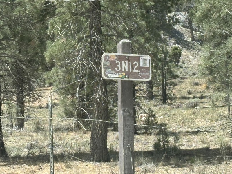
3N12 or Delmar Mountain Road is a great connector from Holcomb Valley to Hanna Flat. The road crosses the Pacific Crest trail and is an easy drive with a couple of good dispersed camping areas along ...

Jeff Van Es
Rated 5/5
Open
Visited: 07/11/2026
We did this trail to get to the miller jeep trail. We also took the side trail to Cottonwood Campground. I had never been to Cottonwood Campground before but it would make a great place to camp, shade...

Ben
Rated 5/5
Open
Visited: 07/11/2026
This short road passes through a great area for dispersed camping. We had a group of nine vehicles and there was plenty of room for more vehicles. If you have a large group, this is an area for you....
Jeff Van Es
Rated 5/5
Open
Visited: 07/11/2026
If you did Miller Jeep trail 5 or more years ago it is a much harder trail today. There was water in Piru Creek but not a lot. It was a hot day. We saw 2 other groups on the trail. 3 guys on motorcycl...
Ben
Rated 5/5
Open
Visited: 07/11/2026
This is a fun, moderate trail with a couple of obstacles. I travelled from west to east and I enjoyed this trail for the views and the challenges. While not overly difficult, there were some technic...
Jeff Van Es
Rated 4/5
Open
Visited: 07/11/2026
This trail has a nice camp spot about 1/4 mile in that is accessible to trailers and Sprinter vans. Beyond that the trail is lightly used and portions have become rutted out, off-camber and pinstripi...
Jeff Van Es
Rated 5/5
Open
Visited: 07/11/2026
This is an easy, graded dirt road that takes you back to Holcomb Valley. It is suitable for all types of vehicles when it is dry and there is a short portion about halfway in that is still paved. Th...
Jeff Van Es
Rated 4/5
Open
Visited: 07/11/2026
Lots of pinch point that make it difficult for longer wheelbases. Loose boulders and rocks (lockers help). Currently has many felled trees along the side of the trail causing even more pinch points....
Rad JT
Rated 4/5
Open
Visited: 07/11/2026
Cooper Cienega Truck Trail is a beautiful off-road adventure and one of the more secluded trails we’ve explored in Southern California. We chose to air down our tires before starting, and in our opini...
James and Pamela Lott
Rated 5/5
Open
Visited: 07/09/2026
After coming up Bee Canyon I got to the lower trailhead at around 6:30 pm. This being my 2nd ever trail review, I can't accurately place the difficulty of the trail other than to agree with the rating...
Jasper Mullins
Rated 4/5
Open
Visited: 07/09/2026
I used this trail to connect up with the 5S09 San Jacinto Ridge trail to go up from Hemet to Idyllwild/Pine Cove and I had a lot of fun so it's a good start point. This was the first trail I've done a...
Jasper Mullins
Rated 5/5
Open
Visited: 07/05/2026
Started down by Green Valley Lake and made it to Coxy Road, about the mid-way point. I went up in 2WD. Only used 4WD for the little off-shoots but can do 2WD the entire way. I’ll be picking up again a...
JR
Juan Rebolledo
No Rating
Open
Visited: 07/05/2026
Came in from the Green Valley Bypass and finished at Camp Whittle. Nice easy trail with great views.
Ryan Smith
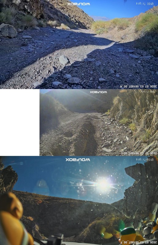
Rated 5/5
Open
Visited: 07/04/2026
I had an amazing, albeit scary, day of adventure in the White Mountains, starting with Silver Canyon Road. The first part of the trail winds through the canyon floor, crossing the creek about 8 times...
Daniel Macioce
Rated 5/5
Open
Visited: 07/03/2026
For the most part this trail is easy, but there are a few long steep sections with exposed rock that are moderately rutted.
The shelf road and switchbacks were well maintained and did not present mu...
Daniel Macioce
Rated 4/5
Open
Visited: 07/03/2026
We went up the Swansea side, where most of the big obstacles are. A lot of crock crawling immediately into the canyon. Pretty early on I ripped a sidewall along the rocky off-camber shelf road and had...
BN
Brandon Noble
Rated 5/5
Open
Visited: 07/02/2026
Berdoo Canyon was an amazing off-road adventure and, in our opinion, an intermediate-level trail. The payoff is reaching the wide-open landscapes and incredible big-sky views of Joshua Tree National P...
James and Pamela Lott
TN
Torrey Nelson
Rated 5/5
Open
Visited: 06/29/2026
Ran the trail from west to east to the San Jacinto River Crossing. I have been seeing photos of that crossing forever and wanted to experience it myself.
The trail was super easy on the section I d...
Josh Noesser
Official Crew
Rated 5/5
Open
Visited: 06/29/2026
Who doesn't love a good old-fashioned hard trail?
We started out on Bee Canyon and worked our way up to the mountain after stopping at 5S09 - San Jacinto Ridge water crossing. When heading up the ...
Josh Noesser
Official Crew
Rated 3/5
Open
Visited: 06/29/2026
Went out and explored Bee Canyon and Indian Mountain Trail. I wanted to find the water crossing everyone shares on their social media and I know it is in this area somewhere. I ended up finding and ...
Josh Noesser
Official Crew
Rated 5/5
Open
Visited: 06/28/2026
I hit this trail as a side quest on the way toward Miller Canyon and Arrowhead, but it became the highlight of the trip. The trail winds through a beautiful part of the forest. Nothing technical, just...
Shawn Whitson
Rated 4/5
Open
Visited: 06/28/2026
This was a fun little trail with plenty to enjoy. The oak trees are the highlight. They're everywhere and make for a beautiful drive through the forest. There are several primitive campsites along the...
Shawn Whitson
Rated 5/5
Open
Visited: 06/27/2026
I ran this trail solo starting at the northern trailhead going south, and I had a great time. The trail has a great deal of variety across the various sections—expansive high desert views, a wide cany...
Daniel Macioce
Rated 5/5
Open
Visited: 06/27/2026
Trail is marked Single black diamond. Not too challenging, but mostly a lot of deep wash out that you expose you vehicle to off camber body damage.
R
Ryan
Rated 5/5
Open
Visited: 06/26/2026
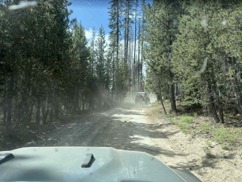
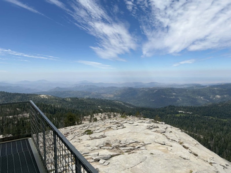
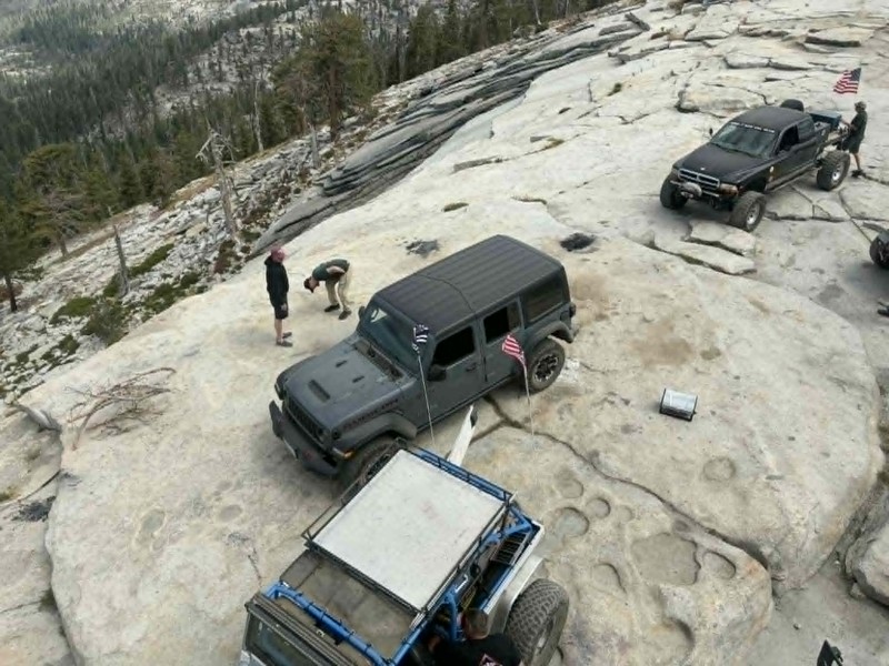
Bald Mountain is probably the most popular OHV Route in the Fresno County area. For the main trail and getting to the lookout, you don’t really need a crazy built vehicle or anything like that, but it...
Rad JT
Rated 5/5
Open
Visited: 06/26/2026
Was in this area for a meeting and got to run this with a local club on the way to the overlook tower on Bald Mountain. This was a mild approach and a nice scenic area giving you a great forest servic...
Jake Weikert
Official Crew
Rated 5/5
Open
Visited: 06/26/2026
While in the area for a meeting, we were given the opportunity to ride the area with a local club. This trail is an excellent sampling of high country California terrain without being too extreme. Man...
Jake Weikert
Official Crew
No Rating
Open
Visited: 06/26/2026
Great place to get away for a moment. Good route to practice and get wheel time. Did the entire run except the last little road section at the top was blocked by rock slide from the peak.
Jorge Salas
No Rating
Open
Visited: 06/26/2026
According to Agency date data, this trail should be open for the season.

Trails Offroad
No Rating
Open
Visited: 06/26/2026
According to Agency date data, this trail should be open for the season.
Trails Offroad
No Rating
Open
Visited: 06/26/2026
According to Agency date data, this trail should be open for the season.
Trails Offroad
No Rating
Open
Visited: 06/26/2026
According to Agency date data, this trail should be open for the season.
Trails Offroad
No Rating
Open
Visited: 06/26/2026
According to Agency date data, this trail should be open for the season.
Trails Offroad
No Rating
Open
Visited: 06/26/2026
According to Agency date data, this trail should be open for the season.
Trails Offroad
No Rating
Open
Visited: 06/26/2026
According to Agency date data, this trail should be open for the season.
Trails Offroad
No Rating
Open
Visited: 06/26/2026
According to Agency date data, this trail should be open for the season.
Trails Offroad
No Rating
Open
Visited: 06/26/2026
According to Agency date data, this trail should be open for the season.
Trails Offroad
No Rating
Open
Visited: 06/26/2026
According to Agency date data, this trail should be open for the season.
Trails Offroad
No Rating
Open
Visited: 06/26/2026
According to Agency date data, this trail should be open for the season.
Trails Offroad
No Rating
Open
Visited: 06/26/2026
According to Agency date data, this trail should be open for the season.
Trails Offroad
No Rating
Open
Visited: 06/26/2026
According to Agency date data, this trail should be open for the season.
Trails Offroad
No Rating
Open
Visited: 06/26/2026
According to Agency date data, this trail should be open for the season.
Trails Offroad
No Rating
Open
Visited: 06/26/2026
According to Agency date data, this trail should be open for the season.
Trails Offroad
Most Popular


Updated: 07/21/2024
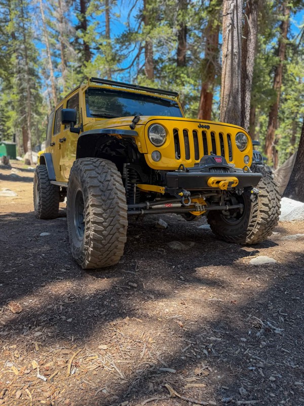
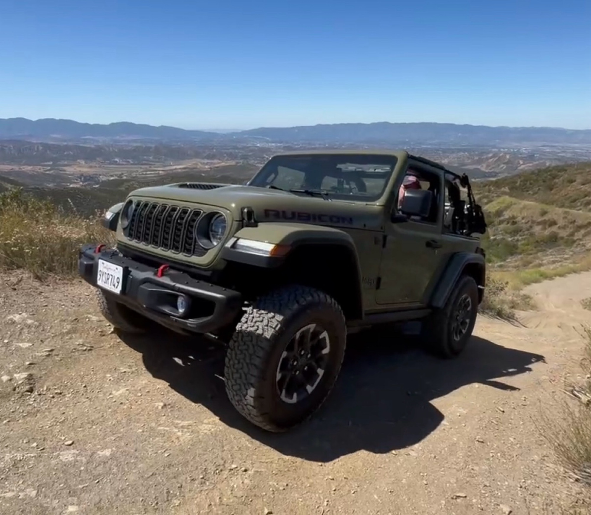
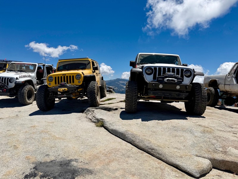
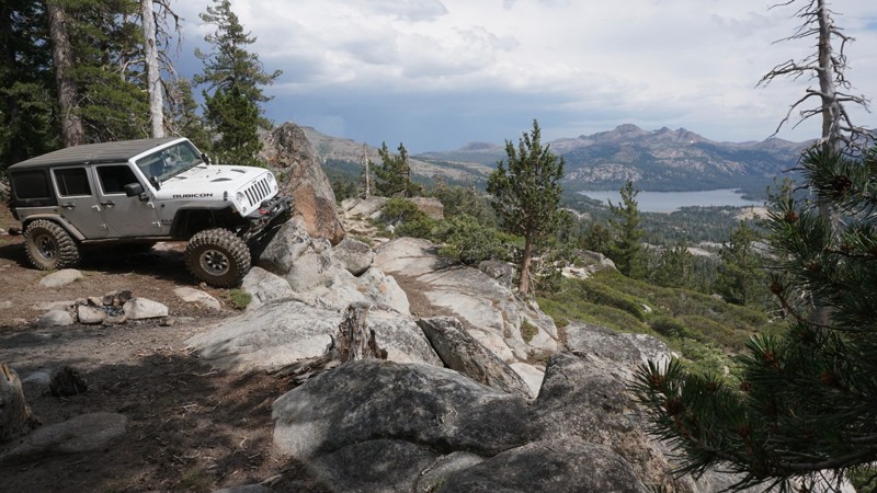
The Rubicon Trail
Open
/
Tahoma, California/
15.75 miles/
About 2 days
No longer the stagecoach road that connected Georgetown, California, and Lake Tahoe, Nevada, in the 1800s, the Rubicon Trail is a legitimate badge of honor known as one of the most iconic offroad trails in the world! So much so that Jeep has even named its famed Wrangler model after it. Decades have passed without the stagecoach in operation, and what was left of that route has become one gnarly and famous Jeep trail. The trail became famous in 1953 when 55 Jeeps and 155 participants ran what is now known as "Jeepers Jamboree 1". Since then, hundreds of thousands have earned the right to say they have conquered this famous Sierra Nevada offroad trail.
Adding to its popularity, the scenery knocks your socks off with a mesmerizing display of natural beauty. Towering pine trees, crystal-clear streams, and entire hillsides of white granite give the trail even more reasons for its world-renowned status. A word to the wise: you need to read the complete Trails Offroad Trail Guide to plan the logistics for this multi-day trip.

Updated: 09/03/2025
Burns Canyon
Open
/
Yucca Valley, California/
19.06 miles/
About 3 hours
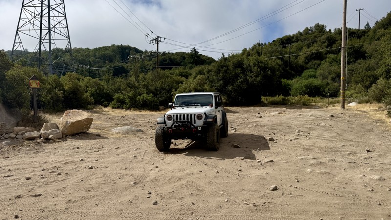
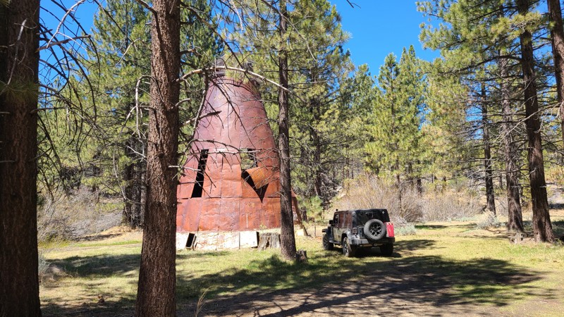
From the high desert floor flush with Joshua trees, Yucca, and crisp blue skies to the green forest of Big Bear, Burns Canyon, also known as Arrastre Creek, is an odyssey waiting for you in Southern California. Rich with history, particularly if you start at the south end and take in Pioneertown, travel through the famous Rose Mine, and find the rare Redwood trees, this trail makes for a great gateway for an epic overland trip close to home. This is the perfect get-away for a day or days when combined with the other amazing trails this area has to offer.
Updated: 12/23/2025
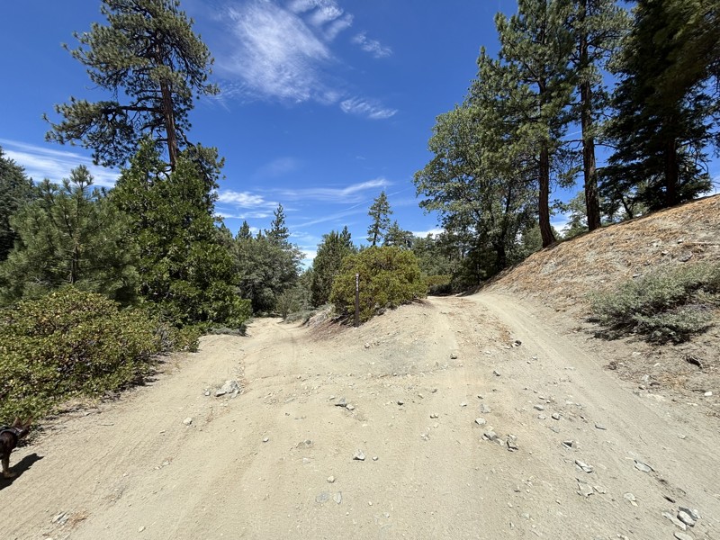
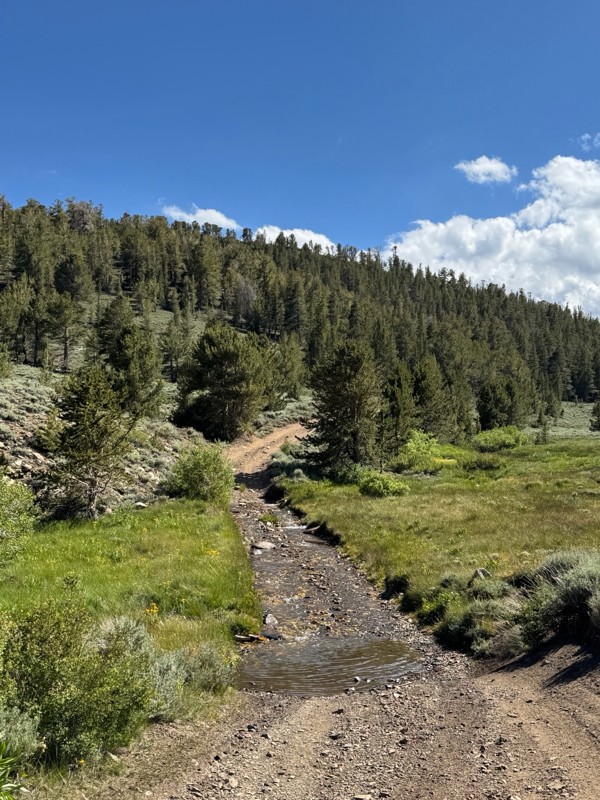
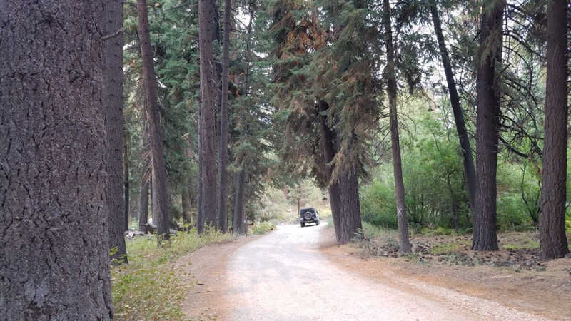
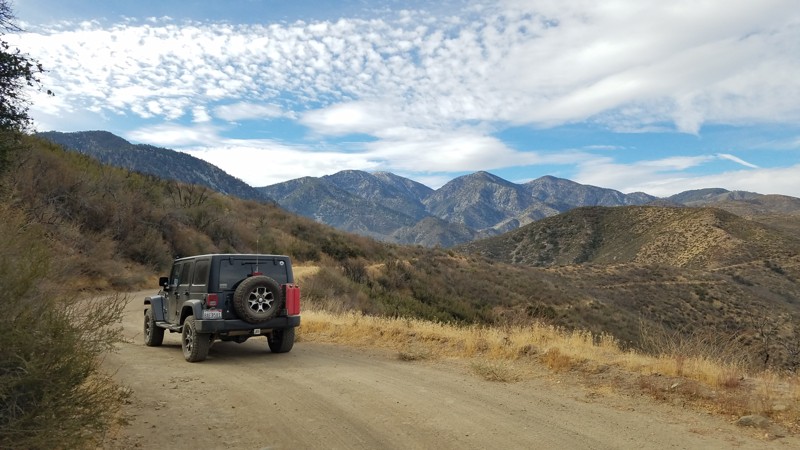
3N16 - Holcomb Valley
Open
/
Green Valley Lake, California/
25.67 miles/
About 2 hours
Holcomb Valley Road, also known as 3N16, is the backbone of Big Bear’s off-road country. It is a 26-mile route winding through pine forests, open meadows, and the storied remains of Southern California’s gold rush. Running west to east across the San Bernardino Mountains, it follows the same paths once traveled by 19th-century miners and settlers. Today, it’s a family-friendly dirt road that invites exploration, with countless opportunities to stop and connect with Big Bear’s rugged backcountry heritage. Along the way, you’ll pass relics of the old Belleville mining district, shady forest campsites, and panoramic overlooks where the air smells of pine and the horizon glows at sunset. More than just a scenic drive, 3N16 links some of the region’s most iconic trails, serving as both an adventure in itself and a gateway to Big Bear’s legendary four-wheel playground.

Updated: 02/05/2025
Mojave Road
Open
/
Baker, California/
112.61 miles/
About 3 days
Filled with oddities, scenic beauty, history, and a sense of adventure, it is no wonder that the Mojave Road has such an iconic stature. Formed as an early Native American trade route and then an east-west passage for settlers, the road has a long and storied history. Passing through the Mojave National Preserve, Mojave Trails National Monument, and the Lanfair Valley, you are remote and far from civilization. Today it is one of the more famous overland routes in the southwest. Although the road is not at all technical, the sense of adventure you get by being so deep in the desert is what makes it worth the trip.

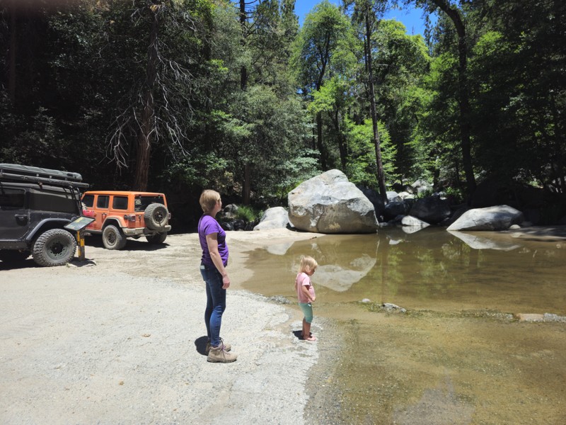
Updated: 01/02/2026
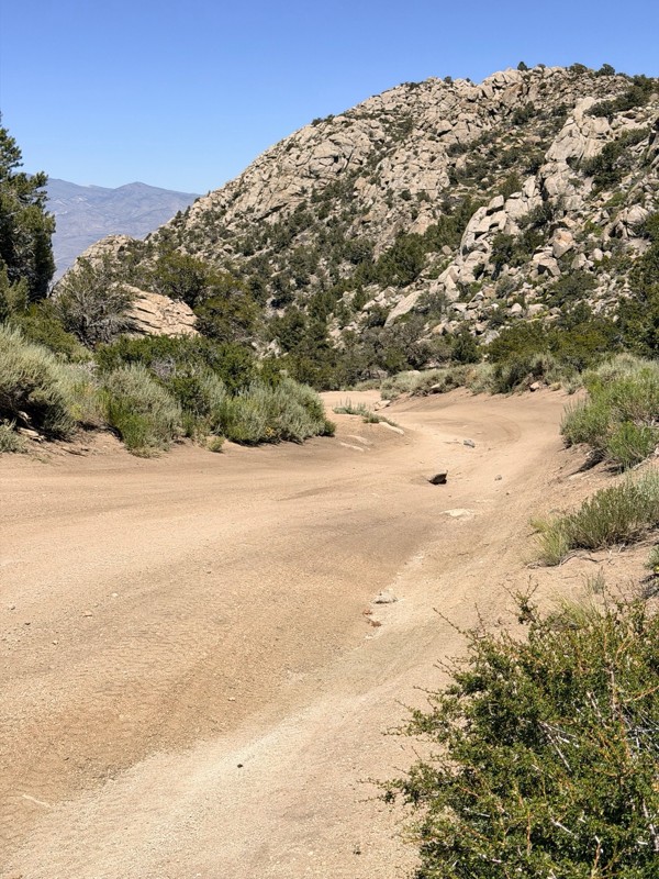
Maple Springs Road
Open
/
Orange, California/
7.49 miles/
About an hour
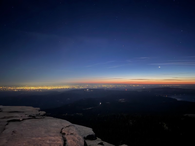
Maple Springs Road is the backdoor to Saddleback Mountain from Orange County. One of Orange County's few trails, this is a popular overland route for people wanting to get out of the house and stay local. Others say they enjoy this road because it leads to the best view of Orange County. Suppose you are fortunate to have a few hours around sunset. In that case, the view from the top of Saddleback Mountain is known for photographs of the sun setting over Catalina Island in the Pacific Ocean with Orange County in the foreground.
The lower section of the trail has a unique scenery for Orange County. The area is covered in oaks and pines. A nearby creek runs most of the year. It's an excellent place for a picnic. If you are lucky, you can find a swimming hole.

Updated: 05/29/2024
Fish Creek Trail - Anza Borrego
Open
/
Ocotillo, California/
18.02 miles/
About 4 hours
There is no other place like Anza-Borrego Desert State Park. Many overlanders and outdoor enthusiasts seek it out for its endless exploration opportunities. Fish Creek Wash is the starting point for many since it connects to many of Anza-Borrego's most famous offroad trails. Wind, rain, powerful earthquakes, landslides, and father time have shaped Fish Creek Wash into a living, geological museum. With its wind caves, dinosaur tracks, fault lines, towering mud hills, sandstone canyons, and wildflowers, Fish Creek is a perfect place to begin your exploration of the astonishing Anza-Borrego.

Updated: 07/08/2024
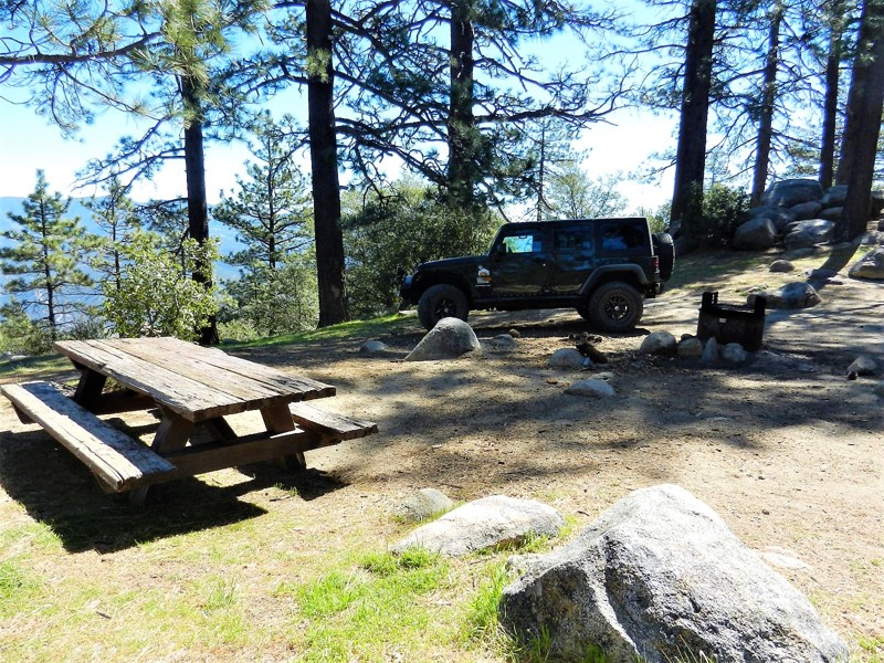
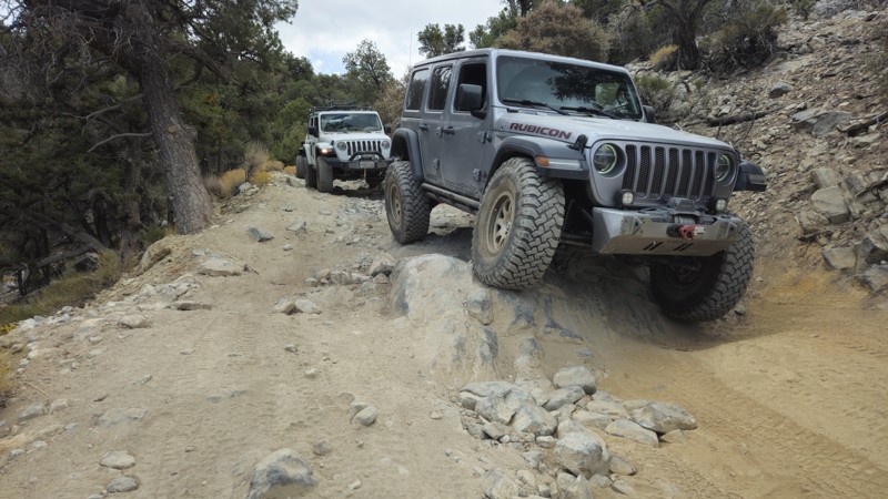
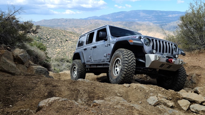
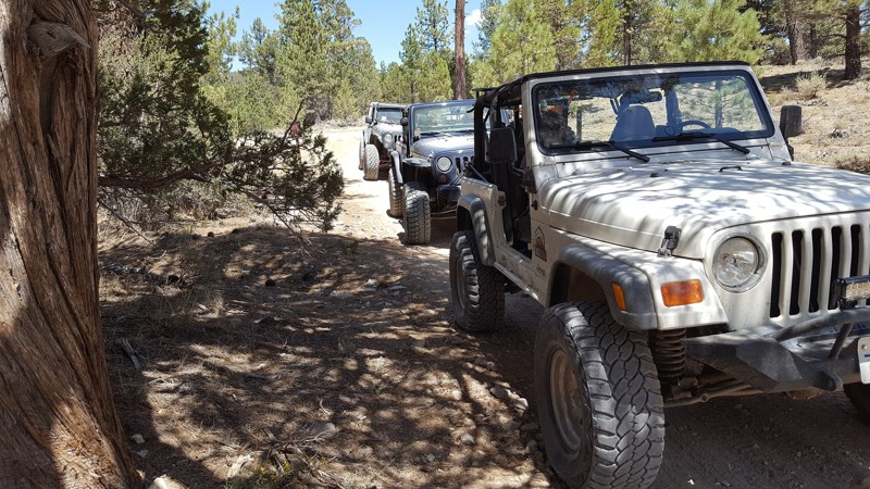
3N69 – Gold Mountain
Open
/
Big Bear City, California/
4.52 miles/
About 2 hours
Gold Mountain Trail, 3N69, is one of those names all Southern California offroaders know. For many, it was their first rock crawling trail. For others, it is their next ambitious goal. Located in the San Bernardino National Forest, near Big Bear Lake, this easily accessed rock crawling trail takes you up and into the mountain range of SoCal, cresting over 8,000 feet above sea level before dropping you near the history-rich Holcomb Valley. Along this scenic wonderland, the trail offers fantastic views of Big Bear Lake, the bustling mountain village below, and the towering San Gorgonio Mountain.
The trail was established in the 1860s during the Big Bear gold rush to facilitate mining operations. Today, the obstacles bring people to this historic trail. With two waterfalls, a rock garden, and several hard corners, this trail tests driver skills and vehicle capability. There is no doubt why Jeep picked this trail as one of its legendary Jeep Badge Of Honor Trails.

Updated: 05/12/2024
Pinyon Mountain Road
Open
/
Borrego Springs, California/
10.09 miles/
About 4 hours
When you hear or read about obstacles named "Heart Attack Hill" and "The Squeeze," you must make excellent adventure decisions before you decide to take them on. Pinyon Mountain is a Jeep Badge of Honor trail in the renowned Anza-Borrego Desert State Park and arguably its most challenging. The Squeeze tests every bit of your precision as you listen to fenders scrape on its narrow passage, while Heart Attack Hill will surely give you that proverbial "heart attack" when you first see it. This isn't a solo-type excursion trail. You will need every bit of your wheeling mates' eyes and collective experience as you conquer what people call "The Secret of the Desert."
Updated: 07/05/2024
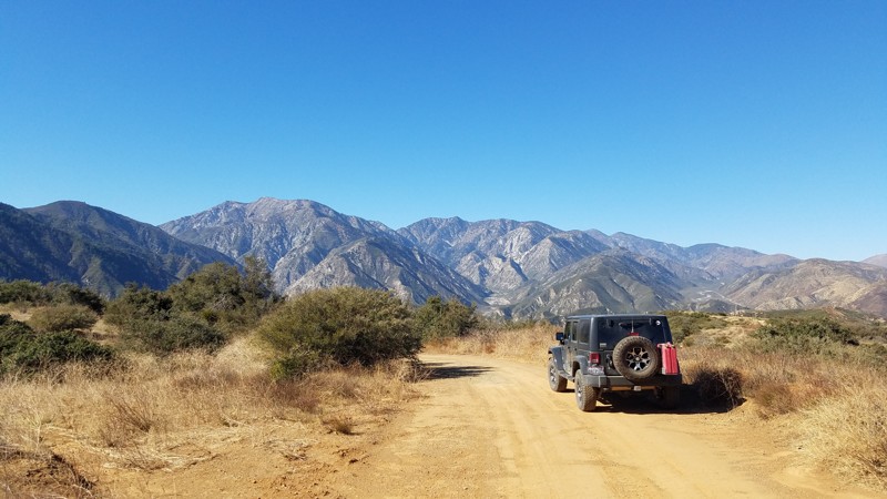
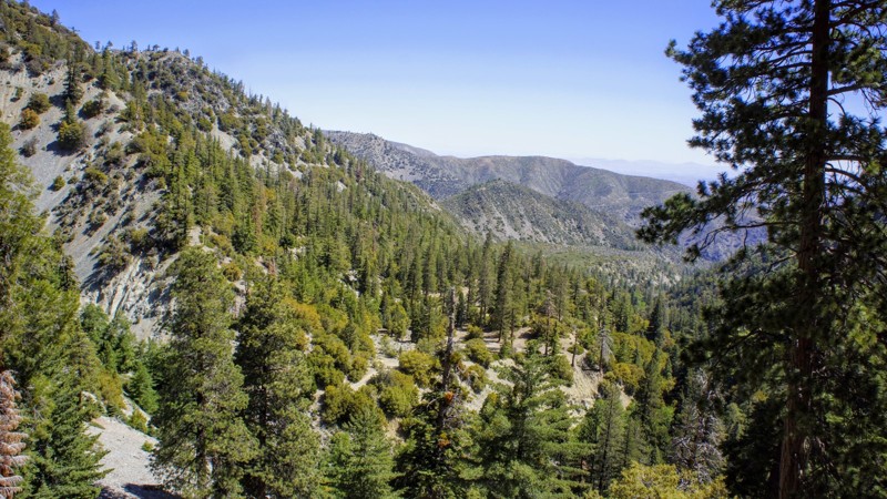
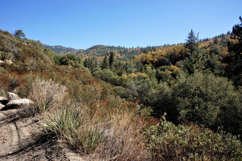
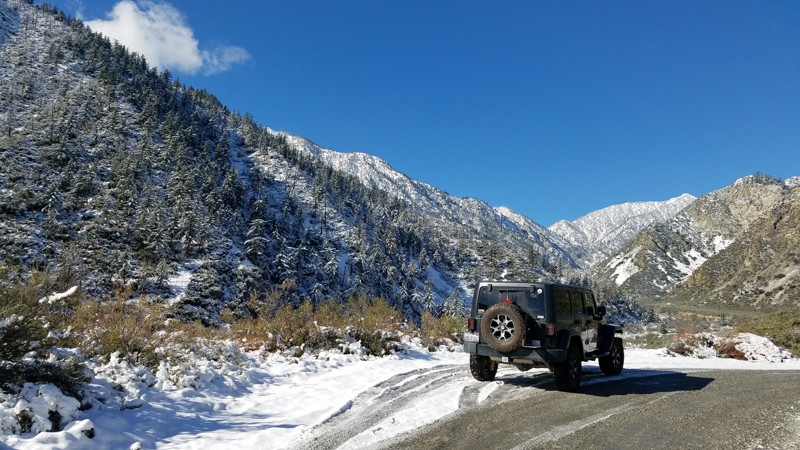
1N09 - City Creek
Redlands, California
Whether you are into overlanding, 4x4'ing, or rock crawling, the San Bernardino National Forest is a common area for people to seek adventure and memories. On the front side of Big Bear is an offroad route that is still barely known, even though it is right off Highway 330, the main highway up to Big Bear. 1N09, or City Creek Road as it's also known, is a magical scenic drive that can easily be made into a day trip or weekend adventure. The trail itself is relatively easy, but as you travel east among the dense forests, you are pleasantly surprised by the many water crossings the trail has. So the next time you go up to Big Bear to do a little wheeling, instead of overlanding on 3N16 again, check out 1N09 City Creek Road for a taste of the mountains' lush forest and tranquil beauty.

Updated: 09/23/2025
Holcomb Creek Trail
Open
/
Big Bear City, California/
5.84 miles/
About 4 hours
Comfortably nestled in the San Bernardino National Forest, Holcomb Creek is a challenging rock-crawling trail that has attracted visitors for decades. It is a Jeep Badge of Honor Trail, and for good reason. It is one of the most demanding trails in the Big Bear Mountain range and provides perhaps the best rock crawling of them all. While traveling the trail, expect everything from water crossings to extensive rock gardens with rocks the size of small cars. You can also expect challenging hill climbs and fantastic views of Holcomb Creek and the Pacific Crest Hiking Trail. Over the years, this trail has claimed many vehicles and should not be underestimated. People often exit this trail with their hopes and vehicles destroyed. If you think you and your vehicle have what it takes to complete this epic 4x4 adventure, then air down your tires, engage those lockers, and be prepared to make unforgettable memories while earning your badge!

Updated: 07/08/2024
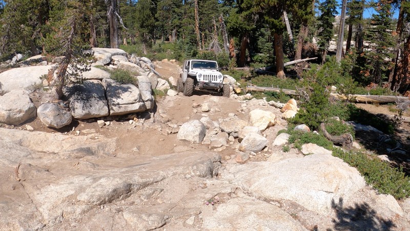
3N10 – John Bull
Open
/
Big Bear, California/
4.58 miles/
About 6 hours
One of the must-do offroad trails in Southern California and maybe even the United States, 3N10 - John Bull is a legendary trail in the offroad community and offers an amazing rock-crawling experience to all users. Often used as a trial run for larger trips such as to the Rubicon or the Dusy-Ershim, this Jeep Badge of Honor trail will test a vehicle to its breaking point. John Bull features large boulders over 36 inches round, loose rocks that love to bend sheet metal, and big trees that seem to jump out of nowhere and kiss your vehicle, leaving behind body damage scars that make for epic campfire stories. If looking for a unique and challenging trail within Big Bear's Holcomb Valley, John Bull will certainly fill the void.

Updated: 11/01/2023
Dusy-Ershim Trail
Seasonal Closure
/
Shaver Lake, California/
33.48 miles/
About 4 days
If you haven't heard of the Dusy-Ershim trail yet, you will soon. Many believe this is the newest hardest multiday off-road trip you can do today. The trail is comprised of both overland and rock crawling. If you ask someone that has recently done the Rubicon, they will say this trail is about 3-6 times harder. The Dusy-Ershim offers some of the hardest wheeling around, from mile long rocky hill climbs, to very technical obstacles, to some of the most amazing camping & fishing you have ever done in your life. The views have something to be said about too. Just be warned, this isn't an easy trip, even the most built rigs will leave this trail with mechanical failure. Be prepared, because body damage is almost guaranteed, even for the best drivers. If you are up to the challenge, expect the trip to take you in the range of 3-5 days.

Updated: 07/08/2024
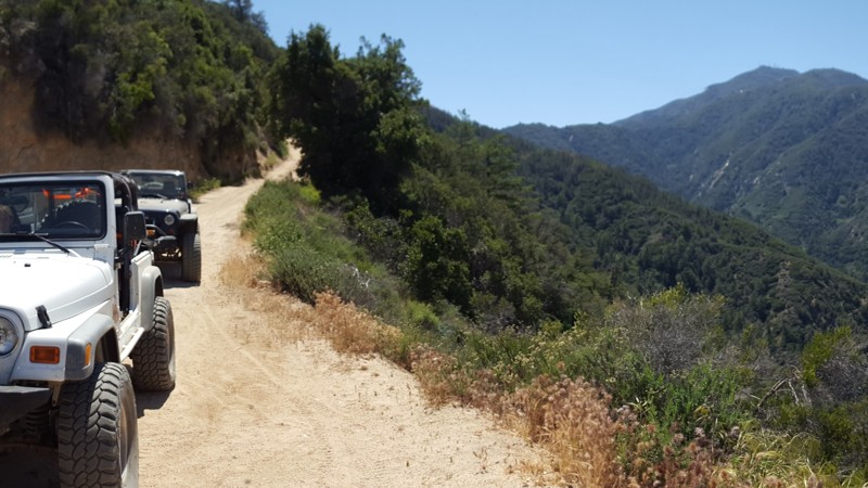
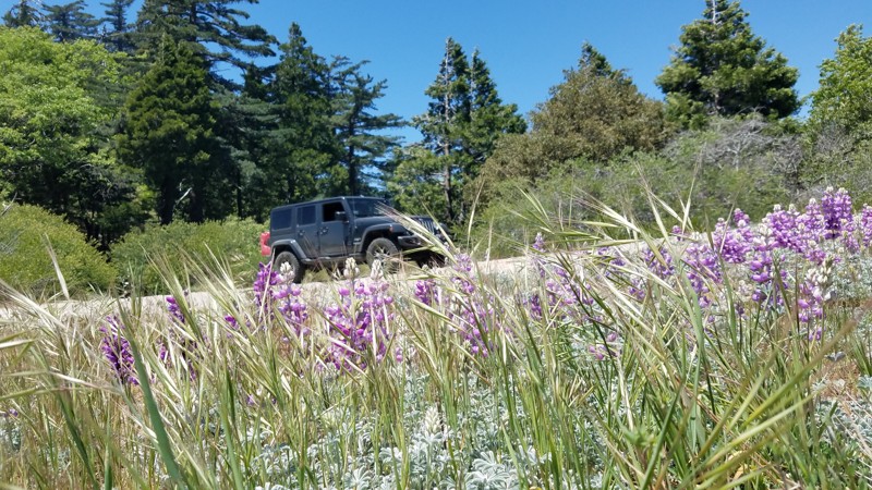
3S04 - Main Divide South - Santiago Peak (aka Saddleback Mountain)
Lake Elsinore, California
The trail is currently closed due to the Holy Fire. This can last years, so please plan accordingly. This local overland getaway is a great goto for people that live in Orange County and Riverside area. The trails are not known for a challenge but for the amazing views of all of Orange, Los Angeles, and Riverside County. On top of that, there are many great spots to stop which are perfect to relax and get away from the hectic city life.
Updated: 07/08/2024
3N14 - Coxey Road
Big Bear Lake, California
At 19 miles long, this dirt road takes you from Fawnskin to Hesperia and is a popular dirt route up the north side of the mountain range. Along the route, there are many trails splitting off such as 3N93 (Holcomb Creek) and 3N16. While traveling on 3N14 on the south side, there are several shooting areas and campgrounds. Please plan accordingly when traveling this area because it can get very hot on the low side in the Summer and still be snow on the ground once you reach high elevation.
Updated: 10/15/2024
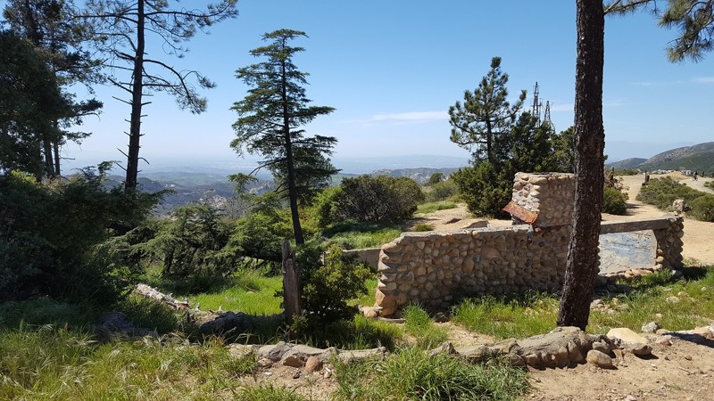
3S04 - Main Divide North End - Beeks Place
Anaheim, California
The northern section of 3S04 Main Divide Road can easily be one of the best kept secrets of Orange County, CA. This section of the route is one trail every Overlander and 4x4 enthusiast should travel for themselves when in the area. With some of the most rare items in Southern California, it can be pretty easy to say that this is probably the most unique trail in all of Orange County, CA, maybe California. The highlight of this intriguing expedition is the stop at Beeks Place, which was built in 1942 by Joe Beeks. Besides being at over 3400 feet in elevation, Beeks Place has standing gun turrets that were built back in WW2. The idea was if the worst case scenario happened to America at the time, an invasion from a foreign country, Orange County would be ready to defend the United States. As you continue to the north, you will cross many abandon sites, some of them are for water collection while others are abandon buildings. You will also enjoy heli pads, many active radio towers, and Southern California's Doppler Radar Systems. But if the sites are not what brings you to this trail, then the view will easily cover that. As you travel the ridge heading north, you will experience 360 degree views with over 100 miles of visibility in almost any direction. You can easily see things like the Pacific Ocean, Ventura County, Downtown L.A., Orange County, Newport Beach, Riverside, Temecula, snow capped mountains of Big Bear and San Jacinto, plus many more amazing sites.

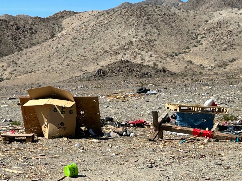
Updated: 03/24/2026
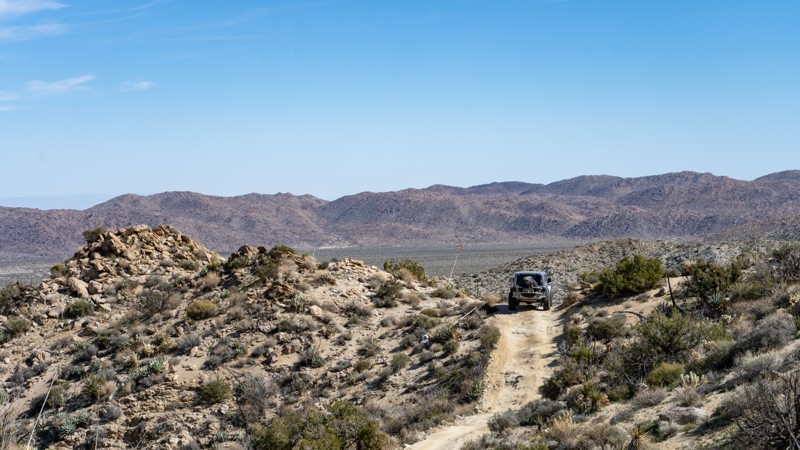
Berdoo Canyon
Open
/
Coachella, California/
14.11 miles/
About an hour
Berdoo Canyon is home to an old ghost town named Berdoo Camp. Berdoo camp was founded by the water district when California built the Colorado River Aqueduct that still provides water to Southern California. The Camp was built in the early 1930s for the workers and their families to live while the aqueduct was being constructed under the mountain range. The camp was abandoned sometime in 1937 when the project was completed in the area, and the camp was no longer needed. Over the years the camp has been scraped of all the lumber from the roofs of the old concrete buildings. Now all that is left of the old camp are the skeletons of the concrete buildings that once housed the workers and their families. Building the Colorado River Aqueduct was an amazing feat of the time. The workers did not have the type of modern machinery we take for granted in our everyday lives during the construction. Come out and explore the colorful history of the Berdoo Camp as well as Berdoo Canyon. You might even get to see some of the desert wildlife as you head into Joshua Tree, or a ghost or two. Please tread lightly along the trail. I have lived my entire life in this area, and have seen many of these awesome trails closed, due to people making these beautiful desolate trails their personal landfill. Please, if you find trash along the trail, pick it up and help do your part in keeping this trail open for generations to come.

Updated: 06/01/2024
Oriflamme Canyon
Julian, California
Oriflamme Canyon is an ancient route connecting Anza-Borrego Desert State Park and Banner, California. Long before overlanding and four-wheeling, the Kumeyaay, Spanish, and early settlers used the route for trade, travel, and seasonal dwelling. Oriflamme was the name given to the first mine that worked in the area, and the canyon and mountain soon took on the name as well. It is believed that the name came from the steamship "Oriflamme," which brought miners to San Diego in 1870 during the Julian gold rush. The road became more pronounced during the various mining booms, and today is included in many overland trips through Anza-Borrego. It offers mountain scenery with tall oak trees, adventurous shelf roads, and a chance to see crystal clear fresh running water at the right time of the year.
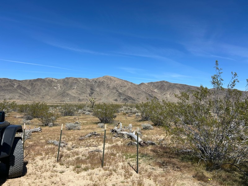
Updated: 04/30/2026
Rattlesnake Canyon
Landers, California
Known for its incredible views and rich history, Rattlesnake Canyon, or RC3331, is a popular overland route that takes you into the San Bernardino Mountains from Old Women Springs Road in Johnson Valley, California. The experience offers impressive views of Joshua trees, mesquite, and flowing springs that will make great memories. It is the perfect trail to escape Orange and Los Angeles Counties, and if strung together with other trails in the area, it can be an excellent add-on to a multi-day trip.

Updated: 05/19/2024
Azusa Canyon SVRA
Azusa, California
Mud... and lots of it. Azusa Canyon is an infamous OHV area for its very large mud pits that are deep enough to swallow a monster truck. Even though many people go out to this area in their Razors, 4x4, and quads to play in the dirt and hills, most people find themselves heading to the south end of the park to the mud pits where the action is always at. Saturdays in Azusa are rather quiet, but Sundays starting around noon get absolutely crazy.
Updated: 06/22/2024
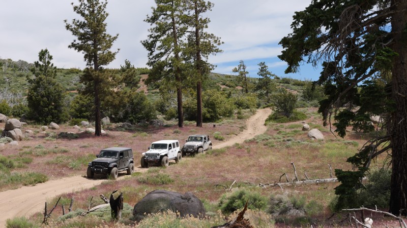
6S13 - Thomas Mountain
Anza, California
Thomas Mountain is a 6,800 foot peak in the San Bernardino National Forest. 6S13 Thomas Mountain trail is between Anza to the south and Garner Valley to the north. You will have a wide range of plant life in your offroad 2,400 foot climb from the trailhead. Ranging from the scrub brush at the lower elevations to the sage, yucca, mesquite, manzanita, scrub oak, pine and cedar at the peak. Camping on Thomas Mountain is the highlight of this trail with 10-12 Yellow Post Sites dispersed between 6,400 feet and 6,800 feet. Please respect and watch for the critters that make this their home.

Updated: 05/20/2026
2N33 - Pilot Rock Truck Trail
Hesperia, California
The Pilot Rock Truck Trail starts at the east side of Silverwood Lake in the San Bernardino Mountains in the San Bernardino National Forest. Possibly the most scenic trail in San Bernardino county, Pilot Rock Truck Trail runs between Silver-wood Lake and the small mountain community of Lake Arrowhead. This long mountain trail serves up one amazing view after another starting with Waypoint 6 which overlooks Silverwood Lake from a steep ledge. From Pilot Rock ( the actual rock ) at Waypoint 18, you will look out to see a panoramic view of the distant desert fading into the forest covered mountains.
Updated: 06/08/2024
2N47 - Cleghorn Ridge
Hesperia, California
Cleghorn Ridge is located near beautiful Lake Silverwood, offering spectacular views overseeing the lake and the San Bernardino National Forest. This trail is great for those looking for a day of adventure. Mostly a graded fire road that any vehicle can pass through, it also offers optional difficult routes for those looking for a more challenging trail. Nearby food, gas, and camping make this an ideal trip for a family weekend. This trail has a rating of "6" which is based on the optional routes, the main trail is easily rated at a "2" and passable by a 2WD SUV or truck.

Updated: 04/28/2024
The Bradshaw Trail
Open
/
Blythe, California/
75 miles/
About 2 days
The Bradshaw Trail or the Gold Road to La Paz is a popular overland trail in the southeast corner of California in Riverside County. This once-popular overland stage route used to haul miners and other people looking for the wealth of California. Along the route, you will see many unique features to the area including old mining encampments, abandon train tracks, abandon train tussle, and many unique natural wonders. Because of all these amazing scenic stops, this route has become very popular with the overland community and off-roaders that are looking for a great way to escape the hassles of work. One of the amazing opportunities of this scenic trip is you can make it a day trip or multiple days to get to enjoy all the unique locations along the route. Thus, if you are looking for a unique offroad adventure near Palm Springs and Blythe, California, that could be done in 1 to 3 days and is easy enough for a new driver, look no further than the enjoyable 4x4 adventure of the Bradshaw Trail.

Updated: 07/20/2024
Trabuco Canyon - AKA Holy Jim Canyon
Trabuco Canyon, California
Please note, a majority of the area has been closed due to the Holy Fire...
Holy Jim Canyon (AKA Trabuco Canyon Road) is among the most popular off-road trails in all of Southern California. With thousands of visitors a day, this is a great place to get out, have some fun, do a little socializing, and partake in people watching all at the same time. Less than 20 minutes from anywhere in Orange County California, there is no doubt why so many 4x4 enthusiasts can say they have driven this path into Orange County's unknown forest. While Holy Jim is a very mellow off-road trail, there are plenty of challenging options in the area from rock crawling, hill climbs, off-camber areas, a creek to play in, and lots of hiking that lead to some of the tallest waterfalls in the Southern California. If you are in the area, and are looking for a place that is suitable for every type and skill level of off-roader, then check out Holy Jim Canyon aka Trabuco Canyon.
Updated: 06/16/2024
4S01 - Black Mountain
Idyllwild-Pine Cove, California
4S01 Black Mountain is the highest offroad trail, at 7,665 feet, in the San Jacinto Mountains, which is in the San Bernardino National Forest near Idyllwild. Because of its 2,300 foot elevation change over the 12 mile route you will experience a wide range of scenery from the lower scrub and manzanita to the pine, oak and cedar at the top. 4S01 Black Mountain is well know for its camping areas, and is also a rendezvous point for hikers on the Pacific Crest Trail. This trail is also a favorite for practicing your rock climbing skills. 4S01 Black Mountain closes during winter so you should check with the San Jacinto Ranger District as to status. Please respect the animals who call this forest their home, they were here first.
Updated: 06/20/2024
5S01 - Indian Truck Trail
Corona, California
Indian Truck Trail is a great overland connector route that all off-road enthusiast can travel along. The trail takes you from the Corona area of the I15 to 3S04 - Main Divide Southern from at which point it is only a short 15 minute drive to the peak of Saddleback Mountain. Along the route, the trail provides many stunning views and some of the only forest left on the mountain. Whether it is a evening cruise to watch the sunset or a breakfast 4x4 trip to go to Tom's Farm, you will find yourself at ease on Indian Truck Trail.
Updated: 02/04/2026
Heartbreak Ridge
Big Bear, California
Tucked into the rugged east side of Big Bear in Southern California, 2N61Y, better known as Heartbreak Ridge, is a remote, challenging 4x4 trail in the San Bernardino National Forest. It’s a trail for drivers who want a true backcountry challenge away from the busier, more popular routes in the area.
Heartbreak Ridge is technical and demanding, with jagged rock gardens, tight canyon squeezes, and off-camber shelf-road sections that require careful tire placement and steady focus. Along the way, you’ll catch wide mountain views and pass scattered remnants of old mining activity that add a gritty, historic feel to the drive.

Updated: 04/14/2025
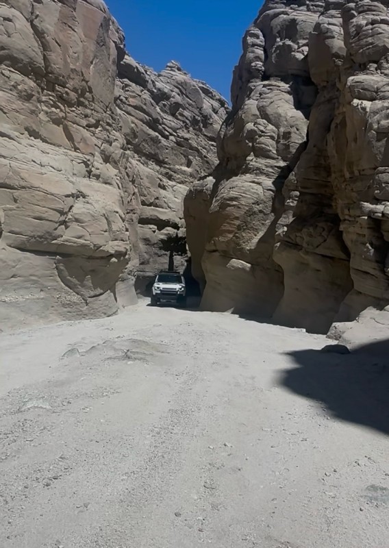
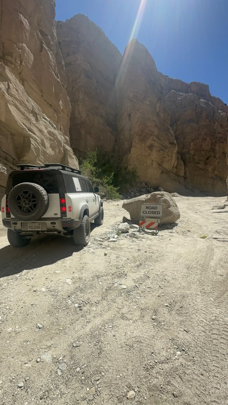
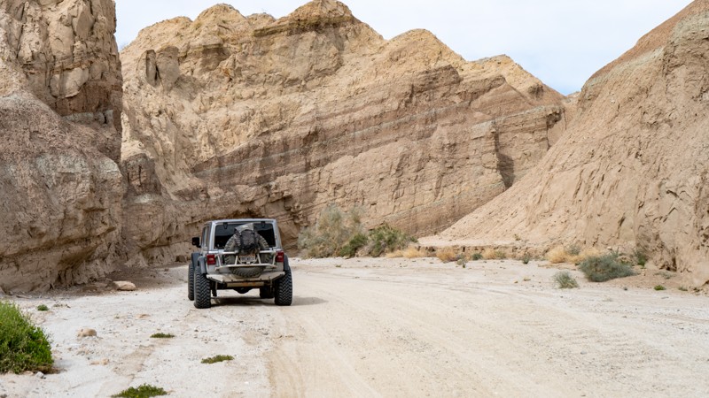
Sandstone Canyon
Ocotillo, California
Widely regarded as the ultimate off-road adventure in California’s Anza-Borrego Desert State Park, Sandstone Canyon is more than just a trail; it’s a journey through time, carved by the forces of nature over millions of years. This breathtaking canyon trail takes you deep into a natural wonderland, where colossal sandstone walls rise high above, their jagged edges and smooth curves telling the story of a prehistoric past.
Winding through the canyon, you’ll navigate tight passages barely wider than your vehicle, feeling the raw power of the Earth’s geological artistry all around you. Every twist and turn unveils a new spectacle—sheer cliffs, towering formations, and sunlit rock faces that glow in shades of gold and red. It’s a place where time slows down, and the thrill of exploration meets the humbling beauty of nature.
Just as the Colorado River carved the Grand Canyon, the remnants of that ancient process have been sculpted here, creating an off-roading paradise unlike any other. This is not just a drive, it’s an experience, a privilege, and an unforgettable adventure. Many off-roaders hail Sandstone Canyon as the crown jewel of Anza-Borrego, and the moment you enter its towering corridors, you’ll understand exactly why.
Updated: 07/12/2024
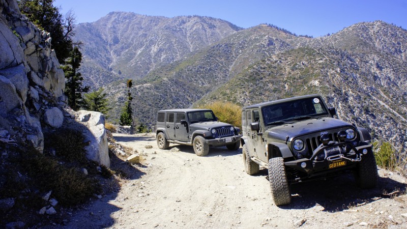
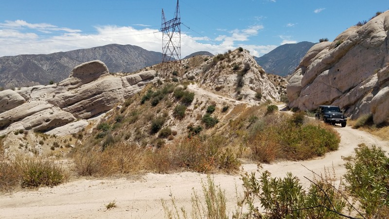
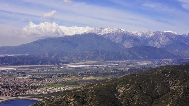
3N31 - Lower Lytle Creek Divide
Fontana, California
3N31 Lower Lytle Creek Divide is within the San Bernardino National Forest. It is an easy road that is well maintained to provide service vehicle access to the power line towers that line its route and an excellent highway for novice off-roaders to get their wheels dirty. Many inviting spurs to explore along the way almost always end at a power line tower.
For all driving skill levels, Lower Lytle Creek Divide offers a pleasant escape from the metropolis with views of the majestic San Gabrial Mountains to the west and the Cajon Pass to the east. There are beautiful vistas to pull over and enjoy at many spots along the trail dominated in the west by the almost 9000' granite peaks of Cucamonga, Big Horn, Timber Mountains, and from below the jumbled boulders that make up Lytle Creek. To the east is an expansive view of Cajon Pass hosting Interstate 15 and the 5400' Cajon Mountain range. A change in color from green to brown looks northward, marking the transition to the dry Mojave desert.
Your dog can also enjoy the trail when kept on a leash.
Updated: 02/11/2025
Bailey Canyon
San Bernardino, California
Bailey Canyon Road is at the eastern end of the 823,000 acres San Bernardino National Forest and only a short 10-mile drive from I-15. The trail passes over the San Bernardino Mountain Range, rising from Silverwood Lake and passing over Sugarpine Mountain at altitudes that are the domain of the big pine forests. The impressive tall pines are survivors of the 2003 Old Fire, which burned 91,000 acres and the scared victims are still visible. Along the road are densely packed young pines fighting for space, quickly becoming a lush forest again. There are many places to pause and enjoy the cool, sheltered quiet offered by the forest, fragrant spring flowers, and views back to Silverwood Lake.
Updated: 04/08/2024
San Sevaine Road
Fontana, California
San Sevaine Road is located in the beautiful San Bernardino National Forest. The trail runs east to west on the south-facing slopes between Mount San Antonio (Mount Baldy) and the Cajon Pass. The views into the Inland Empire are spectacular, where you can spot the ocean on a clear day. This trail has somewhat unusual seasonal closures to protect important fawning habitat for mule deer, a Forest Service Management Indicator Species. The trail is closed between March 1st and Labor Day.
Another highlight of this trail is the Joe Elliott Yellow Post Site near the end. Joe Elliott was the Superintendent of this forest from 1929 to 1935. Southern California's largest conifer tree was once at this campsite. The massive tree was 23 feet in circumference and 140 feet tall. Sadly it had to be taken down for safety reasons.
Updated: 07/13/2024
3N06A Cold Water Canyon
Lytle Creek, California
3N06A Cold Water Canyon, in the San Bernardino National Forest, is one of a dozen trails in the Lytle Creek system. This trail is a short spur off of 3N06 Stockton Flats, the main trail in the north fork of Lytle Creek. A major attraction to the area is the location of 19 Yellow Post camping sites, three of which are on this trail. Travel to this area is no more than 2 hours from anywhere in Southern California, and yet, with a properly equipped 4wd vehicle, you can make your camping experience as remote as you like. Prepare yourself for every forest creature you can imagine, and remember, this is their home. Cold Water Canyon is suitable for the newbie 4-wheeler but tough enough for all to enjoy. Pack your picnic lunch or camping gear and enjoy this trail.

Updated: 04/01/2024
Fordyce Jeep Trail
Open
/
Soda Springs, California/
12.25 miles/
About 12 hours
High in the Tahoe National Forest, west of Truckee California and just off Interstate 80 lies the Fordyce Jeep Trail; a serious rock crawling trail that will challenge any rig and driver. Fordyce is California mountain rock crawling at its finest. Over 12 miles of sharp, jagged rocky trail twists and turns on its way up from Indian Springs and Eagle Lakes to Meadow Lake at the top of this monster of a trail. Fordyce Jeep Trail runs alongside and crosses Fordyce Creek multiple times, where deep and typically unpredictable water crossings add to the challenge of the huge rock obstacles know as the numbered Winch Hills throughout this trail. Hardcore rock crawling, remote dispersed camping, swimming, fishing, and good ol' 4x4 spectating at Committee can all be found on Fordyce.
Experienced wheelers in built rigs will love the challenge and beauty of the Fordyce Jeep Trail, but new wheelers SHOULD NOT ATTEMPT it. This trail is technical and dangerous. Hang-ups, body damage, steering/suspension breakage, rollovers, mechanical breakdowns, engine flooding, you name it, it can happen on Fordyce.
Updated: 10/18/2023
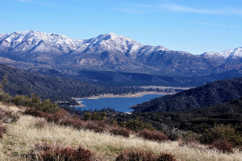
5S15 - Rouse Hill
Hemet, California
Rouse Hill Trail is all about the beautiful views and Thomas Mountain Peak for lunch or camping. It is an off-road route in the San Bernardino National Forest. The view of Lake Hemet with the snow-capped San Jacinto Mountains in the background with Tahquitz Peak in the center with sister peaks on either side is breathtaking.
Updated: 06/25/2026
Dishpan Springs
Lake Arrowhead, California
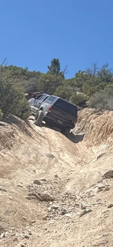
Dishpan Springs 3N34 is a short but brutally hardcore rock crawling trail that has become a must-run destination for serious offroad enthusiasts, rock crawlers, and extreme 4x4 drivers. Hidden deep in the San Bernardino Mountains between Big Bear Lake and Lake Arrowhead, this legendary Southern California off-road trail delivers nonstop technical challenges and is not something to underestimate. Known for its steep granite climbs, loose dirt, and high-consequence obstacles, Dishpan Springs is designed to test driver skill, vehicle setup, and mental focus from start to finish.
The trail is defined by two massive, highly technical waterfalls that rank among the most intimidating obstacles in the area. These near-vertical rock faces demand precise tire placement, controlled throttle, and confident line choice. The upper waterfall in particular is notorious for body damage and rollovers, and it has no regard for whether you are driving a fully built 4x4, a rock buggy, a heavily armored Jeep, or an over-the-top Toyota build. With constant traction challenges, extreme rock crawling lines, and heart-pounding climbs, Dishpan Springs delivers pure adrenaline and is the kind of offroad trail that leaves drivers exhausted, grinning, and wishing it would never end.
Updated: 07/30/2024
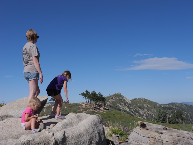
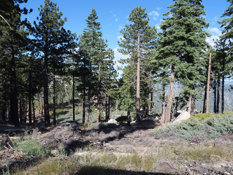
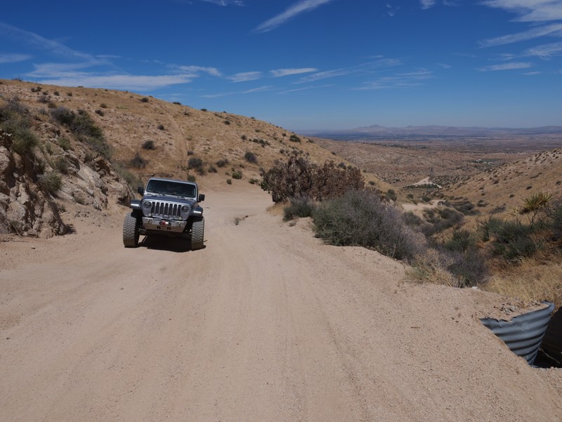
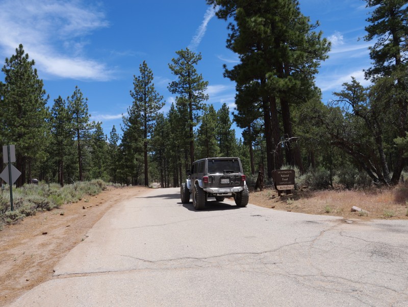
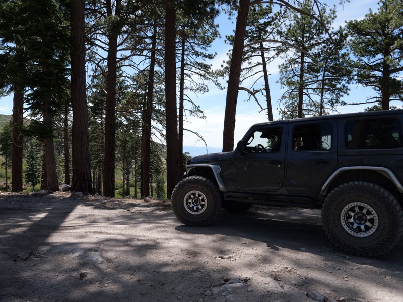
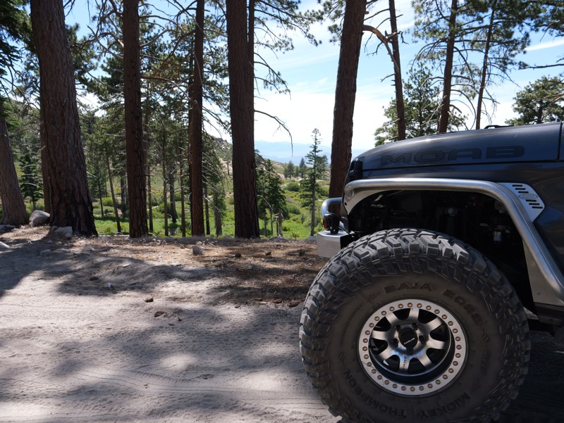
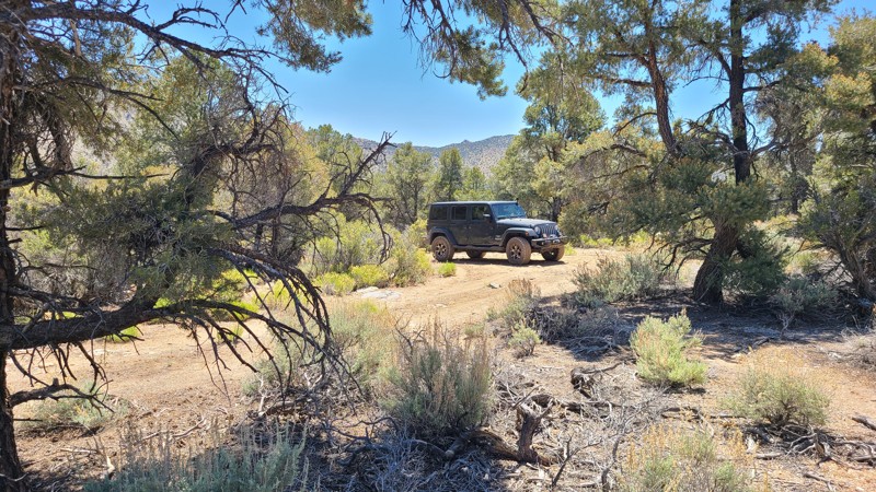
3N17 - White Mountain
Big Bear Lake, California
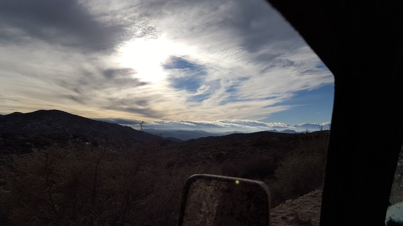
Located deep within the San Bernardino Nation Forest and providing legendary views of the High Desert, 3N17 White Mountain is a lightly traveled yet prominent trail within the Big Bear Lake area, known to be a favorite among locals. Perched at nearly 7,800 feet above sea level, the views from this ridge-running trail are awe-inspiring. While traveling the northern mountain range spine, users are rewarded with views of Johnson Valley, Lucerne Valley, Cougar Buttes, Apple Valley, Barstow, Mojave Road, and even Calico off in the distance. If those views aren't appealing enough, wait for dark and visit one of the two twin peaks on a clear night, where the glamourous lights of Las Vegas can be seen in the distance. If you are looking for something new and scenic that you will want to come back to again and again, look no further than White Mountain.
Updated: 05/23/2024
Jawbone Canyon Road
California City, California
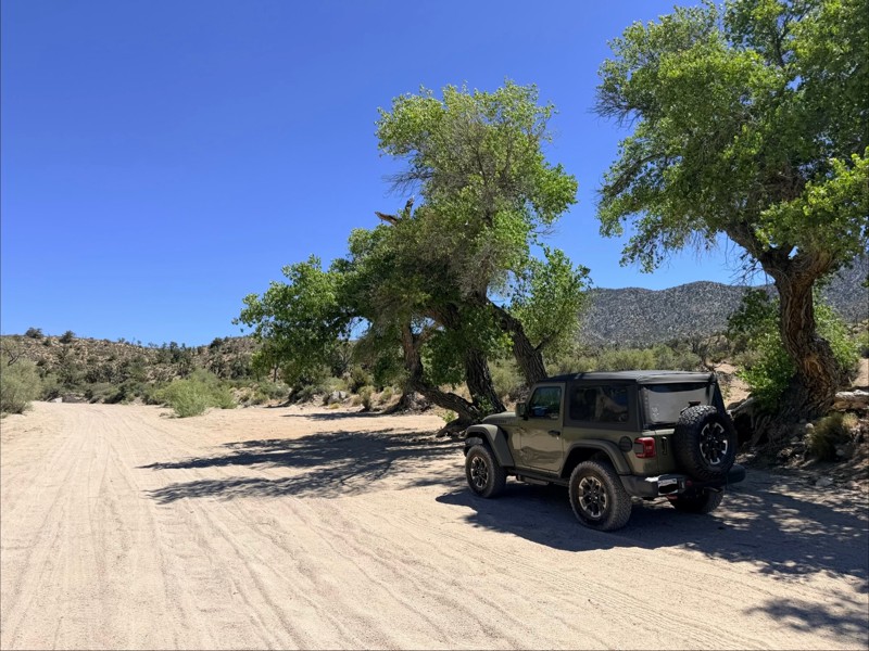
Jawbone Canyon Road provides a leisurely and scenic drive across a quickly changing landscape from the hot Mojave high desert to the cool Piute Mountains. Along the way, you can get close to an impressively massive wind turbine farm, pass across the beautiful Kelso Valley, and then feel the temperature drop as you climb 4500 feet into the serene tall pines of the Sequoia National Forest.

Updated: 12/22/2023
Upper Santa Ysabel Trail
Ramona, California
Upper Santa Ysabel Trail is located in northern San Diego county. The trail runs along Black Mountain which provides great views of the canyons below. This short trail is not just scrub brush and boulders. As you go down into one of the multiple canyons, you will find lots of oak trees and seasonal streams.
Updated: 06/08/2024
9S07 - Palomar Divide
Temecula, California
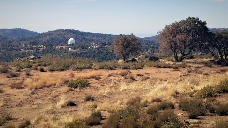
9S07 - Palomar Divide is located off Highway 79 in San Diego County, in the Cleveland National Forest near the Riverside County border. The views along this 13 mile trail are spectacular and are ideal for the new 4x4 wheeler to use for a picnic drive or for overnight camping. The waypoints will direct you to a wildlife guzzler, two semi-active gemstone mines, hiking trails, Sourdough Springs, and the Highpoint Lookout. Palomar Observatory is just a short distance beyond the permanently locked gate at trails end, but visitor access is only via Highway 76 to the south.
Updated: 07/20/2024
1N54 - Clarks Grade
Big Bear Lake, California
Clarks Grade is a 4x4 off-road trail in the San Bernardino National Forest. Driving this trail is a journey through several ecosystems, starting at the lowest elevation at the Santa Ana River and continuing to the ridgeline south of Big Bear Lake. The lushness of the canyon bottom gives way to the semi-aridness of mesquite, sage, and scrub oak. Finally, towards the end, you reach groves of conifer and an open-air ridgeline. Rumor has it that this trail was cut in one week as an alternate way off the mountain when, in 1949, the storm of the century blocked all access in and out of Big Bear Lake/Snow Summit. A sign at the north end explains that the trail has been in place since well before 1949. Harland Clark always told the story his way; it looks like his brother Hiram made the improvements.

Updated: 06/16/2024
26E212 - Red Lake Trail
Open
/
Shaver Lake, California/
2.38 miles/
About 2 hours
A high mountain lake hidden at the end of this rock crawling 4x4 trail makes for a killer end-of-trail reward and an even better camping location.
Rock gardens, dense forest, a few short stretches of easy trail and, of course, Red Lake, make up Red Lake Trail.
This is one of many 4x4 trails in the Red Mountain OHV network in the Sierra National Forest, northeast of Shaver Lake and Southeast of Huntington Lake.
Red Lake Trail is one of the "easier" trails in this area, when compared to Mirror Lake Trail and Coyote Lake Trail , but do not underestimate Red Lake. While easier, it is not "easy", and still a challenge to reach the Lake at the end.

Updated: 12/18/2024
Diablo Drop-Off
Ocotillo, California
Diablo Drop-Off isn't as scary as it sounds, but it is a great story when you get home and tell your family that you drove down a hill named after the Devil himself. From a pragmatic point of view, it will most likely be on your itinerary when you overland between sections of the renowned Anza-Borrego Desert State Park. Diablo Drop-Off connects trails in the southern area, such as Canyon Sin Nombre and Vallecito Creek, with the more famous northern trails, such as Fish Creek Wash and Sandstone Canyon. Whatever the motivation is to conquer the hill or make as many offroad miles as possible in the Park, Diablo Drop-Off is waiting for you to explore.
Updated: 04/15/2026
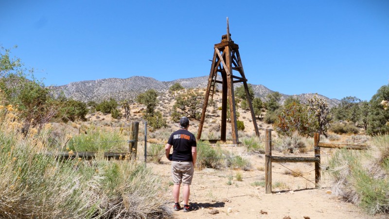
Old Dale Road
Twentynine Palms, California
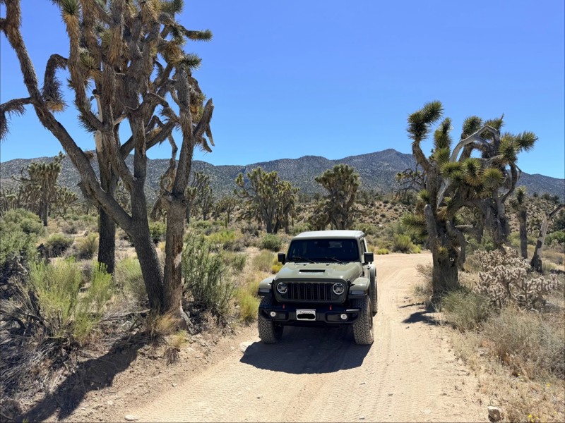
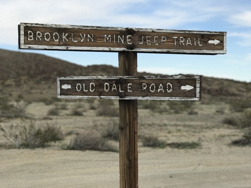
Old Dale Road is a historic route that served as the central corridor for the Old Dale Mining District in what is now the northeast corner of Joshua Tree National Park. Numerous side trails branch off from Old Dale Road and lead to the remains of old mining sites and ruins to explore. The road is also a fun and challenging off-road trail, with steep climbs into the Pinto Mountains on a narrow, rocky path. Old Dale is a popular destination for overlanders. You can easily plan a multi-day trip traveling Old Dale and its connecting trails, exploring the remains of mining operations, and enjoying the rich geography of the area. This area also makes a great day trip from Joshua Tree National Park — just get an early start as the trail is long and there's much to see. Old Dale Road traverses the two great deserts of Southern California, which meet within the boundaries of Joshua Tree National Park. The trail begins in the Sonoran Desert, which is the hotter and drier ecosystem and features vegetation consisting mostly of cholla cacti, ocotillos, and ironwood trees. As you travel north on Old Dale Road you’ll notice the landscape change to yucca, creosote, and the famous Joshua trees, marking the transition to the Mojave Desert.
Updated: 05/06/2026
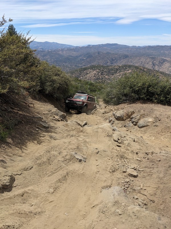
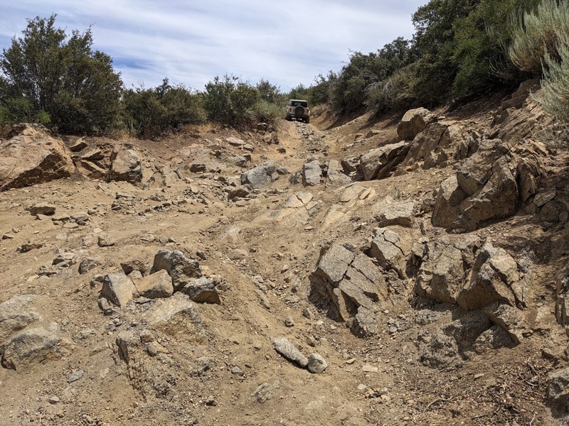
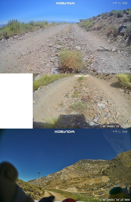
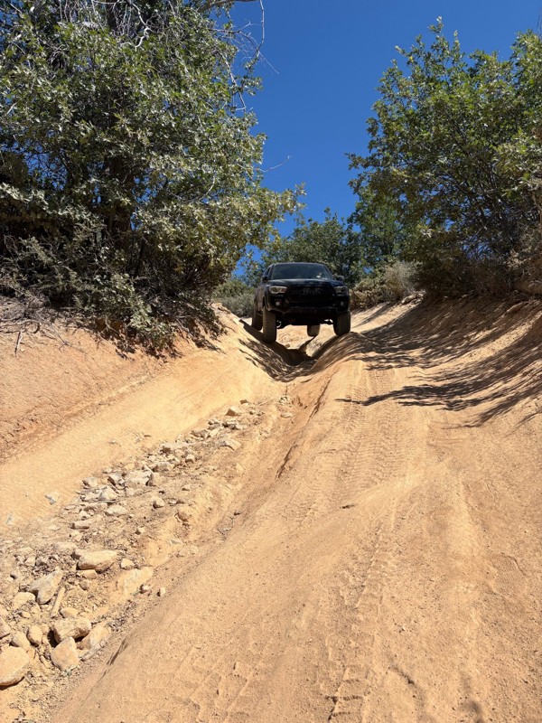
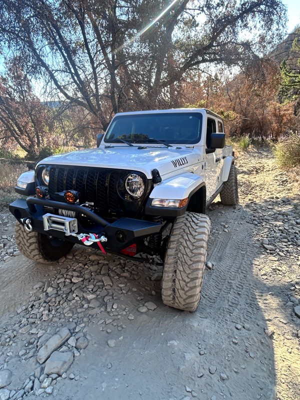
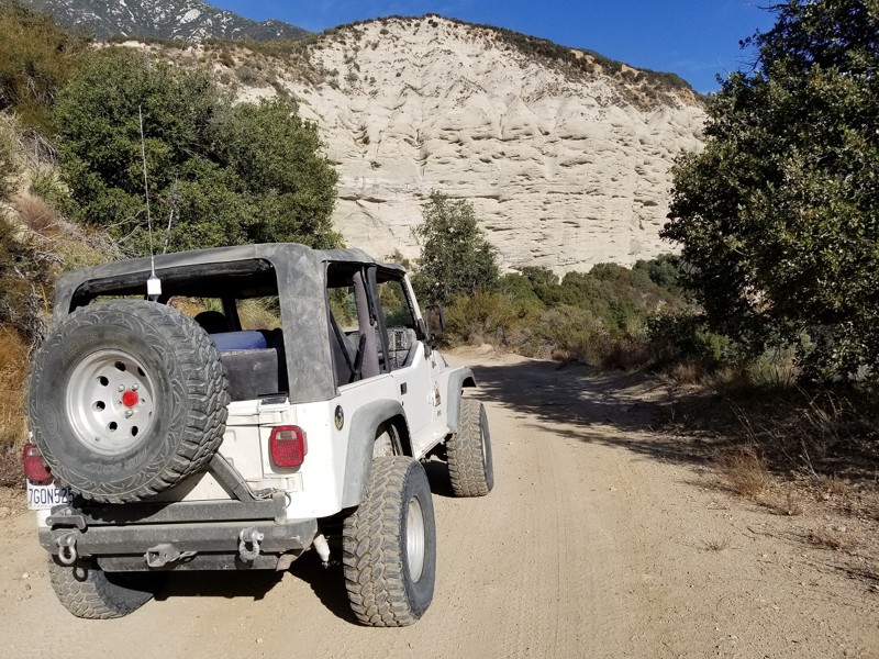
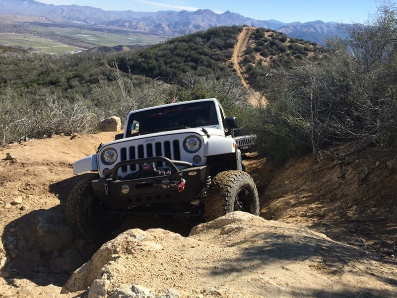
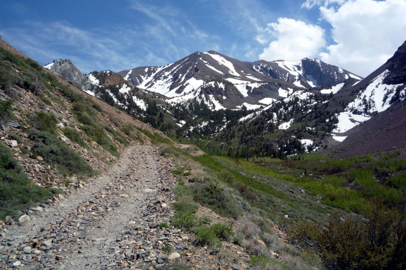
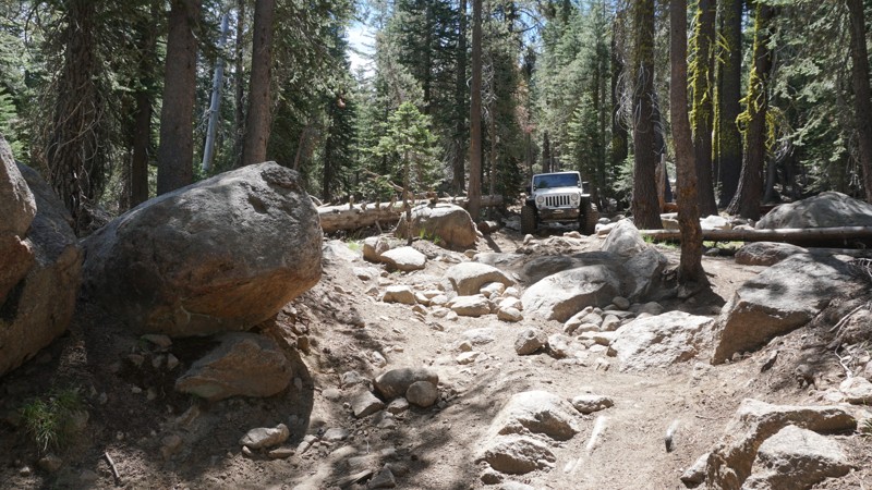
Miller Jeep Trail
Frazier Park, California
The Miller Jeep Trail is a true legend in the Southern California off-road community and one of the original hard trails that helped define California rock crawling. Located near Lockwood Creek and climbing toward Alamo Mountain, this iconic 4x4 trail continues to draw large groups of Jeep, Toyota, Bronco, and overland enthusiasts looking for everything from a challenging day run to a full weekend adventure.
Known for its steep rocky climbs, off-camber sections, 2 to 3-foot ledges, and technical waterfall obstacles, Miller Jeep Trail delivers the perfect blend of overlanding and hardcore rock crawling. Drivers can expect sustained climbs over 25 degrees, loose boulder fields, shelf roads, and narrow mountain passes with breathtaking views of the Los Padres National Forest. This trail tests both driver skill and vehicle capability, making it one of the most respected and talked about off-road trails in Southern California.
Whether you’re running a built rock crawler on 37s or a stock high clearance 4x4 aired down and picking careful lines, Miller Jeep Trail offers an unforgettable off-road experience. From creek crossings on Lockwood Creek Trail to the rugged push up Alamo Mountain, this route is packed with adventure, history, and pure adrenaline.
Updated: 09/06/2024
2N10 - Mill Creek
Big Bear City, California
2N10 Mill Creek is in the 823,000-acre San Bernardino National Forest just south of Big Bear Lake and travels through some of the most beautiful parts of the Big Bear Mountains. Mill Creek has many spots to pull over and enjoy the peaceful solitude of this lush forest. The entire road length is enclosed by a conifer forest with tall Ponderosa Pine sheltering the way and accented by the unusual granite formations for which Big Bear is known. This well-marked road provides access to several other driving trails and numerous hiking and biking trails to explore.
Updated: 07/05/2024
Strawberry Pass / Strawberry 4WD Trail
Kyburz, California
Just south of Lake Tahoe and not far off Highway 50 in the Eldorado National Forest is Strawberry Pass, a scenic off-road trail climbing its way up and over Little Round Top Mountain. The trail overlooks Caples Lake and the Kirkwood Ski resort. This long 4WD trail is known for its high mountain views and some great dispersed camping locations. Strawberry Pass is a key part of a popular route connecting Deer Valley and the Rubicon Trail or Barrett Lake with minimal pavement.

Updated: 09/24/2024
Pleasant Canyon Loop Trail
Ballarat, California
For the overlander who truly wants to explore the best of Death Valley, the Pleasant Canyon Loop Trail offers a little bit of everything. Mines, cabins, steep mountain ascents and descents, epic views, rocks, cliffs, wood bridges, and more. The loop begins and ends in the Panamint Valley and explores Pleasant Canyon, Middle Park, and South Park. Some of the many sites to visit are Claire Camp, World Beater Mine Cabin, Cooper Mine, Mormon Gulch, Rita's Cabin, Roger's Pass, Chicken Rock (see photo), Chicken Bridge, and Briggs Cabin. Chicken Rock is a downward-tilting, narrow section of the trail which tips your vehicle precariously towards a 200' vertical drop. Once past this obstacle, you face the famous 3-ton limit wooden bridge before descending back into the Panamint Valley to complete the loop.

Updated: 01/27/2024
3N34 - Willow Creek Jeep Trail
Lake Arrowhead, California
A few miles north of the mountain lake community of Lake Arrowhead you will find Willow Creek Jeep Trail. This trail is amongst a network of OHV routes in the San Bernardino mountains in the San Bernardino National Forest. As you travel across this trail you begin to notice the forrest environment on the south slowly fade toward a hinting desert landscape on the north. This is most prominent as you pass 3W13 (waypoint 9) and turn to the north.
Along the trail you will make two creek crossings ; willow creek and little bear creek. Both crossings are over concrete-slab fords.
The east end of 3N34X (way point 27) offers the most fun of this trail for the adventurous offroader. This rutted, rocky hill was fun enough for us to run it up and down.
Updated: 04/10/2026
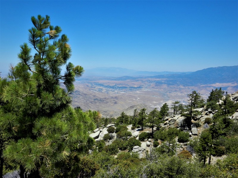
5S09 - San Jacinto Ridge
Idyllwild-Pine Cove, California
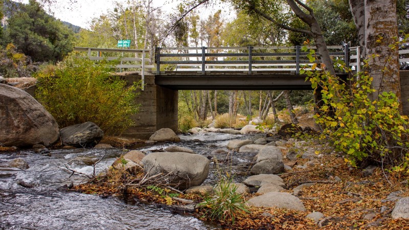
5S09 - San Jacinto Ridge is in the San Bernardino National Forest. It is a beautiful 10 mile forestry truck trail on the western slope of the San Jacinto Mountains near Idyllwild. The nearly 3000 foot elevation change provides a wide variety of flora and fauna to enjoy, from the desert scrub to the pine forests, the ground squirrels to the tree squirrels, deer and more! The North Fork of the San Jacinto River crosses this truck trail and is a perfect spot for a picnic. Only in Southern California can one go off-roading in the mountains and surf at the local beaches in the same day.

Updated: 03/18/2023
Knoxville Devilhead Road
Open
/
Lower Lake, California/
5.33 miles/
About 30 minutes
Knoxville Devilhead Road is the southern entrance into the Knoxville Recreation Area in Napa County, CA. If traveling in from Lake Berryessa, 30+ miles of the roughly paved, bumpy, narrow Berryessa Knoxville Road will make this soft dirt trailhead a welcome relief. This road offers access to other trails in the Knoxville recreation area including Hunting Creek Road, Cement Creek Road and Adams Ridge (currently closed for burn rehabilitation). The entire Knoxville Recreation Area spans from Napa County into Lake County, however this trail is contained within the Napa County borders. The network of trails in this area include scenic mountain views, lush forrest landscapes and multiple creek crossings.
Updated: 02/01/2024
3N49 BP&L
Fontana, California
3N49 BP&L is in the 823,000-acre San Bernardino National Forest north of Lytle Creek. Before it was a forest road, BP&L, or Burea of Power and Lights, provided access to the power line towers which still line the trail. The trail takes you through the Mormon Rocks, also called the Rock Candy Mountains, and offers stunning up-close views of nature's art. These striking sandstone formations are the remnants of ancient oceans heaved up at an angle over the millennia, revealing a beautiful sandstone landscape you can drive through. Also are stunning views to the east of the Cajon Mountains and below the Cajon Pass and Cajon Wash.
Updated: 10/11/2024
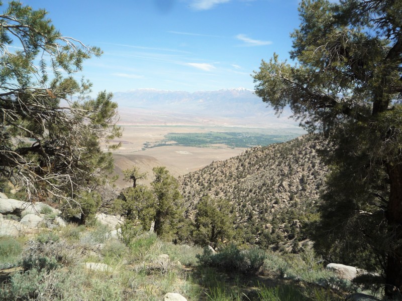
Coyote Valley Road
Bishop, California
From the high desert to the alpine zone of the Inyo National Forest, Coyote Valley Road - 7S10 is one of the most diverse trails you will find. The trail starts on a dirt road which makes its way up through a desert canyon. At the end of the canyon the road starts an ascent for the next six miles. Between the thick pinion pines some of the best views of Bishop and the Round Valley can be found as you climb. As the trail starts to level out, you find yourself at the start of Coyote Flats. Here you can find creeks and sporadic groves of aspens and pine trees. Additional trails, hiking, fishing and dispersed camping can all be found up here. Some trails go as high as 11,000 ft, so this is a great place to visit in the summer.
Updated: 05/21/2024
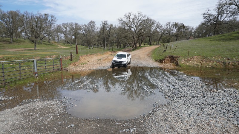
Latrobe Road
El Dorado Hills, California
Tucked away along the edge of El Dorado and Sacramento Counties, Latrobe Road offers a quick diversion from the pavement. Scenic views include sweeping vistas of the foothills combined with blue oak tree groves, a seasonal creek, and the potential to see various avian species such as hawks and falcons. Latrobe Road is a fun little road and makes for a great start or end to spending some time at the nearby Prairie City State Vehicular Recreation Area.

Updated: 05/23/2024
Odessa Canyon
Open
/
Barstow, California/
2.1 miles/
About 3 hours
Odessa Canyon is the flagship of offroad trails in the Calico area near Barstow, California. Comprised of many challenging obstacles with no bypasses, this extreme 4x4 jeep trail makes you earn your trip to the top. Odessa also provides great views of the area. But be ready. This trail has a 7-foot waterfall, an extremely narrow rollover spot you must see to believe, and a super tight off-camber canyon. With all these challenges, don't be surprised if the trail wreaks havoc on your vehicle.
Updated: 12/22/2023
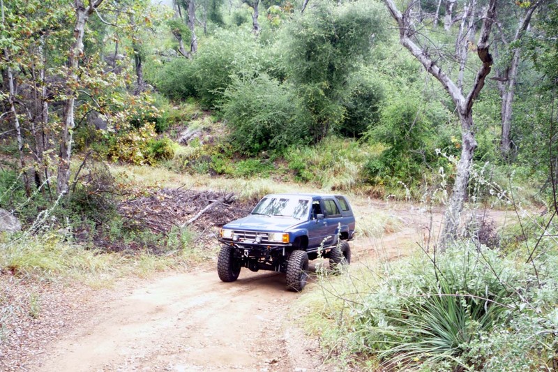
Lusardi Truck Trail
Ramona, California
Lusardi Truck Trail is a great in and out trail that packs a lot of different scenery in a short amount of time. It is an easy drive for most stock trucks and there are lots of places to pass. There are few obstacles to navigate since it appears that the forestry department keeps this trail clear and graded.
Updated: 07/12/2024
3N31Y - Upper Lytle Creek Divide
Fontana, California
3N31Y Upper Lytle Creek Divide lies entirely within the San Bernardino National Forest and straddles the Upper Lytle Creek Ridge, offering east and west views. Many locations along the way offer views of the foot-worn Pacific Crest Trail, which closely parallels the road and intersects at the road's highest elevation near Gobbler's Knob.
Upper Lytle Creek Divide offers a pleasant escape from the metropolis with views of the majestic San Gabrial Mountains to the west and the Cajon Pass to the east. There are beautiful vistas all along the way, dominated in the west by the 10,000' granite top of Mt San Antonio and the 9500 feet peak of Mt. Harwood, while below can be seen the jumbled boulders that make up Lytle Creek. To the east is an expansive view of Cajon Pass hosting Interstate 15, bolstered by the 5400' Cajon Mountain Range.
The road is well maintained, excellent for novice off-roaders looking to get their wheels dirty, and, with the views, a perfect road for all driving skill levels. Your dog can also enjoy the trail when kept on a leash.
Updated: 06/30/2024
Laurel Lakes Road
Mammoth Lakes, California
Laurel Lakes Road is a great scenic trail just outside the town of Mammoth Lakes in the Eastern High Sierras. The narrow five mile road has lots of places to turn out and pass. Starting at 7,300 feet and ending just over 10,000 feet, this trail has snow capped mountains, aspen groves, creeks and a back country lake. With so many sights in front of you, it easy to miss the great views from behind as you leave the valley floor.

Updated: 11/30/2025
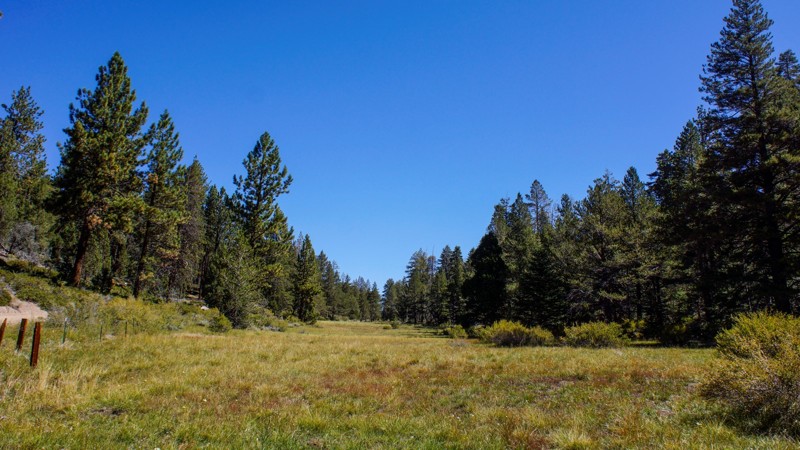
Monache Meadows
Kennedy Meadows, California
Easy for an experienced wheeler but, maybe, difficult for a first-time offroader, Monache Meadows is a beautiful outdoor playground high in the mountains of the Sequoia and Inyo National Forests. The wide-open meadows, sand dunes, multiple water crossings over the south fork of the Kern River, and remote outdoor camping locations make Monache Meadows, also known as Kennedy Meadows, a unique overland destination.
Updated: 07/08/2024
3N08 - Holcomb Creek Road
Big Bear Lake, California
3N08 is the perfect trail for the new and moderately experienced off-road enthusiast in the forest of Big Bear, CA. The trail provides plenty of dense forest scenery and some 4x4 challenges. The most notable obstacle on the trail is a rocky hill climb on the east end of the trail. This hill climb is a 40 degree climb with several moderate sized rocks and ledges. At roughly 30 feet long, the hill climb is just big enough to get the heart pumping and for you to second guess your line of attack.
Updated: 05/06/2026
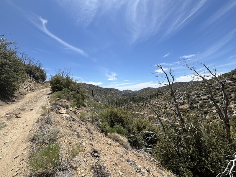
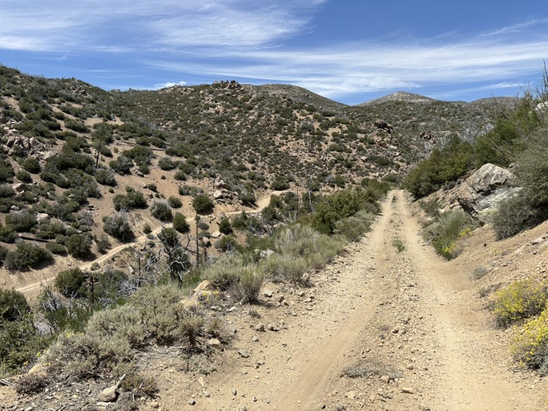
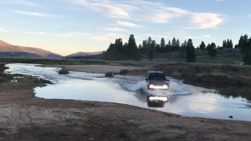
Lockwood Creek Trail
Lake of the Woods, California
Lockwood Creek Trail delivers a full day of classic Southern California mountain wheeling from the very first mile. The route launches you straight into the backcountry with a creek crossing, sustained climbs, and sweeping views of the Los Padres National Forest that only get better as you gain elevation. This is the kind of trail that feels adventurous from start to finish, combining steady technical driving with dramatic ridgeline exposure and wide open scenery. Making that perfect mix of challenge and scenery that makes a trail memorable.
Adding to the character of the trail is its unique history. Originally part of the historic Miller Jeep Trail, Lockwood Creek Trail was rerouted in the early 2000s. The original alignment once followed Lockwood Creek all the way to what is now marked as Miller Jeep Trail. Over time, trail signs were quietly updated, which still sparks friendly debates among off-roaders about which trail they are actually on. No matter what you call it, Lockwood Creek Trail offers an exciting, scenic, and rewarding mountain off-road experience.
Updated: 04/06/2024
Arroyo Seco Del Diablo
Julian, California
Arroyo Seco Del Diablo cuts right through the Carrizo Badlands. The walls of mud and rock change with every whisp of wind, raindrop, and earth shift, causing the canyon to change constantly. The trail is a unique and new experience every time you drive it. Combine this with Arroyo Tapiado or Diablo Drop Off for an entire weekend of overlanding in Anza-Borrego Desert State Park.
Updated: 06/01/2024
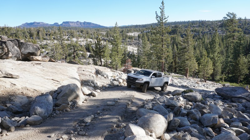
7N17 - Slick Rock Road
Open
/
Bear Valley, California/
5.95 miles/
About 3 hours
High in the Stanislaus National Forest near Bear Valley is one of California's great 4x4 rock crawling trails, Slick Rock Road.
Numerous camping opportunities, beautiful mountain views, two reservoirs, a lake, creeks and plenty of challenging rock obstacles make up Slick Rock Road and the surrounding area.
A re-route near the north end of the trail in 2018 has added to the challenge of this trail by introducing two new obstacles ( See Waypoints 25 and 26 ). With the addition of these obstacles, what was once a mildly challenging rock crawling trail is now a borderline extreme trail. While the southern section of this trail can still be enjoyed by most 4x4 vehicles, more experienced wheelers in built rigs will appreciate the new obstacles near the trails north end.

Updated: 03/31/2024
Font's Point
Borrego Springs, California
Nicknamed California's Grand Canyon, Font's Point is one of the most popular destinations in the Anza-Borrego Desert State Park. The Point has incredible views of the iconic Borrego Badlands, a 15 by 20-mile topographical wonder. Font's Point looks down into the maze of hills and arroyos that makes up the badland. At one time, the badlands were all under a sea. Sunsets at Font's Point are famous and a must-do for those spending time in Anza-Borrego.
Updated: 04/07/2024
2N40 - Cloudland Truck Trail
Crestline, California
2N40 Cloudland Truck Trail is on the south-facing slopes below the community of Crestline in the San Bernardino National Forest. It is an ideal trail for the new 4x4 off-road wheeler due to no obstacles and moderate length. The views of the Inland Empire are fantastic where you can see from the Banning Pass and Mount San Jacinto to the east and Orange and Los Angeles counties to the west including the Pacific Ocean. The real highlight of the trail is on Marshall Peak where the paragliders and hang gliders launch. When conditions are good they can fly for hours on the thermals and eventually land 3,000 feet below near the California State University at San Bernardino.

Updated: 06/17/2024
Hungry Valley SVRA - Pronghorn Trail
Temporary Closure
/
Santa Clarita, California/
5.17 miles/
About an hour
The Rock Wall Climb at Waypoint 2 makes Pronghorn Trail one of the harder and more popular trails in the Hungry Valley SVRA (State Vehicular Recreation Area).
Hungry Valley is just outside of the Gorman and Frazier Park mountain communities in Southern California. Over 130 miles of motorcycle, ATV and 4x4 trails spiderweb throughout this 19,000 acre park. The park's trails include hill climbs, sand washes, wide dirt trails, narrow off-camber shelf roads and a designated 4 wheel drive practice area.
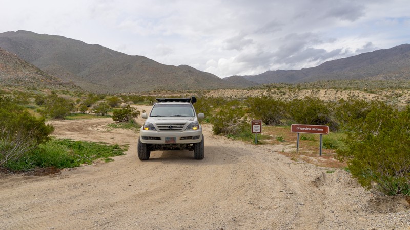
Updated: 12/17/2024
Grapevine Canyon Road
Ranchita, California
Grapevine Canyon was one of the historic routes into Borrego Valley before SR-78 was completed in the 1930's. Even before it was used as a horse and wagon trail by settlers and miners, Grapevine Canyon was home to the Kumeyaay Indians, and their artifacts can still be found in the area. Today, Grapevine Canyon provides a fun off-road trail either on its own or as a leg of an overland expedition through the desert Southwest. The trail also serves as a grand entrance route into Anza-Borrego Desert State Park, starting from S-22 outside Anza-Borrego and descending into the heart of the park near Tamarisk Grove Campground. A smattering of historic sites dot the trail, including Yaqui Well, a historic year-round seep that native peoples and desert travelers have used for centuries. The area around Yaqui Well is also known for attracting numerous and diverse bird species, making it an excellent spot for bird watching.
Updated: 06/22/2024
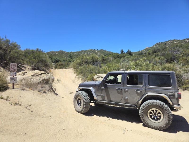
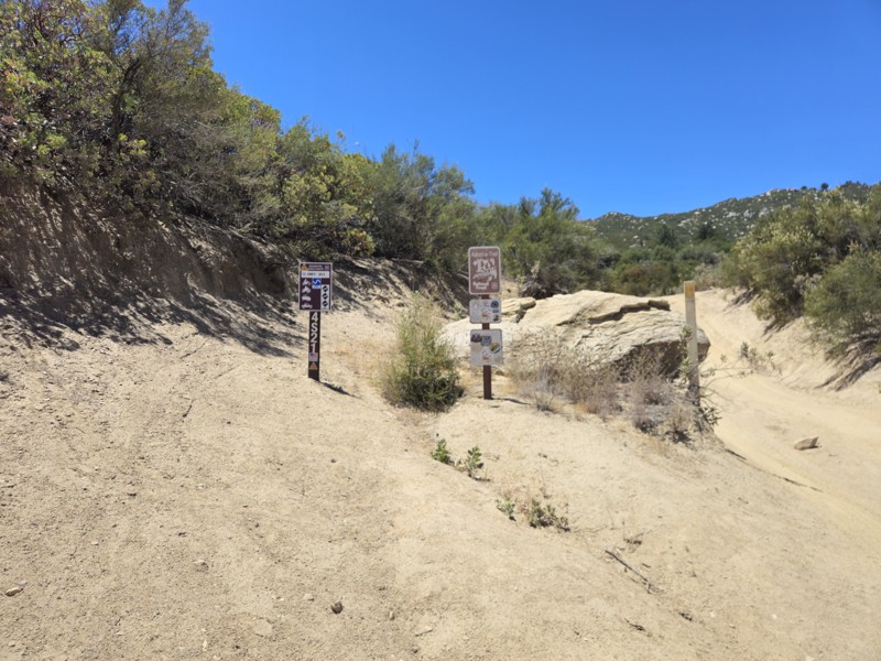
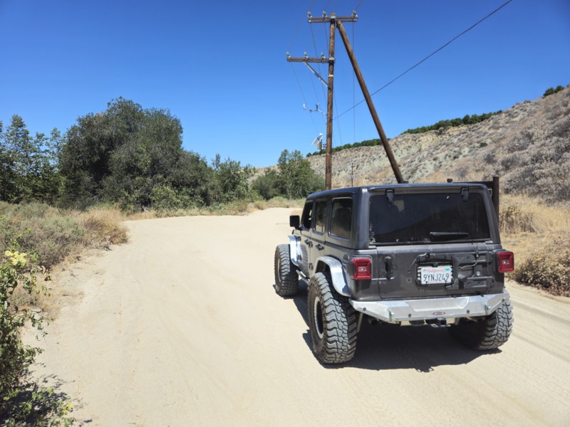
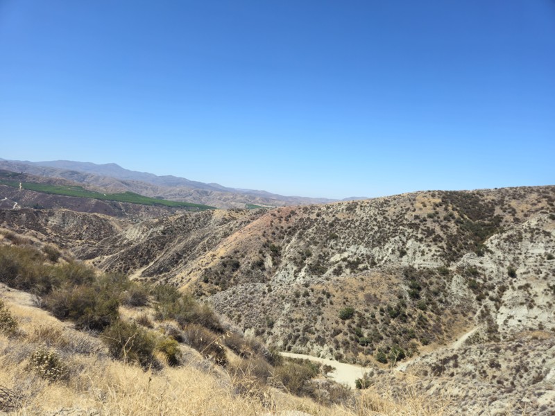
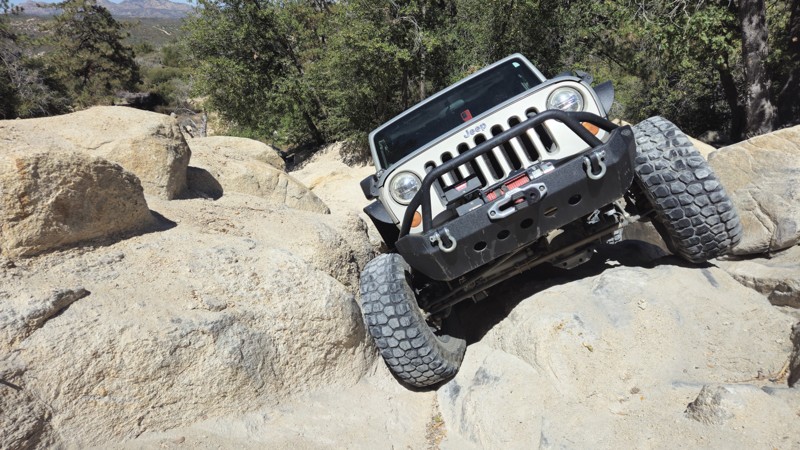
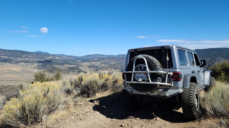
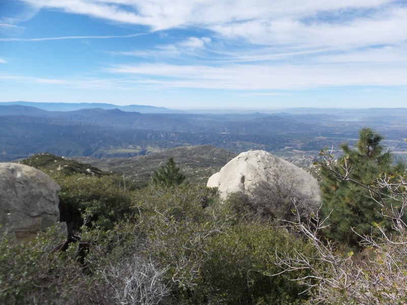
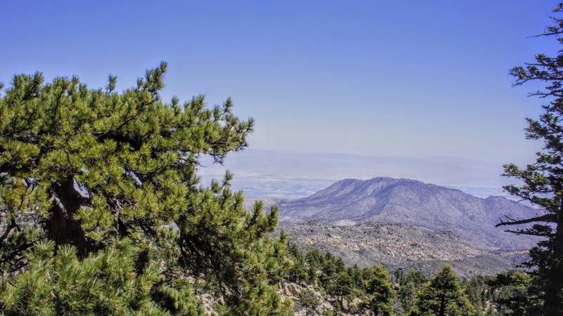
4S21 - Indian Mountain
Idyllwild-Pine Cove, California
I selected this highlight photo from an earlier trip to Indian Mountain. Never living out of southern California I'm only familiar with this dry, arid, scrub brush and boulder type of scenery. I find it very beautiful. Diamond Valley Lake is off in the distance on the right. Because Idyllwild is close to me I manage to get into these mountains frequently. The southern last mile of this trail is rated a "Black Diamond" by the USFS and not to be missed.
Updated: 06/21/2024
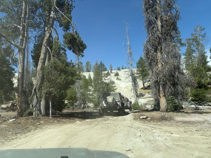
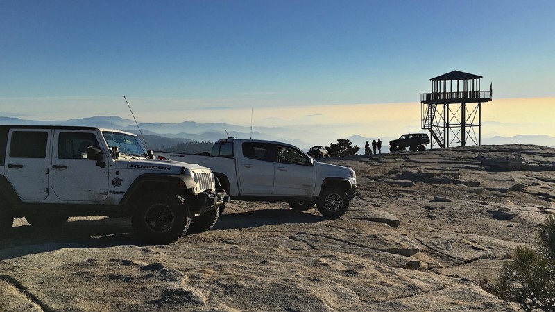
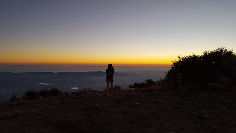
26E219 - Bald Mountain
Shaver Lake, California
This scenic 4x4 trail includes something for everyone with its numerous difficult lines that can be bypassed by those looking for an easier route.
At the peak of Bald Mountain and Hollywood Hill, you will find panoramic views of the surrounding mountains, Shaver Lake and the San Joaquin Valley. If the daytime views aren't enough for you, head to the tower at sunset and watch the sun fade into the night time lights of Fresno below.
26E219 - Bald Mountain is only one of many off-road trails in the Bald Mountain OHV area which sits just east of Shaver Lake in the Sierra National Forest.
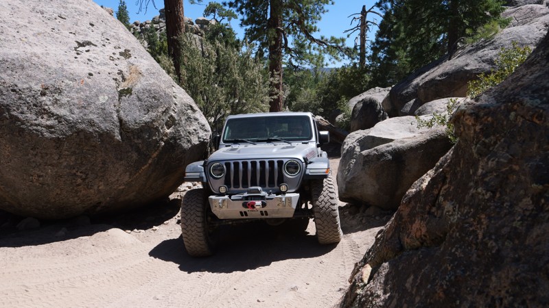
Updated: 07/21/2025
The Squeeze
Minnelusa, California
Tucked deep in the pine-covered hills of Holcomb Valley, The Squeeze Trail or 3N07A is a short but thrilling offroad adventure that combines rugged terrain, alpine beauty, and heart-pounding excitement. Twisting and winding beneath the jagged granite spires of the Big Bear Pinnacles, this route offers more than just a drive. It delivers a front-row seat to some of the most striking geology in the San Bernardino Mountains. These towering rock formations pierce the skyline, making the area a favorite for climbers and photographers chasing golden-hour light. The sense of wilderness here is real and raw, with sweeping views, thick tree cover, and a feeling of remoteness that adds to the adventure.
But the real showstopper is the trail’s namesake obstacle at Coyote Crag. Known simply as The Squeeze, this narrow rock corridor tests both your driving skills and your nerve. Threading your rig between two massive boulders with barely enough room to spare will get your pulse racing. One wrong move and you’re adding new trail scars to your rig. Fold in your mirrors, trust your spotter, and take a deep breath. This is the moment that makes the trail unforgettable.
Updated: 07/10/2024
3N03 - Smarts Ranch
Big Bear City, California
Smarts Ranch Road travels through an interesting mix of Pine and Joshua trees, providing several locations along the way for camping, hanging a hammock, or just pulling over into a clearing and enjoying the quiet forest solitude. The last three miles at the southeastern end of the trail provide a driving challenge over rough, exposed rock outcroppings for those wanting to test their offroad driving skills.

Updated: 11/19/2024
Cougar Buttes
Lucerne Valley, California
Cougar Buttes is one of the great off-road areas of Southern California that has yet to be discovered by the main stream off-road community. Just minutes from Big Bear and Johnson Valley, this small area is easy to miss with its few rock pile hills, it almost looks like it could be someone's backyard. But don't let this fool you, Cougar Buttes has everything Johnson Valley has but in a much smaller and more accessible area. Everything from high speed sandy roads to some of the most extreme rock crawling and Jeeping in all of the United States. Whether you are into rock crawling, some 4x4'ing, pre-running dirt roads, overlanding, or simply just want to take a short vacation. Cougar Buttes should be your place on your next trip.
Updated: 06/07/2024
2N93 Wildhorse Meadow
Big Bear City, California
2N93 Wildhorse Meadow is in the beautiful San Bernardino National Forest, southeast of Big Bear Lake. This trail has designated camping, with two yellow post sites on 2N93F Wildhorse. Also on this trail is a designated shooting site at 2N93G Lightning Gulch. It's obvious where Wildhorse Meadow gets its name when you drive between Waypoints 7 and 10. The meadow is lush green, bordered by pine, oak, cedar, and elm. Bring your family, picnic lunch, and camera for a day of 4WD offroad fun.
Updated: 06/19/2024
7S02 Santa Rosa
Anza, California
7S02 Santa Rosa Truck Trail is in the San Bernardino National Forest. This trail has just about everything for the avid 4-wheeler. The scenery, campsites, running springs, geocaching, wildlife. Something for everyone. Come wheel with a friend for safety and enjoy the day with a picnic or pack your gear and stay in one of the many Yellow Post sites for 14 days with up to 8 people and 2 vehicles.
Updated: 03/09/2026
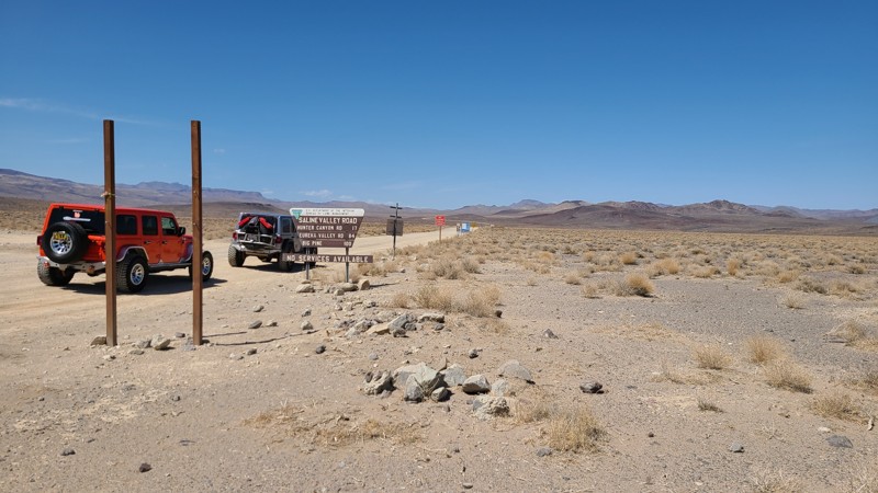
Saline Valley Road
Monola, California
This is the only trail that runs north to south on the northern side of Death Valley. This is also the easiest way into the Saline Valley. The trail has amazing views of the mountains towering over the salt flats. The area is a very remote desert with no resources. Never travel alone. Dispersed camping is abundant along Saline Valley. For warmer days, check out Boxcar Cabin on the southern side up in the mountains. With cooler weather, plenty of camping is available in the Saline Valley, the center area of this trail. All camping is dispersed and remote. Prepare accordingly.
Updated: 11/25/2023
Hapaha Flat Road
Ocotillo, California
Hapaha Flats in Anza-Borrego Desert State Park is a real treat. Rarely traveled due to its location within the park, the trail has that "away from it all" solitude. The four-wheel drive road rolls through the desert surrounded by Ocotillo, Desert Willow, and Agave in the land once home to the Kumeyaay, also known as the Tipai-lpai, a Native American tribe. They hunted and gathered in the area in the spring and winter months. The pictographs and morteros in the area tell their story of how they were one with the land. Plan for a full day of adventure for this one, as you must drive Fish Creek out and back or take Pinyon Mountain Road.

Updated: 10/15/2024
2N17X - Pilot Fuelbreak aka The Old Pilot Rock Trail
Apple Valley, California
On the north side of Canyon Pass near Apple Valley, California is a fun and exciting trail that can challenge even the most experienced of drivers. 2N17X Pilot Fuelbreak, or the old Pilot Rock Trail, is a short but extreme off-road trail that winds up the hills near Lake Arrowhead and Silverwood Lake. Full of steep hills and amazing views, there is no wonder why Southern Californians come from far to wheel this epic offroad trail. But don't be worried if you are not in some built rock buggy, the trail is perfect even for people in stock vehicles. That is because it has bypasses around the very hard lines, but still, some fun stuff for the more stock vehicles to struggle on. So jump in your 4x4, and check out this ultimate Jeep trail in SoCal.
Updated: 07/18/2024
Deer Valley
Bear Valley, California
High in the Stanislaus and Eldorado National Forest, between Lake Alpine and Blue Lakes, is one of northern California's great mountain season 4x4 trails, Deer Valley. Continuous rock crawling, numerous camping opportunities, beautiful mountain views, dense forest, two creek crossings, and a high mountain meadow make up the Deer Valley Four Wheel Drive Trail. Starting at the Hermit Valley Campground, Deer Valley travels through a narrow section of forest surrounded by the Mokelumne Wilderness before reaching Lower Blue Lake at the north end.
This rough, rocky trail is best enjoyed by more experienced wheelers in modified rigs traveling south to north, but stock 4x4s looking for a challenge can give this trail a try from the north entrance.
Updated: 05/31/2024
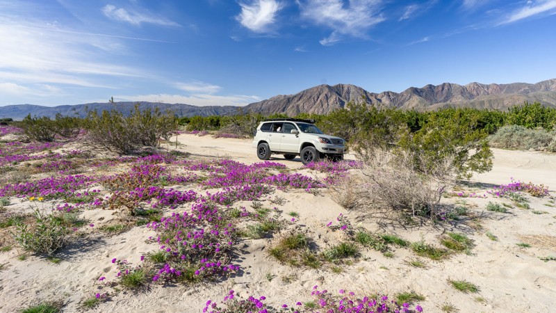
Coyote Canyon Road
Borrego Springs, California
Coyote Canyon Road is a popular trail on the west side of Anza Borrego, known for its year-round water crossings. This oasis-like area of the desert is fun to travel through, especially in the spring during the desert flower blooms. The area directly around the trailhead is marked on State Park maps as a popular flower field with bright purple coloring the landscape. Be mindful of heavy foot traffic as visitors come to see the blooms, and respect management rules. During his overland exploration, Captain Juan Bautista De Anza named Coyote Canyon, where he camped in this area on March 14, 1774. In 1775, Anza led a colonizing expedition of 240 people and over 800 head of livestock from Tubac, Arizona, to modern-day San Francisco, California. Coyote Canyon Road closes at Waypoint 9 from June 1 to September 30 to preserve the watering opportunities for the Desert Bighorn Sheep.
Updated: 07/08/2024
Main Divide - Middle Section to Saddleback - 3S04
Orange, California
The keyhole to the highest point in Orange County, Main Divide Trail is known for its close proximity to Central Orange County and amazing views. The trail skirts along the side of the mountains, reaching both peaks of the famous Saddleback Mountain that separates Orange County and Riverside County. While heading up to Modjeska Peak, the trail is mostly rocky while the second half going up to Santiago Peak is mostly dirt. Santiago Peak reaches a staggering 5,689 feet above sea level, allowing for cooler weather during the summer and snow in the winter. But the nice weather and the fact that it is only minutes from the metropolitan area of Orange County is not what brings people to this area, it is the great views, the remote location, and the great off-road experience it provides.
Updated: 07/12/2024
2N58 Middle Fork Lytle Creek
Fontana, California
2N58 Middle Fork Lytle Creek is a forest road in the San Bernardino National Forest within the 200,000-acre Front Country Ranger District. The route follows alongside Middle Fork Lytle Creek for 2.8 miles through a narrow canyon formed by steep ridges rising 1500 feet on either side. At the road's end is the trailhead for 6W01 Middle Creek Trail, a 3-mile hiking trail reaching deep within the Cucamonga wilderness and connecting with a nexus of other trails spreading throughout the wilderness. Along the drive are several opportunities to pull over for short hikes to explore the actively flowing creek below. The steep ridges provide a beautiful backdrop for the drive, especially when snow-covered. Throughout the park, pets are allowed if kept on a leash.
Updated: 07/07/2024
3N06 Stockton Flats
Fontana, California
Stockton Flats is a short drive from the densely populated Inland Empire and takes you deep within the 200,000-acre Front Country Ranger District of the San Bernardino National Forest. The trail lies at the eastern-most extension of the San Gabriel Mountains. The trail offers a chance to leave civilization behind and see what this rugged country looked like 100 years ago. Only a few weeks of the year does snow stay around, bringing a quiet to the forest that is only interrupted by the occasional sagging tree branch dropping snow. Pets are welcome but must be kept on a leash.
Updated: 10/24/2023
Barrett Lake Jeep Trail
Kyburz, California
Lakes, swimming, camping, fishing, hiking, and of course, rocks, tight squeezes between trees, and long hillside climbs will keep seasoned wheelers in lifted rigs entertained throughout Barrett Lake Jeep Trail. The Barrett Lake Jeep Trail, topped only by the legendary Rubicon and Fordyce Creek is one of northern California's best rock-crawling trails. In the Eldorado National Forest, Barrett Lake includes continuous challenging rock obstacles, scenic mountain views, swimming, fishing, lakeside camping, and even hiking to a past aircraft crash site north of the trail's end.
If the three lakes on the way in and at the end of the trail aren't enough, continue on foot into the Desolation Wilderness north of Barrett Lake to Lost Lake, Lawrence Lake, Top Lake, Lake Number Three, and, many many more.
This is a true five-star rock crawling trail!
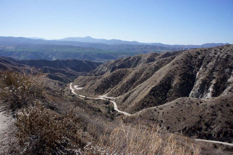
Updated: 09/22/2023
5S07 - Bee Canyon
Hemet, California
10 miles east of Hemet, Bee Canyon is in the San Bernardino National Forest and one of two access points off Hwy 74 for the many trails of the western Idyllwild area. This area is great for the local target shooters with the many side canyons. To the 4 wheelers, the short 3-mile drive connects you to East Indian Creek and San Jacinto Ridge truck trails. These connector trails will take you to Hwy 243 and Idyllwild.
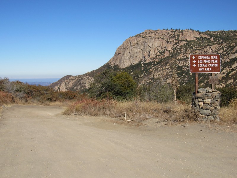
Updated: 06/08/2024
4E03 - Espinosa Trail
Pine Valley, California
Espinosa Trail is a short, fun connector trail that forms an 18-mile loop in Cleveland National Forest. The trail travels along Espinosa Creek in the southern end of the Cleveland National Forest and is bordered by private land, Pine Creek Wilderness to the north and west, and Hauser Wilderness to the south. The trail runs between Los Pinos Road and Corte Madera Road and offers magnificent views of San Diego's own version of Half Dome, the immense Corte Madera Mountain at just over 4,600' of elevation. Corte Madera, Spanish for "to chop the wood," was a heavily logged area in the 18th century, providing much of the timber for the southern California missions. Approximately 4 miles south of the Espinosa Trailhead is Corral Canyon OHV Area, which offers up to 50 miles of OHV trails ranging from easy to very difficult. Along with this road, the 18-mile loop consists of the following additional roads and trails: 16S17 - Los Pinos Road 17S04 - Corral Canyon Road 4E03 - Corte Madera Road 17S06 - Skye Valley Road
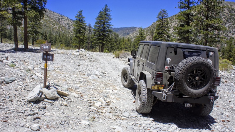
Updated: 11/20/2024
3N06B Paiute Spur
Lytle Creek, California
3N06B Paiute Spur is a beautiful trail in the north fork of Lytle Creek which is in the San Bernardino National Forest. This trail, along with others nearby, is a camper's paradise with three designated Yellow Post sites, besides the unlimited dispersed camping sites available. You may see Deer, Big Horn Sheep, Mountain Lion, and the rest of the forest creatures that call these canyons home, so respect them. Come to Lytle Creek for a day run and picnic, or include your camping gear for a week or two.

Updated: 03/20/2024
Doran Canyon
Barstow, California
Doran Canyon of the Odessa / Doran Loop of the Mojave Desert is one of the most difficult off-road rock crawling trails near Barstow, California next to the Calico Ghost Town. When traveling this area, you will notice that the mostly desert landscape is very different than its counterpart Odessa Canyon. Even though these two off-road trails are near the same in difficulty throughout the main body of the trail. Doran has one big difference when it comes to the trail drive, that is "Doran Gatekeeper". Doran's Gatekeeper is an insanely difficult off-road obstacle with rocks larger than your vehicle. The holes between the rocks are so large that it is common for people to put their vehicle on its side between the rocks. It's a spectacle to watch extreme off-road enthusiasts try this legendary obstacle as the rocks look like they are swallowing the vehicle whole. It is common for a Jeep Wrangler or Toyota to disappear in the gap only to receive massive body damage when trying to recover the vehicle out of the holes. But the rest of the trail is no walk in the park, with several large waterfalls and many off-camber tight areas, Doran Canyon will test your driving skills and vehicle to its limits.
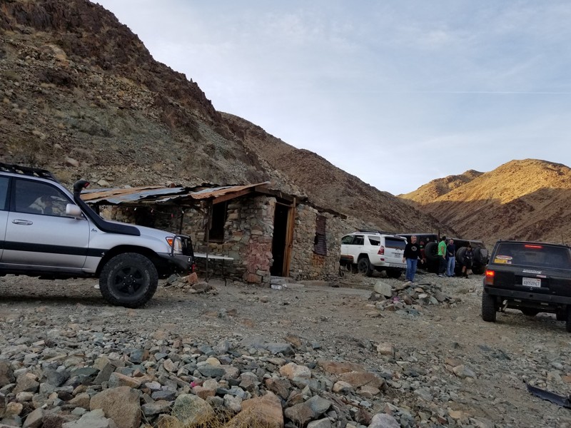
Updated: 06/02/2024
Brooklyn Mine - Joshua Tree
Joshua Tree, California
On the outskirts of the Joshua Tree National Park, near Twentynine Palms California, is a unique and exciting off-road trail that has exceptional features that are hard to find in the Southern California deserts. The Brooklyn Mine Trail starts off as a simple 2wd trail in the Joshua Tree National Park and heads to the north where it leaves the park entering BLM land. The trail turns from an easy dirt road to a thrilling intermediate rock crawling 4x4 trail which is ideal for all ranges of off-road enthusiast including beginners and advanced. Once in the BLM land, you will be immersed in an old mining community with surprisingly large amount of the old equipment still laying around for you to see and touch. But the old equipment isn't the only thing left behind, many of the old structures from the mining camp are still standing making these locations not only an amazing historical adventure but an overlanders paradise. That is because the trail has many remote locations perfect for dispersed camping that are unique and exclusive. So pack up your Jeep, get that rooftop tent on your Toyota, and prepare for an offroad adventure of a lifetime. That is because, the Brooklyn Mine Trail whether your first destination or you are out exploring the area after a Berdoo Canyon trip, just might be one of the best-kept secrets of Joshua Tree National Park.
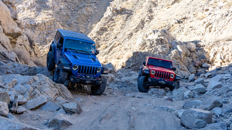
Updated: 03/21/2025
Last Chance Canyon
Inyokern, California
Located in the rugged El Paso Mountains within Red Rock Canyon State Park, Last Chance Canyon is a premier offroad destination known for its steep canyon walls, technical rock obstacles, and rich history. Just a few hours from Los Angeles, this challenging trail is a favorite among rock crawlers and adventure seekers looking to test their skills on its demanding terrain.
Beyond its offroading appeal, Last Chance Canyon is steeped in history. The surrounding region was once a hotspot for gold prospectors and miners, with remnants of the Dutch Cleanser Mine and the legendary Bonanza area still standing as a testament to California’s mining past. Notable pioneers like Walter Bickel and William “Burro” Schmidt left a lasting impact on the area, with Burro Schmidt’s famous tunnel still attracting curious explorers today.
Whether you're drawn by the thrill of the drive—including the infamous V-Notch obstacle—or the allure of the Old West, Last Chance Canyon offers an unforgettable journey through time and terrain. If you're looking for an epic offroad adventure near Los Angeles, this historic and scenic trail is your chance to experience the wild spirit of the California desert.
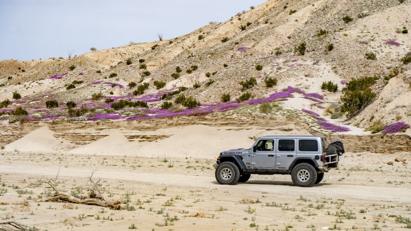
Updated: 01/13/2024
Vallecito Creek Road
Julian, California
Man has traveled this road for thousands of years, making it an ancient offroad trail in Anza-Borrego Desert State Park. Vallecito Creek Road was part of the Southern Overland Trail. Today it provides an immersive offroad experience of the lower desert along the southern edge of the Carizzo Badlands. Seasonally the area can be Hades or can be Heaven. The heavenly part is that the air is filled with aromatic Desert Sand Verbena and Desert Gold paired with the dry, easy-to-breathe desert air. Wherever you look, the foreground is filled with a chaotic yet sensible composite of vibrant colors against a backdrop of dystopian badlands, all of which are everlastingly watched over by the imposing Vallecito Mountains. The road is a destination and connects to several other routes, making it the perfect pairing for your Anza-Borrego overland trip!

Updated: 04/10/2026
Goler Wash / Canyon
Furnace Creek, California
Goler Wash, also known as Goler Canyon, is an enjoyable off-road cut through over the Panamint Mountain Range from Ballarat near Trona to Death Valley National Park in California. The trial is popular for being the home of Barker Ranch, aka Manson Ranch. In 1969 the FBI raided the ranch when they found out the Manson Family was living there. But don't think this is an easy 4x4 pass through. The trail is known to get washed out making it a go-to place for a mild offroad trail to wild overland adventures. Along the route expect beautiful scenery of the canyons that seem to tower above you while the old mines placed up on the side of the cliffs seem to have no way for people to ever access them. If the trail is washed out, expect an intermediate waterfall that is slick with running water on over it. Today, the park service spends a lot of time maintaining this trail, trying to keep the trail easily passable for even a 2wd. To spice things up, make this into a weekend overland adventure including off-roading Warm Springs Road, Butte Valley, Mengel Pass, and Goler Wash. This just might be the best 4wd Jeep Trails you have or will ever take and the dispersed camping is top notch.
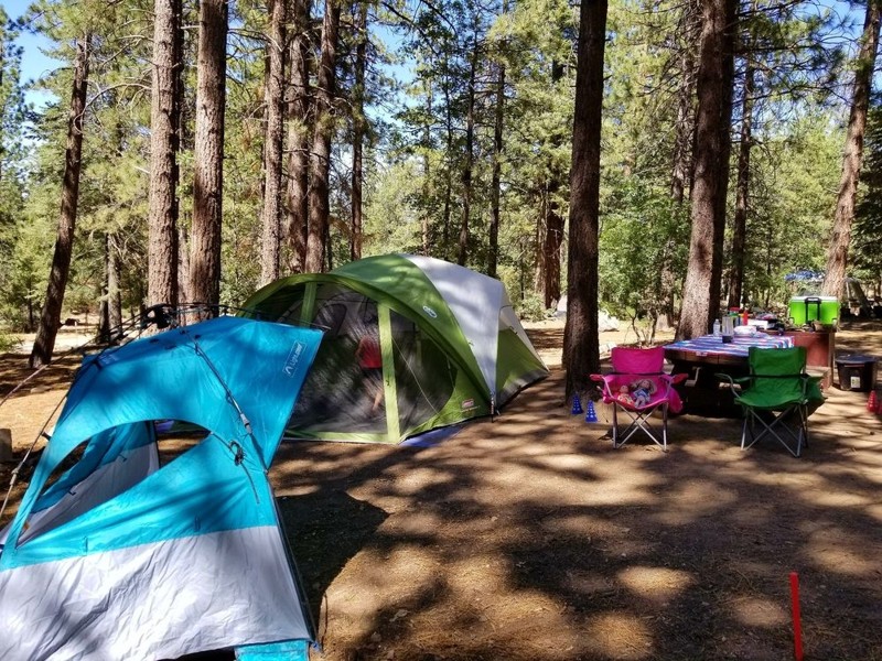
Updated: 11/18/2023
2N08 - Knickerbocker
Big Bear Lake, California
2N08 - Knickerbocker, south of Big Bear Lake, is one of many Forestry Trails in the San Bernardino National Forest. The trailhead is literally in walking distance from the Village in Big Bear. This trail is easy, as are all of the trails on the south side of the lake. The views to the north, including Big Bear Lake, Holcomb Valley, and Gold Mountain, are spectacular. The trail ends on 2N10 - Skyline, where you can go left or right to discover more trails. The trail is absolutely beautiful after the first snowfall, but don't delay, the Forest Service closes the trail as conditions warrant. The entire Big Bear Trail System includes many hiking and biking trails and they are well marked.
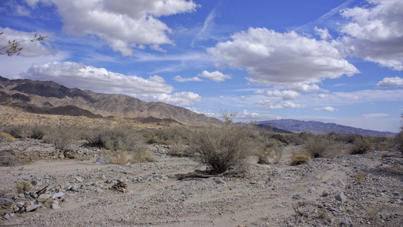
Updated: 05/25/2024
Pinkham Canyon
Desert Center, California
To some, Joshua Tree National Park is only a desert. It is actually two deserts, the higher elevation Mojave and the lower elevation Colorado. The result is amazing desert flora, rock formations and those wacky namesake trees (actually a type of yucca). Joshua Tree’s beauty shines around the clock, with vibrant sunsets melting into nights filled with uncountable stars. Joshua Tree National Park encompasses almost 800,000 acres, larger than Rhode Island. The Park offers hiking, photography, horseback riding, rock climbing, and camping, to name a few activities. Most 4x4 off-roaders love the Park for its trails. Almost all of the trails have a Gold or Silver Mine associated with them. Pinkham Canyons attraction is the Snow Cloud Mine, watch for Waypoint 4 for the trailhead to the north. So enjoy, and explore with safety.

Updated: 09/24/2024
Mengel Pass
Ballarat, California
Mengel Pass is a popular trail within Death Valley National Park as it connects Panamint Valley on the west end of Death Valley to beautiful Butte Valley on the east side. Along the trail are an overlook of Butte Valley and Striped Butte plus the gravesite of Carl Mengel, a historic prospector from the early 20th century. The trail is no easy feat with its constant changing terrain and difficulty. Some days the trail is a mild path while other days, it can damage any vehicle that attempts the crossing. Due to the changing landscape of the obstacles, Mengel Pass is a fun and challenging run for all comers!
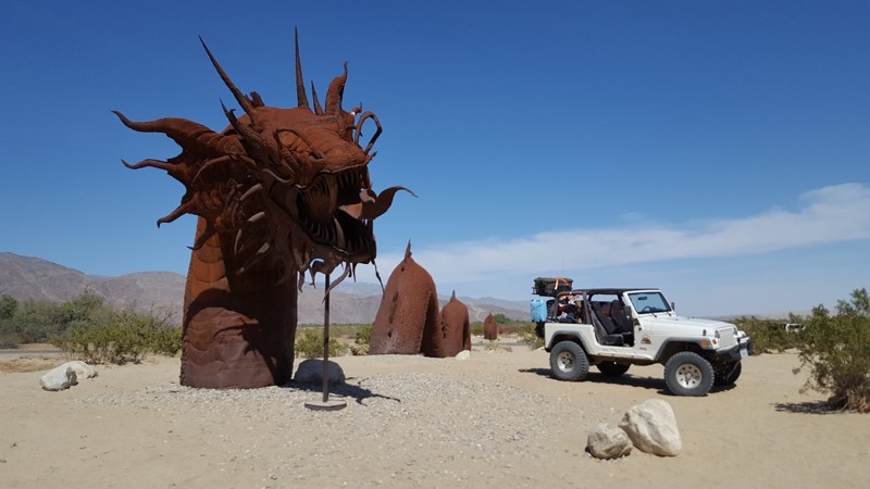
Updated: 02/24/2024
Anza Borrego Metal Sculptures
Borrego Springs, California
Perhaps one of the most unique and talked about features of Anza Borrego isn't the natural beauty but rather the man-made art. In the low desert, a small city named Borrego Springs features some of the most amazing sculptures in North America. Comprised of steel, these sculptures of modern animals, prehistoric dinosaurs, and mythical creatures lace the desert like hidden gems to be found.
These sculptures are an amazing mix of craftsmanship, design, and location. The desert background almost makes them look like they are walking next to you.
Thus when in the area, explore the desert and let us know what you find. And by all means, please tell us which one is your favorite. Is it the Jeep, Sea Serpent, Phoenix, T-Rex, or something different? There are over a 130 different sculptures in the desert. We can't wait to hear from you soon and see your photos.
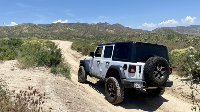
Updated: 06/04/2026
Del Sur Ridge
Las Cantilles, California
Del Sur Ridge, located in the Angeles National Forest near Santa Clarita is rough dirt and gravel with several washed-out areas. The main trail is fairly easy and can be done in 2WD. High clearance is recommended on account of the washed-out sections, which often change drastically after rains.
There are several moderately challenging optional offshoots that require 4WD. The offshoots all lead back to the main trail, which makes this a good trail for both beginner and intermediate skill levels that might be traveling together. With a max elevation of 3,600 feet, it’s worth using the frequent turnouts to admire the views of the surrounding hills and valleys.
While you can run Del Sur Ridge out and back, most people use 6N19 as a loop back to Bouquet Canyon, the main road. Del Sur Ridge ends at a locked gate. The trail's end does have nice views of Bouquet Reservoir.
There is no camping on the trail.
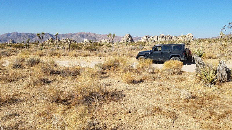
Updated: 05/26/2024
Geology Tour Road
Twentynine Palms, California
Geology Tour Road is located entirely within the Joshua Tree National Park and passes some of the most fascinating scenery that the Park has to offer. The Park Service created a genuinely unique self-driving tour by identifying 16 geologic and manmade features for educational purposes, all of which are pointed out along this backcountry route. These features truly are educating and interesting that include fascinating rock formations, volcanic cinder cones to, abandoned gold mines, and other natural points of interest with unique names such as "Nature's Gutter." This is an excellent trail for a family adventure.
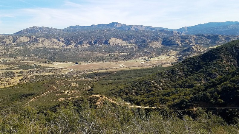
Updated: 09/21/2023
8S05 - Highpoint
Temecula, California
8S05 - Highpoint is in the Cleveland National Forest. It is an ideal 4x4 off-road trail for the newbie wheeler to gain access to the west end of Palomar Divide Trail up at the top of the ridge. The views to the south, of the Aguanga Valley and beyond are spectacular. The Cutca Hiking Trailhead goes off to the west from this trail into the Agua Tibia Wilderness for some fantastic scenery and dispersed camping. You can encounter every forest animal except bear so be watchful and respectful.
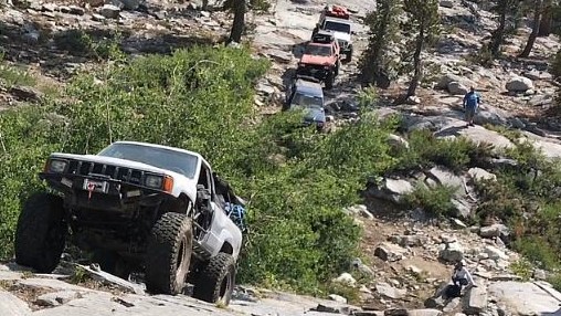
Updated: 11/24/2022
Swamp Lake
Shaver Lake, California
With the trailhead starting at just under 7400 feet, the Swamp Lake Trail has some of the best scenery the Sierra National Forest has to offer. From gravel, dirt, silt, boulders, granite faces, steep climbs and descents, this trail will throw everything at you within the first couple of miles. In the middle of the trail is Swamp Lake. This large, clear lake offers camping and fishing at its finest. Even during holiday weekends, the remote location ensures that the number of campers is minimal. If you are looking for some challenging off-roading and some quiet down time, Swamp Lake should be at the top of your To-Do-List. This could possibly be the most fun trail you ever do.
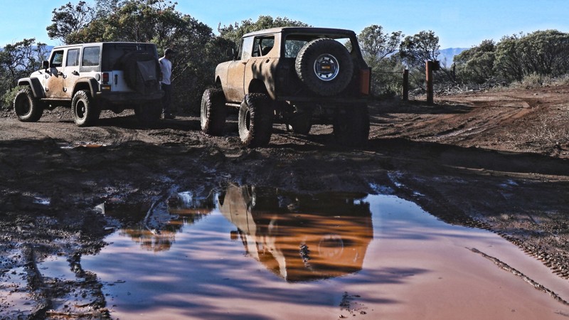
Updated: 03/18/2023
Knoxville - Cement Creek Road
Lower Lake, California
Cement Creek Road is one of many 4x4 trails in the Knoxville Recreation Area just outside of Napa, CA. Mountains, valleys, creeks and mud are a few things you might enjoy in this area. You will find some incredible views of the rolling hills and green farmland in the Pope Valley and surrounding mountain ranges. From the right spot (waypoint 4), you will even see Mount Saint Helena in the distant north end of the Napa Valley.
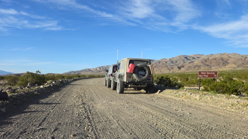
Updated: 03/09/2026
Death Valley Road
Old Camp, California
Death Valley Road takes you from Big Pine to close to Furrance Creek Death Valley. This is a common path for people to travel while exploring Death Valley, as this takes you out of the park's exit from the northwest side. People often use this road to access Saline Valley, Steel Pass, and other popular areas on the park's north side. While few people choose to camp along this road, there are several areas big enough for a small group. Check out the mine near the northern turn on the east side for larger groups. It's important to note that camping is not allowed for the first 22 miles along the eastern end.

Updated: 09/24/2024
West Side Road - Death Valley National Park
Furnace Creek, California
Don't be fooled by the easy 4x4 trail rating, this Death Valley National Park backcountry route has a history of being deadly for the unprepared. Almost every year some unfortunate gets stuck, breaks down, and in some cases just wander off and perish along this road. This 37-mile backcountry route runs below sea level for its entire length. It was the original route of the 20 Mule Team Borax wagons out of Death Valley and offers the only access to the east side of the Panamint Mountains south of Furnace Creek. Along the route, mining was active at the Queen of Sheba mine as recently as 1970, Hungry Bill had a small farm and mining operation in Johnson Canyon that he supplied miners with fresh vegetables. The infamous Charles Manson and his followers were captured at Barker Ranch which is on the west side of the Panamint Mountains and accessible from the Butte Valley Road that intersects West Side Road. Death Valley Shorty, a former Buffalo Bill Wild West Show performer and famous flim-flam man for which Scotty's Castle is named, is buried along the road. There are the remains of old borax works and the nearly impassable Devil's Golf Course geologic formation is comprised of evaporated salt.
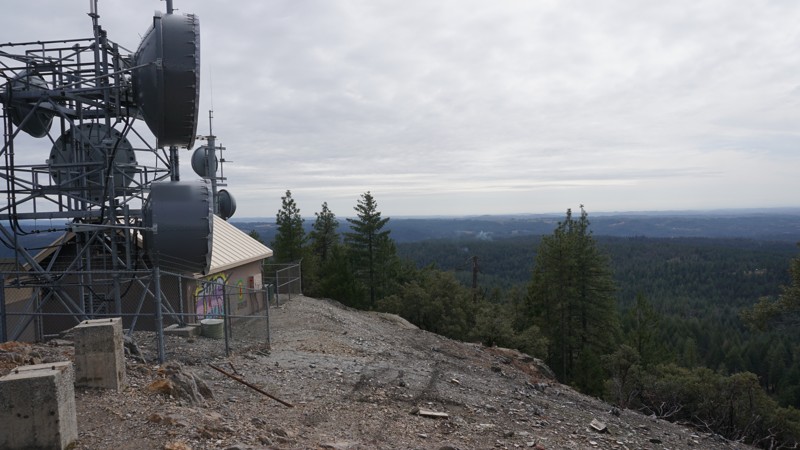
Updated: 01/26/2024
Slate Mountain Lookout
Placerville, California
Situated just inside of the western edge of the Eldorado National Forest, about an hour from the greater Sacramento, CA metropolitan area, lies this great little road with scenic views of Slate Canyon and the Sacramento Valley. Although a fire lookout tower once stood on the peak of Slate Mountain, only its concrete footings and a communications building and tower remain. Notwithstanding, the vista offers 180+ degree views of the Sierra Nevada foothills lining the eastern edge of the Sacramento Valley. This is a great beginner road, suitable for stock 4WD vehicles.
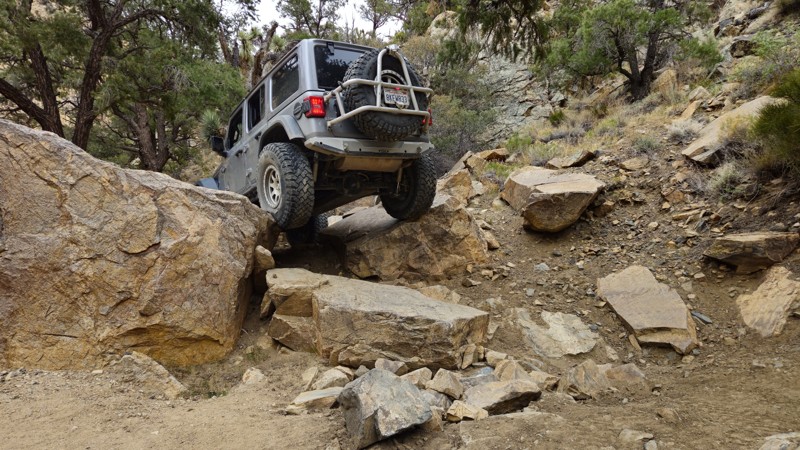
Updated: 05/13/2025
Mottino Wash
Yucca Valley, California
If body damage, brutal lines, and full-send moments are your idea of a good time, then Mottino Wash is the hidden battleground you’ve been looking for. Tucked between Big Bear’s legendary Holcomb Valley and the hardcore madness of Johnson Valley's Hammers, this under-the-radar gem serves up a wild fusion of both worlds—gnarly must-do obstacles, savage optional lines, and relentless rock crawling that will push even the most capable rigs to their limits. With low traffic, remote terrain, and no shortage of bragging rights, Mottino Wash isn’t just another trail, it’s a rite of passage for those bold enough to take it on.
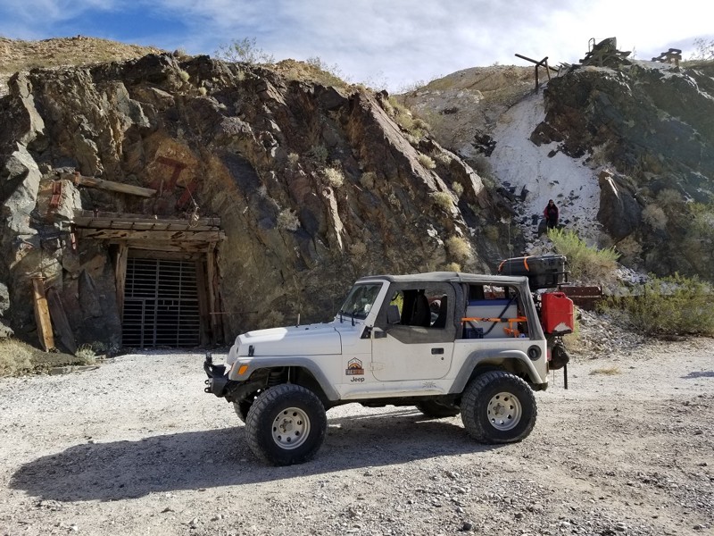
Updated: 12/23/2025
Warm Spring Canyon
Furnace Creek, California
Warm Springs Canyon is a classic Death Valley backcountry road that leaves the wide-open valley floor and climbs into rugged desert terrain shaped by old mining history. It’s a perfect 4x4 adventure for novice off-roaders. Drivers should expect rocky sections, washouts, and the kind of slow, careful driving that teaches good line choice and tire placement without needing to be extreme. Along the way, you’ll pass historic sites and big Mojave panoramas, and when paired with nearby backcountry roads, you can build a full day of exploring. This trail rewards you with a quiet, remote slice of Death Valley that feels worlds away from the pavement.
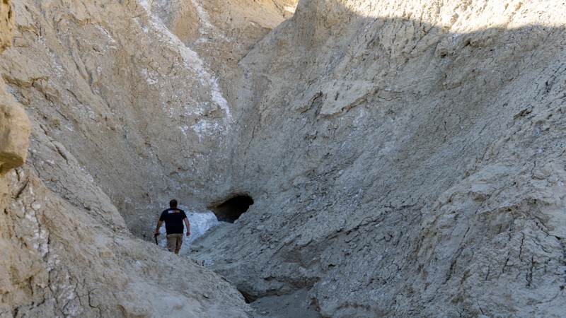
Updated: 04/06/2024
Arroyo Tapiado
Julian, California
Arroyo Tapiado is a nice drive up a beautiful mudstone canyon within the Anza-Borrego Desert State Park. Outside of the fantastic views, Arroyo Tapiado has the highest density and the longest mud caves in the world, making it a unique place on Earth. It is no wonder why many people flock to see this natural wonder year around. One of the mud caves is over 1,000 feet long, which makes these mud caves seem to last forever once inside. With over 22 known mud caves, this area could provide a weekend of exploring. Just be warned, the mud caves are unstable and susceptible to collapse at any time. The dirt is very soft and will quickly collapse if touched. The park recommends not entering the mud caves.
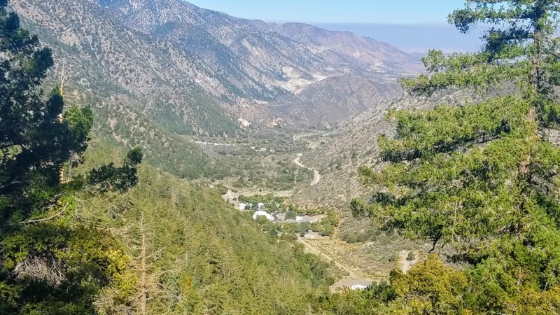
Updated: 06/05/2022
4N56 Pinyon Ridge
Wrightwood, California
4N56 Pinyon Ridge is in the Angeles National Forest. This trail is literally within two hours of all most anywhere in Southern California. The trail runs east to west offering fantastic views of the San Gabriels to the south with Mount Baden-Powell, at an elevation of 9,400 feet a prominent feature of the skyline. To the north is the High Desert 2000 feet below you with views to Pearblossom, Adelanto, Palmdale, and Lancaster.
Close enough for a morning run and be home for lunch or pack your gear for a two-week campout at the Yellow Post Site. With five Animal Guzzlers (man-made water points) on this ridge, there are many prime locations to watch for bear, mountain lion, bobcat, deer, and other animals which come in for water.
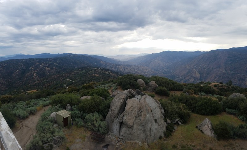
Updated: 12/31/2025
Rancheria Road
Tarina, California
Rancherio Road starts in the lowland oak-covered hills and rises into the majestic Sequoia National Forest. Breathtaking views are abundant along the way. Evans Flats Campground is located about 20 miles along the road and is popular to escape the valley's summer heat and for horseback riders. The road is wide and flat and maintained along its entire route, with the only obstacles being range cattle that crowd the road. For offroaders looking for driving challenges, several forest roads connect to Rancherio.

Updated: 01/20/2024
Oceano Dunes SRVA aka Pismo Beach
Partially Open
/
Pismo Beach, California/
13.41 miles/
About an hour
Oceano Dunes SRVA is a one-of-a-kind destination in southern California. Oceano Dunes SRVA, also called Pismo Beach, is a place for making lasting memories. This is the only area in southern California where you can drive on the beach. If you want to step up the excitement level, head into the dunes for some adrenaline-pumping fun. Bring the toys to go kite surfing, sandcastle building, or having a picnic on the beach. Oceano Dunes SRVA is a must-visit offroad destination.
Help keep this unique and exciting 4x4 adventure destination open. There is increasing pressure to close Pismo Beach to vehicle traffic. It's up to us to fight back. Please do what you can to help the Friends of Oceano Dunes preserve public off-roading open before it is too late.
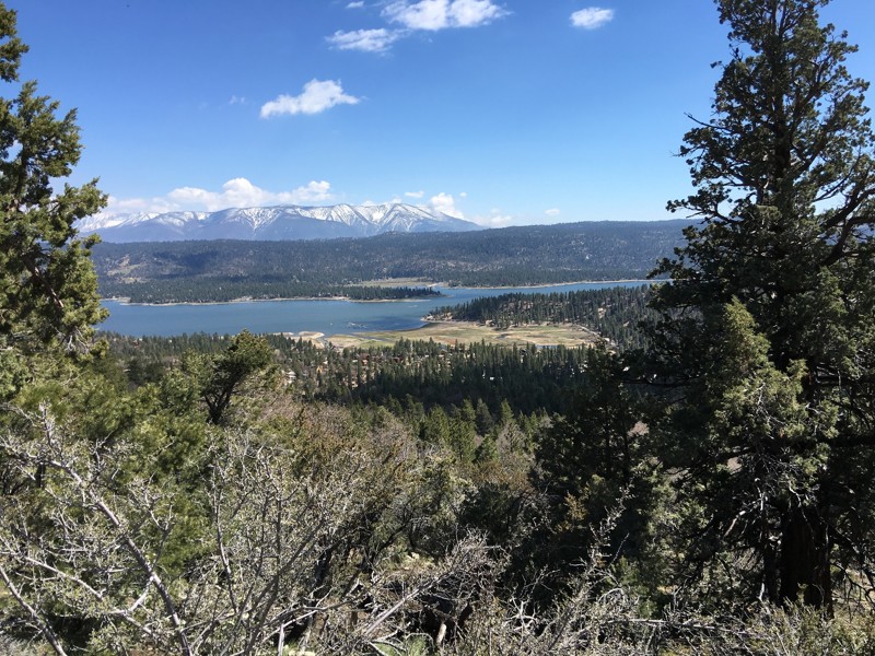
Updated: 07/08/2024
2N71
Big Bear Lake, California
An easy drive in the Big Bear Lake area, 2N71 offers you one of the best off-pavement tours of the lake without having to hike. In addition, you get a perfect view of the city on the south shore of the Lake. Head up this trail for one of the best 4th of July firework displays in the area. The area was once populated by only Native Americans and the grizzly bears, from which the area received its name. Not to worry, grizzly bears have not been found in the region since 1908. Black bears were introduced in the region in 1933. Big Bear Valley grew rapidly during the Southern California Gold Rush from 1861 to 1912. This trail is perfect for an introduction into this beautiful area of Holcomb Valley and Big Bear Lake.

Updated: 03/19/2025
Alabama Hills - Movie Road
Open
/
Lone Pine, California/
6.68 miles/
About 30 minutes
Winding through the rugged and picturesque Alabama Hills, Movie Road is an iconic route that takes travelers through a cinematic landscape of weathered rock formations and stunning Sierra Nevada backdrops. Known for its role in classic Westerns and Hollywood blockbusters, this scenic backcountry drive offers breathtaking views, endless photo opportunities, and access to recognizable filming locations in movie history. Whether you're an overlander, a film buff, or a road trip adventurer, Movie Road is a must-visit destination for its blend of natural beauty and Hollywood magic.
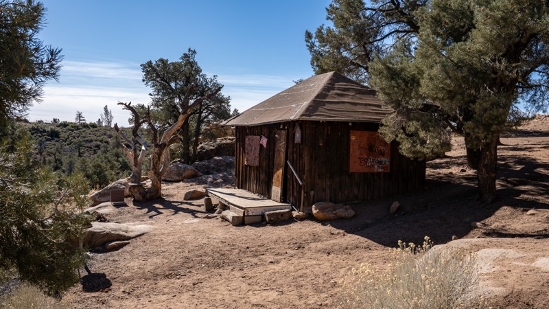
Updated: 03/05/2025
McIver's Jeep Road
Inyokern, California
Nestled within the far reaches of California's Sequoia National Forest, McIver's Jeep Road leads to a namesake cabin, a historic site popular among offroad enthusiasts and hikers alike. Constructed in 1938 by miner Murdo George McIver, the cabin was relocated from Sand Canyon to its current location near McIver's Spring, close to his mining claim. Today, it serves as a shelter for Pacific Crest Trail (PCT) hikers and a destination for offroad adventurers. Tackling this trail requires traveling through diverse terrains, including rolling hills with scrub brush and sandy washes, and features narrow sections that require careful navigation.
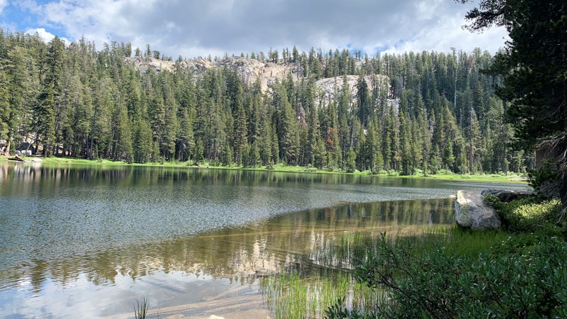
Updated: 06/29/2024
Strawberry Lake Trail
Shaver Lake, California
Located in the Sierra National Forest just outside of Shaver Lake, Strawberry Lake is one of the prettiest little lakes you will find. The Sierra National Forest is a popular destination to escape and reconnect with nature, family, and friends. Towering conifers line the trail to the lake where you will pass several small lakes and ponds in the area. The forest is dense, but you catch glimpses of the granite capped mountains in the distance. Once you reach the lake, you will find it surrounded by towering granite mountains. You will immediately feel the charm of its peaceful seclusion. By foot, you can explore many hiking trails around the lake or launch your kayak and even do some fishing. The scenery is breathtaking. Whether you like off-roading, camping, fishing, or playing in the water, Strawberry lake has something for everyone.
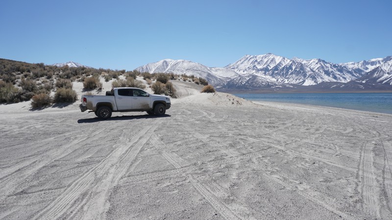
Updated: 06/08/2024
Crowley Lake Trail ( East )
Mammoth Lakes, California
This smooth off-road trail gently curves through these mellow rolling hills beneath the Eastern Sierra Mountain Range near Mammoth Lakes, off the 395, and just outside the Long Valley Caldera. This trail runs up to and on one of the white sandy beaches of Crowley Lake where the clear blue water contrasts the white sand and snowy mountains in the distance. At Waypoint 10 you'll want to take the short detour to the majestic Crowley Columns where these stone formations will make you wonder how and why they are there.
Crowley Lake Trail is an easy and scenic trail that anyone in a 4x4 vehicle will find peaceful and relaxing.
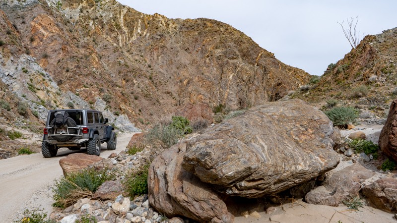
Updated: 03/16/2024
Canyon Sin Nombre
Ocotillo, California
Canyon Sin Nombre is a stunning offroad trail in Anza-Borrego Desert State Park through the San Felipe Fault Network smashed between the Elsinore Fault and San Andres Fault. The upheaval of these faults is evident along the trail. Many call this trail "The Geologist Tour" or "The Journey Through Time" due to the numerous geological formations from the southwestward tilt of the desert sediments. These formations date back hundreds of millions of years and provide a visually impressive drive through this tectonic wonderland.
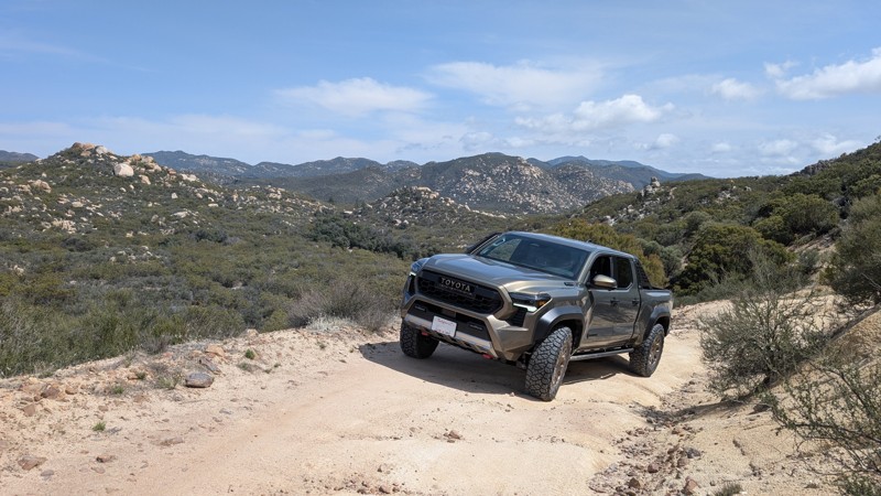
Updated: 04/14/2025
Indian Flats
Holcomb Village, California
Nestled amongst mountains of untouched wilderness, Indian Flats feels isolated from the developed world. The lower elevations of the trail offer rolling hills and turns that tuck into the landscape, while the upper elevations brandish panoramic views of San Diego County's backcountry. This mild offroad drive is enough to give a novice driver a sense of accomplishment yet is not technical or rough enough for consternation. The one-lane trail connects Warner Springs to Chihuahua Valley, where the Cooper Cienega Truck Trail can be taken as far north as Anza.

Updated: 07/25/2024
26E213 - Coyote Lake Trail
Shaver Lake, California
A high mountain lake hidden at the end of the Red Lake 4x4 Trail is, literally, only the beginning.
Coyote Lake Trail is a challenging, rock crawling 4x4 trail that runs from Red Lake to Coyote Lake. Rock crawling, swimming, fishing, camping and lake side relaxation in the high mountains of the Sierra National Forest make for one of the most rewarding 1.7 miles you can run.
This is one of many 4x4 trails in the Red Mountain off-road trail network in the Sierra National Forest, northeast of Shaver Lake and Southeast of Huntington Lake.
Rock obstacles, dense forest, and two lakes make Coyote Lake Trail a prime destination for the seasoned wheeler looking to get off the grid.
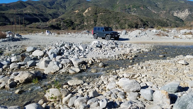
Updated: 07/12/2024
1N33 - Meyers Canyon
Fontana, California
Meyers Canyon offers one of the few places to drive across the entire width of Lytle Creek. While the canyon and the trail are entirely within the San Bernardino National Park, a section of the canyon has been privatized and made into a shooting range. Meyers Canyon Road provides the only access to the shooting range, and a split in the road continues deeper into the park. Once ascending the canyon, great views of the canyon and the shooting range are below. As with most San Bernardino National Forest areas, pets are allowed when kept on a leash.
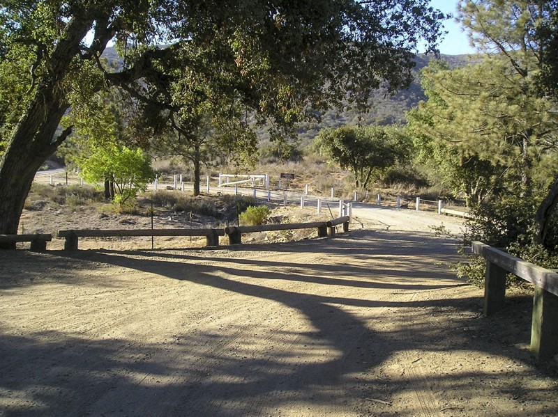
Updated: 02/25/2024
7S03 - Los Alamos/Wildomar OHV
Murrieta, California
The Wildomar OHV Area is 1 square mile with 8 miles of trails. Los Alamos Trail 7S03 is a shortcut to this area. 7S03 ends at South Main Divide 7S04 and the OHV area is just a short distance to the south. The South Main Divide Road is the route of choice for a low clearance 2wd vehicle, coming south off the Ortega Highway, Hwy74, 9 miles away. Even though I rated Los Alamos at 1-2, I was amazed to see 2wd pickups pulling large trailers filled with quads and bikes. Here is a link for more information. Wildomar OHV
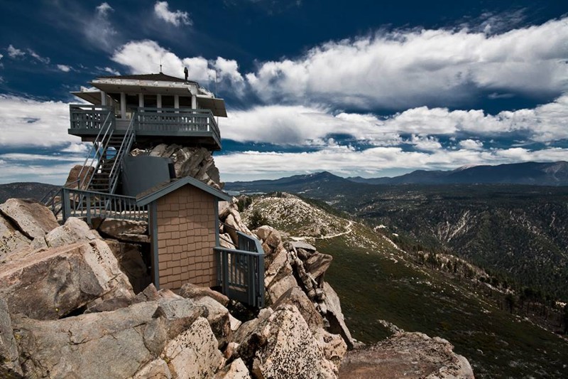
Updated: 05/12/2024
2N13B - Butler Peak
Fawnskin, California
Not just another off-road trail, Butler Peak - 2N13B recently reopened after a forest fire ravaged the area. The trail has been closed for roughly 9 years and has been hiding one of the best views in all of the San Bernardino National Forest. This easy offroad trail takes you up to the fire lookout tower of Butler Peak which upon arriving at the top you have the opportunity to see as far as the eye can see in every direction. You can easily see Calico Mountains to the north, Big Bear Lake to the east, Riverside and Orange County to the south, and Lake Arrowhead and Mountain High to the west. To try and describe the beauty of the view is impossible, thus make plans and enjoy the stunning scenic views of Butler Peak Fire Tower.
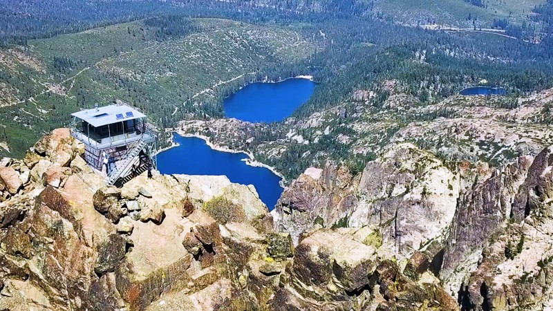
Updated: 11/24/2022
Sierra Buttes Lookout
Sierra City, California
In the Tahoe National Forest, the volcanic Sierra Buttes rise sharply above the North Yuba River Canyon, and at 8,587 feet in elevation watch over the many blue lakes that dot the Lakes Basin landscape. There is a decommissioned fire lookout tower perched on the summit, providing incredible 360 degree views reaching into more than seven different counties. The Buttes are without doubt one of the most distinctive geological features of the northern Sierra Nevada, and the lookout is one of the most popular hiking destinations in the region. Although most hikers reach the lookout from the lower trailhead, 2.5 miles and 1,600 feet of elevation below, those with high-clearance four wheel drive can access the upper trailhead, a mere 3/4 mile from the lookout tower.
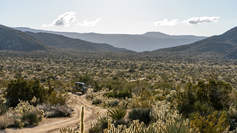
Updated: 05/23/2024
Blair Valley
Ocotillo, California
Blair Valley is a popular destination in Anza Borrego State Park due to its rich cultural and historical significance and stunning natural beauty. This valley was once home to a thriving community of Native American people, who left behind various fascinating artifacts and structures that can still be seen today.
One of the highlights of Blair Valley is the pictographs and petroglyphs found throughout the area. These ancient rock paintings and carvings provide a glimpse into the rich cultural history of the Kumeyaay people who once lived in the region.
In addition to its cultural significance, Blair Valley is known for its stunning natural beauty. Rugged mountains and hills surround the valley, home to various unique desert plant and animal species. Visitors can hike through the valley, take in the stunning desert vistas, or explore nearby trails and canyons.
Blair Valley is also a popular spot for camping, with several designated camping areas throughout the valley. Visitors can enjoy a peaceful and secluded camping experience with the sounds of nature and the stars overhead.
Overall, Blair Valley is a unique and fascinating destination that offers something for everyone. Whether you're interested in exploring the region's rich cultural history and stunning natural beauty or simply enjoying a peaceful camping trip, this hidden gem in Anza Borrego is well worth a visit.
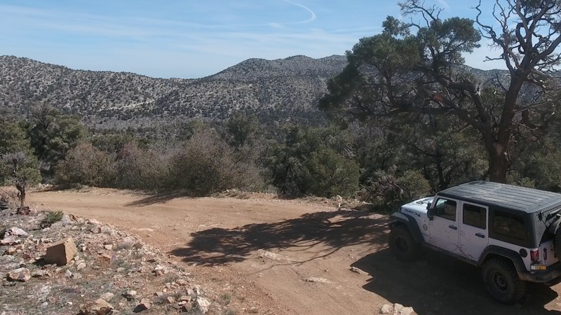
Updated: 06/08/2024
2N01 - Broom Flat
Big Bear Lake, California
2N01 - Broom Flat is a scenic, winding, forest road leading from CA-38 in Big Bear, CA, to the area at the base of Tip Top Mountain.
2N01 serves as a great access road to this south eastern section of the Big Bear Mountains.
This is a great trail for a beginner looking to explore this open area, or a great connector for more advanced wheelers looking for a quick route to Heartbreak Ridge or Tip Top Mountain. 2N01 - Broom Flats can be run as an out & back, or a connector to the many other off-road trails in this area.
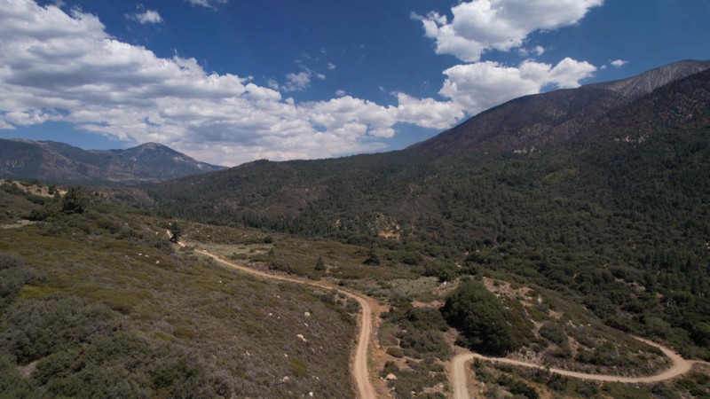
Updated: 11/26/2025
Radford Front Line Road
Big Bear, California
Front Line Road is in the 823,000-acre San Bernardino National Forest just south of Big Bear Lake. It provides a casual meandering adventure alongside a shallow canyon formed by the 8,000-foot San Bernardino Mountain Range to the north and the 10,000-foot San Gorgonio Wilderness mountains to the south. There are numerous places to pull over for lunch or to take in the many commanding views of the mountains and tall pines that guide your way.

Updated: 01/05/2023
Imperial Sand Dunes Recreation Area - Glamis
Brawley, California
The original "Where's It At" for off-road enthusiast, Imperial Sand Dunes, also known as Glamis Sand Dunes, is the mecca of everything sand in the United States. Nestled in the southeastern corner of California against the Mexico border is an area with over 200 square miles of endless sand dunes, deep bowls, sand mountains, and astonishing valleys. Glamis attracts millions of people per year from all over the world to see and play in its glory. This area isn't only famous for the endless dunes, sand drags, or races. The area also hosted popular films like Star Wars, Star Gate, Knights of Arabia, and many more. If vehicles are not your thing, the area offers a tranquil alternative to the fast-paced action with activities like hiking, horse back riding, photography, and wildlife viewing.
Many people would say this is a top-5 Off-Road Bucket List adventure destination.
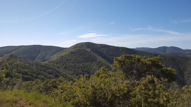
Updated: 04/13/2023
3S04 - Main Divide Middle Northern Section
Corona, California
One of the best long cuts that connects the Inland Empire and Orange County, this stretch of 3S04 Main Divide runs along the ridge of the mountain range for 3 miles with 360 degree views and is perfect for all off-road enthusiasts. While traveling along this route, it is common to see lots of wildlife, amazing views of the Pacific Ocean, and even more spectacular views of the snow-capped San Bernardino Mountain Range in the distance.
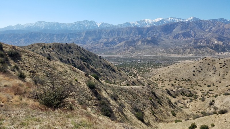
Updated: 07/22/2024
3N24 - Desert Front
Hesperia, California
Desert Front is on the eastern boundary of the 200,000-acre Front Country Ranger District of the San Bernardino National Forest. Desert Front straddles the transition between the rain shadow caused by the San Gabriel Mountains and the beginning of the Mojave Desert. A leisurely drive along its 12-mile path brings you to several spots to enjoy the expansive views. The San Bernardino and San Gabriel mountains are seen from here and make up the major portion of what is known as the Transverse Ranges, the only California mountain ranges that are oriented east-west. The movement of the San Andreas Fault system has uplifted the surrounding mountains and ridges and down cuts formed the surrounding valleys and the Cajon Pass. Views to the east span Cajon Valley and follow Cleghorn Ridge to the San Bernardino Mountains. Looking to the southwest and across Stone Basin is the panorama of the Lytle Creek Ridges framing Mt Baldy and the snow-capped San Gabriel Mountains. As far as you can see, the Mojave Desert is to the north. Protected restoration areas to the north of the road have flourishing Joshua Tree forests taking hold and abundant wildlife whose tracks can be found on the soft sandy road.
Pets are welcome but must be kept on a leash.
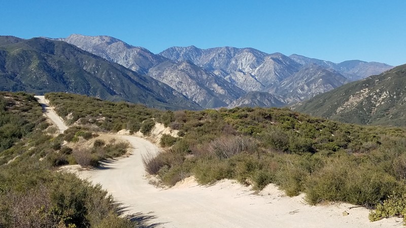
Updated: 04/07/2024
1N32 - Edison Road
Fontana, California
From high up on the Lytle Creek Ridge, Edison Road treats you to views of the not-so-far-off San Gabriel Mountains to the west and the Cajon Pass to the east. It is a Forest Service road that gently meanders down the southern portion of the Lytle Creek Ridge until it passes the border out of the San Bernardino National Forest. The trail also provides service access to the power line towers whose cables you will drive directly under. One unique feature of this trail is caused by the vibration of the long drooping power lines that will sing in the wind to produce a lulling meditative tone.
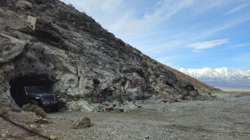
Updated: 02/19/2025
Reward Mine
Lone Pine, California
Located across the valley from Mount Whitney, the tallest peak in the lower 48 states, Reward Mine offers a one-of-a-kind offroad experience. Unlike most trails, this destination allows visitors to experience underground offroading, making for an unforgettable and thrilling ride. The journey takes you about half a mile into the Inyo Mountains, with even more opportunities for on-foot exploration. Whether you're a seasoned mine enthusiast or just looking for a unique and slightly eerie adventure, Reward Mine takes mine exploration to an exciting new level.
Steeped in history, the Reward Mine was the first operational mine in Owens Valley, running from 1860 through the 1980s under several different names. Between 1889 and 1951, it yielded an impressive 600,000 ounces of gold, along with silver, copper, and lead. Today, visitors can still see remnants of the past, including stone building ruins, ore bins, and mining equipment. However, the true highlight of this destination is the rare opportunity to drive directly into the mine itself, an experience that sets Reward Mine apart from any other offroad trail.
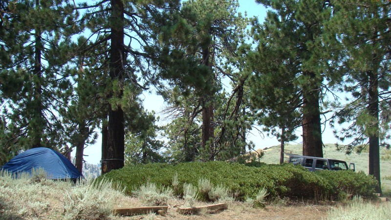
Updated: 07/22/2024
East Blue Ridge Road
Wrightwood, California
East Blue Ridge Road is an excellent trail for spending a few hours enjoying beautiful views of the eastern side of the San Gabriel Mountains. The inner rugged canyons and valleys of these mountains can not be appreciated until you experience them firsthand. This trail has two nice free campgrounds where you can relax under shady pine trees. The campgrounds are seldom crowded, a rarity for campgrounds so close and easy to reach. The trail is easy and 2WD-friendly unless the weather is abnormally poor.
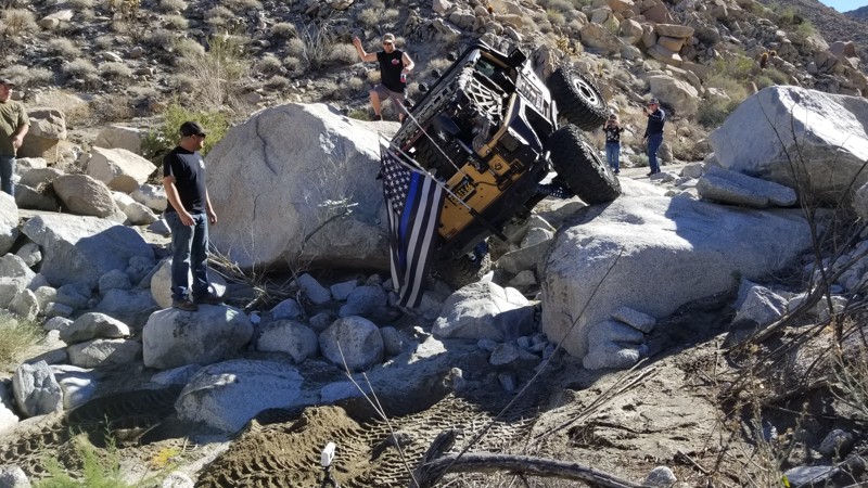
Updated: 05/17/2024
Devil's Canyon
Ocotillo, California
Deep in the deserts of Southern California lies a trail that few of heard of but all of them wish they had the opportunity to drive. Devils Canyon outside of Ocotillo and near San Diego, California is a life changer for most off-road enthusiasts. Full of some of the most intense rock crawling, this permit-required trail can easily be one of the legends. For many, this trail is simply just too hard. Others are forced to turn around in defeat. But for those lucky few, this is a trail of a lifetime and will likely be one of your favorite trails of all time. Full of technical obstacles, this epic 4x4 trail will be testing both man and machine to their limits. What keeps this trail as a unicorn of the off-road community is that it is only available one to two days a month at the max. So, if you think you're up for it, get your information below, gather a group, and attempt one of the most legendary trails the SoCal desert has to offer the off-roading community, Devils Canyon.

Updated: 03/17/2024
Mule Canyon
Barstow, California
A drive down Mule Canyon Road provides a visual feast of interesting shapes and colorful landscapes. Wonderful dispersed camping locations are abundant along the trail for a great evening getaway to enjoy the sunrise and sunsets that light up the Calico Mountains. Camping here serves as a staging point to explore the many BLM trails of the Calico Mountains and view the extensive silver mining that once drove the area's economy. Be sure to visit the nearby restored Calico Ghost Town.
The trail was used in the 2004 "Kill Bill 2" movie. Moving 1.3 miles east into the trail, a flat, dusty box canyon off to the west was the location for Budd's (Michael Madsen) trailer.
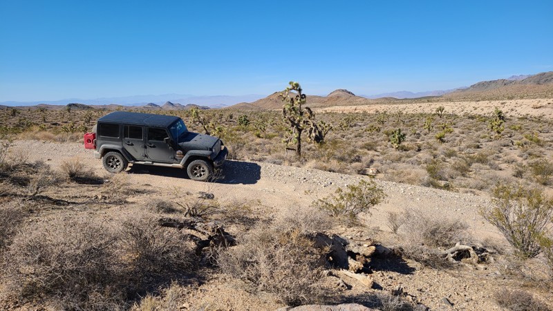
Updated: 12/23/2025
Boulder Corridor NN135
Baker, California
Following the boundary of the National Scenic Area through Kearny Pass of the Clark Mountains, the Boulder corridor takes you through beautiful undisturbed expanses of joshua tree forests and eventually provides views overlooking Ivanpah Lake and the massive Ivanpah Solar Electric Generating System near the Nevada border. This narrow strip of BLM land lies between the Kingston Range Wilderness and the Mesquite Wilderness areas to the north and the Mojave Preserve to the south. The road starts on the sandy desert floor, and at its halfway point begins its rise into Clark Mountains, where it becomes very rocky, rugged, and with several difficult obstacles caused by rain runoff. Some of these obstacles are on narrow shelf roads with deep dropoffs to one side and require precise wheel placement. This road should only be driven in a four-wheel drive, high clearance vehicle, and groups of 2 or more, and be prepared for self-rescue as any help is far away. Several locations are suitable for dispersed camping when following the camping guidelines of the BLM Needles Field Office.

Updated: 04/29/2023
Walker Ridge Road
Williams, California
Walker Ridge Road is a fun ridge run with fantastic views down to Indian Valley Reservoir to the west and Bear Valley to the east. Beyond that are the seemingly endless scalloped ridgelines of the geological fault zone that lies between Clear Lake and the Sacramento Valley. Located entirely on BLM land, It is popular with offroaders, hunters, and target shooters. There is a nearby campground situated alongside the reservoir, on which fishing, boating, and swimming are encouraged.
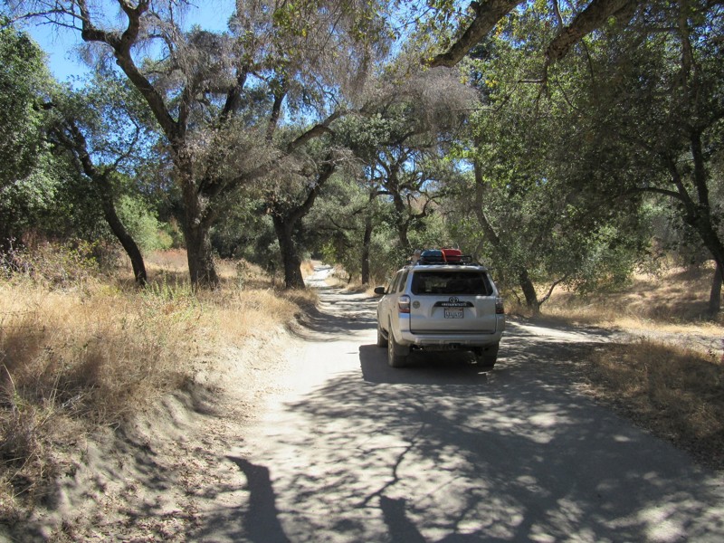
Updated: 07/23/2023
17S04 - Corral Canyon Road
Pine Valley, California
Corral Canyon Road can be driven in either direction. It is one of two main roads to gain access to Corral Canyon OHV Area as well as one of the two campgrounds within the area. The road is a mixture of pavement and dirt and has sections completely covered by trees and other areas fully exposed to sunlight. The road can also be used as a connector road which forms an 18-mile loop around Corral Canyon OHV Area and Cleveland National Forest. Along with this road, the 18-mile loop consists of the following additional roads and trails:
16S17 - Los Pinos Road
4E03 - Corte Madera Road
17S06 - Skye Valley Road
4E03 - Espinosa Trail
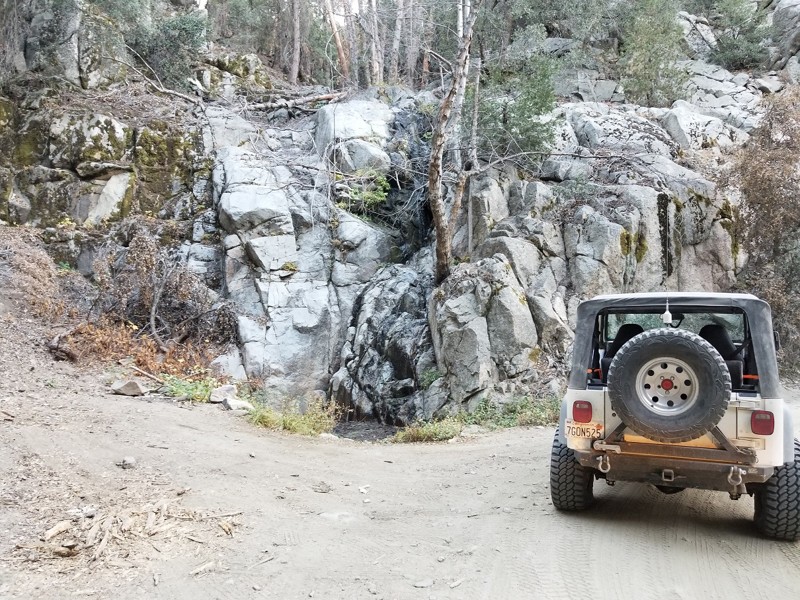
Updated: 07/20/2024
Middle Control Road - Big Bear
Redlands, California
Middle Control Road might not sounds like the worlds most interesting trail, but don't let this name fool you. The trail zig zags down the mountain providing some amazing views across the valley floor. Along the route there are plenty of options to get out of the 4x4 and hike the area. Also along the route is a beautiful waterfall which could easily be a place to stop when looking for inspiration... Whether you love off-road or you're looking for one of the most scenic drives in the area, I would recommend Middle Control Road as one of your next stops.
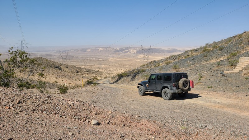
Updated: 02/08/2026
Powerline Road CL8315
Toomey, California
Powerline Road CL8315 is a 51-mile trek through the Mohave Desert, following a narrow path between Fort Irwin and the Soda Mountains Wilderness. Enjoy the many stunning views out over the desert and seemingly endless dry lake beds along the way. The main trail intersects many other desert roads that invite exploration and lead to abandoned mines, historical locations, and protected archeological sites. Experienced drivers with a four-wheel drive high clearance vehicle can manage this trail. This trail provides a wide range of trail conditions, from fine sand and bumpy ancient lava beds to rough, steep, and tight twisting paths through the mountains. Summer monsoons can wash out sections of the road, so be prepared to scout safe detours or turn back. This is a trail that should only be attempted as a vehicle team. Plenty of extra water and the ability to self-rescue are requirements to travel through this hot desert. Dispersed camping is available along the trail when following the BLM Barstow Field Office guidelines.

Updated: 06/09/2026
Chocolate Thunder
Lucerne, California
A trail that many have heard of, Chocolate Thunder is a popular rock crawling trail in Johnson Valley, California. The trail is usually part of the famous King of the Hammers track and has even been one of the famous Shootout Challenges. The short but fun trail is full of large rocks that are big enough to flip even the largest vehicles, sand that can make climbing the countless ledges and waterfalls impossible, and unique and tight obstacles that can easily destroy a body panel or two. One of the unique things about this trail is it has some great spots on the sides of the trail that any stock 4x4 can get to, making it a popular place for people to gather to watch others work their way through. Now, if you want a good challenge or are looking for a unique night run, check out Chocolate Thunder in the home of KOH, Johnson Valley, and see if your offroad rig has what it takes to complete this trail.
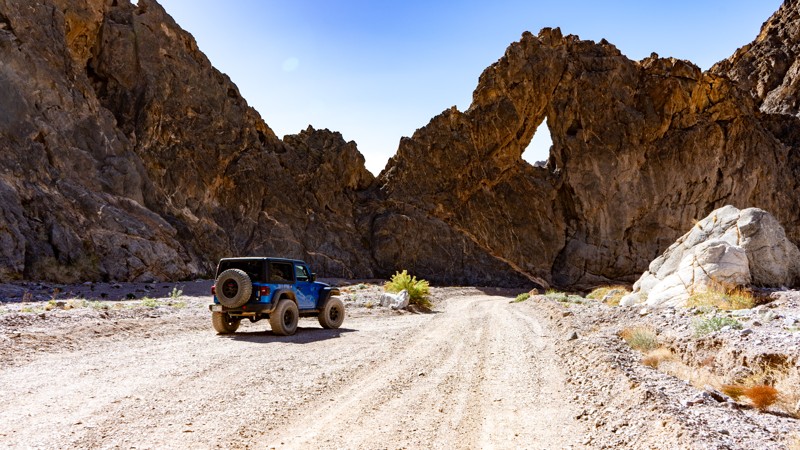
Updated: 03/05/2025
Echo Canyon Trail
Furnace Creek, California
Echo Canyon boasts Death Valley's best qualities with its spectacular scenery, twisty canyons, rock arches, and mining history. It leads to the once famed "Inyo Mine," which was one of the earliest gold discoveries on the west side of the Funeral Range and also the only mine on that side, that produced more than an occasional sack of gold. The drive is peaceful through the sometimes tight canyon and is complete with an arch named the "Eye of the Needle" that you can't miss. With its nine designated and reserved campsites, scenery, and history, it's the perfect stop for a night on the way in or out of Death Valley.

Updated: 12/17/2025
Sledge Hammer
Open
/
Yucca Valley, California/
1.56 miles/
About 5 hours
If you want insanely hard, then the Hammer Trails are for you. Sledge Hammer is the southernmost trail of the Hammers in Johnson Valley, California. This extreme 4x4 trail is a collection of large boulders, massive ledges, towering waterfalls, vertical climbs, and spots you just have to drag through. This trail is going to make you work for it if you are wanting to complete it. Once on this trail, it is clear why this is one of the hardest trails in the country and why it makes the cut for one of the hardest parts of the King Of The Hammers race. If you think you have what it takes to do this run, have a rig that is built for the extreme, and have plenty of off-roading experience, then this is for you!
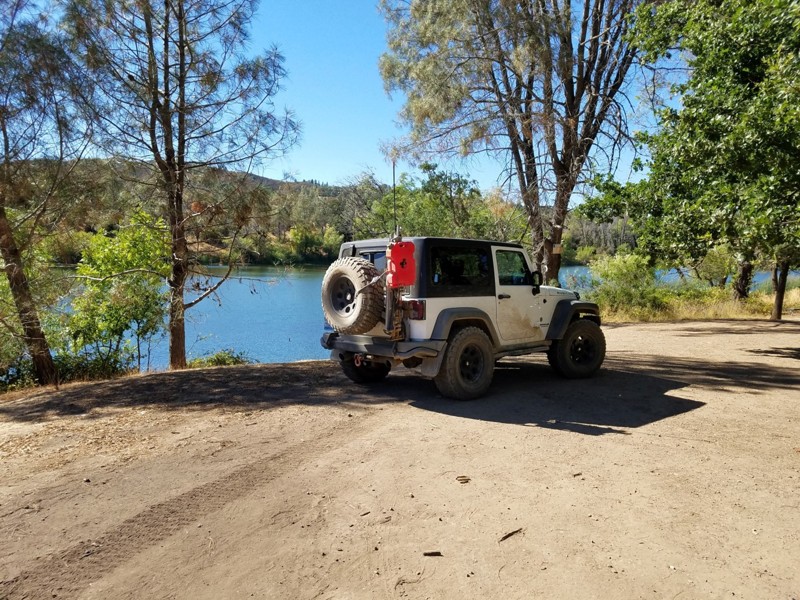
Updated: 06/05/2022
Old Toll Road to Highland Springs
Hopland, California
If you live in the North Bay Area and want to get away from civilization for a while and get some dirt on your tires, Old Toll Road from Hopland to Highland Springs Reservoir will take you through the volcanic landscape of the Mayacamas range; mixed chaparral and oak trees, stacked lava and serpentinite rock formations, soaring raptors (Red-Tailed Hawks are frequently seen here), and great views down to Hopland and Lake County.
This is a great backcountry route that winds through the hills and ends at a beautiful reservoir called Highland Springs --great for swimming, paddling, and fishing.
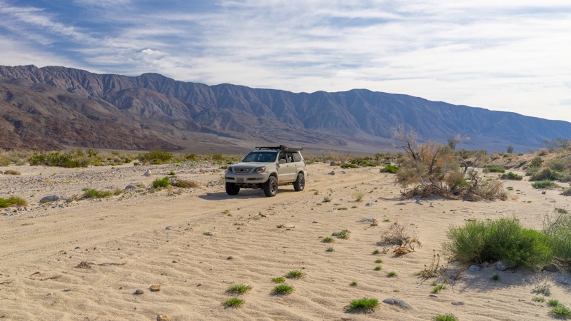
Updated: 03/16/2024
Rockhouse Canyon
Borrego Springs, California
Just outside the sleepy desert town of Borrego Springs, Rockhouse Canyon Road is another fun out-and-back trail to add to your Anza-Borrego Desert State Park list, especially in the springtime. This backcountry trail runs directly along a sprawling dry lake bed in a barren valley between two mountain ranges creating interesting photo opportunities. Climbing out the back of the lake bed, the trail travels a sandy wash filled with tall Ocotillo. Although you won't find much camping on this trail, check out this scenic route through the desert if you are sightseeing in the area.
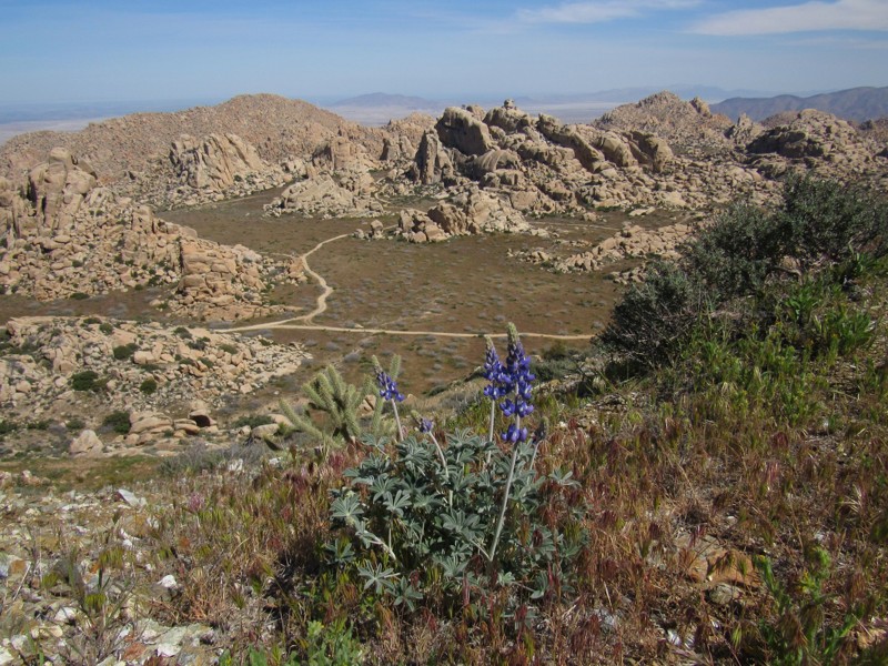
Updated: 10/24/2023
Elliot Mine Trail
Jacumba, California
Nestled within California's Jacumba Wilderness, just over a mile north of the U.S./Mexico border, lies a four-wheel-drive trail with some historical treasures waiting to be explored.
Smugglers' Cave, reached by a short hiking trail, is a man-made shelter with ties to early 19th century Native Americans as well as Mexican banditos of the early 1900s. Today, it is a welcoming, shaded resting place for Mexican immigrants braving the trek to the United States.
At the end of the trail is the abandoned Elliot Mine which sits atop Tahe Peak. Tahe Peak provides an astounding vista of the granitic rocky oasis known as Valley of the Moon Wilderness as well as views of the Salton Sea and Mexico.
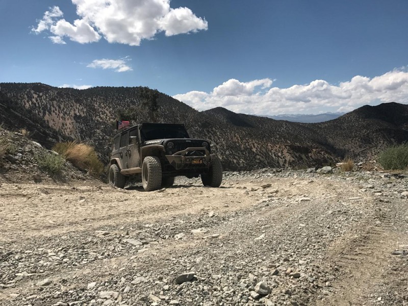
Updated: 06/08/2024
Silver Canyon Road
Bishop, California
Just to the East of Bishop, CA in the Inyo National Forest lie the White Mountains and Silver Canyon Road will take you right to their heart. These mountains, which extend north into Nevada, are the home of desert bighorn sheep, pronghorn antelope, mule deer and some of the oldest trees on the face of the earth. The Ancient Bristlecone Pine Forest is home to living trees exceeding 4000 years old in two separate groves, the Schulman Grove which has a visitors center open during the summer, and the Patriarch Grove which is home to the world's largest bristlecone pine tree. Both of these groves are easily accessible during the summer from the top of the White Mountains.
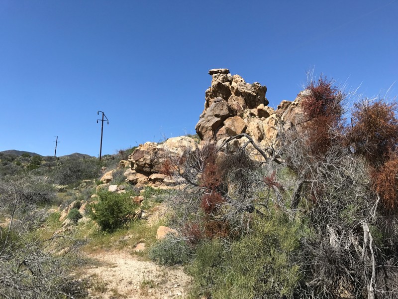
Updated: 03/15/2024
Jasper Trail
Borrego Springs, California
Jasper Trail is a lesser-known off-road trail on the western edge of Anza-Borrego Desert State Park. For those planning an overland expedition in Anza-Borrego, Jasper Trail offers a great connecting route between established campsites at Culp Valley Campground in the north and Tamarisk Grove Campground in the south, as well as numerous other connections to camping locations along the way. The trail also makes for a fantastic day trip, and can provide a more challenging alternative to Grapevine Canyon Road. The route features interesting rock formations of stacks or piles of large boulders, high-country desert vegetation, and high-altitude vistas as you descend into the bowl of the Anza-Borrego desert.
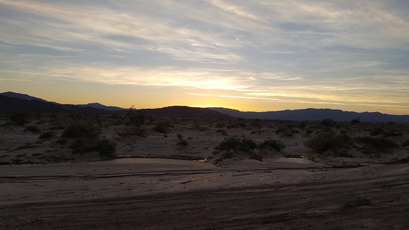
Updated: 10/14/2023
Palo Verde Wash
Borrego Springs, California
In the middle of the overland capital of the world, Anza Borrego, sits this great cut-through wash that allows you to dust off the 4x4's and let your hair blow in the wind. Many off-road enthusiasts use Palo Verde Wash as a connector from San Felipe Wash to the S22. Named after the green twigs on the trail, Palo Verde is a Spanish term for these small plants. Thus, when in the area, take a side trip down Palo Verde Wash to change things up.
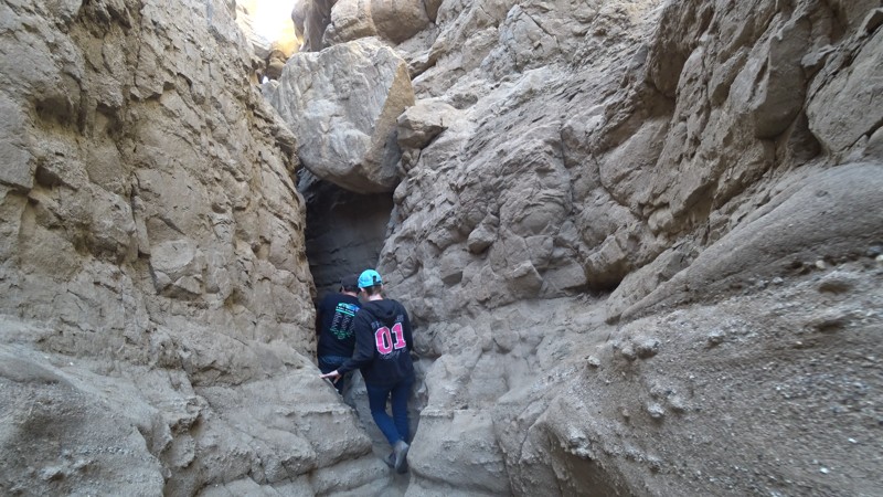
Updated: 12/31/2024
The Slot
Borrego Springs, California
The Slot is an extremely narrow sandstone hiking canyon located in the heart of Anza-Borrego State Park. This popular, family-friendly destination is a great opportunity to take a dirt road to a mesmerizing slot canyon carved by millions of years of flash floods and eroding rock. This unique hiking opportunity in southern California starts as an open-ish area but quickly closes in. At points along the hike, you will be trying to shimmy sideways to continue. Once it reaches the bottom, it opens up to Borrego Mountain Wash, where your 4-wheel drive friends can pick you up and return you to the parking area. Great for groups, friends, or solo adventures, The Slot is a great place to visit for those who come prepared for a day in the desert. The Slot can reach over 110 degrees in the summer, so be sure to bring lots of water and notify people where you are going. This area is at high risk of flash floods and should only be entered on sunny days.
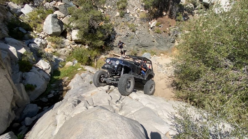
Updated: 10/21/2022
Upper Rattlesnake Canyon
Landers, California
Upper Rattlesnake Canyon seemed destined to be lost to time, reduced to just a story that you might hear when hanging out with the older offroaders. Now resurrected and open again, this trail is handily the hardest trail in the Big Bear Mountain Range with its legendary obstacles. The obstacles are so intense that many of the legendary Johnson Valley Trails pale in comparison and often brave drivers choose to simply turn around.
Over the years the trail has been called many names from Pops Canyon, Grandparents Canyon, to even Garden of Eden as the different groups think they found something new and exciting. But understand, this trail has been here a long time and the original trail is still rather easy to follow. The history of this epic trail is this was once part of the original Rattlesnake Canyon. The upper part of the canyon made Rattlesnake Canyon get it's intermediate to hard rating. The 2 to 4-foot waterfall of bygone days is now a monster 25-foot waterfall and growing. Thus as the canyon gets harder and harder. Because of this, Rattlesnake Canyon trail has moved out of the canyon and now parallels this canyon in the Joshua Tree Forest leaving this trail to be forgotten over time.
But Upper Rattlesnake Canyon is reborn. With lush green plants and trees and year-round flowing springs, it is easy to see why people think they found some kind of Garden of Eden. But understand, there is a lot of history to this uniquely intense rock crawling trail. There is no room for mistakes on this trail without severe consequences. All mistakes will result in vehicle damage ranging from body damage to breaking components or even worse. Thus the only people that should run a legendary trail like this are those who can respect such an insanely difficult 4x4 trail that only could exist from the histories of what once was. Are you that person?
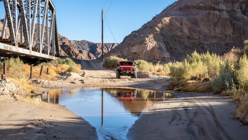
Updated: 02/19/2025
Afton Canyon
Barstow, California
Often referred to as the Grand Canyon of Mojave, Afton Canyon offers a stunning and rugged drive through one of California’s most unique desert landscapes. Located along historic Route 66 and following the iconic Mojave River, this remote canyon features dramatic rock formations, colorful cliffs, and rare year-round water, making it a haven for wildlife and photographers alike. Visitors can explore slot canyons, hike to hidden oases, and even spot bighorn sheep amid the striking desert scenery. Whether you're a nature lover, offroad enthusiast, or history buff intrigued by its connection to the railroad and Old West, Afton Canyon is a must-visit destination for those seeking an unforgettable Mojave Desert experience.
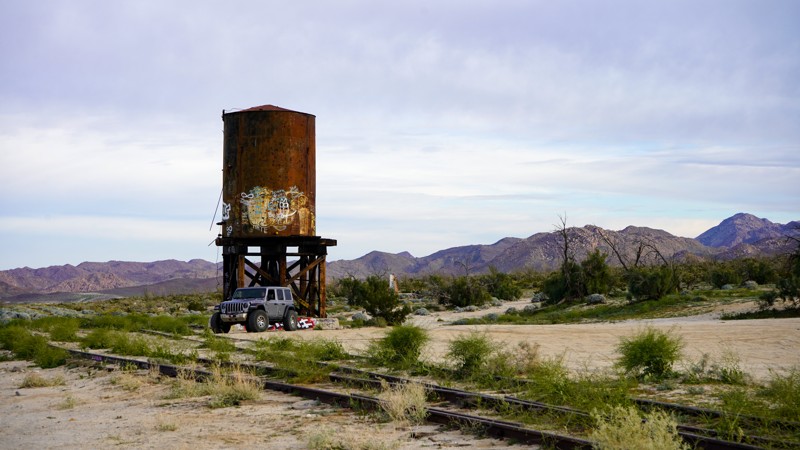
Updated: 03/23/2023
Mortero Wash - Anza Borrego
Ocotillo, California
Mortero Wash is a popular destination in Anza-Borrego due to its rich cultural and historical significance and stunning natural beauty. The wash is located in a southeast area of the park and offers visitors a chance to explore the region's fascinating history and unique geological formations. The wash is home to many stunning rock formations and canyons, including the Mortero Palms, an oasis of palm trees fed by a natural spring. Also rich in railroad history, you hike to the famous Goat Canyon Train Trustle, the world's largest wooden train bridge, or keep it easy and check out the old stop directly off the trail. The Kumeyaay, early Native Americans left behind various ancient artifacts, including mortars and pestles used for grinding seeds and grains that you can witness in the Piedras Grandes Cultural Preserve found on the trail.

Updated: 04/15/2023
M1 - Elk Mountain Road to Lake Pillsbury
Upper Lake, California
National Forest route M1 (also known as Elk Mountain Road) is the main south-to-north arterial that acts as the "spine" of the Mendocino National Forest. Seemingly endless single-track OHV trails (bikes and quads only) and double-track trails wide enough (and signed for) street-legal 4WD vehicles branch off regularly as you travel along the M1. For this reason we have documented its many intersections as comprehensively as possible, with a waypoint for each one. Note that the "Ranch" fire of 2018 closed many of the trails in this area; the BLM has been working hard to get them reopened, but many of the single-track OHV-only trails are still closed for repair.
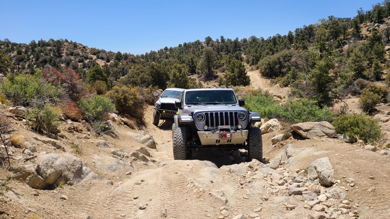
Updated: 10/15/2024
2N70Y - Sidewinder Canyon
Big Bear City, California
Sidewinder Canyon is an offshoot of Burns Canyon Road 2N02. People often take this fun little trail that is looking to spice up their adventure when traveling 2N02. This little fun trail has a few challenges that a new driver in most stock high ground clearance 4x4's can do without pushing them too hard, like the neighboring Heartbreak Ridge. So if traveling through the area and looking for something new or different, make the turn south and run this short but fun little trail.
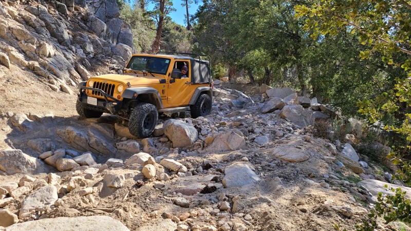
Updated: 07/21/2025
Lower Larga Flat
Big Bear Lake, California
2N06X, aka Lower Larga Flat, is a short offroad connection generally used to bypass the middle rock garden on Holcomb Creek. But don't think this trail isn't hard because it is considered a bypass. 2N06X offers intense rocky hill climbs, large boulder rock gardens, and crazy off-camber spots that will make you think twice. Many people find this to be a fun trail for intermediate drivers ready to make the next step up in difficulty.
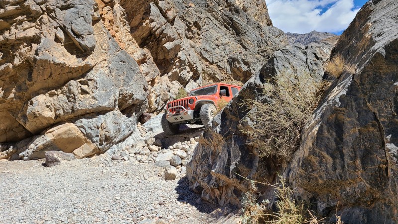
Updated: 12/23/2025
Steel Pass Road
Open
/
Teakettle Junction, California/
8.25 miles/
About 3 hours
Steel Pass is one of Death Valley’s crown-jewel backcountry routes. It is remote, rugged, and strikingly beautiful. Connecting Saline Valley to the Eureka Dunes, this trail carries you through an ever-changing landscape of salt flats, colorful canyons, volcanic rock, and endless desert horizons. Drivers can expect a steady climb from the warm springs in Saline Valley up through the narrows of Dedeckera Canyon, where tight rock walls and a few mild ledge obstacles add just enough technical flavor to keep things exciting without requiring an extreme rock crawler.
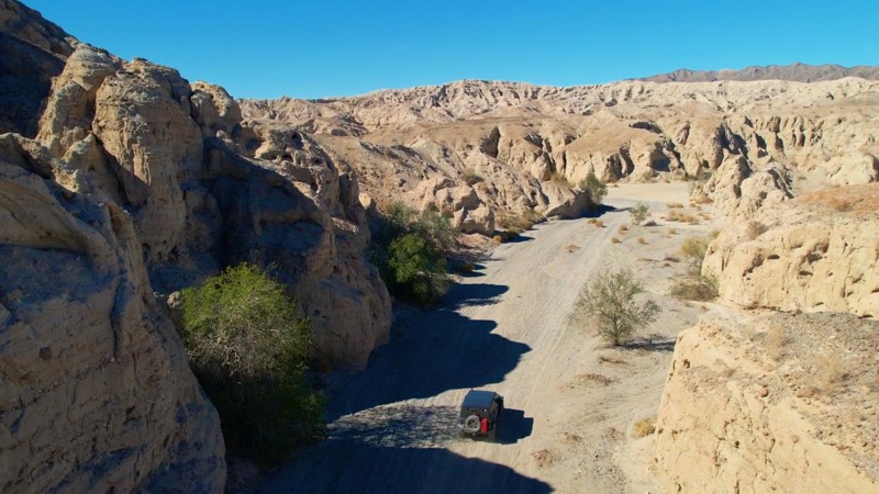
Updated: 05/25/2024
Meccaopia Jeep Trail
Mecca, California
Meccacopia Trail provides a fantastic offroad adventure over easy trails allowing you to focus on the spectacular scenery along its route. The trail follows the border between the Mecca Hills Wilderness and the Orocopia Mountains Wilderness, providing a glimpse of the area before man. Thanks to the restless San Andreas Fault and millennia of erosion, the surrounding area offers some of the world's most exciting and beautiful geologic formations of its kind. As you approach the trail's end and the shores of the Saltine Sea, Meccacopia Trail cuts a path through a badlands labyrinth, a natural maze of small, narrow, steep canyons and caves providing a sightseeing extravaganza. Along the way are many other trails marked and unmarked to explore.
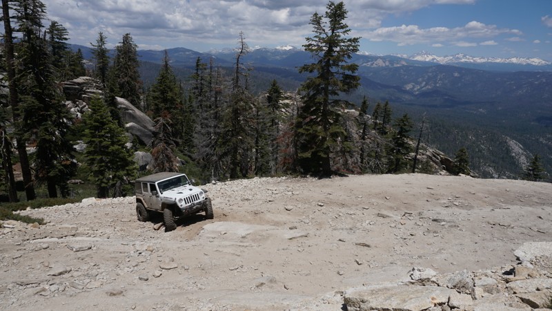
Updated: 05/20/2026
6S59 - Shuteye Peak
Bass Lake, California
Dense forest, water crossings, steep switchbacks, moderate rock obstacles and some amazing views at the Shuteye Peak fire watch tower will make this one of your favorite California trails. High in the Bass Lake Ranger District of the Sierra National Forest, Shuteye Peak overlooks from the Eastern Sierra Nevada Mountains to Kaiser Pass, Shaver Lake and
, to Bass Lake, the Yosemite Wilderness past Madera Peak, over California's Central Valley and beyond. With such diverse trail characteristic from start to finish, Shuteye Peak is one of Central Californias top trails and a must-do for any wheeler looking for high mountain views.
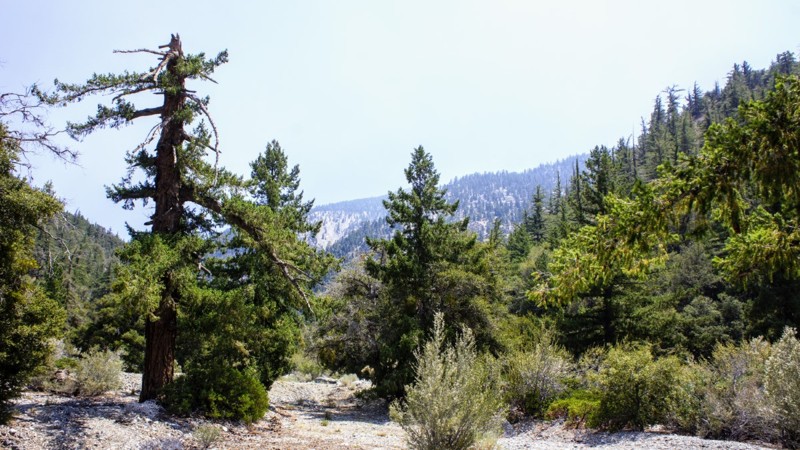
Updated: 05/14/2024
4N11 Big Rock Creek
Wrightwood, California
4N11 Big Rock Creek is in the Angeles National Forest. This trail is literally within two hours of all most anywhere in Southern California. Big Rock Creek runs east to west offering fantastic views of the San Gabriels to the south with Mount Baden-Powell, at an elevation of 9,400 feet a prominent feature of the skyline. To the north is 4N56 Pinyon Ridge trail. These trails are close enough for a morning run and be home for lunch or pack your gear for a campout at Big Rock Campground or choose from several nice dispersed sites along the trail. The campground might be convenient if you are unfortunate enough to have a loved one staying at Fenner Camp, a correctional facility near the trails end.
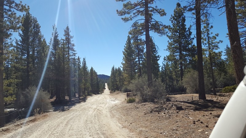
Updated: 07/20/2024
2N09 - Polique Canyon
Big Bear City, California
An easy connector trail. 2N09 is a quick way back to Holcomb Valley. Just be warned, in the snow the trail ices over in the shady areas, and the rain brings long, deep, slick mud holes.
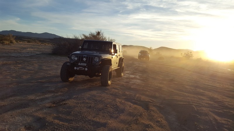
Updated: 11/25/2022
Borrego Mountain Wash
Borrego Springs, California
Deep in the heart of the Anza Borrego State Desert is a neat secret that is rarely traveled. This jewel has everything Anza Borrego has to offer in a short package. Sharing the state park's name, Borrego Mountain Wash has everything from wind caves, Devils Rock Sculptures, narrow canyons, dry waterfalls, and amazing hiking. Just be ready, this trail is also one of the hardest trials in all of Anza Borrego Park, and it leaves no way to run out the way you came in.
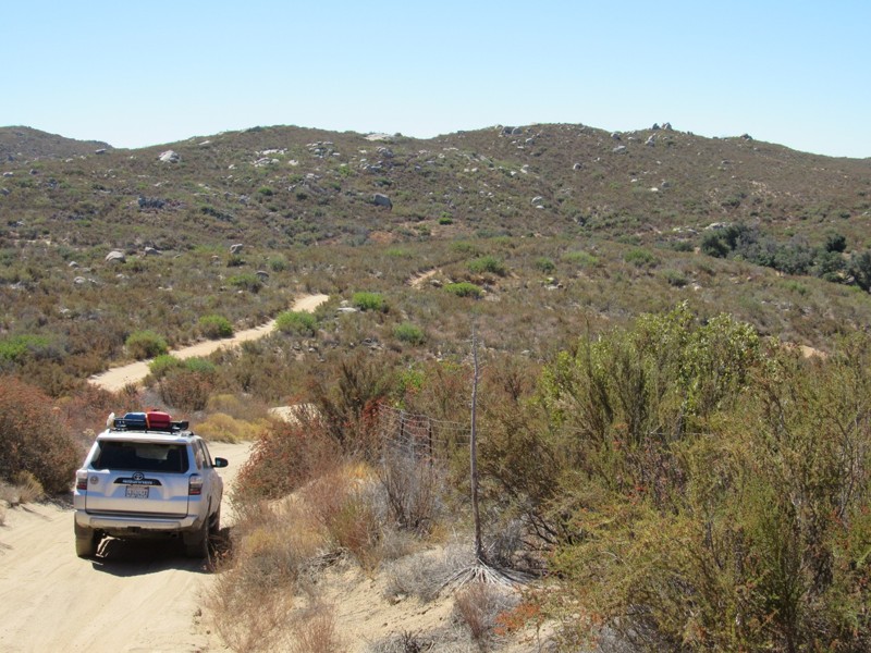
Updated: 05/27/2024
4E03 - Corte Madera Road
Pine Valley, California
Corte Madera Road is a connector trail between Espinosa Trail and Skye Valley Road that forms a 18-mile loop through Cleveland National Forest. To the north and west of the road is Pine Creek Wilderness, which is closed to motor vehicles. The highlights of this short road are the magnificent views of the southern California and Mexico wilderness and the numerous granite boulders that dot the landscape to the east. Along with this road, the 18-mile loop consists of the following additional roads and trails:
16S17 - Los Pinos Road
17S04 - Corral Canyon Road
17S06 - Skye Valley Road
4E03 - Espinosa Trail
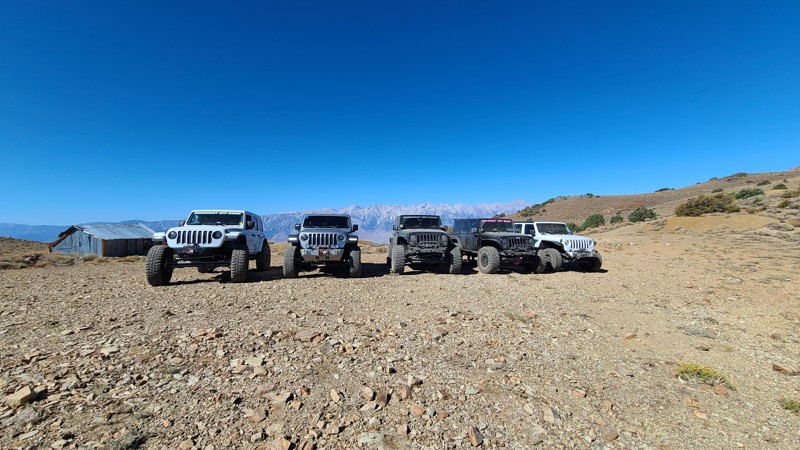
Updated: 07/06/2026
Swansea Grade
Swansea, California
The trail climbs up and over the hills overlooking Death Valley. The trail starts in the desert and heads up the hills into the forest, eventually getting above the treeline. Across the valley is Mount Whitney, the tallest peak in the lower 48. As you follow the ridgeline, you pass what was the old salt tram that took salt from Death Valley down to what was a lake on the west side. Please note: This trail has extremely steep sections. The grade was so steep it was unsafe to get out of the vehicle or even try to take photos of the group. Proceed with caution and never attempt this trail on wet or snowy days.
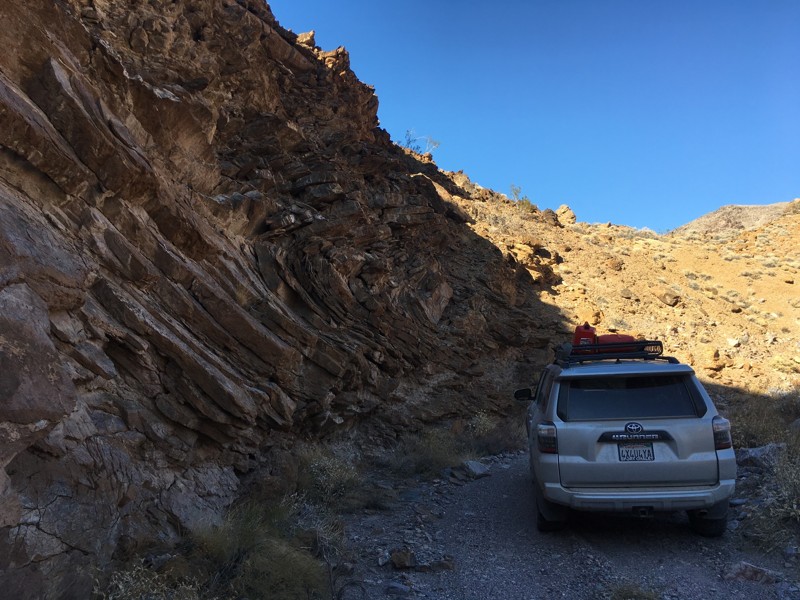
Updated: 11/04/2024
Funeral Range Trail
Furnace Creek, California
The Funeral Range Trail joins a long list of Death Valley areas with morbid names: Coffin Peak, Hell's Gate, Starvation Canyon and Dead Man Pass. The trail runs through the Funeral Mountains along Upper Echo Canyon and offers one of the few difficult trail runs within the national park. Tight canyon walls and rock ledges up to 3' in height will test a vehicle's articulation and a driver's skill level. In addition, the trail lies along the eastern edge of the park and starts and stops in two different states: California and Nevada.

Updated: 03/16/2024
South Carrizo Creek - Anza Borrego
Ocotillo, California
South Carrizo Creek follows its namesake water tributary through a flood plane resulting in one of the greenest trails in the Anza-Borrego Desert State Park. With lush vegetation and perfect for late winter flowers, the trail provides spectacular views of the Vallecito, Tierra Blanco, and the Sawtooth Mountains in one direction and the Carrizo Badlands in another. When exploring the more famous trails, such as Canyon Sin Nombre, don't lose sight of this gem hidden in plain sight.
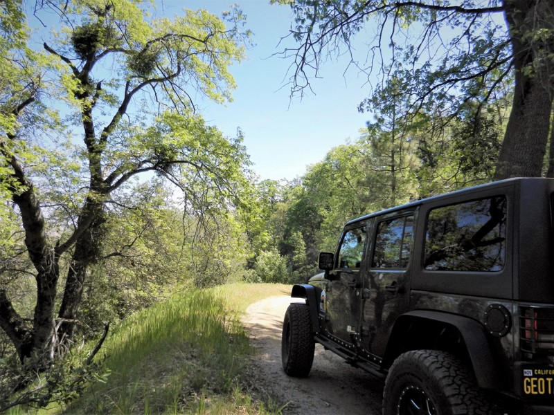
Updated: 10/22/2023
3S08 - Vista Grande
Idyllwild-Pine Cove, California
3S08 - Vista Grande is a little used offroad 4wd trail in the San Bernardino National Forest. It is north of Idyllwild in the San Jacinto Mountains. A beautiful trail at the top, in the pines, fir and cedar. It makes it's way down into a more desert climate and is actually in the Morongo Indian Reservation for it's last mile or so in the north. There are no signs, or gates to prevent your travel on the Reservation. Along with the trail it connects to in the north, it is the northern most Forest Service numbered trail in the San Jacinto Mountains. It meets up with 3S09 Hurley Flats at the end which you can take for a loop run back up to Hwy 243, a short distance from where you started.
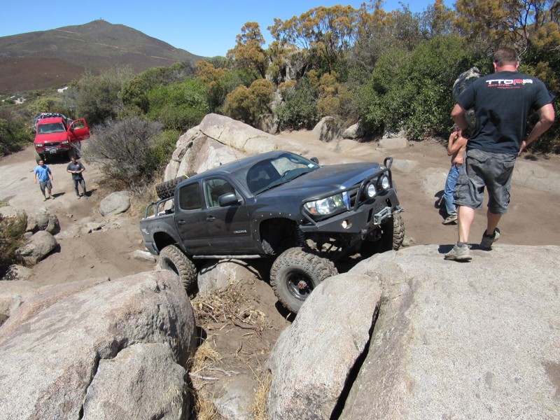
Updated: 06/04/2023
Sidewinder - Corral Canyon
Pine Valley, California
Are you looking for a rock crawling challenge in Corral Canyon OHV Area? If so, Sidewinder is your trail. While not as difficult as nearby Bronco Peak and the Bronco Peak Connector trails, this trail will challenge you and your vehicle. Sidewinder Trail is just over a mile long with several steep rock climbs and sharp drop-offs that make up most of the challenges. Some of the difficult obstacles have alternate routes that may or may not be easier.
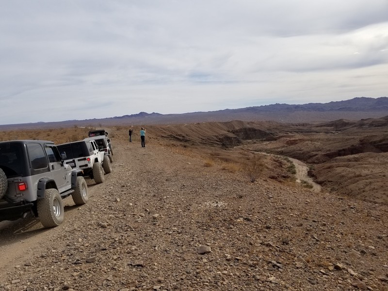
Updated: 04/27/2024
SR2013 - Red Canyon Trail
Blythe, California
The Orocopia Mountains Wilderness Area was once home to one of the largest military bases in the world, while today it is home to some of the most beautiful scenery that Southern California has to offer, including the Red Canyon. The Red Canyon Trail takes you through this wilderness area bobbing and weaving its way through the desert and up and over the mountains to where the Red Canyon resides. This splendid trail is perfect for people new to off-roading up to the most experienced 4x4 enthusiast. Because of the ample amount of wilderness and BLM land, this trail is a great start to exploring the area, or just to get away for a weekend. Thus the next time you are near Palm Springs or the Salton Sea, think about checking out Red Canyon.

Updated: 06/17/2024
3N43 - Harvey Mine
Big Bear Lake, California
3N43 - Harvey Mine is one of many off-road trails in the San Bernardino National Forest, north of Big Bear Lake, in Holcomb Valley. This short trail is close to the Holcomb Valley Campground, near Coyote Crag and connects to the west end of the John Bull rock crawling trail.
This is a great trail for a beginner with a high clearance 4x4 to explore while in Big Bear's Holcomb Valley or a quick short cut for more experienced wheelers going to or coming from a run through John Bull.
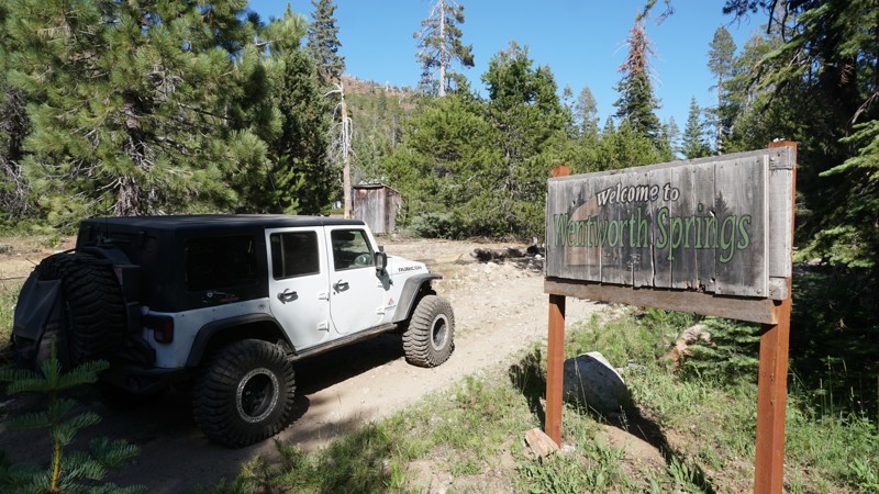
Updated: 02/01/2023
14N07 to Wentworth Springs (Route)
Fresh Pond, California
This route to Wentworth Springs sits northeast of Pollock Pines, California, high in the mountains of the Eldorado National Forest. 14N07 to Wentworth Springs is an easy, scenic route traveling through dense forest, crossing multiple creeks, passing through the historic site of Wentworth Springs and ending at not only the Wentworth Campground, but the original beginning of the legendary Rubicon Trail.
Those new to off-road will enjoy this route for its scenery, history and mild off-road challenges while more advance wheelers will probably be more focused on the Rubicon Trail at the end.
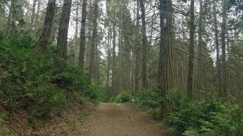
Updated: 10/29/2025
Black Gulch Jeep Trail
Pettit Place, California
Black Gulch 4WD trail at 11 miles long drops you about 3000 feet in the dense Sequoia National Forest from its start at Rancheria Road, eventually leading to paved roads and the shores of Lake Isabella. The road has challenging sections that are well-marked, allowing us to bypass these difficult portions. The trail is narrow and heavily rutted and will take maneuvering to enable another vehicle to bypass. We found no camping along the trail but did camp near the trailhead on Rancheria Road at Evan Flats.

Updated: 05/04/2024
Fissure Mountain Trail
Landers, California
Possibly the only real intermediate trail in Johnson Valley, California, Fissure Mountain Trail is a great offroad trail for everyone from stock 4x4s to built buggies. This classic off-road trail is a unique scenic drive as it skirts along the famous Hammer Trails and has epic views allowing you to see miles in almost any direction. The trail got its name after a fissure opened up during the Landers quake in 1992.
Since most of the trails in the area are either easy or insanely hard, this is a welcome addition to the area as it makes for a great Jeep Trail to drive for people that are learning to offroad or the people that just want an enjoyable way to take a break from the hard trails. And this one isn't just another rock crawling trail; it has some overland features to it as well, with unique camping opportunities. So if you are in Johnson Valley, and want to do something different, check out Fissure Mountain, and make it a memorable adventure in the deserts of Southern California.
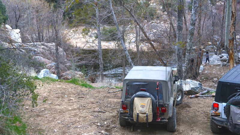
Updated: 03/12/2026
Devils Hole
Lake Arrowhead, California
Forest Route 3N34D is the 4x4 trail to Devil's Hole, a dark, deep, swirling pool of water in Deep Creek, north of Lake Arrowhead, California. Devil's Hole is a popular warm-weather destination. This trail offers the chance to combine some 4x4 adventure with a cool dip in the creek, some relaxation near the water's edge, fishing, or even hiking (The Pacific Crest Trail cuts through this trail near the water). In summer months, plan to come early and stay late to avoid the 4x4 traffic jams on this narrow, winding offroad trail.

Updated: 07/01/2023
High Valley Road
Clearlake Oaks, California
The High Valley Road climbs through very pretty pine forest and provides frequent peekaboo views of Clear Lake, which at 68 square miles is the largest natural freshwater lake in California (remember that Lake Tahoe is partially in California and partially in Nevada). You'll also see 4,305 foot tall Mount Konocti, which is still classified as an active volcano-- although it last erupted over 11,000 years ago. High Valley Road is a great way to climb up to the intersection with Bartlett Springs Road, which leads deep into the Mendocino National Forest.
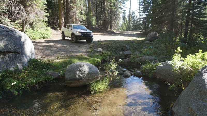
Updated: 06/21/2024
8S09 - Peckinpah / Whiskey Road
North Fork, California
8S09 - Peckinpah / Whiskey Road starts in Cascadel Woods just outside North Fork, California in the Sierra National Forest. This long easy trail slowly climbs into the dense forests of the Whiskey Snowmobile area, passes Whiskey Falls Road, Peckinpah Mountain Loop, and includes plenty of additional connecting trails to explore in this area of the Central Sierras.
Peckinpah / Whiskey Road is a great trail for any first-time off-roaders or more experienced overlanders looking to explore a new area.
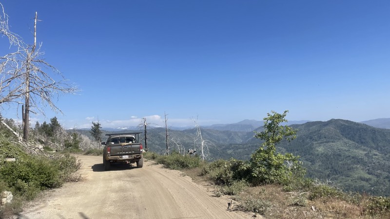
Updated: 12/15/2025
Old Yosemite Coulterville Rd
Buck Meadows, California
Old Yosemite Coulterville Road is a historic trail located in Stanislaus National Forest that crosses over into Yosemite National Park. Coulterville Road was opened in 1874 and was the first highway into Yosemite, a toll road that mainly served stagecoaches. The road was popular until around 1915, when free alternatives such as Big Oak Flat Road made Coulterville Road obsolete. Today, the forest service maintains Coulterville Road for vehicle travel. While it may not be the quickest or most efficient way to enter Yosemite, Coulterville Road provides miles of beautiful scenery on seldom-traveled forest service routes and is a fantastic way to start your visit to Yosemite National Park.
Old Yosemite Coulterville Road is well maintained by the forest service, and the vast majority of the road could be done in a 2WD. However, there is one large obstacle that requires 4WD. On the Yosemite side of the trail, there is a large pile of downed trees that have been covered with loose dirt to allow vehicles to travel over them. Other than the one obstacle, the trail is graded dirt with small hills and ruts and a shallow water crossing. Camping is not allowed.
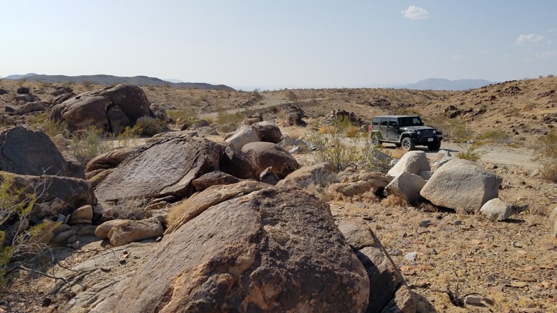
Updated: 02/19/2025
Black Eagle Mine Road
Indio, California
Black Eagle Mine Road begins in Joshua Tree National Park (JTNP) and crosses its eastern border into the Bureau of Land Management controlled areas and the Eagle Mountain Mining District. Before the JTNP was established, Black Eagle Mine Road provided the main route to the many mines along its path. It now provides park visitors a Mojave Desert experience following a corridor between the untouched Pinto Basin Wilderness to the north and the Eagle Mountains Wilderness to the south. Along the way, experience both the natural beauty of the Mojave Desert from the flat open desert and views of the distant Eagle Mountain Range to the man-made remnants of its mining history.
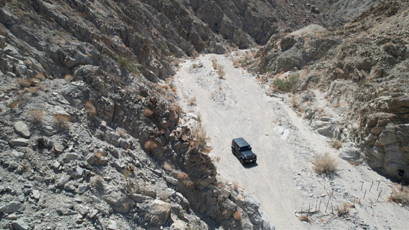
Updated: 01/25/2023
Fargo Canyon Road
Indio, California
Fargo Canyon Road is located in the Mojave and Colorado desert on BLM land just south of Joshua Tree National Park. Beginning in a wide-open sandy wash, the trail soon becomes surrounded by the tall steep walls of Fargo Canyon. The road was originally built and paved in the 1930s to construct the Coachella Tunnels, a portion of the Colorado River Aqueduct. After 80 years, the asphalt has heavily disintegrated and terminates at a construction site for the Coachella Tunnel, which still has water coursing through it beneath your feet. The road becomes increasingly rough towards its end, offering some smaller rock waterfall obstacles, narrow paths, and unavoidable large rocks, all to test your offroad skills. The trail ends at the Joshua Tree National Park border, where vehicles are prohibited. Fargo Canyon Road offers a stark desert canyon desolation with a beauty of its own. It is accented by the brilliant white summer afternoon clouds making exploring over its length a memorable experience.
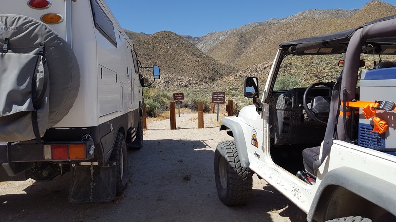
Updated: 03/16/2024
Carrizo Creek / Canyon / Gorge - Anza Borrego
Ocotillo, California
Carrizo Canyon, Creek, or Gorge according to where you find the information at is one of the few pathways to get back into Goat Canyon where the worlds largest wooden trestle train bridge sits. Carrizo, Spanish for a willow that grows along arid water ways in Mexico, is a great descriptive for views along the trail. The trail is a vast sandy wash which narrows and becomes more of a mild rock crawling type of trail. Even with the mild rock crawling, many off-road and overland enthusiast find themselves heading down this trail on either a day trip or an overland adventure.
The train bridge in Goat Canyon was part of the old San Diego and Arizona train system that is no longer in use. Hiking to this location is pretty strenuous and shouldn't be done in the summer months. If you choose to hike to the bridge during the cooler months, it makes for an amazing overland / hiking exploration trip.
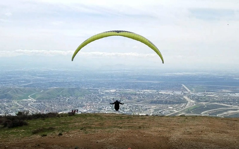
Updated: 04/07/2024
2N30 - Cloudland Cut Off
Crestline, California
2N30 Cloudland Cut Off is on the south-facing slopes below the community of Crestline in the San Bernardino National Forest. It is an ideal trail for the new 4x4 off-road wheeler due to no obstacles and its shorter length. The views of the Inland Empire are fantastic where you can see from the Banning Pass and Mount San Jacinto to the east and Orange and Los Angeles counties to the west including the Pacific Ocean. The real highlight of the trail is on Marshall Peak where the paragliders and hang gliders launch. When conditions are good they can fly for hours on the thermals and eventually land 3,000 feet below near the California State University at San Bernardino.

Updated: 06/03/2025
Turkey Claw
Yucca Valley, California
Turkey Claw isn’t just a trail, it’s a rite of passage for true offroad warriors. Tucked into the legendary Johnson Valley, California, the stomping grounds of King of the Hammers, this short but savage rock-crawling beast will challenge your rig and your nerve from the very first boulder.
Whether you're behind the wheel of a nimble Jeep 2-door JL, a classic CJ, or a fully-built 4-door JKU, Turkey Claw doesn’t discriminate, it dishes out punishment and thrills in equal measure. Expect steep climbs, axle-snapping rocks, and narrow lines that demand precision, guts, and a serious sense of adventure. Body damage? Possible. Driveline carnage? Maybe. Epic stories and unforgettable memories? Guaranteed.
If you're craving a heart-pounding challenge in SoCal’s offroad playground, head southwest from Means Dry Lake and put Turkey Claw on your must-conquer list. It's not just a trail, it’s a test of everything you and your 4x4 are made of.
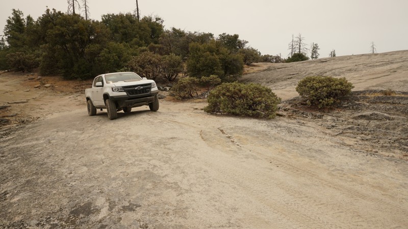
Updated: 04/15/2024
6S13 - Chepo Saddle
Oakhurst, California
6S13 - Chepo Saddle sits just outside Oakhurst, California, and north of Bass Lake in the Sierra National Forest. Some mild 4x4 challenges along this trail lead up to the slabs, also known as Moon Rock at Waypoint 10 before the trail eases up and continues higher into the forest. With a number of additional trails in the area, including the more technical 6S65 - Chepo Slide, wheelers can easily spend a whole day here.
6S13 is a great trail for new off-roaders with a stock 4x4s looking to explore and a necessary trail for more experienced wheelers with built rigs looking to reach the more technical Chepo Slide Trail.
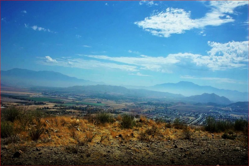
Updated: 11/23/2023
Dagget Creek Path
Menifee, California
Dagget Creek Path is a diamond in the rough. It offers fantastic 360 degree views from the 2,256 foot hill top; Santiago Peak to the west, Mount Baldy, Big Bear, Mount San Gorgonio to the north and Idyllwild, Mount San Jacinto to the east. This trail is only 1 mile west of Menifee, 1 mile south of Perris and 1 mile east of Quail Valley. It is a perfect 4x4 off-road trail to try out that new addition to your rig or if you just don't have the time to run up to the previously mentioned locations.
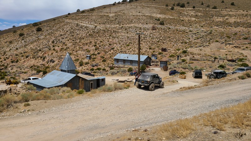
Updated: 08/30/2023
Cerro Gordo
Lone Pine, California
In the deserts of Inyo County sits one of the greatest attractions to the overland community. Sitting tucked swaying in the hills and long forgotten is the Cerro Gordo Ghost Town, also known as Cerro Gordo Mine. This blast from the past ghost town is a must-stop when in the area of the 395 or near Death Valley and offers a fantastic adventure back in time. The ghost town is privately owned, but they allow visitors to stop by and check out the place. This is one of those places you have to see at least once. And with all the other attractions in the area, from Kennedy Meadows, Alabama Hills, and the Reward Mine, this can easily be part of an ultimate overland adventure you can plan with your friends. So the only question is, what are you waiting for?
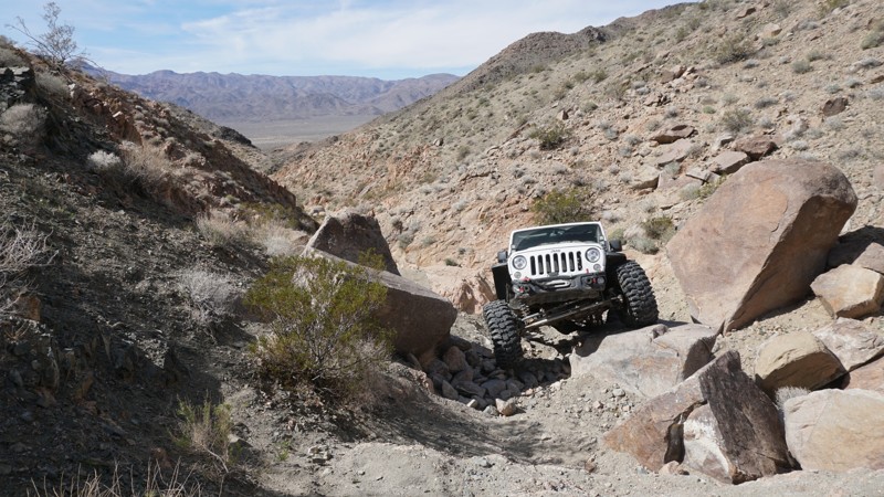
Updated: 12/11/2022
Isham Canyon
Trona, California
Trona, California is home to this iconic desert rock crawling canyon. Isham Canyon sits in the northeastern section of the Searles Valley, west of Panamint Valley, west of Death Valley, and just over 15 miles north of the Trona Pinnacles. In addition to some killer desert views of the Searles and Panamint Valleys, Isham Canyon is known for hardcore wheeling, body damage, and all-around off-road carnage throughout its steep, narrow, off-camber rock obstacles.
Isham Canyon is one challenge after another, with glass breaking, body denting, and dif hanging rocks around every corner. This trail is for experienced wheelers in well-built rigs.
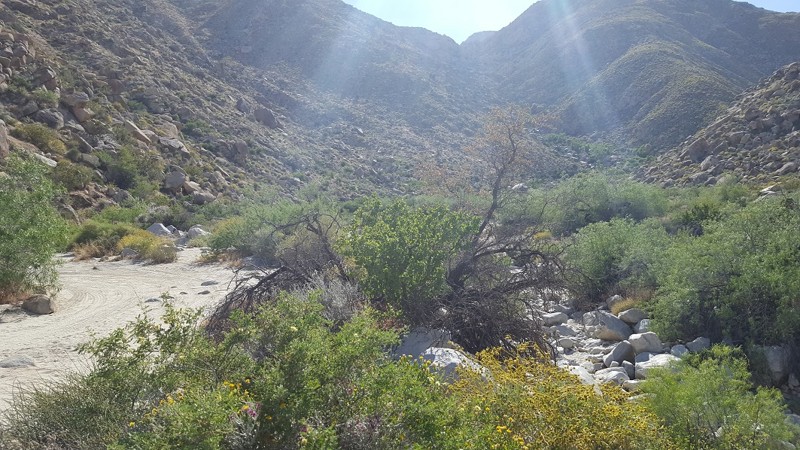
Updated: 10/17/2024
Sheep Canyon - Anza Borrego
Ocotillo, California
Part of Coyote Canyon Lower, Sheep Canyon Trail used to be a popular thruway people enjoyed often. Sheep Canyon got its name from the seasonal pools of water and mud that the big horn sheep come down from the mountains to drink. Now since the park service has closed the trail for a short distance between Coyote Canyon Upper and Coyote Canyon Lower, this area sees a lot less traffic on it. Thus, now this area is a great retreat to avoid crowds and enjoy the peaceful scenery of the Anza Borrego Desert.
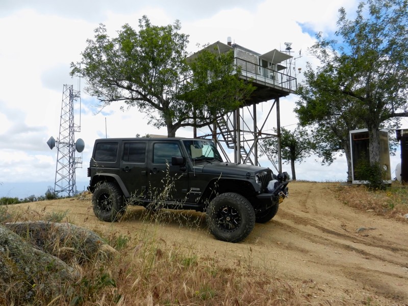
Updated: 11/19/2022
6S22 - Red Mountain OHV
Anza, California
6S22 Red Mountain OHV is the longest of the three OHV trails on Red Mountain, the others being 7S04 Juan Diego Flats and 6S89 Juan Diego. It is just outside the Cahuilla Mountain Wilderness Area in the San Bernardino National Forest. This trail along with the two sister trails are a perfect off-road experience for the new wheeler. The area is known for its gemstone mining and for the Red Mountain Fire Lookout at its end.
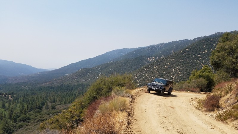
Updated: 09/19/2022
2N06 Radford Truck Trail
Big Bear City, California
Closed until 12/31/23 per Forest Closure Order 05-12-52-22-08, Radford Fire Closure Area.
2N06 Radford Truck Trail is a winding fire road in the 823,000-acre San Bernardino National Forest just south of Big Bear Lake. This less-traveled road leads you to a maze of off-road, hiking, and biking trails in the Big Bear south Shore area to continue your adventure. As the road climbs, watch your surroundings for the change from the lower altitudes, dominated by Live and California Black Oak trees, then quickly changing with the rise in altitude to a conifer forest dominated by tall Ponderosa Pine sheltering you along the way. At the higher elevations and off to the south are grand views of the valley below and Mount San Gorgonio.
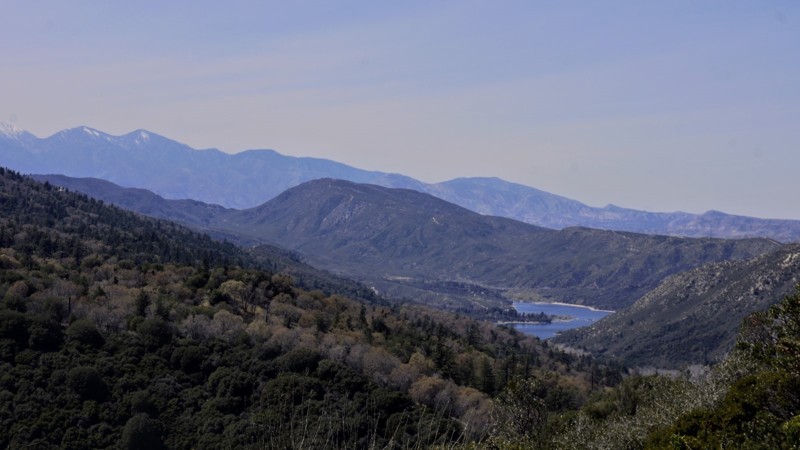
Updated: 10/15/2024
2N38 Valley of the Moon
Crestline, California
2N38 Valley of the Moon is in the beautiful San Bernardino National Forest. It is between Crestline/Lake Gregory to the south and 2N37 Miller Canyon OHV to the north. This trail's attraction is its access to miles of OHV designated trails to the north. There are thousands of miles of roads and trails on public lands that are appropriate and accessible for Off-Highway Vehicles (OHV's) use. OHV's are a fun and exciting way to experience America's natural treasures. These vehicles are not street legal and must display a Green or Red Sticker issued by the State. Unless otherwise posted, normal sized vehicles may use the OHV trails also. To the west around Waypoint 2, there are some beautiful views of Lake Silverwood.
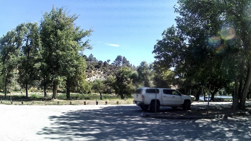
Updated: 12/15/2023
Fenner Saddle Road
Wrightwood, California
Are you looking for a nice short off-road trail near Wrightwood to spend an hour or two? Then Fenner Saddle Road is the trail for you. This trail winds through the Angeles National Forest from Highway 2, over to Big Pines Highway N4, and brings you out at Jackson Lake, a popular day-use area, where you can picnic under shady pine trees and, if you are so inclined, go fishing. Along the route are incredible vistas of the mountains and the Mojave desert to the north.

Updated: 04/21/2024
Phillips Canyon West
Barstow, California
Phillips Canyon is a harder trail in the Calico mountain range network. Phillips Canyon is a narrow path, just a single vehicle width with several hard obstacles. Some of these obstacles are a double 3-foot waterfall, rocky hill climb with 1-4 foot ledges in the middle, narrow canyons with large boulders, and a long, even steeper hill climb with 3-foot ledges in the middle. But the obstacles are not what most people remember of Phillips Canyon. Phillips Canyon has some of the most amazing views in Southern California, including red rock canyons, mud hills you can explore, sandstone canyons, natural stone arches, and old silver mines. Besides the trail, there are ample things to do in the area, including Calico Ghost Town, the robust trail network in calico, exploring abandoned mines, the Mojave River / Road, and exploring the Mojave Desert.
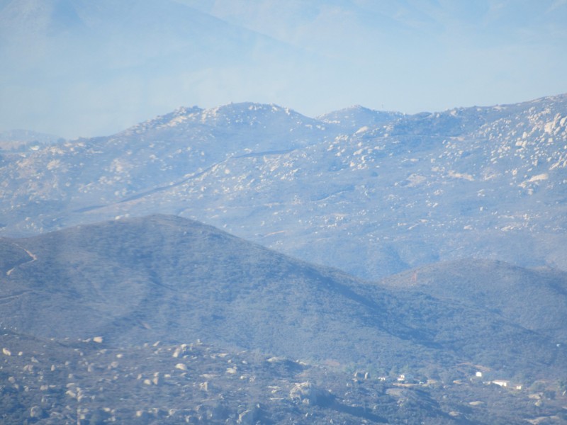
Updated: 05/27/2024
16S17 - Los Pinos Road
Pine Valley, California
Los Pinos Road is an easy, 4.7 mile road that lies about 50 miles east of San Diego, CA and just 10 miles from Mexico. The road can be used as an out-and-back road or as a connector road forming part of a much larger 18-mile loop trail through the Cleveland National Forest. The highlights of this short road are the magnificent views of the southern California and Mexico wilderness. Driving to the top of Los Pinos Mountain (elevation 4800') one is greeted with 360-degree views of Hauser Wilderness and Mexico to the south, Pine Creek Wilderness to the north, the immense Corte Madera Mountain (4600' tall granite boulder) to the east, and Lake Morena to the west. At the top of Los Pinos Mountain is a working fire lookout tower which, when open, allows the visitor even more breathtaking views. Along with this road, the 18-mile loop consists of the following additional roads and trails:
17S04 - Corral Canyon Road
4E03 - Corte Madera Road
17S06 - Skye Valley Road
4E03 - Espinosa Trail
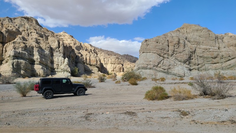
Updated: 06/05/2022
Godwin Jeep Trail
Mecca, California
Godwin Trail follows the southern border of the Mecca Hills Wilderness and is just north of the Salton Sea. Thanks to the restless San Andreas Fault and millennia of erosion, the area provides some of the world's most unusual and beautiful geologic formations of its kind. Godwin Trail cuts a path through a badlands labyrinth, a natural maze of small, narrow, steep canyons and caves providing a sightseeing extravaganza and fun off-road driving. The trail offers off-road driving challenges with its steep climbs and narrow paths. Along the way are many other trails marked and unmarked to explore.
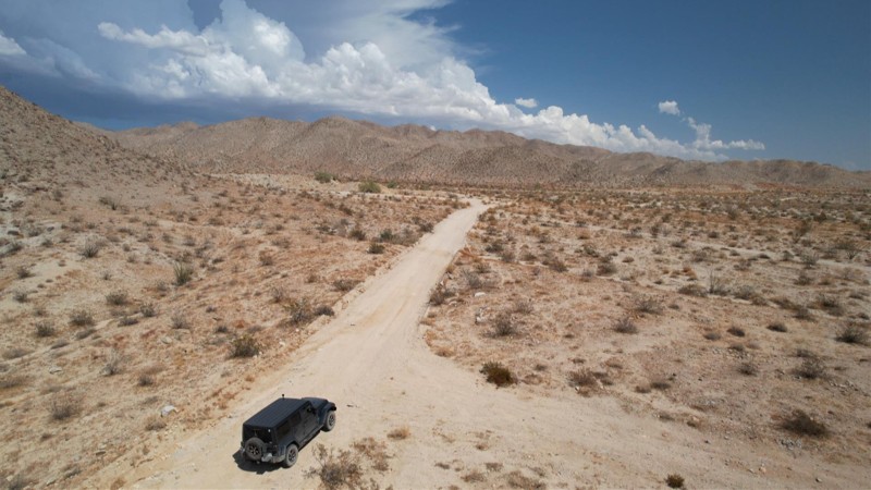
Updated: 02/19/2025
Aqueduct Road West
Indio, California
Aqueduct Road is located in the Mojave and Colorado desert on BLM land just south of Joshua Tree National Park. The road's namesake, the Colorado River Aqueduct, whose water is the lifeblood of greater Los Angeles, courses through a series of tunnels bored into the rugged foothills to the north of the road, a portion of which is beneath your feet. There are still many trails and Aqueduct artifacts to explore off of Aqueduct Road that were leftover from that massive project and access to other courses traveling into the Joshua Tree National Park. Aqueduct Road itself closely straddles the somewhat arbitrary division between the Mojave and Colorado Deserts, and at times you can stand with a foot in each. The desert offers a stark desolation with a beauty of its own. It is accented by the brilliant white summer afternoon clouds making a casual drive over its length a memorable experience.
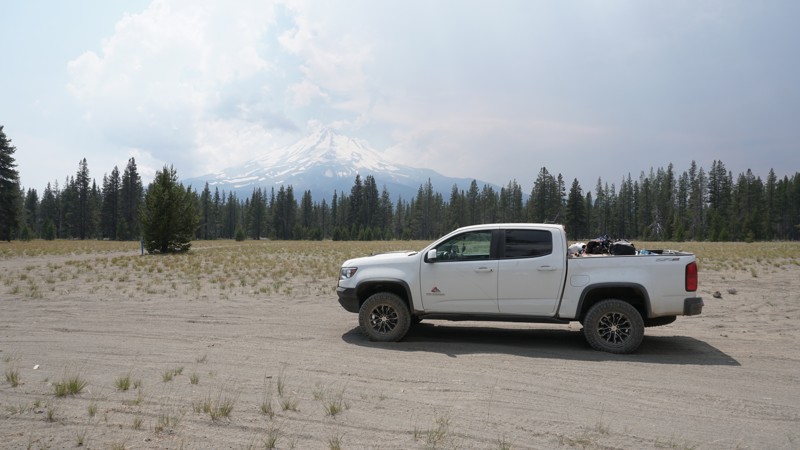
Updated: 07/14/2026
Military Pass Road
Bartle, California
Military Pass Road is just east of Mount Shasta in Northern California's Shasta-Trinity and Klamath National Forests. With some sections of pavement, this long easy dirt road connects Highway 89 on the south to US 97 on the north. Military Pass is a great easy trail for new off-roaders looking to explore in this area of the forest, where there is no shortage of additional connecting trails to keep you busy for days.
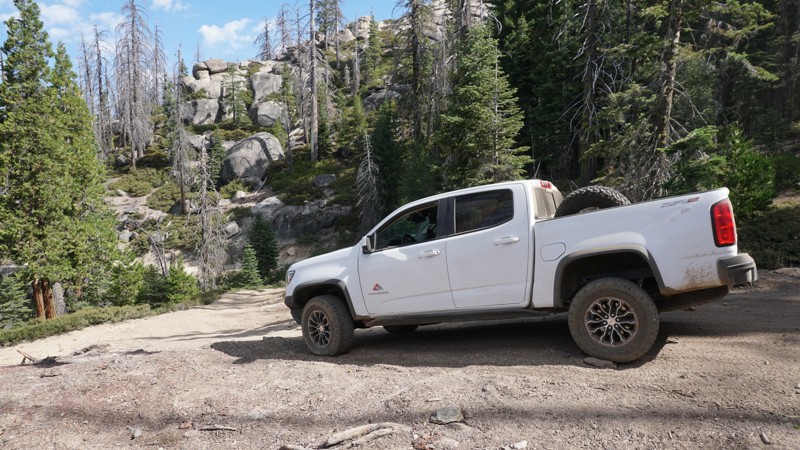
Updated: 07/14/2023
7S02 - Rock Creek Road
North Fork, California
Rock Creek Road is a long, fairly easy, and scenic forest trail. It is a back-bone trail in the Whiskey Falls, Chiquito Ridge, and Shuteye Peak areas of the Sierra National Forest outside North Fork, California. 7S02 - Rock Creek Road includes numerous other connecting trails to explore, plenty of dispersed camping options, creeks to cool off in, and some great views of Shuteye Peak and Chiquito Ridge. Any wheeler with a 4WD vehicle will enjoy exploring this and the surrounding trails.
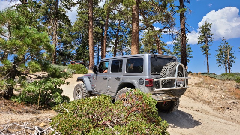
Updated: 06/16/2025
Snow Slide
Running Springs, California
Discover Big Bear’s Best-Kept Secret: 2N13 Snow Slide Trail, which could possibly be one of the most underrated overland trails in Big Bear. Snow Slide Trail is a hidden scenic route through the San Bernardino National Forest that's perfect for a family outing or a weekend adventure with friends. If you're looking to escape the crowds and take in some unbelievable scenery, this trail delivers.
This seasonal route features a smooth, easy-to-navigate trail, making it a great option for stock offroad vehicles. As you follow the trail, you'll be treated to sweeping views that make it feel like you can see the edge of the world. It's the kind of place where you stop to take it all in.
For those who enjoy dispersed camping, Snow Slide Trail offers several quiet, scenic spots that are perfect for setting up camp. Most sites along the way boast incredible views and a peaceful atmosphere that feels miles away from civilization.
If you're in the mood to explore something new and off the radar, Snow Slide should be at the top of your list. It’s a hidden gem waiting to be explored.
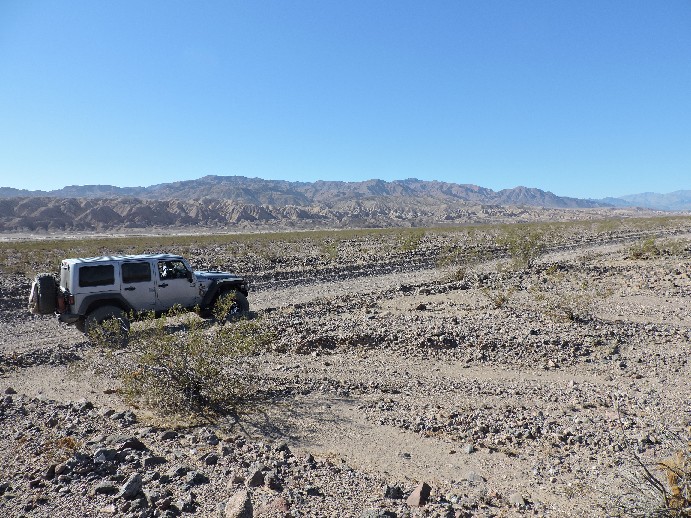
Updated: 09/20/2024
Harry Wade Road
Shoshone, California
The Harry Wade Road (aka Badwater Road) is an easy backcountry route in Death Valley National Park and was first pioneered in 1849 by the Harry Wade family on their way to the California gold fields. Today this remote area of Death Valley National Park sees few visitors but offers spectacular views, and a dramatic water crossing of the Amargosa River, if there is water present.
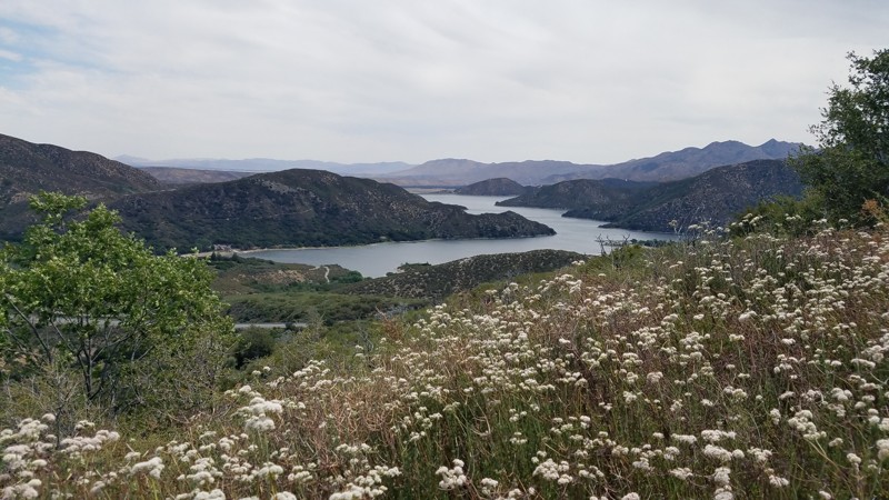
Updated: 02/25/2024
2N59 Rainbow Road
Hesperia, California
Rainbow Road parallels the Rim of the World Scenic Byway and shares the stunning views of the San Bernardino mountains and Silverwood Lake. 2N59 Rainbow Road is in the 823,000 acres San Bernardino National Forest just south of the 1,500 square mile Silverwood Lake and only a short drive from Interstate 15. The road meanders through the boundary where tall lush pine forests share the road with expansive, majestic oaks, tall, graceful birch trees, with flowering mountain shrubs coloring the landscape. The road uses a bridge to pass over Sawpit Creek, which flows even in the summer and provides a cooling respite on a hot summer day.

Updated: 06/16/2024
26E216 - Mirror Lake Trail
Shaver Lake, California
This high mountain lake trail adds extra pucker factor with its steep, rocky, off camber winch hill where winch posts have been drilled and set in the rocks at two locations.
Mirror Lake Trail is a hardcore rock crawling 4x4 trail that runs from Strawberry Lake Trail, near Sand Flats, to Mirror Lake at its north end. Rock crawling, swimming, fishing, camping and lake side relaxation in the high mountains of the Sierra National Forest make for one of the most challenging and rewarding 1.3 miles you can run.
Mirror Lake Trail is one of many 4x4 trails in the Red Mountain off-road trail network which sits northeast of Shaver Lake and Southeast of Huntington Lake.
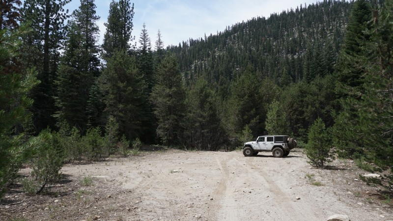
Updated: 06/21/2024
Strawberry - Twin Lakes
Kyburz, California
At just one-half mile off Highway 50, east of Kyburz, California, in the Eldorado National Forest, Strawberry - Twin Lakes Trail is an easy trail to access. This easy forest road travels next to Strawberry Creek and is good for beginners looking to explore the forest or serves as an important connector to Strawberry Pass, at Waypoint 06, which is a more difficult trail that climbs over the side of Little Round Top Mountain where it overlooks Caples Lake.
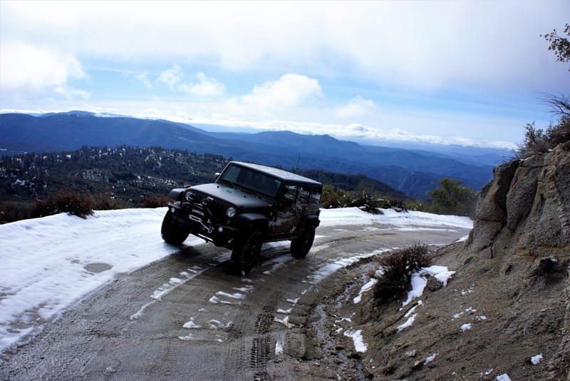
Updated: 06/24/2024
5S10 - Red Hill Road
Idyllwild-Pine Cove, California
5S10 - Red Hill Road is west of Idyllwild/Pine Cove in the San Bernardino National Forest and the San Jacinto Forest District. It's an easy 3 mile drive through beautiful forests at it's upper end and typical high desert scrub when coming in off of the Old Control Road in the lower elevations. When hearing the weatherman announce snow levels to 4000 feet it is especially beautiful as you transition from a bright blue sky on a dry road to a cloudy, wet, snow filled road at the higher elevations. Easily done in 30 minutes, but why? Stop, look, listen, enjoy! Everything Idyllwild has to offer can be found here.
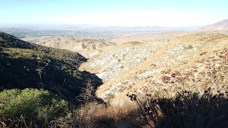
Updated: 07/07/2024
4S10 - East Indian Creek
Idyllwild-Pine Cove, California
4S10 - East Indian Creek is just one of the many trails that make up the 4x4 off-road network west of Idyllwild. It is located in the San Bernadino National Forest and it is rarely closed. East Indian Creek is a designated OHV trail as well as a deer hunting area, so use caution and be prepared to share the road. This trail is below evergreen level but you will travel through the typical Southern California sage, mesquite, manzanita and scrub oak, with outstanding views to the west-southwest.
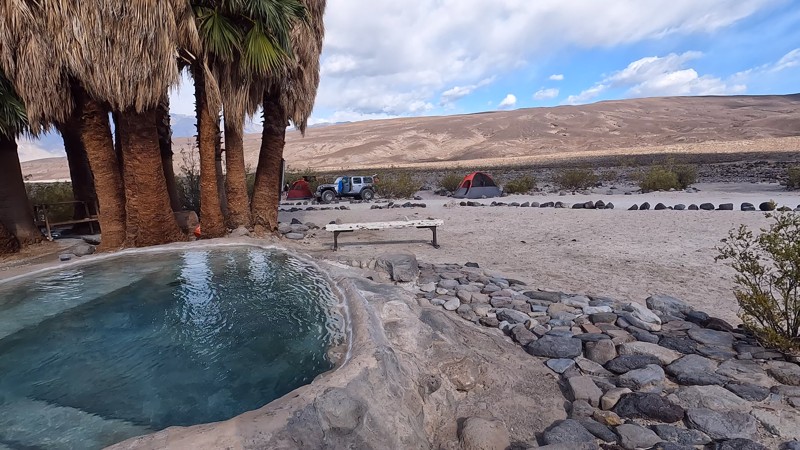
Updated: 03/09/2026
Warm Springs Road
Beveridge, California
Perhaps the most remote trail in the lower 48, Warm Springs Road, has virtually nothing around it. But what brings people to this desert is a small natural hot spring, an interesting life-giving oasis in his remote, desolate area. The best place for camping is at the hot springs. There are plenty of places for any-sized group to camp. Some choose to camp close to the hot springs, while others prefer to be further away. Note: There is natural spring water at this location, meaning you can take a shower and clean up a little. 2nd Note: Prior to visiting the hot springs, it would be wise to understand the culture around hot springs in California.
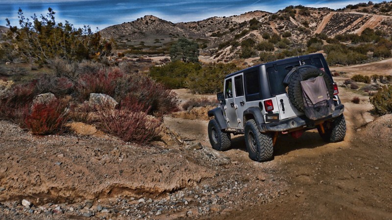
Updated: 06/17/2024
Hungry Valley SVRA - Pipeline Road
Santa Clarita, California
Pipeline Road is one of numerous off-road trails in the Hungry Valley SVRA (State Vehicular Recreation Area) just outside of the Gorman and Frazier Park mountain communities in Southern California. Over 130 miles of motorcycle, ATV and 4x4 trails spiderweb throughout this 19,000 acre park. To traverse these trails, you will climb over hills, plow through muds pits, shoot down sand washes and at the end of the day, idle into one of the numerous campgrounds. On any given weekend this park is full of dirt-bikes, side-by-sides, quads, and 4x4s.
If you are new to off-roading and just looking to get your first taste, Pipeline Road is a great place to start.

Updated: 09/24/2024
Butte Valley
Furnace Creek, California
In the middle of nowhere on the backside of the Panamint Mountain Range lays a secret of the desert. Even though it is extremely remote (60+ miles to the nearest town) this gem of the desert is a popular place for overlanders and off-road enthusiast to visit. Butte Valley, on the southeastern corner of Death Valley, is a unique and exciting place only accessible by 4wd on very old Jeep Trails. While visiting the area be prepared for some amazing views of lands where very few humans have ever been. You will dive into the old mining days of Panamint Mountains as you enter an area that was constructed back in the late 1800's. Becuase of the immense history, offroad enthusiasts have been visiting this unique wonderland for a long time, both enjoying its beauty and preserving it for future generations. Thus, the next time you are visiting Southern California or looking for something near Las Vegas, plan a trip to Death Valley and check out Butte Valley. To spice things up, make this into a weekend overland adventure including Warm Springs Road, Butte Valley, Mengel Pass, and Goler Wash. This just might be the best 4wd trip you have or will ever take.
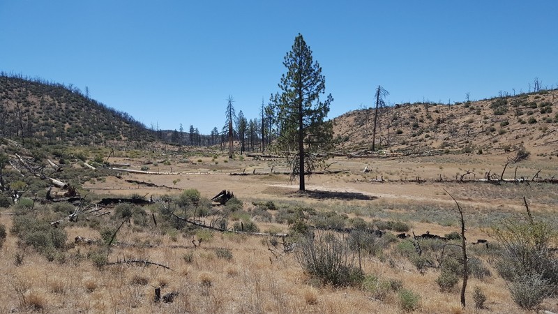
Updated: 05/13/2024
Yellow Jacket Trail (Upper) / 20W24 / 126
Frazier Park, California
Yellow Jacket Upper was once an extreme trail that has now become easy. With a few tight areas and just one rocky area, this trail can be easily traveled in most stock 4x4's. Along the route, you will pass through several meadows that bring some beauty into this burned out area.
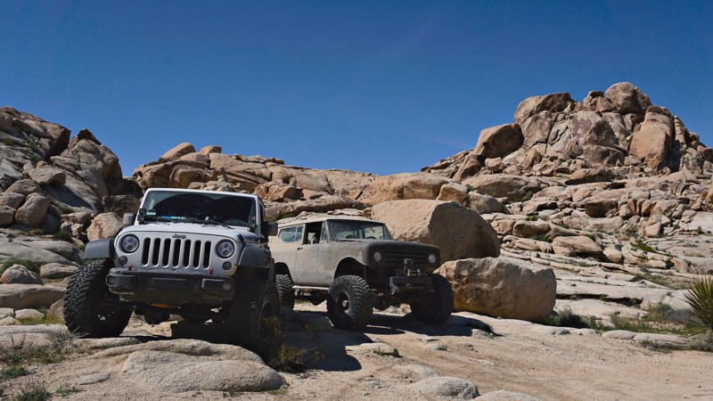
Updated: 09/30/2023
Hammer Down Trail - Cougar Buttes
Lucerne Valley, California
Cougar Buttes, in the Johnson Valley OHV Recreation Area, is home to a number of rock crawling trails, but none quite like this three-quarter mile stretch.
Hammer Down is a serious 4x4 trail that is likely to break, bend, dent and possibly roll your rig. From Gate Keeper to Gate Keeper, the rock obstacles here are continuous. It's hard to tell where Hammer Down obstacles end and the next starts. Boulder, after boulder, after waterfall, after hard rock notches, after boulder, this trail will keep you in low range, with your head out the window watching your tire placement.
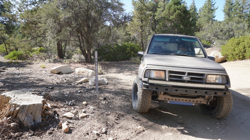
Updated: 06/15/2024
3N83 - Upper Holcomb
Big Bear Lake, California
3N83 is a quick and mildly challenging off-road run through the dense forest of upper Holcomb Valley, north of Big Bear Lake in California's San Bernardino National Forest. 3N38 - Upper Holcomb is a lesser-known and less traveled trail than others in the area and makes a great add-on to a day of exploring through the trails of Big Bear. This off-road trail is easy to access and offers a good challenge to those new to off-roading.
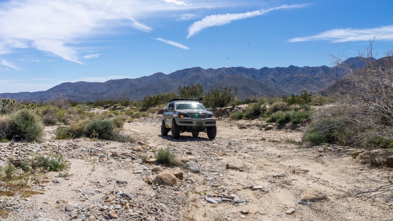
Updated: 11/27/2023
Collins Valley Road
Borrego Springs, California
Collins Valley Road offers a stunning drive through the Anza Borrego Desert into the northernmost area of Coyote Canyon. Filled with lush vegetation fed by Coyote Creek, don't miss the opportunity to walk into the palm grove oasis just off the trail. The final leg of the trail takes you directly into Coyote Creek wash, where the drive gets bumpy! This is an excellent addition to Coyote Canyon Road and Sheep Canyon Road to make a full day of trail riding just outside of Borrego Springs.
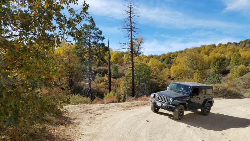
Updated: 07/23/2023
2N25 - Rouse Ranch Road
Lake Arrowhead, California
Rouse Ranch Road begins on the edge of the Lake Arrowhead community and the San Bernardino National Forest border. Only a few feet past the Forest Service gate, the only sign of civilization is the road. The surroundings are beautiful, especially during the fall color change. The road offers enough driving challenges to remind you that you left civilization behind. Rouse Ranch Road passes 2n28y Banff OHV Road and ends at the Deep Creek Day Use area at the intersection of a network of OHV roads and hiking trails including 3N34 Willow Creek Jeep Trail. Your dog can enjoy the outdoors, too, when kept on a leash.
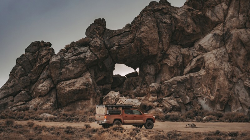
Updated: 05/20/2026
Papoose Flats
Blackrock, California
Papoose Flats trail is a scenic dirt road traverses a dense cedar forest as it ascends to higher elevations on the north end of the Inyo Mountains. The route offers breathtaking views of the majestic Sierra Nevada Mountains with their unique rock formations. This hidden gem is a haven for outdoor enthusiasts seeking solace in the quiet beauty of nature. Dispersed camping is permitted all along the trail, making it a perfect spot for an overnight stay under the stars. A trip to Papoose Flats trail is an unforgettable experience for anyone looking to escape the hustle and bustle of city life and immerse themselves in the serene wilderness of California.
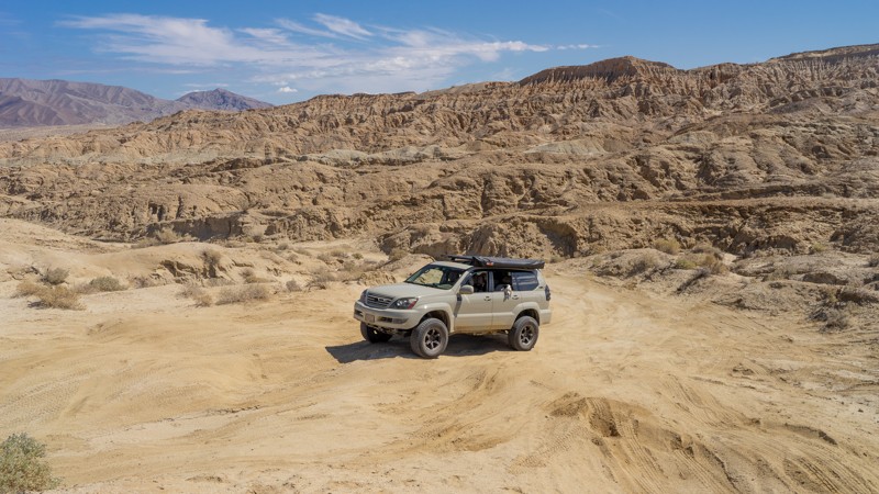
Updated: 12/28/2023
Inspiration Wash
Borrego Springs, California
Just 10 miles outside Borrego Springs, Inspiration Wash earns its name in Anza-Borrego Desert State Park. This trail climbs through the Anza-Borrego Badlands to Inspiration Point, where panoramic views of the desert landscape and rock formations sprawl like a network of veins. Be sure to take your camera on this one for great photo opportunities. You can complete the climb from north heading south and return the way you came via Inspiration Wash or continue southwest via Dump Wash. As the name suggests, the end of the trail drops you off right outside the Borrego Springs landfill, but you can quickly hop on S22 and be on your way to your next adventure.

Updated: 12/27/2022
Pumpkin Patch Trail - Ocotillo Wells SVRA
Borrego Springs, California
Overlapping San Diego and Imperial Counties nestled between Anza Borrego Desert State Park and the Salton Sea is the Ocotillo Wells State Vehicular Recreation Area; an 85,000-acre playground for off-road enthusiasts. Some of the popular attractions in the park are Pumpkin Patch, Tectonic Gorge, Truckhaven, the 4x4 Training Area, Badlands, Shell Reef, Devil's Slide, and Blowsand Hill among many others.
Pumpkin Patch is an iconic geological site and a must-see while visiting Anza Borrego or Ocotillo Wells. Wind erosion has blown away the land's surface to reveal the unique pumpkin shaped concretions millions of years in the making.
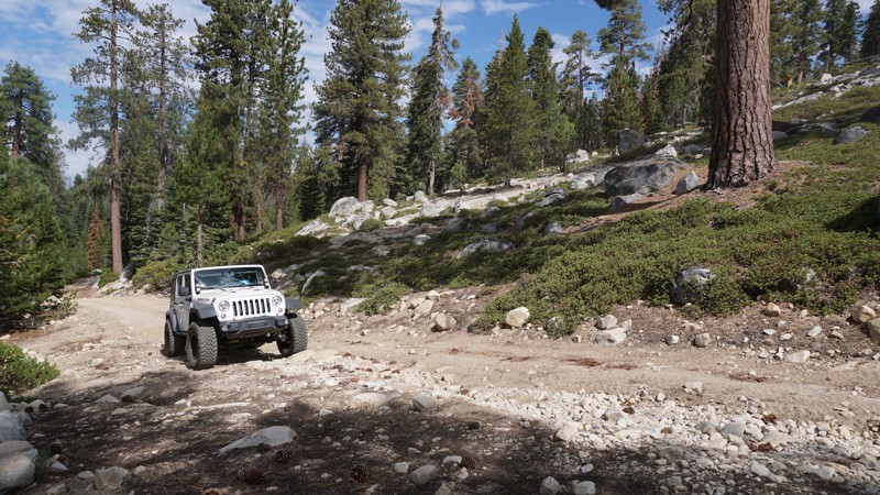
Updated: 06/01/2024
8S10 - Red Mountain Road
Shaver Lake, California
With quick access directly off CA-168, 8S10 - Red Mountain Road is an easy, scenic off-road trail most commonly used as an access road to 8S42-Sand Flats and the five lake trails; Red Lake, Coyote Lake, Mirror Lake, Strawberry Lake and West Lake.
Scenery across this trail includes high mountain views, tall towering trees, and yellow and gray rock formations contrasting the bright green brush.
8S10 - Red Mountain Road is the main entrance into the Red Mountain OHV trail system in the Sierra National Forest. This a good trail for an off-road beginner or fast access for the more advanced wheeler looking to reach the more challenging lake trails at the end of 8S42-Sand Flats.
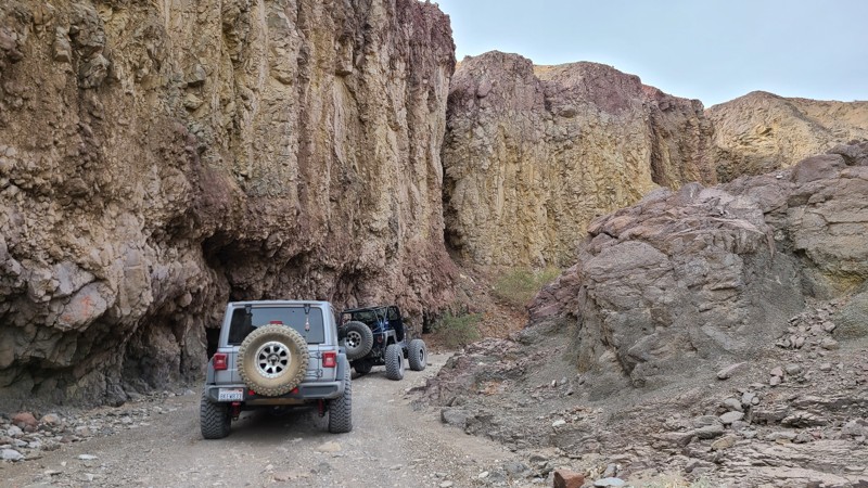
Updated: 01/02/2024
Painted Gorge Trail aka Carrizo Mountain Trail
Ocotillo, California
In the desert of California is a hidden gem that many don't know about and should be on everyone's bucket list. Painted Gorge, aka Carrizo Mountian Trail, is near San Diego in the hills just outside of Ocotillo off the 8 Freeway and can easily be said to be one of these bucket-list trails. With its vibrant colors and unique dirt and stone formations, the natural beauty of this trail is definitely on the list of the most beautiful trails in Southern California. The road starts as a nice graded dirt road that takes you back into the hills; as the hills begin to close in, the colors seem to come out. Now, it can also be said that this trail only gets harder as you continue so it is best to understand that even though a stock 4x4 can make this trail, most people who drive 4wd vehicles might not appreciate the last section as it climbs up this spectacular shelf road up the narrow canyons to the top of Carizzo Mountain.
So if you are looking for some adventure, planning your epic overland adventure, or just needing what could be the ultimate day trip, check out this trail, and you won't be disappointed.
There are two parts to this trail; the lower half that leads to camping and the upper half (this part of the trail) that takes you up the canyon. Note that the upper half is behind a gate, and that gate is closed during certain parts of the year for the Longhorn Sheep breeding season.
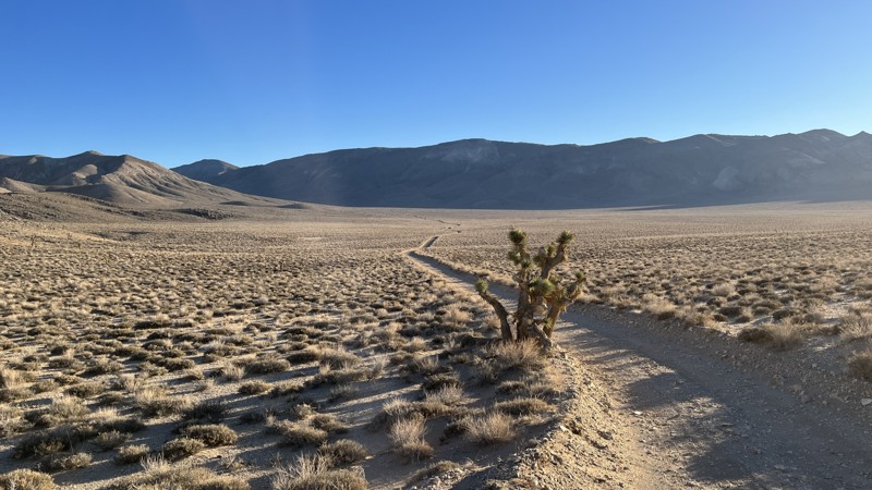
Updated: 04/22/2026
Hunter Mountain Road
Teakettle Junction, California
Hunter Mountain Road, also known as Hidden Valley Road, begins at Teakettle Junction, just north of Racetrack Playa, then passes through Lost Burro Gap and into Hidden Valley. While not the largest empty expanse you’ll come across in Death Valley National Park, Hidden Valley reminds you just how isolated you are. Then, in a dramatic change of scenery, Hunter Mountain Road takes you from the floor of Hidden Valley Dry Lake at 4,626 feet all the way past 7,100 feet of elevation. The only real challenges posed by this road are the sandy lake bed. In the colder months, expect snow and ice on the trail once you reach higher elevations. There are no designated campsites along the trail, but plenty of places along the route could accommodate a few vehicles for the night.
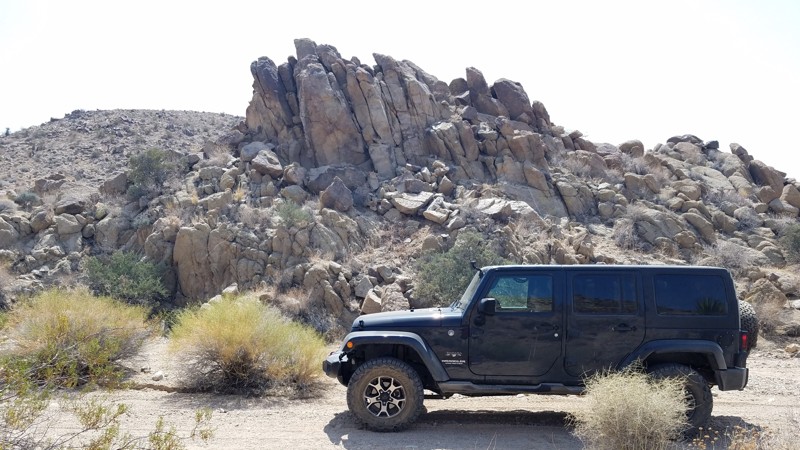
Updated: 06/05/2022
Thermal Canyon Road
Indio, California
Thermal Canyon Road is on the southern edge of Joshua Tree National Park and provides pristine desert scenery. This area is protected and largely untouched since Joshua Tree National Park became a protected area in 1936 when it first became the Joshua Tree National Monument. Thermal Canyon Road begins on the sandy desert floor and rises slowly while meandering 6 miles through rocky canyons and opening to views of the distant Hexie Mountains. Far from anywhere, this road provides solitude, quiet, and no phone service. Nestled in a hot, dry desert caused by the rain shadow of the San Jacinto Mountains to the west, you will be surprised at the abundance of life that has made this particular canyon their home.
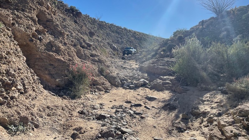
Updated: 04/24/2026
Goat Canyon Trail
Dos Cabezas, California
Goat Canyon Trail is a challenging trail in the southern portion of Anza Borrego Desert State Park. The terrain varies between soft sand, small rock gardens, a rocky canyon, and a heavily rutted dirt hill. Maps show that the hill is one-way and should only be driven downhill. 4WD is necessary, and larger vehicles will have difficulty fitting between the narrow rock walls in the small canyon portion. There are a few large rocks in the trail and a small ledge. The most challenging part of this trail is a steep hill composed of loose sand and dirt. The hill veers into a left turn with large ruts. The hill requires caution because the ground is extremely loose, and it is easy to slide off the edge while trying to descend and turn left. Airing down is highly recommended. The trail ends at Jojoba Wash, which you can take to Highway S2.
Dispersed camping is allowed throughout Anza Borrego, although no suitable campsites are directly off this trail. There are large open areas where multiple vehicles could camp once you get to Jojoba Wash, and a few smaller campsites are suitable for 1-2 vehicles off Dos Cabezas road.
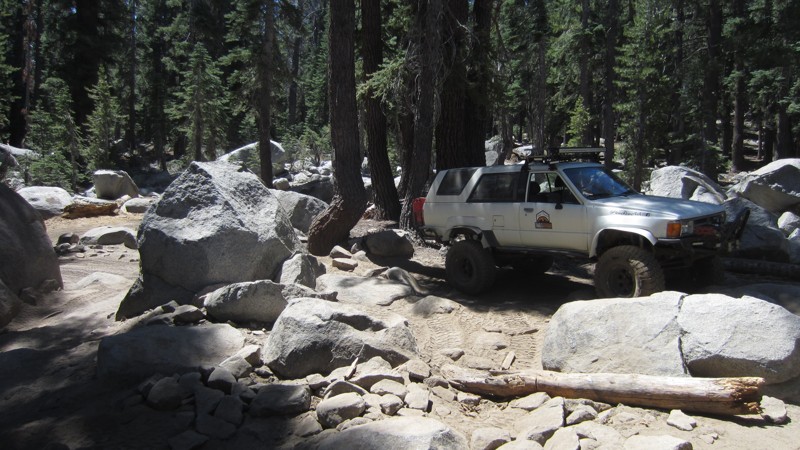
Updated: 11/06/2023
Brewer Lake OHV Trail
Shaver Lake, California
Situated in the Sierra National Forest near the Dinkey Lakes Wilderness, Brewer Lake OHV Trail provides an excellent opportunity to test your skills through increasingly challenging obstacles. The prize at the end of the trail is beautiful Brewer Lake with great fishing, swimming, and camping opportunities. On popular weekends, it is fun to watch highly modified rigs crawl their way over the last few obstacles of the trail to get down to the parking by the lake. People will often test their vehicles on this trail after new modifications before tackling more challenging and longer trails nearby.
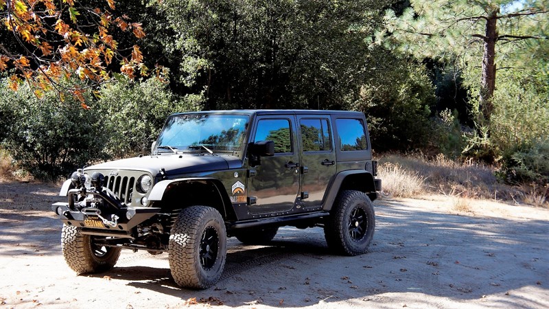
Updated: 05/20/2026
4S05 - Mellor Ranch OHV
Idyllwild-Pine Cove, California
4S05 - Mellor Ranch OHV is just one of the many trails that make up the 4x4 off-road network west of Idyllwild. It is located in the San Bernadino National Forest and it is rarely closed. Mellor Ranch is a designated OHV trail, so use caution and be prepared to share the road. You will see pine, fir, and cedar at the higher elevations, in addition to the typical Southern California sage, mesquite, manzanita and scrub oak as you descend to the west end, you will also have outstanding views to the west-southwest.
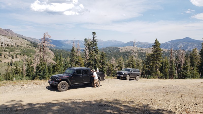
Updated: 06/10/2026
Blue Lakes Road
Hope Valley, California
Blue Lakes Road, AKA Forestdale Road, in Alpine County delivers spectacular scenery along with brief sections of technical terrain as it traverses from Red Lake to Lower Blue Lake.
Start this dirt route by turning off Highway 88. Head south at Red Lake and ascend Forestdale Road to Blue Lakes. This one-vehicle-wide dirt road begins easy and then morphs into a rocky rutted-out shelf trail. There are seasonal shallow water crossings on this trail. Snow can be found as early as September. The trail is closed in winter. Every vista is incredible. This double-track trail is suited for licensed 4WD high-clearance vehicles. It's not recommended for 2WD or low clearance.
There are three designated pay campgrounds along this route. Leashed dogs are okay, and a 14-day maximum stay applies. Blue Lakes (Upper and Lower) campgrounds are lakeside and have lake views. Vault toilets are available, and most camping spaces have fire rings and picnic tables. In July and August, you can reward yourself by swimming in Blue Lakes.
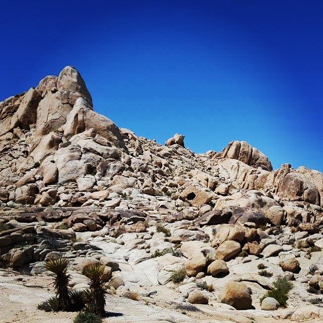
Updated: 05/13/2023
Bull Frog
Lucerne Valley, California
Many people know of Johnson Valley for the famous King Of Hammers and the Hammer Trails, but until recently many people were unaware of the western part of Johnson Valley. Cougar Buttes is a offroading paradise all packed into a small 4x4 area. One such off-road rock crawling trail in this small area is Bull Frog. The trail got its name due to several rocks that took on the look of a bull frog. The trail itself is a an epic difficult rock crawling trail full of severe and extreme obstacles that will put any Toyota and Jeep to the test. The question is can they make it without body damage? Well that is something to prove if possible. While out on this Jeep Trail expect several waterfalls, large rock obstacles, and narrow v-notches. This legendary trail really is everything in a small package. On top of some legendary offroading, the area is perfect from everything from RV camping, to overlanding, to tent camping. Thus you can make a day trip of it or weekend adventure. So pack the camera, and prepare yourself for one awesome time on the legendary Bull Frog trail near Lucerne Valley, California.
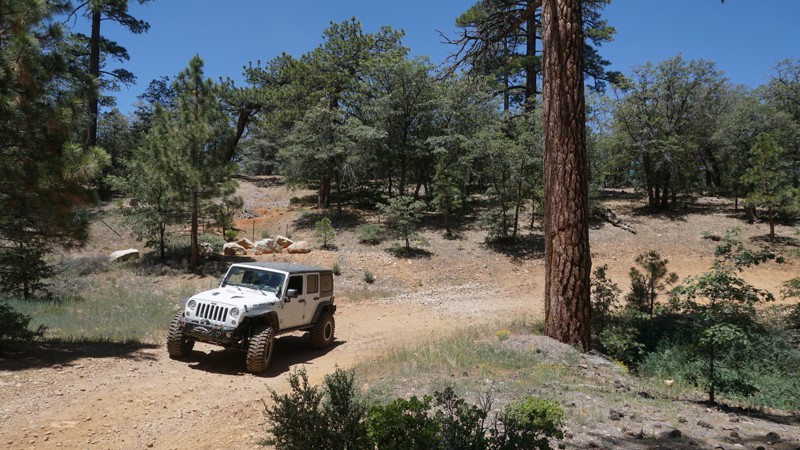
Updated: 11/26/2025
Sand Canyon
Big Bear City, California
Just east of the Bear Mountain Resort, Big Bears Alpine Zoo and the Gold Mine Golf Course in Big Bear, California sits this lesser-known off-road trail at the southeastern edge of the Moonridge mountain neighborhoods. Where the pavement of Sand Canyon Road ends, 2N27 - Sand Canyon starts. If you're in this area of Big Bear and looking for a new place to explore, or if you need to get around Big Bear Boulevards traffic to the 38, 2N27 - Sand Canyon might be your answer.
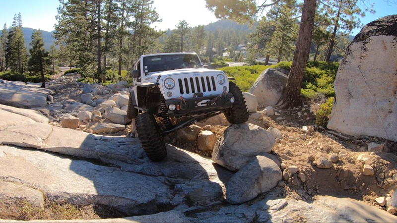
Updated: 02/01/2023
Wentworth Springs
Fresh Pond, California
At the far west end of the Rubicon Trail in the Eldorado National Forest, Wentworth Springs is the original start of the Rubicon Trail. Now typically bypassed by most entering the Rubicon at Loon Lake, this section of the trail is well worth the time to run it. A couple of notable obstacles, a killer campground at the beginning and some views of the Granite Bowl that you don't get anywhere else make Wentworth Springs a must for any wheeler ready for the Rubicon Trail.
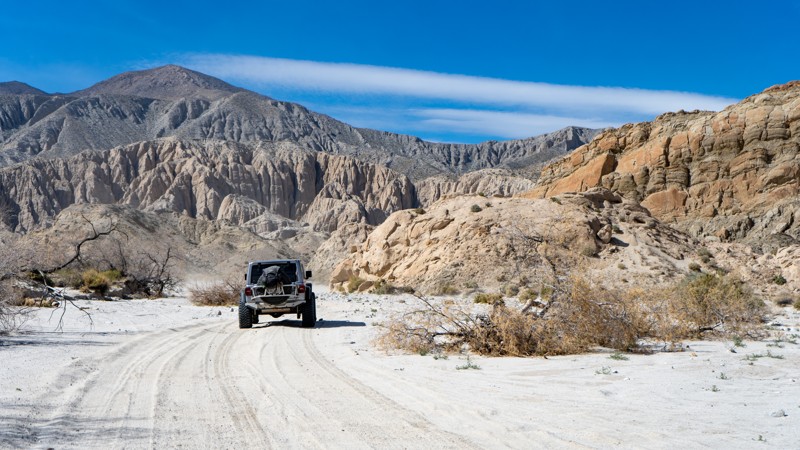
Updated: 04/01/2024
Olla Wash - Anza Borrego
Ocotillo, California
In the Anza-Borrego Desert State Park, Olla Wash leads to one of the more famous attractions, the Mud Palisades. The Mud Palisades resemble ornate columns in what you might see in a European gothic church. Formed over time by dripping water and wind, they provide a beautiful experience for those seeking natural wonders. Olla Wash is a perfect offroad trail for those looking to escape the more crowded parts of Anza-Borrego and who want to get up close and personal with striking landscapes.
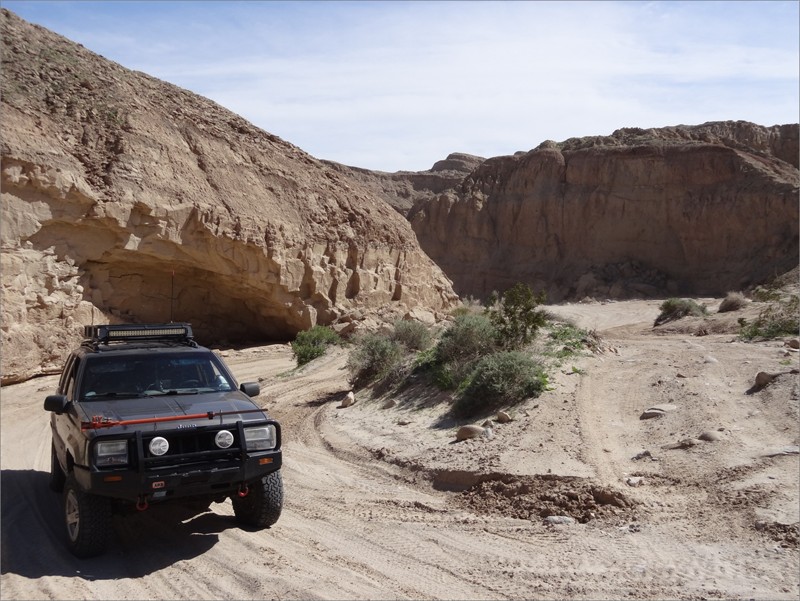
Updated: 02/24/2024
Tectonic Gorge - Ocotillo Wells SVRA
Salton City, California
Overlapping San Diego and Imperial Counties nestled between Anza Borrego Desert State Park and the Salton Sea is the Ocotillo Wells State Vehicular Recreation Area; an 85,000-acre playground for off-road enthusiasts. Some of the popular attractions in the park are Truckhaven, the 4x4 Training Area, the Badlands, Pumpkin Patch, Shell Reef, Devil's Slide, and Blowsand Hill among many others. There is a network of dirt trails and washes that sprawl throughout the park. The main trails are marked with street signs at every intersection, and trail markers at every 1/10th mile. Please use caution while traveling through the park keeping mindful that other vehicles (such as dirt bikes, quads, and buggys) can be zipping through.
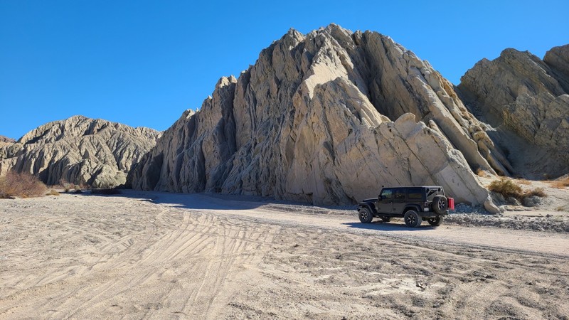
Updated: 02/19/2023
Painted Canyon
Mecca, California
Painted Canyon Road guides you along a sandy wash through a sandstone canyon whose sides have heaved up over the millennia to expose spectacular colors washing down the canyon walls. Rain and weather have carved deep vertical canyons in the soft sandstone creating an infinite tapestry of narrowing shadowed canyons and shapes. The road follows a motor vehicle access into the Mecca Hills Wilderness, a 26,000 acres protected area preventing motor vehicle access to maintain its primitive state. Painted Canyon Road is located between the Salton Sea, visible to the south, and the Joshua Tree National Park to the north. The end of the road arrives at popular hiking trails that lead deeper into the wilderness. There are many dispersed camping opportunities along the way, including a designated camp area at mile four.
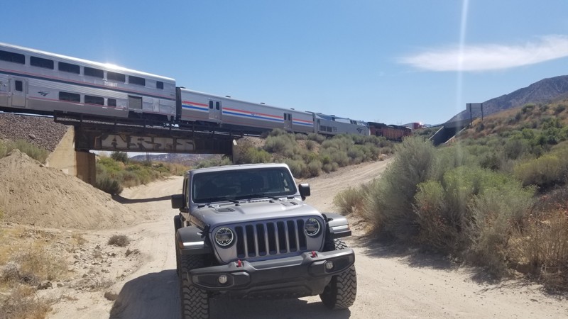
Updated: 06/08/2024
3N21 – Baldy Mesa Road
Fontana, California
If traffic is bad on the 15 in Cajon Pass, maybe think about taking an alternative route down the dirt path that is right next to the freeway. 3N21 Baldy Mesa or Santa Fe Road is a nice little dirt road that can easily be traversed in any 2wd high ground clearance vehicle. Next time you're looking for a fun-cut or just wanting to get off the asphalt, 3N21 might be worth a run.
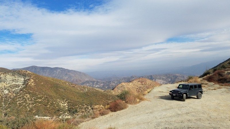
Updated: 07/12/2024
2N56 - Sheep Canyon
Fontana, California
2N56 Sheep Canyon lies entirely within the San Bernardino National Forest. At 2 miles long, this trail provides a shortcut over the Lower Lytle Creek Ridge and connects Lytle Creek Road and Swarthout Road. While short, there are still spots to enjoy the vistas of the surrounding area, especially from its 3800 feet crest. It is also the only road to be able to reach the western trailhead for 3N31Y Upper Lytle Creek Divide
The road is flat and well maintained and an excellent trail for novice off-roaders to get their wheels dirty. Your dog can also enjoy the trail when kept on a leash.
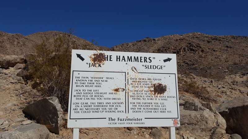
Updated: 12/17/2025
Jack Hammer
Yucca Valley, California
If you want crazy hard and people say you are a bit insane, then Jack Hammer is the trail for you. Known throughout the off-road industry as one of the single hardest off-road trails in the world, Jack Hammer will not leave you disappointed about being challenged. Many have tried, and many have failed even in the most built rigs. This 4x4 trail is going to bend, break, and destroy the common failure items and things you didn't even know that could get damaged. Have your pocketbook ready and a solid recovery plan because it is rare people leave this trail untouched. This trail is only for the most experienced with a very built rig and strong roll cage. The rating of this trail is well past difficult and is above severe in the extreme area. Do not attempt this trail alone and do not attempt this trail unless you have recovery gear, spare parts, and a group of other offroad extremists that are looking for a day of fun in Johnson Valley, California.
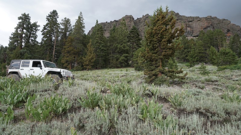
Updated: 06/05/2022
Schneider Cow Camp
Kyburz, California
Schneider Cow Camp, also known as Schneider Camp 4WD Trail, is a scenic and easy trail in the Eldorado National Forest. This easy dirt road passes multiple forest campsites, sits under the Little Round Top Mountain range, and overlooks Caples Lake to the south.
Wheelers in lifted 4x4s will find this a necessary connector to or from Strawberry Pass. At the same time, first-time off-roaders can enjoy this as a mellow out and back trail starting from Caples Lake and ending near the open mountain meadow at Schneider's Camp, at the north end.
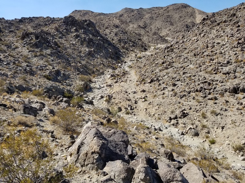
Updated: 06/03/2025
SOS
Yucca Valley, California
SOS is an insane and extreme rock crawling trail that will put any 4x4 or buggy to its test. Whether you are a Toyota, a 2 door Jeep Wrangler, a 4 Door JKU person, or a tube buggy. SOS will make even the most extreme hardcore off-road enthusiast think twice in the first few feet of the trail. Body damage, driveline failure, bad days, but great memories are all likely to be found on this trail. The next time you decide to have an adventure in the home of The King Of The Hammers in Johnson Valley, California, take a trip to he southwest of Means Dry Lake and check out one of the most insane but epic 4x4 trails in Southern California. If you are interested in taking over this trail review, please sign up to be a contributor at TrailsOffroad.com and become part of the team.
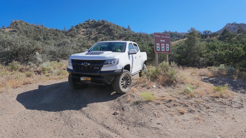
Updated: 06/17/2024
Hungry Valley SVRA - Power Line Road
Santa Clarita, California
Power Line Road is one of many off-road trails in the Hungry Valley SVRA (State Vehicular Recreation Area) just outside of the Gorman and Frazier Park mountain communities in Southern California. Over 130 miles of motorcycle, ATV and 4x4 trails spiderweb throughout this 19,000 acre park. To traverse these trails, you will climb over hills, plow through muds pits, shoot down sand washes and at the end of the day, idle into one of the numerous campgrounds. On any given weekend this park will be full of dirt-bikes, side-by-sides, quads, and 4x4s. If it burns gas and flings mud, you will find it here.
Power Line Road stretches over seven miles from the east and west ends of the park and intersects with many of the more difficult trails that lead through the hills of Hungry Valley. Multiple high points across this trail provide great views in all directions.
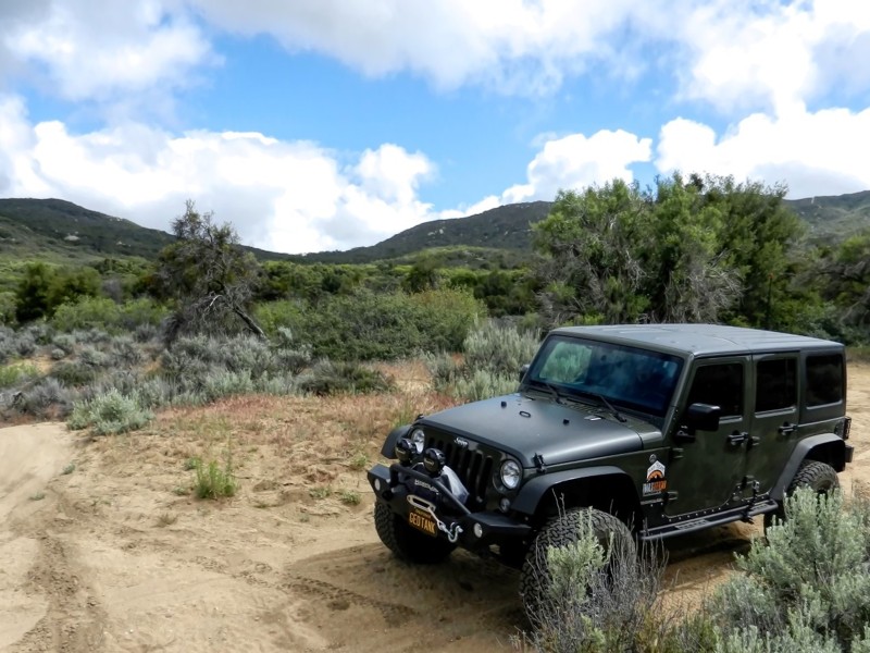
Updated: 11/19/2022
7S04 - Juan Diego Flats OHV
Anza, California
7S04 - Juan Diego Flats OHV is one of a trio of connecting trails just outside the Cahuilla Mountain Wilderness Area, in the San Bernardino National Forest. The trail follows Wilson Creek to it's end, and the Cahuilla Mountain Wilderness is just south of this beautiful trail. The area is known for its gemstone mining, and it's link to the Ramona Pageant in Hemet. Juan Diego was murdered here in 1883, and there is a Historical Marker on this trail at Waypoint 3. His death is the basis for the longest running outdoor play in the United States.
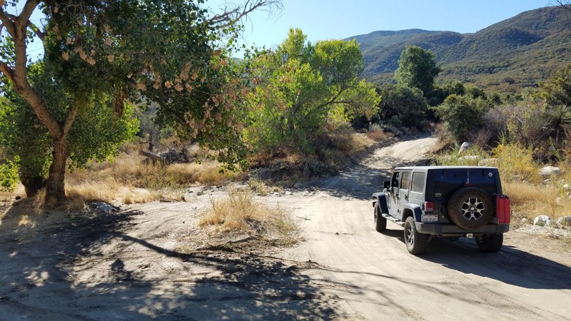
Updated: 06/05/2022
Bautista Road
Anza, California
Bautista Road follows the creek of the same name straddling the South Fork San Jacinto Wilderness to the north and the San Bernadino National Forest to the south. It is frequently used as a shortcut between the Anza Valley area and Hemet and is frequently trafficked. The hills rising on either side are green and lush and provide great views. Several hiking and OHV trails intersect along this dirt section of the road. The devastation of the 2018 Bautista fire can still be seen along portions of the road. The east end of the trail brings you to some great truck and OHV trails including the Cottonwood Truck Trail which connects to the Hog Lake Truck Trail and ends at the mountain ridge and intersects Rouse Hill Road.
From the end of Bautista Road, only 2 miles south on Tripp Flats Road and you will be at the trailhead of Red Mountain OHV trail.
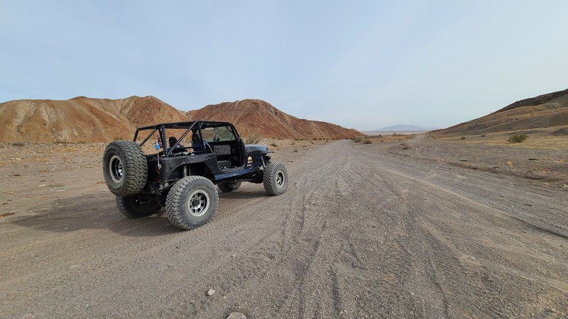
Updated: 01/05/2023
Painted Gorge Road
Ocotillo, California
In the desert of California is a hidden gem that many don't know about and should be on everyone's bucket list. Painted Gorge near San Diego in the hills just outside of Ocotillo off of the 8 Freeway can easily be said to be one of these bucket-list trails. The natural beauty of this trail with its vibrant colors and unique dirt and stone formations is definitely on the list of the most beautiful trails in Southern California. The road starts out a nice graded dirt road that takes you back into the hills. As the hills begin to close in, the colors seem to come out. Now it can also be said that this trail only gets harder as you continue so it is best to understand that even though a stock 4x4 can do this trail, most people who drive 4wd vehicles might not appreciate the last section as it climbs up this spectacular shelf road up the narrow canyons to the top of Carizzo Mountain.
So if you are looking for some adventure, planning your epic overland adventure, or just needing what could be the ultimate day trip, check out this trail and you won't be disappointed.
There are two parts to this trail; there is the lower half that leads to camping (this one) and the upper half that climbs up the canyon. Note that the upper half is behind a gate and that gate is closed during certain parts of the year for the Longhorn Sheep breeding season.
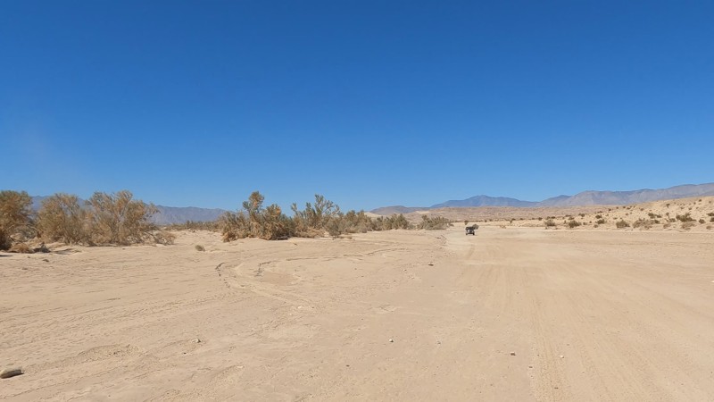
Updated: 10/15/2024
San Felipe Wash
Ocotillo Wells, California
San Felipe Wash is the main wash running through Ocotillo Wells OHV, on the southern side of the park. Because of that, people often use this as the main path to get places. The wash doesn't have anything interesting but does allow people plenty of space to get out and get away from the crowds.
If you are looking for somewhere to camp, check out the camping near Blow Sand. It has bathrooms, showers, and plenty of places for RV Parking.
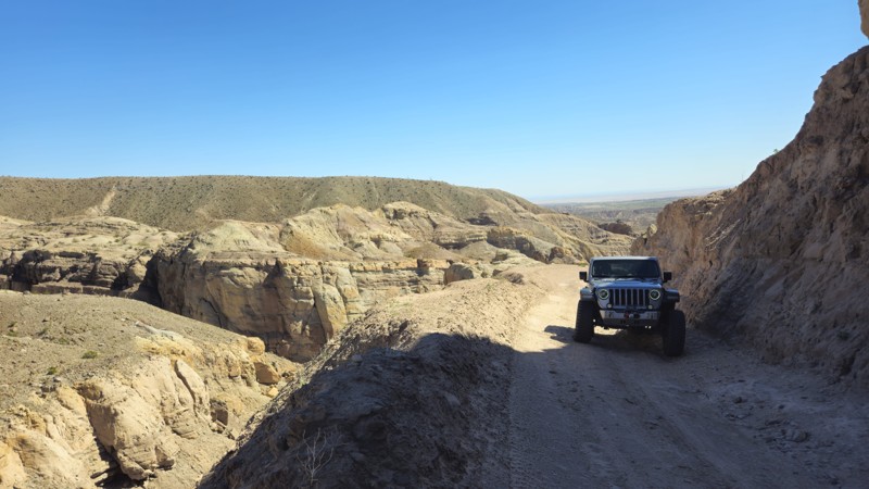
Updated: 05/23/2024
Calcite Mine Trail
Salton City, California
The Calcite Mine in Anza-Borrego Desert State Park is a fascinating destination that many off-roaders and overlanders like on their adventures that combine history, geology, and natural beauty. During World War II, the mine played an essential role as a source of industrial-grade calcite, which was used to manufacture optical equipment such as bomb sights and periscopes. Today, visitors can hike the area and explore the remains of the mines while taking in the stunning desert landscape. Along the way, you may encounter wildlife like desert bighorn sheep and coyotes and see unique geological formations like Calcite Canyon and the surrounding badlands. The Calcite Mine is a must-visit for anyone interested in history, geology, or outdoor adventure.
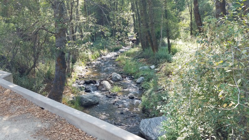
Updated: 04/08/2024
1N45 Santa Ana River Road
Big Bear, California
The trail provides an enjoyable casual drive, bathed in the cool green of the tall pine trees lining the cool green. Santa Ana River Road passes over its namesake, the Santa Ana River, or its tributaries in several places. It provides inviting areas to pull over and walk down to the water's side to enjoy the peaceful forest river and its comforting sounds. Santa Ana River Road is in the 823,000-acre San Bernardino National Forest just south of Big Bear Lake. The Santa Ana River begins its journey in the San Gorgonio Wilderness, high above the trees. It is one of Southern California's largest and longest rivers, tumbling 80 miles to the Pacific Ocean. The Prado and Seven Oaks Dams interrupt the river, providing flood control and water for consumption, irrigation, industry, and recreation. This area around the Santa Ana River is a unique and fragile ecosystem,
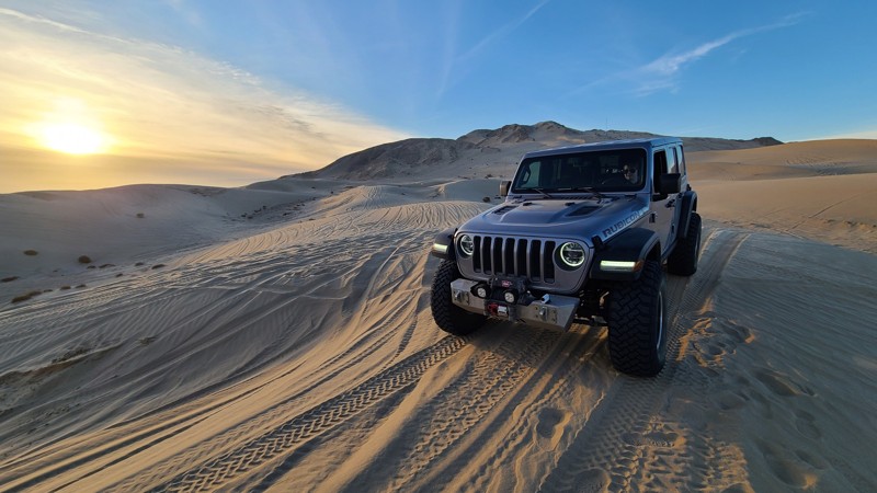
Updated: 05/05/2026
Superstitions Sand Dunes
Brawley, California
On the southern side of the Superstition Hills in California is a neat area that is often overlooked due to its neighbor Glamis aka Imperial Sand Dunes. This area is full of sand dunes and other unique features to sand areas. The Superstition Sand Dunes is a rather large area meaning there are plenty of places to play in the sand and to be away from people. With some unique bowls and canyons, razorbacks, and massive sand dunes, this area is a ton of fun to explore and play around in. So if you are in the area, looking for a different place to play, check out the Superstition Hills and the Sand Dunes that are at them.
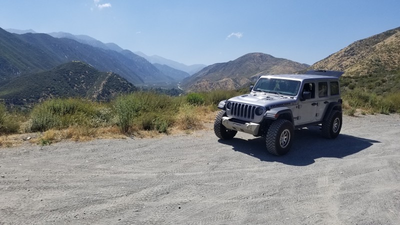
Updated: 07/12/2024
2N53 - Applewhite Road
Lytle Creek, California
Tired of being stuck in traffic on the 15 freeway and looking for a different route other than the same old Route 66. How about taking a right not far from Cleghorn and cutting over the mountains to Lytle Creek. This easy and scenic trail is a great way to get away from the people and relax. Whether you are starting near Lytle Creek and you want to do dirt paths to Cleghorn or on the 15 Freeway and need a break. This easy path is perfect for all skill levels that are looking to get away from the traffic and just relax.
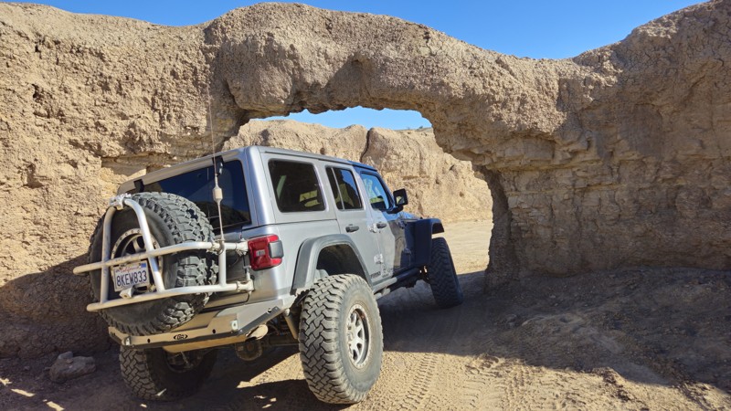
Updated: 05/17/2024
Coral Wash
Salton City, California
In Truckhaven Hills, near the Salton Sea, Coral Wash is often used as a desert highway between destinations in the vast emptiness of the Colorado Desert. This trail is often used to get to one of the many sightseeing, unique features, or legendary obstacles just off the side of the route. Another significant must-stop for this trail is the famous Coral Arch, a mud arch large enough to drive a vehicle through. So whether you are camping in the area or just passing through, take a quick detour up Coral Wash to see the unique and exciting things of the low desert.
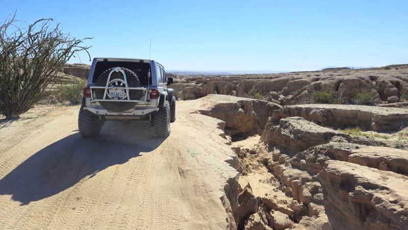
Updated: 05/23/2024
Short Wash
Borrego Springs, California
When traveling through the deserts of Ocotillo Wells and Anza-Borrego State Park, there is an amazing scenic shortcut when heading to Fonts Point. Short Wash provides a pleasant drive in an area that humans rarely touch. This backcountry trail is one of the more peaceful drives in the area, and many find it to be one of their favorites. Along the route, you will see the Santa Rosa Mountains hovering off to the north, while at the same time surrounded by all the fantastic desert flora and fauna. If you are sightseeing or on an overland adventure, check out this scenic route through the desert.
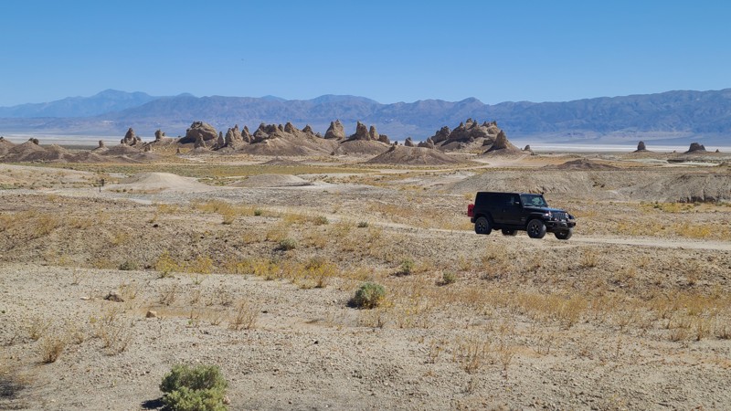
Updated: 05/23/2024
Trona Pinnacles Road
Ridgecrest, California
In the high Mohave Desert near Ridgecrest, California, is one of the desert's most unusual geologic wonders. The Trona Pinnacles are a concentration of large vertical spires rising up to 140 feet from the Searles Dry Lake base bed. The site has more than 500 spires, from short and squat to tall and thin, and are composed primarily of calcium carbonate (tufa) formed underwater when the area was a lake 100,000 years ago. The Pinnacles are recognizable to many because they have been used as a filming location for more than a dozen hit movies, including Planet of the Apes and Star Trek. This 14-square-mile area was designated a National Natural Landmark in 1968, and visitors are free to drive through, hike, and camp amongst the towers. Come for the main attraction, or drive the hundreds of nearby four-wheel drive roads, or better yet, come and do both!
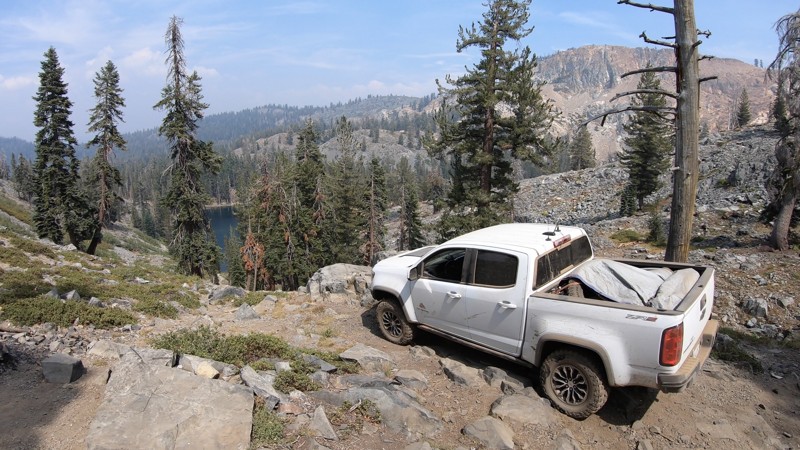
Updated: 04/15/2024
23E204 - Iron Lakes
Fish Camp, California
High in the Sierra National Forest, just south of the Yosemite National Park border is the hidden gem known as Iron Lakes. East of the small mountain town of Fish Camp, north of Bass Lake, and Oakhurst this short, semi-technical 4x4 trail leads to an overlook of Iron Lakes with some awesome views of the surrounding mountains and lake below. For those willing to make the hike, the clear waters at the lake are a short, but steep walk away.
Any off-roader with minimal 4x4 experience should do fine on this trail by taking it slow and picking the right lines.
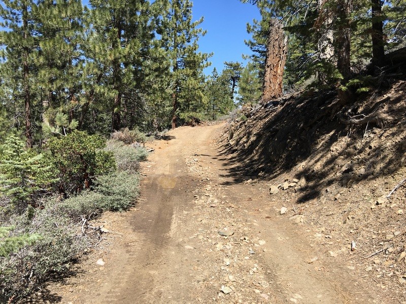
Updated: 07/08/2024
3N12C / 2N09A
Big Bear Lake, California
One of the lesser known trails of Holcomb Valley, 3N12C / 2N09F / 2N09A is a great little trail to get out into the forest and get away from the crowds. In dry conditions, this is a great trail for new drivers. But when it gets wet, this is probably the muddiest trail in the Holcomb Valley area. The mud is known to get over 36 inches deep and is a sticky mess that will swallow even built up trucks.

Updated: 05/23/2024
Kramer Arch
Barstow, California
Kramer Arch, located near the abandoned ghost town of Calico, is a stone arch just large enough for a vehicle to squeeze through. Because of this, people come from far away to experience this unique site for its interesting challenges and photogenic qualities. Simply said, a photo of your vehicle crossing the event horizon of Kramer Arch is a spectacular moment for both vehicle and driver. A moment that can live forever on the wall of your living room or office.
Whether heading to the SoCal Desert for the Famous Mojave Road or Calico for its legendary silver mining history and off-roading, a stop at Kramer Arch is a life-changing and must-do event.
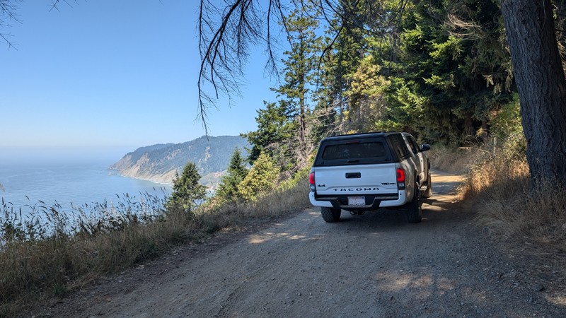
Updated: 06/26/2026
Usal Road
Rockport, California
Usal Road is an iconic, straight-through trail traversing the mountains and cliffs of California's Lost Coast. There are numerous campsites and campgrounds along the way, including Usal Campground and beach, located in the Sinkyone Wilderness State Park. The trail has a lot of ups and downs with a total of 8,100' of climbing and elevation ranging from sea level to almost 1,900'.
Usal Road is mostly a one-lane rough and rutted dirt road, winding through the forest, across mountain ridges, and along cliffs overlooking the Pacific Ocean. When conditions are good, it is traversable with a stock 2WD truck or SUV, but a high clearance 4WD is recommended.
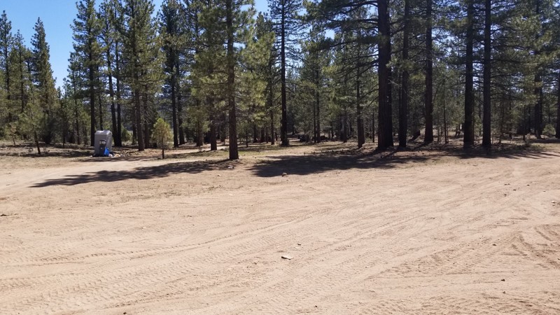
Updated: 07/08/2024
Holcomb Valley Dispersed Camping Area
Fawnskin, California
In the forest of Big Bear are a ton of great trails and a lot of camping. One such of these areas is a dispersed camping area in the Holcomb Valley. The area is full of lush green forest and bushes plus a stunning view of Holcomb Valley in the background. The area is large and flat and perfect for groups or families looking to escape the crazy life of SoCal and slow it down a bit. Because the area is dispersed, the area has way fewer people than camping in a campground. But with that said, it is rare that wood or charcoal fires are allowed in this area so bring a gas campfire for your nightly ritual.
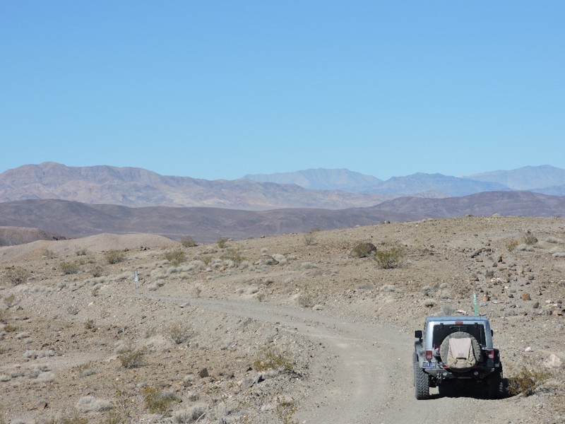
Updated: 09/24/2024
Owls Head Mountains / Microwave Tower Road
Shoshone, California
This easy 4x4 backcountry route is the only access to the remote Owlshead Mountains in the extreme southwestern corner of Death Valley National Park. It is perhaps the most remote backcountry road in the Park and far from much else. Wide open vistas with unusual geologic formations and the possibility of observing military aircraft training await you. You will climb nearly 4000 feet in elevation with stunning scenery along the route with the possibility of spotting wild burros and desert bighorn sheep.
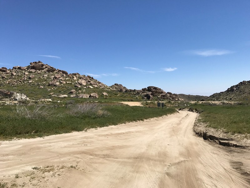
Updated: 03/15/2024
Old Culp Valley Road
Borrego Springs, California
This short but interesting trail is what remains of the old route through Culp Valley on the mountainous western edge of Anza-Borrego Desert State Park. Culp Valley was home to a fairly large Cahuilla village, and a few Cahuilla dwellings remained into the 1900's. It also became home to a handful of homesteader families who ran cattle in the valley. Remnants of one of these homesites, settled by the Paroli family, can still be seen.
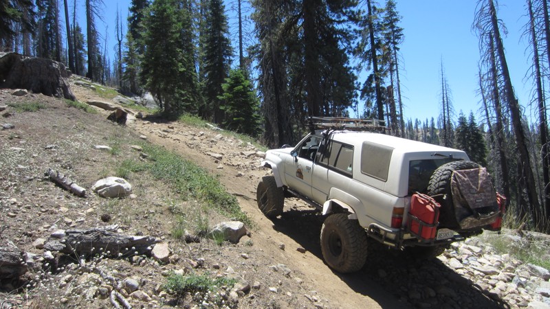
Updated: 11/06/2023
Spanish OHV Route
Shaver Lake, California
Tucked up against the John Muir Wilderness in the Sierra National Forest, Spanish OHV Route climbs 2,500 feet up a ridgeline that affords spectacular views into Crown Valley, down the North Fork of the Kings into Granite Gorge and out to the Central Valley, and up to the high peaks of Kings Canyon National Park. The area that Spanish OHV Route accesses is rumored to have once been mined by the Spanish for gold although only scant evidence of prospecting exists several miles beyond the end of the trail. Perhaps you will be the lucky person to find the lost Spanish gold mine.
The trail becomes progressively more challenging as it ascends through the forest. There are obstacles that have challenging lines for experienced drivers with built vehicles as well as lines that can be accomplished by those who are newer to offroading and with only lightly built rigs.
Several campsites with outstanding views are available along the trail. Several good fishing lakes (Little Spanish Lake, Spanish Lake, Twin Lakes, and Upper and Lower Jeraldine Lakes) are along the last 5 miles of the trail.
Spanish OHV Route is pet-friendly although there are often many cows and deer along the route that may be tempting for dogs to chase.
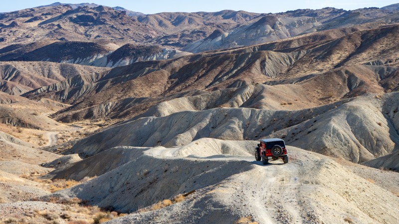
Updated: 04/03/2025
Trail 86B
Cantil, California
With only a few hours' drive north of Los Angeles, spectacular canyons can be observed in the El Paso Mountains. Previously home to the Kawaiisu Indians, the El Paso Mountains contain much of their heritage to this day. Later on, mining became the mainstay. Many mining camps of different minerals are spread across this mountain range. The Dutch Cleanser Mines, Bickel Camp, Cudahy Camp, Burro Schmidt Tunnel, Holland Camp, and Holly Ash Mine are just a few of the attractions. Trail 86B is part of the State Motorized Trail System Route #6 and is near Cudahy Camp. Cudahy Camp is an interesting mining camp in that it has a door on the side of the mountain that leads to a single room, and nonindigenous pine trees can be found near the building foundations. So, whether you're overlanding or just taking your 4X4 out for quick access to the many trails within the Red Rock State Park system, Trail 86B is a great choice.

Updated: 03/19/2025
Alabama Hills – North Area Southwest Day-Use Loop
Lone Pine, California
Alabama Hills draws people from all over for the interesting views of the Sierra Nevada Mountains and the endless outdoor activities that can be found in this area. This loop, at one time, was known for world-class camping and now is a day-use only area. If you are looking for a spot to pop the sunshade for a day, relax or go for a hike, this is it. Please remember to pack out more than you packed in!
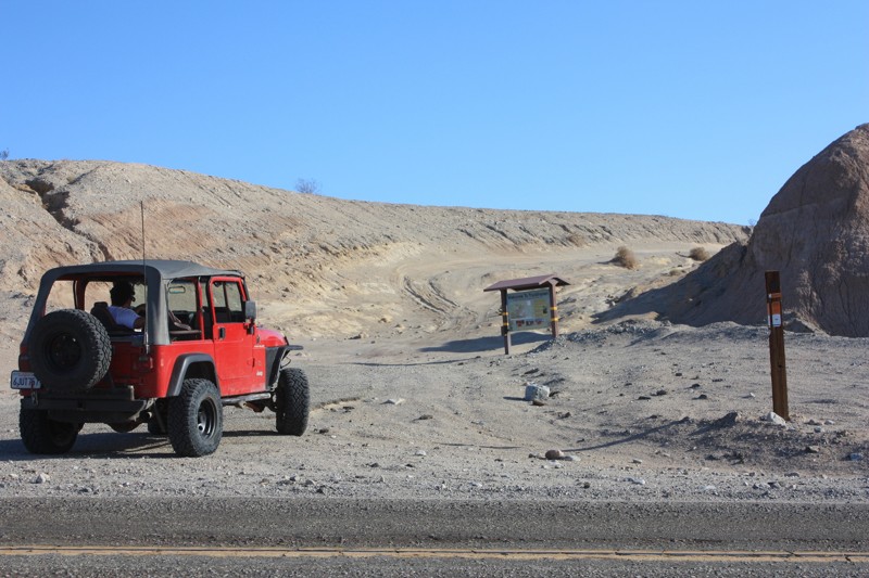
Updated: 06/05/2022
Truckhaven Trail
Salton City, California
As you venture down the Truckhaven Trail you will be rewarded with stunning views of the Salton Sea to the East, a look into Ocotillo Wells SVRA to the South, and Truckhaven Hills to the North. The best thing about Truckhaven Trail is that it offers routes into each of these areas. With just a short drive to the North you will end up in Truckhaven Hills, a favorite among familes and rock crawlers alike, or head South and hit the 4x4 park in Ocotillo Wells or venture out and discover all of the landmarks Ocotillo Wells offers. During the colder desert months and holiday weekends this area is crawling with off-road enthusiasts as it offers just about every level of difficulty you can ask for.
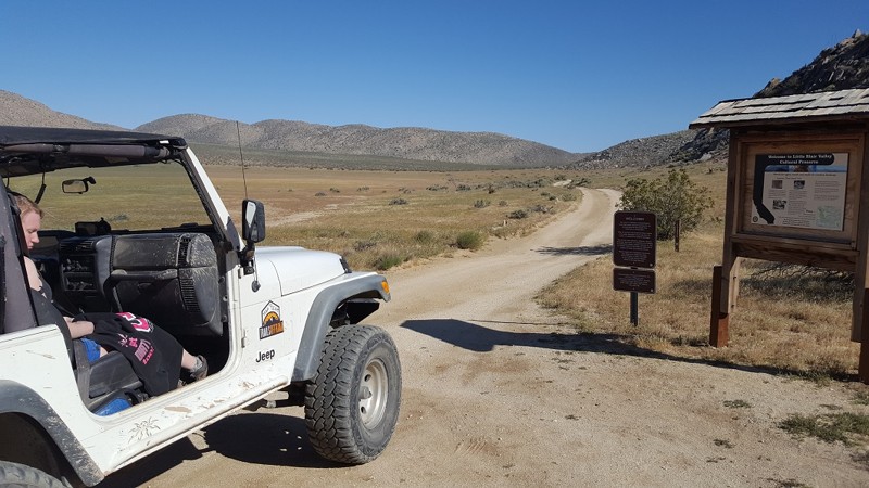
Updated: 05/11/2024
Little Blair Valley
Borrego Springs, California
One of the most amazing areas of Anza Borrego State Park can easily be said to be Blair Valley and Little Blair Valley. Given its historical significance, beautiful desert flora, and the fact that it offers some of the best views in California, it is no wonder many off-roaders, overlanders, 4x4 explorers, and outdoor enthusiasts make this a must-visit when in the area
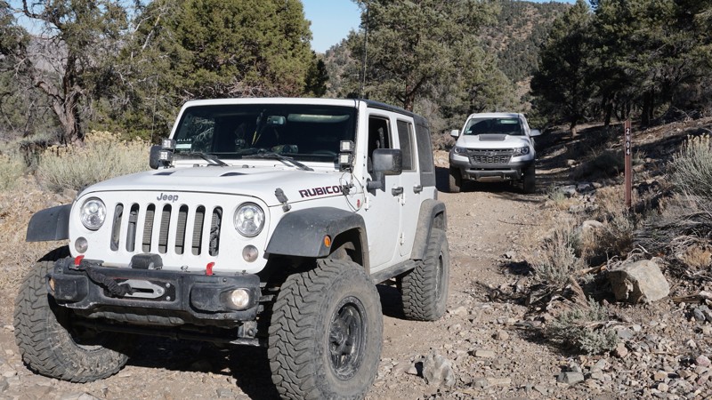
Updated: 04/22/2024
2N04 - Balky Horse Canyon
Big Bear Lake, California
This scenic, winding, forest road in Big Bear, California travels from 2N01 - Broom Flat, across a high, narrow shelf road and loops back to CA 38. 2N04 - Balky Horse Canyon is a great off-road trail for less experienced wheelers to explore while in this southeastern section of the Big Bear mountains, or a great add-on connector for more advanced wheelers, with time to kill, on their way to or from the more technical 4x4 trails nearby, such as Heartbreak Ridge or Motino Wash.
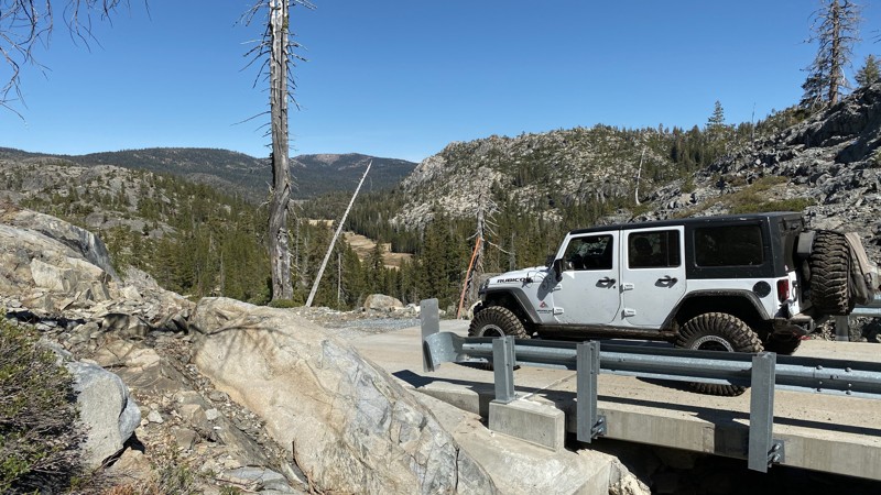
Updated: 08/20/2025
Fordyce Lake Road
Baltimore Town, California
Fordyce Lake Road / Rattlesnake Road is an easy and scenic trail best know as an alternate entrance/exit to the iconic rock crawling trail: Fordyce Creek / Fordyce Jeep Trail. Fordyce Lake Road sits in the Tahoe National Forest and connects from the Cisco Grove area to Fordyce Lake, just short of the dam, which is gated. This is a great trail for just about anyone. While rock crawlers might use it as a shortcut into or out of the harder trail, overlanders and new wheelers can enjoy the scenery and camping along this trail.
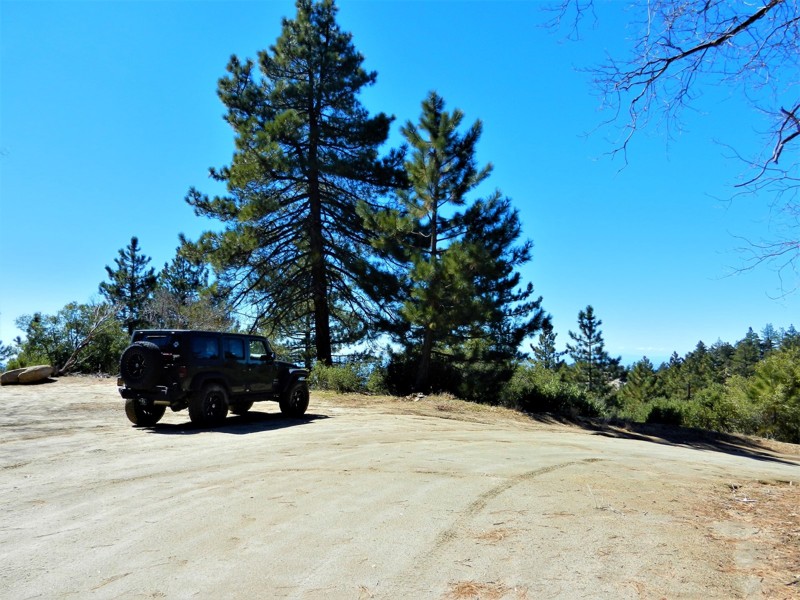
Updated: 06/21/2024
5S21 - May Valley Road
Idyllwild, California
5S21 - May Valley Road is another beautiful off-road trail in the San Jacinto Mountains near Idyllwild, California. It currently is a short (1.7 mile) out and back trail due to the 2013 Mountain Fire. When the closure is lifted it is a 5-6 mile trail, continuing southeast to Hwy 74. It is an easy drive with many spots to pull over for a lunch stop or photography. You will travel through pine, oak, cedar, manzanita and sage. Watch for deer, bear, rattlesnakes and other critters that make this area their home.
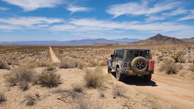
Updated: 11/26/2024
Needles to Ludlow Truck Trail Part 1
Topock, California
The Needles to Ludlow Truck Trail Part 1 when included with Part 2 is a 112-mile trek across the Mojave Desert. Part 1 starts in the rugged Sacramento Mountains, and looking back east is a green band following the Colorado River. Once out of the mountains, the trail is a straight line across the sandy desert floor through the Ward and Fenner Valleys, eventually reaching the famous Route 66. The abandoned Gold Ace west Mine is a great stop to inspect the mine's artifacts and try to reconstruct what once was a thriving operation. The trail is flat and maintained, and it is unlikely you will encounter another traveler. The trail is a great route for all driving skills when taking the proper safety precautions for a stay in the hot, desolate desert.
One major warning: It is illegal and dangerous to cross railroad tracks other than at a designated roadway crossing. NS-203 is shown on all maps to cross over a busy section of tracks with no roadway crossing and is heavily used by trains in both directions. The track for this route provides a safe and short detour to a legal road crossing at the town of Essex and then continues back onto NS-203.
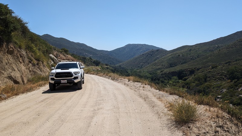
Updated: 01/21/2026
Black Canyon Road
Ramona, California
A nice windy and scenic road connecting Ramona to Santa Ysabel, passing through the Mesa Grande Indian Reservation. The road ranges from nicely graded, wide dirt road, to narrow shelf road with blind turns. There views are stunning and quite memorable with places to pull off an enjoy them.
The road consists of finely ground granite/DG on top of hard-packed dirt, so it can get a little rutted with rain. Since this road is graded, virtually any street-legal vehicle can traverse it, but motorcycles should use extreme caution, as motorcycle tires, especially those with more aggressive tread, can easily lose traction.
The hardest part of this road are the narrow blind turns, which also make it quite unique. Take them slow, honk your horn, and you'll be fine.
While this isn't a road that requires high clearance or 4WD, it does provide an opportunity to traverse part of the county off-pavement.
There are no spots for camping along this route.
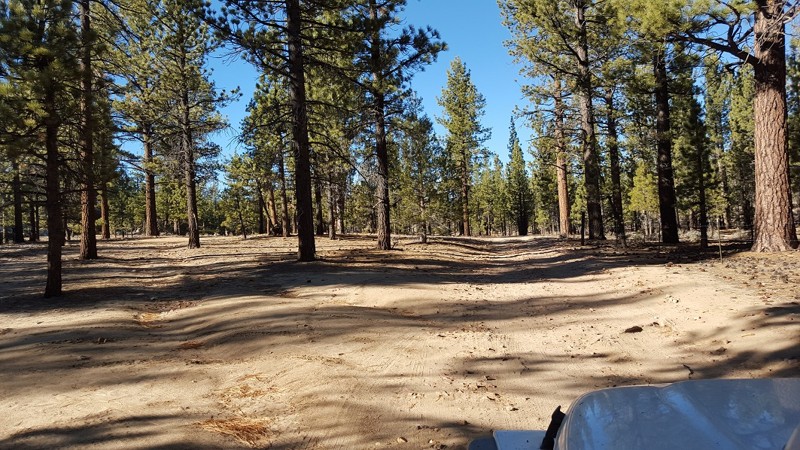
Updated: 08/14/2023
3N32 - Union Flat
Big Bear Lake, California
An easy to mild trail, 3N32 offers the quickest route to the legendary John Bulls GateKeeper. Along the route, you will find lots of small rocky areas and an articulation spot that is great for a new driver. While traveling to John Bull, you will pass by some great climbers areas including Coyote Crag and the turnoff to The Squeeze. Due to the remote nature of this trail, there is some great places to dispersed camp when looking to get away from the crowds.
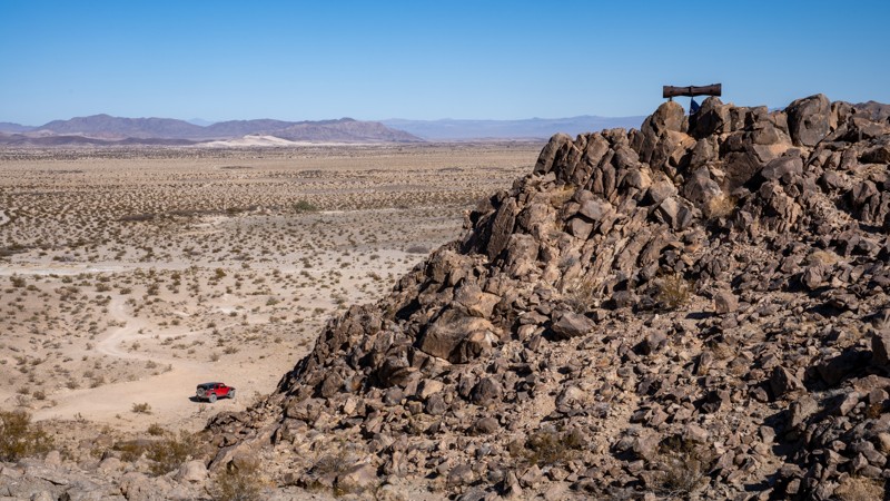
Updated: 06/05/2025
Crucero Road
Ludlow, California
Just north of Ludlow, Crucero Road is a remote desert road that dives deep into the vast expanse of the Mojave Desert. Following the path of the long-abandoned Tonopah and Tidewater Railroad, this sandy and rugged road offers a unique blend of history, isolation, and stark desert beauty. Drivers will traverse dry lake beds, skirt around ancient lava flows, and discover remnants of long-forgotten sidings and mysterious objects that dot this desert landscape. Along the way, keep an eye out for rusted railroad artifacts, old rail beds, and the haunting stillness that defines this part of the Mojave.
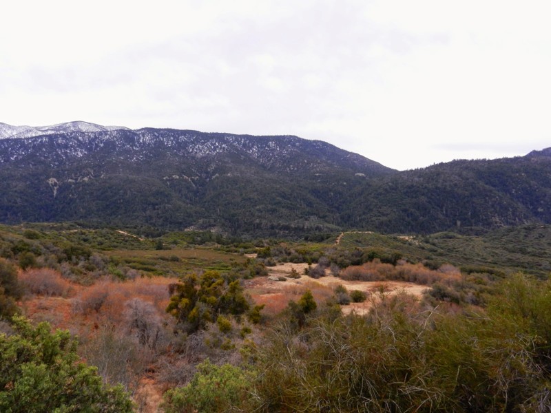
Updated: 07/20/2024
1N64 - Seven Pines
Redlands, California
1N64 - Seven Pines is a wonderful off-road, 4x4 trail in the San Bernardino National Forest. Seven Pines is just one of the many beautiful trails in this Seven Oaks Canyon, including City Creek, Clarks Grade, and Radford. The Santa Ana River begins its journey to the Pacific Ocean in this canyon. This trail is a gem for the dispersed campsite camper, along with it's connecting brother, 1N64A - Slide Lake. Be watchful of bear, mountain lion, deer and the smaller animals who make this area their home.
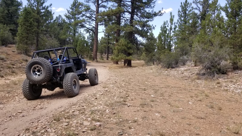
Updated: 06/05/2023
3N02 - Burnt Flats
Big Bear Lake, California
On the east side of Holcomb Valley in Big Bear, California is an easy trail that is perfect for the first time offroaders and overlanders. 3N02 - Burnt Flats is a great drive through the San Bernardino National Forest. This scenic trail starts out near the historic 3N16 - Holcomb Valley Road trail and heads north up and over the peaks of the mountains. Along the route, there are a few places for small groups to camp and enjoy a relaxing weekend. But if you want to push yourself a little more, 3N02 - Burnt Flats also has the little brother of the famous John Bull trail which is 3N10 - Little John Bull connecting to it. So whether you want to go up to camp or if you want to get the wheels dirty, think about checking out 3N02 on your next trip.
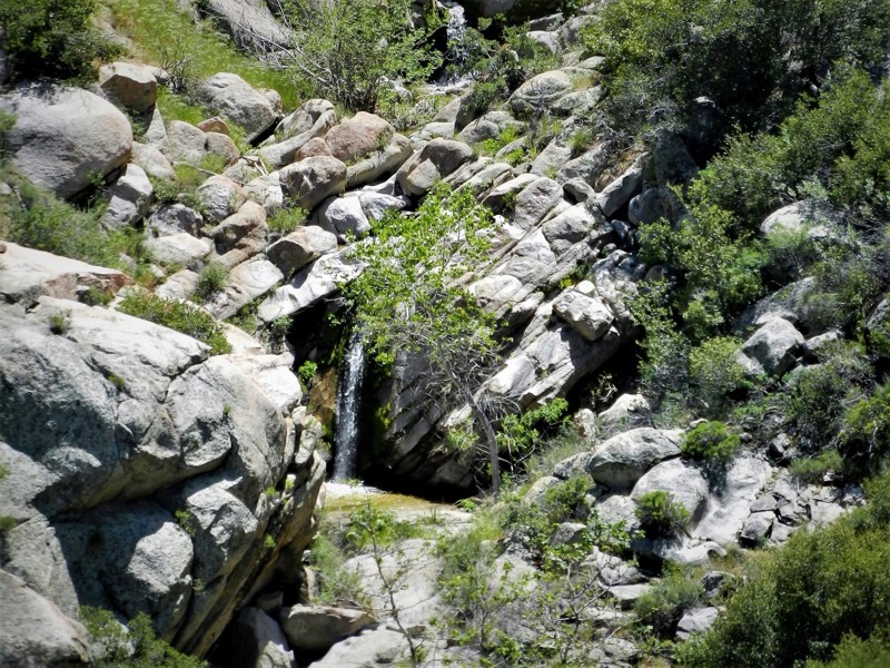
Updated: 10/22/2023
3S09 - Hurley Flats
Idyllwild-Pine Cove, California
3S09 - Hurley Flats is a 4wd offroad trail in the San Bernardino National Forest. This trail is perfect for the new wheeler as there are no obstacles. Pair it with a loop run with the trail to the east 3S08 Vista Grande for a day of sightseeing, photography, and fun. It is the most northern Forest Service numbered trail in the San Jacinto Mountain District. Though shorter than 3S08 - Vista Grande, it is a carbon copy with it's lower elevations almost desert like, to it's forested and wooded, green meadow like climate at the southern end. The northern trailhead is just off Hwy 243 on Twin Pines Road, and the southern trailhead ends on Hwy 243 less than a mile from the trailhead for 3S08 - Vista Grande.
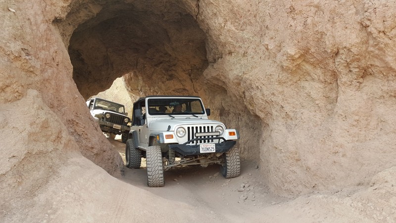
Updated: 03/03/2024
Odessa Doran Scenic Loop Lower
Barstow, California
Odessa Doran Scenic Loop Lower is a popular camping and hangout area. Nestled in the hills of Calico, the lower part of Odessa and Doran Scenic Loop is an ideal location for taking the family out camping, exploring, and shooting. The area is RV and 5th-Wheel friendly. The area has lots of natural wonders, including arches, red rock canyons, slot canyons, and mines. The area's offroad trails range from easy overland tracks to extreme rock crawling. There is something for everyone in his area, making this the perfect basecamp for your adventures.
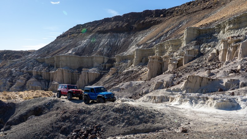
Updated: 03/25/2025
Black Rock Canyon
Inyokern, California
Located in Red Rock Canyon State Park, the Black Rock Canyon offroad trail takes you through striking badlands of dried mud and rugged, reddish-black lava rock canyons—an experience you won't forget. The wheeling is adventurous, but the otherworldly landscape offers a quiet sense of inspiration. Once you conquer its namesake obstacle, "Black Rock," a deep sense of accomplishment will set in, leaving you eager to push forward and carve new trails.
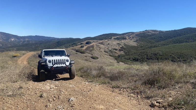
Updated: 05/29/2026
Deer Trail
Las Cantilles, California
Deer Trail is located in San Francisquito Canyon near Santa Clarita. The Los Angeles Aqueduct transports water through the canyon. Two hydroelectric power plants have been producing electricity for Los Angeles since 1917. On March 12th, 1928, the canyon experienced a terrible tragedy when the St. Francis Dam collapsed, claiming the lives of over 400 people. The tragedy is the second-greatest loss of life in California's history, following the 1906 San Francisco Earthquake. The site of the disaster is registered as California Historical Landmark #919. The landmark is located on the grounds of Powerhouse No. 2 near the trail's east end.
The point-to-point trail is accessible from the West via City Highline Road and from the East via Del Sur Ridge. It consists of rough dirt and gravel, with several washed-out areas and exposed rock. A series of moderate hill climbs and descents require high clearance and 4WD. While the trail is rated as a black diamond, it's a relatively easy ride if you pay attention and choose appropriate lines. There is no camping on this trail.
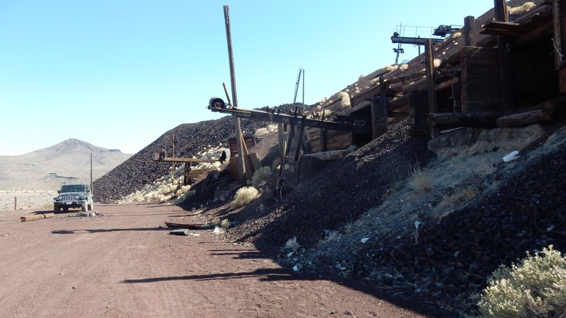
Updated: 12/29/2023
Aiken Mine Road
Baker, California
The Mojave National Preserve (MNP) was established in 1994 and at 1,542,776 acres it is the third-largest National Park. The areas designated as Wilderness restrict all vehicles from remaining in a natural state by minimizing human impact. Aiken Mine Road supported the transportation of cinder from the Aiken Cinder Mine and now navigates a narrow corridor between the designated Wilderness and leads you to some of the most interesting and memorable destinations in the Preserve. The destinations include the Lava Tube, which allows you to hike underground in the tube, the huge abandoned Aiken Cinder Mine, and one of the world's largest and most dense joshua tree forests.
In 1990, the Aiken Cinder Mine operations were closed, and the equipment was left in place, much of which you can see today. The National Park Service treats the mines as another chapter in the Preserve's history with no plans to remove the remnants.
In addition to the destinations, Aiken Mine Road passes dramatic volcanic cinder cones, and you will get up close to extensive black basalt lava flows.
An easy road for any skill level, but a 4-wheel drive is recommended.
Pets are welcome in the MNP but must be kept on a leash per the Pet Guidlines.
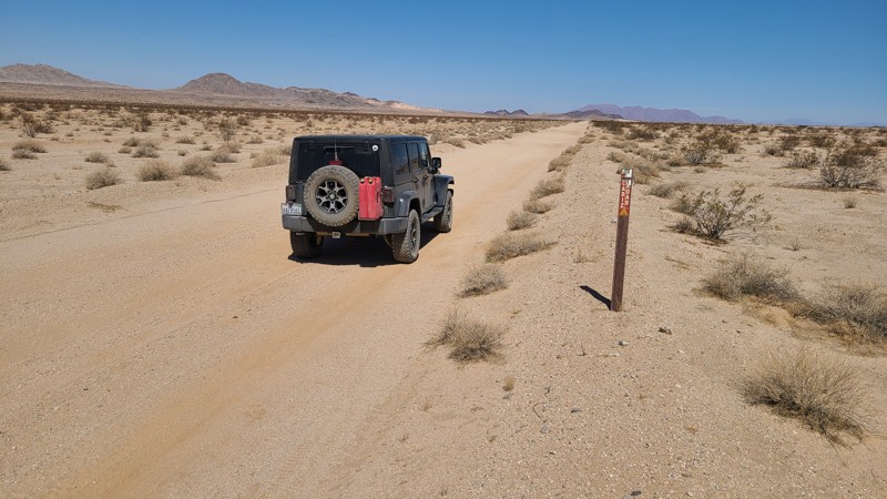
Updated: 10/15/2024
Cadiz Road
Freda, California
Cadiz Road hugs the Arizona California Railroad as it passes between the Cadiz Dunes Wilderness and the Old Women's Wilderness, ending at the famous Route 66 highway. Creosote bushes dot the surrounding Mojave Desert, and occasional crossing washes with their underground water allow lines of green trees to survive. Keeping the drive interesting are several abandoned mines and other artifacts to explore. The road is wide and flat, and its sandy surface is graded flat. As this is BLM-managed land, the flat desert floor provides good dispersed camping locations along the way.
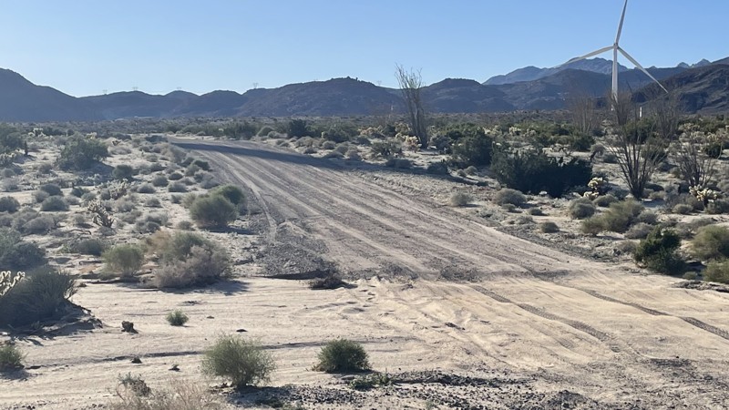
Updated: 10/15/2024
Dos Cabezas Road
Ocotillo, California
Dos Cabezas Road is an easy, sandy track near Ocotillo that leads into the lower part of Anza Borrego. The road is well maintained because it provides access to the wind turbines scattered along the trail. Any 2WD vehicle with moderate ground clearance can manage, although conditions may change after rain. The most challenging portion of this trail is a small hill, which is easily conquered by any vehicle. The trail leads to various other trails in the area to explore. Dispersed camping is allowed throughout Anza Borrego. Several trailside campsites are large enough for 2-3 vehicles.
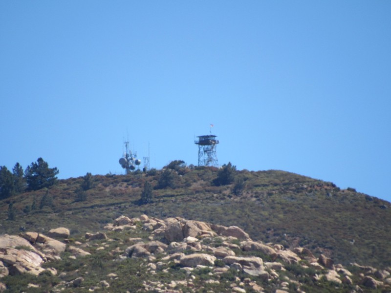
Updated: 05/27/2024
17S06 - Skye Valley Road
Pine Valley, California
Skye Valley Road is a connector trail between Corte Madera Road and Corral Canyon Road that forms a 18-mile loop through Cleveland National Forest. To the north of the road is Cleveland National Forest and to the south is Hauser Wilderness. Mexico is only 8 miles south of the road. The highlights of this short road are the magnificent views of Los Pinos Mountain to the north and the massive Hauser Canyon to the south. Along with this road, the 18-mile loop consists of the following additional roads and trails:
16S17 - Los Pinos Road
17S04 - Corral Canyon Road
4E03 - Corte Madera Road
4E03 - Espinosa Trail
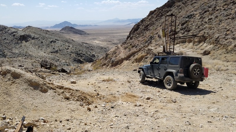
Updated: 03/26/2024
Brannigan Mine Road
Baker, California
Brannigan Mine Road is in the western corner of the 1,542,776 acres Mojave National Preserve which leads to its namesake, Brannigan Mine, a gold mine that operated in the 1930s. While the start of the road is not far from fast-food restaurants and the 18-wheelers of I-15, it already feels isolated and remote. Most of the road is a soft, easy glide through the sandy desert with the Old Dad Mountains in the distance looming larger every minute. Once in the foothills, you will enjoy views to the west of a Mojave Wilderness a pristine desert protected to remain in a natural state by minimizing human impact. A climb into the foothills, you will come upon the Brannigan Mine Camp, where its original cabins and have been repaired and preserved by "Adopt-a-Cabin" volunteers and are open to view. Still standing are many mining structures used to extract and process the gold ore and numerous mine shafts. While all the mine openings are now safely closed with steel gates, large openings in the gate allow you to peer down the tunnels carved from solid rock and often disappearing into the far darkness.
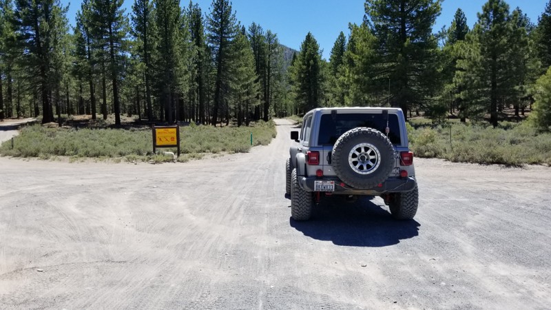
Updated: 07/03/2023
2S10 Glass Flow and Obsidian Dome
Mammoth Lakes, California
In the forest of Mammoth, California is an abundance of trails that many don't know about. Such trails are 2S10 Glass Flow Road and part of Obsidian Dome, that make a great place to get out of the city and just relax. The area is full of dense lush forest and several volcano calderas that, when last erupted, spewed their lava into deep snow creating what is known as Obsidian or lava that has turned into glass. This amazing and shinny rock is something cool to see.
On top of the amazing scenic beauty that overlanders dream of, the area has a lot of dispersed camping and an improved campground for people that would like some amenities.
Now the trails in the area make for some great adventures, including trail riding and hiking.
So whether you are just wanting to get away and go camping for the weekend or you want to get out and check out some amazing natural scenic beauty, think no further than 2S10 near June Lake in Mammoth, California.
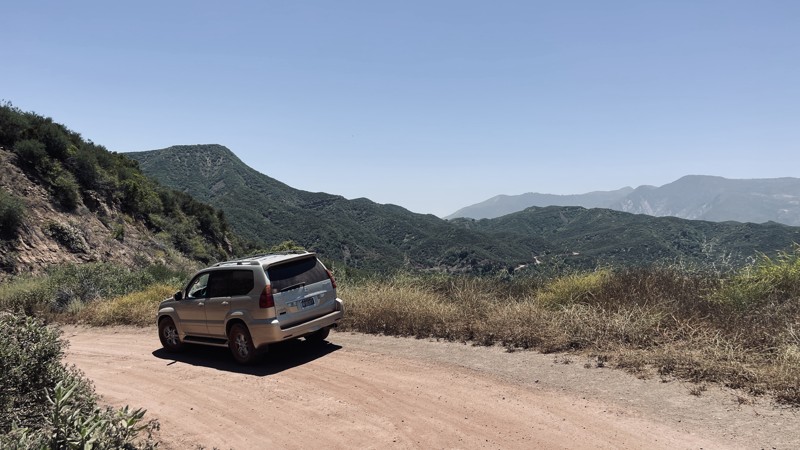
Updated: 05/20/2026
Dough Flat Road
Fillmore, California
Dough Flat Road, formerly Squaw Flat Road, is an easy 10-mile in-and-out dirt trail through the picturesque Topatopa Mountains within the stunning Los Padres National Forest. This trail traverses the Sespe Condor Sanctuary, necessitating heightened caution should you chance upon a California condor, a species perilously close to extinction.
For hiking enthusiasts, parking at the Dough Flat Trailhe offers access to the Alder Creek Trail at the end of FR 6N16.2. Camping is strictly prohibited along 6N16:1 and 6N16:2.
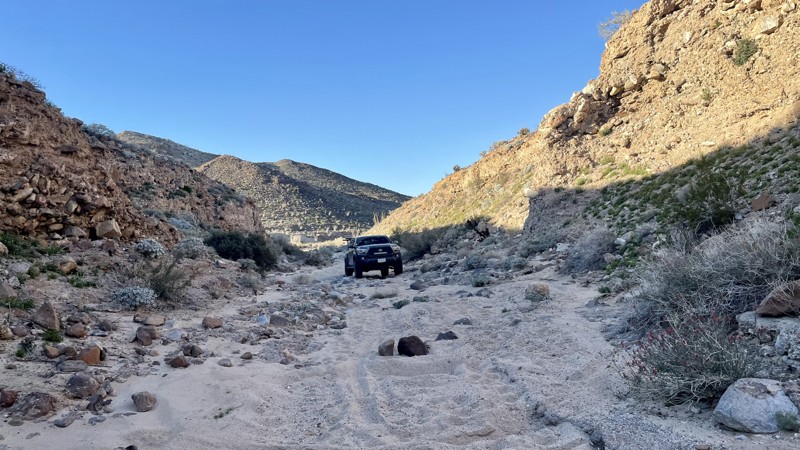
Updated: 03/10/2026
Jojoba Wash
Dos Cabezas, California
Jojoba Wash is a challenging trail in the southern portion of Anza Borrego Desert State Park. Most of the trail is an easy dirt and sand track that could be managed in 2WD. However, one tricky hill climb requires 4WD and bumps this trail rating to Moderate. The connecting Goat Canyon is rated Difficult due to a steep, heavily rutted hill climb. However, Goat Canyon is optional. Jojoba Wash is a loop. You can exit the way you came.
Anza Borrego Desert State Park allows dispersed camping. There are ample opportunities throughout Jojoba Wash. Much of Jojoba Wash is open, sandy, and perfect for camping.
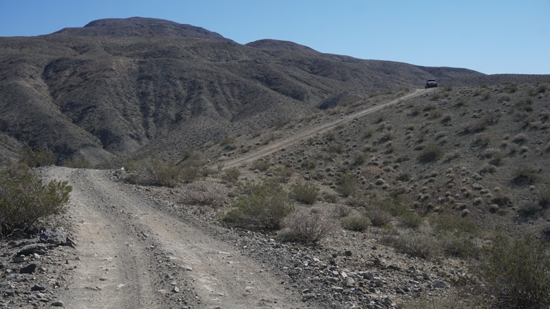
Updated: 04/22/2026
Fish Canyon Escape Trail
Valley Wells, California
The Fish Canyon Escape Trail is a moderate 4x4 trail twisting, turning and climbing it's way through the hills as it connects Panamint Valley and Searles Valley at Trona, California.
This moderate trail includes some steep and narrow sections on the Panamint Valley side and smooth sand washes on the Searles Valley side as it travels through Goff Canyon.
Wheelers who don't mind the steep hills and are looking to enjoy the valley views will like this trail while rock crawlers will find it a necessary escape route from the more technical Isham Canyon.
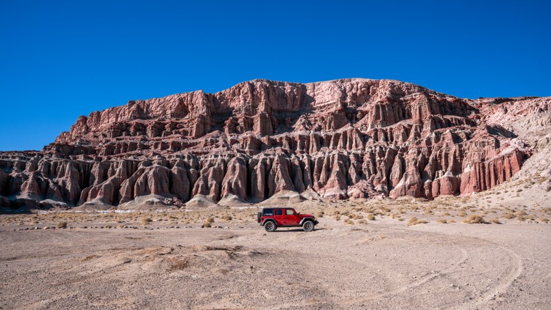
Updated: 03/05/2025
Iron Canyon
Cantil, California
Red Rock Canyon State Park in California is a stunning desert landscape in the Mojave Desert. It is known for its dramatic red and tan sandstone cliffs, rugged rock formations, and scenic desert vistas. Iron Canyon is one of several dirt roads traversing this geologically rich park, offering visitors a glimpse into ancient landscapes shaped by millions of years of erosion. If traveling the 14 Freeway during sunrise or sunset, this short trail is sure to reward you with a mesmerizing experience as the canyon’s colors intensify, creating an otherworldly atmosphere.
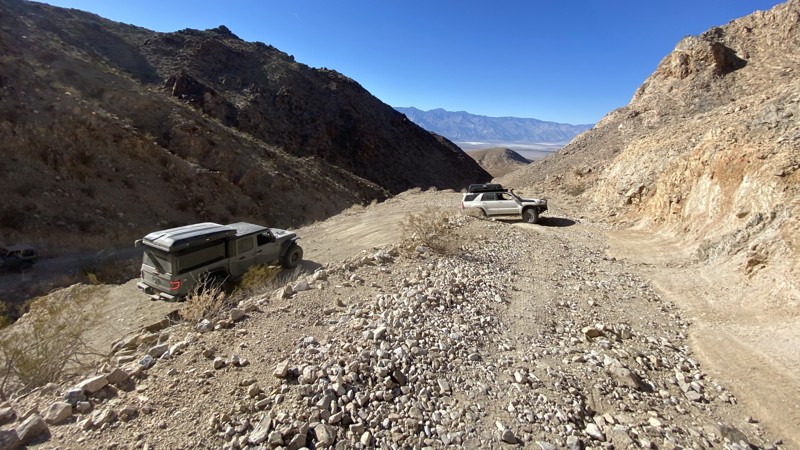
Updated: 03/09/2026
Lippincott Pass
Teakettle Junction, California
Lippincott Pass is an iconic trail in the heart of Death Valley that takes you from Saline Valley to the even more iconic destination of Racetrack Playa. The trail is incessantly rocky and jarring. Combine that with the steep shelf road, and you are sure to give your passenger an uneasy stomach. The beginning of the road passes through one deep wash that requires careful line choice and low range. Then, multiple partial washouts bring you even closer to the edge coming through the pass. Between the narrow road and the rocks, it’s best to be accompanied by a functioning 4WD system and an experienced driver. There are no campsites along Lippincott Pass.

Updated: 03/19/2025
Moffat Ranch Road
Lone Pine, California
In the deserts of California sits an area famous for the overland crowds. Alabama Hills, a complex network of trails, is full of unique camping in Southern California. This trail, Moffat Ranch Road, is the back way in from the northside of the area. Even though this trail isn't as desirable as Movie Road, this is a great way to exit the area to get the full effect when visiting. So the next time you are exploring the area, don't forget to Moffat Ranch Road and make a day out of your trip.
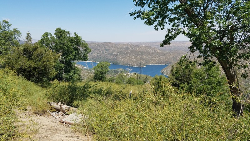
Updated: 11/19/2023
2N03 Burnt Mill Road
Hesperia, California
2N03 Burnt Mill Road is in the 823,000 acres San Bernardino National Forest just south of Silverwood Lake and only a 16-mile drive from I-15. To trail follows above its namesake, Burnt Mill Canyon, to its east. This mountain road takes you from the lower elevations dominated by oak woodland to the land of the confers and the stately tall pine tree forest, where the deep shade and higher altitude bring quick relief from the summer heat below. While eventually leading to the paved Cedarpines Park community, along the way, the trail provides a gauntlet of technical driving challenges for those looking to test their offroading skills and vehicles.
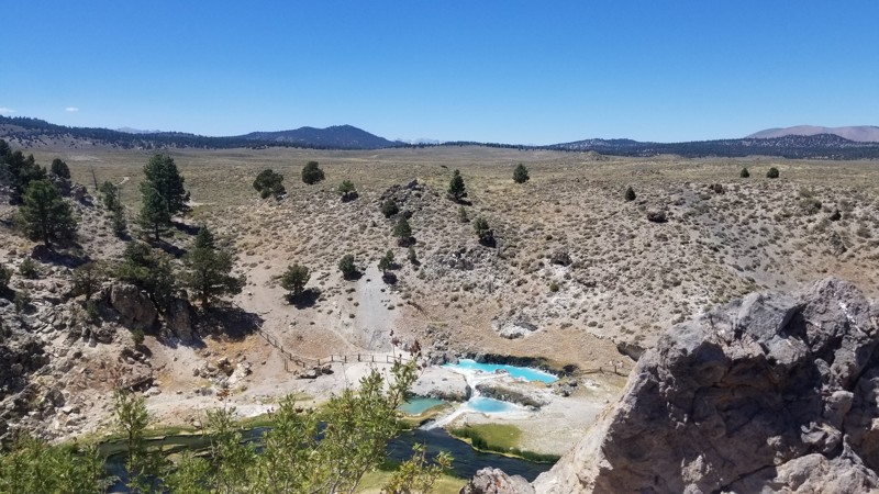
Updated: 08/12/2025
Hot Creek Road
Whitmore Hot Springs, California
Hot Creek Road is a scenic drive in a most unexpected place. This little trail is almost like driving through Yellow Stone, making it hard to believe you are in the mountains of California. That might be why Hot Creek is one of the area's best-kept secrets. Near the trail's east end, camping is alongside the creek. It can get busy, so don't be upset if you are not the only one enjoying all the beauty this trail offers.
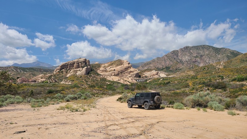
Updated: 12/04/2025
Southern Pacific Road
Alray, California
3N53, Southern Pacific Road, is in the 823,000-acre San Bernardino National Forest north of Lytle Creek. The trail moves west to east, next to portions of the Southern Pacific Railroad tracks, and passes through the stunning Rock Candy Mountains. These striking sandstone formations are the remnants of ancient oceans heaved up at an angle over the millennia, revealing a beautiful sandstone landscape with walls reaching 200 feet tall that you can drive right through. The road is an easy trail with no obstacles and is excellent for beginning off-roaders. While the National Forest permits dispersed camping, there are no appropriate locations along this trail to spend the night, and only gas stoves are allowed. The trail's end offers a tree-covered day-use area near what used to be the Summit Trail Station, marked with a historical landmark.
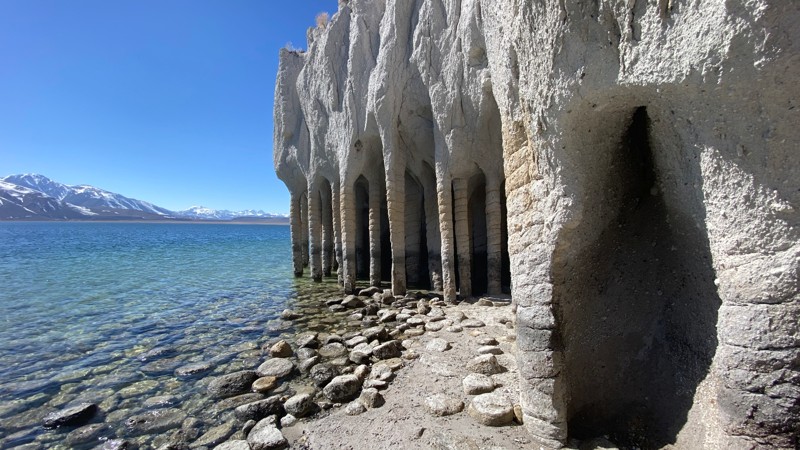
Updated: 03/18/2023
Crowley Columns
Mammoth Lakes, California
Near Mammoth Lakes, California, and just outside the Long Valley Caldera in the Eastern Sierras sits this short trail leading to these unique, unnatural-looking stone columns along the shores of Crowley Lake.
The Crowley Columns, while they appear to be man-made, are said to be natural formations created by a combination of volcanic activity, ash, melting snow, and steam, about 3/4 million years ago.
The columns remained buried for hundreds of thousands of years until the man-made reservoir of Crowley Lake began eroding away the softer materials around them starting in the early 1940s.
Today these tall standing columns at the end of a short scenic off-road trail and short hike are a spectacular sight to see. Anyone from first-time off-roaders to experienced wheelers will enjoy this trail and the beautiful surrounding area.
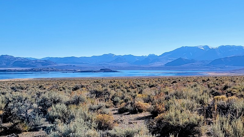
Updated: 06/03/2025
Dobie Meadows Road
Pizona, California
Dobie Meadows Road travels on the edge of the Inyo National Forest and the Granite Mountain Wilderness Area. As you travel around Mono Lake, the arid landscape gives way to the majestic Sierra Nevada Mountain Range. The northwest part of the trail offers the best views of the lake. Mono Lake is over 1 million years old and has amazing tufa towers made of minerals that rise from the ground.
This is a well-maintained gravel road. There is a small river crossing near the trail's western end, but it's only about a foot deep. Any high-clearance vehicle can handle the crossing, so 4WD is not needed. Always check the road conditions before you go, as parts of the trail can get washed away and sandy after a heavy rain. This trail does travel through an open range, so beware of horses and cattle on the road.
While the trail is on BLM land, no campsites were noted.
One great trail that meets up with this road is Crooked Meadows Road at the southeast end.
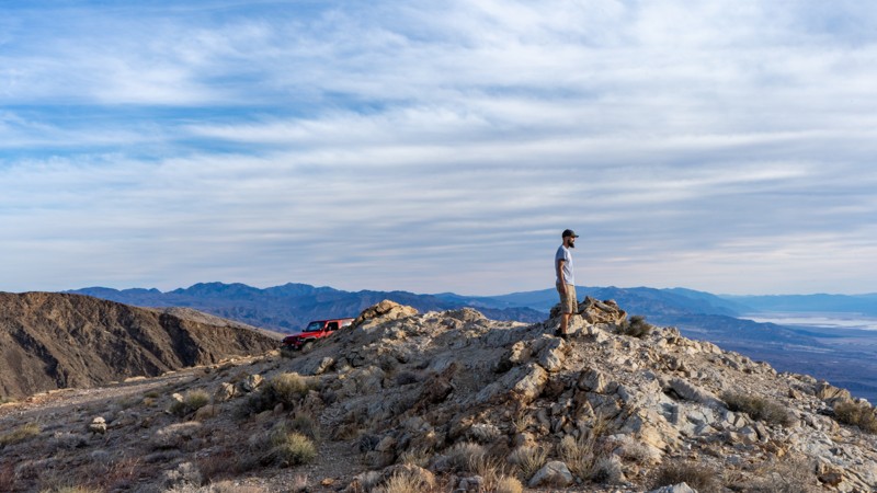
Updated: 03/25/2025
Chloride Cliff Road
Beatty, California
Situated on the east side of Death Valley National Park, within the Funeral Range Mountains, lies one of the oldest mines in the entire park, and the highest point gives unparalleled views as it overlooks Badwater Valley. The original mine was discovered by August J. Franklin in 1871. The story is told that he picked up a rock to crown a rattlesnake and found silver ore. He founded the Chloride Cliff mining company with the first claims he staked. The mine could not produce enough revenue and mostly stopped operations until the Bull Frog mining boom in 1905. With towns like Rhyolite nearby to help support the mine, a permanent camp was established to ramp up operations and was called Chloride City. Not much remains today except for adits, tailing piles, and the grave of James McKay, an unknown man with no known story to tell. It's the perfect trail to add to your Death Valley list.
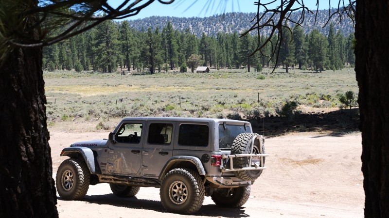
Updated: 07/21/2025
Van Dusen Creek
Minnelusa, California
Tucked deep in the heart of the San Bernardino National Forest, 3N07, Van Dusen Creek, is the kind of gem that turns a casual trip into a full-on adventure. This dirt road winds through towering pine forests and wide-open alpine meadows, delivering panoramic views and crisp mountain air that instantly hits reset on your soul. Just minutes from Big Bear, it’s a backcountry escape that feels miles from civilization, quiet, untouched, and absolutely stunning. But the real magic? It’s what waits at the end. Climbers Camp is a peaceful, pine-shaded haven that leads straight to the legendary Coyote Crag, a dramatic granite wall known across Southern California for epic climbs and surreal scenery. Pair that with expansive dispersed camping, golden hour light pouring through the trees and glissading off the grass-filled valley, and a connection to the thrilling 3N07A - The Squeeze, and you’ve got a trail that doesn’t just impress, it leaves a lasting mark. If you’re searching for that one spot that delivers beauty, adventure, and total escape, this is it.
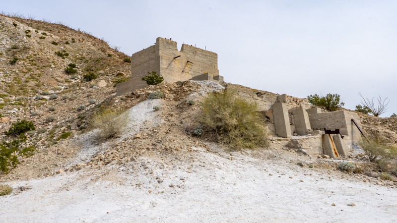
Updated: 05/23/2024
Dolomite Mine - Anza Borrego
Ocotillo, California
The Dolomite Mine is a great stop when traveling through Anza Borrego State Park. Once a Dolomite Marble and Magnesium Calcium Mine located in the Coyote Mountains that operated from the 1920s until the 1960s. Today, visitors can explore the remnants of the old mine and get a sense of what life was like for the miners who once worked here. The site features a number of rusting metal structures, abandoned mining equipment, and other artifacts that provide a window into the area's mining past. These old structures is a great place to explore and provides a great overlook of the South East corner of the park. The trail is one of the harder trails in the area, so when traveling this trail, make sure your vehicle is in good running order.
Overall, the Dolomite Mine is a fascinating destination that offers a unique glimpse into the history and natural beauty of Anza Borrego. Whether you're interested in exploring the area's mining past, off-roading through the scenic landscape, or simply taking in the stunning desert vistas, this historic site is well worth a visit.
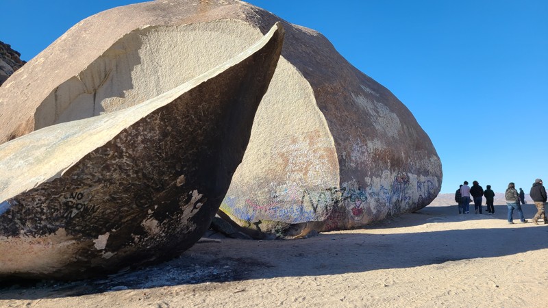
Updated: 05/08/2023
Giant Rock
Landers, California
One of the great natural wonders, Giant Rock in Landers, California is something everyone has to see once. This large free-standing boulder is almost out of place due to its size. You are able to see the large rock for miles, as this boulder is rather unique. The area is famous for several different reasons from someone living under the rock to the world's first UFO convention happening at Giant Rock. Whatever the reason that takes you there, this is a must-do for anyone passing through the area.
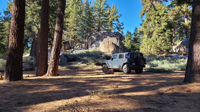
Updated: 12/17/2024
2N86 Kidd Creek
Big Bear City, California
2N86 Kidd Creek is in the 823,000-acre San Bernardino National Forest just south and above Big Bear Lake and travels through some of the most beautiful parts of the Big Bear Mountains. Over its 1.7-mile length, Kidd Creek has many spots to pull over and enjoy the peaceful solitude of this lush forest. The entire road length is enclosed by a conifer forest with tall Ponderosa Pine sheltering the way and accented by the many inspiring granite rock formations for which Big Bear is known. The road leads to Yellow Post Campsite #30, which is bordered by more majestic granite formations.
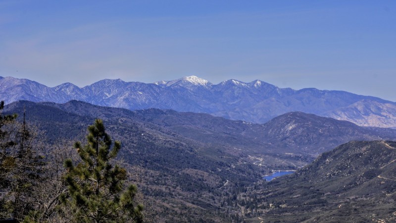
Updated: 07/12/2024
2N34 Tunnel Two
Twin Peaks, California
2N34 Tunnel Two is in the beautiful San Bernardino National Forest. This trail's attraction is its access to miles of OHV designated trails to the north. It is the route of choice if you wish to run 2N37 Miller Canyon OHV from its east end or if you want to access a more difficult trail in 2N33 Pilot Rock. There are thousands of miles of roads and trails on public lands that are appropriate and accessible for Off-Highway Vehicles (OHV's) use. OHV's are a fun and exciting way to experience America's natural treasures. These vehicles are not street legal and must display a Green or Red Sticker issued by the State. Unless otherwise posted, normal sized vehicles may use the OHV trails also. To the west around Waypoint 4, there are some beautiful views of Lake Silverwood.
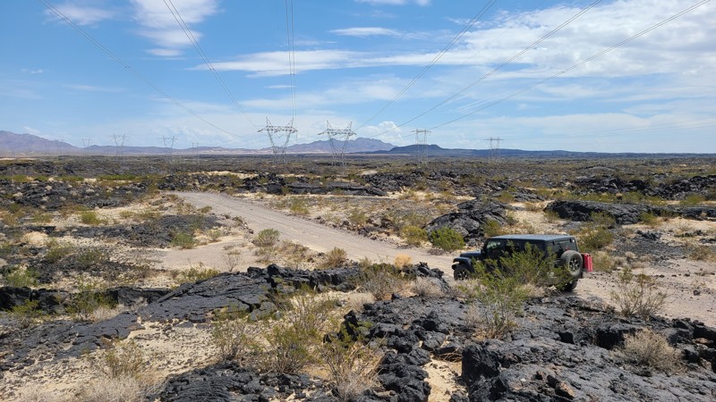
Updated: 04/08/2025
Transmission Line Road
Lucerne Valley, California
Located on BLM land in the Johnson Valley OHV Area, Transmission Road offers a variety of desert terrain and offroad driving challenges. Beginning in deep soft sand, this trail winds its way up and over beautifully the rugged valleys of the Rodman Mountains. Eventually, it passes through a seemingly endless sea of ancient lava fields sourced by the Pisgah Volcano, located near the trail's end. Much of the trail is bordered on the southeast by the Twentynine Palms Marine Base Live Fire Training area with its infrequent signage warning of unexploded ordinance. Camping can be found along the trail following the Bureau of Land Management Barstow Field Office guidelines. Summer monsoons can create deep ruts across the trail, instantly changing the driving conditions. A four-wheel drive high clearance vehicle is needed for this 36-mile trail confidently.
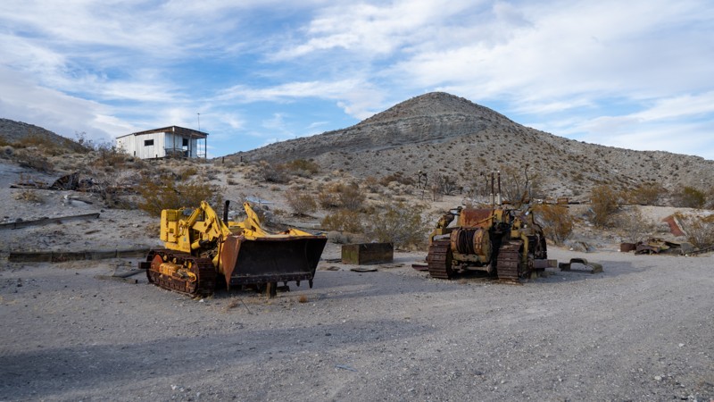
Updated: 03/25/2025
Opal Trail
Cantil, California
Opal Trail is aptly named as at the end of the trail are two famous opal mines, Nowak's Opal Mine and Barnett's Opals. The very light-colored terrain in this canyon consists of volcanic ash. It has yielded many opals over the years. Back in the day, Barnett's Opals charged $2 a head for a day pass to mine, and you could keep whatever you found. Currently, rock collecting is not allowed within the Red Rock Canyon State Park. It is said that among the Barnetts' luminous treasures found is the "Mojave Flame," an opal that glows like coal in a barbecue pit. In 1975, the Opal Miners Association valued the stone at over $50,000. All that remains now are dilapidated buildings and the equipment used to mine.
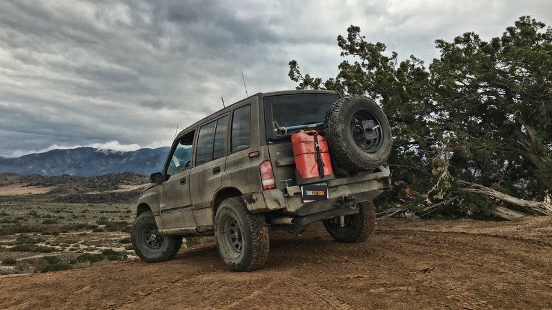
Updated: 06/17/2024
Hungry Valley SVRA - Rattler Trail
Santa Clarita, California
Rattler Trail is one of many off-road trails in the Hungry Valley SVRA (State Vehicular Recreation Area) just outside of the Gorman and Frazier Park mountain communities in Southern California.
Over 130 miles of motorcycle, ATV and 4x4 trails spiderweb throughout this 19,000 acre park. To traverse these trails, you will climb over hills, plow through muds pits, shoot down sand washes and at the end of the day, idle into one of the numerous campgrounds.
On any given weekend this park will be full of dirt-bikes, side-by-sides, quads, and 4x4s. If it burns gas and flings mud, you will find it here.
Rattler Trail stretches nearly five miles from the north and south ends of the park and intersects with many of the more difficult trails that lead through the hills of Hungry Valley. Three high points across this trail provide great views of the west and south sides of this valley in the mountains.
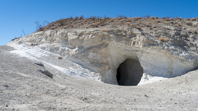
Updated: 03/25/2025
The Dutch Cleanser Mine
Inyokern, California
Once a common household staple, Old Dutch Cleanser was a familiar sight in homes and stores across America. Known for its powerful scrubbing ability, this pumicite-based cleaner was used on everything from sinks and stoves to bathtubs. Between 1923 and 1947, the Old Dutch Cleanser Mine produced over 120,000 tons of the abrasive powder that made the brand so popular.
Today, visiting the mine on an overlanding trip feels like stepping back in time—especially considering the mysterious circumstances under which its operators seemed to vanish overnight. As you wind your way up the road to the site, you’ll be struck by just how much pumicite still blankets the area. For those feeling adventurous, the mine’s shafts remain accessible, offering a rare chance to explore the tunnels and see remnants of the original materials and tools used in the mining process.

Updated: 09/03/2025
Lone Ranger Canyon
Lone Pine, California
In Alabama Hills near Lone Pine, California, there are several camping loops that many people use as a place to retreat from the city. These areas see many different people each year and leave lasting memories. This camping loop, in particular, is up in the narrow rocky canyon with a lot of privacy and epic views of Mt. Whitney. The road is unsuitable for RVs and would be best for 4x4's or vehicles with high ground clearance and good articulation. The best part of this canyon is that it was one of the locations where The Lone Ranger was filmed. Needless to say, if you go out there, you are going to have a fantastic time.
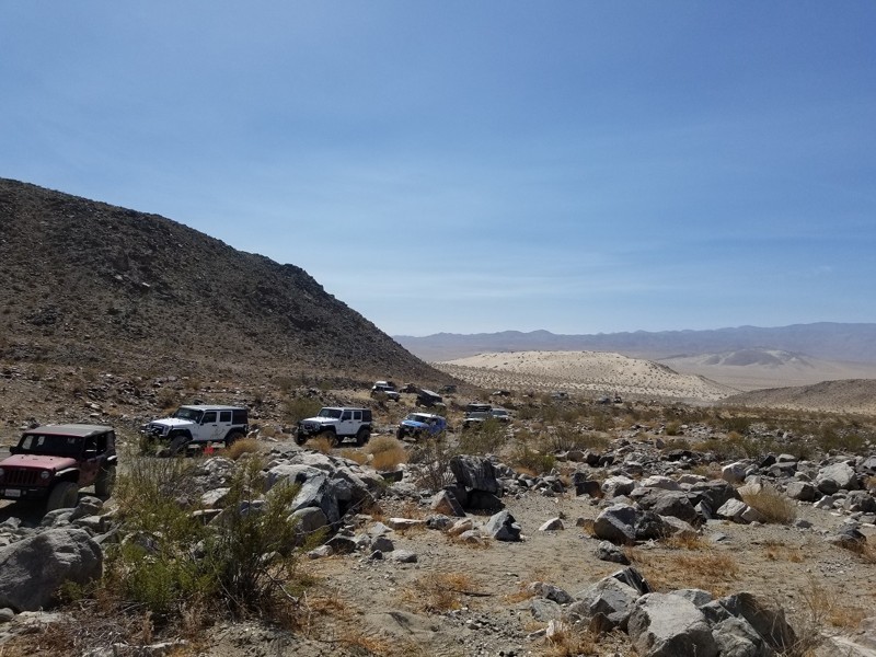
Updated: 02/27/2024
Hammers Scenic Byway - Johnson Valley
Yucca Valley, California
At the feet of the famous Jack Hammer, Sledge Hammer, Claw Hammer, Bender Alley, Big Johnson, and many other great trails in Johnson Valley OHV area is this easy to intermediate scenic trail that offers stunning views of some of the most demanding 4x4 trails in America. The Hammers Scenic Byway is a great trail for everyone from new to off-roading to the most extreme rock crawling tube buggies. This delightful 4x4 trail cuts between the hills that all the Hammers sit on and continues north by Chocolate Thunder, Claw Hammer, Sand Hill, Big Johnson, and several others. The trail slaloms in and out of the Johnson Valley OHV area and gives you a great perspective of the extreme trails that are just off the route. Whether you are a Jeep, Toyota, Isuzu, Nissan, extreme buggy, or an overland person, a drive down this trail will certainly bring some excitement to your day
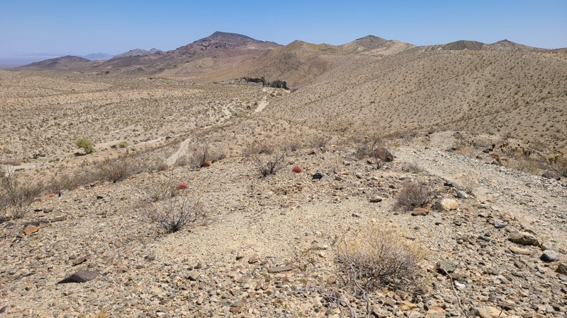
Updated: 11/26/2025
Dupont Road
Desert Center, California
Over most of its length, Dupont Road hugs the eastern base of the Chuckwalla Mountains Wilderness and then crosses through a rugged valley to reach the southern side of the range. Beautiful views of the mountains and desert expanse treat you until the road begins transitioning from cloud-soft sand to a bone-jarring boulder-strewn trail with all eyes concentrating on the road as you crawl through a maze of rocks and obstacles. The BLM rated it as “Most Difficult” or Black Diamond, and the trail lives up to its rating. Only experienced drivers with raised 4-wheel drive vehicles should attempt this trail.
Campers can find dispersed campsites along the eastern or BLM roadside. The BLM requests campers to use existing disturbed sites to limit the impact on the land.
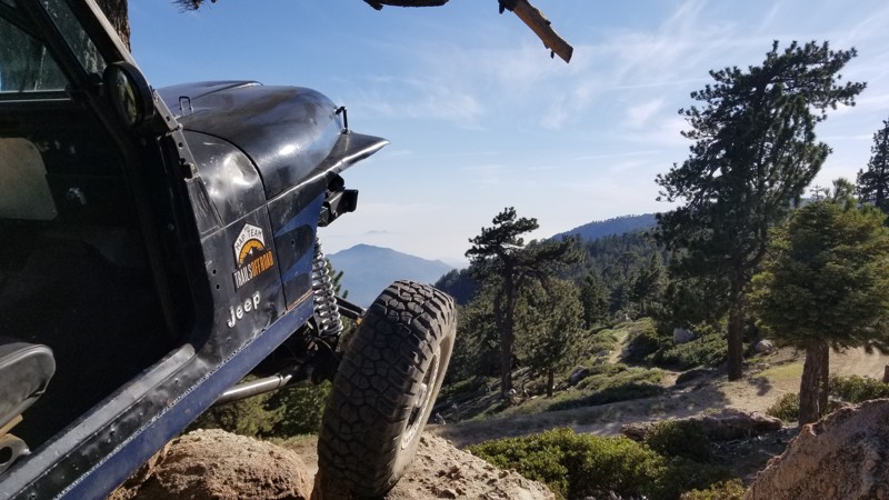
Updated: 12/01/2023
2N51Y - Mid Section
Big Bear Lake, California
On the southern side of Big Bear, California, is a part of the forest that many off-roaders don't explore when thinking about a weekend off-road. This may be because the ski slopes keep this area closed in the winter, or it could be because the extensive named off-road trails are on the opposite side of the lake. Well, let's just stop this injustice right now. On the south side of Big Bear Lake is an extensive trail network that provides some of the best overland camping and scenic views in this mountain range. This is an excellent network of trails that are perfect for first-time 4x4 enthusiasts. These almost untouched views are extremely close to downtown Big Bear Lake. Thus, the next time you are in the area wanting a quick and easy trail to check out, think no further than 2N08 - Knickerbocker Trail and 2N51Y Coyote. The views at the top of Snow Summit are unparalleled.
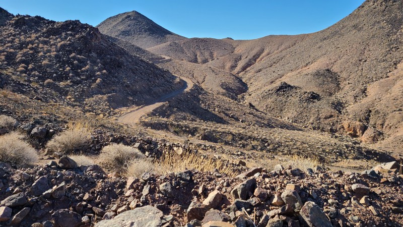
Updated: 03/09/2026
Needles to Ludlow Truck Trail Part 2
Danby, California
This trail is the second half of the Needles to Ludlow Truck Trail.
Starting at the halfway point at Route 66 near Essex, the trail
ends at Ludlow. When reaching the hills, the views
reveal an ancient landscape, untouched by man save for the road you
are on. Panoramas are far as the eye can see in all directions and
show how alone you are on this trail. BLM manages the trail and
surrounding land. Dispersed camping is plentiful anywhere along the
way using BLM camping guidelines.
This trail is rated moderate only if using the bypasses built into the
route. These bypasses provide an alternative to sections that would be
rated severe to extreme and even may be impassable. These bypasses are
not marked or signed, so closely following the attached track will
guide you around the severe sections. Without a .gpx track, the route
should be walked first at each intersection to ensure you are on the
moderate difficulty path. An experienced driver should drive the trail
using a high clearance 4x4.
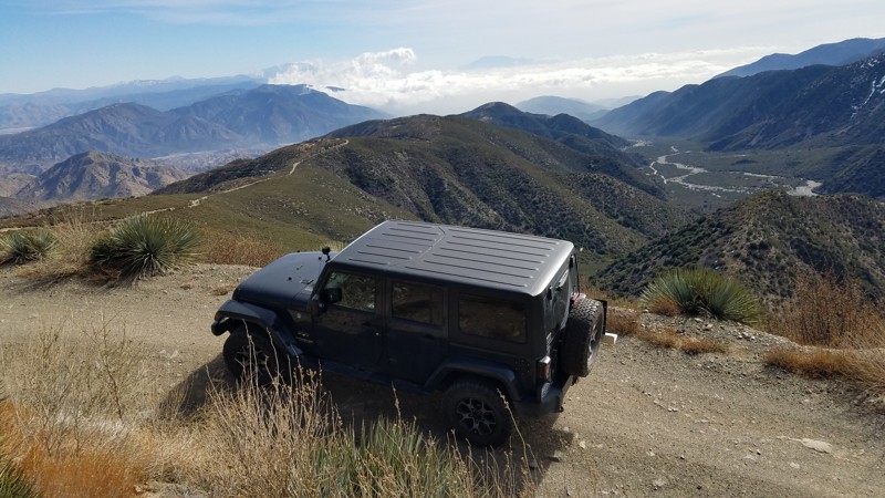
Updated: 07/12/2024
3N33 Slade Canyon
Fontana, California
Slade Canyon is a short drive from the densely populated Inland Empire and takes you deep within the 200,000-acre Front Country Ranger District of the San Bernardino National Forest. The trail lies at the eastern-most extension of the San Gabriel Mountains and winds up the side of Lytle Creek Ridge. It is a short trail, but along its winding climb, it provides many spots to pull over and enjoy the commanding views of the Lytle Creek area below. Rising in the south are the San Gabriel Mountains, and to the east, the receding Lytle Creek Ridge reaches out to the Cajon Mountains. Pets are welcome but must be kept on a leash.
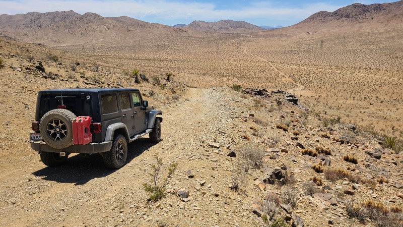
Updated: 10/15/2024
Ord Mountain Area OM7381
Daggett, California
OM-7381 winds up and over the highest elevations of the Ord Mountains, ultimately ending at Stoddard Mountain. The mountain heights provide humbling and colorful views of the surrounding Mojave Desert terrain. With an annual average rainfall of five inches, only the prevalent Creosote Bush can thrive in this region. Even the sparse Mojave Yucca struggles for a foothold. The road can be rough, slippery, and steep and merits an experienced, off-road driver. Most of the road is on BLM land. For explorers wanting to spend a night, dispersed camping is available at several previously disturbed sites along the route.

Updated: 12/17/2025
Morongo Basin Desert Run Road
Yucca Valley, California
Once in Johnson Valley, many people wonder where the best dispersed camping is at. Morongo Basin Desert Run Road (aka Desert Run Road) is one of two favorite spots for the locals to camp at. Desert Run Road is almost totally protected from the aggressive winds that can wreak havoc on the Means Dry Lake. The weather isn’t the only reason to choose this trail for camping. Immediately off of Desert Run Road is some of the best 4x4 and off-road trails in the area including trails like a Turkey Claw, which is an extreme rock crawling trail.
Mommas Sand Hill is a popular place for razors and other side by sides to hang out and there are several natural dirt bike courses against the hillside. So the next time you are in the area and wondering where to camp, take your RV, 5th Wheel, or tent and look to Desert Run Road.
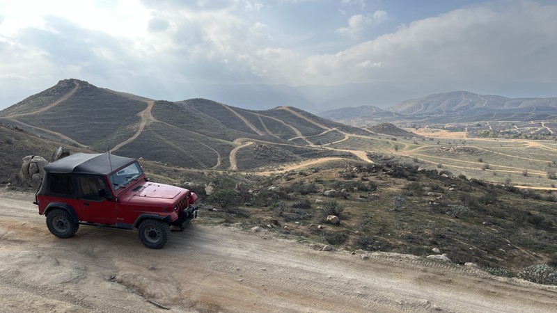
Updated: 04/10/2026
Eagle Valley Road
El Sobrante, California
Eagle Valley Road (also known as Tin Mine Road) is your out-and-back expressway for exploring Eagle Valley, a region due west of Lake Matthews. The road tees off from La Sierra Avenue in Lake Matthews, CA, and is an unmaintained dirt road.
Over the five and a half miles, the road bounces you between rutted-out dirt, loose rocks, smooth pea gravel, and even short stretches of decrepit asphalt. Most of the area you will travel through appears to be Riverside County land of unknown ownership. As such, the first mile has sadly become a popular dumping ground for locals who couldn’t be bothered to take their trash to an actual dump. The rest of the road circles the Eagle Valley area, allowing you to explore dozens of trails.
Be respectful and heed “No Trespassing” signs when you see them since the road passes privately owned properties. The trail ends at a section of land just off La Sierra Ave. that is private property, so you’ll have to come out the entrance you came in. Luckily, there are many more optional routes to explore on your way back if you’ve had your fill of Eagle Valley Road.
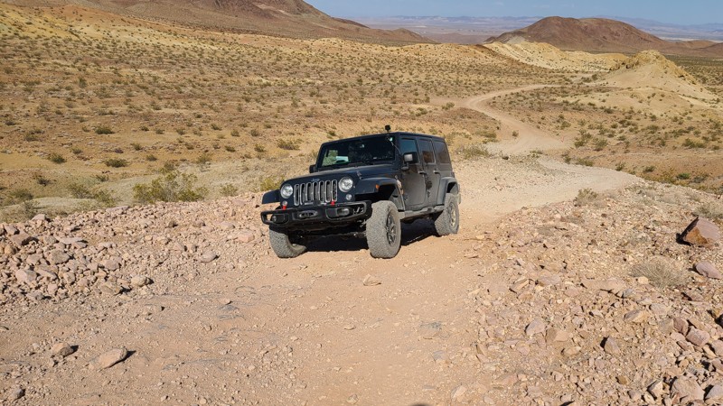
Updated: 01/02/2024
Tin Can Alley
Barstow, California
Climbing into the eastern edge of the Calico Mountains, Tin Can Alley is an easy drive that provides beautiful views across the desert and into the mountains. Near the trailhead, a large area on the side of the trail is covered with rusting tin cans left by the miners decades ago, hence the trail's name. Years of exposure have eroded any markings that tell of the can's contents, but still, it is an enticing stop to rummage through the field to find the last can still standing. At its end, this trail connects to the heart of the challenging Calico Mountain trail network.

Updated: 01/08/2025
Claw Hammer
Lucerne, California
A true legend of the off-roading world, and often called the easier of the three Hammer Trails. Claw Hammer, located in Johnson Valley in Southern California, home of King of the Hammers, offers a difficult to severe-rated rock crawling trail in a short but exciting package. Be ready for lots of technical obstacles with cringe-worthy waterfalls, mountainous rocks, and boulders that just don't seem to offer a way around. The risk of doing body damage is high, along with vehicle failure. Based on how experienced your group is, you can get through this trail in as short as 45 minutes. But the average group takes about 4 hours. Whether you are a Jeep person, a Toyota junky, or a buggy driver, when looking for a truly epic offroad trail that makes most people's top 5 lists, check out Claw Hammer.
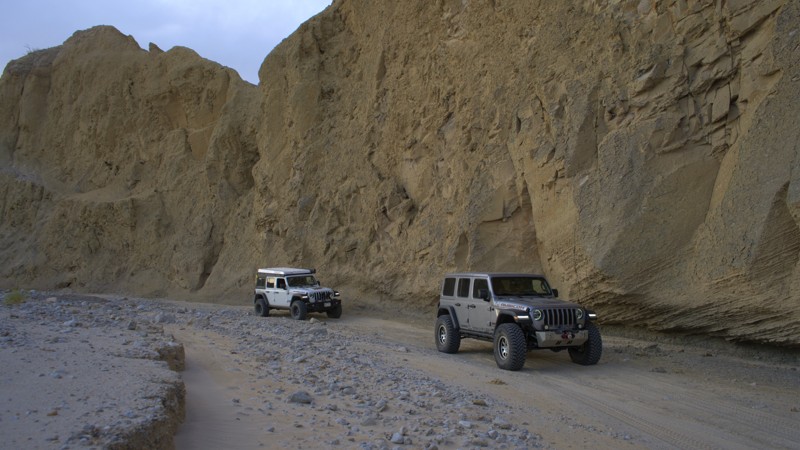
Updated: 03/10/2026
North Fork Fish Creek
Mesquite Oasis, California
North Fork Fish Creek, an often overlooked trail in the Anza-Borrego State Park, is a unique and quiet trail splitting off near the Wind Caves on Fish Creek Trail. The trail's canyon cuts through various geologic layers, including sandstone canyons and mud cliffs. The seldom-used trail follows open sandy washes with a few mild rock-crawling opportunities to spice things up, making it a great overlanding trail for the person looking for a place to have the desert to themselves.
North Fork Fish Creek has several flat campsites suitable for any sized group with flat dirt areas and low traffic.
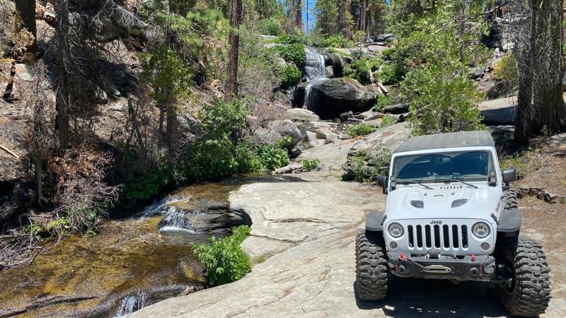
Updated: 12/15/2025
Whiskey Falls
Whisky Falls, California
This long, easy dirt road curves through the mountains in the Sierra National Forest, north of North Fork, California and is best known for the Whiskey Falls waterfall and the Whiskey Falls Campground, which are about 1.5 miles east of Waypoint 18 on 8S09 - Peckinpah / Whiskey Road.
There are scattered sections of old warn pavement throughout this trail, but it is primarily rough dirt and suitable for high ground clearance 2WD vehicles. This is a great trail for those looking to explore the forest, check out the falls, and set up camp.
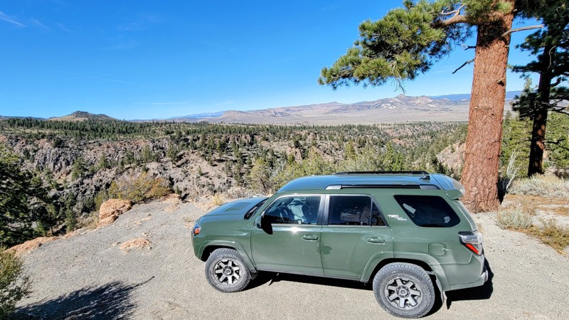
Updated: 06/29/2025
Crooked Meadows Road
Mono Mills, California
Crooked Meadow Road is a rocky dirt road with a few sandy parts that runs through the Inyo National Forest. 4x4 is needed for a few sections of this trail. A good chunk of the northern end road is washed away, and 2WD does not offer the traction you’ll need to get through. There are also a couple of ditches that require 4x4.
The pine trees open up to great views of Crooked Meadow and other meadows along the trail. To the east side of the trail is Taylor Canyon, which is a cool drive down or up, depending on your direction of travel. The steep canyon offers great views of the White Mountains to the east and the Sierra Nevada Mountains to the west.
Crooked Meadow Campground has lots of trees, and some of the sites have great views of the meadow. There are no facilities at this campground and also no fee; you can camp for 14 days before you have to move to a different site at least 10 miles away.
This is a great trail to combine with Bald Mountain Road or the other connecting trails in the area.
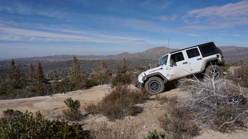
Updated: 12/18/2023
2N29Y - Stove Flats / Plantation
Lake Arrowhead, California
This steep, narrow 4x4 trail known as 2N29Y - Stove Flats or Plantation OHV Road, is part of the network of off-road trails in the Deep Creek OHV area just north of the mountain lake community of Lake Arrowhead in the San Bernardino National Forest.
This trail makes for a great add-on to a run through Willow Creek Jeep Trail or a trip to Devils Hole. With a few steep hills and some small rocky sections, 2N29Y offers a little more offroad challenge than most other 4x4 trails in the surrounding area.
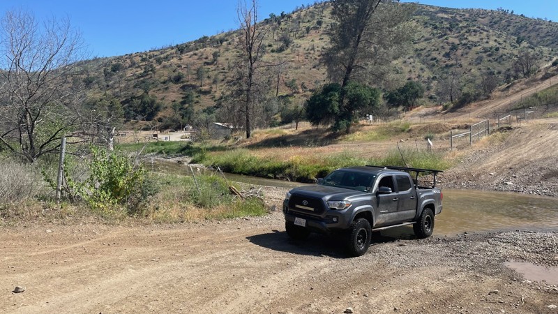
Updated: 10/15/2024
Frank Raines OHV: Fire Road
San Antonio Valley, California
Frank Raines OHV Park is located not far from Patterson, CA. It is open to 4x4s from sunrise to sunset with a $5 admission fee per vehicle. The park is open to all OHV vehicles, so be sure to watch out for dirtbikes, quads, and SXS.
Fire Road is an easy trail that begins at the park's entrance. It is rated green by the park's rating system. The most difficult portion of the trail is a rutted hill descent. The hill can be descended in 2WD, but 4WD is necessary to make it back up. However, there is a parallel trail you can take to bypass the hill climb on your return. The winding trail connects to the park's other trails. There's also a small 4x4 "play area" with a few optional obstacles to test the capabilities of your vehicle. The trail dead ends into Ridgeline Trail, which is currently closed for fire repair.
Deer Creek Campground is located at the park's entrance. The campground has 34 sites with picnic tables, restrooms, and other amenities. Prices range from $15 to $30 per site.
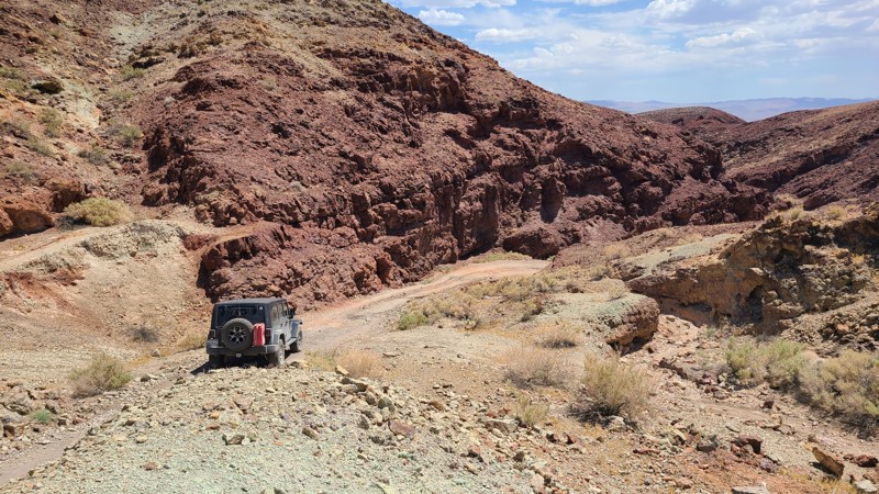
Updated: 05/16/2023
Phillips Canyon East
Barstow, California
Leading into the heart of the Calico Mountains, Phillips Canyon East meanders next to open tunnels and deep pits, providing constant reminders of the silver mining era that once dominated this area. Beginning over flat soft sandy washes, this short trail soon transforms into a rough, rocky, narrow driving challenge. As the trail descends west from its peak, impressively tall and jagged rock walls hug the path leading to the very difficult Phillips Canyon West and Odessa Canyon trails.
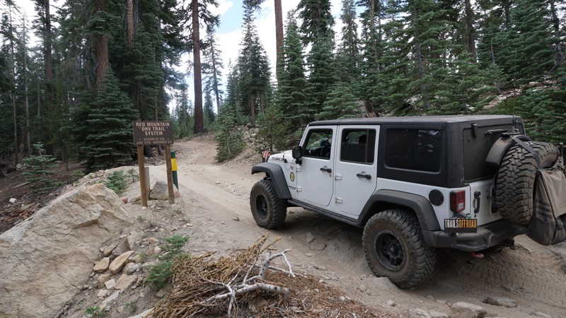
Updated: 06/16/2024
8S42 to Sand Flats
Shaver Lake, California
Forest route 8S42, part of the Red Mountain OHV trail system in the Sierra National Forest, includes mild off-road challenges, dense green forest, numerous camping opportunities and, best of all, access to the five lake trails; Red Lake, Coyote Lake, Mirror Lake, Strawberry Lake and West Lake.
8S42 - Sand Flats is a great trail for an off-road beginner or a necessary trail for the more advanced wheeler looking to reach the more challenging lake trails at the east end.
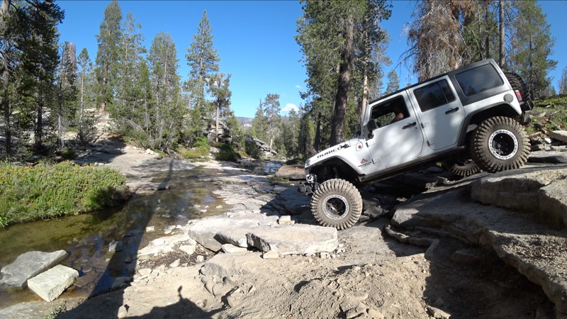
Updated: 04/15/2024
26E328 - Bald Mountain Basecamp
Shaver Lake, California
This short, moderately technical and scenic trail in the Bald Mountain OHV area in the Sierra National Forest sits just east of Shaver Lake, California.
A challenging Creek Crossing/stair-step obstacle and a huge camping/staging area at Basecamp are the highlights of this trail.
Bald Mountain Basecamp offers quick access to the surrounding Bald Mountain trails, Brewer Lake and numerous other 4x4 trails in this area. Basecamp, at the north end of this trail, also makes a great staging area for a run through Swamp Lake or Dusy Ershim.
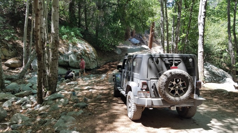
Updated: 08/05/2023
2N63 4000 Foot Road
Crestline, California
2N63 4000 Foot Road is in the 823,000 acres San Bernardino National Forest just south-east of Silverwood Lake and only a 16-mile drive from I-15. The trail parallels Highway 138 for 2.1 miles zig-zagging through the pine forest. Located near the elevation where the pine trees begin, most of the road is shaded by tall trees making for a great escape on a hot day. Along the trail, a creek crosses, finding its way to the East Fork of the Mojave River, eventually draining into Silverwood Lake. This spot is a favorite to stop for lunch as it offers a beautiful rock formation that creates a waterfall with enough water flow.
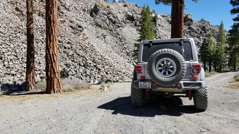
Updated: 06/05/2022
2S79 Obsidian Dome Loop
June Lake, California
In the forest near Mammoth, California is an abundance of trails. One of these unique trails is 2S79 also know as Obsidian Dome Trail named after the unique rock that is produced by the volcano caldera that the trail runs along. This gem trail of the forest is an overlanders dream come true with some of the best camping available in California. So if you are tired of the same old camping in the same old places, give yourself something new and check out 2S79.
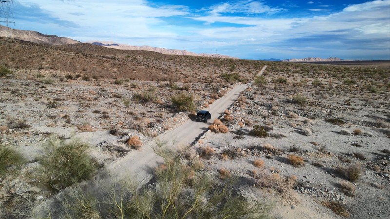
Updated: 06/03/2025
Aqueduct Road East
Indio, California
The desert on this trail offers a contrast of stark desolation and beauty. It is accented by the brilliant white summer afternoon clouds, making a casual drive over its length a memorable experience. To the west are stunning views of the Cottonwood Mountains, which are the alluvial material source, creating the gently sloping bajada you are on. There are many unnamed intersecting spurs to explore along the way and several hiking trails that lead into Joshua Tree National Park with trailheads just off the road. The open desert to the west served as a significant tank training area during World War II, and a short detour along the way will take you to the General Patton Memorial Museum.
The road's namesake, the Colorado River Aqueduct, whose water is the lifeblood of greater Los Angeles, courses through a series of tunnels bored under the rugged foothills a few feet north of the road. And if that were not enough, Aqueduct Road offers beautiful desert camping getaways near the start of the road and at the end next to the General Patton Memorial Museum, which is a great destination in itself.
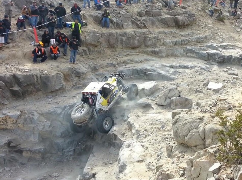
Updated: 12/17/2025
Backdoor
Lucerne, California
Backdoor is probably the single hardest rock crawling obstacle that is possible without a winch. Only minutes from the famous King of the Hammers basecamp, this short trail can provide hours of entertainment for bystanders or years of bragging rights for drivers. For the drivers that think about trying this trail, most will turn around before even starting the trail while some will try and quickly fail. The majority of those who try it will rollover, but there are always the lucky few who will make it. ***Important Notice*** This trail is only for those with a very good/strong roll cage and a well-built vehicle.
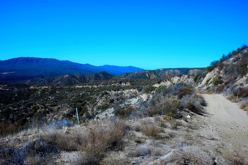
Updated: 06/20/2024
6S16 - Cottonwood Truck Trail
Anza, California
Situated in the San Bernardino National Forest, 6S16 Cottonwood Truck Trail is nothing short of a scenic opportunity. With views of Little Cahilla Mountain, Lake Riverside, Anza, and Thomas Mountain. Nearby is the Bautista Canyon Road which was used by the Spanish during a 1,200-mile expedition from 1775-1786. This is a great trail for a first time off-road enthusiast or someone looking to go explore for a day in the cooler temperatures you'll find further up the trail towards Thomas Mountain.
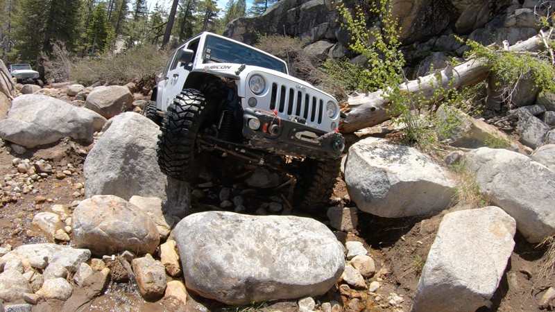
Updated: 02/01/2023
Old Sluice
Pollock Pines, California
Old Sluice is a short, but near-extreme and almost forgotten section of the Rubicon Trail in the Eldorado National Forest outside of Pollock Pines, California. Where the more common Rubicon route travels across the lower granite slabs known as Indian Trail, this higher and more challenging route will seriously test your rig.
Old Sluice is arguably the most difficult section of the Rubicon Trail. This is the reason most bypass it.
With one obstacle after another, after another, after another, plus some serious views of Buck Island Lake and Miller Creek on the mountainside above Rubicon Springs, Old Sluice will keep an experienced wheeler entertained four a couple hours or more. If you're running the Rubicon for the first time and pushing just to get through it, Old Sluice is probably not for you... This trail is tough. If you feel you should bypass it, there is no shame in that, but if you're up for the challenge and your rig is built for it, you'll love wheeling Old Sluice.
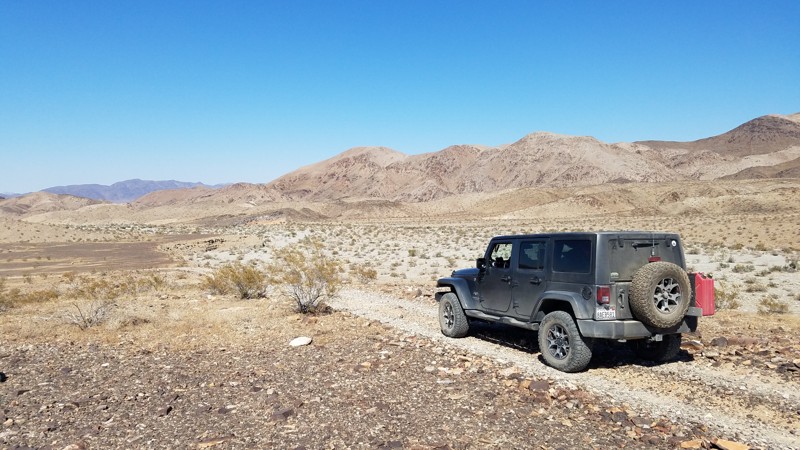
Updated: 02/26/2025
Grubstake Canyon Road
Indio, California
Grubstake Canyon Road is a rolling desert trail formed by the conjunction of the Mojave’s Pinto Basin and the foothills of the Eagle Mountains until the road makes a short climb in the foothills to its completion. This northerly trail road provides a great example of this desert transition region between the Pinto Basin north and the Eagle Mountains east. The road slowly rises at spots high enough to enjoy the far-off vistas of the Pinto Basin. The last portion of the road climbs quickly, allowing close inspection of 2 abandoned and unnamed mines.
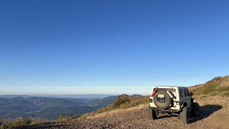
Updated: 09/29/2025
Pillsbury-Indian Dick Road
Rice Fork Summer Homes, California
Pillsbury-Indian Dick Road has a lot to offer all levels of explorers, providing all forms of camping, including designated dispersed sites with cement pads and limitless trials in the area. Pillsbury-Indian Dick Road starts as a scenic drive around Mendocino National Forest's largest lake, Lake Pillsbury. The initial trip around the lake is a slow, mostly paved drive, allowing for beautiful views, including ample wildlife, mountains, and vegetation. Once past the lake, the trail turns to rough dirt, so high clearance will be needed. Thanks to the maintenance of the Forest Service, this trail has no technical sections, allowing for an easy, relaxing drive during the dry months. Due to past wildfires, downed trees are likely to block the road. Pillsbury-Indian Dick Road transitions from high-elevation shelf roads to rolling hills. You will cross the Mendocino Pass/Alder Springs Road at the Black Butte River Ranch approximately halfway through. Black Butte River Ranch has a small, seasonal store to restock basic supplies and offers designated campsites with basic facilities and clean water. This crossing provides an excellent opportunity to switch trails or return to pavement, allowing easy access to multiple highways. Choosing to continue Pillsbury-Indian Dick Road results in a there-and-back trail, with the northern half leading to The Yolla Bolly-Middle Eel Wilderness.
Camping is abundant along Pilsbury-Indian Dick Road. There are multiple designated campsites with facilities and ample dispersed camping locations with year-round water access. A few of the designated camping areas even include concrete pads. This trail allows for endless options for dispersed camping with and without fire rings already established.
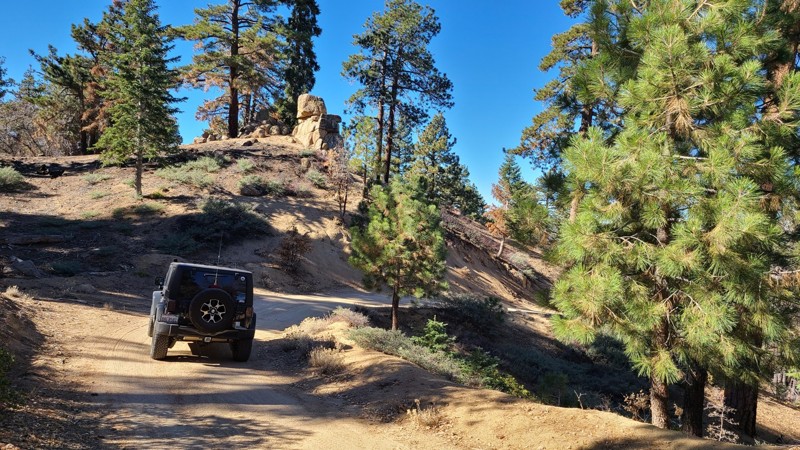
Updated: 03/01/2024
2N17 Camp Osito
Big Bear City, California
2N17 Camp Osito Road is in the 823,000-acre San Bernardino National Forest just south and above Big Bear Lake. The trail travels through the beautiful Big Bear Mountains forest. The gentle slopes surrounding the road provide many spots to camp or pull over and enjoy the peaceful solitude of this lush forest and glimpses of the blue Big Bear Lake between the trees. The entire road is enclosed by a conifer forest with tall Ponderosa Pine sheltering the way and accented by the unusual granite formations for which Big Bear is known. This well-marked road provides access to hiking and biking trailheads.
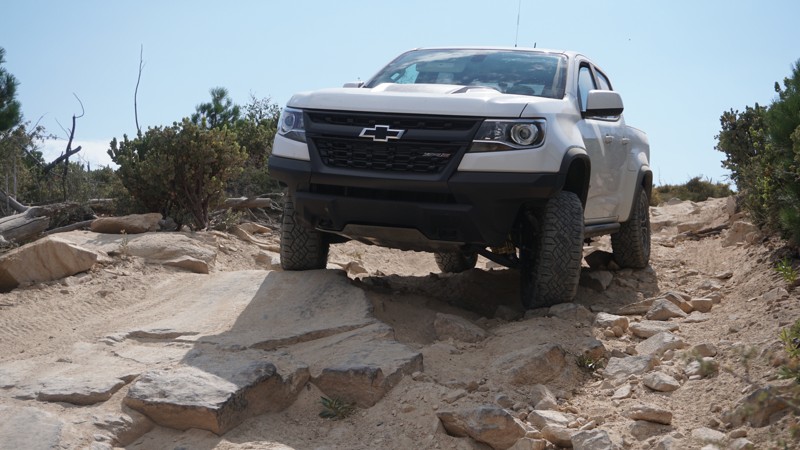
Updated: 10/09/2024
2N27Y - Rouse Meadow / Skyline OHV
Lake Arrowhead, California
Hill climbs, curvy off-camber stretches, moderate rocky patches, and high mountain views make up 2N27Y - Rouse Meadow / Skyline OHV. This steep, narrow, twisty 4x4 trail is part of the network of off-road trails in the San Bernardino Mountains, just north of the mountain lake community of Lake Arrowhead in the San Bernardino National Forest. This makes for a great add-on to a Willow Creek Jeep Trail run and offers a little more challenge than most trails in the immediate area.
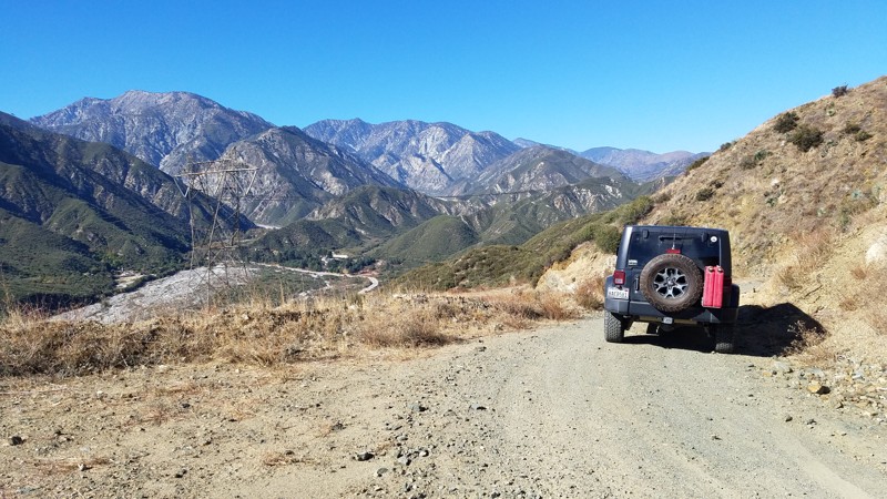
Updated: 07/12/2024
2N79 Penstock Ridge
Fontana, California
2N79 Penstock Ridge Road is within the San Bernardino National Forest and is a pleasant escape with views of the majestic San Gabrial Mountains to the west. There are beautiful vistas at many spots along the trail dominated in the west by the almost 9000' granite peaks of Cucamonga, Big Horn, Timber Mountain, and from below the jumbled boulders that make up Lytle Creek. To create the shelf-road, large sections of the hills have been sliced away, revealing evidence of the millennia of upheaval caused by the dense nest of earthquake faults undermining the area, including the Lytle Creek Fault directly below and the San Andreas Fault only a few miles north. There are massive power line towers following the Lytle Creek Valley and the road to drive in. Penstock Ridge hosts one of these structures, and it is a worthwhile trip to stand next to it and appreciate the engineering to raise such a large structure. Local artists have used the tower's foundation as a canvas, and the tower is an entertaining stop to appreciate their work.
Your dog can also enjoy the trail when kept on a leash.
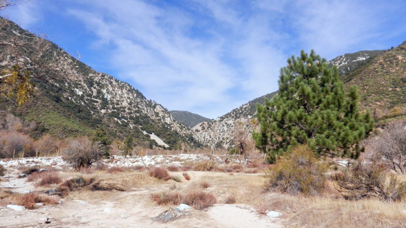
Updated: 12/01/2023
1N64A Slide Lake
Redlands, California
1N64A - Slide Lake is a wonderful off-road, 4x4 trail in the San Bernardino National Forest. Slide Lake is just one of the many beautiful trails in this Seven Oaks Canyon, including City Creek, Clarks Grade, and Radford. The Bear Creek Watershed at trails end flows into the Santa Ana River just 4 miles downstream on its journey to the Pacific Ocean. The beginning of Bear Creek is at the Big Bear Lake Dam spillway, 6 miles to the northeast. This trail is a gem for the dispersed campsite camper, along with it's connecting brother, 1N64 - Seven Pines. Be watchful of bear, mountain lion, deer and the smaller animals who make this area their home.
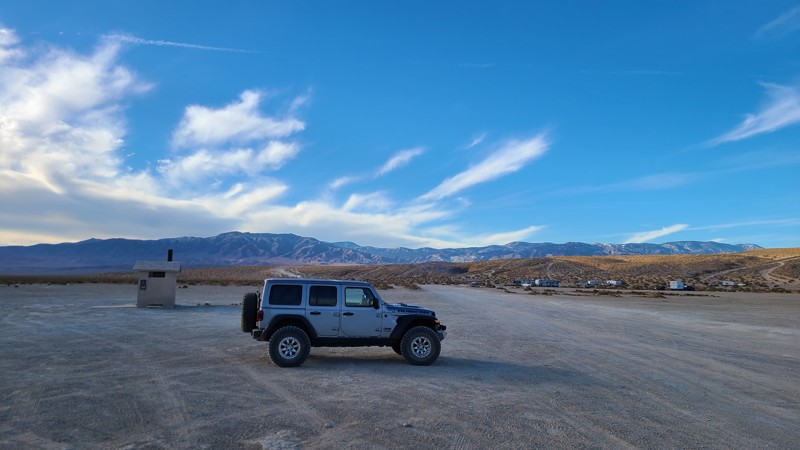
Updated: 06/05/2022
Bessemer Mine Road to Soggy Dry Lake
Lucerne Valley, California
One of the two major roads in Johnson Valley, Bessimare Mine Road, is the main road that takes you to Soggy Dry Lake in Johnson Valley. This primary dirt road is the gateway to the less popular Soggy Dry Lake that was once used as a drag strip of the desert. People often still go out to Soggy to see what high speeds they can reach. Others head out this way to camp away from the city. Whatever you do out there, it will be a great time.
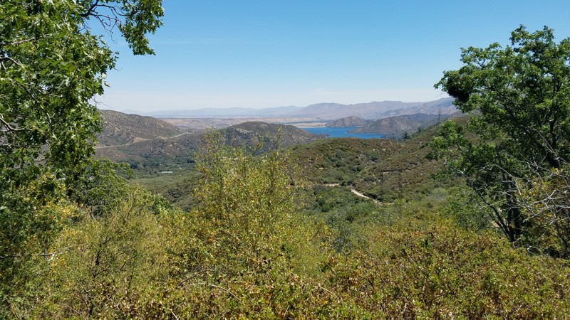
Updated: 07/18/2024
2N45 North Spur
Hesperia, California
2N45 North Spur Road is in the 823,000 acres San Bernardino National Forest just south of Silverwood Lake and only a 16-mile drive from I-15. This mountain road takes you from the lower elevations dominated by oak woodland to the land of the confers and the stately tall pine tree forest, where the deep shade and higher altitude bring quick relief from the summer heat below. Eleven switchbacks carve their way up the side of Sugar Pine Mountain until you eventually reach Bailey Canyon Road and a large inviting meadow and are rewarded with spectacular views to the southwest of the San Gabriel Mountains.
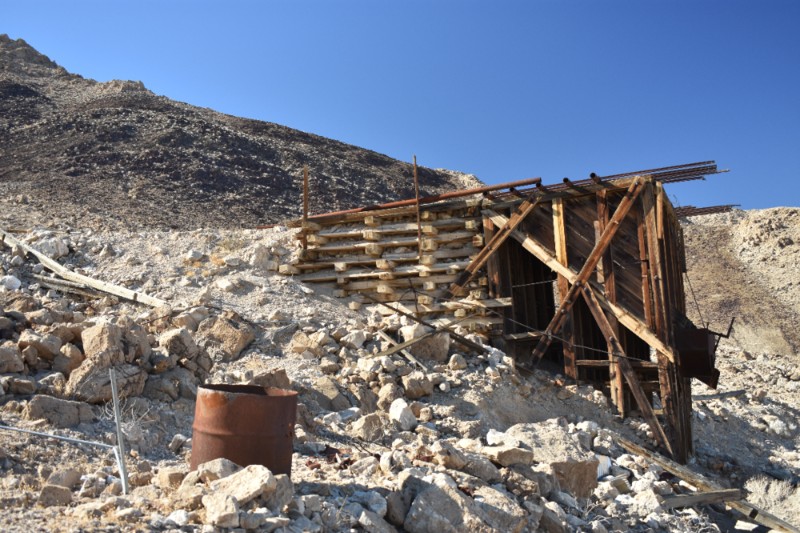
Updated: 09/24/2024
Queen of Sheba Mine - Death Valley National Park
Furnace Creek, California
This easy 4x4 route to the Queen of Sheba Mine follows the original haul road and was in limited commercial use as recently as the 1970's. Total production of the Queen of Sheba has reportedly been 5,000,000 lbs. of lead, 100,000 ozs. of silver, 1,500 ozs. of gold, and 146,000 lbs. of copper. There are extensive mine ruins, and several 2 track trails to explore around the Queen of Sheba Mine. The town and camp of Carbonite sprang up around 1900 near the Carbonite Mine site which is a short distance away. There are no ruins of the town visible.
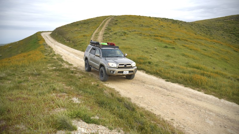
Updated: 06/10/2026
Hurricane Road
Derby Acres, California
Hurricane Road is an easy dirt road that connects Elkhorn Road in the Carrizo Plain National Monument to Crocker Springs Road and Highway 33 by crossing over the Temblor Range. This road offers another option into and out of the Monument and is a good choice for those wishing to save time rather than make a full loop on Soda Lake Road or Elkhorn Road when sightseeing in the Monument.
The road is a graded, semi-maintained track of hard-pack desert dirt with occasional ruts and passable by 2WD sedans with adventurous drivers who take extra care when navigating over the rutted sections.
The GPS track ends where Hurricane Road transitions from dirt to the asphalt of Crocker Springs Road. Continuing along Crocker Springs Road will connect with Mocal Road and eventually to SR33.
There are no camping options along the road. However, it does cross Temblor Range Road, which lies within the approved Bureau of Land Management's Carrizo Plain Dispersed Car Camping Area. Consult the official BLM Carrizo Plain National Monument Recreation Map and Guide on where camping is permitted.
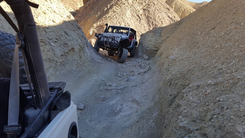
Updated: 01/02/2024
Mud Hills Center Route
Barstow, California
Calico's Mud Hills offer hours of entertainment in close proximity to camping and the roads. This popular cut-through has everything an off-road enthusiast could want from high speed berms and narrow canyons to steep hills and ledges. On top of that, when this area gets a little water, it turns into a giant slip and slide, making even the easiest routes almost impossible.
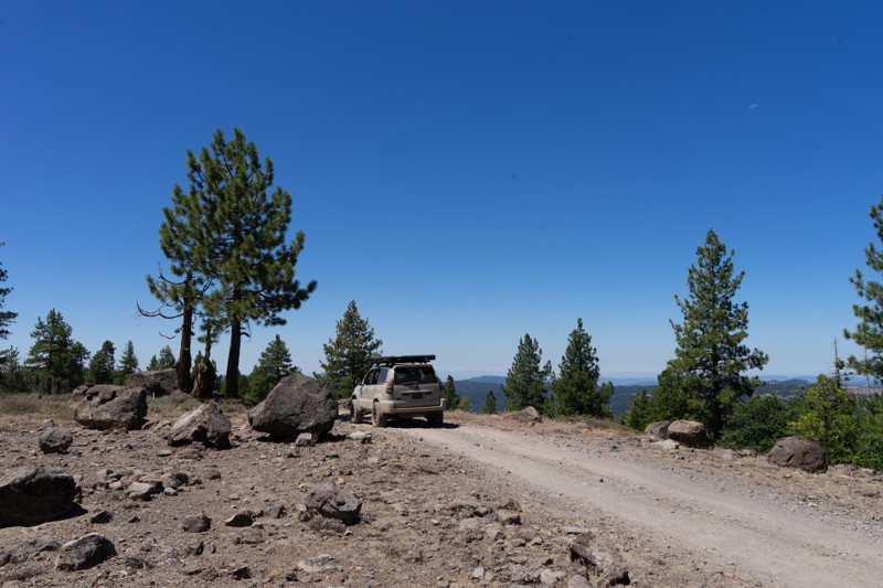
Updated: 12/15/2025
Dodge Ridge
Pinecrest, California
Just south of Pinecrest Lake and the Dodge Ridge Ski Area, you'll find a network of roads hosting a mix of off-road trails and old logging routes. This trail runs along the physical Dodge Ridge and offers excellent views of the surrounding mountains as you travel along the top of the ridge. There is one distinguishable dispersed campsite along this trail. Campsites can generally be hard to come by in this area. The hardest part is passing through a fallen tree towards the beginning of the trail. This could be problematic for wide vehicles. Downed trees are very common in the Sierras due to logging, beetle kill, and fires. Trees are often only cleared as wide as tire tracks, so carrying your own chain saw would not be a bad idea in this area. The Moderate rating is also due to more rocky areas of the trail as you are coming down off the ridge.
OPEN SEASONALLY: 4/15-12/15
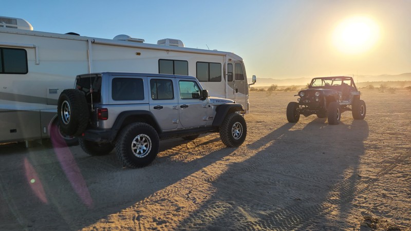
Updated: 01/05/2023
Wheeler Road
Brawley, California
If you are looking for some BLM land to camp on in Southern California near the Salton Sea, then there is only one place to go, that is off of Wheeler Road in the Superstitions OHV area. This massive dirt highway is welcoming to all types of vehicles from RV's to 5th wheels, to rooftop tents. What makes this place great is the ground is flat and smooth meaning if you like camping in a tent, the conditions are perfect for that as well.
Just down the road are the famous Superstition Mountains of many folklores and interesting bits of history. So if you are in the area, out Overlanding in Anza-Borrego, and are looking for somewhere different, check out Wheeler Road in the Superstitions.
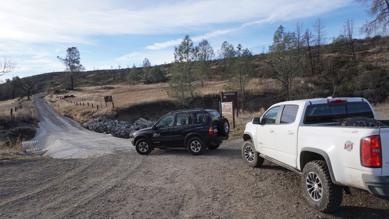
Updated: 05/27/2025
Dunnigan Hill Road / Hunting Creek Road
Knoxville, California
Dunnigan Hill Road / Hunting Creek Road is the northern entrance into the Knoxville Recreation Area in Lake County and Napa County, CA. If traveling in from Lake Berryessa, 30-plus miles of the roughly paved, bumpy, narrow Berryessa Knoxville Road will make this soft dirt trailhead a welcome relief. This road offers access to other trails in the Knoxville recreation area, including Knoxville Devilhead Road. The entire Knoxville Recreation Area spans from Napa County into Lake County, and this trail travels across both Counties.
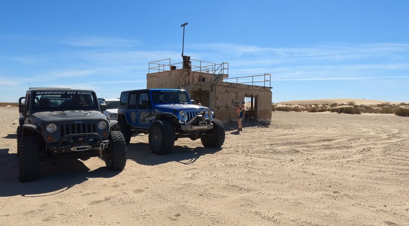
Updated: 10/15/2024
Abandoned Naval Base - Salton Sea
Kane Spring, California
Lost in time, Naval Air Facility Salton Sea sits on the shores of the Salton Sea. The abandoned naval station looks like everyone just walked away, leaving everything as it was. There are old buildings and concrete foundations scattered about. There's even an old pier that no longer reaches the water since the Salton Sea is slowly going dry. It's an eerie sight. Commissioned in 1942 as a seaplane base, the air station was used to test air delivery methods for nuclear weapons by dropping dummy bombs. The tests began during World War II and continued until 1961.
The trail into the abandoned base is very sandy. Camping is allowed along the beach.
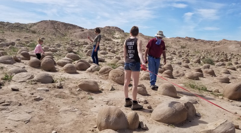
Updated: 05/29/2025
Tule Wash
Ocotillo Wells, California
Tule Wash is famous for its Pumpkin Patch. Located in Ocotillo Wells OHV, this trail runs east to west and is probably one of the highest-traveled routes in the area. The Pumpkin Patch is an area of rocks ranging from just a few inches to several feet around, and as the name says, they look like pumpkins. Created when the Colorado River ran through the area, these rocks are unique and fun to stop at and take photos with. But be warned, even though Tule Wash is an easy trail, the sand can get soft in places, so make sure you air down. Due to the remoteness of this trail, there isn't really any ideal camping. Not saying you couldn't, but it is just a wash. If you are looking for cool places to camp, camp near the north side of Cross Over Trail near the hills. There you find places in the coves for tent camping and open flat ground for RV's.
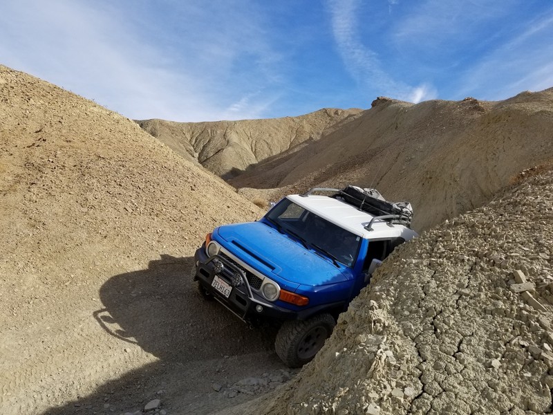
Updated: 09/17/2022
Mud Hills Northern Route - Calico CA
Barstow, California
The Mud Hills, a vast formation of hardened muds hills cut up by canyons, sits inside the famous offroad area known as Calico. It offers hours of off-road entertainment and camping in close proximity to Highway 15. This Northern Route is a popular cut-through and has everything an off-road enthusiast could want from high-speed berms and narrow canyons to steep hills and ledges. On top of that, when this area gets a little water, it turns into a giant slip and slide, making even the easiest routes almost impossible. The next time you are in your short wheelbase 4x4, take an off-road adventure through the Mud Hills of Calico California.
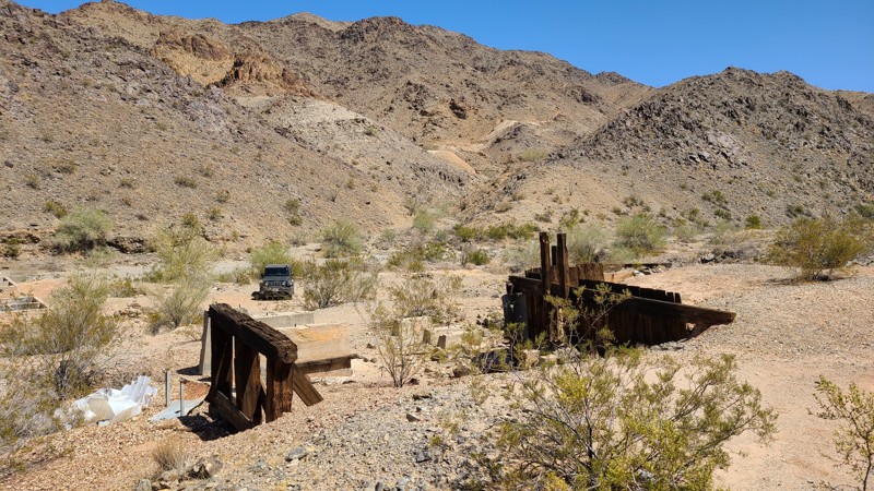
Updated: 10/15/2024
Red Cloud Mine Road
Hayfield, California
Red Cloud Mine Road is an up and back cutting through a sea of sand following the western border of the Chuckwalla Mountains Wilderness into a fascinating rock fortress of steep-walled canyons, washes, geologic textures, and delightful colors, creating a constantly changing panorama. If it's solitude you crave, the chances are great you'll be alone here. This rugged mountain road once provided access to over 30 mines and prospects. Now, all abandoned, several mine remnants can still be seen from the trail. The BLM rates the road as "More Difficult" for good reasons. Once in the mountains, the roadbed consists of broken rock, narrow paths requiring driving over and around large rocks, and steep, challenging descents approaching 25 degrees. This road should be driven by two or more vehicles, with experienced off-road drivers utilizing 4x4 lifted vehicles.
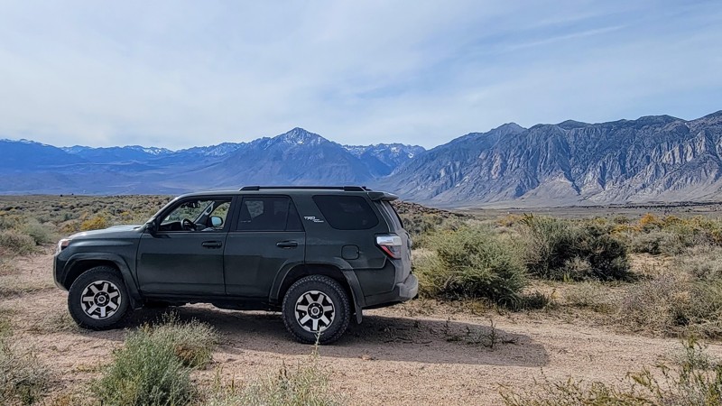
Updated: 06/30/2025
Casa Diablo Road
Sunny Slopes, California
Casa Diable Road through Owens Valley has an extraordinary 360-degree view of the surrounding mountain ranges. The White Mountains to the east and the mighty Sierra Nevada Range to the west are encapsulating. Casa Diablo Mountain is smaller in scale, but its unique formation is worth the trip. It’s made up of small reddish volcanic rocks piled high.
The southern end of the trail is just outside Bishop, CA, along with the Volcanic Tablelands Wilderness, which has spectacular volcanic igneous rock that forms large flat-top mesas across the landscape. You can also see parts of Birchim Canyon to the west, which is carved by the Owens River. Much of the road is lined with dry brush and scrubs, which is typical in the arid climate of the Eastern Sierra region.
Most of the road is gravel, but there are a couple of sandy parts, and 4WD is recommended depending on the road conditions. There is washboarding near the southern section, but it’s not too bad.
Casa Diablo Road travels through BLM land, so dispersed camping is available, but most of the camping is concentrated along the southern tip, where you can find some great campsites.
Other great trails in the area include Fish Slough to the south and Chidago Canyon to the north.
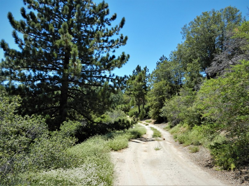
Updated: 05/03/2024
4S01A - Hall Decker
Idyllwild-Pine Cove, California
4S01A Hall Decker is just one of a dozen or more beautiful off-road trails in the San Jacinto Mountains near Idyllwild, California. This trail is a short spur off of 4S01 Black Mountain with a very private camping area at the end. This site would make a wonderful alternate trail if you find yourself blocked from further travel on Black Mountain due to winter approaching as this trail is 1500 feet lower in elevation. The forest is composed of Oak, Pine, Cedar, Elm and Sage. Many animals live here including deer, squirrels, coyote, bobcat, mountain lion and rattlesnakes.
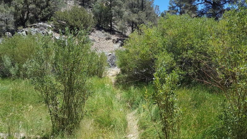
Updated: 05/21/2024
Yellow Jacket Trail (Lower) / 20W24 / 126
Frazier Park, California
Yellow Jacket Trail used to be a trail of legends...one of the original extreme rock crawling off-road trails of the 90's. This trail has gone through some major changes over the years. Even though the trail is nowhere near as hard as it once was, it will still give you an exciting short adventure when traveling the Miller Jeep Trail / Lockwood Creek Trail. Luckily, sections of the trail are untouched from the recent fires, allowing drivers to still experience some of the beautiful scenery.
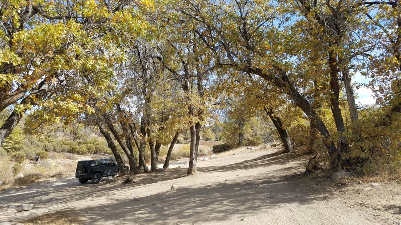
Updated: 02/18/2026
Ash Meadows
Lake Arrowhead, California
Ash Meadows Road is designated as an Off-Highway Vehicle (OHV) road connecting to
and Sewer Pond OHV Trail 3W13. There are few pine trees at this lower elevation, allowing panoramic views to the west. The road is wide and flat with a few bumps and rocks. There are several spots along the way to pull over and have lunch under a shade tree along the way.
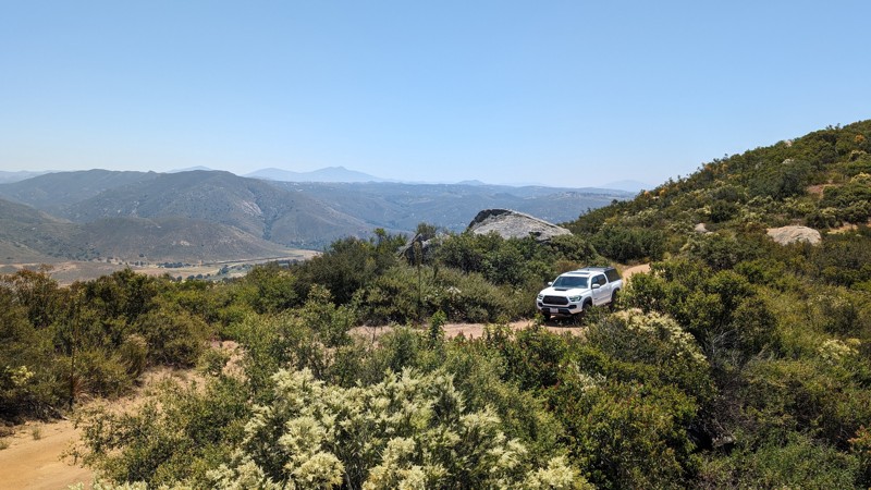
Updated: 05/28/2026
Orosco Ridge
Ramona, California
Orosco Ridge is a multi-use OHV area in San Diego County. It is an excellent spot for beginners to explore their 4x4's abilities. Please note that base maps will show this as a through road, but it is gated at the 6-mile mark and run as an out-and-back. While popular, there's not a whole lot to see at this location, but it is one of the spots that's closest to San Diego City, usually open, and can satisfy the need to get your tires on some dirt.
Although considered easy in dry conditions for any high-clearance vehicle, the road is steep, rutted, and bumpy, with narrow sections and limited passing opportunities. Stock Tacomas and 4-Runners should be able to handle the depth of the ruts, but crossover SUVs may scrape or get stuck. Disabling traction control, airing down, and having 4WD make for a smoother experience. Wet conditions will make the road considerably more difficult.
The area used to be popular for target shooting, and there is plenty of evidence of that. Some spots appear to be very primitive campsites or lookout points, but there are also signs indicating the surrounding area has high levels of lead.
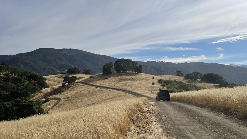
Updated: 10/15/2024
Hollister Hills SVRA: Hudner Pass
Ridgemark, California
Hollister Hills SVRA is a 6,800-acre SVRA park and was the first SVRA made by the California parks department. The park is divided into three parts, the Upper Ranch, Lower Ranch, and Hudner Ranch. The Lower Ranch is for dirtbikes. While the Upper Ranch and Hudner Ranch are for 4x4s, visitors should stop first at the ranger station in the Lower Ranch to pay the $5 entry fee and get a map of the trails.
Hudner Pass is an easy dirt road that takes you along the entirety of Hudner Ranch. The entrance to Hudner Ranch is blocked by a locked gate, and the code is given to you by the ranger after you pay the entry fee. Hudner Pass takes you by the trailheads of all of the other trails in Hudner Ranch, and while the Hudner Pass can be completed in 2WD, the other trails in the ranch require 4WD and high clearance. Camping is available at Hudner Pass Campground. However, a reservation is required.
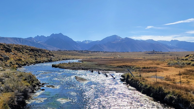
Updated: 08/12/2025
Owens River Road
Benton Crossing, California
Owens River Road is a well-maintained dirt road that travels through the Inyo National Forest., and does not require high clearance or 4x4. Any car should be able to handle this trail.
The trail's eastern section is very arid and desolate, symbolic of the landscape of the Eastern Sierras. You're surrounded by the White Mountains to the east and the Sierra Nevada Mountains to the west. You can see the unique formation of the Minaret Peaks to the west and the Mammoth Mountain Ski Resort. Along the trail, the terrain is mostly dry brush and shrubs, and there is volcanic igneous rock along sections to the east of the trail.
This road is part of an intricate trail system that offers many offshoots from the main road that goes into Little Antelope Valley and deeper into the Inyo National Forest. It is BLM land, so dispersed camping is available, but nothing directly on the main trail. The only designated campground is Big Springs at the trail's west end, but it is closed seasonally. Be sure to check if it's open before you go.
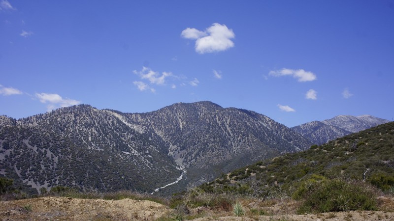
Updated: 07/12/2024
3N29 Sharpless Ranch
Wrightwood, California
3N29 Sharpless Ranch trail is in the San Bernardino National Forest, between Wrightwood and the 15 Freeway. It is a quick way into the Lytle Creek area when 4-wheeling from Wrightwood. This trail is still recovering from the Blue Cut Fire and the 2009 Sheep Fire but consequently, it is ablaze with wildflowers in the spring. You will have some fantastic views into the canyons to the north and east, including the Cajon Pass and up into Hesperia. The Pacific Crest Trail crosses this trail near trails end offering the through hikers the opportunity to replenish their supplies from their support teams. At the trail's end, you are greeted with this view of Mount San Antonio, AKA Mt Baldy.
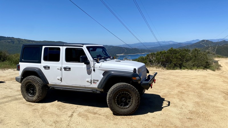
Updated: 06/15/2026
Leona Divide
Leona Valley, California
Leona Divide is an easy point-to-point trail that is perfect for beginners. It’s located in the Sierra Pelona Mountains, just east of Green Valley. It consists of graded and rough dirt with occasional gravel. At the 10.5-mile mark, you’ll have to cross San Francisquito Canyon Road to finish the final 2.6 miles. 4WD is not necessary but will help with traction on the small hill climbs.
A main point of interest in this area is the Pacific Crest National Scenic Trail. It’s a 2,653-mile hiking trail that stretches from the United States-Mexico border to the United States-Canada border. The trail runs parallel to Leona Divide and has two access points nearby. The first is off Grass Mountain Road, and the second is 700 yards west of the trail endpoint.
There is no camping on this trail.
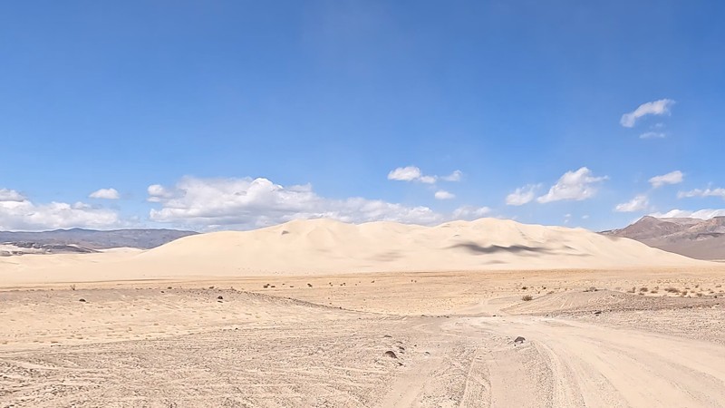
Updated: 03/09/2026
South Eureka Valley Road
Crater, California
This scenic road takes you from Death Valley Road to the Eureka Sand Dune where you will find plenty of areas to camp. The Eureka sand dune is the largest sand dune in Death Valley. If you continue down the trail, it turns into Steel Pass.
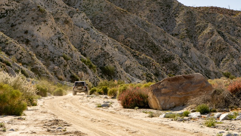
Updated: 11/25/2023
Indian Gorge
Borrego Springs, California
Starting from the Carrizo Valley on S2, the trail enters a tight and colorful gorge with the Tierra Blanca Mountains on the north and the Jacumba Mountains on the south. As you drive, towering canyon walls on either side give way to Indian Valley, a beautiful bowl dotted with backlight chollas that create an angelic glow. You will want to drive slowly, looking for the well-camouflaged big horn sheep who like to call the canyon walls home.
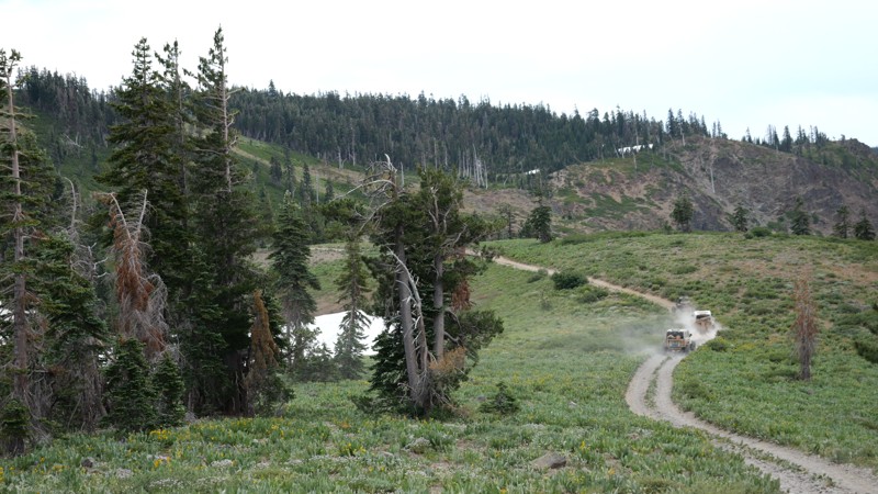
Updated: 01/19/2026
Gold Valley OHV Trail
Johnsville, California
What might be the Holy Grail of the Gold Lakes area's scenic trails, 11E67, aka Gold Valley OHV Trail, is a wonderland for the eyes and soul. This trail takes you up on the ridges of some of the tallest mountains in the Tahoe National Forest area. From there, you can see hundreds of miles off in every direction. You can see Mt Shasta, Rainier, and many more snow-covered peaks in the distance. Not only are there never-ending views, but you also pass through Tahoe National Forest's dense pine forest, which makes you feel tiny in comparison. Once you drop down the southern half, you zig-zag the Pacific Crest Trail, pass by Hawley Lake, a troubled youths camp, and even over a massive abandoned gold mine with relics still sitting there as though the mine was active yesterday. Near the overlook, you pass through what feels like a haunted forest with odd-looking trees created from the overabundance of snow in the winter.
This connector trail is a moderate-difficulty offroad trail. It is full of moderate rock crawling obstacles up to a couple of feet tall, making it ideal for keeping the crowds away and creating that secluded experience you dream of. Because of the many rock obstacles on the route, a stock high clearance 4x4 will be needed to complete this trail. Rocker guards are not a bad idea to avoid any possible body damage.
You are allowed to disperse camp in the area. Although most people camp at Snake Lake due to the ample tent camping and wind break from the hills, one fantastic spot on this trail is up on the overlook. The only drawback is that the area might be too windy. Due to that, a rooftop tent would be the ideal camping for this location. Because of the size of the turnout, a group of a dozen vehicles or so could use this area.
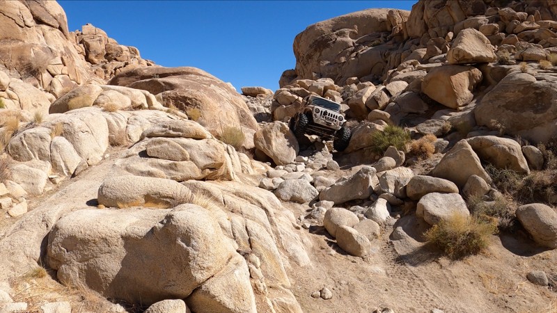
Updated: 03/18/2023
Split Finger - Cougar Buttes
Lucerne Valley, California
Cougar Buttes, in the Johnson Valley OHV Recreation Area, is home to a number of rock crawling trails. Split Finger is one of the few that stand out. This tight, steep, off-camber, rocky trail is short but will push you and your rig to your limits.
Split Finger is a serious 4x4 trail that is likely to bend, break, dent, and possibly roll your rig. From start to finish, the rock obstacles here are continuous and BIG. Boulder, after boulder, after hard rock notch, this trail will keep you in low range, with your head out the window watching your tire placement.
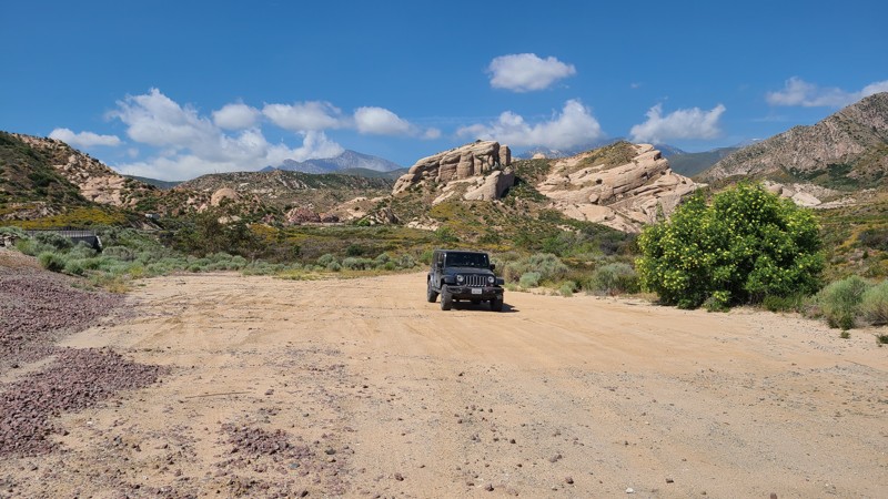
Updated: 12/04/2025
Santa Fe Fire Road
Cajon Junction, California
3N47, Santa Fe Fire Road, is in the 823,000-acre San Bernardino National Forest north of Lytle Creek. Following sections of the Santa Fe Railroad, the trail marches along the edge of the beautiful Mormon Rocks, also called the Rock Candy Mountains. These striking sandstone formations are the remnants of ancient oceans heaved up at an angle over the millennia revealing a beautiful and sometimes alien sandstone landscape. Santa Fe Fire Road is an excellent trail for beginning off-roaders with its smooth surface and several spurs to explore. There are no appropriate areas for dispersed camping along the course, and signs advise vehicles to stay on the road.
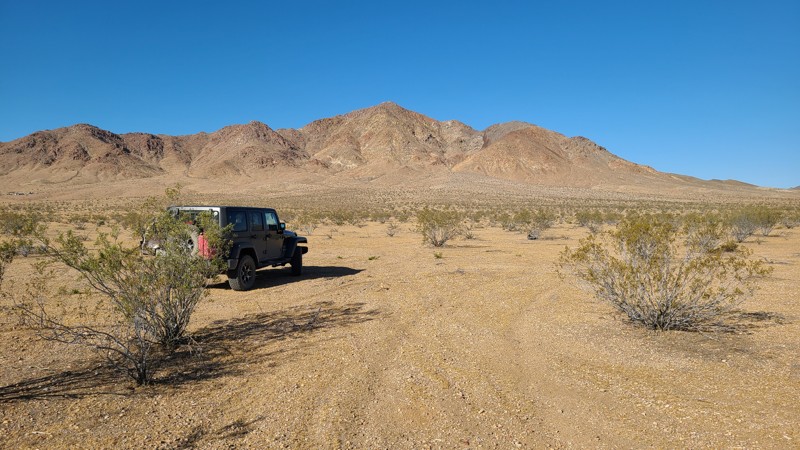
Updated: 10/15/2024
Stoddard Valley Road
Bell Mountain, California
Also called Willow Springs Road, Stoddard Valley Road follows a valley through the Mojave Desert, passing west of Stoddard Mountain and along the eastern edge of the Stoddard OHV area. This journey provides beautiful views of the surrounding mountains across an arid landscape. The roughest spots are rocky segments passing over the foothills. Driving the length of this trail is an excellent adventure for a novice offroader.
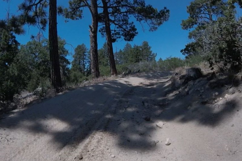
Updated: 03/12/2026
Crab Flat Loop
Running Springs, California
2N31Y is a short, non-technical, scenic loop. Typically roads like 3N16 Holcomb Valley and 3N34 East are used to get from Point A to Point B. Located off of 3N34 East, this little loop is a great detour if you are in the area.
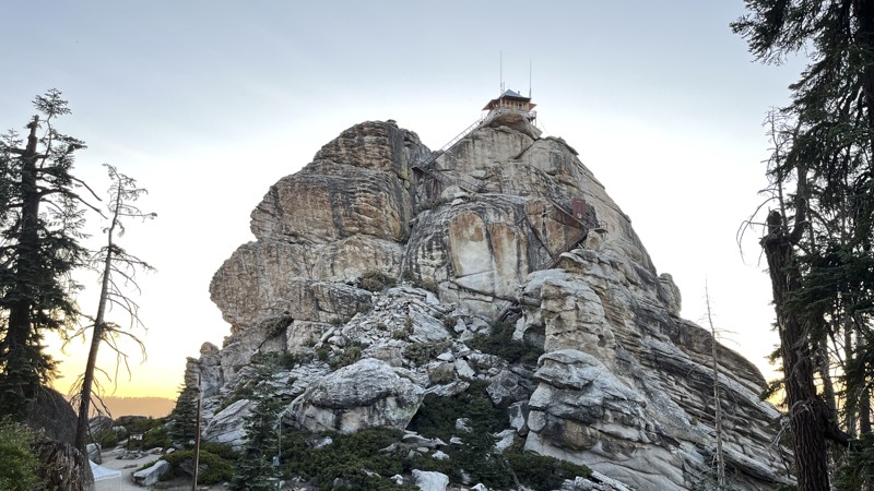
Updated: 03/09/2026
Buck Rock
Hume Station, California
Buck Rock is located in the northern half of Giant Sequoia National Monument, between Kings Canyon National Park and Sequoia National Park. The trail gets its name from the main draw, Buck Rock Lookout, but it also provides access to the best camping in the area. The Buck Rock fire lookout was used as early as 1908, with its current 14 by 14-foot building being constructed in 1923. Both the immense rock and the view it provides are truly awe-inspiring. The trail can be run in either direction, but if visiting Buck Rock Lookout or finding an ideal campsite is your goal, it's easiest to drive this trail south to north. Buck Rock Campground is located just a half-mile from the south trail entrance and can be easily accessed by RVs and camper trailers. The northern half of the trail is a bit more rutted but offers other dispersed camping options. 2WD vehicles with adequate clearance should have no trouble on this trail during dry conditions.
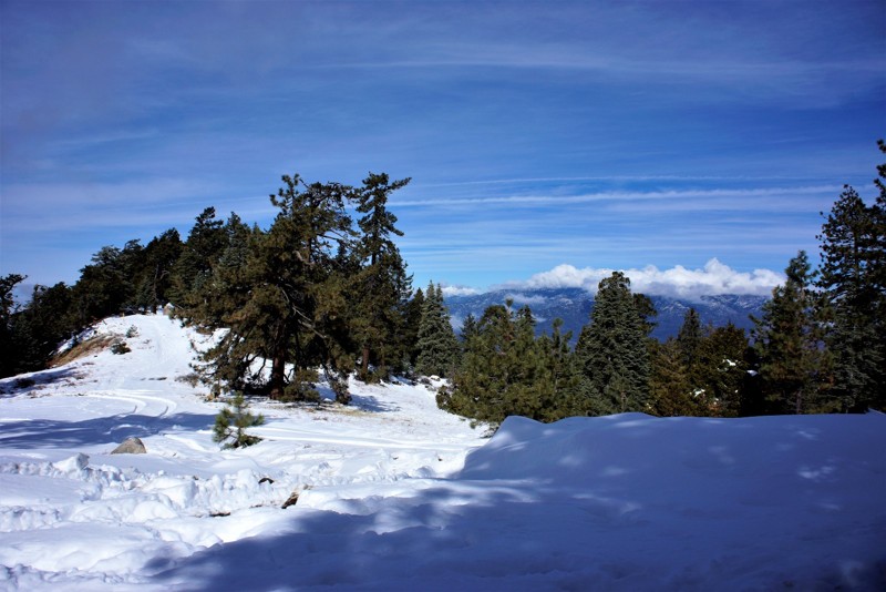
Updated: 07/29/2023
6S18 - Hog Lake Truck Trail
Anza, California
Thomas Mountain should be the destination when using Hog Lake Truck Trail. The mountain is in the beautiful San Bernardino National Forest covered with Oak, Pine, Fir and Cedar trees. With an elevation of 6820 feet you will experience all of the seasons while wheeling, camping, hiking or picnicking. It is located between Lake Hemet and Anza. With 4 trails totaling 30 miles to this peak there is always something to explore.
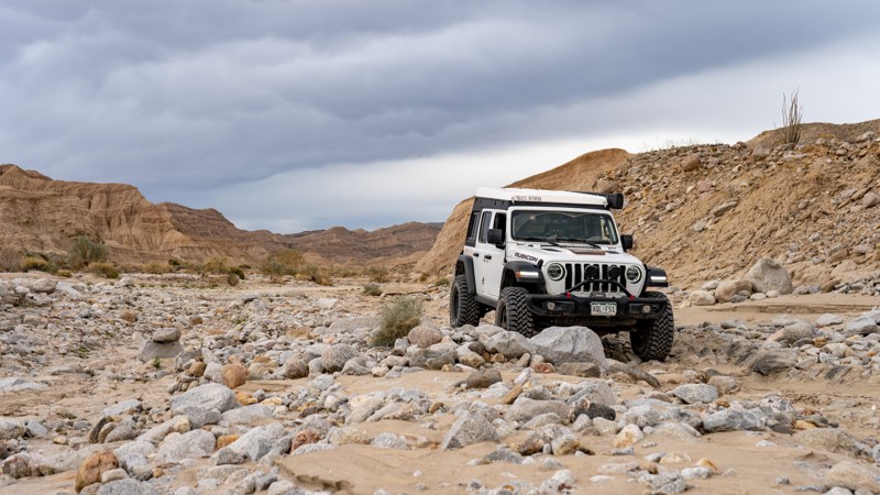
Updated: 04/01/2024
Loop Wash
Ocotillo, California
Loop Wash is an alternate side trip to the more famous Fish Creek. No pun intended, but it "loops" around a portion of Fish Creek, making it a perfect alternative when going in or out of Fish Creek. The entire area that makes up this system of trails was once a shallow sea five million years ago. If you take the time and look closely, you will find Coquina shell beds in the mud ledges that line the trail.
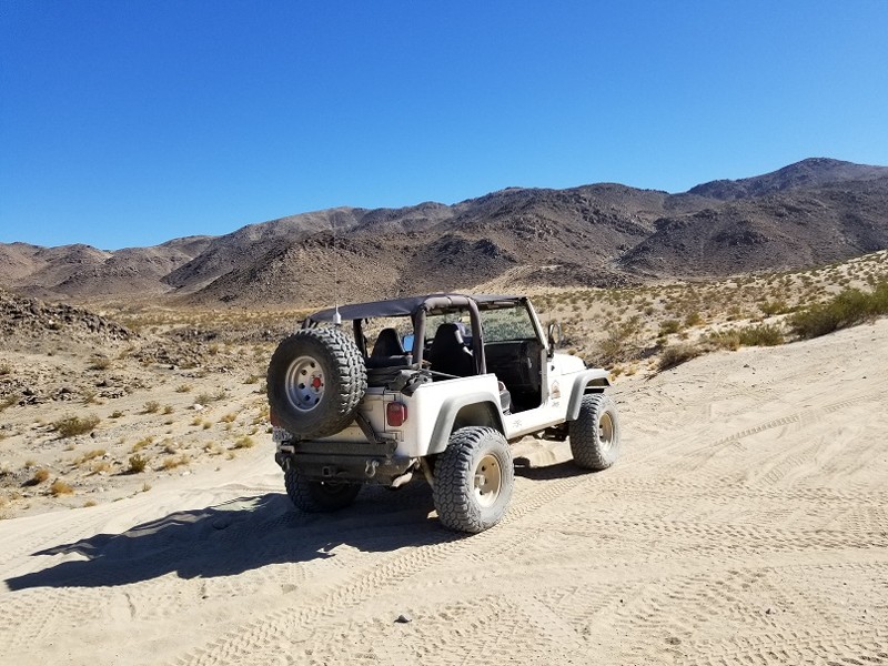
Updated: 02/27/2024
Road To The Hammers - Johnson Valley
Yucca Valley, California
When you hear the words Johnson Valley, you can't stop thinking Hammers. The Road To The Hammers is the super highway that takes you to some of the most legendary trails in all of the United States let alone the world. The trail takes you from the party town on Means Dry Lake (aka Hammer Town) up into the hills and it dumps you right at the foot of some of the hardest trails in the area, Jack Hammer and Sledge Hammer. Thus, the next time you are in the area, take a quick drive up The Road To The Hammers and get yourself a glimpse of some of the most epic rock crawling / off-road trails in all of the United States.
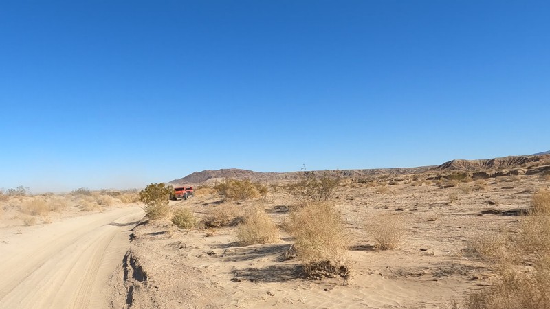
Updated: 10/15/2024
Borrego Springs
Borrego Springs, California
Borrego Springs Trail cuts through the Ocotillo Wells OHV desert and is one of the few exits on the west side of the park. As you reach the western end, you near all the bristlecone bushes that seem to overtake the trail, while on the east side, it is a baron wasteland. Borrego Springs Trail connects Anza Borrego, the Metal Sculptures, and northern side of the park.
If looking to camp, check out the east end of the trail near blow sand. There you will find a lot of camping areas, including areas for RVs and restrooms.
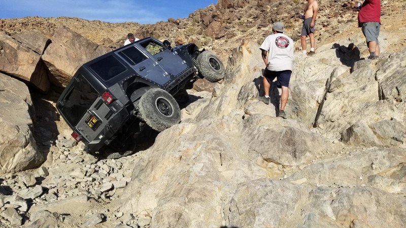
Updated: 02/27/2024
Wrecking Ball
Landers, California
One of the legendary trails in Johnson Valley in Southern California, Wrecking Ball, often referred to as one of the Hammers Trails, is no joke. The trail is about as hard as Sledge Hammer at its hardest point but continues like that for almost all the way through the entire trail. Full of rocks the size of Volkswagons, this extreme rock crawling trail is one for only the extreme drivers and built vehicles. Expect to take a full day when on this extreme rock crawling offroad trail as it won't be fast-moving unless you take the bypasses. This trail does have one of the more feared obstacles at the end which is one of the 10 different waterfalls. Yes, 10 different waterfalls along this trail. So if you are looking for something difficult to an extreme, wanting something that might send you home crying and defeated, you should probably check out Wrecking Ball in Johnson Valley, California when you are in the area.
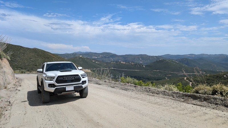
Updated: 01/06/2026
Boulder Creek Road
Pine Hills, California
A graded dirt road connecting Descanso to Julian. It has a total elevation difference of more than 1300' with nice views of the San Diego mountains. Many people use this road to access the Three Sisters Falls and Eagle Peak trailheads. On the north end, it passes through the Inaja and Cosmit Indian Reservation, ultimately connecting to the outskirts of Julian and Eagle Peak Road.
Virtually any vehicle can traverse this road. It has a decent amount of washboard, so be prepared for a bit of vibration. The hardest parts are the climbs with turns and washboard. Nothing difficult, but your tires may slip momentarily.
There are no camping spots along this road.
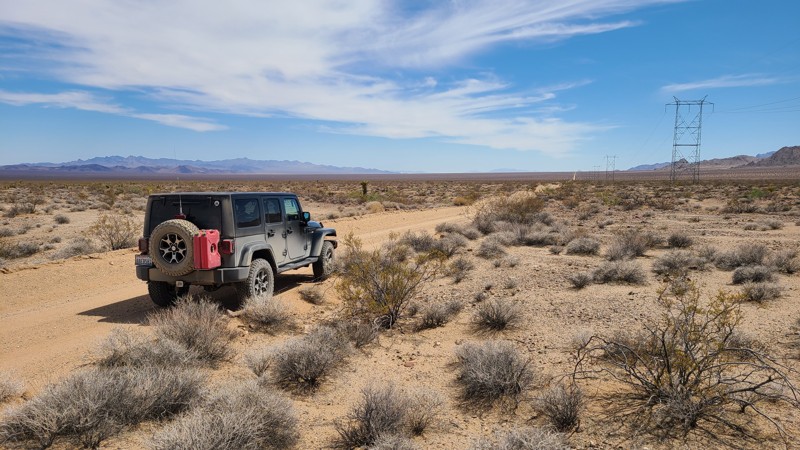
Updated: 05/08/2025
Water Road
Homer, California
The vastness and remoteness of the desert are on full display on this trail, with only sand and creosote bush as far as you can see. This often deep, sandy trail passes between the distant Stepladder and Old Woman's Mountains Wilderness. At its lowest point, the road crosses Danby Lake, a crusted-over dry lake bed in the summer. Dispersed camping can be done along the way, following the BLM Needles Field Office camping guidelines. An easy trail, but the deep, soft sand requires a four-wheel-drive vehicle.
Please note that the southern end runs into private property, and you must backtrack to the intersection with Cadiz Road to exit.
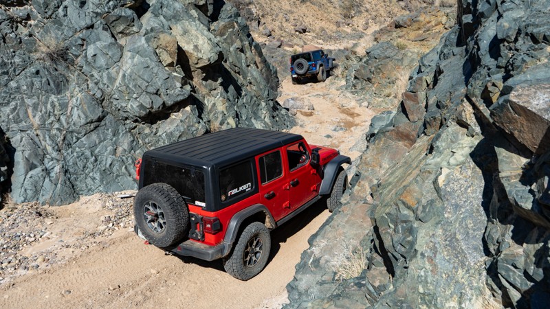
Updated: 03/25/2025
The Narrows
Ridgecrest, California
Winding through the El Paso Mountains near Ridgecrest, California, The Narrows offroad trail offers a thrilling desert adventure. Following the historic Goler Gulch, a once-famous mining route from the 1893 boom, this trail lives up to its name with a dramatically tight passage through rugged, volcanic-formed terrain, cementing its status as a "must-do" for offroad enthusiasts.
Combine the "The Narrows" with other trails to connect to the famous Burro Schmidt Tunnel, Bickel Camp, or through Hobbs Wash on EP 15 as you make your way to the iconic Trona Pinnacles. Die-hard rock crawlers with stamina can even make a route to include Last Chance Canyon! The possibilities with this one make it a great choice to plan a trip around.
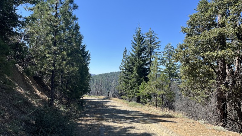
Updated: 10/15/2024
Grouse Springs - Bear Creek
Alder Springs, California
Forest Road M3 in Mendocino National Forest is a great trail for all levels of experience, especially beginners wanting to test out stock, four-wheel drive high clearance vehicles. Most of this trail is a smooth graded road with the occasional large pothole and steep climb on sharp corners, requiring good tire placement for stock rigs. This trail will take you through deeply wooded areas, burned clearings from wildfires that occurred between 2018-2020, and multiple other ecosystems. Due to the wildfires, downed trees and roadblocks are possible. M3 and the surrounding area allow ample dispersed camping near year-round creeks and multiple designated campsites with fire rings and vaulted toilets. Completing M3 requires one water crossing, depending on the time of year.
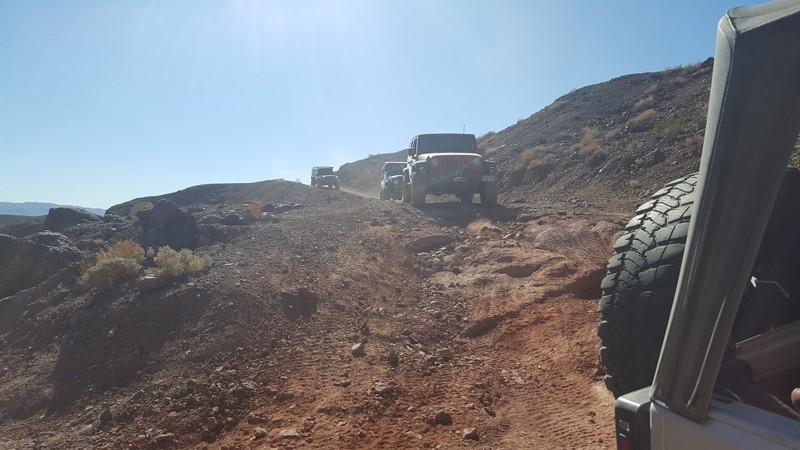
Updated: 04/20/2024
Doran Canyon - Gate Keeper Bypass
Barstow, California
Doran's Bypass is the most popular route to access Doran Canyon. Because of Doran Canyons Gate Keeper being so extreme, this route is the only way for anything less than a buggy to exit or enter Doran Canyon from the south. The route skirts along the top of the ridge looking down in Odessa Canyon and Doran's Gate Keeper making for interesting views when people are trying The Gate Keeper. On the other side of the trail are some great views of the historic Calico Ghost Town that was built in 1881.
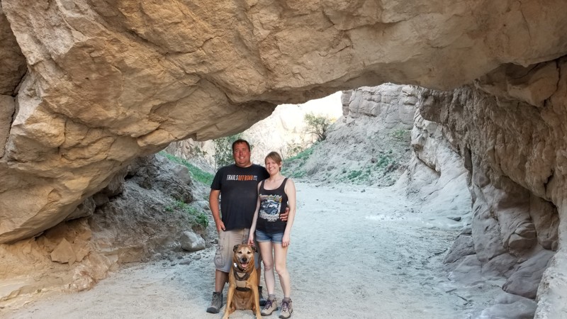
Updated: 06/05/2022
South Fork Palm Wash
Salton City, California
If you are looking for something that you can talk about for the rest of your life, then check out South Fork Palm Wash Slot Canyon. This super unique and lightly traveled adventure is perfect for an active family or overland group that is looking for something different than the norm. At the end of this backcountry trail is a long slot canyon that is absolutely amazing and provides several hours of entertainment. Right out of the door of your vehicle, you walk through a large arch and into a slot canyon that quickly narrows to only a foot wide. This is an exploration worth making!
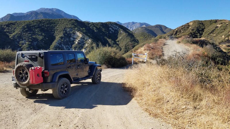
Updated: 07/12/2024
2N57 - Old CC Spur
Fontana, California
2N57 Old CC Road is entirely within the San Bernardino National Forest. It primarily used as access to 3N31 Lower Lytle Creek Divide which intersects at the top of the ridge. Before climbing the ridge, several unmarked and unnamed trails left, and right of Old CC provides a fun, nice opportunity to explore. Many of these trails lead to power line towers, facilities, and the Ranger Station just west of the trailhead. It's short at 1.4-miles in length, and once at the top, you are rewarded with nice views of the San Gabriel Mountains. Dogs are allowed on the trail when kept on a leash.
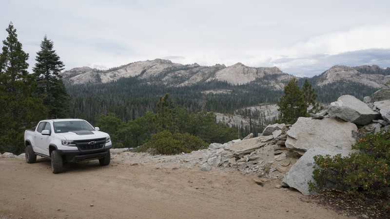
Updated: 05/01/2024
7S04 - Browns Meadow
North Fork, California
7S04 Browns Meadow is high in the Sierra National Forest, north of North Fork and East of Bass Lake. This scenic and slightly challenging 4x4 trail provides a panoramic view of Shuteye peak and Chiquito Ridge before it wraps around the north peak of Whiskey Ridge and continues traveling through dense forest, and wide-open granite slabs.
While not the best choice for a first time wheeler, this trail is great for those with 4WD and a little bit of experience who are looking for a mild 4x4 challenge or even good for more experienced off-roaders just looking to explore the area.
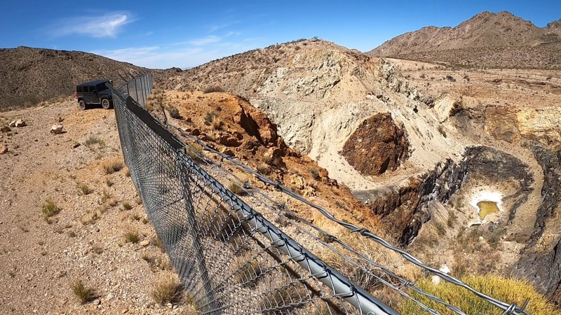
Updated: 02/11/2025
Vulcan Mine Road
Baker, California
The Mojave National Preserve (MNP) was established in 1994. At 1,542,776 acres, it is the third-largest National Park. On the western slope, near the Providence Mountain Range, and along Foshay Pass, is the most prominent human-made feature in the preserve, Vulcan Mine.
Vulcan Mine Road was built to haul iron ore to the railroad at Kelso. You can still follow this trail directly to the mine and even drive around the edges of the massive mine pit, looking to its bottom 100 feet below, while following a fence that has been placed to protect visitors.
Abandoned in 1944, you can see how the desert, over 75 years, the desert has slowly taken back the once smooth asphalt road you are now taking to the mine.
Along the way to the mine, enjoy views of the Providence Mountains rising on either side. Looking back in the distance, you will see the equally massive but naturally occurring Kelso Dunes.
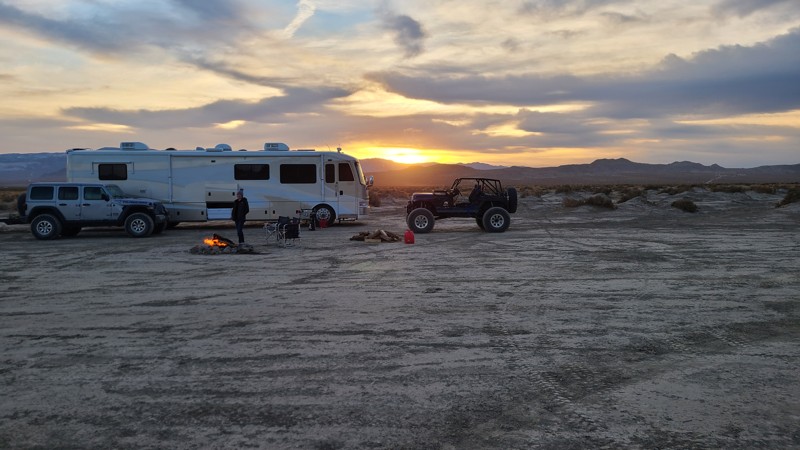
Updated: 06/05/2022
Soggy Dry Lake
Lucerne Valley, California
Soggy Dry Lake is a must-go location for people who love the desert and is the other popular lakebed in Johnson Valley. The area is full of excellent trails and great beauty. Soggy was once a famous high-speed track where people would try to break the speed records back in the day.
Today Soggy Dry Lake is mainly used for camping and for people who want to see how fast their off-highway vehicle can go. The surrounding hills are full of trails from mild to insane.
So the next time you are heading out to Johnson Valley, want to try something different, check out Soggy Dry Lake in Southern California.
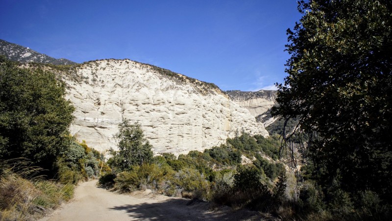
Updated: 12/01/2023
1N13 - Santa Ana
Highland, California
1N13 - Santa Ana, is a 4x4 off-road trail in the San Bernardino National Forest. The trail is on the south-facing slopes below Keller Peak and the town of Running Springs, it is a spur trail off of 1N09 - City Creek. Besides enjoying the beauty of these mountains, the main reason for this route would be to hike to the canyon's bottom to explore the water control facility on the Santa Ana River.
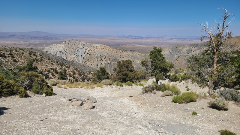
Updated: 07/10/2024
3N03A - Horsethief Flat
Big Bear City, California
Situated in the Big Bear area and just a short jog off the paved CA-18, this challenging trail will reward the effort with endless views and outstanding dispersed camping sites. Tall pine trees crowd the beginning of the trail, provide summer shade, and offer great picnic and camping. Venturing further before the trail's steep descent are endless views over the surrounding desert and out to the distant mountains. All of which takes you to Horsethief Flat, at the desert floor. The flat is a beautiful area concealed by the surrounding mountains with lush ribbons of green foilage that are supported by an active creek flowing along its border with the mountains.
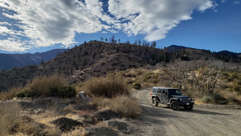
Updated: 02/19/2025
Gobbler's Knob Spur
Fontana, California
Gobbler's Knob provides an escape from the city to enjoy the solitude and wonderful views surrounding the Upper Lytle Creek Divide. The trail is most notable for its connection to the Pacific Crest Trail (PCT), which intersects at both ends and provides camping sites and resupply for hikers taking the long PCT journey. A large parking area at the end provides a place to take short hikes along the PCT or even out to Gobbler's Knob. Gobbler's Knob is actually the highest prominence of the Upper Lytle Creek Divide with an elevation of 6955 feet and is located a short 1/4 mile hike west of the parking area. The term "knob" is an archaic word for a prominent geographical landmark by which travelers may guide themselves. Forest Service Administrators have stated that the "gobbler" of Gobbler's Knob refers to the wild turkeys that once roamed the area. When camping is allowed, you will likely find tired travelers camped in the flat area past the iron fence marking the boundary to PCT. Pets can also enjoy the trail when kept on a leash.
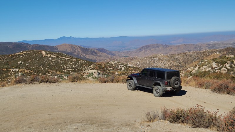
Updated: 12/24/2025
Old Idyllwild Road
Banning, California
Starting in Banning, Old Idyllwild Road is a pleasant drive rising 2000 feet to the edge of the San Bernardino National Forest and the San Jacinto Mountains. Throughout its length, you can enjoy sweeping views to the north and west and view spots to pull over for lunch.
The entire road is on private land; hence, there is no public overnight camping, but the road does reach at its end large areas of Bureau of Land Management land and marked trails for exploration and dispersed camping.
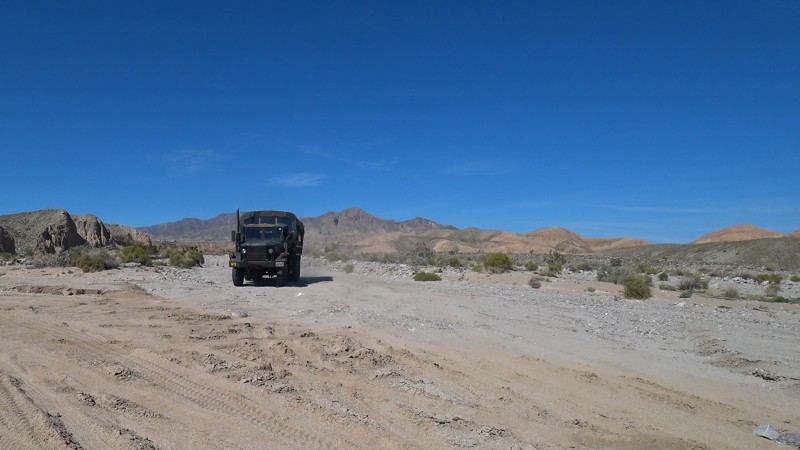
Updated: 02/05/2026
Arroyo Salado Wash
Salton City, California
Arroyo Salado Wash is on the northern side of Ocotillo Wells OHV and Anza Borrego State Park. This east-west trail provides great views and fun exploring. With several natural oases off this trail and an amazing mud cliff, this is one of the better overlanding routes in the area. On the northwestern end of the trail, the Arroyo Salado Primitive Campground has a variety of unimproved sites and a vault toilet.
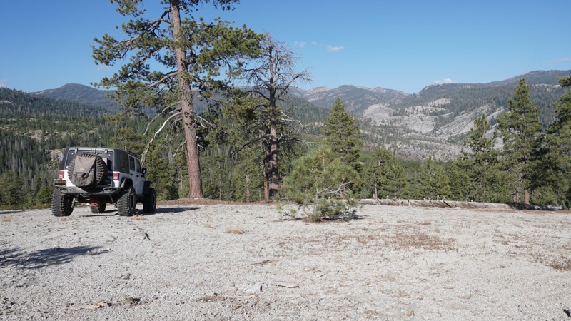
Updated: 04/15/2024
26E211 - Plain
Shaver Lake, California
Part of the Bald Mountain OHV area in the Sierra National Forest east of Shaver Lake, California, 26E211 - Plain is a mellow and scenic trail. Plain makes for a great add-on to a day of wheeling through Bald Mountain.
A quick run through the granite filled woods with some mild challenges ends with some amazing views of the Dinkey Dome and massive granite walls surrounding Dinkey Creek, south of Foster Ridge. If the views aren't enough for you, you can explore the many connecting and nearby trails which include some more challenging wheeling; Bald Mountain, Powder Hill, Basecamp, Bowtie and more.
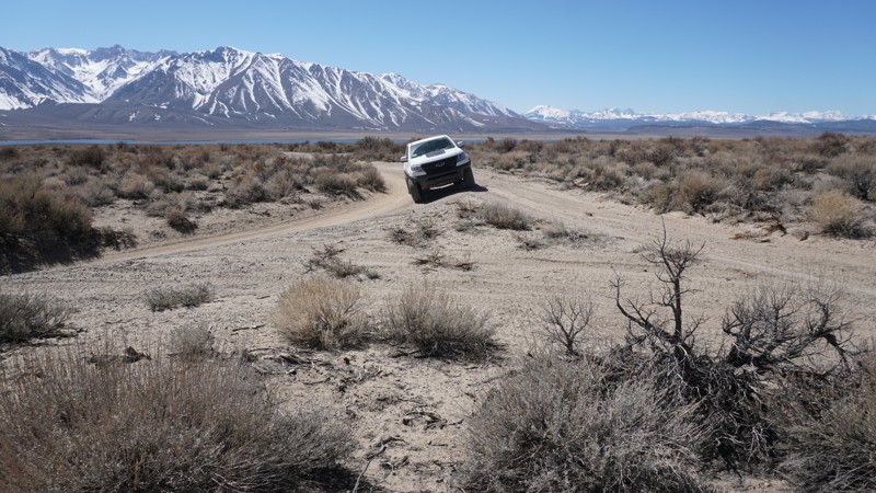
Updated: 10/15/2024
Crowley Lake East Alternate
Sunny Slopes, California
This rough dirt road includes a few moderate rocky sections. It serves as an alternate entrance to the Crowley Lake area and the Crowley Columns connecting from the north end of Owens Gorge Road to Crowley Lake Trail and continuing on to the shore of Crowley Lake. This trail is suitable for new off-roaders with 4wd, but there is tight brush along this trail, so be aware of the risk of pin-striping.
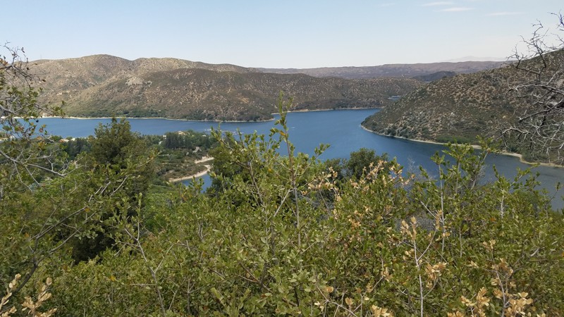
Updated: 06/05/2022
2N43 Sawpit Canyon North
Hesperia, California
2N43 Sawpit Canyon Road is in the 823,000 acres San Bernardino National Forest just south of the 1500 square mile Silverwood Lake and only a short drive from Interstate 15. The 4.5-mile road meanders up the mountain with views of Silverwood Lake along the way and passes through the domain of the mountain oaks and shrubs to tall lush pine forests, eventually ending in the community of Cedar Pines Park and its paved roads.
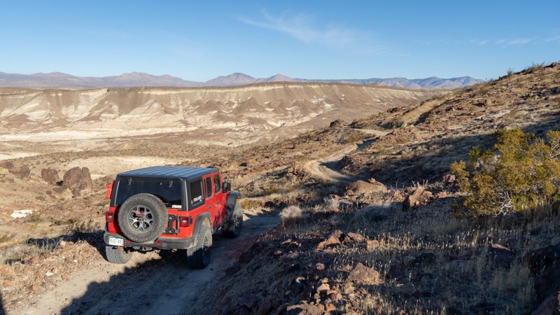
Updated: 11/14/2025
EP 18
Ceneda, California
Coming into the southern end of Red Rock Canyon State Park is a lesser-used trail labeled EP 18. This bumpy 2-track is full of incredible views both down the canyon and into the park, and across its surrounding hills. As you ascend the canyon, the trail is relatively easy, with a few ruts to slow you down. Once you are past the mine, the trail turns into a shelf road cut into the side of the hills. There is minimal passing room, but full-width vehicles will fit just fine. The most challenging part of the trail comes about halfway through when the road suddenly turns down one of the hills and presents a steep hill peppered with loose, softball-sized rocks. 4WD is required, and a locker may help, especially if you are coming uphill. After this hill, you will traverse a few more mounds before reaching its terminus at Trail 86B.
There is no camping along this trail despite a small portion of the southern end lying on BLM land. The only camping allowed within Red Rock Canyon State Park is the developed Ricardo Campground across CA-14 near the visitors center.
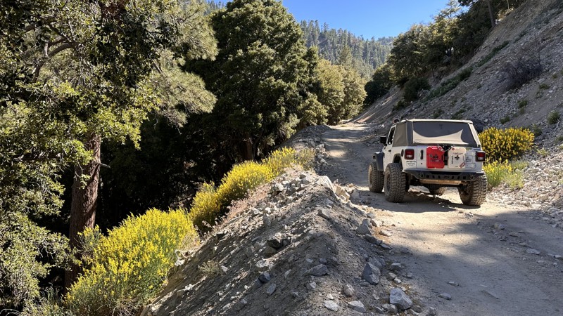
Updated: 12/10/2024
Mescal Creek Road
Crystalaire, California
Mescal Creek Road is yet another beautiful but lesser-known trail that takes you from the desert floor up to the mountains. Starting in Pinyon Hills and ending at Jackson Lake, this short but beautiful connector offers a waterfall, two water crossings, and gorgeous views of the San Gabriel mountains in the Angeles National Forrest. While dispersed camping is not allowed in this area, the trail ends near Lake Campground, with Mt. Oak Campground just around the corner.
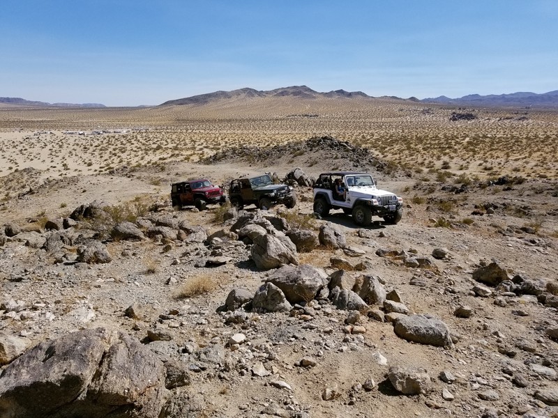
Updated: 02/27/2024
Camp Rock - Johnson Valley
Yucca Valley, California
Who doesn't love a good moderate trail to play on right next to your camp. Camp Rock Trail is that fun and exciting 4x4 trail just waiting for you to take the Jeep, Toyota, or whatever your off-road vehicle is and have some fun. The trailhead can be seconds to only a few minute drive from many of the popular camping areas of Morongo Desert Run Road, this short but thrilling intermediate offroad trail has it all, hill climbs, rock crawling, small ledges, and best part... views. Thus the next time you are in Johnson Valley OHV and you are sitting at camp looking for a little excitement or want to sneak away for some great views, think Camp Rock Trail just off of Morongo Basin Desert Run Road.
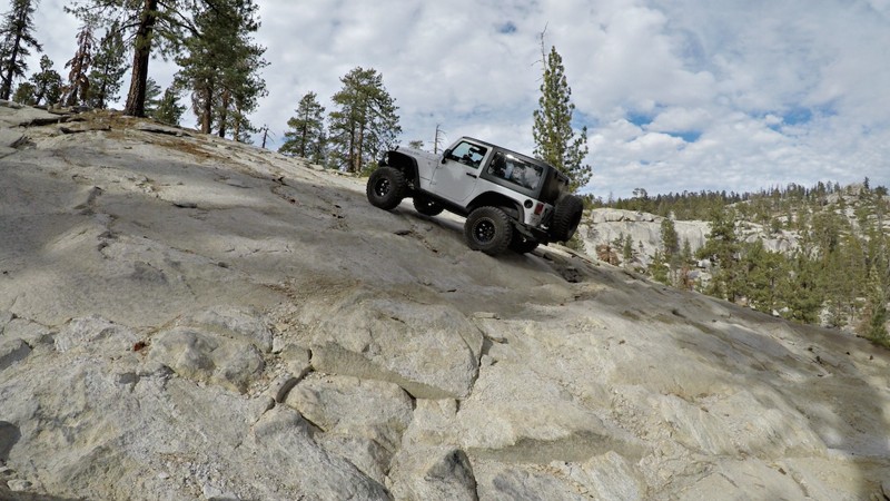
Updated: 06/01/2024
26E330 - Powder Hill
Shaver Lake, California
This short, steep 4x4 trail, 26E330 - Powder Hill, is a small part of the Bald Mountain OHV trail network near Shaver Lake in the Sierra National Forest.
Powder Hill includes some amazing views of the surrounding forest and one of the longest and steepest hill climbs in the Bald Mountain trail system.
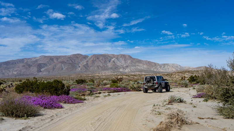
Updated: 04/26/2025
June Wash
Mesquite Oasis, California
June Wash in the Anza-Borrego Desert State Park is notable for its desert flower blooms in February and March. The road is primarily sand until the very end, where it enters a badlands and gets narrow and rocky. The trail is an out-and-back. While you could camp in June Wash, it's not ideal.
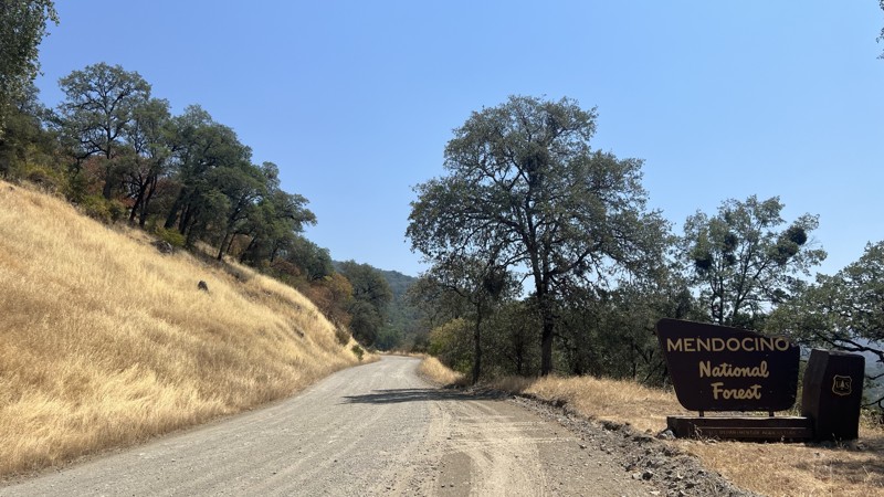
Updated: 10/15/2024
Mendocino Pass/Alder Springs Road
McClure Place, California
Alder Springs Road, also known as FH7, is a main forest road found in Mendocino National Forest. FH7 runs from the small town of Covelo, CA, to Elk Creek, CA. Starting in Covelo, you will pass through rolling hills with Heritage Oak Trees. As the elevation climes, you find yourself in dense Conifer groves with birds-eye views of the surrounding mountains. While never officially closed, FH7 becomes impassable due to higher elevations and snowfall; However, it remains a great place to test your snow wheeling abilities or enjoy a quiet winter camping trip. During the warmer months, this trail is easily passable with all stock, high clearance vehicles, or vans. This road is well traveled in both directions, making the hardest part of being aware of oncoming vehicles. Spanning 35 miles, with limitless side trails to explore, this area has something for everyone. As you explore, there will be endless dispersed camping and a few designated camping locations with primitive amenities.
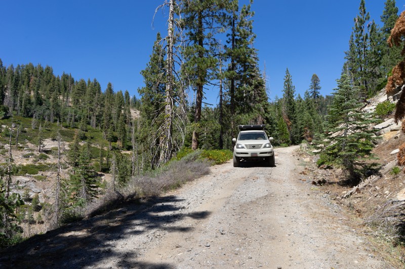
Updated: 12/15/2025
Box Spring
Long Barn, California
Box Spring may be for you if you are an offroader with a love of backcountry hiking. Although the trail doesn't pose any difficulties, this gives you direct access to the Bourland Meadow Trailhead and Box Spring Trailhead, which lead directly into the Emigrant Wilderness. The Bourland Meadow Trailhead parking is pretty tight. However, Box Spring has plenty of room. There was evidence of others camping at the Box Spring Trailhead in the past; however, the legitimacy of the campsite is unknown and should not be considered an official dispersed site.
OPEN SEASONALLY: 04/15-12/15

Updated: 02/06/2025
Cahulla Trail
Ocotillo Wells, California
Crossing the desert can be one of the most enjoyable Overlanding adventures you can do. Cahuilla Trail is a great trail that takes you from Highway 78 near Ocotillo Wells to near the old abandoned naval base. The route passes the Atrian Well and gas domes, making this one of the more epic locations in the Ocotillo Wells OHV park. The western end of the trail near the highway has camping suitable for everything up to an RV. But if you want something a bit more epic, check out the hills on the north side of the OHV park. The east end of this trail has some odd camping restrictions that affect when you can camp. So please ask the park before camping on the trail's east end.
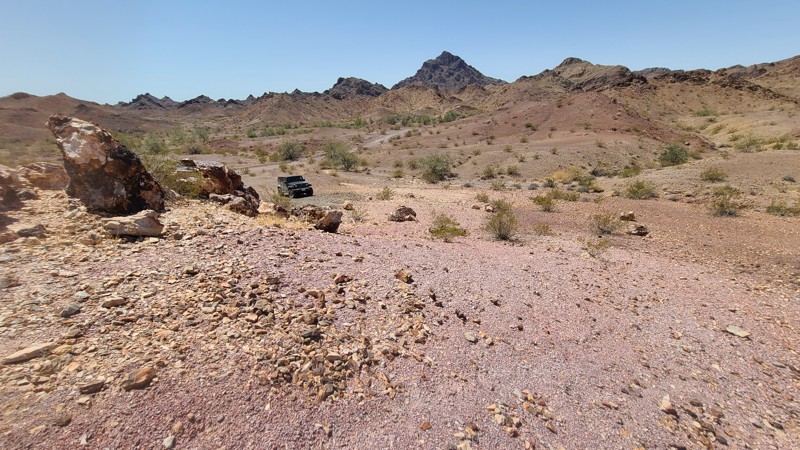
Updated: 10/15/2024
Old Palo Verde Road
Palo Verde, California
On its west end, Old Palo Verde Road begins amongst the vast, beautiful green cotton and alfalfa fields of Palo Verde and soon finds its way into a narrow ravine cutting through the Palos Verde Mountains Wilderness. The surrounding untouched landscape is rugged but stunning. The minimal road maintenance and failed drainage have led to the road being reclaimed by nature. Annual floods through the gorge have caused large road sections to collapse. Detours around washed-out sections of the road leading down into a rough rocky wash at the bottom of the ravine or upwards on new paths cut into the steep slopes. Only higher clearance four-wheel-drive vehicles should be used on this road. Several camping locations can be found along the way when following the camping guidelines of BLM El Centro Field Office.
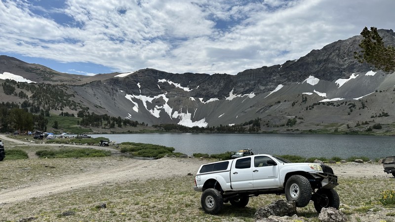
Updated: 01/13/2026
Leavitt Lake
Sonora Junction, California
Leavitt Lake, perched atop Sonora Pass/Highway 108, features a breathtaking out-and-back trail that meanders alongside the serene Leavitt Creek, offering stunning views of the surrounding canyon. While the scenery captivates, the trail also poses challenges, including rugged and eroded sections along with three creek crossings that average 6-8 inches deep during the summer months, which may fluctuate with snowmelt.
This diverse landscape is teeming with wildlife and natural beauty, providing a memorable outdoor experience. Numerous camping spots dot the trail, allowing adventurers to soak in the peaceful ambiance near the lake. For those seeking excitement, there is a hard section on this route. The easier line is located to the left of the large tree, suitable for the average 4x4 vehicles. Meanwhile, larger and better-equipped rigs can opt for the harder line to the right, which features a thrilling 3-4 foot washed-out ditch with embedded boulders, delivering an exhilarating challenge.
As you embark on this adventure, be prepared for occasional strong winds, as the weather can be unpredictable, even during the summer months. The region is rich with exploration opportunities, boasting nearby lakes, wilderness areas, and the famous Pacific Crest Trail. Visitors are encouraged to stick to designated routes, respect off-limit areas for motorized vehicles, and adhere to Leave No Trace principles by taking all waste with them. Embrace the spirit of adventure at Leavitt Lake, where the beauty of nature harmonizes with the thrill of off-roading!
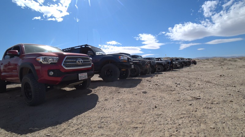
Updated: 03/09/2026
Shell Reef Expressway
Ocotillo Wells, California
Shell Reef Expressway isn't what it sounds like. This is a dirt road that cuts through Ocotillo Wells, OHV park. The trail is one of the larger dirt roads in the park, making it easy to carry a little speed. But watch out as there is a lot of traffic on this path. The trail is 2WD friendly, meaning you will see people towing down this road and trucks with dirt bikes in the back making their way to the reef.
Now what brings everyone to this trail is the Shell Reef near the eastern end, where you can find ancient shells from millions of years ago when this area was once underwater.
There are lots of camping off this trail on the west side near Blow Sand. But if you are looking for cool places to disperse camp, check out the north side of Ocotillo Well OHV near the hills or off Short Wash.
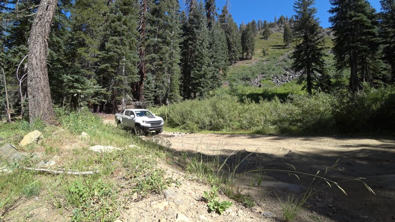
Updated: 04/15/2024
9S62 - Dinkey Lakes
Shaver Lake, California
From first time wheelers to experienced off-roaders and hikers, all will find something to love about this trail. While the trail itself is an easy dirt road, the scenery along the way and destinations near and at the end are what this trail is really about. For the beginners, this smooth dirt road is a scenic run through the Sierra National Forest east of Shaver Lake, California and makes a great out-and-back addition to a drive over Foster Ridge. For hikers, it all about the trails ends where you can park and continue on foot to the Dinkey Lakes in the Dinkey Lake Wilderness to the east. For the experienced wheelers looking for something more technical, Swamp Lake Trail is straight ahead.
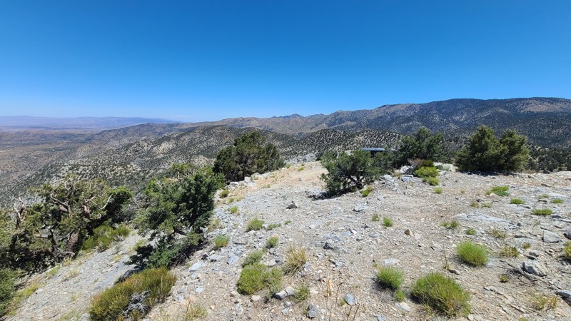
Updated: 06/10/2026
Tip Top Mountain
Doble, California
Located in the Mountain Top Ranger District of the San Bernardino National Forest (SBNF), 2N90 is an up-and-back trail chiseled into the steep side of Tip Top Mountain. This trail climbs 2,300 feet over an extremely rough, rocky, and narrow shelf road that eventually reaches the 7,500-foot summit. Once on top, the views are magnificent. This trail requires an expert driver with a suitable high clearance four-wheel drive vehicle and low range. Drivers will be required to manage very steep grades, narrow trails, sharp alignments, rough or loose tread surfaces, and substantial obstacles.
Dispersed camping is permitted when following the SBNF Dispersed Camping Guidelines. However, the only suitable dispersed campsite is at the end of the road, on top of the mountain, where level land and inspiring views are available. Be sure to follow all Current Fire Restrictions and Related Prohibitions and obtain a California Campfire Permit before camping.
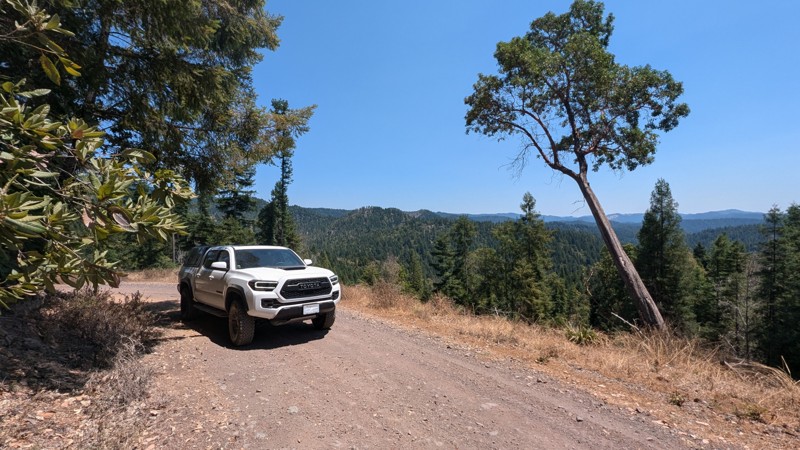
Updated: 03/28/2026
Fort Bragg/Sherwood Road
Longvale, California
Traversing the mountains and redwood forest of Mendocino County, Fort Bragg/Sherwood Road is a seasonal, unpaved road connecting Willits and Fort Bragg. The 24 miles of dirt are a single-lane trail, winding through the forest and traversing ridges with spectacular views. This trail goes deep into the mountains and is very secluded, with many logging road spurs. Most of the spurs are closed with large metal gates, but there are enough open that it may be possible to get lost if you make a wrong turn. Cell service is spotty, so following your GPS closely is crucial.
This trail can become very muddy and impassible when wet. This is evident from the deep ruts found along several sections of the trail. When dry, the trail is easily traversed by a high-clearance vehicle, and 4WD might not be necessary. Users will need to traverse steep hills, ruts, and one constantly muddy section thanks to a natural spring. There are a lot of tight blind turns along this single-lane road. Thus, users should be cautious of any oncoming vehicles. This trail is popular for overlanders, motorcycles, and locals.
No suitable camping exists along the trail as all adjoining lands are privately owned.
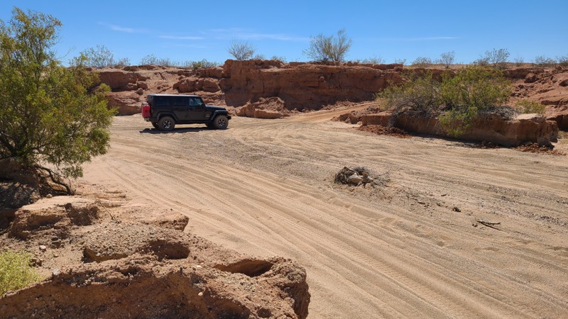
Updated: 04/08/2025
Summit Road
Hayfield, California
Starting at I10, Summit Road is entirely on BLM land and skirts over its 11 miles southward between the Orocopia Mountains to the west, the eastward Chuckwalla Mountains, and ends at the border of the Chocolate Mountains Bombing Range. The road is on or next to the raised railbed of the now-abandoned Eagle Mountain Railway, which hauled iron ore from nearby the Kaiser Eagle Mountain Mine. The railway carried its last ore in 1986, and it's only in recent years the rails and ties have been harvested for reuse. Portions of the raised railbed have collapsed, and Summit Road diverts down its sides and continues on a deep sandy wash. The road is surrounded by widely spaced Creosote scrub and other bushes native to the Colorado Desert. Military jets may fly overhead and are seen first before the roar of the engines catches up as they maneuver for practice bombing runs. You may see the rising smoke of a successful bomb drop off to the south.
The road surface alternates between flat gravel on the railbed and deep soft sand. The constant erosion has created obstacles, especially where the road diverts off the railbed, and it's these areas that require an experienced off-road driver. This straight-through road provides a connection to at least five other trails to explore including Red Cloud Mine Road with a final connection at the Bradshaw Trail.
Dispersed camping is available anywhere along the trail, and several rock fire rings from previous campsites are visible from the road.
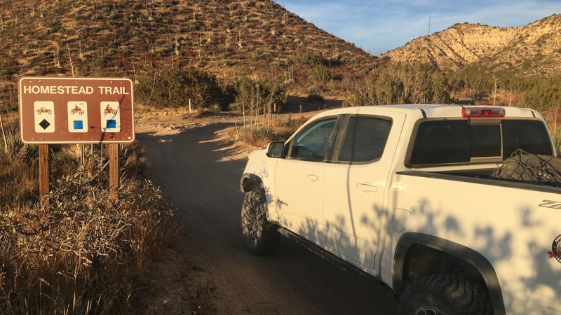
Updated: 06/17/2024
Hungry Valley SVRA - Homestead Trail
Santa Clarita, California
Homestead Trail is one of many off-road trails in the Hungry Valley SVRA (State Vehicular Recreation Area) just outside of the Gorman and Frazier Park mountain communities in Southern California. Over 130 miles of motorcycle, ATV and 4x4 trails spiderweb throughout this 19,000 acre park. To traverse these trails, you will climb over hills, plow through mud pits, shoot down sand washes and at the end of the day, idle into one of the numerous campgrounds. On any given weekend this park will be full of dirt-bikes, side-by-sides, quads, and 4x4s. If it burns gas and flings mud, you will find it here.
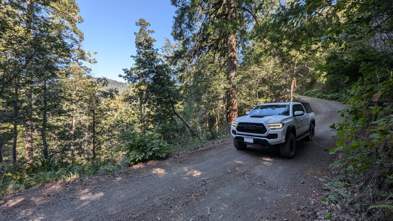
Updated: 05/29/2025
Kings Peak Road
Shelter Cove, California
Kings Peak Road is a scenic and remote trail through the King Range in Humboldt County. It connects Shelter Cove in the south to Wilder Ridge Road in the north. The road between Shelter Cove and Tolkan Campground is graded and well-maintained. The road is a bit rougher north of Tolkan Campground, but still passable with a stock 2WD SUV or Pickup truck.
The trail's south end is just half a mile from Usal Road, and combining the two makes for an epic route through California's Lost Coast and adjoining mountain ranges. Kings Peak Road twists and turns through the mountains with a total of 3,800 feet of elevation change and is slightly easier to traverse than Usal Road.
3.8 miles from the south end, Tolkan Campground is a BLM-managed campground with a nightly fee, providing spacious sites as well as a terrain park for biking. Many hiking trails can also be found in the area.
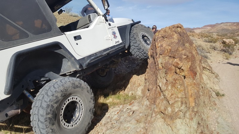
Updated: 01/02/2024
Vodkaberry
Barstow, California
Deep in the mountains near Calico lies trails rarely taken. Vodkaberry is a short but fun 4x4 trail with a couple of obstacles. Vodkaberry's main attraction is a double waterfall with the upper fall comprised of a 6-foot ledge. If you have the skill, this can be a fun trip when cutting across Doran Canyon and Wall Street.
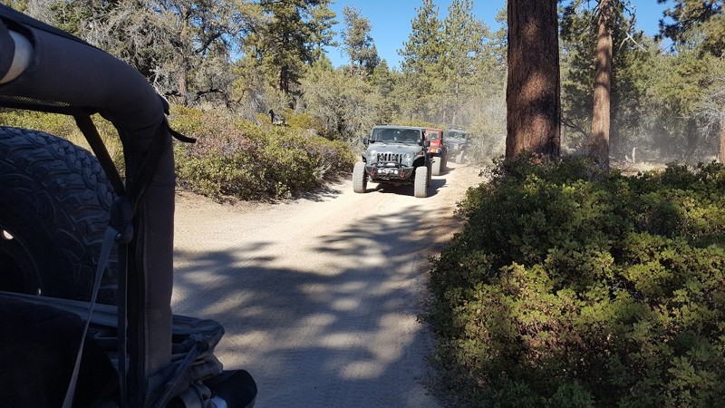
Updated: 07/08/2024
3N10 West - Connector Trail to John Bull West
Big Bear Lake, California
This section of 3N10 is a short connector trail between John Bull West and 3N16. The trail is mostly a dirt road with some scenic views but also provides a loop for several trails that connect back to Holcomb Valley Campground. Along the route, you will pass through the dense forest of Holcomb Valley.
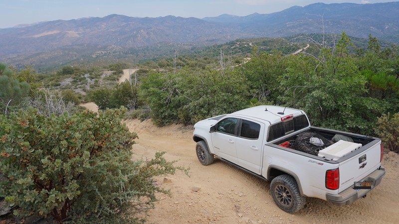
Updated: 06/19/2024
2N28Y - Banff OHV Road
Lake Arrowhead, California
A nice quiet neighborhood street in the mountain lake community of Lake Arrowhead leads into this San Bernardino National Forest trail known as 2N28Y - Banff OHV Road.
Drop in from the blacktop, hit the dirt and start your day off-road with this easy-to-acess off-road trail that connects to numerous other 4x4 trails in the area, including 2N25 - Rouse Ranch Road, 2N27Y - Rouse Meadow and 2N29Y - Stove Flats.
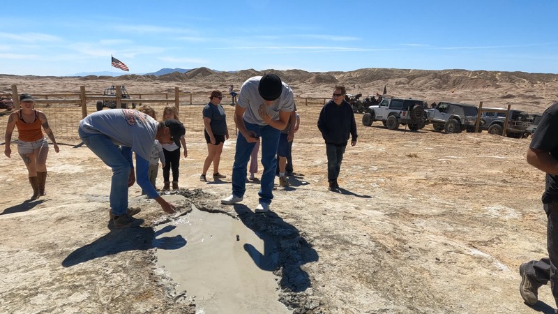
Updated: 10/15/2024
Gas Domes Trail
Kane Spring, California
This trail leads to one of the most unique features of the Ocotillo Wells area. Gas domes are where water and natural gas bubble out of the ground in murky mud. This is interesting because they are far from anything, including a water source.
Legends say if you put mud on your face, you will receive the blessing of the desert.
If you are looking to camp in this area, check out the hills just to the west of the gas domes. The park has odd rules about camping in the area. So if you want to camp near the east side of the trail, please get in touch with the park first.
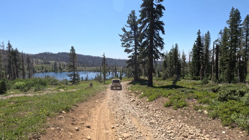
Updated: 09/29/2025
High Lakes
Glenburn, California
High up in the Lassen National Forest, you will find the High Lakes OHV area. This hardly touched offroading/overlanders' dream is a must-stop location when traveling near Paradise, CA. With dense forests, beautiful snowmelt and spring-fed lakes, never-ending views, it is hard to believe this area is utterly unknown to the majority of the offroad crowd. Running through the center of the area is Trail 611, or High Lakes Trail, which is the main trail that services the area. This connector trail is the primarily into the High Lakes area. But just because it is the main trail, it doesn't mean it is easy. Even though the trail is fine for most high-ground clearance 4x4s, there are a couple of moderate no-named obstacles, so it would be best to have 4WD to ensure you won't have any issues. But don't let the moderate difficulty obstacles stop you from exploring this area; the many lakes, including Long Lake, Cambell Lake, Morris Lake, Spring Valley Lake, and several others, are all just a stone's throw off the trail. This is an excellent trail for dispersed camping because of the unique lake camping opportunities. That is because almost every lake has a moderately improved campsite with a fire ring and a unique but scenic view of its specific lake in the background. Each location is different-sized and can support groups from 2 to 6 vehicles. All the sites are flat-level dirt, making them ideal for ground camping. Just don't forget your fishing license and polls. Also, keep in mind that this area is bear country.
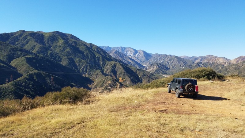
Updated: 07/12/2024
2N79A Penstock Ridge Spur
Fontana, California
2N79A Penstock Ridge Spur is within the San Bernardino National Forest and is a pleasant escape with views of the surrounding hills and the majestic San Gabrial Mountains to the west. There are beautiful vistas at many spots along the trail dominated in the west by the almost 9000' granite peaks of Cucamonga, Big Horn, and Timber Mountain. This is an excellent trail for a beginning off-roader. Penstock Ridge Spur was built as a service road for the four power line towers along its length. Intersecting roads along the way can be explored and often lead to these towers. Shortly after starting the trail is a large concrete structure in the shape of steps whose purpose is a mystery and that local artists have used as a canvas making this a worthwhile stop to appreciate their work.
Your dog can also enjoy the trail when kept on a leash.
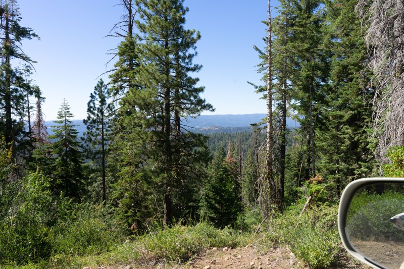
Updated: 12/15/2025
Hull Creek Spring
Long Barn, California
This trail serves its best purpose as a connector running from Dodge Ridge down to the managed Hull Creek Campground. There is one dispersed campsite just off spur 4N33C, although you may get dusted out as the campsite seems to be along an OHV/ATV route. At the intersection of 4N33 and 3N01 (next to the campground entrance), a continuously running spigot provides potable spring water straight from the Hull Creek Spring. This is a fantastic opportunity to refill any potable water containers you may have. Please read the signage and respect the clean drinking water rules.
The hardest part of this trail is after it crosses the Dodge Ridge trail and becomes 4N72Y. The trail becomes more narrow and eventually overgrown as it deadends down a hillside.
OPEN SEASONALLY: 04/15-12/15
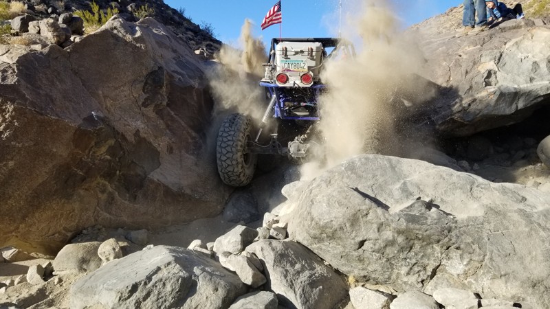
Updated: 02/27/2024
Aftershock
Lucerne, California
Aftershock is a fun but difficult rock crawling trail. The trail is not as hard as the Hammers but harder than almost anything else most have tried. The trail is a narrow canyon with waterfalls, giant boulders, and soft sand to mix things up. Be ready for some body damage and breakage because, like most of the other Johnson Valley trails, this one isn't forgiving.
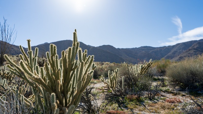
Updated: 12/18/2024
North Indian Canyon
Ocotillo, California
As a continuation of Indian Gorge, South Indian Canyon drives through a much more expansive canyon from Indian Valley. Along this adventure, you are submersed in the cirque-shaped bowls in boulder-laid mountains. This cirque-shaped bowl, however, doesn't include glacier-packed lakes but rather an entire sampling of desert plantlife that includes cholla, agave, creosote, and ocotillo. The drive-in provides one experience, while the drive-out gives you an entirely different perspective of Indian Gorge, which you took to get here.
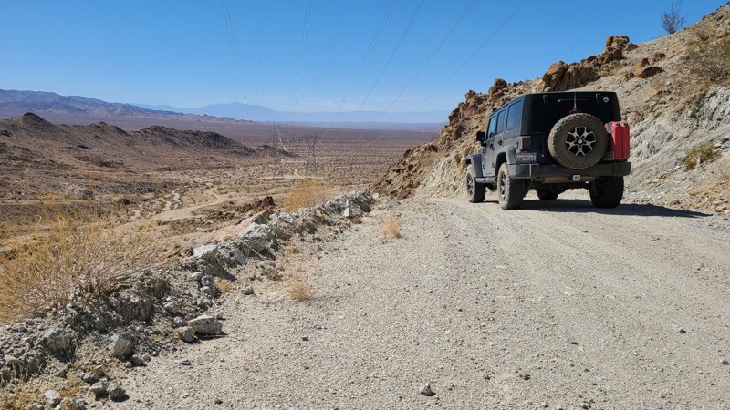
Updated: 10/15/2024
Powerline Road
Cactus City, California
Located just south of Joshua Tree National Park, Powerline Road is a 13-mile service road on desert land managed by the Bureau of Land Management and aimed down the center of a series of tower pairs heading towards the eastern end of the Orocopia Mountains. The road provides a leisurely drive through typical desert terrain and intersects several BLM marked trails that offer more exploration opportunities. The road is an easy drive but rough, consisting of a wide hardpacked rocky trail, and airing down will make the ride more comfortable. In contrast to the previous 13 miles, the last quarter mile suddenly begins a winding and steep climb to the edge of the Orocopia Mountain Range, where the road ends. Dispersed camping is available anywhere on the road, and several existing campsites are seen from the road.

Updated: 06/05/2022
18N25 - Packsaddle Trail
Upper Lake, California
Packsaddle Trail, near Lake Pillsbury in the southwest part of the Mendocino National Forest in Northern California, starts and ends at intersections with M1 - Elk Mountain Road, and thus presents an opportunity to bypass a good portion of the heavily washboarded Elk Mountain Road. It is a quieter, smoother, more peaceful route with one exceptional lookout spot, and spends much of its time winding through deep Ponderosa Pine forest. The lookout spot presents a fine 180 degree view towards the east, with seemingly endless rolling, forested hills disappearing forever into the distance. Hull Mountain is prominent to the northeast.
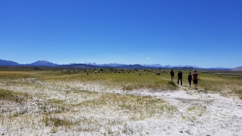
Updated: 06/05/2022
Wild Willies Hot Springs
Mammoth Lakes, California
If you plan on a trip to Mammoth and thinking about something to do, hit up this popular Hot Spring on the southside of town. This large hot spring is absolutely amazing. There's no doubt why so many people visit this hot spring. It's almost as famous as Vegas. So if you are driving 395 near Mammoth Lakes, California, and need a place to relax for a few hours Wild Willies Hot Springs and Tub in the scenic caldera of the Mammoth Volcano is just the ticket!
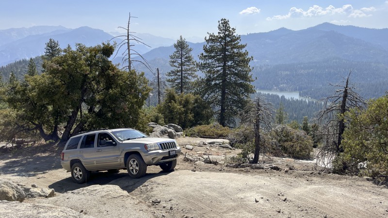
Updated: 10/15/2024
Cherry Gap
Grant Grove, California
Cherry Gap runs along a ridge above Hume Lake in the Sequoia National Forest to the west of Kings Canyon National Park. The trail is great for those looking for something more challenging than your average maintained forest road. It also offers a great view of the lake below, plus a few welcoming pullouts for dispersed camping. The trail begins off Highway 180 at Cherry Gap, rising and falling between 6,000 and 7,000 feet as it follows the ridge. Driver experience and 4WD are necessary due to steep grades and four rock obstacles near the midpoint. The most challenging section requires traversing the steep face of a boulder or navigating around the boulder in loose dirt while precariously close to the edge of the mountain. Running the trail from northeast to southwest is the most challenging.
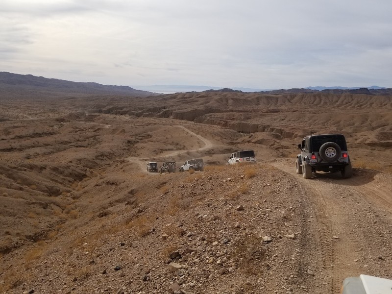
Updated: 04/27/2024
661202 - Red Canyon Drop In Trail - Chuckwalla Mountains
Blythe, California
When out on an overland adventure and exploring the Red Canyon Trail in the Wilderness Park of Orocopia Mountains, there is a small trail that gives you a chance to explore the Red Canyon from its floor. The Red Canyon Drop In, trail designation route 661202, will take you from The Red Canyon Trail down into the depths of the canyon below. Once at the bottom, you can gaze up at the magnificent cliff walls that seem to reach the clouds above. The next time you are out exploring Red Canyon, make sure you check out the drop in and experience for yourself the wonders of Red Canyon.
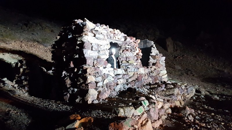
Updated: 01/02/2024
Wall Street
Barstow, California
This historic miners route was used back in the big mining boom of Calico in the late 1800's. The miners would ride cable cars up Wall Street to avoid going all the way around through Doran Canyon. The wall of Wall Street is hundreds of feet tall and offers no alternative routes. An awe-inspiring sight to see, this is one of Calico's rare and amazing sites.
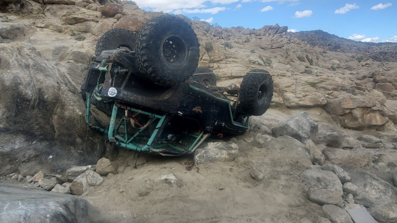
Updated: 02/27/2024
Off-Your-Rocker
Landers, California
Looking to run something hard that isn't a big name? Check out Off-Your-Rocker Trail in Johnson Valley California, home of the King of the Hammers and hard trails. This wild 4x4 rock crawling trail is a none stop of body damage, waterfalls, and fun. Full of boulders that eat up Jeeps and Toyotas alike, this insane Off-Road trail is something that might just make you go home crying to mommy. If you think you have a built offroad vehicle, can play with the extreme people, and think difficult trails are super easy, than Off-Your-Rocker is probably the trail for you.
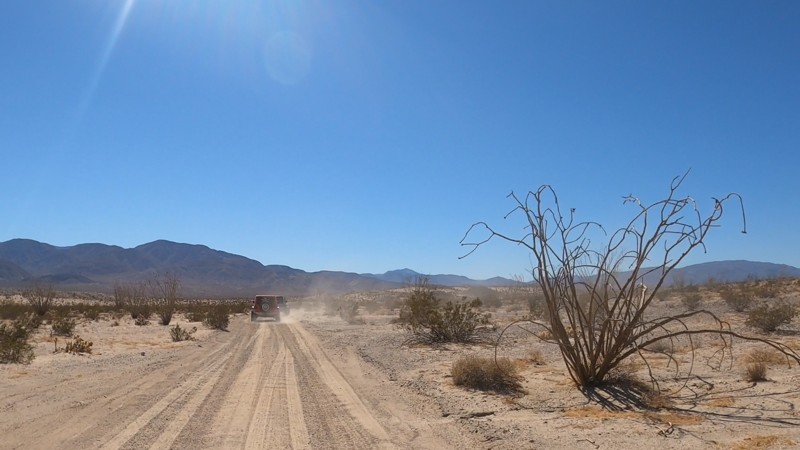
Updated: 12/27/2024
Buttes and Hawk Canyon
Ocotillo Wells, California
Hawk Canyon is a cool escape when over by the slot. Hawk Canyon itself is a small box canyon with towering rock walls. People often use this area to disperse camp and relax after a long trip. Due to the area, it doesn't see a lot of traffic, making it a great place to explore and get away from the crowds. Most people camp nearby at Blow Sand since there are restrooms, showers, and spots to park RVs. But, several areas near the mouth of Hawk Canyon would make for great spots to get away from the crowds with plenty of room for any size group.
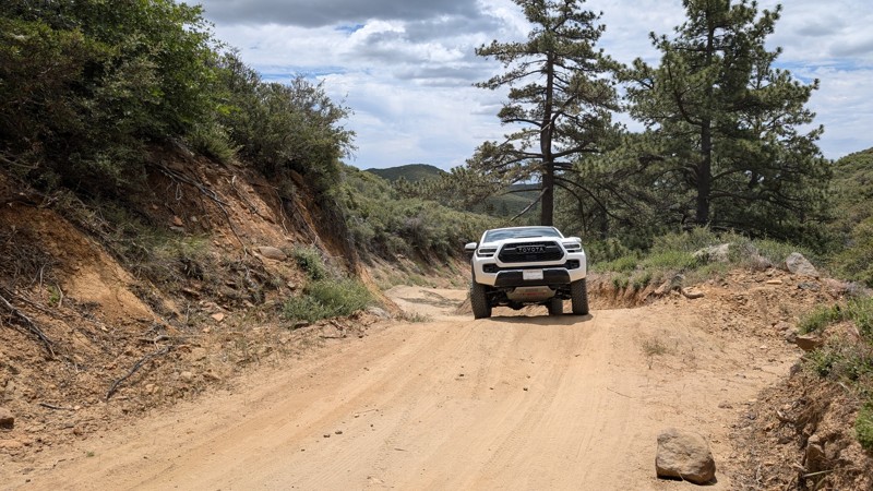
Updated: 10/15/2024
Thing Valley Road
Mount Laguna, California
Thing Valley Road is easily accessed off Sunrise Highway (S1) on Mt. Laguna. It parallels and crosses the Pacific Crest Trail (PCT). It is mostly graded with large humps in the road for erosion control. Some of the humps are tall and steep, enough to think twice about bringing a vehicle with a low break-over angle. There are loose rocks, but 2WD vehicles should manage them well enough.
The route is located in the Cleveland National Forest where dispersed camping is allowed, however, the appropriate passes and permits are required. There are several campsites along the way, including one at the intersection with the PCT.
The road exits the Cleveland National Forest at 2.1 miles and is gated at 2.6 miles with a very small space to turn around.
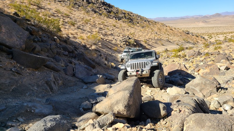
Updated: 12/17/2025
Lower Johnson (Little Johnson)
Landers, California
One of the big names in Johnson Valley, Lower Johnson Canyon, aka Little Johnson, is one of the few intermediate trails in the Johnson Valley range. Because of its location in Southern California near Los Angeles and Orange County, these trails see a lot of traffic for the people that are not looking for the extreme trails of the legendary King of the Hammers area. This awesome but short trail has plenty of optional hard obstacles for the more extreme person while plenty of easier options for the newer drivers that want to get out and test out their vehicle. So the next time you hear Johnson Valley, don't think this is too extreme for me, instead head out to the Johnson Trails and have a little fun.
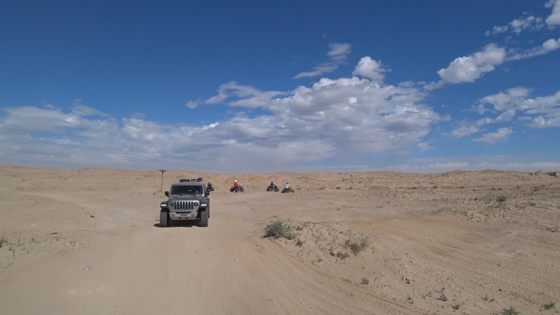
Updated: 03/09/2026
Cross Over Trail
Salton City, California
Cross Over Trail takes you from the northern end of Ocotillo Wells OHV to the middle section near Shell Reef. This is a great trail with optional harder lines on the sides. Now this trail is on the harder side of easy but can still be done in 2WD in shorter and narrower high-ground clearance vehicles. As you cross the desert, you will see a constant change in the desert, some areas are sandy, while others almost seem like they are being pushed out of the depths below. Just watch out near the middle mud hills if it rains. That can make things really interesting really fast. If you are looking for camping, check out the hills on the north side of this trail.
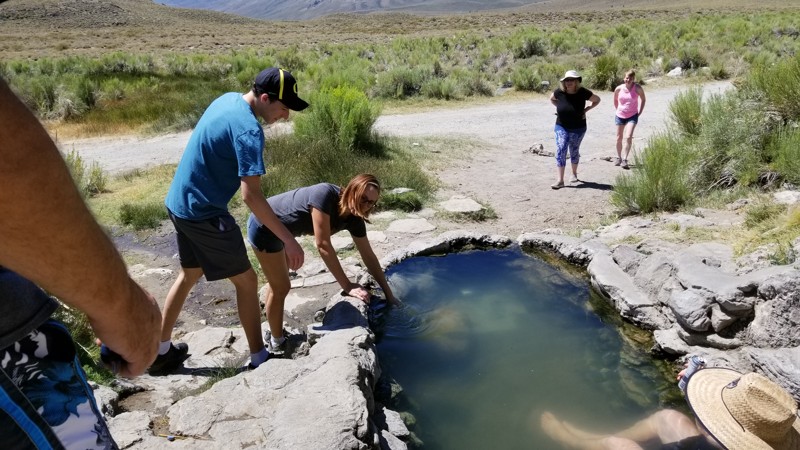
Updated: 06/27/2025
Whitmore Tubs Road
Whitmore Hot Springs, California
This hard-to-believe you are in the mountains of California trail is a fun little side track to get out of the city. Whitmore Tubs Road traverses a valley full of hot springs. The water is warmed geothermically by the volcanic activity below the valley. Since this is BLM land, you can camp in the area. Most camp near Hot Creek.
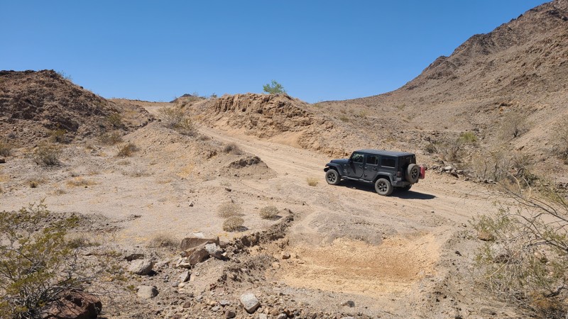
Updated: 05/02/2025
Graham Pass Road
Mesa Verde, California
Graham Pass Road rises into a wide valley of the Little Chuckwalla Mountains. This wide road is on the western border of the Little Chuckwalla Mountains Wilderness for much of the way. Starting as a deep sandy desert trail, it becomes a hard, rocky, and rough road when rising into the valley. Graham pass ends at Bradshaw Trail. BLM rates the trail as "More Difficult" and it can be driven by an inexperienced driver but with a high clearance vehicle. Dispersed camping sites can be found in many spots on the trail. BLM asks that campers use existing sites that have been cleared or have rock fire rings to minimize the impact on the land.
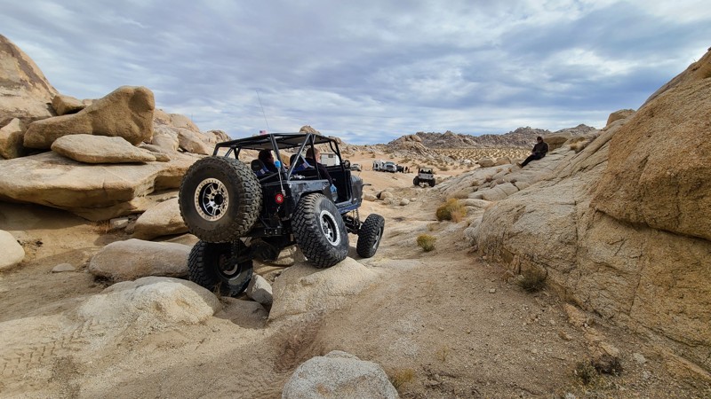
Updated: 05/16/2023
Noesser’s Nasty Notch
Lucerne Valley, California
Look no more if you are looking for the newest and greatest trail in Johnson Valley. Noesser's Nasty Notch is a very technical rock crawling trail in Cougar Buttes that can easily take a group of Jeeps all day to complete. This trail is similar to Jack and Sledge Hammer in difficulty, full of extreme rock crawling.
The trail has three over-the-top obstacles that will make most individuals decide not to do it after they walk the trail. The Devil's Reject is a combination of large rocks, even larger holes, a tights s-turn up Terena Trench. From there, you have to have faith drop-down, Mr. Anderson, a blind steep off-camber drop that many won't want to attempt. If that doesn't get you, the Nasty Notch will, as this is a wide v-notch roughly 78 inches wide, and the walls are 5 feet tall. One mistake there, and you can kiss your paint goodbye.
The bottom line is it can be done in a full-body Jeep or 4x4. So plan a day for this trail and get out there and see why this is one fun and unique off-road trail.
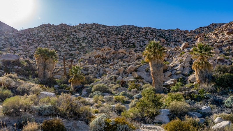
Updated: 12/18/2024
South Indian Canyon
Ocotillo, California
One of Anza Borrego's great southern trails, South Indian Canyon is almost a mirror image of North Indian Canyon and is a dream come true for overlanders and 4x4 enthusiasts alike who are looking to escape the headache of city life and enjoy the solitude and beauty of the amazing Anza Borrego State Park. Along the route, you will be submerged in amazing desert plant life amid stunning boulder-filled mountains in the background. You can even see the Carrizo Badlands lurking off to the north from the high points. Once you reach the trail's end, you come across an oasis with natural palms used by the Kumeyaay, also known as the Tipai-lpai, a Native American tribe. Because of this, many people often say this is one of their favorite memories while visiting the southern section of Anza-Borrego State Park.
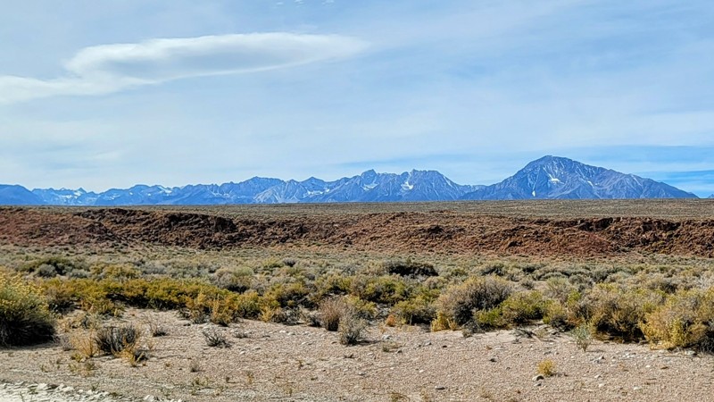
Updated: 10/15/2024
Fish Slough Road
Dixon Lane-Meadow Creek, California
Fish Slough Road takes you on a trip through the ages. Volcanic rock lines the road to the south as you go through the Volcanic Tablelands BLM Park. The rock rises from the Earth in long, flat table-like formations called mesas.
In the middle and northern part of the trail, the arid terrain of the Owens Valley gives way to spectacular views of the Sierra Nevada Mountains to the west and The White Mountains to the east.
The road itself is in good condition. It’s a graded dirt road with a couple of sandy spots, but nothing any high-clearance 2WD vehicle can’t handle. Unless there is a bad storm, the road can get washed away and very sandy, so check conditions before going.
Around the halfway mark are the Chidago Canyon Petroglyphs, a short walk from the road. This historic landmark of rock art is believed to date back at least 3500 years. They were created by ancestors of the Paiute-Shoshone peoples. The Red Canyon petroglyphs are also on this trail, which requires a short hike.Chidago Flats and Casa Diablo trails meet up with Fish Slough and are just as incredible and worth the drive, especially driving through the slot canyon in Chidago Flats.
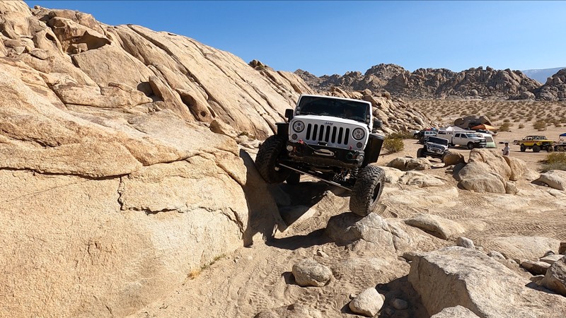
Updated: 11/26/2025
Dorito Hill
Lucerne Valley, California
This technical rock crawling trail, known as Dorito Hill, is located in southern California's Cougar Buttes, a small section of the Johnson Valley OHV Recreation Area in San Bernardino County. Dorito Hill, while short, is one of the difficult 4x4 sections here in Cougar Buttes. Wheelers looking for an off-road challenge will enjoy running up and over Dorito Hill as a quick warm-up before hitting Hammer Down or Split Finger. Off-roaders looking for an easier day might want to stay off this trail. Still, they will find many easier trails and multiple dispersed camping opportunities in the surrounding area of Cougar Buttes.
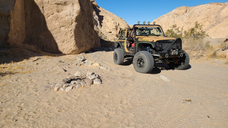
Updated: 01/05/2023
Mine Trail
Brawley, California
Within the Superstition Mountains, not far from San Diego, this is a neat area that is perfect for getting away from the crowds, relaxing, and enjoying the beauty of the deserts. Near the western end of the hills is a cut-through that takes you from the soft sandy area to where some of the more popular rock crawling trails are. Mine Trail will cut through the hills, passing an old strip mine, and pop you out on the other side. This is a great trail as it is lightly used meaning it is a lightly used trail and great for a relaxing drive. If you are in the area, need a place to camp, or just take a relaxing drive, check out Mine Trail in the Superstitions.
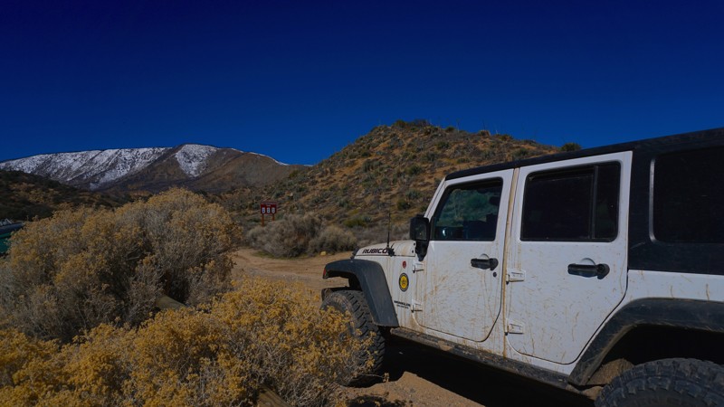
Updated: 06/17/2024
Hungry Valley SVRA - Old Cottonwood Trail
Santa Clarita, California
Old Cottonwood Trail is a short, but enjoyable trail in Hungry Valley SVRA (State Vehicular Recreation Area). Hungry Valley is just outside of the Gorman and Frazier Park mountain communities in Southern California. Over 130 miles of motorcycle, ATV and 4x4 trails spiderweb throughout this 19,000 acre park. The park's trails include hill climbs, sand washes, wide dirt trails, narrow off-camber shelf roads and a designated 4 wheel drive practice area.
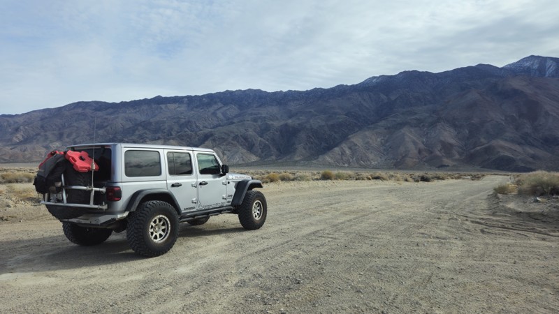
Updated: 02/11/2026
Manzanar Reward Road
Manzanar, California
The Manzanar Reward Road is the main trail over to the legendary Reward Mine. Located near Lone Pine, CA, this mostly dirt track takes you through the famous Owens Valley, across the Owens River, through the abandoned airstrip of the historic Japanese internment camp Manzanar, and eventually across the valley towards the towering Inyo Mountains on the eastern side where the Reward Mine resides. Even though this trail is full of rich history and great fishing, people often remember the awe-inspiring views with Mount Whitney hovering over the western background. The trail is suitable for all offroad vehicles as the trail is mostly a graded dirt road.
When looking for dispersed camping, head to the east side of the trail near the Reward Mine; you will find spaces amongst the bushes for even the biggest groups. The campsites' area is primarily flat, with a mixture of dirt, sand, small rocks, and the occasional cement slabs from the old structures. Add in the stunning views in the background, and this area can easily make a memorable camping location.
Please note: Inyo County often has extreme fire restrictions; please call before planning an open fire when camping in this area.
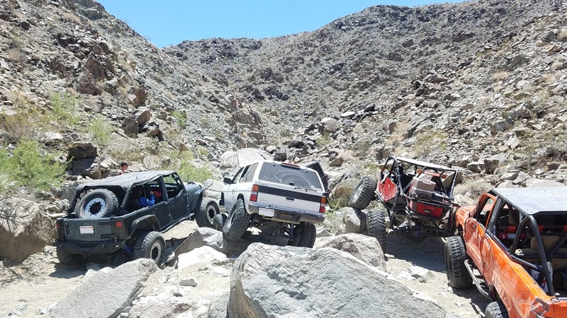
Updated: 01/21/2025
Outer Limits
Landers, California
If you want insanely hard, then the Hammer Trails are for you. A collection of large boulders, massive ledges, towering waterfalls, and spots you just have to drag through. This trail is going to make you work for it. This trail is only for the highly experienced with a well-built rig and strong roll cage. Do not attempt this trail alone and do not attempt this trail unless you have recovery gear, spare parts, and a group of at least 3 vehicles.
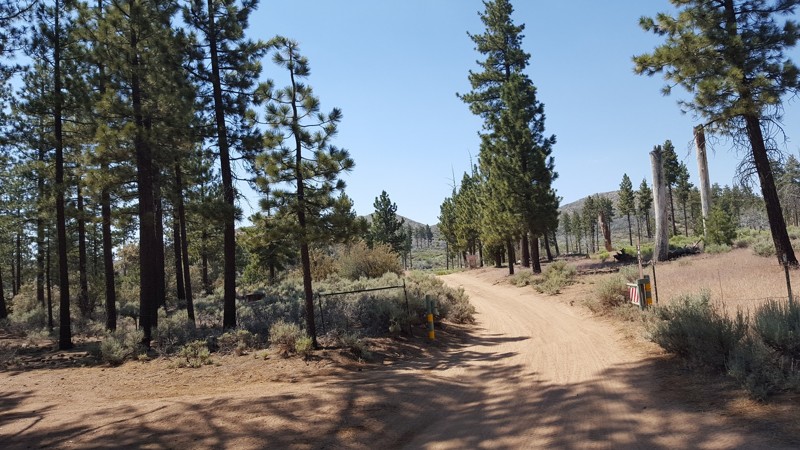
Updated: 05/05/2023
3N11
Big Bear Lake, California
One of the shorter trails on the mountain range, 3N11 takes you to the north end of the mountains where you will be presented with one of the most amazing overlooks of the High Desert. Some even say you can see Vegas on a clear day. Navigable in most stock 4x4's, 3N11 is a perfect trail for most offroad enthusiasts that are looking for some great adventures and amazing views.
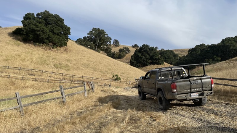
Updated: 10/15/2024
Hollister Hills SVRA: White Rock
Ridgemark, California
Hollister Hills SVRA is a 6,800-acre SVRA park and was the first SVRA made by the California parks department. The park is divided into three parts, the Upper Ranch, Lower Ranch, and Hudner Ranch. The Lower Ranch is for dirtbikes. While the Upper Ranch and Hudner Ranch are for 4x4s, visitors should stop first at the ranger station in the Lower Ranch to pay the $5 entry fee and get a map of the trails, as well as the lock combination to the gate at Hudner Ranch.
White Rock is a moderately difficult trail in the Hudner Ranch portion of Hollister Hills SVRA. It is one of the longer trails in Hudner Ranch and is composed of multiple tight turns, steep hill climbs, loose dirt, and narrow trails. Any 4WD or AWD vehicle with high clearance will be able to complete the trail. It is a great trail for new offroaders to learn and test the limits of their vehicle. There is no camping directly off of the trail, but there are campsites available in nearby Hudner Ranch that require a prior reservation.
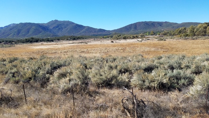
Updated: 05/17/2023
Tripp Flats
Anza, California
Tripp Flats Road straddles the boundary between the San Bernardino National Forest to the west and the unincorporated Anza Valley area to the east. At just under 2 miles, Trip Flats Road provides some nice scenery passing through a large meadow with the Little Cahuilla Mountain as a backdrop.
Tripp Flats also provides an excellent drive for connecting to some great trails.
Pets are OK on this trail.
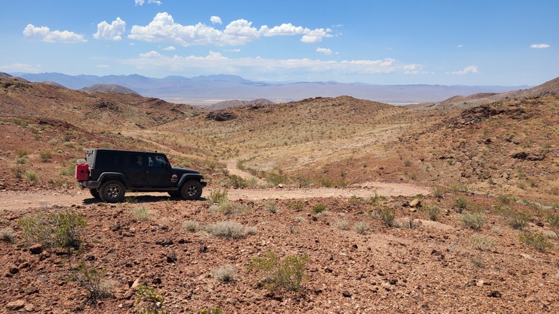
Updated: 10/15/2024
Calico Mountain CM7632b
Yermo, California
Near the end and on the west side of Tin Can Alley is the entrance to this easy-to-miss unmarked trail. Following this rocky trail south for 1-mile connects with Phillips Canyon East. Situated on a high ridge, the trail provides phenomenal east and west views below of the heavily silver-mined canyons, sometimes driving within a few feet of open tunnels and deep vertical shafts.
There are no markings over the entire trail. Following the .gpx will keep you on track. The last bit of the trail is a long steep decline made up of large stone ridges covered in loose rock and gravel. This obstacle should only be attempted by experienced drivers and with other vehicles in the group. A bypass to this obstacle is available to the east that follows a much easier path to Phillips Canyon East and to the bottom of the hill and the end of CM7632a.
There are no pre-disturbed campsites along the trail, and the only flat locations are full of large rocks. There is better camping back down Tin Can Alley at Waypoint 5.
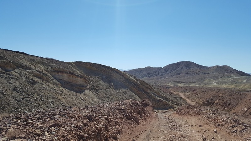
Updated: 05/04/2024
Phillips Canyon West Wash
Barstow, California
This easy drive up the narrow canyon is a popular route for people camping in Mule Canyon. The trail is mostly a wash which narrows as you get closer to the base of the mountains. Upon Arriving at the base of the mountains, the trials becomes rocky with a washed out climb. Past this location is Phillips Canyon West which is one of the harder trails in the Calico Network.
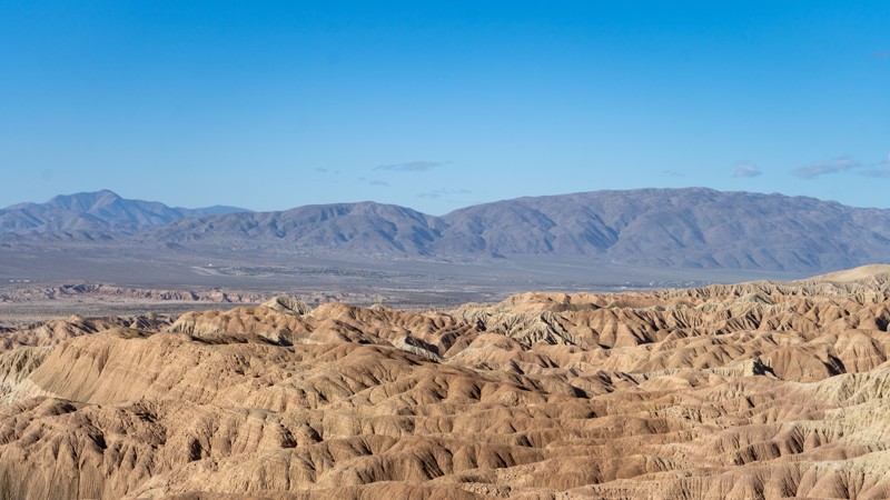
Updated: 02/02/2026
Vista del Malpais
Ocotillo Wells, California
Consider Vista del Malpais, it's like Font's Point without the crowds. A short uphill drive on an easy road leads to a vantage point overlooking the Borrego Badlands. The Borrego Badlands get their unique topography from being near the trailhead off Short Wash. This trail is suitable for any high-clearance vehicle.
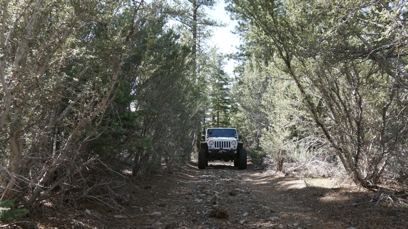
Updated: 05/29/2023
2N22Y - May Van Canyon
Big Bear City, California
Southeast of Big Bear, California in the San Bernardino National Forest and directly off of CA38 is this lone trail leading up the hill and ending just short of May Spring. Known as May Van Canyon, 2N22Y travels through this lush green section of the forest adjacent to private property as it climbs the mild hills leading toward the spring. A spring-fed water trough just outside the private property fence line is visible from the end of the trail where the greenery around it shows recent water flow. May Van Canyon is a good trail for a beginner looking for a little bit of a challenge.
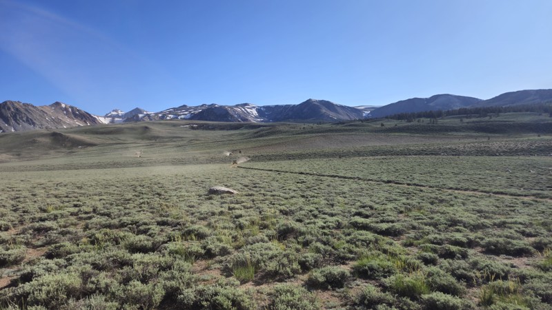
Updated: 06/29/2026
32E303
Peterson Mill, California
Trail 32E303 is a scenic and rugged trail within California’s Coyote Flats Trail Network, offering a high-altitude adventure for experienced off-roaders. Climbing from Big Pine into the upper reaches of the Inyo National Forest, this trail winds its way up steep, sandy hills before leveling out on a stunning alpine plateau at elevations between 10,000 and 11,000 feet. Along the ascent, drivers will encounter moderately difficult rocky sections, narrow tracks, and exposed shelf roads, making high-clearance 4x4 vehicles with low-range gearing a must.
Once on the plateau, the trail opens up to sweeping views of the Sierra backcountry and provides access to remote lakes like Funnel and Baker, both known for their natural beauty and dispersed camping opportunities. While Trail 32E303 offers plenty of visual reward and historical interest, including remnants of an old airstrip and mining sites, it lacks ideal campsites along its path. For better camping options, consider detouring to Trail 32E304 or the Funnel Lake area.
Remote and largely off the grid, this route is best explored in summer or early fall after snowmelt. With its combination of technical terrain, mountain scenery, and solitude, 32E303 delivers a true backcountry experience for those up to the challenge.
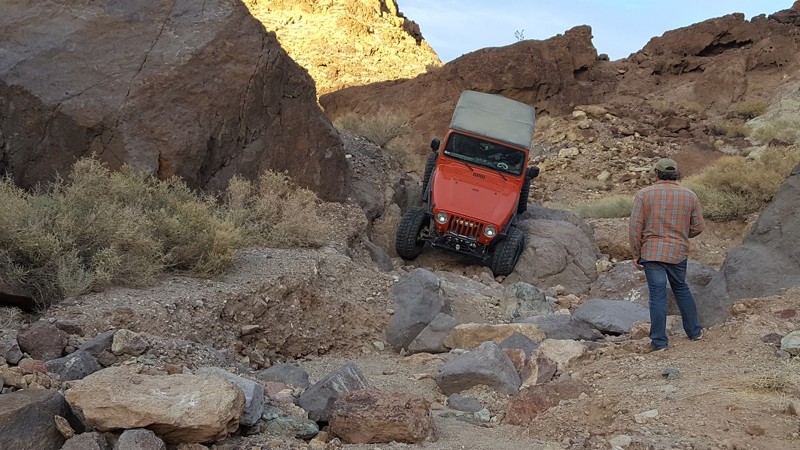
Updated: 01/02/2024
Bismarcks Mullet
Barstow, California
The party in the back, Bismark's Mullet is a trail to either look forward to or be feared. Harder than Odessa Canyon and Doran Canyon (excluding The Gate Keeper), this trail will challenge drivers to the extreme. If you finish your trails early, head around through the hills and give this bad boy a try.
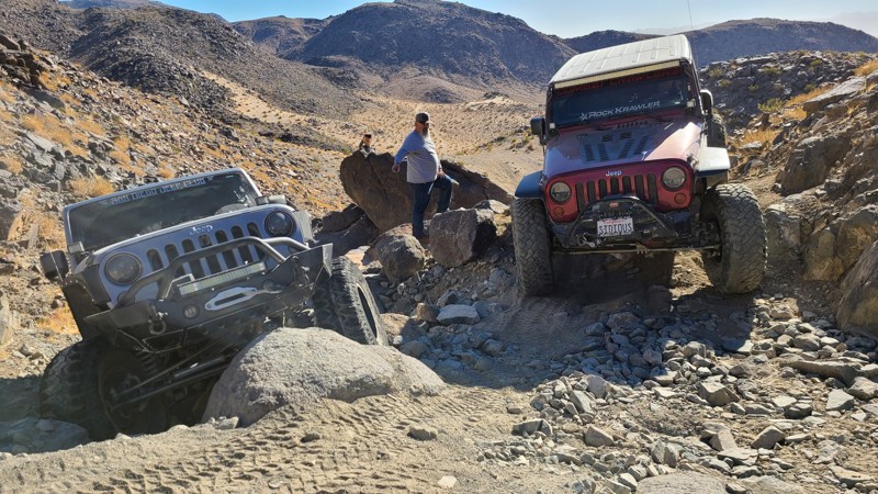
Updated: 12/17/2025
Upper Johnson (Big Johnson)
Landers, California
One of the big names in Johnson Valley, Upper Johnson Canyon aka Big Johnson is one of the few intermediate trails in the Johnson Valley range. Because of its location in Southern California near Los Angeles and Orange County, these trails see a lot of traffic for the people that are not looking for the extreme trails of the legendary King of the Hammers area. This awesome but short trail has plenty of optional hard obstacles for the more extreme person while plenty of easier options for the newer drivers that want to get out and test out their vehicle. Run this as part of Lower Johnson and this can make for a good hour or two run for a group of friends looking to do something different. So the next time you hear Johnson Valley, don't think this is too extreme for me, instead head out to the Johnson Trails and have a little fun.
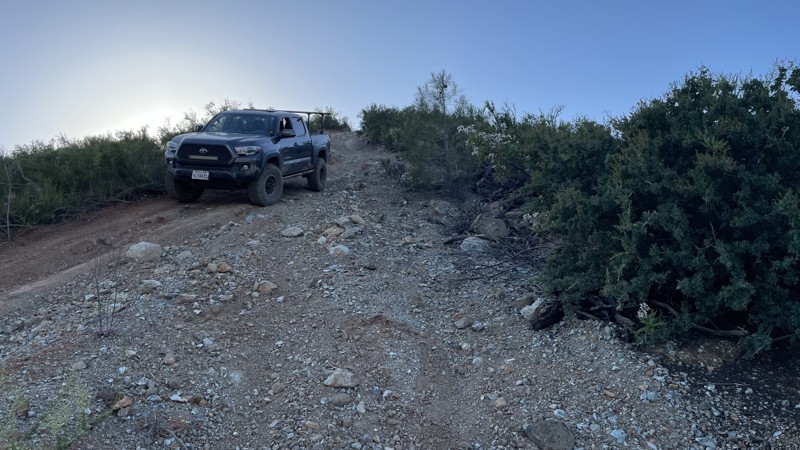
Updated: 10/15/2024
Frank Raines OHV: West Trail
San Antonio Valley, California
Frank Raines OHV is located not far from Patterson, CA. It is open to 4x4s from sunrise to sunset with a $5 admission fee per vehicle. The park is open to all OHV vehicles, so be sure to watch out for dirtbikes, quads, and SXS.
West Trail is a challenging track, rated a black diamond by the park's rating system. The trail is very steep and is essentially one long hill with large ruts and a few turns. The dirt is loose, causing traction issues. The trail can be descended by a stock 4x4, but to climb up the trail, you will need a lightly modified vehicle. Lockers and airing down are very helpful when trying to ascend. There is a high risk of pinstriping on this trail, as it seems to be mainly frequented by dirtbikes nowadays, causing it to become overgrown.
Deer Creek Campground is located at the park's entrance. The campground has 34 sites with picnic tables, restrooms, and other amenities. Prices range from $15 to $30 per site.
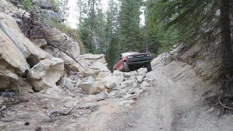
Updated: 05/01/2024
7S08 - Nine Line
North Fork, California
7S08 - Nine Line sits just east of Whiskey Falls in the Sierra National Forest, north of North Fork, California, and east of Bass Lake. This trail travels through two active lumber sights followed by dense forest and. offers a little bit of a challenge at one rock obstacle near the end. Where this trail once connected to 7S04 - Browns Meadow and all the way to 8S09 - Peckinpah / Whiskey Road , it now dead-ends at a wall of boulders just before a deep ravine created by a past wash out.
Wheelers with minimal experience and a 4WD drive vehicle will enjoy exploring this trail if in the area with time to kill.
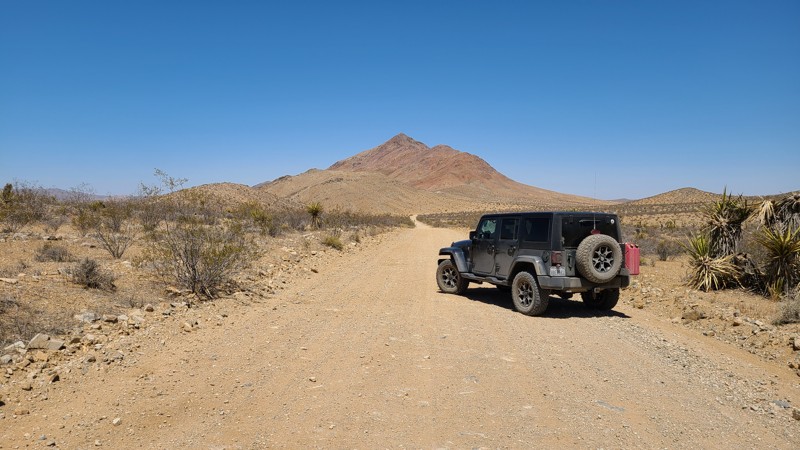
Updated: 02/17/2025
Lucerne Valley Cutoff
Thunderbird Ranches, California
Lucerne Valley Cutoff is a road maintained by the BLM Barstow Field Office. Flat and wide, the road passes over the desert valley floor providing many opportunities to explore trails branching in all directions. Lucerne Valley Cutoff is an excellent road for a new off-roader to get their vehicle dirty and enjoy the exhilaration of exploring the many trails that connect to it.
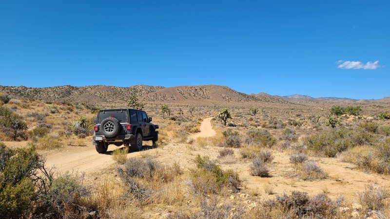
Updated: 09/22/2025
New Dixie Mine Road
Homestead Valley, California
Located south of the popular Johnson Valley OHV area, New Dixie Mine Road travels a picturesque corridor between the Bighorn Mountain Wilderness and the Black Mountain Wilderness, slowly rising towards the northern San Bernardino Mountains. It is a gorgeous drive over a desert wash that leads into narrow rocky canyons. This straight-through trail passes through a once-active mining area with numerous spurs that invite exploration and can lead to mines and their remaining ruins, established campsites, cisterns, and springs.
Along this trail, dispersed camping is allowed at the many established campsites when following the Bureau of Land Management Camping Guidelines. Open fires are prohibited.
This is an easy trail requiring a high clearance two-wheel drive vehicle. However, if planning to explore off the trail, you will require a four-wheel drive high clearance vehicle.
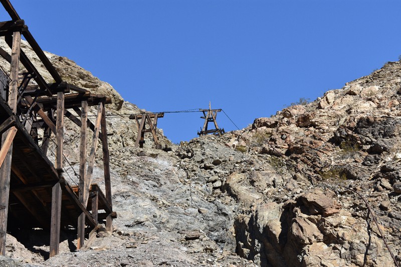
Updated: 09/24/2024
Keane Wonder Mine
Furnace Creek, California
This well-maintained gravel road goes into Death Valley's backcountry for access to one of the parks most successful mining areas, the Keane Wonder Mine and Mill. The mine and mill are one of the best examples of a historical gold mining operation in the national park. What is unique about this site is the well-preserved aerial tramway that still has the cables attached. The mine was first prospected in 1903 and was opened and closed at least twice before successful operations began. It was bought and sold several times after it was closed in 1912, but it never was commercially viable again.
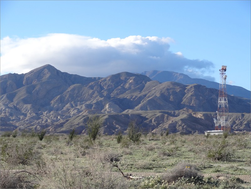
Updated: 07/02/2017
Gettysburg - Ocotillo Wells SVRA
Salton City, California
Overlapping San Diego and Imperial Counties nestled between Anza Borrego Desert State Park and the Salton Sea is the Ocotillo Wells State Vehicular Recreation Area; an 85,000-acre playground for off-road enthusiasts. Some of the popular attractions in the park are Truckhaven, the 4x4 Training Area, the Badlands, Pumpkin Patch, Shell Reef, Devil's Slide, and Blowsand Hill among many others.
Gettysburg is an enjoyable short trail and is a nice complement to Tectonic Gorge with similar features and terrain. After finishing Tectonic Gorge at the west end, jump onto Gettysburg and head east. With the sun at your back, cruise through the open desert, descend into the gorge, and weave through the canyon for more off-road fun and beautiful scenery!
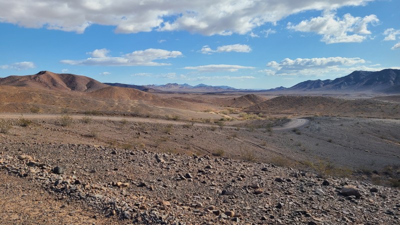
Updated: 10/15/2024
Milpitas Wash Road
Palo Verde, California
Milpitas Wash Road travels on approved access through the Milpitas Wash Wilderness and the Palo Verde Mountains Wilderness. The mountains on either side have water run-off to the Milpitas Wash, allowing the expanse of greenery and abundance of life you experience with your drive. The first half of the road is rough with exposed gravel, then as you descend into the Milpitas Wash, it becomes soft, deep sand and requires a 4WD to push through. A beginner off-roader would enjoy this trail. Campers can find dispersed sites on the BLM portions of the route. There are also BLM improved campsites near the northern trailhead on Wiley Well Road. There are no vehicles allowed in the well-marked Wilderness area.
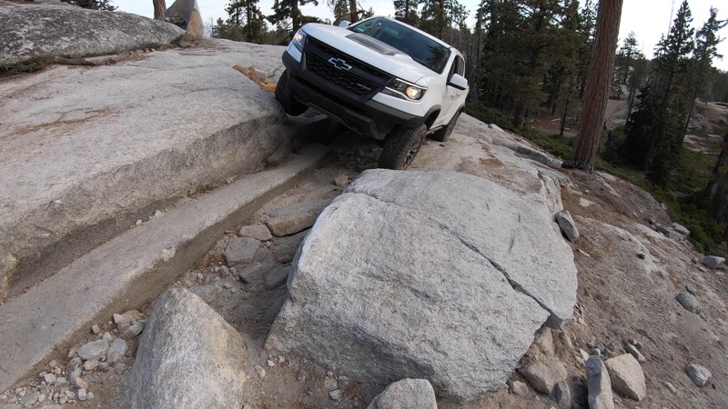
Updated: 06/01/2024
26E331 - Bald Rush / Lower Bald
Shaver Lake, California
Rock steps, a long granite sidehill, some killer mountain views, and a steep, rocky climb are all packed into this short 4x4 trail in the Bald Mountain OHV trail system in the Sierra National Forest, near Shaver Lake, California.
Bald Rush / Lower Bald in combination with Powder Hill, Lookout Rock, Plain, and Bald Basecamp make up a great day route through the east side of the Bald Mountain trail network. First-time wheelers might want to skip this one, but more experience wheelers will enjoy the challenge of the three main obstacles along this trail.
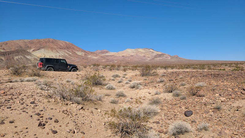
Updated: 10/15/2024
Sunrise Canyon CM7643
Toomey, California
Sunrise Canyon is a desert two-track that winds along the flat desert floor between the Calico mountains and Coyote Lake. The trail is an easy drive, save for some sections of rough rock that can still be managed with a two-wheel drive. Passing through both BLM and private property, some trail entrances are signed as private, most notably near the end of Sunrise Canyon, which is gated. Dispersed camping is allowed on the BLM land when following the camping guidelines of the BLM Barstow Field Office.
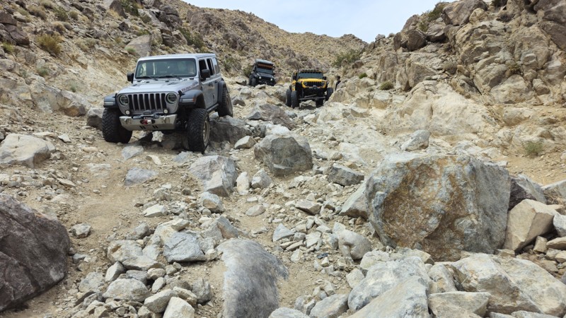
Updated: 03/09/2026
Resolution
Johnson Valley, California
Resolution is the continuation of Back Door in Johnson Valley. But the trail is much easier. Resolution has only a few waterfalls, all much easier than its big brother below. But still, this trail is a hard one. Descending the trail can be done with minorly modified vehicles, while going up will need a little more, such as a locker, to help with a few spots. Overall this is a great trail for people looking to add something to their list when looking for trails that are not too insanely hard for the average person.
There is no good camping on this trail as it is a narrow canyon. The best nearby camping is Means Dry Lake which is suitable for RVs and trailers.
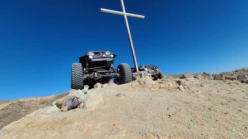
Updated: 05/20/2023
Holy Cross
Brawley, California
In the hills of the Superstitions in Southern California is a unique route that isn't seen often. This trail might add to the lure of the area in an odd and supernatural way. This unique path will zig-zag around the eastern part of the hills to many of the crosses that are representing the fatalities that have happened in the area. Each cross has a different story of who the person is and what happened. Since these are real, please be respectful and help preserve the area. Take the time to visit them, read the story, take in the views, and move to the next one.
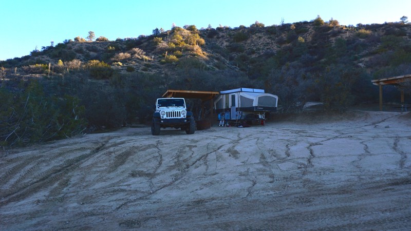
Updated: 06/17/2024
Hungry Valley SVRA - Sterling Canyon Trail
Santa Clarita, California
Sterling Canyon Trail is a fun, but lesser known trail in Hungry Valley SVRA (State Vehicular Recreation Area).
Hungry Valley is just outside of the Gorman and Frazier Park mountain communities in Southern California. Over 130 miles of motorcycle, ATV and 4x4 trails spiderweb throughout this 19,000 acre park. The park's trails include hill climbs, sand washes, wide dirt trails, narrow off-camber shelf roads and a designated 4 wheel drive practice area.
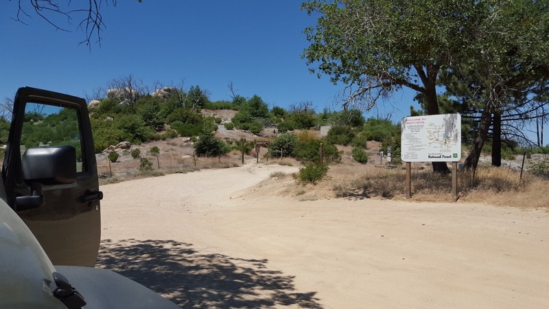
Updated: 05/05/2023
3N34 East - 2W03
Big Bear Lake, California
The entirety of 3N34 is known as Dishpan Springs, but in truth, it is like two trails in one. The east half of 3N34 / 2N03W is extremely different from the west half just 3N34. The contrast is stark, like night and day. The east segment is a very easy trail that stock vehicles can take to get to the Crab Flats Campground or other group campsites in the area. Just don't venture past the sign / gate that enters the more difficult western half unless you are prepared for it.
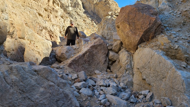
Updated: 01/05/2023
Craptastic
Brawley, California
In the hills of the Superstitions California, is a trail that not only earned its names but describes its will. This mass chaos has left even the most built rear steer buggies broken in its wake. Thus the name Craptastic is well earned for all the right reasons. This is a show from the start and has left many people disappointed for even thinking about trying this trail. Because once you start, there is no turning around.
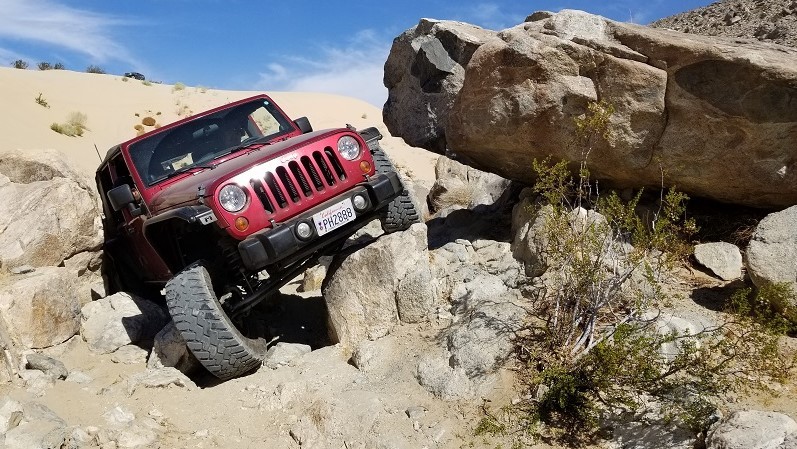
Updated: 02/27/2024
Tack Hammer
Lucerne, California
Tack Hammer is a fun but short 4x4 trail that is a great way to warm up the tires when on your way to The Hammers. The trail is on the lower levels of hard off-road trails with lots of loose sand and large rocks making it perfect for most 4x4 and off-road enthusiasts. The trail starts getting fun as it gets away from the sand and between the two hills. But don't let its short stature fool you, this trail can easily do body damage if you are not paying attention. Thus the next time you are in Johnson Valley OHV Area California, and you are looking to do a warm up rock crawling, check out Tack Hammer.
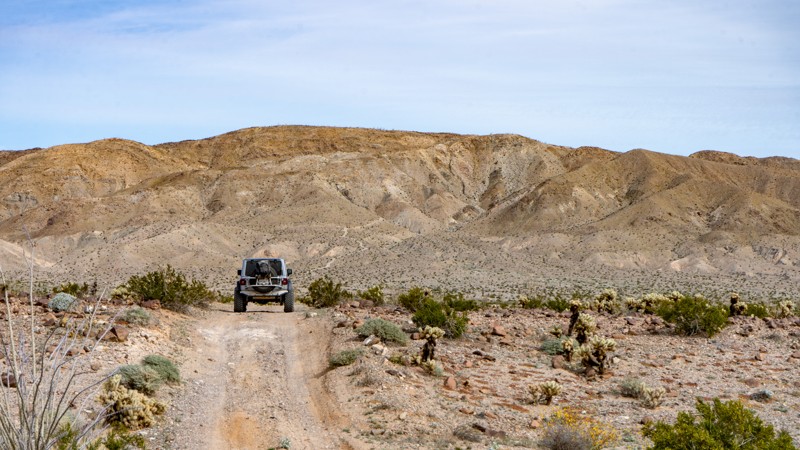
Updated: 05/23/2024
Mortero Wash North - Anza Borrego
Ocotillo, California
In the southwest corner of Anza Borrego State Park sits one of the most visited trails in this desolate part of California, Morero Wash North. An extension of Mortero Wash, this short trail surrounds you with some of the most fantastic flora of the southern portion of the Anza Borrego Desert. Whether you are out exploring the vast desert landscape or trying to get to the Dolomite Mine for some sightseeing, Mortero Wash North will be a great addition to your trip.
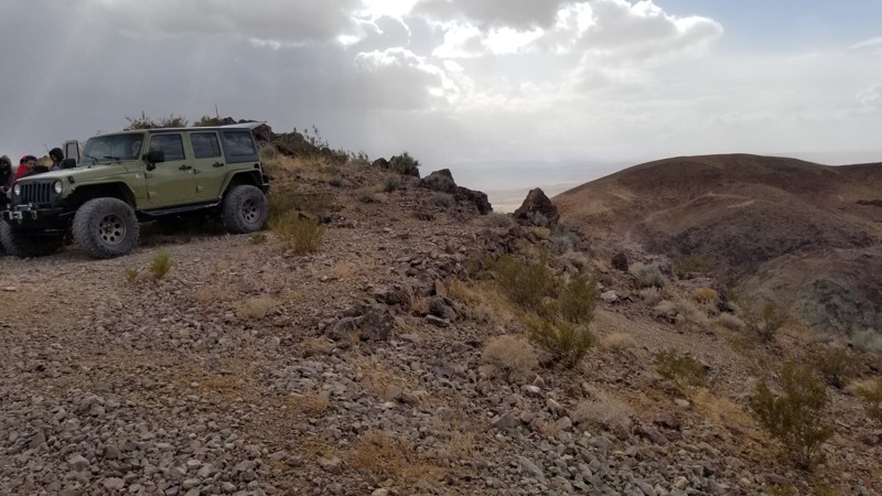
Updated: 01/02/2024
Bismarck’s Back Door
Yermo, California
Off on the backside of Doran Canyon is a lesser-known trail called Bismark's Backdoor. This trail is an easier alternative to the second half of Doran Canyon. The trail splits off and heads up a narrow canyon following an old mining trail to where it peaks at the top providing a stunning view of Wall Street just below. If you have done Doran dozens of times and looking for something new, check out this trail and enjoy what change it will bring.
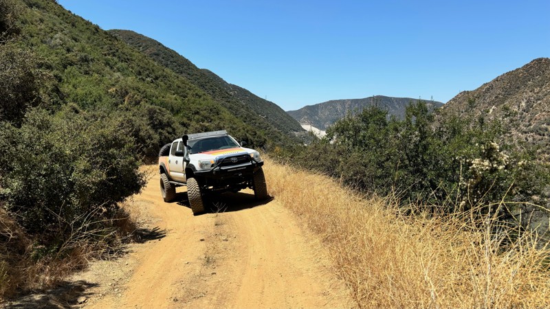
Updated: 03/14/2025
Warm Springs
Mountain Home Village, California
The Warm Springs trail begins at the south end of the Thomas Hunting Ground trail and is about 4.5 miles long with an elevation change of 1600 feet. The trail leads to the Seven Oaks Reservoir but is an out-and-back trail, as the Santa Ana Road at the end is currently washed out and impassable. The trail can be narrow at points with few areas for passing other vehicles. Pinstriping from trees is unavoidable. It is recommended to use a high clearance 4-wheel drive vehicle due to deep ruts and narrow areas around washouts. The drive is scenic, and reaching the end of the trail is rewarding, offering a nice secluded streamside lunch spot. It takes about 35-45 minutes to travel the entire trail.
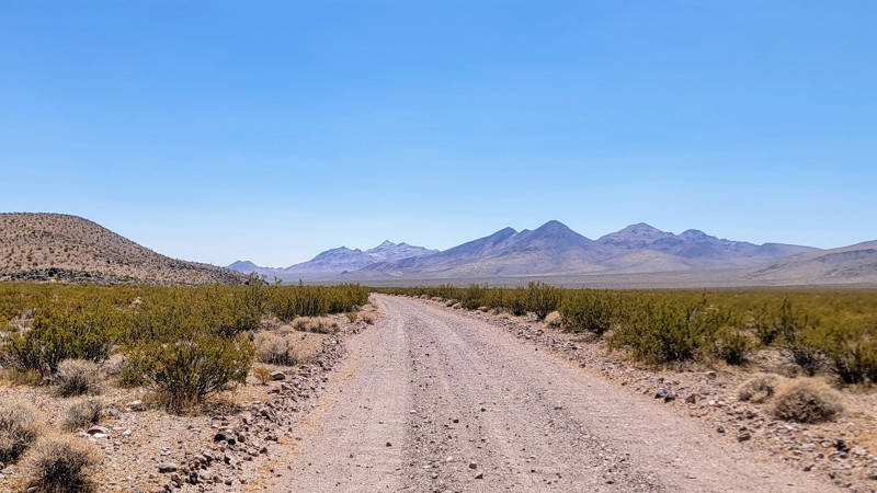
Updated: 06/10/2026
Greenwater Valley Road
Ryan, California
This incredible drive starts at the southern end of Death Valley National Park, just off the road to Dante’s View, which is epic! The arid desert climate provides spectacular views of the Black Mountains to the west, and Greenwater Range to the east!
Camping is allowed along the dirt roads, however, you will need a permit click here for the link to the permit. The road itself is well maintained with a few small rocky sections, but any high-clearance vehicle can make it, 4WD is not necessary.
In case you didn’t know, Death Valley is the hottest place on Earth! So stay away from this region during the summer months, and always check the conditions before you go as the temperature can get up to 130 degrees.
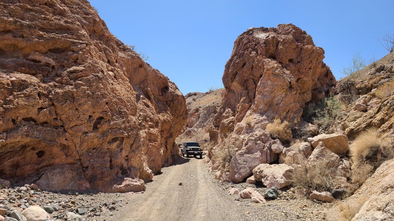
Updated: 03/11/2025
Augustine Pass Road
Desert Center, California
Tucked away in the Chuckwalla Mountains, the trail cuts a seven-mile path over the desert floor and transforms into a challenging rocky trail of twists and tight turns. When in the mountains, the road follows a deeply carved gorge through stunning geology and beautiful views of the desert below. The trail and ends at Bradshaw Trail. Dispersed camping sites can be found in many spots along the trail. BLM asks that existing campsites be used that are already cleared and have rock fire rings to minimize disturbance to the area. BLM rates this road as "Most Difficult," and only experienced drivers with high clearance 4x4s should attempt this trail.
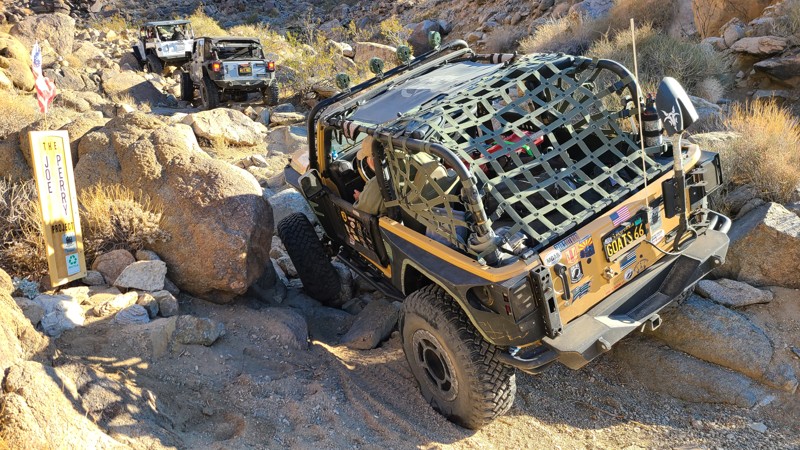
Updated: 03/04/2023
SV2675 - The Joe Perry Project
Lucerne Valley, California
Not far from Lucerne Valley, California, is a trail forgotten about over time. Overgrown, a couple of guys made it their goal not to let another trail fade away and eventually be removed from the maps. That trail was SV2675. These guys were Joe V. and Perry B. Naturally, the trail took on the name: The Joe Perry Project. Just north of Lucerne, this trail is closer than Johnson Valley, which makes this little trail a fun retreat. It is full of large rocks that love to move, narrow tight squeezes, and is in a remote location. This trail brings back memories of the old Johnson Valley days when the hammers were being created. So, if you want something new and love rock crawling, this would be an excellent trail to check out and have some fun.
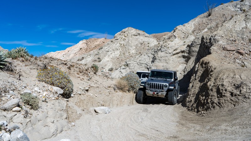
Updated: 10/15/2024
Arroyo Tapiado North
Mesquite Oasis, California
The northern section of Arroyo Tapida was recently opened. The trail isn't very heavily traveled and takes you back into the badlands of Anza Borrego. Once reaching the badlands, the trail becomes narrow and more difficult, eventually leading to a pinch point impossible to pass through. The trail offers a few small, flat, secluded campsites.
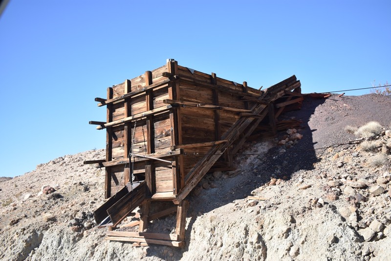
Updated: 09/20/2024
Black Magic Mine Road
Shoshone, California
The Black Magic Mine backcountry 4x4 route is located in perhaps the most remote area of Death Valley National Park. You will likely see wild burros in the area, and lucky travelers may spot desert bighorn sheep. The road to the Black Magic Mine frequently floods during the rainy season, and unless you know there actually is a road, the mine could be difficult to find. There are no signs, and due to water running down the sand wash, previous vehicle tracks may be obliterated making you wonder where you are headed. Prior to WWII, 20 mule team borax wagon trains followed the Owl Hole Spring Road that accesses the road to the Black Magic Mine. These wagon trains would stop at Owl Hole Spring at the Black Magic Mine trailhead on their way to and from the railroad terminal at Mojave, California. Created originally as a national monument, Death Valley was substantially expanded and became a national park in 1994, but the history of the Black Magic Mine goes back to its discovery in 1916. Early ore prices made hauling the magnesium ore out of Death Valley too expensive to develop the mine until WWII when the demand for magnesium drove prices up.
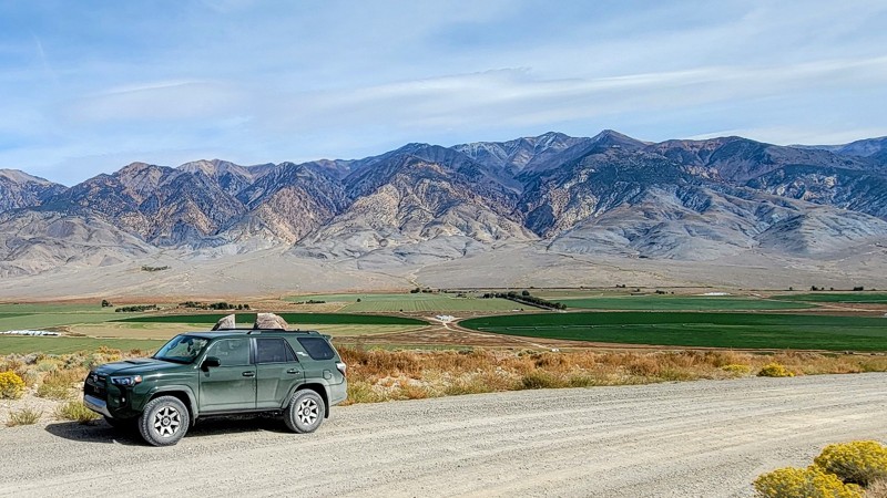
Updated: 05/27/2025
Chidago Canyon Road
Chalfant, California
Chidago Canyon Road travels through the Chidago Canyon Wilderness Area and the Inyo National Forest and offers possibly the best scenery in the area. The landscape is spectacular in every direction, from the drive-thru red rock slot canyon to the stunning views of the White Mountains to the east and The Sierra Nevadas to the west. On a clear day, you can even see Mount Whitney in the far distance to the southwest.
Depending on your start point, the road is a big climb or descent. The high point is towards the west. Either direction offers fantastic views. Just be sure to look behind you so you don't miss out.
The road is washboarded toward the east end but mainly gravel with rocky spots. It is an easy trail to navigate, and any 2WD high-clearance vehicle can handle it.
The volcanic rocks that line the road are reddish from the area's minerals. As the trail gains elevation in the western section, the pine trees of the Inyo National Forest get more abundant.
Towards the west end of the trail, there is a turnoff to a really cool loop that takes you more into the forest area and has BLM camping areas. This is dispersed camping with no facilities and no charge to camp on BLM land for 14 days.
Nearby great trails include Fish Slough Road and Casa Diablo Road.
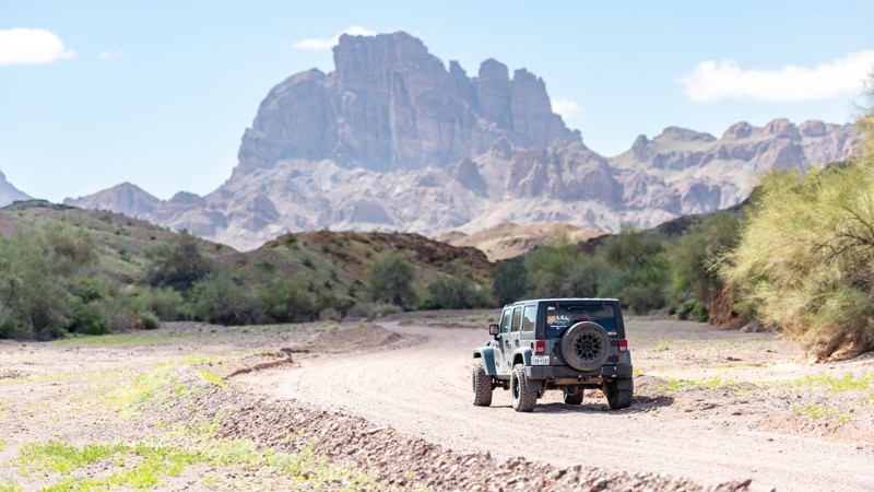
Updated: 02/02/2026
Picacho Road
Ross Corner, California
Picacho Road is a gateway to numerous trails and outdoor activities. Its 17.6 miles of gravel and sand span several land agencies, including the Fort Yuma Quechan Indian Tribal land, El Centro BLM, California State Recreation Area, and private mining property, all while showing off the Picacho Peak monolith in the distance.
Most of the route is on BLM land, offering dozens of spur roads, abundant camping opportunities, and hiking trails. The southern half is mostly desert terrain on maintained gravel, while the northern portion is more rocky and rugged, with several miles of loose gravel and sandy washes cutting through small canyons. The road ends at Picacho State Park, where there is a fee to enter, whether day use or camping. There aren't any obstacles or difficult sections that 2WD can't handle.
Remnants of old and current mining activity, including the Picacho Mine Cemetery, are found throughout this area.
Another popular destination in this area is Valley of the Names, where visitors have created thousands of rock displays on the desert floor for over 70 years.
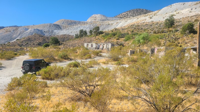
Updated: 12/30/2024
Bessemer Mine Road (Partin Mine Road)
Johnson Valley, California
Located east of Lucerne Valley, Bessemer Mine Road (Partin Mine Road) starts on Bureau of Land Management land and, after a 1500-foot climb, crosses into the San Bernardino National Forest. Near the end of the trail is Partin Mine, a once heavily mined area near Terrace Springs, which still has the fascinating ruins of a large mining camp to explore and expansive views of Fry and Johnson Valleys. Over its length, there are many other intersecting trails to explore. Please note that this is not a continuation or related to the proper Bessemer Mine Road just to the northeast. It is simply named the same.
Bessemer Mine Road is an easy but rocky trail requiring a high clearance two-wheel drive vehicle and would be enjoyed by a beginning offroader.
Dispersed camping is allowed in the mine camp area when following the San Bernardino National Forest Dispersed Camping Guidelines. Several dispersed campsites can be found around the mining camp. Campfires are generally prohibited, and if you plan to camp, you are responsible for knowing the campfire restrictions. Operating a camp stove requires a campfire permit.
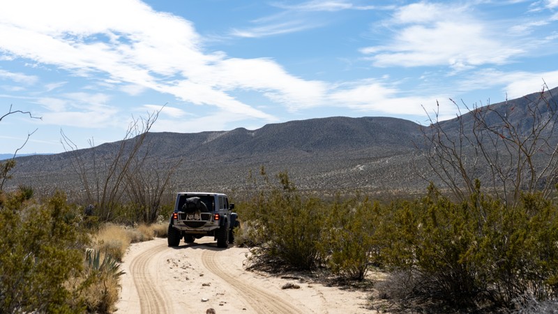
Updated: 03/10/2026
McCain Spring
Agua Caliente Springs, California
The now-dry McCain Springs at the trail's western end was once Fish Creek's headwater. The trail is lined with tall ocotillo cacti, which make for a stunning drive. Snuggled back in the rocky hillside at the trail's end is a great camping spot large enough for five vehicles near the now-dry spring. This is mountain lion country, so understand the risk.
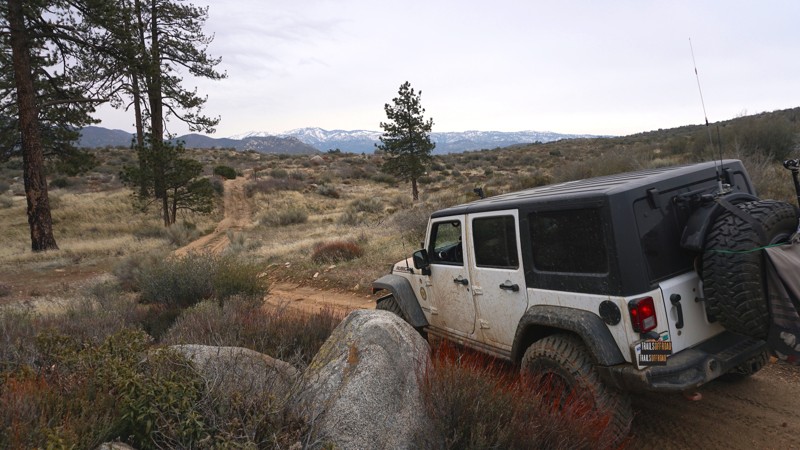
Updated: 07/13/2024
3N38 - Arrowhead Airport Loop
Lake Arrowhead, California
This quick off-road loop off of the Willow Creek Jeep Trail passes by the Arrowhead Airport ; a fenced off, unlikely situated airstrip and collection of outbuildings in the mountains of Lake Arrowhead near Deep Creek and Devil's Hole. This trail offers a quick scenic run and travels along the airport's southern fence line.
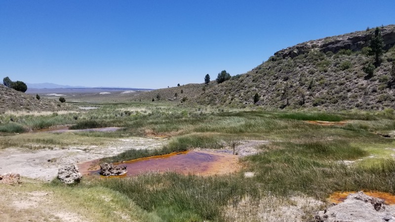
Updated: 10/15/2024
Little Hot Creek
Benton Crossing, California
Little Hot Creek, which used to be a remote retreat location near Mammoth Mountain, is now a site you might see at Yellow Stone National Park. As you follow this trail up the creek, the water's colors start to get very wild, eventually becoming something you would see only down a wood walkway in Yellow Stone. This area used to allow people to sit near these hot springs in the warm/hot water, but with the current spike in temperatures in the Mammoth Caldera, the water is now too hot for a human to touch. So if exploring the area, keep that in mind.
Since this is in BLM land, there are many great places to camp around the trail. But if you can choose, check out the camping near the hot springs to the south.
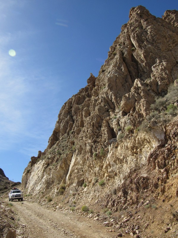
Updated: 04/09/2024
Lotus Mine Road
Ballarat, California
Just outside of Death Valley National Park and within Goler Canyon, a short, twisty mining road leads to an expansive view of the Panamint Valley to the west. This nicely graded road snakes its way up the mountainside, much like Shafer Trail in Utah, passing by decrepit cabins, active mines, and a massive, craggy 4000' monolith.
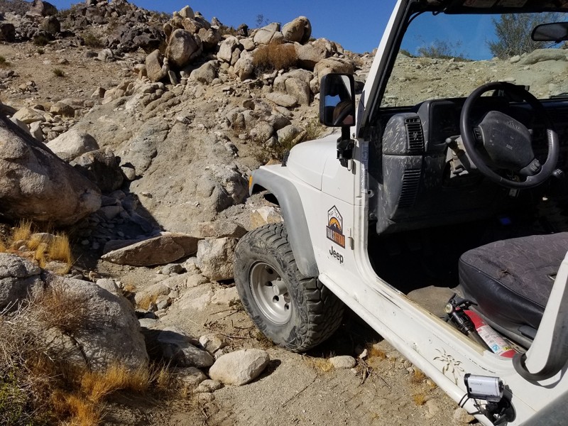
Updated: 02/27/2024
Little MC - Johnson Valley
Yucca Valley, California
What's better than steep loose hill climbs, tight v-notch waterfalls, massive rocks, and extreme off-camber rock crawling. That's right, nothing. Little MC is a connector trail that starts next to SOS and Turkey Claw. This sweet little fun trail provides all of the fun extreme 4x4 action that Johnson Valley OHV brags about. The trail leaves the comforts of Lazy Days Trail and you are instantly introduced to a body damage, axles breaking, mind binding off-road obstacles trail that seems to never end. Not far past the intense v-notch waterfall that will for sure destroy at least one quarter panel is a steep and extremely loose hill climb waiting for you to roll over backwards. If you can make it past those two obstacles you are on the easy stretch, well if you want to call it that. Thus the next time you are in Johnson Valley, and you are looking for some good old fashion extreme rock crawling and offroading, check out Little MC.
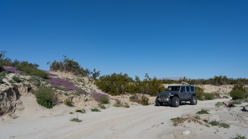
Updated: 03/10/2026
Bow Willow Creek Road
Mesquite Oasis, California
Bow Willow Creek is an easy trail that cuts over to Corizzo Wash. Besides the views of the badlands of Anza-Borrego off in the distance to the north, wildflowers attract visitors to this quiet trail. The colorful flora is usually present in late winter or early spring.
Camping is abundant along the trail. Many sites can accommodate larger vehicles or groups.
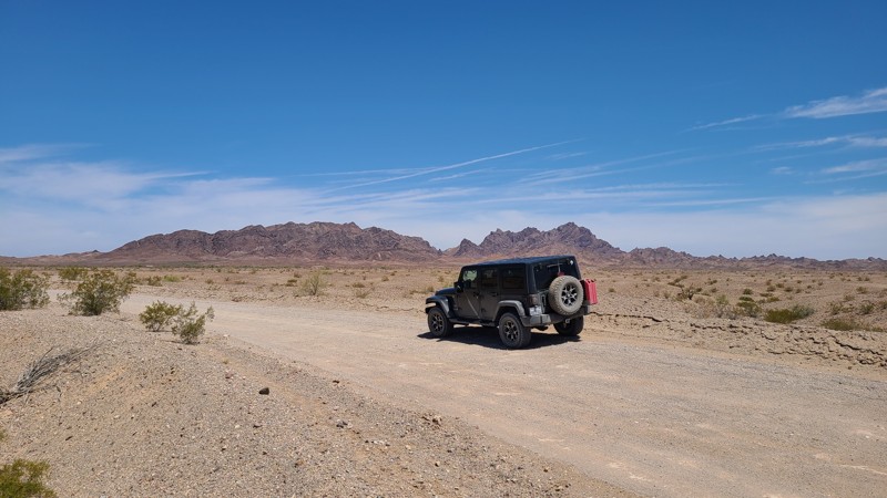
Updated: 10/15/2024
Walters Camp Road
Paymaster Landing, California
Walters Camp Road progresses from the scorching desert to the cool, inviting blue water of the Colorado River. Next to the river bank is Walters Camp, an improved camping area managed by the BLM. A little further along is an existing dispersed campsite. While signs at the start of Walters Camp Road suggest this is a rough road needing four-wheel drive, the route can be driven by most passenger vehicles.
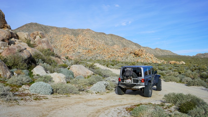
Updated: 03/22/2023
Mortero Palms - Anza Borrego
Ocotillo, California
The Jacumba Mountains shield this area from weather and afternoon sun. It made for more hospitable dwelling lands for the Kumeyaay, who made this area home for over a thousand years. The palm grove up this canyon provided them with material for structures and clothing. Today Motero Palms delivers a beautiful hike to the palms and a sought-after camping opportunity that is not well rivaled within the park.
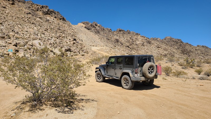
Updated: 10/15/2024
West Pipeline Road
Bell Mountain, California
West Pipeline Road is an excellent road for first-time offroaders to experience the open desert on an easy trail. Along the way is a single hill to climb that rewards drivers with expansive views of the surrounding desert and distant mountains. West Pipeline Road once completed a path over Stoddard Ridge to connect to Highway 247 and reach the Sawtooth Canyon BLM campgrounds. Now a massive landslide has blocked the road at the top of the ridge, closing this once convenient access. Still, there are many wide and flat dispersed camping locations along this route, but these are open areas and exposed to the sometimes harsh winds. Several intersecting trails disappear into the surrounding hills, often to mines and prospects, and invite exploration.
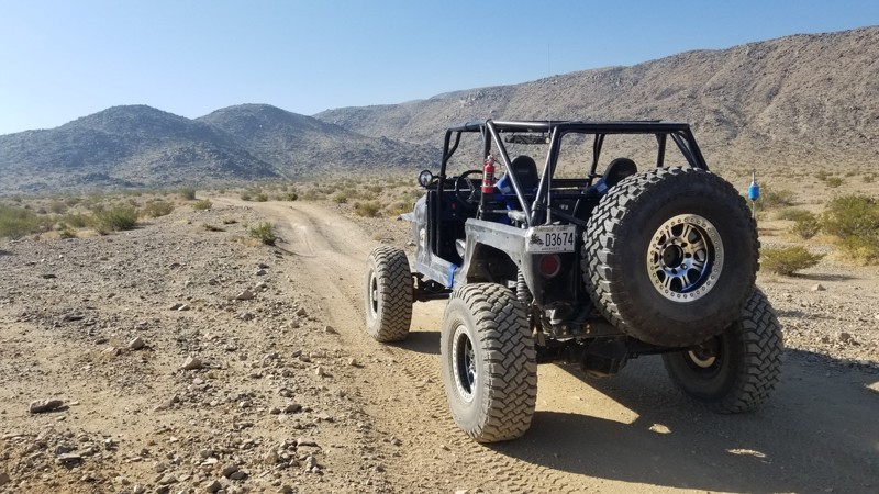
Updated: 10/15/2024
Northern Canyon to Fissure and Aftershock
Johnson Valley, California
This canyon runs through the north part of Johnson Valley and connects to Fissure Mountain and Aftershock.
Even though people sometimes camp on the wash edges, camping here isn't ideal since there's lots of traffic in the area. If tent or RTT camping, go over the small hills to the north. But most people camp on Means Dry Lake and the surrounding area.
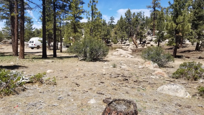
Updated: 06/09/2023
3N19
Big Bear Lake, California
If out in the forests of Big Bear on an overlanding trip and wanting to find a dispersed camping spot that is unique and away from people, check out 3N19 near Holcomb Valley off 3N32 - Union Flats and 3N16 - Holcomb Valley Road. This small area is often passed since most people don't even realize it is here. On the west side of the area is an old damn that was used back in the gold mining era which to this day still retains water. So if out in the Jeep or Toyota, you have the family or friends and want to get away, check out this spot and disappear.

Updated: 03/24/2023
Wood Canyon
Furnace Creek, California
Woods Canyon, situated on the west side of Butte Valley, is this rarely visited mining camp from the early mining area of Death Valley. Because of its remote location, many of the items left behind by the miners remain today, making this a must-stop when exploring the area. At the end of this scenic canyon is Wood Camp, with its cabin and artifacts.
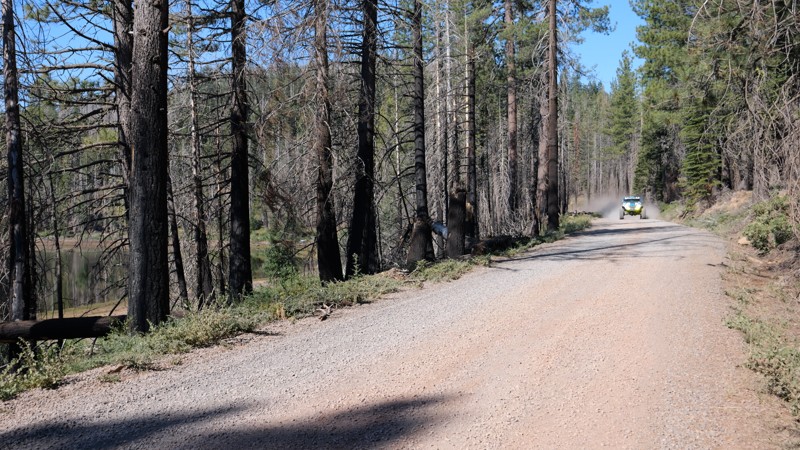
Updated: 10/15/2024
Humbug Road
Glenburn, California
Humbug Road, aka Humbug Summit Trail, located in Northern California, is an easy overland trail from Paradise, CA, to Lake Almanor. Today, the trail is often used for logging, but in the 1850s, this area was booming with people looking for gold. As you travel east, you climb up Humbug Summit, reaching 6718 feet above sea level before gradually lowering down the other side at the lake at 4600 feet. Along the route, you will be entrenched in dense forest, burn scars, and Humbug Valley, where you can find the famous Humbug Valley Soda Springs, once home to the Maidu Indians. Since then, the area has become a thriving town, only to burn down in 1859, 1871, and again in 1917. Another name this valley had was Dogtown. Today, you will find several farm homes and the cemetery holding the valley's pioneers.
People often consider this road a primary pathway through the mountains and use it for snowmobiles during the winter months. With all the alternate paths leading off, this trail is a great way to experience the area and the connecting trails.
Since this is a maintained dirt road, any offroad vehicle can easily do this trail.
There are plenty of places to camp along the road that can fit any size group. However, some areas are private property, so make sure you are on public land.
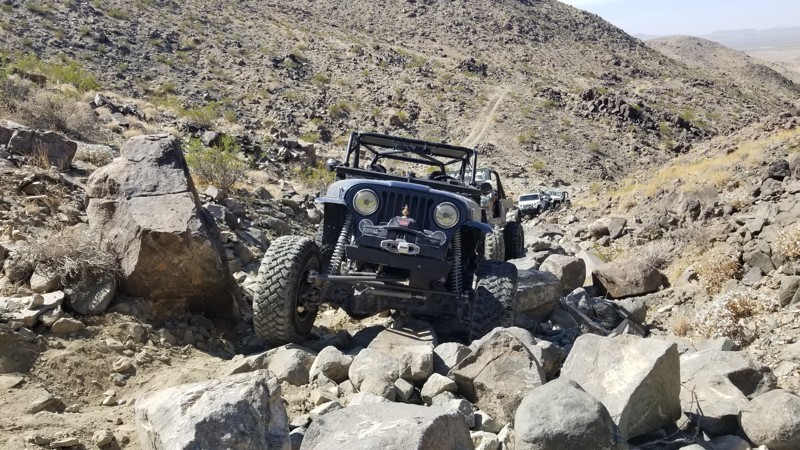
Updated: 12/17/2025
Nightmare
Landers, California
What might be a Nightmare for some, the legendary rock crawling trail in Johnson Valley known as Nightmare is a tough rock crawling trail. Full of rocks about 3-feet around, this trail is going to test any off-roader that is looking to push his vehicle to the max. Did we forget to mention a 7-foot waterfall? Now what really gets offroaders crying isn't the rocks but how narrow the canyon is which if one mistake happens, you will end up in the side of the canyon wall or into a large boulder that is just happy to rip off a quarter pannel to give you jeep or Toyota its first body damage. So if you are heading up Claw Hammer, and want to continue the fun, check out Nightmare in Johnson Valley California, and see what your rig can do.
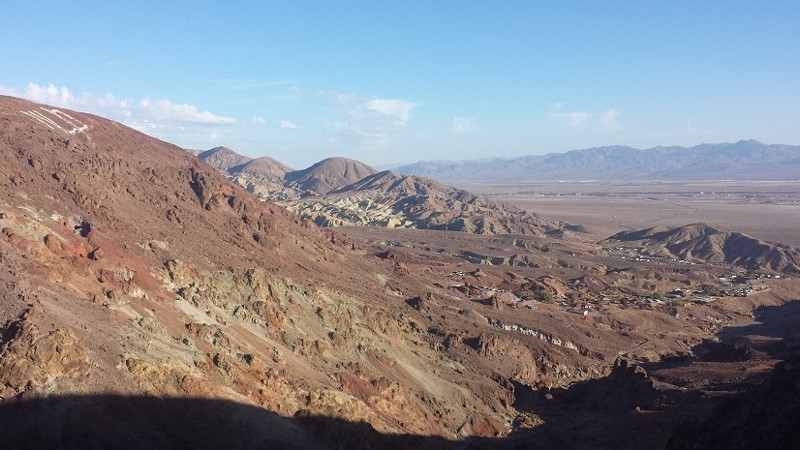
Updated: 11/16/2022
Wall Street Overlook Trail
Barstow, California
Above Wall Street Canyon is a great little trail that has some amazing views and great exploring. This old miners route passes by the Saint Louis Mine along with hundreds of other mines in the area. In addition to the amazing view, the trail offers difficult obstacles such as some very steep hillclimbs on narrow paths.
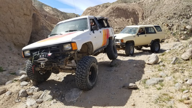
Updated: 06/05/2022
Rocky Canyon
Salton City, California
Rocky Canyon is a quick trail that is located in the next canyon over from Kayla's Mountain. Being that both of these trails are so close and both relatively short in length, this makes them a must hit on a weekend out in Ocotillo Wells, Truckhaven Hills, or on your way to Anza-Borrego Desert State Park.
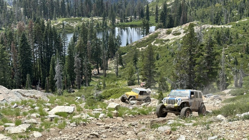
Updated: 12/31/2025
Lots of Lakes OHV Trail
Johnsville, California
Lots of Lakes OHV Trail is one of the most challenging trails in the entire area. You can decide which way to run the trail depending on how hard you like it, with the easier direction being from south to north. For those looking for the blood-pumping thrill, the attraction to the trail is the intense hill climb. What makes the hill climb so feared is the insane amount of loose shale rocks on a 20-30-degree climb. Add a few obstacles, including a 4-foot waterfall, a boulder squeeze, a slider grinder rock, and large boulders you must climb over, and you have a recipe for failure and destruction.
If you would like to camp at Snake Lake, there is a campground on 12E67, or you can also camp in the small open dispersed area at the bottom of the hill. There, you will find dirt on the ground, flat and level. The area is in the forest, so there is plenty of shade. There is enough space for 5-9 vehicles with ground tents.
The Lots of Lakes OHV Trail will also be depicted on various maps as Deer Lake (0093) and 16E62. It is popular for people to drive this in combination with the 12E67 Snake Lake OHV Trail to form a loop.
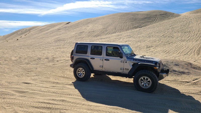
Updated: 01/05/2023
Sand Dam and Pass
Brawley, California
In the sandy hills of the Superstitions is one of the only notable landmarks of the area, Sand Dam. It is a giant sand wall deep in the hills and is one of the natural wonders of the area. This 150+ foot tall sand wall is a popular gathering spot for people to meet up and enjoys the area. Others use this as the cut through to get over to the rock crawling in the northern hills including connecting you to Voodoo and the other intense rock crawling trails of the area.
So if you are in the area, looking for a place to hang out or a place to let the day pass by, head over to Sand Dam and have some fun.
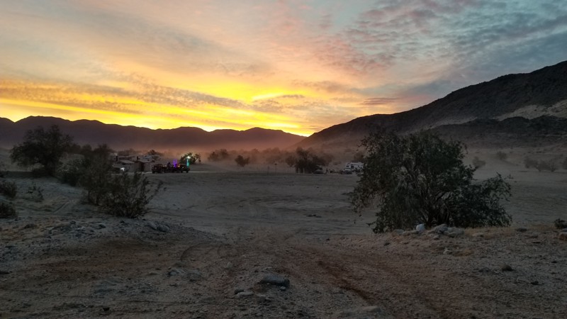
Updated: 10/15/2024
Main Street - Ocotillo Wells SVRA
Ocotillo Wells, California
Main Street is the primary entrance into Ocotillo Wells OHV. Main Street is a well-groomed road perfect. This trail passes a lot of campsites. The southern side is mostly for RVs and tents. There are restrooms with showers. Bring your quarters for the showers. The northern side is more dispersed camping where RVs wouldn't be advised.
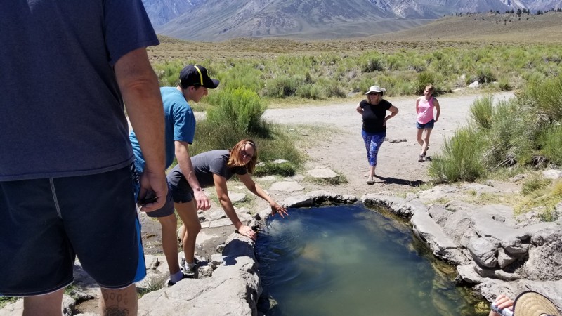
Updated: 10/27/2023
Rock Tub Hot Springs
Mammoth Lakes, California
Looking for something unique to do while in Mammoth Lakes, California. How about a romantic getaway to one of the many hot springs that spread all over the area. Mammoth is home to many natural hot springs, including Rock Tub, that couples and individuals enjoy immensely. Need we say more?
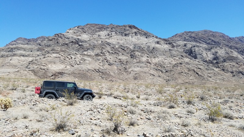
Updated: 06/05/2022
Kelso Road
Baker, California
This area of the desert is desolate and exquisitely quiet except for the sound of a lonely wind and your own footsteps. Contributing to the isolation is the Mojave Wilderness which you enter after passing Mojave Road. Kelso Road then follows a narrow corridor that allows motor vehicles only on the designated road and with the Mojave Wilderness on either side. The wilderness designation is to minimize the human impact by preventing access to motor vehicles.
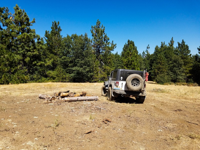
Updated: 01/15/2019
Horse Mountain
Upper Lake, California
This is one of the most fun easy 4WD routes in the southern Mendocino National Forest. A perennial favorite with fans of dispersed camping, it passes quite a few cleared level spots in the forest, many with simple fire rings and some with views. This trail is simply a blast to drive; although it has occasional erosion gullies that need to be navigated with care, much of the rest of the route is surprisingly smooth, and lacks the punishing washboard bumps that are so common elsewhere in the MNF. After the final short, steep hill to the top of Horse Mountain, you'll find that trees around the summit clearing block views down to the valley; however it is still a great spot for a picnic lunch.
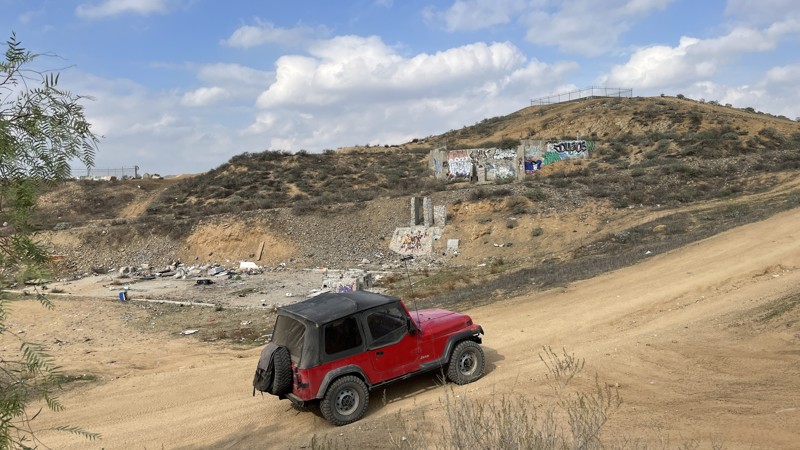
Updated: 10/15/2024
Temescal Tin Mine Trail
El Sobrante, California
Temescal Tin Mine Trail travels through the heart of Eagle Valley, an area just east of the Lake Matthews reservoir. This trail is mostly hard-packed dirt with deeply-rutted sections that have formed after heavy rains. Vehicles with 2WD or AWD and high clearance will be able to drive the trail during the dry season. But, after a good rain, even lifted 4WD vehicles should think twice before attempting the trail, as some of the muddy ruts can quickly bury you up to your frame. Aside from the entertainment this twisting and rutted trail provides, there are also multiple old mines and remains of buildings worth checking out.
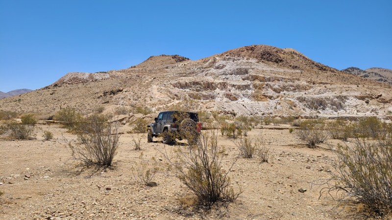
Updated: 02/17/2025
Sorrel Trail
Apple Valley, California
Sorrel Trail is a rocky but easy trail typical in this part of the Lucerne Valley desert. The hardest part of driving Sorrel Trail is finding it. There are so many intersecting and alternative routes that staying on the actual trail is difficult even with a GPS. The trail is often re-routed along a wash providing a smoother path. A very nice feature of this trail is that it is accessible directly from I-15. Dispersed camping is allowed when following BLM camping rules that ask campers to use previously disturbed sites.
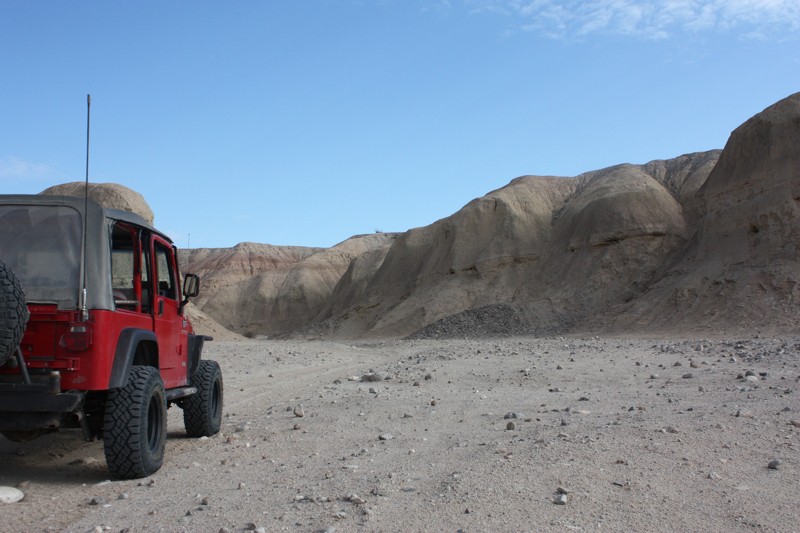
Updated: 11/04/2022
Kayla's Mountain
Salton City, California
Kayla Mountain is a fun connector trail that offers the off-road enthusiasts a more challenging way to get from the SR22/Borrego Salton Sea Way to Truckhaven Trail. The name for this trail comes from Kayla Finley who claimed this mountain in 2009. With the annually changing terrain in these canyons, it puts this trail on the list to check out each time you visit. The peaks, ridges, and small crevices change year after year. Along with the interesting visual sights, you will not be shorted when it comes to putting your rig to the task. There are boulders of every size, berms and hills climbs that make for some fun wheeling.
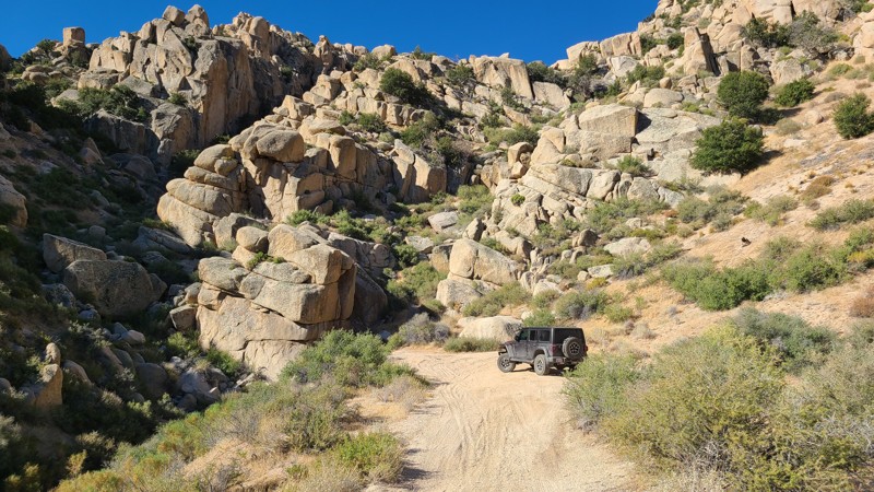
Updated: 04/22/2026
Grapevine Canyon Road
Fizzben Heights, California
Grapevine Canyon Road provides a perfect opportunity to enjoy an easy offroad trail, experience incredible views, and enjoy convenient mountain camping, all while escaping the desert heat. Beginning in a sandy wash of the Lucerne Valley desert floor, Grapevine Valley Road winds 3000 feet up the north face of White Mountain to cooler temperatures and spectacular 180-degree views of the Lucerne Valley and onto the distant Granite and Fry Mountains. Also, the surrounding terrain during the climb offers a unique landscape dotted with fascinating massive granite boulder formations called inselbergs. At about the eight-mile mark is the border of the San Bernardino National Forest, where several marked Forest Service trails and dispersed camping can be found.
This is an easy trail, wide and flat, with a reasonable grade and generally with room for two vehicles to pass each other. A two-wheel drive vehicle with some clearance would handle this road, but once reaching the National Forest, many of the connecting trails will require a high clearance 4x4.
Several dispersed campsites are located by the road, with the best sites next to granite boulder formations that border the road. Near the trail's northern end is an unmarked spur leading to the base of a stunning granite boulder formation and a great dispersed campsite. The spur continues and once connected to Grapevine Canyon, but has been destroyed by weather and is now impassable.
The Horse Springs Spur, just one mile from the southern end of the Grapevine Valley Road, leads to the eleven-site Horse Springs Campground and offers a secluded escape surrounded by a high desert environment in a cluster of juniper and pine trees that offers sweeping mountain views in all directions, tree-shaded campsites, picnic benches, fire rings, and pit toilets, a group ramada and picnic area. Campfires are prohibited in the National Forest.
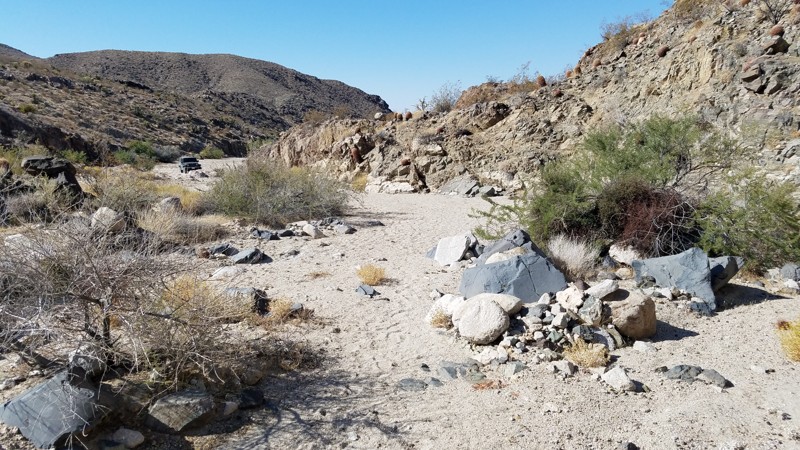
Updated: 06/05/2022
Indian Spring Road
Baker, California
The Mojave National Preserve was established in 1994 and at 1,542,776 acres is the third-largest National Park. Indian Spring Road follows a narrow corridor bounded on both sides by wilderness areas that restrict vehicles and the MNP to remain in a natural state by minimizing human impact.
Indian Spring Road will guide you through these protected areas, with views of surrounding hills while intersecting hiking and horseback trails and passing an abandoned mine a short hike off the road. The road ends at a sandy wash at a beautiful narrow canyon which is the trailhead to an extensive network of trails in the Lava Cones Cinder Lava Bed area of the MNP. This is an easy road for any skill level, but a 4-wheel drive is needed to plow through the deep sandy areas.
Dogs are welcome in the MNP but must be kept on a leash.
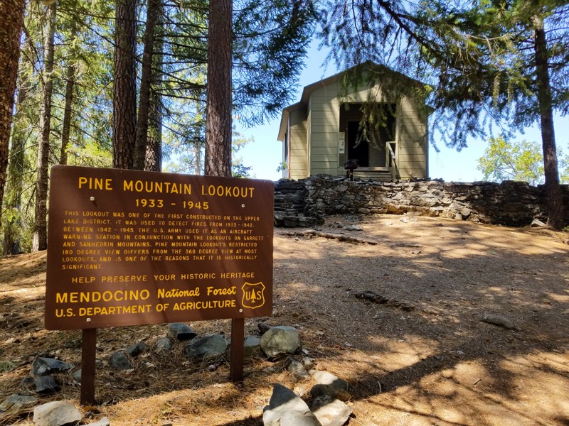
Updated: 01/15/2019
Pine Mountain Lookout
Upper Lake, California
An easy dirt road winds through mixed douglas fir and ponderosa pine forest to reach a rustic former fire lookout which can be rented for two nights at a time. The lookout is perched on a stone outcropping at an elevation of 4,400 feet. There are 180-degree views of endless mountain peaks and verdant forest. A variety of bird species inhabit the forest, and visitors may spot eagles, owls, hawks and osprey. Black-tailed deer, jackrabbits, quail, and wild turkey are also often encountered.
Pine Mountain Lookout was constructed in 1933 and used for fire detection until 1942. During World War II, the lookout served as part of an aircraft defense monitoring system that extended throughout California. This lookout is historically significant because it only offers 180-degree views of the surrounding terrain, while other lookouts have 360-degree views.
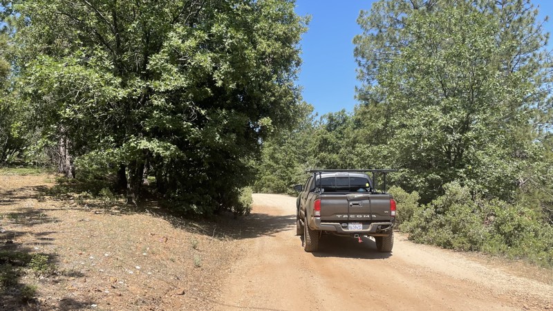
Updated: 12/15/2025
FSR 1S16
Buck Meadows, California
FSR 1S16 is an easy trail, that provides a quick adventure in the beautiful Stanislaus National Forest. The trail connects you to Forest Service Route 02S17Y and also takes you by a fire lookout, although the trail up to the lookout is not always open. The Forest Service maintains the trail, and it can be completed in 2WD. The trail is closed seasonally from December 16th-April 14th to prevent damage to wildlife habitats and damage to the road. Camping is not allowed along the trail.
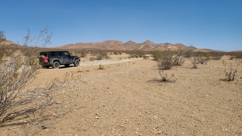
Updated: 10/15/2024
Slash X Ranch Road
Bell Mountain, California
Slash X Ranch Road, also called Mission Road, is a poorly maintained narrow desert road on BLM land managed by the Barstow Field Office. The foremost characteristic of this road is the long stretches of deep moguls. While not difficult, they require a steady low speed, The southern half of the road connects to several trails that invite exploration. Dispersed camping is permitted when following BLM camping rules. There are several previously disturbed sites suitable for camping along the route.
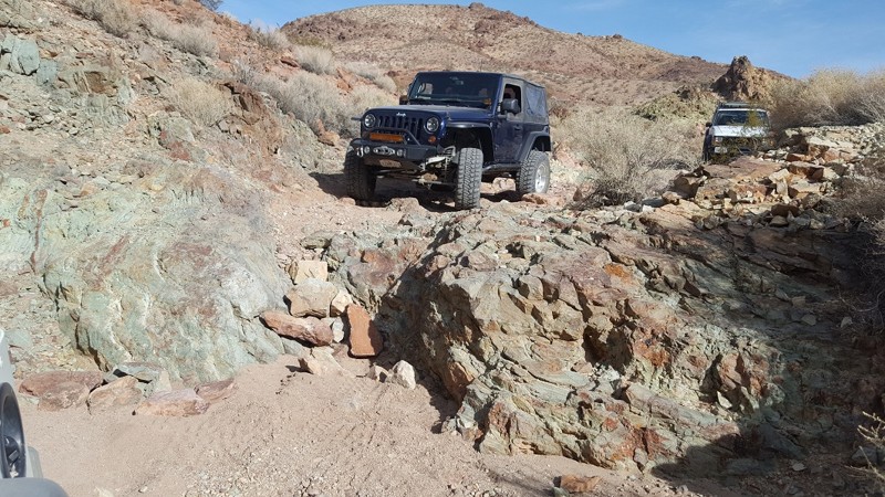
Updated: 01/02/2024
Bismarcks Hairpiece
Barstow, California
Resting above the Bismark Mine in the heart of the Calico hills is a quick cutover trail that is suitable for all off-road enthusiasts. The Bismark's Hairpiece is an easy trail with only one mild, optional obstacle. This trail is perfect for all skill levels while having plenty of optional detours to take in the beautiful yet harsh desert atmosphere.
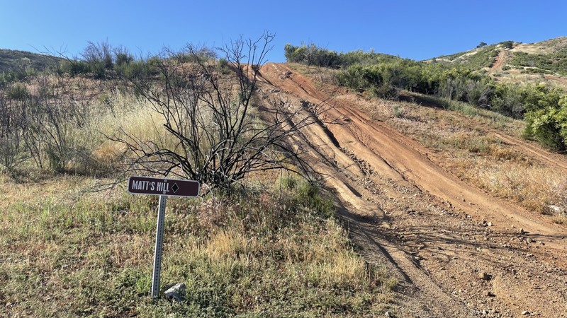
Updated: 10/15/2024
Frank Raines OHV: Matt's Hill
San Antonio Valley, California
Frank Rains OHV Park is located not far from Patterson, CA. It is open to 4x4s from sunrise to sunset with a $5 admission fee per vehicle. The park is open to all OHV vehicles, so watch out for dirtbikes, quads, and SXS.
Matt's Hill is a difficult trail, rated a black diamond by the park's rating system. Most of Matt's Hill is similar to the rest of the trails in Frank Raines, with loose dirt, steep hills, and medium ruts. However, Matt's Hill has one challenging obstacle, possibly making it the toughest trail in the park. This obstacle is a very steep hill, with a sharp turn and a deep rut on the inside of the turn. There is not enough space for a full-size vehicle to go around the rut, so you have to straddle it while ascending or descending a pitch over 30 degrees. Descending is far easier than going up the hill, but the loose dirt causes traction issues in either direction. At the top of the trail, Matt's connects to Truck Trail and Spider Trail.
Deer Creek Campground is located at the park's entrance. The campground has 34 sites with picnic tables, restrooms, and other amenities. Prices range from $15 to $30 per site.
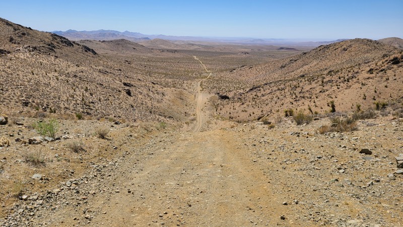
Updated: 10/15/2024
Pipeline Road
Minneola, California
Pipeline Road follows a pass through the Ord Mountains over hills and across the desert floor and ends at the impressively jagged rocks of Stoddard Ridge. The hilltops provide beautiful views of the expansive Mohave Desert, spreading out as far as you can see with the Granite Mountains off in the distance. One particularly steep and slippery hill along the trail offers a more accessible bypass, but another steep and slippery hill has no bypass and requires four-wheel drive. At Stoddard Ridge, BLM has built an improved dry camp area, Sawtooth Canyon Campground. The campsites are right up against the rugged ridges, often used by climbers to practice their skills.
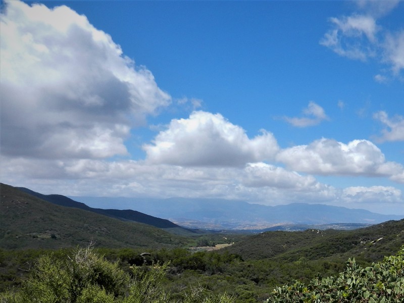
Updated: 06/05/2022
6S89 - Juan Diego OHV
Anza, California
6S89 - Juan Diego OHV is one of a trio of connecting trails just outside the Cahuilla Mountain Wilderness Area. Juan Diego is a straight through trail between Juan Diego Flats OHV to the south and Red Mountain OHV to the north. The area is known for its gemstone mining, and it's link to the Ramona Pageant in Hemet. Juan Diego was murdered near here in 1883, and his death is the basis for the longest running outdoor play in the United States.
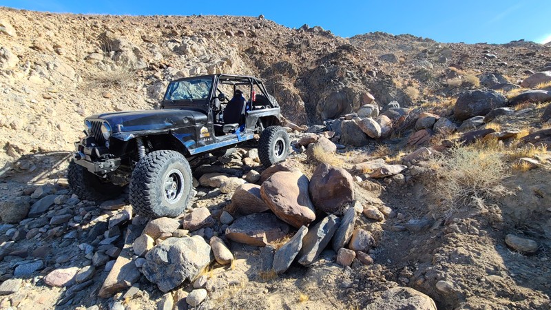
Updated: 01/05/2023
Voodoo Rock Garden
Brawley, California
If you are looking for something to change things up and add some variety, while out playing in the Superstitions, then check out Voodoo Rock Garden. One of the few named areas in the Superstitions, this fun but moderate rock crawling trail will give you some variety of challenges from driving over long rocky paths to a small waterfall about 4-feet tall. The trail is perfect for beginners to experienced wheelers that are looking for something different to do while in the area.
So if you are in The Superstitions in Southern California and want to do something different, head over to Voodoo Rock Garden and enjoy some rock crawling.
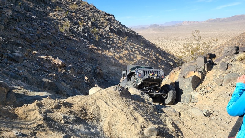
Updated: 12/17/2025
Boulder Dash
Landers, California
One of the many historic Johnson Valley Trails in California, Boulder Dash was one of the original rock crawling trails of the area. Full of moderate to large size rocks and plenty of optional hard lines, there is no reason why people wouldn't find this trail fun and exciting. Because of the makeup of this trail, it is a great crossover trail for the people looking to move from overlanding and dirt roads to rock crawling. The trail is full of challenging obstacles that are not required but allow you to test your skills and vehicle. So if you are in the area, looking for something new to try, you should stop by and give the old Boulder Dash trail a try.
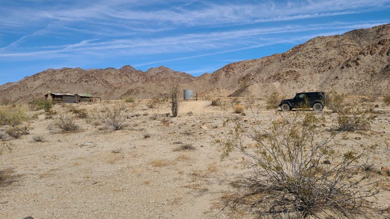
Updated: 10/15/2024
Corn Springs Road
Desert Center, California
Corn Springs Road takes you deep into the rugged canyons of the Chuckwalla Mountains Wilderness and is worth the trip to see the ancient petroglyphs. The road carves through this wilderness area, passing sun tortured mountains to arrive at a green palm tree-covered oasis dense with wildlife. The granite walls around the oasis are covered with ancient rock art or petroglyphs left by the prehistoric Indians over 10,000 years ago and represent some of the finest examples of rock art in the Colorado Desert. The road continues past the campground to old mining encampments, where it ends.
Corn Springs Road is an up and back traveling 10.5 miles on a maintained hardpacked sandy dirt road and is wide and flat. The route is suitable for passenger cars as far as the campground.
The BLM-operated Corn Springs Campground provides wonderfully secluded camping with nine prepared campsites having tables and fire rings, hand-operated pumps provide refreshing cool water, and the site has pit toilets.
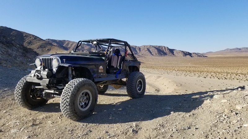
Updated: 12/17/2025
Short Bus
Yucca Valley, California
Short Bus, a short cut in Johnson Valley is a quick way to cut over the hill if you are traveling over to Backdoor. The hill is mild with only a couple little obstacles that short wheelbase vehicles could avoid.
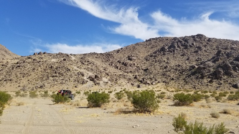
Updated: 12/17/2025
Fielder's Choice
Landers, California
If you are out looking for a "short-cut" in Johnson Valley and wanting something different, check out Fielders Choice which may be a short cut by distance, but not by time. This cool little cut over path takes you over the mountains from Hammers Bi-Way to Claw Hammer. The trail does have a couple of obstacles that will give most people a challenge but nothing too hard that requires an overbuilt vehicle. If you are in the area and just want to do something different, check out Fielders Choice
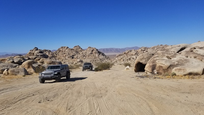
Updated: 06/05/2022
Cougars View and Camping Trail
Lucerne Valley, California
Looking for a place to camp in Cougar Buttes but don't want to camp in the crowded areas? Check out this area behind Chicken Rock. Cougar Buttes View and Camping area is a not so popular area due to it being further back in the trail OHV area. Because of that, many times people skip the area to find a closer spot. All it takes is about 5 more minutes of driving and you can find yourself away from the crowds and enjoying the desert.
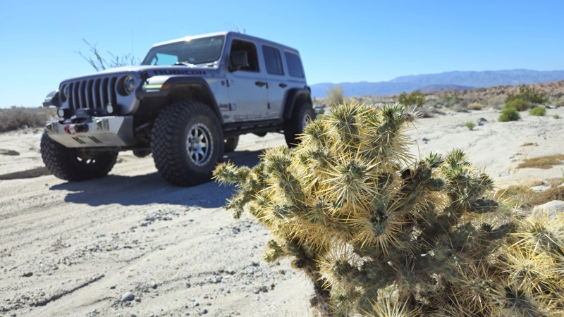
Updated: 05/23/2024
Ella Wash
Borrego Springs, California
Anza-Borrego State Park's northern territory has this simple and floral-rich wash. Ella Wash, named after Ella Calvert, the wife of the first Anza-Borrego supervisor, is the perfect new to the off-roading scene trail. Along the route, you will get a taste of the northern territory of Anza Borrego State Park, with the Santa Rosa Mountains hovering in the background. At the same time, the foreground has stunning plant-rich scenery. It was said that Ella spent a lot of time in this area of the park as this was her favorite area due to the wide range of fauna that grows in this area, which doesn't grow in any other part of the park. Many say this is one of their favorite drives in the park due to the wide range of colors you see along the route.
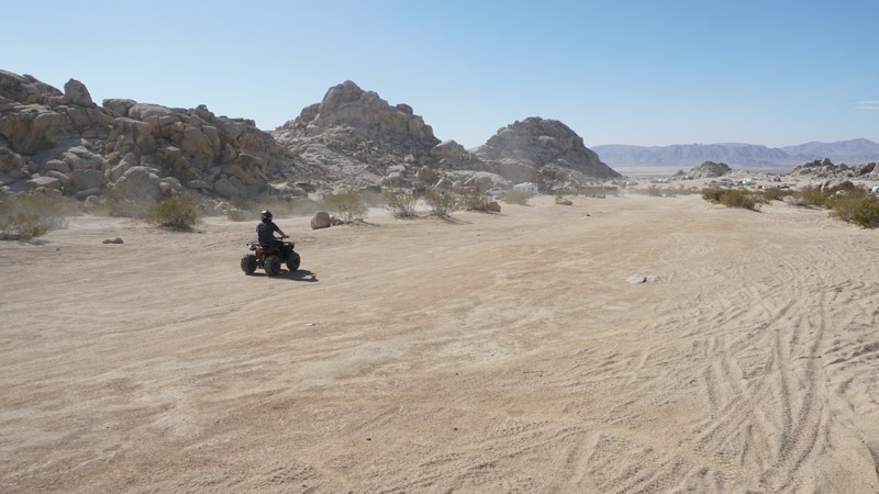
Updated: 03/18/2023
Dust Bowl - Cougar Buttes
Lucerne Valley, California
Dust Bowl is a short, popular OHV strip, sitting in this small section of the Johnson Valley OHV Recreation Area known as Cougar Buttes in Lucerne Valley, California.
Cougar Buttes is full of open desert trails ranging from easy, soft sand, to technical, rocky desert canyons.
Dust Bowl is one of the busier RV camping, ATV, dirt bike, and side-by-side riding areas in the Buttes. On most weekends you’ll find continuous OHV traffic through this strip, creating the dust bowl this trail is named for.
If you like crowds, this might be your spot. Otherwise, Dust Bowl might just be a necessary connector to a quieter area of Cougar Buttes.
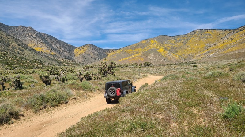
Updated: 04/24/2026
Horse Canyon
Harts Place, California
Horse Canyon SC65 is the South Searles Subregion of the Burea of Land Management (BLM) Ridgecrest Office. The road is straight through, passing through the Kaivah Wilderness, eventually ending at the border of the Sequoia National Forest, where it continues as Forest Service road 27S11. Combined with 27S11, this Horse Canyon is used to reach the trailhead of 36E52 to then reach McIver’s Cabin. Numerous OHV trails intersect over Horse Canyon's 11-mile length, and the eight staging/camping areas it passes attest to its convenience to explore the many trails in the area.
SC65 is almost entirely a soft, sandy, wide trail. A beginning offroader would enjoy this easy trail and experience the surrounding desert using a high clearance 4WD vehicle.
Eight set-aside camping areas can be found over its length, all with existing rock fire rings. These sites can be used for camping when meeting the BLM Camping Guidelines. During high fire danger, campfires may be restricted, and if planning to camp here, one should review the current BLM Campfire Restrictions and have a Campfire Permit.
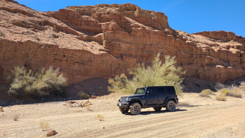
Updated: 04/08/2025
Amy's Wash
Hayfield, California
Amy's Wash takes you on a 10-mile loop over a flat arid desert floor into the foothills of the Orocopia Mountains, reaching an old miners' claim at its apex. The return half travels down a steep hill into an arroyo surrounded on both sides by nearly vertical red-colored walls that reach 30 feet high with a flat floor made up of deep fine sand. The trail is rated by the BLM as "Easiest" and has no obstacles. The end of the trail intersects Bradshaw Trail on the border of the Chocolate Mountain Aerial Gunnery Range.
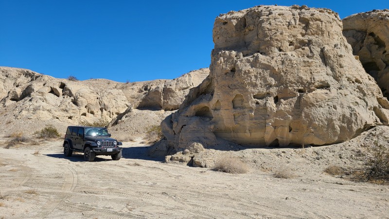
Updated: 10/15/2024
Meyers Run Trail
North Shore, California
Meyers Run Trail is a short 2 mile straight through cutting through the foothills of the Orocopia Mountains Wilderness and connecting the Meccaopia Trail to the Coachella Canal and a service road bridge over the canal allowing an exit to paved roads. This trail is made up almost entirely of soft sand and is an easy drive save for a small hill climb having a 15-degree incline.
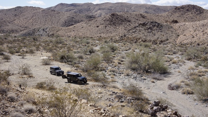
Updated: 06/05/2022
Snow Cloud Mine Road
Desert Center, California
To some, Joshua Tree National Park is only a desert. It is actually two deserts, the higher elevation Mojave and the lower elevation Colorado. The result is amazing desert flora, rock formations and those wacky namesake trees (actually a type of yucca). Joshua Tree’s beauty shines around the clock, with vibrant sunsets melting into nights filled with uncountable stars. Joshua Tree National Park encompasses almost 800,000 acres, larger than Rhode Island. The Park offers hiking, photography, horseback riding, rock climbing, and camping, to name a few activities. Most 4x4 off-roaders love the Park for its trails. Almost all of the trails have a Gold or Silver Mine associated with them. This trails name is the attraction here. The Snow Cloud Mine was discovered in the 1930's and some exploration will reveal the rich quartz vein they were following.
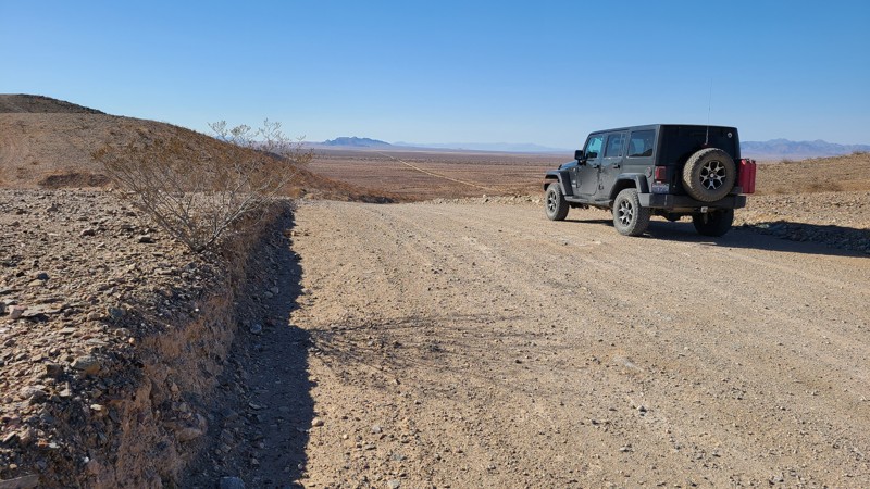
Updated: 10/15/2024
Rice-Midland Road
Midland, California
Rice-Midland Road travels north-south on BLM land along the eastern border of the Palen/McCoy Wilderness area. The paved Midland Road's name changes to Rice-Midland Road, where it becomes a dirt road. The road is maintained and is wide and flat, and appropriate for street vehicles. Camping is available on the BLM portions of the road.
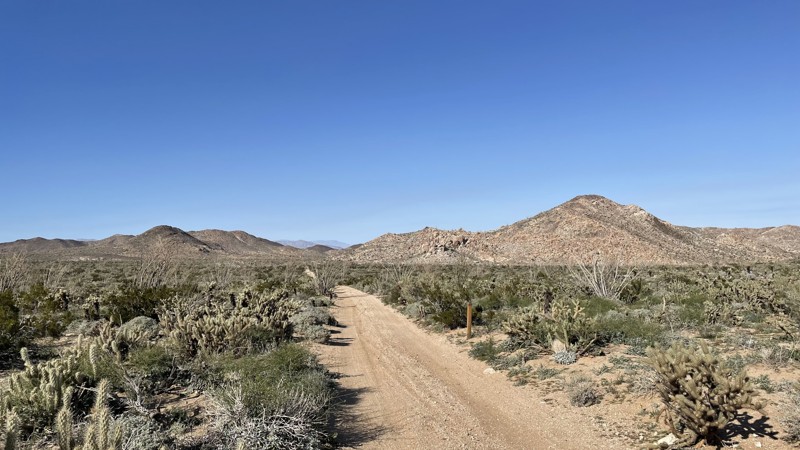
Updated: 03/10/2026
Upper Jojoba Wash
Dos Cabezas, California
Upper Jojoba Wash is an easy dirt trail in Anza Borrego Desert State Park that connects Dos Cabeza Road to the upper portion of Goat Canyon Trail. A 2WD vehicle can manage this trail, but the connecting Goat Canyon Trail is rated Difficult. The hardest part of this trail is a small bump, which any vehicle with a little ground clearance can manage.
Anza Borrego allows dispersed camping. A few open areas along the trail would support two to three vehicles.
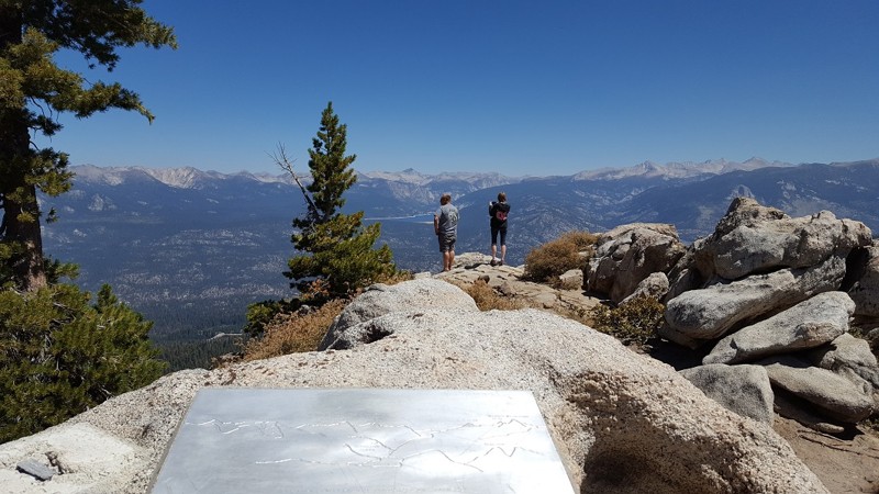
Updated: 11/01/2023
White Bark Vista
Shaver Lake, California
White Bark Vista provides off-road enthusiasts a great 1/2 day trip up the mountain above Fresno. Upon reaching the White Bark Vista Overlook, you will be introduced to some amazing views of the High Sierra Mountains and valleys below.
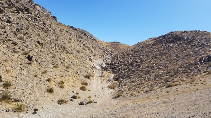
Updated: 12/18/2025
Sledge Hammer 3rd Canyon
Yucca Valley, California
If the lower part of Sledge Hammer wasn't enough, don't worry. 3rd Canyon is a continuation of Sledge Hammer that can give you a little more fun before heading down the mountain. This exciting little trail is a blast if you still have more time in the day. The only downside, if you want to call it that, is you have to run Sledgehammer first. If you are in Johnson Valley California and want a little more fun after you just got done running Sledgehammer, check out 3rd Canyon.
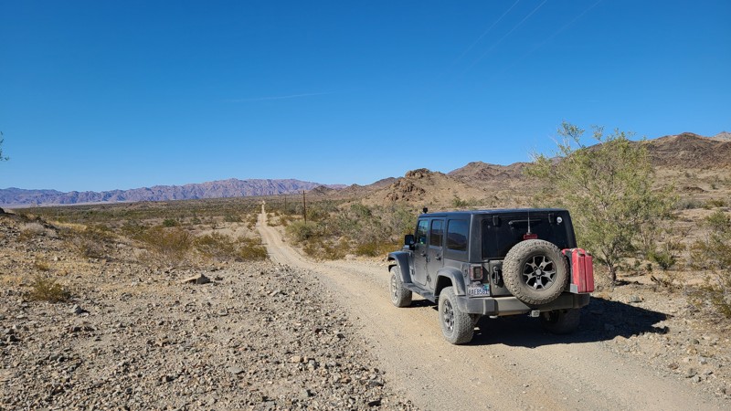
Updated: 08/11/2025
Gasline Road
Hayfield, California
Starting at I10, Gas Line Road is entirely on BLM land and skirts over its 11 miles between the Orocopia Mountains to the west and the Chuckwalla Mountains to the east, and ends at the border of the Chocolate Mountains Bombing Range. This one-lane road is surrounded by dense Creosote scrub and other bushes native to this Colorado Desert. Military jets may fly overhead and are seen first before the roar of the engines catches up as they maneuver for practice bombing runs. You may see the rising smoke of a successful bomb drop off to the south. As the name suggests, the road provides access to a buried pipeline and power lines over its length. The road itself alternates between deep, soft sand and hard-packed gravel with no significant obstacles save for a few rocky sections of broken rock. This straight-through road provides a connection to at least six other trails, often leading to old mines to the east, with a final tie at the Bradshaw Trail.
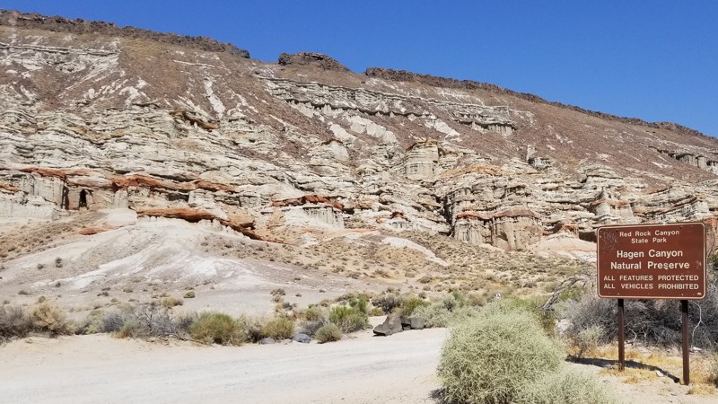
Updated: 01/24/2025
Hagen Canyon Trail
Cantil, California
With only a 2-hour drive north of Los Angeles, spectacular canyons can be observed in the El Paso Mountains. Previously home to the Kawaiisu Indians, the El Paso Mountains contain much of their heritage today. Later on, mining became the mainstay. Many mining camps of different minerals are spread across this mountain range. The Dutch Cleanser Mines, Bickel Camp, Cudahy Camp, Burro Schmidt Tunnel, Holland Camp, and Holly Ash Mine are just a few of the attractions. So, whether you're overlanding or just taking your 4X4 out for quick access to the many trails within the Red Rock State Park system, Hagen Canyon Trail is a great choice to see the essence of the El Paso Mountains.
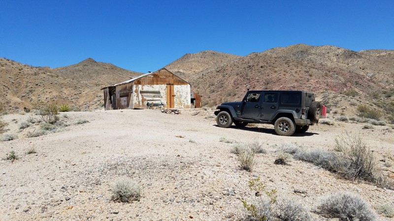
Updated: 06/05/2022
Cree Camp Road
Baker, California
Only a short distance North-East of Baker, California, is Cree Camp Road, which takes you through the typical Mojave Desert with its sparsely spaced creosote bushes and desert holly. Almost the entire length of the road skirts along the eastern edge of the Hollow Hills Wilderness and passes through the foothills of the Turquoise Mountains. Hollow Hills was designated as a wilderness area in 1994 and consists of 22,000 acres of hills and large, broad alluvial slopes east to west. The low hills in the east crawl toward the Turquoise Mountains. Cree Camp Road provides extraordinary opportunities for solitude for this seldom-visited area. Due to the adjacent wilderness area, on a lucky day, you might even see wild horses and burros in the distance on a lucky day. Several registered mines are on or near the trail, along with many more unregistered mines and prospects, and invite careful inspection. The road's namesake, Cree Camp, still has standing living quarters, a storage shack, and remnants of an ore crusher that can be found nearby. Some of the mine shafts are still open and often were dug straight down with no visible bottom. The mine shafts near the road have been fenced off, which speaks to the risks of exploring too close.
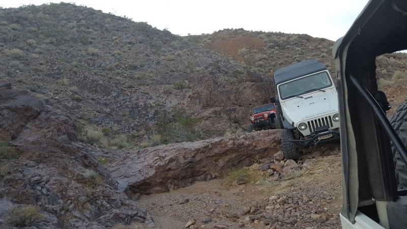
Updated: 10/21/2022
Sushi Burrito
Barstow, California
This hard cut-through is a fun way to challenge even the best drivers. On one side is the famous St. Louis Mine; on the other side is Wall Street Canyon. Between the two is a 5 foot ledge and a slippery slide downhill that is over 70 degrees in spots. This trail isn't for the weak of heart.
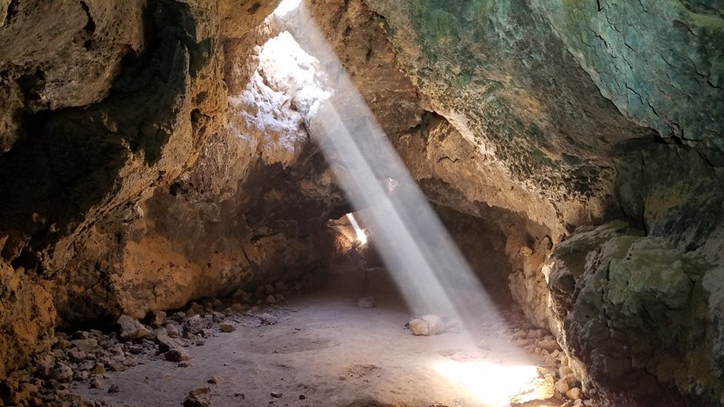
Updated: 12/31/2024
Lava Tube Road
Baker, California
The Mojave National Preserve (MNP) was established in 1994 and at 1,542,776 acres it is the third-largest National Park. Generally, the roads in the preserve follow narrow corridors bounded on both sides by wilderness areas allowing most of the MNP to remain in a natural state by minimizing human impact. Lava Tube Road is surrounded by a wilderness area called Cinder Cones National Natural Landmark, and for good reason. The Cinder Cones National Natural Landmark area comprises 32 small volcanoes that have created a series of lava flows swallowing up the surrounding desert and have been active as recently as 10,000 years ago. Lava Tube Road provides a spectacular and close-up view of many of these lesser volcanoes and an intimate encounter with the lava flows upon which most of the Lave Tube Road is built. If you choose to explore a lava tube firsthand, just 300 feet off the road, the park service has installed a stairwell that descends into one of the lava tubes where you can walk its length deep underground. Dogs are welcome in the Preserve but must be kept on a leash. The roads in this area were built to support the Aiken Cinder Mine, which closed in 1990.
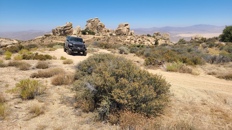
Updated: 08/26/2025
JF3225
Fizzben Heights, California
In the high desert of the San Bernardino National Forest, JF3225 follows the contours of Grapevine Canyon, and intersects with North Peak 3N17D. The trail rises quickly and provides stunning views to the north of the Lucerne Valley dry lakes and onto the distant Granite Mountains. The terrain surrounding the trail offers a unique landscape dotted with fascinating massive granite boulder formations called inselbergs.
This trail is a continuation of the same JF3225 that makes up the start of Grapevine Canyon Road.
The trail surface is generally flat and sandy, with very steep sections that require a high clearance 4x4. The steeper sections of the trail may require four-wheel drive for heavier vehicles. Being only one vehicle wide, there is ample space over most of the trail to pull over in the rare occurrence that there is an opposing vehicle. The trail becomes very narrow near its south end and is surrounded on one side by granite boulders and on the other by intruding bushes, which will result in some stripping.
The best dispersed campsite is found near the trail's northern end, up against a granite boulder formation for wind shelter. Other campsites can be found further along the trail after the steep sections, with flat and open clearings and room for one vehicle. The Horse Springs Camping site is only a short distance from the trail's southern end and offers tree-shaded campsites, picnic benches, fire rings, pit toilets, a group ramada, and a picnic area. Campfires are prohibited in the National Forest.
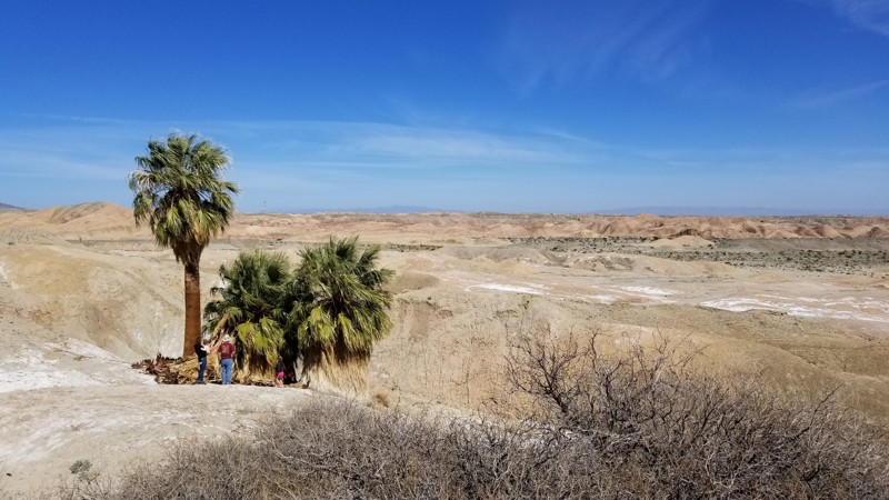
Updated: 06/05/2022
5 Palms Oasis
Salton City, California
Four emerald green palm trees rise from the barren desert at this oasis in the Ocotillo Wells SVRA. The unique and abrupt blip of emerald green rising from the desert has a mystical feeling to it so be sure to check it out when you are out exploring backcountry roads and washes in this desert area near the Salton Sea and Anza Borrego.
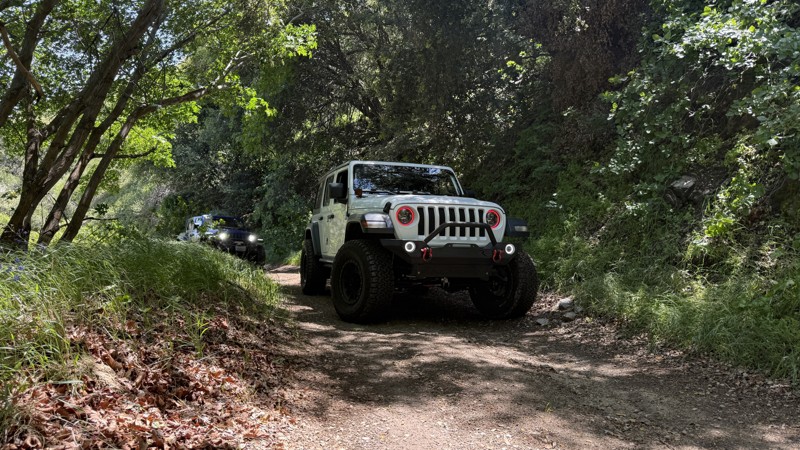
Updated: 06/15/2026
Tule Divide
Elizabeth Lake, California
Tule Divide is a beginner-friendly trail tucked away in the Angeles National Forest near Grass Valley. 4WD is not required. There is no camping on this trail. This scenic route follows a graded dirt road with a few washed-out areas. It’s a great option for first-timers or those looking for a relaxed offroad experience surrounded by mountain scenery. It’s worth mentioning that Tule Divide ends in the middle of Ruby Clearwater Road—a challenging level 4 trail that’s a whole different beast.
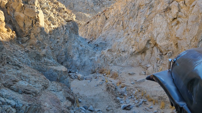
Updated: 01/05/2023
The Hex
Brawley, California
In the hills of the Superstitions is a unique and scary short trail that will likely leave people wondering what happened. The Hex, part of the Voodoo trails area, is likely going to leave people with bad memories for years to come. This intense narrow canyon is full of tight ledges and extreme off-camber. The feeling that things are only going to get worse is a real thing as it almost feels you have no control of what will happen next.
So if you want something harder than Voodoo Rock Garden, but not as insane as Craptastic, check out the Hex and see if you can make it out to the other side.
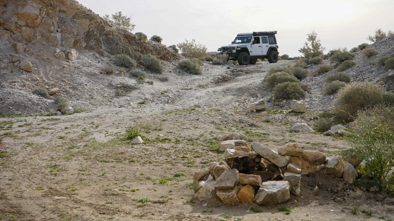
Updated: 03/23/2023
Los Cabezas Mine
Ocotillo, California
A side trip to the old Dos Cabezas Limestone Mine, established in 1958, is worth adding to your explorations of the vast Anza-Borrego Desert State Park. Sites along this short trail include the abandoned limestone mine, an old train trestle, and one of the more unique campsites in the park. The next time you are in the area, make a quick loop and check out the sites of Dos Cabezas Limestone Mine.
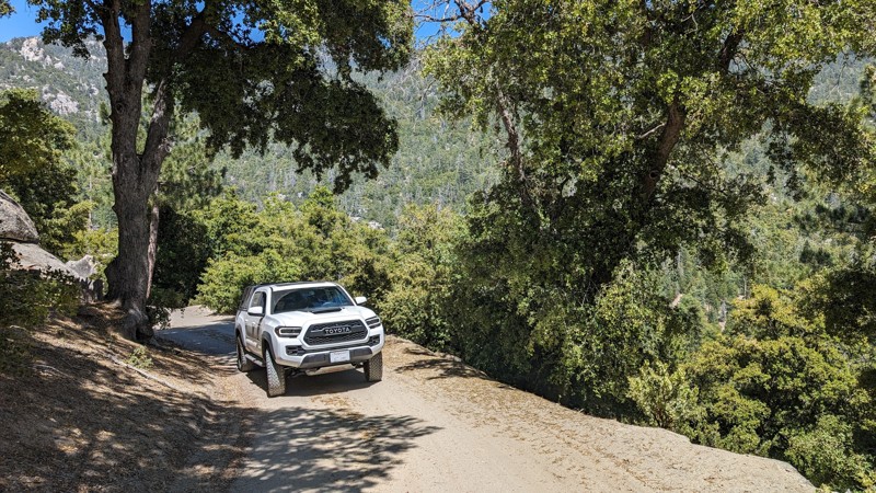
Updated: 12/02/2025
Dark Canyon Road
Pine Wood, California
Dark Canyon Road is paved for the first 2.5 miles, but once you exit the last campground, it turns into a narrow shelf road, ultimately leading to a yellow post campsite. It does not go all the way through to Black Mountain Road; it is gated at 4.6 miles, making it an out-and-back trail. The paved part is not too exciting, but the dirt switchbacks and views from the top are great.
Stone Creek Campground, Fern Basin Campground, Marion Mountain Campground, and Dark Canyon Campground can all be found along this road. There are a couple of small offshoots for dispersed camping and a Yellow Post campsite. Just remember to have an Adventure Pass and Campfire Permit (even for gas stove use).
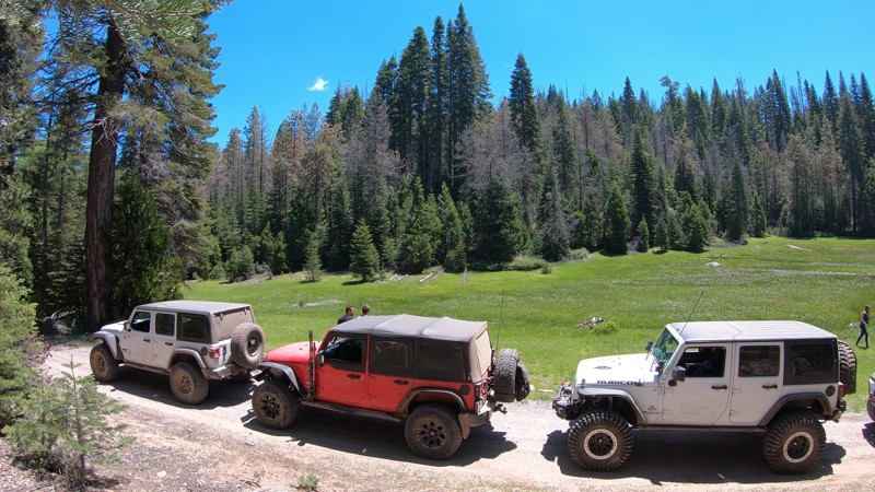
Updated: 07/11/2023
6S68 - Sand Creek
North Fork, California
Just off Rock Creek Road, outside North Fork, California, and east of Bass Lake in the Sierra National Forest is 6S68 - Sand Creek. This short trail is part of a common route connecting the Whiskey Falls area and the Whiskey Falls Campground to the base of the more technical Shuteye Peak. Along this trail, you will find an open forest meadow, Gaggs Campground, and, of course, Sand Creek.
New off-roaders, campers, or overlanders might enjoy this trail for the remote camping opportunities, places to cool off along Sand Creek, and miles and miles of connecting mountain trails at either end.
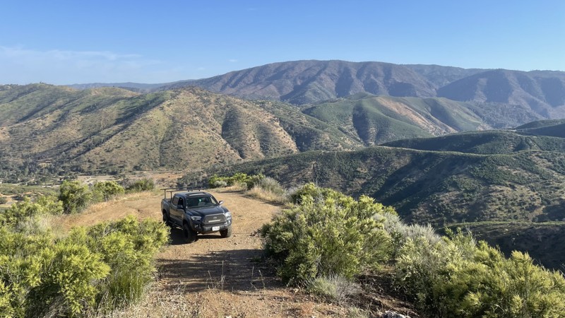
Updated: 10/15/2024
Frank Raines OHV: The Rock Trail
San Antonio Valley, California
Frank Raines OHV Park is located not far from Patterson, CA. It is open to 4x4s from sunrise to sunset with a $5 admission fee per vehicle. The park is open to all OHV vehicles, so watch out for dirtbikes, quads, and SXS.
The Rock Trail is a moderate trail, rated blue by the park's rating system. Despite the name, the trail is not particularly rocky and is mostly loose dirt and moderate hill climbs that any 4WD or AWD vehicle can complete. The trail dead ends at the top of a hill, with a good view of the park and plenty of space to turn around.
Deer Creek Campground is located at the park's entrance. The campground has 34 sites with picnic tables, restrooms, and other amenities. Prices range from $15 to $30 per site.
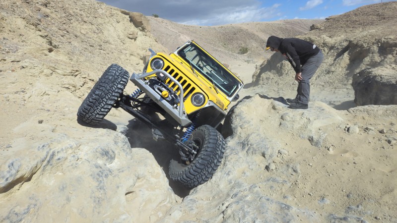
Updated: 10/15/2024
Secret Waterfall Off Coral Wash
Salton City, California
Out off of Coral Wash sits a secret of the area. Rumors float around this secret of the desert. The Waterfall off of Coral Wash in Truckhaven Hills, near the Salton Sea, is one of the most challenging rock obstacles in the area. People often talk about this waterfall with no idea where to find it. The obstacle itself offers three lines: Hard, Harder, and Insane. Because there is a more manageable line, 4WD vehicles with larger tires can likely get up the easier line of this obstacle, but if you want to try the harder line, be ready for body damage and disappointment.
Due to the remote nature of this trail and the fact that it is mostly in tight canyons, there are no good camping locations along the route.
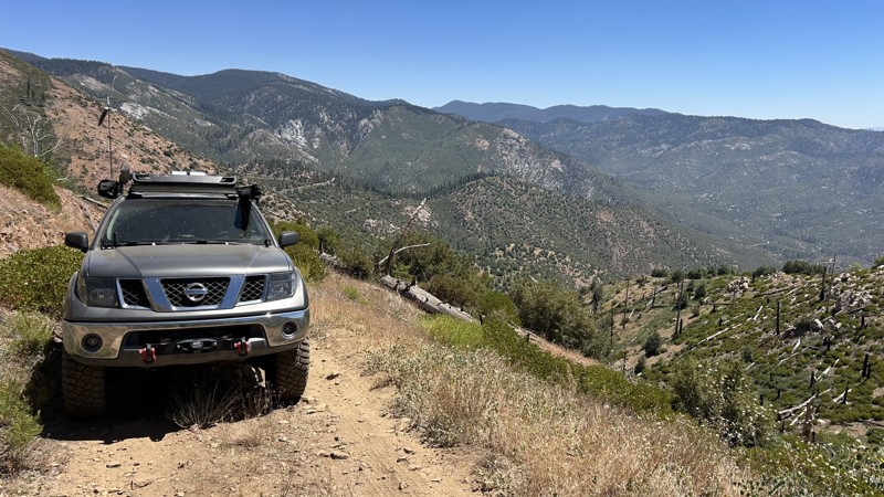
Updated: 09/04/2025
Sherman Pass 4x4 Trail
Fairview, California
Sherman Pass 4x4 Trail skirts the north side of Sherman Peak and climbs to the crest of the Sequoia National Forest, gaining about 2,500 feet in the first 3 miles. Although the trail can be run in either direction, running the trail west to east, starting from Sherman Pass Road, is recommended, as you will be driving the trail uphill. The first half of the trail squeezes through dense brush where pinstriping is unavoidable and crosses numerous rock gardens with boulders from softball to beachball size. Rear lockers are recommended to traverse the rock gardens, especially so on the eastern end, which contains an overly rough rock garden. A high-clearance vehicle with a mild lift and larger tires is ideal. Once you commit to the trail, there are no turnouts to reverse course. It is a narrow trail with limited pull-out opportunities. The trail connects with 33E48A (North Meadow 4x4) and Corral Meadow Road. It delivers a full day of technical wheeling, big views, and a quality camp at the midpoint, where a shaded dispersed site with two established fire rings can accommodate 8 to 10 vehicles.
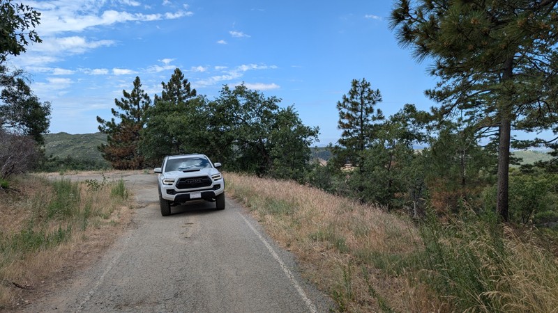
Updated: 10/15/2024
Upper Kitchen Creek Road
Mount Laguna, California
Kitchen Creek Road used to be a through route between Mt. Laguna and I-8 to the south, however, the middle section is now permanently closed. The upper section has roughly a 600' elevation difference, so it's relatively flat but permanently gated at 2.5 miles.
Along this route, there are many spurs and sites for dispersed camping. The road itself is easily traversable with any 2WD vehicle, but the spurs and access to the campsites range from easy to almost impassable.
This route is in the Cleveland National Forest and may require an Adventure Pass and/or Campfire Permit (even for gas stove use).
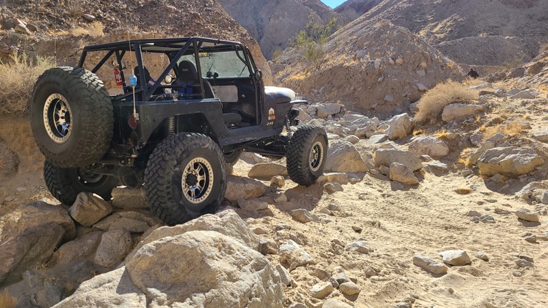
Updated: 01/05/2023
Mine Loop
Brawley, California
If you are looking for something challenging but you think Voodoo Rock Garden is too easy, how about exploring Mine Loop in the Superstition Mountains. This unique trail to the area has several rock gardens that will challenge the normal build of vehicles. If you think that is still too easy, you can turn off and check out Craptastic which is near the end of the canyon on this trail.
So whether you just want to get out and relax away from people, or you are looking for something challenging, this trail has it all.
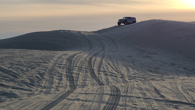
Updated: 05/20/2023
The Void
Brawley, California
In the hills of the Superstitions of Southern California, is a fun play area known as The Void. The Void is a gap between the hills full of large sand dunes, sand walls, and bowls. The area is large enough where you can hang out and enjoy the views, play on the sand dunes, and just disappear. So if you are not too superstitious, head over to the Void and see if your vehicle has what it takes to power through the soft sand.
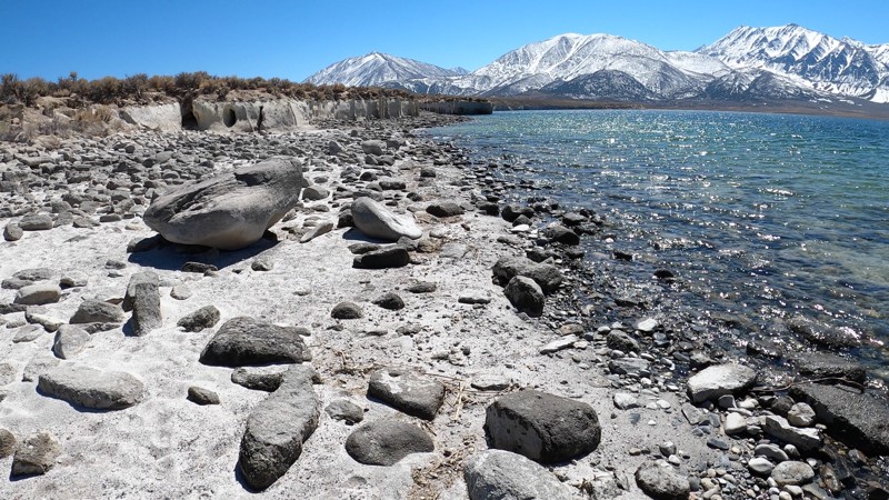
Updated: 03/18/2023
Crowley Lake - Trail to Beach Two
Mammoth Lakes, California
This smooth, easy, scenic trail leads down a mellow hill to one of the white sandy beaches on Crowley Lake, near Mammoth Lakes, California, and just outside the Long Valley Caldera in the Eastern Sierras. From the beach, the southwest view is a snowy mountain backdrop and white sands contrasting the clear blue water of the lake. A short walk along the shore leads to some of the unique rock pillars along Crowley Lake, known as the Crowley Columns. These columns are smaller than the main Crowley Columns, but are still incredible to see in person.
New off-roaders in stock 4x4 vehicles and experienced wheelers in modified rigs will all enjoy this mellow, scenic trail, the beautiful beach, and the unique sight of the Little Crowley Columns.
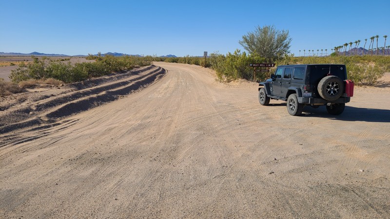
Updated: 12/11/2025
Wiley Well Road
Mesa Verde, California
Built as an access road to a BLM-managed Long Term Visitor Area, Wiley Well Road is also a gateway to beautiful and desolate areas of this Chuckwalla section of the Colorado Desert. At the end of the road, there is a network of well-marked BLM trails to explore throughout the region, with many roads leading to publicly available large geode beds. Paid permits are required for long-term camping from September 15 to April 15 at 45 improved sites along the route. Outside of the LVTA date window camping is allowed for up to 14 days free of charge. This road is sandy but wide and flat and suitably maintained for large RVs.
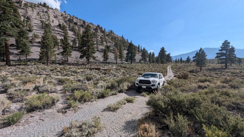
Updated: 10/15/2024
Crater Mountain Flats
June Lake, California
Crater Mountain Flats is a through trail that passes along the base of the Mono Craters with spectacular views. It is in the Inyo National Forest, so dispersed camping is allowed and can be found along the trail.
The trail's south end is a short shelf road along the base of a crater with a lot of obsidian. The rocks are pointy, with sharp obsidian scattered about. The rest of the trail is mostly loose pumice gravel with a few deep ruts from vehicle travel. There are also a couple of small climbs with very loose material.
High-clearance 4WD with tough, good-quality tires is recommended.

Updated: 06/29/2026
Funnel Lake
Peterson Mill, California
Trail 32S304 is a short 5-mile spur that leads directly to Funnel Lake, branching off from the main Coyote Flat route near the high-altitude plateau above Bishop, California. This lower-level intermediate trail is relatively narrow, rocky, and uneven, requiring a capable high-clearance 4x4 vehicle. While it’s not very long, the terrain includes loose rocks and minor obstacles that can challenge less-experienced drivers. At the end of the trail lies Funnel Lake, a serene alpine destination surrounded by granite peaks and meadows, sitting at over 10,400 feet in elevation. This spot is a favorite for dispersed camping due to its remote feel, peaceful setting, and stunning views, though it offers limited shade and no services. Visitors should be prepared for cold temperatures at night and the potential for sudden weather changes. Snow can linger along the trail through June, making the most suitable time of year to visit July through September. Trail 32S304 is an ideal add-on for those already exploring Coyote Flats and looking to spend the night lakeside in the Eastern Sierra wilderness.
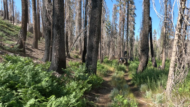
Updated: 08/19/2025
Rock Creek High Lakes aka Bear Lake Trail
Tobin, California
In Lessan National Forest, in the High Lakes OHV area, 519 Bear Lake Trail leads to Butterfly Falls. You will encounter several named obstacles like Pucker Point, a narrow rock outcropping you must drive around, where a simple mistake could send you plummeting off the side of the trail. You also have V-Notch, a 15-foot steep rock section with a deep hole in the center. You will need a built vehicle; although lockers are not required, having them would be a good idea, or at least a winch. It is also recommended to have a full belly and side armor due to all the down trees, narrow squeezes, and rocks.
Many people say this is their favorite trail because of its spectacular scenery, dense forest, green pastures, deep green bushes, and flowing creeks. It has excellent dispersed camping, too, with several areas for dispersed camping. A popular location is down by the old shingle mill at Bear Lake(no longer there), where the flat ground makes for an ideal place to camp. The area is large enough for 5+ vehicles. Another perk of this spot is a nearby swimming hole in Rock Creek.
Once at the falls, the trail continues as "Pipejam," an insanely hard trail where body damage and breaking are almost guaranteed even for the most built rigs. This makes Bear Lake an out-and-back trail for 99% of the people.
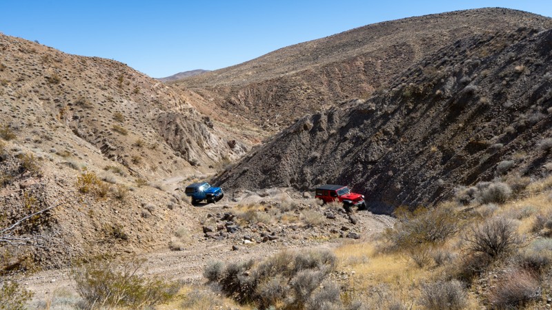
Updated: 01/07/2026
EP 15
Harts Place, California
EP 15 provides a major east-west path across the El Paso Mountains, connecting Highway 14 and Highway 395. It is also the main gateway to other attractions, such as Bickel Camp and the Burro Schmidt Tunnel.
The eastern and western sides are drastically different. On the western side, the trail is rather tame and has the Colorado Camp as a roadside attraction. The eastern side will leave you feeling remote, and the road is more adventurous. Hobbs Wash is a very unique canyon with several tight S-turns where extra-long wheelbase vehicles may struggle.
Pre-disturbed campsites can be found, but they are few and far between. You can also camp at the Colorado Camp, near where Mesquite Canyon intersects.
Airing down is recommended as both the east and west sides will be bumpy and washboarded. There are a couple of steep entry points as it crosses several washes, which may require 4-low gearing for some. It is suitable for all high-clearance vehicles.
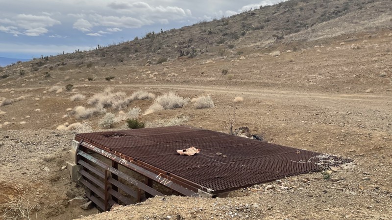
Updated: 10/15/2024
Oro Grande Mine Trail
Bell Mountain, California
Oro Grande Mine is an easy trail not far from Victorville, California. The trail takes you along dirt roads past the abandoned Western States Mine until you ultimately reach the Oro Grande Mine. The mine is closed off and appears partially collapsed, so do not attempt entry. Although there are bumps, ruts, and small rocks, a 2WD vehicle with decent ground clearance can manage this trail. You can explore other trails from the mine or return the way you came. There are lots of unmarked side trails in the area, making it easy to get confused. Dispersed camping is allowed, and you can find a few open areas along the path that would make good campsites.
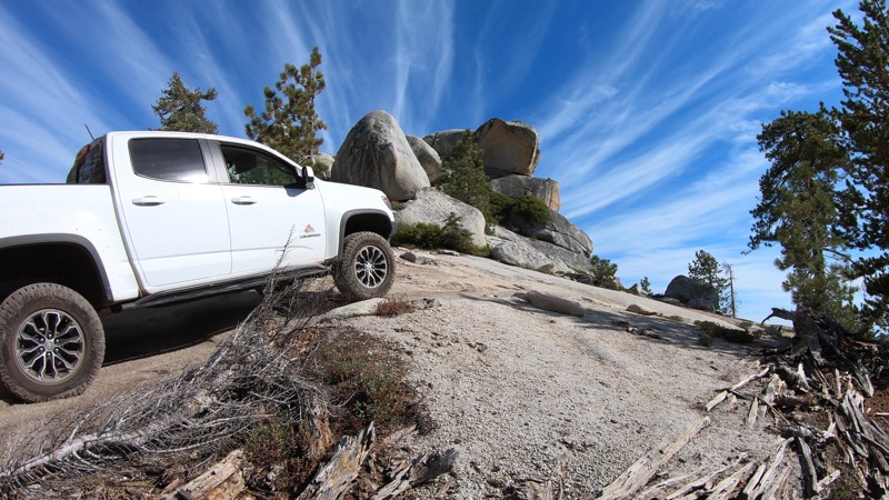
Updated: 06/01/2024
26E327 - Lookout Rock
Shaver Lake, California
Mildly challenging, scenic and unique, Lookout Rock is one of many 4x4 trails in the Bald Mountain OHV Area near Shaver Lake in the Sierra National Forest. A creek crossing, a stair-step rock obstacle and Lookout Rock; a huge layered stack of granite near the end of the trail, set this trail apart from others in the area. 26E327 - Lookout Rock is a great trail for anyone with a 4x4 looking to explore the Bald Mountain off-road trail networks.
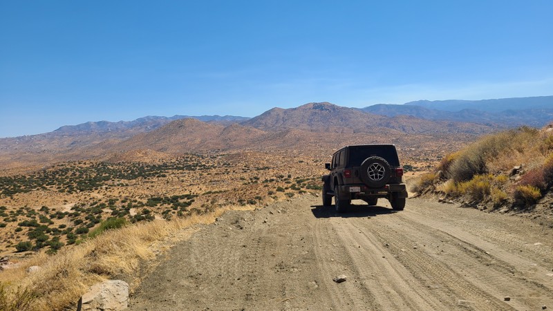
Updated: 01/04/2025
Juniper Flats 3330
Fizzben Heights, California
Juniper Flats 3330 is a 12.5-mile adventure and a gateway to explore the many intersecting driving and hiking trails over its length. JF3330 snakes through the northern slopes of the San Bernardino Mountain foothills and is also known as Power Line Road for its access to the Southern California Edison (SCE) high voltage towers the trail follows. The route begins with majestic views to the west over the Mojave River bed and onto the distant San Gabriel Mountains. About 1.5 miles from the trailhead, it passes by and overlooks the area's namesake Juniper Flats, a shallow depression between the hills covered in tall Junipers. Once leaving the flats, the trail finds itself surrounded by magnificent boulder fields that escort you to the northern slopes of the foothills to reveal stunning views over the northern desert of Apple and Lucerne Valleys and the Granite Mountains with Rabbit Dry Lake 2000 feet below. On the trail's eastern end, it proceeds onto private land, where the trail's name changes to Santa Rosa Road, and it abruptly ends at railroad tracks with no crossing to the road on the other side.
This is an easy trail, but a high clearance vehicle is needed with the occasional steep ascents and a 4-wheel drive. Please note that the Juniper Flats Subregion is a Limited Use Area requiring vehicles to stay on marked trails.
The majority of the trail is on Bureau of Land Management (BLM) land, and dispersed camping can be enjoyed on the trail when following the BLM Dispersed Camping Regulations. The steep slopes the road is carved into allow for a few suitable dispersed campsites. Most of the flat areas large enough for multiple vehicles are at the bases of the SCE high voltage towers. Open fires may be prohibited, and it is the responsibility of campers to know the Campfire Restrictions.
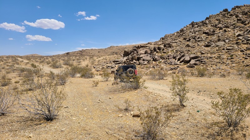
Updated: 10/15/2024
Stoddard Mountain Road
Barstow, California
Stoddard Mountain Road passes over a valley created to the north of Stoddard Moutain. The trail offers a great contrast in road conditions. Beginning as a rough rocky gauntlet, the trail ends in a wide, flat maintained gravel surface that supports an active mine along the road. The road passes through the Stoddard Valley OHV area and the Stoddard Valley Dry Camp.
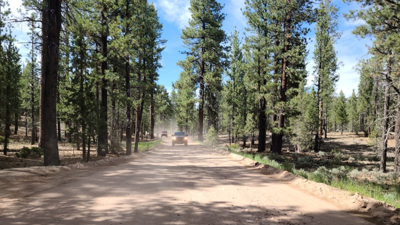
Updated: 06/29/2026
Van Dusen Canyon Road
Big Bear, California
Van Dusen Canyon Road (3N09) is an easy, seasonal offroad trail near Big Bear, California, ideal for beginners or anyone looking to explore the San Bernardino National Forest at a relaxed pace. It serves as a popular connector route to more advanced trails deeper in the forest, such as Holcomb Valley, or as a standalone scenic drive for those seeking tranquility.
As you travel this graded dirt road, you’ll experience a steady elevation gain. Starting around 6,700 feet in Big Bear up to over 7,800 feet at the end. This scenic trail brings cooler temperatures and sweeping mountain views. The gradual climb takes you through dense pine forests, wide open meadows, and some truly beautiful high-country landscapes. Due to its wide, smooth surface, it’s commonly recommended for larger vehicles like RVs, 2WD cars, and other street-driven rigs, making it one of the most accessible routes into the San Bernardino Mountains.
Van Dusen is also a favorite for overlanders and weekend 4x4 travelers thanks to the abundance of dispersed camping in the area. The best location is a large, cleared area about halfway and on the east side of the road, where it is not uncommon to see groups of 5+ vehicles gathered.
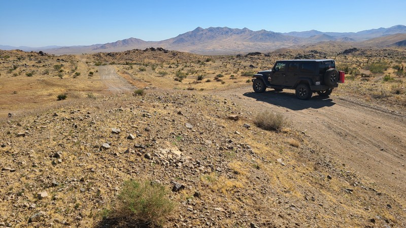
Updated: 10/15/2024
Stoddard Valley 6515
La Delta, California
From Victorville, carving its way over the foothills of the Silver Mountains and through Brisbane Valley, SV6515 eventually reaches Barstow. Topping the many hills along the trail rewards you with stunning views of this high desert landscape. Over its twenty-mile length, this trail connects to several other roads and trails, inviting exploration.
The southwestern end of the trail for the first seven miles is on public land and provides several flat areas for dispersed camping when meeting the BLM Camping Guidelines.
During high fire danger, campfires may be restricted. If planning to camp, review the current BLM Campfire Restrictions and have a Campfire Permit.
SV6515 has several steep climbs and descents, with a loose rocky trail and deep ruts. A high clearance four-wheel drive vehicle with good all-terrain tires and an experienced driver should attempt this trail. Four low is also recommended for the steepest climbs and descents.
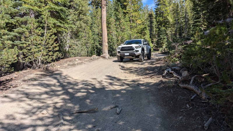
Updated: 06/20/2025
Dry Creek Flats Upper
Mammoth Lakes, California
Dry Creek Flats Upper is an offroad alternative between Mammoth Mountain Ski Area and Inyo Craters. It also connects nearby hiking trails and single-track motorcycle trails.
The trail consists mostly of gravel and dirt, which can be loose in some spots. There are also some large ruts, tree roots, and whoops to contend with, as the area is popular with all sorts of offroad vehicles. A high-clearance 4WD vehicle is recommended.
There are a few spots to camp, but campfires may not be allowed during the dry summer months.
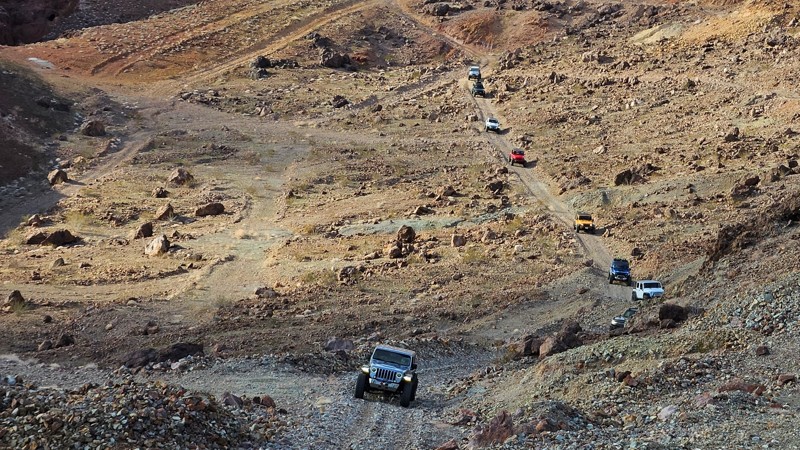
Updated: 10/15/2024
Odessa and Doran Connector and Mine Network
Yermo, California
Connecting Odessa Canyon and Doran Canyon, this shortcut, sometimes referred to as Josh's Cut-Through, will save you several minutes when making the loop between the two canyons. With tons of rich mining history, this is the perfect trail for groups that want to avoid the rock crawling of Doran or Odessa Canyons and would rather spend their day exploring the old mine ruins and history of Calico.
This trail is a shelf-mining road, so if heights are not your thing, this won't be your favorite trail. This trail also has a steep, loose, and slightly off-camber descent and ascent on both ends that can be intimidating but can easily be handled by stock 4x4s with little assistance outside of airing down.
Camping along this trail is not ideal, and no pre-established sites exist.
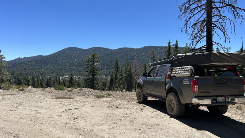
Updated: 08/13/2025
Cherry Hill Road
Kernville, California
22S12 is an out-and-back trail with several designated campgrounds along the route. There is approximately 8 miles of pavement until it becomes a dirt road at Poison Creek. Poison Creek is a dispersed campsite with fire rings and plenty of space for up to 8 vehicles.
Several spurs along the trail lead to dispersed camping and are well-marked. There are many overlooks where you can stop and enjoy the scenic views. If you are traveling into the area, 22S12 is a quick and easy trail to find a place to camp for the night. The trail has remnants of a paved road, but it has deteriorated into a combination of paved spots and graded dirt road with washboard bumps. A stock SUV or car can complete it. Permits are required for campfires, charcoal fires, and portable stoves. There are no garbage services in the area, so you will need to "Pack it out".
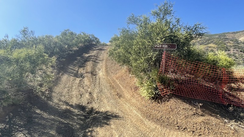
Updated: 10/15/2024
Frank Raines OHV: Spider Trail
San Antonio Valley, California
Frank Raines OHV Park is located not far from Patterson, CA. It is open to 4x4s from sunrise to sunset with a $5 admission fee per vehicle. The park is open to all OHV vehicles, so watch out for dirtbikes, quads, and SXS.
Spider Trail is a challenging trail, rated a black diamond by the park's rating system. The trail is heavily rutted and is essentially one long hill climb. But a skilled driver in a 4x4 will be able to manage. The dirt is loose, causing traction issues. At the trail's end, you can return the way you came or continue to Matt's Trail or Truck Trail.
Deer Creek Campground is located at the park's entrance. The campground has 34 sites with picnic tables, restrooms, and other amenities. Prices range from $15 to $30 per site.
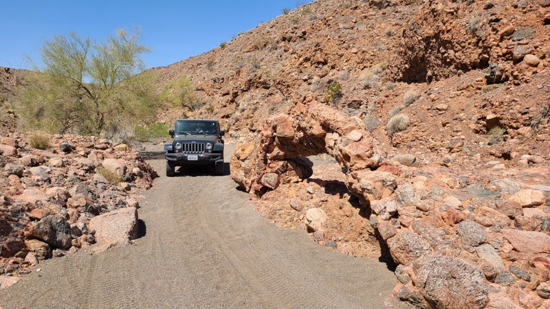
Updated: 10/15/2024
Chuckwalla Springs Road
Desert Center, California
Chuckwalla Springs Road travels from the sandy Colorado Desert floor into a valley of the rocky Chuckwalla Mountains. Remnants of mining and the road's namesake, the Chuckwalla Spring, are passed along the way. The road is rated by BLM as "More Difficult" due to the trail's narrow, twisting, and rocky path. Dispersed camping is available at any suitable spot on BLM land. BLM prefers you use existing rock fire rings or cleared sites to minimize impact.
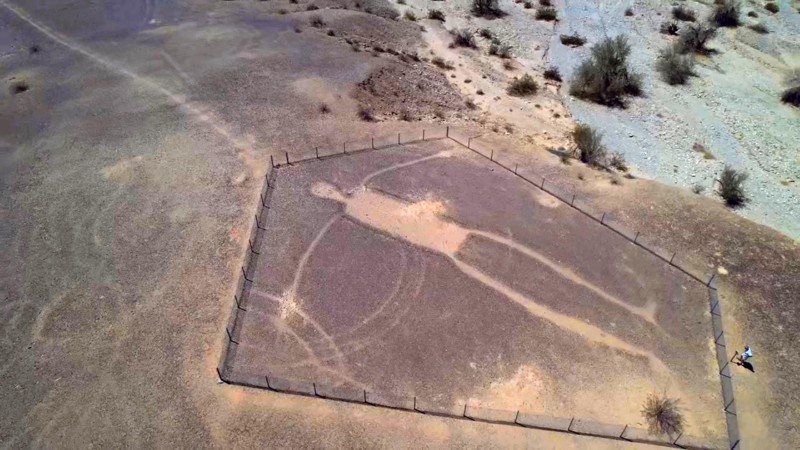
Updated: 10/15/2024
Worthington Trail
Mesaville, California
The highlight of the Worthington Trails is the 170-foot tall Intaglios located at its trailhead. The intaglios of humans and animals are estimated to be between 500 and 2000 years old. According to the Mohave and Quechans, natives of the lower Colorado River area, the human figures represent Mastamho, the Creator of all life. The animal figures represent Hatakulya, one of two mountain lions/persons who helped in the Creation. In ancient times, sacred ceremonial dances were held in the area to honor the creation. Managed by the BLM, the figures were fenced off in 1974 to prevent further damage from vehicles whose tire tracks can last 1000s of years.
The trail then takes you to the rough Big Maria Mountains Wilderness border, where it rises in elevation to provide inspiring views of the valley below. Sections of the trail cross over dry washes where you can lose the trail's tire tracks in the large rocks. The most intimidating section of the route is a long steep, slippery decline. High clearance 4x4s should only attempt this trail. As the trail is entirely on BLM land, dispersed camping is allowed, and we found existing rock fire rings.
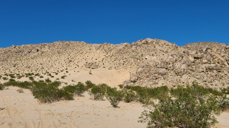
Updated: 10/15/2024
Bloody Mary
Johnson Valley, California
If you want hard, this is about as hard as it gets. Bloody Mary is an extreme buggy trail. Some of the best moon buggy drivers have found themselves beyond stuck on this trail. Full of ledges, 20-foot round rocks, and cracks, it takes extreme patience to get through this one. Thus, if you hear a story of someone wanting to run this trail, pack a lunch and a change of clothes and get out there and watch this wild ride.
There's no camping on this trail. Nearby Means Dry Lake is a popular camping area that is RV friendly.
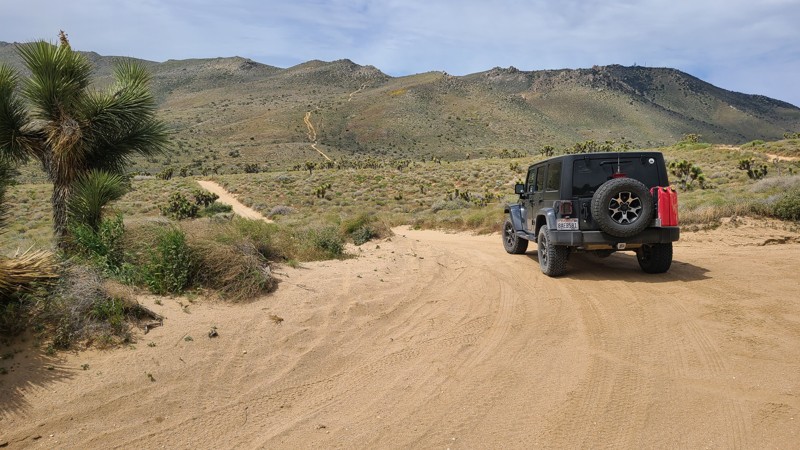
Updated: 10/15/2024
Scodie Mountains SC37
Sageland, California
In the southern Scodie Mountains, a beautiful narrow canyon guides SC37 as it rises 1300 feet to the narrow mountain ridge of Wyleys Knob and an intersection with the Pacific Crest Trail. The ridge provides a perfect lunch spot while enjoying impressive views of the surrounding mountains and the distant Kiavah Wilderness.
SC37 is reached via Frog Creek SC47 and SC50. A BLM trail marker at the western start of the trail indicates this trail has a "Difficult" rating. Obstacles on the west and east side of the Wyle Knob ridge confirm this rating. The entire trail requires a high clearance 4x4 to manage a three-foot sandstone ledge on the west side of the trail and a steep descent over rough, rocky, water-damaged terrain on the eastern half. Only an experienced driver should attempt this trail.
At the northern end of the trail is Bureau of Land Management prepared primitive campsite with a rock fire ring that can be used when meeting BLM Camping Guidelines. During high fire danger, campfires may be restricted, and if planning to camp here, one should review the current BLM Campfire Restrictions and have a Campfire Permit.
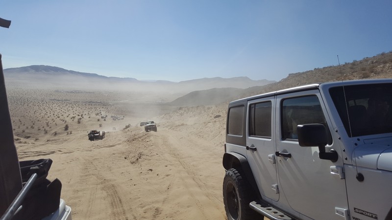
Updated: 02/27/2024
Mommas Sand Hill
Yucca Valley, California
Who doesn't love a good sand hill? Yo Momma's Sand Hill is conveniently located in the epicenter of extreme off-road culture in Johnson Valley. Only a very short distance from the legendary basecamp of "King of the Hammers" lies this sandy playground. Soft loose sand, steep grades, and plenty of area to persuade your friends to try harder and harder obstacles, this sand hill can be hours of fun and entertainment for all off-road skill levels. Just don't get stuck, last thing you want to do is call your momma to come rescue you in her 86 Olds Cutlass Supreme.
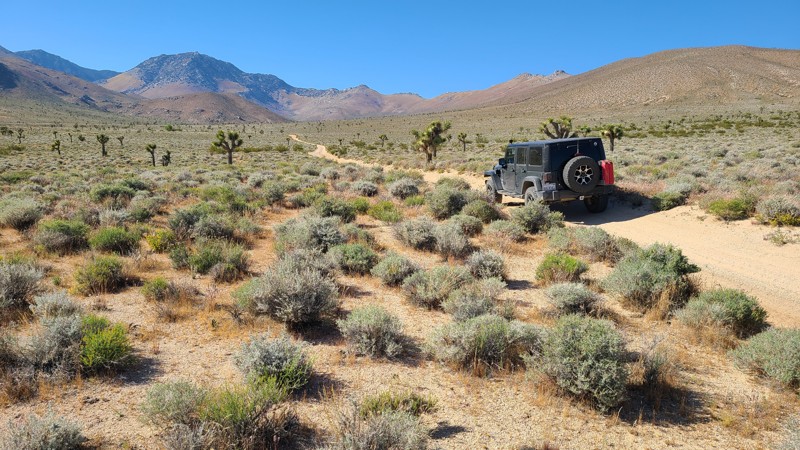
Updated: 08/11/2025
Cow Heaven Canyon Road SC51
Armistead, California
Cows Heaven Canyon Road (SC51) provides a corridor through the beautiful untouched hills of the Kiavah Wilderness from the Mojave Desert to the Sequoia National Forest. The road moves through the transition zone between the Sierra Nevada Mountains and the Mojave Desert, where you'll find an unusual mix of plants and animals, including creosote bush, Joshua trees, burro bush, and shadscale. This is an up-and-back trail with convenient access from Highway 14.
This is an easy trail, consisting almost entirely of packed sand. It requires only a two-wheel drive but still requires high clearance.
Vehicles can travel up the Wilderness Corridor to the end, where dispersed camping is allowed along the road. To minimize impacts, previously used or predisturbed sites should be used. Vehicles must park on the shoulder of the road in previously used locations as well. The Wilderness boundary is 30 feet from the road's centerline, so no motorized vehicles can travel further from the road even if a disturbed area extends past this boundary line. Dispersed camping is limited but can be enjoyed when meeting BLM Camping Guidelines. During high fire danger, campfires may be restricted, and if planning to camp here, one should review the current BLM Campfire Restrictions and have a Campfire Permit.
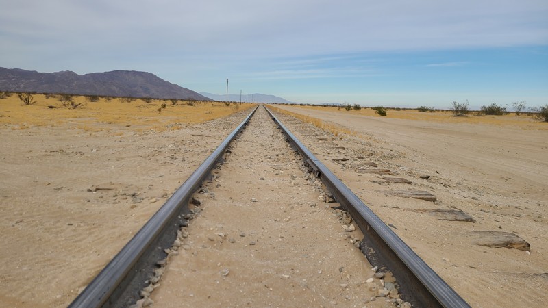
Updated: 01/05/2023
Trail 201
Brawley, California
In the deserts of Southern California is a cut-through trail that takes you from the Superstitions over near the old overland stagecoach route from yesteryears. This simple dirt path cuts through dry lakebeds, open desert and even passes an old foundation from a building that once was.
So if you are in the Superstitions and looking for something different, check out this trail and it will take you over close to Anza-Borrego.
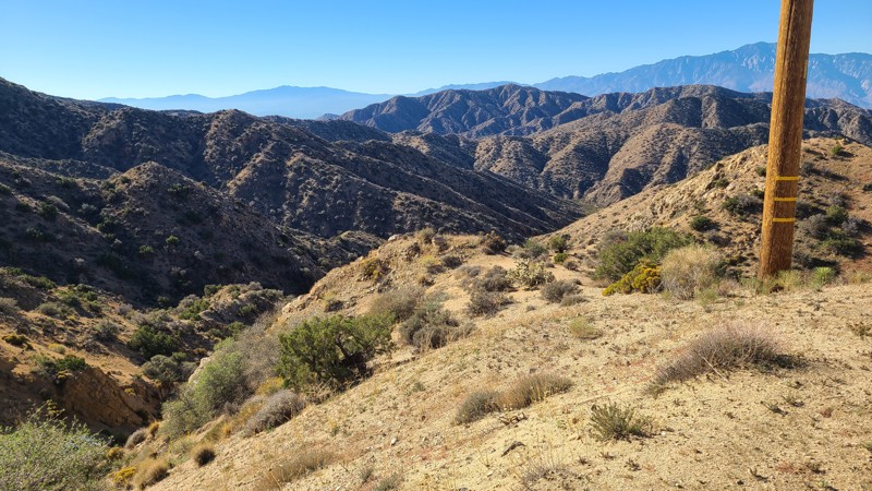
Updated: 11/14/2025
Little Morongo Canyon Road
Yucca Valley, California
Located in the Sand to Snow National Monument, Little Morongo Canyon Road begins in a healthy Joshua Tree forest with great views out to Yucca Valley, then quickly winds 3,000 feet down the slopes of the Little San Bernardino Mountains, eventually following a narrow course between the steep sides of the beautiful Little Morongo Canyon. Along the way, the neighboring valleys expose views of the surrounding mountains. The descent finishes in a shallow wash, where several open dispersed camping sites will be found to enjoy the quiet and solitude of the trail.
This out-and-back road is easy with its wide, flat surface and can be driven using a two-wheel drive with some ground clearance to manage the occasional ruts. The northern end of the trail is on a steep twisty shelf road, and the width of the road will help reduce any apprehension for new off-road drivers.
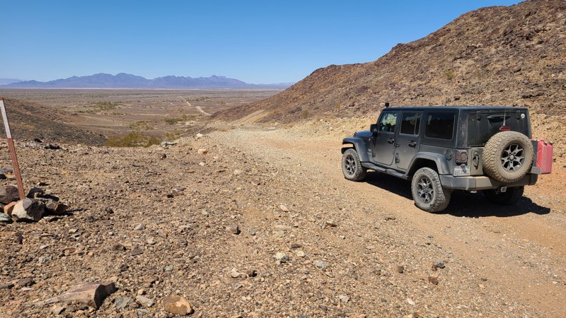
Updated: 10/15/2024
Government Pass Road
Mesa Verde, California
Government Pass Road follows the eastern border of the Little Chuckwalla Mountains Wilderness. The road is split between a rough and rocky mountain road and a deep sandy trail below the desert valley. The summit of 900 feet reveals expansive views of the desert valley below. The road near its start has two deep and steep washouts, making them impassible but are easily bypassed. The road has a BLM rating of "More Difficult."
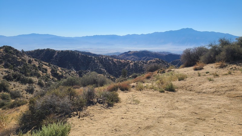
Updated: 11/14/2025
Covington Flats
Yucca Valley, California
Located in the north-west corner of Joshua Tree National Park, the Covington Flats area is a great desert off-road scenic afternoon drive or a backcountry hiking destination. This route covers the entire Covington Flats area, providing views from the 5,400 ft Eureka Peak out to Palm Springs and the Morongo Basin. The lower elevations pass by captivating sculpted rock formations, large shading pinyon pines, and Joshua trees. The road is an out-and-back route and is well-marked, providing directions to staging and day-use areas that access the many backcountry hiking, biking, and horseback riding trails.
The site designated with a camping sign is for day use only; however, overnight camping is available at the National Park’s Black Rock Campground, located just 2 miles east of the road's start.
The route combines Covington Flat Road, Covington Crossover, Upper Covington, Eureka Peak, and Lower Covington Trail. The roads here are well maintained by the park and can be managed using a two-wheel drive passenger vehicle, but if wet, a 4WD high clearance vehicle is required.
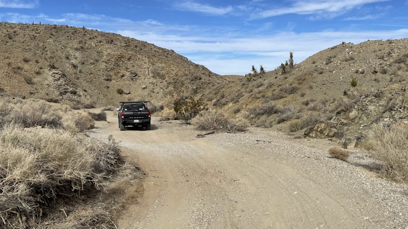
Updated: 10/15/2024
SV6545
Bell Mountain, California
SV4565 is a short trail on BLM land outside Victorville, California. This trail is an entry point to an assortment of other trails that crisscross the BLM land. SV4565l is perfect for someone who wants to explore the abundant side trails leading to everything from old mineshafts to abandoned cars. SV4565 takes about 25 minutes to complete, but you can spend all day exploring the surrounding area. Any 2WD vehicle with decent ground clearance can handle SV4565, but if you want to thoroughly explore the surrounding area, 4WD is necessary. Dispersed camping is allowed.
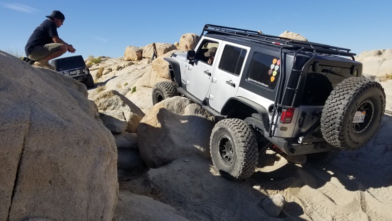
Updated: 03/12/2023
Ness’s Notch
Lucerne Valley, California
Out in the desert of Johnson Valley's Cougar Buttes is a fun short but difficult rock crawling trail tucked against the hills. With only a few obstacles, this intense 4x4 trail is only for the ones with built off-road rigs and excellent drivers experience. Now be warned, this trail is hard enough that body damage and rollovers are likely. So if you think you have what it takes, your rock crawler is a beast, then check out Ness's Notch.
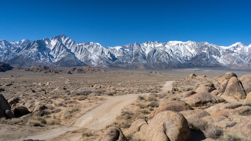
Updated: 03/13/2025
Boot Arch Sites 39-40
Lone Pine, California
Secluded from the more popular region of Alabama Hills, the Boot Arch trail provides a few additional opportunities to explore the dirt roads in the area. Located shortly into the trail is its namesake, Boot Arch. There is a small pullout and a short hike to this small but unique arch. The trail to this point is very flat and easy.
Beyond the camping area, the trail splits into two forks and gets a bit rougher, requiring 4WD and high clearance to reach the ends, due to the rocky and rutty terrain. The northern spur is quite uneventful, aside from pure isolation. The southern spur guides users into the rock fins and truly makes you feel like you are on another planet. The end is a great location to take in the sights and enjoy a bite of lunch or a few minutes to yourself.
About the camping on this route:
All dispersed camping is designated to a specific site and requires a permit. A permit can be obtained online or at the Eastern Sierra Visitor Center or kiosks located on Movie Road and the main entry point in Lone Pine. Permits need to be signed and displayed on your dashboard.
The BLM has created a map showing the site numbers. However, those numbers are not used in the field, but each site is clearly marked with either a camping allowed or no camping allowed symbol on a clearly visible sign. Please be aware that all sites are first come, first served, and a permit does not guarantee you will find a site. Due to the popularity of the area, it is best to arrive early.
There are six portable restrooms throughout Alabama Hills. If you do not want to drive or walk to one, you must bring your own system to pack out human waste.
Below is a brief description of each site:
- 39: Relatively level, with room for 3-4 vehicles and ground tents. Site
- 40: About 30 yards off the trail to the north and is a bit more intimate, allowing for two smaller vehicles or one larger. Trailers and long-wheelbase trucks/vans may struggle to reach site 40 due to a few turns between some rocks and minimal room to turn around.
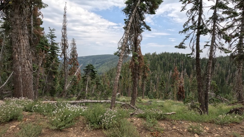
Updated: 06/19/2025
Sloat McRae Road
Cromberg, California
Deep in the Plumas National Forest is a legendary scenic forest trail. Sloat McRae Road is a scenic overland route from Quincy to the Pacific Crest Trail/Gold Valley OHV Trail. This old forest trail has towering trees and stoic beauty and is a fantastic drive. Although this is an excellent offroad trail, you must watch as the local logging companies use the trail. As you start out from the north side, you cross over the amazing Middle Fork Feather River, up a narrow lush canyon, over the towering mountains, and back down the other side. The trail allows for dispersed camping, and Ross Campground is a first-come, first-serve camping area. With a running stream nearby, this campground is something special. Since the trail is a maintained logging road, the trail is straightforward, and any offroad vehicle can ride the trail. So, if you are in the area and looking for something just stunning, look no further than this trail.
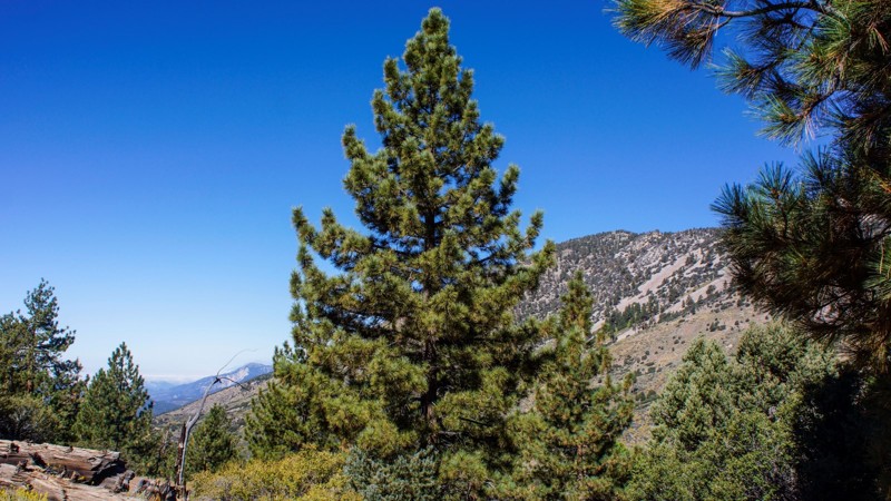
Updated: 06/07/2024
2N93F - Wildhorse
Big Bear City, California
2N93F - Wildhorse Spur is in the beautiful San Bernardino National Forest, southeast of Big Bear Lake. There is dispersed camping throughout this trail, with 2 yellow post sites at the end. This is a spur off of 2N93 - Wildhorse Meadow, which has, on another spur, just 1.8 miles to the south, a designated shooting site at 2N93G Lightning Gulch. It's obvious where Wildhorse Meadow gets its name when you drive between waypoints 7 and 10, (of that trail). The meadow is lush and green and bordered by pine, oak, cedar, and elm. Bring your family, picnic lunch, and camera for a day of 4wd off-road fun. Better yet? Camp under the stars and enjoy the wildlife and forest.
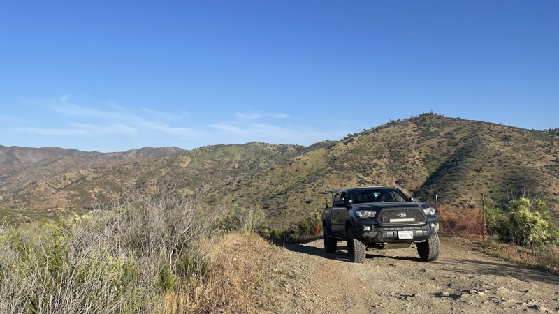
Updated: 10/15/2024
Frank Raines OHV: Tip Over Trail
San Antonio Valley, California
Frank Raines OHV Park is located not far from Patterson, CA. It is open to 4x4s from sunrise to sunset with a $5 admission fee per vehicle. The park is open to all OHV vehicles, so be sure to watch out for dirtbikes, quads, and SXS.
Tip Over Trail is a moderately difficult trail in Frank Raines OHV connecting to West Loop Trail. The trail is mostly smooth dirt, with two moderate hill climbs easily conquered with 4WD or AWD. The beginning portion of the trail takes you past the child dirtbike track, as well as the now-closed entrances to Kidney Stone Trail and Concrete Trail.
Deer Creek Campground is located at the park's entrance. The campground has 34 sites with picnic tables, restrooms, and other amenities. Prices range from $15 to $30 per site.
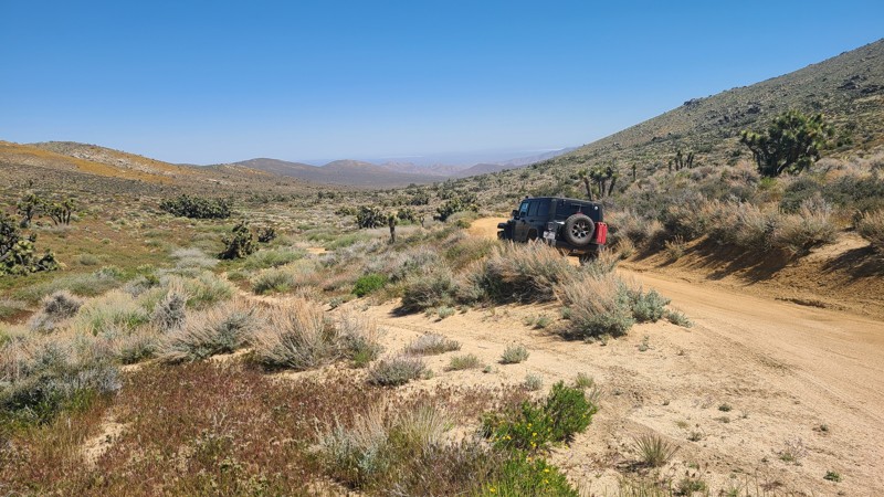
Updated: 05/27/2025
Butterbredt Canyon Road SC123
Sageland, California
South of the Scodie Mountains, starting from the paved Kelso Valley Road, in a narrow gap along the soft sandy bottom of Butterbredt Canyon, sits Butterbredt Canyon Road (SC123). A healthy green joshua tree forest surrounds the road. The canyon's namesake, Butterbredt Springs, is teeming with life supported by the active spring and is near the southeastern end of the road, near its end at the intersection with Jawbone Canyon Road. Surprisingly, for its length, this straight-through road has only a single intersecting road but does have several hiking trails beginning from the road.
This is an easy trail over a maintained road, consisting almost entirely of soft, deep sand that requires a 4-wheel drive vehicle.
The only dispersed camping site is a BLM-provided primitive site near Butterbredt Spring. The large dispersed campsite with rock fire rings can be enjoyed when meeting BLM Camping Guidelines. During high fire danger, campfires may be restricted, and if planning to camp here, one should review the current BLM Campfire Restrictions and have a Campfire Permit.
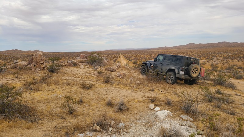
Updated: 10/15/2024
El Mirage 4800
Kramer Hills, California
Passing between the Shadow Mountains to the south and the twin towers of Red Buttes to the north, EM4800 progresses over this Mojave Desert basin, rising a bare 350 feet over its entire length. The trailhead is easily reached from Highway 395, and its southwesterly direction provides access to several trails that invite exploration. EM4800 is within the El Mirage Subregion, which is designated as a Limited Use Area requiring vehicles to stay on the trails.
The trail passes through a checkerboard of private and BLM land, providing solitude and access to dispersed camping anywhere along the trail when meeting the BLM dispersed camping requirements. During the summer fire season, campfires may be restricted, and if planning to camp, one should review the current BLM Camp Fire Restrictions.
EM4800 is an easy, generally flat sandy trail requiring only a high clearance two-wheel drive vehicle.
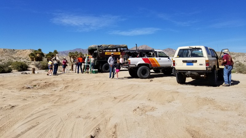
Updated: 06/05/2022
17 Palms Oasis
Salton City, California
Out in the middle of nowhere, the Ocotillo Wells SRVA desert area has a unique landscape feature that most people have never seen in their lives; an oasis. Sprouting out of the desolate desert is a lush green area with palm trees and shrubs. This green blip growing from the brown desert is a unique feature that its typically only read about in stories or see in movies. This backcountry drive, with a short hike, gives you a chance to experience it in real life.
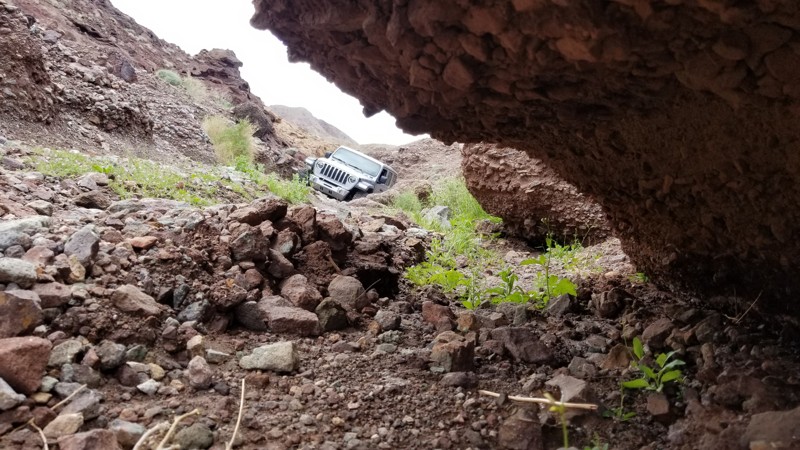
Updated: 01/02/2024
Doran Canyon Flats
Yermo, California
In the hills of Calico California near Yermo and Barstow is a famous trail network that has gotten its name for the right reasons. These hard trails were once a scenic drive back in the day but now are some of the hardest offroading around. On one such trail, Doran Canyon, there is a small area that is often overlooked. This area is perfect for the overlanders and people who want to camp away from everyone. The trail requires some decently hard wheeling to get to which means no one without a decent 4x4 can get to the area. The area is known as Doran Canyon Flats or Doran Flats in short.
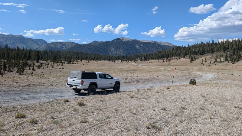
Updated: 06/03/2025
Dry Creek Road
Mammoth Lakes, California
Dry Creek Road is a through trail connecting Inyo Craters to Deadman Creek in the Inyo National Forest. It passes through sections of alpine forest and the scenic Crater Flat. Parts of the trail are rutted and there are a couple of small climbs with loose material. AWD vehicles with moderate clearance should have no problem.
Dispersed camping is allowed, but the sites are mainly small areas that pull off the main trail with little shade. There are plenty of other great dispersed camping sites in the nearby area.
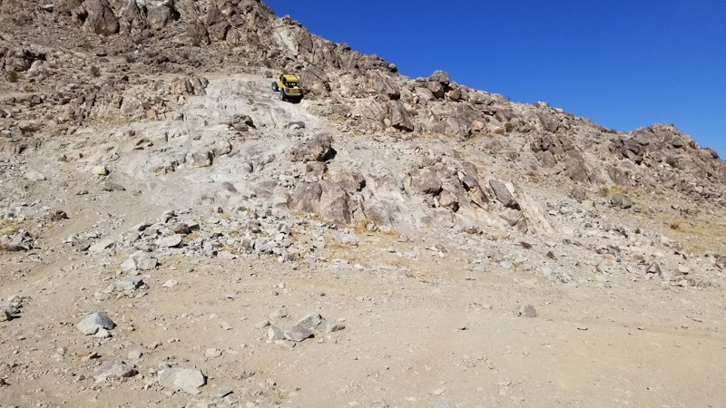
Updated: 12/17/2025
Front Door - Comp Hill
Yucca Valley, California
A popular gathering spot doing King Of The Hammers, Front Door aka as Comp Hill also the Shoot-Out Challenge from 2019 and is one hard hill climb. Full of large ledges and rocks, this hill climb is likely to spit out the less equipped vehicles in just the first few feet. With near-vertical climbs in spots that are already at the tip-over point, there is no question why this intense off-road hill climb made the shootout challenge. Be ready, rollovers are common at this one. This hill climb is only for the most experienced drivers and built rigs with good cages. Nothing less should attempt this hill climb.
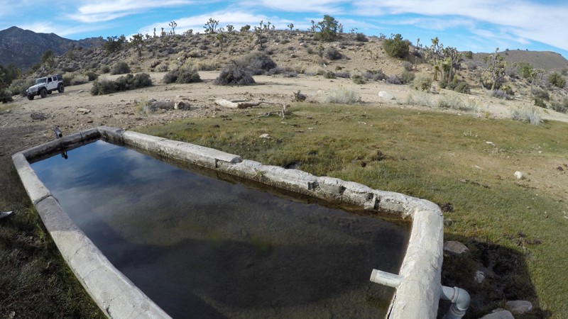
Updated: 10/15/2024
Mound Spring
Rimrock, California
This is a short, easy trail off Rattlesnake Canyon that leads past Mound Spring in the mountains between Big Bear, California, and Johnson Valley. The spring-fed troughs are directly off the side of this trail, and you typically find water here year-round. This trail is a great add-on to a day of exploring in this area.
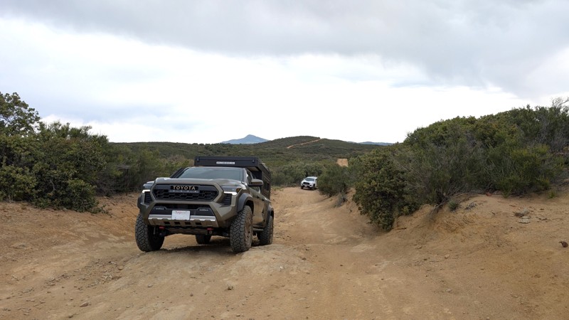
Updated: 04/24/2026
Bear Valley Road
Pine Valley, California
Bear Valley Road is a moderate difficulty trail, 45 minutes from San Diego, with rewarding southern views down to Mexico. It is popular with offroad enthusiasts as it is open to Off-Highway Vehicles (OHV). After the initial 2.5-mile climb to the ridge, the trail widens and has ample opportunities to stop, get out, take in the views, or have a snack. Bear Valley Road is great for anyone looking for mountain views while traversing something more aggressive than a dirt road.
This is an out-and-back trail for anything with 4 wheels (7 miles each way) with no access to Buckman Springs Road. The trail terminates at a locked gate 0.3 miles from the intersection with Long Valley Loop. However, continuing down Long Valley Loop and returning, it can become a 19-mile, almost 3-hour trek round-trip.
Difficulty
The trail is rough dirt and rock in good conditions, but when wet, deep mud bogs may form that could challenge even well-equipped vehicles. The first (northern) 2.5 miles contains over a dozen erosion control berms requiring high clearance. In addition to the erosion control, there are 3-4, roughly 20-foot sections with a climb/descent that may briefly encounter a 20° pitch or 15° camber.
Camping
There are at least 2 sites along the side of the trail, which can be used for camping in a pinch, but do not provide a lot of privacy. Camping does require a dispersed camping permit from the Descanso Ranger District.
Access
Use the Pine Valley exit off of I-8. The staging area is roughly 100 feet south of the freeway off-ramp. Parking within the fence requires a pass, but parking outside the fence is free. Parking may be busy due to the trail's popularity, with weekend mornings typically being the busiest.
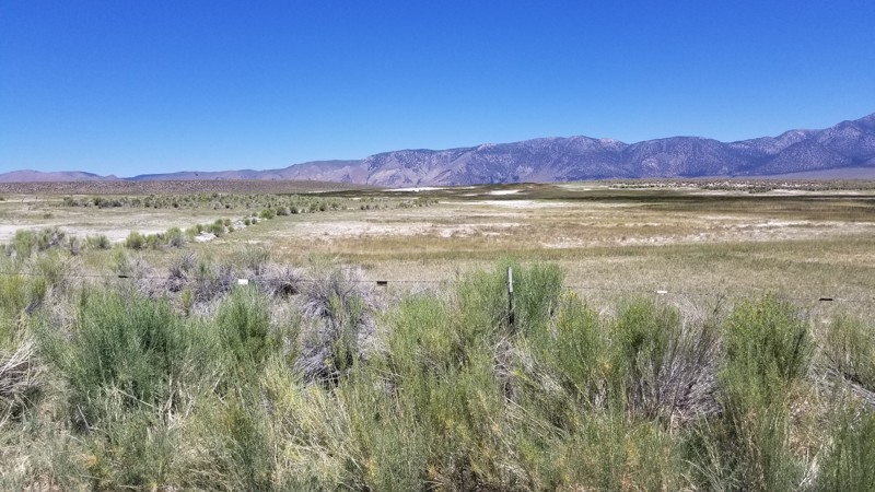
Updated: 06/05/2022
Hill Top Hot Springs
Mammoth Lakes, California
Another one of the amazing hot springs in the Mammoth Lakes area, Hill Top Hot Springs is a must-do if you are looking for a secluded hot spring to take in and relax at. Not far from the popular Wild Willies hot spring, this one is a great place to get away from the crowds and relax.

Updated: 10/15/2024
Gold Lake Shore
Johnsville, California
Gold Lake Shore is high in the Plumas National Forest and is an amazing straight-through trail situated next to Gold Lake, one of the larger lakes in the area and home to the Gold Lake 4x4 Campground. The campground is set up as designated dispersed campsites that can be reserved ahead of time at Recreation.gov. Each campsite has a picnic table, fire ring, and bear locker for food storage. There are also several improved campgrounds nearby, including Gold Lake Campground.
Because this trail is a popular camping location, the trail in and out is moderately maintained and passable in most 4x4s with high ground clearance. On the trail, you should expect water crossings, scattered smaller rocks sticking out of the dirt, and minor hill climbs. Lower vehicles will have to pick lines through some of the areas.
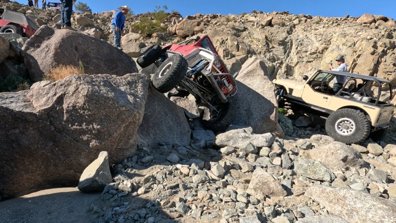
Updated: 03/09/2026
Spooners
Johnson Valley, California
Spooners, a Johnson Valley trail named after a couple of guys who got stuck on the trail and had to spoon to survive overnight cold temperatures, is one of the original Johnson Valley rock crawling trails. Located near Outerlimits, this nearly 3-mile long trail is one of the furthest trails from Means Dry Lake and is positioned directly against the military boundary on its northern end. With large boulders over 4 feet round, waterfalls over 5 feet tall, and a difficult S-Turn obstacle that can quickly end your day with one wrong move, Spooners is a trail only for the bravest and built. This trail is best suited for modified vehicles with lifts, larger tires, skid plate protection, and locking differentials. Body damage and mechanical failure are likely.
Even though the trail got its name from two guys camping on it, users should be aware that this trail does not offer any suitable camping options.

Updated: 06/05/2022
Mission Sweet Mine Road
Indio, California
Mission Sweet Mine Road takes you to one of the many mines in the area. Isolated and desolate, with nothing visible to the horizon to remind one of nearby civilization save the road you were just on. Barren and forsaken, this land has an unmatched and unique beauty. The area is special in that you have the freedom to camp and travel on BLM land but are bordered on three sides by Joshua Tree National Park Wilderness.
The road passes the Mission Sweet Mine and ends at what were once living quarters for the workers. Seeing the mine workings firsthand, one can begin to appreciate what the miners endured to scrape a few dollars of gold for every ton of ore removed from below.
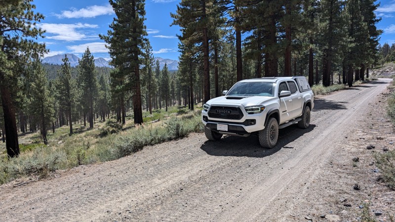
Updated: 10/15/2024
Antelope Bench
Crestview, California
Antelope Bench is easy and offers diverse scenery. It passes by Lookout Mountain in the northwest and Little Antelope Valley in the southeast. Toward the southeastern end, there is also a (white) Clay Pit Mine. The trail winds through sparse forests and open valleys, providing a sample of different terrains east of the 395 highway. The northwestern half of the trail has more tree cover and shade than the southwestern half.
Most of the trail is gravel with a few rocky sections, and when conditions are good, it can be traversed with a stock 2WD truck or SUV. The trail has several locations that could be used for camping, as dispersed camping is allowed in the Inyo National Forest.
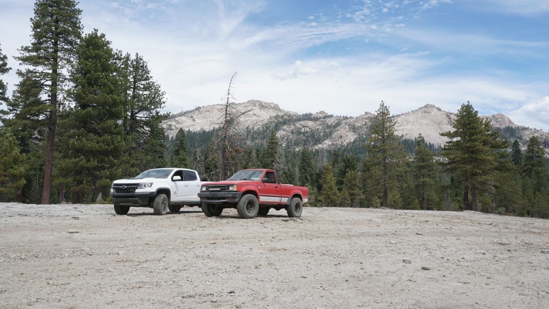
Updated: 05/01/2024
23E278 - Haskel
North Fork, California
Almost hidden off Rock Creek Road and Browns Meadow in the Sierra National Forest north of North Fork and East of Bass Lake is this short, but scenic and slightly challenging 4WD trail. 23E278 - Haskel sits high in the mountains of the Sierras, but is overshadowed by the towering Shuteye Peak and Chiquito Ridge to the north.
Some killer backdrops and great camping options make this trail a must-do if in the area. For those looking for a place to cool off in the summer months, a short hike just a few hundred feet down the creek from Waypoint 06 leads a number of small pools along Rock Creek.
Haskel is a great trail for any level of off-roader with a 4WD vehicle.
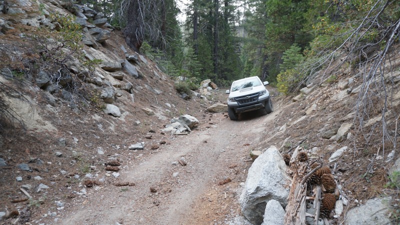
Updated: 05/01/2024
7S08 - Nine Line ( North )
North Fork, California
7S08 - Nine Line (North) is north of Whiskey Falls in the Sierra National Forest, north of North Fork, California and east of Bass Lake. This short trail connects 8S09 - Peckinpah / Whiskey Road and the south end of 7S04 - Browns Meadow.
Where this trail once connected to 7S04 - Browns Meadow and all the way to 8S09 - Peckinpah / Whiskey Road , it now dead-ends at a wall of boulders just before a deep ravine created by a past wash out.
This north end of 7S08 includes only light challenges and is suitable for any first time wheeler or high clearance 2WD vehicle, but note that the south end of 7S08, seperated by a large washout, is slightly harder where 4WD is recommended.
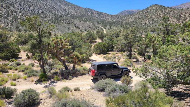
Updated: 10/15/2024
Monarch Flat
Cushenbury, California
Carving its way up Blackhawk Mountain, Monarch Flat is an up-and-back road in the Mountain Top Ranger District of the San Bernardino National Forest (SBNF). Along the way, majestic views north and east only get better as the trail climbs in altitude. The trail eventually reaches 6,700 feet atop Silver Peak, where the abandoned Silver Mountain Mine with its shuttered mine shaft remains. Official maps may show the trail extending beyond Silver Peak, but the trail has long been forgotten and reclaimed by nature. The trail is moderately difficult and made up of loose rock and narrow, twisty shelf roads. A high-clearance four-wheel drive vehicle with an experienced offroad driver is recommended to manage this trail.
This trail offers several excellent dispersed camping locations, especially at its namesake, Monarch Flat, about 1.2 miles from the trailhead and again at the trail's end with its magnificent views. Dispersed camping is permitted when following the SBNF Dispersed Camping Guidelines. Be sure to follow all Current Fire Restrictions and Related Prohibitions and obtain a California Campfire Permit before camping.
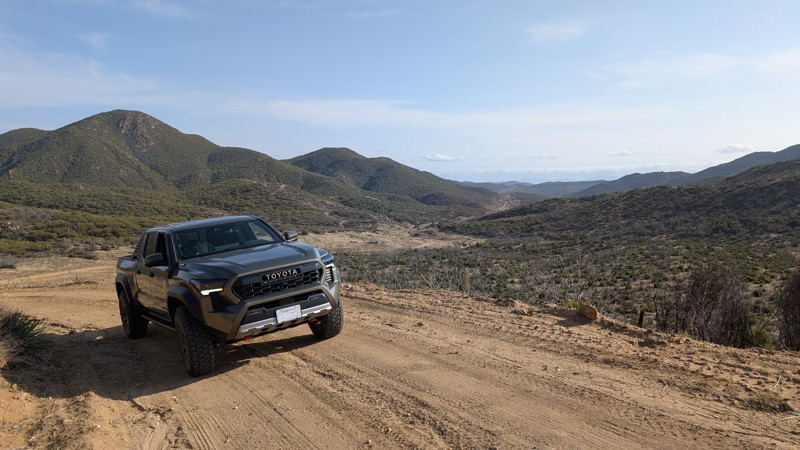
Updated: 07/12/2026
Cooper Cienega Truck Trail
Holcomb Village, California
Cooper Cienega Truck Trail connects Chihuahua Valley to Anza through the Beauty Mountain Wilderness. The northern section of the trail sits in the middle of a 200-foot-wide right of way through the wilderness area itself, offering a scenic drive through pristine backcountry. The southern section is popular for wild turkey hunting, where hunters can be found camping along the side of the trail. The entirety of the trail resides on BLM land but is in a protected environment, so travel is limited to designated routes. When combined with 9S05 Indian Flats, it is possible to travel from Warner Springs to Anza.
Difficulty
The trail is primarily graded dirt. However, two notable obstacles require high clearance and good traction.
- 1.5 miles from the south end is a 300-foot steep climb up a loose dirt shelf road. In normal conditions, a 2WD vehicle can traverse this with good traction, but if the ground is wet and slippery, this could be a challenge for even 4WD vehicles.
- 4.3 miles from the south end, just north of the midpoint of the trail, is a large buried crop of rock with ruts less than 6" deep. This rock creates a mild yet mandatory step-up/down requiring high clearance. Stock high-clearance 2WD vehicles should be able to pass this without issue.
Camping
At least 6 sites for dispersed camping exist along the trail. 3-4 obvious sites are right on the trail with little privacy, often used by hunters, while others can be found tucked away around a corner of a side trail. Two of these tucked-away sites can each accommodate upwards of 6 vehicles in a large flat area with plenty of shade and a hand-made fire ring.
Access
The trail can be traveled in either direction. Old Mitchel Camp Road provides access from the south off of Chihuahua Valley Road. From the north, Ramsey Road in Anza ends at the northern tip of Cooper Cienega Truck Trail.
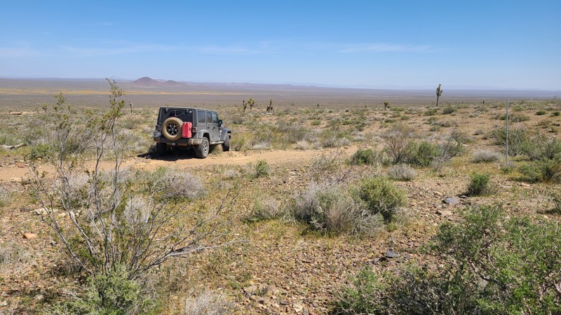
Updated: 10/15/2024
Princess Pat Mine Road
Helendale, California
Reaching far into northern foothills of Shadow Mountains and across the Shadow Mountain Tungsten District, the Bureau of Land Management's Princess Pat Mine Road morphs from a graded dirt road to a narrow rugged Jeep trail with steep inclines and descents. The 3,400-foot elevation provides sweeping northerly views of a rugged, empty desert, reminding one how far from civilization you are. Numerous intersecting trails offer opportunities to explore the many inactive mine claims in the area.
The rugged hills offer limited flat dispersed camping sites, but finding one provides wonderful quiet solitude while enjoying the far-off views.
A four-wheel drive high clearance vehicle is required to navigate through the foothills.
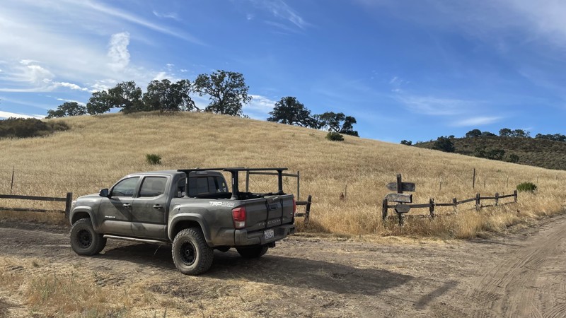
Updated: 10/15/2024
Hollister Hills SVRA: Raptors Ravine
Ridgemark, California
Hollister Hills SVRA is a 6,800-acre SVRA park and was the first SVRA made by the California parks department. The park is divided into three parts, the Upper Ranch, Lower Ranch, and Hudner Ranch. The Lower Ranch is for dirtbikes. While the Upper Ranch and Hudner Ranch are for 4x4s, visitors should stop first at the ranger station in the Lower Ranch to pay the $5 entry fee and get a map of the trails, as well as the lock combination to the gate at Hudner Ranch.
Raptors Ravine is a moderately difficult trail in the Hudner Ranch portion of Hollister Hills SVRA. The trail doesn't have any major technical obstacles, just a few steep hills. However, the trail is narrow, and drivers with wide vehicles may have a hard time navigating the trail. The entirety of Hudner Ranch is perfect for new off-roaders to test their skills with low-risk but entertaining trails. There is no camping directly off of the trail, but campsites are available in nearby Hudner Ranch and require a prior reservation.
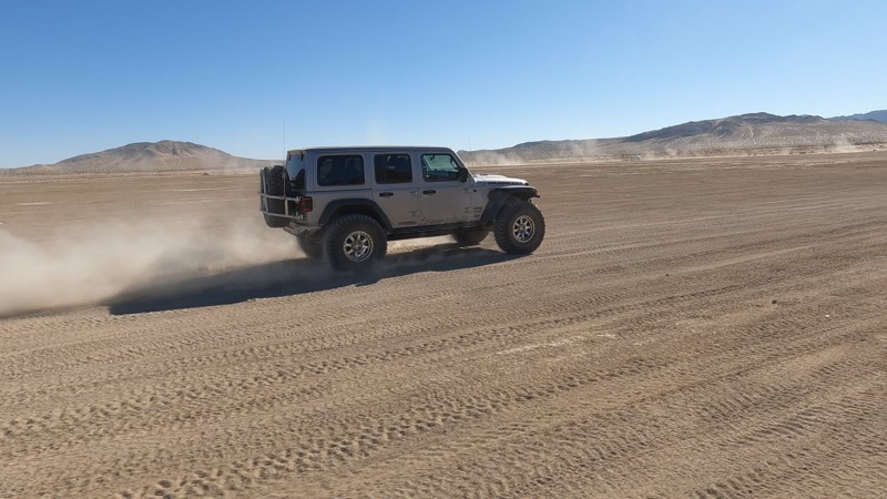
Updated: 03/09/2026
Means Dry Lake
Johnson Valley, California
Means Dry Lake is a broad, hard-packed lakebed located in the Johnson Valley OHV Area of Southern California’s Mojave Desert. It serves as a central hub for offroad recreation and provides direct access to iconic trails like Jackhammer, Sledgehammer, and Claw Hammer, as well as milder desert routes for casual riders. The terrain is flat and firm, making it suitable for dispersed camping, staging, and large gatherings.
Best known as the site of the annual King of the Hammers event, when the area becomes a bustling temporary city, Means Dry Lake is otherwise quiet and open, offering scenic desert views, dramatic sunsets, and exceptional stargazing. The area has no services, so visitors must be self-sufficient. A high-clearance vehicle is recommended for deeper trail exploration, but the lakebed itself is accessible to most vehicles. Camping is primitive but widespread, with ample space for RVs and trailers.
If roughing it isn't your thing, check out the many options in Yucca Valley, which include hotels and other housing options.

Updated: 10/15/2024
Coyote Lake Road CL7684
Manix, California
Coyote Lake Road CL7684 starts near I-15 and hugs the eastern edge of Coyote Lake, ending at an entrance to Fort Irwin National Training Center military base. The base entrance is not gated, but signage prohibits further passage. The road is wide, flat, well maintained, and provides easy access to the many trails in the Coyote Lake area. This road is mostly on BLM land, and there are no signs to prevent dispersed camping along its length. Any passenger car can drive on this road.
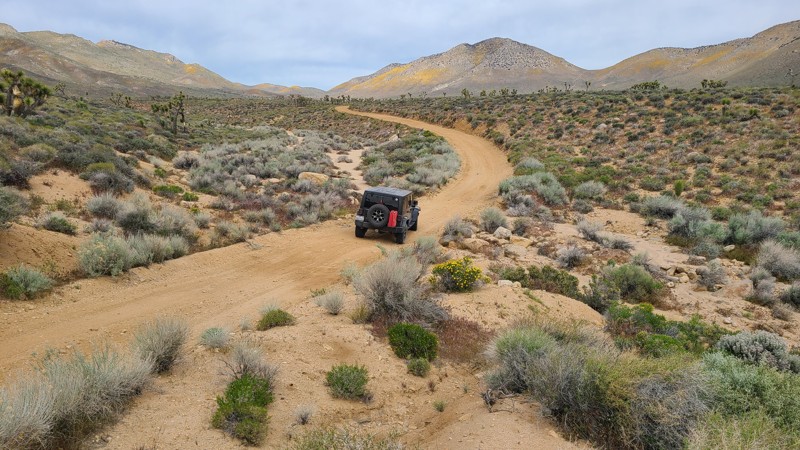
Updated: 10/15/2024
Bird Spring Canyon Road SC120
Harts Place, California
Starting on the desert floor, Bird Spring Canyon Road passes through Bird Spring Pass, gradually rising and falling about 2,000 feet. It skirts the southern edge of the Kiavah Wilderness between the tall peaks of the Scodie Mountains, and the Pacific Crest Trail crosses about five miles from the western end, where a watering station is set up for the hikers.
The road is wide and well maintained and an easy drive for new offroaders, but it still requires a high clearance 4x4 to manage the soft sand and occasionally exposed rocks. Descending on the western end follows a series of switchbacks, which may be intimidating, but these are wide enough for ascending vehicles to pull aside and allow passage.
The eastern portion of the trail has a few primitive campsites set up by the BLM, which are easily identified by posted signs noting a 15-mile speed limit when campers are present. Camping there or at suitable dispersed sites can be enjoyed when meeting the BLM Camping Guidelines. During high fire danger, campfires may be restricted, and if planning to camp here, one should review the current BLM Campfire Restrictions and have a Campfire Permit.
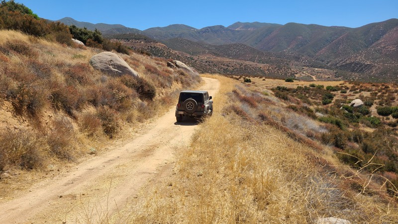
Updated: 10/15/2024
Wolfskill Truck Trail
Banning, California
Wolfskill Truck Trail follows the edges of the San Jacinto Mountains foothills, providing distant views to the west and connecting to other Bureau of Land Management (BLM) trails that meander through these foothills.
The majority of the trail is on BLM land, where dispersed camping can be enjoyed when following the BLM Dispersed Camping Guidelines. There are a few suitable campsites along the trail. These consist of pullouts a few feet off the road with room for one or two vehicles but do provide views. Open fires are prohibited, and it is the responsibility of campers to understand the Fire Restrictions.
A beginning offroad driver in a two-wheel drive high clearance vehicle will enjoy this trail. Some areas of the trail are impassible from washouts, and bypasses can easily be seen at these spots. Water worn ruts in the road can easily be avoided by driving to one side.
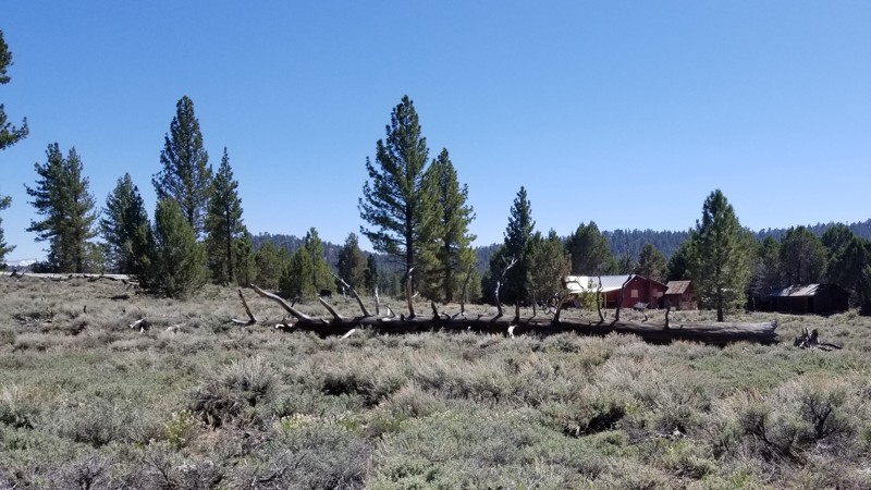
Updated: 05/05/2023
Holcomb Valley Farm and Camping Area
Fawnskin, California
In the forest of Big Bear are a ton of great trails and a lot of camping. One such of these areas is an area next to the old farm in the Holcomb Valley area. Nestled in the forest, this area has some great dispersed camping waiting for families to make memories. It is full of lush green forest and bushes plus a stunning view of Holcomb Valley in the background. The area is large and flat and perfect for groups or families looking to escape the crazy life of SoCal and slow it down a bit. Because the area is dispersed, it has way fewer people than camping in a campground. But with that said, it is rare that wood or charcoal fires are allowed in this area so bring a gas campfire for your nightly ritual.
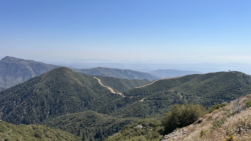
Updated: 09/30/2025
Thomas Hunting Grounds Trail
Angelus Oaks, California
Thomas Hunting Grounds is an 11.6-mile straight-through dirt alternative to Highway 38 that contours the hills above Mill Creek, passing Morton Peak, Mountain Home Peak, and Constance Peak in about an hour. Frequent turnouts offer amazing scenic views of the Inland Empire. The route is easy and beginner-friendly. Scattered rocks about golf-ball to softball size are mostly avoidable, and any stock SUV or truck can make the drive. Multiple side spurs provide dispersed camps for 4–6 vehicles; sites are first-come, first-served, and some have established fire rings. Per the U.S. Forest Service, a California Campfire Permit is required for any fire use, including campfires, charcoal BBQs, and gas stoves, and only street-legal vehicles are allowed.
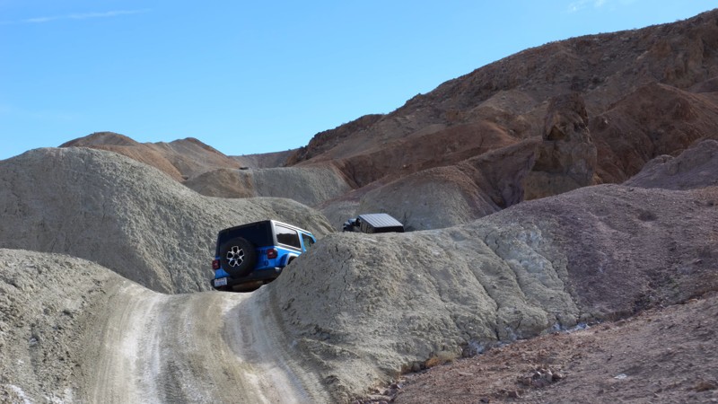
Updated: 05/20/2026
Mud Hills Southern Route
Yermo, California
The Mud Hills Southern Route is an entirely different experience than the other Mud Hill routes. While the other routes run along deep, narrow canyon floors, the southern route is up on the hills the entire way. Because of this, the route is much easier and an easy way to connect Odessa and Phillips Canyon. Since this trail is mostly an easy dirt trail, 2WD high ground clearance vehicles with offroad tires that are aired down can drive this trail in normal conditions.
There is no camping along the trail.
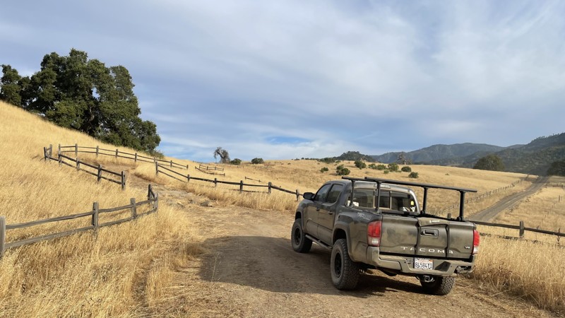
Updated: 09/21/2025
Hollister Hills SVRA: Adventure Trail
Ridgemark, California
Hollister Hills SVRA is a 6,800-acre SVRA park and was the first SVRA made by the California parks department. The park is divided into three parts, the Upper Ranch, Lower Ranch, and Hudner Ranch. The Lower Ranch is for dirtbikes. While the Upper Ranch and Hudner Ranch are for 4x4s, visitors should stop first at the ranger station in the Lower Ranch to pay the $5 entry fee and get a map of the trails, as well as the lock combination to the gate at Hudner Ranch.
Adventure Trail is a short but sweet trail in the Hudner Ranch portion of Hollister Hills SVRA. It is moderately difficult, and any 4WD or AWD vehicle can complete it. This trail is great for beginners looking to get experience offroad. The trail is made up of loose dirt with some steep hills and sharp turns. Portions of the trail are overgrown, and pinstriping is likely from the branches and bushes that have grown onto the trail. There is no camping directly off of the trail, but there are campsites available in Hudner Ranch that require a prior reservation.
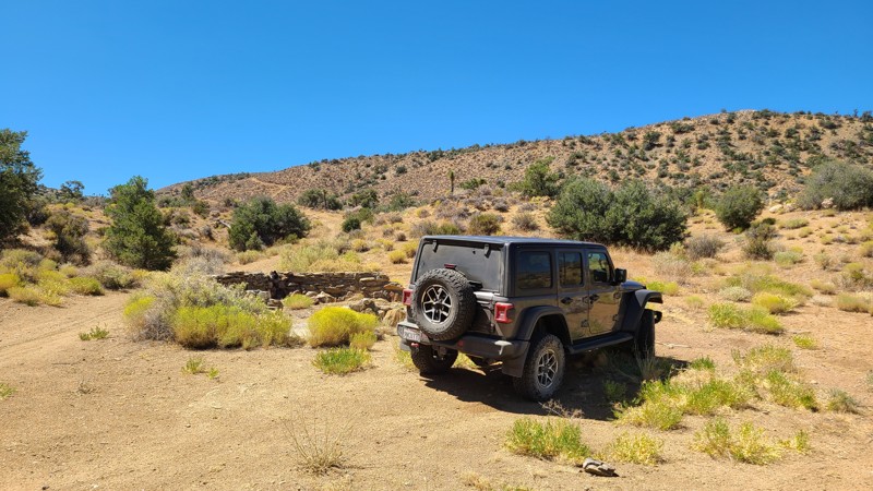
Updated: 09/22/2025
Rattlesnake Canyon 2340
Rimrock, California
Located south of the popular Johnson Valley OHV area and reached from RC2330, RC2340 is an up-and-back over a rugged trail. Ruins can be found within sight of the trail from this once-active mining area. Many short intersecting spurs invite exploration along this route.
The trail has steep rocky sections requiring a 4-wheel drive high clearance vehicle.
Many established campsites can be found along this trail, and dispersed camping is allowed here when following the Bureau of Land Management's Camping Guidelines. Open fires are prohibited in this area.
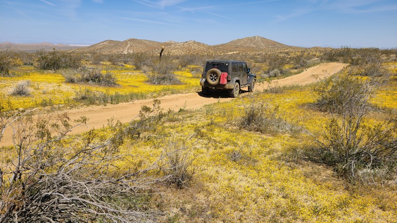
Updated: 01/07/2025
West Loop Trail
El Mirage, California
Reaching the northernmost border of the 27,000-acre El Mirage OHV Recreation Area, the West Loop Trail begins on a flat basin before going into the rugged Shadow Mountains, where it becomes a rough and occasionally steep path. Notable waypoints along the route are Resurrection Hill, where ATVs have carved snake-like lines up its sides and are visible even from a distance, and the remnants of Rabbit Hole Mine directly next to the trail. At the trail's northernmost reach is the Fearless Folly 4X4 Trail intersection, an extremely rugged trail meant only for experienced offroaders in groups for mutual rescue.
West Loop Trail is an excellent trail for beginning offroaders to build their driving confidence on a bit more rugged and steep trail yet can still be managed with a two-wheel drive high clearance vehicle.
Dispersed camping is plentiful along the trail, with enticing dispersed campsites tucked amongst the rocks or beside shading joshua trees. Improved dry camps are only a short distance from its end.
El Mirage OHV Recreation Area requires a permit for one day/night, payable at the Visitor Center entrance.
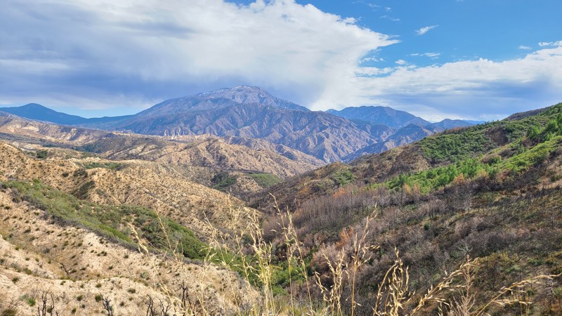
Updated: 01/16/2026
Alder Creek
Highland, California
Climbing 3,200 feet into the southern San Bernardino Mountains, Alder Creek provides phenomenal views across the Inland Empire and out to the distant Santa Ana Mountains. Just off the trail, and hidden from traffic, are abundant dispersed camping sites. Many of these sites are located on large, level areas adjacent to wind-sheltering mountain slopes, with space for multiple vehicles and tents, and offer outstanding views of the cities below. At its end, the trail intersects City Creek 1N09, which provides access to many other trails to explore or a quick exit to Highway 330.
Alder Creek twists and turns up the mountainsides with several hairpin turns, but it is an easy drive on a mostly flat, hard-packed dirt road. Shelf roads with very steep drops make up a large portion of the trail and can be intimidating, but these sections are generally wide enough for two vehicles to carefully pass with a few narrow segments that require careful maneuvering to make way for opposing vehicles. Many culverts and shallow water worn ruts cross the road, and these are easily managed by a two-wheel drive vehicle with good ground clearance
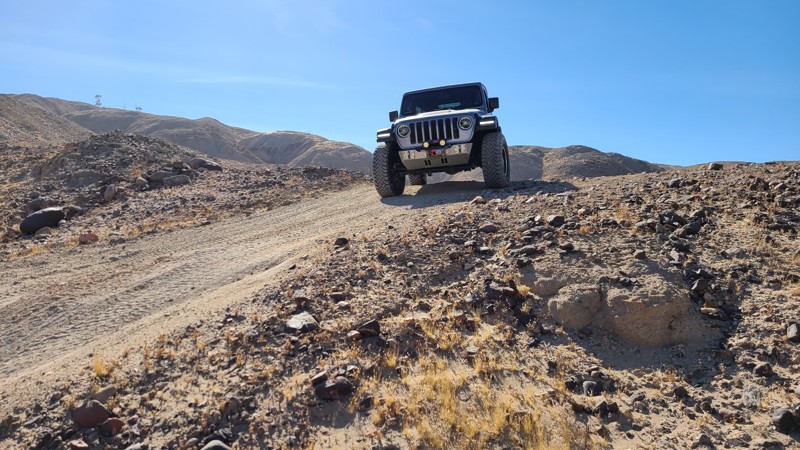
Updated: 01/05/2023
Voodoo
Brawley, California
Looking for a change in pace when cruising through The Superstitions in Southern California? Thinking about taking up a little witchcraft? Well, Voodoo might be your trail. This easy trail takes you from the center of the mountain range to the northern edge. It is full of stunning views and has some of the harder rock crawling trails just off of it.
So when in the area, check out Voodoo and tell us what you think.
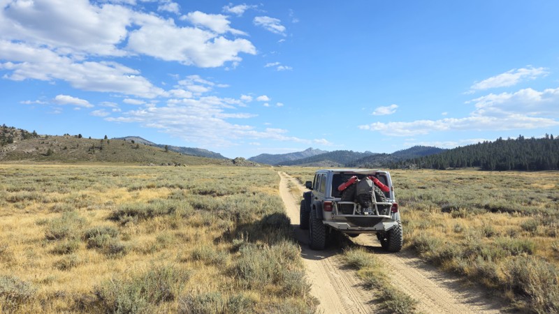
Updated: 11/30/2025
Beck Meadows / Deer Island Road
Olancha, California
Sitting at approximately 7,900 feet above sea level near the northern side of Monache Meadows, 20S05 is a popular and exceptionally scenic trail often considered the poster child for the area. Known for its crossing of the South Fork Kern River, it is one of the two most photographed trails in the region. Beyond its picturesque setting, 20S05 is the longest trail traversing the meadows, offering stunning views and excellent opportunities for photography. The trail's length also provides a great vantage point for observing wildlife as they roam the vast meadows. Near the southern end, the trail reaches a permit-required wildlife area that quickly dead-ends at the river, with an option to hike an additional 500 feet for another encounter with the beautiful Kern River. Although easy and accessible for most off-road vehicles, caution is advised when crossing the river, as conditions can change rapidly, potentially altering the trail's difficulty. Despite its length, the trail does not offer ideal camping spots, so it is recommended to camp at 20S03 near the meadow entrance for convenient access.
Please note: This is the Golden Trout Wilderness Area, one of the few areas where golden trout naturally live. Because of this, there are special fishing rules. Please research the rules and regulations before fishing in the area. More information can be found at the "Fish and Game Website."
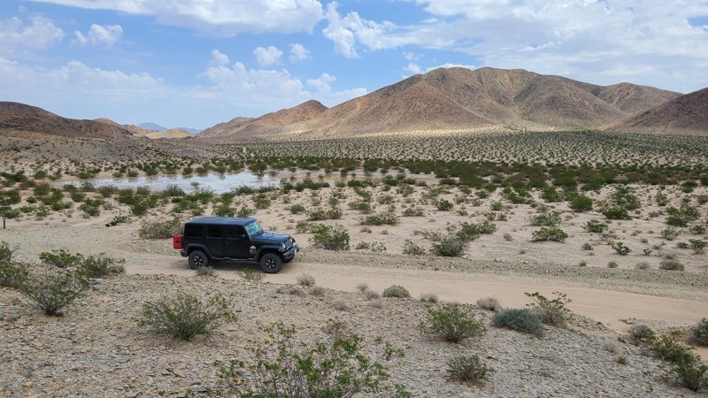
Updated: 10/15/2024
Cronise Lake Area - CL8337
New Dunn, California
The places to visit on this short easy trail make CL8377 a tempting detour. Shortly after the start is the Bonnie Keebler Harris grave, who died in 1872 while traveling on a wagon train heading west. Her grave has a permanent marker installed by the Mojave River Valley Museum. A short distance further, surrounding a small playa, a copse of rare Crucifixion Bushes, the same large thorns put on Jesus Christ's head. Two miles from the trail's end, a green rocky outcrop appears. A short hike away lie intaglios in the rocks and classic Indian sleeping circles where natives built brush shelters or wickiups. A short drive past the trail's end will take you to Afton Canyon and access to the BLM improved camping and the Mojave Road.
Dispersed camping is available along the trail following the BLM Barstow Field Office camping guidelines.
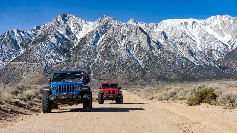
Updated: 05/20/2026
Hogback Ranch Road
Lone Pine, California
Hogback Ranch Road is a maintained dirt surface suitable for any vehicle. If travelling from the east and starting on Movie Road, it gains elevation until it finally leaves BLM-managed land and ends up in the Inyo National Forest, where you will get to witness pine trees! One campsite is directly on the road, which is not numbered on the BLM map, but signage indicates it's okay to camp there. The site is large and suitable for a group of vehicles looking to camp with one another.
About camping on this route:
All dispersed camping is designated to a specific site and requires a permit. A permit can be obtained online or at the Eastern Sierra Visitor Center or kiosks located on Movie Road and the main entry point in Lone Pine. Permits need to be signed and displayed on your dashboard.
The BLM has created a map showing the site numbers. However, those numbers are not used in the field, but each site is clearly marked with either a camping allowed or no camping allowed symbol on a clearly visible sign. Please be aware that all sites are first come, first served, and a permit does not guarantee you will find a site. Due to the area's popularity, it is best to arrive early.
There are six portable restrooms throughout Alabama Hills. If you do not want to drive or walk to one, you must bring your own system to pack out human waste.
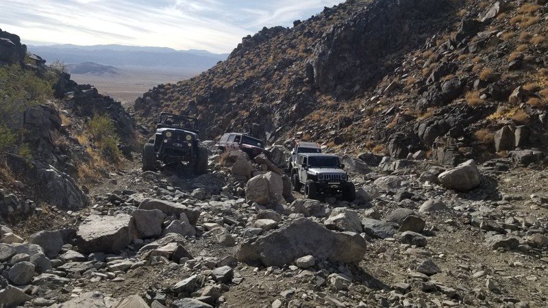
Updated: 02/06/2025
Bender Alley
Johnson Valley, California
Rocks, rocks, and more rocks. Some of the rocks are large, while others are huge. There is a good reason why Bender Alley is feared. Expect rocks over 6 feet round everywhere. Plus, the gatekeeper obstacle at Wrecking Ball is a good one that will filter out most vehicles.
If you want something really hard, continue up the canyon up Upper Bender Alley. Many say it is the hardest single trail in Johnson Valley.
There is no camping on this trail. Nearby Means Dry Lake has space for everything from RVs to tents.
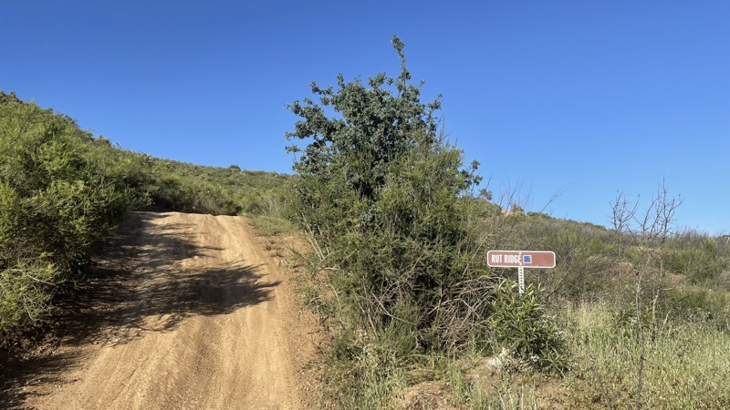
Updated: 10/15/2024
Frank Raines OHV: Rut Ridge
San Antonio Valley, California
Frank Raines OHV Park is located not far from Patterson, CA. It is open to 4x4s from sunrise to sunset with a $5 admission fee per vehicle. The park is open to all OHV vehicles, so be sure to watch out for dirtbikes, quads, and SXS.
Rut Ridge is a moderate trail, rated blue by the park's rating system. Despite the name, Rut Ridge is one of the least rutted trails in the park and can easily be completed in 4WD or AWD. The most difficult portion of the trail is a series of short hill climbs. The trail eventually connects to Fire Road, another trail in Frank Raines.
Deer Creek Campground is located at the park's entrance. The campground has 34 sites with picnic tables, restrooms, and other amenities. Prices range from $15 to $30 per site.
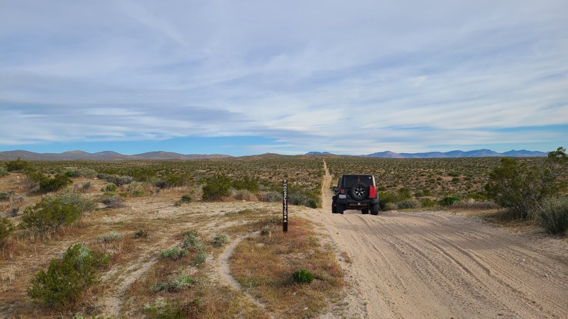
Updated: 10/15/2024
Scodie Mountains SC175
Rancho Seco, California
SC175 is an excellent introduction to the trails of the Jawbone Canyon OHV Area. It conveniently starts and ends near Highway 14 with a must-stop at the Jose Bishop Gravesite and Claim about ½ way along the trail.
The road is wide and well maintained and an easy drive for new offroaders, but it still requires a high clearance 4x4 to manage the soft sand and occasionally exposed rocks.
There are only a few predisturbed sites for dispersed camping and they can be enjoyed when meeting the BLM Camping Guidelines. BLM provides better camping at many sites along Jawbone Canyon Road. During high fire danger, campfires may be restricted, and if planning to camp here, one should review the current BLM Campfire Restrictions and have a Campfire Permit.
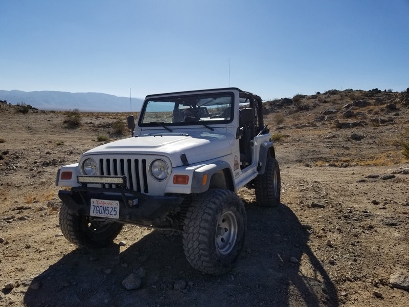
Updated: 02/27/2024
Lazy Days - Johnson Valley
Yucca Valley, California
After pushing the rig a bit, it is always nice for a nice lazy day kind of trail. Lazy Days is the connector trail that takes you to or from SOS or the end of Turkey Claw to the east back towards most people's camps. The trail is mostly a wash and hard compact dirt making it an easy route for high speed. The next time you are done breaking your rig on some of the hard trails in Johnson Valley OHV, just remember there is a Lazy Day waiting for you.
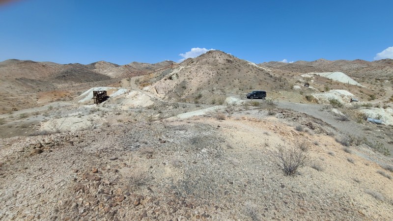
Updated: 10/15/2024
Appaloosa Way D073
Baker, California
Appaloosa Way is a sandy, flat, up and back trail that follows the western border of the Hollow Hills Wilderness to arrive at the Silver Lake Talc mine. The mine last saw action in the mid-1950s and now lays abandoned with its rotting wooden structures yet still has piles of white talc ready for loading. Camping is allowed anywhere along the trail when following the BLM Barstow Field Office guidelines.
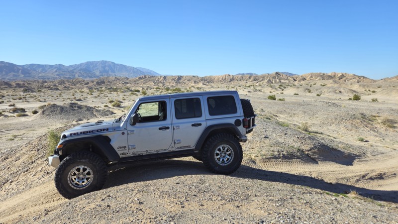
Updated: 08/11/2025
Coral To Palm Wash Cutoff
Salton City, California
As the name suggests, the Coral to Palm Wash Cutoff is a rough, desert route connecting the end of Coral Wash to Palm Wash in the Truckhaven Hills near the Salton Sea. This path connecting the two trails passes through the mud hills, where you will encounter slightly challenging, tight, off-camber canyons and stunning views. Hosting what might be the most remote place to camp in all of Truckhaven, this trail is definitely a unique little offroad gem.
This trail is suitable for any stock, high-clearance vehicle.
The best camping on this trail can be found right in the middle of the trail, on top of the pass, where you will find a large open flat area that could easily fit 20+ vehicles. Because of the remote nature of this area, this could be a fun place to camp as it offers a minor windbreak, a level, flat dirt ground, and some fantastic views just feet away. The camp spot is suitable for ground camping.
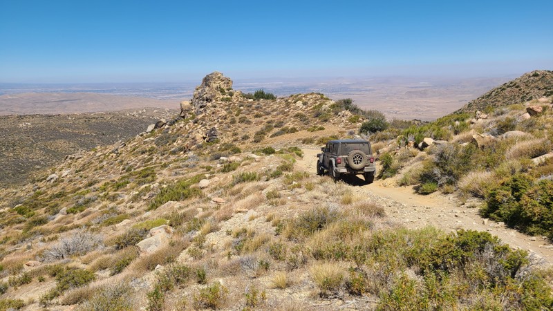
Updated: 08/11/2025
North Peak
Fizzben Heights, California
In the forest-to-desert transition on the north side of the San Bernardino National Forest lies North Peak Road. Created to reach the once active White Knob Quarry, the trail is an out-and-back rising about 1,000 feet up the west side of White Mountain. Drivers looking for an offroad challenge to test their driving skills will enjoy this steep trail, and their efforts will be rewarded with inspiring panoramas out to the distant San Gabriel Mountains. The trail ends at the quarry where the exposed white limestone and the mountain's namesake were being harvested
The trail is deeply rutted and follows steep rock-covered switchbacks, which have both inclines and off cambers reaching 20 degrees. A lifted 4x4 is required to drive this trail, and lockers will be a benefit to help grip over the loose rocky sections.
While dispersed camping is allowed, there are no suitable flat and level locations to set up camp on the trail. However, only about 1.5 miles to the west of the North Peak trailhead is the Horse Spring Campground with its improved campsites and pit toilets.
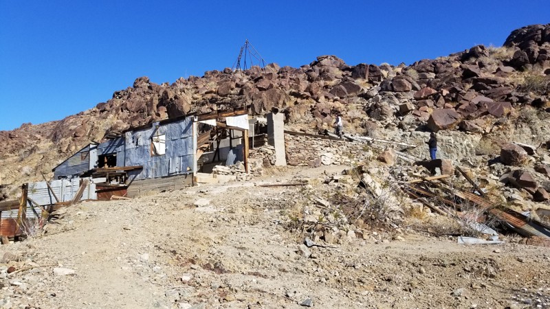
Updated: 10/15/2024
Gold Egg Mine
29 Palms, California
Looking for a unique place to explore or camp when out by 29 palms? Look no further than the Gold Egg Mine just off Gold Crown Road. This unique and fun to explore area has a ton of great historical items that are ready to be rediscovered. Because the area used to be leveled for buildings, the area makes for good overland camping and dispersed camping. So when out and about, and want something new to explore while driving a 4x4 with high ground clearance, you should check out the Gold Egg Mine near Joshua Tree National Forest.
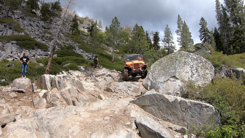
Updated: 12/31/2025
Committee / Fordyce Early Exit
Baltimore Town, California
High in the Tahoe National Forest, this rough rocky trail is the early exit/entrance to the iconic Fordyce Jeep Trail.
Committee is full of jagged rock obstacles and steep ledges. The Committee water crossing at the bottom of this trail is said to be the deepest of all the Fordyce water crossings during high water flows. This trail is tough and is best suited for built rock crawling rigs. Stock 4x4s aren't recommended through here.
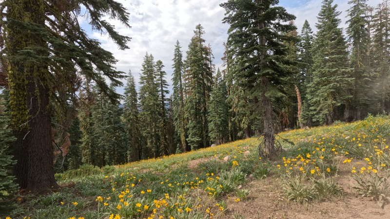
Updated: 12/31/2025
Williams Creek
Bassetts, California
Williams Creek, located within the Tahoe National Forest, is a straight-through, well-maintained dirt road that makes a great way to get around on your overland adventure. You will see towering trees well over 100 feet tall along the route. Since the forest seems well maintained, the views along the route are something else. Just be careful; the trail is so smooth it is easy to go faster than you can safely stop. Any offroad vehicle can do this trail.
Even though the area is well maintained, the majority of the trail is up on the cliffside, meaning there are no ideal places to camp.
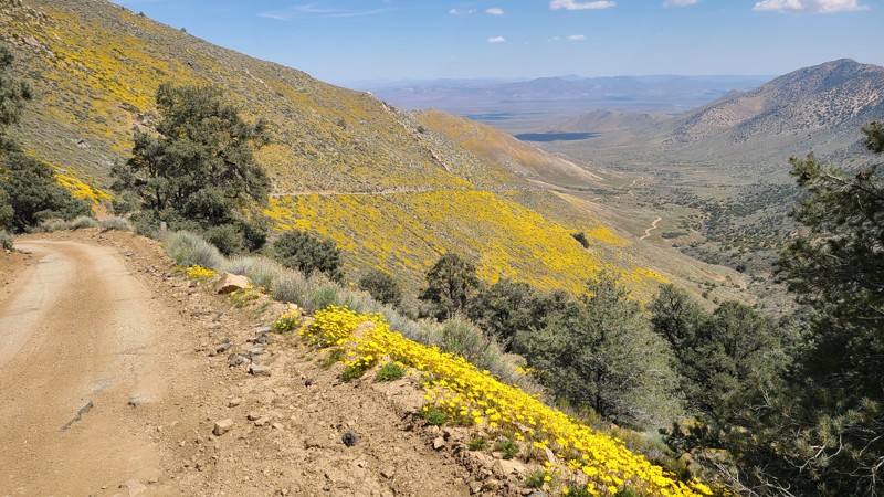
Updated: 04/24/2026
Horse Mountain
Onyx, California
Horse Mountain is often used to access the trailhead for Forest Service road 36E52 to McIver's Cabin. A narrow ledge road winds its way up the side of the mountain with often no room for vehicles to pass. Once at the top, there is the signed trailhead for Forest Service road 36E52.
Some excellent dispersed campsites can also be found when reaching the top of the mountain. Dispersed camping here requires following National Forest Dispersed Camping Rules. Campfires are only seasonally allowed and are generally banned during the summer months beginning in May. When planning to camp, one should first determine if campfires are allowed, meet the required Campfire Safety Rules, and have a valid National Forest Campfire Permit. The best way to determine the campfire restrictions is to call the Kern River Ranger District Ranger Station at (760) 376-3781.
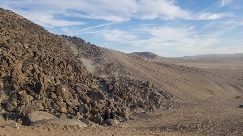
Updated: 10/15/2024
Idle Issues
Johnson Valley, California
Made famous by King of the Hammers, Idle Issues is an alternate trail near Chocolate Thunder that goes straight up a rocky hill. With extreme off-camber and loose rocks, it is no wonder most people are afraid of trying this hill climb. But the secret is that a bit of momentum goes a long way.
This is just a short trail. While you could camp at the base of it, which is also Chocolate Thunder, most people camp on the lake bed or just to the south.
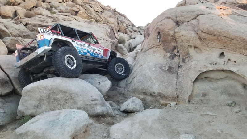
Updated: 10/15/2024
Georges Crack
Lucerne Valley, California
Georges Crack is one of the hardest trails in Cougar Buttes. Near Noessers Nasty Notch, this trail is similar in difficulty but is much shorter since the obstacles are only in the first 30 feet of the trail. This trail is for the extreme rock crawlers looking to push their vehicles to the max. Body damage, breakage, and rollovers are common here. So are you crazy enough?
The trail runs from north to south.
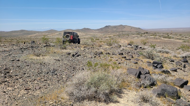
Updated: 10/15/2024
Iron Mountain 5841
Johnstons Corner, California
IM5841 offers difficult driving challenges even when bypassing the extreme or even impassible obstacles on the trail. Climbing up the side of the rocky Iron Mountain, the trail from its highest point loops around, traveling back to the northwest into the valley below. The trail descends into a deep wash and is abruptly blocked by a rocky barrier providing the highest level of difficulty, if not impassible. Just before encountering the obstacle, a faint bypass can be found on the north side of the trail leading around the obstacle and back down into the wash that offers its own rocky navigation challenges.
A nice level dispersed campsite is near the start of the trail.
This trail should only be attempted by experienced drivers with high clearance four-wheel drive and appropriate all-terrain tires to deal with the rocky trail.
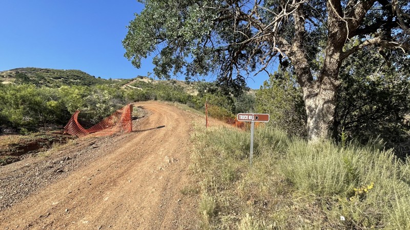
Updated: 10/15/2024
Frank Raines OHV: Truck Hill
San Antonio Valley, California
Frank Raines OHV Park is located not far from Patterson, CA. It is open to 4x4s from sunrise to sunset with a $5 admission fee per vehicle. The park is open to all OHV vehicles, so watch out for dirtbikes, quads, and SXS.
Truck Hill is a moderately difficult trail, rated a black diamond by the park. The trail has similar obstacles as other trails in the park, with steep hill climbs, ruts, and loose dirt, but to a lesser degree. Anyone with 4WD and high clearance could complete Truck Hill. The trail connects to Matt's Hill and Spider Hill, two other black diamond trails in the park.
Deer Creek Campground is located at the park's entrance. The campground has 34 sites with picnic tables, restrooms, and other amenities. Prices range from $15 to $30 per site.
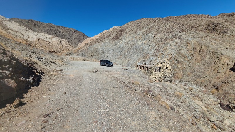
Updated: 10/15/2024
Alvord Mountain Road CL8145
Manix, California
Beginning on the sandy Mojave Desert floor, Alvord Mountain Road soon transitions up the rocky side of Alvord Mountain and arrives at the 120-year-old Alvord Mine. While idle since the early 1950s, the mine shafts and the roof-less stone shelter walls still stand strong. This up-and-back trail is very rough once on the mountain and requires a four-wheel drive with some clearance. Dispersed camping is available along the trail when following the BLM Barstow Field Office guidelines.
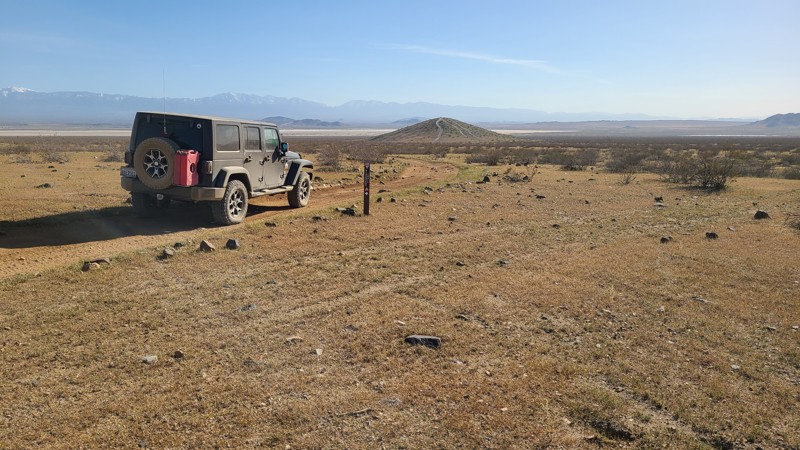
Updated: 10/15/2024
Discovery Trail
El Mirage, California
The BLM 27,000-acre El Mirage OHV Recreation Area provides several trails of varying difficulty to interest all offroaders. Discovery Trail is located in the heart of the area, providing a 15-mile tour circling "The Basin." The Basin lies between the La Mirage dry lake bed and the Shadow Mountains to the north, with its travel through the mountain's foothills providing the roughest terrain along the route.
While the improved campsites within the recreation area are located along Mountain View Road, Discovery Trail offers many dispersed camping opportunities, especially at its most western reach among the ruins of Hess Ranch.
A high clearance two-wheel drive will do fine on this trail.
El Mirage OHV Recreation Area requires a permit costing $15 for one day/night, payable at the Visitor Center entrance.
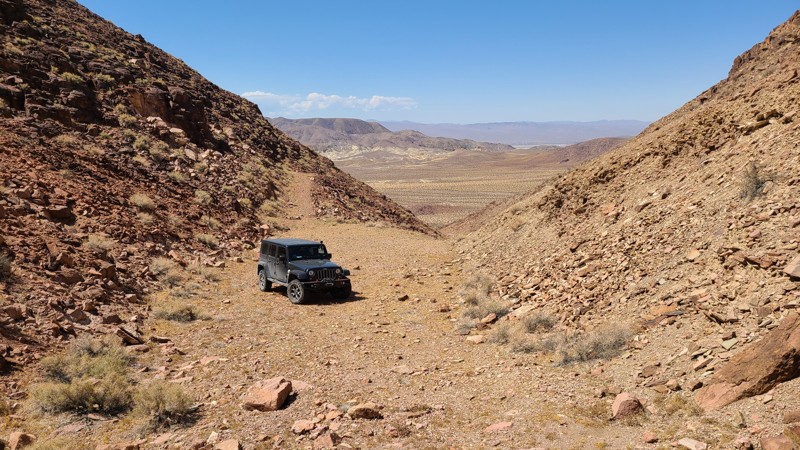
Updated: 10/15/2024
Calico Mountain 7634
Yermo, California
Accessed via Mule Canyon, this 2.5-mile trail follows the sandy desert basin to the north until, at its last 1/2 mile, climbs into a box canyon and dead ends at a perfect camping spot. This ultimate camping getaway has a large plateau-like area that is quiet and sheltered, with room for five or more vehicles. Surrounded on three sides by the easternmost mountain of the Calico Mountain range, the canyon opens to the west, providing a view of the vast desert below.
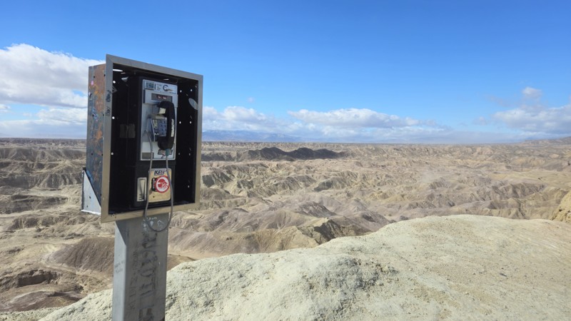
Updated: 10/15/2024
The Phone Booth Truckhaven
Salton City, California
The Phone Booth is one of the many unique attractions in the Truckhaven Hills. Sitting at 300 feet above sea level, this fantastic place to stop is worthwhile when in the area. Once on top of these hills, you are given a fantastic view of the low desert badlands below you. Because Truckhaven is open-roaming, people from all over southern California visit to enjoy life without boundaries and challenge themselves to some of the best offroading in America. Even though you could find an easy trail to the phone booth, the trail provided here offers a unique and exciting challenge as you pass the Basketball Hoop obstacle and head up to the top of the peak, where you find the old pay phone. Because this route is more difficult, 4WD with experience will be required. If this route is too hard, simply back out, and there are more accessible routes on the west and north sides. The trail is not suitable for camping.
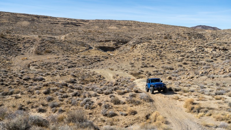
Updated: 03/25/2025
EP 11
Goler Heights, California
EP 11 is one of the more adventurous trails in the El Paso Mountain area, offering a mix of steep climbs, technical obstacles, and fantastic scenery. The western section features several short but intense hill climbs, where you'll find yourself looking straight up or down as you navigate the rugged terrain. From there, the trail presents optional rock challenges before transitioning into the Mormon Flat area, where narrow, rocky shelf roads require patient driving. Low-range gearing and high clearance are highly recommended for most of the route.
Passengers will appreciate the ever-changing landscape, which ranges from sandy washes to an arch and then to higher-elevation flats and eventually leads into tight canyon sections with dramatic twists and turns.
For those looking to extend their adventure, a few pre-disturbed campsites are available along the route, offering a scenic place to stay under the stars.
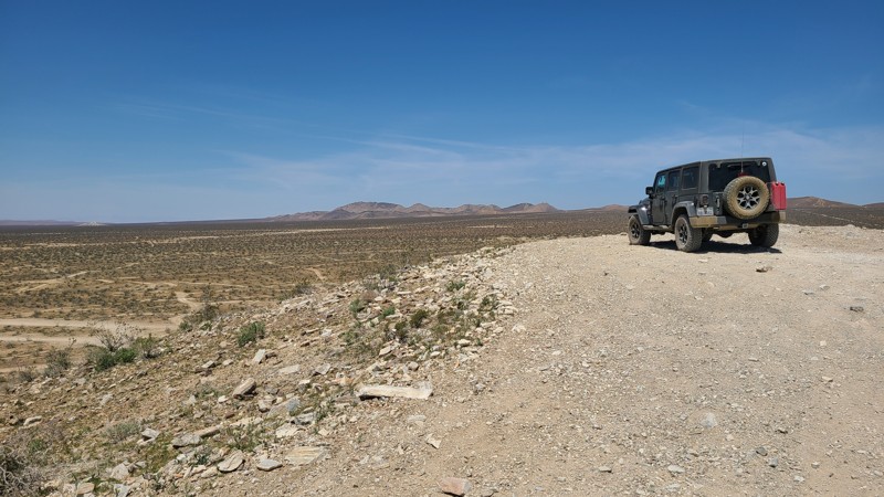
Updated: 10/15/2024
East Loop Trail
El Mirage, California
East Loop Trail is part of the Burea of Land Management's 27,000-acre El Mirage OHV Recreation Area. Located on the area's eastern side, the loop moves up, down, and over the Shadow Mountain foothills and Twin Hills area, reaching the fenced eastern border of the OHVA and eventually looping back to end at one of the OHVA's improved camping areas. The road often presents a rugged rocky path through the rolling hills that would be enjoyed by beginning offroaders needing only a two-wheel drive but a high clearance vehicle. As always, in the OHVA, there are many intersecting and mostly unmarked trails to explore along the way.
While the improved campsites within the recreation area are located along Mountain View Road, East Loop offers solitude and many dispersed camping opportunities.
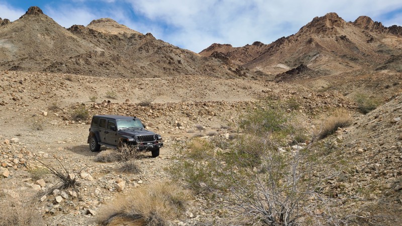
Updated: 04/22/2026
Palen Pass Road
Eagle Mountain, California
Palen Pass Road crosses over the gently rising desert bajadas of the historical WWII Palen Pass Maneuver Area, then, while within the Pale-McCoy Wilderness, carves through beautifully rugged Palen Pass before dropping into the massive alluvial fans formed by the Palen and Little Maria Mountains. Along with the history of the area, one will enjoy spectacular scenery, stone building ruins, abandoned mines and machinery, and several intersecting trails to explore. These trails include the Palen Dunes Road and the Arlington Mine/Patton’s Cabin Roads.
The Palen Pass Maneuver Area was part of the 12 million-acre WWII Desert Training Center and hosted thousands of soldiers manning guns, tanks, artillery, and airplanes that rumbled through this area from 1942-1944. A monument to these fighting men is found at the beginning of the trail. The massive 11,000-acre Camp Coxcomb housed the soldiers immediately across the Highway 177 trailhead.
BLM rates this trail as “MOST DIFFICULT,” which is a rating designed for expert riders and characterized by:
- Steep grades and narrow paths.
- Rough or loose tread surfaces.
- Substantial obstacles like rocks, ledges, and drop-offs.
- Potential for difficult navigation.
A high clearance 4x4 and an experienced driver are required to manage this trail. The trail begins in deep sand, and the road becomes a surface of six-inch-sized loose rock when climbing into Palen Pass, and transitions to hardpack over the east portion of the trail. At approximately 11.2 miles from the trailhead, at coordinates N33.91503°, W115.06504°, drivers can easily mistake the trail direction by following the many tire tracks leading to the right of the actual trail, which will lead down an extremely narrow, impassable path. The actual trail is straight ahead and somewhat disguised as a steep rock face, and is one of the most difficult sections of the trail.
Several dispersed camping locations can be found mainly in the Palen Pass area at the mine camps. Even in the desert, campfires may be prohibited. It is the responsibility of campers to know the campfire restrictions. Campfire restriction information can be found at the BLM Palm Springs South Coast Field Office and the Cal Fire websites, along with instructions to obtain an online campfire permit.
This is a very remote area with no cell service, and drivers should, before leaving, communicate their travel plans to family and friends, should carry adequate water, and be equipped for self-rescue.
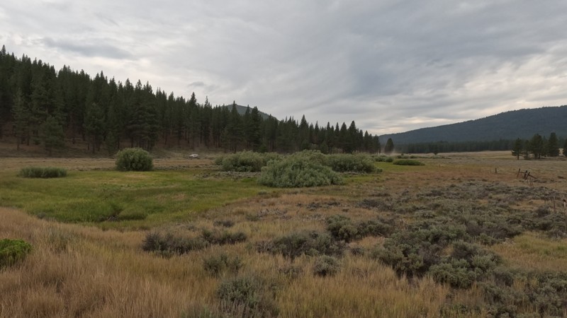
Updated: 11/09/2025
Mitchell Canyon - Long Valley
Verdi, California
Mitchell Canyon- Long Valley Trail is on the east border of California in the Tahoe National Forest. This easy dirt trail takes you from the hills of Henness Pass down to the border. With such easy access to the area, this is a popular place for people to leave their houses for a day trip or weekend adventure. The trail is a mix of forest and desert flora. Even though dispersed camping is allowed, there are no pre-disturbed sites.
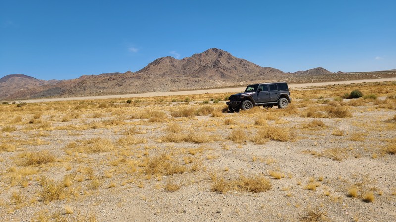
Updated: 10/15/2024
Johnson Valley 4207
Johnson Valley, California
Located in Johnson Valley, JV4207 starts at Highway 247 to reach into the Johnson Valley OHV Area, eventually reaching the edge of Soggy Dry Lake. It travels over the flat desert until reaching a set of rugged hills at the trail's end. The Johnson Valley Shared Use Area will occasionally be off-limits due to military usage, and those borders and off-limit periods can be found on the Johnson Valley OHV website.
Several dispersed campsites are located in the hills at the end of the trail and along the edge of Soggy Dry Lake and can be used when following the Bureau of Land Management Camping Guidelines. Campfires are generally prohibited, and the camper must know the current Bureau of Land Management Campfire Restrictions.
The hills near the trail's end are the only driving challenge due to their ruggedness, steepness, and off-camber cut during the descent, requiring a high clearance four-wheel drive vehicle.
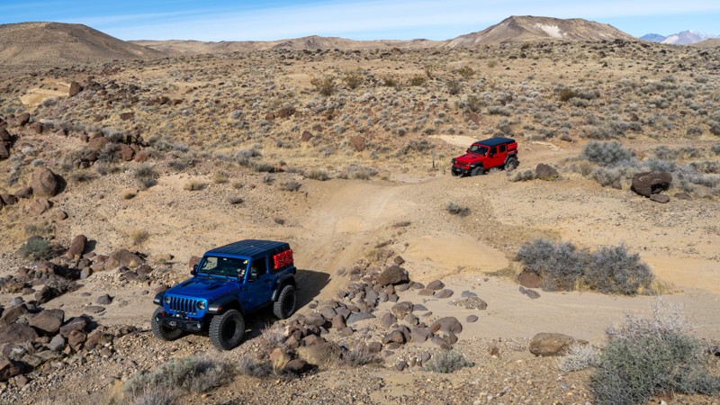
Updated: 05/20/2026
Mesquite Canyon Road
China Lake Acres, California
Running north to south through the rugged El Paso Mountains, Mesquite Canyon offers a stunning geological tour of the region. Starting at the northern end, the trail skirts the El Paso Mountain Wilderness Area and Black Mountain, providing excellent views of the desert landscape. As you travel south, the scenery shifts to sculpted sandstone formations in shades of pink and red, creating a striking contrast against the rugged terrain. Toward the southern end, the route opens up to Koehn Lake, a vast dry lakebed shimmering white with mineral-rich salts.
This is a long drive with rough terrain consisting of eroded dirt paths, embedded rocks, and stretches of hardened lava rock. Airing down your tires and having a high-clearance vehicle is strongly recommended. Although the road is rough, there are no major concerns in dry weather. About midway through, a shaded picnic area with a natural spring provides a perfect spot to pause and stretch your legs before continuing.
Due to the uneven terrain, camping options are limited along the route. Less-than-ideal spots are located at the northern and southern ends and offer no shade or privacy. The best spot is located along the southern end, just below an old mine shaft, but it is right on the trail.
For those seeking a remote and scenic offroad adventure, Mesquite Canyon delivers an unforgettable ride through California’s interesting and geologically diverse landscapes.
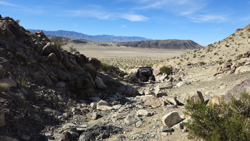
Updated: 03/09/2026
Guacamole
Johnson Valley, California
Guacamole is a straight-through rock-crawling trail just west of Means Dry Lake. This short but fun trail offers obstacles, waterfalls, and plenty of rocks to challenge even the most hardcore group. The main obstacle of the trail is on the southwest end, a boulder waterfall roughly 5 feet tall with a v-notch that can often destroy rocker panels and sometimes cause body damage. The trail is often combined with Resolution to create a longer route. Guacamole is an excellent trail for people looking to get their feet wet on the Johnson Valley Trails but want to avoid getting in over their heads. This trail is best suited for modified vehicles with larger tires, skid plate protection, and locking differentials.
Although this trail does not host any suitable camping options, the northeastern trailhead offers plenty of open areas for people to hang out, camp, and watch the entertainment.
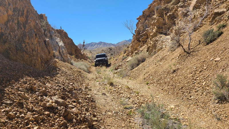
Updated: 04/10/2026
Goldome Mill Mine Road
Vanderbilt, California
Hugging the western border of the Mojave Wilderness, Goldome Mill Mine Road provides a glimpse of the wild, rugged, and undisturbed beauty of the New York Mountain foothills. The road was heavily engineered to provide a level path for ore trucks by cutting through hills and filling the low gaps with 30-foot-tall earth berms. Driving these tall embankments provides a fantastic perspective of the surrounding desert and wildlife below. Once past the foothills, the trail reveals fantastic views over the distant Ivanpah Valley.
This one-vehicle-wide trail is very rugged, filled with apple-sized stones, and some portions are weather- and tire-worn, creating deep, offsetting depressions, resulting in the trail's moderate difficulty rating. A 4x4 with good ground clearance is required to drive this trail.

Updated: 01/15/2019
17N37 - Little Round Mountain Road
Upper Lake, California
Little Round Mountain Road goes only 1.5 miles before narrowing to single track. However, it passes through some lovely pine forest, with peakaboo views down to Bucknell Creek (seasonal) which it runs parallel to. Keep your eyes open for Red-tailed Hawks, as they are frequently seen here in springtime and summer. The trail intersects with two single-track OHV routes. When out exploring the Mendocino National Forest, it is a fun, short side trip.
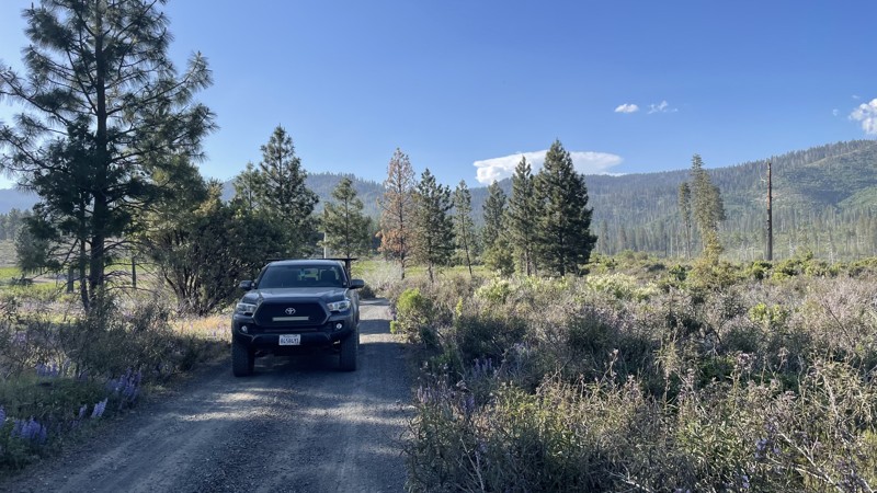
Updated: 10/15/2024
First Street
Foresta, California
First Street is a well-maintained gravel and dirt road in Yosemite National Park that connects Old Coulterville Yosemite Road to the pavement. The road is easily travelable in 2WD and provides views of beautiful lavender plants, and the dramatic mountains in Yosemite National Park, making it a perfect start or end for your trip on Old Coulterville Road. The road takes you into the town of Foresta, just a few houses with no stores or gas stations. Camping is not allowed anywhere along the road.
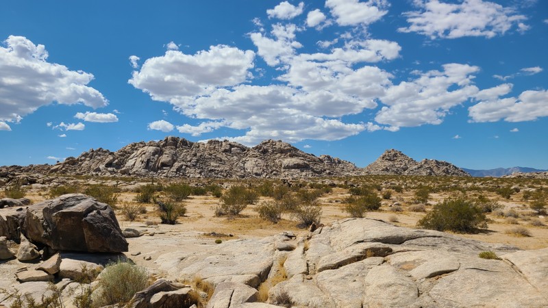
Updated: 12/04/2025
Solar Road
Johnson Valley, California
Located within the Johnson Valley OHV Area, JV4228 is an east-west route, linking Soggy Dry Lake and Cougar Buttes, passing through beautiful, jumbled boulder formations. This sandy desert trail has no obstacles and would be enjoyed by new offroad explorers in a 2-wheel drive high clearance vehicle. Expect washboards and occasional exposed rock.
Dispersed camping is abundant along the trail and can be enjoyed when following the BLM Dispersed Camping Guidelines. Book docking in large RVs is common along the western end of the trail. Campfires may be prohibited, and it is the responsibility of campers to know and follow the current Campfire Restrictions.
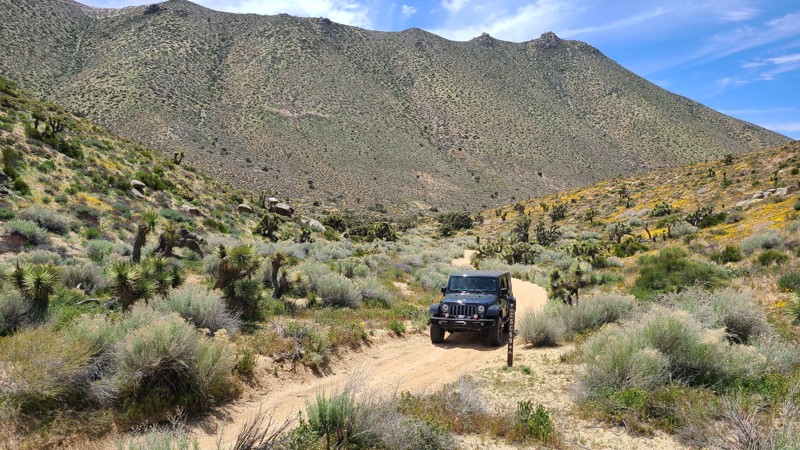
Updated: 10/15/2024
Scodie Mountains SC69
Sageland, California
This straight-through narrow trail rises 1300 feet following a narrow canyon to reach the 6000-foot overlook at Wyleys Knob. Once there, you will be treated to impressive mountains and desert floor views. In the canyon, water collected from the surrounding hills supports dense groves of joshua trees. A striking feature found about one mile into the trail is a massive boulder stack precariously balanced, looking much like a mousetrap needing only the slightest nudge to fall on the trail.
SC69 is almost entirely a soft, sandy, easy trail, with the northern end being the most challenging, requiring a 0.2 mile-long climb on deep soft sand exceeding a 20-degree incline. This trail is designated by BLM as “Difficult,” requiring an experienced driver in a high clearance 4WD vehicle with 4-low and a running start to make it up the last steep section of the soft sandy trail.
The only suitable dispersed camping location on this narrow canyon road is near the mousetrap boulder stack. Dispersed camping is allowed when meeting the BLM Camping Guidelines. During high fire danger, campfires may be restricted, and if planning to camp here, one should review the current BLM Campfire Restrictions and have a Campfire Permit.
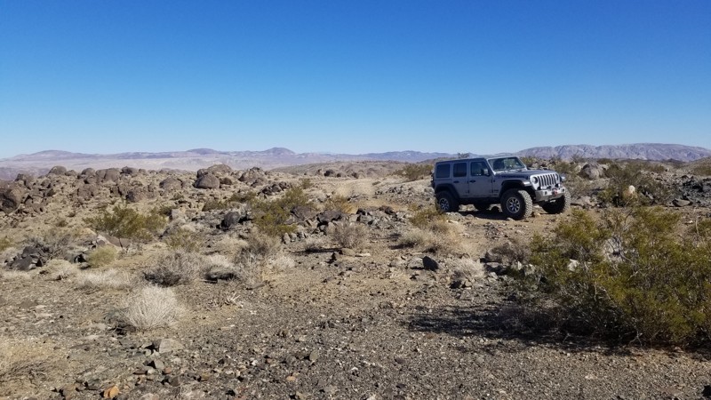
Updated: 10/15/2024
Claw Hammer and Fissure Connector
Johnson Valley, California
This short connector between Fissure Mountain and Wrecking Ball / Claw Hammer has a ton of dispersed camping. Several areas are large enough for 10 vehicles with ground tents. You will want at least an air mattress due to the small rocks on the ground. This trail is very lightly traveled, making it an ideal place to camp close to the epic crawling trails in the area.
The trail ends at Wrecking Ball, which has a difficult hill climb/drop, depending on how you take it. If going from Fissure Mountain, you will drop down the hill climb.
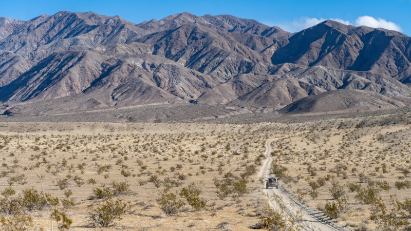
Updated: 02/02/2026
Thimble Trail
Ocotillo Wells, California
Thimble trail is a cut-a-cross from Short Wash to Highway S22. Although the trail isn't popular, this is a great way to exit from Font's Point to enjoy views of the area and have a secluded and relaxing drive. Taking the trail from south to north, you will experience stunning views of the Santa Rosa Mountains across the highway as you work through what seems like never-ending desert fauna. The trail is an easy dirt path that any 2WD high-ground clearance vehicle can complete.
Even though you could disperse camp off this trail, most people camp off short-wash as that area provides a wind break. The best camping on this trail is near the southern end, where the fauna is more spread out, reducing your risk of getting injured by sharp plants.
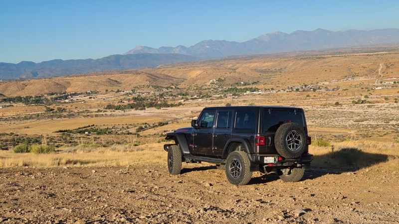
Updated: 02/05/2025
Juniper Flats 3380
Apple Valley Highlands, California
With its trailhead at the edge of the Mojave River in Apple Valley, JF3380 heads east, rising 1,800 feet on a ledge road carved into the San Bernardino Mountain foothills and reaching the Juniper-covered flats of the Bureau of Land Management (BLM) Juniper Flats Subregion. As the trail climbs, impressive 180-degree views are revealed to the west of the meandering Mojave River bed and the distant San Gabrial Mountains. Once reaching the top of the foothills, the sweep of the evergreen Junipers is revealed and offers shady pullouts to relax and have lunch.
The trail is an easy drive, following a maintained road that requires only a 2-wheel drive high clearance vehicle, but exploring the many intersecting trails will require a 4x4. The western portion of the trail may be intimidating as it is on a shelf road with steep drop-offs. A few sections of the trail have water-worn ditches running its length that are easily bypassed to the side. The Juniper Flats Subregion is a Limited Use Area requiring vehicles to stay on marked trails.
Dispersed camping can be enjoyed on BLM land when following the BLM Camping Regulations. The beginning of the trail offers two sizeable flat staging areas, one low and one farther up the hill, near the BLM kiosk for Juniper Flats. Once over the hills, the flats offer several suitable dispersed campsites amongst the shading Junipers. Open fires may be prohibited, and it is the responsibility of campers to know the Fire Restrictions and Regulations.
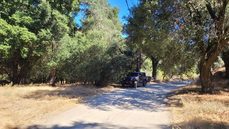
Updated: 02/10/2025
Cryer Road
Banning, California
Beginning in the beautiful oak-tree-covered Poppet Flats, Cryer Road hugs the borders of the San Bernardino National Forest as it twists down the foothills of the San Jacinto Mountains. This easy drive over a maintained road offers continuous views to the northwest.
The road is mostly over private land; only a small portion is on Bureau of Land Management land, and there are no suitable dispersed camping spots.
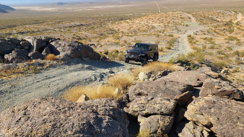
Updated: 10/15/2024
Green Rock Mine Road
Johnson Valley, California
Located in the Johnson Valley OHV area and Fry Valley, Green Rock Mine Road cuts through the remains of its namesake Green Rock Mine and the mounds of green rock left over from the mining operation. This high elevation provides expansive views to the south of the desert floor and distant San Bernardino Mountains.
While starting over an easy desert floor, the trail becomes very difficult once climbing into the Fry Mountains over large loose rocks. The last half mile of the trail requires a high clearance four-wheel drive vehicle with an experienced driver.
Dispersed camping is allowed here when following the Bureau of Land Management Dispersed Camping Guidelines. Several dispersed campsites can be found around the mining camp with flat areas large enough for several vehicles and high enough to provide nice views to the south of the desert and distant mountains. Campfires are generally prohibited, and if you plan to camp, you are responsible for knowing the Campfire Restrictions.
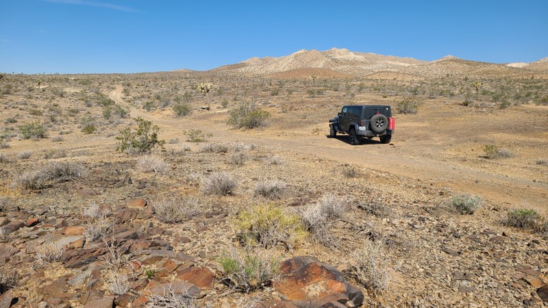
Updated: 10/15/2024
El Mirage 4652
Helendale, California
With its trailhead at Highway 395, El Mirage 4652 (EM4652) provides convenient access to the BLM El Mirage Subregion. Following a flat desert basin floor, this trail ends at a confluence of trails leading into and around the rugged Shadow Mountains, home to many old mines.
The El Mirage Subregion is a Limited Use Area requiring vehicles to stay on designated trails. The trails are well marked with frequent BLM signs to recognize if you are on the trail.
A two-wheel drive vehicle with high clearance and a beginning offroader will do fine on this particular trail, but venturing further into the Shadow Mountains trail network will require an experienced driver in a high clearance four-wheel drive vehicle with a low gear range and all-terrain light truck tires.
Many tortoises are in the area, and a vigilant eye is needed to avoid them as they slowly cross the trail.
There are many suitable and flat locations for dispersed camping on this route, but few existing rock campfire rings exist.
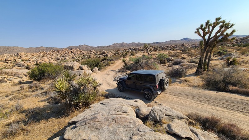
Updated: 09/22/2025
Roadrunner Rut
Rimrock, California
Roadrunner Rut is near the western edge of the San Bernardino National Forest and drives through the recently designated Sand to Snow National Monument. The trail escorts you in and amongst a spectacular desert landscape of massive boulder piles arranged in such a way that it seems more like intentional art than the result of natural erosion. The trail intersects a nest of other BLM trails to explore, and New Dixie Mine Road at its north end provides the opportunity to continue the adventure up into the San Bernardino National Forest.
Tucked in amongst these massive boulders, you will find excellent sheltered dispersed campsites. Most sites have room for several vehicles. One of the best sites is found on a turnout about 2.6 miles from the south end of the trail. This quiet, secluded site hugs a massive boulder and is watched over by a jigsaw puzzle of balancing boulders. The area is flat with space for two or three vehicles.
Roadrunner Rut provides both a navigation and driving challenge. There are occasional BLM trail markers, but many unmarked intersecting trails can easily be taken. A GPS using the provided .gpx is the best way to stay on track. After an easy start over the first 2 miles, the trail narrows and follows a tight, twisting path over and around large 18-inch boulders. Near the north end of the trail, there is a steep hill reaching a 25-degree decline with a tight 90-degree turn. Four-low will be required to climb this hill, but it also aids in the descent. A four-wheel drive, high clearance vehicle driven by an experienced off-roader is necessary to safely travel this trail
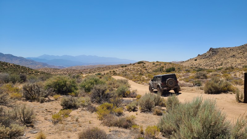
Updated: 08/26/2025
Carbine Flat Spur A
Fizzben Heights, California
Carbine Flat Spur-A provides drivers a chance to test their off-roading skills and vehicle capabilities over a challenging trail. Located in the high desert of the San Bernardino National Forest, Carbine Flat Spur-A slowly descends from the Carbine Flat area to the varied landscape of Juniper Flats. Along the way, the trail passes several motorized and hiking trails that beckon exploration. Near the west end of the spur is the Deep Creek area with popular hiking trails to nearby hot springs. From here, there is access to dozens of other marked BLM trails in the 100,000-acre Juniper Flats.
Forest Service trails on Carbine Flat Spur-A indicate a solid blue square for a “More Difficult rating,” but the trail could easily be rated “Most Difficult” or black diamond. The trail surface is often very rocky with a few significant protruding rock formations and steep slippery climbs. An experienced driver in a lifted 4x4 is necessary for this trail. The most difficult obstacle, about 1.7 miles from the trailhead (N34° 21.108', W117° 07.318'), is an unavoidable rock waterfall requiring careful wheel placement. The west end of the trail features a steep climb over a very worn, rutted, off-camber surface with exposed boulders, making it best suited for those with lockers. The quickest exit to paved roads from the trail's end is via Pack Mem Trail JF3300, which is an intimidating 1,000 feet descent down a shelf road.
Several level clearings suitable for dispersed camping do exist, but they are exposed to the wind and can be found next to the trail. For those looking for a prepared campsite, the Forest Service Horse Springs Camping site, located about 3 miles east of the trailhead, offers tree-shaded campsites, picnic benches, fire rings, pit toilets, a group ramada, and a picnic area. Campfires are prohibited in the National Forest.
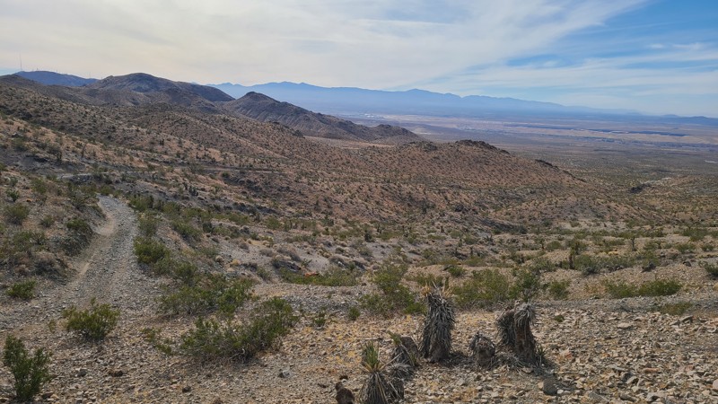
Updated: 10/15/2024
Stoddard Valley 6524
Bryman, California
With the trailhead at Route 66, SV6524 (also called Bryman Road) passes east through the rugged Silver Mountains, past the Marter-White Mica Mine and an unnamed gold mine whose rocky mine waste was used to surface the surrounding trails. This difficult trail includes shelf roads and very steep grades, eventually reaching the eastern side of the Silver Mountain range. This is a straight-through trail that provides connections to other trails that surround these mountains.
While in the mountains, one can find many suitable flat dispersed campsites when meeting the BLM Camping Guidelines.
During high fire danger, campfires may be restricted, and if planning to camp here, one should review the current Campfire Restrictions and have a Campfire Permit.
SV6524 is a rough trail with uneven, loose, rocky surfaces, ledge roads with uncomfortable off-camber stretches, and inclines and descents approaching a steep 30 degrees. This trail should only be attempted with a partner vehicle and by experienced offroad drivers. A high clearance, four-wheel drive vehicle with four-low and all-terrain tires should be used to navigate this trail safely.
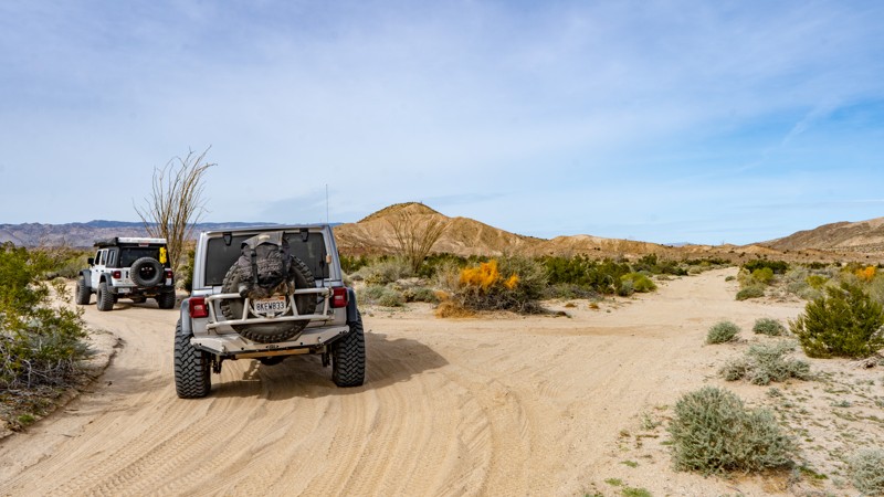
Updated: 05/23/2024
Dolomite Mine Road
Ocotillo, California
Hidden in the low deserts of Southern California is an area that has been forgotten in time. Just outside Ocotillo, Anza-Borrego State Park has a rich mining history, where travelers once came to mine the area for minerals in the 1930s. The Dolomite Mine Road was part of this area when men of the past were hoping for riches. Today, the mine has been forgotten, but the views are amazing. Off in the distance, you can see the scenic Carrizo Badlands glowing through the haze of the Salton Basin. So whether you are starting your overland adventure or finishing it, make this little blip of history a stop to experience the stunning views and remaining history of what once was.
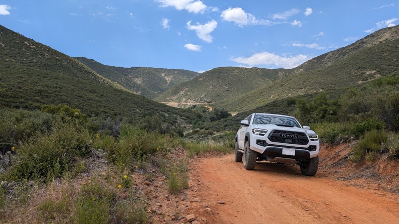
Updated: 03/09/2026
Miners Road
Guatay, California
Miners Road is a fun branch off of Pine Valley Road. It meanders back into the mountains following Indian Creek, which often has water in it. The landscape is quite picturesque, and there are multiple mining claims along the route.
There are small climbs with loose rocks, ruts, and turns. It is quite a bit more than just a dirt road, but something a 2WD SUV can handle.
This road is within the Cleveland National Forest, and dispersed camping is allowed with an Adventure Pass.
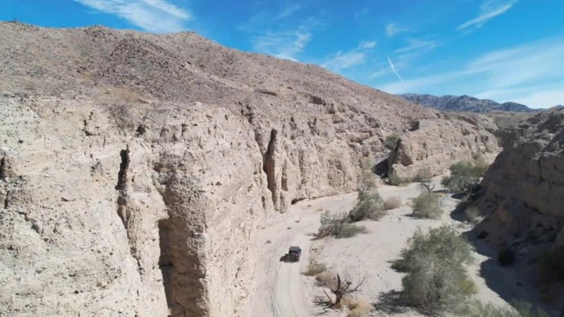
Updated: 10/15/2024
Little Box Canyon
North Shore, California
Little Box Canyon Road follows the northern border of the Mecca Hills Wilderness and is just north of the Salton Sea. The trail cuts through a narrow canyon and is often surrounded by near-vertical 40-foot cliffs rising to make for breathtaking scenery on this leisurely drive. To the north of the trail is BLM land with more unmarked trails to explore.
At 2.3 miles long and running west to east, Little Box Canyon Road is on a wide flat wash of loose sandy gravel. Starting at the paved Box Canyon Road, Little Box Canyon Road terminates at another dirt road, Meccacopia trail. There are no obstacles on the trail. This trail is suitable for first-time off-roaders with a four-wheel-drive vehicle.
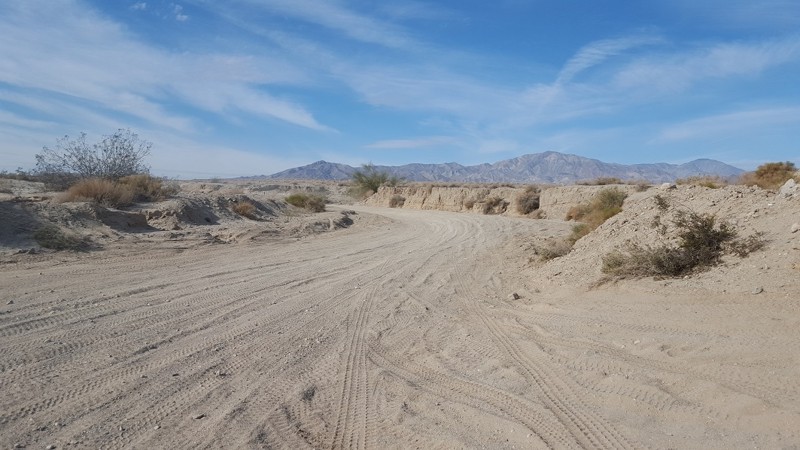
Updated: 12/01/2025
Palm Wash
Salton City, California
Connecting Truckhaven to Calcite Mine, Palm Wash is a 7-mile trek through deep sand and whoops, with steep wash walls on either side. There are occasional drop-offs and step-ups and plenty of blind spots, so don't travel faster than safe. Like most washes, Palm Wash is a popular area for highspeed users, so be sure to keep your head on swivel around turns. Trail is suitable for any high clearance vehicle.
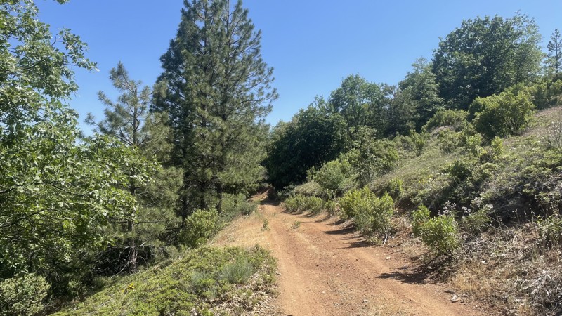
Updated: 12/15/2025
Forest Service Route 02S17Y
Buck Meadows, California
Forest Service Route 02S17Y is an easy trail in the Stanislaus National Forest. The trail connects Forest Service Routes 1S16 and 02S83, providing a less-traveled scenic route through the beautiful national forest. The forest service maintains the road, and although it does have small ruts and hills, it can be easily completed in 2WD. The trail is closed seasonally from December 16th to April 14th to prevent damage to wildlife habitats and the road. Camping is not allowed along the trail.
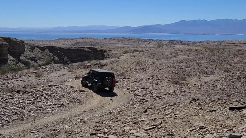
Updated: 10/15/2024
Billers Bailout
North Shore, California
Billers Bailout Trail is a short 1 mile out and back hard-packed gravel road, managed by the BLM and is surrounded by the protected Orocopia Mountains Wilderness. Generally an easy trail but with a couple of climbs that reach inclines up to 21 degrees which may test a 2-wheel drive vehicle, and also has an uncomfortable 15-degree off-camber section. The trail ends at the top of a deep gully where to the south, the altitude affords a beautiful overlook of the expansive Salton Sea. While tire tracks show Billers Bailout continuing down a very steep road into the gully and continuing north, this endpoint marks the legal end of the trail for motorized vehicles.
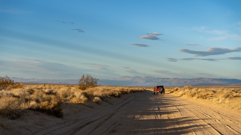
Updated: 05/01/2026
Redrock Inyokern Road
Ricardo, California
Redrock Inyokern Road runs north-south and connects Inyokern, California, with Red Rock Canyon State Park. It travels directly next to the El Paso Mountains Wilderness Area for a third of the distance. A few dispersed campsites can be found on the BLM portions of the trail but are far and wide throughout its 18-mile length. The road is maintained, but embedded rock will poke up from the dirt surface when you least expect it. However, it is suitable for any vehicle in dry conditions.
The El Paso Mountain Wilderness area has a rich mining history, particularly from the early 1900s, when miners built stone cisterns to collect and store water for operations, livestock, or personal use. You will see a few of them as you drive the road.
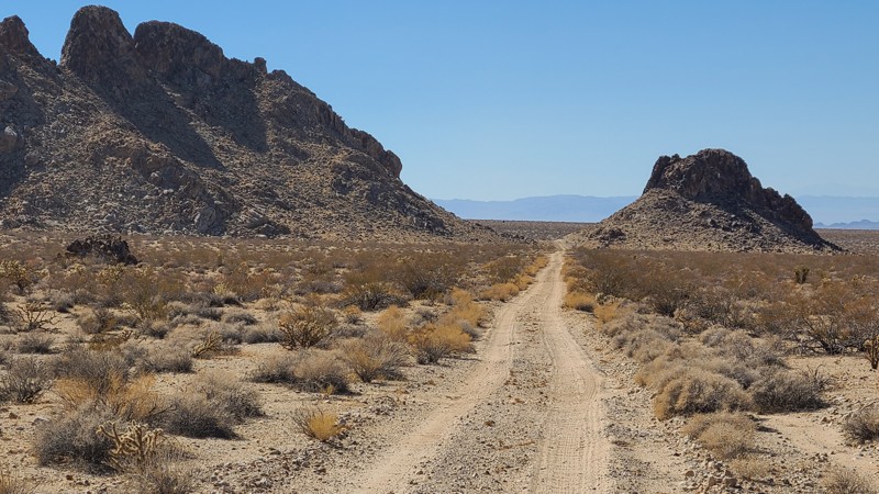
Updated: 03/11/2025
Ship Mountain Road
Bush, California
Ship Mountain Road is a 75-mile trek, perfect for overlanders, through the beautiful Cadiz Valley's soft sandy desert basin with a sudden change up to the rocky trails of the scenic Ship and Old Women Mountains. When combined with Flat Top Mountain Road, these two trails provide a memorable 100-mile overland adventure.
The trail conditions change dramatically from soft, silty sand to hard-packed and rock-strewn. Washes across the road collect deep silt sand and require 4-wheel drive, and lockers can help climb out of the deeper washes. Cattle wander the trail's eastern portion, and drivers are asked to keep a respectful distance. An experienced desert offroad driver should attempt this trail using a high clearance 4x4 and must be prepared for self-rescue in this remote part of the desert.
Dispersed campsites can be found along the trail but are mainly on the open desert floor.
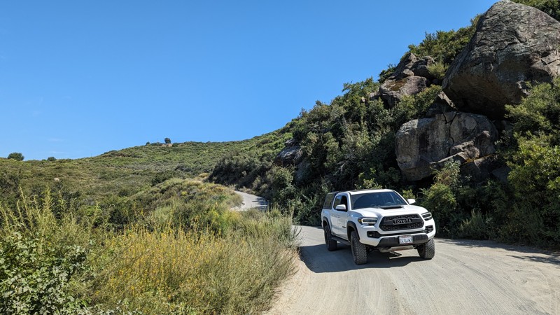
Updated: 10/15/2024
Sutherland Dam Road
Mesa Grande, California
A connecting trail between Lake Sutherland (Dam) and Black Canyon Road. Nicely graded and easy to traverse. Virtually any street-legal vehicle can drive it. The hardest parts are the narrow declines (traveling east to west), as the decomposed granite (DG) on hard-pack dirt doesn't provide the greatest traction. If you have any speed, it may be difficult to stop for oncoming traffic.
At the top (eastern end) is Lake Sutherland Dam, with plenty of room to park and view the dam and/or lake. It's a great place to take a lunch break or just admire the view. It's worth the short trip if you're traversing Black Canyon Road.
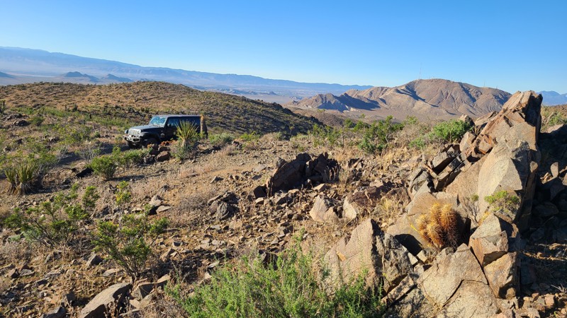
Updated: 10/15/2024
Stoddard Valley 6265
Victorville, California
SV6265, also called Victorville Quarry Road, is a maintained road to support the working quarries in the area before transforming into a narrow mountain trail into the Silver Mountains. The high desert landscape is stunning and is greatly enhanced by the endless views from the mountaintops. This straight-through trail connects to several other paths that once accessed the area's many mines.
With no existing campsites visible from the trail, a few flat locations provide good dispersed campsites with views when meeting the BLM Camping Guidelines.
During high fire danger, campfires may be restricted. If planning to camp here, review the current BLM Campfire Restrictions and have a Campfire Permit.
SV6265 is a rocky trail with steep climbs and descents with significant off-camber leaning into the valley below. A high clearance four-wheel drive vehicle with good all-terrain tires and an experienced driver should attempt this trail.
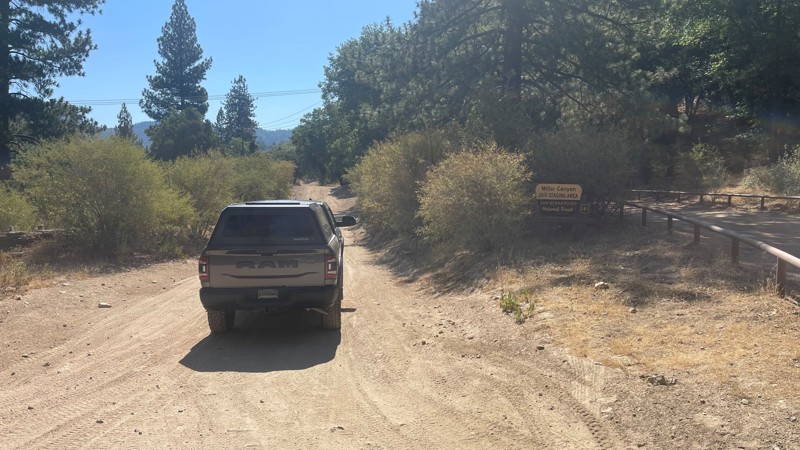
Updated: 06/29/2026
Miller Canyon OHV
Crestline, California
Miller Canyon offers a scenic and approachable entry point starting with a paved road just off Highway 138. The trail quickly transitions into an easy fire road, though you'll encounter sporadic patches of broken asphalt that add a bit of challenge and character to the drive.
You'll find a few level areas ideal for camping. The trail itself becomes increasingly rugged, with deep grooves and scattered rocks that keep things interesting. While four-wheel drive isn’t strictly necessary in dry conditions, it’s definitely a good option to have, especially if the road is wet or if you're planning to explore deeper into the canyon.
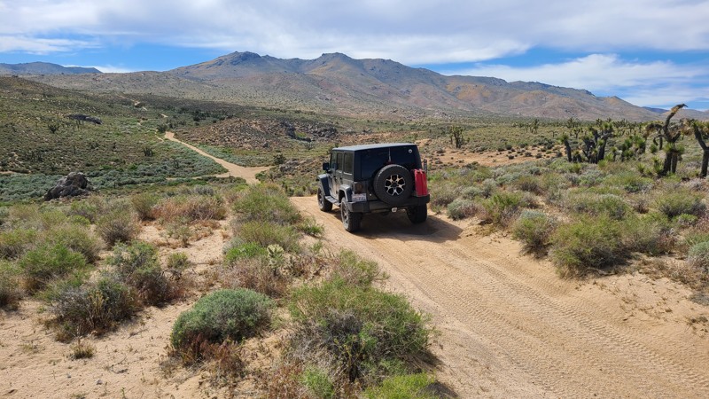
Updated: 10/15/2024
Frog Creek Road SC47
Harts Place, California
Frog Creek Road (SC47) rambles over a flat, high desert floor at a 5200-foot elevation just south of the Scodie Mountains. A spring drive through here will treat visitors with hills covered in yellow desert flowers and groves of healthy joshua tree. This straight-through trail has several intersecting driving and hiking trails. The road begins at the intersection with Bird Spring Road and ends at the paved Kelso Valley Road. The Pacific Crest Trail intersects Frog Creek Road at about its halfway point.
Frog Creek Road is almost entirely a soft sandy trail with short sections of exposed rock. A beginning offroader would enjoy this easy trail using a high clearance 4WD vehicle.
Suitable spots for dispersed camping spots with existing rock fire rings can be found along this route and enjoyed when meeting the BLM Camping Guidelines. During high fire danger, campfires may be restricted, and if planning to camp here, one should review the Campfire Restrictions and have a Campfire Permit.
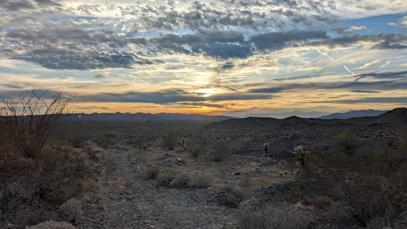
Updated: 05/01/2025
Queen Esther Mine Road
Desert Center, California
The Queen Esther Mine Road begins off Powerline Road, proceeds southeast to the base of the Chuckwalla Mountains, and ends at the mine site. The road alternates between gravel and soft sand. There are two washouts that a full-sized truck would have trouble with.
Cholla cacti line the narrow road. If you have pets, monitor them closely because these cacti are very sharp and stick to everything they touch. Do not try to remove them with your hands, even with gloves. There are also Ocotillo and Palo Verde trees along the trail. At the end of the road, an opening to the mine extends into the mountain for approximately 100 feet. Use caution if you decide to venture in for a look.
There is no room for camping at the end of the road, but several open areas along the track are suitable for camping.
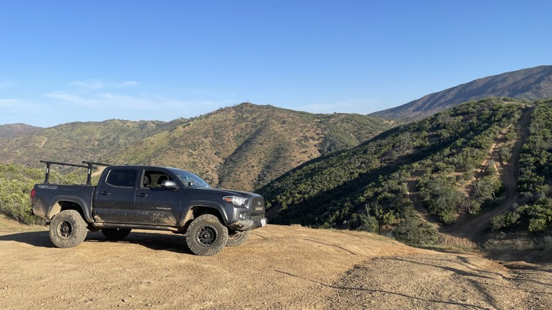
Updated: 10/15/2024
Frank Raines OHV: West Loop Trail
San Antonio Valley, California
Frank Raines OHV Park is located not far from Patterson, CA. It is open to 4x4s from sunrise to sunset with a $5 admission fee per vehicle. The park is open to all OHV vehicles, so be sure to watch out for dirtbikes, quads, and SXS.
West Loop Trail is a moderately difficult trail in Frank Raines that connects Tip Over Trail to West Trail. The trail can mostly be completed in 2WD, but there are a few short hill climbs that require 4WD or AWD.
Deer Creek Campground is located at the park's entrance. The campground has 34 sites with picnic tables, restrooms, and other amenities. Prices range from $15 to $30 per site.
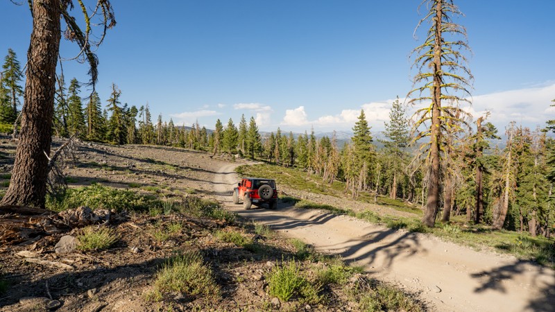
Updated: 12/15/2025
Corral Hollow OHV Trail
Big Meadow, California
Corral Hollow OHV Trail, marked by segments 7N11, 7N88Y, and 17EV485, offers a scenic and engaging straight-through run off Highway 4 near Liberty Vista Point. The route starts at roughly 6,853 feet and steadily climbs to just over 8,160 feet before winding back down to its end at Highway 4 just six miles north of where it started. This trail favors the adventurous spirit, providing a blend of rugged forest stretches, open ridgelines, and occasional rocky terrain that keeps the drive interesting without being overly technical.
The majority of Corral Hollow OHV Trail is rough dirt, punctuated by embedded rock and shallow ruts. However, the final mile at the northern end, just before arriving back at Highway 4, presents larger boulders that demand low-range gearing, careful tire placement, and some driver finesse. High-clearance four-wheel-drive vehicles are recommended, and while the majority of the trail is approachable for casual off-roaders, moderate experience is suggested for navigating the rockier northern section.
This trail draws a wide range of OHV users as it is open to off-highway vehicles and highway-legal vehicles alike. Full-size or long-wheelbase vehicles beware, this trail does wind through tight pine trees at times, which could cause fender or side damage.
Camping spots are relatively frequent and generally easy to identify in clearings among the trees or on flatter, open areas. During summer weekends, the area sees increased visitor traffic as nearby campgrounds fill and families, groups, and day travelers explore the trail. Snow and seasonal closures typically render the route inaccessible in winter, at which point it becomes a playground for snowmobilers and cross-country skiers.
Trailhead signage marks both ends of Corral Hollow OHV Trail, signaling the start of a rewarding drive that combines forest quiet, open vistas, and just enough challenge to keep things memorable.
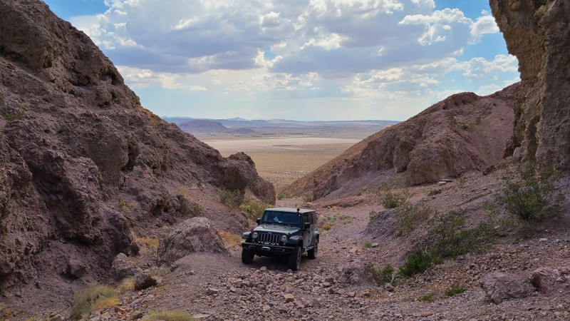
Updated: 10/15/2024
Calico Mountain 7606
Yermo, California
This short 0.4-mile spur offers inspiring geology at an impassible shear-walled box canyon that looks back over the desert basin. Some maps show CM7606 continuing through to Mule Canyon, but whatever road once existed has long ago disappeared, leaving only an impassible shear wall of rock.
Only a high clearance, four-wheel drive vehicle should attempt this rough rocky trail. The road narrows at its end, requiring a careful turnaround to keep the tires on the road. A spotter is very helpful here.
There is no flat camping area here. The best nearby campsites are on the connecting CM7600.
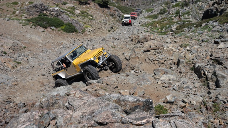
Updated: 10/15/2024
Morris Lake Trail
Tobin, California
Morris Lake Trail, located in the High Lakes OHV Area, is an extremely difficult in-and-back rock crawling trail. What makes it so difficult is you drop down a loose shale trail upwards of 20 degrees; as you travel down the route, there are ledges and waterfalls along with boulders that find their way into the trail. Once at the lake, a tiny area to turn around and head back out of the trail is just large enough for four vehicles. This trail is for people looking for rock crawling trails and nothing else. In this case, if you have never done it before, it would be wise to inspect the downhills first. The first part of the downhill is doable in most high-ground clearance 4x4s. Lockers would be ideal, along with being aired down low with aggressive tires. The lower portion of the hill is where things get insane. With massive ledges, 3-foot round boulders, and other obstacles, only the most insane and well-built rigs should attempt. Just remember, the only way out is back up the hill.
There is no camping on this trail. But not far from the trail on Trail 616, Long Lake has several areas that would be great for dispersed camping and could easily support a small group of 2-4 vehicles.
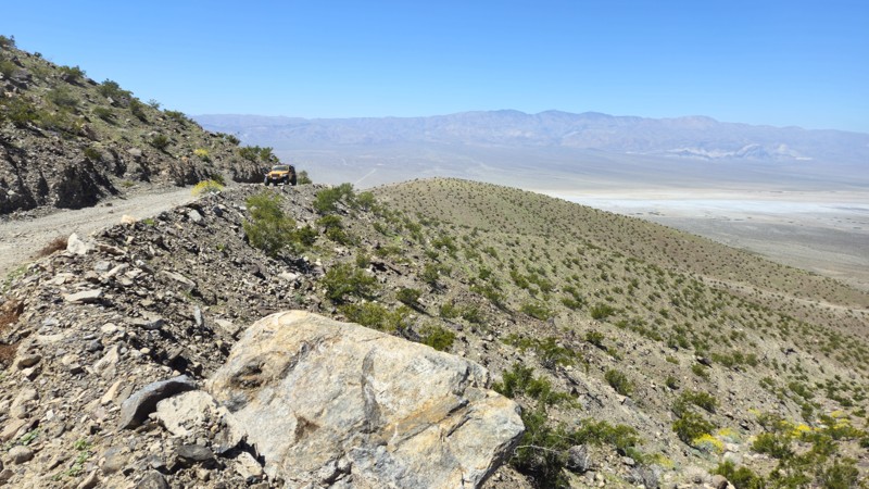
Updated: 06/19/2025
Lower Pleasant Canyon Bypass
Ballarat, California
Look no further than this road when looking for a bypass for the lower section of Pleasent Canyon. Recently graded in 2024, this extremely easy dirt road that snakes its way up the side of the mountains can be done in any high-ground clearance vehicle. Starting at 1,084 feet above sea level and rising to over 2,880 feet, this easy bypass takes you around the lower section of Pleasent Canyon, which is known to get eroded by flowing water and be insanely overgrown. This trail drops you where Pleasant Canyon opens up and is no longer overgrown. Along the route, you will see similar terrain to the lower Jackpot Canyon, a sparse desert terrain. This trail is graded, so all 2WD vehicles should be able to drive this trail.
Due to the nature of this trail being on the side of the hill, there are no suitable locations to camp.
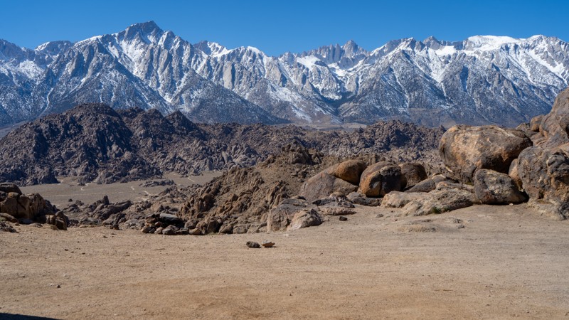
Updated: 03/13/2025
Contact Flat Sites 34-37
Lone Pine, California
North of the famous Movie Flat is Contact Flat, a short out-and-back spur with four designated campsites. After the first campsite, high clearance and 4WD are needed due to a rocky, undulating surface. Just beyond the last campsite, the trail makes a large loop, providing users with the opportunity to view the incredible rock formations of the Alabama Hills and the towering Sierras and even take a hike along a few short trails connecting back to Movie Flat.
About camping on this route:
All dispersed camping is designated to a specific site and requires a permit. A permit can be obtained online or at the Eastern Sierra Visitor Center or kiosks located on Movie Road and the main entry point in Lone Pine. Permits need to be signed and displayed on your dashboard.
The BLM has created a map showing the site numbers. However, those numbers are not used in the field, but each site is clearly marked with either a camping allowed or no camping allowed symbol on a clearly visible sign. Please be aware that all sites are first come, first served, and a permit does not guarantee you will find a site. Due to the popularity of the area, it is best to arrive early.
There are six portable restrooms throughout Alabama Hills. If you do not want to drive or walk to one, you must bring your own system to pack out human waste.
About the campsites on this route:
- 34: Is a large and open site with easy access often used by vehicles pulling trailers. Beyond site 34, a small obstacle requiring high clearance limits the camping to vehicles with either small adventure trailers or self-contained set-ups.
- 35: It is literally on the edge of the trail and is rather small, but a nearby rock face provides a small amount of shade.
- 36: This large site is located a short distance off the trail and has incredible views to the west over the Sierras. Four to five vehicles should fit comfortably here.
- 37: Located right off the trail against a massive boulder, providing shade in the afternoon and evening and room for three to four rigs.
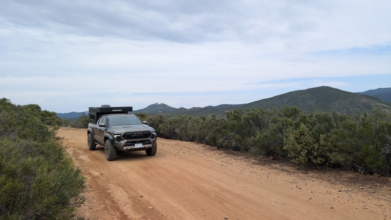
Updated: 04/22/2026
Long Valley Loop
Boulder Oaks, California
Long Valley is quietly nestled between Long Valley Peak and Los Pinos Mountain, two of the tallest peaks in the area. The trail starts with a scenic 1-mile drive along an easy-to-navigate shelf road, after which the loop begins by heading either west or south. To the west, Eagle Nest Mine can be found along the northern part of the loop, 0.4 miles west of the branch. The entire round trip, starting at and returning to Bear Valley Road, is 5.5 miles. This trail, when combined with Bear Valley Road, makes a great half-day adventure for anyone looking for mountain views, some seclusion, and navigating something more aggressive than a dirt road.
Difficulty
About a tenth of a mile from the start (eastern end) is the hardest part. A roughly 20-foot steep slope with embedded rocks that may place a vehicle at a 20° pitch. The slope and rocks can be easily navigated and have good traction. The trail smooths out at the loop and alternates between dirt and golf ball to baseball-size rocks. High clearance and 4WD is recommended.
Camping
There is a large rocky area at Eagle Nest Mine with a small hand-made fire ring. It is not very level and definitely not soft, but with some carefully placed rocks or blocks and a rooftop tent, it could make for a nice site. Camping does require a dispersed camping permit from the Descanso Ranger District.
Access
The trail starts near the end of Bear Valley Road, which is the only way to access the trail with 4 wheels. Kernan Cycle trail also connects to Long Valley Loop, but it is only open to motorcycles.
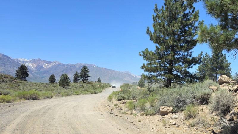
Updated: 09/14/2025
Owens Gorge Road - North
North Landing, California
Owens Gorge Road is a scenic, connecting dirt road that runs through the dramatic landscape of the Owens River Area south of Crowley Lake, located north of Bishop, California. The road follows the river as it cuts through steep volcanic cliffs, offering striking views of the rugged canyon walls. While the road is generally graded and accessible to most high-clearance vehicles, some sections can become rough or rutted depending on recent weather conditions. It’s a popular route for sightseeing, photography, and accessing various rock climbing areas along the gorge. Fishing spots along the Owens River are also easily reachable from this road. Owens Gorge Road is also a popular way to reach the Crowley Lake Columns, a unique geological formation along the shoreline of the lake. While it's a beautiful place to explore during the day, there isn't any ideal camping along the route, so most visitors plan short visits or use nearby campgrounds such as Crowley Lake Campground. Owens Gorge Road is a peaceful, less-traveled route that offers a unique perspective on the geological features and natural beauty of the Eastern Sierra.
Please note: The road is closed on the south end at the dam, and you can't proceed any further south.
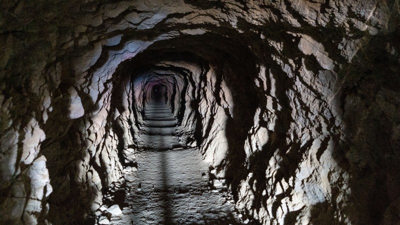
Updated: 05/26/2026
Burro Schmidt Tunnel Road
Saltdale, California
The drive to the tunnel is suitable for any vehicle. As you gain elevation, the dilapidated cabin stands with plenty of graffiti. Continuing around the hill, you will find a large parking area that can hold a dozen vehicles. The tunnel entrance is clearly visible, although if you are of standard height, you will need to hunch down to enter. One small dispersed campsite is at the start on the very northwest end of the trail.
After visiting the tunnel, you can continue your route on the steep and narrow EP 103, which offers outstanding 360-degree views, or return the way you came to connect to many other trail options.
But who was William "Burro" Schmidt"?
William "Burro" Schmidt spent 33 years single-handedly digging a tunnel through Copper Mountain, claiming it was a "shortcut." Using hand tools, explosives, and a wheelbarrow, he removed debris, eventually installing ore car rails. His obsession drove him to complete the tunnel, but he never transported ore through it despite uncovering rich veins of minerals.
Originally from Rhode Island, Schmidt moved to the desert for health reasons and supported himself as a ranch hand while working on the tunnel. After his death in 1954, his partner, Mike Lee, continued giving tours until 1963.
Evelyn Tonie Seger later acquired the property, living in Schmidt's cabin until her death in 2003. A strong-willed woman, she endured hardships, including a violent land dispute.
Today, visitors can explore the tunnel at their own risk. A flashlight is recommended, as the passage is dark and carries a faint stench reminiscent of a stale bar. The tunnel opens to a scenic overlook of Saltdale, making the trek worthwhile.
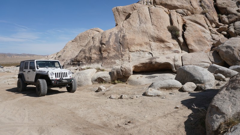
Updated: 03/18/2023
Georges Shortcut - Cougar Buttes
Lucerne Valley, California
Minutes down the hill from Big Bear Lake, California, in Lucerne Valley is Cougar Buttes; A small section of the Johnson Valley OHV Recreation Area in San Bernardino County. The huge, light-colored rock formations here make for unique desert backdrops as you drive through the open trails of Cougar Buttes.
From easy, soft sandy trails to technical, rocky desert canyons and dispersed tent or RV camping, Cougar Buttes has something for anyone from first-time off-roaders to experienced wheelers.
Georges Shortcut travels through a short canyon in the northern section of Cougar Buttes. Dispersed camping locations can be found at either end of this trail. While this trail is easy, rock crawlers looking for a series challenge might like what they find partway into the trail.
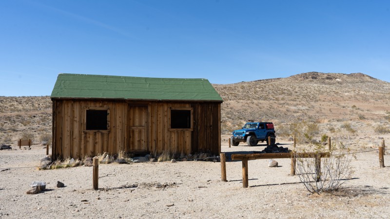
Updated: 05/01/2026
Bonanza Trail
Saltdale, California
The Bonanza Trail is a scenic and rugged 4WD route that winds through the historic mining region of the El Paso Mountains. This remote trail takes adventurers through a landscape rich with stories of gold prospectors, pioneer settlers, and mining camps that thrived during the late 1800s and early 1900s.
As you navigate the rocky and sandy terrain, you'll pass historic sites that provide a glimpse into the area's past. The Bonanza Gulch Post Office is believed to have been built in the 1930s and once served the local mining community. Further along, interpretive signs highlight the experiences of gold seekers who hurried through on their way to the Mother Lode in the Sierra Nevada, only to return seeking their fortunes in these hills. Evidence of their persistence can still be seen in abandoned tunnels, weathered structures, and scattered mining remnants. A much more advanced and abandoned commercial mine is on the far western end, at the border of Red Rock Canyon State Park.
An abundance of dispersed camping can be found on the higher elevations out of the wash, and one can stay at any of the remaining structures along the washy area—just use the occupied signs that vary by building. Use at your own risk.
As a side of history, at one time, these cabins were officially adopted via the BLM Adopt-A-Cabin program. An older document from the BLM describes the program as: "It was a volunteer partnership arrangement administered by the Ridgecrest Field Office from the late 1980s to 2005. It operated under the ambitious but ultimately untenable goal of saving historical-period mining cabins in the region, largely for recreational reuse. Under the auspices of the program, several mining cabins in the Study Area were renovated, including the Beveridge Ridge Cabin in Inyo County. Inarguably, the work under the program prevented the collapse of several buildings. However, concerns over the lack of collection of baseline condition data prior to initiating work and the absence of involvement of BLM cultural resource managers brought an end to the program."
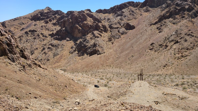
Updated: 10/15/2024
D069
Baker, California
This well-marked out-and-back trail follows an approved path through the Soda Mountains Wilderness, providing an exceptional experience to view a pristine Mojave Desert terrain. The trail manages its way over sandy washes and rocky terrain, arriving at a box canyon surrounded by the beautiful towering sheer slopes of the Soda Mountains. The road once supported a now long abandoned and unnamed mine and itself is now part of the Soda Mountains Wilderness. The mine works are high up a steep slope with its camp below by the trail. Both sites can be explored with a short hike. The trail is well marked with warnings to stay on the trail to avoid this protected wilderness. Camping can be had anywhere along the trail following the guidelines provided by the BLM Barstow Field Office, taking extra care to follow the guidelines for Wilderness areas. Beginning off-roaders would enjoy this trail.
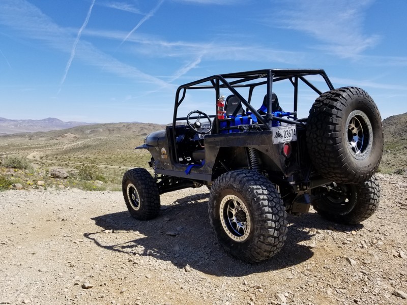
Updated: 02/27/2024
Exit from Claw Hammer and Nightmare
Yucca Valley, California
On the backside of some of the hardest 4x4 trails in California is this great connector trail that gives you an easy up to watch the crazy rock crawling action. Being further from the main camping area, this trail offers some solitude for a little more low-key camp set up.
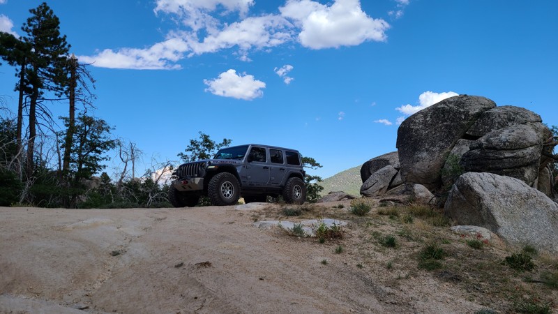
Updated: 10/15/2024
Old Snow Slide - 2N68
Fawnskin, California
2N68 heads off 2N13 up and over the hill towards the boy scout camp. The trail is heavily overgrown and will do a ton of paint damage to almost every vehicle. At one point, there is a yellow post site down this trail. There is a locked gate near the boy scout camp, so this is an out-and-back.
There are a couple of nice small dispersed camping spots on this trail in the first 300 yards.
Please note: We could not take a photo of the overgrown area as we couldn't get out of the vehicle. We also had to back up over 300 yards through the overgrowth.
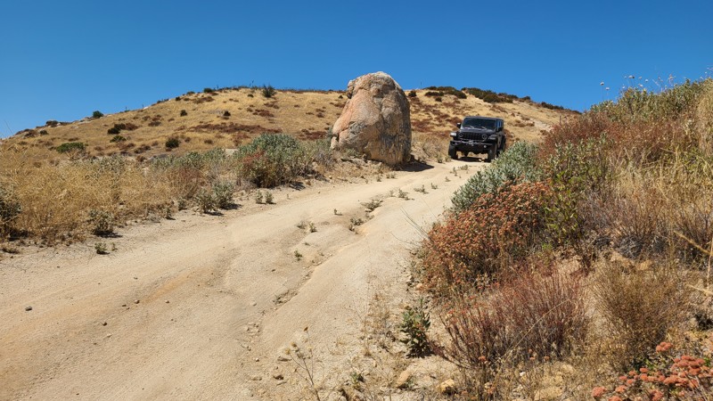
Updated: 02/10/2025
Riverside County 170
San Jacinto, California
This Bureau of Land Management (BLM) area in the San Jacinto Mountain foothills has no designated subregion, hence the trails prefix for Riverside County (RVC). RVC170 passes through the middle of this patch of BLM land and, at its northwest end, connects to Old Idyllwild Road.
New offroaders would enjoy this easy trail in a high clearance two-wheel drive vehicle. There are a few narrow and shallow washouts across the road that are easily crossed at low speeds.
Dispersed camping can be enjoyed on BLM land when adhering to the BLM Dispersed Camping Guidelines. There are only two suitable campsites along this route. These consist of clear, flat areas a few feet off the road that are positioned for great northerly views of the valleys below and the distant town of Banning.
No open fires are permitted, and it is the responsibility of campers to know and follow the Fire Restrictions.
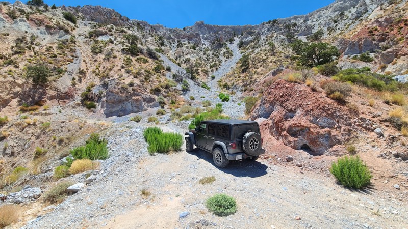
Updated: 10/15/2024
Santa Fe Fire Trail
Cushenbury, California
Located east of Lucerne Valley, Santa Fe Fire Road is primarily on Bureau of Land Management land and, after an 1800-foot rocky climb, comes to a closed gate marking the private property of Black Hawk Mine. Near the end of the trail are several building foundations and ruins that were once buildings supporting the mining in the area can be found. This end portion of the trail provides level spots for dispersed camping and commanding views to the north of Fry and Johnson Valleys.
Santa Fe Fire Road begins on the sandy desert floor and quickly ascends a rocky trail requiring a high clearance two-wheel drive vehicle.
Dispersed camping is allowed here when following the Bureau of Land Management Dispersed Camping Guidelines. Several dispersed campsites can be found around the mining camp. Campfires are generally prohibited, and if you plan to camp, you are responsible for knowing the Campfire Restrictions. Operating a camp stove requires a Campfire Permit.
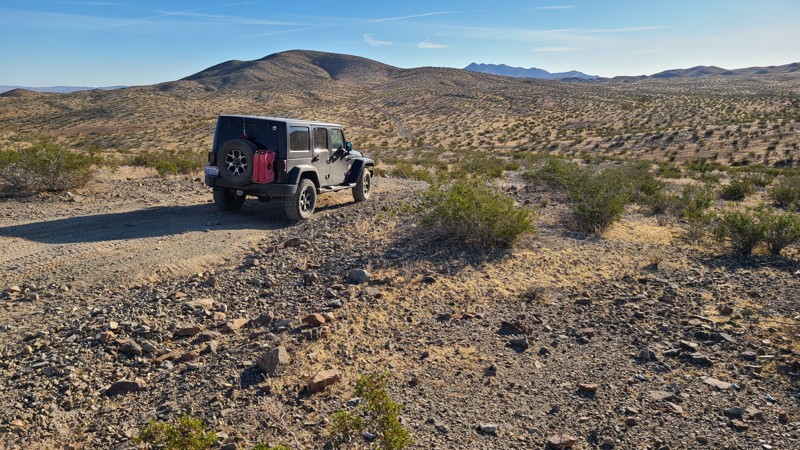
Updated: 10/31/2025
Stoddard Valley, Helendale Mountains Trail
Helendale, California
The Helendale Mountains Trail is north of Victorville and intersects the famous Route 66. This unmarked Burea of Land Management (BLM) trail winds eight miles through the Helendale Mountains. Climbing the hills reveals beautiful views of the desert valley and distant mountain ranges. Surface conditions range wildly from soft, deep sand to rough rocky inclines. This trail is a straight-through road and eventually reaches Interstate 15 and, along the way, crosses several unnamed trails to explore.
While on the BLM portion of this trail, there are plentiful dispersed camping sites to overnight when meeting the BLM Camping Guidelines. Only the first and last one-mile segments are not on public land.
During high fire danger, campfires may be restricted, and if planning to camp, one should review the current BLM Campfire Restrictions and have a Campfire Permit.
Helendale Mountains Trail surface consists of deep, soft sand and steep rocky slopes requiring an experienced offroad driver in a high clearance four-wheel drive vehicle.
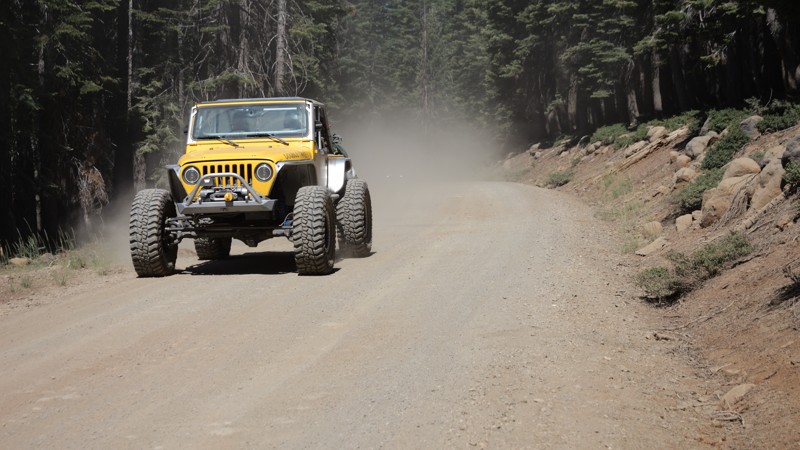
Updated: 10/15/2024
North Philbrook
Glenburn, California
North Philbrook Road is one of the main access trails into the High Lakes OHV. It is graded and suitable for any vehicle. Near the trail's end is a large staging area that can be used to leave trucks and trailers. This road is not suitable for camping. If you are looking to camp in this area and want a legendary dispersed camping location, look at High Lakes Trail for fantastic lake camping that can fit groups of 2 to 6 vehicles relatively easily.
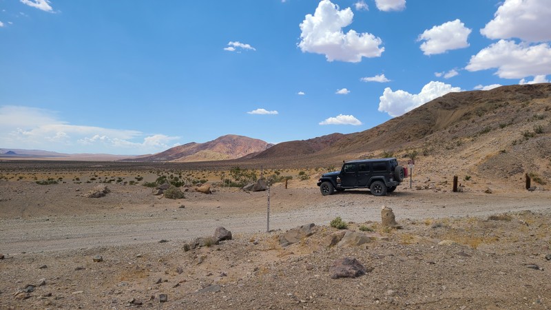
Updated: 10/15/2024
Calico Mountain 7600
Yermo, California
CM7600 parallels the paved Calico Road for 0.8 miles from its trailhead at Mule Canyon. It provides convenient access to large flat sandy staging areas and dispersed camping with many existing rock fire rings.
The trail is easily driven by large recreational vehicles. The location is conveniently close to gas, charging, and supplies at EddieWorld, only about 1.5 miles to the south. Also, Calico Ghost Town, with its improved camping, is only two miles north.
Two interesting connecting spurs, CM7606 and CM7608, invite exploration, but these require four-wheel drive high clearance vehicles.
At its end, CM7600 connects to the paved Calico Road.
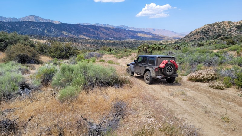
Updated: 10/15/2024
Big John Flat
Mile High, California
Located in the northern foothills of the Angeles National Forest, Big John Flat, also labeled as Ball Flat on some maps, is an out-and-back road across the transition from hills to the Mojave Desert basin, providing beautiful desert scenery.
The trail is easy, with only a single location that is rutted, requiring straddling the rut, but it remains an easy trail for new offroaders.
Dispersed camping is allowed when following the Angeles National Forest Dispersed Camping Restrictions. There are a few small campsites suitable for 1 or 2 vehicles and a large staging area size camping location near the end of the trail.
Open fires are prohibited in this area.
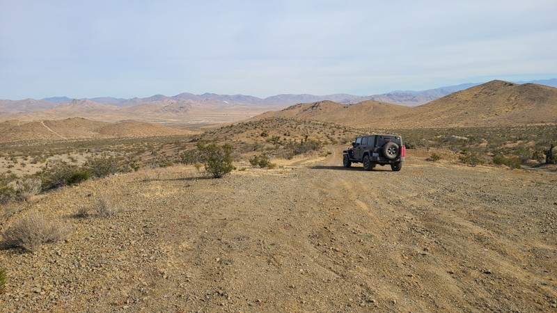
Updated: 10/15/2024
Stoddard Valley 6542
Bryman, California
SV6542 is a straight-through starting near the Ore Grande Mine, heading east to leave the Silver Mountains and ending near I15.
Dispersed camping is available along the trail when meeting the BLM Camping Guidelines.
During high fire danger, campfires may be restricted, and if planning to camp here, one should review the current BLM Campfire Restrictions and have a Campfire Permit.
SV6532 is an easy but rocky trail requiring a high clearance two-wheel drive vehicle.
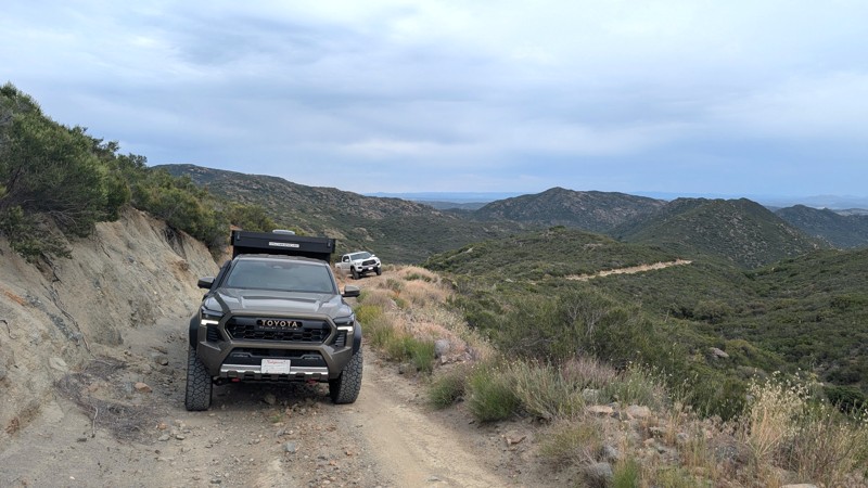
Updated: 02/06/2026
Sheephead Mountain
Boulder Oaks, California
Sheephead Mountain is a moderately difficult 1,300-foot climb to an expansive view of the I-8 corridor and mountains of northern Baja Mexico. The narrow shelf road feels as if it has no end. Navigating the climb, with erosion control berms, switchbacks, and steep edges, can be exhilarating, while the view from the top is icing on the cake.
Difficulty
The trail is almost entirely a narrow shelf road with few opportunities to pass. Being a shelf road, it is filled with large erosion control berms, requiring high clearance to navigate them. The switchbacks are tight and may require multi-point turns near steep drop-offs.
Camping
There is a single open area near the top of the trail that can be used for camping. It is roughly 30 feet from the trail and could accommodate 2 to 3 vehicles. Camping does require a dispersed camping permit from the Descanso Ranger District.
Access
The trail starts at the northeastern end of Buckman Springs Road, just feet from I-8.
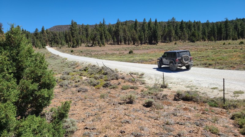
Updated: 07/12/2026
Delamar Mountain Road
Fawnskin, California
Delamar Mountain Road winds through a densely forested valley framed by Little Bear Peak to the west and Delamar Mountain to the east. Near its midpoint, the road crosses the Pacific Crest Trail, a convenient resupply stop for long-distance hikers. Toward the northern end, it opens into the wide expanse of Holcomb Valley, where it connects with Holcomb Valley Road (3N16) and a network of additional trails to explore.
Just 0.6 miles from the southern entrance lies Yellow Post Campsite #33. Along the first two miles, several other flat, shaded clearings provide excellent dispersed camping opportunities close to the road.
The road itself is an easy drive. It is wide, flat, and heavily traveled by all types of vehicles, making it a popular connector into Holcomb Valley. Suitable even for two-wheel drive vehicles with decent ground clearance, this road offers a relaxed and accessible way to experience the surrounding forest.
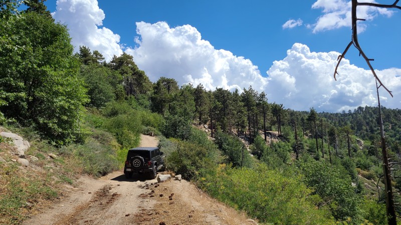
Updated: 10/13/2025
Little Green Valley Road
Green Valley Lake, California
Centered between Lake Arrowhead and Big Bear Lake, Little Green Valley Road take you off the beaten path through the lush forest to provide outstanding dispersed camping, spectacular 100-mile views, connection to hiking trailheads, and driving challenges to scratch your 4x4 itch. This route also explores the up and back spurs 2N19B and C, offering more dispersed camping and leading to a cluster of hiking trails.
Over its length and on the spurs are several excellent, wide, flat areas for dispersed camping and pitching a tent among the pines. Only ½ mile from its northern end is an outstanding dispersed campsite that provides views stretching over 100 miles to the west. Spur C ends at a small meadow, perfect for a basecamp to explore the many hiking trails that connect here. Spur A is closed, open only to authorized vehicles. If improved campsites are preferred, the Green Valley Campground is located just ½ miles east of the north end of the trail.
The dirt road is generally wide and flat, but suffers from several washouts requiring a high clearance 4x4. The most difficult obstacle is located 0.8 miles from the south end of the trail over large boulders, where fallen trees have been positioned by previous travelers, providing ramps to ease over the large rocks. A shelf road makes up some of the road with intimidating descents down the mountainside. Short corridors on the trail are overgrown and can lead to vehicle striping, especially on the little-used spurs.
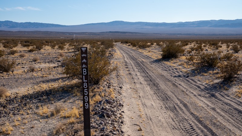
Updated: 03/07/2025
South Cady Flat
Hector, California
Traversing along the western edge of the Mojave Trails National Monument, South Cady Flat is an easy and fairly smooth desert trail that serves as part of a connecting route from Highway 40 outside of Newberry Springs into the Cady Mountains and Hidden Valley Wash. The trail is primarily hard-packed dirt and sand with sections of shallow sand whoops and small rocks no larger than a clenched fist. The southern end offers ample, open boondocking opportunities, while a few smaller, single campsites can be found along the northern end. The railroad crossing at the southern end is not always open. If the gates are closed, you must take the BL8590 and BL8580 connector that treks east a short way to a bridge crossing under the tracks. This trail is suitable for any high clearance vehicle.
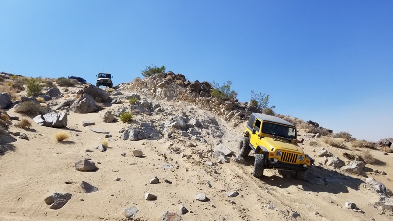
Updated: 10/15/2024
Sledge and Fissure Southern Trailead Connector
Johnson Valley, California
Trail connector from the southern trailheads for Fissure Mountain and Sledge Hammer. The trail starts at the bottom of the hill drop at the end of Sledge Hammer and is a lot of soft sand. The hero shot is at the end of Sledge Hammer, where this trail ends
There is no place to camp on this trail. If looking for unique camping, try near the northern trailhead of Sledge Hammer and watch the people do Jack Hammer all day and night. But for the normal person, camp on Means Dry Lake with all the RVs.
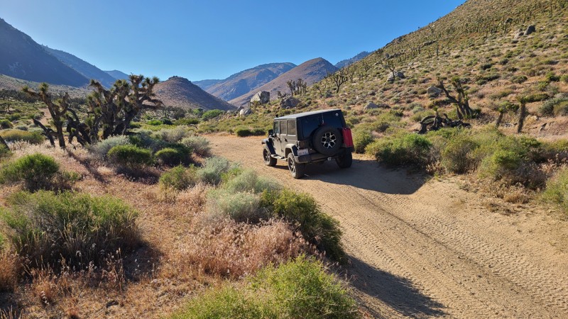
Updated: 10/15/2024
Sage Canyon Road SC56
Armistead, California
Sage Canyon Road is an out-and-back trail guided by the smooth meandering of the shallow canyon walls, through a corridor into the Kiavah Wilderness, and eventually reaching into the Sequoia National Forest. Several springs feed a small creek that runs through the canyon center, and it's no surprise the canyon supports a medley of plant and animal life. A burgeoning joshua tree forest is taking hold here, along with the namesake Sage Bush, whose aroma fills the canyon. Along its length are a few intersecting roads and several established hiking trails.
This easy trail consists almost entirely of hard-packed sand that can be driven in a two-wheel drive high clearance vehicle.
A BLM-provided primitive campsite large enough for several vehicles is next to the start of the trail. Vehicles can travel up the Wilderness Corridor to the end, where dispersed camping is allowed along the road. To minimize impacts, previously used or predisturbed sites should be used. Vehicles must park on the shoulder of the road in previously used locations as well. The Wilderness boundary is 30 feet from the road's centerline, so no motorized vehicles can travel further from the road even if a disturbed area extends past this boundary line. Dispersed camping can be enjoyed when meeting BLM Camping Guidelines. During high fire danger, campfires may be restricted, and if planning to camp here, one should review the current BLM Campfire Restrictions and have a Campfire Permit.
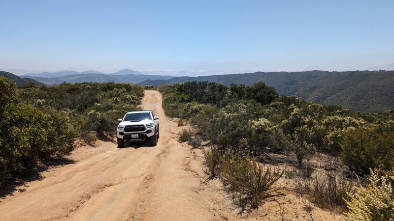
Updated: 10/15/2024
Boden Canyon Road
Ramona, California
A small leg off of Orosco Ridge that ends at a gate, making this an out-and-back trail. Similar to Orosco Ridge this is a rough dirt road with many ruts. If your vehicle can make it up the climb to Orosco Ridge (the start of this trail), it should be able to handle the Boden Canyon Trail just fine. There is an incline/decline near the gated/southern end that could be a problem for traction when wet.
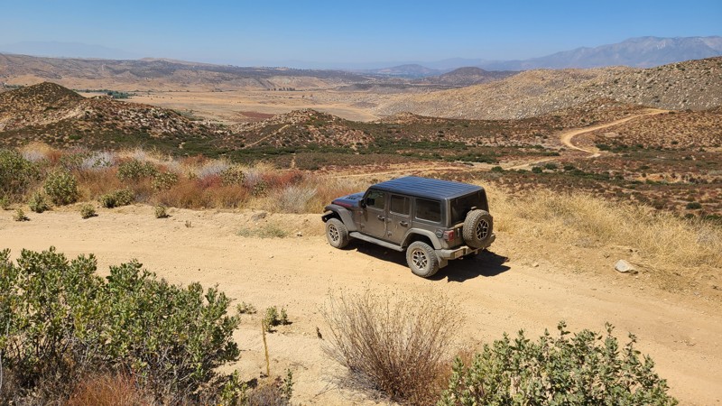
Updated: 10/15/2024
Riverside County 169
San Jacinto, California
This area has no designated Bureau of Land Management (BLM) subregion, hence the prefix for Riverside County (RVC). RVC169 meanders through the San Jacinto Mountains foothills, heading southeast from Wolfskill Truck Trail while providing beautiful views out to the northwest.
New offroaders would enjoy this easy trail in a high clearance two-wheel drive vehicle.
Dispersed camping can be enjoyed on BLM land when adhering to the BLM Dispersed Camping Guidelines. The trail has a few suitable areas suitable for dispersed camping. These sites open flat areas a few feet off of the trail, and several provide northerly views of the surrounding foothills or distant valleys. The last portion of the trail intersects a once-active creek and provides greenery and shade trees, offering a quiet and peaceful dispersed campsite.
No campfires are permitted, and it is the responsibility of campers to know and follow the Fire Restrictions.
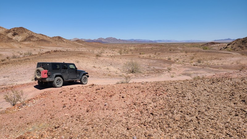
Updated: 12/11/2025
East Coachella Area EC557
Palo Verde, California
This up and back is an easy flat rocky trail reaching far into the desert, ultimately ending the Hidden Saddle Geode Bed. The trail is well marked with signs at just about every intersection.
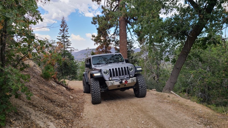
Updated: 03/09/2026
Green Valley Bypass
Green Valley Lake, California
Green Valley Bypass (2N54) is a hard-packed dirt trail that serves as a useful straight-through connector between 3N16 and 2N13 in the San Bernardino National Forest. This lightly trafficked trail gives off-roaders a simple but practical alternative to pavement, allowing drivers to bypass the congestion of Green Valley Lake below when linking up with other trail systems like Snow Slide. Open year-round and generally accessible except during times of deep snow, 2N54 is a solid choice for anyone planning a loop or looking to string together multiple trails in the area.
The trail remains relatively mild throughout, but includes a moderate hillclimb with mild ruts that may require a bit of throttle finesse in slick conditions. The rest of the route is generally flat or gently graded, winding through a mix of sparse pine and chaparral terrain. It’s well within the capability of a stock 4x4, and even drivers without prior offroad experience will find it approachable. While dispersed camping is technically allowed, suitable pull-offs are rare and limited, so this is more of a drive-through than a basecamp destination. All in all, Green Valley Bypass offers a low-effort, high-utility dirt alternative that slots in seamlessly for drivers navigating the surrounding trail network.
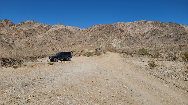
Updated: 03/07/2025
Chuckwalla Peak Road
Desert Center, California
Chuckwalla Peak Road provides access to the antenna farm at the mountain's peak. Before reaching the peak, the road is gated but still offers terrific views of the desert floor and the Ornocopia Mountains in the distance. The road is flat and firm and maintained for the service vehicles frequently visiting the antenna farm at the peak. An existing campsite is located at a flat turnout on the road high enough to provide a beautiful view.
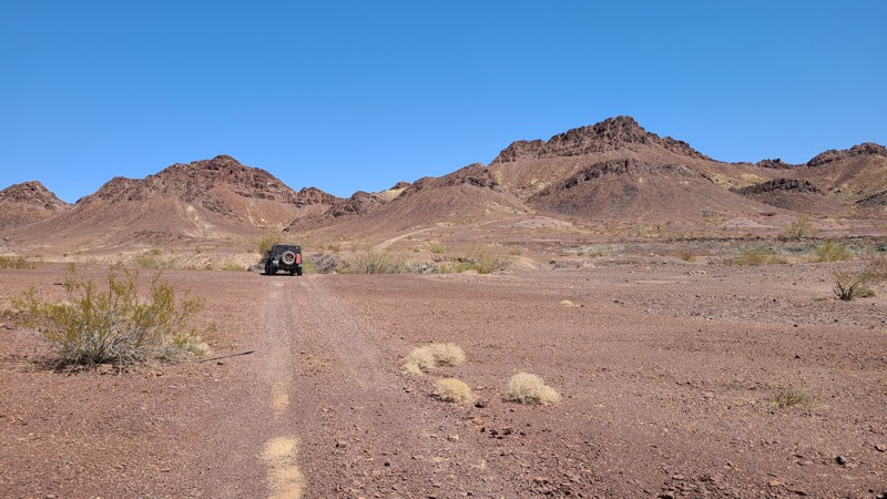
Updated: 10/15/2024
East Coachella Area EC559
Palo Verde, California
EC-559 is an up and back trail that takes you deep into the desert and up against rain-starved but still beautiful mountains. The real allure of this easy road is the Hauser and Roads End Geode Beds available to the public to rockhound.

Updated: 10/15/2024
El Mirage 4661
Houze Place, California
El Mirage 4661 (EM4661) is an up-and-back trail following the gently rising contours of the Shadow Mountains over beautiful high desert terrain with fantastic views to the northwest. Its end is the fenced border of the El Mirage OHV Area. A wonderful trail to get away, camp for an evening, and enjoy the views.
The El Mirage Subregion is a Limited Use Area requiring vehicles to stay on designated trails. The trails are well marked with frequent BLM signs to recognize if you are on the trail.
A two-wheel drive vehicle with high clearance and a beginning offroader will do fine on this trail.
Many tortoises are in the area, and a vigilant eye is needed to avoid them as they slowly cross the trail.
There are many suitable and flat locations for dispersed camping on this route, some with existing rock campfire rings.
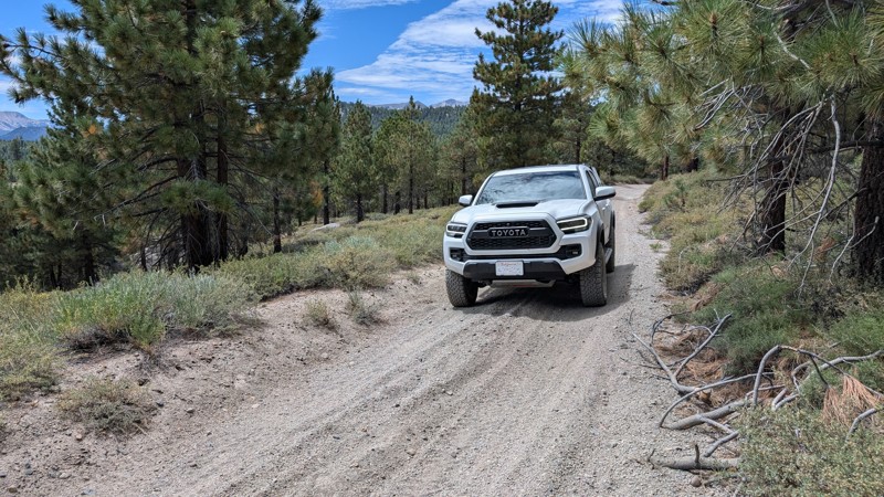
Updated: 10/15/2024
Alpers Canyon Upper
Crestview, California
Alpers Canyon Upper is a scenic, easy drive through the Inyo National Forest. It is a great way to traverse more terrain when overlanding or accessing other trails in the area. The trail is primarily gravel and easy to navigate with a 2WD. Dispersed camping is allowed, and there are several spacious sites. Check local conditions for campfire restrictions.
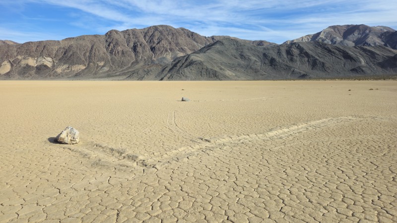
Updated: 03/09/2026
Racetrack Valley Road
Teakettle Junction, California
In northern Death Valley National Park, Racetrack Valley Road is a classic backcountry route to the mysterious Racetrack Playa and its famous “sailing stones.” The rough track starts near Ubehebe Crater and runs roughly 30 miles one way to the Racetrack Playa parking area. Expect loose gravel, heavy washboard, sharp volcanic rock, and occasional rocky wash sections. In dry conditions, some 2WD vehicles can make it, but offroad tires are a necessity due to the distance, lack of services, and rough terrain. After storms, 4-wheel drive should be anticipated, as washouts and ruts can appear until the road is regraded.
Plan for 2–3 hours each way depending on conditions, plus time to explore: about an hour to walk out to the sailing stones and anywhere from 15 minutes to a couple hours at Ubehebe if you hike the rim or drop into the crater. The scenery shifts from stark black cinder fields to a Joshua tree forest before opening into big desert views with the playa ahead. Vehicles are strictly prohibited on the playa surface—use the far southern parking area to shorten the walk to the stones. This is a high-risk, no-cell-service zone with extreme heat (often 120°F+ in summer) and fast-changing weather, so bring ample water, extra fuel, a full-size spare, and reliable emergency communication.
There’s no designated camping directly along Racetrack Valley Road, but just beyond via Lippincott Mine Road is a small, first-come, first-served improved campground with about nine marked sites that’s easy to access. For more amenities, head south toward Furnace Creek for lodging, fuel, and basic services.
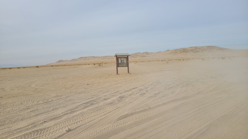
Updated: 06/05/2022
Connector Road
Brawley, California
The connector road in The Superstitions is a cut across from Wheeler Road to the hills and Superstitions Sand Dunes. This very basic trail has lots of camping opportunities that are easy to get to. It is also a great place to set up a basecamp allowing for a full weekend of fun and exploration in the Superstitions.
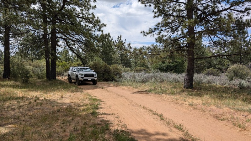
Updated: 10/15/2024
Timbers Edge Rc H
Mount Laguna, California
An easy spur off of Upper Kitchen Creek Road with two nice places for dispersed camping. The road is fairly rutted so it may be a little difficult for minivans and camper vans.
The road is in Cleveland National Forest, where dispersed camping is allowed but requires the appropriate permits, an Adventure Pass, and/or Campfire Pass (even for gas stoves).
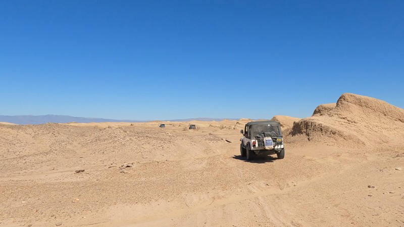
Updated: 10/15/2024
Gas Domes Eastern Park Exit
Kane Spring, California
Take the short, very lightly traveled drive off to the northeast when out by the Gas Domes. Here, the unique terrain almost feels out of this world. With mini semi-petrified sand dunes, it feels like you are driving on Mars. This is also a great way to exit the park quickly if you are near the Gas Domes or Artesian Well.
The park has odd rules on camping in the area. So if you want to camp in the area, check with the park.
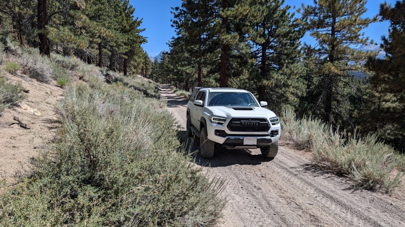
Updated: 10/15/2024
Antelope Cutoff
Crestview, California
Antelope Cutoff is an easy trail not far off Highway 395. It traverses gentle hills, passes through wooded areas, and makes for a great scenic drive. The trail is mostly gravel, with some areas of small ruts from frequent travel, but this is not a concern for any vehicle with a moderate amount of clearance. Any stock 2WD truck or SUV could handle this trail when conditions are good.
Along this route, there are a few shaded sites with nice views for dispersed camping. Check with the Mammoth Ranger District for any fire restrictions that may be in effect.
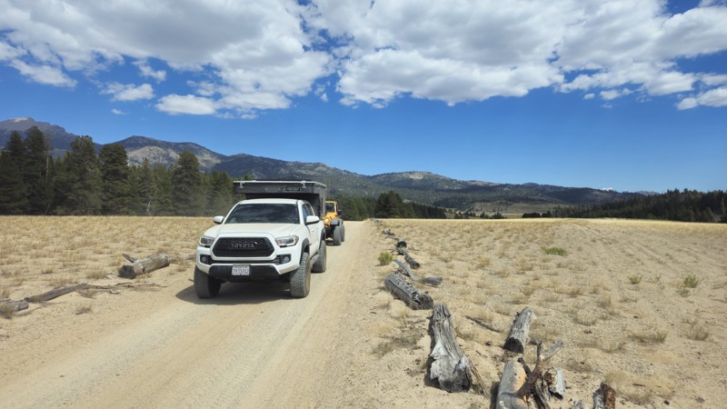
Updated: 11/30/2025
Kingfisher Stringer / Long Canyon
Olancha, California
At the northeasternmost side of Monache Meadows, 20S06, also known as Kingfisher Stringer or Long Canyon, is a unique trail that feels almost out of place in the area. The short in-and-back trail starts from the east, leading you over a random sand dune in the meadows before crossing Olvia Creek. From there, you enter a forest that feels more like Missouri or Arkansas, with a distinct type of pine not found elsewhere in the region. The narrow trail twists and turns through this dense forest as you head west. Midway through, you'll encounter the trail's only significant obstacle: a 2-foot waterfall or ledge that, while not particularly challenging, requires 4-wheel drive and good ground clearance to navigate. Continuing west, you weave through clusters of trees before reaching some of the trail’s best camping spots. The camping here is unlike other areas, offering a remote and unique experience with tight, clustered trees that create a more intimate atmosphere compared to the open forests elsewhere. Though the terrain is hilly, you can still find mostly level ground suitable for pitching a tent. The camping can accommodate groups of nearly any size, making the end of this trail a sought-after destination for those seeking a distinctive camping experience.
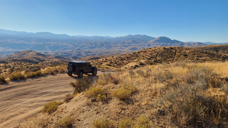
Updated: 02/05/2025
Juniper Flats 4325
Fizzben Heights, California
Beginning at the end of Japatul Road, JF4325 is surrounded by dense thickets of tall Junipers, from which the area gets its name. This flat, easy route intersects several trails to explore, including some that climb the area's highest peaks. Occasionally, the hills part to offer beautiful views to the northeast of the valleys below and the distant Fry and Ord Mountain Ranges. The last mile of the eastern portion of the trail becomes Bowen Ranch Road and provides a connection to JF3330.
The trail is easy, with no obstacles, except for the occasional grazing cattle that should be gently avoided. Some rocky sections are easily managed using a 2-wheel drive high clearance vehicle, but exploring the many intersecting trails will require a 4x4. The Juniper Flats Subregion is a Limited Use Area requiring vehicles to stay on marked trails.
The entire trail is on Bureau of Land Management land, and dispersed camping can be enjoyed on the trail when following the Bureau of Land Management Dispersed Camping Regulations. Several suitable dispersed campsites can be found along the trail amongst the shading Junipers. Open fires may be prohibited, and it is the responsibility of campers to know the Campfire Restrictions.
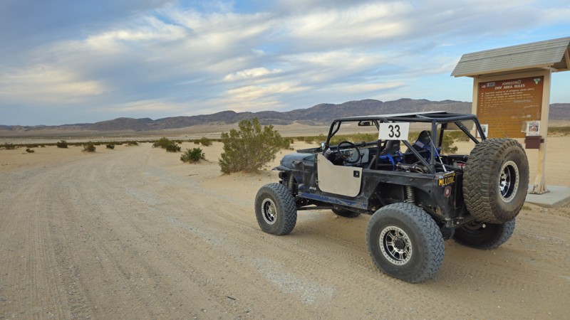
Updated: 03/09/2026
Boone Road & Barnes Road
Johnson Valley, California
Boone Road is the main eastern entry into California’s Johnson Valley OHV Area, a legendary off-road destination best known for the annual King of the Hammers event. Year-round, it serves as a gateway into vast desert terrain and offers easy access for all kinds of vehicles, including RVs, trailers, rock crawlers, and overland rigs. The road is wide, flat, and beginner-friendly, leading to the iconic lakebed and some of the most challenging trails in the country, including the infamous Hammers.
Whether you're exploring or camping, Boone Road delivers a true desert experience. It cuts through open terrain framed by rocky hills and dry lake beds, drawing adventurers from all over. Just past the bridge, the road opens into flat, level ground that’s perfect for dispersed camping. There’s plenty of room for tents, trailers, rooftop setups, and RVs under the vast desert sky.
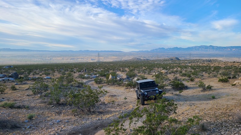
Updated: 10/15/2024
Stoddard Valley 6504
Victorville, California
SV6504 is a straight-through trail along the southern edge of Quartzite Mountain. The trail offers fantastic views and great campsites huddled amongst striking boulder formations.
Almost the entire trail is on public land, offering excellent dispersed campsites throughout its length that can be used when meeting the BLM Camping Guidelines.
During high fire danger, campfires may be restricted, and if planning to camp here, one should review the current BLM Campfire Restrictions and have a Campfire Permit.
SV6504 has only a hard stretch at its northern end, requiring a high clearance four-wheel drive vehicle, but that short section is easily bypassed, making the entire trail an easy two-wheel drive.
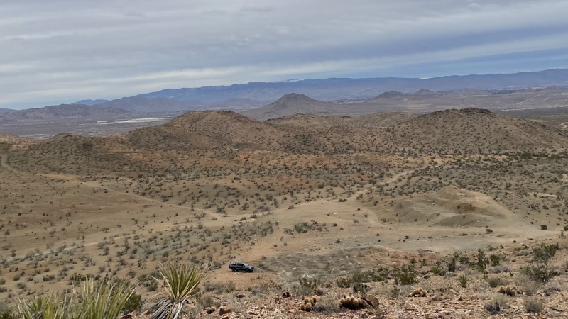
Updated: 02/04/2025
Apex Mine Trail
Bell Mountain, California
This trail outside of Victorville, California, leads to the abandoned Apex Mine. It is a simple dirt trail with small ruts that any 2WD with ground clearance can manage. 4WD is necessary if you want to explore the side trails in the area. Apex Mine has multiple mineshafts. All are gated or blocked. The mines are unsafe to enter, so do not attempt to get past the gates. Dispersed camping is possible on small flat areas along the trail.
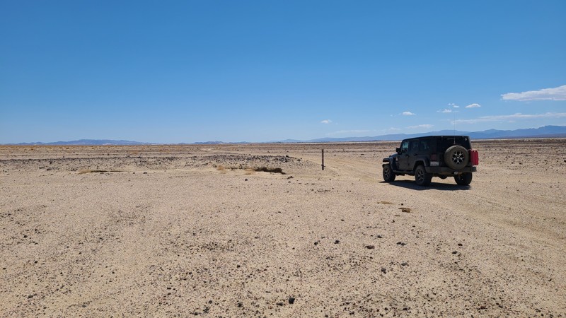
Updated: 10/15/2024
Coyote Lake Rd CL8128
Venus, California
Starting at the paved Fort Irwin Road, CL8128 travels on a low basin along the edge of and across the dry Coyote Lake. Flat and sandy, it is an easy trail for beginning off-roaders. Only the first mile is BLM land, and the remainder of the trail is right of way. Camping on BLM land can be done when following the guidelines of the Barstow Field Office.
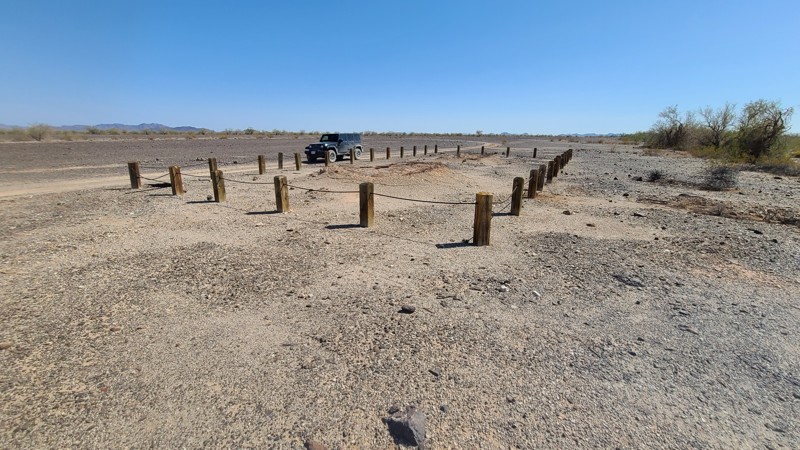
Updated: 10/15/2024
Charcoal Kiln Road
Palo Verde, California
This short and easy spur over natural desert concrete or caliche is a great addition to include during your exploration. Up this road, you'll find the remains of two charcoal kilns. The structures here provided charcoal to the many mine sites in the area. Kilns were used to convert raw wood to charcoal, then hauled to mining sites. Charcoal provides the benefit of burning hotter and more slowly than wood. A benefit of this kiln location is the large wide wash you see to the west. The wash is filled with dead trees washed down in the temporary rivers that occur during the heavy torrents of rain and are then captured by the many living trees growing in the wash.
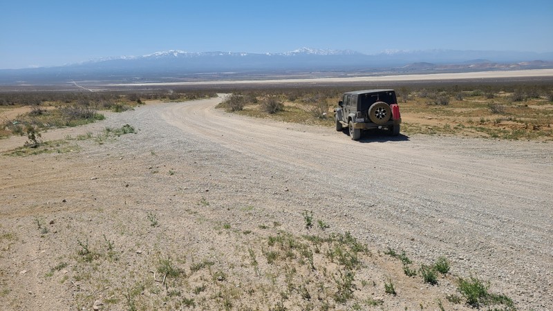
Updated: 10/15/2024
Mountain View Road
El Mirage, California
Cutting through the middle of the 27,000 acres El Mirage OHV Recreation Area, Mountain View Road has ten improved multi-site dry campgrounds with shade covers, benches, and grills along its length while providing access to the many trails in the area. As the road climbs, expansive views of the El Mirage dry lake and the snow-capped San Bernardino Mountains are revealed.
The road is wide and graded flat, allowing passenger and recreational vehicles with trailers to reach the campsites and the large staging areas on either side of the road.
There is a $15 charge for one day/night access to the area. Dispersed camping is also available on the many rugged trails throughout the area.
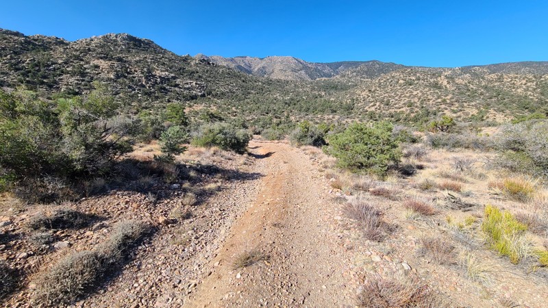
Updated: 09/24/2025
Antelope Creek
Rimrock, California
On the eastern slopes of the San Bernardino National Forest, Antelope Creek Road passes through a forest-to-desert transition zone, where both Pine and Joshua Trees share the landscape. Tucked in the surrounding hills, this remote out-and-back trail and its spurs are reached via Burns Canyon Road, and once past the obstacles near its start, the trail provides access to terrific dispersed camping and hiking trails.
The trail features large rock and boulder-strewn sections that create challenging obstacles. About 0.4 miles from the start is the hardest obstacle, requiring careful tire placement over and around two to three-foot-wide boulders. Other sections of the trail have uncomfortable off-camber sections reaching 20 degrees. This trail is best suited for an experienced off-road driver in a vehicle with larger tires and a small lift.
The trail offers several inviting dispersed campsites, under shaded trees, next to large, picturesque boulder formations, and with wonderful views of the surrounding hills. Some of these sites have existing rock fire rings, but open campfires are now prohibited here.
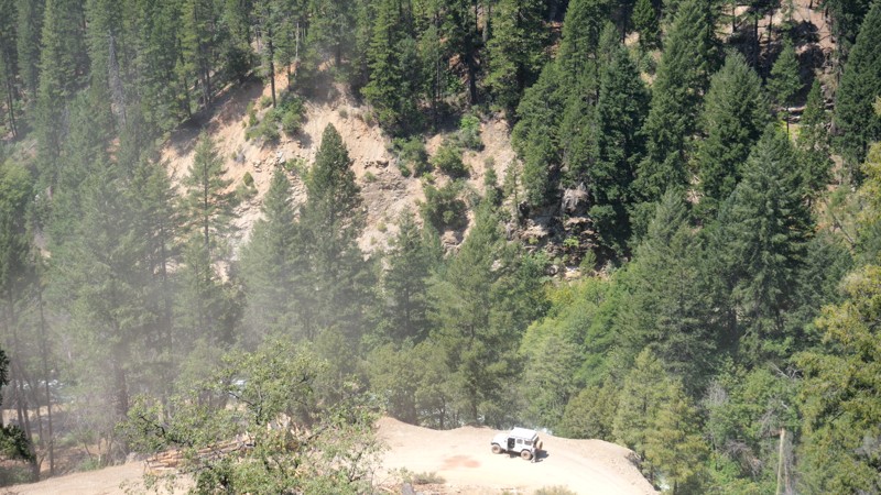
Updated: 10/15/2024
Seneca Road
Caribou, California
Deep in the Plumas National Forest sits an easy dirt trail that takes you from Butt Lake to Lake Almanor. As you travel down the trail, you will pass Butt Lake, a California reservoir. Once you pass the lake, you will climb back up, drop down the mountains, and pass over the North Fork Feather River before starting the long climb up the mountain, which ends roughly 4832 feet above sea level. The trail sits on the side of the sheer mountain cliffs for most of the route, giving it exceptional beauty, but it will also pass through burn scars. The road is maintained and suitable for any high clearance vehicle. No camping is found along the route.
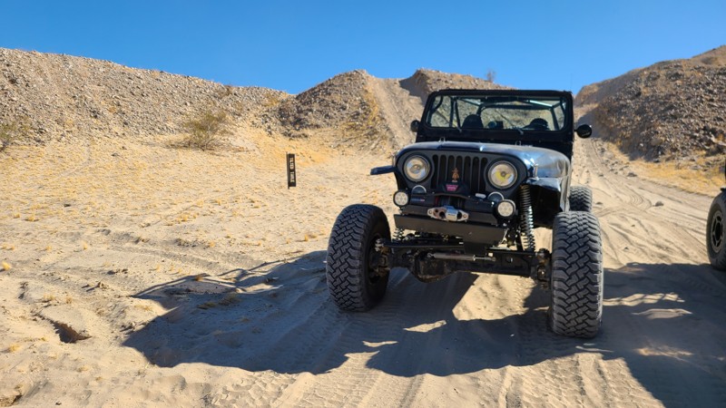
Updated: 01/05/2023
Tilted Table
Brawley, California
One of the many short trails in The Superstitions of California, Tilted Table is a short trail that connects Mine Trail and Voodoo. The trail quickly rises out of the wash, making for some great views. The trail is mostly just a connector but does offer some areas to camp and relax. So if you are in the area and not happy with the camping spots you have found, you can check out this trail to see if it would work better for you.
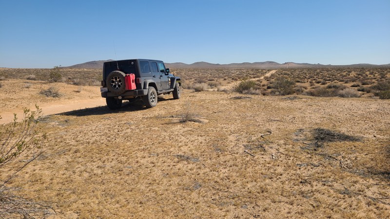
Updated: 10/15/2024
Iron Mountain 5855
Wild Crossing, California
IM5855, at its end, reaches into the Iron Mountain range. Some maps name this road Hillview Truck Trail, and the name is apparent as the run sweeps through the valley amongst the surrounding hills. This is an easy trail requiring only a two-wheel drive vehicle.
The road has a few pre-disturbed sites for dispersed camping.
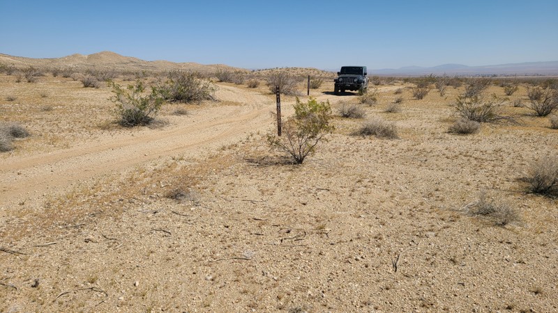
Updated: 10/15/2024
Hillview Road
Wild Crossing, California
Finding its way north over a flat sandy road through the valleys of the Iron Mountains, Hillview Road eventually reaches the busy Highway 58. A two-wheel drive vehicle will do fine on the road.
There is a large camping/staging area with rock fire rings along the trail.
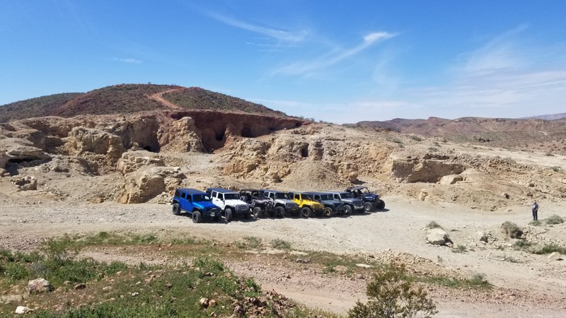
Updated: 10/15/2024
Bismark Short-Cut
Yermo, California
The Bismark Shortcut in the famous Calico Ghost Town area, located in Yermo, CA, is a shortcut on Doran Canyon to the Bismark Mine. For the longest time, people thought this was Doran Cayon Trail. To many's disbelief, it isn't. This trail immediately turns right where the canyon opens up and heads up a tailing pile/jeep trail up the side of the mountain. You pass many open mines just feet off the trail along the route, so use caution while driving the trail. Once on top, you are at the Bismark Mine main spot that everyone photographs, which is the towering open-face mines where the cliff wall was just destroyed by what looks like a giant woodpecker looking for what might be his last meal. The trail is comprised of mine tailings, with rocks ranging in size from golf balls to baseball. These rocks have been compacted into a solid surface for the last 100 years. It is common for rocks to move around a little near the top of the trail as they are still settling in. This trail is suitable for any high-ground clearance vehicle with aired-down, durable off-road tires. Offroad experience is recommended, and 2WD is generally sufficient. Less experienced drivers may require 4WD.
Since this is just a shortcut, there are no suitable campsites along the trail. One spot at the top could support a group of 5+ vehicles at the top of the trail at the Bismark Mine. The spot is flat but mostly tailings, so the ground wouldn't be conducive to sleeping on it. Also, watch out for all the open mineshafts, as they have been known to ruin people's days.
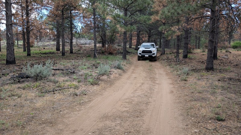
Updated: 10/15/2024
Timbers Edge Rc G
Mount Laguna, California
An easy spur off of Upper Kitchen Creek Road with a nice place for dispersed camping. There are roots and ruts, but they are passable for most vehicles.
This is in Cleveland National Forest, where dispersed camping is allowed but requires the appropriate permits: Adventure Pass and/or Campfire Pass (even for gas stoves).
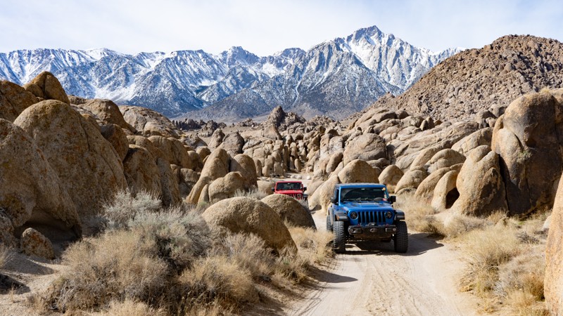
Updated: 03/13/2025
Movie Flat Sites 19-30
Lone Pine, California
This route in Movie Flats is directly off of the main Movie Road and is used to access a plethora of designated campsites. When seeing the iconic photos of people camped within the rounded sandstone structures with the jagged Sierra Nevadas in the background, this is most likely where those photos were taken. The entirety of this route is suitable for any high-clearance vehicle, but those towing trailers will need to proceed with caution as many sections are tight and narrow.
About the camping on this route:
All dispersed camping is designated to a specific site and requires a permit. A permit can be obtained online or at the Eastern Sierra Visitor Center or kiosks located on Movie Road and the main entry point in Lone Pine. Permits need to be signed and displayed on your dashboard.
The BLM has created a map showing the site numbers. However, those numbers are not used in the field, but each site is clearly marked with either a camping allowed or no camping allowed symbol on a clearly visible sign. Please be aware that all sites are first come, first served, and a permit does not guarantee you will find a site. Due to the area's popularity, it is best to arrive early.
There are six portable restrooms throughout Alabama Hills. If you do not want to drive or walk to one, you must bring your own system to pack out human waste.
Below is a brief description of each site, listed as if you were driving from the south to the north.
- 19: Is in the open next to the road. Can use a trailer if accessing from Movie Road nearest point.
- 20: Smallish and suitable for a rooftop, tent, or very small travel trailer.
- 21: Is directly on the edge of the road but suitable for a trailer if accessing directly from Movie Road nearest point.
- 22: Split the road so that you park on one side and tent on the other, or two rooftops can take up each side. It is guaranteed that others will drive directly through your site.
- 23: 4wd or high clearance is most likely needed. It provides a good amount of privacy and is only large enough for one vehicle and a tent or two rooftops.
- 24: Sizeable and flat space good for up to four vehicles.
- 25: Directly on the road edge. It is large but not exactly flat and provides a good view of the mountains.
- 26: This is a larger site, but not that level, but it does provide a bit more privacy than others in the area.
- 27: Pull in suitable for a trailer but only if accessed from its nearest point to Movie Road.
- 28: It is a large site, but all that flat.
- 29: Right next to the road, which is small and great for a truck camper.
- 30: This is a pull-through large enough for two tents only, with a view and direct earshot of Movie Road.
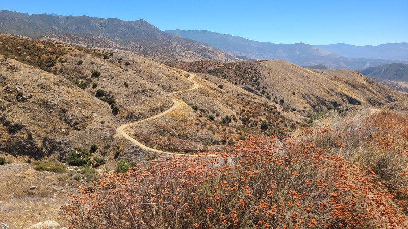
Updated: 02/10/2025
Riverside County 164
Valle Vista, California
This area has no designated Bureau of Land Management (BLM) subregion, hence the prefix for Riverside County (RVC). RVC164 meanders through the San Jacinto Mountains foothills connected Cryer Road to RVC170, providing beautiful views out to the west.
Dispersed camping can be enjoyed on BLM land when adhering to the BLM Dispersed Camping Guidelines. There is a single suitable location for camping on the trail that is a wide pullout a few feet from the road. This site provides wonderful views and room for two or three vehicles. No open fires are permitted, and it is the responsibility of campers to know and follow the Fire Restrictions.
New offroaders would enjoy this easy trail in a high clearance two-wheel drive vehicle.
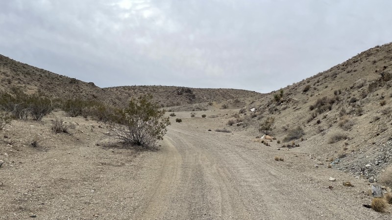
Updated: 10/15/2024
SV6522
Bell Mountain, California
SV6522 is an easy trail that goes between SV6545 and Delmonico Road. The trail can be completed in 2WD with high clearance, but rocky sections and rutted areas require caution. There are multiple offshoots along the trail to explore, but they may require 4WD. Delmonico Road is too steep to be traversed by a 2WD, but there is room at the end of SV6522 for vehicles to turn around. While there are no campsites along this trail, dispersed camping is allowed in the area.
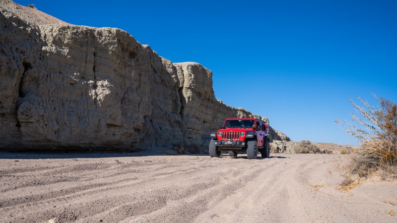
Updated: 09/29/2025
Mojave River Wash
Manix, California
The Mojave River Wash is the final 12 miles on the western side of the historic Mojave Road, connecting Afton Canyon and Manix. It travels along a wide, soft, sandy wash, offering expansive views of the Mojave Desert region. Along the drive, you can expect continuous sandy whoops, deep ruts, and an occasional random rock that could easily take out a tire or differential if you are traveling too fast. There is quicksand along this trail, but the areas they are in have been blocked off, so staying on the marked route is imperative for your safety. This section of the Mojave Road does not offer any camping options, and route finding can be difficult at times. It is suitable for any high clearance vehicle, and airing down is highly recommended due to the sandy terrain.
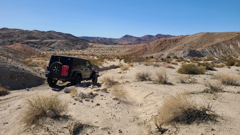
Updated: 10/15/2024
Coyote Lake Area CL8241
Manix, California
CL8241 follows sandy washes across the sandy desert floor, then hugs the ridges of the nearby Alvord Peak. The trail eventually merges into a narrow canyon that leads to a beautiful dispersed campsite.
As the trail enters the ridges and hills of Alvord Peak, there are oddly shaped pillars, seemingly out of place, consisting of a hard stone top protecting the soft material below from the weather. With a bit of imagination, recognizable shapes appear. One notable pillar looks very much like a baby elephant which would be an excellent name for this trail.
Overlapping layers of minerals follow the contours of the surrounding hills in a rainbow of colors and provide shelter from the wind. Soft pink sand washed down from these hills is perfect for pitching a tent with enough room for four or more vehicles.
This easy out-and-back trail would be enjoyed by novice and experienced off-roaders and is suitable for a two-wheel drive high clearance vehicle.
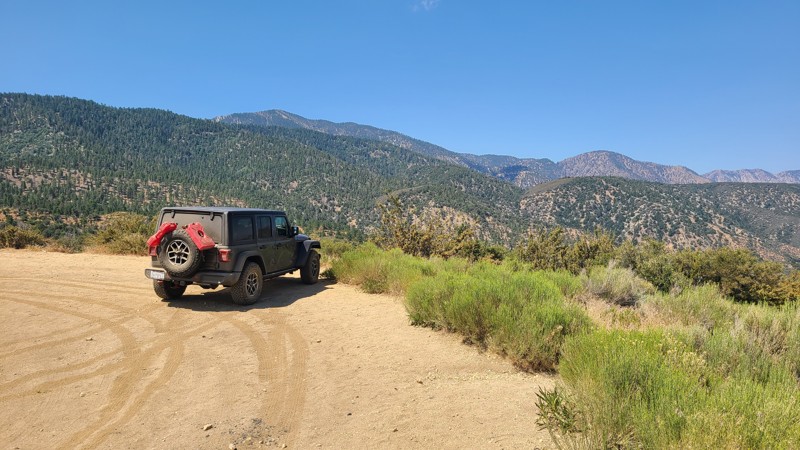
Updated: 01/06/2026
Ball Flat Road
Big Pines, California
An easy trail with convenient access right off Big Pines Highway that provides wonderful dispersed camping amongst the tall pines and great views out over the desert.
Dispersed camping is allowed here when following the Angeles National Forest Dispersed Camping Restrictions. Campfires are prohibited.
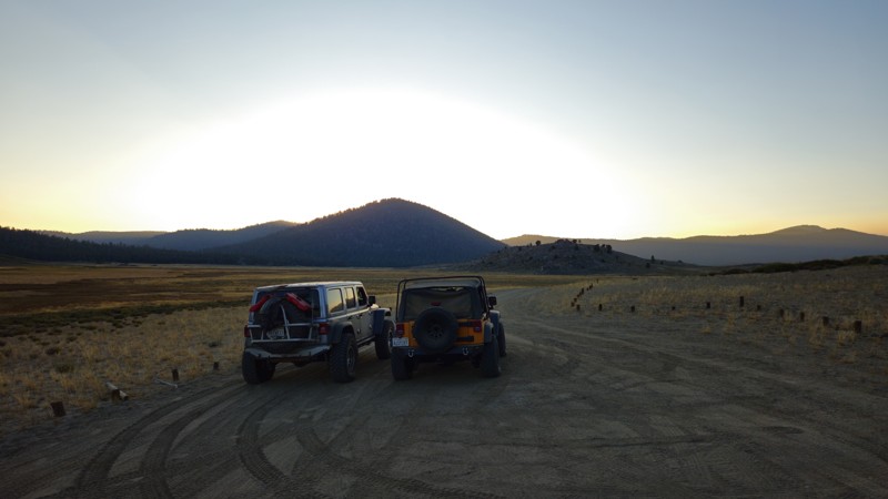
Updated: 11/30/2025
Anderson Point Road
Olancha, California
Located on the eastern side of Monache Meadows, 20S05C is a scenic in-and-back trail commonly used to access the Pacific Crest Trail. This easy, offroad route is perfect for a relaxing evening drive, offering stunning views of the surrounding landscape and ample opportunities to spot birds of prey perched on rocks, scanning the tall grasses for their next meal. While the trail provides a serene experience as it winds through the meadows to the wilderness boundary, it does not have any suitable camping locations along the way.
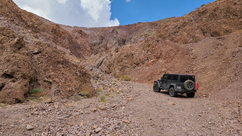
Updated: 10/15/2024
Calico Mountain 7608
Yermo, California
CM7608 is a short drive up this rocky spur into a box canyon with a wide rocky floor. The trail becomes impassible in the canyon. The return trip provides lovely views back down the trail to the desert basin.
The best location for a flat, comfortable campsite is near the trailhead.
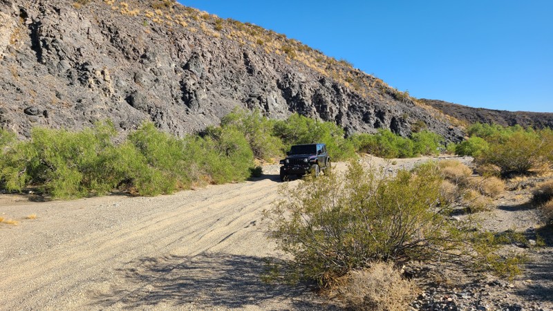
Updated: 10/15/2024
Rattlesnake Wash
Johnson Valley, California
Located south of the popular Johnson Valley OHV area, Rattlesnake Wash follows a dry wash paralleled by a green line of trees and flourishing wildlife. At its end, it intersects with Rattlesnake Canyon Road.
This easy trail requires a high clearance two-wheel drive vehicle due to the deep sand.
Along this trail are a few established dispersed campsites, and dispersed camping is allowed here when following the Bureau of Land Management Camping Guidelines. Open fires are generally prohibited, and it is the responsibility of campers to know the Campfire Restrictions.
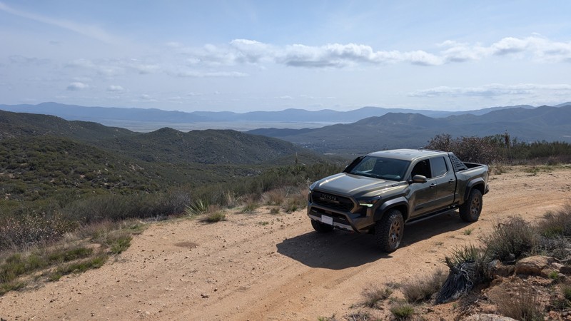
Updated: 09/29/2025
Puerta La Cruz
Holcomb Village, California
9S04 Puerta La Cruz trail is a side trail off of 9S05 Indian Flats. It runs 2.9 miles, down almost 700 feet in elevation, towards Holcomb Village, but terminates at a locked gate. This is an out-and-back trail, as there is no access to Highway 79. The final stretch of trail near the gate has a superb view overlooking the Warner Springs Valley, Palomar Mountain, and Lake Henshaw. While the trail itself may not be a destination, it does offer enticing views of the surrounding valleys and makes a great add-on for those wanting to add more miles to their offroad adventure.
The trail is primarily smooth, graded dirt, making for an easy drive. However, it becomes increasingly rutted towards the southwest section, with the deepest ruts being less than 6" deep and peppered with golf-ball-sized rocks. Any high-clearance 2WD vehicle can easily complete the trail. The northeast end resides in BLM land while the southwest end sits in the Cleveland National Forest, which requires a pass.
There are at least two pull-outs that could be used for dispersed camping in a pinch, but they have no shade and do not provide any privacy from the trail.
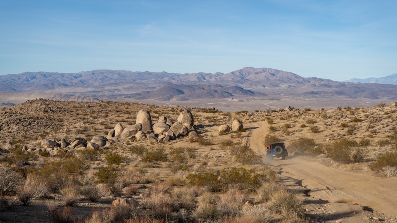
Updated: 03/25/2025
Boundary Road
Ridgecrest Heights, California
Boundary Road travels through the Stoddard OHV area and connects Highway 395 with Randsburg Wash Road. It is also a terminus point for the famed Trona Pinnacles Road. There are no notable obstacles, but airing down and having 4-low gears is recommended. Be advised that fast-moving motorcycles and side-by-sides are all over the place, and their trails often cross paths with the major roads.
It does provide unique scenery, with massive sandstone boulders along most of the route, some reaching almost monolithic proportions. This scenery provides an excellent backdrop for camping, and there are plenty of locations along the route where you can set up for the night. All camping available is dispersed, so no amenities are offered.
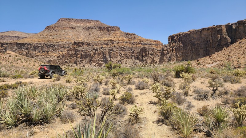
Updated: 08/11/2025
Wild Horse Canyon Road
Thomas Place, California
Wild Horse Canyon Road winds through a rugged and scenic part of Mojave National Preserve, offering striking views of Wild Horse Mesa and the volcanic cliffs near Hole-in-the-Wall. Though it feels remote, the road is easily accessed from the Hole-in-the-Wall Visitor Center and Campground.
Several hiking trailheads branch off along the route, leading deeper into the backcountry. These paths pass through dramatic landscapes and even feature ancient petroglyphs left by Indigenous people who once lived in the area. Many trailheads double as dispersed camping sites.
Camping options range from dispersed sites to improved campgrounds. At the south end, the Hole-in-the-Wall Campground provides picnic areas, fire rings, benches, and pit toilets, but no shade. Further north, Mid Hills Campground offers similar dry camping amenities. Both were heavily burned in the 2020 Dome Fire; while now open, the trees remain scorched and lifeless.
Additional designated and dispersed campsites are scattered along the road. A standout spot lies less than a mile from the southern entrance, nestled among tall rock formations. Another notable site sits at the north end, beside a dramatic stone outcrop.
A sign at the south entrance warns that the road is suitable only for high-clearance, 4-wheel-drive vehicles. It starts out wide enough for two-way traffic but narrows to a single lane about a third of the way in. Some sections are rutted and rocky, requiring careful driving. Still, it’s a good choice for beginners looking to gain confidence on mild offroad terrain.

Updated: 01/13/2025
AC9624
Afton, California
AC9624 is a quick, cool offshoot off Afton Canyon Road a few miles from Highway 15. It wraps up and around the hills following the power lines with vast views of the buttes of the Mojave National Preserve to the southeast and the remnants of West and East Cronese Lake as it wraps around Cave Mountain.
The trail is mostly graded gravely dirt, but descending from Cave Mountain, it becomes more natural gravel with slightly bigger pebbles and smaller rocks. The initial descent is relatively steep, with small ruts to navigate.
The trail's end comes to a fork, with AC9624 going to the left into a deep sand wash with bigger rocks to navigate and ends at a tunnel to go under the highway. You can access Pipeline Road or Arrowhead Trail on the other side or return to Afton Canyon Road. Unfortunately, you cannot enter the highway at this junction.
There were no campsites on this trail. Nearby, Afton Canyon Campground has fire pits, tables, and vault toilets.
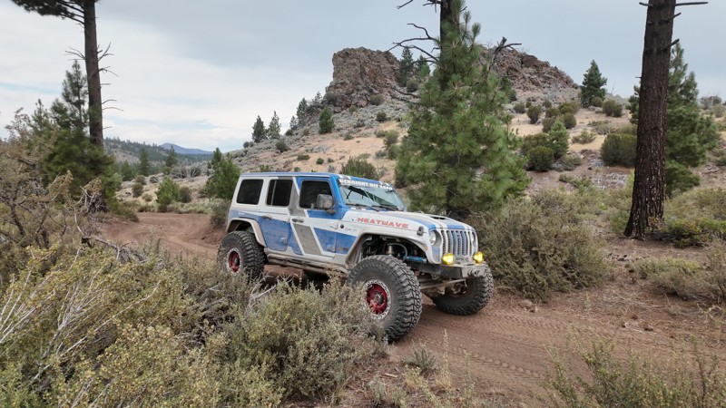
Updated: 10/15/2024
Port Arthur Road
Verdi, California
Crossing the California and Nevada state lines, Port Arthur Road is an easy-to-moderate dirt road that is perfect for any 4x4. Cutting through the Humold-Toiyabe Nation Forest, the trail approaches the state line with an amazing rock formation that pops up out of the ground as though it were a giant marker. Even though dispersed camping is allowed in this area, there are no suitable camping locations along the trail. Dispersed camping can be found along nearby Henness Road to the west.
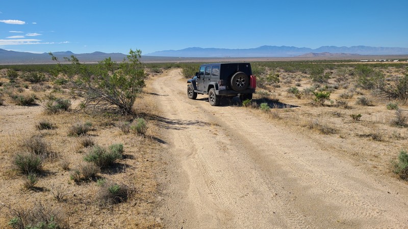
Updated: 10/15/2024
Blanco Road
Houze Place, California
Most of the western side of Blanco Road is privately owned, and this road provides access to these areas. The north ends at the gate to a ranch, and the south ends at the locked gate to the La Mirage Dry Lake Recreational area.
Bordering BLM land over the entire west side of the road north of Shadow Mountain Road, abundant flat areas are appropriate for dispersed camping when following the BLM Camping Guidelines.
During high fire danger, campfires may be restricted, and if planning to camp, one should review the current BLM Campire Restrictions.
Blanco Road is flat and sandy, suitable for most two-wheel drive SUVs.
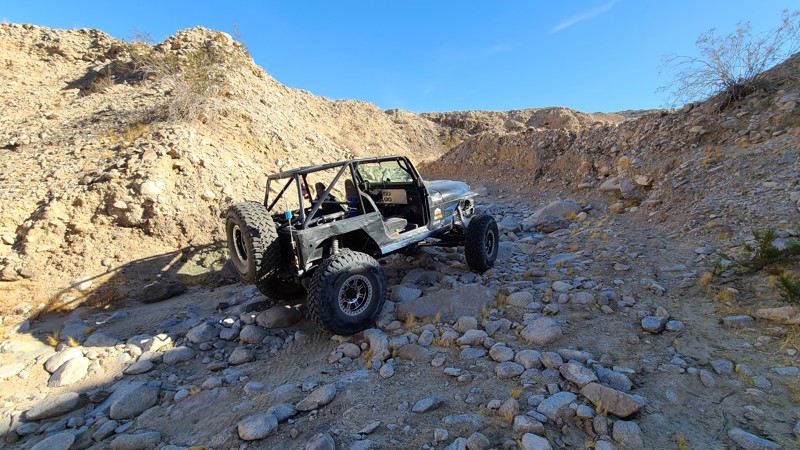
Updated: 01/05/2023
Mine Bypass
Brawley, California
In the hills of the Superstitions near Anza-Borrego State Park is a small short bypass that takes you around some of the harder trails in the area. Mine Bypass is a short climb up a narrow wash. The trail is nothing hard in nature but gives you access to some of the cooler spots in the area. Now, this might not be the first destination but this does pair well with Mine Loop as it keeps the scenery changing.
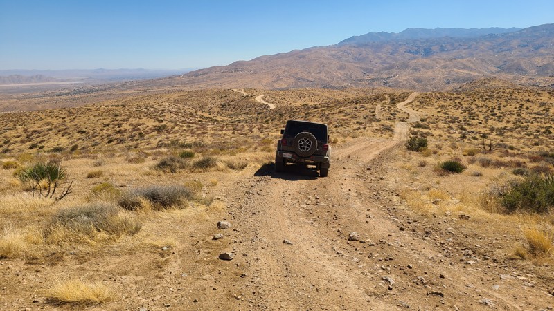
Updated: 02/05/2025
Juniper Flats 4330
Apple Valley Highlands, California
JF4330 is a straight-through, semi-circle that starts on the level ground of Juniper Flats, where shading Junipers provide perfect spots to enjoy lunch or for overnight camping. After a shallow climb, JF4330 ends as the hills begin their steep 2,300' descent to the Mojave River bed. Along the way, the trail passes a burn area that has been fenced off to promote the land's recovery. Reaching the trail's end is the reward of an expansive view of the valley below and out to the distant San Gabriel Mountains. You're likely to pass roaming cattle in the area that make for mellow company when keeping a discrete distance.
This trail has long rocky stretches with no bypasses. A 4-wheel drive high clearance vehicle is best for running this trail. The trail is in the Juniper Flats Subregion, a Limited Use Area requiring vehicles to stay on marked trails.
The entire trail is on Bureau of Land Management (BLM) land, and dispersed camping can be enjoyed on the trail when following the BLM Dispersed Camping Regulations. Near the top of the trail, suitable pre-disturbed campsites can be found positioned to enjoy the expansive views. Open fires may be prohibited, and it is the responsibility of campers to know the BLM Campfire Restrictions.
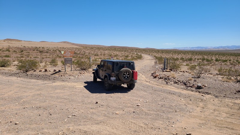
Updated: 10/15/2024
Early Man Site Road CM7649
Toomey, California
The Early Mine Archeological Site has been closed indefinitely due to vandalism, theft, and health concerns. BLM Remediation Actions for the Early Man Site are being discussed. The road is open to the gated site entrance and provides connections to other trails in the area. The road to the site has not been maintained and is in rough shape, requiring a high clearance vehicle. CL7649 is almost entirely on BLM land, and dispersed camping is possible when following the guidelines of the Barstow Field Office.
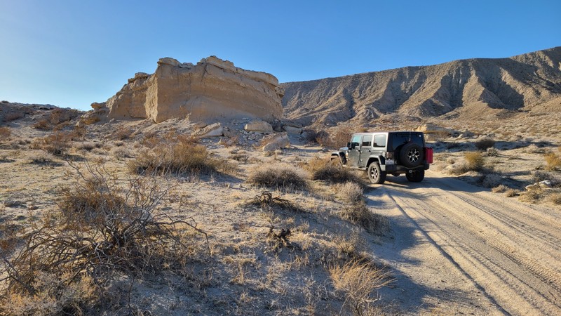
Updated: 10/15/2024
Coyote Lake Area CL8211
Midway, California
Skirting around the northern base of Alvord Mountain, CL8211 provides an easy flat road through the desert leading out to the paved Fort Irwin Road. A cluster of trails, mines, and prospects to explore is at its west end. The trail is flat, sandy, and with occasional soccer ball-sized rocks on the trail that are easily avoided. A two-wheel drive high clearance vehicle would easily manage the trail.
Several dispersed camping sites just off the trail hug the mountain's edges providing protection from the desert wind.
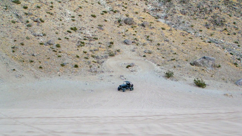
Updated: 09/29/2025
Road to Claw Hammer
Johnson Valley, California
This route is the most efficient way to get from Means Dry Lake to Claw Hammer and many other famous Johnson Valley rock trails. The path is a heavily traveled route full of whoops and sand. Two-thirds of the way to Claw Hammer, you will pass the base of the sandhill or sand dunes, where you can test your traction and horsepower. This easy route can be rough and bumpy at times, but the biggest concern comes from areas of soft sand that are easy to get stuck in; thus, airing down is highly recommended.
Johnson Valley OHV area is an open OHV area, meaning you can drive anywhere, and you don't have to stay on the path if you choose not to. Portions of Johnson Valley are shared with the Twentynine Palms military base, and closures go into effect when training takes place. Please be sure to visit the BLM website: https://www.blm.gov/visit/johnson-valley-ohv-area to see closure schedules.
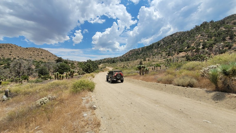
Updated: 04/01/2025
Panorama Road
Largo Vista, California
Panorama Road is well-maintained, providing a nice shortcut to Mescal Creek Road. Traveling through the desert foothills of the Sheep Mountains, the elevation is still high enough to provide lovely views to the north. Along the way are the ruins of long-abandoned buildings built from local rocks. When reaching Mescal Creek Road and turning north, it leads into the Angeles National Forest.
The trail is entirely on private land, and there is no camping along this road.
A two-wheel drive SUV will do fine on the wide, flat road.
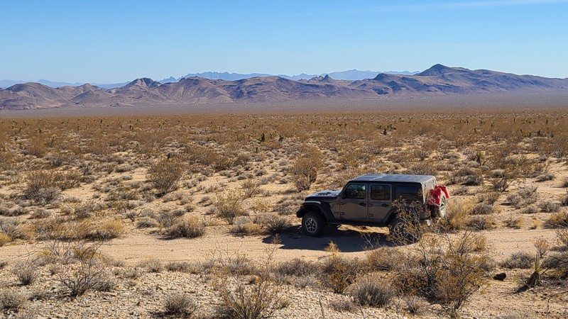
Updated: 04/08/2025
Flattop Mountain Road
Fenner, California
Flattop Mountain Road is a 25-mile trek and, when combined with Ship Mountain Road, creates a 100-mile adventure route from Joshua Tree to Needles, perfect for overlanders. Views galore are offered up by this rocky rolling trail, which guides one through a valley between the Old Woman and Piute Mountain ranges, then across the sandy Ward Valley Basin to eventually reach the black imposing Flattop Mountain. The base of Blacktop Mountain is also a popular rock-collecting area for Jasper.
Most of the trail is hard-packed and strewn with apple-sized rocks, traversing mild grades. Cattle wander the trail's eastern portion, and drivers are asked to keep a respectful distance. A high clearance 4x4 is best for this trail, and drivers must be prepared to self-rescue in this remote part of the desert.
Several dispersed campsites can be found along the trail, with the best wind-protected dispersed campsites around Flattop Mountain. Campfires may be prohibited, and it is the responsibility of campers to know and follow any fire restrictions.
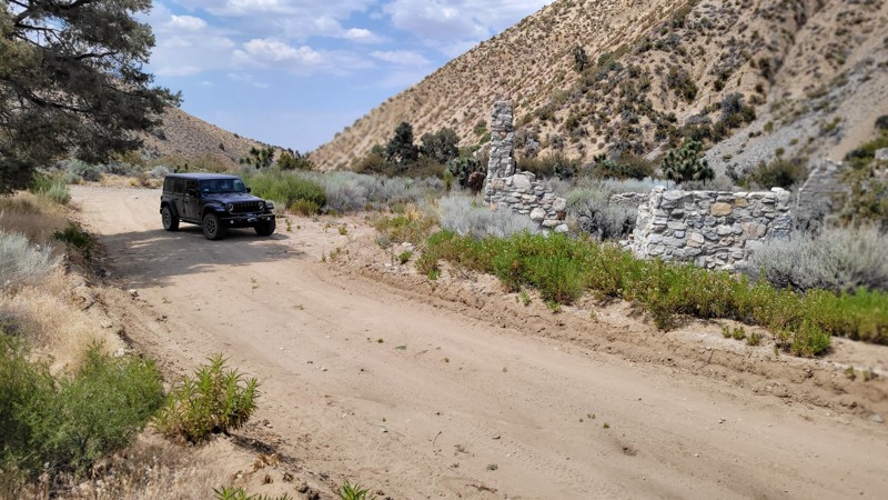
Updated: 12/10/2024
Puzzle Canyon Road
Piñon Hills, California
Puzzle Canyon Road is an up-and-back, maintained road over mostly private land. Near the end of the trail, exploring the ruins of a homestead stone house makes this short diversion worth the drive.
There is no camping along this trail.
Updated: 02/06/2025
Artesian Well Trail
Kane Spring, California
The highlight of this trail is obviously the artesian well. Bubbling up from the deep, this natural well seemingly comes out of nowhere since there is no water source close by. This is a unique and fun place to check out when exploring the Ocotillo Well Desert.
If you are looking for a place to camp nearby, check out the camping by Blow Sand or the hills on the north side of Ocotillo.
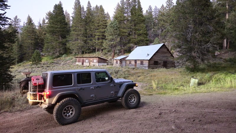
Updated: 11/30/2025
Olivas Cabin Road
Olancha, California
20S05B, also known as Olivas Cabin Road, is named after one of the original families that settled in Owens Valley. In the 1920s, Henry Lester Olivas used this land as a summer cattle ranch, driving his herd up and down Cottonwood Canyon to Templeton Meadows, Ramshaw, Little Whitney, Big Whitney, Mulkey Meadows, and Horseshoe Meadows. In 1938, a large wooden cabin was built on the property, followed by two smaller cabins where about half a dozen people lived. Today, this area features an easy trail accessible to all offroad vehicles, with a spacious, slightly uneven forested area near the old ranch site that’s perfect for camping, accommodating groups of 7+ rigs. Whether exploring the historic surroundings or camping amid the scenic meadows, visitors are sure to enjoy a memorable weekend.
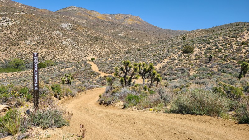
Updated: 10/15/2024
Scodie Mountains 50
Sageland, California
In the southern Scodie Mountains, the short SC50 provides a convenient connection from Frog Creek SC47 to the beginning of SC37.
The trail is well-marked with BLM trail markers. The sandy trail is one vehicle wide with no obstacles and rises on a 6% grade, making it easy for beginning offroad drivers.
Due to the trail's steepness, there are no suitable campsites.
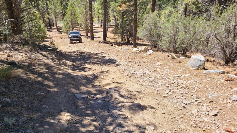
Updated: 05/20/2026
Little Holcomb
Fawnskin, California
Leaving the picturesque Holcomb Valley in your rearview, Little Holcomb winds north through the dense pine forest, quickly reaching 3N83 and access to the many other trails in the area. This road offers a moderate driving challenge with its large rocky obstacles. A high clearance 4x4 vehicle would easily manage this trail, or an experienced driver using a two-wheel drive vehicle would enjoy the challenge.
Along the way, a few locations suitable for dispersed camping can be found, providing deep shade and solitude away from the busier surrounding trails.
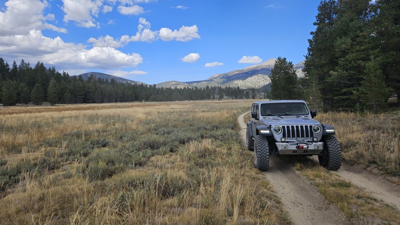
Updated: 11/30/2025
Monache Corral
Olancha, California
20S03A, also known as Monache Corral, is the first spur road along the main Manche Meadows artery. The name likely comes from the old corral near the trail's end. As you head down this dead-end trail, it loops around the hill to a stunning remote campsite near the southern side of the meadows. This campsite at 7,890 feet above sea level is a great place to relax for a fantastic weekend due to its stunning views, remoteness, and cool weather. This trail is easy and suitable for any high clearance vehicle. Several large campsites at the end of the trail sit on the meadow's edge and can easily support large groups of 7+ rigs. The ground is flat dirt with a pine forest canopy. Just to the east, about 100 yards, is the Kern River. Following the white rock path to the river will take you to several swimming holes.
When driving the trail, you will pass through cattle gates. Please leave them as you found them unless there is a sign. If a sign is present, please follow the instructions.
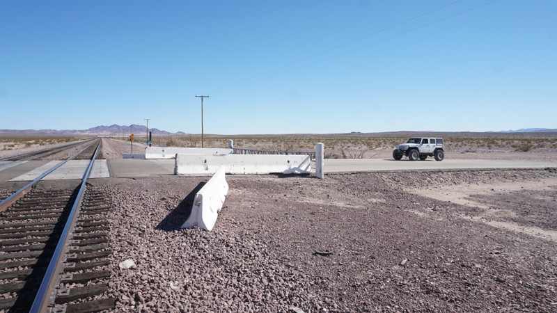
Updated: 02/20/2025
Hector Road to South Cady Flat
Hector, California
Outside of Newberry Springs, California, in the BLM Broadwell Lake region, this route serves as a connector from the 40 Freeway into the Cady Mountains and Hidden Valley Wash when the railroad crossing along South Cady Flat is closed. This trail parallels the railroad tracks to a train bridge tall enough for vehicles to squeeze under. The road is easy and hard-packed making it suitable for any vehicle.
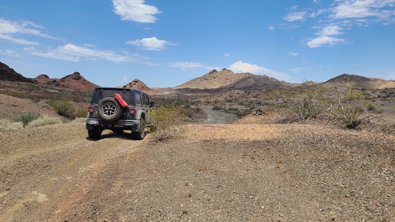
Updated: 06/23/2025
Parker Needles Wagon Road
Calzona, California
In the early days of this desert region, a major route for travelers between Parker, Arizona, and Needles, California, was the historic Parker Needles Wagon Road. This rugged road skirts the western edge of the Whipple Mountains Wilderness, providing scenic views and several intersecting trails to explore. Many of the trails lead to the abandoned mines that were part of the Whipple Mining District. One of these mines, the American Eagle Mine, is very close to the road where some of its structures still stand.
This road is rugged, transitioning from gravel to large rocky sections and through narrow, steep-walled sandy washes. Trail markers are sprinkled along the entire length of the road to help with navigation. An experienced driver in a high-clearance four-wheel drive vehicle will be needed to transition the length of this road.
Abundant existing dispersed campsites are spaced over the entire route. More dispersed camping can also be found following the spurs leading to the several mines near the trail, especially over the south-east half of the trail. One of the best campsites on the trail in a narrow valley is located about one mile past the intersection of Pyramid Peak Rd NS660.
This is a remote area with spotty cell phone coverage, and drivers exploring the area should carry adequate water, be equipped for self-rescue, and notify family/friends of their travel plans.
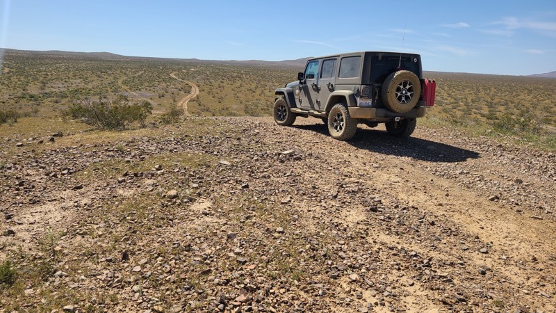
Updated: 10/15/2024
Twin Hills Road
El Mirage, California
Located in the 27,000-acre Bureau of Land Management El Mirage OHV Recreation Area, Twin Hills Road heads east from Mountain View Road, eventually ending at the fenced border of the OHVA.
The road follows rolling hills over occasionally a rocky trail provides many intersecting trails to explore and would be enjoyed by beginning offroaders or those simply looking to find a quiet, dispersed camping spot.
There is a $15 charge per day to enter the OHVA with access to the improved dry campsites and dispersed camping throughout the OHVA.
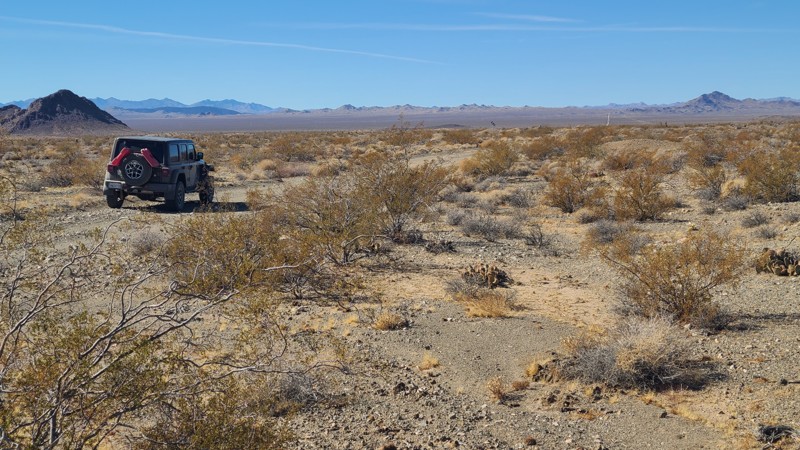
Updated: 03/11/2025
Sunset Trail
Topock, California
Sunset Trail is a 53-mile adventure from near Needles westward to Route 66, and it provides access to a dozen other intersecting trails one can explore.
The trail follows the flat contours of Ward and Fenner Valleys and has no significant obstacles. A few washouts from heavy rainfall have bypasses that have been marked with cones or barricades. A new offroad driver in a high clearance 4x4 would enjoy this trail. The trail passes through a very remote desert, and drivers should be prepared for self-rescue.
Along the trail, there are a few dispersed campsites, but no wind-sheltered campsites. Campfires may be prohibited, and it is the responsibility of campers to know and follow any fire restrictions.
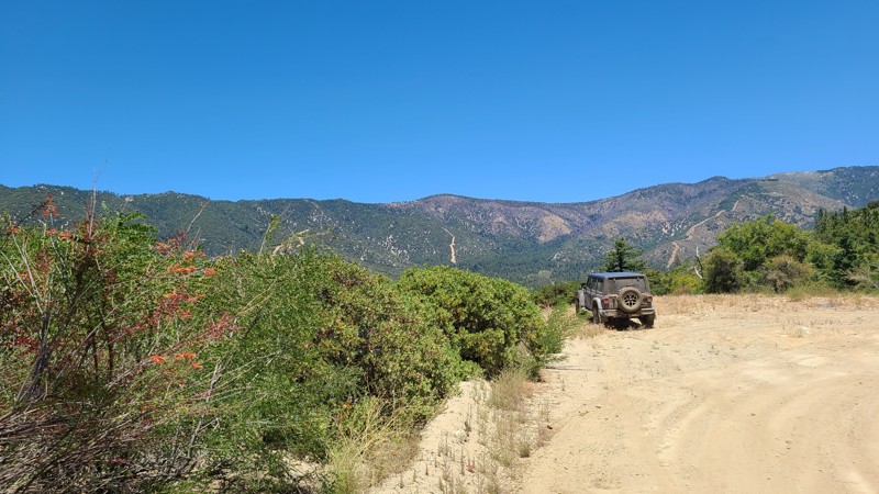
Updated: 07/14/2025
Hill Ranch Road
Seven Oaks, California
With easy access from Highway 38, Hill Ranch Road zigzags through the quiet and beautiful dense forest of the San Bernardino Mountains. Turnouts on the road emerge from the dense forest and provide wonderful views across a wide valley to the distant mountains and Snow Summit. Creeks cross the road in two places, providing ideal spots to stop for lunch and enjoy the peaceful gurgling water, as well as watch for deer. Connected to the road is Stetson Hollow 1N86B, which is a fantastic addition to the journey. The road emerges onto the paved Glass Road, providing access to many other trails to the north or an exit on Highway 38 to the south.
Dispersed camping sites can be found at turnouts off the road, mostly near the north and south ends of the road. These large cleared areas, in the deep shade provided by the surrounding tall pines and oaks, would have room for two vehicles and their tents. These sites have no fire rings as campfires are prohibited in the forest.
Upon entering the road, Forest Service road markers indicate an “Easiest” difficulty level. The road is maintained, graded flat with a few protruding stones easily avoided, and is wide enough to allow passing vehicles. A two-wheel drive vehicle with some clearance and a beginning off-roader would enjoy this road.
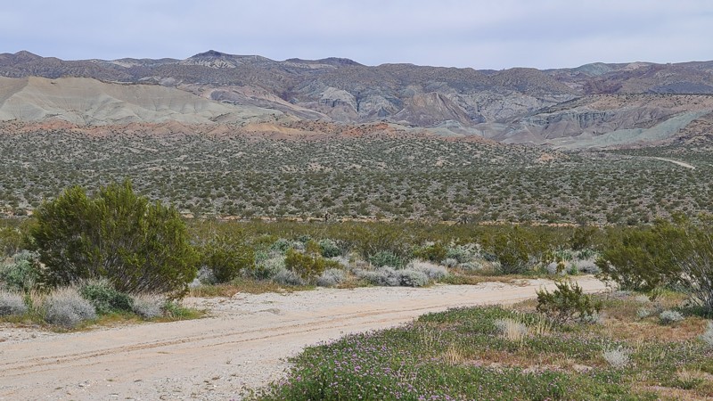
Updated: 10/15/2024
Harper Lake 7154
Skyline North, California
HL7154 is located seven miles north of Barstow in the Bureau of Land Management Harper Lake Subregion. The trail begins just across the road from Rainbow Basin trailhead. After exploring the Rainbow Basin, this trail is very convenient for stretching your offroad legs and enjoying the 360-degree views from the top of the mountain, extending from the colorful hills of Rainbow Basin to the snow-covered San Bernardino Mountains.
HL7154 is steep, rugged, and covered with loose rock, requiring a high clearance four-wheel drive vehicle and a driver with driver experience on these trail conditions.
Only the highest elevations of this trail are within BLM land. Fortunately, this high elevation provides spectacular views and is a beautiful place for a dispersed camp following the BLM Camping Guidelines.
During high fire danger, campfires may be restricted, and if planning to camp here, one should review the current Campfire Restrictions and have a Campfire Permit.
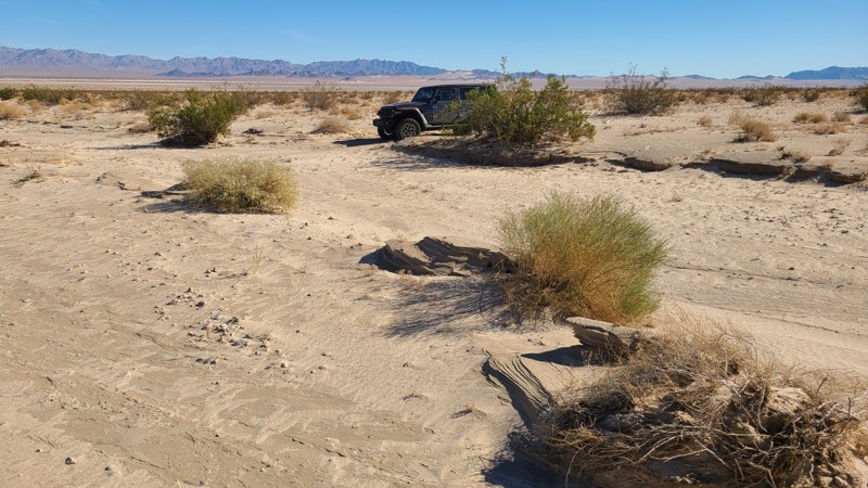
Updated: 03/11/2025
Old Patton Road
Milligan, California
Old Patton Road travels through the once massive 18,000-square-mile Desert Training Center, which was established during WW II to train U.S. soldiers for combat under the harshest desert conditions. Driving the trail, one can appreciate the history here and see why the Mojave Desert was chosen to simulate what they might experience in North Africa.
The trail follows the flat contours of Cadiz Valley over its entire length, starting at the paved Highway 62 in the south and connecting to Ship Mountain Road at its north end. Combining Old Patton Road with Ship Mountain and Flattop Mountain Road provides an impressive 127-mile overland adventure.
The trail is easy over packed sand, requiring only a 2-wheel drive vehicle with high clearance, and would be enjoyed by a first-time off-roader. This trail is remote with no cell coverage, and travelers should be prepared for self-rescue before driving this trail.
Dispersed campsites can be found along the entire trail. Campfires may be prohibited, and it is the responsibility of campers to know and follow any current fire restrictions.
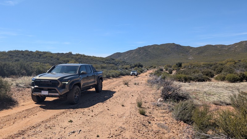
Updated: 05/07/2025
Cooper Canyon
Holcomb Village, California
A leisurely secluded trail paralleling the Beauty Mountain Wilderness and San Diego County's northern border. The western two-thirds of the trail has gradual ups and downs with gentle turns, providing a relaxed and scenic experience. The eastern third descends nearly four hundred feet via mild switchbacks under mature oak tree canopies before climbing back up to Rimrock Canyon Road. Stock trucks and SUVs can handle these ups and downs with decent traction. This trail suits anyone seeking a mild off-road drive while being surrounded by some of San Diego's remote mountains.
Camping
A large flat area with a hand-made rock campfire ring is located 2.7 miles from the western end. This area is large enough to accommodate eight to ten vehicles or possibly 5 vehicles and 5 tents. It also appears to be a popular shooting location, with shells and casings scattered across the ground. There is little to no shade here.
Access
While the trail itself is easy, Cooper Cienega Truck Trail to the west and Rimrock Canyon Road to the east are both slightly harder, requiring good traction in normal conditions. There is an unlocked gate with no signage where Rimrock Canyon Road turns into the trail.
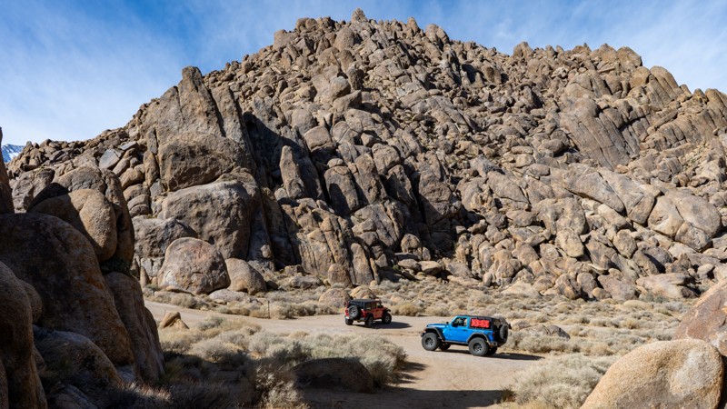
Updated: 03/13/2025
Seven Men From Now Movie Location
Lone Pine, California
The Alabama Hills area is filled with Western genre movie sites, and this route leads to where "Seven Men From Now" was filmed. The story can be summed up as "a rancher (Randolph Scott) hunts down those responsible for killing his wife during a Wells Fargo holdup." The film may be more exciting than the road, as any 2WD vehicle should have no problems driving it. This is a day-use-only area with no camping.
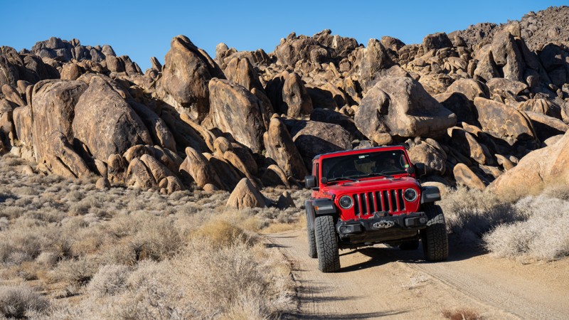
Updated: 03/13/2025
Movie Flat Sites 12-15
Lone Pine, California
This particular route takes you toward the eastern edge of the Alabama Hills area and several designated campsites that offer more seclusion than you might find at other sites in the area. Be advised that driving to the end will require higher clearance and potentially 4WD if the trails are wet. Two sites along this road are well dispersed from the crowds.
About the camping on this route:
All dispersed camping is designated to a specific site and requires a permit. A permit can be obtained online or at the Eastern Sierra Visitor Center or kiosks located on Movie Road and the main entry point in Lone Pine. Permits need to be signed and displayed on your dashboard.
The BLM has created a map showing the site numbers. However, those numbers are not used in the field, but each site is clearly marked with either a camping allowed or no camping allowed symbol on a clearly visible sign. Please be aware that all sites are first come, first served, and a permit does not guarantee you will find a site. Due to the area's popularity, it is best to arrive early.
There are six portable restrooms throughout Alabama Hills. If you do not want to drive or walk to one, you must bring your own system to pack out human waste.
Below is a brief description of each site, listed as if you were driving from Movie Road:
- 16 and 17: Near porta-potty and accessed right from Movie Road.
- 14: Large flat next to road backs up to rocks view of power poles.
- 15: Large and flat, hidden behind rocks.
- 12: Flat and open and away from people. Great view of the Sierra Nevadas from camp.
- 13: This is the most secluded and large site in the area, but it's not all level. There is one small flat tent spot. If you are with a larger group, you must be able to level yourself.
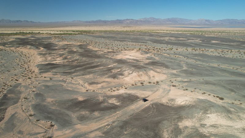
Updated: 05/21/2025
Palen Dunes Road
Mesa Verde, California
The BLM lists Palen Dunes as one of their recommended visits. With easy access right off of I-10, Palen Dunes Road hugs the western border of the Palen/McCoy Wilderness, passing over the sandy desert, through the dunes area, and ending at Palen Pass Road. Unlike more active dunes, Palen Dunes are characterized by vegetation-stabilized sand sheets and are estimated to move about 160ft per year. There is no open riding on the dunes allowed, and vehicles must remain on the posted road.
The BLM trail markers show Palen Dunes Drive as "Easy", but the section north of the dunes is moderately difficult due to the six-inch-sized rock making up the trail surface. Users can also expect frequent two-foot or more deep water worn ruts across the road caused by runoff from the Palen Mountains to the east. A high clearance 4x4 is required to manage this trail. In the dunes area, no open riding is allowed, and vehicles must remain on the posted road.
While dispersed camping can be enjoyed over the entirety of Palen Dunes Drive, the most appropriate dispersed camp sites are near the dunes. Even in the desert, campfires may be prohibited. Campers are responsible for knowing the campfire restrictions and having a campfire permit, which can be found at the BLM Palm Springs South Coast Field Office and the Cal Fire websites, along with instructions to obtain an online campfire permit.
This is a very remote area with weak cell coverage, and drivers should, before leaving, communicate their travel plans to family and friends, should carry adequate water, and be equipped for self-rescue.
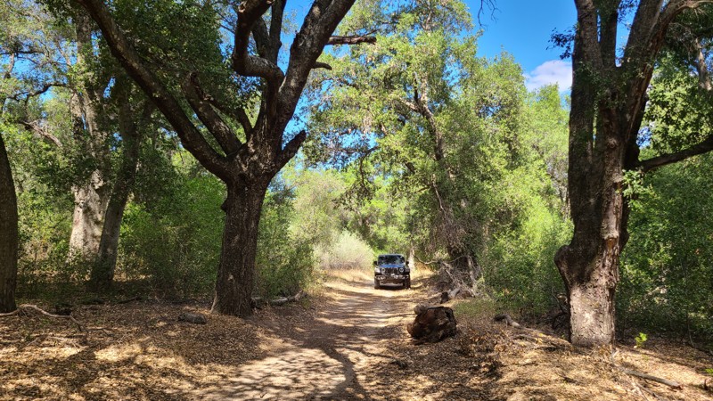
Updated: 10/09/2025
Indian Canyon
Pine Wood, California
Over its seven-mile length, Indian Canyon plunges 2000 feet along winding shelf roads and v-shaped canyons often surrounded by dramatic boulder fields and rock outcroppings. The higher elevations are surrounded by desert and coastal sage scrub and provide stellar views to the west. At its lower elevations, the trail suddenly enters a beautiful, dense oak woodland providing deep shade and cool temperatures, and great dispersed camping.
The few dispersed campsites found at the higher elevations are easily recognized as large clearings next to the trail, close to a ledge providing endless views and space for multiple vehicles. At least one large clearing for dispersed clearing can be found in the deep shade of the oak woodlands.
This is an easy trail, and a four-wheel drive vehicle is suggested, especially when climbing the trail. The Forest Service rates the trail as "Easiest". Indian Canyon is mostly flat and smooth with a surface of decomposed granite with some sections of off-camber measuring around 15 degrees and an average grade of 4.5 degrees. Most of the shelf portions of the trail are wide enough not to be too intimidating, but some sections may require backing up to find passing space for the rare opposing vehicle. Expect some stripping from the encroaching sage scrub.

Updated: 11/30/2025
Monache Jeep Spur
Olancha, California
At the northern end of the main Monache Meadows artery, in an area known as the "River Campsite," 20S03D is a short dead-end spur that travels along the western side of the Kern River. Sitting at roughly 7,950 feet above sea level, this easy dirt trail along the river has about five or six campsites supporting groups from four to over ten vehicles. With the river just feet from the campsites, this is a fun place to camp and relax. At the campsites, expect level dirt ground that is perfect for tent camping and a pine forest canopy that will provide plenty of shade. Like most areas in Monache, the trail is very easy, and all offroad vehicles can take this trail.
Just don't forget your floaties and fishing gear.
Please note: This is the Golden Trout Wilderness Area, one of the few areas where golden trout naturally live. Because of this, there are special fishing rules. Please research the rules and regulations before fishing in the area. More information can be found at the "Fish and Game Website."
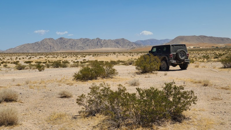
Updated: 10/15/2024
Johnson Valley 4310
Johnson Valley, California
Located in Johnson Valley, JV4310 travels over a checkerboard of private and Bureau of Land Management (BLM) land.
With no existing campsites visible from the trail, several suitable open and flat locations will provide dispersed camping sites when on BLM land and meeting the BLM Camping Guidelines. Campfires are generally prohibited, and it is the responsibility of the camper to know the current BLM Campfire Restrictions.
JV4310 is a sandy trail passing over several washes. A high clearance two-wheel drive vehicle will do well on this trail.
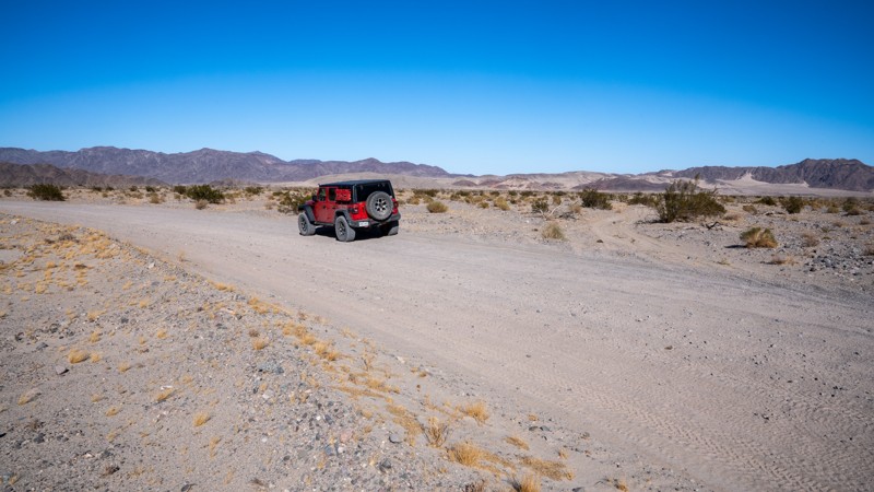
Updated: 03/07/2025
Basin Road
Cronese Valley, California
Basin Road is an easy, graded road that provides access to the Rasor Off-Highway Vehicle Area and runs along the western boundary of the open riding area. The surrounding landscape offers abundant rolling hills, open valleys, and sand dunes that invite any type of rider willing to traverse the rugged terrain. The road travels between Interstate 15 and the Mojave Road, ending at the north end of Afton Canyon. Most of the road is hardpacked, but the farther south you travel, the more sand you will encounter. Large RVs and travel trailers should only travel the eastern side of the lollipop and remain on the 8712 road. The western portion of the lollipop, roads 8711 and 8713, have the softest sand and could easily trap a heavy vehicle. Along the northern half of the road, you will find many large camping and OHV staging areas suitable for any type of camp setup and any group size.
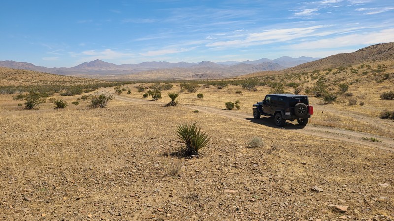
Updated: 10/15/2024
Stoddard Valley 6528
Victorville, California
SV6528 leads into a flat Mohave Desert basin following the southwestern edge of the Silver Mountains. This is a straight-through trail that provides connections to several other trails that surround these mountains.
The southern third of the trail is on public land and offers several dispersed camping opportunities when meeting the BLM Camping Guidelines.During high fire danger, campfires may be restricted, and if planning to camp here, one should review the current BLM Campfire Restrictions and have a Campfire Permit.
SV6528 is an easy drive that requires only a high clearance two-wheel drive vehicle.
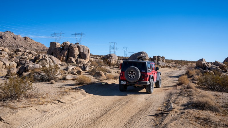
Updated: 09/29/2025
Hercules' Finger Access
Lucerne Valley, California
North of Lucern Valley, OM6600 treks along the southern end of the Ord Mountains under the shadow of several high-voltage powerlines. The road cuts straight across the desert, making slight elevation changes as it passes unique granite rock formations popular with rock climbing enthusiasts. One of the signature formations here, known as Hercules' Finger, is a 70-foot-tall, free-standing monolith sculpted by millions of years of erosion. The road is a mixed surface of hardpacked dirt and sand, with several sections of deep sand whoops. In addition, exposed rocks up to baseball size will be encountered along the road. There are many flat areas along the road where camping would be suitable and has been previously used. However, be cautious of private property parcels along the western half, as several campfire rings exist in areas of posted private property, and users should avoid camping there.
This road is suitable for any vehicle with decent ground clearance.
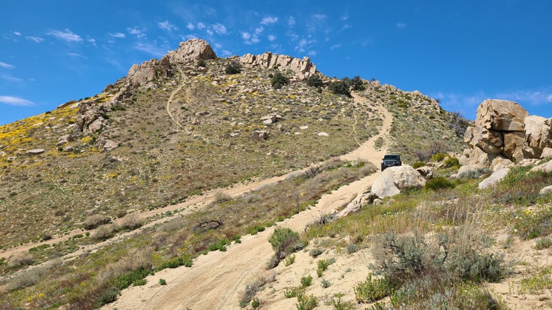
Updated: 10/15/2024
Scodie Mountains SC34
Sageland, California
High in the southern Scodie Mountains, this short connecting trail straddles a 6,000-foot high ridge to provide exhilarating views across Bird Spring Canyon out to the Kaivah Wilderness and 2,800 feet below to the Mojave desert floor. Rising high above the eastern end of the trail is a short hiking trail to Wyleys Knob and its communication towers. The Pacific Crest Trail hugs close to the northern side of the road and intersects at one point.
SC34 itself is an easy trail, but reaching it requires traveling up the sides of the steep ridge over the very challenging trails SC37 or SC69.
Tucked up against a rock jumble that provides wind shelter is the only location suitable for dispersed camping. Dispersed camping can be enjoyed in the Scodie Subregion when meeting the BLM Camping Guidelines. During high fire danger, campfires may be restricted, and if planning to camp here, one should review the current BLM Campfire Restrictions and have a Campfire Permit.
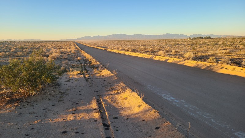
Updated: 10/15/2024
Kramer Hills 6147
Adelanto, California
KH6147, also known as Helendale Road, is a maintained dirt road that provides access to many crossing trails in the Kramer Hills Subregion. Any passenger car can travel the road.
Dispersed camping sites are available just off the road near one of the trail crossings when meeting the BLM Camping Guidelines.
During high fire danger, campfires may be restricted, and if planning to camp here, one should review the current BLM Campfire Restrictions and have a Campfire Permit.
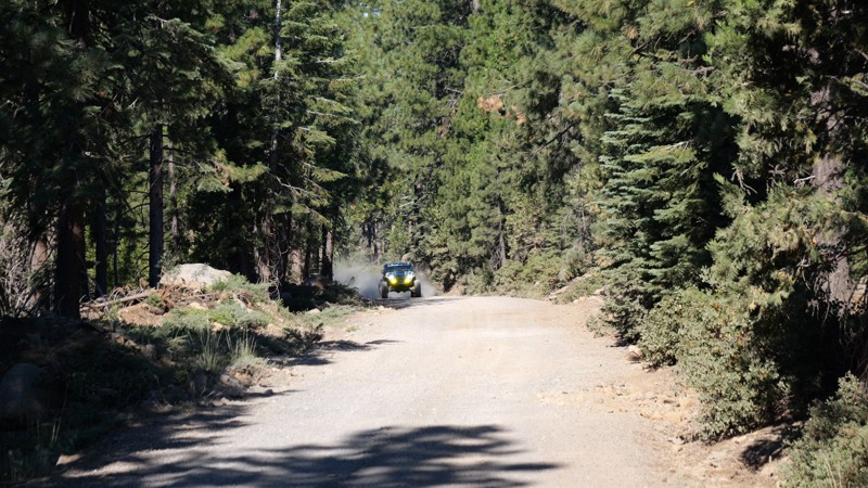
Updated: 10/15/2024
Philbrook Road
Glenburn, California
Philbrook Road in the Lassen National Forest is the trail to the High Lakes OHV area and Philbrook Campground. This dense forest trail is roughly 5,606 feet above sea level and splits off Humbug Road near Paradise, CA. With towering pines, this trail is easy to get mentally lost due to its tranquil and scenic beauty. As you near the trail's end, you will pass by a seasonal lake (Philbrook Reservoir) and Philbrook Campground, which PG&E. owns. If you continue past that, several private cabins are on the eastern side of the lake before the trail continues to other trails. All offroad vehicles can do this trail since this is a maintained dirt road.
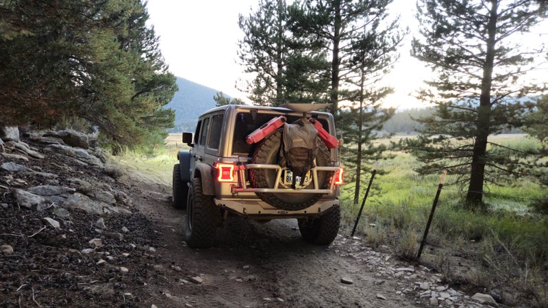
Updated: 11/30/2025
Monache Creek Road
Olancha, California
20S07, also known as Monache Creek Road, is named after the small creek it follows and offers a scenic route leading to forest administration cabins and the Olancha Pass hiking trail. Near the trailhead, a large campsite provides an ideal spot for those looking to camp away from the crowds, accommodating groups with 7 or more vehicles. The campsite features flat, level dirt ground, perfect for ground camping amidst a dense pine forest. The trail runs alongside the creek, making its conditions somewhat rougher and more variable than other trails, but it is still accessible for high-clearance offroad vehicles. However, it's important to note that, like all trails in Monache Meadows, this is a dead-end trail, requiring drivers to return the same way they came in.
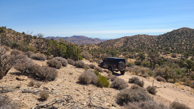
Updated: 09/24/2025
2N75Y
Rimrock, California
On the eastern slopes of the San Bernardino National Forest, 2N75Y is a straight-through trail that follows a beautiful forest to a desert transition zone shared by Pine and Joshua Trees. The route offers a fun, moderate off-road driving challenge, leading to the quiet solitude of the few dispersed campsites and hiking trails along its length.
Sections of the trail travel over water-worn ruts down the trail's center that can be straddled, and a few stretches are over large stones and pumpkin-sized rocks. A Four Wheel Drive vehicle with high clearance is necessary to drive this trail. The quarter-mile portion of the east end of the trail starts on BLM land with a trail marker RC2311. The remaining National Forest portion has no trail markers but is easily followed. The west end of the trail connects to Antelope Creek, and from there, one must pass over the most difficult obstacle of that trail to reach an outlet via Burns Canyon Road. There is a wide turnaround at the west end of 2N75Y for an easier return back to the start.
There are a few small dispersed campsites next to the trail with flat areas for tents and room for one or two vehicles.
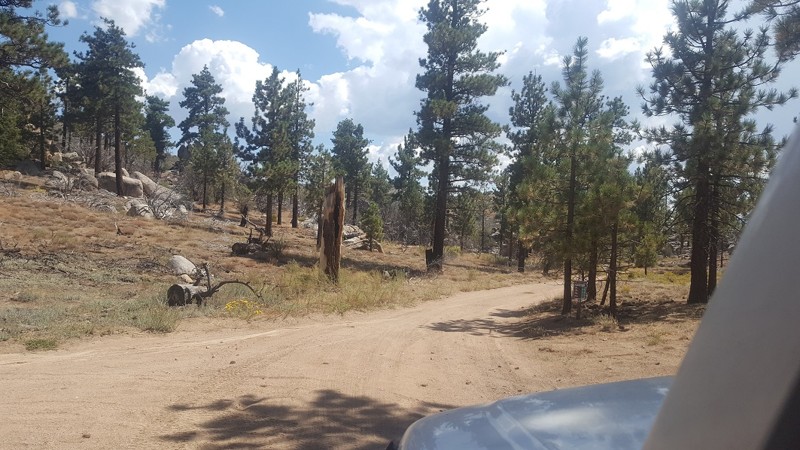
Updated: 09/29/2025
3N56
Fawnskin, California
3N56 is a simple and quick connector between 3N17 – White Mountain and 3N16 – Holcomb Valley Road. At roughly 0.2 miles long, it takes no time to get between the trails and continue your day. The trail is mainly packed dirt and suitable for any vehicle.
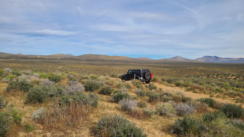
Updated: 10/15/2024
Scodie Mountains SC99
Ricardo, California
SC99 travels northwest over a well-maintained, wide, sandy road toward the very flat desert towards Pinion Mountain.
The road is wide and well maintained and an easy drive for new offroaders, but it still requires a high clearance 4x4 to manage the soft sand and occasionally exposed rocks.
BLM has prepared primitive campsites at the chosen locations, easily identified by posted signs noting a 15-mile speed limit when campers are present. Camping there or at suitable dispersed sites on BLM land can be enjoyed when meeting the BLM Camping Guidelines. During high fire danger, campfires may be restricted, and if planning to camp here, one should review the current BLM Campfire Restrictions and have a Campfire Permit.
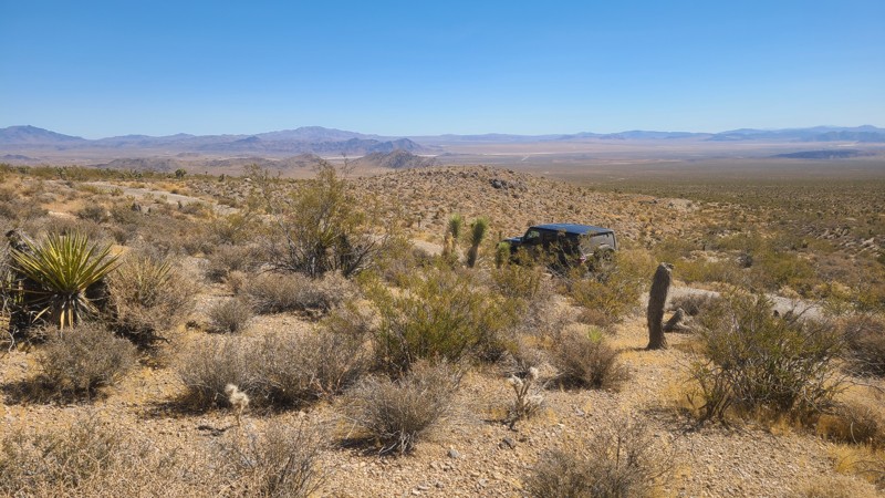
Updated: 10/15/2024
Rattlesnake Canyon 3203
Doble, California
East of Lucerne Valley, RC3203 is entirely on Bureau of Land Management (BLM) land and wanders through the foothills of Round Mountain. Along with the desert scenery, the slight elevation provides distant views out to the north of Lucerne Valley.
This is an easy, straight-through trail, but it still needs a high-clearance vehicle. A new offroad driver will enjoy the twists and turns of this trail and exploring the connecting trails.
Dispersed camping is allowed on this trail when meeting the BLM Camping Guidelines. Campfires are generally prohibited, and if you plan to camp, you are responsible for knowing the current BLM Campfire Restrictions. Operating a camp stove requires a campfire permit. The start of the trail has a dispersed campsite with an overlook of the surrounding valleys.
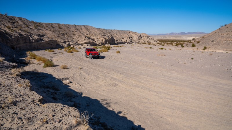
Updated: 03/07/2025
Manix Wash
Manix, California
Manix Wash is a straight-through sandy trail that connects I15 to the Mojave River and the Mojave Road Connector. The road traverses its namesake wash, weaving across the soft sandy track and passing towering walls created from centuries of erosion. It intersects and crosses the Mojave River before entering another drainage with more soft sand and towering cliff walls, but also presenting a minefield of exposed, grapefruit-sized lava rock. Along this trail, you can expect to encounter rough sections of deep sand ruts and rolling whoops that your suspension will either eat up or jar your teeth loose. The rocky sections along the southeast end are a bit bumpy, but most rocks are easy to avoid and drive between. The trail is suitable for any high clearance vehicle, but airing down is necessary, and 4WD is highly recommended due to soft sand conditions.
Along the first mile on the northwest end, you will notice several large areas with fire rings. These should not be considered campsites as they are located on private land. At nearly 1.5 miles, just before dropping into the wash, the road enters BLM land, and there are a couple of large areas that show evidence of camping. These are close to the highway, so noise is a definite factor if attempting to camp here. Along the rest of the trail, there are no suitable campsites.
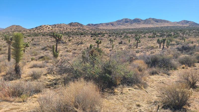
Updated: 11/20/2025
Elk Trail
Yucca Valley, California
This out-and-back trail passes through a beautiful desert plateau full of Joshua Trees and California Junipers, eventually reaching the fenced border of Joshua Tree National Park. Elk Trail provides access to other driving trails, including Little Morongo Canyon Road, as well as sites for day camps to enjoy the several hiking paths in the north-west corner of Joshua Tree National Park. As the trail advances east, the Joshua Trees' thin and burn scars increase from several fires over the years, with the most recent being the Elk Fire in 2022.
No overnight camping is permitted on this Mojave Desert Land Trust property. However, dispersed camping can be found on BLM property along Little Morongo Canyon Road, or improved camping at the nearby Black Rock Campground within the Joshua Tree National Park.
Elk Trail is an easy trail, flat and wide, and comfortably managed by a two-wheel drive passenger SUV.
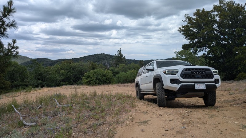
Updated: 10/15/2024
Cuyapaipe Tank Road
Mount Laguna, California
A short branch off of Thing Valley Road that ends at a water tank reservoir. The trail has a few small roots and bumpy ruts that a high clearance 2WD should be able to handle. There is also a campsite closer to the intersection with Thing Valley Road.
This route is in the Cleveland National Forest, so you may need appropriate passes and/or permits, even for gas stove use.
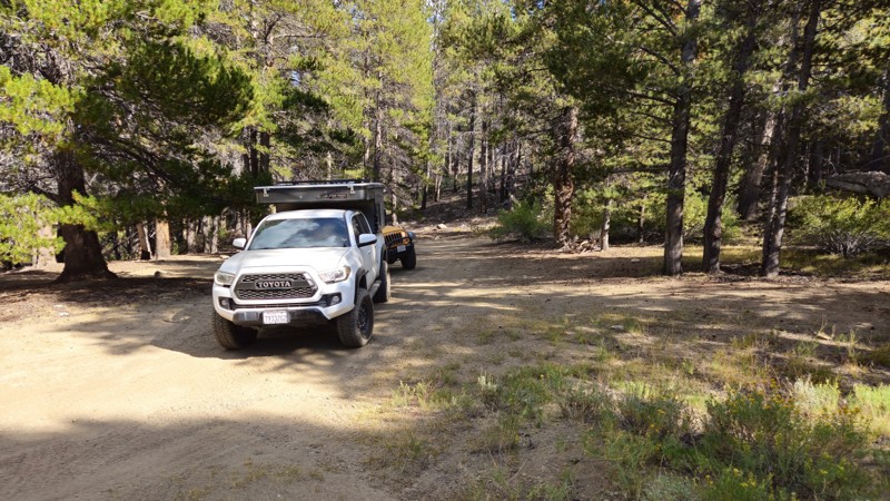
Updated: 11/30/2025
Monache F&G Cabin
Olancha, California
20S03C is a short spur road off the main Monache Meadows artery that quickly dead-ends close to the meadow to the east. With the Kern River just feet outside the treeline, people often use this area to camp away from the crowds and enjoy a relaxing weekend. The trail is an in-and-back like every trail in Monache and is suitable for any high clearance vehicle. The camping is a pine forest-covered area with flat dirt ground, making it ideal for ground camping. The area is large, and a group of 7+ rigs could easily camp near the trail's end.
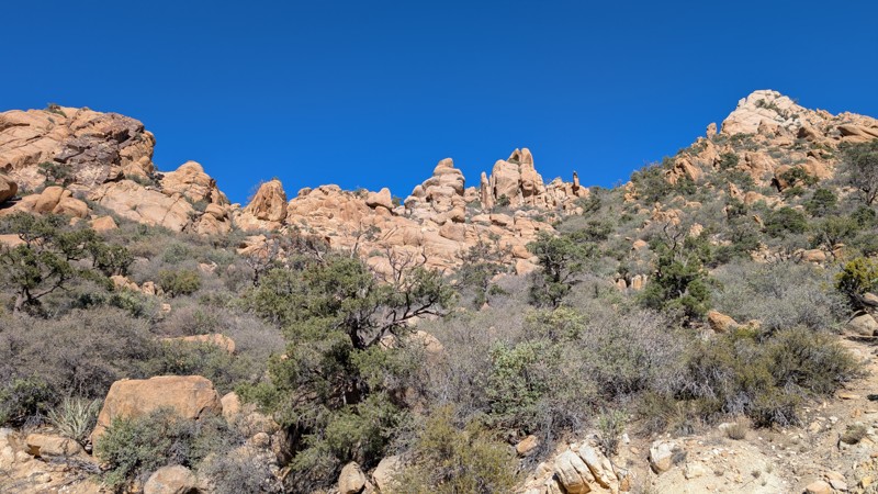
Updated: 11/14/2025
Caruthers Canyon Road
Lanfair, California
Located deep within the Mojave National Preserve, Caruthers Canyon Road begins at Cedar Canyon Road and winds upward into the rugged New York Mountains. The intersection is unmarked, but a lone stop sign hints at the start of your journey.
The road begins at about 4,400 feet in elevation amid a forest of Joshua Trees and climbs roughly nine miles to about 5,600 feet, where stands of pinyon pines once blanketed the slopes. Sadly, much of this forest was lost in the York Fire of 2023, which originated in Caruthers Canyon and burned over 93,000 acres. Three structures were lost, and the landscape was dramatically altered, yet the canyon retains a striking beauty and a sense of quiet resilience.
As you ascend, granite rock formations and towering spires dominate the horizon, creating a landscape reminiscent of Joshua Tree National Park. The road surface varies between sand, gravel, and hard-packed dirt, typical of desert terrain. While ruts and shallow washes cross the route, it remains passable by a high-clearance 2WD vehicle equipped with good off-road tires. Beyond the main camping area, however, the road becomes washed out and impassable as it climbs steeply toward the Giant Ledge Mine.
There are several areas suitable for dispersed camping, including one large site that can accommodate up to seven vehicles. Groups larger than seven vehicles or more than 25 people must obtain a permit from the National Park Service. One particularly scenic campsite is tucked among granite boulders and features a built-in picnic table and grill, perfect for smaller groups of two or three vehicles.
From the upper camps, you can hike the final mile to the Giant Ledge Mine, where a few open adits remain. Use extreme caution when entering abandoned mines, as it is dangerous and not recommended. Historically, the mine was worked primarily for copper, though traces of silver and gold were also found in quartz veins throughout the area. Mining activity here dates back to the early 1900s, part of the region’s short-lived boom that attracted fortune seekers to the Mojave’s remote corners.
Today, Caruthers Canyon offers a serene escape for explorers seeking solitude, geological beauty, and a touch of history. It’s an excellent overnight stop for those traveling the Mojave Road, offering a short but rewarding detour filled with panoramic views, fascinating rock formations, and the quiet magic of the high desert.
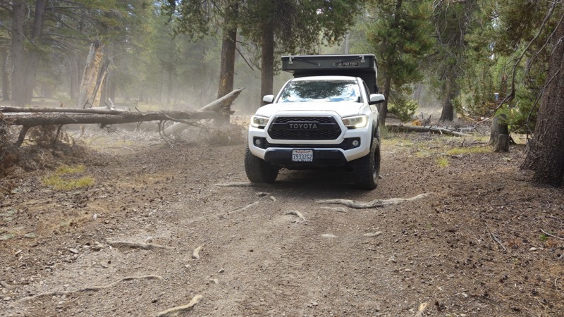
Updated: 11/30/2025
Anchor Ranch Road South
Olancha, California
20S04 is a short, dead-end spur off the main Monache Meadows artery primarily used for camping. This trail is heavily forested with beautiful pine, offering almost zero undergrowth, making it ideal for tent camping. The ground is flat-level dirt with plenty of places for any size group to pull off into a spot and relax for the weekend. This is a great spur for groups looking to camp in Monache but looking to avoid the meadows or river campsites. Like most trails in the area, the trail is easy to drive, and any offroad vehicle can travel it. The trail does dead-end at private property. Thus, this is an in-and-back trail.
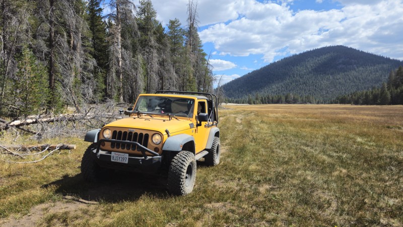
Updated: 11/30/2025
Olivas Sping
Olancha, California
Located near the northwestern corner of Monache Meadows, the 20S06B trail, also known as Olivas Springs, provides access to private ranches that use the area for cattle grazing. While the trail is easily accessible and suitable for any high-clearance offroad vehicle, camping is not ideal along this route due to the treeline being on private property.
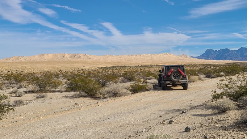
Updated: 01/05/2026
South Gas Line Road
Pisgah, California
South Gas Line Road is a 71-mile overland adventure that showcases the full spectrum of the Mojave Desert, from open sandy flats and majestic dunes to the rugged flanks of the Providence Mountains. A narrow, vehicle-approved corridor threads between designated wilderness areas, giving travelers front-row views of untouched desert, jagged peaks, and endless horizons. Along the way, dozens of side trails and spurs invite deeper exploration, with standout highlights like the towering Kelso Dunes and the massive pit of the abandoned Vulcan Mine. The route finishes at legendary Route 66, just a few miles from Goffs Ghost Town.
The drive starts out on an easy, sandy desert two-track that a high-clearance 2-wheel-drive vehicle can handle in dry conditions. Beyond Kelbaker Road, the character changes quickly, with rough, uneven stretches and melon-sized rocks that require a lifted 4x4 and an experienced driver. The crossing of the Providence Mountains via Foshay Pass includes long, steep 20-degree climbs and descents over rocky, loose, and sometimes slippery surfaces bordered by deep ditches. Locking differentials greatly improve traction and help keep vehicles on line, and informal bypasses exist around the very worst sections.
Dispersed camping opportunities are scattered along the route, including a standout site roughly halfway up Foshay Pass that overlooks nearby canyons and offers sweeping views across the Providence Mountains. Additional camping can be found near Kelso Dunes, while those seeking amenities can overnight at the Mojave National Preserve’s Hole-in-the-Wall Campground, north along intersecting Black Canyon Road.
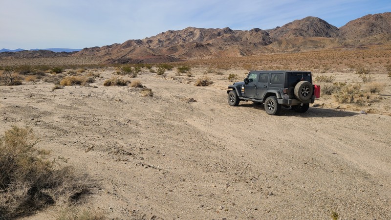
Updated: 10/15/2024
Coyote Lake Area CL8207
Manix, California
Following the southern edge of Alvord Mountain, CL8207 sits on a sandy basin leading to the convergence of several trails and is a shortcut to CL8140. Dispersed camping is available anywhere along the trail with a few established rock fire rings.
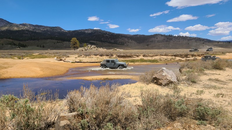
Updated: 11/30/2025
20S10
Olancha, California
Dead in the center of Monache Meadows is 20S10. Sitting at 7,900 feet above sea level, this Monache Meadows trail is the trail people see on social media and in TV commercials. This is that iconic photo or video of vehicles crossing the Kern River in a unique, beautiful meadow with a dark green forest on the mountains behind it. With the water crossing averaging 1 to 4 feet deep, people gather to watch as brave offroaders and overlanders cross this inspiring water crossing. Besides the vehicle show, this area is perfect for taking in the fantastic scenery, fishing the mountain river, and swimming in a once-in-a-lifetime wonderland. Some say this is a heavenly experience. 20S10 is often combined with 20S05 to do create a loop across both Kern River crossings. Since you are crossing a river in a sandy location, 4WD would be ideal and the safest recommendation. Thus, any 4WD offroad vehicle with high ground clearance should be acceptable as long as you can forge the water safely. However, due to the changing water depth, the rating could quickly change from easier to more challenging.
There is no suitable camping along this trail, but near the western trailhead is the famous meadows camping area off 20S03.
Please note: This is the Golden Trout Wilderness Area, one of the few areas where golden trout naturally live. Because of this, there are special fishing rules. Please research the rules and regulations before fishing in the area. More information can be found on the "Fish and Game Website."
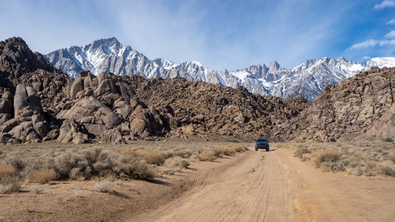
Updated: 03/13/2025
How the West was Won Movie Location
Lone Pine, California
Among the famous Movie Flats, this looping spur guides users beside two famous movie sets: the 1962 film How The West Was Won, which featured a long line of great actors, including John Wayne and James Stewart, and one of the settings for Gunga Din, a 1939 film featuring Cary Grant. This is a well-maintained and well-traveled trail, so just about any vehicle with decent clearance can drive it. Occasional ruts form after rain storms, but most are easily avoidable. Camping is not allowed, but there are many nearby designated sites on the east side of Movie Road.
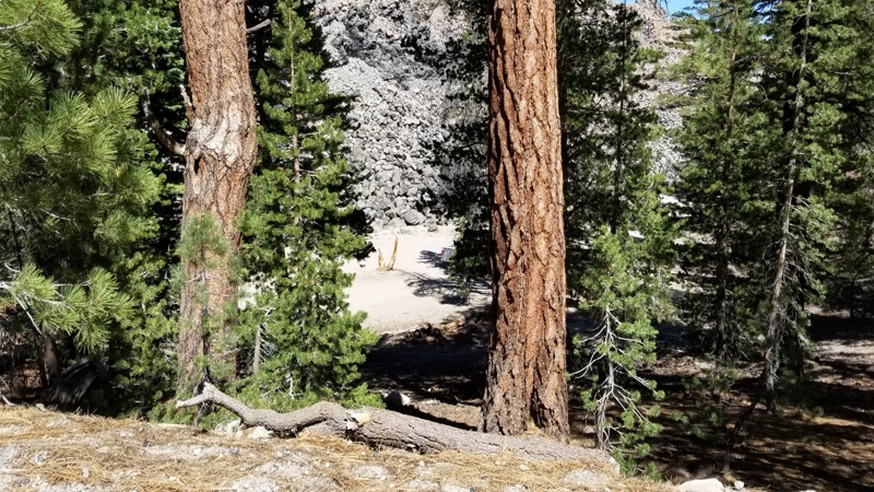
Updated: 09/29/2025
2S79A Obsidian Dome Road Dispersed Camping
Crestview, California
Looking for a super unique campsite? How about camping on the side of a volcano? 2S79A is just that, a campsite that is inside the large caldera of Mammoth but also on the side of one of the many calderas that have erupted out of the ground. The name of this caldera is the Obsidian Dome known for the famous lava glass it has created. So, if you are in the area of Mammoth or June Lake and want to disperse camp somewhere super unique, check out this spot! The trail is a dirt path that any vehicle could do, but there is an overhang from a tree that limits tall vehicles from getting down to the camping spot.
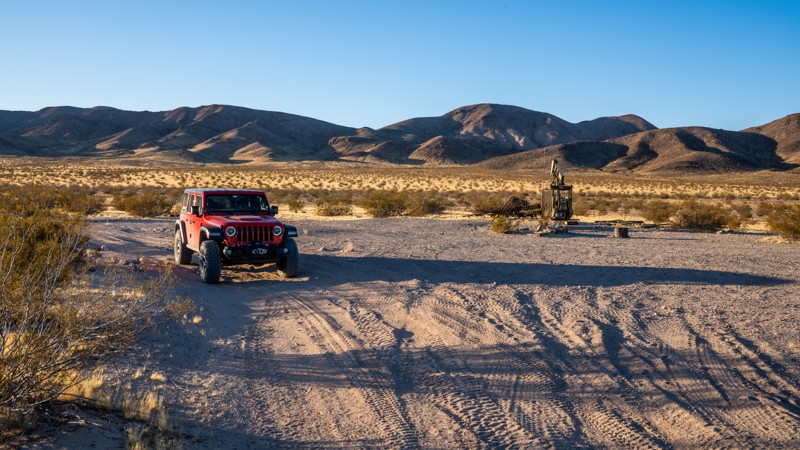
Updated: 01/06/2026
Hidden Valley Wash
Manix, California
Connecting Newberry Springs and Crucero Road, Hidden Valley Wash is a straight-through connecting trail taking users through the Caddy Mountains and deep into the heart of the Mojave Desert. The western half of the trail is easy, with a trail surface that is primarily hard-packed dirt and sand with small rocks. It takes you past several old pump sites and many large, open areas suitable for dispersed camping. The eastern half becomes much rougher and traverses a wide desert wash with soft, deep sand, where 4WD and high clearance are necessary. Airing down will greatly help in aiding tire traction. The trail is very remote with limited cell coverage, where solitude can easily be found.
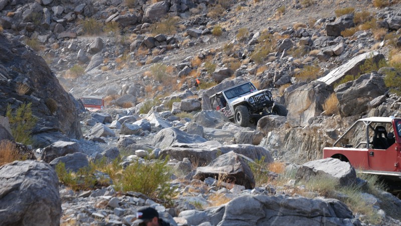
Updated: 03/09/2026
SunBonnet Trail and Hells Gate
Homestead Valley, California
Tucked away in the rugged heart of Johnson Valley, California, the legendary Sunbonnet Trail stands as one of the original and most revered Hammer Trails, branching off the iconic Means Dry Lake, affectionately known to off-roaders as Hammer Town USA. This trail is a true proving ground, drawing thrill-seekers from across the country to the unforgiving expanse of the high desert.
Carved by time and weather, Sunbonnet is a brutal test of driver and machine, packed with massive granite boulders, vehicle-squeezing notches, and extreme features like 4-foot ledges and 7-foot waterfalls. The trail demands precision and grit as it throws one obstacle after another, turning sheer climbs, narrow squeezes, and near-vertical drops into the kind of heart-pounding moments that offroad legends are built on.
Perched at around 3,400 feet above sea level, the climate here is as extreme as the terrain. Blistering summer temperatures can soar to a scorching 115°F, while winter nights plunge toward a bone-chilling 0°F, turning the trail into an entirely different beast with each season.
Due to the sheer intensity of the obstacles and the very real risk of significant body damage, only heavily modified rock crawlers should attempt to conquer Sun Bonnet. This trail isn’t just a drive; it’s a battle of machine versus nature, where every scratch and dent tells a story of grit, determination, and desert conquest.
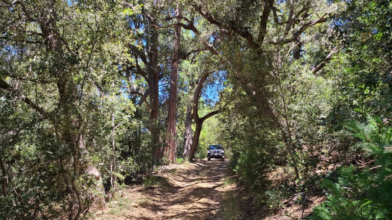
Updated: 08/19/2025
Stetson Hollow
Seven Oaks, California
Stetson Hollow is a little-used up-and-back trail through a dense, lush forest, with surrounding meadows, and makes a perfect quiet getaway. While starting only a few hundred feet from Highway 38, the trail feels isolated and remote, with only the sounds of singing birds and the wind whispering through the trees. Trees embrace portions of the trail to form canopies and filter the sunlight to create dark passageways, enhancing the sense of remoteness.
Along the trail, clearings and grassy meadows allow midday sunlight to beam in through the surrounding tall pine trees and provide excellent dispersed camping sites. The trail starts very close to the highway, but the camp locations are far enough away not to hear any traffic noise. These sites have no fire rings as campfires are prohibited in the forest.
The Forest Service trail makers at the trailhead do not provide a difficulty level, and the road is moderately difficult with a rocky creek crossing, deep ruts, fallen trees, and large rocks to avoid or drive over. The road is not maintained, allowing bushes and trees to crowd the path, which can result in vehicle pin-stripping. A lifted four-wheel drive vehicle with ground clearance is required to navigate this road.
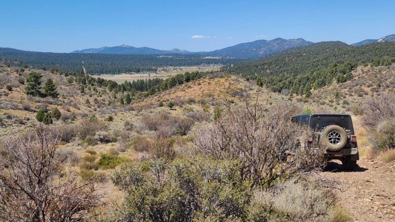
Updated: 09/11/2025
2N87Y
Doble, California
Passing over the mountains immediately surrounding the western end of Big Bear, 2N87Y provides an outstanding view of Big Bear and the surrounding mountains while offering excellent dispersed campsites next to the trail. The road also passes several hiking trails, including an intersection with the Pacific Crest Trail. This straight-through at its southern end is only a short distance from paved roads that reach Big Bear City and Highway 38.
The best camping is found on the northern portion of the trail, where the gentle slopes and surrounding trees provide several shaded flat areas that with room for multiple vehicles, and soft ground perfect for pitching a tent.
This is a moderately difficult trail with long, difficult stretches, requiring driving over and around large embedded boulders and over carpets of loose orange-sized rocks. This rugged trail surface, combined with a few steep inclines, will require a high-clearance 4x4 and an experienced driver.
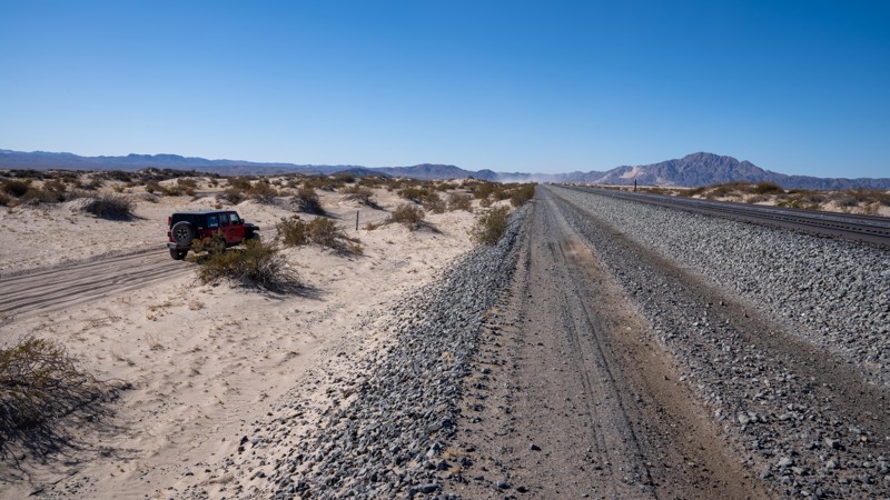
Updated: 03/07/2025
Front Street
Crucero, California
Front Street, marked as 8720 on the east end and 9610 on the west end, is an easy, straight-through track splitting the border of the Rasor OHV Area and the Mojave Trails National Monument. The road is used to connect Mojave Road and Crucero Road, allowing Mojave Road users quick access to see the Mojave Megaphone. The road parallels the Union Pacific Railroad tracks the entire length and offers expansive views of the desert area. The trail is primarily soft sand the entire length, with several sections of washboard that will give your suspension a workout. The road is flat and well-traveled, and although 4WD is recommended for the area, you are unlikely to take it out of 2WD along this stretch.
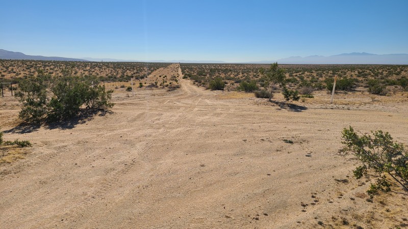
Updated: 10/15/2024
Kramer Hills 6149
Bryman, California
KH6149 passes over very flat desert terrain but still provides wonderful Mojave Desert views all around. The easy sandy trail requires a high clearance two-wheel drive vehicle with all-terrain tires.
Along the way, many flat and clear areas are suitable for dispersed camping when meeting the BLM Camping Guidelines.During high fire danger, campfires may be restricted, and if planning to camp here, one should review the current BLM Campfire Restrictions and have a Campfire Permit.
.
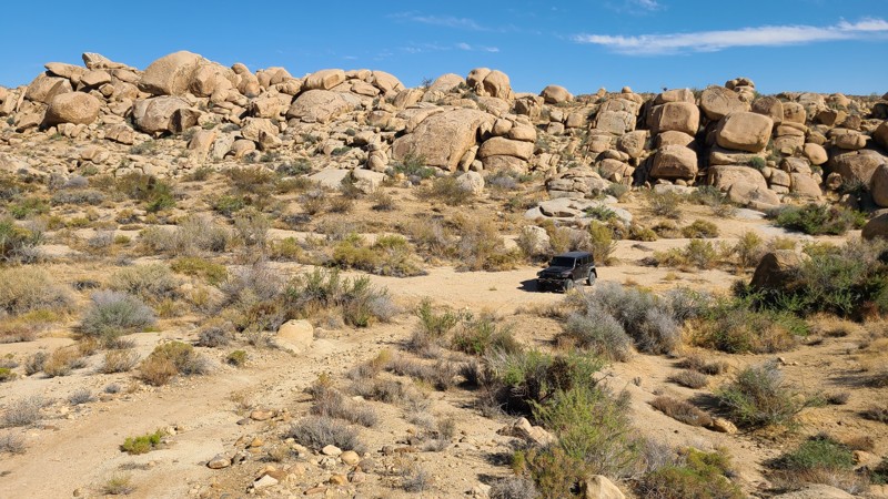
Updated: 10/09/2025
Hondo Trail
Homestead Valley, California
Within the Sand to Snow National Monument, the Hondo Trail winds through a sandy desert valley framed by towering, vertically stacked boulder walls that gradually close in to form a dramatic box canyon. At its end, the canyon offers a spacious, sheltered dispersed campsite on flat sand, with room for multiple vehicles and tents. Along the way, the trail intersects with several other routes and hiking paths, including the inviting Road Runner Rut Trail, making it a great jumping-off point for further exploration.
The driving itself is mostly soft sand, punctuated by the occasional exposed boulder. At the 2.3-mile mark, the trail squeezes down to a tight obstacle where the boulder walls leave just enough room for a narrow vehicle to pass. A wrangler clears with barely an inch to spare. A spotter is highly recommended. Additional sections of overgrown brush have a high probability of causing pinstripes. Deep sand makes a four-wheel drive with high clearance essential. Beyond the driving challenge, several excellent dispersed campsites can be found tucked against the rock walls, offering shade and shelter, with the box canyon at the end standing out as the premier spot.
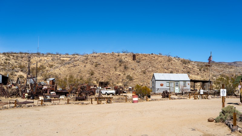
Updated: 04/21/2025
Bickel Camp
Saltdale, California
EP 30 is the trail that Bickel Camp resides on, and it's worth the stop. The Camp itself may or may not be open the day you arrive, but if not, you can look in from outside the gate and look at the historical oddities. EP 30 is an easy, hard-packed sand road with occasional ruts and washboard, suitable for any high clearance vehicle. Dispersed camping can be found along the eastern half. At the Camp, there are two picnic tables set up and shade.
Who was Walt Bickel, and Why is this Camp Important?
Walt Bickel's Camp in Last Chance Canyon, California, became a public historical site thanks to dedicated efforts to preserve his legacy. Bickel, a mechanically inclined Kansas native, moved to California in 1923 and worked in demolitions before becoming a prospector. He first visited the canyon in 1927 and returned in 1933, ultimately filing his own mining claim in 1934. Over the decades, he built a small but self-sufficient camp, relying on collected rainwater, salvaged machine parts, and his ingenuity to survive in the harsh desert.
Despite his dreams of striking gold, Bickel primarily supported his family through odd jobs and later served in the Army during World War II, where he invented a tool for rapidly changing machine gun barrels. After his discharge, he returned to Last Chance Canyon, living there full-time and welcoming visitors with stories, home-cooked meals, and lessons in gold panning.
By the late 1980s, government regulations threatened Bickel's way of life. The Bureau of Land Management (BLM) cracked down on long-term residents on public land, and in 1987, they inspected Bickel's Camp to determine whether he could remain. Unfortunately, just hours before the inspection, Bickel suffered a stroke, forcing him into a nursing home. The BLM later deemed his operation too small for residency, putting the Camp at risk of demolition.
In 1989, Bickel's supporters successfully negotiated with the BLM to preserve the site as a museum, allowing a caretaker to reside there. Today, visitors can explore the Camp, which remains much as Bickel left it. Bickel's ingenuity and desert survival legacy endures with a caretaker on-site, offering a glimpse into a bygone era for future generations.
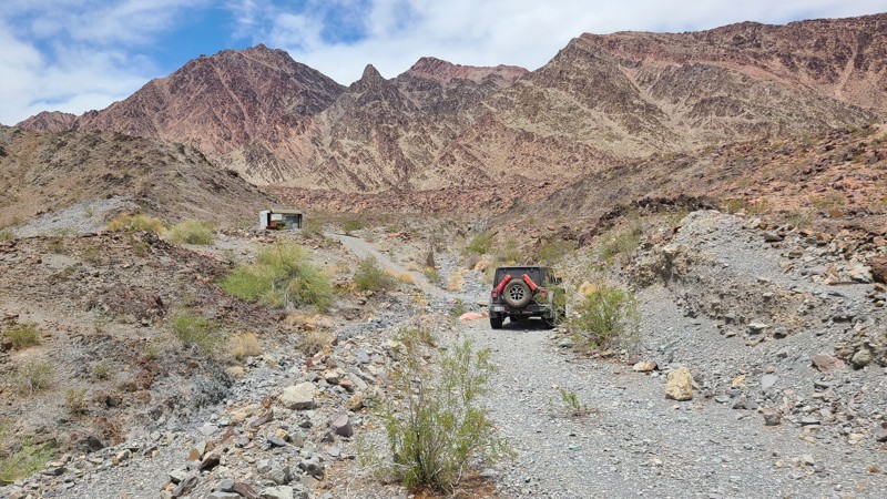
Updated: 02/05/2026
Arlington Mine/Patton's Cabin Road
Inca, California
In north-east Riverside County, lying between the Palen-McCoy and Big Maria Wildernesses, is Arlington Mine/Patton's Cabin Road, and it is one of the roads suggested by BLM as a primary route to explore. The road crosses the flat and sandy McCoy Wash until reaching the edge of the Palen Mountains, where a short but rugged climb reaches Patton's Cabin site. Surrounded by the Palen, McCoy, and Little Maria Mountain ranges, the road is never without an ever-changing, picturesque landscape. Arlington Mine Road provides an artery intersecting with a dozen other BLM designated trails to explore, including the Black Diamond rated Palen Pass Road.
The BLM trail markers indicate Arlington Mine Road as "Easiest" over the sandy majority of the road, but the westernmost 3 miles become more difficult, as they are over deep water worn ruts, turning, and then into a rough rocky surface consisting of 6-8" size rocks. A high clearance 4x4 is required to manage this trail.
Almost the entire length of the road is on BLM land, but the most appropriate dispersed camping sites are around Patton's Cabin location. Even in the desert, campfires may be prohibited. Campers are responsible for knowing the campfire restrictions and having a campfire permit. Campfire restriction information can be found at the BLM Palm Springs South Coast Field Office and the Cal Fire websites, along with instructions to obtain an online campfire permit.
This is a very remote area with intermittent or no cell coverage, and drivers should, before leaving, communicate their travel plans to family and friends, should carry adequate water, and be equipped for self-rescue.
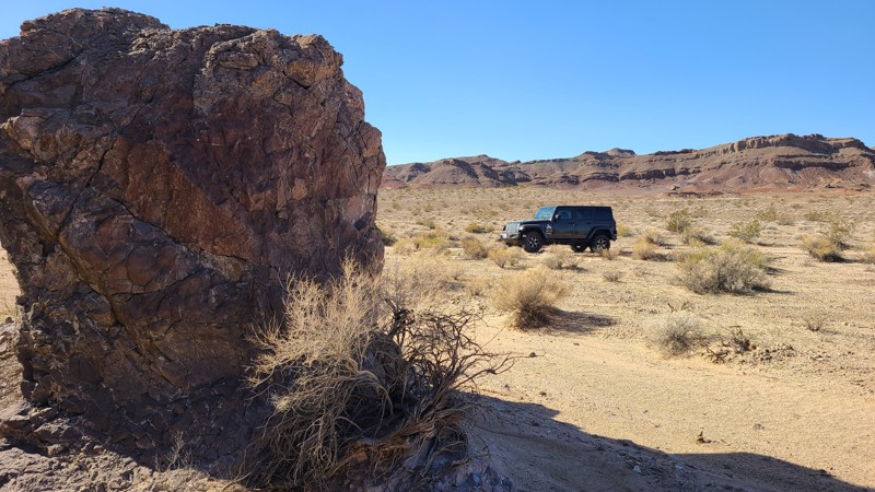
Updated: 10/15/2024
Coyote Lake Area CL8238
Manix, California
With only two small rocky hills to break up this section of flat desert, CL8238 provides a convenient connection to the Spanish Canyon. The flat sandy trail has barely a rock to avoid. The level desert floor is suitable for dispersed camping anywhere along the way, with a few existing rock fire rings and a choice of hills to cozy up to for shelter from the desert wind.
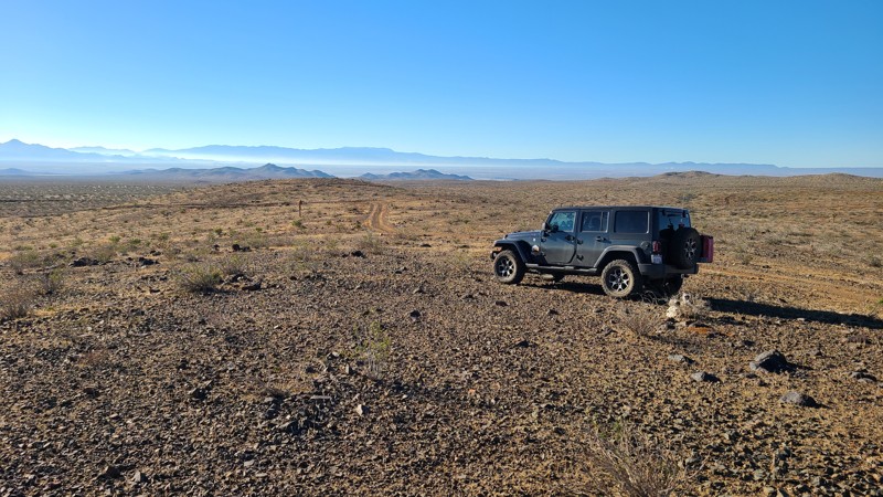
Updated: 10/15/2024
El Mirage 4665
Houze Place, California
This straight up-and-back trail follows a BLM right of way as it is mostly bordered by private or fenced property.
Only the first half mile of the trail is appropriate for dispersed camping when meeting the BLM Camping Guidelines. During fire seasons, campfires may be restricted, and if planning to camp, one should review the current BLM Campire Restrictions.
EM4665 is an easy, flat, sandy trail requiring only a high clearance two-wheel drive vehicle.
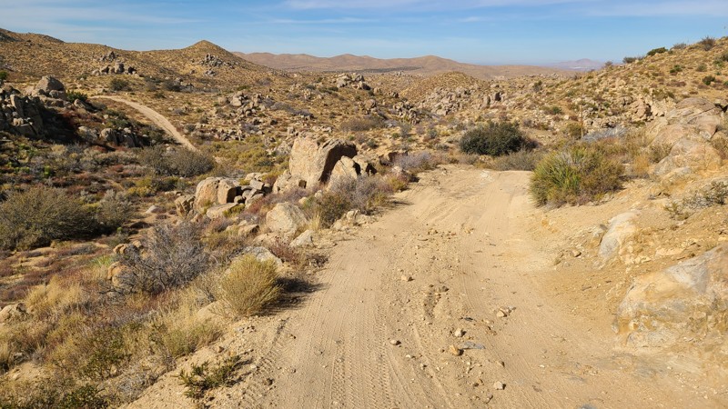
Updated: 03/11/2025
Juniper Flats 3276
Fizzben Heights, California
Located in the Juniper Flats area, JF3276 connects to a network of trails that cover over 100,000 acres of this desert-to-mountain transition. The trail provides beautiful views and hosts a variety of wildlife. This trail moves through a particularly dense area of distinctive rock formations that invite a short hike to explore.
The trail is easy over a hilly section of hard-packed dirt with short sections of exposed grapefruit-size rocks, and it is wide enough for two vehicles to maneuver and pass by over most of its length. This is the perfect trail for beginning offroaders and can be handled with a 2-wheel drive high clearance vehicle. However, if continuing to explore the area, many trails will require a high clearance 4x4.
This trail offers no suitable campsites, but dispersed camping is allowed throughout the area when sites show obvious signs of prior use and lack of vegetation cover and follow the BLM Dispersed Camping Guidelines. This is a high-fire danger area, and campfires may be prohibited. Campers are responsible for knowing and following the current fire restrictions.
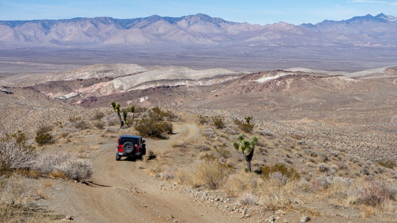
Updated: 03/25/2025
EP 103
Saltdale, California
EP 103 offers an adventurous backway to or from the Burro Schmidt Tunnel, featuring a thrilling drive and expansive views. The trail continuously rises and falls, with steep sections requiring 4-Low gearing for both climbing traction and controlled descents. It can be driven in either direction but is best suited for vehicles equipped with 4-Low.
Along the route, look for old mining shacks and remnants of the area's boom years. However, no pre-existing campsites are available along this trail.
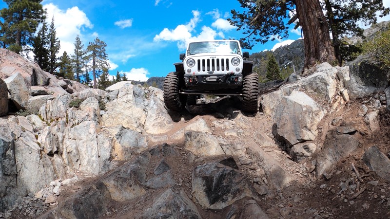
Updated: 12/31/2025
Winch Hill 1 Bypass
Baltimore Town, California
Winch Hill 1 Bypass is just under 7 miles into Fordyce Creek Trail in the Tahoe National Forest. When most hear the word "bypass", they think of an easy, flat forest road around an obstacle. This is not that. The Winch Hill 1 Bypass on Fordyce Creek Trail, while nowhere near as difficult as the straight line up Winch Hill 1, is not easy! This might be the funnest bypass you'll ever run! A challenging rocky ledge followed by a couple of large rocks and some killer mountain views, make this short trail more than any typical bypass. If it's your 1st time through Fordyce, even if you plan to run up Winch Hill 1, it's worth an extra 10 minutes to run up and down this bypass. It also serves as a good way around WH1 when your buddy needs a winch point at the top.
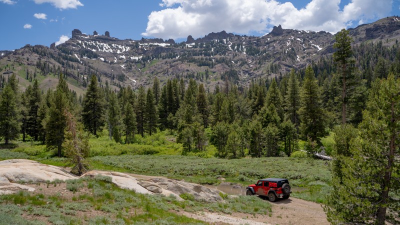
Updated: 01/05/2026
Long Valley Creek
Dardanelle, California
Long Valley Creek (5N01A and 20EV220) is a welcoming out-and-back route that follows a creek (its namesake) as it snakes through a broad alpine valley, steadily gaining elevation until it reaches its quiet end beneath East Flange Rock and the edge of the Emigrant Wilderness. The trail is generally a mellow climb with long, meandering stretches of rough dirt broken up by a couple of short but attention-getting washout sections. These eroded pitches are what give the trail its “moderate” rating, though they’re brief and well within the comfort zone of anyone driving a high-clearance 4WD with basic trail sense.
The scenery is the trail’s real signature. Throughout the drive, you’ll catch impressive views of the surrounding volcanic ridges, particularly The Three Chimneys and East Flange Rock, both of which rise close to 10,000 feet and dominate the skyline. With a dozen dispersed campsites sporting rock-lined fire rings, it’s one of the more camping-rich drainages in this part of the Sierras. These spots vary from shaded creekside pads to open meadow perches with expansive mountain views.
Like most high-elevation routes along Highway 108, Long Valley Creek is usually buried under deep snow in winter, transforming the whole corridor into a playground for skiing and snowmobiling until late spring. In summer, expect some traffic in the broader area as hikers, campers, and reservoir-goers filter through; however, the farther you travel up the valley, the quieter it becomes.
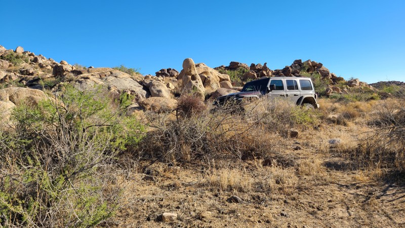
Updated: 10/09/2025
SS1412
Homestead Valley, California
Located within the Sand to Snow National Monument, SS1412 offers easy access from Highway 247 to a beautiful desert valley created by the slopes of the Black Lava Buttes and Flat Top Mountain. The trail follows this valley, passing through stunning boulder-strewn landscapes with stone sculptures shaped from natural erosion. Abundant dispersed camping is found along the trail's length, allowing users to enjoy a peaceful overnight camp or to use it as a convenient base camp to explore the many hiking-only trails that reach further into the desert. While the trail offers no shaded campsites, there are several locations next to the boulder formations that offer flat sandy surfaces, protection from the wind, and room for multiple vehicles.
The trail travels mostly over a flat sandy surface with occasional rutted and rocky sections that are easily managed by a high clearance vehicle using two-wheel drive. While the trail has a map designation of SS1412, BLM trail markers RC1412 and RC1416 are widely placed along the trail, reflecting the shared responsibility for this area by the Sand to Snow National Monument and the Bureau of Land Management.
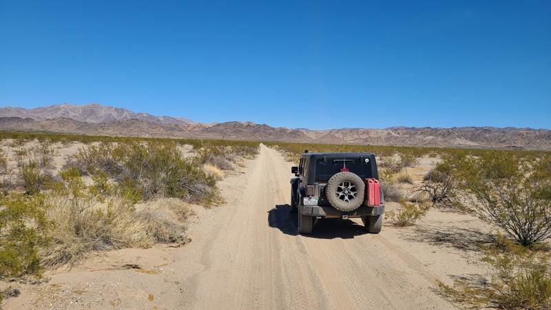
Updated: 09/29/2025
Summit Flat
Hayfield, California
Summit Flat is a short 2-mile BLM road connecting Summit Road with Gas Line Road. The road surface is flat, smooth, and sandy, with occasional sets of moguls. Existing rock fire rings can be found along its length for dispersed camping.
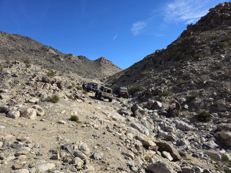
Updated: 06/26/2026
Road to Backdoor
Johnson Valley, California
The Road to Backdoor is a dirt road that leads around the mountain and runs directly into Backdoor. This road isn't very popular since Backdoor is such a difficult trail. The road is comprised of mostly hard-packed dirt, with some soft sand as you get closer to the Backdoor obstacle. All 4x4's can easily handle this road.
Johnson Valley OHV area is an open OHV area, meaning you can drive anywhere, and you don't have to stay on the path if you choose not to. Portions of Johnson Valley are shared with the Twentynine Palms military base, and closures go into effect when training takes place. Please be sure to visit the BLM website: https://www.blm.gov/visit/johnson-valley-ohv-area to see closure schedules.
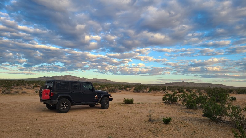
Updated: 10/15/2024
El Mirage 4663
Houze Place, California
This trail is a navigation challenge with few tire tracks through dense growth, but there are BLM trail signs indicating the route. The navigation challenge is that the BLM markers are widely spaced, and the tall overgrowth often hides them.
The desert terrain here is flat but with tall, dense growth and rocky washes, but still does provide a few cleared sites suitable for camping when meeting the BLM Camping Guidelines and being sure to be on BLM land.
Campfires may be restricted during high fire danger, and if planning to camp, one should review the current BLM Campfire Restrictions.
EM4663 is an overland trail with a risk of wrong turns where it can feel like you are breaking the trail. The tight brush causes significant stripping. The trail best suits an experienced driver using a high clearance four-wheel drive vehicle.
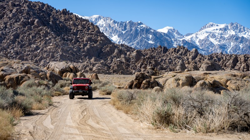
Updated: 03/13/2025
Movie Road Bypass Site 11
Lone Pine, California
Knowing this alternate route will be valuable when movies or commercials are filmed on Movie Road. The route provides a great view of the Eastern Sierras and passes by dispersed camping site #11. Site 11 is large, flat, open, and suitable for trailers. If the roads have not been recently maintained, be advised of erosion ruts.
About camping on this route:
All dispersed camping is designated to a specific site and requires a permit. A permit can be obtained online or at the Eastern Sierra Visitor Center or kiosks located on Movie Road and the main entry point in Lone Pine. Permits need to be signed and displayed on your dashboard.
The BLM has created a map showing the site numbers. However, those numbers are not used in the field, but each site is clearly marked with either a camping allowed or no camping allowed symbol on a clearly visible sign. Please be aware that all sites are first come, first served, and a permit does not guarantee you will find a site. Due to the popularity of the area, it is best to arrive early.
There are six portable restrooms throughout Alabama Hills. If you do not want to drive or walk to one, you must bring your own system to pack out human waste.
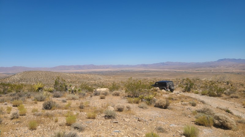
Updated: 10/15/2024
Rattlesnake Canyon 3200
Cushenbury, California
East of Lucerne Valley, RC3200 is entirely on Bureau of Land Management land and wanders through the northern foothills of the Blackhawk Mountains. It arrives at the property line of the Mitsubishi Cement Company, whose cement plant can be seen to the west. Along with the desert scenery, the slight elevation provides distant views out to the north of Lucerne Valley.
This is an easy out-and-back trail, but it still needs a high clearance vehicle. A new offroad driver will enjoy the twists and turns of this trail.
With no existing campsites visible from the trail, there are a few flat locations that will provide reasonable dispersed campsites when meeting the BLM Camping Guidelines.
Campfires are generally prohibited, and if you plan to camp, you are responsible for knowing the current BLM Campfire Restrictions. Operating a camp stove requires a campfire permit.
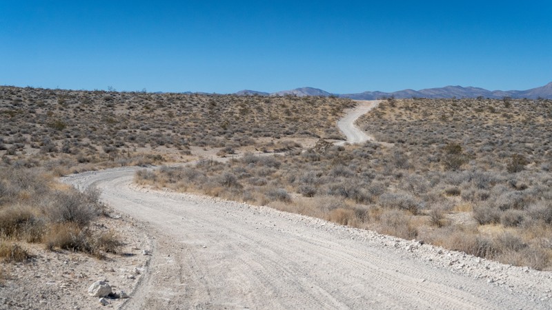
Updated: 10/13/2025
Sierra View Road
Harts Place, California
Sierra View Road is almost entirely within Red Rock Canyon State Park, with the eastern quarter in the Bureau of Land Management area. If it has not been recently maintained, the road is washboard and rough but suitable for any high-clearance vehicle. This is a 5.5-mile connector to the Dutch Cleanser Mine, EP 15, and 86B. Dispersed camping is prohibited within the State Park, and suitable sites can't be found in the Bureau of Land Management portion.
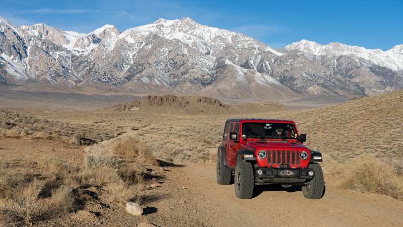
Updated: 05/20/2026
Chicken Ranch Sites 43-45
Lone Pine, California
Chicken Ranch is an out-and-back spur off of Moffat Ranch Road. It leads to dispersed campsites 41, 42, and 43 and the Chicken Ranch Mine. The views of the Eastern Sierras and the surrounding areas are rather good. Being out of the main area of Movie Flats, it's evident this road is not as traveled as much. The road does have a few erosion washouts, and anyone attempting to tow a long trailer beyond the first site may find it difficult; otherwise, any high clearance vehicle not towing will have no issues.
About camping on this route:
All dispersed camping is designated to a specific site and requires a permit. A permit can be obtained online or at the Eastern Sierra Visitor Center or kiosks located on Movie Road and the main entry point in Lone Pine. Permits need to be signed and displayed on your dashboard.
The BLM has created a map showing the site numbers. However, those numbers are not used in the field, but each site is clearly marked with either a camping allowed or no camping allowed symbol on a clearly visible sign. Please be aware that all sites are first come, first served, and a permit does not guarantee you will find a site. Due to the area's popularity, it is best to arrive early.
There are six portable restrooms throughout Alabama Hills. If you do not want to drive or walk to one, you must bring your own system to pack out human waste.
Below is a brief description of each site:
- 43: Good for a smaller trailer or two vehicles. Large enough to fit more, but only a small portion is level. It is a pull-through style site and does not have a tent pad.
- 44: Good for a small trailer or 2-3 vehicles. The bulk of the site is level with a view of the mine, but the site is right off of the road.
- 45: Best for vehicles and tents, two max. Not very level as a whole, and it is right off the road.
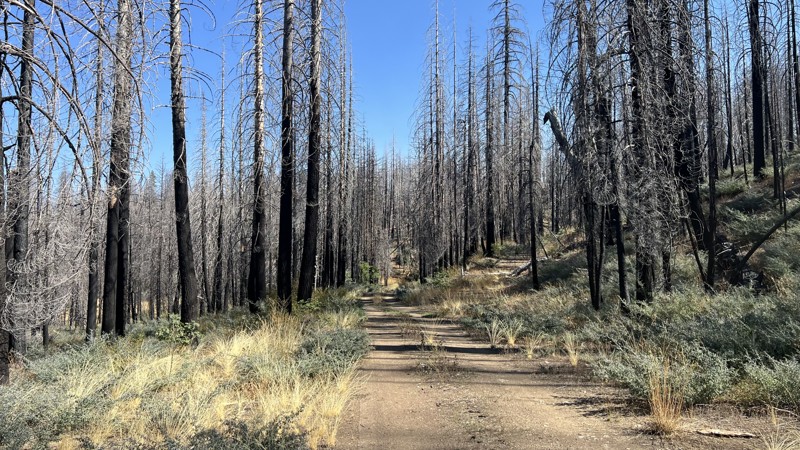
Updated: 10/15/2024
Sunflower Glade Road
Reeves Place, California
Sunflower Glade Road is a short trail located on the border of The Mendocino National Forest and Yolla Bolly-Middle Eel Wilderness. The surrounding area is mostly burned due to recent wildfires, so there is a high chance of downed trees blocking the road. This trail is an easy, there-and-back trail with a few dispersed camping locations offering no amenities or fire rings. Sunflower Glade Road is a good trail for Overlanders of all skills and vehicles.
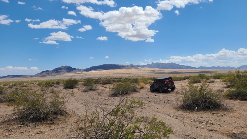
Updated: 06/23/2025
Old Blythe Vidal Road
Vidal, California
Old Blyth Vidal Road was used by the early settlers in Vidal, CA, to reach Blythe, CA, and perhaps even included Wyatt Earp, who lived in Vidal for a time. Along the drive, there are wonderful panoramas across Rice Valley and a marvelous perspective of the Rice Valley Dunes to the west. The trail provides a gateway to explore Rice Valley from its intersecting trails, along with the many nearby mines such as the Gold Rice Mine.
The trail follows a path of least resistance over sandy bajadas, weaving a path along the edge and through the narrow valleys of the Riverside Mountains Wilderness to reach Hwy 95.
This is an easy drive over stretches of deep sand, providing more of a navigation challenge where the lack of markers, wide tangled washes, and disturbed surfaces can disguise the route. A four-wheel drive vehicle is required to manage the deep sandy sections.
Many dispersed campsites with existing rock fire rings are located over the first 8 miles and the last 4 miles of the trail. These sites are in areas of flat desert that provide little wind shelter. After the first 8 miles, the trail enters a narrow canyon that cuts through the Riverside Mountains, and there are no existing campsites visible from the trail when in the canyon.
Drivers exploring the area should carry adequate water, be equipped for self-rescue, and notify family/friends of their travel plans.
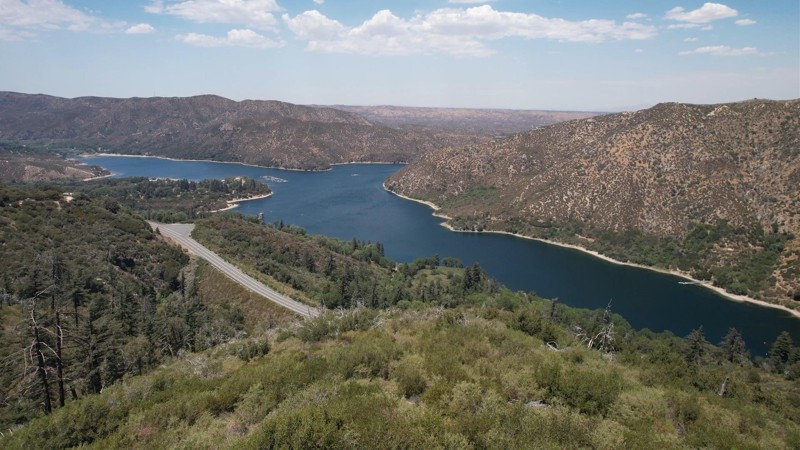
Updated: 09/29/2025
2N13X Sawpit Connector
Crestline, California
2N03X Sawpit Connector is in the 823,000 acres San Bernardino National Forest just south of the 1500 square mile Silverwood Lake and only a short drive from Interstate 15. The 0.5-mile road meanders just north and parallels Silverwood Lake, providing some beautiful views. With minimal obstacles, this trail is suitable for any high clearance vehicle. Improved campsites are available near the beginning of the trail at Silverwood Lake Recreational Area by reservation and include improved sites for recreational vehicles and trailers. There are no opportunities for dispersed campsites along the trail and no campfires permitted or yellow post campsites. Check the SBNF Dispersed Camping website for closed areas and other restrictions.
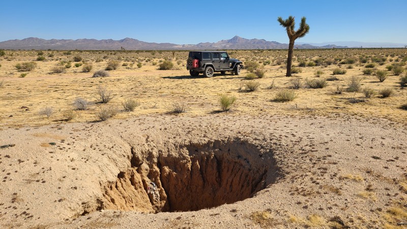
Updated: 10/15/2024
Kramer Hills 6137
Helendale, California
Just two miles west of the Mojave River, KH6137 moves north-south, providing great views across this Mojave Desert basin. KH6137 is an easy trail suitable for a high clearance two-wheel drive vehicle with all-terrain tires.
The northernmost three miles are on public land where flat and clear areas can be found suitable for dispersed camping when meeting the BLM Camping Guidelines.
During high fire danger, campfires may be restricted, and if planning to camp here, one should review the current BLM Campfire Restrictions and have a Campfire Permit.
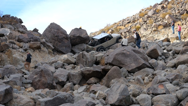
Updated: 06/03/2025
Kings Veto
Johnson Valley, California
Located along the valley's western edge that splits Claw Hammer and Outer Limits, Kings Veto is one of the hardest of the hard. It is a trail reserved for only the most extreme off-roaders. Infamous for causing catastrophic vehicle failures and brutal body damage, this short yet savage canyon is a true reckoning for even the most seasoned drivers.
Littered with boulders larger than most rigs, sheer vertical ledges towering over six feet, and a relentless, unforgiving gauntlet of rocks, King’s Veto offers no mercy. It demands constant front digs, winching through near-impossible lines, and an acceptance that carnage is just part of the journey. It’s no surprise that the team behind King of the Hammers added this trail to the course with one goal in mind: eliminate as many competitors as possible.
So if you think your ultra-built rig is unstoppable, and you’ve got what it takes to face this brutal stretch of terrain, King’s Veto will be more than happy to prove you wrong. But hey, at least you’ll have one hell of a story to tell.
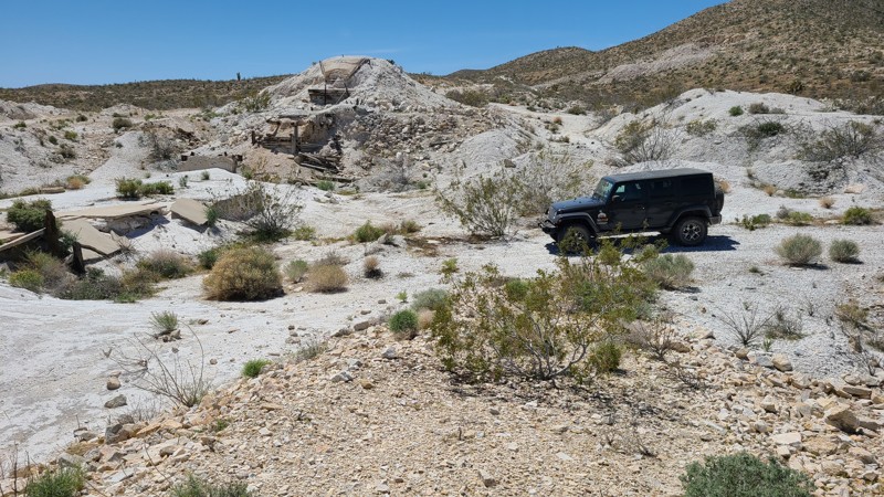
Updated: 10/15/2024
El Mirage 4671
Houze Place, California
Intersecting Princess Mine Road, this trail invites exploration. EM4671 leads to what once must have been a dock to load the tons of ore mined from the Just Tungsten Quarry further up a private road. Tons of brilliant white ore envelop the site, with a few artifacts remaining that suggest the site's purpose. The loading dock, long unused, now provides a good spot to explore on foot, lunch, or camp.
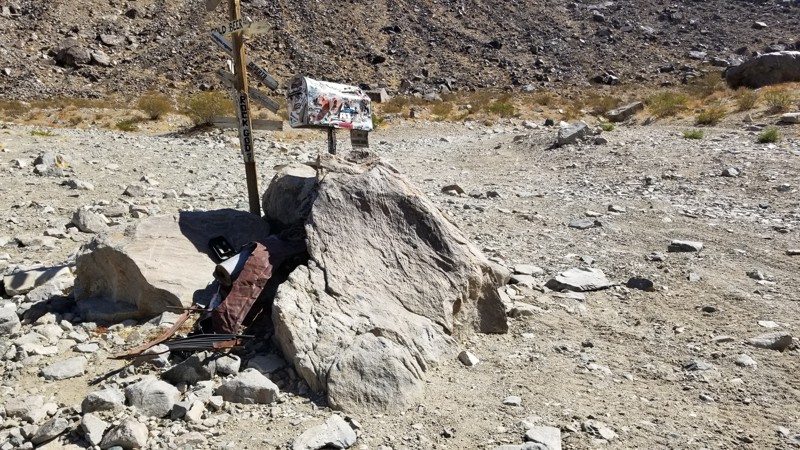
Updated: 03/09/2026
Jack and Sledge Connector
Johnson Valley, California
Looking for a way to cut between Jack and Sledge Hammer. Well, this is your cut-through. The Jack and Sledge Connector is a convenient off-road trail at the top of both trails, meaning you can run up one canyon and then back down the other. Of course, the hard part is the other trails, so if you can do those, you should be good to go here. Due to its short nature, camping is not found directly along this trail, but there are endless camping opportunities on surrounding trails.
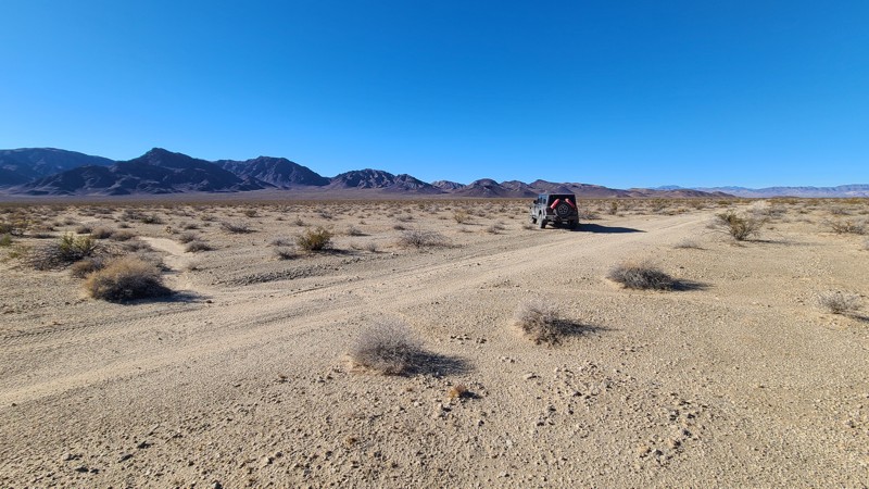
Updated: 03/11/2025
Skeleton Pass Road
Chubbuck, California
Skeleton Pass Road is named after the narrow pass on the eastern edge of the Ship Mountain Range. After visiting Old Woman Meteorite Road, Skeleton Pass Road provides access to a nest of trails that converge near Route 66 or as an alternative to the washboarded Cadiz Road to exit onto the paved Route 66. This sandy, two-track, 19-mile trail is entirely in the desert basin and moves across a flat desert over numerous washes. It offers terrific views of the Ship Mountains to the west and the Old Woman Mountains to the east. This is an easy trail that is good for beginners and that can be managed with a two-wheel drive high clearance vehicle. The trail is remote, with no cell coverage, and drivers should be prepared for self-rescue.
Several existing dispersed campsites can be found along the trail but are on the open desert floor.
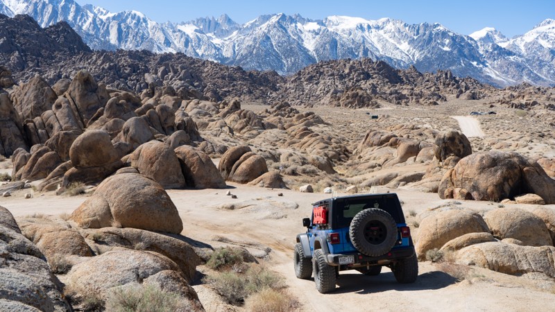
Updated: 03/13/2025
Movie Flat Sites 31-33
Lone Pine, California
Directly off of Movie Road, this route leads to impressive views of rounded sandstone structures and the jagged Sierra Nevada Mountains, as well as three designated campsites. It is suitable for any passenger vehicle, but trailers must be cautious due to the tight nature of the trail's turns.
About the camping on this route:
All dispersed camping is designated to a specific site and requires a permit. A permit can be obtained online or at the Eastern Sierra Visitor Center or kiosks located on Movie Road and the main entry point in Lone Pine. Permits need to be signed and displayed on your dashboard.
The BLM has created a map showing the site numbers. However, those numbers are not used in the field, but each site is clearly marked with either a camping allowed or no camping allowed symbol on a clearly visible sign. Please be aware that all sites are first come, first served, and a permit does not guarantee you will find a site. Due to the area's popularity, it is best to arrive early.
There are six portable restrooms throughout Alabama Hills. If you do not want to drive or walk to one, you must bring your own system to pack out human waste.
Below is a brief description of each site, listed as if you were driving from Movie Road:
- 31: Moderately large for this area and suitable for trailers but not entirely level.
- 32: It is directly next to the road and provides a nice flat area to set up camp.
- 33: Good for trailer only if accessing directly from Movie Road.
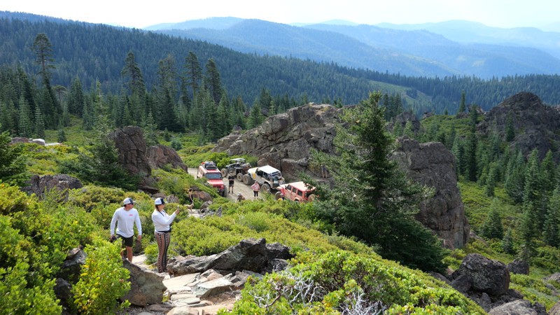
Updated: 10/15/2024
Argentine Rock
Greenhorn, California
Argentine Taylorsville Spur B leads to Argentine Rock, a must-see lookout built in 1934. This lookout sits 7,151 feet above sea level and provides stunning mountain range views. You can see Mt Rainier, Shasta, and many more snow-covered peaks in the distance. The trail up to Argentine Rock is easy and graded. Any offroad vehicle should have no issues getting to the rock from Quincy, the closest town. The hike from the parking area to the peak is short but can be strenuous.
There is no camping off the trail. Look to Brady's Camp for excellent camping.
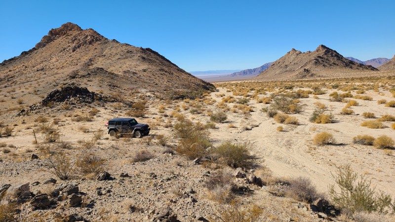
Updated: 03/11/2025
Old Woman Meteorite Road
Chubbuck, California
Old Woman Meteorite Road is a mine road to access the Black Metal Gold Mine, but it got a lot of use when a meteorite was discovered there. In 1975, two miners discovered a large, unusually shaped rock tucked against the rocks and instantly recognized it as a meteorite. A U.S. Marine Corps helicopter hauled it away a few years later, where it was found to be the 2nd largest meteorite found in the United States, weighing 6,070 pounds. Replicas of the meteorite are currently on display at the BLM Needles Field Office, and the original is on display at the California Desert Information Center in Barstow, California.
This sandy, two-track, seven-mile-long trail moves over a flat desert basin over numerous washes. At a boulder jumble, a quick right turn suddenly reveals a beautiful valley. A short distance further, the trail reaches the Black Metal Gold Mine ruins and a dispersed campsite, whose higher elevation offers terrific views across the valley. Intersecting the trail are a few short trails to explore and a few long hiking trails into the wilderness. The mine site makes a perfect base camp to explore the wilderness.
Dispersed camping is allowed here when meeting the BLM Dispersed Camping Guidelines. Campfires may be prohibited, and it is the responsibility of campers to know and follow the any fire restrictions. The best camp spot is near the mine camp, which provides a view and some shelter from the wind.
This is an easy trail except for the last 100 yards past the mine camp ruins and into the mine proper, where the trail becomes steep and strewn with large pumpkin-sized rocks. To drive the last portion will require a high clearance 4x4.
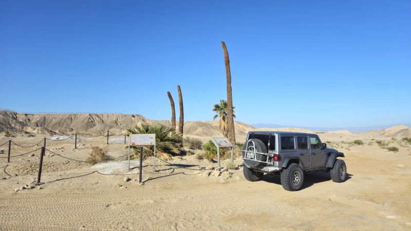
Updated: 10/15/2024
Four Palms Spring
Salton City, California
Located in Truckhaven Hills near the Salton Sea, Four Palms Springs is an easy trail that passes one of the unique features of a desert and Oasis. Sitting around 100 feet above sea level, this area is unique to California for some amazing offroading and hidden finds. Any offroad vehicle and skill level should be acceptable since the trail is mostly a dirt road.
The trail offers plenty of areas to disperse camp; camping near one of the palm trees would make for a unique experience. Along the trail, you will find plenty of level areas with flat dirt that would be ideal for ground camping.
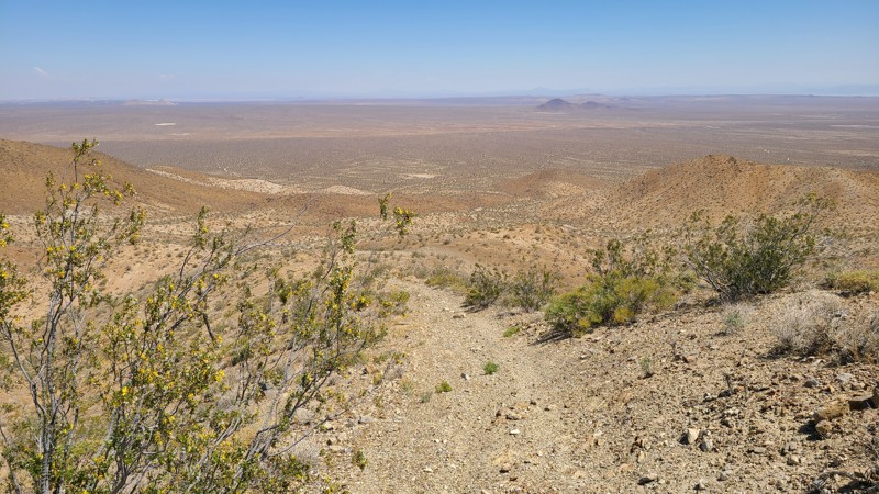
Updated: 10/15/2024
El Mirage 2780
Houze Place, California
EL Mirage 2780 (EM2780) follows the desert basin floor and over rolling hills, eventually reaching the western foothills of the Shadow Mountains. The highest hills provide panoramic views of the northeastern desert anchored by the twin Red Buttes in the foreground and Harper Dry Lake, visible as a white patch in the distance. Connecting with Princess Pat Mine Road, EM2780 is a gateway into the network of rugged trails once used by the many mines located in the Shadow Mountains.
The El Mirage Subregion is a Limited Use Area requiring vehicles to stay on designated trails. The trails are marked with well-spaced signs to recognize if you are on the trail.
A two-wheel drive vehicle with high clearance and a beginning offroader will do fine on this particular trail, but venturing further into the Shadow Mountains trail network requires an experienced driver in a high clearance four-wheel drive vehicle with a low gear range and all-terrain light truck tires.
Many tortoises are in the area, and a vigilant eye is needed to avoid them as they slowly cross the trail.
There are many suitable locations for dispersed camping on this route, but few previously used sites with rock campfire rings exist.
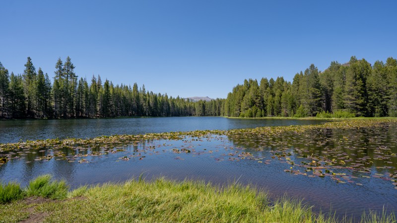
Updated: 12/15/2025
Elephant Rock Lake
Bear Valley, California
Elephant Rock Lake (7N29Y) is an easy out-and-back route that winds gently through the high, forested landscape, located just slightly north of Union Reservoir. Starting around 6,650 feet and topping out near 7,110 feet, this short drive climbs gradually through shaded pine and fir stands on a graded dirt surface. The path is suitable for any high-clearance two-wheel-drive vehicle, and no prior off-road experience is needed. It’s a peaceful trail ideal for casual exploration. It is slow-paced and scenic, with no obstacles aside from the occasional pothole or shallow rut.
The primary draw is access to Elephant Rock Lake, a small, tranquil body of water nestled in a quiet clearing. It’s also a gateway for adventures beyond the road, including the Union Rock Lake Trail and additional hiking routes that lead into the rugged landscapes of the Carson-Iceberg Wilderness. Along the way, drivers will find a handful of dispersed campsites with fire ring remains, but none offer much privacy or views of the lake. The end of the trail offers three walk-in dispersed sites, one of which is located on the water.
Due to its elevation, the trail is typically snowed-in during the winter months, when it becomes popular with snowmobilers and cross-country skiers rather than wheeled vehicles. In summer, the route sees higher use, especially on weekends, as nearby campgrounds like Spicer Meadow Campground fill up and people seek quieter alternatives.
Although it offers no major landmarks along the way, this trail’s charm lies in its simplicity and still makes for a good addition to a day trip in the Stanislaus National Forest.
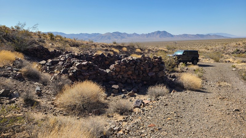
Updated: 08/11/2025
Hidden Hills Road
Flynn, California
Hidden Hills Road in Mojave National Preserve crosses the Clipper Valley desert basin, providing great views of the Granite and Marble Mountains to the southwest. Along the way, several intersecting roads and trails lead to many mines, prospects, and their interesting ruins. A windmill on the road marks the entrance to the Hidden Hills Mine, which was active in the early 1900s and has one of the better preserved mine mills in the area, with its intact ball mill and gold recovery vats. The east end of the road arrives at Route 66, where gas and food can be found at Najah’s Desert Oasis, and if this is the journey's end, from here is a short connection to I-40.
This is an easy road consisting mostly of sandy gravel with the occasional deep sandy washes to cross over. A two-wheel drive high clearance vehicle, being careful to keep momentum through the sandy washes, would manage this road, but a four-wheel drive is recommended. There is not a single marker along the road, and veering onto an intersecting trail is easy. Following a GPX track is very helpful.
Abundant dispersed camping sites can be found along the road, mostly in the exposed flat desert basin. But better campsites can be found among the rock ruins of the mining camp, as well as tucked up against the nearby Hidden Hills for shelter from the wind. These campsites make great base camps to hike the many established trails and explore the area.
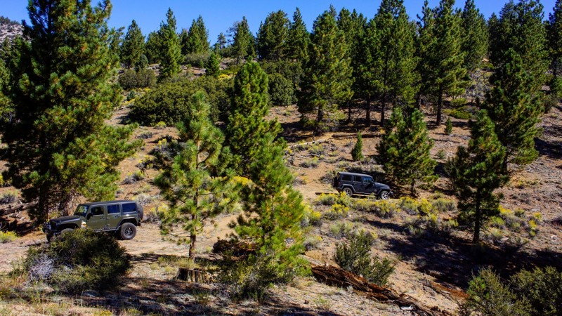
Updated: 09/29/2025
Lightning Gulch
Heart Bar Campground, California
2N93G Lightning Gulch is in the beautiful San Bernardino National Forest, southeast of Big Bear Lake. There is dispersed camping throughout this trail, with a fantastic spot at the trail's end. This trail is a designated Recreational Shooting Site. The trail shows very little travel, so you will have the site to yourself. It is mostly a hard-packed decomposed granite trail that is well maintained and undergoes a seasonal closure, time depending on snow conditions. The condition of the trail is dependent on usage and weather.
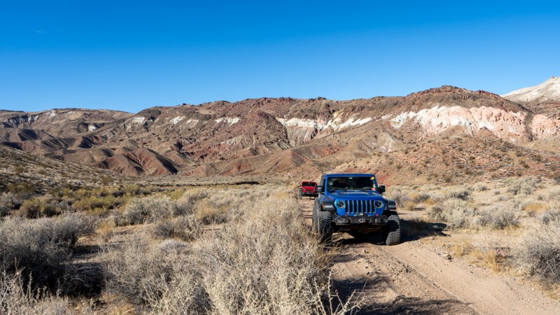
Updated: 05/01/2026
Pleasant Valley Road
Ceneda, California
Residing within Red Rock Canyon State Park and the El Paso Mountains, Pleasant Valley Road drives along the eastern side of Red Buttes. It connects Last Chance Canyon with the network roads you can take on your way to the Burro Schmidt Tunnel or Camp Bickel. While driving this road, the mountains vividly show reds, pinks, tans, and browns. In addition, the area's vegetation is a little more green—all providing stunning views. The drive is comparatively gentle and suitable for any high clearance vehicle. Be advised that the road crosses a wash and might become impassable during a rain event. There is no camping is along this trail.
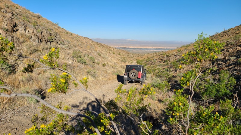
Updated: 10/15/2024
Stoddard Valley 216
La Delta, California
Tucked in a valley of the Silver Mountains north of Victorville, SV216 leads down a mountainside with expansive views to the northwest. This straight-through trail provides connections to several other trails that surround these mountains.
With no existing campsites visible from the trail, a few flat locations provide good camping and views when meeting the BLM Camping Guidelines.
During high fire danger, campfires may be restricted. If planning to camp here, review the current BLM Campfire Restrictions and have a Campfire Permit.
SV216 is an easy but rocky trail requiring a high clearance two-wheel drive vehicle.
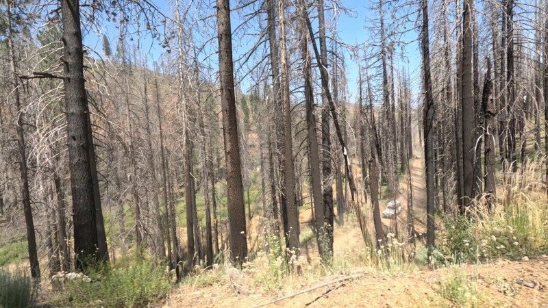
Updated: 10/15/2024
Mosquito Creek Trail
Longville, California
Not far from Humbug Road in the Lassen National Forest is a trail with a name that might strike fear in people's hearts... Or should we say skin. Mosquito Creek Trail, or 26N49, is an easy straight-through trail suitable for any offroad vehicle. Even though this trail has a scary name, the area isn't what it sounds like. This fire-burned area near Soda Springs in Humbug Valley is a pleasant drive near Mosquito Creek and follows the hillside for a pleasant drive. Even though camping is permitted in the area, camping is not found along the route due to the trail's topography.
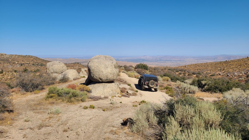
Updated: 09/04/2025
Carbine Flat
Fizzben Heights, California
Carbine Flat Road sits on the northern edge of the San Bernardino National Forest, dropping 1,000 feet along the rim of Lion Canyon before reaching Carbine Flat and a small meadow. The route offers sweeping western views, dispersed camping, access to nearby hiking and OHV trails, including Devils Hole 2W01, and an off-road adventure that ends at Coxey Creek, where a lush green corridor contrasts sharply with the surrounding desert.
While campsites are limited along the descent, the trail’s end rewards travelers with a wide, flat clearing beside the creek. Surrounded by trees and soft ground ideal for tents, this area comfortably accommodates three to four vehicles.
Rated “More Difficult” by the Forest Service, the route begins with a moderately challenging, washed-out descent marked by embedded boulders and sheer 18-inch drops. Beyond that, the trail transitions to a mostly flat dirt road with minor washouts and some brush that may cause light pinstripes. This trail is best suited for a high-clearance 4x4, and an experienced driver
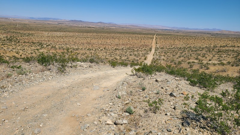
Updated: 10/15/2024
Stoddard Valley 6505
Wild Crossing, California
SV6505 largely parallels Route 66 before ending near Victorville. The trail crosses a checkerboard of BLM and private land. The hilly high desert terrain provides a lovely backdrop to the views at the top of the hills.
With no existing campsites visible from the trail, a few locations on BLM land provide good dispersed camping sites with views when meeting the BLM Camping Guidelines.
During high fire danger, campfires may be restricted. If planning to camp, review the current BLM Campfire Restrictions and have a Campfire Permit.
SV6505 is a rocky trail rising and falling over several steep foothills where the loose rock, uneven trail, and steepness require a high clearance four-wheel drive vehicle with good all-terrain tires and an experienced driver.
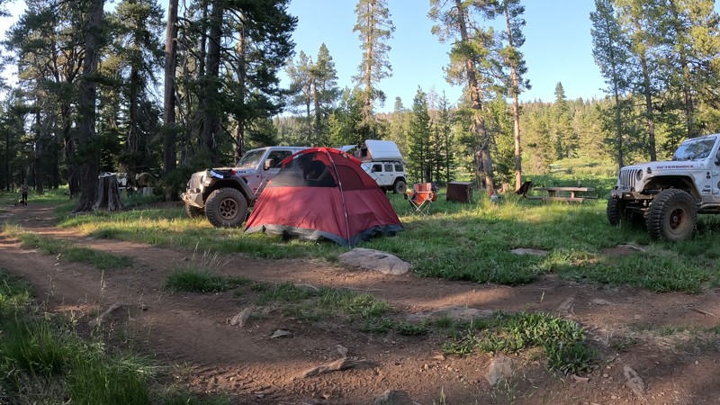
Updated: 10/15/2024
Argentine Taylorsville Road
Greenhorn, California
In the Plumas National Forest near Quincy, CA, in the Mt. Hough Ranger District is Argentine Taylorsville Road. This easy dirt road takes you to Brady's Camp, a first-come, first-serve campground. With six campsites, there are plenty of places for friends to escape city life and enjoy a relaxing camping experience at 7000 feet above sea level. With two streams on both sides of the camp, the babbling brook sounds are magical. With the large prairie off on the northeastern side, it would be easy to sit and get lost in the scenic beauty of this area while watching for wild animals to cross. The campsites have a metal fire ring, picnic tables, bear boxes, and a communal vaulted toilet.
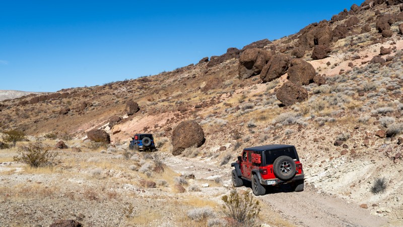
Updated: 07/14/2025
Red Buttes
Saltdale, California
Red Buttes is numbered 86A and resides entirely within Red Rock Canyon State Park. It splits two red buttes and connects Last Chance Canyon with Pleasant Valley Road, and you can drive it in either direction. Visually, it contrasts reddish-brown lava rock against whitish volcanic tuff and mixes, and, from start to finish, will give you something to look at. Volcanic bombs (balls) line the trail in sections twice the size of the vehicles most likely driving this trail. There is plenty of evidence to suggest that this area was active with mining, and towards the eastern end, there are numerous old car carcasses and mining equipment.
The road is non-technical and suitable for any high-clearance vehicle. Dispersed camping is prohibited within the State Park.
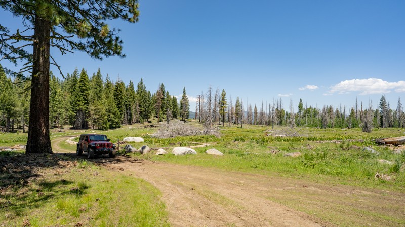
Updated: 02/05/2026
6N17
Cottage Springs, California
Forest Route 6N17 is a secluded, high-country cruise that branches off 5N14, climbing through thick forest up to Big Prather Meadow. The road is mostly rough dirt throughout, with some sections of bumpy embedded rock, and is friendly to any high-clearance 4WD, making it ideal for new off-roaders or anyone looking to explore without much drama. Although not heavy on the dispersed camping, the trail does offer one large site with direct creek access, shaded by large pine trees, roughly 2 miles in. Another dispersed site is located roughly 3.5 miles from the start, and it is large enough for a couple of vehicles but less picturesque. As you work your way along the trail, you'll also notice two small lakes (Swamp Lake and Lake Moran) hidden among the trees. Both seem shallow and serve as water catchments for snow melt. The end of the trail opens up to the lush meadows the high Sierras are known for, which pop with vibrant wildflowers in late spring and early summer.
Be extremely mindful of where the mapped route ends. Although the road continues on Forest Service maps, it dead-ends at a private property line for a hunting preserve with minimal space to turn around. It is best to end your adventure at the meadows and return the way you came.
Like much of the high Sierras, 6N17 stays buried under heavy snow through winter and typically doesn’t open until mid to late spring, depending on snow pack conditions.
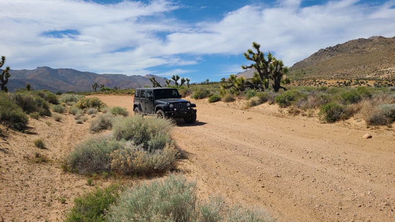
Updated: 10/15/2024
Bird Spring Road SC106
Sageland, California
Bird Spring Road is part of the Bureau of Land Management's Scodie Subregion and is near the southernmost foothills of the Scodie Mountains. This straight-through road flows southeast over a well-maintained, wide, sandy road on this flat, high desert connecting several other roads and hiking trails. Its termination at LA Aqueduct Road provides a quick exit towards Highway 14.
The road is wide and well maintained and an easy drive for new offroaders, but it still requires a high clearance 4x4 to manage the soft sand and occasionally exposed rocks.
BLM has prepared primitive campsites at the premium locations, easily identified by posted signs noting a 15-mile speed limit when campers are present. Camping there or at suitable dispersed sites on BLM land can be enjoyed when meeting the BLM Camping Guidelines. During high fire danger, campfires may be restricted, and if planning to camp here, one should review the current BLM Campfire Restrictions and have a Campfire Permit.
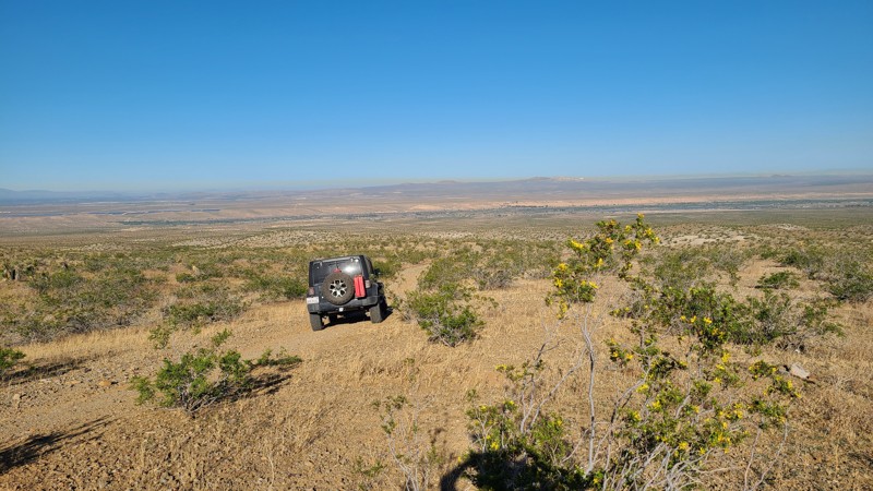
Updated: 10/15/2024
Stoddard Valley 6518
La Delta, California
SV6518 follows a gentle slope down from the edge of the Silver Mountains yet retains enough elevation for expansive views to the west. This straight-through trail connects to several other trails to explore.
The westernmost 3/4 miles of the trail is on public land, providing a few flat locations for dispersed camping when meeting the BLM Camping Guidelines.
During high fire danger, campfires may be restricted. If planning to camp, review the current BLM Campfire Restrictions and have a Campfire Permit.
SV6518 is easily driven in a high clearance two-wheel drive vehicle with good all-terrain tires.
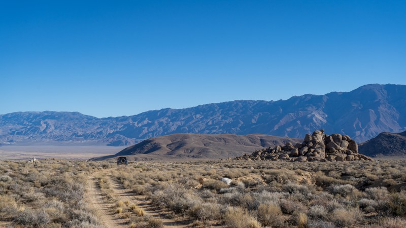
Updated: 03/13/2025
Valley Spur to Nothing
Lone Pine, California
Sometimes, all you need is a little time to yourself. This short out-and-back spur provides just that! Located north of the popular Movie Flat, this easy dirt road leads to nothing except a little piece and quiet. Travelers should expect a few softball-sized embedded rocks, incredible views of the Sierras and the rock fins of Alamaba Hills, and a single trail all to themselves. Unfortunately, camping is not available along this abandoned road.
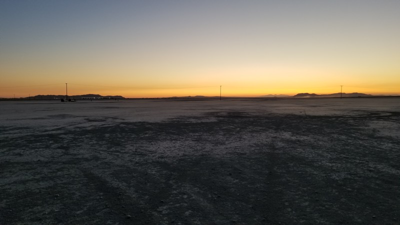
Updated: 09/29/2025
El Mirage Lake Road
El Mirage, California
El Mirage Dry Lake Bed is a popular OHV area that encompasses 27,275 acres of recreational opportunities for motorcycles, ATVs, trucks, cars, buggies, land yachts, model airplanes, model rockets, ultra-light aircraft, gyrocopters, and parasail. The lake bed is the site of many old land speed records and is an excellent place to gather speed. The Lake Road offers eight access points to the lake bed, which closes when it is wet or muddy. For current conditions and closure status of the El Mirage Dry Lake Bed, contact the BAFO at (760) 252-6000.
A permit is required to spend the day here or camp overnight. You can buy the permits at vending machines at the entrance or at the BLM Office. For current pricing, see the BLM website. Daily Passes are valid from the day of purchase until noon the next day.
You are allowed to disperse camp almost anywhere around the lake's perimeter, but camping on the lakebed itself and within 100 feet of it is prohibited. The area is well-marked, so you can easily find the boundary of the lakebed. Around the lake, you will find several outhouses for tent campers.
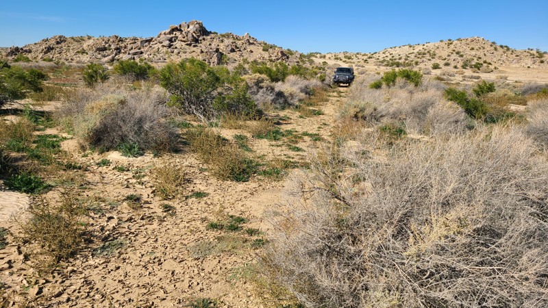
Updated: 10/15/2024
Kramer Hills 6120
Adelanto, California
At times, driving KH6120 feels as if you are breaking trail on this little used motor path. Rain has washed away any tracks in certain sections except for the coyotes and rabbits, which are easily seen on the smooth sandy surface. The trail surface of KH6120 sometimes consists of soft, deep sand, and a high clearance four-wheel drive vehicle with all-terrain tires is recommended.
The easternmost 1.5 miles of the trail are on public land with suitable areas for dispersed camping when meeting the BLM Camping Guidelines.
During high fire danger, campfires may be restricted, and if planning to camp here, one should review the current BLM Campfire Restrictions and have a Campfire Permit.
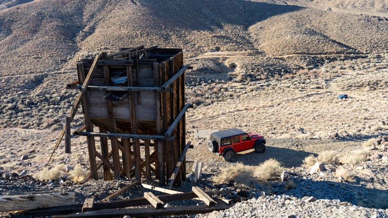
Updated: 03/13/2025
Chicken Ranch Mine
Lone Pine, California
If you are camping on Chicken Ranch, you can't help but notice this mine structure. Little information is known about this particular location. However, nearby Lone Pine was the supply town for the more famous mines of Cerro Gordo, Swansea, and Kearsarge. If you plan on driving up, the road is mildly steep with loose rocks and room for only one vehicle to park at the top.
At the bottom along the washy area are old stone structures; if you look closely enough, one appears to be a fireplace, and there are also a couple of horizontal adits.
Once at the top, you're greeted by the rusting remains of an old mining operation set against the breathtaking Sierra Nevada mountains. The most striking feature is the massive gear-driven hoist system, once used to lower miners and haul ore from deep underground. Nearby, a weathered wooden headframe and an ore bin stand as silent reminders of the mine's heyday, when this region was rich with the pursuit of gold, silver, and tungsten. Scattered pieces of machinery and crumbling timbers hint at the intense labor that took place here, extracting valuable minerals that fueled California's mining boom.
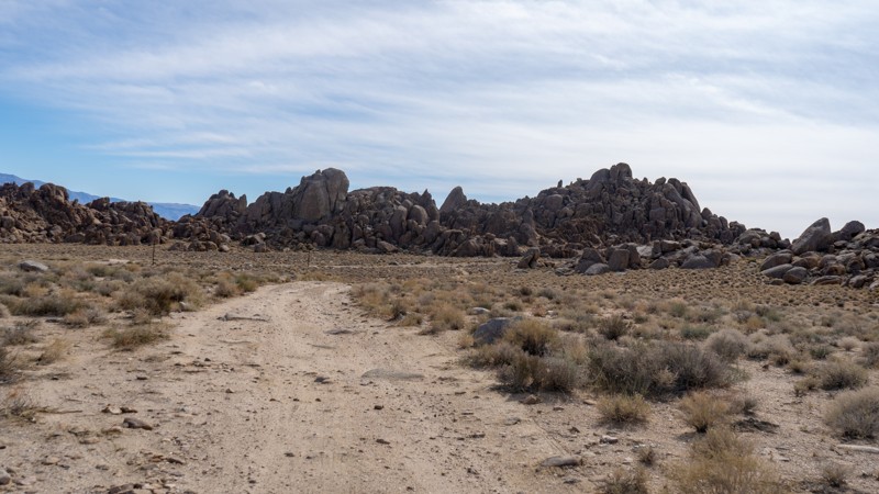
Updated: 03/13/2025
Horseshoe Meadows Sites 9-10
Lone Pine, California
Located south of Movie Flat, Horseshoe Meadows hosts 10 of the designated campsites allowed in the area. This spur is the furthest north along Horseshoe Flats and contains sites 9 and 10. The road to reach these sites is rather bumpy and rough, but nothing that a stock high clearance vehicle can't handle.
About the camping on this route:
All dispersed camping is designated to a specific site and requires a permit. A permit can be obtained online or at the Eastern Sierra Visitor Center or kiosks located on Movie Road and the main entry point in Lone Pine. Permits need to be signed and displayed on your dashboard.
The BLM has created a map showing the site numbers. However, those numbers are not used in the field, but each site is clearly marked with either a camping allowed or no camping allowed symbol on a clearly visible sign. Please be aware that all sites are first come, first served, and a permit does not guarantee you will find a site. Due to the popularity of the area, it is best to arrive early.
There are six portable restrooms throughout Alabama Hills. If you do not want to drive or walk to one, you must bring your own system to pack out human waste.
Below is a brief description of each site on this route:
- 9: is located on the eastern side of the trail, butted up against a large rock, with room for two vehicles and ground tents.
- 10: is just across the trail and is similar in size. Neither site is very protected from the sun or elements, and they are within earshot of each other, but they would make decent sites if the bulk of the Movie Flats sites were already taken.
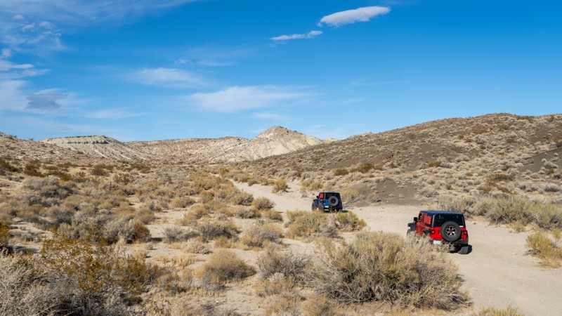
Updated: 03/20/2025
Opal Canyon Road
Ricardo, California
Bridging the gap between Red Rock-Inyokern Road and Trail 86B, Opal Canyon Road is a relatively smooth sandy trail, with only a few washboards to worry about along the drive. The trail is wide most of the way and a quick travel, giving you access to Opal Trail and many of the other trail options within Red Rock Canyon State Park. Although not a destination of its own, you are sure to travel this smooth sand at some point if you are looking to avoid pavement and travel as much of the park as possible. Since the trail is contained within Red Rock Canyon State Park, camping is not permitted along the trail. The only available camping within the park is at the Ricardo Campground across CA-14 near the state park visitors center.
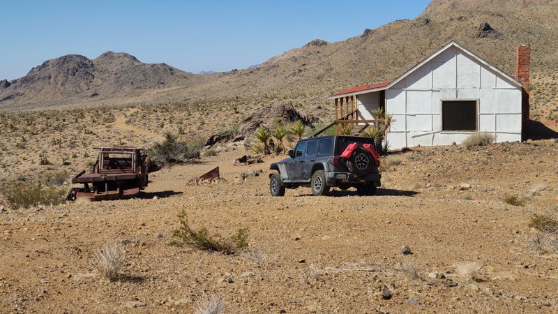
Updated: 08/11/2025
Big Horn Mine Road
Kelso, California
Big Horn Mine Road in Mojave National Preserve leads to the historic Big Horn Mine and the Hilltop House, a cabin built by the mine owners. The bright white Hilltop House was built before 1933 as a place for the owner and investors to keep watch over their mining interests, which are visible just down the hill. From its perch, the Hill House is visible from miles away and became a gathering place for local miners, ranchers, and homesteaders for holidays and other celebrations. The mine was finally abandoned in 1985, and the house fell into disrepair and collapsed in high winds in 2008. To acknowledge its historic role in the area's landscape, the park service rebuilt the house, and it can now be used by desert explorers for short stays. The main room is nice, with a fireplace and cots, but the remaining rooms of the house are in disrepair and not suitable for use. A photograph hanging on the wall shows the cabin in disrepair before its restoration. The mine, visible from the house, is just down the north side of the hill where its water towers have collapsed and other artifacts lie in decay. Iron bars now close the mine entrances.
The best dispersed camping is at the Hilltop House site, which provides expansive views across the desert to the Granite and Van Winkle Mountains. The immediate area around the Big Horn Mine also offers several campsites with rock campfire rings that would provide wind-sheltered camping locations.
This is an easy trail with short sections of hill climbs over a rocky surface and across water-worn depressions that are easily handled by a high clearance vehicle using two-wheel drive.
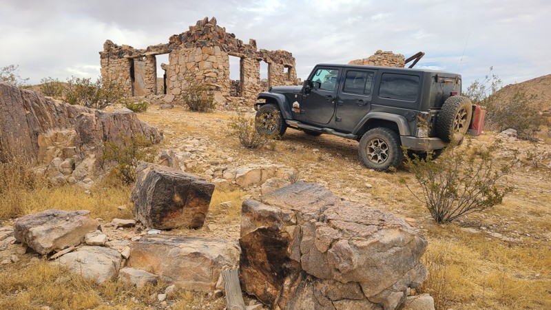
Updated: 10/15/2024
El Mirage 2729
Houze Place, California
Beginning in El Mirage Valley, EM2728 skirts the edge of a cluster of hills, passing the remains of several stone homes. Made from local stone, these once-handsome buildings are worth the drive to see. This trail, located in the El Mirage Subregion, is in a Limited Use Area requiring vehicles to stay on the trails. The trail follows a right-of-way over private land, with the last mile of the trail on BLM land. EM2728 is an easy, generally flat sandy trail requiring only a high clearance two-wheel drive vehicle.
Dispersed camping is available on the last one-mile trail when meeting the BLM Camping Requirements. During the summer fire season, campfires may be restricted, and if planning to camp, one should review the current BLM Campfire Restrictions.
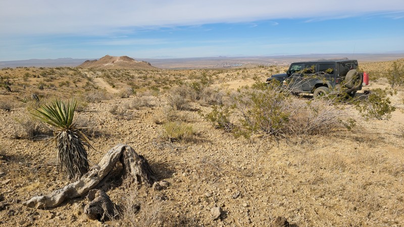
Updated: 10/15/2024
Stoddard Valley 6534
Bryman, California
On its westernmost 2.5-mile stretch of trail, SV6534 is called Cardigan or Citation Road. This straight-through trail provides quick access to Route 66 from the Stoddard Valley Subregion.
Many suitable dispersed camping locations are found on the BLM land when meeting the BLM Camping Guidelines.
During high fire danger, campfires may be restricted, and if planning to camp here, one should review the current Campfire Restrictions and have a Campfire Permit.SV6534 is an easy but rocky trail requiring a high clearance two-wheel drive vehicle.
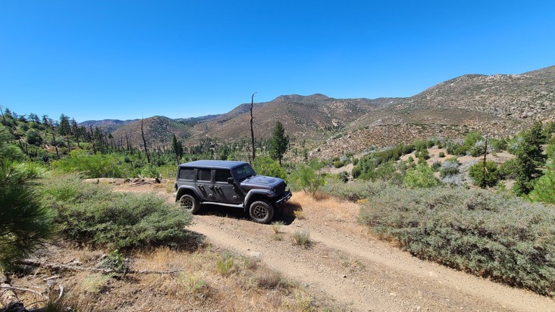
Updated: 07/12/2026
Little Bear Spring
Fawnskin, California
Little Bear Spring is an out-and-back road following the mountain ridges on the south side of a valley formed by Holcomb Creek 400 feet below. The trail offers a peaceful escape, with views across the valley to the northern mountain peaks and a recovering forest from recent forest fires.
This is an easy trail requiring a high-clearance two-wheel drive vehicle. There are no major obstacles beyond the gauntlet of overgrown bushes over large sections of the trail that will cause pinstriping.
Camping is available at Yellow Post #5, located just ¼ mile into the trail, and at a single suitable dispersed site on a wide, flat area near the end of the trail.
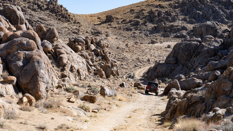
Updated: 03/13/2025
Movie Road Sites 41-42
Lone Pine, California
Tucked away in the north Alabama Hills are designated campsites 41 and 42. Although not near the iconic movie sites along Movie Road, these two campsites offer a nice private camping experience while still being only a stone's throw away. The road surface to the first site (41) is easily managed by any vehicle, but to reach the second, the road is rough and rocky, requiring high clearance.
About the camping on this route:
All dispersed camping is designated to a specific site and requires a permit. A permit can be obtained online or at the Eastern Sierra Visitor Center or kiosks located on Movie Road and the main entry point in Lone Pine. Permits need to be signed and displayed on your dashboard.
The BLM has created a map showing the site numbers. However, those numbers are not used in the field, but each site is clearly marked with either a camping allowed or no camping allowed symbol on a clearly visible sign. Please be aware that all sites are first come, first served, and a permit does not guarantee you will find a site. Due to the popularity of the area, it is best to arrive early.
There are six portable restrooms throughout Alabama Hills. If you do not want to drive or walk to one, you must bring your own system to pack out human waste.
About the sites:
41: is easily accessed via a packed dirt trail, providing a small amount of flat ground for only 1-2 vehicles and ground tents.
42: Large trailers and long vehicles (RVs, Sprinter vans, or long-bed pickups) may find trouble reaching this site with its tighter S-bend in the rocks, and high clearance is recommended. The ground is fairly uneven, although there is a large plot of dirt to situate yourself and up to three other rigs.
Both sites have great views of the eastern Sierras and the rocks of the Alabama Hills.
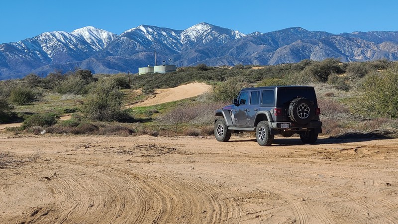
Updated: 02/18/2026
Old Hesperia
Hesperia, California
With its quick access off of I-15, Old Hesperia is an easy trail providing wonderful views in the winter of the surrounding snow-capped San Gabriel mountains, with plenty of spots to pull over for lunch or just enjoy the views. Along the way, the trail passes under a railroad trestle where railroad enthusiasts will enjoy stopping to view the frequent trains. Some drivers have used this trail to bypass the frequent I-15 backups that occur around the Cajon Pass Summit.
This is an easy, wide forestry road, but with some significant storm damage creating wide, deep ruts along and across the trail. A two-wheel drive vehicle with high clearance and a driver with minimal off-road experience would enjoy this trail.
There are no suitable campsites, but from the south end of the trail, seven miles east on Highway 138, are the Silverwood Lake Campgrounds.
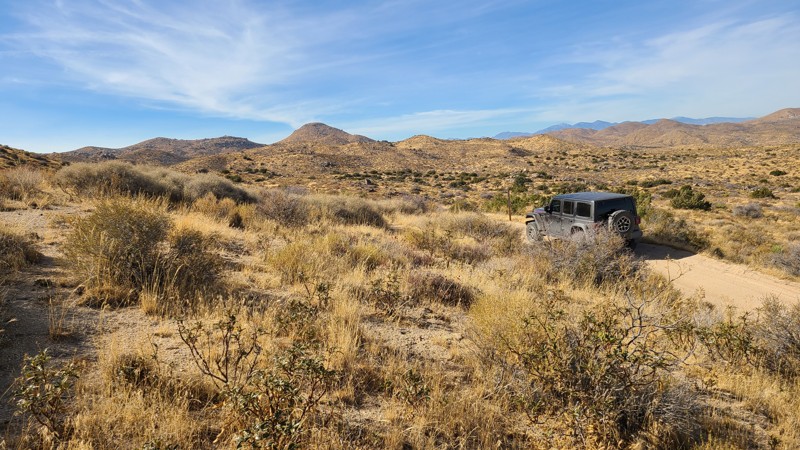
Updated: 03/11/2025
Juniper Flats 3253
Fizzben Heights, California
Located in the BLM-managed Juniper Flats area, JF3253 connects to a network of trails that cover over 100,000 acres of this desert-to-mountain transition. The trail provides beautiful views and hosts a variety of wildlife. The distinctive rock formations close to the trail invite a short hike to explore.
The trail is easy over hard-packed flat dirt and wide enough for two vehicles to maneuver and pass over most of its length. This is the perfect trail for beginning offroaders and can be handled with a 2-wheel drive high clearance vehicle. However, if continuing to explore the area, many trails will require 4-wheel drive.
This trail offers no suitable campsites, but dispersed camping is allowed throughout the area when sites show obvious signs of prior use and lack of vegetation cover and follow the BLM Dispersed Camping Guidelines. This is a high-fire danger area, and campfires may be prohibited. Campers are responsible for knowing and following the current fire restrictions.
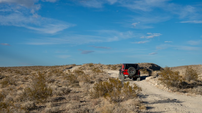
Updated: 11/14/2025
Roaring Ridge
Ricardo, California
Located entirely within Red Rock Canyon State Park, Roaring Ridge is the connector between Sierra View Road and Opal Trail. Being a simple connector, it offers views into the park's most interesting topography and the Scodie Mountains off to the west. It is suitable for any high-clearance vehicle, as the non-even terrain generally consists of packed dirt with scattered loose rock. 4WD will not be needed under normal circumstances. Dispersed camping is not allowed within the State Park.
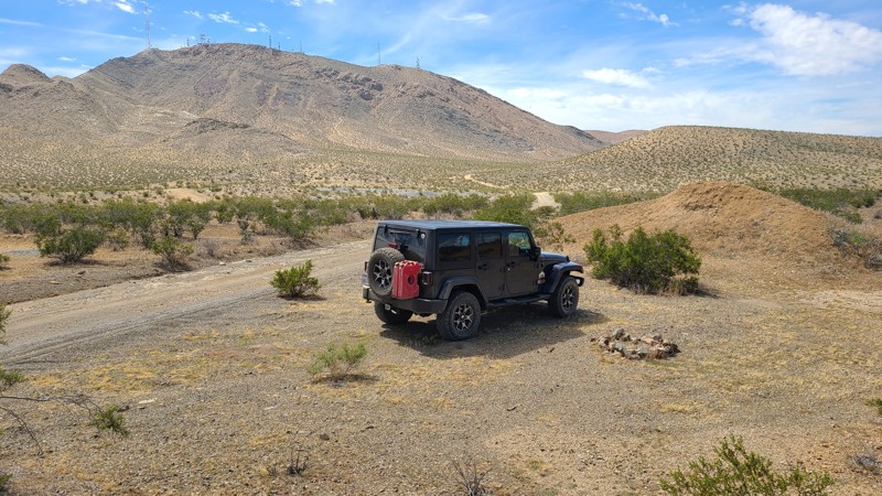
Updated: 10/15/2024
Stoddard Valley 6510
Victorville, California
SV6510 follows along the beautiful Ore Grande Canyon formed by Quartzite Mountain and Sparkhule Mountain and serves as a connector to several other trails in the valley.
Mostly on public land, several flat locations are making for good dispersed camping when meeting the BLM Camping Guidelines.
During high fire danger, campfires may be restricted, and if planning to camp here, one should review the current BLM Campire Restrictions and have a Campfire Permit.
SV6510 is a flat, easy trail suitable for two-wheel drive, but surrounding trails may require high clearance four-wheel drive.
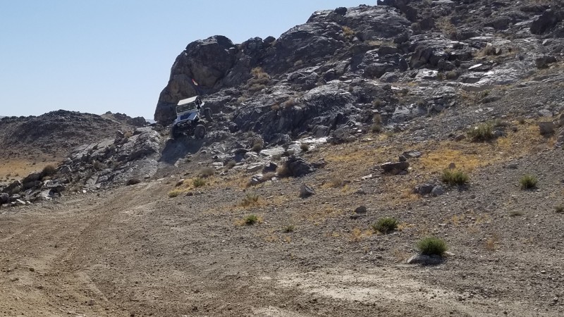
Updated: 09/29/2025
Qualifier Hill
Johnson Valley, California
Part of the King of the Hammers Qualifying course in Johnson Valley California, this steep hillclimb is not for the faint of heart. One side is extremely steep and loose, with rocks in the right spots to make it hard, and on the other side is a drastic drop that is about 4 feet. This is a short straight-through trail only suited for well-built rigs and experienced drivers.
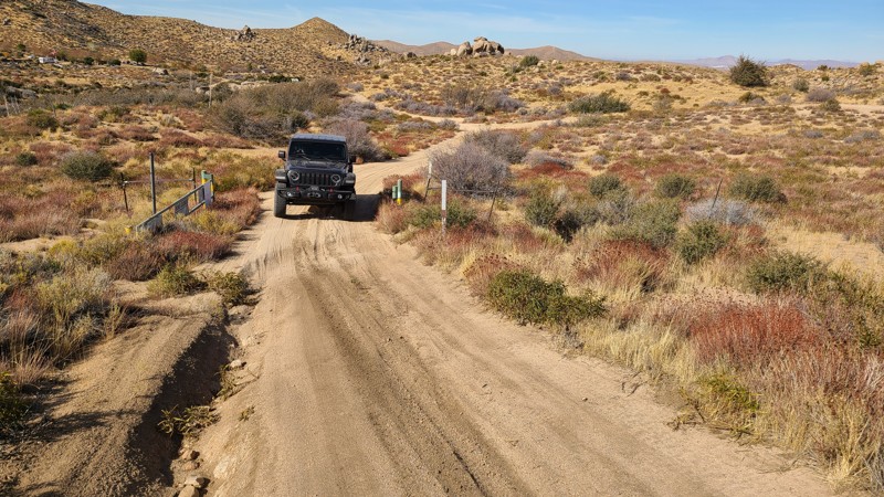
Updated: 03/11/2025
Juniper Flats 3275
Fizzben Heights, California
Located in the Juniper Flats area, JF3275 is an easy trek over hard-packed flat dirt with short sections of exposed grapefruit size rocks and wide enough for two vehicles to maneuver and pass by over most of its length. This is the perfect trail for beginning offroaders and can be handled with a 2-wheel drive high clearance vehicle. However, if continuing to explore the area, many trails will require a high clearance 4x4.
This trail connects to a network of trails that cover over 100,000 acres of this desert-to-mountain transition, providing beautiful views and hosting a variety of wildlife. This trail can be used to access the San Bernardino National Forest and trail 3N67, which leads to even more mountain trails, and eventually Big Bear Lake.
JF3275 offers no suitable campsites, but dispersed camping is allowed throughout the area when sites show obvious signs of prior use and lack of vegetation cover and follow the BLM Dispersed Camping Guidelines. This is a high-fire danger area, and campfires may be prohibited. Campers are responsible for knowing and following the current fire restrictions.
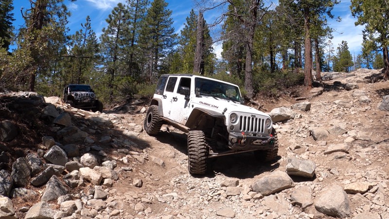
Updated: 12/31/2025
Drive Line Hill Bypass
Crystal Lake, California
High in the Tahoe National Forest, just off the west side of the iconic Fordyce Creek Trail, sits this short bypass around Fordyce Creek Trail's first major obstacle: Driveline Hill. This bypass can help those in lesser-built rigs looking to get to Eagle Lakes a bit further north, or might be useful for built rock crawling rigs looking to limp off the trail or take it easy through this section of the trail. The Driveline Hill Bypass includes dirt, small to medium-sized rocks, and a short stretch of old blacktop.
There are no dispersed campsites located along this bypass.
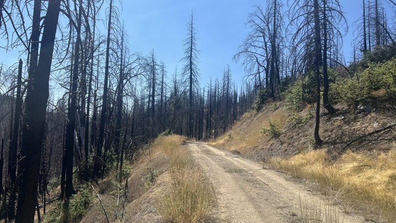
Updated: 10/15/2024
Georges Valley Road
Reeves Place, California
Georges Valley Road is a short trail at the end of the Pillsbury-Indian Dick trail located in the Mendocino National Forest. This trail is a there-and-back trail with a couple of dispersed camping sites. Georges Valley Road is a one-lane, narrow trail that any stock offroad vehicle can travel, providing no real challenges except for a few potholes that will make stock vehicles choose a careful line. The end of the trail is a decent location for bigger groups to set up a dispersed camping site for a night, providing shade and ample space for multiple vehicles.
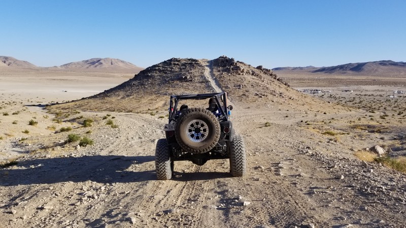
Updated: 03/09/2026
Road to Short Bus and Comp Hill
Johnson Valley, California
A quick shortcut from Means Dry Lake, The Road to Short Bus, and Comp Hill is a quick path to these two popular areas. So if you are looking for an easy way to get there from means dry lake, this is your shortest route. Camping is not found directly along this trail, but there are endless camping opportunities on surrounding trails.
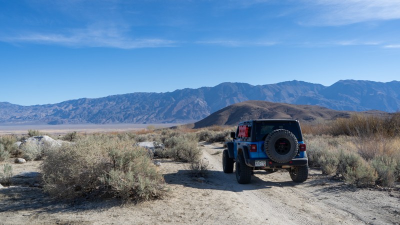
Updated: 03/13/2025
Hogback Road Sites 46-48
Whitney Portal, California
This quick and easy trail is a short drive north of Movie Flat and leads to three of the designated campsites in the Alabama Hills. Located just off Hogback Road, sites 46, 47, and 48 offer peace and quiet away from the crowds. Although there are no major challenges, high clearance may be needed if passing storms cause the ruts to get much deeper.
About the camping on this route:
All dispersed camping is designated to a specific site and requires a permit. A permit can be obtained online or at the Eastern Sierra Visitor Center or kiosks located on Movie Road and the main entry point in Lone Pine. Permits need to be signed and displayed on your dashboard.
The BLM has created a map showing the site numbers. However, those numbers are not used in the field, but each site is clearly marked with either a camping allowed or no camping allowed symbol on a clearly visible sign. Please be aware that all sites are first come, first served, and a permit does not guarantee you will find a site. Due to the popularity of the area, it is best to arrive early.
There are six portable restrooms throughout Alabama Hills. If you do not want to drive or walk to one, you must bring your own system to pack out human waste.
Below is a brief description of each site on this route:
- 46: Quickly and easily accessed, but it is rather small and cannot accommodate trailers or more than two vehicles. A few small bumps further is site 47, a larger site within earshot of 46. This site can fit 2-3 rigs comfortably, with room to turn a small adventure-type trailer around. A quiet and small trickling creek may be heard just across the trail.
- 48: Another hundred or so yards down the trail, where users may encounter small ruts from recent storms. This site is large and exposed but provides plenty of flat ground for 3-4 vehicles and ground tents.

Updated: 03/11/2025
Juniper Flats 3389
Apple Valley Highlands, California
Passing the east side of Round Mountain within the Juniper Flats area, JF3275 is a short connector trail in a much larger network of trails that cover over 100,000 acres of this desert-to-mountain transition. The trail travels through a gorgeous area with swarms of boulder formations, creating stunning views.
The trail can be moderately difficult because of fairly steep, uneven, and rocky slopes. This is a good trail for a beginning off-roader to experience a slightly more rugged trail and should be driven with a 4-wheel drive high clearance vehicle.
JF3275 offers no suitable campsites, but dispersed camping is allowed throughout the area when sites show obvious signs of prior use and lack of vegetation cover, and follow the BLM Dispersed Camping Guidelines. This is a high-fire danger area, and campfires may be prohibited. Campers are responsible for knowing and following the current fire restrictions.

Updated: 04/24/2026
Cottonwood Wash & Granite Pass Camp
Flynn, California
Hugging the eastern edge of the Mojave Wilderness, Cottonwood Wash and Granite Pass Camp Road provide fantastic dispersed camping for a serene escape amongst the stunning granite spires of Granite Pass. At the start of the trail, there are at least eight dispersed campsites with fire rings, each large enough to welcome several vehicles and their tents. These encampments provide a perfect base camp to explore this breathtaking area of the Mojave National Preserve. Located far from any city lights, the black nights are perfect for stargazing and enjoying the annual meteor showers.
As the trail continues, it passes through a beautifully lush Yucca Tree forest and offers even more excellent dispersed camping at the now dry Coyote Springs. As the trail nears its northern end, the Kelso Dunes, rising 650 feet, soar into view, providing a spectacular view of these majestic sand piles that seem to extend forever.
This is an easy trail with occasional ruts and short inclines that can be managed by a two-wheel drive vehicle with some ground clearance.
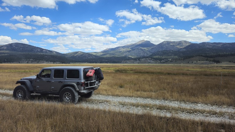
Updated: 11/30/2025
Anchor Ranch Road North
Olancha, California
20S04 is a short spur road off the main Monache Meadows artery that skirts along the meadow and soda springs, leads to a campsite, and eventually deadends at private land. This remote campsite is popular, so you should plan to arrive early if you want to snag it. The campsite is in an open area behind the treeline that is flat-level dirt and can easily support a large group. The trail is easy, and suitable for any high clearance vehicle.
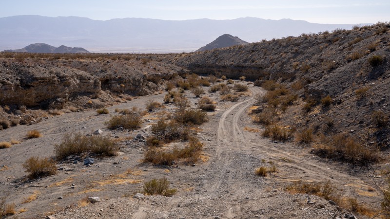
Updated: 03/20/2025
Rickman Road
Lucerne Valley, California
Rickman Road, designated as OM6618 by the Bureau of Land Management (BLM), is a rugged and sometimes rough offroad trail that winds through the heart of the West Ord Mountains. This trail serves as a direct connector between Lucerne Valley and Quill Springs, linking to an expansive network of desert BLM roads. History lingers along the route, with remnants of the area’s rich mining past subtly scattered throughout the mountains. Weathered tailings, forgotten springs, and the ruins of old mining camps appear sporadically, whispering stories of the region’s mining past.
The trail’s terrain is a dynamic mix of sandy stretches, coarse gravel, and scattered grapefruit-sized rocks, making for a bumpy drive. It cuts through winding desert washes on either side of a 3,989-foot pass, offering scenic views and a true sense of remote exploration. At the summit, a secluded campsite awaits, perfect for a solo rig and a tent, providing a peaceful overnight stop under the vast desert sky. For those seeking a larger camping area, an additional site can be found on the east side of the pass, near the remnants of an old building foundation. This spot offers ample space for multiple vehicles.
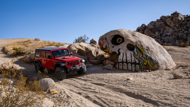
Updated: 09/29/2025
Stellar Road aka Skull Rock
Lucerne Valley, California
A unique side attraction when visiting Johnson Valley is Skull Rock, which is located on a sandy wash at the end of Stellar Road. The road to get to this hand-painted boulder is an easy, hard-packed dirt road just south of the popular Cougar Buttes area. You first pass several private property parcels before entering the Johnson Valley Open OHV Area, where the road becomes a bit sandier as you continue straight towards the rocky hills. As is typical of routes within Johnson Valley, the trail splits in several directions as you come to the edge of a sand wash, up against the base of the hills. Head northeast to the start of the wash, and there you will find the skull, north-facing, hidden in the desert landscape.
Dispersed camping is allowed throughout Johnson Valley, and there are plenty of wide-open, level areas to fit any type of camp setup and any group size. Cougar Buttes is very close and a popular area for camping, with decent wind protection.
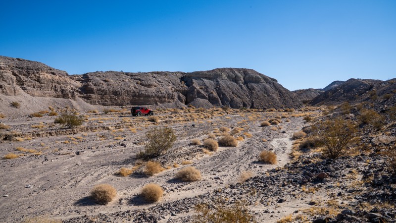
Updated: 09/29/2025
AC9476
Midway, California
Traveling along the western slopes of the Cady Mountains, AC9476 is a typical desert connector between Mojave River Wash and Hidden Valley Wash. The trail provides scenic views of the Mojave desert region, with dark hills made of ancient lava covered with contrasting white sands. This trail can be combined with an endless number of other trails in the area to create a quick day trip loop or a multi-day overland trip. Most of the trail is a flat, packed sand desert road with continuous up-and-down, left-and-right undulations of the trail surface. Surprise exposed rocks, and quick drops will keep your pace slightly lower, while soft sand sections will require good momentum.
The northern end of the trail passes through several primary drainage points for the mountains to the east, making the route prone to washout damage and creating several sections of mild off-camber as you negotiate these washouts. Exposed lava rock along the northern end makes for a bumpy and continuously rough drive. Along the southern end, deep rutting in the sand exposes this same rock along the trial's edge, requiring users to use caution. The southern end also hosts the best camping areas, with one large, flat, and level area suitable for any group size and a second small site, right by Riverside Road, that backs up against a unique rock formation.
This trail is best suited for a high clearance 4x4 vehicle with good suspension and durable off-road tires.
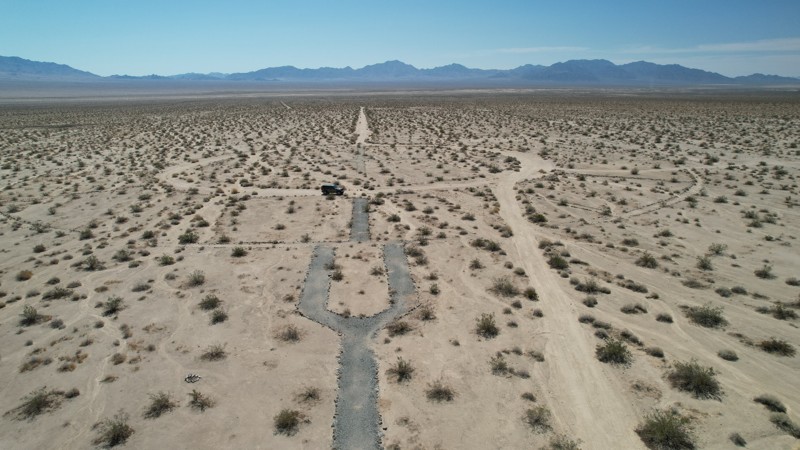
Updated: 06/10/2026
Coxcomb Monument Road
Eagle Mountain, California
For a short two-year period starting in 1942, Coxcomb Camp became a massive tent city housing 15,000 soldiers training for the North African Campaign. Coxcomb Monument Road cuts through the center of this mile-wide camp, where visitors can view artifacts remaining from 1942. The camps were laid out in grids. Streets and boulevards were bulldozed, and rows of tents were set up on each side of assembly areas. When completed, the camp had 39 shower buildings, 165 latrines, 284 wooden tent frames, an observation/flag tower, and a 40,000-gallon water tank. Officers directed idle soldiers to lay extensive rock alignments along roads, streets, and walkways. These rock alignments can still be seen along this road and throughout the three-mile-long camp. The road passes the camp's flag tower circle, considered the center and most important part of the camp, and can be visited next to this road. A monument to the camp and soldiers who fought, and especially those who gave their lives, is located at the trailhead.
Coxcomb Monument Road is an up-and-back ending at the open Colorado Aqueduct over hard-packed sand and is easily handled by a 2-wheel drive vehicle.
There are no appropriate dispersed camping locations found in the area.
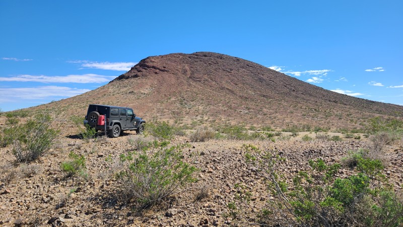
Updated: 10/15/2024
El Mirage 4692-1
Houze Place, California
EM4692-1 follows a rugged valley formed by the peaks of the Red Buttes that serve as a familiar landmark in this area.
This rough rocky trail has a single suitable campsite with beautiful views across this El Mirage Subregion of the Mojave Desert. Only the westernmost 1/4 mile of this trail is on BLM land, where dispersed camping is allowed when following the BLM Camping Guidelines.
During high fire danger, campfires may be restricted, and if planning to camp, review the current BLM Campfire Restrictions.
EM4692-1 is a rough rocky trail requiring a high clearance four-wheel drive vehicle.
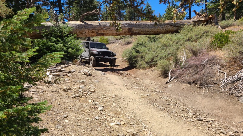
Updated: 08/11/2025
North Delamar
Fawnskin, California
North Delamar Road packs a lot into its 0.9-mile length. Its wonderful mountain scenery and peaceful campsites make it a nice escape from the busier Delamar Mountain road at its trailhead. Pacific Crest Trail hikers may be encountered as the road intersects the hiking trail at its beginning and halfway point.
This up-and-back road offers several flat dispersed campsites along its length. Some sites are in the deep shade of the pine trees, while the best campsite, with a view, is located at the end, offering panoramas across the west end of Holcomb Valley.
This is an easy drive but still requires a high-clearance 4x4. There is only one obstacle to traverse, over flat embedded boulders, and a bypass provides an easier path. After this obstacle, a huge pine tree has fallen, bridging the trail, creating a tunnel, but with enough space for most vehicles to drive under.
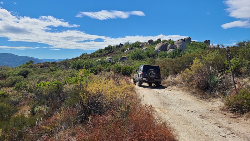
Updated: 01/03/2026
Angelus Hill
San Jacinto, California
Accessed via forest road, Indian Canyon, Angelus Hill trail is an out-and-back that continues south to reach the trail's namesake, the 4,100' Angelus Hill. Along the way, drive through striking boulder fields and enjoy views out to the west of the San Jacinto Valley and onto the Lakeview Mountains. Located in the desert region of the San Jacinto Mountains, the trail is surrounded by desert and coastal sage scrub.
There are two dispersed campsites located 0.3 miles before the end of the trail and at the very end. Both sites are on the edge of the hill and provide gorgeous views of the valley below and beyond. These campsites are on large flat clearings suitable for multiple vehicles and their tents.
The trail is rated by the Forest Service as “Easiest.” The trail surface is mostly flat and smooth, and made up of packed decomposed granite with some rutted sections caused by water runoff. A 4x4 with some clearance is called for, mostly over the other trails needed to reach Angelus Hill. Expect some striping from the scrub bushes intruding on the trail.
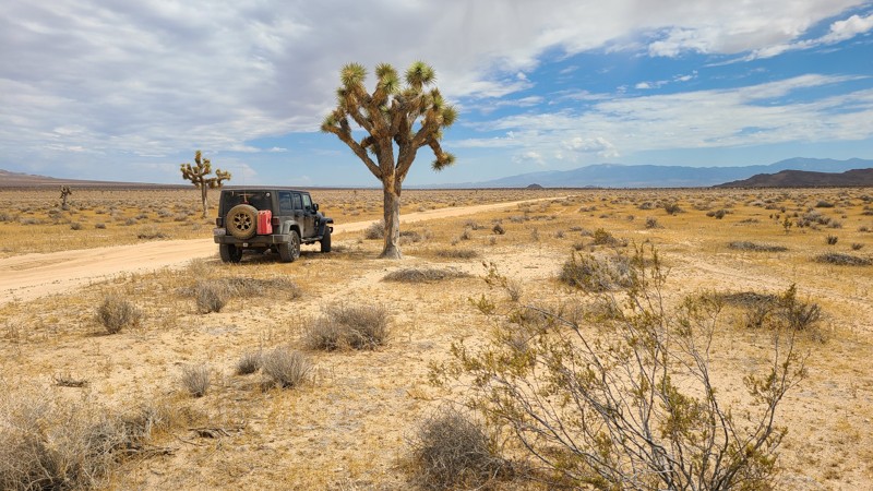
Updated: 10/15/2024
El Mirage 2725
Houze Place, California
Heading south, EM2725 progresses through a very flat Mojave Desert basin, passing a few sparse Joshua trees until reaching Shadow Mountain Road. EM2725 is an easy, flat sandy trail requiring only a high clearance two-wheel drive vehicle.
EM2725 is within the El Mirage Subregion, designated as a Limited Use Area requiring vehicles to stay on the trails. The trail passes through a checkerboard of private and BLM land, providing solitude and access to dispersed camping anywhere along the trail when meeting the BLM Dispersed Camping Guidelines. During the summer fire season, campfires may be restricted, and if planning to camp, one should review the current BLM Fire Restrictions.
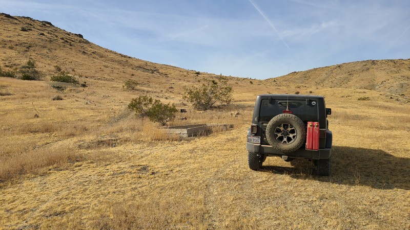
Updated: 10/15/2024
Stoddard Valley 6546
Bell Mountain, California
SV6546 follows a wide sandy wash with both ends connecting to other longer trails. Cattle once grazed here, and a concrete water trough engraved with "/X Cattle Co 1904" near the trail collected water from a now dried-up spring up the hill.
The eastern 1/2 mile of the trail is on public land and provides several good camping sites when meeting the BLM Camping Guidelines.
During high fire danger, campfires may be restricted, and if planning to camp here, one should review the current BLM Campfire Restrictions and have a Campfire Permit.
SV6546 is an easy, flat road that requires a high clearance two-wheel drive vehicle.
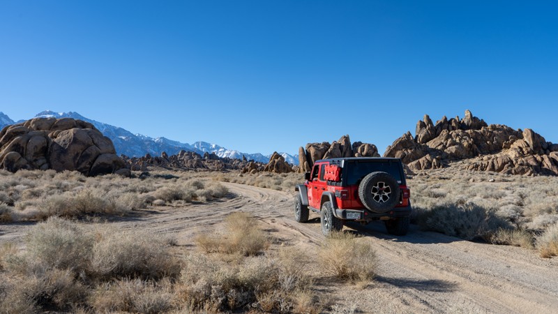
Updated: 03/13/2025
Northwest Movie Flat
Lone Pine, California
Northwest Movie Flat Road leads to named rock climbing routes, specifically what is named "The Wall." It is an easy road suitable for any vehicle. It provides additional views of the famed Alabama Hills Area and Eastern Sierra Mountains, which will allow you to extend your trip by twenty minutes. It is a day-use-only area, so camping is not permitted.
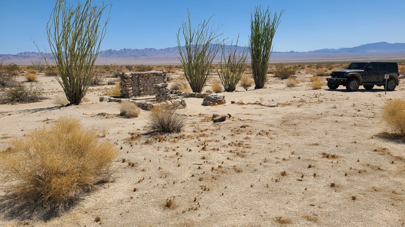
Updated: 06/03/2025
Coxcomb Chapel Road
Eagle Mountain, California
Coxcomb Chapel Road travels across the 3-mile-wide WWII Coxcomb Camp, revealing the many artifacts left behind. For a short two-year period starting in 1942, Coxcomb Camp became a massive tent city housing 15,000 soldiers training for the North African Campaign. The camp was laid out in grids. Streets and boulevards were bulldozed, and rows of tents were set up on each side of assembly areas. When completed, the camp had 39 shower buildings, 165 latrines, 284 wooden tent frames, an observation/flag tower, a 40,000-gallon water tank, and the chapel. Both sides of the road pass extensive rock alignments placed by soldiers to provide borders for these roads, walkways, living and training areas, and plants. Coxcomb Chapel Road passes one of the most complete artifacts, the Coxcomb Chapel. Near its center, the road crosses Coxcomb Monument Road, which at its start has a monument to the soldiers who trained here, then fought, and especially those who gave their lives.
This hard-packed road is easily handled by a 2-wheel drive vehicle. The north end of the road has since weathered away.
There are no appropriate dispersed camping locations found near the road.
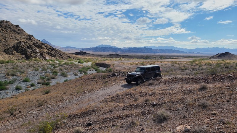
Updated: 06/23/2025
St John's Mine Road
Midland, California
One of the several tributaries of the lengthy Arlington Mine Road, St John’s Mine Road leads into a complex of mines and their ruins on the slopes of the McCoy Mountains. The area provides a quiet, peaceful, and private camping spot with the rugged McCoy Mountains providing an impressive vista. Short hikes from its trail's end reach the ruins of St. John’s and Bluebird Mines to explore.
Running next to a wide wash, the road has been washed out near its end and rerouted to the south to reach the base of the mountains. This road is mostly over desert pavement, a natural surface layer made up of tightly packed, interlocking rock fragments and pebbles, but also transitions through a couple of wide sandy washes. The trail is easy, but it should be driven with a high-clearance vehicle.
Several existing dispersed campsites with existing rock campfire rings are located near the end of the trail, in and around the mining camp, and are tucked close to the hills to provide some shelter from the wind.
This is a remote area with spotty cell phone coverage, and drivers exploring the area should carry adequate water, be equipped for self-rescue, and notify family/friends of their travel plans.
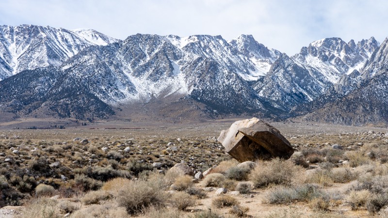
Updated: 03/13/2025
Horseshoe Meadows Sites 2-4
Lone Pine, California
This spur south of the main Alabama Hills Recreation Area leads to dispersed campsites 2-4. It is an out-and-back route suitable for any vehicle and smaller trailers. As you drive in, the impressive Eastern Sierras are clearly visible. Being out of the main areas of Movie Flats, anticipate less traffic.
About the camping on this route:
All dispersed camping is designated to a specific site and requires a permit. A permit can be obtained online or at the Eastern Sierra Visitor Center or kiosks located on Movie Road and the main entry point in Lone Pine. Permits need to be signed and displayed on your dashboard.
The BLM has created a map showing the site numbers. However, those numbers are not used in the field, but each site is clearly marked with either a camping allowed or no camping allowed symbol on a clearly visible sign. Please be aware that all sites are first come, first served, and a permit does not guarantee you will find a site. Due to the area's popularity, it is best to arrive early.
There are six portable restrooms throughout Alabama Hills. If you do not want to drive or walk to one, you must bring your own system to pack out human waste.
About the sites:
- 2: Is large and suitable for a trailer or a few vehicles. The ground is flat, and a large outcropping of sandstone will block the view to the north.
- 3: Just off the trail, the ground has sporadic rocks, and there is nearby vegetation. It is large enough for a vehicle with a trailer.
- 4: A small site at the end that can hold one vehicle with one tent. The ground is slightly slanted.
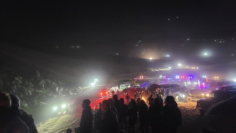
Updated: 02/02/2026
Means Lake to Chocolate Thunder
Homestead Valley, California
The sand path to Chocolate Thunder is a popular access route in the Johnson Valley OHV Area that connects Means Dry Lake and Hammertown to the Chocolate Thunder rock-crawling trail. It is a wide sandy track that is easy to follow and is commonly used by off-roaders and spectators during King of the Hammers. Many people take this path from Means Dry Lake to park up on the big sand hill above Chocolate Thunder to watch the action as racers tackle the rock obstacles below.
The route is not technical but can be soft in places, so airing down is recommended. A 2WD vehicle can make this route as long as they air down.
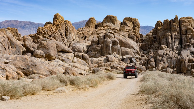
Updated: 03/13/2025
Horseshoe Meadows Sites 7-8
Lone Pine, California
As you pull onto this spur road, a sign reads:
"GUNGA DIN" FILMED HERE"
IN 1938, THIS HILL AREA, AMONG MANY OTHERS IN THESE ALABAMA HILLS, SERVED AS A STAND-IN FOR THE HILL COUNTRY OF NORTHERN INDIA WHEN RKO MADE THE CLASSIC ADVENTURE FILM, 'GUNGA DIN,' ON LOCATION IN LONE PINE. HUNDREDS OF HORSEMEN RACED ACROSS THE HILLS AND ELABORATE SETS WERE BUILT HERE AND NEARBY WHILE THE CAST AND CREW LIVED FOR WEEKS IN A TENT CITY OFF MOVIE ROAD. DIRECTED BY GEORGE STEVENS, THE EPIC STARRED CARY GRANT, DOUGLAS FAIRBANKS JR. VICTOR MCLAGLEN AND JOAN FONTAINE WITH SAM JAFFE AS GUNGA DIN, THE WATERBOY WHO WANTED SO MUCH TO BE A SOLDIER."
The drive starts with dropping into a short canyon with rougher dirt and erosion than the other surrounding roads. The road leads to the designated dispersed sites 7 and 8. Any high clearance vehicle can manage the erosion. Large C-class RVs should be avoided.
About the camping on this route:
All dispersed camping is designated to a specific site and requires a permit. A permit can be obtained online or at the Eastern Sierra Visitor Center or kiosks located on Movie Road and the main entry point in Lone Pine. Permits need to be signed and displayed on your dashboard.
The BLM has created a map showing the site numbers. However, those numbers are not used in the field, but each site is clearly marked with either a camping allowed or no camping allowed symbol on a clearly visible sign. Please be aware that all sites are first come, first served, and a permit does not guarantee you will find a site. Due to the area's popularity, it is best to arrive early.
There are six portable restrooms throughout Alabama Hills. If you do not want to drive or walk to one, you must bring your own system to pack out human waste.
About the sites:
7: Large site suitable for a few vehicles, but the ground is slightly slanted. Well separated from Horseshoe Meadows Road.
8: Large site suitable for a few vehicles, but the ground is slightly slanted. It has a decent separation from site 7, but being in the canyon, voices and sounds could reverberate.
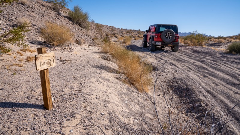
Updated: 03/07/2025
Sandbox
Manix, California
Nestled just west of the Mojave Trails National Monument, the aptly named Sandbox is a short yet dynamic offroad trail that serves as a link between Manix Wash and AC9476. For most of its length, this route offers an easygoing ride over relatively flat terrain, featuring gentle whoops, mild washboard, and scattered rocks no larger than a clenched fist. However, don’t be lulled into complacency. The western end of Sandbox delivers a formidable challenge. Nearly a quarter-mile of deep, loose sand awaits, eager to swallow tires and sap momentum. Here, four-wheel drive and aired-down tires aren’t just recommended; they’re essential for making it through without getting bogged down.
At its easternmost point, Sandbox may give the illusion of continuing beyond AC9476 and winding into the mountains. However, as of 2019, that section has been decommissioned as a legal motorized route. Users should respect this closure and stick to designated open routes only while enjoying this unique slice of the Mojave Desert.
There is plenty of flat, open land one could utilize for camping, but no existing campsites exist along this trail.
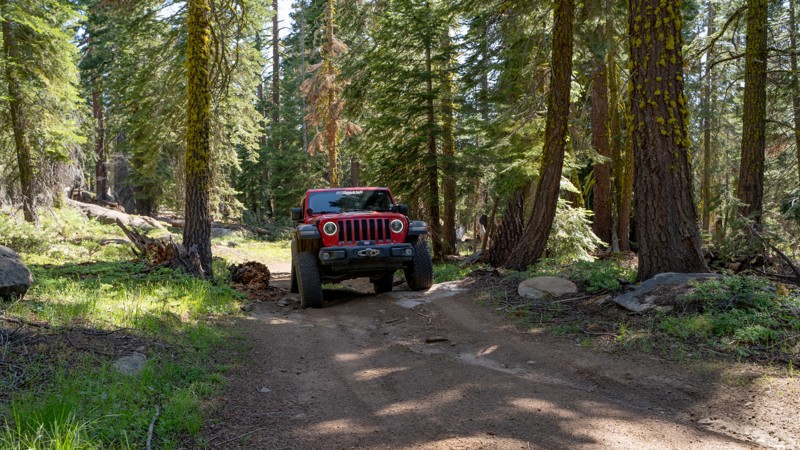
Updated: 01/05/2026
5N04
Dardanelle, California
Forest Route 5N04 is a mostly gentle out-and-back trail that leads to a cell tower station at its terminus. As the trail climbs, it narrows slightly and becomes slightly rougher, but remains easily traversable with minimal experience. Three or four dispersed campsites dot the route, each only large enough for 1-2 vehicles. Visitors new to the area may be interested in the bright green moss that seems to glow on the pine trees. 5N04 also provides general access to the area around Double Dome Rock for those who wish to explore further on foot.
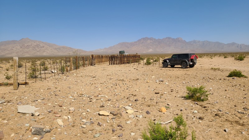
Updated: 08/11/2025
Clipper Valley Road
Danby, California
Located within the Mojave National Preserve, Clipper Valley Road passes through the vast, oval-shaped alluvial plain known as Clipper Valley and provides access to the many trails that head into the Providence Mountains and its plethora of mines and ruins, dating back to the 1840s. The Hidden Hills and the Bighorn Mine are near its south end, only about 2 miles from the road. As mining in the area boomed in the 1800s, cattle ranchers followed close behind, raising Criollo cattle, a species that thrives in desert regions. There were dozens of corrals built throughout the Mojave National Preserve, mostly near natural water sources. Clipper Valley Road passes two of these corrals that are still standing today. Cattle can often be seen grazing near the road.
The north end of the trail is near the intersection of Essex and Black Canyon Roads. From there, ten miles north on Black Canyon will arrive at Hole-in-the-Wall, and ten miles south on Essex Road will arrive at I-40.
Dispersed campsites can be found over the entire length of the road, mostly on flat open areas of desert pavement. As it's on an alluvial plain, the entire path is flat and offers no wind breaks at any campsite.
This is an easy trail over mostly flat gravel, which can be handled by a two-wheel drive vehicle with some ground clearance.
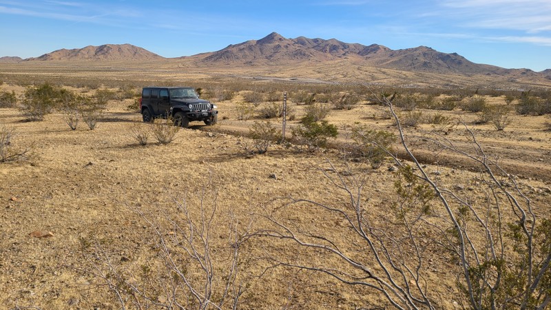
Updated: 10/15/2024
Stoddard Valley 6548
Wild Crossing, California
SV6548 is a straight-through trail that begins the climb from the desert floor into the surrounding foothills, ultimately intersecting other trails that lead further into the hills.
Many suitable dispersed campsites are along its length when meeting the BLM Camping Guidelines.
During high fire danger, campfires may be restricted, and if planning to camp here, one should review the current Campire Restrictions and have a Campfire Permit.
SV6548 is an easy trail requiring a high clearance two-wheel drive vehicle for the rocky sections.
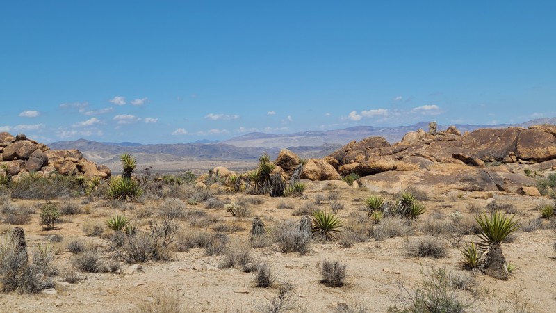
Updated: 10/09/2025
Linn Road
Homestead Valley, California
Linn Road hugs the northwestern base of Ruby Mountain to reveal a gorgeous desert landscape decorated with massive boulder formations and stunning views to the north. The road intersects several other driving and hiking trails to explore, including New Dixie Mine Road, and has easy access from Highway 247.
There are abundant sites for dispersed camping, with one of the better prepared sites about halfway along the trail. This site has space for several vehicles and tents. There is no shade anywhere along the trail, and an awning or pop-up shade in the camp would make for relaxing enjoyment of the views.
This is an easy trail, comfortably handled with any high-clearance vehicle.
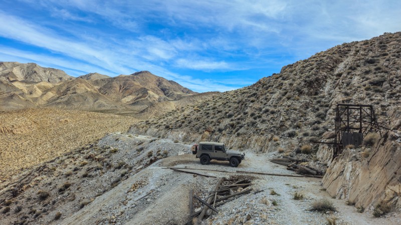
Updated: 03/09/2026
Lippincott Mine Road
Teakettle Junction, California
Lippincott Mine Road is a short but notoriously rough spur off Lippincott Pass that climbs toward the historic Lippincott Mine workings. It is shorter in length but considerably rougher than Racetrack Valley Road. Expect loose rock, off-camber sections, extremely narrow shelf segments, and uneven mining-era cuts into the hillside. High clearance 4x4 is strongly recommended, and careful tire placement is required in multiple spots. This is not a maintained park road and may be partially washed out depending on recent storms.
Plan on 30 minutes to an hour to reach the mining area, depending on conditions and how often you stop. Once at the top, you can explore the remnants of the historic mine structures and equipment. As with all historic sites in the park, do not disturb or remove artifacts.
As you climb, the road transitions from rocky mountain terrain into exposed ridgelines with expansive views across the northern portion of Death Valley. The higher elevation provides a completely different perspective compared to the valley floor. Looking down toward Racetrack Valley and across to the Inyo Mountains gives you a true sense of how isolated this region is.
This spur carries an elevated risk due to its narrow width and lack of regular maintenance. There is no cell service, no guardrails, and very few turnaround opportunities. The weather can quickly change road conditions, and rockfall is possible. Travel with another vehicle if possible, carry recovery gear, and bring plenty of water.
There is designated dispersed camping directly along this route, at the Homestake Camping area. The road to get to the camping area is very easy, and offers nine marked sites that are first-come, first-served. Follow all posted regulations and practice Leave No Trace principles. If you prefer more amenities, head south toward Furnace Creek, where you will find lodging, an RV park, fuel, and basic services.
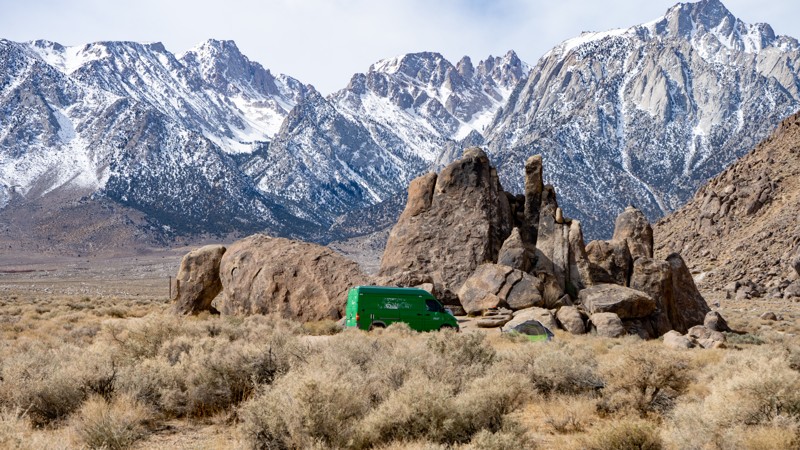
Updated: 03/13/2025
Horseshoe Meadows Sites 5-6
Lone Pine, California
This quick out-and-back spur leads to the Alabama Hills Recreation Area designated sites 5-6. It is out of the central area and will be less busy, but the Eastern Sierras are so big that you will still have views of them from these sites. The road is suitable for any 2WD vehicle.
About the camping on this route:
All dispersed camping is designated to a specific site and requires a permit. A permit can be obtained online or at the Eastern Sierra Visitor Center or kiosks located on Movie Road and the main entry point in Lone Pine. Permits need to be signed and displayed on your dashboard.
The BLM has created a map showing the site numbers. However, those numbers are not used in the field, but each site is clearly marked with either a camping allowed or no camping allowed symbol on a clearly visible sign. Please be aware that all sites are first come, first served, and a permit does not guarantee you will find a site. Due to the area's popularity, it is best to arrive early.
There are six portable restrooms throughout Alabama Hills. If you do not want to drive or walk to one, you must bring your own system to pack out human waste.
Below is a brief description of each site:
- 5: It is spacious, flat, and suitable for a couple of vehicles with ground tents. However, it is directly on the side of the road.
- 6: It is spacious, flat on one half and slanted on the other, further from the road, and nestled up against large sandstone structures. Larger RVs or trailers could have problems accessing it.
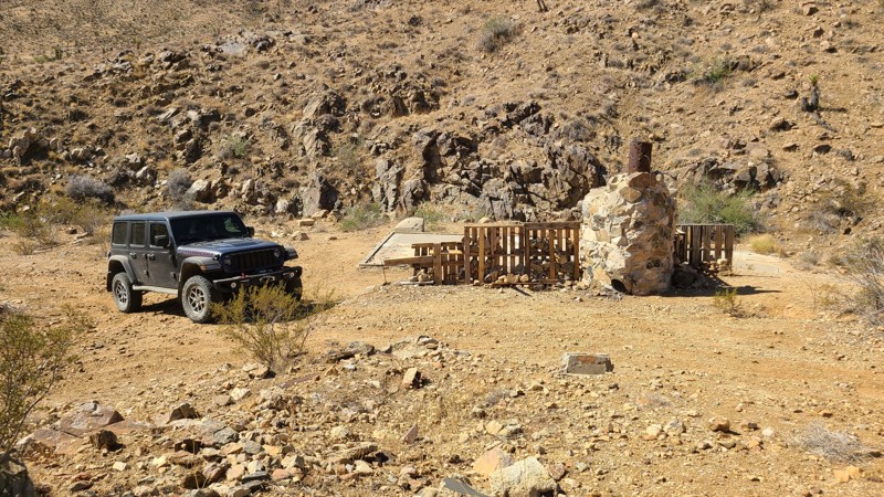
Updated: 10/09/2025
RC1428
Homestead Valley, California
Only a short distance from Highway 247 in Yucca Valley, BLM RC1428 is an out-and-back trail that leads into the desert foothills and the remnants of a once-active mine. The mine buildings and machinery have been removed, but the foundations of the miner's cabin, its standing fireplace, and an ore processing pit still remain. A date of 1972 is inscribed in the concrete foundation. From the mine, the trail continues, climbing a hill to reveal expansive views to the north. Over its length are several intersecting hiking paths to explore.
The trail is mostly hard, flat dirt, with long rocky sections when higher in the foothills. Any high-clearance vehicle should easily manage the trail with ease.
The mine site itself will make a great dispersed campsite with its large flat concrete foundations and fireplace. Just up the hill from the mine is another great dispersed campsite on a flat plateau with wonderful views to the north.
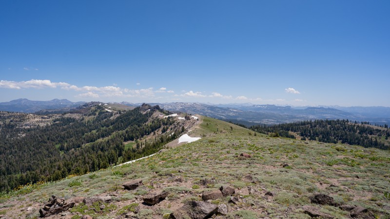
Updated: 12/15/2025
Round Valley 4x4 Trail
Lake Alpine, California
Round Valley 4x4 Trail (7N93) is a rewarding out-and-back route that begins just off Highway 4 at the Round Valley SNO-PARK, where a spacious paved parking area and pit toilet make it a convenient spot to air down, stage vehicles, or meet a group. From the trailhead, the route immediately begins climbing through mixed forest on a rough dirt surface, occasionally scattered with small embedded rock. The grade steadily steepens as you gain elevation, and while the surface is never overly technical, the climb does call for low-range gearing and confident throttle control. The trail traces narrow ridgelines and exposed hillsides, gradually leaving the dense tree cover behind. As you ascend closer to Reba Peak, the environment opens dramatically—trees give way to alpine meadows and sprawling, high-elevation slopes that feel airy and remote.
Near the summit, the terrain becomes more rugged, peppered with loose rock and occasional dips and ruts, but remains passable for any high-clearance 4WD. The reward for making the climb is exceptional. From the top, you’ll enjoy commanding views of Stanislaus National Forest and the Mokelumne Wilderness, including prominent vantage points of Mount Reba, Wheeler Peak, and the shimmering waters of Union Reservoir below. Dispersed campsites are scattered along the upper sections of the trail, especially where flat, open terrain allows for easy vehicle access. These elevated camps boast breathtaking scenery and cool mountain air, making them ideal for anyone seeking solitude and big-sky surroundings, but they are small, typically accommodating only 1-2 vehicles.
This route is beginner-friendly for drivers who understand steep terrain and basic use of low-range gearing, making it a great introduction to higher-elevation off-roading. The trail is typically snowbound and inaccessible during winter months, when the same terrain becomes popular with cross-country skiers and snowmobilers. In summer, visitation around Highway 4 can be busy on weekends, but the trail’s length and terrain help maintain a quieter, more remote feel. Round Valley 4x4 Trail is a memorable climb into the alpine, perfect for those looking for scenic moderate terrain, dispersed camping, and unforgettable mountaintop views.
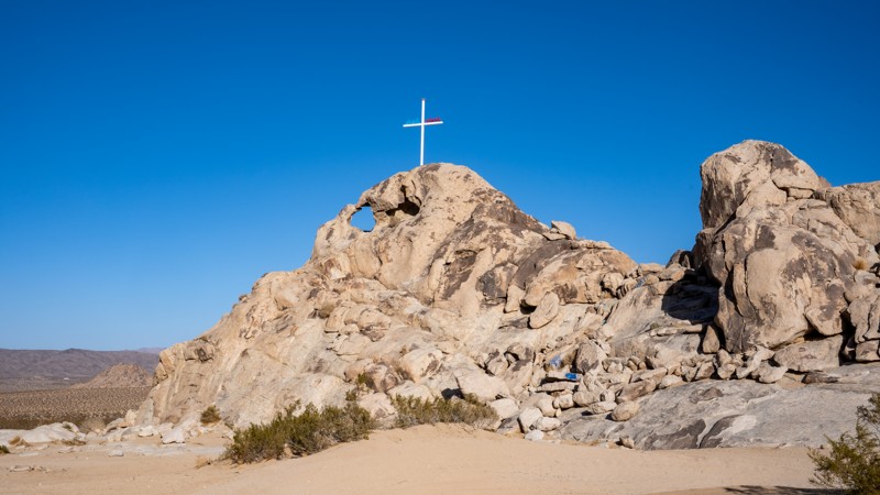
Updated: 01/05/2026
Cougar Buttes Camp Loop
Lucerne Valley, California
Cougar Buttes sits on the northeast side of California’s Johnson Valley OHV Area and feels like a granite playground dropped into the Mojave Desert. Rocky domes and boulder piles rise out of the open desert, creating everything from mild sandy two-tracks and whooped-out washes to tight canyons and serious rock-crawling lines. Dirt bikes, UTVs, and full-size 4x4s all share the area, with routes that range from easy exploring for newer drivers to extreme obstacles with ledges, waterfalls, and a real risk of body damage for those who want to push their rigs. This loop is an easily accessible area for setting up camp and exploring the surrounding trails. It is suitable for tents, RVs, Toy Haulers, and anything in between.
Camping here is a classic BLM-style boondocking experience. There are no developed campgrounds, no hookups, and no services, just wide-open space where you can dry camp for free as long as you follow BLM rules and respect existing routes. Most groups tend to set up near the rock piles for wind protection, quick trail access, and expansive desert views. You must be fully self-contained, pack out all trash, and plan for changing desert conditions. Cooler fall, winter, and spring months offer the most comfortable seasons to enjoy riding and camping. Pit toilets are available at the north end, close to Transmission Line Road.
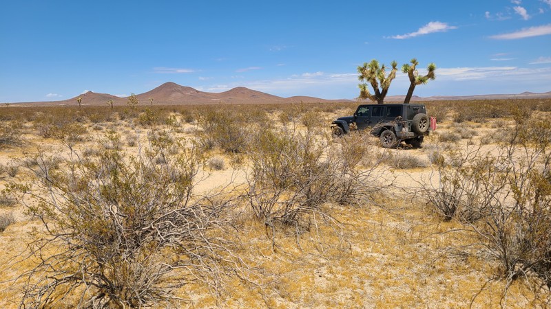
Updated: 10/15/2024
El Mirage 4679
Houze Place, California
Cutting over this Mojave desert basin, EM4679 ushers towards the triple peaks of Red Buttes just a short distance away. This trail, located in the El Mirage Subregion, is in a designated Limited Use Area requiring vehicles to stay on the trails.
The trail is a clear two-track, flat and sandy, providing several good camping sites when following the BLM Dispersed Camping Requirements. During the summer fire season, campfires may be restricted, and if planning to camp, one should review the current BLM Fire Restrictions.
EM4679 is an easy, flat sandy trail requiring only a high clearance two-wheel drive vehicle.
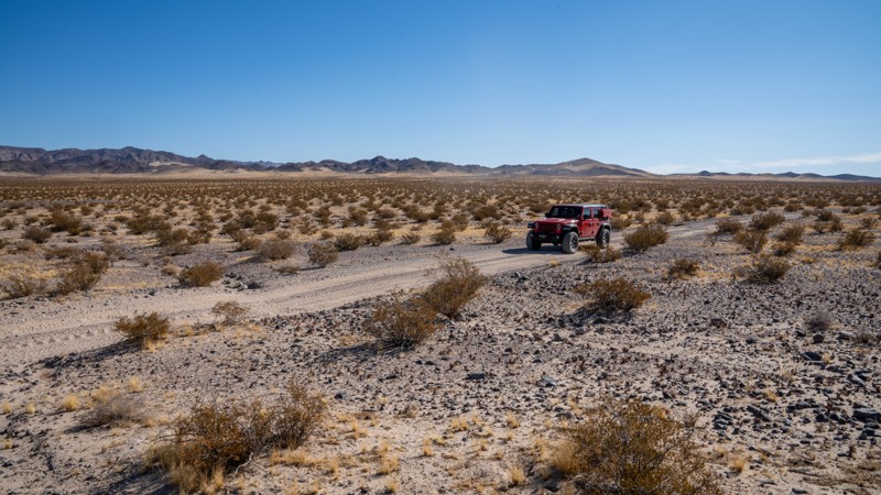
Updated: 03/07/2025
AC9475
Manix, California
Connecting Manix Wash to AC9476, AC9475 is a short, straight-through trail through the Mojave Desert. Generally, this trail is only used to add additional miles to users of the traditional Mojave Road. AC9475 is primarily fast-paced, packed sand, with many undulating sections and occasional fist or grapefruit-sized rocks. Although easy, it will give your shocks a workout due to the bumpy terrain. It is part of a broader network of trails that can be explored for a day or a weekend. Users should be aware that there are many spur roads throughout the area, and only roads signed as "Open Route" are legal for motorized use. The road is suitable for any high clearance vehicle.
There are no suitable campsites along this road.
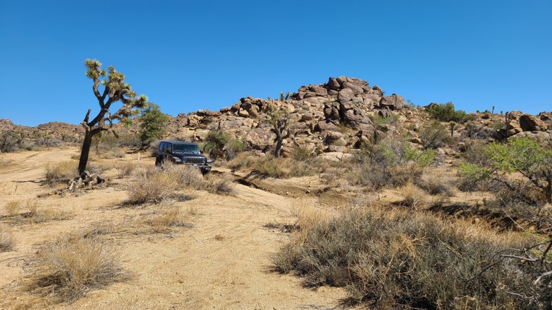
Updated: 10/09/2025
SS1418
Homestead Valley, California
Near the north end of the Black Lava Butte and within the Sand to Sea National Monument, SS1418, also labeled as RC1418, moves over a flat sandy desert spotted with Joshua Trees while intersecting several other driving and hiking trails that explore this area. At the trail's western end, it merges with Roadrunner Rut.
The flat terrain of the trail makes for abundant suitable dispersed camping with sites large enough for a few vehicles, but without shade. The best camp spots are next to the boulder formations that dot the trail and provide wind shelter.
SS1418 is an easy trail with no obstacles other than an occasional smooth boulder embedded in the sand. It can easily be handled by any high clearance.
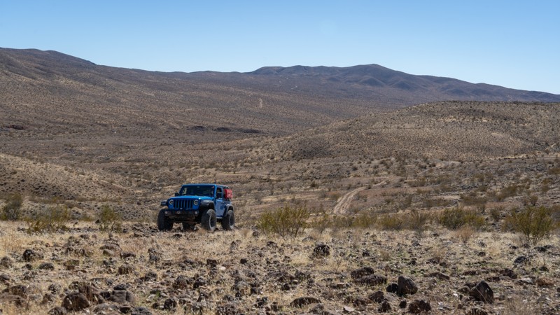
Updated: 03/09/2026
EP 499
Garlock, California
EP 499 travels primarily north-south, connecting the Bonanza Trail with Bickel Camp, labeled as EP 30. The road surface is a mix of dirt and loose lava rock, making it rough in spots, but it is suitable for any high-clearance vehicle. As you travel, the trail will go up and over an open and flat playa area. This is good for dispersed camping and offers 360-degree views. Near Bonanza's boom area, there are a few scattered ruins and an old well to see along the way.
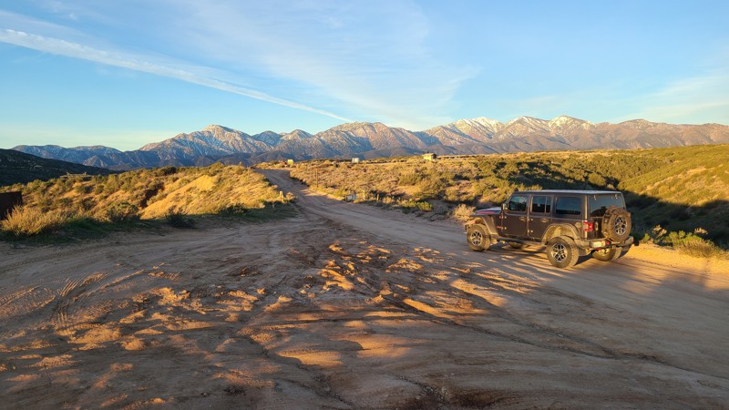
Updated: 03/09/2026
Elliot Ranch
Oak Hills, California
With direct access from Hwy 138, Elliot Ranch 3N22 provides very convenient access to a large staging area with pit toilets, then continues to connect to the popular Cleghorn Ridge trail.
While the Forest Service has rated the trail difficulty as Blue Square or More Difficult, it is an easy drive that can be managed by a beginning offroader in a 2WD vehicle with some ground clearance. The only driving difficulty is water-worn ruts along the route.
The trail is marked with signs stating that overnight camping is not permitted.
An Adventure Pass is required to use the area, and in the staging area, you can purchase passes using your phone.
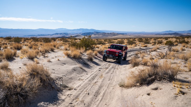
Updated: 09/29/2025
BL9489
Hector, California
BL9489 is a lightly used, Mojave Desert trail that climbs the lower Cady Mountains. It offers fantastic views of the Rodman and Newberry Mountains across the valley. It can be used as an easy connecting road between Hidden Valley Wash and BL8599, just west of the Mojave Trails National Monument, or can be run as an out-and-back into the monument. The section of trail that enters the monument east of 8599 is where you encounter soft, beach-like sand that will rob your vehicle of momentum as it slowly but continuously gains elevation, ascending nearly 1,200 feet in 5 miles. The track here ends at a small, young Joshua Tree patch 0.18 miles before the official trail ends. Just beyond this patch of trees, the trail descends an extremely steep and soft sand hill into a narrow canyon once used for copper mining. The hill is the only way back out of the canyon and is nearly impossible to climb without utilizing a winch, or traveling in a lightweight, sand-purpose vehicle such as a UTV. It is highly recommended not to attempt this sand hill.
The trail passes several small camping pullouts best suited for single-vehicle camping as the terrain is not very level and is covered in brush and cacti. However, near the end of the trail is a very large and level site that is good for groups and ground tents. Camping along this trail is very secluded and quite.
The trail is suitable for any high clearance 4wd vehicle.
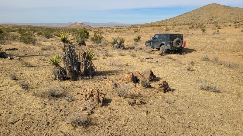
Updated: 10/15/2024
Stoddard Valley 6530
Bryman, California
SV6530 winds between hills over a flat desert basin and passes close to the Three Buttes Deposit, a clay surface mine, with its white mountain scar providing a landmark along the way.
Almost the entire trail is on public land and provides many suitable camping sites when meeting the BLM Camping Guidelines.
During high fire danger, campfires may be restricted, and if planning to camp here, one should review the current BLM Campfire Restrictions and have a Campfire Permit.
SV6530 is an easy drive over a packed sandy trail requiring a high clearance two-wheel drive vehicle.
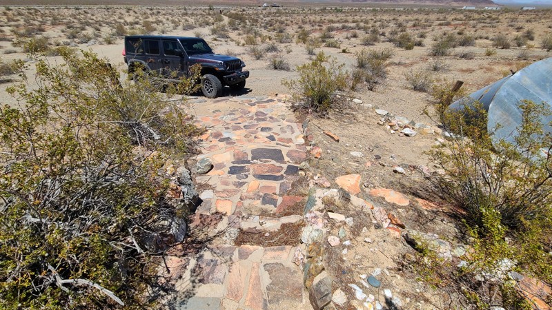
Updated: 08/11/2025
Chuckwalla Springs Trail
Fenner, California
Soon after turning onto the sandy tracks of Chuckwalla Springs Trail, a distant tunnel presents itself. These tunnels or underpasses are designed to allow various wildlife, like desert bighorn sheep, to safely cross beneath the highway and are also designed to be wide and tall enough to allow passage of full-size vehicles. After emerging from the tunnels, the remnants of Gold Hammer Mine appear. The remains of a mill, bare concrete slabs where the building once was, and fenced-off mine shafts remain. The mine front presents an extremely well-preserved rounded flagstone staircase and a flagstone trellised garden appearing more as a luxurious home entrance than a working gold mine. Continuing past the mine, the road eventually follows a wash and ends at the edge of the Clipper Mountain Wilderness, where a 1.5-mile hike will reach Chuckwalla Springs.
Past the mine and over a hill, the only dispersed campsite seen from the trail is on a large area of flat desert pavement that does provide a wonderful view of the Clipper Mountains.
This is an easy trail over soft sand but requires a four-wheel drive, high clearance vehicle.

Updated: 04/10/2026
Vanderbilt Ghost Town Road
Vanderbilt, California
At the end of this short trail within the Mojave National Preserve are the remnants of the boom-to-bust mining town of Vanderbilt. Established in 1893 to support the several gold mines in the area, at its peak, this tent city had a population of 400 served by saloons, hotels, restaurants, a general store, a post office, and even a church. The only two-story building in town was a hotel/saloon owned by Virgil (brother of Wyatt Earp). The town was abandoned around 1900 as the mines paid out, leaving time, weather, and fires to erase much of its presence, and it is now protected by the Mojave National Preserve to tell the story of the region's mining history. Today, no standing structures remain, and the town consists of the remains of miners' huts, scattered relics, rusting equipment, and unprotected vertical mine shafts. Along the way, the trail passes several miners' huts with their carefully laid rock walls still standing. At the site of the town are two surviving wooden huts built into the side of the hills.
Several dispersed campsites with large flat areas and existing rock fire rings can be found at the end of the trail.
The trail is an out-and-back up a shallow incline, with the only obstacle being a short section of weather-worn depressions. An experienced driver using a two-wheel drive vehicle with good ground clearance would enjoy this trail, but Four Wheel Drive is recommended.
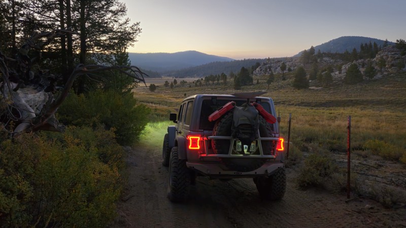
Updated: 11/30/2025
20S09
Olancha, California
20S09 is a very short connector from 20S05 to 20S05B. The trail has no key features other than being a connector and offers no camping along the drive. This trail is a dirt trail suitable for all offroad vehicles.
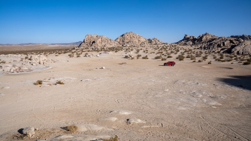
Updated: 09/29/2025
North Valley
Lucerne Valley, California
Located along the western edge of the Johnson Valley OHV Area, minutes from Lucern Valley, North Valley is one of the primary routes through a popular area known as Cougar Buttes. This trail is a straight connector between Astral Road and Powerline Road, providing access to many hardcore side trails and abundant dispersed camping. It travels over packed dirt and patches of soft sand, making it suitable for any vehicle. It is not uncommon to see large RVs and motorhomes camping together in small groups like wagon trains. There are two pit toilets along the route, but no trash receptacles.
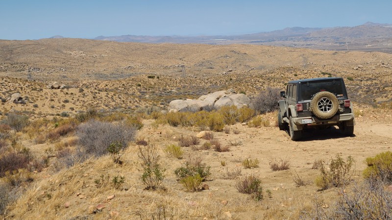
Updated: 09/24/2025
Oak Springs Road
Fizzben Heights, California
Located on the southern slopes of the San Bernardino Mountains and within the beautiful Juniper Flats desert area, Oak Springs Road's 4,500-foot altitude provides endless views to the west, with access to several hiking trails and intersecting BLM-designated roads to explore.
There are a few dispersed campsites along its length, offering a choice of single-vehicle campsites with views to the west or tucked next to the spectacular boulder formations that line the trail.
This is an easy trail requiring only a two-wheel drive vehicle, but with some clearance to handle the occasional embedded boulders and water-worn furrows across the road.
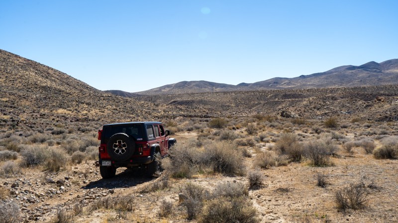
Updated: 05/26/2026
EP 152
Goler Heights, California
EP 152 is a simple, bumpy dirt connector trail between the more popular EP 15 and The Narrows. Other than the steep dirt drop into the wash at the southern end, this shortcut is not overly challenging. Although not long, this trail provides good scenery of the surrounding hills and the barren California desert landscape. Due to its short nature, no camping is found along this trail.
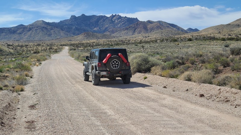
Updated: 04/10/2026
Ivanpah-Lanfair Road
Vanderbilt, California
Ivanpah-Lanfair Road traverses the eastern portion of the Mojave National Preserve, passing some of the desert's most interesting and iconic destinations. Near the northern end, the road passes Vanderbilt ghost town and the abandoned Goldome Mill, with its largely intact ball mill and machinery for extracting gold from hard rock mines in the area. At Ivanapah-Lanfair Roads' halfway point, you will cross the iconic Mojave Road and eventually reach Route 66 at its southern end. All the while, the road provides outstanding views of the surrounding mountains and impressive Joshua Tree forests. Numerous abandoned mines and ruins are reached from its over 25 intersecting trails and spurs.
There are no campsites directly next to the trail, but many wonderful dispersed campsites can be found shortly off the road along its intersecting trails. One example of camping found off the trail is the outstanding campsites at Mine Landings, reached from the Slaughterhouse Spring trail.
This is an easy, wide, flat gravel road suitable for passenger vehicles and trailers, with only occasional water-worn dips or cattle crossings to be aware of. However, if planning to explore the intersecting trails, an experienced driver using a four-wheel drive vehicle with ground clearance is required.
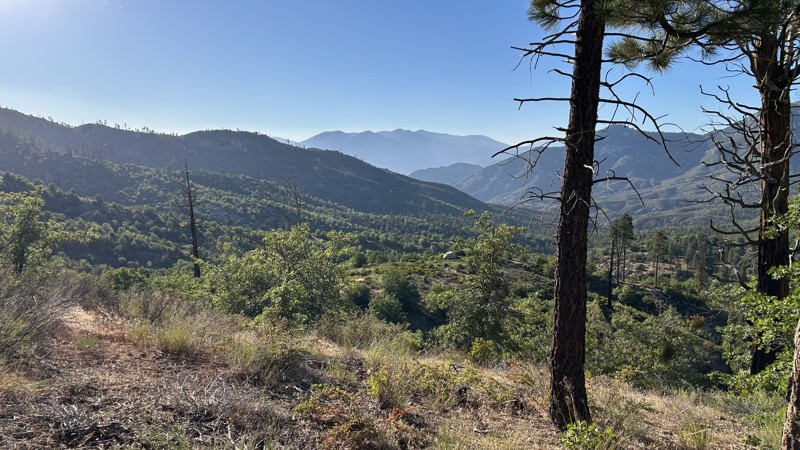
Updated: 08/27/2025
Cherry Hill Spur A
Fairview, California
Spur A 22S12B is an easy out-and-back spur that has two dispersed campsites. It can be accessed from Cherry Hill Road for a quick stop to camp. It ends overlooking the Sequoia National Forest, where the second campsite is located. Both camping areas have established fire rings and can accommodate up to 3-5 vehicles.
There are no notable concerns along this trail other than some overgrown vegetation that can cause minimal pinstripping. A stock SUV or car can easily complete this trail.
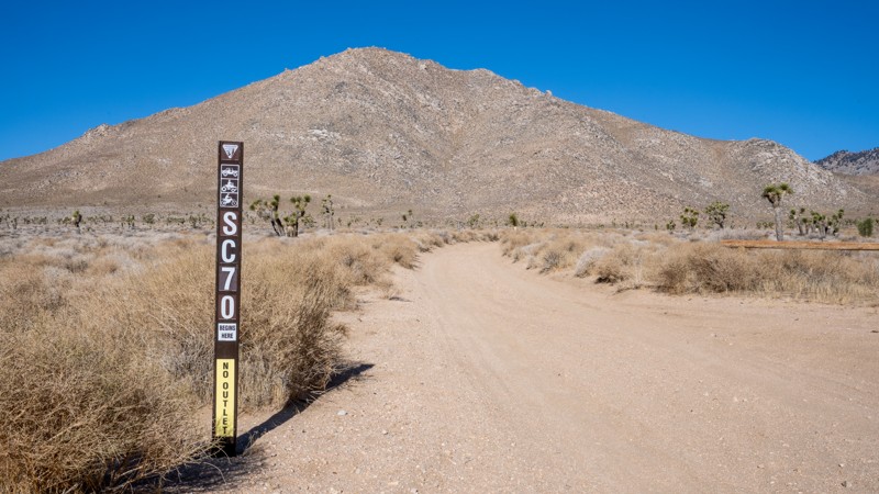
Updated: 03/02/2026
Scodie Mountains SC70
Armistead, California
SC70 is a short dead-end camping spur off of Horse Canyon. The road is easy and mostly hard-packed sand and dirt, but it does have some ruts caused by water runoff that you will need to be cautious of if you are in a low-clearance vehicle. The campsite at the end is large and level and can accommodate any size group. The camp is fenced in like others in the area and provides a great hiking route into the Kiavah Wilderness, where you can walk amongst a large Joshua Forest.
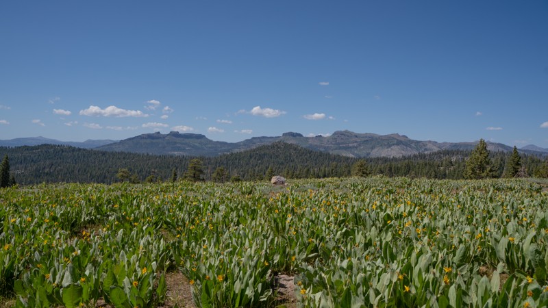
Updated: 01/05/2026
5N09
Dardanelle, California
Forest Route 5N09 is a mellow, high-country cruise that branches off 5N01, loops up through open timber, and climbs a few hundred feet before topping out at a quiet vista overlooking the surrounding Sierra ridgelines. Take a break at this area to wander on foot and check out the large, funky rock formations within view of the trail. You'll likely also find oversized pine cones that are sure to delight explorers new to the Northern California ecosystem. If you visit in late spring, wildflowers like sego lily and lupine will fill the open areas.
The road is rough dirt throughout, but it’s wide, predictable, and friendly to any high-clearance 2WD. It is an ideal warm-up for new off-roaders or anyone looking to explore without breaking a sweat. As the route drops back toward 5N01, it passes a handful of dispersed camps tucked into the western end of the loop, each offering a simple, peaceful basecamp without the crowds often found in nearby developed campgrounds. Drivers sometimes use 5N09 as a scenic connector to additional forest roads leading to Double Dome Rock and its short hiking trail, making it a versatile option for a half-day wander or as part of a larger adventure.
Like much of the high Sierra, the road stays buried under snow through winter and typically doesn’t open until late spring or early summer, when traffic begins to pick up with campers and hikers spreading out from Highway 108. For those seeking easy terrain, light exploration, and quiet camps under the pines, 5N09 delivers precisely that.
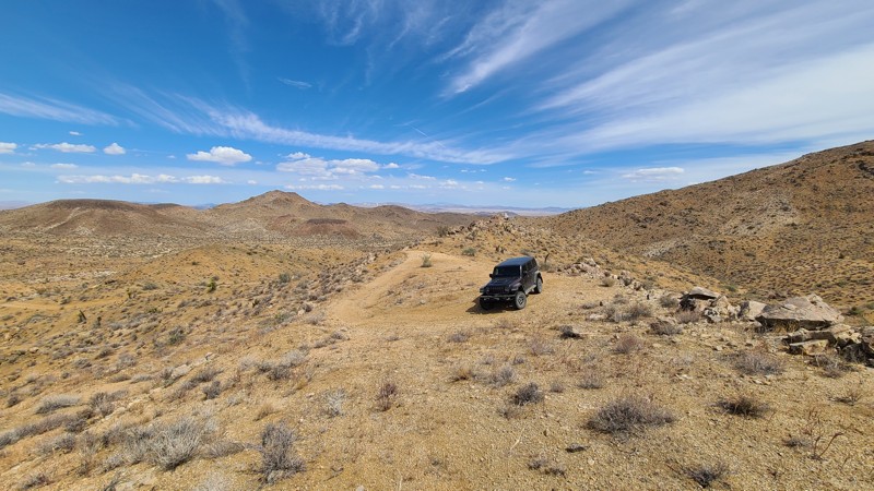
Updated: 10/09/2025
RC2309
Homestead Valley, California
Intersecting New Dixie Mine Road, RC2309 is a short out-and-back camping spur that climbs up the nearby hill to reach a large plateau with terrific views out to Ruby Mountain and its foothills. Near the start of the trail is an interesting cistern or guzler with a large slanting surface to collect rainwater and direct it to storage for drinking access by local wildlife. The trail offers a gentle rise to the plateau at its top, with a small rocky section.
There are two dispersed camping locations, one at the top with its great views and another at the bottom in a large, level, sandy area just across from the cistern.

Updated: 04/10/2026
Slaughterhouse Spring Road
Vanderbilt, California
In the north-eastern corner of the Mojave National Preserve, Slaughterhouse Spring Road climbs up the New York Mountains, offering spectacular views out across Ivanpah Valley onto the Clark Mountains and the distant Ivanpah Solar Power Facility's glowing white boilers. The road passes a series of well-preserved horizontal mines that were blasted into solid rock. One extremely interesting mine is found about 1.5 miles along the trail, has a cathedral entrance with 30-foot ceilings, is large enough for vehicles to drive into and turn around, and has multiple drifts extending from the cathedral deep into the mountain. Still evident in the mine walls are the remains of countless drilled blast holes that were filled with explosives to blast the rock away. The mine entrances are not barricaded with iron bars or bat gates, and only the posted danger signs warn visitors of the hazards of entering the mines.
Many of the mine entrances have flat portals or landings providing excellent spots to camp and enjoy the spectacular views.
This is an extremely tight and narrow shelf road that cuts into the side of the mountain, winds through hairpin turns, and provides a slippery surface of gravel and apple-sized rocks from the mine's waste tailings. This trail is best suited for experienced drivers. A stock 4-wheel drive vehicle with good ground clearance will handle the trail easily. The Mojave Preserve does not mark trails well, and the entrance to Slaughterhouse Spring Road is easily missed without a GPS.
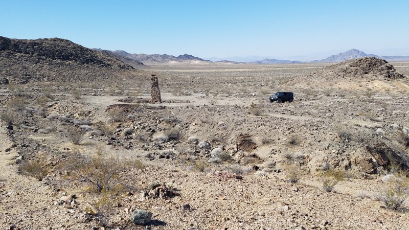
Updated: 01/15/2026
Paymaster Mine Road
Baker, California
Paymaster Mine Road is in the western corner of the 1,542,776-acre Mojave National Preserve, which leads to its namesake, Paymaster Mine. The Paymaster Mine, discovered in 1900 on the slope of Old Dad Mountain, produced approximately $75,000 worth of gold between 1910 and 1914 but closed during the Great Depression. The last 100 feet of the road has degraded and is now impassible by vehicle, but a short hike uphill over the road's remains will take you to the mine entrance. Once there, you can explore the remnants of structures and machinery and glimpse down the single mineshaft. A steel gate closes the entrance, but large openings between the bars allow you to peer down the solid rock tunnels that disappear into the darkness, revealing a small section of the 2,000 feet of underground workings.
The road surface is mostly rocky hardpack over a one-mile out-and-back that intersects Brannigan Mine Road. Beginning at an elevation of 1,600 ft, it is a 200 ft climb to the end and the mine entrance. It is a short drive, but the destination is an abandoned mine, and it is worth taking some time to hike and explore. The road towards its end becomes very rocky and uneven as, in this area, the roads are made up of mine tailings. A high clearance SUV is needed and is suitable for a novice offroader.
Dispersed camping is allowed, and a few pre-established sites can be found within the last half of the trail.
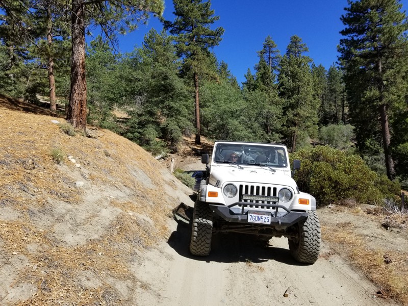
Updated: 04/22/2026
Little Bear Spring Spur B
Fawnskin, California
2N84B wraps around Delmar Mountain in the San Bernardino National Forest near Big Bear Lake, California. It is an out-and-back trail with rough terrain, several narrow sections, and moderate hill climbs. It is suitable for most stock 4x4s and new drivers. The trail ends near the Pacific Crest Trail, where you can find several flat tent spots.
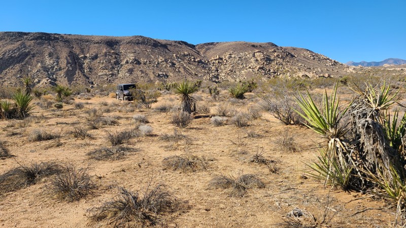
Updated: 10/09/2025
RC1409
Homestead Valley, California
Tucked into the southern foothills of Ruby Mountain, RC1409 is an out-and-back trail that begins in a broad desert valley before winding into a striking narrow canyon that begs to be explored. The route loosely follows a dry creek bed, where remnants of old mining activity can still be spotted. Near the end, the trail pinches down to a point that requires a multi-point turnaround, surrounded by piles of unusual rock formations. Along the way, RC1409 also connects with two established hiking trails that branch east and west from the route.
A few dispersed campsites can be found along the trail, but the standout is located about halfway in, while still in the open valley. There you can find a wide, flat site with room for 3–4 vehicles and long views north across distant mountains.
The trail itself is easy overall, with a mix of rocky slopes and tight turns that keep things interesting. A high-clearance two-wheel-drive vehicle can make the drive, but four-wheel drive is recommended for exploring the surrounding trails and tackling the rockier sections with confidence.
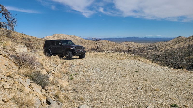
Updated: 04/10/2026
Mail Spring Road
Barnwell, California
Mail Spring Road is an out-and-back trail that climbs up the eastern side of one of the mountains in the New York Mountain range to provide wonderful views across the desert and eventually reaches one of the oldest mines in the area, the Sagamore Mine. Sagamore Mine silver deposits were discovered in the 1870s, and the mine has operated on and off until the mid-1960s, recovering a variety of precious metals, including gold. Remnants of the abandoned operation are still present, including the gold recovery vats at the end of the trail, but the once-standing mine camps were leveled by the massive 2023 York Fire. Hiking up the hill from the end of the road will reach the mine camp sites.
A note of caution: in its later years, the mine was reported to have used toxic cyanide to recover gold (termed gold cyanidation). The concrete basins at the end of the road are typical of vats used for this process.
The trail is covered in apple-sized rocks sourced from the mine operation, making for a rough ride. Airing down will make for a more comfortable trip. Burned trees from the 2023 York Fire may fall to block the mountain section of the road, and drivers must be aware and willing to remove these trees before attempting the trail. One particular shelf section of the trail is water-damaged, creating a slippery off-camber section leaning down the side, requiring careful tire placement.
Large flat dispersed camping sites with existing rock fire rings can be found next to the trail, not far from Ivanpah Road.
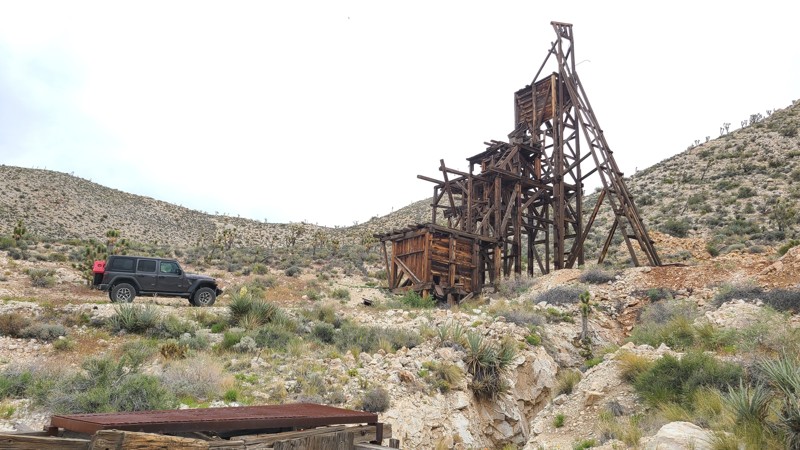
Updated: 05/20/2026
Kessler Peak Road
Wheaton Springs, California
Kessler Peak Road follows the valley between the Striped and Ivanpah Mountains in the Mojave National Preserve. The road travels through a heavily mined area with no shortage of intersecting trails and mines to explore. Perhaps the most easily reached and most interesting mine is the Evening Star Mine. Originally one of the many area claims made by J. Riely Bembry (of Riely's Camp), he sold the claim, and the new owners erected a massive head frame and operated it as a tin mine from 1939 to 1944. The 50-foot-tall head frame or guillotine is still standing strong, allowing visitors a close inspection. The mine used cables and pulleys to lift buckets loaded with ore from the adjacent mine shaft and dump them into the top of the head frame, where it was crushed in preparation for shipment and refinement. Continuing from there, the road enters the Shadow Valley basin, where it becomes surrounded by a decimated Joshua Tree forest, the effect of the 2020 Dome fire.
Many dispersed camping sites can be found along the road, especially at the mine sites, with the best camping at the southern end of the road at Sunrise Rocks Campsite. Sunrise Rocks Campsite offers several campsites comfortably nestled amongst the rock jumbles, with rock or iron fire rings and large flat areas for multiple vehicles and tents.
Most of the road is easy over flat compacted gravel, but sections, especially near the north end and the spurs leading off the road, can be made up of sharp-edged, cantalope-sized rocks with deep rutting in the roadbed. The trail is best suited for an agressive high clearance vehicle with skid plate protection.
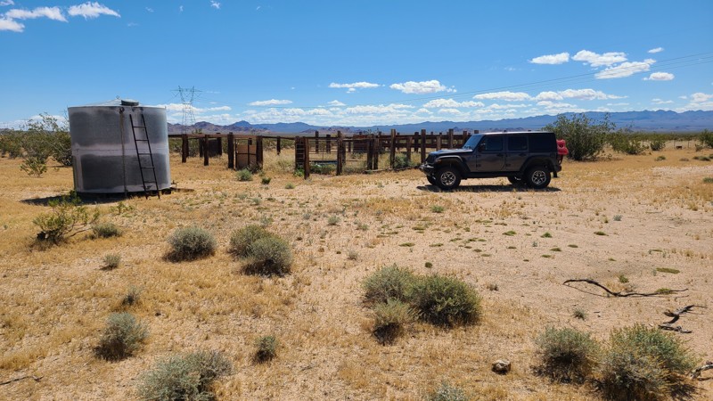
Updated: 05/20/2026
Black Canyon Wash Trail
Fenner, California
Located in the Fenner Valley basin of the Mojave National Preserve, Black Canyon Wash follows a vehicle corridor through a Mojave Wilderness area with wonderful views of the surrounding Wood and Providence Mountains. This area hosted herds of grazing cattle, but with the establishment of the Preserve in 1994, most grazing permits were not renewed, allowing this wilderness area to return to its primal state. Dotting the trail are the remains of corrals and wells that were left standing to preserve the area's ranching history.
Most of the path is easy and fairly smooth, except for the stretch through the huge Woods and Black Canyon Washes, where the trail becomes a bit more rocky and features steep climbs in and out of the wash. A four-wheel-drive vehicle with good ground clearance is required to navigate these sections.
The best camping is near the north-west end of the trail, where there is a large flat area with established rock fire rings, complemented by fantastic views of the Providence Mountains. Improved camping is available at the Hole-in-the-Wall Campground just one mile from the end of the trail.
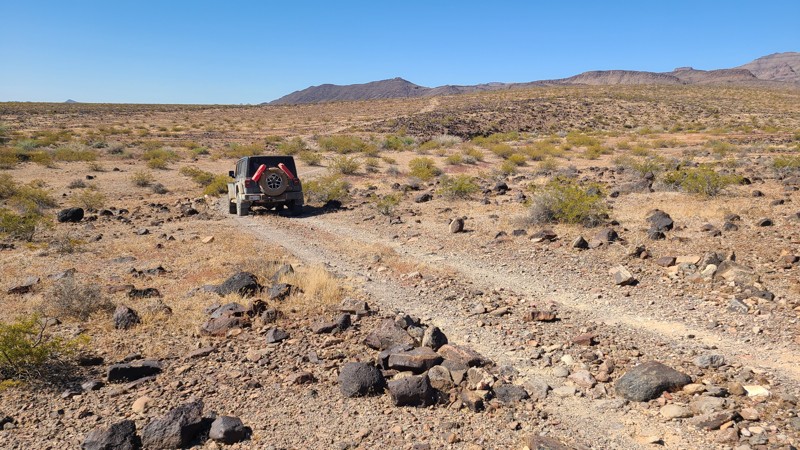
Updated: 07/02/2026
NS499
Havasu Lake, California
NS499 runs along the western edge of Chemehuevi Valley with the rugged Turtle Mountains rising just to the west. The entire route is part of Eastern Mojave Heritage Trail (EMHT) Segment 4, one section of the larger 733-mile EMHT network. Segment 4 offers a 145-mile tour through some of the most remote terrain in the Eastern Mojave and is managed through a partnership between the Bureau of Land Management and the Mojave Desert Heritage and Cultural Association.
This is a slow, rocky trail for its entire length. Much of the route is covered in grapefruit-sized rocks and larger, with several steep, narrow wash crossings adding to the difficulty. The most challenging obstacle is about 2.6 miles from the east end, where the trail drops into a narrow, boulder-filled wash with no obvious track and requires a sharp 90-degree turn up a steep exit. A lifted 4x4 and an experienced driver are recommended. Drivers following the EMHT from the east can bypass this section by staying on Turtle Mountain Road to Highway 95, where the route reconnects with the EMHT at Pyramid Peak Road.
A few small, cleared areas along the trail can work for dispersed camping, but the best camping is just beyond the west end of NS499 on nearby NS495 at the abandoned mining cabin. That site offers more space for multiple vehicles and tents, along with excellent views across the valley.
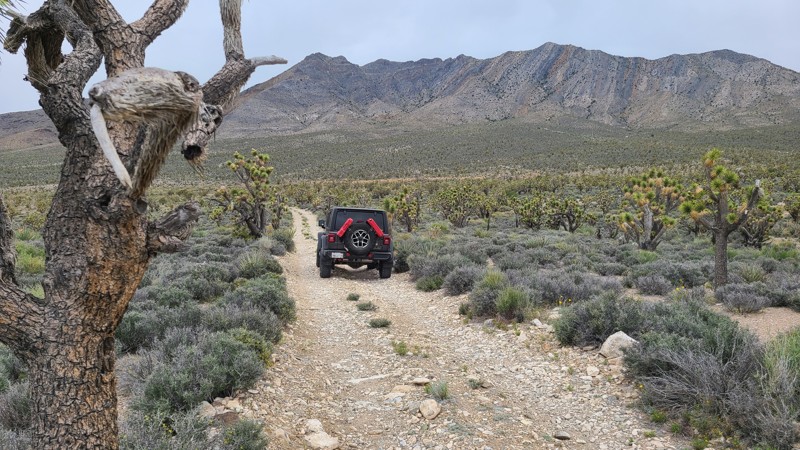
Updated: 05/20/2026
Zinc Mine Road
Mountain Pass, California
Nestled in the Piute Valley of the Mojave National Preserve, Zinc Mine Road is escorted by a beautifully dense Joshua Tree forest, with picturesque views out to the Mescal and Striped mountains. The road passes several other driving and hiking trails that invite exploration. The highlight of the trail is a visit to Roger's Camp and the beautifully restored Roger's Cabin. Everett E. Rogers was a miner and ranch hand who built the original cabin in the 1900's. Restored by Park personnel and volunteers, the cabin is available for use by backcountry explorers.
While there are no existing dispersed campsites visible from the road, Roger's Camp provides an excellent campsite with views overlooking the valley, a fire ring, a bench, and space for several vehicles.
Zinc Mine Road is an easy path with the occasional water-worn furrow across the road. A two-wheel drive vehicle with some clearance would easily navigate this trail.
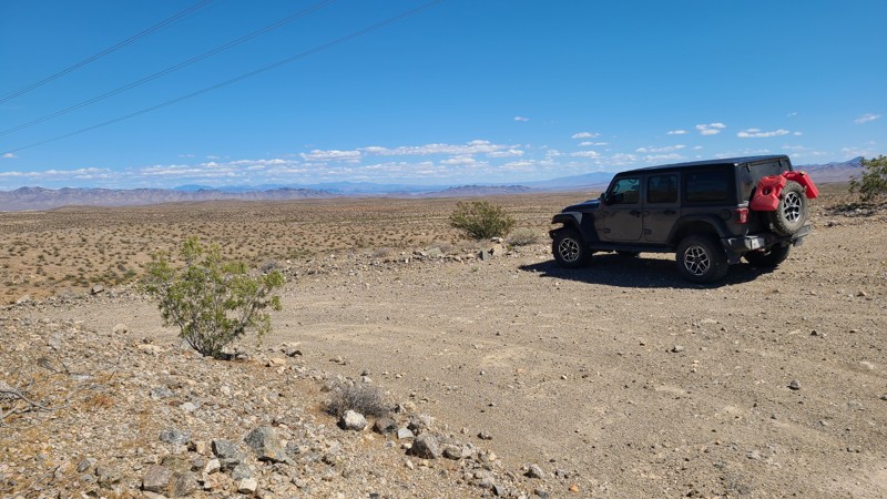
Updated: 05/20/2026
Homer Mountain Trail
Hayden, California
Homer Mountain is a cross-country trek through the Mojave National Preserve. Bordering the Mojave Wilderness over much of its length, travelers are rewarded with fantastic desert scenery across an unpopulated desert landscape, with the Piute Mountains providing a backdrop.
Most of the trail is flat with no obstacles, but once into the Homer Mountain foothills, the path becomes twisty, rocky, and steep over several deep washes. This trail can be managed in a two-wheel drive with good all-terrain tires, but the frequent dips and washes across the trail will require a vehicle with some ground clearance.
The best dispersed campsites are found in the Homer Mountain Foothills, along the eastern third of the trail, where the higher elevation provides an overlook of the surrounding desert.
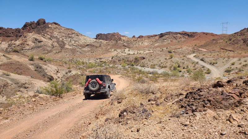
Updated: 06/30/2026
Hightower Road
Homer, California
Hightower Road is an overland adventure across the deep sandy basins of the Mojave's Ward and Chemehuevi Valleys and then through the spectacular deep canyons, towering peaks, and natural rock arches of the Whipple Mountains. Along the way, a short detour up NS427 visits the long-abandoned Capitan Mine and its many abandoned vehicles, the ancient petroglyphs at West Well on the War Eagle Mine Loop, and exits driving over the Parker Dam holding back Lake Havasu.
The majority of the road is on BLM land, and dispersed camping is allowed anywhere except a 6-mile section that passes through the well-marked Chemehuevi Reservation near the end of the trail. Surprisingly few existing campsites can be seen from the road, and some of the better camping is found on the Capitan Mine site, nine miles from the north end of the trail and off of the many intersecting trails and spurs over Hightower Road's length.
Traveling southward, the road surface changes dramatically from the soft sand of the desert floor to the hard-packed gravel as you climb through the mountains. While the mountain section of the road surface itself does not present any driving difficulty, the road's steepness, combined with tight, twisting, blind turns over shelf roads and steep drop-offs, can be intimidating. The soft sand at the north end of the trail and the need for confident traction when climbing the mountains require a high-clearance 4x4 with good all-terrain tires and an experienced mountain-road driver.
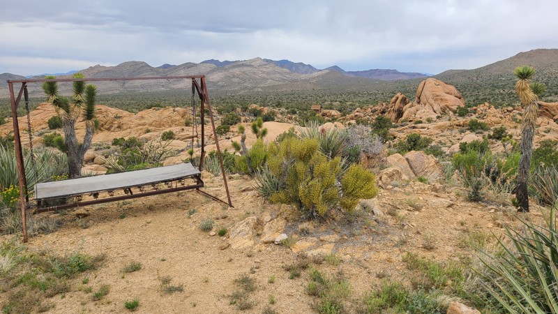
Updated: 05/20/2026
Standard Mine Road
Mountain Pass, California
This is one of those roads, rich with discoveries, that one hopes to discover when wandering the Mojave. Tucked between the aptly named Striped Mountains and Ivanpah Mountains in the Mojave National Preserve is Standard Mine road, providing a wealth of mining history, with fathomless mine shafts now safely grated closed, abandoned heavy equipment, and surviving miners' cabins. The Mojave National Preserve leaves these sites untouched to preserve the rich mining history of the area. The miners located the cabin sites to provide fantastic views across the lush Joshua Tree forests of the Shadow Valley below. Many of the cabins have been restored by volunteers and offer a glimpse of miners' lives. Probably the most well-known and well-preserved is Riley Camp, the home of J. Riley Bembry, a World War I veteran who had placed 56 claims in the area.
The main road is easy and can be managed with a 2-wheel drive vehicle with some clearance, but the spurs leading to mine sites can be very rocky and rugged, often made from the mine's waste rock and requiring a 4-wheel drive lifted vehicle.
Camping can be found on the flat areas around mine sites, with the best camping around the cabins, where tables and iron fire rings can be found.
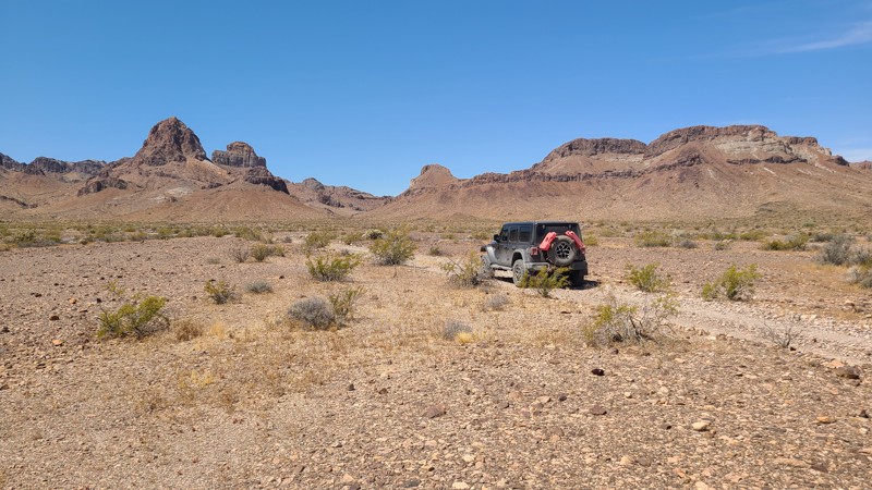
Updated: 06/10/2026
Lost Arch Inn & Lisa Dawn Trails
Needles, California
Heading into the Turtle Mountains, Lost Arch Inn Road and Lisa Dawn Trail lead to the Lost Arch Inn. Where once a miner's cabin stood, the “Inn” is now an improved BLM campsite with impressive views of the steep walls of the Turtle Mountains. Bordering the Turtle Mountains Wilderness to the west, the road provides easy access to many hiking trails where spring cacti floral displays are bountiful, and quiet patience will reveal the local wildlife. The Lost Arch itself is a natural arch found only when hiking into the wilderness, and legend suggests the arch is a landmark for a nearby gold mine. The Lisa Dawn Mine vertical shaft is located only 75 feet north of the Lost Arch Inn campsite, and iron mine grates protect curious explorers. In 1962, the 100 lb "Needles Meteorite" was discovered next to the Lisa Dawn Trail and was quickly removed, and today, there remains no evidence of its landing site.
This is an easy path, but the uneven rocky road will require a high clearance vehicle needing only two-wheel drive.
The Lost Arch Inn campsite is located at the westernmost section of the trail, tucked up against the steep wall of Turtle Mountain, where a covered table and metal fire ring with a grill are provided.
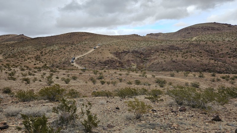
Updated: 01/15/2026
Wall Street East Connector
Yermo, California
The Wall Street East Connector is a short, ridgeline connector between the north ends of Wall Street and Vodkaberry. It is a rough and rocky road with moderate grades, suitable for any high clearance vehicle. Along the route as you traverse the Mojave Desert above the famous Calico Ghost Town, expect great views and absolute silence.
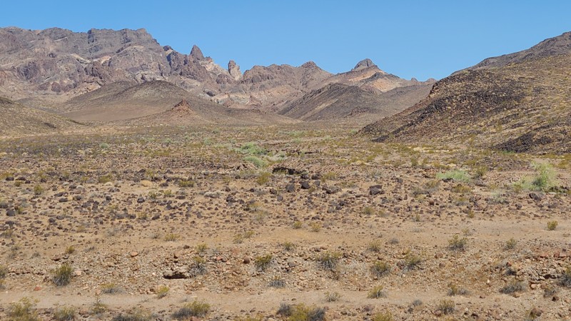
Updated: 07/02/2026
NS495
Vidal Junction, California
NS495 ends at the boundary of the Turtle Mountains Wilderness, where broad views open across a rugged desert basin to the Turtle Mountains. The west end of the route also passes an old mining site, where a collapsed miner’s cabin and scattered artifacts still remain. Near the east end, an abandoned ore-processing site includes a standing hopper and shaker deck that make for another worthwhile stop along the trail.
The eastern portion of the route, east of the NS499 junction, is part of Eastern Mojave Heritage Trail (EMHT) Segment 4. Segment 4 is one section of the larger 733-mile EMHT network and provides a 145-mile tour through some of the most remote terrain in the Eastern Mojave. The trail network is managed through a partnership between the Bureau of Land Management and the Mojave Desert Heritage and Cultural Association.
Good dispersed camping can be found at both ends of the route, including near the abandoned miner’s cabin on the west end and the ore-processing site on the east end. Large, flat campsites with existing rock fire rings can accommodate multiple vehicles.
This is an easy trail overall, though the lightly traveled west end may have faint or barely visible tracks in places. A short stretch of embedded rock is the main obstacle, but the route is otherwise suitable for most high-clearance two-wheel-drive vehicles in dry conditions. Nearby side roads and spurs may be rougher and are better suited to a capable 4x4.
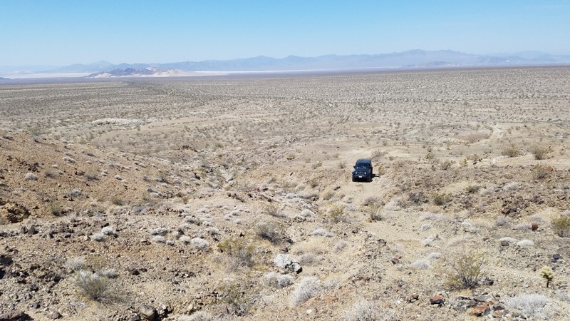
Updated: 01/15/2026
Paymaster Mine Spur
Baker, California
The Paymaster Mine Spur is a short, rugged offshoot near Old Dad Mountain that climbs about 150 feet through rocky desert terrain to an old prospecting mine, part of the larger network of mines that were active in the early 1900s. This half-mile, two-track trail is narrow and uneven, with one steep, loose section that requires high clearance and 4WD for less experienced drivers. The route ends at a deep washout, but a short hike beyond reveals mine tailings and the quiet solitude of the Mojave Wilderness, where wind and open space are the only sounds left from a once-bustling gold operation.
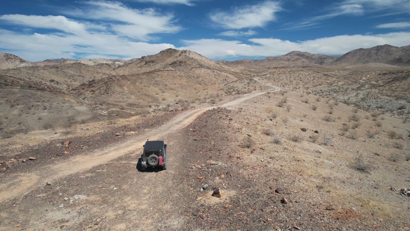
Updated: 01/15/2026
Mission Sweet Mine Road
Eagle Mountain, California
Mission Sweet Mine Road takes you to one of the many mines in the area. Isolated and desolate, with nothing visible to the horizon to remind one of nearby civilization save the road you were just on. Barren and forsaken, this land has an unmatched and unique beauty. The road passes the Mission Sweet Mine and ends at what were once living quarters for the workers. The trail is entirely flat, hard-packed with small rocks. There are no major obstacles along the trail, and it is suitable for beginning offroaders with a high clearance SUV. Near the start of the trail is an established campsite, sheltered by rocks and with a natural chimney
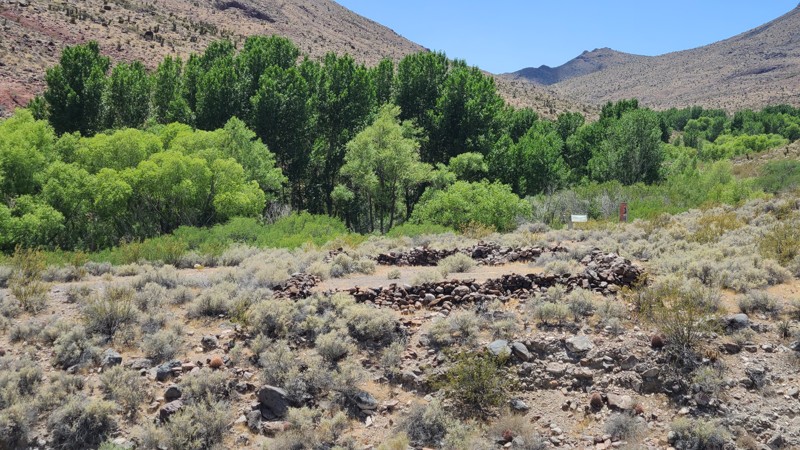
Updated: 06/10/2026
Piute Valley Trail - Gulch Road
Searchlight, California
Piute Valley Trail-Gulch Road offers a desert escape through the beautiful Piute Valley, with the Piute Range as a backdrop. Much of the trail borders the Mojave National Preserve and Mojave Wilderness, providing a natural desert expanse to enjoy. Intersecting along the are Route 66 and the Mojave Road. A short drive up the old Mojave Road leads to Fort Piute and its still-running creek supporting a lush green oasis of cottonwoods and surrounded by the towering mountains of the Piute Gorge. Fort Piute was originally built in 1867 to provide military escorts to the mail carriers traveling the Mojave Road, but was abandoned only 6 months later when the mail route was changed. Significant Fort ruins remain, providing a glimpse of what life was like for the 18 soldiers stationed there. Hiking trails starting at the Fort follow the old Mojave Road and lead to ancient petroglyphs carved by indians who lived in the area. A portion of Mojave Road was rerouted along 1.3 miles of Piute Valley Trail to protect the sensitive habitat of the Piute Gorge.
The best dispersed camping is around Fort Piute, about 18 miles south of the south end of the trail. Here, large flat areas with rock fire rings can be found, providing wonderful views over the eastern Mojave Desert. Another good dispersed camping site is around the Tenmile Well site, with its aging corral and water pump about 8.5 miles from the northern end of the trail.
The vast majority of the Piute Valley Trail is easy over a sandy desert floor with occasional ruts and dips across the trail. A two-wheel drive with some clearance will manage this trail fine. However, the 2-mile path up to Fort Piute is extremely rugged, full of melon-sized rocks, not maintained, and will require a 4x4 with high clearance.
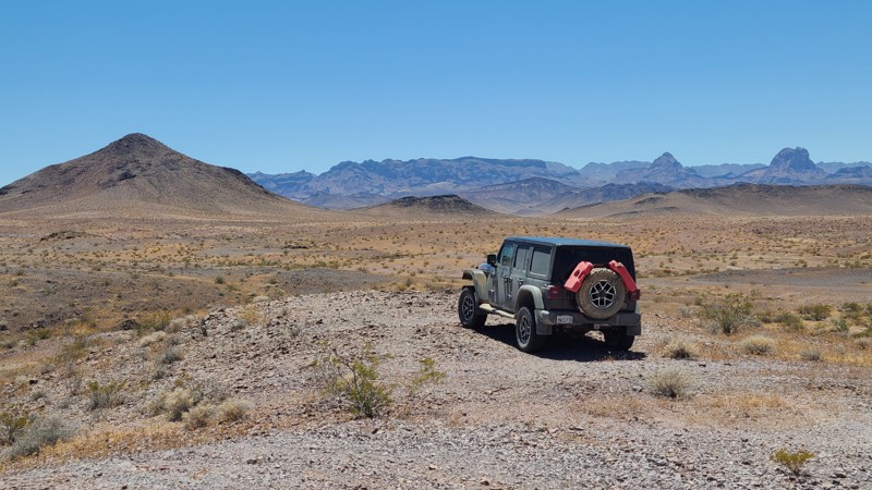
Updated: 07/02/2026
Pyramid Peak Road
Vidal Junction, California
Pyramid Peak Road crosses the rolling terrain of the Whipple Mountains, weaving through low ridgelines and desert foothills. Several hiking and motorized side routes branch off along the way, many leading to abandoned mining and mill sites scattered throughout the area. Higher elevations along the route provide wide western views across the desert toward the Turtle Mountains.
The entire route is part of Eastern Mojave Heritage Trail (EMHT) Segment 4, a curated 145-mile section of the larger 733-mile EMHT network. Segment 4 highlights some of the most remote terrain in the Eastern Mojave and is managed through a partnership between the Bureau of Land Management and the Mojave Desert Heritage and Cultural Association.
Pyramid Peak is generally an easy trail, with one notable obstacle that earns it a Moderate difficulty rating. Located 2.7 miles from the eastern end, a deep, narrow wash drops sharply into a tight bottom before climbing back out to the continuing trail. The descent is steep, rutted, and roughly 30 feet high, followed by a short, steep climb of approximately 25 degrees to exit the obstacle. An experienced driver in a high-clearance 4x4 is recommended for this trail. NS660 can be used to bypass this obstacle, but that route contains obstacles that may be equally difficult or more challenging.
The route is entirely on BLM land, and dispersed camping is permitted throughout. Only a few established dispersed campsites are visible from the main road, with better camping found nearby along side routes. The best option is near the ruins of the Juanita Rose Mine, reached via a short drive up NS639, where existing fire rings and expansive views make for a scenic camping area.
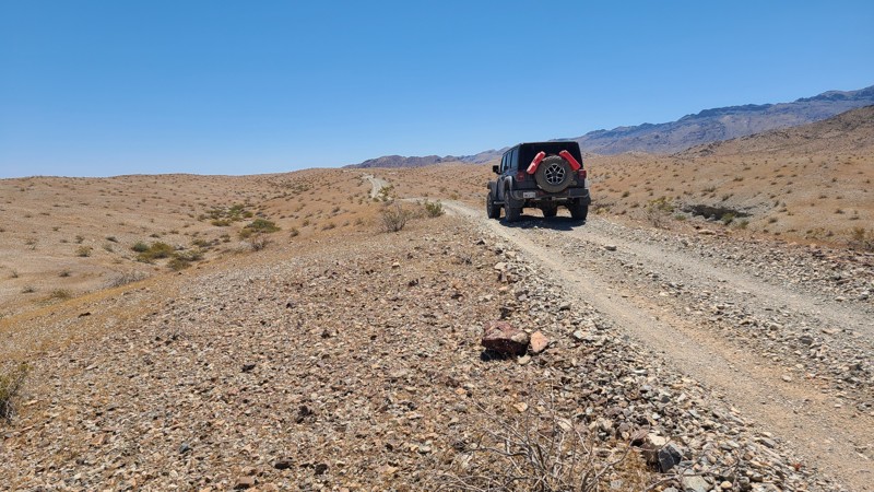
Updated: 06/10/2026
War Eagle Mine Loop
Havasu Lake, California
On the southern edge of the Chemehuevi Valley, within sight of Havasu Lake, lies War Eagle Mine Loop. The trail is a pleasant tour of the desert that passes near its start, an ancient sacred Native American petroglyph site, and then continues to reach the War Eagle Mine site. The mine site has many equipment artifacts left in situ, and the end of the trail connects to hiking trails to explore the area further.
The War Eagle Mine Loop exists entirely on BLM land, and dispersed camping is allowed along the entire trail. A few camping sites can be found near the trail, with the best locations on the War Eagle Mine site.
The trail surface is over a desert hard pack with a few sections of moguls, and becomes more rugged when entering the foothills on the southern section of the loop. A two-wheeled drive vehicle with some clearance will be able to manage this trail.
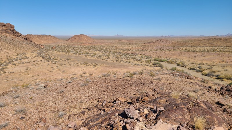
Updated: 07/02/2026
Snaggletooth Trail
Needles, California
Skirting the western edge of the Chemehuevi Mountains Wilderness, this network of desert tracks winds past the Snaggletooth Range and the Snaggletooth Campground. A short spur heading west (NS428) before the campground climbs toward the summit, where expansive views open across Chemehuevi Valley and the surrounding Mojave backcountry.
This route forms part of the Eastern Mojave Heritage Trail (EMHT), Segment 4. EMHT Segment 4 is a curated 145-mile corridor showcasing some of the most remote and visually striking terrain in the Eastern Mojave. The broader EMHT system is managed through a partnership between the Bureau of Land Management (BLM) and the Mojave Desert Heritage and Cultural Association, which maintains route information for all four segments of the 733-mile network.
At the heart of this section lies Snaggletooth Primitive RV Camp, set against the rugged backdrop of Snaggletooth Ridge. The campground includes five designated sites with large, level pads suitable for multiple RVs. Cell service is generally reliable, and resupply options are available approximately 20 miles north along US-95 in Needles. Additional informal campsites are dispersed along the surrounding ridgelines and washes. An especially secluded and sheltered campground is found at the end of the NS 428 spur, whose entrance is north of the RV Camp.
The route surface consists primarily of hard-packed gravel and sand, offering an easy, well-graded drive under normal conditions. Most of the main track is suitable for high-clearance two-wheel-drive vehicles. However, adjacent spur routes and exploratory trails in the area are more technical and typically require a high-clearance four-wheel-drive vehicle.
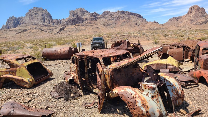
Updated: 06/10/2026
Glory Been Trail to Browns Camp
Needles, California
Glory Been Trail leads to the Lost Arch Mining Camp tucked next to the Turtle Mountains and mined from the 1880s through 1960. Many artifacts remain from the over a dozen mines that operated in the area, including Browns Cabin, the fascinating Car Corral, and the foundations of a stamping mill. The site was strewn with abandoned vehicles and machinery, and the BLM gathered many of these to display in the Car Corral as a living history for visitors to enjoy. Browns Cabin, now collapsed, was built by Charlie Brown in 1922, who prospected the area and died here in 1948. Hiking trails throughout the area can lead to other fascinating discoveries.
Several dispersed camp sites can be found along the motorized trails, with an improved campsite off of Browns Camp Trail about ½ mile north of Browns Cabin. This site has a table, a shade cover, and an iron fire ring with a grill.
The route consists of three BLM marked trails: Glory Been, Carson Well, and Browns Camp. Once entering the foothills at Carson Well, sections of the trails become very rugged over uneven surfaces strewn with melon-sized rocks, earning this route's moderate difficulty rating. The most difficult sections are near the north end of Browns Camp Trail. A high clearance four wheel drive vehicle is required to manage this route.
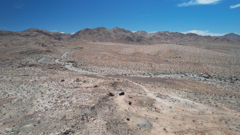
Updated: 01/15/2026
Rainbows End Mine Road
Eagle Mountain, California
The trail is entirely flat hardpack with small rocks. This out-and-back trail was created to access Rainbows End Mine. At only 0.6 miles long and at a constant 2,000 feet elevation, it takes about 60 minutes to explore the mine's artifacts. There are no major obstacles along the trail, and it is suitable for beginning offroaders with a high clearance SUV. Near the start of the trail is an established campsite, sheltered by rocks and with a natural chimney
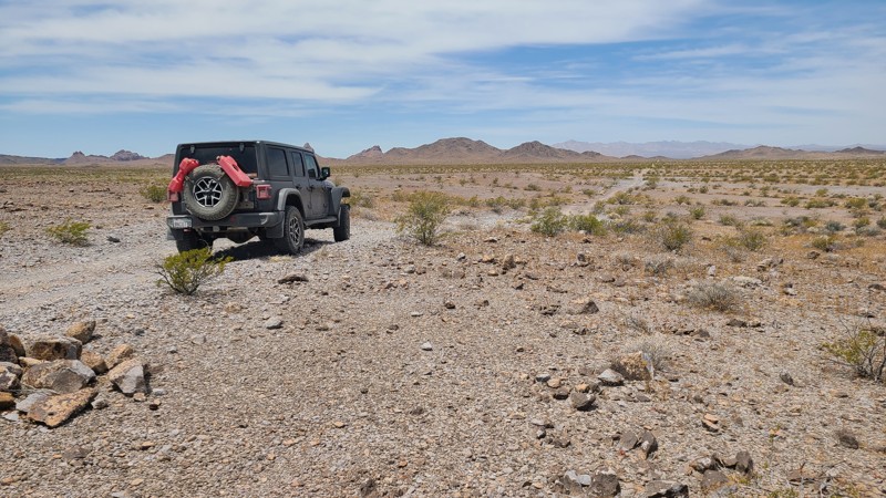
Updated: 06/10/2026
Turtle Mountain Road
Havasu Lake, California
Accompanied by the beautiful scenery of the Stepladder Mountains to the east and the Turtle Mountains to the west, Turtle Mountain Road follows a corridor between those two untouched wilderness areas. Along the way, several hiking trails invite exploration into the wilderness areas on either side, with perhaps the most interesting detour into the historic Lost Arch Mining Camp. The road ends at the border of the Old Women's Mountains Wilderness.
Over its entire length, there are only a few dispersed campsites with existing rock campfire rings visible from the road, with the best camping found about 10.5 miles from the eastern trailhead following a short diversion into the Lost Arch Mining Camp, where several dispersed and two improved campsites can be found.
The first ten miles of the road are over a wide, flat, maintained road, but from there the road changes significantly to a two-track desert trail over rocky hardpack, with the last six miles over a soft sandy desert floor. A four wheel drive high clearance vehicle is recommended to travel the entire length of the road, with the four wheel drive helpful in the eastern soft sandy section.
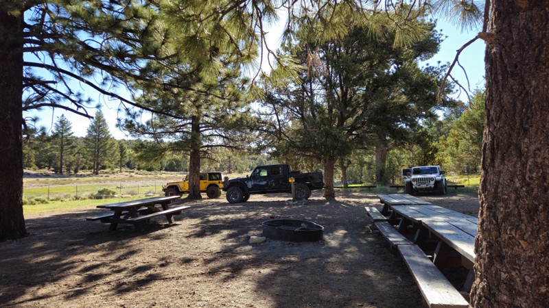
Updated: 06/18/2026
Juniper Springs Group Camp
Big Bear, California
2N64Y Juniper Springs Spur is a short out-and-back trail on the quieter eastern side of Big Bear, leading through the high-elevation forests of the San Bernardino Mountains to Juniper Springs Group Camp. Unlike the busier rock-crawling routes near Holcomb Valley, this spur is better suited for a relaxed forest drive, camping access, and a slower-paced escape into the mountains.
The trail winds through Jeffrey pine, pinyon pine, and juniper near the Juniper Springs area, sitting around 7,700 feet in elevation, where summer temperatures are often cooler than the surrounding valleys. The route is mostly compact dirt with minimal obstacles, making it approachable for most high-clearance vehicles in dry conditions and a good option for newer drivers looking for an easy Big Bear trail.
At the end of the trail, Juniper Springs Group Camp offers a primitive, reservation-only camping experience available from May through September. The campground is closed to reservations from October through April due to seasonal conditions. The site includes one large, mostly flat and shaded camping area with room for up to eight vehicles, along with picnic benches, a Forest Service-provided fire ring, and a faucet with non-potable spring water. Always check current fire restrictions before starting any campfire.
In winter, 2N64Y can become a scenic snow route when conditions allow, but snow can quickly increase the difficulty and should only be attempted with properly equipped vehicles. Whether you are looking for an easy forest drive, a reserved group campsite, or a quieter alternative to Big Bear’s more crowded trail network, 2N64Y Juniper Springs Spur is a simple but worthwhile addition to a mountain adventure.
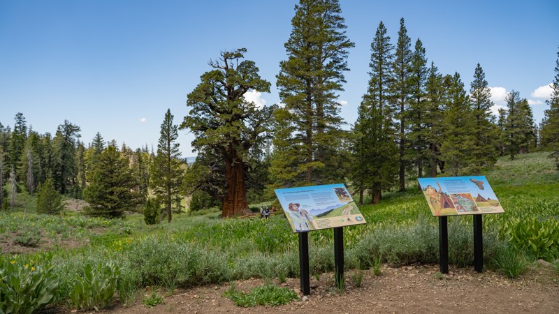
Updated: 01/05/2026
Bennett Juniper Road
Dardanelle, California
Bennett Juniper Road (5N83Y and spur 5N83YB) is a short, easy out-and-back that branches off 5N01 and climbs gently across high-country terrain toward one of the Sierra Nevada’s most remarkable natural landmarks. The route follows rough dirt the whole way, but remains friendly to any high-clearance two-wheel-drive vehicle.
The primary draw here is the Bennett Juniper, the largest and oldest western juniper known to be alive today. Estimated to be several thousand years old, the tree has passed through multiple eras of human care, from ranchers in the mid-1800s to modern conservation groups, including The Nature Conservancy, Save the Redwoods League, and now the Mother Lode Land Trust. A short fork, 5N83YB, leads to a looped pull-around with informational signage and a walking path that allows visitors to experience the tree up close without disturbing its delicate habitat. Late spring and early summer bring vibrant wildflower displays throughout the area, with native plants blanketing the surrounding meadows.
Camping opportunities along the road are sparse, with only a couple of viable dispersed sites. While solitude is easy to find mid-week, summer traffic in the broader region can increase as hikers, cabin visitors, and water-recreation crowds spread out across the Sierras. Like most high-elevation routes in this region, Bennett Juniper Road becomes inaccessible once winter snow settles in, transitioning into terrain favored by cross-country skiers and snowmobilers.
Simple, scenic, and historically significant, this short spur is well worth the detour for anyone exploring 5N01. The drive is easy, the terrain forgiving, and the payoff—a visit to a millennia-old giant—is something every Sierra traveler should experience at least once.
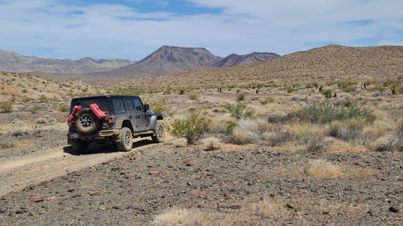
Updated: 07/02/2026
Eagle Pass Road
Needles, California
Beginning near Needles, Eagle Pass Road travels southwest across open BLM land before eventually looping back to Interstate 40. Along the way, the route passes several hiking and off-road trail junctions that offer additional opportunities for exploration. Broad views of the Sacramento Mountains, Flat Top Mountain, and Eagle Peak provide a scenic backdrop for much of the drive.
The first 16 miles of the route, ending at the NS064 junction, are part of Eastern Mojave Heritage Trail (EMHT) Segment 4. This segment is one section of the larger 733-mile EMHT network, a curated collection of routes showcasing some of the most remote terrain in the Eastern Mojave. The trail network is managed through a partnership between the Bureau of Land Management and the Mojave Desert Heritage and Cultural Association.
The entire route is on BLM land, and dispersed camping is allowed throughout the area. While only a few previously disturbed campsites are visible from the road, there are many suitable places to camp along the trail.
Road conditions vary as the route crosses gravel, desert pavement, and sandy washes. Most of the trail is straightforward but slow-going, with extended sections of soft sand and occasional stretches of exposed bedrock. In the washes, multiple tire tracks sometimes split away from the mapped route, though they generally reconnect farther ahead. Some of the lesser-used lines may be narrower and more overgrown, with a higher chance of pinstriping. The main obstacle is located about 0.5 miles north of the NS064 junction, where a rocky descent over a shallow waterfall requires careful wheel placement.
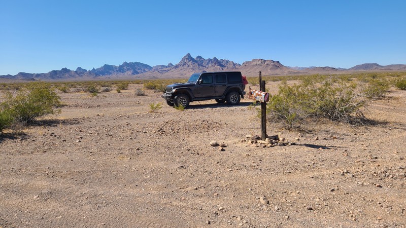
Updated: 06/10/2026
Mailbox and Prospectors Trails
Sablon, California
Mailbox Trail hugs the border of the Turtle Mountains Wilderness and provides a staging area for hikers and equestrians traveling the trails leading deep into the wilderness. The trail provides a convenient western access to the Lost Arch Mining camp from its end when continuing onto the Lost Arch Inn Road. The start of the trail is marked with a mailbox stuffed with food and water donations.
Dispersed camping is available along the trail with an existing campsite about 0.5 miles from the east end.
The surface is gravel that can be managed with a two-wheel drive vehicle, but with adequate ground clearance to manage the uneven surface.
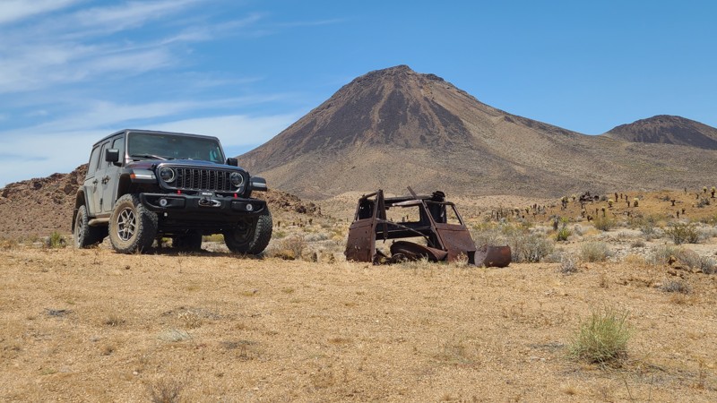
Updated: 07/02/2026
NS064
Klinefelter, California
Cutting through the western foothills of the Sacramento Mountains, NS064 follows a narrow canyon framed by steep, near-vertical rock walls before exiting onto a broad sandy wash at Flattop Mountain Road. Along the way, the route offers excellent views of Flattop Mountain and a stop at an abandoned mining prospect, where a 1930 Ford Model A still sits nearby.
The entire route is part of Eastern Mojave Heritage Trail (EMHT) Segment 4, one section of the larger 733-mile EMHT network. Segment 4 provides a 145-mile tour through some of the most remote terrain in the Eastern Mojave and is managed through a partnership between the Bureau of Land Management and the Mojave Desert Heritage and Cultural Association.
The route is entirely on BLM land, and dispersed camping is allowed throughout the area. A few suitable campsites can be found once the trail leaves the narrow canyon, with one of the better options near the abandoned mining prospect about 0.5 miles from the east end of the route.
Despite the dramatic canyon scenery, the drive itself is easy. The road is wide, flat, and sandy for its entire length, with no significant obstacles. Most high-clearance two-wheel-drive vehicles should have no trouble in dry conditions, though exploring beyond the main route may require a lifted 4x4.
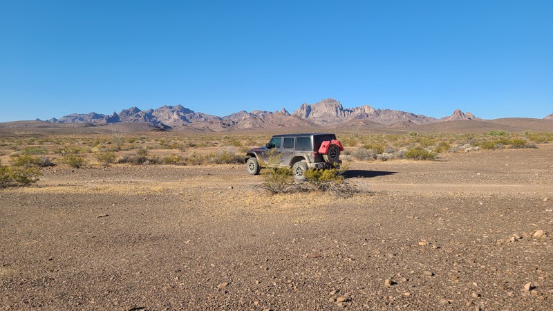
Updated: 07/02/2026
Chemehuevi Valley West
Needles, California
Leaving the Turtle Mountains behind, Chemehuevi Valley West Trail crosses the 22-mile-wide Chemehuevi Valley to Hightower Road near Havasu Lake. The first 2.4 miles on the west end are part of the Eastern Mojave Heritage Trail (EMHT) Segment 4, one section of the larger 733-mile EMHT network managed through a partnership between the Bureau of Land Management and the Mojave Desert Heritage and Cultural Association.
The route is entirely on BLM land, and dispersed camping is allowed throughout the area. While only a few previously disturbed campsites are visible from the trail, there are many suitable places to camp along the route.
Road conditions vary significantly across the valley. West of Highway 95, the trail is rough and rocky, with several steep, narrow wash crossings. One wash includes an approximately 18-inch vertical ledge at the bottom of a steep descent, requiring careful tire placement. East of Highway 95, the route transitions into the sandy drainage of Chemehuevi Wash, where dozens of smaller washes combine to form a broad wash bottom.
A lifted 4x4 and an experienced driver are recommended due to the rocky obstacles, wash crossings, and soft sand.
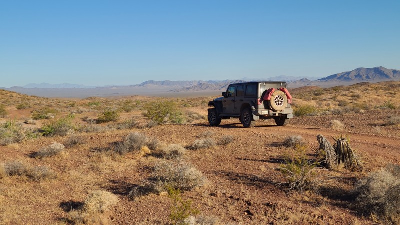
Updated: 07/02/2026
NS085
Needles, California
NS085 winds through the western foothills of the Sacramento Mountains before reaching the broad alluvial plain of Ward Valley. Much of the route offers open views toward the distant Piute Mountains. A short side trip on nearby NS240 leads to the ruins of the Capitan Mine, where a collapsed mining camp building and several abandoned vehicles remain scattered around the site.
No established campsites are obvious from NS085 itself, but several flat, open areas along the route can work well for dispersed camping. Better camping can be found by following the connecting NS240 to the Capitan Mine area, where existing rock fire rings and a larger campsite sit near an abandoned 1938 Buick Special Series 40.
Most of the route follows flat, hard-packed sand with only occasional rocky sections and shallow water-worn ruts. In dry conditions, it is generally suitable for most high-clearance two-wheel-drive vehicles.
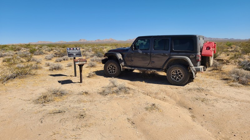
Updated: 07/02/2026
Little Piute Trail
Fenner, California
Little Piute Trail begins in the Little Piute Mountains and descends into the wide, sandy expanse of Ward Valley. Throughout the route, expansive views stretch toward the nearby Old Woman Mountains Wilderness. One of the more notable landmarks along the trail is the Eastern Mojave Heritage Trail mailbox, where visitors can sign the logbook to record their passage.
The entire route is part of Eastern Mojave Heritage Trail (EMHT) Segment 4, a curated 145-mile section of the larger 733-mile EMHT network. Segment 4 highlights some of the most remote terrain in the Eastern Mojave and is managed through a partnership between the Bureau of Land Management and the Mojave Desert Heritage and Cultural Association.
A few previously disturbed campsites are visible along the route, and there are several additional open, flat areas suitable for dispersed camping.
The trail follows generally flat, hard-packed sand with occasional short rocky sections. In dry conditions, it is typically suitable for most high-clearance two-wheel-drive vehicles.
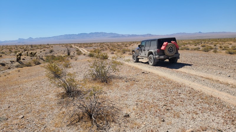
Updated: 07/02/2026
North Chemehuevi Trail
Havasu Lake, California
NS513 travels north across the Chemehuevi Valley desert basin as part of the Eastern Mojave Heritage Trail (EMHT). The route begins in the relatively lush Chemehuevi Wash, where scattered shade trees provide inviting spots for a break, before exiting the wash and continuing across the hard desert pavement of Chemehuevi Valley.
The entire route is part of Eastern Mojave Heritage Trail (EMHT) Segment 4, a curated 145-mile section of the larger 733-mile EMHT network. Segment 4 highlights some of the most remote terrain in the Eastern Mojave and is managed through a partnership between the Bureau of Land Management and the Mojave Desert Heritage and Cultural Association.
The route is entirely on BLM land, and dispersed camping is permitted throughout. The most favorable camping is found within Chemehuevi Wash among the shade trees, though this area should be avoided if rain is in the forecast due to potential flooding.
Conditions vary from easy desert travel to soft sand. The wash section can be deep and loose, while the remainder of the route crosses flat, hard desert pavement. A 4x4 with some clearance is recommended for the sandy wash portion, while the rest of the trail is generally easy.
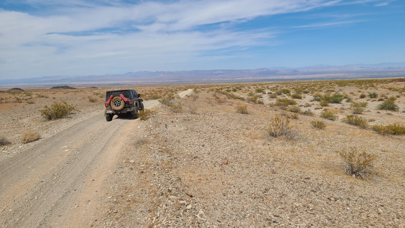
Updated: 07/02/2026
Monumental Pass Road
Needles, California
NS246 follows a broad, open Monumental Pass through the Sacramento Mountains, offering expansive views east across the Mojave Valley. Several hiking routes and side roads branch off along the way, many of them leading to abandoned mining sites that add extra opportunities for exploration.
A few existing dispersed campsites are visible from the route, and most of the trail crosses BLM land where dispersed camping is allowed. In addition to the established sites, there are several flat pullouts and open areas along the road that can work well for camping.
The road surface is generally flat and gravelly for the entire route, making it suitable for most high-clearance two-wheel-drive vehicles in dry conditions. Side roads and connecting trails may be rougher and are better suited to a 4x4 with some clearance.
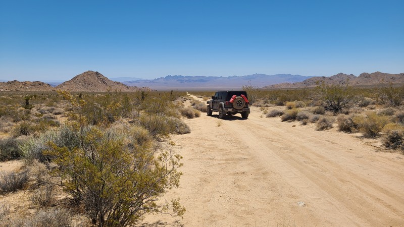
Updated: 07/02/2026
Sunflower Springs Road
Fenner, California
Starting at the near ghost town of Essex, California, Sunflower Springs Road skirts the eastern edge of the Old Woman Mountains Wilderness and passes several intersecting hiking and motorized trails that lead into the wilderness and often to abandoned mines. A working cattle corral is next to the trail, just before reaching the Native American Land Conservancy, which is surrounded by beautiful rock formations and is approved for day use.
The last 8 miles of NS021 are part of the Eastern Mojave Heritage Trail (EMHT) network Segment 4, and from its end, EMHT continues to Turtle Mountain Road. The Eastern Mojave Heritage Trail (EMHT) network. EMHT Segment 4 is a curated set of trails that provides a 145-mile tour of the remotest areas of the Eastern Mojave. The trail network is managed through a partnership between the Bureau of Land Management (BLM) and the Mojave Desert Heritage and Cultural Association, where details can be found for all four segments of the 733-mile adventure.
While a few existing previously disturbed campsites are visible from the trail, there are many suitable sites along the way to establish a campsite.
Most of the trail passes over the desert basin of Ward Valley, where the road surface is hard-packed sand and flat. There are occasional rocky sections that could be driven over with a 2-wheel drive vehicle with some clearance.
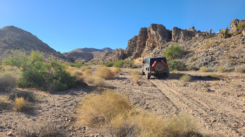
Updated: 07/02/2026
Piute Crossing
Fenner, California
Piute Crossing provides a scenic corridor along the edge of the Piute Mountains Wilderness, with close-up views of the range’s dramatic rock spires and broad vistas east across Ward Valley toward the Sacramento Mountains.
The entire route is part of Eastern Mojave Heritage Trail (EMHT) Segment 4, where the route continues from the west end onto Little Piute Trail. Segment 4 is one section of the larger 733-mile EMHT network and offers a 145-mile tour through some of the most remote terrain in the Eastern Mojave. The trail network is managed through a partnership between the Bureau of Land Management and the Mojave Desert Heritage and Cultural Association.
Only a few previously disturbed campsites are visible from the route, but several other flat, open areas along the trail can work well for dispersed camping.
Most of the route follows flat, hard-packed sand with only occasional rocky sections. In dry conditions, it is generally suitable for most high-clearance two-wheel-drive vehicles.
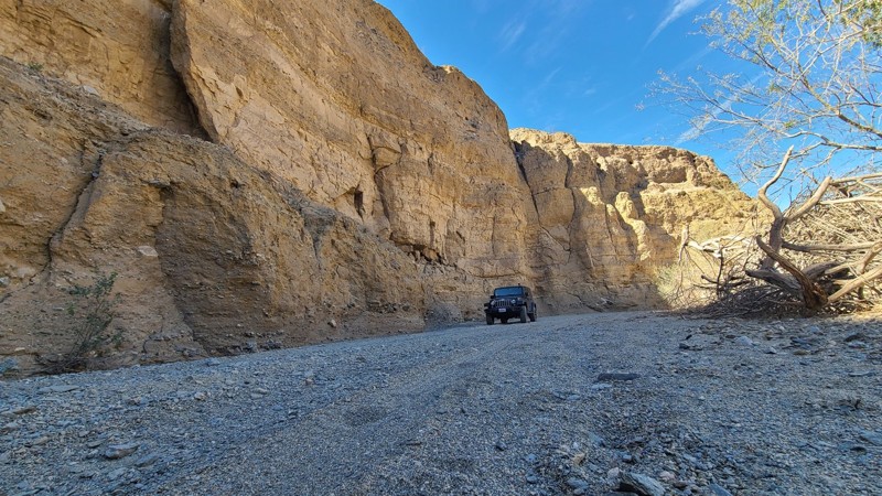
Updated: 06/25/2026
Little Box Canyon Jeep Trail
North Shore, California
Little Box Canyon Road is a short, scenic road tucked into the Mecca Hills just north of the Salton Sea and along the northern border of the Mecca Hills Wilderness. Often described as a smaller version of Anza-Borrego’s Sandstone Canyon, this 2.3-mile west-to-east route winds through sandy washes and tight canyon corridors lined by near-vertical cliffs up to 40 feet tall. The route begins off paved Box Canyon Road at roughly 777 feet and gradually climbs to just over 1,030 feet before connecting with Meccacopia Trail.
The trail is mostly loose sandy gravel, hard-packed dirt, small rocks, and brief patches of deeper sand, making it approachable for first-time off-roaders in a 4WD vehicle.
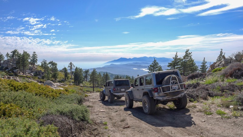
Updated: 07/15/2026
Crafts Peak
Green Valley Lake, California
Hidden high in the mountains of Big Bear, 2N13D Crafts Peak is a little-known out-and-back trail offering some of the best views in the area. Sitting at over 8,000 feet in elevation, the trail travels through a high-elevation forest filled with Jeffrey pine, white fir, lodgepole pine, and western juniper. Do not let the scenery fool you, as 2N13D features an almost nonstop rough and bumpy trail surface with several steep climbs approaching 30 degrees. Loose dirt and rocks can make maintaining traction difficult, although the trail is generally harder on the way in than on the way out. The reward is incredible mountain scenery, including areas with nearly 360-degree views and the opportunity to see several surrounding mountain lakes. Along the route are several small dispersed campsites, although space is limited, with the largest site accommodating only three or four vehicles. Drivers continuing to the end should also be aware that turnaround space is extremely limited, making groups of three or four vehicles the practical maximum. Larger groups can use several areas before the endpoint to park or turn around.
A stock, high-clearance 4x4 should be capable of completing the trail under normal conditions, but airing down is strongly recommended for traction and comfort. Vehicles with heavily worn or low-traction tires may struggle on the steeper, loose climbs.

Upgrade your Membership
Unlock all of the details on every Trail Guide and Scout Route.
Start a 7-day Free TrialCommunity
Partners