










By clicking "ACCEPT", you agree to be the terms and conditions of each policy linked to above. You also agree to the storing of cookies on your device to facilitate the operation and functionality of our site, enhance and customize your user experience, and to analyze how our site is used.
Utah Off-Road Trails
359
Total Trail Guides 334

4759
Detailed Waypoints 925
Try a Free 7-Day Trial and unlock it all
Start a Free Trial Most Recent Trail Reviews
Rated 5/5
Open
Visited: 09/25/2026
We drove this top to bottom in a 2025 Tundra on 34s. No real obstacles, just rough and steep.

SS
Sebastian S.
P
Peaks&Pixels
No Rating
Open
Visited: 09/24/2026
This trail has been graded recently and is now an easy trail.
IE
Ingrid Enyeart
Rated 5/5
Partially Open
Visited: 09/22/2026
The portion of the trail between the fork at 11 and the fork at 13 has two major ledges that have formed going into and out of the wash. Not sure what vehicle could overcome these. So just take the sc...


CI
Christine Irsik
Rated 4/5
Open
Visited: 09/22/2026
We enjoyed this trail and will definitely do it again. Gorgeous views at many points along the trail. We didn’t try The Wall, but everything else was just enough of a challenge for us and nice that m...
LF
Leslie F
No Rating
Open
Visited: 09/22/2026
Drove out here in a thunderstorm after doing dome plateau overlook. Epic camping. peaceful. unparalleled views. trail had two steep rocky sections I used 4wd low but probably didn't need to.

JR
jon ross
No Rating
Open
Visited: 09/21/2026
This is a short 2 mile of so cut off trail. Has a wash out with a by pass half way through.



Earl Neisler
Earl Neisler
Rated 2/5
Open
Visited: 09/21/2026
Pinstripe Alley nonstop for the first 4 miles. INo view to be had until waypoint 7. It was a beautiful view then we turned around. Should’ve read the reviews before we started the trail, because th...
LF
Leslie F
Rated 5/5
Open
Visited: 09/21/2026
This is a highlight for the trip. We stayed at waypoint10 for the night.


Earl Neisler
Rated 4/5
Open
Visited: 09/21/2026
Nice connector. The short out back was the hardest and not that short.


Earl Neisler
Rated 4/5
Open
Visited: 09/21/2026
A well maintained road. Found a nice camp site on the south in.
Earl Neisler

Jesse Martin
Jesse Martin
Rated 5/5
Open
Visited: 09/20/2026
Great area to go camping and gather for family reunions. There are multiple other trails that fork off throughout the trail to explore.

Dustin
Earl Neisler
Rated 5/5
Open
Visited: 09/20/2026
Only did apart due to time. This is 1 I will come back and finish.

Earl Neisler
Rated 3/5
Open
Visited: 09/20/2026
Not much to say it a slow easy. A good connecting trail.
Earl Neisler
No Rating
Open
Visited: 09/20/2026
We started just south of Cottonwood Canyon. We stop and looked but could not fine the rock art. The area was a nice to see all the green.


Earl Neisler
Rated 4/5
Open
Visited: 09/19/2026
Great trail, we drove through waypoints 24-35. Easy ride with a good amount of mud holes with few ruts on the stretch we drove. Would love to complete the whole trail at a later date.
Dustin
Rated 4/5
Open
Visited: 09/19/2026
Fun easy trail. Great way to get out and enjoy a relaxing trail ride to take in nature and see the fall colors.
Dustin
Rated 5/5
Open
Visited: 09/19/2026
Great Trail! The scenery was good with lots of wildlife. The trail was diverse that give drivers the opportunity to use both high and low four wheel drive. Trail has both wide and narrow areas.
Dustin
Rated 5/5
Open
Visited: 09/18/2026
I run this trail every year. Always fun and beautiful views. Fair amount of off camber sections.

Jeff Klaassen
Rated 5/5
Open
Visited: 09/18/2026
This was a good trail. The trail still had so flood damage but was passable. Highly recommended this. Has some all some view. We took 2 day to enjoy the ride and views.


Earl Neisler
No Rating
Open
Visited: 09/16/2026
Very fun, short trail. We did the loop but not Wipeout Hill. The sandy sections were a blast and there were a few ledges and obstacles that probably warrant a 5 but are still a fun challenge. We did i...



Mark Signorelli
Rated 4/5
Open
Visited: 09/15/2026
Ran this one and it's a decent stretch for anyone with a high clearance 4x4. The early sagebrush section had me watching my GPS track closely since the road nearly disappears a few times, but it alway...



Jay North
Official Crew
Rated 4/5
Open
Visited: 09/15/2026
Ran this as a quick add-on while working through the rest of the Red Hills network, and it's a fun one to knock out in under an hour. The wash crossing is the one spot where you actually have to think...


Jay North
Official Crew
Rated 3/5
Open
Visited: 09/15/2026
Ran this one on a dry afternoon and came away satisfied without being blown away. The rocky, rolling grade keeps things interesting without ever feeling out of reach for a stock high clearance rig, th...


Jay North
Official Crew
Rated 4/5
Open
Visited: 09/15/2026
Ran this one on an afternoon when I didn't have time for a full day out, and it delivered more than I expected for a short climb. The hill about a mile in makes you actually think about your line, and...


Jay North
Official Crew
Rated 4/5
Open
Visited: 09/13/2026
Red Peak Road is a short, easy cruise that's mostly smooth dirt with just enough texture to keep it interesting. There's a mild rough patch early on and a slightly rockier stretch past the halfway poi...


Jay North
Official Crew
Rated 2/5
Open
Visited: 09/13/2026
This is an easy, low-key cruise with a short technical bump right in the middle where it ties into the rest of the network, otherwise it is just packed dirt and gravel the whole way. Nothing here dema...


Jay North
Official Crew
Rated 4/5
Open
Visited: 09/13/2026
This one's an easy, mellow cruiser and it shows in how quick it feels behind the wheel. The rocky spots near the start and about two thirds up are barely worth mentioning, just some careful tire place...


Jay North
Official Crew
Rated 5/5
Open
Visited: 09/13/2026
This one's a fun add-on if you're already out in the area, easy enough for most of the way that a stock rig won't break a sweat, with just a couple of hard spots to keep things interesting. The washou...


Jay North
Official Crew
Rated 4/5
Open
Visited: 09/13/2026
A nice view of Kanab. Steepish and possibly slick when muddy. One spot has a small rock shelf. 4x4 recommended.


Ben Ruddell
Official Crew
Rated 3/5
Open
Visited: 09/13/2026
Easy, suitable for high clearance 2WD on a dry day, though four wheel drive earns its keep if the ground's been wet. The ruts along the way are mild and easy to place your tires around, and the two wa...


Jay North
Official Crew
No Rating
Open
Visited: 09/12/2026
Crazy no reviews since I ran it last May. We ran it again this time the whole trail out to the south overlook. It had rained the night before and into the morning. The rock dried up quick but a lot o...



Andrew Hotton
Rated 5/5
Open
Visited: 09/12/2026
Sand dunes. DANGER, you need to know your technique to head in here. It’s easy to misjudge slope and camber and get stuck or worse roll.


Ben Ruddell
Official Crew
Rated 3/5
Open
Visited: 09/12/2026
The section of the trail was rocky and rough - still fairly easy but the rockiest stretch.
WF
Wyatt Frampton
Rated 4/5
Open
Visited: 09/12/2026
This trail checks so, so many of the boxes -- hanging off a cliff, passing within 4" of rocks on BOTH sides at the same time on narrow sections, meaningful obstacles (ledges) where I smacked my hitch ...
IR
Isaac R
Rated 3/5
Open
Visited: 09/12/2026
This is an easy, high clearance 2WD road, easy enough that the drive itself isn't the draw. The shelf road stretch is mild and only about two jeeps wide, so keep an eye out for oncoming traffic, and t...


Jay North
Official Crew
Rated 2/5
Open
Visited: 09/12/2026
This is a mellow, low-stress drive that rewards a relaxed pace more than any technical challenge. Stock high clearance handled every mile without a second thought, and the surface stayed predictable e...


Jay North
Official Crew
Rated 5/5
Open
Visited: 09/11/2026
Great rest quick trail! Perfect for beginners, fun place for a picnic. The entrance and exit terrain to the tunnel changes depending on the weather and use. Very fun and interesting.


Dustin
Rated 4/5
Open
Visited: 09/11/2026
My route didn’t originally include this trail, but one of my crew broke on impossible hill and we had to limp back to civilization. This trail was beautiful and remote. Difficulty wise, no issues on t...



Dewie Jones
Official Crew
Rated 4/5
Open
Visited: 09/10/2026
Way better than I thought it would be. This was simply a connector trail for my unsuccessful (broken Toyota) Blanding to Moab overland trip. The trail is absolutely beautiful, relatively fast access, ...
Dewie Jones
Official Crew
Rated 3/5
Open
Visited: 09/10/2026
Easy enough that I did this road in pitch-black with just headlights (no light bar or anything) on the way to see sunrise from the end of the trail (Hurrah Pass). Really straightforward, just rocky li...
IR
Isaac R
Rated 4/5
Open
Visited: 09/10/2026
Incredibly beautiful road and not really rough at all -- I did a bunch of with fully-inflated tires. I know it's just a connector but honestly I would 100% come out here again to enjoy the views, hang...
IR
Isaac R
Rated 4/5
Temporary Closure
Visited: 09/10/2026
Deep mud around river crossing prevents passage. We came from Goblin Valley side, we were able to cross the river but there was deep mud on south side due to recent rains. Almost got stuck, had to go ...

Thomas A Youngerman
Rated 5/5
Open
Visited: 09/09/2026
Incredible bucket list trail that you must do if you can. DON'T do it in 1 day unless you like rushing it, unfortunately circumstances changed that required us to rush it. It's gorgeous and worth an o...



Sean Allen
Rated 5/5
Open
Visited: 09/09/2026
I built this into our rocklanding/overland route and really enjoyed the adventure. You can tell this isn’t well traveled which added to the experience. With that said, we’re trying to get to Moab from...


Dewie Jones
Official Crew
Thomas A Youngerman
Most Popular

Updated: 08/26/2026
Hogs Back Road
Timber Lakes, Utah
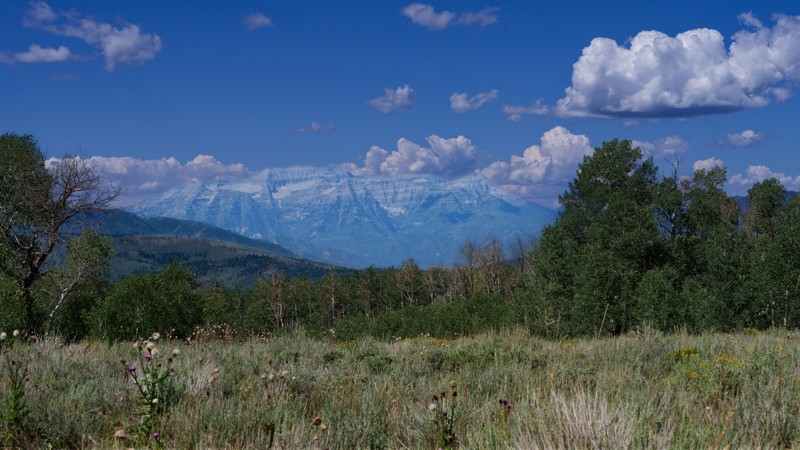
Hogs Back Road works its way through aspen groves and open meadow before topping out near Tower Mountain in the western Uinta Mountains. Along the way, it passes an old split-rail corral, a small hunter's cabin, and a spur not listed on the official motor vehicle use map to an overlook of Center Creek Number 5 Reservoir, finishing with a wide view across the western Uintas from the shoulder of Tower Mountain. The route works well as a scenic out-and-back or as a way to connect to other trails in the Center Creek drainage, with Mount Timpanogos visible early in the drive.
The road runs mostly one vehicle wide with regular pullouts and calls for a high clearance 4x4. Most of the mileage is a moderate, steady two-track, but a rockier, rutted stretch about a third of the way in demands careful tire placement, and the final climb toward Tower Mountain tightens into a rougher, more exposed shelf road. Dispersed camping is available along the road, with many sites of varying sizes, including several large enough for a group with several rigs and trailers. Some sites offer shade and privacy from surrounding timber, while others sit more open.
Updated: 09/02/2026
Clear Creek
Panguitch Lake Resort, Utah
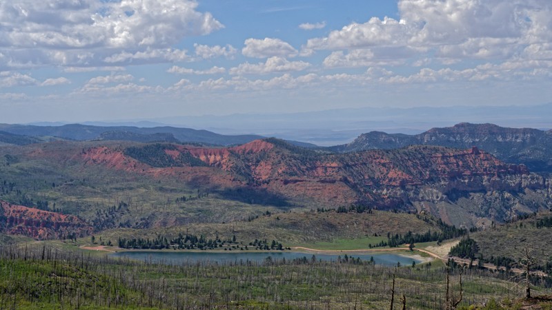
Clear Creek Canyon Road is an out-and-back and works well as a self-contained half-day outing or as a mellow overnight base before tackling something tougher elsewhere on the plateau. High clearance 2WD is enough to handle it, and stock rigs face nothing worse than the occasional rock or dip on a steady, well-graded climb.
Two dispersed campsites sit along the route. The larger is a group-size spot able to hold four or five rigs with trailers, while the smaller offers shade but no privacy.
The road ends at a pass where a separate, much narrower trail continues down the far side of the plateau. That connecting route carries width and weight restrictions, so full-size rigs and anything not built for a tight, technical descent should plan to turn around here.
Updated: 09/09/2026
Brian Head Peak Road
Brian Head, Utah
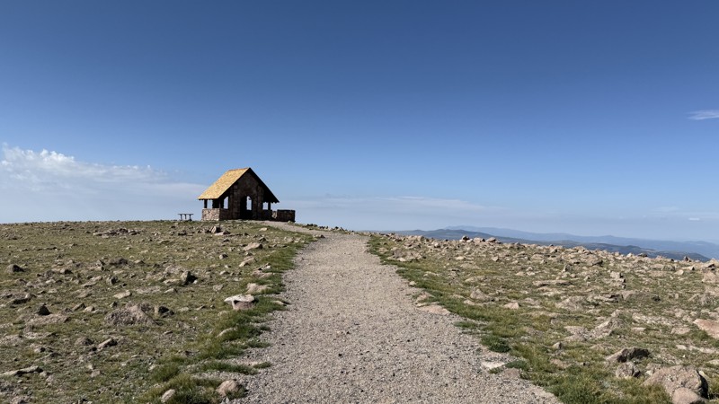
Traveling to over 11,000 feet, Brian Head Peak Road provides access to popular hiking trails such as Sydney Peak and terminates at a remarkable stone structure built in 1935 by the Civilian Conservation Corps. From the structure, expansive views stretch across Utah and into Nevada and Arizona, as well as down toward Brian Head.
The road is hard-packed dirt with embedded limestone rock and is suitable for any vehicle. There is one short section that is a little too narrow for two vehicles to pass, but it's only 3 car-lengths long and has plenty of visibility. A vault toilet is located at the Sydney Peak trailhead parking area. Camping is not permitted.
Updated: 09/02/2026
Monroe Peak Road
Monroe, Utah
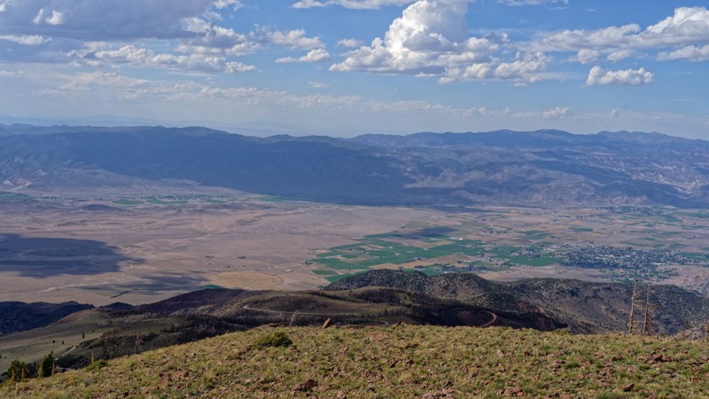
Monroe Peak Road provides a short climb through fire-damaged forest onto the open ridge near Monroe Peak, offering a quick way to reach high-elevation views without technical driving. Along the way, the road passes through timber killed by the Monroe Canyon Fire, which burned across Monroe Mountain and Cove Mountain during the summer of 2025, charring roughly 73,000 acres and threatening the communication infrastructure now visible from the ridge.
The drive rates as easy and is manageable in a stock, high clearance 2WD vehicle with no specialized equipment required. The one spot demanding extra attention is a single lane shelf road section near the top of the climb, where there isn't room to pass an oncoming vehicle, so drivers should slow down and stay alert for other traffic.
No camping is available anywhere along this road, so anyone planning to spend the night in the area will need to find a site elsewhere before or after the drive.
Updated: 04/10/2026
D2997
Green River, Utah
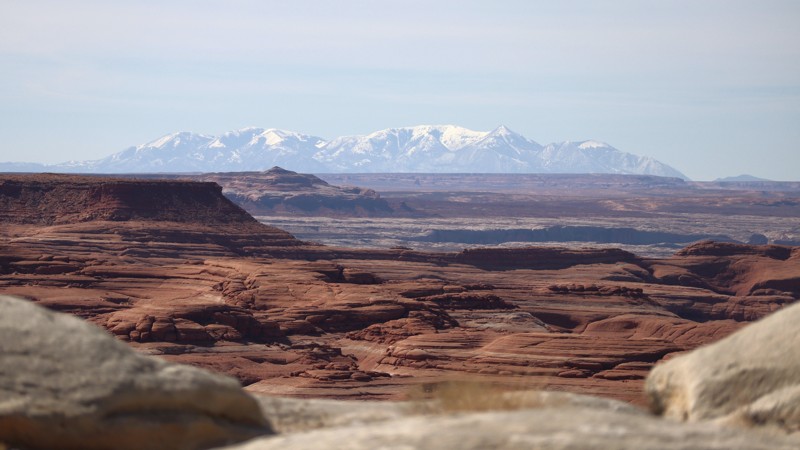
In the 1940s, uranium was a vital wartime commodity, and D2997 was used to access many of the mines scattered throughout this area. Today, the trail crosses a rugged desert landscape with sweeping panoramic views, including an overlook of the White Wash Dunes area. The route is rough and features numerous moderate obstacles, including loose rock ledges 16 to 24 inches tall, steep dirt hills, and scattered softball-sized boulders. High ground clearance, durable off-road tires, and a capable 4WD vehicle are recommended. There are no established campsites along the road.
Updated: 04/10/2026
D3002
Green River, Utah
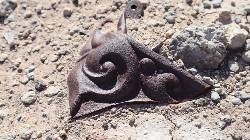
Branching off of D2996, D3002 is a short dead-end to an old uranium mining camp with interesting artifacts left behind. Old cast iron stoves, boot soles, glassware, and falling down buildings are all left for the curious to discover. The short, bumpy two-track is easy enough for stock 4x4s with high ground clearance and durable tires. Avoid driving too far into the site to help prevent tire punctures by old rusty nails. Please help preserve the site and avoid camping at the mine site.
Updated: 04/10/2026
D1783
Moab, Utah
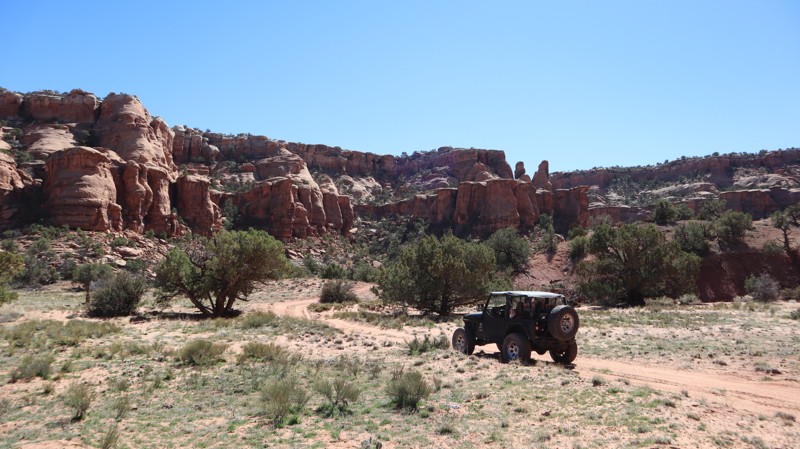
D1783 is a very short dead-end to a small turn around in a dry wash. There is no camping found along the route and the trail can be completed in 2WD high-clearance vehicles.
Updated: 07/16/2026
Berry Springs
Bryce Canyon City, Utah
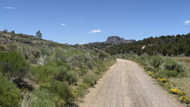
Berry Springs Road connects Tom Springs Road to the Sanford Loop. In dry conditions, it is suitable for any high-clearance vehicle. When wet, however, the road could become impassable.
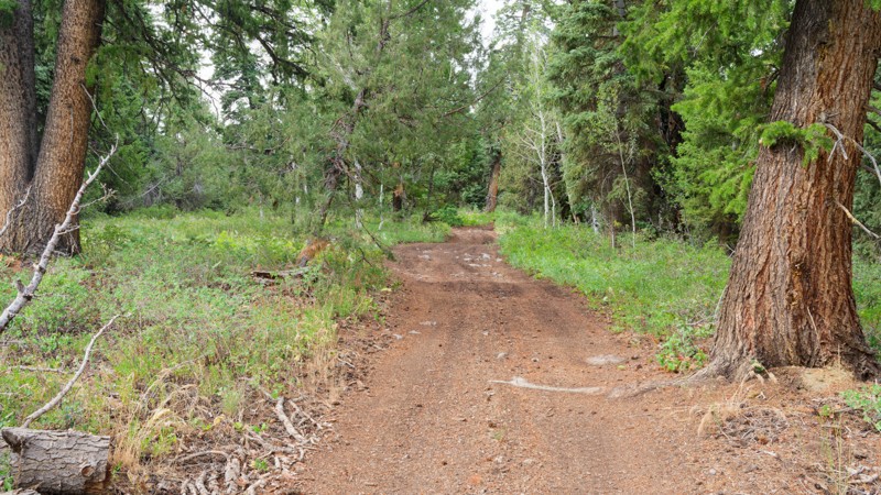
Starting from the east, the road passes through open meadows lined with no-camping signs. True to its name, the road does pass Berry Springs, but be aware that the water is only suitable for the cattle that roam the area. As you continue under the tree canopy, a few campsites begin to appear. The site near Sanford Loop offers an incredible view of Hancock Peak in the distance.
All of the campsites are only large enough for an overland setup, not fifth wheels.
Updated: 08/11/2026
Cedar Hollow West 1
Woodland, Utah
Cedar Hollow West 1 (FS 80199) is a short shelf road in the Wasatch National Forest. Over 1.7 miles it climbs through pine forest along a narrow hillside shelf road, passing embedded rock ledges, loose stone, and a few brush-crowded, occasionally muddy sections before ending at a quiet junction where a hiking trailhead begins and an ATV-only connector continues on (not suited for full-size vehicles). Openings in the trees offer views down into the surrounding drainage, and the trail functions primarily as a short, scenic out-and-back rather than a through route, making it a good option for a quick side trip or a connector to the adjoining hiking trailhead.
Rated easy, the trail is typically manageable in a stock high-clearance 2WD vehicle, though the tightest section of shelf road rewards careful tire placement and benefits from four-wheel drive when the muddy spots are present. No designated campsites are noted along the route, making it better suited to a day trip than an overnight stay, and no special permits are called out beyond standard national forest regulations.
Updated: 04/10/2026
Little Flat Top
Hanksville, Utah
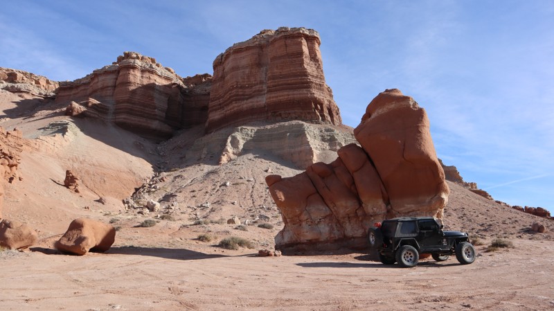
Below Little Flat Top butte, you'll find a short but sweet camp spot for the weary traveler looking for a site for the night. But this spot has a bonus at camp. There is a pillar rock offering shade in the morning, and a conveniently placed rock that acts as a table next to the campfire. There are unique rock formations to explore, and the easy access is hard to resist. It's a little steep getting up the trailhead, but that shouldn't stop high clearance vehicles.
Updated: 04/10/2026
Sand Road
Green River, Utah
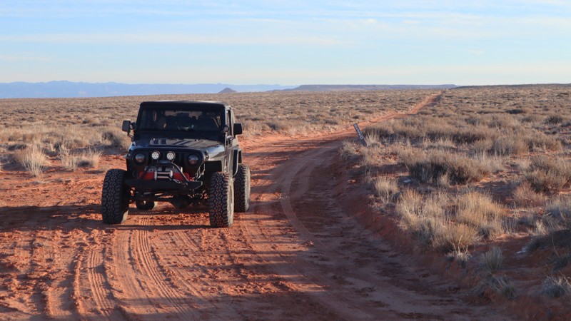
Ideally named, Sand Road is 3.5 miles of nothing but sand. Some days it can be graded smooth, but in the winter it's likely endless cattle hoof holes, that will shake your fillings loose. There are limited options for crossing the desert, and Sand Road is one of them. Heavy vehicles may require 4x4 on sand drifts or hot summer days. No camping is found along the route.
Updated: 07/16/2026
Mud Spring Bench / Mud Spring Creek
Bryce Canyon City, Utah
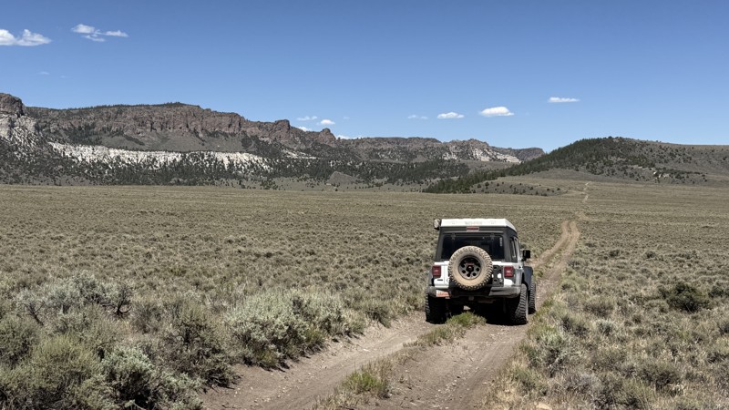
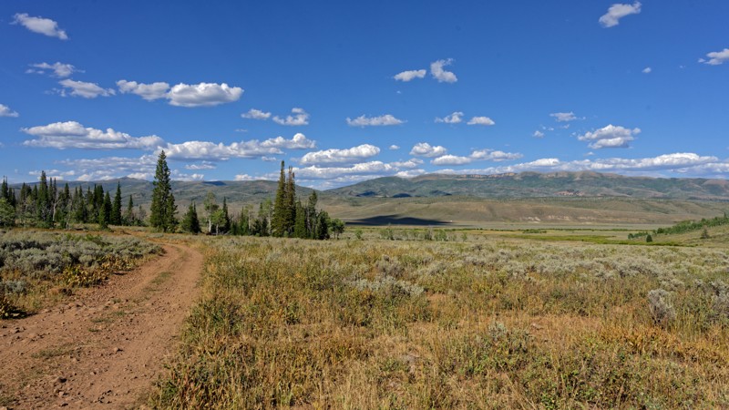
If you enjoy wide-open spaces and that “home on the range” feeling, these roads are for you. Combining Mud Spring Bench, the east-west section, with Mud Springs Creek, the north-south section, this lightly traveled route offers panoramic views of Casto Bluff, Tent Hollow, Mud Spring Ridge, and the surrounding backcountry.
The two-track road is faint in places and lined with sagebrush at the higher elevations and grasses in the lower sections. Four-wheel drive is recommended, as rain or newly formed ruts could quickly make it necessary.
There are minimal pre-existing campsites along the route.
Updated: 08/26/2026
Jones Hollow
Independence, Utah
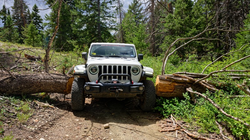
Jones Hollow drops out of the high timber above Soapstone Basin and follows an old forest road down through aspen groves and open meadow toward the lower drainage near Strawberry Reservoir. Expect a dirt and rocky surface with occasional obstacles under 9 inches, minor ruts, and a few tight turns, but nothing that demands low range in dry conditions. Suitable camping is not present on the trail. There are no legitimate campsites along the route, so anyone planning to camp should look for options elsewhere in the surrounding Uinta National Forest. The road ends at a Snowmobile Trail.
Updated: 08/26/2026
Upper White River
Soldier Summit, Utah
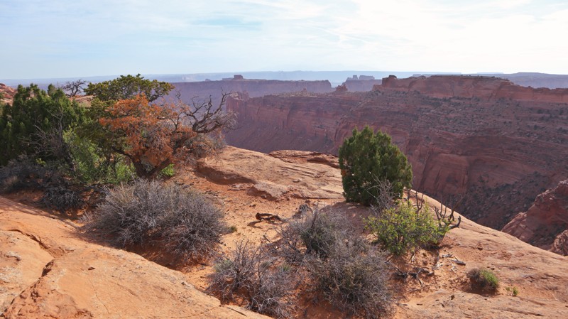
This spur drops off Willow Creek Road, threading through timber above the White River on a mostly narrow shelf. It functions as a dead-end out-and-back rather than a connector.
The going is moderate, challenging the limits of a high clearance 4x4. The toughest section sits roughly a third of the way in, where the shelf tightens, and the road leans off-camber, demanding careful tire placement. Concerns to note include the narrow shelf road itself, where passing oncoming traffic can be difficult, as well as stretches of moderate off-camber lean.
Suitable camping is not present on the road/trail. Drivers planning an overnight will need to look elsewhere in the surrounding forest or plan for a day trip instead.
Updated: 09/02/2026
Horseshoe Canyon/Spur Road
Hanksville, Utah
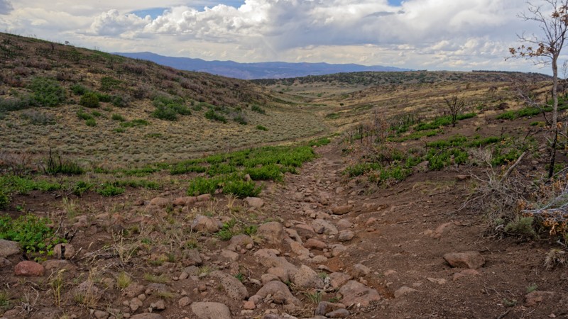
If super remote hiking and camping are your thing, look no further. This semi-graded trail is mainly used to access the hiking trails leading to the Great Gallery rock art site. The trailhead begins at the Maze visitor center, where it's advised to check in before venturing further out into the desert. The trail travels past a couple of unmarked overlooks for the colorful Orange Cliffs. Bring extra water and fuel to explore all the trails along this sandy track. You will need four-wheel drive for the soft sand and high clearance for a couple of rocky sections. A shovel, sand tracks, and other self-recovery devices are advised.
Camping is prohibited without a special permit for the first 12 miles. Once beyond the trail end and Windy Peak, there are a couple of campsites. But the best camping can be found at the end of High Spur Camping.
The Great Gallery is a 2000-8000 year-old life-size, ghost-like figures painted on the cliff walls. A challenging 3.7-mile sandy hike is required to reach the panel. The hiking trailhead begins at the end of Spur Road.
Updated: 09/02/2026
E Of Cove Mountain Road
Glenwood, Utah
E of Cove Mountain Road is a quick out-and-back rather than a route to anywhere in particular. It ends at private property. Most of the drive is a mellow forest two-track, but a rocky section roughly three hundred yards long breaks up the run and is the reason for its rating.
A stock high clearance 4x4 handles this trail without issue. The rocky stretch calls for careful tire placement to avoid undercarriage contact, but the rest of the ascent/descent is straightforward dirt with occasional loose or steep spots. No concerns beyond the terrain itself apply here.
There is no camping along this road. Drivers looking to camp nearby will need to find a spot elsewhere before or after running the trail.
Updated: 09/23/2026
Sugarloaf Mountain
Summit, Utah
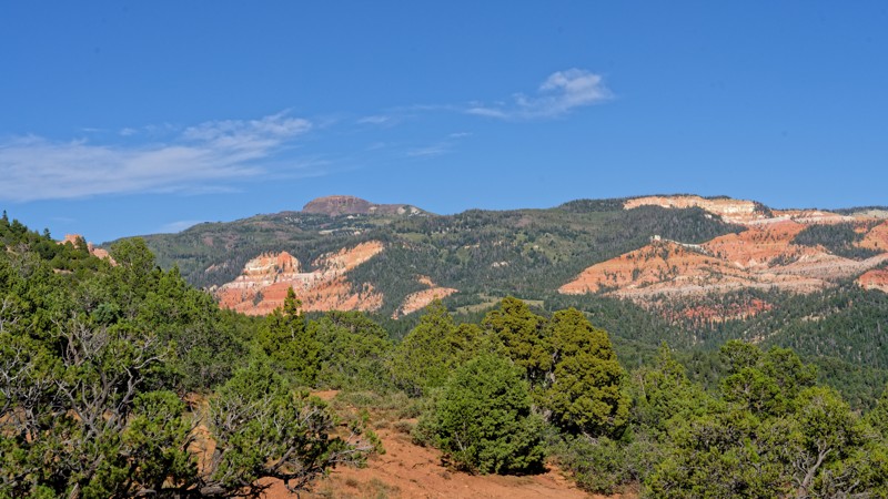
Summit Mountain Road works well as a link for travelers moving between the Panguitch Lake area and Brian Head, with the payoff being access to the Twisted Forest trailhead at the far end. The road is easy and stays within reach of a stock high clearance 2WD, and only a brief rocky stretch and a shallow stream crossing interrupt an otherwise straightforward dirt surface. Drivers looking for more of a challenge can detour onto an optional spur near the trailhead that steps up in difficulty before rejoining the main route.
Camping is dispersed and spread across several clusters along the corridor, adding up to roughly a dozen informal spots in all. Sizes and settings vary widely, from single vehicle pull-offs near the road to a couple of sites tucked slightly off the corridor among trees, where both shade and a measure of privacy can be found. Open areas closer to the road tend to lack cover, so those wanting more seclusion should look toward the tree-shielded spots farther along the route.
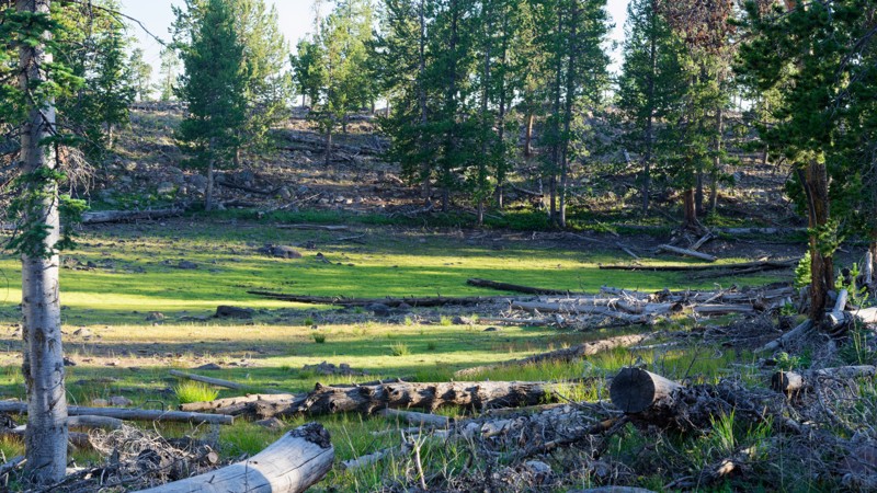
The road briefly crosses private land partway through, where staying on the established road is required. Portions of the corridor burned during the 2017 Brian Head Fire, and aspen regrowth marks where the blaze moved across Cedar Mountain. At its southern end, the road reaches the Twisted Forest trailhead, home to ancient bristlecone pines whose twisted shapes come from centuries of partial dieback sculpted by wind and weather.
Updated: 09/23/2026
Low Mountain Road
Brian Head, Utah
Low Mountain Road links the high timber of the Markagunt Plateau to the lower forest below, offering a quiet descent through changing terrain rather than serving as a connector between other named routes. It works well as a scenic cruise for those exploring the Cedar City Ranger District, with mule deer and elk sightings common through the open meadows along the way.
A high clearance 4x4 is recommended. Two sections stand out from an otherwise mellow dirt and rock surface: a loose rock climb partway down and a set of deep ruts further along that demand careful line choice. Brush closes in tight enough in one stretch to pinstripe a vehicle's paint, and the road briefly crosses private land, so the gate there must be kept closed and travel stays on the road through that section.
Suitable camping is not present on the road, so plan to camp elsewhere before or after running this route.
Updated: 01/12/2026
Orange Trail Shelf Road
Green River, Utah
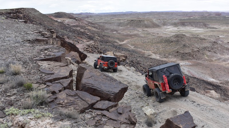
Orange Trail Shelf Road is a short, moderate spur road off of Orange Trail. At the trailhead, it can look like a simple cattle track across open prairie, but it quickly transitions into a narrow descent that opens up valley views to the south. This spur serves as an alternate access point to the Orange Trail, linking travel between Salt Wash North and the Crystal Geyser Jeep Trail area. The narrow passage down a tight shelf road adds a bit of excitement to an otherwise mundane trail. The difficulty of this trail comes from the exposure. Full-width vehicles such as 1-ton pickups, vans, and vehicles towing trailers should avoid this trail. Otherwise, the trail is suitable for any high clearance vehicle.
Camping is not suitable along this trail, but can be found on many nearby roads.
Updated: 08/26/2026
Spring Canyon 1
Woodland, Utah
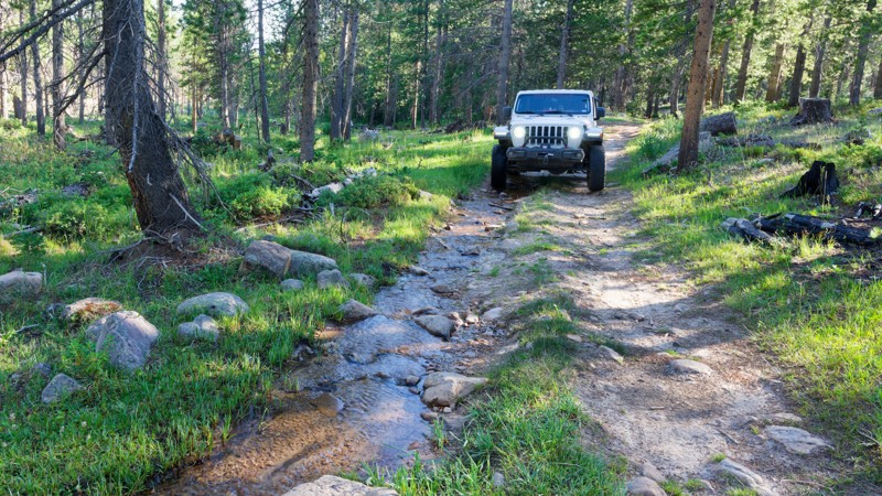
Spring Canyon 1 branches off Spring Canyon Road in the high country above Trial Lake. It runs through dense lodgepole pine and spruce before opening onto a meadow with a small pond (when in season) at the end. Drivers use this route mainly for the meadow and pond.
The surface alternates between rutted dirt and exposed rock, with ledges and washed-out sections generally under a foot tall. The route is narrow, mostly one-vehicle-wide, with tight turns between trees that require careful line choice and some maneuvering in longer-wheelbase rigs. It's a slow, deliberate drive rather than a technical one, and a stock suspension will feel the rocks and ruts.
Dispersed camping is available along the trail, with two to three sites. The largest is a group-sized site that can comfortably hold several rigs. The forest canopy along the route provides good shade at the campsites, though the lack of tight tree spacing limits privacy.
Updated: 08/19/2026
Mansard Trail
Kanab, Utah
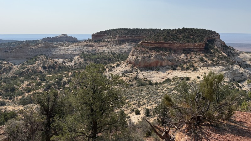
The Mansard Trail connects BLM 100 with the Hog Canyon Trail System before continuing south and eventually dead-ending at a parking area for the short hike to the Mansard Petroglyphs. Between BLM 100 and the Hog Canyon Trail System, the northern 4 miles are generally non-technical and suitable for most 4WD vehicles. South of the Hog Canyon Trail System, however, the road narrows considerably, and larger rigs, including full-size pickups and taller vehicles, may have difficulty navigating tight trees, off-camber terrain, and deep, soft sand.
Along the higher portions of the route, the views are striking, with sweeping vistas across the surrounding Grand Staircase landscape and south toward Kanab and Fredonia. A few flat, previously disturbed areas also provide opportunities to pitch a tent for the night.
The final mile becomes considerably more challenging as the trail descends steeply toward the Mansard Petroglyphs parking area. Soft sand, loose dirt, and exposed rock can make traction difficult, and traveling this section alone is not recommended due to the terrain and limited recovery options.
Updated: 08/26/2026
Spring Canyon 2
Woodland, Utah
Spring Canyon 2 is a short segment on the south side of the Mirror Lake corridor. The route runs through pine and aspen forest. The tread alternates between packed dirt, grassy margins, and stretches of embedded cobble, with a section that firms up into a rock garden covering the full trail width. It connects into the broader Spring Canyon network, which is known for its backcountry lakes and quiet camping, making this stretch a useful link for those exploring further into the Soapstone Basin area.
Suitable camping is not present on this segment of trail. Those looking to camp should plan on finding a site elsewhere in the Spring Canyon or Soapstone Basin area.
Updated: 08/26/2026
Box Springs
Independence, Utah
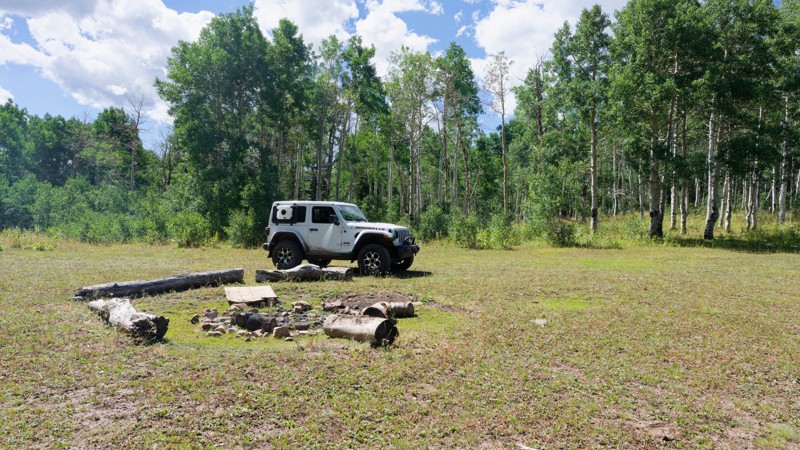
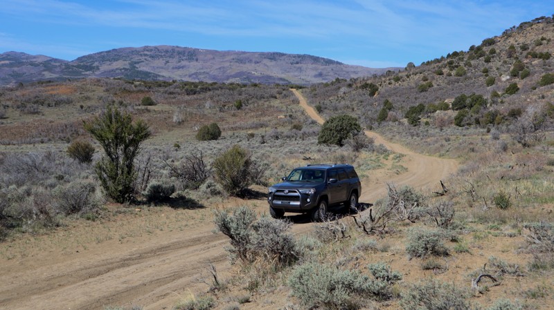
Box Springs is a short road that drops through pine and fir forest before ending at a dispersed camping area in a shady drainage. It is used mainly as a quick out-and-back for anyone wanting an easy overnight spot, rather than as a through route to other trails. Along the way it passes a rocky, undulating midsection that breaks up an otherwise mellow drive through dense timber.
At just under a mile, most of the trail is straightforward two-track suited to a stock high-clearance 4x4 with off-road tires. The middle third is where it earns its Moderate rating, with ruts and a narrower line that calls for careful tire placement, though low range isn't needed. The road stays about one vehicle wide for most of its length, with occasional pull-outs for passing oncoming traffic.
Dispersed camping is available at the far end of the trail, with two to three sites spread along the bottom of the drainage. The largest comfortably fits three or more rigs or a larger group, and the sites offer both shade and privacy under the surrounding trees.
Updated: 08/27/2026
Old Woman Road
Whipup, Utah
Old Woman Road is a 12.7-mile dead-end camping trail within the Fishlake National Forest. Crossing under the interstate and climbing up into the trees will reward you with a couple of free campsites. The campsites have enough room for a couple of vehicles with tents. In dry conditions, the trail can be completed in 2wd. The trail is closed when it is wet or snow-covered. The best camping is far up on the ridge, a short distance before the private property closure.

Upgrade your Membership
Unlock all of the details on every Trail Guide and Scout Route.
Start a 7-day Free TrialBrowse Trails in Utah by City
Browse every Utah city with offroad trail guides.
Community
Partners

