


By clicking "ACCEPT", you agree to be the terms and conditions of each policy linked to above. You also agree to the storing of cookies on your device to facilitate the operation and functionality of our site, enhance and customize your user experience, and to analyze how our site is used.
Wyoming Off-Road Trails
25
Total Trail Guides 23

281
Detailed Waypoints 59
Try a Free 7-Day Trial and unlock it all
Start a Free Trial Most Recent Trail Reviews
Rated 5/5
Open
Visited: 06/14/2026
After a weekend spent in Dubois we were looking for the best way to get back to Ogden without going through Jackson Hole and the weekend tourist traffic. Union Pass was perfect, it was scenic and easy...

Ariana Dufour
Official Crew
Open
Visited: 06/13/2026
Beautiful drive. Road is well maintained and not washboarded. Even though the road is great I only saw 3 other cars the whole time. Mosquitoes were really bad in the pines
DC
Darrin Collard
Rated 5/5
Open
Visited: 06/04/2026
Easy trail with some washboard and steep sections.
SB
Scott Barton
Seasonal Closure
Visited: 06/01/2026
According to this trails management agency, the trail is likely closed for the season.
You can reach out to the agency for more details.
Be sure to leave us a report and let us know ...

Trails Offroad
Rated 4/5
Open
Visited: 05/25/2026
Easy to moderate trail. Do not attempt without a high clearance 4x4. Beautiful views from the top. Being a Wyoming boy, I had never done this trail. Good fun drive. Not terribly busy. Worth the ...
Joe
No Rating
Open
Visited: 05/20/2026
Crazy Woman Canyon road is now open for the season.
TN
Troy Nye
No Rating
Open
Visited: 04/18/2026
Road is completely dry right now. It's a little bumpy but pretty much any car can easily make it to the top. Amazing views from the top, absolutely worth the detour off of the main road.
Lee Juszak
TM
Todd Mau
No Rating
Seasonal Closure
Visited: 02/28/2026
According to this trails management agency, the trail is likely closed for the season.
You can reach out to the agency for more details.
Be sure to leave us a report and let us know ...
Trails Offroad
No Rating
Seasonal Closure
Visited: 02/08/2026
2/8/26 Barely any snow, trail seemed to only be open to snowmobiles and closed to all others. Very disappointing. Was trying to get to Jim Creek and then down to the reservoir

David Watson
No Rating
Seasonal Closure
Visited: 01/31/2026
According to this trails management agency, the trail is likely closed for the season.
You can reach out to the agency for more details.
Be sure to leave us a report and let us know ...
Trails Offroad
No Rating
Seasonal Closure
Visited: 01/31/2026
According to this trails management agency, the trail is likely closed for the season.
You can reach out to the agency for more details.
Be sure to leave us a report and let us know ...
Trails Offroad
No Rating
Seasonal Closure
Visited: 01/31/2026
According to this trails management agency, the trail is likely closed for the season.
You can reach out to the agency for more details.
Be sure to leave us a report and let us know ...
Trails Offroad
No Rating
Seasonal Closure
Visited: 01/31/2026
According to this trails management agency, the trail is likely closed for the season.
You can reach out to the agency for more details.
Be sure to leave us a report and let us know ...
Trails Offroad
No Rating
Seasonal Closure
Visited: 01/31/2026
According to this trails management agency, the trail is likely closed for the season.
You can reach out to the agency for more details.
Be sure to leave us a report and let us know ...
Trails Offroad
No Rating
Seasonal Closure
Visited: 01/31/2026
According to this trails management agency, the trail is likely closed for the season.
You can reach out to the agency for more details.
Be sure to leave us a report and let us know ...
Trails Offroad
No Rating
Seasonal Closure
Visited: 01/31/2026
According to this trails management agency, the trail is likely closed for the season.
You can reach out to the agency for more details.
Be sure to leave us a report and let us know ...
Trails Offroad
No Rating
Seasonal Closure
Visited: 01/31/2026
According to this trails management agency, the trail is likely closed for the season.
You can reach out to the agency for more details.
Be sure to leave us a report and let us know ...
Trails Offroad
No Rating
Partially Open
Visited: 01/16/2026
Snow has rendered the trail impassable for the season
Ryan Boudreau
Official Crew
Ryan Boudreau
Official Crew
No Rating
Seasonal Closure
Visited: 12/14/2025
According to this trails management agency, the trail is likely closed for the season.
You can reach out to the agency for more details.
Be sure to leave us a report and let us know ...
Trails Offroad
No Rating
Seasonal Closure
Visited: 12/14/2025
According to this trails management agency, the trail is likely closed for the season.
You can reach out to the agency for more details.
Be sure to leave us a report and let us know ...
Trails Offroad
No Rating
Seasonal Closure
Visited: 12/14/2025
According to this trails management agency, the trail is likely closed for the season.
You can reach out to the agency for more details.
Be sure to leave us a report and let us know ...
Trails Offroad
Partially Open
Visited: 12/05/2025
Road is currently impassable due to snow. See you next summer!
Ryan Boudreau
Official Crew
No Rating
Seasonal Closure
Visited: 11/30/2025
According to this trails management agency, the trail is likely closed for the season.
You can reach out to the agency for more details.
Be sure to leave us a report and let us know ...
Trails Offroad
No Rating
Seasonal Closure
Visited: 11/30/2025
According to this trails management agency, the trail is likely closed for the season.
You can reach out to the agency for more details.
Be sure to leave us a report and let us know ...
Trails Offroad
No Rating
Seasonal Closure
Visited: 11/30/2025
According to this trails management agency, the trail is likely closed for the season.
You can reach out to the agency for more details.
Be sure to leave us a report and let us know ...
Trails Offroad
No Rating
Seasonal Closure
Visited: 11/30/2025
According to this trails management agency, the trail is likely closed for the season.
You can reach out to the agency for more details.
Be sure to leave us a report and let us know ...
Trails Offroad
No Rating
Seasonal Closure
Visited: 11/30/2025
According to this trails management agency, the trail is likely closed for the season.
You can reach out to the agency for more details.
Be sure to leave us a report and let us know ...
Trails Offroad
No Rating
Seasonal Closure
Visited: 11/30/2025
According to this trails management agency, the trail is likely closed for the season.
You can reach out to the agency for more details.
Be sure to leave us a report and let us know ...
Trails Offroad
No Rating
Seasonal Closure
Visited: 11/30/2025
According to this trails management agency, the trail is likely closed for the season.
You can reach out to the agency for more details.
Be sure to leave us a report and let us know ...
Trails Offroad
No Rating
Seasonal Closure
Visited: 11/30/2025
According to this trails management agency, the trail is likely closed for the season.
You can reach out to the agency for more details.
Be sure to leave us a report and let us know ...
Trails Offroad
No Rating
Seasonal Closure
Visited: 11/30/2025
According to this trails management agency, the trail is likely closed for the season.
You can reach out to the agency for more details.
Be sure to leave us a report and let us know ...
Trails Offroad
No Rating
Seasonal Closure
Visited: 11/30/2025
According to this trails management agency, the trail is likely closed for the season.
You can reach out to the agency for more details.
Be sure to leave us a report and let us know ...
Trails Offroad
No Rating
Seasonal Closure
Visited: 11/30/2025
According to this trails management agency, the trail is likely closed for the season.
You can reach out to the agency for more details.
Be sure to leave us a report and let us know ...
Trails Offroad
Seasonal Closure
Visited: 11/30/2025
According to this trails management agency, the trail is likely closed for the season.
You can reach out to the agency for more details.
Be sure to leave us a report and let us know ...
Trails Offroad
No Rating
Seasonal Closure
Visited: 11/30/2025
According to this trails management agency, the trail is likely closed for the season.
You can reach out to the agency for more details.
Be sure to leave us a report and let us know ...
Trails Offroad
No Rating
Seasonal Closure
Visited: 11/30/2025
According to this trails management agency, the trail is likely closed for the season.
You can reach out to the agency for more details.
Be sure to leave us a report and let us know ...
Trails Offroad
No Rating
Seasonal Closure
Visited: 11/30/2025
According to this trails management agency, the trail is likely closed for the season.
You can reach out to the agency for more details.
Be sure to leave us a report and let us know ...
Trails Offroad
No Rating
Seasonal Closure
Visited: 11/30/2025
According to this trails management agency, the trail is likely closed for the season.
You can reach out to the agency for more details.
Be sure to leave us a report and let us know ...
Trails Offroad
Rated 4/5
Open
Visited: 11/27/2025
Keep on the trail. Mostly private land on either side of the road. This one is treacherous during heavy snows. The Wyoming wind quickly makes it zero visibility. On a clear day it is just a better way...
Troy Smith
Rated 5/5
Open
Visited: 11/27/2025
Have run this one dozens of times over the years. It’s a great place to explore, camp, and just get away. There is a little playground to test your skills behind one of the climbing walls and tons of ...
Troy Smith

David
Rated 5/5
Open
Visited: 11/11/2025
At first this trail looks like it should be a 1/10. But after a while, the many small embedded rocks will rattle you silly. So, yeah. 2/10. We only ran up to Centennial Ridge (Waypoint 4). There's a l...


Trint Ladd
Official Crew
Rated 5/5
Open
Visited: 11/08/2025
There's a couple of inches of snow, well packed and icy in spots. The many little mud puddles are iced over. We broke through the ice unexpectedly a few times. Thankfully, they are not deep, so no iss...
Trint Ladd
Official Crew
No Rating
Seasonal Closure
Visited: 10/31/2025
According to this trails management agency, the trail is likely closed for the season.
You can reach out to the agency for more details.
Be sure to leave us a report and let us know ...
Trails Offroad
No Rating
Seasonal Closure
Visited: 10/31/2025
According to this trails management agency, the trail is likely closed for the season.
You can reach out to the agency for more details.
Be sure to leave us a report and let us know ...
Trails Offroad
No Rating
Seasonal Closure
Visited: 10/31/2025
According to this trails management agency, the trail is likely closed for the season.
You can reach out to the agency for more details.
Be sure to leave us a report and let us know ...
Trails Offroad
No Rating
Seasonal Closure
Visited: 10/31/2025
According to this trails management agency, the trail is likely closed for the season.
You can reach out to the agency for more details.
Be sure to leave us a report and let us know ...
Trails Offroad
No Rating
Open
Visited: 10/25/2025
Easy smooth drive. Lots to Look at and see. Great rock formations and a place where the river disappears then reappears further down the canyon. Another place where there are huge bolders and the w...
Joe
Most Popular


Updated: 06/17/2024
Monument Ridge
Partially Open
/
Hoback Junction, Wyoming/
2.16 miles/
About 30 minutes
Located about an hour from Jackson in the Bridger-Teton National Forest, Monument Ridge is one of only two fire lookouts in Wyoming accessible by road. The road provides incredible views of nearby mountain ranges and is a common destination for hikers, bikers, and off-road adventure seekers, especially Jeep enthusiasts. Monument Ridge is the only Jeep Badge of Honor Trail (BOH) in the state of Wyoming and is easily accessible from nearby Highway 191.

Updated: 07/18/2023
Morrison Jeep Trail
Cody, Wyoming
The Morrison Trail is an iconic trail that should be on your bucket list… if you can stomach very narrow shelf roads. This trail is for advanced drivers only. Once you start the climb up the switchbacks, there is nowhere to turn back if you decide it is too much for you. All of the switchbacks are multiple point turns for anything but very small wheelbase rigs. You will be off camber while climbing tight switchbacks while your suspension is flexed. There is no room for error, no winch points if you get into trouble and you can literally hear the edges of the cliff crumbling away as you drive in some areas.
The trail is most famous for the 28 switchbacks(or so depending on what you count). The panoramic views at the top are well worth the intense few hours it may take to climb up the side of the cliff. You begin along the Clarks Fork River and climb to the top of the Beartooth Plateau gaining 2,000ft of elevation in two miles. The Clarks Fork Canyon where you begin is the canyon that Chief Joseph and the Nez Perce Indians traveled through in 1877 to escape the pursuing Army. The scenic byway to the south of the canyon is named after Chief Joseph and has a few interpretive signs along the drive.

Updated: 10/31/2024
Cascade North Twin
Centennial, Wyoming
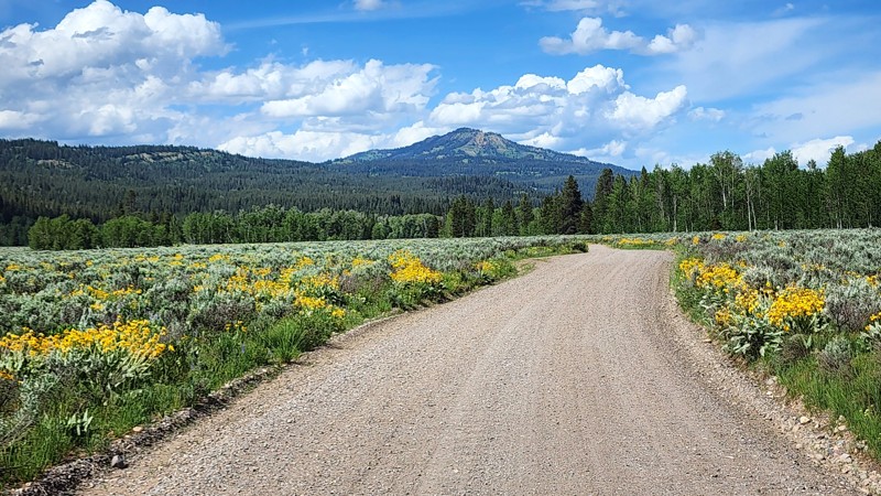
Wheeling Forest Service Road 103 is what some would call a "tour of the lakes". This off-road trail one of the best to view high mountain lakes. You pass by South and North Twin Lakes, Dipper and Queally Lake, along with Cascade Lake. Feeding all these lakes are crystal clear streams and brooks which you can't help but appreciate as you listen and look at them. All of this water leads to a visually pleasing trip through many colorful and delicate sub-alpine meadows. This route lies within the Snowy Range of the Medicine Bow-Routt National Forests, it is pristine and less crowded than some of the most well-known areas that tend to get most of the attention. This is the perfect destination for an overland adventure.

Updated: 08/06/2024
Pumpkin Vine Road
Laramie, Wyoming
Put your boots on and saddle up your trusty four-wheeled steed to enjoy an excursion through the old west of Southeast Wyoming. Pumpkin Vine Road meanders through the high prairies south of Laramie Wyoming. This easy gravel road is a great alternative to the other asphalt routes when traveling to the Vedauwoo Recreation Area between Laramie and Cheyenne. Don't forget to stop and see the Ames Monument, a large pyramid paying tribute to the area's rich railroad history. Ames Monument is listed on the National Register of Historic Places and is maintained as a State of Wyoming historic site.

Updated: 06/01/2024
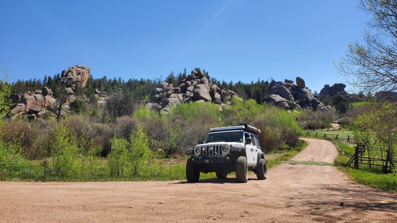
Vedauwoo Road
Laramie, Wyoming
Vedauwoo Road is an easy back-country road in the Medicine Bow National Forest between Cheyenne and Laramie, Wyoming. Native American named, the word Vedauwoo (pronounced Vee-da-voo) means “Land of the earth-born spirits.” The giant rock piles and outcroppings along Vedauwoo Road are Sherman Granite and contain an abundance of feldspar, giving the rock its distinctive pink color. Vedauwoo is popular with rock climbers and offers dozens of climbing routes. Looking closely at the outcroppings, one will likely find technical climbers during a visit. Hiking and camping are both popular activities in this mesmerizing and iconic venue. Once seeing the precariously balanced and oddly placed rocks throughout the vicinity, one will see why Native Americans felt spirits in this unique place.

Updated: 08/12/2025
Greys River
Calpet, Wyoming
Greys River, FR 10138, follows its namesake waterway through Wyoming's rugged Bridger National Forest. This scenic dirt road is a feast for the eyes. Flanked by towering pine trees backed by prominent mountain peaks, the trail passed through a stunning panorama that never ceases to amaze. The remote location and sense of wilderness add to the sense of adventure. The river is home to various trout species making it quite popular with fly fishing enthusiasts. The road is usually graded but can be rough. Any 2WD SUV will have no difficulties.
There are ample dispersed camping sites along the way, allowing visitors to immerse themselves in the beauty of the natural surroundings. First-come, first-served improved campgrounds with amenities are scattered along the track.

Updated: 06/29/2024
Libby Flats
Centennial, Wyoming
Traversing the high mountain tundra and forest in southern Wyoming's Snowy Range, Libby Flats is an intermediate 4x4 trail that meanders through the Medicine Bow National Forest. This multi-use trail is only open and accessible for a few months each year because of the exceptional volume of snowfall during the winter and spring. Luckily, the golden fall color from abundant aspen trees makes up for the short season.
Libby Flats is a trail to take for the beauty of the high mountain views. Although this area receives considerable snow during the winter, that is not how the Snowy Range Mountains received their name. The color of the rocky peaks gives the appearance of being covered with snow even when no snow is present.

Updated: 06/01/2024
Eagle Rock Road
Laramie, Wyoming
Nestled in the high mountain plains of southeastern Wyoming, Eagle Rock Road wanders through the unique piles of granite rock prevalent in the Pole Mountain recreation area. You will experience the feeling of both the wide-open prairie as well as the pine and aspen forest during the journey along this trail. The namesake feature, Eagle Rock, is found in the center of this loop-shaped trail and offers a beautiful backdrop to an abundance of camping, hiking, and off-road activities. The various rock formations in the area are popular for rock climbing while numerous streams and beaver ponds attract fishing. Open most of the year, the area provides the opportunity for a snowy off-roading experience in the winter. The wind is notoriously strong and common here and can cause deep snowdrifts to form from only a few inches of snowfall.

Updated: 06/21/2023
Ehlin Road
Centennial, Wyoming
Ehlin Road provides access to many of the historic mining camps from the late 1800s and the Roby Roy Reservoir near Centennial, Wyoming. The area was initially used for logging railroad timbers until gold was discovered in 1875. Soon, mining claims popped up west along the Centennial Ridge and Ehlin Road. Mineshaft structures and homestead log cabins are scattered throughout the region. This is also the secret shortcut if your destination is Rob Roy Reservoir in Wyoming's Snowy Range. It travels through the popular Cinnabar Park, a popular camping destination suitable for RVs and large trailers. An abundance of US Forest Service Road provided endless opportunities to explore.

Updated: 06/01/2024
Crow Creek Road
Laramie, Wyoming
The Crow Creek four-wheel drive trail is a great trail to experience mesas of ponderosa pine and stretches of rolling grasslands. The trail is situated in the Pole Mountain unit of the Medicine Bow-Routt National Forest in between Cheyenne and Laramie Wyoming. The Medicine Bow-Routt National Forests and Thunder Basin National Grassland cover nearly 2.9 million acres from north central Colorado to central and northeastern Wyoming. The Pole Mountain section of this magnificent national forest lies just 30 minutes west of Cheyenne. Prior to 1959, this 55,000-acre area was administered by the Department of Defense for military training. There are two old bunkers in the area, and one you get to see from this trail.

Updated: 11/14/2024
Cliff Creek
Hoback Junction, Wyoming
Located southeast of Jackson in the Bridger-Teton National Forest, Cliff Creek is a rare road that offers fantastic backcountry opportunities for all types of users. Along Cliff Creek, you will find abundant dispersed camping options and many non-motorized trails that offer spectacular views, including the scenic Cliff Creek Falls. This area is a premiere big game hunting area and is also used by 4x4 enthusiasts as an access point to the only Wyoming Jeep Badge of Honor Trail (BOH), Monument Ridge.
Updated: 06/18/2026
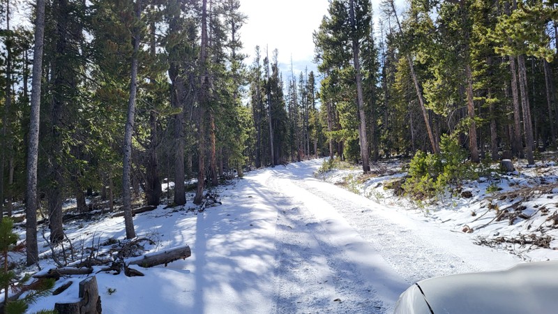
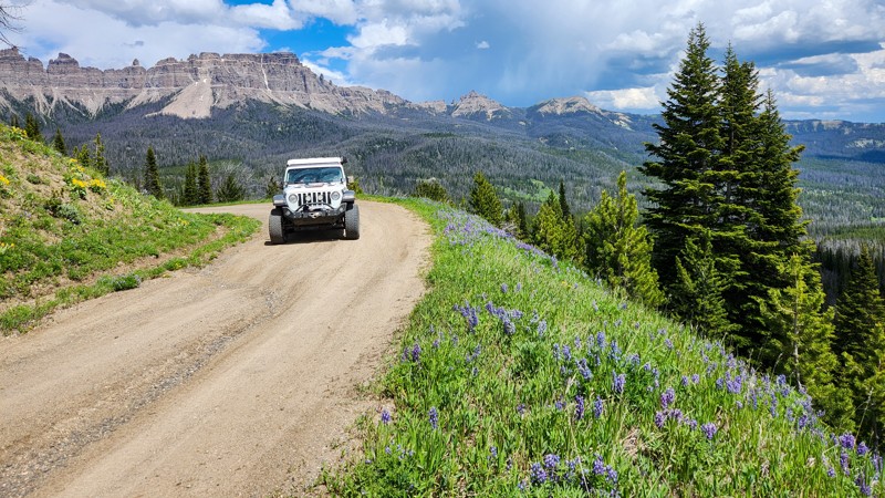
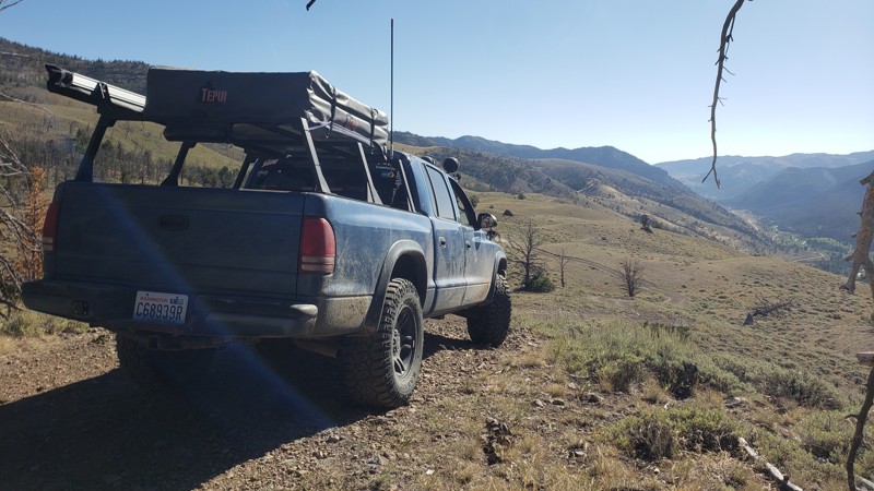
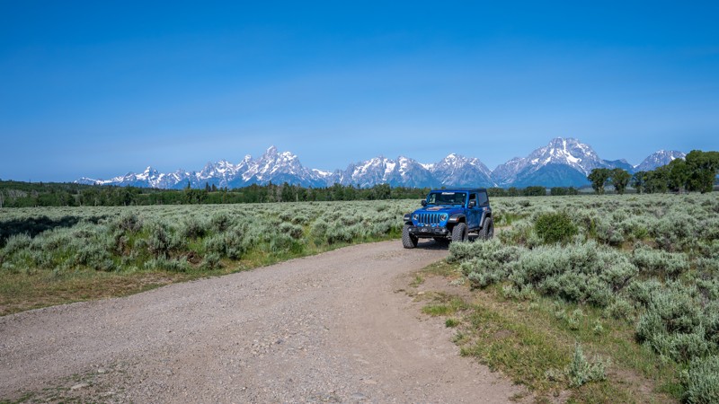
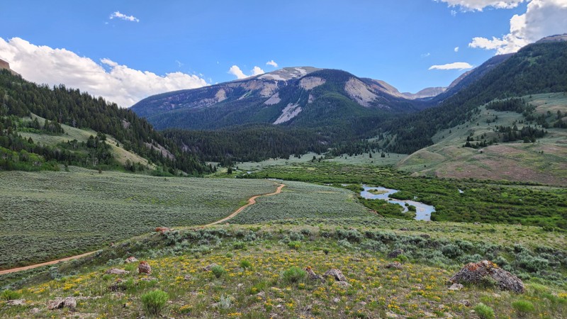
Union Pass
Cora, Wyoming
Union Pass is a maintained dirt road connecting the town of Pinedale to Dubois (the locals pronounce it "dew-boys"). This route showcases many mountain vistas that the Teton National Forest is known for, including Gannett Peak, the highest point in Wyoming, and numerous lakes and streams. This is a great trail if you want to see this special area via dirt instead of asphalt. Any passenger vehicle can handle Union Pass but might be bumpy without airing down your tires.

Updated: 07/02/2023
Hog Park Road
Encampment, Wyoming
Hog Park Road starts in the middle of the beautiful Medicine Bow-Routt National Forest. This trail meanders through thick pine forests and ultimately ends up at the Colorado border. One of the main attractions of this road is the aptly named Hog Park Reservoir, which is a rather large body of water used for fishing and kayaking. The water from here feeds into the North Platte River, which is a significant contributor to the Missouri River. The history behind Hog Park Road dates back to the early 1800s, in which there were a large number of Swedish and Danish immigrants making a living cutting the abundant timber. They cut lodgepole pines into 8-foot lengths and used broad axes to flatten them on two sides. The logs were stacked on the banks of the Encampment River. When spring runoff came, the logs were floated downstream into Wyoming for use as railroad ties by the Union Pacific Railroad. The men who cut the trees were called "tie hackers." Hog Park was named for the pigs raised by the tie hacker families who cured giant hams to get them through the winter. This trail is an excellent easy trail with an incredible reservoir at the end. Couple this with others in the area for a multi-day overland trip with your friends and family!

Updated: 10/14/2023
Jim Creek Road
Centennial, Wyoming
A short escape from more heavily used routes, Jim Creek Road will instill the solitude you are looking for in Wyoming’s Snowy Range. Evidence of a simpler life is found along Jim Creek Road and the surrounding Centennial Ridge. At the trailhead, two abandoned cabins from nearly a century ago remain to stir your imagination about the history of logging and mining in this part of the Medicine Bow National Forest. An industrial past has opened the door for a modern-day outdoor recreational epicenter. Keep a watchful eye as herds of elk and moose are common sights when taking this back-woods route.
Updated: 11/14/2025
Oregon Trail Road
Bessemer Bend, Wyoming
Oregon Trail Road starts 15 miles west of Casper off Poison Spider Road. Heading south the trail passes the Oregon Trail Pet Cemetery and the Avenue of Rocks, where W.H. Stephens of Winnebago County, Illinois, carved his name on July 5, 1849. A day later, he carved his name at Independence Rock. Later, the trail takes you past Willow Springs and Prospector Hill. The trail parallels State Highway 220 and eventually merges with it roughly 48 miles south of Casper and 10 miles north of Independence Rock.
Updated: 10/15/2024
Kirwin Trail
Kirwin, Wyoming
Kirwin Trail is a beautiful and exciting run deep into the Absaroka Range along the Wood River. The trail is an out-and-back running 11 miles each way. The route typically takes about 3 hours. At the trail's end sits the deserted Wyoming ghost town of Kirwin. The trail passes through a valley cut by water and time with mountains on both sides. Pine trees, sage, and scrub brush add color to the dramatic backdrop. It's always a good idea to pack bear spray as plenty of bears call the Absaroka home. Deer, antelope, and moose are also common in this area. The road to Kirwin is suitable for any 4×4 high clearance vehicle, including full-sized rigs. It's pretty easy going with a good bit of loose rocks and ruts, but nothing technical. The trail would earn an easy rating if it weren't for the numerous water crossings. But those crossings kick up the difficulty and the adventure a notch. Always be careful before taking on a water crossing. Verify the depth before just plowing through. Snow, runoff, and rain cause ever-changing river crossing conditions.
The Shoshone National Forest operates Brown Mountain and Wood River Campgrounds along the Kirwin Trail. Both campgrounds are free, but donations are accepted. Neither have potable water, but both have vault toilets. There is also ample dispersed camping along the Kirwin Trail.
Updated: 10/15/2024
Clark's Draw
Bondurant, Wyoming
Following the Sandy Marshall Creek within the Bridger-Teton National Forest, Clarks Draw is an 8-mile rough dirt road used mainly as a connector to Monument Ridge and to create a loop with Cliff Creek. The road is open year-round for travel but does get extremely muddy during wet periods and becomes impassable in the winter due to snow. The eastern side has many Aspen trees making this a good location for fall color viewing. Due to the terrain, there are only a few camping opportunities along this road, but many more opportunities exist at the Cliff Creek hiking trailhead and all along Cliff Creek.
Updated: 10/15/2024
Indian Trail
Atlantic City, Wyoming
Indian Trail runs 10.5 miles from Wyoming Highway 28 across Freak Mountains to just above Sinks Canyon. The views along the trail are breathtaking. Keep your eyes open for all kinds of wildlife. This trail has a bit of everything including multiple rocky bottomed creek crossings, steep loose rock inclines and declines, narrow sections, and many large rock and root-filled stretches. Be sure to bring a saw. A 2-mile narrow heavily wooded tends to have deadfall across the trail. Most of the trail is narrow, making it difficult to pass oncoming rigs by. Snow makes this route impassable in winter. During spring, mud makes it impassable as well. The best times to do this route is early summer to late fall.
There are a few flat areas along the trail to camp, none of which have fire pits or rings. There's plenty of camping in the area along Louie Lake Road or in Sinks Canyon. Cell service is spotty at best in the area.
Updated: 10/15/2024
Battle Creek Divide
Battle, Wyoming
Battle Creek Divide climbs from Battle Creek Valley up along the ridge and eventually connects to Highway 70 across from Lost Creek Campground. This trail is more difficult than most of the trails in this area. Along the way, you will encounter moderately steep climbs, tight passages between trees, significant mud pits, picturesque aspen groves, and peaceful mountain meadows. Once you climb out of the valley, you will spend most of your time in dense forest. Occasionally it will open up to beautiful views of the mountains around you. After you pass the Baby Lakes hiking trailhead, the trail becomes easier on your way to Lost Creek Campground.
Updated: 10/15/2024
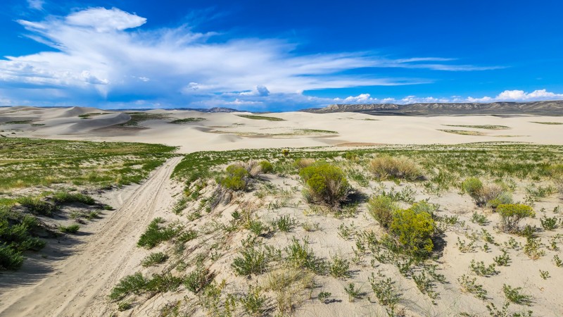
Chilton Road to Killpecker Sand Dunes
Reliance, Wyoming
Located north of Rock Springs, Chilton Road is a 23-mile, easy, wide, packed dirt road used to access the Killpecker Sand Dunes ORV Area. The road into the dunes is very remote, and cell service is extremely spotty, but any passenger vehicle can traverse this road. The Killpecker Sand Dunes ORV Area is 11,000 acres of designated open play space. Soft sand from one million years of eroding volcanic lava and ash helped create this beautiful landscape that now offers enthusiasts the opportunity to conquer massive dunes up to 100 feet high. Before entering the dunes, there is a large campground with tables and fire rings and a vault toilet at the end of Chilton Road. Camping and riding are entirely free of charge.
Clay soils make the road muddy and impassable during wet periods.

Updated: 05/06/2023
Jelm Mountain Road
Woods Landing, Wyoming
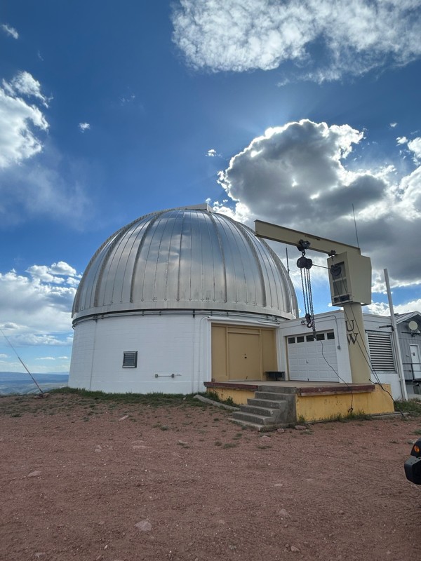
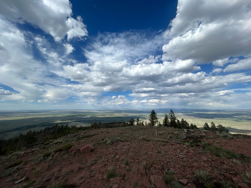
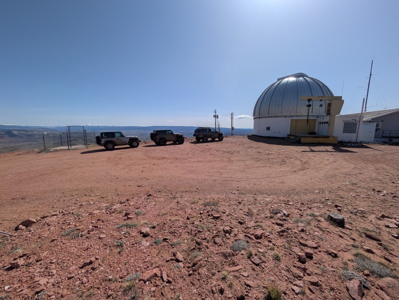
Jelm Mountain Road is in Southeast Wyoming about 40 minutes from Laramie. This trail lies on the outskirts of the beautiful Medicine Bow-Routt National Forest. This road was originally created to be the home for a USFS fire tower, which was predominantly used to report fires before aircraft became the popular method. The Jelm Mountain fire tower was used in conjunction with the fire tower atop Deadman Hill, just SE of the Jelm Mountain fire tower, and together were used to report fires in and around the surrounding areas, including the Laramie Basin and Laramie River valley. In 1975, the fire tower was decommissioned and replaced with an observatory. After 2 years of construction, the WIRO (Wyoming Infrared Observatory) started making its first observations. Jelm Moutain was chosen as a site for the observatory, due to its proximity to the University of Wyoming, low-light pollution, low atmospheric moisture (which can interfere with observations), and existing power and phone service. This trail is not the most interesting trail to drive on if you are looking for a purely off-roading experience, but it provides stunning views of the area as well as a very interesting piece of equipment located at the top. You can even schedule a tour if astronomy is your passion!

Updated: 06/02/2024
Centennial Ridge
Centennial, Wyoming
Centennial Ridge lies just to the west of the "Gateway to the Snowys", Centennial, Wyoming. Founded in 1876, Centennial received its name for being founded on the nation’s 100th birthday. Centennial Ridge has a deep history of mining and logging to make railroad ties for the transcontinental railroad being built through nearby Laramie. Gold was discovered at the Queen Mine during this time and later discovery of platinum prompted the mine to be dubbed "The Platinum Queen." Remnants of this historic mine still exist along the Centennial Ridge Road. This trail offers a short off-road experience into Wyoming’s history.
Updated: 07/10/2025
Shadow Mountain Road
Kelly, Wyoming
Perched just east of Grand Teton National Park, Shadow Mountain is one of the most sought-after dispersed camping zones in the Jackson area, and for good reason. As you climb the dirt roads that wind through aspen groves and open meadows, the Tetons rise dramatically in the west, unfolding a jaw-dropping panorama that feels straight from a postcard. This isn’t just camping, it's front-row wilderness immersion. Whether you're sleeping under the stars in a tent or pulling in with a fifth wheel in tow, Shadow Mountain delivers a rare blend of peace, scenery, and accessibility.
With sites scattered along pullouts, ridgelines, and tucked-away flats, there's a spot for everyone if you're willing to navigate the bumps and elevation. Early arrivals snag the most iconic viewpoints, but even the lower clearings offer serenity and sweeping vistas. Wildflowers blanket the hillsides in summer, and the dark skies are a stargazer’s dream. Shadow Mountain isn't just a place to camp, it's a destination worth returning to again and again.
Updated: 10/15/2024
Moccasin Lake Road
Fort Washakie, Wyoming
Everyone in your group must purchase tribal fishing licenses since Moccasin Lake Road crosses tribal lands Tribal fishing licenses are available at Popo Agie One Stop and Wild Iris Mountain Sports in Lander or Hines General Store in Fort Washakie.
The drive to Moccasin Lake is long but beautiful, with steep scalloped hills giving way to tall forests. This route is an out-and-back running 18 miles each way. The road is rough with ruts and washboards but easy to navigate. Any rain or snow could make this trip a little more challenging of a drive. The road climbs about 4000 feet by the time you reach the lake. There are no designated camping areas until you get to the lake. There is another campground in the area called Dickinson Park. The area offers lots of hiking and fishing opportunities. Along the way, there are many offshoot trails to explore. Cell service is spotty at best. The views from the road are spectacular.
The campgrounds are first come, first served, 16-day limit campsites. This is bear country so practice safe food storage.

Updated: 06/05/2022
Deep Creek Road (Aspen Alley)
Encampment, Wyoming
Deep Creek Road is the main north/south access along the western side of the Sierra Madre range in the Medicine Bow National Forest, providing connections to many back roads and 4WD trails. The abundance of camping opportunities makes it a great place to set up a base from which to explore the dozens of trails in the surrounding area.
Deep Creek Road also offers plenty of scenic beauty. It features Aspen Alley, a third of a mile long, one-lane section of road between very tall, mature aspen trees. In fact, there are several groves of tall, mature aspen, making this an outstanding venue for viewing changing colors in the fall. Wildflowers are abundant in the spring, and summer features the beauty of the aspen, pine, and fir forest. Though technically open in the winter, the road receives no winter maintenance and becomes impassable. However, the area is very popular for snowmobiles.
This area is a little too remote for day trips but is an excellent choice for a weekend or week-long adventure.

Updated: 06/02/2024
Middle Fork Canyon
Centennial, Wyoming
Middle Fork Canyon is a trip back in time to the mining days of the late 1800s. This short trail boasts four different known gold, silver, and copper mines abandoned 140 years ago. Several dilapidated, roofless log cabins from that era still exist for you to explore while taking this easy 4x4 trail. Today, excellent camping along the canyon road with the sounds of the rippling waters from the small river can be a cornerstone to a peaceful weekend.
Updated: 10/15/2024
Smith Fork Road
Smoot, Wyoming
Smith Fork Road is a beautiful drive, taking you directly from Highway 89 up into the Wyoming Range, just past the LaBarge Guard Station. Dispersed camping along this road is plentiful and easily accessed, with sites directly next to Smiths Fork Creek. Visiting in the summer is a treat, with wildflowers covering the hillsides. In the final 5-6 miles, the road narrows slightly, and the surface changes from well-graded dirt to cobblestone, but still maintains an Easy rating with no technical obstacles.
Updated: 10/15/2024
Blair Wallis Road
The Buttes, Wyoming
Blair Wallis Road is a well-traveled dirt road in the Medicine Bow National Forest, colloquially referred to as "Happy Jack." This trail is one of the major thoroughfares in the area that provides access for passenger cars to experience the beauty of these public lands. While there is not a ton of camping along this trail, this trail provides access to a lot of other activities such as hiking, climbing, and fishing. Whether you are looking for access to other trails in the area or are just looking for a fun, relaxing road to enjoy over the weekend, Blair Wallis Road might just fit the bill.
Updated: 09/10/2025
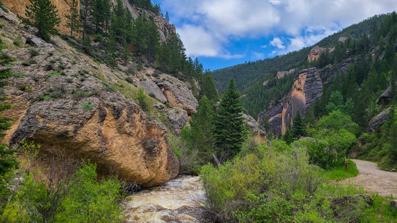
Crazy Woman Canyon Road
Open
/
Hazelton, Wyoming/
13.16 miles/
About an hour
Scenic Crazy Woman Canyon Road winds alongside Crazy Woman Creek through the rugged beauty of Wyoming’s Bighorn National Forest. Few drives in the intermountain West can rival its sheer charm. This is more than just a road—it’s an experience worth seeking out.
From the oxide-stained cliffs and jagged rock formations to the rushing rapids of the lower canyon, every stretch offers something striking. As you climb toward the Powder River Pass, the canyon opens into wider expanses, with tranquil trout pools tucked along the creek. It’s the kind of place that invites you to slow down, roll down the windows, and take it all in.
For those wanting to linger, the route is dotted with dispersed campsites, making it a perfect destination for both a day’s drive and an overnight adventure. Crazy Woman Canyon isn’t to be missed.
Updated: 11/30/2025
Red Canyon
Kotey Place, Wyoming
Red Canyon is a short, leisurely drive through one of Wyoming's most spectacular landscapes. The route is just over 10 miles of packed dirt. The route can be traveled in either direction, beginning at the top of the route or starting near the Red Canyon Overlook. The overlook on Highway 28 has outstanding views of the beautiful scenery and informational signage about the area.
Red Canyon is listed as a National Natural Landmark and has a seasonal closure from December 1st to April 30th. The canyon's red and orange bluffs stretch into green meadows and tall cottonwood trees. During the spring, the slopes are covered with wildflowers.
Red Canyon has a long and rich history. The area has great religious significance for the local tribes and was also an important transportation corridor for the western expansion. Today, the canyon supports great herds of grazing animals such as elk, mule deer, and other small mammals and birds.
There is no camping along this route. But there is plenty of camping in the surrounding areas. There is public access to fishing along the route as well.
Updated: 07/01/2025
Gros Ventre Road
Kelly, Wyoming
Gros Ventre Road is a long, scenic road that winds southeast from the town of Kelly, Wyoming, deep into the Gros Ventre Wilderness corridor. This road begins near the eastern boundary of Grand Teton National Park and gradually climbs into the foothills of the Gros Ventre Range, following the Gros Ventre River for much of its length. Popular among campers, hunters, and those seeking a more remote scenic drive, the road provides access to multiple designated and dispersed campsites, trailheads, and side roads deeper into the Bridger-Teton National Forest.
Updated: 11/30/2025
Flat Creek Road
Jackson, Wyoming
Flat Creek Road is an easy, out-and-back trail through the scenic Gros Ventre Mountain Range (pr: groh vahnt) near Jackson, Wyoming. The trail begins at the eastern boundary of the National Elk Refuge. It is primarily rough dirt with some gravel sections through the Bridger-Teton National Forest and ends at a private luxury dude ranch called Flat Creek Ranch.
Beyond the Curtis Canyon Campground, there is a large area for RV camping. Additionally, there are multiple camp spots along the trail, most of which are suitable for several vehicles.
No difficult obstacles exist, with the exception of late spring runoff, which causes slick mud and mild flooding across sections of the trail.
This area is also near Grand Teton National Park.
A seasonal closure of Elk Refuge Road from December 1st through April 30th limits public travel on the Refuge Road. During that period, traffic and pedestrian use are only allowed from the Refuge entrance from East Broadway Avenue to the Twin Creek subdivision (approximately 3½ miles from the Refuge entrance).
Updated: 10/15/2024
Cedar Mountain Road
Cody, Wyoming
Cedar Mountain Road is a short out-and-back trail near Cody. The trail is mostly level and made up of loose dirt and small rocks. It is a narrow shelf road, about one vehicle wide, with occasional spots to pass. The view is great from start to finish, and from the top, you can see for miles out over the city. The most difficult obstacle is an optional hill climb and descent right at the bottom, with loose rocks and a hairpin turn on one side of the hill. The most difficult obstacle on the main trail is a moderate rutted section near the bottom, also full of loose rock and dirt. There are dispersed camping sites along the whole trail. Near the top is a short hiking trail leading to a cave system. The cave is gated off, and if you want to explore it, you need to get a key and permit from the Cody Resource Area. The higher campsites can get extremely windy, especially in a soft-sided rooftop tent.
Updated: 10/15/2024
Brooks Lake Road
DuNoir, Wyoming
Brooks Lake Road is an access road within the Shoshone National Forest just outside the famously scenic Teton National Forest. This road provides access to not only Brooks Lake, which is a wonderful spot for camping and fishing, but also world-class hiking trails radiating from the Brooks Lake Campground. The lakeside campground has 13 sites.
This trail can be fairly rutted up depending on the time of the year, so plan accordingly. The eastern end of this road is more maintained, whereas the western half is less maintained. While the road isn't the most interesting road in the area, the access to hiking, camping, and fishing makes this a must-do experience.

Updated: 06/25/2023
Green Ridge Road
Encampment, Wyoming
Green Ridge Road is one of several major side roads off of Deep Creek Road in the Sierra Madre Range of the Medicine Bow National Forest in southern Wyoming. It is a beautiful drive as it winds its way along the broad high ground of the Green Ridge through an aspen, pine, and fir forest with some large open meadows. There are also several large, clear cut areas along the road leftover from major logging operations several years ago and you will see large piles of debris wood stacked up and waiting for safe conditions to be burned. The remnants of the logging also mean that the many closed spurs offer a lot of camping opportunities. The plentiful aspen makes this a good choice for fall foliage viewing. The road gets no winter maintenance and is snowed in but is very popular for snowmobiles. This is a nice, relaxing drive through some very pretty country and makes a great addition to a weekend or week-long adventure in the Sierra Madres.
Updated: 06/18/2026
Ashton-Flagg Ranch Road / Grassy Lake Road
Colter Bay Village, Wyoming
Ashton-Flagg Ranch Road, also known as Grassy Lake Road by the National Park Service, is a 33-mile scenic backcountry route connecting Ashton, Idaho, to Flagg Ranch, just outside Yellowstone and Grand Teton National Parks. The road travels through remote sections of the Caribou-Targhee and Bridger-Teton National Forests, nestled between two grizzly bear-inhabited wilderness areas. It offers a rare blend of wild seclusion and approachable driving, making it a favorite for overlanders traveling between the parks.
The route is primarily well-graded gravel and is suitable for most vehicles with decent ground clearance. Four-wheel drive isn’t usually necessary in dry weather, but is strongly recommended during or after storms. Mud, erosion ruts, and slick spots are common in wet conditions and can catch less-prepared vehicles off guard.
Along the way, the road passes meadows, pine and aspen forests, and high-country lakes and streams, with Grassy Lake Reservoir serving as a scenic midpoint and a great location for dispersed camping. Wildlife sightings, including bears, moose, and deer, are common, and the remote feel of the area adds to the backcountry experience.
Camping is available in several forms. The eastern end of the road, within the John D. Rockefeller Jr. Memorial Parkway, includes eight designated dispersed camping areas with a total of 20 free, first-come, first-served sites. Each site includes a picnic table, bear box, and parking space. Each camp area also features a central vault toilet, trash receptacle, and recycling bins. Note that there is no water, electricity, or sewer service.
The best time to travel this road is summer through early fall. Snow often lingers into late spring and can return early at high elevations. The eastern end remains closed for grizzly bear migration until at least June 1st, though heavy snowpack may delay the opening further.
Updated: 01/31/2026
Telephone Road
Hirsig, Wyoming
Telephone Road is an easy trail in the heart of Medicine Bow National Forest, colloquially referred to as "Happy Jack." This is one of the longer sections of trail in the area, stretching almost the entire width of the national forest. This trail offers excellent camping opportunities for larger vehicles such as fifth-wheel campers and vans. With access to the main Happy Jack Road, you can be off the grid in a matter of moments, wandering through the high prairie that mainly comprises this area. While Spring and Fall are the prime times of the year to explore this area, Telephone Road is open year-round, making it a great choice for when all the other trails close.
Updated: 10/15/2024
Fifteen Mile Knoll Cutoff
Eden, Wyoming
Located in the Northern Red Desert between Farson and Rock Springs, Fifteen Mile Knoll Cutoff is a small, 15-mile section of the 153-mile Wyoming Red Desert Driving Tour. This road starts at Highway 191 just south of Eden and skirts the southwestern edge of the Killpecker Sand Dune Field before intersecting with Chilton Road. It is a wide, packed dirt and gravel road that can be completed by any passenger vehicle. However, the washboards along this road are ferocious and teeth-rattling. Along the way, you will pass the 400-foot tall monolith known as Boar's Tusk. This sacred Native American icon is a geological formation called a volcanic plug, the remaining core of an extinct volcano. Level camping options are limited due to the terrain, but the road passes through BLM land and does allow dispersed camping if you find a suitable location.
Clay soils make the road muddy and impassable during wet periods.
Updated: 10/15/2024
Headquarters Road
Hirsig, Wyoming
Headquarters Road is a well-traveled dirt track in the Medicine Bow National Forest, colloquially referred to as "Happy Jack." Like most other trails in Happy Jack, this trail is suited for passenger vehicles, vans, and large camp setups such as RVs or fifth-wheels looking for an easy place to spend the night off-grid. This trail offers some of the most abundant dispersed camping in the entire area, even a campground located about halfway through the trail. Pair that with dramatic views of Point Crawford off to the west, and this may be some of the most sought-after camping for large camp setups or passenger cars without 4WD.
Updated: 02/21/2026
Curtis Canyon / Sheep Creek Road
Jackson, Wyoming
Located just east of Jackson, Wyoming, Curtis Canyon and Sheep Creek Road form a scenic 9-mile dead-end drive to the edge of the Gros Ventre Wilderness, offering sweeping views of the Teton Range, access to multiple campgrounds and dispersed sites, and a peaceful retreat into the Bridger-Teton National Forest. Starting just outside the National Elk Refuge, Curtis Canyon Road climbs gradually into the forested hills above the valley floor, eventually becoming Sheep Creek Road at the halfway point of the drive.
This road begins as a well-maintained gravel route with wide shoulders and modest elevation gain. It’s suitable for most vehicles with moderate ground clearance in dry conditions. Along the way, drivers are treated to several turnouts and viewpoints overlooking the entire Jackson Hole valley and the distant Tetons. As the road transitions onto Sheep Creek Road, the road narrows slightly and becomes more rutted and rocky, especially in the steeper forested sections. This stretch is better suited for high-clearance vehicles, particularly during or after rain when sections may become slick. Still, it remains approachable for drivers with basic offroad experience.3
The Curtis Canyon Campground sits near the top of the first climb and offers basic amenities, while 21 designated dispersed campsites dot the entirety of the road and offer varying levels of seclusion.
Important Camping Notes:
- Camping in this area is restricted to designated sites only.
- A 5-day maximum stay limit is in effect from May 1st through Labor Day, and a 14-day limit the rest of the year.
- Bears are common in the area; thus, all food and attractants must be stored in bear-resistant containers or hard-sided vehicles.
- Some campsites offer on-site bear boxes, but not all campsites do.

Updated: 07/02/2022
Ditch West
Encampment, Wyoming
Ditch West is a fun little trail off of Deep Creek Road in the Sierra Madre Range of the Medicine Bow National Forest in southern Wyoming. The trail follows the Belvidere Ditch for most of its length through shimmering aspen groves and picturesque pine and fir forest before fording the ditch near the end and returning to Highway 70. The ditch bank is narrow but not as overgrown as Ditch East. The rippling water and stately forest make for a quiet, peaceful trip (unless you meet an oncoming dirt bike). Ditch West can be combined with Ditch East by running one or the other backwards to extend your peaceful excursion.
Updated: 10/15/2024
Caretakers Road
Hirsig, Wyoming
Caretakers Road is a well-traveled dirt road in the Medicine Bow National Forest, colloquially referred to as "Happy Jack." Like most other trails in Happy Jack, this trail is suited for passenger vehicles, vans, and large camp setups such as RVs or fifth-wheels looking for an easy place to spend the night off-grid. If you are looking for more of an offroad adventure, Caretakers Road will connect you with Crow Creek Road, arguably the most challenging trail in the entire area.
Updated: 10/15/2024
West Pilot Hill
The Buttes, Wyoming
West Pilot Hill is a well-traveled dirt road in the Medicine Bow National Forest, colloquially referred to as "Happy Jack." Like most other trails in Happy Jack, this trail is suited for passenger vehicles, vans, and large camp setups such as RVs or fifth-wheels looking for an easy place to spend the night off-grid. A word of caution, this trail ends abruptly just past Laycock Spring, which is going to be the easiest place to turn around. For that reason, use caution if progressing past this turn. A tight multi-point turn in a smaller rig or some skillful backing up for a larger rig with a trailer will be necessary. Use this trail to put yourself close to the hiking and biking trailheads for which Happy Jack is known.
Updated: 10/15/2024
Mesa Road
Mayoworth, Wyoming
Mesa Road is an easy county-maintained gravel road with lovely views of Wyoming's rolling hills and pastures. This easy route between Highways 191 and 196 is enjoyable and easy for those who are new to off-pavement driving and exploring. A standard two-wheel drive vehicle is all that is needed to travel on Mesa Road. There are no dispersed campsites in this area.
Updated: 10/31/2025
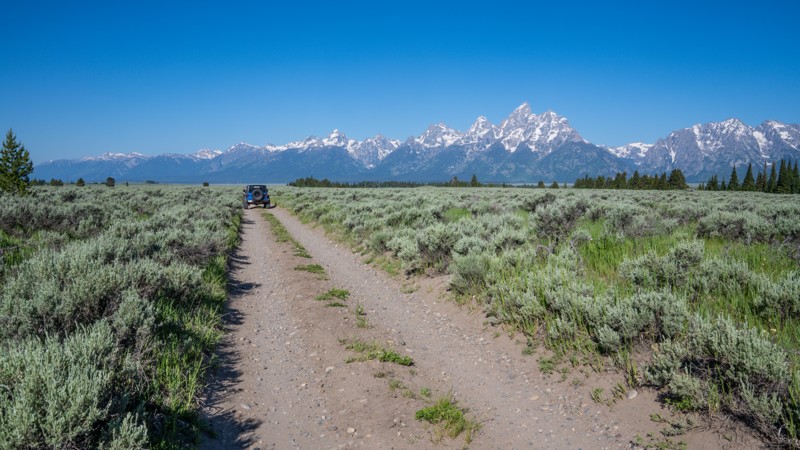
Bar BC Road
Beaver Creek, Wyoming
Bar BC Road is located within the park boundaries of Grand Teton National Park. This is an opportunity to enjoy viewing wildlife on and/or near the trail, as it is a wide-open landscape with the spectacular Teton Mountain Range as your backdrop. The road ends at Bar BC Ranch. A sprawling, nearly forgotten ranch with many dilapidated structures along Snake River, you are encouraged to take a walking tour.
This moderate out-and-back trail is rough and rocky, with many potholes. Its most challenging part is a steep hill with these same holes. High-clearance four-wheel drive is recommended. It is also subjected to seasonal closure in the winter months, accessible from May through October. With no camping permissible along this trail, be prepared to take advantage of the many other camping opportunities nearby.
Updated: 10/31/2025
Spalding Bay Road
Jenny Lake, Wyoming
This moderate out-and-back trail is located within the park boundaries of Grand Teton National Park and is only accessible by vehicle from May through October. It takes you down to Spalding Bay, part of Jackson Lake. A boat launch, picnic table, and two backcountry campsites are only available by obtaining a backcountry permit through Recreation.gov or one of Grand Teton's three permit offices in the visitor centers. The trail itself does NOT require a permit to enjoy for the day and is only accessible May through October.
The most challenging part of this trail is one narrow, steep switch back. If you are driving a larger vehicle, be aware you may acquire "pin striping" due to overgrowth in a couple of sections.

Updated: 06/25/2023
Aspen Road
Encampment, Wyoming
Aspen Road is one of several major side roads off of Deep Creek Road in the Sierra Madre Range of the Medicine Bow National Forest in southern Wyoming. Much of the lower portion of the trail is in thick aspen, pine, and fir forest. Occasional open meadows provide stunning views of the surrounding mountains. Near the top, the terrain opens up offering absolutely spectacular views of the beautiful Mill Creek Valley and the majestic peaks beyond. There are plenty of camping opportunities, especially along the beginning of the trail near Deep Creek Roadand at the top along the Mill Creek Valley. Aspen Road would be a nice addition to any weekend or week-long adventure in the Sierra Madres.
Updated: 10/15/2024
White Mountain Petroglyphs
Winton, Wyoming
The White Mountain Petroglyphs are a permanent reminder of the ancient people that once lived in Southwest Wyoming. The Plains and Great Basin Native Americans who lived in this area 200-1,000 years ago took to the 300-foot sandstone cliff face of White Mountain to forever tell their stories to future generations. Starting on Chilton Road, take an easy gravel road for just shy of 3 miles to a BLM parking lot with a restroom. From here, it is a 1/2-mile hike to the petroglyph site.
Updated: 07/10/2025
Toppings Lake
Elk, Wyoming
Toppings Lake Road offers one of the most scenic and accessible introductions to dispersed camping in the shadow of Grand Teton National Park. Just a short drive from Jackson, this road winds through forested hillsides and wide-open meadows, revealing campsites with some of the best front-row views of the Teton Range you'll find anywhere. Whether you're arriving in a fully equipped trailer or pitching a tent beneath the stars, the setting here is both rugged and serene, ideal for those looking to experience the wild beauty of Wyoming without straying too far from civilization. In addition to the wonderful camping, Toppings Lake Road is a gateway to the backcountry, a haven for wildlife viewing, and a front porch to sunrise alpenglow on the Teton peaks. This road is ideal for backcountry campers looking to enjoy big views with minimal vehicle demands. Just remember to camp only in designated sites and pack out everything you bring in.

Updated: 10/15/2024
Battle Creek Road
Battle, Wyoming
Battle Creek Road is the main entry point into an extensive network of easy to moderate trails along the Battle Creek Valley and the surrounding rolling hills. This out and back trail is 9.5 miles each way, taking 3-4 hours for the round trip. But you can easily fill a whole day or even a couple of days exploring all the side trails and spurs in the network. Much of the trail crosses open grass and sagebrush hills with occasional stands of scrub oak and aspen and a few groves of pine and fir. Since much of the trail is out in the open, you are treated to spectacular views of the southern Sierra Madre Range as it crosses from Wyoming into Colorado. Many areas are suitable for dispersed camping, although very few have established fire rings.
Updated: 10/15/2024
Old Stage Road
Kirwin, Wyoming
Old Stage Road is a short 1.25-mile spur off the Kirwin Trail. The gatekeeper of this trail is also its hardest obstacle, a steep climb up a loose dirt and rocky hillside. Expect a little wheel slip as you ascend this obstacle. Once past the initial climb, the road winds around some rolling hills and a few sparse trees. You are then rewarded with a spectacular view down the valley and the road you came in on as you approach one of the steepest and highest descents. The moderate difficulty of this trail comes from the relatively steep climbs and descents over the hills, and a few washouts, which would feel uneasy for a beginner driver. There are no campsites along this trail, although there are plenty on the Kirwin Trail.

Updated: 07/02/2022
Ditch East
Encampment, Wyoming
Ditch East is a delightful little diversion off of Deep Creek Road in the Sierra Madre Range of the Medicine Bow National Forest in southern Wyoming. The trail follows the Belvidere Ditch for a little more than half a mile before crossing the ditch over a culvert and climbing back up to Highway 70. The ditch bank is a narrow dike and there is not much room to maneuver to avoid branches that stick out onto the trail. The lapping of the water in the ditch and the quaking of the aspen leaves make this a tranquil and relaxing interlude as you wind your way through the beautiful forest. Ditch East can be combined with Ditch West by running one or the other backwards to extend your peaceful excursion.
Updated: 07/01/2025
Spread Creek Road
Elk, Wyoming
Spread Creek Road is one of the more accessible and rewarding roads for dispersed camping near Grand Teton National Park. Just a short drive from the park entrance, this dirt and gravel road leads to a network of level campsites, many offering stunning views of the Teton Range. The road winds through groves of cottonwoods and open meadows, with numerous campsites offering shady forest sites and more exposed spots with unobstructed mountain views. For new and casual off-roaders, Spread Creek Road provides an ideal introduction to vehicle-based camping with a big payoff in scenery and solitude.
Updated: 10/15/2024
Battle Creek Spur 1D
Battle, Wyoming
This fairly short spur off Battle Creek Road descends steeply through very thick brush to a dead end at private property near the Colorado state line. Expect branches to scrape the sides of your rig and possibly knock your CB antenna off. Before you start down the steep hill, there are nice views and room for four to five rigs to turn around at the bottom. There are no suitable camping sites on this spur, but camping is available on Battle Creek Road or West Sheep Mountain.
Updated: 11/30/2025
Hoback River Dispersed Recreation Sites
Bondurant, Wyoming
Located right on the Hoback River along Highway 189, southeast of Jackson, Wyoming, this little spur route is a fantastic camping location for any kind of camping setup. The road is easy and well packed with minimal rocks. The soil is a little soft and could become muddy with an extended wet period. The camping is flat, level, and grassy. Depending on the group sizes staying here, there are 8-10 campsites. Some sites are shaded by trees, some are very exposed.
Updated: 08/11/2025
Uhl Hill Road
Moran, Wyoming
Uhl Hill Road is one of Grand Teton National Park’s lesser-known backroads, but it delivers big on views, solitude, and light offroad adventure. Starting at the intersection with Elk Ranch and Wolf Ranch Roads, it traverses sagebrush flats before gently climbing toward the base of Uhl Hill. While technically simple, the route features a mix of gravel and two-track dirt, with occasional fist-sized rocks and rutted segments that can become muddy after storms. Three shallow creek crossings add a bit of excitement without posing much risk for most vehicles. A high-clearance vehicle is recommended, especially after heavy rains, but confident drivers in stock 4WD rigs will have no trouble navigating this trail. This trail makes for a perfect detour for casual off-roaders looking to experience the grandeur of the park away from the main crowds. Expect a peaceful ride with unbeatable scenery and a dash of Wyoming history.
Keep your camera ready as this is a common place to see wildlife such as buffalo, coyotes, elk, and bears.
Updated: 11/30/2025
Wilderness Road / Pacific Creek
Moran, Wyoming
Located just outside of Moran, in the northeast corner of Grand Teton National Park, this easy, dead-end gravel road leads to the Pacific Campground and hiking trailhead, on the edge of the Teton Wilderness. It is known as both Wilderness Road by the park service, or Pacific Creek by the Forst Service. The road is two-vehicles wide the entire way and suitable for any vehicle, but anticipate significant washboard along the drive. Airing down will greatly ease in comfort.
The road passes 8 designated campsites, all offering significant space and suitable for any campsites or group size. Pacific Campground offers an additional 8, first-come first-serve sites for a nightly fee. The end of the road is a popular place for equestrian riders entering the wilderness, as evident by the many trailers and hitching posts in the trailhead parking lot.
Important Camping Notes:
- Camping in this area is restricted to designated sites only.
- A 5-day maximum stay limit is in effect from May 1st through Labor Day, and a 14-day limit the rest of the year.
- Bears are common in the area; thus, all food and attractants must be stored in bear-resistant containers or hard-sided vehicles.
- Some campsites offer on-site bear boxes, but not all campsites do.
Updated: 12/05/2025
Two Ocean Lake Road
Moran, Wyoming
Two Ocean Lakes Road is a short, washboarded, dead-end road within the northeast corner of Grand Teton National Park. The road leads to a vault toilet and picnic grounds on the edge of Two Ocean Lakes, where several hiking trails circle the lake and enter the Teton Wilderness. The road is sufficiently wide with no passing concerns. However, vehicles over 24 feet long, trailers, and vehicles over 8 feet wide are all prohibited from traversing this road.
This is a day-use only area with no camping. It passes through prime bear habitat. Bears may be active any place and at any time. Travel in groups, make noise and carry bear spray. Hikers cannot access backcountry camping in the park from this trailhead.
Updated: 08/11/2025
Cattlemans Bridge Road
Moran, Wyoming
Located within Grand Teton National Park, Cattleman's Bridge once spanned the Snake River, allowing ranchers to graze cattle west of the river near the potholes. It was a wooden plank bridge constructed in the mid-1950s and finally removed in 2001. Today, this easy gravel road offers scenic views of the Tetons and the river. It is a popular place for wildlife and a great place to launch hand-powered boating vessels. The road is suitable for any vehicle and has enough parking at the end to accommodate a dozen vehicles or so.
Updated: 11/30/2025
Red Rock Ranch Road
Kelly, Wyoming
Red Rock Ranch Road is a short, dead-end spur that leads to the Crystal Creek Trailhead, a popular equestrian access point into the Gros Ventre Wilderness. The route follows alongside Crystal Creek and a private ranch, offering expansive views and a quiet setting.
At the end of the road, several large, level campsites are located near the creek banks, making it a scenic option for those looking to stage near the wilderness boundary.
The trail surface is compact bentonite that becomes increasingly rough and rocky as you travel farther in. During wet weather, this clay turns to thick, slick mud that can be impassable. When dry, it forms deep ruts and hard-edged trenches that challenge suspension and traction. This road is best suited for high-clearance vehicles equipped with four-wheel drive.
Important Camping Notes:
- A 5-day maximum stay limit is in effect from May 1st through Labor Day, and a 14-day limit the rest of the year.
- Bears are common in the area; thus, all food and attractants must be stored in bear-resistant containers or hard-sided vehicles.
Updated: 11/30/2025
East Boundary Road
Elk, Wyoming
East Boundary Road is a rough but scenic high-clearance route that connects two popular camping areas: Toppings Lake to the north and Shadow Mountain to the south. The road closely follows the eastern edge of Grand Teton National Park, offering a unique route with exceptional mountain views for those prepared for the rugged terrain.
The northern end, designated FS 30333, lies within the Bridger-Teton National Forest. This segment stretches just over a quarter mile and includes campsites 4, 5, 5A, and 6. Campsite 4 is tucked deep in the trees with no views, while sites 5 through 6 are situated in a grassy clearing with panoramic vistas of the Teton Range. Each site includes a steel fire ring and bear box.
As the road enters the national park, it becomes a rougher two-track with protruding rocks and occasional mud holes. Though the scenery is outstanding, including consistent views of the Tetons, this section demands careful tire placement and is only suitable for high-clearance vehicles. No camping is permitted within the national park boundary. Drivers will also pass a few private ranch roads along this section.
At the southern end, the road transitions into FS 30344, also known as Antelope Springs. This area includes three camping zones, collectively offering 15 designated campsites. These sites vary in size but can accommodate anything from tents to RVs. Amenities include steel fire rings at every site, communal bear boxes, and a pit toilet.
The south end of the trail is conveniently located just five minutes northeast of Mormon Row, making it an ideal basecamp for exploring the area.
While both ends of East Boundary Road are generally passable with any vehicle that has decent ground clearance, the middle stretch within the national park should only be attempted by high-clearance vehicles due to rocky surfaces, ruts, and frequent mud holes.
Important Camping Notes:
- Camping in this area is restricted to designated sites only.
- A 5-day maximum stay limit is in effect from May 1st through Labor Day, and a 14-day limit the rest of the year.
- Bears are common in the area; thus, all food and attractants must be stored in bear-resistant containers or hard-sided vehicles.
- Some campsites offer on-site bear boxes, but not all campsites do.
Updated: 11/30/2025
Jackson Peak
Jackson, Wyoming
Jackson Creek Road is a short, rugged spur leading to the trailhead for both the Jackson Peak and Goodwin Lake hiking trails, situated at the edge of the Gros Ventre Wilderness. The road is moderately technical and features a persistent bed of softball to grapefruit-sized rocks, along with deep erosion ruts that can easily swallow a tire and high-center a vehicle. The final ascent to the turnaround at the trailhead is especially rocky and uneven, requiring precise tire placement and good suspension. This road is only suitable for high-clearance 4WD vehicles. Passenger SUVs and crossovers should not attempt this drive.
Despite its rough condition, the road rewards with stunning wildflower displays in summer and a pair of large, designated campsites. These sites are level and spacious, easily accommodating any group. The views near the trailhead include sweeping vistas of the Teton Range, offering a worthy payoff for those making the climb.
Important Camping Notes:
- Camping in this area is restricted to designated sites only.
- A 5-day maximum stay limit is in effect from May 1st through Labor Day, and a 14-day limit the rest of the year.
- Bears are common in the area; thus, all food and attractants must be stored in bear-resistant containers or hard-sided vehicles.
- Some campsites offer on-site bear boxes, but not all campsites do.
Updated: 01/31/2026
Merritt Ranch/Boundary Road
Hirsig, Wyoming
Located on the outskirts of Medicine Bow National Forest, colloquially referred to as "Happy Jack," this is one of the trails in the area that is more suited for smaller rigs. As you make your way off the beaten path, you will find yourself driving through narrow stretches of tight trees on a fun two-track trail. While this trail is a bit more difficult than most other dirt roads in the area, any 2WD truck/van or AWD passenger car will have little difficulty completing this trail. This trail has a good bit of camping nicely tucked away from the higher-profile spots that attract the larger camp rigs. Since this is a boundary trail, the traffic tends to be slightly less than in other parts of this forest.
Updated: 10/15/2024
Telephone Extension
Laramie, Wyoming
Located in the interior of Medicine Bow National Forest, colloquially referred to as "Happy Jack," this is one of the area's trails more suited for smaller rigs. As you make your way off the beaten path, you will find yourself driving through narrow stretches of tight trees on a fun two-track trail. While this trail is a bit more difficult than most other dirt roads in the area, any 2WD truck, van, or AWD passenger car will have little difficulty completing this trail. This trail contains lots of large Aspen tree stands, which in the Fall turn that famous shade of gold. While most of Happy Jack is flat, this trail is a welcome change offering some fun ups and downs through the hilly landscape. If you are in a smaller rig, this trail will keep you a bit more entertained than most other trails in this area.
Updated: 11/30/2025
Sheep Creek Spur
Kelly, Wyoming
Sheep Creek Spur is a short, dead-end spur off Curtis Canyon and Sheep Creek Road that leads to three designated campsites and the boundary of the Gros Ventre Wilderness. The road begins easily enough, with the first few hundred yards offering relatively smoother terrain up to the campsites. Each site provides excellent views of the surrounding hills and makes for a quiet, scenic overnight stop.
Beyond the campsites, the road narrows into a rough, rocky single-lane shelf section with no room for passing. This portion is challenging, with uneven terrain and steep drop-offs to one side, and should only be attempted by high-clearance vehicles with confident drivers who have previous shelf road experience. The spur ends at a small turnaround near the wilderness boundary. While views remain partially visible along the shelf road, the best scenery is found near the campsites.
Important Camping Notes:
- Camping in this area is restricted to designated sites only.
- A 5-day maximum stay limit is in effect from May 1st through Labor Day, and a 14-day limit the rest of the year.
- Bears are common in the area; thus, all food and attractants must be stored in bear-resistant containers or hard-sided vehicles.
- Some campsites offer on-site bear boxes, but not all campsites do.
Updated: 11/30/2025
Brush Creek
Elk, Wyoming
Brush Creek is a short but rugged connector route tucked into the Bridger-Teton National Forest. Running between Toppings Lake and Lower Spread Creek roads, this trail serves a practical purpose for off-roaders looking to link routes without backtracking. Despite its lack of technical challenge, the trail’s surface is a bed of baseball-to-grapefruit-sized rocks that demand slower travel and steady tire placement. It's not a long route, but it does pack in enough rock chatter to make high clearance a necessity. The trail offers limited passing opportunities along a single-vehicle-wide road where wider vehicles are guaranteed pinstriping.
Although Brush Creek is mostly used as a jump route between longer, designated camping forest roads, there are a couple of tucked-away dispersed campsites for those who want to linger in the dense forest surroundings. These sites are small and infrequent, but they work if you are in a pinch or just want to be as remote as possible. Drivers with moderate experience will be comfortable here, especially those familiar with navigating uneven rock-strewn surfaces.
Important Camping Notes:
- Camping along the two access roads in this area is restricted to designated sites only.
- A 5-day maximum stay limit is in effect from May 1st through Labor Day, and a 14-day limit the rest of the year.
- Bears are common in the area; thus, all food and attractants must be stored in bear-resistant containers or hard-sided vehicles.
- Some campsites offer on-site bear boxes, but not all campsites do.
Updated: 08/11/2025
Wolf Ranch Road
Moran, Wyoming
Wolf Ranch Road is a lesser-traveled gem within Grand Teton National Park that offers sweeping vistas, rich history, and a peaceful off-pavement driving experience. The road begins just east of the highway and immediately puts you on a well-maintained gravel track that winds through broad sagebrush flats. With the Teton Range towering in the background, the drive is a visual feast nearly the entire way. Along Wolf Ranch Road, you’ll pass historic log cabins and ranch structures that harken back to the region’s early settler era. The road parallels cottonwood-lined irrigation ditches and open pastures, where wildlife sightings are common. Bison frequently graze in the surrounding meadows, and it’s not unusual to spot a bald eagle or pronghorn in the distance. It’s especially enjoyable in the late spring through early fall, when wildflowers are in bloom and wildlife is most active.
The terrain is flat and easygoing, suitable for nearly any vehicle. However, low clearance vehicles will need to treat this as an out-and-back road. High clearance vehicles can continue to make this journey a loop with Elk Ranch Road, where you will encounter two deep water crossings.
Updated: 01/31/2026
Laycock Spring
Laramie, Wyoming
Located on the outskirts of Medicine Bow National Forest, colloquially referred to as "Happy Jack," this is one of the trails in the area that is more suited for smaller rigs. As you make your way off the beaten path, you will find yourself driving through narrow stretches of tight trees along a fun two-track trail. While this trail is a bit more difficult than most other dirt roads in the area, any 2WD truck/van or AWD passenger car will have little difficulty completing this trail. There is virtually no camping off this trail, and the dead-end at the end makes it for a very anti-climatic ending.
Updated: 01/31/2026
Hill 8821
Laramie, Wyoming
Located on the outskirts of Medicine Bow National Forest, colloquially referred to as "Happy Jack," this is one of the trails in the area that is more suited for smaller rigs. As you make your way off the beaten path, you will find yourself driving over some large rocky slabs, eventually taking you to the forest boundary with some great views of Laramie. If you can handle the wind that Wyoming is famous for, this would not be a bad place to set up camp for the night, away from the hustle and bustle of the more accessible roads in the area. While this trail is a bit more difficult than most other dirt roads in the area, any 2WD truck, van, or AWD passenger car will have little difficulty completing this trail. While camping is not abundant, there are a few nice spots to post up for the night and allow for close proximity to some of the hiking/biking trails for which Happy Jack is known.
Updated: 11/30/2025
Soda Lake
Jack Pine, Wyoming
Soda Lake is a rough, out-and-back spur trail that leads to its namesake lake and a trailhead providing access to the Gros Ventre Wilderness. The road is a single-vehicle-wide track of hard-packed dirt with embedded rocks up to eight inches in height. Along the way, drivers will navigate a moderately steep hill that becomes impassable when wet due to the slick bentonite soil.
Before reaching the lake, there is one grassy dispersed campsite. At the lake itself, two to three large sites sit along the shoreline, offering a peaceful and scenic setting for overnight stays.
This trail is generally easy in dry conditions and can be traveled with a two-wheel-drive vehicle, but only if it has high ground clearance. The rocky and uneven terrain makes it unsuitable for low-clearance vehicles, especially after rain.
Important Camping Notes:
- A 5-day maximum stay limit is in effect from May 1st through Labor Day, and a 14-day limit the rest of the year.
- Bears are common in the area; thus, all food and attractants must be stored in bear-resistant containers or hard-sided vehicles.
Updated: 10/15/2024
West Sheep Mountain
Battle, Wyoming
West Sheep Mountain is the second major trail in the extensive network of trails around Battle Creek. It runs southwest from the middle of Battle Creek Road 4.3 miles before ending at private property a little shy of the Colorado border. The road surface is easy two-track the entire way with an occasional bumpy spot. Like Battle Creek Road, it crosses rolling hills of grass and sagebrush with occasional stands of aspen, groves of scrub oak, and patches of pine and fir. Combining this trail with some of the spurs and connectors in the network makes for a relaxing, scenic day. There are many suitable sites for camping, but only a few have established fire rings.
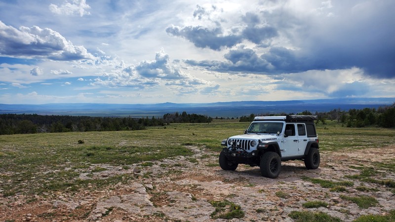
Updated: 01/31/2026
Sullivon Spring
Laramie, Wyoming
Located on the outskirts of Medicine Bow National Forest, colloquially referred to as "Happy Jack," this is one of the area's trails more suited for smaller rigs. As you make your way off the beaten path, you will find yourself driving through narrow stretches of tight trees on a fun two-track trail. While this trail is a bit more difficult than most other dirt roads in the area, any 2WD truck/van or AWD passenger car will have little difficulty completing this trail. There are a few camp spots located along this trail that would provide a good night's rest. The trail's proximity to hiking and biking trailheads makes it desirable for getting up early and enjoying the activities for which Happy Jack is known. The trail, unfortunately, ends abruptly at the forest border, but it provides excellent views of Laramie.
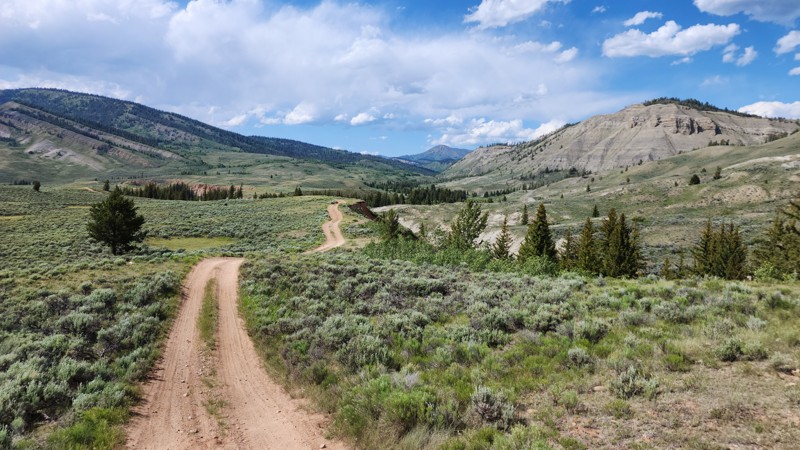
Updated: 11/30/2025
Slate Creek Loop
Kelly, Wyoming
Slate Creek Loop is a scenic, horseshoe-shaped spur off Gros Ventre Road, located in a remote stretch of the Bridger-Teton National Forest. The road follows the cliffs above the Gros Ventre River and crosses through open sagebrush country on its way to the Slate Creek Trailhead, a popular hiking and OHV parking area.
Dispersed campsites are found throughout the loop, many with wide-open views of the surrounding wilderness. However, the area offers little protection from the sun and wind due to minimal tree cover. All observed campsites are large and level, making them suitable for any camp setup and capable of accommodating groups of various sizes.
The western half of Slate Creek Loop is a wide, easy gravel road that can be traveled by most vehicles, including RVs and trailers. In contrast, the eastern half transitions to a narrow two-track with ruts and protruding rocks up to five inches in height. This section requires a high-clearance vehicle and is better suited for drivers with some off-pavement experience.
Important Camping Notes:
- A 5-day maximum stay limit is in effect from May 1st through Labor Day, and a 14-day limit the rest of the year.
- Bears are common in the area; thus, all food and attractants must be stored in bear-resistant containers or hard-sided vehicles.
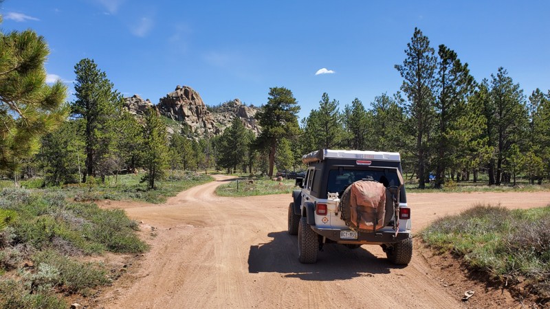
Updated: 10/15/2024
Hawk Road
Hirsig, Wyoming
Hawk Road is a well-traveled dirt road in the Medicine Bow National Forest, colloquially referred to as "Happy Jack." Any 2WD vehicle should have no issues out in this area. The highlight along this trail is the Middle Lodgepole Creek, which has a few nice pools along the way. Pair those with the side trails along this road, and you can have a nice fishing hole to park your rig nearby and enjoy the high prairie for which southern Wyoming is famous.

Updated: 04/23/2026
Elk Ranch Road
Moran, Wyoming
Elk Ranch Road is a scenic backcountry route within the eastern stretches of Grand Teton National Park that offers a unique blend of history, terrain variety, and unmatched views of the iconic Teton Range. Beginning near US-89, the trail crosses open fields before arriving at the historic Elk Ranch cabins, a photogenic cluster of weathered homesteads that sit beneath the towering backdrop of the snow-capped peaks. From here, the road continues across lush, grassy flats and through a short but notable water crossing. This 1-2 foot deep water crossing is easily navigable for high-clearance vehicles, but impedes further traffic for low-clearance vehicles.
The surface is a mix of packed dirt and gravel, with shallow ruts and uneven sections that may challenge lower clearance vehicles after rain. While not technical, the route favors 4WD during or after wet conditions due to mud and water crossings. Beyond the cabins and creek, the trail opens into wide meadows with sweeping panoramas of the Tetons, arguably some of the best views in the park accessible by vehicle. Wildlife sightings are common, and the isolation offers a peaceful contrast to the busier park corridors. This spur eventually intersects with Wolf Ranch Road, which can then be used to return to the highway. This road is best enjoyed as an easygoing scenic drive or a detour for photography and light adventure. It is ideal for beginners seeking that true backcountry feel without the punishment of rock crawling.
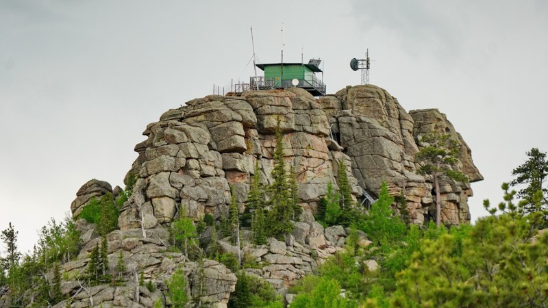
Updated: 05/28/2026
Black Mountain Lookout
Binford, Wyoming
The Black Mountain road is a short but scenic drive to an abandoned fire lookout tower perched on top of a rock formation at the summit of Black Mountain, with panoramic views all around. It starts passing through the middle of a Boy Scout camp before ascending steeply up the mountain, ultimately toping out at a small parking area at the base of the lookout tower. Though the lookout appears to not have been staffed in years and the main building is locked, you can climb the stairs to the catwalk surrounding it and see the entire valley spreading out below you, looking across to Laramie Peak.
The trail surface alternates between rutted dirt and rough rocks, with several small granite slab obstacles with ledges around a foot high. The overall difficulty is on the hard side of moderate. Stock SUVs with good clearance should be able to make it up fine, but careful tire placement will be needed. Some of the rocks can be quite sharp, so watch your sidewalls. While this road doesn't appear to be regularly used for camping, there are a couple of nice level patches along it that would make excellent campsites with great views. This road also accesses the Harris Park trailhead and a network of hiking trails around Laramie Peak, so you could spend days exploring the area.
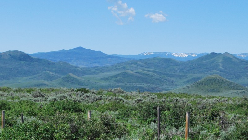
Updated: 10/15/2024
Telephone
Battle, Wyoming
Description: Telephone is one of the main connectors between Battle Creek Road and West Sheep Mountain. It follows a fence line up a ridge over one of the highest hills in the area. Because of the higher altitude, the trail climbs into aspen groves, pine, and fir forest. There are plentiful wildflowers in the spring and early summer with gorgeous views before you enter the forest. There is only one campsite along the trail right at the intersection with West Sheep Mountain, but it is one of the best in the area.
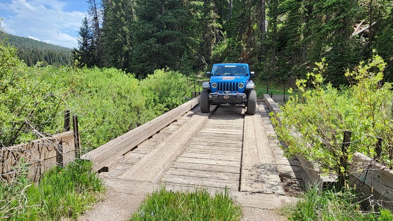
Updated: 08/11/2025
Bailey Creek Road
Colter Bay Village, Wyoming
Bailey Creek is a short, nearly 3-mile dead-end spur that leads to a tiny parcel of National Forest land sandwhiched between Grand Teton National Park and the Teton Wilderness. The drive winds through a dense pine canopy, past the willow layden Bailey Meadow, and terminates at a large grassy area popular with equestrian campers. Wildlife are common along the road, and bear activity is relatively high due to the remoteness of the road. The road is a single-vehicle wide two track for most of the trip, across a rough, rutty, and cobbly surface of rounded baseball and softball sized rocks. It gradually becomes rougher the farther along the road you travel, and mud pits are a common occurrence during wet periods. The only camping is found at the end of the road with plenty of level, grassy areas, and a single bear box.
Important Camping Notes:
- Camping in this area is restricted to designated sites only.
- A 5-day maximum stay limit is in effect from May 1st through Labor Day, and a 14-day limit the rest of the year.
- Bears are common in the area; thus, all food and attractants must be stored in bear-resistant containers or hard-sided vehicles.
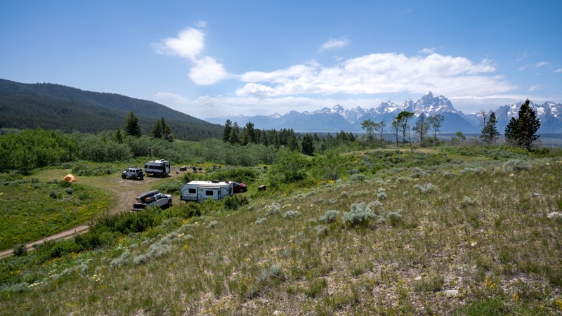
Updated: 11/30/2025
Puwerae Road
Elk, Wyoming
Puwerae Road is a short camping spur off Toppings Lake Road that leads to designated campsite 27, offering stunning views of the Teton Range. The campsite lies less than a quarter mile from the start and is accessed by a fairly steep incline. At the top, a small, level clearing can accommodate three to four camping parties, depending on vehicle size. Some visitors choose to hike higher up the hillside to set up tents for better views and added privacy.
The site is accessible to trailers, but turning around can be difficult if the area is already occupied. Beyond the designated campsite, the road continues for about a mile as a rough and bumpy two-track. The surface is hard-packed bentonite, which becomes dangerously slick and impassable when wet. The road ends abruptly with little space to maneuver.
The area is filled with wildflowers, especially in early summer. High clearance is required to drive the entire trail, though 2WD is sufficient in dry conditions.
Important Camping Notes:
- Camping in this area is restricted to designated sites only.
- A 5-day maximum stay limit is in effect from May 1st through Labor Day, and a 14-day limit the rest of the year.
- Bears are common in the area; thus, all food and attractants must be stored in bear-resistant containers or hard-sided vehicles.
- Some campsites offer on-site bear boxes, but not all campsites do.
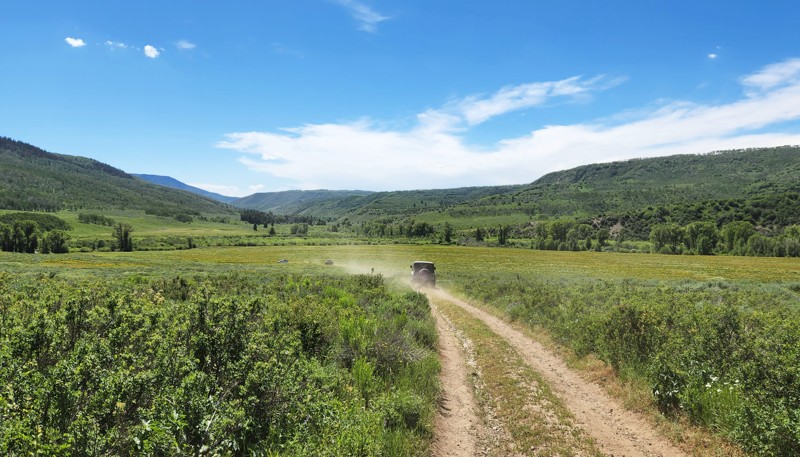
Updated: 10/15/2024
Battle Creek Spur 1G
Battle, Wyoming
Battle Creek Spur 1G connects Battle Creek Road near its end to West Sheep Mountain about in its middle. This provides an alternative to just turning around after you have run Battle Creek Road and allows you to extend your trip into a full day of exploring. It is mostly out in the open, providing spectacular views of the southern Sierra Madres. The trail follows a small ditch part of the way, crossing it at one point before turning north to connect to West Sheep Mountain. If you want to extend your day, consider turning south on West Seep Mountain Spur 1G, where this trail turns north. Although dispersed camping is allowed, there were no established campsites on the trail.
Updated: 08/11/2025
Taylor Ranch Road
Kelly, Wyoming
Taylor Ranch Road is a short and easy gravel spur off Gros Ventre Road that offers scenic lake views, several small campsites, and access to Lower Slide Lake. The road is open to the public for a brief stretch before it enters private ranch property.
Just before crossing the bridge, two small campsites can be found tucked into the trees along the river on the west side. After the bridge, there is a small cluster of campsites that could accommodate up to four groups, depending on spacing. This area also offers excellent beach access directly across from the campsites, making it a convenient spot for those looking to enjoy the lake.
The road ends shortly after this cluster at a manmade eagle's nest. It is best to turn around here, as there are no additional turnouts before reaching private property. While the drive is short, it provides a peaceful and scenic stop for camping or lake recreation near Lower Slide Lake.
Important Camping Notes:
- A 5-day maximum stay limit is in effect from May 1st through Labor Day, and a 14-day limit the rest of the year.
- Bears are common in the area; thus, all food and attractants must be stored in bear-resistant containers or hard-sided vehicles.
Updated: 10/15/2024
West Sheep Mountain Spur 1G
Battle, Wyoming
West Sheep Mountain Spur 1G is a short but important connector in the network of trails around Battle Creek Road and West Sheep Mountain in southern Wyoming. It connects Battle Creek Spur 1G with West Sheep Mountain to provide another option for extending your exploration of this area. Like many of the trails in the area, it traverses rolling hills of grass and sagebrush, providing sweeping views of the Sierra Madres. The road surface is rough dirt two-track which is slightly overgrown in places. Although camping is technically allowed on this trail, there were no established sites. More camping can be found on Battle Creek Road or West Sheep Mountain.
Updated: 12/14/2025
Lower Spread Creek Spur C & D
Elk, Wyoming
FS 30290C and 30290D are short, dead-end two-tracks that branch off Lower Spread Creek Road. Each leads to a designated campsite: Site 14 and Site 15.
Campsite 14 is the closer of the two, sitting above Lower Spread Creek with excellent northern views of the surrounding mountain terrain. It’s a spacious, level site with a partially grassy surface. Campsite 15 lies farther back in the pine forest, offering more solitude. While it lacks sweeping views, it's surrounded by wildflowers and has thicker ground cover, likely due to less vehicle traffic.
The trail surface to these sites is steep and composed of bentonite clay, which turns slick and unstable when wet. Deep ruts and erosion pockets scar the trail, making it clear this trail doesn’t handle moisture well. A high-clearance 4x4 vehicle is strongly recommended, and if rain is expected, rugged offroad tires are advised.
Important Camping Notes:
- Camping in this area is restricted to designated sites only.
- A 5-day maximum stay limit is in effect from May 1st through Labor Day, and a 14-day limit the rest of the year.
- Bears are common in the area; thus, all food and attractants must be stored in bear-resistant containers or hard-sided vehicles.
- Some campsites offer on-site bear boxes, but not all campsites do.
Updated: 12/14/2025
Lower Spread Creek Spur A & B
Elk, Wyoming
FS 30290A and 30290B are short spur roads that parallel Lower Spread Creek Road, providing access to designated campsites 7, 8, and 9. These spurs begin at the west end and progress eastward, with varying site types and road conditions along the way.
Campsite 7 sits at the western edge of the spur and overlooks the Spread Creek drainage. It’s a spacious, level site, large enough to accommodate RVs and trailers, with excellent views and room to spread out.
As the road continues east, it narrows and becomes increasingly rough, with several dips and exposed rocks up to 9 inches tall. While trailers can technically reach Campsites 8 and 9, maneuvering space is limited, and turning around may be difficult if the sites are already occupied by other large vehicles.
Campsite 8 is a wide, flat clearing near the treeline, featuring four to five fire rings and ample room for multiple camping parties. It offers a semi-shaded, open layout suitable for groups.
Campsite 9 is tucked into a cove at the mouth of the canyon, directly overlooking Spread Creek. This site is very large and open, with a dirt base that can comfortably host several parties or larger groups. Its seclusion and size make it a highly desirable site in the area.
Important Camping Notes:
- Camping in this area is restricted to designated sites only.
- A 5-day maximum stay limit is in effect from May 1st through Labor Day, and a 14-day limit the rest of the year.
- Bears are common in the area; thus, all food and attractants must be stored in bear-resistant containers or hard-sided vehicles.
- Some campsites offer on-site bear boxes, but not all campsites do.

Upgrade your Membership
Unlock all of the details on every Trail Guide and Scout Route.
Start a 7-day Free TrialCommunity
Partners