


By clicking "ACCEPT", you agree to be the terms and conditions of each policy linked to above. You also agree to the storing of cookies on your device to facilitate the operation and functionality of our site, enhance and customize your user experience, and to analyze how our site is used.
Alaska Off-Road Trails
11
Total Trail Guides 10

95
Detailed Waypoints 3
Try a Free 7-Day Trial and unlock it all
Start a Free Trial Most Recent Trail Reviews

Kyle Todd
Official Crew
No Rating
Open
Visited: 06/20/2026
The road is open but an avalanche has closed the road past Horse Tail Creek. Very fun and easy trail. I do recommend airing down your tires to make it more enjoyable. Beautiful scenery, I felt like I...
Tim Babb
Rated 5/5
Partially Open
Visited: 06/19/2026
Lovely trail to drive offering spectacular views. Moderate amount of traffic on the trail including motorbikes, but plenty of roadside Lupines flowering too.
Trail still washed out past the campgroun...
Paul
Kyle Todd
Official Crew
No Rating
Partially Open
Visited: 06/10/2026
The trail is only open to the campground, due to a washout, the gate at the campground is closed preventing further traffic.
Kyle Todd
Official Crew
Rated 5/5
Open
Visited: 06/05/2026
Water flow changes accessible trails daily. Lots of mud, be prepared to self-extract. Trails will become very narrow, and you should expect pin stripping.
Tom
Rated 5/5
Open
Visited: 05/16/2026
Nice drive up and down. Road was completely free of snow and ice all the way up to the ski slope. Mostly dry and dusty, washboards weren’t too bad at all.
Paul
No Rating
Seasonal Closure
Visited: 04/03/2026
Still a locked gate and snow and ice covering the trail.
Kyle Todd
Official Crew
No Rating
Open
Visited: 01/16/2026
The weather has been very warm around 40 degrees F and raining, significant overflow on the trail is present and ice over the frozen rivers is melting very quickly. Consider finding another trail and ...
Kyle Todd
Official Crew
No Rating
Partially Open
Visited: 12/09/2025
Due to the recent powerful wind storm there are many trees down, please bring a chainsaw and help clear the trail if you head this way!
Kyle Todd
Official Crew
No Rating
Seasonal Closure
Visited: 10/15/2025
According to this trails management agency, the trail is likely closed for the season.
You can reach out to the agency for more details.
Be sure to leave us a report and let us know ...

Trails Offroad
No Rating
Seasonal Closure
Visited: 10/01/2025
The pass is closed! Enjoy it next year. :)
Kyle Todd
Official Crew
Rated 5/5
Open
Visited: 09/28/2025
Alaska Extreme Fourwheelers went out and had a good group run. Took a side trail and had a group lunch. Had a blast!
Kyle Todd
Official Crew
No Rating
Open
Visited: 09/25/2025
The gate is not shut yet! But likely will be soon, get out while you can.
Kyle Todd
Official Crew
No Rating
Seasonal Closure
Visited: 09/15/2025
According to this trails management agency, the trail is likely closed for the season.
You can reach out to the agency for more details.
Be sure to leave us a report and let us know ...
Trails Offroad
Rated 5/5
Open
Visited: 09/02/2025
Navigating the road late in the evening was a gorgeous trip thru the greater Nome region along the Bering Sea.
Kyle Todd
Official Crew
Rated 5/5
Open
Visited: 08/16/2025
The road was dusty in the loose loamy sections but was an excellent easy excursion. I will most assuredly come back for some stellar camping spots.
Kyle Todd
Official Crew
Rated 4/5
Open
Visited: 08/10/2025
it was a little rainy today, headed east from Willow, but it was still a gorgeous drive. the Western side follows some rivers and creeks, there lots of places to park and some right on the river. we w...
Ryan Wallace
Official Crew
Rated 5/5
Open
Visited: 08/05/2025
nice trail. lots of puddles . easy route. pretty lake at the end.
Leanne Rueger
Rated 5/5
Open
Visited: 07/27/2025
The road is in great shape just the normal amount of potholes.
Kyle Todd
Official Crew
No Rating
Open
Visited: 07/01/2025
According to this trails management agency, the trail is likely open for the season.
You can reach out to the agency for more details.
Be sure to leave us a report and let us know if...
Trails Offroad
Kyle Todd
Official Crew
No Rating
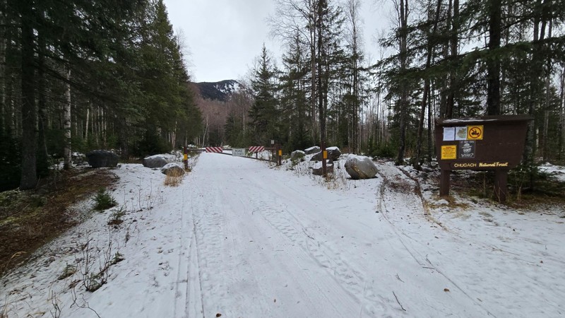
Temporary Closure
Visited: 06/17/2025
The trail is closed for the summer. Notice from the Forest service below:
"To protect the health and safety of forest-users and construction workers, the Palmer Creek Road, including the Coeur d’Alene...
Kyle Todd
Official Crew
No Rating
Partially Open
Visited: 06/16/2025
Reports of a large mud slide, be very careful!
Kyle Todd
Official Crew
No Rating
Open
Visited: 06/01/2025
According to this trails management agency, the trail is likely open for the season.
You can reach out to the agency for more details.
Be sure to leave us a report and let us know if...
Trails Offroad
No Rating
Open
Visited: 05/15/2025
According to this trails management agency, the trail is likely open for the season.
You can reach out to the agency for more details.
Be sure to leave us a report and let us know if...
Trails Offroad
No Rating
Open
Visited: 05/05/2025
DOT finished plowing the Highway so travel is easy once again!
Kyle Todd
Official Crew
No Rating
Seasonal Closure
Visited: 03/26/2025
Gated off on the Sterling Y side.

Kyle Todd
Official Crew
No Rating
Open
Visited: 02/23/2025
Due to melting conditions some of the crossings are breaking up. Be prepared to rescue yourself if you fall thru.
Kyle Todd
Official Crew
No Rating
Seasonal Closure
Visited: 02/16/2025
Not much snow, hopefully we get an early open this summer!
Kyle Todd
Official Crew
Kyle Todd
Official Crew
No Rating
Partially Open
Visited: 01/20/2025
Covered in 4 feet of snow, grab the snow machines!
Kyle Todd
Official Crew
No Rating
Seasonal Closure
Visited: 10/30/2024
According to this trails management agency, the trail is likely closed for the season.
You can reach out to the agency for more details.
Be sure to leave us a report and let us know ...
Trails Offroad
No Rating
Seasonal Closure
Visited: 10/15/2024
According to this trails management agency, the trail is likely closed for the season.
You can reach out to the agency for more details.
Be sure to leave us a report and let us know ...
Trails Offroad
No Rating
Seasonal Closure
Visited: 10/09/2024
DOT just closed the pass, access is only via the Willow entrance now and the final pass is gated off.
Kyle Todd
Official Crew
Rated 5/5
Open
Visited: 09/24/2024
The road was in great shape for the most part but had deteriorated in a few spots with the rather rainy fall we've been having evidenced by some rough pothole and washboard sections. Still no snow at ...
Kyle Todd
Official Crew
Rated 5/5
Open
Visited: 09/21/2024
Nice easy trail. More potholes and ruts the farther you go. Could get extra muddy after heavy rains.
S
Sam
Rated 5/5
Open
Visited: 09/01/2024
The Highway was in great shape, more of it has been oiled by DOT so the rugged essence of the trail is slowly vanishing. The wild Northern Lights danced for hours overhead making for a mesmerizing eve...


Kyle Todd
Official Crew
Rated 5/5
Open
Visited: 08/24/2024
Took my kids for a nice ride to get some blueberries. :)


Kyle Todd
Official Crew
Kyle Todd
Official Crew
Rated 5/5
Open
Visited: 06/01/2024
Fantastic trail conditions and lots of dirt bikes exploring the trail. I even saw my old rig on the trail!
Kyle Todd
Official Crew
No Rating
Open
Visited: 05/16/2024
DOT finished plowing the snow and the road is open! :)
Kyle Todd
Official Crew
Rated 5/5
Open
Visited: 01/02/2024
The trail has been reported to be in "normal" winter conditions with most crossings reported safe by users. Look for an updated trip report soon.
Kyle Todd
Official Crew
No Rating
Open
Visited: 10/30/2023
While not closed, the ice isnt thick enough and a few side by sides have broken through the ice recently.
Kyle Todd
Official Crew
No Rating
Seasonal Closure
Visited: 10/30/2023
Closed for the year, the trail is normally groomed for XC skiing though!
Kyle Todd
Official Crew
No Rating
Seasonal Closure
Visited: 10/30/2023
Closed for the winter, come again next year, or snow machine in!
Kyle Todd
Official Crew
Rated 5/5
Seasonal Closure
Visited: 09/20/2023
DOT just closed the pass for the winter. :(
Kyle Todd
Official Crew
Rated 5/5
Open
Visited: 08/21/2023
Nice little outing to the river and Knick Glacier view. Popular with locals on weekends, so patience and courtesy are recommended in tighter spots. Trail is fairly easy to follow, but numerous branc...
D
DogFather
Rated 1/5
Open
Visited: 08/20/2023
Drove this today, Sunday. Had expected heavy traffic. Gravel road was nearly constant washboard with plentiful dust - but no potholes noticed. High clearance not required. Looks like very good roa...
D
DogFather
No Rating
Open
Visited: 07/29/2023
Ran this trail up and back in a Can Am ATV. The day was rainy and cool. Great trail with lots of water crossings.
JA
Joan Antolik
Most Popular


Updated: 05/16/2024
Denali Highway
Open
/
Cantwell, Alaska/
150.01 miles/
About 4 hours
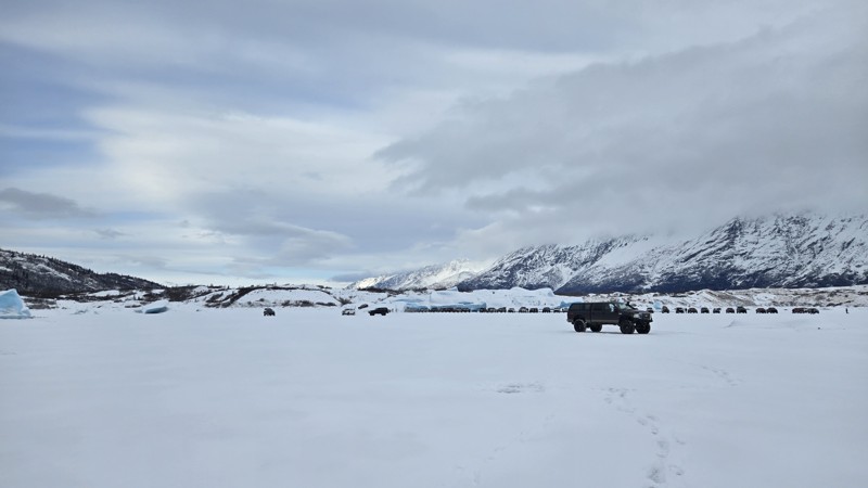
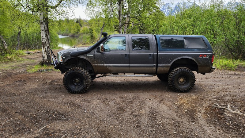
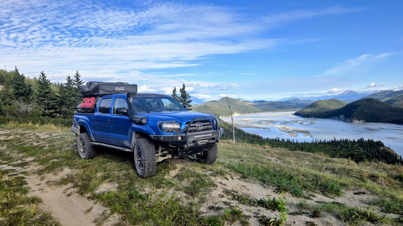
Connecting the outside world to Denali National Park for over a decade, the Denali Highway provides spectacular views of Alaska's interior. Stretching from the Wrangell-St. Elias Mountains to North America's tallest summit, Denali, at 20,310' is surrounded by the Alaska Range. This historic route is guaranteed not to disappoint. Sprawling over three different river drainages to include: Susitna, Tanana/Yukon, and Copper, this dirt road provides spectacular views and river crossings of narrow wooden-decked single-lane bridges. This route really is special with its scenery and guaranteed to carve a special place in your heart that only Alaska can fill. Several different lodges are found along the way and are worth grabbing a warm meal and friendly company along your journey. Wildlife Viewing is a common attraction along the 135-mile stretch, so keep an eager eye, and you may find some of Alaska's wildlife looking back at you!

Updated: 01/02/2024
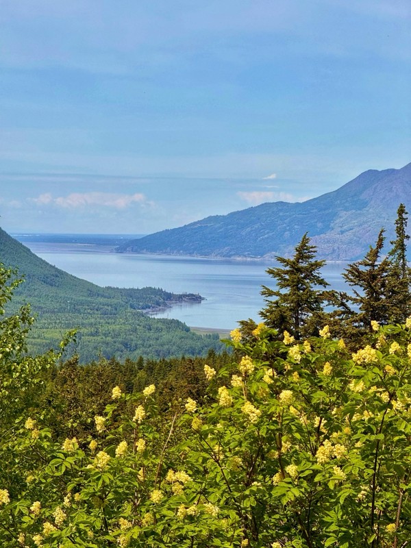
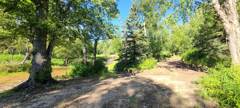
Knik Glacier Trail
Butte, Alaska
The Knik trails offer picturesque Alaskan scenery! You have sand dunes, a beautiful glacial river, the chance to touch the Knik glacier, and this is all at the base of a beautiful set of mountain ranges on these 4x4 trails! These trails are probably the most popular offroad destinations in south-central Alaska. They are often filmed by out of state crews when they offroad in Alaska; parts of Expedition Overland (Season 1, Episode 5), Dirt Every Day (Episode 57), and Nitto's 2016 JK-Experience all have been filmed along these 4x4 trails. Viewing the Knik Glacier, gazing into a display of the northern lights in the darker months, and salmon fishing are all highly recommended activities of the area.

Updated: 06/01/2024
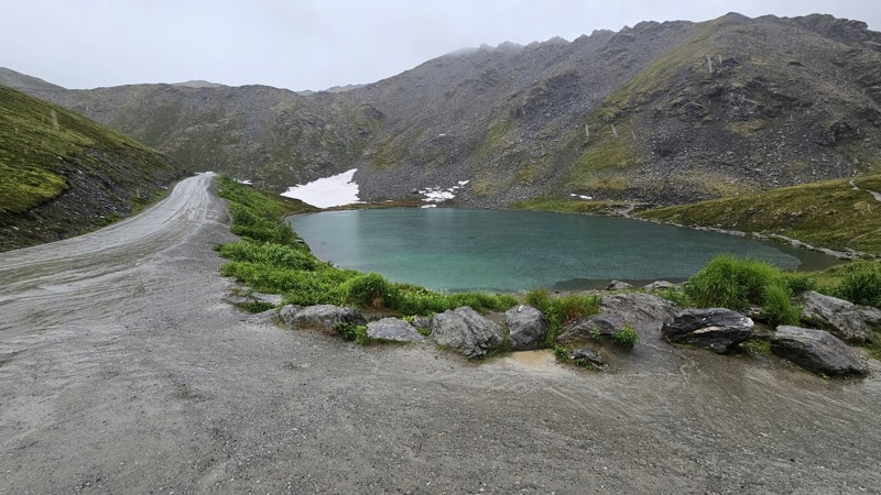
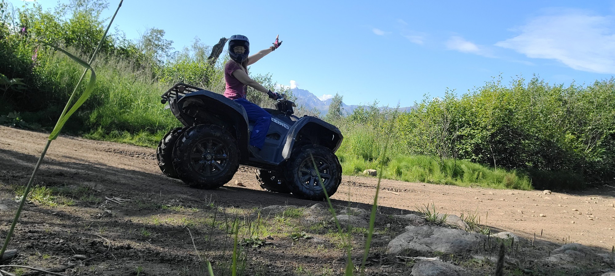
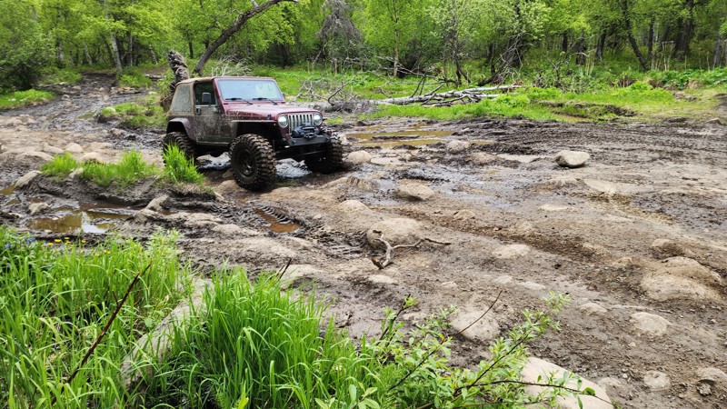
Kings River Trail
Sutton-Alpine, Alaska
Meandering along the banks of the Kings River and then traversing up the hills to pristine Ruby Lake, this off-road trail is certainly recommended for the adventurous soul. While not proving too difficult during the drier summer months, the muddy sections and hills can prove to be a challenge to less capable rigs in inclement weather. Fishing is supposed to be good at Ruby Lake (license required) and it is stocked. The views of Ruby Lake and the surroundings are spectacular and well worth the gas burned on enjoying this corner of Alaska's wilderness.

Updated: 06/05/2022
Bald Mountain B29 Trail
Wasilla, Alaska
Bald Mountain Trail keeps testing you and your rig until you make it or give up along the way. As you and your rig are pushed to the limits you witness spectacular panoramic views of the entire Matanuska-Susitna Valley making this one of the best off-road trails in Alaska. You can also see the wreckage of a B-29 on the side of the mountain. This trail was featured on Episode 57 of Dirt Every Day - Alaskan Army Truck Adventure as well as Nitto's 2016 JK Experience, clearly it is worth the visit! Breathtaking views abound on this one! Come prepared and bring a camera!

Updated: 11/24/2022
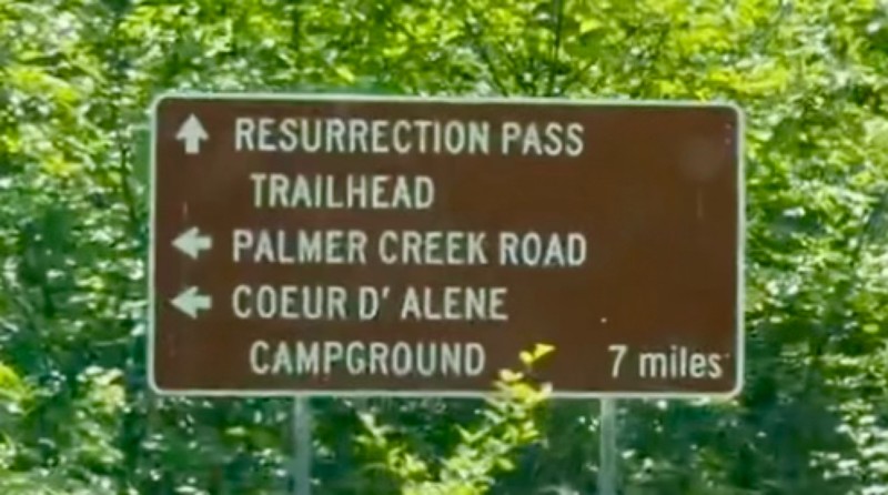
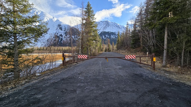
Palmer Creek Road
Hope, Alaska
Climbing from sea level in Hope, Alaska up through a narrow forested road, passing by a small campground, and culminating at the end of an alpine valley is Palmer Creek Road. This trail is rich with a history of gold mining with old mine ruins to explore. There were three primary mines that operated in the valley. The Downey mine is to the east of the wooden bridge around the 2500' level. The Hershey/Hirshey mine is around 2900' to the east of the gated end of the road. The Swetman Mill, a 0.6-mile hike, and Swetman/Lucky Strike Mine, a 1.75-mile hike, still have mining artifacts and ruins south of the road's end. Most of these hiking trails have shallow water crossings. These mines were active from 1911 to 1939 but have not been reopened since. In recent years, mining claims have still been active in the valley at a smaller scale.

Updated: 06/05/2022
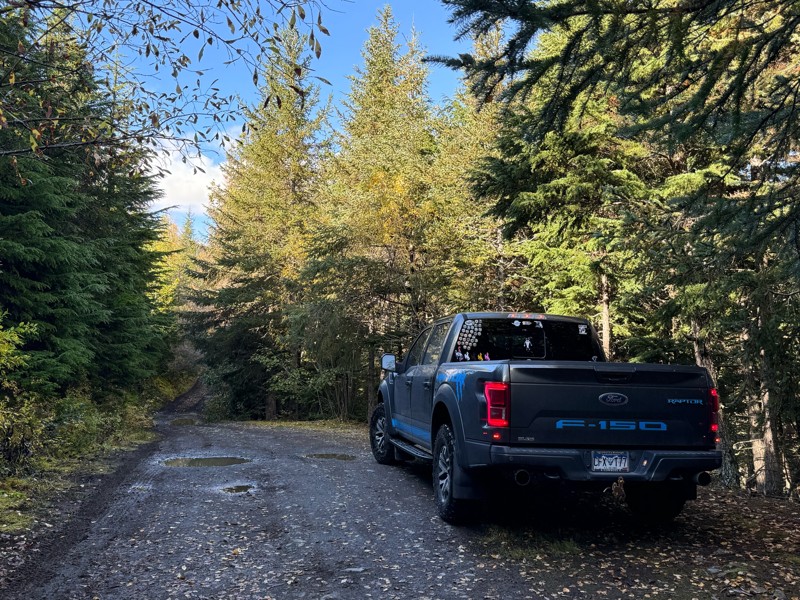
Craigie Creek Road
Willow, Alaska
Gold mines, mining cabins, grizzly bears, eagles, and a moderately challenging trail don't interest you? Of course they do! This trail has a little bit of everything on it and is a favorite of more than a few. Mining relics, mine shafts, mining buildings, tools, and machinery litter the valley in a homage to the rich gold mining of the area that continues on today. People still actively mine this area so please be respectful of their equipment and claims. This trail sits just a couple valleys over from the popular Independence Mine State Historical Park. Do not remove any mining artifacts, leave them for everyone to enjoy.

Updated: 06/19/2024
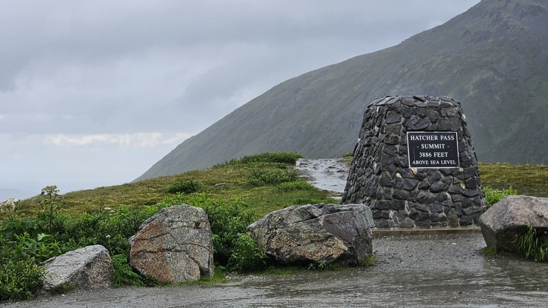
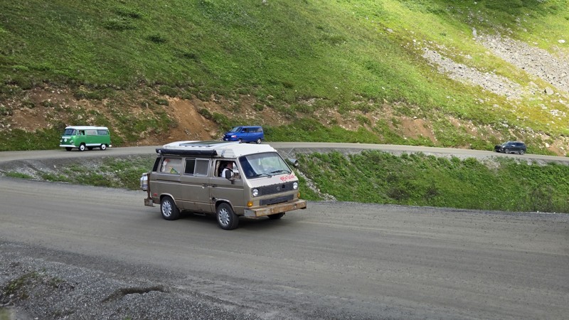
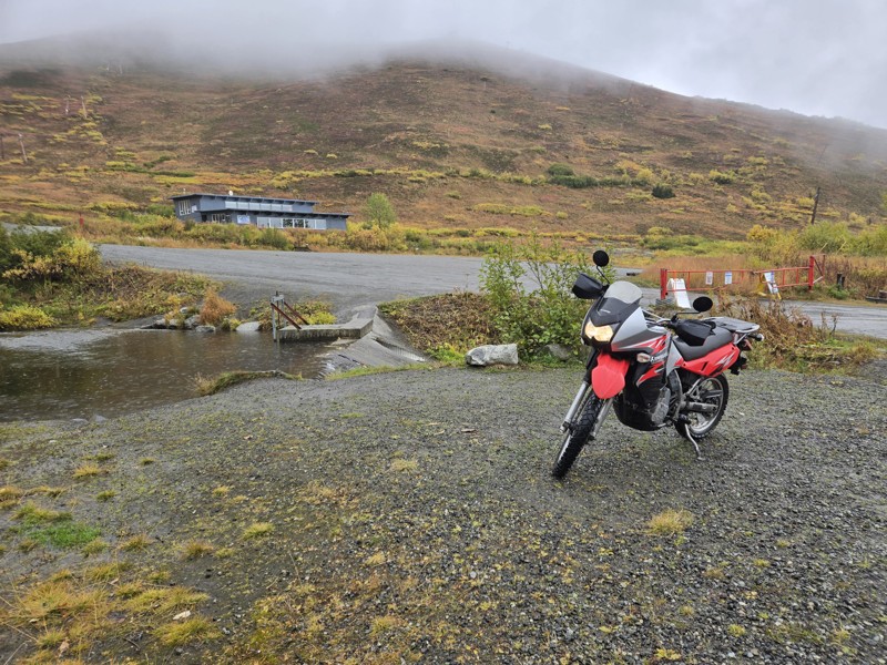
Hatcher Pass Road
Willow, Alaska
Hatcher Pass is considered to be one of the top ten scenic drives in Alaska. Situated in the Talkeetna Mountains there is a tremendous amount of mining history that includes the Independence Mine and dozens of other mines, some still active today. If you are looking for a gnarly offroad trail this is not what you are looking for but it might get you to Purches Trail, Craigie Creek Road, a winter snowmachine playground, a summer hiking trail, an off-grid camping spot (more details in camping section), ski, snowboard, biking, sledding, or other adventure. This road is very tame and a scenic route. If you are just visiting Alaska and left your rig at home, this road is suitable for any rental car.

Updated: 12/23/2025
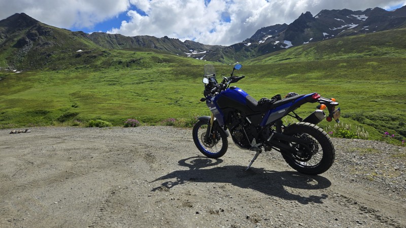
Belanger Pass
Sutton, Alaska
Off the Glenn highway and very near the Eureka Lodge, is Belanger Pass, an Alaska mining trail with numerous active local mines. On a clear day, the views from the pass of surrounding mountains and glaciers are spectacular. Belanger Pass Trail is a common access point to the Nelchina Public Use Area, which is roughly 2.5 million acres of Alaska set aside for Alaskans and wildlife in 1985 by the Alaska Legislature. The Nelchina Public Use Area is a very common destination among hunters, berry pickers, mountain bikers, and other outdoor enthusiasts.

Updated: 08/20/2023
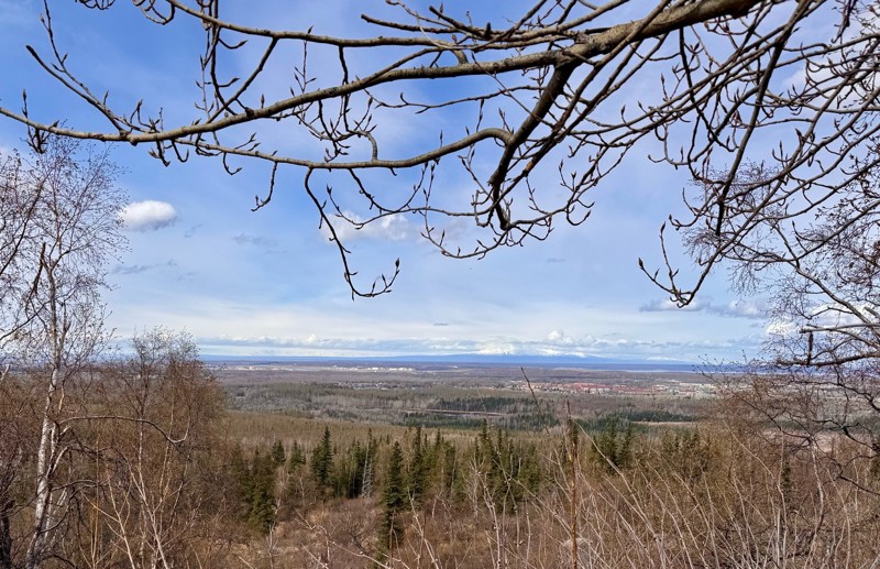
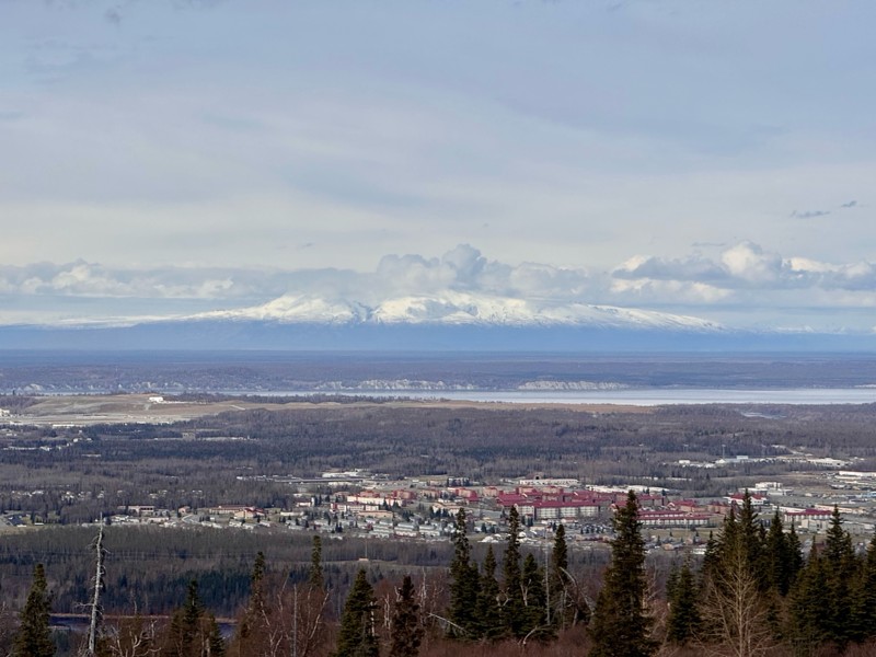
Arctic Valley Road
Anchorage, Alaska
Arctic Valley provides a quick jaunt into the wilderness of Alaska tucked in between Anchorage and Eagle River adjacent to JBER (Joint Base Elmendorf Richardson). Near the bottom of the road is a great sledding hill that starts at Waypoint 3 and goes down to Waypoint 2, although a JBER Recreation Pass is required if you want to explore beyond the road, sledding included. Bears and wolves along with other wildlife frequent the area, so keep an eye open and see what may be looking back at you! Along the way, there are great views of the greater Anchorage area, Denali, and the northern lights (aurora borealis) on a clear night sky. At the top of Arctic Valley Road (pay to park) you can pick blueberries, hike up and see an old Nike Missile site, site "Summit" (fenced off) that is still used today as a communications site for various government agencies, or go explore the backcountry. During winter the Arctic Valley Ski Area is a great place to ski, it is run by volunteers and is only open on the weekends. In the winter, 4WD (4x4, 4 wheel drive) or good working AWD (all wheel drive) is a necessity as the road is infrequently maintained and is often snow covered and icy from overflow, especially near the top.

Updated: 08/21/2023
Knik Sand Dunes
Butte, Alaska
The Knik trails offer beautiful Alaskan scenery! You have sand dunes, a beautiful river and views of the Knik glacier all at the base of Pioneer Peak. These trails are probably the most popular offroad destinations in south-central Alaska. They are often filmed by out of state crews when they offroad in Alaska; parts of Expedition Overland (Season 1, Episode 5), Dirt Every Day (Episode 57), and Nitto's 2016 JK-Experience all have been filmed along these 4x4 trails. Viewing the Knik Glacier, gazing into a display of the northern lights in the winter months, and salmon fishing are all highly recommended activities of the area. Often small planes fly overhead and occasionally land on gravel bars. Great place for a quick picnic or an overnight stay. Northern lights viewing is best further away from the dunes as the aurora often appears low on the horizon in the darker months.

Updated: 10/30/2023
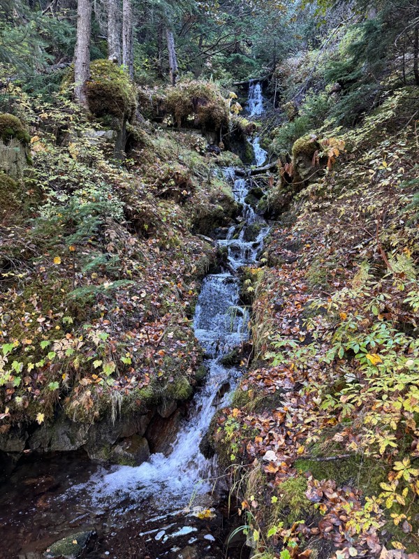
Mineral Creek Road
Valdez, Alaska
A narrow canyon trail with views of glaciers, rugged mountains surrounding you, and mining efforts throughout the years (historical as well as current) are all present along this short sojourn into the Alaskan wilderness. Anyone looking for historic goldmines will be well rewarded along Mineral Creek Road and hiking the area. At the end of the drivable trail (where this trail guide ends and marked with a gate), a hiking trail continues to the historic Smith Mill about 1 mile further up the canyon. (At the time of mapping this guide, a landslide prevented safe hiking to the Smith Mill, proceed at your own risk.)

Updated: 04/10/2026
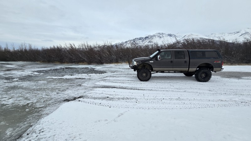
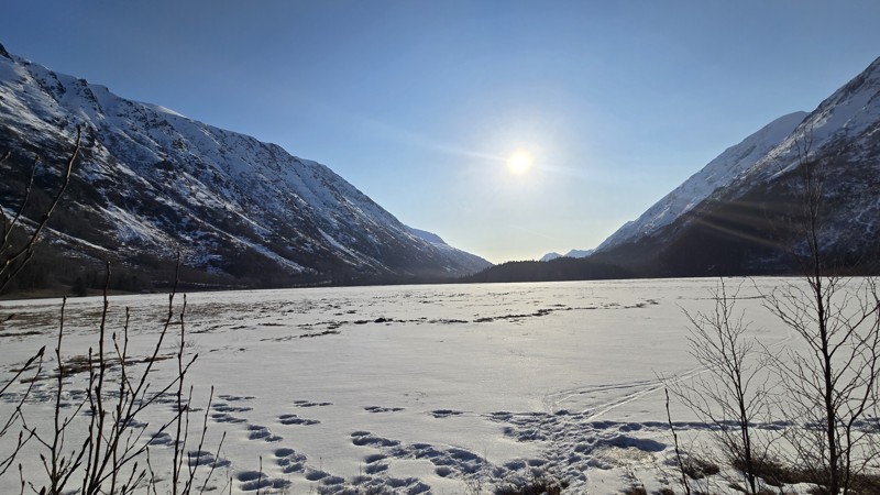
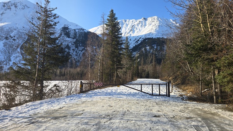
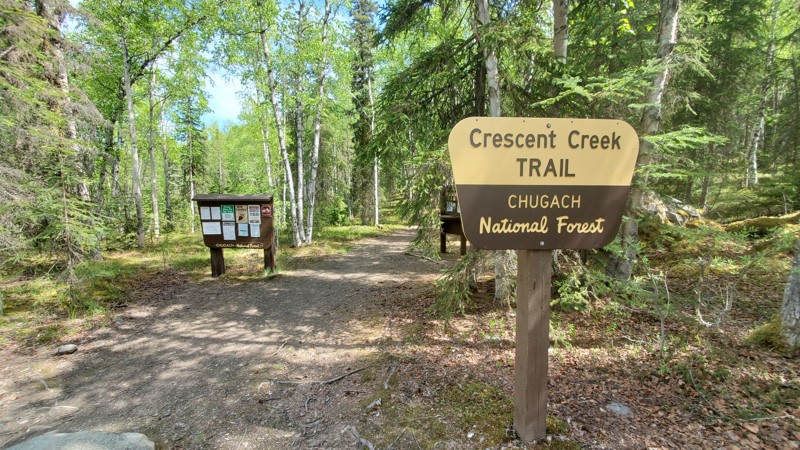
Old Sterling Spur Road
Moose Pass, Alaska
With construction beginning in 1947 and finishing in 1950, this bumpy one-lane dirt road was the only drivable connection for Soldotna, Kenai, Homer, and the smaller towns of the Kenai Peninsula to Anchorage and Seward. Currently, the narrow trail meanders thru a plethora of aspen and black spruce to the trailhead of the Crescent Creek Trail. Continuing past the trailhead in either direction will take the keen traveler back to the newer Sterling Highway with highway speed limits and a lesser feeling of connection to the surrounding wild.
Two campgrounds sit near the southwestern end of the trail. Tranquil Crescent Creek Campground or the airy Quartz Creek Campground on the banks of Kenai Lake envelop the savvy camper with aspen, birch, and spruce trees. But don't forget the bug dope!
Updated: 01/05/2026
McCarthy Road
Chitina, Alaska
Meandering through the Wrangell–St. Elias Mountains from the small community of Chitina to the abandoned mining town of McCarthy, just outside the historic Kennecott Mine, is an unforgettable experience.
The McCarthy Road is a remote, 60-mile wilderness route that follows the old Copper River & Northwestern Railway grade from Chitina to the edge of Wrangell–St. Elias National Park. Known for its rugged charm, the road traces deep river canyons, passes through broad spruce forests, and offers sweeping views of the Wrangell Mountains. Travelers experience a true backcountry atmosphere, with limited services, abundant wildlife, and a sense of stepping far away from the developed road system.
Despite its scenic beauty, the McCarthy Road requires patience and preparation. Portions of the route remain narrow, winding, and unpaved, with frequent washboard and pothole sections depending on the season. Old rail ties—locally called “fishplates”—may still surface in the gravel in places, giving the drive a distinctive feel. Bridges and culverts have been significantly improved over the years, including the dramatic Kuskulana Bridge crossing 238 feet above the river, but conditions can still vary due to weather, runoff, and maintenance schedules.
The road ends at the Kennicott River Footbridge, the pedestrian gateway to the historic town of McCarthy and the nearby Kennecott Mines National Historic Landmark. From there, visitors can access an extensive network of trails ranging from easy riverside walks to glacier hikes and alpine routes deeper within the park. As both an access corridor and a scenic experience of its own, the McCarthy Road offers an unforgettable introduction to the raw, expansive landscape of America’s largest national park.
Along the route and at McCarthy are paid camping options, some state owned and some privately owned. Make sure to follow the fees and permits for both as they do differ.
Updated: 01/05/2026
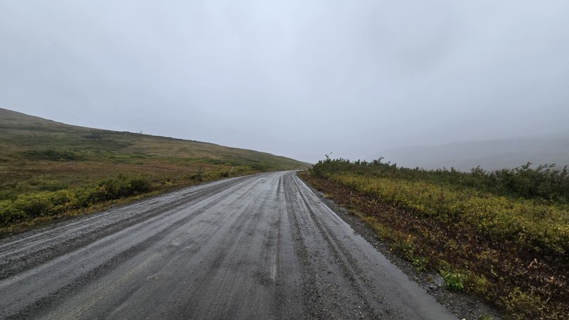
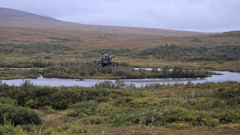
Nome-Council Road
Nome, Alaska
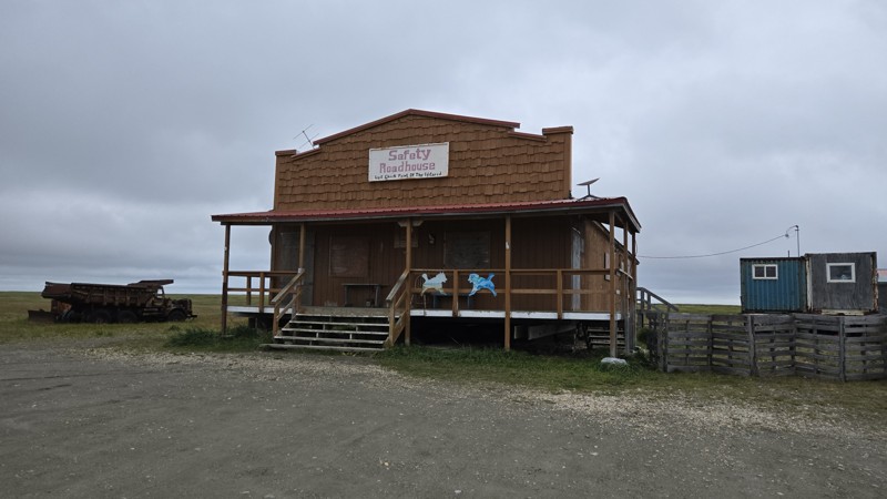
The Nome–Council Road is a 72-mile summer-only gravel route that runs from the coastal town of Nome to the historic gold-rush settlement of Council, perched on the south bank of the Niukluk River. The drive begins along the Bering Sea, following windswept beaches, coastal wetlands, and the famous Safety Roadhouse, the final checkpoint of the Iditarod Trail Sled Dog Race. It then turns inland, crossing wide tundra valleys and low rolling hills. The scenery transitions through nearly every ecosystem on the Seward Peninsula, from open tundra and lagoons to dense dwarf shrub and the western fringe of Alaska’s boreal forest. Along the way, you may encounter musk ox, reindeer, and arctic fox, as well as prolific birdlife near Safety Sound and the river crossings.
For drivers, this is a route that is both approachable and remote. The surface is unpaved from end to end, mostly wide and well-graded, with occasional washboard, potholes, and soft shoulders. The weather can change road conditions quickly. Storms may leave the track muddy or rutted, and lingering storm damage from Typhoon Merbok still affects some stretches. From May through October, most high-clearance vehicles can handle the drive, but beyond that, snow and ice make it impassable. Historical relics of Nome’s mining past line the route, including the “Last Train to Nowhere” and long-abandoned dredges. The road ends at the Niukluk River, where seasonal bridge access determines whether you can reach the tiny community of Council itself.
While not technically difficult, Nome–Council demands preparation and respect for its isolation. There are no services between Nome and Council, and the weather off the Bering Sea can shift from calm to harsh in minutes. Bring a full-size spare, recovery gear, extra fuel, and time to explore the relics, wildlife, and wide-open solitude that define this true Alaskan overland route.

Upgrade your Membership
Unlock all of the details on every Trail Guide and Scout Route.
Start a 7-day Free TrialCommunity
Partners