


By clicking "ACCEPT", you agree to be the terms and conditions of each policy linked to above. You also agree to the storing of cookies on your device to facilitate the operation and functionality of our site, enhance and customize your user experience, and to analyze how our site is used.
British Columbia Off-Road Trails
1
Total Trail Guides 1

20
Detailed Waypoints 34
Try a Free 7-Day Trial and unlock it all
Start a Free Trial Most Recent Trail Reviews
No Rating
Seasonal Closure
Visited: 11/01/2025
According to this trails management agency, the trail is likely closed for the season.
You can reach out to the agency for more details.
Be sure to leave us a report and let us know ...

Trails Offroad
No Rating
Seasonal Closure
Visited: 11/01/2025
According to this trails management agency, the trail is likely closed for the season.
You can reach out to the agency for more details.
Be sure to leave us a report and let us know ...
Trails Offroad
No Rating
Open
Visited: 03/01/2025
According to this trails management agency, the trail is likely open for the season.
You can reach out to the agency for more details.
Be sure to leave us a report and let us know if...
Trails Offroad
No Rating
Open
Visited: 03/01/2025
According to this trails management agency, the trail is likely open for the season.
You can reach out to the agency for more details.
Be sure to leave us a report and let us know if...
Trails Offroad
No Rating
Seasonal Closure
Visited: 11/01/2024
Trail is closed per FS seasonal dates. See you next year!
Trails Offroad
No Rating
Seasonal Closure
Visited: 11/01/2024
Trail is closed per FS seasonal dates. See you next year!
Trails Offroad
Rated 5/5
Open
Visited: 08/01/2024
This truly is a beautiful trek through the valley! Mountains, flowing rivers and creeks, waterfalls, and glaciers! Take some time to stop at Thompson Falls and Mummery Glacier. We encountered a wildfi...
Tony Faiola
Official Crew
Rated 3/5
Open
Visited: 07/31/2024
A nice trail that winds its way up into the mountains. Good pull off spots with views of the valley below. Many spur roads that look like the go even higher elevation but we didn't explore them. We sa...
Tony Faiola
Official Crew
Rated 5/5
Open
Visited: 11/17/2023
A cool drive through the valley along some lakes and rivers. I saw a couple of herds of deer.
Matt T
Official Crew
Rated 4/5
Open
Visited: 11/17/2023
There were lots of deer and livestock in the area. The western section is the best part with the views of the lake.
Matt T
Official Crew
Rated 5/5
Open
Visited: 11/17/2023
The lakes and campgrounds are pretty cool; I want to return in the summer and go out on the lake.
It’s an incredible drive that connects to other cool trails, so you can do a whole loop from Kelowna,...
Matt T
Official Crew
Rated 5/5
Open
Visited: 11/14/2023
These lakes look like a fisherman’s dream. It's a great way to escape the heat during the summer, with lots of paddleboarding and other water activities.
Matt T
Official Crew
Rated 5/5
Open
Visited: 11/14/2023
This was a really cool drive with lots of access to the lakes, which are great for fishing or any water activities.
Matt T
Official Crew
Rated 5/5
Open
Visited: 11/01/2023
This road is an open livestock range, so watch out for cows on the road. The lakes are very cool, and the camping is great too. These lakes are great places for fishing and water activities.
Matt T
Official Crew
Rated 5/5
Open
Visited: 11/01/2023
Buck Hills is a great trail; the Aberdeen Columns hike is really cool and worth the short trip from the road. Nicken Lake is fantastic and the camping is great there, plenty of privacy.

Matt T
Official Crew
Rated 5/5
Open
Visited: 10/31/2023
The lake is awesome, and there was no one there at either beach. The weather was a nice brisk fall day, and the trail was in good condition. Watch out for logging trucks.
Matt T
Official Crew
Rated 4/5
Open
Visited: 10/29/2023
Echo Lake was really cool, I want to come back when it’s warmer.
I saw two bald eagles around the lake and lots of deer.

Matt T
Official Crew
Rated 3/5
Open
Visited: 10/29/2023
Not a whole lot to see other than some mountain views, no camping.
Matt T
Official Crew
Rated 3/5
Open
Visited: 10/29/2023
Very easy trail and the view of Mable Lake was amazing; great place to stop for lunch. Not much to see other than that.
Watch out for deer and other wildlife.
Easy trail to drive, I saw a minivan o...
Matt T
Official Crew
Rated 4/5
Open
Visited: 10/29/2023
Hidden Lake is pretty cool and nice for kayaking or paddleboarding. There were some deer along the road, so watch out for wildlife.
Matt T
Official Crew
Rated 5/5
Open
Visited: 10/27/2023
I went in late October, and at higher elevations, there was an inch or so of snow on the ground. Be sure to check road conditions before you go.
Matt T
Official Crew
Rated 4/5
Open
Visited: 10/27/2023
This was a nice drive through the forest, with a couple of really cool lookout points. No camping areas on the trail.
Matt T
Official Crew
Rated 5/5
Open
Visited: 08/15/2023
There weren’t many people or cars out on the road, but there was a nearby fire which made for very hazy conditions.
The lake is a great place for boating or paddling; there was no one out there.
Matt T
Official Crew
Rated 5/5
Open
Visited: 08/09/2023
There are several other roads that connect to Westside Road if you want to venture out further into the mountains and wilderness.
Matt T
Official Crew
Rated 4/5
Open
Visited: 08/06/2023
Always check the fire report and maps before venturing out; some of the connecting roads were closed due to fire activity.
I saw a couple of bighorn sheep along the way, so watch your speed as there ...
Matt T
Official Crew
Rated 4/5
Open
Visited: 08/06/2023
There are several other trails in the area that can connect with Settlers Road and make a great loop, such as Kootenay River Forest Service Road.
There were some forest fires in the area which led to...
Matt T
Official Crew
Rated 5/5
Open
Visited: 08/04/2023
Watch out for wildlife, I saw a mom and cub black bear on the side of the road. So watch your speed as the road can get quite busy in the summer as boating activity on the lake is very popular.
Bush...
Matt T
Official Crew
Rated 3/5
Open
Visited: 08/02/2023
Some small trees had fallen in the road, but they were easy to drive over. Many vehicles were on the road, so watch your speed around blind corners.
Most of the road was lined with thick trees and v...
Matt T
Official Crew
Rated 4/5
Open
Visited: 08/02/2023
There were lots of other cars and logging trucks on the road, so be aware and watch your speed around blind corners. Frog Falls is a neat little waterfall just a short walk from the Frog Falls Recreat...

Matt T
Official Crew
Rated 4/5
Open
Visited: 07/29/2023
The wildflowers were in full bloom in late July, but I struck out on gold-panning; guess I’ll have to keep writing for Trails Offroad for now.
There were some downed trees in the road, you can drive ...
Matt T
Official Crew
Rated 5/5
Open
Visited: 07/27/2023
Watch out for those logging trucks and pickups out there, they come flying down the road. The trail ended after some switchbacks, and there was a huge pile of logs and an impassable ditch that marked ...
Matt T
Official Crew
Rated 4/5
Open
Visited: 07/26/2023
The scenic viewpoints are few-and-far in between, which is a shame because the aqua-blue water of Lake Revelstoke is unbelievable. Along the out-and-back trail, there are a few trickling waterfalls do...
Matt T
Official Crew
Rated 5/5
Open
Visited: 07/25/2023
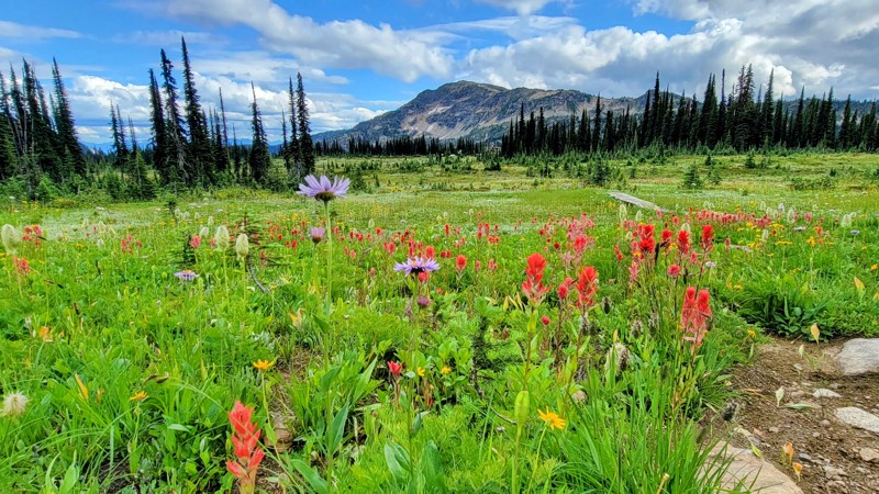
The lodge at Sol Mountain was really cool, and I did a short walk into the meadow and saw the most amazing wildflowers I’ve ever seen in my life! Wildflower season is July and August.
Watch out for l...
Matt T
Official Crew
Rated 5/5
Open
Visited: 07/23/2023
Hadow Creek Campground is one of the best campsites I’ve ever seen, I went for a paddle, and there was only one boat on the whole arm (which is pretty large.) If you want remote camping with incredibl...
Matt T
Official Crew
Rated 5/5
Open
Visited: 07/16/2023
Most of the road was easy; it got narrow at parts, but not too bad. The wildflowers were in full bloom along the trail. The last climb was worth the drive. I sat up on the mountain for a good hour and...
Matt T
Official Crew
Rated 5/5
Open
Visited: 07/16/2023
This was an easy and fun road to drive; the views of the creek and the surrounding peaks are spectacular. Be on the lookout for wildlife, I saw a small black bear run across the road. The bridges over...

Matt T
Official Crew
Rated 4/5
Open
Visited: 07/14/2023
There was a forest fire far away, but the smoke filled the valley; always check fire reports before planning your route. I could tell the views would have been spectacular, but the smoke ruined them. ...
Matt T
Official Crew
Rated 2/5
Open
Visited: 07/14/2023
There was a fire far away, and the smoke filled the valley, so I didn’t get to see much along the trail. I don’t think I missed much, it was mostly the thick tree-lined road. The 2 or 3 viewpoints loo...
Matt T
Official Crew
Rated 4/5
Open
Visited: 07/14/2023
There was a fire over 100 miles away, and I choose a route away from the fire, but the smoke filled the valley. Always be sure to check fire reports in the summer before planning your route. It was st...
Matt T
Official Crew
Rated 4/5
Open
Visited: 07/11/2023
Along the trail, I didn’t see another vehicle the whole time on the road, and at the campgrounds, there were only two cars there. If you want a secluded camping experience, then this is the place for ...
Matt T
Official Crew
Rated 5/5
Open
Visited: 07/10/2023
This was a nice and easy drive to some marvelous views of the snow-capped mountains and Arrow Lake, which is part of the Columbia River.
The wildflowers were in full bloom in a variety of colors alon...
Matt T
Official Crew
Rated 5/5
Open
Visited: 07/10/2023
The last climb up the logging road is well worth it; the views of the glaciers and the river valley below are amazing! Do not follow the road past the GPX map; it’s a short logging road with some larg...
Matt T
Official Crew
Most Popular

Updated: 10/15/2024
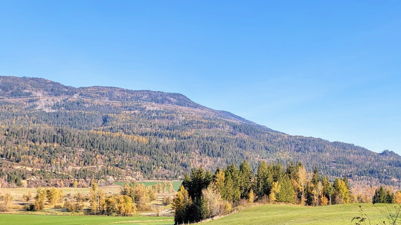
Settlers Road
Radium Hot Springs, British Columbia
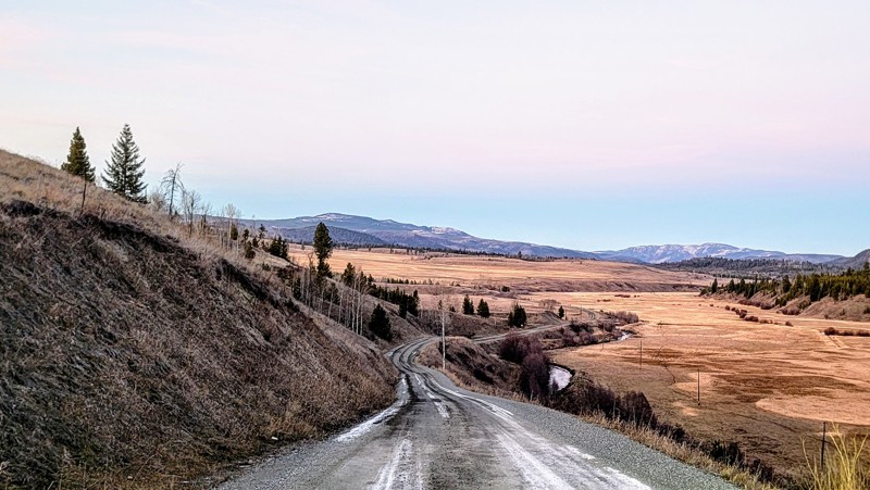
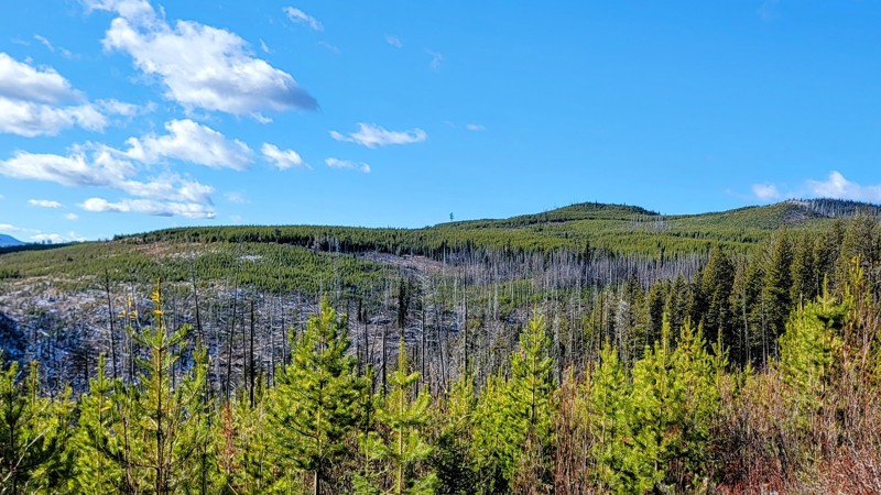
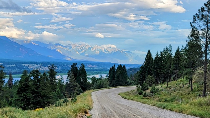
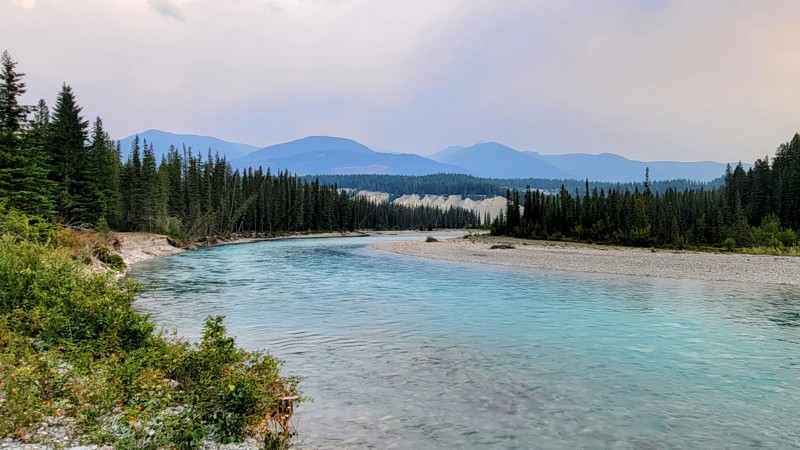
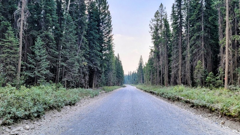
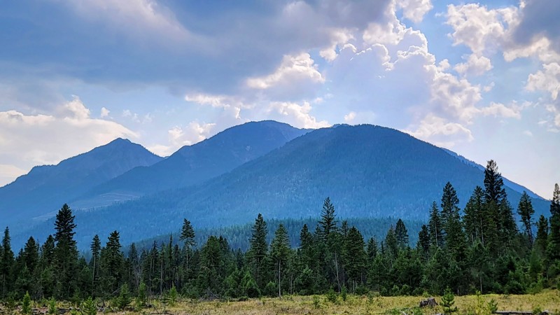
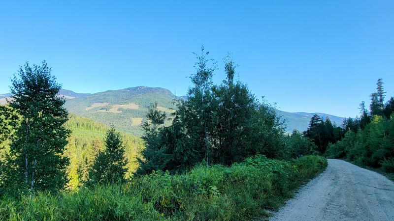
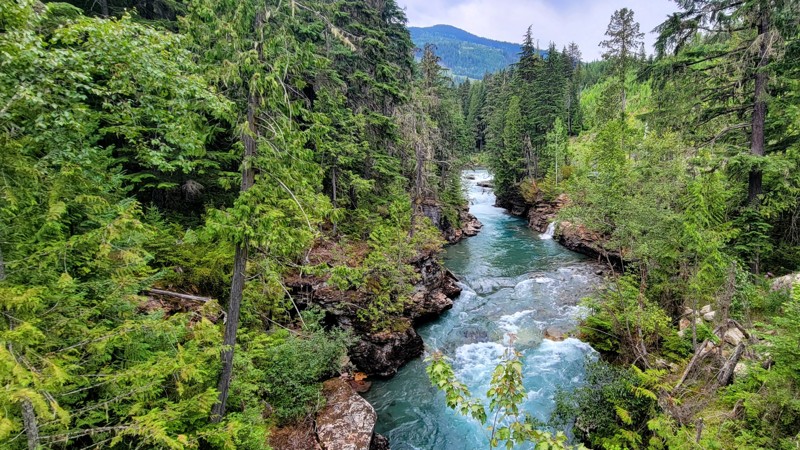
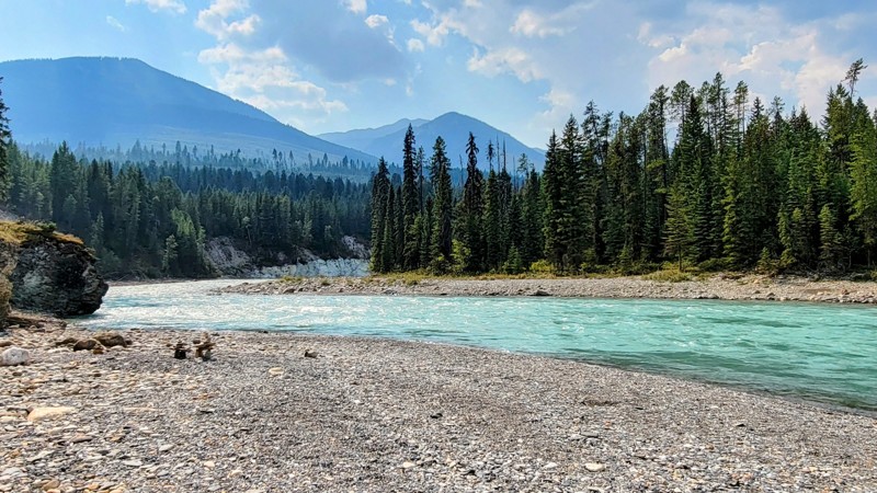
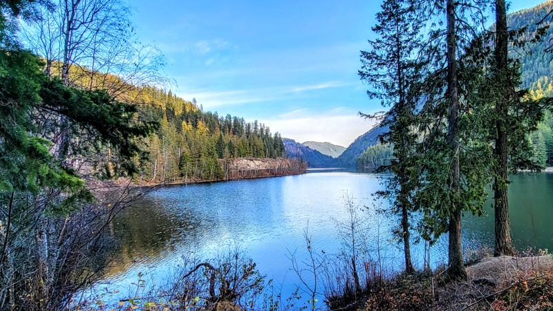
Settlers Road is a wide, mostly gravel road that starts in Kootenay National Park and runs along the majestic Kootenay River. The river gets its vivid blue waters from the nearby glacier runoff. Much of the road is thick tree-lined, but there are amazing views of the river and surrounding glaciers, including The Height of the Rockies Provincial Park.
Horseshoe Rapids Recreation Site is a free dispersed camping area with vault toilets but no running water or electrical hookups. The campsites provide great views of the Kootenay River and the rapids in a large bend in the river.
The road passes through an open cattle range, so watch out for cows in the middle. The road is in very good condition. Any vehicle can handle this trail. High clearance or 4X4 is not required.

Updated: 12/04/2023
Mabel Lake Road
Lumby, British Columbia
Mabel Lake Road is situated in the North Okanagan region of British Columbia, about an hour northeast of Vernon. Two fantastic campgrounds on this trail are right along the lake and have great beaches. Mabel Lake is 35 KM long and narrow; it's excellent for fishing, boating, swimming, paddle sports, or having a lovely day at the lake when the summer heat is too much!
The trail traverses mostly through Crown Land, with Wap Provincial Park on the north and Mabel Lake Provincial Park on the south. As you travel through the dense forest, the trees give way to incredible views of Mabel Lake and the Columbia Mountains.
This trail will take you down the east side of Mabel Lake, and if you want to do the whole Mabel Lake Loop, at the north trailhead is the Thee Valley Mabel Road Junction, which will travel down the west side of the lake and provides access to the lovely little community of Kingfisher.
Updated: 10/15/2024
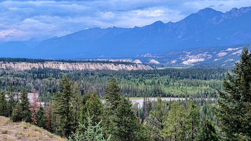
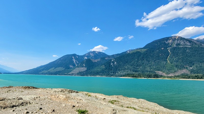
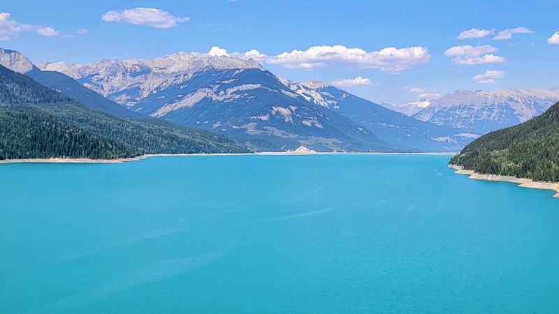
Bush River Road - Lake Kimbasket
Donald, British Columbia
Bush River Forest Service Road is a well-maintained wide double-laned gravel and dirt road that runs through Crown Land; the speed limit is 60 KPM (38 MPH), and any vehicle should be able to handle this road. In the distance to the east, you can see the backside of the famous Icefields Parkway and the towering glaciers, including Mount Columbia; it’s a marvelous sight!
Along the way, there are spectacular views of the very long and narrow Kimbasket Lake, which is part of the Columbia River. Columbia Lake, the headwaters for the mighty Columbia River, is close by. The trail ends as you reach the base of Mount Bryce, and the views are unbelievable.
There are several campgrounds along the road, both dispersed where it’s first come, first served, and there is no charge, and recreation sites like Bush Arm, which offers amazing views of the crystal clear and vibrant blue lake. These developed campgrounds have a $15 charge per night.
Updated: 10/15/2024
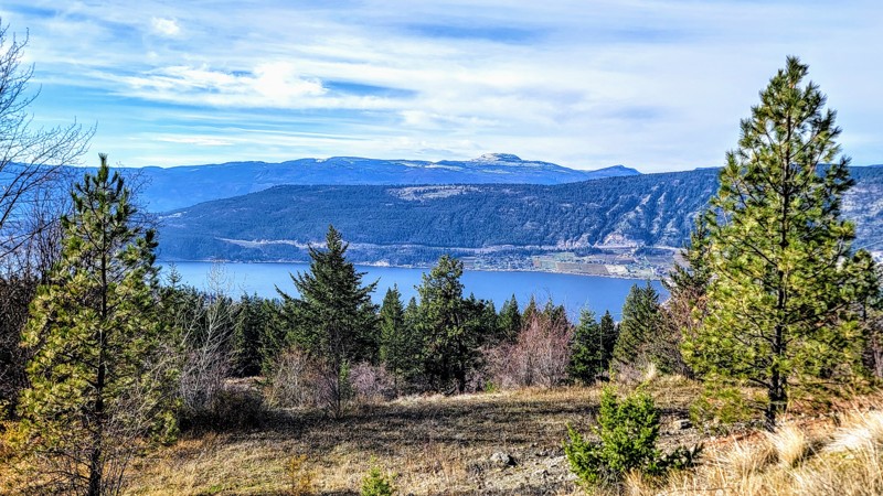
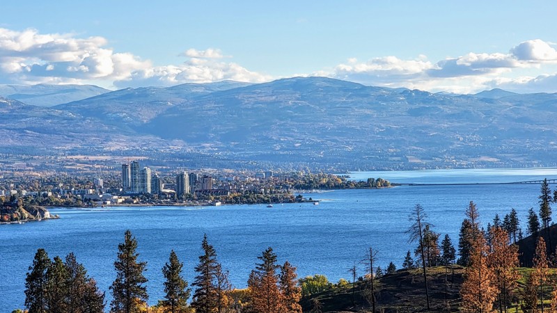
Bear Lake Main Road
Traders Cove, British Columbia
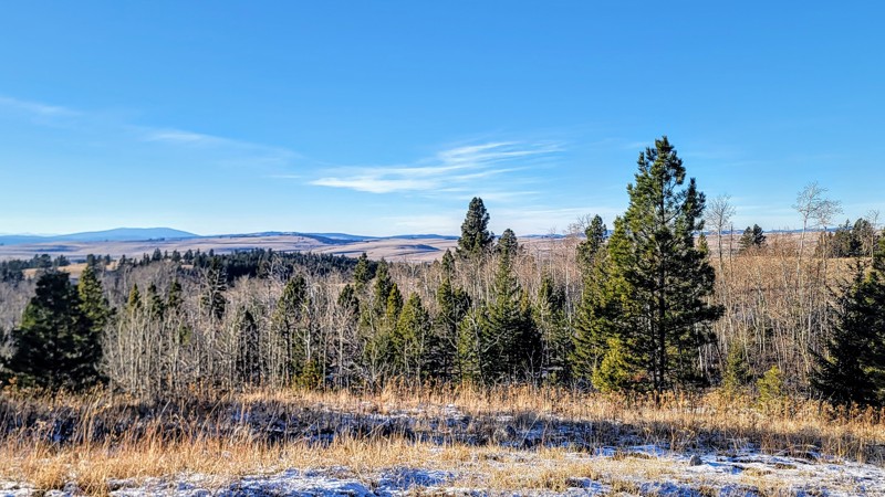
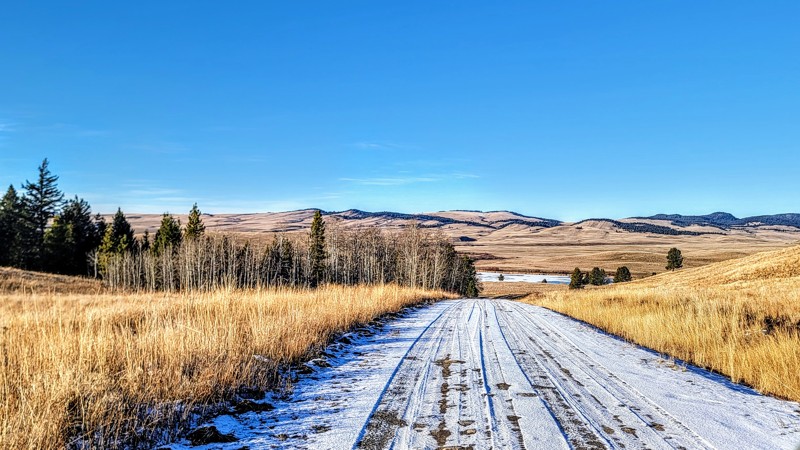
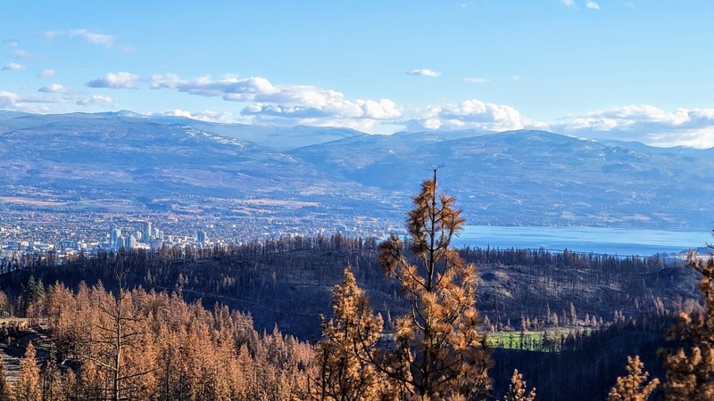
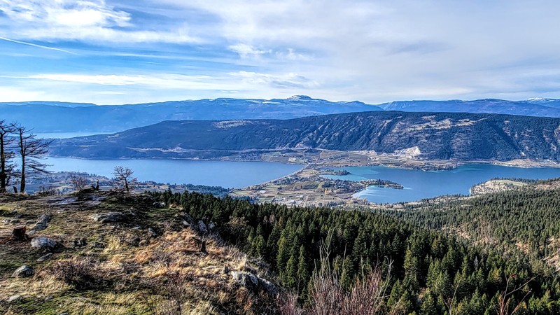
Located across Okanagan Lake from Kelowna, Bear Lake Main Road is a leisurely scenic drive through Crown Land through the forest, passing several lakes and campgrounds. There are great views of Mount Hayman and the surrounding peaks and forests. Near the very east end of the trail, you can see Kelowna and the Okanagan Lake in the distance.Bear Creek Recreation Site is a large campground opened seasonally. This fully developed campground has plenty of amenities, including running water, showers, electrical hookups, and more. Reservations are encouraged. The fee varies based on the campsite type but starts at $15 for a basic site.
Lamby Lake Recreation Area has a lovely wooded lake with a cool little island in the middle. The lake has a boat launch and plenty of picnic tables in the large day-use area, so it’s a popular spot for water activities. There is dispersed camping only here, and the only facilities are pit toilets; there is no fee for camping.
The road is in good condition, with minor washboard sections. It’s a wide gravel road where two cars can easily pass, which is good because it’s also an active logging road. Beware of log trucks. 4WD is not needed. Any high-clearance vehicle can traverse this trail.
Other great offroading trails in the area include Sturat FSR and Pennask Lake FSR.
Updated: 11/28/2025
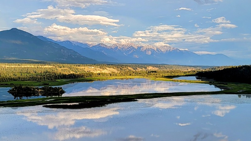
Blaeberry Road
Saskatchewan River Crossing, British Columbia
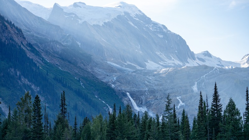
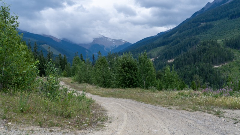
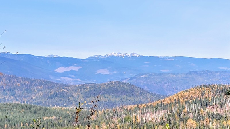
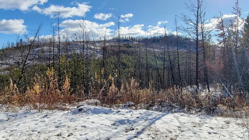
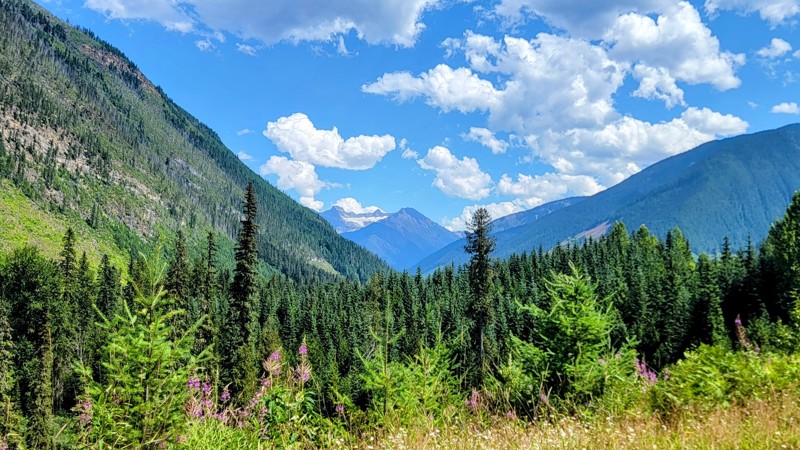
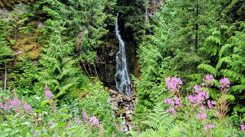
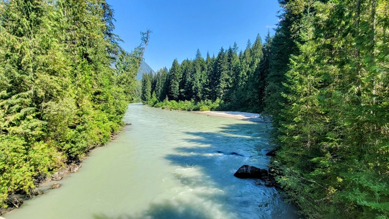
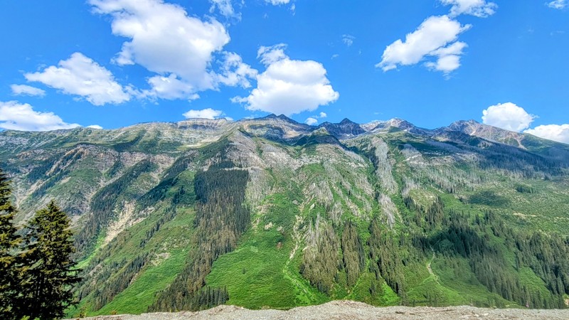
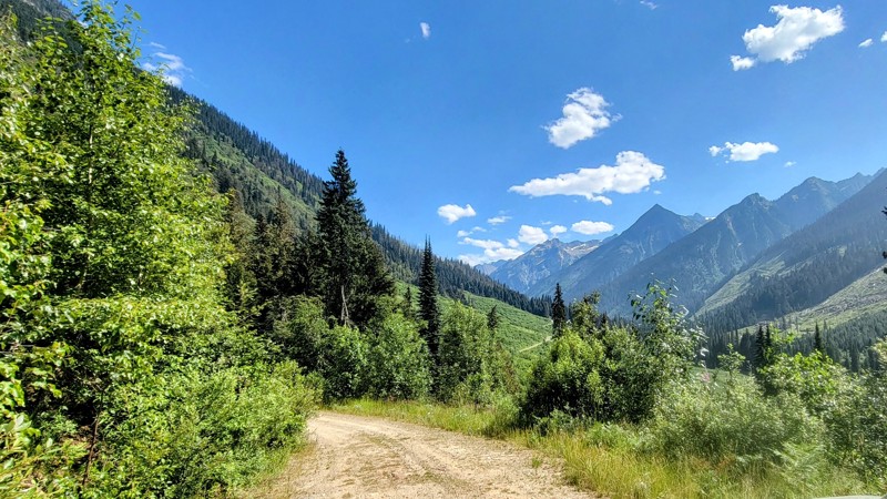
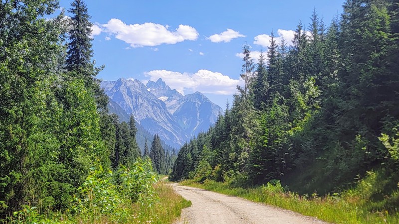
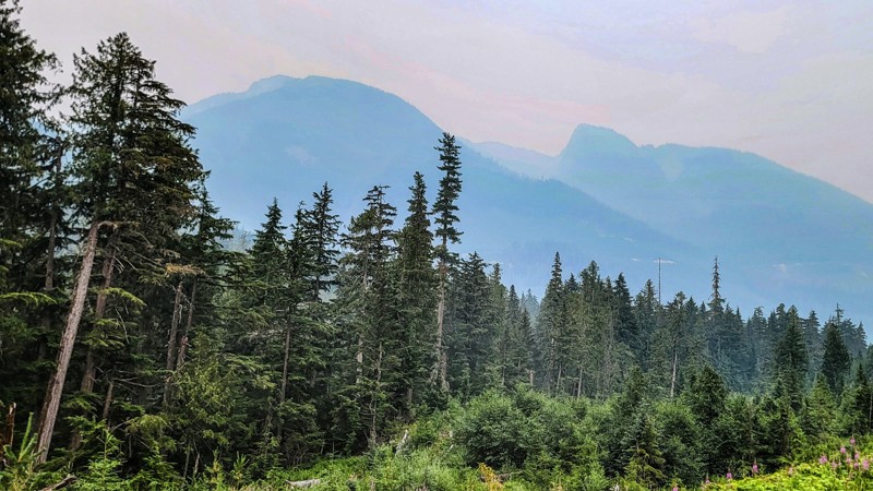
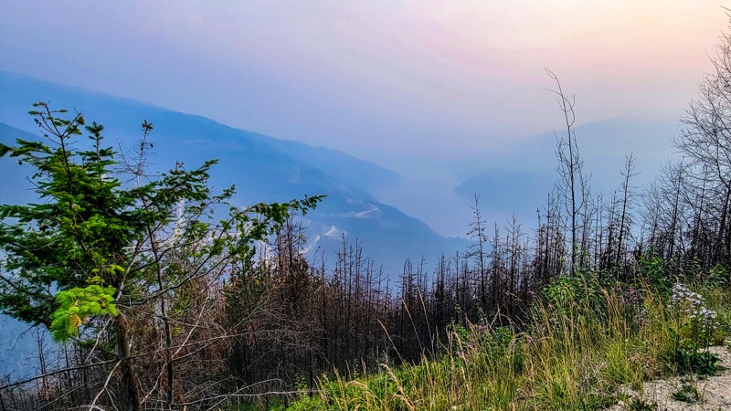
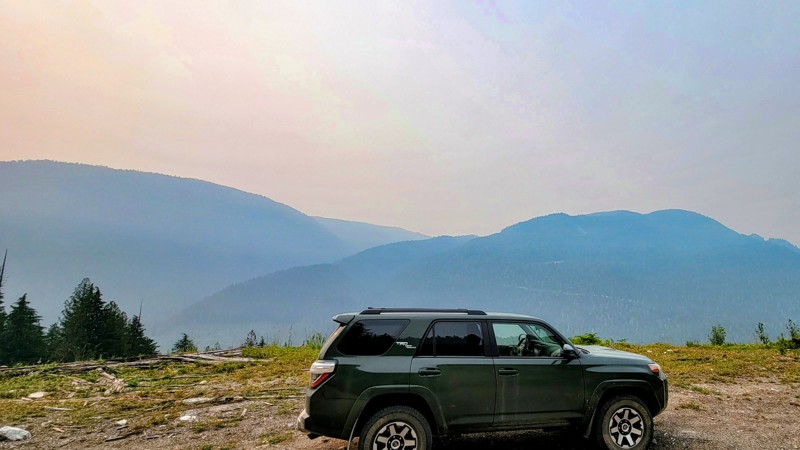
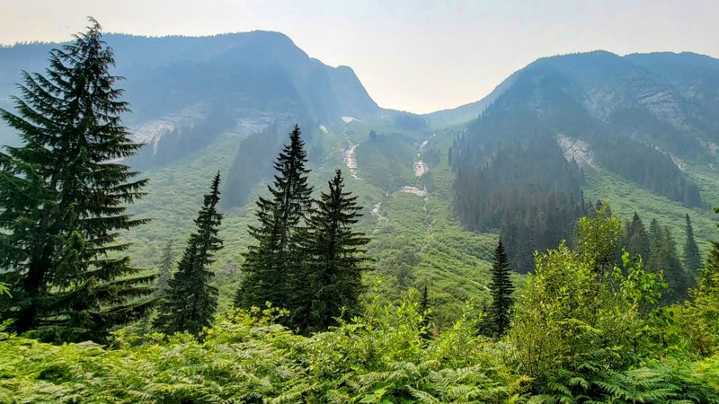
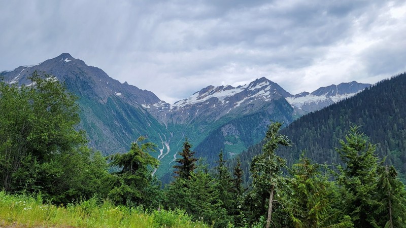
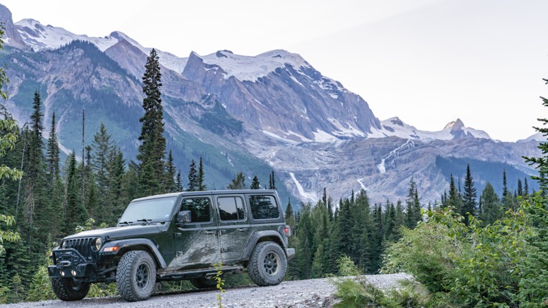
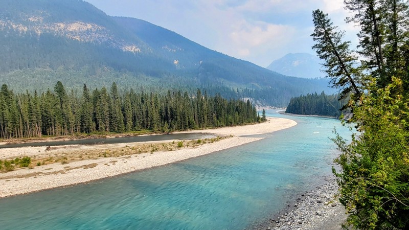
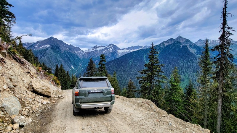
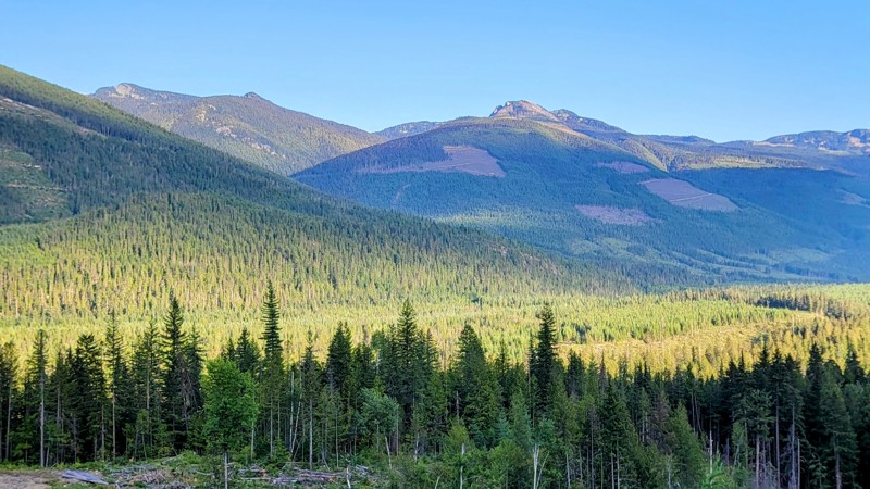
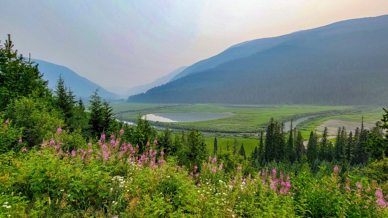
The Blaeberry River Valley offers an adventurous journey through diverse terrain and striking landscapes. This route provides a rewarding experience for those prepared for a mix of conditions and eager to explore the area's natural beauty.
The initial 4 miles are private property that opens to public land afterward. Along the western slope of the Canadian Rockies, Blaeberry Road begins as a well-graded dirt road accessible to 2-wheel drive vehicles. The road becomes rougher and rockier as travel progresses, requiring a high-clearance vehicle for continued progress. At the 26-mile mark, a short-wheelbase 4-wheel drive vehicle is recommended due to the fifteen runoff ditches marking a more challenging section of the road. These ditches can be deep and narrow, while some are wider and shallow.
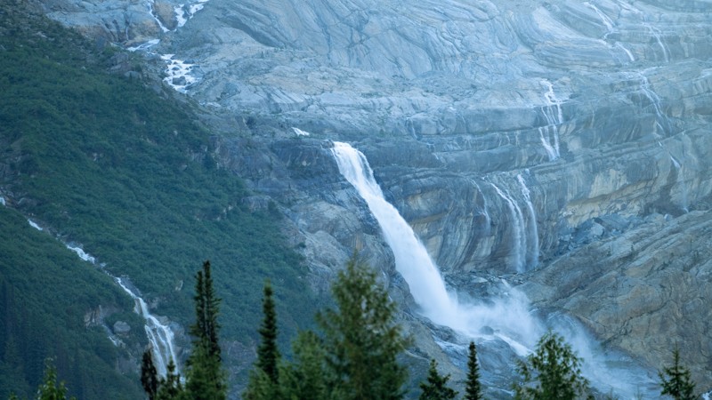
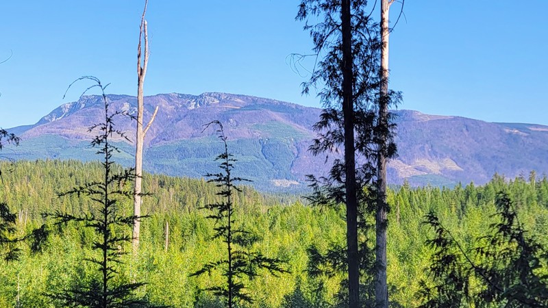
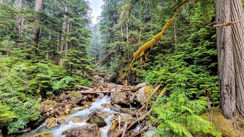
Near the 24-mile mark, Mummery Glacier is partially visible from the trail. It is accompanied by epic waterfalls that add to the scenic allure.
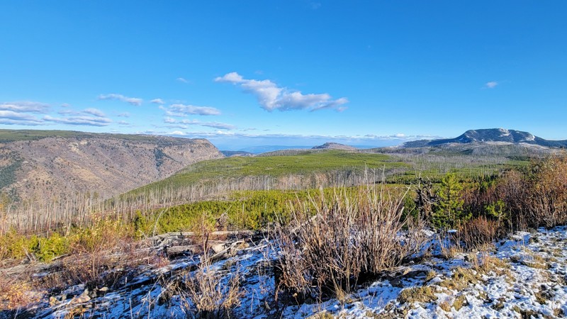
The Blaeberry Valley becomes very remote near the trail's end. Be prepared for changing weather conditions, which can impact road conditions and accessibility, especially after the 26-mile mark. Before setting out, check for wildfires in the area as well.
Multiple recreation sites and non-designated areas provide ample camping opportunities along the river. These sites include O.B. Campground, Thompson Falls Recreation Site, Split Creek Recreation Site, Mummery Glacier Recreation Site, and Cairnes Creek Recreation Site as the last spot to camp. The Thompson Falls Rec Site also has an impressive set of upper and lower waterfalls.
There are roughly a dozen single-lane bridges spanning the river and various creeks. Blaeberry Road ends at Cairnes Creek Rec Site, where a deactivated bridge is located.
Updated: 10/15/2024
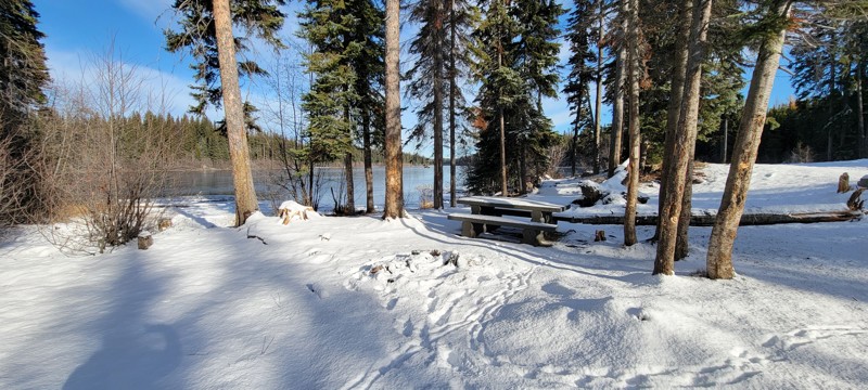
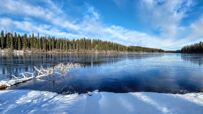
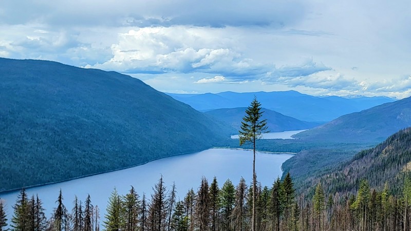
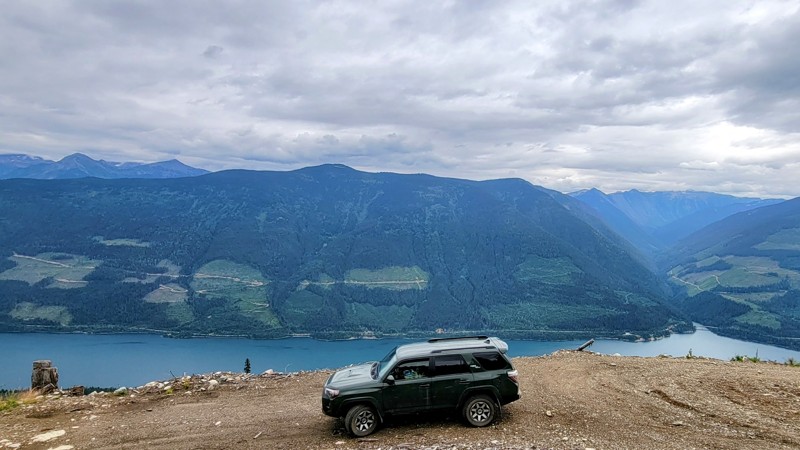
Beaton Arm
Beaton, British Columbia
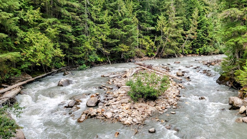
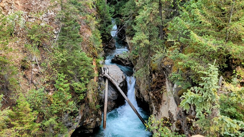
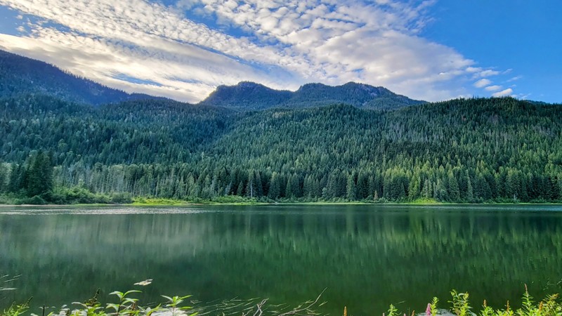
The drive along Beaton Arm is a short but remarkable one through Crown Land. About three miles in, there is a road to the left; it’s a short trek to a great beach area. Back on the main trail, you’ll reach a fork in the road; the right fork runs into private property a short bit down the road, even though the maps show it goes along the river for a while, so take the left fork. You’ll cross and drive along the Incomappleux River, where the water is very murky due to all the sediment from the glacier runoff.
Near the end of the trail is Hadow Creek Recreation Site. It's a fabulous campground with campsites that offer amazing views of the water; camping is free with a 14-day limit. Be sure to pay attention to campfire regulations. During parts of the year, all campfires are prohibited.
The road up to Hadow Creek is an easy drive that does not require a 4x4, but to get to the incredible view of Beation Arm, you must climb up a rugged hillside with no guardrails and a steep cliff on the side. 4WD is necessary for this final climb. There are pretty big ditches in the climb and off-camber spots. It’s best to go down at an angle instead of straight into the ditch. The views at the top are well worth the effort; the vibrant aqua-blue water is unbelievable.
Updated: 10/15/2024
Wilson Lake
Rosebery, British Columbia
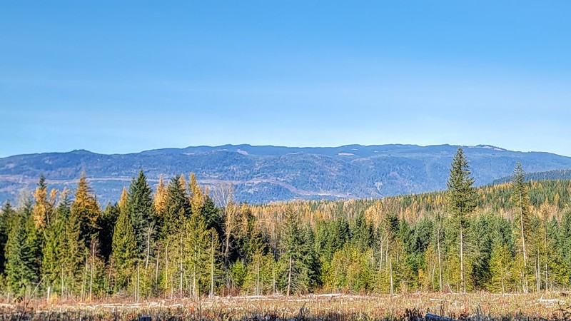
The trail follows along Wilson Creek on this secluded forest drive on Crown Land. The road is mostly well-maintained except for a small section of rough road on a steep incline just past Wilson Lake. That brief section defines the rating for the trail.
The road is called Wilson Lake Road to the west of the lake, and southeast of the lake, the road is called Wilson Creek, but it's the same road. Trees line most of the road, but there are clearings where you can see Wilson Creek, and when you get high enough, there are great views of the Columbia Mountains.
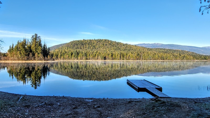
Along the way, stop at Beaver Lake Campground. It’s a small but peaceful tree-lined lake with nice campsites. Wilson Lake, near the north end of the trail, also offers campsites, some of which are right on the water. Neither of these campgrounds requires fees.
Updated: 10/15/2024
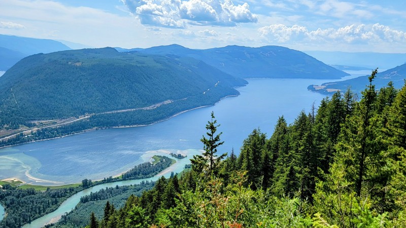
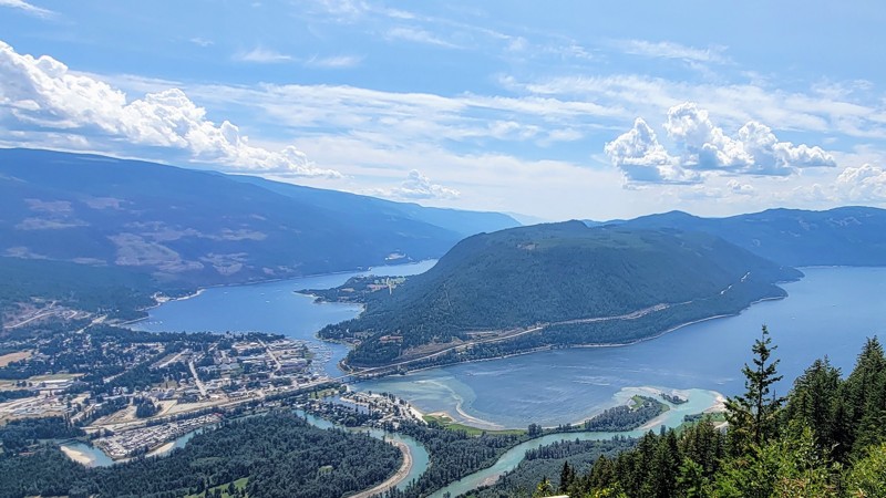
Shuswap Lake
Sicamous, British Columbia
The drive around Shuswap Lake on the Quest-Wilson Forest Service Road is marvelous. It’s an active logging road through Crown Land and offers incredible views of Shuswap Lake, a very large lake with several arms. When traveling on any forest road in British Columbia, you’ll need a two-way radio to communicate with other vehicles.
Around the 3.5 miles (5.6 KM) mark, there is a short but must-see side route to Sicamous Lookout and its spectacular view of Shuswap Lake and the city of Sicamous. The road is called “Old Logging Road.” It’s just over a mile to get to the lookout.
About 16 miles (25 KM) down the trail, you’ll go through a few switchbacks and reach a fork in the road. The left fork leads down to the water and a few dispersed campsites. As with all Crown Land, there is no fee to camp. The right fork continues up the trail, which gets rough. There are a few spots where 4WD is needed, mainly after you pass a sign that says “Unmaintained Road.” You’ll go through heavily logged areas, but the views of the lake are amazing.
Updated: 10/15/2024
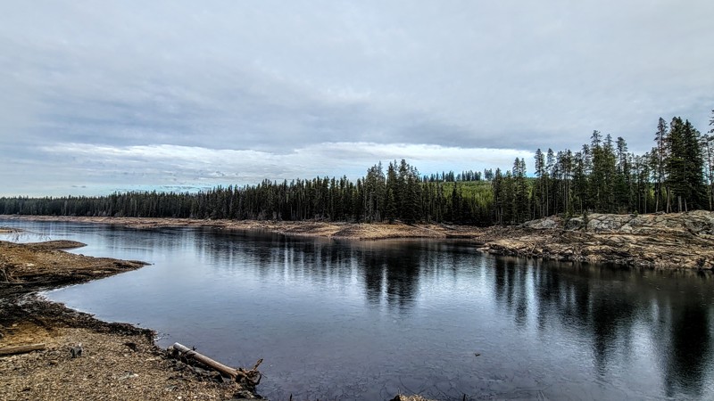
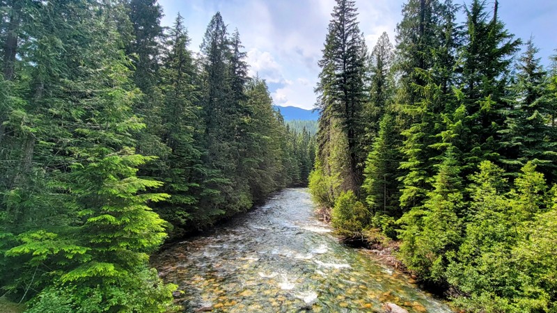
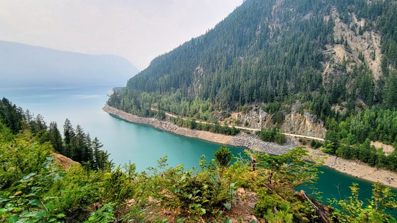
Kootenay River Road
Fairmont Hot Springs, British Columbia
Kootenay River Forest Service Road is a graded dirt road through Crown Land. It’s an easy road that any vehicle can handle. High clearance is not necessary. There are ruts in the road, but it’s a wide two-lane road, so the ruts are easy to avoid.
The road runs along the stunning blue Kootenay River, which gets its color from the glacier runoff. There are amazing views of the surrounding mountains when the trees thin out.
The trail goes from Canal Flats and ends with intersections with several other forest roads. Take Settlers Forest Service Road to make a nice loop that ends in Kootenay National Park.
No designated campgrounds are along this trail, but because it’s on Crown Land, camping is free anywhere off the road.
Kootenay Road runs through an active cattle range, so keep an eye out for cows on the road and other wildlife in the area, such as deer and bighorn sheep.
Updated: 08/06/2025
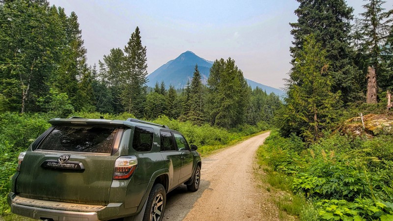
Canoe East Forest Service Road
Cedarside, British Columbia
Canoe East Forest Service Road starts in the town of Valemount, BC. It’s a well-maintained single-lane dirt road with rocky sections, and semi-steep climbs with no guardrail near the end. 4WD is not needed. Any high-clearance vehicle can make it.
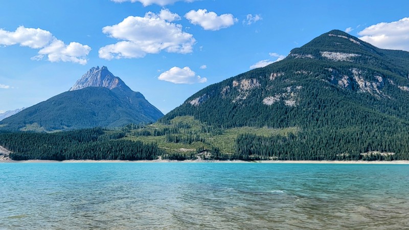
The road travels alongside Kimbasket Lake, part of the Columbia River. The lake gets its vibrant aqua-blue waters from the glacier runoff. The trail runs through Crown Land, and on the north side is Mount Robson Provincial Park, the highest peak in the Canadian Rockies.
There are a couple of campgrounds along the road, the best being Yellow Jacket Creek Recreation Site, which is along the lake and offers spectacular views of the glacier Mount Thompson and the cascading waterfalls. There is no charge to use these dispersed campgrounds. However, there are no facilities either.
Updated: 10/15/2024
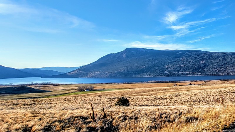
Pennask Lake Forest Service Road
Mazama, British Columbia
Pennask Lake Road is a gravel and rocky road traversing Crown Land. Traveling east and traveling west provides the best views. The elevation is the highest in the east, and the forest gives way to golden rolling hills as you descend with spectacular views of Nicola Lake.
Pennask Lake Fishing and Game Club is a private fly fishing lodge on the northwest side of Pennask Lake. The lodge is open seasonally until mid-October.
This Northwest Okanagan region has an incredible and extensive trail system. You can travel from Kelowna to Kamloops without using the major highways. Other great trails in the area are Douglas Lake Road, which takes you north, and the Bear Lake Main Junction to the east, which takes you to West Kelowna.
Updated: 10/15/2024
Westside Road
Wilmer, British Columbia
Westside Road is a well-maintained gravel road from Invermere to Brisco. The wide two-lane that runs through Crown Land. A portion of the road runs along Horsethief Creek. There are also elevated views of the Columbia River which starts just a few miles south at Columbia Lake and empties into the Pacific Ocean.
Hall Lake Recreation Site is a private, fully developed campground on Hall Lakes. There are also smaller dispersed campsites along the trail.
This is an active range, so keep an eye out for cows and other wildlife, such as deer and bighorn sheep.
Updated: 10/15/2024
Douglas Lake Road
Quilchena, British Columbia
The drive along Douglas Lake Road provides incredible views of Mount Bouleau and the golden Salmon River Valley. You pass by a couple of lakes on the trail, the largest of which is Douglas Lake, part of the Upper Nicola Indian Band land.
Salmon Lake Resort is a working ranch and iconic boutique hotel open seasonally. It’s been in business since 1908 and offers world-class fly-fishing tours where the rainbow trout are huge! The trail north of Salmon Lake traverses along the Salmon River.
Douglas Lake Road is a double-lane dirt and gravel road that is well-maintained. 4WD is not required. The road does have washboard sections, but it’s not too bad. It travels through an open cattle range, so beware of livestock and wildlife.
This trail is accessed via Highway 97 in the north, near Westwold, and it intersects with Pennask Lake Trail in the south.
Updated: 10/15/2024
Akolkolex River
Greenslide, British Columbia
The Akolkolex River Forest Service Road is a well-maintained road used for logging. It offers spectacular views of the surrounding mountains. Although it is a tree-lined single-lane road, there are several openings in the vegetation that offer great views of the river. The views of the nearby glacier on Mount Darling and Mount Ernest are epic. A few miles into the trail, Echo Lake recreation site is a day-use-only area beside a nice little lake that is popular for paddleboarding.
The last few miles climb up Mount MacKinlay on a logging road. It’s a little rough, but any high clearance 2WD vehicle should be able to handle it. The ride down the short mountain is better than the way up.
This forest road runs through Crown Land, and while there aren’t any campgrounds, you can camp anywhere away from the road for free.
Updated: 10/15/2024
Frisby Creek Road
Revelstoke, British Columbia
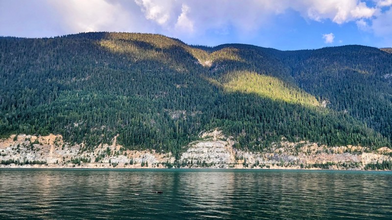
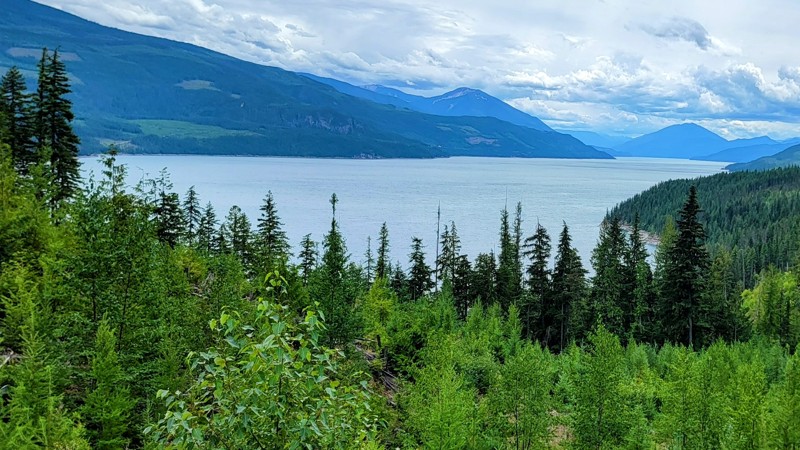
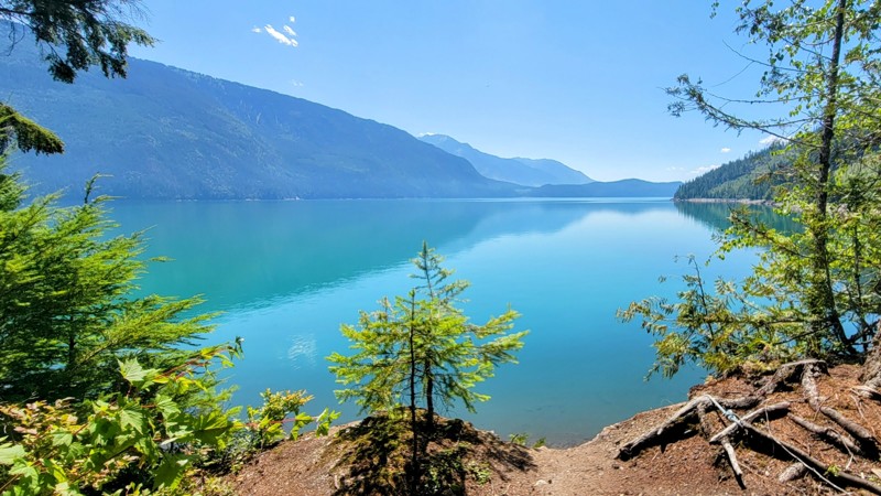
Frisby Creek Forest Service Road is a tree-lined dirt road along Lake Revelstoke, part of the Columbia River. The trees and vegetation are thick, so the views of the lake are scarce, but there is a climb at the end of the trail that provides marvelous views of the vibrant blue water, which gets its color from the glacial runoff from Mount Revelstoke and the surrounding glaciers.
4X4 is not needed until the final climb; there are a series of switchbacks and a steep dropoff with no guardrail, and the road turns pretty rocky for the last five miles, but the view from the top is spectacular. The trail runs through Crown Land, so camping is allowed anywhere off the road.
Updated: 10/15/2024
Dee Lake Forest Service Road
Lavington, British Columbia
Dee Lake Road is a spectacular drive through the forest and has access to many incredible lakes and campgrounds. There are amazing views of the Okanagan Valley and Lake towards the west end of the trail; if you're traversing from west to east, be sure to look behind you.
There are several campgrounds along the trail and two lodges. Both are opened seasonally and offer RV hookups, plenty of campsites, a general store, and a boat launch. Dee Lake Wilderness Resort, towards the east end of the trail, has neat cottages right on the lake and offers guided fishing tours. Beaver Lake Mountain Lodge is located on the trail's west end and offers similar amenities.
As you drive along the well-maintained dirt and gravel road that runs through Crown Land, beware of logging trucks, as this is an active logging area. There are a couple of small rocky patches, but any high-clearance vehicle can handle this trail. 4WD is not needed.
Dee Lake FSR intersects with Aberdeen Lake Road in the east and the small city of Lake Country, BC in the west. Several primitive campgrounds are along the trail. Island Lake and Doreen Lake have great campsites right on the lake.
Updated: 10/15/2024
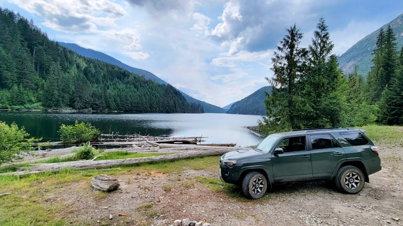
Sorcerer Creek Road
Canyon Hot Springs, British Columbia
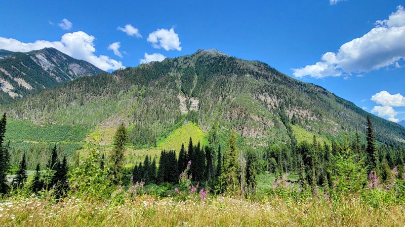
Sorcerer Creek Road is an offshoot of Downie Creek Forest Service Road that runs through Crown Land. There are a couple of rough spots, small ditches, and a creek crossing where 4X4 is needed, but nothing too bad. As you drive down the glacier valley along the small Sorcerer Creek, the views of the mountains are incredible!
Near the end of the trail, maps may show there is a fork in the road. The track that goes left is very overgrown and impassable. The right fork continues up a logging road to a small but steep climb where the views of the Sorecerer Glacier and the surrounding mountains and glacier valley are epic. Sorcerer Mountain and the peaks to the east are part of Canada’s Glacier National Park.
Updated: 10/15/2024
Oyama Lake Road
Woodsdale, British Columbia
Omaya Lake Road travels through the popular "King Eddy" area just southeast of Vernon, BC. This well-maintained gravel road will take you to King Edward and Oyama Lakes. The High Rim Hiking Trail runs along this road, with several access points to great hikes.
As you navigate the switchbacks towards the trail's west end, you get incredible views of Terrace Mountain, Kalamalka Lake, Wood Lake, and Okanagan Lake. Just east of the switchbacks is a fantastic dispersed campsite with the best views of the Okanagan Valley.
Oyama Wilderness Resort (open seasonally) is on the west side of the trail and specializes in fishing excursions. There are campsites, RV hookups, and small cabins on the lake. They also have a general store that has fishing supplies.
King Edward Lake Recreation Area has both dispersed campsites outside of the campground and the campground, which is open seasonally and costs $15 per night. The smaller Damer Lake also offers camping; both campgrounds have vaulted toilets only.
The road is a well-maintained two-lane gravel road that any high-clearance vehicle can handle. It's mostly gravel with a couple of rocky sections.
Updated: 11/01/2025
Redburn Creek Road
Blaeberry, British Columbia
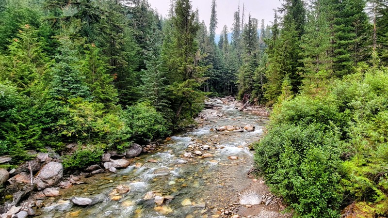
Redburn Creek Road starts as a graded dirt road that quickly transitions to a narrow mountain trail in the shadow of Redburn Peak, which stands at 9,251 ft.
The 5-mile road, composed of gravel, dirt, and rocks, can be rough with occasional potholes. Other than the possibility of an occasional fallen tree, there aren't any notable obstacles.
The steady incline reveals a variety of terrain, from dense evergreen forests to open meadows with expansive views of the Blaeberry Valley. Redburn Creek runs parallel to the road and continues past the road's end, offering scenic waterfalls and rapids. The road is typically accessible during warmer months but may be closed or impassable during winter due to snow or ice.
There are several flat open areas for camping with space for more than one vehicle.
Updated: 10/15/2024
Perry River Road
Craigellachie, British Columbia
Perry River is a well-maintained Crown Land forest road. Most of the way, it is a single lane with thick trees and vegetation. The road follows the Perry River as it winds through a glacial valley. The mountain views are amazing! There are cascading waterfalls down the side of Bourne Glacier to the east.
It is an easy road. Any high-clearance 2WD can make it. About 13 miles (21 km) from the start. There is a steep switch-back road up a mountain to a snowcat lodge. It’s worth the drive. While 4WD is convenient on this climb for traction, it’s not necessary. There is no guard rail and a very steep drop, but the resulting views are incredible! The side road is about 7 miles (11 km) each way.
Updated: 10/15/2024
Gorge Forest Road
Seymour Arm, British Columbia
The Gorge Forest Service Road is an active logging road. There are signs that say “closed to through traffic M-F, 9:00 AM to 4:00 PM.” This is a wide single-lane dirt road that runs through Crown Land.
Third Creek Falls is a small but nice cascading waterfall right alongside the road and worth the stop to check out. It’s a little over the halfway point of the trail. The northern part of the road is tree-lined, but there are several bridges over a creek that are pretty cool to check out, and if you’re lucky, you might see a bear or other wildlife in the creek.
The southern part of the road is a steep climb, but a 4X4 is not needed. There are steep drop-offs with no guardrails. If you’re afraid of heights, this might not be the best trail for you. But you’ll see spectacular views of Shuswap Lake and Anstey Arm when you climb above the trees.
Gorge Forest Road makes a nice loop when combined with Perry River Road. Just don’t get stuck in the logging activity.
Updated: 10/15/2024
Downie Creek Road
Seymour Arm, British Columbia
Downie Creek Road is a well-maintained easy trail that runs through Crown Land. Any 2WD with high clearance can handle this forest service road. Most of the road is tree-lined. The trail runs along Downie Creek. Several bridges cross the creek. Depending on where you’re from, this might be considered a river. The water in the creek is almost white from all the sediment from the glacier runoff. Near the trail's end, there are incredible cascading waterfalls down the sides of Carnes Peak and the surrounding mountains.
Updated: 10/15/2024
Goldstream River Road
Mica Creek, British Columbia
Goldstream River Forest Service Road is an active logging road, so beware of trucks barreling down the road. Be sure to carry a two-way radio, call out your location, and communicate with other vehicles for safety. Most of the road is a wide single-lane dirt road that runs through Crown Land.
Most of the trail is tree-lined, but there are pretty cool bridges crossing the river that are worth stopping and checking out. As you get into the second half of the trail, the trees start to thin out, which provides impressive views of the surrounding mountains and glaciers, part of Canada's Glacier National Park.
There is a small creek crossing with a small ditch. 4WD is recommended but not needed. Most of the road is in good condition, and 2WD and high clearance will do.
Goldstream River is part of a historic gold panning reserve, an active gold panning site where you can pan for gold. However, there are no signs and few paths leading down to the river.
Updated: 10/15/2024
Aberdeen Lake Forest Service Road
Lavington, British Columbia
Aberdeen Lake Forest Service Road is a well-maintained, wide gravel road. It’s an active logging road, so beware of log trucks around blind corners. You should carry a long-range radio and call out the KM markers as you traverse the trail. There are rocky sections, so good tires are recommended, but 4WD is unnecessary. Any high-clearance vehicle can handle this trail.
Along the tree-lined road through Crown Land, there are great views of the mountains and forests. The trail passes several lakes, most offering camping. Grizzly, Specs, and Ideal Lakes are very cool spots to camp. They have vault toilets, and camping is free for 14 days. Several of the sites have incredible lake views.
Aberdeen Lake Road intersects other trails that are worth checking out. In the northern section is Buck Hills FSR, which provides access to the Aberdeen Columns hike, a unique volcanic rock formation. Just north of Grizzly Lake is the junction with Dee Lake FSR, which will take you to spectacular lakes and ends in Lake Country to the west
Bluenose Mountain Trailhead is a popular hike towards the north end of the trail by Lavington that offers excellent views of Vernon and the surrounding mountains and lakes.
Updated: 10/15/2024
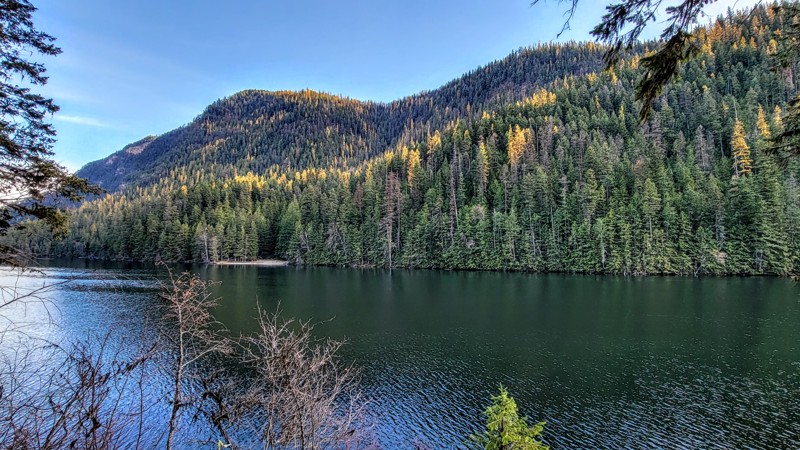
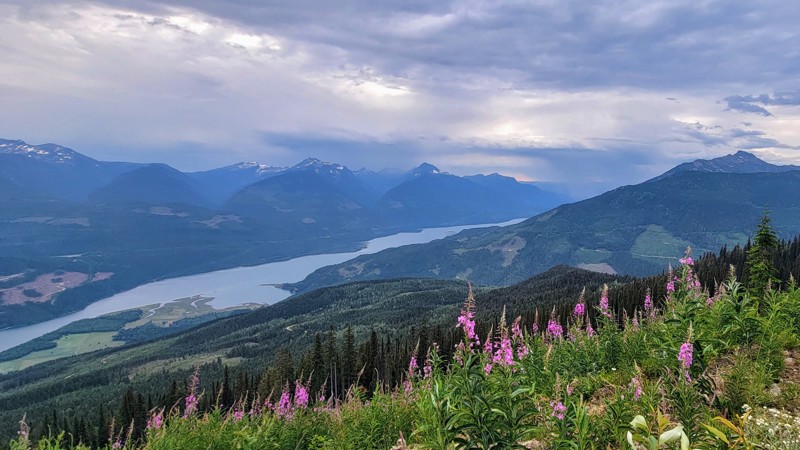
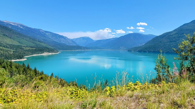
Sol Mountain Road
Shelter Bay, British Columbia
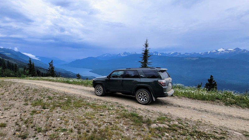
The trip to Sol Mountain is well worth the drive; along the way, there are some fantastic views of Upper Arrow Lake; the vivid blue water is truly remarkable! The last section goes through the Monachee Provincial Park and follows Fostall Creek, which is pretty nice too.
This is an active logging road, so watch out for trucks and always bring a two-way radio with you to communicate with other drivers on the road. Sol Mountain Road is primarily a single-lane road but is pretty wide at parts.
Stay on Sol Mountain Forest Service Road; other roads branch off the main one, but just follow the signs for Sol Mountain. Near the end of the road, you’ll come to a fork in the road; if you go right, that will take you to Sol Mountain, and if you go left, there is a short but very steep climb up to a ridge and what looked like an incredible place to camp. The drive is through Crown Land, so camping is free anywhere off the road, but there are no designated campgrounds along this trail.
The road is in pretty good condition, and it does get rocky at parts; 4x4 is nice to have but not necessary unless you want to do the short climb on the left fork.
Updated: 10/15/2024
Three Valley Mable Road
Taft, British Columbia
Three Valley Mable Forest Service Road is a snowmobile trail that is a wide two-lane road in most parts. The road travels through the Columbia Mountains along Mabel Lake and is an easy dirt road through Crown Land. Any 2WD vehicle should be able to make it. There are ruts in parts of the road, but it’s wide enough to avoid them.
Noisy Creek Recreation Site is a scenic campground on the northwest side of Mabel Lake. The fee is $15 per night. There are basic facilities, and campsites are right on the lake in the lush forest with mountains and trees as far as you can see.
Kingfisher, a nice camping and resort area, is the southernmost point on the trail. Mable Lake is very popular in the summer. This road can be busy. Be sure to carry a two-way radio with you.
Updated: 10/15/2024
Stuart Forest Service Road
Killiney Beach, British Columbia
Stuart Forest Service Road is a pleasant drive through Crown Land and offers access to several small but lovely lakes and cool mountain views. Most of the trail is thickly lined with trees. However, the surrounding mountains are visible from several clearings in the trees. The views are amazing!
The road gets a little rocky towards the north, but the rocks are smaller than a golf ball, and towards the south, it's a gravel road. 4WD isn't needed, and high clearance is probably not necessary either.
The trail passes several lakes, including Sandberg, Stuart, and Esperson. Both Sandberg and Stuart Lakes have campgrounds, although, at Sandberg Lake, there are only a couple of campsites. These are dispersed campgrounds with a fire ring and no other facilities.
Stuart Road is part of an extensive backroads trail system and connects with many other roads, including Whiteman Creek, South Whiteman Creek, and Bear Lake Main Roads.
Updated: 10/15/2024
Hidden Lake Road
Ashton Creek, British Columbia
Hidden Lake Forest Service Road is a tree-lined dirt road through Crown Land. The main attraction on this trail is Hidden Lake, a small, beautiful lake with a little dock and boat launch. When the trees thin out, there are incredible views of Mira Mountain and the other surrounding mountains.
There are three campgrounds around the lake on the southwest, east, and north sides. These campgrounds have vault toilets. The campsites are pretty nice. They have tables, fire rings, and trees in between the sites. A few of the sites also offer fantastic lake views.
This is an active logging road, so beware of big trucks coming fast; it is a double-lane road, so two cars can pass each other. There are grapefruit-size rocks on the road, but the road is wide enough to avoid them easily.
Updated: 10/15/2024
Bobby Burns Road
Ashton Creek, British Columbia
Bobby Burns Road is a thick tree-lined gravel road that offers mountain views and goes through Crown Land. It is an active logging road, so watch out for trucks and use a 2-way radio to call out your KMs as you traverse the trail.
There is a steep switchback hill, and whether you're going up or down, you'll get a great view of Mount Mara to the north and Mable Lake through the trees. The road is in pretty good condition. It is a wide two-lane gravel road with a couple of rocky sections. Any high-clearance vehicle can handle Bobby Burns Road.
The southern section of the trail travels around the north side of Bobby Burns Mountain. The area has several other cool trails, such as Hidden Lake Road and Baird Lake Road.
Updated: 10/15/2024
Creighton Valley Road
Blue Springs, British Columbia
Creighton Valley Road is a gravel road to Echo Lake Provincial Park. There is a boat launch, day-use areas, and beaches, but no camping here. Echo Lake is a pristine lake surrounded by trees and mountains. This lake is a popular destination for water activities. It can get crowded during the summer. You’ll also pass Barbe Lakes just to the west of Echo Lake. These are two very tiny lakes.
The trail runs through Crown Land. It is a wide double-lane road. Any vehicle can handle this, and high clearance is not necessary. An offshoot towards the trail's east end runs along Echo Creek and offers superb views of the surrounding mountains and forests.
Updated: 10/15/2024
Seymour River Road
Seymour Arm, British Columbia
Seymour River Forest Road is a dirt track through Crown Land. The road goes through the Upper Seymour River Provincial Park. A thick cedar-hemlock forest lines the single-lane road. The road is in good condition with a few rough spots, but a 4x4 is not needed. Any high clearance vehicle can make this drive.
This trail can be accessed by the Gorge Forest Road if you're coming from the east or Ross Creek Forest Road from the west.
The road runs along the Seymour River, and when you get to higher elevations, the views of the river valley below are remarkable! There aren’t many clearings in the thick trees and vegetation, so take advantage of the few viewpoints that exist. At the end of the trail is a little trickling waterfall and a trailhead for backcountry hiking and camping. At the waterfall, the road is blocked off for motorized vehicles.
Updated: 10/15/2024
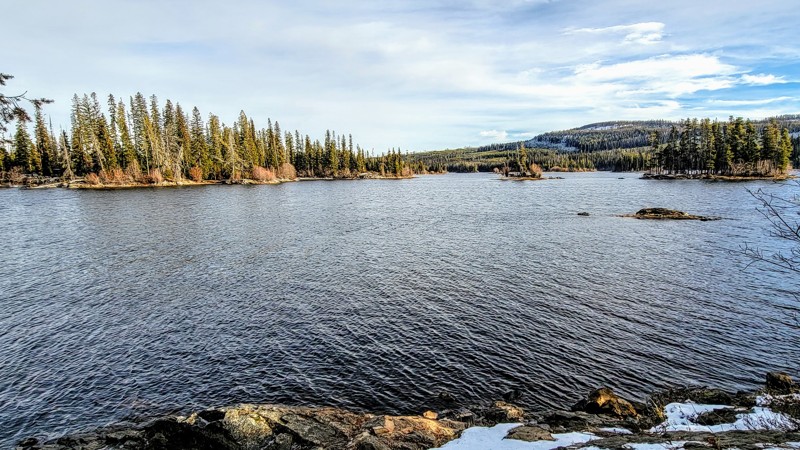
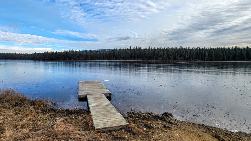
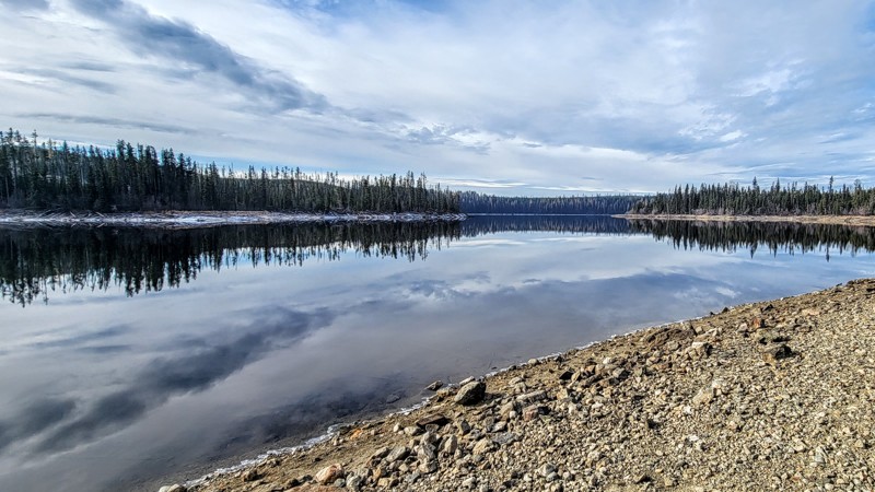
Buck Hills Forest Service Road
Lumby, British Columbia
Buck Hills Forest Service Road is a gravel road that gets rocky at points, but 4WD is unnecessary. Any high-clearance vehicle can easily traverse this trail. This trail runs through Crown Land and has two nice lakes, both with recreation sites and primitive campgrounds.
Nicken Lake is the larger of the two lakes, and Goat Mountain Lake is to the east. Nicken is a wooded lake with two campgrounds, one at the northwest end and one at the east end of the lake. The individual campsites are very secluded, with trees and thick vegetation in between the sites. Both campgrounds are free and have vault toilets. Some of the campsites have lake views and access.
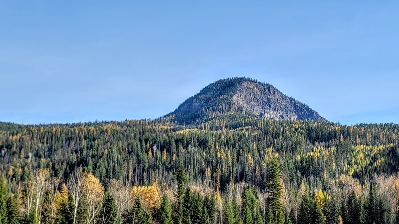
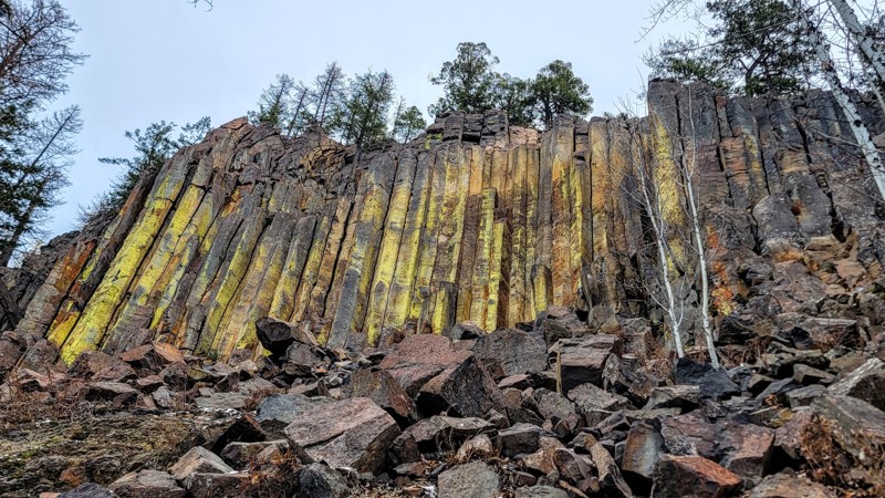
This trail provides access to the Aberdeen Columns hike, a short, steep uphill hike. The Columns are polygonal basalt originating from volcanic activity, rising to about 22 meters (75 feet) from the ground. They have a greenish color.
To access Buck Hills Road, you must take Aberdeen Lake Road, south of Lavington, BC. If you take the turnoff near the trail's western end, you can get down to Aberdeen Lake, which is a larger and scenic lake.
Updated: 10/15/2024
Crawford Road
Greenslide, British Columbia
Crawford Forest Service Road is an easy dirt road through Crown Land and offers stunning views of Upper Arrow Lake and the glacier valley below. The first section of the trail is a tree-lined single-lane road that follows the Akolkolex River. To access this trail, you’ll need to start on the Akolkolex Forest Service Road, which is a pretty cool drive also.
About three miles (5 KM) into the road is Akolkolex Falls Recreation Site with a short hike down to a viewpoint of the falls and a longer hike around to reach the main view of the falls. After the falls, the climb starts on a steep switchback road, but it's not very challenging.
Along the climb, stop and admire the remarkable views of the surrounding mountains and glaciers. The road ends at McCrae Lake Recreation Site, which is a two-mile (3.2 km) hike each way.
Updated: 10/15/2024
South Whiteman Creek Road
Killiney Beach, British Columbia
South Whiteman Creek Forest Service Road is a rocky trail through Crown Land alongside the tree-lined creek of the same name. Although the trail is rocky, they’re all small rocks about the size of golf balls, so 4WD is not necessary, just a high-clearance vehicle.
There are spectacular views of The Fintry Gorge, which is a national protected area. The jagged peaks that surround the gorge offer incredible landscape scenery.
This trail intersects other great trails in the area, including the main Whiteman Creek Road to the east and Stuart Road to the west.
Updated: 10/15/2024
Baird Lake Road
Hupel, British Columbia
Baird Lake Road is a well-maintained dirt road that can get slightly rocky, but any vehicle can make it. 2WD or high clearance is not needed. The trail runs through Crown Land, and there is one place to camp. Baird Lake Recreation Site features the very small and wooded Baird Lake. They only have vault toilets. There is no fee to camp here.
The turnoff to the southeast offers a spectacular view of Mabel Lake and the surrounding mountains. Most of the trail is lined with thick vegetation and trees.
To reach Baird Lake Road, you must take either Hidden Lake Road or Hidden Toledo Road towards the south.

Upgrade your Membership
Unlock all of the details on every Trail Guide and Scout Route.
Start a 7-day Free TrialCommunity
Partners