


By clicking "ACCEPT", you agree to be the terms and conditions of each policy linked to above. You also agree to the storing of cookies on your device to facilitate the operation and functionality of our site, enhance and customize your user experience, and to analyze how our site is used.
Hawaii Off-Road Trails
2
Total Trail Guides 2

13
Detailed Waypoints 2
Try a Free 7-Day Trial and unlock it all
Start a Free Trial Most Recent Trail Reviews
No Rating
Open
Visited: 01/06/2026
Great beginner trail! Definitely use low gear. There are parts where you need to read the trail and avoid some sharp looking rocks but for the most part it’s easy going. It took us about 5 hours to do...
CM
Caley Morgan
Rated 5/5
Open
Visited: 09/10/2024
Disclaimer: We haven't completed the entire 7-hour trail, but the first 2 hours were absolutely breathtaking.
If you're looking for a scenic and relatively easy off-road adventure in Hawaii, the Kahin...

Francois Gravel
Rated 5/5
Open
Visited: 03/20/2024
I drove this trail in March of 2024 during my second time offroading on Mauna Kea on a vacation to Hawaii. This trail has all the best features of the much longer R-1 road, but more concentrated and m...

Patrick McKay
Official Crew
Rated 5/5
Open
Visited: 11/12/2020
We give this trail (5) stars due to the scenery and simply the experience of off-roading in Maui; what's not to love about that!? We ran this trail in a FWD Hyundai Santa Fe and did okay; 4wd would de...

Trenton Moore
Rated 5/5
Open
Visited: 03/21/2020
I drove this route on a trip to Hawaii in March 2020. I've rented a Jeep and sought out opportunities for offroading on trips to three different Hawaiian islands, and this was by far the best offroad ...

Patrick McKay
Official Crew
Rated 5/5
Not Reported
Visited: 02/20/2020
Well worth the drive! The entire rugged coastal cliffs in this area are amazing! Seems like lots of people were down in this area so drive slowly and carefully.


Ed Keeley
Most Popular

Updated: 06/05/2022
Hahana Road to Jaws
Haiku-Pauwela, Hawaii
The Hahana Road to Jaws is located on the north shore of the island of Maui. After following a portion of the famous and scenic Hana highway, you will turn onto an off road un paved trail named Hahana Road and follow the trail to the outlook overwatching the Pe'ahi surf break known as Jaws. Jaws is named due to the area's unpredictable changes of conditions and waves, which can reach sixty feet in height.


Updated: 01/07/2026
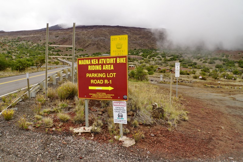
Kahinahina Road
Waimea, Hawaii
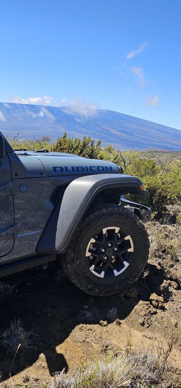
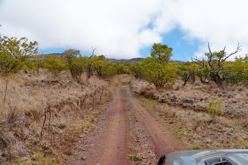
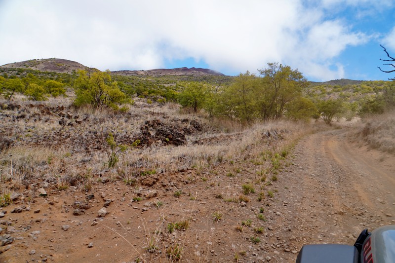
Kahinahina Road, also called the Mauna Kea Access Road, Mauna Kea Hunters Road, or simply the R-1 Road, is probably Hawaii's most epic offroad trail. Beginning at the Mauna Kea Visitor Center, it forms a 36-mile loop around the rarely visited back side of Mauna Kea, connecting to the Old Saddle Road at the Mauna Kea Forest Reserve entrance. It traverses a wide variety of terrain high on the side of Hawaii's tallest volcano, from evergreen forests and rare Silversword groves to dry washes reminiscent of Arizona or New Mexico to barren red lava fields that feel like driving on Mars. Much of the route is above timberline, and several side spurs climb over 11,000 feet above the ocean below. If the weather is clear, you can see Maui and the Haleakala volcano in the distance.
The road surface is mostly rough, rutted dirt and OK lava rock, though there are rockier sections, and 4WD is required. Though not recommended for the average tourist, visitors to Hawaii with offroading experience can easily drive in the stock Jeep Wranglers you can rent at the airport. It can be combined with a drive to the summit of Mauna Kea and multiple optional side trails for a full day of offroad adventure exploring places that few visitors to Hawaii will ever see.
There are camping opportunities at various points along the trail, though it is better to lower down near the trail's western end.
Note: Hunters most often use this road, so it is recommended to wear bright colors if walking off the road. A permit is required for unlicensed vehicles but not for passenger vehicles.

Updated: 06/05/2022
(Ka Lae)South Point Road
Nā‘ālehu, Hawaii
(Ka Lae)South Point Road is a short offroad trail that travels to the southernmost point in the US, on Hawaii's southernmost (and largest) island. The southern tip of "the big island" (Island of Hawai'i) has been designated as a National Historic Landmark. It has been reported that this is where the Polynesians originally came ashore between 400AD and 750 AD. The scenic landscape includes grassy plains, large windmills, cliffs with divers, a historical lighthouse and beautiful beaches.

Updated: 10/15/2024
Skyline Road Loop
Waimea, Hawaii
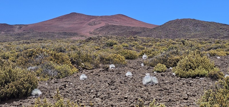
If you don't have time to drive the full Kahinahina Road (R-1) loop around the backside of Mauna Kea but still want to have an incredible offroad adventure above the clouds on the side of a Hawaiian volcano, check out Skyline Road in the Mauna Kea Forest Reserve. This moderate four-wheel drive road takes you high above timberline, over 11,000 feet, into a stark volcanic wasteland that feels like driving on Mars.
Skyline Road (signed on the ground as R-10) begins a few miles up R-1 and climbs steeply up the mountainside until reaching a terrace with a short side spur out to an overlook at a ring-shaped stone wall. After checking out the overlook, you can either keep going straight on R-10 or turn left on an unmarked road to begin the loop to the mountain's upper reaches. Following the loop road, you'll wind up the mountainside toward a cluster of large cinder cones. As you climb higher, the sparse desert vegetation gives way to a desolate plain of fine red lava rock, surrounded by cinder cone peaks with the main summit of Mauna Kea looming above. A short spur off the main loop leads to the highest point at a saddle with spectacular views looking back down the mountain and over the sea of clouds that usually surrounds it.
Back on the main loop, the road crests a rise and then descends steeply through a field of larger lava rocks with rare Silversword plants growing among them. This is the roughest portion of the trail but is still easily passable in a stock rental Jeep from the airport. Before long, the loop road meets back up with R-10 and completes a full loop back to where you started.
While people may occasionally camp along this road, it is not really suitable for it, and there are no established campsites.

Upgrade your Membership
Unlock all of the details on every Trail Guide and Scout Route.
Start a 7-day Free TrialCommunity
Partners