


By clicking "ACCEPT", you agree to be the terms and conditions of each policy linked to above. You also agree to the storing of cookies on your device to facilitate the operation and functionality of our site, enhance and customize your user experience, and to analyze how our site is used.
Georgia Off-Road Trails
61
Total Trail Guides 53

432
Detailed Waypoints 33
Try a Free 7-Day Trial and unlock it all
Start a Free Trial Most Recent Trail Reviews
Rated 5/5
Open
Visited: 06/16/2026
This is were we spent Tuesday night nice camp site next to the creek had a tree across the creek as a bridge. This was a fun night.
Earl Neisler
No Rating
Open
Visited: 06/16/2026
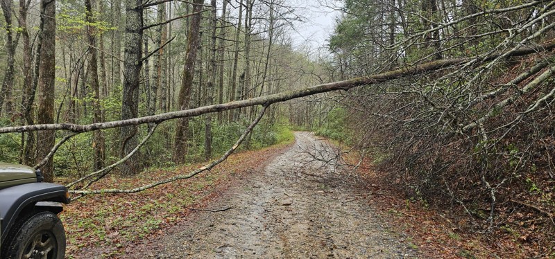
We tried to run from west to east starting at point 10. There was a tree down at 10 our tall rigs would not fit under. So we went to point 1 and ran to the swing bridge. Fun times on the hike.

Earl Neisler
Earl Neisler
Earl Neisler
No Rating
Open
Visited: 06/14/2026
Started late and spent the night at Hickory Creek campground small, and worked well for our needs. The trail rating was spot on.
Earl Neisler
Rated 4/5
Open
Visited: 06/13/2026
Beautiful scenery. A few dips and rocky sections but overall easy drive.
LB
Lara Boldin
Rated 5/5
Open
Visited: 06/13/2026
We went north to south, waypoint 1 to 3. The reviews are right on. It is rutted and very rocky but we had a blast. We went slow and picked lines carefully through the trail. No problems in my Bronco i...
LB
Lara Boldin
Rated 5/5
Open
Visited: 06/13/2026
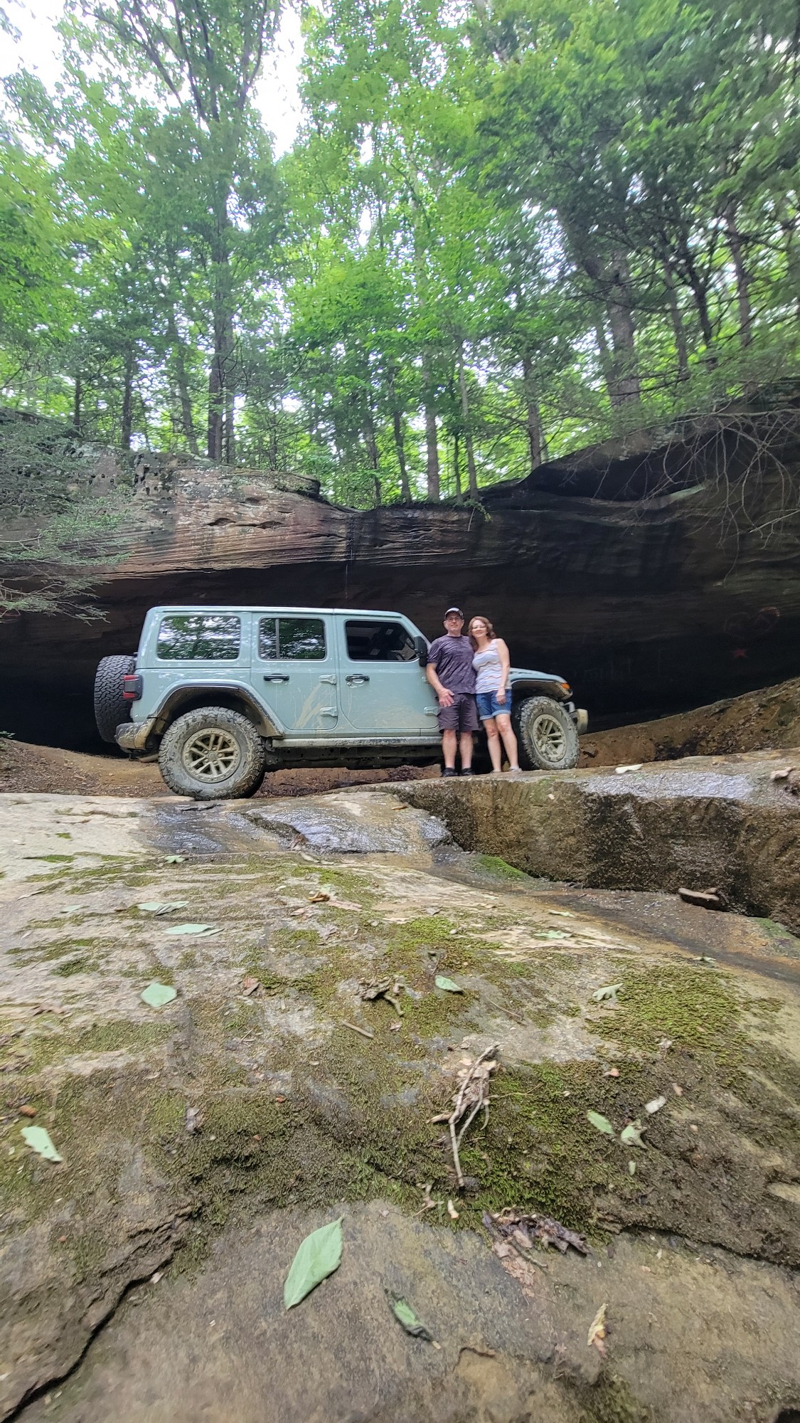
Nice water crossing. Definitely rougher after the Benton McKaye trail but also definitely doable with 4x4! Fun!
DT
Dottie Tieslau
Earl Neisler
Rated 4/5
Open
Visited: 06/10/2026
Nice route to connect tree or more trails for a fun peaceful ride.
Earl Neisler
No Rating
Open
Visited: 06/07/2026
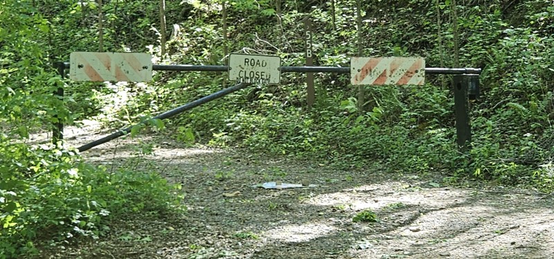
The culvert replacement at the west end of Duncan Ridge Rd is complete and the road is open.
FM
Felix Miller
No Rating
Open
Visited: 06/05/2026
I’ve driven this trail multiple times in a stock Defender. Today I noticed a bunch of down trees and wished I had my chainsaw to clear them up.
MC
Matt Chin
Rated 5/5
Open
Visited: 06/05/2026
The most fun I’ve had trail riding since I moved to North Georgia from Colorado. Fairly technical and just challenging enough for a novice to have fun. Good testing ground for beginners with stock or ...
Cain Menard
No Rating
Seasonal Closure
Visited: 06/01/2026
According to this trails management agency, the trail is likely closed for the season.
You can reach out to the agency for more details.
Be sure to leave us a report and let us know ...

Trails Offroad
No Rating
Open
Visited: 05/30/2026
First time in a trail like this. Been to Horse Pasture Road- beautiful looking over Lake Jocassee! So second trail- I wanted to go past the sign lol. Great spot, good learning.
D
Danny
No Rating
Open
Visited: 05/24/2026
Trail is open and in good condition. Easy pass ability. Only a few ruts and water spots. Stock 4WD will have to problems in two wheel drive.
AR
Andrew reed
Rated 4/5
Open
Visited: 05/24/2026
Very rocky but easy trail. There is a tree down about 2.5 miles in, so bring a chainsaw with if you want to not have to turn around. Drove completely in 2WD.
AR
Andrew reed
No Rating
Open
Visited: 05/14/2026
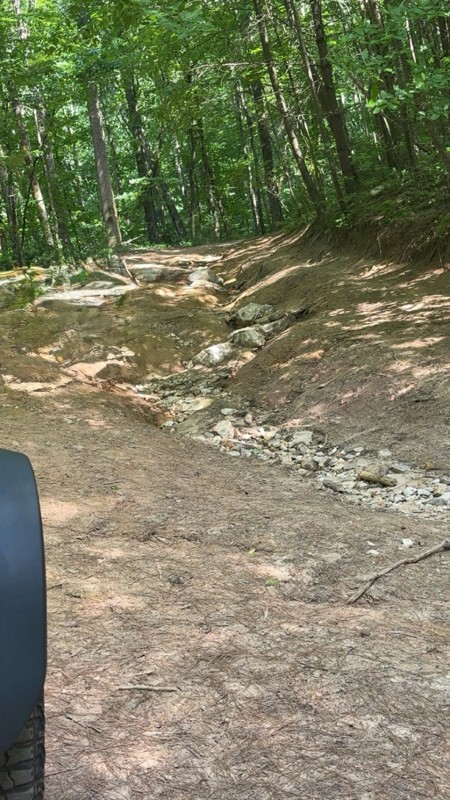
Erosion past campground @1.52mm makes few choices other than direct line on drop off side. Nice articulation study. Looks like a hot mess, but with a rear locker should not have issues. Very low pitch...
WL
William Lee
No Rating
Seasonal Closure
Visited: 05/14/2026
According to this trails management agency, the trail is likely closed for the season.
You can reach out to the agency for more details.
Be sure to leave us a report and let us know ...
Trails Offroad
Rated 4/5
Open
Visited: 05/05/2026
We stopped here to collect another badge and had a good time. Keep in mind the trails do close after big rain events so check the website before heading out. It was mostly dry for us aside from a few ...
Peter Olson
Rated 4/5
Open
Visited: 05/05/2026
We stopped here to collect another badge and had a good time. Keep in mind the trails do close after big rain events so check the website before heading out. It was mostly dry for us aside from a few ...
Peter Olson
Rated 5/5
Open
Visited: 05/02/2026
open today. tough spot near north end of trail. someone has a photo of it in a review dated 12/20/25. running south to north you have gravity on your side. stock jeep, you probably only have one l...
LL
Luke LoRusso
LL
Luke LoRusso
Rated 3/5
Open
Visited: 04/19/2026
trail was open today. very basic and easy trail.
LL
Luke LoRusso
LL
Luke LoRusso
Rated 4/5
Open
Visited: 04/18/2026
Charlie’s Creek is rough!! The videos you see from last November look way smoother than what we saw today. If you’re in a wranger/rubicon with all terrain tires, you’re probably still oke but it takes...
A
Alan
Rated 5/5
Open
Visited: 04/17/2026
This was our first of many trail rides. Being a solo trip, we decided on this over Tray Mtn. Definitely recommend for beginners.
BM
Brian Mason
Rated 5/5
Open
Visited: 04/12/2026
What a run trail ride we had on Sunday afternoon. We ran the trail from East to West entering the trailhead at Tallulah River off Tallulah River Road. The road leading to the trail head has several 1...
DEANA JONES
Rated 4/5
Open
Visited: 04/12/2026
We continued with this route from Tray Mountain Road. The reported tree has been somewhat cleared, enough for us to go under the fallen tree with our Wrangler. This was a nice long ride after runnin...
DEANA JONES
No Rating
Open
Visited: 04/11/2026
4x4 not really need but all depends on if it’s rained lately. I wouldn’t take normal everyday vehicles down this road for sure.
SE
Sara Ellisor
Rated 5/5
Partially Open
Visited: 04/05/2026
trail was open today from the top ( near tray mountain summit ) however there is a fallen tree which is impossible to pass in a 4 wheeled vehicle near coordinates 34 deg 49'21" 83 deg 40'06. would ne...
LL
Luke LoRusso
Rated 5/5
Open
Visited: 04/02/2026
Easy trail, straight forward, with good spots to camp by the creek.
C
Cannis
Rated 5/5
Open
Visited: 04/02/2026
Fun first run in 4Runner ORP. One large challenge near the start but take your time and it’s fine. End with a nice few spots to stop near the creek for a break or lunch.
C
Cannis
No Rating
Open
Visited: 03/31/2026
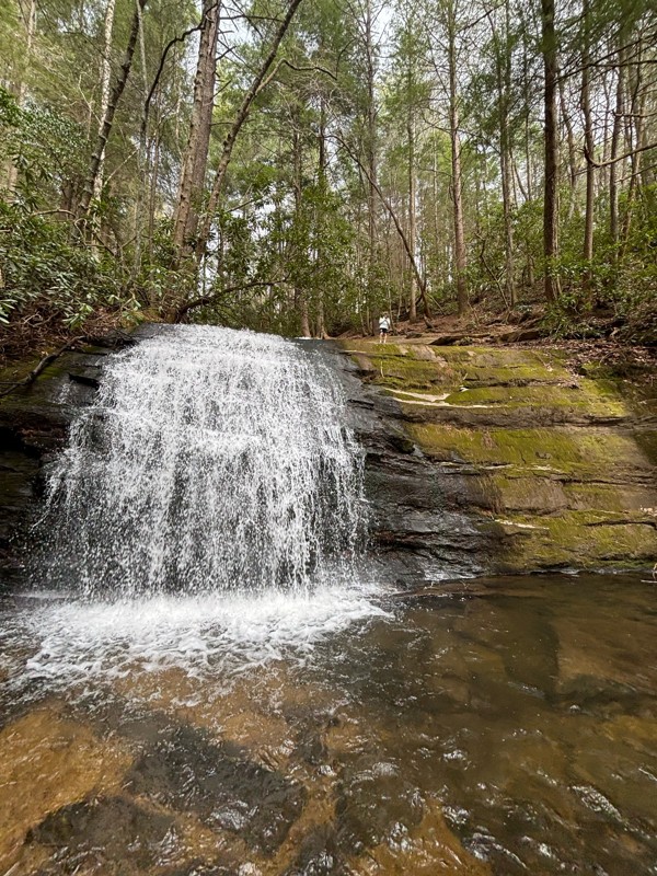
Scenic trail, stop off at waypoint 9 to long creek falls nice easy hike.
BT
Blair Thompson
No Rating
Open
Visited: 03/31/2026
Good trail to run north as the elevation goes up it does get more rocky. Good climb up.
BT
Blair Thompson
No Rating
Open
Visited: 03/31/2026
Fun short trail. Some water crossings made it cool. Lots of good camping spots
BT
Blair Thompson
No Rating
Open
Visited: 03/31/2026
Did this after coming up old bucktown. Rocky at the to and smooths out the further you go down the mountain. Photo at the meet point of old bucktown and nimble well
BT
Blair Thompson
No Rating
Open
Visited: 03/31/2026
First time doing this trail. Definitely on the higher side of moderate. It is rocky and rutted out. Not sure what it used to be like but I would recommend 4x4 and good clearance.
BT
Blair Thompson
No Rating
Temporary Closure
Visited: 03/30/2026
3/30/2026
⚠️Temporary Road Closure – Duncan Ridge Road (FSR 39) ⚠️
A portion of Duncan Ridge Road (FSR 39) on the Chattahoochee-Oconee National Forest is temporarily closed to support culvert replacem...

Dave Greenspan
Official Crew
No Rating
Open
Visited: 03/30/2026
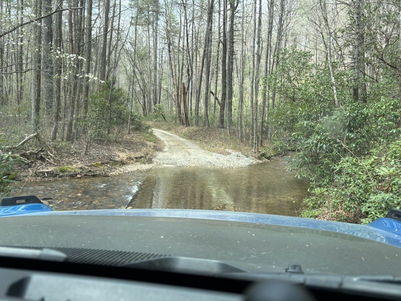
Easy creek crossing at the beginning(not too deep). After swinging bridge gets more technical and difficult. Would recommend 4x4 after walking swinging bridge with clearance.
BT
Blair Thompson
No Rating
Open
Visited: 03/30/2026
Good trail, one spot at the beginning rutted out with some clearance most 4x4 should clear easily
BT
Blair Thompson
Rated 5/5
Open
Visited: 03/24/2026
Someone has cleared the tree that has fallen. It is a good little trail! Nothing super difficult however it can get muddy during the rain. Follow us on Instagram! @Trailsenders
TS
Trail Senders
FM
Felix Miller
Rated 3/5
Temporary Closure
Visited: 03/21/2026
drove up here with the kids and was disappointed to find a locked gate on the access road. theres lots of fresh gravel here right now on the surrounding trail that make for a rough ride. we still made...

B
Brian
Rated 5/5
Open
Visited: 03/19/2026
What a surprise! After coming to the top of Tray Mountain, this trail connects to come down.The beauty of the trail is the peacefulness and scenic views.
MR
MIGUEL ROSARIO
Rated 5/5
Open
Visited: 03/19/2026
First time. Loved it! Not technical at all, you’ll find some large puddles/mud holes after some rain but what it lacks in challenges it makes up in the beautiful views! It is a must try (at least onc...
MR
MIGUEL ROSARIO
No Rating
Partially Open
Visited: 03/16/2026
West end of trail temporarily closed due to work to replace a large culvert. Can still access the trail at Wolfpen Gap and via Bryant Creek Rd.
FM
Felix Miller
Rated 5/5
Open
Visited: 03/08/2026
Nice trail with several camp sites to choose from.
Some areas of the trail can be narrow to pass oncoming vehicles. However there are places on the trail to pull over to let others pass.
This trail gi...
Ricky Wilson
Rated 4/5
Open
Visited: 03/01/2026
Ive been to Sarah's Creek and passed this so many times, I decided to go ahead and check it out. All very tame, zero spice. Lots of great views and some pretty decent camping spots. We pulled off one ...
Jeff Bowman
Rated 4/5
Open
Visited: 03/01/2026
Absolutely beautiful, lesser known trail with some decent camp spots. The Scout guide lead us to believe that there would be at least some Habenero-level spice, but the only spice we found was a coupl...
Jeff Bowman
Most Popular


Updated: 01/15/2024
Tray Mountain Road
Open
/
Helen, Georgia/
8.02 miles/
About an hour
Just north of Helen, Georgia lies Tray Mountain Road. Perhaps the most popular offroad trail in all of Georgia, this road climbs Tray Mountain to Tray Gap, a small parking area and an intersection with the famous Appalachian Trail. The road follows along the ridge so there are spectacular views off one side or the other for the northern portion of the trail, especially in the winter months when there are no leaves on the trees blocking the view. With so many things to do and it's close proximity to Helen, don't pass up Tray Mountain Road.

Updated: 02/07/2024
Charlies Creek Road
Clayton, Georgia
About halfway between Hiawassee and Clayton lies Charlies Creek Road. One of the most popular off-road trails in all of Georgia because of its many water crossings and rough terrain, this trail follows along Charlies Creek and Flat Branch Creek through the valley between River Mountain and Wheeler Knob. It even crosses over the famous Appalachian Trail. With its proximity to some of the best camping in the state, it's easy to see why this trail is the favorite of many!

Updated: 05/04/2024
Forest Service Road 333
Open
/
Morganton, Georgia/
3.33 miles/
About an hour
Following the Toccoa River along the base of John Dick Mountain, Forest Service Road 333 is the rarely used north western entrance of the Blue Ridge Wildlife Management Area of the Chattahoochee National Forest. This trail also offers access to the the Toccoa River Swinging Bridge along the Benton MacKaye Trail, a 300+ mile hiking trail along the Appalachian Mountains that spans across three states. With hiking, fishing, camping and access to numerous other trails, Forest Service Road 333 is a fun addition to any day in the mountains of North Georgia.

Updated: 06/29/2024
Nimblewill Gap
Dahlonega, Georgia
Situated in a mountain range spanning 550 miles from Georgia to Pennsylvania called the Blue Ridge Mountains is an easy trail known as Nimblewill Gap Road. What it lacks in difficulty and obstacles, it makes up for in gorgeous scenery. Part of the trail follows along the beautiful Nimblewill Creek before climbing up the eastern side of Amicalola Mountain reaching Nimblewill Gap, the pass between Amicalola Mountain and Black Mountain. Numerous roadside camping areas make this trail very popular with campers looking to get away from more traditional campgrounds. Additionally, any hikers or history buffs in your group will be delighted to see that this road also offers access to the famous Appalachian Trail, the 2100 mile hiking trail from Georgia to Maine. With camping, hiking, and access to other trails in the area, Nimblewill Gap Road has a little something for everyone.

Updated: 03/09/2024
Grassy Gap Road
Dahlonega, Georgia
One of the less frequently traveled Forest Service roads, Grassy Gap Road is another entrance to the popular Blue Ridge Wildlife Management Area of the Chattahoochee National Forest. Climbing 1200 feet up Gooch Mountain, there are stunning views overlooking the ridge, especially in the winter when there are no leaves on the trees. Connecting to Coopers Gap Road which offers access to the famous Appalachian Trail, Grassy Gap Road is a fun way into the Blue Ridge Wildlife Management Area for those looking for a rougher ride than the average Forest Service road.

Updated: 07/14/2024
Old Bucktown Road
Ellijay, Georgia
Just outside of Ellijay, Georgia, and immediately north of Amicalola Falls State Park lies Old Bucktown Road. Part of the beautiful Blue Ridge Mountains which extend 550 miles from Georgia all the way to Pennsylvania, Old Bucktown Road is a rocky mountain pass that cuts through from Ellijay to Nimblewill. One of the rougher Forest Service roads left in Georgia, this is a great trail for beginner offroad drivers or for someone looking to test out a new rig without being too rough or too remote. Additionally, any hikers or history buffs in your group will be delighted to see that this road also offers access to the famous Appalachian Trail, the 2100 mile hiking trail from Georgia to Maine.

Updated: 03/16/2024
Corbin Creek Road
Open
/
Helen, Georgia/
10.35 miles/
About an hour
Just north of Helen, Georgia lies Corbin Creek Road. Twisting and turning all the way to the top of Tray Mountain, this popular trail is the northernmost and smoothest way to Tray Gap, a small parking area and the intersection with the famous Appalachian Trail. In addition to some great camping spots, there are stunning views to the northwest overlooking the Chinquapin Ridge - especially in the winter months when there are no leaves on the trees blocking the view. So whether you're out day hiking the Appalachian Trail, looking for some secluded camping, or just out for a beautiful mountain drive, give Corbin Creek Road a look.

Updated: 06/15/2024
93C - Nicholson Gap
Open
/
Blairsville, Georgia/
2.53 miles/
About an hour
Located just east of Blairsville, in the Chattahoochee National Forest of north Georgia, Nicholson Gap is one of the main trails into the heart of the infamous Beasley Knob OHV Trail System. This narrow, single-lane trail will get the blood pumping like an amusement park ride as you twist and turn through the dense foliage, climb up and down steep grades, and sling bright orange Georgia mud down the sides of your vehicle. Combine this trail with several others in the network to fully complete the only Jeep Badge of Honor in the state of Georgia.

Updated: 06/15/2024
93A - Access
Seasonal Closure
/
Blairsville, Georgia/
1.81 miles/
About 20 minutes
Situated in the Chattahoochee National Forest of north Georgia, 93A is the simplest and easiest road within the Beasley Knob OHV Trail System. Known simply as "Access," this trail leads to several of the most intense Beasley Knob trails. It offers a few great camping opportunities that are sometimes used as impromptu camps after a long, eventful day tackling other trails in the network. Come explore for a day or a weekend, but combine this trail with several others in the network to complete the only Jeep Badge of Honor trail in Georgia.

Updated: 05/18/2024
Noontootla Road
Suches, Georgia
About 25 minutes east of East Ellijay, Georgia and just north of Amicalola Falls State Park lies Noontootla Road. One of the main routes through the Blue Ridge Wildlife Management Area, this trail follows along Noontootla Creek and then Chester Creek offering outstanding views for almost the entire way. This trail also crosses and has a small parking area for the famous Benton MacKaye Hiking Trail which also is the closest access point for the popular Long Creek Falls. So if you are looking for some of the best camping in the entire state or out for a great hike or drive through the forest, check out Noontootla Road.

Updated: 06/08/2024
Forest Service Road 28-1
Dahlonega, Georgia
Forest Service Road 28-1 is one of the main roads of a popular offroad driving loop in the Blue Ridge Wildlife Management Area. It is also the southern main entrance of the Blue Ridge District of the Chattahoochee National Forest. This road connects with numerous other Forest Service roads and non-motorized hiking/biking/equestrian trails. This trail has many interesting sights, such as the Wahsega 4-H Center and US Army Camp Merrill.

Updated: 06/15/2024
93D - Bridge Gap
Open
/
Blairsville, Georgia/
2.5 miles/
About 40 minutes
Located a few miles east of Blairsville, in the Chattahoochee National Forest, Bridge Gap is a mid-level trail within the infamous Beasley Knob OHV Trail System. This trail will have you white-knuckling the steering wheel as you descend steep grades, maneuver through intense rock gardens, and pray you find a pull-out before meeting oncoming traffic. Whether you come for the rocks, the Jeep Badge of Honor designation, or just good off-road fun in the forests of north Georgia, Bridge Gap is a must-do trail.

Updated: 12/18/2023
Calbeck Road
Calhoun, Georgia
If a beautiful mountaintop drive is what you are looking for, then look no further. Hidden inside the Armuchee area of the Chattahoochee National Forest, just west of Calhoun, lies Calbeck Road. What starts as your basic forest road surrounded by thick green trees leads to a unique, open clearing on the top of Calbeck Mountain. Stunning views overlook the Dry Creek Valley you just drove through to get here all the way across to the peaks of 1780-foot Horn Mountain. Stretching 17 miles, Horn Mountain is the eastern wall of The Pocket, a popular and geographically unique recreation area. Whether you are out to see the bright blue skies against the green mountain tops in the summer, the beautiful colors of fall, or watch a storm move in during the spring, Calbeck Road is one you'll remember for its beauty.

Updated: 05/24/2024
93G - Nelson Cove
Seasonal Closure
/
Blairsville, Georgia/
2.71 miles/
About an hour
Located in the Chattahoochee National Forest, Nelson Cove is one of the more difficult trails within the Beasley Knob OHV Trail System. Deep trenches, steep climbs, and sticky mud holes await those brave enough to attempt the drive. Spinning tires and roaring engines will leave mud splattered across windows like abstract art. With perseverance, determination, and in some cases, a little luck, you can conquer this trail and proudly earn a portion of the Badge of Honor designation. Combine trail 93G with several others in the network to fully complete the Jeep Badge of Honor.

Updated: 03/09/2024
Winding Stair Gap Road
Dahlonega, Georgia
About halfway between Suches and Dahlonega lies Winding Stair Gap Road. This trail is the western part of a popular off-road driving loop through the Blue Ridge district of the Chattahoochee National Forest. Connecting Winding Stair Gap, a five-way intersection of trails, to the southern entrance of the forest - Winding Stair Gap Road follows the ridge overlooking Penitentiary Cove to the east and Jones Creek to the west. So if you're looking for a shortcut through the mountains or just out for a scenic drive through the forest, check out Winding Stair Gap Road.

Updated: 03/03/2024
Appalachian Blue Ridge Road
Suches, Georgia
About halfway between Suches and Dahlonega lies Appalachian Blue Ridge Road, one of the most scenic non-paved drives in all of Georgia. This trail follows along the famous Appalachian Trail the entire way and is the connector route from Hightower Gap to Coopers Gap. Looking to the north you will find spectacular views of the valley and mountains for most of the way, especially in the winter months when there are no leaves on the trees blocking the view. With camping areas throughout and small parking areas at both ends of this trail, Appalachian Blue Ridge Road is perfect for campers, day hikers, or anyone looking for an easy scenic drive through the mountains.

Updated: 10/18/2023
Jones Creek Road
Dahlonega, Georgia
Tucked deep within the Blue Ridge District of the Chattahoochee National Forest lies Jones Creek Road. This easy, scenic trail has some of the best-secluded camping in the area. This trail has it all with water crossings, roadside camping, access to hiking trails and waterfalls and much more! If you're in the area and looking for some secluded off the beaten path camping, give this trail a look.

Updated: 06/15/2024
93B - Blue Rock Mountain
Seasonal Closure
/
Blairsville, Georgia/
0.53 miles/
About 3 hours
Rightfully earning the designation as the most challenging trail within the Beasley Knob OHV Trail System, Blue Rock Mountain is a legendary trail with a fearsome reputation for holding hostage any mortal who dares cross its sacred domain. If spending multiple hours traveling half a mile up treacherous terrain sounds like an acceptable challenge, 93B is the trail of your dreams or can easily become your nightmare. This Jeep Badge of Honor trail will not go gently into the night, but rest assured, conquering Blue Rock Mountain will leave you feeling like you just conquered Mount Everest.

Updated: 03/02/2024
Coopers Gap Road
Dahlonega, Georgia
One of the more scenic mountainous trails in Georgia, Coopers Gap Road, is the main eastern route in and out of the Blue Ridge Wildlife Management Area. Breathtaking views of ridges and valleys off both sides throughout much of the ride, this trail twice crosses paths with the famous Appalachian Trail - a 2,200 hiking trail from Georgia to Maine. With multiple camping areas and two parking areas, Coopers Gap Road is an excellent route for day hikes, overnight hikes, or just a scenic ride through the Blue Ridge Mountains.

Updated: 01/14/2024
Dunaway Gap Road
Armuchee, Georgia
Tucked away in the northwestern part of Georgia, just west of Calhoun, lies Dunaway Gap Road. This short, rarely-used trail is the only cut-through of Johns Mountain, a 20-mile-long mountain that forms the western part of The Pocket, a popular and geographically unique recreation area. The trail traverses the Johns Mountain Wildlife Management Area, a 28,000-acre area with opportunities for hiking, fishing, hunting, horseback riding, and mountain biking.

Updated: 03/28/2024
Gumlog Gap Road
Blairsville, Georgia
Just north of Blairsville is one of the most beautiful, scenic rides in all of Georgia. Known as Gumlog Gap Road, this pair of Forest Service roads travels the ridge between Gumlog Mountain, Chestnut Top, Tarklin Knob, Turkey Knob, and Piley Top. Right next to the beautiful Lake Nottely, this trail has some incredible views overlooking into North Carolina - even when the trees are thick with leaves. Riding this trail in the summer might make you think you took a wrong turn and ended up in the jungles of Columbia with the thick green surroundings and the Kudzu vines everywhere. If you're looking for an easy off-pavement scenic getaway, don't pass up Gumlog Gap Road.

Updated: 09/19/2023
Duncan Ridge Road
Suches, Georgia
Spanning the ridge across the Coopers Creek Wildlife Management Area, just north of Suches, Georgia, lies Duncan Ridge Road. This scenic mountain trail overlooks the valley to the south and runs the ridges of several mountains such as Wildcat Knob, Coosa Bald and Buckeye Knob. With access to four popular hiking trails - Duncan Ridge Trail, Coosa Backcountry Trail, Yellow Mountain Trail and Shope Gap Trail - and some good secluded camping areas, Duncan Ridge Road is a great addition to any trip through the mountains.

Updated: 03/03/2024
Springer Mountain Road
East Ellijay, Georgia
About 25 minutes east of East Ellijay, Georgia and just north of Amicalola Falls State Park lies Springer Mountain Road. The western main entrance to the Blue Ridge Wildlife Management Area of the Chattahoochee National Forest, this trail is the connector trail from the forest entrance to Winding Stair Gap, a five-way intersection of trails. Springer Mountain Road also has the parking area for the southern terminus of the famous Appalachian Trail at Springer Mountain. So if you're looking to hike or just check out the beginning of the most famous hiking trail in the country or just out for a scenic drive through the mountains, don't pass up Springer Mountain Road.

Updated: 12/01/2023
Rock Creek Road
Suches, Georgia
This smooth and scenic road is the main entrance to the Blue Ridge Wildlife Area of the Chattahoochee National Forest. Just outside the beautiful Suches, Georgia, this trail offers access to the famous Appalachian Trail, a 2,200 mile hiking trail from Georgia to Maine. Following the heavily stocked trout stream, Rock Creek, all the way past Rock Creek Lake, this trail passes the Chattahoochee Forest National Fish Hatchery, which is open to the public. With at least a half dozen fishing access points to the creek, plus the fish hatchery itself and Rock Creek Lake, this trail offers access to some of the best trout fishing in the area. With hiking, fishing, camping and access to numerous other trails, Rock Creek Road is a great place to spend a day in the mountains.

Updated: 06/05/2022
Cooper Creek Road
Suches, Georgia
Just north of Suches, Georgia and right next to Lake Winfield Scott lies Cooper Creek Road. This trail is the main route through the Coopers Creek Wildlife Management Area that spans more than 30,000 acres and offers hunting opportunities for deer, bear, turkey and small game in addition to trout fishing. There are numerous small clearings for camping along this trail including some right along the creek. This trail is also a connecting trail to four other trails. The eastern trailhead is across the street from the Winfield Scott Recreation Area which has full facilities including nice restrooms. With so many things to do, and its close proximity to so many other trails - Cooper Creek Road is a great easy trail to hit while out exploring the forest.

Updated: 12/18/2023
Hale Ridge Road
Clayton, Georgia
Hale Ridge Road is the main route through the Warwoman Wildlife Management Area of the Chattahoochee National Forest and the only road that goes completely through to North Carolina. Just outside Clayton, Georgia, Hale Ridge Road offers access to numerous hiking trails, including the Bartram Trail, Three-Forks Trail, Holcomb Trail, and the Rabun Bald Trail. With access to many hiking trails and other Forest Service roads, Hale Ridge Road is a fun place to explore while out in the mountains.

Updated: 07/24/2024
Red Root Road
Cornelia, Georgia
Just east of Cornelia lies Red Root Road. The main route through the Lake Russell Wildlife Management Area - a 17,000+ acre area known for primitive camping, hiking, hunting, and fishing - this trail is one of only three trails in the area that is open year round. Red Root Road runs along the Middle Fork Broad River for part of the way and then passes between Allen Mountain and Farmers Mountain for some outstanding views. With so many activities, Red Root Road is a great place to explore while out in the mountains.

Updated: 05/17/2024
Knight Creek Road
Suches, Georgia
Just north of Suches, Georgia, lies Knight Creek Road. Fully enclosed within the Cooper's Creek Wildlife Management Area boundary, this fun little trail follows the beautiful Knight Creek the entire way. Rougher than most other trails in the area, this trail follows up the slope between Upper Polecat Mountain and Licklog Mountain and allows you to stretch your vehicle's legs a little bit. Spanning more than 30,000 acres, the Coopers Creek Wildlife Management Area offers hunting opportunities for deer, bear, turkey, and small game in addition to trout fishing. With so many things to do and its close proximity to so many other trails, Knight Creek Road is a great trail to hit while out exploring the forest.

Updated: 07/07/2024
Weeks Creek Road
Morganton, Georgia
Just southeast of Blue Ridge Lake is a little connector trail called Weeks Creek Road. This trail follows along the base of Weeks Mountain and Pine Mountain and connects the popular Aska area to Highway 60. With a few secluded camping areas, this trail also makes for a good escape from the crowds along the Toccoa River which is just outside the western trailhead. So if you're just out for a scenic ride or looking for a shortcut to the lake or river, check out Weeks Creek Road.

Updated: 03/28/2024
West Skeenah Road
Suches, Georgia
If you're looking to get lost in the woods, look no further than West Skeenah Road. Situated just north of Suches, Georgia, this long and winding road is part of the ever-popular Georgia Traverse - a 390-mile route with 225 miles of unpaved surfaces. Nothing but curves, this easy but scenic trail might make you feel like your on a slow-moving roller coaster in a sea of green far from civilization. Following the base of Wilscot and Deadenenn Mountains, this road connects Highway 60 to Skeenah Gap Road while crossing over numerous creeks including Woody Branch, Pigeon Creek, and Skeenah Creek. So whether your following along the Georgia Traverse, looking for a secluded camping spot, or just looking to get away from it all, check out West Skeenah Road.

Updated: 12/18/2023
Overflow Creek Road
Clayton, Georgia
Just outside Clayton, Georgia, Overflow Creek Road is one of the main routes through the Warwoman Wildlife Management Area of the Chattahoochee National Forest. One of the smoother and more popular trails in the area, Overflow Creek Road crosses over the famous Chattooga River, where the movie Deliverance was filmed. With access to camping, fishing, and numerous hiking trails, Overflow Creek Road is a fun road to explore while in the area.

Updated: 03/28/2024
Ivylog Gap Road
Blairsville, Georgia
Just north of Blairsville is a little trail called Ivylog Gap Road. This easy, scenic trail follows the ridge between Ivylog Mountain, Juber Knob, Lynn Knob, Anderson Knob, and Mine Mountain and might even make you forget you're so close to the megacity of Atlanta. Right next to the beautiful Lake Nottely, known for trophy striper fishing, this trail connects to the town of Young Harris next to Brasstown Bald - the tallest mountain in all of Georgia with a lookout tower, making it a popular attraction. So, if you find yourself in the area and need to get away from the crowds and the pavement, give Ivylog Gap Road a look.

Updated: 01/26/2024
West Wolf Creek Road
Blairsville, Georgia
Situated south of Blairsville and just north of Vogel State Park is West Wolf Creek Road. Following West Fork Wolf Creek most of the way, this trail runs through the valley between Frady Mountain and Sheriff Knob to the southeast and Ben Knob, Big Grassy Knob and Wildcat Knob on the northwest. A popular trail due to the numerous camping areas, there is also access to the popular Coosa Backcountry Hiking Trail. So whether you're out for a day of hiking, a night of camping or just a scenic drive through the forest, don't overlook West Wolf Creek Road.

Updated: 03/16/2024
Swallows Creek Road
Hiawassee, Georgia
Hidden just south of Hiawassee, Georgia lies Swallows Creek Road. Situated in the heart of the Swallow Creek Wildlife Management Area, a 19,000-acre public area with over 25 miles of hiking trails and opportunities for hunting and fishing, this often overlooked road has some incredible creekside camping areas. Surrounded by sights and sounds of nature, this secluded trail follows Swallows Creek through Syrup Mill Cove, along the base of Berrong Mountain all the way to Buckeye Cove. So whether you're looking for some hiking and camping, hunting and fishing, or just a scenic drive through the forest, don't overlook Swallows Creek Road.

Updated: 03/28/2024
Forest Service Road 97
Dahlonega, Georgia
A short and scenic trail along Campbell Mountain, Forest Service Road 97 is one of many Forest Service roads in the Blue Ridge Ranger District of the Chattahoochee National Forest. Surrounded the entire way by sights and sounds of nature, there is a small clearing at the end perfect for a picnic or place to park while setting up camp for the night. Because of its close proximity to so many other trails and because it's slightly rougher than the average gravel road, this is an ideal trail to hit while out exploring for the day in the area.

Updated: 03/28/2024
Forest Service Road 69C
Morganton, Georgia
Forest Service Road 69C, also known as Lower Frozen Branch Road, is a scenic loop off the beaten path inside the Blue Ridge Wildlife Management Area of the Chattahoochee National Forest. A side trail off Rock Creek Road, this loop is directly across from the Chattahoochee Forest National Fish Hatchery and the Frank Gross Campground. A short distance away from both the Appalachian Trail and the Benton MacKaye Trail, Forest Service Road 69C is a great place for camping after a day of hiking or just an easy beautiful drive through the forest.

Updated: 03/16/2024
Sea Creek Road
Suches, Georgia
Just north of Suches lies Sea Creek Road. Fully enclosed within the boundary of the Cooper's Creek Wildlife Management Area that spans more than 30,000 acres and offers hunting opportunities for deer, bear, turkey, and small game in addition to trout fishing - this fun little trail follows the beautiful Sea Creek the entire way. This trail also offers access to numerous other trails and the popular Sea Creek Falls. With lush green views of the forest and the sounds of the creek most of the way, Sea Creek Road is a great trail to explore if you're looking to get away from it all.

Updated: 07/15/2025
Tumbling Creek
Dunn, Georgia
Tumbling Creek is one of the eight roads that make up the overlanding route around the Cohutta Wilderness Area. When traveling from the south to the north, the road quickly loses elevation, leaving the ridgelines' broken views behind you as you wind your way down to the lush laurel-lined trail below. Once towards the bottom, the road drives beside sections of its namesake, Tumbling Creek, with picturesque campsites dotted along its banks. Keep an eye out for mini waterfalls and bear! Most of this road is closed from January - March.

Updated: 03/09/2024
Hightower Gap Road
Suches, Georgia
Just south of Suches, Georgia and not too far from Amicalola Falls State Park lies Hightower Gap Road. This easy trail is the connector route from Hightower Gap to Winding Stair Gap. In addition to numerous camping areas and some outstanding views, there is also an intersection with the famous Appalachian Trail and a small parking area at the northern trailhead making this an excellent trail for day hikers. So whether you're looking for some top-notch camping areas, day hiking on the Appalachian Trail or just out for an easy scenic drive through the mountains, don't pass up Hightower Gap Road.
Updated: 04/27/2026
Three Forks
Hasslers Mill, Georgia
Three Forks is part of the Cohutta Wilderness Area loop. It is mostly gravel with sections of embedded rock. This section of the loop includes older-growth hardwood trees that make a dense canopy for most of the route, so thick you will see plenty of moss growing on the trunks of the trees you pass by. As a bonus, this road has the Mountaintown Overlook, which gives expansive views of the valley below and ridgelines off in the distance. Several dispersed campsites can be found along this section of the loop. Most of this road is closed from January - March.

Updated: 06/04/2026
Sarah’s Creek
Pine Mountain, Georgia
Located within the Warwoman Wildlife Management Area outside of Clayton, Georgia, Sarah’s Creek, or FS 156, is a trail that offers a fun offroad challenge and ample solitude for those looking to escape. The trail begins as a simple road providing access to the Sarah’s Creek Campground, which the National Forest Service manages. This is an improved campground that offers standard amenities with flat pads, fire pits, and outhouses.
While the trail begins as paved, the farther north you travel, the more degraded the road surface becomes. Once you pass the NFS campground, you’ll come to a creek crossing, which marks the start of the interesting obstacles. Immediately after the creek crossing, you’re faced with a rocky, washed-out section. Scout before you commit, as this serves as the gatekeeper, and turning around is very difficult. Narrow width and short wheelbase or big lifts and large tires are your friends here. Otherwise, you can count on busted mirrors or smashed bumpers.
Past this highlight obstacle, the trail is interesting but not nearly as pucker-inducing. Dispersed campsites are fairly abundant, but they can be small. The trail comes to an end at a large turnaround. Although it appears two more trails have been cut into the woods, these are not officially recognized trails and should be considered illegal.

Updated: 10/16/2022
Finney Creek Road
Clayton, Georgia
A short and scenic trail just outside Clayton, Georgia, Finney Creek Road is one of many Forest Service roads in the Warwoman Wildlife Management Area of the Chattahoochee National Forest. Surrounded the entire way by sights and sounds of nature, there are plenty of camping and hunting areas along the trail as well as the main Warwoman Wildlife Management Area wild game check-in station. With hunting, camping and it's close proximity to numerous other trails, Finney Creek Road is a great trail to hit while out exploring the area.

Updated: 12/18/2023
Bull Mountain Road
Dahlonega, Georgia
One of many short offroad trails in the Blue Ridge district of the Chattahoochee National Forest, Bull Mountain Road is a very scenic forest service road that offers access to the Bull Mountain trail system, a 50-plus mile trail system for horses, mountain bikes, and hikers.

Updated: 05/15/2023
Water Gauge Road
Tallulah Falls, Georgia
Situated in the Chattooga River District of the Chattahoochee National Forest, just outside Tallulah Falls, Georgia, lies Water Gauge Road - a relatively smooth gravel Forest Service road offering access to the famous Chattooga River. The border between Georgia and South Carolina, the Chattooga River is a whitewater river where the 1972 movie Deliverance starring Burt Reynolds was filmed. A short hike down the Water Gauge Hiking Trail at the end of the road leads to numerous access points to the river for fishing, watching the whitewater rafters or just relaxing along the river.

Updated: 10/15/2024
Scull Shoals Experimental Forest Trail
Maxeys, Georgia
Take a break from cheering on the Dawgs in Athens to get out and explore the Scull Shoals Experimental Forest. While the trails in this area are not difficult, they provide a great opportunity to experience Georgia's natural beauty. The trail connects with Moose Finch and the Scull Shoals Trail.
Several spurs off the main trail lead to dispersed campsites. Campsites are typically open areas featuring a rock fire ring. There are no fees for using these locations.

Updated: 09/19/2023
Guard Camp Road
Cornelia, Georgia
About halfway between Cornelia and Toccoa lies Guard Camp Road. This trail is the northern main entrance to the Lake Russell Wildlife Management Area, a 17,000+ acre area known for primitive camping, hiking, hunting, and fishing. One of only three trails in the area open year round, Guard Camp Road is the connector road from the northern entrance game check station all the way down to Red Root Road. With superb hunting access, hiking trail access, and primitive camping, Guard Camp Road is a great place to explore while out for a day or weekend in the mountains.

Updated: 09/19/2023
Brown Bottoms Road
Cornelia, Georgia
About halfway between Cornelia and Toccoa lies Brown Bottoms Road. One of the main routes through the Lake Russell Wildlife Management Area - a 17,000+ acre area known for primitive camping, hiking, hunting and fishing - this trail is one of only three trails in the area that is open year round. The connector trail between Red Root Road and Guard Camp Road, Brown Bottoms Road also crosses the Middle Fork Broad River just after its source. With so many fun activities, Brown Bottoms Road is a nice easy scenic trail to explore while in the area.

Updated: 03/09/2026
Chattahoochee River Road
Scorpion Hollow, Georgia
Starting immediately north of the popular town of Helen, this easy gravel road climbs to the top of Unicoi Gap and reconnects to Highway 75. Lots to do on this one! Numerous access spots along the Chattahoochee River along the southern section are popular with trout fishermen. Access to seasonal hunting roads makes it popular with hunters as well. The trail has multiple outstanding roadside campsites and two improved campgrounds, Low Gap Creek Campground and Upper Chattahoochee River Campground. The road is well maintained with small solid bottom potholes and small ruts around corners, making this one suitable for any high clearance vehicle.

Updated: 03/09/2026
Darnell Creek
Dillard, Georgia
Don't let the unsuspecting drive to the trailhead fool you. This trail poses serious challenges. Shortly after passing through several residential areas, the paved road turns to rough gravel, and the climb begins. The 4.7-mile trail gains over 1000 feet of elevation!
Most of the trail meanders through the Chattahoochee National Forest and runs parallel to Darnell Creek. There are several pullouts to admire the beautiful waterfalls, including Darnell Falls, Big Falls on Thomas Creek, and Middle Falls on Thomas Creek.
Approximately 3 miles into the route is the Darnell Shooting Range. This is a great place to turn around as it offers a wide parking area. The U.S. Forest Service manages the range, but unfortunately, people have dumped trash and left debris from the shooting. Please pack out your trash when you come to this area! Feel free to pick up trash around the range and pack it out.
The road narrows and gets slightly off-camber past the range but resumes being a graded forest service road approximately a quarter of a mile past the range. The remainder of the trail is generally east, but mud puddles and washes may be along the road following rain.
There are several gullies along the trail. A high clearance 4WD vehicle is necessary to overcome the obstacles along the trail. Vehicles with longer wheelbases may drag their frame.
The trail has several primitive campsites. They are first come, first serve.

Updated: 03/28/2024
Moss Hill Road
Dahlonega, Georgia
Hidden deep inside the Nimblewill area of the Chattahoochee National Forest lies the often overlooked Moss Hill Road. This easy trail travels the ridge between Jake Mountain and Campbell Mountain almost all the way to the Etowah River. There are also multiple access points to the Jake/Bull Trail System for hikers, mountain bikers and equestrians and some good dispersed camping areas. With so many things to do, this is a good trail to check out if you're looking to get away from the crowds.

Updated: 11/05/2024
Scull Shoals Trail
Wrayswood, Georgia
This short, easy trail traverses east to west through the Scull Shoals Experimental Forest. The trail's highlight is a stop at the Scull Shoals Historic Site at the end. The site has over 10,000 years of history, from early Native Americans to the Spanish explorer DeSoto in the 1540s, to Georgia's first paper mill in 1811. Take a gentle hike along the historic ruins of the old Scull Shoals Village on the banks of the Oconee River.
There are no primitive campsites along this trail. However, the Scull Shoals Experimental Forest Trail bisects this trail and has dispersed campsites. If you are looking for an established campground, the Oconee River Campground is nearby. The campground has five campsites with tables, tent pads, and charcoal grills available to campers. No reservations are required, but each site costs $5.00 daily and is on a first-come, first-serve basis.

Updated: 10/16/2022
Tuckaluge Creek Road
Clayton, Georgia
One of many Forest Service roads in the Warwoman Wildlife Management Area of the Chattahoochee National Forest, Tuckaluge Creek Road is the first major entrance to the area coming from Clayton. Connecting Warwoman Road to the northwest portion of the Wildlife Management Area, this trail first follows Tuckaluge Creek then goes up and over Indian Grave Mountain and connects to Dan Gap Road, one of the more scenic trails in the area.
Updated: 11/05/2024
West Cowpen
Cisco, Georgia
West Cowpen is one of the main roads that make up the 70-plus mile-long overland loop around the Cohutta Wilderness. Traveling north to south, you will climb almost 2,000' in elevation. As you wind up the gravel road, sections of the eastern hardwoods will break, offering views to the west. Just after the final and steepest climb, there is a worthy viewpoint overlooking what is called "Mill Creek." The road is suitable for almost any vehicle, but a few steep grades may pose difficulty for front-wheel drive vehicles. Keep an eye out for the few pre-disturbed dispersed campsites. Be aware the road is typically closed from January through March.

Updated: 10/16/2022
Billingsley Creek Road
Clayton, Georgia
Nestled deep within the Warwoman Wildlife Management Area east of Clayton, Georgia, lies Billingsley Creek Road. This scenic trail follows Billingsley Creek the entire way and crosses over both Holcomb Creek and Overflow Creek offering some great trout fishing spots. At the end of the trail is access to a beautiful 15-foot waterfall. So if you're looking for some good mountain fishing access or just out waterfall hunting, check out Billingsley Creek Road.

Updated: 12/01/2023
Georgia Mountain Orchard Road
Cornelia, Georgia
Just outside Cornelia lies Georgia Mountain Orchard Road. One of the less commonly used entrances to the Lake Russell Wildlife Management Area - a 17,000+ acre area known for primitive camping, hiking, hunting, and fishing - this seasonal trail connects from the northwestern boundary of the Wildlife Management Area to Red Root Road. Popular with hunters during the seasons, this trail is also good for overflow camping when the other camping areas along the more commonly traveled roads are occupied.

Updated: 03/16/2024
Dan Gap Road
Clayton, Georgia
One of the many connector roads inside the Warwoman Wildlife Management Area of the Chattahoochee National Forest, Dan Gap Road connects Tuckaluge Creek Road off the southern section to Walknut Fork Road of the northern section of the Wildlife Management Area. This scenic trail follows the ridges of Sheep's Knob and Dan Ridge for some beautiful views off to the west. If you're looking for one of the most scenic trails in all of Georgia, look no further than Dan Gap Road.

Updated: 03/15/2024
Crow Creek Road
Tallulah Falls, Georgia
Just off Lake Seed in Rabun County lies Crow Creek Road. This isolated and rarely used trail follows Crow Creek at the base of Crow Mountain all the way to the base of Oakley Mountain where the popular Oakley Mountain Off-Highway Vehicle Area is located. With some excellent dispersed camping, this trail is a great place to escape the crowds of Lake Seed, especially on busy weekends.

Updated: 10/16/2022
Tottery Pole Road
Clayton, Georgia
One of the less frequently traveled trails in the Warwoman Wildlife Management Area of the Chattahoochee National Forest, Tottery Pole Road is a connector trail between two more popular trails, Hale Ridge Road and Overflow Creek Road. This fun little trail twists and turns its way between Cabin Mountain and Norton Ridge following Tottery Pole and a few other small creeks. If you're looking to get away from the crowds, Tottery Pole Road is a good place to explore.

Updated: 05/28/2026
Johns Mountain Road
Subligna, Georgia
Air down those tires and ensure those shocks are in good order before driving this rocky trail! Johns Mountain Road is a narrow road that follows the ridge of Johns Mountain for just under three miles, starting at Dunaway Gap from Dunaway Gap Road. Lush green canopies add to the feeling of seclusion in the summertime, while the lack of leaves offers views of the valley to the east in the winter. While there are no technical spots, there is pretty much no gravel left and mostly embedded medium rocks, making for a slow, bone-rattling ride most of the way. The trail ends at a gate.
Although there is a clearing with a nice fire ring for camping right before the gate, you would have to make sure not to block the turnaround area as that's the last place to turn around before the gate.

Updated: 01/06/2024
Canada Creek Road
Suches, Georgia
Just south of Suches, Georgia along Sally Spillers Creek and then Canada Creek itself lies Canada Creek Road. Formerly popular with the dirt bike riders before it was graveled, this road has one of the best camping spots in the area at the end of the trail right along the creek. Surrounded by sights and sounds of nature the entire way, this trail is also the connecting trail for Forest Service Road 274. If you're looking for a good, off the beaten path camping area or just out for an easy scenic stroll near Suches, give Canada Creek Road a look.

Updated: 03/28/2024
John Dick Mountain Road
Morganton, Georgia
About halfway between Morganton and Suches lies John Dick Mountain and John Dick Mountain Road. Tucked completely inside the Blue Ridge Wildlife Management Area, an over 38,000-acre area for seasonal hunting and year-round camping, hiking and fishing, this trail offers some outstanding alternative camping areas to the nearby popular and crowded Rock Creek Road. There is also an open field with mountains in the background perfect for a picnic or scenic photography. So if you need a good camping spot or just out exploring the forest - don't pass up John Dick Mountain Road.

Updated: 09/19/2023
Stephens Road
Cornelia, Georgia
Just east of Cornelia lies Stephens Road. One of the few seasonal trails in the Lake Russell Wildlife Management Area - a 17,000+ acre area known for primitive camping, hiking, hunting, and fishing - this trail follows the base of Red Root Mountain and offers access to the Ladyslipper Trail, a 6.3-mile hiking trail. Popular with hunters and hikers, Stephens Road also offers some secluded camping spots if all the campsites along the other more popular roads are taken.
Updated: 06/20/2026
Potato Patch
Hasslers Mill, Georgia
Potato Patch Road is the forest service road name that refers to what many call Conasauga Lake Road. It is part of the 70+ mile Cohutta Wilderness Loop. This portion of the route treats you to awe-inspiring older growth from below, and the tree tops close to your eye level. Further along the road, the underbrush becomes more dense and pronounced, hiding a few prime dispersed campsites. If dispersed camping is not your style, Lake Conasauga Campground is on the far west edge of the road and offers a few lovely sites nestled directly on the shore of the lake. Most of this road is closed from January - March.

Updated: 03/28/2024
John Dick Creek Road
Morganton, Georgia
About halfway between Morganton and Suches lies John Dick Creek Road. Following along John Dick Creek the entire way, this is one of many trails inside the Blue Ridge Wildlife Management Area, an over 38,000-acre area for seasonal hunting and year-round camping, hiking and fishing. This trail is also an access point to the famous Benton MacKaye Hiking Trail. So if you're looking for a secluded camping area, remote access to the Benton MacKaye trail, or just out exploring the forest, check out John Dick Creek Road.

Updated: 10/16/2022
Holcomb Creek Road
Clayton, Georgia
Nestled deep within the Warwoman Wildlife Management Area east of Clayton, Georgia lies Holcomb Creek Road. This rarely traveled and rarely maintained trail is a connector trail between Billingsley Creek Road and Hale Ridge Road - one of the main arteries through the Warwoman area. This fun little trail climbs up and down through the mountains along the Georgia / South Carolina border. If you're looking to get away from the crowds, check out Holcomb Creek Road.

Updated: 07/06/2024
Chestnut Cove Road
Blairsville, Georgia
Not far from Suches, Georgia and right next to Vogel State Park, lies Chestnut Cove Road. This seasonal side trail off Helton Creek Road, near the famous Helton Creek Waterfalls, follows along the base of Chestnut Knob, a 3,100-foot mountain that is part of the Blue Ridge Mountain Range. Surrounded the entire way by sights and sounds of nature, this rarely traveled trail has a few suitable camping areas and is a great place to get away from the crowds if you're exploring the area.

Updated: 10/08/2022
Pear Orchard Road
Toccoa, Georgia
Just outside Toccoa lies Pear Orchard Road. Popular with hunters, hikers, and mountain bikers, this seasonal side trail off Currahee Mountain Road is a short but fun, and rarely used trail. It provides access to numerous hiking and mountain biking trails including the Frady Branch Equestrian and Bike Trail System. Pear Orchard Road also features two of the only three trailside camping areas in this part of the forest. Whether you're looking for a secluded camping area or just out hiking or biking, check out Pear Orchard Road when in the area.

Updated: 11/05/2024
Currahee!
Ayersville, Georgia
Any fan of military history will appreciate this short trail. Currahee Mountain was made famous by the release of Stephen Ambrose's Band of Brothers. The release of the HBO miniseries based on the book of the same name brought the area additional prominence in 2003.
During World War 2, the United States Army used Camp Toccoa to train the first generation of American Paratrooper. The 501st, 506th, 511th, and 517th Parachute Infantry Regiments initially completed prerequisite training here prior to traveling south to Fort Benning to complete Jump School. Between 1942 and 1945, over 17,000 young American Soldiers underwent rigorous physical training and combat training as they prepared to join the 11th, 17th, and 101st Airborne Divisions. Part of the daily training regimen included forced marches and runs to the top of Currahee.
Today, getting to the top of Currahee is much easier than it was over 80 years ago. Following the war, the rutted and rugged roads were graded over as the top Currahee was repurposed to host radio towers.
This trail starts at the intersection of West Currahee Street and Currahee Trail. The trail is graded gravel and winds its way through Georgia forests. It can be completed by any type of vehicle. 4WD is not necessary. The trail gains approximately 700 feet in elevation from start to finish.
Nearing the summit, the forests give way to really neat rock formations and beautiful views. Unfortunately the area has been "tagged" with a lot of graffiti, but the views are still great. Make sure to take time at the turnaround point to get out and explore the area. The turnaround point for the young soldiers can be found near the base of the cell phone towers located at the highest point on the mountain. From the turn-around point, make your way back down to the trailhead. Make sure to check out the Airborne Memorial and the newly renovated Camp Toccoa at Currahee Museum near the entrance of the trail.
No camping is permitted along the trail, but camping is available just north of Toccoa.
Think the trail is easy? It is! For a challenge, park your vehicle at the beginning of the trail and hike or run the trek to the top while thinking of the young Americans that did the same up to three times per day! It is a rewarding experience. If you have time available, take the trip to Toccoa. The Historic Toccoa Rail Station now holds the Currahee Military Museum, which has several one-of-a-kind artifacts from the original Band of Brothers.
Three Miles Up, Three Miles Down. Currahee!

Updated: 05/15/2023
Raven Rock Road
Tallulah Falls, Georgia
Situated in the Chattooga River District of the Chattahoochee National Forest, just outside Tallulah Falls, Georgia, lies Forest Service Road 511B. A short spur off the popular Water Gauge Road this trail also offers access to the famous Chattooga River. The border between Georgia and South Carolina, the Chattooga River is a whitewater river where the 1972 movie Deliverance starring Burt Reynolds was filmed. A short hike down the Raven Rock Hiking Trail at the end of the road leads to numerous access points to the river for fishing, watching the whitewater rafters or just relaxing along the river.

Updated: 06/05/2022
Bryant Creek Road
Suches, Georgia
Just north of Suches, Georgia and not too far from Lake Winfield Scott lies Bryant Creek Road. This trail is the connecting trail between Duncan Ridge and Cooper Creek Road and one the roads through the Coopers Creek Wildlife Management Area. Spanning more than 30,000 acres, the Coopers Creek Wildlife Management Area offers hunting opportunities for deer, bear, turkey and small game in addition to trout fishing. With so many things to do, and it's close proximity to so many other trails - Bryant Creek Road is a great trail to hit while out exploring the forest.

Updated: 10/15/2024
Indian Grave Gap
Macedonia, Georgia
With access to four popular hiking trails, Indian Grave Gap is an easy forest road nestled in the Chattahoochee-Oconee National Forest just north of Helen, GA. The road climbs about 1200 feet in elevation during its roughly 4-mile path and remains in the thick oak and sycamore forests native to the area. About 1 mile up Indian Grave Gap from its start on State Highway 17, two of Georgia’s most beautiful waterfalls are along the exceptionally popular High Shoals Falls hiking trail. Other hiking trails cross this road, including the famous Appalachian Trail, Rocky Mountain, and Andrews Cove. Indian Grave Gap ends at its intersection with the popular Tray Mountain Road. Several nice dispersed camping sites are along Indian Grave Gap near its intersection with Tray Mountain Road. With all the activities available in this area, Indian Grave Gap can be very busy, especially on the weekends.

Updated: 10/15/2024
Martin Branch Road
Scorpion Hollow, Georgia
Formerly two separate roads with different open dates, Martin Branch Road is one through road with one set of dates that acts as a shortcut bypass of Chattahoochee River Road. This long, steep gravel road runs almost parallel to Highway 75 along the ridges and mountaintops, connecting the top of Chattahoochee River Road near Unicoi Gap to the bottom near Helen. You can see why it was once two separate roads as the terrain is quite different - the upper half is very steep, and the gravel is worn away most of the way, leaving compacted dirt and slightly rocky areas. The bottom half is not nearly as steep and has gravel almost the entire way, making this trail suitable for any stock 4x4 vehicle.
Although not ideal, a few scattered clearings could be used as campsites here and there.
This seasonal road is only open a few weeks per month, from September through December. The dates vary slightly each year. Check the dates before visiting via the Forest Service website.
Updated: 11/05/2024
Old Highway 2
Alaculsy, Georgia
Old Highway 2 is entirely on private land and provides access to the Chattahoochee National Forest roads that loop around the Cohutta Wilderness Area. The road passes residential areas, and keeping the speed and dust down when passing through is best. Entirely gravel, it has steeper sections and blind curves but is suitable for any vehicle. No camping is available on this route.
Updated: 06/20/2026
Mill Creek
Crandall, Georgia
Mill Creek provides one of the few access points to the Cohutta Wilderness Loop. The road is gravel and can be steep and curvy in spots. At points in the drive, you parallel Mill Creek and can hear the sounds of rushing water. One prime dispersed campsite is on the route, and further east on the road, you reach the Hickey Gap Campground, which is first come, first served. It has one vault toilet.

Updated: 12/16/2024
Old Satterfield Road
Blairsville, Georgia
Old Satterfield Road is an easy dirt road topped with crushed rock and used to access the western trailhead of the Chattahoochee National Forest's Beasley Knob OHV Trail System. The road is 1.5-2 vehicles wide and travels just over a half mile before ending at the Satterfield Trailhead, a large parking area. This trailhead has two vault toilets and is scheduled for additional improvements, including picnic tables. The road is suitable for any passenger vehicle, including trucks and trailers. A gate near the beginning of the road is seasonally closed from January until Mid-March and is also subject to closure during periods of wet weather.
For the most current, up-to-date gate information, call the Blue Ridge Ranger District Office, Monday through Friday, 8:00 am - 4:30 pm, at 706 745-6928.

Updated: 05/14/2026
Blue Springs Branch
Sugar Valley, Georgia
Blue Springs Road is part of the web of gravel roads in the southernmost section of the John's Mountain Wildlife Management Area. This seasonal road is popular among hunters with its numerous wildlife openings and clearings. Named after the nearby creek, it actually climbs and follows the ridge, offering outstanding views through the trees of the valley below during the winter months when the leaves are all gone. It is mostly gravel with sections of embedded rock and has a few scattered small roadside campsites along the way. This road is closed from the middle of May to the middle of August.

Updated: 07/02/2024
Porter Gap Road
Clayton, Georgia
Way off the beaten path west of Clayton, Georgia, lies Porter Gap Road. This short and scenic trail follows along Lion Mountain all the way to Porter Gap. Surrounded the entire way by sights and sounds of nature, this trail is a great place to escape the masses and find a secluded camping or hunting spot or just spend a day in the forest.

Updated: 10/08/2022
Pear Orchard Loop
Toccoa, Georgia
Just outside Toccoa lies Pear Orchard Loop. This seasonal side trail off Currahee Mountain Road is a short but fun rarely used trail. Popular with hunters and hikers, it features access to numerous hiking and mountain biking trails such as the Pear Orchard Loop Trail, Perimeter Trail, and Lathan Cemetery Loop. Pear Orchard Loop also features one of the few roadside dispersed camping areas within this part of the forest.

Updated: 02/17/2025
Augustine Gap Road
Scorpion Hollow, Georgia
One of the most beautiful and scenic roads in all of Georgia, Augustine Gap winds its way through the mountain ridges around Jasus Creek. Riding the ridge, the lack of trees and brush on one side or the other mesmerizes you with outstanding views of the mountains and the valley below. Although there are no obstacles, technical spots, or potholes, this road is extremely steep and very narrow, with steep drop-offs and almost no passing spots, making it suitable for any stock 4x4 vehicle.
A few clearings are suitable for camping but not nearly as good as the connecting Chattahoochee River Road, FSR 44.
This seasonal road is only open a few weeks per month, from September through December. The dates vary slightly each year. Check the dates before visiting via the Forest Service website.

Updated: 01/16/2026
Walnut Fork
Pine Mountain, Georgia
Walnut Fork is a nice little inside the Warwoman WMA. The trail connects Sarah's Creek and Dan Gap and makes for a beautiful looping drive through the forest. The trail continues traveling west, beyond Dan Gap, as begins to slowly degrade. Gravel gives way to dirt and mud with several shallow washes and the occasional mud hole.
There are several wild campsites along the route, with only rock-lined fire pits and the occasional picnic table. Most sites are large and suitable for 2-3 vehicles. The trail dead-ends at a closed gate and a very large campsite/clearing that could host 5-6 vehicles.
Several hiking trails and one horse trail intersect with Walnut Fork, so be mindful of hikers and horses. Otherwise, enjoy the ride and the beautiful forest scenery.

Updated: 12/16/2024
Rosemary Drive
Blairsville, Georgia
Rosemary Drive is an easy dirt road topped with crushed rock and used to access the northern Blue Rock Trailhead of the Beasley Knob OHV Trail System. The narrow road, at only a single lane in width, winds through the thick forest for 1.2 miles, ending at a large parking area with a raised OHV loading ramp. This road is suitable for any passenger vehicle. However, due to the narrowness and endless blind corners, trucks towing trailers would find a more convenient access point from the western trailhead off Old Satterfield Road, FS-851. Be aware that the road passes several private drives, and users should always abide by posted signage. A gate along this road is seasonally closed from January until Mid-March and is also subject to closure during periods of wet weather.
For the most current, up-to-date gate information, users should call the Blue Ridge Ranger District Office, Monday through Friday, 8:00 am - 4:30 pm, at 706 745-6928.

Updated: 10/15/2024
Moose Finch
Stephens, Georgia
Moose Finch, located in the heart of the Oconee National Forest, is a fairly easy graded dirt trail with plenty of potholes. Expect dust on dry days and mud on rainy days. There's a single shallow water crossing with a sandy bottom roughly halfway through the route. Higher water levels may occur in rainy weather.
There are no dispersed campsites along this trail. However, nearby Scull Shoals Experimental Forest Trail has dispersed campsites. If you are looking for an established campground, the Oconee River Campground is nearby. The campground has five campsites with tables, tent pads, and charcoal grills available to campers. No reservations are required, but each site costs $5.00 daily and is on a first-come, first-served basis

Updated: 02/02/2026
Mill Creek
Macedonia, Georgia
Located in Georgia's beautiful Chtahoochee-Oconee National Forest, Mill Creek is a short out-and-back trail that ends at the Tray Mountain Wilderness Area. This trail is in the heart of Georgia’s 19,000-acre Swallow Creek Wildlife Management Area offering endless hunting, hiking, primitive camping, and wildlife viewing. The forest boasts a rich array of towering hardwood trees, including oak, hickory, and maple, as well as white pine and hemlock evergreens. The fall color here displays nature’s beauty at its best. While campsites along other trails in the vicinity tend to be crowded, this trail offers a few hidden gems. Mill Creek begins as a paved road through a rural neighborhood, but the real beauty is where the blacktop ends and your adventure begins.

Updated: 02/09/2026
Willis Knob
Pine Mountain, Georgia
Willis Knob serves as an access road to the Willis Knob horse campground in the Chattahoochee National Forest. The campground isn't far once you turn off the pavement, but the Willis Knob trail continues on for several miles. Like other trails in the area, the further you go, the more degraded the trail becomes. The trail is easy until the 6-mile mark, where 4WD and high clearance are likely required to traverse a very deep and long washout. Prior to this point, 2WD will do just fine. Also, beware of fallen trees that have been just barely cleared from the trail. These trees could easily tag the side of a vehicle if not cautious.
You can expect to see ample greenery in the warmer months and plenty of wildlife if you take it slow and quiet. You may even catch a crawfish hopping from mud hole to mud hole.
Willis Knob horse campground is available by reservation only. No other dispersed camping along the road exists.
Updated: 11/05/2024
Murrays Lake
Alaculsy, Georgia
Murrays Lake Road is a beautiful side excursion when driving the Cohutta Wilderness Loop and should not be missed. It veers off of West Cowpen and is slightly rougher, giving you a more immersive experience. While short, it leads to its namesake, Murrays Lake, which is complete with a light boat launch for small watercraft. Camping is not allowed near the lake, nor were sites noted on the way to the lake.

Updated: 12/31/2025
93F - Connector
Blairsville, Georgia
93F is a hill climb trail within the Beasley Knob OHV Trail System. This short and steep climb connects 93D to 93C along the western edge of Jones Knob. The trail is mainly packed clay peppered with softball and dinner plate-sized rocks. Deep ruts the entire trail length require larger tires to avoid dragging differentials. The trail is one vehicle wide the whole length, with one cut-in water bar that could be used to pass oncoming traffic. This pull-out is only large enough to accommodate one or two vehicles, so be sure to scout for oncoming traffic before attempting the trail in either direction. The preferred direction of travel is uphill, driving south to north. This trail is best suited for modified vehicles with larger tires. Traction aid devices such as lockers will come in handy during wet conditions.
This trail is seasonally closed from January until Mid-March and is also subject to closure during periods of wet weather.
For the most current, up-to-date gate information, call the Blue Ridge Ranger District Office, Monday through Friday, 8:00 am - 4:30 pm, at 706-745-6928.

Updated: 12/31/2025
93E - Hill Climb
Blairsville, Georgia
93E, as the Forest Service name suggests, is a hill climb trail within the Beasley Knob OHV Trail System. This short climb connects 93D to 93C along the northern edge of Jones Knob. The trail is mainly packed clay with sporadic, fist-sized rocks. The climb is steep but relatively smooth, making for extremely slick conditions if moisture is present. The trail is two-way but only wide enough for one vehicle. Be sure to scout for oncoming traffic before attempting the trail in either direction. The preferred direction of travel is uphill, driving east to west. This trail is suitable for any high clearance 4x4.
This trail is seasonally closed from January until Mid-March and is also subject to closure during periods of wet weather.
For the most current, up-to-date gate information, call the Blue Ridge Ranger District Office, Monday through Friday, 8:00 am - 4:30 pm, at 706-745-6928.

Updated: 10/15/2024
Poplar Stump Road
Scorpion Hollow, Georgia
Poplar Stump Road is a short but very secluded hunter's road that branches off from the ever-popular Chattahoochee River Road and heads into the depths of the mountains. Following up the ridge of Horsetrough Mountain, the road skirts the border of the Mark Trail Wilderness almost to the famous Appalachian Trail. While it has no obstacles or technical spots, it gets steep, and there were minor off-camber sections towards the top, making this trail suitable for any stock 4x4 vehicle. The road abruptly ends with nowhere to turn around, so you must backtrack to the safest place to turn around.
This seasonal road is only open a few weeks per month, from September through December. The dates vary slightly each year. Check the dates before visiting via the Forest Service website.
Updated: 11/05/2024
Cisco Alaculsy
Alaculsy, Georgia
Cisco Aluculsy, when traveling north to south, starts from Peavine Sheeds Creek Road. The easy gravel surface is suitable for any vehicle. It immediately crosses the scenic Conasauga River over a bridge with steel girders. It passes the Cottonwood Campground, a horse camp. There is no dispersed camping specifically on this road. While this is a forest service road, it is sometimes called Chable Road.

Updated: 12/27/2024
Allison Ridge Road
Yonah, Georgia
Just across from Smithgall Woods State Park lies Allison Ridge Road. This short, well-groomed trail follows the base of Ash Mountain and briefly crosses the boundary into the state park and then into the Chattahoochee Wildlife Management Area. Popular with hunters, this trail had no obstacles or potholes, making it suitable for most passenger vehicles. The narrow trail and lush green canopy provide a feeling of seclusion before winter, and the lack of leaves opens views of the surrounding mountains through the trees.
This seasonal road is only open a few weeks per month, from September through December. The dates vary slightly each year. Check the dates before visiting via the Forest Service website.

Updated: 12/31/2025
Dunn Branch
Nimblewill, Georgia
A short and scenic trail not too far from Dahlonega, Dunn Branch is one of many Forest Service roads in the Blue Ridge Ranger District of the Chattahoochee National Forest. Popular with hunters during deer and turkey seasons, this rarely traveled trail is also right near the Whissenhunt Off-Highway Vehicle trail system. With so many other trails in the immediate area, Dunn Branch is a fun off-the-beaten-path road to explore.
There is a small clearing where camping would be possible at the end of the trail. Dispersed camping is allowed throughout the Chattahoochee National Forest including nearby Forest Service Road 28-1 and Coopers Gap Road. While there are no improved campgrounds in the area, nearby Amicalola State Park offers camping, cabins and lodging.

Updated: 09/29/2025
Gillespie Branch
Owltown, Georgia
Gillespie Branch is just south of Blairsville, right outside the Coopers Creek Wildlife Management Area. Following along the ridge of Bowers Mountain, this short trail is often overlooked because of the trailhead's remote location. Surrounded by sights and sounds of nature the entire way, this easy trail is a great addition to any day out exploring the mountain forests. This is a basic gravel Forest Service road with 1 mild water crossing, so high clearance is required.
While dispersed camping is allowed throughout the Chattahoochee National Forest, there are no clearings along this short trail that are good for camping. The road continues for foot traffic only after the road closed sign and camping could be possibly be found further down the road. West Wolf Creek Road is nearby and has numerous excellent dispersed camping areas along with Duncan Ridge Road with more dispersed camping areas. The improved Mulky Campground is not far away on Mulky Gap Road, with eleven campsites, and has an outhouse restroom, grill, picnic tables, and lantern posts. Additionally, Vogel State Park is nearby and offers camping, cabins, and heated yurts.

Updated: 12/31/2025
Mart Helton Ranch B Road
Suches, Georgia
Just north of Suches, Georgia, lies the Cooper Creek Wildlife Management Area, one of Georgia's larger Wildlife Management Areas spanning more than 30,000 acres. Tucked inside is Mart Helton Branch B Road, a short side trail of Cooper Creek Road. This rarely traveled seasonal side trail follows along Helton Creek and then climbs almost to the top of Davis Mountain. Whether you're looking to get away from the crowds or just out exploring the mountains, don't overlook this road.
Dispersed camping is available along this trail. Dispersed camping is also available along the connecting trail, Cooper Creek Road. The improved Mulky Campground is nearby and has 11 campsites, vault restrooms, grills, and picnic tables. The Lake Winfield Scott Recreation Area is also nearby on the other side of the Coopers Creek Wildlife Management Area. The recreation area offers tent and RV camping, cabin rentals, and full facilities, including hot showers.

Updated: 12/31/2025
Dixon Branch
Owltown, Georgia
Right in the middle of the Coopers Creek Wildlife Management Area lies Dixon Branch, a short seasonal trail also known as Ridge Runner Trail. This rarely traveled trail runs along the base of Dunsmore Mountain and Parke Knob all the way to Fish Gap. There is an access point to the Duncan Ridge Hiking Trail, a strenuous trail for experienced backpackers with one of the most challenging climbs in the country at the end of this road. If you are looking for hiking, camping, or just out exploring the forest, Dixon Branch is a fun, easy trail to hit if you are in the area.

Upgrade your Membership
Unlock all of the details on every Trail Guide and Scout Route.
Start a 7-day Free TrialCommunity
Partners