


By clicking "ACCEPT", you agree to be the terms and conditions of each policy linked to above. You also agree to the storing of cookies on your device to facilitate the operation and functionality of our site, enhance and customize your user experience, and to analyze how our site is used.
Arkansas Off-Road Trails
56
Total Trail Guides 49

582
Detailed Waypoints 58
Try a Free 7-Day Trial and unlock it all
Start a Free Trial Most Recent Trail Reviews
Rated 5/5
Open
Visited: 06/20/2026
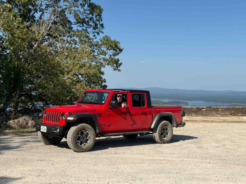
Loved it, 2025 gladiator sport s with 35’s, 2.5” Clayton long arm lift and rock jock anti rock sway bar.
Trail was just the right amount of challenge for myself and my 14 year old. I let him drive t...

Brad
No Rating
Temporary Closure
Visited: 06/14/2026
Unsure if they will open it due to the amount of downed trees. I will reach out to the ranger district and see what I can find out and will post a new review
Jason Clatt
Official Crew
Rated 5/5
Open
Visited: 06/14/2026
what a treat!! To think we have the ability to explore areas and find such amazing trails with fairytale style camping areas. I came across this spot around 10 AM and made my way back to it at 5 PM ...
Jason Clatt
Official Crew
Open
Visited: 06/13/2026
I attempted this in a stock 2026 4runner TRD Off Road. I got to waypoint 3 no problem. Just past way point 3 is a very deep and short crossing. I did not think I would be able to get through it withou...
JL
Jordan Leicht
No Rating
Partially Open
Visited: 06/13/2026
its closed to ohv at waypoint 10
BD
brian d
Rated 5/5
Open
Visited: 05/30/2026
i actually planned part of my route (135mi) to include this section simply because of the pictures and descriptions. loved it
Jason Clatt
Official Crew
Rated 5/5
Open
Visited: 05/30/2026
found myself on this road as a connector trail, didn"t know all the amazing camping areas nor the amazing overlook of the lake. It was a great place to stop and make lunch.
Jason Clatt
Official Crew
Rated 5/5
Open
Visited: 05/23/2026
This trail presents a significant challenge, rewarding off-road enthusiasts with breathtaking views. Expect off-camber rock ledges and a notorious swamp section with numerous mud pits. The destination...
Jason Clatt
Official Crew
No Rating
Open
Visited: 05/16/2026
Trail was in great condition all the creek was dry sense no rain today but me and my friends had a blast on the trail and we will be back to finish the last part
A
Anthony
No Rating
Open
Visited: 05/09/2026
After 40 years of being in the passenger seat I am. now driving! This was day 3 of me being behind the wheel. I appreciated an easy trail!
SW
Susie White
Rated 5/5
Open
Visited: 04/26/2026
Carwash Falls was a good time today. Even though it rained quite a bit the night before, the water coming off the cliff face wasn’t crazy. The road is in great shape with some small puddles in spots. ...

Shayne Danielson
Official Crew
No Rating
Seasonal Closure
Visited: 03/31/2026
According to this trails management agency, the trail is likely closed for the season.
You can reach out to the agency for more details.
Be sure to leave us a report and let us know ...

Trails Offroad
Rated 4/5
Open
Visited: 03/21/2026
It was a fun little road, I went at dawn it dead ends into a homestead so you need to turn around. But nothing to challenging.
Shark Bait Jeep
Shark Bait Jeep
No Rating
Seasonal Closure
Visited: 03/15/2026
According to this trails management agency, the trail is likely closed for the season.
You can reach out to the agency for more details.
Be sure to leave us a report and let us know ...
Trails Offroad
No Rating
Seasonal Closure
Visited: 03/01/2026
According to this trails management agency, the trail is likely closed for the season.
You can reach out to the agency for more details.
Be sure to leave us a report and let us know ...
Trails Offroad
Rated 4/5
Open
Visited: 02/27/2026
This was a great experience. Prior to this I have run some trails in Moab and two other Badge of Honor trailes in Oregon. The loose rock and dirt made for a very different experience than those ones...
MS
Michael Shortle
No Rating
Open
Visited: 12/28/2025
When wet, this trail becomes quite the test! The ruts are a fun challenge but most can be bypassed
Kevin
No Rating
Open
Visited: 12/22/2025
tight trails and some steep slippery hills but nothing to be scared of does havea few deep creek crossing .
BD
brian d
BD
brian d
Rated 5/5
Open
Visited: 11/26/2025
This is a very fun trail that provides a perfect warm up for the beginner to intermediate off roader. Sadly it is no longer a Jeep BOH trail but don't let that stop you from including it in your day...

Michael S Rusinko
Rated 5/5
Open
Visited: 11/26/2025
Rubicon Ridge definitely makes you earn your badge! There is no turning back after the initial drop off. You are committed for about an hours ride of awesome steep descents, climbs, and thrilling of...
Michael S Rusinko
Rated 5/5
Open
Visited: 11/26/2025
This trail is awesome! A must do trail for off any road enthusiast in the Arkansas area. We drove 8 hours and had a great time winding through the Arkansas woods earning our Jeep Badge of Honor. A ...
Michael S Rusinko
No Rating
Open
Visited: 11/08/2025
Fun trail a little spicy at the end with a stock jeep , but definitely doable .
BD
brian d
Rated 4/5
Open
Visited: 10/30/2025
Most of the road is smooth gravel with light washboarding here and there, making it suitable for any high-clearance vehicle and most SUVs. The drive stays on the ridge for much of the route, offering ...

Brent
Official Crew
Rated 5/5
Open
Visited: 10/20/2025
I started the trail at the vista and went down. I had my offroad camper so took it nice and slow the 1st few miles through the rocky section. The trail was alot of fun and could be a nice trail to ru...


craig
No Rating
Open
Visited: 10/19/2025
Jumped on after driving Dare Mine (to loop back to highway). Little more exciting than Dare Mine - more stream-type crossings (although many were dry). More active trail. Saw a number of campers. Stil...
JD
Jon Dickinson
No Rating
Open
Visited: 10/19/2025
Sunny day. About 20 hours after rain storm. Trail essentially dry (but not dusty). Aired down to 25 PSI. Easy trail with some minor (but fun) stream crossings. Occasional rocks less than 3" but some u...
JD
Jon Dickinson
Rated 5/5
Open
Visited: 10/19/2025
Loved this trail! The views are worth the drive alone. Trail itself was not very difficult but I’m sure with enough rainfall there could be concern in a few spots.

RS
Ryan Safarik
Rated 4/5
Open
Visited: 10/12/2025
My first off-road in my 2023 Gladiator. It was fun but a little more intense than my wife wanted😜. It was a great first experience…
BT
Brad Teague
Rated 4/5
Open
Visited: 10/07/2025
The drive begins on a broad gravel surface that gradually narrows as you move deeper into the forest. Expect moderate washboarding through the midsection, especially after dry spells or heavy traffic....
Brent
Official Crew
Rated 3/5
Open
Visited: 10/07/2025
The road begins as a well-graded gravel surface and gradually narrows as it ascends into higher elevations. Expect mild washboarding and occasional rocky patches, especially after rainfall. While the ...
Brent
Official Crew
Rated 5/5
Open
Visited: 10/07/2025
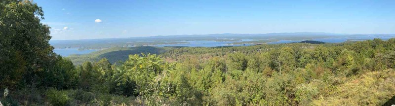
Shores Lake Road (Forest Service Road 1501) winds through some of the most scenic terrain in the Ozark National Forest, connecting Highway 215 near Shores Lake Recreation Area to the upper forest rout...
Brent
Official Crew
Rated 5/5
Open
Visited: 10/06/2025
This trail has large rocks that will likely require a spotter. The trails are very narrow, covered in tree limbs, with logs that you must go over as well as downed trees that you must go around via al...
Jason Clatt
Official Crew
Rated 4/5
Open
Visited: 08/03/2025
Very fun trail but took well over 3 hours because it was so narrow with most places very overgrown with trees. I have major pin stripping because of it. Spent most of the day in 4 low. Creeks were dr...
JP
J Parker
Rated 5/5
Open
Visited: 07/14/2025
Great trail! No 4x4 needed. The creek was around 12-14 inches deep. Great views from this trail! I highly recommend for a beginner.
HC
Holly Cobb
Rated 5/5
Open
Visited: 07/10/2025
Drove today, was great and clear. Had a few muddy/wet spots near some of the overlook locations. Be aware of full road dip somewhere around mile 24!

Joseph M.
No Rating
Open
Visited: 07/05/2025
Drove this today. Everything was good but everyone should be aware to the giant full road dip at around mile 24.
JP
J Parker

Todd
Official Crew
GW
Gracey Williams
No Rating
Open
Visited: 06/14/2025
Lived up to its name. Steep and slick
JB
Jim Baker
Open
Visited: 06/14/2025
Great trail, went through with a stock Gladiator in 33s. Only dinged the rock sliders pretty good. I dinged my rock sliders on 35s with 2.5in lift in a JKU. My wife didn't like it at all. lol
JB
Jim Baker
Rated 2/5
Open
Visited: 05/24/2025
This trail is surrounded by dense tree cover, providing plenty of shade and a secluded feel, especially in the summer months. While the foliage limits long-range views, it adds to the immersive forest...
Tony Cress
Official Crew
Rated 4/5
Open
Visited: 05/24/2025
Beautiful scenic drive. Typically, 2 wheel drive vehicles with high clearance is all that would be needed. Depending on rainfall amounts, 4x4 could be required.
Tony Cress
Official Crew
Rated 3/5
Open
Visited: 05/24/2025
Very peaceful and scenic drive, I saw turkeys and deer along this trail. There is one spot where the culverts have been uncovered by recent heavy rainfall. I suspect this will be repaired quickly. Eit...
Tony Cress
Official Crew
Rated 3/5
Open
Visited: 05/24/2025
This is a fantastic place to camp and hike. Incredibly peaceful along Little Cedar Creek when its running. If it is raining, pay close attention to rising water levels when camping here. You can be tr...
Tony Cress
Official Crew
Rated 2/5
Open
Visited: 05/24/2025
This trail provides easy quick access to Cedar Creek Lake from North Fork Road. The washout and water crossing will probably be dry most of the year.
Tony Cress
Official Crew
Rated 3/5
Open
Visited: 05/23/2025
Along the route, you'll catch occasional glimpses of Cove Creek Lake through the trees, offering a peaceful preview of what’s to come. The final descent down to the dam is an enjoyable stretch with ju...
Tony Cress
Official Crew
Most Popular


Updated: 04/28/2024
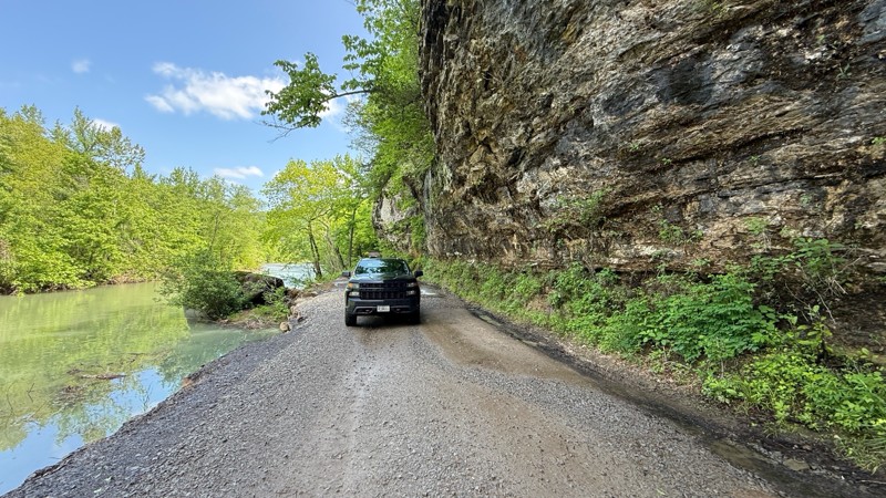
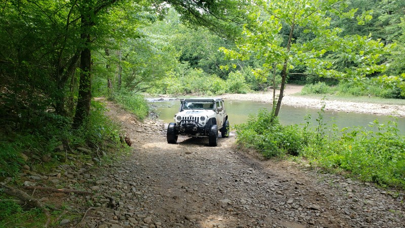
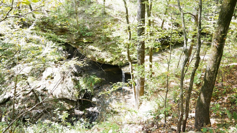
Carwash Falls
Open
/
Hagarville, Arkansas/
5.55 miles/
About an hour
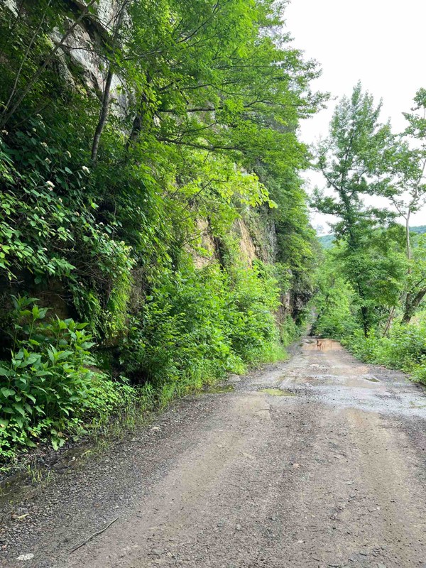
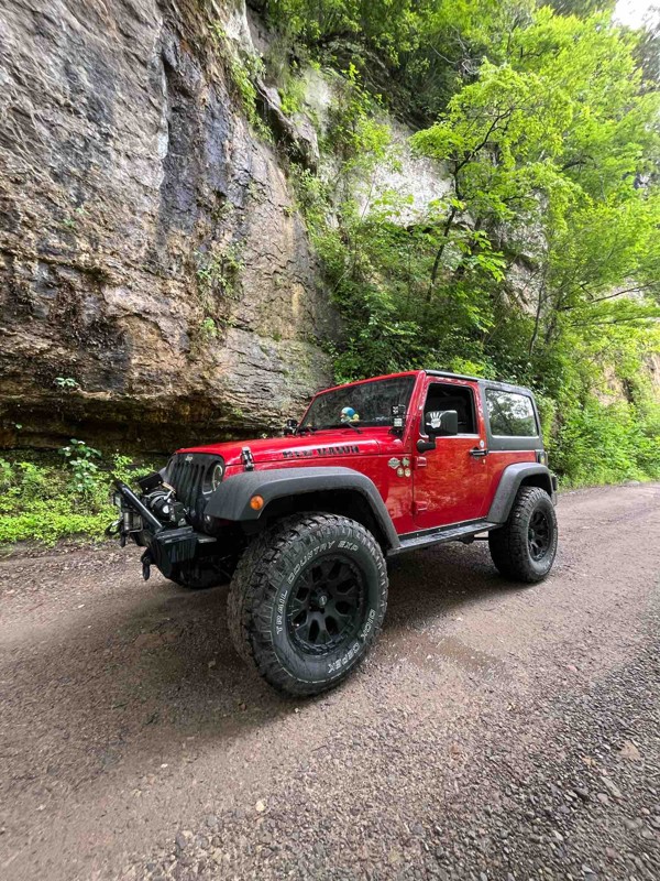
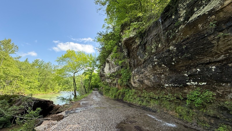
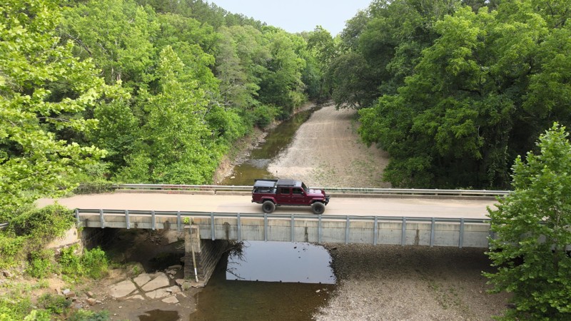
Big Piney Creek flows south out of the Ozark Mountains down to its confluence with the Arkansas River near Russellville Arkansas. This area is popular with canoeists, kayakers, tubers, hikers, bikers, SXS/ATV riders, hunters, fishermen, and anyone that loves the outdoors. The trail parallels Big Piney Creek and Hurricane Creek most of its length, offering beautiful water and foliage views along the way. The highlight of the trail is Carwash Falls, where a stream spills over the top of a small limestone bluff onto the road before entering Big Piney Creek.

Updated: 07/05/2024
Rubicon Ridge D1 - Hot Springs ORV Park
Open
/
Hot Springs, Arkansas/
1.99 miles/
About an hour
Rubicon Ridge is one of four trails at Hot Springs ORV Park where you can earn a Jeep Badge of Honor. For avid off-road enthusiasts, it is on the "must do" list, as the trail consists of a myriad of challenges depending on the weather and trail conditions. You get everything from steep downhill and uphill grades, loose gravel, slick clay/dirt, larger rocks, off-camber sections, and beautiful scenery all combined on a two mile trek you won't soon forget.

Updated: 08/01/2023
Fun Run G3 - Hot Springs ORV Park
Open
/
Hot Springs, Arkansas/
0.97 miles/
About 40 minutes
Fun Run is one of four Jeep Badge of Honor trails you can wheel at Hot Springs ORV Park, and the most difficult of the four if you take the hard lines. It is a beautiful mile of wooded, rocky, and technical terrain that you don't want to miss. Moderate to hardcore wheelers will enjoy taking the hard line at Waypoint 5 with the three+ foot boulders to climb. Put your rig to the test and earn that badge!

Updated: 06/10/2023
Indian Creek Road
Dover, Arkansas
If you're interested in discovering the Ozarks' raw natural beauty in its purest form, look no further than Indian Creek Road! Indian Creek Road may seem like just another gravel road at first, but it most certainly is not. It only takes about 1/2 of a mile to realize the serenity and soothing nature that Indian Creek Road provides. As you work your way down the switchbacks under the marvelously captivating forest canopy and after the first few stream crossings there's no doubt you'll want to travel this road time and time again. The forest canopy continues throughout a large majority of the trip and the sounds of the forest let you know it is alive, from the birds chirping to the soothing sounds of Indian Creek flowing in the valley below to the sounds of the coyotes howling at night. Indian Creek Road has a couple of excellent primitive camping areas with access to the creek that will not disappoint! The area around AR-123 is an amazing place to explore in the Ozark National Forest and with the growing popularity of overlanding on the rise, Indian Creek Road makes a fantastic place to set up a base camp. You're definitely going to want to drop this one in the Ozark National Forest bucket!

Updated: 02/05/2025
Snake F19 - Hot Springs ORV Park
Open
/
Hot Springs, Arkansas/
2.73 miles/
About 2 hours
Snake earns its name by winding back and forth, up and down, and through the picturesque woods of Hot Springs ORV Park. Clocking in as one of the longest trails within the park, Snake is a "must-do" trail for those looking for a leisurely yet mildly challenging drive. From mild off-camber sections to hill climbs and descents, Snake is a great trail to introduce a new driver or new rig to off-roading.

Updated: 07/15/2023
Winona Auto Tour Scenic Drive
Perryville, Arkansas
There are multiple reasons folks travel from all over the state to enjoy the Winona Auto Tour Scenic Drive! Throughout its 26 miles of gorgeous Arkansas scenery, the Winona Auto Tour offers numerous places to set up camp and unwind. The marvelous views from the overlooks and vistas are abundant and make for a truly relaxing drive through the mountains of the Ouachita National Forest. On this trek, you will venture across several of the mountain ridges in the Winona area: Oak, Wildcat, and Crystal Mountains just to name a few and there are several others with astounding landscape and beautiful forest canopy. There are plenty of neighboring roads and trails that branch off into other parts of the forest and it's not uncommon for people to spend an entire weekend exploring and enjoying nature around the Winona and Flat Side Wilderness areas. If you are looking to get your tires off the pavement and onto a scenic gravel road you won't want to miss out on the Winona Auto Tour Trail!

Updated: 05/25/2024
Hickory Nut Mountain Road
Royal, Arkansas
Located just 20 miles west of Hot Springs is a beautiful overlook of Lake Ouachita. This is an excellent Sunday drive with a little excitement on the way to the top of Hickory Nut Mountain Vista. It starts off as a leisurely stroll down a gravel road with amazing Arkansas scenery. About halfway when it turns off the main road is where it gets a little more interesting. At this point, the terrain is slightly rougher. The view from the top on a clear day is nothing short of amazing and definitely worth the trek up there. There is dispersed tent camping just down from the overlook and hiking and mountain biking trails are nearby if one is feeling adventurous.

Updated: 02/05/2025
Quartz Canyon - Hot Springs ORV Park
Open
/
Hot Springs National Park, Arkansas/
1.82 miles/
About an hour
Tucked away in a remote corner of Hot Springs Off Road Park’s 1,242 acres, Quartz Canyon offers a rugged, roller-coaster ride through dense forests and rocky hills. Winding through steep climbs and descents beneath a canopy of hardwood and pine, you'll navigate a mix of dirt, gravel, and loose, basketball-sized rocks. Off-camber sections keep things interesting, while the rhythmic crunch of tires on stone adds to the adventure. To truly embrace the experience, and save yourself from a bone-jarring ride, airing down your tires is essential, improving both comfort and control as you conquer this trail.

Updated: 08/26/2022
Felkins/Meyer Bridge
Hector, Arkansas
Felkins / Meyer Bridge trail is a unique and wonderful trail north of Hector, Arkansas, in the heart of the Big Piney Ranger District. This trail skirts between two ridges through a valley and parallels Mill Creek. Along the route are multiple water crossings and amazing scenery unique to the Ozark National Forest. This trail makes an excellent cut-through from Granny Gap Road to Adams Mountain Road with the added feature of dispersed camping. During winter, the forest opens up, exposing several high rock walls and cliffs. A lush green canopy shades this trail during spring and summer. Due to the trail's proximity to water, keep a lookout for wildlife.
Updated: 06/10/2023
Dare Mine Road
Dover, Arkansas
The road name is derived from the nearby 1972 foot tall Dare Mine Knob.
Although no known mining activity actually exists. Interestingly, several mining claims were made in the area under the General Mining Law of 1872, but no mines are recorded past or present. For your purpose, Dare Mine Road provides a short drive through the Ozark National Forest and provides access to other more engaging routes. This road can be used as a great connector road traveling east and west, allowing a bit more off-highway time as you explore the Ozark National Forest.

Updated: 06/05/2022
Angling Creek
Jessieville, Arkansas
Hidden just on the edge of the Ouachita National Forest is an excellent county road most folks have never heard of, Angling Creek! Angling Creek is going to take you on an epic adventure for the better part of an hour. Throughout the trip, there will be several creek and stream crossings. There are also some magnificent views of the natural state and you are sure to see some wildlife at some point. Angling Creek offers just about everything a person could ask for in a trail so it's guaranteed there will be a little something for everyone. If you're looking for an excellent trail around central Arkansas, you definitely need to put this one on your shortlist!

Updated: 08/26/2023
Brown Creek Cascade - Flatside Pinnacle
Perryville, Arkansas
Beautiful dirt road less than an hour from Little Rock, Arkansas with plenty to do! Camp by a creek, walk through the woods to see a waterfall/cascade, and a short hike to enjoy a gorgeous view of the Ouachita National Forest. You can even park and hike part of the 192-mile long Ouachita National Recreation Trail that extends all the way to Oklahoma. If any or all of that sounds like your cup of tea, this trail would be a great way to spend a half day or more outdoors, even if you aren't camping. Waterfall chasing has become a popular pastime, and Brown Creek Cascade is one you can check off your list here. The sunsets atop the Flatside Pinnacle Vista have been described as some of the best in Arkansas. Get out and enjoy what "The Natural State" has to offer!

Updated: 07/15/2023
Alum Fork
Jessieville, Arkansas
Alum Fork or Forest Road 114 is an excellent way to navigate through the beautiful Ouachita National Forest without ever having to touch the pavement. It has several dispersed camping areas, and winds it's way around Lake Winona if you're wanting to catch some fish or get the kayak on the water. Wildlife is rampant in this part of the forest and it's not uncommon to see deer and turkeys on any given day. Forest Road 114 is a wonderful way to do a little overlanding and experience some of the scenery the "Natural State" has to offer.

Updated: 12/17/2023
Ritter
Jessieville, Arkansas
This fun 3 1/2 mile trail is tucked away in the beautiful Ouachita National Forest. The area around Lake Winona is exceptionally scenic but doesn't offer much as far as obstacles or anything technically challenging, except for Ritter. Ritter is one of the most difficult trails in the area and if you and your rig are up for the task, it's a lot of fun! There are several washouts throughout the trail, some of which are fairly deep, and a small water crossing towards the end of the trail. It can be traveled either way and provides shortcuts to several other roads in the area with a little challenge along the way. It is approximately 20-25 miles from Hot Springs which is known for its historical bathhouses and other tourist attractions.
Updated: 09/14/2022
Nowlin Hollow
Hector, Arkansas
The Ozarks are known for their beautiful forests, clear creeks, and rocky outcroppings. Nowlin Hollow is an excellent microcosm of the 1.2 million-acre Ozark National Forest wrapped up in a short journey. The road follows the river at the bottom of Nowlin Valley in the forest's heart. The multiple water crossings you will experience on Nowlin Hollow are memorable and picturesque. You will find each crossing more inspiring than the last as you take in this idyllic forest journey. Make sure you have a camera for this adventure as you slow down and take in the sights, sounds, and smells of this national treasure. Because this trail is not along the beaten path, travel with other off-roaders as you will not come across many other vehicles during this trail ride.

Updated: 06/05/2022
Muse Mountain
Perryville, Arkansas
Muse Mountain or FR778 is an adventure packed 8.4-mile trip through the Ouachita National Forest. This trail has a little something for everyone's taste of off-roading. Muse Mountain offers a water crossing, camping, mud, a little bit of optional off camber and some marvelous scenery of the natural state. This portion of the forest is a wildlife management area. It's not uncommon to encounter sightings of deer, turkeys, coyotes and even the occasional bear.
Updated: 06/05/2022
Boyd Road
Dover, Arkansas
Located just shy of 4 miles north of the increasingly popular Falling Water Road trailhead, lies a quaint little trail most folks have never heard of, Boyd Road. Boyd Road/1008 makes an excellent addition to any Ozark National Forest Overlanding route! It's a fun peaceful ride that's not "just another gravel road". It offers not only serenity but a bit of challenge as well. But what if you're just looking for a day ride? Well, it's excellent for that too! Boyd Road appears to start as any other typical gravel road but quickly transitions to a trail working its way down Chinquapin Knob Mountain. There are several little stream crossings and a couple of larger ones to appreciate. Around the halfway mark you'll cross Cedar Creek. Cedar Creek makes an excellent place to stop for lunch and play in the water. Directly following the creek is the old Boyd Cemetery you can stop and check out. The rumor is it's haunted if you believe in that sort of thing. Regardless of whether it is or is not, it's definitely nostalgic, and as most old cemeteries do, it has a bit of an eerie feel. The Ozarks are filled with gorgeous fascinating places to explore and this is another one you won't want to miss!

Updated: 10/15/2024
FR 93687
Victor, Arkansas
FR 93687 is a slightly difficult trail with a bit of everything: water crossing, mud, rocky hill climb, and pin striping. This is a very pretty forested Jeep trail that will challenge the unprepared. The deep holes have bypasses, so vehicless with few mods will have no issues. Just pay attention and go slow and steady.

Updated: 05/08/2024
Main Road 5 - Hot Springs ORV Park
Open
/
Hot Springs, Arkansas/
1.5 miles/
About 20 minutes
Main Road 5 has some great views of the Ouachita Mountains at the trailhead and trail end, and connects to a few of the best "3" rated trails in the Park (based on the Park's 1-5 scale.) A beginner would enjoy driving this rocky trail just for the experience, as there are numerous rocky sections and 12"+ rocks one can conquer if so desired. Rubicon Ridge (one of the Park's iconic trails) begins at the end of Main Road 5, and is part of the Jeep Badge of Honor program.
Updated: 06/05/2022
Lindsey Road
Hector, Arkansas
Are you are looking to kick up a little dust, ford a water crossing, or take a dip in a cool mountain stream? Or maybe you just simply want to kick back in a lawn chair and listen to the crackle of the fire and the crickets chirping while you stare at the stars. If so, then the Ozark Mountains are where you want to be, and more specifically Lindsey Road. Lindsey Road has a great spot to stop and cool off on a hot summer day at East Fork Illinois Bayou! If you're into chasing waterfalls Lindsay Road also houses the trailhead for Fiddlehead Falls! When you're done with that you can pick out one of the dispersed camping areas to set up camp. Nothing is better than sitting down to a fresh camp breakfast and listening to the bird's chirp to make you feel alive and get ready for what the day has in store. So grab your swimming suit and your camping gear and come check out this area of the Ozark National Forest! Oh, and don't forget the camera.

Updated: 07/19/2023
Deberrie Road
Jessieville, Arkansas
Deberrie Road/607 offers a variety of scenery in this 10-mile excursion through the Ouachita National Forest! It starts off as a quaint little forest road, after traveling about halfway you'll drive through an incredibly captivating forest canopy. Then on to see Wallace Bridge, Fourche LaFave River and picture-perfect fields with the Ouachita Mountains in the background! When you "stack" Deberrie Road with Doyle Springs/207, Forest Road 29000, Trail 86 to West Forked Mountain/124 and the Winona Auto Tour Scenic Drive, you'll have hours worth of trail riding adventure!

Updated: 05/08/2024
Main Road 1 - Hot Springs ORV Park
Hot Springs, Arkansas
Originally established in March of 2002 as Superlift Off-Road Vehicle Park, Hot Springs Off-Road Vehicle Park is considered an off-road Mecca by many. The trails are well marked and rated from one to five diamonds (one being the easiest, five being the hardest.) According to HSORV Park's own trail map, a five diamond trail is described as "These are the "real deal" obstacles for the hard-core off-roader. Go with at least 36" tires and all the other truck stuff. Mechanical and body damage is the norm. These trails require a co-driver/spotter and the driver's undivided attention. Bring a camera and a clean change of underwear." The Park's trail map is located here: Hot Springs ORV Park Trail Map and is a great reference for trail rating, rules, and regulations. You will also see on the map there are trails that are intended for motorcycles and/or SxS's/ATV's/UTV's only (no SUV's allowed.) If you are traveling from afar, plan on staying a while. You can wheel on the trails for days and not even make it to half of them. Anyone from beginner to expert can come and get their money's worth out of several days of trail riding or extreme rock crawling. After a day on the trail, you can shower up at the Park and head downtown to enjoy what Hot Springs has to offer. HSORV Park is only 5 miles from downtown Hot Springs. The city itself is a huge tourist attraction. From the beautiful scenic views atop Hot Springs Mountain Tower, a fun and refreshing day at Magic Springs Theme and Water Park, or enjoying the history of the city in the downtown spas or Gangster Museum of America, there is something for the whole family. Oaklawn is close by if you like to wager on horses or play some electronic gaming such as poker or blackjack. You could easily stay a week and not take it all in.
Updated: 06/05/2022
Payne Ridge Road
Dover, Arkansas
Located in the Boston Mountains of the Ozark National Forest, Payne Ridge Road is a delightful trail that follows along the Payne Ridge in the heart of the forest. The drive along the ridgeline offers the opportunity for views of the thick, colorful Ozark hardwoods. The trail is near the unincorporated and very rural Victor, Arkansas, which was formally named Morning Shade, Arkansas. Payne Ridge Road is popular with hunters in the fall season because of its ease of access. Payne Ridge Road is a choice route if you desire to explore through the Ozark Mountains while looking to avoid pavement.
Updated: 01/18/2026
North Fork
Thornburg, Arkansas
North Fork, marked as Ouachita National Forest Road 86, or Trail 86 in the Winona Wildlife Management Unit, has bridge crossings, views of the Forked Mountain, valley views, creeks, and camping areas. Just off the road, a hiking trail follows a creek with several small cascading falls. An interesting bluff in the parking area seems to be a local favorite for camping. Several other trails connect to this trail making for a long list of adventurous routes you can combine together. This is an easy dirt track that you can take any vehicle on and enjoy the sites.

Updated: 09/03/2022
North Fork Saline River Trail
Perryville, Arkansas
This serene shaded route takes you near the heart of the North Fork Saline River. Nestled down in a valley, the fork of the river actually starts along this trail from the water run off! Traveling through the wet valley along the North Fork Saline River grants access to cool temperatures, and due to proximity of water, the chance to view some of Arkansas' native wild life!
This route is a great cut through to take when coming back from Crystal Mountain Peak or the Winona Auto Tour to avoid the drone of plain dirt / gravel roads.
Updated: 04/03/2025
Barker
Hector, Arkansas
A quiet, peaceful journey awaits as you travel along Barker Road. Situated near one of the main roads crossing the Ozark National Forest, Barker provides a great off-highway access point into the heart of the forest while experiencing a small waterfall along the way. This road is an excellent start to your journey through the spectacular Ozarks National Forest.
Updated: 05/28/2026
Cove Creek Crossing
Odell, Arkansas
Cove Creek Crossing is a very easy, scenic, smooth, graded dirt road in the Ozark National Forest connecting Cove Creek Road and Old Cove City Road at the intersection with Bug Scuffle Road. The thick forest along the road shines with Fall color. Along the way, numerous spur trails spread out into the forest with varying degrees of difficulty. Most require a 4WD with high ground clearance. There are also a few spots along this road with fire rings where you can pull off to camp.
Updated: 01/17/2023
C16 - Hot Springs ORV Park
Hot Springs National Park, Arkansas
C16 is a lesser traveled off-road trail at Hot Springs ORV Park, possibly due to its difficulty level (or maybe the lack of a catchy name?) If you love extreme downhill grades on large, loose rocks or you enjoy scaring your passengers to death you will love it! Most people that rock crawl think of going up and over, but C16 is all about the downhill slide at Waypoint 4. Experienced wheelers will enjoy the challenge, as it demands every bit of attention and experience you can muster.

Updated: 06/05/2022
The Loop F17 F42 - Hot Springs ORV Park
Open
/
Hot Springs, Arkansas/
0.72 miles/
About 10 minutes
Excitement awaits off the path of this wooded connector trail! The entrances to some of Hot Springs ORV Parks most popular destinations are accessed here. One of the three Jeep "Badge of Honor" trails the park has to offer can also be accessed from The Loop. It can stand on its own as an easy, shaded drive through the woods, with a few water/mud holes and a spring crossing along the way. If you are headed down Main Road 1, cut through here on a hot summer day to cool down with under some shade and enjoy the woodland scenery!
Updated: 10/15/2024
Gunner Pool Road
Fifty-Six, Arkansas
In the heart of the Ozark – St Francis National Forest, Gunner Pool Road leads to one of the best swimming holes around. Sylamore Creek runs right through Gunner Pool Recreation Area with camping for the low cost of $10 per night in a rustic, primitive campground complete with pit-toilets, picnic tables, and grills. There are no water or electric sites, but water is available on site. There are also several off-road free primitive campsites along Gunner Pool Road. Sylamore Creek still runs at a very cool temperature in the summer heat for a nice cooling wade or dip, complete with fish and tadpoles. There are hiking trails along this road as well. Gunner Pool Road is a great place to see deer, turkey, squirrels, and occasionally a black bear. A very cool one-lane bridge crosses Sylamore Creek.

Updated: 06/05/2022
Squid's Jaunt G7 to G6 - Hot Springs ORV Park
Hot Springs, Arkansas
Squid's Jaunt at Hot Springs ORV Park is a rock filled, medium difficulty trail that can be enjoyed by both stock and modified 4x4 vehicles. It ascends 366' over the course of half a mile, and is rated a 3 out of 5 on the Park's rating system (which suggests at least 32" aggressive tires and a locking differential). There are enough larger rocks, ledges, and loose gravel to entertain a seasoned veteran. Mildly challenging bypasses around harder sections will also allow a beginner in a stock rig (and use of a spotter) to complete the trail and feel proud to have done so. Traveling from west to east (uphill) is the more challenging route, with a two foot ledge midway up the trail being one of the more notable obstacles. The view back to the west as you get to the top is picture worthy, and warrants stopping along the way to take in the scenery.
Updated: 04/22/2026
Green Mountain Road
Fifty-Six, Arkansas
Green Mountain Road, Forest Road 1113, in the Ozark St Francis National Forest, is a quiet, easy country road that winds through the woods, past historic buildings, and accesses the Sylamo Bike Trail with several trailheads for parking. There are plenty of established pull-offs for boondock camping. From Arkansas Highway 5, Green Mountain Road connects to many more open forestry and county roads worth exploring.
Updated: 07/19/2023
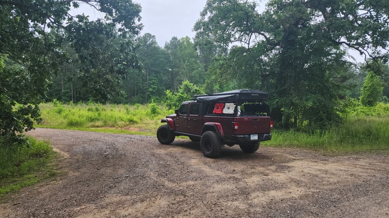
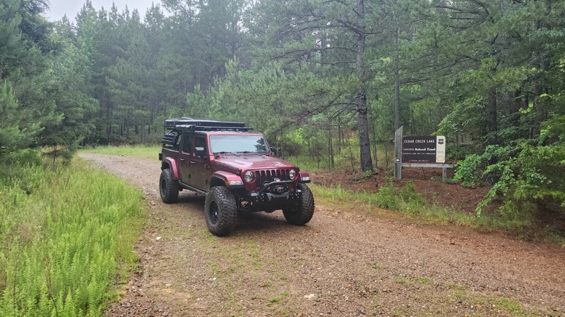
Cedar Creek Lake
Jessieville, Arkansas
Just a mile down Cedar Creek Lake Road off of Trail 86 lies a quiet little lake most folks have never heard of, Cedar Creek Lake. Cedar Creek Lake is an 86 acre flood control lake that has the 4 most common types of fish native to the natural state; largemouth bass, crappie, bream, and catfish. Rates of fishing success vary widely, from not good to spotty to very good, depending on the angler and on the particular occasion when he or she goes after the fish. Cedar Creek Lake is one of 6 watershed lakes in this part of the Ouachita National Forest. This little lake is an excellent place to get the canoe out and take advantage of a mere fraction of what the beautiful state of Arkansas has to offer. There's a ton of great forest roads in the area to explore, one being Little Cedar Creek/FR793 which offers some magnificent camping spots and a short hike to a waterfall. A few more are Ritter/FR211, Muse Mountain/FR778, and Reform Road/FR179. This area of the Ouachita National Forest is known as Flatside Pinnacle. But don't let that deter you from exploring this area of the forest. It has some marvelous scenery you won't want to miss out on!
Updated: 05/31/2024
Power Wagon Point C4 to C17 - Hot Springs ORV Park
Hot Springs, Arkansas
A steep rutted out hill climb and several water crossings are the highlights of Power Wagon Point. The grade of the climb ranges from approximately 20 to 50 degrees and is enough to be exciting, and high clearance is desired to avoid scraping your undercarriage. During this write-up, the depth of the rutted out area was miscalculated, and a camera lens met its fate in the middle of the trail. The first water crossing can be deep after heavy rains, so proceed with caution! Power Wagon Point is also heavily wooded, so it can provide respite from the hot sun on a sweltering summer day. This is a one way only trail and is marked as such. Do not attempt to run it backwards, as it would be almost impossible to move off to the side of the trail in some spots.
Updated: 10/11/2025
Roaring Springs Road
Optimus, Arkansas
Just off of FR 1119 in the Ozark National Forest is a technical trail with several big rock formations to the sides of the trail, a wet weather creek area, and everything from sand to shelf rock on the trail. Several areas with large ruts made it more suitable for a 4x4 vehicle with a 2-4 inch lift and larger tires. The hardest section, where you have to climb up the sandy washed-out bank, is the reason for the difficulty rating. There were no established camp areas on this little trail but several along surrounding forestry roads.
Updated: 10/15/2024
Old Cove City Road
Odell, Arkansas
Old Cove City Road is an easy scenic dirt road in the Ozark National Forest running between the 3-way intersection with Bug Scuffle Road and Cove Creek Crossing and paved Lee Creek Road, State Highway 220. Like Cove Creek Crossing, numerous trails spur off this road. Most notable is Pannell Road, a popular technical route for 4x4 vehicles with high ground clearance.
There aren't many places to camp on Old Cove City Road. However, there are a few roadside spots and campsites on the spur trails in the area. A 4x4 vehicle may be required to access those spots on the spur trails.

Updated: 07/15/2023
Reform Road
Perryville, Arkansas
It's a well-known fact that this area of the Ouachita National Forest is incredibly picturesque, but doesn't offer anything very challenging or technical. However, there are a handful of fun trails in the area that are more "trail" like and not so much scenic gravel road, and Reform Road happens to be one of them! Reform Road offers a variety of just about everything in its 4.5 miles. It could be said it's the "total package" as far as trails go. In the first 2 miles, there will be mud, washouts, rock stair steps, and a couple of camping locations. Then the rest is a casual gravel road climb up to the increasingly popular Winona Auto Tour Scenic Drive. If you are wanting to get out and explore this area of the Ouachita National Forest and are looking for something a bit more "trail" oriented you'll want to check this one out for sure!
Updated: 06/10/2023
Black Berry Loop
Hector, Arkansas
This shady route takes you into the shady recesses of the Ozark National Forest. After the first bend it will take you through the sun and several patches of wild black berries ( Warning: these encroach upon the trail times and will scratch your rig. See route description). If you catch them in season, they will be the sweetest black berries you've ever eaten, and at times can easily be picked from your rig just by rolling the window down (see warning above / route description).
This lush portion of the forest, with it's sweet fruit and closeness to the Illinois Bayou, make it home to some of Arkansas' most known wild life. Animal sightings are common on this trail, including deer, hogs, and black bears, so have your cameras ready! (remember: these are wild animals, and you should never approach them. Follow tread lightly principles!) Finally, for the brave, you can take a quick hike down to the bayou if you split off at Waypoint 4.
Updated: 06/05/2022
Forest Road 94 - Flatside Wilderness
Perryville, Arkansas
Forest Road 94 is a great detour off the Winona Auto Tour Scenic Drive up to the beautiful Flatside Pinnacle overlook, or drive this heavily wooded road on through to Trail 86 to explore the Ouachita Mountains even more. Being well maintained by the Forest Service, anyone that doesn't mind dust and gravel can enjoy this scenic connector trail and have a fun day exploring!
Updated: 06/19/2022
93054N
Hector, Arkansas
This technical trail in the Ozark National Forest is an excellent way to save time by cutting from Adams Mountain Road to North Fork Road in order to continue exploring other areas of the forest. This short trail is a great way to dodge those mundane gravel roads, do a little technical driving, and get in some good experience and practice with a spotter. Be warned, though. You WILL NEED a spotter to deal with the washouts. It's not the hardest trail, which makes it PERFECT for beginner off-roaders with a good spotter, or medium experienced off-roaders with a beginner spotter wanting to get practice. Don't let the short length of this fool you; this trail offers plenty of excitement with a challenging hill climb/descent, washouts in the middle of the trail, and an exciting stair-step rock climb on the west end.
Updated: 10/15/2024
Bee Hollow Road
Mount Olive, Arkansas
Bee Hollow is a scenic, wooded drive with creek crossings, mountain views, a lot of pinstriping, overgrown areas, and moderate rock climbing. It is located in the Ozark St Francis National Forest between the towns of Mountain View, Arkansas, and Calico Rock, Arkansas. Stay on the trail since it runs behind the Sylamore gun range. You will see warning signs when you reach that area. During October, the trail has amazing fall colors. There are several creek crossings, be aware of water levels during the rainy season and watch for washout spots along the tops of the creek beds. Due to the rocky terrain and deep ruts, there are several off-camber spots along the trail. The trail begins off Arkansas Highway 5 - Sylamore Scenic By-Way. Expect to send a couple of hours on this trail.
Updated: 02/01/2024
Doyle Springs
Jessieville, Arkansas
Doyle Springs/207 is an excellent connector road to get from Deberrie Road to the Forest Road 29000, Trail 86, Forest Road 94 intersection. It is at this intersection that a host of forest road exploration awaits! Doyle Springs is a lovely forest road where you are sure to see some type of wildlife at some point during the excursion, whether it be deer, turkeys, coyotes and even the occasional Bald Eagle! There is really no "wrong turn" from the intersection, whichever way you decide is bound to be terrific!
Updated: 10/15/2024
County Road 14
Woolum, Arkansas
Searcy County Road 14 runs through the Richland Elk Preserve in Arkansas. The scenery is ever-changing, with a creek crossing, mud puddles, fields that are part of the elk preserve, epic bluffs, and the majestic Buffalo River. At one time, the county road continued across the Buffalo River, past Woolum campground, and followed the river back to the highway. However, CR14 washed out on the Woolum side of the Buffalo River and has been barricaded for some time with no projected repair date. Depending on your vehicle’s height and capabilities, you can still cross to the Woolum campground, which is basically a large field beside the river with pit toilets. Searcy County Road 14 connects to Searcy County Road 12 and, at this time, ends at the Buffalo River crossing.
Updated: 10/15/2024
Wilderness Trail
Lost Corner, Arkansas
Wilderness Trail is a nice wide country road with a few historic buildings along the way. The buildings are on private property, so you must enjoy them from the road. Several hiking trailheads along the road have designated parking areas to stop and stretch your legs. Towards the east end of the road you will start seeing more and more residences. Wilderness Trail is a nice relaxing drive.
Updated: 10/15/2024
Tie Ridge Road
Optimus, Arkansas
Tie Ridge Road, County Road #1112, which also turns into County Road 55/Tie Ridge Road, runs through the Ozark – St Francis National Forest from Highway 14. Around the middle of Tie Ridge Road is Bark Shed Campground with vault/pit toilets and trash cans but no other amenities. At Bark Shed, there is a wonderful little swimming hole, an old bridge, hiking trails, and beautiful bluffs. Tie Ridge Road has everything from woods, bluffs, Sylamore Creek, camping, and hiking trails. The trail makes for a wonderful day ride or weekend campout.
Updated: 06/05/2022
Alum Divide
Jessieville, Arkansas
The Ouachita National Forest is a great way to get away from the hustle and bustle of everyday life. Alum Divide/961 is an excellent road to take and slow things down. Alum Divide offers several options. You can watch the wildlife in their natural habitat, listen to the birds, or stop at one or all three of the low water bridges and enjoy the relaxing melody of the water as it flows down Bread Creek. There are several forest roads to choose from that branch off of Alum Divide that lead to other areas of the Ouachita National Forest. Such as Ritter, Alum Branch, and Alum Fork just to name a few. No matter what your decision is it won't be a disappointment. Often times the best excursions are the ones with no real destination in mind.
Updated: 10/15/2024
Brushy Creek Road
Advance, Arkansas
Brushy Creek Road, FR 1116, in the Ozark St Francis National Forest, runs adjacent to the Leatherwood Wilderness. The road is packed full of valley views, wildlife, and peaceful places to camp or picnic. It is an out-and-back road that ends on Cleveland Knob. Brushy Creek Road is an easy ride with very little traffic.
Updated: 10/15/2024
North Barkshed Road
Big Flat, Arkansas
Ozark-St. Francis National Forest Road 1108, locally called Barkshed Road, is the north end of a road that ends at a closed bridge at the Barkshed Recreation area. The road is gated off about a mile from the closed bridge. It is a nice easy drive through the forest with several OHV trails branching off for further exploration.
Updated: 10/15/2024
Wooten Road
Tag, Arkansas
Wooten Road starts just off Highway 7 north of Dover, Arkansas. It is a nice forest road with many mud puddles (even in August). It also has few small off camber spots, and a bit of pin striping. No camping was noted.
Updated: 05/08/2024
Main Road 2 - Hot Springs ORV Park
Hot Springs, Arkansas
Main Road 2 near Hot Springs, Arkansas is one of the most used roads in Hot Springs ORV Park. There is a lot going on close to the Trailhead; a cabin to rent, the office/store, the front entrance to the pavilion, and the bathrooms/showers are all within 100 yards of each other. The pavilion is a great place to come off the trails, enjoy some shade, and eat your lunch. If you didn't pack enough to eat or drink you can find something to sustain you in the store. Main Road 2 is also the quickest way to get to Main Road 5, which has some of the highest elevations and best views of the Ouachita Mountains in the Park.
Updated: 01/17/2023
4x4 Rock Hop G19 - Hot Springs ORV Park
Hot Springs National Park, Arkansas
4x4 Rock Hop G19 is another great connector trail at Hot Springs ORV Park to get out of the sun and enjoy some shade. Grab a seat at the covered picnic table, relax, and recharge before continuing on to the excitement awaiting on Fun Run G3, one of Jeep's "Badge of Honor" trails. The "Kids Zone" at Waypoint 3 is a great place to let the younger ones enjoy some time on their four-whee
About Hot Springs ORV Park:
Originally established in March of 2002 as Superlift Off-Road Vehicle Park, Hot Springs Off-Road Vehicle Park is considered an off-road Mecca by many. The trails are well marked and rated from one to five diamonds (one being the easiest, five being the hardest.) According to HSORV Park's own trail map, a five-diamond trail is described as "These are the "real deal" obstacles for the hard-core off-roader. Go with at least 36" tires and all the other truck stuff. Mechanical and body damage is the norm. These trails require a co-driver/spotter and the driver's undivided attention. Bring a camera and a clean change of underwear." The Park's trail map is located here: Hot Springs ORV Park Trail Map and is a great reference for trail rating, rules, and regulations. You will also see on the map there are trails that are intended for motorcycles and/or SxS's/ATV's/UTV's only (no SUV's allowed.) If you are traveling from afar, plan on staying a while. You can wheel on the trails for days and not even make it to half of them. Anyone from beginner to expert can come and get their money's worth out of several days of trail riding or extreme rock crawling. After a day on the trail, you can shower up at the Park and head downtown to enjoy what Hot Springs has to offer. HSORV Park is only 5 miles from downtown Hot Springs. The city itself is a huge tourist attraction. From the beautiful scenic views atop Hot Springs Mountain Tower, a fun and refreshing day at Magic Springs Theme and Water Park, or enjoying the history of the city in the downtown spas or Gangster Museum of America, there is something for the whole family. Oaklawn is close by if you like to wager on horses or play some electronic gaming such as poker or blackjack. You could easily stay a week and not take it all in.lers or SxS's, as no big rigs are allowed in their loop.
Updated: 06/05/2022
Twin Hills East A15 to A23 - Hot Springs ORV Park
Hot Springs, Arkansas
If you want to start the day off with a rush of adrenaline and a sense of accomplishment, Twin Hills East will give you that and more. Experience, a built rig, and a lack of self preservation are all highly recommended. Seriously though, taking the harder obstacles requires close attention, and a seasoned spotter is highly recommended. You can easily roll a vehicle here, and a flop would most likely result in tumbling to the bottom of the trail. Be sure and forewarn passengers it will be very steep and off camber. Optional gear would include a change of clothes and a blindfold. The view of Squid's Jaunt from the top of Twin Hills East is at its peak during the green months, as the contrast between the green foliage and dusty trails is very pleasing.
Updated: 07/15/2023
29000
Jessieville, Arkansas
It's no secret that the Ouachita National Forest is one of the best free playgrounds for offroaders in the natural state. Forest Road 29000 is no exception. There's nothing better than hitting a dirt road and smelling the fresh mountain air! Not only does 29000 offer the dirt road and the fresh mountain air. It also harbors a stunning view of Forked Mountain and the rolling hills of the Ouachita National Forest. So don't forget to bring your camera because you're not going to want to miss this incredible photo opportunity!
Updated: 06/05/2022
Crystal Mountain
Jessieville, Arkansas
Crystal Mountain or Forest Road 75 is an excellent way to travel from Alum Fork to Winona Forest Drive/132, which is a large part of the increasingly popular Winona Auto Tour Trail. Crystal Mountain will take you north or south depending on your preferred destination. This will save a lot of time since it connects the two roads closer to the middle resolving the issue of having to travel all the way around. If the goal is to be time efficient, this is the road to take.
Updated: 01/17/2023
Bilstein Ravine B19 - Hot Springs ORV Park
Hot Springs National Park, Arkansas
Recommended for all creekbed junkies and those that like to show their flex! The v-notch is the highlight of the trail, and you are in it right at the start. Grab the wheel, pick your line, and have a great time showing off your rig's abilities. Once you pass the v-notch, you can take a breath and enjoy the rest of the trail as you navigate the creek bed and take in the sights and sounds of the forest.
Updated: 10/15/2024
Culp Road
Calico Rock, Arkansas
Nestled in the Ozark National Forest, between Sylamore and Calico Rock, Arkansas, just off Highway 5, is Culp Road, an easy trek to City Rock Bluff and Historic Culp. This area was settled in the 1800s by Thomas Culp. City Rock Bluff was one of his points of trade and is preserved by the Ozark National Forest and Stone County Historical Society. It is an easy two-wheel drive with a spectacular view of the White River from the bluff. This short out-and-back trip is just a little over three miles and well worth the time if you are in the area.
Updated: 06/05/2022
Sesame Street C3 - Hot Springs ORV Park
Hot Springs, Arkansas
Sesame Street is a very short, 5-diamond (the highest rating at HSORV) trail that will challenge you and your rig. It is one of the easier 5-diamond trails at the Park, but don't let your guard down. It is worth running Power Wagon Point to get to it, and is challenging enough to become one of your "go to" trails. It is also a great spot to test suspension or bumpstop changes.
Updated: 06/05/2022
Fairchild
Jessieville, Arkansas
Fairchild or Forest Road 135 is a 2.7 mile short cut from Alum Fork/114 to Lake Winona Drive/132, which is a part of the increasingly popular Winona Auto Tour Trail. Fairchild offers a short mud bog, a couple of dispersed camping spots and 1/2 mile of a fairly steep incline with some mildly sharp switchbacks before arriving close to the top of Crystal Mountain. Whether time is of the essence or you're just exploring the beautiful Ouachita National Forest this is an ideal road to travel. Because of the short mud bog, only high clearance vehicles are recommended.
Updated: 05/08/2024
Samurai Way B13 to B28 - Hot Springs ORV Park
Hot Springs National Park, Arkansas
What a beautiful way to enjoy the day at Hot Springs ORV Park! Samurai Way is slightly less than a half-mile long, but packs in something most everyone can enjoy. There are beautiful views down the power line, exciting ascents and descents, some mild off-camber sections, and even a water/mud hole and a small creek crossing along the way. This is a great trail to introduce a new off-road driver to, and even a seasoned veteran will enjoy the open-air scenery.
Updated: 06/05/2022
Reform Point
Perryville, Arkansas
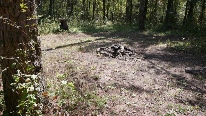
Reform Point is a 1.34 mile all gravel forest road that can be traveled either way and connects Lake Winona Road and Reform Road/FR179. There are several reasons to make the short trek down Reform Point/FR715. 1: It provides a bypass for the tough section of Reform Road/FR179 for vehicles not up to the challenge. 2: It provides a short cut from Reform Road/FR179 back to Lake Winona Road. 3: It provides a straight-through pass from Lake Winona Road to Lake Winona Drive/FR132. 4: It has a dispersed camping area with plenty of shade and a rock fire pit.
Updated: 10/15/2024
Charleston Road
Austin, Arkansas
Set in the Ozark-Saint Francis National Forest, Charleston Road begins shortly after you cross a levee. You can see the established camping area overlooking the small lake from the levee. As soon as you turn onto this road, you can drive up into the camp area to set up for your rides. There is an area large enough for a group to camp. There are several driving trails as well as walking trails a short distance from the camp area.
Updated: 05/14/2025
Twin Knobs
Savoy, Arkansas
A smooth graded dirt road with patches of gravel and occasional potholes. Suitable for low clearance 2 wheel drive cars. This area of the Ozark National Forest has very little in the way of dispersed campsites, however there is one nice large campsite on this road capable of housing a group of 5 to 10 rigs.
Updated: 01/17/2023
Michael’s Way D5 - Hot Springs ORV Park
Hot Springs National Park, Arkansas
Adrenaline junkies only need apply! Michael's Way is all about the rocks, and big ones they are. The first set is just a teaser of what's to come. If tire lifting, bumper dragging, and spinning tires are your idea of fun this trail is the place for you. It is a short split in the trail at Waypoint 5 of Rubicon Ridge D1, but if you make it through it may be the most memorable.
Updated: 10/15/2024
93054
Tag, Arkansas
This short trail is for those who like to get muddy and enjoy a couple of creek crossings. It has a few Toyo sticking holes to test your new winch rope. Just watch out! Some of the holes are very deep.
Updated: 10/15/2024
Forest Road 1652
Ben Hur, Arkansas
Morris Ridge, Forestry Road 1652, part of the Ozark St Francis National Forest, connects with Pope County Road 1008 and Arkansas Highway 16. Morris Ridge is a rough dirt, through road, with plenty of spots for camping and wandering in the woods. It appears to be a local hunting spot, so check seasons, use caution, and wear orange if you intend to explore out of your vehicle. The road has washed out and rocky areas. Expect some off-camber. Morris Ridge Road is just a few miles from Pedestal Rocks and Kings Bluff hiking trails if you are also looking for a scenic hike.
Updated: 10/15/2024
Mountain Ridge Road
Advance, Arkansas
Mountain Ridge Road connects to County Road 72 and Forestry Road 1116 in Big Flat, Arkansas. The valley views from Mountain Ridge are inspiring. There is a beautiful area to pull off and camp or just hike and explore the bluffs. The road doesn't appear to be traveled often but is also used for horseback riding, so be alert. There are several off-camber areas, ruts, and rocks. Sway bar disconnects are recommended.
Updated: 10/15/2024
FR 1139
Optimus, Arkansas
FR 1139 is an easy scenic road in the Ozark National Forest. The trail is a mix of evergreen and hardwood forests. You could see many types of wildlife, from deer to small black bears, in this area. It is not a technical drive and would be awesome for a nice leisurely jaunt through the forest. This road would be especially beautiful in the fall and winter months.
Updated: 10/15/2024
County Road 114
Advance, Arkansas
Baxter County Road 114 in Arkansas is a picturesque out-and-back road that ends at the Cartney Access to the White River, a great trout fishing spot with a rustic camp area. CR 114 crosses two spectacular creeks and passes breathtaking bluffs. It also connects with several other scenic county and forest roads. CR 114 is an easy gravel road suitable for all vehicles.
Updated: 10/15/2024
FR 93219
Tag, Arkansas
This trail was rocky and muddy. There is a creek crossing with a nice place to have lunch on the creek bed. You will want to take a right at the fork and then a left at the “T” the other roads are dead ends. This trail ends at Freeman Road (FR 1815).
Updated: 10/15/2024
Perry Creek
Advance, Arkansas
Forest Road 91002A, in the Ozark-St Francis National Forest, is a scenic out-and-back road that follows Perry Creek. At one time, there was a through road running adjacent called Perry Creek Road However, it seems to have been allowed to grow up and is inaccessible now. FR 91002A is a moderate trail with creek crossings, mud puddles, and forested campsites. During the wet season, the creek crossings could be an issue so be aware of the rain levels in the area before attempting the trail.
Updated: 01/17/2023
Tex-Winder F15 - Hot Springs ORV Park
Hot Springs National Park, Arkansas
What a great trail to see what a new driver or rig can accomplish. Tex-Winder lives up to its name...how else can you pack .7 miles of trail into such a small area without multiple switchbacks and turns! It would be a great trail to add to any new guys list, requiring little use of 4WD, but demanding your attention so as not to run into any trees! Shaded and running several miles in the woods, it is a must-do if you have never been to Hot Springs ORV Park.
Updated: 10/15/2024
County Road 72
Advance, Arkansas
County Road 72 near the town of Big Flat, Baxter County, Arkansas, ends at a horse camp and nature hike. The hike will take you to Buffalo River, about a mile down the trail. There is a small creek crossing before you reach the river. County Road 72 is an easy drive for any vehicle but connects to the more difficult Mountain Ridge Road, which has epic bluff views. County Road 72 is a nice wooded country drive with mountain views, creeks, pastures, barns, horses, and donkeys.
Updated: 10/15/2024
Cole Fork Road
Big Flat, Arkansas
Spurring off FR 1108 in Ozark-St. Francis National Forest, FR 1125 follows a bluff line and a creek with awesome views. The road ends at the Sycamore Creek hiking trail and a forest campsite. OHVs tracks cross the creek, but the MVUM does not show the road continuing.
Updated: 01/17/2023
Dam Road F13 - Hot Springs ORV Park
Hot Springs National Park, Arkansas
The anxiety per mile factor is extremely high on Dam Road! A precarious hill climb in Hot Springs ORV Park located between Pond Road and Main Road 2, it is less than one-tenth of a mile long and only one obstacle. The trail starts off innocent enough by a woodland pond. The real excitement begins when you turn the corner and start your climb. To the delight of some and the demise of others, you must carefully approach the washed-out area and pick the correct line, or risk dropping into the center of the trail. Dam Road will appeal to those who enjoy more challenging risks, as the consequences for your rear tire slipping off the edge could be dire. If you love excitement, it would be perfect to add to your day of wheeling after you run Rover's Ravine F7.
Updated: 07/15/2023
Cedar Mountain
Jessieville, Arkansas
Do you love zigging and zagging through the national forests? Do you enjoy exploring side roads and seeing wildlife in their natural environment? Or maybe you are planning an overlanding trip and looking for the best route. Cedar Mountain has several side roads that lead to plenty of exploration and wildlife. It is also great for connecting many of the main forest roads together for a multi-day overland route. Regardless of whether you are looking for a good connector road for an overlanding trip, or just wanting to kick up a little dust, you'll want to put this short little forest road on the list!
Updated: 05/08/2024
Grand Cherokee Challenge B4 - Hot Springs ORV Park
Hot Springs National Park, Arkansas
If you enjoy driving on a country road, hearing the crunch of gravel under your tires and the flashes of light and shade from the canopy of the trees, Grand Cherokee Challenge B4 is an off-road destination for you! Located in Hot Springs ORV Park, it is short three tenths of a mile connector trail between Main Road 2 and the trailhead of Samurai Way B13 to B28, but is much more than that. If you are headed to Samurai Way B13 to B28, take Grand Cherokee Challenge, put some more crushed stone under your tires, and experience the feeling of a slow country drive.
Updated: 10/15/2024
Webb Lake Road
De Valls Bluff, Arkansas
Webb Lake Road is an easy, straight-through gravel road that begins on the south side of the White River Rest Area on Interstate 40 and ends at Highway 70. In dry conditions, the trail is easily accessed by any two-wheel-drive vehicle. There is fishing at Webb Lake and several designated camping sites. An offshoot near the beginning of the trail allows access to the north side of Webb Lake. After passing Webb Lake, the trail winds around a small unnamed lake with great scenic views.
Updated: 04/10/2026
Lowder Road
Gobblers Point, Arkansas
Lowder Road in the Ozark-Saint Francis National Forest is a fun dead-end road through the forest with several creek crossings. The creeks are seasonal and have some potential for a lot of water during the rainy season. The trail has a few mud puddles, some pin striping, and rocky/off-camber terrain. Lowder Road is not an especially long road but was well worth the ride.
Updated: 05/08/2024
Main Road 3 - Hot Springs ORV Park
Hot Springs, Arkansas
Main Road 3 is a smooth, short drive through the woods. It is not much in itself, but does lead to the entrance to C13 "Power Wagon Point", which is a 2 rated trail in the Park's rating system and a fun washed out hill climb. You can also make a scenic loop through the woods on "Waterfall" (B22 - B25) and end up back on Main Road 3.
Updated: 10/15/2024
Pear Tree Road
Cleveland, Arkansas
Pear Tree Road is a nice smooth county road with many jeep trails branching off as you drive further into the Ozark St-Francis National Forest. The road meanders through some farmland and into the pine forest . In the Fall, as the colors change, this will be a nice beautiful Sunday drive. No camping.
Updated: 06/05/2022
Pond Road F14 to F2 - Hot Springs ORV Park
Hot Springs, Arkansas
Pond Road near Hot Springs, Arkansas is a nice leisurely drive through the woods, complete with a stream crossing and a shaded picnic table by the pond. It is also a scenic cut-through between Main Road 1 and Main Road 2 that can be driven in either direction. If you are partaking in all the other off-road trails in Hot Springs ORV Park, this is a fun road to simply enjoy the scenery.
Updated: 10/15/2024
FS 93053A
Solo, Arkansas
FS 93053A offers an enjoyable and moderately challenging ascent that caters to various offroad preferences. Driving northwest from Felkins/Meyer Bridge, you quickly encounter a creek crossing, which can be dry or up to 2+ feet deep during wetter months. Once across the creek, FS 93053A takes you across mixed terrain of loose dirt, clay, smaller rocks, and soccer to basketball-sized rocks. A steady 12-16 degree pitch and 746-foot elevation change through scenic hardwood and pines boosts your adrenaline, and expansive views of the canopy elicit feelings of driving through an enchanted forest. Expect both slight off-camber sections and possible pin-striping from overgrowth along the trail. There is a mostly firm-bottomed water hole with some softer mucky areas for a tinge of excitement, which can reach depths 3 feet even in drier seasons. This trail has a couple of good options for dispersed camping. There is one pull-off area large enough for 1-2 vehicles and another spot close to the top end of the trail, which can accommodate 7-10 vehicles and features a large established fire ring. FS 93053A is recommended if you enjoy scenic hill climbs through wooded areas, want an alternative route back to Adam's Mountain Road without completing Felkins/Meyer Bridge and Barker, or are looking for a stopover to camp during your next overland adventure.
Updated: 06/04/2026
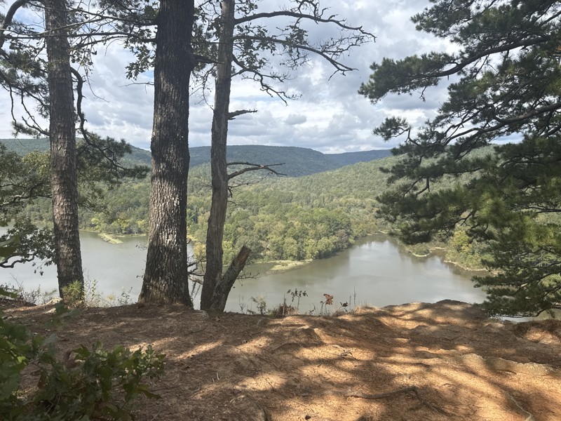
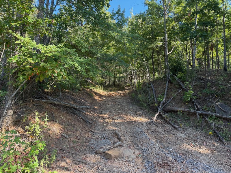
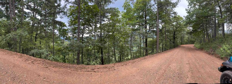
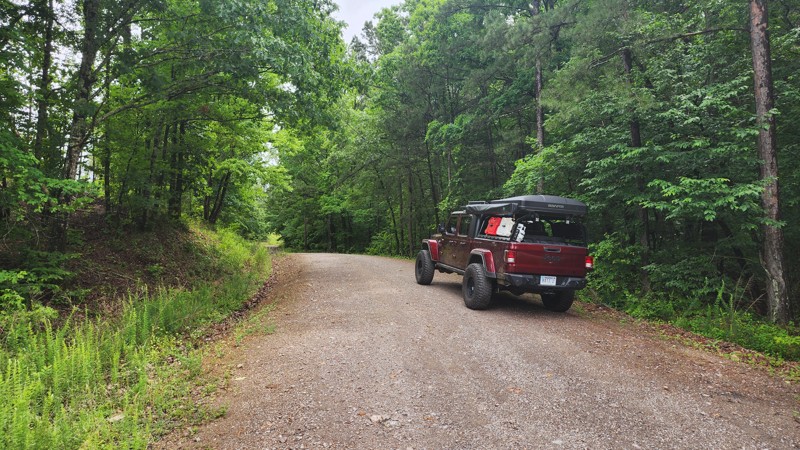
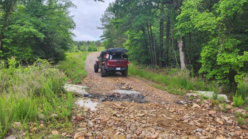
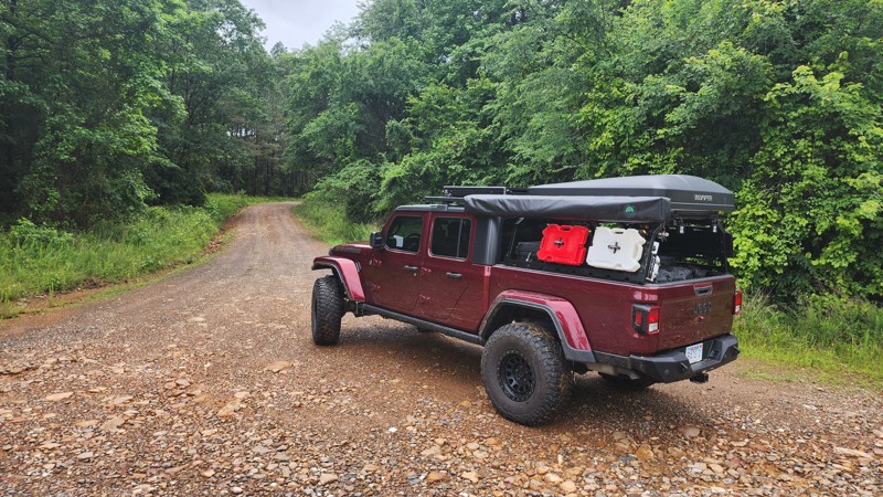
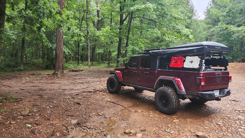
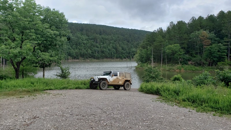
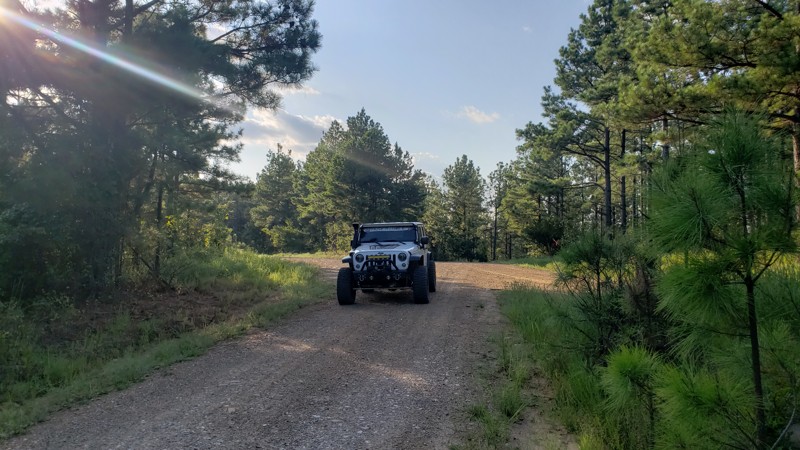
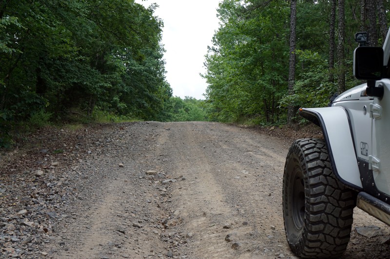
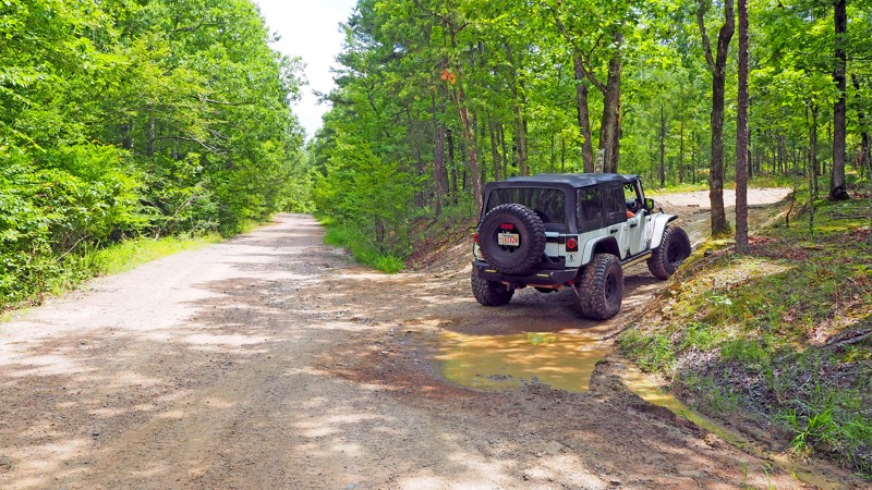
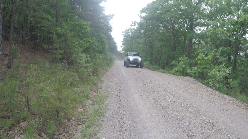
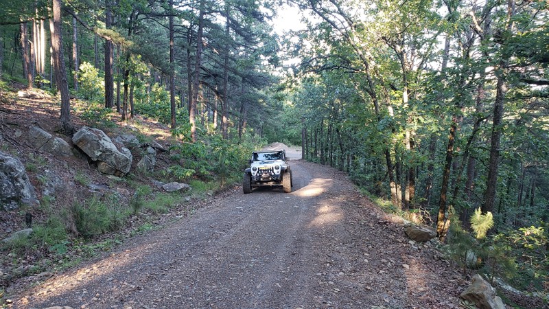
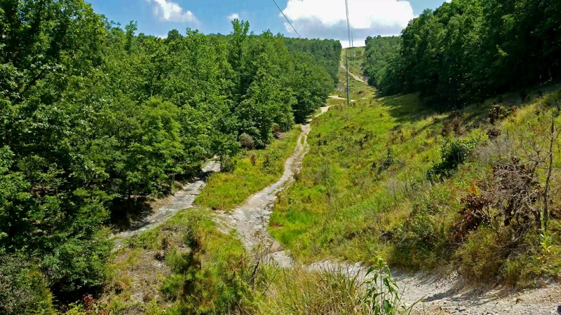
Shores Lake Road
Cass, Arkansas
Shores Lake Road (FSR 1501) is primarily a well-graded gravel road with light washboarding and a few shallow washouts, especially after heavy rain. The route is passable in almost any vehicle, though a high-clearance rig will make for a smoother ride. The climb from the lake gradually gains elevation through dense hardwoods and pine, with occasional clearings offering sweeping glimpses of the valley below.
Several side trails branch off along the way, many leading to primitive campsites or short exploratory spurs perfect for off-roaders wanting to stretch their legs. The road is wide enough for easy passing, and navigation is straightforward, though cell service can be spotty; offline maps or a printed MVUM are recommended.
Highlights:
- Stunning overlook of Shores Lake from upper pull-offs near the ridge
- Multiple side trails and dispersed campsites along the route
- Direct access to the Shores Lake Recreation Area and nearby hiking loops
- Connects with FSR 1003 to White Rock Mountain for extended exploration
Updated: 01/17/2023
Rover's Ravine F7 - Hot Springs ORV Park
Hot Springs National Park, Arkansas
Rover's Ravine is a hidden gem amongst the 1200 acres of trails Hot Springs ORV Park has to offer. A gorgeous drive upstream and through the woods will calm your day, and Waypoint 5 will really get your blood pumping! Take a turn at Waypoint 2 of Pond Road, drop into the creek bed, and enjoy the sound of the creek and woodland scenery. The extreme off-camber and tight squeeze at Waypoint 5 will appeal to those who enjoy picking a perfect line. It takes an experienced driver or patient spotter to avoid body damage or a flop, but that just adds to the excitement of the trail!
Updated: 09/29/2025
Little Cedar Creek
Hollis, Arkansas
Traveling alongside the Flatside Wilderness, Little Cedar Creek is an easy, maintained trail with two low water crossings while trekking through a dense forest canopy, on its way to a fantastic hike to Forked Mountain Falls. This trail is suitable for any vehicle. Along the drive, you can find one Campsite on the way in and additional camping at the end of the road next to a large bluff on Forked Mountain.
Updated: 10/15/2024
Driver Creek Road
Cleveland, Arkansas
Driver Creek Road is an easy drive into the Ozark National Forest along a ridge with some nice views. There are many connecting off-road trails for more adventure. You will cross a levee around a lake as you move deeper into the forest.
The road ends at a staging area for OTVs and ATVs with primitive camping
Updated: 10/15/2024
Driver Creek Dam Road
Cleveland, Arkansas
Driver Creek Dam Road is a nice, easy trail through the woods with several trails shooting off from the main roads. Some of the off-shoots are more technical and potentially exciting, particularly during the rainy season due to several creek crossings. There are many staging areas if you are looking to trailer an OHV or ATV for riding. There are also several campsites large enough for your entire group.
Updated: 10/15/2024
Hooper Hollow
Fifty-Six, Arkansas
Hooper Hollow, FR 1108F, spurs off North Barkshed Road in the Ozark-St. Francis National Forest. This short side road winds through the woods and ends in a clearing on a grassy knoll. Hooper Hollow is a great road to catch wildlife and do a little bird watching. Downed trees are common on this trail. Bring your saw.
Updated: 03/15/2026
Branscum
Optimus, Arkansas
Forest Road #1140, in the Ozark St Francis National Forest, normally connects County Road 26 and Green Mountain Road. Currently, the part on the Green Mountain Road side is closed due to a washout on the bridge. It is still a beautiful, wooded, out-and-back trail with primitive camp areas. In October, the trees are vibrant, and the views are spectacular.
Updated: 05/08/2024
Bulletproof Loop B1 to B7 - Hot Springs ORV Park
Hot Springs, Arkansas
Bulletproof Loop B1 to B7 is a smooth, short, forrest drive down a dirt road. It is very well shaded in the green months, and can be a nice route to run if you need a break from wheeling in the hot sun. There is a small dell that runs along the road on your left, and makes the wooded scenery that much more pleasant. The trail ends in the middle of B4 "Grand Cherokee Challenge."
Updated: 01/17/2023
C11 to C13 - Hot Springs ORV Park
Hot Springs National Park, Arkansas
C11 to C13 is just what its name sounds like, a connector road between a harder trail and a main road, Ingrid's Revenge C6 and Main Road 5. It is short, as in super short. In fact you could line up 18 Jeep JKU Wranglers and cover every inch of this trail! If you want to avoid “The Bowl” on Ingrid's Revenge this would be your bypass route!
Updated: 11/20/2025
Parker Ridge Road
Deer, Arkansas
Parker Ridge Road offers an easy and scenic route along one of the Ozark National Forest’s most beautiful ridgelines. This well-maintained gravel forest road features gentle washboarding in sections, wide-open valley views on both sides of the ridge, and multiple side trails to explore. It’s an ideal beginner-friendly route with big-payoff scenery, especially during fall when the foliage turns the hillsides into a stunning blend of orange, red, and gold. There are also several primitive camping options.
Updated: 06/15/2026
Deer Trap
Bidville, Arkansas
Hidden deep in the Ozark National Forest, Deer Trap Trail is a rugged and narrow path that tests both driver precision and vehicle width. Heading south through dense woodland, the route connects to Forest Road 1003 (White Rock Mountain), eventually leading toward Shores Lake. This secluded section of trail winds through thick hardwood forest, where the canopy closes in tightly overhead, creating a tunnel-like drive with low-hanging branches ready to leave their mark on wider rigs.
Downed timber and tight trail corridors make this route best suited for narrow offroad vehicles. Full-size trucks will struggle to squeeze through without significant pinstriping or risk of body damage. The terrain alternates between rutted dirt, slick roots, exposed rocks, and off-camber sections that require careful line choice, especially after rainfall when the surface becomes slick. While challenging in spots, the drive is immensely rewarding, offering a genuine backcountry feel and a sense of exploration that few other routes in the area provide.
This trail is not well-suited for camping, but a large, open site suitable for groups does exist, less than 1 mile from the southern end of the trail. Some vehicle leveling or creative tent placement will be required in 75% of the area due to the hillside's contour. The other 25% seems flat with little to no leveling
Updated: 10/15/2024
Caney Road
Optimus, Arkansas
Caney Road, FR 1141A, connects to FR 1141 in the Ozark – St Francis National Forest. The trail ends in a secluded field with a nice campsite under several large hardwood trees. Caney Road would be a great place to set up camp and watch for wildlife. Deer, squirrel, and turkey are commonly seen, and occasionally you will spot a black bear or two. There are areas along the road that opens to valley views and beautiful Fall colors. The road goes from graded to field, back to graded. When you hit the field, just follow the tire tracks to pick up the graded road.
Updated: 10/15/2024
County Road 1122
Big Flat, Arkansas
From Tie Ridge Road, in the Ozark – St Francis National Forest, County Road 1122 is a fun little side trek. It's a bit technical and comes with pin-striping, big ruts, and holes. This moderate trail connects to Gunn Road and leads back to Tie Ridge Road. There's no camping on CR1122, but Gunn Road has a few dispersed campsites. County Road 1122 is a good way to get lost in the woods for a bit.
Updated: 12/02/2025
Potato Knob
White Rock, Arkansas
Forest Road 1510, locally known as County Road 77, or Potato Knob on Forest Service maps, winds its way through the rugged heart of the Ozark National Forest. This maintained gravel route steadily climbs in elevation, offering a classic backcountry drive that’s perfect for those looking to explore the high ridges north of Shores Lake and White Rock Mountain.
Expect mild washboarding. The road is wide enough to pass at most points. There is a steady climb in elevation. There are several offshoots for more trail exploration and many dispersed camping options.
There is primitive camping on this route, but there are only a few in this section.
Updated: 01/17/2023
B14 to B22 - Hot Springs ORV Park
Hot Springs National Park, Arkansas
Are you looking for excitement on Bilstein Ravine, or just wanting a leisurely drive through the woods? B14 to B22 delivers both! Its entire length is a pine and hardwood canopied connector trail with a small creek crossing that flows almost year-round. It would be a great trail to add to a day of just cruising around taking in the sights and sounds of nature. Or, you take a turn onto Bilstein Ravine at Waypoint 3 and pump your adrenaline a bit!
Updated: 06/04/2026
Fanes Creek Road
Bidville, Arkansas
Fanes Creek Road is a scenic back road in the Ozark National Forest that delivers a mix of relaxed exploration and classic Ozark character. Winding along forested ridges and dropping into low creek valleys, this route offers a little more texture than your average forest road, with frequent washboards, mild ruts, and a few rocky stretches that keep things interesting.
While passable for most high-clearance vehicles, the uneven surface and occasional standing water make it best suited for SUVs and trucks with off-road tires.
Points of interest include Phipps Branch Falls, which is beautiful in the spring. There is a low-water bridge that crosses clear, turquoise water, offering a nice place to see true Ozark beauty. There are several opportunities to explore additional trails and dispersed camping.
Updated: 10/15/2024
Whittaker FR 1102D
Optimus, Arkansas
Whittaker Road, County Road 1102D, spurs off Gunner Pool Road in the Ozark – St Francis National Forest. The trail is a secluded out-and-back that is great for wildlife viewing. It is an overgrown road with pin-striping and a jungle feel. There are several large old oak trees mixed among the pines, with valley views along the way. Whittaker Road is definitely the road less traveled. The trail ends at a large field with several large indentions, which appear to be places where deer herd bed down in the evening. There is an established primitive campsite along the road.
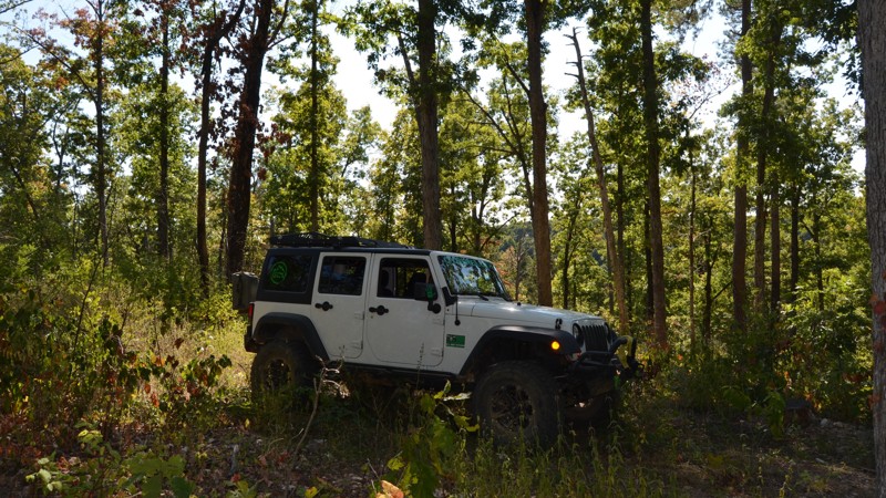
Updated: 10/15/2024
West Caney Road
Optimus, Arkansas
West Caney Road, County Road #1141, is a short out-and-back trail road that feels very mysterious because it is engulfed in the deep woods of the Ozark – St Francis National Forest. The road is overgrown with tall weeds, and there is a lot of undergrowth and trees around the road. There are no designated camp areas along this section, but it connects to several roads that have established camping. West Caney Road connects to Gunner Pool Road. West Caney Road is a great road to find wildlife or just enjoy the peace and quiet of the woods.
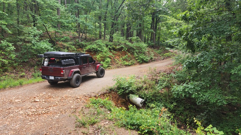
Updated: 09/29/2025
West Forked Mountain
Hollis, Arkansas
Traveling along the western slope of its namesake, West Forked Mountain is an easy, well-maintained dirt and gravel road that connects North Fork to the Winona Auto Tour Scenic Drive. While the views are more open during the winter months, the trail offers a peaceful drive year-round. Running alongside the Flatside Wilderness, it’s a great spot for spotting wildlife and enjoying the quiet beauty of the Ouachita National Forest.
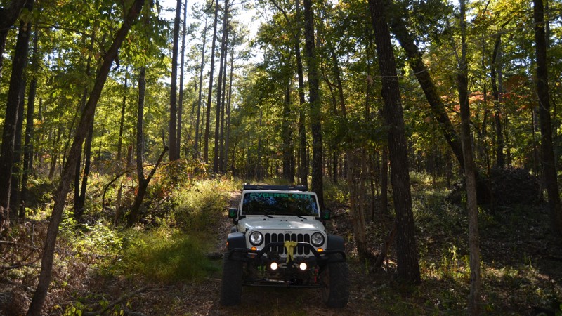
Updated: 10/15/2024
Gunn Road
Fifty-Six, Arkansas
Gunn Road runs between County Road 1122 and Tie Ridge Road in the Ozark – St Francis National Forest north of Mountain View, Arkansas. The hardest part of the trail is a large tree that appears to have been across the road for quite some time, as there is an established “go-around.” The trail crosses a creek bed that will presumably have water during wet weather. A nice, large, mowed field with an established fire ring makes for good camping along the trail. This is a nice place to get lost for a bit and maybe set up a base camp while exploring the roads nearby.
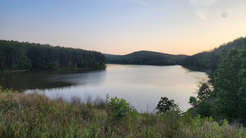
Updated: 08/11/2025
Little Cove Creek
Nimrod, Arkansas
This narrow dirt trail winds through the forest and may leave a few scratches on wider rigs due to overgrown brush in spots. The route is mostly flat and easygoing, making it suitable for stock 4x4s, but it ends with a steep descent down to the dam’s surface. That final section can be slippery or challenging in wet conditions, so use caution. Despite its short length, the trail connects nicely with Cove Creek Lake and offers a more adventurous loop option when combined with Link Mountain.
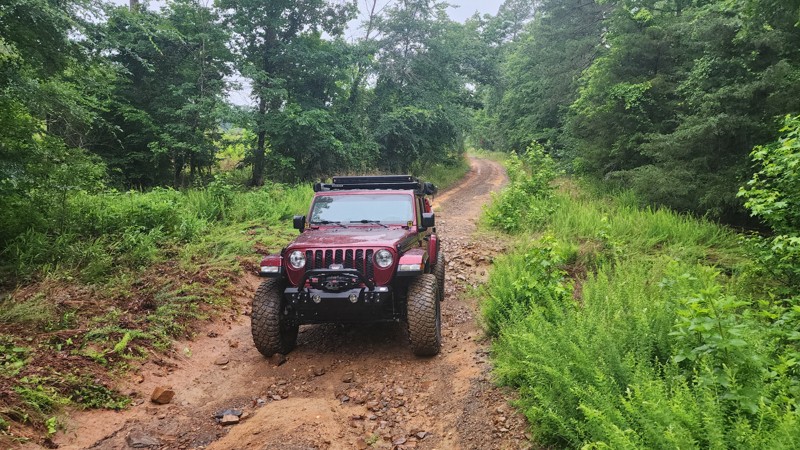
Updated: 09/29/2025
29145
Hollis, Arkansas
This is an easy connecting trail through the Winona Wildlife Management Area, with a washout and a water crossing to navigate. You will need high clearance at least, and possibly 4x4 at times with heavy rainfall. No camping along this trail; however, camping can be found near the end at Cedar Creek Lake.
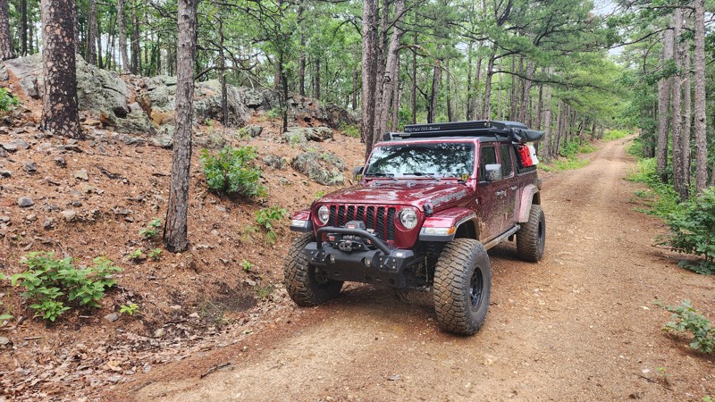
Updated: 09/29/2025
Oak
Hollis, Arkansas
Oak is a short, maintained dirt trail that connects Highway 7 to the Winona Auto Tour Scenic Drive. It is an easy trail, but it does require high clearance vehicles. One fantastic campsite along this trail has an incredible view.
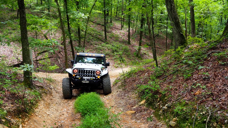
Updated: 01/28/2025
F16 - Hot Springs ORV Park
Fountain Lake, Arkansas
Take this fun hill climb while you are on Tex-Winder F15 for some added excitement. Take it slow and make it technical, or blaze up the hill, get sideways, and throw some dirt! If you happen to be there during rain or the wet season, you will be throwing mud and in for a real challenge trying to make it to the top.
Camping is not found directly along this trail. Cabins, primitive tent camping sites, RV campsites with 30 and 50-amp electrical and water hookups, and primitive RV sites are all available in HSORV Park from Thursday through Sunday nights. They also have a nice restroom/shower house on-site and a convenience store with snacks, drinks, tools, apparel, and other sundries. Firewood and ice are also available, and there is a 3900-square-foot pavilion that provides a nice place for shade on a hot day. There are also numerous bed and breakfasts, hotels, campsites, and RV parks within a 15-minute drive from the park if you wish to stay elsewhere.
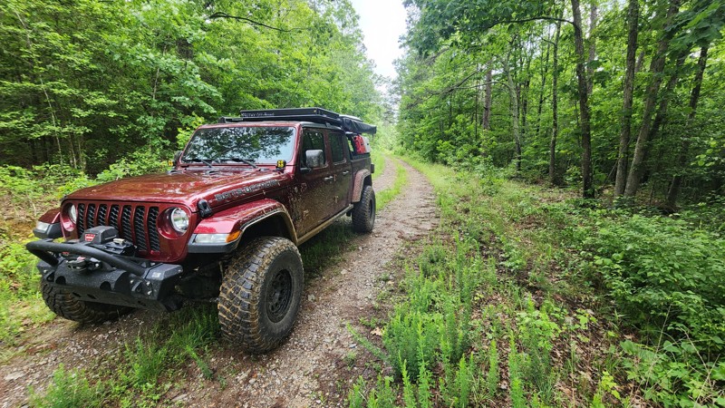
Updated: 09/29/2025
Alum Branch
Hollis, Arkansas
Alum Branch is an easy, short, well-maintained dirt/gravel trail within Ouachita National Forest. It is a great connecting route between Alum Divide and Ritter and is suitable for any vehicle. If you turn left on Ritter from Alum Branch there is a really neat water crossing. The trail is heavily wooded, offering abundant shade. No dispersed camping can be found along Alum Branch.
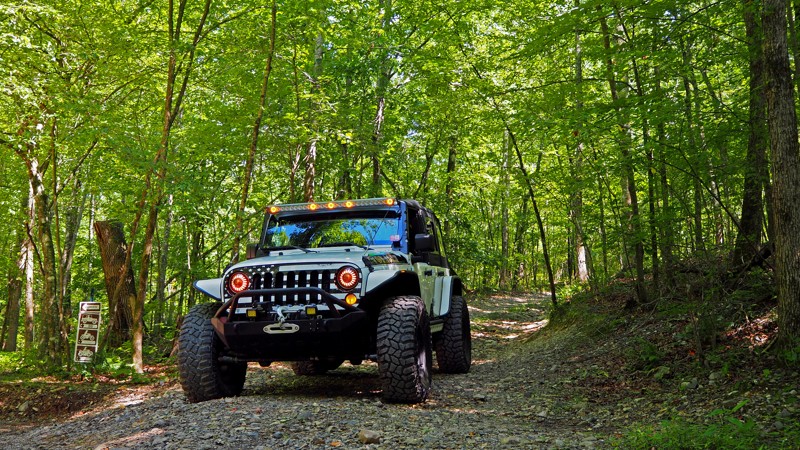
Updated: 01/28/2025
Waterfall B25 to B16 - Hot Springs ORV Park
Hot Springs, Arkansas
Splash your way through the water and take another scenic drive through the woods of Hot Springs ORV Park. This short connector trail is easy on the eyes and easy to drive! Got a Prius...no problem! You can make it through this one if you don't mind a little dirt and mud.
Camping is not found directly along this trail. Cabins, primitive tent camping sites, RV campsites with 30 and 50-amp electrical and water hookups, and primitive RV sites are all available in HSORV Park from Thursday through Sunday nights. They also have a nice restroom/shower house on-site and a convenience store with snacks, drinks, tools, apparel, and other sundries. Firewood and ice are also available, and there is a 3900-square-foot pavilion that provides a nice place for shade on a hot day. There are also numerous bed and breakfasts, hotels, campsites, and RV parks within a 15-minute drive from the park if you wish to stay elsewhere.
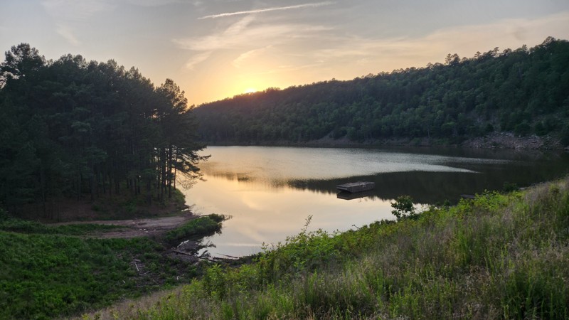
Updated: 10/24/2025
Link Mountain
Hollis, Arkansas
This easy dirt trail winds along a ridge through tall pine forest, offering a peaceful drive and access to scenic campsites. It leads to Cove Creek Lake Dam, a picturesque spot with a boat ramp for those looking to enjoy time on the water. Along the way, a few campsites can be found directly on the trail, with additional camping opportunities available both above and below the dam. The trail is mostly smooth, but there is one minor obstacle where rainwater runoff cuts across the road—visible in the provided photo. For drivers with a high-clearance 4x4 equipped with low range, the route continues across the dam to access Little Cove Creek Trail, which loops back toward Highway 7, making for a nice offroad circuit in the area.
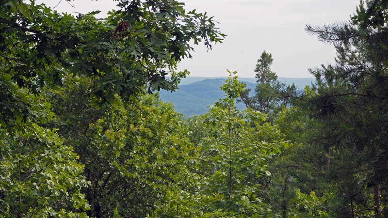
Updated: 09/29/2025
Prothane Point E12 - Hot Springs ORV Park
Fountain Lake, Arkansas
Gorgeous views of the Ouachita Mountains can be enjoyed at the end of this out-and-back trail if you catch it during the fall and winter months. A small peek of their beauty can be seen during heavy foliage. Prothane Point is also a good spot to park off the beaten path of Main Road 5 to escape the dust and heat of the summer. Stop for lunch and enjoy some shade and beautiful views!
Camping is not found directly along this trail. Cabins, primitive tent camping sites, RV campsites with 30 and 50-amp electrical and water hookups, and primitive RV sites are all available in HSORV Park from Thursday through Sunday nights. They also have a nice restroom/shower house on-site and a convenience store with snacks, drinks, tools, apparel, and other sundries. Firewood and ice are also available, and there is a 3900-square-foot pavilion that provides a nice place for shade on a hot day. There are also numerous bed and breakfasts, hotels, campsites, and RV parks within a 15-minute drive from the park if you wish to stay elsewhere.
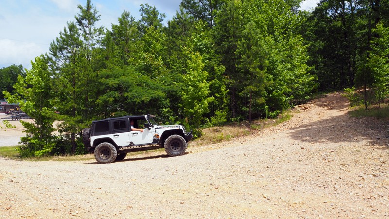
Updated: 03/11/2025
B2 - Hot Springs ORV Park
Hot Springs, Arkansas
B2 is a great way to access Samurai Way B13. It is less than a tenth of a mile long but there is a small bit of excitement. A washed out and rocky spot just as you get going provide a small challenge on what otherwise would be a simple connecting trail.
Camping is not found directly along this trail. Cabins, primitive tent camping sites, RV campsites with 30 and 50-amp electrical and water hookups, and primitive RV sites are all available in HSORV Park from Thursday through Sunday nights. They also have a nice restroom/shower house on-site and a convenience store with snacks, drinks, tools, apparel, and other sundries. Firewood and ice are also available, and there is a 3900-square-foot pavilion that provides a nice place for shade on a hot day. There are also numerous bed and breakfasts, hotels, campsites, and RV parks within a 15-minute drive from the park if you wish to stay elsewhere.
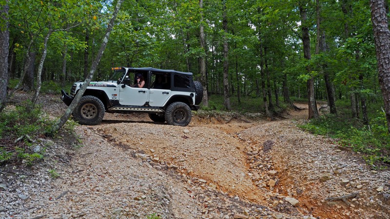
Updated: 01/28/2025
C12 to C11 - Hot Springs ORV Park
Hot Springs, Arkansas
Take a short detour off Power Wagon Point at Waypoint 7 and enjoy the easy, shaded woodland drive on this short gravel connector trail. The trail end also connects to C11 to C13, which is a bypass exit for "The Bowl" obstacle on Ingrid's Revenge C6. If you are lucky, you might catch some buggies or hardcore rigs attempting to make it through.
Camping is not found directly along this trail. Cabins, primitive tent camping sites, RV campsites with 30 and 50-amp electrical and water hookups, and primitive RV sites are all available in HSORV Park from Thursday through Sunday nights. They also have a nice restroom/shower house on-site and a convenience store with snacks, drinks, tools, apparel, and other sundries. Firewood and ice are also available, and there is a 3900-square-foot pavilion that provides a nice place for shade on a hot day. There are also numerous bed and breakfasts, hotels, campsites, and RV parks within a 15-minute drive from the park if you wish to stay elsewhere.
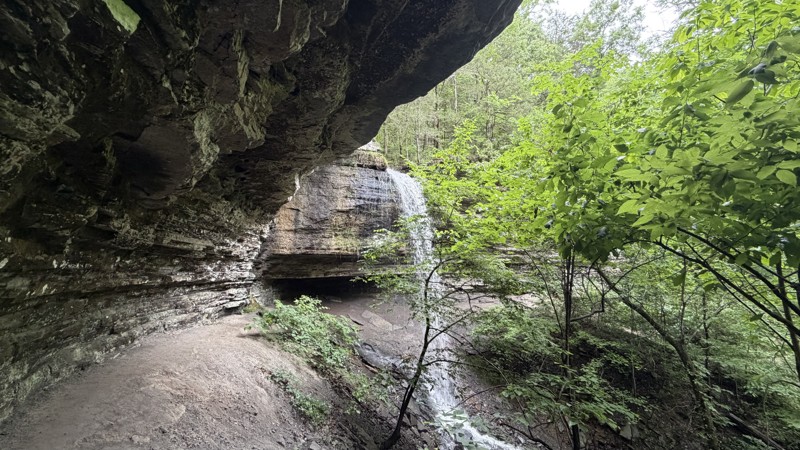
Updated: 06/10/2026
Mountain Creek
West Cobb, Arkansas
An integral part of the Ozark Overland Adventure Trail, specifically as Day 4 of the journey, this challenging off-road trail is not for the faint of heart, demanding both advanced driving skills and well-prepared, robust off-road equipment. Drivers should anticipate significant elevation changes and a variety of obstacles throughout the entire route. The lower sections of the trail are particularly demanding, featuring numerous challenging water crossings and deep, potentially treacherous mud bogs, especially after rainfall or during the wet season, requiring very careful line selection to avoid getting bogged down. Washouts and deep drainage gutters are also commonplace, making recovery gear an essential piece of equipment for any vehicle venturing onto this trail. The trail network connects to HWY 23 at West Fly Gap Road to the north and Morgan Mountain Road to the southeast. To exit the trail, take FS94669D straight, and at the Y-junction, turn onto FS94669A.
Adventurous drivers are encouraged to explore the numerous side trails, discover the area's refreshing waterfalls, and be mindful that the marked trail has shifted in some areas due to natural erosion. This is a longer, more demanding trail within the region, offering excellent opportunities for off-road driving and exploring the surrounding area on foot, as well as unique waterfall exploration.
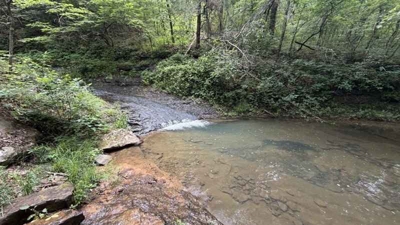
Updated: 06/18/2026
Eureka Springs Hollow
Bidville, Arkansas
This short connector trail packs a lot of variety into a quick drive, making it a worthwhile addition to the surrounding trail network. Traveling west to east, the route drops steadily through a narrow, overgrown corridor with deep mud holes, tight sections, and a memorable off-camber descent along a steep hillside. The Forest Service has improved a famous ledge on the descent, but the narrow road and exposure into the canyon can still feel intimidating for newer drivers. Once at the bottom, the trail enters a scenic, rock-lined creek fed by clear springs, with several places to stop, cool off, and enjoy the water, including a natural rock waterslide that makes this a fun summer destination. There is also a dispersed campsite near the creek area, though suitability may vary depending on recent water levels and seasonal use. The route finishes with another set of mud puddles, some reaching 18 to 24 inches deep, before connecting to the next road. High-clearance 4WD is recommended, and while full-size vehicles can make it through, expect tight brush, pinstriping, and possible body contact.

Upgrade your Membership
Unlock all of the details on every Trail Guide and Scout Route.
Start a 7-day Free TrialCommunity
Partners