


By clicking "ACCEPT", you agree to be the terms and conditions of each policy linked to above. You also agree to the storing of cookies on your device to facilitate the operation and functionality of our site, enhance and customize your user experience, and to analyze how our site is used.
Virginia Off-Road Trails
11
Total Trail Guides 6

156
Detailed Waypoints 45
Try a Free 7-Day Trial and unlock it all
Start a Free Trial Most Recent Trail Reviews
No Rating
Open
Visited: 06/26/2026
According to MVUM data, this trail should be open for the season.

Trails Offroad
Rated 5/5
Open
Visited: 06/13/2026
This is a wonderful trail that was unexpectedly challenging in spots. I ran this in the opposite direction from the description above since I was driving the northernmost portion of the Virginia Adven...
Peter Dougherty
K
Kkk15kkk
GL
Getting Lost
Rated 5/5
Open
Visited: 05/26/2026
Fun, relaxing trail. Was running solo so I didn’t try the difficult trail. Had rained quite a bit so the water holes were full. Went primarily as a birding trip. Covered Potts Mtn, Peaceful Valley...
B
Brent
Rated 5/5
Open
Visited: 04/14/2026
Absolutely fun experience. Just after doing the Peter Mill Run we decided to the Long Run Road and we loved it very beautiful, great camping spots and very fun off roading.
MB
Manuel Barreto
LV
Luis Vega
No Rating
Open
Visited: 04/02/2026
Nice trail with some moderate challenges and inclines.
NJ
Neil Johnson
NJ
Neil Johnson
Rated 5/5
Open
Visited: 02/14/2026
Easy ride. Views are obstructed but only because of the trees.
KG
Kevin Garrett
Rated 5/5
Open
Visited: 02/07/2026
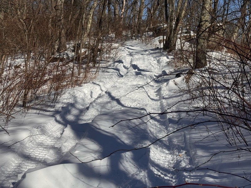
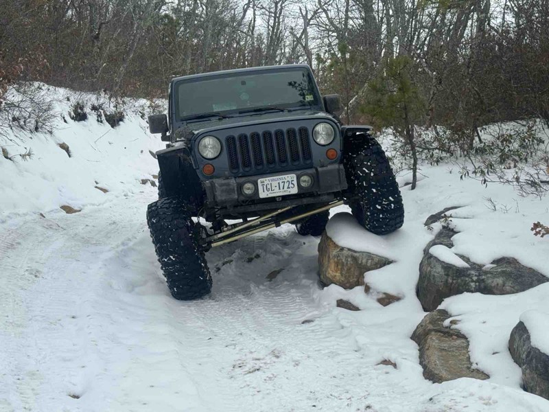
Snow , ice , and drift all the way to flagpole knob . With my tires and lockers the trail was fairly easy . Just took my time . But hidden danger was sleet piles on the trail . Some piles were 6’ hig...
RB
Robert Bryant
No Rating
Open
Visited: 01/17/2026
Was a fun trail... breaking through the ice in my new to me zr2 was awesome! Highly reccommend.
JB
Jason Braswell
No Rating
Seasonal Closure
Visited: 01/15/2026
According to this trails management agency, the trail is likely closed for the season.
You can reach out to the agency for more details.
Be sure to leave us a report and let us know ...
Trails Offroad
No Rating
Seasonal Closure
Visited: 01/15/2026
According to this trails management agency, the trail is likely closed for the season.
You can reach out to the agency for more details.
Be sure to leave us a report and let us know ...
Trails Offroad
No Rating
Seasonal Closure
Visited: 01/15/2026
According to this trails management agency, the trail is likely closed for the season.
You can reach out to the agency for more details.
Be sure to leave us a report and let us know ...
Trails Offroad
No Rating
Seasonal Closure
Visited: 01/15/2026
According to this trails management agency, the trail is likely closed for the season.
You can reach out to the agency for more details.
Be sure to leave us a report and let us know ...
Trails Offroad
No Rating
Seasonal Closure
Visited: 01/10/2026
According to this trails management agency, the trail is likely closed for the season.
You can reach out to the agency for more details.
Be sure to leave us a report and let us know ...
Trails Offroad
No Rating
Seasonal Closure
Visited: 01/10/2026
According to this trails management agency, the trail is likely closed for the season.
You can reach out to the agency for more details.
Be sure to leave us a report and let us know ...
Trails Offroad
No Rating
Seasonal Closure
Visited: 01/10/2026
According to this trails management agency, the trail is likely closed for the season.
You can reach out to the agency for more details.
Be sure to leave us a report and let us know ...
Trails Offroad
No Rating
Seasonal Closure
Visited: 01/10/2026
According to this trails management agency, the trail is likely closed for the season.
You can reach out to the agency for more details.
Be sure to leave us a report and let us know ...
Trails Offroad
No Rating
Seasonal Closure
Visited: 01/10/2026
According to this trails management agency, the trail is likely closed for the season.
You can reach out to the agency for more details.
Be sure to leave us a report and let us know ...
Trails Offroad
Seasonal Closure
Visited: 01/10/2026
According to this trails management agency, the trail is likely closed for the season.
You can reach out to the agency for more details.
Be sure to leave us a report and let us know ...
Trails Offroad
No Rating
Seasonal Closure
Visited: 01/07/2026
According to this trails management agency, the trail is likely closed for the season.
You can reach out to the agency for more details.
Be sure to leave us a report and let us know ...
Trails Offroad
No Rating
Seasonal Closure
Visited: 01/04/2026
According to this trails management agency, the trail is likely closed for the season.
You can reach out to the agency for more details.
Be sure to leave us a report and let us know ...
Trails Offroad
No Rating
Seasonal Closure
Visited: 01/04/2026
According to this trails management agency, the trail is likely closed for the season.
You can reach out to the agency for more details.
Be sure to leave us a report and let us know ...
Trails Offroad
No Rating
Seasonal Closure
Visited: 01/04/2026
According to this trails management agency, the trail is likely closed for the season.
You can reach out to the agency for more details.
Be sure to leave us a report and let us know ...
Trails Offroad
No Rating
Seasonal Closure
Visited: 01/04/2026
According to this trails management agency, the trail is likely closed for the season.
You can reach out to the agency for more details.
Be sure to leave us a report and let us know ...
Trails Offroad
No Rating
Open
Visited: 12/31/2025
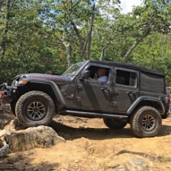
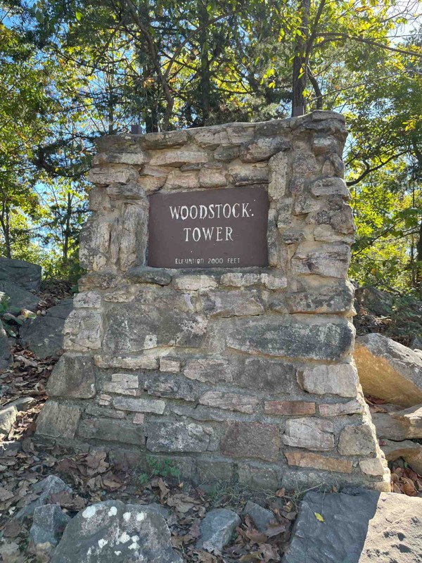
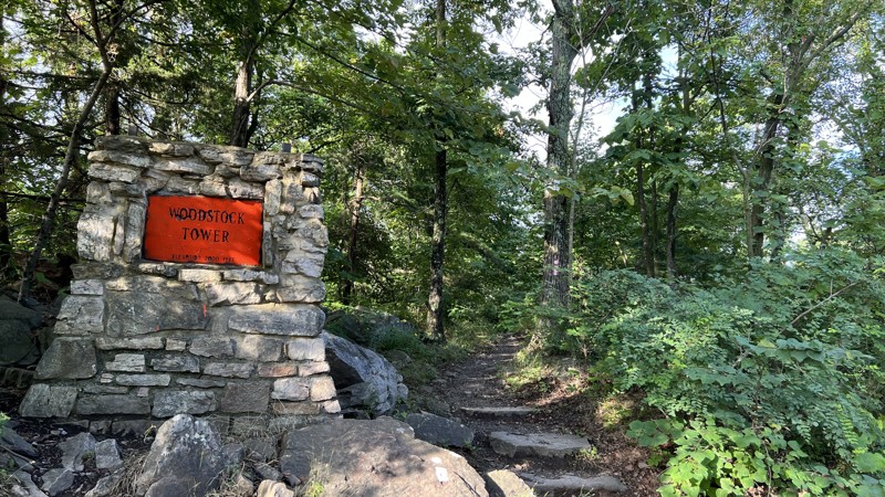
No one out there today. Trail was dry and very rocky. Air down for a nicer trip . Went south to north and beautiful vista at end in Woodstock .
NJ
Neil Johnson
No Rating
Seasonal Closure
Visited: 12/31/2025
According to this trails management agency, the trail is likely closed for the season.
You can reach out to the agency for more details.
Be sure to leave us a report and let us know ...
Trails Offroad
No Rating
Open
Visited: 12/26/2025
Nice, easy trail. I ran the trail in 4H Auto, 2021 Wrangler Rubicon. Could have likely run it in 2WD. The start of the south end is the most rocky and uphill. If you want a fun, relaxing trail, th...
BT
Bryan Trebelhorn
No Rating
Open
Visited: 12/22/2025
Great trail to ride with some really cool spots for pictures and learning how to navigate your rig.
ES
Errin Stanton
Rated 5/5
Open
Visited: 12/14/2025
Snow and ice definitely makes this a lot more difficult. We had to turn around a little after waypoint number eight due to ice
D
Darin
Rated 5/5
Open
Visited: 12/12/2025
Decided to head back to Big Levels after the last snow we had . Wanted to test the tires , tire pressure , and lockers and it was a lot of fun running this trail in the snow . Just upgraded the steeri...
RB
Robert Bryant
No Rating
Open
Visited: 12/06/2025
very fun, did it with the snow and it definitely added the thrill factor
D
Darin
Open
Visited: 12/06/2025
Very fun trail. I am new to offroading and will say this trail was definitely fun but a lot easier than the rating suggested.
D
Darin
No Rating
Open
Visited: 11/28/2025
Great beginner trail. Was my first experience doing some “more serious” off-roading compared to the pine barrens of NJ. Lots of fun and a good place to learn new techniques/learn the capabilities of y...
JK
Julia Kline
No Rating
Open
Visited: 11/23/2025
This easy trail is characterized by minimal uphill climbs and rocky sections. I recommend airing down your tires for a smoother ride. Use 4-Low for the occasional, steeper inclines. Overall, it's a fu...
JB
James Bobadilla
Rated 4/5
Open
Visited: 11/16/2025
Also came for the camping. Easy road, only 2WD needed. 4WD may be needed to return to the road from some of the better camp sites. Despite the lack of challenge, the scenery is fantastic. Wasn't parti...
Bryan Napier
Rated 3/5
Open
Visited: 11/15/2025
Fun trail and nice scenery along the German River but not very challenging. The southern end had a few deeper mud holes but nothing too rough but it has been really dry lately. Only noticed a few disp...
DM
Derek McCleskey
Rated 5/5
Open
Visited: 11/08/2025
Great trail for an afternoon run. Drove up the trail to the knob. Several features and a splash puddle area along the way.
Mike Botzan
Rated 5/5
Open
Visited: 11/01/2025
The trail was what i expected , Have been looking for something new and challenging . This was it , The rock garden has gotten rougher from what i have seen from other peoples videos on youtube . But ...
RB
Robert Bryant
Rated 5/5
Open
Visited: 10/18/2025
Second time doing this trail. You will get pin stripping. Your vehicle will get dirty. The water obstacles mostly have some available bypasses; however, I’ve done once through the water obstacles an...
Jack Skym
Rated 5/5
Open
Visited: 10/16/2025
When I ran this in October 2025 the big mud pit wasn't particularly bad; locking front and rear and applying momentum got me through OK. I ran it solo, but in the wet season I wouldn't consider this w...
Peter Dougherty
Rated 5/5
Open
Visited: 10/11/2025
Road with Richmond City Wranglers. Nice scenic trail.
Grady L Spitzer
Rated 5/5
Open
Visited: 10/08/2025
Did this trail with a 2” lift and 33” tires. Not a technical trail. Actually found myself going faster than I should be because the trails very easy going. I did not air down. But do believe airin...
Jack Skym
Rated 5/5
Open
Visited: 10/05/2025
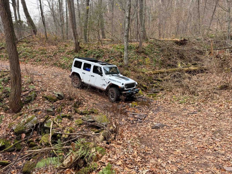
Fun trail. Water obstacles on the back end were deeper than expected, but I was able to get through all of them in my stock 2025 JLUR. Water line came up to bottom of the door seam in two of the water...

Gary Cherrix (Flounder)
No Rating
Open
Visited: 09/26/2025
I went after two days of rain, so I’d call this “beginner +”. I’ll have to run it again when it’s dry to compare. Lots of water and mud, but nothing too deep. Also some ruts and off camber areas bu...
F
Feagans01
Rated 5/5
Open
Visited: 09/20/2025
Went up about 2 miles and turned around because of time constraints. This was my first time off road in the new gladiator and I was surprised by how well it handled the trail, especially the slightly...
SL
Steven Luck
Rated 4/5
Open
Visited: 09/19/2025
Perfect trail for a peaceful drive through the George Washington National Forest. Great trail for beginners and stock 4x4 vehicles.

Christopher
Rated 3/5
Open
Visited: 09/13/2025
Came for the camping, stayed for the wheeling. Just a gravel road, really. But the offshoot trail that branches off from it to the east, Shoe Creek Rd. South, a.k.a. FR263, is a very different animal ...
Peter Dougherty
Most Popular


Updated: 07/21/2024
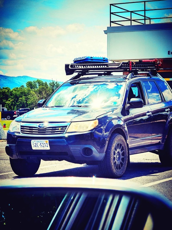
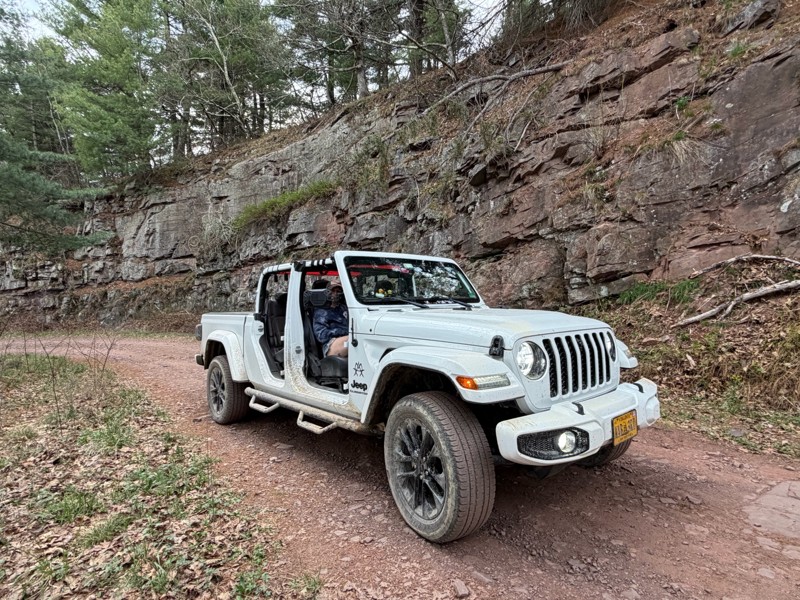
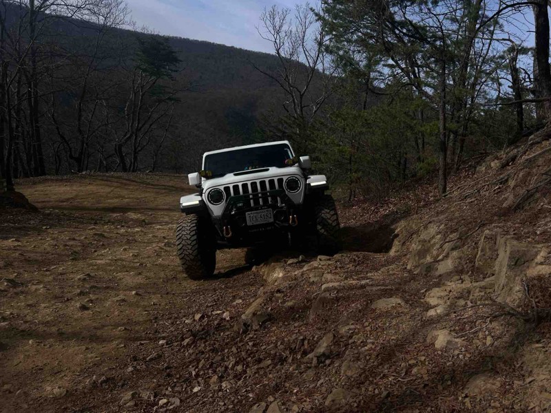
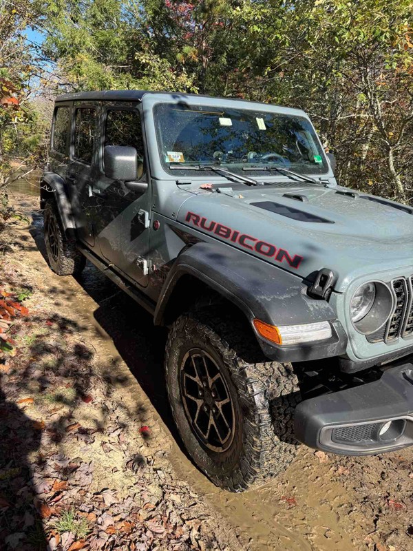
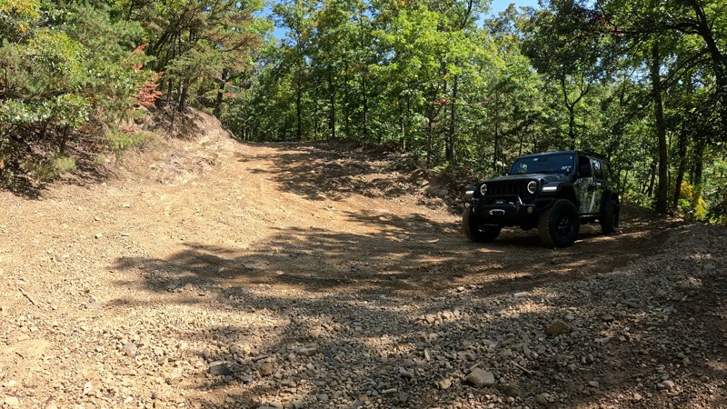
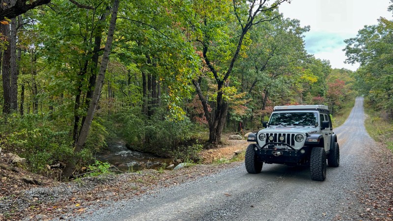
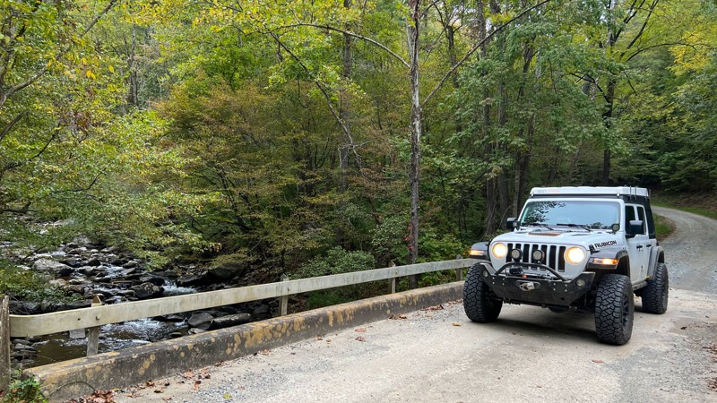
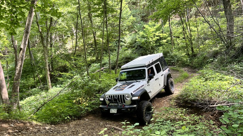
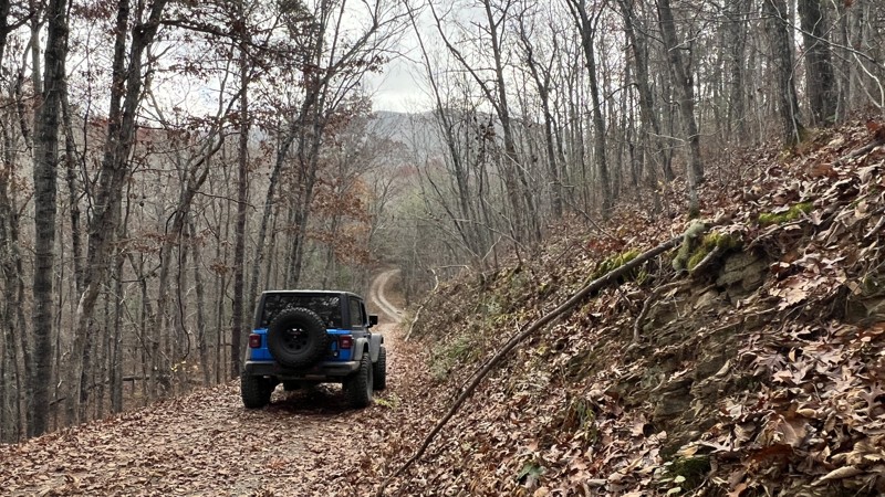
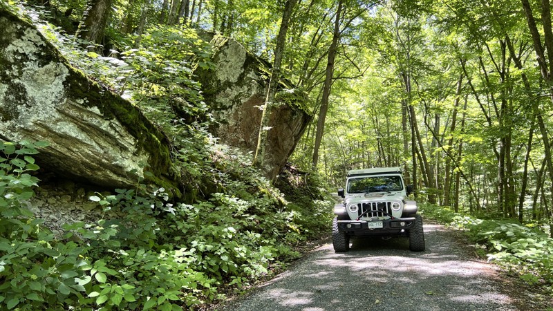
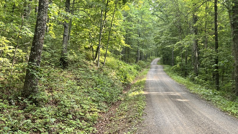
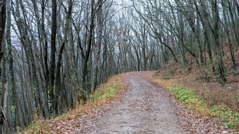
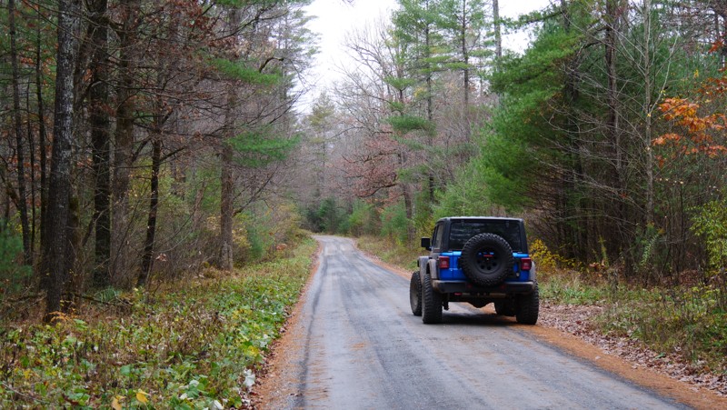
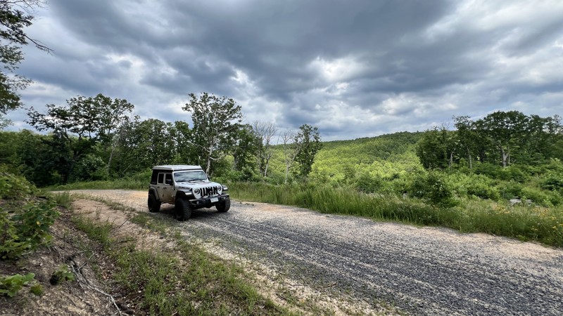
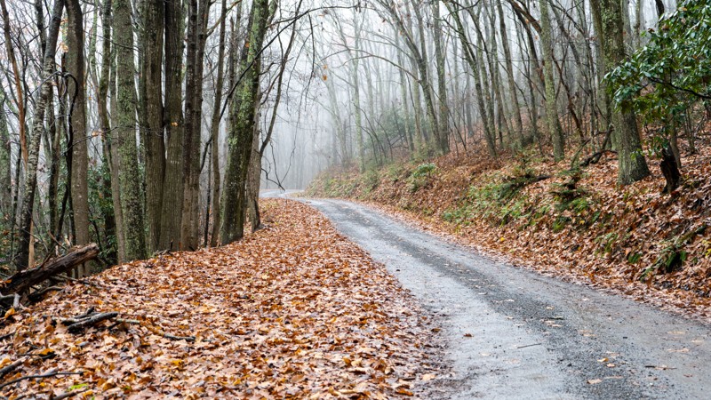
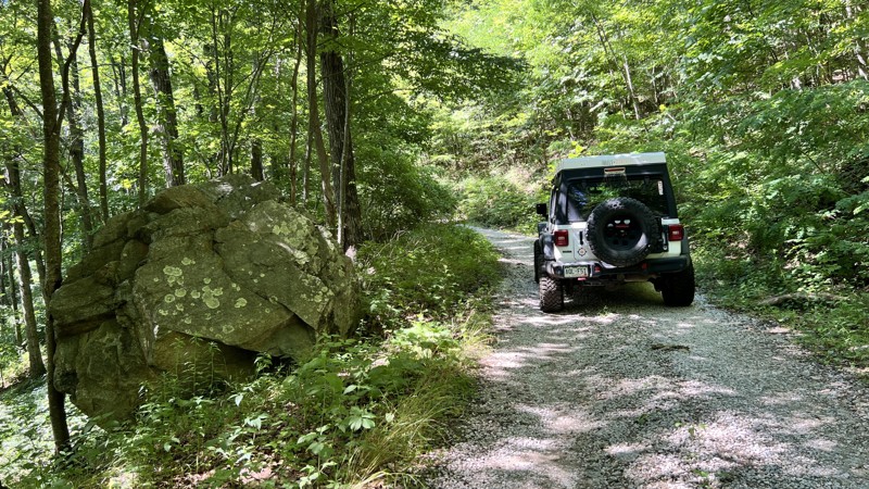
Peters Mill Run
Open
/
Edinburg, Virginia/
8.39 miles/
About 2 hours
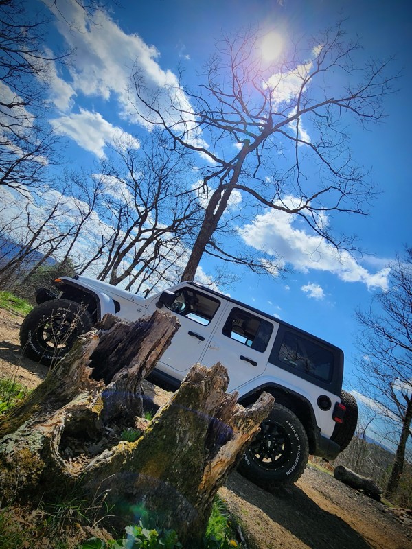
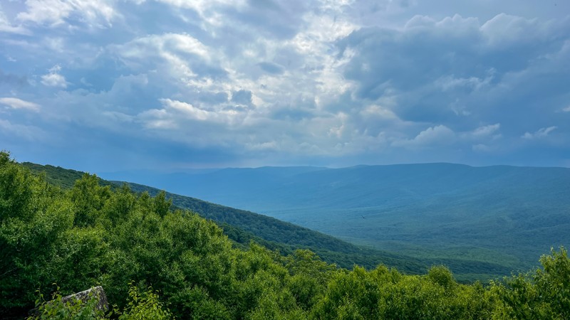
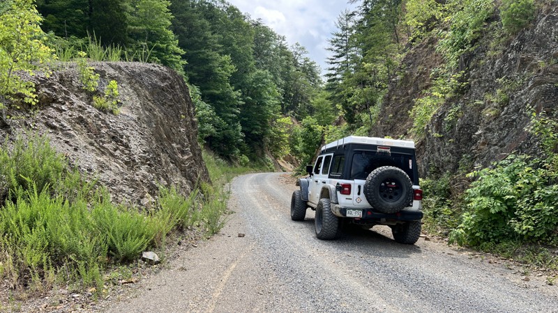
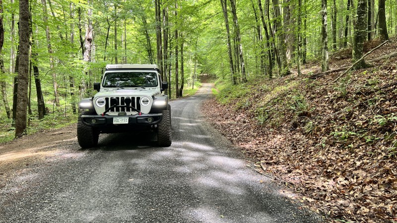
Situated above the Shenandoah Valley, Peters Mill Run is a delightful 4WD road providing a relaxing trip through the George Washington National Forest. Named after the nearby river this route generally follows, Peters Mill Run will entertain experienced and novice off-road drivers alike. Peters Mill Run is one of the cherished Jeep "Badge of Honor" trails making it one of the more desirable trails in the region. The trail starts off strong with some rocky sections but eventually eases into a smoother ride as it curves through the trees. The thick tree canopy provides cooler temperatures and defused sunlight for an enjoyable open-top excursion.

Updated: 07/22/2024
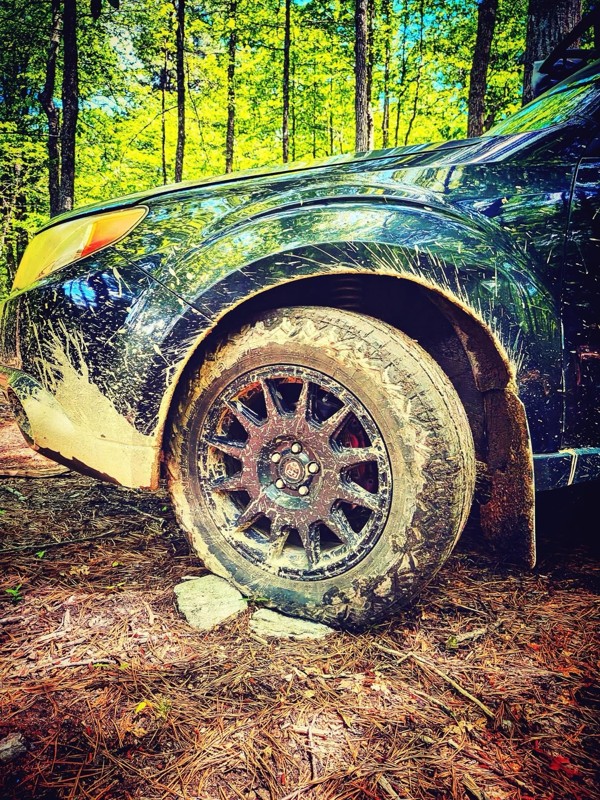
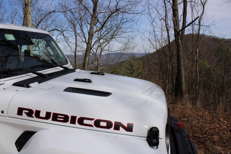
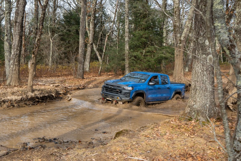
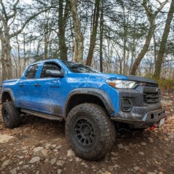
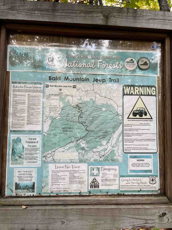
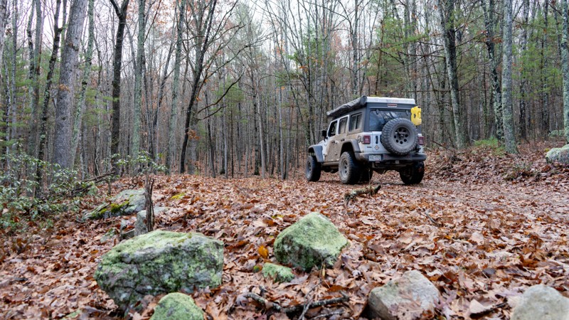
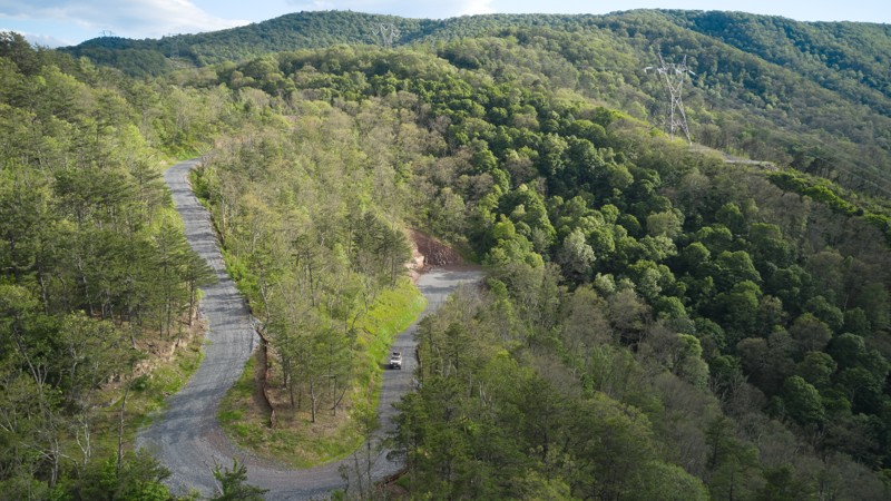
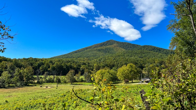
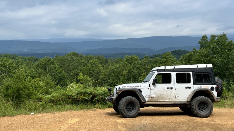
Bald Mountain Jeep Trail aka Big Levels
Open
/
Stuarts Draft, Virginia/
9.97 miles/
About 3 hours
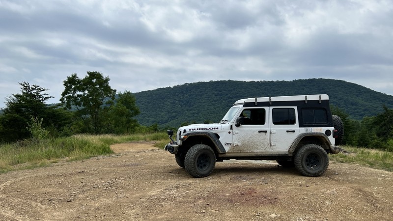
Nestled in the George Washington National Forest, the Bald Mountain Jeep Trail gives you a great taste of what the Blue Ridge area offers. The George Washington National Forest is highly accessible for your weekend adventures, with major byways allowing you to move around the forest. Regardless of the direction you choose to run the Bald Mountain Jeep Trail, you are in for an adventure with mud pits to spike your adrenaline, rock obstacles to test your line-picking skills, and scenic dispersed camping to chat over the campfire. Take this trail during the autumn, and you'll be treated to the beautiful colors the Appalachians display. Bring a couple of friends to enjoy this as an overnight overland trip!

Updated: 06/24/2024
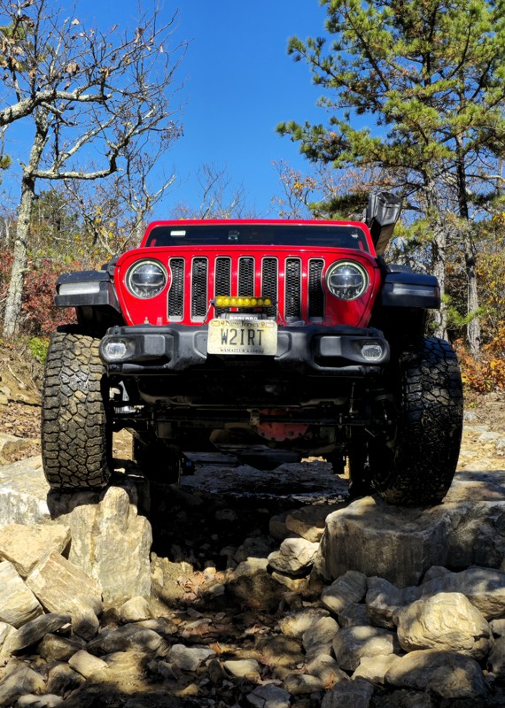
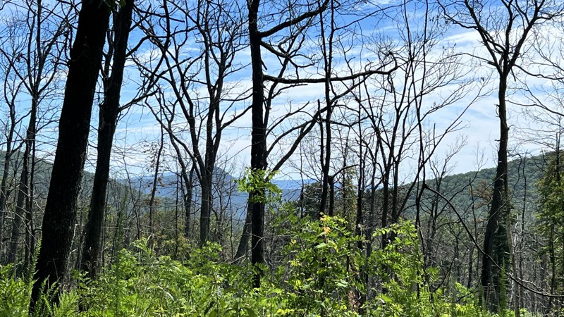
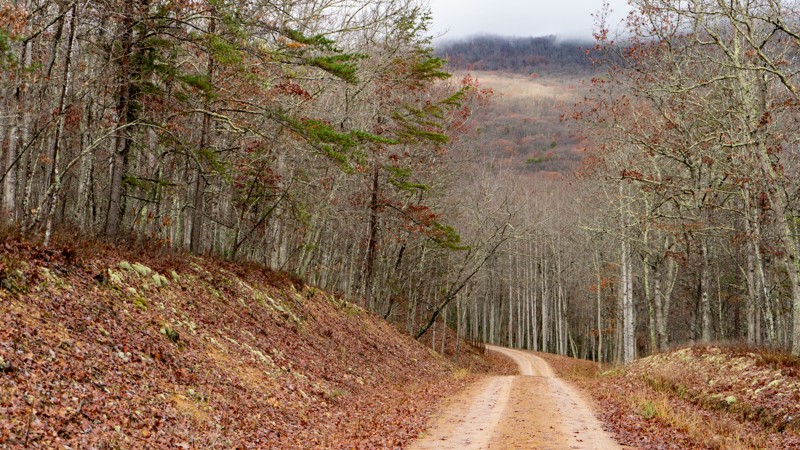
Flagpole Knob
Open
/
Harrisonburg, Virginia/
4.03 miles/
About 40 minutes
Traveling along the southern ridge of Slate Spring Mountain and literally on the border of Virginia and West Virginia, Flagpole Knob is an excellent road for a mellow family trip to one of Virginia's most historic knobs. It offers unparalleled views into the famous Shenandoah Valley, which has its own folklore and American history. In the 1920s, fire wardens set up fire tire lookouts across the ridgelines and knobs of the surrounding mountains, and Flagpole Knob was one of those. A large open area is on top to pitch a tent or several nooks to hide away. This trail is well worth the trip for the views along the way and the reward at the top looking east across the great state of Virginia.

Updated: 07/16/2024
Skidmore Fork/Dunkle Hollow Road
Open
/
Harrisonburg, Virginia/
8.22 miles/
About 2 hours
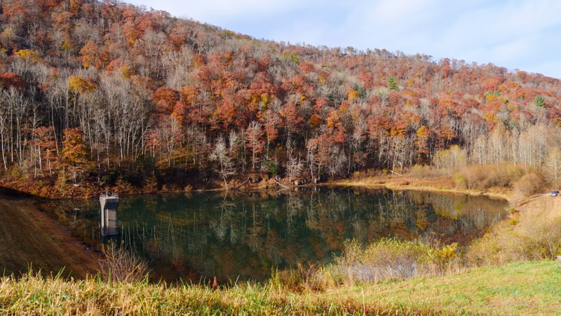
Located just 15 minutes from Harrisonburg, Virginia, and within the George Washington National Forest, Skidmore Fork/Dunkle Hollow Road offers an outstanding backcountry four-wheel drive adventure checking off all the boxes. Dispersed camping, check! Water crossings, check! A lake to canoe or kayak on, check! Connects with other trails for more options, check! Scenic views, check! When a road checks that many boxes, who wouldn't like it?

Updated: 04/01/2024
Potts Mountain Jeep Trail
Open
/
Mallow, Virginia/
7.54 miles/
About 4 hours
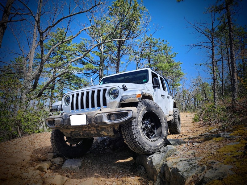
Most experienced wheelers say Potts Mountain Jeep Trail is the most rugged forest service road east of the Mississippi. Located near the border of Virginia and West Virginia, Potts Mountain Jeep Trail tests your skill set and vehicle build as you climb the tallest mountains in the area. As you conquer this one, you will be greeted with mud pits, severe rock obstacles, epic views of Virginia, and looking further west into West Virginia. Call your buddies because you will need a small team for this one!

Updated: 06/22/2024
Union Springs
Union Springs, Virginia
Just outside the sleepy town of Union Springs lies the main thoroughfare up to the famous and well-traveled Flagpole Knob. This trail will meander through the lush vegetation of the George Washington National Forest before you approach the first switchback. What starts as a leisurely Sunday drive will become a steep, unforgiving climb up to a ridge where you feel like you are on top of the world. Like most of the trails in this area, the foliage will put on quite the show in the Autumn months. If you are looking for an alternate route up to Flagpole Knob, this trail is a great option, but you will have to contend with Stone Camp to connect the two trails.

Updated: 06/25/2024
Stone Camp
Union Springs, Virginia
Stone Camp takes you on an epic adventure through Virginia's finest national public lands traversing a ridgeline high above the surrounding valleys. Straddling this ridgeline offers spectacular views to either side. You will also need to keep your eyes on the trail since there are a few obstacles along the way to keep any wheeler who likes challenging trails on their toes. This trail has it all - mud, rocks, history, camping, and a feeling of being on top of the world. Bring the camera, bring the family and friends, this is an adventure you will not soon forget. Is this a technical overlander's bucket-list trail on the east coast? It just might be. Connect this over to Flagpole Knob for a full day of exploring Virginia's high-elevation scenic trails.

Updated: 01/04/2026
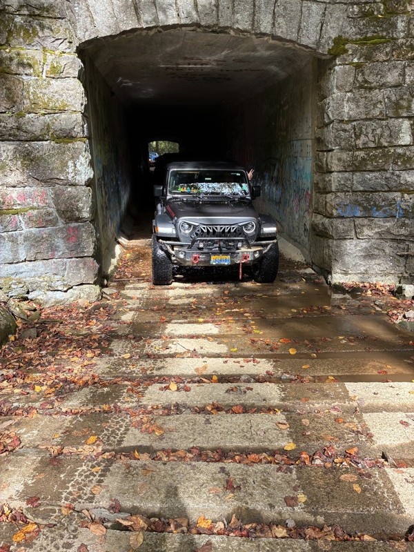
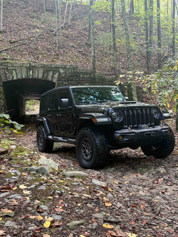
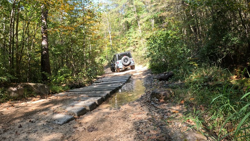
Enchanted Creek
Willow, Virginia
If you own a stock 4WD vehicle with a transfer case and want to get off the main Blue Ridge Parkway to get in time on the dirt, look no further than Enchanted Creek. This trail has a bit of a challenge, amazing stretches of forest, and even a tunnel you will navigate through. There are a few pockets of mud so make sure you have the right tires if you decide to try this one solo.

Updated: 06/11/2024
Long Run Road
Harrisonburg, Virginia
Discover the tranquil beauty of the East Coast Appalachian wilderness, where mountains are draped in vibrant, lush trees. At the summit, embrace a timeless solitude, far from the noise and rush of daily life. Epic camping will captivate you, making you never want to leave. The breathtaking views and sense of timelessness are unparalleled. As you gaze across the valleys, imagine Native American hunting parties setting up camp along mountain streams or Civil War soldiers seeking refuge between battles. The trail guides you deeper into the forest, where equally inspiring paths await your exploration.

Updated: 07/13/2024
German River Road
Broadway, Virginia
Nestled within the depths of the George Washington National Forest lies a trail winding through a deep, rugged valley, where the sun rises at 10 in the morning and vanishes at 3 in the afternoon. Here, the specter of flash floods looms ever-present, and impassable roads can remain obstructed for weeks. This is the true essence of the Appalachian wilderness, where elusive bobcats and bears keep a watchful eye, demanding your utmost vigilance. Not for the faint-hearted, but you'll never feel more alive!
Updated: 10/15/2024
Coal Road
Sherando, Virginia
Coal Road is a basic maintained road in the George Washington National Forest. The road itself isn't much to write home about, but it does lead to a few nice dispersed camping spots along a few creeks and access to a phenomenal technical overland trail, Bald Mountain Jeep Trail.
Updated: 10/15/2024
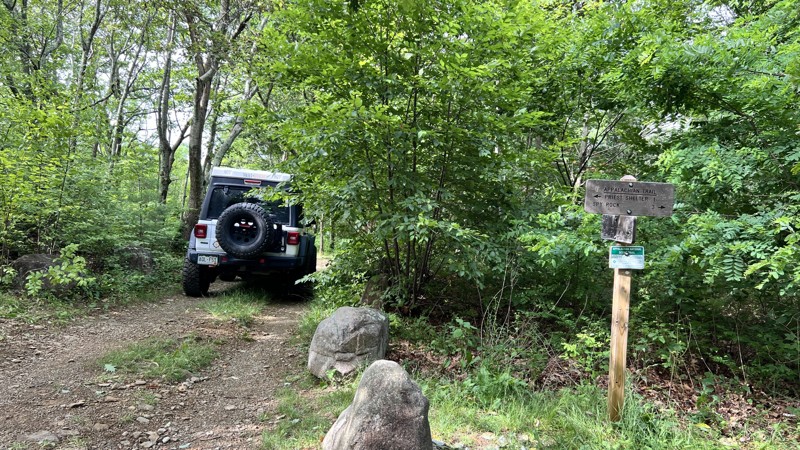
Pedlar River/Reservoir Road
Alto, Virginia
Pedlar River is a straight-through trail in the George Washington National Forest that offers some great dispersed camping and an opportunity to access hiking trails. The famous Appalachian Trail intersects along this trail, so seeing thru-hikers is not uncommon. This trail also provides access to the Lynchburg Reservoir, which the road is sometimes referred to as Reservoir Road.
Updated: 04/11/2026
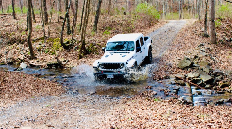
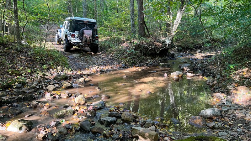
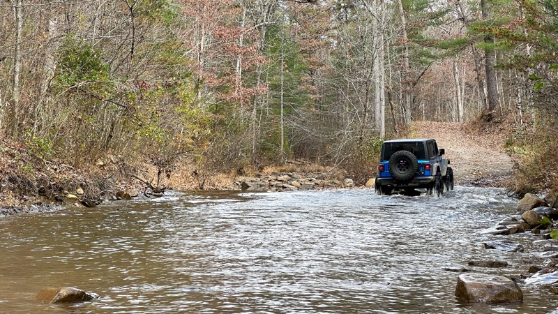
Broad Run
Abbott, Virginia
Broad Run starts as a county/state road before eventually morphing into a forest service road. It follows Broad Run for its first half and has ten water crossings. In times of rain, these crossings could become extremely deep, making the road impassable to most vehicles. No dispersed camping opportunities were spotted.
Updated: 01/09/2025
Reddish Knob
Sugar Grove, Virginia
Reddish Knob, at one time, was a longer-distance road, but it was paved north of the actual Knob. The Knob provides views of the landscapes and towns in the distance, along with plenty of chalk art drawn on the paved surfaces. From the Knob and traveling south, you skim the border of West Virginia along a hardpacked dirt road with patches of red clay and gravel. Limited dispersed camping was found, but there is excellent camping on Hone Quarry and North River.
Updated: 03/09/2026
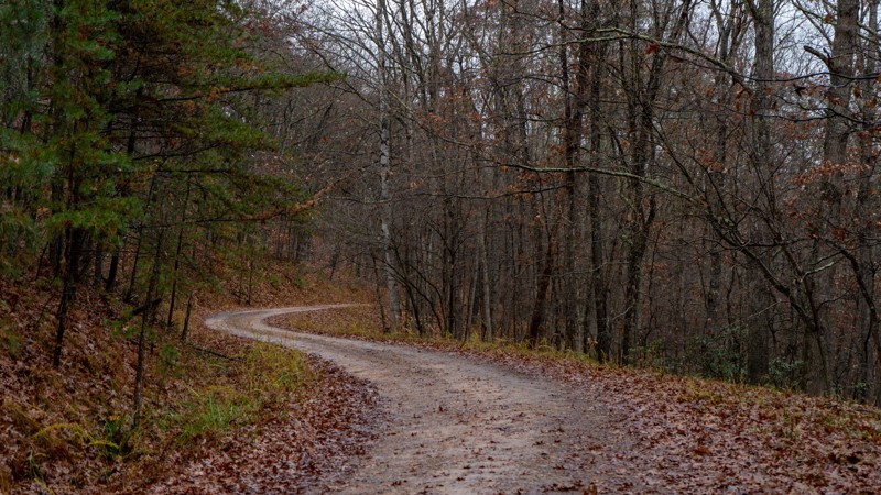
Forest Road 374
Edinburg, Virginia
Forest Road # 734 is a straightforward, well-maintained, gravel US Forest Service Road. The road begins at the end of Peters Mill Run 4x4 Road near Woodstock, VA. After completing Peters Mill Run, the road offers an excellent alternative route back to the highway. No camping along the route.

Updated: 04/22/2024
Old Mans Run Forest Road
Broadway, Virginia
A short drive from Harrisonburg, the North River Ranger District of the George Washington National Forest offers a veritable maze of trails for the offroad enthusiast. Old Mans Run Forest is very much a trail in two parts. You start with a long, open climb of 1200 feet with splendid views across the mountains and valleys. Then, the forest closes in on you with a tranquil atmosphere that encapsulates the soul as you inhale the earthy scent of pine needles. The peace is only disturbed by the gentle sounds of a mountain stream's tranquil melody. Don't miss the mossy streamside campsite at the end of the trail.
Updated: 01/04/2026
Coon Bridge
Lowesville, Virginia
Coon Bridge is the roughest trail in this immediate area. Near its start from Indian Creek Road, it is on a right-of-way easement through private property, and landowners have placed signs asking for respect for the property; the road slightly veers from the MVUM through this section. It starts rough and steep. Once it leaves the private property, an erosion v-notch obstacle must be straddled. Most of the trail is tight, overgrown, rocky, and slightly offcamber. Aggressive stock high-clearance vehicles with 4low can accomplish the trail in dry conditions. The views are limited during foliage months, and dispersed camping cannot be found. Look to Big Piney for good camping and as your return road to the valley.
Updated: 01/10/2026
Tub Run
Maggie, Virginia
Tub Run is almost two different roads between its north and south ends. The south end is wilder, with a rougher road and more turns, while the north end has recently been upgraded with fresh gravel. There are intermittent potholes and protruding rocks on the south side that you will want to pay attention to. There are dispersed campsites throughout the route. The northern end seems to be the better choice, with campsites underneath a pine tree canopy.
Updated: 10/15/2024
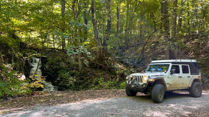
Parkers Gap
Sedalia, Virginia
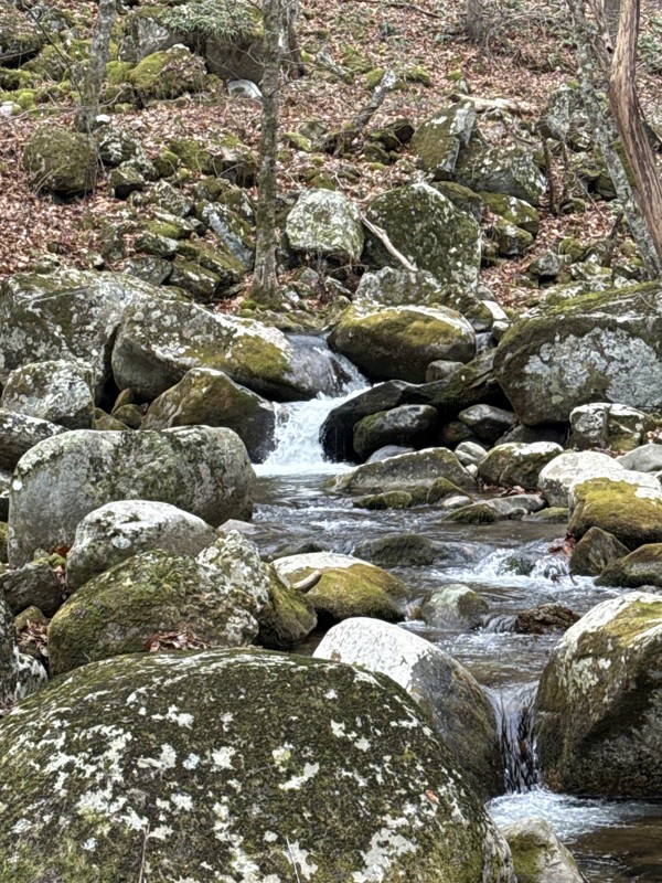
This trail lies just off the Blue Ridge Parkway and if you own an AWD vehicle, this would be an amazing option to see the forest away from the crowded pavement roads. There is a wonderful waterfall along the way. While no camping is allowed on this trail, there are a few nearby campgrounds and tons of spur roads to go check out while you are here. Don't pass this one up if you are in the area.
Updated: 05/13/2026
County Road 758
Woodstock, Virginia
County Road 758 is a graded gravel road that leads from the City of Woodstock, VA, to the trailhead for Peters Mill Run, a Jeep Badge of Honor Trail. The road is an enjoyable drive through a series of switchbacks as it climbs the Powell Mountains east of town. The gravel road begins right after crossing Virginia's Shenandoah River. If you are headed up to complete Peters Mill Run, County Road 758 is a captivating prequel to your adventure. There are no campsites along the trail.
Updated: 08/11/2025
Bald Mountain
New Castle, Virginia
Not to be confused with the Bald Mountain Jeep Trail, This Bald Mountain is located northwest of Roanoke, traveling straight through from the paved Peaceful Valley Road to the Forest Road Lignite Mines. The road starts steep and narrow and is comprised of degraded pavement, gravel, dirt, and rock at the beginning. Users should anticipate protruding rocks, shallow water/mud holes, and tight brush pinstriping through the remainder of the trail. Once at the high points, views open up to the east, and at its highest point resides a clearing for unparalleled views to the west. Any aggressive high clearance vehicle with four low gearing can manage the road under normal conditions.
Updated: 10/15/2024
North River
Palo Alto, Virginia
The road is hardpacked dirt and gravel and travels through the North River Watershed. It crisscrosses the rocky and babbling North River numerous times. There is plenty of dispersed camping throughout, with sites set further off the road while others are directly next to it.

Updated: 05/28/2024
West Side Road
Brandywine, Virginia
West Side Road is the epitome of an Appalachian Mountain back road. It's a place where the distinct laughter of pileated woodpeckers reverberates throughout the forest, and where the eerie hum of ghostly moonshiners' V8 engines blends with the whispers of the wind. The fragrance of sweet-scented mountain laurel fills the senses, adding to the atmosphere of intrigue.
Locals still caution against venturing onto these dirt roads, lest you disturb the clandestine activities of moonshiners hidden deep in the holla. Each bend holds the promise of encountering new characters—will you cross paths with trucks brimming with hunting dogs, and what quarry are they pursuing? Turkeys, bears, or perhaps even unsuspecting city dwellers?
Amidst the mystery, the silhouette of a dark figure in the shadows catches your eye, prompting questions and stirring the imagination. And as you lay your head down to catch some sleep, you can't help but wonder—was that the faint strum of a banjo echoing from the depths of the mountains?
Updated: 10/15/2024
Hunting Creek
Sedalia, Virginia
Hunting Creek is an out-and-back trail located in the Jefferson National Forest. While the MVUM might suggest that this is a connector trail, it is blocked by a gate at the terminus. A few nice camp spots lie along this trail and a few hiking intersections.
Updated: 01/10/2026
Wildlife
Abbott, Virginia
Wildlife is a hardpacked dirt and gravel road that gently rolls through the forest. It is an unassuming road with no remarkable features, yet it is a pleasant drive. Anticipate potholes and a water crossing or two. No camping opportunities were spotted.
Updated: 10/15/2024
Peaceful Valley East
Paint Bank, Virginia
Peaceful Valley East is part of a network of trails in this area where you can spend all day just being mellow, or you can mix it up and in the more intense Potts Mountain Jeep Trail. Of the mellow roads, this one does provide varied views of rocks, pastures, and distant landscapes. The road is also suitable for dispersed camping, with a few locations along the way.
Updated: 06/15/2026
Potts Mountain Road
Potts Creek, Virginia
Potts Mountain Road runs along the ridge of Potts Mountain and is a great connector trail from the paved route 311 after running Potts Mountain Jeep Trail or for taking a gentle stroll through the mountains when connected with Sweet Springs Turnpike. The road is hard-packed gravel and dirt and only offers views when around the two cell towers or when the trees are bare. Be advised there is a patch of private property in the southern to middle end of the road. As you drive, you will notice most of the tree bark and granite boulders are covered in green lichen, indicating plenty of shade and moisture year-round. One pre-existing campsite was found facing east. Anticipate hard bottom water/mud holes and potholes. Suitable for any high clearance vehicle.
Updated: 01/15/2026
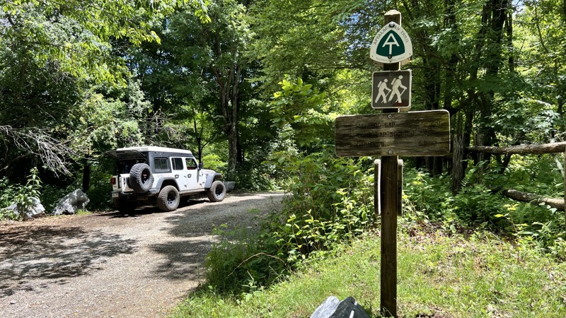
Hone Quarry
Briery Branch, Virginia
Hone Quarry is an out-and-back trail with ridges on both sides that takes you up Hone Quarry Run. During times of high water flow, this trail could be impassable. There are ample hiking opportunities off this trail. Camping is available in Hone Quarry Campground just below the start of this trail and dispersed camping along the trail. Hone Quarry is a nice trail for beginners, campers, or someone who wants to get out and see the foliage changing colors in the Autumn.
Updated: 12/24/2025
Big Piney
Alto, Virginia
Big Piney is a well-maintained gravel road that follows alongside the Childress Branch and South Fork Piney River. From where it crosses the Appalachian Trail, the eastern portion of the road is scenic as it follows the moss-covered waterways. This section includes roughly ten dispersed campsites, well spread out in the distance and each sizeable for two vehicles and two tents.
Updated: 04/07/2026
Dolly Anne
Ashwood, Virginia
Stretching nearly 20 miles from the town of Covington, Dolly Anne travels through the George Washington National Forest and is part of one of the longer backcountry discovery routes. Towards the middle, the route briefly shares the paved Sulphur Springs Road, but it is gravel with no obstacles for almost all of it. There are several campsites scattered throughout the length of the trail.
Updated: 01/15/2026
Vepco Road
Yankeetown, Virginia
Vepco Road is a well-packed gravel road that provides quick access to Long Run Road. Driving up Vepco Forest Road and down the east side of Long Run Road is an easy way to view the majesty of this section of the George Washinton National Forest without needing a four-wheel drive vehicle. As long as you don't mind powerlines, the views are spectacular.
Updated: 10/15/2024
Mud Lick
Maggie, Virginia
Mud Lick is a gravel road without any mud! It is lined with rhododendron and single lane most of the way. On the south end, there are spots off the road to camp. Very popular hunting area.
Updated: 09/29/2025
Sweet Springs Turnpike
Marshalltown, Virginia
When you see the word "Turnpike" in a trail name, you know it has a historic background. However, little information is available on this particular turnpike. As well, when you think turnpike, you are most likely thinking concrete or pavement. Not so here. This road is a mix of hardpacked dirt, gravel, and protruding rock. The west side has several wider switchbacks before it eventually terminates in private land. Dispersed camping is limited, but there is camping at the Pines Campground on the east side off Highway 617. This road also serves as the major exit after you have run Potts Mountain Jeep Trail.
Updated: 10/15/2024
Battery Creek
Big Island, Virginia
While the MVUM calls this a trail, an avid wheeler might call this an access road. Any 2WD or AWD vehicle will have no troubles on this trail. If a leisurely Sunday drive is your thing, this might be a good trail for you. There is no camping along the way.
Updated: 01/06/2026
Crabtree Meadows
Montebello, Virginia
Crabtree Meadows, also called Crabtree Falls, leads to the hiking trailhead parking lot for Crabtree Falls and joins the partially open Shoe Creek trail. At the parking lot, there is a vault toilet. The hike to the fall is 2.9 miles one-way. The road is entirely maintained gravel except where runoff occurs, where larger golf-ball to baseball-sized rocks can be present. With foliage, the views are minimal, but the trail does have five well-hidden campsites from the road, with a few more directly roadside that you can walk into. It is suitable for any high-clearance vehicle.
Updated: 12/31/2025
Patterson Creek
Marshalltown, Virginia
Patterson Creek is a gravel road running alongside its namesake. It has roughly a dozen well-spaced dispersed campsites large enough for a few vehicles each. The road is entirely under a tree canopy and provides cooler temperatures in the summer. There are several creek crossings, mostly under one foot in depth, and a hard bottom during dry weather, but they can be much deeper during heavy rain events.
Updated: 10/15/2024
Calf Pasture
West Augusta, Virginia
Calf Pasture serves as a quick exit from the forest and back to the pavement. It isn't very interesting compared to all the other great roads in the area. No camping was spotted.
Updated: 10/01/2025
Shoe Creek North
Nash, Virginia
A sign at the start of the trail informs visitors that Shoe Creek is being evaluated for closure to protect headwater trout water, unique habitats, adjacent Wilderness character, the Appalachian Scenic Trail, and newly found Federally Endangered Species. The Forest Service's own maps depict the road traveling straight through and much further. However, a gate makes this a short out-and-back trail. It does cross the Appalachian Trail and has one campsite. The road is rough with ledges and basketball-sized rocks, requiring clearance and four-wheel drive.
Updated: 10/15/2024
Peaceful Valley West
Laurel Branch, Virginia
Peaceful Valley West is a gravel and hardpacked dirt road with a 21-day camping limit. Although there is not a whole bunch of camping, what there is, is very prime with large sites. The road is mostly one lane wide and has places to pull over if needed. About 3/4 of the way in, you will also find a short waterfall on the side of the road.
Updated: 01/31/2026
Hog Camp
Alto, Virginia
Hog camp is a wide gravel road that crosses the Appalachian Trail and connects to several other roads in the area. With foliage, the views are limited. When traveling west to east, the road turns from a wide, well-maintained gravel road to a narrower, rougher road shortly after it crosses the AT, but it is still suitable for any high clearance vehicle. The short spur, FR 51, leads to additional hiking routes. Over its span, there are only a few dispersed campsites.
Updated: 10/15/2024
Limekiln
Bath Alum, Virginia
Limekiln is a straight-through, mild gravel road that is suitable for any high-clearance vehicle. There is plenty of clear-cutting evidence that does provide for views as you drive it. There is also evidence of either prescribed burns or forest fires. There is one small dispersed campsite.
Updated: 10/15/2024
Sugar Tree
Williamsville, Virginia
Sugar Tree is an exceptionally wide road compared to other roads in the area. The width provides a nice break through the trees to view the mountain range you are driving in. There are no obstacles, and the road is suitable for any high-clearance vehicle. While there are a few dispersed camping sites, most are directly on the side of the road, providing little privacy.
Updated: 01/04/2026
Cow Camp
Willow, Virginia
Cow Camp starts at a picnic table area at the Lexington Turnpike and is directly next to the Appalachian Trail. The road can be traveled in either direction, but traveling uphill is preferred. The road is rougher than its neighboring trails, starting as hardpacked native soil mixed with rocks and getting rockier and more eroded as you climb in elevation. It is mostly one vehicle width wide with little passing. Anticipate pinstriping. While the road is non-technical, drivers may wish to use four-wheel drive with low gearing on the steeper grades. No dispersed camping is found along the trail.
Updated: 10/15/2024
Lovelady
Allwood, Virginia
If you are looking for a nice place to camp with great views and a big enough spot for a large group of people or maybe just a few large rigs, this trail will fit the bill. AWD cars will have no issues on this trail, or if you are brave, you might be able to get a fifth-wheel trailer back here and have a nice piece of George Washington National Forest all to yourself.
Updated: 10/15/2024
Limestone Hill and Rocky Gap
Waiteville, Virginia
A beautiful road lined with rhododendron and packed full of twists and turns used as one of the longer overland routes in the area. No camping along this private land route.
Updated: 01/31/2025
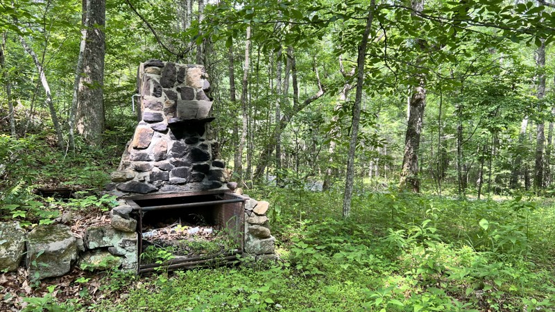
Piney Mountain
Shiloh, Virginia
At the northern end, an old stone chimney greets you at the start of the trail. The road winds its way along the lower portions of Big Piney Mountain, Black Rock, and Middle Knob. It is mostly gravel, and the rocks can become baseball to softball-sized, where it crosses any runoff. The road is suitable for any high-clearance vehicle. It dead ends at private property, but you can take Hester on its southern end to return to the pavement. A handful of dispersed camping sites can be found along the trail, and they are large enough to accommodate one to two vehicles.
Updated: 01/10/2026
Kelly Hollow
Howell Mills, Virginia
Kelly Hollow is a quick out-and-back jaunt that leads to a dead end. At the beginning, there is a parking setup where bicyclists and hikers can use the road. Drive with care and share the road. There is one minor creek crossing at which one dispersed campsite exists.
Updated: 09/30/2025
Greasy Springs
Alto, Virginia
Greasy Springs is an out-and-back trail that crosses the Appalachian Trail and ends at a clearing. Most of the road is hard-packed gravel, with a few spots of protruding rock. It is suitable for any high-clearance vehicle. A limited number of predisturbed campsites exist on the route but are very difficult to find.
Updated: 10/15/2024
Craig Valley Drive
Eagle Rock, Virginia
When combining Oi and Patterson Creek, Craig Valley Drive provides Northern access in or out of the forest. It has hardly any views of Craig Creek and appears to have been once a railroad grade. Certain maps show the road on the west continuing across the creek, but it does not. Be mindful that it is almost entirely on private land, and there is no camping off this road. It is suitable for any street-legal vehicle.
Updated: 10/15/2024
Jordan
Alto, Virginia
Jordan connects the Blue Ridge Parkway and Pedler River Road. It is a gentle drive, with the road being primarily maintained gravel suitable for any vehicle and typically wide enough for passing when encountering other drivers. There are limited dispersed camping opportunities, but at the eastern end, it joins FR 76A and the Oronco Campground. The campground has a vault toilet and a half dozen spaces for tents and shorter motorhomes.
Updated: 01/15/2026
Leading Ridge
West Augusta, Virginia
Leading Ridge connects North River to the Todd Lake Recreation Area. It is an opportunity to extend your offroad adventure by a few miles. Towards the middle of the trail, a clearing gives views of the surrounding mountains. There are three sizeable dispersed camping sites along the route.
Updated: 01/10/2026
Oi
Surber, Virginia
Oi is a mild gravel road that continues or merges with Patterson Creek and can be used when overlanding the area's various forest service roads. It is suitable for any street-legal vehicle and is entirely maintained. Unlike Patterson Creek, no camping is found along the road. It can offer forested views during the summer and, in a few locations, views beyond the trail when the trees are bare.
Updated: 09/30/2025
Rocky Mountain FAA
Alto, Virginia
This is a simple graded gravel road to a radio-type tower. There are no obstacles, but steep grades may dictate four-low gearing. There are no camping opportunities along the trail.
Updated: 01/10/2026
Hebron
Marshalltown, Virginia
Hebron is a gravel out-and-back road suitable for any street-legal vehicle. It leads to an overlook where you can see the valley that Craig Creek resides in, along with all the mountains in the background. Camping is non-existent.
Updated: 10/15/2024
Hester
McClung, Virginia
Hester is a short gravel road that connects Piney Mountain to the paved Dry Run Road. There is no camping, and the road is suitable for any vehicle.
Updated: 10/15/2024
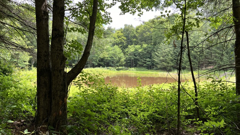
Puffenbarger Pond
Palo Alto, Virginia
This is a short out-and-back trail that leads to a pond and one campsite. The road is rutted and eroded and could be impassable in wet weather due to mud. The campsite at the end appears that it could also be very soggy during wet weather, although it is sizeable for several vehicles.

Upgrade your Membership
Unlock all of the details on every Trail Guide and Scout Route.
Start a 7-day Free TrialCommunity
Partners