Region

The Maze

Utah

Offroad Trails in The Maze

A Region within Utah
4.8/5 (74)

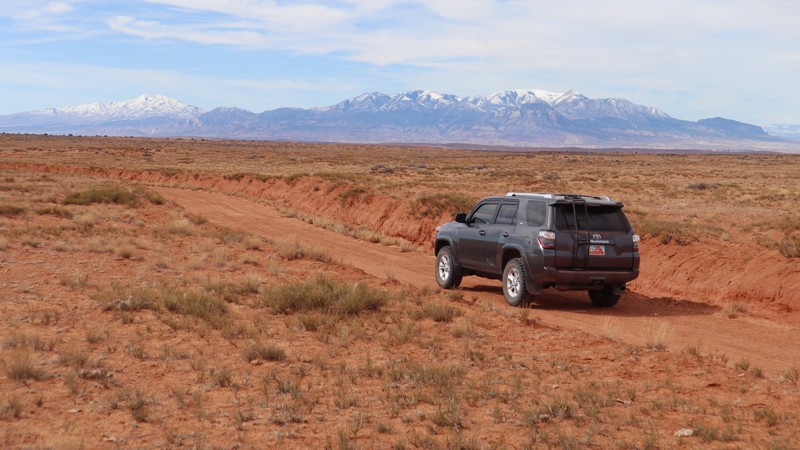
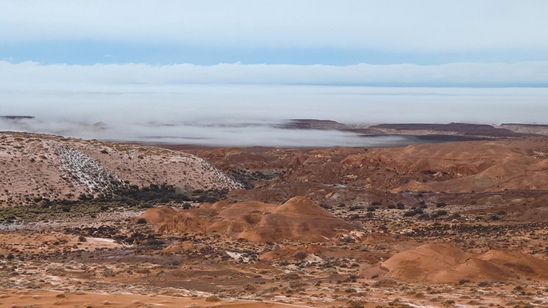
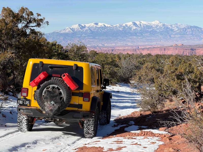
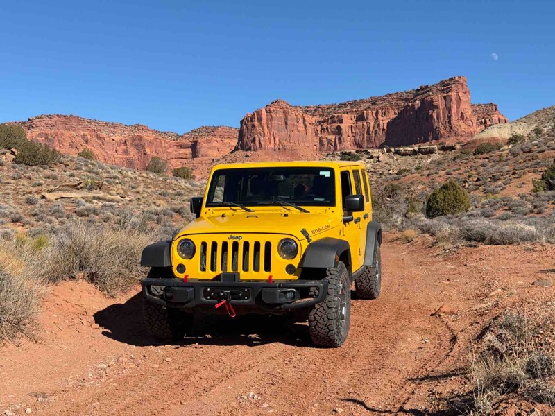
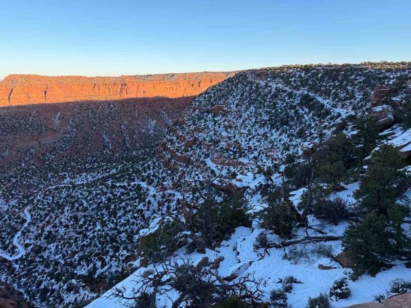
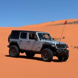
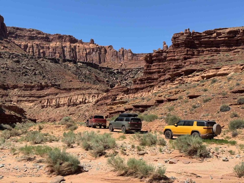
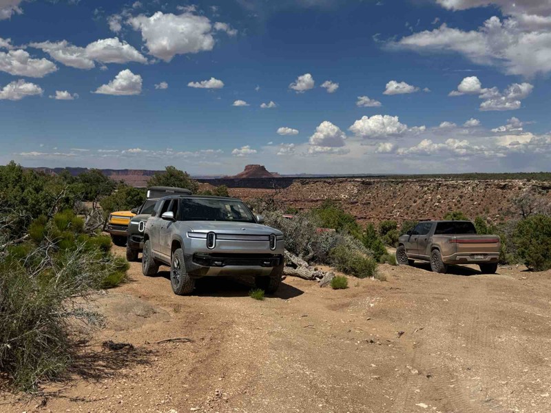
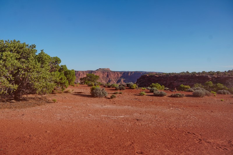
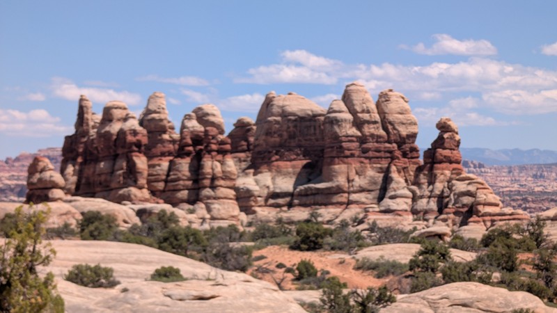
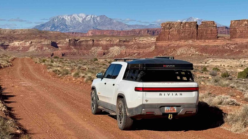
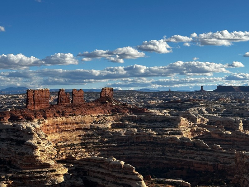
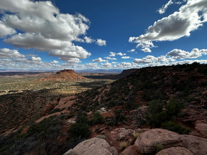
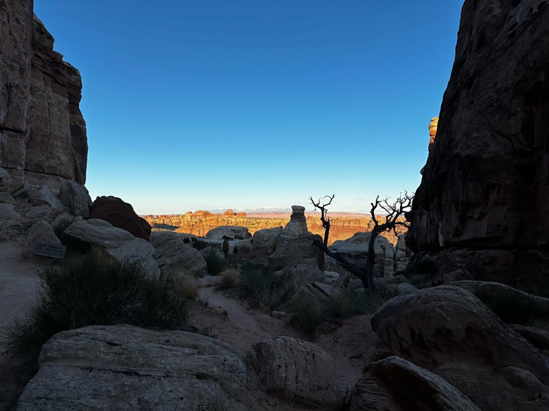
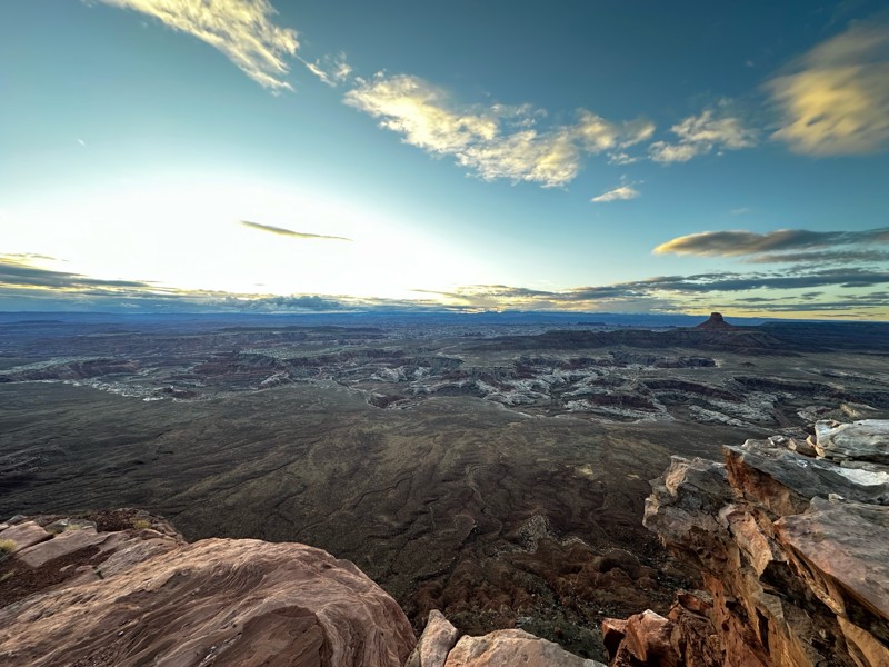
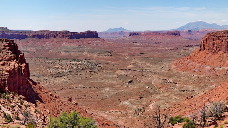
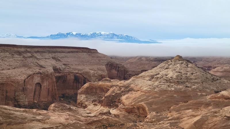
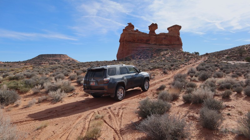
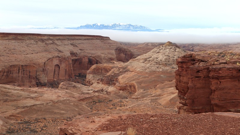
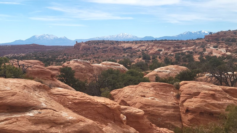
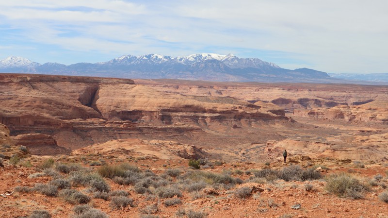
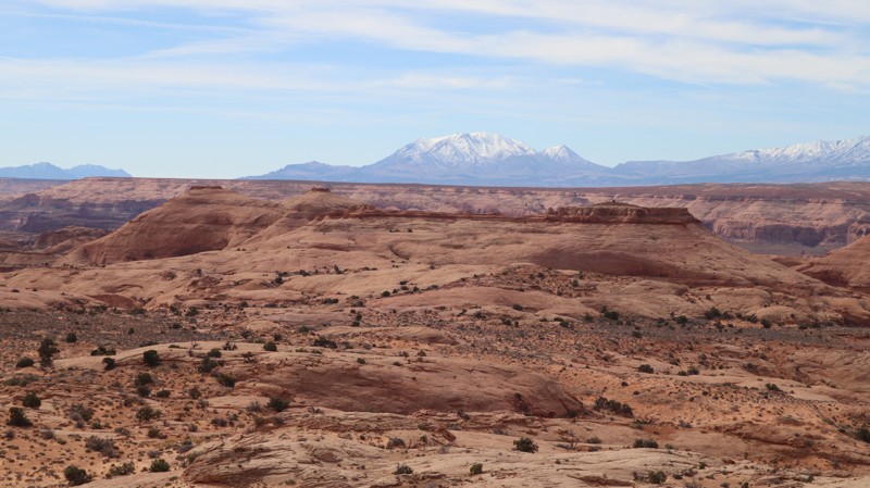
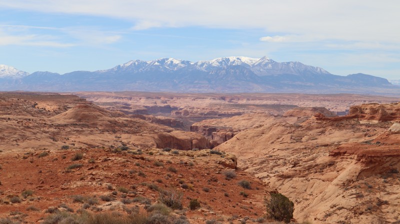
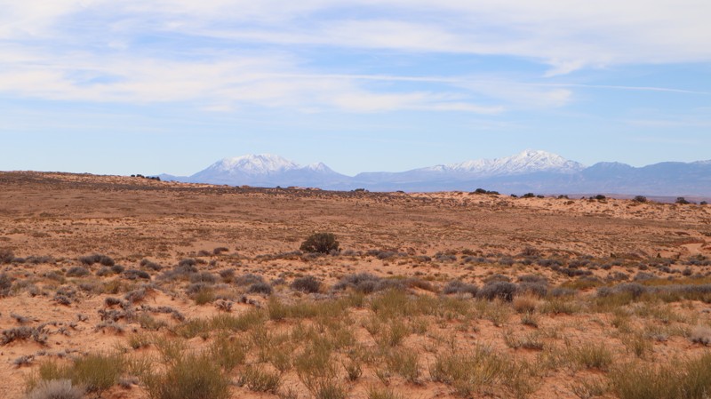
A National Park rarely has numerous unmaintained dirt roads, let alone a true challenge for 4WD vehicles. While Canyonlands National Park offers plenty of hiking, sightseeing, and historical information, this incredible park is also an overlander's paradise. The Maze is all about rugged terrain with expansive views and world-class camping.

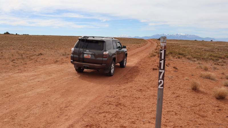
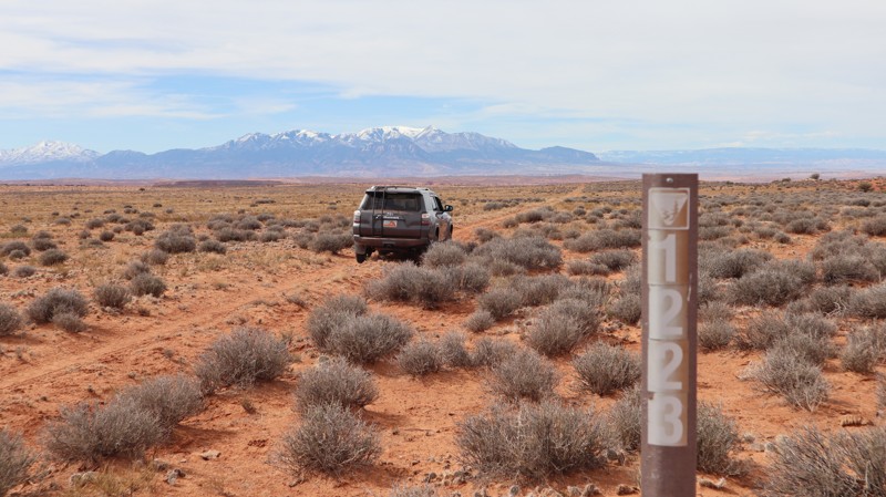
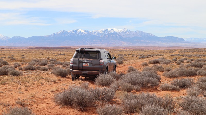
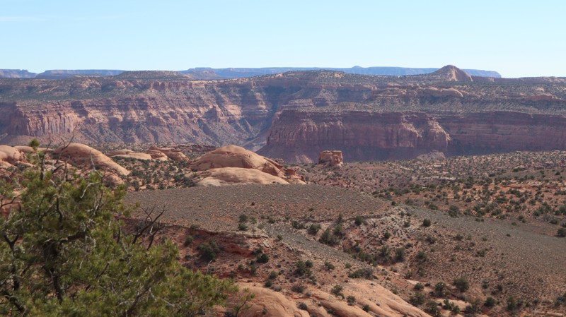
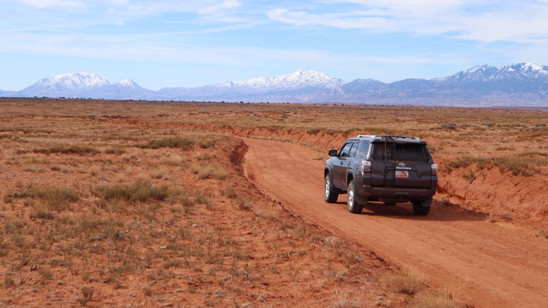
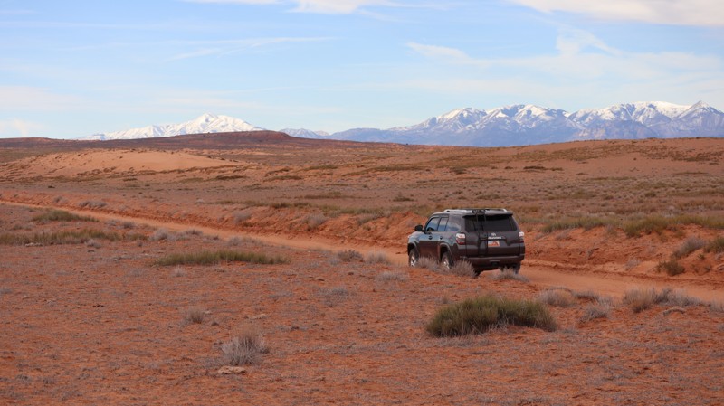
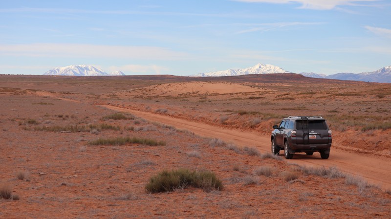
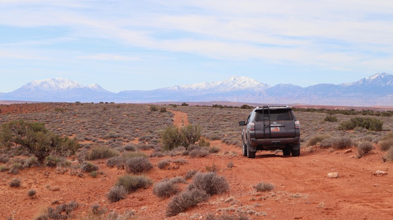
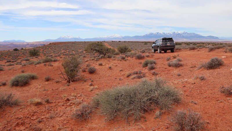
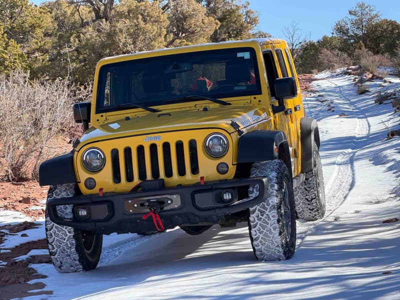
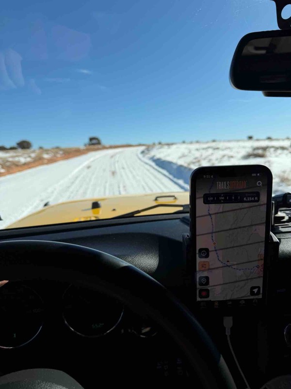
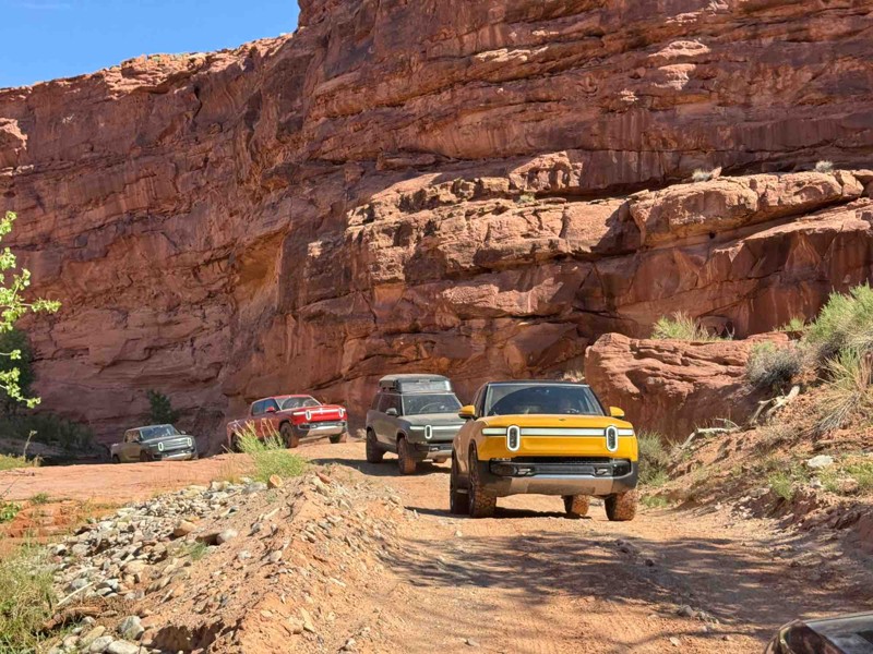
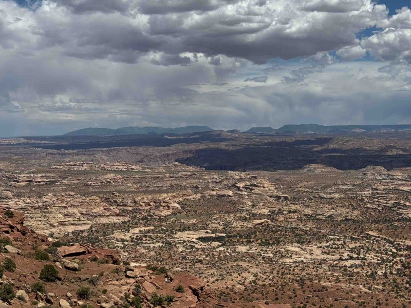
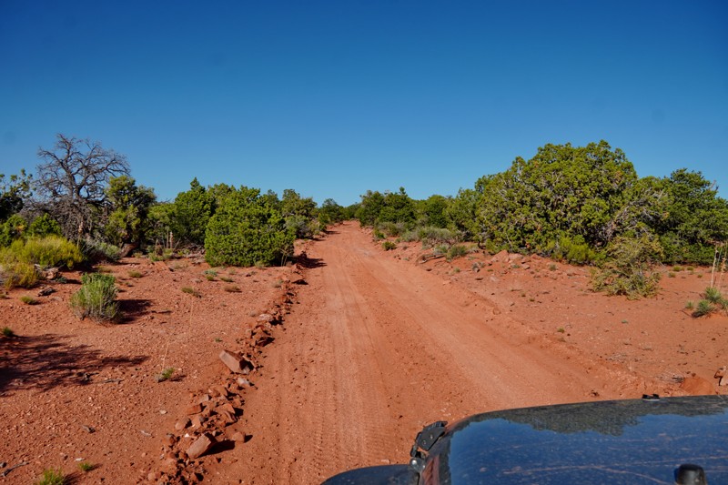
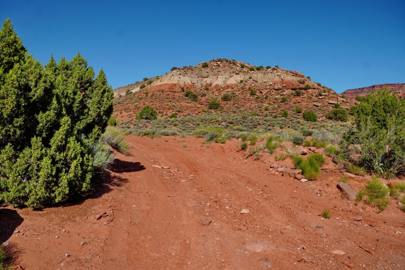
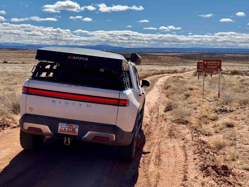
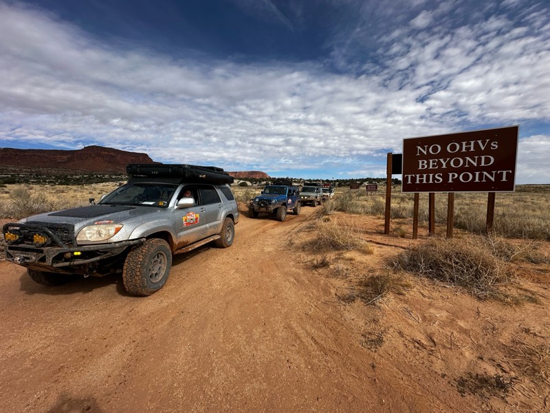
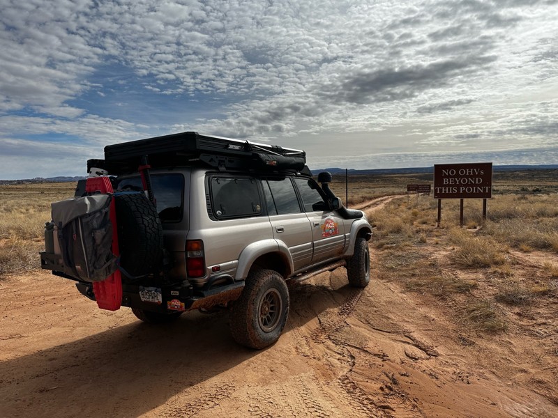
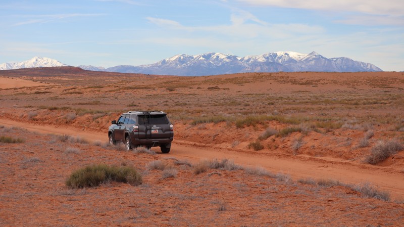
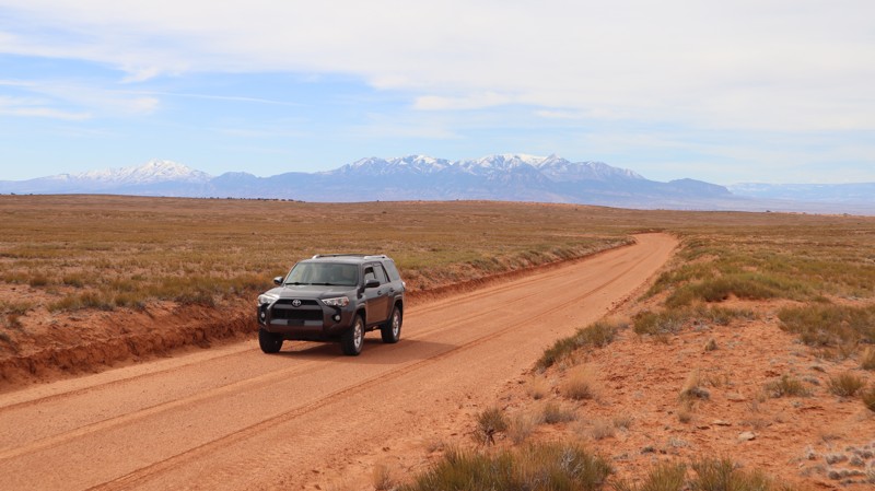
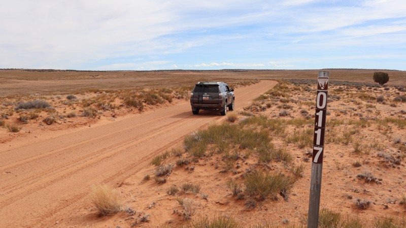
Starting at the outskirts of the park boundaries, it is clear that where you are heading is one of the most remote regions in the entire US. These easy dirt paths seem to go into the horizon and beyond, with no evidence of ever returning to civilization. Luckily, that IS the case for many of these roads.

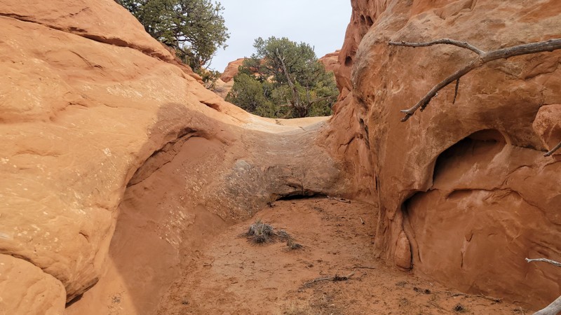
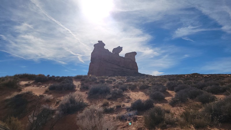
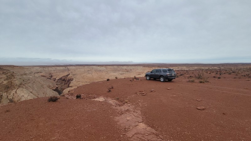
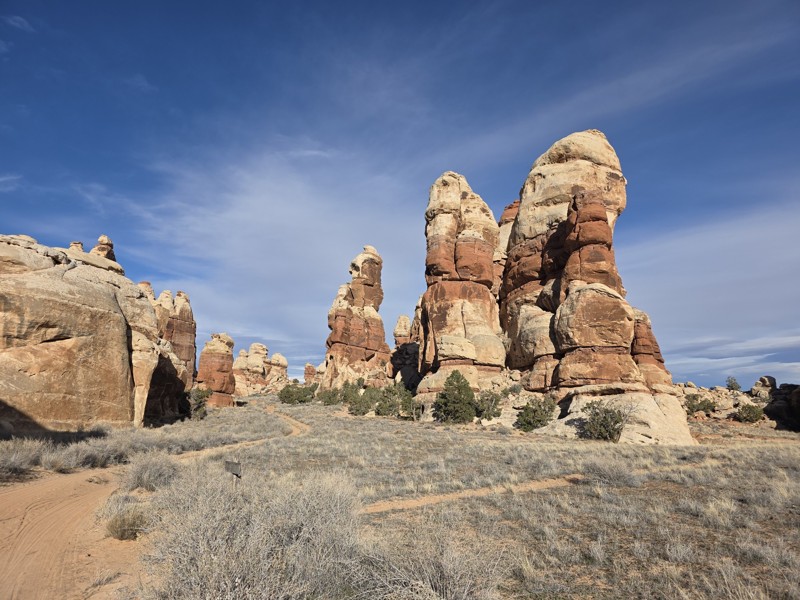
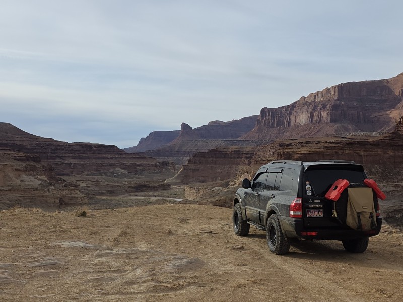
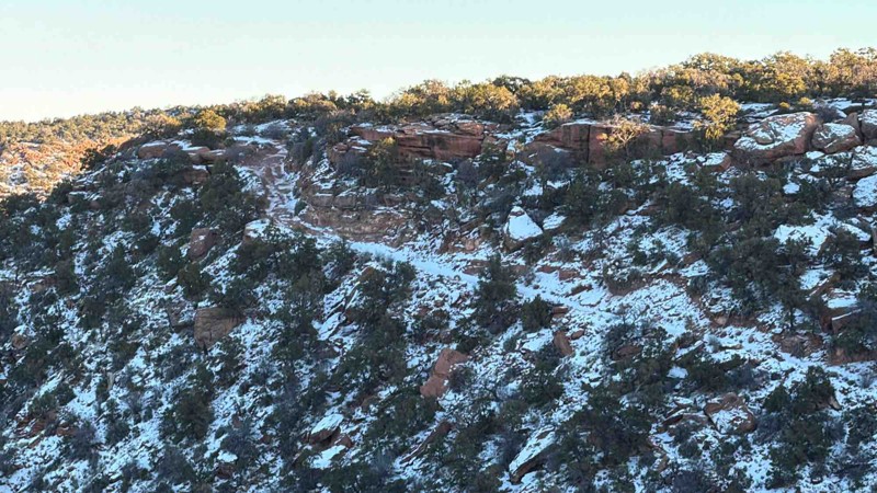
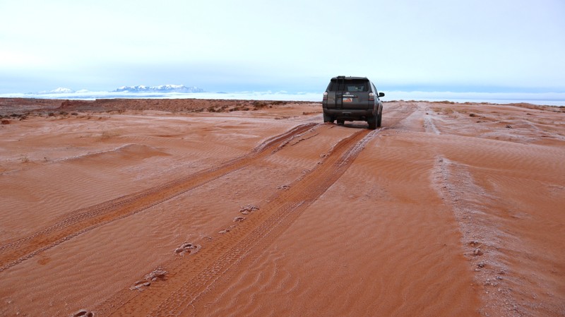
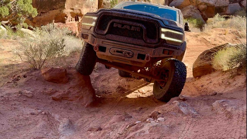
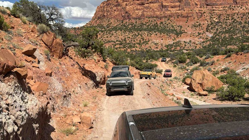
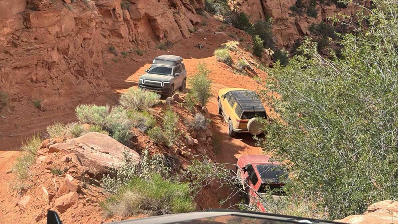
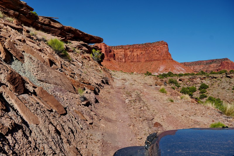
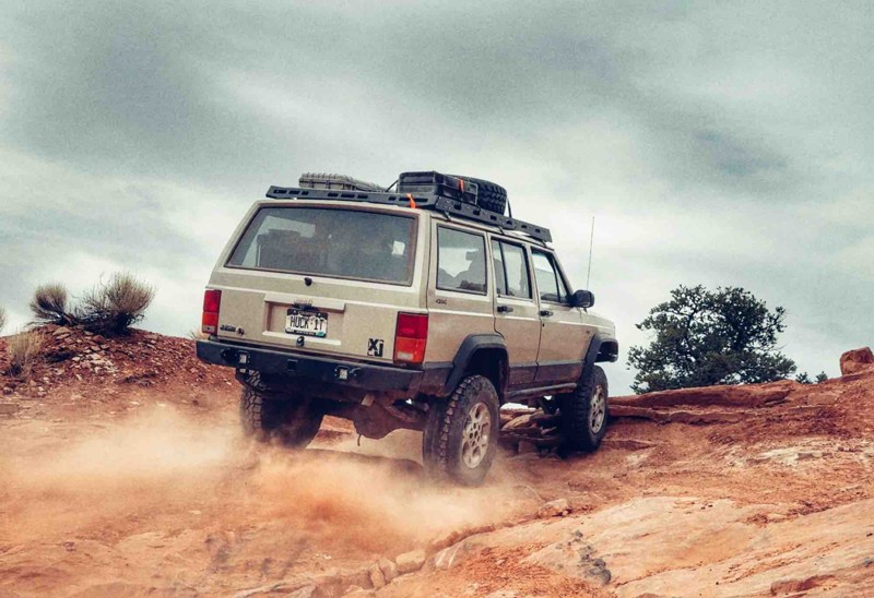
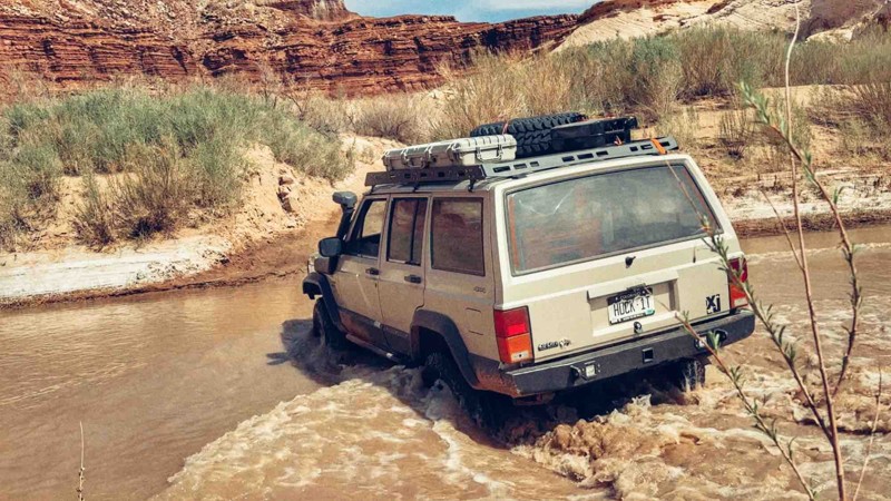
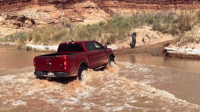
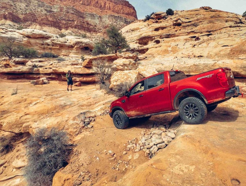
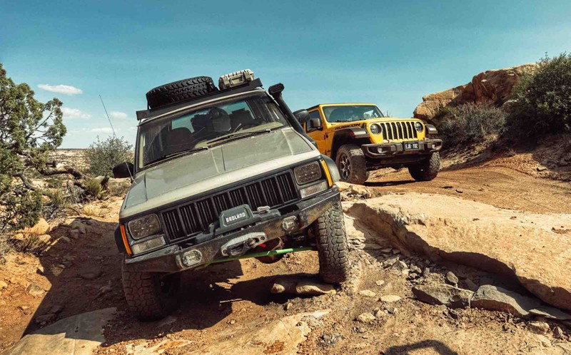
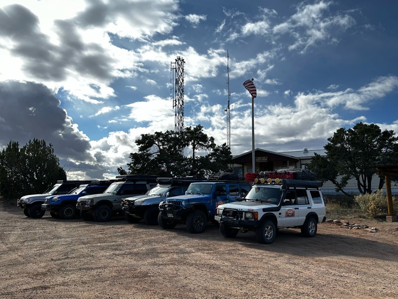
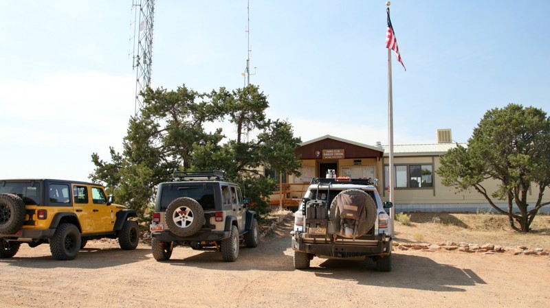
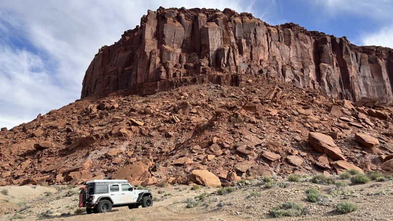
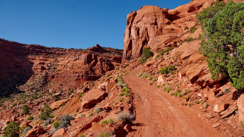
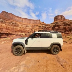
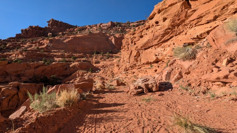
The Maze has a handful of long trails and none of them are particularly easy. Expect slickrock faces and waterfalls, 1-2 foot shelves, and plenty of sand and loose rock surfaces begging to blow a tire. This area is so hazardous, in fact, that you must check in with the park rangers and show them your vehicle before you head in. They will tell you if you are allowed to enter or not, but put it this way: you WILL need A/T, R/T, or M/T tires and 4WD with low range.

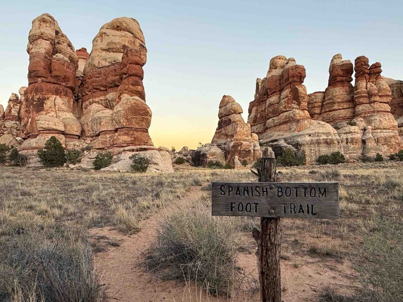
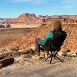
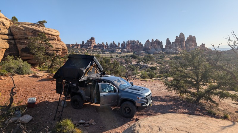
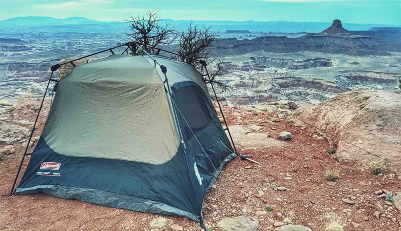
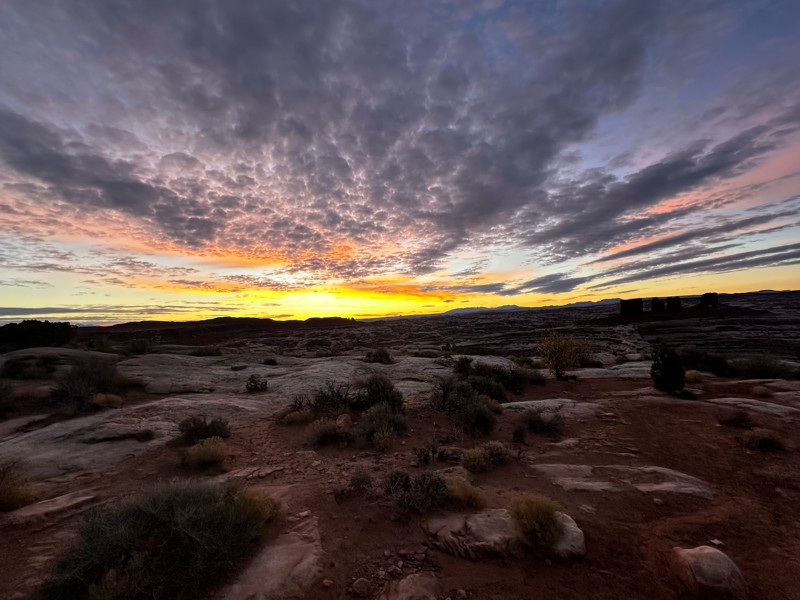
If you are lucky enough to be planning a trip to the Maze, be sure to book your camping well in advance, as most of the sites get reserved months ahead of time. There is a reason for the madness, though, as this is likely some of the best camping in the country. Purely isolated, reserve-only designated sites are your only option within the park. However, if you have the fuel range, there are a few options that lie just outside of park boundaries on Poison Springs and Lower San Rafael Road.

If a bucket list trip is just what the doctor ordered, then this trip will surely be near the top of the list. Only a few can pull off such an incredible journey through this wild and scenic region of central Utah, but it will be one for the books.

Top Reasons to Explore Here
Altitude Category IconAltitude
Beginner Category IconBeginner
Camping Category IconCamping
Desert Category IconDesert
Iconic Category IconIconic
Overland Category IconOverland
Sand Category IconSand
Scenic Category IconScenic
Wash Category IconWash
Basemap Styles

Content Type
Guide Types
Scout Route
Full Trail Guide

Difficulty Rating
easy
moderate
difficult
severe
extreme

Waypoints
Camping
Staging Area
Bathroom
Obstacle
Point of Interest
Directional

Most Recent Trail Reviews

Most Popular

Search for Trails
Utah: Poison Springs Hero Photo
All-Access Icon
4.9/5 (18 reviews)
Updated: 12/23/2025
Poison Springs
Hanksville, Utah

The Poison Springs 4WD trail in Southern Utah is a thrilling off-road adventure offering breathtaking scenery and complete isolation. Nestled within the picturesque canyonlands, this trail takes daring explorers on a rugged journey through red rock formations, steep ascents, and treacherous descents. As you navigate the narrow paths and encounter the famous Dirty Devil River crossing, the trail rewards you with sweeping vistas of towering red rock cliffs, vibrant desert flora, and the untamed beauty of the wild landscape. With its technical sections and awe-inspiring views, the Poison Springs 4WD trail promises an unforgettable experience for off-road enthusiasts seeking a taste of Utah's wild side.

Utah: Flint Trail Hero Photo
All-Access Icon
4.7/5 (13 reviews)
Updated: 03/26/2024
Flint Trail
Hanksville, Utah

With breathtaking views, heart-pounding switchbacks, and epic backcountry camping, what else could you want in a 4x4 adventure? Flint Trail is the southern gateway for one of America's most remote offroad trips. The views hit you right away along the towering Orange Cliffs of the Glen Canyon National Recreation Area. The bright orange cliffs tower over the trail as you zigzag beneath the shadows of precariously balanced stone behemoths. Natural arches and spires are abundant along the southern portion of the route, reminiscent of Monument Valley. Once inside the Glen Canyon area, the terrain changes to a more forested high desert with narrow cliff edge views and the infamous 800-foot climb on the narrow exposed Flint Switchbacks. Planning and preparation will help, but experience is key to safely navigating through this remote region of central Utah.

Utah: Doll House Hero Photo
All-Access Icon
5/5 (14 reviews)
Updated: 03/25/2024
Doll House
Hanksville, Utah

The Dollhouse 4WD trail in the Maze District of Canyonlands National Park is an exhilarating off-road adventure that immerses you in a remote awe-inspiring desert wilderness. Tucked away in the rugged heart of the park, the Dollhouse offers an unforgettable journey through towering sandstone formations, deep canyons, and vast expanses of untamed beauty. As you navigate the challenging terrain, with its narrow passages, and rocky obstacles, you are rewarded with panoramic views of the breathtaking landscape below. The Dollhouse itself, a collection of unique and intricately eroded rock formations resembling dolls, serves as a mesmerizing centerpiece of this unforgettable trail. With its combination of thrilling off-roading and stunning vistas, the Dollhouse 4WD trail promises an unforgettable experience for adventurers seeking the untamed spirit of Canyonlands National Park's Maze District.

Utah: Maze Overlook Hero Photo
All-Access Icon
4.6/5 (9 reviews)
Updated: 10/04/2023
Maze Overlook
Hanksville, Utah

The Maze Overlook trail in Canyonlands National Park is a thrilling adventure that takes visitors to breathtaking heights and rewards them with sweeping panoramic views. This rugged trail winds through the heart of the park's mesmerizing Maze District, showcasing the awe-inspiring natural beauty of red rock canyons and towering spires. As you navigate the challenging terrain, your adrenaline will surge with every twist and turn. Upon reaching the Maze Overlook, prepare to be captivated by the vastness of the landscape spread out before you, a true testament to the raw power of nature. The Maze Overlook trail is an unforgettable experience that will leave you in awe of the remarkable wonders found within Canyonlands National Park.

Utah: Hans Flat Road Hero Photo
Scout Route Icon
3.3/5 (4 reviews)
Updated: 11/07/2025
Hans Flat Road
Hanksville, Utah
Hans Flat Road runs 20.9 sandy miles from Lower San Rafael Road to the Canyonlands Maze District's Hans Flat Ranger Station. The road is easy but has a lot of washboarding in sections. The most difficult part of driving this road is controlling your anticipation. The Maze District of the Canyonlands National Park is one of the most iconic destinations for dedicated offroaders. The Maze District is the only national park area that has not a single foot of paved road surface. When checking in at Hans Flat, expect the ranger will examine your rig, question your driving experience, and verify you are bringing enough water. A trip into the Maze is a serious adventure. Vehicle recoveries are difficult and extremely expensive. But it's oh so worth the effort. There aren't many camping opportunities on Hand Flat Road and camping in the Maze District must be reserved ahead of time. There is camping along the Lower San Rafael Road.
Utah: Panorama Point and Cleopatra's Chair Hero Photo
All-Access Icon
4.9/5 (10 reviews)
Updated: 03/27/2024
Panorama Point and Cleopatra's Chair
Hanksville, Utah

The Panorama Point Overlook 4WD trail in Canyonlands National Park offers an exhilarating journey through a stunning desert landscape. The rugged trail leads to sweeping vistas of the park's iconic red rock formations and deep canyons. The trail gradually ascends to the Panorama Point Overlook with an awe-inspiring panoramic view that stretches for miles, including the Las Sal and Abajo mountain ranges as well as a bird's eye view of the red rock canyons that give the Maze its moniker. From this vantage point, the layers of colorful cliffs and the meandering Colorado River create a breathtaking tapestry of nature's artistry. It's a must-visit destination for nature enthusiasts and adventurers seeking a remarkable experience in Canyonlands National Park.

Utah: Black Jump Hero Photo
Scout Route Icon
5/5 (3 reviews)
Updated: 02/04/2025
Black Jump
Hite, Utah

Black Jump spurs off Poison Springs to incredible camping opportunities and the fantastic hiking trail through Happy Canyon. Camping along this trail is plentiful, and many sites offer impressive vistas of the surrounding canyons. It is common to see petrified wood up here, so keep your eyes open. The 8-mile round-trip hike at the end is not to miss if slot canyons are your thing.

If you are brave, you could potentially complete this trail in an AWD vehicle, but a stock 4WD vehicle with a transfer case is recommended. There are also sections of narrow shelf road. This is a highly recommended route to explore in the Poison Springs area.

Utah: Golden Stairs Hero Photo
Scout Route Icon
4/5 (3 reviews)
Updated: 01/20/2026
Golden Stairs
Hite, Utah

Short but sweet, this easy spur in the Maze District of Canyonlands takes you to the incredible Golden Stairs hiking trail and campsite of the same name. Getting into the park requires 4WD and high clearance, although this trail is an easy winding path. There is only a small amount of parking, so please be aware of keeping on the trail and leaving room for others to enjoy this breathtaking region. All camping in the Maze is by reservation only at Rec.gov.

Utah: Big Ridge Hero Photo
Scout Route Icon
5/5 (2 reviews)
Updated: 01/20/2026
Big Ridge
Hite, Utah

The Big Ridge Road, also labeled Happy Canyon on some maps, follows a long mesa top above Hatch Canyon and the Poison Springs road, with many amazing views of the surrounding area. It starts in the Orange Cliffs portion of the Glen Canyon National Recreation Area, adjacent to the Maze District of Canyonlands National Park, splitting off from the Flint Trail just above the famous Flint Hill switchbacks. The first 12 miles are an easy, well-maintained county B road consisting of graded dirt mixed with sections of broken slickrock. The first 7 miles are inside the Glen Canyon NRA, where camping is prohibited except at the Happy Canyon Campsite near the beginning of the trail. The highlight of this section is where the road traverses a narrow ridge with amazing views of the surrounding canyons on both sides.

After crossing onto BLM land, the road follows a flat mesa top past the top of the Simplot Dugway and crosses a backcountry airstrip. This section alternates between open fields and juniper forest. Camping is allowed here, though there are a few established sites.

The last 2.5 miles have a quite different character, transitioning from an easy graded dirt road to a moderate four-wheel-drive road, which is mostly a narrow shelf road skirting along the edge of a series of cliffs near Two Pipe Spring. The views here are spectacular. While there are no major obstacles along this section and the road is consistently wide enough for full-size vehicles, it may be intimidating to people who don't like shelf roads. Recent rockfall could render this section impassible or increase the difficulty level considerably.

At the end of the shelf road portion is a three-way junction. The road straight ahead leads to a hilltop overlook on an outcropping portion of the mesa. This road was closed in the 2025 Henry Mountains Fremont Gorge travel plan, but you may wish to hike the short distance to see the viewpoint at the end.

To the right is the beginning of a much harder road that climbs steeply up and over the highest terrace of Big Ridge before looping around the north rim of the mesa and reconnecting with the main Big Ridge Road near the backcountry airstrip. While most of this road is passable for full-size vehicles, there is a narrow, shelf road section in the middle that is only wide enough for ATVs and dirt bikes, preventing full-size vehicles from driving it as a loop. The east end of this side loop is easy and offers some nice viewpoints of Happy Canyon, while the west end is more challenging and requires navigating a series of steep, tight switchbacks with some difficult ledge obstacles and narrow pinch points. This side loop used to access a spur road that continued further out along the top of Big Ridge, but that road was also closed in the 2025 travel plan.

Utah: Simplot Dugway Hero Photo
Scout Route Icon
5/5 (1 reviews)
Updated: 01/05/2026
Simplot Dugway
Hite, Utah

The Simplot Dugway is a classic Utah dugway road, switch-backing steeply up a series of seemingly impossible cliffs to connect the Poison Springs road to the road on top of Big Ridge. Originally built in the 1950s, the road fell into disrepair and for decades was only passable to dirt bikes or on foot. But in 2020, Garfield County rebuilt the road and cleared the rockslides that had long buried it. It is now a moderate four-wheel-drive road that is regularly maintained by the county, most recently in the spring of 2025. It was reaffirmed as a designated route open to all vehicles in the 2025 BLM Henry Mountains Fremont Gorge travel plan, and is the only way that unlicensed vehicles can access the top of Big Ridge, since they are not allowed on Flint Trail or the portion of the Big Ridge road in the Glen Canyon National Recreation Area.

If the road has been maintained recently, its difficulty should be similar to that of the Flint Trail switchbacks, with lots of steep, tight switchbacks but no major obstacles. However, it is subject to severe erosion from major rainstorms, which can cause it to narrow over time and render it impassable to full-size vehicles until the county rebuilds it. Check with the Hans Flat Ranger Station or the Garfield County roads department to confirm its current status before planning to drive it.

Starting from the intersection with Poison Springs Road at the bottom, the road crosses an open field before reaching the base of the cliffs at the bottom of Big Ridge. From there, it climbs steeply up the side of the mesa, with numerous tight switchbacks and sections of narrow shelf road clinging precariously to the cliff face. If you hate shelf roads, this is probably not the trail for you. There is a spot about halfway up that is the most likely to wash out in a major rainstorm. If you make it past that, you should be good. Before you know it, you're at the top and can continue on Big Ridge Road.

There are no campsites along this road, but you should be able to find a place to camp near the top of Big Ridge.