
Elephant Hill (19.87 miles away)
Monticello, Utah
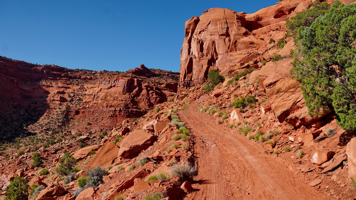

The Simplot Dugway is a classic Utah dugway road, switch-backing steeply up a series of seemingly impossible cliffs to connect the Poison Springs road to the road on top of Big Ridge. Originally built in the 1950s, the road fell into disrepair and for decades was only passable to dirt bikes or on foot. But in 2020, Garfield County rebuilt the road and cleared the rockslides that had long buried it. It is now a moderate four-wheel-drive road that is regularly maintained by the county, most recently in the spring of 2025. It was reaffirmed as a designated route open to all vehicles in the 2025 BLM Henry Mountains Fremont Gorge travel plan, and is the only way that unlicensed vehicles can access the top of Big Ridge, since they are not allowed on Flint Trail or the portion of the Big Ridge road in the Glen Canyon National Recreation Area.
If the road has been maintained recently, its difficulty should be similar to that of the Flint Trail switchbacks, with lots of steep, tight switchbacks but no major obstacles. However, it is subject to severe erosion from major rainstorms, which can cause it to narrow over time and render it impassable to full-size vehicles until the county rebuilds it. Check with the Hans Flat Ranger Station or the Garfield County roads department to confirm its current status before planning to drive it.
Starting from the intersection with Poison Springs Road at the bottom, the road crosses an open field before reaching the base of the cliffs at the bottom of Big Ridge. From there, it climbs steeply up the side of the mesa, with numerous tight switchbacks and sections of narrow shelf road clinging precariously to the cliff face. If you hate shelf roads, this is probably not the trail for you. There is a spot about halfway up that is the most likely to wash out in a major rainstorm. If you make it past that, you should be good. Before you know it, you're at the top and can continue on Big Ridge Road.
There are no campsites along this road, but you should be able to find a place to camp near the top of Big Ridge.