
Elephant Hill (18.94 miles away)
Monticello, Utah
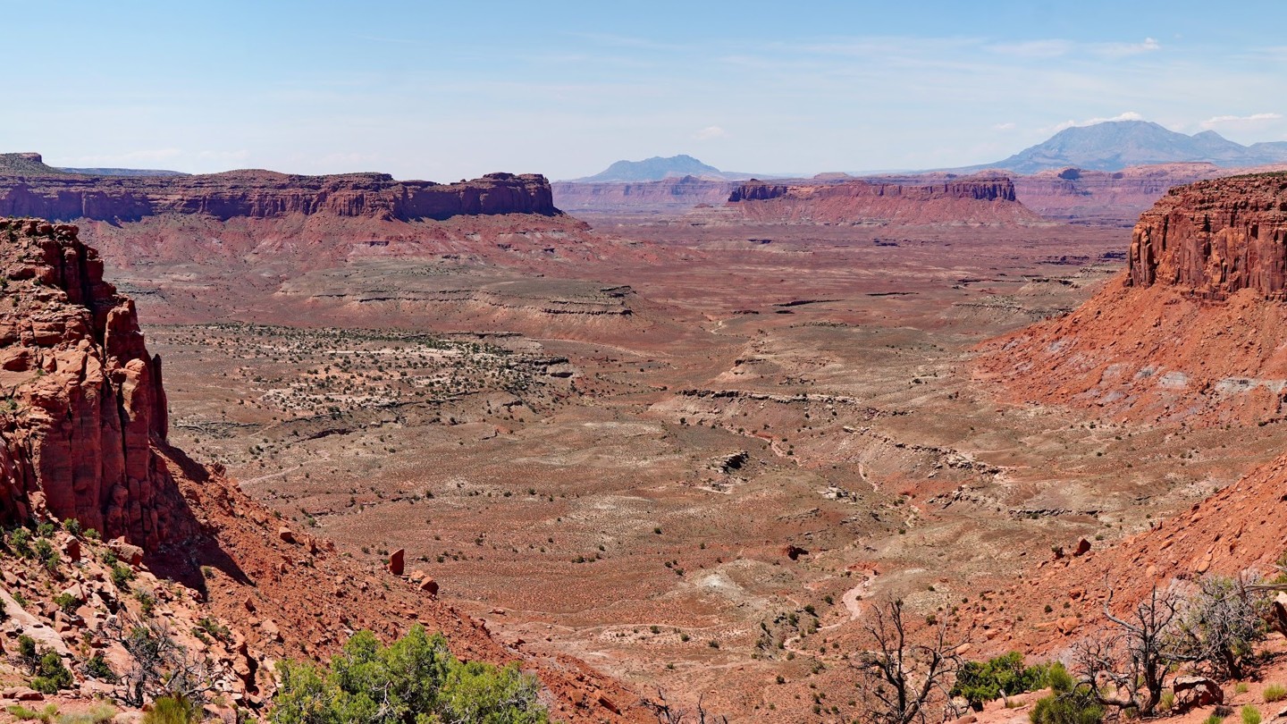

The Big Ridge Road, also labeled Happy Canyon on some maps, follows a long mesa top above Hatch Canyon and the Poison Springs road, with many amazing views of the surrounding area. It starts in the Orange Cliffs portion of the Glen Canyon National Recreation Area, adjacent to the Maze District of Canyonlands National Park, splitting off from the Flint Trail just above the famous Flint Hill switchbacks. The first 12 miles are an easy, well-maintained county B road consisting of graded dirt mixed with sections of broken slickrock. The first 7 miles are inside the Glen Canyon NRA, where camping is prohibited except at the Happy Canyon Campsite near the beginning of the trail. The highlight of this section is where the road traverses a narrow ridge with amazing views of the surrounding canyons on both sides.
After crossing onto BLM land, the road follows a flat mesa top past the top of the Simplot Dugway and crosses a backcountry airstrip. This section alternates between open fields and juniper forest. Camping is allowed here, though there are a few established sites.
The last 2.5 miles have a quite different character, transitioning from an easy graded dirt road to a moderate four-wheel-drive road, which is mostly a narrow shelf road skirting along the edge of a series of cliffs near Two Pipe Spring. The views here are spectacular. While there are no major obstacles along this section and the road is consistently wide enough for full-size vehicles, it may be intimidating to people who don't like shelf roads. Recent rockfall could render this section impassible or increase the difficulty level considerably.
At the end of the shelf road portion is a three-way junction. The road straight ahead leads to a hilltop overlook on an outcropping portion of the mesa. This road was closed in the 2025 Henry Mountains Fremont Gorge travel plan, but you may wish to hike the short distance to see the viewpoint at the end.
To the right is the beginning of a much harder road that climbs steeply up and over the highest terrace of Big Ridge before looping around the north rim of the mesa and reconnecting with the main Big Ridge Road near the backcountry airstrip. While most of this road is passable for full-size vehicles, there is a narrow, shelf road section in the middle that is only wide enough for ATVs and dirt bikes, preventing full-size vehicles from driving it as a loop. The east end of this side loop is easy and offers some nice viewpoints of Happy Canyon, while the west end is more challenging and requires navigating a series of steep, tight switchbacks with some difficult ledge obstacles and narrow pinch points. This side loop used to access a spur road that continued further out along the top of Big Ridge, but that road was also closed in the 2025 travel plan.