


By clicking "ACCEPT", you agree to be the terms and conditions of each policy linked to above. You also agree to the storing of cookies on your device to facilitate the operation and functionality of our site, enhance and customize your user experience, and to analyze how our site is used.
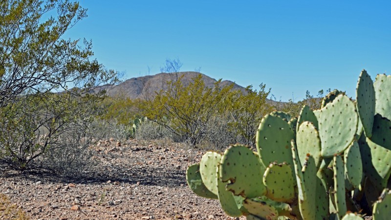
Texas Off-Road Trails
70
Total Trail Guides 63

591
Detailed Waypoints 42
Try a Free 7-Day Trial and unlock it all
Start a Free Trial Most Recent Trail Reviews
Rated 5/5
Open
Visited: 06/07/2026
Great trails. Appreciate the staff and air station. Will definitely be returning!
ES
Erin Snow
No Rating
Open
Visited: 05/29/2026
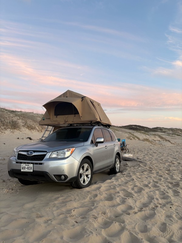
One of my most visited places in Texas! No issues at all with my stock Subaru on some slightly larger A/Ts. I reccomend airing down, a lot of hard packed sand, especially at low tide, but soft deep se...
K
Kai
Rated 5/5
Open
Visited: 05/23/2026
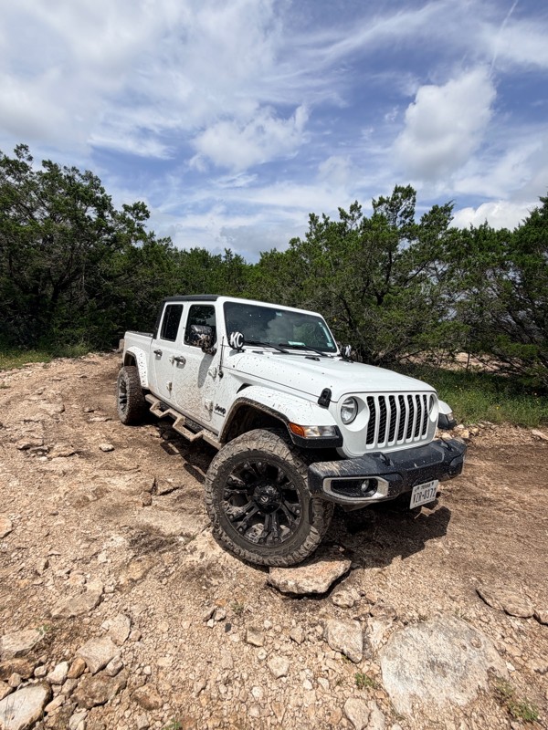
Made it through with a stock 2025 Jeep Gladiator, although we definitely had to take they bypasses. Scenery is beautiful, such a nice place with so many trails for a great adventure.
Amanda Martinez
TH
Travis Hofeldt
Rated 5/5
Open
Visited: 05/01/2026
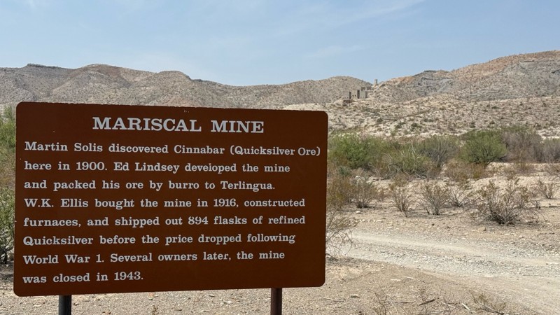
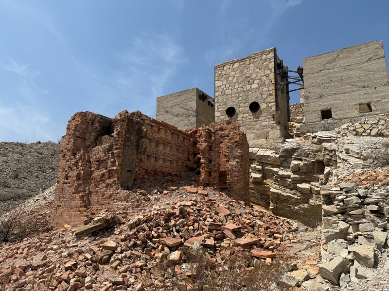
Mariscal Mine is one of the most interesting parts of Big Bend…a must see stop on this trail.
TH
Travis Hofeldt
No Rating
Open
Visited: 04/29/2026
Drove on the way to Old Ore Road…super easy trail
TH
Travis Hofeldt
Rated 5/5
Open
Visited: 04/29/2026
Very scenic trail; our first time visiting Big Bend. This took us 4+ hours, not including stops for air, lunch, etc. It’s certainly rougher than expected today.
TH
Travis Hofeldt
No Rating
Open
Visited: 04/28/2026
Our favorite trail we did all week. The staff that manage access were super friendly, they even have air at the base to air up when you’re done. Lots of shelf road!
TH
Travis Hofeldt
No Rating
Open
Visited: 04/28/2026
Very nice scenic trail…easily passable via most any reasonable 4wd vehicle.

TH
Travis Hofeldt
Rated 5/5
Open
Visited: 04/27/2026
I took “easy” literally…it’s rough enough to slow progress in much of the route, but I would have preferred to not be pulling a trailer.
TH
Travis Hofeldt
Rated 4/5
Open
Visited: 04/17/2026
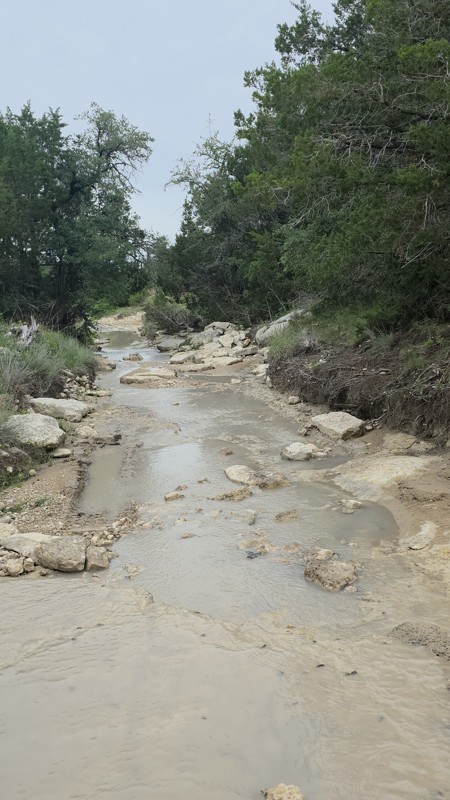
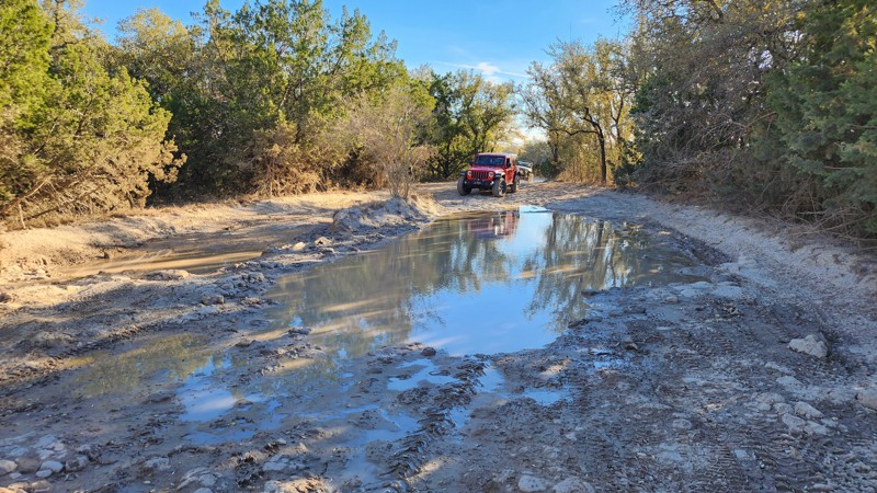
Road back open, drove it today in a crossover. Some more mud and ruts now from the flood. One area that requires any skill where I got on three wheels but otherwise an easy drive.
Tyler
Rated 3/5
Temporary Closure
Visited: 04/15/2026
Due to a flood, this road is marked as closed by NPS.
Tyler
Open
Visited: 04/11/2026
Pretty easy run that requires decent clearance in a couple spots. Optional flexy bits. There is a really good section where you can see the entire quarry below.. (Rain/mud can turn this trail ...
Kevin
Open
Visited: 04/11/2026
Minos is a fun loop around the back of the park. There are a couple rutted section as you come up the back fence line, but there are bypasses for lower ground clearance rigs.
The bumps can get re...
Kevin
Rated 5/5
Open
Visited: 04/11/2026
We went after a rain and during high tide... it was a blast. Deep sand started a couple of miles past Access 6 and although you could run close to the surf line we intentionally went to the deepest sa...
D
David
Rated 5/5
Open
Visited: 03/25/2026
Holy washboards! Drove this route to get to the Santa Elena Canyon Trailhead. If you have the capability, air down to smooth out the ride on this easy dirt road.

Marcus Trusty
Official Crew
Rated 4/5
Open
Visited: 03/21/2026
Long wheelbases will have trouble. Every route has a bypass. With bypass this is like a 2. Without bypass this is like a 4. Line choice is always important. Some of the best trails you’ll get in the s...
TA
texas aggie
Rated 5/5
Open
Visited: 03/20/2026
Very pretty road which is more interesting to drive and varied than some other roads in big bend. Would give yourself some time to do it so can stop and enjoy views, check out springs, have lunch, etc...
K
Kathleen
Rated 4/5
Open
Visited: 03/20/2026
Pretty, and easy. Condition of road/ difficulty similar to Glenn Springs Rd. Saw a good number of people camping in campsites along road, more than we saw on other trails in park (though it was spring...
K
Kathleen
Rated 3/5
Open
Visited: 03/20/2026
For the first couple miles, this trail is similar to Glenn Springs Rd. The second half is not -- it's basically a long, stock-doable, but slow and bumpy rock garden. I wouldn't recommend unless you wa...
K
Kathleen
No Rating
Open
Visited: 03/20/2026
This was a really fun trail, with great views. Didn't see that many people on it, even though it was spring break. We did notice that except for the "rocky steps," many of the current rougher parts do...
K
Kathleen
Rated 5/5
Open
Visited: 03/18/2026
Drove this over spring break week in one day, and repeated parts of it on two other days. Took maybe 5-6 hours including lots of longish stops. Mostly an easy road but unique experience being this rem...
K
Kathleen
Partially Open
Visited: 02/15/2026
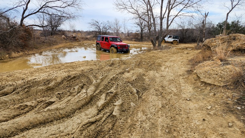
Great Off-roading trail. We had just had some heavy rain the day before and the trails were good and muddy, a slippery, clay like mud. There are multiple, optional trails that take you off the main tr...
KW
Kevin Weaver
No Rating
Temporary Closure
Visited: 02/11/2026
From the park's website:
Due to heavy rain and flooding events in July, the following closures are in effect until further notice:
The following dirt roads are CLOSED: Hot Springs Road and Black Gap...

Todd
Official Crew
No Rating
Temporary Closure
Visited: 02/06/2026
I was excited to get on this Jeep Badge of Honor trail while we are exploring Big Bend. Unfortunately, this trail is closed and rangers at the Visitors Center do not have update on when it will re-ope...
JR
Joe Ryan
Rated 4/5
Open
Visited: 02/04/2026
the road is very smooth to campsite 2, perfect for road oriented RV's wanting a taste of primitive camping with great views of the Chisos. after campsite 2 the road drops into a gulley of very rocky s...
rob hone
Rated 4/5
Open
Visited: 02/03/2026
Glenn Springs road is very manicured, when you turn off on to Pine Canyon its far rougher, rockier, and slower but winds up into the best views of the Chisos in the park. Pine Canyon 3 and 4 are the b...
rob hone
Rated 5/5
Open
Visited: 01/23/2026
This is an easy road that gets you to some good group campsites with some terrain/hills to explore on foot. When the weather is clear, there are some fine views to the north and south (Chicos Mountai...

Tracy Barker
Official Crew
Rated 5/5
Open
Visited: 01/22/2026
My small group came in on Thursday and departed on Friday; we intended to stay longer but the others meeting us suggested we camp closer to "civilization" (Panther Junction in BBNP) just in case the a...
Tracy Barker
Official Crew
Rated 4/5
Open
Visited: 01/22/2026
No significant road changes to report, it is as described in the guide. We did find some erosion in the washes and in the road near Jackson Pens, but nothing a high-clearance 4x4 has trouble with (2W...
Tracy Barker
Official Crew
Rated 4/5
Open
Visited: 01/22/2026
I drove the Main Park Road on Thursday and Friday (in and out) with a small group. The terrain and topography are fantastic. The road narrows, goes up and down inclines, and has several spots where ...
Tracy Barker
Official Crew
Rated 4/5
Open
Visited: 01/22/2026
I drove Bofecillos Road on Thursday and Friday (22-23 January) into and out of the BBRSP. The group that I traveled with didn't want to stop for photos,so I have none for Bofecillos Road. The descri...
Tracy Barker
Official Crew
Rated 5/5
Open
Visited: 01/21/2026
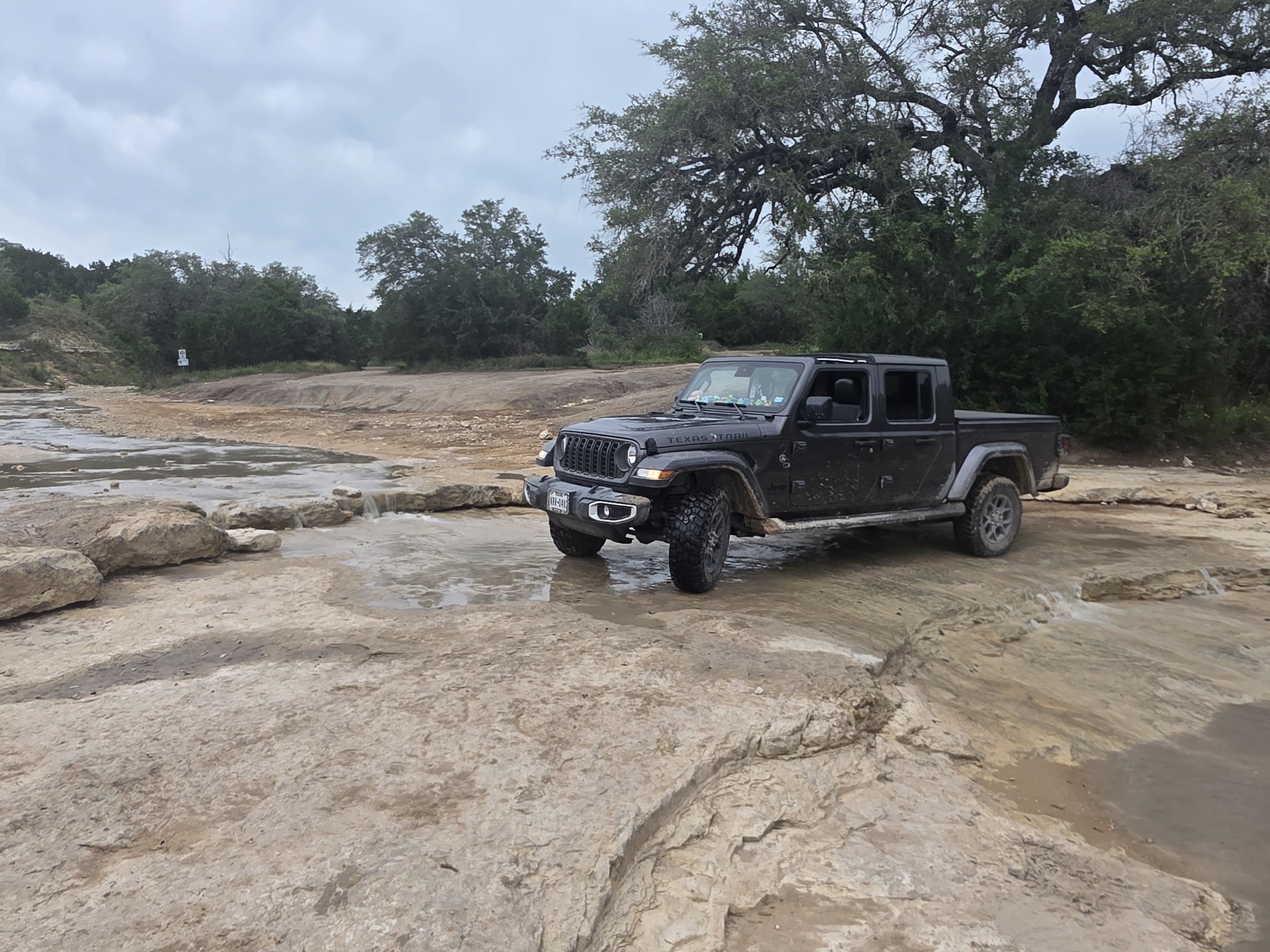
I drove segments of the River Road on January 20 and 21, 2026. What's remarkable about BBNP and BBRSP is how remote it is...once I left the pavement, I didn't see another vehicle until midway through...
Tracy Barker
Official Crew
Rated 5/5
Open
Visited: 01/18/2026
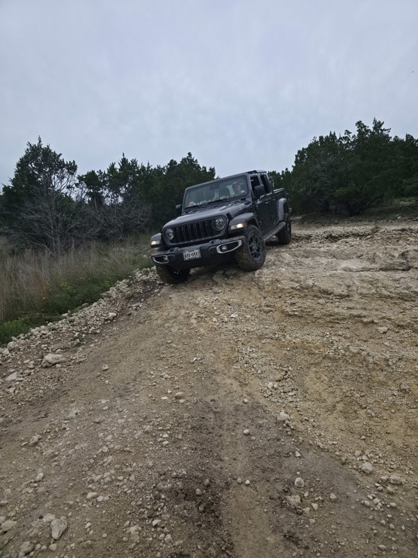
Took a Gladiator on 33s up the mountain for my wife’s first time ever off roading. Besides the occasional large rock she kept composed the whole time. The fact that only 1 party is allowed on the trai...
T
Tricky_rick
Rated 4/5
Open
Visited: 01/16/2026
Enjoyed our first visit to the park. We’ll be back. Had two Jeeps. Wrangler Sahara was stock. I was in my Rubicon. Park was dry.
Wendell Barton
No Rating
Open
Visited: 01/01/2026
Took an hour up to the top and 50 minutes down. Some boulders at most 12” in the way but mostly easy if you don’t have an issue with shelf roads, which are most of the road. Enjoyed the trail and the ...
TL
Thomas Le
Rated 4/5
Open
Visited: 12/22/2025
The trail is open in the Sam Houston National Forest. Patches/repairs to washed-out sections do require a high-clearance vehicle. The trail was dry the day we ran it. From trees in the National Forest...
Wendell Barton
Rated 4/5
Open
Visited: 11/17/2025
Slightly unnerving for people with a fear of heights is an understatement.
The Trail is all shelf road.
It is a moderate trail. Amazing views.
Not doing it again. :)
JM
John Matthews
No Rating
Open
Visited: 11/05/2025
The "Apollo Spacecraft" is a few hundred yards from the south entrance of the trail.

LM
Layne Marlow
No Rating
Open
Visited: 11/03/2025
Defiantly not maintained. Be prepared for a lot of Texas Pinstripes and hood high bushes in middle of road.


LM
Layne Marlow
Open
Visited: 11/02/2025
That last hill climb along the fence was pretty harsh, definitely worse than it looks in the images on the trail guide. Idk if it’s just been washed out over the last couple of years but a couple of s...
SH
Shane Hancock
Open
Visited: 10/25/2025
This trail was pretty clear for the most part. Once you cross the river the road has a good washout.
BR
Blaine Robbins
Rated 5/5
Open
Visited: 10/25/2025
Very overgrown will give your vehicle some new pinstripes but it was a great trail
BR
Blaine Robbins
Rated 5/5
Open
Visited: 10/25/2025
Great trail. Arroyo washout at waypoint 11 has become deeper. Hardest part of the trail.
SO
Scott Oswald
Rated 5/5
Open
Visited: 10/25/2025
Great trail. Sever pin-striping…. Just be ready for it.
SO
Scott Oswald
Rated 5/5
Open
Visited: 10/25/2025
Fun trail. Arroyo exit is tricky to find if you are running the trail South to North.
SO
Scott Oswald
Rated 5/5
Open
Visited: 10/24/2025
This was a great trail! Awesome views! 2wd all the way up and back down.
SO
Scott Oswald
No Rating
Open
Visited: 10/24/2025
Road was bumpy. Did not need a high clearance vehicle or 4wheel drive.
BR
Blaine Robbins
No Rating
Open
Visited: 10/24/2025
Nice camping spots. Road was super easy, just a rocky/bumpy.
SO
Scott Oswald
MM
Mike Mittelbuscher
Most Popular


Updated: 03/12/2024
Hidden Falls Adventure Park: Outer Loop
Open
/
Marble Falls, Texas/
5.54 miles/
About 2 hours
Located just outside Marble Falls, an hour from Austin, Hidden Falls Adventure Park is an exhilarating 4x4 and camping area with some of the best offroading for miles around. With over 2,000 acres, this private off-road park, also designated as a Jeep Badge of Honor park, offers nearly 240 miles of trails suitable for all types of 4-wheel drive vehicles. Drivers can expect to be challenged with a variety of terrains, including steep hills, rock gardens, ledge climbs, water crossings, and tight turns.
Hidden Falls Adventure Park is an unforgettable experience that combines the thrill of off-road driving with the beauty of the Texas Hill Country. Whether you're a beginner or an experienced driver, there's something for everyone at this amazing off-road park.

Updated: 11/20/2024
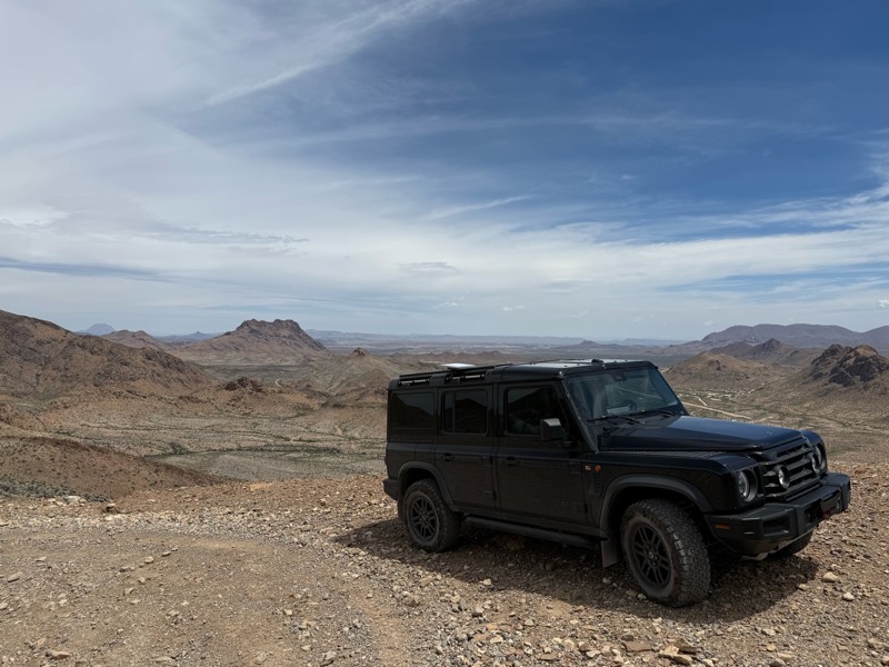
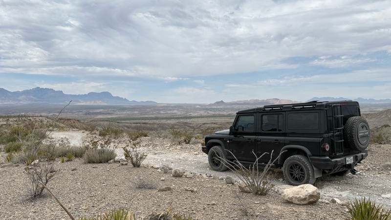
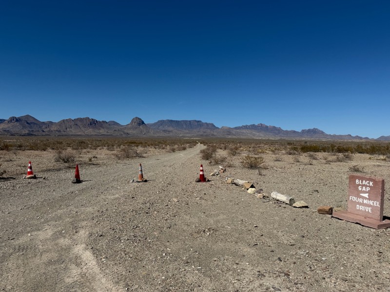
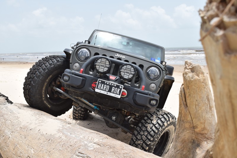
Black Gap Road
Temporary Closure
/
Terlingua, Texas/
8.71 miles/
About 2 hours
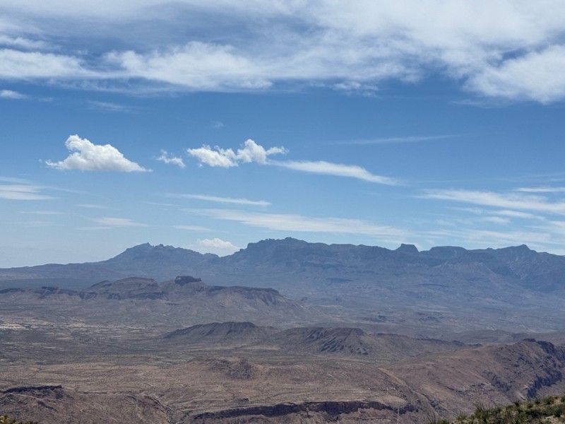
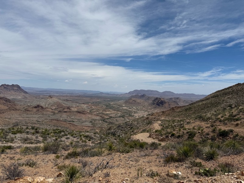
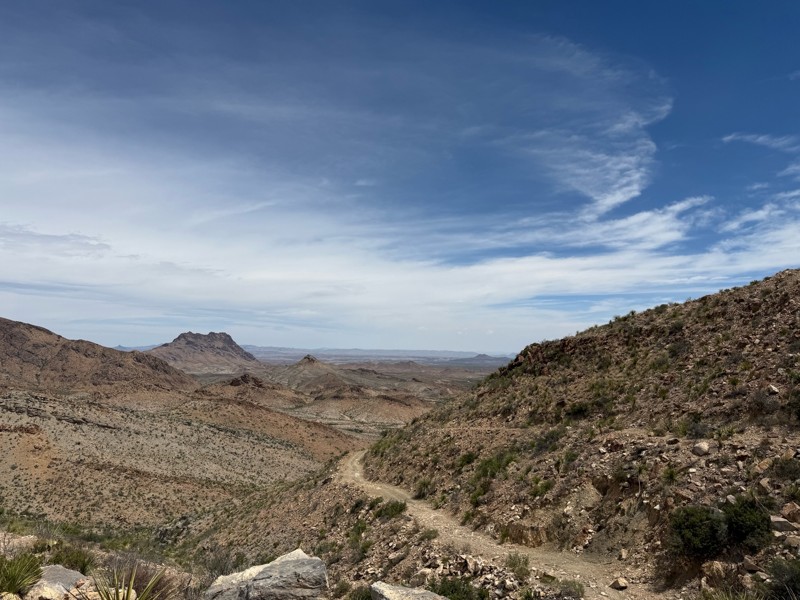
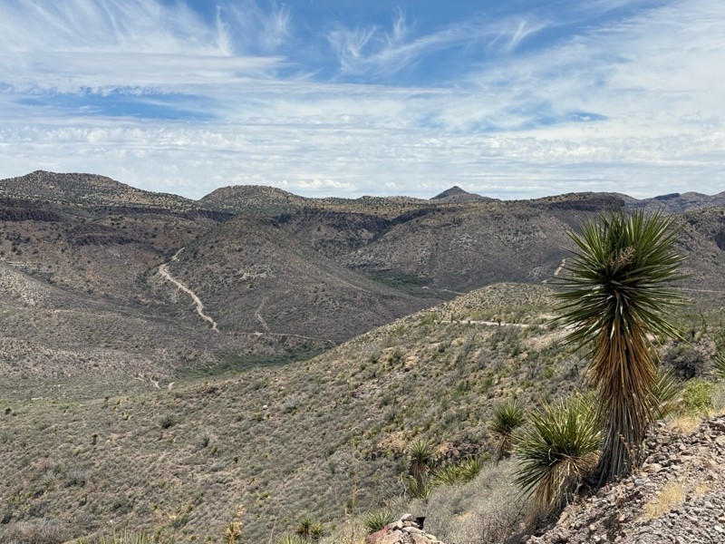
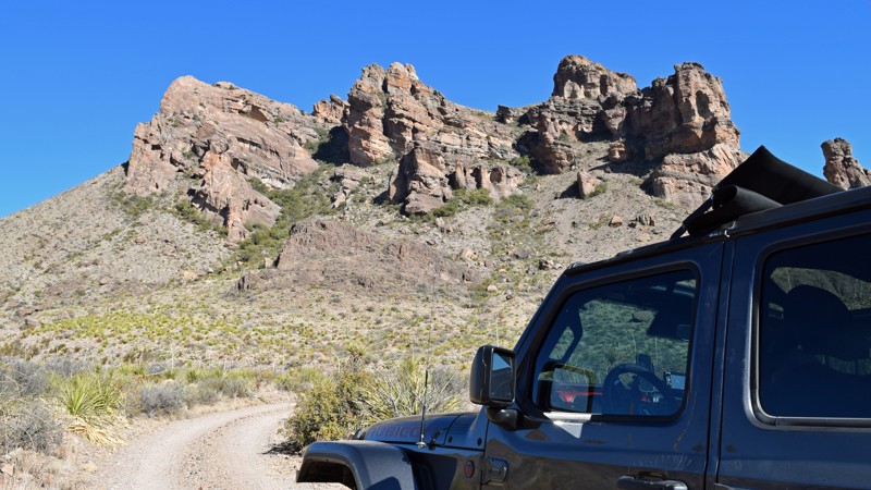
Black Gap Road in Big Bend National Park is 1 of 3 Jeep Badge of Honor Trails in Texas and arguably the most well-known off-road trail in the state of Texas. Connecting Glenn Springs Road with River Road, Black Gap is perhaps the most remote, un-maintained road in the park, providing scenic views of the Chisos Mountain Range as well as wide-open vistas of the Chihuahuan Desert. For those looking to experience Texas at its best, Black Gap Road is an absolute must do!

Updated: 03/12/2024
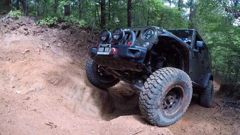
Northwest OHV Park E-101 - Minos Loop
Open
/
Bridgeport, Texas/
1.19 miles/
About 30 minutes
Located 100 miles northwest of Dallas, in Bridgeport, Texas, Northwest OHV Park is a 302-acre rock quarry converted to an offroad park in 2009. This Jeep Badge of Honor designated OHV park offers around 25 miles of trails varying in difficulty, great for any level of wheeler from beginners to experts. Minos Loop circles the northwest corner of the property and offers an excellent opportunity to test your 4x4 skills over large limestone deposits that create steep hills and dramatic ledges. Use this trail to access several of the park's longest rock-crawling trails.

Updated: 10/09/2025
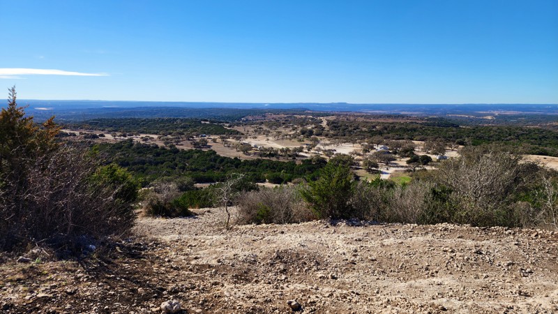
Texas Hill Country Overland Route
Sunrise Beach Village, Texas
The meandering 148-mile Texas Hill Country Overland route makes its way through scenic ranch lands between Marble Falls and Fredericksburg, Texas. As the route continually alternates from paved to a well-graded dirt road, be prepared to pause for cattle casually relaxing in the middle of the road. Though a beautiful and relaxing drive any time of year, the route takes on a peculiar Texas beauty in the spring as the bluebonnets bloom across the region, adding to the picturesque scenery of old farmhouses, country schools, and windmills. While the route includes numerous river crossings, all but one - the famous James River Crossing - are typically dry except during heavy rains. Easily traversed by any stock high clearance vehicle during normal conditions, the James River, as well as several other crossings, become unpassable during inclement weather. Be prepared to turn back if water levels prohibit a safe crossing.
Running in parallel with sections of the Gillespie County Country Schools Driving Trail, travelers looking to do a bit more site seeing may want to take time to check out the schools along the way. Yet another option for those looking for additional things to do is to visit one of the largest bat nurseries in the country - the Eckert James River Bat Cave Preserve.
While commercial camping and lodging options abound in both Marble Falls and Fredericksburg, just a few miles from either end of the trail, the only options directly along the route include a few boutique hotels in Mason, Texas. While providing the only food and fuel stop along the route, Mason also serves as an excellent midway option to take a break from the trail.
Whether you are vacationing in the Texas hill country, touring the Texas wineries and breweries in and around Fredericksburg, or visiting Hidden Falls Adventure Park (the Jeep Badge Of Honor destination just outside Marble Falls), be sure to take the time to explore this beautiful and scenic Texas route.
Updated: 01/05/2026
Cheeseburger Loop
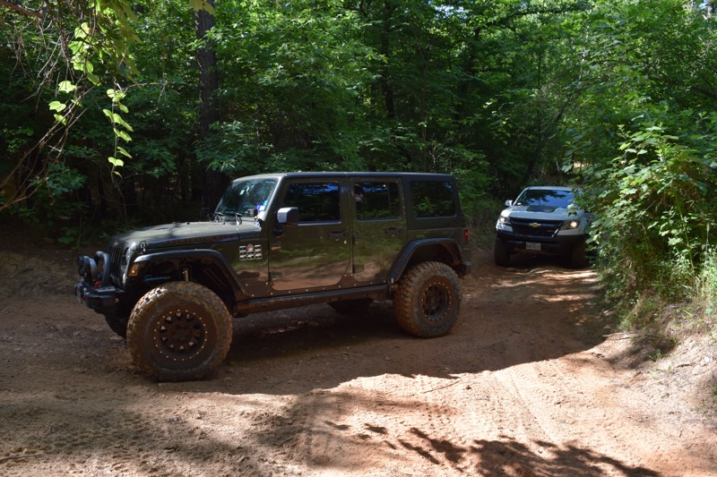
Montgomery, Texas
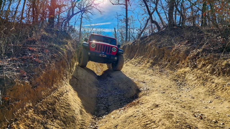
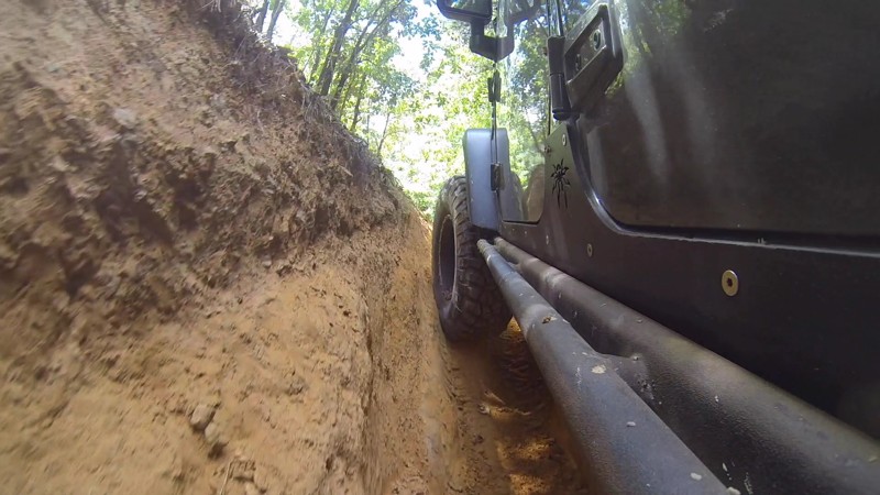
Just a short drive from the hustle and bustle of the Houston metro area, the quiet serenity of a quaint country drive awaits those needing a day trip to escape the city. While a ‘loop,’ most tend to start the Cheeseburger Loop in Montgomery, following the pavement into the Sam Houston National Forest. The route winds its way along numerous forest roads, providing travelers with the beauty of canopied dirt roads barely wide enough to pass. Sections of well-maintained dirt roads connect through short stints of payment, ultimately making their way out of the forest and through private ranch lands of southeast Texas. As the cares of the world drift away, roughly two-thirds along the route, travelers will stumble upon Yankee’s Tavern & Grill when traveling counterclockwise. A tradition of the route has travelers stopping for a cold beverage and a burger before completing the loop and heading back to the cares of the world. Looking to turn this day trip into a weekend getaway? Sam Houston National Forest offers numerous first-come-first-serve campsites. For those living in the Houston metro area, this hidden gem provided the perfect opportunity for beginners and veterans alike to get away and kick up some dirt on the tires!

Updated: 10/30/2022
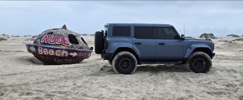
Lost Highway 87
Port Arthur, Texas
Of all the beach runs in Texas, the Lost Highway 87 run offers an eerie reminder of the destructive damage and erosion caused by past storms. What was once a state highway lined with homes and businesses is now mere scattered ruins along a narrowly passable 20 mile stretch of beach. Awareness of the tide charts is key to making the run comfortably and legally along the shoreline.
Running from Sabine Pass in Jefferson County to High Island on the Bolivar Peninsula in Galveston County, the “Lost Highway 87” runs primarily along McFaddin Beach. Adding to the mystic of the run is the fact that the mid-sections along McFaddin Beach are (albeit illegally) visited by those enjoying nude sun bathing during the warmer months, though local custom courtesy does require those sun bathers to cover with a towel as approaching traffic make their way down the beach. Still, one may wish to use discretion when bringing children on the run during peak summer months.

Updated: 06/20/2023
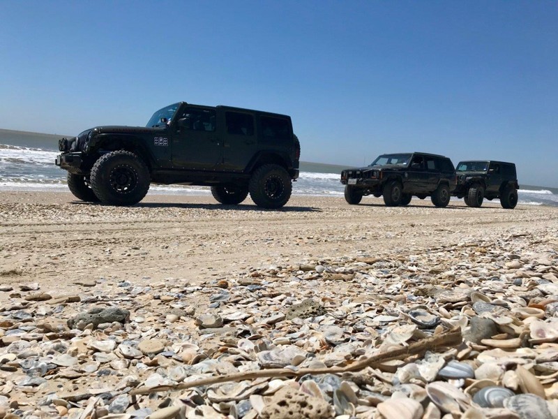
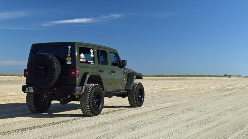
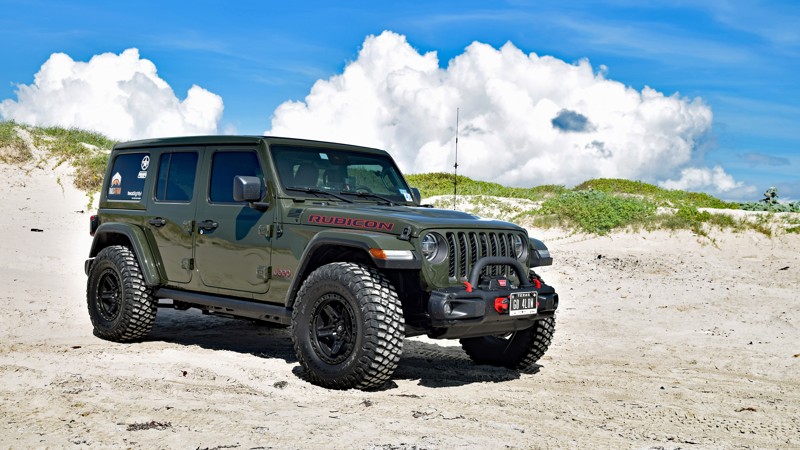
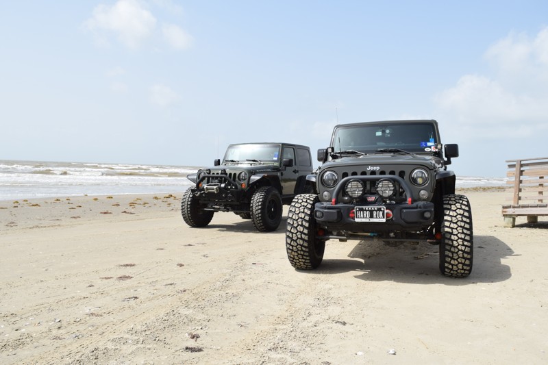
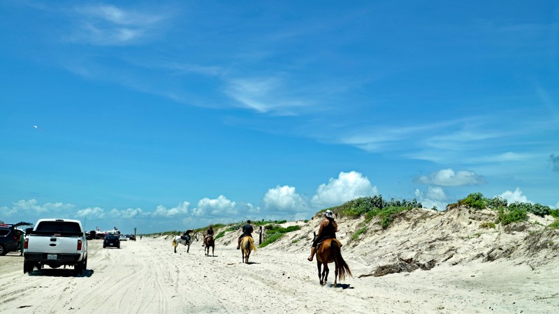
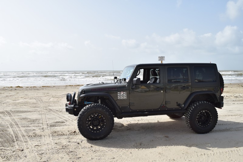
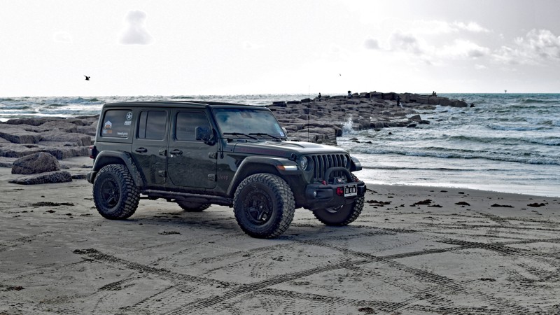
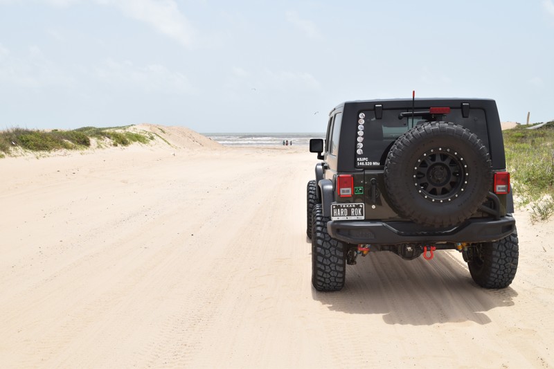
Padre Island National Seashore
Open
/
Corpus Christi, Texas/
61.29 miles/
About 4 hours
Without a doubt, the run on Padre Island National Seashore (PINS) is one of the most iconic overland runs in Texas. 60 miles one-way, completing this out-and-back beach route of 120 miles will require a solid 7-8 hours, leading most to set camp along the beach.
Blue water, beautiful dunes, countless bird species, sea turtle spottings and awesome fishing are just some of the lures drawing visitors to experience the park. Be prepared for soft sand as even 4WD vehicles have been known to get stuck in the softer sections.

Updated: 05/18/2024
Bolivar Peninsula
Open
/
Crystal Beach, Texas/
24.91 miles/
About 3 hours
Rarely can one find a destination that appeals to such a wide variety of personalities and interests as Bolivar Peninsula.
Port Bolivar on the western end of the peninsula hosts the Bolivar Flats Shorebird Sanctuary, easily accessible by walking from the western end of the drivable beach. Some may even choose to camp the night on the beach and walk through the sanctuary during twilight hours.
For those party goers looking for an energetic atmosphere, the beaches along the centrally located Crystal Beach portion of Bolivar Peninsula are sure to please. Plan to camp the night at the Crystal Beach washout and let the party begin!
Moving eastward through Caplan, the remnants of Rollover Pass – a manmade pass through Bolivar Peninsula - earned its name as smugglers used this narrow strip of land between the Gulf of Mexico and Galveston Bay, to “roll” their barrels of good across to awaiting recipients up through the Prohibition Era. (In 2019, the pass was completely filled in, making way for an upcoming park area and fishing pier.)
Gilchrist and High Island on the western edge shows the effects and ruins of past hurricanes; notably the most recent Hurricane Ike, and provide cause for a moment of reflection.

Updated: 05/19/2024
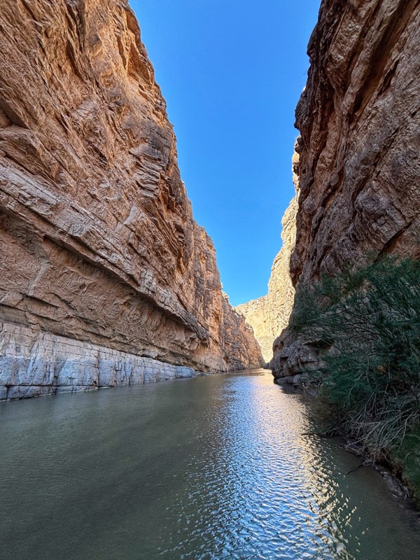
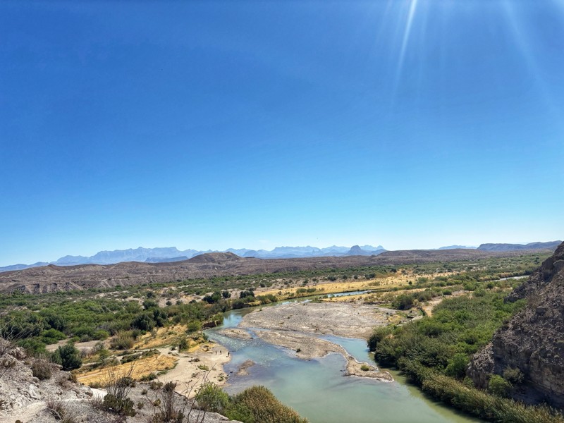
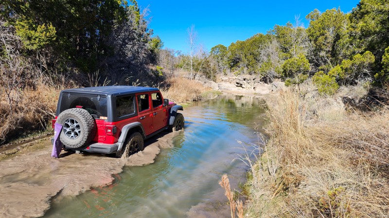
River Road
Terlingua, Texas
River Road truly has something for everyone looking to get off concrete. Whether it’s exploring an abandoned mercury mine, visiting the ruins of an old ranch, paying respects at an old cemetery, camping under the stars, stepping foot in the Rio Grande River, or simply getting dirt on the tires of your favorite 4WD, everyone is sure to find something of interest along this nearly 54-mile route. While the route can be driven end-to-end in a day, more curious travelers may likely wish to reserve a campsite along the route to fully explore its wonders. Alternatively, some may wish to traverse a portion each day, utilizing either Glenn Springs Road or Black Gap Road to cut their exploration of River Road into 2 separate days.

Updated: 11/29/2023
Old Ore Road
Terlingua, Texas
Used during the 1900s to transport ore from mines in the south to trail stations farther north, Old Ore Road is an excellent half-day route providing exceptional views of the Chisos Mountains and Tornillo Creek. Whether staying in nearby Study Butte-Terlingua area or camping in Big Bend National Park, the route is an absolutely must-do for 4x4 enthusiasts visiting the area.
Updated: 11/28/2022
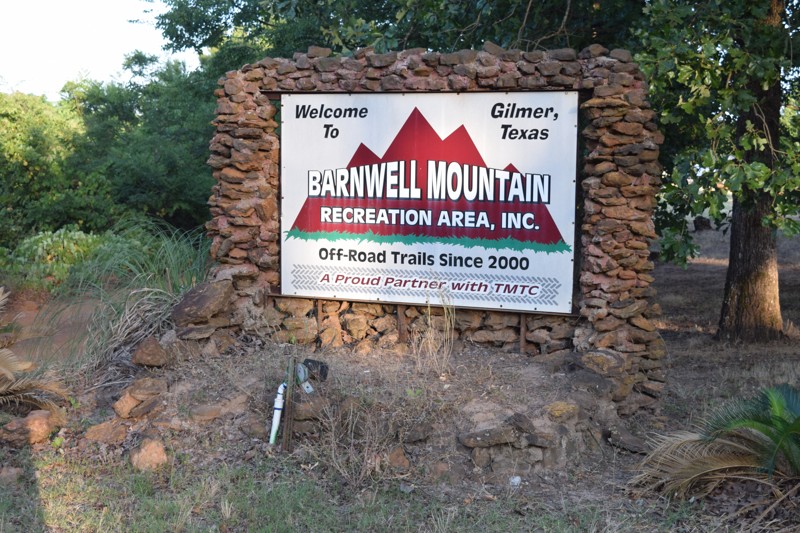
Barnwell Mountain Recreation Area: Main Road
Gilmer, Texas
Barnwell Mountain Recreation Area (BMRA) is the premier off-road destination in northeast Texas. A property of Texas Motorized Trails Coalition (TMTC), Barnwell is open year-round and offers a family-friendly experience for off-road enthusiasts of all skill levels. The Main Road begins at the highway and winds through a large portion of the park, exposing all the park amenities such as camping and restroom facilities along its route. While not necessarily a trail in and of itself, a familiarity with the Main Road will considerably enhance your overall experiences at BMRA .

Updated: 12/30/2023
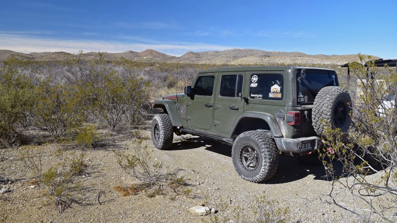
Christmas Mountain
Terlingua, Texas
For those Big Bend visitors looking for ‘exclusivity’ in trail access along with the most stunning views at elevation, a trip up Christmas Mountain is a must. Limited to only two small groups up the mountain per day – one in the morning and one in the afternoon – access to the most scenic views in the region are managed through Terlingua Ranch Lodge. Plan accordingly though as space atop Christmas Mountain is very limited – large enough for only a few vehicles.
Updated: 06/20/2023
Matagorda Beach
Matagorda, Texas
Popular with fishermen, shell collectors, kayakers, paddleboarders, 4WD 4x4 off-road enthusiasts, and beachcombers, Matagorda Island offers up 23 miles of accessible beach with a wide variety of sand and shell terrain. Whether you’re looking to lounge in the sun with a large group of friends or find a secluded spot to camp for the weekend, you’re sure to find just the right spot on the island. Notable gathering and fishing spots include the large, sandy area at the Three Mile Cut, the western edge of the island out on the jetties, as well as the eastern edge of the island at the intracoastal waterway cut. Be sure to note the abandoned ruins of the destroyed piers along the way, random items washed up after a large storm, and who knows what you'll see along the 'nude beach' stretch.

Updated: 12/31/2024
Casa Piedra
Open
/
Presidio, Texas/
23.75 miles/
About an hour
Driving through the Chihuahuan Desert, splitting the Black Hills on one side and the imposing Cienega Mountains on the other, you can't help but feel you are in a remote part of the world. Casa Piedra is the warm-up where you can let your stress slip away before venturing into the wild and remote portions of Big Bend Ranch State Park, or allow your mind to unwind from the thrilling adventures you just had in the park. Take the time - enjoy the views - and venture down Casa Piedra!

Updated: 05/28/2023
South Padre Island Beach
South Padre Island, Texas
South Padre Island Beach arguably provides visitors with the greatest diversity of activities of any beach in Texas. Whether travelers are looking for extremely remote sections of beach to camp or fish, or travelers are looking to merely dip their feet in the water while still being a stone's throw away from a myriad of tourist activities, including but not limited to deep-sea fishing, dolphin watch tours, parasailing, boat, and jet ski rentals or even renting a beach golf cart for the day, South Padre Island Beach is sure to please.
Updated: 06/05/2022
Sargent Beach
Sargent, Texas
Sargent Beach provides an excellent combination of ‘remote beach’ within a reasonable travel distance to major metro areas such as Houston. Having a special appeal to fishermen, the cuts at either end are typically hotspots for the locals. At the same time, off-road enthusiasts can enjoy driving along some of the lesser-traveled beach sections in Texas. Near the entrances to the beach, signs of heavy erosion can be seen along the coast – causing one to ponder just how long this and similar beaches may be available for off-road enjoyment.
Updated: 06/20/2023
Mustang Island Beaches
Port Aransas, Texas
Mustang Island brings a rare diversity of experience along its beaches. Unlike any other beach in Texas, the northern-most section of Mustang Island, maintained and managed by Port Aransas, attracts RVers looking to safely enjoy a weekend of RV camping along a Texas beach. Southward, spring break enthusiasts have the opportunity to enjoy fun in the sun along the well-maintained beaches of Corpus Christi. For those new to the off-road community, either segment is an extraordinary opportunity to take virtually any vehicle off concrete and begin enjoying the wonders of the off-road community while still having the safety of civilization.

Updated: 05/19/2024
Glenn Springs Road
Terlingua, Texas
Often traveled by those looking to traverse Black Gap Road or as a shortcut to River Road, Glenn Springs Road offers a wide range of scenery from wide-open desert views to majestic overlook views of Talley Mountain. The trail also offers several primitive campsites for those looking to spend the night under an open sky. Be sure to check out Glenn Springs Road during your trip to Big Bend National Park!
Updated: 10/15/2024
Hidden Falls Adventure Park: FM T.R.O
Smithwick, Texas
F.M. T.R.O. is located in the park's western half and is the longest trail within Hidden Falls at nearly 3 miles. The trail begins at Park Road 1, not far from the park office, and quickly mesmerizes you with an incredible water crossing that looks bottomless but varies in depth of 2-3 feet. After passing unique rock formations, the trail increases in difficulty and becomes a non-stop rock garden filled with basketball and beachball-sized moving boulders. The trail randomly sprinkles in 2, 3, and even 4-foot ledges where multiple lines can traverse the obstacles to ensure it stays technical enough. The trail intersects with Valley Road, where you can bail out or continue trekking north, tackling more limestone ledges and eventually connecting to Park Road 2 near Green Mile.
F.M. T.R.O. is considered a level 4 road per the park's rating system.
This trail is best for modified vehicles with larger tires, traction aid devices, and skid plates.
Fees and Entry
Daily fees or extended memberships can be purchased at the park office. Entry into the park is on a first-come, first-served basis until the park reaches capacity, so be sure to arrive early.
Hours
Hidden Falls Adventure Park is only open Thursday thru Sunday, with 8 am and 9 am opening times and 2 pm-7 pm closing times depending on the day. Visit the park website for more information.
Accommodations
The park offers almost any type of accommodation you can think of. There are cabin rentals, bunkhouses, full R.V. hookups, dry campsites, and dispersed sites. Camping is only allowed in the designated areas and not on the trails. Reservations are required for all overnight camping. Visit the park website for booking information.

Updated: 05/19/2024
Terlingua Ranch Road - Road to Highway 385
Terlingua, Texas
Known by two names; dependent upon which end one enters the trail, Terlingua Ranch Road – Road to Highway 385 spans land both within and exterior to Big Bend National Park. For those in the northern section of the park, the route provides quick access to Terlingua Ranch and Christmas Mountain, while providing a quick route to Highway 385 and subsequently Marathon, for those within Terlingua Ranch. Providing views of to Rosillos Mountains along much of the route, the easy drive can be enjoyed by nearly anyone looking for an off-concrete excursion.

Updated: 01/04/2024
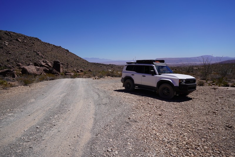
Main Park Road
Open
/
Presidio, Texas/
29.86 miles/
About 3 hours
You’ve likely traveled for hours to arrive. You’re eager to get into Big Bend Ranch State Park. Then you see the oversized entrance sign welcoming you to the park. Little did you know that you still have miles to go. However, adventure awaits at every turn in the park. So even the Main Park Road provides a touch of adventure as you travel over an hour just to get to the ranger station. From there it's still 3 hours to the farther reaches of the park. This is Texas. Everything is big.
Wildlife and scenic viewing spots dot the roadside. Numerous designated camping spots flash by. For many visitors, the Main Park Road may be their sole offroad experience. While Main Park Road is easy to travel, the scenery is no less spectacular than many spots on much more remote and rugged trails in the park. You’re sure to spend time on Main Park Road to enjoy the scenery!

Updated: 01/24/2023
Botella Road
Presidio, Texas
Snaking its way across Terneros Creek; with numerous scenic hills and peaks to the east, Botella Road runs north-south through the Black Hills region of the park; making numerous washout crossings, and connects the Cienega region of the park with the central portions of the park. While more tame routes exist connecting the northwest and central portions of the park, those who dare take this rugged route to the Cienega region are sure to get a taste of what lies ahead and can explore the ruins of the old Vasques House along the way. As the northern 10 miles of this 12.5 mile route are not maintained by the park, come prepared for anything as the only thing guaranteed along the route is an adventure!
Updated: 06/20/2023
Follett’s Island Beach
Surfside Beach, Texas
Follett's Island Beach provides beach lovers and overland excursionists an opportunity to enjoy a 10 mile stretch of beach within close proximity of services and amenities, all within a reasonable drive from the Houston major metropolitan region.
Unlike the neighboring beaches, Follett's Island Beach permits year round camping and of course, sun bathers, fishermen and kayakers also enjoy recreation along the beach as well. Those exploring Follett's Island Beach will also appreciate the relative quiet of the mid sections of Follett's Island Beach, compared to the heavily populated neighboring beaches during peak season times.
Updated: 12/27/2022
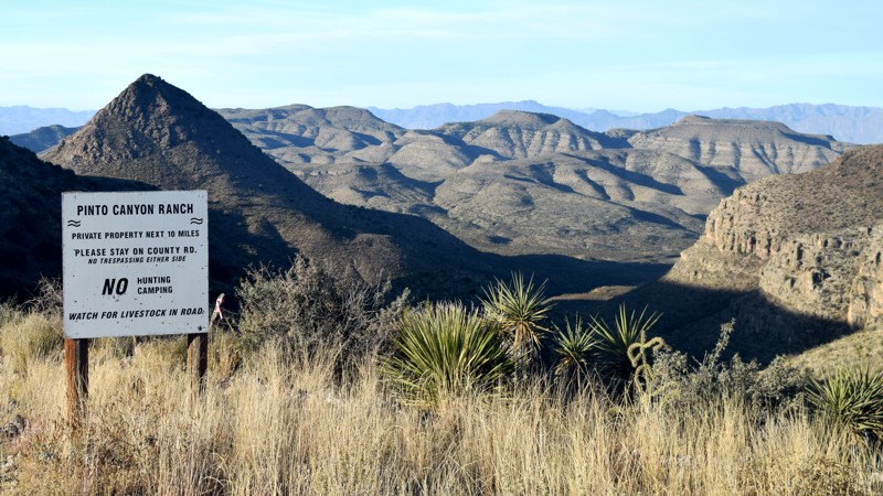
Pinto Canyon Road
Marfa, Texas
Off-road enthusiasts are known to take 'the road less traveled', and Pinto Canyon Road provides just such an opportunity. While many visitors traveling from the Marfa to Presidio areas may typically take a faster route, those looking for some exceptional scenery along an off-the-beaten-path dirt road will want to add a bit of time to their itinerary and travel Pinto Canyon Road. Winding through the beautiful Pinto Canyon, travelers can pause to take in the breath-taking scenery of the canyon, then ultimately exit the route in the Ruidosa Ghost Town. For those traveling through the region, slow down and take a moment to enjoy this hidden gem in the Texas Big Bend area!

Updated: 05/19/2024
Old Maverick Road
Terlingua, Texas
Old Maverick Road provides an off-road alternative in lieu of the paved Ross Maxwell Scenic Highway, for those traveling between the Santa Elena Canyon and the western park entrance. The 14-washboard road provides quite the ride along the majority of the route but is easily accessible by all vehicle types. Note however that the road may become impassable after heavy rainstorms due to flooding. Be sure to take in the scenic views of the Terlingua Creek all along the route when you visit Big Bend National park and want to take the path less traveled.

Updated: 12/28/2022
Fresno Canyon Road
Presidio, Texas
What's the best overland trail in the state of Texas? One could easily argue Fresno Canyon Road takes the prize. This fun trail takes travelers back in time. The ancient inhabitants of this ara left petroglyphs deep in Fresno Canyon. Abandoned farm ruins provide a glimpse into the lives of more modern settlers. The views never stop as the trail hugs towering cliff walls with the occasional glimpses of the hills of the Solitario to the east. The trail is challenging enough to make the drive even more interesting. For anyone seeking an iconic offroad adventure in the Big Bend Ranch State Park, Fresno Canyon Road is an absolute must-do!

Updated: 05/21/2024
Cerro De Las Burras Loop
Presidio, Texas
When visitors go to Big Bend Ranch State Park, they typically think of highly remote and ultra-rugged trails with ocotillos often teasing the doors and mirrors of vehicles, especially so on those unmaintained off-road routes. Cerro De Las Burras is a curious exception to this rule providing casual off-roaders spectacular views of majestic cliff caves complete with hiking trails. As an added bonus, the trail is the only trail within park boundaries that is accessible from the park exterior and easily reached from both Presidio as well as Terlingua. For anyone with at least a high clearance 2WD vehicle and especially hikers, this easy and accessible trail is a must-do for anyone in the area.

Updated: 01/04/2024
Guale Road
Presidio, Texas
Many say there are no mountains in Texas. Many say there are no majestic views in Texas. They’re all wrong. Even most Texas residents are unaware of the beauty that awaits them in Big Bend Ranch State Park, but even fewer are aware of the awe-inspiring views from atop Guale Mesa, at the end of Guale Road. Reminiscent of views the likes of Top Of The World in Utah, the view from atop Guale Mesa is nothing short of poetic. Any traveler even considering a trip to Big Bend Ranch State Park should consider a run down Guale Road an absolute must-do. Better yet – secure the highly coveted campsite at Guale 2 and enjoy the utter splendor of sunset atop the mesa.
Updated: 06/05/2022
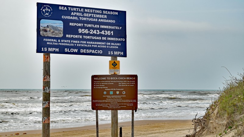
Boca Chica Beach
Brownsville, Texas
Boca Chica Beach offers two unique experiences to visitors willing to make the journey. First; as visitors approach the beach, travelers will be provided up-close views of the SpaceX control center and launch pads. Once on the beach, the southern tip of the beach provides access to the Rio Grande River as it empties into the Gulf of Mexico. So whether you’re in the Brownsville area and looking to fish or merely catch some rays, you’re a space fan and are hoping to get a glimpse of the latest SpaceX rocket, head down to south Texas and check out Boca Chica Beach.
Updated: 11/28/2022
Barnwell Mountain Recreation Area: Louisiana Backroad (formerly Angry Jeep)
Gilmer, Texas
Louisiana Backroad (formerly Angry Jeep) is a leisurely drive, cutting through the park to eliminate the easternmost section of the Main Road, enabling faster access to the Xterra campsite, Any Sunday, and the play area along the northern trailhead of Solihull. Save yourself some time and take Louisiana Backroad if you're needing to expedite traversing the Main Road.
Updated: 10/15/2024
Northwest OHV Park B-26 - Spider Web Loop
Lake Bridgeport, Texas
B-26, Spiderweb Loop, circles the southeast B section of the park, passing dozens of other technical trails. The Southern end of the B-26 loop is notorious for large mud bogs during wet periods. Be cautious as the mud is thick and sticky, with a peanut butter-type consistency. The west and east side of the loop are easy, hard-packed surfaces with a few exposed rocks. The northern end of the loop presents the only non-mud-related challenge, with a 12-degree hill where you straddle a 14'' deep erosion rut. In dry conditions, this trail is suitable for any high clearance vehicle.
Fees
Daily fees and annual passes can be purchased at the park gate with a card or cash, but both fees are cheaper if bought online.
Hours and Location
Northwest OHV Park is at 279 George Mitchell Pkwy, Bridgeport, TX 76426. The park hours vary depending on the time of year. For more information, call (940) 683-3480 Monday through Friday or (940) 683-3685 on weekends.
Camping
Free primitive camping is allowed in the staging area on Friday and Saturday nights. No camping in the woods or on the trails.
Updated: 10/07/2023
Los Alamos Loop
Presidio, Texas
Los Alamos Loop is unique within Big Bend Ranch State Park. First, let's list what this trail is not. Los Alamos Loop is not an easy, simple dirt road. It is not a route for lower clearance vehicles. It is not a route to run alone. So what is Los Alamos Loop? It is arguably the most technical non-maintained route in the park. The track offers fun challenges at nearly every turn with plenty of articulation and off-camber sections to entertain most off-road enthusiasts. Winding through the hills around and through Panther Canyon in the extreme northeast section of the park, Los Alamos Loop is also very scenic and beautiful. It is a must-do for any true adventure seeker visiting the park!
Updated: 06/20/2023
North Padre Island Beaches
Corpus Christi, Texas
North Padre Island is uniquely positioned to provide travelers a beach experience ranging from the most civilized to the most remote beach experience in Texas. Whitecap Beach along the northern end of North Padre Island is easily accessible and provides all the amenities worthy of a beach near a metro area. Transitioning quickly, however, the beaches along North Padre Island transition quickly to the primitive and remote beaches associated with Padre Island National Seashore. Of particular note in this transition is North Beach – that section between Whitecap Beach and the national park that offers a unique blend or remote access near a metro area. Soft roaders looking to dip their feet into the more remote aspects of off-roading may well wish to experience these sections of Texas beaches to determine if they wish to dig deeper into the wonderful world of off-roading.
Updated: 11/28/2022
Barnwell Mountain Recreation Area: Linda Gail
Gilmer, Texas
Linda Gail provides an enjoyable option to the Main Road when headed to the central region of the park. The trail is also one of only a few with an improved campsite actually on the trail. Complete with a forest canopy and an extra credit off-camber section (purely optional) the trail can provide a pleasant refreshment for those just entering the park and needing to reach the interior of the park and the campsites in the area.
Updated: 06/20/2023
Surfside Beach
Surfside Beach, Texas
Surfside Beach is a delight for sunbathers and beach-goers in the region, providing a family-friendly environment with close proximity to services and amenities for everyone. For first-time off-roaders looking to take their initial excursion off the pavement, Surfside Beach provides perhaps the most tame and predictable experience of any beach along the Texas coast due to the regular maintenance and heavy traffic during warmer months. Those who enjoy the sounds of waves lapping the shoreline intermingled with children’s laughter, and the smell of the occasional bar-b-que being prepared on a grill combined with a relaxing drive along a shoreline, should be sure to take a drive down Surfside Beach.
Updated: 02/21/2019
Bryan Beach
Freeport, Texas
Popular with local fishermen and beach goers, Bryan Beach; along with the adjoining Quintana Beach, provides an enjoyable alternative destination from nearby more heavily trafficked beaches. Tides permitting, following the beach to its farthest western edge also provides access to excellent fishing and enjoyable camping options at the mouth of the Brazos River. The natural state of the beach also provides opportunities for collecting driftwood for those interested in crafting with natural beach relics.
Updated: 11/28/2022
Barnwell Mountain Recreation Area: Green Lane Upper Half
Gilmer, Texas
Green Lane is the park's visitors first potential exposure to trails more difficult than the 'easy' trails in the park. Still easily traversable by stock 4WD vehicles, those with a greater build and/or drivers with more experience will enjoy the ledge obstacle options on the trail. If you're looking for your first trail to attempt to stretch your wheeling legs at Barnwell Mountain Recreation Area, , the upper half of Green Lane provides an excellent opportunity to do so.
Updated: 06/05/2022
Black Hills Road
Presidio, Texas
While Big Bend Ranch State Park has numerous off-road routes, the park's "unmaintained" routes offer a unique experience to willing travelers. Of all those unmaintained routes, Black Hills is arguably one with one of the most 'comforting' start and endpoints. With the black hills of Big Bend to the east, travelers' decision to take the route are rewarded with some spectacular views of the black hills as well as a few short sections of slightly off-camber ledge road. The scraping sound of Creosote Bush and Ocotillo dragging along the side of your vehicle, the engine's whine while you lean down a steep hillside, and being far from any help, make this trail a true adventure
Updated: 05/20/2026
Northwest OHV Park D-76 - Rock Bluff Loop
Lake Bridgeport, Texas
D-76 is a hardpacked dirt road that loops around the plateau above the three quarries. Along the western straight, just before the intersection with E-101, there is an optional mud bog that parallels the main trail, where you can feel free to test your luck in the peanut butter-type mud. Travelers must tackle one hill at 20 degrees of pitch, with a steep break-over angle that could be troublesome for long-wheelbase vehicles, but otherwise, the road is obstacle free and a good beginner option on a wet day.
The trail is suitable for any high clearance vehicle.
Fees
Daily fees and annual passes can be purchased at the park gate with a card or cash, but both fees are cheaper if bought online.
Hours and Location
Northwest OHV Park is located at 279 George Mitchell Pkwy, Bridgeport, TX 76426. The park hours vary depending on the time of year. For more information, call (940) 683-3480 Monday through Friday or (940) 683-3685 on weekends.
Camping
Free primitive camping is allowed in the staging area on Friday and Saturday nights. No camping in the woods or on the trails.
Updated: 10/15/2024
Hidden Falls Adventure Park: Park Road 4
Smithwick, Texas
Park Road 4 is an easy, multi-use dirt road primarily used as an access road for ATV riders to ride between the General Store and the ATV trail system. The road is hard-packed and 2-3 vehicles wide the entire way. The closer you get to Area B, the more gravel you will encounter along the road surface.
Park Road 4 is considered a level 2 road per the park's rating system.
This trail is suitable for any high clearance vehicle.
Fees and Entry
Daily fees or extended memberships can be purchased at the park office. Entry into the park is on a first-come, first-served basis until the park reaches capacity, so be sure to arrive early.
Hours
Hidden Falls Adventure Park is only open Thursday thru Sunday, with 8 am and 9 am opening times and 2 pm-7 pm closing times depending on the day. Visit the park website for more information.
Accommodations
The park offers almost any type of accommodation you can think of. There are cabin rentals, bunkhouses, full RV hookups, dry campsites, and dispersed sites. Camping is only allowed in the designated areas and not on the trails. Reservations are required for all overnight camping. Visit the park website for booking information.
Updated: 11/28/2022
Barnwell Mountain Recreation Area: Omega
Gilmer, Texas
For those looking for a relaxing run along a light trail or the brand new wheeler looking for their first off-road adventure, Omega fits the bill nicely. Connecting to other easy trails, Omega can be used to begin a days adventure, progressing to additional trails as ones comfort level progressively increases.
Updated: 10/15/2024
Hidden Falls Adventure Park: Valley Road
Smithwick, Texas
Valley Road is one of only a couple of 4x4 roads in the western half of Hidden Falls Adventure Park. This area of the park is primarily for ATV trails, so don't be surprised when you see many signs and intersections for those such trails. Valley Road is a multi-use trail designated for both 4x4s and ATVs. It boasts the most significant water crossing within the park as you start by crossing Camp Creek. Immediately following the creek crossing, you are greeted with a steep hill making up the most challenging part of the trail. The remainder of the trail is a hard-packed, 2-vehicle-wide road across open terrain with a single, 50-yard optional mud bog. The trail passes a few large gathering spots with shade that could make for good lunch spots in the summer. The road deadends a short distance north of its intersection with Park Road 4.
The park's rating system considers Valley Road a level 2 trail.
This trail is suitable for any high clearance vehicle.
Fees and Entry
Daily fees or extended memberships can be purchased at the park office. Entry into the park is on a first-come, first-served basis until the park reaches capacity, so be sure to arrive early.
Hours
Hidden Falls Adventure Park is only open Thursday thru Sunday, with 8 am and 9 am opening times and 2 pm-7 pm closing times depending on the day. Visit the park website for more information.
Accommodations
The park offers almost any type of accommodation you can think of. There are cabin rentals, bunkhouses, full RV hookups, dry campsites, and dispersed sites. Camping is only allowed in the designated areas and not on the trails. Reservations are required for all overnight camping. Visit the park website for booking information.

Updated: 10/19/2023
Madrid Falls Road
Presidio, Texas
Few routes offer as many camping opportunities as Madrid Falls Road. Making even the drive to the campground more memorable, Madrid Falls Road takes a long, steep climb to the top of a mesa where all camping is located. For those looking to explore, the end of the 5.3-mile route offers hiking opportunities to both Madrid Falls, an overlook of Fresno Canyon, and the Crawford-Smith House near the end of Fresno Canyon Road. So whether you’re looking to camp at one of the numerous campsites, explore Madrid Falls, or merely want to try your driving skills along the steep incline, come check out Madrid Falls Road!
Updated: 06/05/2022
Juniper Canyon Road
Terlingua, Texas
With two hiking trailheads and the end of Juniper Canyon Road, hikers are sure to receive an extra bonus when opting to traverse Juniper Canyon Road. As a trail off of Glenn Springs Road, many may pass the trail in lieu of the more well known Black Gap Road, however those looking to explore a rocky trail through some magnificent scenery may wish to explore this lesser traveled trail.
Updated: 11/28/2022
Barnwell Mountain Recreation Area: South Road West
Gilmer, Texas
South Road West provides a quick route to the southern sections of the park, and many of the more difficult trails. You'll spend a bit of time on this connecting road if you're one to wheel the more difficult trails at Barnwell Mountain Recreation Area .
Updated: 10/15/2024
Hidden Falls Adventure Park: Park Road 2
Smithwick, Texas
Park Road 2 is an easy, two-way hard-packed access road multiple vehicles wide. The road is considered level 2 by the park's rating system. It is bumpy in a few areas with tiny, 4 to 6-inch ledge drops. Many trails spur off both sides of Park Road 2, everything from level 1 to level 5.
This trail is suitable for any high clearance vehicle.
Fees and Entry
Daily fees or extended memberships can be purchased at the park office. Entry into the park is on a first-come, first-served basis until the park reaches capacity, so be sure to arrive early.
Hours
Hidden Falls Adventure Park is only open Thursday thru Sunday, with 8 am and 9 am opening times and 2 pm-7 pm closing times depending on the day. Visit the park website for more information.
Accommodations
The park offers almost any type of accommodation you can think of. There are cabin rentals, bunkhouses, full RV hookups, dry campsites, and dispersed sites. Camping is only allowed in the designated areas and not on the trails. Reservations are required for all overnight camping. Visit the park website for booking information.
Updated: 11/28/2022
Barnwell Mountain Recreation Area: Desi's Way
Gilmer, Texas
Desi’s Way is often the first trail many visitors explore due to its proximity to the park office and its relative ease. With a couple minor obstacles as well as one optional moderate obstacle, the trail provides an enjoyable introduction to the park terrain and the type of wheeling that can be found throughout the park.
Updated: 10/15/2024
Hidden Falls Adventure Park: Hog Alley
Smithwick, Texas
Hog Alley is an easy dirt road that travels a ridgeline connecting Baby Back and Park Road 2. Typically a ridgeline is a high point that water would run down from. However, this trail defies that logic and selfishly stores gallons of water in several thick and sticky optional mud holes along the sides of the trail. The mud in these holes has a peanut butter consistency and almost acts like quicksand.
Hog Alley is considered level 1 by the park's rating system and has bypasses for every mud hole. Be cautious and do not attempt mud without recovery equipment and other vehicles.
This trail is suitable for any high clearance vehicle.
Fees and Entry
Daily fees or extended memberships can be purchased at the park office. Entry into the park is on a first-come, first-served basis until the park reaches capacity, so be sure to arrive early.
Hours
Hidden Falls Adventure Park is only open Thursday thru Sunday, with 8 am and 9 am opening times and 2 pm-7 pm closing times depending on the day. Visit the park website for more information.
Accommodations
The park offers almost any type of accommodation you can think of. There are cabin rentals, bunkhouses, full RV hookups, dry campsites, and dispersed sites. Camping is only allowed in the designated areas and not on the trails. Reservations are required for all overnight camping. Visit the park website for booking information.
Updated: 11/28/2022
Barnwell Mountain Recreation Area: South Road East
Gilmer, Texas
Connecting the park to additional southern trails, South Road East also provides easy access to Old Camp. Whether you're looking to get to a campsite 'away from it all', or wanting to access some of the more difficult trails in the park, you're sure to be traveling South Road East.
Updated: 10/06/2023
Rancherias Loop
Presidio, Texas
Adventure seekers just coming off Guale Road may be looking for an experience to continue that ultra offroad remote experience. For those folks, we suggest Rancherias Loop. Winding its way around Panther Mountain, Rancherias Loop providing some extraordinary views and wheeling opportunities. The trail is also a convenient connecting road between Guale Road and Javelin Road, useful for planning a long and interesting day trip through the park.
Updated: 11/05/2022
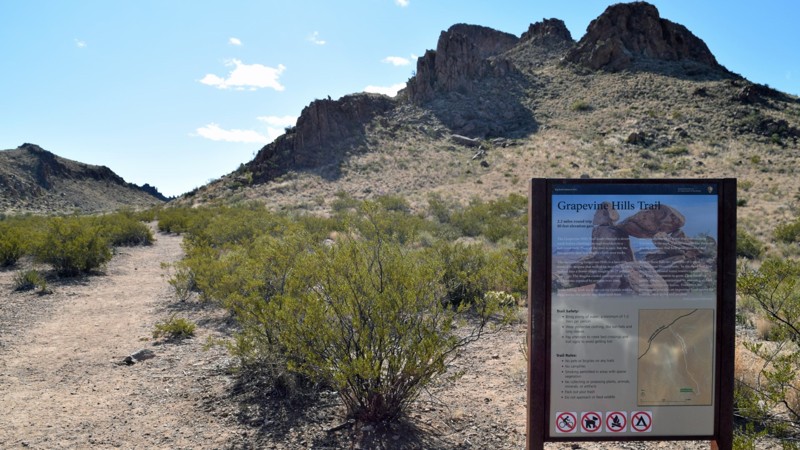
Grapevine Hills Road
Terlingua, Texas
Providing access to several group campsites and the Grapevine Hills hiking trail (ultimately leading to a balanced rock), Grapevine Hills Road is a 7.6-mile well-maintained dirt road running through the Chihuahuan Desert. For those without high-clearance vehicles, this dirt road provides an enjoyable means to get some off-pavement time will visiting Big Bend National Park.
Updated: 06/05/2022
Paint Gap Road
Terlingua, Texas
Typically going unnoticed in lieu of the more familiar offroad trails in Big Bend National Park; especially given it’s ‘typical dirt road’ appearance at its trailhead, Paint Gap Road’s unassuming nature results in most bypassing the wonders the trail holds. Yet just a couple miles down this 4 miles trail, the trail takes on a noticeable change in feel, transitioning from a well-maintained dirt road to a more rugged double-track trail. In spite beginning just off the main road within Big Bend National Park; once a visitor hits the double-track section and passes into the gap, visitors will immediately get the sense they’ve traversed well off the beaten path and ultimately be rewarded with the sites of several ruins of an old abandoned settlement.
Updated: 06/05/2022
Solitario Road
Presidio, Texas
Of all the geological formations in Big Bend Ranch State Park, the Solitario may be the most interesting. Solitario Road is the gateway into this ancient formation for explorers. Make no mistake, the route is deep within the park's interior, but exploring this ancient volcanic flow is sure to entice most. The route into the Solitario is rugged but accessible by any 4WD. So if you’re looking to take a trip into the area's ancient geologic past, be sure to take a run down Solitario Road!

Updated: 01/02/2023
Dagger Flat Auto Trail
Terlingua, Texas
Highlighted by the forest of giant Dagger Yuccas at the end of the trail, this hidden gem hides its secret to those who may have unknowingly traveled a portion of this trail entering or exiting Old Ore Road. Regardless if you’re intending to traverse the better known Old Ore Road, a brief journey to the end of this trail will reveal the beauty of the Chihuahuan desert not easily observable elsewhere. Traversable by any 2WD vehicle, be sure to check out the namesake of this trail at the end of the 7-mile route!
Updated: 10/15/2024
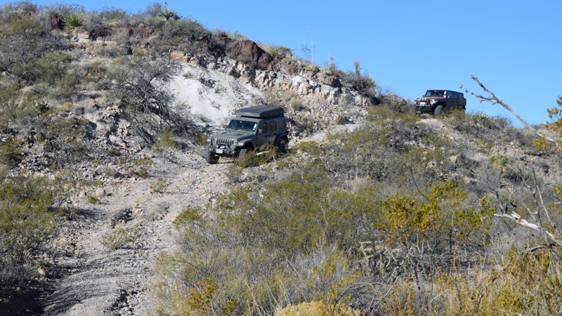
Northwest OHV Park A-2
Lake Bridgeport, Texas
A-2 is a difficult and long trail that circles the south and eastern edges of the East Quarry. The trail can be run in either direction and is fun either way. A-2 offers steep, 23-degree rocky climbs, small basketball-sized rock gardens, puckering shelf sections, scenic views into the southern A section of the park, and 3-foot stair-step ledge drops. The trail connects several other hill climbs and offers an alternative to the easy roads that are typically taken to the pavilion. This is a great trail for new drivers in a modified vehicle to test their skills and the vehicle's capabilities. Larger tires and rocker protection are highly recommended.
Fees
Daily fees and annual passes can be purchased at the park gate with a card or cash, but both fees are cheaper if bought online.
Hours and Location
Northwest OHV Park is located at 279 George Mitchell Pkwy, Bridgeport, TX 76426. The park hours vary depending on the time of year. For more information, call (940) 683-3480 Monday through Friday or (940) 683-3685 on weekends.
Camping
Free primitive camping is allowed in the staging area on Friday and Saturday nights. No camping in the woods or on the trails.
Updated: 10/15/2024
Hidden Falls Adventure Park: Bronco Buster
Smithwick, Texas
Cut by raging water flows, Bronco Buster is a narrow, rocky canyon sporting 8-foot dirt walls topped with thick cedar trees. This canyon connecting Snoopy Falls and Park Road 2 will make you feel like you are driving through a tunnel. The trail boasts a number of challenges, including off-camber wall leans ready to take out mirrors and fenders, beachball-sized diff-catching rocks, sharp limestone wedges that choke your tire sidewalls, and 2'-3' ledge climbs that require a generous throttle bump.
Bronco Buster is considered a level 4 trail per the park's rating system.
This trail is best for modified vehicles with larger tires and skid plate protection.
Fees and Entry
Daily fees or extended memberships can be purchased at the park office. Entry into the park is on a first-come, first-served basis until the park reaches capacity, so be sure to arrive early.
Hours
Hidden Falls Adventure Park is only open Thursday thru Sunday, with 8 am and 9 am opening times and 2 pm-7 pm closing times depending on the day. Visit the park website for more information.
Accommodations
The park offers almost any type of accommodation you can think of. There are cabin rentals, bunkhouses, full RV hookups, dry campsites, and dispersed sites. Camping is only allowed in the designated areas and not on the trails. Reservations are required for all overnight camping. Visit the park website for booking information.
Updated: 06/05/2022
Casa Piedra Trailhead to Casa Ramon
Presidio, Texas
Of the routes heading into the northwest region of Big Bend Ranch State Park, Casa Piedra Trailhead to Casa Ramon definitely provides a measure of "adventure" and an element of the 'unknown" to the experience. Travelers will likely find themselves pausing to assess current conditions for multiple creek crossings, providing visitors with a true sense of exploration and adventure. When not evaluating obstacles, visitors will enjoy a spectacular view of the lowlands with glimpses of the distant Cienega mountains. For those visiting the area who have the time, this route is a must-do if you want to fully experience this portion of Big Bend Ranch State Park.
Updated: 10/15/2024
Hidden Falls Adventure Park: Green Horn
Smithwick, Texas
Green Horn is a moderate, rocky trail connecting Park Road 2 and the mid-way point of North Pole. The trail is rightfully named as it is excellent for beginner 4-wheelers to stretch their legs and challenge themselves with little fear of vehicle damage. The trail starts in the dry drainage of Hickory Creek, where you will first traverse flat, table-top-sized boulders. You then must conquer a small, double-step waterfall with twin 18-inch ledges. The final obstacle is a much larger, 3-foot ledge with a slight undercut. This obstacle is entirely optional, with a smooth bypass around one side.
Green Horn is considered level 4 by the park's rating system.
This trail is suitable for any stock, high clearance 4-wheel drive.
Fees and Entry
Daily fees or extended memberships can be purchased at the park office. Entry into the park is on a first-come, first-served basis until the park reaches capacity, so be sure to arrive early.
Hours
Hidden Falls Adventure Park is only open Thursday thru Sunday, with 8 am and 9 am opening times and 2 pm-7 pm closing times depending on the day. Visit the park website for more information.
Accommodations
The park offers almost any type of accommodation you can think of. There are cabin rentals, bunkhouses, full RV hookups, dry campsites, and dispersed sites. Camping is only allowed in the designated areas and not on the trails. Reservations are required for all overnight camping. Visit the park website for booking information.
Updated: 10/15/2024
Northwest OHV Park E-103
Lake Bridgeport, Texas
E-102 cuts through the center of the E-101 loop and follows a deeply cut ravine seasoned with tabletop-sized limestone slabs and peppered with plenty of round beachball boulders. Traction is already tough due to the unsecured moving rocks, but add in a little rain, and this trail can easily become impossible. The trail is a two-way trail with minimal spots to pull out of the way for oncoming traffic, especially for groups.
This trail is best suited for modified vehicles with large tires and traction aid devices. Rock sliders and engine skid plates are a must if you want to exit this trail under your own power.
Fees
Daily fees and annual passes can be purchased at the park gate with a card or cash, but both fees are cheaper if bought online.
Hours and Location
Northwest OHV Park is located at 279 George Mitchell Pkwy, Bridgeport, TX 76426. The park hours vary depending on the time of year. For more information, call (940) 683-3480 Monday through Friday or (940) 683-3685 on weekends.
Camping
Free primitive camping is allowed in the staging area on Friday and Saturday nights. No camping in the woods or on the trails.
Updated: 10/15/2024
Hidden Falls Adventure Park: Boss Hog
Smithwick, Texas
Unlike the muddy ridgeline to the southwest, Boss Hog is a continuous staircase of limestone drops as it makes its way from Park Road 2 near Hog Alley down to an intersection with Royal Gorge. The ledges start small on the trail's west end at about 10" and gradually grow in size until you come to a 5-foot, horseshoe-shaped waterfall drop with only a few possible lines. This obstacle poses a significant challenge to stock vehicles; thus, the trail is best suited for modified vehicles with larger tires and undercarriage protection. This trail is a two-way trail and a significant challenge in either direction.
Boss Hog is considered a level 3 road per the park's rating system.
Fees and Entry
Daily fees or extended memberships can be purchased at the park office. Entry into the park is on a first-come, first-served basis until the park reaches capacity, so be sure to arrive early.
Hours
Hidden Falls Adventure Park is only open Thursday thru Sunday, with 8 am and 9 am opening times and 2 pm-7 pm closing times depending on the day. Visit the park website for more information.
Accommodations
The park offers almost any type of accommodation you can think of. There are cabin rentals, bunkhouses, full RV hookups, dry campsites, and dispersed sites. Camping is only allowed in the designated areas and not on the trails. Reservations are required for all overnight camping. Visit the park website for booking information.
Updated: 10/15/2024
Northwest OHV Park C-51 - Wise Co. Ridge
Lake Bridgeport, Texas
C-51 is a muddy ridge line above the West Quarry and the Powerline Road. There are several ways to access C-51, but if you approach from the east, you encounter several peanut butter-thick mud holes that will stick to everything and refuse to clean out from your tires. The southwest corner of the trail is generally hard-packed and offers several roller coaster-style inclines. This trail is suitable for any high clearance vehicle.
Fees
Daily fees and annual passes can be purchased at the park gate with a card or cash, but both fees are cheaper if bought online.
Hours and Location
Northwest OHV Park is located at 279 George Mitchell Pkwy, Bridgeport, TX 76426. The park hours vary depending on the time of year. For more information, call (940) 683-3480 Monday through Friday or (940) 683-3685 on weekends.
Camping
Free primitive camping is allowed in the staging area on Friday and Saturday nights. No camping in the woods or on the trails.
Updated: 06/20/2023
Mustang Island State Park
Port Aransas, Texas
Preserving the natural beauty of Mustang Island, Mustang Island State Park is a must-see for nature enthusiasts visiting the area. The 2.4 mile stretch of beach provides plenty of room for primitive camping along the beach, with the park enforcing capacity limits to ensure all have a quality experience. Whether it’s fishing off the jetties, paddling the Mustang Island State Park Paddling Trail , mountain biking through the park, or just sitting back and enjoy the beach – be sure to pay a visit to Mustang Island State Park.
Updated: 10/15/2024
Hidden Falls Adventure Park: Rocky
Smithwick, Texas
Rocky starts near Area B and passes by the most notorious hill climbs in the park, like Penthouse, Dammit Derek, and Loose Rock. Rocky begins as a reasonably easy, hard-packed trail as it circles the south and east end of Wildcat Mountain, with only a few small sections of bumpy football-sized rocks. Once passing Revenge and heading northeast toward Feeder Creek, the trail finally presents a rightfully named challenge with a rocky, chewed-up hill peppered with large tombstone and tire-sized rocks. Careful tire placement and good ground clearance will be necessary to avoid differential hits or rocker panel damage.
This trail best suits modified vehicles with larger tires, skid plates, and traction aid devices.
Fees and Entry
Daily fees or extended memberships can be purchased at the park office. Entry into the park is on a first-come, first-served basis until the park reaches capacity, so be sure to arrive early.
Hours
Hidden Falls Adventure Park is only open Thursday thru Sunday, with 8 am and 9 am opening times and 2 pm-7 pm closing times depending on the day. Visit the park website for more information.
Accommodations
The park offers almost any type of accommodation you can think of. There are cabin rentals, bunkhouses, full RV hookups, dry campsites, and dispersed sites. Camping is only allowed in the designated areas and not on the trails. Reservations are required for all overnight camping. Visit the park website for booking information.
Updated: 11/28/2022
Barnwell Mountain Recreation Area: Pine Hill Run
Gilmer, Texas
Pine Hill Run is a fun, short ascent/descent to/from the Main Road to Clyde's Ravine. When you're looking to cut your run on Clyde's short, you'll almost certainly be taking Pine Hill Run to make it happen. One optional off-camber section adds a bit of excitement to an otherwise very easy trail.
Updated: 10/15/2024
Hidden Falls Adventure Park: Park Road 3
Smithwick, Texas
Park Road 3 is a wide, hard-packed main access road used primarily as an exit to the one-way hill climbs on the south side of Wildcat Mountain. Additionally, it is an easy road to visit the radio tower on Wildcat Mountain and visit the lookout point, where you can oversee the entire southwest side of the park and gaze upon Texas hill country for miles.
Park Road 3 is considered a level 2 road per the park's rating system.
This trail is suitable for any high clearance vehicle.
Fees and Entry
Daily fees or extended memberships can be purchased at the park office. Entry into the park is on a first-come, first-served basis until the park reaches capacity, so be sure to arrive early.
Hours
Hidden Falls Adventure Park is only open Thursday thru Sunday, with 8 am and 9 am opening times and 2 pm-7 pm closing times depending on the day. Visit the park website for more information.
Accommodations
The park offers almost any type of accommodation you can think of. There are cabin rentals, bunkhouses, full RV hookups, dry campsites, and dispersed sites. Camping is only allowed in the designated areas and not on the trails. Reservations are required for all overnight camping. Visit the park website for booking information.
Updated: 06/14/2021
Quintana Beach
Quintana, Texas
Left to nature as a “natural” beach, Quintana Beach; along with the adjoining Bryan Beach, provides an enjoyable alternative destination from nearby more heavily trafficked beaches. Tides will rarely prevent making the short journey along the beach to the 8th Street Pier. Bring a picnic lunch and enjoy a day in the sun on Quintana Beach.
Updated: 06/05/2022
McGuirk's Loop
Presidio, Texas
Ruins of a long-abandoned waterline service road and rusted remnants of an old pumping station liter McGuirk’s Loop. But what you will likely remember is the exceptionally demanding nature of this rarely traveled and heavily overgrown unmaintained route in Big Bend Ranch State Park. Running within the Solitario, McGuirk’s Loop enters and exits from an easily accessible road in the Solitario, yet immediately immerses the bold offroader with an experience unlike any other in the Park. Those who don't appreciate the chalkboard-like sounds of branches playing music with their vehicle's paint should avoid this trail. For those hearty others, this one-of-a-kind experience is an excellent addition to a day's off-road exploration in and around the solitario, blazing your way through what may at times feel like a jungle in the desert!
Updated: 06/05/2022
Pine Canyon Road
Terlingua, Texas
Providing one of the more spectacular close-up mountain views in the park, Pine Canyon Road may likely go overlooked by those traveling Glenn Springs Road and/or looking to explore Black Gap Road. Those curious enough to take the brief detour off Glenn Springs Road are sure to be rewarded with an enjoyable ride into Pine Canyon and unexpected majestic views of the mountain towering overhead near the end of the trail.
Updated: 10/15/2024
Hidden Falls Adventure Park: Wet & Wild
Smithwick, Texas
Wet & Wild is a tight, narrow, rocky canyon that treks over small limestone ledges and basketball-sized boulders. This half-mile-long trail through thick cedar trees offers a half dozen optional ledge climbs that will challenge even the most built rigs. Halfway through the trail, you encounter the first optional ledge, a horseshoe-shaped waterfall ranging from 3-5 feet tall, with a slight undercut. A large coffin-sized rock at the bottom of the obstacle makes it tough to gather momentum as it will grab most differentials. The bypass around this obstacle is a steep, loose, v-notch that is not stock vehicle friendly.
Wet & Wild is considered a level 4 trail per the park's rating system.
This trail is best for modified vehicles with larger tires and skid plate protection.
Fees and Entry
Daily fees or extended memberships can be purchased at the park office. Entry into the park is on a first-come, first-served basis until the park reaches capacity, so be sure to arrive early.
Hours
Hidden Falls Adventure Park is only open Thursday thru Sunday, with 8 am and 9 am opening times and 2 pm-7 pm closing times depending on the day. Visit the park website for more information.
Accommodations
The park offers almost any type of accommodation you can think of. There are cabin rentals, bunkhouses, full RV hookups, dry campsites, and dispersed sites. Camping is only allowed in the designated areas and not on the trails. Reservations are required for all overnight camping. Visit the park website for booking information.
Updated: 10/15/2024
Northwest OHV Park C-52
Lake Bridgeport, Texas
C-52 is a hill climb trail with one nasty little ledge near the top. The ledge ranges from 42 inches on the left to 30 inches on the right. There are multiple lines across the ledge. The far right seems the easiest because of the shorter climb. However, the far right will lean the vehicle off-camber towards a large tree on the downhill side. Pick a line that best suits your vehicle.
This trail is suitable for modified vehicles with large tires, skid plates, and traction aid devices.
Fees
Daily fees and annual passes can be purchased at the park gate with a card or cash, but both fees are cheaper if bought online.
Hours and Location
Northwest OHV Park is located at 279 George Mitchell Pkwy, Bridgeport, TX 76426. The park hours vary depending on the time of year. For more information, call (940) 683-3480 Monday through Friday or (940) 683-3685 on weekends.
Camping
Free primitive camping is allowed in the staging area on Friday and Saturday nights. No camping in the woods or on the trails.
Updated: 01/04/2024
Oso Loop
Presidio, Texas
Big Bend Ranch State Park has a wide variety of trails with greatly varying difficulty levels. Oso Loop may arguably be the perfect starter trail for those looking to take their vehicle offroad. The trail begins near the safety of the ranger station and terminates along the Main Park Road, Oso Loop offers several mild climbs and descents as it winds through multiple hills and provides several small rocky challenges for those looking to flex their vehicle. As an added benefit, the route provides one of the most spectacular views in the park from Guale Road as well as access to the more rugged Las Burras Road. So if you’re looking for a fun mild trail to explore one of the more remote areas of the park, be sure to check out Oso Loop!
Updated: 11/28/2022
Barnwell Mountain Recreation Area: Solihull
Gilmer, Texas
Solihull is an often traveled 'easy' trail due to the optional obstacle and the opportunity to play in the playground area at the opening of the northern trailhead. Whether you're looking to shorten your trip to/from the extreme reaches of the park road, or merely wish to add a dash of excitement to your journey, Solihull can accommodate.
Updated: 06/05/2022
Llano Loop
Presidio, Texas
Need a break from the washboard and and rugged trails found throughout Big Bend Ranch State Park? Take a break and enjoy a comfortable drive around the serene Llano Loop! The 5.5-mile route forms a partial loop around the Sauceda Ranger Station and airport centrally located in the park. The track offers breathtaking views of the surrounding area. So whether you're a first-time off-roader or a long-time veteran, be sure to take a run through Llano Loop.
Updated: 10/15/2024
Northwest OHV Park D-82
Lake Bridgeport, Texas
D-82 is a short trail that cuts through the north side of the D-76 loop. The western half of the trail crosses along a rocky and muddy flat in the middle of a bunch of brush and trees. The trail's eastern end offers a dozen different hill climbs, each with unique characteristics. All of which are steep from 23-32 degrees of pitch. A few of the climbs are smooth and good for stock 4-wheel drive vehicles, while others trouble you with 3-foot rock ledges halfway up the hill requiring big tires and high horsepower.
This trail is suitable for any high clearance 4-wheel drive vehicle.
Fees
Daily fees and annual passes can be purchased at the park gate with a card or cash, but both fees are cheaper if bought online.
Hours and Location
Northwest OHV Park is located at 279 George Mitchell Pkwy, Bridgeport, TX 76426. The park hours vary depending on the time of year. For more information, call (940) 683-3480 Monday through Friday or (940) 683-3685 on weekends.
Camping
Free primitive camping is allowed in the staging area on Friday and Saturday nights. No camping in the woods or on the trails.
Updated: 01/24/2023
West Casa Piedra Trailhead to Chupadero de Tomas Hernandez
Presidio, Texas
The northwestern section of Big Bend Ranch State Park offers several remote and rugged unmaintained roads for explorers to visit. The first and one of the easiest to access is West Casa Piedra Trailhead to Chupadero de Tomas Hernandez (Chupadero Spring). Offering the fun of crossing Alamito Creek, the scenic views while traversing the Alamito lowlands, then seeing the Cienega Mountains slowly rising in the distance make this route a joy for those looking to explore some of the lesser-traveled routes in the park.
Updated: 06/20/2023
Mustang Island Beaches - South
Corpus Christi, Texas
An attraction for Corpus Christi locals, the beaches along the southern portion of Mustang Island provide a convenient day getaway for residents and overflow accessibility from Mustang Island State Park when the park is at capacity. This short but well maintained stretch of navigable beach offers travelers a less crowed experience compared to the primary Mustang Island Beaches but the safety of proximity to civilization compared to Padre Island National Seashore.
Updated: 06/05/2022
Casa Ramon to Cat and Chupadero Springs
Presidio, Texas
Of Big Bend Ranch State Park’s unmaintained routes, Casa Ramon to Cat and Chupadero Springs and Beyond combines a myriad of terrain and some of the most stunning views in the Park. Arroyo crossings, steep climbs, desert flatlands, and overgrown lowlands are just some of the trail’s offerings. Come prepared since this trail is very remote! For those looking to explore the rarely visited Cienega region of the park and get a sense of what the old west must have felt like, this route is an absolute must-do!
Updated: 10/15/2024
Hidden Falls Adventure Park: Dino Falls
Smithwick, Texas
Dino Falls is a short trail connecting Park Road 2 and Baby Back while passing through Hickory Creek. The waterfall is a popular picture point with vehicles staged as close to the edge as possible. The large parking area atop the falls is great for hanging out and relaxing. Vehicles are not allowed at the base of the falls, but the trail loops around the west side and drops down into the creek bottom. The transition from the top to the bottom of the falls is a dirt v-notch that varies in depth depending on recent rainfall. The creek bottom is bumpy, filled with rocks of different sizes, from golf balls to beachballs, and often has standing water.
In dry conditions, this trail is suitable for any high clearance vehicle. In wet conditions, 4WD is necessary.
Fees and Entry
Daily fees or extended memberships can be purchased at the park office. Entry into the park is on a first-come, first-served basis until the park reaches capacity, so be sure to arrive early.
Hours
Hidden Falls Adventure Park is only open Thursday thru Sunday, with 8 am and 9 am opening times and 2 pm-7 pm closing times depending on the day. Visit the park website for more information.
Accommodations
The park offers almost any type of accommodation you can think of. There are cabin rentals, bunkhouses, full RV hookups, dry campsites, and dispersed sites. Camping is only allowed in the designated areas and not on the trails. Reservations are required for all overnight camping. Visit the park website for booking information.
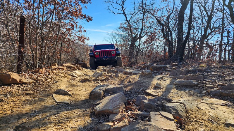
Updated: 10/15/2024
Northwest OHV Park A-12
Bridgeport, Texas
A-12 is an easy hard-packed dirt road with one slight off-camber section that leans 12 degrees and another section of flat, football-sized rocks. It is primarily used to access or exit the A-6, Fenceline North trail, which is a difficult and rocky hill climb between A-2 and A-12. The A-12 trail is also used to access A-13, which offers several steep inclines and descents. The A-12 trail is suitable for any high clearance vehicle.
Fees
Daily fees and annual passes can be purchased at the park gate with a card or cash, but both fees are cheaper if bought online.
Hours and Location
Northwest OHV Park is located at 279 George Mitchell Pkwy, Bridgeport, TX 76426. The park hours vary depending on the time of year. For more information, call (940) 683-3480 Monday through Friday or (940) 683-3685 on weekends.
Camping
Free primitive camping is allowed in the staging area on Friday and Saturday nights. No camping in the woods or on the trails.
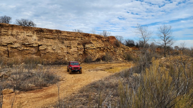
Updated: 10/15/2024
Northwest OHV Park A-4
Bridgeport, Texas
A-4 is a short trail around the bottom of the east quarry along the north wall. The trail is often muddy and can easily be impassable due to the cake-frosting thickness of the mud. Be aware that mud holes can be deeper than they appear. Always be sure to probe depths before entering.
This trail is best suited for high clearance 4-wheel drive vehicles.
Fees
Daily fees and annual passes can be purchased at the park gate with a card or cash, but both fees are cheaper if bought online.
Hours and Location
Northwest OHV Park is located at 279 George Mitchell Pkwy, Bridgeport, TX 76426. The park hours vary depending on the time of year. For more information, call (940) 683-3480 Monday through Friday or (940) 683-3685 on weekends.
Camping
Free primitive camping is allowed in the staging area on Friday and Saturday nights. No camping in the woods or on the trails.
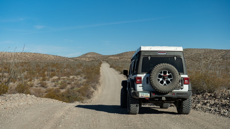
Updated: 01/04/2024
Bofecillos Road
Presidio, Texas
You have probably driven hours, if not days, to experience the remote nature of Big Bend Ranch State Park. At this point of your drive, you are ready for the real and meaningful part of your vacation. The good news is you are almost there. Once you turn off the pavement and onto Bofecillos Road, you are only a few miles to the Main Park Road entrance where a much grander adventure awaits you. Big Bend Ranch State Park is the largest State Park in Texas and also happens to be a honey hole full of excellent four-wheel-drive roads. The park also offers a collection of unique and well-spaced designated camping opportunities among the best you can find anywhere in the United States.
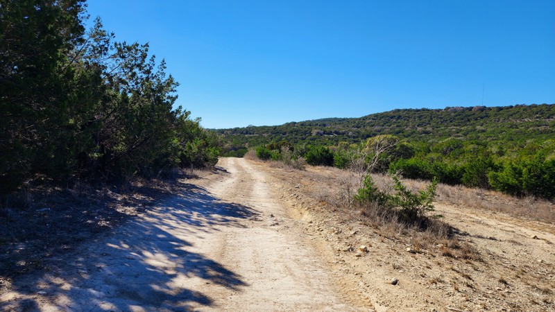
Updated: 10/15/2024
Hidden Falls Adventure Park: Feeder Creek
Smithwick, Texas
Feeder Creek is a simple, hard-packed dirt road with a few rogue rocks, potholes, and shallow erosion ruts. Its primary use is to connect Green Horn/Park Road 2 with North Pole, just west of Mount Saint James. It's a well-traveled two-way trail and generally 1.5-2 vehicles wide.
Feeder Creek is considered a level 2 road per the park's map but a level 1 per signs on the ground.
This trail is suitable for any high clearance vehicle.
Fees and Entry
Daily fees or extended memberships can be purchased at the park office. Entry into the park is on a first-come, first-served basis until the park reaches capacity, so be sure to arrive early.
Hours
Hidden Falls Adventure Park is only open Thursday thru Sunday, with 8 am and 9 am opening times and 2 pm-7 pm closing times depending on the day. Visit the park website for more information.
Accommodations
The park offers almost any type of accommodation you can think of. There are cabin rentals, bunkhouses, full RV hookups, dry campsites, and dispersed sites. Camping is only allowed in the designated areas and not on the trails. Reservations are required for all overnight camping. Visit the park website for booking information.

Updated: 03/11/2023
Javelin Road
Presidio, Texas
Javelin Road has the unique distinction of being the only maintained dirt road that penetrates deep into the park's rugged landscape. Offering multiple camping opportunities, the route extends south from the Sauceda Ranger Station, through the Llano, offering views of the Papalote Llano towards the east and the Panther Mountains to the west. For those looking to explore the likes of rugged trails likes of Rancherias Loop or Madrid Falls Road, then Javelin Road is the pleasant reprieve from more inhospitable adventures – but for the more refined, Javelin Road provides a pleasant direction from the Main Park Road and Llano Loop.
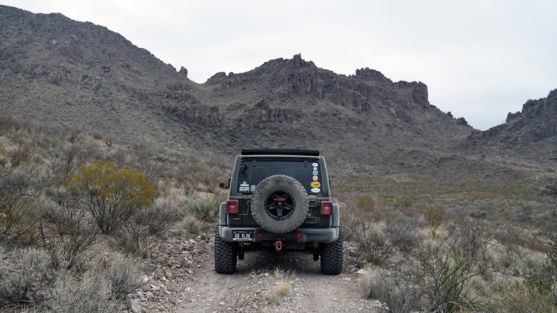
Updated: 06/05/2022
Las Burras Road
Presidio, Texas
Stretching from Oso Loop west of Oso Mountain southward into Las Burras Canyon, Las Burras Road provides both access to several campsites as well as scenic vistas available only to those willing to explore the rugged 4WD routes within the park. Rocky terrain, complete with off-camber ledges, offers an off-road experience that’s sure to remind travelers of just how far they are from civilization. Bring your curiosity and sense of wonder when exploring Las Burras Road!
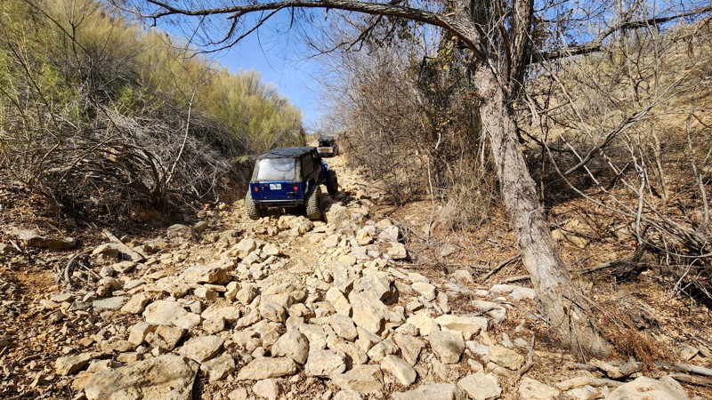
Updated: 10/15/2024
Northwest OHV Park A-8 - No Winch Hill
Bridgeport, Texas
A-8 is an uphill rock garden trail heavily peppered with free-moving basketball-sized rocks. This trail is called No Winch Hill for a good reason. There are no trees large enough or anything anchored to the ground that could be used as a winch anchor if you get stuck. Because the large rocks are constantly moving, it is easy to snag differential-catching rocks that will put a pause on any forward momentum. Gathering traction from a dead stop in the middle of the hill climb can be nearly impossible. This trail is best suited for modified vehicles with large tires, skid plates, and traction aid devices.
Fees
Daily fees and annual passes can be purchased at the park gate with a card or cash, but both fees are cheaper if bought online.
Hours and Location
Northwest OHV Park is located at 279 George Mitchell Pkwy, Bridgeport, TX 76426. The park hours vary depending on the time of year. For more information, call (940) 683-3480 Monday through Friday or (940) 683-3685 on weekends.
Camping
Free primitive camping is allowed in the staging area on Friday and Saturday nights. No camping in the woods or on the trails.
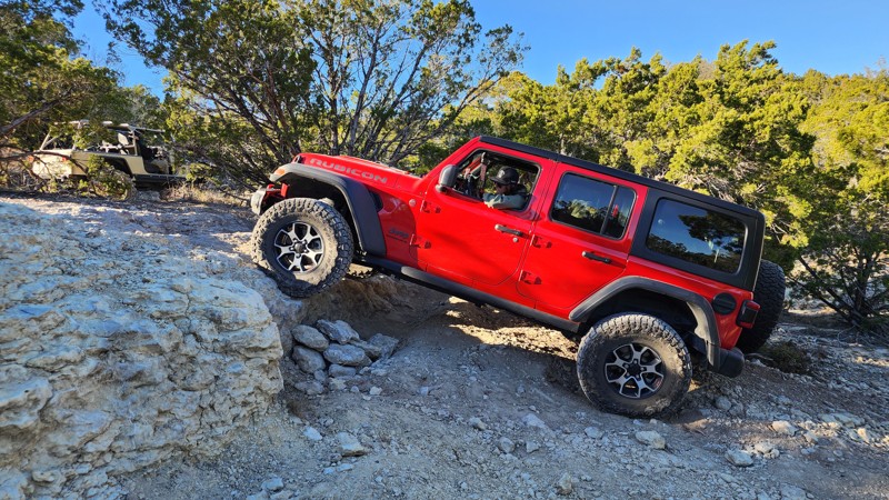
Updated: 10/15/2024
Hidden Falls Adventure Park: Carnage Canyon
Smithwick, Texas
Carnage Canyon is a 400-yard trail that climbs sharply between Dino Falls and Hog Alley. The trail's three limestone ledge obstacles will punish your rock sliders and undercarriage if you are not cautious with your line choice. The first ledge is the smallest, with a 12-inch wall and only wide enough to offer one line choice. The second ledge is 3-4 feet with multiple lines, the far right being the easiest. The third and final ledge is 2-5 feet tall with multiple lines. The far left is the easiest. This two-way trail is best run uphill from east to west.
This trail is best suited for modified vehicles with larger tires and traction aid devices.
Fees and Entry
Daily fees or extended memberships can be purchased at the park office. Entry into the park is on a first-come, first-served basis until the park reaches capacity, so be sure to arrive early.
Hours
Hidden Falls Adventure Park is only open Thursday thru Sunday, with 8 am and 9 am opening times and 2 pm-7 pm closing times depending on the day. Visit the park website for more information.
Accommodations
The park offers almost any type of accommodation you can think of. There are cabin rentals, bunkhouses, full RV hookups, dry campsites, and dispersed sites. Camping is only allowed in the designated areas and not on the trails. Reservations are required for all overnight camping. Visit the park website for booking information.
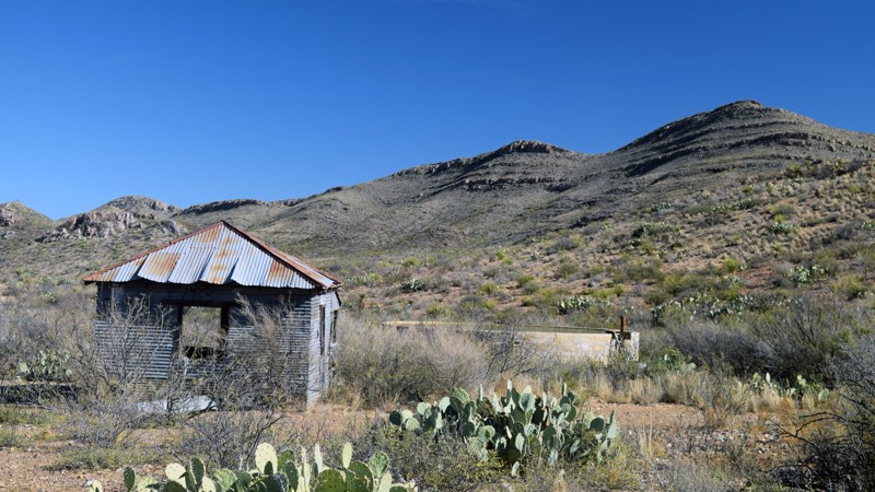
Updated: 03/09/2023
Solitario Road East
Presidio, Texas
They say “The Road To Nowhere” can be hard to find, but not in Big Bend Ranch State Park. Solitario Road East takes you to just such a place, a hiking and biking trail called “The Road To Nowhere”. Reaching into the eastern-most section of the park, Solitario Road East ends at a comfortable group campsite suitable as a home base for those wanting to hike or bike the Solitario. Explore nowhere in the Solitario via Solitario Road East.
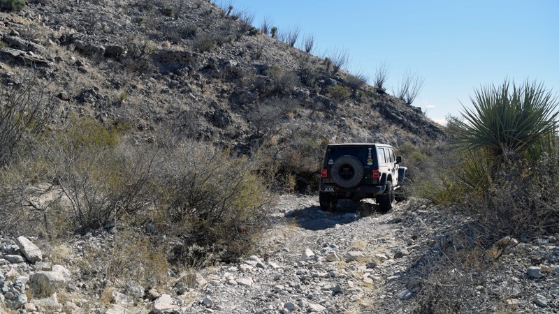
Updated: 01/24/2023
Papalote De La Sierra Loop
Presidio, Texas
Arguably one of the most rugged trails in Big Bend Ranch State Park, Papalote De La Sierra Loop extends into the northern-most reaches of the Cienega region of the park. For adventurers looking to explore areas less traveled and enjoy views rarely seen, this trail definitely doesn't disappoint. Be prepared for the unexpected, as civilization is nowhere near. But the rewards of exploring the trail are well worth the trip!
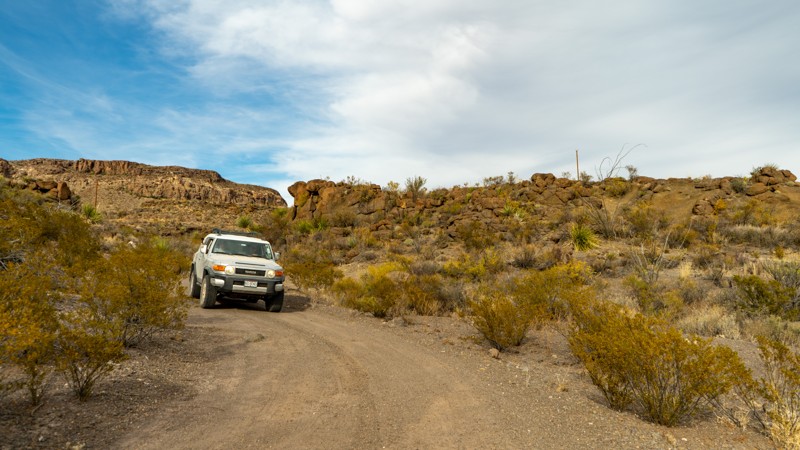
Updated: 06/05/2022
La Mota Road
Presidio, Texas
In Spanish, La Mota translates to "the weed." The weeds along this trail are not the main draw. What you will remember is the reddish lava-strewn landscape with La Mota Mountain in the background as you make your way to the camping opportunities along this trail. Camping is either nestled up to rocks or in a wide-open bowl looking at the distant plateaus and the notable La Mota Mountain. Either setting makes for a delightful and memorable camping experience.
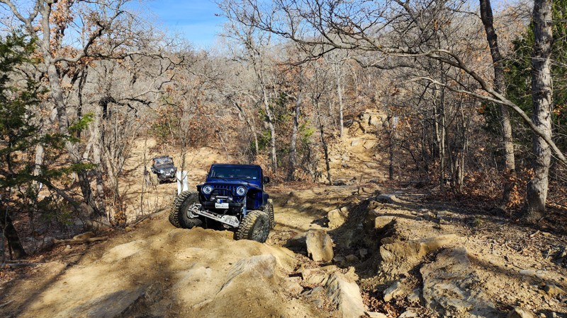
Updated: 10/15/2024
Northwest OHV Park E-102
Lake Bridgeport, Texas
E-102 is a straight-through trail from the creek bottom of E-103 to the upper cutoff of E-101. The bottom of the trail has a deep erosion-created ravine with several tombstone-sized boulders lying in the trench. This can be avoided by hugging one side of the trail and is guaranteed to flex out the suspension in doing so. Continue up a steep grade where you come across a split in the trail offering two different routes to the top. Both routes squeeze between tight trees and then over a stairstep-style ledge made of dozens of flat, loose limestone slabs.
This trail is best suited for modified vehicles with larger tires and skid plates.
Fees
Daily fees and annual passes can be purchased at the park gate with a card or cash, but both fees are cheaper if bought online.
Hours and Location
Northwest OHV Park is located at 279 George Mitchell Pkwy, Bridgeport, TX 76426. The park hours vary depending on the time of year. For more information, call (940) 683-3480 Monday through Friday or (940) 683-3685 on weekends.
Camping
Free primitive camping is allowed in the staging area on Friday and Saturday nights. No camping in the woods or on the trails.
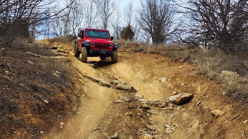
Updated: 10/15/2024
Northwest OHV Park C-56
Lake Bridgeport, Texas
C-56 is a short hill climb connecting C-51 and B-26. The trail offers a puckering 26-degree pitch at the top where it's hard to see over the hood on the way down. Stay in the center of the trail and straddle an erosion rut as you make your way over several football-sized rocks near the bottom. This trail is suitable for any vehicle with high clearance and 4-low.
Fees
Daily fees and annual passes can be purchased at the park gate with a card or cash, but both fees are cheaper if bought online.
Hours and Location
Northwest OHV Park is located at 279 George Mitchell Pkwy, Bridgeport, TX 76426. The park hours vary depending on the time of year. For more information, call (940) 683-3480 Monday through Friday or (940) 683-3685 on weekends.
Camping
Free primitive camping is allowed in the staging area on Friday and Saturday nights. No camping in the woods or on the trails.
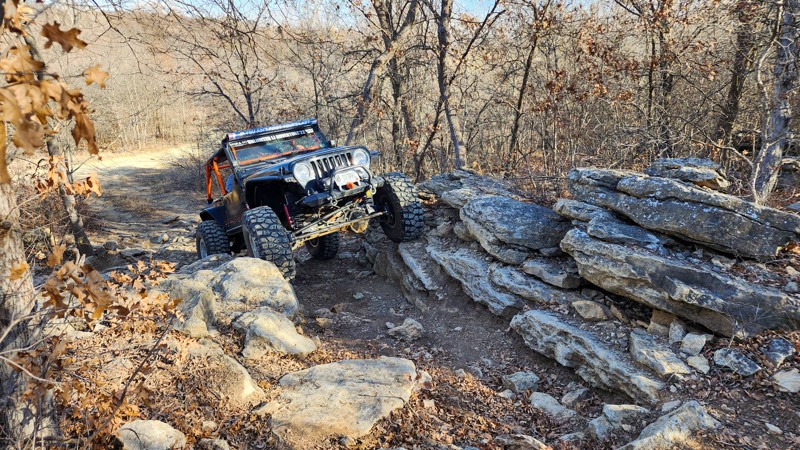
Updated: 10/15/2024
Northwest OHV Park E-104
Lake Bridgeport, Texas
E-104 is a rocky ridge between E-101 and E-103, in the northwest section of the park. The trail forces you to negotiate a wide v-notch while traveling uphill, followed by tire-sized, diff-catching boulders right as you crest the ridge. The rocks on the south side get even bigger with tabletop-sized boulders in the center of the trail and sedan-sized rock slabs on the sides of the trail. These massive rocks offer a great opportunity to test suspension flex and check component clearances.
This trail is best suited for modified vehicles with large tires, traction aid devices, skid plates, and body armor.
Fees
Daily fees and annual passes can be purchased at the park gate with a card or cash, but both fees are cheaper if bought online.
Hours and Location
Northwest OHV Park is located at 279 George Mitchell Pkwy, Bridgeport, TX 76426. The park hours vary depending on the time of year. For more information, call (940) 683-3480 Monday through Friday or (940) 683-3685 on weekends.
Camping
Free primitive camping is allowed in the staging area on Friday and Saturday nights. No camping in the woods or on the trails.
Updated: 10/15/2024
Hidden Falls Adventure Park: Revenge
Smithwick, Texas
Revenge is a 50-yard wide wall on the east side of Wildcat Mountain that offers multiple ledge climbs between Rocky trail and Park Road 3. The ledges range from 2 feet to 7 feet tall and every size in between. Most climbs are only 5-10 yards long, but the terrain is loose and could prove impossible in wet conditions.
This trail best suits modified vehicles with larger tires and skid plates.
Fees and Entry
Daily fees or extended memberships can be purchased at the park office. Entry into the park is on a first-come, first-served basis until the park reaches capacity, so be sure to arrive early.
Hours
Hidden Falls Adventure Park is only open Thursday thru Sunday, with 8 am and 9 am opening times and 2 pm-7 pm closing times depending on the day. Visit the park website for more information.
Accommodations
The park offers almost any type of accommodation you can think of. There are cabin rentals, bunkhouses, full RV hookups, dry campsites, and dispersed sites. Camping is only allowed in the designated areas and not on the trails. Reservations are required for all overnight camping. Visit the park website for booking information.
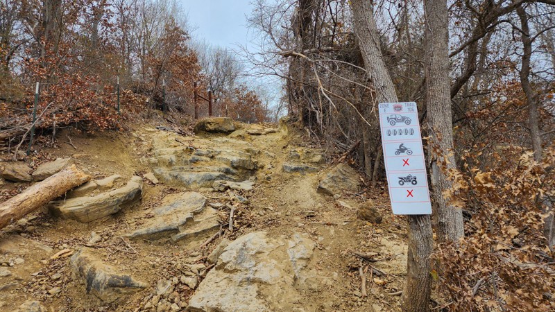
Updated: 10/15/2024
Northwest OHV Park E-106
Lake Bridgeport, Texas
E-106 is a quick loop in the park's northwest corner, spurring off of E-101, Minos Loop. The trail offers multiple steep, off-camber ledge climbs pinched between large trees. Different lines along the ledges range from 2 to 4 feet tall. A few ledges are severely undercut. Raising a tire on this trail is very common and the potential for rollover is high. Vehicles parked at the bottom of the climb should give ample space and be prepared to move at any time.
This trail is best suited for modified vehicles with large tires, traction aid devices, skid plates, and body armor.
Fees
Daily fees and annual passes can be purchased at the park gate with a card or cash, but both fees are cheaper if bought online.
Hours and Location
Northwest OHV Park is located at 279 George Mitchell Pkwy, Bridgeport, TX 76426. The park hours vary depending on the time of year. For more information, call (940) 683-3480 Monday through Friday or (940) 683-3685 on weekends.
Camping
Free primitive camping is allowed in the staging area on Friday and Saturday nights. No camping in the woods or on the trails.
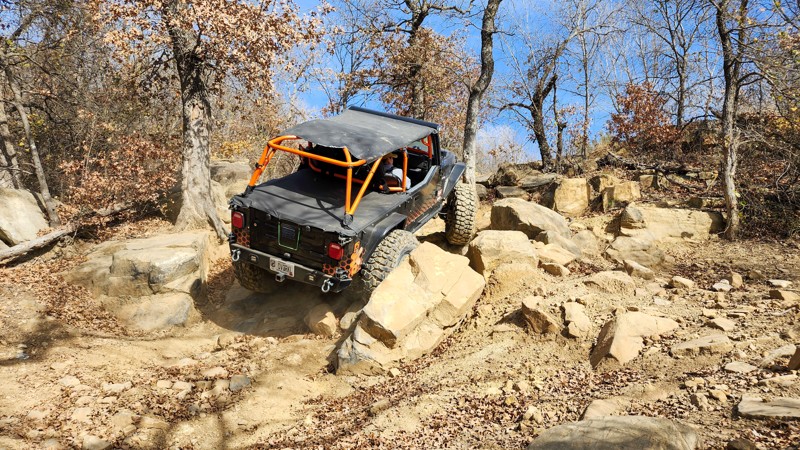
Updated: 10/15/2024
Northwest OHV Park A-11 - Edwards Run
Lake Bridgeport, Texas
A-11, Edwards Run, is a technical bouldery hill climb cutting from Honey Bee to the best part of No Winch Hill. The trail starts in a narrow ravine with large, tire-sized boulders and makes its way north to a large, sloped, 30' waterfall climb made up of 3 stair steps. The climb is buttered with coffin-sized limestone slabs that perfectly mask 40" holes. This trail will require large tires, traction aid devices, heavy-duty skid plates, and body armor is highly recommended.
Fees
Daily fees and annual passes can be purchased at the park gate with a card or cash, but both fees are cheaper if bought online.
Hours and Location
Northwest OHV Park is located at 279 George Mitchell Pkwy, Bridgeport, TX 76426. The park hours vary depending on the time of year. For more information, call (940) 683-3480 Monday through Friday or (940) 683-3685 on weekends.
Camping
Free primitive camping is allowed in the staging area on Friday and Saturday nights. No camping in the woods or on the trails.
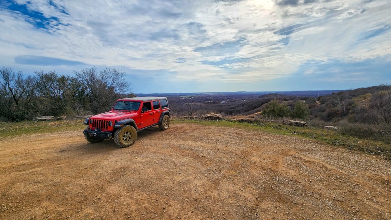
Updated: 10/15/2024
Northwest OHV Park A-7
Lake Bridgeport, Texas
A-7, also called Pavillion Jump, is a hard-packed dirt road shortcut from the top of No Winch Hill to the Pavillion and City Overlook. There are no obstacles, but one potential mudhole depending on recent rains.
The trail is suitable for any high clearance vehicle.
Fees
Daily fees and annual passes can be purchased at the park gate with a card or cash, but both fees are cheaper if bought online.
Hours and Location
Northwest OHV Park is located at 279 George Mitchell Pkwy, Bridgeport, TX 76426. The park hours vary depending on the time of year. For more information, call (940) 683-3480 Monday through Friday or (940) 683-3685 on weekends.
Camping
Free primitive camping is allowed in the staging area on Friday and Saturday nights. No camping in the woods or on the trails.
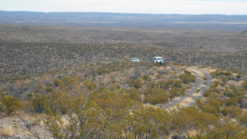
Updated: 06/05/2022
Cienega Creek Loop
Presidio, Texas
Big Bend Ranch State Park is arguably a very remote destination, but some trails within the park are more traveled than others. Cienega Creek Loop is one of the most remote trails in this very remote area. The trail evokes images of Lewis and Clark exploring areas for the first time. Cienega Creek Loop provides adventurous travelers with the opportunity to explore lost trail segments and reclaim them for others to use. Yet even for those a bit more cautious, the route provides extraordinary views along the Cienega Mountains worthy of taking a few moments to pause for self-introspection gazing over the gorge.
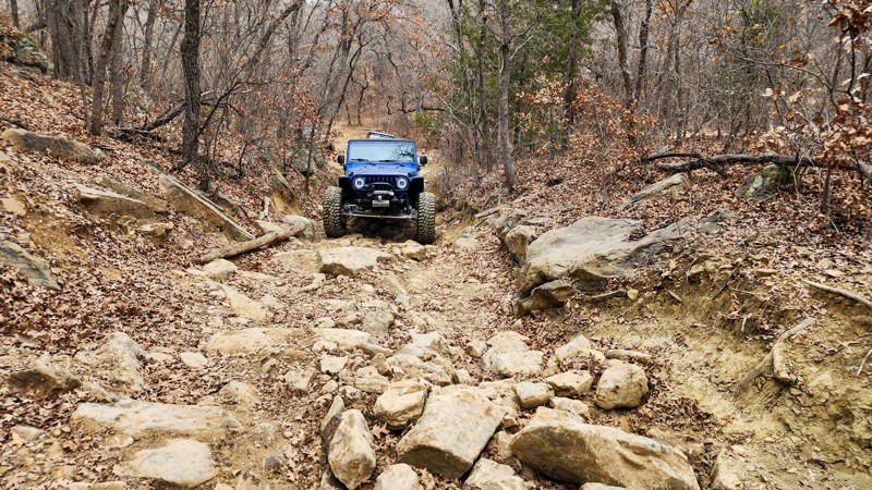
Updated: 10/15/2024
Northwest OHV Park E-105
Lake Bridgeport, Texas
E-105 is a straight-through trail that can be run in either direction from the creek bottom of E-103 to the western fence line and the upper cutoff of E-101. This gradual hill climb is covered in football-sized boulders with one additional obstacle of two 24'' tall tabletop-sized rocks, that you must climb both front tires over simultaneously and straddle the opening between them, as you then pull the rear tires up and over. This obstacle is about halfway up the hill.
This trail is best suited for modified vehicles with larger tires. Skid plates and rocker protection are highly recommended.
Fees
Daily fees and annual passes can be purchased at the park gate with a card or cash, but both fees are cheaper if bought online.
Hours and Location
Northwest OHV Park is located at 279 George Mitchell Pkwy, Bridgeport, TX 76426. The park hours vary depending on the time of year. For more information, call (940) 683-3480 Monday through Friday or (940) 683-3685 on weekends.
Camping
Free primitive camping is allowed in the staging area on Friday and Saturday nights. No camping in the woods or on the trails.
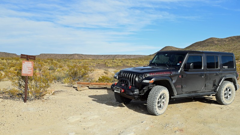
Updated: 06/05/2022
Croton Springs Road
Terlingua, Texas
Croton Springs Road offers quick access to both the Croton Spring trailhead as well as two campsites. But perhaps more appealing to others may be the trails pullout spot just off the main road, suitable for quick lunch in the desert. Whether your goal is to hike or camp Croton Springs; or merely enjoy the scenery over lunch, take a few moments to enjoy this short jaunt off the main park road.
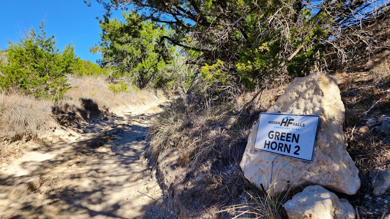
Updated: 10/15/2024
Hidden Falls Adventure Park: Green Horn 2
Smithwick, Texas
Green Horn 2 starts at Green Horn 1 and travels directly north, parallelling Feeder Creek. This trail is a somewhat narrow wash with a few sporadic rocks smaller than a football and two small ledges. The first ledge is around 12'' tall, and the second is around 16'' tall. Neither ledge is that challenging. Just a good place to stretch the suspension.
Green Horn 2 is considered a level 4 road per the park's rating system.
This trail is suitable for any high clearance, 4wd vehicle.
Fees and Entry
Daily fees or extended memberships can be purchased at the park office. Entry into the park is on a first-come, first-served basis until the park reaches capacity, so be sure to arrive early.
Hours
Hidden Falls Adventure Park is only open Thursday thru Sunday, with 8 am and 9 am opening times and 2 pm-7 pm closing times depending on the day. Visit the park website for more information.
Accommodations
The park offers almost any type of accommodation you can think of. There are cabin rentals, bunkhouses, full RV hookups, dry campsites, and dispersed sites. Camping is only allowed in the designated areas and not on the trails. Reservations are required for all overnight camping. Visit the park website for booking information.
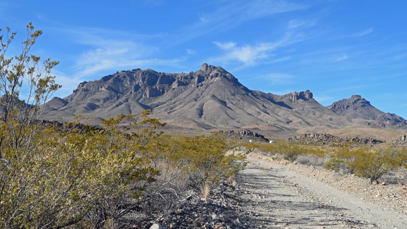
Updated: 06/05/2022
K Bar Road
Terlingua, Texas
While several short out-and-back trails extend off Big Bend National Park’s main road west of Panther Junction Visitor Center, only one – K Bar Road – is east. Providing views eastward towards Estufa Spring, most travel K Bar Road to access one of the two campsites along the route. In addition, researchers often leverage the route and available RV sites (available only to staff) to conduct desert research. For those veterans to Big Bend National Park looking for some different sites, be sure to take a short ride down K Bar Road.
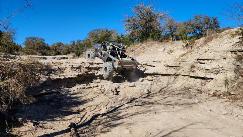
Updated: 10/15/2024
Hidden Falls Adventure Park: Royal Gorge
Smithwick, Texas
Royal Gorge is a narrow wash trail that parallels Park Road 2, passes Helicopter Landing Zone 4, and offers several entry and exit points. The main feature on the trail is a massive, bowl-shaped waterfall with multiple lines ranging from 4-6 feet tall. The only bypass around the waterfall is a loose, 4-5 stairstep climb over 10'' ledges. The northwest end of the trail offers a couple of small, single-ledge obstacles and a rutty rock garden.
Royal Gorge is considered a level 5 road per the park's rating system, but this would be if you attempt the large waterfall.
This trail is suitable for modified vehicles with larger tires and skid plates as they can bypass the most difficult obstacles, but to conquer the biggest waterfall, you will need a highly modified vehicle on 37'' tires or larger and locking differentials.
Fees and Entry
Daily fees or extended memberships can be purchased at the park office. Entry into the park is on a first-come, first-served basis until the park reaches capacity, so be sure to arrive early.
Hours
Hidden Falls Adventure Park is only open Thursday thru Sunday, with 8 am and 9 am opening times and 2 pm-7 pm closing times depending on the day. Visit the park website for more information.
Accommodations
The park offers almost any type of accommodation you can think of. There are cabin rentals, bunkhouses, full RV hookups, dry campsites, and dispersed sites. Camping is only allowed in the designated areas and not on the trails. Reservations are required for all overnight camping. Visit the park website for booking information.
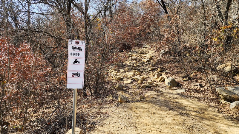
Updated: 10/15/2024
Northwest OHV Park A-9
Lake Bridgeport, Texas
A-9 is a consistent rock garden hill climb from start to finish. The trail starts at A-10, where you immediately traverse basketball and beachball-sized boulders. The farther you continue up the hill, the larger the rocks become. Near the top of the climb, you encounter coffin-sized rock slabs with very few line choices. This trail is best for modified vehicles with large tires, traction aid devices, heavy-duty skid plates, and rocker protection.
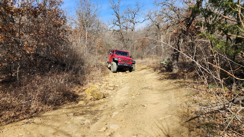
Updated: 10/15/2024
Northwest OHV Park A-10 - Honey Bee
Lake Bridgeport, Texas
A-10, known as Honey Bee, is a short loop to access the A-9 and A-11 hill climbs. The trail has a few exposed boulders that could catch a low-hanging differential and a few erosion ruts that will slightly articulate your suspension. This is an easy trail, suitable for any high clearance vehicle.
Fees
Daily fees and annual passes can be purchased at the park gate with a card or cash, but both fees are cheaper if bought online.
Hours and Location
Northwest OHV Park is located at 279 George Mitchell Pkwy, Bridgeport, TX 76426. The park hours vary depending on the time of year. For more information, call (940) 683-3480 Monday through Friday or (940) 683-3685 on weekends.
Camping
Free primitive camping is allowed in the staging area on Friday and Saturday nights. No camping in the woods or on the trails.
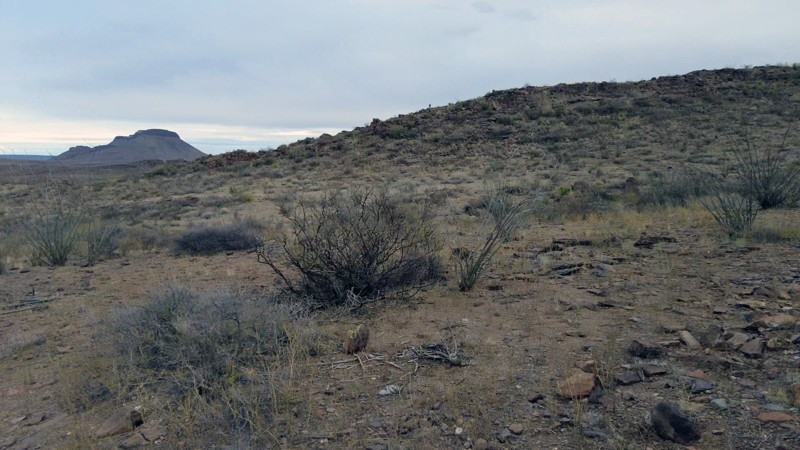
Updated: 01/18/2023
Yedra
Presidio, Texas
Fantastic views of the desert and majestic Aqua Adentro Mountain draw visitors to Yedra Road. The easily accessible route provides two campsites to relax while taking in this beautiful section of Big Bend Ranch State Park. Into hiking? Then be sure explore Yedra Canyon, Leyva Canyon, Cañon de la Cueva Larga, and Cañon de las Brujas. All are easily reached from Yedra Road.
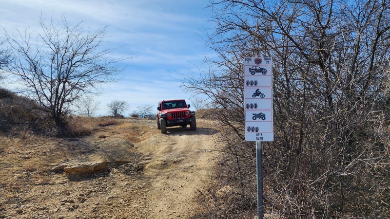
Updated: 10/15/2024
Northwest OHV Park D-79
Lake Bridgeport, Texas
D-79 is a rocky shortcut trail between Rocky Bluff Loop and the access road. The southwest end has an 18-degree hill you climb up and over. You then pass trail D-77 and drop down a rocky, 12'' ledge. This trail is suitable for any high clearance 4-wheel drive.
Fees
Daily fees and annual passes can be purchased at the park gate with a card or cash, but both fees are cheaper if bought online.
Hours and Location
Northwest OHV Park is located at 279 George Mitchell Pkwy, Bridgeport, TX 76426. The park hours vary depending on the time of year. For more information, call (940) 683-3480 Monday through Friday or (940) 683-3685 on weekends.
Camping
Free primitive camping is allowed in the staging area on Friday and Saturday nights. No camping in the woods or on the trails.
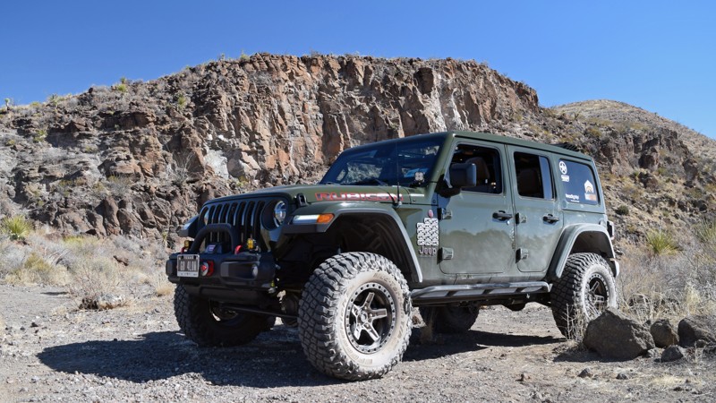
Updated: 06/05/2022
Pila Montoya Road
Presidio, Texas
Pila Montoya Road spurs off the Main Park Road to some excellent campsites, fantastic views, and a glimpse down into scenic Fresno Canyon. Pila Montoyo provides one of the easier roads into the more remote area of the park. Take a brief ride down Pila Montoya Road to enjoy the views and perhaps a night camping under a west Texas starry sky.
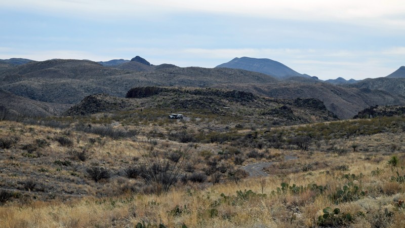
Updated: 06/05/2022
Fresno Vista Road
Presidio, Texas
Looking to take a short jaunt off the Main Park Road to catch some views southward into the Solitario? Scenic Fresno Vista Road is an easy drive to those views. The trail even offers a little bonus with a fantastic little campsite at the end. Take a short drive down Fresno Vista Road and enjoy the views!
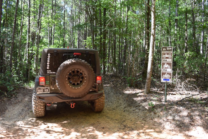
Updated: 01/28/2025
Barnwell Mountain Recreation Area: We Show
Delrose, Texas
We Show is the shortest "trail" in BMRA - effectively a connector trail rounding off the northeast corner of Omega. We Show also offers a unique opportunity to add a level of difficulty in an otherwise minimal obstacle on Omega. By exiting We Show and driving south on Omega, one positions their vehicle in such a precarious position to require the use of lockers and suspend their vehicle across diagonal points. If you're looking for a brief rise in heart rate, try running We Show - and don't be fooled by its otherwise innocence of length. There is no camping found directly along this trail.
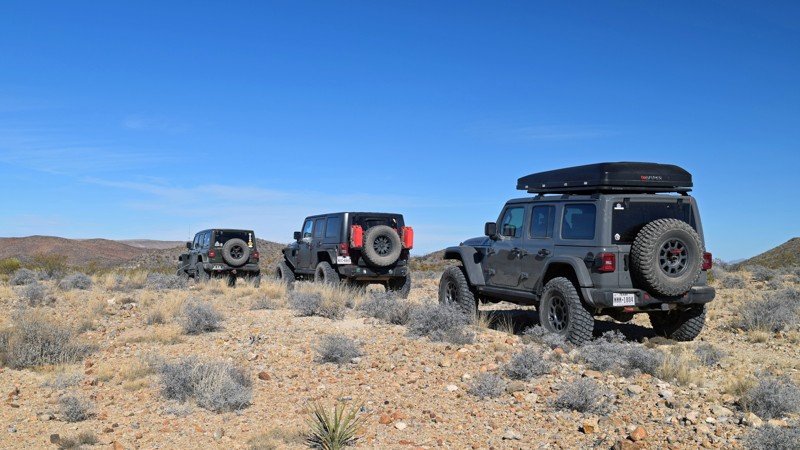
Updated: 02/18/2026
Los Alamos Road
Lajitas, Texas
Los Alamos Road is a straight-through 4-mile trail with compacted dirt and a slight amount of loose rock. The route is easily traversed by any high clearance vehicle. Mildly off-camber sections exist along the route and at arroyo entrances and exits. The bottoms of the arroyos are soft sand.
Camping in the park is restricted to designated sites only. There is one designated site along this trail, 1 mile from the southeast end.
Permits
Permits are required to drive into the Park's property, and must be displayed on your windshield. Visitors can check-in at Fort Leaton State Historic Site, the Barton Warnock Visitor Center, or the Sauceda Ranger Station. The Sauceda Ranger Station is open from 8 am to 6 pm. Fort Leaton State Historic Site and the Barton Warnock Visitor Centers are open from 8 am to 4:30 pm. There are self-serve driving permit stations that require cash if you are coming in after hours.
Dogs
The park does have a policy regarding dogs.
- Dogs must remain within ¼ mile of campsites or designated roads and are allowed only on the Closed Canyon Trail and the Hoodoos Trail on FM 170.
- Dogs are not allowed on any other trails in the backcountry.
Note: Under the Americans with Disabilities Act, these policies do not apply to persons relying on service dogs.
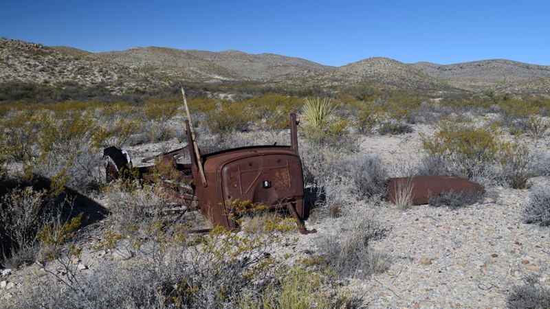
Updated: 02/18/2026
Solitario Road West
Lajitas, Texas
Solitario Road West is a straight-through 2.2-mile trail consisting of compacted dirt, mixed with loose rock. The trail is easily traversed by any high clearance vehicle. The trail has no notable obstacles but has been narrowed by encroaching brush in some areas. The area offers some exceptional hiking, including the Burnt Camp Trail accessible off the Solitario Road West. The hike takes you through a scenic desert landscape.
Along the drive, you will notice the nearly decomposed ruins of an automobile, reminding you that this remote area has attracted visitors for quite a while. The camping here is restricted to designated sites only. One site can be found about halfway through, just past the intersection with the abandoned McGuirk’s tanks.
Permits
Permits are required to drive into the Park's property, and must be displayed on your windshield. Visitors can check-in at Fort Leaton State Historic Site, the Barton Warnock Visitor Center, or the Sauceda Ranger Station. The Sauceda Ranger Station is open from 8 am to 6 pm. Fort Leaton State Historic Site and the Barton Warnock Visitor Centers are open from 8 am to 4:30 pm. There are self-serve driving permit stations that require cash if you are coming in after hours.
Dogs
The park does have a policy regarding dogs.
- Dogs must remain within ¼ mile of campsites or designated roads and are allowed only on the Closed Canyon Trail and the Hoodoos Trail on FM 170.
- Dogs are not allowed on any other trails in the backcountry.
Note: Under the Americans with Disabilities Act, these policies do not apply to persons relying on service dogs.

Upgrade your Membership
Unlock all of the details on every Trail Guide and Scout Route.
Start a 7-day Free TrialCommunity
Partners