


By clicking "ACCEPT", you agree to be the terms and conditions of each policy linked to above. You also agree to the storing of cookies on your device to facilitate the operation and functionality of our site, enhance and customize your user experience, and to analyze how our site is used.
Illinois Off-Road Trails
0
Total Trail Guides 0

0
Detailed Waypoints 5
Try a Free 7-Day Trial and unlock it all
Start a Free Trial Most Recent Trail Reviews
No Rating
Seasonal Closure
Visited: 12/09/2025
According to this trails management agency, the trail is likely closed for the season.
You can reach out to the agency for more details.
Be sure to leave us a report and let us know ...

Trails Offroad
Rated 5/5
Open
Visited: 10/12/2025
WOW! This trail did not disappoint! I would absolutely come back again to spend more time exploring the area. The views are incredible! The upper parking area for Inspiration Point is small and given ...

Shayne Danielson
Official Crew
Rated 5/5
Open
Visited: 10/11/2025
While the trail is short, it offers a great view of the surrounding area. The hiking trails offer plenty of rock action. The picnic area would be great for a lunch stop. I did pass a few vehicles goin...
Shayne Danielson
Official Crew
Rated 5/5
Open
Visited: 07/27/2025
Awesome place to visit! In the heat of the summer, this place is the perfect spot to cool off with plenty of water access. There were a lot of people enjoying the area and it is easy to see why it is ...
Shayne Danielson
Official Crew
Rated 5/5
Open
Visited: 07/27/2025
The road was an easy drive through the forest but beware of potholes. They are everywhere. Burden creek was quite low with barely any water in it so there was not much water coming over the falls. The...
Shayne Danielson
Official Crew
Rated 5/5
Open
Visited: 07/27/2025
Jackson Falls is an awesome place to visit. The scenery, camping, water and forest make for a great experience. There are a number of camping options from hiking in a ground tent to vehicle options. T...
Shayne Danielson
Official Crew
Most Popular

Updated: 02/12/2026
Burden Falls Road
McCormick, Illinois
Burden Falls Road offers a wonderful experience in the Shawnee National Forest. The highlight of the trail is Burden Falls. The road itself has golf ball-sized gravel mixed in with numerous potholes, making for an easy drive. The only real obstacle is the Burden Creek crossing. Depending on the water level, the creek crossing may be impassable. The eastern half features private property on either side of the road, with the last mile or so consisting of pavement, and the road ends at the junction of State Highway 145. No obvious camping locations exist along the route.
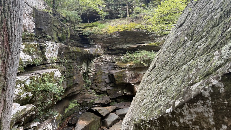
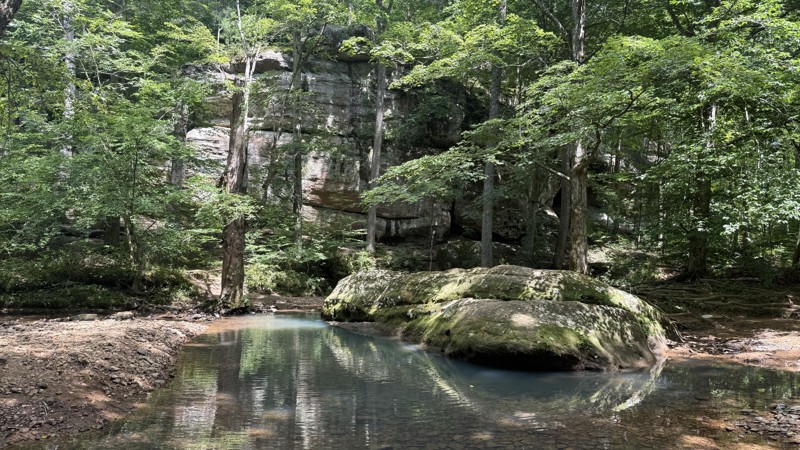
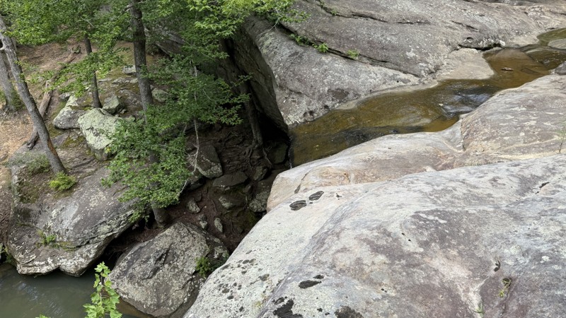
Burden Falls has a parking area right off the road, and a short hike leads to two waterfalls and some fantastic scenery. Cliffs, large boulders, and water pools, in addition to the waterfalls, make for a great area to explore! Burden Falls is a must-see in the area.
Updated: 02/12/2026
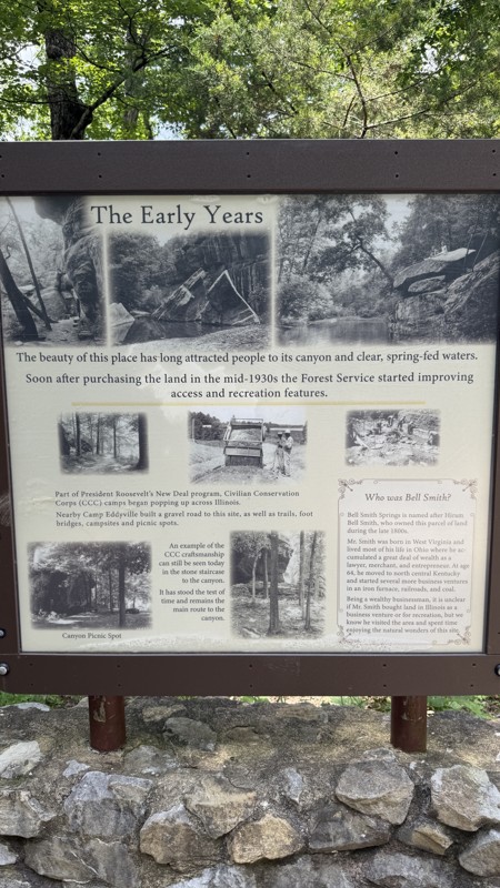
Bell Smith Springs Road
McCormick, Illinois
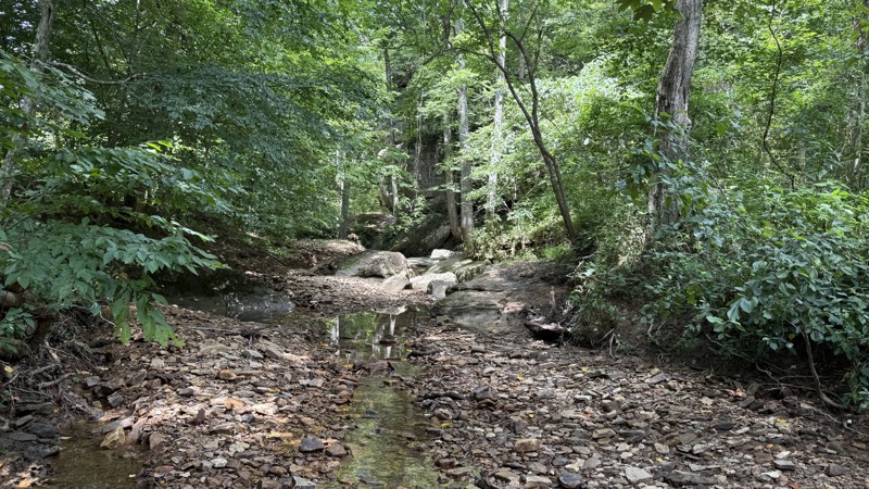
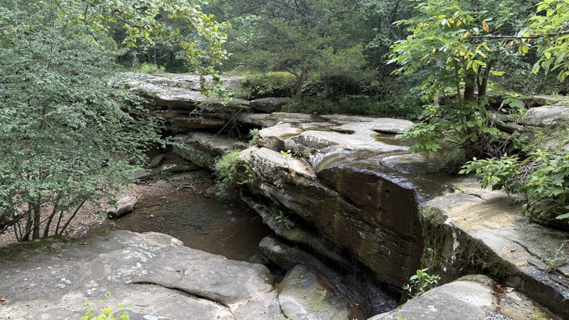
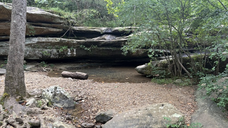
Bell Smith Springs Road offers access to hiking, cliffs, water, and stunning scenery. The road itself is composed of golf ball-sized and smaller gravel, with the western end consisting of pavement. Beware of potholes and puddles along the track. There are a couple of parking areas offering close access to the hiking trails down to Bay Creek. There is also access to more hiking via Bell Smith Scenic Area - 849. Red Bud Campground is nearby, offering primitive camping.
Cliffs are scattered throughout the area, along with several areas to cool off in water pools, engage in cliff jumping, and climb boulders, making the location a popular one. According to a pamphlet obtained from the Vienna Ranger Station, there are seven miles of interconnected hiking trails providing access to a variety of rock formations, including Devil's Backbone, Boulder Falls, and a natural rock bridge, to name a few. Bell Smith Springs Recreation Area offers a little bit of everything, making it a great spot to visit.
Updated: 11/07/2025
Pine Hills Road
Aldridge, Illinois
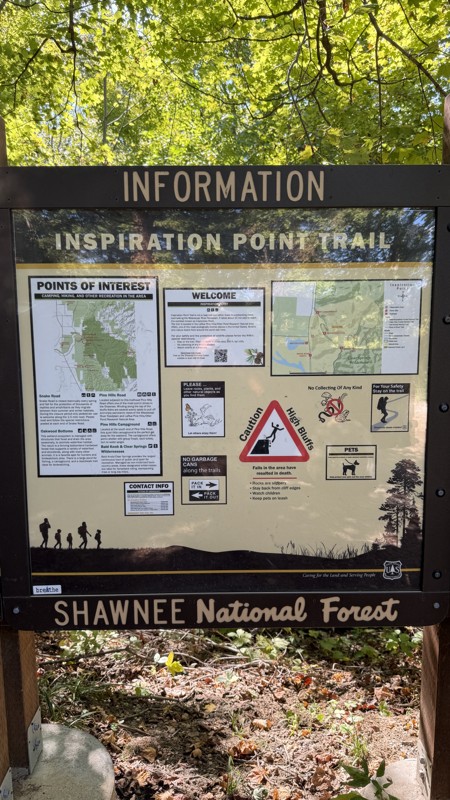
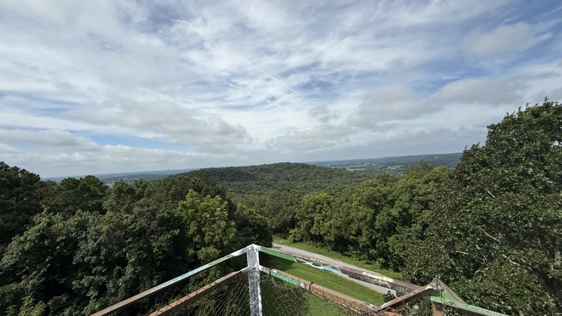
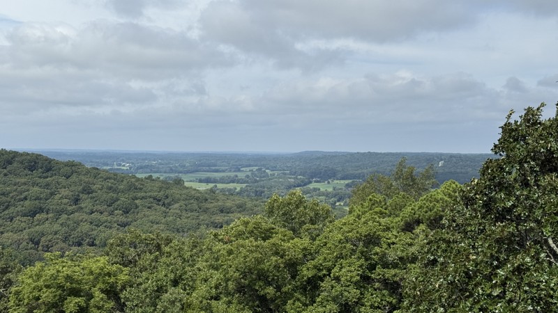
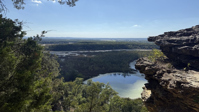
Pine Hills Road is a must-see trail in Southern Illinois. It offers fantastic views of the Mississippi River Valley at multiple points. The cliffs are not for the faint of heart. The most prominent cliff view is named Inspiration Point and is accessible via a short hike from the trailhead parking area located at the northern end of the road. Generally, the trail stays on the ridgeline with switchback climbs on either end.
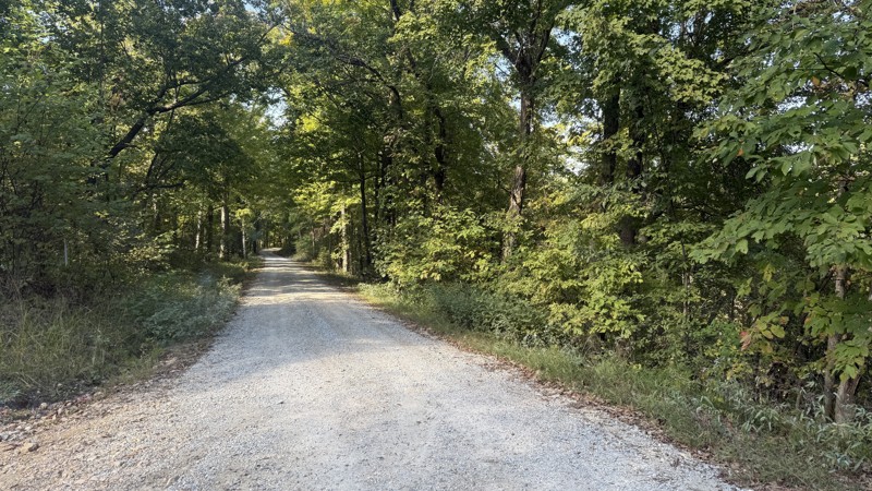
The road features golf ball-sized gravel, with a few areas marked by ruts from water runoff, narrow sections that allow only one vehicle to pass, and multiple potential creek crossings on the southern end, depending on the time of year. There are pull-offs for viewing the countryside at specific points.
Camping-wise, Pine Hills Campground offers multiple sites of varying sizes to spend the night in the woods right next to a creek bed.
Due to the area's popularity, expect to see a good number of vehicles and people exploring this part of the Shawnee National Forest.
Updated: 12/09/2025
Glen Street
Abbot, Illinois
While the name of this Forest Road might be Glen Street, it isn't much of a street, but rather a pleasant drive through the Shawnee National Forest with a cool place to visit. Jackson Falls is the highlight of the trail. For the most part, the road is gravel with rocks smaller than golf balls. Expect potholes, washboarding, and puddles if it has rained recently. There are a few areas with exposed rock beds and a couple of creek crossings. Past Jackson Falls, there are several campsites available for both ground tents and vehicle-mounted tents. The trail gets a bit rougher past the falls, but nothing difficult. There is private property mixed in with the National Forest on the northern end.
The water flowing over Jackson Falls is dependent on the amount of rainfall the area has received. Please keep this in mind when scheduling your visit. There are trails on either side of the falls; however, there is no direct path to the pool at the base. According to a pamphlet picked up at the Vienna, IL Ranger Station, a 3.25-mile round-trip hike on Trail 49 can access the bottom of the falls. The cliffs are 30 feet or so high from the top of the falls to the pool below. The trail from the parking lot is a quick, easy hike along the creek. Large boulders and small pools offer plenty to explore in the immediate area.
This place is a must-visit if you are in the area.
Updated: 11/07/2025
High Knob Road
Karbers Ridge, Illinois
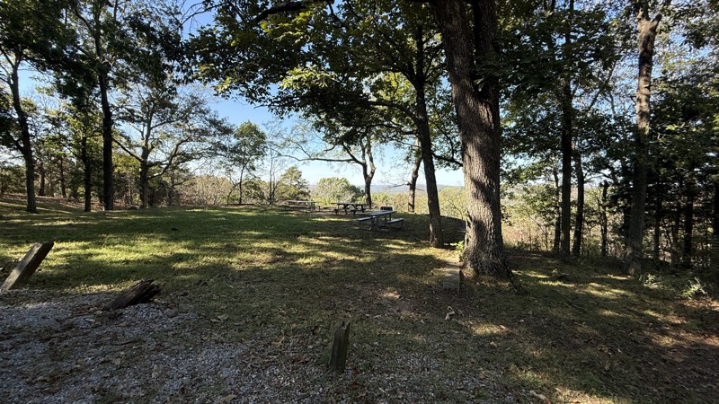
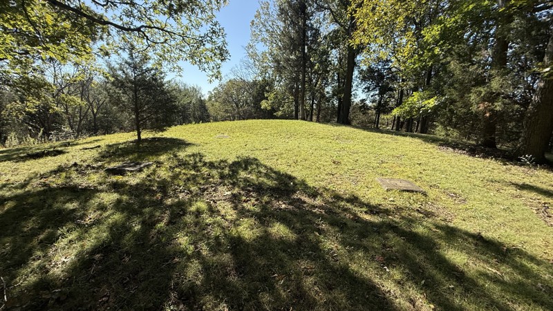
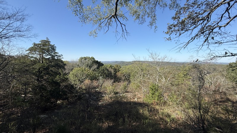
High Knob Road is a short out-and-back trail that takes you to the summit of High Knob. The site was home to a 60-foot fire tower constructed by the Civilian Conservation Corps in 1934. By the 1970s, all of the fire towers in the area were decommissioned. All that remains of the fire tower are the four concrete anchor points. The area features a parking lot, a picnic area, a sign explaining the area's history, and a stunning view of the surroundings. A hiking trail circumnavigates the cliff summit, offering an excellent opportunity to view some prominent rock formations in the countryside.
At the beginning of the trail is a horse camp on private property, and then it transitions to the Shawnee National Forest. It is an easy drive to the top. The road has loose gravel that is golf ball-sized and smaller, with some areas experiencing water runoff that causes small ruts. There are a few pull-off areas for vehicles and horseback riders to pass, given the area's popularity. The area is day use only, so there is no camping.

Upgrade your Membership
Unlock all of the details on every Trail Guide and Scout Route.
Start a 7-day Free TrialCommunity
Partners