


By clicking "ACCEPT", you agree to be the terms and conditions of each policy linked to above. You also agree to the storing of cookies on your device to facilitate the operation and functionality of our site, enhance and customize your user experience, and to analyze how our site is used.
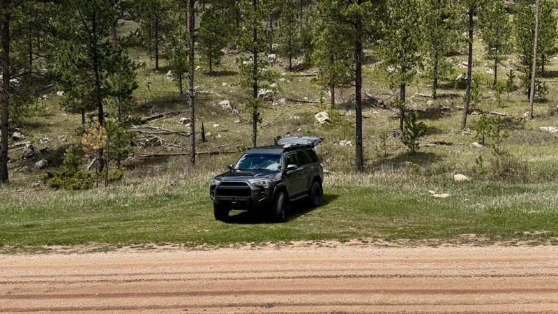
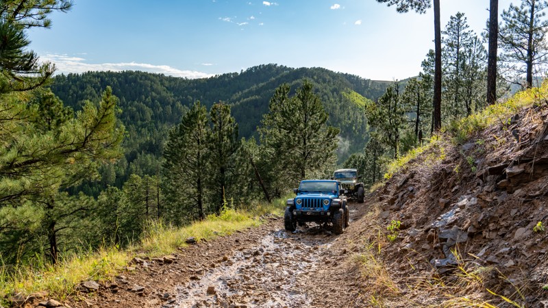
South Dakota Off-Road Trails
11
Total Trail Guides 9

112
Detailed Waypoints 82
Try a Free 7-Day Trial and unlock it all
Start a Free Trial Most Recent Trail Reviews
Rated 5/5
Open
Visited: 06/29/2026
The mud ruts are pretty substantial, if you get past them expect a very narrow trail with some pinstriping then a few steep climbs to find this sweet campsite. Plenty of room for a bunch of vehicles....
Peter Olson
Rated 4/5
Open
Visited: 06/28/2026
Similar to others, the trail is pretty straightforward. After proceeding off of NP maintenance, it gets a bit tougher, but not much of a challenge at all even with rains less than 24 hours before. Rut...
MC
Mark Croke
Rated 5/5
Open
Visited: 06/28/2026
This was a great trail to do, though in my opinion, it's tougher than the rating shows. In several areas, 4 low was required to get over the loose sand at the top of the embankments. The crossings are...
MC
Mark Croke
Rated 3/5
Open
Visited: 06/28/2026
Took this north to south yesterday and was getting bored until about halfway. The rock garden at waypoint 9 was really quite tough on the gladiator and I may need a new rear driveshaft over it… That s...
Peter Olson
Rated 3/5
Open
Visited: 06/27/2026
The ruts and mud holes are getting deeper and the trees are getting tighter, but the view is just as gorgeous at the top.
Dalton Santana
Official Crew

Trails Offroad
Rated 4/5
Open
Visited: 06/25/2026
Logging over the winter has changed how the entrance looks. It is now completely visible from the road. A logging or user created bypass has also popped up at the switchback so make sure you stay on...
Dalton Santana
Official Crew
No Rating
Open
Visited: 06/19/2026
Suitable for just about any vehicle for the first couple of miles. There is an overlook where you can turn around if not driving a high clearance vehicle. Did not need 4-wheel drive but did need high...
LM
Lester M Sendecki
Dalton Santana
Official Crew
Rated 5/5
Open
Visited: 06/09/2026
Trail is open! Easy going, just a bit dusty. Two spots at the southern end have some utility maintenance (power lines/poles) so watch for those guys if going anytime soon after this comment.
David
Dalton Santana
Official Crew
Dalton Santana
Official Crew
Dalton Santana
Official Crew
Rated 4/5
Open
Visited: 06/02/2026
Stagebarn is pretty mellow as long as you avoid the harder lines near High Meadows. The connecting trail between the main trail and road is marked as FS 148 and well-traveled, but does not appear on...
Dalton Santana
Official Crew
Rated 5/5
Open
Visited: 05/29/2026
Primary part of the road is a grated gravel road. Once you get to an overlook and turnaround, there is a sign that notes high clearance 4wd past that point. The road is no longer maintained. The pa...
DG
David G
Rated 3/5
Open
Visited: 05/29/2026
The cabins near the entrance are pretty, but the trail itself is pretty mediocre. I usually just use it to get into Schmitz and run the loop.
Dalton Santana
Official Crew
Rated 3/5
Open
Visited: 05/24/2026
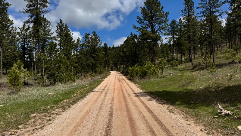
This was a very pleasant road we used to get to Bear Mountain from Custer. If you are looking to navigate the southern Hills while avoiding pavement, be sure to check it out.
Dalton Santana
Official Crew
Rated 5/5
Open
Visited: 05/24/2026
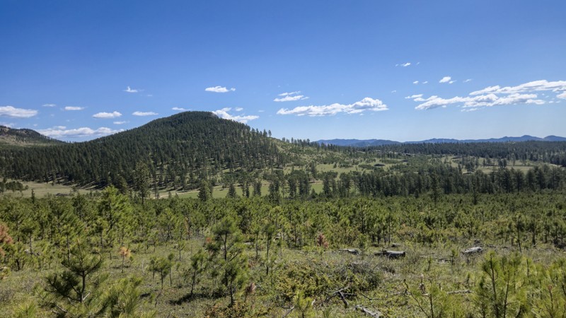
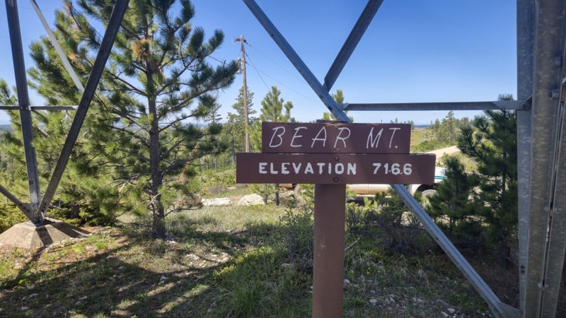
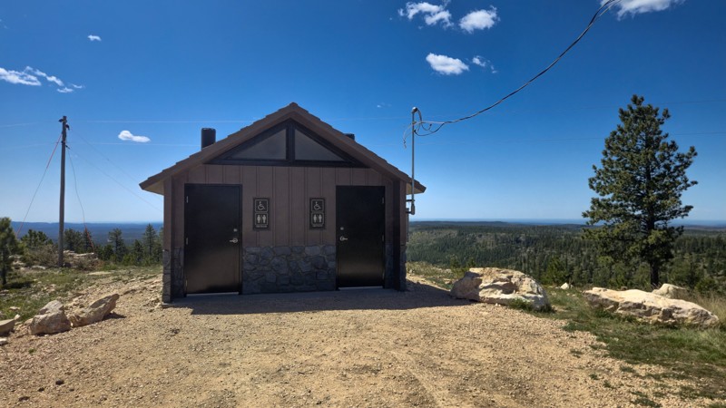
Bear Mountain is a fantastic view and well worth the trip. If you want an easy ride, be sure to approach from the south and leave the way you came. If you are up for a bit of off-roading, run the no...
Dalton Santana
Official Crew
Rated 3/5
Open
Visited: 05/22/2026
Easy gravel road with limited camping. I pulled off to make lunch in a quiet area.
AT
Andrew T
Ryan Boudreau
Official Crew
Rated 5/5
Open
Visited: 05/10/2026
I had been wanting to check out Indian Creek for a while at the recommendation of some friends, and it did not disappoint. The trail was no problem for my Bronco, and the Outback tagging along did we...
Dalton Santana
Official Crew
Rated 3/5
Open
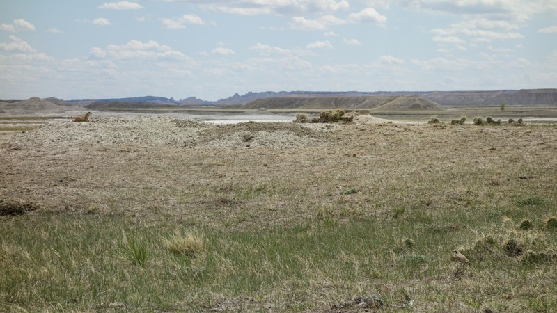
Visited: 05/10/2026
Sage Creek 7146 is short and easy. It is very pretty and cuts through a large Prairie Dog town. The camping area would be great for a small group and would be pretty easy to get a small camper or tr...
Dalton Santana
Official Crew
Rated 4/5
Open
Visited: 01/17/2026
Edelweiss Mountain Road is a peaceful cut across from Silver City if you want to get off the pavement. It is well-maintained and very pretty. There wasn't much snow during this trip, but I think thi...
Dalton Santana
Official Crew
Rated 5/5
Open
Visited: 01/06/2026
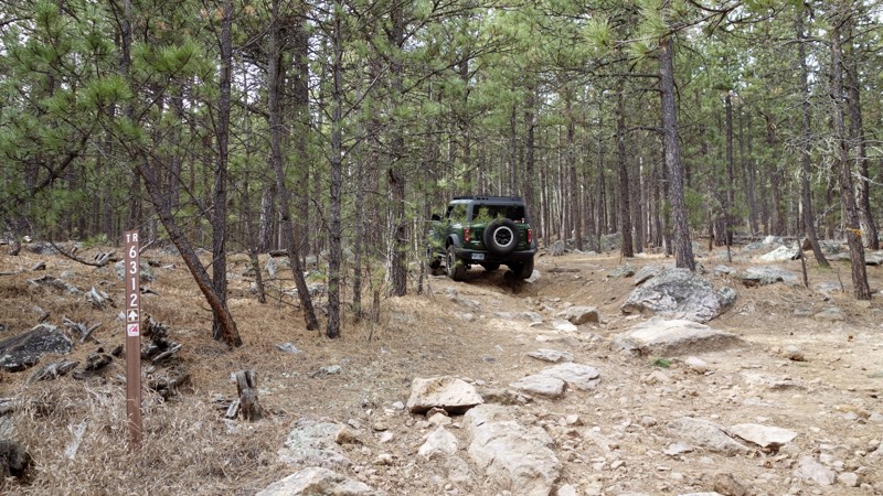
I usually take this to exit the Cereal bowl after running Fruity Pebbles and Got Milk. The 6311 shortcut is fun to go either up or down, and is great for those wanting to try something a little more ...
Dalton Santana
Official Crew
Rated 4/5
Open
Visited: 01/06/2026
The first half of this, FS 6312, is a rocky, rough ride down to Captain Crunch and Got Milk. It seems like every time I drive down it, the rocks have moved around. It probably takes about the same a...
Dalton Santana
Official Crew
Rated 3/5
Partially Open
Visited: 01/06/2026
Hat Mountain is usually a means to an end for me. The trail itself is not technical or particularly scenic, but it provides access to rock-crawling and dirt bike trails, so I'm usually hitting at lea...
Dalton Santana
Official Crew
No Rating
Seasonal Closure
Visited: 12/15/2025
According to this trails management agency, the trail is likely closed for the season.
You can reach out to the agency for more details.
Be sure to leave us a report and let us know ...
Trails Offroad
No Rating
Seasonal Closure
Visited: 12/15/2025
According to this trails management agency, the trail is likely closed for the season.
You can reach out to the agency for more details.
Be sure to leave us a report and let us know ...
Trails Offroad
No Rating
Seasonal Closure
Visited: 12/15/2025
According to this trails management agency, the trail is likely closed for the season.
You can reach out to the agency for more details.
Be sure to leave us a report and let us know ...
Trails Offroad
No Rating
Seasonal Closure
Visited: 12/15/2025
According to this trails management agency, the trail is likely closed for the season.
You can reach out to the agency for more details.
Be sure to leave us a report and let us know ...
Trails Offroad
No Rating
Seasonal Closure
Visited: 12/15/2025
According to this trails management agency, the trail is likely closed for the season.
You can reach out to the agency for more details.
Be sure to leave us a report and let us know ...
Trails Offroad
No Rating
Seasonal Closure
Visited: 12/15/2025
According to this trails management agency, the trail is likely closed for the season.
You can reach out to the agency for more details.
Be sure to leave us a report and let us know ...
Trails Offroad
No Rating
Seasonal Closure
Visited: 12/15/2025
According to this trails management agency, the trail is likely closed for the season.
You can reach out to the agency for more details.
Be sure to leave us a report and let us know ...
Trails Offroad
No Rating
Seasonal Closure
Visited: 12/15/2025
According to this trails management agency, the trail is likely closed for the season.
You can reach out to the agency for more details.
Be sure to leave us a report and let us know ...
Trails Offroad
No Rating
Seasonal Closure
Visited: 12/15/2025
According to this trails management agency, the trail is likely closed for the season.
You can reach out to the agency for more details.
Be sure to leave us a report and let us know ...
Trails Offroad
No Rating
Seasonal Closure
Visited: 12/15/2025
According to this trails management agency, the trail is likely closed for the season.
You can reach out to the agency for more details.
Be sure to leave us a report and let us know ...
Trails Offroad
No Rating
Seasonal Closure
Visited: 12/15/2025
According to this trails management agency, the trail is likely closed for the season.
You can reach out to the agency for more details.
Be sure to leave us a report and let us know ...
Trails Offroad
No Rating
Seasonal Closure
Visited: 12/15/2025
According to this trails management agency, the trail is likely closed for the season.
You can reach out to the agency for more details.
Be sure to leave us a report and let us know ...
Trails Offroad
No Rating
Seasonal Closure
Visited: 12/15/2025
According to this trails management agency, the trail is likely closed for the season.
You can reach out to the agency for more details.
Be sure to leave us a report and let us know ...
Trails Offroad
No Rating
Seasonal Closure
Visited: 12/15/2025
According to this trails management agency, the trail is likely closed for the season.
You can reach out to the agency for more details.
Be sure to leave us a report and let us know ...
Trails Offroad
No Rating
Seasonal Closure
Visited: 12/15/2025
According to this trails management agency, the trail is likely closed for the season.
You can reach out to the agency for more details.
Be sure to leave us a report and let us know ...
Trails Offroad
No Rating
Seasonal Closure
Visited: 12/15/2025
According to this trails management agency, the trail is likely closed for the season.
You can reach out to the agency for more details.
Be sure to leave us a report and let us know ...
Trails Offroad
No Rating
Seasonal Closure
Visited: 12/15/2025
According to this trails management agency, the trail is likely closed for the season.
You can reach out to the agency for more details.
Be sure to leave us a report and let us know ...
Trails Offroad
No Rating
Seasonal Closure
Visited: 12/15/2025
According to this trails management agency, the trail is likely closed for the season.
You can reach out to the agency for more details.
Be sure to leave us a report and let us know ...
Trails Offroad
No Rating
Seasonal Closure
Visited: 12/15/2025
According to this trails management agency, the trail is likely closed for the season.
You can reach out to the agency for more details.
Be sure to leave us a report and let us know ...
Trails Offroad
No Rating
Seasonal Closure
Visited: 12/15/2025
According to this trails management agency, the trail is likely closed for the season.
You can reach out to the agency for more details.
Be sure to leave us a report and let us know ...
Trails Offroad
No Rating
Seasonal Closure
Visited: 12/15/2025
According to this trails management agency, the trail is likely closed for the season.
You can reach out to the agency for more details.
Be sure to leave us a report and let us know ...
Trails Offroad
No Rating
Seasonal Closure
Visited: 12/15/2025
According to this trails management agency, the trail is likely closed for the season.
You can reach out to the agency for more details.
Be sure to leave us a report and let us know ...
Trails Offroad
No Rating
Seasonal Closure
Visited: 12/15/2025
According to this trails management agency, the trail is likely closed for the season.
You can reach out to the agency for more details.
Be sure to leave us a report and let us know ...
Trails Offroad
No Rating
Seasonal Closure
Visited: 12/15/2025
According to this trails management agency, the trail is likely closed for the season.
You can reach out to the agency for more details.
Be sure to leave us a report and let us know ...
Trails Offroad
Most Popular

Updated: 12/08/2025
China Gulch Road
Hill City, South Dakota
The beauty of the Black Hills National Forest is on display as you travel along China Gulch Road. The road begins in the China Gulch and ends as it proceeds through the more rugged and popular Nugget Gulch. This easy forested road displays an abundance of wildflowers and mature pine trees. Creek crossings are always a favorite feature for an off-pavement adventure and several can be found near the north end of this road.


Updated: 09/16/2025
Camp 5
Open
/
Deadwood, South Dakota/
3.98 miles/
About 2 hours
Nestled midway between Deadwood and Sturgis, Camp 5 is the ultimate gateway to over 10 miles of adrenaline-pumping rock-crawling, 4x4, and OHV trails. Offering a small taste of what can be found along its neighboring trails, Camp 5 marches you into a broader network, where you will find trails twisting through creek beds, threading past boulder fields, and scaling natural waterfalls. Trails in this area draw in local 4x4 clubs, rock-crawling diehards, and thrill-seekers from across the country who are eager to test the limits of their skills and machines.

Updated: 06/05/2022
Lightning Creek Road
Custer, South Dakota
A well-groomed forest helps define Lightning Creek Road from start to finish. This scenic drive through the lush terrain sports an abundance of wildflowers, wildlife, and mature pine trees. The forest here is an example of what can be done to reduce the risk of forest fires and beetle kill infestation while creating a visually stimulating view. Near the north end of the route, you will be treated to a magnificent view of the Black Hills and the Crazy Horse Memorial in the distance.

Updated: 06/20/2024
Williams Draw
Hill City, South Dakota
Williams Draw is an easy drive that takes you from Deerfield Lake to the Four Corners area in the beautiful Black Hills. Four Corners is a central location in the large network of other, less maintained, offroad trails. This makes Williams Draw one of the direct routes to the center of the trail network. If your looking to explore in the central Black Hills then Williams Draw is an excellent place to start

Updated: 09/16/2025
Fruity Pebbles
Open
/
Merritt, South Dakota/
0.67 miles/
About an hour
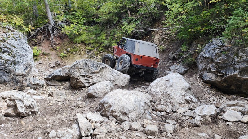
Located in the Cereal Bowl Trail System, Fruity Pebbles is a poster child for the technical type of rock crawling the Black Hills of South Dakota is widely known for. Unlike the sweetened breakfast cereal, this trail is not easy to chew and does not soften itself for ill-prepared vehicles. You will not be offered any bypasses or bailout routes once you enter this trail. Weak links will be exposed as you carefully attempt to navigate your way through not one but two chaotic minefields of sharp, loose, jagged rocks the size of kitchen appliances. Be sure to bring a proper spoon because devouring this trail will take a good utensil.

Updated: 06/29/2026
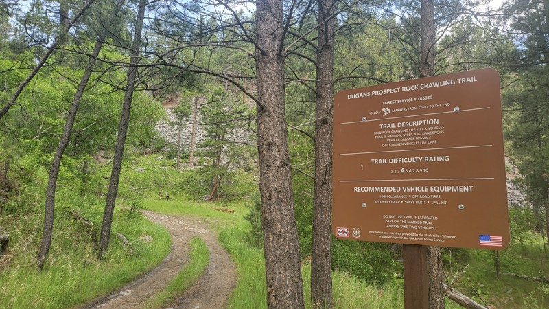
Dugan's Prospect
Three Forks, South Dakota
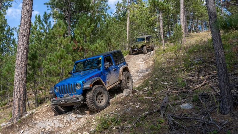
Dugan's Prospect is a there-and-back rock crawling trail located off U.S. Highway 385 across from the Sheridan Lake Fishing Pier. Dugan's Prospect is rated a 4 out of 10 by the Black Hills 4 Wheelers Club. It is suitable for stock vehicles with high clearance and off-road tires. The trail is steep, narrow in several sections, and very rocky throughout.
Camping is limited on Dugan's Prospect. A small grassy area can be found just after the trail entrance sign, suitable for a ground tent and possibly a vehicle-mounted tent or small trailer. Motor vehicles may go up to 300 feet off of the road in the Black Hills National Forest to camp. However, campfires are not allowed.
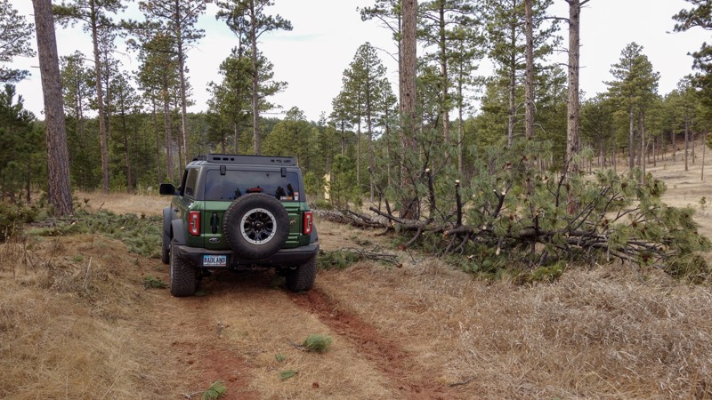
Shortly after the entrance to Dugan's Prospect, a barbed-wire gate blocks the trail. Open it to pass through and close it behind you. The path starts climbing and is covered in smaller jagged rocks with trees tight to either side. The rocks will grow in size as you go up the trail. There are also washouts with ruts in the climb. The trail smooths out until the last 1/8th of a mile.
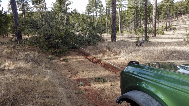
This last section descends into a canyon with several large rocks and downed trees to navigate around and over. Once at the bottom, turn around and head back the way you came. The bottom is the official end of the trail. There are tracks from others who continued toward the nearby house, but this is private property and is off-trail, so make sure to stay on the marked route.
Updated: 06/29/2026
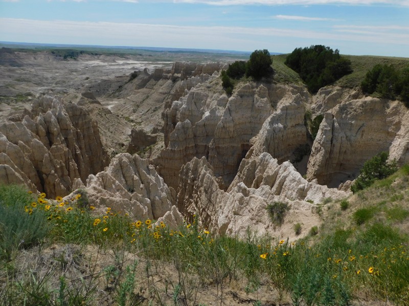
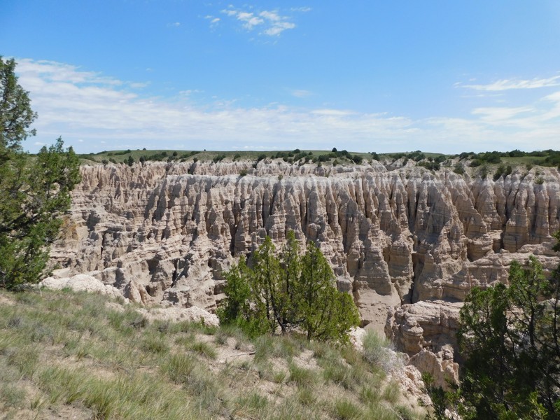
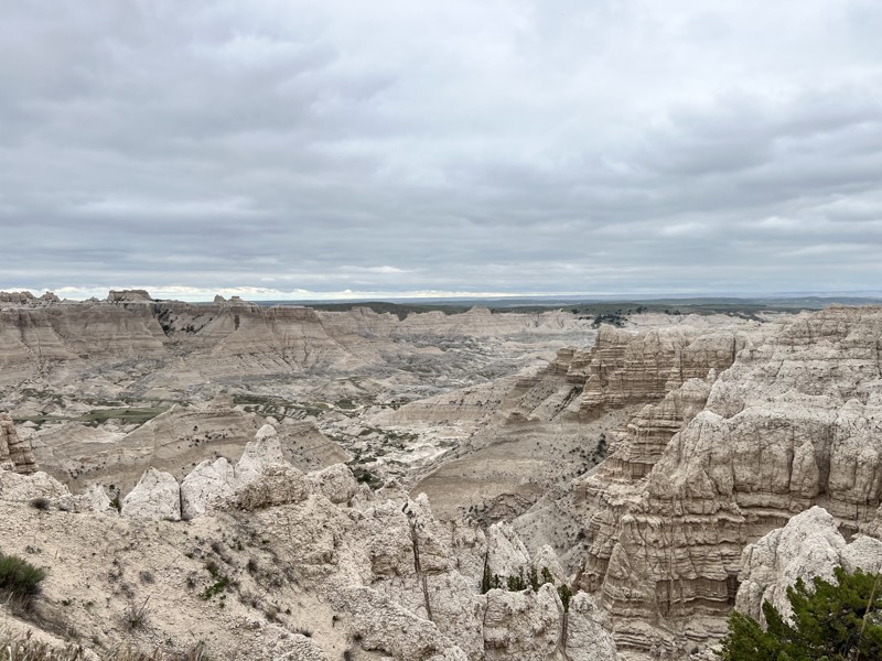
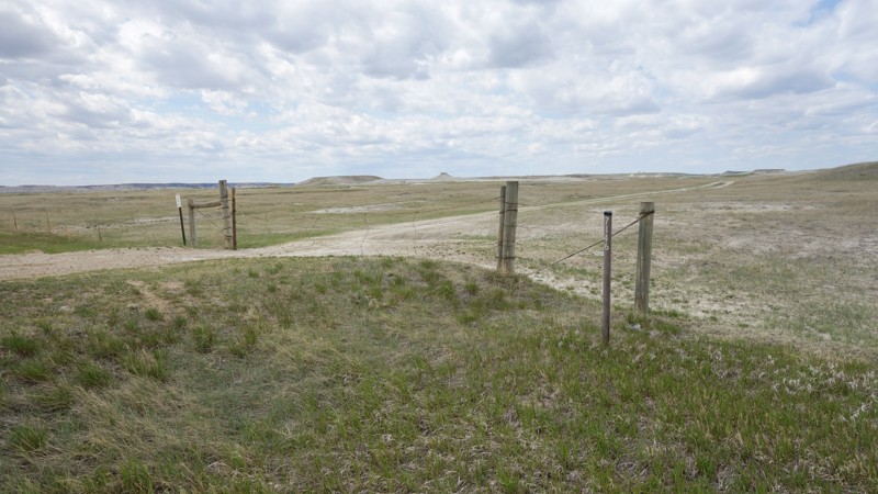
Sheep Mountain Road
Scenic, South Dakota
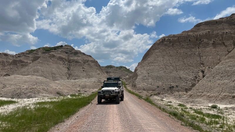
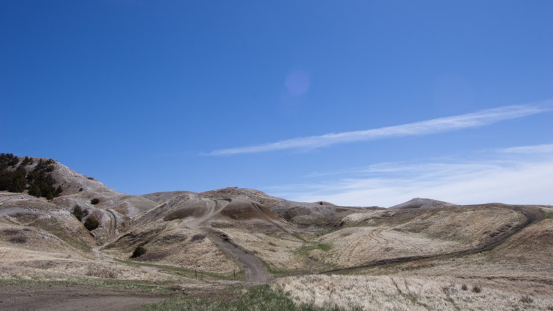
Sheep Mountain Road is on the eastern edge of Badlands National Park north of Pennington, South Dakota. The 7.27-mile out-and-back trail runs deep into the otherworldly landscapes of the Badlands. Sitting atop Sheep Mountain Table, pullouts offer stunning, panoramic views of the ruggedly eroded geology below. There are also opportunities for exploring further into the wilderness, with several hiking trails along the way.
The trail begins as a maintained gravel road at the trailhead but turns into a two-track trail about 2 miles in. Deep-cut ruts in the trail make having a 4-wheel drive vehicle with high clearance necessary, especially after a storm rolls through and makes the trail muddy.
Unfortunately, there is no camping allowed along the trail. But there are established campgrounds within Badlands National Park closer to Wall, South Dakota, approximately 40 miles away.
Updated: 05/12/2025
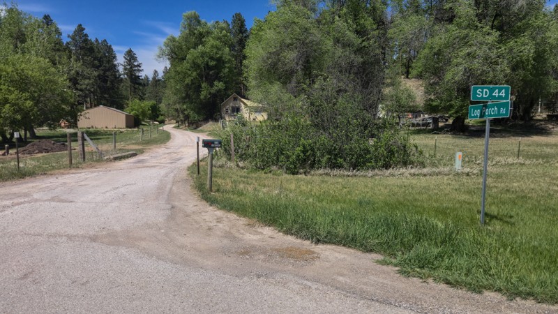
Railroad Buttes #503
Creston, South Dakota
Just outside the small community of Farmingdale, about 20 minutes east of Rapid City on Highway 44, is a wonderful playground for off-roading. Turn south from Highway 44 on 160th Ave. You will know you are in the right place when you reach a large dirt parking area with a pit toilet. There is plenty of room for campers and trailers in this lot, and many elect to set up right here if staying the night. Bring water and resources, as there are no hookups or amenities besides the toilet. Dispersed camping is allowed throughout the Railroad Buttes OHV area, but there is little shade or suitable trailer parking elsewhere. The area is popular with dirt bikes and includes multiple small dirt bike tracks and many single-track paths. Railroad Buttes is open year-round. However, it is best run when dry, as the clay turns into very slick "gumbo" after rain or snowmelt. In regular conditions, 503 and other trails in this area can be run with any stock 4x4 with decent ground clearance.
To access 503, head out of the parking area, across 160th Ave, and pass through the cattle gate. The actual "Railroad Buttes" can be seen rising from the prairie past the gate. Follow the main trail, marked by signs bearing 503 and directional arrows. There are a few easily visible alternative paths up to the top. Railroad Buttes is an open off-roading area, so feel free to try them out if so inclined, but some are more suited for narrow vehicles and dirt bikes.
At the top, the path becomes rocky with a couple of small steps and baby-head rocks, but they are short-lived. Looking back west, the beautiful Black Hills, topped by Black Elk Peak, are readily visible. Soon after, the trail crosses small but steep rolling hills, which feel like an off-road rollercoaster. This area looks like a mini version of Badlands National Park, located about 30 minutes east. If you follow an older map, you may notice the trail signs deviate from the maps. Wash-outs and erosion caused the Forest Service to change the trail. The maps haven't caught up yet. Follow the signs as the trail goes out into the rolling prairie before returning to the Mars-like terrain. Pay attention; certain areas are washed out, narrow, or have ruts, cracks, and crevices. 503 can be run out and back, or you can spur off onto one of the other trails in the area, several of which circles back to 160th Ave.
Updated: 12/15/2025
Boles Canyon
Hanna, South Dakota
Boles Canyon is an easy, 38-mile, well-maintained dirt road traveling through the western side of the Black Hills. The road travels north and south, connecting Highway 85 just east of O'Neil Pass and Highway 16 a little east of Newcastle, Wyoming. The road surface is mainly hard-packed dirt and gravel and is generally extremely dusty. You pass through many forest sections and plenty of ranchland. Considering the amount of broad-leaf trees, fall colors should be exceptional along the road. The northern 23 miles of the road are seasonal and only open May 15th - December 15th, while the southern 15 miles are open year-round. This is a popular elk hunting road in the fall.
Dispersed camping is widely available on Forest Service land, and there are many flat, open opportunities to pitch camp. However, finding previously disturbed campsites is few and far between. Please be aware that per Forest Order BKF-146-2019, campfires are not permitted unless the fire is in an established fire ring constructed and approved by a public agency in a designated recreation area. A forest service-run campground can be found a short distance from Road 117.1 at Redbank Springs, where picnic tables, fire rings, and outhouses can be utilized for a nightly fee.
Updated: 10/06/2025
Piedmont
Piedmont, South Dakota
Piedmont, Forestry Road 144, is a year-round trail between the towns of Piedmont and Nemo. There are several seasonal trails that branch off the main road. This road can be run either direction, but for the best view, start off Main Street in Piedmont. This will frame the lonely Bear Butte in your windshield as you climb the shelf road up the hill.
The eastern trailhead has a staging area. Just before the trail is a large gravel parking area to unload machines if you trailered in. Expect mud if it recently rained. The trail turns rocky quickly, passing through an exposed hillside once ravaged by a fire. The trail heads into the trees, and the rocks turn into manageable ruts as it takes you down the other side of the hill. The trail turns to a gravel road at the intersection with FR 266, which heads to Dalton Lake. The trail ends in the town of Nemo.
Dispersed camping is allowed in the Black Hills National Forest as long as you are 100 feet from a creek and 1/2 mile from developed sights. Campfires are not allowed. There are several areas along Piedmont to throw down a tent or park an overland vehicle or two. The area pictured is in the trees west of the shelf road.
Updated: 05/20/2025
Custer Peak
Brownsville, South Dakota
Custer Peak is home to the Custer Peak Lookout Tower, a fire watch tower originally built in 1911. Custer Peak begins off Highway 385, about 10 miles south of the town of Lead. FR-216 is a well-maintained gravel road until closer to the summit.
The trail passes Mystic Hills Hideaway and Campground. While dispersed camping is allowed in the Black Hills National Forest, there are no good spots along Custer Peak Road, and there is no camping allowed at the peak. Mystic Hills Hideaway features 12 cabins and rental units and 70 full hookup sites, including big rig campsites capable of accommodating toy haulers and large RVs and camping spots reserved for summer-long campers.
To reach the peak, continue past Mystic Hills Hideaway until FR-216 merges into FR-216.2 While still Custer Peak Road, FR-216.2 is noticeably rougher with moderately steep inclines, ledges, and loose softball to football-sized rocks. At the top, there's a small parking area with a portable toilet. A short hike on the nearby well-marked trail takes you to the tower with a 360-degree view of the surrounding Black Hills.
Updated: 12/15/2025
Spearfish Mountain
Mountain Plains, South Dakota
Spearfish Mountain is a short, fun trail just south of the town of Spearfish. The main route climbs through thick ponderosa forests and small meadows before opening up to panoramic views of the valley below. On a clear day, you can also catch a glimpse of Crow Peak and Bear Butte. The out-and-back trail ends at a private property gate.
The scenic trail is suitable for stock, aggressive 4x4 vehicles, and has just enough challenge to be fun. Erosion has exposed a few channels and a rocky section in the road that will keep the 2WD vehicles off the upper section. No defined or used dispersed campsites are visible along the trail, but the Black Hills National Forest allows for dispersed camping up to 300' from the center of the road along the entire route.
Updated: 10/15/2024
Victoria Lake Road
Colonial Pine Hills, South Dakota
Victoria Lake Road (FR 159) is a dirt and gravel road connecting Sheridan Lake Road to Highway 385 in the Black Hills of South Dakota. Victoria Lake Road can be accessed from Sheridan Lake Road, about three miles west of Rapid City. It may also be accessed from Highway 385 just west of Pactola Lake. Victoria Lake Road is a forestry road and, as such, requires no special permits to access.
Victoria Lake Road is mostly rough-graded dirt, although near the midway point, it does have embedded rock up to about 8-12 inches tall. It should be easily navigated by any 4x4 or SUV with moderate clearance. There is one water crossing near South Victoria Road, which can be up to a foot deep, depending on the recent rainfall.
This trail does offer an overlook of Victoria Dam, built in the 1930s as a stock dam. The dam was destroyed in the 1972 flood and was never fully rebuilt. Victoria Lake is now mostly a pond feeding the sometimes dry Victoria Creek. The branch road 159.1E allows visitors to drop down into the ravine for a closer view of the dam and access to a hiking trail.
Several pull-outs and openings are suitable for vehicle and tent camping, the largest of which is midway near the peak of the road. Few offer locations far from the road, so expect traffic noise. Many use the pull-offs closer to Sheridan Lake Road as shooting ranges, which is allowed in many areas of the Black Hills National Forest. This area has a couple of nearby cattle ranches that use the forest for their cattle, so also beware of animals in the roadway.

Updated: 09/04/2024
Polo Peak
Deadwood, South Dakota
"The trails are either maintained forest access roads or super challenging offroad trails" may be a sentence you've heard summarizing the Black Hills, but Polo Peak is undoubtedly one of the outliers to that statement. Polo Peak is a rare, scenic getaway from this area's thick, tree-covered trails, as ascending to the very top will provide you with 360-degree views of the entire forest and surrounding towns. With just enough challenge and diversity to make this interesting for any wheeler, Polo Peak should be on your shortlist for trails in this area. If you don't mind camping without a fire, the top provides large groups a gathering spot to talk about the day's adventures and the many more experiences to come while wheeling in the Black Hills.
Updated: 12/15/2025
Raspberry Ridge 8026
Merritt, South Dakota
Raspberry Ridge is an entry-level rock crawling trail in the northern Black Hills. The trail is located just east of the Pilot Knob Trailhead on Merritt Estes Road between Highway 385 and Nemo Road. This is a trail rated by Black Hills 4 Wheelers as a 3 out of 10 and is a combination of trails 8030 and 8026. Raspberry Ridge is named for the plethora of wild raspberries found along the trail in the summer.
8026 is the eastern end of Raspberry Ridge and starts at the end of 8030. While it does not have any one obstacle more difficult than 8030, it is much more consistently rocky. There are few breaks between the long rock gardens, and the trail goes up and down several steep hills. 8026 does have several narrow sections between trees and rocks, which wide vehicles would need to be cautious of. A little past halfway through 8026, right at the intersection with Forestry Road 202.2C, you will find one area suitable for tent or vehicle camping. The remainder of the trail is too rocky or forested for any camping. After around 2.3 miles of slow, rocky trail riding, 8026 will end at Forestry Road 201.2D, which runs into the Bogus Jim trail system.

Updated: 05/14/2025
Iceman
Piedmont, South Dakota
Located just outside Rapid City, Iceman is one of the Black Hills’ premier rock-crawling trails, famous for its towering canyon walls, vibrant vegetation, and relentless rock challenges. This local favorite puts drivers to the test with a series of 2- to 3-foot ledges and waterfalls as you work your way down to the mouth of South Stagebarn Canyon. And just when you think you’ve conquered it, the out-and-back layout serves up every obstacle a second time, this time on the climb out. If you’re searching for a trail that’s equal parts technical and scenic, Iceman is the perfect double-dose of adventure you’ve been looking for.

Updated: 06/20/2024
Smith Draw
Hill City, South Dakota
Smith Draw is a combination of several forest service roads that tracks you through the heart of the Black Hills from one main road to another. Located in the heart of the Mystic Ranger District this is one of the dozens of trails to explore showing the different landscapes in the Western Black Hills. As you travel through the forest, grassy valleys, and small gulches you will begin to see the unique nature of the hills making this a great easy trail for someone not familiar with the area.
Updated: 12/15/2025
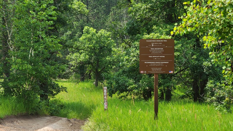
Fullsize
Boulder Canyon, South Dakota
Fullsize, FR 8042 is a rock crawling trail near Sturgis in the Camp 5 area. It can be accessed via Camp 5 Road from Boulder Canyon Road or off Galena Road. Fullsize is a marked rock crawling route from Black Hills 4 Wheelers and is rated by the Black Hills National Forest as a 4 out of 10. Fullsize is named as such because it can be navigated by full-sized vehicles.
To enter Fullsize from Boulder Canyon Road, take Camp 5 Road until it meets Calamity Canyon FR 8043. Continue south about a quarter mile on Camp 5 Road until Fullsize branches off on the right. A large brown trail sign marks Fullsize. Pay attention, as Fullsize is marked 8042, but this number is shared with Hal John's, which parallels Camp 5 to the north and is much more difficult. Fullsize can be accessed via Galena Road by taking FR 170.4D north from Galena Road.
After passing the trail sign, stay left at the four-way intersection. Once on the main trail, Fullsize presents several rock gardens and rock slides requiring good tire placement to avoid undercarriage contact on stock or slightly modified vehicles. Fullsize crosses FR170.4D in a few locations as it parallels it southbound. This allows you to bypass obstacles and pick up down the way. The final section of Fullsize will pass the entrance of Kong, FR 8046, before ending back on FR170.4D.
There are no good camping spots on Fullsize. However, dispersed camping is available at the beginning of Camp 5 Road.
Updated: 10/06/2025
Lost Gulch Road
Galena, South Dakota
Lost Gulch Road is a straight-through 4x4 road connecting the town of Galena to the Camp 5 trailhead and Highway 14A. Near the town of Galena, the road is named Butcher Gulch and passes one road split that leads to the Galena - Vinegar Hill Cemetary, where you can find headstones dating back to the 1800s. 80% of this road is an easy, hard-packed drive, with plenty of road width to pass oncoming traffic. However, the moderate rating comes from the southern 1.3 miles, where you will need to climb or descend a steep mountainside that zigs and zags its way across loose fist-sized rocks along a single-lane road. High clearance and low-range 4WD will be needed to traverse this southern end safely. RVs and travel trailers should not attempt the southern end of this road. The northern entrance of the road is suitable for any vehicle and can easily be traversed for around 2 miles before the road becomes significantly rougher.
Many dispersed campsites can be found along the road's northern end between Highway 14A and the northern intersection of Camp 5. The campsites here come in a variety of sizes, suitable for just about any camp setup, including ground tents, trailers, and RVs. Large open grass areas are suitable for larger setups and groups, while small, secluded sites in the trees are nice for those looking for a bit more privacy.

Updated: 10/29/2024
Got Milk
Merritt, South Dakota
Located in the Cereal Bowl Trail System, Got Milk is a perfect introductory trail to the more technical rock crawling that is common in the Black Hills. This challenging trail, sometimes referred to as Upper Captain Crunch, winds through a striking landscape of dense pine forests and steep granite outcrops, offering a thrilling mix of tight turns, boulder-filled rock gardens, rocky ledges, and narrow passages that demand precision driving and constant attention. If you are looking for a bridge trail to see if you are ready to make the jump from forest roads to rock trails, Got Milk should be at the top of your list.
Updated: 12/15/2025
Erskine Gulch
Nemo, South Dakota
Erskine Gulch, located off of Nemo Road in the Black Hills of South Dakota near Steamboat Rock, is a short moderate trail through the gulch. The trail is rocky in several places, but nothing a 4x4 with high ground clearance can't handle.
The trail can be accessed straight off Nemo Road using FR145 or off the Piedmont Trailhead system using trail 8279. If entering through FR145, be respectful as this road passes several private properties.
Just before the entrance to the trail, a wide portion of the road leaves room to park and unload any trailers. As you progress into Erskine Gulch, the path comes to a Y intersection. Left or right is up to you since the trail can be run in either direction.
Take a right, and the trail continues with a slight grade up the hill with numerous puddles to splash through. After this, the route becomes rockier, and tire placement is important as you climb up to the loop's apex. You will come across a branch for trail 8276. This leads toward the Nemo Flag, which overlooks Nemo and the surrounding valley. However, 8276 is restricted to vehicles 62 inches wide or smaller. If you want to see the flag, it is about a half-mile walk up the hill.
After passing 8276, it's time to go back down the hill to where we started. This side of the gulch is full of smaller rocks but nothing too challenging. Once you reach the bottom, the trail meets back up, and you are home free.
Updated: 12/15/2025
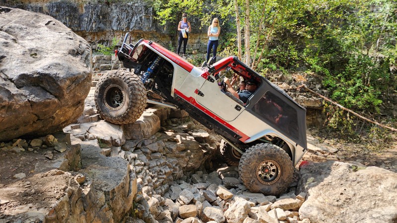
Calamity Canyon
Boulder Canyon, South Dakota
Calamity Canyon is a challenging Black Hills rock crawling trail located within the Camp 5 area near Deadwood. The trail follows Butte Creek through a narrow-walled canyon, offering no reprieve as you continuously weave your way up, over, and around a jumbled mess of beachball and couch-sized boulders. Although the trail can be run in either direction, traveling from north to south, starting at Camp 5 Road and ending at Galena Road, is the recommended direction as you will be driving the trail uphill. The trail remains in the creekbed most of the way, paralleling and crossing the observation or bypass trail several times. These trail crossings offer a great opportunity to bail out if you break something or the large rocks prove to be more than you can handle. However, once both trails merge together and exit the canyon, you climb a steep, rutty hill where you will still encounter moderate challenges.
This trail will require a skilled driver who is comfortable with undercarriage damage. Vehicles attempting this trail should be equipped with skid plates, rocker protection, and larger tires. Lockers are highly recommended but not required.
Updated: 05/29/2025
Castle Creek Road
Mystic, South Dakota
Castle Creek Road (FS181) is a scenic Forest Service Road in the center of the Black Hills of South Dakota between the towns of Rochford and Hill City. It can be accessed from the south by Mystic Road or from the north by S. Rochford Road. If starting from S. Rochford Road, FR181 will dead-end into private property and a no-trespassing sign. To create a complete through route, take Castle Creek Road Branch 1C (FR181.1C) and connect with FR181.
Castle Creek Road is best described as a rough, graded dirt road. When dry, it is traversable by any 4x4 or SUV with moderate ground clearance. A few small embedded rocks could damage passenger cars with low ground clearance. When wet, Castle Creek Road can present multiple mud holes. Castle Creek Road is open year-round; however, in deep snow, it may be difficult to tell where the road ends and the creek starts.
Castle Creek Road follows Castle Creek through a heavily forested canyon in the shadow of Castle Peak. The peak itself cannot be accessed off of Castle Creek Road but may be accessed from the nearby FR238. The main attraction to Castle Creek Road is Castle Peak Campground, which is about equidistance from either starting point. Castle Peak Campground is a National Forest Campground with nine campsites, fire rings, tables, and a pit toilet right on the banks of Castle Creek. It is free during the off-season but charges a nightly fee from May 22 through September 11. The sites are large enough for vehicle tents and small camping trailers. The campground is usually fairly empty outside of hunting seasons. Other attractions include views of the canyon walls and forests, as well as the ruins of a log cabin on the northern end before the private property.
Updated: 09/22/2025
Galena Road
Roubaix, South Dakota
Galena Road is a well graded dirt route between Highway 385 south of Deadwood and Vanocker Canyon south of Sturgis. It offers access to the ghost town of Galena, as well as access to several trail systems including the renown Camp 5 trail system.
Galena was founded in 1876 as part of the Black Hills Gold Rush and many of the old houses and buildings can still be seen, although several have had renovations in the past century or so. Galena is home to the Vinegar Hill Cemetery, where gravestones dating to the late 1800s can still be found. A hidden gem near Galena is the China Walls, which are located on Lost Gulch Road not far north of Vinegar Hills Cemetery. The walls were built for the Hercules mine but ultimately never finished or utilized. The walls do require a moderate walk from the road as they cannot be accessed by motor vehicles. Several other mines dot the area, but little can be found still on the surface.
The western entrance to Galena Road, off Highway 385, offers several commercial camping options, including Wild Bill's Campground and Saloon, Cole Cabins, and the Fish N Fry Campground. Directly on Galena Road, there is little to offer in the way of dispersed camping; however, many options can be found down the surrounding forest roads and trails.
Updated: 07/22/2025
Jake
Hisega, South Dakota
Nestled in the heart of the Black Hills, Jake is a popular rock crawling trail among locals and part of the Dakota Territory Challenge, along with nearby Fruity Pebbles and Got Milk. Jake will test your skills, abilities, and vehicle with its half-mile of relentless rock gardens. Fall colors will make Jake a beauty to behold as you tackle the challenge.
Updated: 10/15/2024
Bear Den
Boulder Canyon, South Dakota
Bear Den is a 5.71-mile road on the east side of Bear Den Mountain in the Lost Gulch area north of Galena. It offers scenic views of the surrounding Black Hills and the Black Hills National Forest. Bear Den branches off Lost Gulch and ultimately meets back up with Lost Gulch in a junction just south of Bear Den Mountain.
Bear Den is predominately rough dirt and small loose rocks, however there is one area containing large, deep ruts. Good tire placement would keep you on top of them, but the risk of slipping down may make going through the center the wiser choice. An illegal bypass route was present, but please stay on the designated trail and do not avoid mud holes or ruts. This would be an easy route if it weren't for this section. High clearance is recommended to make it through the ruts until they are repaired. The ruts can be bypassed by taking Bear Den 1E.
There is little to offer for camping along Bear Den. There is one small pull out south of the intersection with Camp 5, 8044, but it is only large enough for one vehicle.
Updated: 05/10/2025
Battle Creek
Rockerville, South Dakota
Battle Creek, FR 6501, is a moderately difficult 1.2-mile trail in the central Black Hills near Rockerville. Battle Creek connects South Rockerville Road and Teepee Gulch Road.
The trail is rocky and heavily forested but wide enough to minimize the risk of pinstriping. Expect ruts, embedded and loose rocks, mud, and standing water, especially after rain or in wet seasons. There are two main sections containing larger rocks, generally no more than 12 inches tall and moderate grade. A stock 4x4 can navigate this trail with good tire placement, but scraping a differential or low-hanging running board would be easy.
Due to the heavily wooded area, there are no good campsites along the trail. Nearby Teepee Gulch Road has several campsites suitable for vehicle or tent camping.
Updated: 10/29/2024
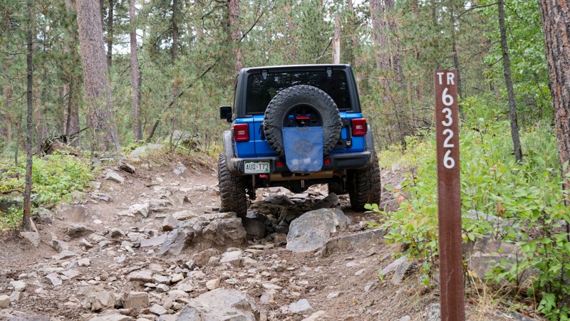
Jake Bypass
Johnson Siding, South Dakota
Trail 6326 is the primary entry and exit for the much harder Jake trail. It can be run in either direction, but it is best to run northeast to the southwest so that it parallels Jake and gives you options to attempt harder obstacles if you so choose. This trail is a great stand-alone trail for smaller rigs as it can be utilized as an observation trail to watch your more built buddies take on the trail down below. Along the drive, you will encounter several rock gardens consisting of watermelon to beachball-sized boulders that could cause undercarriage damage. This trail is a mild challenge for any built rig but will be significantly challenging for a stock 4WD due to the consistently large rocks. Skid plates and aggressive offroad tires are a must, and a lift is highly recommended.
6326 is bookended by 3-digit forest-numbered roads, but being a 4-digit number trail means it requires a motorized trail permit. Due to the terrain, there is no camping along this trail, but many connecting roads in the area allow dispersed camping.
Updated: 12/15/2025
Hal Johns
Boulder Canyon, South Dakota
Hal Johns, one of the best-known rock-crawling trails in the Black Hills, can be found off Boulder Canyon Road in the Camp 5 area, west of the city of Sturgis. Hal Johns runs the creek bed adjacent to the main Camp 5 trail, crossing Camp 5 many times and at points running the same track. The Camp 5 crossings are what divide Hal Johns into its 16 separate sections.
Those visiting Hal Johns should expect boulders up to the size of a kitchen refrigerator, tight squeezes, steep climbs and descents, and pinstriping foliage throughout. Hal Johns can be tackled section by section, as Camp 5 is never far away to bail out or skip harder areas. Buck and rail block a section from private land near the northern end, so follow the posted signage and make sure not to follow the tire tracks off the legal trail.
Although each section varies in difficulty, the entire trail should only be attempted in purpose-built rock crawling vehicles equipped with large tires, lockers, heavy-duty skid plates, and winches. Body damage is a high probability, and mechanical failures are common.
The best camping can be found at the beginning of Camp 5 for numerous large vehicles and trailers.
Updated: 12/15/2025
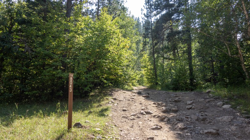
Calamity Canyon Bypass
Boulder Canyon, South Dakota
The Calamity Canyon Bypass is a bailout or observation route for the much more intense Calamity Canyon trail, a marked 5/10 rock crawling trail from the Black Hills 4 Wheelers Club. Calamity Canyon runs the creek bed, with the bypass on the road above. The routes share a trail number and sit nearly on top of each other, crossing several times. The Bypass offers those having second thoughts on the main route, a milder option if they feel in over their heads. It also offers access to the eastern entrance of 8044.
The Calamity Canyon Bypass starts just north of the main Calamity Canyon entrance. It does not have a large Black Hills 4 Wheeler sign like the main route, but does have a USFS sign designating it as 8043. Expect to find embedded rocks 12-15" tall in various places, tight trees, and steep uphill climbs. Moderate clearance and skid plates are recommended, along with 4-LO. Calamity Canyon and the Bypass merge toward the end and climb up a long, rocky, relentless hill until kicking out onto FS 170.5I Small mud pits can be found in low sections of the trail nearly year-round. This trail is tight throughout with trees, and pinstriping is likely.
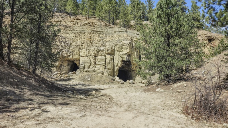
Midway through both the Bypass and main trail, a cave can be found which is large enough to enter. Across from this cave is a small pull-out area, which could also double for vehicle or tent camping. Additionally, a large cleared area where 8043 and FS 170.5I meet would be suitable for camping.
Updated: 12/15/2025
Red Hill
Boulder Canyon, South Dakota
Red Hill is a nearly 7-mile-long forest road starting off Galena Road about a mile west of Vanocker Canyon. Red Hill is open May 15 through December 15. Its northern border runs into a gated access to the Marcotte Game Production Area. The path does continue but turns into Red Cut Road, which may be closed during hunting season. When open, this route will continue into Sturgis. Do not bypass the gate if it is closed. Red Cut Road is not part of the Black Hills National Forest and is instead managed by the South Dakota Game, Fish, and Parks.
This road is primarily rough dirt, with a few minor rutted areas. Near the Game Production Area is a 15-20 degree rocky hill, which may require 4-High but is otherwise easy for 4x4s and SUVs. This area has distinctive red dirt, which is likely the namesake for the route and nearby peak.
Camping is mostly limited to a large clearing near the southern end, which would allow RV and trailer access, and another clearing about halfway down the track, which could be used by trucks and SUVs but would be difficult for larger vehicles to access due to the ruts in the road and steep entrance to the clearing. Campers should be aware that campfires are not allowed in the Black Hills National Forest.

Updated: 06/20/2024
Smith Draw Cutoff
Hill City, South Dakota
Smith Draw Cutoff is an optional route to exit Smith Draw in the Black Hills National Forest. This short route takes you directly through a grassy valley where the trail can be difficult to see from the green grass, especially in early summer when the vegetation is new and lush. As you travel through the open grass field, you get a sense of what the rancher experiences as he's going to maintain his well and check on his cattle.
Updated: 06/15/2026
Slate Creek Dam
Mystic, South Dakota
Slate Creek Dam is a well-maintained dirt and gravel road connecting Mystic Road and China Gulch Road, passing a small, peaceful forest lake. Open from May 15 to December 15, it provides access to the Slate Creek Dam, hiking trails off spur 530.1C, and a large parking area suitable for camping. The road is generally accessible to most vehicles, including those with modest clearance, though occasional potholes may be present.
To reach Slate Creek Dam, travel north on China Gulch Road from Highway 16 east of Hill City or enter from Mystic Road near the Red Fern Trailhead. Along Mystic Road, this trail is incorrectly labeled with a street sign as Horse Creek Road. The Slate Creek Dam and spur 530.1C are roughly halfway from either end of the trail. Dispersed camping is available at the end of 530.1C for tents, vehicles, and small RVs or trailers, though there are no amenities, and campfires are restricted to designated fire pits. The area’s highlights include the Slate Creek Dam and its small lake, as well as the ruins of the early 1900s Queen Bee mining town, with remnants of the town and mine visible along the roadside.
Updated: 12/15/2025
East Rim
Blucksberg Mountain, South Dakota
East Rim, also known as Bulldog Canyon Road, is a seasonal Forest Service road near Sturgis, South Dakota. It consists mainly of rough dirt, with spots of embedded rock less than a foot tall and spots with loose shale and softball-sized rocks. There are several short hill climbs and descents, with the steepest at 12 degrees. East Rim is suitable for stock 4x4 vehicles. Visitors can expect to see vistas of the surrounding Black Hills, the nearby plains, and views of Bear Butte across the plains. Be sure to look out for the natural arch in the cliffside at the eastern end of this route. The Centennial Hiking trail also crosses East Rim.
East Rim offers multiple small pull-outs suitable for a single vehicle to camp with a ground or vehicle-based tent. Branch 139.1A ends in a large clearing that can accommodate several vehicles and tents. At the intersection of 139.1 and 139.1A, there is a large gravel trailhead also suitable for camping and trailers. 139.1 west from this trailhead to Vanocker Canyon Road is well-maintained gravel, so those wishing to trailer vehicles may find this a suitable area to park. Open fires are not allowed in the Black Hills National Forest.
Updated: 12/15/2025
Pine Grove
Rockerville, South Dakota
Pine Grove (FS 718) can be found at the eastern edge of the central Black Hills near Rockerville, South Dakota. It is best accessed by taking Highway 16 to Neck Yoke Road and then turning onto Pine Grove Road. Pine Grove Forestry Road branches off Pine Grove Road, about a mile from Neck Yoke Road.
Pine Grove features a mix of rough dirt with loose and embedded rocks up to six inches in size. It is easily tackled by any vehicle with moderate ground clearance. Pine Grove will expose its visitors to alternating sections of forest and clearings, with numerous chances to see unique Black Hills granite formations. Midway through the trail, views of the surrounding mountains, including Black Elk Peak and the Needles, can be found.
Pine Grove features a moderately sized parking area near its eastern start and a small pullout toward its western end. The parking area would accommodate vehicle trailers for those who may wish to haul their vehicle in. It is also large enough for small campers and trailers. The pullout is large enough for two vehicles or one vehicle with a camper trailer.
Pine Grove's western end is not far from Foster Gulch, which provides access to the extreme rock crawling trails T-Back and Bikini.
Updated: 12/15/2025
Hal Johns Bypass
Boulder Canyon, South Dakota
Paralleling the most extreme southern sections of the Hal Johns trail, Hal Johns Bypass is a short connector trail from Camp 5 to Galena Road. 99% of this trail is easy, with a hard-packed surface, gentle grades, and a few watery mudholes. However, the moderate rating comes from one short section at the northern end of the trail, at the intersection with Camp 5, Calamity Canyon, and Hal Johns. At this intersection, you are required to traverse a rutty and chunky rock climb out of Bear Butte Creek, with rocks up to 10''-12" in size. The northern quarter of Hal Johns Bypass is trail 8045, which requires a motorized trail permit. The southern three-quarters changes road numbers to 170.4C and offers several connection points to Hal Johns, Fullsize, and Kong. The southern end of the road has some of the best scenery you will find in the Camp 5 area, with several wide-open meadow views. At the southern intersection with Galena Road, you can find a small staging/camping area good for airing up or leaving trucks and trailers. Please remember, per Forest Order BKF-146-2019, campfires are strictly prohibited in the Black Hills.
This trail is suitable for any high clearance vehicle and drivers of any experience level.
Updated: 12/15/2025
Moses Hill
Bethlehem, South Dakota
Located between Sturgis and Nemo along Vanocker Canyon, Moses Hill is one of the best natural rollercoaster rides you can find in the Black Hills. This trail is only one vehicle wide the entire way but can be run in either direction. The terrain is rocky and loose and traverses three extremely steep hills.
Traveling the trail from south to north, you will climb two 24-degree hills, encounter one rounded rock ledge, and descend a 27-degree hill down the trail's northern end. Pine trees slightly obstruct views from the top of Moses Hill, but this trail offers the best views you can find in the immediate area. There is no camping along the trail, but several nearby roads offer dispersed camping options.
Although new offroaders might find this trail intimidating, it is suitable for beginners in a short-wheelbase high-clearance 4x4 with selectable low-range gearing. Low-clearance 4x4s will have issues with the rock ledge along the southern climb. Thus, long-wheelbase vehicles will require additional clearance over stock or rocker protection.
Be cautious during wet weather as the trail can become very slick, and traction will be difficult.
Updated: 08/11/2025
Captain Crunch
Johnson Siding, South Dakota
Listed as a 10 out of 10, Captain Crunch is one of, if not the most difficult, rock-crawling trail in South Dakota. Captain Crunch can be located in the "Cereal Bowl" area off Bogus Jim Road, near Johnson Siding.
Captain Crunch starts near the beginning of Got Milk?, where users can take the smoother northern section down to the bottom of the canyon before climbing back up on the southern section. Dedicated rock crawlers and buggies are required to navigate Captain Crunch. Visitors can expect large, sedan-sized boulders, steep climbs, v-notches, and boulder after boulder.
No camping locations are available on Captain Crunch. A clearing at the entrance of the Cereal Bowl area (Bogus Jim Branch 1B) at its intersection with Bogus Jim Road provides room for trailers and some vehicle-based camping.
Updated: 12/15/2025
Raspberry Ridge 8030
Merritt, South Dakota
Raspberry Ridge is an entry-level rock crawling trail in the northern Black Hills. The trail is located just east of the Pilot Knob Trailhead on Merritt Estes Road between Highway 385 and Nemo Road. This is a trail rated by Black Hills 4 Wheelers as a 3 out of 10 and is a combination of trails 8030 and 8026. Raspberry Ridge is named for the plethora of wild raspberries found along the trail in the summer.
8030 is the western end of Raspberry Ridge and starts right off of Merritt Estes Road, climbing sharply right away. The first right turn will send you right into the rocks. High clearance and lockers will help as the trail throws rock after rock in your path, all while climbing a 10-20 degree grade. The trail is wide in most spots but does present a few tight areas around trees and rocks. Expect steep climbs and descents, all while navigating around and over medium-sized loose and embedded rock. The trail comes to an end as it transitions into 8026, with no other legal exits available. There are no designated or readily accessible camping locations on 8030.
Like all four-digit trails, an offroad permit is required to access Raspberry Ridge.
Updated: 10/15/2024
Bogus 07
Merritt, South Dakota
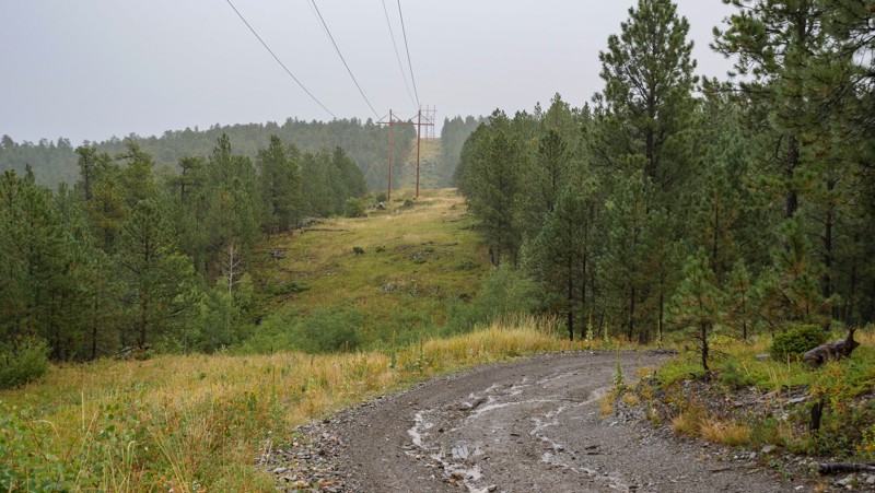
Bogus 07, marked as trail 6307, is a short, straight-through trail in the Bogus Jim Area that follows the powerlines from Nissen to South Bogus. The trail is mostly easy and well-maintained, but one short, moderately steep, and chunky hill will require a high clearance vehicle and could necessitate the need for 4-wheel drive. There are no significant obstacles along the trail, and the hardpacked and rocky trail surface limits any potential mud that could form during rainy periods. This trail is suitable for wheelers of any skill level and offers no camping.
Updated: 12/15/2025
Kong
Galena, South Dakota
King of the trails, Kong is a short, technical rock-crawling trail in the Camp 5 area near the ghost town of Galena. Kong can be found branching off the final section of Fullsize, connecting it to the Hal Johns Bypass.
Kong is a third-mile-long of relentless hardcore rock-crawling. Users will encounter numerous refrigerator-sized to sedan-sized boulders, fallen trees, undercut ledges, and off-camber washes.
Kong has extremely limited room to pass, thus it is best to run the trail from north to south.
Updated: 12/15/2025
Bear Den Branch 1C
Galena, South Dakota
Bear Den 1C starts north of Bear Den Mountain and travels on the west side of the peak. A large portion of this route is rough dirt with small embedded rocks and traverses a single car-wide shelf road. It continues on a spur past trail 8048, which ends at a spectacular lookout point dubbed "Puff Puff Point" by a sign on a tree. The trees on the spur are narrow, and branches are sure to rub on the side of vehicles. There are some small mud puddles on Bear Den 1C, but they have hard bottoms and are shallow.
"Puff Point Point" is the only area suitable for camping, with space for a vehicle tent system or a ground tent. However, the ground is rocky in this area. A short trailer could make it to this point, but it would be difficult to turn around to return down the spur.
The descent down 8048 quickly becomes rocky and high ground clearance is strongly recommended. Expect 6'-10" rocks with step downs and shelves. 8048 is short and ends on 567.1E.
Updated: 12/15/2025
Camp Five 8044
Galena, South Dakota
Camp Five 8044 is an unnamed connector between Calamity Canyon and Bear Den. It is less than a mile long and has no camping options or beautiful views. This trail is best used as a shortcut to Calamity Canyon as it starts near the northern entrance or as a bailout option if Calamity Canyon and the Calamity Canyon Bypass prove too difficult.
This trail, when started from Bear Den, starts tame with mostly rough dirt. It progressively gets rockier until it drops toward Calamity Canyon, losing altitude fast as the rocks get bigger and the washout gets deeper. High clearance and 4-Lo are recommended, especially when going back up from Calamity Canyon. Expect embedded rocks up to 12" tall.
Updated: 12/15/2025
Pillar
Boulder Canyon, South Dakota
Pillar is a trail on the western side of the Camp 5 system composed of trail numbers 8041 and 8040. It can be accessed by taking the north entrance to Camp 5 from Boulder Canyon and taking Lost Gulch until meeting the start of 8041.
8041 is mostly rough dirt with some mild ruts. Near the start of 8040, it is possible to see the Black Hills through the trees. 8041 has a spur to the northwest; however, this spur has little to see and offers no exciting terrain. 8040 starts with the same rough dirt but soon turns rocky, with 6-10" tall embedded rock. The trail gets steeper, reaching 12-14 degrees as the rock becomes loose and 4-wheel drive becomes necessary.
Pillar 8040 offers one pull-out large enough for a vehicle or two to set up a small camp. This trail ends when it meets up with Lost Gulch Branch 1H.
Updated: 05/26/2026
Ditch Creek Road
Rochford, South Dakota
Ditch Creek Road is a year-round, well-maintained gravel and dirt road located off Deerfield Road just west of Deerfield Lake, about 20 miles west of Hill City. Ditch Creek Road provides access to several full-width and restricted-width trails, the Ditch Creek Campground, and stunning views of the Black Hills National Forest. A short walk from the main road up trail 6021 leads to an enterable retired silica mine. 6021 is restricted to vehicles under 62 inches in width. The Ditch Creek area is also well-known for elk viewing.
Ditch Creek Road can be traversed by most vehicles, as its most challenging terrain is gravel washboards with the occasional pothole. Ditch Creek Campground offers several dry RV-sized spots and tent locations with fire rings. A large parking area across from the campground provides adequate space for trailer parking and unloading. Ditch Creek Road also offers several suitable spaces for dispersed camping.
Updated: 10/15/2024
Terry Summit Road
Englewood, South Dakota
At 7,064 feet, Terry Peak is the sixth-highest peak in the Black Hills and the area's most prominent mountain. It is home to a popular ski resort of the same name and a decommissioned fire watchtower that now serves as a viewing platform for visitors. Terry Summit Road is a 3.26-mile gravel road that allows access to Terry Peak and the tower.
Terry Summit Road is a well-maintained gravel road suitable for any vehicle. Its end at the peak offers a gravel parking lot and turn-around, suitable for medium-size campers and trailers to park or change directions. There are no camping options off Terry Summit Road, as it is mostly bordered by private property and housing developments.
The watchtower allows a nearly unobstructed 360-degree view of the plains to the north and surrounding Black Hills in every other direction. Bear Butte stands at the edge of the plains, with Crow Peak to the northwest, Cement Ridge to the west, Custer Peak to the southeast, and Deer Mountain to the south. Spearfish, Lead, Deadwood, and Sturgis are all visible from the peak as well.
Updated: 10/15/2024
Power Line
Hill City, South Dakota
Forestry Road 425, or "Power Line" is a easy "there and back" dirt forest road southeast of Hill City South Dakota. It can be accessed by taking Highway 16 south from Hill City, turning east onto SD Highway 244, and then taking the first left onto Power Line. Power Line does not require a special permit to access.
There are a few spots within the first half mile of Power Line suitable for camping. These could accommodate a ground tent, vehicle tent, or small trailer and can be found just off the side of the road. While the views are better further down the road, the terrain becomes steeper and rockier.
Power Line is predominately rough dirt, with a few short rutted areas and embedded rocks. It should be little problem for any 4x4 or SUV. The dirt does become slick after a rain but should dry within 24 hours.
Power Line offers many samples of Aspen forests, as well as views of Black Elk Peak and the surrounding granite spires, however most views require looking through the surrounding trees. One of the best views is actually just toward the end of the branch route, 425.1D, just before it ends in a turn-around. This branch can be accessed just before the end of Power Line.
Updated: 12/15/2025
Galena Branch 5H / Camp 5 047
Galena, South Dakota
Galena Branch 5H starts off Galena Road just west of Forestry Road 180. This route is short and mainly a connector route from Galena Road to the southern end of the main Camp 5 trail. It is a mostly rough dirt road until it turns into trail 8047, where it becomes tighter and rockier, and tree branches are likely to connect with the side of your vehicle. 8047 exits onto Calamity Canyon / Calamity Bypass about 1/8th mile from the start, near the end of Camp 5. Overall, this section is just two miles long and would be accessible by any standard 4x4 and most AWD SUVs with a patient and experienced driver. Expect some loose rock 6-8" and mildly graded hills.
Camping along the road is limited to two pullouts. One would accept a vehicle with a rooftop tent, and the other could accommodate a small trailer. Both are located right on the side of the trail and offer no privacy.
Updated: 03/25/2025
Bald Hill / Taylor Ranch Road
Three Forks, South Dakota
Taylor Ranch Road is a year-round, rough-graded dirt road in the Bald Hills area of the Black Hills. It can be found on the north side of Sheridan Lake Road, between Highway 385 and Rapid City. It is generally accessible to most vehicles with moderate ground clearance. Visitors can expect an easy path with small embedded rocks and the occasional wash or rut on the side of the road. In all instances, the ruts are easily straddled or side-passed. Taylor Ranch Road will present the Bald Hills, a nearly treeless island of rolling hills in an otherwise forested area. This road will connect users from Sheridan Lake Road into Nik Ranch, and then to Victoria Lake Road near the Pactola Dam.
Taylor Ranch Road does have three short spurs. Spurs 160.1 and 160.2D end at gates to private property and offer little to see. Spur 160.2B offers access to the Centennial Hiking Trail 89.
Taylor Ranch Road has no designated camping spots. However, dispersed camping is allowed in the Black Hills National Forest, and there are ample flat, bare spots on the edges of the road. Open campfires are not permitted in the Black Hills National Forest.
Updated: 07/10/2025
Turkey Ridge
Rockerville, South Dakota
Turkey Ridge (FR719) is an easy Forestry Road connecting Highway 16 to South Rockerville Road, just south of the town of Rockerville. It can be run either direction and is accessible from pavement on either end. Turkey Ridge is open year-long.
Turkey Ridge is just short of two miles long and is mostly rough dirt with some ruts and mild off-camber sections. Expect rocks no more than 12" tall. This road would be easily tackled by any 4x4 and most high-clearance SUVs. There are spots that may hold water and mud in wet seasons but are usually dry.
Pay attention to views of Black Elk Peak and the surrounding Black Hills. Deer and cattle are likely to be present. The foliage is mostly away from the road, but a few branches and limbs could drag along a vehicle if one were not paying attention.
Updated: 09/22/2025
Nissen
Merritt, South Dakota
Nissen, FS 202, is an easy, straight-through gravel dirt road connecting US 385 to the Bogus Jim Area. The road is 1.5-2 vehicles wide the entire way, and there are no concerns other than the occasional pothole or a washboard section or two. The road is primarily used as an access road to reach the rock-crawling trails of Fruity Pebbles, Got Milk, Captain Crunch, and Jake, but the vast amount of Aspen and broad-leaf trees make it an ideal fall foliage drive. There are several large grassy areas along the western half of the trail that make suitable campsites and ideal locations to leave trucks and trailers to stage for the nearby rock-crawling trails. This road is suitable for any vehicle.
Updated: 06/28/2025
Bogus 08
Silver City, South Dakota
Bogus 08 is a short, looping trail in the Bogus Jim area. The trail climbs and descends mild grades and is very rough with consistently loose, sharp, football-sized rocks, making for a slow drive. Other than the rough terrain, you will encounter no significant obstacles or concerns of any kind. The trail is primarily 1-1.5 vehicles wide, with plenty of open shoulder space to pass oncoming traffic. The trail circles a plot of private property and offers no camping. This trail is suitable for stock high clearance vehicles and best for beginners or those looking for a tranquil drive through the pines.
Updated: 09/22/2025
Fruity Pebbles Bypass
Johnson Siding, South Dakota
Located off Bogus Jim Branch 1B, the Fruity Pebbles Bypass allows users to bypass the Fruity Pebbles rock crawling trail, ending at Forestry Road 6340 near the exit of Fruity Pebbles. Users can expect loose and embedded schoolbook-sized rocks and up to a 14-degree climb to the top.
About halfway up the hill, where FS 201.1E transitions into FS6319, you can expect a washed-out rut to test your flex, followed by a tight switchback ending with a 10-12" ledge.
Camping is sparse on the Fruity Pebbles Bypass, with a pull-off about a quarter of the way from the north end of the trail and a clearing at the top of the climb, about a quarter of the way from the south end. Both would provide room for a few vehicles to park and set up vehicle-based camping if needed.
Updated: 10/15/2024
South Bogus
Silver City, South Dakota
South Bogus is a straight-through, almost 3-mile-long connector road to the Jake trail and other trails within the Cereal Bowl Area of the Black Hills National Forest. The road is primarily packed dirt and loose shale rock with a few moderate grades, occasional ruts, and a couple of small, 6''-8'' ledges. There are only 1 or 2 wide, flat areas that could be utilized for camping, but they are sub-par spots at best. Far better camping can be found at the north end of Merrit School. Please note that this route also includes Forest Service Road 642.1A. South Bogus is suitable for any high clearance vehicle.
Updated: 10/15/2024
Merrit School
Merritt, South Dakota
Merrit School is an easy, straight-through dirt road paralleling Highway 385 just north of Pactola Lake. The road is mainly packed dirt and gravel, with small protruding rocks up to fist-sized and an occasional pothole and water drainage rut. The southern half of the road is the roughest and has a few gentle grades, while the north side is extremely smooth, hard-packed, and easy to access. The very northern end of the road offers an extremely large grassy area great for camping or an ideal staging area for trucks and trailers of users heading out to tackle hardcore trails in the nearby Cereal Bowl trail system, such as Fruity Pebbles or Captain Crunch. If camping, please be aware that per Forest Order BKF-146-2019, campfires are not permitted unless the fire is in an established fire ring constructed and approved by a public agency in a designated recreation area.
This trail is suitable for any vehicle with decent ground clearance.
Updated: 12/15/2025
Kirk
Bethlehem, South Dakota
Traveling between Vanocker Canyon Road and Galena Road, Kirk is an easy, rough, straight-through forest service road that leisurely weaves through the Black Hills National Forest. It provides a good entry or exit point to the Moses Hill trail and offers little in the way of concerns beyond a few gradual grades and occasional first-sized rocks. Kirk can easily be managed by any high-clearance vehicle, and 4-wheel drive is likely only necessary during extreme wet weather. Although easy, RVs and travel trailers are not recommended for this road, as the road surface is not much wider than a single vehicle in some areas and makes several tight turns.
The entire length of the road allows dispersed camping, but previously established sites are practically non-existent. The road does offer several flat and grassy areas where camp can easily be set up, but users should be prepared to share the space with free-range cattle. Campers should also be aware that per Forest Order BKF-146-2019, campfires are not permitted unless the fire is in an established fire ring constructed and approved by a public agency in a designated recreation area.
Updated: 10/15/2024
Johnson Gulch
Rockerville, South Dakota
Johnson Gulch (FS 674) is a rough, graded dirt route between Beretta Road and Boulder Hill off of Highway 16 in the Black Hills. It is also marked as Boulder Hill Branch 1E on the eastern half of the road.
Johnson Gulch branches off Beretta Road at a shallow water crossing, which may be dry in the late summer months. While the road used to contain numerous large, deep mud bogs, it was recently graded and is now accessible by any 4x4 or moderate clearance AWD SUV. Embedded and loose rock no larger than six inches can be found, as well as small dips and potholes. Midway through Johnson Gulch is a large metal gate, which should be left as it is found after passing it.
Johnson Gulch's southern end features several large clearings near Beretta Road. However, it is not recommended to camp in these as Beretta Road is a popular open shooting area. There is a clearing about .75 miles from Beretta Road that would be suitable for vehicle or tent camping and could accommodate several people. Local ranchers use this area for cattle, so be cautious of livestock on the roads.
Updated: 12/15/2025
Schmitz
Johnson Siding, South Dakota
Schmitz is a predominantly rough dirt loop around the northern Schroeder Trailhead area. It is located about five miles west of Rapid City and can be accessed via the Schroeder Trailhead, off Nemo Road, or the Shanks Trailhead, off Highway 44. Schmitz contains two spurs off the east side of the loop, which terminate in clearings with no major points of interest.
Schmitz features mostly rough dirt with small embedded rocks. The northern portion of the loop, marked as 6605, features two areas of greater difficulty. To the east of the Flat Nasty rock-crawling trail, there is a ravine with steep banks on either side. Next to this ravine lie the remnants of the bridge that once crossed it. To the west of Flat Nasty is a narrow, rocky section that requires moderate clearance and careful tire placement. Pay attention not to enter Flat Nasty by mistake, as it is also marked 6605 and parallels the main trail. The sign for Flat Nasty can be found on its northern end, but is not present on its southern end. Schmitz is often damp and prone to mud, with frequent puddles up to axle deep.
Schmitz offers no designated camping areas. Dispersed camping is allowed up to 300 feet from the road on all parts of Schmitz except for the portion marked 6605.
Updated: 03/25/2025
South Victoria
Hisega, South Dakota
South Victoria is a year-round, graded dirt road between Taylor Ranch Road and Victoria Lake Road. It can be accessed near the southern start of Taylor Ranch Road or the midway point of Victoria Lake Road. It serves as a connector between the two, with sights of the aspen forests and several small creek crossings. South Victoria is easily traversed by any SUV or other vehicle with moderate ground clearance. The pavers on the creek crossings could prove difficult for low-clearance vehicles. The road is usually dry but can present some shallow mud during rainy periods.
South Victoria contains one spur named Boone Draw, which ends at private property. Boone Draw is a little rougher than South Victoria but still accessible by any SUV. South Victoria has no designated camping spots, although several clearings can be found along the side of the road, allowing vehicle or tent camping. Open fires are not allowed in the Black Hills National Forest.
Updated: 06/10/2026
Pied
Nemo, South Dakota
Pied is a simple connector trail that is primarily used to access the Iceman trail and connect other trails to create a dirt route between Nemo and Custer Gap. The trail surface is primarily hard-packed dirt, with small protruding rocks, a few gentle grades, and an occasional muddy depression. Trees along the trail are thin, providing a good amount of sunshine, but you won't encounter any type of views. There is no camping along this trail, but users can find dispersed camping along the intersecting Piedmont Road.
Updated: 12/15/2025
Lost Gulch Branch 1H
Galena, South Dakota
Lost Gulch Branch 1H is a connector from Pillar to Lost Gulch, with a short spur on the northern end. It is mostly rough dirt with some small loose rocks and mild ruts. There are multiple views of the surrounding hillsides and vistas. If entered from the south, off Lost Gulch, this is a very easy trail for most high-clearance vehicles. However, the connecting Pillar Road is more demanding and could cause issues for some vehicles.
The turnaround at the northern spur could serve as a small camping site, but a much better site with a fantastic view to the south has been established about halfway through the trail.
Updated: 05/21/2025
Ditch Creek 04
Rochford, South Dakota
Ditch Creek 04 is a short, rough dirt connector trail between William's Draw and Ditch Creek Road. It can be accessed from either road near their intersections with Deerfield Road. It is open year-round and requires a Black Hills Trail Permit. This trail offers views of the Black Hills National Forest and is a common area where elk can be found. Ditch Creek 04 is suitable for any stock 4x4 vehicle or AWD vehicle with moderate clearance. Users should expect rough dirt, with small ruts and embedded rock. Ditch Creek 04 is just north of the similar connector, Ditch Creek 08.
There are some small clearings on the sides of Ditch Creek 04 which would allow tent or vehicle based camping. Open campfires are not allowed in the Black Hills National Forest. Larger rigs or groups should consider the Ditch Creek Campground off Ditch Creek Road.
Updated: 12/15/2025
Vanocker Canyon Branch 2G
Bethlehem, South Dakota
Vanocker Canyon Branch 2G, also known as Deadman Mountain or Kirk Banch 1C, is an easy, straight-through connector that accesses the northern part of the Moses Hill trail. The road is a hard-packed road with occasional shallow mud pits and ruts. The road offers several flat, grassy areas that can be utilized for camping, and free-range cattle are often seen in the area. Please be aware that per Forest Order BKF-146-2019, campfires are not permitted unless the fire is in an established fire ring constructed and approved by a public agency in a designated recreation area. This trail is exceptionally wide with no concerns of vehicle width and only climbs a gentle grade. This road is suitable for any vehicle.
Updated: 12/15/2025
Wild Irishman
Johnson Siding, South Dakota
Wild Irishman is a seasonal, rough dirt road starting at the Schroeder Trailhead off Nemo Road just outside Rapid City. Visitors can expect dirt and gravel roads with small embedded rocks. Wild Irishman, also a popular hiking location, was once a connector between the east and west sides of the Shanks and Schroeder Trail systems. Unfortunately, the western end of Wild Irishman is now closed due to private property. Access to the other parts of the system can be had through various connector trails.
A large gravel parking lot marks the Schroeder Trailhead and the beginning of Wild Irishman. This lot is suitable for campers, staging, or parking of trailers for offroad rigs. Those seeking the Flat Nasties rock crawling trail may find this lot useful as well. Further down Wild Irishman is a clearing that would allow smaller vehicle-based camping but may prove too rocky and uneven for ground tents.
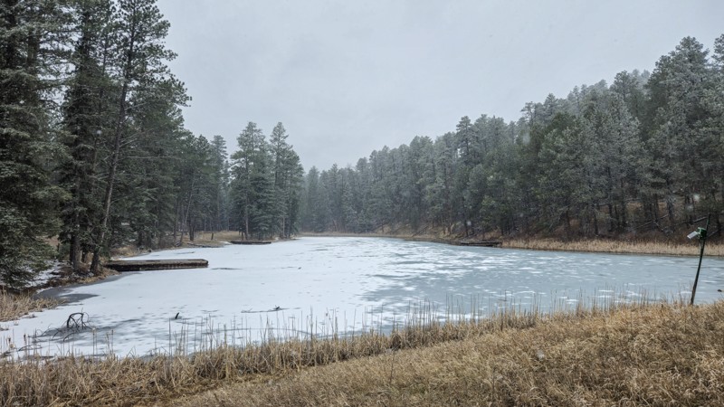
Updated: 05/07/2025
Dalton Lake Road
Tomahawk, South Dakota
Dalton Lake Road is a graded dirt and gravel forest road found off Vanocker Canyon Road north of Nemo in the Black Hills. Dalton Lake Road provides access to Dalton Lake and the adjoining campground. This road also provides access to the Centennial hiking trail near the Dalton Lake Campground and the Little Elk Creek hiking trail at the road's eastern end.
Dalton Lake Road is accessible by most vehicles, including those with modest ground clearance. In wet seasons, some mud may be found, especially near the Little Elk Creek trail start. The Dalton Lake Campground is a National Forest campground suitable for tent, vehicle, and small camper-based camping. Those bringing smaller off-road machines will also find access to numerous single-track and restricted-width trails in this area.
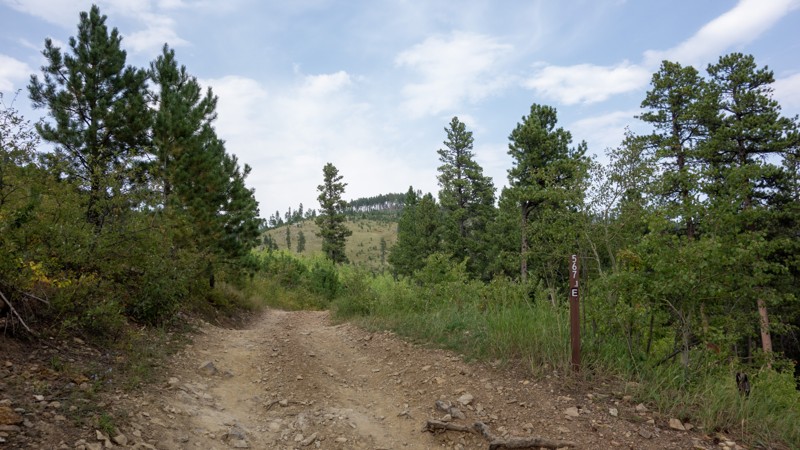
Updated: 10/15/2024
Bear Den 1E
Galena, South Dakota
Bear Den 1E is a very short connector trail between Bear Den and Lost Gulch. It offers access to trail 8048 but has no camping or noteworthy site-seeing on its own.
Taking Bear Den 1E from Bear Den to Lost Gulch does allow one to bypass the deep ruts on the south portion of Bear Den if they are too muddy or their vehicle is not suitable for the required clearance.
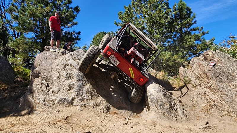
Updated: 10/22/2025
Bikini
Keystone, South Dakota
Cut high into the granite spine of the Black Hills, a short distance east of Keystone, Bikini is a challenging, obstacle-course-like trail that packs a serious punch into a short distance. Shaped like a wet noodle, the trail twists and winds through a mix of sparsely shaded pine forest and open rock faces, offering continuous obstacles with nearly no reprieve. Obstacles are a blend of natural rock gardens and narrow V-notches that create steep climbs, deep ruts, and off-camber squeezes. Some climbs feature sharp breakovers with limited visibility, making a good spotter almost as important as lockers. Despite the tough sections, the granite surface provides exceptional grip.
Navigation can be extremely challenging due to the tight turns, low traffic, and thick grass overgrowth. However, the trail is well marked with 42 numeric carsonite signs helping keep users on the correct path. If you look far out to the west while traveling this trail, you will get a glimpse of Mt Rushmore found nowhere else.
This trail should only be traveled by experienced offroaders in purpose-built rock-crawling vehicles. Big tires, lockers, vehicle armor, and spare parts are recommended. Vehicle damage is likely.
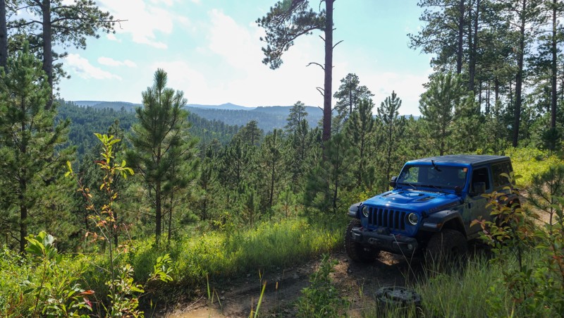
Updated: 12/15/2025
Moses Bypass
Galena, South Dakota
Not feeling up to the challenge of Moses Hill and looking for an alternate route to travel on? This short bypass is an easy trail that skirts around the base of Moses Hill and is suitable for any high-clearance 2WD vehicle or AWD vehicle. This would make a great option to avoid the steep, loose pitches of Moses Hill, but still get you to where you need to go if you are offroading/overlanding in this area. Use caution after rainfall, as a few of the turns can have pockets of mud. There are no campsites along this trail.
This is an MVUM trail (not a road) and requires the purchase of a permit (linked above) to legally travel.
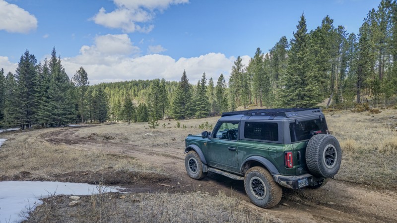
Updated: 05/21/2025
Ditch Creek 08
Crazy Horse, South Dakota
Ditch Creek 08 is a short, rough dirt connector trail between William's Draw and Ditch Creek Road. It can be accessed from either road near their intersections with Six Mile Road. It is open year round and requires a Black Hills Trail Permit. This trail offers views of the Black Hills National Forest and is a common area to spot elk. Ditch Creek 08 is suitable for any stock 4x4 vehicle or AWD vehicle with moderate clearance. Users should expect rough dirt, with small ruts and embedded rock.
Ditch Creek 08 has no established camping spots, however camping can be found on Ditch Creek Road at the Ditch Creek Campground.
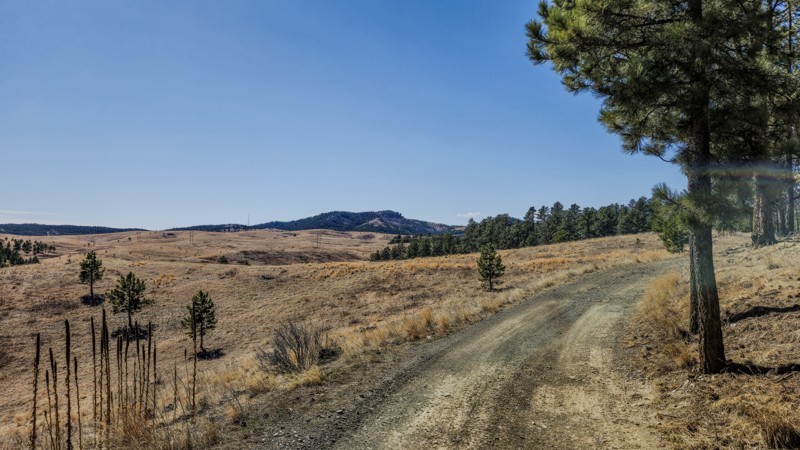
Updated: 03/25/2025
Nik Ranch
Johnson Siding, South Dakota
Nik Ranch is a short, roughly graded dirt road in the Bald Hills area of the Black Hills south of Pactola Lake. It is open yearlong and is generally accessible to most vehicles with moderate ground clearance. Visitors can expect small embedded rocks on the eastern half of the path, small mud puddles when wet, and some easily avoided ruts.
Nik Ranch connects Bald Hill / Taylor Ranch Road and Victoria Lake Road. At the west end, Nik Ranch intersects with Taylor Ranch Road at Forestry Road 160.2A and 160.1. This section displays rolling, treeless hills not usually found in this area. Eastward travelers will enter the pine forest and descend toward Victoria Lake Road just west of the Brush Creek Trailhead.
Nik Ranch has no designated camping spots, however, dispersed camping is allowed in the Black Hills National Forest and there are ample flat, bare spots on the edges of the road. Open campfires are not allowed in the Black Hills National Forest.
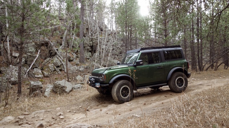
Updated: 02/11/2026
Bogus Jim Branch 1
Johnson Siding, South Dakota
This trail, branching off Bogus Jim Road and providing access to the east side of the Cereal Bowl trails, is accessible by moderate to high-clearance 4WD vehicles. It becomes progressively more technical and rocky as it reaches further into the trail system, and undercarriage damage is possible. Users should expect deep ruts and basketball-sized loose and embedded rocks. Pinstriping from tree branches is also likely.
Bogus Jim Branch 1 offers two notable camping or staging areas. The first is located directly off Bogus Jim Road, with the second just up the hill near the Fruity Pebble Bypass. Both are large enough for multiple vehicles and campers.
FS 6311 is an optional, difficult shortcut near the southern end of Bogus Jim Branch 1 for those who want to push their vehicle through some larger rocks.
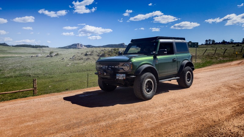
Updated: 06/11/2026
Custer Limestone Road
Custer, South Dakota
Custer Limestone Road is a graded gravel road connecting Medicine Mountain Road off Highway 16, north of Custer, to Boles Canyon near the Wyoming border. This road spans nearly 30 miles and provides access to numerous trails and Forest Service roads in the southern Black Hills of South Dakota. This road is suitable for all but the lowest vehicles.
Along the eastern portion, travelers are presented with several views of the Crazy Horse Monument, Black Elk Peak, and the surrounding Black Hills. Several small pull-offs provide camping options, including one with a great view of Crazy Horse. As you head west, the forest thickens, and camping on the road becomes more sparse. Many of the connecting roads and trails host options for dispersed camping.
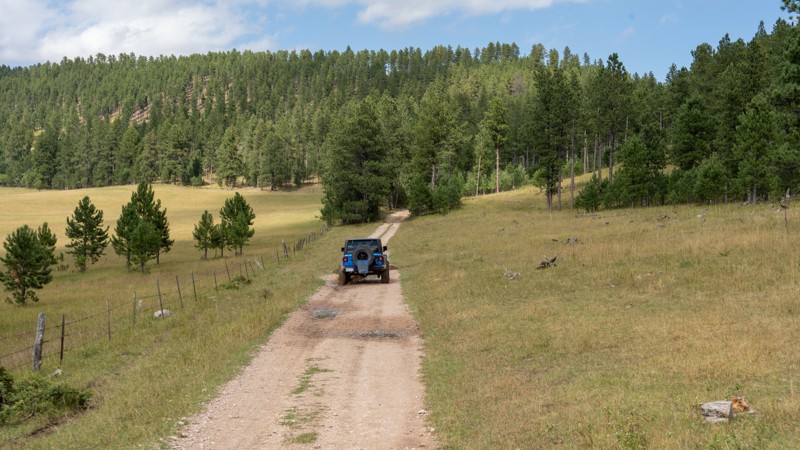
Updated: 12/15/2025
Holloway Road
Bethlehem, South Dakota
Located off Vanocker Canyon Road halfway between Sturgis and Nemo, Holloway Road is a short, dead-end access road primarily used as an entry or exit point for Moses Hill. This road, also known as Nelson on some Forest Service maps, is primarily packed dirt and gravel, with one short rocky section of fist-sized rocks. The road is well maintained and should easily be traveled by any vehicle with decent ground clearance. The road ends at a wide clearing that has been used for timber harvesting in the past and now makes a good, rather level, and grassy campsite. Please be aware that per Forest Order BKF-146-2019, campfires are not permitted unless the fire is in an established fire ring constructed and approved by a public agency in a designated recreation area.
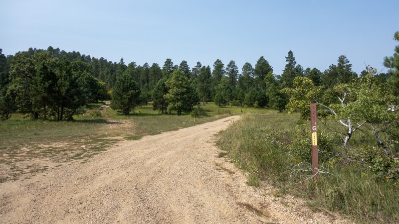
Updated: 12/15/2025
Lost Gulch Branch 1G
Boulder Canyon, South Dakota
Lost Gulch Branch 1G is a short out and back trail on the northern end of the Camp 5 trail system. It is mostly rough dirt with some small embedded rock and mild ruts. It offers a large number of camping spots near the entrance, as well as a handful of smaller spots throughout.
Lost Gulch Branch ends at a turn-around near the entrance to a private mining claim. The road does go on, but the official trail does not, and the road is likely just access to the claim. This route would be accessible to any 4x4 or AWD SUV, as well as smaller campers.
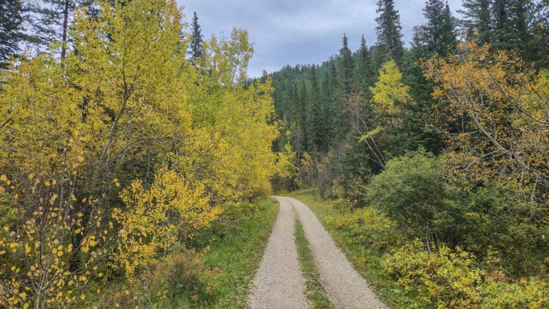
Updated: 10/22/2025
Kelly Gulch
Merritt, South Dakota
Kelly Gulch is a peaceful, rough dirt forestry road near Silver City in the Black Hills. It can be accessed by taking Jenny Gulch Road north from Silver City Road. Kelly Gulch Road terminates in a small parking area with access to the Kelly Gulch hiking trail and the Deerfield hiking trail.
Kelly Gulch has several creek crossings improved with pavers; however, a few pavers have buckled up. This road can be traversed by any stock SUV and most high-clearance crossovers. Fall colors are abundant along Kelly Gulch Road and the surrounding area, and Christmas ornaments can be found on several of the trees as you drive deeper into the gulch.
One large clearing at the intersection of Kelly Gulch and Banner Gulch would allow two or three vehicles to camp. The parking area near the hiking trailhead at the end of the gulch would also allow two or three vehicles to stop for the night.
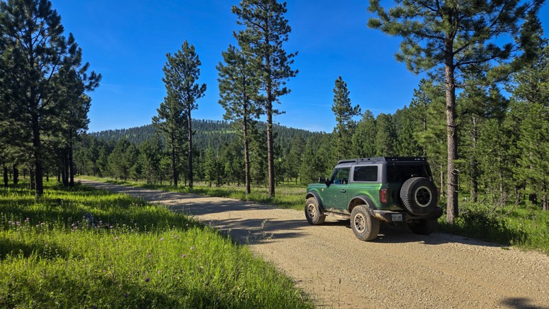
Updated: 08/11/2025
Kelley Spur Road
Novak, South Dakota
Kelley Spur Road, sometimes marked as Kelly Spur Road, is a well-graded gravel road located on Vanocker Canyon Road between the town of Nemo and the city of Sturgis. It can be traversed by most vehicles and has no notable obstacles. Kelley Spur Road connects Vanocker Canyon Road to Old Ridge Road and allows access to numerous other forestry roads and trails. It offers views of the thick pine forests of the northern Black Hills.
There are few camping options along this road. There is a notable pull-off near the Vanocker Road entrance, which would allow one or two vehicles to park if needed. Dalton Lake Campground is nearby on Dalton Lake Road to the east and offers a more established area for groups and trailers.
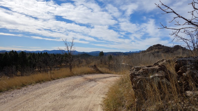
Updated: 12/15/2025
Long Run
Rockerville, South Dakota
Long Run is a seasonal, 4.5-mile rough dirt forest road spanning between South Rockerville Road, south of the town of Rockerville, to Pine Grove (FS718). Users can expect rough dirt with loose rock up to grapefruit size and flat embedded rocks less than 8 inches tall. Long Run is suitable for any stock SUV with moderate ground clearance.
Long Run has one small clearing off the side of the road, near its intersection with FS718.1B, which has space for a vehicle or two to park and camp. The first mile or so of Long Run from South Rockerville Road doubles as a driveway to a local residence, so remember to Tread Lightly.
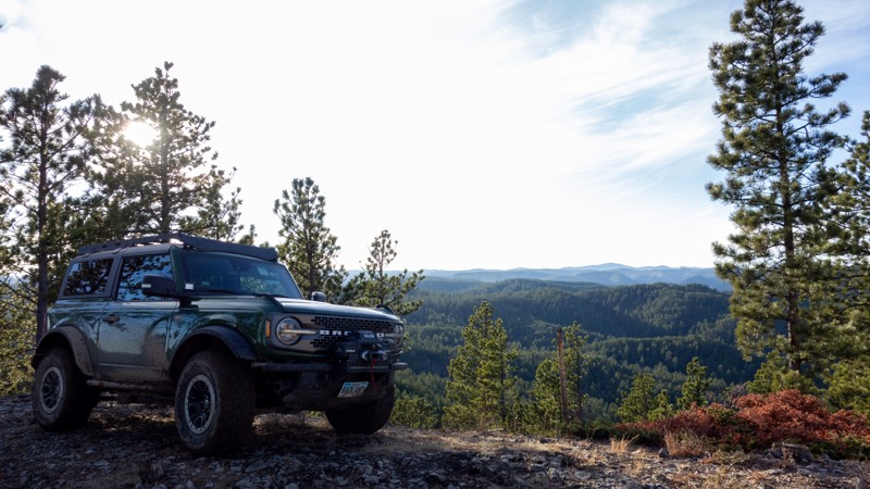
Updated: 05/07/2025
Veteran's Peak
Bethlehem, South Dakota
Veteran's Peak is a yearlong, short, rough dirt road with small embedded and loose rock, just off Vanocker Canyon Road on East Rim between Nemo and Sturgis. Veteran's Peak can be traversed by a stock truck, SUV, or crossover. In winter, Veteran's Peak can gather snow and become precarious due to the narrow trail with a steep bank on one side.
Veteran's Peak has two small clearings on the sides of the road suitable for a single ground or vehicle-based tent. If you need more camping space, you can find it further down the East Rim. Veteran's Peak offers vistas of the surrounding Black Hills and a glimpse of Bear Butte through the trees to the north.
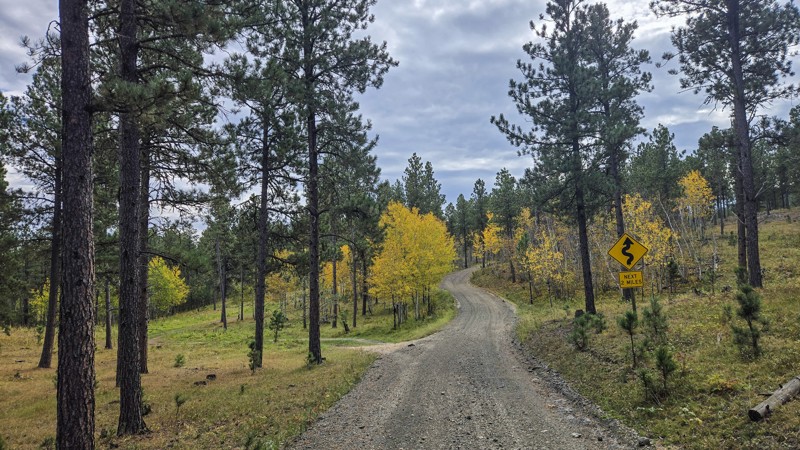
Updated: 10/22/2025
Jenny Gulch Road
Merritt, South Dakota
Jenny Gulch Road is a four-mile connector between Rochford Road and Silver City Road north of Silver City in the Black Hills, providing access to Kelly Gulch. The route is a mix of gravel and rough dirt, with the northern half near Rochford Road being the rougher section. You’ll encounter shallow ruts and embedded rock, but any stock SUV and most high-clearance crossovers can make the drive. The corridor is lined with aspen, making it an especially scenic trip in the fall.
There are two small pullouts, one near each end of the road, that can fit a couple of vehicles with trailers or tents. Campfires are not allowed in Black Hills National Forest outside established campgrounds with fire rings.
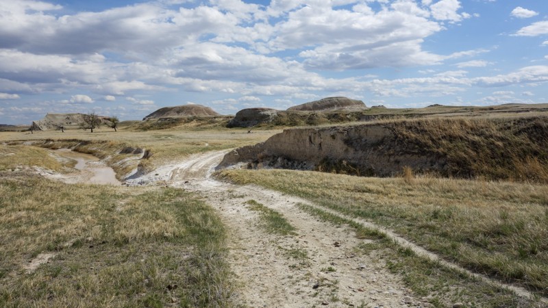
Updated: 06/11/2026
Indian Creek
Scenic, South Dakota
Indian Creek is a rough dirt trail, about 18 miles long, and features about 18 creek crossings. Indian Creek starts on Indian Creek Road near Scenic, South Dakota, and ends at BIA Highway 27. This trail covers land managed through the Buffalo Gap National Grasslands, Badlands National Park, and the Pine Ridge Indian Reservation.
Users will need at least moderate clearance, approach, and departure angles, as this trail has numerous brief, steep climbs and descents as it crosses Indian Creek. Like other trails in the Badlands of South Dakota, the soil has a high clay content and becomes sticky and slick when wet, so this trail is best avoided after rain. Camping can be found at the beginning of Indian Creek, where there is room for several vehicles or campers. Dispersed camping may also be found along the trail.
Rock hunting is popular along Indian Creek, and those visiting are likely to see wildlife such as the American Pronghorn, Prairie Dogs, and Burrowing Owls. Cattle graze in the area from May to October, and bison graze in the area from November to March. Horses may be seen in the area as well, but are not wild.
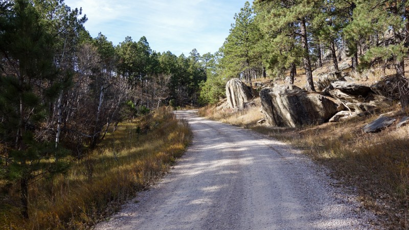
Updated: 11/14/2025
Teepee Gulch
Keystone, South Dakota
Teepee Gulch is a nearly 6-mile-long, year-round dirt forest road connecting South Rockerville Road to Highway 16. It also provides access to one end of the Battle Creek trail. Teepee Gulch has been recently graded and is suitable for any SUV or truck.
Teepee Gulch has one spur, leading near Tepee Peak; however, this branch dead-ends against private property. The peak can be reached on foot, but there is no designated path. There are several clearings suitable for vehicle or tent-based camping along Teepee Gulch
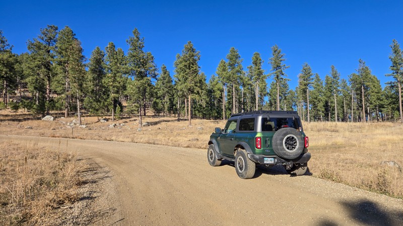
Updated: 12/02/2025
Boulder Hill
Rockerville, South Dakota
Boulder Hill is a year-round, gravel forest road bridging Highway 16 to Sheridan Lake Road in the Black Hills. It can be accessed south of Rapid City on either of these roads. It is well-maintained and accessible by any vehicle. Boulder Hill also provides access to the Boulder Hill section of the Flume Hiking Trail.
Boulder Hill offers multiple small pull-outs suitable for camping along its path, suitable for one or two vehicles. There is also one large clearing near the Sheridan Lake Road side, which can accommodate several large vehicles or groups.
Boulder Hill's spur, 358.1H, provides access to private property and has no sights or obstacles to see.
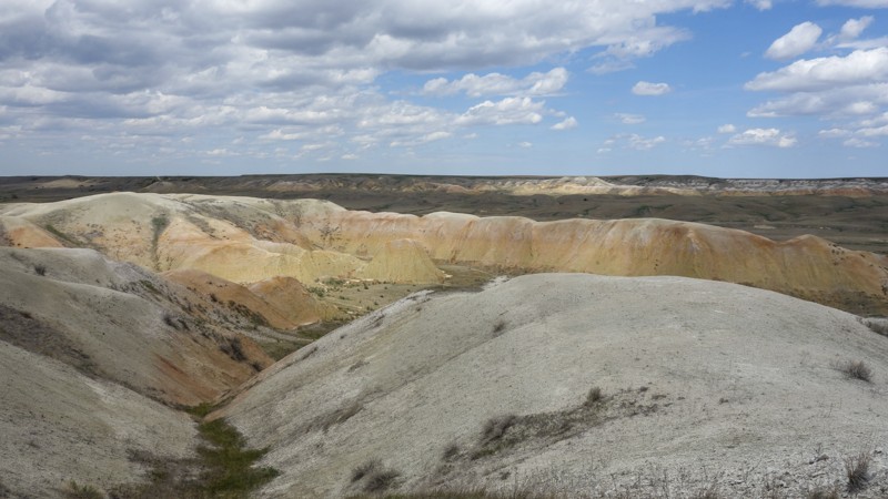
Updated: 05/28/2026
Sage Creek 7146
Scenic, South Dakota
Sage Creek Forest Road 7146 is a short, easy trail off Sage Creek Road just northeast of the small town of Scenic. Sage Creek 7146 starts at a gated barbed wire fence, so remember to leave the fence as you found it. This trail, when dry, can be traversed by most vehicles and is mostly rough dirt with some small potholes, climbs, and slightly off-camber sections. This trail terminates on private property, but there is no signage to indicate the border. Be sure to monitor your map to avoid trespassing.
Those visiting Sage Creek FS 7146 will see views of the Badlands of South Dakota and local wildlife, including American Pronghorn, Prairie Dogs, and Burrowing Owls. Rock hunting is popular in this area as well. About midway through the trail is a large clearing suitable for multiple vehicles or campers. Like other trails in this area, the high-clay-content soil becomes slick and sticky when wet and is best avoided.
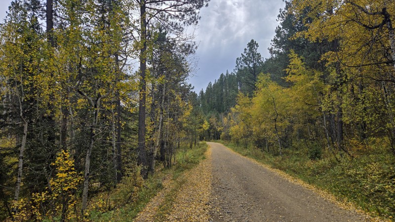
Updated: 10/22/2025
Broad Gulch
Merritt, South Dakota
Broad Gulch is a yearlong, two-mile stretch of rough dirt and gravel between Highway 385 and Silver City Road south of the Sugar Shack and north of Silver City. Broad Gulch has a few small ruts along the way, but could be traversed by a sedan or other low-clearance vehicle.
With its large amount of Aspen trees, Broad Gulch shines bright yellow in the Fall. Elk and other wildlife are known to live in this area, so keep an eye out for movement in the trees. Broad Gulch also provides access to several restricted-width and single-track OHV trails, so watch for other traffic.
A clearing at a restricted-width trailhead on the southern end of Broad Gulch would provide suitable space for several vehicles to camp.
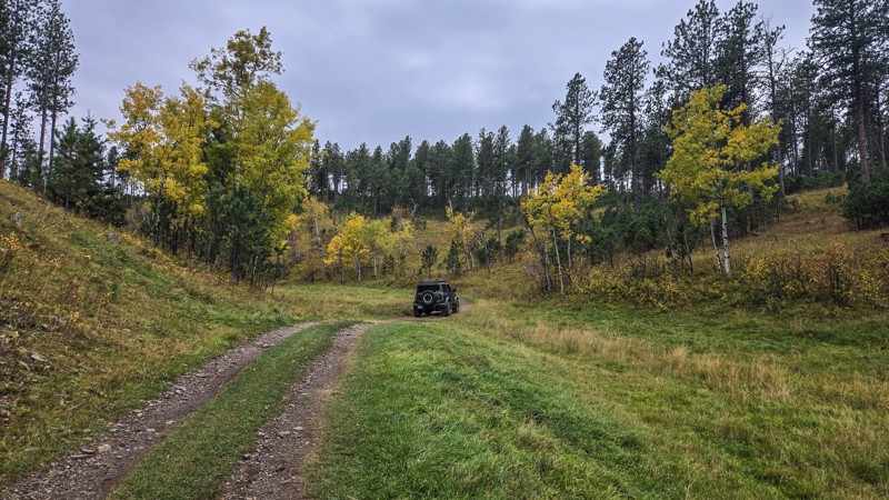
Updated: 10/22/2025
Merritt 34
Merritt, South Dakota
Merritt 34 is a rough dirt trail near the northern end of Broad Gulch. It is about 1.5 miles long and terminates at an intersection between a single-track trail and a restricted-width trail. Merritt 34 has some ruts, embedded rock, and small crests in the trail, which could hang up low-clearance vehicles but would be traversable by any moderate to high clearance SUV.
Merritt 34 offers views of gorgeous Fall colors and wildlife. Nearly midway through, Meritt 34 intersections with restricted-width trail 6210. From this intersection, the ruins of an old farmhouse can be seen. If your vehicle is wider than 62 inches, please do not enter the restricted-width trail. You can walk over to the ruins, which are on private property behind a fence, and view them from the public land.
The intersection near 6210 offers a clearing large enough for several vehicles to park overnight, but may not be desirable as this clearing is in view of nearby homes.
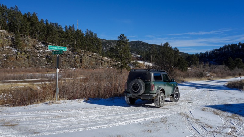
Updated: 01/23/2026
Edelweiss Mountain Road
Silver City, South Dakota
Edelweiss Mountain Road is a graded dirt and gravel road spanning from Silver City to the south side of the Pactola Reservoir. It is just over seven miles long and open year-round. This road can be travelled by passenger cars and any truck or SUV. When traveling west to east, users will start on graded dirt, which will transition to gravel near the start of the Pactola Estates housing development. Travel from this point is through a neighborhood, and users should Tread Lightly.
Edelweiss Mountain Road has a few pull-offs and gated, defunct trailheads, which would allow a vehicle to stop for the night. It also provides access to China Gulch and Bear Gulch, which ends at the seasonal Bear Gulch Campground.
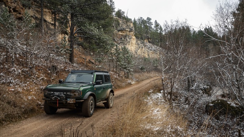
Updated: 06/10/2026
Mickey
Piedmont, South Dakota
Mickey is a four-and-a-half-mile, seasonal forest road off Rolling Hills Road, which can be accessed from Nemo Road. It is mostly rough dirt, with some small rocks and ruts. It can be traversed by any truck or SUV with moderate clearance.
There is no place to camp, but Mickey does offer forest views of the northern Black Hills, including rock features and wildlife. There are no camping locations along Mickey. Located midway through Mickey, Stagebarn (FS 148) can be used to connect to the town of Blackhawk via Brownie (FS 126)
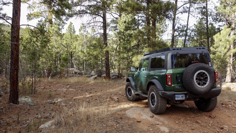
Updated: 02/11/2026
Captain Crunch Access
Johnson Siding, South Dakota
This trail, consisting of FS 6312 and FS 6318, provides access to the Captain Crunch and Got Milk rock crawling trails. It can be found in the aptly named Cereal Bowl area off Bogus Jim Road. This access trail is best navigated by 4WD vehicles with high clearance. Undercarriage damage is possible without careful line choices.
After branching from Hat Mountain, FS 6312 quickly becomes rocky and rutted. Near its intersection with the Bogus Jim Branch 1 (FS 6303), there is a large rocky step-down. As users continue downhill on FS 6312, there will be large, loose rocks up to basketball size. Continue straight through an intersection with Got Milk before reaching the end of Captain Crunch and the transition to 6318. FS 6318 features embedded rock as well, but the loose rocks are significantly smaller than was previously encountered. This trail ultimately ends at an intersection with Hat Mountain trail.
The Captain Crunch Access trail has forest on either side, with no suitable camping areas.
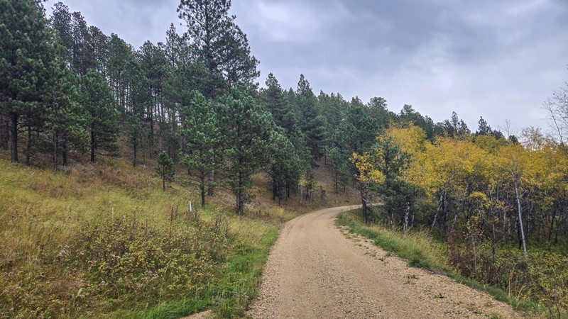
Updated: 10/22/2025
Merritt 07
Merritt, South Dakota
Merritt 07 is a 1.5-mile spur off Broad Gulch north of Silver City in the Black Hills. Open year-round to full-size vehicles, it’s primarily rough dirt with mild ruts and small embedded rock. Any stock SUV or pickup can handle the drive. For full-size rigs, Merritt 07 is an out-and-back, ending at a junction with a restricted-width trail (62" or less).
The corridor is lined with aspen, delivering vibrant fall color, and the surrounding hills are home to deer, turkey, and elk.
A few small clearings along the road allow dispersed camping, though there are no designated sites. Open fires are not allowed in Black Hills National Forest outside of established fire rings.
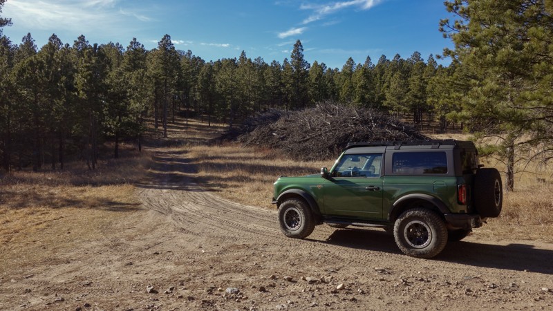
Updated: 01/23/2026
Hat Mountain
Johnson Siding, South Dakota
Hat Mountain is a year-round, rough dirt trail near Bogus Jim Road. It starts near the intersection of the Fruity Pebbles rock-crawling trail and Fruity Pebbles Bypass. Hat Mountain can be tackled by any SUV or truck with moderate ground clearance; however, it can only be accessed via Fruity Pebbles, the Fruity Pebbles Bypass, or by the Cereal Bowl Bypass, which are all more difficult than Hat Mountain.
This trail ends with a loop around the trail's namesake, Hat Mountain. While there is no trail to the peak, users can park along the loop and walk up, should they choose to do so.
There are no designated camping locations on Hat Mountain, but several areas along the trailside are wide enough to support tents or vehicle-based camping.
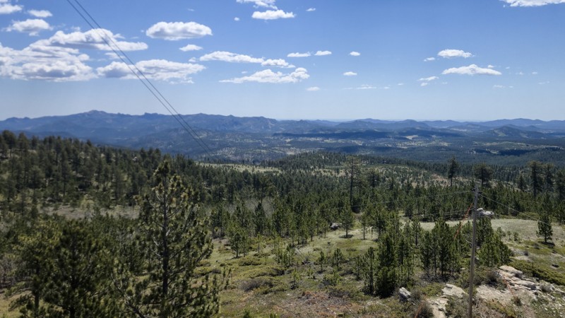
Updated: 05/28/2026
Bear Mountain
Crazy Horse, South Dakota
Bear Mountain is the third highest peak in the Black Hills and the highest drivable route between the Rocky Mountains and the Alps, reaching 7,166 feet. The watchtower at the peak provides a 360-degree view of the Black Hills, including Black Elk Peak.
Bear Mountain can be accessed either from the south off Ditch Creek Road or from the north off Bobcat Road via Medicine Mountain Road. The trail between the peak and Ditch Creek Road is a graded gravel path traversable via most vehicles, including passenger cars with modest clearance. The trail to the north of the peak is more difficult and should only be taken with high-clearance 4x4 vehicles. This section features embedded basketball-sized and loose baseball-sized rocks, mud, and deep ruts. Bear Mountain is open year-round; however, the northern side holds deep snow in the winter and can quickly become impassable.
Bear Mountain features a few less-traveled spurs, which end in small areas suitable for dispersed camping. Remember, campfires are not allowed in the Black Hills National Forest. A pit-toilet facility is located just under the watchtower and features two restrooms.
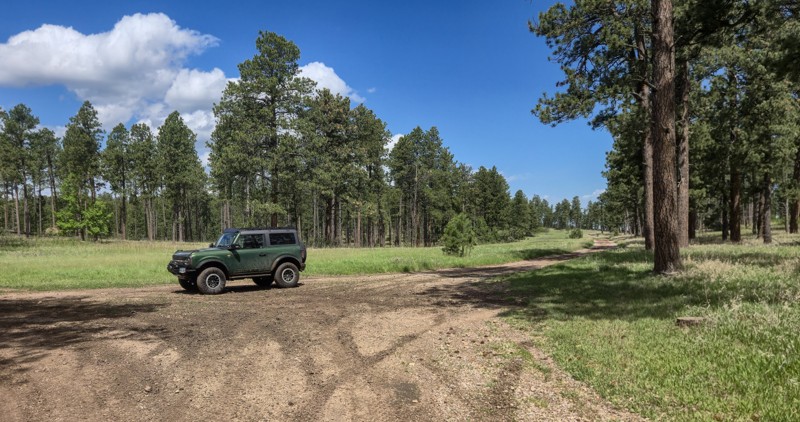
Updated: 06/10/2026
Stagebarn
Piedmont, South Dakota
Stagebarn is a seasonal, rough dirt forest road located west of Summerset, South Dakota. Stagebarn starts on High Meadows Road, sharing a beginning with the Botany Canyon Hiking trail, and ends at its intersection with Mickey (FS 777). A gate at the High Meadows entrance is closed during the off-season and restricts motorized access to Stagebarn. Hiking is still permitted.
Stagebarn is mostly well graded and rough dirt, except for the section closest to High Meadows Road. This section features several paths, some of which contain large, loose rocks. Staying on the southern-most route provides the smoothest path. Several mud puddles may accumulate on Stagebarn after recent rainfall. Moderate ground clearance and 4x4 is recommended, especially when muddy.
A large pull-off midway through Stagebarn provides room for multiple vehicles to set up camp. Other smaller options can be found in various spots as well.
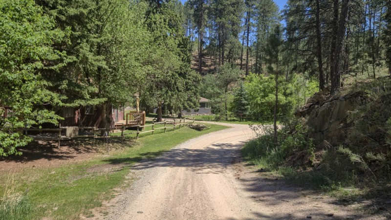
Updated: 06/04/2026
Log Porch Road
Johnson Siding, South Dakota
Log Porch Road is a gravel and rough dirt forest road located off E Highway 44 between Hisega and Johnson Siding. It is accessible by most vehicles with moderate ground clearance and provides access to the center of the Shanks and Schroeder Trail system, intersecting with Schmitz. It is also an option for those looking for access to the Flat Nasties rock crawling trail. As you get closer to Schmitz, there will be small, grapefruit-sized embedded rocks in the path to make the ride a little bumpy.
A few small clearings suitable for camping may be found on both spurs off Log Porch Road. The beginning of Log Porch Road shares access with a few residences, so remember to drive slowly and be mindful of others.

Upgrade your Membership
Unlock all of the details on every Trail Guide and Scout Route.
Start a 7-day Free TrialCommunity
Partners