


By clicking "ACCEPT", you agree to be the terms and conditions of each policy linked to above. You also agree to the storing of cookies on your device to facilitate the operation and functionality of our site, enhance and customize your user experience, and to analyze how our site is used.
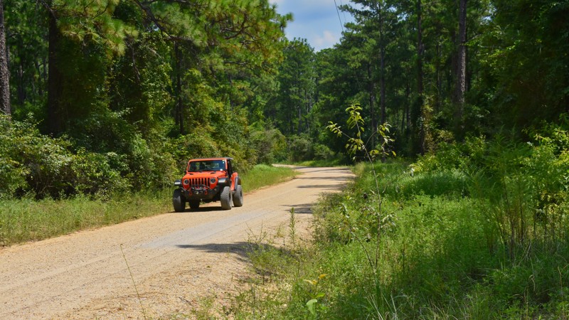
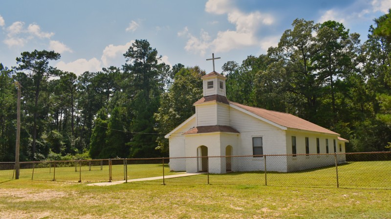
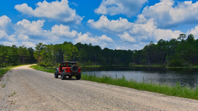
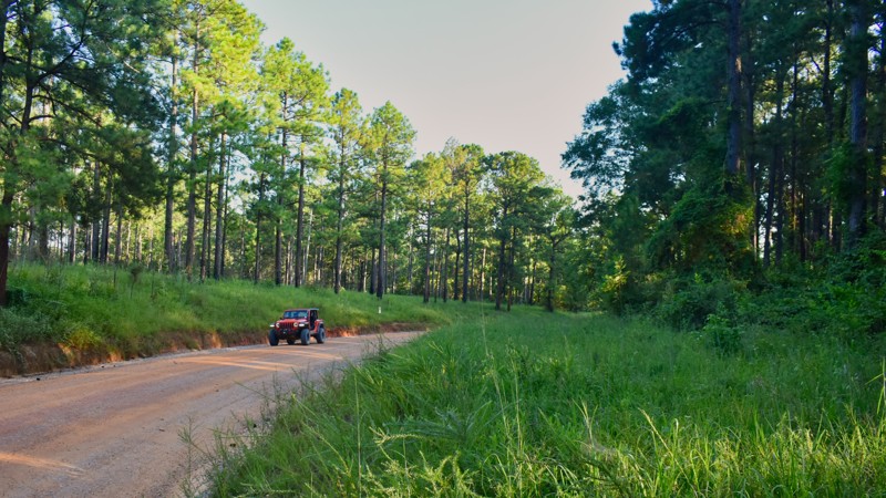
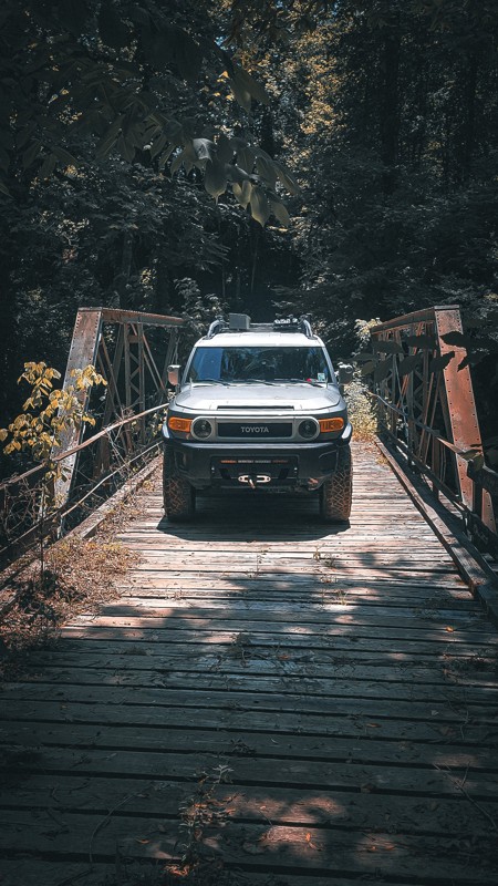
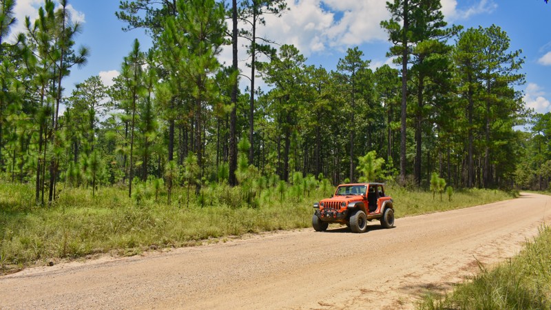
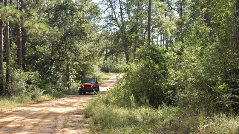
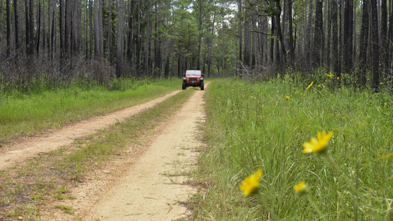
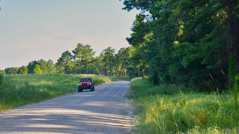
Mississippi Off-Road Trails
4
Total Trail Guides 2

24
Detailed Waypoints 21
Try a Free 7-Day Trial and unlock it all
Start a Free Trial Most Recent Trail Reviews
Rated 4/5
Open
Visited: 08/14/2024
Hot and dry for the trail today. This area is used heavily during the deer hunting season as there are several parcels of private property set up as deer camps along New York Road. Deer camps are plo...

Tim Palmer
Official Crew
Rated 4/5
Open
Visited: 08/14/2024
A beautiful day for a drive in the forest. The hot, dry weather conditions made the trip a little dusty.
Tim Palmer
Official Crew
Rated 5/5
Open
Visited: 08/10/2024
This road is completely within the Pascagoula WMA area. This area does not get heavy use and I was able to find access to any area without being crowed by others. The road was completely dry and all...
Tim Palmer
Official Crew
Rated 4/5
Open
Visited: 08/07/2024
FR 369A provides access to other roads in the area. Although this is in the Camp Shelby training area, there are no ranges or military facilities along this route. The road was in great shape, but d...
Tim Palmer
Official Crew
Rated 4/5
Open
Visited: 08/07/2024
Seeing the shooting range simulated city is the draw for this road. Besides the urban shoot house, there is also a very large traditional military shooting range located at the west end of this road....
Tim Palmer
Official Crew
Rated 4/5
Open
Visited: 08/07/2024
A very well-maintained road. Signs along the route indicate that tracked military vehicles travel this road and it is built to support these large, heavy military vehicles. The road was recently reo...
Tim Palmer
Official Crew
No Rating
Open
Visited: 08/07/2024
This road provides access to most of the small arms ranges operated by Camp Shelby, a joint forces training center for the military. All of the ranges along FR 35000 are on the north side of the route...
Tim Palmer
Official Crew
Rated 4/5
Open
Visited: 08/05/2024
The military keeps this gravel road well-maintained. There is a short section where this road is concrete as it nears a large ammo depot on Camp Shelby. A field of large storage bunkers is visible al...
Tim Palmer
Official Crew
Rated 3/5
Open
Visited: 08/05/2024
Because of the nearby Camp Shelby Training Base, the road is gravel and well-maintained. The parking area for the Rattlesnake Bay ATV Trail system was well-groomed and inviting, despite the name of t...

Tim Palmer
Official Crew
Rated 4/5
Open
Visited: 08/05/2024
A very easy road north of Boutwell Road. South of Boutwell I encountered some mud ruts from the rain last week. I was able to stay on the high ridges to keep out of the mud for the most part. I fou...
Tim Palmer
Official Crew
Rated 3/5
Open
Visited: 08/04/2024
The forest here is in great shape and scenic. This road did not have muddy ruts like other routes in the vicinity. Short Cut Road provides access to the south end of Gavin Road.
Tim Palmer
Official Crew
Rated 5/5
Open
Visited: 08/04/2024
There were plenty of ruts in the road from others driving during last week's rain. Although there was some mud left over on the trail, it was easy to find a path on the high spots to avoid most of th...
Tim Palmer
Official Crew
Rated 4/5
Open
Visited: 08/03/2024
The road was mostly dry and dusty and the weather was hot and humid. This was a great drive through the Southern Mississippi forest. Although there was evidence of recent muddy conditions, I was able...
Tim Palmer
Official Crew
Rated 5/5
Open
Visited: 08/03/2024
This road was in great shape. There were some logging operations about halfway across Gavin Road. Heavy equipment was parked just off of the road and it appears that the loggers created a new spur. ...
Tim Palmer
Official Crew
Rated 4/5
Open
Visited: 08/03/2024
The rough section of this trail can be difficult with muddy conditions during rainy periods. The trail will dry out with just a few days of the hot sun. There had not been any rain for four days when...
Tim Palmer
Official Crew
Rated 4/5
Open
Visited: 07/31/2024
This is a scenic drive through the forest with plenty of wildflowers blooming along the way. The road and the forest here are in great healthy shape. Because of the two-track nature of FR 420B, the r...
Tim Palmer
Official Crew
Rated 4/5
Open
Visited: 07/31/2024
There are not many roads that include a river crossing in the DeSoto. Very Refreshing trail during these hot summer days in the south.
Tim Palmer
Official Crew
Rated 5/5
Open
Visited: 07/26/2024
The portion of the road west of Highway 63 is pretty well developed with private property along much of the road. There are several old homesteads, cabins, and groomed pastures along the road in this...
Tim Palmer
Official Crew
Rated 5/5
Open
Visited: 07/26/2024
This forest road traverses along the northern edge of this small isolated section of the DeSoto National Forest just southeast of Laural, MS. The western half of the road is surrounded by the national...
Tim Palmer
Official Crew
Rated 3/5
Open
Visited: 06/25/2023
This is an easy, no-frills road. The forest is in great shape and appears to be managed for fire control. It was really hot!!! 95 degrees with no breeze and minimal cloud cover. I did not see any o...
Tim Palmer
Official Crew
Rated 3/5
Open
Visited: 06/19/2023
The road itself is quite easy and uneventful. I spent a bit of time looking around the POW Camp at Waypoint 2 and found the history to be interesting. I have left a message with the De Soto District...
Tim Palmer
Official Crew
Rated 3/5
Open
Visited: 06/18/2023
This is an easy, quick trail in the southeastern part of the De Soto National Forest. The camping opportunity found at the Bethel Bicycle Trailhead is the best site in the vicinity. I have visited t...
Tim Palmer
Official Crew
Rated 5/5
Open
Visited: 06/11/2023
As far as trails go around the area this one is about as good as it gets. We went last week and had a good time. It had rained the night before and sections was still a little slick.

craig
Rated 4/5
Partially Open
Visited: 01/28/2023
It's difficult to find a off-road trail that more than just a gravel road in the Southern Gulf Coastal area. Shaifer Road was a decent choice for a drive along a back road. This trail is between Vick...


Tim Palmer
Official Crew
Rated 3/5
Open
Visited: 01/21/2023
The trip to Rodney, MS was educational. The entirety of Rodney Road is a convoluted road which is mostly paved as it leaves Rodney, MS to the north. This segment of road is still a country dirt road...


Tim Palmer
Official Crew
Most Popular


Updated: 06/25/2023
Raymond Creek Road
Open
/
McHenry, Mississippi/
4.81 miles/
About 20 minutes
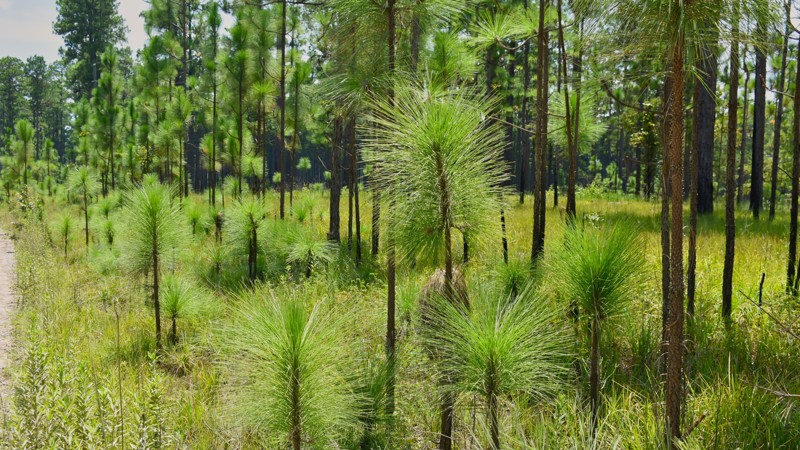
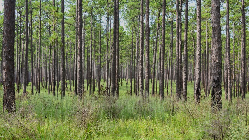
Raymond Creek Road provides a relaxing stroll through the Gulf Coast plains forest ecosystem in the De Soto National Forest. With ridges sporting Long Leaf Pines and bottoms filled with native oaks, this forest offers an example of the traditional ecosystem found 20 miles north of the coast. Between heavy rain and the occasional hurricane or tropical storm, this forest receives more than 60 inches of rain annually. This quickly growing forest takes maintenance to keep it in check. Take in the sights, sounds, and smells this forest offers.

Updated: 06/21/2023
Ford Road
Open
/
Saucier, Mississippi/
4.16 miles/
About 15 minutes
Whether you're a child or an adult, the clip-clop sound of a horse is alluring. Ford Road is the centerpiece in the De Soto National Forest for horseback recreation. The Big Foot Horse Trails begin and travel along this forest road. The trailhead for the horse trails is located at the Big Foot Horse Trails Campground and becomes the home base for these equestrian activities. Because OHVs are not allowed on Ford Road or in the campground, a peaceful and serene stay awaits a getaway to this Gulf Coastal Plains forest.

Updated: 06/19/2023
POW Camp Road
Saucier, Mississippi
Although WWII was fought in the Pacific and European theatres, captured German soldiers were held at prisoner camps in southern Mississippi. Large tents provided housing for these POWs while in captivity. Today, few relics remain from this old prisoner camp. The US Forest Service recognizes the POW Camp Recreation Area as a reminder of the war's history.
POW Camp Road, situated in the De Soto National Forest, provides access to this historic site. Camping, hiking, hunting, and fishing now replace the other more austere activities from the 1940s. The only signs left of the old POW camp are large concrete ammunition storage bunkers.

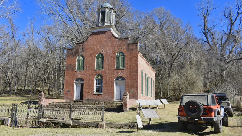
Updated: 02/06/2025
Shaifer Road
Port Gibson, Mississippi
The Union Army landed troops in Mississippi as part of the Vicksburg Campaign of the US Civil WarMay 1, 1863. The goal was to control the Mississippi River, a vital transportation link, from the Confederate Army by capturing Vicksburg, MS. The first shots, known as the Battle of Port Gibson, took place just outside the home of Abram Keller Shaifer located on today's Shaifer Road. The Shaifer House is the last remaining structure on this historic battlefield. Today, it is part of the National Park Service's Vicksburg National Military Park. History buffs will enjoy the experience of being on this historic battlefield.
Shaifer Road is a dirt and gravel county road with little maintenance and significant erosion. Deep ruts require careful tire placement. A high clearance 4x4 vehicle is necessary to complete the route. The road is suitable for beginning offroad drivers looking for a bit of adventure.
Camping is not allowed along Shaifer Road.

Updated: 06/18/2023
FR 426
D'Iberville, Mississippi
Multi-use recreation is a key feature along FR 426 in this 518,000-acre De Soto National Forest segment. Scattered amongst the mature Long Leaf and Loblolly Pines, one can find camping, hiking, designated bicycle trails, and designated motorcycle trails in this no-fee area of the national forest. The Bethel Bicycle Trail Recreation Area is one of southern Mississippi's few mountain bike-specific trail networks.
The gently rolling terrain in the De Soto National Forest means little elevation change for your outdoor activities. While recreating, however, one should tread lightly as several venomous snake species call the De Soto National Forest home.
Updated: 10/15/2024
Rodney Road
Church Hill, Mississippi
A drive on Rodney Road is a journey back in time. Once expected to be the capital of Mississippi, Rodney is now a ghost town near the Mississippi River. Sitting on the Banks of the Mississippi River, Rodney was the busiest port between New Orleans and St. Louis in the 1850s. It once had a population of nearly 4000 with growth rate that surpassed that of Jackson. The Rodney Presbyterian Church is one of the many remaining buildings from the Civil War era. There's still a cannonball embedded in the brick above the church's front doors.
In 1870, a large sand bar began forming in the Mississippi River, forcing the River to change its course two miles to the west. When the River naturally changed course, Rodney was no longer a port city and began a steady decline. By 1930, Rodney was no longer considered an official town. Ghost town enthusiasts will enjoy exploring the town's history, buildings, and a sizable graveyard.
A dirt road portion of Rodney Road enters the town from the south. This is but a section of a much longer Rodney Road. The remaining parts are paved. The dirt portion of Rodney Road is maintained and suitable for most vehicles.
Today, the entire area around Rodney is prone to flooding. Rodney Road is also prone to flooding where the road approaches the ghost town. Local officials close the road when it is impassable.
Camping is not available along Rodney Road.
Updated: 10/15/2024
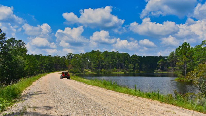
Boutwell Road
Avera, Mississippi
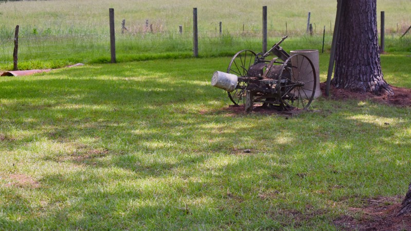
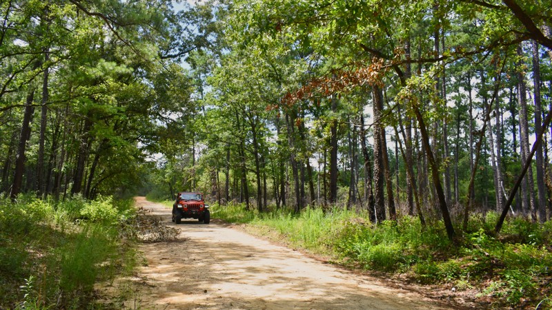
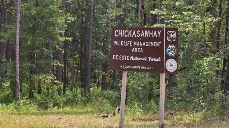
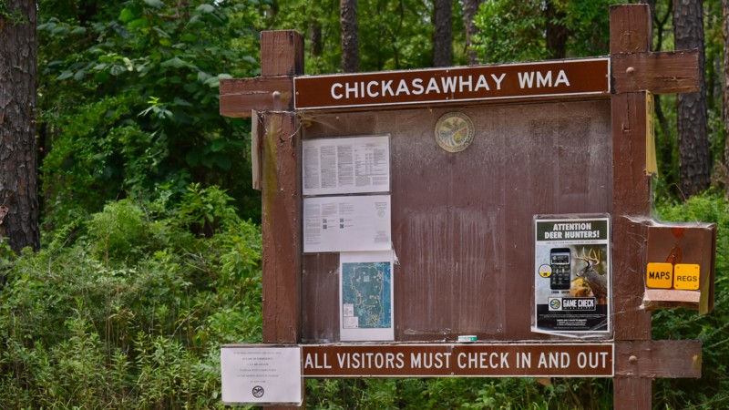
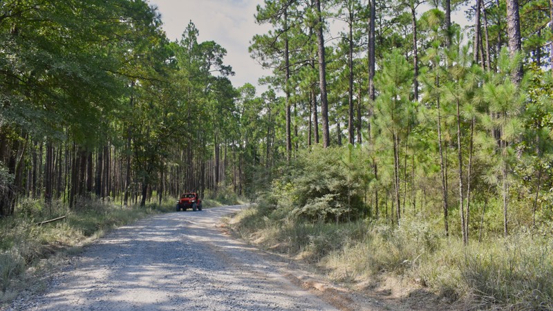
Boutwell Road is one of the longest routes through the De Soto National Forest in the Chickasawhay Ranger District. The road is mostly a graded gravel road; however, one section of the road is graded dirt and prone to exceptionally muddy conditions during periods of rain. This 3-mile-long section of road is on the eastern half of the road between Brewertown Road and Camp Eight Road. Boutwell Road traverses through groves of Longleaf Pines and southern hardwoods. The western half of this road also travels through the Mississippi State Chickasawhay Wildlife Management Area. This is a joint project between the US Forest Service and the Mississippi Division of Wildlife. This forest is popular with hunters, particularly those who use dogs to hunt deer. There is no camping available along Boutwell Road.
Updated: 10/15/2024
South Tank Trail
Beaumont, Mississippi
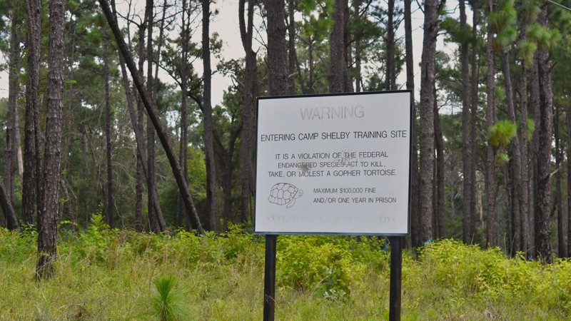
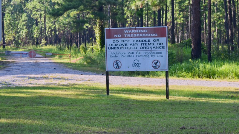
South Tank Trail is a well-maintained gravel road in the De Soto National Forest near New Augusta, MS. The road provides access to most of the small arms training ranges for Camp Shelby, a joint forces training facility operated by the Mississippi National Guard. The military base uses this area of the national forest for training activities. Warning signs throughout the area advise of the need to remain alert for unexploded munitions. Visitors should remain on the roadway or in designated recreation areas. South Tank Trail and other nearby forest roads occasionally close during military training. Information about road closures is available from the Camp Shelby Control Center. Camping along South Tank Trail is not allowed.
Updated: 10/15/2024
Pascagoula WMA North
Crossroads, Mississippi
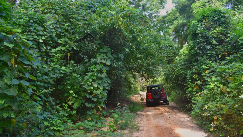
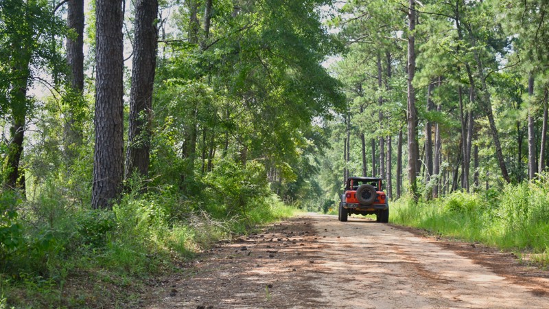
Pascagoula WMA North Road is a limestone gravel road wholly within the Pascagoula River WMA located 4 miles east of Benndale, MS. The road takes visitors to various recreation areas for fishing, hunting, and camping. This road is in a low-lying area near the Pascagoula River and is subject to flooding during rainy periods or when the river runs high. Late summer and early fall are among the best times of the year to visit the area. Every visitor using this area of the Pascagoula River WMA must obtain a permit, including those who are just driving the roads. Permits can be obtained online at the Mississippi Department of Wildlife, Fisheries, and Parks. MDWFP also has an app available where permits, fishing licenses, and hunting licenses can be purchased
Updated: 10/15/2024
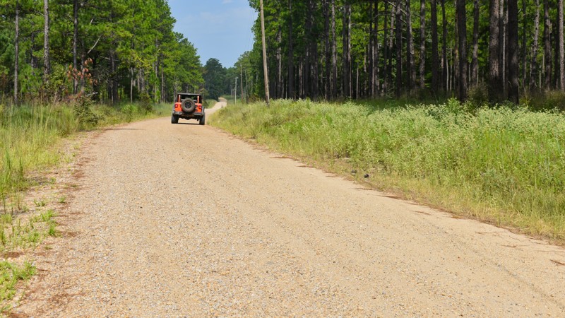
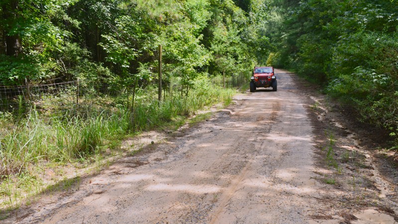
Strickland Road
Antioch, Mississippi
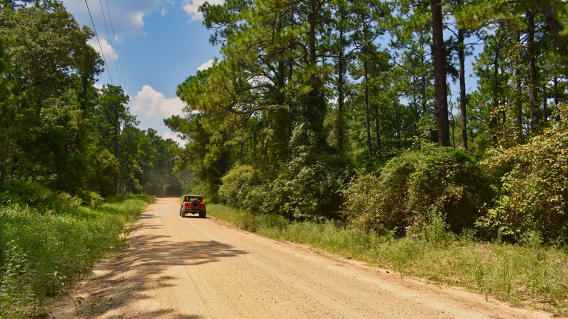
Strickland Road is a rural gravel road that meanders through the picturesque countryside, showcasing Mississippi's rich natural beauty. This road offers a scenic drive with views of rolling hills, dense forests, and open farmland. It is a peaceful route that provides access to various outdoor recreational opportunities, including hiking, birdwatching, and exploring the DeSoto National Forest. Strickland Road is not only a gateway to nature but also a glimpse into the local culture and history, as it passes through small communities that embody the charm and heritage of rural Mississippi. The road's quiet, laid-back atmosphere makes it a favorite for those seeking a break from the hustle and bustle of urban life, offering a serene escape into the heart of the state's natural Longleaf Pine ecosystem. Minimal dispersed camping opportunities are only available along the westernmost section of the road.
Updated: 10/15/2024
Leaf Road
Leaf, Mississippi
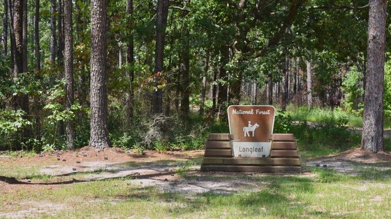
Leaf Road is a well-maintained gravel road in the De Soto National Forest. The majority of the road also travels through the Leaf Wildlife Management Area (WMA). Although visitors may drive the road freely, all other activities in the Leaf WMA require the purchase of a permit from the Mississippi Department of Wildlife, Fisheries, and Parks (MDWFP). The western half of Leaf Road is also known as Jimmy Breland Road, although the entire route is Forest Road 309. This road also travels through the Camp Shelby Manuever Training Area. This is the far southern portion of that designated training area and is rarely used for military training. Camping is available throughout the area in designated locations of the Leaf Wildlife Management Area, but no campsites are immediately along Leaf Road.
Updated: 10/15/2024
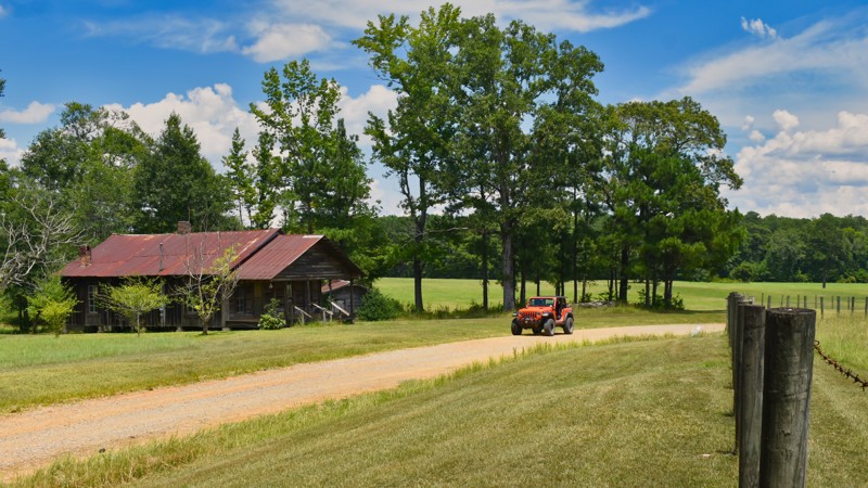
Pine Grove Road
Clara, Mississippi
Pine Grove Road, in the DeSoto National Forest, is a road with two distinct personalities. The northwestern section of the road between Strickland Road and Highway 63 is a graded gravel road that meanders past rural southern homes, historic old homesteads, and groomed green pastures. The second half of the road, southeast of Highway 63, is a graded dirt road with less development along the route. Mississippi's heavy clay soil, combined with frequent rainfall, creates a perfect recipe for muddy conditions, particularly during the wet seasons. This section of road can become treacherous and nearly impassable with rain. Due to the frequent tracts of private property along this entire road, camping is not appropriate on Pine Grove Road.
Updated: 10/15/2024
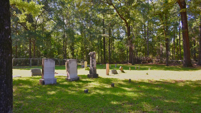
New York Road
Janice, Mississippi
New York Road is a well-maintained gravel road in the De Soto National Forest southeast of Brooklyn, MS. Around the turn of the 20th century, the Mississippi community of New York was found along this road. The town, now a ghost town, consisted of a small group of houses with residents made up of freed slaves. Today, nothing more than a small cemetery exists in the vicinity. There is no camping found along New York Road.
Updated: 10/15/2024
North Tank Trail
Belleville, Mississippi
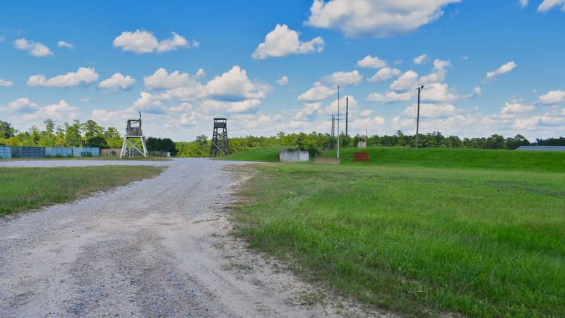
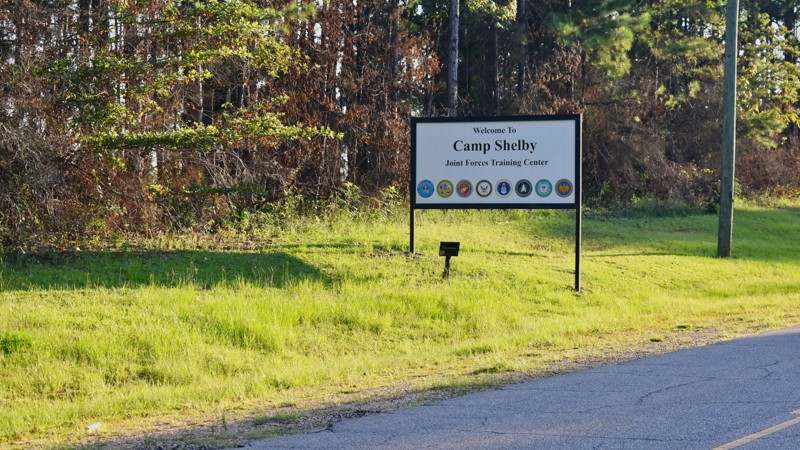
North Tank Trail is a well-maintained gravel road that borders the north edge of the Camp Shelby Joint Forces Training Center, a facility operated by the Mississippi National Guard. When driving the road, it is not always intuitive which route to take when coming to an intersection. North Tank Trail generally travels east and west, and forest service signs identifying the route number can be hard to find at some intersections. The military base uses this area of the national forest for training activities. Warning signs throughout the area advise of the need to remain alert for unexploded munitions. Visitors should remain on the roadway or in designated recreation areas. During military training, North Tank Trail and other nearby forest roads are occasionally closed. Information about road closures is available from the Camp Shelby Control Center. Camping is not allowed along North Tank Trail.
Updated: 10/15/2024
Tiger Road
Rhodes, Mississippi
Traversing north and south across the De Soto National Forest a few miles southeast of Laural, MS, Tiger Road is a gravel and dirt road within this Longleaf Pine and southern hardwood forest. The road is popular with outdoor recreation enthusiasts, especially deer and turkey hunters. Tiger Road gets its name from the nearby Tiger Creek; however, there are no river crossings on this road. The north end of Tiger Road is sometimes known as Old Culpepper Road, which is the road's name north of the forest service boundary.
This forest is jointly managed by the National Forest Service and the Mississippi Department of Wildlife, Fisheries, and Parks (MDWFP). The Mississippi Chickasawhay Wildlife Management Area is co-located in this National Forest. All activities, including hunting, fishing, and camping, require a permit from the MDWFP. Driving the forest service road does not require any permits. The only camping available along Tiger Road are two MDWFP-designated, dispersed camp locations. Contact the MDWFP for information about their daily use permit requirements.
Updated: 10/15/2024
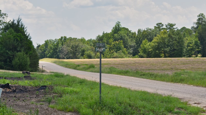
Salem Road
Myrick, Mississippi
Salem Road is a gravel road that traverses the northern section of the De Soto National Forest in the Chickasawhay Ranger District. The road continues north and south outside of the forest as a paved road. Some maps show Salem Road south of Boutwell Road as also being named Touchstone Road, but the Official Forest Service name is Salem Road. When Salem Road intersects Boutwell Road (FR202), the two roads overlap each other for a short distance before Salem Road continues to the south. South of Boutwell Road, Salem Road has some short sections of graded dirt which are prone to muddy conditions during periods of rain. Vehicles need to be equipped to deal with this mud to avoid getting stuck. During dry periods, Salem Road is easy to navigate. There are no camping opportunities along Salem Road. Camping is only allowed in designated dispersed locations of the Chickasawhay Ranger District. There are none of these along Salem Road.
Updated: 10/15/2024
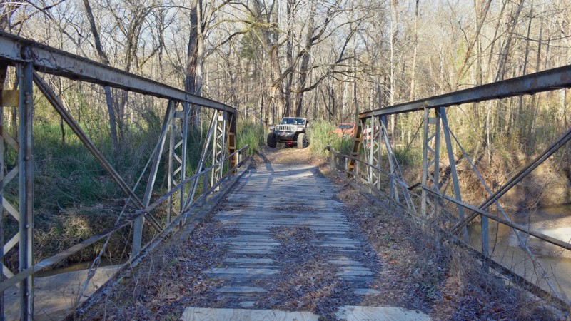
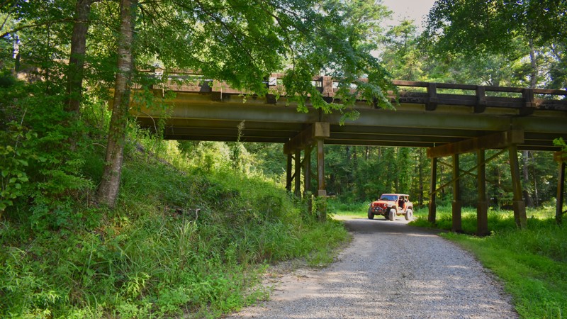
North Cable Bridge Road
Ramsey Springs, Mississippi
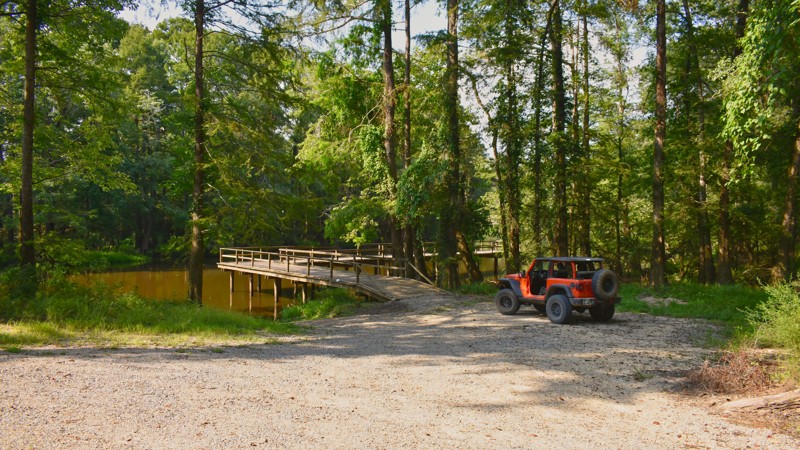
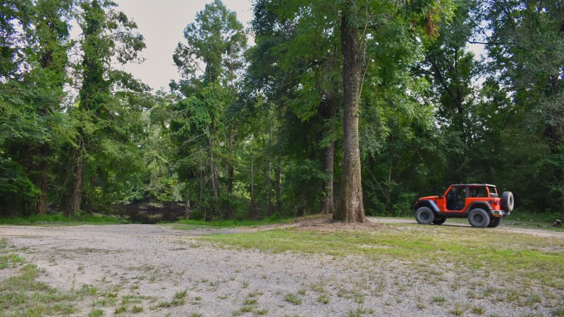
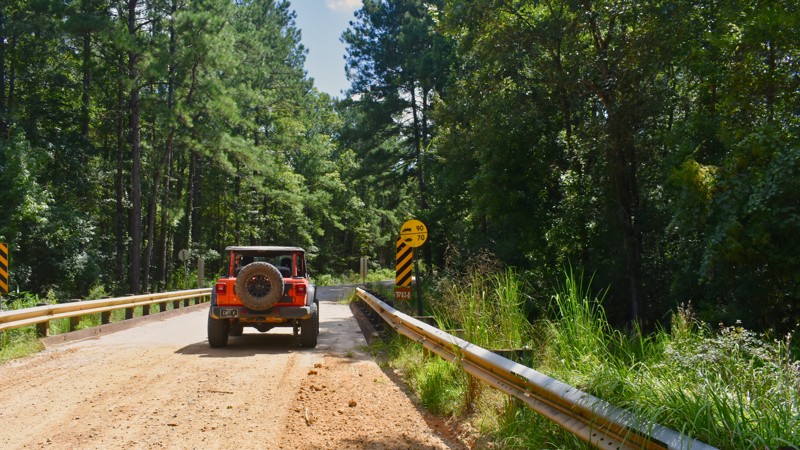
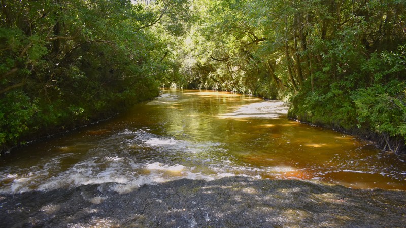
North Cable Bridge Road, an out-and-back road in the De Soto National Forest, is one of the few routes that includes a water crossing. The road ends shortly after crossing the Cypress Creek. This white sandy creek crossing provides a great venue to pull up a folding chair and enjoy the sights and sounds of this natural water park. Putting your feet in the water adds to the refreshment. Two hundred yards past the creek crossing, the road ends with room to turn around. There is a single user-defined dispersed campsite along the road just before crossing Cypress Creek.
Updated: 10/15/2024
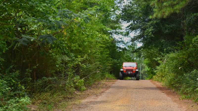
FR 420B
Airey, Mississippi
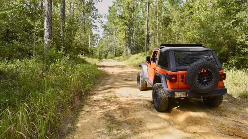
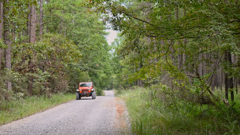
FR 420B is a short two-track spur emanating from Raymond Road in the southern part of the De Soto National Forest just east of McHenry, MS. The road surface is mostly gravel, and muddy conditions are rare, even during rainy periods FR 420B travels through a typical Mississippi forest of Longleaf Pines and southern hardwoods The road ends at a wide grassy turnaround loop suitable for a makeshift campsite.
Updated: 10/15/2024
Grapevine Road
Currie, Mississippi
Grapevine Road is a non-traditional forest service road in the De Soto National Forest as it runs through the heart of the Camp Shelby Joint Force Training Center. This training center consists of multiple live-fire ranges for a multitude of weapons and is operated by the Mississippi National Guard. Warning signs throughout the area advise of the need to remain alert for unexploded munitions. Visitors should remain on the roadway or in designated recreation areas. Grapevine Road and other nearby forest roads occasionally close during military training. Information about road closures is available from the Camp Shelby Control Center. Camping is not allowed along Grapevine Road.
Updated: 10/15/2024
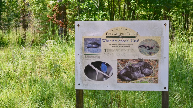
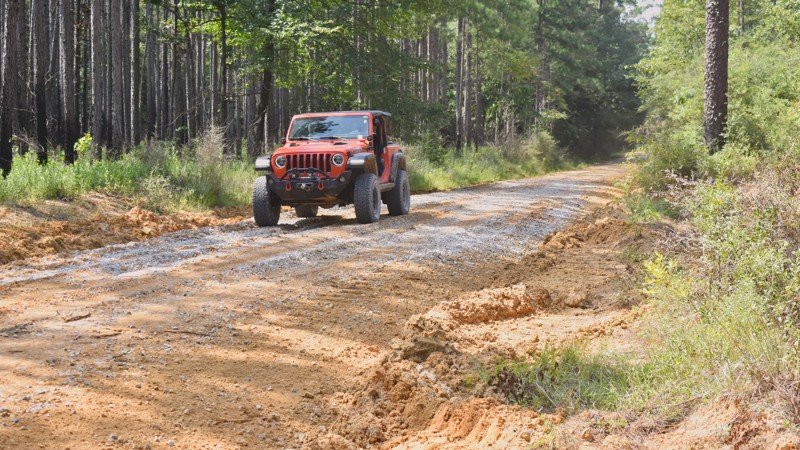
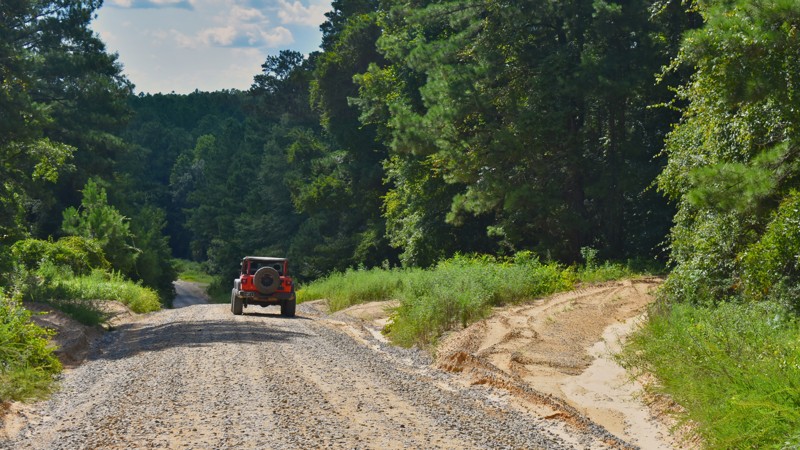
Musgrove Road
Crotts, Mississippi
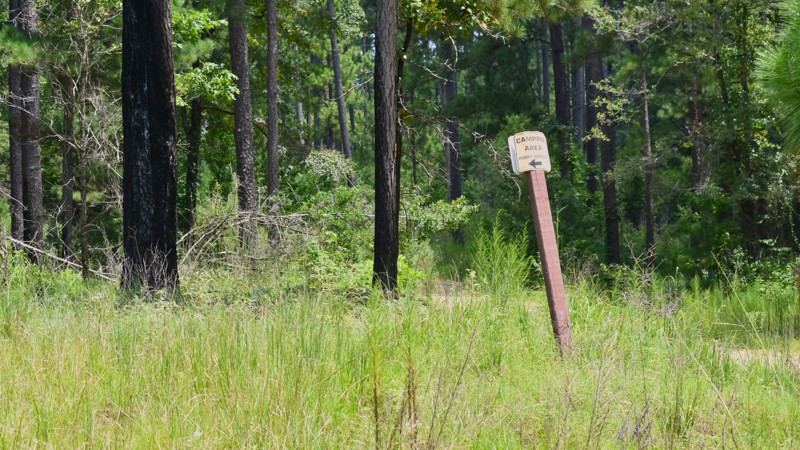
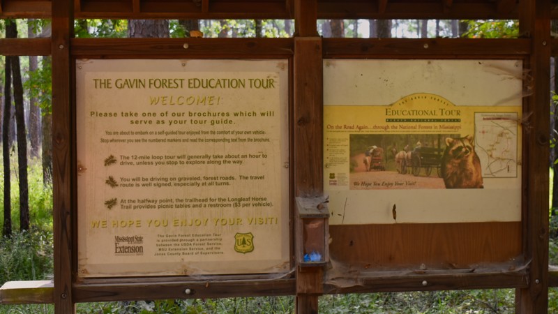
Musgrove Road, in the De Soto National Forest, is a graded gravel and dirt road in a healthy Longleaf Pine forest minutes southeast of Laural, MS. The road is part of the US Forest Service's Gavin Forest Educational Tour, a self-guided drive with interpretive signs along the way that tells about Mississippi's Longleaf Pine ecosystem. The educational tour begins at the intersection of Gavin Road and FR 270. This part of the National Forest uses practices to maintain a healthy forest, providing an environment for robust wildlife and outdoor recreation. During rainy conditions, the dirt portions of the road can become muddy and exceptionally difficult to navigate. Vehicles not equipped to deal with deep mud can easily get stuck. The Longleaf Horse Camp is a semi-primitive campground located at the intersection of Gavin Road (FR213) and Musgrove Road (FR218). There is a minimal fee required to use the campground. The campground is designed to accommodate horseback recreation. Musgrove Road and the Longleaf Horse Camp are both within the Chickasawhay Wildlife Management Area and could have some additional requirements for recreational uses other than driving the roads.
Updated: 10/15/2024
FR 312
New Augusta, Mississippi
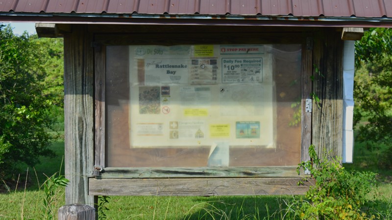
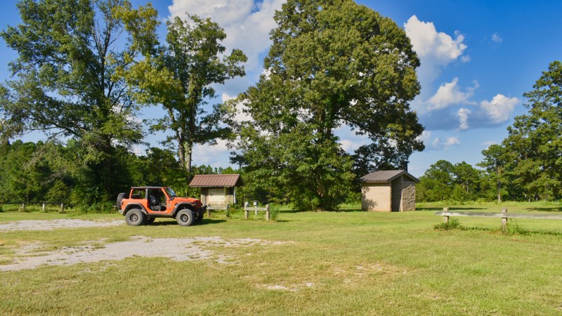
Forest Road 312 is a typical gravel road in the De Soto National Forest and is located near Camp Shelby, a military joint forces training center. This area of the national forest is used heavily by the military base for training activities. Warning signs throughout the area advise of the need to remain alert for unexploded munitions. Visitors should remain on the roadway or in designated recreation areas. One such recreation area is located on this trail. The Rattlesnake Bay ATV Trail is a designated ATV trail site. The entrance of this recreation site has parking and minimal dispersed primitive camping availability. A vault toilet is also located here.
FR 312 and the Rattlesnake Bay ATV Trail are occasionally closed for military training operations. Information about these closures is available from the Camp Shelby Control Center.
Updated: 10/15/2024
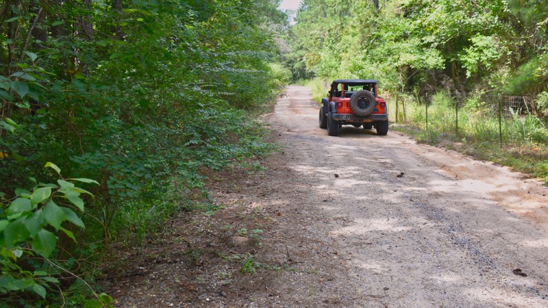
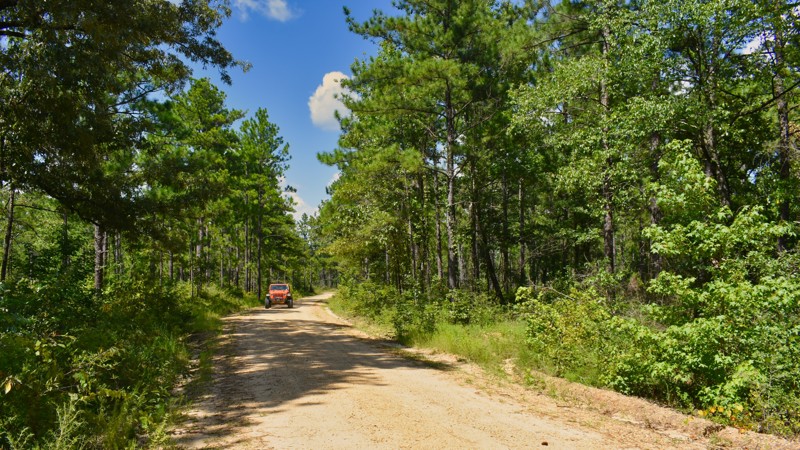
Gavin Road
Ovett, Mississippi
Gavin Road, in the De Soto National Forest, is a graded gravel road in a healthy Longleaf Pine forest minutes southeast of Laural, MS. The road is part of the US Forest Service's Gavin Forest Educational Tour, a self-guided drive with interpretive signs along the way that tells about Mississippi's Longleaf Pine ecosystem. The educational tour begins at the intersection of Gavin Road and FR 270. This part of the National Forest uses practices to maintain a healthy forest, providing an environment for robust wildlife and outdoor recreation. The Longleaf Horse Camp is a semi-primitive campground located at Gavin Road (FR213) and Musgrove Road (FR218). There is a minimal fee required to use the campground. The campground, designed for horseback recreation, provides picnic tables, fire rings, and a hitching post at each campsite. Gavin Road and the Longleaf Horse Camp are within the Chickasawhay Wildlife Management Area. Users could have some additional requirements for other recreational uses like fishing, hunting, and hiking.
Updated: 10/15/2024
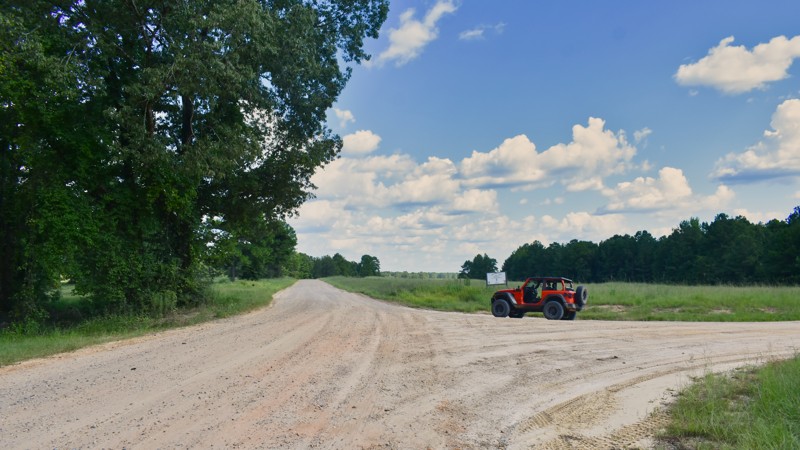
FR 369A
Belleville, Mississippi
FR 369A is one of the initial entry roads into the Camp Shelby training area of the De Soto National Forest. There are no individual military training facilities along FR 369A. The road is a well-maintained gravel road suitable for large and heavy vehicles. Signs posted along this route indicate a danger in going offroad as there is a risk of unexploded munitions in this part of the forest. Visitors should remain on the roadway or in designated recreation areas. FR 369A and other nearby forest roads occasionally close during military training. Information about road closures is available from the Camp Shelby Control Center. Camping is not allowed along FR 369A.
Updated: 10/15/2024
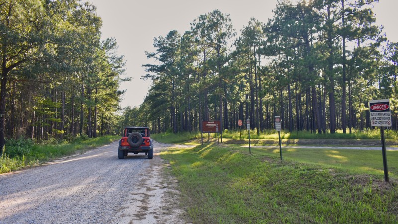
FR 369A1
Belleville, Mississippi
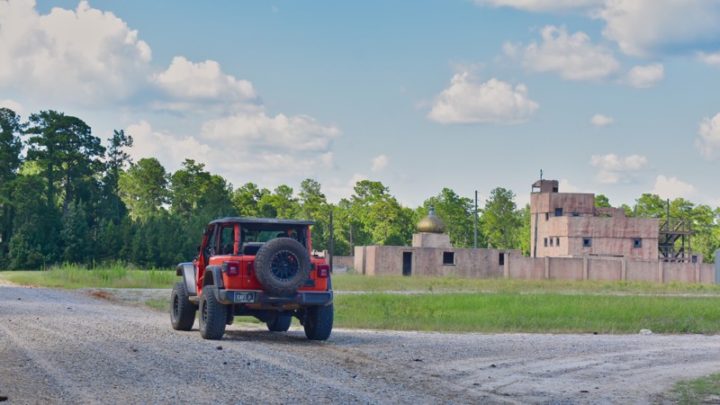
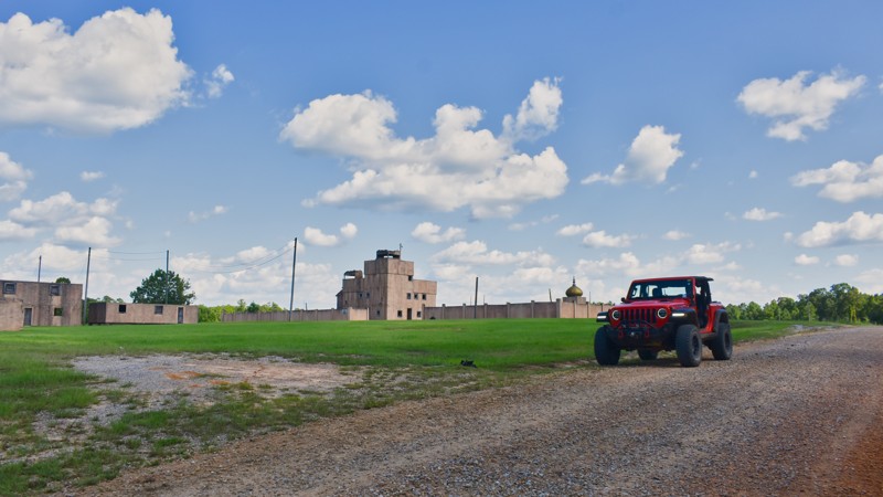
FR 369A1 is a short gravel forest service road near the Camp Shelby Joint Forces Training Center operated by the Mississippi National Guard. The road itself is uneventful; however, it borders next to a small military arms training range with a simulated city. The simulated city shooting range, visible from the road, provides realistic urban arms training for military personnel. The military base uses this area of the national forest for training activities. Warning signs throughout the area advise of the need to remain alert for unexploded munitions. Visitors should remain on the roadway or in designated recreation areas. FR 369A1 and other nearby forest roads occasionally close during military training. Information about road closures is available from the Camp Shelby Control Center. Camping is not allowed along FR 369A1.
Updated: 10/15/2024
Short Cut Road
Ovett, Mississippi
Short Cut Road is one of the shortest through routes in this part of the De Soto National Forest. This gravel road provides access to Gavin Road (FR213) and Boutwell Road (FR202). The road is not well-marked at its intersection with State Highway 15. Short Cut Road also provides an early glimpse into the Longleaf Pine and southern hardwood forest of southern Mississippi. Camping is not allowed along Short Cut Road.

Upgrade your Membership
Unlock all of the details on every Trail Guide and Scout Route.
Start a 7-day Free TrialCommunity
Partners