










By clicking "ACCEPT", you agree to be the terms and conditions of each policy linked to above. You also agree to the storing of cookies on your device to facilitate the operation and functionality of our site, enhance and customize your user experience, and to analyze how our site is used.
Utah Off-Road Trails
359
Total Trail Guides 334

4759
Detailed Waypoints 925
Try a Free 7-Day Trial and unlock it all
Start a Free Trial Most Recent Trail Reviews
No Rating
Open
Visited: 09/24/2026
This trail has been graded recently and is now an easy trail.

IE
Ingrid Enyeart
Rated 5/5
Partially Open
Visited: 09/22/2026
The portion of the trail between the fork at 11 and the fork at 13 has two major ledges that have formed going into and out of the wash. Not sure what vehicle could overcome these. So just take the sc...


CI
Christine Irsik
Rated 4/5
Open
Visited: 09/22/2026
We enjoyed this trail and will definitely do it again. Gorgeous views at many points along the trail. We didn’t try The Wall, but everything else was just enough of a challenge for us and nice that m...
LF
Leslie F
No Rating
Open
Visited: 09/22/2026
Drove out here in a thunderstorm after doing dome plateau overlook. Epic camping. peaceful. unparalleled views. trail had two steep rocky sections I used 4wd low but probably didn't need to.

JR
jon ross
No Rating
Open
Visited: 09/21/2026
This is a short 2 mile of so cut off trail. Has a wash out with a by pass half way through.



Earl Neisler
Earl Neisler
Rated 2/5
Open
Visited: 09/21/2026
Pinstripe Alley nonstop for the first 4 miles. INo view to be had until waypoint 7. It was a beautiful view then we turned around. Should’ve read the reviews before we started the trail, because th...
LF
Leslie F
Rated 5/5
Open
Visited: 09/21/2026
This is a highlight for the trip. We stayed at waypoint10 for the night.


Earl Neisler
Rated 4/5
Open
Visited: 09/21/2026
Nice connector. The short out back was the hardest and not that short.


Earl Neisler
Rated 4/5
Open
Visited: 09/21/2026
A well maintained road. Found a nice camp site on the south in.
Earl Neisler

Jesse Martin
Jesse Martin
Rated 5/5
Open
Visited: 09/20/2026
Great area to go camping and gather for family reunions. There are multiple other trails that fork off throughout the trail to explore.

Dustin
Earl Neisler
Rated 5/5
Open
Visited: 09/20/2026
Only did apart due to time. This is 1 I will come back and finish.

Earl Neisler
Rated 3/5
Open
Visited: 09/20/2026
Not much to say it a slow easy. A good connecting trail.
Earl Neisler
No Rating
Open
Visited: 09/20/2026
We started just south of Cottonwood Canyon. We stop and looked but could not fine the rock art. The area was a nice to see all the green.


Earl Neisler
Rated 4/5
Open
Visited: 09/19/2026
Great trail, we drove through waypoints 24-35. Easy ride with a good amount of mud holes with few ruts on the stretch we drove. Would love to complete the whole trail at a later date.
Dustin
Rated 4/5
Open
Visited: 09/19/2026
Fun easy trail. Great way to get out and enjoy a relaxing trail ride to take in nature and see the fall colors.
Dustin
Rated 5/5
Open
Visited: 09/19/2026
Great Trail! The scenery was good with lots of wildlife. The trail was diverse that give drivers the opportunity to use both high and low four wheel drive. Trail has both wide and narrow areas.
Dustin
Rated 5/5
Open
Visited: 09/18/2026
I run this trail every year. Always fun and beautiful views. Fair amount of off camber sections.

Jeff Klaassen
Rated 5/5
Open
Visited: 09/18/2026
This was a good trail. The trail still had so flood damage but was passable. Highly recommended this. Has some all some view. We took 2 day to enjoy the ride and views.


Earl Neisler
No Rating
Open
Visited: 09/16/2026
Very fun, short trail. We did the loop but not Wipeout Hill. The sandy sections were a blast and there were a few ledges and obstacles that probably warrant a 5 but are still a fun challenge. We did i...



Mark Signorelli
Rated 4/5
Open
Visited: 09/15/2026
Ran this one and it's a decent stretch for anyone with a high clearance 4x4. The early sagebrush section had me watching my GPS track closely since the road nearly disappears a few times, but it alway...



Jay North
Official Crew
Rated 4/5
Open
Visited: 09/15/2026
Ran this as a quick add-on while working through the rest of the Red Hills network, and it's a fun one to knock out in under an hour. The wash crossing is the one spot where you actually have to think...


Jay North
Official Crew
Rated 3/5
Open
Visited: 09/15/2026
Ran this one on a dry afternoon and came away satisfied without being blown away. The rocky, rolling grade keeps things interesting without ever feeling out of reach for a stock high clearance rig, th...


Jay North
Official Crew
Rated 4/5
Open
Visited: 09/15/2026
Ran this one on an afternoon when I didn't have time for a full day out, and it delivered more than I expected for a short climb. The hill about a mile in makes you actually think about your line, and...


Jay North
Official Crew
Rated 4/5
Open
Visited: 09/13/2026
Red Peak Road is a short, easy cruise that's mostly smooth dirt with just enough texture to keep it interesting. There's a mild rough patch early on and a slightly rockier stretch past the halfway poi...


Jay North
Official Crew
Rated 2/5
Open
Visited: 09/13/2026
This is an easy, low-key cruise with a short technical bump right in the middle where it ties into the rest of the network, otherwise it is just packed dirt and gravel the whole way. Nothing here dema...


Jay North
Official Crew
Rated 4/5
Open
Visited: 09/13/2026
This one's an easy, mellow cruiser and it shows in how quick it feels behind the wheel. The rocky spots near the start and about two thirds up are barely worth mentioning, just some careful tire place...


Jay North
Official Crew
Rated 5/5
Open
Visited: 09/13/2026
This one's a fun add-on if you're already out in the area, easy enough for most of the way that a stock rig won't break a sweat, with just a couple of hard spots to keep things interesting. The washou...


Jay North
Official Crew
Rated 4/5
Open
Visited: 09/13/2026
A nice view of Kanab. Steepish and possibly slick when muddy. One spot has a small rock shelf. 4x4 recommended.


Ben Ruddell
Official Crew
Rated 3/5
Open
Visited: 09/13/2026
Easy, suitable for high clearance 2WD on a dry day, though four wheel drive earns its keep if the ground's been wet. The ruts along the way are mild and easy to place your tires around, and the two wa...


Jay North
Official Crew
No Rating
Open
Visited: 09/12/2026
Crazy no reviews since I ran it last May. We ran it again this time the whole trail out to the south overlook. It had rained the night before and into the morning. The rock dried up quick but a lot o...



Andrew Hotton
Rated 5/5
Open
Visited: 09/12/2026
Sand dunes. DANGER, you need to know your technique to head in here. It’s easy to misjudge slope and camber and get stuck or worse roll.


Ben Ruddell
Official Crew
Rated 3/5
Open
Visited: 09/12/2026
The section of the trail was rocky and rough - still fairly easy but the rockiest stretch.
WF
Wyatt Frampton
Rated 4/5
Open
Visited: 09/12/2026
This trail checks so, so many of the boxes -- hanging off a cliff, passing within 4" of rocks on BOTH sides at the same time on narrow sections, meaningful obstacles (ledges) where I smacked my hitch ...
IR
Isaac R
Rated 3/5
Open
Visited: 09/12/2026
This is an easy, high clearance 2WD road, easy enough that the drive itself isn't the draw. The shelf road stretch is mild and only about two jeeps wide, so keep an eye out for oncoming traffic, and t...


Jay North
Official Crew
Rated 2/5
Open
Visited: 09/12/2026
This is a mellow, low-stress drive that rewards a relaxed pace more than any technical challenge. Stock high clearance handled every mile without a second thought, and the surface stayed predictable e...


Jay North
Official Crew
Rated 5/5
Open
Visited: 09/11/2026
Great rest quick trail! Perfect for beginners, fun place for a picnic. The entrance and exit terrain to the tunnel changes depending on the weather and use. Very fun and interesting.


Dustin
Rated 4/5
Open
Visited: 09/11/2026
My route didn’t originally include this trail, but one of my crew broke on impossible hill and we had to limp back to civilization. This trail was beautiful and remote. Difficulty wise, no issues on t...



Dewie Jones
Official Crew
Rated 4/5
Open
Visited: 09/10/2026
Way better than I thought it would be. This was simply a connector trail for my unsuccessful (broken Toyota) Blanding to Moab overland trip. The trail is absolutely beautiful, relatively fast access, ...
Dewie Jones
Official Crew
Rated 3/5
Open
Visited: 09/10/2026
Easy enough that I did this road in pitch-black with just headlights (no light bar or anything) on the way to see sunrise from the end of the trail (Hurrah Pass). Really straightforward, just rocky li...
IR
Isaac R
Rated 4/5
Open
Visited: 09/10/2026
Incredibly beautiful road and not really rough at all -- I did a bunch of with fully-inflated tires. I know it's just a connector but honestly I would 100% come out here again to enjoy the views, hang...
IR
Isaac R
Rated 4/5
Temporary Closure
Visited: 09/10/2026
Deep mud around river crossing prevents passage. We came from Goblin Valley side, we were able to cross the river but there was deep mud on south side due to recent rains. Almost got stuck, had to go ...

Thomas A Youngerman
Rated 5/5
Open
Visited: 09/09/2026
Incredible bucket list trail that you must do if you can. DON'T do it in 1 day unless you like rushing it, unfortunately circumstances changed that required us to rush it. It's gorgeous and worth an o...



Sean Allen
Rated 5/5
Open
Visited: 09/09/2026
I built this into our rocklanding/overland route and really enjoyed the adventure. You can tell this isn’t well traveled which added to the experience. With that said, we’re trying to get to Moab from...


Dewie Jones
Official Crew
Thomas A Youngerman
Rated 5/5
Open
Visited: 09/08/2026
Great as always, high rewards in terms of views and nothing crazy in terms of obstacles. Great first trail for someone to do with a great payoff!


Sean Allen
Rated 5/5
Open
Visited: 09/08/2026
Fun trail, would run again. Had lunch between Monitor and Merrimac buttes.


Thomas A Youngerman
Most Popular
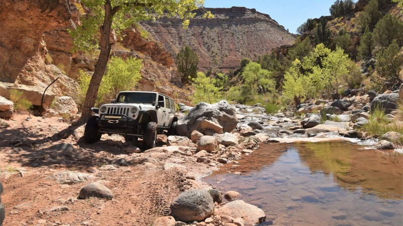
Updated: 01/28/2024
Rattlesnake Gulch
La Verkin, Utah
Rattlesnake Gulch in southern Utah is one of those iconic, right of passage trails that should be on everyone's shortlist. For those with lightly modified, daily driver type rigs that want a little more scenery than the red rocks of Sand Hollow, then this is the trail for you. It's a short drive from Hurricane, and the trail has flowing mountain water all year long. In the summertime, the small swim holes and Toquerville Falls at the end offer wonderful places to relax. The boulders are numerous, big, and wet. There are vertical rock ledges to drop down and soft sand to climb up as you zigzag through a 200-foot deep desert canyon. Go with friends and go prepared for a wonderfully unique rock crawling experience.


Updated: 04/19/2024
The Barracks Trail
Open
/
Orderville, Utah/
23.2 miles/
About 6 hours
Southern Utah holds some of the most iconic scenery in the entire state. The red cliffs spotted with deep green juniper trees seem to just roll on forever. Just outside of Zion National Park lies this gem of an offroad trail that gives you incredible viewpoints of such scenery. As you begin this trail, you wind your way through the canyon carved by the East Fork of the Virgin River, crossing it nearly half a dozen times. Many people believe that this is the highlight of the trail. While it is fun, this is only the beginning. After you ascend from the canyon onto the plateau above, you really get to see the sights that The Barracks Trail has to offer. Changing scenery is accompanied by different vantage points to view the southern valley that borders the Coral Pink Sand Dunes, while to the northwest you can get a glimpse of Zion. This 4wd road is not for the faint of heart through, as you have to climb steep sandy hills to complete this 23-mile-long trek. Luckily, this trail is easily accessible off of Highway 89 from both ends and can be enjoyed by all; even if you decide to avoid the hill and turn back the way you came in. If you are passing through on your way to Kanab or just looking for a new trail to explore, make sure this one is on your list!
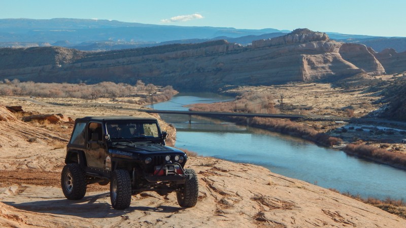
Updated: 02/26/2025
Owl Draw Upland (Dome Plateau)
Moab, Utah
The challenge is just as exhilarating as the views. Considered the gateway to Dome Plateau, the Upland trail is a four-wheeling adventure that we all expect from Moab. Epic views, rock crawling, and memories worth a lifetime are delivered every time you venture out to this remote area north of Moab. The challenges are moderate but enough to keep the adventure exciting for even the most seasoned wheelers. Plan for a long day when connecting this amazing trail with all the others that make up the iconic Dome Plateau Loop.
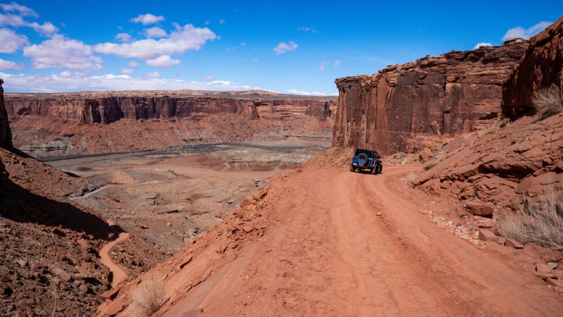
Updated: 06/11/2024
Mineral Bottom Road
Moab, Utah
Mineral Bottom Road is an epic offroad trail from the upper edge of Mineral Canyon into the canyon's bottom along the Green River. The visually stimulating descent into the canyon is along a switchback-filled shelf road that offers plenty of visual exposure with sheer drop-offs and imposing canyon walls. Mineral Bottom Road creates anxiety for those with a fear of heights. Once at the bottom of the canyon, you feel like you're in an old-time Western movie, passing towering walls and massive buttes. This is a popular road for all recreation types and leaves a lasting memory for all users.
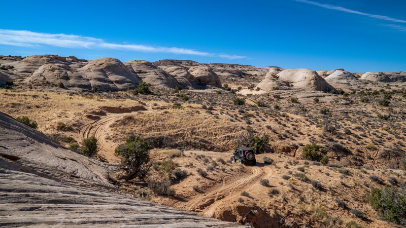
Updated: 05/08/2026
Lost World
Open
/
Green River, Utah/
7.84 miles/
About 2 hours
Tucked away in the rugged red rock wilderness northwest of Moab, Utah, Lost World is an emerging favorite among offroad explorers. The trail winds through a surreal landscape of petrified sandstone fins, spires, ancient canyons, and wide-open desert views that seem untouched by time. As you crawl over slickrock shelves and drop into sandy washes, each turn reveals a cinematic view, from the snow-capped La Sal Mountains and distant Henrys to the maze-like chaos of sculpted rock below. Far from the crowds and deep in Utah’s backcountry, the Lost World trail delivers raw adventure and striking scenery with a journey into a prehistoric-looking expanse where solitude reigns.

Updated: 01/21/2026
Courthouse Rock aka Buttes and Towers
Moab, Utah
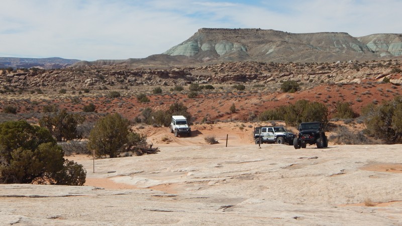
Simply amazing is an appropriate description for this iconic Easter Jeep Safari route. Buttes and Towers follows an easy but rocky route around the most majestic landscapes in the Moab area. The trail offers very mild rock-crawling challenges for stock-type 4x4s on its massive stretches of sandstone. You will climb up and around the towering Courthouse Rock circle around the ledge at Pasture Butte before ending near the famous Determination Towers. The trail has numerous points where you'll want to stop, get out and soak it all in. For the lesser experienced offroaders, this is a great way to get the complete experience of a Moab adventure.
Updated: 04/28/2026
Copper Ridge
Crescent Junction, Utah
Copper Ridge is a popular Easter Jeep Safari route that combines numerous trails within this scenic region north of Moab. The trail begins with a stop at a fantastic dinosaur track site, where multiple large footprints are preserved in the sandstone. You'll then work your way over to what's left of the 1969 movie set for the movie "Blue." The trail then travels to the white slick rock and more challenging obstacles. In the distance, you'll have spectacular views of the Arches National Park rock formations and, further, the Las Sal mountains. The final point of interest is the Seven Mile Canyon pour-off. You can park right on the cliff's edge and reflect on the epic day you just had on the trail.
Updated: 01/07/2025
Cathedral Valley Loop
Torrey, Utah
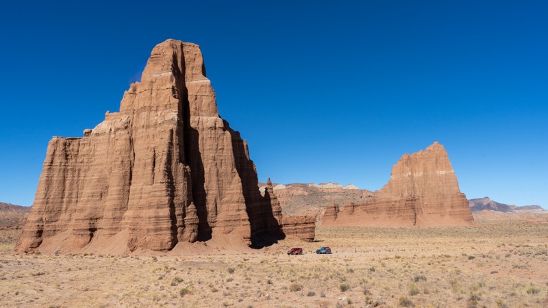
Cathedral Valley Scenic Backway takes you into the heart of the "Cathedral District," a land filled with natural wonder. A title like that is something you think you should be hearing in Paris, but instead, you are in Capitol Reef National Park, a wonder in its own right. With prominent natural landmarks named Temple of the Sun, Temple of the Moon, and Jericho Wall, you always question if the beauty is overhyped. It is not. This trail is a must for the offroad crowd simply for the visual stimulation factor. Cathedral Valley Loop presents no challenging obstacles, but mile after mile of a colossal panorama is the journey's reward.
Updated: 10/06/2025
Eye of the Whale
Moab, Utah
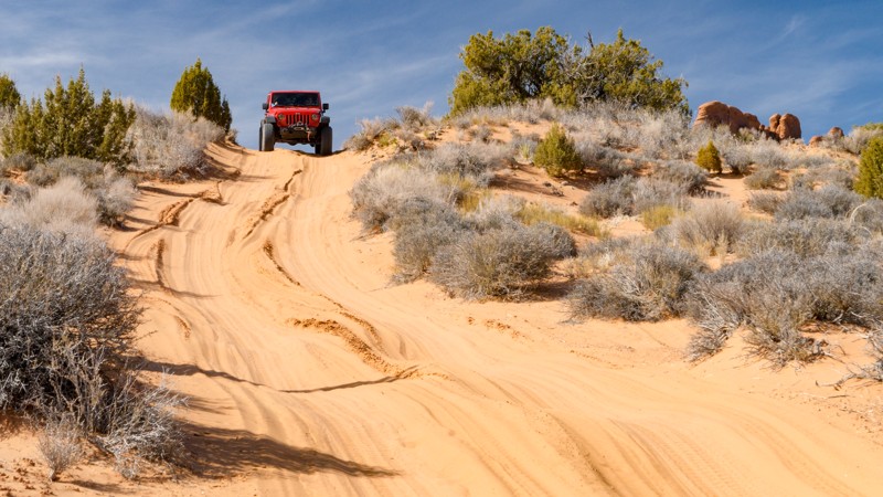
Walking through the Eye of the Whale feels like walking into the mythical Middle Earth. Bright green plant life, pink and reddish sand, and standing trees are seen through the portal view shaped like a giant eye, the Eye of the Whale. Getting there is half the fun. This four-wheel drive road inside Arches National Park is one of the more adventurous ways to visit while avoiding crowds. Deep sand, washes, and slickrock are all surrounded by the otherworldly rock formations that immortalize Arches National Park. Combine this with Tower Arch Road and Willow Springs Road for an unforgettable day in one of the most famous National Parks in the United States.
Updated: 09/08/2023
Wipe-Out Hill
Open
/
Moab, Utah/
6.04 miles/
About 2 hours
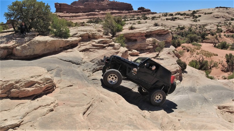
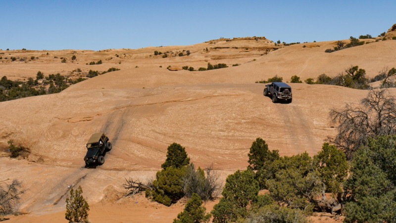
Wipe-Out Hill is undoubtedly an intimidating trail name, but in no way should the one optional obstacle be the only reason for running this trail. There is so much more. Once you exit the pavement, immediately leaving the packed mini-vans behind, you'll be enveloped by the landscape, and red sandstone cliffs fill your windshield. This is one of those trails where you put it in 4-low and leave it there for the next couple of hours. Several early challenges will ensure your rig is ready for the big show at the midway point of the loop. Wipe-Out Hill is an optional steep slab of sandstone with off-camber vertical ledges. The climb up and down is optional and not for the inexperienced. The loop's second half is a scenic drive below the cliffs. The challenges in this section are ideal for stock type 4x4s. Be sure to look for unique rock formations along the way.
Updated: 03/28/2024
Behind the Rocks Trail
Moab, Utah
Time to earn your stripes! Behind The Rocks will demand the best from you and your modified rig. The trail will get your attention right away at the menacing Guardian Rock. In a sense, this towering slab of sandstone is a true gatekeeper for one of Moab's most iconic routes. BTR has earned icon status by other named obstacles like High Dive, Hummer Hill, Roller Coaster, and the adrenaline-pumping White Knuckle. Get an experienced and reliable crew together or join a group run because you don't want to attempt this trail without backup and a trusted spotter. The scenic landscape you'll traverse is endlessly challenging, with breathtaking views demanding your attention. Be on your toes and the skinny pedal to make it through this one.

Updated: 03/28/2025
Hurrah Pass
Moab, Utah
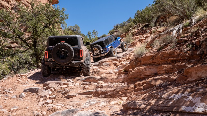
Hurrah Pass is a scenic offroad trail located a short distance outside of downtown Moab, offering a quintessential red rock desert experience. The trail winds its way alongside dramatic canyon walls, sandstone formations, and wide-open desert vistas. It gradually ascends to the summit of its namesake Pass at about 4,800 feet, providing panoramic views of the Colorado River, the potash evaporation ponds, Kane Creek Canyon, and endless jagged cliffs and buttes Moab is widely known for. Hurrah Pass is popular for its blend of manageable terrain, rich desert scenery, and access to further backcountry routes like Chicken Corners, making it a favorite for those looking to explore the remote beauty surrounding Moab without extreme rock crawling.
Updated: 10/21/2025
Rose Garden Hill
Open
/
Dewey, Utah/
12.74 miles/
About 3 hours
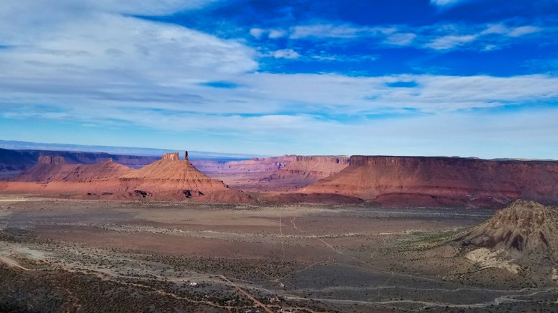
Used as the only connecting route between Top of the World and Onion Creek, Rose Garden Hill is one of Moab’s most iconic challenges, and the hardest section of the overlanding route known as the Kokopelli Trail. The trail offers scenic wash driving, steep inclines, steep descents, loose soil, big ledges, epic views, and off-camber shelves that will test your vehicle and your nerves. This slow, rough, and narrow 4WD road can be tackled as a standalone challenge or part of a much longer, multi-day route connecting various trails.
Updated: 06/11/2024
Porcupine Rim
Moab, Utah
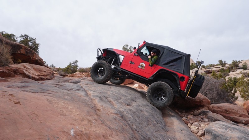
Don't miss this gem in the Sand Flats Recreation Area. While not as famous as other local trails, it is well worth the time and effort it takes to run this route. To say this trail is scenic is an understatement. Virtually the entire 9 miles are rough outcroppings of the classic Moab slickrock, making for a challenging but fulfilling trip.
You may recognize the rock formations and terrain features along this trail because the area has been in several movies and TV shows. The same scenery that brings filmmakers is the highlight of this trail. As one of the highest-elevation trails in Moab, the views of Utah in are fantastic in all directions. The views include the La Sal Mountains, Castle Valley, Round Mountain, Castleton Tower, and the Colorado River on the north side. The south side of this trail has views of Moab, the sandstone rock 'fins,' and the famous trails in the valley.
Updated: 04/30/2024
Gold Bar Rim
Moab, Utah
Gold Bar Rim is a fantastic offroad trail in its own right, but it is also known to be the first or last leg of the famous "Trifecta", which is comprised of Poison Spider and Golden Spike. Situated near Moab, this trail offers continual obstacles and views of desert scenery that include the dramatic Moab Canyon and Gold Bar Canyon.
Updated: 06/12/2024
Salt Valley Road
Moab, Utah
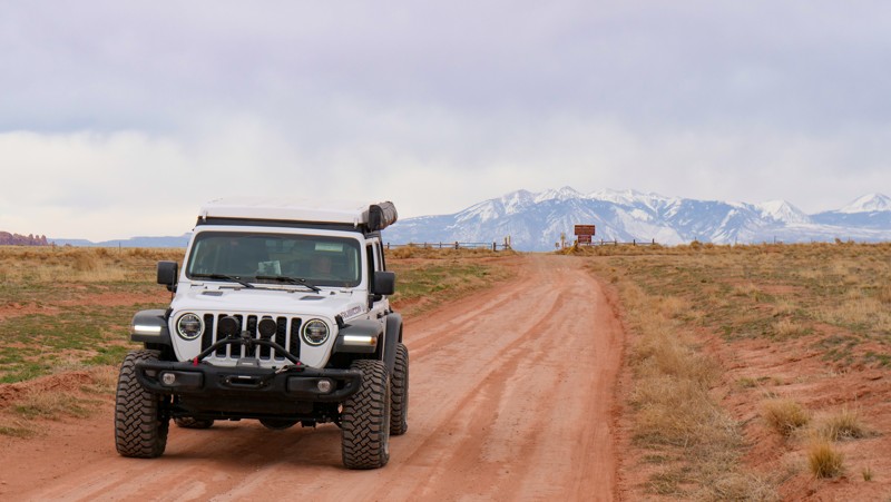
This road is filled with amazing views of Arches National Park, the La Sal Mountains, and Klondike Bluffs. It offers a direct route from Crescent Junction to deep inside Arches National Park, finishing just shy of Devil's Garden. Enjoy the desert views along the way with varied terrain, and notice how the ground colors change as you drive this trail.
Updated: 05/13/2025
Klondike Bluffs
Moab, Utah
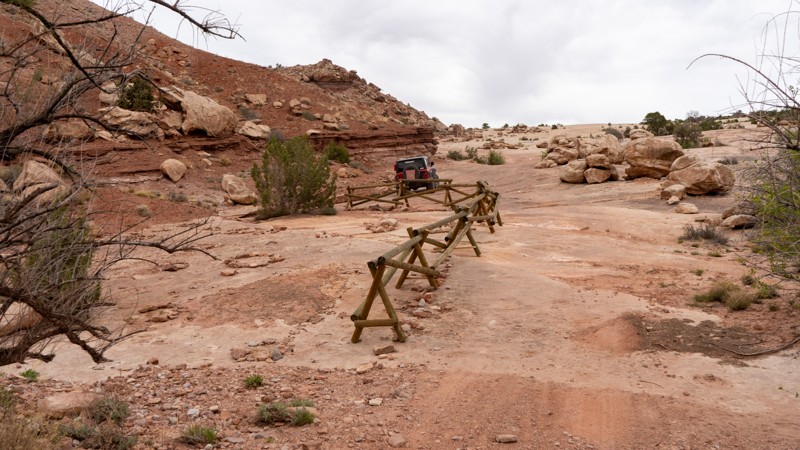
Dinosaur tracks, slickrock, and washes - consider this trail your very own offroad Jurassic Park experience, without the risk of being eaten by Velociraptors. Klondike Bluffs, sitting just north of Moab and bordering the 300-million-year-old formations of Arches National Park, is truly an enjoyable and interesting 4WD trail. It travels alongside the visible evidence of the Jurassic time period and right up to the mysterious-looking rock formations of the Bluffs and Arches National Park. Combine this trail with Klondike Bluffs Escape for a visually stimulating route into Salt Valley and Arches National Park.
Updated: 06/12/2024
Tower Arch
Moab, Utah
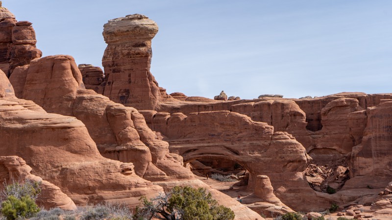
Situated in Arches National Park, a major tourist destination known for its many sandstone arches, is a hidden gem four-wheel drive road known as Tower Arch Road. Driving the road is perhaps what our national parks must have been like in their infancy - rugged, remote, beautiful, and hard to get to! Traveling through red, pink, and brown sandstone formations, up and over ledges, and through reddish sandy dunes, you reach the namesake, Tower Arch. When you arrive, you feel like you have been tucked into the corner of nowhere as the sands of time are ever-changing, the magical landscape that time seems to have forgotten. Combine this with Eye of the Whale for an unforgettable day trip in Arches National Park.

Updated: 05/04/2024
Behind the Reef
Hanksville, Utah
The San Rafael Swell of central Utah is considered by many to be one of the most unique, rugged, and beautiful geology in the western United States. Spanning from Price to Hanksville and Emery to Green River, this colorful sandstone triangle brings out the adventurer in all of us. You can raft the San Rafael River, mountain bike the innumerable single tracks, explore pictographs and petroglyphs, horseback through the red rock, or kick back in a remote campsite. But the miles and miles of offroad trails running through desert juniper forests onto dry and arid plateaus before descending to cottonwood-lined rivers is the largest draw. Behind the Reef may be the hidden gem of the magnificent Swell. Behind the Reef traces along the huge jutting San Rafael Reef, the eastern wall of the Swell. The dichotomy of jaw-dropping and conflicting views adds to the uniqueness of this remote meandering red track. Looking west, you feel like you are on top of the world, an eagle's perspective of the vast sandstone solitude below. To the east, towering cliffs remind you just how small you really are in this endless stony landscape. What will you find Behind the Reef?

Updated: 03/26/2024
Flint Trail
Hanksville, Utah
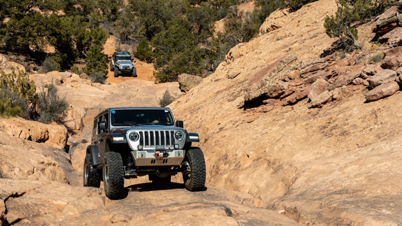
With breathtaking views, heart-pounding switchbacks, and epic backcountry camping, what else could you want in a 4x4 adventure? Flint Trail is the southern gateway for one of America's most remote offroad trips. The views hit you right away along the towering Orange Cliffs of the Glen Canyon National Recreation Area. The bright orange cliffs tower over the trail as you zigzag beneath the shadows of precariously balanced stone behemoths. Natural arches and spires are abundant along the southern portion of the route, reminiscent of Monument Valley. Once inside the Glen Canyon area, the terrain changes to a more forested high desert with narrow cliff edge views and the infamous 800-foot climb on the narrow exposed Flint Switchbacks. Planning and preparation will help, but experience is key to safely navigating through this remote region of central Utah.
Updated: 03/30/2026
Flat Iron Mesa
La Sal, Utah
Flat Iron Mesa is a tough 4x4 route typically run as part of the Easter Jeep Safari and other events in the area. This trail will leave you feeling accomplished and tired at the very end. Almost every inch of it will test your driving skill and your vehicle's suspension as you manage the named obstacles of Tilt-A-Whirl, The Chutes, Easter Egg Hill, and The Intimidator, which is one of the more scary obstacles in the Moab area. Between the rock crawling, you will take in beautiful views of Coyote Canyon, Hatch Wash, and its namesake, Flat Iron Mesa. This trail is perfect for those seeking a challenge and a full day of adventure.

Updated: 12/23/2025
Poison Springs
Hanksville, Utah
The Poison Springs 4WD trail in Southern Utah is a thrilling off-road adventure offering breathtaking scenery and complete isolation. Nestled within the picturesque canyonlands, this trail takes daring explorers on a rugged journey through red rock formations, steep ascents, and treacherous descents. As you navigate the narrow paths and encounter the famous Dirty Devil River crossing, the trail rewards you with sweeping vistas of towering red rock cliffs, vibrant desert flora, and the untamed beauty of the wild landscape. With its technical sections and awe-inspiring views, the Poison Springs 4WD trail promises an unforgettable experience for off-road enthusiasts seeking a taste of Utah's wild side.
Updated: 10/10/2023
Lower San Rafael Road
Hanksville, Utah
In the central part of Utah lies this 69-mile long trail known as the Lower San Rafael Road. Crossing through many unique rock formations, this trail also provides access to many incredible areas that Utah has to offer. The northern end of the trail will allow you to experience many sections of the Green River such as views of Crystal Geyser, Tri Alcove Bend, and Keg Knoll, while the southern end is used as access to the famous Horseshoe Canyon and the Maze District of Canyonlands National Park. This trail is highly recommended if you are in the area as you are sure to find something you'll love!

Updated: 06/17/2024
Mary Ellen Gulch
Partially Open
/
Alpine, Utah/
3.96 miles/
About 3 hours
Located about an hour southeast of Salt Lake City in the majestic Wasatch Mountain range, Mary Ellen Gulch offers a lot of adventure for any outdoor enthusiast. From the bottom, you immediately experience the amazing scenery in the Wasatch National Forest and work your way up the old mining road past abandoned gold and silver mines of the late 1800s. Look hard enough, and you might find iron pyrite or fool's gold lying around. If you are more extreme, there have been rumors that you can get lucky panning the mountain streams. There is a story of a Jeeper who panned in one of these canyons and found just enough gold to pay for the expenses of his journey up. Who knows what you may find! As you finish the trail, enjoy the breathtaking views of the surrounding mountains and overlook the Mineral Basin ski lift.

Upgrade your Membership
Unlock all of the details on every Trail Guide and Scout Route.
Start a 7-day Free TrialBrowse Trails in Utah by City
Browse every Utah city with offroad trail guides.
Community
Partners

