










By clicking "ACCEPT", you agree to be the terms and conditions of each policy linked to above. You also agree to the storing of cookies on your device to facilitate the operation and functionality of our site, enhance and customize your user experience, and to analyze how our site is used.
Utah Off-Road Trails
359
Total Trail Guides 334

4759
Detailed Waypoints 925
Try a Free 7-Day Trial and unlock it all
Start a Free Trial Most Recent Trail Reviews
No Rating
Open
Visited: 09/24/2026
This trail has been graded recently and is now an easy trail.

IE
Ingrid Enyeart
Rated 5/5
Partially Open
Visited: 09/22/2026
The portion of the trail between the fork at 11 and the fork at 13 has two major ledges that have formed going into and out of the wash. Not sure what vehicle could overcome these. So just take the sc...


CI
Christine Irsik
Rated 4/5
Open
Visited: 09/22/2026
We enjoyed this trail and will definitely do it again. Gorgeous views at many points along the trail. We didn’t try The Wall, but everything else was just enough of a challenge for us and nice that m...
LF
Leslie F
No Rating
Open
Visited: 09/22/2026
Drove out here in a thunderstorm after doing dome plateau overlook. Epic camping. peaceful. unparalleled views. trail had two steep rocky sections I used 4wd low but probably didn't need to.

JR
jon ross
No Rating
Open
Visited: 09/21/2026
This is a short 2 mile of so cut off trail. Has a wash out with a by pass half way through.



Earl Neisler
Earl Neisler
Rated 2/5
Open
Visited: 09/21/2026
Pinstripe Alley nonstop for the first 4 miles. INo view to be had until waypoint 7. It was a beautiful view then we turned around. Should’ve read the reviews before we started the trail, because th...
LF
Leslie F
Rated 5/5
Open
Visited: 09/21/2026
This is a highlight for the trip. We stayed at waypoint10 for the night.


Earl Neisler
Rated 4/5
Open
Visited: 09/21/2026
Nice connector. The short out back was the hardest and not that short.


Earl Neisler
Rated 4/5
Open
Visited: 09/21/2026
A well maintained road. Found a nice camp site on the south in.
Earl Neisler

Jesse Martin
Jesse Martin
Rated 5/5
Open
Visited: 09/20/2026
Great area to go camping and gather for family reunions. There are multiple other trails that fork off throughout the trail to explore.

Dustin
Earl Neisler
Rated 5/5
Open
Visited: 09/20/2026
Only did apart due to time. This is 1 I will come back and finish.

Earl Neisler
Rated 3/5
Open
Visited: 09/20/2026
Not much to say it a slow easy. A good connecting trail.
Earl Neisler
No Rating
Open
Visited: 09/20/2026
We started just south of Cottonwood Canyon. We stop and looked but could not fine the rock art. The area was a nice to see all the green.


Earl Neisler
Rated 4/5
Open
Visited: 09/19/2026
Great trail, we drove through waypoints 24-35. Easy ride with a good amount of mud holes with few ruts on the stretch we drove. Would love to complete the whole trail at a later date.
Dustin
Rated 4/5
Open
Visited: 09/19/2026
Fun easy trail. Great way to get out and enjoy a relaxing trail ride to take in nature and see the fall colors.
Dustin
Rated 5/5
Open
Visited: 09/19/2026
Great Trail! The scenery was good with lots of wildlife. The trail was diverse that give drivers the opportunity to use both high and low four wheel drive. Trail has both wide and narrow areas.
Dustin
Rated 5/5
Open
Visited: 09/18/2026
I run this trail every year. Always fun and beautiful views. Fair amount of off camber sections.

Jeff Klaassen
Rated 5/5
Open
Visited: 09/18/2026
This was a good trail. The trail still had so flood damage but was passable. Highly recommended this. Has some all some view. We took 2 day to enjoy the ride and views.


Earl Neisler
No Rating
Open
Visited: 09/16/2026
Very fun, short trail. We did the loop but not Wipeout Hill. The sandy sections were a blast and there were a few ledges and obstacles that probably warrant a 5 but are still a fun challenge. We did i...



Mark Signorelli
Rated 4/5
Open
Visited: 09/15/2026
Ran this one and it's a decent stretch for anyone with a high clearance 4x4. The early sagebrush section had me watching my GPS track closely since the road nearly disappears a few times, but it alway...



Jay North
Official Crew
Rated 4/5
Open
Visited: 09/15/2026
Ran this as a quick add-on while working through the rest of the Red Hills network, and it's a fun one to knock out in under an hour. The wash crossing is the one spot where you actually have to think...


Jay North
Official Crew
Rated 3/5
Open
Visited: 09/15/2026
Ran this one on a dry afternoon and came away satisfied without being blown away. The rocky, rolling grade keeps things interesting without ever feeling out of reach for a stock high clearance rig, th...


Jay North
Official Crew
Rated 4/5
Open
Visited: 09/15/2026
Ran this one on an afternoon when I didn't have time for a full day out, and it delivered more than I expected for a short climb. The hill about a mile in makes you actually think about your line, and...


Jay North
Official Crew
Rated 4/5
Open
Visited: 09/13/2026
Red Peak Road is a short, easy cruise that's mostly smooth dirt with just enough texture to keep it interesting. There's a mild rough patch early on and a slightly rockier stretch past the halfway poi...


Jay North
Official Crew
Rated 2/5
Open
Visited: 09/13/2026
This is an easy, low-key cruise with a short technical bump right in the middle where it ties into the rest of the network, otherwise it is just packed dirt and gravel the whole way. Nothing here dema...


Jay North
Official Crew
Rated 4/5
Open
Visited: 09/13/2026
This one's an easy, mellow cruiser and it shows in how quick it feels behind the wheel. The rocky spots near the start and about two thirds up are barely worth mentioning, just some careful tire place...


Jay North
Official Crew
Rated 5/5
Open
Visited: 09/13/2026
This one's a fun add-on if you're already out in the area, easy enough for most of the way that a stock rig won't break a sweat, with just a couple of hard spots to keep things interesting. The washou...


Jay North
Official Crew
Rated 4/5
Open
Visited: 09/13/2026
A nice view of Kanab. Steepish and possibly slick when muddy. One spot has a small rock shelf. 4x4 recommended.


Ben Ruddell
Official Crew
Rated 3/5
Open
Visited: 09/13/2026
Easy, suitable for high clearance 2WD on a dry day, though four wheel drive earns its keep if the ground's been wet. The ruts along the way are mild and easy to place your tires around, and the two wa...


Jay North
Official Crew
No Rating
Open
Visited: 09/12/2026
Crazy no reviews since I ran it last May. We ran it again this time the whole trail out to the south overlook. It had rained the night before and into the morning. The rock dried up quick but a lot o...



Andrew Hotton
Rated 5/5
Open
Visited: 09/12/2026
Sand dunes. DANGER, you need to know your technique to head in here. It’s easy to misjudge slope and camber and get stuck or worse roll.


Ben Ruddell
Official Crew
Rated 3/5
Open
Visited: 09/12/2026
The section of the trail was rocky and rough - still fairly easy but the rockiest stretch.
WF
Wyatt Frampton
Rated 4/5
Open
Visited: 09/12/2026
This trail checks so, so many of the boxes -- hanging off a cliff, passing within 4" of rocks on BOTH sides at the same time on narrow sections, meaningful obstacles (ledges) where I smacked my hitch ...
IR
Isaac R
Rated 3/5
Open
Visited: 09/12/2026
This is an easy, high clearance 2WD road, easy enough that the drive itself isn't the draw. The shelf road stretch is mild and only about two jeeps wide, so keep an eye out for oncoming traffic, and t...


Jay North
Official Crew
Rated 2/5
Open
Visited: 09/12/2026
This is a mellow, low-stress drive that rewards a relaxed pace more than any technical challenge. Stock high clearance handled every mile without a second thought, and the surface stayed predictable e...


Jay North
Official Crew
Rated 5/5
Open
Visited: 09/11/2026
Great rest quick trail! Perfect for beginners, fun place for a picnic. The entrance and exit terrain to the tunnel changes depending on the weather and use. Very fun and interesting.


Dustin
Rated 4/5
Open
Visited: 09/11/2026
My route didn’t originally include this trail, but one of my crew broke on impossible hill and we had to limp back to civilization. This trail was beautiful and remote. Difficulty wise, no issues on t...



Dewie Jones
Official Crew
Rated 4/5
Open
Visited: 09/10/2026
Way better than I thought it would be. This was simply a connector trail for my unsuccessful (broken Toyota) Blanding to Moab overland trip. The trail is absolutely beautiful, relatively fast access, ...
Dewie Jones
Official Crew
Rated 3/5
Open
Visited: 09/10/2026
Easy enough that I did this road in pitch-black with just headlights (no light bar or anything) on the way to see sunrise from the end of the trail (Hurrah Pass). Really straightforward, just rocky li...
IR
Isaac R
Rated 4/5
Open
Visited: 09/10/2026
Incredibly beautiful road and not really rough at all -- I did a bunch of with fully-inflated tires. I know it's just a connector but honestly I would 100% come out here again to enjoy the views, hang...
IR
Isaac R
Rated 4/5
Temporary Closure
Visited: 09/10/2026
Deep mud around river crossing prevents passage. We came from Goblin Valley side, we were able to cross the river but there was deep mud on south side due to recent rains. Almost got stuck, had to go ...

Thomas A Youngerman
Rated 5/5
Open
Visited: 09/09/2026
Incredible bucket list trail that you must do if you can. DON'T do it in 1 day unless you like rushing it, unfortunately circumstances changed that required us to rush it. It's gorgeous and worth an o...



Sean Allen
Rated 5/5
Open
Visited: 09/09/2026
I built this into our rocklanding/overland route and really enjoyed the adventure. You can tell this isn’t well traveled which added to the experience. With that said, we’re trying to get to Moab from...


Dewie Jones
Official Crew
Thomas A Youngerman
Rated 5/5
Open
Visited: 09/08/2026
Great as always, high rewards in terms of views and nothing crazy in terms of obstacles. Great first trail for someone to do with a great payoff!


Sean Allen
Rated 5/5
Open
Visited: 09/08/2026
Fun trail, would run again. Had lunch between Monitor and Merrimac buttes.


Thomas A Youngerman
Most Popular

Updated: 05/14/2025
Book Cliff Ridge Road
Mack, Utah
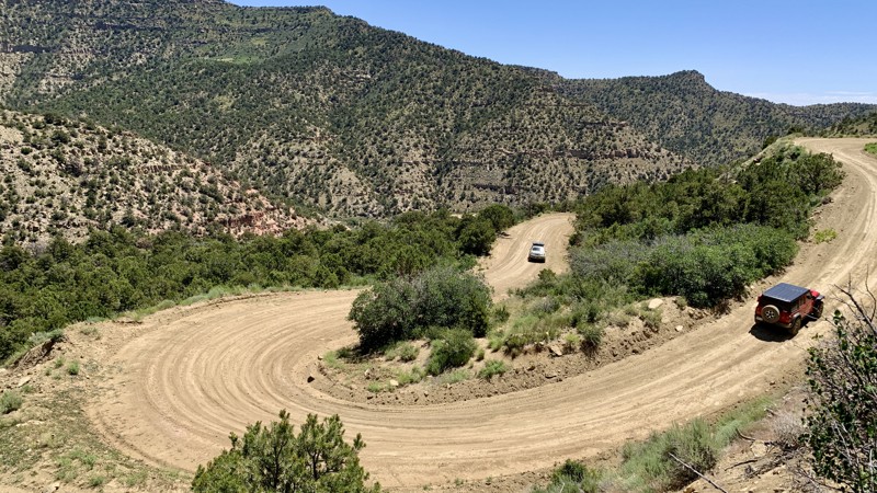
The Book Cliffs in Central Eastern Utah is a treasure trove of winding dirt roads providing explorers with nearly endless directions to travel. Book Cliff Ridge Road is a 67-mile-long gateway to the southern end of the Book Cliffs, climbing quickly from the valley below to the top ridgeline. Since this trail serves plenty of drilling and oil sites, it is well-maintained and suitable for just about any vehicle in optimal conditions. There are a few great camping opportunities at the top of the eastern climb, with designated sites tucked away in the trees providing plenty of room for 8-plus vehicles and all the passengers you can carry.

Updated: 04/13/2024
North Temple Wash
Hanksville, Utah
Deep in the heart of Utah is this legend of a trail, North Temple Wash. Not because of difficulty but because of scenery and dispersed camping. Following this astonishing jeep trail, you will be immersed in some of the most incredible surroundings such as tall cliffs, narrow canyons, intriguing rock formations, and stand-alone spires. Whether you enjoy climbing steep rocks or traveling long distances in your rig, you are sure to be amazed at what North Temple Wash has to offer. If you are in the southern San Rafael area, be sure to add this one to your list.
Updated: 07/17/2026
Green River Cutoff
Woodside, Utah
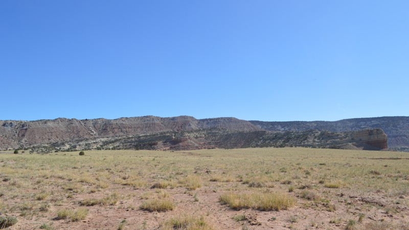
Running through the heart of the San Rafael Swell, the Green River Cutoff road provides access to everything this incredible place has to offer. Camping is abundant along its entirety and more side trails than you can count veer off the main road. This is a well-maintained road, so any vehicle should be able to travel without issue. Be sure to plan a fun-filled weekend and bring the whole family along on this one.
Updated: 09/21/2026
Peavine Corridor
Blanding, Utah
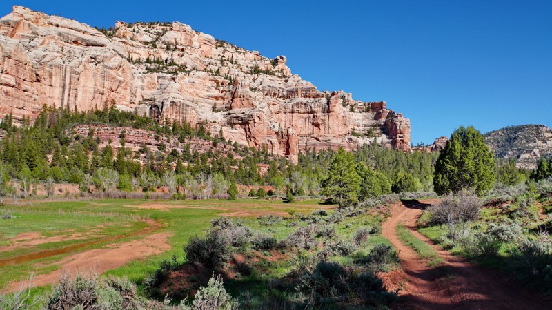
The Peavine Corridor trail is a hidden gem in the Manti-La Sal National Forest (now part of Bears Ears National Monument) that makes you wonder how it is allowed to exist. Traveling through a forested canyon surrounded by stunning red rock cliffs, the road follows a narrow corridor cherry-stemmed out of the Dark Canyon Wilderness when it was designated in 1984.
Though the rest of Peavine Canyon is in a Wilderness Area where no motor vehicles are allowed, this corridor allows motorized access deep into the heart of the canyon. Because of this, it has long been the bane of wilderness advocacy groups like the Southern Utah Wilderness Alliance, which have sought the closure of this road for decades. There is likely to be another major push to close it as part of the ongoing management planning process for Bears Ears National Monument, so be sure to drive it while you still can!
The road begins at a small trailhead with an outhouse off Elk Ridge Road and, from there, descends steeply into Peavine Canyon. This section is mostly a rocky shelf road with a few moderate rock ledge obstacles. Upon reaching the canyon floor, the road levels out and travels through the riparian area along a seasonal stream going down the canyon. The road is lightly traveled and difficult to follow here, as the floodplain it crosses can change significantly as a result of spring runoff and flash flooding from summer storms. Mudholes and washouts are common and there are several very steep wash crossings that could pose problems for vehicles with inadequate breakover angles. The MVUM does not always accurately show the road's location, so do your best to follow existing vehicle tracks and the few directional signs to avoid damaging the delicate terrain.
Almost 9 miles in, the road forks, with the fork to the right initially traveling up a creek and the left fork continuing across it. The right fork (FR 55378) is 2.5 miles long and leads to the historic Scorup Cabin site. However, the road is severely washed out 0.5 miles from the fork and is impassable to full-size vehicles past that point. There is a narrow dirt causeway with 10-foot drop-offs on both sides that an ATV or dirt bike could probably cross and continue, but it is too narrow to be safely crossed by full-size vehicles. The Forest Service is unlikely to repair the road past this point, so most vehicles will need to turn around here. The left fork (FR 50089) continues 2.25 miles past the fork and dead-ends at a hiking trailhead in Rig Canyon shortly after climbing a large rock ledge. The left fork also accesses the Dark Canyon West trail, which allows hiking access deeper into the Dark Canyon Wilderness.
Overall, the Peavine Corridor trail is a spectacular and challenging 4x4 trail that offers a very different experience than southern Utah is typically known for. While this trail would mostly be moderate in dry conditions, the significant ruts, mudholes, and tricky wayfinding in the middle section across a boggy floodplain merits a difficult rating. If you go alone, be sure to bring a winch line extension to be sure you can reach the nearest tree if you get stuck. While camping is allowed on this route, as long as your vehicle remains inside the motorized corridor, there are no established campsites along the trail. There are multiple excellent campsites along Elk Ridge Road near the trailhead.
Updated: 03/12/2025
Cottonwood Canyon Road
Cannonville, Utah
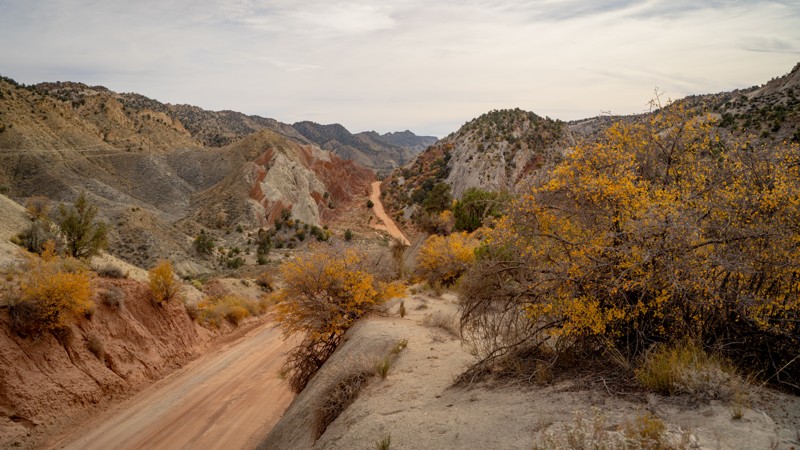
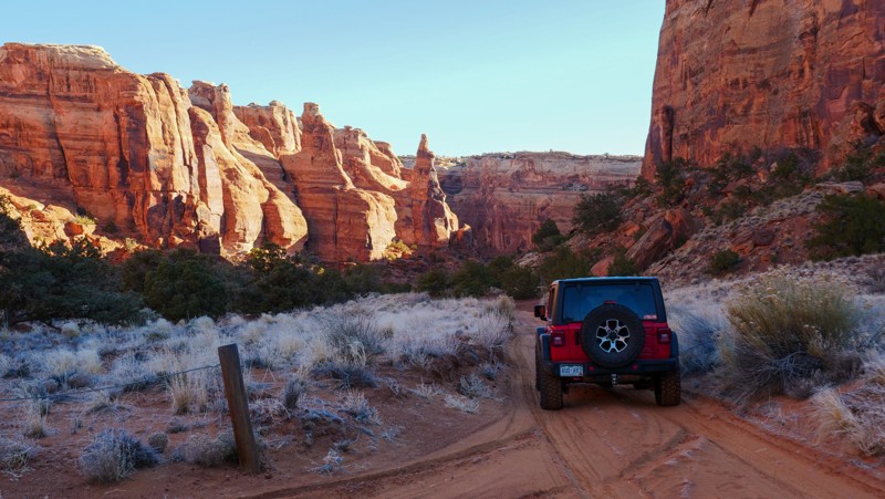
Cottonwood Canyon Road is a great addition to anyone's southern Utah overland adventure plans. Spanning across the Grand Staircase-Escalante National Monument, the geologic features from start to finish provide endless opportunities for exploration. Perhaps the most scenic area lies along the Cockscomb, part of the East Kaibab monocline, with near vertical sandstone beds that form a sinuous hogs back of prominent, multicolored ridges. Prominent backcountry hiking and camping areas can be found in various places along the trail, making it popular for outdoor recreators of all types.
Cottonwood Canyon Road also passes near another geologic wonder, the Grosvenor Arch. Named for Gilbert Hovey Grosvenor, president of the National Geographic Society and the first full-time editor of National Geographic Magazine, the double sandstone arch towers 150 feet above the surrounding terrain.
Updated: 04/28/2025
Bride Canyon
Moab, Utah
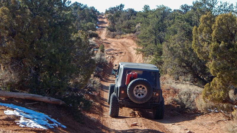
Bride Canyon is the only place you can camp along Gemini Bridges Road. The trail has five designated sites, all somewhat different from one another. Site 1 and 2 offer a little larger space and are flatter. While taking it in, don't forget to look up the north canyon wall to spot Bride Canyon Arch. Arrive early, as there are no reservations or fees associated with these sites. They are first come, first serve.
Updated: 02/26/2025
Trail Canyon (Dome Plateau)
Moab, Utah
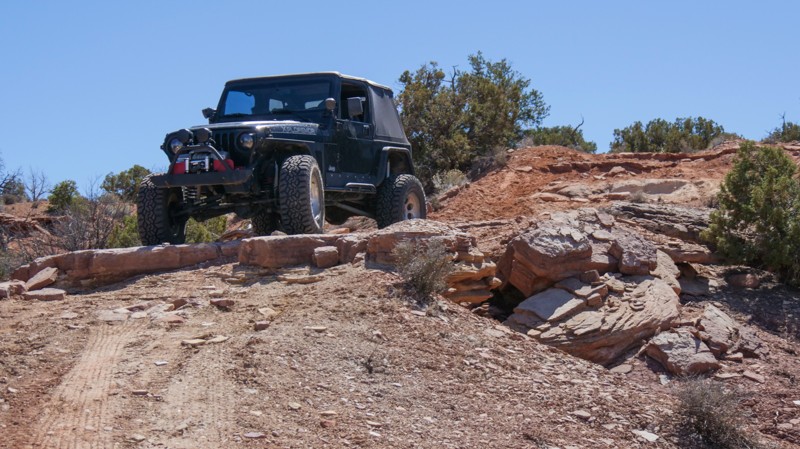
Traveling through the wide, highlands of its namesake, Trail Canyon takes users across the top of the Highlands before quickly dropping down into a rugged and dense tree-lined drained. In either direction, this section of the iconic Dome Plateau Loop adds a little difficulty when you plan to visit the Dome Plateau Overlook. This route also offers access to several lesser-known overlooks of the canyon and the Colorado River.
Updated: 12/26/2023
Mineral Point Road to Spring Canyon Bottom Road
Moab, Utah
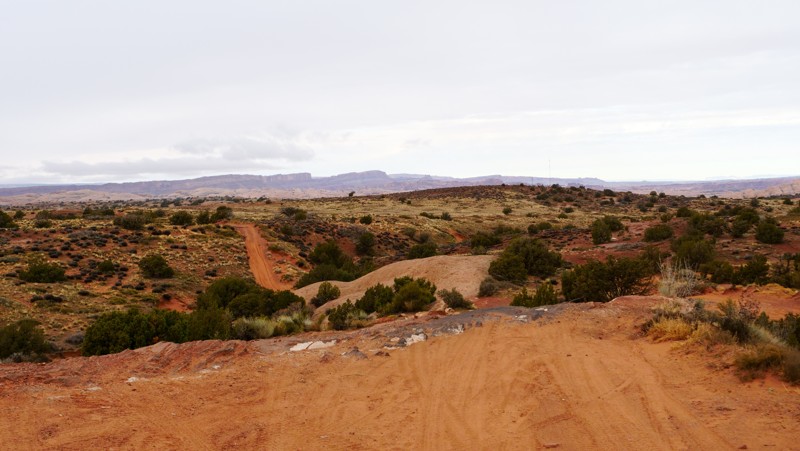
The iconic Hell Roaring Rim (HRR) route has become popular. Known as a family-friendly trail with spectacular views of the desert, this portion of HRR challenges even the most seasoned wheelers. Rocky ledges are overly abundant along this slow, bumpy traverse. You create the iconic HRR route and an all-day scenic adventure by connecting with the Mineral Point and Mineral Point Return via Hell Roaring trails. You'll wind through a diverse and well-preserved desert landscape with a hike to Tibbetts Arch and endless views of the canyons and distant mountains.
Updated: 06/10/2026
Fins and Things - Alternate Route (The Wall)
Moab, Utah
The Wall is an alternate route along the southern section of Fins and Things. It is one-way only, starting at Waypoint 15. It provides one of the more undulated obstacles throughout Fins and Things, meaning this obstacle is not smooth. If you are new to offroading, you will want to disconnect your sway bars and most likely have a spotter. If you are looking for more difficult options, this one won't take that much time to run as it is very short!
Updated: 04/22/2026
Yellow Cat Road
Thompson Springs, Utah
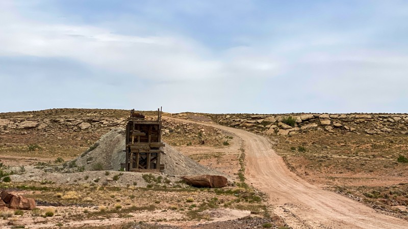
The road is as easy as it gets. It is a "B" designated route, meaning it gets maintained. It is one of the main roads in the area from its namesake, "Yellow Cat." The uranium mining boom of the 1950s used to make nuclear power and weapons. The road will change on the southern edge from flat roads with an open plains feel and begin to expose fascinating rock formations of all shapes and sizes with colors including white, red, and purplish, all with the La Sal Mountains looming in the background. Old mining ruins dot the route. The road has only minimal pre-existing camping opportunities. The trail is a narrow, steep shelf road comprised of clay that can become impassable when wet. There is also a wash towards the northeast that could be problematic in the rain.

Updated: 01/24/2024
Sego Canyon
Green River, Utah
Whether passing through on I-70 or exploring the Book Cliff trails, this historic and immersive drive through Sego Canyon will elevate your opinion of this desolate landscape. Starting at 5,500' and ending at 8,500', this easy trail packs a bunch of history and scenery in just over 10 miles. The trail slowly begins to leave the rugged flat desert after a short stop at the Sego Cemetery, where some of the town's residents were laid to rest. Continuing up into the cliffs, you will see signs of an abandoned railroad spur built in 1914 to retrieve coal from the town of Sego. An impressive 13 bridges had to be constructed to crisscross the creek. As you approach the ghost town, you will see the small stone buildings being overtaken by nature, but one structure still stands tall. The American Fuel Company Store was built in 1911 and still has all four walls standing today. The now crumbling town reached its peak in the 1930s when the mine employed 125 miners, and the town had approximately 500 residents. Continuing through a seemingly hypnotizing canyon, you'll have more opportunities to see how the early settlers lived when you stop at the stone and log cabins. The now vertical cliffs become much tighter while precariously balanced rock spires threaten to tumble down at any moment. The vegetation changes dramatically as you switch back to the top, where you enter a dense pine and aspen forest, ripe with memorable camping on the rim.

Updated: 04/09/2024
Winter Solstice Road
Fairfield, Utah
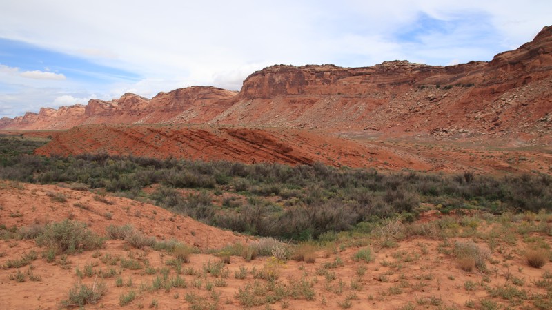
This is a gorgeous trail just west of Utah Lake. You gain elevation quickly and get rewarded with great views. It is a relatively mild trail allowing SUV's of all sorts to reach the mines and enjoy a day away from the city. This trail also serves as a quick emergency exit to the more challenging trails in the network in case you have any breakages, injuries, or other emergencies. Although there are no major obstacles, it is a nice trail to cruise up or down if you are in the area.
Updated: 01/28/2025
Comb Wash
Tselakai Dezza, Utah
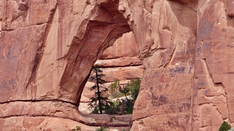
Comb Wash runs between Highways 95 and 163 along the western side of Comb Ridge, a prominent 80-mile towering sawtoothed monocline. The trail also connects with historic Snow Flat Road. The normally easy graded dirt road crosses its namesake wash several times and is often impassable after heavy rains. While there is a smattering of campsites along the trail, an area of ancient cottonwoods hosts an informal campground on the northern end. Picnic tables, fire pits, and vault toilets are scattered throughout this popular camping area.
Updated: 05/28/2026
Arch Canyon
Blanding, Utah
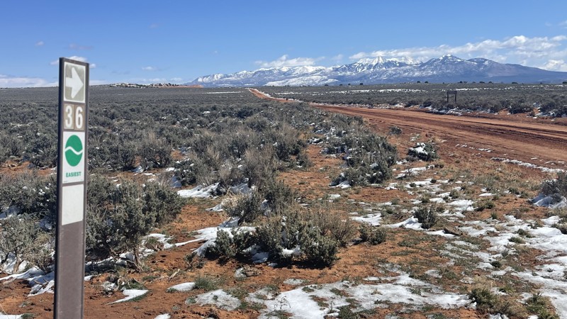
Arch Canyon combines the three things you look for in a southeastern Utah adventure. Those, of course, are epic sandstone geology, ancient history, and fun wheeling. The ruins of an Ancestral Puebloan cliff dwelling rests in a south-facing alcove. The building techniques vary between the structures, evidence this site was inhabited several times over its long history. Petroglyphs pecked into the sandstone tell an unknown story. The trail crosses several boulder-strewn sandy washes, and the canyon's brush may add to your rig's pinstripe collection. The trail ends at a grove of pines that make a great picnic spot or campsite. Look high on the high north wall of the canyon for its impressive namesake arch.
Updated: 10/15/2024
Box Car Loop
Spanish Valley, Utah
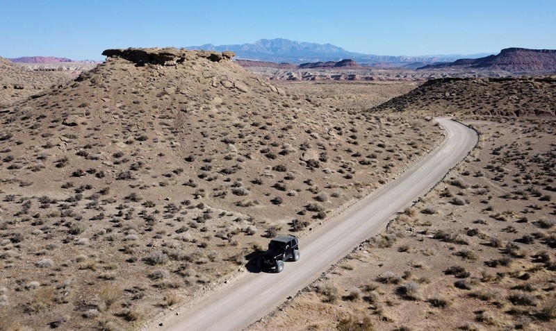
If you are looking for a trail that not many know about and definitely away from the bustle of Moab, "Box Car Loop" is the answer. This fun 19.57-mile loop starts and ends on the Needles Overlook Road. The trail is a mix of fast pasture sandy road with some whoops. There's a technical downhill section into a lower canyon, and then the trail climbs back up on some slickrock. There are several lookouts into Trout Water Canyon, which is the location of the Kane Creek Canyon trail. There are a few camping spots to be found, so this might make a great trail for exploring overland style.
Updated: 06/19/2022
Navajo Road
Saint George, Utah
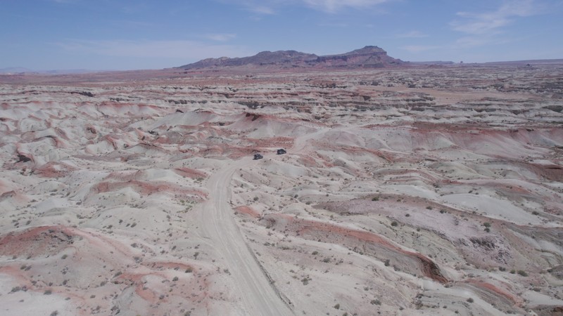
Navajo Road is the gateway trail to a vast OHV area located outside St. George, Utah. This high desert region of southern Utah has a sprawling network of 4x4 hiking and mountain bike trails. The staging area at the trailhead is a large parking area for the start of many mountain bike trails. All along the early sections of the route, there are countless primitive campsites to choose from. The trail winds through a couple of scenic canyons before climbing high above the valley to Joshua Tree Scenic Byway and the Beaver Dam Mountains. The trail can be connected with others in the area for an easy but scenic day on the trail or just getting to Bloomington Caves along Hollow Washington trail.
Updated: 01/09/2026
Lower Last Chance Loop
Whipup, Utah
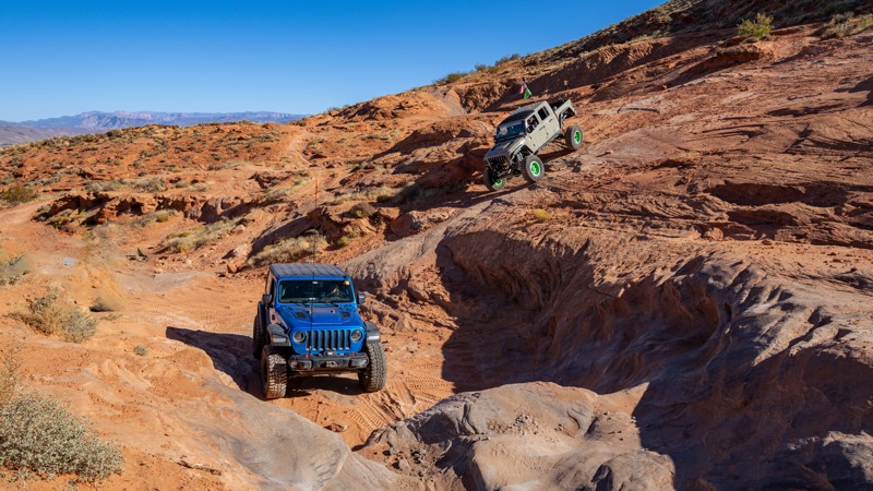
Lower Last Chance Loop road is a very scenic route from the north end of Capitol Reef towards I-70. This easy route is full of diverse and multi-colored and diverse landscapes. It is also home to the Mussentuchit Sand Dunes. There are no established campsites; however, this road is on BLM land.
Updated: 12/12/2023
John's Trail
Washington, Utah
Located in the Sand Mountain OHV Area, John's Trail is a popular trail for those seeking out steep slickrock climbs and descents. Beyond constant views of the sky, you'll often find yourself reaching out for balance like a Jack Sparrow pirate walk, as you tiptoe and sway through many technical off-camber challenges. This tire-chirping trail offers a continuous adrenaline rush from beginning to end and is a must-do for aggressive off-roaders looking to advance their skills.
Updated: 10/15/2024
Cow Dung Road
Hanksville, Utah
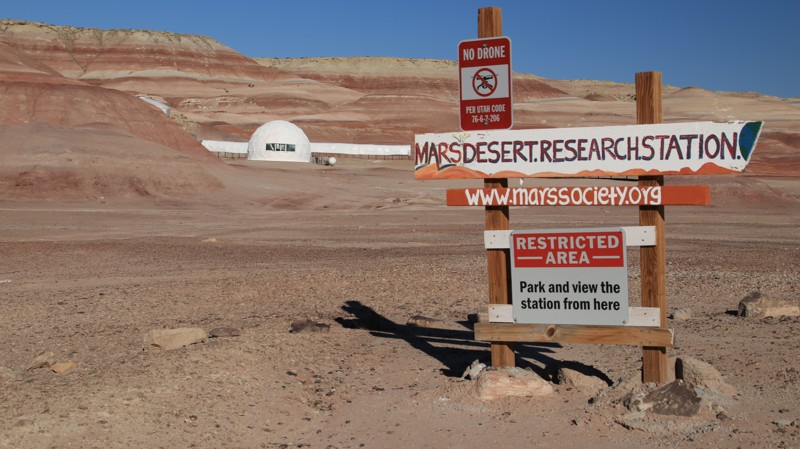
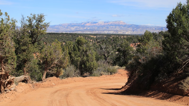
Cow Dung Road runs north from Highway 24 through a moonscape of multi-hued bentonite hills ending at an overlook with views of Muddy Creek. Along the way, the trail passes the Mars Research Station and the Hanksville Burpee Dinosaur Quarry. So if the trail's name doesn't pique your interest, maybe dinosaurs and Martians will.
The bentonite hills provide the otherworldly setting for the Mars Research Station. It is on Utah State Trust land, so you may only view it from a small pullout. The dinosaur quarry, behind a wooden fence, has a large parking lot suitable for camping. A few small campsites sit near the beginning of the road. Factory Butte looms on the western horizon on the latter portions of the trail.
The trail is graded to the dinosaur quarry. After the quarry, it becomes a narrow two-track to the end. Rains may cause the bentonite to become so slick that the road is impassable.
Updated: 07/03/2026
Skutumpah
Canyon Point, Utah
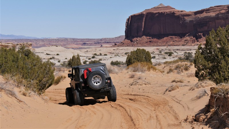
Skutumpah (pronounced scoot um pa) runs east-west through the Grand Staircase Escalante National Monument from the intersections of Johnson Valley Road and Glendale Bench in the west to Cottonwood Canyon Road near Cannonville in the east. The graded road is easily passable in 2WD vehicles unless wet. When wet, the road becomes essentially impassable in any vehicle. The clay surface becomes exceptionally slick, providing virtually no traction. The road has deep ruts, steep grades, and hairpin switchbacks on the eastern end. Emergency contact stations are every 5 miles along a good portion of the remote road.
The western end is relatively dull but offers good views of the orange and pink cliffs of the Bryce Canyon area. The road crosses Deer Springs Ranch, a large plot of private land. Watch out for cattle on the trail. The eastern half of the road is far more interesting. A bridge crosses Bull Valley Gorge, a challenging canyoneering destination. Take a moment to walk onto the bridge and look down into the impressively deep sandstone gorge. Willis Slot Canyon is an easy 2-mile round trip hike through a scenic slot canyon. The trailhead has plenty of parking.
Camping is limited. The best dispersed campsite on the western end is 2 miles into the track across from one of the emergency rescue beacons. The shaded site can host up to 5 larger rigs and is suitable for tent camping. A mile from the eastern end is a superb camping area on the edge of a ridgeline capable of hosting 15 to 20 vehicles while still providing privacy. The best sites have impressive views, with Powell Point dominating the skyline. Deer Springs Ranch offers cabins and campsites. Plenty of commercial camping and lodging options exist in Cannonville, Tropic, and the beautiful Kodachrome State Park.
Updated: 05/13/2025
Duma Point Road
Green River, Utah
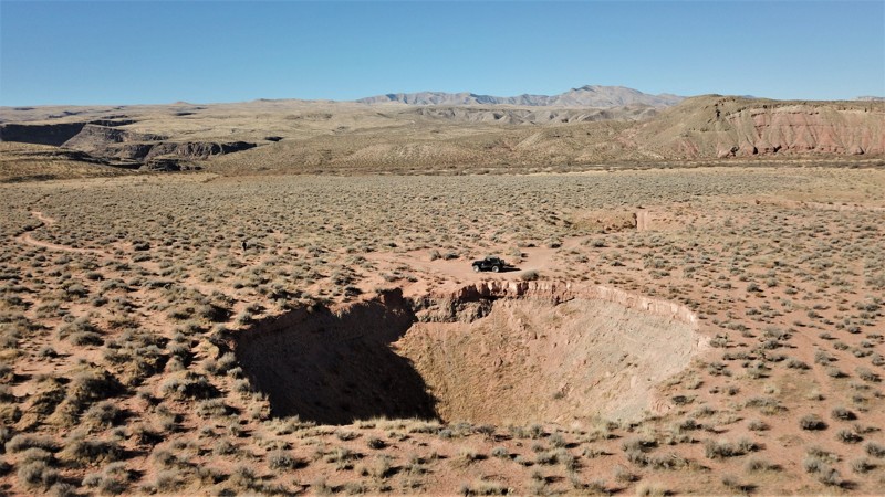
Are you looking for an oasis in the desert? How about welcoming shade and a flowing creek in the middle of Utah's red desert? Dripping Springs is the start of a riparian beltway stretching to the banks of the Green River. The dense trees and vegetation thriving within Ten Mile Canyon are a hiker and bird watcher's paradise. In the winter, look for predator birds nesting within the nooks of the cliff walls. The shade under the cottonwood trees in the summer is a welcome reprieve. Gold-colored fall leaves create a vibrant contrast to the surrounding rock formations. When combined with other nearby trails, Duma Point Road adds a unique cooling break to an otherwise hot day in the high desert.
Updated: 05/06/2024
Big Round Valley
Saint George, Utah
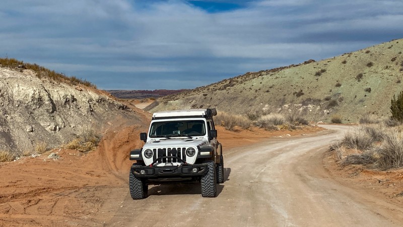
Sinkholes are surface depressions or holes created by the collapse of an underlying cave. We've all seen stories on the news about sinkholes in Florida swallowing cars and entire houses, but most people wouldn't expect to find them in Utah. However, sinkholes do occur in Utah. Some have even swallowed and diverted rivers. For several months in 1985, a sinkhole diverted the entire Virgin River, 2 miles east of Pah Tempe Hot Springs. A similar occurrence happened in 1996 when La Verkin Creek disappeared into a sinkhole for nearly a week. These holes were eventually backfilled to restore the water flow.
Big Round Valley trail travels to an area where multiple large sinkholes can be seen and even driven through. The most spectacular of the sinkholes is large enough to swallow several houses. It occupies over 1/10 of an acre, measuring approximately 80 feet in diameter and 60 feet deep. This and other nearby sinkholes are found in stream-terrace sediments that were deposited by the Virgin River before it carved out its current channel.
Updated: 09/23/2026
Mill Canyon - Tusher Road
Moab, Utah
Mill Canyon is also known as Tusher Road. It is graded and easy to follow with plenty of traffic. It leads to several other more famous trails such as Sevenmile Rim, Tusher Tunnel, Bartlett Wash, Monitor and Merrimac Jeep Trail, and Courthouse Pasture. There are also designated campsites along the route and hikes to dinosaur tracks.
Updated: 02/16/2024
Coyote Canyon
Moab, Utah
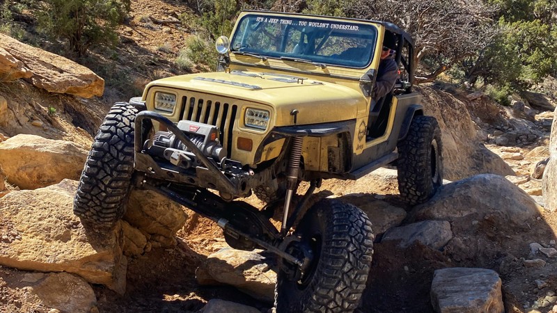
Coyote Canyon is a rock crawler's dream trail. Located just south of Moab, the loop is .65 miles of continuous rocks and challenges. Big climbs, tight maneuvers, and multiple lines will keep your attention glued to the trail for the entire trip. Ascending obstacles, descending obstacles, careful tire placement, and expert spotting is required to complete the route unscathed. If your rig has a weak point, Coyote Canyon will be sure to point it out. It's not every day you get a chance to have your own private rock crawling trail, and that's why Coyote Canyon should be on your bucket list!

Upgrade your Membership
Unlock all of the details on every Trail Guide and Scout Route.
Start a 7-day Free TrialBrowse Trails in Utah by City
Browse every Utah city with offroad trail guides.
Community
Partners

