










By clicking "ACCEPT", you agree to be the terms and conditions of each policy linked to above. You also agree to the storing of cookies on your device to facilitate the operation and functionality of our site, enhance and customize your user experience, and to analyze how our site is used.
Utah Off-Road Trails
359
Total Trail Guides 334

4759
Detailed Waypoints 925
Try a Free 7-Day Trial and unlock it all
Start a Free Trial Most Recent Trail Reviews
No Rating
Open
Visited: 09/24/2026
This trail has been graded recently and is now an easy trail.

IE
Ingrid Enyeart
Rated 5/5
Partially Open
Visited: 09/22/2026
The portion of the trail between the fork at 11 and the fork at 13 has two major ledges that have formed going into and out of the wash. Not sure what vehicle could overcome these. So just take the sc...


CI
Christine Irsik
Rated 4/5
Open
Visited: 09/22/2026
We enjoyed this trail and will definitely do it again. Gorgeous views at many points along the trail. We didn’t try The Wall, but everything else was just enough of a challenge for us and nice that m...
LF
Leslie F
No Rating
Open
Visited: 09/22/2026
Drove out here in a thunderstorm after doing dome plateau overlook. Epic camping. peaceful. unparalleled views. trail had two steep rocky sections I used 4wd low but probably didn't need to.

JR
jon ross
No Rating
Open
Visited: 09/21/2026
This is a short 2 mile of so cut off trail. Has a wash out with a by pass half way through.



Earl Neisler
Earl Neisler
Rated 2/5
Open
Visited: 09/21/2026
Pinstripe Alley nonstop for the first 4 miles. INo view to be had until waypoint 7. It was a beautiful view then we turned around. Should’ve read the reviews before we started the trail, because th...
LF
Leslie F
Rated 5/5
Open
Visited: 09/21/2026
This is a highlight for the trip. We stayed at waypoint10 for the night.


Earl Neisler
Rated 4/5
Open
Visited: 09/21/2026
Nice connector. The short out back was the hardest and not that short.


Earl Neisler
Rated 4/5
Open
Visited: 09/21/2026
A well maintained road. Found a nice camp site on the south in.
Earl Neisler

Jesse Martin
Jesse Martin
Rated 5/5
Open
Visited: 09/20/2026
Great area to go camping and gather for family reunions. There are multiple other trails that fork off throughout the trail to explore.

Dustin
Earl Neisler
Rated 5/5
Open
Visited: 09/20/2026
Only did apart due to time. This is 1 I will come back and finish.

Earl Neisler
Rated 3/5
Open
Visited: 09/20/2026
Not much to say it a slow easy. A good connecting trail.
Earl Neisler
No Rating
Open
Visited: 09/20/2026
We started just south of Cottonwood Canyon. We stop and looked but could not fine the rock art. The area was a nice to see all the green.


Earl Neisler
Rated 4/5
Open
Visited: 09/19/2026
Great trail, we drove through waypoints 24-35. Easy ride with a good amount of mud holes with few ruts on the stretch we drove. Would love to complete the whole trail at a later date.
Dustin
Rated 4/5
Open
Visited: 09/19/2026
Fun easy trail. Great way to get out and enjoy a relaxing trail ride to take in nature and see the fall colors.
Dustin
Rated 5/5
Open
Visited: 09/19/2026
Great Trail! The scenery was good with lots of wildlife. The trail was diverse that give drivers the opportunity to use both high and low four wheel drive. Trail has both wide and narrow areas.
Dustin
Rated 5/5
Open
Visited: 09/18/2026
I run this trail every year. Always fun and beautiful views. Fair amount of off camber sections.

Jeff Klaassen
Rated 5/5
Open
Visited: 09/18/2026
This was a good trail. The trail still had so flood damage but was passable. Highly recommended this. Has some all some view. We took 2 day to enjoy the ride and views.


Earl Neisler
No Rating
Open
Visited: 09/16/2026
Very fun, short trail. We did the loop but not Wipeout Hill. The sandy sections were a blast and there were a few ledges and obstacles that probably warrant a 5 but are still a fun challenge. We did i...



Mark Signorelli
Rated 4/5
Open
Visited: 09/15/2026
Ran this one and it's a decent stretch for anyone with a high clearance 4x4. The early sagebrush section had me watching my GPS track closely since the road nearly disappears a few times, but it alway...



Jay North
Official Crew
Rated 4/5
Open
Visited: 09/15/2026
Ran this as a quick add-on while working through the rest of the Red Hills network, and it's a fun one to knock out in under an hour. The wash crossing is the one spot where you actually have to think...


Jay North
Official Crew
Rated 3/5
Open
Visited: 09/15/2026
Ran this one on a dry afternoon and came away satisfied without being blown away. The rocky, rolling grade keeps things interesting without ever feeling out of reach for a stock high clearance rig, th...


Jay North
Official Crew
Rated 4/5
Open
Visited: 09/15/2026
Ran this one on an afternoon when I didn't have time for a full day out, and it delivered more than I expected for a short climb. The hill about a mile in makes you actually think about your line, and...


Jay North
Official Crew
Rated 4/5
Open
Visited: 09/13/2026
Red Peak Road is a short, easy cruise that's mostly smooth dirt with just enough texture to keep it interesting. There's a mild rough patch early on and a slightly rockier stretch past the halfway poi...


Jay North
Official Crew
Rated 2/5
Open
Visited: 09/13/2026
This is an easy, low-key cruise with a short technical bump right in the middle where it ties into the rest of the network, otherwise it is just packed dirt and gravel the whole way. Nothing here dema...


Jay North
Official Crew
Rated 4/5
Open
Visited: 09/13/2026
This one's an easy, mellow cruiser and it shows in how quick it feels behind the wheel. The rocky spots near the start and about two thirds up are barely worth mentioning, just some careful tire place...


Jay North
Official Crew
Rated 5/5
Open
Visited: 09/13/2026
This one's a fun add-on if you're already out in the area, easy enough for most of the way that a stock rig won't break a sweat, with just a couple of hard spots to keep things interesting. The washou...


Jay North
Official Crew
Rated 4/5
Open
Visited: 09/13/2026
A nice view of Kanab. Steepish and possibly slick when muddy. One spot has a small rock shelf. 4x4 recommended.


Ben Ruddell
Official Crew
Rated 3/5
Open
Visited: 09/13/2026
Easy, suitable for high clearance 2WD on a dry day, though four wheel drive earns its keep if the ground's been wet. The ruts along the way are mild and easy to place your tires around, and the two wa...


Jay North
Official Crew
No Rating
Open
Visited: 09/12/2026
Crazy no reviews since I ran it last May. We ran it again this time the whole trail out to the south overlook. It had rained the night before and into the morning. The rock dried up quick but a lot o...



Andrew Hotton
Rated 5/5
Open
Visited: 09/12/2026
Sand dunes. DANGER, you need to know your technique to head in here. It’s easy to misjudge slope and camber and get stuck or worse roll.


Ben Ruddell
Official Crew
Rated 3/5
Open
Visited: 09/12/2026
The section of the trail was rocky and rough - still fairly easy but the rockiest stretch.
WF
Wyatt Frampton
Rated 4/5
Open
Visited: 09/12/2026
This trail checks so, so many of the boxes -- hanging off a cliff, passing within 4" of rocks on BOTH sides at the same time on narrow sections, meaningful obstacles (ledges) where I smacked my hitch ...
IR
Isaac R
Rated 3/5
Open
Visited: 09/12/2026
This is an easy, high clearance 2WD road, easy enough that the drive itself isn't the draw. The shelf road stretch is mild and only about two jeeps wide, so keep an eye out for oncoming traffic, and t...


Jay North
Official Crew
Rated 2/5
Open
Visited: 09/12/2026
This is a mellow, low-stress drive that rewards a relaxed pace more than any technical challenge. Stock high clearance handled every mile without a second thought, and the surface stayed predictable e...


Jay North
Official Crew
Rated 5/5
Open
Visited: 09/11/2026
Great rest quick trail! Perfect for beginners, fun place for a picnic. The entrance and exit terrain to the tunnel changes depending on the weather and use. Very fun and interesting.


Dustin
Rated 4/5
Open
Visited: 09/11/2026
My route didn’t originally include this trail, but one of my crew broke on impossible hill and we had to limp back to civilization. This trail was beautiful and remote. Difficulty wise, no issues on t...



Dewie Jones
Official Crew
Rated 4/5
Open
Visited: 09/10/2026
Way better than I thought it would be. This was simply a connector trail for my unsuccessful (broken Toyota) Blanding to Moab overland trip. The trail is absolutely beautiful, relatively fast access, ...
Dewie Jones
Official Crew
Rated 3/5
Open
Visited: 09/10/2026
Easy enough that I did this road in pitch-black with just headlights (no light bar or anything) on the way to see sunrise from the end of the trail (Hurrah Pass). Really straightforward, just rocky li...
IR
Isaac R
Rated 4/5
Open
Visited: 09/10/2026
Incredibly beautiful road and not really rough at all -- I did a bunch of with fully-inflated tires. I know it's just a connector but honestly I would 100% come out here again to enjoy the views, hang...
IR
Isaac R
Rated 4/5
Temporary Closure
Visited: 09/10/2026
Deep mud around river crossing prevents passage. We came from Goblin Valley side, we were able to cross the river but there was deep mud on south side due to recent rains. Almost got stuck, had to go ...

Thomas A Youngerman
Rated 5/5
Open
Visited: 09/09/2026
Incredible bucket list trail that you must do if you can. DON'T do it in 1 day unless you like rushing it, unfortunately circumstances changed that required us to rush it. It's gorgeous and worth an o...



Sean Allen
Rated 5/5
Open
Visited: 09/09/2026
I built this into our rocklanding/overland route and really enjoyed the adventure. You can tell this isn’t well traveled which added to the experience. With that said, we’re trying to get to Moab from...


Dewie Jones
Official Crew
Thomas A Youngerman
Rated 5/5
Open
Visited: 09/08/2026
Great as always, high rewards in terms of views and nothing crazy in terms of obstacles. Great first trail for someone to do with a great payoff!


Sean Allen
Rated 5/5
Open
Visited: 09/08/2026
Fun trail, would run again. Had lunch between Monitor and Merrimac buttes.


Thomas A Youngerman
Most Popular
Updated: 05/04/2024
Bartlett Flat
Moab, Utah
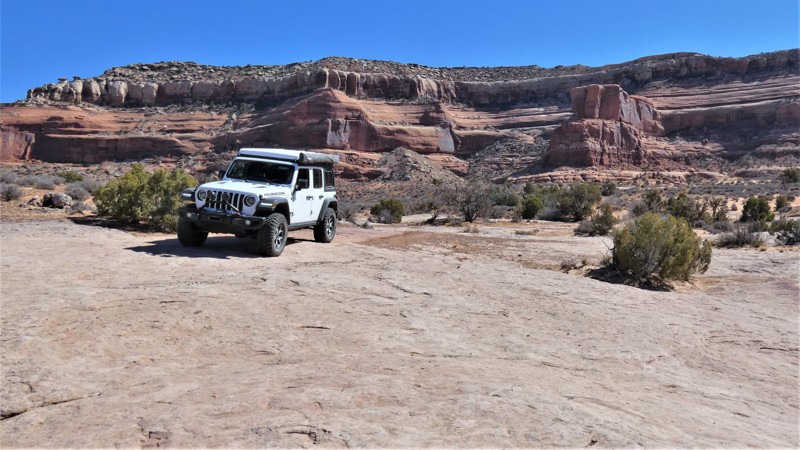
Take a leisurely scenic tour along one of the lesser-known trails in the region. Bartlett Flat is an excellent alternative to the more congested trails within the area. The trail easily travels below a towering red cliff before zigzagging through the scattered rock formations that dot the valley. You'll roll through long stretches of bright red sand and across long, solid rock slabs. For the cautious traveler or less experienced rock crawler, connecting this with Bartlett Overlook is a fun day and an ideal way to experience Moab without all the risks of challenging obstacles.

Updated: 04/10/2026
Pole Canyon Rim
Dewey, Utah
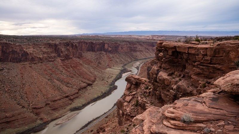
With birdseye views 1,200 feet above the Colorado River, Pole Canyon Rim is an amazingly scenic in-and-out trail that leads to several overlooks. Beginning and ending on Entrada Bluffs, the trail starts as a fairly easy dirt and slickrock track passing Mule Shoe and Pole Canyon, with several campsites overlooking this canyon. As you continue south, the road becomes rockier and rougher, encountering small ledges less than 10 inches. A few miles in, the trail intersects with Powerpole Rim, where you can continue along the moderate and rough route or take a much harder Powerpole route to the rim overlooks. Eventually, the trail turns sharply and heads northwest, forking one more time. The southernmost fork leads to a rim-side overlook high above the Colorado River, and the northmost fork leads to a plateau overlook with 360-degree views. This northwest stretch of trail is quite narrow as it weaves through thick brush, and pinstriping is likely. There is plenty of opportunity to camp at the end of both fingers and amazing views in all directions.
This trail is suitable for any high clearance 4x4 or AWD vehicle. Low-range will likely not be used during your travels, but airing down is highly encouraged to ease in comfort of the ride.
Updated: 10/07/2025
Plan B
Hurricane, Utah
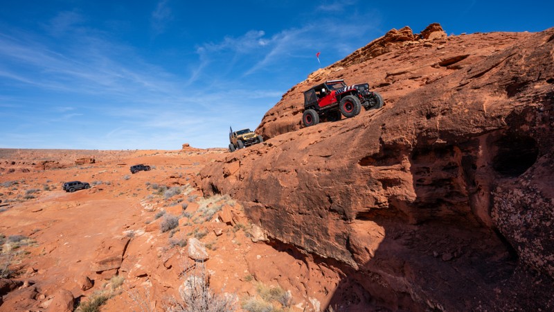
Located south of the dunes, on the cliffside edge of Sand Mountain, Plan B is an adrenaline rush from start to finish with countless climbs, drops, cracks, off-camber leans, and optical illusions next to a towering cliff face. This trail travels through tight canyons with gravity-defying walls. It traverses white-knuckle shelves next to sheer drop-offs as you try to keep your focus on the trail and off the spectacular views of the Arizona Strip and Warner Valley. If you are looking for a trail to make you pucker and conquer obstacles that leave you certain the vehicle is on the edge of rolling, this is the trail you need to head to.
Updated: 08/11/2026
South Fork Canyon
Oakley, Utah
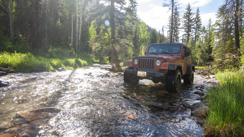
A ride up South Fork Canyon is a rugged backcountry experience just a few miles east of Oakley. You'll be crawling in 4-wheel low through a river, up steep rocky slopes, through a rock quarry, and amidst narrow forest roads. The trail follows a canyon up into the mountains near the headwaters of the South Fork of the Weber River. Head up there in late June or early July, and the river will be running fast. This trail will test your skills, providing adventure at every turn.
The trail begins off Weber Canyon Road about five miles east of Oakley. The first two miles are a public road through private residences. Please respect the private property with no stopping along this stretch. After crossing the creek about a mile in, follow the signs to the left for South Fork Canyon. The entrance to national forest property is not marked, but you'll know once you leave private property, going through a dense grove of trees and on into the river bed.
You'll want to be 4WD-low the entire route once you're into the national forest. Watch for ATV traffic since the trail is narrow. You'll actually be running in the river in the spring and early summer. Be cautious on uphills as the rocks require good tire placement. Nearing the end, you'll break out of the forest into a massive rock quarry. The trail eventually ends at a heavily-eroded section of the South Fork.
You'll find an old mine if you hike up another mile via South Fork to Maxwell's Creek. Inside are names inscribed on the walls with dates back to 1930. There is a geocache hidden nearby called Rowe Mine Cache, which will get you the approximate coordinates of the mine.
South Fork Canyon is a dangerous trail in the spring with river flow. It is closed from May 1-June 15. It's best accessed from late June up through mid-October. Most of the trail is located in the Uinta-Wasatch-Cache National Forest, with dispersed camping permitted. There are several sites lower down, not far from the river crossing. As pictured, there are also possible sites along the trail and at its terminus.
Updated: 11/04/2025
Secret Spire
Crescent Junction, Utah
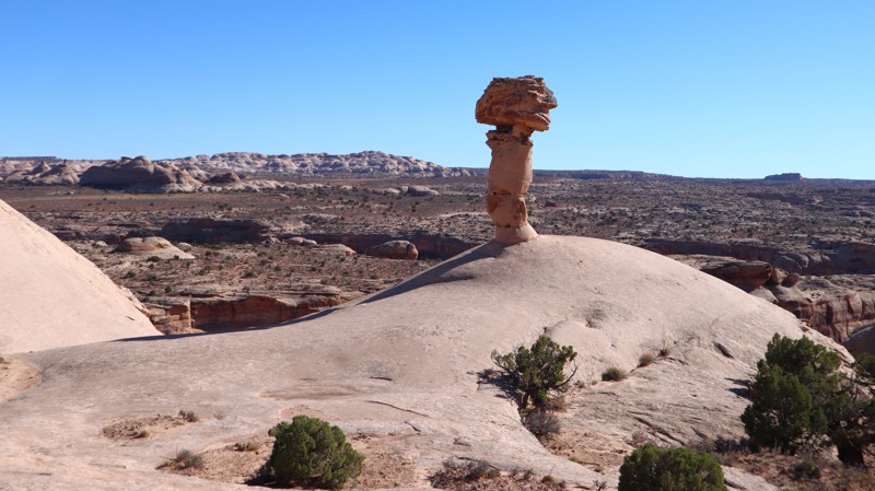
Part of an Easter Jeep Safari route, Secret Spire is a short, scenic drive across sandy two-track and slickrock on the mesa between Hellroaring and Spring Canyons. It rolls over small sandstone ledges that flex suspension and lightly test traction while staying beginner and stock-friendly. What it lacks in difficulty, it makes up for in scenery and geology, with flowing Navajo sandstone, sculpted hoodoos, and the namesake mushroom-shaped spire perched on a smooth dome at the halfway point.
Updated: 02/19/2024
The Maze
Hurricane, Utah
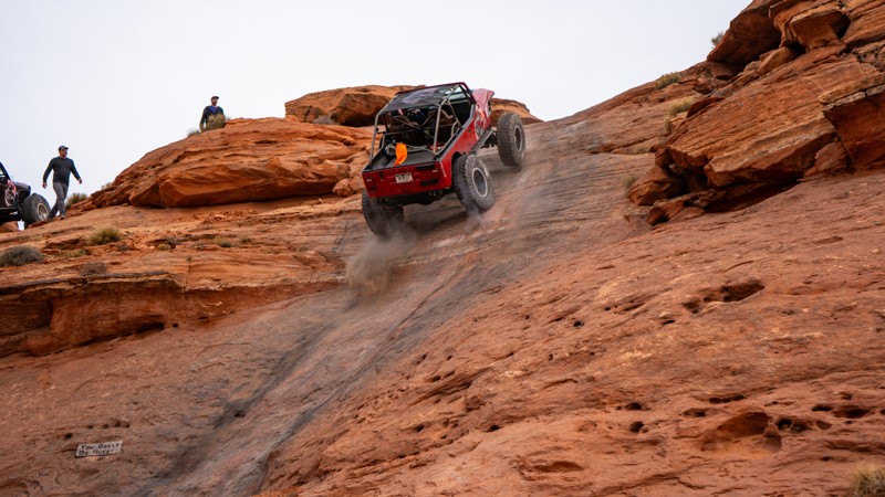
Located along the southern rim edge of Sand Mountain Open OHV Area, The Maze is a non-stop adrenaline-rushing technical rock crawling trail, with continuous obstacles traversing gravity-defying ascents and descents, seat-puckering off-camber situations, and heart-pounding cliff exposures with over 1,000-foot drops. Relentless twists and turns through millennium-old rock formations and countless optional routes that sometimes lead back to the main trail and sometimes lead to nowhere severely test your navigation skills as you make your way through this trail. The Maze is a popular, must-do trail for anyone looking for a hardcore challenge.
Updated: 06/05/2022
Dee Pass
Green River, Utah
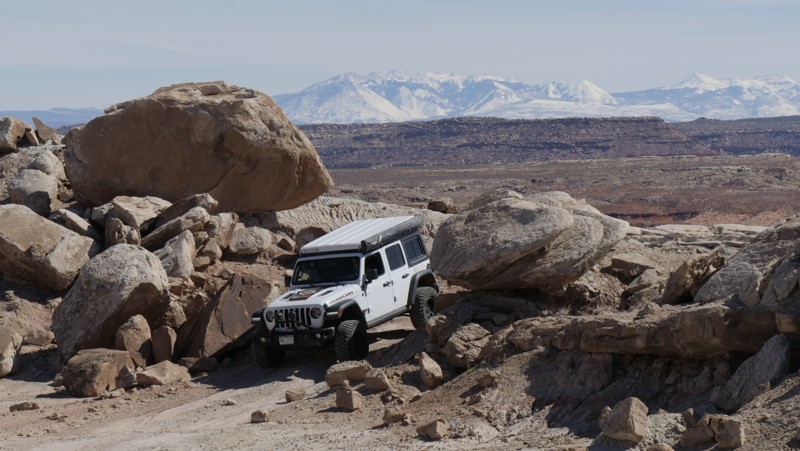
Four-wheeling on the moon. That's how traversing this rugged, but oddly serene Utah desert trail feels. The different layers of colored dirt create a kaleidoscope of colors. The ground is virtually void of plant life, yet the landscape is alive with color. Dee Pass transports you over numerous colorful and rocky hills with unique panoramas. The La Sal Mountains create a perfect backdrop as you weave through the maze of balance rocks and narrow ledges. Dee Pass is not your typical Moab trail but part of the Easter Jeep Safari Crystal Geyser route.
Updated: 12/26/2023
Merrimac and Monitor Butte Viewpoint
Moab, Utah
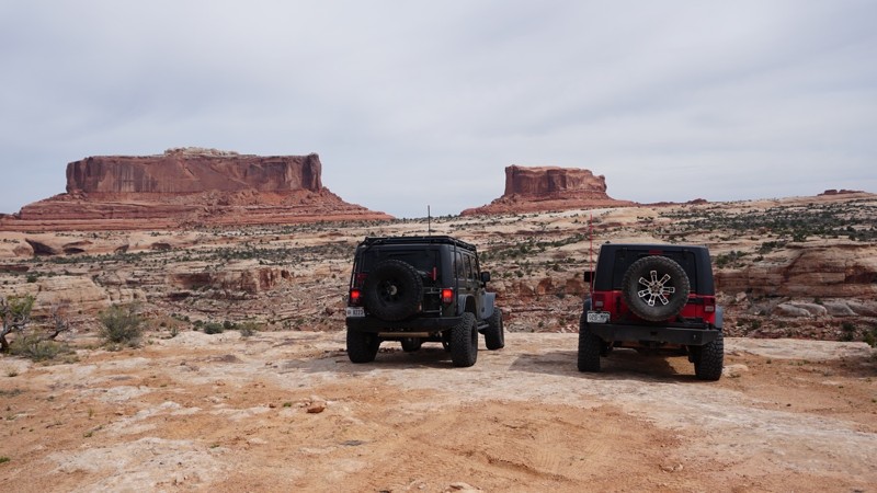
Situated on the way to Canyonlands Island in the Sky District and Deadhorse State Park, this offroad trail is hidden amidst the paved and improved tourist areas directly off Highway 313. Named after the famous Merrimac and Monitor Civil War-era ironclads, it makes for a quick side trip when wheeling other trails in the Moab area. While not the most amazing trail, it takes you to a more up-close and personal view of Merrimac and Monitor Buttes and gives you a good bird's-eye view down into Seven Mile Canyon. It is perfect for the person looking to get used to driving offroad before tackling the more challenging trails in the area.
Updated: 08/11/2026
Timpooneke Road
Sundance, Utah
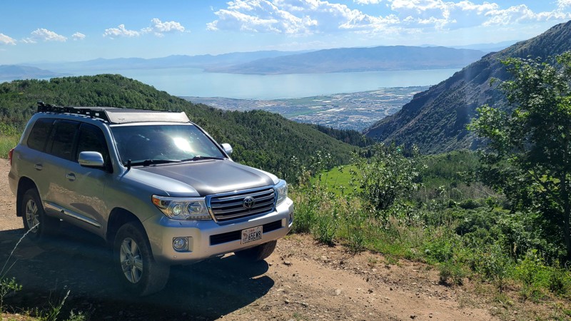
Traversing the western face of Mount Timpanogos in the Wasatch range, Timpooneke Road is a roughly 10-mile gravel out and back that offers unmatched alpine views of the Utah Valley below. The road has no technical challenges, and any AWD vehicle can access most of what this trail has to offer. Beginners should know this two-way trail can be narrow, a little rocky, and includes portions that parallel very steep cliffs.
Campers can also enjoy this beautiful stretch. The road begins at a National Forest campground and offers a dozen or so dispersed sites along the route. Sites have spectacular views of surrounding mountains and/or the cityscape below or might be tucked into deep forests. This trail should be at or near the top of anyone's list looking for an alpine getaway just minutes from I-15 in and around Provo or Salt Lake.
Updated: 06/01/2024
Bull Creek Pass
Hanksville, Utah
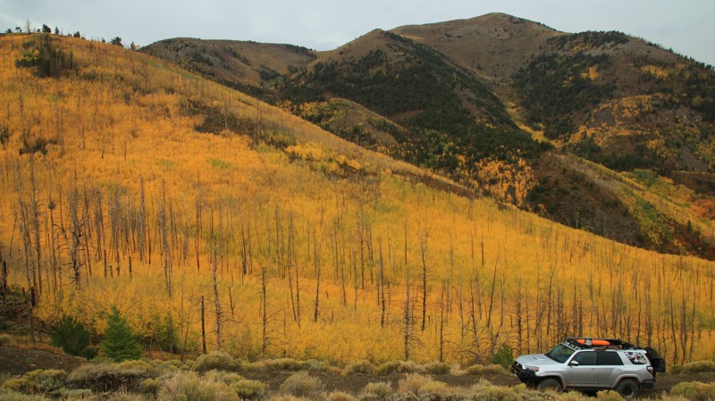
The Henry Mountains were the last mountain range added to the US Geological Survey map of the 48 contiguous states. Before they were named for the first Secretary of the Smithsonian, Joseph Henry, they were simply referred to as the Unknown Mountains. Pre-European inhabitants of what is now Utah seemed to ignore them as well since there were virtually no signs of inhabitants prior to the late 1800s. Even today, the Henrys are easy to drive into due to excellent BLM roads, but they are still rarely visited. Given their undeniable beauty, this makes them the perfect destination for overlanders looking for a great destination without the crowds. Bull Creek Pass, named for the mountain pass at 10,500 feet elevation near its western end, crosses the northern end of the Henrys just below the highest peaks of the range. The trail zigs and zags along the sidewalls of canyons that drop off the tops of the range, clinging to shelf roads to navigate to the canyon heads to make a quick crossing only to snake back along the wall of the opposite side of the canyon. Thus the trail goes in and out, in and out, revealing a new perspective of both the mountains and the sandstone desert below. The alpine forest of pine, spruce, fir, and aspens supports a variety of animal life, including a huge population of deer, bears, and mountain lions. One of only three remaining herds of genetically pure buffalo in the United States grazes the mountains. In Fall, the foliage bursts into color, rivaling anything the northeast could offer. Bull Creek Pass always puts on a show for those hardy enough to climb up for the experience. Go enjoy the views and the solitude.
Updated: 08/11/2026
Molly's Castle / Goblin Valley Cutoff Road
Hanksville, Utah
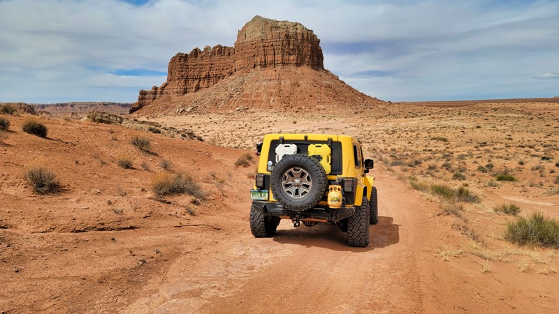
Running from Highway 24 to the Goblin Valley State Park, this little trail has rocks and sand to contend with, along with some amazing views. The trail is mostly sandy with some rocky climbs offering just a little challenge for the adventurous. There's no camping on this trail, but plenty of dispersed camping nearby. Goblin Valley State Park also has a campground.
Updated: 08/20/2026
Hotel Rock
Blanding, Utah
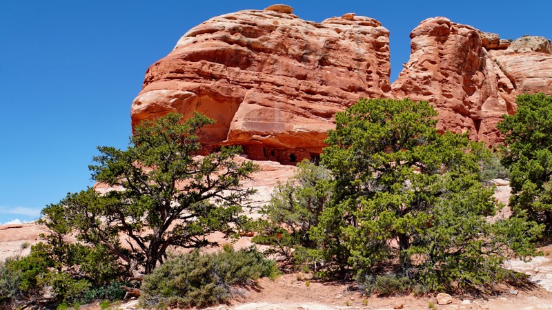
Hotel Rock, the most technically difficult trail in the Arch Canyon area of Bears Ears National Monument, is one of the few Jeep Safari trails not near Moab. It climbs steeply from the bottom of Comb Wash to the top of Little Baullie Mesa, roughly following the northeastern rim of Arch Canyon. The main trail ends at the eponymous Hotel Rock, at the site of a small but interesting Ancestral Puebloan ruin. While it is typically run as an out-and-back during Easter Jeep Safari, the trail continues if you turn right shortly before reaching Hotel Rock, where the road climbs further up Little Baullie Mesa to Milk Ranch Point in the Manti-La Sal National Forest and ultimately connects to Elk Mountain Road.
From the very beginning, the Hotel Rock trail offers almost constant challenges in the form of steep, off-camber slickrock climbs and descents over large ledges and humps. Red Rock 4 Wheelers rates it a 5. A modified rig and careful line selection are necessary to complete the trail, and there are places where a careless move could result in a rollover. The scenery is spectacular, with stunning views of Comb Ridge and viewpoints on the rim of Arch Canyon. Near the end, the terrain smooths out, and the last couple miles follow a mild dirt track leading across the mesa top to Hotel Rock.
The Hotel Rock Ruin is a fascinating specimen of Ancestral Puebloan / Anasazi architecture, and one of the few ruins in the region accessible without a lengthy hike. Be careful to respect this cultural site by looking and not touching, and do not enter any of the rooms. Most of the trail is unsuitable for camping. However, there are numerous campsites near the beginning of the trail at the mouth of Arch Canyon, and it looks like people sometimes camp at the end of the trail by Hotel Rock.
Updated: 05/23/2025
Dark Canyon Lake Road
La Sal, Utah
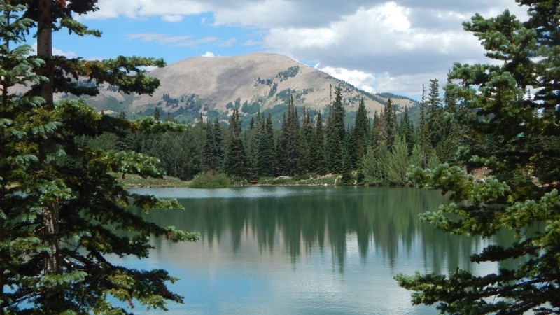
Dark Canyon Lake Road is a beautiful and leisurely cruise through dense forest and towering mountain peaks over 12,000 feet. The trail connects Two-Mile Road and Geyser Pass on a 12.8-mile gravel and hard-packed dirt road winding through a scenic pass. During winter months, Geyser Pass Road can be closed, and Dark Canyon Lake Road may be impassable. Along the way, a high clearance trail leads down to Dark Canyon Lake, a must-stop. There is a turn-around parking area for a few vehicles at the lake. Most of the shoreline is private, but there is a small area to get your toes wet and enjoy a mountain lake view. Camping is relatively abundant along the route. There are numerous primitive campsites on the 4x4 side trails, or you can camp at one of the organized campgrounds in the area.
Updated: 07/02/2026
Sand Dune Way
Washington, Utah
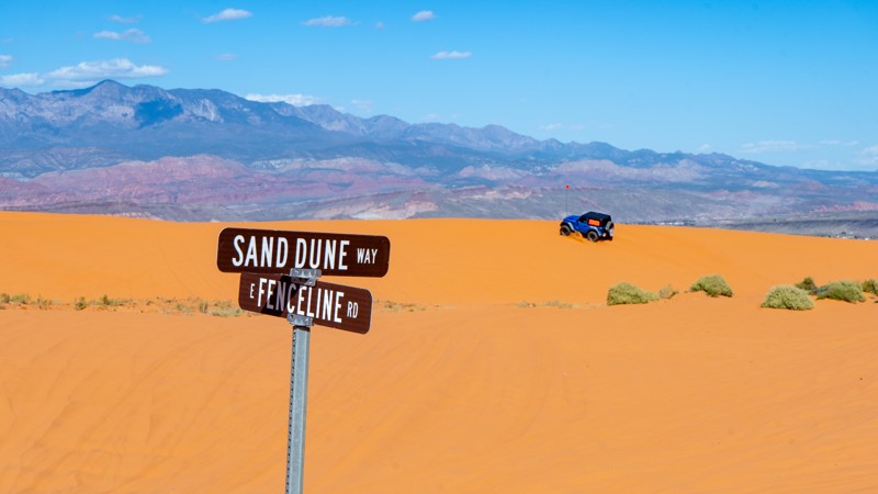
Sand Dune Way is a major north-to-south artery within the Sand Mountain OHV Area. It connects the Sand Hollow tunnel with Top of the World, providing entry and exit points to many major trails. As the name suggests, this trail primarily travels across soft sand dunes for the entire 3.5-mile length. At its southern point near the Competition Hill Overlook, you can find a large gathering spot with a vault toilet. Traversing the dunes requires 4-wheel drive and aired-down tires. Caution should be taken when cresting large dunes, as steep vertical drops can appear out of nowhere.
About Sand Mountain
Sand Mountain is an extremely unique parcel of public land. Designated as an Open OHV Area, riders are free to make their own trails. Due to this, many of the long-established named trail routes have several variations that can take easier or more challenging routes through the intended trail. The GPX track for this trail helps you navigate the area, but various lines, bypasses, and additional obstacles may exist along the way. Riders are encouraged to stay on existing trails and not unnecessarily drive over or destroy vegetation.
Fees
Riding on Sand Mountain is entirely free. However, there are multiple entry/exit points for the area, including "the tunnel," which connects Sand Hollow State Park to the open OHV area. Any entry into the boundaries of Sand Hollow State Park requires a Utah State Park Pass.
Requirements
When operating on Sand Mountain, users must attach an orange or red safety flag to the vehicle, rising at least 8 feet off the ground.
Updated: 02/11/2025
Black Rock Canyon
Eureka, Utah
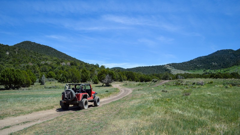
This is the most well-known offroad trail in the area, although it is still pretty abandoned most of the year. This popular trail from Saratoga to Vernon Reservoir follows a section of the Prospector OHV Complex. This complex has hundreds of miles of dirt roads ranging from Tooele to Eureka and Utah Lake to Dugway. You could spend days on the trails and never see the same thing twice. The mines in the area are the main reason for the offroading since this was once one of the most extensive mining areas in Utah. There are still plenty of mines that you can explore if you know where they are. Although now closed off, Nutty Putty Cave is one of the more famous of them all and even has a movie out about the story of the man whose body remains within the walls. Black Rock Canyon is the only trail to take you straight up and over the East Tintic Mountains, allowing you to reach a new area of trails. The View is a spur off of this trail and provides one of Utah's best views of the West Desert. Be sure to pack plenty of food and water, as getting lost on all the spurs out here is easy, and bring a flashlight to explore the caves!
Updated: 07/08/2026
Pleasant Creek Road
Fruita, Utah
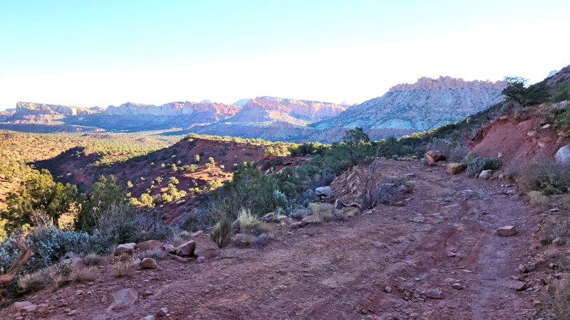
At the end of Capital Reef National Park's scenic drive is a dirt road called Pleasant Creek Road, but parts aren't so pleasant for the uninitiated. This offroad adventure takes you through a couple of streams and along a dry river bed until you start a steep climb over a mountain range. The mountain climb consists of a rutted and narrow shelf road. On the other side, you'll enter Dixie National Forest and then on to scenic Highway 12 near Pleasant Creek Campground.
Suppose the fantastic scenery isn't enough, once out of the National Park and into the Dixie National Forest area. In that case, you'll find excellent secluded, remote camping spots along this trail throughout Dixie National Forest.
Updated: 05/01/2024
Dry Camp Valley
Duck Creek Village, Utah
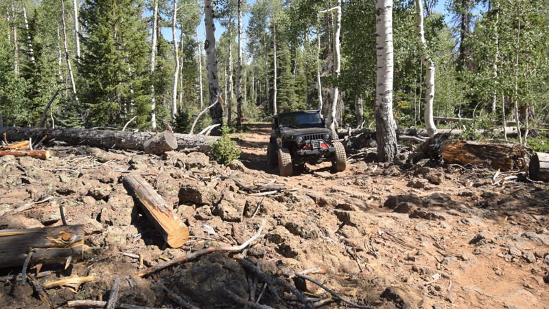
The Dixie National Forest has an impressive network of offroad trails crisscrossing the mountains and canyons of southern Utah. While there is certainly an abundance of leisurely scenic trails, Dixie NF lacks trails that offer any significant 4x4 challenges. Dry Camp Valley trail is a little known route that offers the offroad enthusiast a mild challenge through a very scenic mountain landscape. The trail travels from the small town of Duck Creek Village through a dense forest, weaving through the vast network of lava flows that blanket the region. Millions of years ago this region was a hot spot of volcanic activity. The area volcanoes deposited vast areas of black rock across the landscape. The amazing part is how plant life can thrive in such rugged terrain. Be prepared, you'll need a capable 4x4 and some durable tires to get through this unique trail.
Updated: 04/20/2024
South Cottonwood Road
Blanding, Utah
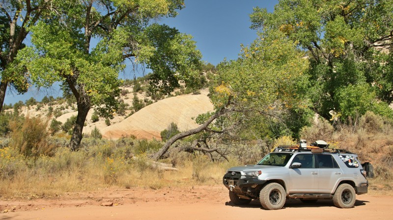
South Cottonwood Creek follows its colorful namesake up into the ruggedly handsome Abajo Mountains. The first 8 miles of the trail are quite scenic as it crosses back and forth over Cottonwood Creek, but they are also largely on land owned by the Ute Nation and are generally marked with No Trespassing signs. The upper stretch of the trail enters the Manti-L Sal National Forest. As you'd imagine by the name, Cottonwood Creek is lined with majestic cottonwood trees that turn magnificent gold in the Fall. With a backdrop of white sandstone cliffs, the drive along the little creek is a comforting symphony for your senses. At higher elevations, the cottonwoods give way to pines, a few aspens, and big tooth maples whose leaves turn fire-red each Fall. With the wind in the pines and shy deer peeking out from the shadows, the upper stretches of South Cottonwood Creek are amazingly relaxing.
Updated: 01/08/2024
Highlands Road
Moab, Utah
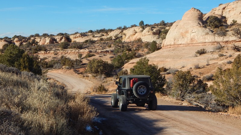
While Highlands Road may not be a "destination trail," you'll likely have to use this easy trail to visit the popular Dome Plateau Overlook. Winding across the Highlands of the Dome Plateau, the road travels past colorful sandstone cliffs and sprawling meadows with distant views of the La Sal Mountains. Numerous 4x4 trails branch off this county road, leading to overlooks, log cabins, and other hidden gems.
Updated: 05/13/2025
Bobbys Hole
Monticello, Utah
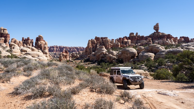
Tucked far into the southeastern Utah Desert is an overlander's paradise. If driving long distances over challenging terrain, far from any sort of civilization, is up your alley, then Bobby's Hole will surely be on your list. Lying on the edge of Canyonlands National Park in the Needles District, this unique desert trail provides it all. Numerous rocky obstacles will distract your attention from the incredible white and red rock spires surrounding you. Camping is at its best, whether you opt for a permitted site in the park or a dispersed site outside the boundary. Utah is known for its Dark Sky Parks; here, you are deep in the heart of darkness. Just don't forget the spare gas! Getting here consumes more fuel than tackling the trail itself, and once completed, you are still hours from the nearest station. Come prepared, but leave with bragging rights and irreplaceable memories after conquering Bobby's Hole.
Updated: 06/15/2024
Dip Hollow (Old Ephraim's Grave)
Laketown, Utah
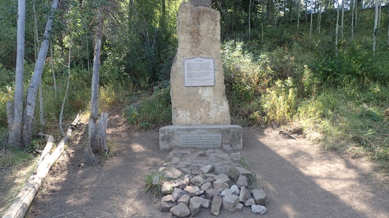
The life of a grizzly bear is celebrated among this trail as it runs to the grave of Old Ephraim, the last known grizzly bear in the state of Utah. Along this scenic drive through the Uinta-Wasatch-Cache national forest situated near Logan, Utah, you will wind your way through aspen groves, towering pines, and across open valleys. This off-road trail is a great way to escape the heat of the city during the few months of the year that it is open. Due to its elevation and location deep in the mountains, it is only accessible about 6 months out of the year. Camping and hunting are very popular along this trail so you are likely to not be alone. Although this may seem like an easy trail, there is much to see and do in the area so you can plan anything from a day trip to a multi-day adventure within this large network of trails, combining it with routes such as Temple Fork, Millville Canyon and Logan Peak, or you can jump over to Bear Lake Summit Trail or Temple Canyon and spend some time down at Bear Lake.
Updated: 03/03/2025
Kokopelli Colorado Border to Westwater Area
Westwater, Utah
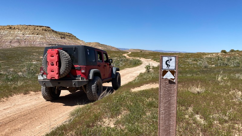
Part of the famed Kokopelli route, this section is sensory overload with its epic natural beauty, but the driver will have to pay attention in certain sections. Leaving from Kokopelli Road in Colorado you are immediately faced with the most difficult portions of this road. There is a nice-sized ledge to drop down and two very narrow sections along a shelf road. This route is not suitable for trailers of full-size pickup trucks or vehicles with outside accessories that expand outside the width of the vehicle's footprint. While most of the road is rough dirt, these sections will require skill. Once down to the lowest altitude section of the trail, crossing Bitter Creek, you will need to drive up and onto Harley Dome Plateau, a 1 1/4 vehicle wide shelf portion with boulders that most likely shift after each rain. However, once on top, there are many camping locations and other side roads that lead to camping.
Updated: 04/10/2024
McKay Flat Road
Hanksville, Utah
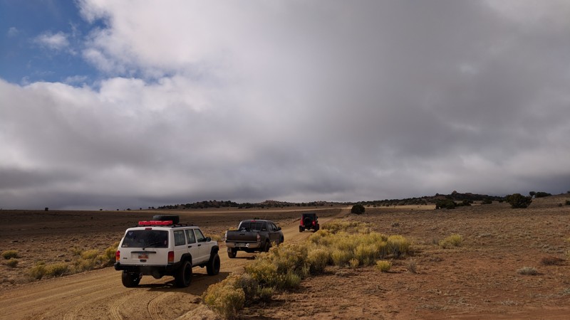
In the beauty of Central Utah lies the great San Rafael Swell. Running through the land are miles of off-road trails taking you to some incredible places. McKay Flat Road is no exception. Beginning just a short distance off of Temple Mountain Road, McKay Flat Road provides some incredible scenic opportunities while connecting you to some of the other incredible trails in the swell. If you are looking to camp away from the crowds of the campgrounds, this trail also provides many dispersed camping options. Combine this trail with the Reds Canyon Trail and Hidden Splendor for an unforgettable journey.
Updated: 07/21/2026
Skyline View / Factory Bench
Hanksville, Utah
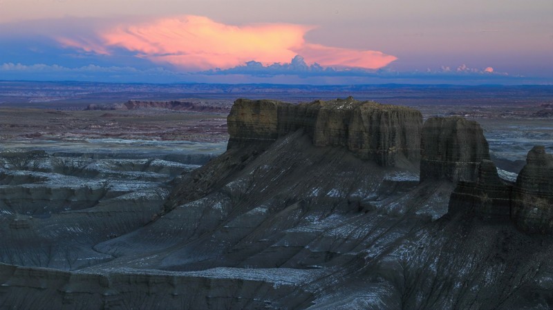
West of Factory Butte is Factory Bench which hosts the uber-popular Skyline View camping area. Skyline View overlooks an otherworldly landscape of multi-hued bentonite hills. Often referred to as the Moonscape Overlook, this place looks so unearthly that it hosts the Mars Research Station. Sunsets and sunrises from the campsites scattered along the edge of Factory Bench are amazing. The northernmost spur has large flat campsites and is the most popular. Smaller campsites further south offer more privacy. The BLM roads that make up this trail are ordinarily easy to drive but will become quite difficult after heavy rains.

Upgrade your Membership
Unlock all of the details on every Trail Guide and Scout Route.
Start a 7-day Free TrialBrowse Trails in Utah by City
Browse every Utah city with offroad trail guides.
Community
Partners

