










By clicking "ACCEPT", you agree to be the terms and conditions of each policy linked to above. You also agree to the storing of cookies on your device to facilitate the operation and functionality of our site, enhance and customize your user experience, and to analyze how our site is used.
Utah Off-Road Trails
359
Total Trail Guides 334

4759
Detailed Waypoints 925
Try a Free 7-Day Trial and unlock it all
Start a Free Trial Most Recent Trail Reviews

P
Peaks&Pixels
No Rating
Open
Visited: 09/24/2026
This trail has been graded recently and is now an easy trail.
IE
Ingrid Enyeart
Rated 5/5
Partially Open
Visited: 09/22/2026
The portion of the trail between the fork at 11 and the fork at 13 has two major ledges that have formed going into and out of the wash. Not sure what vehicle could overcome these. So just take the sc...


CI
Christine Irsik
Rated 4/5
Open
Visited: 09/22/2026
We enjoyed this trail and will definitely do it again. Gorgeous views at many points along the trail. We didn’t try The Wall, but everything else was just enough of a challenge for us and nice that m...
LF
Leslie F
No Rating
Open
Visited: 09/22/2026
Drove out here in a thunderstorm after doing dome plateau overlook. Epic camping. peaceful. unparalleled views. trail had two steep rocky sections I used 4wd low but probably didn't need to.

JR
jon ross
No Rating
Open
Visited: 09/21/2026
This is a short 2 mile of so cut off trail. Has a wash out with a by pass half way through.



Earl Neisler
Earl Neisler
Rated 2/5
Open
Visited: 09/21/2026
Pinstripe Alley nonstop for the first 4 miles. INo view to be had until waypoint 7. It was a beautiful view then we turned around. Should’ve read the reviews before we started the trail, because th...
LF
Leslie F
Rated 5/5
Open
Visited: 09/21/2026
This is a highlight for the trip. We stayed at waypoint10 for the night.


Earl Neisler
Rated 4/5
Open
Visited: 09/21/2026
Nice connector. The short out back was the hardest and not that short.


Earl Neisler
Rated 4/5
Open
Visited: 09/21/2026
A well maintained road. Found a nice camp site on the south in.
Earl Neisler

Jesse Martin
Jesse Martin
Rated 5/5
Open
Visited: 09/20/2026
Great area to go camping and gather for family reunions. There are multiple other trails that fork off throughout the trail to explore.

Dustin
Earl Neisler
Rated 5/5
Open
Visited: 09/20/2026
Only did apart due to time. This is 1 I will come back and finish.

Earl Neisler
Rated 3/5
Open
Visited: 09/20/2026
Not much to say it a slow easy. A good connecting trail.
Earl Neisler
No Rating
Open
Visited: 09/20/2026
We started just south of Cottonwood Canyon. We stop and looked but could not fine the rock art. The area was a nice to see all the green.


Earl Neisler
Rated 4/5
Open
Visited: 09/19/2026
Great trail, we drove through waypoints 24-35. Easy ride with a good amount of mud holes with few ruts on the stretch we drove. Would love to complete the whole trail at a later date.
Dustin
Rated 4/5
Open
Visited: 09/19/2026
Fun easy trail. Great way to get out and enjoy a relaxing trail ride to take in nature and see the fall colors.
Dustin
Rated 5/5
Open
Visited: 09/19/2026
Great Trail! The scenery was good with lots of wildlife. The trail was diverse that give drivers the opportunity to use both high and low four wheel drive. Trail has both wide and narrow areas.
Dustin
Rated 5/5
Open
Visited: 09/18/2026
I run this trail every year. Always fun and beautiful views. Fair amount of off camber sections.

Jeff Klaassen
Rated 5/5
Open
Visited: 09/18/2026
This was a good trail. The trail still had so flood damage but was passable. Highly recommended this. Has some all some view. We took 2 day to enjoy the ride and views.


Earl Neisler
No Rating
Open
Visited: 09/16/2026
Very fun, short trail. We did the loop but not Wipeout Hill. The sandy sections were a blast and there were a few ledges and obstacles that probably warrant a 5 but are still a fun challenge. We did i...



Mark Signorelli
Rated 4/5
Open
Visited: 09/15/2026
Ran this one and it's a decent stretch for anyone with a high clearance 4x4. The early sagebrush section had me watching my GPS track closely since the road nearly disappears a few times, but it alway...



Jay North
Official Crew
Rated 4/5
Open
Visited: 09/15/2026
Ran this as a quick add-on while working through the rest of the Red Hills network, and it's a fun one to knock out in under an hour. The wash crossing is the one spot where you actually have to think...


Jay North
Official Crew
Rated 3/5
Open
Visited: 09/15/2026
Ran this one on a dry afternoon and came away satisfied without being blown away. The rocky, rolling grade keeps things interesting without ever feeling out of reach for a stock high clearance rig, th...


Jay North
Official Crew
Rated 4/5
Open
Visited: 09/15/2026
Ran this one on an afternoon when I didn't have time for a full day out, and it delivered more than I expected for a short climb. The hill about a mile in makes you actually think about your line, and...


Jay North
Official Crew
Rated 4/5
Open
Visited: 09/13/2026
Red Peak Road is a short, easy cruise that's mostly smooth dirt with just enough texture to keep it interesting. There's a mild rough patch early on and a slightly rockier stretch past the halfway poi...


Jay North
Official Crew
Rated 2/5
Open
Visited: 09/13/2026
This is an easy, low-key cruise with a short technical bump right in the middle where it ties into the rest of the network, otherwise it is just packed dirt and gravel the whole way. Nothing here dema...


Jay North
Official Crew
Rated 4/5
Open
Visited: 09/13/2026
This one's an easy, mellow cruiser and it shows in how quick it feels behind the wheel. The rocky spots near the start and about two thirds up are barely worth mentioning, just some careful tire place...


Jay North
Official Crew
Rated 5/5
Open
Visited: 09/13/2026
This one's a fun add-on if you're already out in the area, easy enough for most of the way that a stock rig won't break a sweat, with just a couple of hard spots to keep things interesting. The washou...


Jay North
Official Crew
Rated 4/5
Open
Visited: 09/13/2026
A nice view of Kanab. Steepish and possibly slick when muddy. One spot has a small rock shelf. 4x4 recommended.


Ben Ruddell
Official Crew
Rated 3/5
Open
Visited: 09/13/2026
Easy, suitable for high clearance 2WD on a dry day, though four wheel drive earns its keep if the ground's been wet. The ruts along the way are mild and easy to place your tires around, and the two wa...


Jay North
Official Crew
No Rating
Open
Visited: 09/12/2026
Crazy no reviews since I ran it last May. We ran it again this time the whole trail out to the south overlook. It had rained the night before and into the morning. The rock dried up quick but a lot o...



Andrew Hotton
Rated 5/5
Open
Visited: 09/12/2026
Sand dunes. DANGER, you need to know your technique to head in here. It’s easy to misjudge slope and camber and get stuck or worse roll.


Ben Ruddell
Official Crew
Rated 3/5
Open
Visited: 09/12/2026
The section of the trail was rocky and rough - still fairly easy but the rockiest stretch.
WF
Wyatt Frampton
Rated 4/5
Open
Visited: 09/12/2026
This trail checks so, so many of the boxes -- hanging off a cliff, passing within 4" of rocks on BOTH sides at the same time on narrow sections, meaningful obstacles (ledges) where I smacked my hitch ...
IR
Isaac R
Rated 3/5
Open
Visited: 09/12/2026
This is an easy, high clearance 2WD road, easy enough that the drive itself isn't the draw. The shelf road stretch is mild and only about two jeeps wide, so keep an eye out for oncoming traffic, and t...


Jay North
Official Crew
Rated 2/5
Open
Visited: 09/12/2026
This is a mellow, low-stress drive that rewards a relaxed pace more than any technical challenge. Stock high clearance handled every mile without a second thought, and the surface stayed predictable e...


Jay North
Official Crew
Rated 5/5
Open
Visited: 09/11/2026
Great rest quick trail! Perfect for beginners, fun place for a picnic. The entrance and exit terrain to the tunnel changes depending on the weather and use. Very fun and interesting.


Dustin
Rated 4/5
Open
Visited: 09/11/2026
My route didn’t originally include this trail, but one of my crew broke on impossible hill and we had to limp back to civilization. This trail was beautiful and remote. Difficulty wise, no issues on t...



Dewie Jones
Official Crew
Rated 4/5
Open
Visited: 09/10/2026
Way better than I thought it would be. This was simply a connector trail for my unsuccessful (broken Toyota) Blanding to Moab overland trip. The trail is absolutely beautiful, relatively fast access, ...
Dewie Jones
Official Crew
Rated 3/5
Open
Visited: 09/10/2026
Easy enough that I did this road in pitch-black with just headlights (no light bar or anything) on the way to see sunrise from the end of the trail (Hurrah Pass). Really straightforward, just rocky li...
IR
Isaac R
Rated 4/5
Open
Visited: 09/10/2026
Incredibly beautiful road and not really rough at all -- I did a bunch of with fully-inflated tires. I know it's just a connector but honestly I would 100% come out here again to enjoy the views, hang...
IR
Isaac R
Rated 4/5
Temporary Closure
Visited: 09/10/2026
Deep mud around river crossing prevents passage. We came from Goblin Valley side, we were able to cross the river but there was deep mud on south side due to recent rains. Almost got stuck, had to go ...

Thomas A Youngerman
Rated 5/5
Open
Visited: 09/09/2026
Incredible bucket list trail that you must do if you can. DON'T do it in 1 day unless you like rushing it, unfortunately circumstances changed that required us to rush it. It's gorgeous and worth an o...



Sean Allen
Rated 5/5
Open
Visited: 09/09/2026
I built this into our rocklanding/overland route and really enjoyed the adventure. You can tell this isn’t well traveled which added to the experience. With that said, we’re trying to get to Moab from...


Dewie Jones
Official Crew
Thomas A Youngerman
Rated 5/5
Open
Visited: 09/08/2026
Great as always, high rewards in terms of views and nothing crazy in terms of obstacles. Great first trail for someone to do with a great payoff!


Sean Allen
Most Popular
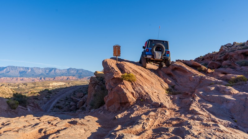
Updated: 11/27/2023
Razorback
Washington, Utah
This off-camber rock thrill ride has nonstop obstacles and precarious situations. Right out of the gate, drivers are treated to a glimpse of what this trail will provide. Although not technically challenging, Razorback will test drivers' skills as they are forced into tippy situations to avoid dragging vehicle body parts on the sharp projections. If off-camber is not your thing, you will want to avoid this short but fun ride.
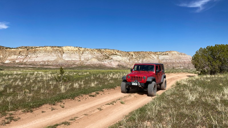

Updated: 10/15/2024
Kokopelli Westwater to Cisco Landing
Westwater, Utah
A two-track road that follows along the Denver and Rio Grande Railroad gives way to a wide and very smooth graded dirt road. Interesting rock formations towards the western edge. It meets pavement at the Cisco Landing boat launch called Cisco Pumphouse Road. You could take pavement to Cisco and eventually I-70 if wishing to terminate your offroad trip here. Very little camping along the route.
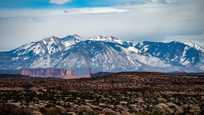
Updated: 09/19/2025
Cordova Canyon Overlook
Thompson Springs, Utah
A rugged 4WD road that meanders through washes, up and over hills, and follows a few shelf roads to a fantastic overlook of Cordova Canyon. Along the route, you are treated with remnants of the Uranium mining boom of the 50s as you pass Parco Mines, Yellow Bird Mine, and views into what is known as “Mine Draw.” One amazing campsite at the end looks over the canyon with views of the La Sal Mountains, Fisher Tower, and even Arches National Park.
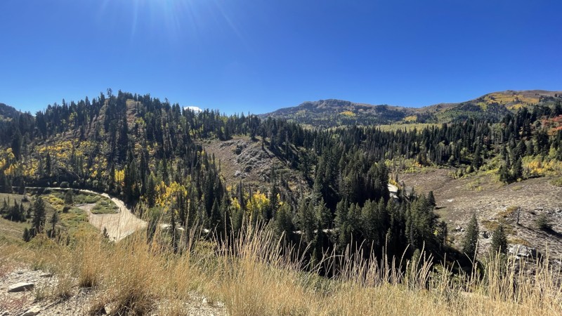
Updated: 07/06/2026
Francis Peak
Farmington, Utah
Francis Peak continues your trip from the valley floor to the mountain top. At the top are stunning views from both sides of the mountain. There are several dispersed campsites to choose from. While most vehicles should be able to make it up to Francis Peak, high clearance is recommended to continue to Holmes Creek as the road turns into a one-lane rocky off-road trail.
Updated: 09/28/2025
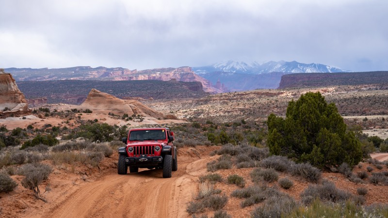
Kokopelli Yellow Jacket Canyon Section
Dewey, Utah
Part of the famed "Kokopelli Route," the Yellow Jacket Canyon section darts between Dome Plateau Upland and Owl Draw, crossing several challenging obstacles. The southwest end of the trail, near Yellow Jacket Canyon, is mainly a sandy trail with great views of the La Sal Mountains. As you work your way northeast, you will encounter several slickrock ledges ranging from 1-2 feet in height, with optional climbs as tall as 3-4 feet. The trail becomes mainly white slickrock through the middle section and traverses a steep, rocky, and ledgy hill climb before leveling out and passing through a low-lying clay area prone to mud pits during wet conditions. The trail traverses one more rocky hill climb with ledges 14" tall before leveling out on its way to Owl Draw. The only viable dispersed campsites are located near Owl Draw, where you can only find a few spots good for 2-3 vehicles.
This trail is best suited for modified vehicles with lifts and larger tires. Long-wheelbase vehicles will find this trail exceptionally challenging due to breakover angles along the ledgy hill climbs.
Updated: 08/11/2025
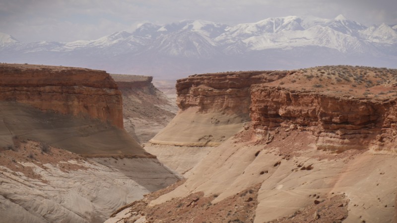
Blackburn Wash Road
Hanksville, Utah
Blackburn Wash Road is the southern gateway trail to the vast San Rafael Desert and so much more. Butch Cassidy's hide-out was hidden deep in these canyons. The trail crosses a barren desert with beautiful views of rugged canyons within the Dirty Devil Wilderness area. The trail is a mix of graded gravel and sections of blowing soft sand. For the most part, it's a well-maintained gravel road, but ruts and washboards can be rough on suspension. The route can be completed in high clearance camper vans and trucks with camper tops. While the camping was limited to a few spectacular spots, they'll likely be unoccupied because of the remoteness.
Updated: 06/15/2025
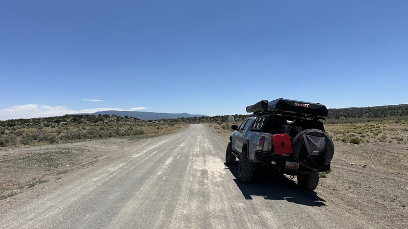
Smooth Knoll Road
Loa, Utah
Smooth Knoll Road starts south of Loa, Utah, and goes through parts of Fish Lake and Dixie National Forests before its terminus at FR153, which heads into Escalante. It is hard-packed dirt the entire way and traverses several high meadows and easy mountain passes. Just about any vehicle can tackle this trail, but there is severe washboarding around a few of the passes. You will find numerous camping areas along the entire length of the route. Near the southern end of FR154 is Posey Lake Campground, which is a great place to spend a few days! Posey Lake has a couple of reservable group sites, but most of the individual sites are first come, first serve. The best part about this road is if you need to travel from Loa to Escalante, you can take the normal route (Highway 12 and 24), which is about 90 miles and takes over an hour and a half, or this route, which takes 50 minutes.
Updated: 05/01/2024
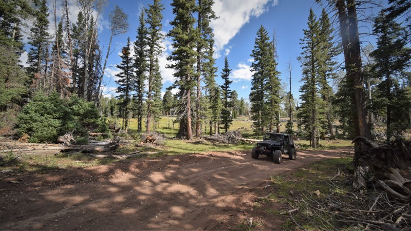
Tippets Valley
Duck Creek Village, Utah
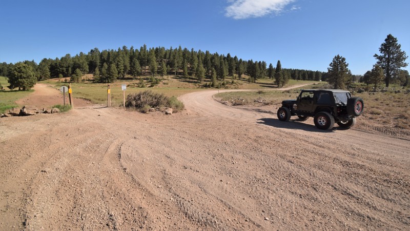
Tippetts Valley is located within the heart of the Dixie National Forest in southern Utah. The route easily travels through wide-open meadows and a large section of old-growth Ponderosa Pines. Some of the trees in the area are over 300 years old and mature to heights above 150 feet tall. One of these old giants is along the edge of the trail at Waypoint 07. On this route, you'll have your choice of trails to connect with. Dry Camp Valley, at Waypoint 08, is a difficult 4x4 trail that leads to Duck Creek Village. Tippetts Valley is often used to bypass the difficult section along Red Desert Road. If you have low clearance or don't want any challenges, then this is an easy way around that rough section on Red Desert Road. The remote camping within the pine and aspen trees is a very relaxing experience. Be sure to keep your eyes out for the abundant wildlife found in the area. Elk, deer, turkey, and all the big predator birds can be spotted within this region.
Updated: 06/04/2026
Indian Creek
Monticello, Utah
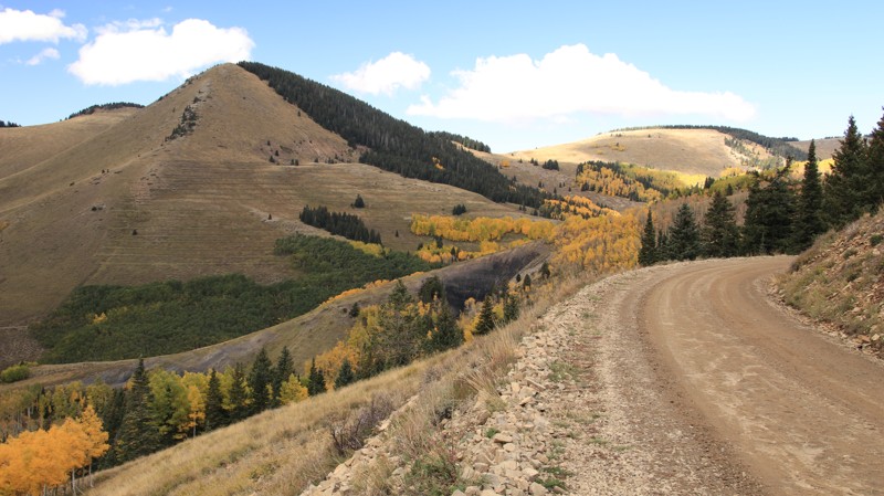
Both the elevation and the scenery will take your breath away, literally. Indian Creek may be the most beautiful road in southeastern Utah in the Fall. The aspen and big tooth maples explode into vibrant yellows and reds set against the dark greens of the fir and spruce. Peaks rise gray-green above the tree line. The trail is part of the Abajo Loop State Scenic Backway for a reason.
The road is well maintained but has very steep grades and blind curved switchbacks. There are ample amounts of shelf road to add a bit of pucker factor. Most of the trail is marked as no camping since it is a part of the Monticello watershed. There are several small campgrounds on the northeastern end and a few dispersed campsites on the southwestern end. Nizhoni Campground on the southwest end has 28 individual campsites and two group sites with all the amenities you'd expect from a good campground.
Updated: 09/04/2025
The Fallen Access
Washington, Utah
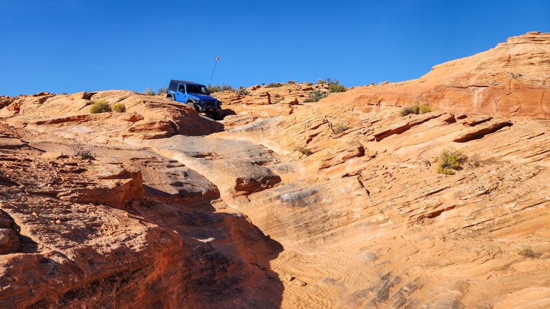
The Fallen Acess is a rocky and challenging connector road between Sand Dune Way and East Fenceline Road. This trail intersects and crosses many popular trails within the Sand Mountain OVH area but is primarily used to access "The Chute" obstacle at the top of Double Sammy and the beginning of The Fallen trail. From the west, the trail starts as an easy trek through soft sand with occasional protruding slickrock and slowly transitions to wavy slabs of petrified dunes. After passing Double Sammy and Papa Smurf, the trail slows to constant crawl speeds and increases in difficulty substantially as you negotiate constant undulating rock, steep drops, and minor off-camber situations. Good suspension articulation, skid plates, and rocker protection are certainly needed for this trail. The trail can be run in either direction and is the same difficulty either way. This trail best suits experienced drivers in modified vehicles with larger tires.
About Sand Mountain
Sand Mountain is an extremely unique parcel of public land. Designated as an Open OHV Area, riders are free to make their own trails. Due to this, many of the long-established named trail routes have several variations that can take easier or more challenging routes through the intended trail. The GPX track for this trail helps you navigate the area, but various lines, bypasses, and additional obstacles may exist along the way. Riders are encouraged to stay on existing trails and not unnecessarily drive over or destroy vegetation.
Fees
Riding on Sand Mountain is entirely free. However, there are multiple entry/exit points for the area, including "the tunnel," which connects Sand Hollow State Park to the open OHV area. Any entry into the boundaries of Sand Hollow State Park requires a Utah State Park Pass.
Requirements
When operating on Sand Mountain, users must attach an orange or red safety flag to the vehicle, rising at least 8 feet off the ground.
Updated: 04/10/2026
Willow Springs Road
Whipup, Utah
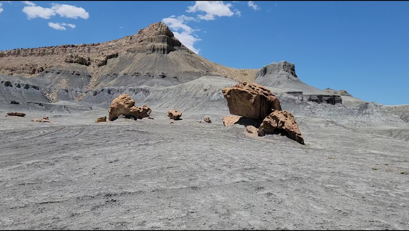
A link between I-70 and Lower last Chance Road, Willow Springs is an easy and scenic drive and is a perfect back route to Capitol Reef. No established campsites were noted along this road.
Updated: 05/01/2024
Henrie Knoll
Duck Creek Village, Utah
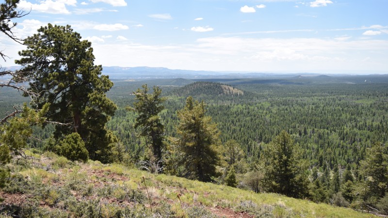
The Dixie National Forest in southern Utah has been a hotbed for volcanic activity for millions of years. The region is littered with massive patches of the jagged black rocks that have been slowly overgrown with aspen and conifer trees. If you're looking to get away for a long weekend on forested trails where the nights are cool, then this region of the Dixie National Forest has an abundance of trails to explore and plenty of other family activities as well. There are lakes for fishing, caves to explore, and an awesome hike to Cascade Falls. This area is sure to have everything needed to keep a family busy for a week. The Henrie Knoll trail is a short out and back route that travels to the top of a knoll, 700 feet above the surrounding area. The summit offers stunning panoramas of the Markagunt Plateau and other nearby knolls. The view at the top is a great location for a lunch break while enjoying the fall colors.
Updated: 09/23/2026
Professor Valley Rim
Dewey, Utah
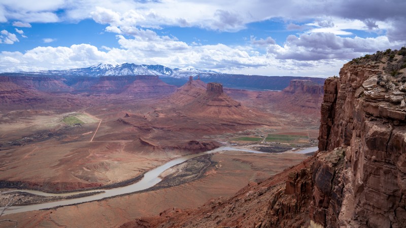
This short, 1.6-mile dead-end spur travels along the southwest end of Dome Plateau to a rim nearly 2,000 feet above Professor Valley. For over a half mile, you will ride the edge of the rim with astonishing panoramic views of the La Sal Mountains, Parriott Mesa, Castleton Tower, the Priest and Nuns rock formations, as well as the Colorado River. The drive is fairly easy in a high clearance 4WD vehicle, but users can expect to encounter 6-8" rocks and ledges along the way, tight brush that is likely to scratch your paint, and one loose hillclimb that might require low range. The trail ends at a small roundabout that can accommodate four to six vehicles and offers plenty of level, open ground for camping on top of patches of slickrock. This trail is suitable for any high clearance vehicle, but not recommended for large groups due to the small size of the ending turnaround.
Updated: 06/05/2022
Indian Springs
Beaver Dam, Utah
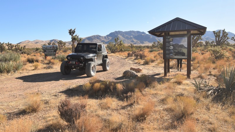
Indian Springs trail is located in southwestern Utah where you can easily drive through Utah's only Joshua tree forest. The trail is a well-maintained crushed gravel road that winds its way along the edge of the rugged Beaver Dam Mountains. You'll travel along the edges of the Beaver Dam Wash National Conservation Area where you can find all sorts of desert wildlife; bighorn sheep, desert tortoise, golden eagles, and Gila monster lizards are just some of the elusive creatures calling this area home. Since the introduction of cattle grazing, non-native grasses have spread across the area, forever altering the landscape. Wildfires are rare occurrences in the Mojave Desert region, so these changes led to fires in 1993, 2005, and 2006. Some of the large Joshua tree forests were lost, however, this route travels through a very large section that has been able to survive. The trees create a densely packed forest; most of them are massive, growing as tall as 49 feet. They can live for hundreds of years; some specimens survive a thousand years. The section between Waypoints 11 & 12 is truly a memorable experience. It's believed these trees likely got their name from the first Mormons migrating through this area.
Updated: 04/01/2025
Hunter Canyon
Spanish Valley, Utah
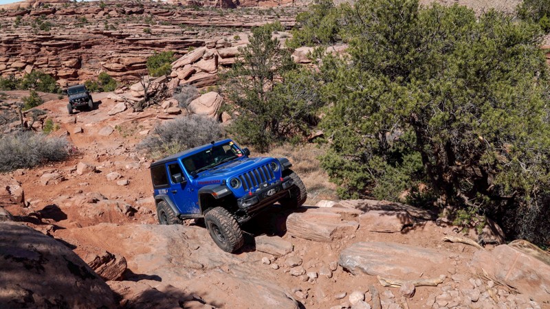
Wedged between two iconic Moab trails and skirting the edge of the Behind The Rocks Wilderness Study Area, Hunter Canyon somehow maintains a low profile while serving as the perfect encore to its neighboring routes. It lures you in with a few optional challenges, but just as you get comfortable and drop your guard, the canyon flips the script, throwing down a tight gauntlet of steep climbs, large boulders, and stacked ledges. It’s shorter and easier than its legendary northern neighbor, but make no mistake: Hunter Canyon is a rock-crawling trail that knows how to throw down.
Updated: 05/01/2024
Uinta Flat
Duck Creek Village, Utah
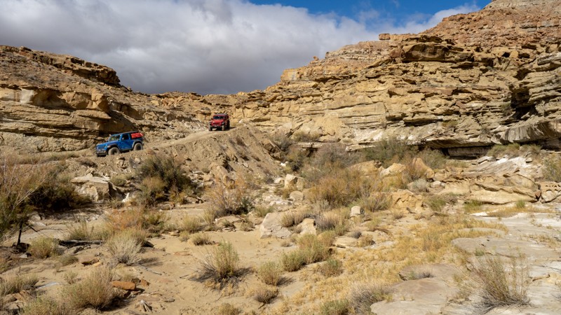
Located in the heart of the Dixie National Forest, Uinta Flat is one of the most popular routes and camping areas in the region. The route is very popular with large groups and RV's that need a little extra space for camping. There are countless opportunities to put down stakes and explore the vast network of area trails. This route is also popular because of it's close proximity to the town of Duck Creek Village.
The route is also used to access two area caves, Mammoth Cave and Bowers Cave. Both are free and open to the public. Don't forget to bring a flashlight.
Updated: 06/02/2025
Tibbet Canyon
Big Water, Utah
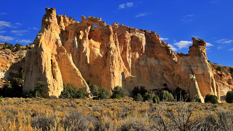
Tibbet Canyon, located on the Kaiporowtz Plateau, is a beautiful canyon that runs from Nipple Butte to Smoky Hollow. There are several unique rock formations visible throughout the drive, no matter which direction you run it. Obstacles generally consist of bumpy wash crossings, which can increase in size with every storm. Any vehicle with high ground clearance will be able to handle this trail in normal conditions, but if there is any moisture present, 4WD is likely required. The only campsite found along the trail is at its eastern end, where it intersects Smoky Hollow. It is a large and exposed site with plenty of ground for 6-8 vehicles to spread out.
Updated: 03/24/2026
Four Mile Bench
Henrieville, Utah
Four Mile Bench spurs off Cottonwood Canyon Road, running 14 miles into the remote Kaparowitz Plateau. The trail climbs steeply along shelf roads up the face of the plateau. It also crosses Wahweep Wash, Blue Wash, and Tommy Smith Creek. These drainages are ordinarily dry but prone to flash flooding and washouts after heavy rains. Four Mile Bench ends at an intersection with Death Ridge Road, 313, marked as impassable by full-size vehicles.
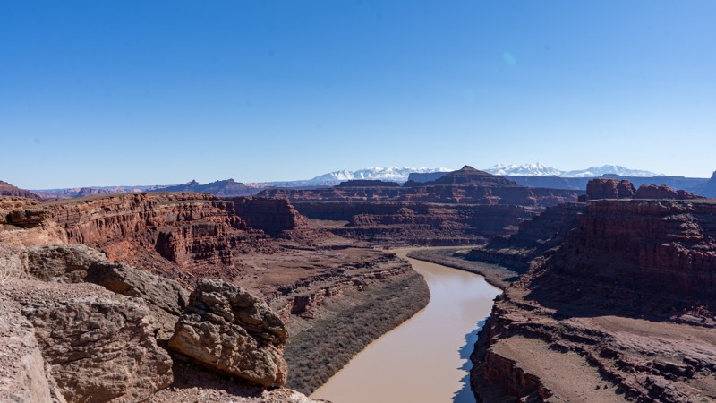
The western end of Four Mile Bench passes Grosvenor Arch. The massive sandstone arch is actually two arches. They tower 150 feet above the desert, with the larger arch measuring 100 feet wide. There is a parking area with a vault toilet for those visiting this imposing natural wonder.
East of the arch, two small campsites sit on the south side of the road. One is a single-vehicle site very close to the trail, while the other is a lollipop site further off the trail. Neither are desirable campsites. Better camping options are available along Cottonwood Canyon Road.
Updated: 04/29/2025
Thelma and Louise
Moab, Utah
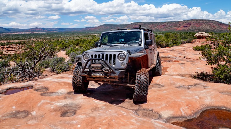
Many refer to this as Thelma and Louise Point due to the 1991 film "Thelma and Louise." Much of the film was shot above at Dead Horse Point and looking down into this location. The road is comprised of dirt with golfball to baseball-sized rocks, and any vehicle can handle it. Follow the track to ensure you stay on the actual road, as you will see many vehicles driving up the edges, which would be considered "off the trail." Camping is prohibited.
Updated: 05/20/2026
Little Baullie Mesa to Milk Ranch Point
Blanding, Utah
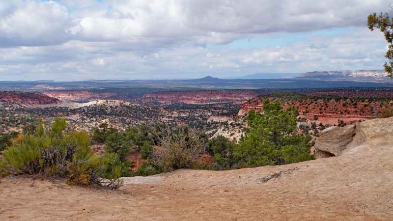
The Little Baullie Mesa trail connects the Hotel Rock Jeep Safari trail to Elk Mountain Road in the Manti La-Sal National Forest via Milk Ranch Point. It offers scenic views of Comb Ridge and the area around the head of Arch Canyon. Multiple side spurs access overlooks of Comb Wash and the rim of Arch Canyon, as well as the interior of Little Baullie Mesa. This trail can be used as a connector in a long overland route through Bears Ears National Monument from Arch Canyon and Hotel Rock over Elk Ridge to the Beef Basin area and the Elephant Hill trail.
The trail starts at a turn-off to the right from the Hotel Rock trail just before reaching Hotel Rock. There is one significant optional rock ledge obstacle near the beginning of the trail, where it climbs to the terrace above Hotel Rock. This obstacle can be bypassed by taking an alternate route. A side spur splits off to the east just below this obstacle which leads to an overlook of Comb Wash. A short spur at the top of this obstacle leads to an overlook of Hotel Rock.
The rest of the road across the upper level of Little Baullie Mesa consists of a mostly moderate, lightly used dirt track until reaching the final climb to the top of Milk Ranch Point, which is rocky and rutted. The road on top of Milk Ranch Point is a graded dirt road until the junction with Elk Mountain Road. Near the beginning of the climb up Milk Ranch Point is a hiking trailhead to Lewis Lodge, one of the more famous Ancestral Puebloan ruins in the area. Camping is allowed along the trail, though no established campsites exist.
Updated: 06/04/2026
Mosdell Trail
Kanab, Utah
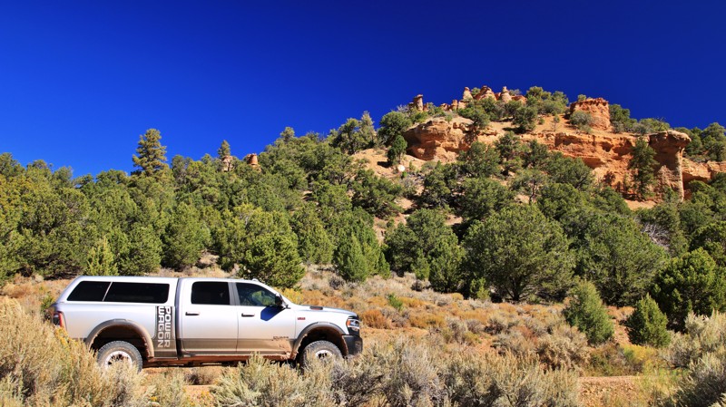
The Mosdell Trail is a scenic and challenging route through the Hog Canyon trail system, which connects to the network of trails accessed from the Crocodile Staging Area in Johnson Canyon. Much of it follows a ridge line at the top of Mosdell Hill, with panoramic views of the surrounding area. It also serves as the main access route to most of the trails in the Hog Canyon area.
The first part of the trail is sandy and easy, with connections to the Hog Point Loop and Pinnacles trails. It then descends a steep sandy hill into Tom's Canyon to a junction at the beginning of the extreme rated Tom's Canyon trail. Turn left to stay on the Mosdell Trail and follow it up a wash, then up a steep rocky hill to another junction with the Tom's Canyon trail. From here, the Mosdell Trail turns left again and passes over a cattle guard before beginning the difficult climb up Mosdell Hill, which involves a series of challenging rock ledge obstacles along a narrow ridge line. The trail levels out after reaching the top of the ridge, where it connects to the eastern end of the Pinnacles trail. Past this point, it is mostly easy as it follows the ridge to an intersection with Mansard Trail, which leads out to the Crocodile Staging Area or deeper into the trail network around Cutler Point.
There are no established campsites along this trail.
Updated: 10/15/2024
Old Escalante Road
Widtsoe Junction, Utah
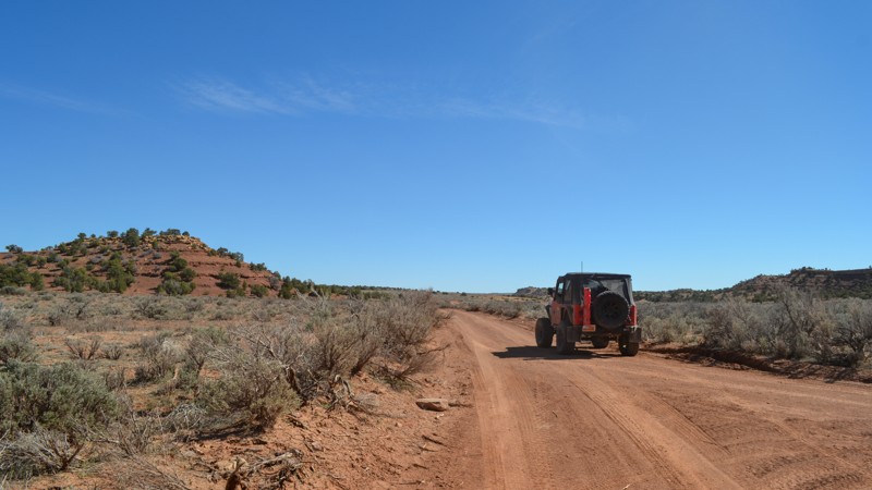
Old Escalante Road is called Main Canyon Road by the Dixie National Forest. Beginning just east of Escalante off Scenic Highway 12, Old Escalante follows Birch Creek through a patchwork of private and public lands before climbing into the Escalante Mountains and descending Escalante Canyon alongside Sweetwater Creek to Widtsoe Junction on Johnson Valley Road. The well-maintained road has steep switchbacks and wide shelf road sections where it seems you can see forever if you are brave enough to look down. Confiers and aspen line the trail at the higher elevations. Colorful cliffs tower above the trail to the north. The western end has whimsical toadstool rock formations.
Spacious campsites on the western slopes of the mountain have felt ground, fire rings, shade, and enough space for even RVs. There is a 16-day camping limit.
Updated: 05/17/2024
Rod's Valley Road
Emery, Utah
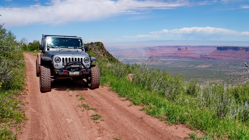
Rods Valley Road is a nice mild trail winding its way through the south end of the San Rafael Swell in Central Utah. This trail provides easy access to a number of trails in the area as well as a good route to take you from the south end, up to I70 and the north end of the Swell.
Updated: 10/15/2024
Upper Porcupine Rim
Castle Valley, Utah
The Upper Porcupine Rim trail is an extremely scenic forest road that is also part of the Kokopelli Trail. It connects Sand Flats Road and the La Sal Loop Road, following the upper portion of Porcupine Rim with spectacular views of the La Sal Mountains and Castle Valley. It is best driven east to west, so the views along the rim are on the driver's side. It is also heavily used by bikes to access the Upper Porcupine Singletrack (UPS) trail, which is part of the Whole Enchilada bike trail.
The hardest part of the road is near the beginning, where it climbs steeply up to the rim from the intersection with Sand Flats Road. This section is heavily rutted dirt interspersed with short sections of slickrock, which would likely be impassable in wet conditions as it looks like it can get extremely muddy. Once on top of the mesa, the trail levels out and becomes smoother, passing through a wide-open flat meadow, which would be great for camping. About halfway into the trail, it reaches the rim of the mesa at an overlook with amazing views of Castle Valley to the west and Green Mountain and Mount Waas to the east. From here, the road follows along the rim for about a mile and a half before turning inland and intersecting the La Sal Loop Road next to the Jimmy Keen trailhead.
Though there are no obvious established campsites along this road, dispersed camping is allowed per the MVUM, and the meadow just before reaching the rim would make for a gorgeous location for camping. There are also multiple established campsites along Sand Flats Road near the beginning of this trail.

Upgrade your Membership
Unlock all of the details on every Trail Guide and Scout Route.
Start a 7-day Free TrialBrowse Trails in Utah by City
Browse every Utah city with offroad trail guides.
Community
Partners

