










By clicking "ACCEPT", you agree to be the terms and conditions of each policy linked to above. You also agree to the storing of cookies on your device to facilitate the operation and functionality of our site, enhance and customize your user experience, and to analyze how our site is used.
Utah Off-Road Trails
359
Total Trail Guides 334

4759
Detailed Waypoints 925
Try a Free 7-Day Trial and unlock it all
Start a Free Trial Most Recent Trail Reviews
No Rating
Open
Visited: 09/24/2026
This trail has been graded recently and is now an easy trail.

IE
Ingrid Enyeart
Rated 5/5
Partially Open
Visited: 09/22/2026
The portion of the trail between the fork at 11 and the fork at 13 has two major ledges that have formed going into and out of the wash. Not sure what vehicle could overcome these. So just take the sc...


CI
Christine Irsik
Rated 4/5
Open
Visited: 09/22/2026
We enjoyed this trail and will definitely do it again. Gorgeous views at many points along the trail. We didn’t try The Wall, but everything else was just enough of a challenge for us and nice that m...
LF
Leslie F
No Rating
Open
Visited: 09/22/2026
Drove out here in a thunderstorm after doing dome plateau overlook. Epic camping. peaceful. unparalleled views. trail had two steep rocky sections I used 4wd low but probably didn't need to.

JR
jon ross
No Rating
Open
Visited: 09/21/2026
This is a short 2 mile of so cut off trail. Has a wash out with a by pass half way through.



Earl Neisler
Earl Neisler
Rated 2/5
Open
Visited: 09/21/2026
Pinstripe Alley nonstop for the first 4 miles. INo view to be had until waypoint 7. It was a beautiful view then we turned around. Should’ve read the reviews before we started the trail, because th...
LF
Leslie F
Rated 5/5
Open
Visited: 09/21/2026
This is a highlight for the trip. We stayed at waypoint10 for the night.


Earl Neisler
Rated 4/5
Open
Visited: 09/21/2026
Nice connector. The short out back was the hardest and not that short.


Earl Neisler
Rated 4/5
Open
Visited: 09/21/2026
A well maintained road. Found a nice camp site on the south in.
Earl Neisler

Jesse Martin
Jesse Martin
Rated 5/5
Open
Visited: 09/20/2026
Great area to go camping and gather for family reunions. There are multiple other trails that fork off throughout the trail to explore.

Dustin
Earl Neisler
Rated 5/5
Open
Visited: 09/20/2026
Only did apart due to time. This is 1 I will come back and finish.

Earl Neisler
Rated 3/5
Open
Visited: 09/20/2026
Not much to say it a slow easy. A good connecting trail.
Earl Neisler
No Rating
Open
Visited: 09/20/2026
We started just south of Cottonwood Canyon. We stop and looked but could not fine the rock art. The area was a nice to see all the green.


Earl Neisler
Rated 4/5
Open
Visited: 09/19/2026
Great trail, we drove through waypoints 24-35. Easy ride with a good amount of mud holes with few ruts on the stretch we drove. Would love to complete the whole trail at a later date.
Dustin
Rated 4/5
Open
Visited: 09/19/2026
Fun easy trail. Great way to get out and enjoy a relaxing trail ride to take in nature and see the fall colors.
Dustin
Rated 5/5
Open
Visited: 09/19/2026
Great Trail! The scenery was good with lots of wildlife. The trail was diverse that give drivers the opportunity to use both high and low four wheel drive. Trail has both wide and narrow areas.
Dustin
Rated 5/5
Open
Visited: 09/18/2026
I run this trail every year. Always fun and beautiful views. Fair amount of off camber sections.

Jeff Klaassen
Rated 5/5
Open
Visited: 09/18/2026
This was a good trail. The trail still had so flood damage but was passable. Highly recommended this. Has some all some view. We took 2 day to enjoy the ride and views.


Earl Neisler
No Rating
Open
Visited: 09/16/2026
Very fun, short trail. We did the loop but not Wipeout Hill. The sandy sections were a blast and there were a few ledges and obstacles that probably warrant a 5 but are still a fun challenge. We did i...



Mark Signorelli
Rated 4/5
Open
Visited: 09/15/2026
Ran this one and it's a decent stretch for anyone with a high clearance 4x4. The early sagebrush section had me watching my GPS track closely since the road nearly disappears a few times, but it alway...



Jay North
Official Crew
Rated 4/5
Open
Visited: 09/15/2026
Ran this as a quick add-on while working through the rest of the Red Hills network, and it's a fun one to knock out in under an hour. The wash crossing is the one spot where you actually have to think...


Jay North
Official Crew
Rated 3/5
Open
Visited: 09/15/2026
Ran this one on a dry afternoon and came away satisfied without being blown away. The rocky, rolling grade keeps things interesting without ever feeling out of reach for a stock high clearance rig, th...


Jay North
Official Crew
Rated 4/5
Open
Visited: 09/15/2026
Ran this one on an afternoon when I didn't have time for a full day out, and it delivered more than I expected for a short climb. The hill about a mile in makes you actually think about your line, and...


Jay North
Official Crew
Rated 4/5
Open
Visited: 09/13/2026
Red Peak Road is a short, easy cruise that's mostly smooth dirt with just enough texture to keep it interesting. There's a mild rough patch early on and a slightly rockier stretch past the halfway poi...


Jay North
Official Crew
Rated 2/5
Open
Visited: 09/13/2026
This is an easy, low-key cruise with a short technical bump right in the middle where it ties into the rest of the network, otherwise it is just packed dirt and gravel the whole way. Nothing here dema...


Jay North
Official Crew
Rated 4/5
Open
Visited: 09/13/2026
This one's an easy, mellow cruiser and it shows in how quick it feels behind the wheel. The rocky spots near the start and about two thirds up are barely worth mentioning, just some careful tire place...


Jay North
Official Crew
Rated 5/5
Open
Visited: 09/13/2026
This one's a fun add-on if you're already out in the area, easy enough for most of the way that a stock rig won't break a sweat, with just a couple of hard spots to keep things interesting. The washou...


Jay North
Official Crew
Rated 4/5
Open
Visited: 09/13/2026
A nice view of Kanab. Steepish and possibly slick when muddy. One spot has a small rock shelf. 4x4 recommended.


Ben Ruddell
Official Crew
Rated 3/5
Open
Visited: 09/13/2026
Easy, suitable for high clearance 2WD on a dry day, though four wheel drive earns its keep if the ground's been wet. The ruts along the way are mild and easy to place your tires around, and the two wa...


Jay North
Official Crew
No Rating
Open
Visited: 09/12/2026
Crazy no reviews since I ran it last May. We ran it again this time the whole trail out to the south overlook. It had rained the night before and into the morning. The rock dried up quick but a lot o...



Andrew Hotton
Rated 5/5
Open
Visited: 09/12/2026
Sand dunes. DANGER, you need to know your technique to head in here. It’s easy to misjudge slope and camber and get stuck or worse roll.


Ben Ruddell
Official Crew
Rated 3/5
Open
Visited: 09/12/2026
The section of the trail was rocky and rough - still fairly easy but the rockiest stretch.
WF
Wyatt Frampton
Rated 4/5
Open
Visited: 09/12/2026
This trail checks so, so many of the boxes -- hanging off a cliff, passing within 4" of rocks on BOTH sides at the same time on narrow sections, meaningful obstacles (ledges) where I smacked my hitch ...
IR
Isaac R
Rated 3/5
Open
Visited: 09/12/2026
This is an easy, high clearance 2WD road, easy enough that the drive itself isn't the draw. The shelf road stretch is mild and only about two jeeps wide, so keep an eye out for oncoming traffic, and t...


Jay North
Official Crew
Rated 2/5
Open
Visited: 09/12/2026
This is a mellow, low-stress drive that rewards a relaxed pace more than any technical challenge. Stock high clearance handled every mile without a second thought, and the surface stayed predictable e...


Jay North
Official Crew
Rated 5/5
Open
Visited: 09/11/2026
Great rest quick trail! Perfect for beginners, fun place for a picnic. The entrance and exit terrain to the tunnel changes depending on the weather and use. Very fun and interesting.


Dustin
Rated 4/5
Open
Visited: 09/11/2026
My route didn’t originally include this trail, but one of my crew broke on impossible hill and we had to limp back to civilization. This trail was beautiful and remote. Difficulty wise, no issues on t...



Dewie Jones
Official Crew
Rated 4/5
Open
Visited: 09/10/2026
Way better than I thought it would be. This was simply a connector trail for my unsuccessful (broken Toyota) Blanding to Moab overland trip. The trail is absolutely beautiful, relatively fast access, ...
Dewie Jones
Official Crew
Rated 3/5
Open
Visited: 09/10/2026
Easy enough that I did this road in pitch-black with just headlights (no light bar or anything) on the way to see sunrise from the end of the trail (Hurrah Pass). Really straightforward, just rocky li...
IR
Isaac R
Rated 4/5
Open
Visited: 09/10/2026
Incredibly beautiful road and not really rough at all -- I did a bunch of with fully-inflated tires. I know it's just a connector but honestly I would 100% come out here again to enjoy the views, hang...
IR
Isaac R
Rated 4/5
Temporary Closure
Visited: 09/10/2026
Deep mud around river crossing prevents passage. We came from Goblin Valley side, we were able to cross the river but there was deep mud on south side due to recent rains. Almost got stuck, had to go ...

Thomas A Youngerman
Rated 5/5
Open
Visited: 09/09/2026
Incredible bucket list trail that you must do if you can. DON'T do it in 1 day unless you like rushing it, unfortunately circumstances changed that required us to rush it. It's gorgeous and worth an o...



Sean Allen
Rated 5/5
Open
Visited: 09/09/2026
I built this into our rocklanding/overland route and really enjoyed the adventure. You can tell this isn’t well traveled which added to the experience. With that said, we’re trying to get to Moab from...


Dewie Jones
Official Crew
Thomas A Youngerman
Rated 5/5
Open
Visited: 09/08/2026
Great as always, high rewards in terms of views and nothing crazy in terms of obstacles. Great first trail for someone to do with a great payoff!


Sean Allen
Rated 5/5
Open
Visited: 09/08/2026
Fun trail, would run again. Had lunch between Monitor and Merrimac buttes.


Thomas A Youngerman
Most Popular

Updated: 06/17/2024
Forest Lake
Highland, Utah
Forest Lake, an awesome spur off Lower Mill Canyon, takes you away from the crowd for fun on the rocks. The trail weaves through the pine forest up to about 10,000 feet and into the middle of an aspen grove. Most of the trail is shaded, creating spots where mud is frequently present. With its rock gardens and mud pits, Forest Lake keeps people of all skill levels and vehicle capabilities entertained through this short trail. This is also a great trail to camp along since you are off the busy trails. However, there can still be a fair amount of traffic on warm summer weekends. There is a large amount of wildlife present if you keep your eyes open. The top of the trail is a very peaceful spot to relax.


Updated: 01/06/2024
Rattlesnake
Open
/
Fairfield, Utah/
1.52 miles/
About an hour
This is a gorgeous trail in western Utah that gives you some incredible views as well as some old mines to look down into. You also get to walk across the top of the grates that cover the closed-off mines. Just make sure you don't bring anything over them unless you have a firm grip! Being so close to Salt Lake City, you will often come across other off-roaders no matter the time of day or day of the week. Many people even do night runs in the area. There are many spurs around that can take you to different areas of the mountain so be sure you remember where you came from.
Updated: 05/19/2024
Alstrom Point
Big Water, Utah
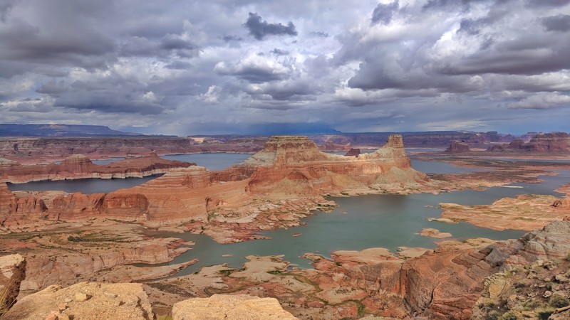
Alstrom Point is located in the Glen Canyon National Recreation Area. It is an overlook over the famous Lake Powell. Lake Powell is a manmade reservoir in which the water is held in by the also famous Glen Canyon Dam. The dam was completed in 1963 and it's intended purpose was to behave as an "aquatic bank" for the agriculture downstream of it. This dam has, in turn, created one absolutely stunning overlook that is called Alstrom Point. The trail itself is nothing to write home about, but the overlook at the end might be one of the most spectacular views of Lake Powell that is accessible by vehicle. The camping out at the end is subject to a lot of winds, but if you can handle the wind, the reward for camping out here and waking up to the views is well worth it.
Updated: 04/28/2026
Entrada Bluffs Road aka Shura Road
Dewey, Utah
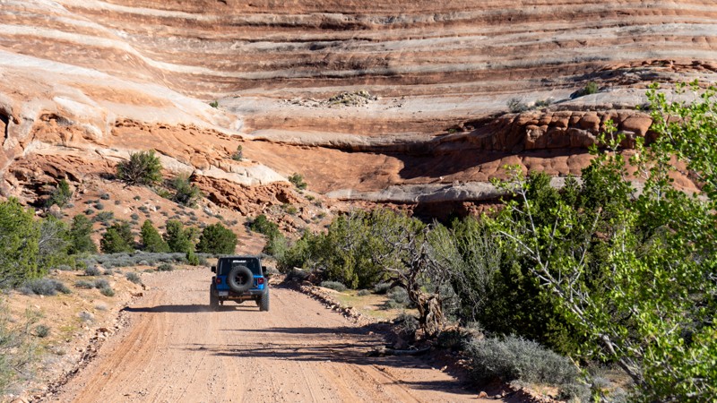
Entrada Bluffs Road, also known as Shura Road, begins at the historic Dewey Bridge site, once a well-known crossing of the Colorado River before it was lost to fire. From there, the route opens into one of the most accessible desert corridors in the region, offering easy access to abundant camping, connections to dispersed sites, and nearby backroads. It follows portions of the iconic Kokopelli's Trail and leads toward the well-known Top of the World Trail. Along the way, the landscape unfolds into a striking expanse of Entrada Sandstone formed over 140 million years ago, revealing a rugged beauty that cannot be experienced from the pavement.
Updated: 12/18/2023
Lavender Canyon
Monticello, Utah
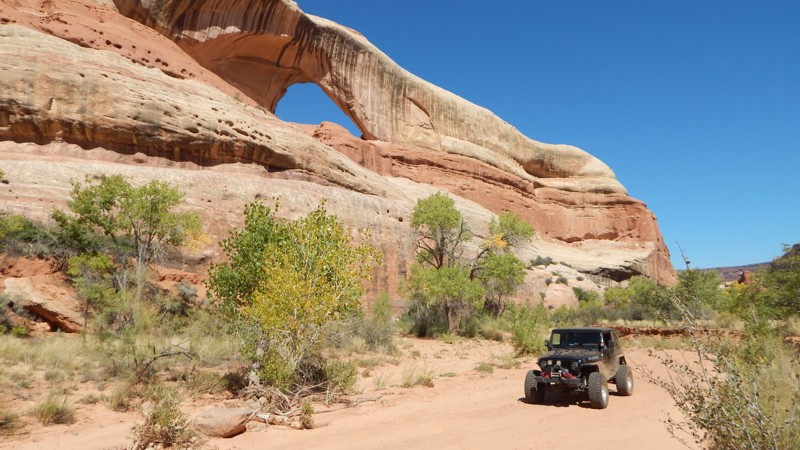
Far back in Canyonlands, the twisting sandstone cliffs hide ancient wonders above this scenic 4x4 trail. Combined with Davis Canyon, Lavender Canyon is a destination adventure for those wanting to escape everything. The engrossing sense of remoteness takes you over as you travel back into the canyons. The towering Bridger Jack Mesa is a permanent eastern border as the walls slowly close on both sides. The cliffs within the National Park hide ancient Native American structures, still safe to this day, tucked high up on the sandstone cliffs. These structures are so well preserved they appear as if they were made recently and not hundreds of years ago. Reaching and gaining legal access beyond the National Park Boundary makes all the effort and planning worth it. Timing is everything, for the permit and weather.

Updated: 06/24/2024
Lower Mill Canyon
Highland, Utah
Referred to as American Fork Canyon to the local wheelers, this is one of the few awesome places to offroad near Salt Lake City or Provo. Lush green forest and plenty of camping are to be expected throughout the trail. It is fairly well traveled so you will probably not be alone but there are enough trails to explore that you won't on somebody's back all day. You will get a good taste of what the Utah mountains have to offer as far as the greenery and steep inclines. There are a number of fun obstacles to test anybody's limits, but almost all of them have a bypass if you feel that they are too hard. Camping is everywhere up here and this is as close to the city as you can be while being "away from it all".
Updated: 04/29/2024
Rusty Nail
Moab, Utah
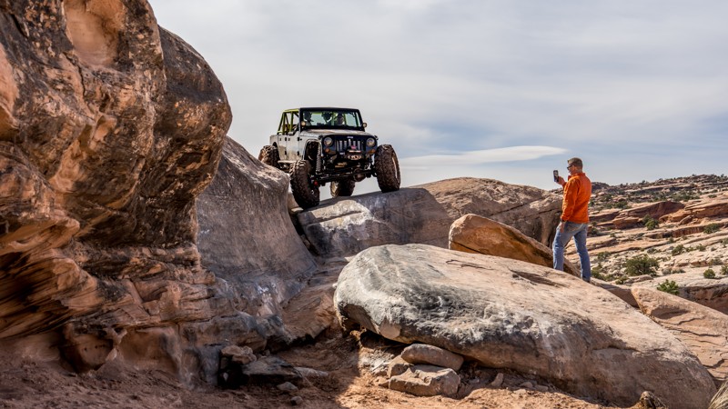
Rusty Nail is a difficult rock crawling 4x4 trail that is a "shortcut" to the most popular and most difficult obstacles on the Golden Spike & Gold Bar Rim trails. This trail challenges the most seasoned veteran wheeler, both physically and mentally. Large, off-camber, undercut ledges, true to the Moab testament, make up the majority of the obstacles on Rusty Nail. Although there are only four named obstacles, the trail is riddled with numerous challenges and no bypasses. There are alternate routes on a couple of obstacles, but those routes are just as difficult, if not more difficult, than the main route.

Updated: 07/01/2024
Baker Fork Road
Midway, Utah
Winding its way through the Mill Canyon OHV Complex in the Wasatch Mountain State Park, this easy off-road trail will guide you from Midway over to American Fork Canyon via Lower Mill Canyon. Once it opens in the springtime, OHV enthusiasts flock to the area to explore the miles of trails that the Wasatch Mountains have to offer. Although Baker Fork Road is maintained, it provides access to incredible views and many other trails carrying in difficulty such as Forest Lake and Mineral Basin. Whether you are looking to kill a few hours, or need to get away for the weekend, this mountainous OHV complex is full of trails to escape the heat and get you away from the rush of the city.

Updated: 01/14/2025
West Rim
Open
/
Washington, Utah/
3.76 miles/
About 3 hours
Easy to get to and offering a huge variety of challenges from mild to wild, West Rim is a popular trail for both veterans and newcomers to the Sand Hollow area. This trail hosts a great variety of obstacles, from tire-chirping ledges to metal-scraping rock faces, and welcomes a wide range of vehicles. Stock rigs can drive right next to the buggies, and both will find a challenging line. In addition to great obstacles, West Rim rewards users with incredible views of St. George, Warner Valley, the Arizona Strip, and the Hurricane Cliffs. Great for groups or testing out new builds, West Rim is a perfect introduction to what the Sand Mountain OHV Area offers.
Updated: 04/22/2024
John's Canyon
Mexican Hat, Utah
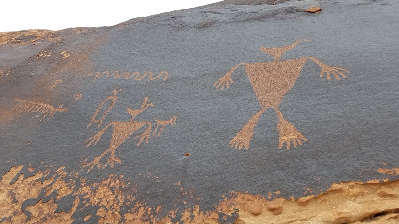
John's Canyon Trail is a spectacular road that lies along the belt-line between the 1000 foot cliffs of Cedar Mesa to the north and the San Juan River 1000 feet below in Grand Gulch to the south. Anasazi petroglyphs are abundant in the area so keep a sharp eye out. Access to the trail is easy to find along UT 316 W and is in close proximity to Utah's spectacular Goosenecks State Park.
Updated: 07/12/2024
South Skyline Drive
Ephraim, Utah
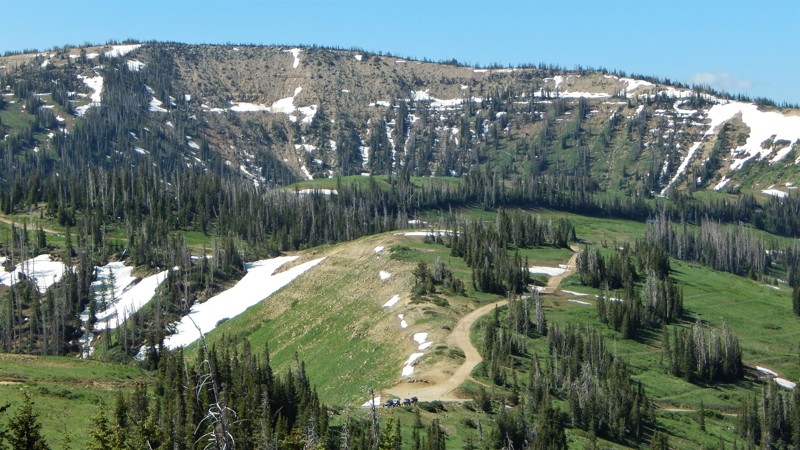
A true adventure along one of America's most scenic byways and historic 4x4 routes, South Skyline Drive can be an endorphin overload all at once, or it can be slowly spread out over a few days. Very few trails compare to this 73-mile journey across 10,000-foot peaks, passing countless turquoise blue lakes calling for you to try their renowned trout fishing. With over 60 Waypoints in this trail guide, the journey can seem overwhelming. But don't worry. You can easily cruise across the mountains in a stock 4x4 and only worry about where to camp for the night. Or you can choose to reserve the ultra-cool Sealy Ranger Cabin to stay in a rustic cabin high in the mountains, with your family, all by yourself, or with your favorite overland crew. A memorable experience that can only be had along South Skyline Drive.
Updated: 11/24/2022
Hook and Ladder OHV #1 (Cameo Cliffs)
Monticello, Utah
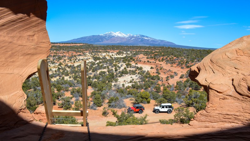
Also known as Cameo Cliffs, Hook and Ladder is an offroad odyssey that travels from the lower deserts to above "Hook and Ladder Gulch," following Cameo Ridge to higher elevations filled with juniper and cooler temperatures. Right away, the soft sand underneath your tires turns into that one distinct sound that is synonymous with Moab: "chirp, chirp," as you drive across swaths of slickrock with the La Sal Mountains to the northeast and the Abajo Mountains visible in your side view mirror. This specific route, Trail #1, is in the middle of an OHV area with more trails and adventures. Come for this trail, or come for them all.

Updated: 04/08/2025
Behind the Rocks Road
Spanish Valley, Utah
Not to be confused with the Behind The Rocks Trail, Behind The Rocks Road is a rough and rocky 9-mile-long connector road between Picture Frame Arch and Pritchett Canyon. It connects a spiderweb network of trails and is the main exit from the popular hardcore trails Pritchett Canyon and Behind The Rocks Trail, connecting those folks back to Highway 191. This road has both fast and slow crawling sections and is traveled by users in both directions. The road becomes more challenging the farther north you travel. The southernmost 3 miles is the easiest, with a mix of hard-packed dirt, sand, and slickrock slabs. The middle 3 miles traverse several ledges and a short section of rutty shelf road. The northernmost 3 miles, just past the Kane Creek Canyon Overlook, are the most difficult, with a continuous onslaught of rough-cut slickrock ledges, many of which are 18-32 inches tall. This road is best suited for modified vehicles with larger tires, small lifts, and skid plate protection.
There is no suitable camping along this stretch of Behind the Rock Road.
Updated: 05/01/2024
Second Left Hand Canyon
Parowan, Utah
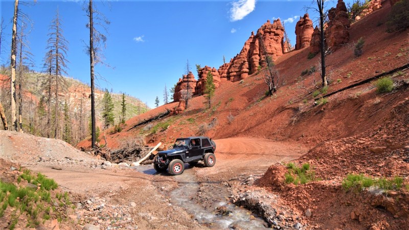
Second Left Hand Canyon is located within the iconic Cedar Breaks region of Dixie National Forest. This easy but memorable trail travels up through a vibrant landscape with red sandstone hoodoos and limestone cliffs. You'll wind your way up through a canyon above 10,000 feet before reaching the summit at Sidney Valley Overlook. If you're looking to get away for a long weekend where the nights are cool and the trails are in the forest, then this region of Dixie NF has an abundance of trails to explore and plenty of other family activities in the area. There are lakes for fishing, caves for exploring and an awesome hike to Cascade Falls. This area is sure to have everything needed to keep a family busy for a week.

Updated: 06/17/2024
Miller Hill
Alpine, Utah
Off-roading Miller Hill is a well-spent day meandering through wildflowers and a rich forest of pine and aspen. The journey will lead you to some awe-inspiring overlooks of the Wasatch Mountains. Aside from the beauty, the trail itself is a relatively easy-going dirt path with some rocky patches and a few minor challenges to keep the ride entertaining for both driver and passenger. Situated in the American Fork Mining District, formed in July of 1870, the trail offers an abundance of mining history with a few remaining sites to be seen. Jacob and William Miller discovered rich ore deposits on what would become known as Miller Hill. The Miller Hill Mine stopped producing ore by 1874, started up again briefly the following year, and then shut down permanently.
Updated: 09/05/2024
Eagle Canyon
Emery, Utah
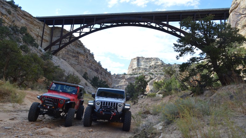
The iconic destinations along Eagle Canyon are pictured all over Utah, from signs to merchandise and even on TV. There is no end to all of the history to be learned or the sights to be seen from this incredible trail. Running through the center of the San Rafael Swell, this short canyon has an arch, elevated viewpoints, a historic walk to a refrigerator of times past, and a cabin housing a family with a significant history in the Swell. Be sure to find your way into Eagle Canyon next time you are venturing around this incredible region.
Updated: 03/23/2024
Dome Plateau Overlook
Moab, Utah
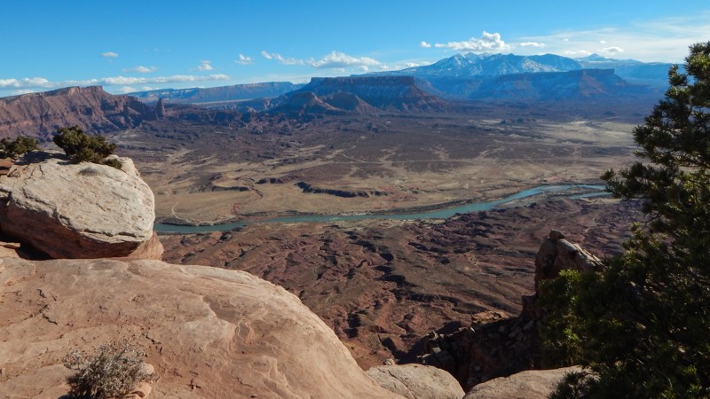
This leisurely drive ends with one of the best views in the western United States. The Dome Plaeau Overlook will take your breath away in many ways. You catch glimpses of the views as you travel along the trail. Only when you're about to drop down the hill at Waypoint 4 do you realize what's in store. The views of the Colorado River set against the distant plateaus and mountains are phenomenal. No matter what you're planning on doing while exploring the Dome Plateau, be sure to plan a stop at this one-of-a-kind overlook.
Updated: 04/07/2024
Reds Canyon Loop
Hanksville, Utah
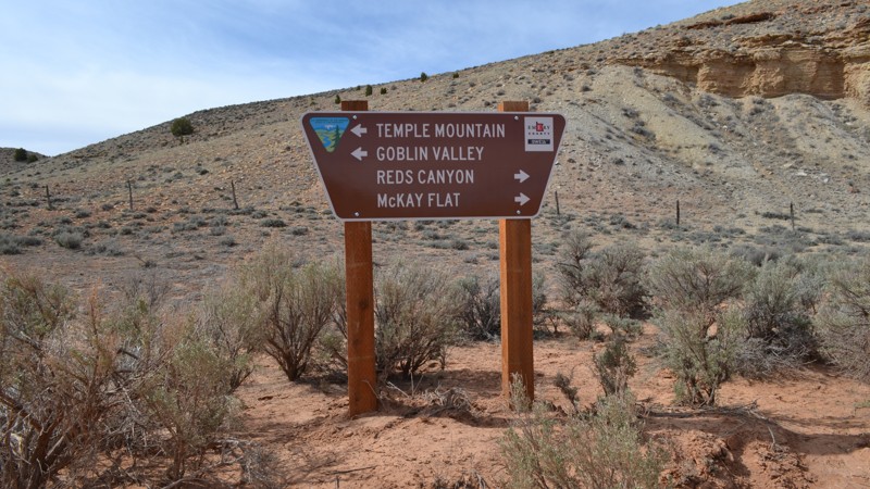
Reds Canyon Loop is an incredibly gorgeous trail in the south end of the San Rafael Swell in Central Utah. Starting at a high elevation, you can see the beautiful canyon that you will be descending into. Once in the canyon, you can see where the trail gets its name. Winding through the red cliffs, you will wish you could spend days down here. As you exit the trail to the north, you are treated with more spectacular views of the surrounding areas. This is an absolute must do in the Swell!
Updated: 07/28/2026
Sand Flats Road
Moab, Utah
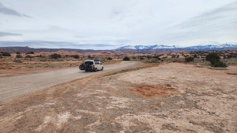
Sand Flats Road travels through the famous Sand Flats Recreation Area, connecting Moab to the La Sal Mountain Loop Road. This easy road provides trailhead access to many of Moab's most popular and famed trails: Baby Lions Back, Hell's Revenge, and Fins and Things. Porcupine Rim, Mill Creek Rim West, and Mill Canyon Rim East also connect to/from Sand Flats Road. The road has a mixed surface, including pavement, gravel, and dirt, with many washboard sections. The road drives along several exposed shelf sections and is 2-plus vehicles wide the entire way. This road is suitable for any vehicle.
Entering Sand Flats Recreation Area does require a daily fee, and camping is an additional fee.
Nine campgrounds lettered A through J, with over 120 campsites, are open year-round on a first-come, first-served basis. Only group campsites can be reserved. Camping is limited to these designated sites. The campsites have nearby vault toilets. Expect the campgrounds to fill quickly from Thursday through Monday.
Updated: 03/27/2024
Little Canyon
Moab, Utah
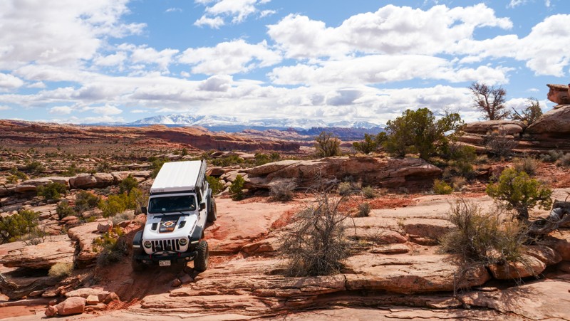
Within a network of more well-known trails lies Little Canyon. This unique trail is nestled between Gold Bar Rim and Bull Canyon, taking you across a traditional Moab landscape just northwest of town. You will likely have the trail all to yourself as you take in the breathtaking scenery. The La Sal Mountains tower in the background, rising over the red fins for which Moab is so well known. Alongside the expansive views are numerous shelves, ledges, and waterfalls, drawing your attention away for just a brief moment in time. This diverse combination of experiences will leave a lasting impression on those fortunate enough to find this hidden gem.

Updated: 11/27/2023
Old Ward Canyon Road
Bountiful, Utah
Old Ward Canyon Road is one way to experience spectacular views close to home. It is a short offroad trail in Bountiful, Utah that takes you up onto the beautiful Wasatch Mountain range. The trail is perfect for when you get that itch to go off-roading but don’t have the time to go on a long trip. Old Ward Canyon Road can be done in just a few hours, so it’s an excellent day trip trail. At night, this trail is extraordinary! You can get up to the hilltop and overlook the cities in Davis County for miles. Additionally, a wide variety of wildlife can be encountered on this trail, including mule deer, Rocky Mountain elk, or even moose if you’re lucky!
Updated: 12/18/2023
Milts Mile
Hurricane, Utah
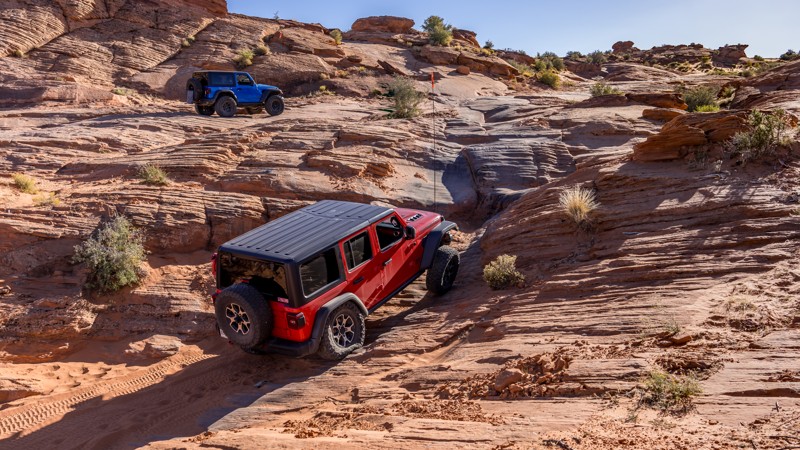
The first trail developed in the Sand Hollow area is named after local 4x4 shop owner Milt Thompson. Milt's Mile is an always-evolving must-do trail for anyone new to the area. This trail offers constant slickrock challenges, including off-camber turns, steep bowl climbs, stair-step ledges, and technical v-notches. With many obstacle options, this popular trail has several variations, making it a great trip for a wide range of vehicles, no matter your build size. In addition to the fun-filled obstacles, Milt's Mile provides incredible views of Sand Hollow Reservoir, the cliffs of Zion National Park, Pine Valley Mountains, and vibrant desert canyons and rock formations.
Updated: 09/01/2023
Montezuma Canyon
Blanding, Utah
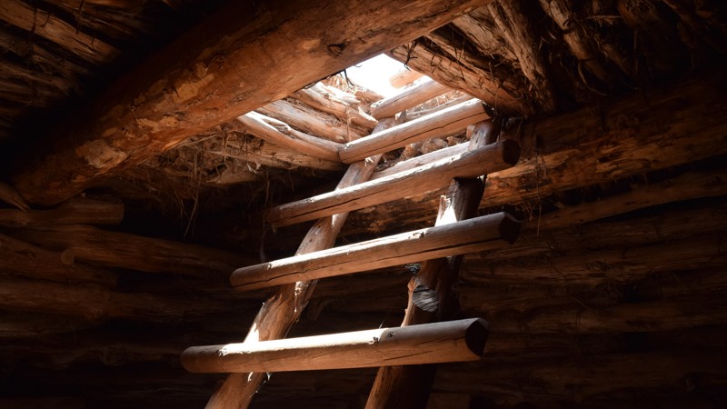
Montezuma Creek Road is a scenic canyon drive back in time to when early Native Americans inhabited the area and built their homes into the cliffs. There are many cliff-dwelling sites that you can walk right up to. The most exciting and family-friendly site is "Three Kivas Pueblo," a reconstructed kiva that you can walk on and even experience climbing an old ladder down into the dwelling. The stone, mud, and wood construction offers a glimpse into life over a thousand years ago. As you travel the route, keep an eye out for several old dwellings and petroglyphs hidden along the cliffs all over the region. This road makes for a mild yet interesting ride into the history of the area's early inhabitants.
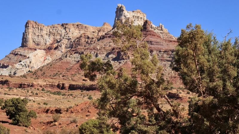
Updated: 05/01/2026
Temple Mountain Road
Moore, Utah
Temple Mountain Road is the superhighway of the lower San Rafael Swell. While a great drive in itself, it connects to many of the smaller adventure and sightseeing trails like Swasey's Cabin, Behind the Reef, North Temple Wash, and more. Around every curve, Temple Mountain Road offers breathtaking views of the colorful geology for which the San Rafael Swell is renowned. It's easy to see how the road got its name when looking at its namesake sandstone monlith. Ancient pictograph panels painted on shaded alcove walls beckon you to ponder both their meaning and the lives of those who created them centuries before. Camping opportunities are abundant along Temple Mountain Road and the numerous side trails. The short paved section on the eastern end of the road branches off to the whimsical Goblin Valley State Park. Temple Mountain Road is an easy drive with a tremendous payoff.

Upgrade your Membership
Unlock all of the details on every Trail Guide and Scout Route.
Start a 7-day Free TrialBrowse Trails in Utah by City
Browse every Utah city with offroad trail guides.
Community
Partners

