










By clicking "ACCEPT", you agree to be the terms and conditions of each policy linked to above. You also agree to the storing of cookies on your device to facilitate the operation and functionality of our site, enhance and customize your user experience, and to analyze how our site is used.
Utah Off-Road Trails
359
Total Trail Guides 334

4759
Detailed Waypoints 925
Try a Free 7-Day Trial and unlock it all
Start a Free Trial Most Recent Trail Reviews

P
Peaks&Pixels
No Rating
Open
Visited: 09/24/2026
This trail has been graded recently and is now an easy trail.
IE
Ingrid Enyeart
Rated 5/5
Partially Open
Visited: 09/22/2026
The portion of the trail between the fork at 11 and the fork at 13 has two major ledges that have formed going into and out of the wash. Not sure what vehicle could overcome these. So just take the sc...


CI
Christine Irsik
Rated 4/5
Open
Visited: 09/22/2026
We enjoyed this trail and will definitely do it again. Gorgeous views at many points along the trail. We didn’t try The Wall, but everything else was just enough of a challenge for us and nice that m...
LF
Leslie F
No Rating
Open
Visited: 09/22/2026
Drove out here in a thunderstorm after doing dome plateau overlook. Epic camping. peaceful. unparalleled views. trail had two steep rocky sections I used 4wd low but probably didn't need to.

JR
jon ross
No Rating
Open
Visited: 09/21/2026
This is a short 2 mile of so cut off trail. Has a wash out with a by pass half way through.



Earl Neisler
Earl Neisler
Rated 2/5
Open
Visited: 09/21/2026
Pinstripe Alley nonstop for the first 4 miles. INo view to be had until waypoint 7. It was a beautiful view then we turned around. Should’ve read the reviews before we started the trail, because th...
LF
Leslie F
Rated 5/5
Open
Visited: 09/21/2026
This is a highlight for the trip. We stayed at waypoint10 for the night.


Earl Neisler
Rated 4/5
Open
Visited: 09/21/2026
Nice connector. The short out back was the hardest and not that short.


Earl Neisler
Rated 4/5
Open
Visited: 09/21/2026
A well maintained road. Found a nice camp site on the south in.
Earl Neisler

Jesse Martin
Jesse Martin
Rated 5/5
Open
Visited: 09/20/2026
Great area to go camping and gather for family reunions. There are multiple other trails that fork off throughout the trail to explore.

Dustin
Earl Neisler
Rated 5/5
Open
Visited: 09/20/2026
Only did apart due to time. This is 1 I will come back and finish.

Earl Neisler
Rated 3/5
Open
Visited: 09/20/2026
Not much to say it a slow easy. A good connecting trail.
Earl Neisler
No Rating
Open
Visited: 09/20/2026
We started just south of Cottonwood Canyon. We stop and looked but could not fine the rock art. The area was a nice to see all the green.


Earl Neisler
Rated 4/5
Open
Visited: 09/19/2026
Great trail, we drove through waypoints 24-35. Easy ride with a good amount of mud holes with few ruts on the stretch we drove. Would love to complete the whole trail at a later date.
Dustin
Rated 4/5
Open
Visited: 09/19/2026
Fun easy trail. Great way to get out and enjoy a relaxing trail ride to take in nature and see the fall colors.
Dustin
Rated 5/5
Open
Visited: 09/19/2026
Great Trail! The scenery was good with lots of wildlife. The trail was diverse that give drivers the opportunity to use both high and low four wheel drive. Trail has both wide and narrow areas.
Dustin
Rated 5/5
Open
Visited: 09/18/2026
I run this trail every year. Always fun and beautiful views. Fair amount of off camber sections.

Jeff Klaassen
Rated 5/5
Open
Visited: 09/18/2026
This was a good trail. The trail still had so flood damage but was passable. Highly recommended this. Has some all some view. We took 2 day to enjoy the ride and views.


Earl Neisler
No Rating
Open
Visited: 09/16/2026
Very fun, short trail. We did the loop but not Wipeout Hill. The sandy sections were a blast and there were a few ledges and obstacles that probably warrant a 5 but are still a fun challenge. We did i...



Mark Signorelli
Rated 4/5
Open
Visited: 09/15/2026
Ran this one and it's a decent stretch for anyone with a high clearance 4x4. The early sagebrush section had me watching my GPS track closely since the road nearly disappears a few times, but it alway...



Jay North
Official Crew
Rated 4/5
Open
Visited: 09/15/2026
Ran this as a quick add-on while working through the rest of the Red Hills network, and it's a fun one to knock out in under an hour. The wash crossing is the one spot where you actually have to think...


Jay North
Official Crew
Rated 3/5
Open
Visited: 09/15/2026
Ran this one on a dry afternoon and came away satisfied without being blown away. The rocky, rolling grade keeps things interesting without ever feeling out of reach for a stock high clearance rig, th...


Jay North
Official Crew
Rated 4/5
Open
Visited: 09/15/2026
Ran this one on an afternoon when I didn't have time for a full day out, and it delivered more than I expected for a short climb. The hill about a mile in makes you actually think about your line, and...


Jay North
Official Crew
Rated 4/5
Open
Visited: 09/13/2026
Red Peak Road is a short, easy cruise that's mostly smooth dirt with just enough texture to keep it interesting. There's a mild rough patch early on and a slightly rockier stretch past the halfway poi...


Jay North
Official Crew
Rated 2/5
Open
Visited: 09/13/2026
This is an easy, low-key cruise with a short technical bump right in the middle where it ties into the rest of the network, otherwise it is just packed dirt and gravel the whole way. Nothing here dema...


Jay North
Official Crew
Rated 4/5
Open
Visited: 09/13/2026
This one's an easy, mellow cruiser and it shows in how quick it feels behind the wheel. The rocky spots near the start and about two thirds up are barely worth mentioning, just some careful tire place...


Jay North
Official Crew
Rated 5/5
Open
Visited: 09/13/2026
This one's a fun add-on if you're already out in the area, easy enough for most of the way that a stock rig won't break a sweat, with just a couple of hard spots to keep things interesting. The washou...


Jay North
Official Crew
Rated 4/5
Open
Visited: 09/13/2026
A nice view of Kanab. Steepish and possibly slick when muddy. One spot has a small rock shelf. 4x4 recommended.


Ben Ruddell
Official Crew
Rated 3/5
Open
Visited: 09/13/2026
Easy, suitable for high clearance 2WD on a dry day, though four wheel drive earns its keep if the ground's been wet. The ruts along the way are mild and easy to place your tires around, and the two wa...


Jay North
Official Crew
No Rating
Open
Visited: 09/12/2026
Crazy no reviews since I ran it last May. We ran it again this time the whole trail out to the south overlook. It had rained the night before and into the morning. The rock dried up quick but a lot o...



Andrew Hotton
Rated 5/5
Open
Visited: 09/12/2026
Sand dunes. DANGER, you need to know your technique to head in here. It’s easy to misjudge slope and camber and get stuck or worse roll.


Ben Ruddell
Official Crew
Rated 3/5
Open
Visited: 09/12/2026
The section of the trail was rocky and rough - still fairly easy but the rockiest stretch.
WF
Wyatt Frampton
Rated 4/5
Open
Visited: 09/12/2026
This trail checks so, so many of the boxes -- hanging off a cliff, passing within 4" of rocks on BOTH sides at the same time on narrow sections, meaningful obstacles (ledges) where I smacked my hitch ...
IR
Isaac R
Rated 3/5
Open
Visited: 09/12/2026
This is an easy, high clearance 2WD road, easy enough that the drive itself isn't the draw. The shelf road stretch is mild and only about two jeeps wide, so keep an eye out for oncoming traffic, and t...


Jay North
Official Crew
Rated 2/5
Open
Visited: 09/12/2026
This is a mellow, low-stress drive that rewards a relaxed pace more than any technical challenge. Stock high clearance handled every mile without a second thought, and the surface stayed predictable e...


Jay North
Official Crew
Rated 5/5
Open
Visited: 09/11/2026
Great rest quick trail! Perfect for beginners, fun place for a picnic. The entrance and exit terrain to the tunnel changes depending on the weather and use. Very fun and interesting.


Dustin
Rated 4/5
Open
Visited: 09/11/2026
My route didn’t originally include this trail, but one of my crew broke on impossible hill and we had to limp back to civilization. This trail was beautiful and remote. Difficulty wise, no issues on t...



Dewie Jones
Official Crew
Rated 4/5
Open
Visited: 09/10/2026
Way better than I thought it would be. This was simply a connector trail for my unsuccessful (broken Toyota) Blanding to Moab overland trip. The trail is absolutely beautiful, relatively fast access, ...
Dewie Jones
Official Crew
Rated 3/5
Open
Visited: 09/10/2026
Easy enough that I did this road in pitch-black with just headlights (no light bar or anything) on the way to see sunrise from the end of the trail (Hurrah Pass). Really straightforward, just rocky li...
IR
Isaac R
Rated 4/5
Open
Visited: 09/10/2026
Incredibly beautiful road and not really rough at all -- I did a bunch of with fully-inflated tires. I know it's just a connector but honestly I would 100% come out here again to enjoy the views, hang...
IR
Isaac R
Rated 4/5
Temporary Closure
Visited: 09/10/2026
Deep mud around river crossing prevents passage. We came from Goblin Valley side, we were able to cross the river but there was deep mud on south side due to recent rains. Almost got stuck, had to go ...

Thomas A Youngerman
Rated 5/5
Open
Visited: 09/09/2026
Incredible bucket list trail that you must do if you can. DON'T do it in 1 day unless you like rushing it, unfortunately circumstances changed that required us to rush it. It's gorgeous and worth an o...



Sean Allen
Rated 5/5
Open
Visited: 09/09/2026
I built this into our rocklanding/overland route and really enjoyed the adventure. You can tell this isn’t well traveled which added to the experience. With that said, we’re trying to get to Moab from...


Dewie Jones
Official Crew
Thomas A Youngerman
Rated 5/5
Open
Visited: 09/08/2026
Great as always, high rewards in terms of views and nothing crazy in terms of obstacles. Great first trail for someone to do with a great payoff!


Sean Allen
Most Popular

Updated: 10/15/2024
Perkins Road
White Mesa, Utah
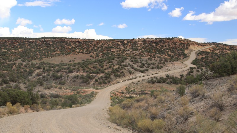
Perkins Road connects Blanding to Montezuma Canyon and begins a scenic dirt route to Hovenweep. The graded county road is easy but has steep grades and switchbacks, which offer panoramic views. Near Blanding, a small spur to the east has a campsite large enough for 3 to 4 rigs overlooking Recapture Canyon with views of the Abajo and Sleeping Ute mountain ranges.
Updated: 06/15/2024
Cobble Creek
Kamas, Utah
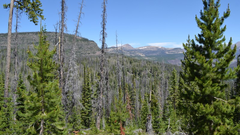
Just over an hour away from Salt Lake City lies a playground. This playground offers over 2.1 million acres with any outdoor sporting activity you can imagine. The Uinta-Wasatch-Cache National Forest is quite the wonderland. This particular region lies just outside of Kamas, Utah, and is open to all kinds of recreation from backpacking to fishing, to just about anything with a motor.
Not far from the mouth of the canyon is the Soapstone Basin. This region runs right along the Lower Provo River and provides access to many streams, lakes, trails, and camping opportunities. Cobble Creek is one of those trails that provides your access. Whether you are here to backpack, fish, or just enjoy the cool mountain air, this area is quite a treat!
Updated: 05/01/2024
Mammoth Cave
Duck Creek Village, Utah
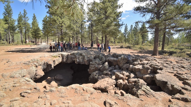
Mammoth Cave is made up of multiple lava tubes within the vast lava flows on the Markagunt Plateau region of Dixie National Forest in Utah. The 12,000 foot Duck Creek Lava Tube is among the longest and highest lava tube in the United States. This easy out and back trail is accessible by all types of vehicles and a great spot to take the entire family. There are multiple cave entrances that you can easily walk down into. The lava tubes run in different directions and exit up to the surface at several points.
Volcanism in the Markagunt Volcanic Field occurred between 2.8 and 5.3 million years ago. The area's cinder cones and lava flows produced during this stage are now heavily eroded. The second stage of volcanic activity occurred between 800,000 and 500,000 years ago. Its cones and lava flows are only moderately eroded. If you plan to explore deep in the caves, be sure to bring a flashlight or two.
Updated: 06/05/2022
Cascade Falls
Duck Creek Village, Utah
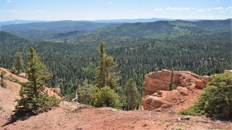
Named for the waterfall that flows out of the side of the red cliffs, Cascade Falls is a must-see when you're visiting this area. The hiking trail leads to an observation deck providing spectacular views of Zion National Park and the surrounding mountains. The water is supplied by a sinkhole below Navajo Lake, traveling through an underground lava tube before coming out of the cliff face. The water flows a couple of miles underground through the lava tube before exiting a hole in the side of the Virgin River Rim. The hiking trail is an easy 1.1 miles, round trip. It has a couple of narrow spots, but there are stairs and benches along the way. In dry conditions, all passenger cars can safely reach the hiking trailhead.
Updated: 06/29/2026
Hideout Canyon Road
Castle Valley, Utah
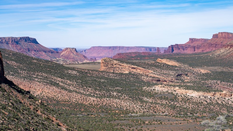
Hideout Canyon Road connects the east end of Onion Creek Trail to Polar Mesa, winding through its namesake canyon along the famed Kokopelli Trail. The road is lined with mature Utah juniper, giving the canyon a classic high-desert feel as twisted trunks and dense green crowns stand out against the red sandstone walls and sandy desert floor, with Cowhead Hill towering in the background. Following part of the Kokopelli Trail corridor, the route offers scenic canyon travel, access to great camping, and a memorable connection between two classic backcountry areas.
Updated: 10/15/2024
Reservation Ridge
Royal, Utah
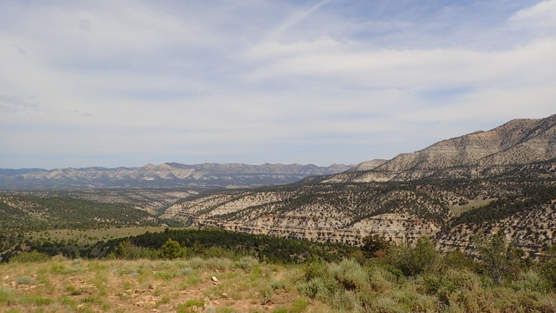
Reservation Ridge is a beautiful high mountain road taking you through the Uinta Mountains north of the little town of Helper. This trail will have you winding in and out of trees while passing other opportunities to explore the many side roads in the area. Be sure to plan a whole weekend out here, as there is much to do!
Updated: 10/15/2024
Pinnacles Trail
Kanab, Utah
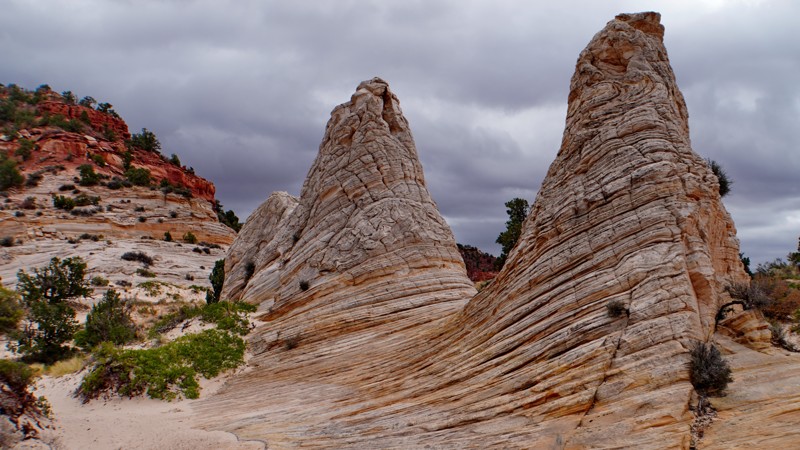
The Pinnacles Trail is one of the most popular trails in the Hog Canyon trail system. It is named after the interesting Pinnacles rock formation, also called the Beehives, encountered about a third of the way into the trail with an established picnic area next to it.
While this trail is known as the 'softer' route through the Hog Canyon area compared to the extreme route through Tom's Canyon, it is still a difficult trail requiring a modified 4WD vehicle, preferably with lockers. This trail is highly scenic and fun to drive, with much of it feeling like a sand and slickrock roller coaster as you cross numerous washes and gullies following the hillside above South Fork Hog Canyon. Steep sandy hills, slickrock ramps, rocks, and ledges abound. The most challenging obstacle is a series of sand-covered ledges on the final climb out of the canyon just before the end, for which lockers are very helpful.
From the end of the trail, you can either turn right on the Mosdell Trail and descend the difficult Mosdell Hill to loop back to the Hog Canyon Staging area or turn left and take the easier route out to the Crocodile Staging Area in Johnson Canyon. There are no established campsites along this trail.
Updated: 08/27/2024
Soapstone Basin
Kamas, Utah
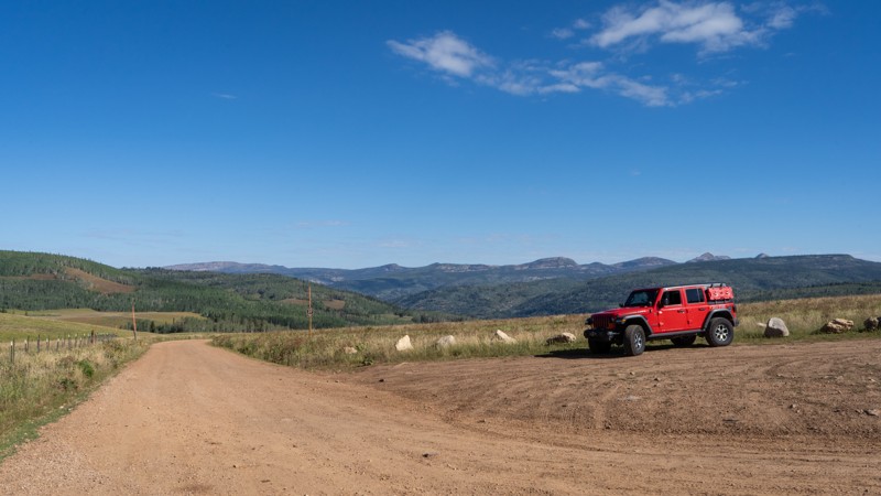
Rolling through the mountains of the Uinta-Wasatch-Cache National Forest is a popular trail known as Soapstone Basin. This well-traveled route is known for being a quick getaway from the summer heat of the city, providing ample opportunities to set up camp among the trees or take a walk down one of the many hiking trails that the Uintas has to offer. At an elevation of just over 9,000 feet, this trail will allow you to breathe in the cool, refreshing air while listening to the breeze whisper through the trees. Although it is a popular trail, it doesn't take much to find yourself a little campsite tucked away among the trees so you can enjoy your own little slice of mountain paradise.
Updated: 03/23/2024
Salt Wash Trail
Green River, Utah
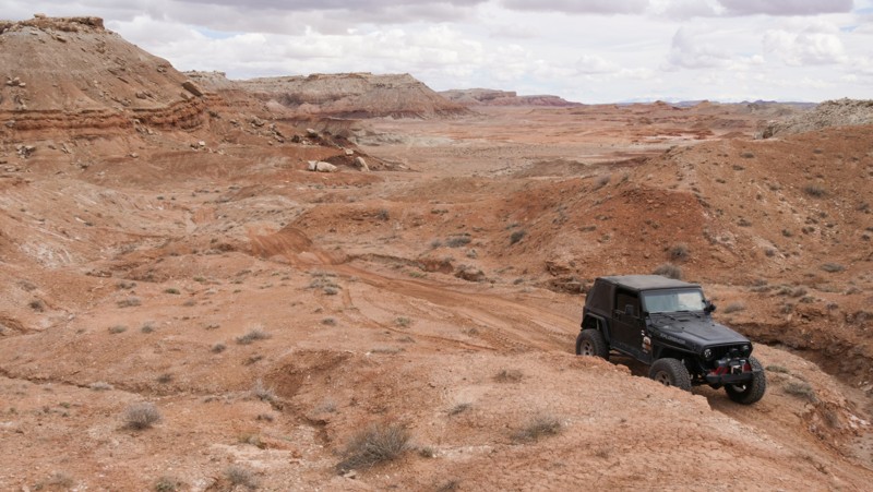
Otherworldly, barren, and desolate describe the foreboding landscape along Salt Wash Trail. The trail winds through and across rugged canyons with colorfully striped cinder cones dotting the horizon. This rugged but oddly beautiful Utah desert is frequented by geologists and archaeologists seeking rare earth minerals and ancient fossils. Salt Wash Trail has enough 4x4 challenges to keep things exciting and a wild mix of terrain, an excellent alternative to the easier trails in the area.
Updated: 04/27/2025
Queens Court
Hurricane, Utah
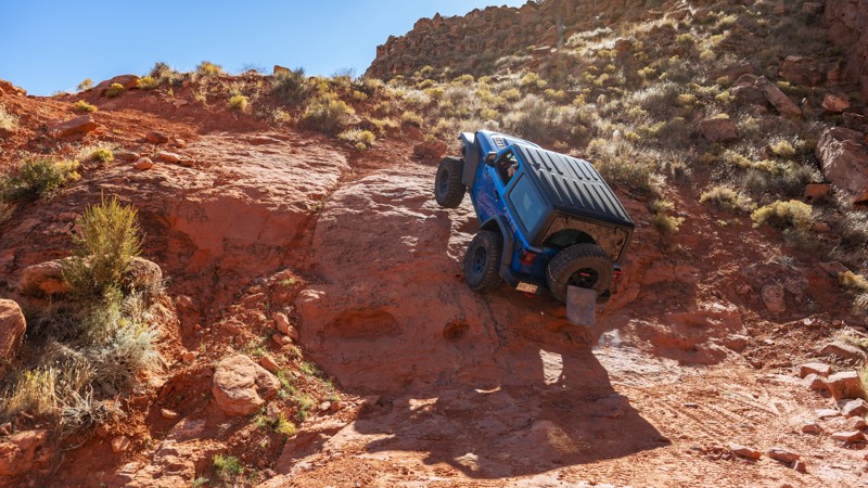
Close to the Arizona border in an area known as the backside of Sand Hollow, Queens Court is a newer trail with entirely different qualities from any other in Sand Mountain. Queens Court is a technical, boulder-strewn 3.5-mile loop with countless diff-catching rocks, small ledges, steep and loose climbs, birds-eye Arizona Strip views, and almost completely absent of any sand. The farther into this trail you travel, the more difficult it becomes. The trail does not offer bypasses for the major obstacles, and there are no winch points for self-recovery.
The trail starts on the eastern end of Warner Valley with large, open, dispersed camping opportunities. Queens Court is best run in the counter-clockwise direction around both loops. The first loop is a mild taste of what you will encounter later in the trail, with a small stair-step ledge. The second obstacle, named left hook, is a two-part obstacle starting with a v-notch ledge, up to a landing, and then a hard left turn up a steep, 36-degree slickrock slab with an uncomfortable amount of off-camber lean. Long-wheelbase vehicles will find the slab easier to climb than short-wheelbase vehicles. The trail climbs a loose boulder-infested hill with moving basketball-sized rocks before finishing the first loop.
The second loop starts with small obstacles and various lines at "The Ledge," where you drop a short cliff into a narrow-cut wash. The canyon then comes to a pinch-point obstacle with no bypasses known as "The Slot." This obstacle will beat on rock sliders and requires careful tire placement to negotiate. The trail then turns south, and heads through Diff Buster Canyon, a time-sucking natural drainage with endless boulders of every shape and size and several 2-3 foot ledge climbs. You are then rewarded with amazing views of the Arizona border as you gaze out across Warner Valley. Drivers will then need to traverse two simultaneous 4-foot drops, the second of which is on the cliff edge, with little room for error. These drops are where the trail earns its highest rating. You then finish the loop with ease and return to where you started.
This trail best suits modified vehicles with lifts, larger tires, skid plates, rocker protection, and locking differentials. 35s should be considered a minimum tire size, with 37s being helpful with long wheel-base vehicles.
About Sand Mountain
Sand Mountain is an extremely unique parcel of public land. Designated as an Open OHV Area, riders are free to make their own trails. Due to this, many of the long-established named trail routes have several variations that can take easier or more challenging routes through the intended trail. The GPX track for this trail helps you navigate the area, but various lines, bypasses, and additional obstacles may exist along the way. Riders are encouraged to stay on existing trails and not unnecessarily drive over or destroy vegetation.
Fees
Riding on Sand Mountain is entirely free. However, there are multiple entry/exit points for the area, including "the tunnel," which connects Sand Hollow State Park to the open OHV area. Any entry into the boundaries of Sand Hollow State Park requires a Utah State Park Pass.
Requirements
When operating on Sand Mountain, users must attach an orange or red safety flag to the vehicle, rising at least 8 feet off the ground.
Updated: 09/18/2023
Allen's Ranch Road
Elberta, Utah
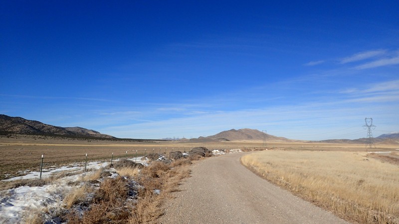
This is an important road in the area. Although it may be short and mild, it allows quick access to the Tintic Mountains from Little Moab/Chimney Rock Pass on a public road. Other roads in the area are quite a bit out of the way or private property. This is also part of the Prospector OHV Backcountry Complex, taking you from Utah Lake over to Vernon Reservoir. The Prospector OHV Backcountry Complex is a network of trails in the west desert of Utah, taking you from town to town by dirt. The network spans hundreds of miles and achieved funding in 2010 for signage and maps. The network ranges from Tooele to Eureka and Utah Lake over to Dugway. This accommodates day runs to long multi-day trips to everything in between. Gear up and be ready for an adventure in the west desert of Utah.
Updated: 08/31/2026
Upper Muley Twist Canyon
Boulder, Utah
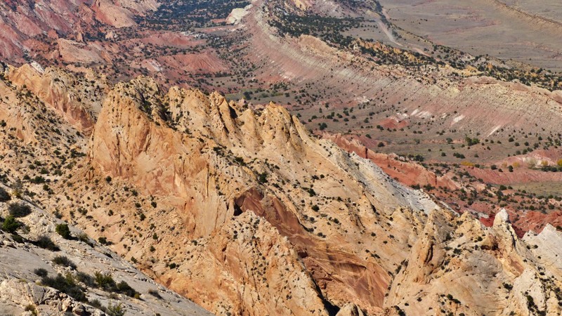
When a short trail combines numerous arches and one of the best views in Utah, you simply have to do it. Upper Muley Twist Canyon hosts several impressive arches along its short track, but they are easy to miss. Keep a careful eye out to the left as you drive inbound. There's even a double arch. The trail ends at a small trailhead parking lot. Follow the cairns east to the Strike Valley Overlook. The vibrant colors of the Waterpocket Fold are simply striking. The Henry Mountains dominate the eastern skyline. A view like this is why you come to Utah
Updated: 10/15/2024
Johnson Creek Road
Blanding, Utah
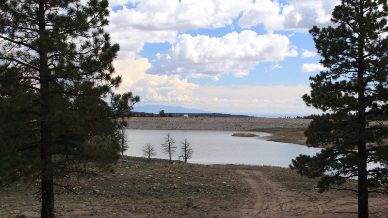
Johnson Creek is the primary access road into the Manti-La Sal National Forest and the Bears Ears National Monument from the Blanding area. A portion of this road is paved, but the entire route is included as a convenience to those heading into this beautiful area of Utah.
Johnson Creek becomes FR 285 once inside the Manti-La Sal National Forest. There are numerous dispersed campsites inside the National Forest Boundary. Nizhoni Campground has 28 individual campsites and two group sites with all the amenities you'd expect from a good campground. Johnson Creek passes Dry Wash Reservoir shortly before ending at the Indian Creek and Causeway intersection.
Updated: 06/05/2022
Radio Tower Bluff Road
Green River, Utah
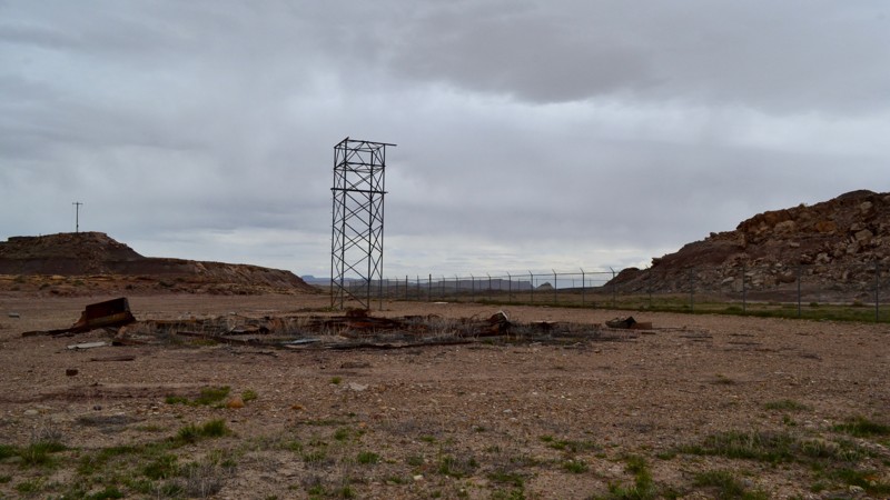
Radio Tower Bluff Road (sometimes referred to as Missile Base Road) is a unique trail just south of Green River, Utah. It is a short spur off of Crystal Geyser Road (Little Valley Road) and will take you back toward a section of the old missile base. Conspiracy theorists have reason to converge on this area. Located in the immediate area in the surrounding hills is the abandoned USAF Green River Launch Complex, known informally as New Area 51. With a quick scan of the area, keen observers can locate the abandoned buildings from the military complex which was closed down in the 1970s. This area also has some unique geology to note. If you are in the area, be sure to take this leisurely drive and explore what Green River has to offer.
Updated: 10/15/2024
Airport Hill
Moab, Utah
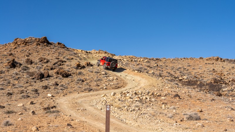
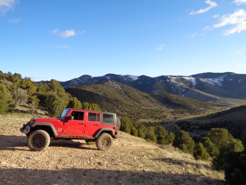
Airport Hill is a small section of the 3D Jeep Safari Route starting near the Mill Canyon Trailhead. The trail is known for its steep, rocky hill climb near its eastern end. This hill climb snakes up to the top of a mesa. There's a two-foot rock ledge before the trail levels out with panoramic views of the Labyrinth Rims area and the Canyonlands Field Airport. The trail continues west, trekking along exposed piles of slickrock and soft sand before ending at an intersection with Sevenmile Rim within Tusher Canyon.
This trail is suitable for any high clearance 4x4.
There is no camping along this trail. Camping in this area is limited to designated dispersed spots only. Several designated sites are located along Cotton Mine Road.
Updated: 09/01/2023
The View
Eureka, Utah
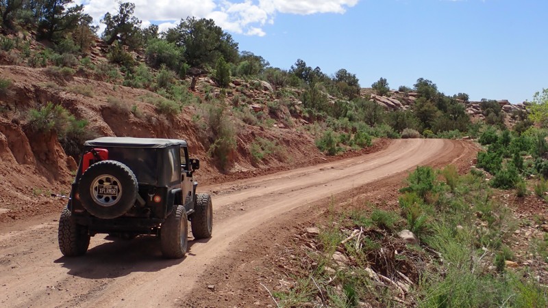
Probably one of the best views in the area, this is definitely a worth while spur. It is just a short 1.3 miles off of Black Rock Canyon and is very easy. If you search around, you can even find a geocache hidden in a tree. From the top, you can see all the way over Utah Lake to Provo and the Wasatch Mountains. If you turn around, you can see to Vernon and the Rush Valley to the Onaqui Mountains and the Sheeprock Mountains.
Updated: 10/15/2024
Brown's Hole
La Sal, Utah
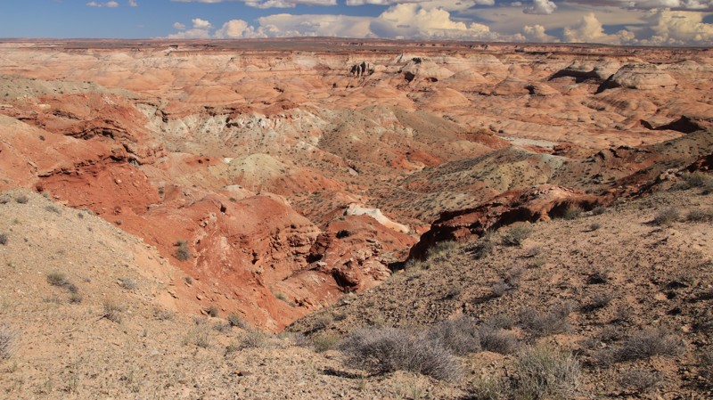
Located south of Moab, on the edge of the Manti-La Sal National Forest, Brown's Hole is an easy 5.3-mile trail cutting through a scenic canyon with private residence. The western portion of the trail is a graded gravel road with a couple of campsites. They are easily accessible and have room for a couple of vehicles with tents. The trail becomes rougher once you enter Browns Hole, a canyon with a flowing creek. There can be deep muddy ruts and potholes while passing the various rustic ranches. The eastern portion is a lovely forest road along a narrow ledge above the creek. The complete trail can be completed in a stock high clearance 4x4 vehicle.
Updated: 10/15/2024
Sand Slide Road
Hanksville, Utah
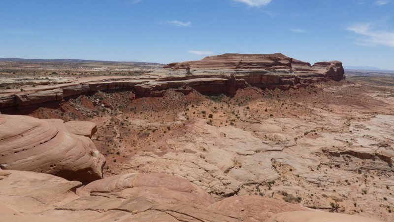
Sand Slide Road loops off Highway 95 primarily to access the trailhead serving Angel Point Trail, a hiking trail that descends to the Dirty Devil River. Reaching the trailhead is easier from the south. The northern portion of the loop may be impassable when wet. There is one small campsite near the northern terminus of the Sand Slide Road. Camping at the Angel Point trailhead is also possible.
Updated: 06/05/2022
Rainbow Rim
Moab, Utah
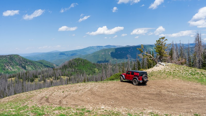
Driving out to the point and walking up to the edge of Rainbow Rim is breathtaking. The adrenaline rush of slowly approaching the edge of the 400-foot vertical cliff is something you will never forget. Countless overlooks in the Moab area require quite a bit of effort to reach either on foot or in a Jeep. Rainbow Rim is an excellent way for the family or a group to experience the feeling of walking up to a breathtaking overlook without committing to an arduous all-day beat down. This memorable trail has no rock crawling or challenging obstacles. Instead, the mild mix of Moab-type terrain entertains even the seasoned wheeler.
Updated: 09/06/2026
Hoyt Canyon
Marion, Utah
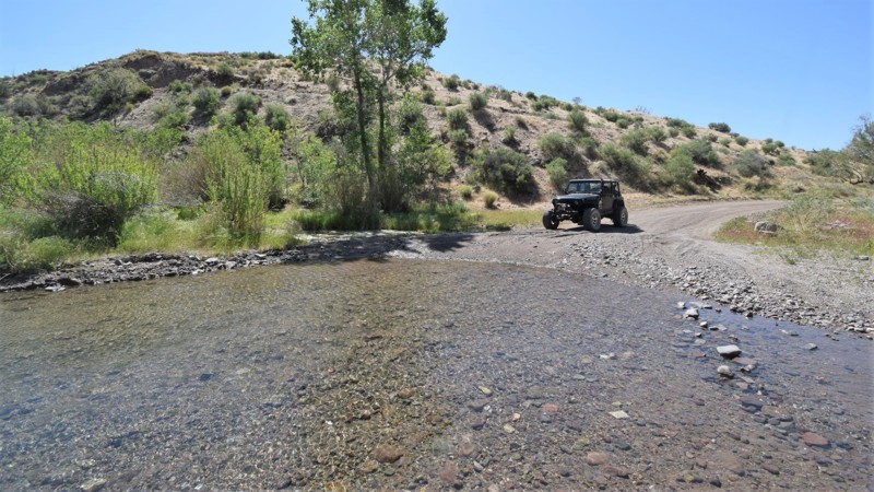
Hoyt Canyon is a rough dirt trail spanning 4 miles but ending just shy of Hoyt Peak. It climbs 1,500 feet and has no major obstacles other than a few ruts and rocky patches where 4WD may be necessary due to the incline. This is a great trail to take the family up, enjoy a day away from the city, and breathe in that fresh air. Once you park at the overlook, there is a final hike to reach the peak if you wish for even better views.
Updated: 04/13/2024
Potters Peak
Santa Clara, Utah
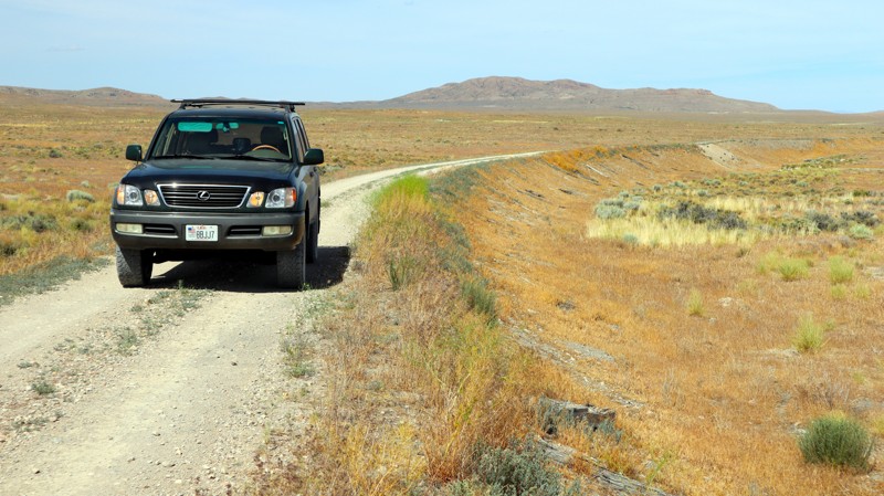
Potters Peak trail traverses a rugged and remote mountainous region of southwestern Utah. The early section of the route travels through Upper Beaver Dam Wash and the small community of Motoqua, UT. After leaving the canyon, you zigzag your way across countless mountain ridgelines with expansive views of the surrounding mountains, containing the trail's namesake: Potters Peak standing at 4850 feet. It is all about the adventure, and this trail has a couple of very narrow spots to get your heart racing, be sure to give yourself ample space on these sections. The trail is an ideal connector for those looking for a true backcountry overland route. Connecting this trail with others can lead to a multi-day adventure or just a day cruise within a very lightly used wilderness region of Utah. Either way, be sure to go prepared for a remote high-desert 4x4 experience.
Updated: 05/28/2026
Transcontinental Railroad National Backcountry Byway
Promontory, Utah
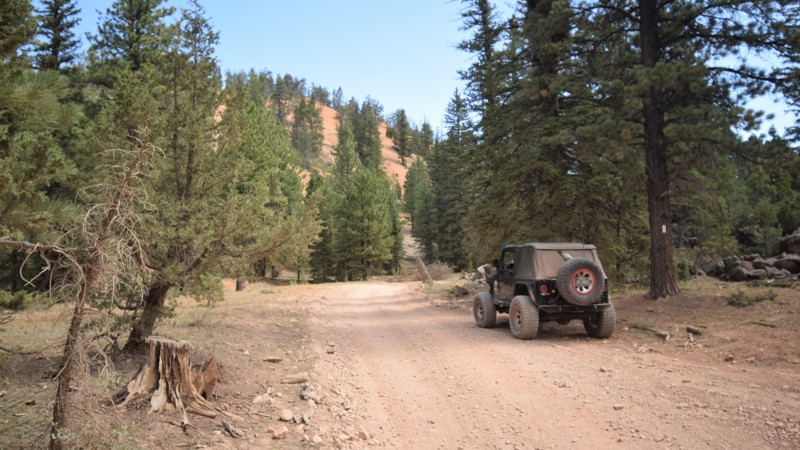
This trail takes you along a section of the Transcontinental Railroad, completed in 1869. It was the first railroad to span from the Eastern United States to the Western United States, connecting Council Bluffs, Iowa, to Sacramento, California. This trail, managed by the Bureau of Land Management, Salt Lake Field Office, is one of the few remaining original, historic railroad grades left that you can actually drive on.
While much of the original grade is closed off due to washouts, cave-ins, and broken bridges, you'll still get a good feel for it as you drive on and next to the original railroad grade.
While you could drive this road in a day, along with a stop in Promitory, Utah, to visit the historic Golden Spike National Park, there's also a great opportunity to take your time and camp along the trail or on Utah State Trust Land next to the Great Salt Lake.
Updated: 05/01/2024
Red Valley
Duck Creek Village, Utah
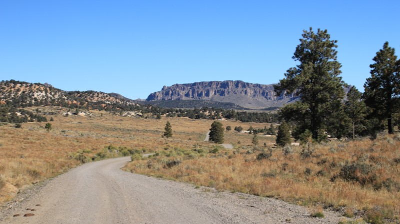
Located within the vast network of OHV trails of Dixie National Forest, Red Valley is a mildly challenging drive through dense pine and aspen forest. The route has been used as a logging trail for many years and is now used for a backway into the small mountain community of Mammoth Creek. The trail has a few mild challenges for stock type 4x4's, making for an excellent choice for connecting numerous trails in this beautiful region of southwestern Utah. You'll encounter a mud hole, bumpy lava rock, and possibly a downed tree or two. When you're in the area, be sure to visit the top of Henrie Knoll and you can't miss exploring the vast tunnels at the nearby Mammoth Cave..
Updated: 05/01/2026
Tom Best Spring Road
Bryce Canyon City, Utah
Tom Best Spring Road is an easy drive near Bryce Canyon National Park with a plethora of dispersed camping. The southern end is dotted with shaded campsites capable of hosting RVs. Further north, the campsites begin to thin out, but the scenery improves with large open prairies, pine-dotted hillsides, and colorful bluffs. The namesake spring is marked with signage. It's a short drive or an easy walk to the watery oasis. The drive requires crossing the normally dry Hunt Wash.
Most of the trail is in the Dixie National Forest. The northern end crosses private ranch land and is far more boring. Just watch out for cattle on the road.

Upgrade your Membership
Unlock all of the details on every Trail Guide and Scout Route.
Start a 7-day Free TrialBrowse Trails in Utah by City
Browse every Utah city with offroad trail guides.
Community
Partners

