










By clicking "ACCEPT", you agree to be the terms and conditions of each policy linked to above. You also agree to the storing of cookies on your device to facilitate the operation and functionality of our site, enhance and customize your user experience, and to analyze how our site is used.
Utah Off-Road Trails
359
Total Trail Guides 334

4759
Detailed Waypoints 925
Try a Free 7-Day Trial and unlock it all
Start a Free Trial Most Recent Trail Reviews
No Rating
Open
Visited: 09/24/2026
This trail has been graded recently and is now an easy trail.

IE
Ingrid Enyeart
Rated 5/5
Partially Open
Visited: 09/22/2026
The portion of the trail between the fork at 11 and the fork at 13 has two major ledges that have formed going into and out of the wash. Not sure what vehicle could overcome these. So just take the sc...


CI
Christine Irsik
Rated 4/5
Open
Visited: 09/22/2026
We enjoyed this trail and will definitely do it again. Gorgeous views at many points along the trail. We didn’t try The Wall, but everything else was just enough of a challenge for us and nice that m...
LF
Leslie F
No Rating
Open
Visited: 09/22/2026
Drove out here in a thunderstorm after doing dome plateau overlook. Epic camping. peaceful. unparalleled views. trail had two steep rocky sections I used 4wd low but probably didn't need to.

JR
jon ross
No Rating
Open
Visited: 09/21/2026
This is a short 2 mile of so cut off trail. Has a wash out with a by pass half way through.



Earl Neisler
Earl Neisler
Rated 2/5
Open
Visited: 09/21/2026
Pinstripe Alley nonstop for the first 4 miles. INo view to be had until waypoint 7. It was a beautiful view then we turned around. Should’ve read the reviews before we started the trail, because th...
LF
Leslie F
Rated 5/5
Open
Visited: 09/21/2026
This is a highlight for the trip. We stayed at waypoint10 for the night.


Earl Neisler
Rated 4/5
Open
Visited: 09/21/2026
Nice connector. The short out back was the hardest and not that short.


Earl Neisler
Rated 4/5
Open
Visited: 09/21/2026
A well maintained road. Found a nice camp site on the south in.
Earl Neisler

Jesse Martin
Jesse Martin
Rated 5/5
Open
Visited: 09/20/2026
Great area to go camping and gather for family reunions. There are multiple other trails that fork off throughout the trail to explore.

Dustin
Earl Neisler
Rated 5/5
Open
Visited: 09/20/2026
Only did apart due to time. This is 1 I will come back and finish.

Earl Neisler
Rated 3/5
Open
Visited: 09/20/2026
Not much to say it a slow easy. A good connecting trail.
Earl Neisler
No Rating
Open
Visited: 09/20/2026
We started just south of Cottonwood Canyon. We stop and looked but could not fine the rock art. The area was a nice to see all the green.


Earl Neisler
Rated 4/5
Open
Visited: 09/19/2026
Great trail, we drove through waypoints 24-35. Easy ride with a good amount of mud holes with few ruts on the stretch we drove. Would love to complete the whole trail at a later date.
Dustin
Rated 4/5
Open
Visited: 09/19/2026
Fun easy trail. Great way to get out and enjoy a relaxing trail ride to take in nature and see the fall colors.
Dustin
Rated 5/5
Open
Visited: 09/19/2026
Great Trail! The scenery was good with lots of wildlife. The trail was diverse that give drivers the opportunity to use both high and low four wheel drive. Trail has both wide and narrow areas.
Dustin
Rated 5/5
Open
Visited: 09/18/2026
I run this trail every year. Always fun and beautiful views. Fair amount of off camber sections.

Jeff Klaassen
Rated 5/5
Open
Visited: 09/18/2026
This was a good trail. The trail still had so flood damage but was passable. Highly recommended this. Has some all some view. We took 2 day to enjoy the ride and views.


Earl Neisler
No Rating
Open
Visited: 09/16/2026
Very fun, short trail. We did the loop but not Wipeout Hill. The sandy sections were a blast and there were a few ledges and obstacles that probably warrant a 5 but are still a fun challenge. We did i...



Mark Signorelli
Rated 4/5
Open
Visited: 09/15/2026
Ran this one and it's a decent stretch for anyone with a high clearance 4x4. The early sagebrush section had me watching my GPS track closely since the road nearly disappears a few times, but it alway...



Jay North
Official Crew
Rated 4/5
Open
Visited: 09/15/2026
Ran this as a quick add-on while working through the rest of the Red Hills network, and it's a fun one to knock out in under an hour. The wash crossing is the one spot where you actually have to think...


Jay North
Official Crew
Rated 3/5
Open
Visited: 09/15/2026
Ran this one on a dry afternoon and came away satisfied without being blown away. The rocky, rolling grade keeps things interesting without ever feeling out of reach for a stock high clearance rig, th...


Jay North
Official Crew
Rated 4/5
Open
Visited: 09/15/2026
Ran this one on an afternoon when I didn't have time for a full day out, and it delivered more than I expected for a short climb. The hill about a mile in makes you actually think about your line, and...


Jay North
Official Crew
Rated 4/5
Open
Visited: 09/13/2026
Red Peak Road is a short, easy cruise that's mostly smooth dirt with just enough texture to keep it interesting. There's a mild rough patch early on and a slightly rockier stretch past the halfway poi...


Jay North
Official Crew
Rated 2/5
Open
Visited: 09/13/2026
This is an easy, low-key cruise with a short technical bump right in the middle where it ties into the rest of the network, otherwise it is just packed dirt and gravel the whole way. Nothing here dema...


Jay North
Official Crew
Rated 4/5
Open
Visited: 09/13/2026
This one's an easy, mellow cruiser and it shows in how quick it feels behind the wheel. The rocky spots near the start and about two thirds up are barely worth mentioning, just some careful tire place...


Jay North
Official Crew
Rated 5/5
Open
Visited: 09/13/2026
This one's a fun add-on if you're already out in the area, easy enough for most of the way that a stock rig won't break a sweat, with just a couple of hard spots to keep things interesting. The washou...


Jay North
Official Crew
Rated 4/5
Open
Visited: 09/13/2026
A nice view of Kanab. Steepish and possibly slick when muddy. One spot has a small rock shelf. 4x4 recommended.


Ben Ruddell
Official Crew
Rated 3/5
Open
Visited: 09/13/2026
Easy, suitable for high clearance 2WD on a dry day, though four wheel drive earns its keep if the ground's been wet. The ruts along the way are mild and easy to place your tires around, and the two wa...


Jay North
Official Crew
No Rating
Open
Visited: 09/12/2026
Crazy no reviews since I ran it last May. We ran it again this time the whole trail out to the south overlook. It had rained the night before and into the morning. The rock dried up quick but a lot o...



Andrew Hotton
Rated 5/5
Open
Visited: 09/12/2026
Sand dunes. DANGER, you need to know your technique to head in here. It’s easy to misjudge slope and camber and get stuck or worse roll.


Ben Ruddell
Official Crew
Rated 3/5
Open
Visited: 09/12/2026
The section of the trail was rocky and rough - still fairly easy but the rockiest stretch.
WF
Wyatt Frampton
Rated 4/5
Open
Visited: 09/12/2026
This trail checks so, so many of the boxes -- hanging off a cliff, passing within 4" of rocks on BOTH sides at the same time on narrow sections, meaningful obstacles (ledges) where I smacked my hitch ...
IR
Isaac R
Rated 3/5
Open
Visited: 09/12/2026
This is an easy, high clearance 2WD road, easy enough that the drive itself isn't the draw. The shelf road stretch is mild and only about two jeeps wide, so keep an eye out for oncoming traffic, and t...


Jay North
Official Crew
Rated 2/5
Open
Visited: 09/12/2026
This is a mellow, low-stress drive that rewards a relaxed pace more than any technical challenge. Stock high clearance handled every mile without a second thought, and the surface stayed predictable e...


Jay North
Official Crew
Rated 5/5
Open
Visited: 09/11/2026
Great rest quick trail! Perfect for beginners, fun place for a picnic. The entrance and exit terrain to the tunnel changes depending on the weather and use. Very fun and interesting.


Dustin
Rated 4/5
Open
Visited: 09/11/2026
My route didn’t originally include this trail, but one of my crew broke on impossible hill and we had to limp back to civilization. This trail was beautiful and remote. Difficulty wise, no issues on t...



Dewie Jones
Official Crew
Rated 4/5
Open
Visited: 09/10/2026
Way better than I thought it would be. This was simply a connector trail for my unsuccessful (broken Toyota) Blanding to Moab overland trip. The trail is absolutely beautiful, relatively fast access, ...
Dewie Jones
Official Crew
Rated 3/5
Open
Visited: 09/10/2026
Easy enough that I did this road in pitch-black with just headlights (no light bar or anything) on the way to see sunrise from the end of the trail (Hurrah Pass). Really straightforward, just rocky li...
IR
Isaac R
Rated 4/5
Open
Visited: 09/10/2026
Incredibly beautiful road and not really rough at all -- I did a bunch of with fully-inflated tires. I know it's just a connector but honestly I would 100% come out here again to enjoy the views, hang...
IR
Isaac R
Rated 4/5
Temporary Closure
Visited: 09/10/2026
Deep mud around river crossing prevents passage. We came from Goblin Valley side, we were able to cross the river but there was deep mud on south side due to recent rains. Almost got stuck, had to go ...

Thomas A Youngerman
Rated 5/5
Open
Visited: 09/09/2026
Incredible bucket list trail that you must do if you can. DON'T do it in 1 day unless you like rushing it, unfortunately circumstances changed that required us to rush it. It's gorgeous and worth an o...



Sean Allen
Rated 5/5
Open
Visited: 09/09/2026
I built this into our rocklanding/overland route and really enjoyed the adventure. You can tell this isn’t well traveled which added to the experience. With that said, we’re trying to get to Moab from...


Dewie Jones
Official Crew
Thomas A Youngerman
Rated 5/5
Open
Visited: 09/08/2026
Great as always, high rewards in terms of views and nothing crazy in terms of obstacles. Great first trail for someone to do with a great payoff!


Sean Allen
Rated 5/5
Open
Visited: 09/08/2026
Fun trail, would run again. Had lunch between Monitor and Merrimac buttes.


Thomas A Youngerman
Most Popular
Updated: 06/05/2022
Gunlock Bypass
Santa Clara, Utah
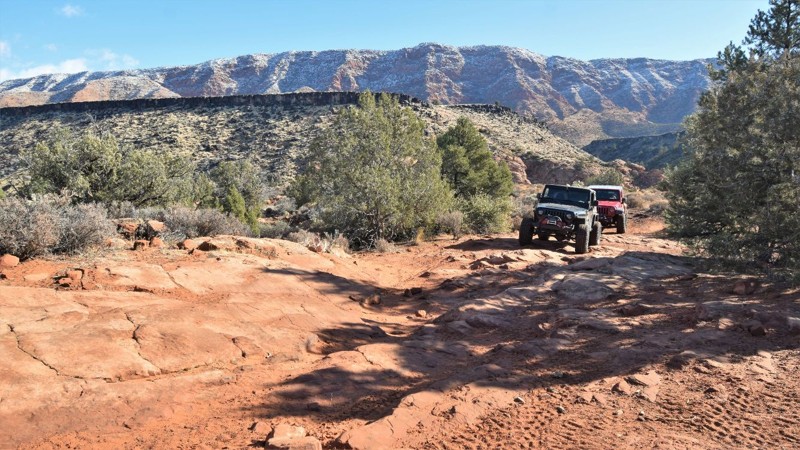
Located outside the small town of Gunlock, Utah, is the scenic and secluded Gunlock State Park and Reservoir. The reservoir is surrounded by large red sandstone rocks and inviting red sandy beaches. Gunlock Bypass trail is a mildly challenging route that travels 3.5 miles through the area outside the State Park Boundary. The trail travels across and along a crystal clear creek that's shaded by countless Cottonwood trees. The trail has a few challenges for stock-type 4x4 vehicles. There is some mild rock crawling and a steep sandy hill to climb. The trail has some of the best FREE campsites in the area; some are along or near the creek that flows year-round. The trail connects with the scenic Gunlock Reservoir trail, where you can gain access to the lakeshore and additional camping.

Updated: 07/02/2026
Kimberly Trail
Sevier, Utah
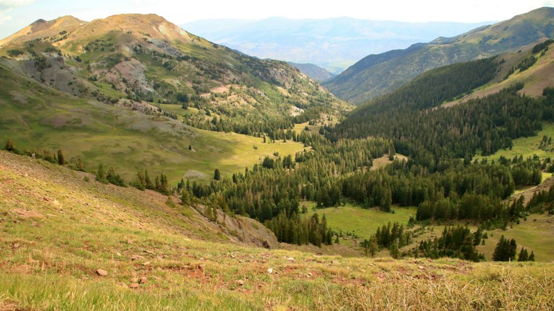
Kimberly Trail, named for a large gold mining operation, runs from Marysvale across the Fishlake National Forest and the Tushar Mountains to Interstate 70 near the Fremont Indian State Park. The trail offers amazing views as it climbs to nearly 10,000 feet elevation through a picturesque mixed conifer forest. Kimberly Trial also intersects with the stunning Paiute Trail which climbs even higher topping out above the treeline. Be sure to stop at the Silver King Mine Interpretive Site for a glimpse into life in the mining heyday of the area. The north end of the trail is near Utah's Fremont Indian State Park and Museum. If you are interested in Native American history, this state park offers outstanding collections and exhibitions. They also have two nice campgrounds.

Updated: 06/05/2022
Coal Canyon Road
Green River, Utah
Disappear into the Book Cliffs with this gateway into Utah's most isolated protected wilderness. The Book Cliffs are the longest continuous cliffs on the continent. They loom just out of reach along the highways from Price, Utah, east to Grand Junction, CO. This region has been protected from development for decades and lays claim to being one of the least explored regions in the United States. There are still undocumented cliff dwellings and petroglyphs being found to this day in the Desolation Canyon Wilderness Study Area. The cliff system is comprised of multiple tiers, each acting as a natural barrier to reaching the uninhabited interior. Coal Canyon Road is one of the few roads that quickly transports you to the first tier of these towering cliffs. The trail travels through an ever tighter canyon before rapidly climbing up a narrow ledge to the wilderness area above. Be sure to stop at the petroglyphs to try to interpret what they may mean.
Updated: 08/12/2026
Adobe Mesa
Castle Valley, Utah
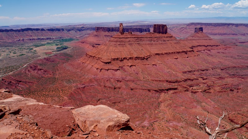
Adobe Mesa is a lesser-known but highly scenic trail in the highlands above Moab. It is located on the mesa that separates Castle Valley from Professor Valley and is particularly known for the majestic overlook of Castleton Tower from the western end of the mesa. The trail starts from the La Sal Loop Road in the Manti-La Sal National Forest and crosses onto BLM land once out on the mesa. It initially winds through a valley with a section of off-camber shelf road before coming out onto the flat mesa. Near the end of the mesa, it splits into two branches that each go to a different overlook on the rim. The western branch leads to an overlook of Castleton Tower and is the more difficult of the two branches. The northern branch is the easiest of the two and leads to another overlook of Professor Valley on the rim, where you will also find an excellent campsite. While this overlook isn't quite as spectacular as the western overlook, it is still worth checking out. The entire mesa is open to dispersed camping, and several campsites can be found both near the beginning and ends of the trail.
Adobe Mesa's overall difficulty is moderate. The road surface changes from rutted dirt near the beginning to a mixture of sand and slickrock ledges further out. The western branch is the most difficult, with a series of rock ledges that will challenge stock vehicles.
Updated: 06/20/2025
Mat Martin Point
Castle Valley, Utah
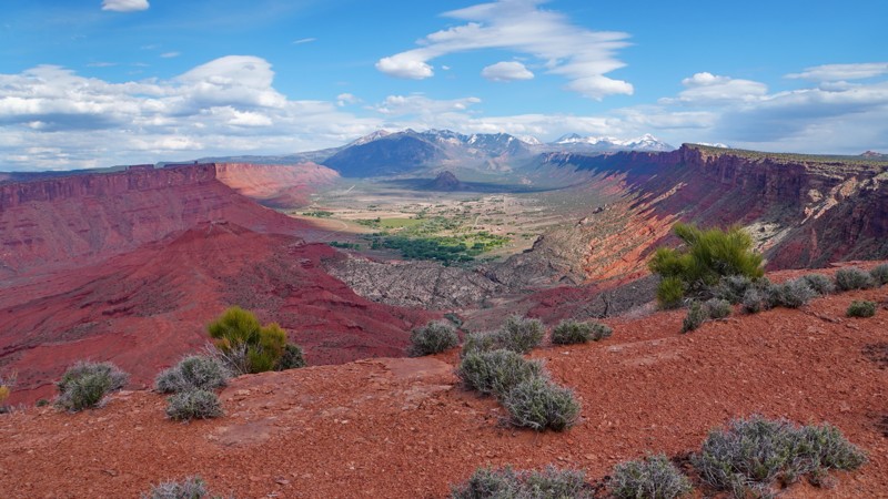
Mat Martin Point is one of the most scenic yet obscure and rarely visited Jeep trails in Moab. It starts at an intersection where the Porcupine Rim safari trail ends and a mountain bike trail continues west. Mat Martin Point heads north and leads to five different branches and overlooks of Castle Valley. Most people who drive Porcupine Rim either don't realize this is a legal trail or are so worn out from its relentless bumps they just turn around where the Mat Martin Point trail begins. It takes a minimum of 2 hours to reach the beginning of the Mat Martin Point trail from Sand Flats Road, so it's best to allocate a full day to explore this trail. Due to its remoteness, you will almost certainly have the whole area to yourself.
The trail is slightly less difficult than Porcupine Rim, with no major obstacles, but there are a few moderate ledges and shelf road sections. The most difficult section is where the trail crosses a small canyon in the middle of a SITLA parcel about halfway out to the point, where there are a series of ledges on a shelf road descending into the canyon. While the main route out to the point is fairly distinct, there are a couple of places where route finding can be difficult. The two overlook spurs to the northwest have become overgrown to the point where they are almost non-existent, though they can still be followed on the ground if you look carefully. Be sure to follow the GPS track closely to stay on the legal trail.
The northeastern overlook is by far the best overlook, as it provides spectacular views of the La Sal Mountains straight up Castle Valley to the south and Fisher Towers to the east along the Colorado River. The north overlook is also worth visiting, with excellent views across the Colorado River canyon to Dry Mesa and Arches National Park, along with two arches in the Windows area clearly visible on the horizon. The pair of overlooks to the northwest are less impressive as both spurs dead-end on hilltops in the middle of the mesa, quite a distance from the rim itself or any expansive views. Getting there requires driving a sandy trail that is so overgrown with small clumps of sagebrush it is barely visible, and the payoff isn't worth the bumpy drive over all that sagebrush.
While the overlooks at the end of the point would make excellent campsites, camping is unfortunately prohibited on all BLM land along this trail. Camping is allowed on the SITLA parcel in the middle of the trail, but there are no existing campsites there. The closest established camping is either in the campgrounds in the Sand Flats Recreation Area or dispersed camping up Sand Flats Road in the Manti-La Sal National Forest.
Updated: 10/15/2024
Nefertiti Point
Green River, Utah
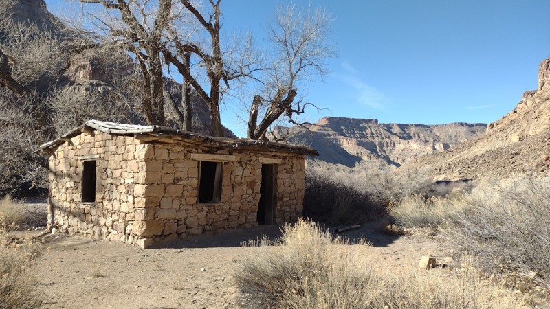
Nefertiti, queen of the 18th Dynasty of Ancient Egypt, has been immortalized by nature. At the end of this easy but very scenic canyon drive is a rock spire that looks like the queen. Although this is the trail's highlight, it by no means is the only worthy stop along the route. The trail travels along and above the mighty Green River. After the pavement ends, the trail is a well-maintained gravel road that accesses an organized campground with sites along the river. At least ten more primitive campsites can be found further back in the canyon. You will also need to plan for a short stop at the remarkably well-preserved Smith Cabin and the petroglyphs at the end. Pack for a day along the river or settle in for a week of epic camping in this remarkable recreation area.
Updated: 10/15/2024
Burr Point
Hanksville, Utah
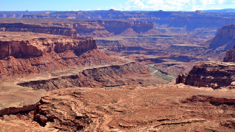
Burr Point loops off Highway 95 to a large camping area overlooking the Dirty Devil River and its colorful canyon. The numerous 5-star flat campsites overlook a geological wonderland of colorful sandstone strata carved by wind, water, and time.
The road is easy graded dirt, except for the Granite Wash crossing very close to the northwestern end of the trail. This crossing washes out with every significant rain and can be completely impassable. It drives the trail's moderate rating. The remainder of the trail is easy.
Updated: 06/01/2024
Nasty Flat
Hanksville, Utah
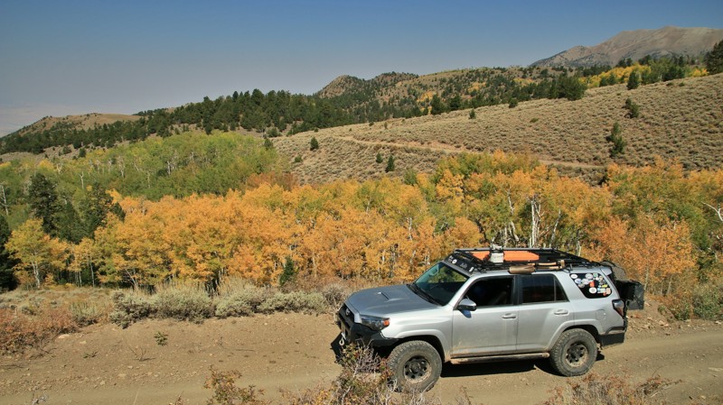
With a name like Nasty Flat, you might not expect 360-degree world-class views of most of southern Utah or picturesque canyons with creeks lined by aspen and bigtooth maples amongst the pines and junipers. That the road curves, climbs and dips along the side canyons of an ancient granite mountain range might seem incongruous. Nasty Flat is neither nasty nor flat. It is, in a single word, extraordinary. Running along the western slopes of Utah's Henry Mountains, Nasty Flat offers a new eye-popping view around each of its innumerable curves. The multi-hued Waterpocket Fold snakes along far below with its toothy monocline uplifts of pink, gray, yellow, and red sandstone. Beyond the Fold lies the vast and magical Escalante. To the south rises the mammoth and majestic Mount Pennell, the stony Horn below it. Ragged Mountain sits off to the east. Don't forget to look up and behind you to see the smooth bare slope of Mount Ellen rising into the skyline. It's easy to get lost in the epic grandeur surrounding the Nasty Flat, but look closer to see the shy deer peeking out from brush thickets or scattering off the trail as you round yet another tight curve along the many heartstoppingly sheer sections of shelf road suspended precariously on the slopes of the Henrys. Nasty Flat ain't flat or nasty. But it is certainly worth venturing deep into the remote Henry Mountains to enjoy its many offerings.
Updated: 10/16/2025
Arrowhead Canyon
Hurricane, Utah
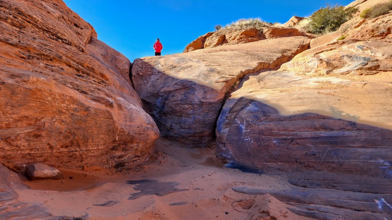
Located a short distance east of the tunnel, just before the east fenceline, Arrowhead Canyon is a technical, tight sandstone canyon ready to wage war on body panels and weak driveline components. Drivers can expect to encounter massive v-notches spanning 4 feet wide, multi-step 6-foot waterfall climbs, a 10-foot sheer wall, and endless side challenges that will push the limits of any rig.
This trail starts up a soft sandy wash from Lakeside for a short distance until you reach the first slickrock slab with a steel sign marking the official trail start. This slabbed waterfall is in no way a representation of what you will eventually encounter along the trail. Continue along the sandy slickrock wash as the canyon constricts, eventually leading to a gatekeeper v-notch scarred with countless engravings from prior vehicles that fell victim to the trail's true difficulty. Arrowhead then continues up the canyon, offering numerous side challenges through a trail known as Side Chick, a level 12-rated trail. Several more waterfalls and v-notches await as you continue traveling southwest to the end, where you will intersect with Papa Smurf and make a hard right turn up a steep, chunky, slickrock slab to exit the canyon.
This trail should only be attempted by experienced drivers in purpose-built rock-crawling rigs. Body damage and mechanical failure are highly likely, and recovery attempts will be challenging.
About Sand Mountain
Sand Mountain is an extremely unique parcel of public land. Designated as an Open OHV Area, riders are free to make their own trails. Due to this, many of the long-established named trail routes have several variations that can take easier or more challenging routes through the intended trail. The GPX track for this trail helps you navigate the area, but various lines, bypasses, and additional obstacles may exist along the way. Riders are encouraged to stay on existing trails and not unnecessarily drive over or destroy vegetation.
Fees
Riding on Sand Mountain is entirely free. However, there are multiple entry/exit points for the area, including "the tunnel," which connects Sand Hollow State Park to the open OHV area. Any entry into the boundaries of Sand Hollow State Park requires a Utah State Park Pass.
Requirements
When operating on Sand Mountain, users must attach an orange or red safety flag to the vehicle, rising at least 8 feet off the ground.
Updated: 06/05/2022
Goldstrike Mine
Santa Clara, Utah
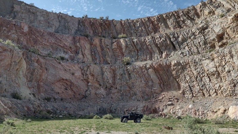
The Goldstrike Mine district is located in Washington County, Utah, at an elevation of 5,000 feet. This route easily travels across a wide-open desert, down through a scenic canyon, and up to the sprawling mine district. In addition, there are a couple of accessible, large open-pit mines that border the trail. Thus, you can get right up close to what once was one of the largest gold mining operations in southern Utah.
According to published project documents, the Goldstrike district was first explored in the late 1800s. During these early years, the production peaked in the area around 1910 before eventually closing down. The district sat idle until the 1970s when there was renewed interest in the area. Widespread exploration started with roughly 1500 drill holes, creating an extensive road network being built. The former Goldstrike open-pit heap leach gold mine was developed and mined by Tenneco Minerals Company from 1988 to 1993. Then was sold to USMX of Utah Inc. USMX operation was the largest yet, encompassing 11 pits, four mine dumps, a crushing plant, a heap leach facility, a carbon recovery plant, smelting facility, and an alkaline chlorination facility. Finally, the mine was closed, and they finished reclamation work in 1996. The last info published on the area states: In October 2018, the company Liberty Gold raised $11.6 million in bought-deal financing that will be used to explore and once again develop Goldstrike.
Updated: 05/01/2026
Bridger Jack Mesa
Monticello, Utah
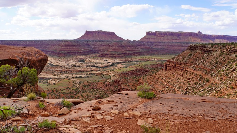
The Bridger Jack Mesa trail is a rougher, more scenic alternative to the graded Beef Basin Road, winding around the west side of Bridger Jack Mesa. Most of the road is a narrow and rocky shelf road following a terrace on the side of the mesa with spectacular views down into Dry Fork Canyon and Lavender Canyon. While not recommended for those uncomfortable driving shelf roads, the road is wide enough for full-size vehicles and never gets dangerously narrow or off-camber. It is rough and rocky the whole way, but there are no major obstacles, and it should be passable to stock 4WD vehicles, though it will be more difficult for them.
This is an excellent overlanding trail, as it has abundant camping opportunities and can be combined with multiple other trails as part of a multi-day trip through Beef Basin and over Elk Ridge to Hotel Rock and Arch Canyon. The trail's northern end has a cluster of free designated campsites in the Bridger Jack Dispersed Camping Area, complete with picnic tables and fire rings, offering panoramic views of the Indian Creek area. This area makes a perfect basecamp for exploring the Indian Creek area and the Needles District of Canyonlands. There are also several established campsites near the southern end of the trail and a flat mesa top near the middle that would be a good area to camp as well.
Updated: 07/02/2026
Causeway
Blanding, Utah
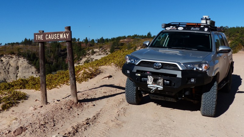
The Causeway runs across the spine of the Abajo Mountains of the Manti-La Sal National Forest. The road's name comes from a bridge across a rocky gorge where the mountains fall way on both sides of the trail. The view from this spot on the trail is never-ending. The Causeway also crosses under the Chippean Rocks, spectacular white sandstone formations towering above the road. Fall brings out dramatic color from golden quaking aspens and bigtooth maples. There are abundant dispersed camping opportunities. At the eastern end of the trail is Nizhoni Campground for those wanting a few more amenities. The western end of the Causeway connects to Elk Ridge and South Cottonwood Road.
Updated: 04/28/2023
Reds Canyon Overlook Loop
Emery, Utah
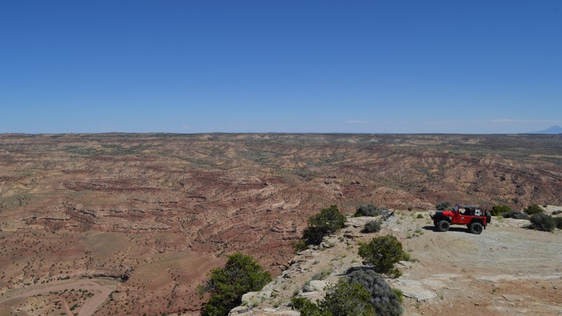
Views for days is the story of this trail. This trail is tucked away in the western side of the San Rafael Swell but needs to be added to the bucket list if you are nearby. Whether you have seen the formations of the Swell, or you are new to this area, you will be amazed at what you can see from the bench. Off to the east, you will overlook the Reds Canyon trail. To the north, you can see Sagebrush Bench and Devil's Point. To the west, you will overlook Link Flats and Cat Canyon, and to the south, you will be looking toward the Lucky Strike Mine and the south end of Reds Canyon where Muddy Creek is flowing. This trail is also an incredible place to camp, providing solitude from the busier areas of the Swell due to the inability of the RV's and big trailers to make it back here. Although not known as an International Dark Sky Park itself, the San Rafael Swell is a star-gazers paradise. Be sure to spend some time checking out what this area has to offer!
Updated: 07/17/2026
Blue Lake Loop
Kamas, Utah
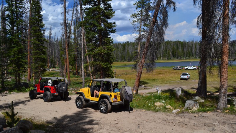
Blue Lake Loop is nestled high in the Uinta Mountains, just a few miles off of popular Mirror Lake Highway. When looking for somewhere not too far from civilization, but off the beaten path, this one makes the list. This moderate off-road trail will lead you to nearby Blue Lake and neighboring Buckeye Lake. Both are popular fishing destinations for catching perch, brown trout, and rainbow trout. In addition to some great destinations for water recreation, there is a plentiful selection of peaceful campsites to choose from for both small and large groups.
Updated: 03/11/2025
Water Tank Road
Washington, Utah
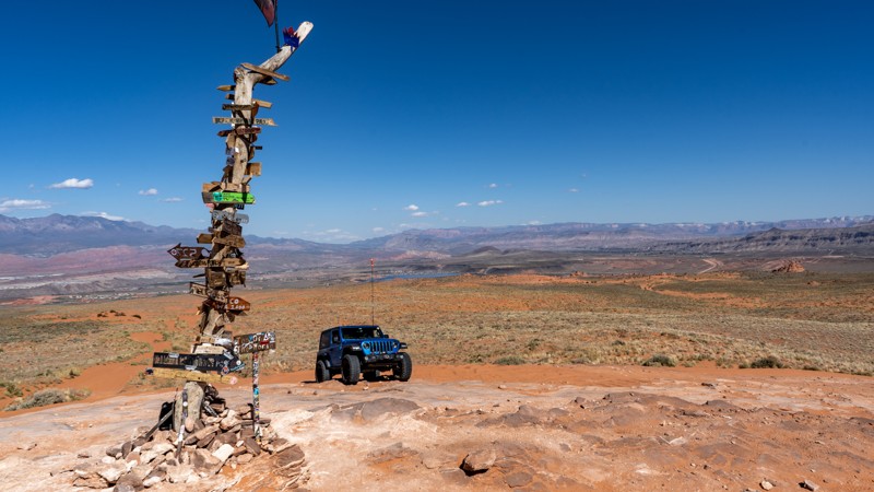
Water Tank Road is one of the central access veins to the southern side of Sand Mountain and a great trail to familiarize yourself with the open OHV area. The trail starts at the massive Waddy's Coral staging area just south of Highway 7 off Sand Hollow Road. Here, you will find a restroom and plenty of space to gather and prepare for your trail ride. From the staging area, the trail travels directly south past many other trail intersections, traversing sharp sandy embankments and tiptoeing through protruding sandstone rocks. You'll cross several long dune sections as you work your way to the Top of The World overlook and the Sand Dunes Overlook, where you will be rewarded with expansive views of Sand Mountain, Sand Hollow Reservoir, The Arizona Strip, and Competiton Hill. This trail is suitable for any high clearance vehicle, and airing down is highly recommended due to the rough terrain and soft sand.
About Sand Mountain
Sand Mountain is an extremely unique parcel of public land. Designated as an Open OHV Area, riders are free to make their own trails. Due to this, many of the long-established named trail routes have several variations that can take easier or more challenging routes through the intended trail. The GPX track for this trail helps you navigate the area, but various lines, bypasses, and additional obstacles may exist along the way. Riders are encouraged to stay on existing trails and not unnecessarily drive over or destroy vegetation.
Fees
Riding on Sand Mountain is entirely free. However, there are multiple entry/exit points for the area, including "the tunnel," which connects Sand Hollow State Park to the open OHV area. Any entry into the boundaries of Sand Hollow State Park requires a Utah State Park Pass.
Requirements
When operating on Sand Mountain, users must attach an orange or red safety flag to the vehicle, rising at least 8 feet off the ground.
Updated: 02/11/2026
Buckhorn Draw
Dewey, Utah
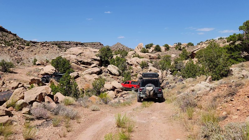
Buckhorn Draw is a beautiful trail along the Delores River and up Buckhorn Draw. The section along the river is on a narrow shelf road that is off camber in places. As you make your way off the shelf road, you encounter a very rocky area with large boulders you have to crawl over. After that, you wind your way around boulders as big as the vehicle you are driving. One of the most scenic places on the trail is an old cabin overlooking the Delores River. There aren't any campsites along this trail
Updated: 05/14/2024
Temple Mine
Hanksville, Utah
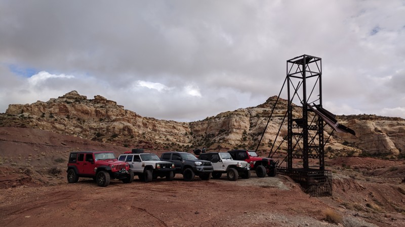
Situated at the southern end of the San Rafael Swell, the Temple Mine is a scenic trip along a ridgeline with inspiring views of Temple Mountain. There are several mining areas to explore. This remote, historic, and seldom traveled route is perfect for the adventurer looking for the hidden nooks and crannies of the San Rafael Swell.
Updated: 09/23/2026
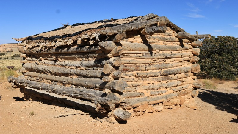
Swasey's Cabin
Moore, Utah
The beautiful San Rafael Swell is known for its fantastic sandstone geology. But the area is full of history, both ancient and more recent. Swasey's Cabin takes you to one piece of that more recent history. Joe Swasey, one of four cattlemen brothers who ranched in the area, built the sturdy log cabin in 1921. Today the cabin still sits against a rock edifice dominated by Broken Cross Tower. Nestled in the rocks is an old spring house designed to keep food and supplies cold by evaporation.
The road to Swasey's Cabin is an easy drive off Temple Mountain Road. The road passes Lone Warrior. For the more adventurous, the moderately difficult Eagle Canyon trail begins at the end of Swasey's Cabin. There are numerous campsites off the many small spur trails along Swasey's Cabin. The cabin site parking lot even hosts a pit toilet.
Updated: 06/05/2022
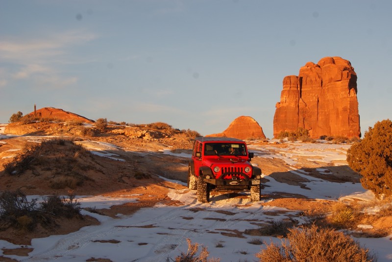
Dellenbaugh Tunnel
Moab, Utah
Sensory overload is how one might describe many off-road trails near Moab, and this one is no different. Tombstone Rock, an imposing red rock tower, is in almost constant view as you travel to an oddity in nature, Dellenbaugh Tunnel, a tunnel formed through sandstone that you can walk through. This is a short but an extremely fun four-wheel-drive trail with inspiring near and distant desert scenery to soak in.
Updated: 02/26/2025
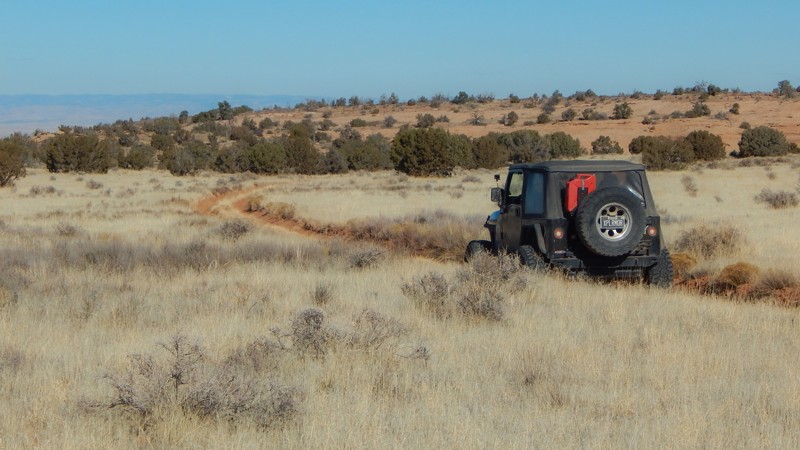
Tub Canyon (Dome Plateau)
Moab, Utah
Traveling along the northwest reaches of its namesake, Tub Canyon is a moderate challenge traversing trees and a scenic prairie-like landscape. Part of the much larger Dome Plateau Loop, this trail offers glimpses of red sandstone buttes poking out between the trees and tall, blowing grass. Although this trail is impossible to run as a stand-alone trail, combined with the other Dome Plateau sections, it creates a challenging and incredibly scenic day on the trail. Considered an alternate route to the popular Dome Plateau Overlook, this route adds a small pinch of difficulty for those looking for a bit more excitement.
Updated: 03/08/2026
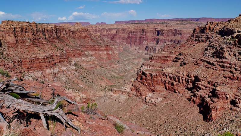
Imperial Valley - Impossible Hill
Hite, Utah
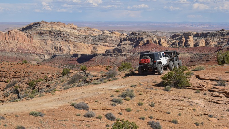
The Imperial Valley and Impossible Hill trail is a remote, challenging, and stunning trail in the Beef Basin area of Bears Ears National Monument and a portion of the Glen Canyon National Recreation Area. It is rarely traveled, and the road has all but faded away in places. The few who venture down it will find spectacular views, challenging rock obstacles, and perfect solitude.
This trail can be run in both directions and in combination with other connecting routes in the area. As shown here, the trail starts at an intersection with the Bobby's Hole trail just below the Bobby's Hole Dugway. It descends a steep, rocky hill called Impossible Hill, which is not for the faint of heart. It is much rougher than the challenging Bobby's Hole Dugway, and most of it is on a narrow, off-camber shelf road with significant exposure. Once at the bottom of Impossible Hill, the trail follows the bottom of Cross Canyon for a short distance before turning left and following the long, flat Imperial Valley. The trail through this section is faint and overgrown with tall grass, as it follows a broad meadow surrounded by red rock spires and cliffs and is filled with wildflowers in the spring. There are a few rocky sections as the trail cuts between levels of the valley.
Near the far point, the trail cuts steeply in and out of a wash before reaching a short spur leading to a spectacular overlook at the head of Imperial Canyon, a side canyon of Cataract Canyon. There is also a nice campsite here, though it lacks shelter from the wind. Continuing past this side spur, the trail follows a sandy wash and loops back upon itself, forming a lasso shape. The trail is almost non-existent in places and may not be possible to get all the way through, though it can be clearly seen at the fork where it rejoins the main trail.
This is an excellent trail to drive as part of a multi-day overlanding trip through Beef Basin. Camping is allowed throughout the area, though only one established campsite exists. If it is windy, you may wish to find a more sheltered spot to camp.
Updated: 05/20/2026
Wild Horse Canyon
Moore, Utah
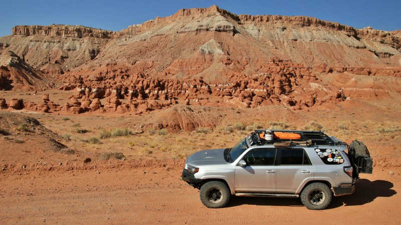
Wild Horse Canyon is an excellent way to continue your Behind the Reef overland adventure into the San Rafael Swell. Ideal for stock type 4x4s, the trail climbs over 1200' from Behind The Reef to sprawling meadows where herds of wild horses are seen grazing. The trail crosses meadow valleys where wild herds spend their days. Wild horses and burros have occupied the region since the Spanish Trail days in the early 1800's. The trail has a few rocky sections that require 4x4, durable tires, and high clearance; however, there are no hard obstacles, steep hill climbs, or extremely narrow ledges. The camping is pretty limited, and only a couple of small pull-off-type sites were found along the route.
Updated: 03/10/2024
Lone Cedar
Hanksville, Utah
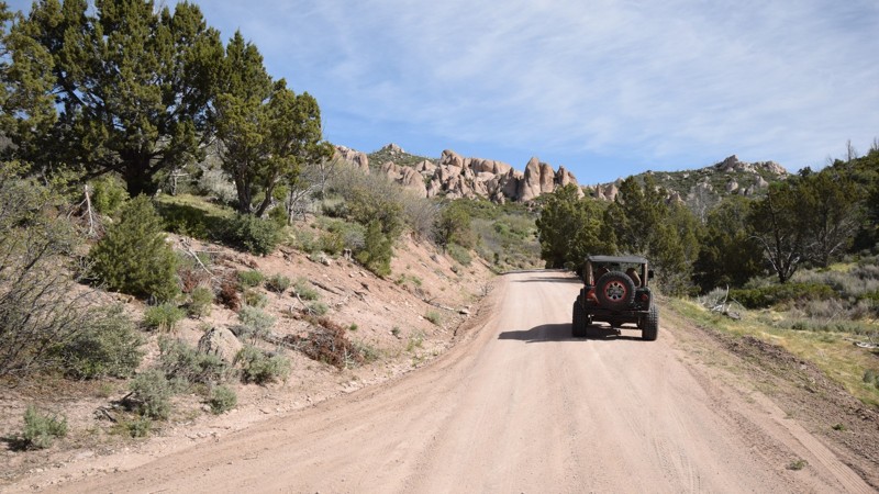
Located in BLM land south of Hanksville, Utah, Lone Cedar is the start of the Bull Creek Pass Back Country Byway, a 68-mile route through the ruggedly beautiful Henry Mountains. Lone Cedar also leads to the Little Egypt Geologic Site. If you enjoy the subtle hues of southern Utah's sandstone, Lone Cedar is definitely for you. With easy access and abundant campsites, Lone Cedar is a popular side trip off Utah's scenic Highway 95. Stately rust-red sandstone buttes stand watch over the trail. The road dips and curves, first hiding and then filling your windshield with its earthy charms. The Henry Mountains, named for the first secretary of the Smithsonian Institution, were the last mountain range to be added to the map of the 48 contiguous States. They loom tall and gray to the west of the trail. Made of igneous minerals that extruded through the surrounding sandstone sediments, the mountains range from 23 to 31 million years old. The Henrys host one of only three genetically pure herds of buffalo left in the United States. Slow down and take a side trip on Lone Cedar. Or use it enter the beckoning Henry Mountains. As they say in Utah, it rocks.
Updated: 06/05/2022
Veyo Shoal Creek Road
Veyo, Utah
Veyo Shoal Creek Road is your entryway into adventure in southern Utah. This easy trail travels from the desert up to the tall pines around Enterprise Reservoir. Along the route, there is an abundance of great camping, with many sites having room for a family gathering or group outing. When you connect this trail with others in the area, you can explore a vast region of Utah wilderness while enjoying cooler temps during the summer months. Be sure to check out unique rock formations along The Pinnacles and travel in the backcountry of Slaughter Creek. The area is well known for predator bird spotting, there are bald eagles, golden eagles, owls and hawks everywhere.

Upgrade your Membership
Unlock all of the details on every Trail Guide and Scout Route.
Start a 7-day Free TrialBrowse Trails in Utah by City
Browse every Utah city with offroad trail guides.
Community
Partners

