










By clicking "ACCEPT", you agree to be the terms and conditions of each policy linked to above. You also agree to the storing of cookies on your device to facilitate the operation and functionality of our site, enhance and customize your user experience, and to analyze how our site is used.
Utah Off-Road Trails
359
Total Trail Guides 334

4759
Detailed Waypoints 925
Try a Free 7-Day Trial and unlock it all
Start a Free Trial Most Recent Trail Reviews
No Rating
Open
Visited: 09/24/2026
This trail has been graded recently and is now an easy trail.

IE
Ingrid Enyeart
Rated 5/5
Partially Open
Visited: 09/22/2026
The portion of the trail between the fork at 11 and the fork at 13 has two major ledges that have formed going into and out of the wash. Not sure what vehicle could overcome these. So just take the sc...


CI
Christine Irsik
Rated 4/5
Open
Visited: 09/22/2026
We enjoyed this trail and will definitely do it again. Gorgeous views at many points along the trail. We didn’t try The Wall, but everything else was just enough of a challenge for us and nice that m...
LF
Leslie F
No Rating
Open
Visited: 09/22/2026
Drove out here in a thunderstorm after doing dome plateau overlook. Epic camping. peaceful. unparalleled views. trail had two steep rocky sections I used 4wd low but probably didn't need to.

JR
jon ross
No Rating
Open
Visited: 09/21/2026
This is a short 2 mile of so cut off trail. Has a wash out with a by pass half way through.



Earl Neisler
Earl Neisler
Rated 2/5
Open
Visited: 09/21/2026
Pinstripe Alley nonstop for the first 4 miles. INo view to be had until waypoint 7. It was a beautiful view then we turned around. Should’ve read the reviews before we started the trail, because th...
LF
Leslie F
Rated 5/5
Open
Visited: 09/21/2026
This is a highlight for the trip. We stayed at waypoint10 for the night.


Earl Neisler
Rated 4/5
Open
Visited: 09/21/2026
Nice connector. The short out back was the hardest and not that short.


Earl Neisler
Rated 4/5
Open
Visited: 09/21/2026
A well maintained road. Found a nice camp site on the south in.
Earl Neisler

Jesse Martin
Jesse Martin
Rated 5/5
Open
Visited: 09/20/2026
Great area to go camping and gather for family reunions. There are multiple other trails that fork off throughout the trail to explore.

Dustin
Earl Neisler
Rated 5/5
Open
Visited: 09/20/2026
Only did apart due to time. This is 1 I will come back and finish.

Earl Neisler
Rated 3/5
Open
Visited: 09/20/2026
Not much to say it a slow easy. A good connecting trail.
Earl Neisler
No Rating
Open
Visited: 09/20/2026
We started just south of Cottonwood Canyon. We stop and looked but could not fine the rock art. The area was a nice to see all the green.


Earl Neisler
Rated 4/5
Open
Visited: 09/19/2026
Great trail, we drove through waypoints 24-35. Easy ride with a good amount of mud holes with few ruts on the stretch we drove. Would love to complete the whole trail at a later date.
Dustin
Rated 4/5
Open
Visited: 09/19/2026
Fun easy trail. Great way to get out and enjoy a relaxing trail ride to take in nature and see the fall colors.
Dustin
Rated 5/5
Open
Visited: 09/19/2026
Great Trail! The scenery was good with lots of wildlife. The trail was diverse that give drivers the opportunity to use both high and low four wheel drive. Trail has both wide and narrow areas.
Dustin
Rated 5/5
Open
Visited: 09/18/2026
I run this trail every year. Always fun and beautiful views. Fair amount of off camber sections.

Jeff Klaassen
Rated 5/5
Open
Visited: 09/18/2026
This was a good trail. The trail still had so flood damage but was passable. Highly recommended this. Has some all some view. We took 2 day to enjoy the ride and views.


Earl Neisler
No Rating
Open
Visited: 09/16/2026
Very fun, short trail. We did the loop but not Wipeout Hill. The sandy sections were a blast and there were a few ledges and obstacles that probably warrant a 5 but are still a fun challenge. We did i...



Mark Signorelli
Rated 4/5
Open
Visited: 09/15/2026
Ran this one and it's a decent stretch for anyone with a high clearance 4x4. The early sagebrush section had me watching my GPS track closely since the road nearly disappears a few times, but it alway...



Jay North
Official Crew
Rated 4/5
Open
Visited: 09/15/2026
Ran this as a quick add-on while working through the rest of the Red Hills network, and it's a fun one to knock out in under an hour. The wash crossing is the one spot where you actually have to think...


Jay North
Official Crew
Rated 3/5
Open
Visited: 09/15/2026
Ran this one on a dry afternoon and came away satisfied without being blown away. The rocky, rolling grade keeps things interesting without ever feeling out of reach for a stock high clearance rig, th...


Jay North
Official Crew
Rated 4/5
Open
Visited: 09/15/2026
Ran this one on an afternoon when I didn't have time for a full day out, and it delivered more than I expected for a short climb. The hill about a mile in makes you actually think about your line, and...


Jay North
Official Crew
Rated 4/5
Open
Visited: 09/13/2026
Red Peak Road is a short, easy cruise that's mostly smooth dirt with just enough texture to keep it interesting. There's a mild rough patch early on and a slightly rockier stretch past the halfway poi...


Jay North
Official Crew
Rated 2/5
Open
Visited: 09/13/2026
This is an easy, low-key cruise with a short technical bump right in the middle where it ties into the rest of the network, otherwise it is just packed dirt and gravel the whole way. Nothing here dema...


Jay North
Official Crew
Rated 4/5
Open
Visited: 09/13/2026
This one's an easy, mellow cruiser and it shows in how quick it feels behind the wheel. The rocky spots near the start and about two thirds up are barely worth mentioning, just some careful tire place...


Jay North
Official Crew
Rated 5/5
Open
Visited: 09/13/2026
This one's a fun add-on if you're already out in the area, easy enough for most of the way that a stock rig won't break a sweat, with just a couple of hard spots to keep things interesting. The washou...


Jay North
Official Crew
Rated 4/5
Open
Visited: 09/13/2026
A nice view of Kanab. Steepish and possibly slick when muddy. One spot has a small rock shelf. 4x4 recommended.


Ben Ruddell
Official Crew
Rated 3/5
Open
Visited: 09/13/2026
Easy, suitable for high clearance 2WD on a dry day, though four wheel drive earns its keep if the ground's been wet. The ruts along the way are mild and easy to place your tires around, and the two wa...


Jay North
Official Crew
No Rating
Open
Visited: 09/12/2026
Crazy no reviews since I ran it last May. We ran it again this time the whole trail out to the south overlook. It had rained the night before and into the morning. The rock dried up quick but a lot o...



Andrew Hotton
Rated 5/5
Open
Visited: 09/12/2026
Sand dunes. DANGER, you need to know your technique to head in here. It’s easy to misjudge slope and camber and get stuck or worse roll.


Ben Ruddell
Official Crew
Rated 3/5
Open
Visited: 09/12/2026
The section of the trail was rocky and rough - still fairly easy but the rockiest stretch.
WF
Wyatt Frampton
Rated 4/5
Open
Visited: 09/12/2026
This trail checks so, so many of the boxes -- hanging off a cliff, passing within 4" of rocks on BOTH sides at the same time on narrow sections, meaningful obstacles (ledges) where I smacked my hitch ...
IR
Isaac R
Rated 3/5
Open
Visited: 09/12/2026
This is an easy, high clearance 2WD road, easy enough that the drive itself isn't the draw. The shelf road stretch is mild and only about two jeeps wide, so keep an eye out for oncoming traffic, and t...


Jay North
Official Crew
Rated 2/5
Open
Visited: 09/12/2026
This is a mellow, low-stress drive that rewards a relaxed pace more than any technical challenge. Stock high clearance handled every mile without a second thought, and the surface stayed predictable e...


Jay North
Official Crew
Rated 5/5
Open
Visited: 09/11/2026
Great rest quick trail! Perfect for beginners, fun place for a picnic. The entrance and exit terrain to the tunnel changes depending on the weather and use. Very fun and interesting.


Dustin
Rated 4/5
Open
Visited: 09/11/2026
My route didn’t originally include this trail, but one of my crew broke on impossible hill and we had to limp back to civilization. This trail was beautiful and remote. Difficulty wise, no issues on t...



Dewie Jones
Official Crew
Rated 4/5
Open
Visited: 09/10/2026
Way better than I thought it would be. This was simply a connector trail for my unsuccessful (broken Toyota) Blanding to Moab overland trip. The trail is absolutely beautiful, relatively fast access, ...
Dewie Jones
Official Crew
Rated 3/5
Open
Visited: 09/10/2026
Easy enough that I did this road in pitch-black with just headlights (no light bar or anything) on the way to see sunrise from the end of the trail (Hurrah Pass). Really straightforward, just rocky li...
IR
Isaac R
Rated 4/5
Open
Visited: 09/10/2026
Incredibly beautiful road and not really rough at all -- I did a bunch of with fully-inflated tires. I know it's just a connector but honestly I would 100% come out here again to enjoy the views, hang...
IR
Isaac R
Rated 4/5
Temporary Closure
Visited: 09/10/2026
Deep mud around river crossing prevents passage. We came from Goblin Valley side, we were able to cross the river but there was deep mud on south side due to recent rains. Almost got stuck, had to go ...

Thomas A Youngerman
Rated 5/5
Open
Visited: 09/09/2026
Incredible bucket list trail that you must do if you can. DON'T do it in 1 day unless you like rushing it, unfortunately circumstances changed that required us to rush it. It's gorgeous and worth an o...



Sean Allen
Rated 5/5
Open
Visited: 09/09/2026
I built this into our rocklanding/overland route and really enjoyed the adventure. You can tell this isn’t well traveled which added to the experience. With that said, we’re trying to get to Moab from...


Dewie Jones
Official Crew
Thomas A Youngerman
Rated 5/5
Open
Visited: 09/08/2026
Great as always, high rewards in terms of views and nothing crazy in terms of obstacles. Great first trail for someone to do with a great payoff!


Sean Allen
Rated 5/5
Open
Visited: 09/08/2026
Fun trail, would run again. Had lunch between Monitor and Merrimac buttes.


Thomas A Youngerman
Most Popular
Updated: 12/01/2023
Logan Peak
Providence, Utah
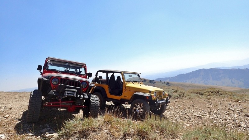
Locally known as Mt. Logan, Logan Peak is located in the Bear River Mountains. This is a highly recommended off-road trail for an amazing scenic overlook. It has been measured as the second highest peak overlooking the Cache Valley, after Mt. Naomi. Dependent on the air clarity, you may even be able to see Wyoming’s Tetons in the distance. The area serves as a popular destination for off-roading, hiking, mountain biking, snowmobiles and even advanced cross-country skiers in the winter months.

Updated: 11/04/2024
West Rim Boulevard
Washington, Utah
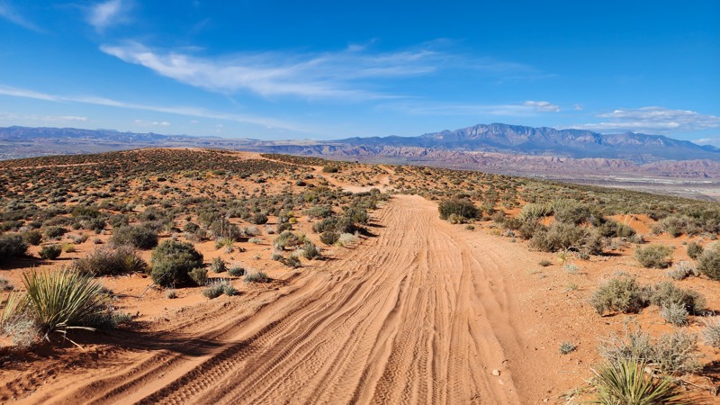
West Rim Boulevard is a rough and sandy connector trail traveling along the western edge of Sand Mountain. The trail connects West Rim and Water Tower Road and is primarily used to access more challenging trails like The Maze, Fawlty Towers, and Renegade. A portion of West Rim Boulevard, south of the West Fenceline Road, is part of the West Rim Lite route, bypassing obstacles like V-Notch, The Squeeze, and Wall of Doom. West Rim Boulevard offers fantastic views of St. George, Washington, Warner Valley, and the Arizona Strip. The road surface is a mix of everything, with rough dirt sections, soft sandy sections, protruding slickrock sections, and a couple of loose hill climbs. Besides a few slow spots that may require low range, this trail has no major obstacles and is suitable for any stock 4-wheel drive vehicle without any modifications.
About Sand Mountain
Sand Mountain is an extremely unique parcel of public land. Designated as an Open OHV Area, riders are free to make their own trails. Due to this, many of the long-established named trail routes have several variations that can take easier or more challenging routes through the intended trail. The GPX track for this trail helps you navigate the area, but various lines, bypasses, and additional obstacles may exist along the way. Riders are encouraged to stay on existing trails and not unnecessarily drive over or destroy vegetation.
Fees
Riding on Sand Mountain is entirely free. However, there are multiple entry/exit points for the area, including "the tunnel," which connects Sand Hollow State Park to the open OHV area. Any entry into the boundaries of Sand Hollow State Park requires a Utah State Park Pass.
Requirements
When operating on Sand Mountain, users must attach an orange or red safety flag to the vehicle, rising at least 8 feet off the ground.
Updated: 06/15/2024
Lambert Meadows
Kamas, Utah
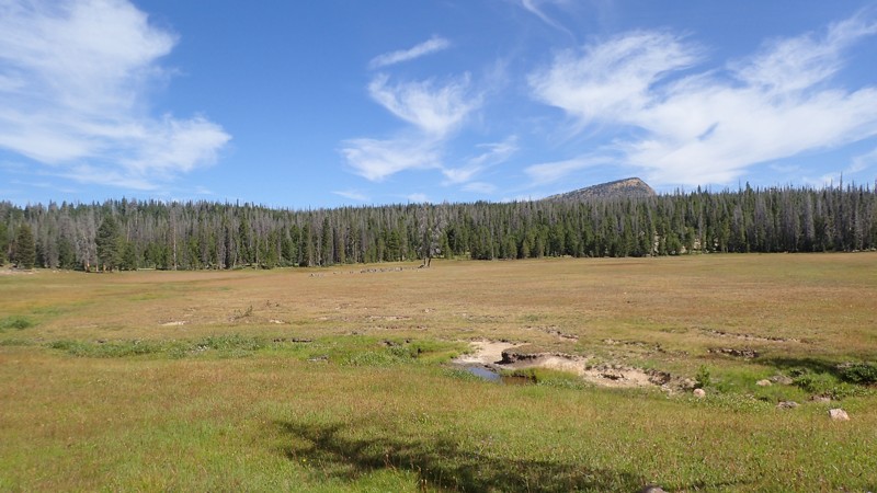
Among the Trial Lake area of the Uinta Mountains, Lambert Meadow is a great place to explore for the day if you are looking to escape the crowds. Winding your way through the forest, you may encounter many forms of wildlife, as this area is lush with vegetation and water sources. Camping is prime in this area as well, with many spots already set up away from the crowds. Although there are no useful lakes in this immediate area, the views you get are well worth the trade. Be sure to explore the area whether it's for the day or a nice long weekend getaway. You won't be disappointed.

Updated: 11/27/2023
Chiulos Canyon Road
Eureka, Utah
Chiulos Canyon Road is a nice drive through the Tintic Mountains, connecting you from Homansville Pass Road over to Jenny Lind Canyon. This steady trail features some history of the mining industry that used to be present back in the late 1800's and into the 1920's. The Farragut mine shaft is right along this route, which has a large grate covering it, however, you are still able to walk out over the entrance. This looks to be one of the deeper mine shafts to walk over in the area. This trail also allows access to Eureka via Jenny Lind Canyon so you can get some food or fuel if needed. If you are looking to do a little easy exploring in the Tintic Mountains, be sure to run Chiulos Canyon Road and save some time for a little hiking!
Updated: 05/20/2026
Poseys Trail
Blanding, Utah
William Posey was a Paiute chief who led one of Utah's last conflicts between white settlers and natives. A skirmish occurred along Comb Ridge as the Paiute's attempted to flee westward along and then down Comb Ridge.
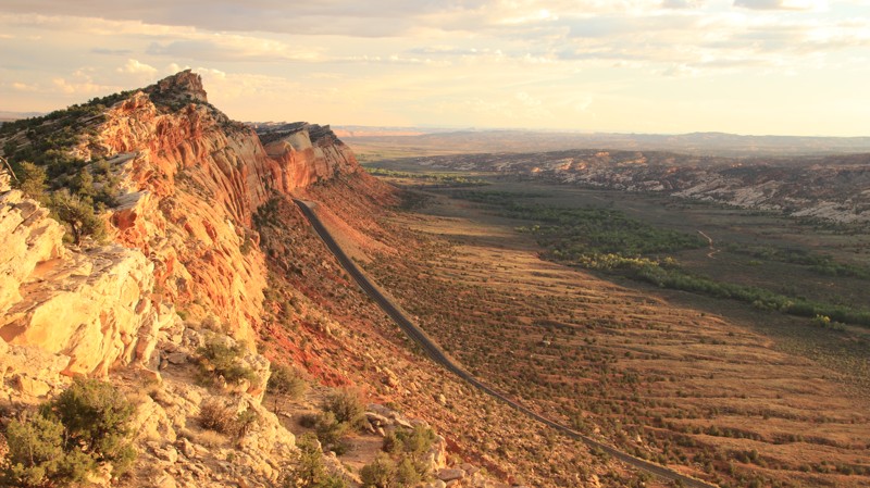
Today Posey's Trail is a scenic drive along the top of Comb Ridge. Beginning off Cottonwood Wash, the trail passes several canyons with campsites and, if you know how to get down there, cliff dwellings at the bottom. The trail turns north along the apex of Comb Ridge with amazing views down the monocline and across Cedar Mesa. This first of two campsites along the ridgeline can support two to three vehicles and has a sandstone slab table right out of the Flintstones. The other campsite is at the southern end of the road. There's not much level ground there, but enough space for two or three vehicles. The site has great views as well.
Updated: 03/04/2024
Joint Effort
Hurricane, Utah
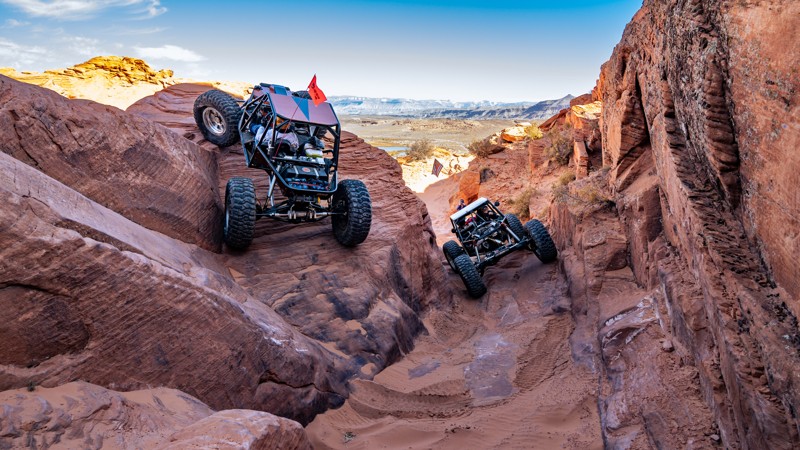
Traversing non-stop, consecutive obstacles through the most demanding terrain on Sand Mountain, Joint Effort is a short but brutal trail that tests even the most well-built vehicles. Immerse yourself with steep slickrock climbs, sharp drop-offs, and extreme off-camber situations, constantly articulating your suspension to its max. The obstacles on Joint Effort provide a constant adrenaline rush but don't forget to take in the spectacular views of Sand Hollow Reservoir, Zion National Park, and the Pine Valley Mountains in the backdrop.
Updated: 06/18/2026
Little Wild Horse Canyon
Hanksville, Utah
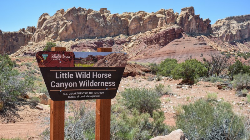
Continuing your Behind The Reef adventure through Little Wild Horse Canyon may be the adrenaline boost your overland trip needed. With two choices at the end of Behind the Reef trail, Little Wild Horse is the difficult option for reaching the higher elevations within the San Rafael Swell. The trail winds through a rocky wash before climbing along narrow, steep, rocky ledges. A few hills are long, loose rock, requiring low-range gearing, offroad tires, and a confident driver. The views of the colorful reef, buttes, and canyons go on for miles as you wind your way up to the meadows on top of The Swell. There were no established campsites found along this challenging trail.
Updated: 05/15/2023
Surprise Overlook
Moab, Utah
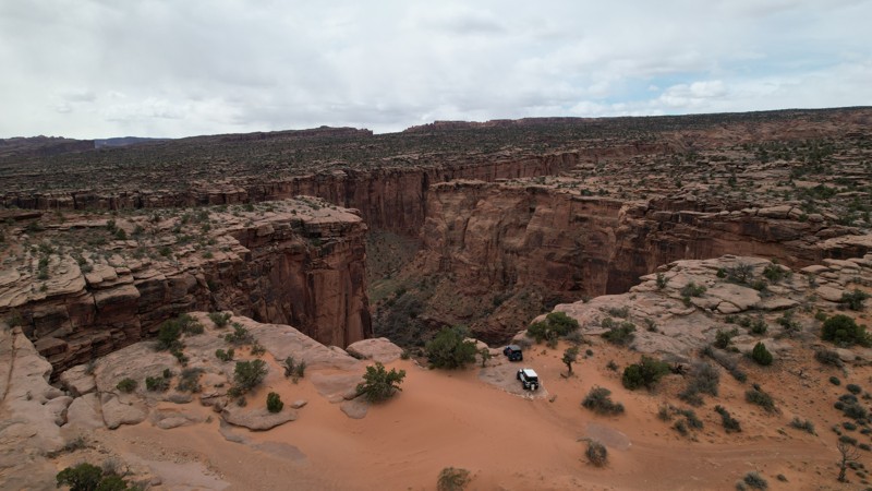
Surprise Overlook near Moab is an excellent extension of your day if you are exploring Gemini Bridges, Little Canyon, or Bull Canyon. The trail is very short, with fantastic scenery in the immediate desert landscape and views of the La Sal Mountains in the distance. The trail's end treats you to a breathtaking view deep into Day Canyon. The trail is appropriately named because as you drive it, you have no idea of the view of the hidden Day Canyon. It is quite the surprise!
Updated: 06/05/2022
Thompson Bench Road
Thompson Springs, Utah
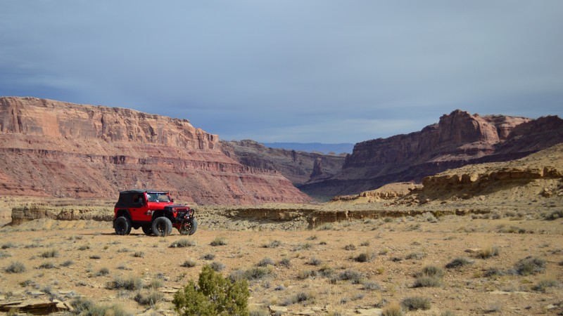
Traverse along the Book Cliffs with this remote gateway into Utah's most isolated wilderness. The Book Cliffs are the longest continuous cliffs on the continent. Thompson Bench Road transports you along the first tier of these towering cliffs. The trail travels along the edge of numerous canyon overlooks and epic campsites perched on the rim. The Book Cliffs loom just out of reach along the highways from Price, Utah, east to Grand Junction, CO. This region has been protected from development for decades. It lays claim to being one of the least explored regions in the United States. There are still undocumented cliff dwellings and petroglyphs being found to this day in the Floy, Flume, Coal, Desolation Canyons, and other Wilderness Study Areas that make up this region. The cliff system is comprised of multiple tiers of dramatic geological layers acting as a natural barrier to reaching the uninhabited interior.
Updated: 11/04/2021
Sulphur Springs
Green River, Utah
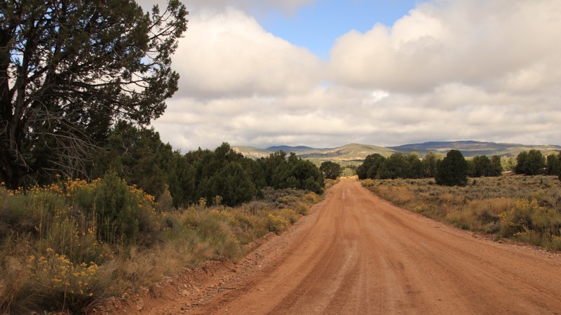
Located on the eastern side of the San Rafael Swell just west of Green River, Utah, Sulpher Springs is a pleasant little side trip off of the Jackass Benches. Although you can no longer drive all the way to the springs due to the Mexican Mountain Wilderness Study Area, it is still a nice drive with spectacular views of the Lower Black Box Canyon area. You also have the opportunity to hike all the way down to the springs and the San Rafael River.
Updated: 05/20/2026
Glendale Bench
Canyon Point, Utah
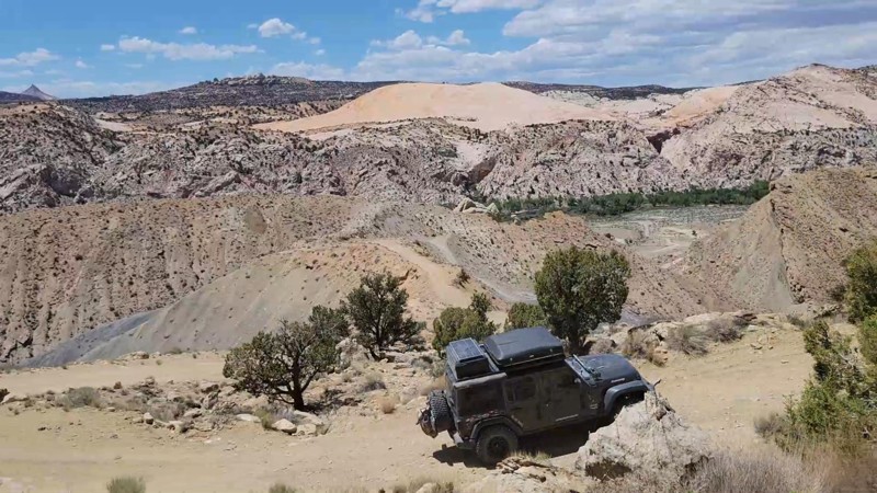
Glendale Bench runs from the little hamlet of Glendale on Highway 89 across BLM land and the Grand Staircase Escalante National Monument to intersect with Skutumpah Road and Johnson Valley Road. The easy road begins with a brief section of rough pavement as it climbs above the town. In places, the pavement has washed away. Beyond is a well-maintained dirt road that passes through jumpers and pinion pines, open meadows of sage, and towering sandstone bluffs. Look south when crossing a small bridge near cattle corrals. Kanab Creek tumbles over a ledge into a large pool at the bottom.
There are very limited dispersed campsites along the road. One large level site with a rock fire ring and views sits on the south side of the trail about 4 miles from the western end.
The road quickly becomes slippery and impassible after any significant precipitation. When dry, it is very easy.
Updated: 03/24/2026
Brigham Plains Road
Paria, Utah
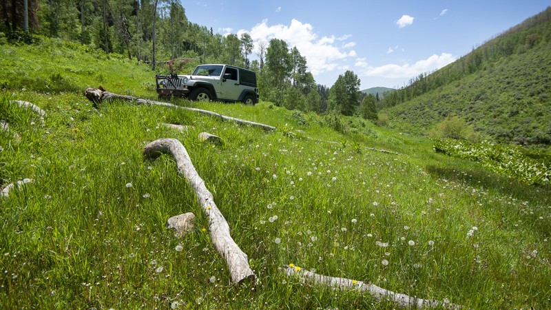
This trail takes you up onto the beautiful Brigham Plains. It is steep, narrow, and rocky going up or down either side. Going up the west side gives you incredible views of the Cottonwood Canyon. The east side takes you down a narrow shelf road with multiple switchbacks. Once you get through the switchbacks, you will travel through Coyote Creek Canyon. There are no campsites along this trail
Updated: 10/15/2024
Main Canyon
Wallsburg, Utah
The remote mountain trails of the Uinta National Forest southeast of Heber City form an interconnecting network of opportunities for overland enthusiasts. The Main Canyon trail from the tiny hamlet of Wallsburg up to Daniels Summit along US 40 features a challenging, rocky uphill climb matched with the stunning beauty of mountain streams and wide-open glades. There are plenty of dispersed campsites along the entire trail. The route is a short 12 miles but packs a big wallop in its first six miles, climbing in 4WD low up a rocky, narrow roadway along Main Creek, past the lush Willow Spring, and on to the expansive mountain meadow of the Big Glade. From there, it’s an easy drive down a wide gravel road to Daniels Summit Lodge, a basecamp for offroad adventures. You’ll want to lower your tire pressure for a more secure and comfortable ride up the rock-strewn roadway. There’s easy access to Strawberry Peak from the Big Glade, plus the entire trail network around Daniels Summit Lodge.
Updated: 07/01/2025
Round Knoll
Green River, Utah
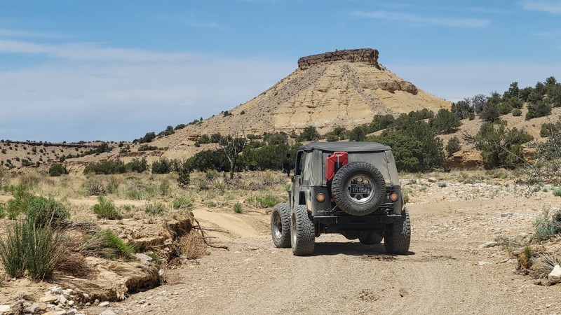
An ideal beginner's route and an excellent addition to The Wickiup, Round Knoll is a meandering scenic route named after a nearby natural flat-top mesa. The route twists, bumps, and drops across varied terrain with lush high desert vegetation. Desert junipers and pinyon pine patches are dense, while shrubs of black brush, rabbitbrush, and several colonies of rare cacti line the route. The northern portion of the route has ever-expansive views of colorful sandstone buttes and spires.
Updated: 05/04/2024
Jackass Benches
Green River, Utah
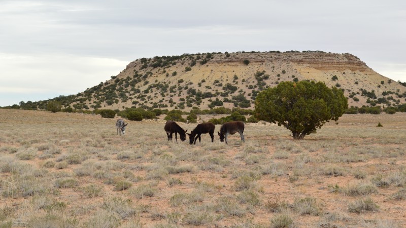
The Jackass Benches are a series of small mesas on the eastern side of the San Rafael Swell just west of Green River, Utah. They are named for the wild burros that roam the area. This offroad trail runs along the east side of the benches and is a nice alternate route to return from Swasey's Leap. It also provides access to the trailheads for Sulpher Springs and Black Dragon Wash. There is amazing high desert scenery and a lot of wide, open spaces. Plus, if you're lucky, you'll get to see the wild burros!
Updated: 05/20/2026
Old Highway 95
Blanding, Utah
Cross Comb Wash and pass through Comb Ridge the hard way! This was the original roadbed of Utah State Route 95 prior to 1976, when the current paved highway was constructed about a mile to the south. While it was originally a graded dirt road passable to 2WD sedans in the 1960s, the road has degraded to the point where it is now a moderate to difficult 4x4 trail that provides a scenic and challenging offroad alternative to the paved highway. This trail can also be combined with either the Arch Canyon trail or the Hotel Rock trail, which both connect to it. While there is minimal camping along the trail itself, there are numerous campsites along the Arch Canyon Overlook road at its western end and at the mouth of Arch Canyon in the middle.
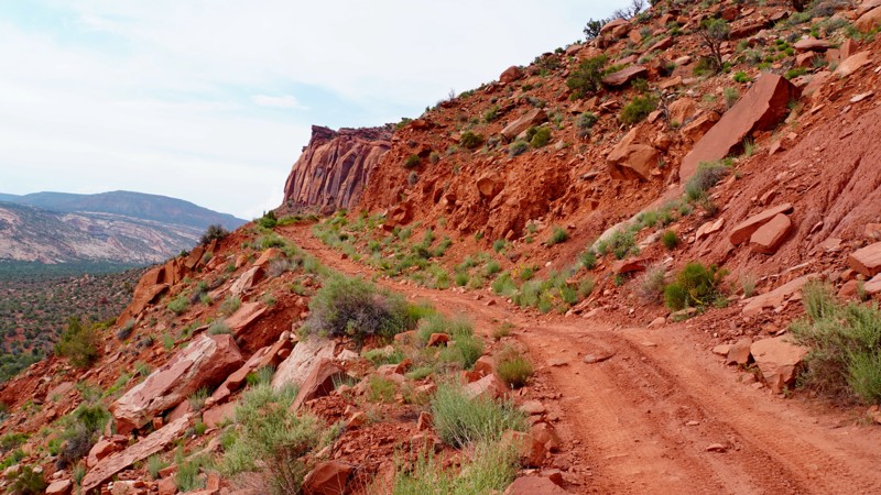
Beginning at the junction with the Arch Canyon Overlook road just past the hiking trailhead to House on Fire, the road is relatively easy crossing the mesa top. The scenery gets more dramatic as you approach the rim of Comb Wash, where the difficulty increases considerably. The descent into Comb Wash follows a series of switchbacks and requires navigating one significant rock obstacle that lower clearance vehicles might struggle with coming up (pictured in the hardest part photo). Once at the bottom of Comb Wash, the route briefly follows a graded dirt road before turning off to the right to climb up Comb Ridge.
Erosion and regular rock falls have taken their toll on the historic dugway cutting through and down the side of Comb Ridge from Posey's Trail Road. It is now a narrow, rocky, shelf road that will test the courage of the average driver. The remains of an old wrecked car can be seen lying on the rocks below, demonstrating that even in the 1960s, this road was far from safe. This portion of the trail is best run uphill for the greatest challenge and for the best views from the driver's side. After climbing up the side of the cliff most of the way, the road veers right through a gap cut through Comb Ridge and follows a steep erosion gully up to the junction with Posey's Trail Road.
Updated: 05/01/2024
Mitchell Mill
Duck Creek Village, Utah
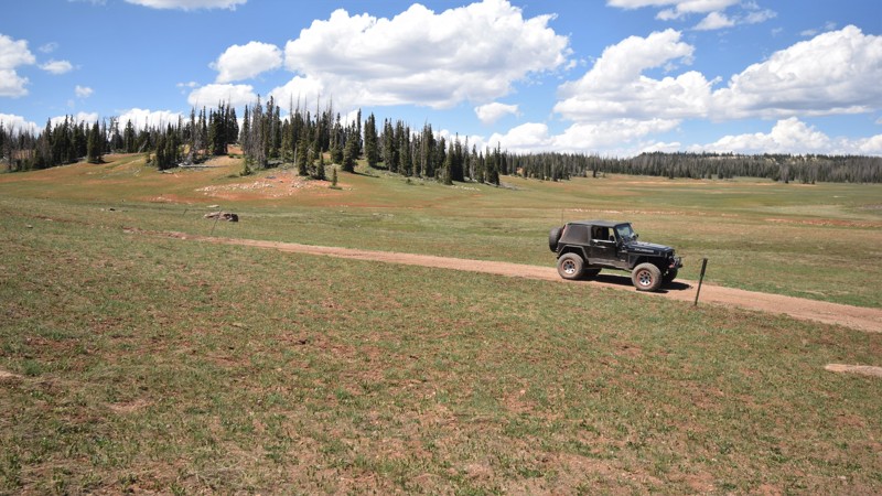
Named after an old sawmill that was once along the route, Mitchell Mill is a scenic loop within the Dixie National Forest. The trail leads to several worthy, primitive campsites, away from the more populated camping areas. Since the elevation is around 10,000 feet, the summer nighttime temperatures are ideal for camping. The route travels through scenic meadows with clusters of trees and lava rocks. The wide-open meadows offer numerous opportunities to pull out a chair and take some time to observe the area wildlife. With the easy access to highway 14, the camping along the trail makes for an ideal location for a base camp while you're exploring this memorable region of Utah.
Updated: 03/12/2025
Burr Trail
Boulder, Utah
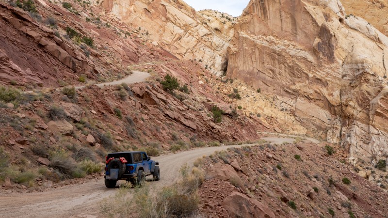
The Burr Trail is a scenic, historic route in southern Utah, known for its breathtaking landscapes and rich geological features. Stretching about 68 miles with pavement from the town of Boulder to the Grand Staircase-Escalante National Monument, the trail offers stunning views of red rock canyons, towering cliffs, and mesas. Originally a cattle-driving route, the Burr Trail now attracts travelers seeking a unique drive through diverse desert terrain, including the famous Waterpocket Fold and the dramatic Capitol Reef National Park. The portion of the trail written about here is the dirt stretch spanning the National Park boundaries. It is only a matter of time before it is all paved! Regardless, this trail is a must-see for those looking to experience the rugged beauty of southern Utah's wilderness.

Updated: 06/05/2022
Homansville (Holmansville) Pass Road
Eureka, Utah
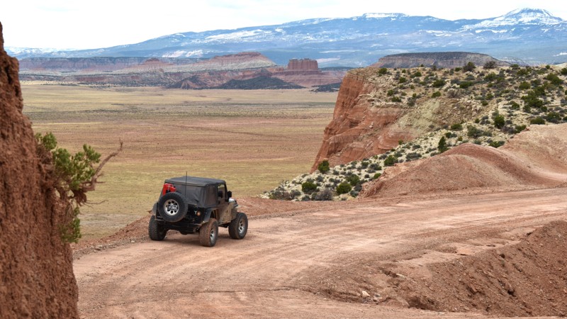
In the 1870s, the little town of Homansville was just starting up. The Tintic Mining District started booming with all of the silver and other minerals being mined. Throughout the 1870s, '80s, and 90's the mines in this area produced enough profit to be considered the second-largest mining district in the state of Utah and in the top 25 in the nation. Prior to the 1900s, the town was abandoned. Today, you can still see remains of very few buildings. The trail pulls you from Highway 6 just north of Eureka and allows you to take a mild drive through the Tintic Mountains up to Allen's Ranch. Mines are rich in the area and you can often see tailings along the hillside. With all of the spurs offered in the area, it's hard to spend just a short day up here.
Updated: 03/24/2026
Last Chance Road
Whipup, Utah
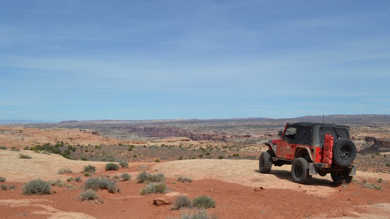
Last Chance Road easily transports you 26 miles into Utah's remote backcountry, where the spires, cliffs, and mountain views will have you saying, "Wow" around every corner—the gravel washboard road winds through several canyons on tight corners and along cliff edges. You will drive for miles across prairies rimmed with towering cliff walls and have abundant choices of private primitive camping. The numerous short offshoots offer semi-secluded camping for a couple of vehicles with tents. The views at every campsite are amazing. The trail connects in the south with the Cathedral Valley Loop trail and numerous other trails with days' worth of scenery to be wowed by. Your vehicle must be very dependable and durable for offroad travel. In dry conditions, the entire route is passable in 2WD. There are no washouts or deep ruts unless driving in the mud, which makes it nearly impassable. Overprepare for the desert with extra fuel, water, and a good working spare tire.
Updated: 11/27/2023
Keg Knoll
Hanksville, Utah
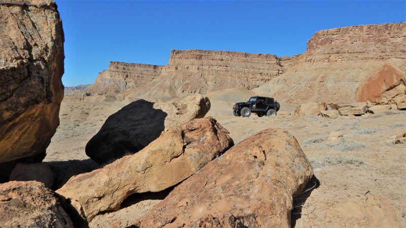
Keg Knoll Road is an awesome spur off of Lower San Rafael Road. Although the trail itself is nothing spectacular, the ending is worth it all! Camping on the end of this trail is among the best around, and it is also the hiking trailhead to Colonnade Arch (a.k.a. Five Hole Arch). This amazing but seldom visited sandstone arch overlooks the Green River, Colonnade Arch (a.k.a. Five Hole Arch). Keg Knoll Road is a must-do if you are exploring the area!
Updated: 06/05/2022
Tusher Canyon
Green River, Utah
East of the Green River, Tusher Canyon is the first trail used to access the expansive Book Cliffs. As you approach the mountains from the river basin, the trail leads through towering cliffs that continually close in on you. The Book Cliffs are the longest continuous cliffs on the continent. They loom just out of reach along the highways from Price, Utah, east to Grand Junction, CO. This region has been protected from development for decades and lays claim to being one of the least explored regions in the United States. There are still undocumented cliff dwellings and petroglyphs being found to this day in the Desolation Canyon Wilderness Study Area. The cliff system is comprised of multiple tiers, each acting as a natural barrier to reaching the uninhabited interior. Tusher Canyon travels up to the first tier of this geographic wonder.
Updated: 04/10/2026
Picture Frame and Balcony Arches
Spanish Valley, Utah
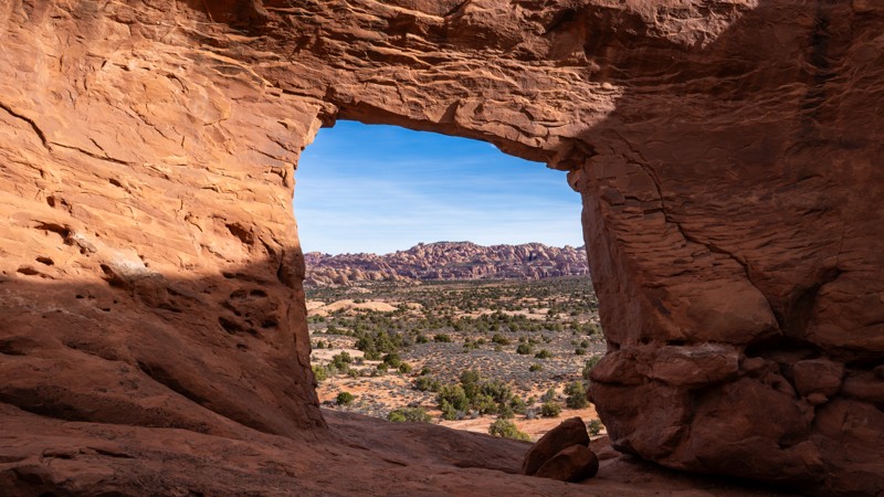
Located south of Moab, about 20ish minutes, Picture Frame and Balcony Arches is part of the popular Behind The Rocks area and offers users amazing scenery, great primitive camping, and opportunities to explore a spiderweb network of numerous side trails. The trail begins off Highway 191 and winds through classic Utah desert landscapes, including sandstone formations, wide-open vistas, and scattered juniper trees. The trail is most accessible on the east end and gets rougher the farther west you travel. While the road isn’t particularly technical, weather conditions like rain can make parts of it more challenging, and it is best suited for high-clearance, 4WD vehicles due to sections of loose sand, rocky terrain, and slickrock. The end of the trail is where the reward is, with both arches situated near opposite corners of a large dome of sandstone that forms a ridge on a small mesa overlooking part of the Behind the Rocks Wilderness. Balcony Arch is located on the southwest corner, above several designated campsites, while Picture Frame Arch is located on the northeast corner. Picture Frame Arch is the more well-known arch and is a large, natural sandstone formation that resembles a picture frame, making it a popular spot for photography.
The first 2 miles of trail do not allow camping, but there are several large staging areas great for airing down or unloading your machines. For the remainder of the trail, primitive camping is only allowed in designated areas marked with a tent symbol sign. Campsites range in size from a single vehicle to large group sites. From tenting and car camping to travel trailers and RVs, there is definitely a spot along this trail for everyone.
Updated: 10/15/2024
Salt Valley Gorge Road
Crescent Junction, Utah
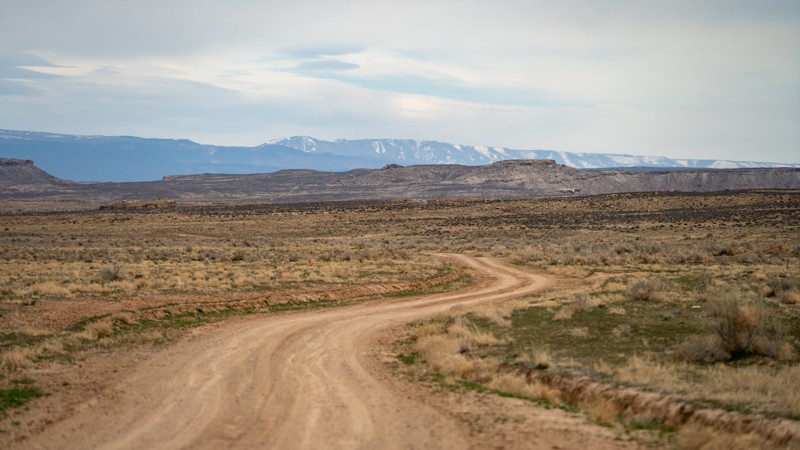
Salt Valley Gorge Road is a maintained BLM road that leads from Highway 191 east towards the entire Yellow Cat area, known for its uranium mines from the uranium boom in the 1950s. This road gives you glimpses of the north side of Arches National Park, the La Sal Mountains, and Fisher Towers. Going through Little Valley and towards Yellow Cat Flats, you are treated with varying badland-type views of reddish and grey clay mountains and structures throughout the entire route. Avoid during wet soggy conditions due to clay mud.

Upgrade your Membership
Unlock all of the details on every Trail Guide and Scout Route.
Start a 7-day Free TrialBrowse Trails in Utah by City
Browse every Utah city with offroad trail guides.
Community
Partners

