










By clicking "ACCEPT", you agree to be the terms and conditions of each policy linked to above. You also agree to the storing of cookies on your device to facilitate the operation and functionality of our site, enhance and customize your user experience, and to analyze how our site is used.
Utah Off-Road Trails
359
Total Trail Guides 334

4759
Detailed Waypoints 925
Try a Free 7-Day Trial and unlock it all
Start a Free Trial Most Recent Trail Reviews
Rated 5/5
Open
Visited: 09/25/2026
We drove this top to bottom in a 2025 Tundra on 34s. No real obstacles, just rough and steep.

SS
Sebastian S.
P
Peaks&Pixels
No Rating
Open
Visited: 09/24/2026
This trail has been graded recently and is now an easy trail.
IE
Ingrid Enyeart
Rated 5/5
Partially Open
Visited: 09/22/2026
The portion of the trail between the fork at 11 and the fork at 13 has two major ledges that have formed going into and out of the wash. Not sure what vehicle could overcome these. So just take the sc...


CI
Christine Irsik
Rated 4/5
Open
Visited: 09/22/2026
We enjoyed this trail and will definitely do it again. Gorgeous views at many points along the trail. We didn’t try The Wall, but everything else was just enough of a challenge for us and nice that m...
LF
Leslie F
No Rating
Open
Visited: 09/22/2026
Drove out here in a thunderstorm after doing dome plateau overlook. Epic camping. peaceful. unparalleled views. trail had two steep rocky sections I used 4wd low but probably didn't need to.

JR
jon ross
No Rating
Open
Visited: 09/21/2026
This is a short 2 mile of so cut off trail. Has a wash out with a by pass half way through.



Earl Neisler
Earl Neisler
Rated 2/5
Open
Visited: 09/21/2026
Pinstripe Alley nonstop for the first 4 miles. INo view to be had until waypoint 7. It was a beautiful view then we turned around. Should’ve read the reviews before we started the trail, because th...
LF
Leslie F
Rated 5/5
Open
Visited: 09/21/2026
This is a highlight for the trip. We stayed at waypoint10 for the night.


Earl Neisler
Rated 4/5
Open
Visited: 09/21/2026
Nice connector. The short out back was the hardest and not that short.


Earl Neisler
Rated 4/5
Open
Visited: 09/21/2026
A well maintained road. Found a nice camp site on the south in.
Earl Neisler

Jesse Martin
Jesse Martin
Rated 5/5
Open
Visited: 09/20/2026
Great area to go camping and gather for family reunions. There are multiple other trails that fork off throughout the trail to explore.

Dustin
Earl Neisler
Rated 5/5
Open
Visited: 09/20/2026
Only did apart due to time. This is 1 I will come back and finish.

Earl Neisler
Rated 3/5
Open
Visited: 09/20/2026
Not much to say it a slow easy. A good connecting trail.
Earl Neisler
No Rating
Open
Visited: 09/20/2026
We started just south of Cottonwood Canyon. We stop and looked but could not fine the rock art. The area was a nice to see all the green.


Earl Neisler
Rated 4/5
Open
Visited: 09/19/2026
Great trail, we drove through waypoints 24-35. Easy ride with a good amount of mud holes with few ruts on the stretch we drove. Would love to complete the whole trail at a later date.
Dustin
Rated 4/5
Open
Visited: 09/19/2026
Fun easy trail. Great way to get out and enjoy a relaxing trail ride to take in nature and see the fall colors.
Dustin
Rated 5/5
Open
Visited: 09/19/2026
Great Trail! The scenery was good with lots of wildlife. The trail was diverse that give drivers the opportunity to use both high and low four wheel drive. Trail has both wide and narrow areas.
Dustin
Rated 5/5
Open
Visited: 09/18/2026
I run this trail every year. Always fun and beautiful views. Fair amount of off camber sections.

Jeff Klaassen
Rated 5/5
Open
Visited: 09/18/2026
This was a good trail. The trail still had so flood damage but was passable. Highly recommended this. Has some all some view. We took 2 day to enjoy the ride and views.


Earl Neisler
No Rating
Open
Visited: 09/16/2026
Very fun, short trail. We did the loop but not Wipeout Hill. The sandy sections were a blast and there were a few ledges and obstacles that probably warrant a 5 but are still a fun challenge. We did i...



Mark Signorelli
Rated 4/5
Open
Visited: 09/15/2026
Ran this one and it's a decent stretch for anyone with a high clearance 4x4. The early sagebrush section had me watching my GPS track closely since the road nearly disappears a few times, but it alway...



Jay North
Official Crew
Rated 4/5
Open
Visited: 09/15/2026
Ran this as a quick add-on while working through the rest of the Red Hills network, and it's a fun one to knock out in under an hour. The wash crossing is the one spot where you actually have to think...


Jay North
Official Crew
Rated 3/5
Open
Visited: 09/15/2026
Ran this one on a dry afternoon and came away satisfied without being blown away. The rocky, rolling grade keeps things interesting without ever feeling out of reach for a stock high clearance rig, th...


Jay North
Official Crew
Rated 4/5
Open
Visited: 09/15/2026
Ran this one on an afternoon when I didn't have time for a full day out, and it delivered more than I expected for a short climb. The hill about a mile in makes you actually think about your line, and...


Jay North
Official Crew
Rated 4/5
Open
Visited: 09/13/2026
Red Peak Road is a short, easy cruise that's mostly smooth dirt with just enough texture to keep it interesting. There's a mild rough patch early on and a slightly rockier stretch past the halfway poi...


Jay North
Official Crew
Rated 2/5
Open
Visited: 09/13/2026
This is an easy, low-key cruise with a short technical bump right in the middle where it ties into the rest of the network, otherwise it is just packed dirt and gravel the whole way. Nothing here dema...


Jay North
Official Crew
Rated 4/5
Open
Visited: 09/13/2026
This one's an easy, mellow cruiser and it shows in how quick it feels behind the wheel. The rocky spots near the start and about two thirds up are barely worth mentioning, just some careful tire place...


Jay North
Official Crew
Rated 5/5
Open
Visited: 09/13/2026
This one's a fun add-on if you're already out in the area, easy enough for most of the way that a stock rig won't break a sweat, with just a couple of hard spots to keep things interesting. The washou...


Jay North
Official Crew
Rated 4/5
Open
Visited: 09/13/2026
A nice view of Kanab. Steepish and possibly slick when muddy. One spot has a small rock shelf. 4x4 recommended.


Ben Ruddell
Official Crew
Rated 3/5
Open
Visited: 09/13/2026
Easy, suitable for high clearance 2WD on a dry day, though four wheel drive earns its keep if the ground's been wet. The ruts along the way are mild and easy to place your tires around, and the two wa...


Jay North
Official Crew
No Rating
Open
Visited: 09/12/2026
Crazy no reviews since I ran it last May. We ran it again this time the whole trail out to the south overlook. It had rained the night before and into the morning. The rock dried up quick but a lot o...



Andrew Hotton
Rated 5/5
Open
Visited: 09/12/2026
Sand dunes. DANGER, you need to know your technique to head in here. It’s easy to misjudge slope and camber and get stuck or worse roll.


Ben Ruddell
Official Crew
Rated 3/5
Open
Visited: 09/12/2026
The section of the trail was rocky and rough - still fairly easy but the rockiest stretch.
WF
Wyatt Frampton
Rated 4/5
Open
Visited: 09/12/2026
This trail checks so, so many of the boxes -- hanging off a cliff, passing within 4" of rocks on BOTH sides at the same time on narrow sections, meaningful obstacles (ledges) where I smacked my hitch ...
IR
Isaac R
Rated 3/5
Open
Visited: 09/12/2026
This is an easy, high clearance 2WD road, easy enough that the drive itself isn't the draw. The shelf road stretch is mild and only about two jeeps wide, so keep an eye out for oncoming traffic, and t...


Jay North
Official Crew
Rated 2/5
Open
Visited: 09/12/2026
This is a mellow, low-stress drive that rewards a relaxed pace more than any technical challenge. Stock high clearance handled every mile without a second thought, and the surface stayed predictable e...


Jay North
Official Crew
Rated 5/5
Open
Visited: 09/11/2026
Great rest quick trail! Perfect for beginners, fun place for a picnic. The entrance and exit terrain to the tunnel changes depending on the weather and use. Very fun and interesting.


Dustin
Rated 4/5
Open
Visited: 09/11/2026
My route didn’t originally include this trail, but one of my crew broke on impossible hill and we had to limp back to civilization. This trail was beautiful and remote. Difficulty wise, no issues on t...



Dewie Jones
Official Crew
Rated 4/5
Open
Visited: 09/10/2026
Way better than I thought it would be. This was simply a connector trail for my unsuccessful (broken Toyota) Blanding to Moab overland trip. The trail is absolutely beautiful, relatively fast access, ...
Dewie Jones
Official Crew
Rated 3/5
Open
Visited: 09/10/2026
Easy enough that I did this road in pitch-black with just headlights (no light bar or anything) on the way to see sunrise from the end of the trail (Hurrah Pass). Really straightforward, just rocky li...
IR
Isaac R
Rated 4/5
Open
Visited: 09/10/2026
Incredibly beautiful road and not really rough at all -- I did a bunch of with fully-inflated tires. I know it's just a connector but honestly I would 100% come out here again to enjoy the views, hang...
IR
Isaac R
Rated 4/5
Temporary Closure
Visited: 09/10/2026
Deep mud around river crossing prevents passage. We came from Goblin Valley side, we were able to cross the river but there was deep mud on south side due to recent rains. Almost got stuck, had to go ...

Thomas A Youngerman
Rated 5/5
Open
Visited: 09/09/2026
Incredible bucket list trail that you must do if you can. DON'T do it in 1 day unless you like rushing it, unfortunately circumstances changed that required us to rush it. It's gorgeous and worth an o...



Sean Allen
Rated 5/5
Open
Visited: 09/09/2026
I built this into our rocklanding/overland route and really enjoyed the adventure. You can tell this isn’t well traveled which added to the experience. With that said, we’re trying to get to Moab from...


Dewie Jones
Official Crew
Thomas A Youngerman
Most Popular
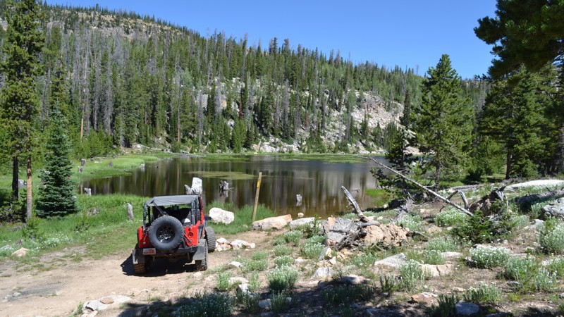

Updated: 08/11/2026
Norway S13
Samak, Utah
Norway S13 is a great little spur off of Norway Flat. It resides within the Uinta-Wasatch-Cache National Forest which is home to thousands of miles of forest roads, along with endless camping, fishing, and many other recreational activities. S13 takes you to a great campsite on a small lake that would be a fantastic spot to kayak or paddleboard. The trail is not challenging and is suitable for any high clearance vehicle. Be sure to check this one out if you are in the area!
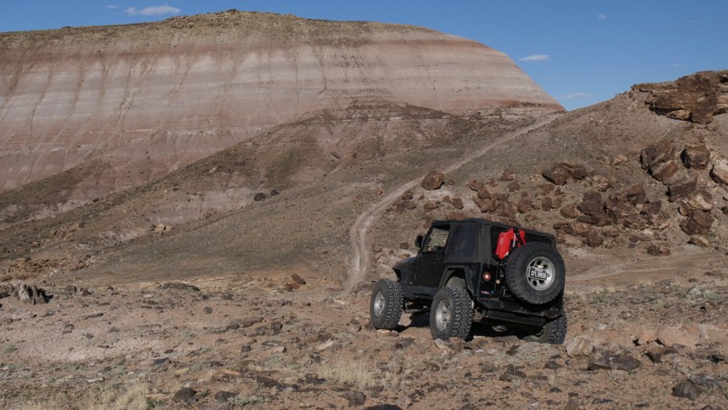
Updated: 10/15/2024
Crystal Spring
Crescent Junction, Utah
Climbing over the Blue Hills, Crystal Spring is a rugged but visually rewarding experience. The trail's multiple challenges include loose rocky hills and vertical rock ledges that can be navigated by stock high clearance 4x4 vehicles with low-range gearing. You'll need durable and aggressive tires to travel the entire route safely. While not an all-day adventure, connecting this trail with other challenging trails in the area makes for an enjoyable day in this colorful desert. Camping was sparse, with only one site on the trail, but it's nice.
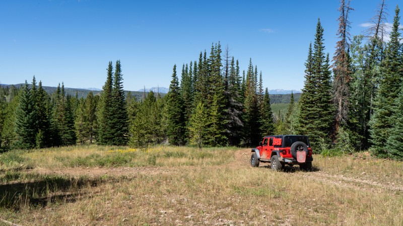
Updated: 08/03/2026
Lambert Hollow
Woodland, Utah
Leaving from Soapstone Basin within a group of campsites, Lambert Hollow is a bumpy, unmaintained forest service road with an abrupt ending. Although the majority of this trail is easy, there are a few patches where water runoff has caused rocks to become exposed and ruts to form. 4 low is beneficial, especially when the rocks are slick from recent rain. This trail once continued up Iron Mine Mountain but is now closed to motorized use before reaching the peak. Most of the good large campsites are right at the trailhead, but a few smaller and more private sites are scattered along the way. All of the camping options are dispersed, with no amenities offered.
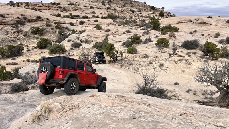
Updated: 10/15/2024
Jug Rock Spring Canyon Link
Crescent Junction, Utah
A combination of BLM trail numbers is technically labeled as Jug Rock Spring Canyon Link. Other maps and sources will also show this as part of the Easter Jeep Safari Secret Spire Route. It can be driven in any direction, with the road changing from dirt two-track to a section of slickrock near the southern end. Depending on which direction you drive the trail, there is a significant elevation change nearer the southern end, presenting a sustained climb/descent and quick slickrock pitches to negotiate. The trail is suitable for any high-clearance stock SUV with low gearing. There is no dispersed camping along the route.
Updated: 12/18/2024
Brinkerhoff Spring
Boulder, Utah
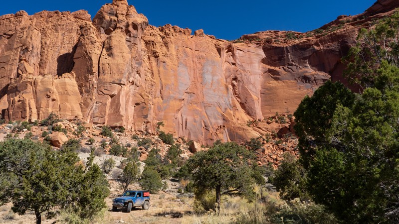
122 is a short camping spur leading off Lampstand Road and back to the cliffs. At the end, you will find evidence of an old corral and a dirty water tank. The only "moderately" difficult portions of the trail lie after the final camping options once you hit the final few hundred yards of trail. Washouts have caused deep ruts that will flex a stock suspension. If you are just interested in camping, this trail is just a bumpy dirt road. Camping is all small and only suitable for 1-2 vehicles.
Updated: 08/11/2026
Thousand Lake Mountain Road
Fremont, Utah
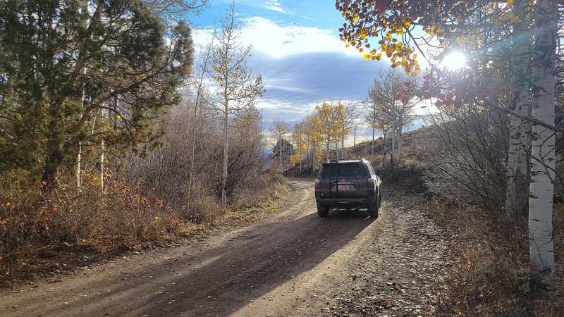
Thousand Lakes Mountain Road is a scenic traverse from the Capital Reef desert to the tall pines within Fishlake National Forest. Also known as Polk Creek Road, this maintained dirt and rock trail winds its way between vastly different environments. One minute you’re surrounded by pines and colorful aspen, with snow in the shady spots, the next, you’re in sandy desert scrub brush with towering buttes. In dry conditions, this semi-maintained dirt and rock road can be completed in 2WD vehicles equipped with durable tires. Camping within the National Forest boundary is abundant. There are numerous campsites with flat grassy areas and breathtaking, unobstructed sunrise views across the San Rafael Swell. The trail is only open during dry conditions; winter months are dependent on the snow melt.
Updated: 10/15/2024
North Dragon
Orangeville, Utah
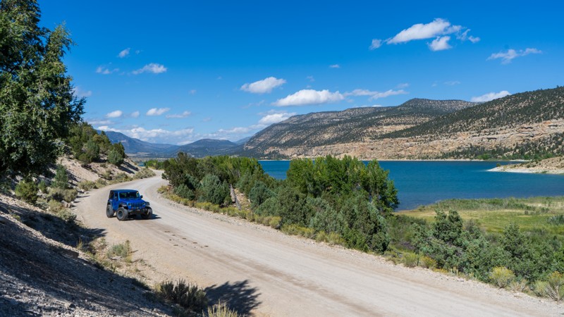
Beginning near the beautiful Joes Valley Reservoir, North Dragon takes users south on a maintained dirt road through juniper and pinyon trees in the Manti-La Sal National Forest. The only obstacles are traffic jams with cattle that roam the area. Giving users access to a network of trails, North Dragon is a great option to start your day or weekend excursion. Campsites are scattered throughout the trail.
The name North Dragon and road number 50170 continue south but have a completely different feel and difficulty, hence the split into two trails. If you are a 2-wheel drive vehicle without decent clearance, this northern portion of North Dragon is all you will want to drive.
Updated: 10/15/2024
BLM 186
Agate, Utah
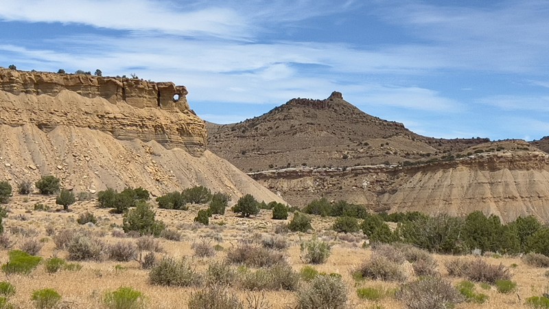
BLM 186 has no official name. The Bureau of Land Management designates it a "B" road, which receives maintenance from time to time. It is suitable for any high-clearance vehicle in dry conditions. It follows along the top contour of the first bench that starts to form the famed Book Cliffs. On the north side of the road are towering cliffs, and on the south side, erosion canyons give a short and quick glimpse of the lowlands and provide a unique experience and contrast compared to the roads that access them. At each end of the road is private ranch land, and while there are several areas to pull over and camp, nothing is pre-disturbed.
Updated: 10/15/2024
Box Flat
Woodside, Utah
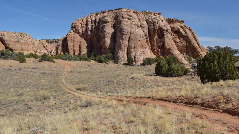
Traveling out and back to Box Flat feels like entering your remote private paradise. Once through the trees and over the numerous rock steps, you pop out onto a pristine prairie surrounded by scenic sandstone cliffs. The trail has a few early challenges that require you to take it slow in four-wheel drive and accept the bouncy ride. Located along the sandy two-track that circles Big Flat, there are a couple of small individual campsites and the trailhead for a remote hiking trail. The drive around the grassy meadow and between the sandstone buttes is scenic and peaceful.
Updated: 04/01/2025
San Rafael Desert 9141
Green River, Utah
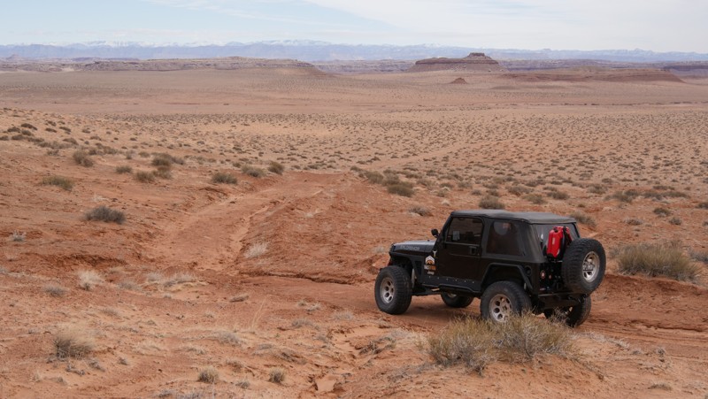
San Rafael Desert 9141 twists through a sandy scenic valley before climbing over a rocky ridgeline leading to Chaffin Geyser. The trail's mild challenges are ideal for beginners with stock 4x4s and an adventurous spirit. As you exit Lower San Rafael Road, you'll drop below red sandstone cliffs known to have golden eagles keeping their sharp eyes on the pond far below along San Rafael Desert 9140. Another unique feature is the old rusty station wagon way out in the middle of nowhere. How did that thing get way out here? Camping is non-existent along the route, but there's plenty near Chaffin Geyser and Lower San Rafael Road.
The trail is mainly used to connect to Chaffin Geyser from 9140. The climb over the ridge requires 4x4 and keeping a close eye on the gpx track. The blowing dunes at the pass cover previous tracks, making navigating over the top slightly confusing. Follow the breadcrumbs as best you can while avoiding running over any vegetation.
Updated: 11/04/2024
John's Access
Washington, Utah
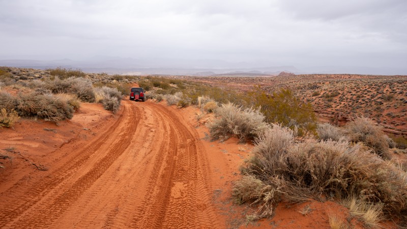
John's Access is a short, straight-through connecting trail between Sliplock Gulch and John's Trail. The road surface is mostly sandy, with a few protruding rocks. The most difficult spot along the trail is a wash crossing, where you drop a quick hill to enter the wash. The drop has a few small slickrock ledges poking out, but they can easily be maneuvered around if you think the ledges are too tall for your undercarriage. This trail is suitable for any high clearance vehicle, and airing down is highly recommended due to the rough terrain and soft sand.
About Sand Mountain
Sand Mountain is an extremely unique parcel of public land. Designated as an Open OHV Area, riders are free to make their own trails. Due to this, many of the long-established named trail routes have several variations that can take easier or more challenging routes through the intended trail. The GPX track for this trail helps you navigate the area, but various lines, bypasses, and additional obstacles may exist along the way. Riders are encouraged to stay on existing trails and not unnecessarily drive over or destroy vegetation.
Fees
Riding on Sand Mountain is entirely free. However, there are multiple entry/exit points for the area, including "the tunnel," which connects Sand Hollow State Park to the open OHV area. Any entry into the boundaries of Sand Hollow State Park requires a Utah State Park Pass.
Requirements
When operating on Sand Mountain, users must attach an orange or red safety flag to the vehicle, rising at least 8 feet off the ground.
Updated: 07/07/2025
Muley Twist Overlook
Boulder, Utah
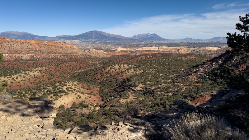
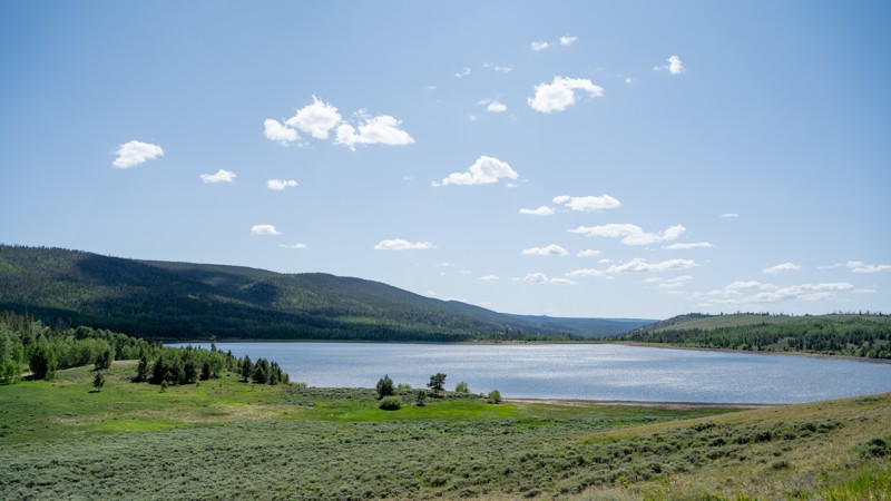
Tucked away off the lightly used Sinkholes trail is a BLM 2-track leading to a gem of an overlook. From the moment you start this trail, bumps and washouts will keep you at a slow pace. Once you begin to climb a bit, a few rocky patches will emerge, warranting the need for 4WD and high clearance. Along the ridgeline, there are a few spots to pull over and view the impressive sights overlooking the Upper Muley Twist region. Camping is limited to one to two small, makeshift sites along the cliff edge, that are exposed to winds.
Updated: 09/14/2026
North Slope - Thornburg / Beaver Meadows
McKinnon, Utah
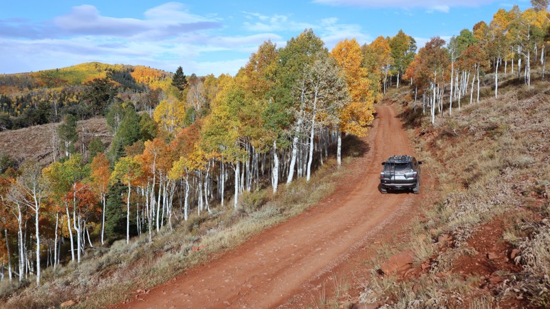
Known as North Slope - Thornburg along the eastern half, and Beaver Meadows along the western half, this trail is a great option for adding to a string of trails journeying along the northern edge of the High Uintas Wilderness. Spanning from the Ashley National Forest into the Uinta-Wasatch-Cache National Forest, this trail offers access to multiple lakes, individual dispersed campsites, multiple hiking trails, and a managed, improved campground.
Overall, the route is easy, with the section from the east end to Beaver Meadow Reservoir being the smoothest. Conditions get a little bumpier after Beaver Meadow Reservoir heading west, but remain appropriate for any stock 4WD vehicle.
If you are seeking water recreation, Hoop Lake at the western end is likely your better option. Here, you can enjoy views of North and South Burro Peak and Thompson Peak. For a fee, numbered group campsites are located on the east side of Hoop Lake, and a full improved campground can be found on the west side.
Updated: 08/11/2026
Richfield Pioneer Track
Richfield, Utah
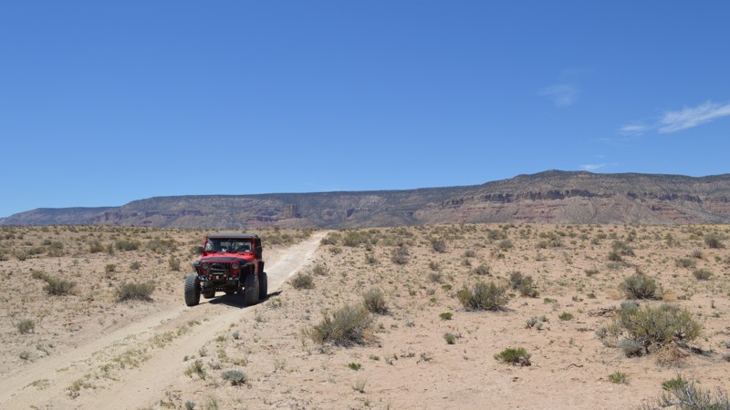
Follow in the footsteps of the early pioneers who carved a path across the mountains above Richmond, Utah. The Richmond Pioneer Track traverses over 38 miles across picturesque mountain landscapes, winding through rugged desert canyons before summiting above 10,000 feet. On the western edge of the Fishlake National Forest, the pioneer track is best enjoyed during fall, when the colors are simply overwhelming. Plan a trip in late September or early October for the best chances of seeing the amazing colors up close. The trail is ideal for beginners in stock-type 4x4s with durable tires. Durable tires are important for the long stretches of cobblestone rocks. The use of 4x4 is required to prevent washboards and ensure traction on the steep dirt hills. The route is popular and used as a commercial shuttle route for the area's mountain bike trails. Camping is abundant along the entire route. The early section near Richmond is popular and easily accessible for all vehicle types. Above 7000', camping can be found on short spur trails or at large RV-type pull-off sites. During the fall color season, it's also hunting season, and camping can be more limited at elevation.
Updated: 10/15/2024
Summerville Flats
Woodside, Utah
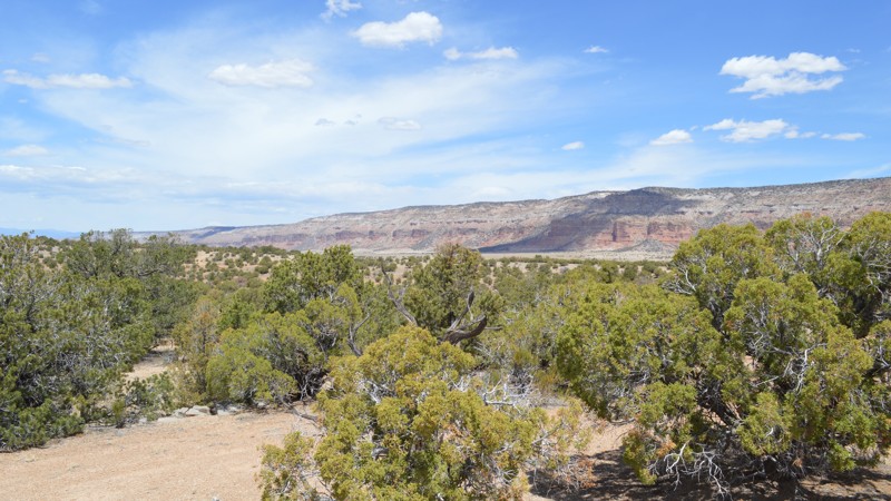
An easy little jaunt, Summerville Flats runs you from the Spirit Railroad Complex over to Humbug Flats without backtracking to the Green River Cutoff. The Spirit Railroad Complex has a sign telling you about all of the old mining history in the area, and you can even see where the old train used to run. In fact, the hardest part of the trail is where you will turn off of the old railroad grade and descend while you tilt pretty heavily toward the driver's side. There are no major challenges, but this one may not be for you if you don't like off-camber.
Updated: 10/15/2024
Cow Canyon Overlook
Woodside, Utah
This easy little trail gives you a glimpse of Cow Canyon and Buckhorn Wash. However, it ends up cutting you just a little bit short of right on the edge viewpoints. There is a camping option along this trail that will keep you away from the crowds. Be sure to take a little extra time and run these short spurs. You never know what you may find!
Updated: 04/01/2025
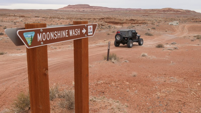
Moonshine Wash
Green River, Utah
Moonshine Wash is a popular canyon hike in the San Rafael Desert region. This very short, easy trail leads to the hiking trailhead and an overlook of the San Rafael River. The views above the junction with the San Rafael and Moonshine Wash are filled with healthy cottonwoods tucked into the canyon. The trail's minor sandstone ledges require high clearance. Please don't try this trail in the rain. The soil at the end is very soft. Please do not camp at the trail end where the hiking trailhead is located. Abundant camping is found along Lower San Rafael Road and other nearby trails.
Updated: 10/15/2024
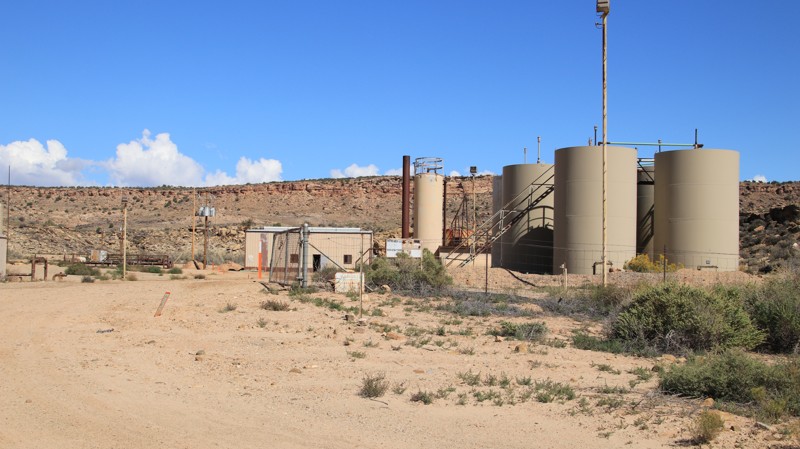
Gas Plant Road
Montezuma Creek, Utah
Gas Plant Road, named for the small facility along the trail, is a connector between Cross Canyon and Black Steer helping provide a dirt alternative to the paved roads going to Hovenweep. The road has a concrete bottom where it fords Cross Canyon Creek. There is no camping along this road.
Updated: 10/15/2024
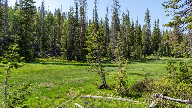
Castle Peak
Samak, Utah
An easy spur off of Upper Setting, Castle Peak jogs through the trees over rough dirt and scattered rocks and brings you to a clearing in the trees with a marshy meadow. Although the trail is nothing special, the campsite at the end is peaceful and isolated, so campers have the opportunity to escape the city crowds that huddle close to the Mirror Lake Highway. Due to the wetlands at the end, bug spray is highly advised!
Updated: 08/11/2026
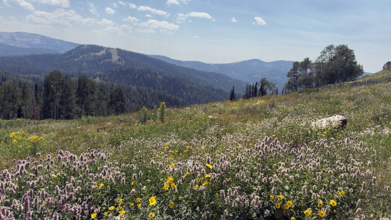
Red Pine Road
Marion, Utah
Red Pine Road is an out-and-back route that climbs from the popular Smith and Morehouse Reservoir into the highlands, reaching nearly 10,000 feet in elevation. The lower section winds through a dense aspen forest with steep Red Pine Canyon to the west, before opening into a sweeping meadow with panoramic views. From there, the road climbs a steep hill into the upper forest.
The trail is mostly dirt and rock with one notable obstacle: a steep, eroded ascent into the meadow. The upper section is narrow, and overhanging brush will likely leave pinstriping. Dispersed campsites are scattered along the route, though the higher elevations bring chilly nights.
At its upper reaches, Red Pine Road overlooks South Fork Canyon more than 2,000 feet below, with views stretching toward Rowe Mine. The reservoir itself is named after George Smith and Henry Morehouse, 19th-century tie hackers who cut and squared massive trees for the Union Pacific Railroad, floating them down the Weber River to Echo Canyon.
Seasonal closure is in effect during May and early June due to spring snowmelt runoff.
Updated: 08/17/2026
Dry Canyon
Bruin Point, Utah
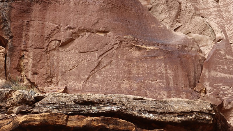
Take it slow, and keep an eye out for all the hidden gems along this amazing trail. Dry Canyon can be its own adventure, but combined with the other trails of the Great Hunt Loop, it creates a truly memorable 4x4 experience. The trail has numerous petroglyph sites along the trail, and others can be found by exploring the side canyons on foot. Cairns can also be seen sitting on ledges within the canyon. The northern trailhead begins at a working mine plant within Nine Mile Canyon, where the trail begins winding through towering cliffs of the rugged canyon. A large campsite can be found near the trailhead, or, more quiet, primitive sites can be found further up the canyon. The trail requires 4x4, high-clearance, and durable off-road-type tires. There are short sections within the wash that have large rocks, requiring careful tire placement to prevent high centering. The climb out of the canyon along the southern section to Water Canyon is narrow, but passable in all full-width vehicles. The trail is impassable to tall camper vehicles.
Updated: 11/20/2025
Sanford Loop
Bryce Canyon City, Utah
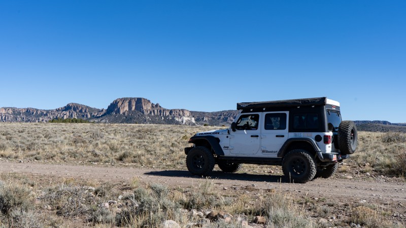
Sanford Loop cuts the corner around the town of Panguitch, connecting US 89 and US 12. Starting from Highway 12 near the Red Canyon turn-off, the route rolls through open terrain under big skies before climbing into pine-lined ridges where the rock formations grow more dramatic. It offers plentiful dispersed camping near Bryce Canyon National Park and can easily be worked into a longer overland trip. Expansive views stretch across the benchlands toward Casto Bluff and Hancock Peak, with quiet campsites tucked among sage and pines. The trail invites an unhurried pace. Find a spot, settle in, and enjoy the solitude before moving on. It also ties into the larger Paiute and Fremont ATV Trail network, linking through Sanford and Smith Canyon country.
The surface alternates between dirt, gravel, and patches of loose rock, with occasional washouts and shallow ruts. The ground can be uneven where the trail transitions between benches and forested coves. It’s generally easy for high-clearance vehicles, though scattered rocks the size of baseballs to basketballs can test AWD or low-clearance rigs. Stay attentive through the dips and rises, and it remains a steady, satisfying drive.
Camping is dispersed. In the southern section, between Red Canyon and Berry Spring, there are roughly half a dozen sites in close succession; farther north, they thin out into quieter, more private spots. Most are open to the sky, with a few shaded under pines, and none feel like developed campgrounds. In all, about twenty sites can be seen along the drive with plenty of room to spread out and enjoy the stillness.
Historical note: The area around Panguitch, including the old Fort Sanford site, once served as a strategic post during the 1860s frontier era, guarding the north–south corridor used by settlers and travelers along the Old Spanish Trail.
Updated: 09/06/2026
Hoyt S2
Marion, Utah
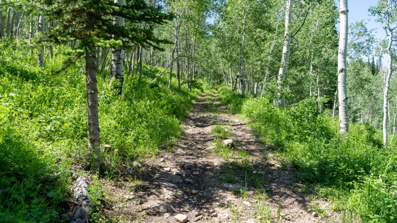
A side trail off of Hoyt Canyon, Hoyt S2 is a narrow rocky trail that climbs its way to a ridgeline. As you weave your way through the aspens, the underbrush encroaches as this trail is very lightly used. If pinstriping is not your thing, there may be better options for you. Airing down is recommended due to its rocky nature. Passing storms continue to wash away what dirt remains.
Updated: 10/15/2024
Lost Creek-Rex Reservoir
Burrville, Utah
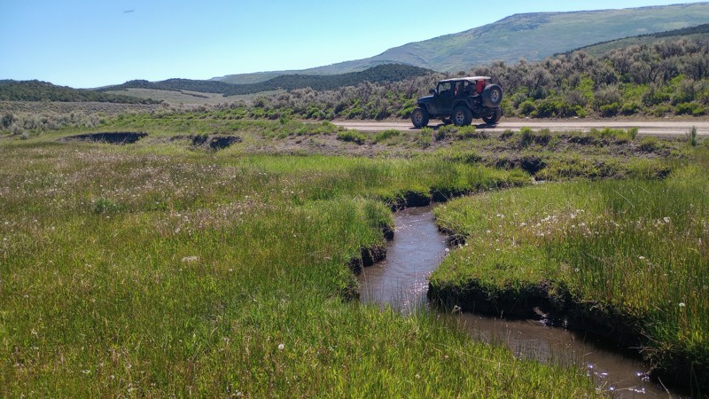
Granting easy access from both Highway 24 or scenic Little Lost Creek Road, Forest Road 53, Lost Creek-Rex Reservoir is a relaxing and enjoyable ride through Fishlake National Forest. The trail has a maintained gravel and dirt surface that can be completed in all vehicles with durable tires and high clearance. Around the reservoir and the crystal clear creek, you will find numerous campsites for groups or individuals. These campsites are all primitive and not designated. There are no services and only one vault toilet near the lake. Beyond the reservoir, winding down to Little Lost Creek Road is the most difficult portion of the trail. Here, you will encounter a loose gravel road that has numerous tight switchbacks and deep washboards.

Upgrade your Membership
Unlock all of the details on every Trail Guide and Scout Route.
Start a 7-day Free TrialBrowse Trails in Utah by City
Browse every Utah city with offroad trail guides.
Community
Partners

