By clicking "ACCEPT", you agree to be the terms and conditions of each policy linked to above. You also agree to the storing of cookies on your device to facilitate the operation and functionality of our site, enhance and customize your user experience, and to analyze how our site is used.
Utah Off-Road Trails
334

4757
Detailed Waypoints Try a Free 7-Day Trial and unlock it all
Start a Free Trial Most Recent Trail Reviews
Open
Visited: 11/19/2026
We wheeled this trail from south to north on a late-season run between El Niño rainstorms. It turned out to be a good choice after the rain because the sandy stretches between the rocky slickrock sect...

Jeff Nelson
Rated 5/5
Open
Visited: 11/17/2026
A Moab classic and one of my all-time favorites, “Fins” will stretch your sense of what you and your vehicle can do off-road. Even with a rating of 4, the trail’s many drop-offs and other hazards call...
Jeff Nelson
Open
Visited: 11/16/2026
This scenic loop adds a little spice to an otherwise easy return trip along Mineral Point Road. The rock steps and climbs keep the wheeling interesting. We skipped the hike to the Hell Roaring Canyon ...
Jeff Nelson
Rated 4/5
Open
Visited: 11/16/2026
This is a fairly easy drive out to the canyon edge of the Green River. The only real difficulty that may rate a 4 rating is the last bit beyond waypoint 20 heading to the cliff edge view of the Green...
Jeff Nelson
Rated 5/5
Open
Visited: 11/15/2026
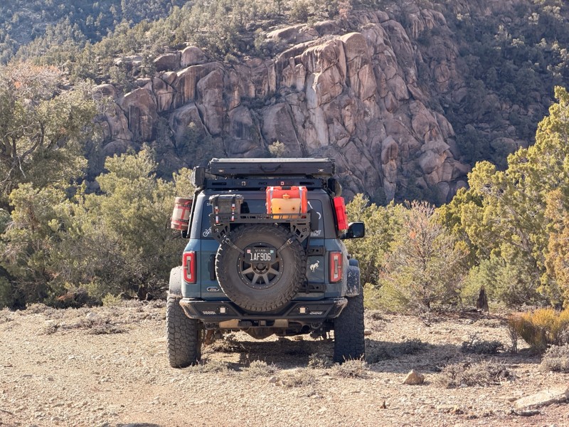
I hitched a ride to Moab with my brother in his Bronco. Since the trail is easy to reach from Highway 191, we decided to spend an afternoon on it before heading into town for a few days of wheeling. I...
Jeff Nelson
Rated 4/5
Open
Visited: 11/15/2026
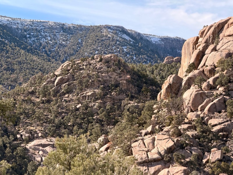
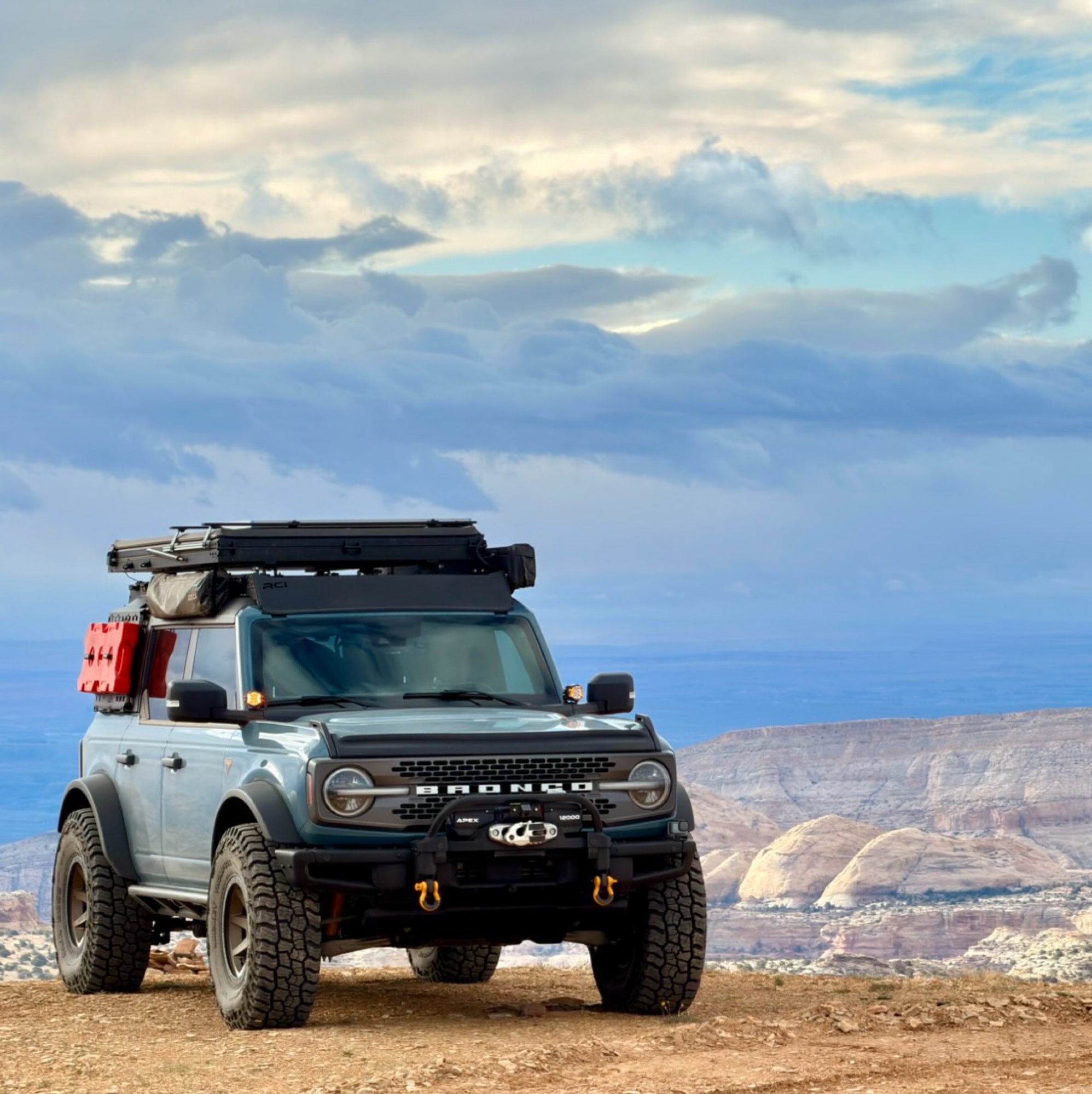
Nice scenic trail that takes you up to an area with mining claims. The trail to that point is passable by just about anything. Nothing technical or challenging about it. Once you get to the mining cla...
Jason Sumsion
Rated 3/5
Open
Visited: 11/15/2026
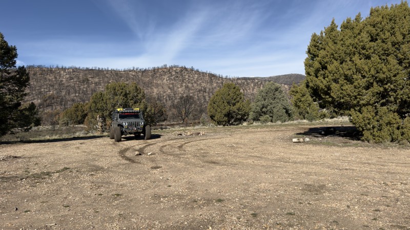
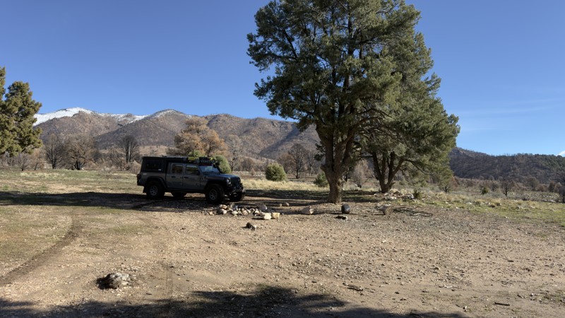
This was through the bur scar of the fire that had to have the nearby town evacuated in 2026, even tough scenic its very desolate right now due to the fire. will be interesting to see if regrow over t...
VT
vernon turner
Official Crew
No Rating
Seasonal Closure
Visited: 11/15/2026
According to this trails management agency, the trail is likely closed for the season.
You can reach out to the agency for more details.
Be sure to leave us a report and let us know ...

Trails Offroad
Official Crew
No Rating
Seasonal Closure
Visited: 11/15/2026
According to this trails management agency, the trail is likely closed for the season.
You can reach out to the agency for more details.
Be sure to leave us a report and let us know ...
Trails Offroad
Official Crew
No Rating
Seasonal Closure
Visited: 11/15/2026
According to this trails management agency, the trail is likely closed for the season.
You can reach out to the agency for more details.
Be sure to leave us a report and let us know ...
Trails Offroad
Official Crew
No Rating
Seasonal Closure
Visited: 11/15/2026
According to this trails management agency, the trail is likely closed for the season.
You can reach out to the agency for more details.
Be sure to leave us a report and let us know ...
Trails Offroad
Official Crew
No Rating
Seasonal Closure
Visited: 11/15/2026
According to this trails management agency, the trail is likely closed for the season.
You can reach out to the agency for more details.
Be sure to leave us a report and let us know ...
Trails Offroad
Official Crew
No Rating
Seasonal Closure
Visited: 11/15/2026
According to this trails management agency, the trail is likely closed for the season.
You can reach out to the agency for more details.
Be sure to leave us a report and let us know ...
Trails Offroad
Official Crew
No Rating
Seasonal Closure
Visited: 11/15/2026
According to this trails management agency, the trail is likely closed for the season.
You can reach out to the agency for more details.
Be sure to leave us a report and let us know ...
Trails Offroad
Official Crew
No Rating
Seasonal Closure
Visited: 11/15/2026
According to this trails management agency, the trail is likely closed for the season.
You can reach out to the agency for more details.
Be sure to leave us a report and let us know ...
Trails Offroad
Official Crew
No Rating
Seasonal Closure
Visited: 11/15/2026
According to this trails management agency, the trail is likely closed for the season.
You can reach out to the agency for more details.
Be sure to leave us a report and let us know ...
Trails Offroad
Official Crew
No Rating
Seasonal Closure
Visited: 11/15/2026
According to this trails management agency, the trail is likely closed for the season.
You can reach out to the agency for more details.
Be sure to leave us a report and let us know ...
Trails Offroad
Official Crew
No Rating
Seasonal Closure
Visited: 11/15/2026
According to this trails management agency, the trail is likely closed for the season.
You can reach out to the agency for more details.
Be sure to leave us a report and let us know ...
Trails Offroad
Official Crew
No Rating
Seasonal Closure
Visited: 11/15/2026
According to this trails management agency, the trail is likely closed for the season.
You can reach out to the agency for more details.
Be sure to leave us a report and let us know ...
Trails Offroad
Official Crew
No Rating
Seasonal Closure
Visited: 11/15/2026
According to this trails management agency, the trail is likely closed for the season.
You can reach out to the agency for more details.
Be sure to leave us a report and let us know ...
Trails Offroad
Official Crew
No Rating
Seasonal Closure
Visited: 11/15/2026
According to this trails management agency, the trail is likely closed for the season.
You can reach out to the agency for more details.
Be sure to leave us a report and let us know ...
Trails Offroad
Official Crew
No Rating
Seasonal Closure
Visited: 11/15/2026
According to this trails management agency, the trail is likely closed for the season.
You can reach out to the agency for more details.
Be sure to leave us a report and let us know ...
Trails Offroad
Official Crew
No Rating
Seasonal Closure
Visited: 11/15/2026
According to this trails management agency, the trail is likely closed for the season.
You can reach out to the agency for more details.
Be sure to leave us a report and let us know ...
Trails Offroad
Official Crew
No Rating
Seasonal Closure
Visited: 11/15/2026
According to this trails management agency, the trail is likely closed for the season.
You can reach out to the agency for more details.
Be sure to leave us a report and let us know ...
Trails Offroad
Official Crew
No Rating
Seasonal Closure
Visited: 11/15/2026
According to this trails management agency, the trail is likely closed for the season.
You can reach out to the agency for more details.
Be sure to leave us a report and let us know ...
Trails Offroad
Official Crew
No Rating
Seasonal Closure
Visited: 11/15/2026
According to this trails management agency, the trail is likely closed for the season.
You can reach out to the agency for more details.
Be sure to leave us a report and let us know ...
Trails Offroad
Official Crew
No Rating
Seasonal Closure
Visited: 11/15/2026
According to this trails management agency, the trail is likely closed for the season.
You can reach out to the agency for more details.
Be sure to leave us a report and let us know ...
Trails Offroad
Official Crew
No Rating
Seasonal Closure
Visited: 11/15/2026
According to this trails management agency, the trail is likely closed for the season.
You can reach out to the agency for more details.
Be sure to leave us a report and let us know ...
Trails Offroad
Official Crew
No Rating
Seasonal Closure
Visited: 11/15/2026
According to this trails management agency, the trail is likely closed for the season.
You can reach out to the agency for more details.
Be sure to leave us a report and let us know ...
Trails Offroad
Official Crew
No Rating
Seasonal Closure
Visited: 11/15/2026
According to this trails management agency, the trail is likely closed for the season.
You can reach out to the agency for more details.
Be sure to leave us a report and let us know ...
Trails Offroad
Official Crew
No Rating
Seasonal Closure
Visited: 11/15/2026
According to this trails management agency, the trail is likely closed for the season.
You can reach out to the agency for more details.
Be sure to leave us a report and let us know ...
Trails Offroad
Official Crew
No Rating
Seasonal Closure
Visited: 11/15/2026
According to this trails management agency, the trail is likely closed for the season.
You can reach out to the agency for more details.
Be sure to leave us a report and let us know ...
Trails Offroad
Official Crew
Rated 5/5
Open
Visited: 11/14/2026
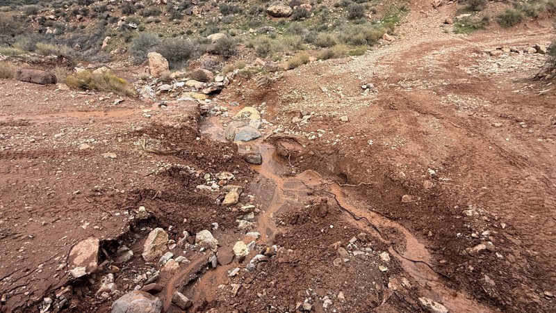
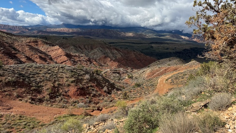
This trail has definitely seen some erosion from the recent rainfall! There are quite a few washouts and ruts along the way. Nothing dangerous, but enough to make it a rough ride. A couple of the ledg...
Tony Faiola
Official Crew
Rated 5/5
Open
Visited: 11/14/2026
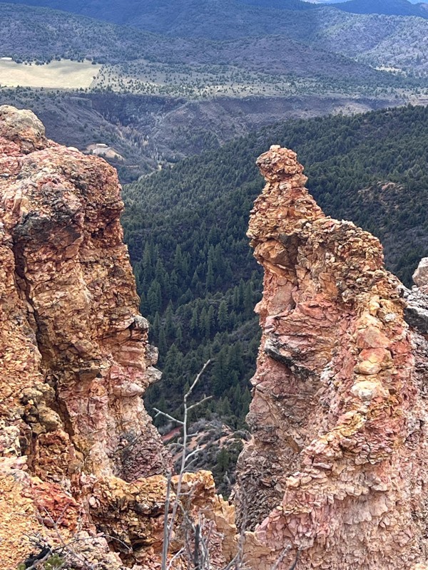
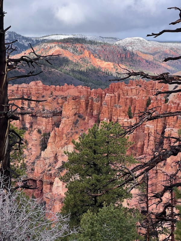
Lots of puddles and mud from recent rains, but we were able to make it all the way to the viewpoint. Fantastic!
M
mjp303
RK
Randall Klimes
Rated 5/5
Open
Visited: 11/13/2026
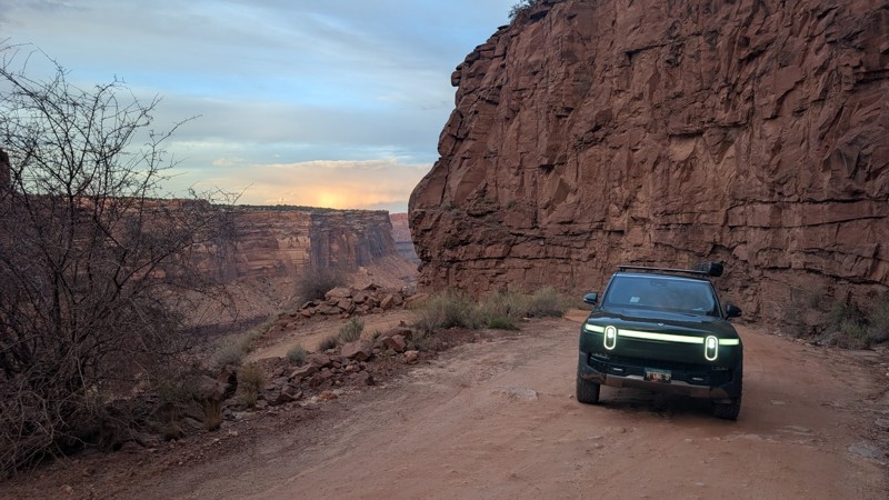
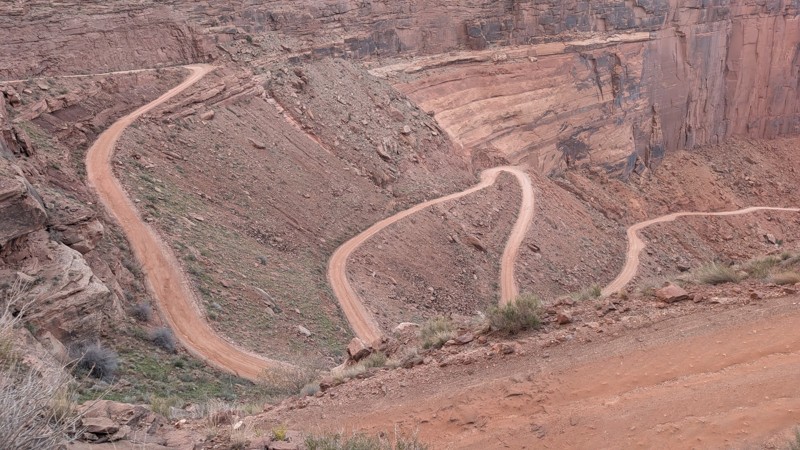
it's a nice family friendly trail. absolutely stunning views. highly recommend. you don't have to connect to potash trail. you can just go down and back up if you are just there for this trail.

Mustafa ParDane
Official Crew
No Rating
Partially Open
Visited: 11/13/2026
Deep mud in the riverbed. The river itself is not a challenge, but the clay mud is no joke. You can see the signs of the flood, and the road closer to the river is completely washed out. I wouldn't re...
CC
Cassiano Carromeu
No Rating
Open
Visited: 11/13/2026
This is not closed or washed out, trail is good to go.
Ryan Boudreau
Official Crew
Rated 5/5
Open
Visited: 11/13/2026
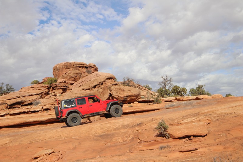
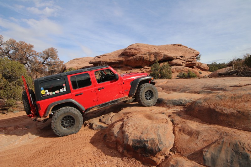
We ran Metal Masher today solo- didn't see any other rigs out there today, which changes one's perspective about being careful not to get stuck! This trail is a bit like Sevenmile Rim, but harder; it ...
Jim Wise
Rated 5/5
Open
Visited: 11/13/2026
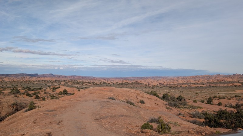
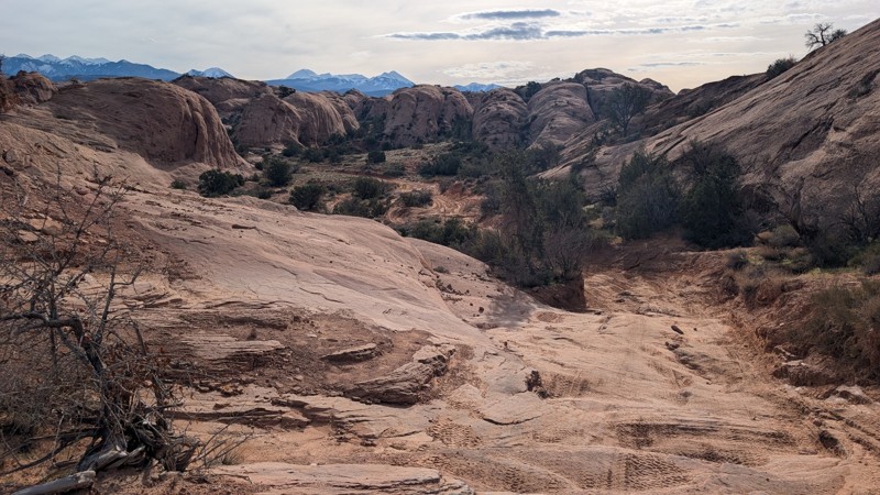
I've completed it until the waypoint 26 and connected back to the main road. the mud is not terrible for this trail but it definitely makes the slick rock slicker. :) there was only one spot (before w...
Mustafa ParDane
Official Crew
Rated 5/5
Open
Visited: 11/13/2026
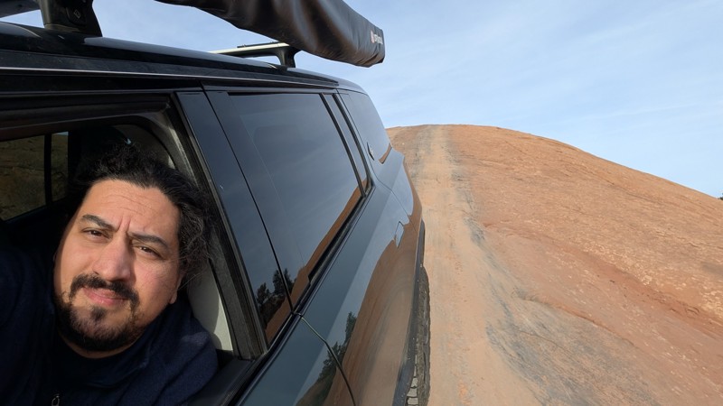
there is a huge mud puddle right after the first decent and around the corner. I didn't attempt it as I saw some recent YouTube videos of people getting stuck in the mud in Utah after the recent rains...
Mustafa ParDane
Official Crew
Rated 5/5
Open
Visited: 11/12/2026
Doll House Trail Report – November 10–12, 2026
Traveled the Doll House Trail and Maze Overlook in Canyonlands National Park’s Maze District.
Trail conditions were generally normal for this route—ver...
BK
Brian K Mayfield
Rated 5/5
Open
Visited: 11/12/2026
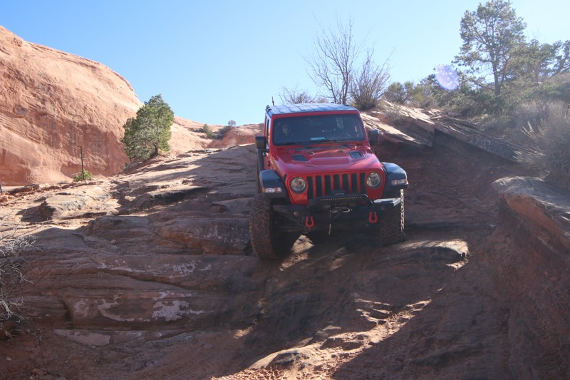
Call it a demanding difficulty of 4... this is my second time running this trail. Did it 2 years ago with 35-inch tires, returning now with 37-inch tires and more experience running Moab trails, Color...
Jim Wise
Rated 4/5
Open
Visited: 11/11/2026
Beautiful day, a little cool if you’re out of the vehicle for more than a few minutes. Very little traffic, but it’s Wednesday, and Veteran’s Day. We went up and over to Midway today.
BR
Ben Roueche
No Rating
Partially Open
Visited: 11/11/2026
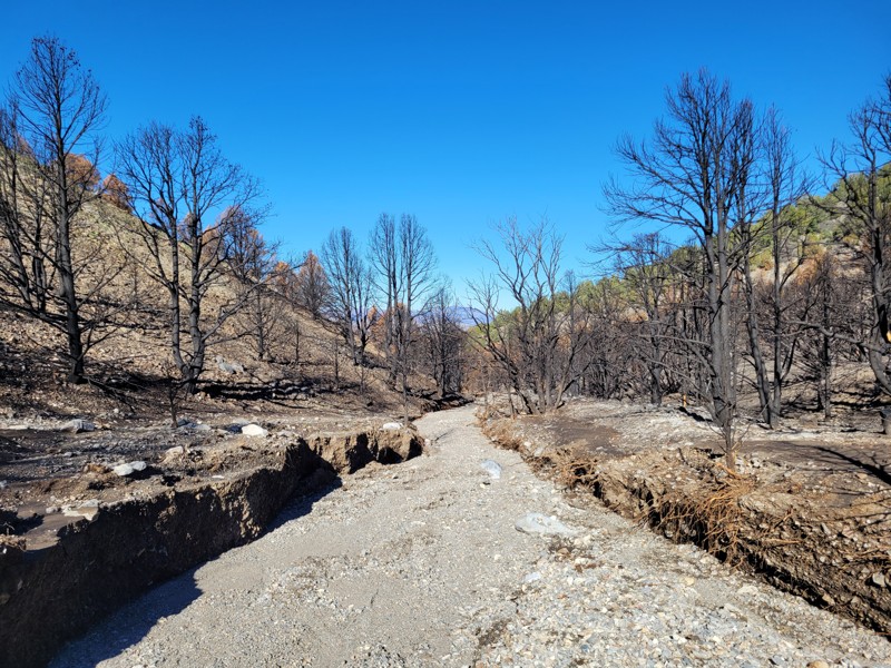
Due to wild fire and flooding the trail is washed out at the bottom. I explored about 1/2 mile finding the original trail in only a few places. I love this trail and hope its gets opened again.
BD
Brian Dorcheus
Rated 4/5
Open
Visited: 11/10/2026
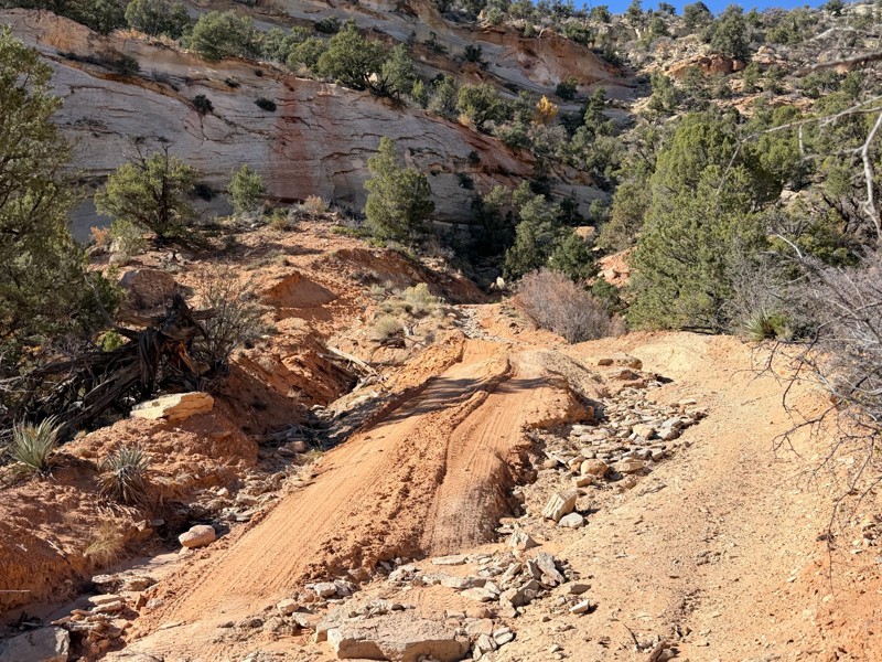
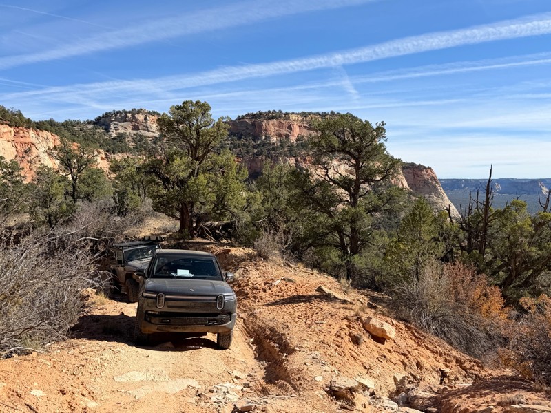
Recent monsoon rains have made the shelf road section more challenging. Inside the canyon wash was a significant washed out section. It is passable, no spotters needed, and getting better with continu...
Tyler D’Hulst
Rated 5/5
Partially Open
Visited: 11/09/2026
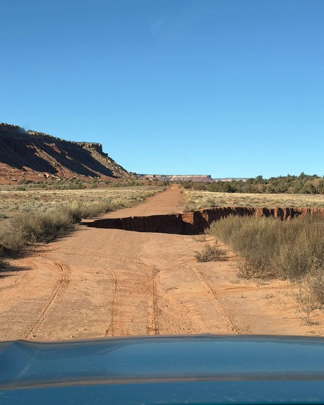
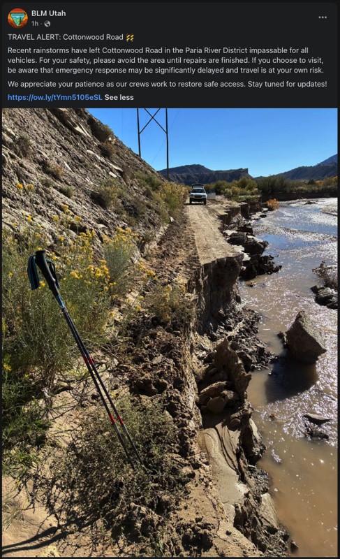
Trail may be impassible based on this image that was shared on Instagram a few days ago. Marking as partially open until someone in the area can confirm closure or repair.

Jason
No Rating
Temporary Closure
Visited: 11/09/2026
Closure announcement via Bureau of Land Management Utah: Recent rainstorms have left Cottonwood Road in the Paria River District impassable for all vehicles. The agency is asking that travelers please...

Ariana Dufour
Official Crew
Rated 4/5
Open
Visited: 11/08/2026
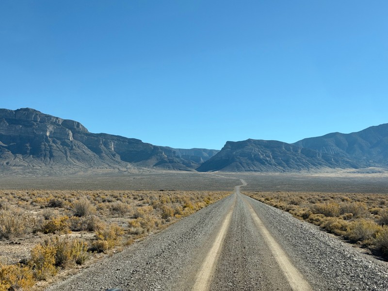
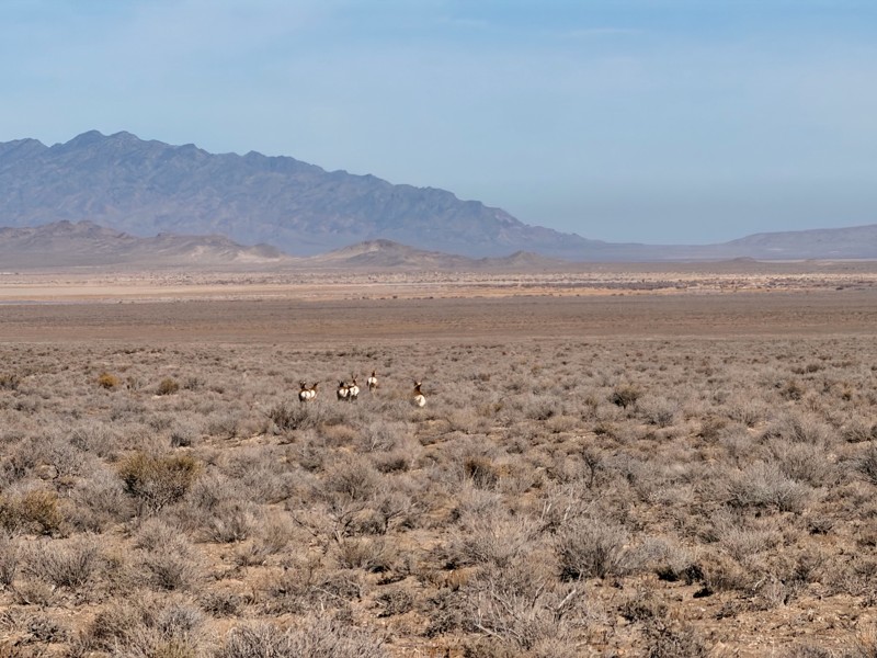
Really nice drive on a road that you can maintain a good pace on. Nothing technical about it, just about any vehicle could run this. Something you can air down a little will make the ride more comfort...
Jason Sumsion
Most Popular

Updated: 04/08/2025
Power Pole Rim
Dewey, Utah
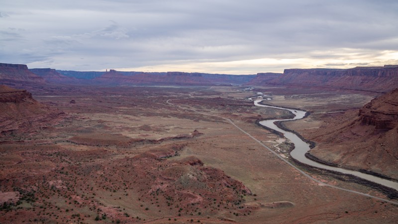
Power Pole Rim is a multi-section spur off Pole Canyon Rim and leads to a fantastic cliffside overlook high above Hittle Bottom and the Colorado River. The road starts several miles into Pole Canyon Rim before branching off for a short stint, then crossing over Pole Canyon Rim again before dead-ending at the overlook. For the most part, this trail is a fairly easy, rocky, and rough road. This includes the second section of the road that leads to the overlook. However, the first section of the road between the two Pole Canyon Rim intersections is a nasty 30-yard hill climb on an exposed ridge, covered in loose dirt and riddled with multiple 18-inch ledges. This hill requires a lifted vehicle with larger tires. A spotter is recommended, and a good line choice is required.
The trail ends with several campsites along the rim next to the power poles that drop 1,200 feet to the valley floor next to the river. This is a great place to take in a sunset and enjoy the views.
Updated: 05/20/2026
Thompson Crossover
Crescent Junction, Utah
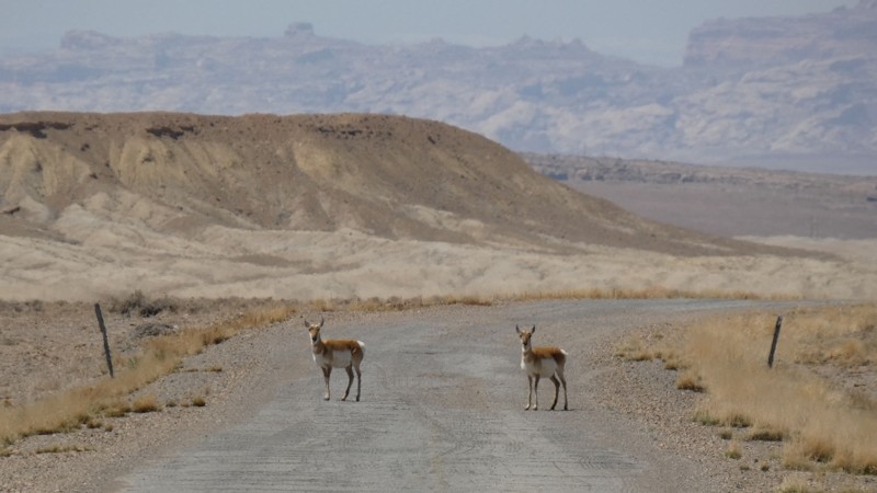
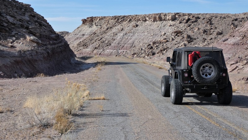
Thompson Crossover is part of old Highway 10 that was replaced with I-70 in the 1960s. All year long, early in the morning, you are guaranteed to see pronghorns along this route. They graze daily between the interstate and the Book Cliffs to the north. The road is beat-up old asphalt and gravel. There are potholes like you find on any county road, so be cautious at high speeds. There is little to no traffic, so you can go slow or stop to take pictures of the wildlife and the many remnants of the old highway. The camping is wide open along this route. You can put down stakes just about anywhere, but the noise from I-70 and the trains might be a deterrent. There is excellent camping on the Book Cliffs or organized campgrounds in Green River.
Updated: 10/15/2024
Cottonwood Canyon Road
Orangeville, Utah
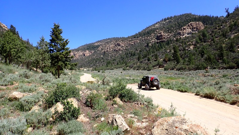
Cottonwood Canyon Road begins as a paved county road before turning into a grated gravel trail. The higher you climb into the pines, the steeper and more narrow the trail becomes. The trail has a couple of very nice old drill platforms that have been converted into large group camping areas. These sites are ideal for RVs or campers needing solid and level ground to park. As you climb, the landscape transforms from rugged desert rocks to dense pine and aspen forests. The trail is easily completed in 2WD vehicles equipped with durable tires.
Updated: 10/15/2024
Broadhead Meadows
Woodland, Utah
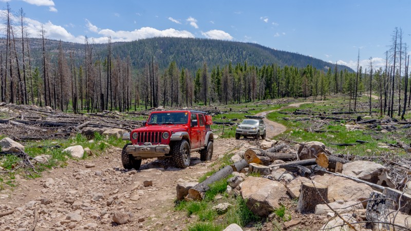
Broadview Meadows departs off Murdoch Basin Road and heads through the 2020 Upper Provo Wildfire burn scar north to Broadwater Meadows, connecting to the Mirror Highway. When running this trail, be sure to stay on Broadview Meadows FR416, as quite a few ATV-only trails diverge off the trail. A designated camping area is available immediately at the start of Broadview Meadows, with sites distinguishable by the metal fire rings and picnic tables. This fee area requires a recreation pass obtained at the kiosk on the Mirror Highway when you are first entering the Uinta-Wasatch-Cache National Forest. Three-day passes are only $6. The trail is a mix of rough dirt and cobblestone stretches. Air down to make the ride more comfortable.
Updated: 06/15/2024
Pit and Page Hill
Kamas, Utah
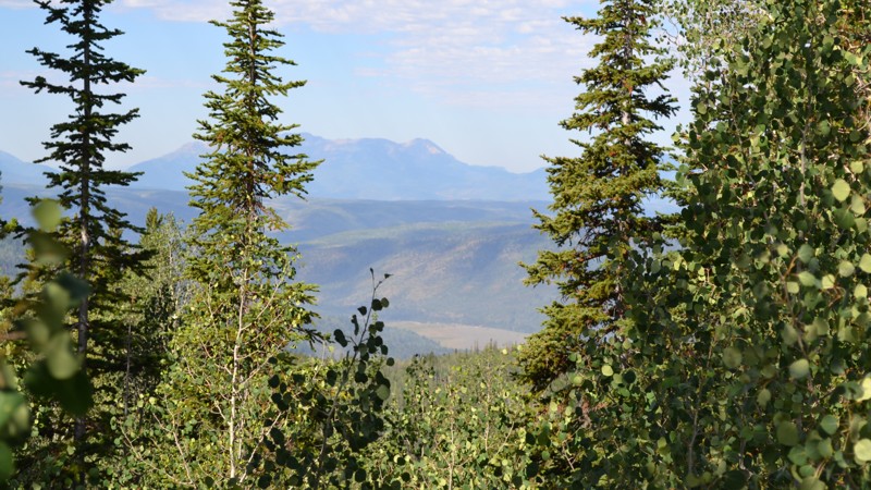
Tucked away off of the major trails lies a little gem of peace and solitude away from the main trails in the Uinta National Forest. Requiring 2 sections of other trails just to reach, Pit and Page Hill is a neat little trail taking you around a hillside and occasionally giving you a glimpse of the surrounding area. Along with its solitude, you may find a spot or two to pitch a tent, crack open a beverage, and enjoy the wind whistling through the trees around you. Luckily, all that's needed to reach this serenity is a mild high-clearance vehicle and an hour or two of your time. Be sure to pack a deck of cards and some firewood so you can spend an evening with some good company enjoying the Uinta Mountains!
Updated: 03/17/2025
Salt Valley Gorge Road Cutoff
Crescent Junction, Utah
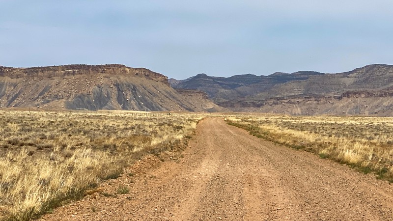
There is only one gas station on I-70 between Highway 191 and Fruita, Colorado. Beginning at that one gas station, Salt Valley Gorge Road Cutoff is a dirt trail southward that connects to other roads leading into Arches National Park and the Moab area. It's an easy graded road with no camping opportunities. The trail is much more interesting if driven from the north to the south.
Updated: 10/15/2024
FR 30203
Alton, Utah
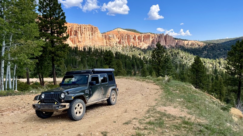
FR 30203 is an easy-to-moderate (one end is rough due to washouts) point-to-point trail that will reward you with spectacular views of what has been nicknamed "Little Bryce Canyon" and the valley below. There is no camping available on this trail. There are designated campsites in the immediate area. Be sure to take advantage of the designated viewpoint at the top of "Little Bryce Canyon."
Updated: 05/01/2026
Brushy Basin
Blanding, Utah
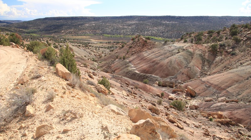
Brushy Basin begins off Highway 95 in a near moonscape environment of multi-hued bentonite hills. The trail climbs onto a ridge overlooking Cottonwood Wash with views of the Bears Ears National Monument. Several dispersed campsites sit along the ridgeline. While normally an easy trail, when wet, it can be impassable.
Updated: 07/01/2024
Slate Gorge
Kamas, Utah
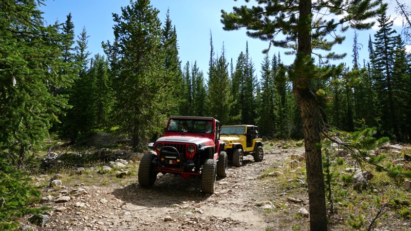
Slate Gorge trail is sure to slow you down, take you away from the hustle and bustle of the city, and get you out to some really magnificent sights. Barely a quarter-mile down the trail, Trident Lake lies amidst a meadow with protective surrounding conifers. Trident Lake serves as both a popular fishing destination, in addition to providing a handful of optimal campsites overlooking the small, but beautiful lake. If you're looking to explore further, the trail will lead you out toward the canyon rim, overlooking Slate Gorge. Carved by the Provo River, the gorge exposes two beautifully cascading waterfalls and several layers of flat slate rock.
Updated: 10/15/2024
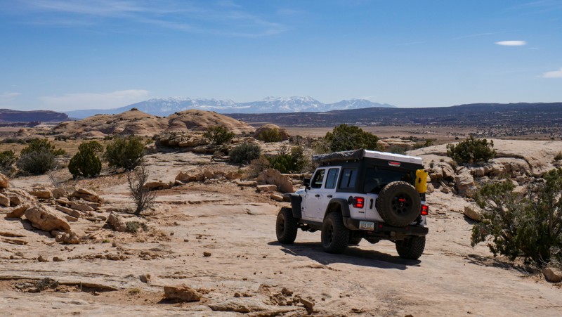
Spring Canyon North Overlooks
Moab, Utah
A straight out and back 2-track that follows a portion of the Secret Spire Easter Jeep Safari Route. This trail leads to the north edge of Spring Canyon and provides a view of the tip of Secret Spire. Traveling out the road has plenty of "whoop de doos" up and over soft and with a few patches of minor rock protrusions in other areas. At the end of the trail, the road surface is white rock.
Updated: 02/21/2023
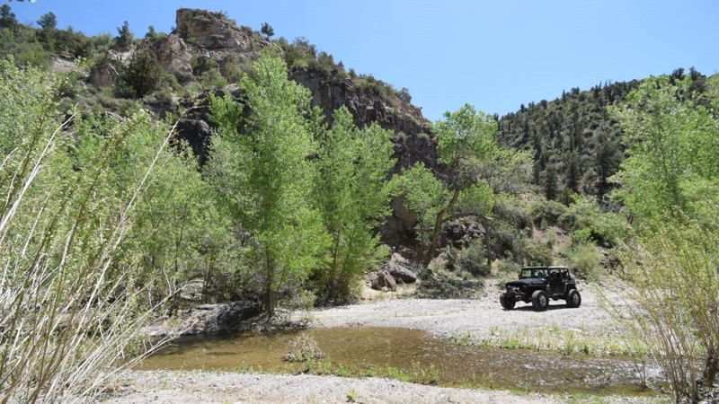
Upper Beaver Dam Wash
Santa Clara, Utah
In the southwest, riparian canyons like this are very hard to come by; it's even rarer that you can drive through it. This natural oasis is hidden far out in the desert of Utah, making it an ideal place to get away from everything. Beaver Dam Wash flows through both the Cougar Canyon and Doc’s Pass Wilderness areas while Slaughter Creek, a spur of this creek, flows through its namesake wilderness. The headwaters begin in the Dixie National Forest then flow into Nevada through Beaver Dam State Park. The stream again returns into Utah and is fishable on BLM lands upstream from the small community of Motoqua. Beaver Dam Wash also supports native rainbow trout and the Virgin spinedace, a native minnow-like species. In addition, a wide variety of mammals roam here, including elk, mule deer, mountain lion, ringtail, bobcat, badger, and both the common and kit fox. Wildlife is not just subject to the ground as many species of songbirds and raptors can be viewed in the native willows and cottonwood trees covering the canyon floor.
Updated: 03/24/2025
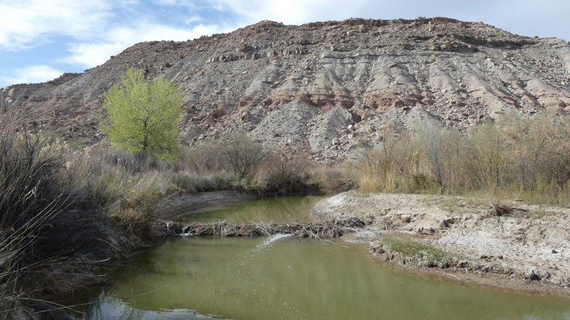
Humbug Flats
Woodside, Utah
Driving across Humbug Flats with Humbug Buttes looming in the distance is reason enough to take this easy gravel road. However, if you travel to the end, you're treated to an epic remote campsite along the Price River. The trail ends at what can be best described as a natural green beltway. A unique and experimental change is that beavers control the water levels in this area. Using beaver to rehabilitate western forests, rivers, and wetlands is not new. It was a practice the U.S. Forest Service introduced in some western forests in the 1940s but was never widespread. The 15-mile out & back trail is all gravel and periodically maintained. You should expect a bumpy ride with the random washout rut across the road. You will not need four-wheel drive, but durable tires are required. Please do not gather or cut any wood in the desert.
Updated: 10/15/2024
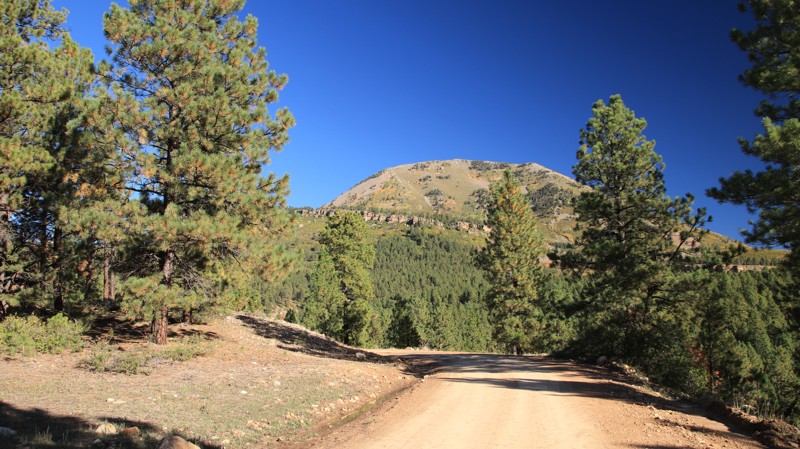
Recapture
Blanding, Utah
Dude Ranch Road loops west off Highway 191, climbing into the Manti-La Sal National Forest. On its southern end, the road is initially marked as San Juan 264. the first stretch of crumbling asphalt has views of Recapture Reservoir. The trail climbs steadily through a mix of private property and BLM land. Watch out for cows on the road.
At the National Forest border, the road becomes FR 84. The trail passes through a forest of large pines with good views of the Abajo Mountains. There are several dispersed campsites scattered along the trail. A very large camping area with a vault toilet sits at the intersection with Bulldog - Blue Mountain, FR 85. Shortly after the intersection, there's a sign marking Harry Hopkin's grave and detailing his mysterious death. The forest road passes a commercial retreat and is paved the rest of the way to Highway 191.
Updated: 09/10/2026
Hell's Revenge Sand Flats Exit
Moab, Utah
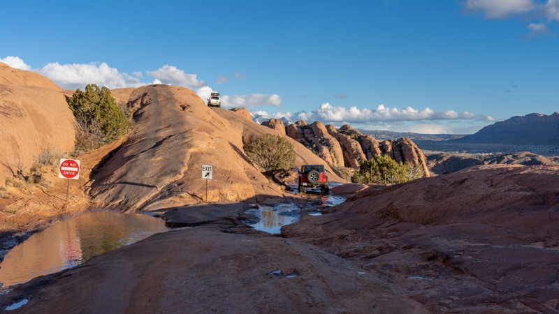
This is the exit route for those that do not want to run the entire Hell's Revenge loop or need to return to the parking lot within Sand Flats Recreation Area. Running parallel to the entrance fin along a lower fin, this simple 220-yard-long one-way trail provides one last spectacular view of the La Sal Mountains before ending at the Sand Flats entrance station. This trail is suitable for any high clearance vehicle.
Updated: 10/15/2024
Green River Banks
Green River, Utah
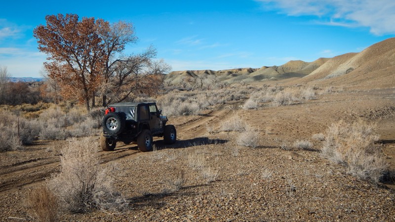
Green River Banks is a 3.8-mile 4x4 trail that travels along the soft banks of the mighty Green. The trail has a variety of different terrain to navigate. From rocky desert cliffs, you'll drop down to the wooded shoreline with its mix of super soft dirt and sand. There are deep washouts to dodge and traverse as you work your way through a small section of private property. Thankfully, they allow us to travel in such a beautiful area. After turning up the scrub brush lined wash, the terrain turns Moon-like. Not a single plant grows on this alien landscape. The trail winds over dirt mounds and off-camber washouts, eventually climbing the most challenging obstacle on the route, a very deep washout halfway up. There is no bypass. You will need low-range gearing and good suspension articulation. It's easy to slip on the dirt and get into trouble. Disconnect those sway bars! Don't attempt this trail if it has recently rained. It will be impassable.
Camping is limited to the start of the trail at the end of Augar Road. There are lovely camp spots on the cliffs above the river, but they can be windy, especially in springtime. You can find all your camping supplies and services in the nearby Green River, Utah.
Updated: 10/15/2024
Willis Creek
Cannonville, Utah
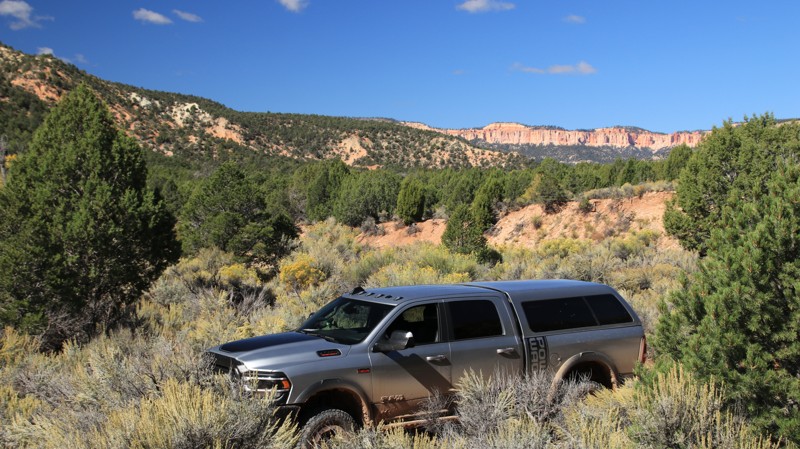
Willis Creek runs north off Skutupah Road to a dead end at a plot of private land with a locked gate. The trail offers four very small dispersed campsites, two at the intersection with Skutumpah and two more before the first of two wire gates where the trail crosses a plot of private property. The fourth site is the largest and has the best views.
Willis Creek Ranch sits in a picturesque valley below the road and between the wire gates.
The trail is easy until the first of the wire gates. 4WD is recommended after that point due to steep sandy grades and a very soft-bottomed creek crossing.
Updated: 06/15/2024
Barney Powell Mine
Kamas, Utah
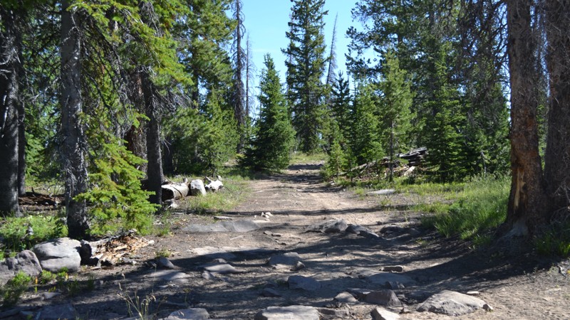
Just over an hour away from Salt Lake City lies a playground. This playground offers over 2.1 million acres with any outdoor sporting activity you can imagine. The Uinta-Wasatch-Cache National Forest is quite a wonderland. This particular region lies just outside of Kamas, Utah, and is open to all kinds of recreation from backpacking to fishing, to just about anything with a motor.
Not far from the mouth of the canyon is the Soapstone Basin. This region runs right along the Lower Provo River and provides access to many streams, lakes, trails, and camping opportunities. Barney Powell Mine is a nice addition to any plans you may have exploring the Uintas. This trail will take you away from the crowds and allow you some peace and quiet so you can really take a deep breath and relax to forget all of your troubles.
Updated: 10/15/2024
Old Green River Highway
Green River, Utah
Mix it up a little and take a short ride along this old highway. It's an easy and less stressful way to travel from Green River to Highway 24. You will travel past the Green River airport on a graded dirt road before turning onto the old highway asphalt running parallel to I-70. You have a good chance of spotting a pronghorn or 30 before you drop down through the colorful canyons with a ton of free group or individual campsites. There are large open areas right off the old highway where you can pull a camper or set up a tent for a day or week.
Updated: 10/15/2024
Lakeside
Hurricane, Utah
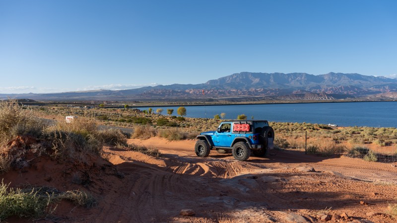
Lakeside is an easy, sandy access road along the northern edge of Sand Mountain, offering good views of Sand Hollow Reservoir. The road is adjacent to Highway 7, traveling west to east between the Waddy's Corral staging area (formally known as Water Tanks), past the Sand Hollow State Park tunnel, and ending at the East Fenceline Road, near the Highway 7 exit 19 offramp. The road can be run in either direction and is a busy central vein used to access popular trails like Risky Biz, Twister, Milts Mile, Triple 7s, and Chain Reaction. The road has a few chunky slickrock spots, especially near the Water Tank Road and the tunnel, and a lot of whoop-de-doos through the sand. This trail is suitable for any high clearance vehicle.
About Sand Mountain
Sand Mountain is an extremely unique parcel of public land. Designated as an Open OHV Area, riders are free to make their own trails. Due to this, many of the long-established named trail routes have several variations that can take easier or more challenging routes through the intended trail. The GPX track for this trail helps you navigate the area, but various lines, bypasses, and additional obstacles may exist along the way. Riders are encouraged to stay on existing trails and not unnecessarily drive over or destroy vegetation.
Fees
Riding on Sand Mountain is entirely free. However, there are multiple entry/exit points for the area, including "the tunnel," which connects Sand Hollow State Park to the open OHV area. Any entry into the boundaries of Sand Hollow State Park requires a Utah State Park Pass.
Requirements
When operating on Sand Mountain, users must attach an orange or red safety flag to the vehicle, rising at least 8 feet off the ground.
Updated: 10/15/2024
San Rafael 9130
Green River, Utah
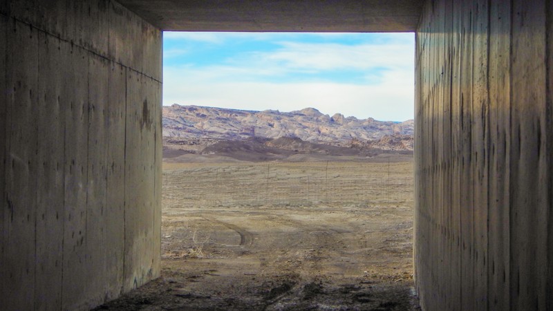
You will wonder what the travelers think as they watch you drive under I-70, out in this desolate landscape. It's a rare opportunity to drive across an interstate median, but it's legal and a creative link on your overland adventure across the San Rafael Swell. The moderate 6.4-mile trail takes about an hour to cross the seemingly endless desert flats. The dirt is soft, and there are countless deep washouts; a few can swallow an entire vehicle. Please use caution since they sneak up on you. A couple of the washouts have become so large you have to detour around them. The two tunnels under the interstate are large enough for full-size vehicles and rooftop tents. The camping is in the wide open and very exposed to the area's frequent winds. However, there is one protected site at the start of the gravel road, behind the large gravel mound, on the northern section of the trail.
Updated: 10/15/2024
Poverty Gulch Rim Overlooks
Orderville, Utah
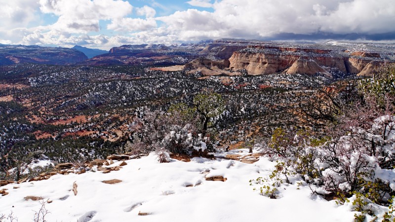
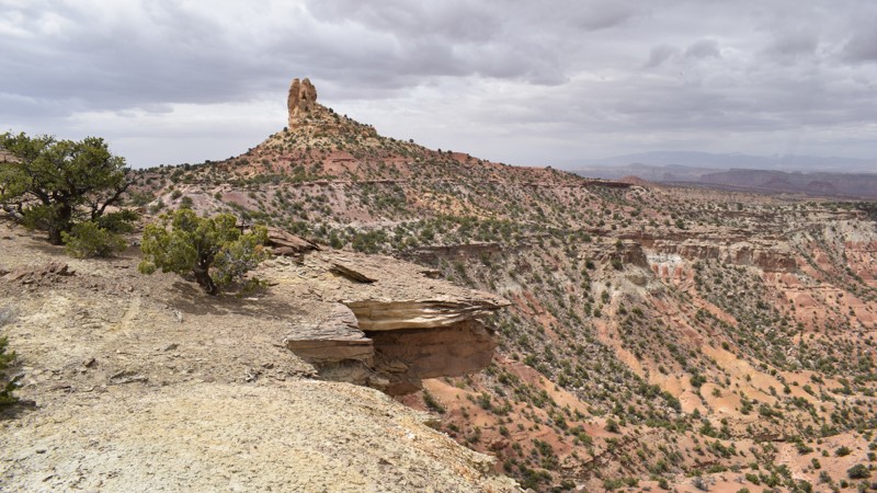
This trail visits two spectacular overlooks on the rim of Poverty Gulch, looking down into Parunweap Canyon toward Poverty Flats, the White Cliffs, and Zion National Park. The road is mostly easy sand in tight trees but is more challenging in snow.
Most of the route is on SITLA land, where camping is technically prohibited but not signed. However, the main (north) overlook is on BLM land where camping is allowed. The viewpoint would make an amazing campsite as long as it's not windy.
Updated: 01/05/2026
Family Butte Road
Moore, Utah
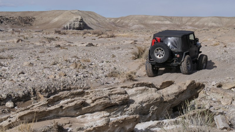
Family Butte Road is tucked far back in the southern region of the San Rafael Swell. The easy-graded dirt road offers breathtaking overlooks, up-close spire views, and memorable primitive camping. In either direction, you will enjoy views of Turkey Spire and Family Butte and stop at a couple of old mine sites. In dry conditions, the route is passable in 2WD with high clearance. There is abundant camping along the route; many sites offer cliffside views, or you can be nestled back in a canyon alone.
Updated: 10/15/2024
Nine Mile Wash
Green River, Utah
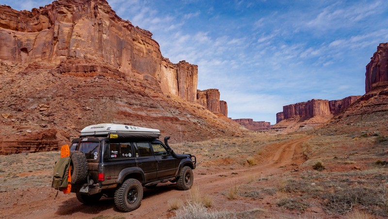
Nine Mile Wash zigzags for almost six miles across this barren desert landscape. When the wash is dry, 99.9% of the time, it's a mix of soft sand and very rocky sections. One minute you're cruising in the wide-open wash; the next, you're trying to decide where to climb a 3-foot vertical ledge. There are multiple optional ledges to play on in the wash. The clustered cottonwoods offer a reprieve from the glaring sun while proving that something can survive in this rugged environment. Camping is nonexistent on this trail.
Updated: 09/29/2025
Mineral Canyon Road
Moab, Utah
The steep rock canyon walls and surrounding desert landscapes that line Mineral Canyon Road are reminiscent of panoramic images from the Old Wild West. This is the natural elegance of Utah at its best. Starting near the end of Mineral Bottom Road, Mineral Canyon Road follows this gorgeous canyon for 1.6 miles. Although evidence of mining activity is sparse, Mineral Canyon was once the site of uranium mines in the 1950s. Along the Green River near the trailhead of Mineral Canyon Road is a small sandy airstrip occasionally used by backcountry pilots seeking adventure.
Heavy rain and high water from the nearby Green River can limit access to the Mineral Canyon. Be prepared for the potential of extreme backcountry conditions.

Upgrade your Membership
Unlock all of the details on every Trail Guide and Scout Route.
Start a 7-day Free TrialTop Utah Cities for Offroading
Browse Trails in Utah by City
Browse every Utah city with offroad trail guides.
Community
Partners

