










By clicking "ACCEPT", you agree to be the terms and conditions of each policy linked to above. You also agree to the storing of cookies on your device to facilitate the operation and functionality of our site, enhance and customize your user experience, and to analyze how our site is used.
Utah Off-Road Trails
359
Total Trail Guides 334

4759
Detailed Waypoints 925
Try a Free 7-Day Trial and unlock it all
Start a Free Trial Most Recent Trail Reviews
Rated 5/5
Open
Visited: 09/25/2026
We drove this top to bottom in a 2025 Tundra on 34s. No real obstacles, just rough and steep.

SS
Sebastian S.
P
Peaks&Pixels
No Rating
Open
Visited: 09/24/2026
This trail has been graded recently and is now an easy trail.
IE
Ingrid Enyeart
Rated 5/5
Partially Open
Visited: 09/22/2026
The portion of the trail between the fork at 11 and the fork at 13 has two major ledges that have formed going into and out of the wash. Not sure what vehicle could overcome these. So just take the sc...


CI
Christine Irsik
Rated 4/5
Open
Visited: 09/22/2026
We enjoyed this trail and will definitely do it again. Gorgeous views at many points along the trail. We didn’t try The Wall, but everything else was just enough of a challenge for us and nice that m...
LF
Leslie F
No Rating
Open
Visited: 09/22/2026
Drove out here in a thunderstorm after doing dome plateau overlook. Epic camping. peaceful. unparalleled views. trail had two steep rocky sections I used 4wd low but probably didn't need to.

JR
jon ross
No Rating
Open
Visited: 09/21/2026
This is a short 2 mile of so cut off trail. Has a wash out with a by pass half way through.



Earl Neisler
Earl Neisler
Rated 2/5
Open
Visited: 09/21/2026
Pinstripe Alley nonstop for the first 4 miles. INo view to be had until waypoint 7. It was a beautiful view then we turned around. Should’ve read the reviews before we started the trail, because th...
LF
Leslie F
Rated 5/5
Open
Visited: 09/21/2026
This is a highlight for the trip. We stayed at waypoint10 for the night.


Earl Neisler
Rated 4/5
Open
Visited: 09/21/2026
Nice connector. The short out back was the hardest and not that short.


Earl Neisler
Rated 4/5
Open
Visited: 09/21/2026
A well maintained road. Found a nice camp site on the south in.
Earl Neisler

Jesse Martin
Jesse Martin
Rated 5/5
Open
Visited: 09/20/2026
Great area to go camping and gather for family reunions. There are multiple other trails that fork off throughout the trail to explore.

Dustin
Earl Neisler
Rated 5/5
Open
Visited: 09/20/2026
Only did apart due to time. This is 1 I will come back and finish.

Earl Neisler
Rated 3/5
Open
Visited: 09/20/2026
Not much to say it a slow easy. A good connecting trail.
Earl Neisler
No Rating
Open
Visited: 09/20/2026
We started just south of Cottonwood Canyon. We stop and looked but could not fine the rock art. The area was a nice to see all the green.


Earl Neisler
Rated 4/5
Open
Visited: 09/19/2026
Great trail, we drove through waypoints 24-35. Easy ride with a good amount of mud holes with few ruts on the stretch we drove. Would love to complete the whole trail at a later date.
Dustin
Rated 4/5
Open
Visited: 09/19/2026
Fun easy trail. Great way to get out and enjoy a relaxing trail ride to take in nature and see the fall colors.
Dustin
Rated 5/5
Open
Visited: 09/19/2026
Great Trail! The scenery was good with lots of wildlife. The trail was diverse that give drivers the opportunity to use both high and low four wheel drive. Trail has both wide and narrow areas.
Dustin
Rated 5/5
Open
Visited: 09/18/2026
I run this trail every year. Always fun and beautiful views. Fair amount of off camber sections.

Jeff Klaassen
Rated 5/5
Open
Visited: 09/18/2026
This was a good trail. The trail still had so flood damage but was passable. Highly recommended this. Has some all some view. We took 2 day to enjoy the ride and views.


Earl Neisler
No Rating
Open
Visited: 09/16/2026
Very fun, short trail. We did the loop but not Wipeout Hill. The sandy sections were a blast and there were a few ledges and obstacles that probably warrant a 5 but are still a fun challenge. We did i...



Mark Signorelli
Rated 4/5
Open
Visited: 09/15/2026
Ran this one and it's a decent stretch for anyone with a high clearance 4x4. The early sagebrush section had me watching my GPS track closely since the road nearly disappears a few times, but it alway...



Jay North
Official Crew
Rated 4/5
Open
Visited: 09/15/2026
Ran this as a quick add-on while working through the rest of the Red Hills network, and it's a fun one to knock out in under an hour. The wash crossing is the one spot where you actually have to think...


Jay North
Official Crew
Rated 3/5
Open
Visited: 09/15/2026
Ran this one on a dry afternoon and came away satisfied without being blown away. The rocky, rolling grade keeps things interesting without ever feeling out of reach for a stock high clearance rig, th...


Jay North
Official Crew
Rated 4/5
Open
Visited: 09/15/2026
Ran this one on an afternoon when I didn't have time for a full day out, and it delivered more than I expected for a short climb. The hill about a mile in makes you actually think about your line, and...


Jay North
Official Crew
Rated 4/5
Open
Visited: 09/13/2026
Red Peak Road is a short, easy cruise that's mostly smooth dirt with just enough texture to keep it interesting. There's a mild rough patch early on and a slightly rockier stretch past the halfway poi...


Jay North
Official Crew
Rated 2/5
Open
Visited: 09/13/2026
This is an easy, low-key cruise with a short technical bump right in the middle where it ties into the rest of the network, otherwise it is just packed dirt and gravel the whole way. Nothing here dema...


Jay North
Official Crew
Rated 4/5
Open
Visited: 09/13/2026
This one's an easy, mellow cruiser and it shows in how quick it feels behind the wheel. The rocky spots near the start and about two thirds up are barely worth mentioning, just some careful tire place...


Jay North
Official Crew
Rated 5/5
Open
Visited: 09/13/2026
This one's a fun add-on if you're already out in the area, easy enough for most of the way that a stock rig won't break a sweat, with just a couple of hard spots to keep things interesting. The washou...


Jay North
Official Crew
Rated 4/5
Open
Visited: 09/13/2026
A nice view of Kanab. Steepish and possibly slick when muddy. One spot has a small rock shelf. 4x4 recommended.


Ben Ruddell
Official Crew
Rated 3/5
Open
Visited: 09/13/2026
Easy, suitable for high clearance 2WD on a dry day, though four wheel drive earns its keep if the ground's been wet. The ruts along the way are mild and easy to place your tires around, and the two wa...


Jay North
Official Crew
No Rating
Open
Visited: 09/12/2026
Crazy no reviews since I ran it last May. We ran it again this time the whole trail out to the south overlook. It had rained the night before and into the morning. The rock dried up quick but a lot o...



Andrew Hotton
Rated 5/5
Open
Visited: 09/12/2026
Sand dunes. DANGER, you need to know your technique to head in here. It’s easy to misjudge slope and camber and get stuck or worse roll.


Ben Ruddell
Official Crew
Rated 3/5
Open
Visited: 09/12/2026
The section of the trail was rocky and rough - still fairly easy but the rockiest stretch.
WF
Wyatt Frampton
Rated 4/5
Open
Visited: 09/12/2026
This trail checks so, so many of the boxes -- hanging off a cliff, passing within 4" of rocks on BOTH sides at the same time on narrow sections, meaningful obstacles (ledges) where I smacked my hitch ...
IR
Isaac R
Rated 3/5
Open
Visited: 09/12/2026
This is an easy, high clearance 2WD road, easy enough that the drive itself isn't the draw. The shelf road stretch is mild and only about two jeeps wide, so keep an eye out for oncoming traffic, and t...


Jay North
Official Crew
Rated 2/5
Open
Visited: 09/12/2026
This is a mellow, low-stress drive that rewards a relaxed pace more than any technical challenge. Stock high clearance handled every mile without a second thought, and the surface stayed predictable e...


Jay North
Official Crew
Rated 5/5
Open
Visited: 09/11/2026
Great rest quick trail! Perfect for beginners, fun place for a picnic. The entrance and exit terrain to the tunnel changes depending on the weather and use. Very fun and interesting.


Dustin
Rated 4/5
Open
Visited: 09/11/2026
My route didn’t originally include this trail, but one of my crew broke on impossible hill and we had to limp back to civilization. This trail was beautiful and remote. Difficulty wise, no issues on t...



Dewie Jones
Official Crew
Rated 4/5
Open
Visited: 09/10/2026
Way better than I thought it would be. This was simply a connector trail for my unsuccessful (broken Toyota) Blanding to Moab overland trip. The trail is absolutely beautiful, relatively fast access, ...
Dewie Jones
Official Crew
Rated 3/5
Open
Visited: 09/10/2026
Easy enough that I did this road in pitch-black with just headlights (no light bar or anything) on the way to see sunrise from the end of the trail (Hurrah Pass). Really straightforward, just rocky li...
IR
Isaac R
Rated 4/5
Open
Visited: 09/10/2026
Incredibly beautiful road and not really rough at all -- I did a bunch of with fully-inflated tires. I know it's just a connector but honestly I would 100% come out here again to enjoy the views, hang...
IR
Isaac R
Rated 4/5
Temporary Closure
Visited: 09/10/2026
Deep mud around river crossing prevents passage. We came from Goblin Valley side, we were able to cross the river but there was deep mud on south side due to recent rains. Almost got stuck, had to go ...

Thomas A Youngerman
Rated 5/5
Open
Visited: 09/09/2026
Incredible bucket list trail that you must do if you can. DON'T do it in 1 day unless you like rushing it, unfortunately circumstances changed that required us to rush it. It's gorgeous and worth an o...



Sean Allen
Rated 5/5
Open
Visited: 09/09/2026
I built this into our rocklanding/overland route and really enjoyed the adventure. You can tell this isn’t well traveled which added to the experience. With that said, we’re trying to get to Moab from...


Dewie Jones
Official Crew
Thomas A Youngerman
Most Popular

Updated: 11/20/2024
Tidwell Draw
Green River, Utah
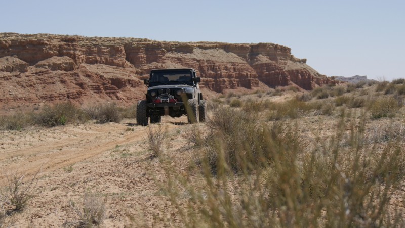
An excellent addition to Thompson Hole, Tidwell Draw offers a more clear view of the Swell's uprising and a different 4x4 challenge while traveling out to the Hole. The trail is the same difficulty, but the challenges are more dirt with a mix of rock. You also drive through the cottonwood trees in the large Tidwell Draw. The trail ends at the brushy, dry Tidwell Draw and the always-flowing San Rafael River. There was no river access and no camping found along this route.
Updated: 06/05/2022
East Tintic Mountain Quarry Spur
Eureka, Utah
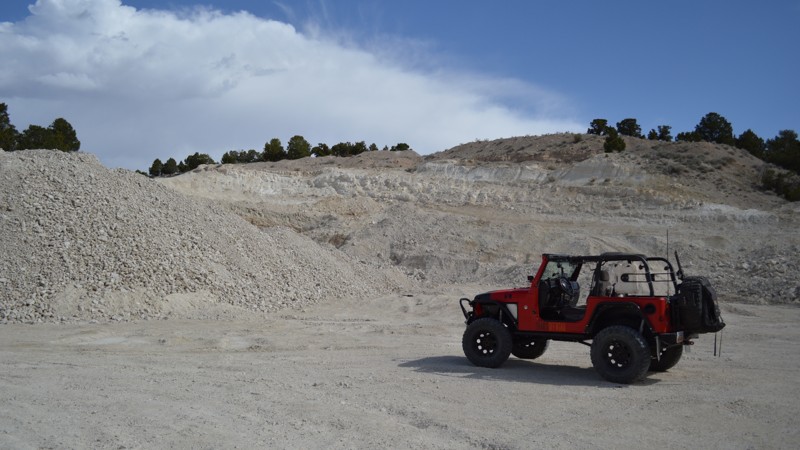
Be sure to check out this short side trip when exploring the East Tintic Mountains. This four-wheel-drive trail takes you to remnants of the Tintic Mining District. The Tintic Mining District is among the oldest mining camps in Utah. Ore was first discovered in December 1869, about a mile east of Silver City, and the district was organized in the following spring. The district is named in honor of the Ute Indian Chief Tintic, who lived his whole life in the area with his tribe. Shortly after the district was organized, an influx of settlers, prospectors, and miners started to move in. By 1899, the Tintic District was the leading mining center of the state of Utah.
Updated: 10/01/2025
Old Spanish Trail
Green River, Utah
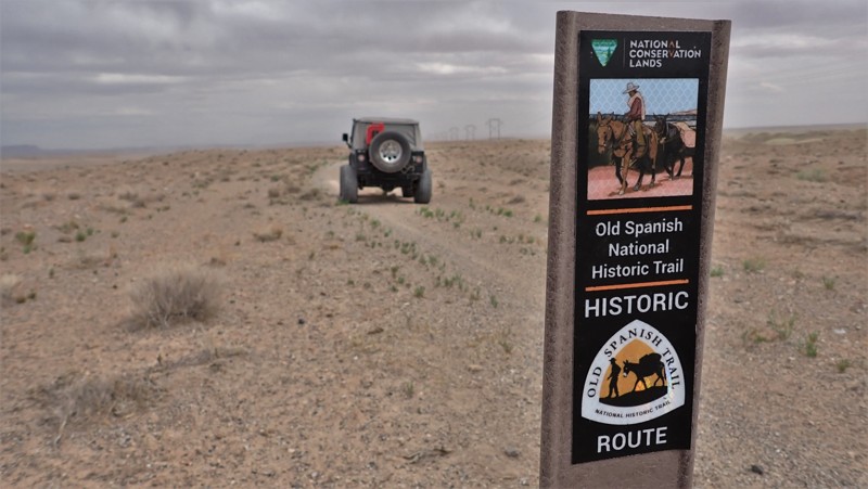
As the early settlers crossed this desolate landscape, they marked their way, leaving behind a trail marker for others to follow. Old Spanish Trail is the original route used by these weary travelers. This small section follows that original trail before it treks through Cottonwood Wash. The trail is loose and soft dirt but was once a graded road in areas. BE CAUTIOUS because there are deadly blind washouts. One crossing over a washout is not advised. Bypassing around the crumbling "bridge" will prevent a collapse. Camping is in the wide open on the dirt, where it can be very windy.
Updated: 10/15/2024
D2761 Moab
Crescent Junction, Utah
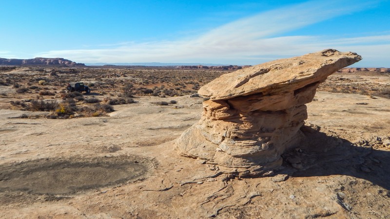
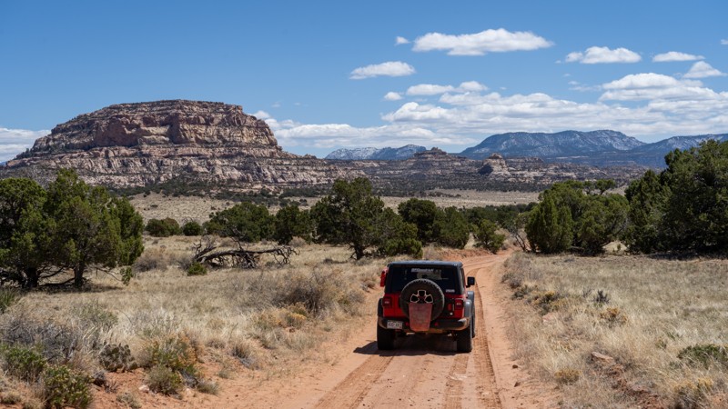
D2761 is a rocky, sandy, remote, dead-end 4x4 trail across a scenic desert landscape. Unique balance rocks and hoodoos add to the vast panoramas that stretch for miles in all directions. Watch for pronghorn and big horn sheep that thrive in this pristine, remote environment. The trail cuts straight across the scrub brush, following a sandy two-track with long sections of bumpy sandstone, mild vertical ledges, and gradual descents. Airing down tire pressure will aid with traction in the loose sand and over the endless bumps. Low-range 4x4 may be needed numerous times, and high clearance and durable offroad tires are required. The rocky step ledges are 10-14" tall and must be driven in both directions. There are no campsites along this route or down in Bull Bottom. Abundant camping is available along Ten Mile Point.
Updated: 09/14/2026
Ruin Park Road
Hite, Utah
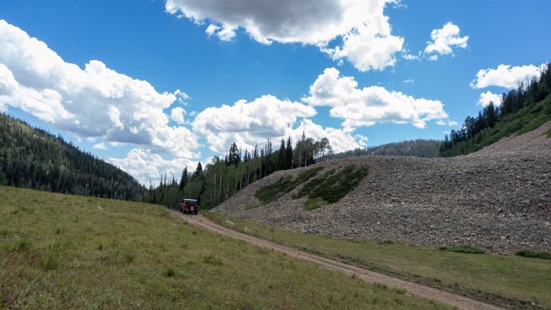
Ruin Park Road is a great connector trail if you plan on making a multi-day overlanding trip in or out of the Needles District of Canyonlands National Park. This easy trail offers several good campsites and no real challenges. The road is mostly comprised of packed dirt with sections of large rock slabs and pockets of sand. The scenery along this trail is stunning, with great views of the Henry Mountains and into the Maze District, another amazing offroad destination in Canyonlands. If the name didn't give it away, rumor has it there are Anasazi Ruins along the way, which true explorers and adventurers will have a fun time trying to find them all. As with any native history, take only photos and leave only tracks.
Updated: 08/11/2026
Rhodes Canyon
Hanna, Utah
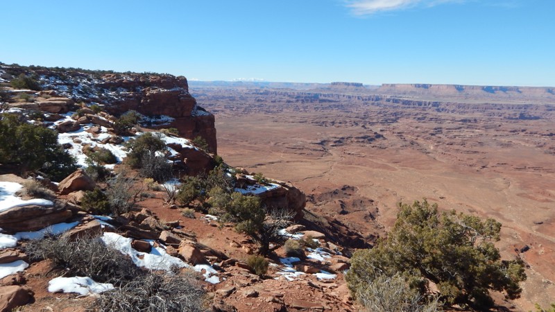
Rhodes Canyon is an easy but bumpy forest service road leading from Highway 35 to the end of Soapstone Creek. Any vehicle with high clearance can handle this trail, as the small rocky patches are nothing more than a few inches tall. Although the trail is mainly contained within the Ashley and Uinta-Wasatch-Cache National Forests, camping is fairly limited. There are only a handful of good preexisting dispersed sites with man-made fire rings, and none of them are much larger than 3-4 vehicles in size.
Updated: 04/01/2025
Rustlers Spur
Spanish Valley, Utah
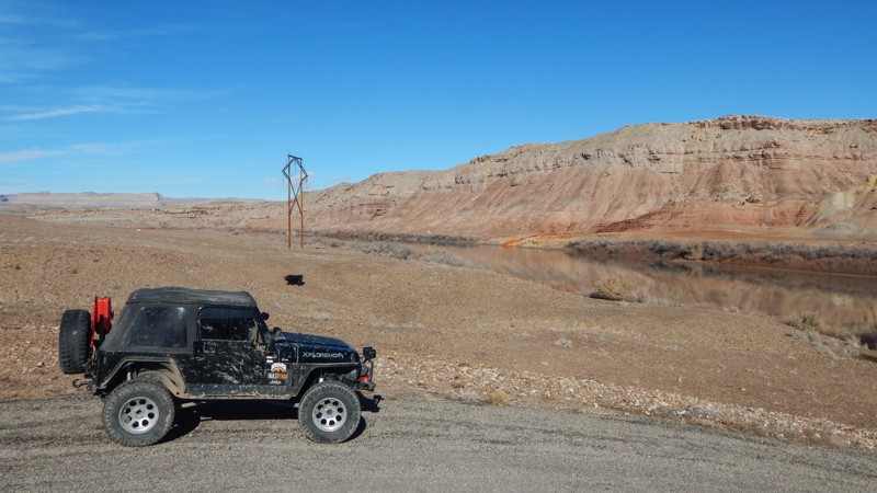
Rustlers Spur is the main out-and-back trail connecting all four of the Rustler network of trails. The 2-mile sandy service road leads to an overlook of the Canyonlands and a couple of rocky campfire rings for tent campers. The trail is hard-pack sand that is passable in 2WD in dry conditions. The trail connects with the more challenging 4x4 trail Rustlers Loop, leading to the Needles Overlook.
Updated: 10/15/2024
Augar Road
Green River, Utah
Augar Road is considered the alternate viewpoint for the popular Crystal Geyser but from across the river. The trail is a semi-maintained 3.3-mile gravel road leading down to a large camping spot along the shore of the Green River. The trail is home to the area's gravel pit. Expect heavy equipment on the road. Along the route, there are large, wide-open dirt spaces where campers have set up in the past. The camping at the end is pretty level and more sheltered from the high winds that often rip across this region. All your camping supplies and other services can be found in Green River, Utah.
Updated: 06/15/2024
Alexander Loop and Spur A
Kamas, Utah
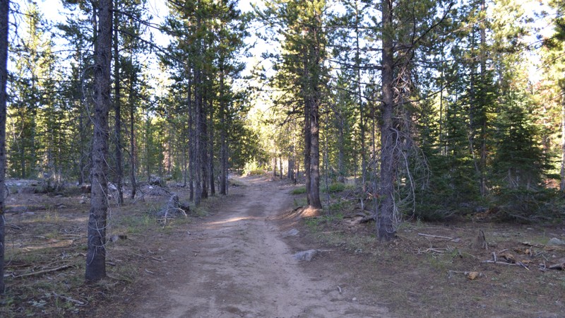
Alexander Loop and Spur A, along the popular Mirror Lake Highway, is all about camping. Popular in the hunting season, this short track has a large number of big camping areas that are great for a group. It is nearby to the main trail, so it has quick access and can accommodate 4-5 vehicles plus off-road trailers. If you don’t need to be right on Alexander Lake, this is the spur to camp on. Along the popular Mirror Lake Highway in the Uinta Mountains, you will find endless opportunities for weekend recreation. Alexander Lake is among those popular areas providing all kinds of fun for the family.
Updated: 09/21/2026
Spirit Railroad to Chimney Rock
Woodside, Utah
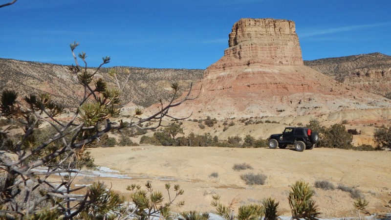
Take a short trip down history lane along this easy 4x4 trail. In 1881 Spirit Railroad was extended into this region of San Rafael. This trail travels right on its old grade to one of the best-preserved sites to see anything left from its construction. After wandering around the site looking for the old chimney, head back to Chimney Rock. The towering rock formation will make you think of the much larger Devil's Tower in Wyoming. There was a nice campsite near the base. The trail has a couple of mild challenges for stock 4x4s. You may need a four-wheel drive and high clearance to prevent high centering.
Updated: 05/28/2026
Buckhorn Wash Overlook
Lawrence, Utah
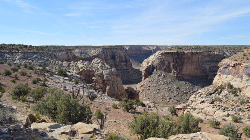
Buckhorn Wash Overlook is a neat little scenic drive away from the crowds of the Swell. No obstacles lie along its path, making it a great option for some epic views for any driver, seasoned or beginner. Adventurers looking for secluded camping may also find this trail particularly intriguing as there are many options for small groups to enjoy quiet solitude.
Updated: 10/15/2024
Rustlers Overlook
Spanish Valley, Utah
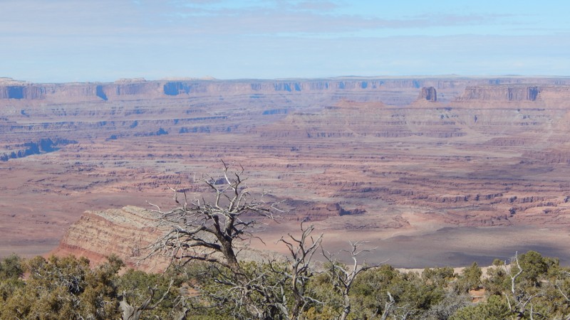
The first and main road to the Rustler area trails leads to a subdued, overlook camping area. The easy sand road travels 3.4 miles to the turn-around camping area but is less rewarding than the Rustlers Spur trail. A vehicle can set up a tent or two in two small areas, but it would be tight and intrusive when traffic passes through for a look. The maintained road to the overlook is easy with packed sand and can be busy during the day. Whether you're there for a quick look or a few days, you'll leave with many memories and photos. Look for Horsehead Rock off in the distance.
Updated: 05/02/2025
Neversweat Canyon
Woodside, Utah
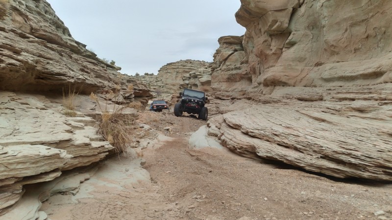
Neversweat Canyon is a truly unique Utah rock-crawling experience that isn't well-known or run by full-size vehicles. The pock-marked greenish sandstone narrow slot canyon section is almost surreal. You must choose your line through the entire canyon, over and around boulders, picking the best line for your vehicle, one rock at a time. The canyon is very challenging in stock vehicles. Modified 4x4s with extra ground clearance, skid plates, and durable 33-inch tires are recommended for this challenging route. Count on harsh pin-striping and potential body damage. The route follows the wash for the entire canyon. Motorcycles still use the grassy by-passes, which are now reclaimed and overgrown, therefore reduced to single-track. There's no camping within the canyon, but it is available on many of the easier trails in the area.
Updated: 10/16/2025
Dead Broke
Hurricane, Utah
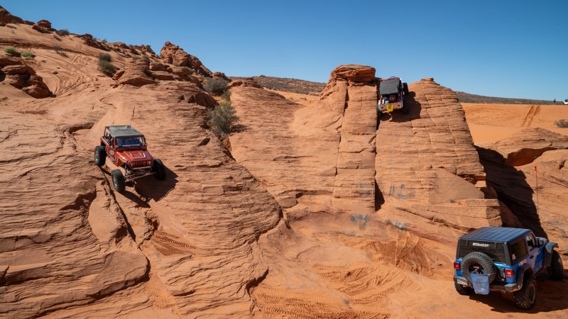
Traveling east to west, and crisscrossing many of the most popular routes along Sand Mountain, such as Chain Reaction, Triple 7, Double Sammy, and Joint Effort, Dead Broke is a trail that delivers a nonstop series of steep climbs, sharp ledges, and off-camber drops carved into the red slickrock. This is not a trail for the faint of heart. Expect constant vertical walls, deep cracks, and tall waterfalls where careful spotting, throttle finesse, and lockers are an absolute requirement. The line choices are tight and technical, and often very tippy. Dead Broke rewards the challenge with jaw-dropping Sand Hollow State Park views, unique sandstone formations, and the kind of obstacles that make Sand Mountain famous. The trail ends just before reaching Sand Dune Way by tackling the Baby Lionsback obstacle, where users must traverse a narrow, blind climb and then drop off the other side of the rock feature in the same blind fashion. This trail is best for experienced drivers who want to test themselves on technical terrain. Two lockers, rock sliders, and at least 35" tires are recommended for this trail.
About Sand Mountain
Sand Mountain is an extremely unique parcel of public land. Designated as an Open OHV Area, riders are free to make their own trails. Due to this, many of the long-established named trail routes have several variations that can take easier or more challenging routes through the intended trail. The GPX track for this trail helps you navigate the area, but various lines, bypasses, and additional obstacles may exist along the way. Riders are encouraged to stay on existing trails and not unnecessarily drive over or destroy vegetation.
Fees
Riding on Sand Mountain is entirely free. However, there are multiple entry/exit points for the area, including "the tunnel," which connects Sand Hollow State Park to the open OHV area. Any entry into the boundaries of Sand Hollow State Park requires a Utah State Park Pass.
Requirements
When operating on Sand Mountain, users must attach an orange or red safety flag to the vehicle, rising at least 8 feet off the ground.
Updated: 10/15/2024
Lone Warrior
Moore, Utah
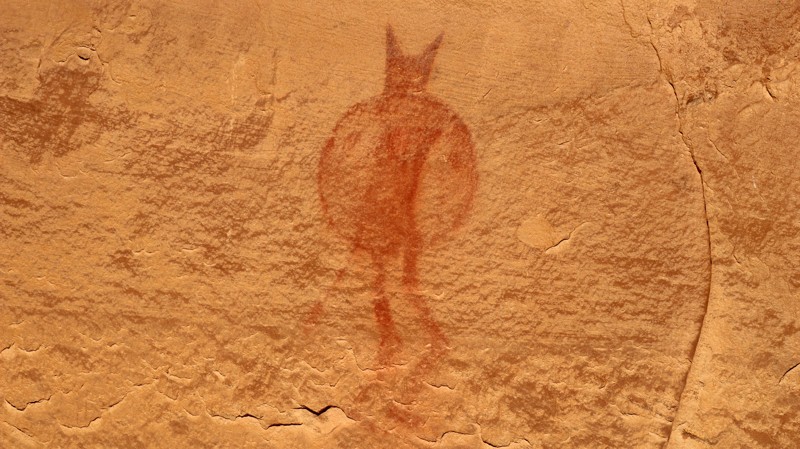
The San Rafael Swell hosts an extraordinary collection of ancient petroglyphs and pictographs. One of the most unique is the Lone Warrior pictograph. A massive sandstone wall hosts a single red figure holding his spear and shield. To be totally honest, there are other faded pictographs along the sandstone edifice. However, it takes a keen eye to spot them.
Lone Warrior is a spur off Swasey's Cabin. The brief drive to the Lone Warrior trailhead is sandy and prone to occasional washouts, but normally very easy. The hike to the Lone Warrior panel is only a few hundred feet on level ground. Several fantastic campsites are nestled in sandstone outcroppings on the north side of the road. They make a wonderful place for a great night under the stars contemplating the story behind the Lone Warrior.
Updated: 10/15/2024
Slaughter Flats 4254
La Sal, Utah
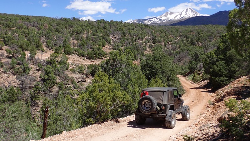
The Slaughter Flats region south of Moab is nestled in the foothills of the Manti-La Sal Mountains. The 4254 National Forest trail crosses sprawling meadows with stunning views of the snow peaked mountains. The camping is limited to a couple of sites, but what excellent campsites they are. Reaching this trail via Slaughter Flats 78 creates a scenic and historic tour of one of the lesser-known areas around Moab, Utah. The area trails are ideal for stock-type 4x4s with high clearance and a driver with a sense of adventure.
Updated: 01/02/2025
Dog Hollow Reservoir Alternate
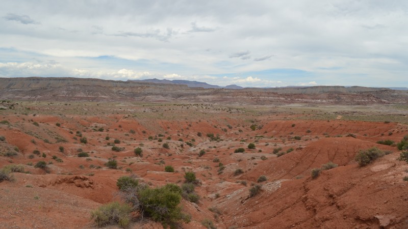
Emery, Utah
As the name suggests, this is another way to reach Dog Hollow Reservoir. Although that may not be your end goal, this trail is pretty exciting in its own way. From the start, you are treated with views over the western side of the San Rafael Swell. Once you start down into the wash, you will be treated with a few minor obstacles until you must exit the wash. Over the years this exit changes, so much so that previous users abandoned hopes of continuing on and returned the way they began. This has left the northern end of the trail almost invisible. For those people able to exit the wash, you can head north to other access trails for the Swell. If you are just looking for a little dirt, be sure to make it to the descent before the wash for the most scenic views!
Updated: 10/15/2024
Coral Pink Sand Dunes Overlook
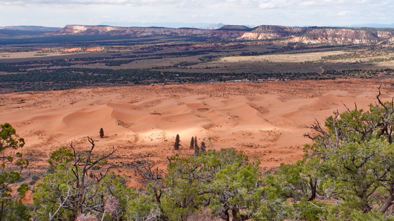
Moccasin, Utah
This short but highly scenic and challenging spur off the Hell Dive Canyon trail follows a ridge out to an overlook of Coral Pink Sand Dunes State Park. It is entirely on state land (partly SITLA and partly the state park), so it may not be shown on BLM travel maps but it is a legal route. The difficulty is similar to the rest of the Hell Dive Canyon trail, with a mixture of sand and slickrock with a few decent size ledge obstacles that would probably be too hard for a stock 4x4. Since the trail goes downhill on the way in, returning out is more challenging. There are excellent views of Coral Pink Sand Dunes from multiple viewpoints along the trail, with the best viewpoint near the end, looking directly down on the tallest dune in the park. There are no established campsites.
Updated: 10/15/2024
D1167
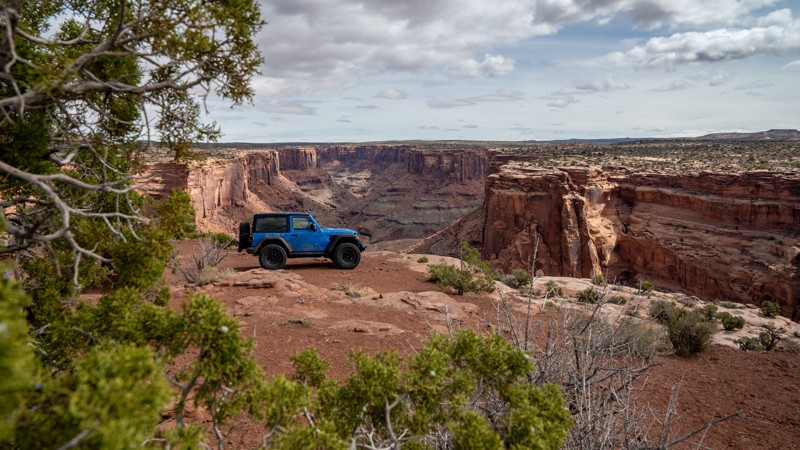
Moab, Utah
D1167 is a short, dead-end spur road off Mineral Bottom that leads to a couple of campsites at the cliff edge overlooking Mineral Canyon. Any vehicle can easily travel the road. The trail surface is primarily sand with sections of flat slickrock. The first campsite is large and wide open, with plenty of level space on top of the slickrock accommodating several tents and vehicles. Against another canyon area, the second campsite is again large and open, but has more uneven ground, making it harder to support ground tents. Rooftop tents are a great option at the second campsite.
Updated: 10/29/2025
Chaffin Geyser
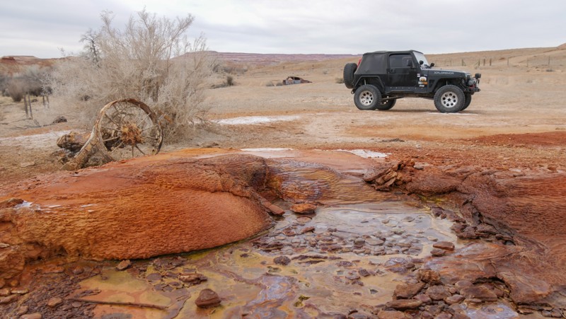
Green River, Utah
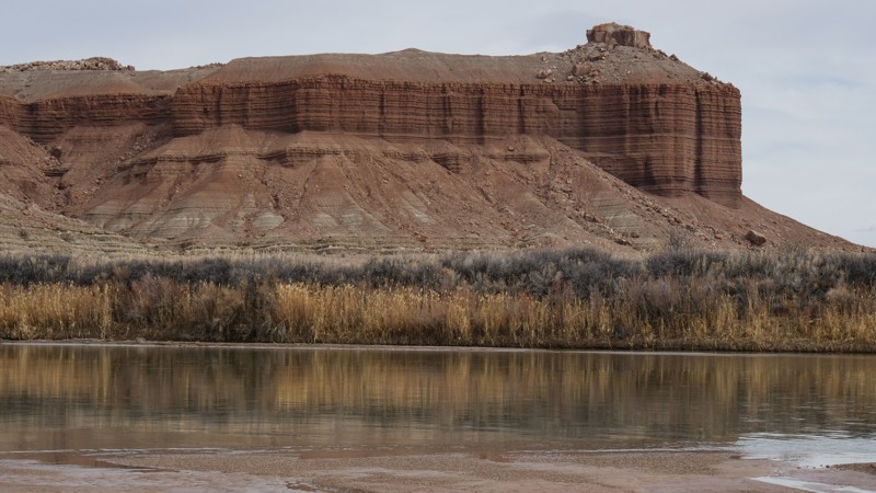
Chaffin Geyser, named after the ranch that occupied the location for years, is another area geyser created by man when core drilling. A colorful small hole typically erupts every 2-4 hours during spring and summer. Pooling water around the mouth indicates an eminent eruption. The pressurized water shoots out of the hole to over 30 feet in the air. The geyser area also has old rusted cars and other remnants from the ranch, adding unique contrast to this colorful landscape.
The road leading to the geyser area is well-maintained gravel and sand. Once past the geyser camping and parking area, the trail becomes more difficult, with very soft sand requiring a 4x4. Near the end of the track is a large rock butte with camping nearby. At the very end, there is a campsite for one with privacy and brushy access to the river.
Updated: 04/01/2025
Dry Lake Wash
Green River, Utah
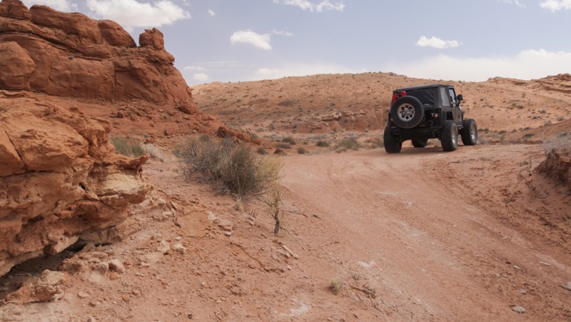
Branching off of Fossil Point trail, Dry Lake Wash winds its way through rutted sandy washes to the banks of the mighty Green River. Very few trails lead down to clear access to the river like this one. Views of the buttes along the trail and across the river are colorfully scenic and unobstructed by the typical thick desert brush lining the river. The trail is mainly soft sand with deep cross ruts from rainstorms. You'll need high-clearance, four-wheel-drive and durable tires to reach the river bank. Please follow the gpx track closely to find the cattle gate. Camping was limited to a couple of spots in the rocks of the first wash or the wide-open desert. Because of the potential for flash flooding, camping along the river is not advised.
Updated: 10/15/2024
Blackburn Draw
Hanksville, Utah
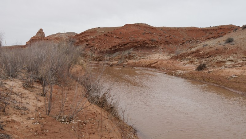
Blackburn Draw is an excellent alternative to the typical gravel roads crisscrossing the San Rafael Desert in central Utah. The trail crosses over a barren and rugged landscape on a mix of soft sand and jagged rocks. Vehicles should have durable offroad tires, high clearance, and four-wheel drive to safely navigate the steep hill on the route. Traveling east is downhill. The area is a wide-open desert with little protection from the wind or sun.
Updated: 10/15/2024
San Rafael Desert 9062
Green River, Utah
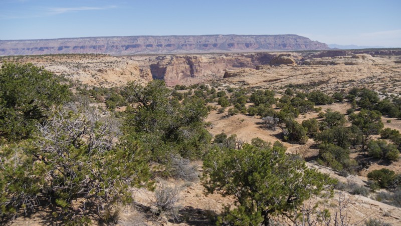
Dropping into the trailhead along the San Rafael River, you're immediately in this unique trail's brushy and grassy flood plain. The trail's early section offers easy access to charming shady campsites under the cottonwoods thriving along the banks of the San Rafael. Later, the route climbs to a river rock and dirt mesa, built by millennia of shifting river flow. The plateau offers sprawling views of the colorful buttes, eventually dead-ending above the Green River. The trail's end is sagebrush and blowing sand, leaving little room to set up camp. The views of the river are serene and different from others found along Lower San Rafael Road. The trail is soft sand before turning into rocks to climb up the mesa. 4x4 and high clearance are required to access camping along the early portions of the route.
Updated: 10/15/2024
Lower Wedge
Lawrence, Utah
Lower Wedge is simply the trail with the most camping in the area. This easy dirt road winds through the trees to several free and eight improved sites that charge a fee. The campsites range from large open sites for RVs and groups to small intimate single tent camps with beautiful views of the nearby canyons. The trail ends at a large turn-around with a canyon view with Cedar Mountain as a backdrop. Early in the trail at campsite 5, there are vault toilets for the area campers. The most challenging part is the blind corners around the trees. Please be sure to use caution and take it slow.

Upgrade your Membership
Unlock all of the details on every Trail Guide and Scout Route.
Start a 7-day Free TrialBrowse Trails in Utah by City
Browse every Utah city with offroad trail guides.
Community
Partners

