







By clicking "ACCEPT", you agree to be the terms and conditions of each policy linked to above. You also agree to the storing of cookies on your device to facilitate the operation and functionality of our site, enhance and customize your user experience, and to analyze how our site is used.
Arizona Off-Road Trails
373
Total Trail Guides 359

4679
Detailed Waypoints 676
Try a Free 7-Day Trial and unlock it all
Start a Free Trial Most Recent Trail Reviews
No Rating
Open
Visited: 09/23/2026
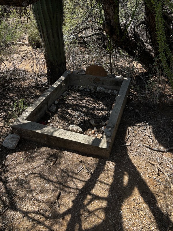
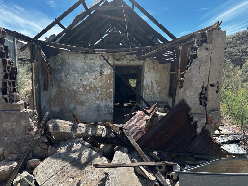
Gets a little technical at the end but the difficulty is spot on.

KR
Keith Ringiesen
No Rating
Open
Visited: 09/22/2026
The road was very smooth with the normal views running through the pines. Reminded us of many of the trails in the White Mountains.
T
Tom
No Rating
Open
Visited: 09/22/2026
Even with all of the recent rain, this trail was mostly dry ... a few ruts had water in them. Looks like there was a bad washout at the northern end of the trail on Apache Maid between waypoints 7 an...
T
Tom
No Rating
Open
Visited: 09/22/2026
Still an easy trail ... even after all of the rain.
T
Tom
Rated 4/5
Open
Visited: 09/22/2026
Hard pack, easy forest service road that is a great back way to the North Rim of the Grand Canyon.

Tyler D’Hulst
Rated 4/5
Open
Visited: 09/22/2026
Spring Canyon is a beautiful drive. We didn’t go out to the cabin but used this western section of road coming back from Crazy Jug

Tyler D’Hulst
Rated 4/5
Open
Visited: 09/22/2026
We took this out to Crazy Jug. The northern section is hard packed forest service road. Not difficult. Very scenic drive through the ponderosas.

Tyler D’Hulst
Rated 5/5
Open
Visited: 09/22/2026
View point is spectacular! Trail was easy going out, no obstacles at all. Saw a Toyota Camery at the viewpoint.


Tyler D’Hulst
Rated 3/5
Open
Visited: 09/22/2026
An alternative route out to Crazy Jug Point. It’s easy and can be scenic in areas. I’d recommend West Ryan out to Crazy Jug though.
Tyler D’Hulst
Rated 3/5
Open
Visited: 09/22/2026
A quick connector trail through the burn patch.
Tyler D’Hulst
Rated 4/5
Open
Visited: 09/20/2026
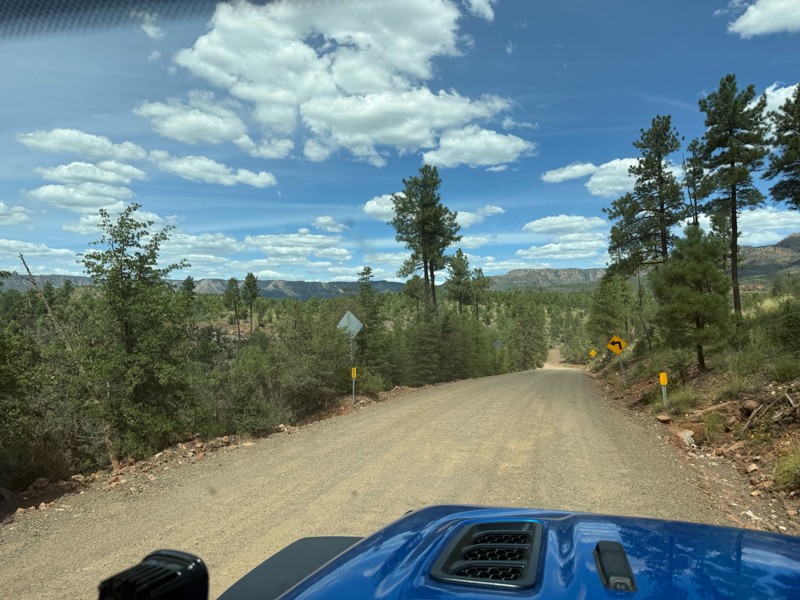
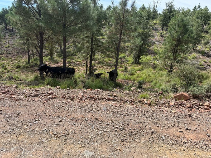
Trail was as described. Scenic but not particularly memorable. A few creek crossings would be fun if there had been recent rain. Easy drive in 2w the whole way. Be sure to pull off and check out wher...

Troy P
Rated 5/5
Open
Visited: 09/20/2026
Leviathan Mine trail is a full day trip. Though it is only 20 miles in length the travel is slow and rough. Majority of the trail you will be going between 5-10 MPH. Then once at the end it connects w...



Eric Gartin
Official Crew
Rated 5/5
Open
Visited: 09/19/2026
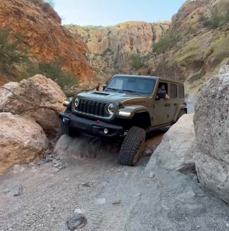
The harder obstacles aren’t that bad anymore. With the amount of sand and gravel that has washed into the canyon. The main constraint is the wedge between the 2 rocks; but I found it easy if you stick...
BC
Brian C
Rated 4/5
Open
Visited: 09/19/2026
Simple road, well graded today. Many mountain bikers coming down from the West out of Breezy Pines. Not too many people out until approaching Senator Hiway. We went East to West as I think thats a bet...



Jeff Burnett
Rated 3/5
Open
Visited: 09/19/2026
The trail itself is not spectacular, it's pretty flat across the plains. However, driving up to the overlook and seeing a huge gaping hole in the ground is a great juxtaposition to the flat trail. The...
Tyler D’Hulst
Rated 3/5
Open
Visited: 09/19/2026
A nice trail ride from the main road down off the plateau. It's graded forest service road until the switchbacks. The switchbacks themselves are not difficult, road is not graded. This section has bee...
Tyler D’Hulst
Rated 3/5
Open
Visited: 09/18/2026
The end of the trail is not well marked, and can cause confusion. Also, vehicle passes are required for all backcountry routes within the Lake Mead National Recreation Area.
Eric Gartin
Official Crew

Ted Whisler
No Rating
Open
Visited: 09/17/2026
Nice ride west side a little rocky but rating is true to #2


Ted Whisler
Rated 3/5
Open
Visited: 09/15/2026
A nice drop off the plateau heading towards Marble Canyon. Not a difficult road. Road is weathered but not challenging.
Tyler D’Hulst
No Rating
Temporary Closure
Visited: 09/15/2026
Road closed due to multiple washed out wash crossings after the turn off to go up the mountain. "Road Closed" sign put out by BLM on trail.
Tyler D’Hulst
No Rating
Temporary Closure
Visited: 09/15/2026
After the turn off to head up the mountain there are multiple washed out wash crossings. A "Road Closed" sign has been put out by the BLM.
Tyler D’Hulst

Ben Ruddell
Official Crew
Rated 4/5
Open
Visited: 09/14/2026
Bogles Ranch Road is a great Sunday afternoon drive type of dirt road that climbs up in elevation and gives some spectacular views of the surrounding area. The first half passes through State and Priv...


Eric Gartin
Official Crew
Ben Ruddell
Official Crew
Rated 3/5
Open
Visited: 09/14/2026
Antares Road is an excellent way to travel from Route 66 to the eastern portion of the Lake Mead National Recreation Area. This wide county road is well maintained with minor washboarding, most of whi...


Eric Gartin
Official Crew
Rated 3/5
Open
Visited: 09/14/2026
Hackberry road is a wide dirt road with minimal erosion damage and washboarding. There are a couple of larger washes that cross Hackberry road creating wide stretches of loose sand which can cause iss...


Eric Gartin
Official Crew
Rated 3/5
Open
Visited: 09/13/2026
This is a very rough, rocky, & slow going trail. Expect around 4+ hours for the trail & another hour to get the highway. One of those trails I'm happy I did but I wont be back personally. High clearan...

Brandon W
No Rating
Open
Visited: 09/12/2026
I think the rating is spot on. The ruts and washouts at the beginning are not as bad and if you hug the inside of the shelf road they can be avoided. The middle part is same general sandy wash with ov...



Greg Page
Rated 4/5
Open
Visited: 09/11/2026
Ran this trail as part of a larger loop. Trail is in great shape. Easy for standard 4x4 with no lift. Passengers can do it until maybe the very end by the lake where the road gets rocky and washed out...


Jeff Burnett
Rated 5/5
Open
Visited: 09/10/2026
This is one of my favorite scenic trails in the area. The trail is easy to travel, but does have some optional short trails that will test your vehicle. The views from the Grand Wash Cliffs of the Hua...


Eric Gartin
Official Crew
Rated 3/5
Open
Visited: 09/07/2026
This trail by itself is nothing special. It is mostly used as an access road to get to the more technical trail such as Homecourt, Twister, and Waynes World. This is a great trail for the beginner to ...


Eric Gartin
Official Crew
Rated 3/5
Open
Visited: 09/07/2026
This trail is an enjoyable alternate route when traveling on Blake Ranch Road (7163). The trail is easy with only a handful of spots with erosion damage. The few established camping sites appear to n...


Eric Gartin
Official Crew
Rated 5/5
Open
Visited: 09/07/2026
Ran this trail from Boynton Pass Road to Loy Butte Road (opposite direction from what is listed). Ran into a few rental ATVs and a couple of Jeeps heading the opposite way. This was a fun trail wit...



Daniel Macioce
Rated 5/5
Open
Visited: 09/07/2026
This trail was a lot of fun, plus the views were amazing. I ran the trail in the order posted, starting at the south trailhead and finishing at the heritage site. Past a motorcycle, a few jeeps and a...


Daniel Macioce
Rated 4/5
Open
Visited: 09/07/2026
Nice trail, ran West to East. For some reason the map shows this a a one-way trial, East to West. That is not the case, it is a two way trail. Was pretty washed out starting around mile 12. Plenty roc...


Jeff Burnett
No Rating
Open
Visited: 09/06/2026
New trail for me. You didn’t know what it would throw at you around every corner which is why you try to find new trails or old forgotten ones
KB
Kory Burden
Rated 5/5
Open
Visited: 09/06/2026
The trail is no joke—steep, narrow, and technical enough that you’ll want to be comfortable with off-camber shelf roads, rocky terrain, and washouts that will test your vehicles articulation. The rew...



Bobby Rumbaugh
Official Crew
Rated 5/5
Open
Visited: 09/06/2026
Fun trail if you don't want to do pyeatt draw itself. Ran this trail 3yrs ago and definitely a little more erosion but, still any truck or suv with good factory ground clearance can do it. From previo...
JM
James m
Rated 4/5
Open
Visited: 09/06/2026
Ran this trail from I-17 to Sedona. Extraordinary views descending into Sedona. As others have noted, there are lots of rock on the trail, making it slow going. Passed a large number of Pink Jeeps ...


Daniel Macioce
Rated 4/5
Open
Visited: 09/05/2026
This one definitely changed over the last few years. The southern section has some legit, steep, off-camber sections. YOU NEED experience, backup, and a capable vehicle on this one now. It's not supe...


.jpg)
Bobby Nelson
Official Crew
Rated 4/5
Open
Visited: 09/05/2026
Another amazing time on this scenic crossover. We came in from Walnut Canyon and finished out on Price Road after about 6 hours. A challenging and hot day for the old TJ. Rincon Road has evolved into ...


Bobby Nelson
Official Crew
Rated 4/5
Open
Visited: 09/05/2026
We started exactly at sunrise to try and beat the heat. We planned to crossover to Box Canyon and out on Price Road. It ended up taking us 6 hours, even with all the photos and filming we did. A chall...


Bobby Nelson
Official Crew
Rated 5/5
Open
Visited: 09/04/2026
We recently ran Four Peaks after the monsoon rains. Here’s what we found and what to expect if you’re planning to run it. Have a GR8 day!

Jeep 4 Dirt
Rated 5/5
Open
Visited: 09/04/2026
Breathtaking views. Definitely don't rush through the trail. Devil's staircase was a bit slippery but awesome. A few tight stops here and there, but a trail that's a must on anyone's to do list.



Christopher Bradley
Rated 4/5
Open
Visited: 08/30/2026
Id say this is a 3.5 to 4 trail. There are some obstacles, but nothing you really need to think hard about how to approach. If you send your vehicle at it in 4 low you'll get through everything.



Justin Holsinger
Rated 4/5
Open
Visited: 08/28/2026
Rim Road (FS300) West to East. Very well groomed gravel forest road. Accessible by just about any vehicle thats not been lowered. Who does that anyway? Scenic views the whole route. Hard to believe on...


Jeff Burnett
Rated 4/5
Open
Visited: 08/28/2026
Not a bad road but it was crowded with sxs and vehicles towing campers. Hard to rate 5 stars for a busy road. Super easy any vehicle can do this. Part is paved near the freeway but the rest is gravel.

Tony Rockwell
Rated 4/5
Open
Visited: 08/28/2026
I rated 4 stars just due to the volume of sxs & camper trailers on the road.
Easy drive, any car can do this.
Ran from sheep springs to munds park, see other reviews for full route.

Tony Rockwell
Most Popular

Updated: 07/16/2026
Cottonwood Gulch
Black Canyon City, Arizona
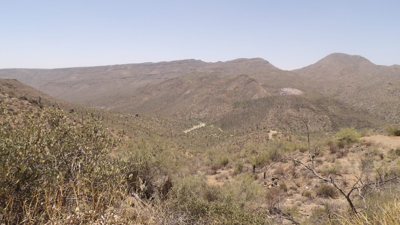
This scenic drive used to be a difficult, rough track but is now a smooth, well-graded road. It takes you up and over a mountain pass near Williams Mesa, before descending to Boulder Creek. On the way up, it follows Cottonwood Gulch through beautiful Sonoran Desert terrain filled with Saguaro cacti, mesquite, and palo verde trees. Along the way you’ll find a couple great campsites with stunning views—perfect for sunrise or sunset.
The road once provided access to the Tip Top Mine, but the owners have blocked it off and it’s now inaccessible. There’s also one gate, at the top of the pass, that must stay closed after passing through. Overall, it’s an easy and rewarding drive with minimal effort for big desert scenery and peaceful creekside access at the end.
Updated: 08/11/2026
Trilby Wash
Morristown, Arizona
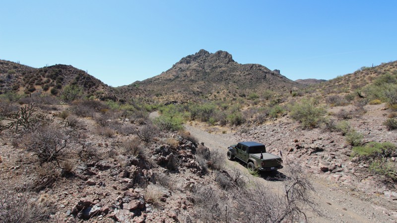
The trail begins as a mostly smooth sandy wash that offers sweeping views of the surrounding mountains. As you cruise along, the landscape is dotted with classic desert flora, including towering saguaro cacti, low-lying prickly pear, and sprawling mesquite trees. Watch for an old weathered cattle pen on the east side of the trail.
Soon, the route transitions into a narrow, bumpy section winding tightly through rugged volcanic rock formations. Beyond this mildly rocky challenge, the terrain levels out until you reach a surprising grassy area surrounding a quiet cattle pond. After that, it opens back up into a wide sandy wash that carries you smoothly all the way to the end of the trail.
Any stock high clearance vehicle can traverse this trail, but four wheel drive is recommended due to the loose sand. The short rocky section has baseball to softball sized rocks and isn't difficult to get through. No campsites were located along the way, but the grassy area might make a nice lunch spot. Keep an eye on the weather during monsoon season so you don't get caught in a flash flood. Traveling southbound takes you down in elevation, and the trail ends at Castle Hot Springs Road.
Updated: 04/22/2026
FR 124H
Allan Lake Landing, Arizona
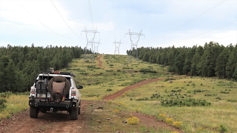
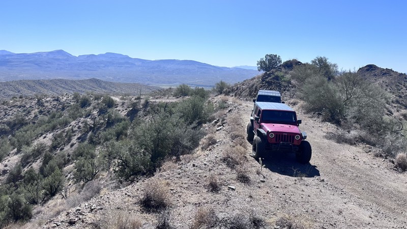
FR 124H, stretching 6.6 miles along the Mogollon Rim in Arizona, is far more than a simple connector between Sawmill Springs and Mahan Ranch. While it loosely follows a powerline corridor, the route delivers a surprisingly scenic and engaging drive, weaving between open clearings with expansive views of rolling high-country terrain and dense stands of ponderosa pine, fir, and spruce. The road itself is primarily packed dirt with embedded rock, featuring frequent dips, curves, and mild elevation changes that keep drivers attentive without being overly technical. The most challenging section comes near the southern end, where a tight switchback leads into a short but steep, rocky climb out of a drainage, requiring careful tire placement and moderate ground clearance. Overall, the trail is suitable for most high-clearance vehicles and offers a rewarding mix of forested solitude, sweeping vistas, and a touch of technical driving, with dispersed camping available near both ends for those looking to extend the experience.
Updated: 07/16/2026
Shannon Basin
Wikieup, Arizona
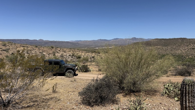
The Shannon Basin Trail is a 10-mile point-to-point trail that skirts the base of Groom Mountain as you cross the Shannon Basin from HWY 93 to Chicken Springs Road. The trail is mostly a rough dirt road with minor erosion damage in places. There are three areas that are challenging for independent suspension vehicles. Two areas, the weeble wobbles, are sections of major erosion damage that will test the articulation of your suspension. The third, the washout, is a steep drop and quick exit from a wash while turning. This trail is great for the beginner looking to increase their confidence and skills.
The views along this trail are stunning. As you climb in elevation, the scenery comes to life with desert flora. Groom Peak is a great backdrop for wonderful mountain views. There is a hearthstone and fireplace that remains from an old rancher's cabin along this trail. Also, several large veins of Quartz can be seen protruding from the rocks, some the size of a small car.
There are very few locations suitable for camping along this trail. If camping, ensure you do not camp on any private land along this trail.
Updated: 06/10/2026
Crosscut Cutoff
New River, Arizona
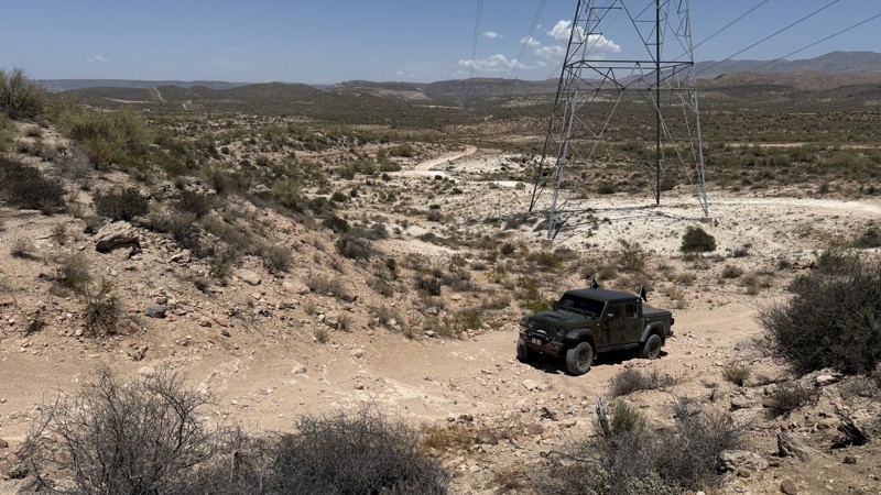
Connecting the Crosscut Trail to the Moores Gulch Trail, this short but rugged desert track delivers a true off-road adventure. Expect steep descents, mildly challenging terrain, and a mix of baseball- to bowling ball-sized rocks that will keep drivers engaged from start to finish. A stock high-clearance 4x4 is capable of handling the trail, but confidence behind the wheel is a must. No camping is available.
Updated: 06/29/2026
Table Mesa 9991A
New River, Arizona
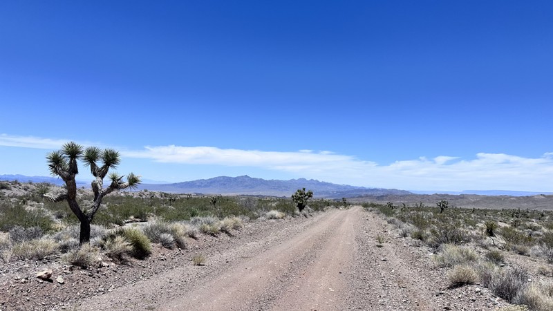
Though short in length, this trail packs plenty of fun into a quick desert adventure. The route follows a corridor of power lines across distinctive white dirt terrain, winding through scattered Palo Verde trees, scrub brush and several small rocky steps that add just enough challenge to keep things interesting. The highlight of the trail awaits at the western end, where a steep hill climb provides an exciting test of traction and driving skill. Along the way, the open desert scenery offers a classic Arizona experience, and a single camping spot makes it a great destination for a quiet overnight stay. Whether you're looking for a quick run or a relaxing evening under the stars, this trail delivers a rewarding mix of scenery and off-road fun.
Updated: 06/29/2026
Temple Bar/Gregg's Hideout Connector
White Hills, Arizona
The Temple Bar to Gregg's Hideout connector is a 15-mile point-to-point trail that crosses the Lost Basin Mining District. This open desert area was once very active with several mining claims in the early 1900's. Now deserted, the desert flora and fauna abound, with stands of creosote bush and white bursage. Though no dispersed camping is allowed on the Lake Mead National Recreation Area portions of this road, those sections on BLM land dispersed camping is allowed and there are a few sites along the trail. The trail has a few sections with minor erosion damage.
Updated: 07/16/2026
Back Road
Wikieup, Arizona
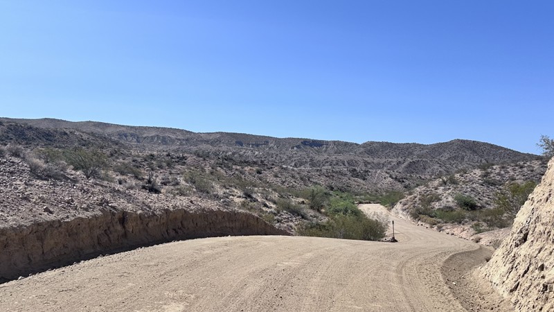
Back Road is a 14-mile point-to-point road that goes from Bogles Ranch Road to Wikieup. This is a graded and maintained County Road. There is a section of loose sand that could be troublesome for a 2WD vehicle. This is a great option if looking to get off the pavement of Highway 93.
Updated: 05/01/2026
7408
Larneds Landing, Arizona
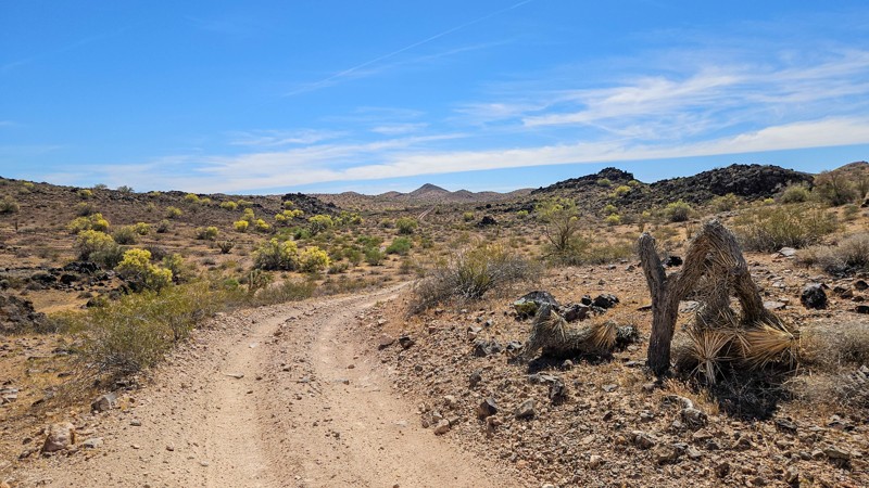
This connector trail links the Standard Wash and Mohave Wash areas with Planet Ranch Road. It is an easy trail overall, with most sections allowing you to simply look out the window and enjoy the scenery, though a few rocky and rutted spots require picking your line.
One of this trail's highlights is its distinctive volcanic rock formations, with clear bedding and layers that are certainly worth traveling at least once to see if you're into geology. It also passes through reddish soils and patches that resemble caliche but are actually a hard, fine-grained tan-and-white material blanketing the ground. Desert vegetation includes ocotillo, Palo Verde trees, and various cacti.
Please drive with extra caution on the western side of the trail, where there are several blind corners and hills that can hide fast-moving oncoming traffic.
Updated: 08/13/2026
Maggie Mine Road Campsite
Black Canyon City, Arizona
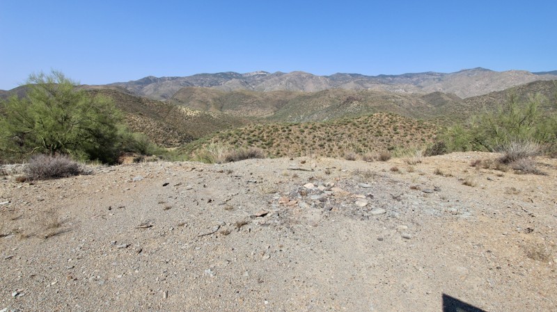
Navigating this short out-and-back Sonoran Desert trail begins with a rough entrance that immediately tests your vehicle's articulation among a dense landscape of towering saguaros, cat-claw brush, and heavily armored prickly pear. As you push further along the track, the terrain demands constant focus to clear palo verde trees that hug the narrow path, increasing the chance of Arizona pin-striping. The route challenges drivers with rutted, off-camber washouts that require precise tire placement and high clearance, followed by a steep hill descent to the bottom. Driving back up the hill will be required upon departure.
Despite the punishing obstacles along the way, this demanding route rewards adventurous drivers with a secluded campsite situated on an overlook at the end of the trail. This prime spot allows you to set up camp and decompress after battling the technical washouts and tight clearances, offering a quiet desert sanctuary surrounded by classic Sonoran flora. Whether you are running the trail as a quick afternoon technical challenge, or using it as a remote overnight stay, it delivers a quintessential, heart-pounding desert 4x4 experience.
Any high clearance 4x4, with an experienced driver, can tackle this trail. Take your time on the way down the hill, because part of it will tilt you to the side and may feel a bit tippy, but it's not bad. Once at the bottom, the campsite has an amazing view of the Bradshaw Mountains to the west.
Updated: 09/22/2026
Leviathan Mine
Wikieup, Arizona
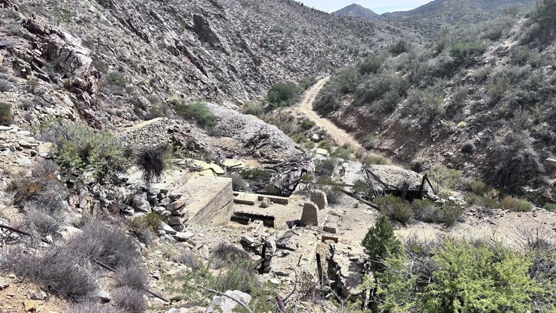
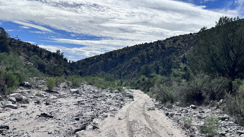
Leviathan Mine trail is a 21-mile point-to-point trail that begins from HWY 93 north of Wikieup, Arizona and climbs into the Hualapai Mountain range. The trail is mostly a narrow mountain shelf road with sections of erosion damage. There are a couple of small rock gardens along the trail; the most significant rock garden is close to the southern end of the trail.
The Leviathan Mine trail has several old copper and gold mines situated along the trail, the most popular one being the Leviathan Mine. The Leviathan mine was productive during World War I, producing molybdenum and Copper. Most mines are situated on private property and may have no trespassing signs posted. While exploring this area, be respectful of private property and be aware of the hazards posed by old mine shafts and structures. The trail also provides amazing views of the surrounding area.
Camping is allowed along this trail, but there are very few good areas for setting up a campsite.
Updated: 09/22/2026
Lower Antelope Wash
Pine Lake, Arizona
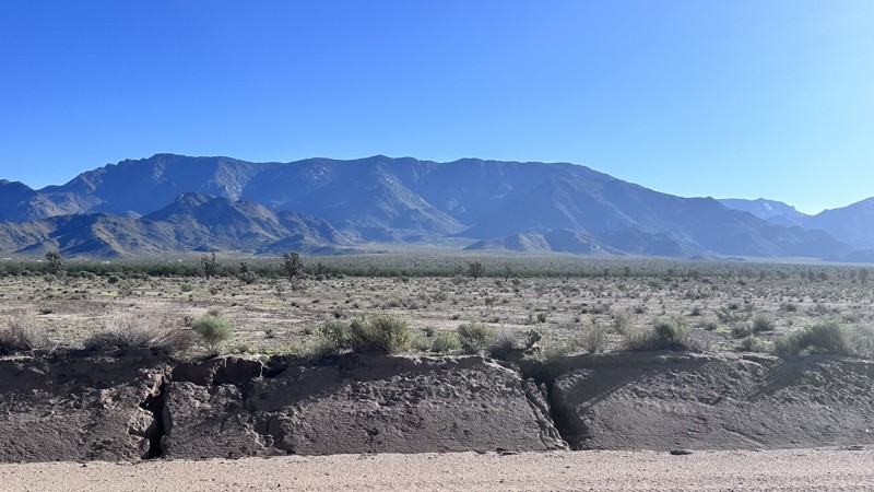
Lower Antelope Wash is an 8.5-mile dead-end trail in the Hualapai Mountain range, which starts from Blake Ranch Road and ends at a livestock corral and watering hole. This trail primarily provides access to multiple watering holes for local ranchers. Lower Antelope Wash trail has minor erosion damage, including potholes and washed-out sections, that expose small rocks, softball to football-sized. The trail is easily passable by any high clearance 4WD vehicle, but will be problematic for low clearance vehicles. This trail is very scenic, with lots of Mohave Desert flora and fauna to view. Dispersed camping is allowed along this trail, and there are several established sites with stone fire rings.
Updated: 09/22/2026
Antares Road
Cyclopic, Arizona
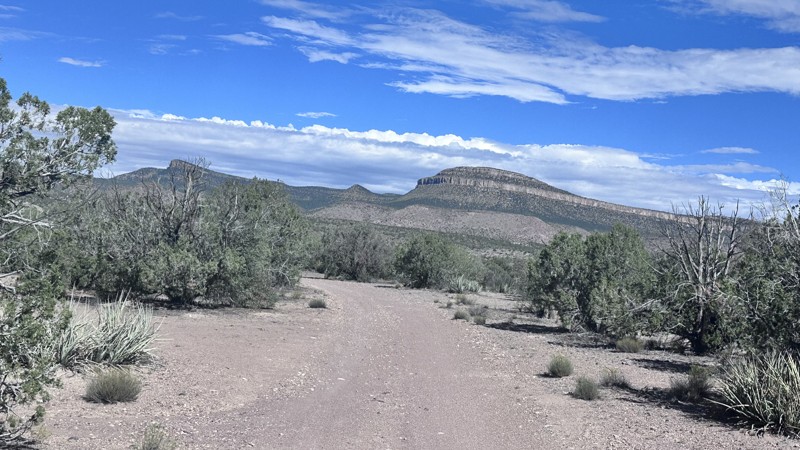
Antares Road is a 31.5-mile point-to-point road that traverses through the Hualapai Valley from Route 66 to North Pierce Ferry Road. With the Music Mountain range to the east and the Cerbat Mountain range to the west, this road provides multiple majestic views of the surrounding mountain ranges. Antares Road is a maintained county road with minor washboarding and minimal erosion damage. It is passable by any vehicle.
Updated: 09/22/2026
Music Mountains
Crozier, Arizona
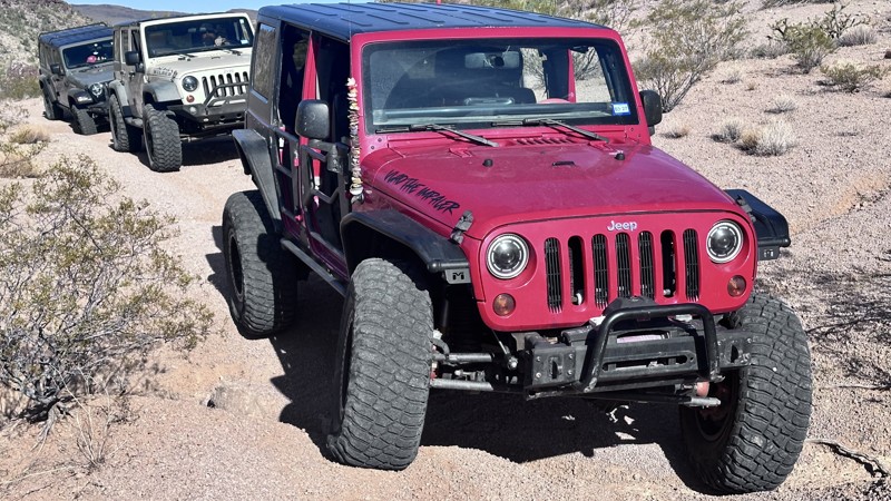
Music Mountains is a 17-mile loop trail that begins and ends on Route 66 and travels through the Music Mountain range. The Music Mountains are a rugged, scenic mountain range with peaks between 4,500 and 6,000 feet scattered with Pinyon Pines, Juniper Trees, and Purple Sage. The large geological feature in this area is the Grand Wash Cliffs, where you get spectacular views of the Hualapai Valley, Cerbat, and Peacock Mountains. This trail is easy with only minor erosion damage and some steep hills with loose rock, and is passable with any high clearance 4WD vehicle. Dispersed camping is allowed on this trail with several established primitive sites with fire rings. This is an open range area with active ranching operations; be cautious of livestock.
Updated: 09/22/2026
7192
McConnico, Arizona
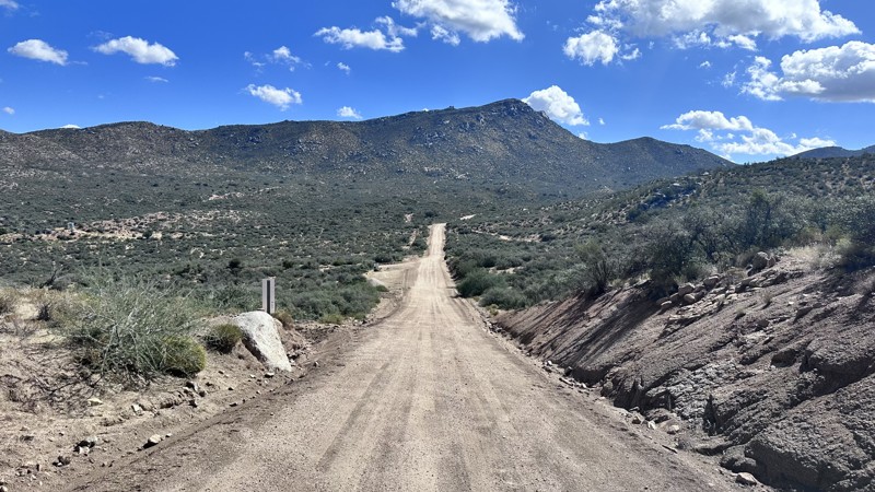
7192 is a 3.5-mile point-to-point trail that begins at Black Bridge off of Old Trails Road and is used primarily as a connector trail to other trails in the Hualapai Mountain Range. There is a large staging area at the western end of the road, where you will find plenty of room for trucks and trailers. The road primarily follows an easy dry wash with only minor erosion damage and loose sand. The middle section is what gives this trail its moderate rating, where the road climbs a narrower drainage with erosion damage that will test the limits of a stock 4WD vehicle's articulation.
Updated: 09/22/2026
Bogles Ranch Road
Cedar, Arizona
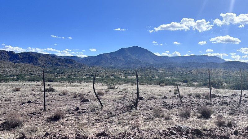
Bogles Ranch Road is a 24-mile point-to-point trail that climbs up through the Aquarius Mountains from Highway 93 to Francis Creek Ranch. The trail is a well-maintained county road and the easy option for accessing the Goodwin Mesa Area. Enjoy the Mojave Desert flora as you gain elevation in the Aquarius Mountains. The trail provides several locations for great vista views of the Hualapai Mountain range to the west and the Goodwin Mesa to the east. Heavy rain can make this road extremely muddy, do not travel for several days after heavy rain to keep damage to the road at a minimum. Dispersed camping is available once you enter BLM land on the eastern portion of the trail. Suitable for any vehicle iwth decent ground clearance.
Updated: 09/22/2026
Hackberry Road
Hackberry, Arizona
Hackberry Road is a 14-mile point-to-point road that connects Route 66 to Highway 93, crossing under Interstate 40. The road runs along the Hackberry wash between the Cottonwood Mountain range to the east and the Peacock Mountain range to the west. This is a maintained county road with minor washboarding. There are some larger washes that cross Hackberry Road, creating the most difficult spots along this road, with wide stretches of deep, loose sand. Passable by most 2WD vehicles and all AWD and 4WD vehicles.

Upgrade your Membership
Unlock all of the details on every Trail Guide and Scout Route.
Start a 7-day Free TrialBrowse Trails in Arizona by City
Browse every Arizona city with offroad trail guides.
Community
Partners

