Region

Buenos Aires National Wildlife Refuge

Arizona

Offroad Trails in Buenos Aires National Wildlife Refuge

A Region within Arizona
4/5 (27)

Arizona’s Grassland Sanctuary

Why Visit

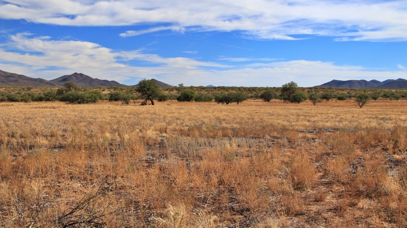
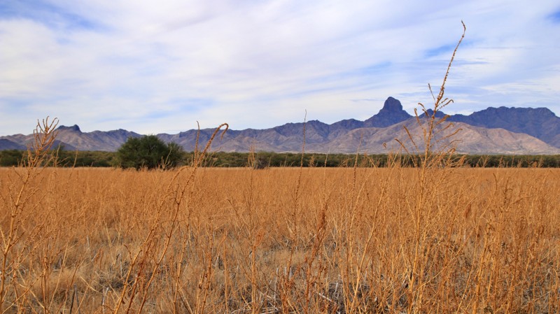
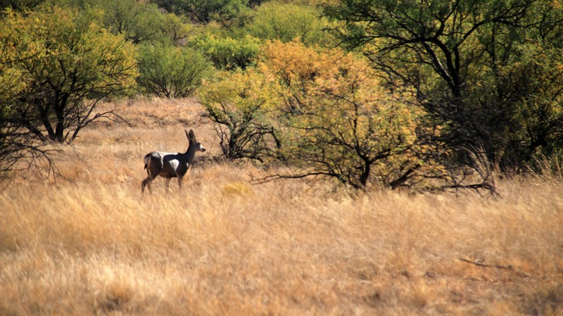
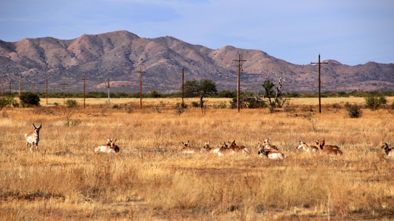
Buenos Aires National Wildlife Refuge offers a rare blend of solitude, scenic beauty, and accessible overlanding adventure. Its wide-open grasslands, framed by mountain backdrops, invite exploration without crowds. Visitors can spot pronghorn and quail, explore quiet backroads steeped in ranching history, and camp under a vast desert sky filled with stars. Whether you come for photography, wildlife viewing, or the simple peace of the open desert, this refuge delivers a sense of space and freedom that’s uniquely southern Arizona.

Overview

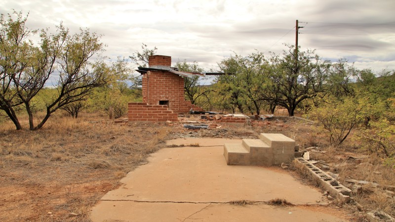
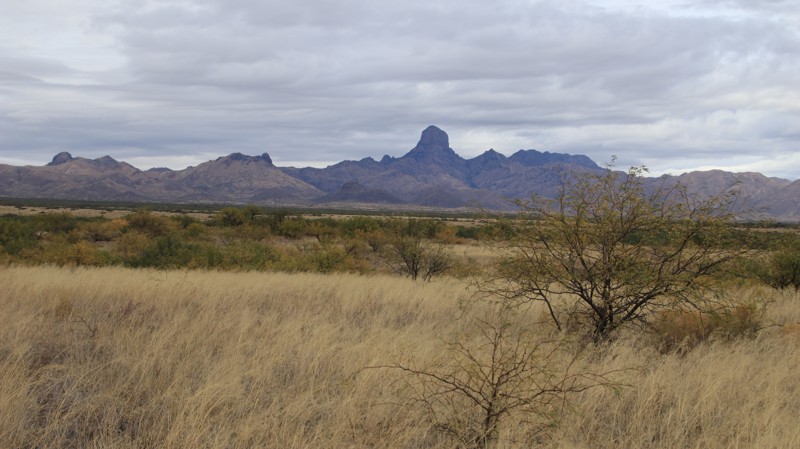
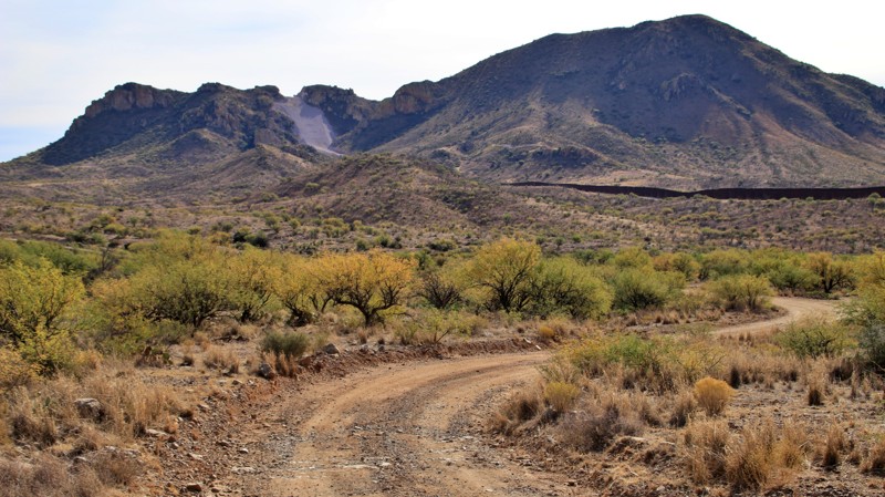
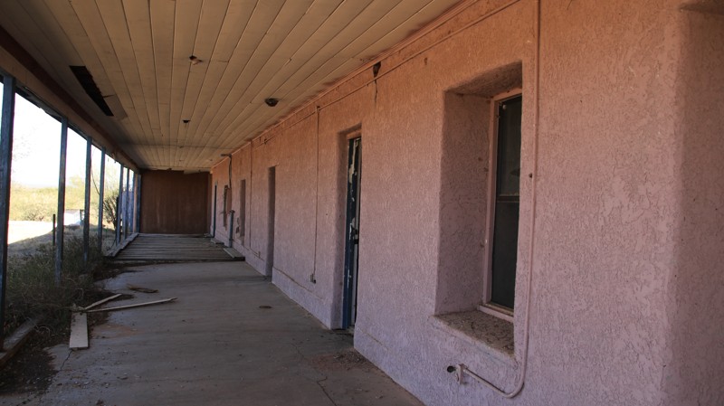
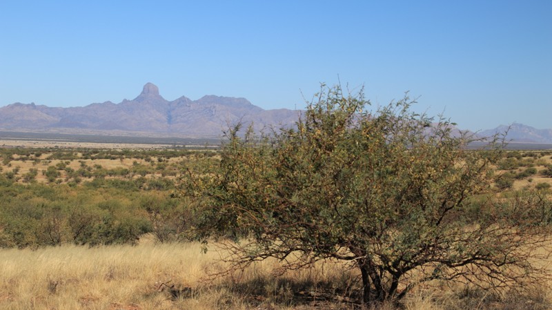
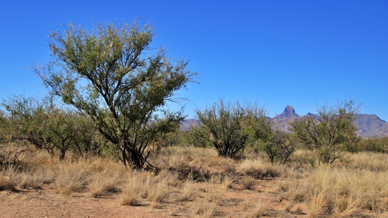
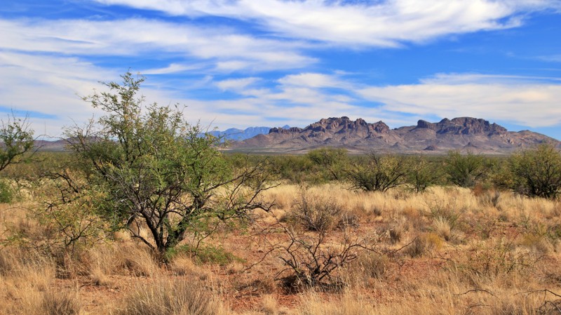
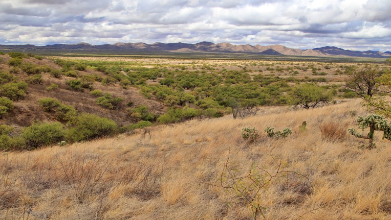
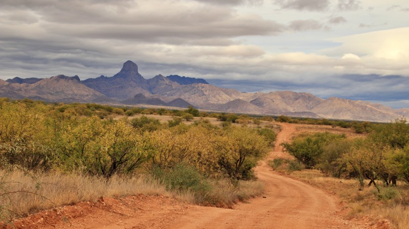
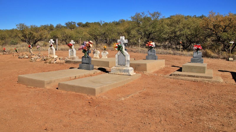
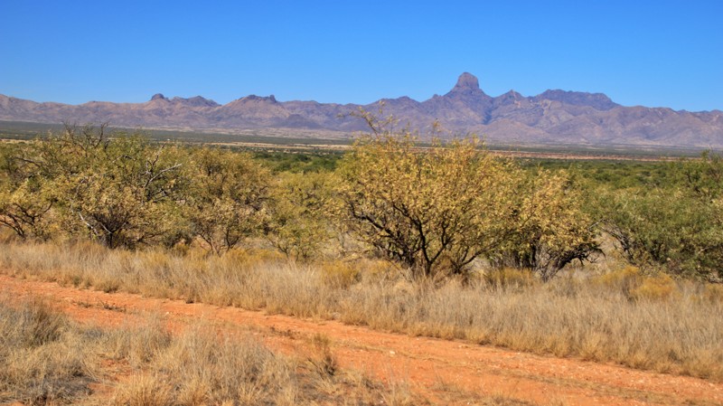
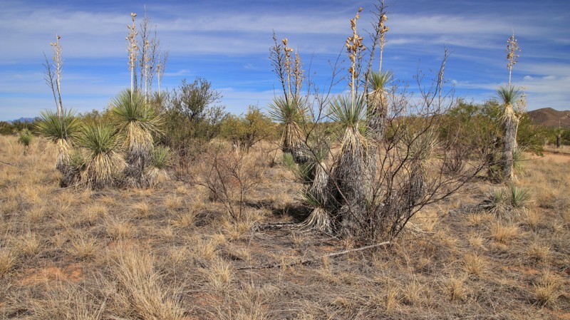
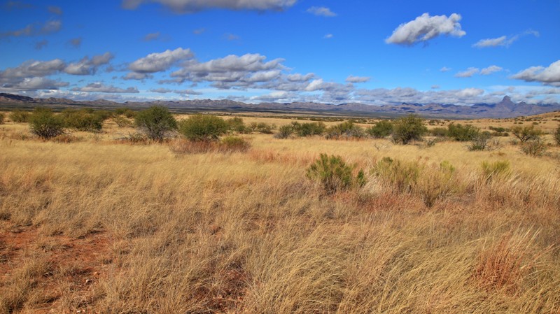
Tucked between the rugged Baboquivari Mountains to the west and the San Luis Mountains to the east, the Buenos Aires National Wildlife Refuge protects 118,000 acres of restored desert grasslands and wildlife habitat. Established in 1985, the refuge was created to reintroduce the masked bobwhite quail and support the Sonoran pronghorn. The visitor center—set in the 1864 adobe ranch built by Pedro Aguirre Jr.—anchors a landscape shaped by “good air,” constant desert winds, and endless open space.
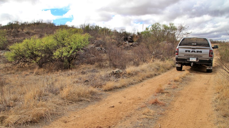
Getting There

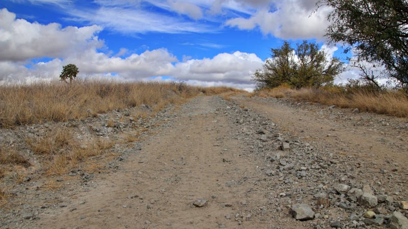
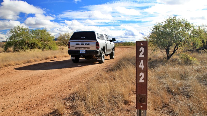
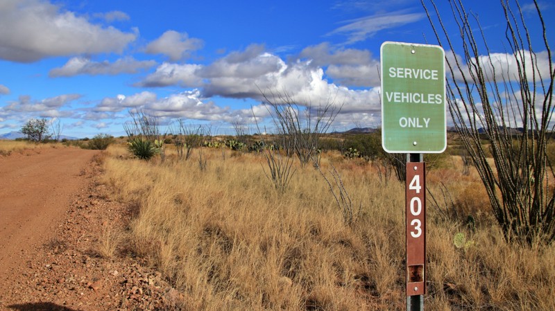
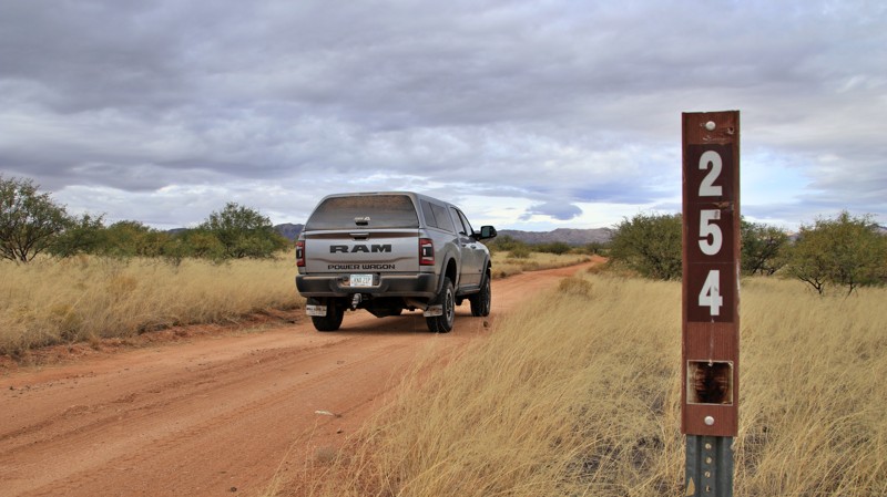
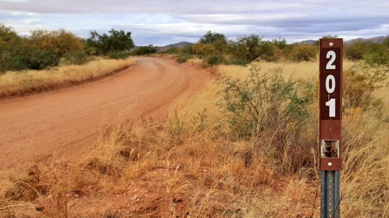
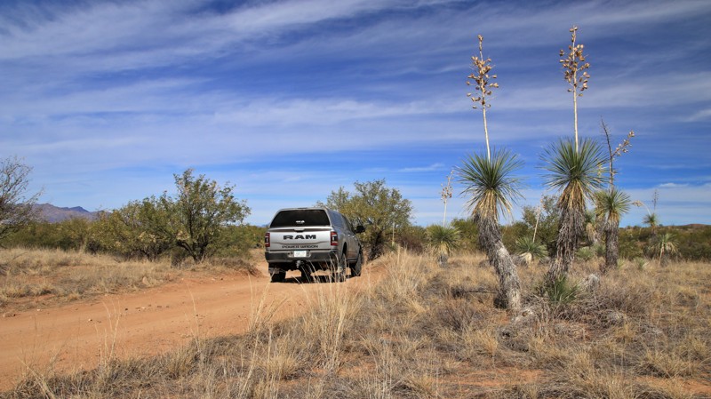
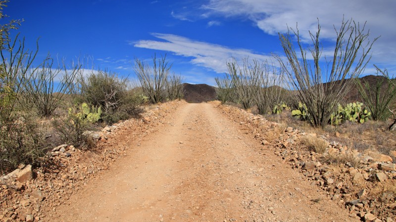
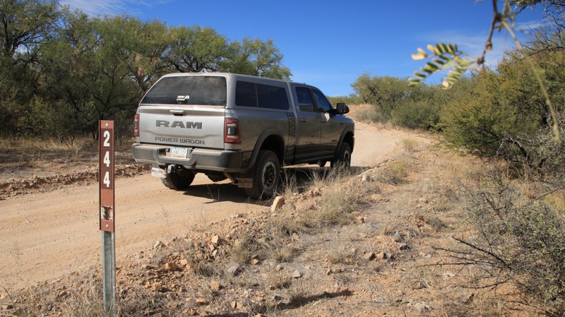
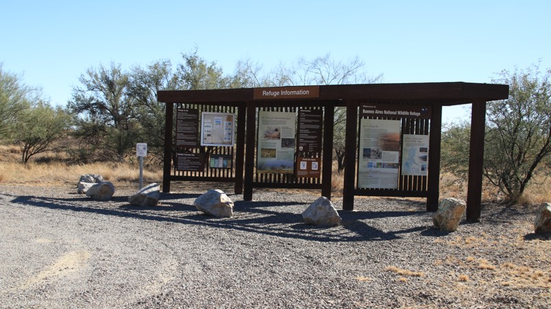
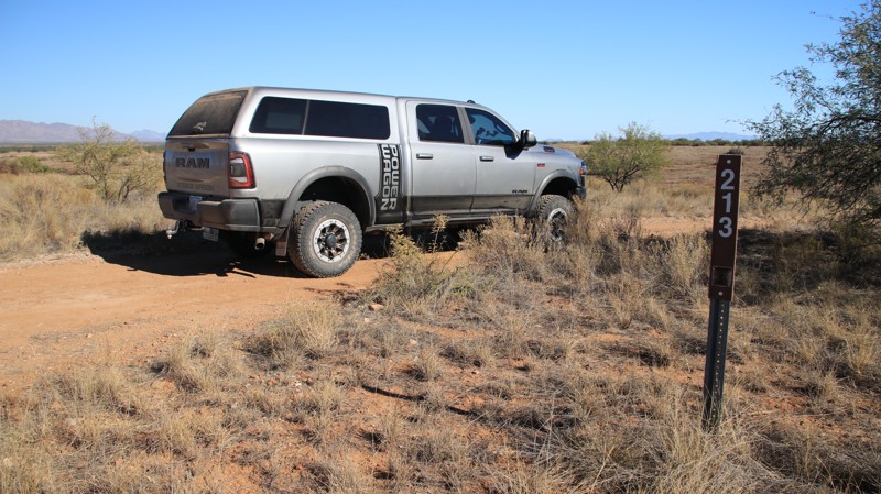
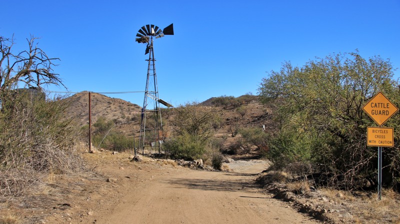
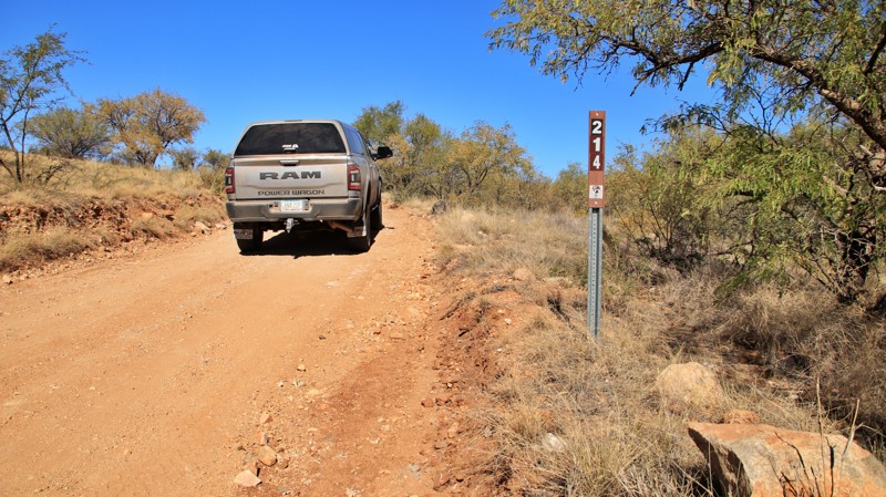
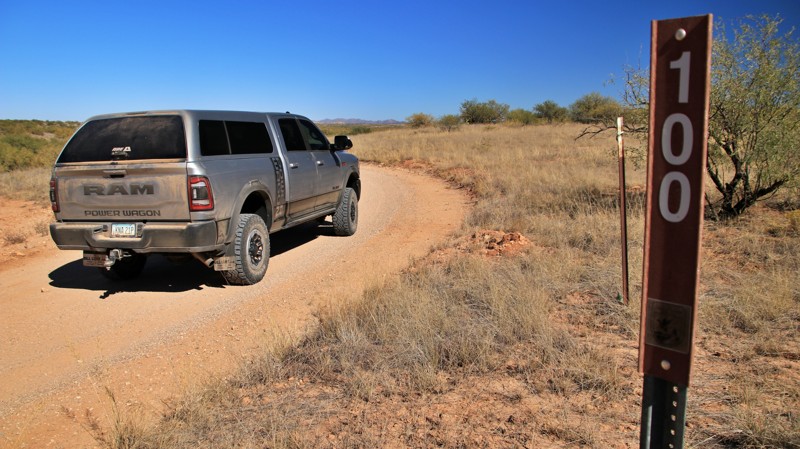
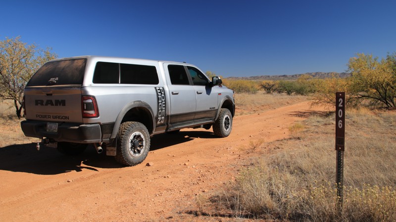
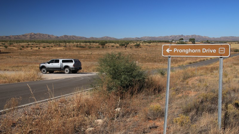
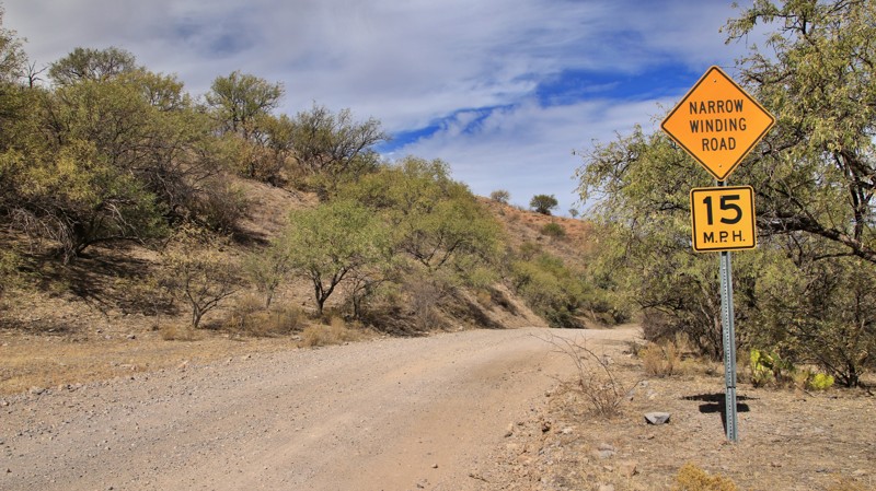
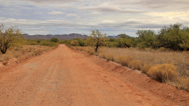
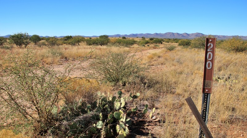
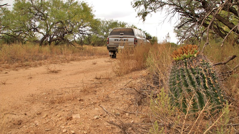
The refuge lies about 60 miles southwest of Tucson near Arivaca and Sasabe, two small towns offering limited supplies and fuel. Most refuge roads are graded and suitable for passenger vehicles in dry weather, though summer monsoons can make them challenging. Visitors can stop by the refuge headquarters for maps and wildlife information before venturing into the backcountry.
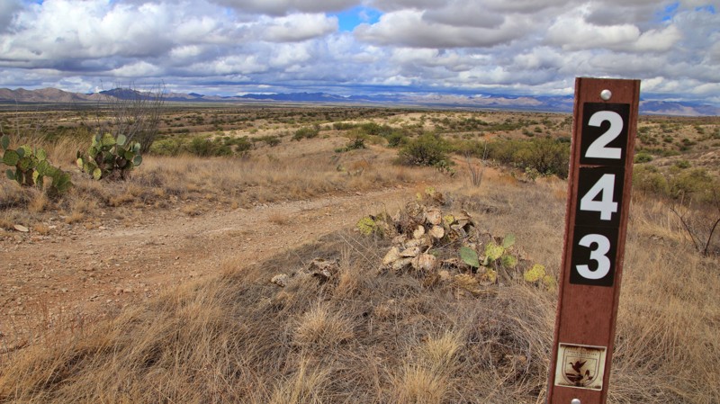
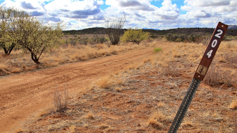
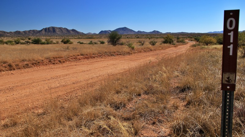
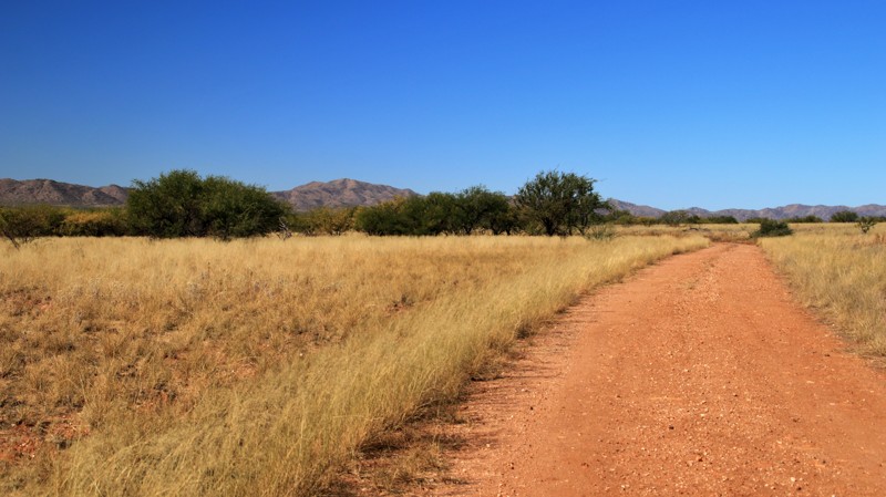
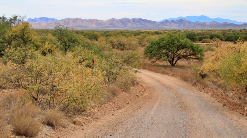
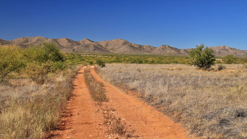
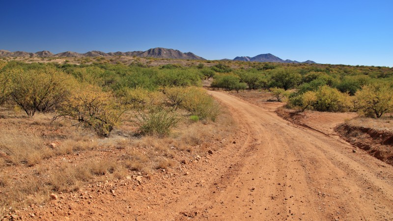
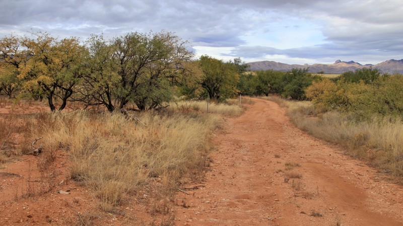
Trails

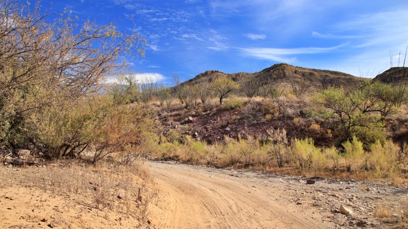
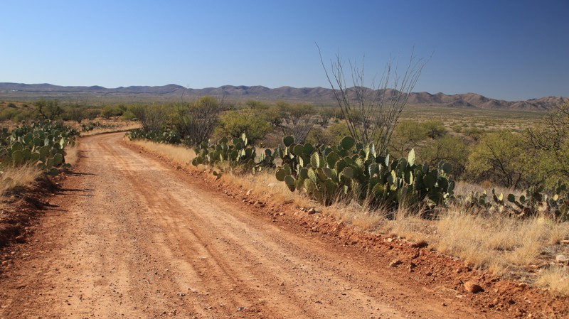
The Buenos Aires refuge is crisscrossed with scenic drives and historic ranch roads. Of all the routes, a few stand out as must-drives for their beauty, solitude, and sense of discovery:

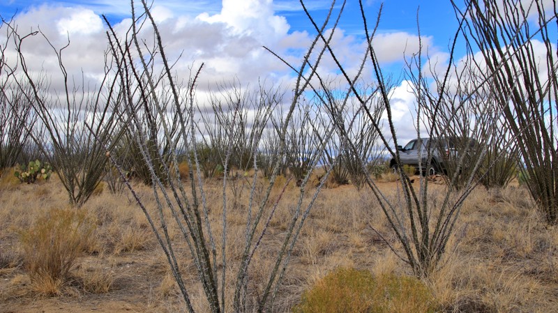
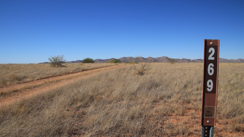
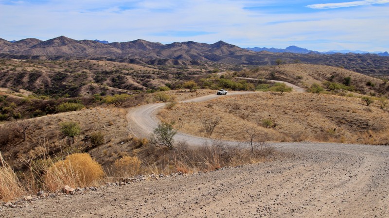
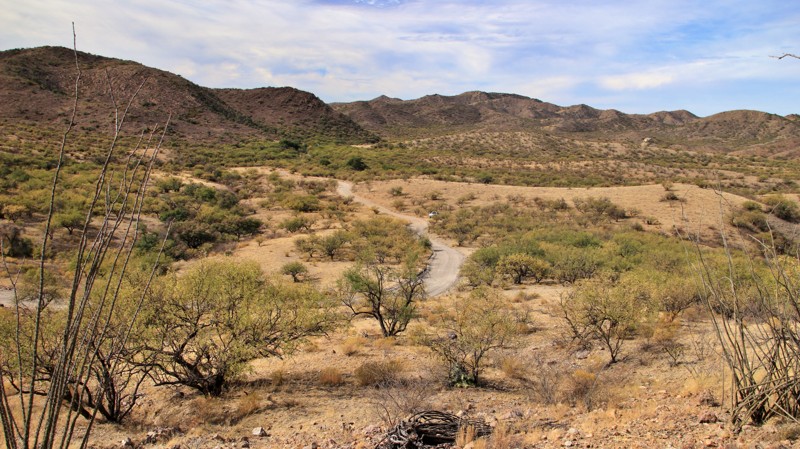
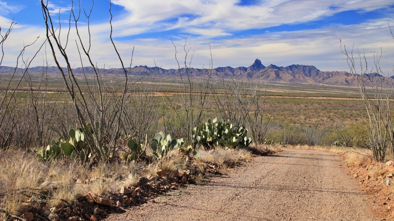
  • Castle Rock Tank Road begins inside the refuge and winds into the Coronado National Forest, where sweeping mountain views and groves of ocotillo mark the transition from grasslands to rugged foothills.
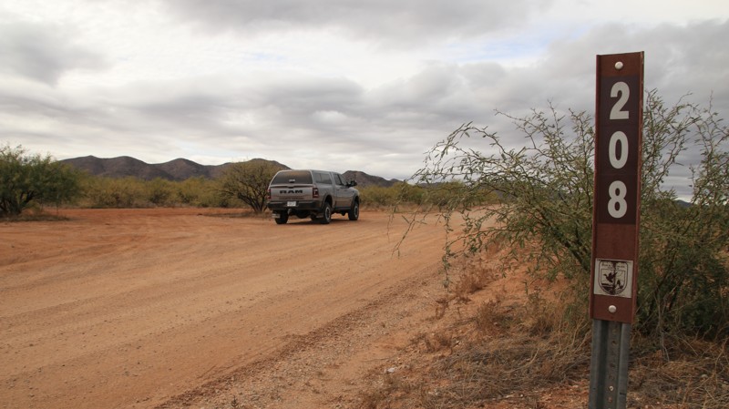
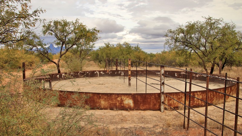
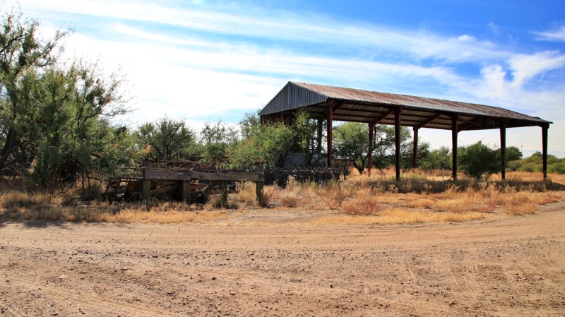
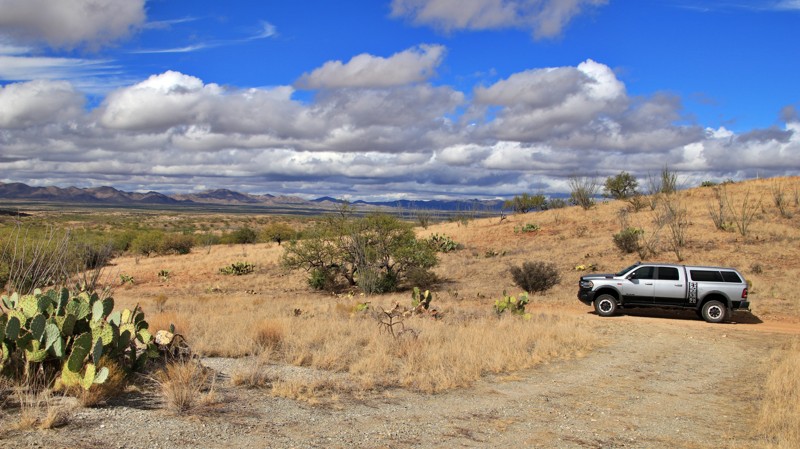
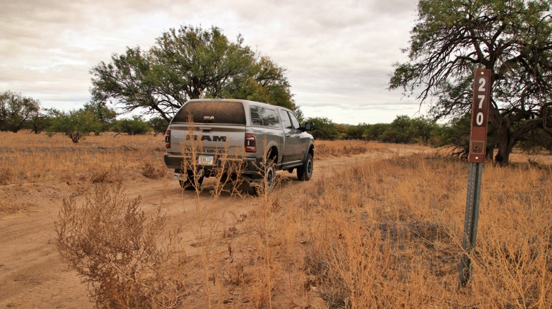
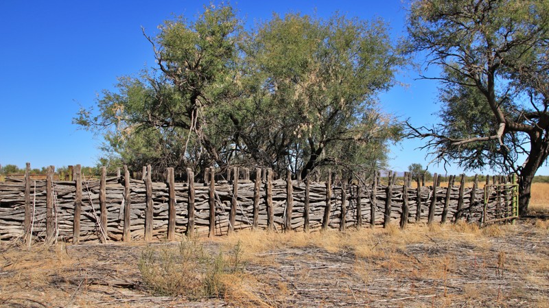
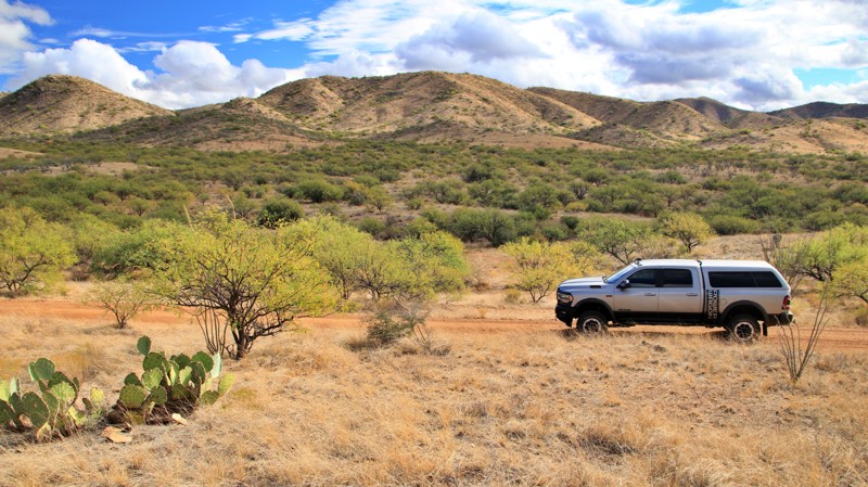
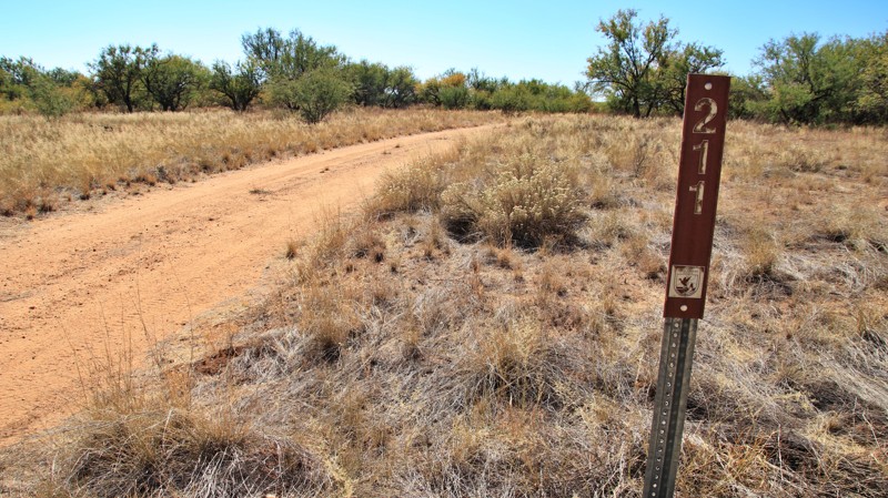
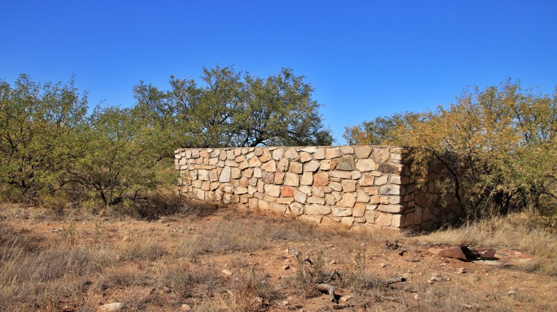
  • Big Bertha (271/203/205) traces the refuge’s western edge past relics of its ranching history—old corrals, windmills, and water tanks—before arriving at a shaded multi-rig campsite with mountain views.
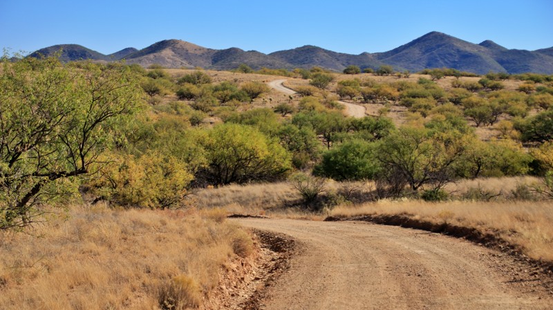
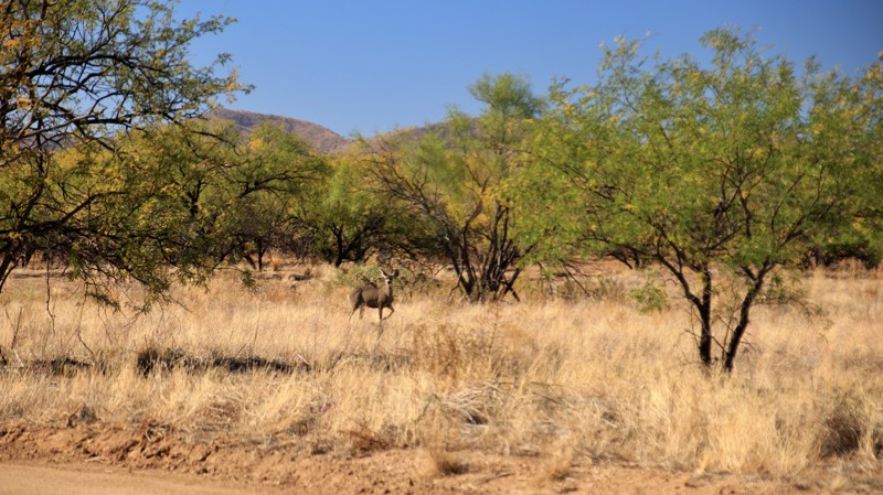
  • Pronghorn Loop is the refuge’s best-known scenic route. This easy, well-maintained loop passes through prime feeding grounds for deer and pronghorn and showcases the vast open grasslands dotted with mesquite.
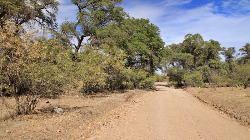
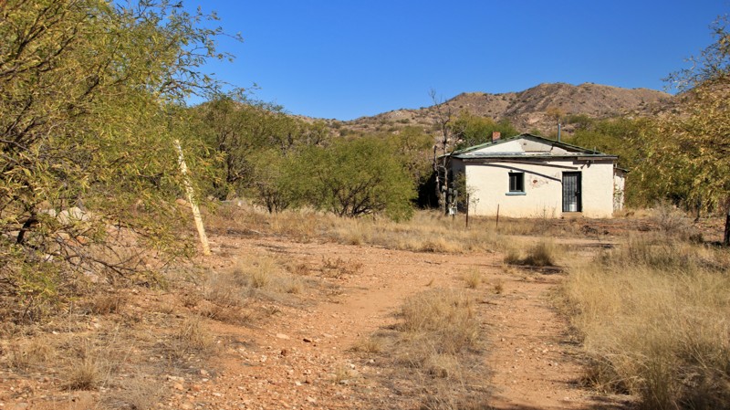
  • Puertocito Wash Road explores the refuge’s northwestern corner, following a broad wash lined with desert willows and mesquite. The route passes the historic Secondino Ranch site and connects to several large campsites ideal for RVs or trailers.
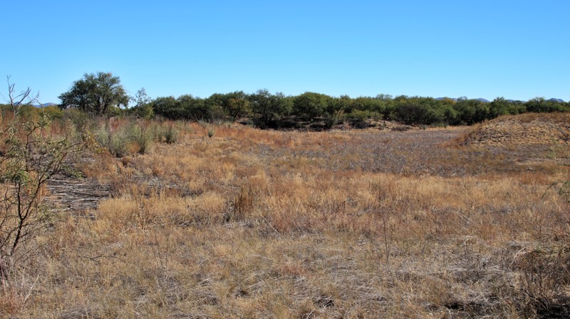
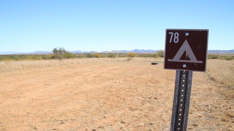
Camping

With over 80 designated campsites, the refuge offers some of the quietest overnight spots in southern Arizona. Camping is free for up to 14 days within a 30-day period and limited to marked sites only. Most camps feature fire rings or grills, level ground, and room for vehicles or tents. Shade is scarce, but the trade-off is unmatched stargazing and peaceful isolation under an open desert sky.
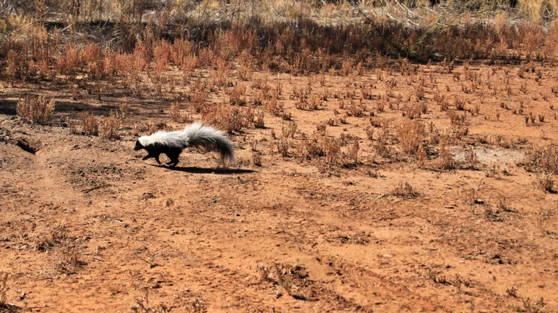
Wildlife & Seasons

Winter through spring offers the best conditions for exploring. Grasslands are green, wildlife is active, and temperatures are comfortable. Summer brings the dramatic monsoon season, transforming dry washes into temporary rivers and painting the skies with towering clouds. Visitors should stay on marked roads, respect seasonal closures, and always pack out trash.

Nearby Attractions

Pair your visit with stops at Arivaca Cienega Trail, Tumacácori National Historical Park, or Baboquivari Peak Wilderness for hiking, birding, and photography. Whether you’re chasing solitude, wildlife, or a glimpse into Arizona’s ranching past, the Buenos Aires National Wildlife Refuge delivers a perfect mix of adventure and serenity.

Top Reasons to Explore Here
Beginner Category IconBeginner
Camping Category IconCamping
Desert Category IconDesert
Overland Category IconOverland
Sand Category IconSand
Basemap Styles
Trail Types
Scout Route
Full Trail Guide

Difficulty Rating
easy
moderate
difficult
severe
extreme

Most Recent Trail Reviews

Most Popular

Search for Trails
Arizona: Secundino Loop Hero Photo
Scout Route Icon
4/5 (1 reviews)
Updated: 10/15/2024
Secundino Loop
Arivaca, Arizona

Buenos Aires National Wildlife Refuge in southern Arizona was established in 1985 for the reintroduction of masked bobwhite quail and the restoration of natural landscapes and their native wildlife, including the Sonoran Pronghorn. The 118,000-acre refuge lies in a broad Altar Valley between the Baboquivari Mountains, with their prominent main peak in the west, and the lower San Luis Mountains to the east. In the 1850s, Pedro Aguirre, Jr. built a homestead here in 1864 and named it Buenos Ayres, or "good air," because of the constant winds. His ranch changed hands several times before being purchased to form today's wildlife refuge. The refuge's visitor center is located in the adobe ranch house.

The refuge has over 80 designated campsites identified by a numbered sign. Camping is free and allowed for 14 days in a 30-day period, but only in the designated campsites. Most campsites have a fire ring/grill. Site sizes vary from a single vehicle to large enough for multiple RVs and trailers. Most are suitable for tents.

Fuel and limited supplies are available in the nearby small towns of Sasabe and Arivaca.

Secundino means second born in Spanish. Secundino Loop runs deep into the refuge to connect two outliers of the original ranch. The horseshoe-shaped route begins and ends on Highway 286. On the southern end, the trail passes an old corral made of mesquite logs. The northern end passes an abandoned bunkhouse. Both locations are far from the main ranch headquarters, today's visitor center.

The western ends of the horseshoe are graded dirt roads. The center of the trail is a weedy, rocky two-track that is heavily overgrown. Expect heavy pinstriping. A deep wash may require 4Low.

Campsite 16 sits along the southern leg of the horseshoe. The small lollipop site could host two vehicles. The site has level ground for tents and a fire ring.

Arizona: Tre Bolotis Road Hero Photo
Scout Route Icon
5/5 (1 reviews)
Updated: 10/15/2024
Tre Bolotis Road
Rancho La Agua Nueva, Arizona

Running south from the tiny hamlet of Arivaca, Tre Bolotis crosses desert washes, climbs a high ridge via narrow winding shelf roads, and descends into an oak-strewn valley. The trail begins in the Fraguita Wash and crosses a short stretch of well-marked private property. The ridgeline sits high above the surrounding landscape, providing vast views of southern Arizona. Narrow blind curves make you slow down and concentrate on the road. The descent on the southern end is via steep switchbacks. The trail drops into a long, narrow valley dotted with large oak trees. There are plenty of excellent shaded campsites in the valley. The trail ends at a private ranch gate.

Arizona: Fresnal Road Hero Photo
Scout Route Icon
5/5 (1 reviews)
Updated: 10/15/2024
Fresnal Road
Los Panchos, Arizona

Fresnal Road begins at Garcia Ranch in the Buenos Aires National Wildlife Refuge and crosses into the Coronado National Forest. The road's western end is very close to the US/Mexico border. The borer wall makes an interesting transition as it climbs the western slopes of Cerro del Fresnal. The winding road passes through a prototypical Lower Sonoran Desert landscape of cacti and mesquites as it climbs in and out of sandy desert washes. The east end becomes a steep shelf road as it climbs to intersect with Tre Bolotis Road.

There are numerous dispersed campsites along the trail. The best site sits at the lower end of the shelf road section.

Arizona: High Gates Road Hero Photo
Scout Route Icon
5/5 (1 reviews)
Updated: 10/15/2024
High Gates Road
Arivaca, Arizona

Buenos Aires National Wildlife Refuge in southern Arizona was established in 1985 for the reintroduction of masked bobwhite quail and the restoration of natural landscapes and their native wildlife, including the Sonoran Pronghorn. The 118,000-acre refuge lies in a broad Altar Valley between the Baboquivari Mountains, with their prominent main peak in the west, and the lower San Luis Mountains to the east. In the 1850s, Pedro Aguirre, Jr. built a homestead here in 1864 and named it Buenos Ayres, or "good air," because of the constant winds. His ranch changed hands several times before being purchased to form today's wildlife refuge. The refuge's visitor center is located in the adobe ranch house.

The refuge has over 80 designated campsites identified by a numbered sign. Camping is free and allowed for 14 days in a 30-day period, but only in the designated campsites. Most campsites have a fire ring/grill. Site sizes vary from a single vehicle to large enough for multiple RVs and trailers. Most are suitable for tents.

Fuel and limited supplies are available in the nearby small towns of Sasabe and Arivaca.

High Gates Road is the primary camping corridor for the refuge. The wide graded road runs north/south through the center of the refuge, crossing the Arivaca Sasabe Highway. There are large staging areas on both sides of the highway. High Gates is well-traveled and hard-packed. It is one of the few all-weather roads in the refuge.

The approximately 40 campsites along the road vary from small one-vehicle sites to those capable of hosting multiple RVs or trailers. The sites have a fire ring/grill and are mostly flat. Very few have any shade. Views of the mountain ranges to the east and west are incredible.

Arizona: Puertocito Wash Road Hero Photo
Scout Route Icon
5/5 (1 reviews)
Updated: 10/15/2024
Puertocito Wash Road
Chiuli Shaik, Arizona

Buenos Aires National Wildlife Refuge in southern Arizona was established in 1985 for the reintroduction of masked bobwhite quail and the restoration of natural landscapes and their native wildlife, including the Sonoran Pronghorn. The 118,000-acre refuge lies in a broad Altar Valley between the Baboquivari Mountains, with their prominent main peak in the west, and the lower San Luis Mountains to the east. In the 1850s, Pedro Aguirre, Jr. built a homestead here in 1864 and named it Buenos Ayres, or "good air," because of the constant winds. His ranch changed hands several times before being purchased to form today's wildlife refuge. The refuge's visitor center is located in the adobe ranch house.

The refuge has over 80 designated campsites identified by a numbered sign. Camping is free and allowed for 14 days in a 30-day period, but only in the designated campsites. Most campsites have a fire ring/grill. Site sizes vary from a single vehicle to large enough for multiple RVs and trailers. Most are suitable for tents.

Fuel and limited supplies are available in the nearby small towns of Sasabe and Arivaca.

Running parallel to its wide namesake wash, Puertocito Wash Road is an enjoyable, leisurely drive through the northwest portion of the refuge. Likely impassable when wet, the trail crosses numerous washes and low areas. The trail passes the Secondino ranch site. Campsites 58 and 59, near the trail's south end, are a double site capable of supporting six or more RVs or trailers. There are two fire rings, flat ground for tents, and a bit of shade.

Arizona: Pronghorn Loop Hero Photo
Scout Route Icon
4/5 (1 reviews)
Updated: 10/15/2024
Pronghorn Loop
Sasabe, Arizona

Buenos Aires National Wildlife Refuge in southern Arizona was established in 1985 for the reintroduction of masked bobwhite quail and the restoration of natural landscapes and their native wildlife, including the Sonoran Pronghorn. The 118,000-acre refuge lies in a broad Altar Valley between the Baboquivari Mountains, with their prominent main peak in the west, and the lower San Luis Mountains to the east. In the 1850s, Pedro Aguirre, Jr. built a homestead here in 1864 and named it Buenos Ayres, or "good air," because of the constant winds. His ranch changed hands several times before being purchased to form today's wildlife refuge. The refuge's visitor center is located in the adobe ranch house.

The refuge has over 80 designated campsites identified by a numbered sign. Camping is free and allowed for 14 days in a 30-day period, but only in the designated campsites. Most campsites have a fire ring/grill. Site sizes vary from a single vehicle to large enough for multiple RVs and trailers. Most are suitable for tents.

Fuel and limited supplies are available in the nearby small towns of Sasabe and Arivaca.

The refuge's main scenic drive is the Pronghorn Loop. It starts near the visitor center, runs through a no-hunting area, and is a favorite feeding area for deer and the Sonoran pronghorn. The landscape is grasslands dotted with mesquite trees. The well-maintained and graveled road is easily passable by any vehicle. There is no camping along Pronghorn Loop. However, several side trails have designated campsites.

Arizona: Garcia Ranch Road Hero Photo
Scout Route Icon
4/5 (1 reviews)
Updated: 10/15/2024
Garcia Ranch Road
Sasabe, Arizona

Buenos Aires National Wildlife Refuge in southern Arizona was established in 1985 for the reintroduction of masked bobwhite quail and the restoration of natural landscapes and their native wildlife, including the Sonoran Pronghorn. The 118,000-acre refuge lies in a broad Altar Valley between the Baboquivari Mountains, with their prominent main peak in the west, and the lower San Luis Mountains to the east. In the 1850s, Pedro Aguirre, Jr. built a homestead here in 1864 and named it Buenos Ayres, or "good air," because of the constant winds. His ranch changed hands several times before being purchased to form today's wildlife refuge. The refuge's visitor center is located in the adobe ranch house.

The refuge has over 80 designated campsites identified by a numbered sign. Camping is free and allowed for 14 days in a 30-day period, but only in the designated campsites. Most campsites have a fire ring/grill. Site sizes vary from a single vehicle to large enough for multiple RVs and trailers. Most are suitable for tents.

Fuel and limited supplies are available in the nearby small towns of Sasabe and Arivaca.

Garcia Ranch Road begins in Sasabe near the school and runs through the refuge to the abandoned Garcia Ranch homestead. The wide, well-maintained, graded road runs parallel to the Mexican border. Driving the spur trails south of Garcia Ranch Road is not recommended. The homestead is in disrepair and closed off. There is no camping along this trail.

Arizona: Castle Rock Tank Hero Photo
Scout Route Icon
5/5 (1 reviews)
Updated: 10/15/2024
Castle Rock Tank
Sasabe, Arizona

Buenos Aires National Wildlife Refuge in southern Arizona was established in 1985 for the reintroduction of masked bobwhite quail and the restoration of natural landscapes and their native wildlife, including the Sonoran Pronghorn. The 118,000-acre refuge lies in a broad Altar Valley between the Baboquivari Mountains, with their prominent main peak in the west, and the lower San Luis Mountains to the east. In the 1850s, Pedro Aguirre, Jr. built a homestead here in 1864 and named it Buenos Ayres, or "good air," because of the constant winds. His ranch changed hands several times before being purchased to form today's wildlife refuge. The refuge's visitor center is located in the adobe ranch house.

The refuge has over 80 designated campsites identified by a numbered sign. Camping is free and allowed for 14 days in a 30-day period, but only in the designated campsites. Most campsites have a fire ring/grill. Site sizes vary from a single vehicle to large enough for multiple RVs and trailers. Most are suitable for tents.

Fuel and limited supplies are available in the nearby small towns of Sasabe and Arivaca.

Castle Rock Tank begins in the refuge as 202 and enters the Coronado National Forest, changing road numbers to 4115. The trail is well maintained, with a few wash crossings and ruts. It ends at a lollipop turnaround. There are fantastic views along the trail and a dense grove of ocotillo cacti. A spur to the east leads to the mouth of an interesting canyon. There are no campsites inside the refuge, but several large sites sit roadside in the national forest portion. The sites can accommodate multiple vehicles and have rock fire rings.

Arizona: Mesquite Loop Hero Photo
Scout Route Icon
4/5 (1 reviews)
Updated: 10/15/2024
Mesquite Loop
Arivaca, Arizona

Buenos Aires National Wildlife Refuge in southern Arizona was established in 1985 for the reintroduction of masked bobwhite quail and the restoration of natural landscapes and their native wildlife, including the Sonoran Pronghorn. The 118,000-acre refuge lies in a broad Altar Valley between the Baboquivari Mountains, with their prominent main peak in the west, and the lower San Luis Mountains to the east. In the 1850s, Pedro Aguirre, Jr. built a homestead here in 1864 and named it Buenos Ayres, or "good air," because of the constant winds. His ranch changed hands several times before being purchased to form today's wildlife refuge. The refuge's visitor center is located in the adobe ranch house.

The refuge has over 80 designated campsites identified by a numbered sign. Camping is free and allowed for 14 days in a 30-day period, but only in the designated campsites. Most campsites have a fire ring/grill. Site sizes vary from a single vehicle to large enough for multiple RVs and trailers. Most are suitable for tents.

Fuel and limited supplies are available in the nearby small towns of Sasabe and Arivaca.

Conveniently located near Arivaca, the Mesquite Loop has nine designated campsites set into the foothills of the San Luis Mountains. Site 47, near the trail's western end, is the largest of the campsites. This pull-through has a fire ring like all the other sites. The remaining sites are best suited for a single vehicle. There is a wash crossing and a steep hill climb along the northern segment of the loop. The trail offers outstanding views of Baboquivari Peak and the observatory at Kitt Peak. Spindly ocotillo line the trail.

Arizona: Sierra Vista Hero Photo
Scout Route Icon
2/5 (1 reviews)
Updated: 10/15/2024
Sierra Vista
Sasabe, Arizona

Buenos Aires National Wildlife Refuge in southern Arizona was established in 1985 for the reintroduction of masked bobwhite quail and the restoration of natural landscapes and their native wildlife, including the Sonoran Pronghorn. The 118,000-acre refuge lies in a broad Altar Valley between the Baboquivari Mountains, with their prominent main peak in the west, and the lower San Luis Mountains to the east. In the 1850s, Pedro Aguirre, Jr. built a homestead here in 1864 and named it Buenos Ayres, or "good air," because of the constant winds. His ranch changed hands several times before being purchased to form today's wildlife refuge. The refuge's visitor center is located in the adobe ranch house.

The refuge has over 80 designated campsites identified by a numbered sign. Camping is free and allowed for 14 days in a 30-day period, but only in the designated campsites. Most campsites have a fire ring/grill. Site sizes vary from a single vehicle to large enough for multiple RVs and trailers. Most are suitable for tents.

Fuel and limited supplies are available in the nearby small towns of Sasabe and Arivaca.

Sierra Vista runs from Highway 286 to a gated parcel of private property, crossing Big Bertha along the way. The trail is graded and well-maintained. It's a nice cutoff going to or from Camp 74.

Arizona: State Tank - Rock Tank Loop Hero Photo
Scout Route Icon
4/5 (1 reviews)
Updated: 10/15/2024
State Tank - Rock Tank Loop
Sasabe, Arizona

Buenos Aires National Wildlife Refuge in southern Arizona was established in 1985 for the reintroduction of masked bobwhite quail and the restoration of natural landscapes and their native wildlife, including the Sonoran Pronghorn. The 118,000-acre refuge lies in a broad Altar Valley between the Baboquivari Mountains, with their prominent main peak in the west, and the lower San Luis Mountains to the east. In the 1850s, Pedro Aguirre, Jr. built a homestead here in 1864 and named it Buenos Ayres, or "good air," because of the constant winds. His ranch changed hands several times before being purchased to form today's wildlife refuge. The refuge's visitor center is located in the adobe ranch house.

The refuge has over 80 designated campsites identified by a numbered sign. Camping is free and allowed for 14 days in a 30-day period, but only in the designated campsites. Most campsites have a fire ring/grill. Site sizes vary from a single vehicle to large enough for multiple RVs and trailers. Most are suitable for tents.

Fuel and limited supplies are available in the nearby small towns of Sasabe and Arivaca.

State Tank - Rock Tank Loop combines roads 213 and 249. The loop begins and ends near the visitor center and Aguirre Lake. While narrow on the western ends with grass in the middle, the trail widens out on the east. Campsites 68 and 68A sit on the northern portion of the loop. 68 is a large site capable of accommodating several trailers. 68A is a small one-vehicle site off a small spur with excellent views. Both sites have a metal fire ring. When mapped, the refuge was removing invasive mesquite trees near the trail to restore the open native grasslands.

Arizona: Big Bertha Hero Photo
Scout Route Icon
5/5 (1 reviews)
Updated: 10/15/2024
Big Bertha
Sasabe, Arizona

Buenos Aires National Wildlife Refuge in southern Arizona was established in 1985 for the reintroduction of masked bobwhite quail and the restoration of natural landscapes and their native wildlife, including the Sonoran Pronghorn. The 118,000-acre refuge lies in a broad Altar Valley between the Baboquivari Mountains, with their prominent main peak in the west, and the lower San Luis Mountains to the east. In the 1850s, Pedro Aguirre, Jr. built a homestead here in 1864 and named it Buenos Ayres, or "good air," because of the constant winds. His ranch changed hands several times before being purchased to form today's wildlife refuge. The refuge's visitor center is located in the adobe ranch house.

The refuge has over 80 designated campsites identified by a numbered sign. Camping is free and allowed for 14 days in a 30-day period, but only in the designated campsites. Most campsites have a fire ring/grill. Site sizes vary from a single vehicle to large enough for multiple RVs and trailers. Most are suitable for tents.

Fuel and limited supplies are available in the nearby small towns of Sasabe and Arivaca.

Big Bertha runs along the westernmost part of the refuge. The easy trail is signed as 271, 203, and 205 along its seven-plus miles. Dried ruts remind us that this well-maintained trail is likely impassable when wet. Abandoned water tanks, fencing, and an old line shack remind visitors of the area's ranching history. There's a gate at the southern end. Please remember to close it behind you. Campsite 74 has a fire ring, level ground, and shade. The appealing site is suitable for two or three rigs.

Arizona: Mormon Lake Road Hero Photo
Scout Route Icon
3/5 (1 reviews)
Updated: 10/15/2024
Mormon Lake Road
Sasabe, Arizona

Buenos Aires National Wildlife Refuge in southern Arizona was established in 1985 for the reintroduction of masked bobwhite quail and the restoration of natural landscapes and their native wildlife, including the Sonoran Pronghorn. The 118,000-acre refuge lies in a broad Altar Valley between the Baboquivari Mountains, with their prominent main peak in the west, and the lower San Luis Mountains to the east. In the 1850s, Pedro Aguirre, Jr. built a homestead here in 1864 and named it Buenos Ayres, or "good air," because of the constant winds. His ranch changed hands several times before being purchased to form today's wildlife refuge. The refuge's visitor center is located in the adobe ranch house.

The refuge has over 80 designated campsites identified by a numbered sign. Camping is free and allowed for 14 days in a 30-day period, but only in the designated campsites. Most campsites have a fire ring/grill. Site sizes vary from a single vehicle to large enough for multiple RVs and trailers. Most are suitable for tents.

Fuel and limited supplies are available in the nearby small towns of Sasabe and Arivaca.

Morman Lake Road passes a seasonal waterhole by the same name. The rough trail connects to Highway 286. Please keep the gate closed at the highway. Campsite 77 is large enough for two RVs and easily accessible from the highway. The flat site has views, a fire ring, and little shade. The northeastern portion of the trail is likely impassable when wet. Pin striping is likely for wider vehicles near the lake.

Arizona: Yellow Jacket Road Hero Photo
Scout Route Icon
4/5 (1 reviews)
Updated: 10/15/2024
Yellow Jacket Road
Sasabe, Arizona

Buenos Aires National Wildlife Refuge in southern Arizona was established in 1985 for the reintroduction of masked bobwhite quail and the restoration of natural landscapes and their native wildlife, including the Sonoran Pronghorn. The 118,000-acre refuge lies in a broad Altar Valley between the Baboquivari Mountains, with their prominent main peak in the west, and the lower San Luis Mountains to the east. In the 1850s, Pedro Aguirre, Jr. built a homestead here in 1864 and named it Buenos Ayres, or "good air," because of the constant winds. His ranch changed hands several times before being purchased to form today's wildlife refuge. The refuge's visitor center is located in the adobe ranch house.

The refuge has over 80 designated campsites identified by a numbered sign. Camping is free and allowed for 14 days in a 30-day period, but only in the designated campsites. Most campsites have a fire ring/grill. Site sizes vary from a single vehicle to large enough for multiple RVs and trailers. Most are suitable for tents.

Fuel and limited supplies are available in the nearby small towns of Sasabe and Arivaca.

Yellow Jacket Road, BANWR 243, climbs a steep hill with a 13-degree pitch to a ridgeline with a campsite and extraordinary 360-degree views. Campsite 82 sits atop the ridgeline. The pull-through site can accommodate two vehicles. It has a fire ring and outstanding views. It is exposed, however.

Combine this trail with the connecting Herman Tank for some actual wheeling inside the refuge.

Arizona: Burnt Corral Road Hero Photo
Scout Route Icon
4/5 (1 reviews)
Updated: 10/15/2024
Burnt Corral Road
Sasabe, Arizona

Buenos Aires National Wildlife Refuge in southern Arizona was established in 1985 for the reintroduction of masked bobwhite quail and the restoration of natural landscapes and their native wildlife, including the Sonoran Pronghorn. The 118,000-acre refuge lies in a broad Altar Valley between the Baboquivari Mountains, with their prominent main peak in the west, and the lower San Luis Mountains to the east. In the 1850s, Pedro Aguirre, Jr. built a homestead here in 1864 and named it Buenos Ayres, or "good air," because of the constant winds. His ranch changed hands several times before being purchased to form today's wildlife refuge. The refuge's visitor center is located in the adobe ranch house.

The refuge has over 80 designated campsites identified by a numbered sign. Camping is free and allowed for 14 days in a 30-day period, but only in the designated campsites. Most campsites have a fire ring/grill. Site sizes vary from a single vehicle to large enough for multiple RVs and trailers. Most are suitable for tents.

Fuel and limited supplies are available in the nearby small towns of Sasabe and Arivaca.

Burnt Corral runs from Highway 286 to the southwestern corner of Pronghorn Loop. The trail is impassable when wet. An old stone water cistern sits trailside, visible for those with a keen eye. The trail has three campsites. Sites 80 and 81 sit off a short spur lableled 256. 80 is a small single site with shade and a fire pit. It also has a skunk den nearby. 81 is large enough for multiple trailer or RVs with shade, a fire pit/grill, and flat ground. 79 is a small pullthrough site with a firepit.

Arizona: BANWR 214 Hero Photo
Scout Route Icon
5/5 (1 reviews)
Updated: 10/15/2024
BANWR 214
Los Panchos, Arizona

Buenos Aires National Wildlife Refuge in southern Arizona was established in 1985 for the reintroduction of masked bobwhite quail and the restoration of natural landscapes and their native wildlife, including the Sonoran Pronghorn. The 118,000-acre refuge lies in a broad Altar Valley between the Baboquivari Mountains, with their prominent main peak in the west, and the lower San Luis Mountains to the east. In the 1850s, Pedro Aguirre, Jr. built a homestead here in 1864 and named it Buenos Ayres, or "good air," because of the constant winds. His ranch changed hands several times before being purchased to form today's wildlife refuge. The refuge's visitor center is located in the adobe ranch house.

The refuge has over 80 designated campsites identified by a numbered sign. Camping is free and allowed for 14 days in a 30-day period, but only in the designated campsites. Most campsites have a fire ring/grill. Site sizes vary from a single vehicle to large enough for multiple RVs and trailers. Most are suitable for tents.

Fuel and limited supplies are available in the nearby small towns of Sasabe and Arivaca.

BANWR 214 runs from the Garcia Ranch ruins to an old windmill at the Coronado National Forest border. The graded road has a steep wash crossing. The trail's highlight is the historic Garcia Family Cemetary, with graves dating back to the middle 1800s. According to docents at the visitor center, the family gathers every six months to maintain the cemetery. Visitors are encouraged to come inside the fence. Just keep the gate closed. There is no camping on this trail.

Arizona: Chivo Tank Road Hero Photo
Scout Route Icon
4/5 (1 reviews)
Updated: 10/15/2024
Chivo Tank Road
Los Panchos, Arizona

Buenos Aires National Wildlife Refuge in southern Arizona was established in 1985 for the reintroduction of masked bobwhite quail and the restoration of natural landscapes and their native wildlife, including the Sonoran Pronghorn. The 118,000-acre refuge lies in a broad Altar Valley between the Baboquivari Mountains, with their prominent main peak in the west, and the lower San Luis Mountains to the east. In the 1850s, Pedro Aguirre, Jr. built a homestead here in 1864 and named it Buenos Ayres, or "good air," because of the constant winds. His ranch changed hands several times before being purchased to form today's wildlife refuge. The refuge's visitor center is located in the adobe ranch house.

The refuge has over 80 designated campsites identified by a numbered sign. Camping is free and allowed for 14 days in a 30-day period, but only in the designated campsites. Most campsites have a fire ring/grill. Site sizes vary from a single vehicle to large enough for multiple RVs and trailers. Most are suitable for tents.

Fuel and limited supplies are available in the nearby small towns of Sasabe and Arivaca.

Chivo Tank Road, 215, runs along a ridgeline on the southwestern side of the refuge. The elevation provides expansive views of the refuge and beyond. There are groves of prickly pear cacti because of the slightly higher elevation. There is no camping along this road.

Arizona: Figueroa North Road Hero Photo
Scout Route Icon
4/5 (1 reviews)
Updated: 10/15/2024
Figueroa North Road
Arivaca, Arizona

Buenos Aires National Wildlife Refuge in southern Arizona was established in 1985 for the reintroduction of masked bobwhite quail and the restoration of natural landscapes and their native wildlife, including the Sonoran Pronghorn. The 118,000-acre refuge lies in a broad Altar Valley between the Baboquivari Mountains, with their prominent main peak in the west, and the lower San Luis Mountains to the east. In the 1850s, Pedro Aguirre, Jr. built a homestead here in 1864 and named it Buenos Ayres, or "good air," because of the constant winds. His ranch changed hands several times before being purchased to form today's wildlife refuge. The refuge's visitor center is located in the adobe ranch house.

The refuge has over 80 designated campsites identified by a numbered sign. Camping is free and allowed for 14 days in a 30-day period, but only in the designated campsites. Most campsites have a fire ring/grill. Site sizes vary from a single vehicle to large enough for multiple RVs and trailers. Most are suitable for tents.

Fuel and limited supplies are available in the nearby small towns of Sasabe and Arivaca.

Figueroa North Road runs between the Arivaca Sasabe Highway and Secondino. There is a staging area at the southern trailhead. The easy trail begins wide in the south and narrows towards the north. Agave forests line the trail. There are six designated campsites along the trail, with others along the various spurs branching to the east. Camp 45 is a very nice pull-through. The northern campsites are very small. All the sites have fire rings.

Arizona: BANWR 279 Hero Photo
Scout Route Icon
3/5 (1 reviews)
Updated: 10/15/2024
BANWR 279
Sasabe, Arizona

Buenos Aires National Wildlife Refuge in southern Arizona was established in 1985 for the reintroduction of masked bobwhite quail and the restoration of natural landscapes and their native wildlife, including the Sonoran Pronghorn. The 118,000-acre refuge lies in a broad Altar Valley between the Baboquivari Mountains, with their prominent main peak in the west, and the lower San Luis Mountains to the east. In the 1850s, Pedro Aguirre, Jr. built a homestead here in 1864 and named it Buenos Ayres, or "good air," because of the constant winds. His ranch changed hands several times before being purchased to form today's wildlife refuge. The refuge's visitor center is located in the adobe ranch house.

The refuge has over 80 designated campsites identified by a numbered sign. Camping is free and allowed for 14 days in a 30-day period, but only in the designated campsites. Most campsites have a fire ring/grill. Site sizes vary from a single vehicle to large enough for multiple RVs and trailers. Most are suitable for tents.

Fuel and limited supplies are available in the nearby small towns of Sasabe and Arivaca.

BANWR 279 is a short and easy graded road used primarily as a connector to Pronghorn Loop and the visitor center from the northeast portions of the refuge. There is no camping on the trail.

Arizona: Compartidero Road Hero Photo
Scout Route Icon
4/5 (1 reviews)
Updated: 10/15/2024
Compartidero Road
Sasabe, Arizona

Buenos Aires National Wildlife Refuge in southern Arizona was established in 1985 for the reintroduction of masked bobwhite quail and the restoration of natural landscapes and their native wildlife, including the Sonoran Pronghorn. The 118,000-acre refuge lies in a broad Altar Valley between the Baboquivari Mountains, with their prominent main peak in the west, and the lower San Luis Mountains to the east. In the 1850s, Pedro Aguirre, Jr. built a homestead here in 1864 and named it Buenos Ayres, or "good air," because of the constant winds. His ranch changed hands several times before being purchased to form today's wildlife refuge. The refuge's visitor center is located in the adobe ranch house.

The refuge has over 80 designated campsites identified by a numbered sign. Camping is free and allowed for 14 days in a 30-day period, but only in the designated campsites. Most campsites have a fire ring/grill. Site sizes vary from a single vehicle to large enough for multiple RVs and trailers. Most are suitable for tents.

Fuel and limited supplies are available in the nearby small towns of Sasabe and Arivaca.

Compartidero Road runs from Pronghorn Loop to Mormon Roas in the southwestern portion of the refuge. This two-track is impassable when wet. Campsite 78 is midway along the trail. The site has excellent views, level ground, and a firepit. It is large enough for two vehicles.

Arizona: Choffo Tank Road Hero Photo
Scout Route Icon
4/5 (1 reviews)
Updated: 10/15/2024
Choffo Tank Road
Sasabe, Arizona

Buenos Aires National Wildlife Refuge in southern Arizona was established in 1985 for the reintroduction of masked bobwhite quail and the restoration of natural landscapes and their native wildlife, including the Sonoran Pronghorn. The 118,000-acre refuge lies in a broad Altar Valley between the Baboquivari Mountains, with their prominent main peak in the west, and the lower San Luis Mountains to the east. In the 1850s, Pedro Aguirre, Jr. built a homestead here in 1864 and named it Buenos Ayres, or "good air," because of the constant winds. His ranch changed hands several times before being purchased to form today's wildlife refuge. The refuge's visitor center is located in the adobe ranch house.

The refuge has over 80 designated campsites identified by a numbered sign. Camping is free and allowed for 14 days in a 30-day period, but only in the designated campsites. Most campsites have a fire ring/grill. Site sizes vary from a single vehicle to large enough for multiple RVs and trailers. Most are suitable for tents.

Fuel and limited supplies are available in the nearby small towns of Sasabe and Arivaca.

Choffo Tank, BANWR 204, goes east off Pronghorn Loop, climbing through grassland dotted with mesquite and groves of ocotillo cacti. The trail ends at BANWR 204, a road restricted to service vehicles only. Campsites 75 and 76 are near the west end of the trail. 75 is a sizeable pull-through site suitable for an RV, trailer, or several vehicles. 76 is tucked away beside a wash under mesquite trees. The site can accommodate one vehicle or a vehicle with a small trailer. Both sites have a fire ring/grill.

Arizona: Barrel Cactus Road Hero Photo
Scout Route Icon
3/5 (1 reviews)
Updated: 10/15/2024
Barrel Cactus Road
Sasabe, Arizona

Buenos Aires National Wildlife Refuge in southern Arizona was established in 1985 for the reintroduction of masked bobwhite quail and the restoration of natural landscapes and their native wildlife, including the Sonoran Pronghorn. The 118,000-acre refuge lies in a broad Altar Valley between the Baboquivari Mountains, with their prominent main peak in the west, and the lower San Luis Mountains to the east. In the 1850s, Pedro Aguirre, Jr. built a homestead here in 1864 and named it Buenos Ayres, or "good air," because of the constant winds. His ranch changed hands several times before being purchased to form today's wildlife refuge. The refuge's visitor center is located in the adobe ranch house.

The refuge has over 80 designated campsites identified by a numbered sign. Camping is free and allowed for 14 days in a 30-day period, but only in the designated campsites. Most campsites have a fire ring/grill. Site sizes vary from a single vehicle to large enough for multiple RVs and trailers. Most are suitable for tents.

Fuel and limited supplies are available in the nearby small towns of Sasabe and Arivaca.

Barrel Cactus, 200, bisects Pronghorn Loop. The trail is a seldom maintained two-track with great views. There is no camping along Barrel Cactus.

Arizona: BANWR 270 Hero Photo
Scout Route Icon
4/5 (1 reviews)
Updated: 10/15/2024
BANWR 270
Sasabe, Arizona

Buenos Aires National Wildlife Refuge in southern Arizona was established in 1985 for the reintroduction of masked bobwhite quail and the restoration of natural landscapes and their native wildlife, including the Sonoran Pronghorn. The 118,000-acre refuge lies in a broad Altar Valley between the Baboquivari Mountains, with their prominent main peak in the west, and the lower San Luis Mountains to the east. In the 1850s, Pedro Aguirre, Jr. built a homestead here in 1864 and named it Buenos Ayres, or "good air," because of the constant winds. His ranch changed hands several times before being purchased to form today's wildlife refuge. The refuge's visitor center is located in the adobe ranch house.

The refuge has over 80 designated campsites identified by a numbered sign. Camping is free and allowed for 14 days in a 30-day period, but only in the designated campsites. Most campsites have a fire ring/grill. Site sizes vary from a single vehicle to large enough for multiple RVs and trailers. Most are suitable for tents.

Fuel and limited supplies are available in the nearby small towns of Sasabe and Arivaca.

BANWR 270 runs from Highway 286 to BANWR 254. The easy winding two-track trail parallels Bailey Wash. Grass grows between the two worn tracks that comprise the trail. There are no designated campsites along 270.

Arizona: Aros Wash Road Hero Photo
Scout Route Icon
3/5 (1 reviews)
Updated: 10/15/2024
Aros Wash Road
Sasabe, Arizona

Buenos Aires National Wildlife Refuge in southern Arizona was established in 1985 for the reintroduction of masked bobwhite quail and the restoration of natural landscapes and their native wildlife, including the Sonoran Pronghorn. The 118,000-acre refuge lies in a broad Altar Valley between the Baboquivari Mountains, with their prominent main peak in the west, and the lower San Luis Mountains to the east. In the 1850s, Pedro Aguirre, Jr. built a homestead here in 1864 and named it Buenos Ayres, or "good air," because of the constant winds. His ranch changed hands several times before being purchased to form today's wildlife refuge. The refuge's visitor center is located in the adobe ranch house.

The refuge has over 80 designated campsites identified by a numbered sign. Camping is free and allowed for 14 days in a 30-day period, but only in the designated campsites. Most campsites have a fire ring/grill. Site sizes vary from a single vehicle to large enough for multiple RVs and trailers. Most are suitable for tents.

Fuel and limited supplies are available in the nearby small towns of Sasabe and Arivaca.

Aros Wash Road begins directly across from the main entrance to the refuge. The wide, graded dirt road has a staging area at the highway. The track ends as the road enters private property. Campsite 73 is large enough to accommodate an RV plus a second vehicle. The site has flat ground and a fire ring.

Arizona: Herman Tank Road Hero Photo
Scout Route Icon
4/5 (1 reviews)
Updated: 10/15/2024
Herman Tank Road
Sasabe, Arizona

Buenos Aires National Wildlife Refuge in southern Arizona was established in 1985 for the reintroduction of masked bobwhite quail and the restoration of natural landscapes and their native wildlife, including the Sonoran Pronghorn. The 118,000-acre refuge lies in a broad Altar Valley between the Baboquivari Mountains, with their prominent main peak in the west, and the lower San Luis Mountains to the east. In the 1850s, Pedro Aguirre, Jr. built a homestead here in 1864 and named it Buenos Ayres, or "good air," because of the constant winds. His ranch changed hands several times before being purchased to form today's wildlife refuge. The refuge's visitor center is located in the adobe ranch house.

The refuge has over 80 designated campsites identified by a numbered sign. Camping is free and allowed for 14 days in a 30-day period, but only in the designated campsites. Most campsites have a fire ring/grill. Site sizes vary from a single vehicle to large enough for multiple RVs and trailers. Most are suitable for tents.

Fuel and limited supplies are available in the nearby small towns of Sasabe and Arivaca.

Herman Tank crosses a wash and climbs a rocky hill onto a ridgeline. The trail is narrow and requires clearance. The trail ends at Yellow Jacket Road and Campsite 83, a small one vehicle site with a fire ring, views, and no shade.

Arizona: BANWR 011 Hero Photo
Scout Route Icon
4/5 (1 reviews)
Updated: 10/15/2024
BANWR 011
Sasabe, Arizona

Buenos Aires National Wildlife Refuge in southern Arizona was established in 1985 for the reintroduction of masked bobwhite quail and the restoration of natural landscapes and their native wildlife, including the Sonoran Pronghorn. The 118,000-acre refuge lies in a broad Altar Valley between the Baboquivari Mountains, with their prominent main peak in the west, and the lower San Luis Mountains to the east. In the 1850s, Pedro Aguirre, Jr. built a homestead here in 1864 and named it Buenos Ayres, or "good air," because of the constant winds. His ranch changed hands several times before being purchased to form today's wildlife refuge. The refuge's visitor center is located in the adobe ranch house.

The refuge has over 80 designated campsites identified by a numbered sign. Camping is free and allowed for 14 days in a 30-day period, but only in the designated campsites. Most campsites have a fire ring/grill. Site sizes vary from a single vehicle to large enough for multiple RVs and trailers. Most are suitable for tents.

Fuel and limited supplies are available in the nearby small towns of Sasabe and Arivaca.

011 spurs south off the Pronghorn Loop and shares the same road number. It ends near the border at Garcia Ranch Road. The two-vehicle-wide dirt trail is very well-maintained. It passes a large tank (manmade water hole) with massive mesquite trees. There is no camping along the trail.

Arizona: BANWR 254 Hero Photo
Scout Route Icon
3/5 (1 reviews)
Updated: 10/15/2024
BANWR 254
Sasabe, Arizona

Buenos Aires National Wildlife Refuge in southern Arizona was established in 1985 for the reintroduction of masked bobwhite quail and the restoration of natural landscapes and their native wildlife, including the Sonoran Pronghorn. The 118,000-acre refuge lies in a broad Altar Valley between the Baboquivari Mountains, with their prominent main peak in the west, and the lower San Luis Mountains to the east. In the 1850s, Pedro Aguirre, Jr. built a homestead here in 1864 and named it Buenos Ayres, or "good air," because of the constant winds. His ranch changed hands several times before being purchased to form today's wildlife refuge. The refuge's visitor center is located in the adobe ranch house.

The refuge has over 80 designated campsites identified by a numbered sign. Camping is free and allowed for 14 days in a 30-day period, but only in the designated campsites. Most campsites have a fire ring/grill. Site sizes vary from a single vehicle to large enough for multiple RVs and trailers. Most are suitable for tents.

Fuel and limited supplies are available in the nearby small towns of Sasabe and Arivaca.

BANWR 254 begins across from the main entrance to the refuge. The easy trail ends abruptly at Tony Tank with little room to turn around. The easy crossings at Bailey Wash and Los Encinos Wash are the most difficult portion of the trail. Campsite 72 is nestled in trees and large enough for an RV or two smaller vehicles.