Region

North Rim Grand Canyon and Kaibab National Forest

Arizona

Offroad Trails in North Rim Grand Canyon and Kaibab National Forest

A Region within Arizona
4.5/5 (143)

Offroading the North Rim: Exploring Kaibab National Forest

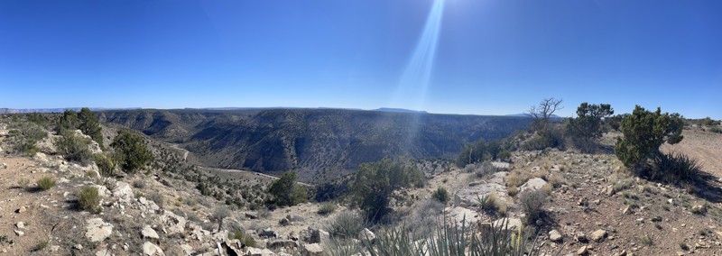
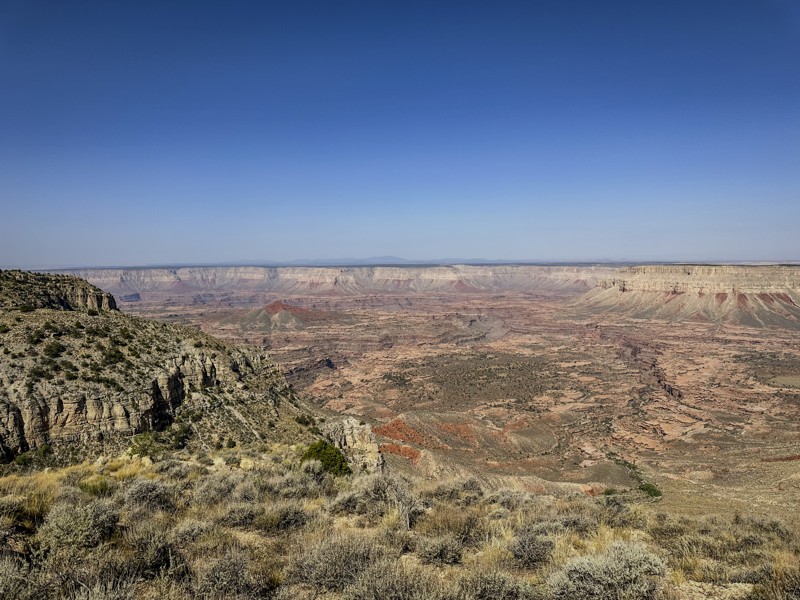
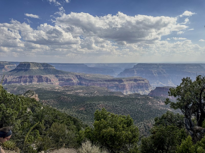
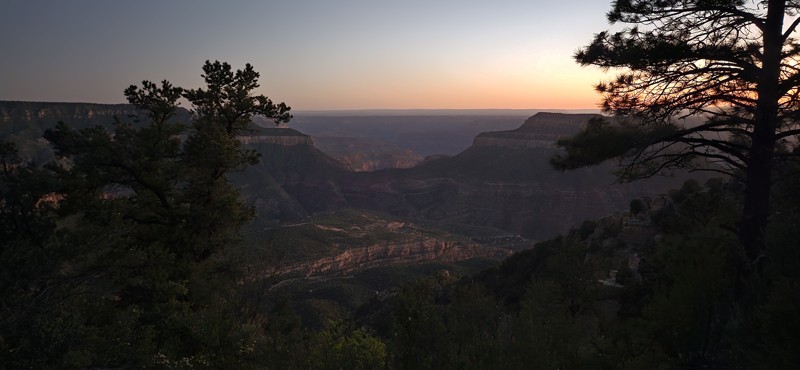
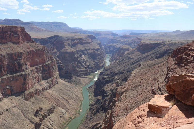
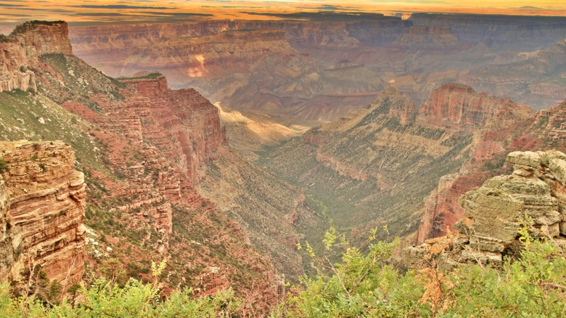
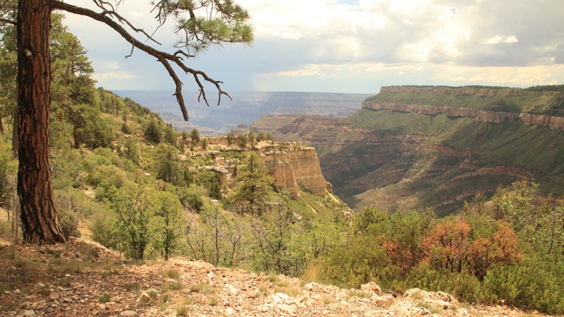
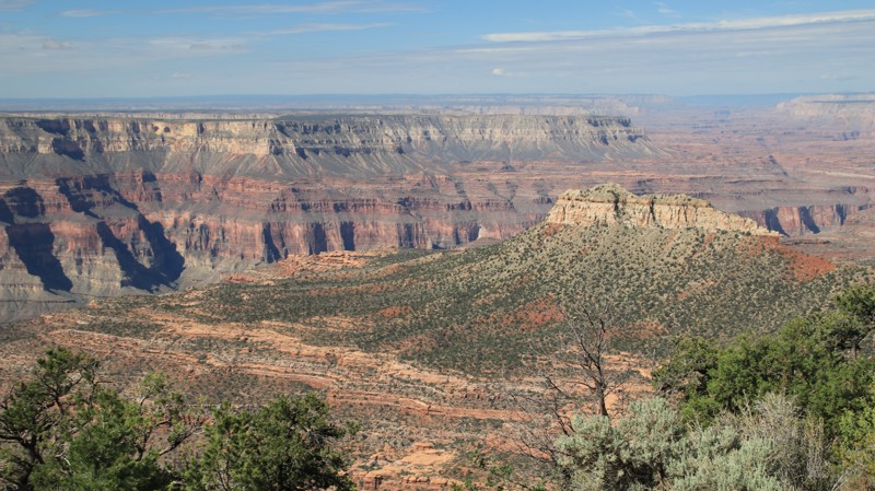
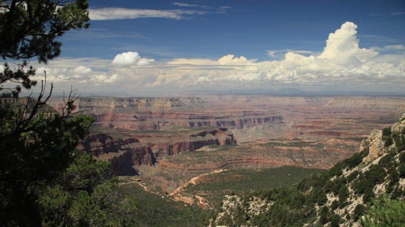
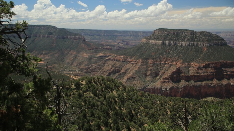
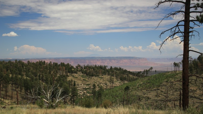
The North Rim of the Grand Canyon offers a quieter, wilder experience than its southern counterpart—and for offroaders, it's a hidden gem. Surrounded by the expansive Kaibab National Forest, this region delivers cool high-elevation forests, remote trail access, and breathtaking canyon-edge views, all far from the crowds.

Why Offroaders Love the North Rim

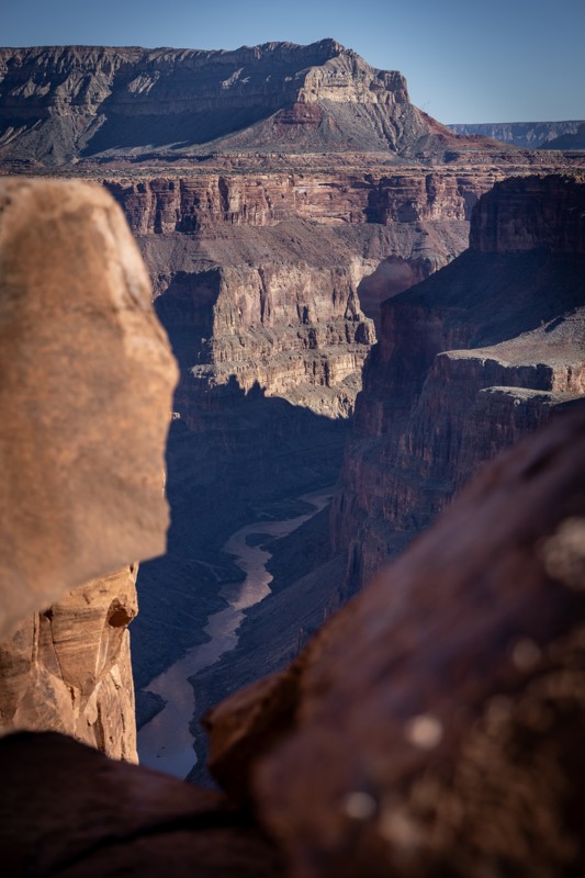
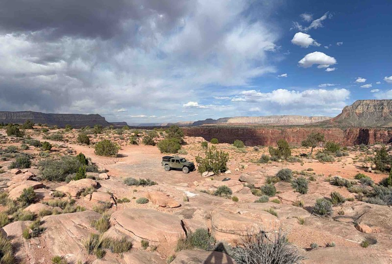
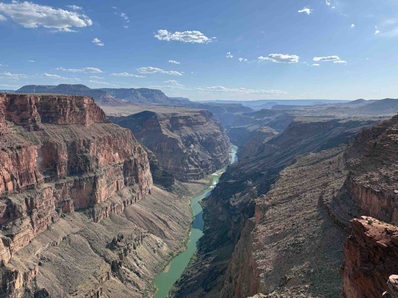
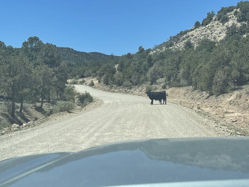
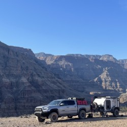
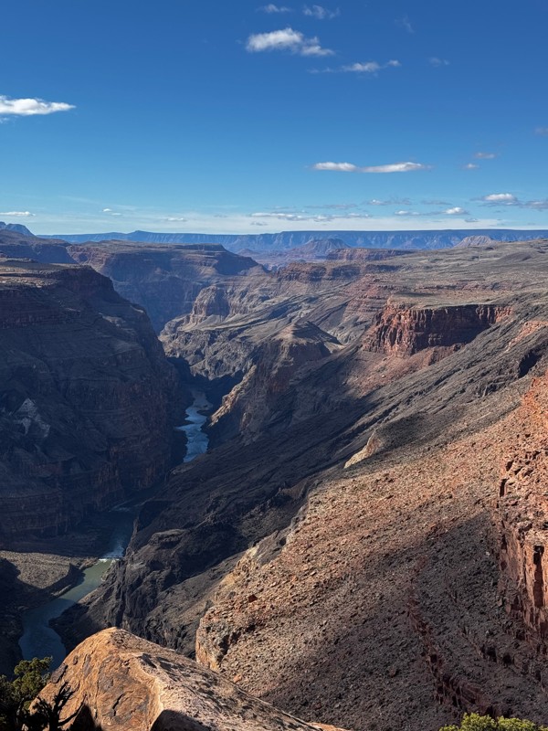
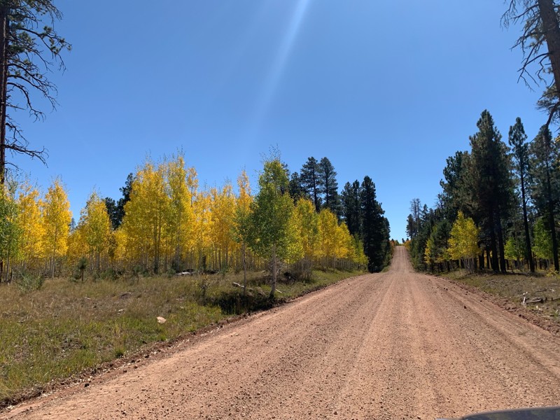
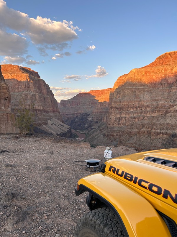
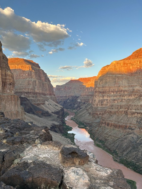
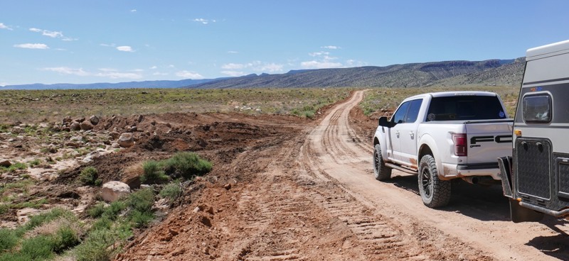
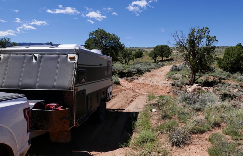
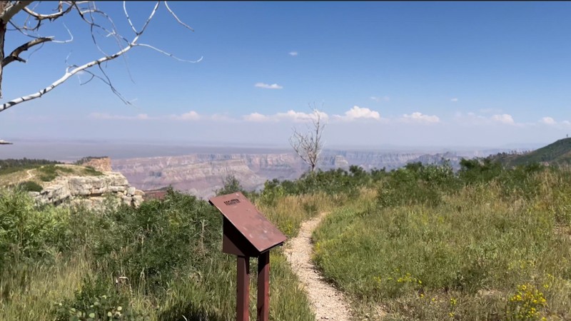
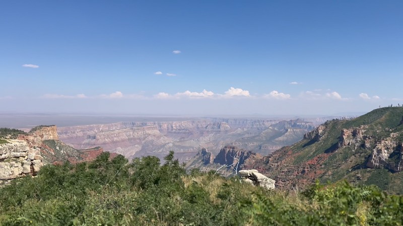
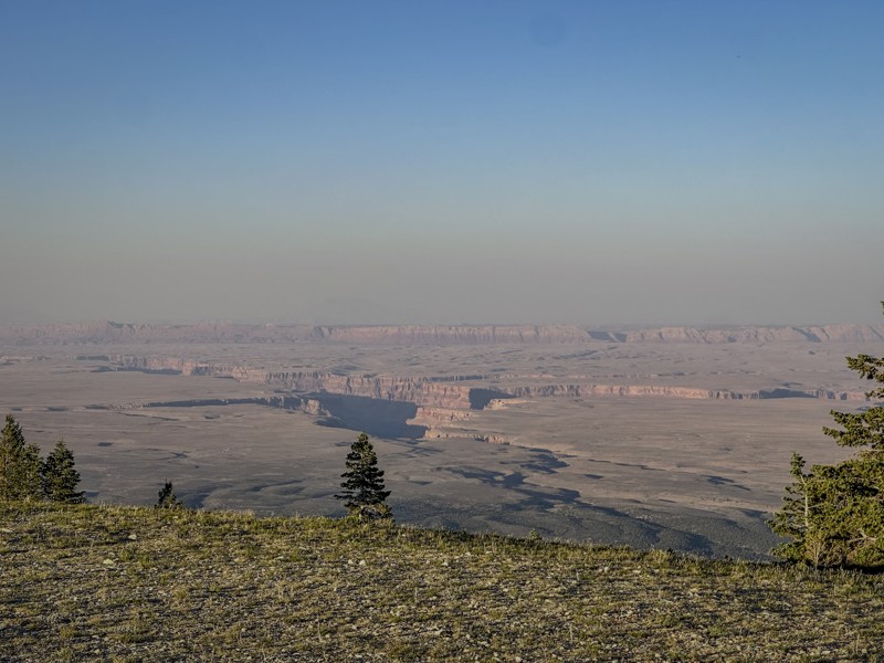
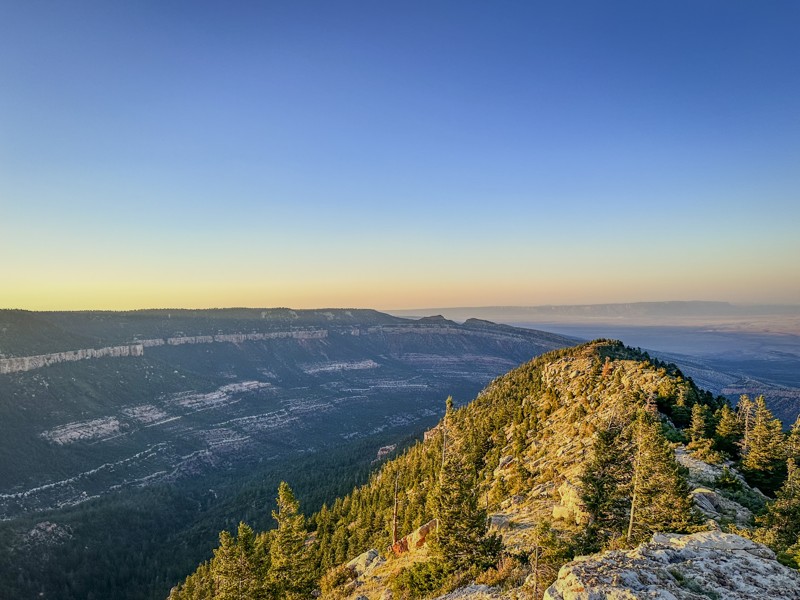
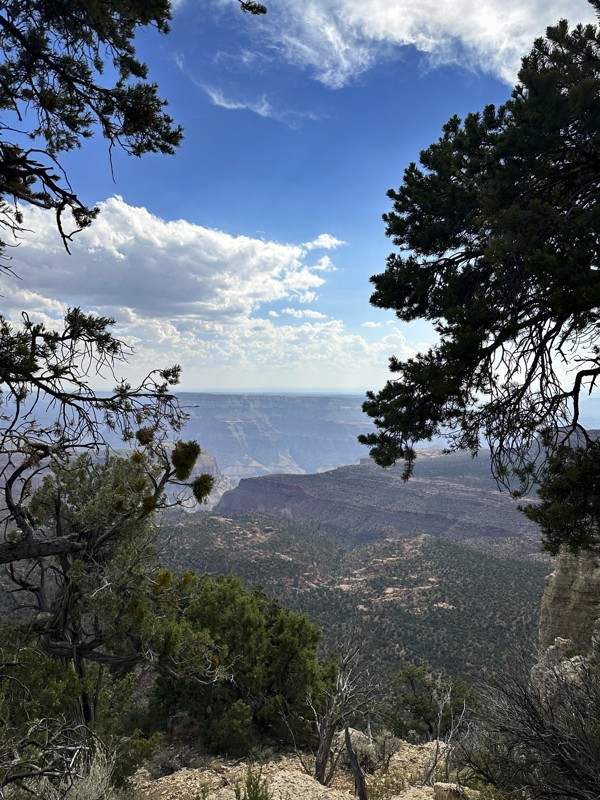
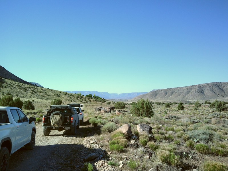
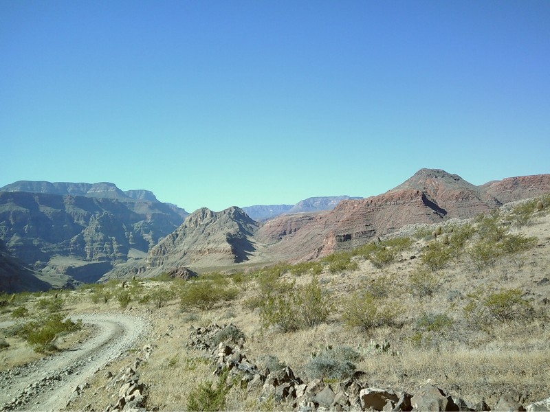
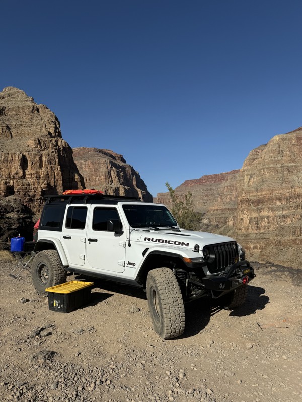
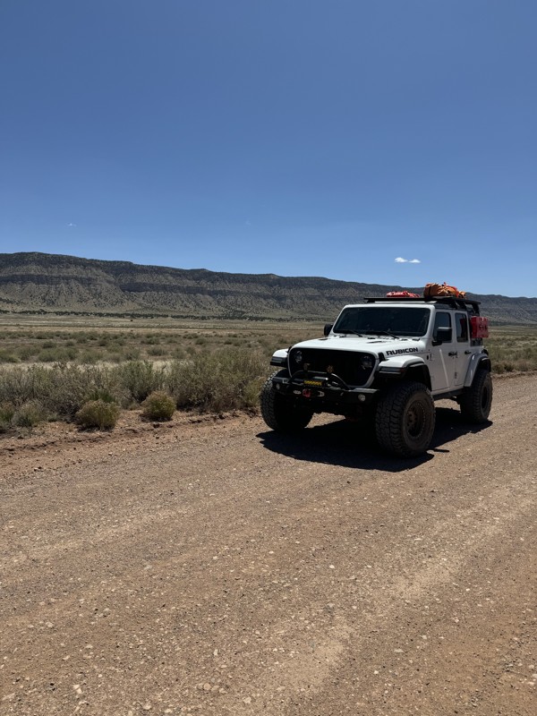
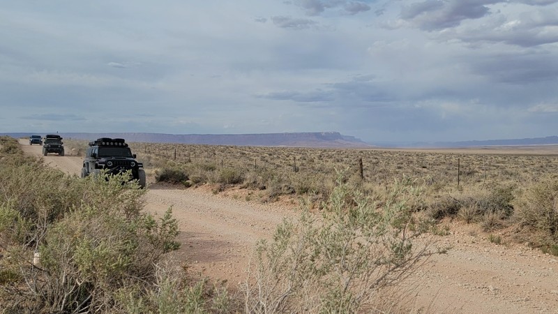
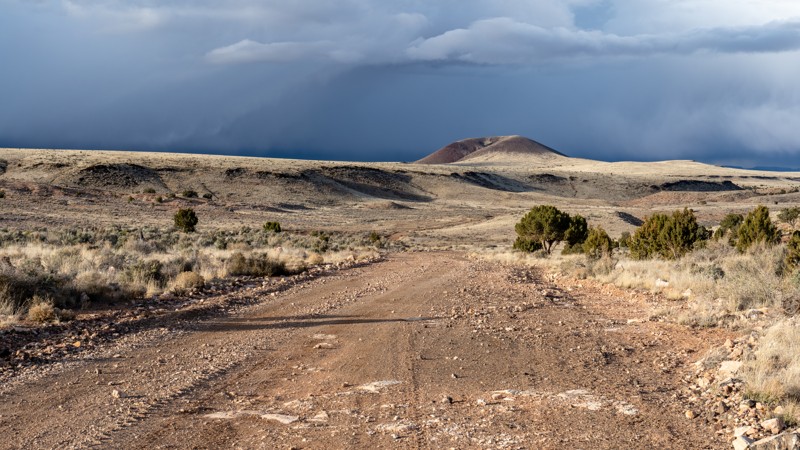
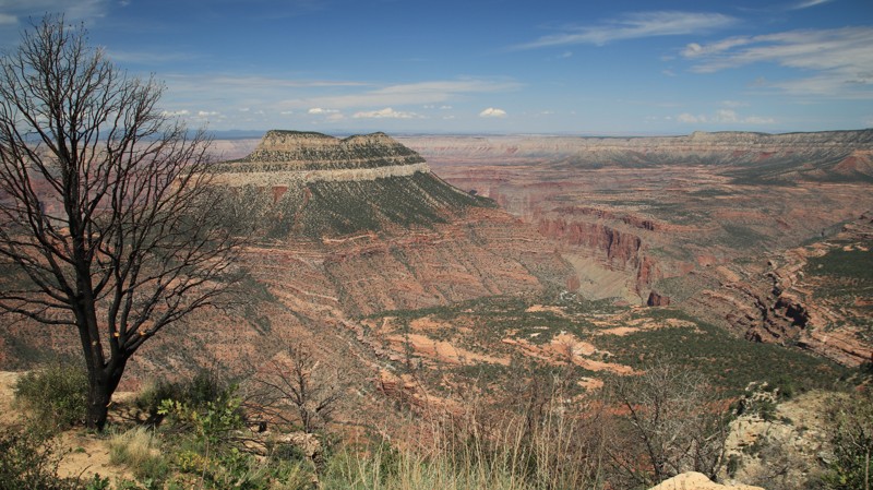
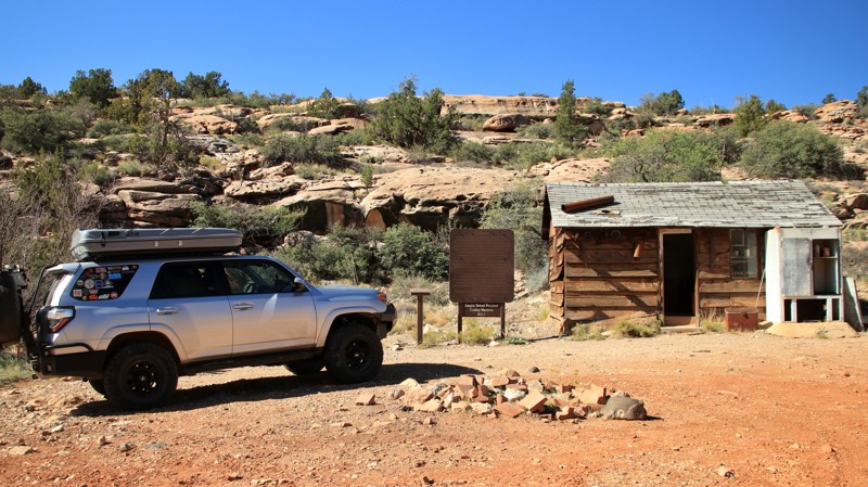
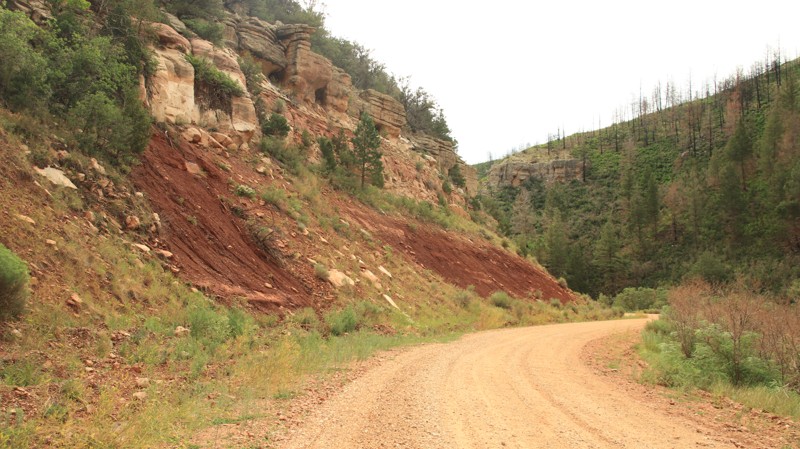
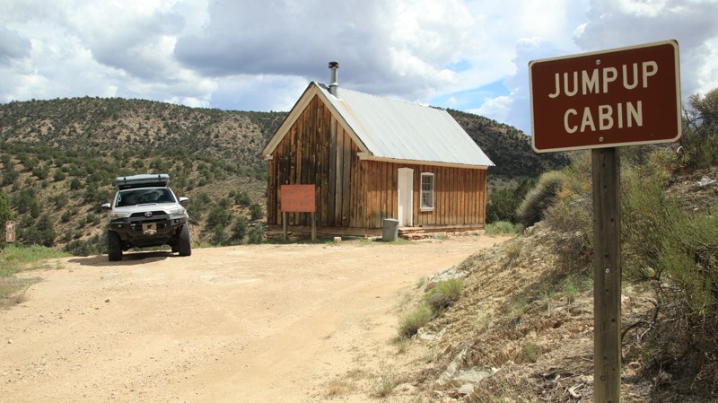
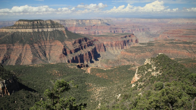
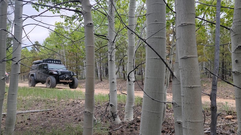
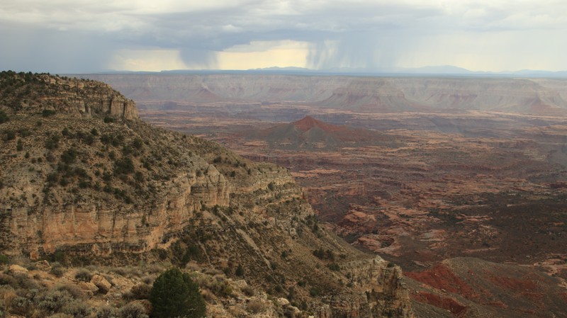
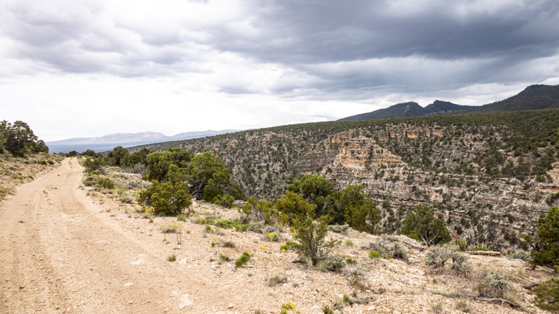
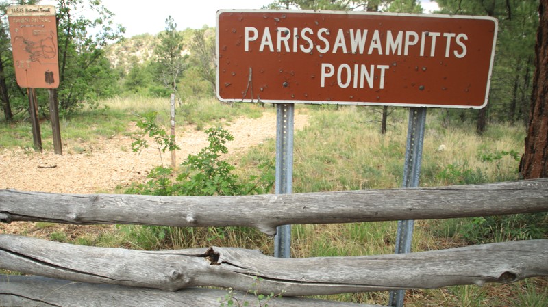
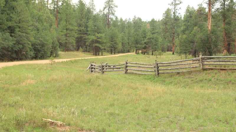
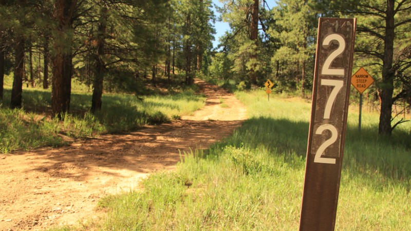
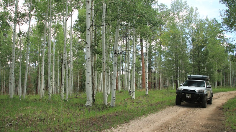
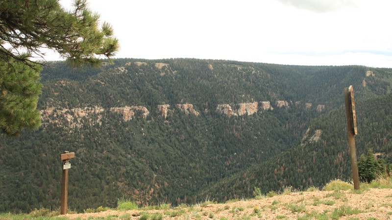
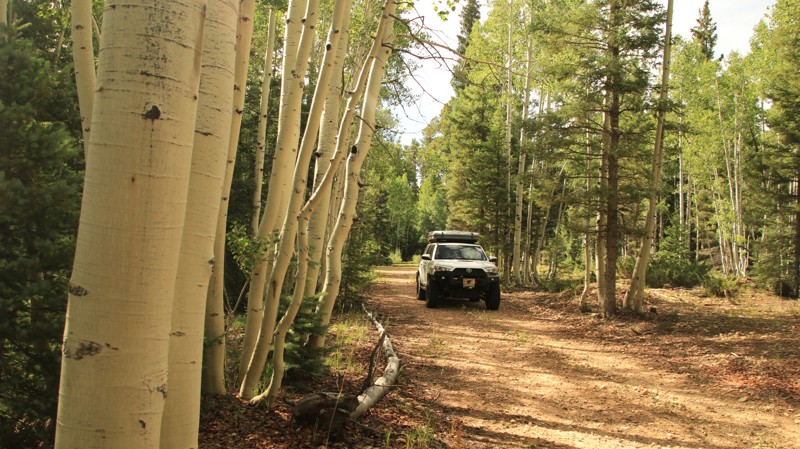
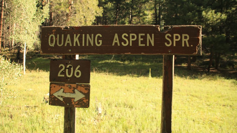
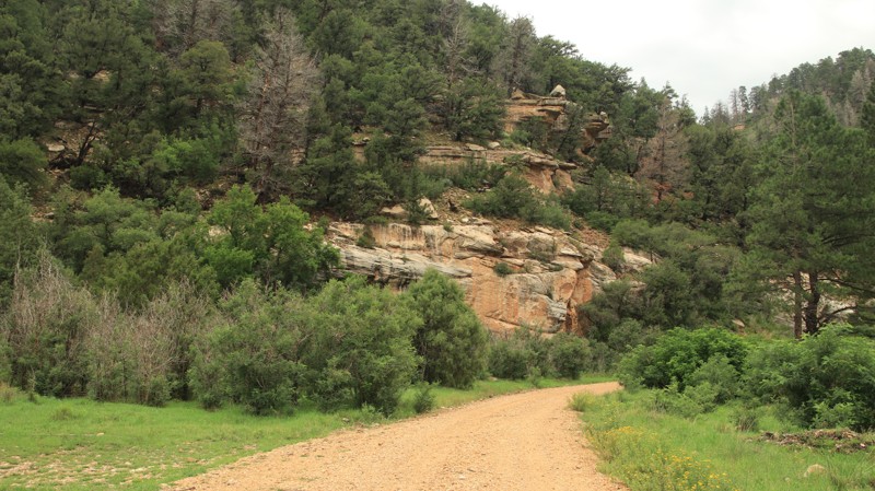
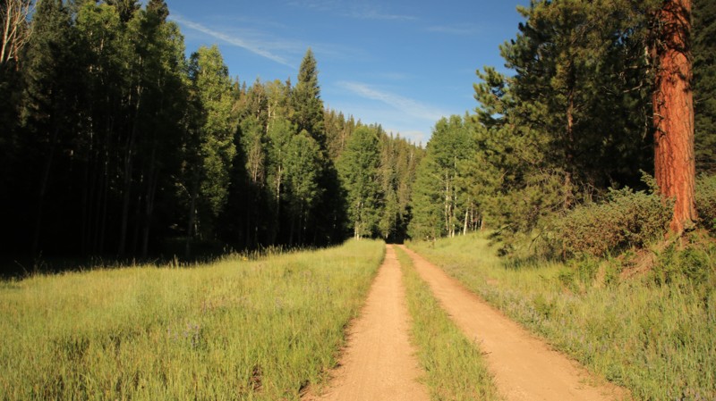
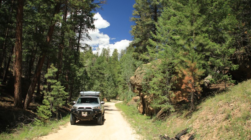
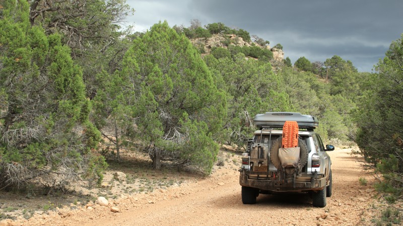
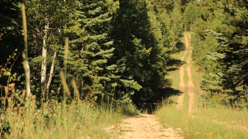
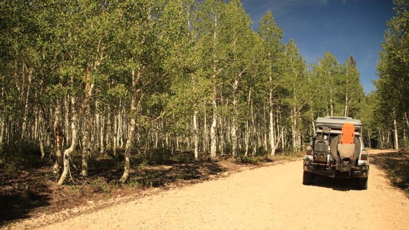
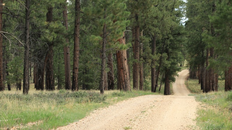
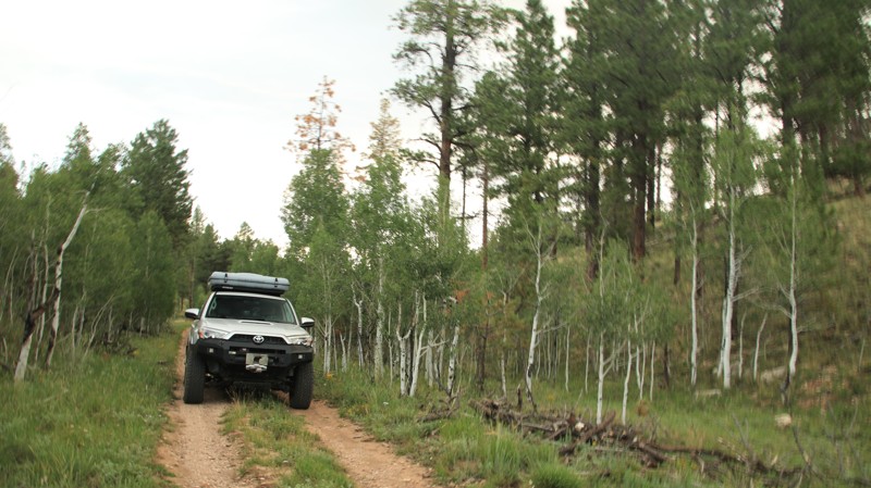
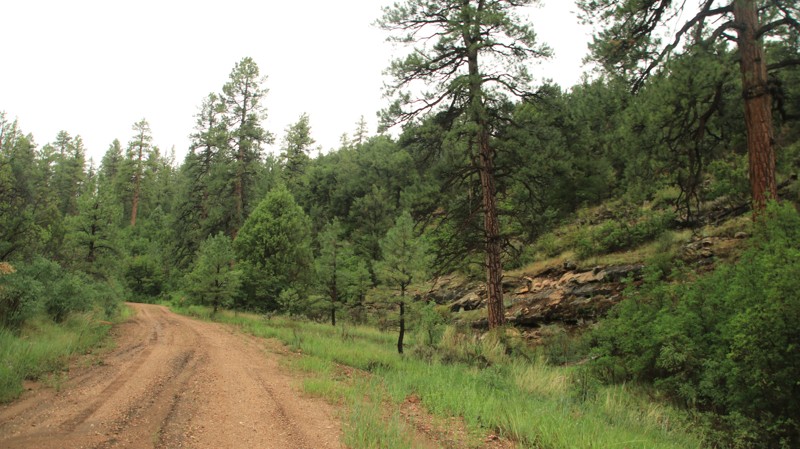
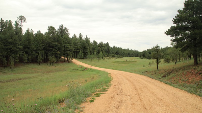
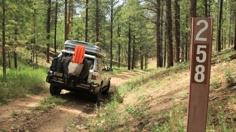
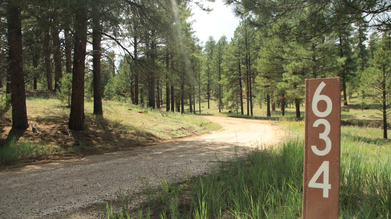
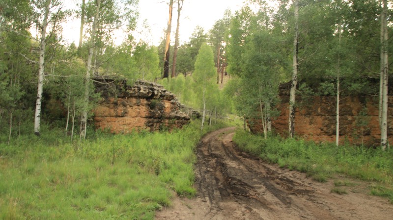
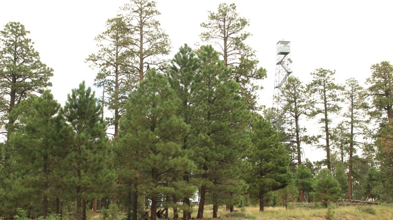
Kaibab National Forest is crisscrossed with a network of forest roads ranging from smooth graded routes to rugged two-tracks. Many of these trails lead to spectacular overlooks, historic fire towers, and secluded campsites perched just steps from the canyon rim. Popular routes include Toroweap, Point Sublime, Crazy Jug Point, and Saddle Mountain Overlook—each offering a blend of scenery, solitude, and just enough challenge to keep it fun.

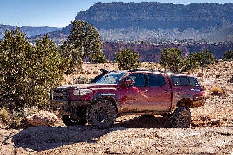
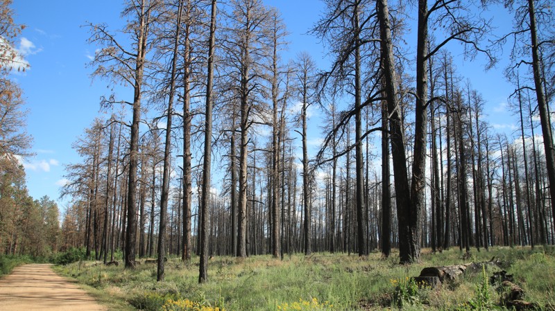
Most trails are best suited for high-clearance 4x4s, especially after rain or snow. Wildfire closures can impact access, so checking local conditions and updated trail guides is a must.

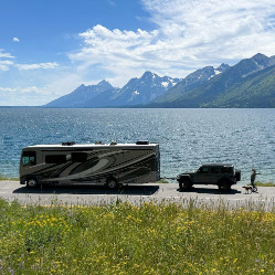
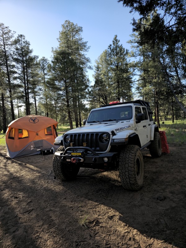
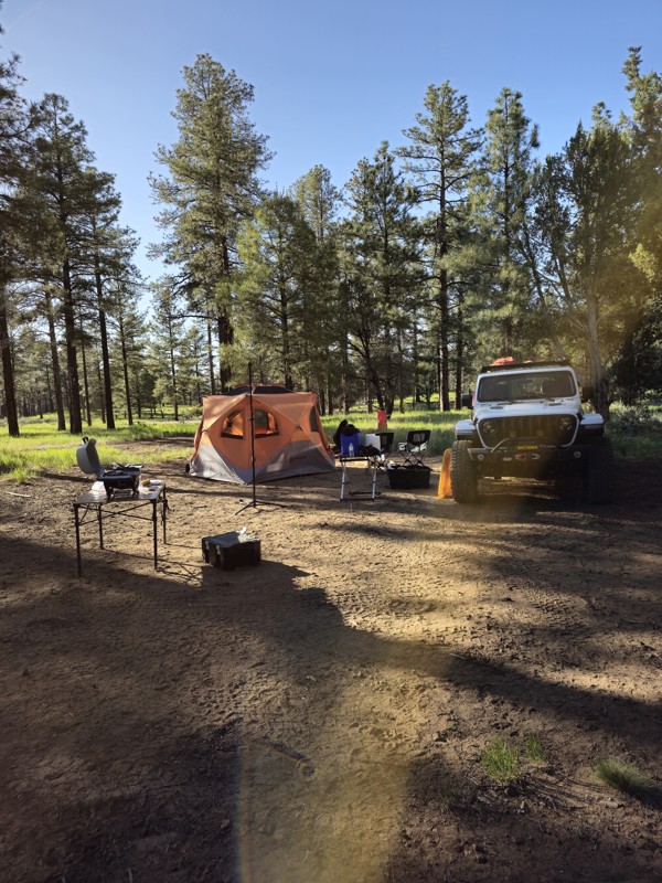
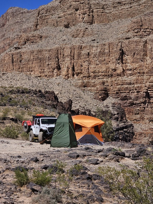
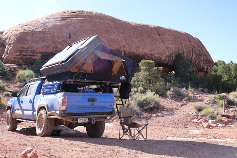
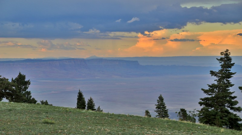
Camping and Trip Planning

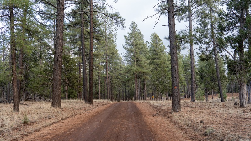
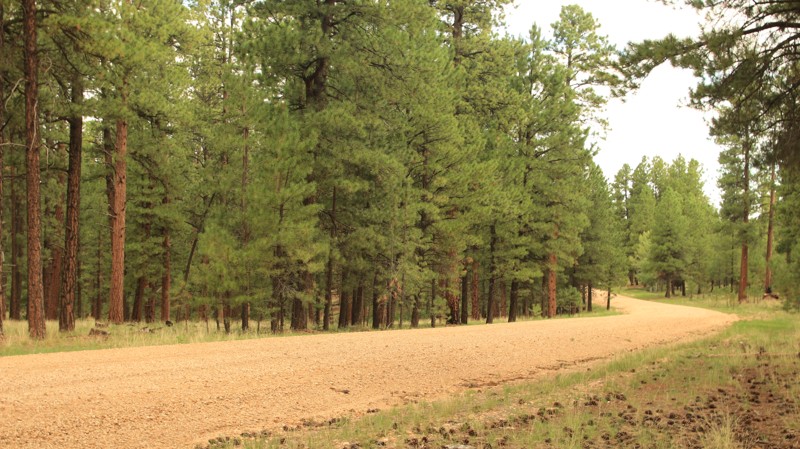
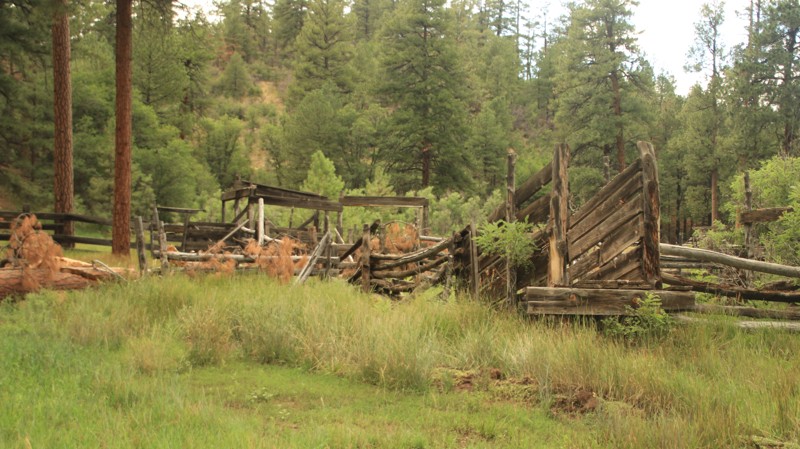
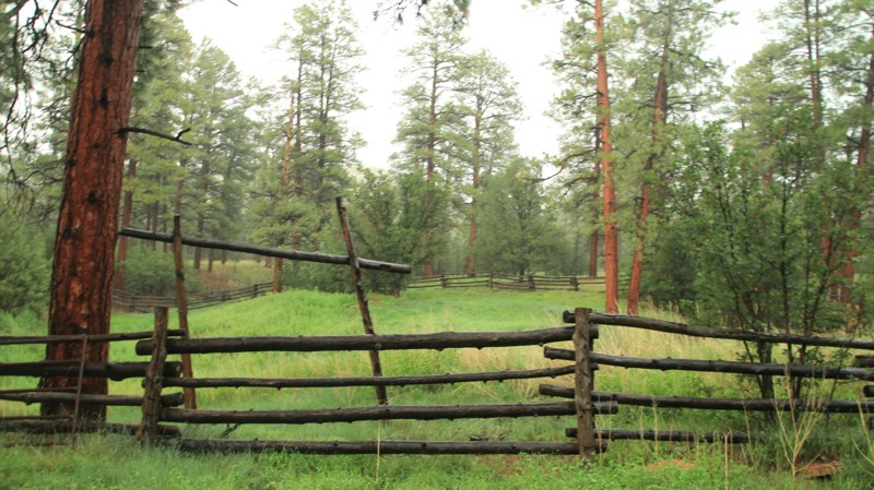
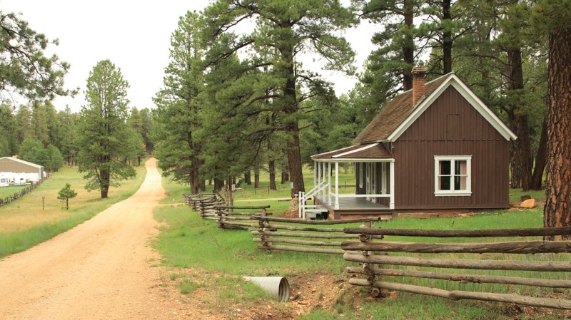
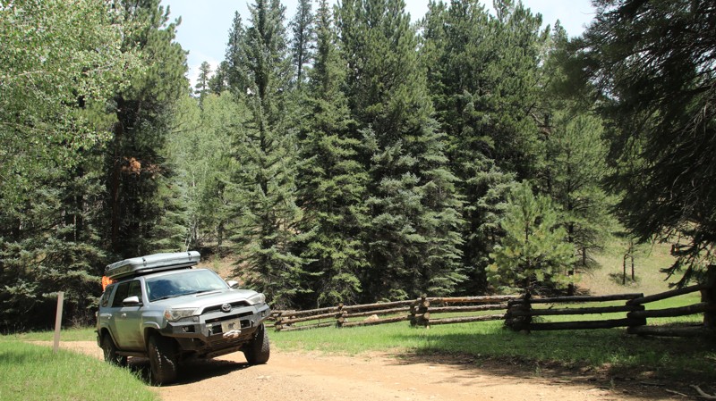
Dispersed camping is widely available throughout the Kaibab Plateau. From pine-covered ridges to meadow-lined roads, there’s no shortage of scenic, peaceful spots to set up camp. Services are limited, so pack in water, supplies, and a sense of adventure. The season typically runs from late spring through early fall, depending on snowmelt and road conditions.

Plan Your North Rim Adventure

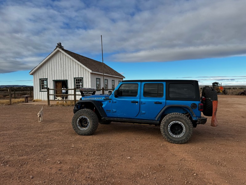
  • Best Vehicle Type: High-clearance 4x4
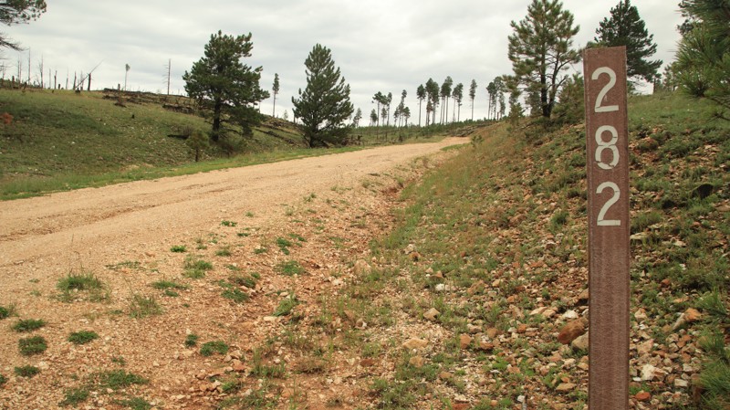
  • Navigation: Trails Offroad GPS trail maps recommended
  • Popular Offroad Trails: Toroweap, Point Sublime, Crazy Jug, Marble Viewpoint, East Side Game Trail
  • Land Management: National Park Service, USFS Kaibab National Forest, North Kaibab Ranger District

For offroaders craving a true backcountry experience with unbeatable views of the Grand Canyon, the North Rim delivers. Load up your rig, grab the GPS, and get ready to explore one of Arizona’s most underrated offroad regions.

Top Reasons to Explore Here
Altitude Category IconAltitude
Beginner Category IconBeginner
Camping Category IconCamping
Desert Category IconDesert
Forest Category IconForest
Ghost Town Category IconGhost Town
Iconic Category IconIconic
Mud Category IconMud
Overland Category IconOverland
Rock Category IconRock
Sand Category IconSand
Scenic Category IconScenic
Trail Types
Scout Route
Full Trail Guide

Preview Trail Icon
Preview Trails
easy
moderate
difficult
severe
extreme

All-Access
Scout Route
Start a 7-day Free Trial

Most Recent Trail Reviews

Most Popular

Search for Trails
Arizona: Point Sublime Hero Photo
All-Access Icon
4.8/5 (24 reviews)
Updated: 06/23/2024
Point Sublime
Fredonia, Arizona
The Point Sublime trail, located in the less-visited North Rim of the Grand Canyon National Park and is one of the four offroad trails inside the Park. The awe-inspiring and sublime nature of this point is most likely why it has its given name. The Grand Canyon National Park is 1,902 square miles. Its otherworldly landscape and enormity will leave you feeling small and breathless as you make the drive to Point Sublime. Driving through a timeless forest mixed with rolling meadows is accented with two main viewpoints along the way that act as warm-ups for what lays ahead. Once you make it to Point Sublime, that feeling of being immersed in the splendid magnitude is cemented as the narrow peninsula suspends you over the grandly expansive canyon, with just a sliver of a glimpse of the Colorado River at Boucher Rapids. The Point Sublime campsites offer the most extraordinary views from a tent window that a person could see.
Arizona: Whitmore Overlook Hero Photo
All-Access Icon
4.9/5 (14 reviews)
Updated: 05/27/2024
Whitmore Overlook
Saint George, Arizona

Located in the remote and mostly uninhabited Arizona Strip, Whitmore Overlook is an iconic Overlanding destination. The trail ends at an uber-impressive viewpoint 500 feet above the Colorado River as it snakes through the western end of the Grand Canyon. The ambitious can hike down to the river. But most will be content to sit on the cliff's edge admiring the scenery and possibly seeing a group of river rafters passing below. While the end of the trail is a worthy destination, getting there is special too. The trail begins at the historic Mount Trumbull Schoolhouse. Constructed in 1922, the schoolhouse was the civic focal point for the hardy residents of the area until 1966. Today it houses artifacts and photographs of the era. Passing through a pinion-juniper forest, every curve on the trail presents a new and impressive view of the Uinkaret Mountains to the east and the Whitmore Plateau and flat-topped 6,500-foot Grassy Mountain to the west. The sandstone cliffs glow in a rainbow of reds, oranges, pinks, grays, and white. Traveling farther south, ominous dark lava flows spill over the sandstone heights. Part of the Uinkaret Volcanic Field, the lava flows range from 850,000 to 72,000 years old. Uinkaret flows dammed the Colorado River at least 17 times, forming a lake that spanned back to the present-day Phantom Ranch. Each time the river overflowed the dams. The silt-laden water of the Colorado River eroded the basalt dams allowing the river to return to its voyage to the Gulf of California. From the Whitmore Overlook, you can see the remains of one of the lava dams across the river. The climax of the trail is obviously a night spent under the stars on the edge of a cliff above the mighty Colorado. With no light pollution, the night sky comes alive with a blanket of twinkling billions of stars and galaxies overhead. Sunrise and sunset views are nearly unparalleled. It's worth the trip.

Arizona: Toroweap Hero Photo
All-Access Icon
5/5 (11 reviews)
Updated: 06/02/2024
Toroweap
Fredonia, Arizona

You've undoubtedly seen the photographs though you might not have known where they were taken. The dramatic sandstone cliff dropping 3000 feet straight down to the Colorado River below is an iconic image. The location is the Toroweap Overlook. It sits in one of the most remote areas of Arizona, the Arizona Strip. Toroweap and Tuweep are used interchangeably. Both are derivations of a Paiute word meaning dry, barren valley. The long drive to Toroweap bears out the applicability of the name. But even barren locals can be dramatically beautiful. Multihued sandstone cliffs rise on either side of the Paiute's barren valley. To the south lies cinder cones and lava flows from the ancient Uinkaret Volcanic Field. Long views abound as the road descends towards the canyon cut by the Colorado River, the grandest canyon of them all. Walking to the edge of the Toroweap Overlook is a profound experience. The views are breathtaking. The immenseness of your surroundings is almost incomprehensible in human terms. The view here is like no other along the entire Grand Canyon. You have to work to get here, but it's worth the effort.

In an effort to manage the number of visitors to the area, all motor vehicles entering the Toroweap area of the Grand Canyon National Park require a backcountry permit or a day-use ticket available through Recreation.gov.

Arizona: Buffalo Ranch Road Hero Photo
Scout Route Icon
4.8/5 (12 reviews)
Updated: 04/21/2025
Buffalo Ranch Road
One Mile, Arizona
Buffalo Ranch Road is a very flat access road to the North Rim of the Grand Canyon. This route is mainly graded dirt. However, there are occasional sand-blown dune areas that require high clearance and 4WD. No camping is available until you get to the rim.
Arizona: Kanabownits Road Hero Photo
All-Access Icon
5/5 (11 reviews)
Updated: 06/23/2024
Kanabownits Road
Fredonia, Arizona

In the late 1870s, Edward Dutton led various geological survey teams deep into what was then the unmapped northern side of the Grand Canyon. He found a long narrow promontory extending far out into the canyon with views he called "most sublime." Today there are only two routes to Dutton's Point Sublime. The first originates at the Grand Canyon's North Rim Village and is appropriately named Point Sublime. The second route comes in from the north and is named Kanabownits for a picturesque spring along the trail. Kanabownits Road passes through a fertile forest with ferns towered over by old-growth Ponderosa pines. Spruce and aspens dot the forest. The tight trail drops into small tight canyons, grips hillsides on narrow shelves, and bursts into open glades fed by springs. Once a ranger lived along the trail watching for wildfires. Today only the small deteriorating cabin remains up a small spur trail. While Point Sublime is the objective of the area, should you choose to enter or depart by the north, Kanabownits Road is a worthy part of the adventure.

Arizona: Dog Saddle Hero Photo
Scout Route Icon
4/5 (4 reviews)
Updated: 10/15/2024
Dog Saddle
North Rim, Arizona
Ever wonder where roads get their names? Typically dogs don't wear saddles. Dog Saddle runs from Dog Point in the north to the Saddle Mountain Trailhead in the south. There's a small campsite with a view from the spur at the trail's northern end. Aspen trees along the roadside dominate the middle of the trail. In the Fall, they turn yellow, giving the road the illusion of being a golden tunnel. The road runs ramrod straight along the border of the Grand Canyon National Park. At the southern end of the road lies the Saddle Mountain Trailhead, a hike through the Saddle Mountain Wilderness to connect with the Nankoweap Trail into the Grand Canyon. There are a few small campsites at the trailhead with good canyon views.
Arizona: Swamp Ridge Road Hero Photo
Scout Route Icon
5/5 (3 reviews)
Updated: 10/15/2024
Swamp Ridge Road
North Rim, Arizona
Swamp Ridge Road passes through old-growth pines and fields of ferns to a great view into the Grand Canyon and the North Bass Trailhead. The end of the trail is inside the Grand Canyon National Park. The trail also connects to Kanabownits Road, which ends on Point Sublime Road. Be prepared to clear downed trees. Camping inside the park requires a backcountry permit. Camping along the trail outside the park is free.
Arizona: Mount Trumbull Loop - Main Street Section Hero Photo
Scout Route Icon
4/5 (5 reviews)
Updated: 04/09/2025
Mount Trumbull Loop - Main Street Section
Rock Crossing, Arizona

Located in northern Arizona, within a vast area known as the Arizona Strip, the Mount Trumbull Scenic Loop is a picturesque drive through the Grand Canyon-Parashant National Monument that takes drivers through nearly every aspect of terrain the monument offers. Cutting through the desert, shrubland, and montane habitats, drivers are rewarded with picturesque views of deep canyons, vast valleys, lonely buttes, and 8,000-foot mountains.

Main Street is the western section of the CR 5, Mount Trumbull Loop, traveling between Wolf Hole Valley and the Mount Trumbull School House, essentially connecting St. George to Mount Trumbull. This is the primary access road for those visiting the Mount Trumbull School House and the Whitmore Overlook. The Mount Trumbull School House is a historic replica of the 1918 schoolhouse that served as the school, town hall, church, and community meeting place for the local homesteaders until 1966, when it was shut down. The original building burned down due to arson but was rebuilt to its original specs in 2001 with the help of volunteers. At the schoolhouse, you will find many relics of the past, informational signs, and a public outhouse. The road through Main Street Valley has a well-maintained, hard-packed gravel and clay surface, is multiple vehicles wide, and is suitable for any vehicle in dry conditions. After mild rain, the clay sections of the road become impassable for a few hours, while a heavy rain event can make the road impassable for days.

Arizona: Mount Trumbull Loop - Clay Hole Section Hero Photo
Scout Route Icon
3/5 (3 reviews)
Updated: 05/27/2025
Mount Trumbull Loop - Clay Hole Section
Tuweep, Arizona

Located in northern Arizona, within an area known as the Arizona Strip, the Mount Trumbull Scenic Loop is a picturesque drive through the Grand Canyon-Parashant National Monument that takes drivers through nearly every aspect of terrain the monument offers. Cutting through the desert, shrubland, and montane habitats, drivers are rewarded with picturesque views of deep canyons, vast valleys, lonely buttes, and 8,000-foot mountains.

Clayhole is the eastern section of the CR 5, Mount Trumbull Loop, and connects Colorado City to Tuweep. This is a primary access road for those visiting the Toroweap Overlook. The road winds through Clayhole Valley, traversing a scenic volcanic field and the dramatic Hat Knoll cinder cone. The road surface is generally very easy, with hardpacked clay mixed with sections of gravel and small protruding rocks. However, the clay quickly turns to a peanut butter consistency after any rain, making the road totally impassable and very dangerous until it dries. Users should always check recent and future weather forecasts before traveling on this road. In dry conditions, this is a 2WD road that is suitable for any vehicle with good ground clearance and rugged tires, such as all-terrain tires.

Arizona: Vulcan's Throne Hero Photo
All-Access Icon
4.3/5 (3 reviews)
Updated: 06/05/2022
Vulcan's Throne
Fredonia, Arizona

Vulcan's Throne, a cinder cone volcano, erupted 72,000 years ago, sending a 1200-foot-high wall of lava into the Grand Canyon. One of at least 17 in the Grand Canyon's history, the resulting lava dam created a lake that ran as far back as the present-day Phantom Ranch. The silt-filled Colorado eventually overcame the dam, grinding away the basalt and returning the river to its present state. Today Lava Falls, one of the largest rapids on the Colorado River, marks the existence of this massive volcanic dam. A sandy trail leads to the western slopes of Vulcan's Throne and then on to a hiking trail that leads down into the Grand Canyon. The geological history of the region is written largely along the trail. A part of the six million-year-old Uinkaret Volcanic Field, Vulcan's Throne's dark volcanic cinders stand in dramatic contrast to the red and orange Toroweap Formation sedimentary sandstone through which the volcano rose. Both were tectonic forces instrumental in shaping the Grand Canyon. In the quiet of the area, you can pause and contemplate the wonder of the ever-evolving earth on which we reside.

In an effort to manage the number of visitors to the area, all motor vehicles entering the Toroweap area of the Grand Canyon National Park require a backcountry permit or a day-use ticket available through Recreation.gov.

Arizona: Fire Point Hero Photo
Scout Route Icon
5/5 (3 reviews)
Updated: 10/15/2024
Fire Point
North Rim, Arizona
Fire Point goes west through a pine and aspen forest, crosses into the Grand Canyon National Park, and ends with great views down into the Grand Canyon. The trail is well maintained until it crosses into the national park, where deep mudholes and ruts could create issues for 2WD or low clearance vehicles. But it's only a short walk to the end of the trail at that point, so the trail is rated easy. The trail still shows some of the effects of the 2019 Ikes Wildfire. But it is named Fire Point, right? The MVUM doesn't allow camping along Fire Point, and overnight camping in the Grand Canyon National Park requires a permit.
Arizona: West Side Ryan Hero Photo
Scout Route Icon
4.3/5 (3 reviews)
Updated: 10/15/2024
West Side Ryan
Ryan, Arizona
West Side Ryan, FR 22, is the main north/south arterial road into the northern Kaibab National Forest. The road begins in Fredonia. The first 22 miles are paved and boring. The remaining 29 miles are graded dirt and definitely not boring. West Side Ryan cuts through a park-like forest of old-growth Ponderosa Pines before terminating at Highway 67 near De Motte Campground. The road passes historic Big Springs Cabins, one of the original ranger stations built in the early 1900s. Today it serves as a USFS work center, and some cabins are set aside as rentals. There's even a ribbon waterfall during the rainy season. There is camping on the many spur roads leading off West Side Ryan, but none directly along the road.
Arizona: Fracus Canyon Hero Photo
Scout Route Icon
4/5 (3 reviews)
Updated: 10/15/2024
Fracus Canyon
Ryan, Arizona
Fracus Canyon, named for the winding canyon on its northern end, is a major north/south arterial road in the Kaibab National Forest. The northern portion of the trail was burned in the 2020 Mangum Wildfire. The blackened trunks of massive Ponderosa pines stand stark against the white backdrop of the canyon walls. The burned section gives way to a beautiful pine forest with campsites scattered along the central portion of the trail and its many spurs. The road intersects with West Side Ryan, close to Highway 67 and the DeMotte Campground.
Arizona: Pa's Pocket Hero Photo
All-Access Icon
5/5 (2 reviews)
Updated: 06/05/2022
Pa's Pocket
Saint George, Arizona

Water is life in the desert. Places where water collects are called pockets in the deserts of the Southwest. These relatively verdant pockets are gathering places for animals and humans. Native tribes knew the large rock cisterns carved into a tight slot canyon of a sandstone ridge would collect and hold the water from infrequent rains. Early settlers often improved on these natural features. Pa's Pocket is such a place. James Bundy, a prominent Mormon settler who lived near Mount Trumbell, built a dam in 1920 to capture and hold the runoff rainwater in this slick rock sandstone canyon to support cattle ranching in the area. Atwood and Ben Bundy built the cabin in 1945. Pa's Pocket is an oasis in a beautiful but parched landscape. The small canyon leading to the dam is often 20 degrees cooler than the surrounding environment. The trail to Pa's Pocket is scenic and just challenging enough to keep things interesting. The Pocket is a great payoff for the effort. Please respectfully visit the area and admire both the natural beauty and the efforts of the hardy people who lived in this land.

Arizona: Mount Trumbull Loop - Southern Section Hero Photo
Scout Route Icon
5/5 (3 reviews)
Updated: 10/15/2024
Mount Trumbull Loop - Southern Section
Mount Trumbull, Arizona

Located in northern Arizona, within a vast area known as the Arizona Strip, the Mount Trumbull Scenic Loop is a picturesque drive through the Grand Canyon-Parashant National Monument that takes drivers through nearly every aspect of terrain the monument offers. Cutting through the desert, shrubland, and montane habitats, drivers are rewarded with picturesque views of deep canyons, vast valleys, lonely buttes, and 8,000-foot mountains.

The southern section of CR 5 travels east to west through significantly different terrain than the other two sections of the Mount Trumbull Loop. This section ascends a half-mile-long dugway constructed in the 1930s by the Civilian Conservation Corps into mountainous terrain with a ponderosa pine forest reaching 6,800 feet. The road is continuously rocky and rough, only 1.5 vehicles wide across the dugway. Drivers of this road are rewarded with plenty of scenic views, including the 8,028-foot Mount Trumbull and 7,866-foot Mount Logan. The trail passes a historic sawmill site that once supplied lumber to build the St. George Morman Temple in the 1870s. It also offers a short side trip to petroglyphs at Nampaweap.

There is substantial dispersed camping along this road, with many large sites suitable for groups or multiple vehicles.

This road is suitable for any high clearance 4WD vehicle, and it is highly recommended to air down to make the ride more comfortable due to the roughness of the road surface.

Arizona: Crazy Jug Point Hero Photo
Scout Route Icon
4.6/5 (5 reviews)
Updated: 10/15/2024
Crazy Jug Point
Ryan, Arizona
Besides having a cool name, Crazy Jug Point offers great views and some nice campsites. The roads are in good condition with a couple of moderate climbs and descents. FR 292A, the western spur, services the Bill Hall Trailhead and has a couple of campsites right on the edge of the rim. FR 292B, the southern spur leads to amazing views and a nice campsite.
Arizona: Ryan Jumpup Divide Hero Photo
Scout Route Icon
3/5 (1 reviews)
Updated: 10/15/2024
Ryan Jumpup Divide
Ryan, Arizona
This trail has everything from a well-graded road to a two-track with weeds higher than your hood and a shelf section. There are wide grassy valleys with cattle and deer. And at the end is a historic cabin you can rent. Ryan Jumpup Divide begins at its intersection with West Side Ryan, the major north-south artery through the Kaibab National Forest. The initial parts of the road traverse and then steeply wind out of a pretty canyon. The switchbacks are so tight that the turns are totally blind to oncoming traffic. Take care. The road makes an abrupt 90-degree turn to the west and radically changes. There's plenty of evidence of the 2007 Slide Fire. The trail becomes a weedy, overgrown two-track for several miles. You'll be tempted to mistake which way to go at the intersection with FR 235 near a cattle tank. Stay left because the road changes again as it passes through picturesque grassy hills. Go straight ahead at the confusing intersection with FR 236. Again go straight ahead at the junction with the pleasantly graded Ranger Pass, FR 234. Ryan Jumpup Divide changes again to a shelf road until it reaches its destination, the Jumpup Cabin. The Jumpup Cabin was one of the first ranger stations built in the Kaibab in the early 1900s. It can be reserved for adventurous visitors but is locked otherwise. The cabin is also located at the trailhead for Ranger Trail. A few dispersed campsites are located along the northern part of the trail amongst junipers and pinion pines.
Arizona: Big Saddle - Bee Springs Hero Photo
Scout Route Icon
5/5 (2 reviews)
Updated: 10/15/2024
Big Saddle - Bee Springs
Ryan, Arizona
Two roads diverged in a yellow wood. Big Saddle - Bee Spring is just such a road, except half is fair and easy while the other is narrow, steep, and often muddy. The northern half of the trail is well-graded and mild-mannered, providing access to Crazy Jug, Sowats Point, and Indian Hollow. The southern half is tight, often muddy, and follows the Indian Hollow canyon until it does a steep switchback exit to connect with Dry Ridge Park. Grazing is allowed here, so expect to see cattle. The trail has only a few campsites.
Arizona: Timp Points Hero Photo
Scout Route Icon
4.8/5 (4 reviews)
Updated: 10/15/2024
Timp Points
North Rim, Arizona
Timp Points goes west to two outstanding viewpoints. The well-maintained road goes through an old-growth pine forest. The trail splits to go to Timp Point and North Timp Point. Both points serve as hiking trailheads for the Rainbow Rim Trail. Both points have amazing views and campsites.
Arizona: East Side Game Road Hero Photo
Scout Route Icon
5/5 (3 reviews)
Updated: 02/10/2025
East Side Game Road
Jacob Lake, Arizona

East Side Game Road is a picturesque track connecting Tater Ridge FS 213 and Buffalo Ranch Road. The trail provides a convenient offroad shortcut from the Grand Canyon's North Rim to or from Highway 89A via the eastern slope of the Kaibab Plateau. The shortcut saves you from traveling more than 40 extra miles, offering a significant advantage in distance and perhaps time. Spanning approximately 8.3 miles, the elevation gradually decreases from 7400 feet to 5500 feet going east. The track traverses diverse landscapes, transitioning from verdant meadows and dense alpine pine forests to the expansive open grasslands of the high desert.

The trail is narrow in hilly sections but progressively widens in the lower section. A section of shelf road along the edge of a drop of several hundred feet. While 2WD vehicles with standard clearance can easily navigate this route from west to east, off-road tires are highly recommended due to the rocky terrain encountered in the hilly areas. However, traveling from east to west requires 4WD due to loose rocks, and steep inclines, all exacerbated in unfavorable weather conditions.

While the trail's western end offers several camping spots, the area's most remarkable camping is on the eastern end of Buffalo Ranch Road, with an awe-inspiring 360-degree view of the Grand Canyon.

Arizona: Tater Ridge  FS 213 Hero Photo
Scout Route Icon
5/5 (3 reviews)
Updated: 06/08/2025
Tater Ridge FS 213
North Rim, Arizona
Tater Ridge Road, or FS 213, is a scenic dirt road through a Ponderosa Pine and Aspen tree forest. It is a great route between Highway 67 and the eastern edge of the Kaibab Plateau. There are a few campsites near the west end of the trail.
Arizona: Sowats Point Hero Photo
Scout Route Icon
5/5 (4 reviews)
Updated: 10/15/2024
Sowats Point
Ryan, Arizona
Sowats Point is likely the most boring trail that leads to the most unexpected view. The effects of the 2006 Sowats Wildfire are still evident. The trail passes through an unimpressive growth of random small bushes and stunted junipers. While not difficult, the track is annoyingly bumpy. The few campsites along the way are uninspiring. The Jump Up - Nail hiking trailhead looks like it hasn't seen any action in quite a while. Then you take a left at the Y intersection towards a small hill. Angels begin to sing because this view western reaches of the Grand Canyon is completely and unexpectedly breathtaking. A right at the Y intersection takes you to a game water collection site.
Arizona: Locust Point Hero Photo
Scout Route Icon
4.5/5 (3 reviews)
Updated: 10/15/2024
Locust Point
Ryan, Arizona
Locust Point, FR 294, goes west through an old-growth pine forest to a very nice viewpoint. There's limited camping at the viewpoint. A short walk is required to get the best views. The viewpoint also serves as a hiking trailhead for the Rainbow Rim Trail. The road has minor potholes but is an easy drive.
Arizona: Marble View Point Hero Photo
Scout Route Icon
4.7/5 (3 reviews)
Updated: 10/15/2024
Marble View Point
North Rim, Arizona
Marble View Point attracts campers and photographers with its unparalleled vistas from the bare arrowhead-shaped point jutting eastward off the edge of the Kaibab Plateau. The road to Marble View Point is easy but always has a few mudholes. The bottoms are solid. The view from the short spur road at the end showcases the Vermillion Cliffs, best seen in the late afternoon sun, Navajo Mountain in the distant east, and Marble Canyon, the first segment of the Grand Canyon to the south. There's plenty of room to camp in the edge of the trees. Marble View Point is a very popular camping destination. You will typically have neighbors. There's even cell phone service.
Arizona: Indian Hollow Hero Photo
Scout Route Icon
5/5 (1 reviews)
Updated: 10/15/2024
Indian Hollow
Ryan, Arizona
Indian Hollow passes through the western edge of the Kaibab Plateau to reach the Indian Hollow hiking trailhead, though most know it as the Thunder River trailhead. The Thunder River Trail is an extremely arduous multiday hike that leads to an enormous spring gushing from a cliff face in the Redwall Limestone. The spring forms its own river. The Forest Service conveniently provided Indian Hollow Forest Camp near the trailhead. The campground is free with three separate campsites. Each site has a picnic table, a fire pit, and a grill rack. There's also a vault toilet.
Arizona: FR 272 Hero Photo
Scout Route Icon
3.5/5 (2 reviews)
Updated: 10/15/2024
FR 272
Ryan, Arizona
FR 272 passes through a park-like pine and aspen forest. Two miles on the trail's western end is steep with loose rock and ledges. There are a few dispersed campsites along the trail and plenty more along the numerous spur trails.
Arizona: FR 268 Hero Photo
Scout Route Icon
4/5 (1 reviews)
Updated: 10/15/2024
FR 268
North Rim, Arizona
FR 268 passes through a beautiful forest before reaching an ignominious end. The trail parallels the Kaibab National Forest and Grand Canyon National Park boundaries. Summer monsoon storms will cause mudholes and ruts, but the road surface is hard. Be prepared to clear downed trees. Camping is not permitted along the trail by either the Forest Sevice or the National Park.
Arizona: Parissawampitts Point Road Hero Photo
Scout Route Icon
3/5 (1 reviews)
Updated: 10/15/2024
Parissawampitts Point Road
North Rim, Arizona
Parissawampitts Point Road leads to fairly unimpressive views when compared to the viewpoints to the south. However, it's an exceptionally nice road. There are a few campsites. The point is the northern terminus of the Rainbow Rim hiking trail.
Arizona: Fence Point Hero Photo
Scout Route Icon
4/5 (1 reviews)
Updated: 10/15/2024
Fence Point
North Rim, Arizona
Fence Point is an easy drive to a nice viewpoint. The best views require a short walk. There are two small walk-in campsites at the point. The point also serves as a hiking trailhead for the Rainbow Rim Trail.
Arizona: East Rim Ridge Hero Photo
Scout Route Icon
5/5 (2 reviews)
Updated: 10/15/2024
East Rim Ridge
North Rim, Arizona
East Rim Ridge begins on Highway 67 and runs eastward atop the Kaibab Plateau. Aspen trees line the sides of the well-maintained road and, in Fall, provide the illusion of traveling through a golden tunnel. The East Point Lookout has good views at the end of its 200-yard paved walking path. There are picnic tables to enjoy the amazing view eastward. There's also a vault toilet in the parking lot. The real draw of this road is the campsites scattered along the ridgeline with fantastic views of the Vermillion Cliffs and Navajo Mountain out in the distance. While camping is plentiful, there is no camping a half mile on either side of the East Point Lookout.
Arizona: VT Ridge Hero Photo
Scout Route Icon
4/5 (1 reviews)
Updated: 10/15/2024
VT Ridge
North Rim, Arizona
VT Ridge runs south off West Side Ryan. The trail connects with east/west trails leading to many of the scenic viewpoints and great campsites for which the Kaibab Plateau is known. VT Ridge begins as a well-groomed gravel road but deteriorates further south until it ends at the Grand Canyon National Park boundary. While the MVUM doesn't permit camping on VT Ridge, there is plenty of quality camping along the spur roads.
Arizona: Dry Ridge Park Hero Photo
Scout Route Icon
3.5/5 (2 reviews)
Updated: 10/15/2024
Dry Ridge Park
Ryan, Arizona
Dry Ridge Park begins on West Side Ryan, FR 22, and serves as a connector to most of the "point roads". Along the way, it passes Quaking Aspen Spring, many small grassy glades, and an old-growth pine forest. There's plenty of camping along the spur roads, but none on this major travel artery.
Arizona: Warm Springs Canyon Hero Photo
Scout Route Icon
3/5 (1 reviews)
Updated: 10/15/2024
Warm Springs Canyon
Jacob Lake, Arizona
Beginning near Jacob Lake, Warm Spring Canyon goes westward to connect with Fracus Canyon. The road is a popular route for accessing the scenic vistas of the "point" roads deeper in the Kaibab National Forest. The well-maintained road passes a commercial campground, the Kaibab Camper Village, and a historic ranger cabin built in 1910. The trail soon enters a burned area from the 2020 Magnum Wildfire, severely limiting the availability or desirability of dispersed campsites. The road steeply descends along a shelf at its western end before joining Fracus Canyon.
Arizona: Ranger Pass Hero Photo
Scout Route Icon
3/5 (1 reviews)
Updated: 10/15/2024
Ranger Pass
Ryan, Arizona
Ranger Pass runs east-west between Pine Flat, FR 427, and Ryan Jumpup Divide, FR 423. The road is primarily used to access the Jumpup Cabin and the Ranger Trail into the Kanab Creek Wilderness. Ranger Pass is easy when dry and very slippery when wet. The road passes through a pinion juniper forest and a burned area. Only one marginal campsite was noted along the trail.
Arizona: Castle Canyon Hero Photo
Scout Route Icon
5/5 (1 reviews)
Updated: 10/15/2024
Castle Canyon
Jacob Lake, Arizona
Castle Canyon runs east-west from Highway 67 to West Side Ryan. The trail's eastern end briefly passes through an area burned by the 2006 Warm Fire and the 2019 Castle Fire. There is an active cattle ranch on the east end as well. You will likely see cattle grazing on the open grassy meadows but watch for deer too. The western portion of the trail passes through deep forests and a pretty canyon. There's a nice campsite at the intersection with West Side Ryan and others down many of the spur trails.
Arizona: FR 609 Hero Photo
Scout Route Icon
4/5 (1 reviews)
Updated: 10/15/2024
FR 609
North Rim, Arizona
FR 609 is a short connector between the roads to Fire Point and the Timp Points. The road runs through a pine, fir, spruce, and aspen forest as it descends and then climbs out of Browns Canyon. There are minor washouts from rain runoffs. There are no campsites along the road.
Arizona: Pine Flat Hero Photo
Scout Route Icon
2/5 (2 reviews)
Updated: 10/15/2024
Pine Flat
Ryan, Arizona
Pine Flat is a relatively boring trail that runs through a recovering burn area. There are a few pockets of very pretty pines that survived the wildfire. No camping was noted.
Arizona: FR 205 Hero Photo
Scout Route Icon
4/5 (1 reviews)
Updated: 10/15/2024
FR 205
Jacob Lake, Arizona
FR 205 runs between Highways 89A and 67 near Jacob Lake. The road has vault toilets on each end with large pull-throughs for RVs and trailers. The easy trail follows a small canyon lined with pine, aspen, and limestone boulders before climbing onto a ridgeline. Jolly Sink is a sinkhole formed when the underlying limestone eroded. There are campsites galore near each end of the trail.
Arizona: FR 225 Hero Photo
Scout Route Icon
4/5 (1 reviews)
Updated: 10/15/2024
FR 225
Jacob Lake, Arizona
FR 225 runs through the tall pines of the Kaibab National Forest between Highway 89A and FR 205. There are numerous campsites on the northern end of the trail. The middle of the trail offers eastward views of the Vermillion Cliffs. While there are a few ruts and minor washouts, this is an easy road.
Arizona: FR 239 Hero Photo
Scout Route Icon
5/5 (1 reviews)
Updated: 10/15/2024
FR 239
North Rim, Arizona
FR 239 connects Fire Point and Dry Ridge Park. The eastern end has campsites suitable for groups or RVs and trailers. Smaller campsites dominate the central part of the trail. Further west, the trail is seldom used, with high grass growing between the two tracks.
Arizona: FR 222 Hero Photo
Scout Route Icon
4/5 (2 reviews)
Updated: 10/15/2024
FR 222
North Rim, Arizona
FR 222 is a graded east-west arterial road through the Kaibab National Forest connecting VT Ridge and Dry Ridge Park providing access to the scenic western portion of the Kaibab Plateau. There is a nice campsite at the intersection with FR 231.
Arizona: Mile Half Access Road North Hero Photo
Scout Route Icon
4/5 (1 reviews)
Updated: 10/15/2024
Mile Half Access Road North
Jacob Lake, Arizona
Mile Half Access Road North runs north-south from Warm Springs Canyon to Corral Lake. The historic Jacob Lake Ranger Station, built in 1910, sits just across from Jacob Lake, which is more of a grassy meadow that sometimes holds water than an actual lake. The trail passes through a small burn section and curves in and out between canyons and ridgelines. The best camping is at the southern end, where the trail meets Corral Lake.
Arizona: FR 250 Hero Photo
Scout Route Icon
4.5/5 (2 reviews)
Updated: 10/15/2024
FR 250
Ryan, Arizona
FR 250 runs north/south, bisecting most of the "point" roads. It climbs and descends five separate ridgelines through four canyons. The ridges are dominated by stately Ponerdeosa pines, while the canyons have aspen and open glades. The seldom traveled trail is easy with a few steeper loose rock sections. A single dispersed campsite was noted along the trail.
Arizona: FR 200B/G Hero Photo
Scout Route Icon
4/5 (1 reviews)
Updated: 10/15/2024
FR 200B/G
Jacob Lake, Arizona
FR 200B and its short spur, 200G, offers a bit more challenge than the neighboring tame forest roads. The trail descends a steep rocky hill into a tight canyon with overhanging aspens. There are several mudholes, and one is quite deep. The trail feels remote, though you are very close to civilization. There are a couple of small campsites along the way.
Arizona: FR 200 Hero Photo
Scout Route Icon
4/5 (1 reviews)
Updated: 10/15/2024
FR 200
Jacob Lake, Arizona
FR 200 runs through a pine and aspen forest between Highway 67 and FR 205. Numerous campsites on the southern end of the trail could support large rigs or a larger group. The forest is very open along the road, and deer often graze.
Arizona: Corral Lake Hero Photo
Scout Route Icon
5/5 (1 reviews)
Updated: 10/15/2024
Corral Lake
Jacob Lake, Arizona
Corral Lake derives its name from a large limestone sinkhole on its western end. Look closely through the trees, and you can see it. The trail goes through a pretty pine forest with open grassy meadows and glades. Dispersed camping is abundant and popular. There's a large camping area near the Half Mile Access Road North intersection.
Arizona: Pine Hollow Hero Photo
Scout Route Icon
5/5 (1 reviews)
Updated: 10/15/2024
Pine Hollow
Ryan, Arizona
Pine Hollow travels through an old-growth pine forest on the east end before entering a brief area recovering from an old wildfire on the west end. The road is used primarily by travelers headed to the Jumpup Cabin or Kanab Creek Wilderness Area. There's lots of dispersed camping in the pines along the road or down any of the many spur trails.
Arizona: FR 258 Hero Photo
Scout Route Icon
4/5 (1 reviews)
Updated: 10/15/2024
FR 258
Jacob Lake, Arizona
FR 258 is a tight little two-track trail running through a small and pretty canyon between FR 225 and FR 205. While easy, it is a bit more adventurous that most of the other area forest roads. There are four campsites along the way.
Arizona: FR 634 Hero Photo
Scout Route Icon
2/5 (1 reviews)
Updated: 10/15/2024
FR 634
Jacob Lake, Arizona
FR 634 runs between Highway 67 and FR 205. There's no camping. The trail serves as a quick and scenic way to get from Jacob Lake into the pines of the Kaibab National Forest.
Arizona: Mile Half Access Road South Hero Photo
Scout Route Icon
4/5 (1 reviews)
Updated: 10/15/2024
Mile Half Access Road South
Jacob Lake, Arizona
Mile Half Access Road South runs between Castle Canyon and Corral Lake. The trail's southern portion goes through an area burned by the 2006 Warm Fire. The northern part of the trail passes through a pristine pine forest with many large dispersed campsites.
Arizona: FR 200A Hero Photo
Scout Route Icon
4/5 (1 reviews)
Updated: 10/15/2024
FR 200A
Jacob Lake, Arizona
FR 200A runs through a pine and aspen forest between FR 624 and FR 200. There are a few limestone steps during a short hill climb, but the trail is easy. Billy Sink is a limestone sink hole common in the area. You can drive into the sink using the very short NF 3126 spur road. Deer are abundant in the area. Camping is not permitted along the trail.
Arizona: FR 628 Hero Photo
Scout Route Icon
4/5 (1 reviews)
Updated: 10/15/2024
FR 628
Jacob Lake, Arizona
FR 628 is a short trail just south of Jacob Lake that runs between Highway 67 and Mile Half Access Road North. The trail offers only one small campsite on spur trail 628E. However, directly across Highway 67 is a camping area with a vault toilet and a forest lookout tower to climb. There's also cell phone service.