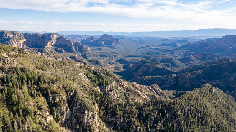
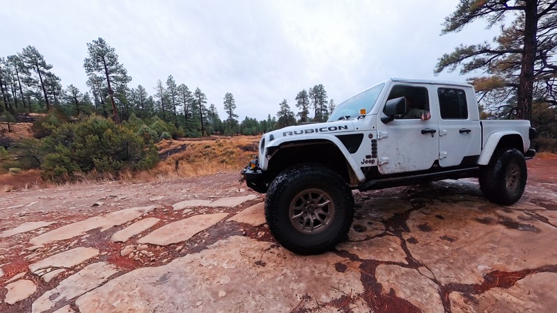
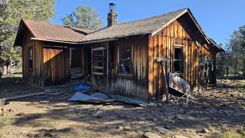
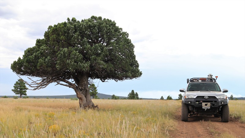
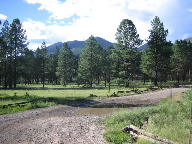
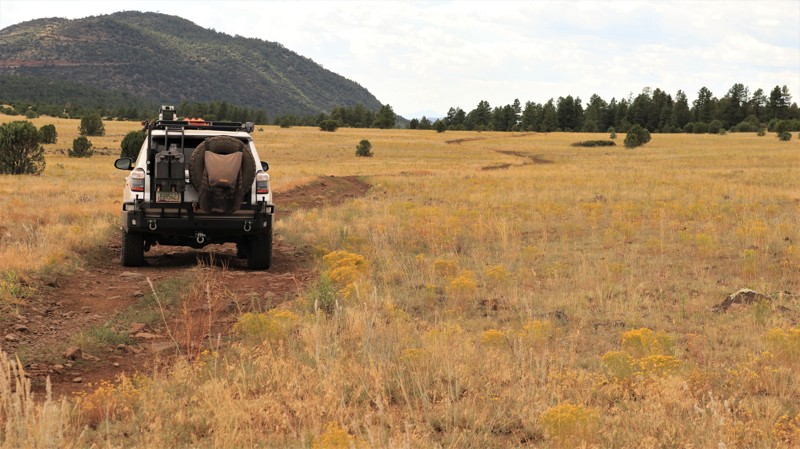
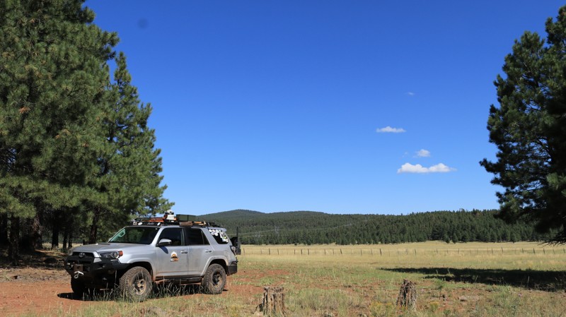
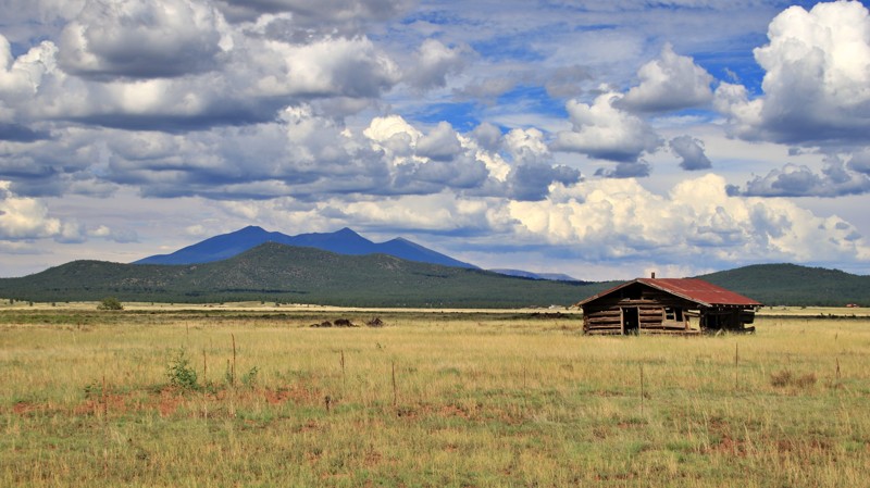
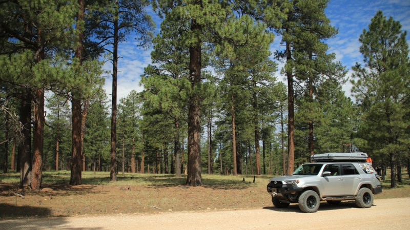
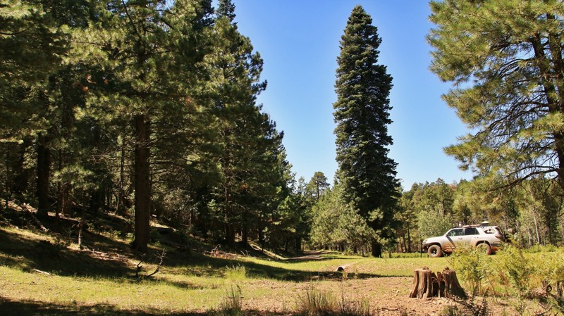
Region

Rim Country - The Mogollon Rim

Arizona

Offroad Trails in Rim Country - The Mogollon Rim

A Region within Arizona
4.2/5 (397)
Overlanding Arizona: Top Trails Near Phoenix on the Mogollon Rim

If you're looking to escape the desert heat, the Mogollon Rim (pronounced "MUG-ee-yon") is the perfect retreat for anyone living in the Phoenix metro area. Just a few hours north, this high-elevation destination offers cooler temperatures, stunning views, and access to the largest contiguous Ponderosa pine canopy in the world—ideal for unforgettable overlanding adventures in Arizona.

Explore the Best Overlanding Trails on the Mogollon Rim

The Rim is a natural wonder stretching across central Arizona, known for its towering cliffs, deep forests, and endless trail options. Whether you're in a rugged 4x4 or a fully outfitted overlanding rig, these are the top three overlanding trails near Phoenix:

  1. Rim Road (Forest Road 300) One of Arizona’s most scenic drives, Rim Road hugs the edge of the Mogollon Rim for nearly 50 miles. This gravel road offers panoramic views, abundant wildlife, and countless dispersed camping opportunities—all surrounded by towering pines.
  2. FR 153A For a more remote adventure, Forest Road 153A offers a rugged, off-the-beaten-path experience. It winds through meadows and dense forest, perfect for those seeking solitude and a challenge. High-clearance vehicles are recommended.
  3. Sycamore Point A short drive off the main routes, Sycamore Point rewards you with sweeping views of Sycamore Canyon—Arizona’s hidden gem. It’s a favorite for sunsets, photography, and quiet reflection.
Plan Your Rim Country Overlanding Adventure

Do not feel limited to just the popular roads and trails. In fact, there are over 900 miles and 80 trails that we have documented, and hundreds of miles of forest service roads left to be explored. You could even overland from Phoenix to Flagstaff if you wanted to! Whether escaping for a weekend or building a longer trip, the Mogollon Rim delivers memorable scenery and ideal overlanding conditions. Before heading out, be sure to check for current fire restrictions and practice Leave No Trace principles. It’s a must-visit for Arizona adventurers looking to trade pavement for pine-scented trails.

Top Reasons to Explore Here
Altitude Category IconAltitude
Beginner Category IconBeginner
Camping Category IconCamping
Desert Category IconDesert
Forest Category IconForest
Ghost Town Category IconGhost Town
Iconic Category IconIconic
Mud Category IconMud
Overland Category IconOverland
Rock Category IconRock
Scenic Category IconScenic
Snow Wheeling Category IconSnow Wheeling
Wash Category IconWash
Water Category IconWater
Trail Types
Scout Route
Full Trail Guide

Preview Trail Icon
Preview Trails
easy
moderate
difficult
severe
extreme

All-Access
Scout Route
Start a 7-day Free Trial

Most Recent Trail Reviews

Most Popular

Search for Trails
Arizona: Rim Road Hero Photo
All-Access Icon
4.9/5 (25 reviews)
Updated: 07/04/2024
Rim Road
Payson, Arizona
You will not even believe you are in Arizona if you drive on the Rim Road. You will travel through two Arizona national forests but this area looks more like Colorado as you travel along at 7,000+ feet all day. In fact, you'll see sights from the rim that are only surpassed by the Grand Canyon and Sedona. Plan on spending a good long day on this road as you'll stop frequently to smell the pine, listen to the wind rustling through the trees, and be stunned by the scenic vistas that await you. Just bought a four-wheeler? Looking for a passenger car appropriate adventure? The Rim Trail has everything you need. Need a cool place to camp? You'll find hundreds of developed, and even more dispersed camping spots in these two forests. Keep a sharp eye out for the abundant elk, and an elusive black bear that inhabit these woods.
Arizona: Woody Mountain Road Hero Photo
All-Access Icon
4.6/5 (30 reviews)
Updated: 04/03/2025
Woody Mountain Road
Kachina Village, Arizona

Situated near Flagstaff, Arizona, Woody Mountain Road is a favorite among campers and sightseers, especially near the end as they venture into the East Pocket area atop the Mogollon Rim and the famed Edge of the World camping area. The places it takes you to are scenic and full of potential. As you head south, you can see a radio tower atop Woody Mountain, then past The Arboretum at Flagstaff and Northern Arizona University Centennial Forest, Coconino County's Rogers Lake, through Mill Park with its scenic meadows, and further south to the top of the Mogollon Rim with incredible views and dispersed camping. There are also a lot of other connecting forest roads and trails that give you access to camping and many great places to enjoy the Coconino National Forest.

Arizona: Anderson Mesa South Hero Photo
All-Access Icon
4.8/5 (7 reviews)
Updated: 01/08/2024
Anderson Mesa South
Mormon Lake, Arizona

Anderson Mesa lies between the vast Ponderosa pine forests at the edge of the Mogollon Rim and the barren badlands and painted deserts of northeastern Arizona. The topography of vast grasslands with a few scattered trees evokes​ Africa's Serengeti more than most people's ideas of Arizona. There are no major roads that cross Anderson Mesa. You have to work to get here. It is one of Arizona's most remote and unvisited landscapes. Forest Road 82 is called Anderson Mesa Road by the locals. Anglers and weekend ATV riders use the ends of this southern stretch to reach Long Lake and Kinnikinnick Lake. The lakes, even modest Cow Lake, are wonders in their own right. Elk, pronghorn, and sometimes eagles are drawn to their reliable water sources. The rough, rocky, suspension-crunching middle section seldom sees anyone save a few lonesome ranch hands or extremely dedicated hunters. The tan savannah grasslands periodically give way to thick juniper forests, forcing the trail to twist, split, merge, and meander before opening again to another broad vista. A sudden outcropping of rough boulders forces you to choose a line. You are more likely to see a dozen elk racing across the two-track in front of you than running across another human.

Arizona: Schultz Pass Hero Photo
All-Access Icon
4.6/5 (19 reviews)
Updated: 08/19/2025
Schultz Pass
Flagstaff, Arizona

The heavily used western portion of the road over Schultz Pass is a scenic and easy trip up from town to the cool pines between Mount Elden and the San Francisco Peaks. This is your ticket to the top of the excellent Schultz Creek mountain biking trail, and to the trailheads of Sunset Trail, Kachina Trail, and Weatherford Trail, three of the best hikes in alpine Arizona. The dispersed camping is also excellent, although limited to a few locations. Since 2010 the less-used eastern half of the road over Schultz Pass has become a world-class tour in the effects of devastating forest fires and in the work required to restore a landscape after these hot all-consuming blazes.

Arizona: Cedar Flat Road Hero Photo
All-Access Icon
4.8/5 (10 reviews)
Updated: 02/05/2024
Cedar Flat Road
Camp Verde, Arizona

Cedar Flat Road is a tale of two trails. On its southern end, the well-behaved road climbs out of the desert to offer camping with views, driving with views and hiking with views. Looking west, the sacred red rocks of Sedona are below you. Mingus Mountain tents horizon due west. Farther south the rugged Bradshaws stand out above the haze. North you catch glimpses of the San Francisco Peaks towering above Flagstaff. Closer in you get a look deep into the canyon of West Clear Creek and Blodgett Basin. The tall stalks of century plants stand sentinel over prickly pears with their crimson fruits. Ocotillo spread their firesticks skyward along the roadside. The daggers of the agaves make you watch your step. And then Cedar Flat Road throws a temper tantrum, all be it a beautiful outburst. The finely graded road becomes a rock-strewn two-track weaving among junipers, testing your tires, your suspension, your kidneys, and your ability to pick a good line. But the rugged beauty of the place, the sudden openings onto wide tree-dotted savannah grasslands, and a short stretch through a pristine pine forest make you forget to keep your eyes on the trail. Apache Maid Mountain begins to appear larger and larger until it looms over the mesa. Too soon, it seems you reach the junction with Apache Maid. You'll want to stop and catch your breath. Nice is good. Naughty is fun. Why not have a little of both?

Arizona: Milk Ranch Point Hero Photo
All-Access Icon
4.4/5 (15 reviews)
Updated: 10/20/2023
Milk Ranch Point
Payson, Arizona

Between 15 and 20 million years ago, a geologic uplift created the rugged and dramatic escarpment we now call the Mogollon Rim. The Rim rises 3000 feet above the Sonoran Desert floor below and marks the beginning of the Colorado Plateau. North of Payson, the scenic pine-forested peninsula known as Milk Ranch Point extends south from the Mogollon. Milk Ranch Point is all about great views and wonderful campsites. At just over 7000 feet elevation, summers are downright cool when compared to the desert below. Campsites right on the edge of the Rim offer amazing vistas of jagged sandstone slopes leading down to the country where Zane Grey based his novels. The distant Matazal Mountains form a jagged horizon. Elk bugle in the early evenings. Sightings of deer and wild turkeys are common. Abert's squirrels scamper around the many shaded campsites. Those more adventurous can take the trail all the way to the southern tip of the Point and enjoy an unparalleled view.

Arizona: Fry Canyon Trail Hero Photo
All-Access Icon
3.6/5 (18 reviews)
Updated: 07/06/2024
Fry Canyon Trail
Kachina Village, Arizona

Situated in the vast ponderosa pine woodlands of the Coconino National Forest, Fry Canyon Trail offers peaceful serenity only minutes from downtown Flagstaff. The numerous designated shady campsites on the western end of the trail make excellent base camps for exploring the area while still providing easy access to all the services found in Flagstaff. The high country abounds with elk, deer, and wild turkey, often seen when hiking one of the many area trails. The road's namesake, Fry Canyon, is a favorite with the canyoneering and climbing crowd. Beautiful red rock Sedona is just a 30-minute drive south through the scenic Oak Creek Canyon. There are plenty of forest roads to explore through the high country pinelands and wide-open prairies. There are even a few gnarly trails to provide offroading challenges for those so inclined. Whatever you are looking for, it isn't far away from the Fry Canyon Trail.

Arizona: Behind the Peaks Hero Photo
All-Access Icon
4.9/5 (21 reviews)
Updated: 06/23/2024
Behind the Peaks
Flagstaff, Arizona

Behind the Peaks is a scenic gem accessible by all kinds of vehicles! In the Spring, there are alpine meadows and wildflowers aplenty. The Fall brings glorious golden aspen on the slopes of the San Francisco Peaks, which dominate the skyline. You’ll have better views of the San Francisco Peaks along this route than anywhere else in the Flagstaff area and without the crowds. This route also provides access to major hiking trails like Bear Jaw, Abineau, Alto Spring, and the Arizona Trail. Like most of Flagstaff, this area is also great for mountain biking.

Arizona: Buck Springs Ridge Hero Photo
All-Access Icon
4.2/5 (6 reviews)
Updated: 09/22/2023
Buck Springs Ridge
Pine, Arizona

Buck Spring Ridge begins at the scenic Mogollon Rim and the iconic Rim Road, one of Arizona's best trails. Running through the eastern portion of the vast Coconino National Forest, the trail first traverses an alpine woodland of spruce, fir, and Ponderosa pines. As the trail descends northward, the spruce and fir fall away, and the pines become smaller because of the rain shadow caused by the Mogollon Rim's massive uplift. Take the time to visit the historic Buck Springs Cabin via the spur trails at Waypoints 5 and 6. These remote cabins, first used by ranchers almost 100 years ago, were summer quarters for fireguards who battled wildfires in this massive forest. The cabins sit on a picturesque mountain meadow that hosts the springs that give this area its name. Deer and elk often graze nearby in the mornings and later afternoons. Descending northward, the trail gets a bit rougher and enters an area burned in the 2018 Tinder Fire. The forest is slowly recovering from the fire, but the new openness allows quick views down into the deep East Clear Creek gorge giving explores a real feel for the true scope and ruggedness of this diverse landscape.

Arizona: Hart Prairie Hero Photo
All-Access Icon
4.8/5 (21 reviews)
Updated: 06/20/2024
Hart Prairie
Flagstaff, Arizona

Forming the west leg of the “Around the Peaks” loop, Hart Prairie Road is an Arizona gem. The eponymous Hart Prairie sits east of Fern Mountain at the midpoint of this drive and offers superb views and the finest ecological beauty in the Flagstaff area. Aspen groves, alpine meadows, springs, diverse terrain, and varied ecosystems flank the trail. Fern Mountain offers a short and beautiful hike with sweeping views of the San Francisco Peaks. The road is also part of the “Hart Prairie Loop” mountain biking trail. Quite a few lucky private property owners, including a youth camp and The Nature Conservancy, enjoy the west slope of the Peaks via this road.

Arizona: Horse Park Road Hero Photo
All-Access Icon
4.1/5 (14 reviews)
Updated: 02/11/2024
Horse Park Road
Mountainaire, Arizona

Roads and trails in this area are often named after early pioneers or important geographical features along the way. Alpine meadows are called parks in local parlance. Horse Park Road draws its name from a particularly picturesque meadow, one of three along this easy scenic drive. Horse Park Road begins just south of Flagstaff in the bedroom community of Mountainaire. The well-maintained road travels through an OHV area ripe with interesting ATV tracks. There are seemingly countless campsites along the trail, many located near the three parks. Combine those two attributes with the native beauty of the pine-forested Coconino National Forest, and you have a top-rated destination on weekends. If you are looking for fun and a chance to meet up with other offroad enthusiasts, Horse Park Road might just be the path you want to follow.

Arizona: FR 226 Hero Photo
All-Access Icon
3.5/5 (12 reviews)
Updated: 06/07/2024
FR 226
Flagstaff, Arizona

Immediately you are ensconced in tall pines and an abundance of campsites. That's just what you'd expect from a well-groomed trail in the Coconino National Forest with easy access off the interstate. But just a few miles into Forest Road 226, you begin to find silence broken only by the wind singing a soothing melody in the tops of the Ponderosas and the crunch of your tires on the dirt. Squirrels scamper across the road, and that might have been an elk in the shadows watching you pass by. At picturesque Bar M Canyon, named for an old ranch that once operated in the area, is an unexpected one-lane bridge. Just beyond the bridge is a campsite snuggled up to the canyon. An enterprising camper cut large pine logs into camp furniture fit for Paul Bunyan. The site makes for a cozy overnight camp or perhaps just an amusing and timely picnic spot. With links to a complete network of other fun trails, Forest Road 226 might be a pivotal segment of a longer overland journey. But even alone, it is worth checking out.

Arizona: Apache Maid Hero Photo
All-Access Icon
5/5 (9 reviews)
Updated: 02/05/2024
Apache Maid
Mormon Lake, Arizona

Historians agree that during the area's pioneer days, an incident involving an Apache girl made her a local legend. The specifics are lost to time, but the name Apache Maid has been applied to a mountain, a ranch, a cabin, a road, and the area in general. Apache Maid Ranch was owned by the Babbitts, a prominent northern Arizona family that created a mercantile company, numerous local leaders, and a Senator. The Apache Maid road travels through the center of today's geography and the era's history. In the east, Apache Maid winds through the tall, stately ponderosa forest that dominates the vast Coconino National Forest. As the road loses elevation, the pines give way to scattered juniper, canvas-tan grasslands, and beautiful views. The Apache Maid cabin, an old ranch house, sits up a short lane. With its fire watchtower, Apache Maid Mountain looms over the trail's western end. With plenty of camping available and a trail offering a few challenges, Apache Maid makes for a great Arizona wheeling experience.

Arizona: Back Road to Lockett Meadow Hero Photo
All-Access Icon
5/5 (9 reviews)
Updated: 06/20/2024
Back Road to Lockett Meadow
Flagstaff, Arizona

Located on the eastern slope of the San Francisco Peaks in the Coconino National Forest north of Flagstaff, this is the fun "Back Road" to get to Lockett Meadow, one of the most scenic destinations in Arizona! If the trail is open, and that's a big if, in this case, this is a very enjoyable, mildly challenging, lightly traveled, and scenic trail with a great view of Sunset Crater and the Cinder Hills. On a clear day, from the right vantage point, you can see the eastern edge of the North Rim of the Grand Canyon and the Vermillion Cliffs. Even better, the camping higher up is scenic and lightly used.

Arizona: FR 301 to Fisher Point Trailhead Hero Photo
All-Access Icon
4.3/5 (22 reviews)
Updated: 07/10/2024
FR 301 to Fisher Point Trailhead
Flagstaff, Arizona

FR301 is a dirt road trail that will take you under an hour out and back, and it starts right at the city limits of Flagstaff! This is great for a quick family outing or to get in a hike when you're on the east side of Flagstaff. The mudding is good after a soaking rain or when the snow is melting (avoid this trail in-stock vehicles when it's wet!). At the end of the guide's trail you'll find parking and a USFS trailhead for a nice half-mile hike to Fisher Point with epic views of Walnut Canyon. FR301 is a more interesting drive and a quicker hike to the canyon than the Arizona Trail trailhead, located a mile east down Old Walnut Canyon Road. You are likely to see Elk along FR301 or FR301D during their migration season, especially in late fall and early winter. This area is heavily affected by bark beetles; you can hear them work on the trees in the summer if you are quiet.

Arizona: Buckhorn Cabin Hero Photo
Scout Route Icon
4/5 (4 reviews)
Updated: 09/04/2025
Buckhorn Cabin
Wingfield, Arizona
Running along the remote northern rim of West Clear Creek Wilderness, Buckhorn Cabin uses multiple trails through dense forest and wide open prairies. Take your time crossing this pristine landscape, where elk, pronghorn, and deer are abundant. Stop at the old cabin to enjoy how well it's been preserved. The trail is ideal for those wanting to get off of the area's groomed trails. This route requires 4x4, durable tires, and high clearance. You'll find numerous secluded campsites for the night or to stay for a few days to hike down into West Clear Creek Canyon, one of the best wet-hiking experiences in the United States
Arizona: Battleground Ridge Hero Photo
All-Access Icon
4.8/5 (7 reviews)
Updated: 01/08/2024
Battleground Ridge
Payson, Arizona

In 1882, White Mountain Apache warriors, led by Na-tio-tish, got into an altercation with and killed several policemen in San Carlos, Arizona. Eighty warriors, chased by U.S. cavalry, crossed the Tonto Basin and climbed onto the Mogollon Rim. They laid a trap for the pursuing cavalry on a rugged side canyon of East Clear Creek. The cavalry's scout ferreted out the trap. The fight raged for an afternoon until a severe afternoon thunderstorm halted hostilities. The warriors escaped in the night and returned to the reservation, leaving behind 20 dead Apaches, with two dead and six wounded among the cavalry troops. Nearly lost to history, today, a lonely marker stands on the site, and the entire area is called Battleground Ridge. Battleground Ridge, also known as FR 123, is a distinctive trail for two reasons. First is the obvious connection to the obscure bloody battle fought here. Secondly, an aqueduct that pumps water from the C.C. Cragin Reservoir down to Payson runs along a portion of the trail. You can see the roadside access points; round metal covers every hundred yards along the trail. A small power line brings electricity to the pump station near Waypoint 10. But take a step away from both the history and the modern, and you overwhelmingly sense the remoteness of this place deep in the uplifted country of the Mogollon Rim. The wind, as it always has, sings through the upper branches of the tall Ponderosa Pines. Elk bugle on the ridges and down in the deep canyons. Flocks of shy wild turkeys scratch the forest floor for a meal. Gazing across the deep canyon at the trail's end to the distant forest-blanketed ridgelines of this wild landscape, both the past and present seem very far away.

Arizona: Marshall Lake Hero Photo
All-Access Icon
4.2/5 (12 reviews)
Updated: 05/17/2024
Marshall Lake
Flagstaff, Arizona

On FR128 to Marshall Lake, or the "South of Walnut Canyon," you will discover Boondocking and ATV heaven, with scattered views of the San Francisco Peaks! There are many side roads and dispersed campsites accessible to more robust RVs and trailers for camping. Usage on the trail's northern end close to I-40 is low even during peak season when the rest of Flagstaff is bonkers.

Arizona: Control Road Hero Photo
Scout Route Icon
4/5 (4 reviews)
Updated: 10/18/2024
Control Road
Pine, Arizona
Located in the vast Tonto National Forest, Control Road runs under the massive geologic uplift known as the Mogollon Rim. The road traverses a pine and juniper forest. This area is the setting for many classic western tales by famed writer Zane Grey. Numerous dispersed campsites are scattered along this easy trail.
Arizona: Crimson Road Hero Photo
All-Access Icon
3.8/5 (6 reviews)
Updated: 01/05/2024
Crimson Road
Flagstaff, Arizona

In its day, Crimson Road was the main thoroughfare between Flagstaff and the Mormon Lake area. Bypassed by the paved Lake Mary Road, today it simply transports you quickly into the magnificent ponderosa pine woodland that is the heart of the 1.8 million-acre Coconino National Forest. The well-maintained road meanders gently along the contours of an otherwise rugged landscape. After 11 miles, the forest gives way to Antelope Park, a large alpine meadow at an elevation of 7,000 feet. The meadow begs you to camp along its wooded edges to watch elk, deer, and pronghorn graze early and late in the lazy day. Crimson Road leaves the open meadow, plunging back into the forest and Newman Canyon. The road passes a picturesque old cattle corral, unused these days. Before you are ready, the road deposits you back onto the pavement.

Arizona: Clover Springs Hero Photo
All-Access Icon
4.4/5 (11 reviews)
Updated: 10/20/2023
Clover Springs
Payson, Arizona

Clover Springs is a tale of two trails, and thus more interesting. One part of the trail is as rough as a corncob enema. The other portion is as silky smooth as your grandmother's buttermilk pie. Turning off Highway 260 onto the west end of the trail brings you almost immediately into some fun little obstacles. Most have several choices of lines. Decisions based on your rig's unique characteristics may leave you scratching your head. They aren't overly difficult, just enough to make it fun and interesting. In a few places, erosion has cut nice washouts, which will test the level of travel in your suspension. Bone-jarring sections of trail consist of nothing more than cannonballs and larger-sized rocks jarring your rig, you, and everything else. There are a few bypasses. Just when you have had enough, the trail becomes as easy as pie. Clover Springs becomes a stroll through a huge Ponderosa Pine studded park. Deer, elk, javelina, turkey, and the occasional cow may cross the road in front of you or be lurking in the brush nearby. Wonderful campsites beckon you to slow down and spend some time around a campfire. So what's it gonna be? Corncob? Pie? Why not both?

Arizona: Bar M Road Hero Photo
All-Access Icon
4.2/5 (10 reviews)
Updated: 02/11/2024
Bar M Road
Munds Park, Arizona

A drive along Bar M Road takes you back in time. On the east end, the hundred-plus-year-old Brolliar Cabin sits on the edge of an alpine meadow. Born in Iowa, David Brolliar built his one-room cabin in 1911 and raised cows and crops on the prairie now known as Brolliar Park. He lived there alone until his death in 1938. Today, the cabin is a great spot to watch elk, deer, and pronghorn grazing on the park. A small pond beside the cabin often hosts migratory geese. The cabin is a short walk from the road. Farther west along the trail, ranchers use the forests and parks for summer grazing, just as they have for the last century. Branded cattle roam wild until the fall roundup when they are moved to lower elevations and winter pastures. The road nostalgically passes an old corral, battered and worn but still in use. Take a drive back in time on the Bar M. The road is a little bumpy, but so is the region's history.

Arizona: Casner Park Road Hero Photo
All-Access Icon
4.5/5 (7 reviews)
Updated: 08/12/2023
Casner Park Road
Munds Park, Arizona

Casner Park Road is named, like many of the original roads in the area, for the broad grassy meadow along which it meanders just a few miles out of town. Here beautiful alpine meadows are called parks. Casner Park and Bert Lee Park, which the trail briefly passes later, are named for the hardy pioneer families who settled nearby. Casner Park offers broad vistas, and numerous shady campsites are nestled in the pines along its edge to enjoy those views. There are many campsites along the trail, and it's a favorite summer weekend destination for desert dwellers escaping the heat, enjoying the forest beauty, and happily parading every kind of ATV imaginable. The trail climbs enough that fir, spruce, and a few aspens line the road before dropping back down a bit. The final curve in the trail delivers an almost shockingly unexpected view across the 3-mile diameter Mormon Lake, a sometimes lake, most times grassy meadow.

Arizona: Elden Lookout Road Hero Photo
All-Access Icon
4.2/5 (9 reviews)
Updated: 06/20/2024
Elden Lookout Road
Flagstaff, Arizona

This route is short and sweet. Elden Lookout Road winds steeply up the west flank of Mount Elden, the 9000-foot mountain around which wraps Flagstaff and Route 66. From the peak, the views are excellent. It’s a nice place for a picnic or stargazing. The summit can be windy, especially in Spring. The real highlight and reason most use this road is the collection of hiking trails and mountain biking singletracks that crisscross the mountain. The trails include Elden Trail, Sunset Trail, Brookbank Trail, Rocky Ridge Trail, Oldham Trail, and more. Mount Elden is a frequent host of professional mountain bike races. Unfortunately, the 2019 Museum Fire burned much of this route, so it is now a monument to the damage of a forest fire and the catastrophic debris floods that often result. In 2019 the Museum Fire was the worst early-season fire in the country and attracted a large number of airborne firefighting assets. The fire nearly burned into the City of Flagstaff.

Arizona: Sheep Springs Road Hero Photo
All-Access Icon
5/5 (5 reviews)
Updated: 09/03/2022
Sheep Springs Road
Mormon Lake, Arizona

Sheep Spring Road leads into the heart of the vast and beautiful Coconino National Forest. Lined with ponderosa pines and the occasional aspen grove, the often bursts onto expansive alpine meadows, called parks by the locals. Sheep Springs Road traverses three large parks; Tie, Brolliar, and Long. These are favorite haunts of elk, mule deer, and pronghorns. The occasional flock of wild turkeys may cross the road as well. Both Brolliar and Long Park host historic log cabins. The Brolliar Park cabin was built in 1911 and is currently being restored. The Long Park cabin is two rooms and is in ruins but it remains an interesting glimpse into the history of the area. Sheep Springs Road is a fun and scenic drive, but stop and get out of your rig. Listen to the wind singing in the top of the pines, a distant elk bugling, and jays squawking in the trees. Life is good in the Coconino.

Arizona: Camp Two – Wild Bill –  Kendrick Hero Photo
All-Access Icon
3.9/5 (14 reviews)
Updated: 12/18/2024
Camp Two – Wild Bill – Kendrick
Flagstaff, Arizona

Located a short distance west of Flagstaff, Camp Two – Wild Bill – Kendrick is a popular forest road that winds its way from I-40 to the Kendrick Peak Wilderness, passing the famous Lava River Cave. With abundant RV-accessible dispersed camping and dozens of connecting forest roads, this trek through the Coconino National Forest is a bustling summer route through lush pine forests and open meadows offering excellent hiking opportunities. The Lava River Cave is a difficult but manageable one-mile hike down under the pine forests. It is cold in the cave, so bring a jacket! Kendrick Peak is another popular hike in the area, that is a moderately difficult 9-mile round trip rewarding users with the best views of the San Francisco Peaks.

Arizona: Lockett Meadow Hero Photo
All-Access Icon
5/5 (22 reviews)
Updated: 06/20/2024
Lockett Meadow
Flagstaff, Arizona

The very popular Lockett Meadow Road takes you to the roof of Arizona, the San Francisco Peaks! You'll swear you are in the alpine Rockies. RVs camp on the lower sections. Folks picnic and camp at Lockett Meadow Campground. The end of the road has a hiking trailhead for the Inner Basin Trail. A fall hike into the Inner Basin of the San Francisco Peaks, the massive caldera of an ancient volcano, takes you through a tunnel of golden aspen. The cool mountain breezes make it easy to forget you are in Arizona.

Arizona: FR 518 Hero Photo
All-Access Icon
4/5 (3 reviews)
Updated: 08/23/2022
FR 518
Flagstaff, Arizona

Located just outside Flagstaff in the Coconino National Forest, FR 518 provides easy access to fantastic camping and scenic forest trails. Travelers en route to the Grand Canyon or just passing through on I-40 or the old Route 66 will appreciate the peaceful campsites afforded by this well-maintained forest road. The sound of the wind in the tall Ponderosa Pines will quickly erase the stress of a day on the road. Listen carefully, and you might hear a bull elk bugling from somewhere deep in the forest. While Flagstaff is only a few minutes away, you'll feel like you are a million miles from the hustle and bustle of city life. Whether spending one night or staying for the 14-day camping limit, this trail is a great place to unwind.

Arizona: Apache Maid Lookout Hero Photo
All-Access Icon
5/5 (8 reviews)
Updated: 07/15/2023
Apache Maid Lookout
Camp Verde, Arizona

The Apache Maid fire tower arguably has the best views in central Arizona. Be kind to the fire watch in the tower, and you will likely receive an invitation to the top. Getting there requires climbing the 30-foot scaffold holding up the tower's cab, and negotiating over 2 miles of narrow shelf road. The views are definitely worth the effort. From the summit of Apache Maid Mountain at 7301 feet, the entire topography of the heartland of Arizona surrounds you. Vistas of pine forests, open grassland meadows, the San Francisco Peaks north of Flagstaff, the red rocks of Sedona, the Mogollon Rim, and Mingus Mountain all lay at your feet. Both the road and the tower were completed in 1961. The drive up switchbacks along the southern side of the mountain provide stunning views at each turn. A picnic table at the summit makes for a sweet place to grab a bite. Enjoy!

Arizona: East Clear Creek Hero Photo
All-Access Icon
4.6/5 (11 reviews)
Updated: 10/28/2023
East Clear Creek
Pine, Arizona

East Clear Creek serves as the gateway to the heart of the wild and wonderful Mogollon Rim area of the vast Coconino National Forest. The road draws its name from its crossing of the picturesque mountain stream of the same name. The stream's deep canyon, with its soaring sandstone cliffs, is a perfect natural barrier and only one road crosses it. The East Clear Creek crossing offers a chance for the kids to splash in the shallow water and chase crayfish under rocks. Anglers hike along the stream locating deeper pools in search of trout. Beyond the crossing, a variety of fantastic adventure opportunities await. The Cabin Loop, a series of interconnected trails, is one of the top backpacking destinations in Arizona because of its beauty and the sheer number of reliable springs along the route. Campsites set among the pines, fir, and spruce provide a basecamp for exploring down into canyons or driving the seemingly endless maze of forested trails. It's almost a certainty you will see elk and lots of them during your time along this trail and all the smaller roads and trails that branch from it. Finally, the road drops you off near the vertical precipice of the Mogollon Rim, 3000 feet above the northernmost reaches of the Sonoran Desert below. The views from atop the Rim are truly inspirational. Snagging a campsite right on the edge of the Rim is a highly unique experience. East Clear Creek is indeed the gateway to this amazing section of the Mogollon Rim, a virtual magic carpet to adventure. Take a ride on it and see what adventure you can find.

Arizona: Lost Eden Hero Photo
All-Access Icon
3.7/5 (5 reviews)
Updated: 06/18/2022
Lost Eden
Payson, Arizona

With a name like Lost Eden, you know the area has to be something special. The name is derived from an old homestead and ranch of the same name near Todds Draw, south of the current Lost Eden road. The remains of the ranch still exist but are on a small plot of private land. Today, far more visitors roam the area than in the old ranching days. Lost Eden is a popular playground for the outdoorsy. Summer weekends find the road lined with campers, often in large impromptu villages. ATVs full of happy smiling faces parade the main road. If the exuberant crowds aren't your thing, blissful solitude can be quickly found along some of the more challenging side trails. The stately Ponderosa pines and occasional open grassy valleys offer lots of chances to see elk and other area wildlife. No matter what your idea of Eden might be, you can find it on Lost Eden.

Arizona: Stoneman Lake Road Hero Photo
All-Access Icon
2.5/5 (9 reviews)
Updated: 02/07/2024
Stoneman Lake Road
Camp Verde, Arizona

Located in the beautiful Coconino National Forest, Stoneman Lake Road begins in a juniper and scrub pine forest on the west end and climbs steadily into towering Ponderosa pine forests, Gambel oaks, and grassy alpine meadows. Elk, deer, turkeys, coyotes, and the occasional black bear all reside in the area and are often spotted along the drive. Stoneman Lake is an 8 million-year-old geological oddity, a large bowl-shaped depression that holds rainwater and snowmelt. More a marsh than a lake, geologists disagree on whether it is the caldera of a small volcano or a sinkhole. KT Ranch is a highlight of this trail. Its bucolic pastoral setting evokes every kid's dream of being a cowboy. An active ranch, its cattle graze on the expansive open meadows and laze under in the shade of old-growth pines. Stoneman Lake Road is a wonderful place to escape the desert's summer heat for some relaxed camping and enjoy all this beautiful area has to offer.

Arizona: FR 195 - Tonto National Forest Hero Photo
All-Access Icon
4/5 (8 reviews)
Updated: 06/04/2024
FR 195 - Tonto National Forest
Payson, Arizona
If camping and exploring trails in the pines with your 4x4 sounds like a great time, then this would be the spot to start. Camping in this area makes for a great starting point for exploring the Arizona Mogollon Rim country near Payson, Arizona. The trail is easily accessible from FR64, Control Road and located near the East Verde Creek at Verde Glen. All within an easy trail ride from camp, you can hunt geodes at Brody Hill, rock crawl Pyeatt Draw or go for a hike on the Highline Trail #31. Along this route you can visit an old recreation site where the foundations and walkways are barely visible. The trail has many beautiful dispersed campsites along the way, the one at the end is below the Mogollon Rim, also allowing access to the Highline Hiking Trail.
Arizona: Old Walnut Canyon  Hero Photo
All-Access Icon
2.8/5 (4 reviews)
Updated: 12/31/2023
Old Walnut Canyon
Flagstaff, Arizona
Where else can you get in 4x4 (on FR301), a national monument with cliff dwellings, a beer and sandwich on the patio of the country club’s restaurant, prime mountain biking and hiking (Arizona Trail, Fisher Point, Walnut Canyon), and golf, all within a few miles and right off a major interstate? There are hotels at the I-40 / Country Club interchange. So if you find yourself on I-40 on the east side of Flagstaff, consider taking a detour for a couple of hours to avail yourself.
Arizona: Kinnikinnick Road Hero Photo
All-Access Icon
4/5 (4 reviews)
Updated: 06/05/2022
Kinnikinnick Road
Mormon Lake, Arizona

Spanning two very unique ecosystems in the vast Coconino National Forest, Kinnikinnick Road is a very scenic route. While the southern section sees many visitors on their way to Kinnikinnick Lake or simply to camp among the majestic Ponderosa Pines, the northern half is less traveled. Typically only ranchers and hunters venture up onto the wide-open grasslands of Anderson Mesa. However, the solitude offers a peaceful opportunity to contemplate the amazing views of the San Francisco Peaks in the distance or the tall grasses and wildflowers swaying in the cool breezes. While Kinnikinnick Road is a worthy destination on its own, those with a penchant for traveling longer distances on dirt can connect to FR 126 in the north and Anderson Mesa South to create quite the adventure. Given the many offshoots from Anderson Mesa South, a variety of all dirt routes from Interstate 40 south to Camp Verde become possible. Taken in that light, Kinnikinnick Road becomes the linchpin for classic overland adventures.

Arizona: Dane Ridge Hero Photo
All-Access Icon
4/5 (5 reviews)
Updated: 09/22/2023
Dane Ridge
Pine, Arizona

Located in the eastern reaches of the vast Coconino National Forest, Dane Ridge cuts through a deep forest of Ponderosa pines. Near the higher southern end of the trail, spruce and fir trees join the pines evoking an alpine forest more reminiscent of Colorado than Arizona. Elk, deer, and turkey sightings are commonplace along the delightful track. As its name implies, Dane Ridge rides along the ridgeline between Dane Canyon on the west and Yeager Canyon on the east. The ridge narrows in several places where travelers are simultaneously looking down the wooded slope of each canyon. A highly recommended side trip is to Dane Springs and Dane Cabin. At Waypoint 5, FR 321A goes off west to some fantastic camping and a small parking lot with a wood rail fence. A short hike west down into Dane Canyon ends at Dane Spring and the remnants of Dane Cabin. The spring, flowing from under a huge boulder, is one of the most reliable and tastiest water sources in the area. The spring has been boxed and now flows out a short pipe. The cabin nearby was once the Fall hunting base for renowned western novel author Zane Grey. Dane Ridge ends at the iconic Rim Road and a spectacular view off the edge of the Mogollon Rim. There are several campsites nearby right on the edge of the Rim for a night under the stars where you feel like you are on top of the world.

Arizona: Mahan Ranch Hero Photo
All-Access Icon
4.5/5 (4 reviews)
Updated: 06/05/2022
Mahan Ranch
Mormon Lake, Arizona

Mahan Ranch starts in the pristine Ponderosa pine woodlands of the Coconino National Forest. The road skirts the forested southern slopes of Hutch Mountain before passing through a section of private property, once the headquarters of the namesake Mahan Ranch. Today the cattle you see grazing summer pastures belong to the Apache Maid ranch, one of Arizona's earliest and most storied ranching operations. Periodically the pines give way to flowery alpine meadows, parks in local parlance. The road is smooth and well-traveled, but that will change. The intersection with Bargaman Park marks a change in the road. At first, the trail just seems narrower. Then the dirt surface turns to a jumble of rock. Then comes the embedded boulders. Loose items in your vehicle begin a journey of their own. Cattle watch you pass with a bit of surprise. Don't despair. It gets a little better after two miles of testing the quality of your dental fillings. Mahan Ranch breaks out onto Anderson Mesa, leaving the pine forest behind in favor of more open savanna grasslands with long views of mountain promontories far away. Here the trail is abasic two-track snaking out ahead. Tall grasses swipe the undercarriage of your vehicle. Cresting a ridge, picturesque Pine Tank leaps into your view. The beauty of Anderson Mesa makes you forget the rough rocky trail behind you. But don't worry, you will be reminded again. Unfortunately, Mahan Ranch, despite what maps may show, comes to an inglorious end at a sign informing the traveler of a locked gate ahead. The gate serves to protect a fragile habitat used by the more permanent residents of the area. The unused roadbed can be traversed on foot. The reverse route back does require enduring the rough section, but the adventure is definitely worth the price.

Arizona: Little Elden Springs Hero Photo
All-Access Icon
3.6/5 (10 reviews)
Updated: 01/07/2025
Little Elden Springs
Flagstaff, Arizona

Located in Flagstaff and the Coconino National Forest, Little Elden Springs Road is a short useful connector road up the eastern flank of Mount Elden. It is the faster way to the high-elevation hiking trailheads and mountain biking off Schultz Pass. There is also access to horse trails along Little Elden Springs Road, and a fun rock garden for kids to play on at Waypoint 4.

Arizona: FR 164B Canyon Loop Hero Photo
All-Access Icon
3.2/5 (13 reviews)
Updated: 06/20/2024
FR 164B Canyon Loop
Flagstaff, Arizona

Canyon Loop, FR 164B, is a good place for dispersed trailer camping, and a good place to do some forest restoration tourism. This dirt road, while rough, offers abundant dispersed camping for your RV, trailer, or out of your car, without crowding or fees. The setting is the beautiful Ponderosa Pine forest of the Coconino National Forest. The forest is undergoing restoration under the Fort Valley Restoration Project, and you will have a chance to see your tax dollars at work improving the health of this once-overgrown forest. It's not the most choice camping destination in Flagstaff, but it is free, uncrowded, conveniently located by Snowbowl, and easily accessible. And if you're feeling adventurous, this is a great way to cut the corner from US-180 to Snowbowl Road, adding half an hour of time but making the drive more interesting. As a bonus, you'll have access to the Fort Valley Trail and the Moto Trail, which are good places to mountain bike and which connect with the Arizona Trail.

Arizona: Blue Ridge Reservoir Hero Photo
All-Access Icon
4/5 (5 reviews)
Updated: 10/28/2023
Blue Ridge Reservoir
Pine, Arizona

Large bodies of water in Arizona are rare and wonderful. Blue Ridge Reservoir sits high in the Coconino National Forest pine woodlands in the deep canyon formed by East Clear Creek. A few years ago, the lake was renamed C.C. Cragin reservoir when water rights management changed hands. But the signage and all the locals still call it Blue Ridge. Wonderful camping and hiking opportunities dot the trail leading to the reservoir. But the lake is the main draw. Anglers come to try their luck since the waters are regularly stocked with rainbow, brown, and brook trout. Colorful canoes and kayaks ply the lake's cold water. Paddlers often see elk and deer watering on the shoreline. Beyond the boat ramp facilities, the road gets a little rougher and less traveled as it winds around the lake towards the dam that blocks East Clear Creek to form the deep narrow reservoir. At the trail's end, a short walk along the lake leads to great views of the dam and its complex jigsaw-puzzle spillway. Come for the lake views, fishing, paddling, and even a campfire under starry skies. Blue Ridge has a lot to offer.

Arizona: 9129D to Alto Spring Hero Photo
All-Access Icon
4.2/5 (8 reviews)
Updated: 06/20/2024
9129D to Alto Spring
Flagstaff, Arizona

Hunting! This is the main reason you’ll be using FR 9129D. Alto Spring is a game hotspot​ (in wet years) and excellent hunting territory. During the Fall, the aspens turn golden. You’ll also find many prime campsites on side trails, with great views of the Peaks. If the snow flies early, this is a tremendous snow-wheeling road.

If you come at other times of the year, you’ll be able to hike, mountain bike, or snowshoe, and you’ll have the place entirely to yourself due to that locked gate. This is an excellent spot for a short overnight backpacking trip when the gate is closed during the summer.

Arizona: Wing Mountain Road Hero Photo
All-Access Icon
3.3/5 (4 reviews)
Updated: 08/23/2022
Wing Mountain Road
Flagstaff, Arizona

Wing Mountain Road is all about camping among the Ponderosa Pines of the Coconino National Forest in Arizona's high country. Just north of Flagstaff, the area is perfect for campers headed to the Grand Canyon, traveling I-40, attending Overland EXPO West, or just wanting to get away. There are dozens of great campsites along Wing Mountain Road. Ravens and blue jays will undoubtedly take note of where you choose to camp. In the Fall, you'll hear elk bugling. Named for the cinder cone volcano just south of the road, Wing Mountain Road cuts through the largest Ponderosa Pine forest in North America. You'll see plenty of old stumps. When the Atlantic and Pacific Railroad reached Flagstaff in 1882, numerous lumber yards sprung up. The mills heavily harvested the virgin pine forest. They shipped lumber by rail as far away as Albuquerque and Los Angeles. The stumps of the cut trees remain, but there are ancient Ponderosa Pines still residing in the forest. The bark of young pines is black. Once reaching a hundred years old, the Ponderosas have an orange-yellow color to their bark. Loggers differentiate the two by calling them "blackjacks" and yellow bellies." The wind in the tops of the pines sings a very relaxing song. Stop and take a listen.

Arizona: FR 141 Hero Photo
All-Access Icon
4/5 (3 reviews)
Updated: 06/05/2022
FR 141
Payson, Arizona

FR 141 is a beautiful drive that cuts through the heart of the Mogollon Rim high country. Located in the vast Coconino National Forest, the trail provides easy access to Rim Road with its stunning views atop the massive geologic uplift that forms the boundary between the Colorado Plateau and the Sonoran Desert. The trail crosses grassy prairies, deep Ponderosa pine forests, and several canyons. With an elevation above 7,000 feet, FR 141 is in one of the few areas of Arizona that experiences a true four seasons. Summers are mild, and the trail offers lots of camping opportunities for those fleeing the scorching desert heat below. Fall brings scattered color with aspens, oaks, and maples on the canyon floors. It is also the season that attracts hunters to the largest elk herd in the U.S. Deer and wild turkey are also plentiful and often seen as you drive the trail. Winter can deliver a thick carpet of snow to the area, ensuring a wonderfully green Spring. Enjoy the beauty of the area as FR 141 transports you from pavement to a myriad of opportunities to explore the Arizona high country.

Arizona: Dry Dude Creek Hero Photo
All-Access Icon
5/5 (5 reviews)
Updated: 06/05/2022
Dry Dude Creek
Payson, Arizona
If camping and exploring trails in the pines with your 4x4 sounds like a great time, then this would be the spot to start. Camping in this area makes for a great starting point for exploring the Arizona Mogollon Rim country near Payson, Arizona. The trail is easily accessible from FR64, Control Road, and located near the East Verde Creek at Verde Glen. All within an easy trail ride from camp, you can hunt geodes at Brody Hill, rock crawl Pyeatt Draw, or go for a hike on the Highline Trail #31.
Arizona: Freidlein Prairie Hero Photo
All-Access Icon
4/5 (17 reviews)
Updated: 06/20/2024
Freidlein Prairie
Flagstaff, Arizona

Freidlein Prairie provides the closest motorized access to the Kachina Peaks Wilderness and Kachina Trailhead and fourteen high-elevation designated campsites. Views of the peaks are limited by the beautiful alpine forest. Mexican Spotted Owls, a protected species, live in the area, and the campsites are closed for their breeding season. For those visiting the Snowbowl ski resort on the west side of the peaks for activities in the summer, access to 522 is located conveniently halfway up Snowbowl Road. The hiking trailhead parking lot at the end of Freidlein Prairie is within a few hundred yards of the Kachina Wilderness boundary and the demanding but enjoyable Kachina Trail.

Arizona: Dick Hart Ridge Hero Photo
All-Access Icon
4.7/5 (5 reviews)
Updated: 06/01/2024
Dick Hart Ridge
Pine, Arizona

Dick Hart Ridge, also called FR 139, is set in the Ponderosa pine forest atop the Mogollon Rim in the vast 1.856-million acres Coconino National Forest. The road crosses three of the five hiking trails that constitute the Cabin Loop, one of Arizona's preeminent backpacking destinations. Dick Hart Ridge ends at the Mogollon Rim and Rim Road, one of the most scenic and storied offroad drives in Arizona. The views from the Rim's 3000-foot escarpment are simply breathtaking. The road is set on a prominent ridge named after a stockman who operated a sheep shearing facility on the east side of the spine, thus becoming Dick Hart Ridge. A separate trail ran east/west to the shearing shed set by a spring in a small canyon. One of the men at the shearing plant was so accomplished with his scissors that locals came to him for a haircut, earning the canyon and trail the moniker Barbershop which still is used today. The southern end of Dick Hart Ridge climbs above 7000' and receives a good deal of rainfall. The forest here is still primarily pines, but stands of fir and spruce mix in as well. Elk, deer, bear, turkeys, and a few million squirrels call this primordial forest home. You will definitely see the squirrels, and likely see some elk. Keep your eyes open, and who knows what else you might see along Dick Hart Ridge.

Arizona: Bargaman Park Hero Photo
All-Access Icon
4/5 (3 reviews)
Updated: 01/08/2024
Bargaman Park
Mormon Lake, Arizona

Located in the expansive and beautiful Coconino National Forest, Bargaman Park is a small jewel. The trail packs a lot into its five miles and connects with FR 109 and Mahan Ranch. Traversing a forest of stately Ponderosa pines, the easy trail passes the edge of its namesake, the beautiful Bargaman Park meadow. This open grassy plain is prime grazing for the free-range cattle that spend their summers here. But don't be surprised to see elk and pronghorn along the edges of the meadow, either. They will mostly be out in the early mornings or late afternoons. Wildflowers dot the park as well. Emerging in Spring, they last almost all Summer. Whether camping at any of the numerous dispersed sites along the trail or just taking a sightseeing drive, Bargaman Park is a gem of a trail.

Arizona: Wallace Hero Photo
Scout Route Icon
5/5 (1 reviews)
Updated: 10/15/2024
Wallace
Whitted Place, Arizona
Wallace runs through the beautiful Sitgreaves National Forest. Portions of the trail are park-like, with tall Ponderosa pines shading the forest floor. To the north, the pines give way to juniper studded grasslands. There are numerous large shaded dispersed campsites scattered along the trail. Most will support multiple rigs of any size, tent camping, and hammocks. After exiting Sitgreaves National Forest, the road becomes Highway 87 to Winslow, providing a nice northern entry into the beautiful Mogollon Rim country of central Arizona.
Arizona: Deer Lake Hero Photo
Scout Route Icon
4/5 (1 reviews)
Updated: 10/15/2024
Deer Lake
Christopher Creek, Arizona
Deer Lake passes through park-like Ponderosa Pine woodlands in the Sitgreaves National Forest. The trail connects Rim Road in the south to Heber Mormon Crossing in the north. The trail's southern end is part of the Rim Lakes Recreation Area, where camping is only allowed in numbered campsites. As the trail goes north, other camping opportunities abound, and the landscape slowly morphs into a juniper grassland.
Arizona: FR 228 Hero Photo
All-Access Icon
2.8/5 (8 reviews)
Updated: 07/19/2024
FR 228
Flagstaff, Arizona

Growing up, everyone had a friend that was a bit short, rugged, rough and tumble, not that great to look at, but fun to be around. If that friend was a trail, he'd be FR 228. Beginning near the beautiful Casner Park, the trail immediately takes you into the belly of the Coconino Forest. That means pine trees, cattle tanks, rocky roads, and drift fences in the middle of nowhere. You aren't that far from civilization, but as Jeremiah Johnson famously said, it "feels like far." You'd be no more surprised to see a grizzled cowboy on his horse with his cattle dog trailing along behind than an OHV coming around the next curve with the sound system cranking a billion decibels. The past and the present aren't that far apart in this land. Go see what you can find on this short, rugged trail.

Arizona: Garland Prairie Hero Photo
Scout Route Icon
4/5 (2 reviews)
Updated: 10/15/2024
Garland Prairie
Parks, Arizona

Garland Prairie is a massive alpine meadow. The road by the same name is the spine of the area's trail network. The road begins and ends off Interstate 40. Short stretches of the ends are paved since they serve homes and small businesses. The vast center is a wide, well-maintained gravel road that winds in and out of private land and the Kaibab National Forest. Both entities graciously number the road 141.

Expect to see cattle grazing on the prairie and deer peaking from the forests. Old homesteads sit abandoned on the prairie.

Being a busy travel artery, there are no campsites along the trail. But the many offshoots have every sort of forest recreation you can imagine.

Arizona: FR 616 Hero Photo
All-Access Icon
4/5 (4 reviews)
Updated: 06/05/2022
FR 616
Payson, Arizona

In 1936 the Civilian Conservation Corps (CCC) established a work camp above Pivot Rock Canyon. Company 863, mostly young men from back east, spent summers there building roads, fire lookout towers, and numerous other construction projects. They also helped fight forest fires. CCC volunteers were paid $30 per month, but $25 of that had to be sent back home to support their families. This was, of course, during the Great Depression of the 1930s. The Pivot Rock camp was abandoned in 1941 as World War II loomed and manpower was needed elsewhere. The remnants of the camp, a few concrete foundations and slabs, still sit beside FR 616. Now, just as then, FR 616 is all about camping. The easily traveled trail, which largely parallels Pivot Rock Canyon, is dotted with campsites large and small. The old CCC camp is a favorite, and most summer weekends find plenty of RVs and toy haulers scattered in the wide-open areas under the towering Ponderosa pines. Many campsites are perched above Pivot Rock Canyon, which is named after a unique rock formation at the canyon bottom. The campsites of FR 616 are a great jumping-off point for exploring the vast and beautiful Coconino National Forest. The higher elevation makes this a great area for escaping the summer desert heat below.

Arizona: Buck Springs Hero Photo
All-Access Icon
4.5/5 (7 reviews)
Updated: 09/22/2023
Buck Springs
Pine, Arizona

In 1923 a rancher by the name of R. Pyle built a small cabin on the edge of a bucolically beautiful alpine meadow with several wonderfully reliable springs. The springs became known as Buck Springs. Later the fledgling Forest Service built a cabin and then another to house fireguards during the summer fire season. The Buck Springs Fire Guard station was the most remote of a network of such cabins. Today two of the three historic Buck Springs cabins still stand in the tall pines along the peacefully serene meadow. The land around Buck Springs is now a part of the vast Coconino National Forest that spans 1.856 million acres in northern Arizona's high country. Buck Springs Road, FR 161, is located in the easternmost portion of the Coconino. The road offers an easy way to visit the remote cabins and take a stroll around the meadow while listening to the wind sing in the tops of the tall Ponderosa pines, possibly interrupted by the bugle of a nearby bull elk. Buck Springs Road travels deeper into a seldom-visited part of the vast and ancient forest. The forest floor is often clear of underbrush, carpeted with pine straw, and seemingly begging you to abandon your rig and just go exploring. Spacious campsites sit along the edge of Buck Springs Canyon or tucked up on short spur trails. If you are looking for a little trip that combines history and beauty with a completely relaxing environment, Buck Springs may be just what you seek.

Arizona: FR 147 Hero Photo
All-Access Icon
3.7/5 (5 reviews)
Updated: 06/09/2023
FR 147
Payson, Arizona

The Mogollon Rim is a rugged country cut with deep canyons separated by steep wooded ridges. Roads are often rocky and rough. FR 147 is a winding ribbon of smooth trail that transports you gently into this imposing and inspiring wild landscape. Set in the vast Coconino National Forest, FR 147 runs from Highway 87 to Rim Road, perhaps the most scenic of all trails in central Arizona. Along the way, FR 147 slices through forests of old-growth Ponderosa pines, crosses shallow canyons and draws with names like Cienaga, Poverty Flat, Potato, and Quaking Aspen. On its southern end, the winding trail parallels the headlands of East Clear Creek which gathers invaluable summer monsoon runoff and winter snowmelt for deposit into the deep and blue C.C. Cragin Reservoir. Potato Lake draws the local forest denizens to its shallow shores for a reliable drink. The Rim Country is undeniably as rugged as it is beautiful. Your drive into it should be beautiful too, but it doesn't have to be rough. Enjoy FR 147.

Arizona: FR 218A Hero Photo
All-Access Icon
4/5 (5 reviews)
Updated: 06/05/2022
FR 218A
Pine, Arizona

If a shortcut to some of the best camping on the Mogollon Rim sounds good, take FR 218A to Milk Ranch Point, with its many campsites right on the edge of the Rim. But slow down to enjoy the short drive along this pretty trail. Nestled in the soaring Ponderosa Pines of the vast Coconino National Forest, FR 218A is lined with sun-loving New Mexico Locusts, a tree that produces light pink clusters of flowers in late Spring and early Summer. FR 218A also offers prime camping, just in case the sites on the Rim are already taken. It isn't unusual to hear elk bugging in late Summer and early Fall. Wild turkeys may gobble near your camp in the late afternoons and early mornings. The breeze singing through the high branches of the tall pines can soothe the most frayed of nerves. Swing a hammock between two trees and relax.

Arizona: Willow Valley Hero Photo
All-Access Icon
4/5 (5 reviews)
Updated: 06/18/2022
Willow Valley
Mormon Lake, Arizona

Willow Valley is a scenic drive through an old-growth Ponderosa pine forest in the beautiful Coconino National Forest. At intervals, the forest gives way to several alpine meadows​ or parks in local parlance. The trail offers just enough bumps to make you know you are having a good time. This is prime elk habitat and home to the largest elk herd in North America, so don't be surprised when one runs across the road in front of you. But it is also home to a couple of large ranches that graze their herds here during the summer. Thus the road rumbles over numerous cattle guards. The Arizona National Scenic Trail crosses the road near Waypoint 12. This foot and equestrian trail runs the length of Arizona from the Mexican border to the Utah state line, a distance of over 800 miles, and draws enthusiasts worldwide. Enjoy the ride. You never know what you will find along Willow Valley.

Arizona: Hicks/Duncan Hero Photo
All-Access Icon
4/5 (5 reviews)
Updated: 07/03/2022
Hicks/Duncan
Payson, Arizona

John Hicks and John Duncan were two of the first settlers in what would become the town of Pine in 1879. Hicks and Duncan partnered in a ranching venture. They summered their cattle in the high country above the Mogollon Rim, just as ranchers still do today. The canyon they used for summer grazing became known as the Hicks and Duncan Canyon. FR 149 crosses that canyon today and is locally known as the Hicks/Duncan. Hicks/Duncan is a picturesque trail that cuts through the massive Ponderosa pine timberland that dominates the vast Coconino National Forest. With an average elevation of 7000 feet, the mild summer temperatures make the area a favored getaway for desert dwellers. Camping among the soaring pines with the wind song of the breeze through the upper branches is a wonderfully relaxing experience. Though no formal trail exists, hiking along the broad Hicks and Duncan Canyon is an easy stroll. A hiker is sure to see Abert's squirrels scampering about. With any fortune, elk, deer, black bear, or wild turkey might also be spotted by those with a sharp eye.

Arizona: FR 144 Hero Photo
All-Access Icon
4/5 (4 reviews)
Updated: 06/05/2022
FR 144
Payson, Arizona

The wind singing through the tops of tall pines is one of the most relaxing sounds known to mankind. FR 144 serves as a gateway to some of the plentiful camping and offroading opportunities found among the tall Ponderosa pines of the Coconino National Forest. The higher elevation and cooler temperatures make the area a popular summer getaway. Campsites along FR 144 vary from spacious open sites suitable for larger rigs and trailers to cozy, secluded sites along the various spur trails. Pushing beyond the gateway of FR 144 leads deeper and deeper into the vast Arizona high country where remote campsites and even more adventure can be found. Go listen to that relaxing wind in the tall treetops. The experience does a body good.

Arizona: Spring Valley Hero Photo
Scout Route Icon
4/5 (1 reviews)
Updated: 10/15/2024
Spring Valley
Red Lake, Arizona

When Arizona Highways magazine designates a road as a scenic drive, there might be something worth seeing. Spring Valley Loop provides a basket full of worth. The road begins in the west off Highway 64, which eventually ends at the Grand Canyon. You might have heard of it. On the east end of Spring Valley Loop lies Parks, a stop on Old Highway 66. You might have heard of it. Between lies a vast pine forest, meadows, cute ranchettes, junk yards, open meadows, one campsite, and views of Hardy Hill and Sitgreaves Mountain. Sadly there's pavement on both ends. Perfection is unattainable, even by the beloved Arizona Highways magazine.

Arizona: FR 132A Hero Photo
All-Access Icon
4/5 (4 reviews)
Updated: 08/12/2023
FR 132A
Mormon Lake, Arizona

So you're having a great time running the wonderful variety of trails found in the majestic Coconino National Forest and definitely not ready to put asphalt under your dusty wheels. Why not use the delightfully dirty FR 132A to cut over from Crimson Road to Casner Park Road and the spider web of trails available from there? Why not, indeed! FR 132A winds through a ponderosa pine forest with old-growth trees along its curvy 4.5 miles. The trail also offers a side trip to the summit of Mormon Mountain, elevation 8510 feet, and its antennae farm and views. You might spot elk watering at Mud Spring Tank or maybe a wild turkey crossing the road near Rock Dike Tank. If not, be happy. You're still on dirt.

Arizona: Rim Wood Road Hero Photo
All-Access Icon
3.3/5 (10 reviews)
Updated: 05/14/2024
Rim Wood Road
Payson, Arizona
Are you looking for what has to be the best 'free' camping along the Mogollon Rim? This is your spot. The 2.2-mile long Rim Wood Road has 42 designated camping spots nestled in the pines. At the whopping price of $0 and if you get there early enough, you might even find a campsite right on the Rim's edge. The views are astounding, the drive easy and the area is a welcome retreat from the valley heat in Phoenix. It's almost hard to believe that you are still in Arizona while listening to the breeze whispering through the tall Spruce and Douglas Fir trees.
Arizona: FR 222A Hero Photo
All-Access Icon
3.7/5 (4 reviews)
Updated: 07/23/2023
FR 222A
Flagstaff, Arizona

Located in the Coconino National Forest, FR 222A travels through a dense Ponderosa Pine forest, the largest in North America. It also traverses a land formed by ancient volcanos. The ragged gray edges of lava flows can be seen through the thick trees. But it isn't until the forest opens up that you see the myriad of peaks and cinder cones that dominate this unique part of Arizona. Views like this come at a price. Here a small but severe forest fire in 2000 denuded the landscape but opened impressive views. Imagining this as a land of violent volcanic activity is difficult when nestled in a peaceful campsite listening to the soothing wind in the tops of the pines interrupted only by the plaintive bugling of a bull elk. But the last volcanic activity in the area happened a thousand years ago, just a blink of an eye in geologic time. FR222A provides the perfect setting for enjoying peacefulness while pondering the violent past.

Arizona: FR 109 Hero Photo
All-Access Icon
4/5 (3 reviews)
Updated: 06/05/2022
FR 109
Mormon Lake, Arizona

Many of the roads on the Mogollon Rim go through impressive forests and pass scenic alpine meadows. They are also fairly smooth, easy driving, and sometimes crowded. If you are looking for all that minus the smooth and crowds, FR 109 might be for you. This seldom-used road follows along the Bargaman Draw. A draw is a western term for a shallow canyon. Starting at the northern end, you leave Bargaman Park, a wide and beautiful alpine meadow. The road quickly becomes a rock-littered two-track. The pines on the west side of the trail show some soot from 2016's Jack fire. But the forest is in largely good health. Looking through the pines to the west, you can make out the slopes of Pine Mountain, a promontory topping out at almost 8,000 feet. The road makes a rocky crossing of Bargaman Draw just over four miles from the start. Large boulders are strewn haphazardly, making you choose your line with care. The crossing changes frequently following summer monsoon storms. Not long after clearing the crossing, it is almost a shock to round a curve into a large, open meadow. There are some great campsites on the southern side of this unnamed park. FR 109 deposits you onto Willow Valley. If you want more of what you just went through, turn left for a rocky ride. A right turn takes you onto the smooth part of the Willow Valley trail.

Arizona: Sawmill Springs Hero Photo
All-Access Icon
3/5 (3 reviews)
Updated: 06/05/2022
Sawmill Springs
Mormon Lake, Arizona

Located in the heart of the vast and beautiful Coconino National Forest, Willow Springs is a great camping destination as well as a fun drive through some amazing countryside. Most of the track is nestled in old-growth Ponderosa pines interspersed with small alpine meadows. The large flat campsites are popular summer getaways. After skirting around the northern base of Cow Hill, the trail breaks out into the juniper-studded grasslands of Anderson Mesa. The trail ends near the shallow grassy Cow Lake. Yes, cows are a theme of this area. This is open range and used for summer grazing by one of Arizona's largest and most historic ranches, the Apache Maid. During the summer, expect to see cattle grazing or lazing in the shade alongside the trail. In early Fall, they will be rounded up and moved to winter pastures at lower elevations. Sawmill Springs intersects with Anderson Mesa South and FR 124H, both interesting trails for those seeking some adventurous wheeling.

Arizona: FR 613 Hero Photo
All-Access Icon
4/5 (4 reviews)
Updated: 06/08/2023
FR 613
Pine, Arizona

Running through the tall Ponderosa pines of the vast Coconino National Forest, FR 613 is one of the more seldom-used trails in the area. That's a good thing on summer weekends when desert dwellers flock to the cool high country to escape the heat. Fortyfour Canyon is a gorgeous little grassy meadow that makes for an excellent roadside camp or picnic spot. You may forget that you are in Arizona when coming across large fields of tall ferns. Scattered along the trail are excellent dispersed campsites, great places to kick back and relax as you listen to the wind sing through the upper branches of those massive pines.

Arizona: Anderson Mesa Hero Photo
Scout Route Icon
3/5 (1 reviews)
Updated: 10/15/2024
Anderson Mesa
Winona, Arizona

Anderson Mesa, also labeled as Winona Ranch Road along a short section of the northern starting point, is a connector from I-40 in the north to Lake Mary Road in the south, paralleling the South Side of Walnut Canyon trail. There are many side trails featuring nice private overlanding-style boondocking campsites where you will not be bothered by anyone due to the difficulty of access. Some of these sites have San Francisco Peaks views. Do not attempt FR82 in a wide or tall vehicle or without a 4x4 and high clearance. This trail is not suitable for trailers, campers, or passenger sedans.

FR82's northern half is a mostly smooth graded dirt road beginning at the Winona exit from I-40 and proceeding south until it passes through private property. In this middle portion, FR82 effectively disappears from your maps and the trail signage posted by the forest service, and a variety of confusing and outdated FR9XXX and FR128X trails can be found mixed in with FR82. Outdated maps and signage are abundant in the area, due to lack of visitation by Forest Service staff. This scout route connects the northern portion of FR82 with the southern portion of FR82 using several other roads and without violating posted private property. This middle section of the trail is rough dirt with some serious rutting. The southern portion of FR82 is extremely rocky and follows a stream through a canyon with many crossings and portions covered with 9-12" rocks; your passengers will feel the whiplash here unless you go very slow and air down. The last southern mile of the trail near Ashurst Lake Road is graded dirt with several group campsites.

Arizona: Knoll Lake Hero Photo
Scout Route Icon
5/5 (1 reviews)
Updated: 10/15/2024
Knoll Lake
La Cienega, Arizona

When imagining Arizona, no one thinks of sparkling clear mountain lakes. Above the massive Mogollon Rim escarpment, Arizona's high country is dotted with alpine lakes. Knoll Lake, set in a vast Ponderosa pine forest, is one of the less visited. Formed by damming East Leonard Canyon, Knoll Lake is a haven for fishermen, kayakers, and campers.

The road into the lake is well maintained but accessible only via Rim Road. Dispersed camping is more than abundant, with sites of all sizes clustered primarily in the second and third miles of the trail. Everything from tents to camping trailers can find a home along the trail. Dispersed camping is not allowed after the 90-degree turn eastward towards the lake. Knoll Lake Campground is located after the east turn and near the lake. The campground has over 30 sites, water, picnic tables, fire pits, vault toilets, and grills.

Knoll Lake has a boat ramp, parking, and a vault toilet. Summer weekends are busy.

Arizona: Roberts Mesa Hero Photo
Scout Route Icon
4.3/5 (3 reviews)
Updated: 10/15/2024
Roberts Mesa
Kohls Ranch, Arizona
Set in the vast Tonto National Forest, Roberts Mesa connects Control Road with Tonto Creek Road. The trail is peppered with lots of roadside dispersed campsites. The roadbed on the east end of the trail has plenty of embedded rock. The west end is nicely graded since it leads to a community of summer homes. The skyline often offers nice views of the Mogollon Rim to the north and the rugged Mazatzal Mountains to the southeast.
Arizona: Moore Creek Hero Photo
All-Access Icon
4/5 (6 reviews)
Updated: 06/04/2024
Moore Creek
Payson, Arizona

If backpacking and hiking in the pines sounds like a great time, then this would be the spot to start. This easy off-road trail leads to Highline Trail #31 which is a great hiking trail that runs along the Mogollon Rim for over 50 miles. Beautiful vistas of rim canyons, brushy hills, and distant mountains. Unique rock formations and wonderful stands of Ponderosa pine. Fire is an important aspect of the wild environment. The Dude Fire of 1990 burned portions of the forest along the Highline Trail; thus, this trail is an ideal place to observe how our forests rejuvenate themselves after a fire. The Highline Trail, established in 1870, was used to travel between homesteads and to attend school in the town of Pine. Zane Grey and Babe Haught used the Highline Trail while hunting. The portion of the Highline Trail from Washington Park Trailhead and Pine Trailhead is part of the Arizona Trail.

Arizona: Rocky Gulch Ridge Hero Photo
All-Access Icon
5/5 (5 reviews)
Updated: 06/05/2022
Rocky Gulch Ridge
Mormon Lake, Arizona

Rocky Gulch Ridge offers expansive alpine meadows, called parks by the locals, old-growth ponderosa pines, alligator juniper (the oldest tree species in Arizona), and quiet serenity to those who traverse its 8 miles of beauty. Cattle graze roadside and sometimes right in your camp. It isn't unusual to see a turkey, elk cow and calf, or a few mule deer run across the road in front of you. The trail gently drops in elevation when driven southwesterly. The vegetation changes slowly as pines get smaller, juniper appears, century plants bloom, views open southward, and Apache Maid Mountain suddenly looms ahead.

Arizona: General Springs Hero Photo
All-Access Icon
4/5 (10 reviews)
Updated: 05/14/2024
General Springs
Payson, Arizona

Directly off of the 44.5-mile Rim Road, General Springs is a quick side trip well worth your time when navigating one of the best roads along the Mogollon Rim. Through the tall pines, you end at a beautiful Arizona style meadow with the well preserved General Springs Cabin. This is an excellent side-trip for anyone looking for good camping and access to fantastic hiking trails.

Arizona: Kehl Ridge Hero Photo
All-Access Icon
4/5 (3 reviews)
Updated: 06/05/2022
Kehl Ridge
Payson, Arizona

Kehl Ridge is a wonderfully winding little road that connects Rim Road, possibly the most scenic trail in central Arizona, with FR 147. Near the intersection with Rim Road, campsites on the edge of the Mogollon Rim offer panoramic views of a large portion of central Arizona. Coursing through old-growth Ponderosa Pine forests, Kehl Ridge crosses some small fern-bottomed draws that drain into East Clear Creek.

When combined with FR 147, Kehl Ridge offers visitors from the north smooth and easy access to the dramatic heart of the Mogollon Rim. Accessing beauty and remoteness need not be difficult or uncomfortable. As George W. Sears, under the pen name Nessmuck, wrote in his 1884 book Woodcraft, "During the long winters, they (tourists) are prone to collect in little knots and talk much of camps, fishing, hunting, and roughing it. I dislike the phrase. We do not go to the green woods and crystal waters to rough it, we go to smooth it. We get it rough enough at home, in towns and cities." Smooth it on out to the Rim Country on Kehl Ridge.

Arizona: Highline Access  Hero Photo
All-Access Icon
3.8/5 (6 reviews)
Updated: 05/31/2024
Highline Access
Payson, Arizona
If camping and exploring trails with your 4x4 in the pines sounds like a great time, then this would be the spot to start. Camping in this area makes a great starting point for exploring the Arizona Mogollon Rim country near Payson, Arizona. The trail is easily accessible from FR64, Control Road and located near the East Verde Creek at Verde Glen. All within an easy trail ride from camp, you can hunt geodes at Brody Hill, rock crawl Pyeatt Draw or go for a hike on the Highline Trail #31. The trail has many beautiful dispersed campsites along the way, the one at the end is below the Mogollon Rim, allowing access to the Highline Hiking Trail.
Arizona: Telephone Ridge Hero Photo
All-Access Icon
4/5 (3 reviews)
Updated: 06/05/2022
Telephone Ridge
Pine, Arizona

Telephone Ridge, or FR 139A, runs north along the spine of the ridge of the same name. It splits off of Dick Hart Ridge, the two ridges and roads separated by the green and grassy Houston Draw. While never exceedingly wide, at points, the ridgeline becomes very narrow. As you drive, you can look down the steep side slopes into Houston Draw on the east and the deep drainage of Bear Canyon on the west. The view gives you a definite appreciation for the ruggedness of this amazing land. Hiking is a favorite activity atop the Mogollon Rim. The Cabin Loop is one of Arizona’s premier backpacking routes. Telephone Ridge crosses two of the five hiking trails that make up the Cabin Loop. Near the trailhead, the Houston Brothers Trail crosses on its way south to the Mogollon Rim. Further up the road, the Fred Haught Trail cuts across the track on its way to both the Fred Haught Cabin and the General Springs Cabin. Telephone Ridge ends at the start of the Rock Crossing Trail. This rugged hiking trail goes north to the beautiful Blue Ridge Reservoir.

Arizona: FR 300G Hero Photo
All-Access Icon
4/5 (4 reviews)
Updated: 06/05/2022
FR 300G
Pine, Arizona

FR 300G runs north off scenic Rim Road. Just getting to this trailhead is a visually splendid adventure. The trail rides along the ridgeline between picturesque East and West Bear Canyons. Just beyond the end of the trail, those two smaller canyons merge to form the rugged Bear Canyon. If you camp along FR300G, take a walk down into one of the side canyons. In late Summer and Fall, there are tasty wild blackberries and raspberries to pick. In Fall, the Aspens turn golden, and Big Tooth Maples transform into a bright red, bringing rare seasonal color to the area. Elk and other animals are plentiful. In Spring, you may find a set of antlers where a bull worked his old ones free in order to grow new antlers for a new year

Arizona: Chamberlain Trail Hero Photo
Scout Route Icon
4/5 (1 reviews)
Updated: 10/15/2024
Chamberlain Trail
Haigler Creek, Arizona

Chamberlain Trail runs from just below the Mogollon Rim in the north to Pleasant Valley in the south, descending nearly a thousand feet. The Ponderosa pines give way to juniper and scrub oak. The well-maintained dirt road has washboarding throughout. Near Fisherman Point, the trail is a narrow shelf road with blind hairpin turns. The shelf road section provides excellent views into Haigler Canyon. Near the southern end, the trail enters the parklike Pleasant Valley with broad grassy meadows dotted with junipers. A couple of miles from the southern end, look for a sign marking the grave of a Navajo herder killed during the Pleasant Valley War, a deadly 10-year battle between the two rival groups of area ranchers.

There is very little dispersed camping along the trail. The best camping is the free Haigler Canyon Campground on the banks of Haigler Creek. The campground has approximately a dozen sites suitable for one to two vehicles. Tent camping is also possible. There are picnic tables, fire pits with grills, and vault toilets. A nearby picnic area serves those just wanting to stop and play in the gurgling creek.

Arizona: McClintock Ridge Hero Photo
All-Access Icon
4/5 (5 reviews)
Updated: 06/05/2022
McClintock Ridge
Pine, Arizona

McClintock Ridge, named for the ridgeline on which it runs, goes north off scenic Rim Road. Just getting to this trailhead is a visually splendid adventure as you drive along the Mogollon Rim with its dramatic forever views. Two picturesque canyons run parallel to the McClintock Ridge and merge just beyond the trail's end. To the west, deep and rugged Barbershop Canyon has a perennial spring-fed stream. Dane Canyon to the east has several springs as well. The little creek in Dane Canyon can be dry in stretches interspersed with wonderful deep pools. If you camp on McClintock Ridge, take a walk down into one of the side canyons. In late Summer and Fall, there are tasty wild blackberries and raspberries to pick. Crayfish and darters scurry through the pools in Barbershop. The ruins of an old cabin supposedly used by Zane Grey, the famous western novel author, sit on the east side of Dane Canyon at Dane Spring. Elk and other animals are plentiful. Expect to see elk and possibly wild turkeys early and late in the day.

Arizona: Kendrick Park Hero Photo
Scout Route Icon
5/5 (2 reviews)
Updated: 05/27/2025
Kendrick Park
Fort Valley, Arizona

Kendrick Park Road connects US-180 to US-89 and features very nice dispersed campsites along the road, excellent peak views, and direct access to the AZT. The campsites are on two tracks along the road and won't be accessible to RV's.

Arizona: FR 96 Hero Photo
All-Access Icon
3.5/5 (4 reviews)
Updated: 06/05/2022
FR 96
Pine, Arizona

Millions of years ago, pressure from deep in the earth ripped a fissure in the crust. The north side of the fissure rose a few thousand feet, creating a long ridge towering over the lower southern side. That uplift, named the Mogollon Rim, runs from New Mexico through Arizona, separating the Sonoran Desert from the Colorado Plateau. Late summer winds laden with moisture from the Gulf of California and the Pacific Ocean are forced upward by the massive uplift. The moisture condenses and falls as rain creating one of the western United State's largest forests. The rain also creates deep canyons running north to south. Most of the roads up on the Mogollon Rim run north to south along the ridges between the steep and rugged canyons. But one trail cuts through that network, snaking west to east. FR 96 is literally the pretty path to adventure in the easternmost region of the vast Coconino National Forest. Forking east off East Clear Creek, FR 96 transports visitors deep into the beauty of one of Arizona's most amazing landscapes. The scenic drive gets adventurers closer to hiking, backpacking, camping, hunting, and even fishing and kayaking over on Knoll Lake. Come enjoy the area. It's truly uplifting.

Arizona: Dogtown Road Hero Photo
Scout Route Icon
5/5 (1 reviews)
Updated: 10/15/2024
Dogtown Road
Williams, Arizona

Forest Road 140 and its spur 132 are a camper’s heaven.  Together, they form Dogtown Road.  With literally hundreds of dispersed campsites, mainly along the western end, and an established campground and day-use picnic area, this is a busy road on summer weekends.  Dogtown Lake draws anglers, kayakers, and picnickers.  The name for the lake came from a nearby prairie dog village.  

The road is easy, with one area of hard-bottomed mudholes in the late summer rainy season.  Lined with Ponderosa pines, the trail crosses a few open prairies with nice views.


Arizona: Desert to Tall Pines Scenic Byway (North) Hero Photo
Scout Route Icon
5/5 (1 reviews)
Updated: 10/15/2024
Desert to Tall Pines Scenic Byway (North)
Young, Arizona

The Desert to Tall Pines Scenic Byway begins near the southern end of Roosevelt Lake with its many saguaro cacti, passes through the remote hamlet of Young, and ends atop the Mogollon Rim with old-growth Ponderosa pines. The byway has short paved sections at each end and the middle section through Pleasant Valley and Young. The remainder of the trail is dirt road. Young is the only significant city in Arizona that must be accessed by a dirt road. Young is famous for the 10-year Pleasant Valley War between the feuding Tewksbury and Graham ranch families. The feud resulted in nearly 50 deaths and is said to have delayed Arizona's bid for statehood by several years.

This Scout Route describes the dirt section north of Young. The wide dirt trail climbs steadily out of Plesant Valley. The pines grow taller with additional elevation and decreased temperatures. Any curve in the trail may present the paradox of meeting an 18-wheeler delivering supplies to Young via a dirt road. Spur trails shoot off into the Tonto National Forest and beg for exploration.

Several dispersed campsites are along the road. The best camping is at the free Colcord Ridge Campground, where the dirt meets pavement again on the northern end. Young has fuel, groceries, and the well-regarded Antlers Cafe.

Arizona: FR 513B Hero Photo
All-Access Icon
4/5 (3 reviews)
Updated: 06/05/2022
FR 513B
Pine, Arizona

Situated in the eastern portion of the vast Coconino National Forest, FR 513B rides along the western ridgeline above the deep chasm cut by East Clear Creek. The 2018 Tinder Fire has opened the forest up to provide some impressive views across the wide canyon. Besides the views, FR 513B has some fantastic campsites outside the burned area. Since roadside camping is not allowed on East Clear Creek past its intersection with FR 513B, the numerous campsites just up the trail from the intersection are very popular. Deer, elk, and turkey are often nearby. They might be shy, but every so often the lucky get a glimpse of them sliding through the deep Ponderosa pine forest.

Arizona: South Side of Lower Lake Mary Hero Photo
Scout Route Icon
3/5 (2 reviews)
Updated: 10/15/2024
South Side of Lower Lake Mary
Mountainaire, Arizona

Running along the south side of Lower Lake May, FR 296 begins as a graded road and deteriorates into a dirt and mud trail. There is usually no water in Lower Lake Mary, but there are picnic areas and wildlife viewing opportunities. Parcels of private property mixed in with the Coconino National Forest land, so watch the signage. The trail connects with FR132D near Upper Lake Mary. There's no camping along this trail.

Arizona: FR 124H Hero Photo
All-Access Icon
3/5 (3 reviews)
Updated: 06/05/2022
FR 124H
Mormon Lake, Arizona

Sometimes the map shows a simple road that seems to exist only to connect one road to another. Looking closer, you see the symbol of a powerline snaking along close to the road. FR 124H looks that way on a map, but the drive is far more rewarding than the map might show. Yes, the trail snakes back and forth, crossing the wide powerline cut. But the clearing reveals miles of the complex rolling nature of the Mogollon Rim, a unique topography mostly hidden by the dense forests of Pondersoda pines. The trail winds through those stately tall pines as well, even an area of shady fir and spruce trees, making you momentarily forget the powerline until a sharp curve bursts you into the open again. The multitude of curves and dips in the trail are sufficiently entertaining. Nearing the southern end of the trail, a hairpin turn begins a steep rocky climb out of small brushy drainage. Soon you intersect with Mahan Ranch, barely remembering that you left Sawmill Springs just a while back. Sometimes the maps don't show everything, and a drive along a simple connector beside a powerline becomes a fun and scenic adventure.

Arizona: FR 305 Hero Photo
All-Access Icon
3/5 (4 reviews)
Updated: 06/05/2022
FR 305
Mormon Lake, Arizona

This area isn't called Happy Jack for no reason. It's difficult to be anything but happy and relaxed as you drive through this wonderful placid landscape or sit in camp listening to the wind's song in the tops of the old-growth Ponderosa Pines. Abert's squirrels scamper up and down the trees as elk bugle in the evenings. Be sure to look up as you wind along the trail. On one curve, you can catch a brief glimpse of the Discovery Channel Telescope. The stark white dome set on its hilltop seems otherworldly. Operated by the Lowell Observatory, the name comes from a large donation from the television channel. First operational in 2015, tours can be arranged.

Arizona: Hospital Ridge Hero Photo
All-Access Icon
4/5 (4 reviews)
Updated: 06/05/2022
Hospital Ridge
Pine, Arizona

Nothing seems to be more relaxing than kicking back in camp and listening to the relaxing sounds of nature and the wind singing in the tops of tall pines. Hospital Ridge is all about that camping experience. Each little spur trail offers a shady, secluded getaway. Squirrels chatter and gather pine nuts for the winter. Jays and ravens watch your camp with an envious eye, ready to swoop in and take away a trinket or the snack you temporarily abandoned. Elk bugle deep in the forest of pines, spruce, and fir. Shy deer slink past your camp, pausing only for a quick look before scampering away. Hospital Ridge is located in the remote eastern section of the vast Coconino National Forest. Sitting atop the Mogollon Rim, the higher elevation makes for pleasant summers away from the desert heat below. Not far away is the historic Buck Springs Cabin, sitting beside its lovely alpine meadow. Make the time to visit the site. It's definitely worth it. Maybe Hospital Ridge got its name because a little time there will definitely decrease your blood pressure and stress level. Go try it.

Arizona: Gentry Ridge Hero Photo
Scout Route Icon
4.5/5 (2 reviews)
Updated: 10/15/2024
Gentry Ridge
Kohls Ranch, Arizona

Gentry Ridge, FR 91, is a secondary forest road that receives minimal maintenance. The steep slopes leading down into the McGuire Crossing of Turkey Creek have loose fist-sized rocks that require good tires and 4WD. Aspen groves dot the trail's center and would make a golden tunnel over the road in the fall.

Camping is not abundant on Gentry Ridge, with sites only on the western end. One superb site sits on a small spur to the north, approximately one mile from the trail's western end.

Arizona: FR 139G Hero Photo
All-Access Icon
4/5 (4 reviews)
Updated: 10/14/2022
FR 139G
Pine, Arizona

FR 139G is a delightful little two-track through the tall pines of the vast Coconino National Forest. A short hike along a side trail brings you to picturesque Aspen Spring and an old homestead. A stone chimney remains from the original cabin. The log horse barn is leaning but still standing after all this time. Aspen Spring flows gently from under a massive rock outcrop, its pure water joining the little creek in Houston Draw. The site was used back in the day by the Houston brothers, who summered their cattle in the lush canyons of the high country above the Mogollon Rim. Further along the trail are superb campsites beckoning you to spend some time listening to the wind sing in the tops of the towering pines. Swinging a hammock between two pines and listening to the wind song is proven to make a person forget the rest of the world below, at least for a bit.

Arizona: Promontory Butte Hero Photo
Scout Route Icon
4.8/5 (5 reviews)
Updated: 08/11/2025
Promontory Butte
Christopher Creek, Arizona

Promontory Butte, FR 76, is a lollipop off Rim Road with superb dispersed camping. Campers must remain within 300 feet of the road. Several sites on the lollipop portion offer the unique opportunity to camp right on the edge of the Mogollon Rim with unparalleled views. The trail is narrow, with deep ruts and loose fist-sized rocks. RVs and trailers are not recommended. The trail may be impassable when wet.

Arizona: FR 935 Hero Photo
All-Access Icon
3/5 (6 reviews)
Updated: 06/05/2022
FR 935
Mormon Lake, Arizona

FR 935 winds through old-growth pine forests, crosses alpine meadows and passes through ranch land still worked by cowhands on sure-footed ponies. After you leave the pavement be sure to close the gate behind you. The trail immediately crosses a wide-open meadow with spacious campsites on both sides. The trail winds along the contours of this rugged landscape mostly smoothly but occasionally forcing you to choose a line to bypass protruding boulders. Often cows and calves are laying in the shade and watch idly as you roll by. Several small spur trails go off at angles along the way, so pay attention to the guide unless you are in the mood for some more exploring. Though in this beautiful country, side trips are often good trips. Before long FR 935 deposits you onto Stoneman Lake Road, a good route to other adventures in the area.

Arizona: FR 91B Hero Photo
All-Access Icon
4/5 (3 reviews)
Updated: 06/05/2022
FR 91B
Munds Park, Arizona

If aspen groves and a high probability of seeing some wildlife appeal to you, FR 91B might be worth the detour. Its western end begins near Sheep Springs, a perennial water source attracting the local 4-legged forest denizens as well as turkeys and other critters. The trail climbs quickly on the shoulder of a small canyon into a grove of quaking aspen trees. The north fork in the road leads to a gravel pit cut into the side of the butte around which FR 91B skirts. Though the main road is often gated, the local ATV crowd has created some alternate entrances to find fun on the soft slopes of the quarry. FR 91B is short but packs a lot in its roughly one-and-a-half miles. Side trips are often the best trips. Enjoy!

Arizona: FR 116A Hero Photo
Scout Route Icon
3/5 (1 reviews)
Updated: 10/15/2024
FR 116A
Williams, Arizona

FR 116A is a nice drive through the forest along an unmaintained dirt road. The tire ruts and occasional rocks are a challenge for vehicles without clearance. The northern portion of the road has numerous campsites and is often crowded since it is a few miles from Willams and along the highway to the Grand Canyon. There are great campsites with various levels of cell phone service along most of the road. The farther you get from the main road the more the campsites are spread out. 

Arizona: FR 141H Hero Photo
Scout Route Icon
4/5 (1 reviews)
Updated: 10/15/2024
FR 141H
Washington Park, Arizona

Forest Road 141H connects to both the FR 141 and Battleground Ridge trails. It is a beautiful and well-maintained trail that's accessible by most vehicles. This trail intersects with Miller Canyon which offers breathtaking views of the surrounding ponderosa pines. Wildlife sightings are common with bird watching being a popular activity on this trail.

Arizona: Old "190" Kendrick Trailhead Hero Photo
Scout Route Icon
4.3/5 (4 reviews)
Updated: 10/09/2025
Old "190" Kendrick Trailhead
Parks, Arizona

FR190 is a moderately difficult, rocky, and severely rutted dirt road that loops around a hill near Kendrick Peak. To reward your trouble, you will find several nice, 4x4-accessible, dispersed campsites back.

Arizona: FR 76 Hero Photo
Scout Route Icon
4/5 (1 reviews)
Updated: 10/15/2024
FR 76
Parks, Arizona

FR 76 begins off Historic Route 66 in the south and goes north to the historic Spring Valley Work Center, a once remote Forest Service cabin. Today you can visit the site and even reserve it for group camping. The trail has mountain grades in the middle and deep ruts on the northern end. The elevation rises in the middle of the trail at Schultz Pass enough that aspen, spruce, and fir find their way into the pine forest. Camping is plentiful on the ends of the trail, with sites large enough for groups or larger rigs.

Arizona: FR 513 Hero Photo
All-Access Icon
4/5 (3 reviews)
Updated: 06/05/2022
FR 513
Pine, Arizona

FR 513 and its connecting spurs are one of those gems that most folks race by without noticing. After all, in the vast Coconino National Forest, it can be difficult to see the forest for the trees. Thus the casual visitor may be excused for missing the pristine forest of tall Ponderosa pines that envelop FR 513. The forest here is anything but confining. Moqui Draw parallels the first section of the trail. Its open grassy meadow is often studded with wildflowers giving the area a park-like feel. The forest is largely devoid of brushy undergrowth, adding to the open feel of the landscape. The wind singing through the tops of the tall pines is guaranteed to lower your blood pressure and illicit an "ahhhh." The higher elevation makes the area a desirable escape from summer's heat in the deserts below. While FR 513 is a fairly easy drive, the connecting spur trails offer a bit more interesting wheeling and a look deeper into the forest. Seeing deer, elk, and turkey along them is common. Black bear sightings are rarer. Seeing cows on the trail in the summer is almost certain since grazing is allowed in this portion of the National Forest. Besides watching out for cow pies, keep a mindful eye out for the sneak thief ravens eyeing your campsite for food and trinkets.

Arizona: Bear Canyon Lake Hero Photo
Scout Route Icon
3/5 (2 reviews)
Updated: 10/15/2024
Bear Canyon Lake
Wiggins Crossing, Arizona

Bear Canyon Lake provides access to the alpine lake of the same name. The easy trail passes through a pine, fir, and aspen forest while crossing Willow Creek at Mule Crossing. The lake is only partially visible from the parking areas and accessible only by a steep hike, but it is very popular with fishermen.

Camping in the vicinity of the lake is in numbered designated sites only. The sites near the lake share two vault toilets. Outside the lake area, there are nice dispersed campsites. RV, camper trailers, and tent campers can all find suitable sites.

Arizona: FR 513A Hero Photo
All-Access Icon
4/5 (3 reviews)
Updated: 06/05/2022
FR 513A
Pine, Arizona

Nestled in a group of interesting side trails on the eastern portion of the vast Coconino National Forest, FR 513A cuts through a deep Ponderosa pine forest. Free-range cattle graze the area in summer. But elk, deer, turkeys, and the occasional black bear also call this forest home. While not far off the pavement, this area is often overlooked by campers and adventurists. FR 513A makes for an interesting little drive with fine scenery and just enough challenge to hold your interest and make your passenger reach for the grab handle now and then. Combined with the other similar trails nearby, this little gem can be part of a very enjoyable afternoon on the trails without the usual weekend crowds.

Arizona: Wiggins Hero Photo
Scout Route Icon
3/5 (1 reviews)
Updated: 10/15/2024
Wiggins
Wiggins Crossing, Arizona

Running between Limestone, FR 215, in the east and Wallace, FR 34, in the west, Wiggins is a well-maintained artery in the westernmost reaches of the Sitgreaves National Forest. The trail's most redeeming feature is Wiggins Crossing, where steep shelf roads and a seemingly out-of-place bridge cross the deep and scenic Willow Creek Canyon. Decades ago, Macadam was added to the dirt trail to stabilize the eroding shelf roads in and out of the canyon. Today, the deteriorating attempt at pavement is the hardest and roughest part of the trail.

A handful of large, flat, shaded, dispersed campsites lie just west of Willow Creek Canyon.

Arizona: FR 139C Hero Photo
All-Access Icon
5/5 (3 reviews)
Updated: 06/05/2022
FR 139C
Pine, Arizona

FR 139C is a short jewel of a trail in the Coconino National Forest. The trail runs through a mixed-conifer forest. Besides the ever-present Ponderosa pines, spruce and fir trees stand tall beside the trail. Spruce and fir are rare in Arizona and thrive in very limited locations. Their presence lends a certain Rocky Mountain flavor to the area. The trail briefly runs alongside an unnamed grassy draw with a seasonal stream and a small spring. Look for elk grazing in the draw during the early mornings and late afternoons. The last half of the trail rides atop a wide ridgeline between Merritt Draw on the north and Barbershop Canyon on the south. From the end of the trail, it is easy to see the outline of both canyons merging. The openness of the forest beckons you to stop and take a stroll. Wild raspberries and blackberries flourish in late Summer and early Fall. Picturesque campsites beckon visitors to pitch a tent and stay a while.

Arizona: FR 513C Hero Photo
All-Access Icon
4/5 (3 reviews)
Updated: 06/05/2022
FR 513C
Pine, Arizona

Nestled in a group of interesting side trails on the eastern portion of the vast Coconino National Forest, FR 513C cuts through a deep Ponderosa pine forest. Free-range cattle graze the area in summer. But elk, deer, turkeys, and the occasional black bear also call this forest home. Hancock Tank and several other dammed drainages along the way hold water for all the creatures of the forest. While not far off the pavement, campers and adventurists often overlook this area. FR 513C makes for an fun little drive with fine scenery and enough challenge to hold your interest and make your passenger reach for the grab handle now and then. Combined with the other similar trails nearby, this little gem can be part of a very enjoyable afternoon on the trails without the usual weekend crowds.

Arizona: Colcord Mountain Hero Photo
Scout Route Icon
3/5 (1 reviews)
Updated: 10/15/2024
Colcord Mountain
Hunter Creek, Arizona

Colcord Mountain begins on Highway 260 and ends on the Young Highway. The trail turns to smooth dirt several miles off Highway 260. It turns sharply south just before the entrance to a residential area. The trail narrows and slowly begins to gain elevation as it passes through a dense Ponderosa pine forest. Approaching Colcord Mountain and its fire tower, the trail ascends steep, deeply rutted switchbacks along a narrow shelf road. The trail is well maintained east of the fire tower. The views are outstanding, but keep your eyes on the trail. A mistake here is fatal. The tower is manned during fire season but usually is not open to the public.

There is limited dispersed camping along the trail due to private property in the west and steep terrain in the east. The best camping is at the trail's eastern end at the free Colcord Ridge Campground, which has vault toilets and picnic tables.

Arizona: Bear Willow Hero Photo
Scout Route Icon
4/5 (1 reviews)
Updated: 10/15/2024
Bear Willow
Christopher Creek, Arizona

Bear Willow, FR 84, runs south to north from Rim Road to Hart Canyon. Initially, the trail is on a high ridge east of Bear Canyon Lake. Numerous shady campsites are along this section of trail, but you can’t see the lake down in its deep canyon.

In the north, the trail switchbacks on narrow shelf roads steeply down to cross Willow Creek at Pauls Crossing. The trail is mostly packed dirt with a few loose rocks up to fist-sized. The southern portion of the trail is easier than the northern half, but it is still suitable for 2WD vehicles with good tires.

Arizona: FR 612 Hero Photo
All-Access Icon
5/5 (3 reviews)
Updated: 06/05/2022
FR 612
Pine, Arizona

With a massive campsite bordering a picturesque alpine meadow and a pretty little seasonal lake with a sand beach, FR 612 punches way above its weight class. Set in the vast pine woodlands of the Coconino National Forest, this little trail is worth serious consideration. Features include solitude and a natural water feature. A wooden rail fence surrounds a grassy meadow where elk graze in the evenings. The wind sings a soothing melody in the tops of the tall pines. Seriously fantastic campsites await you and your friends. Cool breezes help you forget the desert's summer heat. Yeah, all that does sound like an advertisement for a retirement village in Florida. But it can all be yours for the low price of a tank of gas and an easy drive into Arizona's high country. Seriously, what do you have to lose? Check out FR 612 today. With our complimentary free camping offer, you can't afford to miss this opportunity.

Arizona: FR 133 Hero Photo
Scout Route Icon
4/5 (1 reviews)
Updated: 10/15/2024
FR 133
Munds Park, Arizona

FR 133 runs between Horse Park and Crimson Roads. While most of the trail winds through heavily forested slopes, the northeastern end crosses the wide-open Antelope Park. Here open meadows are called parks. There are several campsites along the western side of the park.

The trail is easy, with no obstacles.

Arizona: Old Rim Road Hero Photo
Scout Route Icon
3/5 (1 reviews)
Updated: 10/15/2024
Old Rim Road
Forest Lakes, Arizona

Al Fulton. Shot. 1901.

The gravemarker still sits against an ancient tree just south of Lake One, near the General Crook hiking trail. Little is recorded about Al or his death. The grave is a short hike from the Mogollon Rim Visitor Center, which sits at the start of Old Rim Road, FR 171, which runs along Fulton Point, a scenic vista perched atop the Mogollon Rim.

Old Rim Road is all about camping. The first quarter mile from the Visitor Center on the west end of the road is a designated day-use area with multiple sites sitting right on the edge of the Rim with picnic tables and expansive views. The remainder of the 2.5-mile well-maintained forest road has 49 designated campsites supporting everything from tent camping to RVs. The ones on the west end of the track have Rim views. The others sit in a shady Ponderosa Pine forest. The sites range in size from single-vehicle to large sites subdivided into as many as five smaller campsites. Most are fairly level with stone fire rings. There are no other services.

Camping is free but limited to 14 consecutive days. Camping is only allowed at designated sites and within 50 feet of the “camp here” signs. This is a congested area, so shooting is not allowed.

Arizona: 9512E Hero Photo
Scout Route Icon
4/5 (1 reviews)
Updated: 10/15/2024
9512E
Forest Lakes, Arizona

Running parallel to the steep dropoff of the Mogollon Rim, 9512E has dozens of campsites for those seeking escape from the desert’s summer heat among the shady Ponderosa pines. The views southward across central Arizona are inspiring. The largest sites sit at the eastern end near the Young Highway. This area can support very large RV and trailer groups. The sites westward grow smaller but more private, with several still large enough for an RV or full-size camping trailer. The trail ends at a lollipop turnaround with several small rocky campsites with unbeatable views.

The existing trail is poorly depicted on maps but very obvious when driving. The trail is rutted with minor potholes. Be prepared to clear downed pines blocking the trail early in the season.


Arizona: Lonesome Lake Hero Photo
Scout Route Icon
4/5 (1 reviews)
Updated: 10/15/2024
Lonesome Lake
Forest Lakes, Arizona

Lonesome Lake, named after its marshy watering hole midway along the trail, has abundant camping.  Camping is free but limited to 14 consecutive days and must be within 300 feet of the road. The road has minor ruts and potholes and ends at a powerline.  The trail beyond has been abandoned but seems to be used by ATVs. 

The cool summer temperatures make the Mogollon Rim a popular camping destination.  The campsites range from single tent to large group size.  Most have flat ground and a fire ring. Ravens, squirrels, and elk share the vast Ponderosa pine forest and often make appearances near camp.

Arizona: Hart Canyon Hero Photo
Scout Route Icon
5/5 (1 reviews)
Updated: 10/15/2024
Hart Canyon
Wiggins Crossing, Arizona

Hart Canyon, FR 75, loops off Wallace, FR 34. The easy road is packed dirt with small loose rocks. It crosses one well-marked section of private property. Please respect the no-trespassing signs. 

A large cattle corral is just over a half mile from the northern end of the trail.  Adjacent to the corral, a spur runs northward along beautiful Hart Canyon.  This scenic area can be reserved as a group campsite by calling the Black Mesa Ranger District at 928-535-7300.  The grassy site can accommodate at least two dozen rigs.  It has shady pines and sits beside a small spring-fed stream perfect for splashing in on warm summer days.

There are also a few scattered, dispersed campsites along the trail.

Arizona: Crowley Hero Photo
Scout Route Icon
3/5 (2 reviews)
Updated: 01/04/2025
Crowley
Fort Valley, Arizona

FR193 is a well-maintained connector from US-180 to the Kendrick Mountain road and area. No camping is allowed on this road unless indicated otherwise; the USFS has the areas near US-180 closed to camping due to excessive impacts.

Arizona: FR 9354 Hero Photo
Scout Route Icon
5/5 (1 reviews)
Updated: 10/15/2024
FR 9354
Christopher Creek, Arizona

Looping off Rim Road, FR 9354 offers one and a half miles of outstanding camping in a Ponderosa Pine forest. Twenty-seven well-spaced numbered sites offer quiet, shaded campsites with stone fire rings. The narrow forest road has two large mudholes, but otherwise, it is very easy for most rigs, including midsized RVs, campers, and trailers. The ground is suitable for tent camping as well.

Arizona: Ohaco Hero Photo
Scout Route Icon
1/5 (1 reviews)
Updated: 10/15/2024
Ohaco
Wiggins Crossing, Arizona

Set in the western portion of the Sitgreaves National Forest, Ohaca, FR 56, is an unremarkable trail through a nice Ponderosa Pine forest and scattered parcels of private property. Named for the fire tower on its western end, Ohaco has minimal dispersed camping and no interesting views. At least it is an easy drive.

Arizona: F301D Hero Photo
Scout Route Icon
4/5 (1 reviews)
Updated: 10/15/2024
F301D
Flagstaff, Arizona

FR301D forms a loop with FR301 from Old Walnut Canyon Road to the Fisher Point trail access. It provides a better alternative during wet weather than FR301, as it does not have as many mudholes and is generally an easier road in soaking wet weather. Please note there is a gate at Walnut Canyon Road; after you pass through, it needs to be closed behind you.  It is unmaintained with ruts, and 4WD maybe necessary.

Camping is not allowed in the FR301 area nor on the north side of Walnut Canyon. 

Arizona: Old 90 Road Hero Photo
Scout Route Icon
4/5 (1 reviews)
Updated: 02/19/2025
Old 90 Road
Parks, Arizona

Old 90 is a straight-through connector road that travels through two national forests. Confusingly, the Kaibab National Forest calls this road KNF90 on its side of the boundary, but the Coconino National Forest calls this road 760A on its maps and labels it 767 with signage on the ground. The road travels west to east and is an occasional scenic drive along Juniper Ridge and Bull Basin Mesa. It is primarily used to access many other forest roads in the area that make up the Kendrick Peak trail system. There are a small number of dispersed mountain view campsites accessible to overlanders on the spur roads such as 128, but no campsites directly on KNF90 itself. In dry conditions, the trail is an easy drive, but during monsoon season it can get quite muddy and may be challenging when snow resides on the ground as well. There are one or two spots on the eastern end of the trail that require high clearance and possibly 4x4 due to ruts created by water runoff.

Arizona: Colcord Ridge Hero Photo
Scout Route Icon
5/5 (1 reviews)
Updated: 10/15/2024
Colcord Ridge
Forest Lakes, Arizona

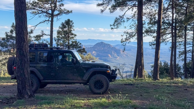
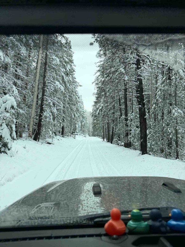
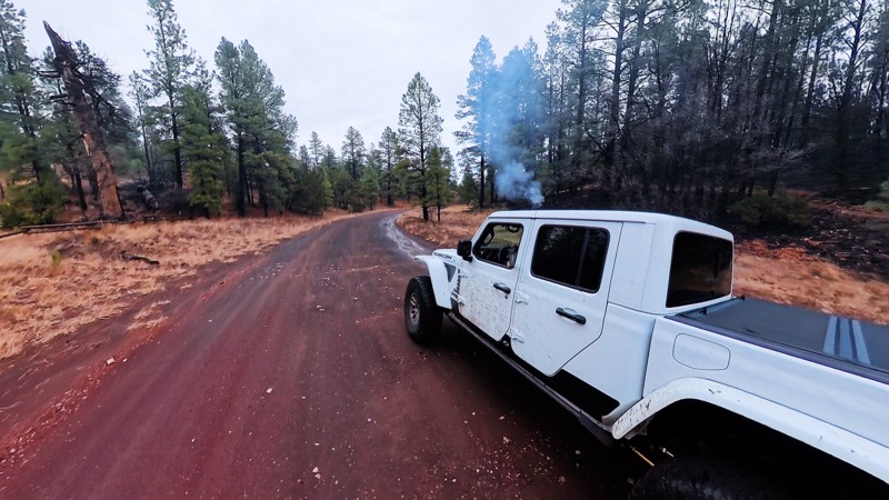
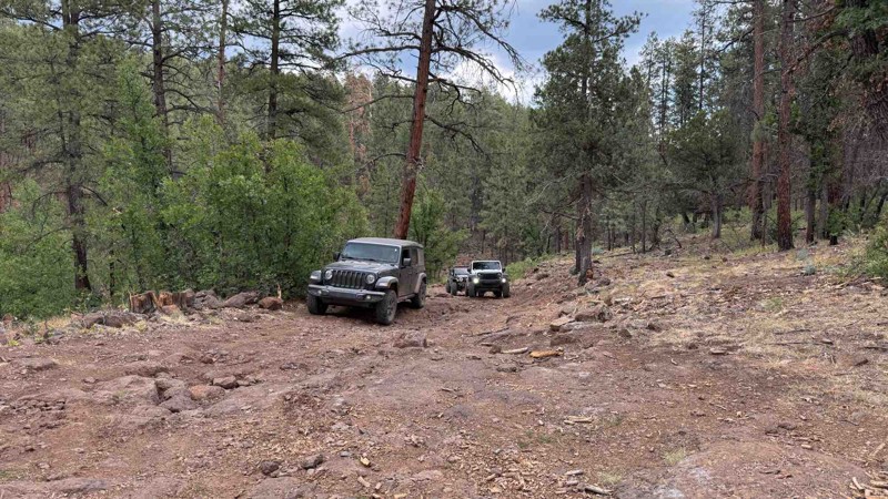
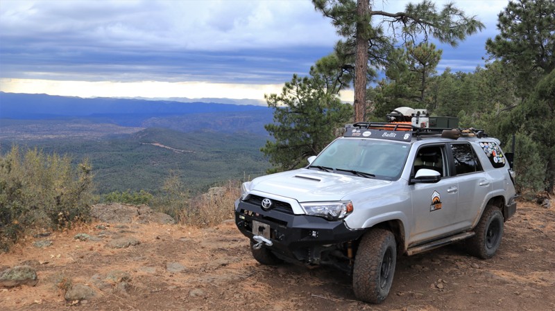
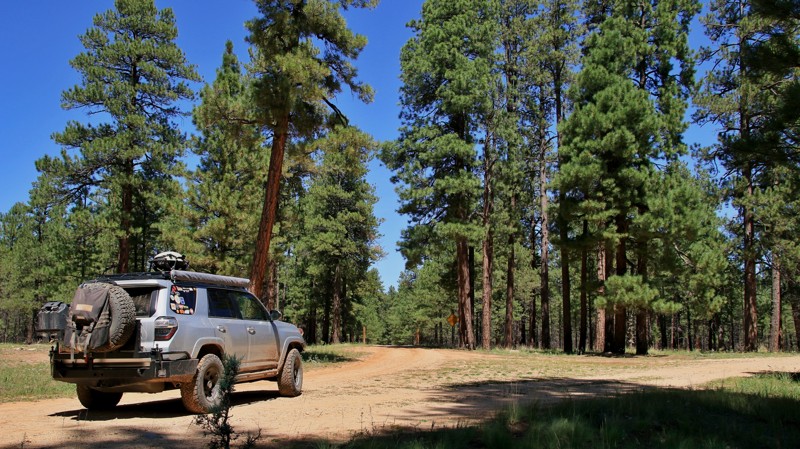
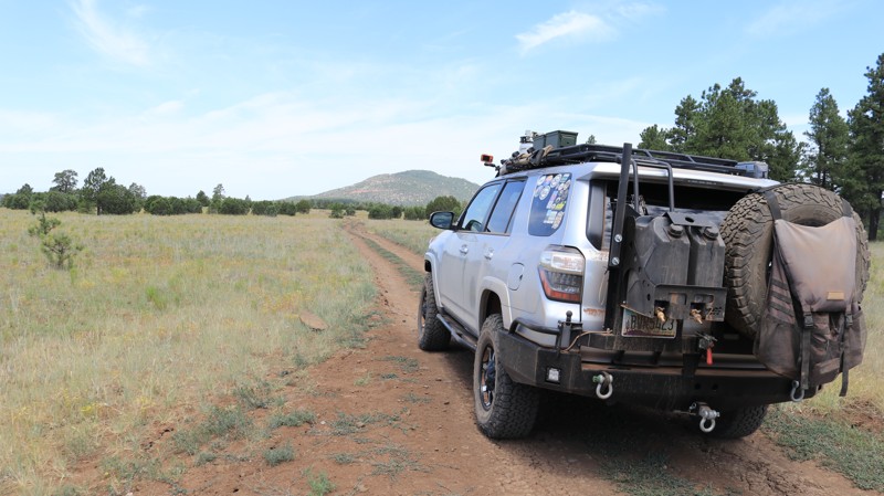
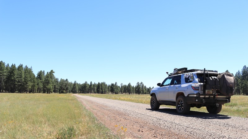
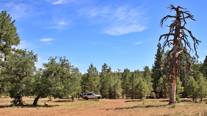
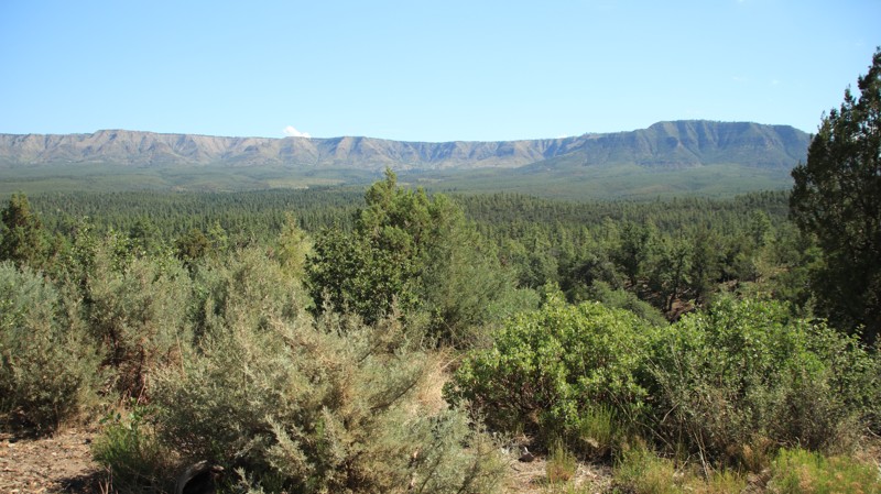
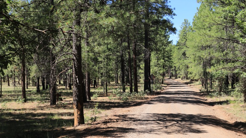
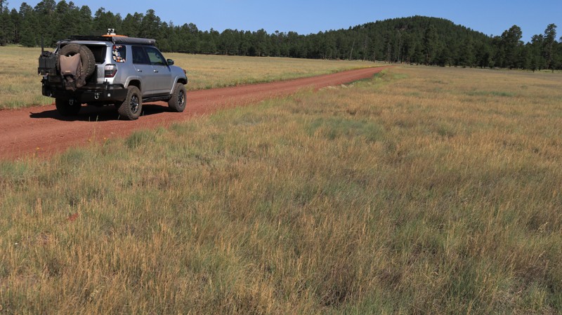
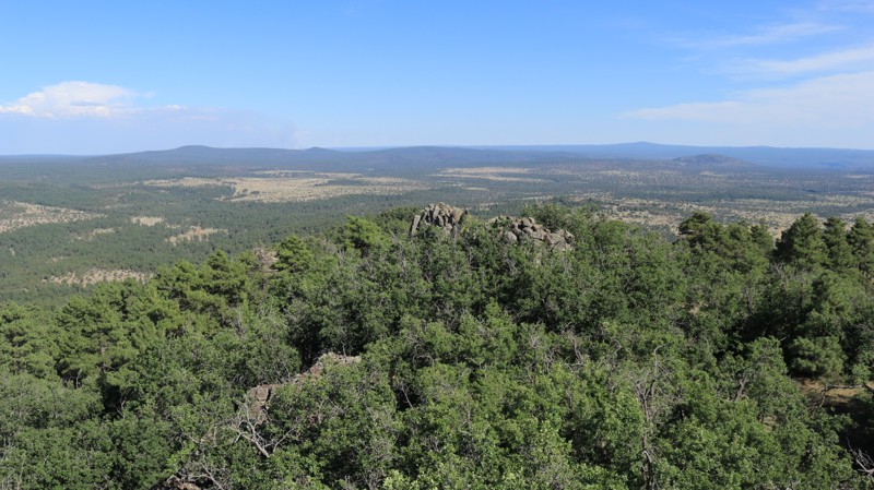
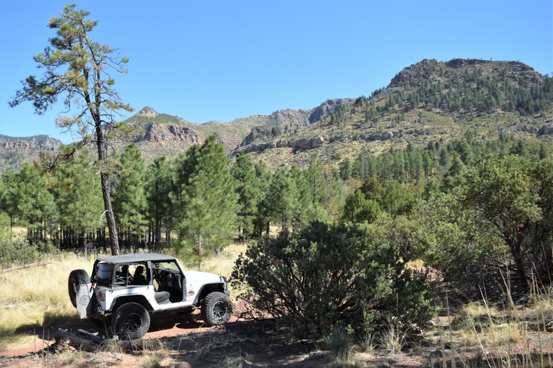
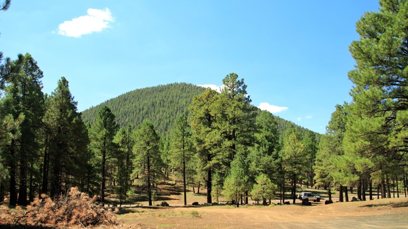
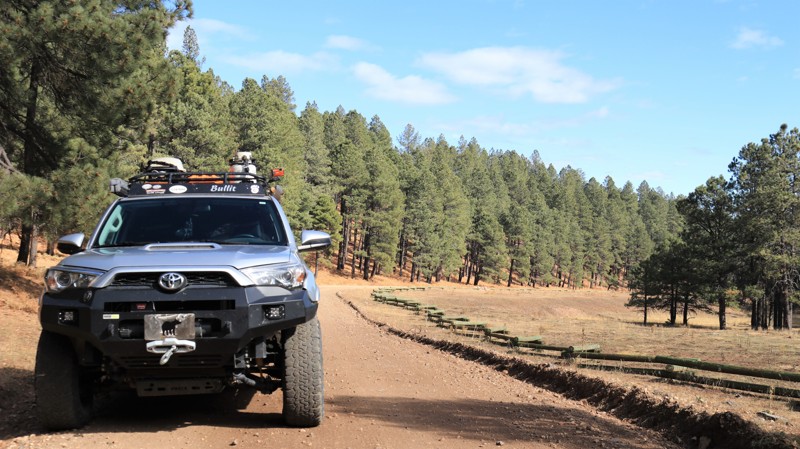
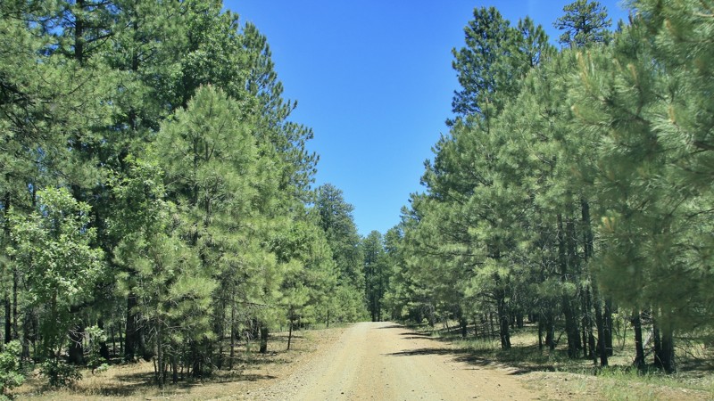
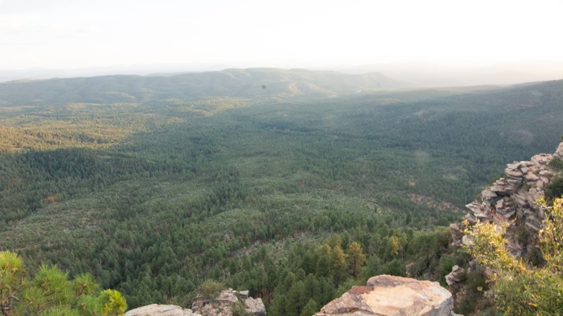
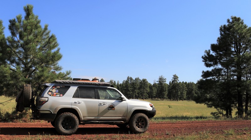
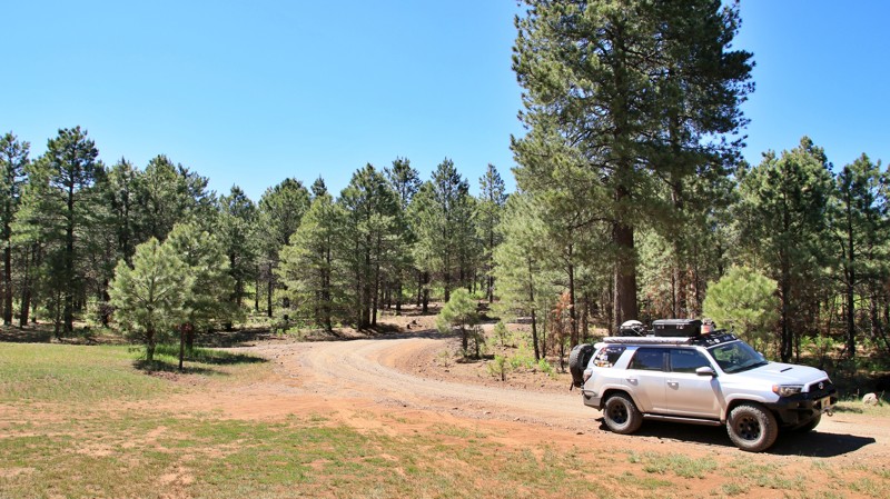
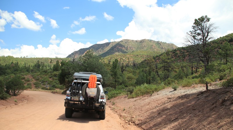
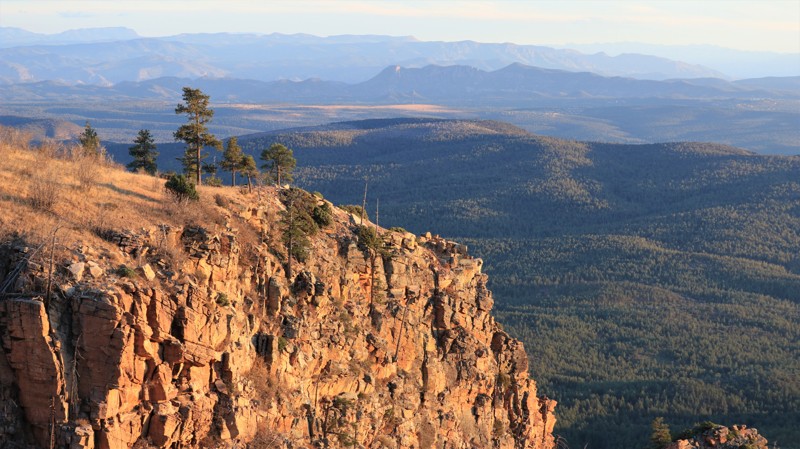
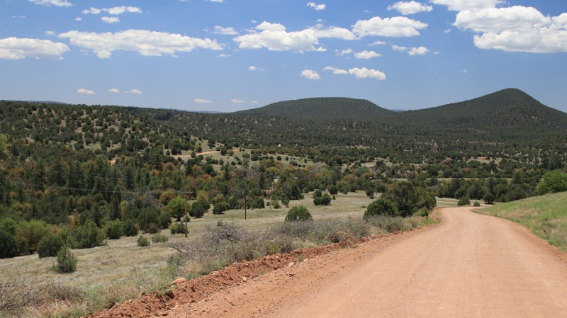
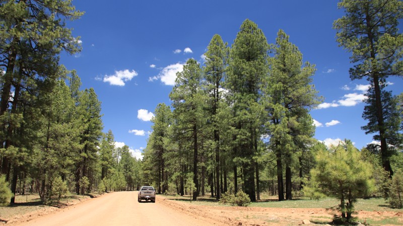
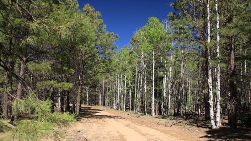
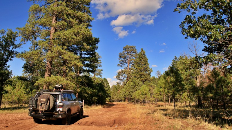
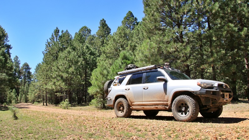
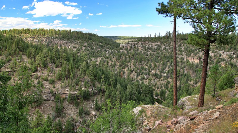
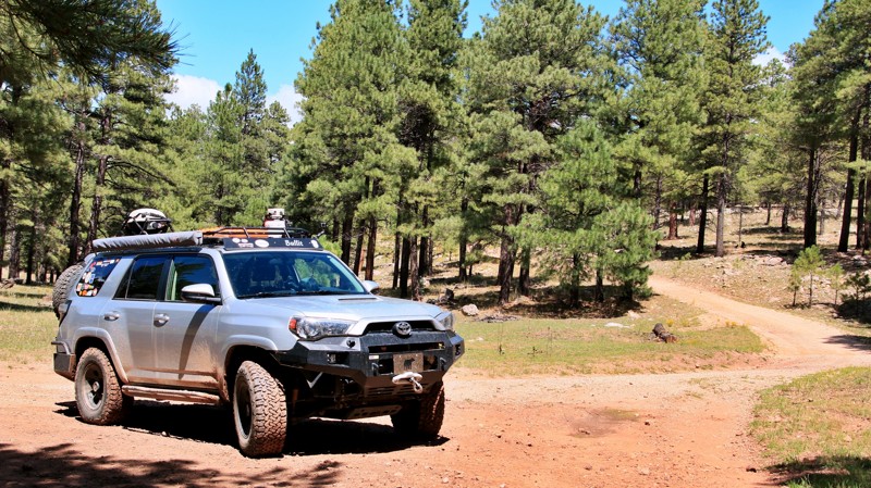
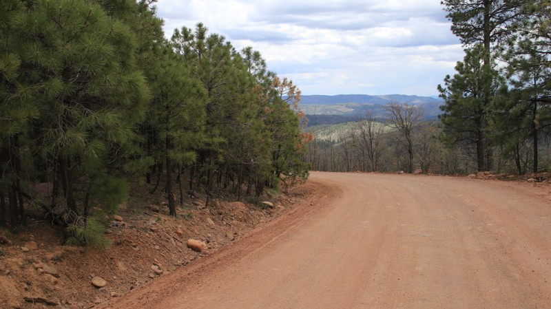
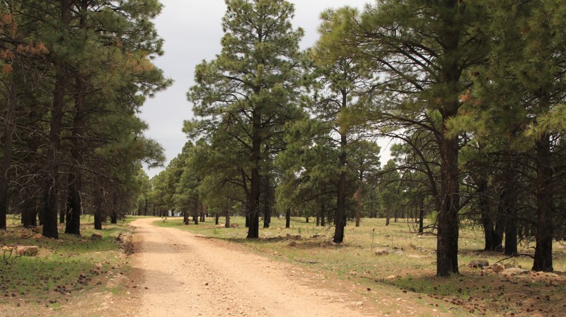
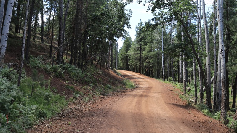
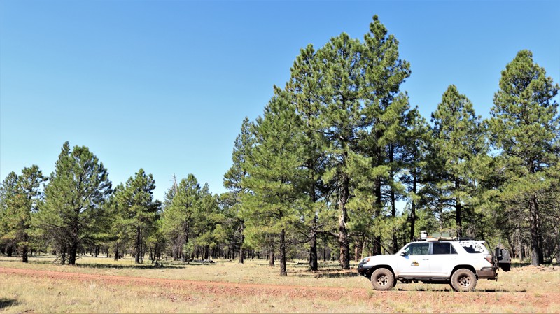
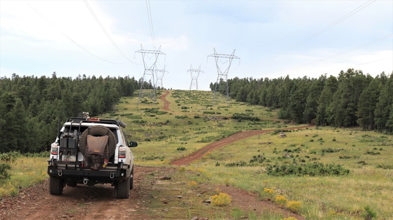
Colcord Ridge is a scenic and easy road running down the face of the Mogollon Rim. The trail boasts three free campgrounds and a fish hatchery along Canyon Creek.

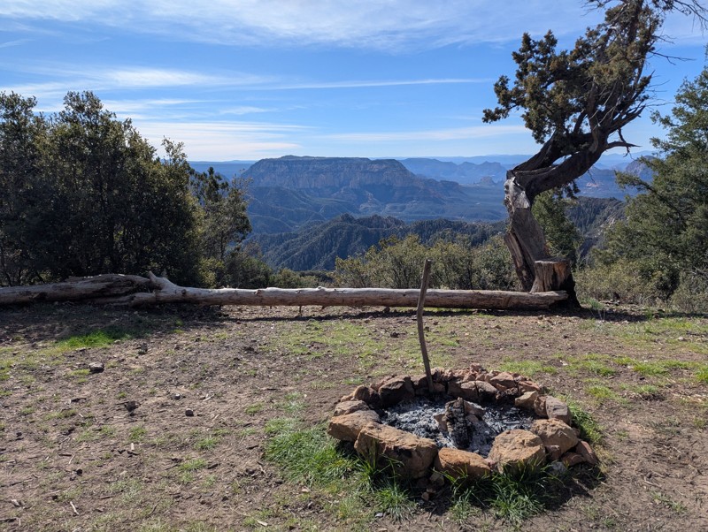
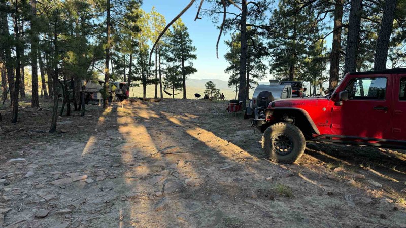
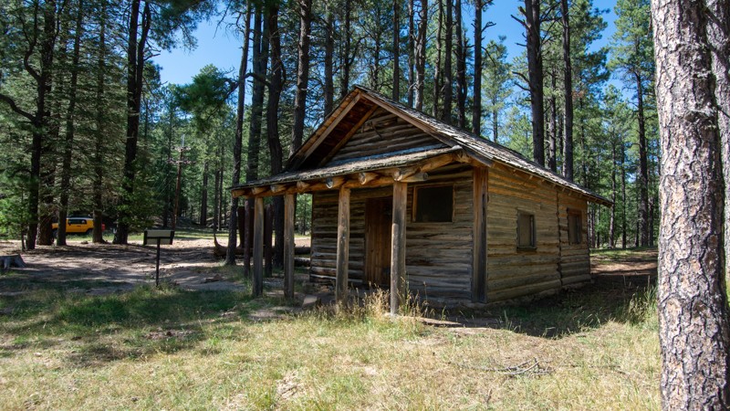
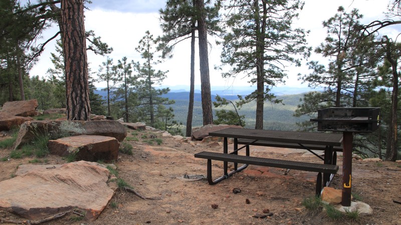
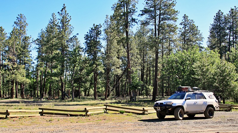
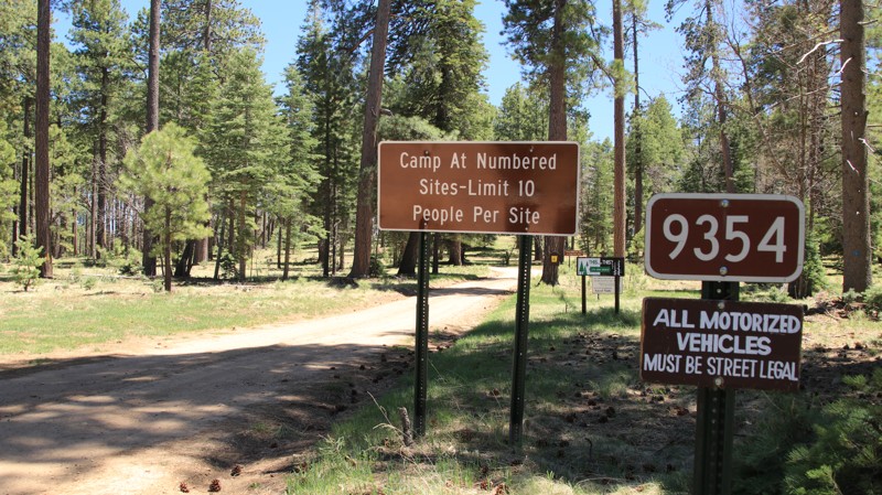
Colcord Ridge Campground is near the western end of the road. It has vault toilets, picnic tables, fire rings, grills, and informational signage. The individual campsites are RV-sized.

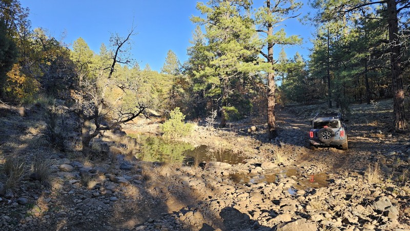
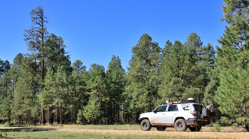
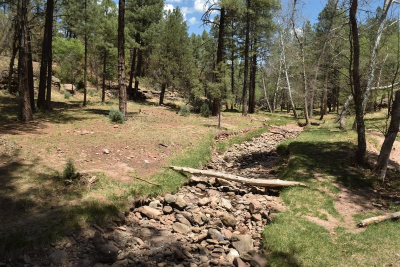
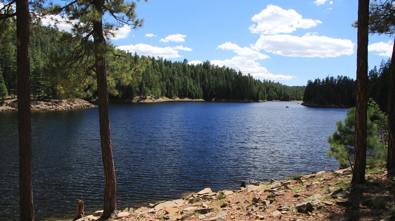
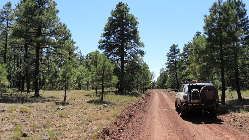
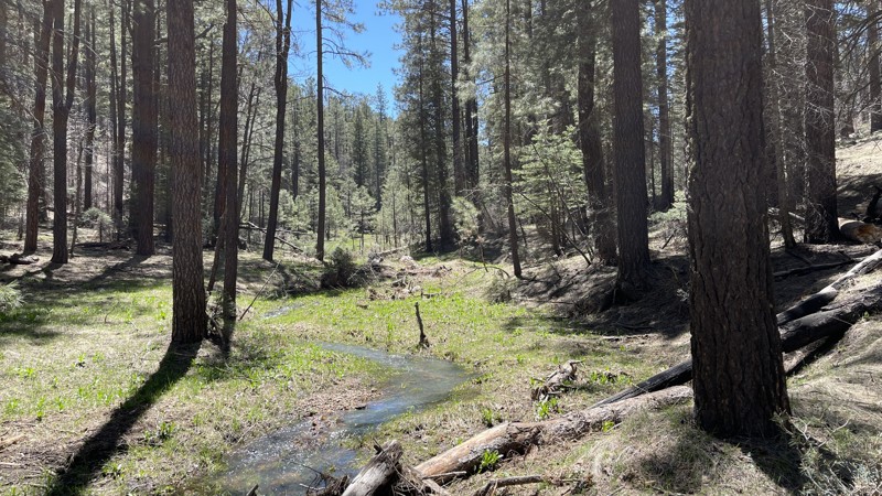
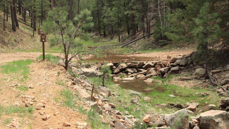
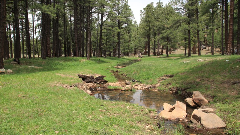
Airplane Flat Campground is west of the spring-fed, gurgling Canyon Creek. The large campground is shaded by Ponderosa pines and equipped with vault toilets, picnic tables, fire rings, and grills.  

Just east of Canyon Creek’s one-lane bridge, the Canyon Creek Fish Hatchery is sporadically open to visitors. The road narrows past the hatchery. Upper Canyon Creek Campground is just short of the gated end of the road, with amenities similar to Airplane Flat Campground. The campground is mostly frequented by anglers.  

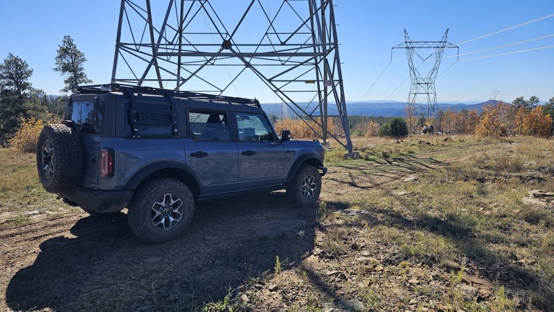
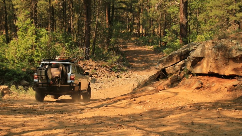
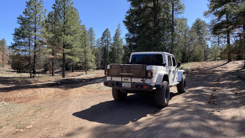
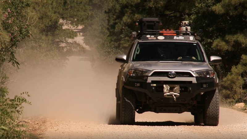
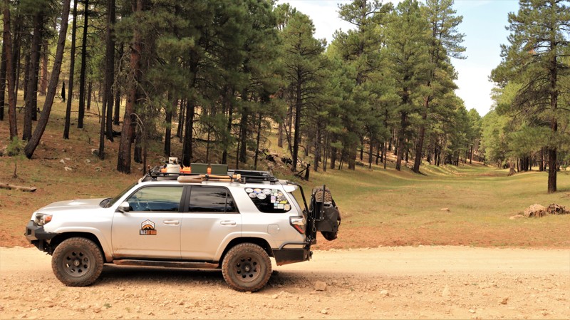
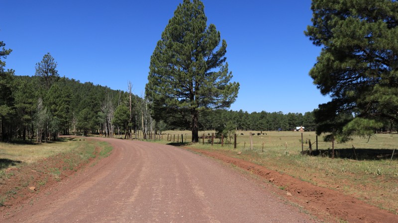
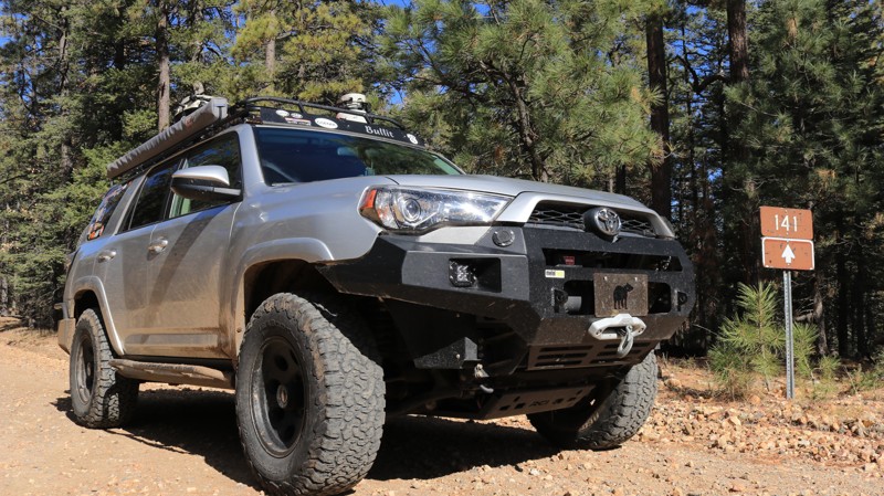
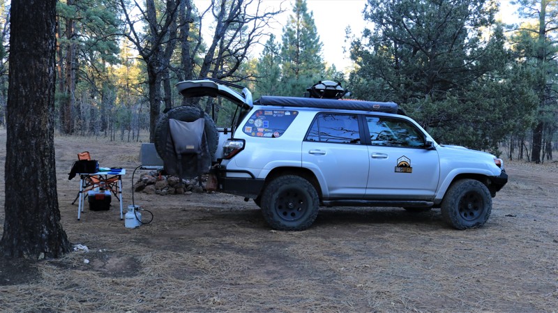
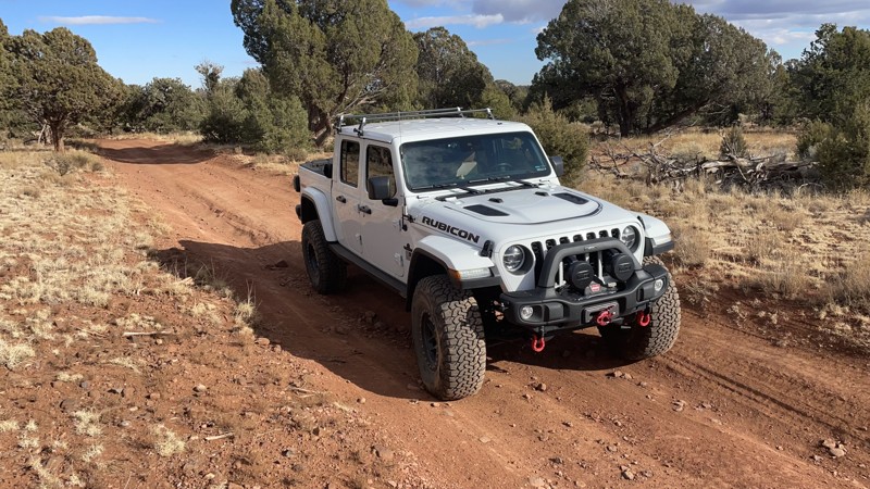
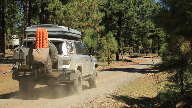
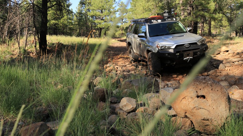
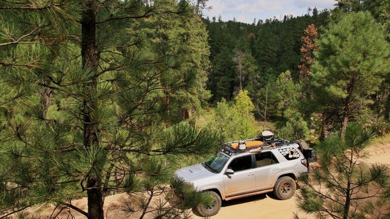
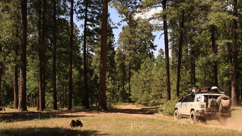
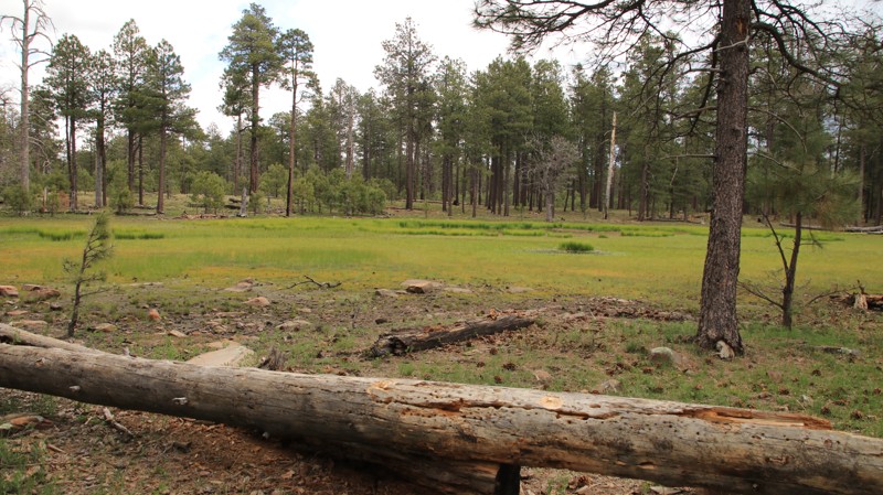
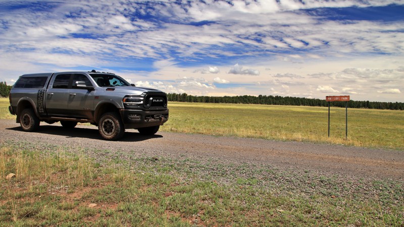
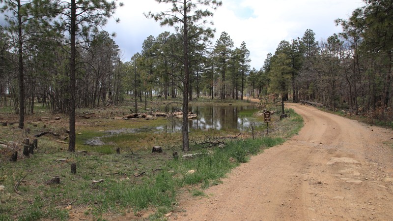
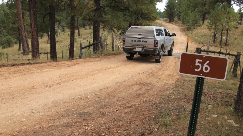
The road has a few ruts and potholes. There is room to turn around at the gated end just past Upper Canyon Creek Campground. There is very limited dispersed camping along the trail. The campgrounds do not see heavy use, so they make the best option for camping along the trail.

Arizona: Dye Ridge Road Hero Photo
Scout Route Icon
5/5 (1 reviews)
Updated: 10/15/2024
Dye Ridge Road
Christopher Creek, Arizona

Dye Ridge Road, FR 717, is packed dirt with a few loose rocks and easily driven by any vehicle. Dispersed camping is abundant along the southern portion of the trail, with shaded sites large enough for RVs and large trailers and enough smooth ground for tents. The northern half of the road is almost park-like, with brush and smaller trees crooked for fire prevention and forest management. Spur trails lead out to campsites set well off the main road. 

Arizona: West Chevelon Hero Photo
Scout Route Icon
5/5 (1 reviews)
Updated: 10/15/2024
West Chevelon
Wiggins Crossing, Arizona

West Chevlon, FR 100, runs seven miles from Deer Lake, FR 169, to Wallace, FR 34, crossing Chevlon Canyon at Barts Crossing. The easy trail passes through a park-like open forest with brush and smaller trees cleared for fire prevention and forest management. The switchbacks leading down to Barts Crossing are steep, but the trail retains excellent traction. There are scattered dispersed campsites throughout the trail.

The track includes the FR 101 spur leading to the site of the historic Nagel Logging Camp. Today, the site is used for fall roundups of cattle that graze in the national forest on leases held by the nearby Dye Ranch. However, it makes a great group campsite. There’s a very old outhouse and a water spigot that is sometimes operational.