Region

Florence Junction

Arizona

Offroad Trails in Florence Junction

A Region within Arizona
4.5/5 (172)

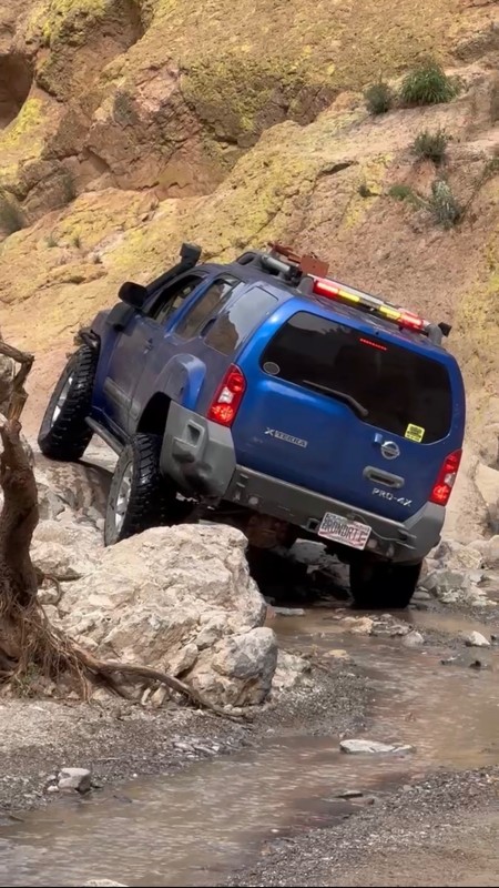
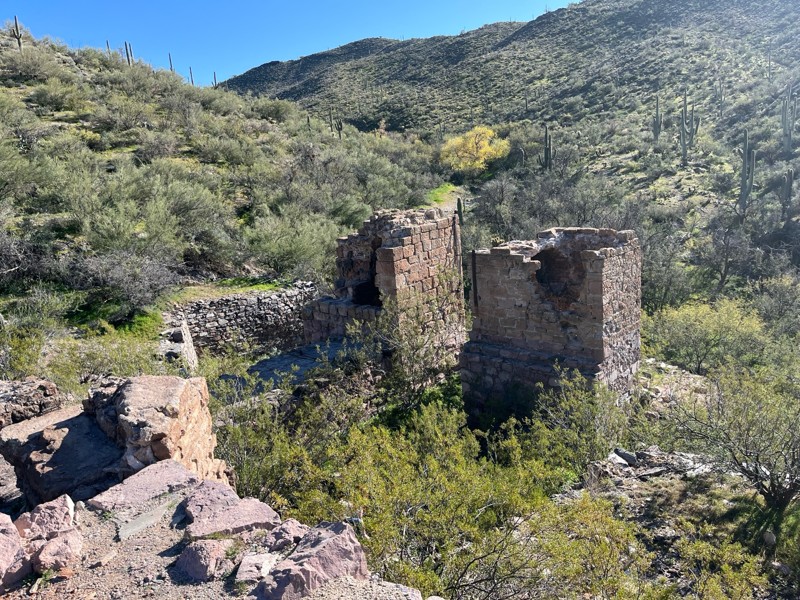
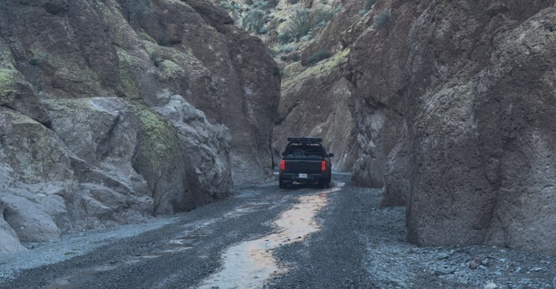
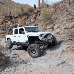
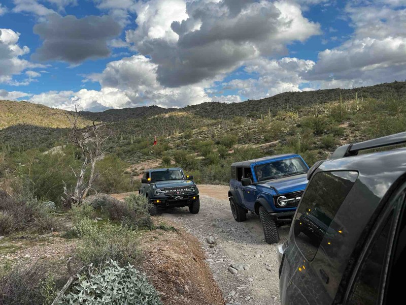
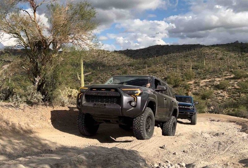
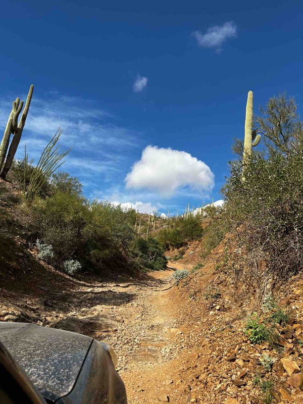
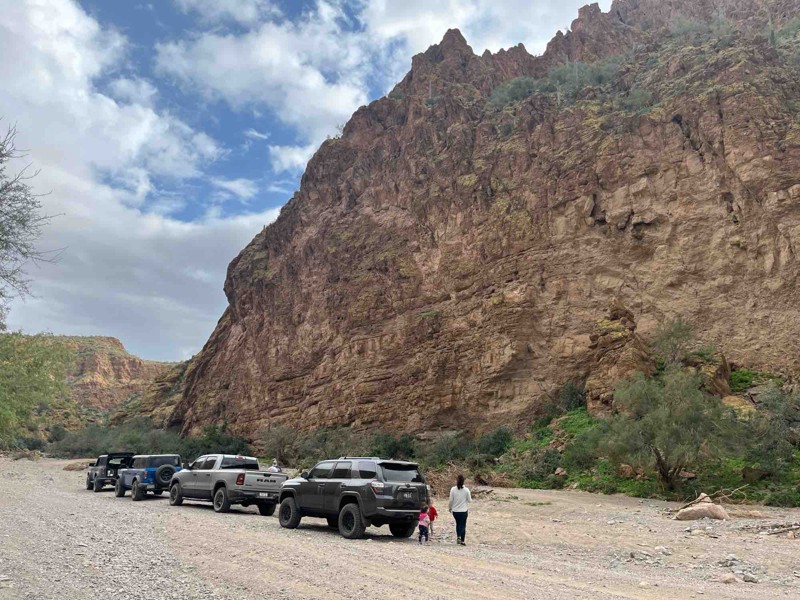
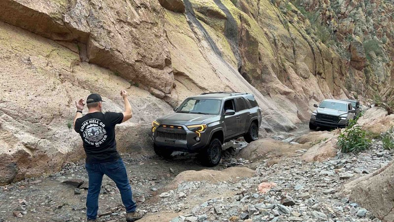
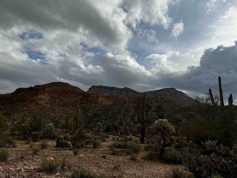
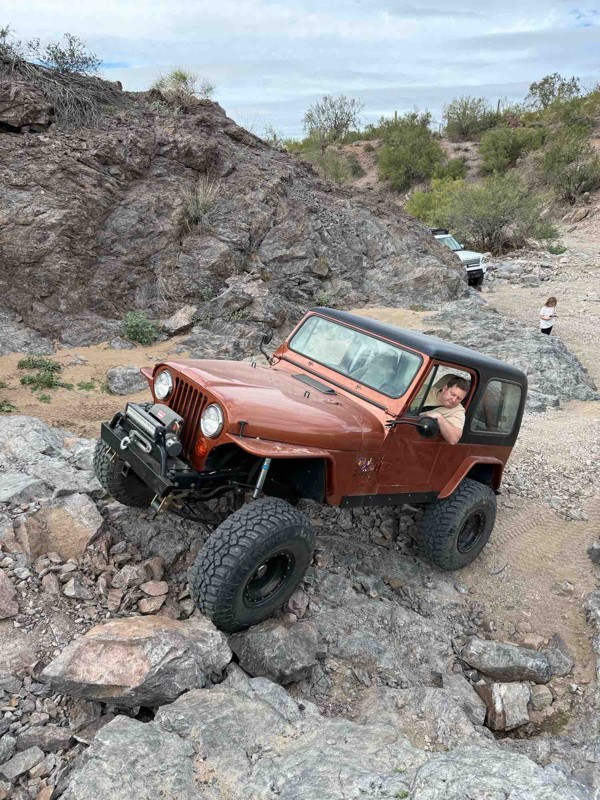
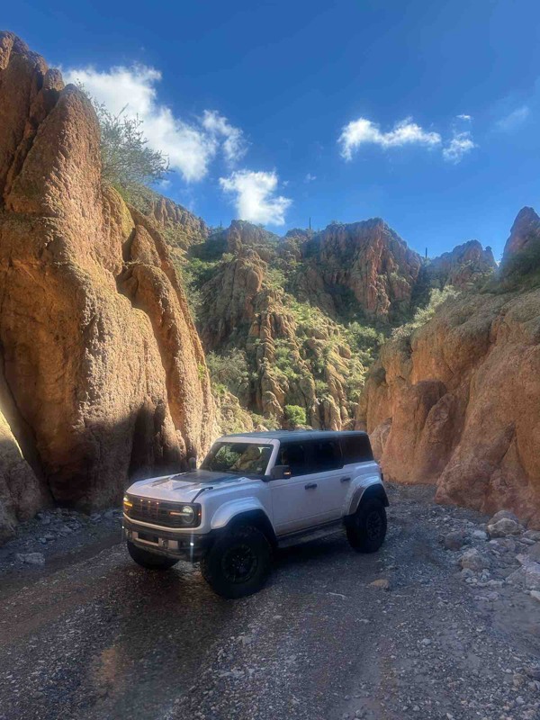
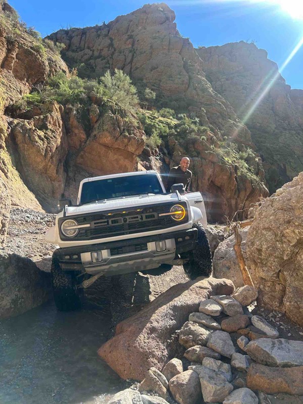
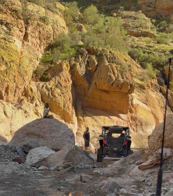
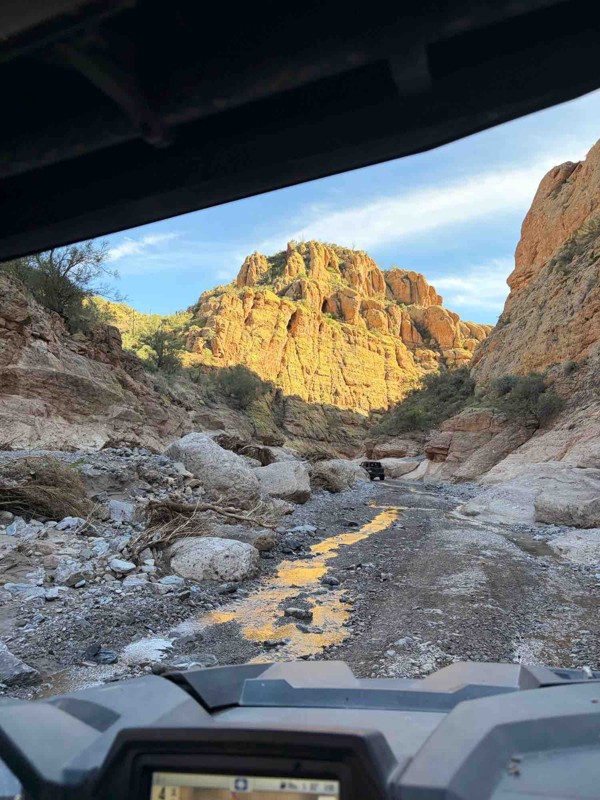
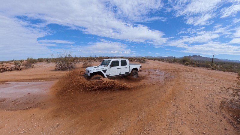
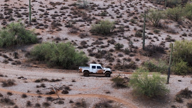
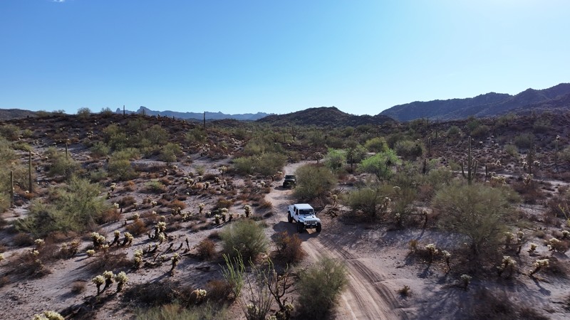
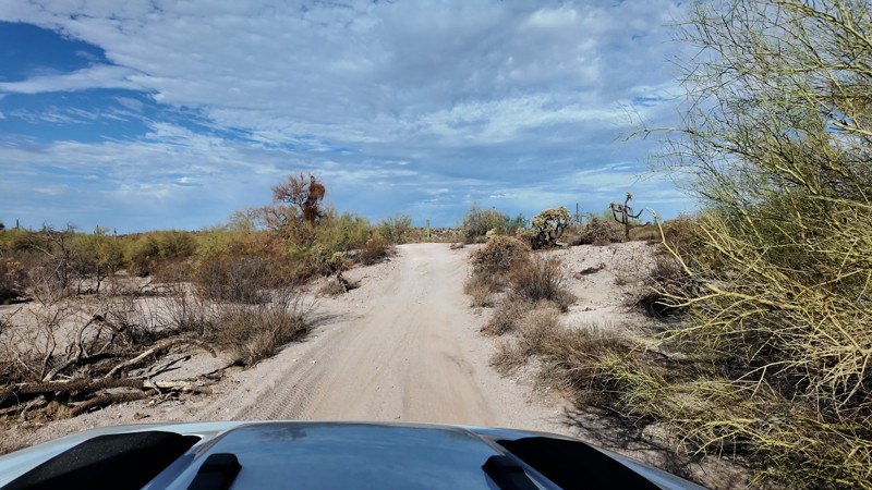
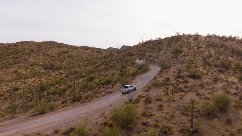
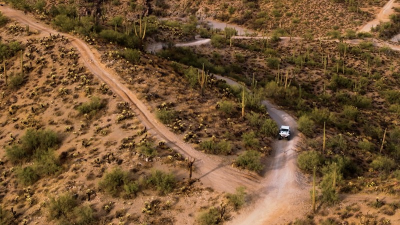
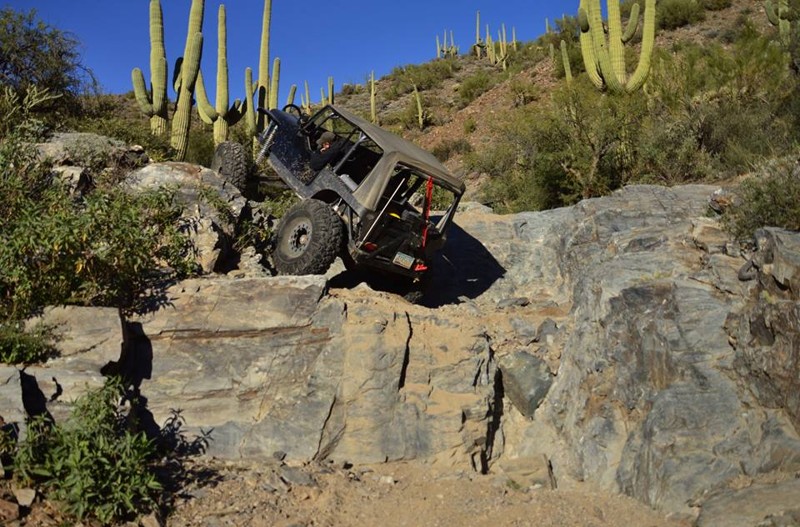
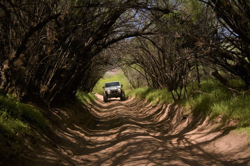
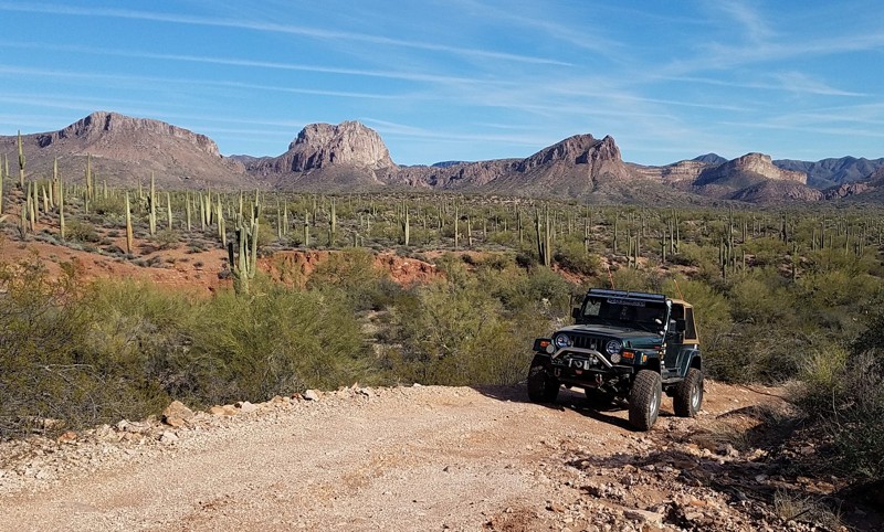
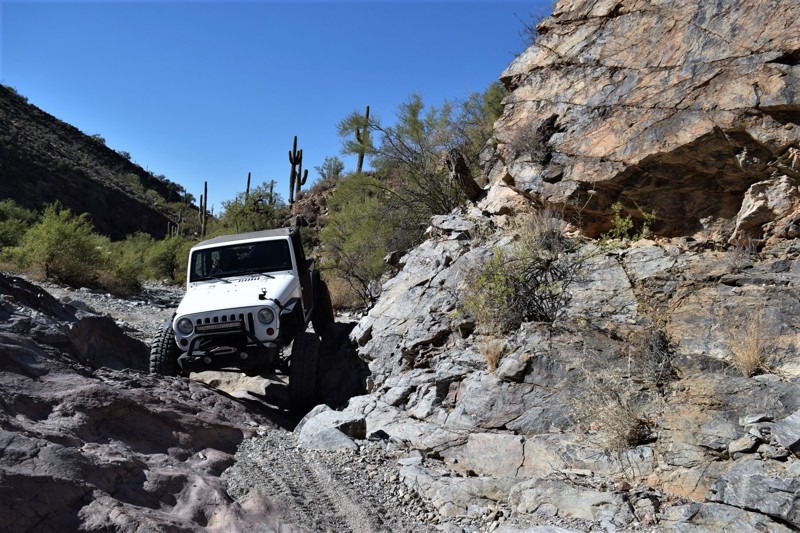
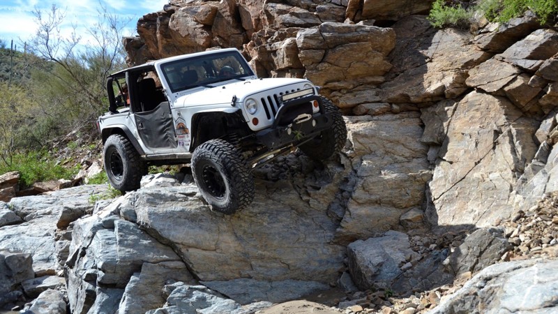
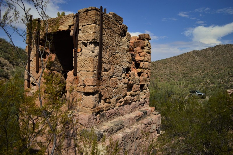
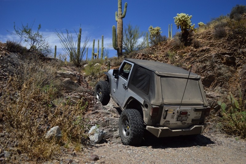
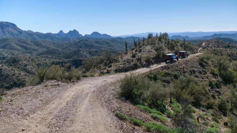
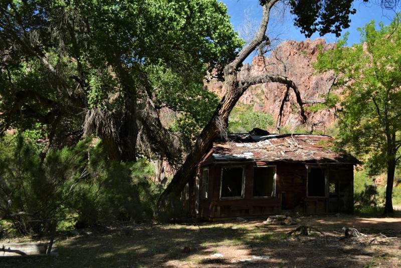
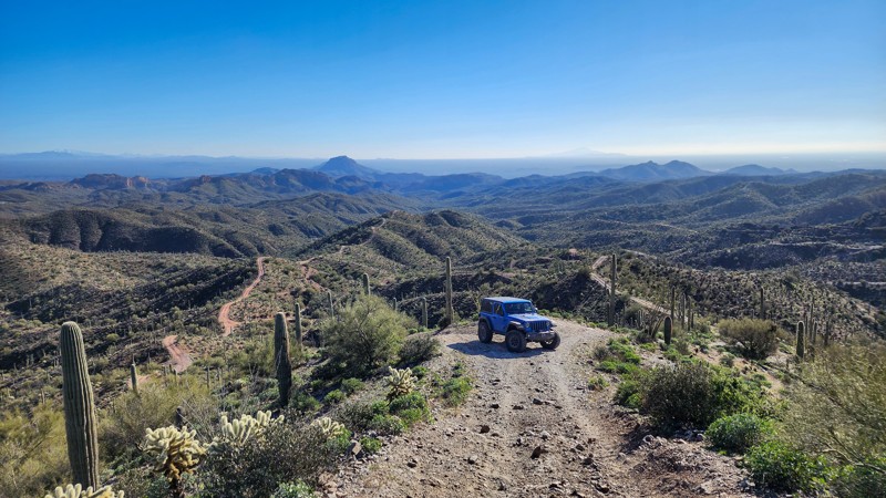
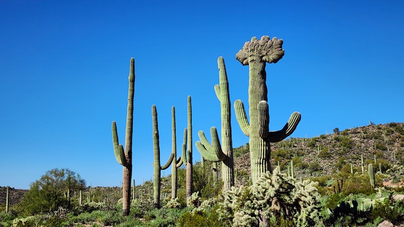
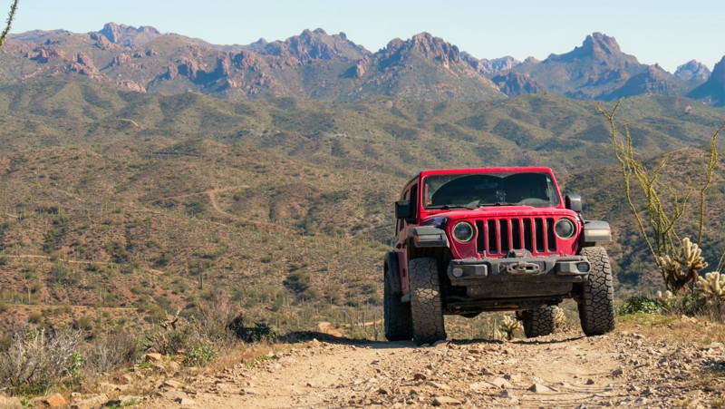
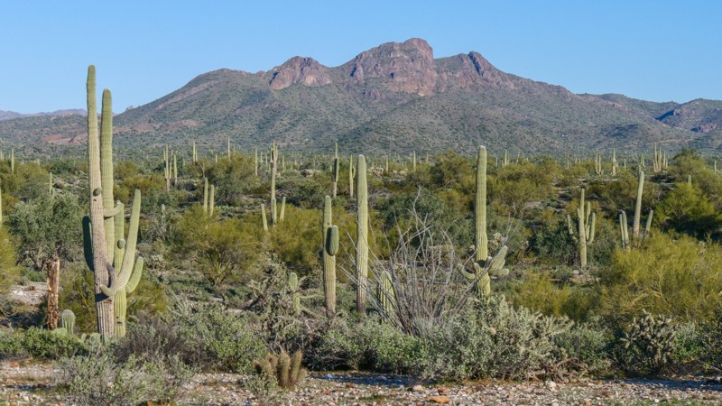
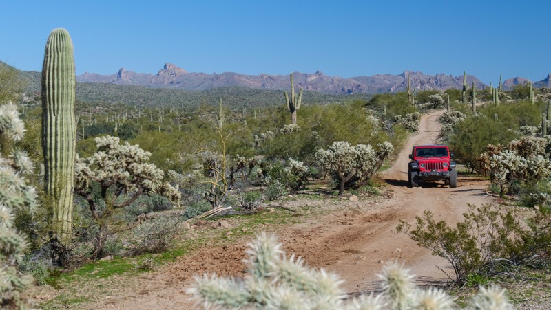
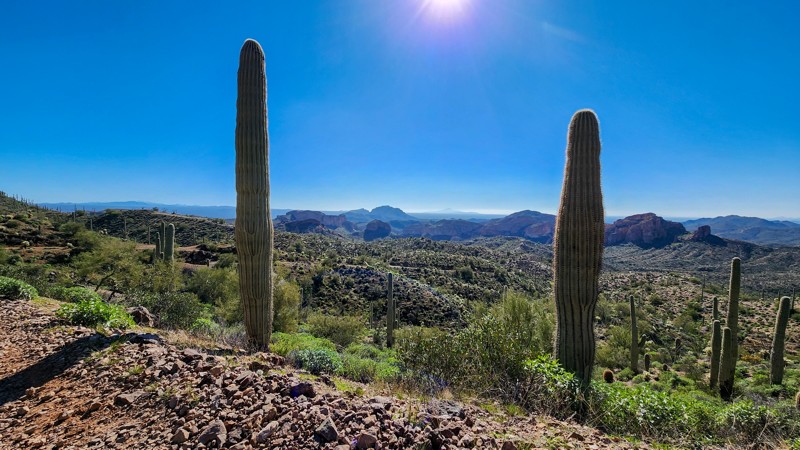
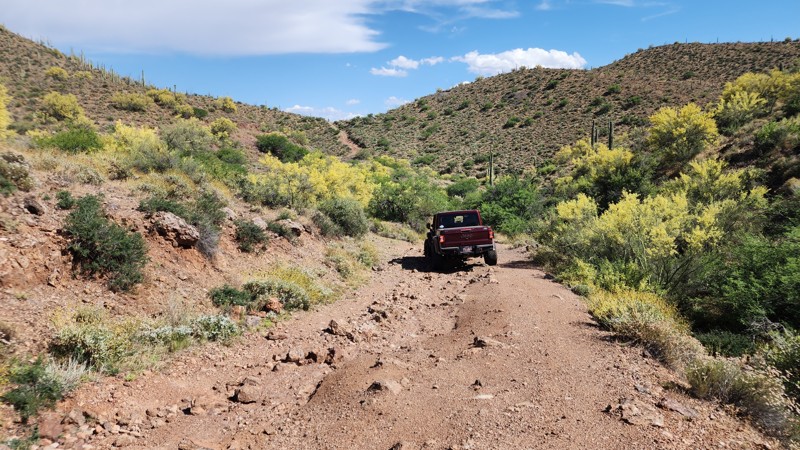
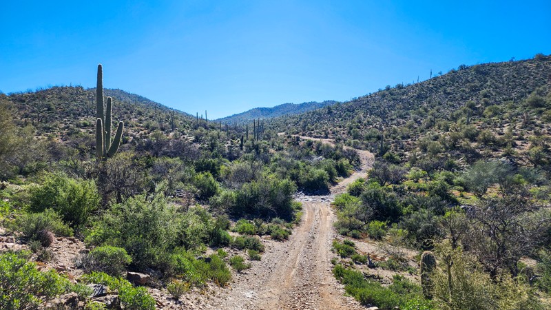
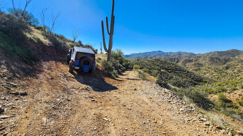
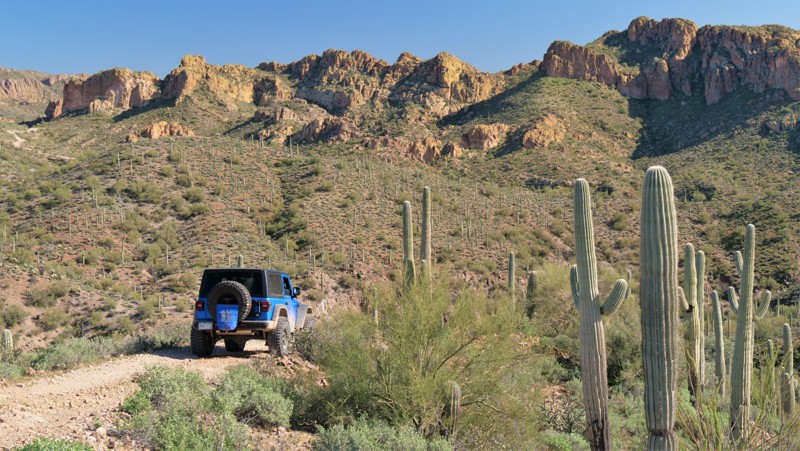
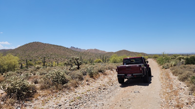
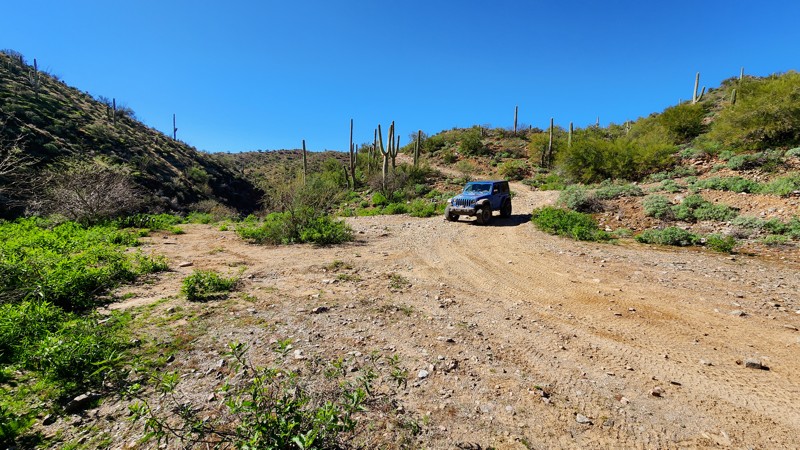
Located within the Middle Gila Canyons, just outside of Phoenix, Arizona, Florence Junction offers a huge network of OHV trails loaded with outdoor adventures and history the entire family will enjoy. With over a century of mining history on this rugged desert landscape, many trails have been cut into the mountains and narrow canyons. The trails have a wide range of difficulty, leading to various remote locations deep within the rocky canyons. Petroglyphs, old mine buildings, wagon stops, and towering saguaros are all part of the epic scenery. While dusty two-tracks, rocky riverbeds, steep hills, narrow channels, and waterfall climbs showcase the area's wide range of traversable terrain.

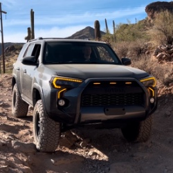
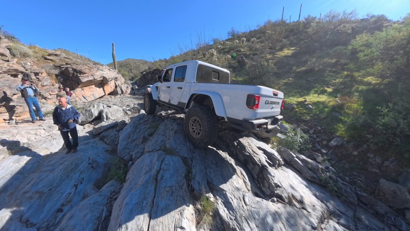
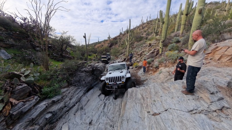
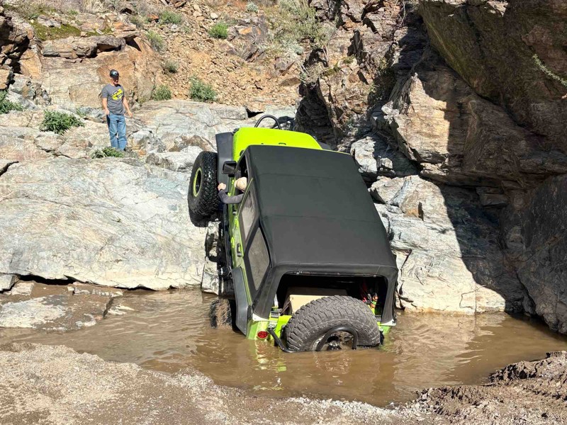
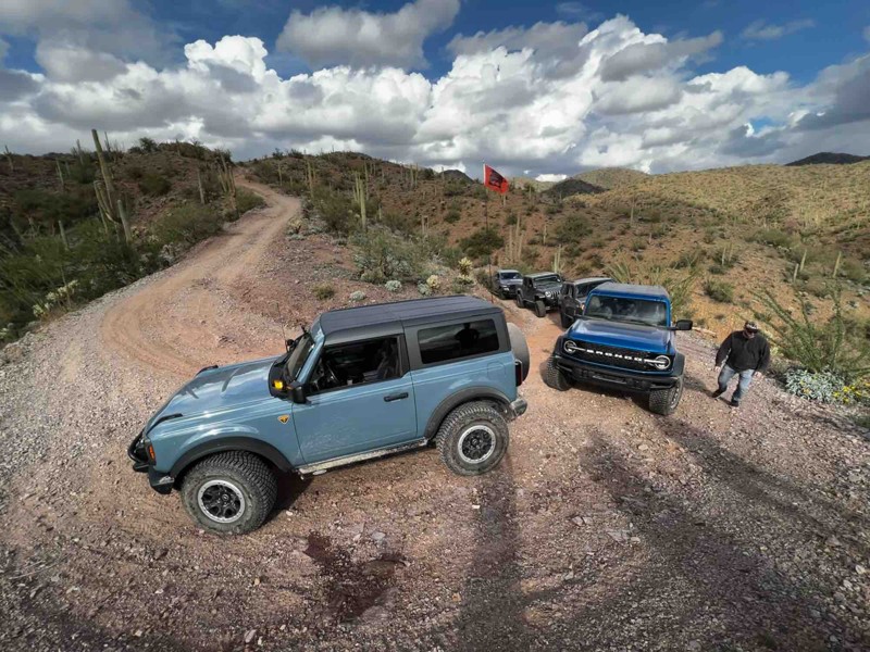
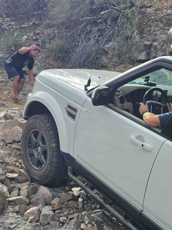
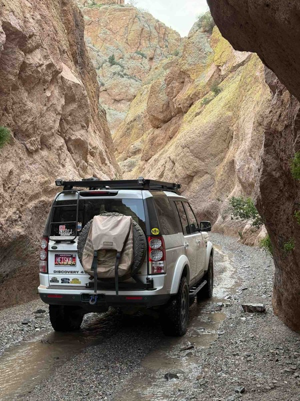
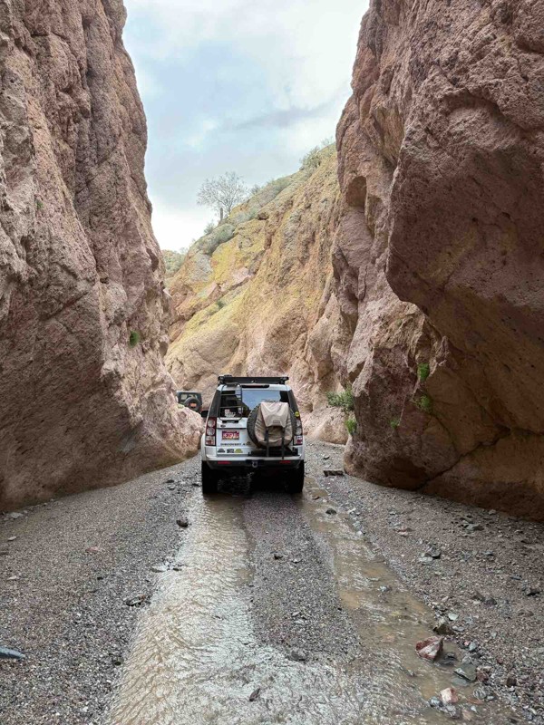
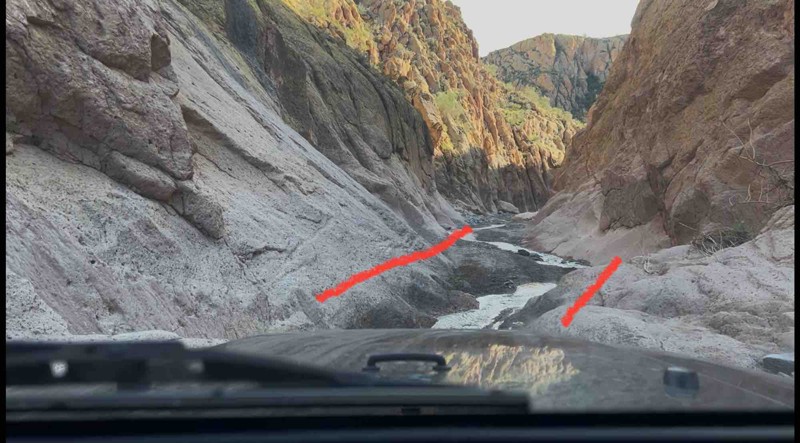
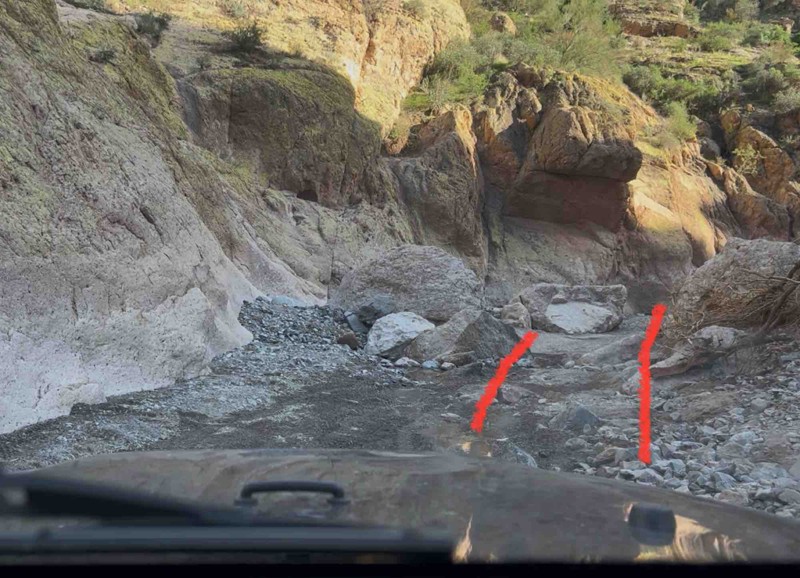
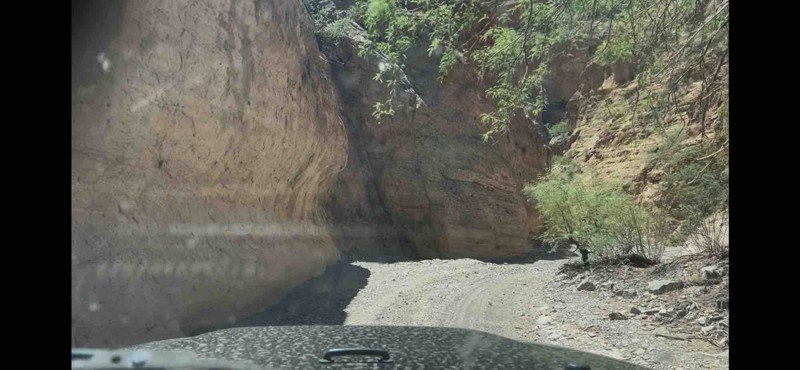
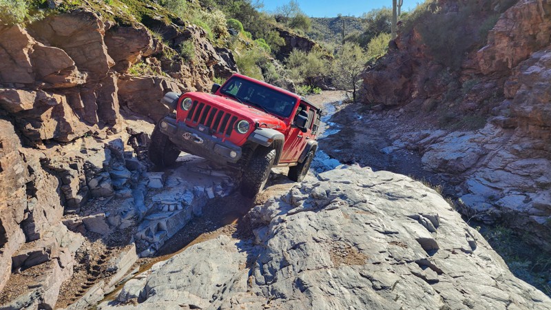
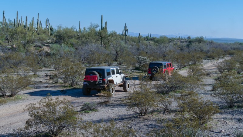
Florence Junction is a vast region where beginners and novices can strengthen their offroad driving skills on a large network of "moderate" trails. You can begin with a one-of-a-kind drive through Box Canyon, where you'll slowly crawl through a narrow slot canyon in a stock 4x4 vehicle. If your timing is right, you can experience it when water flows and the cacti are fully in bloom. Once you outgrow these easier trails, try your luck on one of several “Technical Vehicle” trails, such as Jack Handle, Woodpecker, or Highway to Hell.

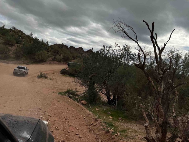
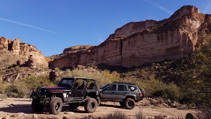
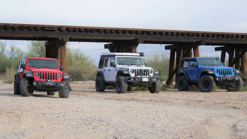
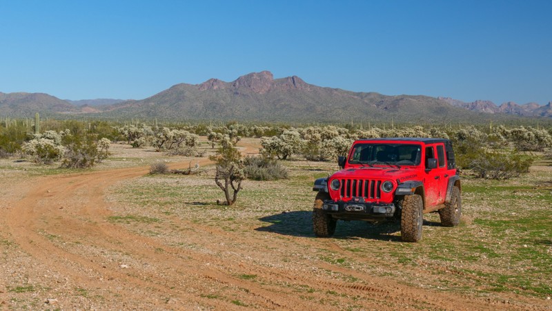
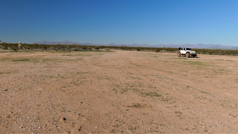
The region is part of numerous land management agencies, including the Bureau of Land Management and Arizona State Trust Land. With allowable camping for up to 14 days, you can set up basecamp and have time to explore all of the hidden gems. The main dirt road entering the OHV area, Cottonwood Canyon Road, is often lined with large RV corrals and other weekend encampments, while more private campsites are tucked further back in the hills. Be sure to acquire a State Land Recreational Permit if you plan to camp or drive the trails within the state’s jurisdiction. This area is popular any time of year except summer, when temperatures can exceed 110° in the shade.

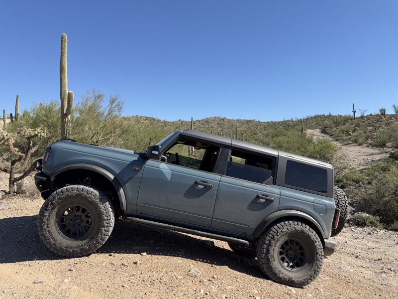
Whether you are into boondocking, relaxing desert rides, wild west history, or hardcore rock crawling, Florence Junction is sure to have something for everyone.

Top Reasons to Explore Here
Beginner Category IconBeginner
Camping Category IconCamping
Desert Category IconDesert
Ghost Town Category IconGhost Town
Iconic Category IconIconic
Mine Category IconMine
Overland Category IconOverland
Rock Category IconRock
Sand Category IconSand
Scenic Category IconScenic
Wash Category IconWash
Water Category IconWater
Trail Types
Scout Route
Full Trail Guide

Preview Trail Icon
Preview Trails
easy
moderate
difficult
severe
extreme

All-Access
Scout Route
Start a 7-day Free Trial

Most Recent Trail Reviews

Most Popular

Search for Trails
Arizona: Box Canyon - Florence Hero Photo
All-Access Preview Icon
4.8/5 (55 reviews)
Updated: 03/30/2024
Box Canyon - Florence
Open
/
Florence, Arizona/
5.85 miles/
About 2 hours

Located northeast of Florence, Box Canyon is a scenic trail that passes through a spectacular, narrow canyon with geological features and bright, colorful vegetation you wouldn't commonly associate with the desert, such as acarosporaceae fungi. Beyond the sheer, towering canyon walls, drivers can find petroglyphs, and historical stagecoach stops making this trail a truly unique Arizona offroad experience. A favorite amongst many offroad enthusiasts, this trail is a popular access point to many other trails within the Florence Junction area.

Arizona: Mineral Mountain Road Hero Photo
All-Access Icon
4.6/5 (19 reviews)
Updated: 03/01/2024
Mineral Mountain Road
Florence, Arizona

Mineral Mountain Road is the northern entrance to the famous Florence, AZ, OHV area. From Mineral Mountain Road, offroad enthusiasts can plan a full day's adventure with any number of the local trails. This expansive area is littered with mining claims, petroglyphs, wagon stops, and beautiful scenic views. Occasionally, there are deer, big horn sheep, Gila monsters, and endangered desert tortoise sightings. Mineral Mountain Road can access several of Arizona's most famous rock crawling trails. Ajax Mine, Axle Alley, and Highway to Hell are just a few of the area's legendary trails. If you're looking for a great scenic 4x4 tour, Box Canyon and Price Road make for a fantastic and moderate day.

The route was once a maintained gravel road connecting several mines and the old town of Reymert. After the mining years ended, the land was used for military artillery training. The local Arizona National Guard would notify the public when the firing was live by raising a red flag at the trailhead. Over the years, the military stopped firing into the mountains, and this rugged Sonoran desert landscape found a new purpose.

Arizona: Elvis Trail Hero Photo
All-Access Preview Icon
4.8/5 (17 reviews)
Updated: 04/28/2024
Elvis Trail
Open
/
Florence, Arizona/
5.11 miles/
About 2 hours

The OHV region near Florence, Arizona, is loaded with legendary offroad trails for all types of vehicles. Hidden in one of the many washes, Elvis is widely known for its numerous rock waterfalls that challenge even the best-built rigs. There are many abandoned as well as active mines in the area. Legend has it the trail's name comes from a local miner’s dog that traveled along the route with him many years ago. Along the way, there are towering saguaros clinging to the rocky banks as you twist through a lush Sonoran desert. The terrain along this route is harsh, the rocks are sharp, and everything out there wants to poke or sting you. Continuing that theme, the rocky waterfalls are massive and intimidating, but with careful tire placement and a trusted spotter, navigating through the rocky maze is achievable. Stopping after conquering an obstacle and feeling a sense of accomplishment is the memorable part about Elvis.

Arizona: Cottonwood Canyon Road Hero Photo
All-Access Icon
4.6/5 (16 reviews)
Updated: 12/30/2023
Cottonwood Canyon Road
Florence, Arizona

Cottonwood Canyon Road serves as one of, if not the main entrance to, the famous Florence OHV area. This rugged region is littered with old mines, wagon stops, petroglyphs, and beautiful Sonoran Desert landscapes. During the busy winter months, the early portion of the route is considered the boondockers midway. Countless RVs and large family groups line the well-maintained gravel road. The fun begins once you pass all the traffic. The trail travels through a rocky wash before climbing into the southern foothills of the Superstition Mountains with spectacular panoramas of the surrounding Sonoran Desert. Cottonwood Canyon Road ends at 5 Points, the central hub of the region's trail network. You can choose from various routes, like rock crawling on the Ajax Mine trail for lunch at the ruins or continuing south through the beautiful narrow walls of Box Canyon.


Arizona: Sandman Road Hero Photo
All-Access Icon
4.6/5 (16 reviews)
Updated: 03/29/2024
Sandman Road
Florence, Arizona

Located a short distance east of Florence and just outside the Phoenix Metro area, Sandman Road offers incredibly beautiful views of the Sonoran Desert and the Mineral Mountains. Travel through fields of teddy bear cholla and towering saguaro as you crest picturesque ridgelines that overlook miles of connecting OHV trails. Sandman Road should be near the top of your adventure list whether you are looking for a beginner offroad trail that's more than just a dirt road or looking to photograph amazing scenery.

Arizona: Highway To Hell Hero Photo
All-Access Icon
4.5/5 (5 reviews)
Updated: 04/05/2024
Highway To Hell
Florence, Arizona
This is one of Arizona's best legal rock crawling trails. Highway To Hell is technically 1.1 miles long, but can take a few hours to complete. This trail is HARD and has a high potential for body damage and breakage. There are a few tall and very rocky waterfall obstacles along the route that keep things very interesting. This trail will challenge even highly modified vehicles. Please be aware there are many active mining claims in the area that are considered out of bounds and should not be entered. The entire region is also home to many herds of cattle that can often pop up around a blind corner. As with all trails, proceed with caution in these areas. The trail has many hazards along the way, including the typical desert predators so please be cautious when outside the vehicle. Strap in for this trail, it will test your limits!
Arizona: Telegraph Canyon Road Hero Photo
All-Access Icon
4.5/5 (17 reviews)
Updated: 12/03/2024
Telegraph Canyon Road
Superior, Arizona

Telegraph Canyon Road is a scenic day ride weaving through the rugged beauty of Arizona's Mineral Mountain Mining District. Starting near the historic town of Superior, the trail meanders southwest, offering breathtaking views of iconic landmarks like Picketpost Mountain, Weaver’s Needle, Apache Leap, and the Superstition Wilderness. It intersects with the famed Arizona Trail before concluding at the intriguing Ajax Mine, a site steeped in history and frontier drama.

The Ajax Mine, established in 1915, was once rich in lead and zinc ore, estimated at 20,000 tons by its original operator, B.D. Johnson. Ownership disputes and legal battles defined its turbulent past, including a notorious eviction of the Wallace brothers in 1926. Despite being listed for sale in the 1940s, disagreements among heirs left it idle, with its asking price of $45,000 and unique no-down-payment terms never fulfilled. Visitors can explore its impressive remnants but should use extreme caution as you are likely to encounter open, vertical shafts.

Arizona: Cochran Road Hero Photo
All-Access Icon
4/5 (7 reviews)
Updated: 06/05/2022
Cochran Road
Florence, Arizona
Cochran Road leads to the now non-existent town of Cochran, along the Gila River and Sante Fe railway. In it's heyday back in the very early 1900's, it had up too 10 residents. The town was named after it's first post master John S. Cochran and served the local mines, railway and ranchers. There is nothing really left of the town site now except a very flat area. However, the route leads to a nice section of the Gila River, which always has flowing water. It's a popular crossing point for accessing many of the area OHV trails. Once you decide to cross the river, you then have to choose between two different trails to take, Rincon Road to the right, leading out to Walnut Canyon or to the left is Martinez Canyon Road leading out to many trails in the Florence OHV area. Please note that the Coke Ovens are closed to the public and should not be driven to.
Arizona: Martinez Canyon Road Hero Photo
All-Access Icon
4.5/5 (17 reviews)
Updated: 02/22/2024
Martinez Canyon Road
Florence, Arizona
Martinez Road is a connector trail that will allow you to access the remote southwest region in the Florence, Arizona OHV area. The trail travels through a couple washes and past the entrance to the popular Jack Handle trail, Martinez Cabin Trail and eventually up and over to the Gila River. The rich mining operations that have been conducted in this area for over a century have made it quite famous. The name of the route comes from the Martinez Mine and an old cabin of the same name. The cabin used to be the primary destination for the area but vandals and irresponsible users forced it's closure years ago. The Cabin is only accessible by foot and is roughly 3 miles round trip with a slight elevation climb there of 275 feet. The hike through the helps make it worth the walk. This area is remote and rough, please ensure you are prepared with sufficient water and other necessities.
Arizona: Rincon Road Hero Photo
All-Access Icon
4.7/5 (8 reviews)
Updated: 03/10/2023
Rincon Road
Superior, Arizona
If backcountry desert adventure is your thing, then Rincon Road may be just what you're looking for. It's a little known route that connects two rugged but beautiful desert regions. While on the route you'll parallel The Rincon, a cove of mountains to the north and the lush Gila River Valley to the south. When this trail is coupled with Walnut Canyon, Martinez Canyon Road and Box Canyon you are guaranteed to have an incredible off-road experience. Rincon Road was used in the late 1800's into the 1950's for accessing the numerous mining operations in the area but has since had a rebirth in offering access to rugged desert for OHV users, hikers and rock climbers. The region is littered with side trails and canyons offering a life time of exploration. This is a remote and seldom run trail, so please be over prepared for anything that can happen. Enjoy responsibly and remember to always carry out more then you bring in.
Arizona: Orville's Loop Hero Photo
All-Access Icon
4/5 (2 reviews)
Updated: 06/05/2022
Orville's Loop
Florence, Arizona

Twisting its way through a rocky and narrow canyon, Orville's Loop is an exhilarating and scenic roller coaster ride through the Sonoran desert. Dense desert vegetation hangs overhead off the tall canyon walls. During winter, water often trickles down the canyon's walls, pooling at the base of the rocky waterfall you will have to climb. The waterfall is Orville's Loop's standout obstacle, a favorite with local crawlers. The climb up the steep and super narrow ledge road provides spectacular panoramas before the trail merges with Jack Handle.

Arizona: Woodpecker Trail Hero Photo
All-Access Icon
5/5 (9 reviews)
Updated: 05/20/2023
Woodpecker Trail
Florence, Arizona
Woodpecker Mine Trail outside of Phoenix Arizona is well known for being a challenging and fun rock crawling opportunity for mildly modified vehicles. The trail has numerous optional rock obstacles that will push the limits of both driver and vehicle. The trail has a couple obstacles that have reputations for causing damage to even the best built rigs. The entrance will immediately let you know what you're in for. If you're not careful, the optional left line is quite challenging and can result in body damage or a broken window. The trail has many hazards along the way, including the typical desert predators so please be cautious when outside the vehicle. The area is also known for having numerous petroglyphs that are in remarkable condition. Keep your eye out while crawling through the wash for the black faced rocks with the ancient markings carved into them. The Woodpecker Mine was originally opened in 1937 and closed in 1952. It's main ore production was from silver and lead. It's now managed by a large mining corporation but the trail is ours to enjoy. Please be aware there are many active mining claims in the area that are considered out of bounds and should not be entered. The entire region is also home to many herds of cattle that can often pop up around a blind corner, so please be cautious around blind corners.
Arizona: Walnut Canyon Hero Photo
All-Access Icon
4.8/5 (11 reviews)
Updated: 03/30/2024
Walnut Canyon
Superior, Arizona
Walnut Canyon trail is a nice and easy scenic entry point into the White Canyon Wilderness region and beyond. The area is one of Arizona's most preserved and scenic regions that is still easily accessible by 4x4 vehicle. The scenery includes towering canyon walls, some as high as 800 feet and numerous narrow canyons you can hike for days. There are sporadic willows and saguaros that line the trail. Wildlife includes released big horn sheep, black bear and even mountain lions. The trail ends at the Rincon Road starting point and the starting point of some incredible back country hiking.
Arizona: Ajax Mine Trail Hero Photo
All-Access Icon
5/5 (9 reviews)
Updated: 04/05/2024
Ajax Mine Trail
Florence, Arizona
Ajax Mine Trail is a 2.7 mile-long rock crawling trail or can be run as a shelf road to view the mine ruins. It's mainly a boulder-strewn wash from the beginning and circles back to the start via the mining road above the entire route. There are numerous difficult rock waterfall obstacles without bypasses along the route. The trail is ideal for experienced wheelers with modified vehicles wishing to test and advance their skills. An Arizona State Trust Permit is required if you plan to enter the area. There are numerous routes to get to the area where the actual trail entrance is located. Unfortunately, there is very little trail signage around because the trails are not numbered by BLM.
Arizona: Reymert Mine Hero Photo
All-Access Icon
5/5 (8 reviews)
Updated: 03/02/2024
Reymert Mine
Florence, Arizona
Take a short out-and-back trip through time on this easy but historic trail. The town of Reymert was initially established around a post office that started operating in 1890. Reymert was named after its founder, James DeNoon Reymart, who also founded the adjacent milling and smelting town of DeNoon. Originally a silver mine, then later a silver-manganese mine, the town's occupants primarily worked at Reymert Mine until work there stopped in the 1950s. The remnants of the town were bulldozed in the late 1970s, leaving only a couple of processing kilns and several stacked stone foundations. The entire Florence OHV area offers numerous trails to explore that will challenge both man and vehicle. There are trails for every type of vehicle and experience level.
Arizona: Jack Handle Hero Photo
All-Access Icon
4.7/5 (6 reviews)
Updated: 06/05/2022
Jack Handle
Florence, Arizona

Jack Handle is one of those trails that's earned legendary status with local rock crawlers. The trail's name comes from the first difficult waterfall obstacle, Jack Handle. Back when the rock gap was thinner, if your hi-lift jack was on the passenger rear, it would get hung up on the rocks. Hence the name. The trail offers multiple optional rock crawling obstacles, including a difficult and super off-camber rock waterfall appropriately named Jackass.

For over a century, the surrounding mineral-rich area has been profitable for the region. There are many abandoned as well as active mines in the area. Along the route is a spectacular array of desert plant life, from massive saguaros to towering cottonwoods hidden deep in one of many secluded canyons that litter the region. The area is remote. The rocks are sharp. And everything here wants to poke or bite you. Be cautious. This is a desert, and it's not very forgiving, especially in the summer. But it does have an irresistible rugged charm.

Arizona: North Box Canyon Hero Photo
Scout Route Icon
4.6/5 (7 reviews)
Updated: 03/03/2025
North Box Canyon
Reymert, Arizona

Also known as the Waterfall Bypass, this northern section of Box Canyon winds its way up narrow ledges and over the mountains for an alternative way around the waterfall obstacle on Mineral Mountain Road. The trail is ideal for stock-type 4x4 owners who want a mild challenge while exploring the Florence OHV area. The trail has narrow ledge switchbacks and steep rocky climbs requiring low range, high clearance, and durable offroad tires. The trail is excellent for beginners looking to cut their teeth on Arizona desert trails without difficult rock crawling. You'll climb high up into the mountains with immersive panoramas of the surrounding peaks before dropping into Box Canyon.

Camping is minimal. There are only a few old mine platforms where you could set up tents for the night.


Arizona: Price Road Hero Photo
Scout Route Icon
3.7/5 (12 reviews)
Updated: 10/15/2024
Price Road
Florence, Arizona

Price Road is the primary southern entry into the Florence OHV area. The road also serves the two small ranch communities and mining operations. The views of the Rincon Mountains on the eastern horizon loom higher as you travel the desert road. Nearby Box Canyon, Martinez Canyon, Old Silverbell Mine, and many other sites provide visitors with fantastic scenic views and opportunities to hike, explore, offroad, and enjoy the Sonoran Desert. Price Road is a gravel and semi-maintained dirt road that all vehicles can navigate. Durable off-road tires are highly recommended.

Dispersed campsites are located all along Price Road. Camping on Arizona State Trust Land requires a permit. State Trust Land is normally well marked, but a land use map is helpful. The area has abundant primitive campsites and multiple large staging areas. There are no services, facilities, or potable water in the area for campers.

Arizona: Rollercoaster Hero Photo
Scout Route Icon
5/5 (3 reviews)
Updated: 11/04/2024
Rollercoaster
Cochran, Arizona

Unlike the many canyon and wash-type trails in the Florence OHV area, Rollercoaster weaves up and down along the ridgelines high above the canyon floors providing unobstructed, 360-degree views in all directions. This trail leaves you open-mouthed and white-knuckled as it traverses consistent 20-25 degree slopes and reaches brief moments as high as 32 degrees.

The eastern half of the trail starts near the Orville Waterfall obstacle and passes one campsite near the valley floor, which is suitable for a few vehicles. After traveling up a series of ridgelines, the trail crosses the intersection of Box Canyon, North Box Canyon, and Mineral Mountain before sharply climbing to the top of the ridgelines again. The trail's western half is the most difficult, with the steepest climbs and descents. Several sections of deep erosion ruts will also need to be navigated. The western edge of the trail drops down to intersect with Mineral Mountain at the Sunset Mine.

A reliable 4x4 with low gearing, high clearance, and aggressive off-road tires will be needed to traverse the entire trail. Traction aids are highly recommended, as losing traction and momentum in the middle of a steep climb could result in losing control of your vehicle. The trail is generally only one vehicle wide. Tight sections between cacti make this trail unsuitable for full-width vehicles. Rollercoaster is good for novice wheelers looking to push their mental abilities and their vehicle's physical abilities.

Arizona: Martinez Cabin Trail Hero Photo
All-Access Icon
4/5 (5 reviews)
Updated: 06/05/2022
Martinez Cabin Trail
Florence, Arizona
Martinez Canyon was a thriving mining center during the late 1880's when multiple veins of silver were discovered throughout the canyon. Operations were active in the area into the early 1950's. The remnants of an old cabin and some other equipment can still be found on the site near the cabin. If you hike a little further you can see the old mill and some of the machinery. The hike is relatively easy through a beautiful canyon with huge shade trees offering some relief from the desert sun. The hike back to the cabin is 1.5 miles, with an elevation gain of 275 feet. Please remember to carry extra water hiking back into the area. The area has had a lifetime of vandalism, forcing the closure of the last section of trail. Please help preserve precious sites like this by leaving everything as you found it, removing all waste and reporting any acts of vandalism you witness to Arizona BLM. There are still open mine shafts in the area as well, it's highly recommended that you DO NOT ENTER any of the structures or mine shafts for fear of collapse.
Arizona: East Ajax Mine Road Hero Photo
Scout Route Icon
4/5 (5 reviews)
Updated: 02/11/2025
East Ajax Mine Road
Reymert, Arizona

Ajax Mine Road is a moderately rough and rocky trail that parallels the Lower and Upper Ajax Technical Vehicle trails. The road starts at the Five Points intersection and travels east to connect with Telegraph Canyon Road. The road is the primary exit route from the Ajax TV trails and Highway to Hell. But Ajax Mine Road is a great beginner trail and suitable for any high clearance 4-wheel drive vehicle. The road has a few narrow washout sections, but with careful line choice, they should not be a problem for most 4x4s. The road ends at the Ajax Mine, an abandoned lead mine that ceased operation in 1916.

Several spots along the road can be utilized for vehicle camping. Halfway through the trail, one of these wide campsites marks the location of a rare crested saguaro.

Arizona: West Ridge 6132 Hero Photo
Scout Route Icon
4.5/5 (3 reviews)
Updated: 02/27/2025
West Ridge 6132
Reymert, Arizona

Often overlooked, West Ridge Trail delivers one of the best 360-degree views of Box Canyon within the Florence OHV Area. The trail is a steep and rocky climb to a scenic vista above the canyon. A portion of the trail twists through a sandy desert wash. The trail requires high clearance, durable off-road tires, and low range. West Ridge is wide enough for full-size vehicles, but expect very tight brush to cause pin-striping in the rocky wash on the southern portion of the route. There is no camping along this route.

Arizona: Price Cutoff Hero Photo
Scout Route Icon
3/5 (2 reviews)
Updated: 04/21/2025
Price Cutoff
Florence, Arizona

Considered the early cutoff along Price Road, this crossover trail connects to the popular Cottonwood Canyon Road. The views and desert vegetation create a scenic leisurely cruise through the desert. Price Cutoff has deep washouts, rocky ledges up to 10 inches, and mud during winter months. Most of the route can be completed in 2WD, but there are sporadic rough spots. The trail is ideal for vehicles with 4x4 high clearance and durable off-road tires. There are no significant height or width restrictions for larger overland vehicles, but the off-camber washouts may be an issue.

Camping is more than abundant. You can stay close to the crowds or drive deeper to find a quiet primitive campsite.

Arizona: Black Hill Hero Photo
Scout Route Icon
2/5 (1 reviews)
Updated: 10/15/2024
Black Hill
Queen Valley, Arizona

Considered the southern flagpole entrance, Black Hill is a main crossover type trail connecting several other trails that crisscross this region of the Florence, OHV area. Named after a nearby hill covered in black stones, the trail travels across the very flat and often muddy desert terrain. In dry conditions, the route can be completed in 2WD, but if it has rained within the last month, slippery mud puddles will likely require 4WD. The early portion of the route is used by boondockers in winter, making it a little more crowded. A mile into the trail, you will encounter more private and secluded scenic campsites hidden among the cactus. The views of the mountains to the east at sunrise are very welcoming to adventurous wheelers.

Arizona: High Country Hero Photo
Scout Route Icon
5/5 (1 reviews)
Updated: 10/15/2024
High Country
Reymert, Arizona

Connecting Orville's Loop to East Martinez Canyon, High Country is a straight-through trail that is easily one of the most scenic routes in the Florence OHV area. The trail traverses a high ridgeline for 1.5 miles providing unobstructed Sonoran Desert views for hundreds of miles. Picacho Peak, along I-10, is easily seen to the southwest on a clear day.

Most of this road is rough and rugged trekking along hard-packed dirt with softball-sized rocks. The trail gets its difficult rating from one spot on the southern end, where a severe washout on the edge of the road constricts vehicles to a 28-degree off-camber bypass around the washout. This trail is best suited for slightly modified vehicles and experienced drivers comfortable with extreme vehicle leans. There are several areas along the trail where the tight brush will likely scratch your paint. Full-width trucks are not recommended for this trail.

It is worth noting that although this is a BLM road, it travels almost entirely through private property. Please respect the private land and pass through with care and consideration. As history has shown us from other trails in this area, landowners are not afraid to close off access if users cannot be respectful.

There is no camping along this trail.

Arizona: Flo Jo Hero Photo
Scout Route Icon
3/5 (1 reviews)
Updated: 10/15/2024
Flo Jo
Cochran, Arizona

Crossing between The Flats and Sandman Road, Flo Jo passes through a prototypical Lower Sonoran Desert landscape dotted with saguaro and cholla cacti. This moderate 4x4 trail is ideal for the beginner off-road driver. The trail has hard-pack dirt and rocky terrain, perfect for stock 4x4s with high clearance and durable off-road tires. Deep washouts and mild hills may require 4WD. On hills and blind corners, watch for high-speed UTV traffic. Camping is limited along the route, with only a few open rocky areas.

Arizona: Artillery Range Hero Photo
Scout Route Icon
3/5 (1 reviews)
Updated: 10/15/2024
Artillery Range
Florence, Arizona

Traveling along the border of the Arizona National Guard artillery range, this moderate 4x4 trail crosses the desert flats before dropping into a twisting rocky wash. The trail is ideal for stock, high clearance 4x4s, and beginner off-road users. You'll drive along the artillery range fence line, where numerous signs mark the boundary. The entire region was once used for large artillery testing. Recently, the range has been limited to small arms testing and training within this boundary. Camping is abundant in the northern section of the route. There are numerous wide-open flat spaces for large groups or a solo tent under the stars.

Arizona: North Woodpecker Trail Hero Photo
Scout Route Icon
4.3/5 (3 reviews)
Updated: 03/11/2025
North Woodpecker Trail
Reymert, Arizona

North Woodpecker Trail connects from the northeast end of the Woodpecker Trail to the south end of the Highway to Hell trail. It is a great connector to use if you do not want to backtrack the Woodpecker Trail and you don't want to do Highway to Hell. The road has a couple of optional minor rock-crawling spots that may require something more than a stock 4x4. There is a memorial at the south end of North Woodpecker Trail where it connects to Highway to Hell. This trail has amazing views of the eastern section of the Middle Gila Canyon. Interestingly the trail is almost completely on BLM land, with a little section right in the middle that shows it is private land owned by the AZ State Assoc of 4 Wheel Drive Club, Inc. No camping was observed.

Arizona: Orville Cutoff Hero Photo
Scout Route Icon
3/5 (2 reviews)
Updated: 10/15/2024
Orville Cutoff
Reymert, Arizona

Orville Cutoff is a 1.7-mile moderate connecting trail between the Bad Medicine Canyon and Orville's Loop, north of Jack Handle. The trail travels a narrow shelf road as you make your way up to one of the taller ridgelines in the area. The road is steep, rough, rocky, and generally only one vehicle wide the entire length. There are several wide areas to pass oncoming traffic, but backing up a short distance might be required. Take caution along this trail as it crosses several deep washouts reinforced with rebar and railroad ties. They are considerably narrow for full-size vehicles. If narrow roads make you uneasy, avoid this trail. The trail is suitable for stock high clearance 4x4s. Full-size rigs should be prepared for pinstriping.

It is worth noting that although this is a BLM road, it partially passes through private property from mile marker 0.85 to 1.25. Please respect the private land and pass through with care and consideration. As history has shown us from other trails in this area, landowners are not afraid to close off access if users cannot be respectful.

There is no camping along this trail.

Arizona: East Ajax Mine Cutoff Hero Photo
Scout Route Icon
2/5 (1 reviews)
Updated: 10/15/2024
East Ajax Mine Cutoff
Reymert, Arizona

East Ajax Mine Cutoff, BLM 6121D, is a simple connecting road between North Box Canyon and East Ajax Mine Road. The road surface is hard-packed dirt with small embedded rocks. The road is short and does not have any obstacles. The hill grades along the road are very mellow. Any high clearance 2WD vehicle can complete East Ajax Mine Cutoff. The trail is generally one vehicle wide, but there are many areas to pull out of the way for oncoming traffic. There are no campsites along this trail.

Arizona: Rim Rider 6133-J Hero Photo
Scout Route Icon
3/5 (1 reviews)
Updated: 11/04/2024
Rim Rider 6133-J
Cochran, Arizona

Rim Rider is a short and steep shortcut from Sandman to the upper portion of Box Canyon. The trail climbs numerous loose dirt and rock hills requiring high clearance, off-road tires, and low-range gearing. The trail has scenic views above the canyons and offers a mild challenge for beginners wanting a 4x4 experience without difficult rock crawling. There are no camping opportunities along this route.

Arizona: North Reyment Road Hero Photo
Scout Route Icon
3/5 (1 reviews)
Updated: 10/15/2024
North Reyment Road
Reymert, Arizona

North Reyment Road is a connector road in the Middle Gila Canyon area. The road goes through Arizona State Trust and BLM land. There is one camping spot just as North Reyment intersects with Mineral Mountain Road. The trail has beautiful views of the Sonoran desert and distant mountains, with many saguaros along the way. You can see Weaver's Needle to the north on a clear day. There is a gate that is closed with a "Dead End" sign on it, but the gate is not locked. If you continue past the gate, the road actually dead-ends about a half mile further in a horse corral.

Arizona: Herring Mine Cutoff Hero Photo
Scout Route Icon
0/5 (1 reviews)
Updated: 10/15/2024
Herring Mine Cutoff
Reymert, Arizona

Herring Mine Road is a short, steep, rocky hill connector road that starts on North Box Canyon and drops down to the Bad Medicine Technical Vehicle Trail, just south of Herring Mine. This is the last connecting road into or out of the Bad Medicine Canyon and is often used to access the Bad Medicine trail or as a bailout for anyone that might have damaged their vehicle. The steepness of the road and the high probability of encountering erosion ruts will require a high clearance 4-wheel drive vehicle with low gearing. Herring Mine Road is not the easiest way out of Bad Medicine, but it is the fastest if you have a capable vehicle. On the east of the trail, one small, flat campsite along a wide section of the road is up above the wash.

Arizona: The Flats Hero Photo
Scout Route Icon
2/5 (1 reviews)
Updated: 10/15/2024
The Flats
Florence, Arizona

Hidden behind Black Hill, The Flats is precisely as it sounds, a large wide open flat terrain. The highlight of this route is the camping. The easily accessible trail, with its smooth flat ground, is close to a collection of Arizona's best 4x4 trails. In dry conditions, the route can be easily driven in 2WD. The trail can be muddy for weeks during the Winter or after late Summer monsoons. Mud tires and 4WD are needed if you encounter mud. You must obtain an AZ State Land permit to access this area.