



By clicking "ACCEPT", you agree to be the terms and conditions of each policy linked to above. You also agree to the storing of cookies on your device to facilitate the operation and functionality of our site, enhance and customize your user experience, and to analyze how our site is used.
Idaho Off-Road Trails
63
Total Trail Guides 60

644
Detailed Waypoints 302
Try a Free 7-Day Trial and unlock it all
Start a Free Trial Most Recent Trail Reviews
No Rating
Open
Visited: 09/19/2026
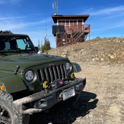
Fun drive, lots of dirt bikes and a few BDR Moto riders. Drove it in reverse direction.

Kim Richards
No Rating
Open
Visited: 09/19/2026
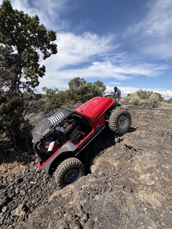
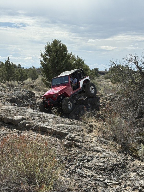
This trail was a great time. It is very unique, ive never been on a trail like it. the lava rock has plenty of traction and is pretty nasty on tires. But all in all I would recommend it to be done at ...
JP
Jared Pyne
Rated 3/5
Open
Visited: 09/15/2026
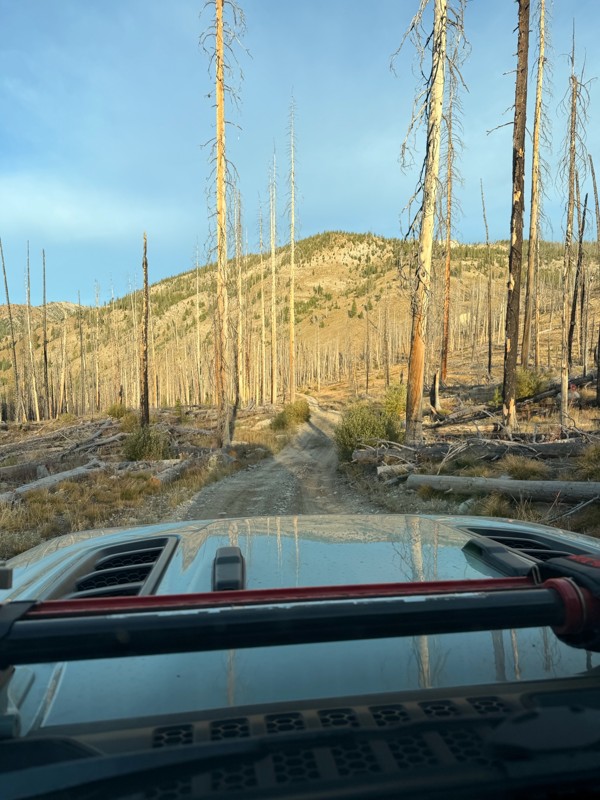
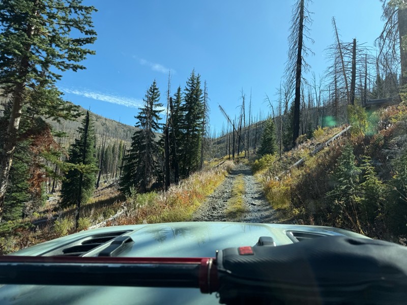
Trail consists of mostly narrow 2-track. Softball to soccer ball sized rocks. Slow going. Most of this forestland experienced fire in the past few years and is still recovering. Pulled a 9’ off-road t...
JH
Jason Holmes
No Rating
Open
Visited: 09/05/2026
Been going here for 57 years and the road keeps getting easier and easier. Sedans can make it.
BC
Bruce Chadwick
Rated 4/5
Open
Visited: 09/01/2026
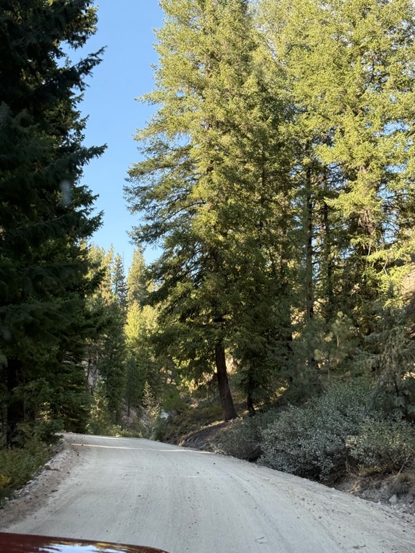
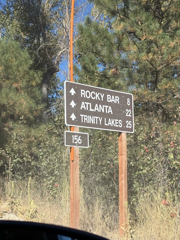
Easy trail that connects you to other great locations. Any vehicle could do this one.
PS
Paul Smith
Rated 4/5
Open
Visited: 09/01/2026
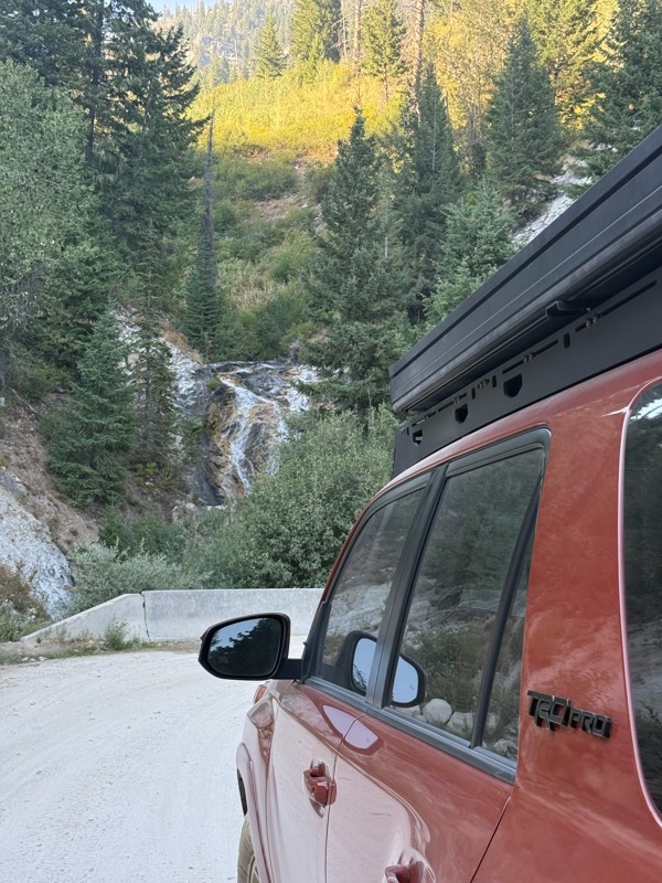
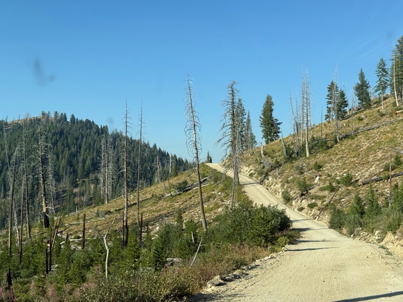
Pretty easy trail although there are some narrow spots along the way. Gets a bit bumpy and rocky as you head toward Atlanta but nothing difficult.
PS
Paul Smith
No Rating
Open
Visited: 09/01/2026
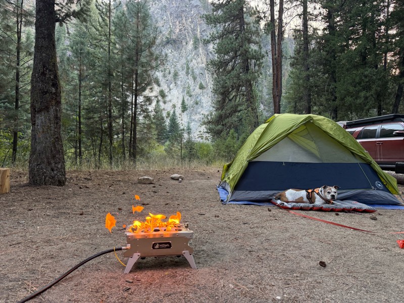
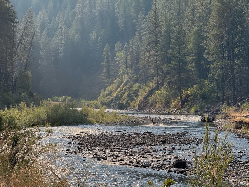
Beautiful and easy road. The smoke was wildfires was pretty bad but that can change. Any stock vehicle could do this at the moment. Campsites were all nearly empty which was a bonus.
PS
Paul Smith
Rated 3/5
Open
Visited: 08/22/2026
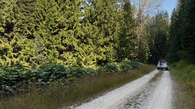
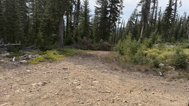
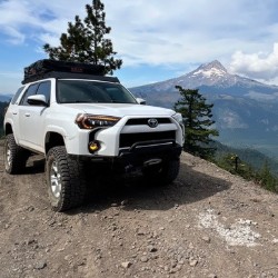
If it wasn't a very exciting trail, it still gets three stars because of how well-maintained it is. I can't even recall one single pothole the whole 4.5 miles. Otherwise, I was just using it as a conn...
Lorraine Bourget
Official Crew
Rated 3/5
Open
Visited: 08/22/2026
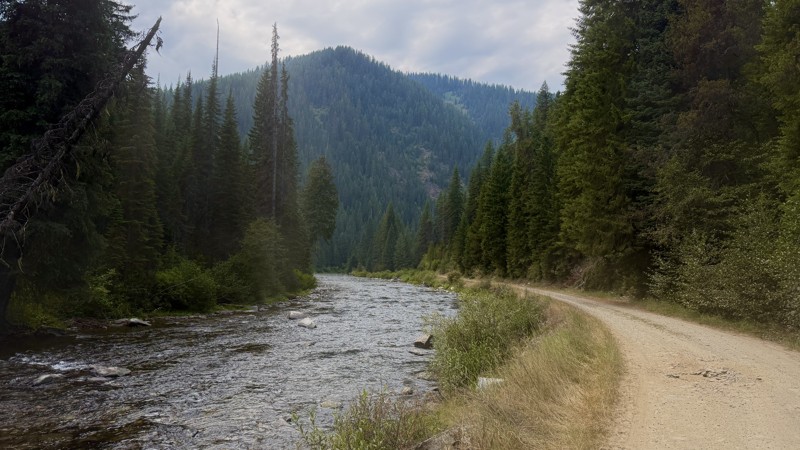
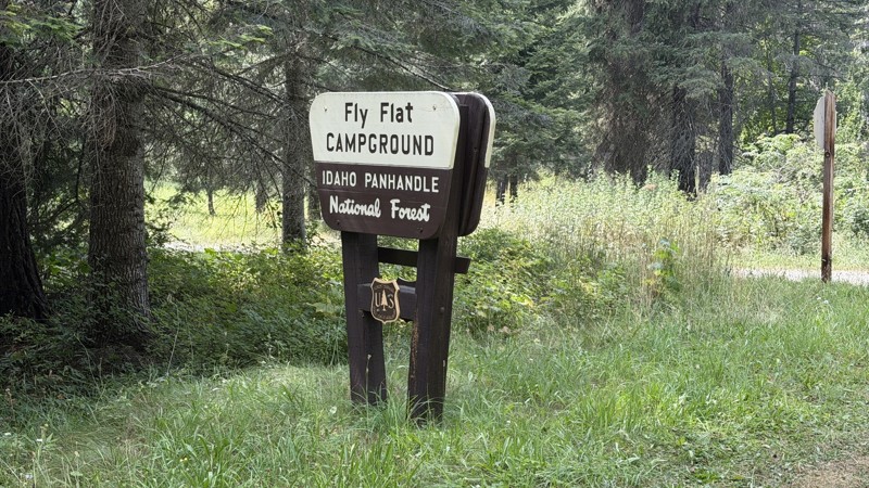
While it was a beautiful drive along the river, I'm rating this road 3 stars. Honestly, I planned my weekend around having the least amount of human contact possible but this section of my loop had ot...
Lorraine Bourget
Official Crew
Rated 5/5
Open
Visited: 08/22/2026
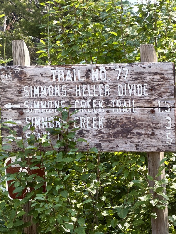
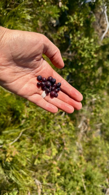
This trail holds a somewhat sentimental value to me. I randomly stumbled across it a couple of years ago when searching for somewhere to use my shower at the top of a mountain. Little did I know I wou...
Lorraine Bourget
Official Crew
Rated 4/5
Open
Visited: 08/21/2026
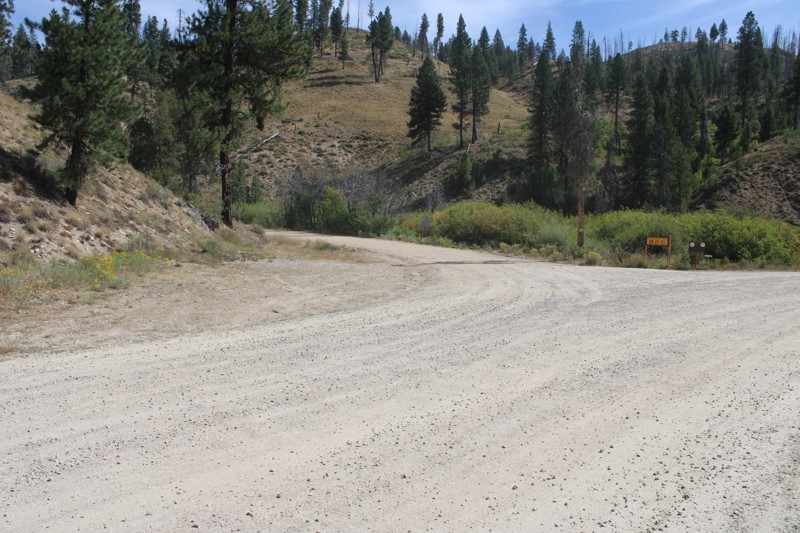
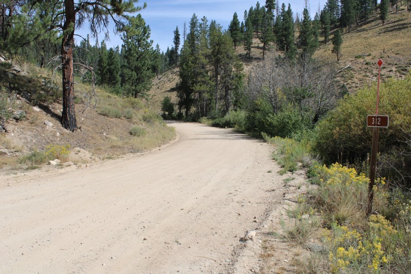
Pike's Fork Road is a spectacular drive into the heart of the Boise National Forest! One of the many dispersed campsites along its length makes an excellent destination for one night on a multi-night...

Bill Ward
Official Crew
Rated 5/5
Open
Visited: 08/16/2026
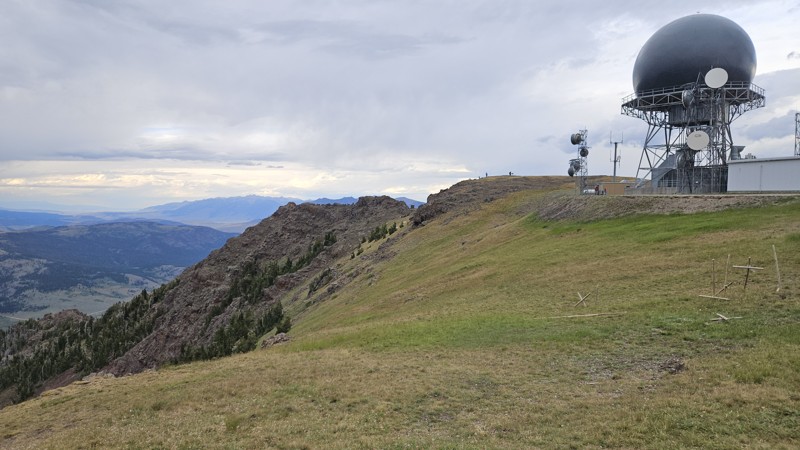
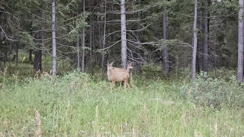
One person can give a group a bad name, especially in the side-by-side world, and that one was on the trail tonight like it was his private racetrack. Otherwise, a very peaceful and enjoyable drive. T...

Cory Wooldridge
Official Crew
Rated 5/5
Open
Visited: 08/11/2026
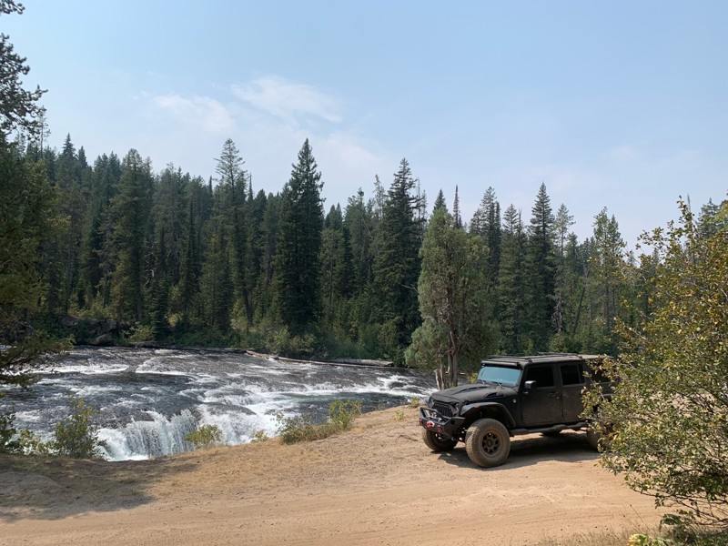
Great Jeep trail! Had fun running it and in pretty good shape. Dry and dusty with a few sections of rocks on decline/incline depending on what direction you’re going. No issues in my lifted Jeep. Not ...
JJ
Jill Jensen
No Rating
Open
Visited: 08/11/2026
Per the MVUM, the trail is seasonally open. As always, check current fire restrictions/closures before venturing out.

Trails Offroad
Official Crew
Open
Visited: 08/11/2026
Per the MVUM, the trail is seasonally open. As always, check current fire restrictions/closures before venturing out.
Trails Offroad
Official Crew
No Rating
Open
Visited: 08/11/2026
Per the MVUM, the trail is seasonally open. As always, check current fire restrictions/closures before venturing out.
Trails Offroad
Official Crew
No Rating
Open
Visited: 08/11/2026
Per the MVUM, the trail is seasonally open. As always, check current fire restrictions/closures before venturing out.
Trails Offroad
Official Crew
No Rating
Open
Visited: 08/11/2026
Per the MVUM, the trail is seasonally open. As always, check current fire restrictions/closures before venturing out.
Trails Offroad
Official Crew
No Rating
Open
Visited: 08/11/2026
Per the MVUM, the trail is seasonally open. As always, check current fire restrictions/closures before venturing out.

Todd
Official Crew
No Rating
Open
Visited: 08/11/2026
Per the MVUM, the trail is seasonally open. As always, check current fire restrictions/closures before venturing out.
Todd
Official Crew
No Rating
Open
Visited: 08/11/2026
Per the MVUM, the trail is seasonally open. As always, check current fire restrictions/closures before venturing out.
Todd
Official Crew
No Rating
Open
Visited: 08/11/2026
Per the MVUM, the trail is seasonally open. As always, check current fire restrictions/closures before venturing out.
Todd
Official Crew
No Rating
Open
Visited: 08/11/2026
Per the MVUM, the trail is seasonally open. As always, check current fire restrictions/closures before venturing out.
Todd
Official Crew
No Rating
Open
Visited: 08/11/2026
Per the MVUM, the trail is seasonally open. As always, check current fire restrictions/closures before venturing out.
Todd
Official Crew
No Rating
Open
Visited: 08/11/2026
Per the MVUM, the trail is seasonally open. As always, check current fire restrictions/closures before venturing out.
Todd
Official Crew
No Rating
Open
Visited: 08/11/2026
Per the MVUM, the trail is seasonally open. As always, check current fire restrictions/closures before venturing out.
Todd
Official Crew
No Rating
Open
Visited: 08/11/2026
Per the MVUM, the trail is seasonally open. As always, check current fire restrictions/closures before venturing out.
Todd
Official Crew
No Rating
Open
Visited: 08/11/2026
Per the MVUM, the trail is seasonally open. As always, check current fire restrictions/closures before venturing out.
Trails Offroad
Official Crew
No Rating
Open
Visited: 08/11/2026
Per the MVUM, the trail is seasonally open. As always, check current fire restrictions/closures before venturing out.
Trails Offroad
Official Crew
No Rating
Open
Visited: 08/11/2026
Per the MVUM, the trail is seasonally open. As always, check current fire restrictions/closures before venturing out.
Trails Offroad
Official Crew
No Rating
Open
Visited: 08/11/2026
Per the MVUM, the trail is seasonally open. As always, check current fire restrictions/closures before venturing out.
Trails Offroad
Official Crew
No Rating
Open
Visited: 08/11/2026
Per the MVUM, the trail is seasonally open. As always, check current fire restrictions/closures before venturing out.
Trails Offroad
Official Crew
No Rating
Open
Visited: 08/11/2026
Per the MVUM, the trail is seasonally open. As always, check current fire restrictions/closures before venturing out.
Trails Offroad
Official Crew
No Rating
Open
Visited: 08/11/2026
Per the MVUM, the trail is seasonally open. As always, check current fire restrictions/closures before venturing out.
Trails Offroad
Official Crew
No Rating
Open
Visited: 08/11/2026
Per the MVUM, the trail is seasonally open. As always, check current fire restrictions/closures before venturing out.
Trails Offroad
Official Crew
No Rating
Open
Visited: 08/11/2026
Per the MVUM, the trail is seasonally open. As always, check current fire restrictions/closures before venturing out.
Trails Offroad
Official Crew
No Rating
Open
Visited: 08/11/2026
Per the MVUM, the trail is seasonally open. As always, check current fire restrictions/closures before venturing out.
Trails Offroad
Official Crew
No Rating
Open
Visited: 08/11/2026
Per the MVUM, the trail is seasonally open. As always, check current fire restrictions/closures before venturing out.
Trails Offroad
Official Crew
No Rating
Open
Visited: 08/11/2026
Per the MVUM, the trail is seasonally open. As always, check current fire restrictions/closures before venturing out.
Trails Offroad
Official Crew
No Rating
Open
Visited: 08/11/2026
Per the MVUM, the trail is seasonally open. As always, check current fire restrictions/closures before venturing out.
Trails Offroad
Official Crew
No Rating
Open
Visited: 08/11/2026
Per the MVUM, the trail is seasonally open. As always, check current fire restrictions/closures before venturing out.
Trails Offroad
Official Crew
No Rating
Open
Visited: 08/11/2026
Per the MVUM, the trail is seasonally open. As always, check current fire restrictions/closures before venturing out.
Trails Offroad
Official Crew
No Rating
Open
Visited: 08/11/2026
Per the MVUM, the trail is seasonally open. As always, check current fire restrictions/closures before venturing out.
Trails Offroad
Official Crew
No Rating
Open
Visited: 08/11/2026
Per the MVUM, the trail is seasonally open. As always, check current fire restrictions/closures before venturing out.
Trails Offroad
Official Crew
No Rating
Open
Visited: 08/11/2026
Per the MVUM, the trail is seasonally open. As always, check current fire restrictions/closures before venturing out.
Trails Offroad
Official Crew
No Rating
Open
Visited: 08/11/2026
Per the MVUM, the trail is seasonally open. As always, check current fire restrictions/closures before venturing out.
Trails Offroad
Official Crew
No Rating
Open
Visited: 08/11/2026
Per the MVUM, the trail is seasonally open. As always, check current fire restrictions/closures before venturing out.
Trails Offroad
Official Crew
No Rating
Open
Visited: 08/11/2026
Per the MVUM, the trail is seasonally open. As always, check current fire restrictions/closures before venturing out.
Trails Offroad
Official Crew
No Rating
Open
Visited: 08/11/2026
Per the MVUM, the trail is seasonally open. As always, check current fire restrictions/closures before venturing out.
Trails Offroad
Official Crew
No Rating
Open
Visited: 08/11/2026
Per the MVUM, the trail is seasonally open. As always, check current fire restrictions/closures before venturing out.
Trails Offroad
Official Crew
Most Popular

Updated: 10/15/2024
Feltham Peak
Bonanza, Idaho
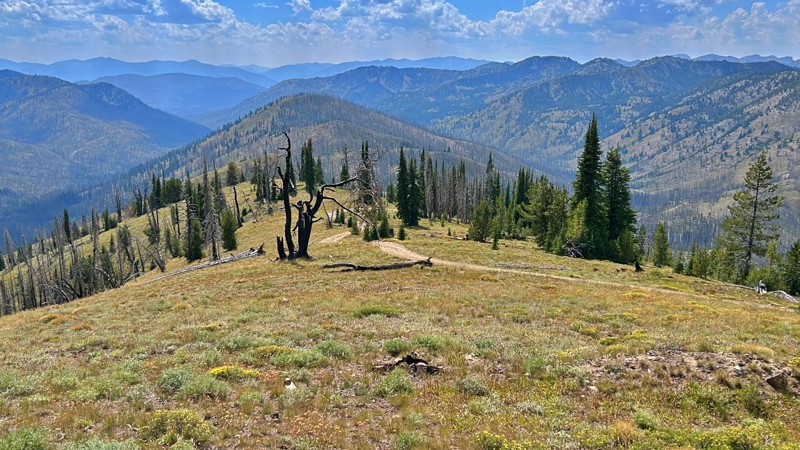
Feltham Peak, NF-174, is a picturesque path to the summit and the historic Feltham Peak Lookout remnants. This lookout, which has a history dating back to 1926, gradually succumbed to disrepair after World War II. All that remains today are its enduring pier footings and a solitary flagpole. From the elevated vantage point of Feltham Peak unfolds an extraordinary visual spectacle. An unmatched panorama stretches across the Salmon-Challis National Forest's expansive beauty and the neighboring landscape's rolling peaks. Feltham Peak is worth the short drive from the Pinyon Peak Loop to enjoy the views. There is camping at the trailhead or the summit near the pier footings of the former lookout.
Updated: 08/11/2025
Horse Heaven Pass
Dickey, Idaho
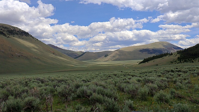
Horse Heaven Pass is a quiet, scenic back road tucked into the backside of the Lost River Range. This single-lane, unmaintained dirt trail connects Doublesprings Pass to the Upper Pahsimeroi, offering a mellow ride through open grasslands and sweeping alpine views. Though slightly bumpy near low-lying troughs and water collection areas, the route is relatively easy and passable with high clearance.
In spring and summer, the landscape bursts to life with wildflowers, lush grass, and the occasional grazing deer, elk, or pronghorn. Though no established campsites are marked, a few spur roads lead to peaceful, tucked-away spots at the base of the range, perfect for dispersed camping.
Once used as summer pasture for wild and domestic horses, Horse Heaven lives up to its name. There’s little traffic, no noise, and no distractions, just crisp mountain air, panoramic views, and a rare sense of solitude in one of Idaho’s most beautiful corners.
Updated: 10/15/2024
Carey Dome Fire Lookout
Green, Idaho
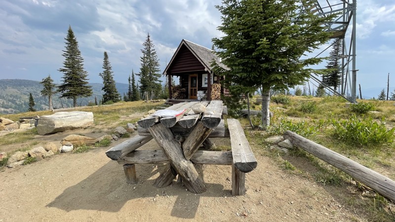
Since the 1920s, Carey Fire Tower has stood and is still active today. Its location was chosen due to its view in all directions of the remote backcountry in the Salmon River Mountains of west-central Idaho.
The road to the top is suitable for any high-clearance vehicle, and there is room for four to five vehicles to park. Once at the top, there is a stout picnic bench where you can enjoy lunch. The tower is seasonally staffed. If you are interested in fire towers, further reading can be found here.
Updated: 06/23/2025
Pat Hollow
Fish Haven, Idaho
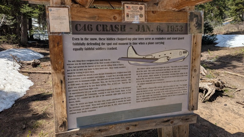
This trail in the Bear River Range leads to a tragic and historically significant site, the location of a C-46 aircraft crash that occurred on January 6, 1953, claiming the lives of 40 passengers.
The route starts moderately challenging with an uphill climb through a small rock garden. Beyond that, the trail becomes easier to navigate, though a large puddle may form during wetter seasons. Surrounded by dense pine forest, it offers a scenic drive that ends at the hiking trailhead. From there, a short walk down a dirt path leads to the memorial, where visitors can pay their respects and learn about the crash’s history. While there are no designated or dispersed campsites along this route, the journey is a meaningful one for those interested in historical events.
Updated: 10/15/2024
Immigrant Road
Sebree, Idaho
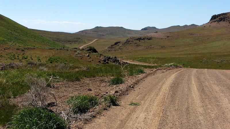
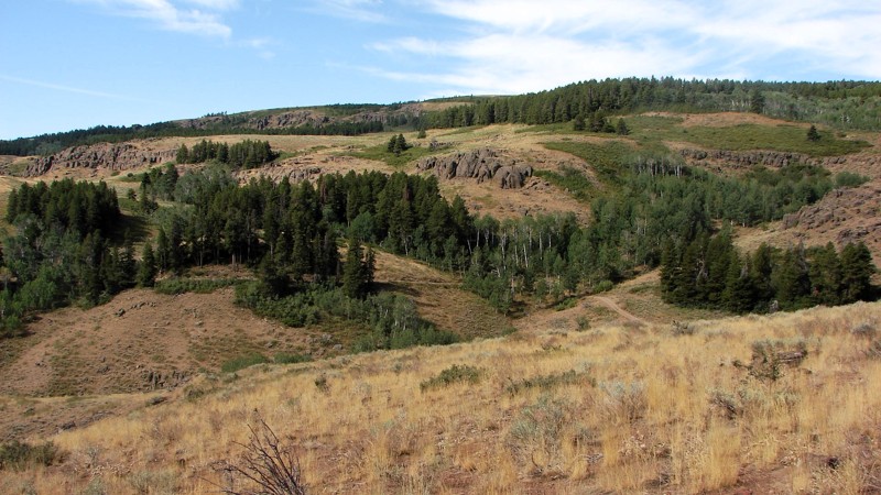
During most of the year, Immigrant Road is a well-maintained gravel road that is easy to drive and can be driven in any vehicle. However, there is no winter maintenance, so it can be dicey to drive during the winter. The west half of the road is mostly straight and runs along the foothills of the Bennett Mountains. The east half of the road runs through part of the Bennett Mountains; this section has significant climbs that twist and turn up and down the grades.
About midway along the road is an information board describing Kelton Road, Site 6 of the Main Oregon Trail Backcountry Byway. Kelton Road was a popular freight route bringing goods from the Transcontinental Railway at Kelton, Utah, up to Boise, Idaho.
Although dispersed camping is allowed on public lands bordering Immigrant Road, there are no obvious places to set up. Two sections of private land should be avoided if you decide to camp.
Updated: 10/15/2024
Winecup Road
Iversons, Idaho
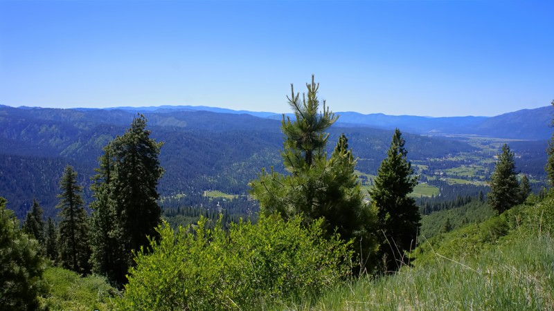
Winecup Road leaves Deadline Ridge, drops into the Goose Creek Draw, and runs somewhat parallel to Deadline Ridge Road until it enters Nevada, turning west and reconnecting with it. Winecup Road has a native surface of sand and gravel and sections with considerable rock. On the north end, Winecup is a reasonably nice gravel road, but towards the south, it degrades into a mostly gravel and sand two-track. Because of the rocky areas and some relatively short but steep and rocky climbs, good ground clearance is required, and four-wheel drive is recommended. Dispersed camping is allowed, but there are no great places where other people have established camps. Winecup Road is open range, so cattle and sheep may be encountered.
The north end of Winecup Road winds down from the ridge through stands of aspen, pine, and fir mixed with open areas of grass and sagebrush. The contrasts on the hillsides are pretty impressive! As you drive south, the trees disappear, and the vegetation turns into a sagebrush desert with a good mix of rabbit and bitterbrush.
Updated: 06/05/2022
East Fork Scriver Creek
Garden Valley, Idaho
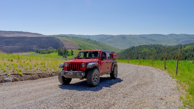
The beauty of southwestern Idaho is second to none, with hundreds of off-road trails available for exploration. You'll pass through the town of Crouch to get to the trailhead, a population of less than 200 with a couple of restaurants, a market, and a hardware store. Crouch is a hub for trails like this one, plus whitewater rafting and kayaking on the south fork of the Payette River. You'll share this trail with other 4-bys, plus side x sides, motorcycles, elk, and deer.
Updated: 10/15/2024
Wells Canyon
Georgetown, Idaho
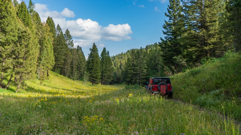
Wells Canyon is a connector running between Crow Creek Road and the junction of Georgetown Canyon Road and Diamond Creek Road. The initial climb up Wells Canyon is on a wide, maintained road made of dark chunky slate-like rock. Although not challenging, the surface does make for a bumpy ride, and combined with the uphill grade, you may slip a little. At the top of the climb is a large active phosphate mine. Don't be deterred. There is well-placed signage directing you to stay safely on the public-access road. Just follow the Scout Route's gpx track. A pull-out area has information signage about the history of the mine and what the phosphate is used for. There is no camping available along Wells Canyon.
Updated: 10/15/2024
Free Use Canyon
Sarilda, Idaho
Free Use Canyon is an out-and-back trail dead ending at a small turnaround due to a locked gate. The trail is pretty narrow and overgrown. However, due to its semi-shaded nature, it allows drivers to view the incredible wildflowers that paint this forest in the spring and summer. Camping is also an option right after the trailhead among the towering pines. This is a popular area for hunters in the fall, so the campsites are large, flat, and well-established.
Updated: 10/15/2024
C700
Spiry Place, Idaho
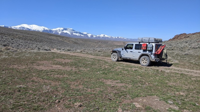
C700 is accessed off Adler Creek Road, south of Oreana, Idaho. The early section of the trail is relatively smooth and easy through a series of gullies. The trail drops off the high plateau about midway, winding down a long, steep ridge with tight turns. The ridge has spectacular vistas of the Sawtooth Mountains to the north and deep canyons. After about 6.4 miles, the trail enters private property, although there is no fence or signage. At that point, out of respect for the landowners, it’s best to turn around and find another trail to get back to Adler Creek Road or wherever your front bumper leads you!
This trail has a maximum of 18 degrees of pitch and 15 degrees of roll. 4WD, good tires, and good ground clearance are a must. C700 is a fun road to drive, with just enough challenges to make it exciting but not scary.
Dispersed camping is allowed in the area, and there are several likely spots to set up camp.
Owyhee County in Southwest Idaho has over 5000 square miles of desert, canyons, and mountains. There are no services in the entire area, and cell coverage is spotty. Being adequately prepared for almost any contingency is a must. Because there are multitudes of crisscrossing trails, a good navigation system, a backup system, and the knowledge to use them is a must.
Updated: 10/15/2024
Homer Bedal Homestead
James Place, Idaho
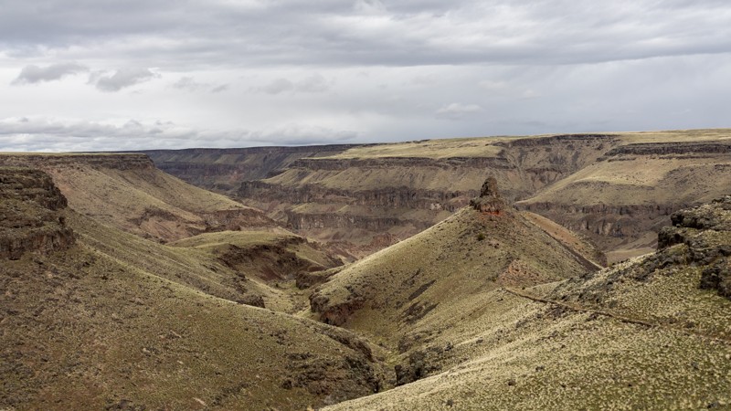
Homer Bedal Homestead is a rarely-visited homestead with several abandoned buildings and farming implements. Please leave artifacts where they are found for future visitors' enjoyment. Portuguese immigrants once settled this land along the river, and though a fire may have swept through, several structures still stand. Midsize 4WD vehicles and ATVs are recommended, as full-size vehicles may have difficulty maneuvering around rocks on the canyon's steep grade. There are jaw-dropping views from the canyon rim down to the river below in every direction. By the river, there are areas that can be used for dispersed camping.
Updated: 08/11/2026
Pebble Creek Road
Pebble, Idaho
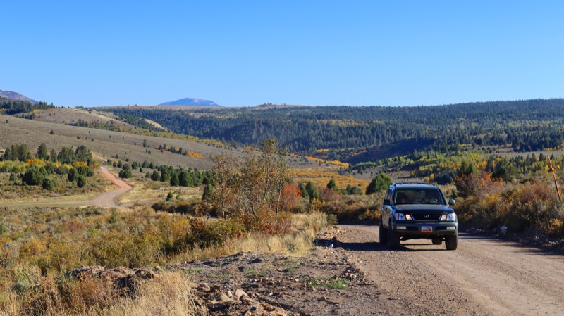
Pebble Creek Road, named for the stream it follows along much of its eastern stretch, serves as the easiest eastern entrance to the Caribou-Targhee National Forest east of Pocatello and provides the most direct route to the beautiful Big Springs Campground. This well-maintained dirt road also offers access to excellent dispersed camping spots along the way. However, the area is fairly secluded, so visitors should not expect any amenities nearby.
Updated: 08/11/2026
Long Gulch Road
Pebble, Idaho
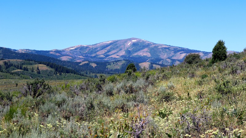
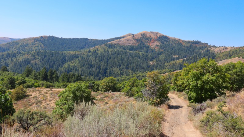
Between Toponce Canyon Road and the Big Springs Camping area, Long Gulch Road is exactly as the name suggests; a long offroad trail that runs through a gulch along its southwestern section. This trail will take you up and down small canyons and through abundant dispersed camping areas, as it winds its way between The Bureau of Land Management and Caribou-Targhee National Forest Management areas. Most of the road is fairly easy to traverse, but high clearance and low-range four-wheel drive is required for some of the steeper hill climbs and rough terrain.
Updated: 08/11/2026
Blackrock Canyon
Blackrock, Idaho
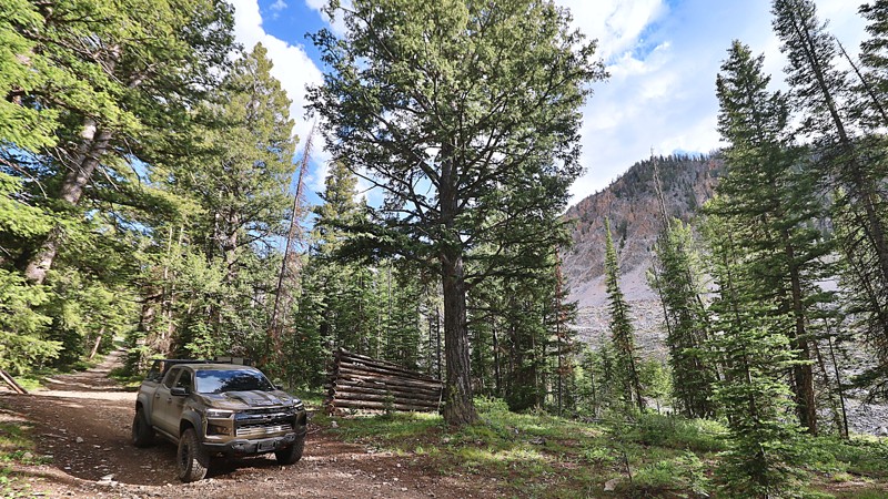
Slicing through the center of the Chinese Peak-Blackrock Trail System, Black Canyon is a beautiful, out-and-back forest road with great camping spots and beautiful views for its entire 4-mile length. The trail is not challenging, but high clearance and low range will be useful for the occasional steep climb and uneven terrain. The most northern portion is an optional narrow trail full of overgrowth that comes to an abrupt dead end at a locked gate. At the southern start of the trail, you can find a large staging area with sheltered picnic tables, fire rings, and vaulted toilets.
Connect this trail with 0319 and 03113 to create a full loop.
This is a popular trail system for all user types, as there are over 40 miles of trails for motorized, equestrian, mountain biking, and hiking users. The trail system is seasonally closed from November 16th to April 15th each year.
Updated: 08/12/2025
Weda'a Naokwaide
Hahn, Idaho
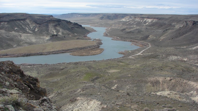
The “Weda’a Naokwaide” trail, often referred to as the Hidden Lemhi Pass, is a rough and remote route that carves its way across the western slopes of Idaho’s Lemhi Range. This lesser-known passage offers a raw, unfiltered offroad experience for those seeking solitude and scenery far from the beaten path.
The ascent is marked by narrow shelf roads peppered with sharp, loose rocks. While the stones aren’t especially large, the steep incline makes this a trail where 4LO is highly recommended. It’s not a technical rock crawl, but the combination of elevation, exposure, and terrain demands a steady hand and a well-equipped rig.
As you descend the western flank of the Lemhi Range, the terrain gives way to sweeping views that stretch across the Pahsimeroi Valley and to the distant jagged peaks of the Lost River Range.
At the base of the trail, you'll find a scattering of dispersed campsites, offering peaceful places to post up for the night. Whether you’re looking for a scenic crossover, a rugged drive, or simply a place to disconnect and explore, Weda’a Naokwaide delivers in every way, with drama, beauty, and the thrill of finding something hidden and wild.
Updated: 10/15/2024
Black Butte
Morgan Place, Idaho
Access to Black Butte in the Morley Nelson Snake River Birds of Prey National Conservation Area (NCA) is off Range Road. The Range Road loop encircles the Idaho National Guard Artillery Range--a live fire range used for training. DO NOT go into the inner part of the loop! Signs are spaced every 100 yards and at the intersections of all roads leading into the artillery range, warning you to keep out. Please obey those signs!
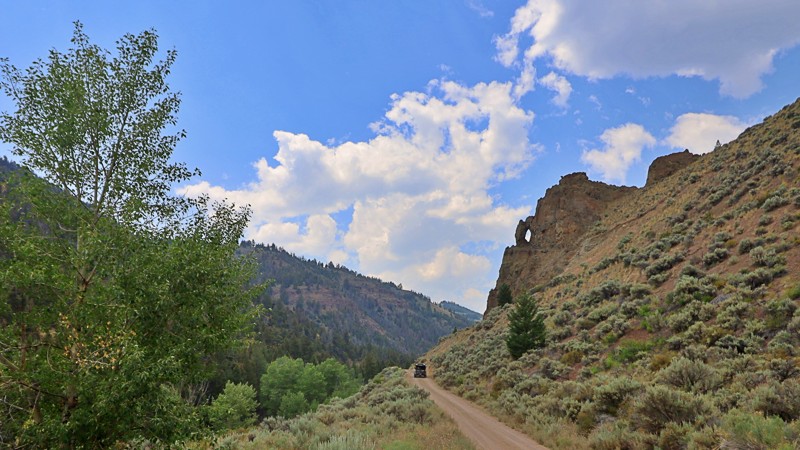
Black Butte is outside the southern end of the artillery range. The butte is not exceptionally high or imposing but offers a spectacular view of the Snake River from its southeast side. The views of the river, its steep-walled canyon, and the mountains in the distance are well worth the short trip! The end of the road above the river would be a fine place to camp. Dispersed camping is allowed anywhere outside of the artillery range in the NCA!
The trail is not particularly difficult but does have rough and rocky patches. Recent rains can cause considerable puddling in the tire tracks and slippery conditions.
Updated: 08/11/2026
Big Boulder
Clayton, Idaho
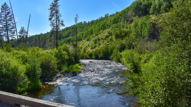
Nestled amidst the rugged beauty of the Sawtooth National Forest lies Big Boulder Creek Road, a vital link to the storied Railroad Ridge, the highest driving road in Idaho at 10417 in elevation, and the hiking trails of the majestic mountain peaks of Cecil D. Andrus White Clouds Wilderness.
While Big Boulder Creek Road is navigable by passenger cars, it demands respect with its occasional rough patches strewn with rocks and occasional washouts. This narrow path closely hugs the cascading waters of Big Boulder Creek, meandering through a dramatic canyon that leaves little room for dispersed camping.
Yet, for those who traverse its twists and turns, a gateway to Idaho's wilderness awaits- a journey blending the thrill of exploration with the serenity of high-altitude landscapes.
Updated: 10/15/2024
241
Warm River, Idaho
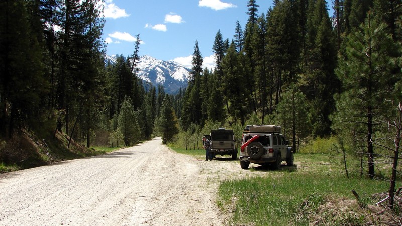
Robinson Creek Trail 241 is a fantastic way to connect your adventures near Cave Falls with Fish Creek Road 082 without backtracking to Mesa Falls Scenic Byway. This short trail has great views, but no camping.
Updated: 10/15/2024
Swanholm Road
Rocky Bar, Idaho
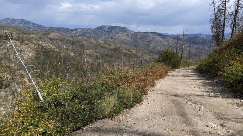
Swanholm Road is a well-maintained and easy gravel road connecting the east end of the North Fork Boise River with the Middle Fork Road and forms part of a backcountry route from Idaho City to Atlanta. There are a number of side roads and trails that can be explored, but some of them are width-limited for ATVs or motorcycles. Dispersed camping is allowed all along the road, and there are numerous nice places to set up for the night. At the north end of the road is Deer Park Campground, a semi-developed camping area with several nice sites along the river.
Updated: 10/15/2024
Mill Creek
Prairie, Idaho
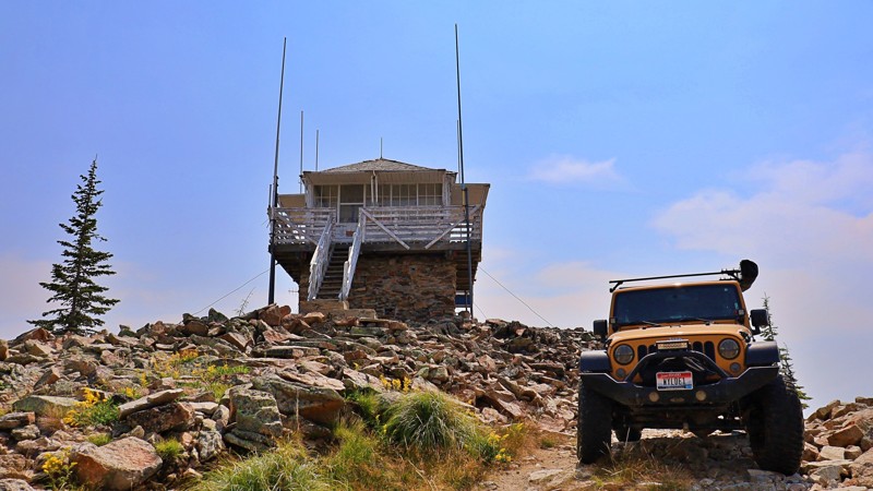
Mill Creek winds through standing dead timber killed in the 2013 Elk Fire. Brush and smaller trees are returning after the fire's devastation. Running through the Boise National Forest between Castle Creek and House Mountain Road, Mill Creek is a fun, interesting, scenic, and relatively easy road. The shelf road section views into and across the steep valley to the distant mountains are spectacular!
After less than a mile from the east end, the road makes a hard right and becomes a narrow shelf road cut into a steep mountainside. The primary hazards along Mill Creek include down timber, gullies, washouts, and pin-striping. This is open-range, so watch out for livestock on or near the road. The shelf section has a few pullouts for passing.
While dispersed camping is available along the entire road, it can be difficult to find a place both big and flat enough to set up camp in the shelf road sections.
Updated: 10/15/2024
Castle Butte Lookout
Powell Junction, Idaho
Perched on a rugged rocky point at an elevation of 6,659 feet, Castle Butte Lookout is a unique cabin offering unparalleled 360-degree vistas of the Selway-Bitterroot Wilderness, the Seven Devils Mountains, the Great Burn area, and the deep canyons carved by the upper drainages of the North Fork Clearwater River.
Access to this remote lookout is via the Lolo Motorway, a primitive, single-lane road created by the Civilian Conservation Corps in the early 1930s. The trail to the lookout is unmaintained, susceptible to washouts and gullies, and not recommended for large RVs, vehicles with low ground clearance, or trailers. Visitors should be prepared to walk approximately 100 feet up a steep, rocky path to reach the lookout.
Castle Butte Lookout has a rich history, serving the Clearwater National Forest since 1916 as a modest frame cabin. In 1928, it was replaced by an R-1 log cabin with a distinctive cupola. The current structure, a 14’x14’ L-4 cab with a surrounding catwalk perched on a 10-foot stone base, was constructed in 1950. This historic lookout, recently restored, is now part of the recreation rental system, offering a unique connection to the past.
Castle Butte Lookout has a few basic comforts, though guests need to bring additional gear and supplies to enhance their stay. The breathtaking panoramic views alone promise an unforgettable experience.
For those seeking a more grounded experience, an area for dispersed camping is nestled among the trees along the trail below the lookout.
Updated: 10/15/2024
Poison Creek Cutoff
Doyle Place, Idaho
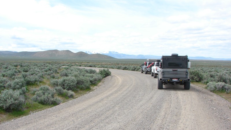
Poison Creek Cutoff is a well-maintained gravel road that goes from Mud Flat Road, aka the Owyhee Back Country Scenic Byway, to near the little town of Oreana. For much of its length, the road parallels the foothills of the Owyhee Mountains, with several side roads going over to and, presumably, into the foothills. Those traveling south on Highway 78 and desiring to get onto Mud Flat Road can save quite a few miles by taking the Cutoff.
As it follows the foothills of the Owyhee Mountains, Poison Creek Cutoff winds into and through interesting and scenic small draws and canyons. The largest draw is toward the south end, and the climb out is steep and winding with limited visibility, making it the hardest part of the road. Because it is a well maintained gravel road it can be driven in most any vehicle but care does need to be taken for other vehicles. Since the area is open range, there could be cattle on or near the road.
Dispersed camping is allowed along Poison Creek Cutoff, but there are no obvious campsites.
Updated: 10/15/2024
Phifer Creek Road
Rocky Bar, Idaho
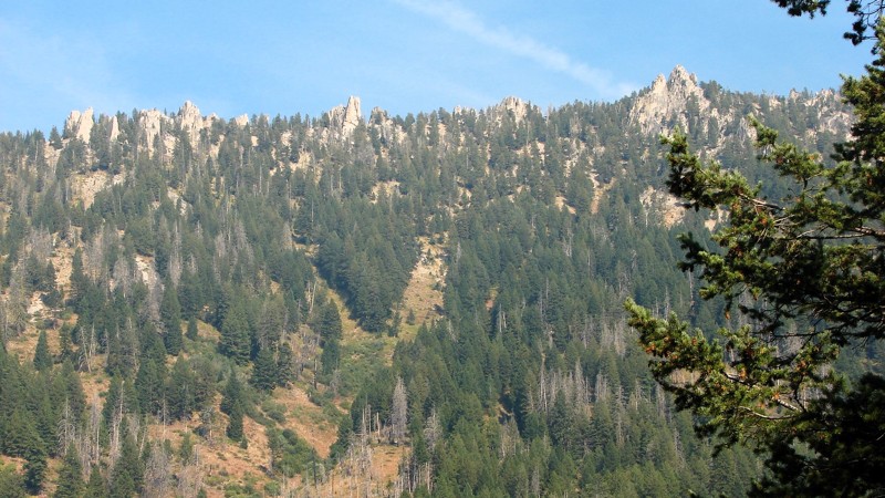
Phifer Creek Road climbs sharply from the Middle Fork of the Boise River to Trinity Ridge Road. It is a one-lane gravel and rock road suitable for any vehicle with moderately high clearance. Although in generally good shape, there are sections with rocks and washouts. There are many tight switchbacks with quite steep sections right in the turn. Most of the road is in a timber tunnel that restricts the big views; however, there are enough open areas where the views open up to keep the road interesting. During fire season, the views can be blocked by smoke and haze.
No campgrounds are along Phifer Creek Road, but numerous opportunities exist for dispersed camping.
Updated: 10/15/2024
Wilson Creek Road
Lowman, Idaho
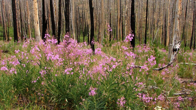
Wilson Creek Road is a primarily one-lane sand and gravel road from Deadwood Reservoir to Landmark-Stanley Road. Other than minor potholes and small washouts, it is an easy drive suitable for all but the lowest clearance vehicles. Much of the road goes through burned-out forests with a lot of standing dead trees. Be prepared to clear downed trees or turn back and take a different route should a tree cross the road. The primary hazards are oncoming traffic, which can be heavy on weekends, dust, and shortened sight lines due to the curves.
There are no campgrounds along the road and no obvious places where people have dispersed camped, although there are occasional wide spots in the road where dispersed camping would be possible. Several campgrounds lie around Deadwood Reservoir.
There are plenty of opportunities for big views. However, during fire season, the air can be quite smoky, which limits longer-range viewing.

Upgrade your Membership
Unlock all of the details on every Trail Guide and Scout Route.
Start a 7-day Free TrialBrowse Trails in Idaho by City
Browse every Idaho city with offroad trail guides.
Community
Partners

