


By clicking "ACCEPT", you agree to be the terms and conditions of each policy linked to above. You also agree to the storing of cookies on your device to facilitate the operation and functionality of our site, enhance and customize your user experience, and to analyze how our site is used.
Idaho Off-Road Trails
63
Total Trail Guides 60

644
Detailed Waypoints 302
Try a Free 7-Day Trial and unlock it all
Start a Free Trial Most Recent Trail Reviews
No Rating
Open
Visited: 09/19/2026
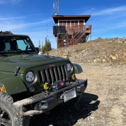
Fun drive, lots of dirt bikes and a few BDR Moto riders. Drove it in reverse direction.

Kim Richards
No Rating
Open
Visited: 09/19/2026
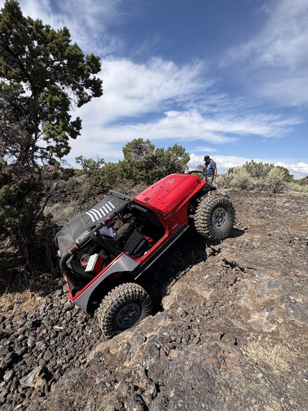
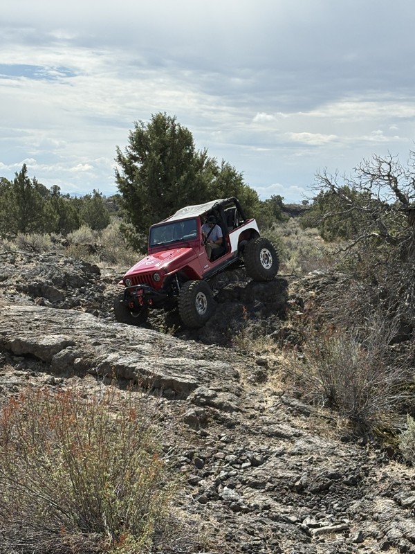
This trail was a great time. It is very unique, ive never been on a trail like it. the lava rock has plenty of traction and is pretty nasty on tires. But all in all I would recommend it to be done at ...
JP
Jared Pyne
Rated 3/5
Open
Visited: 09/15/2026
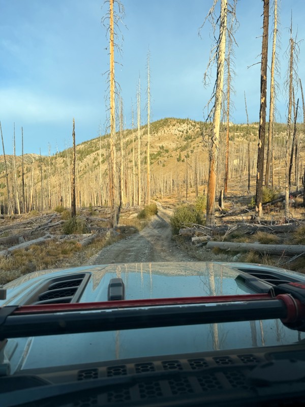
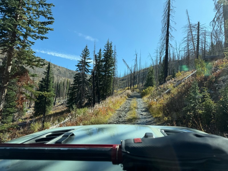
Trail consists of mostly narrow 2-track. Softball to soccer ball sized rocks. Slow going. Most of this forestland experienced fire in the past few years and is still recovering. Pulled a 9’ off-road t...
JH
Jason Holmes
No Rating
Open
Visited: 09/05/2026
Been going here for 57 years and the road keeps getting easier and easier. Sedans can make it.
BC
Bruce Chadwick
Rated 4/5
Open
Visited: 09/01/2026
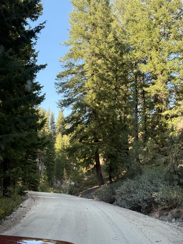
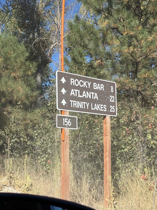
Easy trail that connects you to other great locations. Any vehicle could do this one.
PS
Paul Smith
Rated 4/5
Open
Visited: 09/01/2026
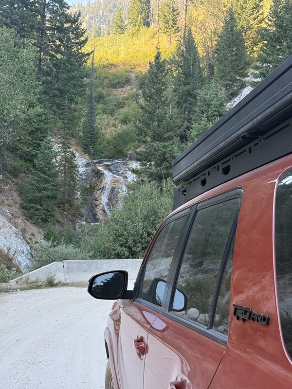
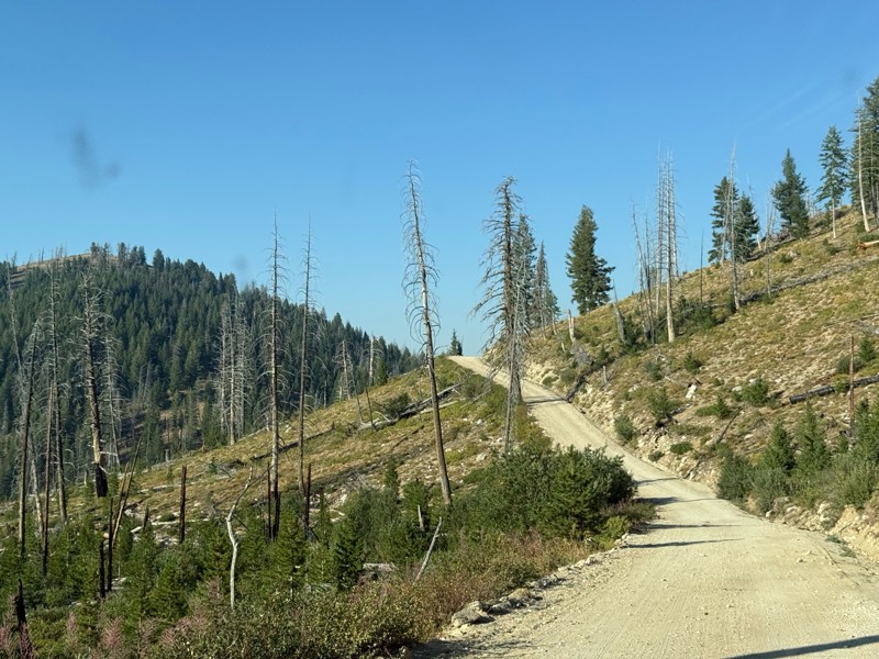
Pretty easy trail although there are some narrow spots along the way. Gets a bit bumpy and rocky as you head toward Atlanta but nothing difficult.
PS
Paul Smith
No Rating
Open
Visited: 09/01/2026
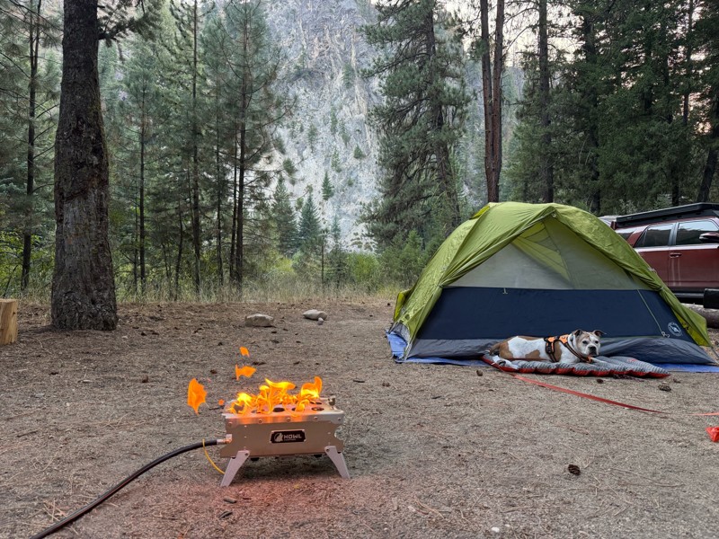
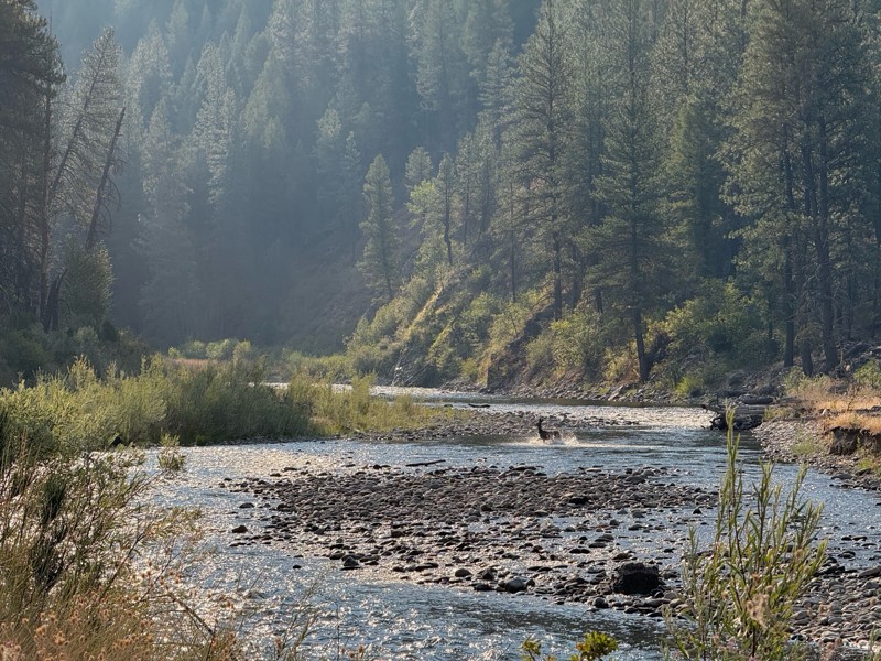
Beautiful and easy road. The smoke was wildfires was pretty bad but that can change. Any stock vehicle could do this at the moment. Campsites were all nearly empty which was a bonus.
PS
Paul Smith
Rated 3/5
Open
Visited: 08/22/2026
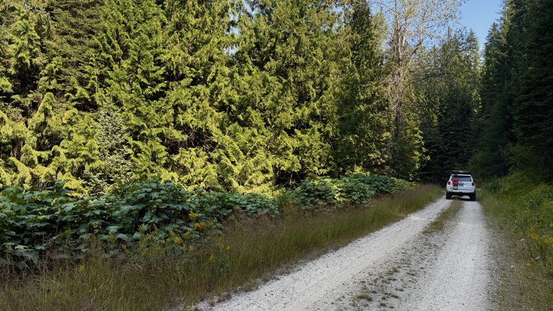
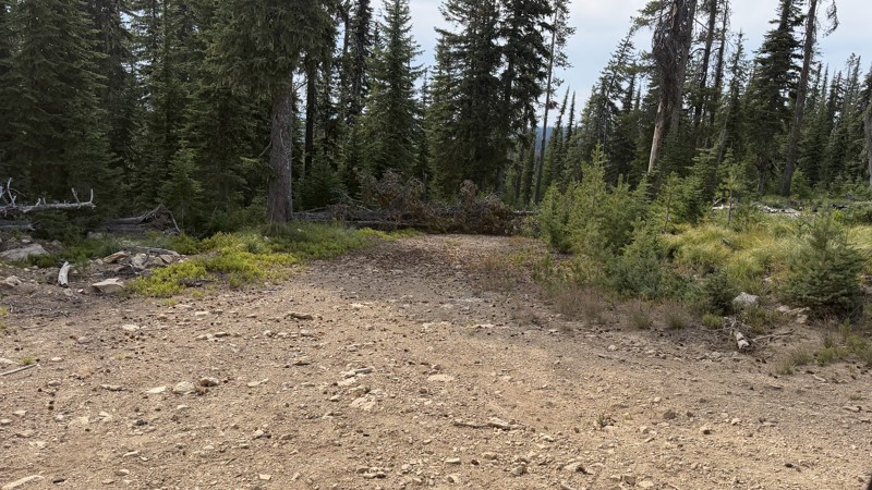
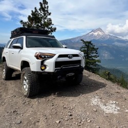
If it wasn't a very exciting trail, it still gets three stars because of how well-maintained it is. I can't even recall one single pothole the whole 4.5 miles. Otherwise, I was just using it as a conn...
Lorraine Bourget
Official Crew
Rated 3/5
Open
Visited: 08/22/2026
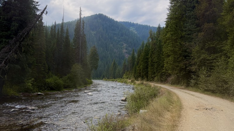
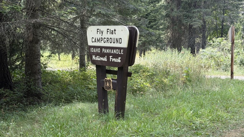
While it was a beautiful drive along the river, I'm rating this road 3 stars. Honestly, I planned my weekend around having the least amount of human contact possible but this section of my loop had ot...
Lorraine Bourget
Official Crew
Rated 5/5
Open
Visited: 08/22/2026
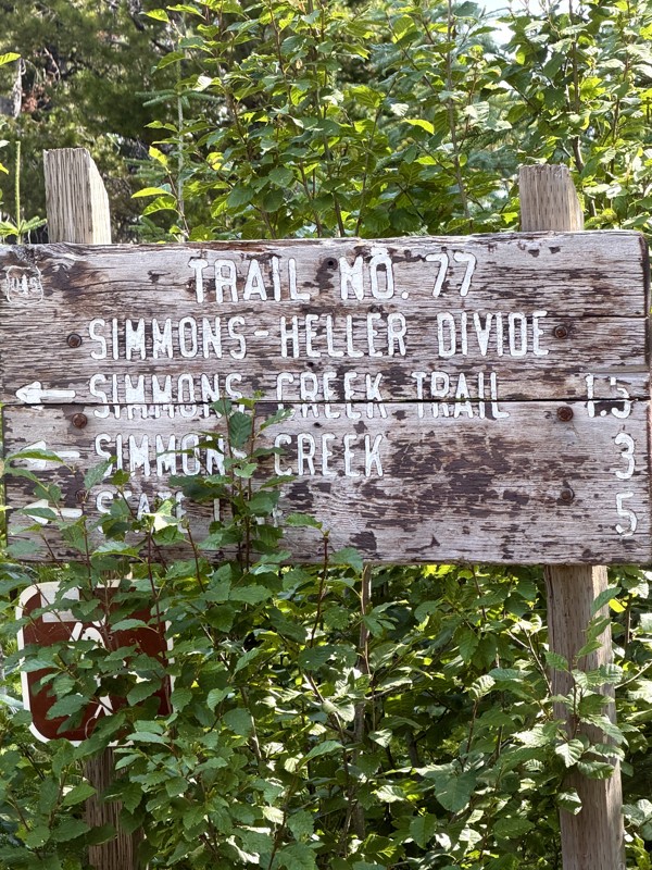
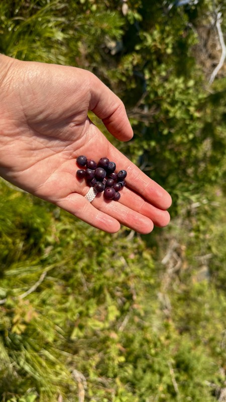
This trail holds a somewhat sentimental value to me. I randomly stumbled across it a couple of years ago when searching for somewhere to use my shower at the top of a mountain. Little did I know I wou...
Lorraine Bourget
Official Crew
Rated 4/5
Open
Visited: 08/21/2026
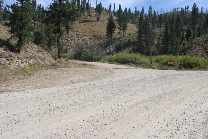
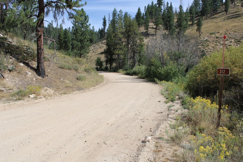
Pike's Fork Road is a spectacular drive into the heart of the Boise National Forest! One of the many dispersed campsites along its length makes an excellent destination for one night on a multi-night...

Bill Ward
Official Crew
Rated 5/5
Open
Visited: 08/16/2026
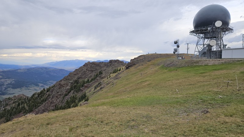
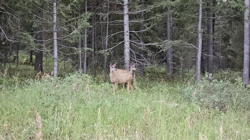
One person can give a group a bad name, especially in the side-by-side world, and that one was on the trail tonight like it was his private racetrack. Otherwise, a very peaceful and enjoyable drive. T...

Cory Wooldridge
Official Crew
Rated 5/5
Open
Visited: 08/11/2026
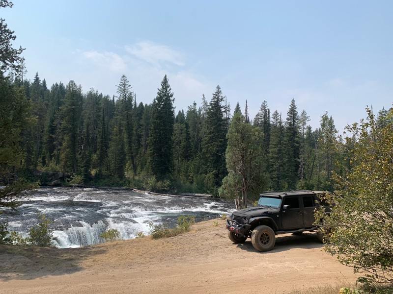
Great Jeep trail! Had fun running it and in pretty good shape. Dry and dusty with a few sections of rocks on decline/incline depending on what direction you’re going. No issues in my lifted Jeep. Not ...
JJ
Jill Jensen
No Rating
Open
Visited: 08/11/2026
Per the MVUM, the trail is seasonally open. As always, check current fire restrictions/closures before venturing out.

Trails Offroad
Official Crew
Open
Visited: 08/11/2026
Per the MVUM, the trail is seasonally open. As always, check current fire restrictions/closures before venturing out.
Trails Offroad
Official Crew
No Rating
Open
Visited: 08/11/2026
Per the MVUM, the trail is seasonally open. As always, check current fire restrictions/closures before venturing out.
Trails Offroad
Official Crew
No Rating
Open
Visited: 08/11/2026
Per the MVUM, the trail is seasonally open. As always, check current fire restrictions/closures before venturing out.
Trails Offroad
Official Crew
No Rating
Open
Visited: 08/11/2026
Per the MVUM, the trail is seasonally open. As always, check current fire restrictions/closures before venturing out.
Trails Offroad
Official Crew
No Rating
Open
Visited: 08/11/2026
Per the MVUM, the trail is seasonally open. As always, check current fire restrictions/closures before venturing out.

Todd
Official Crew
No Rating
Open
Visited: 08/11/2026
Per the MVUM, the trail is seasonally open. As always, check current fire restrictions/closures before venturing out.
Todd
Official Crew
No Rating
Open
Visited: 08/11/2026
Per the MVUM, the trail is seasonally open. As always, check current fire restrictions/closures before venturing out.
Todd
Official Crew
No Rating
Open
Visited: 08/11/2026
Per the MVUM, the trail is seasonally open. As always, check current fire restrictions/closures before venturing out.
Todd
Official Crew
No Rating
Open
Visited: 08/11/2026
Per the MVUM, the trail is seasonally open. As always, check current fire restrictions/closures before venturing out.
Todd
Official Crew
No Rating
Open
Visited: 08/11/2026
Per the MVUM, the trail is seasonally open. As always, check current fire restrictions/closures before venturing out.
Todd
Official Crew
No Rating
Open
Visited: 08/11/2026
Per the MVUM, the trail is seasonally open. As always, check current fire restrictions/closures before venturing out.
Todd
Official Crew
No Rating
Open
Visited: 08/11/2026
Per the MVUM, the trail is seasonally open. As always, check current fire restrictions/closures before venturing out.
Todd
Official Crew
No Rating
Open
Visited: 08/11/2026
Per the MVUM, the trail is seasonally open. As always, check current fire restrictions/closures before venturing out.
Todd
Official Crew
No Rating
Open
Visited: 08/11/2026
Per the MVUM, the trail is seasonally open. As always, check current fire restrictions/closures before venturing out.
Trails Offroad
Official Crew
No Rating
Open
Visited: 08/11/2026
Per the MVUM, the trail is seasonally open. As always, check current fire restrictions/closures before venturing out.
Trails Offroad
Official Crew
No Rating
Open
Visited: 08/11/2026
Per the MVUM, the trail is seasonally open. As always, check current fire restrictions/closures before venturing out.
Trails Offroad
Official Crew
No Rating
Open
Visited: 08/11/2026
Per the MVUM, the trail is seasonally open. As always, check current fire restrictions/closures before venturing out.
Trails Offroad
Official Crew
No Rating
Open
Visited: 08/11/2026
Per the MVUM, the trail is seasonally open. As always, check current fire restrictions/closures before venturing out.
Trails Offroad
Official Crew
No Rating
Open
Visited: 08/11/2026
Per the MVUM, the trail is seasonally open. As always, check current fire restrictions/closures before venturing out.
Trails Offroad
Official Crew
No Rating
Open
Visited: 08/11/2026
Per the MVUM, the trail is seasonally open. As always, check current fire restrictions/closures before venturing out.
Trails Offroad
Official Crew
No Rating
Open
Visited: 08/11/2026
Per the MVUM, the trail is seasonally open. As always, check current fire restrictions/closures before venturing out.
Trails Offroad
Official Crew
No Rating
Open
Visited: 08/11/2026
Per the MVUM, the trail is seasonally open. As always, check current fire restrictions/closures before venturing out.
Trails Offroad
Official Crew
No Rating
Open
Visited: 08/11/2026
Per the MVUM, the trail is seasonally open. As always, check current fire restrictions/closures before venturing out.
Trails Offroad
Official Crew
No Rating
Open
Visited: 08/11/2026
Per the MVUM, the trail is seasonally open. As always, check current fire restrictions/closures before venturing out.
Trails Offroad
Official Crew
No Rating
Open
Visited: 08/11/2026
Per the MVUM, the trail is seasonally open. As always, check current fire restrictions/closures before venturing out.
Trails Offroad
Official Crew
No Rating
Open
Visited: 08/11/2026
Per the MVUM, the trail is seasonally open. As always, check current fire restrictions/closures before venturing out.
Trails Offroad
Official Crew
No Rating
Open
Visited: 08/11/2026
Per the MVUM, the trail is seasonally open. As always, check current fire restrictions/closures before venturing out.
Trails Offroad
Official Crew
No Rating
Open
Visited: 08/11/2026
Per the MVUM, the trail is seasonally open. As always, check current fire restrictions/closures before venturing out.
Trails Offroad
Official Crew
No Rating
Open
Visited: 08/11/2026
Per the MVUM, the trail is seasonally open. As always, check current fire restrictions/closures before venturing out.
Trails Offroad
Official Crew
No Rating
Open
Visited: 08/11/2026
Per the MVUM, the trail is seasonally open. As always, check current fire restrictions/closures before venturing out.
Trails Offroad
Official Crew
No Rating
Open
Visited: 08/11/2026
Per the MVUM, the trail is seasonally open. As always, check current fire restrictions/closures before venturing out.
Trails Offroad
Official Crew
No Rating
Open
Visited: 08/11/2026
Per the MVUM, the trail is seasonally open. As always, check current fire restrictions/closures before venturing out.
Trails Offroad
Official Crew
No Rating
Open
Visited: 08/11/2026
Per the MVUM, the trail is seasonally open. As always, check current fire restrictions/closures before venturing out.
Trails Offroad
Official Crew
No Rating
Open
Visited: 08/11/2026
Per the MVUM, the trail is seasonally open. As always, check current fire restrictions/closures before venturing out.
Trails Offroad
Official Crew
No Rating
Open
Visited: 08/11/2026
Per the MVUM, the trail is seasonally open. As always, check current fire restrictions/closures before venturing out.
Trails Offroad
Official Crew
No Rating
Open
Visited: 08/11/2026
Per the MVUM, the trail is seasonally open. As always, check current fire restrictions/closures before venturing out.
Trails Offroad
Official Crew
Most Popular

Updated: 07/13/2025
Salmon River Road
Riggins Hot Springs, Idaho
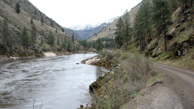
Salmon River Road starts in Riggins, Idaho, and ends at the Vinegar Creek Boat Ramp. Vinegar Creek is the furthest upstream launch point for jet boat operators entering the wilderness area. Further up the river are numerous small ranches and resorts on private property along the river. Vinegar Creek is one of the few supply points for most of those ranches, as everything has to be taken in by boat, carried in by horseback or hand, or flown into the ranches. Vinegar Creek is also the launch point for sport fishermen and other river users. As a result, it can be pretty busy, with reasonably heavy traffic along Salmon River Road.
There are two historical bridges with information boards explaining the area's history.
The road starts as a narrow paved road in Riggins. At about 12 miles, it changes to a well-maintained gravel road ranging from one to one and a half lanes wide with pullouts for passing oncoming traffic. It is primarily a shelf road with no shoulder on either side and is an almost continuous string of blind turns. The hard part of the Salmon River Road is not the road but the traffic coming towards you. Big jet boats ply the road between Riggins and Vinegar Creek. On their trailer, these boats are big enough to cover the entire road in many areas. Combined with blind turns, it makes for dangerous driving conditions.
Along the paved part of the road are several nice semi-primitive camping and picnic areas. Although dispersed camping is allowed along the entire road, it is generally not wide enough to accommodate it once it turns to gravel. The camping photo is from about the halfway point of the gravel road, the only place that can handle more than one rig.
The Salmon River cuts a deep, steep canyon through central Idaho. The Salmon River Road is one of the best places to get "up close and personal" with the river and the canyon from a wheeled vehicle. The scenery is second to none, and other than the potential for problems with oncoming traffic, the road is easy to drive and can be driven in any vehicle.
Updated: 06/05/2022
Lightning Creek
Horseshoe Bend, Idaho
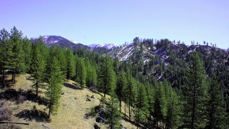
The beauty of southwestern Idaho is second to none, with hundreds of off-road trails available for exploration. You'll pass through the town of Crouch to get to the trailhead, a population of less than 200 with a couple of restaurants, a market, and a hardware store. Crouch is a hub for trails like this one, plus white water rafting and kayaking on the south fork of the Payette River. You'll share this trail with other 4-bys, plus side x sides, motorcycles, elk, and deer. If you are enjoying the fantastic dispersed camping available on this trail, be cautious and careful with your children and pets.
Updated: 12/02/2025
Crater Rings
Cleft, Idaho
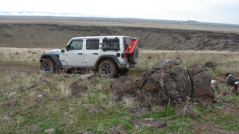
The Crater Rings are adjacent, symmetrical volcanic pit craters in the Western Snake River Plain about eight miles northwest of Mountain Home, Idaho. The craters are at the summit of a broad shield volcano. The eastern crater is about 3000 feet across and 350 feet deep. According to Wikipedia, the western is 2500 feet across and 300 feet deep.
Although the Crater Rings are a phenomenal natural feature, many people in the area do not know about them. Crater Rings are rare enough that this area was designated a National Natural Landmark in 1980, but no signs lead to them. They are not visible from any major roads. They are well worth the visit!
The trail to the craters is not long, and getting to them is not particularly difficult. However, if you want to drive the trails around the craters, good tires and clearance are needed, as the trails are often covered with jagged, pointy lava rocks. The area around the craters is laced with side trails worthy of exploration.
Dispersed camping is allowed in the area, but no obvious campsites are along the trail.
Updated: 10/15/2024
Black Lake Campground
Helena, Idaho
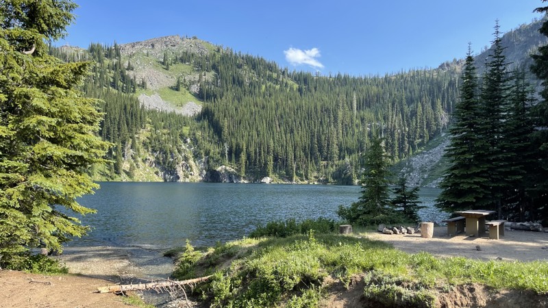
Black Lake Campground, nestled in Idaho's Wallowa-Whitman National Forest, is a rustic retreat for those who prefer a more primitive camping experience. With just 4 designated tent sites and one vault toilet, it's the perfect getaway for anyone looking to disconnect from the hustle and bustle of modern life and reconnect with nature.
There are several hiking trails to explore nearby lakes that aren't accessible by motorized vehicles.
Updated: 09/10/2026
Little Owl Creek
Tenmile Summer Home Area, Idaho
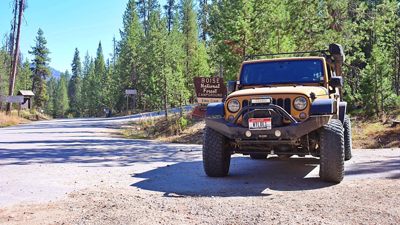
Little Owl Creek, also known as Edna Creek and Crooked River, is an automobile-friendly forest service trail that can begin at State Highway 21 north of Idaho City or at North Fork Boise River. This is one of the main roads to access fishing, hiking, horseback riding, SXS, offroad bike, jeep trails, historic mining claims, and existing mining claims. There are two developed campgrounds off the trail, Edna Creek Campground and Willow Creek Campground. There are also plenty of choices for more private dispersed camping.
Updated: 03/09/2026
Johnson/Lakeview Road
Clark Fork, Idaho
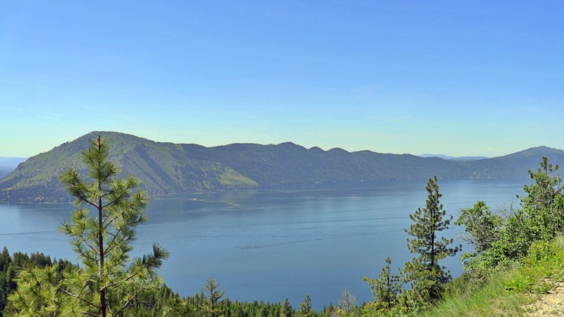
Johnson/Lakeview Road #278 unfolds as a scenic, offroad route that winds its way through the wild heart of northern Idaho toward Johnson Creek near the Clark Fork River. This dirt road, offering a mix of easy to moderate terrain, is a favorite among backroad explorers looking for a laid-back drive with just enough rugged charm to keep things interesting.
The trek begins with broad, navigable sections suitable for high-clearance vehicles, even larger rigs, although some stretches are narrower. The further you travel, the more remote it feels. The road meanders through dense pine forests, over rolling ridges, and past open meadows, gradually gaining elevation on the eastern shore of Lake Pend Oreille.
Along the way, you'll find a web of narrow offshoot trails perfect for dirt bikes and ATVs, making this a hub of OHV recreation. The area is also rich in outdoor opportunities: fishing, hiking, and recreational mining are all popular pastimes. While there were no visible campsites beside the trail, dispersed campsites can be found tucked among the spurs and offshoot trails.
As you continue southeast, the road offers stunning views of the surrounding hills and mountains, with occasional panoramic glimpses of Lake Pend Oreille sparkling through the trees in one of Idaho’s most peaceful and scenic corridors.
Although Johnson/Lakeview Road is technically open year-round, it is best traveled from late spring through fall, as snow and ice can make the route impassable in the winter months. Whether you're out for a weekend of dispersed camping, a quiet lakeside escape, or just a beautiful drive through Idaho's backcountry, this trail delivers a memorable blend of solitude, scenery, and adventure.
Updated: 10/15/2024
Green Mountain Lookout
Red River Hot Springs, Idaho
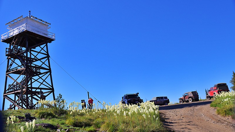
FSR 285A Green Mountain leads to an imposing wooden fire lookout tower on its summit. Green Mountain is a rougher trail than its access road Elk Mountain Road, it is doable with high clearance vehicles, and the views are worth it! Unlike most of this area, Green Mountain has not burned and offers stunning vistas. If you look carefully, you can spot another iconic lookout, Burnt Knob, in the distance. The tower is only used for emergency detection. You can camp at the lookout site.
Updated: 07/21/2025
Spar Canyon
Dickey, Idaho
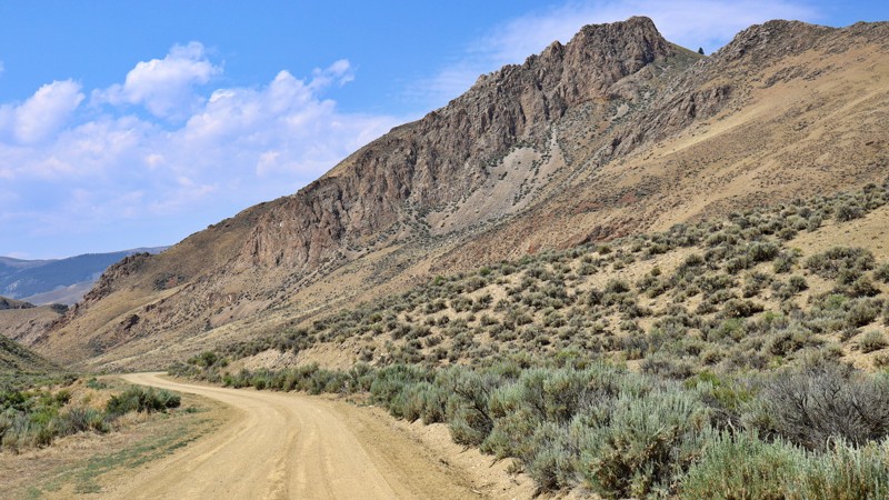
Spar Canyon Road showcases the high desert beauty of the Challis region, providing smooth access to a network of OHV trails. Though unpaved, the road is well-graded and comfortable, especially beyond the rocky sections near the highway. Along the route, you'll find plenty of spur trails, occasional cattle traffic, and possible wild horse sightings. The journey takes you through small rock canyons with stunning views at every turn. The road serves as the primary access for the Northern Boulder Mountain peaks and can be reached from US-93 to the east or East Fork Salmon River Road to the west. Be mindful that it is not maintained in the winter and can be challenging in wet or snowy conditions due to potential flash floods.
Updated: 06/05/2022
Gooseberry
Garden Valley, Idaho
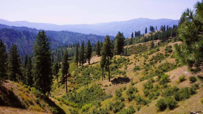
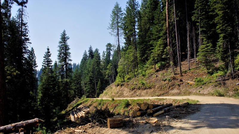
Gooseberry is in the Boise National Forest in the mountains separating Garden Valley from Crouch. Because of Idaho's Forestry Management policies, it offers the most spectacular views into both of those valleys below you when up on the ridge. Both areas are noted for their wintering elk and sleigh rides. The trail starts on BLM and private property, so be respectful and watchful for others. There are several spurs to explore, including the Cow Creek Spur, which takes you to Garden Valley. Most of the trails in this area are well-traveled, which is a good thing, but sometimes you may want to tread where others don't? This trail offers that opportunity after the Cow Creek Spur. The forest offers camping, hiking, hunting, and 4-wheeling. This area, north of Crouch, offers 100s of miles of trail to explore on both sides of the Payette Rivers Middle Fork. If you camp, be alert to the fact that this forest is home to bear, mountain lions, and wolves, so keep close watch over your children and pets.
Updated: 06/05/2022
West Fork Scriver Creek
Garden Valley, Idaho
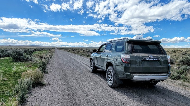
The West Fork Scriver Creek trail is located in the Boise National Forest just north of the small, rural town of Crouch, Crouch, and nearby Garden Valley serve as hubs for hiking, camping, fishing, hunting, and kayaking. The trail itself is part of a network of 4x4 trails totaling more than 100 miles for 4x4's, side x sides, and snowmobiles. Hunters will enjoy being in Unit 24 for elk, deer, bear, mountain lion, and wolf when in season. Scriver Creek Road follows Scriver Creek, which drains into the Middle Fork of the Payette River and forms the network for all of these great trails.
Updated: 10/15/2024
Clover Three Creek Road
Hot Springs, Idaho
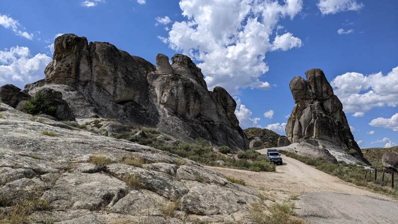
Clover Three Creek Road runs from just south of Mountain Home in the north to Three Creek Road in the south, just above the Nevada border. This trail traverses through BLM land, so dispersed camping is available away from the road.
Along the road, the vegetation is scarce, and the land is barren, which is nice because you’ll see amazing views of the Sawtooth Mountains in the north and the Owyhee Mountains in the southwest. You can also see the Bruneau River Gorge.
Three miles from the trail's north end is the Bruneau Canyon Overlook, which offers stunning views of the river canyon.
The road itself is a wide, double-lane gravel road in good condition. Any vehicle can take this trail. However, it is an open range, so beware of livestock on the road.
Updated: 03/09/2026
Castle Rock Road
Castle Rocks, Idaho
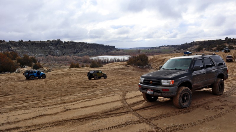
Castle Rocks Road is an interesting and scenic byway accessed from Highway 20 north of Mountain Home, Idaho. Taking the byway is almost the same number of miles as staying on the highway, but slower and much more scenic! The surface is good sand and gravel and is open to any automobile when dry and maintained. However, in the early spring and after heavy rain, the road can get serious washouts that may cause problems for the family sedan.
The large rock formations were formed millions of years ago by granite pushed upward into the softer surface materials. Over geologic time, the softer material eroded, leaving the magnificent granite outcroppings for which the area is named.
The surrounding land is part public and part private. Dispersed camping is allowed on public land. There is one reasonably nice dispersed camp area in a small clearing just east of where the road passes between the two tall rocks.
If traveling along Highway 20, Castle Rock Road is a pleasant diversion from highway driving.
Updated: 10/15/2024
Lake Channel Sand Dunes
Quigley, Idaho
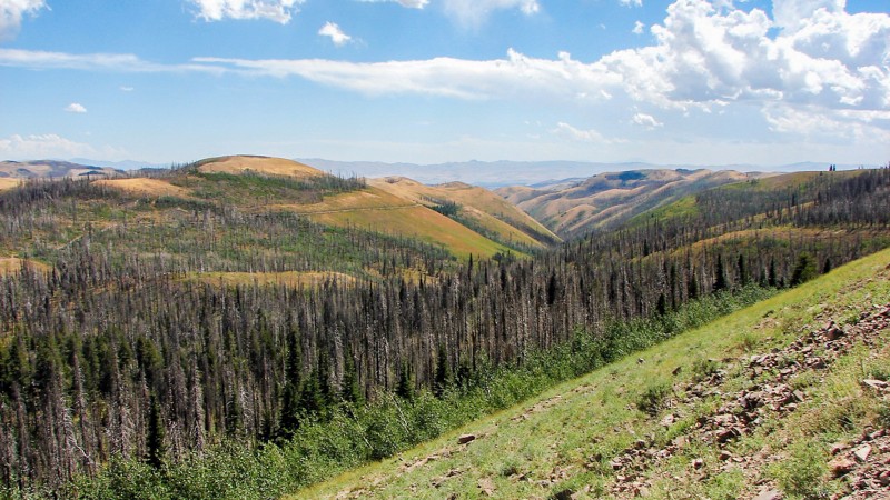
If you like sand, I've got a great place for you to check out. This is the Lake Channel Sand Dunes area managed by the Bureau of Land Management Idaho Falls region. While getting into and out of this bowl of sand can be challenging, the sand itself can offer easy to difficult tracks to choose from. Reaching and exiting the main area of sand requires traversing some rock ledges or steep sandy hills.
This area also offers a nice view of Bonanza Lake and can be reached from Lake Channel Road. It also has a few established camping spots with fire pits and shaded, level spots to post a tent.
Updated: 10/15/2024
Oakley Rogerson Road
Oakley, Idaho
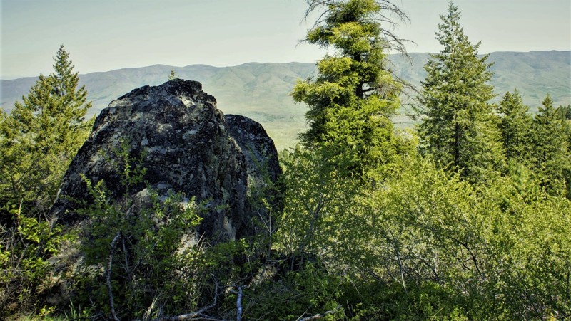
The Oakley Rogerson Road completely crosses the south unit of the Sawtooth National Forest, often called the South Hills, primarily on FS 500 but with short sections on FS 533 and 538. It is the primary east-west access across. The road starts outside the Forest near Oakley and continues outside the Forest near Rogerson. Near the middle of the trip is the Rock Creek Recreation Area, which includes the Magic Mountain Ski and Diamond Field Jack Snowmobile Areas. Due to heavy traffic, a short section between Magic Mountain and Diamond Field Jack is paved. The rest of the road is good gravel, easy to drive, and suitable for any vehicle.
Except for a short section near the Rock Creek Recreation Area, dispersed camping is allowed, and there are many available sites. Several campgrounds are along the road, with tables, fire rings, and pit toilets available. One of the more exciting and unique areas near the west end of the road is the Home of the Hummingbirds, where local volunteers hang hundreds of hummingbird feeders, and there are often several hundred hummingbirds in the area feeding on the provided nectar!
As one climbs into the National Forest, the flora changes to aspen, pine, and fir stands interspersed with the sagebrush desert. Much of the road is at a relatively high elevation, which provides spectacular panoramic views. There are a few areas of private property inholdings that must be respected.
Updated: 10/18/2022
Ola Slope
Horseshoe Bend, Idaho
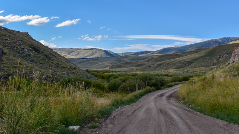
644A Ola Slope is in the Boise National Forest about 5 miles east of the "town" of Ola. With an elevation over 5,000 feet, you will experience all of the seasons southwest Idaho has to offer. This trail is in hunting section 32A so be respectful and cautious of others who might be in the area. When leaving the vehicle be aware of the fact that you are in a wild area including the presence of bears.
This trail writeup was done in mid-May and still showed traces of winter with snow on the northern slopes. No other persons or vehicles were observed during this beautiful drive through the forest, it's meadows and occasional creek crossings.
Updated: 10/15/2024
Medicine Lodge Road
Dubois, Idaho
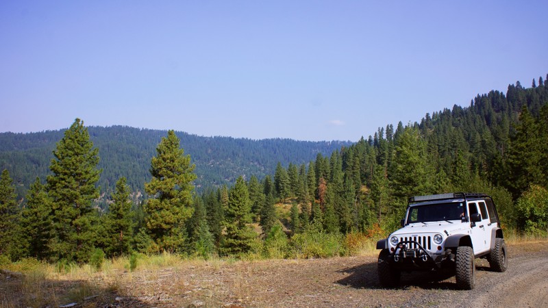
Medicine Lodge Road begins less than 10 miles from Dubois, Idaho, off I-15, offering a welcome escape from the busy interstate. This trail and its connectors allow for over 100 miles of mostly dirt road, connecting to Bannack State Park outside Dillon, MT. The journey along this route is marked by striking near-vertical rock bluffs, showcasing unique geological formations and a bison farm, which is always neat.
As the road winds through the landscape, it reveals a variety of scenery, from rolling hills to open country vistas. The terrain features neat rock formations, adding an element of natural artistry to the surroundings. The lush greenery in the valleys contrasts beautifully with the rugged cliffs and open plains. Wildlife sightings are common, with deer, antelope, and birds of prey often spotted along the way.
This route and the connecting trails to the north offer a fantastic alternative for those looking to avoid paved roads. It's an excellent choice for adventurers seeking solitude and the beauty of Idaho's diverse landscapes.
There was no obvious sign of camping along this trail, but plenty of sites are available further north along Bannack Pass, South Medicine Lodge Road, and Big Sheep Creek Road.
Updated: 06/05/2022
Dry Buck Ridge
Banks, Idaho
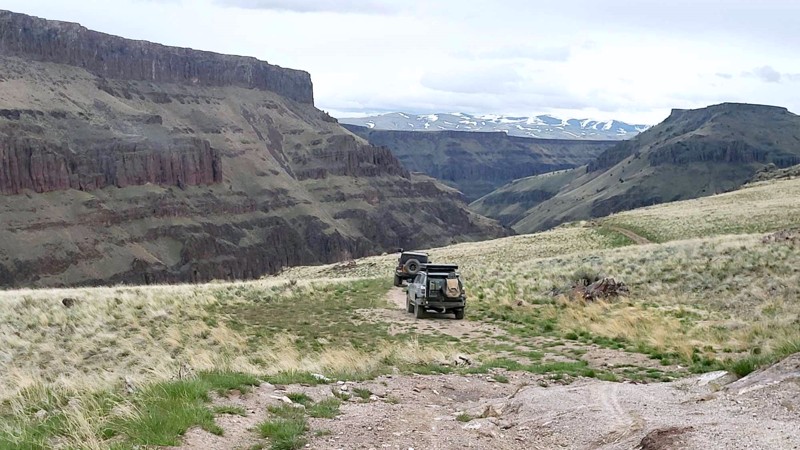
Part of the adventure of running the Dry Buck Ridge Trail is the 7-mile drive from Banks, where you will climb 1500 feet on a shelf road to arrive at the Dry Buck Road and Valley. The remaining time to the trailhead is through the beautiful valley and meadows of the Lazy R Ranch. The Lazy R has been a working cattle ranch since the 1800s. It borders this trail to the south and operates as a guest ranch for lodgings, weddings, hunting, and horseback riding. The trail is a camping paradise with several large and open sites with fire rings. You'll experience the feel of a cattle ranch as you navigate by many open-range cattle with their spring calves and enjoy the views down to the Payette River, 3,000 feet below. You'll experience the value of Forest Management driving through the thriving Aspens, Oak, and Ponderosa Pines. This trail will be a favorite, not soon to be forgotten.
Updated: 10/15/2024
Black Rock Crossing
James Place, Idaho
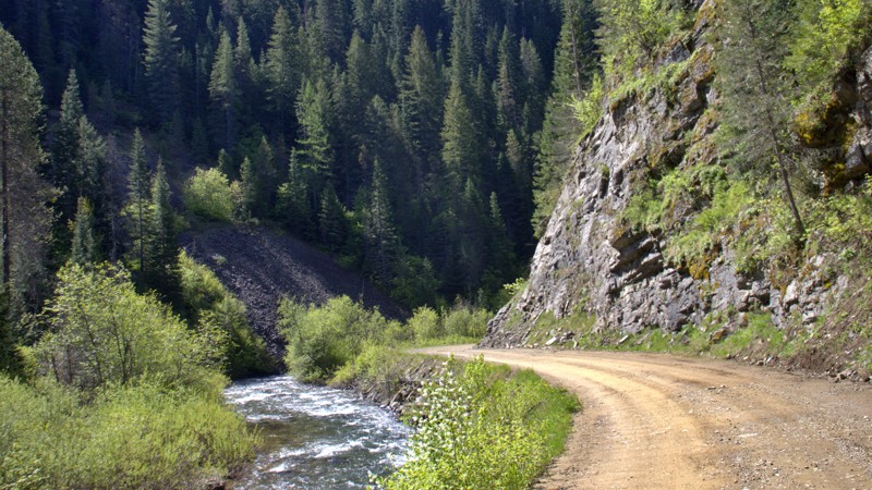
3717 Black Rock Crossing begins at 366/037 Rowland Route Road and weaves eastward across the J-P Desert, offering stunning views of the canyons along the Bruneau River. From the west side, the trail is rugged, with rocky terrain that sometimes narrows, crumbles, and goes off-camber. Negotiating around fallen boulders might pose a challenge for full-size vehicles. A couple of homesteader graves are at the river's bottom, and a crossing spot to the opposite side, where a stone barn stands. Crossing the river in spring is likely impossible due to high and fast water levels. It's best to tackle the entire trail during the summer months. Black Rock Crossing continues its journey up the canyon, culminating near the Nevada border. While there were no discernable dispersed campsites, there was space in a few areas to pull over and set up camp.
Updated: 06/03/2025
Loop Creek
Bogle, Idaho
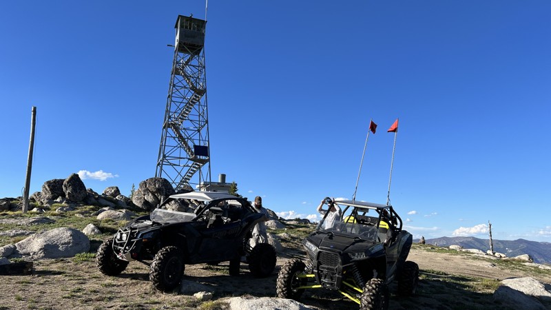
Loop Creek Road (NF 326) is a scenic backroad gem tucked in the Idaho Panhandle National Forest, connecting Moon Pass to the area near Quarles Peak. This graded dirt road winds through a vibrant, lush green forest, occasionally revealing sweeping views of the valley below. While much of the route is wide enough for two vehicles to pass comfortably, be prepared for occasional narrow stretches and tight switchbacks that call for a bit of caution.
Ideal for a leisurely forest drive or a basecamp scouting run, Loop Creek Road is dotted with numerous dispersed campsites. These primitive sites offer a peaceful, off-the-grid camping experience surrounded by dense trees and the sound of a rushing creek nearby.
Its proximity to the iconic and historic Route of the Hiawatha Trail adds to the charm and the crowds. During peak seasons, expect moderate to heavy traffic from cyclists and shuttle vehicles navigating the popular rail trail. Still, if you're looking for a mix of forest solitude, rugged charm, and easy access to one of the region's most scenic corridors, Loop Creek Road delivers in spades.
Updated: 08/11/2026
Bear Valley Lookout
Landmark, Idaho
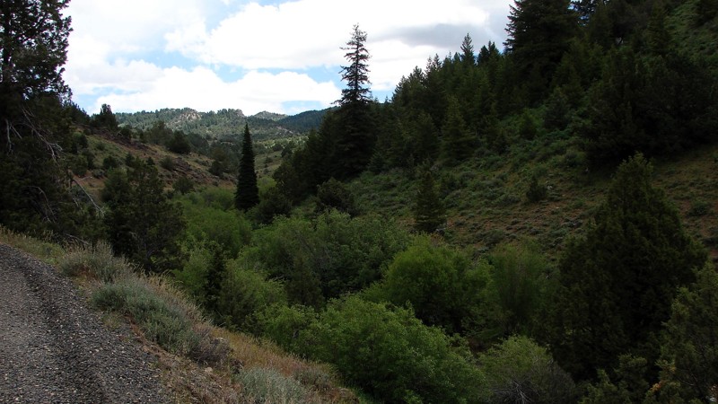
Take a classic, high-elevation trip to an old 1914 Fire Lookout Tower. Bear Valley Lookout offers incredible 360-degree views of the Salmon River area. At the top of the trail is an awesome lookout tower that is no longer in use. Imagine being stationed up there.
The trail climbs to 8300 feet, so snow and fallen trees are always an issue early in the summer. There can be times you are climbing four-foot snow drifts on the 4th of July. Even though the trail can be rocky and gains close to 2000 feet of elevation in four miles, the trail is actually quite pleasant, with only a few spots of rocks exposed to drive around for stock four-wheel-drive vehicles.
The trail switchbacks and winds through an area of burned timber, open views, and heavy timber, giving a great variety of sights. Deer, elk, moose, and other animals are visible from the trail.
Updated: 09/04/2025
Trout Creek Road
Jordan Valley, Idaho
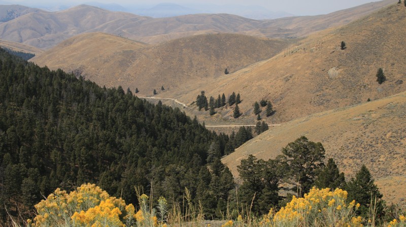
Trout Creek Road is a fairly easy gravel road connecting Silver City, Idaho, with Jordan Valley, Oregon. The east portion of the road has numerous potholes and a few rocks and requires moderate ground clearance but not 4WD. The west section is a well-maintained gravel road. While the potholes are mostly well-rounded, some of them can be quite deep and, depending on timing and weather, full of water. Other hazards along the road are dust and, particularly on the eastern section, blind curves. Dispersed camping is available along the eastern part of the road with many attractive sites. Care should be taken to avoid camping on private land.
The entire area is rich in mining history, and Trout Creek Road passes three areas where old mining structures are still visible. Unfortunately, the structures are on private land, but they can be viewed and enjoyed from the road.
Updated: 10/15/2024
Lemhi Pass
Tendoy, Idaho
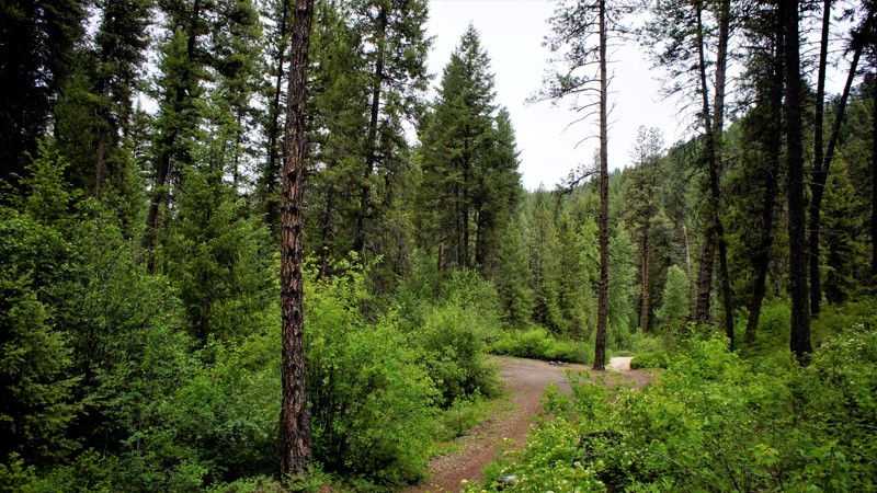
Lemhi Pass, also known locally as Agency Creek, climbs from the Lemhi Valley to the Lemhi Pass through the Salmon National Forest. The mostly wooded drive follows Agency Creek to the Continental Divide. Water on the east of the divide flows to the Atlantic Ocean. Water on the west ends up in the Pacific. The road is fairly tame except for the very steep climb of the last two miles. RVs and trailers are not recommended, but almost any other vehicle could drive the trail.
Agency Creek Campground is about 4 miles from the lower end of the road. It is free, can accommodate multiple vehicles, and has pit toilets, fire pits, and picnic tables. It sits beside the creek. There are also multiple dispersed campsites higher up the trail.
Updated: 06/05/2022
Bunchs Creek
Garden Valley, Idaho
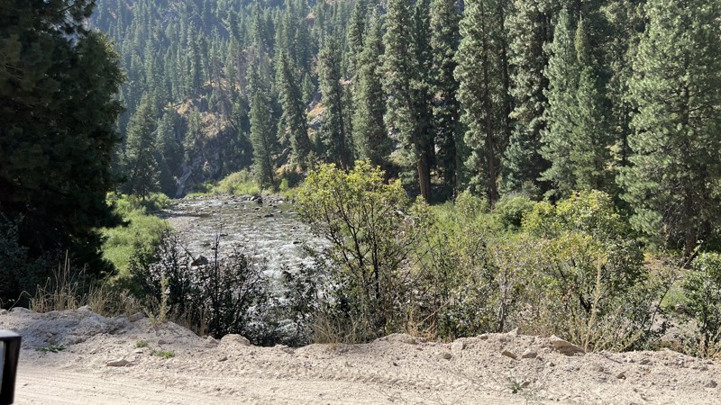
Bunchs Creek FS615A Trail is in the beautiful Boise National Forest. It is mid-way between Placerville to the south and Garden Valley to the north. Placerville is a border-line ghost town from the 1800s and it's by-gone mining and logging prosperity. Garden Valley, with the south fork of the Payette River running through it, is internationally known for its white-water kayaking. It is also a major ranging area for thousands of Elk. The trail itself is well known to campers and hunters alike. The foliage and forest canopy of this trail has to be experienced to fully appreciate the beauty you will see from this trail.
Updated: 08/11/2026
Baumgartner Hot Springs
Featherville, Idaho
Take a leisurely drive up a graded forest service road to a hot springs and campground. After leaving Featherville, Idaho, head up along the picturesque river with plenty of dispersed camping spots right along the river.
On busy weekends, like Memorial Day, 4th of July, or Labor Day, be aware of lots of oncoming traffic and dust. Also, there are houses and cabins along the route, so be ready to slow down and take your time around the population, but also be looking for deer, elk, and hawks along the route. There are tons of photography and wildlife viewing opportunities along the the route.
The road itself is not difficult but the trip is worth it for the beauty.

Upgrade your Membership
Unlock all of the details on every Trail Guide and Scout Route.
Start a 7-day Free TrialCommunity
Partners

