Pricing
Blog
Trail Map
States
Alabama
Alaska
Arizona
Arkansas
California
Colorado
Florida
Georgia
Hawaii
Idaho
Illinois
Indiana
Iowa
Kansas
Kentucky
Maryland
Michigan
Minnesota
Mississippi
Missouri
Montana
Nebraska
Nevada
New Hampshire
New Jersey
New Mexico
New York
North Carolina
North Dakota
Ohio
Oklahoma
Oregon
Pennsylvania
South Carolina
South Dakota
Tennessee
Texas
Utah
Vermont
Virginia
Washington
West Virginia
Wisconsin
Wyoming
Baja
Alberta
British Columbia
New Brunswick
Quebec
Log In
Sign Up
Try Advanced Search
Sign Up
Log In
Pricing
States
Alabama
Alaska
Arizona
Arkansas
California
Colorado
Florida
Georgia
Hawaii
Idaho
Illinois
Indiana
Iowa
Kansas
Kentucky
Maryland
Michigan
Minnesota
Mississippi
Missouri
Montana
Nebraska
Nevada
New Hampshire
New Jersey
New Mexico
New York
North Carolina
North Dakota
Ohio
Oklahoma
Oregon
Pennsylvania
South Carolina
South Dakota
Tennessee
Texas
Utah
Vermont
Virginia
Washington
West Virginia
Wisconsin
Wyoming
Baja
Alberta
British Columbia
New Brunswick
Quebec
Trail Map
Blog
Support
Completed
Public
A collection of trails I have completed.
In This List (54)
922.13 Miles
did top half
—
Show All Guides
Back
Basemaps
Basic Terrain
Available for free. Basic national land management shading and labels.
Go All-Access to Unlock
All-Access
Advanced national, state, and federal land management shading and colors. Visual styling of road types.
Satellite
Aerial view with basic land management and road labels.
Layers
NEW
Content Type
Waypoints
Back
TRAILS OFFROAD™ TRAIL TYPES
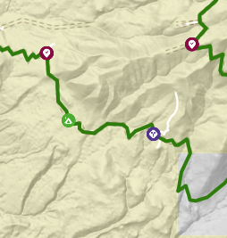
Trail Guide
Full detailed write up with Advanced Rating System, Waypoints, Video, and more.
Scout Route
Lite version with highlights, camping, and hardest part documented. Vetted in person.
TRAIL DIFFICULTY RATINGS
easy (1-2)
Suitable for high clearance 2WD
moderate (3-4)
Best suited for a high clearance 4x4
difficult (5-6)
Best suited for a lightly modified 4x4
severe (7-8)
Best suited for a highly modified 4x4
extreme (9-10)
Best suited for specialized buggy type vehicles
BASEMAPS
Basic Terrain
Available for free. Basic national land management shading and labels.
All-Access
Advanced national, state, and federal land management shading and colors. Visual styling of road types.
Satellite
Aerial view with basic land management and road labels.
LAYERS
Nathan Atkinson
List:
Completed
Log in or sign up to check out this list and much more!
or
Show
Log In
Don't have an account?
Sign Up
Forgot password
Nathan Atkinson
Completed
Follow this public list to:
See all user generated tracks on your map
*
See all user generated waypoints on your map
*
Get real-time list change updates
Follow List
Not Right Now
* All-Access Members Only