




By clicking "ACCEPT", you agree to be the terms and conditions of each policy linked to above. You also agree to the storing of cookies on your device to facilitate the operation and functionality of our site, enhance and customize your user experience, and to analyze how our site is used.
California Off-Road Trails
415
Total Trail Guides 392

4112
Detailed Waypoints 524
Try a Free 7-Day Trial and unlock it all
Start a Free Trial Most Recent Trail Reviews
Rated 5/5
Open
Visited: 09/19/2026
Great beginner trail here for those looking to try out some rockier sections. Starting to trend a little closer to a rating of 4, but still a 3 I’d say

R
Rob
Rated 5/5
Open
Visited: 09/19/2026
I entered this trail from Freeway Ridge 4WD trail (31E77) and ran Black Gulch Jeep Trail up to Rancheria Road, turned around, and ran Black Gulch Jeep Trail all the way down to Keyesville Road in Lake...



Daniel Macioce
Rated 4/5
Open
Visited: 09/19/2026
Took out the vstrom 800de today and this thing was tough for someone like me who is pretty new to offroading motorcycles. I ended up turning around about half way because I wasn't sure if I would be a...
SK
sean kotrola
No Rating
Open
Visited: 09/19/2026
The trial marked by the app here is very difficult with all the recent deep washouts. Proceed at your own risk if you are by yourself with unmodified rigs. However the bypass is maintained and should ...
TB
Timmy Boby
Rated 5/5
Open
Visited: 09/18/2026
Very friendly fire watch tower volunteers and fantastic 360 degree views up top
R
Rob
Rated 5/5
Open
Visited: 09/18/2026
Great views and an easy drive through. Be sure to take the road up to the fire watch tower
R
Rob
Rated 5/5
Open
Visited: 09/17/2026
ran the trail twice last weekend, this is such a better way to go than 3n16...


Josh Noesser
Official Crew
Rated 5/5
Open
Visited: 09/16/2026
It's been 6 years since I visited this trail. It has seen some wear, but the overall difficulty is about the same, probably a bit higher now, as Waypoint 11 has suffered from traffic. Waypoint 11 ha...

Robert
Official Crew
Rated 5/5
Open
Visited: 09/16/2026
Started off from polique canyon at way point 13 and headed east. Its a great trail for most of it with scenic views. A good amount mud puddles that were fun as hell to drive through. Some I decided to...


VM
Victor Manuel Garcia
Rated 5/5
Open
Visited: 09/16/2026
Used this trail to get to Holcomb valley. Super easy and a nice drive, I can see how in the winter it can be a bit more challenging with rain and snow.
VM
Victor Manuel Garcia
No Rating
Open
Visited: 09/16/2026
Mostly easy, but heading NE there's a rock step down just a few miles in that *requires* high clearance. Banged the rear end of my 4runner despite having a 3" lift and 33" tires. A stock SUV would alm...



Carlos H.
Rated 5/5
Open
Visited: 09/15/2026
It's been over 4 years since I was last on this trail, and I was very happy to see that the old car was still there. Some research suggests that it is a 1939 Plymouth Road King 5-window coupe.


Robert
Official Crew
Rated 5/5
Open
Visited: 09/14/2026
A fun little detour off Burns Canyon. I ran this alone and stopped a few times to spot; I also used my grill camera in several places. I brushed my sliders a couple times, but no real issues. Definite...
EB
Ed Boyd
Rated 5/5
Open
Visited: 09/13/2026
easy perfect beginner off roader trail with great views and water crossing during the winter.



Dex Offroad
Rated 5/5
Open
Visited: 09/12/2026
Fenders Ferry kept giving me reasons to slow down and enjoy the ride. I loved winding along mountain ridges, following creeks, and catching glimpses of Shasta Lake's fingers tucked between the hills. ...



Rose Meirs
Official Crew
Rated 5/5
Open
Visited: 09/11/2026
super easy trail over looking the valley and 15fwy. only bad thing is that its super windy.

Dex Offroad
No Rating
Partially Open
Visited: 09/09/2026
Although you can cross the creek from Fordyce if you want, Committee Road is still closed back to the I80, so this has no exit, and you'll be forced back onto Fordyce.

Ryan Boudreau
Official Crew
No Rating
Temporary Closure
Visited: 09/09/2026
Road is still closed. I thought i read somewhere an expected 2030 opening, but can't confirm that info.
Ryan Boudreau
Official Crew
Rated 5/5
Open
Visited: 09/09/2026
This is an awesome trail . This trail is moderate with a few obstacles to make it fun. It also has incredible scenic views with a little bit of shelf roads. You can watch the full video on my YouTube ...


Dex Offroad
Rated 5/5
Open
Visited: 09/07/2026
Pretty spot on with the rating, was a little tough today with the rain but made it through in my 2023 Gladiator Overland with 2.5” lift and 35s with autolynx sway disconnects.


CT
Christopher Tanton

Shaan Heugly
Rated 5/5
Open
Visited: 09/06/2026
Drove reverse from what’s listed to the jasper trail. This is a easy but enjoyable trail with plenty of places to camp at the end of the
Shaan Heugly
Rated 5/5
Open
Visited: 09/06/2026
Bit washed near the top but nothing difficult to navigate. I headed from jasper to the highway and near the highway it did narrow. I got through with my Tacoma but there are a few pinch points I could...
Shaan Heugly
Rated 5/5
Open
Visited: 09/06/2026
Mostly easy trail but when going south to north, I did need to use 4Lo on some of the inclines with a loaded Tacoma
Shaan Heugly
Rated 4/5
Open
Visited: 09/05/2026
It had been five years since I last drove this trail. The long, annoying stretches of moguls are still there, and water erosion has added a touch more difficulty in places. It was nice to see the old ...


Robert
Official Crew
Rated 4/5
Open
Visited: 09/05/2026
This is a nice trail with great views for any 4WD with ground clearance as some sections have ruts that are 12+ inches deep. Things were very dry on my visit, so airing down the tires helped to smooth...


SG
Steve Graham
Rated 3/5
Open
Visited: 09/05/2026
From waypoint 7 to 10 the water damage is pretty bad. Waypoint 13-16 it is rocky. Nothing crazy but a few spots where patience and the right line will go a long way. Good clearance and 4x4 recommended
N
Noah
Rated 5/5
Open
Visited: 09/05/2026
Easy trail with an awesome view at the end. There were three lookouts in the fire tower and each one was super friendly and informative. Must see trail!


N
Noah
Rated 5/5
Open
Visited: 09/05/2026
fun easy trail, Butler Peak lookout is the highlight imo
N
Noah
Rated 5/5
Open
Visited: 09/04/2026
Trail was very well maintained. Thanks for the Fresno 4x4 club. It was very cold at night, into the 30s. We were on the trail two nights, 3 days and two nights at voyager rock due to a breakdown fr...
JD
John Drago
No Rating
Open
Visited: 09/04/2026
Beautiful area, but the trail itself wasn’t very interesting. I’d rate it around a 3/10, with a couple of optional sections that might push a 4.
There’s tons of dispersed camping throughout the area,...


Ryan Smith
Rated 5/5
Open
Visited: 09/01/2026
awesome trail with a lot of water crossings. just be careful of sxs and bikes since its a OHV area.

Dex Offroad
Rated 5/5
Open
Visited: 09/01/2026
Super easy trail and you can over look the high desert. Trail ends at an awesome view point.

Dex Offroad
Dex Offroad
Rated 5/5
Open
Visited: 08/31/2026
This trail is much harder than it used to be. It’s just as breathtakingly beautiful as ever. You are on your own out there. Fuel, parts, spare tire. It’s days from help if you need it so go prepared. ...

CP
Christopher Pepin
No Rating
Open
Visited: 08/30/2026
Ran this trail today and had fun. Easy trail with great views. I wouldn’t hesitate to take an experienced driver in a stock jeep up this. There are lots of trails in this area and way to get off the m...

CP
Christopher Pepin
No Rating
Open
Visited: 08/29/2026
Trail was in good shape, a little less sand makes the boulders a little bigger. People have made the bypass around the sluice a little bit longer than it used to be you miss a lot of the good rocks. O...
C
Campbell
Rated 5/5
Open
Visited: 08/29/2026
An often overlooked and amazing trail. It’s about the length and difficulty of the rubicon if you don’t hit any of the bypasses on the rubicon. We had a group of 3 lj on 40s, a jku on 42s, and an Xj o...
CP
Christopher Pepin
Rated 4/5
Open
Visited: 08/27/2026
This is most definitely a hard trail. Is the entire thing hard? Not at all. The western 7 miles are a hard packed dirt road. Then you run into 3 straight, large boulder obstacles where its clear many ...


Ryan Boudreau
Official Crew
Rated 4/5
Open
Visited: 08/27/2026
Easy drive with beautiful views and . . . Buck Rock! Lots of camping south of Buck Rock, but camping north of the Rock isn't as plentiful. There are a few others on the north, but there's one here: 36...


Carlos H.
Rated 5/5
Open
Visited: 08/26/2026
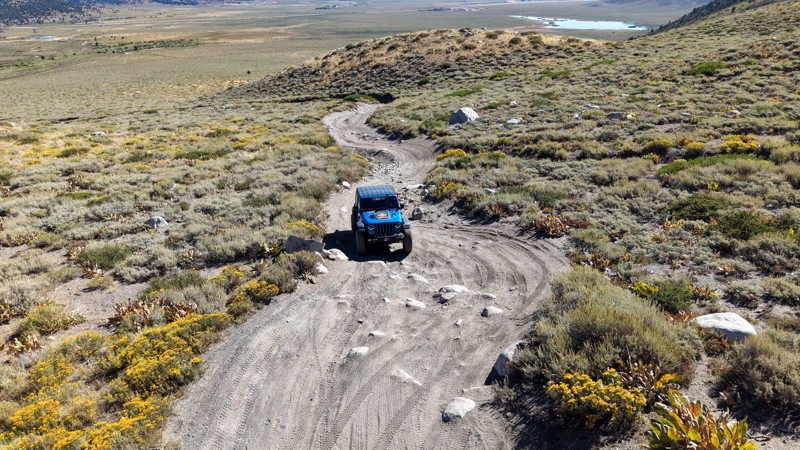
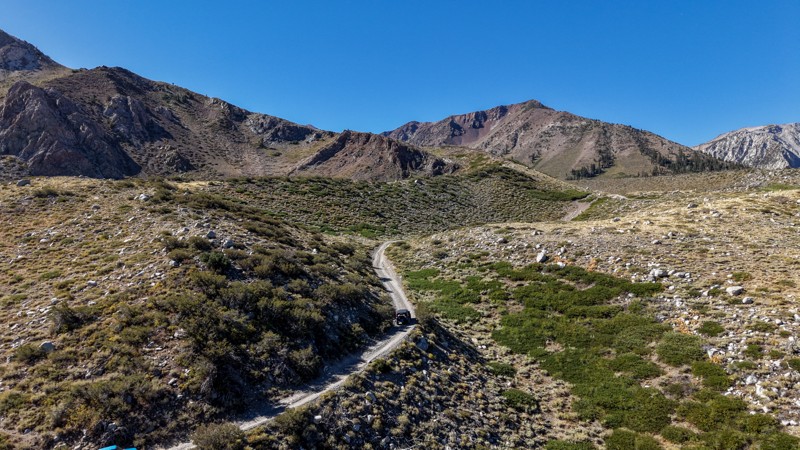
5 stars all day! This trail is absolutely amazing, and one you do not want to miss if you are in a capable vehicle in the area. It is rough, rocky, steep, and narrow enough to weed out the vanlifers a...
Ryan Boudreau
Official Crew
Rated 5/5
Open
Visited: 08/26/2026
I really enjoyed this road. It's super scenic with the sierra's in the background, the white beaches, and the columns are really cool. The road is not anything challenging with a high clearance vehicl...


Ryan Boudreau
Official Crew
Rated 4/5
Open
Visited: 08/25/2026
Fun area. The hot springs are pretty popular and well-known, and because they are small, you'd better hope you are one of the first people there that day if you want to get in. The route is easy, exce...


Ryan Boudreau
Official Crew
Rated 4/5
Open
Visited: 08/25/2026
I liked this trail a lot, but it's not quite a 5-star trail for me. I feel like it's a little overhyped. Is it scenic? Absolutely! Is there tons of great camping? Totally! Is it a crazy busy? You Bet!...


Ryan Boudreau
Official Crew
Rated 4/5
Open
Visited: 08/25/2026
Road to the hot springs parking area is easy. There are regular passenger cars there. The hike is easy too. The tub itself is super scenic, but know that they are not hidden gems by any means and we'l...

Ryan Boudreau
Official Crew
Rated 3/5
Open
Visited: 08/25/2026
It's a simple road, but definitely very scenic and really only used to get from Convict to Laurel Lakes or Mammoth. Road is suitable for anything with decent ground clearance.


Ryan Boudreau
Official Crew
Rated 2/5
Open
Visited: 08/25/2026
Simple dirt road used to access other types of recreation. Many signs remind you that you aren't allowed to camp along it except at the campground.


Ryan Boudreau
Official Crew
Rated 3/5
Open
Visited: 08/23/2026
Simple, straightforward dirt road used for fishing access.


Ryan Boudreau
Official Crew
Rated 5/5
Open
Visited: 08/23/2026
Amazing views at the top of this trail. Erosion looks to be making this trail harder than it probably originally was. Most of the hardest spots are getting bypasses created around them. A short, st...



Dan Jurgella
Rated 5/5
Open
Visited: 08/23/2026
Toad Lake Road 40N64 was a long, slow, and wonderfully remote drive into the Trinity Divide. The changing mix of old pavement, dirt, loose rock and deep ruts kept the journey interesting, while forest...


Rose Meirs
Official Crew
Most Popular

Updated: 05/20/2026
Homer Mountain Trail
Hayden, California
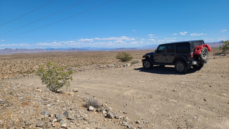
Homer Mountain is a cross-country trek through the Mojave National Preserve. Bordering the Mojave Wilderness over much of its length, travelers are rewarded with fantastic desert scenery across an unpopulated desert landscape, with the Piute Mountains providing a backdrop.
Most of the trail is flat with no obstacles, but once into the Homer Mountain foothills, the path becomes twisty, rocky, and steep over several deep washes. This trail can be managed in a two-wheel drive with good all-terrain tires, but the frequent dips and washes across the trail will require a vehicle with some ground clearance.
The best dispersed campsites are found in the Homer Mountain Foothills, along the eastern third of the trail, where the higher elevation provides an overlook of the surrounding desert.
Updated: 06/10/2026
Piute Valley Trail - Gulch Road
Searchlight, California
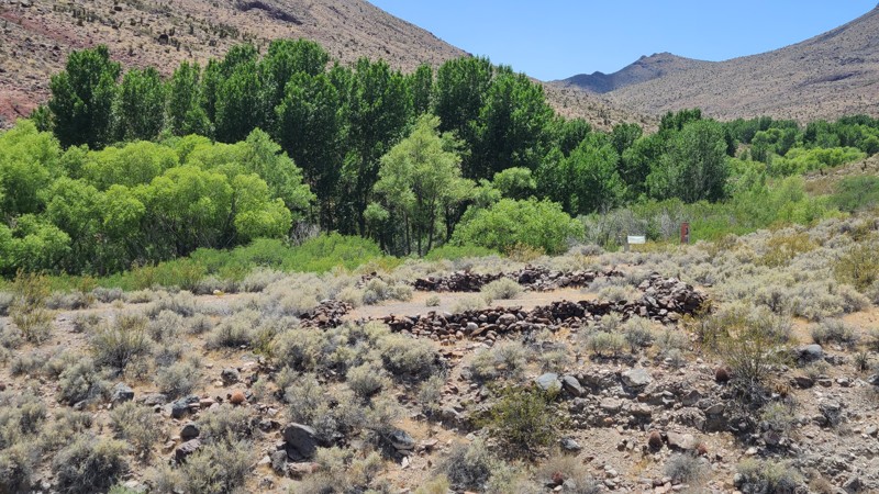
Piute Valley Trail-Gulch Road offers a desert escape through the beautiful Piute Valley, with the Piute Range as a backdrop. Much of the trail borders the Mojave National Preserve and Mojave Wilderness, providing a natural desert expanse to enjoy. Intersecting along the are Route 66 and the Mojave Road. A short drive up the old Mojave Road leads to Fort Piute and its still-running creek supporting a lush green oasis of cottonwoods and surrounded by the towering mountains of the Piute Gorge. Fort Piute was originally built in 1867 to provide military escorts to the mail carriers traveling the Mojave Road, but was abandoned only 6 months later when the mail route was changed. Significant Fort ruins remain, providing a glimpse of what life was like for the 18 soldiers stationed there. Hiking trails starting at the Fort follow the old Mojave Road and lead to ancient petroglyphs carved by indians who lived in the area. A portion of Mojave Road was rerouted along 1.3 miles of Piute Valley Trail to protect the sensitive habitat of the Piute Gorge.
The best dispersed camping is around Fort Piute, about 18 miles south of the south end of the trail. Here, large flat areas with rock fire rings can be found, providing wonderful views over the eastern Mojave Desert. Another good dispersed camping site is around the Tenmile Well site, with its aging corral and water pump about 8.5 miles from the northern end of the trail.
The vast majority of the Piute Valley Trail is easy over a sandy desert floor with occasional ruts and dips across the trail. A two-wheel drive with some clearance will manage this trail fine. However, the 2-mile path up to Fort Piute is extremely rugged, full of melon-sized rocks, not maintained, and will require a 4x4 with high clearance.
Updated: 01/05/2026
Bennett Juniper Road
Dardanelle, California
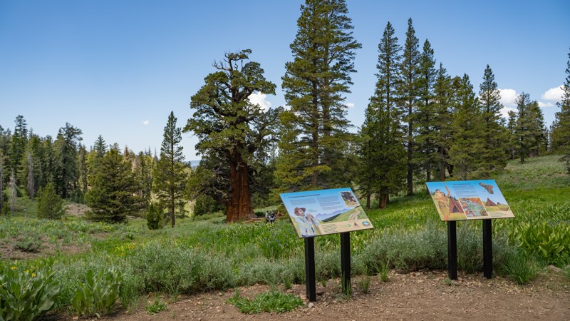
Bennett Juniper Road (5N83Y and spur 5N83YB) is a short, easy out-and-back that branches off 5N01 and climbs gently across high-country terrain toward one of the Sierra Nevada’s most remarkable natural landmarks. The route follows rough dirt the whole way, but remains friendly to any high-clearance two-wheel-drive vehicle.
The primary draw here is the Bennett Juniper, the largest and oldest western juniper known to be alive today. Estimated to be several thousand years old, the tree has passed through multiple eras of human care, from ranchers in the mid-1800s to modern conservation groups, including The Nature Conservancy, Save the Redwoods League, and now the Mother Lode Land Trust. A short fork, 5N83YB, leads to a looped pull-around with informational signage and a walking path that allows visitors to experience the tree up close without disturbing its delicate habitat. Late spring and early summer bring vibrant wildflower displays throughout the area, with native plants blanketing the surrounding meadows.
Camping opportunities along the road are sparse, with only a couple of viable dispersed sites. While solitude is easy to find mid-week, summer traffic in the broader region can increase as hikers, cabin visitors, and water-recreation crowds spread out across the Sierras. Like most high-elevation routes in this region, Bennett Juniper Road becomes inaccessible once winter snow settles in, transitioning into terrain favored by cross-country skiers and snowmobilers.
Simple, scenic, and historically significant, this short spur is well worth the detour for anyone exploring 5N01. The drive is easy, the terrain forgiving, and the payoff—a visit to a millennia-old giant—is something every Sierra traveler should experience at least once.
Updated: 09/02/2026
Liebre Mountain
Sandberg, California
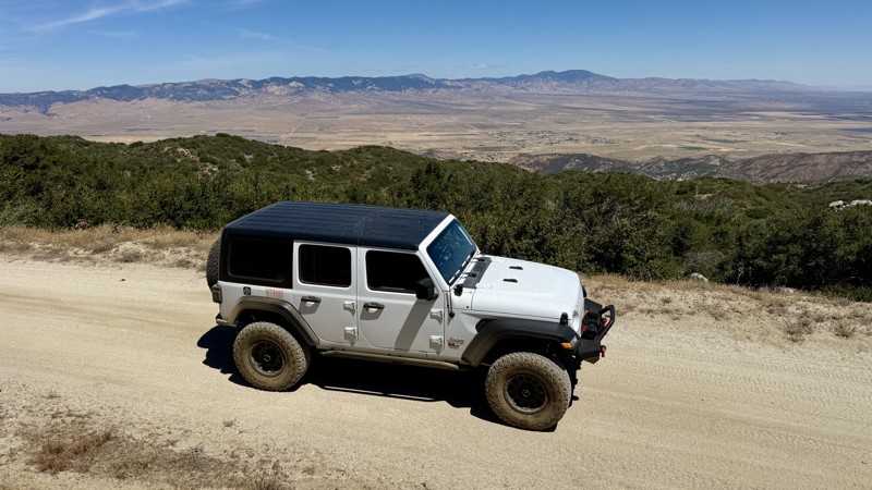
Liebre Mountain is a scenic, ridgeline drive located in the northern region of the Angeles National Forest. This route connects the historic Old Ridge Route on the west to Pine Canyon Road (N2) on the east. The trail serves as a perfect introductory dirt route for beginners, an easy scenic drive for stock SUVs, and a vital access point for the Pacific Crest Trail (PCT). Drivers are treated to massive, sweeping vistas overlooking the Antelope Valley and the western edges of the Mojave Desert.
The trail consists primarily of a graded dirt and decomposed granite surface. While generally wide enough for two vehicles, it narrows down to a single lane along several tight ridgelines. Expect minor ruts, loose gravel, and small washboard sections. Wet weather can quickly turn the dirt into slick mud, and winter storms frequently bring snow to the higher elevations, making 4WD necessary or prompting seasonal forest closures.
There are excellent opportunities for dispersed, primitive camping scattered along the ridgeline pullouts. Established sites like Bear Campground and Sawmill Campground are located just off the main road. Due to the high wildfire risk in the Angeles National Forest, campfires and charcoal BBQs are strictly prohibited in dispersed areas along the trail. Fires are exclusively allowed within designated metal fire rings at the developed campsites (Bear Campground or Sawmill Campground).
A valid USFS Adventure Pass or America the Beautiful Interagency Pass is required if you plan to park your vehicle at designated trailheads, picnic areas, or campgrounds.
Updated: 07/02/2026
NS499
Havasu Lake, California
NS499 runs along the western edge of Chemehuevi Valley with the rugged Turtle Mountains rising just to the west. The entire route is part of Eastern Mojave Heritage Trail (EMHT) Segment 4, one section of the larger 733-mile EMHT network. Segment 4 offers a 145-mile tour through some of the most remote terrain in the Eastern Mojave and is managed through a partnership between the Bureau of Land Management and the Mojave Desert Heritage and Cultural Association.
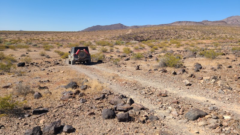
This is a slow, rocky trail for its entire length. Much of the route is covered in grapefruit-sized rocks and larger, with several steep, narrow wash crossings adding to the difficulty. The most challenging obstacle is about 2.6 miles from the east end, where the trail drops into a narrow, boulder-filled wash with no obvious track and requires a sharp 90-degree turn up a steep exit. A lifted 4x4 and an experienced driver are recommended. Drivers following the EMHT from the east can bypass this section by staying on Turtle Mountain Road to Highway 95, where the route reconnects with the EMHT at Pyramid Peak Road.
A few small, cleared areas along the trail can work for dispersed camping, but the best camping is just beyond the west end of NS499 on nearby NS495 at the abandoned mining cabin. That site offers more space for multiple vehicles and tents, along with excellent views across the valley.
Updated: 06/18/2026
Juniper Springs Group Camp
Big Bear, California
2N64Y Juniper Springs Spur is a short out-and-back trail on the quieter eastern side of Big Bear, leading through the high-elevation forests of the San Bernardino Mountains to Juniper Springs Group Camp. Unlike the busier rock-crawling routes near Holcomb Valley, this spur is better suited for a relaxed forest drive, camping access, and a slower-paced escape into the mountains.
The trail winds through Jeffrey pine, pinyon pine, and juniper near the Juniper Springs area, sitting around 7,700 feet in elevation, where summer temperatures are often cooler than the surrounding valleys. The route is mostly compact dirt with minimal obstacles, making it approachable for most high-clearance vehicles in dry conditions and a good option for newer drivers looking for an easy Big Bear trail.
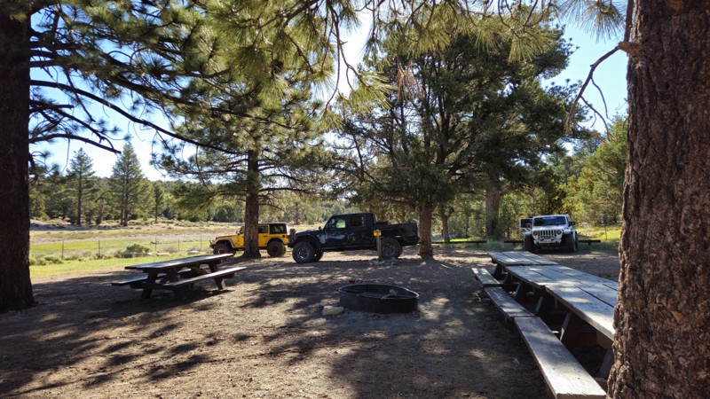
At the end of the trail, Juniper Springs Group Camp offers a primitive, reservation-only camping experience available from May through September. The campground is closed to reservations from October through April due to seasonal conditions. The site includes one large, mostly flat and shaded camping area with room for up to eight vehicles, along with picnic benches, a Forest Service-provided fire ring, and a faucet with non-potable spring water. Always check current fire restrictions before starting any campfire.
In winter, 2N64Y can become a scenic snow route when conditions allow, but snow can quickly increase the difficulty and should only be attempted with properly equipped vehicles. Whether you are looking for an easy forest drive, a reserved group campsite, or a quieter alternative to Big Bear’s more crowded trail network, 2N64Y Juniper Springs Spur is a simple but worthwhile addition to a mountain adventure.
Updated: 06/10/2026
Glory Been Trail to Browns Camp
Needles, California
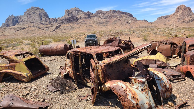
Glory Been Trail leads to the Lost Arch Mining Camp tucked next to the Turtle Mountains and mined from the 1880s through 1960. Many artifacts remain from the over a dozen mines that operated in the area, including Browns Cabin, the fascinating Car Corral, and the foundations of a stamping mill. The site was strewn with abandoned vehicles and machinery, and the BLM gathered many of these to display in the Car Corral as a living history for visitors to enjoy. Browns Cabin, now collapsed, was built by Charlie Brown in 1922, who prospected the area and died here in 1948. Hiking trails throughout the area can lead to other fascinating discoveries.
Several dispersed camp sites can be found along the motorized trails, with an improved campsite off of Browns Camp Trail about ½ mile north of Browns Cabin. This site has a table, a shade cover, and an iron fire ring with a grill.
The route consists of three BLM marked trails: Glory Been, Carson Well, and Browns Camp. Once entering the foothills at Carson Well, sections of the trails become very rugged over uneven surfaces strewn with melon-sized rocks, earning this route's moderate difficulty rating. The most difficult sections are near the north end of Browns Camp Trail. A high clearance four wheel drive vehicle is required to manage this route.
Updated: 06/10/2026
War Eagle Mine Loop
Havasu Lake, California
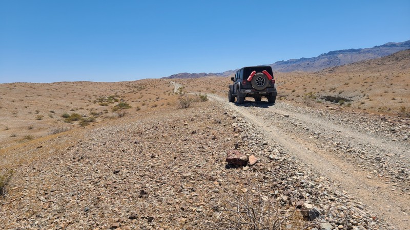
On the southern edge of the Chemehuevi Valley, within sight of Havasu Lake, lies War Eagle Mine Loop. The trail is a pleasant tour of the desert that passes near its start, an ancient sacred Native American petroglyph site, and then continues to reach the War Eagle Mine site. The mine site has many equipment artifacts left in situ, and the end of the trail connects to hiking trails to explore the area further.
The War Eagle Mine Loop exists entirely on BLM land, and dispersed camping is allowed along the entire trail. A few camping sites can be found near the trail, with the best locations on the War Eagle Mine site.
The trail surface is over a desert hard pack with a few sections of moguls, and becomes more rugged when entering the foothills on the southern section of the loop. A two-wheeled drive vehicle with some clearance will be able to manage this trail.
Updated: 08/13/2026
Pinecreek Canyon/Highgrade Road
New Pine Creek, California
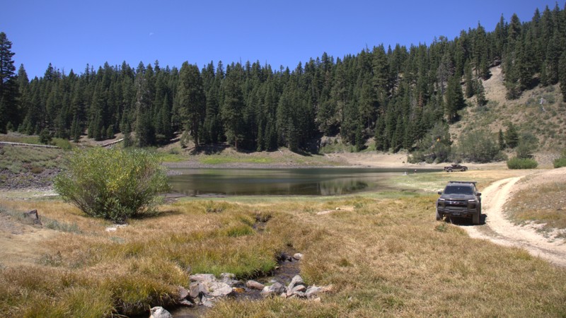
County Road 2 is a remote mountain road crossing the northern Warner Mountains between New Pine Creek and Fort Bidwell. It is known as Pinecreek Canyon Road or Highgrade Road, depending on what map you are referring to. Along the way, it passes Lily Lake, Cave Lake, and the historic High Grade gold mining district.
The road is rough, narrow, rocky, and steep in places. Four Wheel Drive is recommended for Cave Lake access. Snow, mud, washouts, fallen trees, and loose rock can affect the route, making it unsuitable for large trailers and vehicles with low ground clearance.
Gold was discovered in the area in 1905, prompting prospectors to establish claims near Fandango Peak, Yellow Mountain, and the headwaters of Pine Creek. A larger rush followed between 1909 and 1912. New Pine Creek and Fort Bidwell became supply centers, while the settlement of Highgrade arose on National Forest land with its own post office. The need to transport miners, equipment, and supplies likely helped shape the route that became Pinecreek/High Grade/County Road 2.
Although rich surface samples attracted considerable attention, the gold-bearing veins proved narrow and difficult to mine profitably. High Grade became Modoc County’s principal gold district, but its boom was brief.
From New Pine Creek, the road climbs from sagebrush country and views of Goose Lake into pine and fir forest. It passes volcanic ridges, wet meadows, and Lily and Cave lakes before continuing through the former mining district and descending toward Fort Bidwell and Surprise Valley. Cave Lake offers primitive camping, fishing, and nonmotorized boating, while Lily Lake is a quiet destination for picnicking and fishing.
Little remains of Highgrade beyond mine dumps, prospect pits, shafts, old roads, and scattered debris. The High Grade National Recreation Trail provides access to part of the historic landscape.
Updated: 01/15/2026
Wall Street East Connector
Yermo, California
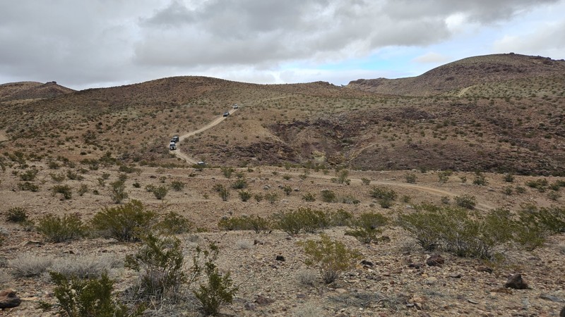
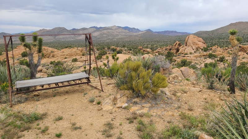
The Wall Street East Connector is a short, ridgeline connector between the north ends of Wall Street and Vodkaberry. It is a rough and rocky road with moderate grades, suitable for any high clearance vehicle. Along the route as you traverse the Mojave Desert above the famous Calico Ghost Town, expect great views and absolute silence.
Updated: 05/20/2026
Standard Mine Road
Mountain Pass, California
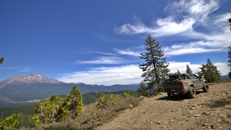
This is one of those roads, rich with discoveries, that one hopes to discover when wandering the Mojave. Tucked between the aptly named Striped Mountains and Ivanpah Mountains in the Mojave National Preserve is Standard Mine road, providing a wealth of mining history, with fathomless mine shafts now safely grated closed, abandoned heavy equipment, and surviving miners' cabins. The Mojave National Preserve leaves these sites untouched to preserve the rich mining history of the area. The miners located the cabin sites to provide fantastic views across the lush Joshua Tree forests of the Shadow Valley below. Many of the cabins have been restored by volunteers and offer a glimpse of miners' lives. Probably the most well-known and well-preserved is Riley Camp, the home of J. Riley Bembry, a World War I veteran who had placed 56 claims in the area.
The main road is easy and can be managed with a 2-wheel drive vehicle with some clearance, but the spurs leading to mine sites can be very rocky and rugged, often made from the mine's waste rock and requiring a 4-wheel drive lifted vehicle.
Camping can be found on the flat areas around mine sites, with the best camping around the cabins, where tables and iron fire rings can be found.
Updated: 08/26/2026
41N53 North Fork
Mount Shasta, California
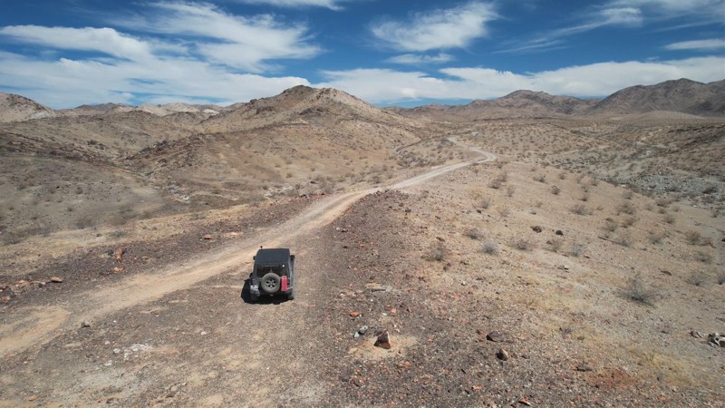
North Fork 41N53 is a scenic Forest Service road winding through the mountains west of Mount Shasta in the Shasta Trinity National Forest. Beginning at Forest Road 26, just beyond the bridge over the South Fork of the Sacramento River, the route climbs through dense pine and fir forest toward the North Fork of the Sacramento River, Morgan Meadows, and the upper trailhead of the historic Sisson Callahan Trail. Along the way, rocky streams, steep wooded slopes and occasional clearings reveal exceptional views across the Sacramento headwaters toward Mount Shasta.
Loose rock, uneven surfaces, encroaching brush and narrow shelf sections give the road its rugged backcountry character. The Forest Service designates 41N53 for high clearance vehicles, and reducing tire pressure is recommended to improve traction and provide a more comfortable ride. Conditions can change considerably with the seasons. Snow, fallen trees, erosion, and high spring runoff may make the route much more difficult or temporarily impassable.
Several dispersed campsites can be found along the route, ranging from small clearings suitable for a single vehicle to larger areas that can accommodate groups traveling with multiple rigs.
The Sisson Callahan Trail was designated a National Recreation Trail in December 1979, formally recognizing the recreational importance of this historic mountain corridor. Today, Road 41N53 provides motorized access to the upper North Fork trailhead while also supporting dispersed recreation, forest management, and wildfire protection.
North Fork 41N53 is far more than a simple forest connector. It is a gateway into a landscape traveled for well over a century. Its combination of deep forest, flowing water, rugged terrain, quiet campsites, and sweeping views of Mount Shasta makes this a route where the journey is every bit as memorable as the destination.
Updated: 01/15/2026
Mission Sweet Mine Road
Eagle Mountain, California
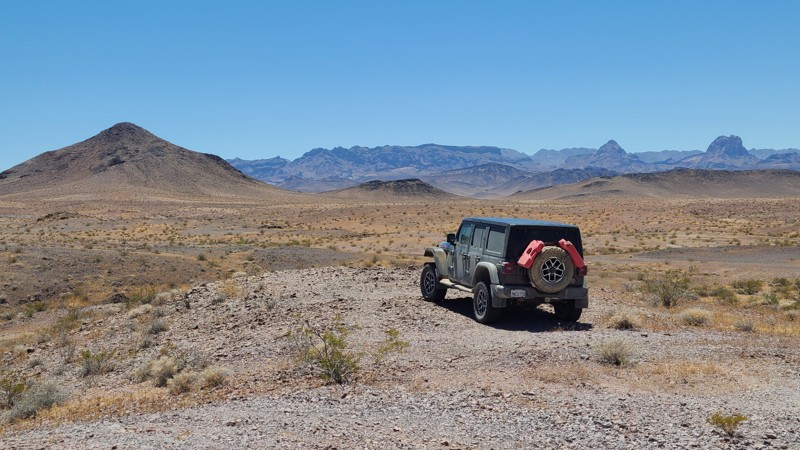
Mission Sweet Mine Road takes you to one of the many mines in the area. Isolated and desolate, with nothing visible to the horizon to remind one of nearby civilization save the road you were just on. Barren and forsaken, this land has an unmatched and unique beauty. The road passes the Mission Sweet Mine and ends at what were once living quarters for the workers. The trail is entirely flat, hard-packed with small rocks. There are no major obstacles along the trail, and it is suitable for beginning offroaders with a high clearance SUV. Near the start of the trail is an established campsite, sheltered by rocks and with a natural chimney
Updated: 07/02/2026
Pyramid Peak Road
Vidal Junction, California
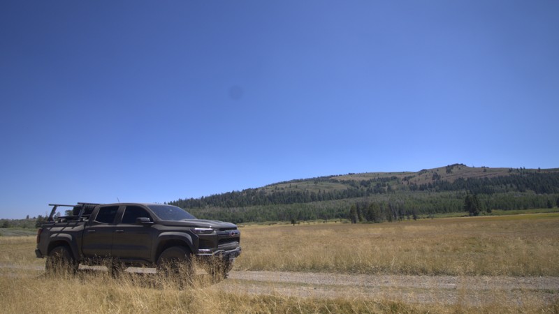
Pyramid Peak Road crosses the rolling terrain of the Whipple Mountains, weaving through low ridgelines and desert foothills. Several hiking and motorized side routes branch off along the way, many leading to abandoned mining and mill sites scattered throughout the area. Higher elevations along the route provide wide western views across the desert toward the Turtle Mountains.
The entire route is part of Eastern Mojave Heritage Trail (EMHT) Segment 4, a curated 145-mile section of the larger 733-mile EMHT network. Segment 4 highlights some of the most remote terrain in the Eastern Mojave and is managed through a partnership between the Bureau of Land Management and the Mojave Desert Heritage and Cultural Association.
Pyramid Peak is generally an easy trail, with one notable obstacle that earns it a Moderate difficulty rating. Located 2.7 miles from the eastern end, a deep, narrow wash drops sharply into a tight bottom before climbing back out to the continuing trail. The descent is steep, rutted, and roughly 30 feet high, followed by a short, steep climb of approximately 25 degrees to exit the obstacle. An experienced driver in a high-clearance 4x4 is recommended for this trail. NS660 can be used to bypass this obstacle, but that route contains obstacles that may be equally difficult or more challenging.
The route is entirely on BLM land, and dispersed camping is permitted throughout. Only a few established dispersed campsites are visible from the main road, with better camping found nearby along side routes. The best option is near the ruins of the Juanita Rose Mine, reached via a short drive up NS639, where existing fire rings and expansive views make for a scenic camping area.
Updated: 08/13/2026
Dismal Swamp
New Pine Creek, California
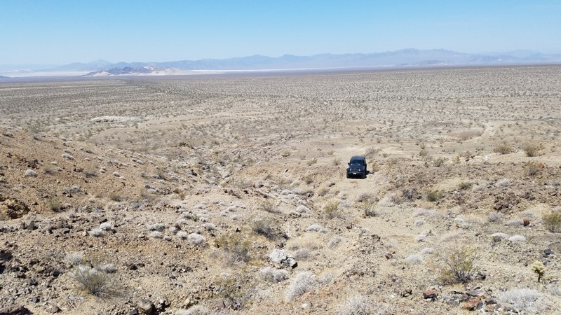
Dismal Swamp Road is a short, remote backcountry route near the California-Oregon border in the northern Warner Mountains. This trail travels approximately three miles from Pinecreek/Highgrade Road to the state line, leading visitors into one of the quieter corners of Modoc National Forest. The road continues into Oregon as a different trail name, South Warner, road number 3915, under the jurisdiction of the Fremont-Winema National Forest - Lakeview District. After roughly 25 remote miles, it terminates at Winnemucca-to-the-Sea Highway, east of Lakeview.
Despite its gloomy name, Dismal Swamp is a lush high mountain wetland at approximately 7,300 feet. Shallow streams wander through meadows, willows, bog birch, grasses, and lodgepole pine forest. Snowmelt keeps the ground wet well into summer, creating a surprisingly green landscape among the surrounding volcanic uplands.
The wetland supports uncommon streamside plant communities and has been considered worthy of additional protection by the Modoc National Forest. Its name may reflect the difficult conditions faced by early travelers as they crossed the high plateau through deep snow, standing water, mosquitoes, and thick mud.
Today, Dismal Swamp Road offers an intimate drive through peaceful forest, wet meadows, and quiet headwaters. The narrow, unpaved route is not maintained during winter and may remain blocked by snow into late spring. Mud, deep ruts, and standing water are common after snowmelt. The road is very narrow in some places, so pinstriping could be a risk. When the road dries, exposed rocks make the drive slow, rough, and bumpy. A vehicle with high ground clearance is recommended, and airing down the tires can make the journey more comfortable. There are no established camping areas along the road.
Dismal Swamp Road may be short, but it provides a memorable journey into a secluded world of lodgepole forest and high mountain wetlands at the northern edge of California.
Updated: 01/15/2026
Paymaster Mine Spur
Baker, California
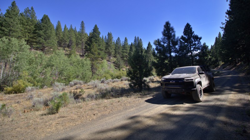
The Paymaster Mine Spur is a short, rugged offshoot near Old Dad Mountain that climbs about 150 feet through rocky desert terrain to an old prospecting mine, part of the larger network of mines that were active in the early 1900s. This half-mile, two-track trail is narrow and uneven, with one steep, loose section that requires high clearance and 4WD for less experienced drivers. The route ends at a deep washout, but a short hike beyond reveals mine tailings and the quiet solitude of the Mojave Wilderness, where wind and open space are the only sounds left from a once-bustling gold operation.
Updated: 08/19/2026
Cold Creek
Davis Creek, California
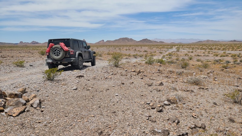
Cold Creek Road is a remote yet relatively easy backcountry drive through the northern Warner Mountains of Modoc National Forest, east of Davis Creek and US 395. The route winds through open sagebrush and juniper country before climbing into scattered stands of pine, offering a quiet journey through one of northeastern California’s less-traveled landscapes.
Along the way, Lassen Creek Campground provides inviting campsites beside the creek. Less than a mile away are the Rainbow Obsidian Mine and surrounding collection areas, known for their colorful volcanic glass. Farther into the mountains, Sugar Hill Lookout rewards visitors with sweeping views of Goose Lake, the Warner Mountains, and the expansive Modoc countryside.
Access generally begins from US 395 via County Road 47 and County/Forest Road 30. Cold Creek Road also connects with the network of forest roads serving the Davis Creek obsidian-collection area.
The road is a narrow, one-lane road with a dirt-and-gravel surface and occasional washboarding, dust, rocks, and shallow ruts. It is usually manageable in dry conditions, although a higher-clearance vehicle provides added confidence. Because the road receives no winter maintenance, snow, mud, and spring runoff can make it difficult or impassable during wetter parts of the year.
Updated: 06/10/2026
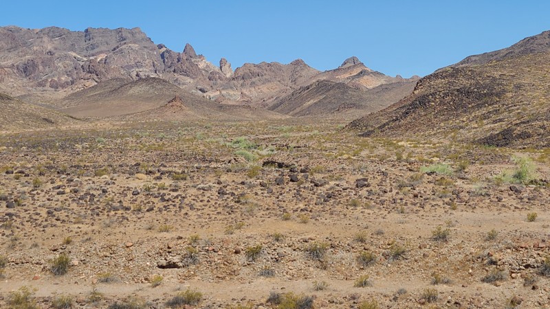
Turtle Mountain Road
Havasu Lake, California
Accompanied by the beautiful scenery of the Stepladder Mountains to the east and the Turtle Mountains to the west, Turtle Mountain Road follows a corridor between those two untouched wilderness areas. Along the way, several hiking trails invite exploration into the wilderness areas on either side, with perhaps the most interesting detour into the historic Lost Arch Mining Camp. The road ends at the border of the Old Women's Mountains Wilderness.
Over its entire length, there are only a few dispersed campsites with existing rock campfire rings visible from the road, with the best camping found about 10.5 miles from the eastern trailhead following a short diversion into the Lost Arch Mining Camp, where several dispersed and two improved campsites can be found.
The first ten miles of the road are over a wide, flat, maintained road, but from there the road changes significantly to a two-track desert trail over rocky hardpack, with the last six miles over a soft sandy desert floor. A four wheel drive high clearance vehicle is recommended to travel the entire length of the road, with the four wheel drive helpful in the eastern soft sandy section.
Updated: 07/02/2026
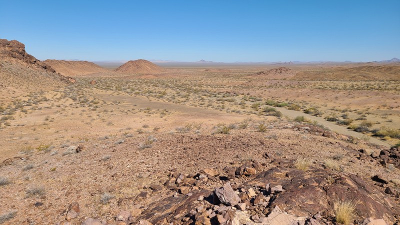
NS495
Vidal Junction, California
NS495 ends at the boundary of the Turtle Mountains Wilderness, where broad views open across a rugged desert basin to the Turtle Mountains. The west end of the route also passes an old mining site, where a collapsed miner’s cabin and scattered artifacts still remain. Near the east end, an abandoned ore-processing site includes a standing hopper and shaker deck that make for another worthwhile stop along the trail.
The eastern portion of the route, east of the NS499 junction, is part of Eastern Mojave Heritage Trail (EMHT) Segment 4. Segment 4 is one section of the larger 733-mile EMHT network and provides a 145-mile tour through some of the most remote terrain in the Eastern Mojave. The trail network is managed through a partnership between the Bureau of Land Management and the Mojave Desert Heritage and Cultural Association.
Good dispersed camping can be found at both ends of the route, including near the abandoned miner’s cabin on the west end and the ore-processing site on the east end. Large, flat campsites with existing rock fire rings can accommodate multiple vehicles.
This is an easy trail overall, though the lightly traveled west end may have faint or barely visible tracks in places. A short stretch of embedded rock is the main obstacle, but the route is otherwise suitable for most high-clearance two-wheel-drive vehicles in dry conditions. Nearby side roads and spurs may be rougher and are better suited to a capable 4x4.
Updated: 08/13/2026
Fandango Pass
Fort Bidwell, California
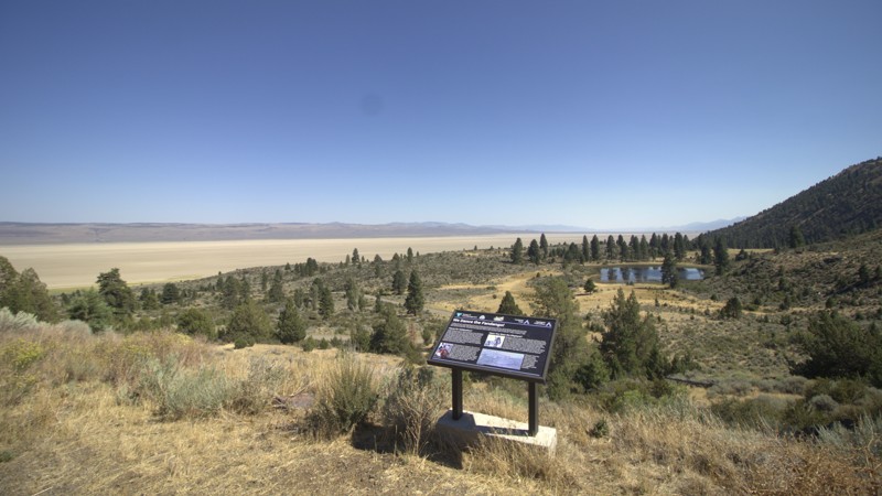
Fandango Pass Road, also known as County Road 9 and Forest Road 9, crosses the northern Warner Mountains from Fort Bidwell in Surprise Valley to Goose Lake Valley. Traveling east to west, the road climbs from the open sagebrush landscape of Surprise Valley toward Fandango Pass at approximately 6,135 feet. Along the way, sweeping views reach across the valley toward Nevada before the route enters pine forest, rocky slopes, and quiet mountain meadows.
The road follows the path of an important nineteenth-century emigrant crossing. Remnants of the original wagon trail, old wagon ruts, a military road retaining wall, and a historical marker can still be found near the pass. The name Fandango may have come from stories of travelers dancing either in celebration or to stay warm during harsh weather.
Beyond the summit, the road passes near Fandango Peak and continues west through the forest toward Buck Creek Guard Station and Goose Lake Valley. In dry conditions, Fandango Pass Road is an easy and enjoyable drive, although it remains narrow, winding, and steep in places. Snow, mud, fallen trees, loose rock, and washouts can make it more difficult during wet weather and early spring. There are no designated campsites along the route.
Updated: 09/14/2026
White Rock Lake
Baltimore Town, California
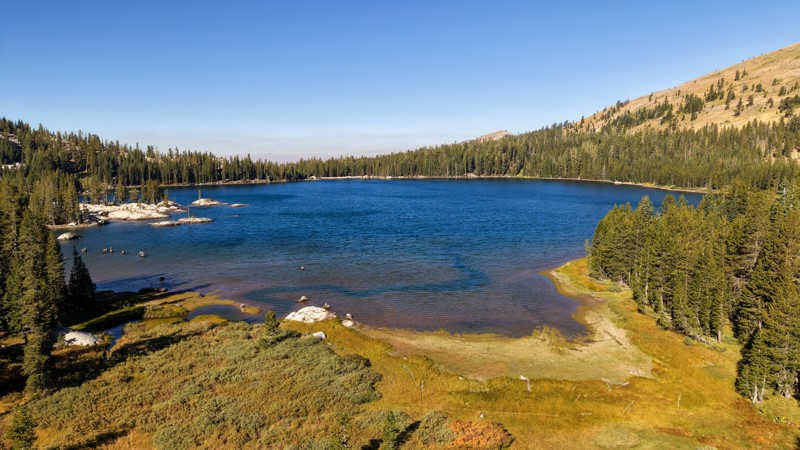
White Rock Lake Road is a dead-end spur road off Meadow Lake Road that treks 6.5 miles through dense Sierra forest to a remote, high-elevation lake tucked beneath Mount Lola. Sitting near 7,800 feet, White Rock Lake is surrounded by thick conifers, granite outcroppings, and broad mountain slopes, creating a surprisingly secluded destination despite its proximity to several better-known routes and trails. The drive starts relatively mild but steadily becomes rougher, with deep silty dirt, loose softball to grapefruit-sized rocks, and several steep grades where traction can be difficult. Near the lake, the road splits and becomes noticeably more demanding, adding larger rocks, erosion holes approaching a foot deep, and tighter terrain that makes a high-clearance 4WD vehicle necessary. Both branches eventually reach the shoreline, where primitive campsites are scattered among the trees and beside the water, making the rough drive worthwhile for anyone looking to camp, fish, or simply spend a quiet night beside one of the more remote lakes in this corner of the Sierra.
If you are looking for all of the great campsites in this area, be sure to check out this list: Meadow Lake Camping Opportunities.
Updated: 07/02/2026
Snaggletooth Trail
Needles, California
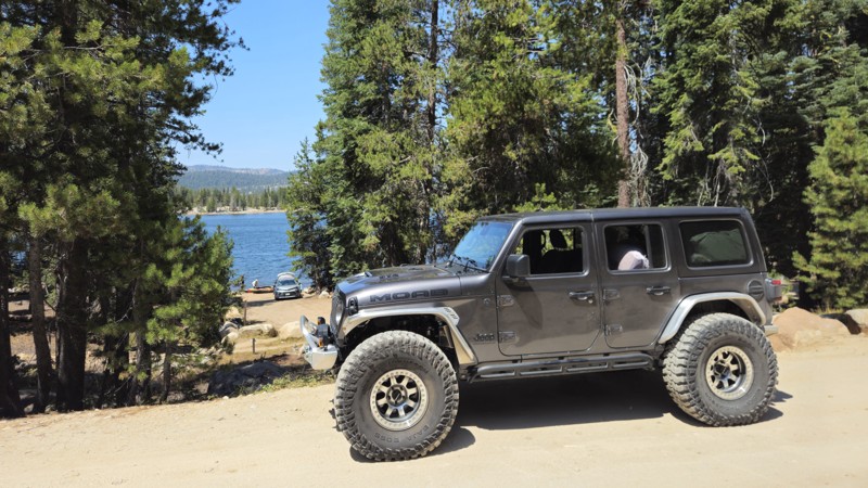
Skirting the western edge of the Chemehuevi Mountains Wilderness, this network of desert tracks winds past the Snaggletooth Range and the Snaggletooth Campground. A short spur heading west (NS428) before the campground climbs toward the summit, where expansive views open across Chemehuevi Valley and the surrounding Mojave backcountry.
This route forms part of the Eastern Mojave Heritage Trail (EMHT), Segment 4. EMHT Segment 4 is a curated 145-mile corridor showcasing some of the most remote and visually striking terrain in the Eastern Mojave. The broader EMHT system is managed through a partnership between the Bureau of Land Management (BLM) and the Mojave Desert Heritage and Cultural Association, which maintains route information for all four segments of the 733-mile network.
At the heart of this section lies Snaggletooth Primitive RV Camp, set against the rugged backdrop of Snaggletooth Ridge. The campground includes five designated sites with large, level pads suitable for multiple RVs. Cell service is generally reliable, and resupply options are available approximately 20 miles north along US-95 in Needles. Additional informal campsites are dispersed along the surrounding ridgelines and washes. An especially secluded and sheltered campground is found at the end of the NS 428 spur, whose entrance is north of the RV Camp.
The route surface consists primarily of hard-packed gravel and sand, offering an easy, well-graded drive under normal conditions. Most of the main track is suitable for high-clearance two-wheel-drive vehicles. However, adjacent spur routes and exploratory trails in the area are more technical and typically require a high-clearance four-wheel-drive vehicle.
Updated: 08/26/2026
7N75 Union Reservoir
Bear Valley, California
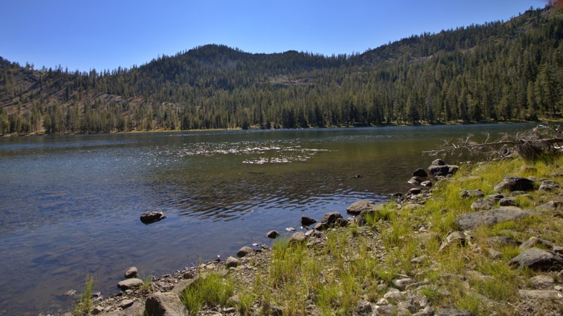
Forest Road 7N75 is an easy and scenic backcountry route in California’s Stanislaus National Forest, providing access to the Union and Utica Reservoir area. Traveling at roughly 6,800 feet in elevation, the road passes through classic high-Sierra forest, granite outcroppings, and open mountain terrain.
The trail consists primarily of maintained dirt and gravel with no significant obstacles, making it suitable for virtually any passenger vehicle during normal dry conditions. Numerous camping opportunities are located along or near the route, including developed campgrounds around Union and Utica Reservoirs, along with access to additional camping throughout the surrounding national forest.
7N75 is a seasonal road; the motorized season is April 15 through December 15. Snowpack and road conditions can cause the Forest Service to extend the closure beyond April 15.
Overall, 7N75 is less about four-wheel-drive difficulty and more about easy access to camping, fishing, kayaking, and exploring the reservoirs and forests of the Sierra Nevada, making it an excellent scenic route for beginners and families.
Updated: 08/26/2026
40N64 Toad Lake
Mount Shasta, California
Toad Lake Road 40N64 is a remote Forest Service route that climbs deep into the Trinity Divide west of Mount Shasta. Branching from North Fork Road 41N53, it follows the Middle Fork of the Sacramento River for roughly ten miles, winding through mixed conifer forest, rocky drainages, and lush mountain meadows. Occasional openings reveal impressive views of Mount Shasta and the rugged ridges separating the Middle Fork and North Fork watersheds.
The drive is long, narrow and slow. Its surface transitions from scattered remnants of pavement to dirt, gravel, loose rock and deeply rutted sections, with few convenient places to turn around. The upper portion becomes particularly rough and may be difficult for vehicles with low clearance. Snow can linger into early summer, while fallen trees, washouts and seasonal runoff may change conditions from one visit to the next. A vehicle with high clearance, durable tires and reduced tire pressure is strongly recommended.
Near the end of the road, a primitive campground and trailhead sit below Toad Lake. From there, a short hike crosses streams and wet meadows before reaching the secluded lake beneath Porcupine Peak near the crest of the Eddy Range.
The history of this mountain corridor extends well beyond modern vehicle access. Naturalists Louise Kellogg and Annie Alexander spent several days at Toad Lake during a 1911 scientific expedition through the Mount Shasta region, confirming that the lake was already an established backcountry destination more than a century ago.
Toad Lake Road is far more than a route to the trailhead. It is a slow and memorable journey from the lower Sacramento headwaters into the secluded high country of the Trinity Divide. Its rugged terrain, quiet forests, mountain streams, and remote destination create a genuine sense of exploration, with peaceful Toad Lake waiting at the end.

Upgrade your Membership
Unlock all of the details on every Trail Guide and Scout Route.
Start a 7-day Free TrialBrowse Trails in California by City
Browse every California city with offroad trail guides.
Community
Partners

