




By clicking "ACCEPT", you agree to be the terms and conditions of each policy linked to above. You also agree to the storing of cookies on your device to facilitate the operation and functionality of our site, enhance and customize your user experience, and to analyze how our site is used.
California Off-Road Trails
415
Total Trail Guides 392

4112
Detailed Waypoints 524
Try a Free 7-Day Trial and unlock it all
Start a Free Trial Most Recent Trail Reviews
Rated 5/5
Open
Visited: 09/19/2026
Great beginner trail here for those looking to try out some rockier sections. Starting to trend a little closer to a rating of 4, but still a 3 I’d say

R
Rob
Rated 5/5
Open
Visited: 09/19/2026
I entered this trail from Freeway Ridge 4WD trail (31E77) and ran Black Gulch Jeep Trail up to Rancheria Road, turned around, and ran Black Gulch Jeep Trail all the way down to Keyesville Road in Lake...



Daniel Macioce
Rated 4/5
Open
Visited: 09/19/2026
Took out the vstrom 800de today and this thing was tough for someone like me who is pretty new to offroading motorcycles. I ended up turning around about half way because I wasn't sure if I would be a...
SK
sean kotrola
No Rating
Open
Visited: 09/19/2026
The trial marked by the app here is very difficult with all the recent deep washouts. Proceed at your own risk if you are by yourself with unmodified rigs. However the bypass is maintained and should ...
TB
Timmy Boby
Rated 5/5
Open
Visited: 09/18/2026
Very friendly fire watch tower volunteers and fantastic 360 degree views up top
R
Rob
Rated 5/5
Open
Visited: 09/18/2026
Great views and an easy drive through. Be sure to take the road up to the fire watch tower
R
Rob
Rated 5/5
Open
Visited: 09/17/2026
ran the trail twice last weekend, this is such a better way to go than 3n16...


Josh Noesser
Official Crew
Rated 5/5
Open
Visited: 09/16/2026
It's been 6 years since I visited this trail. It has seen some wear, but the overall difficulty is about the same, probably a bit higher now, as Waypoint 11 has suffered from traffic. Waypoint 11 ha...

Robert
Official Crew
Rated 5/5
Open
Visited: 09/16/2026
Started off from polique canyon at way point 13 and headed east. Its a great trail for most of it with scenic views. A good amount mud puddles that were fun as hell to drive through. Some I decided to...


VM
Victor Manuel Garcia
Rated 5/5
Open
Visited: 09/16/2026
Used this trail to get to Holcomb valley. Super easy and a nice drive, I can see how in the winter it can be a bit more challenging with rain and snow.
VM
Victor Manuel Garcia
No Rating
Open
Visited: 09/16/2026
Mostly easy, but heading NE there's a rock step down just a few miles in that *requires* high clearance. Banged the rear end of my 4runner despite having a 3" lift and 33" tires. A stock SUV would alm...



Carlos H.
Rated 5/5
Open
Visited: 09/15/2026
It's been over 4 years since I was last on this trail, and I was very happy to see that the old car was still there. Some research suggests that it is a 1939 Plymouth Road King 5-window coupe.


Robert
Official Crew
Rated 5/5
Open
Visited: 09/14/2026
A fun little detour off Burns Canyon. I ran this alone and stopped a few times to spot; I also used my grill camera in several places. I brushed my sliders a couple times, but no real issues. Definite...
EB
Ed Boyd
Rated 5/5
Open
Visited: 09/13/2026
easy perfect beginner off roader trail with great views and water crossing during the winter.



Dex Offroad
Rated 5/5
Open
Visited: 09/12/2026
Fenders Ferry kept giving me reasons to slow down and enjoy the ride. I loved winding along mountain ridges, following creeks, and catching glimpses of Shasta Lake's fingers tucked between the hills. ...



Rose Meirs
Official Crew
Rated 5/5
Open
Visited: 09/11/2026
super easy trail over looking the valley and 15fwy. only bad thing is that its super windy.

Dex Offroad
No Rating
Partially Open
Visited: 09/09/2026
Although you can cross the creek from Fordyce if you want, Committee Road is still closed back to the I80, so this has no exit, and you'll be forced back onto Fordyce.

Ryan Boudreau
Official Crew
No Rating
Temporary Closure
Visited: 09/09/2026
Road is still closed. I thought i read somewhere an expected 2030 opening, but can't confirm that info.
Ryan Boudreau
Official Crew
Rated 5/5
Open
Visited: 09/09/2026
This is an awesome trail . This trail is moderate with a few obstacles to make it fun. It also has incredible scenic views with a little bit of shelf roads. You can watch the full video on my YouTube ...


Dex Offroad
Rated 5/5
Open
Visited: 09/07/2026
Pretty spot on with the rating, was a little tough today with the rain but made it through in my 2023 Gladiator Overland with 2.5” lift and 35s with autolynx sway disconnects.


CT
Christopher Tanton

Shaan Heugly
Rated 5/5
Open
Visited: 09/06/2026
Drove reverse from what’s listed to the jasper trail. This is a easy but enjoyable trail with plenty of places to camp at the end of the
Shaan Heugly
Rated 5/5
Open
Visited: 09/06/2026
Bit washed near the top but nothing difficult to navigate. I headed from jasper to the highway and near the highway it did narrow. I got through with my Tacoma but there are a few pinch points I could...
Shaan Heugly
Rated 5/5
Open
Visited: 09/06/2026
Mostly easy trail but when going south to north, I did need to use 4Lo on some of the inclines with a loaded Tacoma
Shaan Heugly
Rated 4/5
Open
Visited: 09/05/2026
It had been five years since I last drove this trail. The long, annoying stretches of moguls are still there, and water erosion has added a touch more difficulty in places. It was nice to see the old ...


Robert
Official Crew
Rated 4/5
Open
Visited: 09/05/2026
This is a nice trail with great views for any 4WD with ground clearance as some sections have ruts that are 12+ inches deep. Things were very dry on my visit, so airing down the tires helped to smooth...


SG
Steve Graham
Rated 3/5
Open
Visited: 09/05/2026
From waypoint 7 to 10 the water damage is pretty bad. Waypoint 13-16 it is rocky. Nothing crazy but a few spots where patience and the right line will go a long way. Good clearance and 4x4 recommended
N
Noah
Rated 5/5
Open
Visited: 09/05/2026
Easy trail with an awesome view at the end. There were three lookouts in the fire tower and each one was super friendly and informative. Must see trail!


N
Noah
Rated 5/5
Open
Visited: 09/05/2026
fun easy trail, Butler Peak lookout is the highlight imo
N
Noah
Rated 5/5
Open
Visited: 09/04/2026
Trail was very well maintained. Thanks for the Fresno 4x4 club. It was very cold at night, into the 30s. We were on the trail two nights, 3 days and two nights at voyager rock due to a breakdown fr...
JD
John Drago
No Rating
Open
Visited: 09/04/2026
Beautiful area, but the trail itself wasn’t very interesting. I’d rate it around a 3/10, with a couple of optional sections that might push a 4.
There’s tons of dispersed camping throughout the area,...


Ryan Smith
Rated 5/5
Open
Visited: 09/01/2026
awesome trail with a lot of water crossings. just be careful of sxs and bikes since its a OHV area.

Dex Offroad
Rated 5/5
Open
Visited: 09/01/2026
Super easy trail and you can over look the high desert. Trail ends at an awesome view point.

Dex Offroad
Dex Offroad
Rated 5/5
Open
Visited: 08/31/2026
This trail is much harder than it used to be. It’s just as breathtakingly beautiful as ever. You are on your own out there. Fuel, parts, spare tire. It’s days from help if you need it so go prepared. ...

CP
Christopher Pepin
No Rating
Open
Visited: 08/30/2026
Ran this trail today and had fun. Easy trail with great views. I wouldn’t hesitate to take an experienced driver in a stock jeep up this. There are lots of trails in this area and way to get off the m...

CP
Christopher Pepin
No Rating
Open
Visited: 08/29/2026
Trail was in good shape, a little less sand makes the boulders a little bigger. People have made the bypass around the sluice a little bit longer than it used to be you miss a lot of the good rocks. O...
C
Campbell
Rated 5/5
Open
Visited: 08/29/2026
An often overlooked and amazing trail. It’s about the length and difficulty of the rubicon if you don’t hit any of the bypasses on the rubicon. We had a group of 3 lj on 40s, a jku on 42s, and an Xj o...
CP
Christopher Pepin
Rated 4/5
Open
Visited: 08/27/2026
This is most definitely a hard trail. Is the entire thing hard? Not at all. The western 7 miles are a hard packed dirt road. Then you run into 3 straight, large boulder obstacles where its clear many ...


Ryan Boudreau
Official Crew
Rated 4/5
Open
Visited: 08/27/2026
Easy drive with beautiful views and . . . Buck Rock! Lots of camping south of Buck Rock, but camping north of the Rock isn't as plentiful. There are a few others on the north, but there's one here: 36...


Carlos H.
Rated 5/5
Open
Visited: 08/26/2026
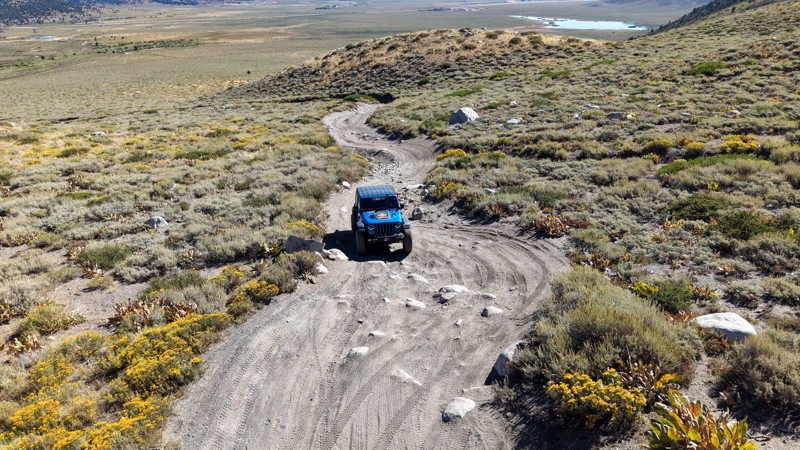
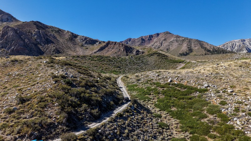
5 stars all day! This trail is absolutely amazing, and one you do not want to miss if you are in a capable vehicle in the area. It is rough, rocky, steep, and narrow enough to weed out the vanlifers a...
Ryan Boudreau
Official Crew
Rated 5/5
Open
Visited: 08/26/2026
I really enjoyed this road. It's super scenic with the sierra's in the background, the white beaches, and the columns are really cool. The road is not anything challenging with a high clearance vehicl...


Ryan Boudreau
Official Crew
Rated 4/5
Open
Visited: 08/25/2026
Fun area. The hot springs are pretty popular and well-known, and because they are small, you'd better hope you are one of the first people there that day if you want to get in. The route is easy, exce...


Ryan Boudreau
Official Crew
Rated 4/5
Open
Visited: 08/25/2026
I liked this trail a lot, but it's not quite a 5-star trail for me. I feel like it's a little overhyped. Is it scenic? Absolutely! Is there tons of great camping? Totally! Is it a crazy busy? You Bet!...


Ryan Boudreau
Official Crew
Rated 4/5
Open
Visited: 08/25/2026
Road to the hot springs parking area is easy. There are regular passenger cars there. The hike is easy too. The tub itself is super scenic, but know that they are not hidden gems by any means and we'l...

Ryan Boudreau
Official Crew
Rated 3/5
Open
Visited: 08/25/2026
It's a simple road, but definitely very scenic and really only used to get from Convict to Laurel Lakes or Mammoth. Road is suitable for anything with decent ground clearance.


Ryan Boudreau
Official Crew
Rated 2/5
Open
Visited: 08/25/2026
Simple dirt road used to access other types of recreation. Many signs remind you that you aren't allowed to camp along it except at the campground.


Ryan Boudreau
Official Crew
Rated 3/5
Open
Visited: 08/23/2026
Simple, straightforward dirt road used for fishing access.


Ryan Boudreau
Official Crew
Rated 5/5
Open
Visited: 08/23/2026
Amazing views at the top of this trail. Erosion looks to be making this trail harder than it probably originally was. Most of the hardest spots are getting bypasses created around them. A short, st...



Dan Jurgella
Rated 5/5
Open
Visited: 08/23/2026
Toad Lake Road 40N64 was a long, slow, and wonderfully remote drive into the Trinity Divide. The changing mix of old pavement, dirt, loose rock and deep ruts kept the journey interesting, while forest...


Rose Meirs
Official Crew
Most Popular
Updated: 09/22/2026
Utica Reservoir
Bear Valley, California
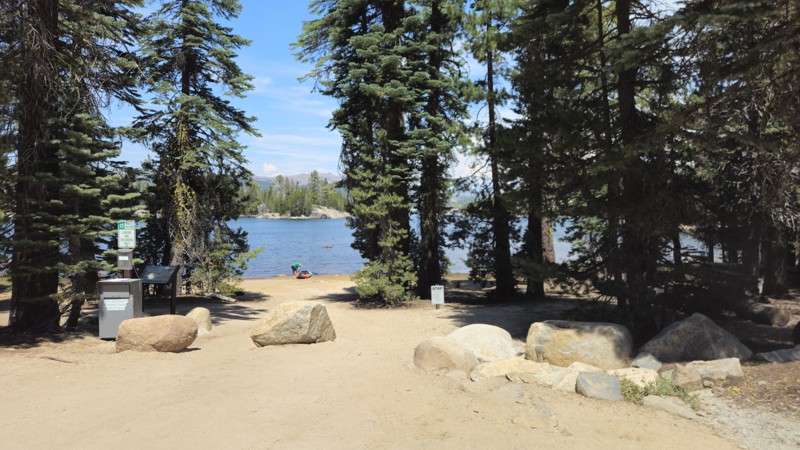
The road to Utica Reservoir offers an easy-going backcountry escape into the high country of the Sierra Nevada. The road strolls gently through pine forest and granite terrain before ending up at the 241-acre Utica Reservoir, known for its rocky shoreline, small islands, and calm water popular with paddlers and campers. Surrounding campgrounds provide excellent bases for fishing, kayaking, swimming, and exploring the neighboring Union Reservoir area. For most travelers, it is a relaxed destination road with plenty of Sierra scenery, but those looking for a much bigger challenge can continue north on 7N17, where the maintained road transitions into the technical rock crawling of the legendary Slick Rock Trail.

Updated: 07/02/2026
Eagle Pass Road
Needles, California
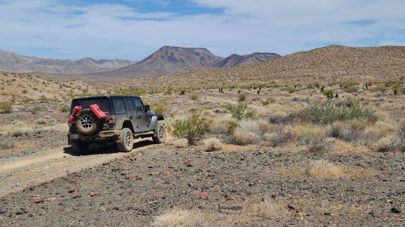
Beginning near Needles, Eagle Pass Road travels southwest across open BLM land before eventually looping back to Interstate 40. Along the way, the route passes several hiking and off-road trail junctions that offer additional opportunities for exploration. Broad views of the Sacramento Mountains, Flat Top Mountain, and Eagle Peak provide a scenic backdrop for much of the drive.
The first 16 miles of the route, ending at the NS064 junction, are part of Eastern Mojave Heritage Trail (EMHT) Segment 4. This segment is one section of the larger 733-mile EMHT network, a curated collection of routes showcasing some of the most remote terrain in the Eastern Mojave. The trail network is managed through a partnership between the Bureau of Land Management and the Mojave Desert Heritage and Cultural Association.
The entire route is on BLM land, and dispersed camping is allowed throughout the area. While only a few previously disturbed campsites are visible from the road, there are many suitable places to camp along the trail.
Road conditions vary as the route crosses gravel, desert pavement, and sandy washes. Most of the trail is straightforward but slow-going, with extended sections of soft sand and occasional stretches of exposed bedrock. In the washes, multiple tire tracks sometimes split away from the mapped route, though they generally reconnect farther ahead. Some of the lesser-used lines may be narrower and more overgrown, with a higher chance of pinstriping. The main obstacle is located about 0.5 miles north of the NS064 junction, where a rocky descent over a shallow waterfall requires careful wheel placement.
Updated: 09/22/2026
Leavitt Lake
Sonora Junction, California
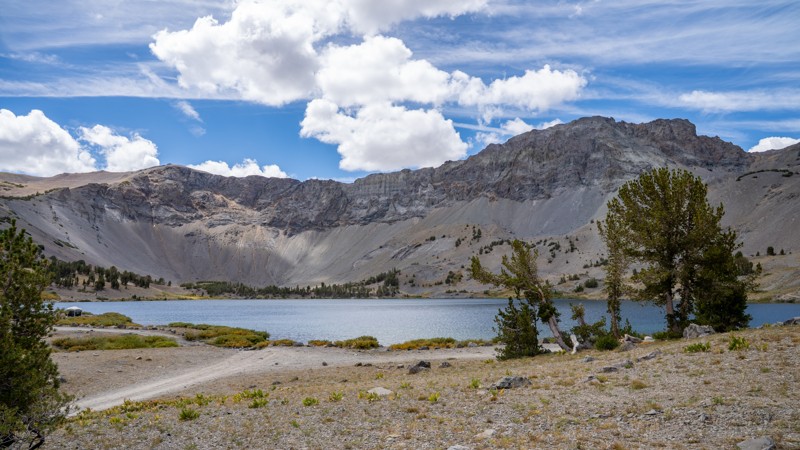
Tucked high in the glacial mountains near Sonora Pass, Leavitt Lake Road is a rugged alpine off-road trail that follows Leavitt Creek through forest, rocky climbs, eroded terrain, and several shallow water crossings before reaching a stunning high-alpine lake surrounded by stark ridgelines of the Eastern Sierras. The drive feels progressively more remote as the road roughens and the trees begin to thin, eventually opening into a broad alpine basin where camping, fishing, hiking, and dramatic mountain scenery make it easy to linger. With just enough technical terrain to keep the drive interesting and a destination that feels far removed from Highway 108, Leavitt Lake is the kind of trail where the journey and the campsite are equally memorable.
Updated: 06/25/2026
Little Box Canyon Jeep Trail
North Shore, California
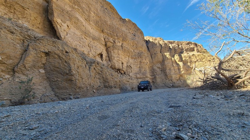
Little Box Canyon Road is a short, scenic road tucked into the Mecca Hills just north of the Salton Sea and along the northern border of the Mecca Hills Wilderness. Often described as a smaller version of Anza-Borrego’s Sandstone Canyon, this 2.3-mile west-to-east route winds through sandy washes and tight canyon corridors lined by near-vertical cliffs up to 40 feet tall. The route begins off paved Box Canyon Road at roughly 777 feet and gradually climbs to just over 1,030 feet before connecting with Meccacopia Trail.
The trail is mostly loose sandy gravel, hard-packed dirt, small rocks, and brief patches of deeper sand, making it approachable for first-time off-roaders in a 4WD vehicle.
Updated: 01/15/2026
Rainbows End Mine Road
Eagle Mountain, California
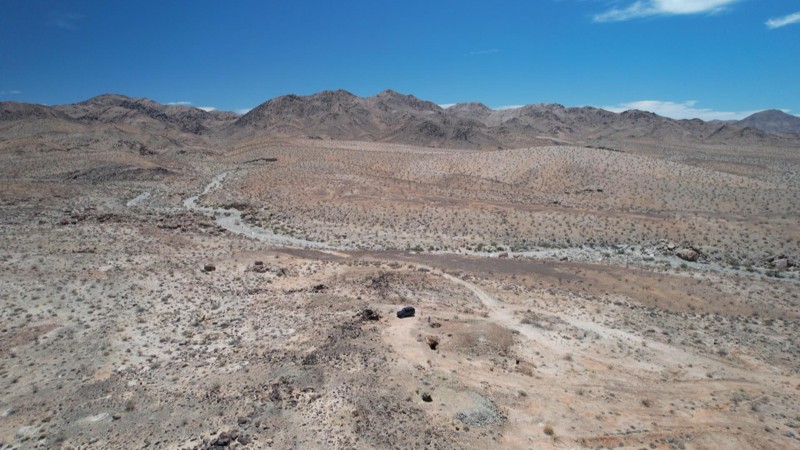
The trail is entirely flat hardpack with small rocks. This out-and-back trail was created to access Rainbows End Mine. At only 0.6 miles long and at a constant 2,000 feet elevation, it takes about 60 minutes to explore the mine's artifacts. There are no major obstacles along the trail, and it is suitable for beginning offroaders with a high clearance SUV. Near the start of the trail is an established campsite, sheltered by rocks and with a natural chimney
Updated: 06/10/2026
Mailbox and Prospectors Trails
Sablon, California
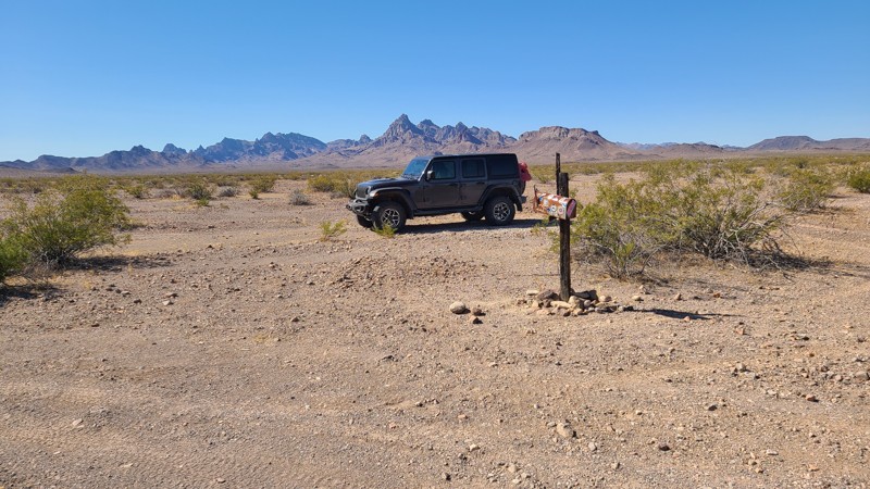
Mailbox Trail hugs the border of the Turtle Mountains Wilderness and provides a staging area for hikers and equestrians traveling the trails leading deep into the wilderness. The trail provides a convenient western access to the Lost Arch Mining camp from its end when continuing onto the Lost Arch Inn Road. The start of the trail is marked with a mailbox stuffed with food and water donations.
Dispersed camping is available along the trail with an existing campsite about 0.5 miles from the east end.
The surface is gravel that can be managed with a two-wheel drive vehicle, but with adequate ground clearance to manage the uneven surface.
Updated: 07/21/2026
Doran Canyon - Gate Keeper Bypass
Yermo, California
Doran's Bypass is the most popular route to access Doran Canyon. This route allows drivers to skip the infamous gatekeeper obstacle while still enjoying the canyon’s rocky terrain, tight lines, and scenic desert walls. It’s the preferred entry point for most rigs and the primary way in and out for those looking to experience Doran without committing to the extreme obstacle right at the start.
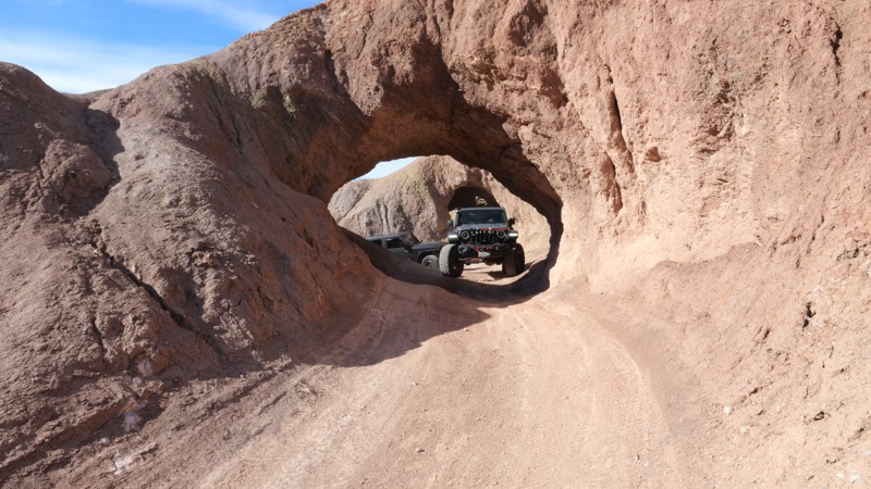
Just feet past the entrance to the trail are the famous mud arches people love to drive through. The route skirts along the top of the ridge, looking down into Odessa Canyon and Doran's Gate Keeper, making for interesting views when people are trying The Gate Keeper. On the other side of the trail are some great views of the historic Calico Ghost Town that was built in 1881.
This trail has some mild off-camber spots, but is primarily hard-packed dirt with some exposed rocks.
Updated: 09/23/2026
Hilltop Hot Springs
Whitmore Hot Springs, California
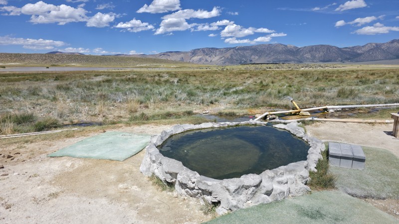
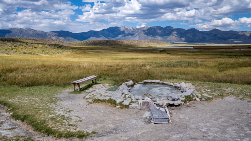
Hilltop Hot Springs, also commonly called Pulkey’s Pool, is one of several small, primitive soaking tubs in the open expanse of the Long Valley Caldera east of Mammoth Lakes, California. Unlike a developed spa, Hilltop is essentially a rock-and-cement pool fed by naturally heated geothermal water that is piped in from a nearby source. The pool is only large enough for a handful of people, and visitors can regulate the incoming water with valves to keep the soaking temperature around 100–110°F. This natural tub sits alone in a broad meadow with sweeping, nearly 360-degree views across Long Valley toward the snow-capped Sierra Nevada. It is free, easy to reach from Benton Crossing Road, and only requires a short quarter-mile walk from the parking area, making sunrise and sunset soaks especially popular. The road to the parking area is hard-packed dirt with sporadic potholes and coarse gravel. Just beyond the primary parking area, a small turnaround is often used by boondockers visiting the area.
The springs are a visible reminder of the extraordinary volcanic system beneath Long Valley. The caldera was created by an enormous eruption roughly 760,000 years ago, and today snowmelt from the Sierra seeps deep underground, is heated by hot rock associated with the area's relatively young volcanic system, and eventually returns toward the surface through fractures and permeable rock. That same hydrothermal system feeds numerous springs around Hot Creek and the eastern side of the caldera. Historically, thermal springs throughout Long Valley were known and used by Native American peoples, with the USGS noting that some held spiritual and medicinal significance long before Euro-American settlement.
It is important to note that these pools may not be considered family-friendly, as clothing is entirely optional.
Updated: 07/02/2026
Sunflower Springs Road
Fenner, California
Starting at the near ghost town of Essex, California, Sunflower Springs Road skirts the eastern edge of the Old Woman Mountains Wilderness and passes several intersecting hiking and motorized trails that lead into the wilderness and often to abandoned mines. A working cattle corral is next to the trail, just before reaching the Native American Land Conservancy, which is surrounded by beautiful rock formations and is approved for day use.
The last 8 miles of NS021 are part of the Eastern Mojave Heritage Trail (EMHT) network Segment 4, and from its end, EMHT continues to Turtle Mountain Road. The Eastern Mojave Heritage Trail (EMHT) network. EMHT Segment 4 is a curated set of trails that provides a 145-mile tour of the remotest areas of the Eastern Mojave. The trail network is managed through a partnership between the Bureau of Land Management (BLM) and the Mojave Desert Heritage and Cultural Association, where details can be found for all four segments of the 733-mile adventure.
While a few existing previously disturbed campsites are visible from the trail, there are many suitable sites along the way to establish a campsite.
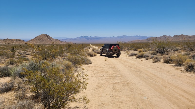
Most of the trail passes over the desert basin of Ward Valley, where the road surface is hard-packed sand and flat. There are occasional rocky sections that could be driven over with a 2-wheel drive vehicle with some clearance.
Updated: 07/02/2026
Little Piute Trail
Fenner, California
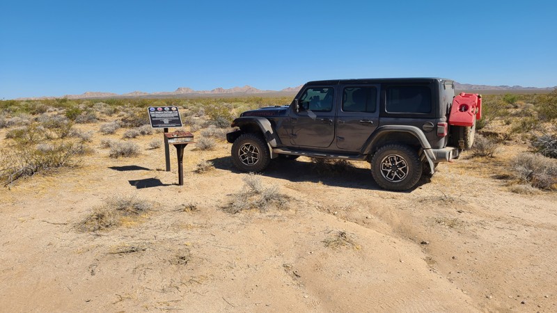
Little Piute Trail begins in the Little Piute Mountains and descends into the wide, sandy expanse of Ward Valley. Throughout the route, expansive views stretch toward the nearby Old Woman Mountains Wilderness. One of the more notable landmarks along the trail is the Eastern Mojave Heritage Trail mailbox, where visitors can sign the logbook to record their passage.
The entire route is part of Eastern Mojave Heritage Trail (EMHT) Segment 4, a curated 145-mile section of the larger 733-mile EMHT network. Segment 4 highlights some of the most remote terrain in the Eastern Mojave and is managed through a partnership between the Bureau of Land Management and the Mojave Desert Heritage and Cultural Association.
A few previously disturbed campsites are visible along the route, and there are several additional open, flat areas suitable for dispersed camping.
The trail follows generally flat, hard-packed sand with occasional short rocky sections. In dry conditions, it is typically suitable for most high-clearance two-wheel-drive vehicles.
Updated: 08/19/2026
Sugar Hill Lookout
Davis Creek, California
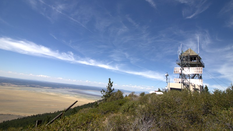
Sugar Hill Road, Forest Road 46N06A, follows the historic route to Sugar Hill Lookout in the North Warner Mountains of Modoc National Forest, east of Goose Lake near Davis Creek. This narrow, unpaved road winds through stands of ponderosa pine and white fir as it climbs to the 7,267-foot summit, with grades reaching about 11 percent. The drive is generally easy in dry conditions, but snow, storms, fallen trees, and washouts can quickly change the road. Visitors should check current Forest Service maps and closures before making the trip.
According to local tradition, Sugar Hill received its name in the late 1860s after a wagon carrying sugar from Yreka to soldiers at Fort Bidwell broke down nearby, leaving the garrison without its shipment for several weeks. The Forest Service began using the summit for fire detection around 1920. The importance of reliable access became especially clear in 1929, when a devastating wildfire burned more than 8,000 acres and drew nearly 300 firefighters.
A permanent lookout was completed in 1931, featuring a glass observation cab and surrounding catwalk atop a 30-foot steel tower. A telephone line connected the station with Crane Creek and Davis Creek in 1933, and additional support facilities were added in later years. Between 1942 and 1946, Sugar Hill personnel made the first reports of 16 fires while also monitoring wind, humidity, and fuel moisture.
A pit toilet stands near the lookout, but there is no designated campground at the summit.
Sugar Hill Lookout remains standing and is recognized on the National Historic Lookout Register. Although its future may involve restoration or relocation, the summit continues to offer sweeping views across Goose Lake, the Warner Mountains, western Modoc County, and southern Oregon.
Updated: 09/09/2026
Faucherie Lake
Marsh Mill, California
Trekking deep into the Tahoe National Forest just east of Bowman Lake, Faucherie Lake Road is a roughly 4-mile, out-and-back spur off Meadow Lake Road that begins near Jackson Creek Campground. While there are no singular major obstacles, the road is consistently rough, with embedded and loose rock ranging from baseball to softball size. Water bars, uneven climbs, occasional creek crossings, and stretches that require careful tire placement make this an often-slow drive, especially for stock vehicles.
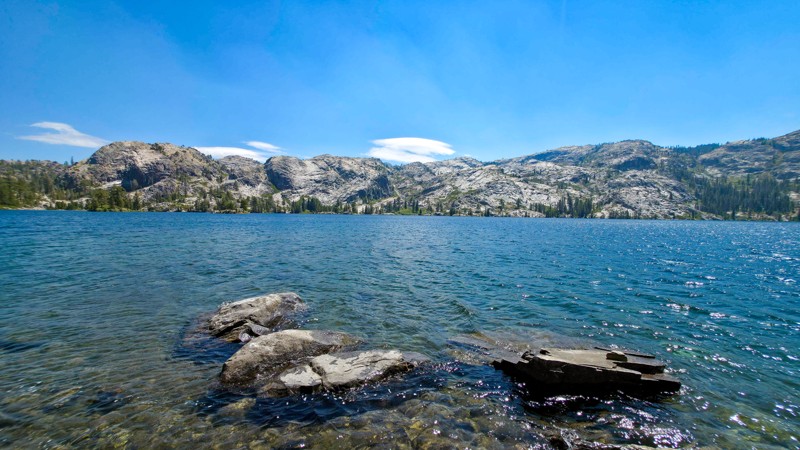
The road winds through dense stands of towering conifers, passing mountain lakes and flowing creeks such as Sawmill Lake and Canyon Creek before eventually reaching Faucherie Lake, a striking blue reservoir surrounded by exposed Sierra granite, rocky cliffs, and forested slopes. The area is a popular summer destination for camping, swimming, fishing, paddling, hiking, and other outdoor activities.
Developed camping is available at Jackson Creek Campground, Canyon Creek Campground, and Faucherie Group Campground, while dispersed camping can be found around Sawmill Lake and along several short spurs off the main road.
High-clearance vehicles are strongly recommended, and trailers should not attempt this road. Four-wheel drive is generally not necessary along the main road during dry conditions, but it can be useful when accessing dispersed campsites where steep, loose, and undulating terrain is common. Although the road is technically open year-round, deep Sierra snow typically makes it inaccessible during winter and can linger well into the summer months.
If you are looking for all of the great campsites in this area, be sure to check out this list: Meadow Lake Camping Opportunities.
Updated: 07/02/2026
Chemehuevi Valley West
Needles, California
Leaving the Turtle Mountains behind, Chemehuevi Valley West Trail crosses the 22-mile-wide Chemehuevi Valley to Hightower Road near Havasu Lake. The first 2.4 miles on the west end are part of the Eastern Mojave Heritage Trail (EMHT) Segment 4, one section of the larger 733-mile EMHT network managed through a partnership between the Bureau of Land Management and the Mojave Desert Heritage and Cultural Association.
The route is entirely on BLM land, and dispersed camping is allowed throughout the area. While only a few previously disturbed campsites are visible from the trail, there are many suitable places to camp along the route.
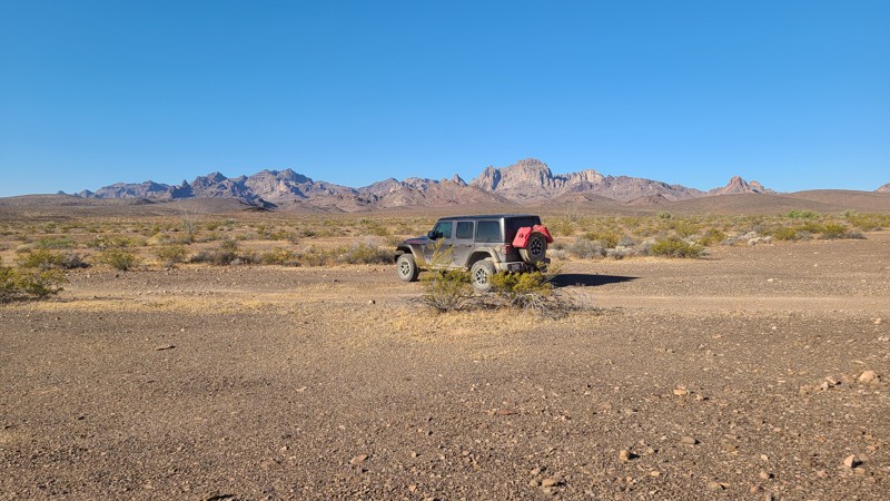
Road conditions vary significantly across the valley. West of Highway 95, the trail is rough and rocky, with several steep, narrow wash crossings. One wash includes an approximately 18-inch vertical ledge at the bottom of a steep descent, requiring careful tire placement. East of Highway 95, the route transitions into the sandy drainage of Chemehuevi Wash, where dozens of smaller washes combine to form a broad wash bottom.
A lifted 4x4 and an experienced driver are recommended due to the rocky obstacles, wash crossings, and soft sand.
Updated: 07/02/2026
Monumental Pass Road
Needles, California
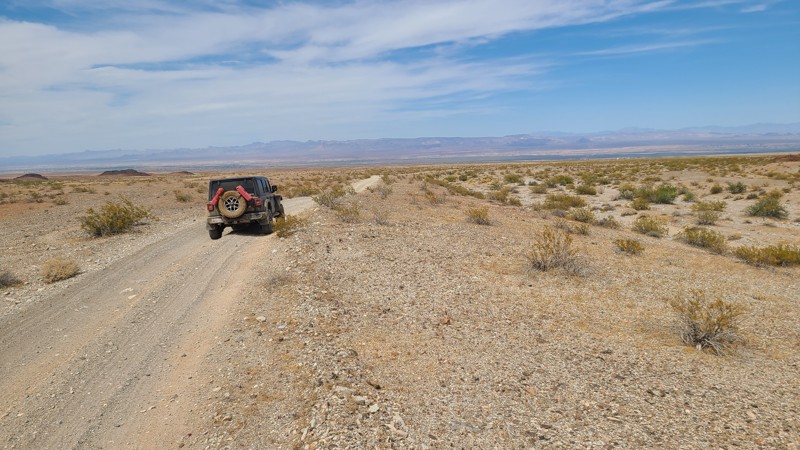
NS246 follows a broad, open Monumental Pass through the Sacramento Mountains, offering expansive views east across the Mojave Valley. Several hiking routes and side roads branch off along the way, many of them leading to abandoned mining sites that add extra opportunities for exploration.
A few existing dispersed campsites are visible from the route, and most of the trail crosses BLM land where dispersed camping is allowed. In addition to the established sites, there are several flat pullouts and open areas along the road that can work well for camping.
The road surface is generally flat and gravelly for the entire route, making it suitable for most high-clearance two-wheel-drive vehicles in dry conditions. Side roads and connecting trails may be rougher and are better suited to a 4x4 with some clearance.
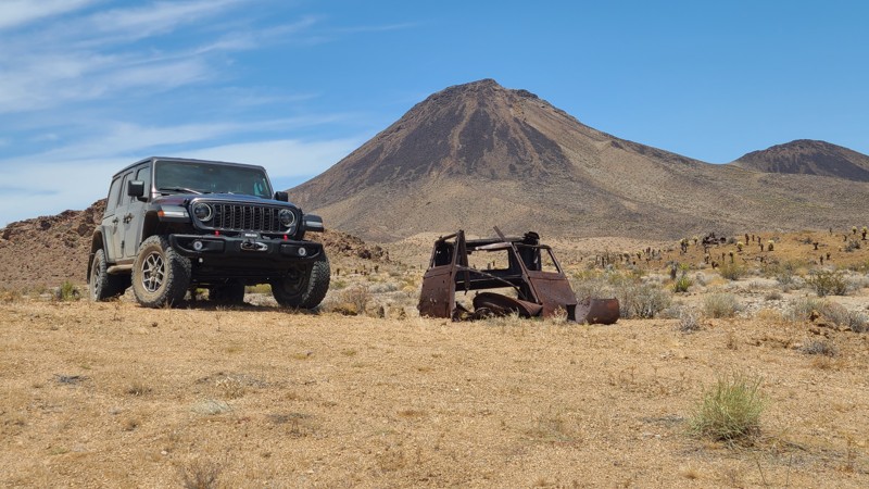
Updated: 07/02/2026
NS064
Klinefelter, California
Cutting through the western foothills of the Sacramento Mountains, NS064 follows a narrow canyon framed by steep, near-vertical rock walls before exiting onto a broad sandy wash at Flattop Mountain Road. Along the way, the route offers excellent views of Flattop Mountain and a stop at an abandoned mining prospect, where a 1930 Ford Model A still sits nearby.
The entire route is part of Eastern Mojave Heritage Trail (EMHT) Segment 4, one section of the larger 733-mile EMHT network. Segment 4 provides a 145-mile tour through some of the most remote terrain in the Eastern Mojave and is managed through a partnership between the Bureau of Land Management and the Mojave Desert Heritage and Cultural Association.
The route is entirely on BLM land, and dispersed camping is allowed throughout the area. A few suitable campsites can be found once the trail leaves the narrow canyon, with one of the better options near the abandoned mining prospect about 0.5 miles from the east end of the route.
Despite the dramatic canyon scenery, the drive itself is easy. The road is wide, flat, and sandy for its entire length, with no significant obstacles. Most high-clearance two-wheel-drive vehicles should have no trouble in dry conditions, though exploring beyond the main route may require a lifted 4x4.
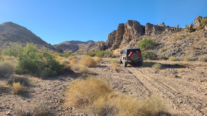
Updated: 07/02/2026
Piute Crossing
Fenner, California
Piute Crossing provides a scenic corridor along the edge of the Piute Mountains Wilderness, with close-up views of the range’s dramatic rock spires and broad vistas east across Ward Valley toward the Sacramento Mountains.
The entire route is part of Eastern Mojave Heritage Trail (EMHT) Segment 4, where the route continues from the west end onto Little Piute Trail. Segment 4 is one section of the larger 733-mile EMHT network and offers a 145-mile tour through some of the most remote terrain in the Eastern Mojave. The trail network is managed through a partnership between the Bureau of Land Management and the Mojave Desert Heritage and Cultural Association.
Only a few previously disturbed campsites are visible from the route, but several other flat, open areas along the trail can work well for dispersed camping.
Most of the route follows flat, hard-packed sand with only occasional rocky sections. In dry conditions, it is generally suitable for most high-clearance two-wheel-drive vehicles.
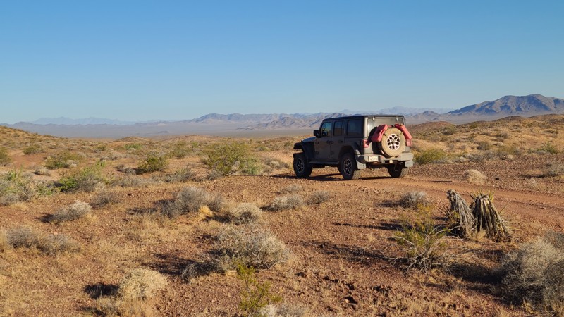
Updated: 07/02/2026
NS085
Needles, California
NS085 winds through the western foothills of the Sacramento Mountains before reaching the broad alluvial plain of Ward Valley. Much of the route offers open views toward the distant Piute Mountains. A short side trip on nearby NS240 leads to the ruins of the Capitan Mine, where a collapsed mining camp building and several abandoned vehicles remain scattered around the site.
No established campsites are obvious from NS085 itself, but several flat, open areas along the route can work well for dispersed camping. Better camping can be found by following the connecting NS240 to the Capitan Mine area, where existing rock fire rings and a larger campsite sit near an abandoned 1938 Buick Special Series 40.
Most of the route follows flat, hard-packed sand with only occasional rocky sections and shallow water-worn ruts. In dry conditions, it is generally suitable for most high-clearance two-wheel-drive vehicles.
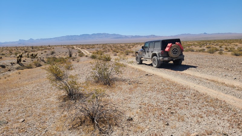
Updated: 07/02/2026
North Chemehuevi Trail
Havasu Lake, California
NS513 travels north across the Chemehuevi Valley desert basin as part of the Eastern Mojave Heritage Trail (EMHT). The route begins in the relatively lush Chemehuevi Wash, where scattered shade trees provide inviting spots for a break, before exiting the wash and continuing across the hard desert pavement of Chemehuevi Valley.
The entire route is part of Eastern Mojave Heritage Trail (EMHT) Segment 4, a curated 145-mile section of the larger 733-mile EMHT network. Segment 4 highlights some of the most remote terrain in the Eastern Mojave and is managed through a partnership between the Bureau of Land Management and the Mojave Desert Heritage and Cultural Association.
The route is entirely on BLM land, and dispersed camping is permitted throughout. The most favorable camping is found within Chemehuevi Wash among the shade trees, though this area should be avoided if rain is in the forecast due to potential flooding.
Conditions vary from easy desert travel to soft sand. The wash section can be deep and loose, while the remainder of the route crosses flat, hard desert pavement. A 4x4 with some clearance is recommended for the sandy wash portion, while the rest of the trail is generally easy.
Updated: 09/23/2026
Blue Lakes
Markleeville, California
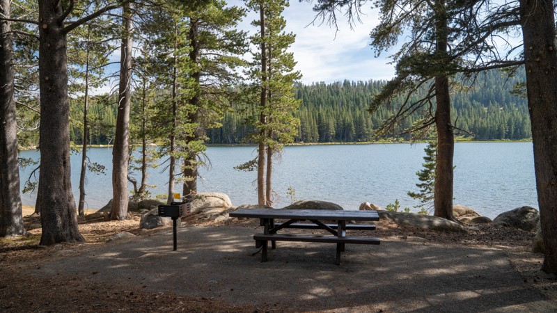
Starting at the Lower Blue Lake Dam, Blue Lakes is a dirt road extension of Blue Lakes Road that starts at Highway 88. This dirt section provides recreational access to Twin Lake and Meadow Lake. It first crosses the Middle Creek pump station and an old cabin, before climbing a mild grade up an undulating slope of marble and golfball-sized gravel. The road is primarily 1-1.5 vehicles wide the entire way, with plenty of wide areas to pass oncoming traffic. Twin Lake offers several picnic tables, grills, an outhouse, and plenty of fishable shoreline. The road continues deeper into the thick forest before reaching a small parking area, where users must continue on foot to the dwindling Meadow Lake on the edge of the Mokelumne Wilderness.
This road is a day-use-only area, open from dawn to dusk. Plenty of camping is available at the nearby Lower Blue Lake Campground or Middle Creek Campground.
Updated: 09/23/2026
Lowe Cervantes
Marsh Mill, California
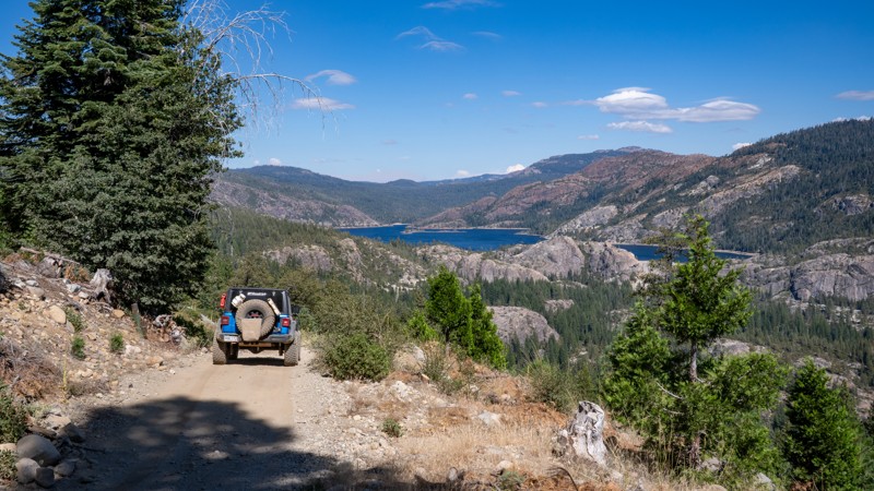
Located directly west of Bowman Lake, Lowe Cervantes is a steep, narrow, single-lane connector road between Meadow Lake Road and Bowman Lake Road. This road offers a rougher, more exciting way to connect the two roads as it travels along the edge of the hillside, over a mostly hard-packed dirt road with occasional potholes, an uneven surface, and baseball to softball-sized protruding rocks. There is virtually nowhere to pass oncoming traffic if both vehicles are standard, full-size 4WD vehicles. It is recommended to travel east to west so that you have the right-of-way uphill. The road is suitable for any high clearance vehicle and offers no camping along the route.
Updated: 09/23/2026
Bowman Lake Road
Marsh Mill, California
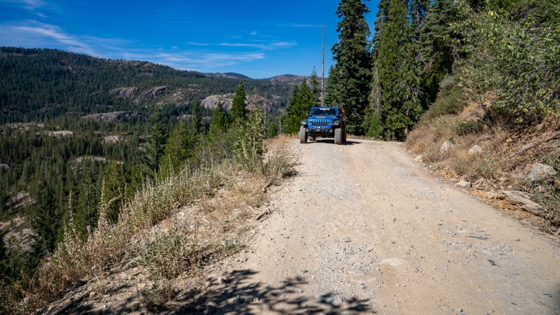
Bowman Lake Road leaves Highway 20 west of Cisco Grove and winds roughly 14.5 miles north through the Tahoe National Forest to the Bowman Lake Recreation Area, trading pavement for about 4.25 miles of increasingly rugged dirt as it approaches the reservoir. The drive moves through thick pine and fir forest before opening to dramatic views across granite-studded Sierra slopes, with access along the way to many other roads, hiking trails, fishing lakes and streams, and plenty of established climbing areas. A large staging area and several campsites can be found at the end of the paved section that resides on Sierra Pacific Lands. The dirt then begins as a relatively easy, compacted road with occasional potholes, then narrows to a single lane and grows progressively rockier, with loose and embedded baseball to softball-sized rocks, making high clearance and 4WD strongly recommended for the final stretch. Several small dispersed campsites are tucked into the forest along the road, generally best suited for one or two vehicles and ground tents, while Bowman Lake itself offers abundant dispersed camping options and multiple improved campgrounds.
Updated: 09/23/2026
Sherwin Creek Road
Mammoth Lakes, California
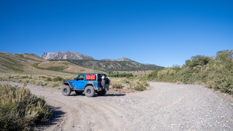
Sherwin Creek Road is a straight-through, 4.5-mile-long recreational access road southeast of Mammoth Lakes. The road is 2.5 vehicles wide, an easy drive over hard-packed dirt, gravel, and golf-ball-sized rocks, with heavy dust being the only major concern. It travels from west to east, starting in heavily wooded National Forest Land, passing the popular hiking trailheads for Sherwin Lakes and Valentine Lake, which lead deep into the John Muir Wilderness. This road also provides access to the YMCA High Sierra Camps and to the only camping along the road, at Sherwin Creek Campground, a large Forest Service-run campground that charges a nightly fee and offers minimal amenities. Camping is prohibited anywhere else along Sherwin Creek Road. The road then enters LA Water property, where the terrain changes to open meadows and sagebrush, with spectacular foothill views of Laurel Mountain, Bloody Mountain, and Mammoth Peak, before passing Laurel Lakes Road, a popular 4WD route, and eventually ending at Highway 395. Although officially listed as open year-round, it is naturally closed by snow and is considered seasonally open, depending on road and weather conditions.
This road is suitable for any vehicle.
Updated: 09/22/2026
Whitmore Tubs Road
Whitmore Hot Springs, California
Cutting across the wide-open volcanic landscape northwest of Crowley Lake, Whitmore Tubs Road is a dirt-road adventure where the scenery is every bit as memorable as the destination. Surrounded by sagebrush, broad meadows, and commanding views of the jagged Sierra Nevada, this road provides access to several of the area’s highly sought-after primitive natural hot springs, where a warm soak comes with an incredible mountain backdrop. The combination of geothermal features, open-country views, and classic Eastern Sierra atmosphere makes Whitmore Tubs Road a worthwhile detour when exploring the Mammoth Lakes and Crowley Lake area.
Updated: 09/23/2026
Fenders Ferry
Vollmers, California
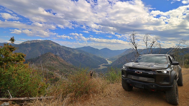
Fenders Ferry Road, marked on maps as FA27, Forest Road 27, or 34N17, winds through the remote mountains north and east of Shasta Lake in Northern California. Traveling from east to west, the journey begins at Highway 299 between Round Mountain and Montgomery Creek and crosses wooded ridges, deep river canyons, and quiet stretches of forest on its way toward the McCloud River and Interstate 5. Its combination of backcountry scenery, local history, and secluded river access makes it an interesting alternative to simply traveling around the lake on pavement.
From Highway 299, the road heads north before descending into the Pit River canyon. Pavement eventually gives way to dirt and gravel as the route curves along the hillsides, occasionally narrowing beside exposed canyon edges. Much of the road is maintained and graded, but potholes, washboard, loose surfaces, and occasional washouts can make travel uneven. High clearance is recommended, and all-wheel drive can be helpful when traction is poor. Conditions can change considerably with weather and maintenance.
The road's history is closely tied to the transformation of the surrounding landscape. During the 1930s, the Civilian Conservation Corps developed the route to connect the Delta area along old Highway 99 with the Pit River and Montgomery Creek region, improving access to remote timberlands and communities. The construction of Shasta Dam and the filling of Shasta Lake would soon reshape transportation throughout the area, inundating older roads, mines, settlements, and river crossings.
At the Pit River, the road crosses near the historic Fender’s Ferry site on a bridge recorded by the Forest Service as dating to 1941. Just beyond the river, Potem Falls provides one of the route's most popular side trips, with a short hike descending into a shaded gorge where the creek plunges roughly 70 feet into a pool below.
West of the Pit River, Fenders Ferry Road climbs back into the mountains and continues across remote forested ridges and creek drainages toward the McCloud River. The increasingly isolated surroundings and occasional views into the surrounding canyons give this portion of the drive a distinctly backcountry feel. Near McCloud Bridge, connecting roads provide access toward Interstate 5 and the Sacramento River corridor.
Dispersed camping opportunities are scattered along the route where permitted, while McCloud Bridge Campground provides an established fee-based option near the western end. The route passes through a mixture of public and private land, so observe posted boundaries, avoid camping on private property without permission, and remain on designated roads when crossing private parcels.

Upgrade your Membership
Unlock all of the details on every Trail Guide and Scout Route.
Start a 7-day Free TrialBrowse Trails in California by City
Browse every California city with offroad trail guides.
Community
Partners

