




By clicking "ACCEPT", you agree to be the terms and conditions of each policy linked to above. You also agree to the storing of cookies on your device to facilitate the operation and functionality of our site, enhance and customize your user experience, and to analyze how our site is used.
California Off-Road Trails
415
Total Trail Guides 392

4112
Detailed Waypoints 524
Try a Free 7-Day Trial and unlock it all
Start a Free Trial Most Recent Trail Reviews
Rated 5/5
Open
Visited: 09/19/2026
Great beginner trail here for those looking to try out some rockier sections. Starting to trend a little closer to a rating of 4, but still a 3 I’d say

R
Rob
Rated 5/5
Open
Visited: 09/19/2026
I entered this trail from Freeway Ridge 4WD trail (31E77) and ran Black Gulch Jeep Trail up to Rancheria Road, turned around, and ran Black Gulch Jeep Trail all the way down to Keyesville Road in Lake...



Daniel Macioce
Rated 4/5
Open
Visited: 09/19/2026
Took out the vstrom 800de today and this thing was tough for someone like me who is pretty new to offroading motorcycles. I ended up turning around about half way because I wasn't sure if I would be a...
SK
sean kotrola
No Rating
Open
Visited: 09/19/2026
The trial marked by the app here is very difficult with all the recent deep washouts. Proceed at your own risk if you are by yourself with unmodified rigs. However the bypass is maintained and should ...
TB
Timmy Boby
Rated 5/5
Open
Visited: 09/18/2026
Very friendly fire watch tower volunteers and fantastic 360 degree views up top
R
Rob
Rated 5/5
Open
Visited: 09/18/2026
Great views and an easy drive through. Be sure to take the road up to the fire watch tower
R
Rob
Rated 5/5
Open
Visited: 09/17/2026
ran the trail twice last weekend, this is such a better way to go than 3n16...


Josh Noesser
Official Crew
Rated 5/5
Open
Visited: 09/16/2026
It's been 6 years since I visited this trail. It has seen some wear, but the overall difficulty is about the same, probably a bit higher now, as Waypoint 11 has suffered from traffic. Waypoint 11 ha...

Robert
Official Crew
Rated 5/5
Open
Visited: 09/16/2026
Started off from polique canyon at way point 13 and headed east. Its a great trail for most of it with scenic views. A good amount mud puddles that were fun as hell to drive through. Some I decided to...


VM
Victor Manuel Garcia
Rated 5/5
Open
Visited: 09/16/2026
Used this trail to get to Holcomb valley. Super easy and a nice drive, I can see how in the winter it can be a bit more challenging with rain and snow.
VM
Victor Manuel Garcia
No Rating
Open
Visited: 09/16/2026
Mostly easy, but heading NE there's a rock step down just a few miles in that *requires* high clearance. Banged the rear end of my 4runner despite having a 3" lift and 33" tires. A stock SUV would alm...



Carlos H.
Rated 5/5
Open
Visited: 09/15/2026
It's been over 4 years since I was last on this trail, and I was very happy to see that the old car was still there. Some research suggests that it is a 1939 Plymouth Road King 5-window coupe.


Robert
Official Crew
Rated 5/5
Open
Visited: 09/14/2026
A fun little detour off Burns Canyon. I ran this alone and stopped a few times to spot; I also used my grill camera in several places. I brushed my sliders a couple times, but no real issues. Definite...
EB
Ed Boyd
Rated 5/5
Open
Visited: 09/13/2026
easy perfect beginner off roader trail with great views and water crossing during the winter.



Dex Offroad
Rated 5/5
Open
Visited: 09/12/2026
Fenders Ferry kept giving me reasons to slow down and enjoy the ride. I loved winding along mountain ridges, following creeks, and catching glimpses of Shasta Lake's fingers tucked between the hills. ...



Rose Meirs
Official Crew
Rated 5/5
Open
Visited: 09/11/2026
super easy trail over looking the valley and 15fwy. only bad thing is that its super windy.

Dex Offroad
No Rating
Partially Open
Visited: 09/09/2026
Although you can cross the creek from Fordyce if you want, Committee Road is still closed back to the I80, so this has no exit, and you'll be forced back onto Fordyce.

Ryan Boudreau
Official Crew
No Rating
Temporary Closure
Visited: 09/09/2026
Road is still closed. I thought i read somewhere an expected 2030 opening, but can't confirm that info.
Ryan Boudreau
Official Crew
Rated 5/5
Open
Visited: 09/09/2026
This is an awesome trail . This trail is moderate with a few obstacles to make it fun. It also has incredible scenic views with a little bit of shelf roads. You can watch the full video on my YouTube ...


Dex Offroad
Rated 5/5
Open
Visited: 09/07/2026
Pretty spot on with the rating, was a little tough today with the rain but made it through in my 2023 Gladiator Overland with 2.5” lift and 35s with autolynx sway disconnects.


CT
Christopher Tanton

Shaan Heugly
Rated 5/5
Open
Visited: 09/06/2026
Drove reverse from what’s listed to the jasper trail. This is a easy but enjoyable trail with plenty of places to camp at the end of the
Shaan Heugly
Rated 5/5
Open
Visited: 09/06/2026
Bit washed near the top but nothing difficult to navigate. I headed from jasper to the highway and near the highway it did narrow. I got through with my Tacoma but there are a few pinch points I could...
Shaan Heugly
Rated 5/5
Open
Visited: 09/06/2026
Mostly easy trail but when going south to north, I did need to use 4Lo on some of the inclines with a loaded Tacoma
Shaan Heugly
Rated 4/5
Open
Visited: 09/05/2026
It had been five years since I last drove this trail. The long, annoying stretches of moguls are still there, and water erosion has added a touch more difficulty in places. It was nice to see the old ...


Robert
Official Crew
Rated 4/5
Open
Visited: 09/05/2026
This is a nice trail with great views for any 4WD with ground clearance as some sections have ruts that are 12+ inches deep. Things were very dry on my visit, so airing down the tires helped to smooth...


SG
Steve Graham
Rated 3/5
Open
Visited: 09/05/2026
From waypoint 7 to 10 the water damage is pretty bad. Waypoint 13-16 it is rocky. Nothing crazy but a few spots where patience and the right line will go a long way. Good clearance and 4x4 recommended
N
Noah
Rated 5/5
Open
Visited: 09/05/2026
Easy trail with an awesome view at the end. There were three lookouts in the fire tower and each one was super friendly and informative. Must see trail!


N
Noah
Rated 5/5
Open
Visited: 09/05/2026
fun easy trail, Butler Peak lookout is the highlight imo
N
Noah
Rated 5/5
Open
Visited: 09/04/2026
Trail was very well maintained. Thanks for the Fresno 4x4 club. It was very cold at night, into the 30s. We were on the trail two nights, 3 days and two nights at voyager rock due to a breakdown fr...
JD
John Drago
No Rating
Open
Visited: 09/04/2026
Beautiful area, but the trail itself wasn’t very interesting. I’d rate it around a 3/10, with a couple of optional sections that might push a 4.
There’s tons of dispersed camping throughout the area,...


Ryan Smith
Rated 5/5
Open
Visited: 09/01/2026
awesome trail with a lot of water crossings. just be careful of sxs and bikes since its a OHV area.

Dex Offroad
Rated 5/5
Open
Visited: 09/01/2026
Super easy trail and you can over look the high desert. Trail ends at an awesome view point.

Dex Offroad
Dex Offroad
Rated 5/5
Open
Visited: 08/31/2026
This trail is much harder than it used to be. It’s just as breathtakingly beautiful as ever. You are on your own out there. Fuel, parts, spare tire. It’s days from help if you need it so go prepared. ...

CP
Christopher Pepin
No Rating
Open
Visited: 08/30/2026
Ran this trail today and had fun. Easy trail with great views. I wouldn’t hesitate to take an experienced driver in a stock jeep up this. There are lots of trails in this area and way to get off the m...

CP
Christopher Pepin
No Rating
Open
Visited: 08/29/2026
Trail was in good shape, a little less sand makes the boulders a little bigger. People have made the bypass around the sluice a little bit longer than it used to be you miss a lot of the good rocks. O...
C
Campbell
Rated 5/5
Open
Visited: 08/29/2026
An often overlooked and amazing trail. It’s about the length and difficulty of the rubicon if you don’t hit any of the bypasses on the rubicon. We had a group of 3 lj on 40s, a jku on 42s, and an Xj o...
CP
Christopher Pepin
Rated 4/5
Open
Visited: 08/27/2026
This is most definitely a hard trail. Is the entire thing hard? Not at all. The western 7 miles are a hard packed dirt road. Then you run into 3 straight, large boulder obstacles where its clear many ...


Ryan Boudreau
Official Crew
Rated 4/5
Open
Visited: 08/27/2026
Easy drive with beautiful views and . . . Buck Rock! Lots of camping south of Buck Rock, but camping north of the Rock isn't as plentiful. There are a few others on the north, but there's one here: 36...


Carlos H.
Rated 5/5
Open
Visited: 08/26/2026
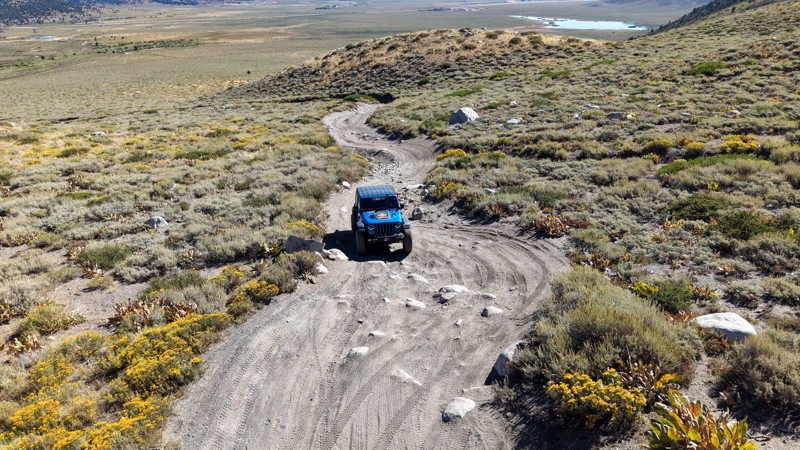
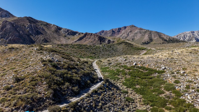
5 stars all day! This trail is absolutely amazing, and one you do not want to miss if you are in a capable vehicle in the area. It is rough, rocky, steep, and narrow enough to weed out the vanlifers a...
Ryan Boudreau
Official Crew
Rated 5/5
Open
Visited: 08/26/2026
I really enjoyed this road. It's super scenic with the sierra's in the background, the white beaches, and the columns are really cool. The road is not anything challenging with a high clearance vehicl...


Ryan Boudreau
Official Crew
Rated 4/5
Open
Visited: 08/25/2026
Fun area. The hot springs are pretty popular and well-known, and because they are small, you'd better hope you are one of the first people there that day if you want to get in. The route is easy, exce...


Ryan Boudreau
Official Crew
Rated 4/5
Open
Visited: 08/25/2026
I liked this trail a lot, but it's not quite a 5-star trail for me. I feel like it's a little overhyped. Is it scenic? Absolutely! Is there tons of great camping? Totally! Is it a crazy busy? You Bet!...


Ryan Boudreau
Official Crew
Rated 4/5
Open
Visited: 08/25/2026
Road to the hot springs parking area is easy. There are regular passenger cars there. The hike is easy too. The tub itself is super scenic, but know that they are not hidden gems by any means and we'l...

Ryan Boudreau
Official Crew
Rated 3/5
Open
Visited: 08/25/2026
It's a simple road, but definitely very scenic and really only used to get from Convict to Laurel Lakes or Mammoth. Road is suitable for anything with decent ground clearance.


Ryan Boudreau
Official Crew
Rated 2/5
Open
Visited: 08/25/2026
Simple dirt road used to access other types of recreation. Many signs remind you that you aren't allowed to camp along it except at the campground.


Ryan Boudreau
Official Crew
Rated 3/5
Open
Visited: 08/23/2026
Simple, straightforward dirt road used for fishing access.


Ryan Boudreau
Official Crew
Rated 5/5
Open
Visited: 08/23/2026
Amazing views at the top of this trail. Erosion looks to be making this trail harder than it probably originally was. Most of the hardest spots are getting bypasses created around them. A short, st...



Dan Jurgella
Rated 5/5
Open
Visited: 08/23/2026
Toad Lake Road 40N64 was a long, slow, and wonderfully remote drive into the Trinity Divide. The changing mix of old pavement, dirt, loose rock and deep ruts kept the journey interesting, while forest...


Rose Meirs
Official Crew
Most Popular

Updated: 03/09/2026
Lippincott Mine Road
Teakettle Junction, California
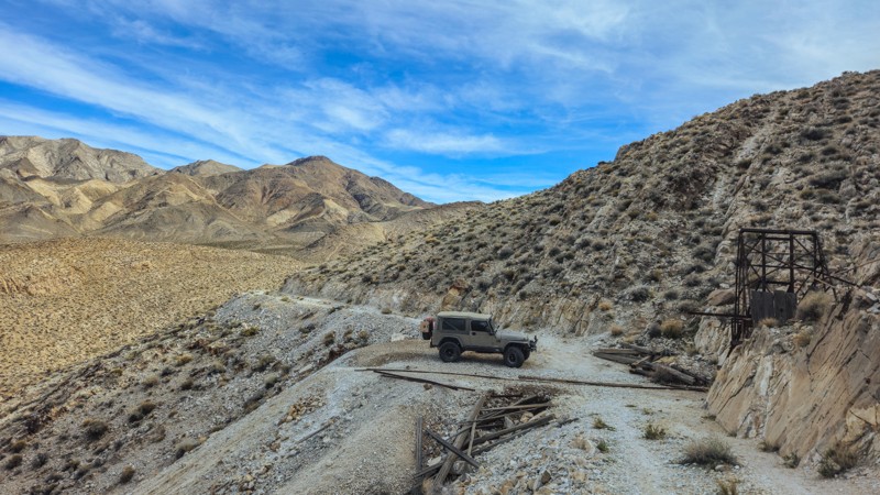
Lippincott Mine Road is a short but notoriously rough spur off Lippincott Pass that climbs toward the historic Lippincott Mine workings. It is shorter in length but considerably rougher than Racetrack Valley Road. Expect loose rock, off-camber sections, extremely narrow shelf segments, and uneven mining-era cuts into the hillside. High clearance 4x4 is strongly recommended, and careful tire placement is required in multiple spots. This is not a maintained park road and may be partially washed out depending on recent storms.
Plan on 30 minutes to an hour to reach the mining area, depending on conditions and how often you stop. Once at the top, you can explore the remnants of the historic mine structures and equipment. As with all historic sites in the park, do not disturb or remove artifacts.
As you climb, the road transitions from rocky mountain terrain into exposed ridgelines with expansive views across the northern portion of Death Valley. The higher elevation provides a completely different perspective compared to the valley floor. Looking down toward Racetrack Valley and across to the Inyo Mountains gives you a true sense of how isolated this region is.
This spur carries an elevated risk due to its narrow width and lack of regular maintenance. There is no cell service, no guardrails, and very few turnaround opportunities. The weather can quickly change road conditions, and rockfall is possible. Travel with another vehicle if possible, carry recovery gear, and bring plenty of water.
There is designated dispersed camping directly along this route, at the Homestake Camping area. The road to get to the camping area is very easy, and offers nine marked sites that are first-come, first-served. Follow all posted regulations and practice Leave No Trace principles. If you prefer more amenities, head south toward Furnace Creek, where you will find lodging, an RV park, fuel, and basic services.
Updated: 06/23/2025
St John's Mine Road
Midland, California
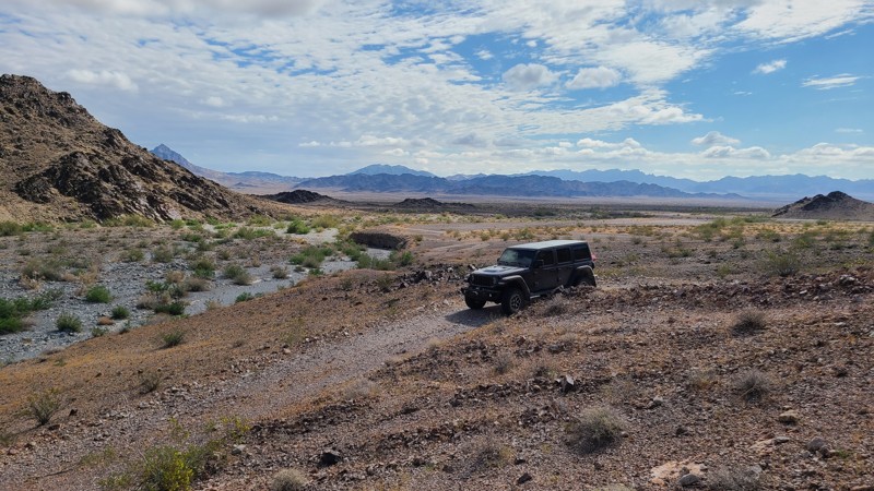
One of the several tributaries of the lengthy Arlington Mine Road, St John’s Mine Road leads into a complex of mines and their ruins on the slopes of the McCoy Mountains. The area provides a quiet, peaceful, and private camping spot with the rugged McCoy Mountains providing an impressive vista. Short hikes from its trail's end reach the ruins of St. John’s and Bluebird Mines to explore.
Running next to a wide wash, the road has been washed out near its end and rerouted to the south to reach the base of the mountains. This road is mostly over desert pavement, a natural surface layer made up of tightly packed, interlocking rock fragments and pebbles, but also transitions through a couple of wide sandy washes. The trail is easy, but it should be driven with a high-clearance vehicle.
Several existing dispersed campsites with existing rock campfire rings are located near the end of the trail, in and around the mining camp, and are tucked close to the hills to provide some shelter from the wind.
This is a remote area with spotty cell phone coverage, and drivers exploring the area should carry adequate water, be equipped for self-rescue, and notify family/friends of their travel plans.
Updated: 09/29/2025
AC9476
Midway, California
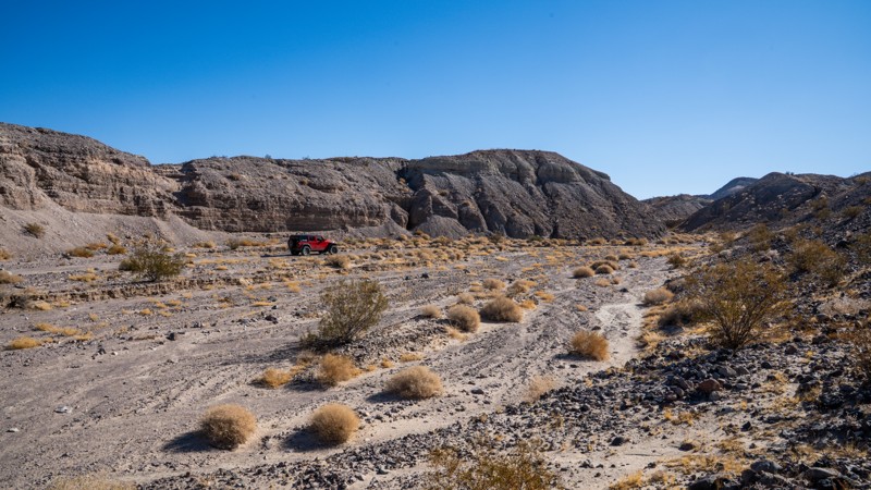
Traveling along the western slopes of the Cady Mountains, AC9476 is a typical desert connector between Mojave River Wash and Hidden Valley Wash. The trail provides scenic views of the Mojave desert region, with dark hills made of ancient lava covered with contrasting white sands. This trail can be combined with an endless number of other trails in the area to create a quick day trip loop or a multi-day overland trip. Most of the trail is a flat, packed sand desert road with continuous up-and-down, left-and-right undulations of the trail surface. Surprise exposed rocks, and quick drops will keep your pace slightly lower, while soft sand sections will require good momentum.
The northern end of the trail passes through several primary drainage points for the mountains to the east, making the route prone to washout damage and creating several sections of mild off-camber as you negotiate these washouts. Exposed lava rock along the northern end makes for a bumpy and continuously rough drive. Along the southern end, deep rutting in the sand exposes this same rock along the trial's edge, requiring users to use caution. The southern end also hosts the best camping areas, with one large, flat, and level area suitable for any group size and a second small site, right by Riverside Road, that backs up against a unique rock formation.
This trail is best suited for a high clearance 4x4 vehicle with good suspension and durable off-road tires.
Updated: 09/10/2026
Clipper Valley Road
Danby, California
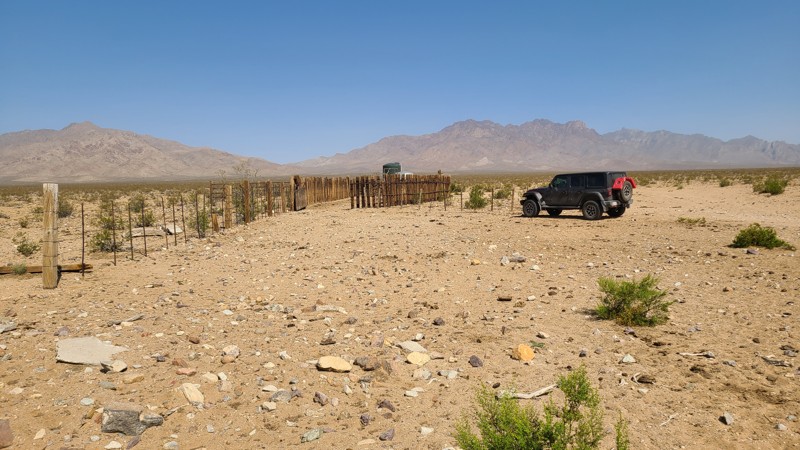
Located within the Mojave National Preserve, Clipper Valley Road passes through the vast, oval-shaped alluvial plain known as Clipper Valley and provides access to the many trails that head into the Providence Mountains and its plethora of mines and ruins, dating back to the 1840s. The Hidden Hills and the Bighorn Mine are near its south end, only about 2 miles from the road. As mining in the area boomed in the 1800s, cattle ranchers followed close behind, raising Criollo cattle, a species that thrives in desert regions. There were dozens of corrals built throughout the Mojave National Preserve, mostly near natural water sources. Clipper Valley Road passes two of these corrals that are still standing today. Cattle can often be seen grazing near the road.
The north end of the trail is near the intersection of Essex and Black Canyon Roads. From there, ten miles north on Black Canyon will arrive at Hole-in-the-Wall, and ten miles south on Essex Road will arrive at I-40.
Dispersed campsites can be found over the entire length of the road, mostly on flat open areas of desert pavement. As it's on an alluvial plain, the entire path is flat and offers no wind breaks at any campsite.
This is an easy trail over mostly flat gravel, which can be handled by a two-wheel drive vehicle with some ground clearance.
Updated: 02/02/2026
Means Lake to Chocolate Thunder
Homestead Valley, California
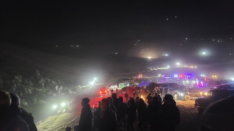
The sand path to Chocolate Thunder is a popular access route in the Johnson Valley OHV Area that connects Means Dry Lake and Hammertown to the Chocolate Thunder rock-crawling trail. It is a wide sandy track that is easy to follow and is commonly used by off-roaders and spectators during King of the Hammers. Many people take this path from Means Dry Lake to park up on the big sand hill above Chocolate Thunder to watch the action as racers tackle the rock obstacles below.
The route is not technical but can be soft in places, so airing down is recommended. A 2WD vehicle can make this route as long as they air down.
Updated: 01/03/2026
Angelus Hill
San Jacinto, California
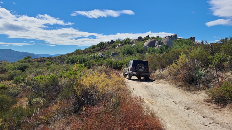
Accessed via forest road, Indian Canyon, Angelus Hill trail is an out-and-back that continues south to reach the trail's namesake, the 4,100' Angelus Hill. Along the way, drive through striking boulder fields and enjoy views out to the west of the San Jacinto Valley and onto the Lakeview Mountains. Located in the desert region of the San Jacinto Mountains, the trail is surrounded by desert and coastal sage scrub.
There are two dispersed campsites located 0.3 miles before the end of the trail and at the very end. Both sites are on the edge of the hill and provide gorgeous views of the valley below and beyond. These campsites are on large flat clearings suitable for multiple vehicles and their tents.
The trail is rated by the Forest Service as “Easiest.” The trail surface is mostly flat and smooth, and made up of packed decomposed granite with some rutted sections caused by water runoff. A 4x4 with some clearance is called for, mostly over the other trails needed to reach Angelus Hill. Expect some striping from the scrub bushes intruding on the trail.
Updated: 10/15/2024
El Mirage 2725
Houze Place, California
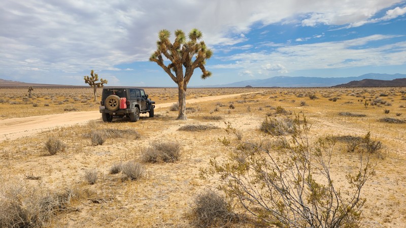
Heading south, EM2725 progresses through a very flat Mojave Desert basin, passing a few sparse Joshua trees until reaching Shadow Mountain Road. EM2725 is an easy, flat sandy trail requiring only a high clearance two-wheel drive vehicle.
EM2725 is within the El Mirage Subregion, designated as a Limited Use Area requiring vehicles to stay on the trails. The trail passes through a checkerboard of private and BLM land, providing solitude and access to dispersed camping anywhere along the trail when meeting the BLM Dispersed Camping Guidelines. During the summer fire season, campfires may be restricted, and if planning to camp, one should review the current BLM Fire Restrictions.
Updated: 03/13/2025
Horseshoe Meadows Sites 2-4
Lone Pine, California
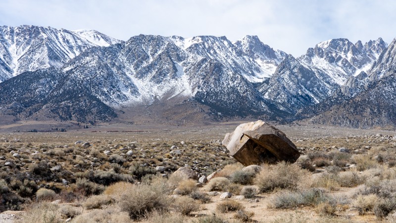
This spur south of the main Alabama Hills Recreation Area leads to dispersed campsites 2-4. It is an out-and-back route suitable for any vehicle and smaller trailers. As you drive in, the impressive Eastern Sierras are clearly visible. Being out of the main areas of Movie Flats, anticipate less traffic.
About the camping on this route:
All dispersed camping is designated to a specific site and requires a permit. A permit can be obtained online or at the Eastern Sierra Visitor Center or kiosks located on Movie Road and the main entry point in Lone Pine. Permits need to be signed and displayed on your dashboard.
The BLM has created a map showing the site numbers. However, those numbers are not used in the field, but each site is clearly marked with either a camping allowed or no camping allowed symbol on a clearly visible sign. Please be aware that all sites are first come, first served, and a permit does not guarantee you will find a site. Due to the area's popularity, it is best to arrive early.
There are six portable restrooms throughout Alabama Hills. If you do not want to drive or walk to one, you must bring your own system to pack out human waste.
About the sites:
- 2: Is large and suitable for a trailer or a few vehicles. The ground is flat, and a large outcropping of sandstone will block the view to the north.
- 3: Just off the trail, the ground has sporadic rocks, and there is nearby vegetation. It is large enough for a vehicle with a trailer.
- 4: A small site at the end that can hold one vehicle with one tent. The ground is slightly slanted.
Updated: 03/13/2025
Horseshoe Meadows Sites 5-6
Lone Pine, California
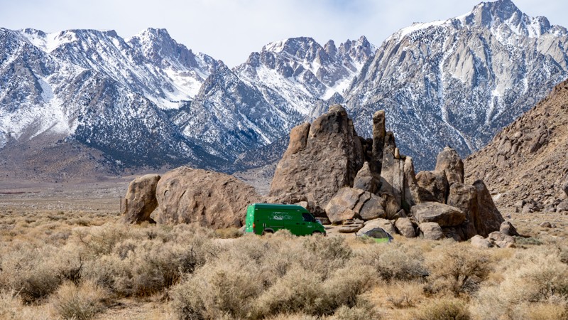
This quick out-and-back spur leads to the Alabama Hills Recreation Area designated sites 5-6. It is out of the central area and will be less busy, but the Eastern Sierras are so big that you will still have views of them from these sites. The road is suitable for any 2WD vehicle.
About the camping on this route:
All dispersed camping is designated to a specific site and requires a permit. A permit can be obtained online or at the Eastern Sierra Visitor Center or kiosks located on Movie Road and the main entry point in Lone Pine. Permits need to be signed and displayed on your dashboard.
The BLM has created a map showing the site numbers. However, those numbers are not used in the field, but each site is clearly marked with either a camping allowed or no camping allowed symbol on a clearly visible sign. Please be aware that all sites are first come, first served, and a permit does not guarantee you will find a site. Due to the area's popularity, it is best to arrive early.
There are six portable restrooms throughout Alabama Hills. If you do not want to drive or walk to one, you must bring your own system to pack out human waste.
Below is a brief description of each site:
- 5: It is spacious, flat, and suitable for a couple of vehicles with ground tents. However, it is directly on the side of the road.
- 6: It is spacious, flat on one half and slanted on the other, further from the road, and nestled up against large sandstone structures. Larger RVs or trailers could have problems accessing it.
Updated: 03/09/2026
Elliot Ranch
Oak Hills, California
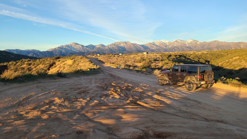
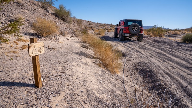
With direct access from Hwy 138, Elliot Ranch 3N22 provides very convenient access to a large staging area with pit toilets, then continues to connect to the popular Cleghorn Ridge trail.
While the Forest Service has rated the trail difficulty as Blue Square or More Difficult, it is an easy drive that can be managed by a beginning offroader in a 2WD vehicle with some ground clearance. The only driving difficulty is water-worn ruts along the route.
The trail is marked with signs stating that overnight camping is not permitted.
An Adventure Pass is required to use the area, and in the staging area, you can purchase passes using your phone.
Updated: 03/07/2025
Sandbox
Manix, California
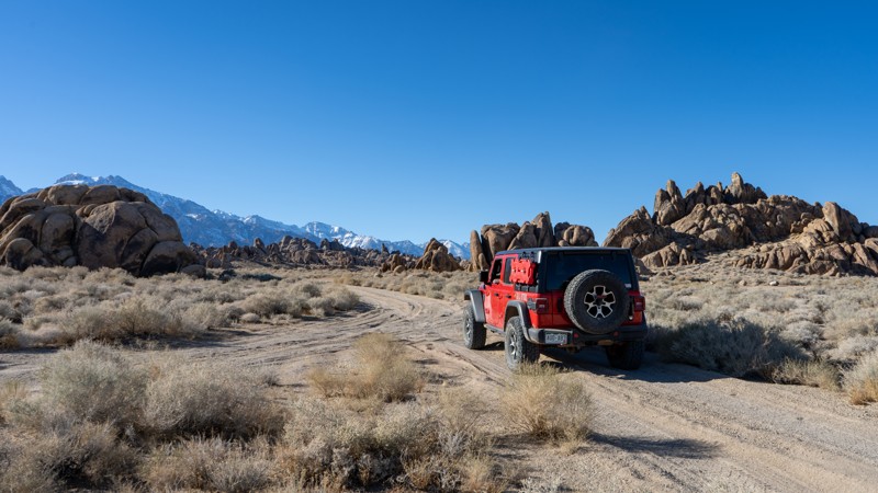
Nestled just west of the Mojave Trails National Monument, the aptly named Sandbox is a short yet dynamic offroad trail that serves as a link between Manix Wash and AC9476. For most of its length, this route offers an easygoing ride over relatively flat terrain, featuring gentle whoops, mild washboard, and scattered rocks no larger than a clenched fist. However, don’t be lulled into complacency. The western end of Sandbox delivers a formidable challenge. Nearly a quarter-mile of deep, loose sand awaits, eager to swallow tires and sap momentum. Here, four-wheel drive and aired-down tires aren’t just recommended; they’re essential for making it through without getting bogged down.
At its easternmost point, Sandbox may give the illusion of continuing beyond AC9476 and winding into the mountains. However, as of 2019, that section has been decommissioned as a legal motorized route. Users should respect this closure and stick to designated open routes only while enjoying this unique slice of the Mojave Desert.
There is plenty of flat, open land one could utilize for camping, but no existing campsites exist along this trail.
Updated: 03/13/2025
Northwest Movie Flat
Lone Pine, California
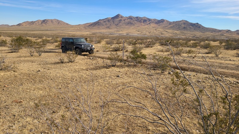
Northwest Movie Flat Road leads to named rock climbing routes, specifically what is named "The Wall." It is an easy road suitable for any vehicle. It provides additional views of the famed Alabama Hills Area and Eastern Sierra Mountains, which will allow you to extend your trip by twenty minutes. It is a day-use-only area, so camping is not permitted.
Updated: 10/15/2024
Stoddard Valley 6548
Wild Crossing, California
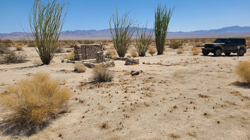
SV6548 is a straight-through trail that begins the climb from the desert floor into the surrounding foothills, ultimately intersecting other trails that lead further into the hills.
Many suitable dispersed campsites are along its length when meeting the BLM Camping Guidelines.
During high fire danger, campfires may be restricted, and if planning to camp here, one should review the current Campire Restrictions and have a Campfire Permit.
SV6548 is an easy trail requiring a high clearance two-wheel drive vehicle for the rocky sections.
Updated: 06/03/2025
Coxcomb Chapel Road
Eagle Mountain, California
Coxcomb Chapel Road travels across the 3-mile-wide WWII Coxcomb Camp, revealing the many artifacts left behind. For a short two-year period starting in 1942, Coxcomb Camp became a massive tent city housing 15,000 soldiers training for the North African Campaign. The camp was laid out in grids. Streets and boulevards were bulldozed, and rows of tents were set up on each side of assembly areas. When completed, the camp had 39 shower buildings, 165 latrines, 284 wooden tent frames, an observation/flag tower, a 40,000-gallon water tank, and the chapel. Both sides of the road pass extensive rock alignments placed by soldiers to provide borders for these roads, walkways, living and training areas, and plants. Coxcomb Chapel Road passes one of the most complete artifacts, the Coxcomb Chapel. Near its center, the road crosses Coxcomb Monument Road, which at its start has a monument to the soldiers who trained here, then fought, and especially those who gave their lives.
This hard-packed road is easily handled by a 2-wheel drive vehicle. The north end of the road has since weathered away.
There are no appropriate dispersed camping locations found near the road.
Updated: 09/02/2026
Meadow Lake Road
Sierraville, California
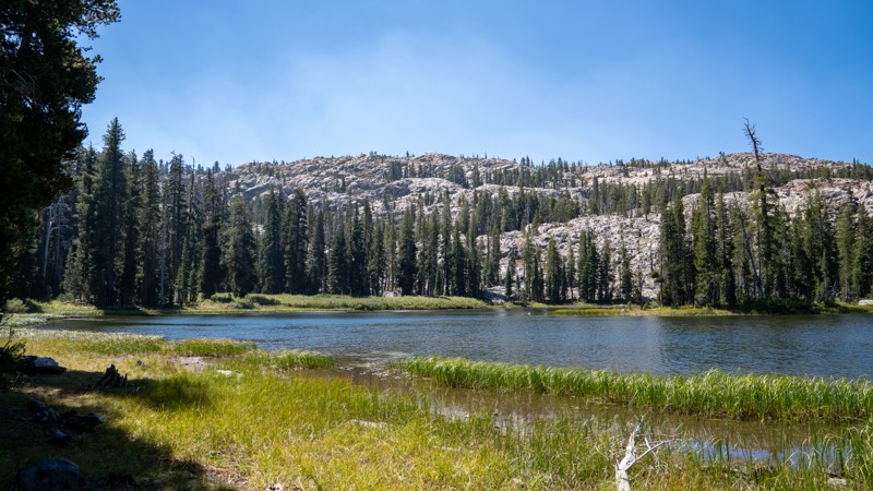
Meadow Lake Road is a long, remote backcountry road southwest of Sierraville that crosses the Tahoe National Forest between Webber Lake and Bowman Lake, passing directly through the high-country setting of Meadow Lake along the way. This dirt road covers roughly 28 miles, winding through dense conifer forest, broad mountain meadows, granite-covered ridges, and several scenic lake basins. It offers sweeping views across several large reservoirs and a few smaller mountain lakes, while providing numerous opportunities for both developed and dispersed camping, as well as access to other well-known OHV routes. Be sure to get a California Campfire Permit before camping, and follow all fire restrictions, as they change frequently.
Road conditions along Meadow Lake Road are best described in three sections:
- Eastern Section (Webber Lake to Meadow Lake, about 10 miles): The road is a two-lane, smooth, graded gravel road with occasional potholes and shallow erosion ruts. This end of the road is popular and suitable for trailers and RVs, offering access to abundant camping around Meadow Lake. It is the primary exit for the Fordyce Jeep Trail, and is the easiest section of the road. Camping is limited to Meadow Knolls Group Camp, Meadow Lake Shoreline Campground, and Meadow Lake Campground.
- Middle Section: (Meadow Lake to Catfish Lake, about 7 miles): West of Meadow Lake, the road narrows to a single-lane road with abundant passing opportunities and becomes extremely rough, with continuous baseball-sized rocks, steep grades, and sharp turns. You will encounter several unavoidable rocky sections peppered with loose, larger, softball-sized rocks. This section is the toughest section, best suited for true high clearance vehicles, and should NOT be attempted by trailers unless they are offroad purpose trailers. A handful of dispersed campsites can be found along this stretch, with the best spots around Tollhouse Lake.
- Western Section: (Catfish Lake to Bowman Lake and Graniteville, about 10 miles): The western end of the road is slightly rougher than the eastern end, with exposed protruding rocks of granite-strewn terrain. This terrain may keep the speeds down, but the road is once again suitable for any vehicle with a little bit of ground clearance. There are abundant lakeside dispersed campsites, several day-use areas, and developed camping at Bowman Campground and Jackson Creek Campground.
What makes Meadow Lake Road memorable is less about individual obstacles and more about the journey itself: miles of quiet forest, secluded campsites, alpine lakes, granite scenery, and the feeling of crossing a genuinely remote piece of the northern Sierra backcountry.
If you are looking for all of the great campsites in this area, be sure to check out this list: Meadow Lake Camping Opportunities.
Updated: 10/09/2025
Linn Road
Homestead Valley, California
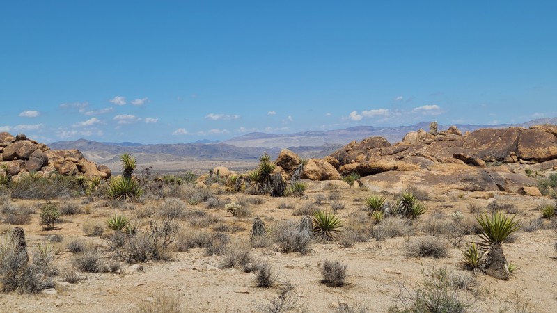
Linn Road hugs the northwestern base of Ruby Mountain to reveal a gorgeous desert landscape decorated with massive boulder formations and stunning views to the north. The road intersects several other driving and hiking trails to explore, including New Dixie Mine Road, and has easy access from Highway 247.
There are abundant sites for dispersed camping, with one of the better prepared sites about halfway along the trail. This site has space for several vehicles and tents. There is no shade anywhere along the trail, and an awning or pop-up shade in the camp would make for relaxing enjoyment of the views.
This is an easy trail, comfortably handled with any high-clearance vehicle.
Updated: 07/16/2026
Crafts Peak
Green Valley Lake, California
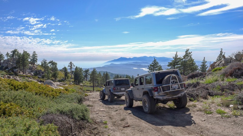
Hidden high in the mountains of Big Bear, 2N13D Crafts Peak is a little-known out-and-back trail offering some of the best views in the area. Sitting at over 8,000 feet in elevation, the trail travels through a high-elevation forest filled with Jeffrey pine, white fir, lodgepole pine, and western juniper. Do not let the scenery fool you, as 2N13D features an almost nonstop rough and bumpy trail surface with several steep climbs approaching 30 degrees. Loose dirt and rocks can make maintaining traction difficult, although the trail is generally harder on the way in than on the way out. The reward is incredible mountain scenery, including areas with nearly 360-degree views and the opportunity to see several surrounding mountain lakes. Along the route are several small dispersed campsites, although space is limited, with the largest site accommodating only three or four vehicles. Drivers continuing to the end should also be aware that turnaround space is extremely limited, making groups of three or four vehicles the practical maximum. Larger groups can use several areas before the endpoint to park or turn around.
A stock, high-clearance 4x4 should be capable of completing the trail under normal conditions, but airing down is strongly recommended for traction and comfort. Vehicles with heavily worn or low-traction tires may struggle on the steeper, loose climbs.
Updated: 01/05/2026
5N09
Dardanelle, California
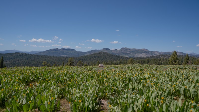
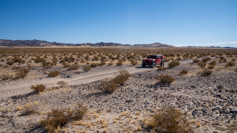
Forest Route 5N09 is a mellow, high-country cruise that branches off 5N01, loops up through open timber, and climbs a few hundred feet before topping out at a quiet vista overlooking the surrounding Sierra ridgelines. Take a break at this area to wander on foot and check out the large, funky rock formations within view of the trail. You'll likely also find oversized pine cones that are sure to delight explorers new to the Northern California ecosystem. If you visit in late spring, wildflowers like sego lily and lupine will fill the open areas.
The road is rough dirt throughout, but it’s wide, predictable, and friendly to any high-clearance 2WD. It is an ideal warm-up for new off-roaders or anyone looking to explore without breaking a sweat. As the route drops back toward 5N01, it passes a handful of dispersed camps tucked into the western end of the loop, each offering a simple, peaceful basecamp without the crowds often found in nearby developed campgrounds. Drivers sometimes use 5N09 as a scenic connector to additional forest roads leading to Double Dome Rock and its short hiking trail, making it a versatile option for a half-day wander or as part of a larger adventure.
Like much of the high Sierra, the road stays buried under snow through winter and typically doesn’t open until late spring or early summer, when traffic begins to pick up with campers and hikers spreading out from Highway 108. For those seeking easy terrain, light exploration, and quiet camps under the pines, 5N09 delivers precisely that.
Updated: 03/07/2025
AC9475
Manix, California
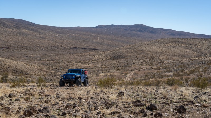
Connecting Manix Wash to AC9476, AC9475 is a short, straight-through trail through the Mojave Desert. Generally, this trail is only used to add additional miles to users of the traditional Mojave Road. AC9475 is primarily fast-paced, packed sand, with many undulating sections and occasional fist or grapefruit-sized rocks. Although easy, it will give your shocks a workout due to the bumpy terrain. It is part of a broader network of trails that can be explored for a day or a weekend. Users should be aware that there are many spur roads throughout the area, and only roads signed as "Open Route" are legal for motorized use. The road is suitable for any high clearance vehicle.
There are no suitable campsites along this road.
Updated: 03/09/2026
EP 499
Garlock, California
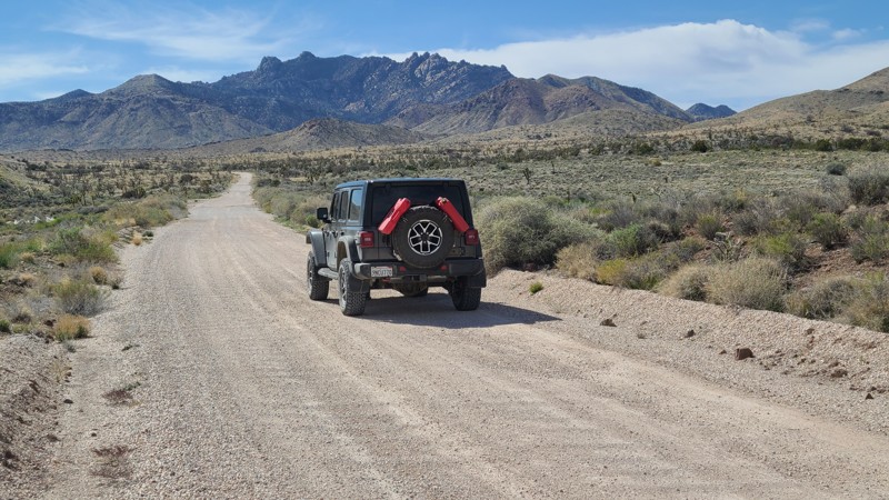
EP 499 travels primarily north-south, connecting the Bonanza Trail with Bickel Camp, labeled as EP 30. The road surface is a mix of dirt and loose lava rock, making it rough in spots, but it is suitable for any high-clearance vehicle. As you travel, the trail will go up and over an open and flat playa area. This is good for dispersed camping and offers 360-degree views. Near Bonanza's boom area, there are a few scattered ruins and an old well to see along the way.
Updated: 04/10/2026
Ivanpah-Lanfair Road
Vanderbilt, California
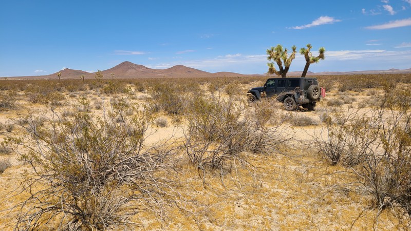
Ivanpah-Lanfair Road traverses the eastern portion of the Mojave National Preserve, passing some of the desert's most interesting and iconic destinations. Near the northern end, the road passes Vanderbilt ghost town and the abandoned Goldome Mill, with its largely intact ball mill and machinery for extracting gold from hard rock mines in the area. At Ivanapah-Lanfair Roads' halfway point, you will cross the iconic Mojave Road and eventually reach Route 66 at its southern end. All the while, the road provides outstanding views of the surrounding mountains and impressive Joshua Tree forests. Numerous abandoned mines and ruins are reached from its over 25 intersecting trails and spurs.
There are no campsites directly next to the trail, but many wonderful dispersed campsites can be found shortly off the road along its intersecting trails. One example of camping found off the trail is the outstanding campsites at Mine Landings, reached from the Slaughterhouse Spring trail.
This is an easy, wide, flat gravel road suitable for passenger vehicles and trailers, with only occasional water-worn dips or cattle crossings to be aware of. However, if planning to explore the intersecting trails, an experienced driver using a four-wheel drive vehicle with ground clearance is required.
Updated: 10/15/2024
El Mirage 4679
Houze Place, California
Cutting over this Mojave desert basin, EM4679 ushers towards the triple peaks of Red Buttes just a short distance away. This trail, located in the El Mirage Subregion, is in a designated Limited Use Area requiring vehicles to stay on the trails.
The trail is a clear two-track, flat and sandy, providing several good camping sites when following the BLM Dispersed Camping Requirements. During the summer fire season, campfires may be restricted, and if planning to camp, one should review the current BLM Fire Restrictions.
EM4679 is an easy, flat sandy trail requiring only a high clearance two-wheel drive vehicle.
Updated: 10/09/2025
RC1428
Homestead Valley, California
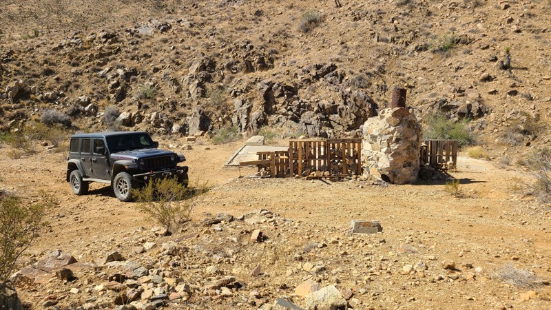
Only a short distance from Highway 247 in Yucca Valley, BLM RC1428 is an out-and-back trail that leads into the desert foothills and the remnants of a once-active mine. The mine buildings and machinery have been removed, but the foundations of the miner's cabin, its standing fireplace, and an ore processing pit still remain. A date of 1972 is inscribed in the concrete foundation. From the mine, the trail continues, climbing a hill to reveal expansive views to the north. Over its length are several intersecting hiking paths to explore.
The trail is mostly hard, flat dirt, with long rocky sections when higher in the foothills. Any high-clearance vehicle should easily manage the trail with ease.
The mine site itself will make a great dispersed campsite with its large flat concrete foundations and fireplace. Just up the hill from the mine is another great dispersed campsite on a flat plateau with wonderful views to the north.
Updated: 09/29/2025
BL9489
Hector, California
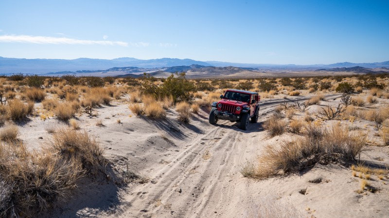
BL9489 is a lightly used, Mojave Desert trail that climbs the lower Cady Mountains. It offers fantastic views of the Rodman and Newberry Mountains across the valley. It can be used as an easy connecting road between Hidden Valley Wash and BL8599, just west of the Mojave Trails National Monument, or can be run as an out-and-back into the monument. The section of trail that enters the monument east of 8599 is where you encounter soft, beach-like sand that will rob your vehicle of momentum as it slowly but continuously gains elevation, ascending nearly 1,200 feet in 5 miles. The track here ends at a small, young Joshua Tree patch 0.18 miles before the official trail ends. Just beyond this patch of trees, the trail descends an extremely steep and soft sand hill into a narrow canyon once used for copper mining. The hill is the only way back out of the canyon and is nearly impossible to climb without utilizing a winch, or traveling in a lightweight, sand-purpose vehicle such as a UTV. It is highly recommended not to attempt this sand hill.
The trail passes several small camping pullouts best suited for single-vehicle camping as the terrain is not very level and is covered in brush and cacti. However, near the end of the trail is a very large and level site that is good for groups and ground tents. Camping along this trail is very secluded and quite.
The trail is suitable for any high clearance 4wd vehicle.

Upgrade your Membership
Unlock all of the details on every Trail Guide and Scout Route.
Start a 7-day Free TrialBrowse Trails in California by City
Browse every California city with offroad trail guides.
Community
Partners

