




By clicking "ACCEPT", you agree to be the terms and conditions of each policy linked to above. You also agree to the storing of cookies on your device to facilitate the operation and functionality of our site, enhance and customize your user experience, and to analyze how our site is used.
California Off-Road Trails
415
Total Trail Guides 392

4112
Detailed Waypoints 524
Try a Free 7-Day Trial and unlock it all
Start a Free Trial Most Recent Trail Reviews
Rated 5/5
Open
Visited: 09/19/2026
Great beginner trail here for those looking to try out some rockier sections. Starting to trend a little closer to a rating of 4, but still a 3 I’d say

R
Rob
Rated 5/5
Open
Visited: 09/19/2026
I entered this trail from Freeway Ridge 4WD trail (31E77) and ran Black Gulch Jeep Trail up to Rancheria Road, turned around, and ran Black Gulch Jeep Trail all the way down to Keyesville Road in Lake...



Daniel Macioce
Rated 4/5
Open
Visited: 09/19/2026
Took out the vstrom 800de today and this thing was tough for someone like me who is pretty new to offroading motorcycles. I ended up turning around about half way because I wasn't sure if I would be a...
SK
sean kotrola
No Rating
Open
Visited: 09/19/2026
The trial marked by the app here is very difficult with all the recent deep washouts. Proceed at your own risk if you are by yourself with unmodified rigs. However the bypass is maintained and should ...
TB
Timmy Boby
Rated 5/5
Open
Visited: 09/18/2026
Very friendly fire watch tower volunteers and fantastic 360 degree views up top
R
Rob
Rated 5/5
Open
Visited: 09/18/2026
Great views and an easy drive through. Be sure to take the road up to the fire watch tower
R
Rob
Rated 5/5
Open
Visited: 09/17/2026
ran the trail twice last weekend, this is such a better way to go than 3n16...


Josh Noesser
Official Crew
Rated 5/5
Open
Visited: 09/16/2026
It's been 6 years since I visited this trail. It has seen some wear, but the overall difficulty is about the same, probably a bit higher now, as Waypoint 11 has suffered from traffic. Waypoint 11 ha...

Robert
Official Crew
Rated 5/5
Open
Visited: 09/16/2026
Started off from polique canyon at way point 13 and headed east. Its a great trail for most of it with scenic views. A good amount mud puddles that were fun as hell to drive through. Some I decided to...


VM
Victor Manuel Garcia
Rated 5/5
Open
Visited: 09/16/2026
Used this trail to get to Holcomb valley. Super easy and a nice drive, I can see how in the winter it can be a bit more challenging with rain and snow.
VM
Victor Manuel Garcia
No Rating
Open
Visited: 09/16/2026
Mostly easy, but heading NE there's a rock step down just a few miles in that *requires* high clearance. Banged the rear end of my 4runner despite having a 3" lift and 33" tires. A stock SUV would alm...



Carlos H.
Rated 5/5
Open
Visited: 09/15/2026
It's been over 4 years since I was last on this trail, and I was very happy to see that the old car was still there. Some research suggests that it is a 1939 Plymouth Road King 5-window coupe.


Robert
Official Crew
Rated 5/5
Open
Visited: 09/14/2026
A fun little detour off Burns Canyon. I ran this alone and stopped a few times to spot; I also used my grill camera in several places. I brushed my sliders a couple times, but no real issues. Definite...
EB
Ed Boyd
Rated 5/5
Open
Visited: 09/13/2026
easy perfect beginner off roader trail with great views and water crossing during the winter.



Dex Offroad
Rated 5/5
Open
Visited: 09/12/2026
Fenders Ferry kept giving me reasons to slow down and enjoy the ride. I loved winding along mountain ridges, following creeks, and catching glimpses of Shasta Lake's fingers tucked between the hills. ...



Rose Meirs
Official Crew
Rated 5/5
Open
Visited: 09/11/2026
super easy trail over looking the valley and 15fwy. only bad thing is that its super windy.

Dex Offroad
No Rating
Partially Open
Visited: 09/09/2026
Although you can cross the creek from Fordyce if you want, Committee Road is still closed back to the I80, so this has no exit, and you'll be forced back onto Fordyce.

Ryan Boudreau
Official Crew
No Rating
Temporary Closure
Visited: 09/09/2026
Road is still closed. I thought i read somewhere an expected 2030 opening, but can't confirm that info.
Ryan Boudreau
Official Crew
Rated 5/5
Open
Visited: 09/09/2026
This is an awesome trail . This trail is moderate with a few obstacles to make it fun. It also has incredible scenic views with a little bit of shelf roads. You can watch the full video on my YouTube ...


Dex Offroad
Rated 5/5
Open
Visited: 09/07/2026
Pretty spot on with the rating, was a little tough today with the rain but made it through in my 2023 Gladiator Overland with 2.5” lift and 35s with autolynx sway disconnects.


CT
Christopher Tanton

Shaan Heugly
Rated 5/5
Open
Visited: 09/06/2026
Drove reverse from what’s listed to the jasper trail. This is a easy but enjoyable trail with plenty of places to camp at the end of the
Shaan Heugly
Rated 5/5
Open
Visited: 09/06/2026
Bit washed near the top but nothing difficult to navigate. I headed from jasper to the highway and near the highway it did narrow. I got through with my Tacoma but there are a few pinch points I could...
Shaan Heugly
Rated 5/5
Open
Visited: 09/06/2026
Mostly easy trail but when going south to north, I did need to use 4Lo on some of the inclines with a loaded Tacoma
Shaan Heugly
Rated 4/5
Open
Visited: 09/05/2026
It had been five years since I last drove this trail. The long, annoying stretches of moguls are still there, and water erosion has added a touch more difficulty in places. It was nice to see the old ...


Robert
Official Crew
Rated 4/5
Open
Visited: 09/05/2026
This is a nice trail with great views for any 4WD with ground clearance as some sections have ruts that are 12+ inches deep. Things were very dry on my visit, so airing down the tires helped to smooth...


SG
Steve Graham
Rated 3/5
Open
Visited: 09/05/2026
From waypoint 7 to 10 the water damage is pretty bad. Waypoint 13-16 it is rocky. Nothing crazy but a few spots where patience and the right line will go a long way. Good clearance and 4x4 recommended
N
Noah
Rated 5/5
Open
Visited: 09/05/2026
Easy trail with an awesome view at the end. There were three lookouts in the fire tower and each one was super friendly and informative. Must see trail!


N
Noah
Rated 5/5
Open
Visited: 09/05/2026
fun easy trail, Butler Peak lookout is the highlight imo
N
Noah
Rated 5/5
Open
Visited: 09/04/2026
Trail was very well maintained. Thanks for the Fresno 4x4 club. It was very cold at night, into the 30s. We were on the trail two nights, 3 days and two nights at voyager rock due to a breakdown fr...
JD
John Drago
No Rating
Open
Visited: 09/04/2026
Beautiful area, but the trail itself wasn’t very interesting. I’d rate it around a 3/10, with a couple of optional sections that might push a 4.
There’s tons of dispersed camping throughout the area,...


Ryan Smith
Rated 5/5
Open
Visited: 09/01/2026
awesome trail with a lot of water crossings. just be careful of sxs and bikes since its a OHV area.

Dex Offroad
Rated 5/5
Open
Visited: 09/01/2026
Super easy trail and you can over look the high desert. Trail ends at an awesome view point.

Dex Offroad
Dex Offroad
Rated 5/5
Open
Visited: 08/31/2026
This trail is much harder than it used to be. It’s just as breathtakingly beautiful as ever. You are on your own out there. Fuel, parts, spare tire. It’s days from help if you need it so go prepared. ...

CP
Christopher Pepin
No Rating
Open
Visited: 08/30/2026
Ran this trail today and had fun. Easy trail with great views. I wouldn’t hesitate to take an experienced driver in a stock jeep up this. There are lots of trails in this area and way to get off the m...

CP
Christopher Pepin
No Rating
Open
Visited: 08/29/2026
Trail was in good shape, a little less sand makes the boulders a little bigger. People have made the bypass around the sluice a little bit longer than it used to be you miss a lot of the good rocks. O...
C
Campbell
Rated 5/5
Open
Visited: 08/29/2026
An often overlooked and amazing trail. It’s about the length and difficulty of the rubicon if you don’t hit any of the bypasses on the rubicon. We had a group of 3 lj on 40s, a jku on 42s, and an Xj o...
CP
Christopher Pepin
Rated 4/5
Open
Visited: 08/27/2026
This is most definitely a hard trail. Is the entire thing hard? Not at all. The western 7 miles are a hard packed dirt road. Then you run into 3 straight, large boulder obstacles where its clear many ...


Ryan Boudreau
Official Crew
Rated 4/5
Open
Visited: 08/27/2026
Easy drive with beautiful views and . . . Buck Rock! Lots of camping south of Buck Rock, but camping north of the Rock isn't as plentiful. There are a few others on the north, but there's one here: 36...


Carlos H.
Rated 5/5
Open
Visited: 08/26/2026
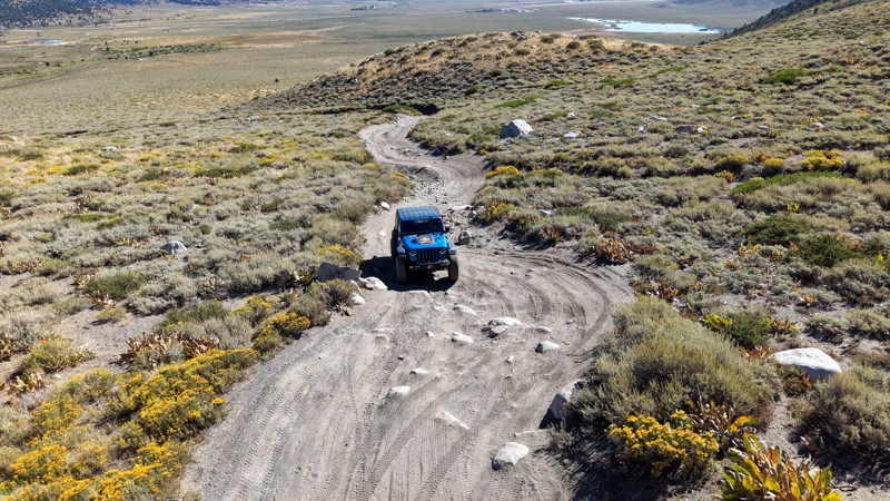
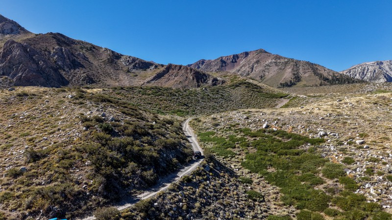
5 stars all day! This trail is absolutely amazing, and one you do not want to miss if you are in a capable vehicle in the area. It is rough, rocky, steep, and narrow enough to weed out the vanlifers a...
Ryan Boudreau
Official Crew
Rated 5/5
Open
Visited: 08/26/2026
I really enjoyed this road. It's super scenic with the sierra's in the background, the white beaches, and the columns are really cool. The road is not anything challenging with a high clearance vehicl...


Ryan Boudreau
Official Crew
Rated 4/5
Open
Visited: 08/25/2026
Fun area. The hot springs are pretty popular and well-known, and because they are small, you'd better hope you are one of the first people there that day if you want to get in. The route is easy, exce...


Ryan Boudreau
Official Crew
Rated 4/5
Open
Visited: 08/25/2026
I liked this trail a lot, but it's not quite a 5-star trail for me. I feel like it's a little overhyped. Is it scenic? Absolutely! Is there tons of great camping? Totally! Is it a crazy busy? You Bet!...


Ryan Boudreau
Official Crew
Rated 4/5
Open
Visited: 08/25/2026
Road to the hot springs parking area is easy. There are regular passenger cars there. The hike is easy too. The tub itself is super scenic, but know that they are not hidden gems by any means and we'l...

Ryan Boudreau
Official Crew
Rated 3/5
Open
Visited: 08/25/2026
It's a simple road, but definitely very scenic and really only used to get from Convict to Laurel Lakes or Mammoth. Road is suitable for anything with decent ground clearance.


Ryan Boudreau
Official Crew
Rated 2/5
Open
Visited: 08/25/2026
Simple dirt road used to access other types of recreation. Many signs remind you that you aren't allowed to camp along it except at the campground.


Ryan Boudreau
Official Crew
Rated 3/5
Open
Visited: 08/23/2026
Simple, straightforward dirt road used for fishing access.


Ryan Boudreau
Official Crew
Rated 5/5
Open
Visited: 08/23/2026
Amazing views at the top of this trail. Erosion looks to be making this trail harder than it probably originally was. Most of the hardest spots are getting bypasses created around them. A short, st...



Dan Jurgella
Rated 5/5
Open
Visited: 08/23/2026
Toad Lake Road 40N64 was a long, slow, and wonderfully remote drive into the Trinity Divide. The changing mix of old pavement, dirt, loose rock and deep ruts kept the journey interesting, while forest...


Rose Meirs
Official Crew
Most Popular

Updated: 09/10/2026
Big Horn Mine Road
Kelso, California
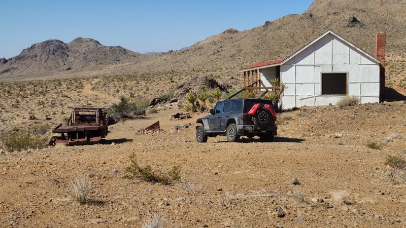
Big Horn Mine Road in Mojave National Preserve leads to the historic Big Horn Mine and the Hilltop House, a cabin built by the mine owners. The bright white Hilltop House was built before 1933 as a place for the owner and investors to keep watch over their mining interests, which are visible just down the hill. From its perch, the Hill House is visible from miles away and became a gathering place for local miners, ranchers, and homesteaders for holidays and other celebrations. The mine was finally abandoned in 1985, and the house fell into disrepair and collapsed in high winds in 2008. To acknowledge its historic role in the area's landscape, the park service rebuilt the house, and it can now be used by desert explorers for short stays. The main room is nice, with a fireplace and cots, but the remaining rooms of the house are in disrepair and not suitable for use. A photograph hanging on the wall shows the cabin in disrepair before its restoration. The mine, visible from the house, is just down the north side of the hill where its water towers have collapsed and other artifacts lie in decay. Iron bars now close the mine entrances.
The best dispersed camping is at the Hilltop House site, which provides expansive views across the desert to the Granite and Van Winkle Mountains. The immediate area around the Big Horn Mine also offers several campsites with rock campfire rings that would provide wind-sheltered camping locations.
This is an easy trail with short sections of hill climbs over a rocky surface and across water-worn depressions that are easily handled by a high clearance vehicle using two-wheel drive.
Updated: 10/15/2024
Stoddard Valley 6534
Bryman, California
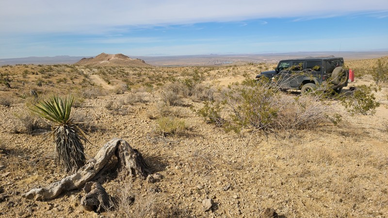
On its westernmost 2.5-mile stretch of trail, SV6534 is called Cardigan or Citation Road. This straight-through trail provides quick access to Route 66 from the Stoddard Valley Subregion.
Many suitable dispersed camping locations are found on the BLM land when meeting the BLM Camping Guidelines.
During high fire danger, campfires may be restricted, and if planning to camp here, one should review the current Campfire Restrictions and have a Campfire Permit.SV6534 is an easy but rocky trail requiring a high clearance two-wheel drive vehicle.
Updated: 03/13/2025
Movie Road Sites 41-42
Lone Pine, California
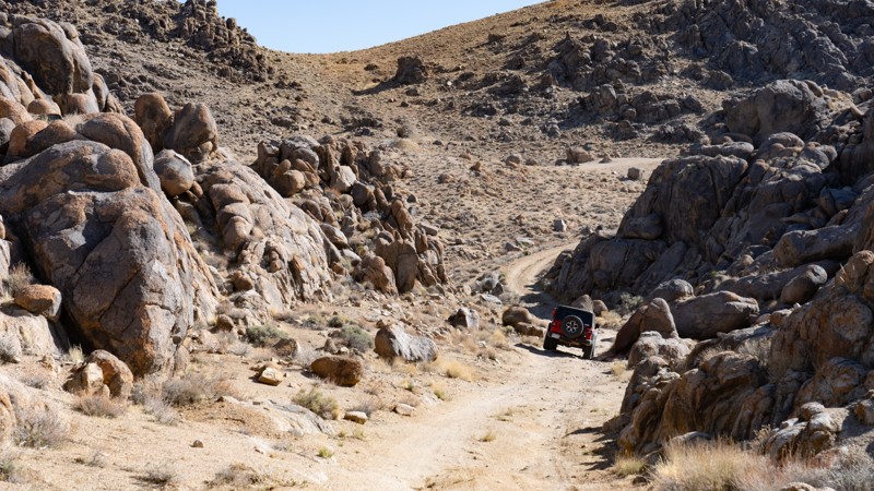
Tucked away in the north Alabama Hills are designated campsites 41 and 42. Although not near the iconic movie sites along Movie Road, these two campsites offer a nice private camping experience while still being only a stone's throw away. The road surface to the first site (41) is easily managed by any vehicle, but to reach the second, the road is rough and rocky, requiring high clearance.
About the camping on this route:
All dispersed camping is designated to a specific site and requires a permit. A permit can be obtained online or at the Eastern Sierra Visitor Center or kiosks located on Movie Road and the main entry point in Lone Pine. Permits need to be signed and displayed on your dashboard.
The BLM has created a map showing the site numbers. However, those numbers are not used in the field, but each site is clearly marked with either a camping allowed or no camping allowed symbol on a clearly visible sign. Please be aware that all sites are first come, first served, and a permit does not guarantee you will find a site. Due to the popularity of the area, it is best to arrive early.
There are six portable restrooms throughout Alabama Hills. If you do not want to drive or walk to one, you must bring your own system to pack out human waste.
About the sites:
41: is easily accessed via a packed dirt trail, providing a small amount of flat ground for only 1-2 vehicles and ground tents.
42: Large trailers and long vehicles (RVs, Sprinter vans, or long-bed pickups) may find trouble reaching this site with its tighter S-bend in the rocks, and high clearance is recommended. The ground is fairly uneven, although there is a large plot of dirt to situate yourself and up to three other rigs.
Both sites have great views of the eastern Sierras and the rocks of the Alabama Hills.
Updated: 03/11/2025
Juniper Flats 3253
Fizzben Heights, California
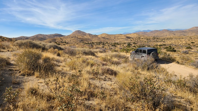
Located in the BLM-managed Juniper Flats area, JF3253 connects to a network of trails that cover over 100,000 acres of this desert-to-mountain transition. The trail provides beautiful views and hosts a variety of wildlife. The distinctive rock formations close to the trail invite a short hike to explore.
The trail is easy over hard-packed flat dirt and wide enough for two vehicles to maneuver and pass over most of its length. This is the perfect trail for beginning offroaders and can be handled with a 2-wheel drive high clearance vehicle. However, if continuing to explore the area, many trails will require 4-wheel drive.
This trail offers no suitable campsites, but dispersed camping is allowed throughout the area when sites show obvious signs of prior use and lack of vegetation cover and follow the BLM Dispersed Camping Guidelines. This is a high-fire danger area, and campfires may be prohibited. Campers are responsible for knowing and following the current fire restrictions.
Updated: 10/15/2024
El Mirage 2729
Houze Place, California
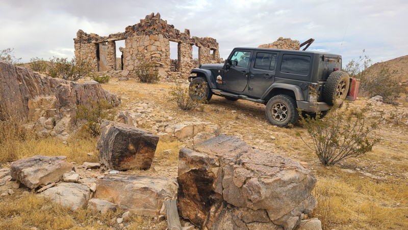
Beginning in El Mirage Valley, EM2728 skirts the edge of a cluster of hills, passing the remains of several stone homes. Made from local stone, these once-handsome buildings are worth the drive to see. This trail, located in the El Mirage Subregion, is in a Limited Use Area requiring vehicles to stay on the trails. The trail follows a right-of-way over private land, with the last mile of the trail on BLM land. EM2728 is an easy, generally flat sandy trail requiring only a high clearance two-wheel drive vehicle.
Dispersed camping is available on the last one-mile trail when meeting the BLM Camping Requirements. During the summer fire season, campfires may be restricted, and if planning to camp, one should review the current BLM Campfire Restrictions.
Updated: 10/15/2024
Georges Valley Road
Reeves Place, California
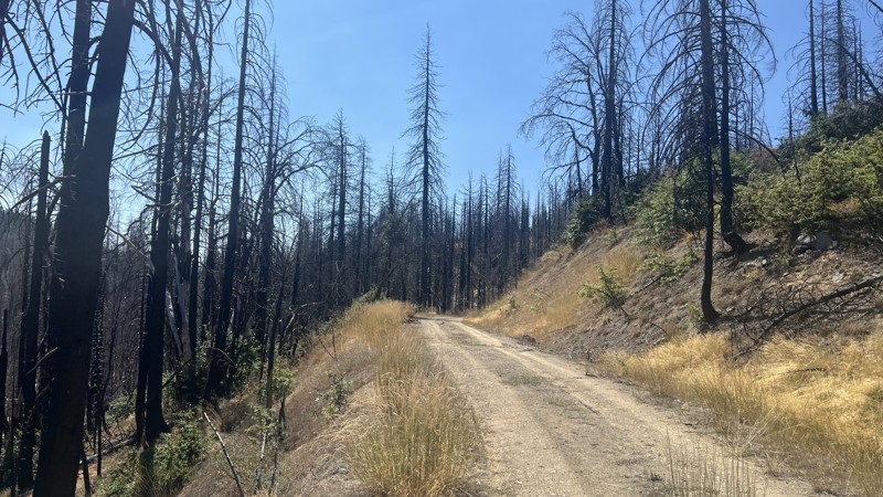
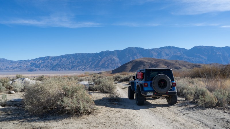
Georges Valley Road is a short trail at the end of the Pillsbury-Indian Dick trail located in the Mendocino National Forest. This trail is a there-and-back trail with a couple of dispersed camping sites. Georges Valley Road is a one-lane, narrow trail that any stock offroad vehicle can travel, providing no real challenges except for a few potholes that will make stock vehicles choose a careful line. The end of the trail is a decent location for bigger groups to set up a dispersed camping site for a night, providing shade and ample space for multiple vehicles.
Updated: 03/13/2025
Hogback Road Sites 46-48
Whitney Portal, California
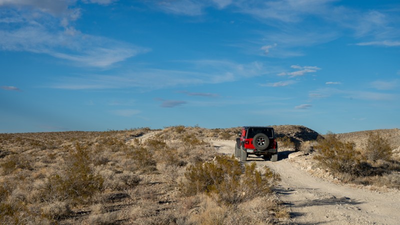
This quick and easy trail is a short drive north of Movie Flat and leads to three of the designated campsites in the Alabama Hills. Located just off Hogback Road, sites 46, 47, and 48 offer peace and quiet away from the crowds. Although there are no major challenges, high clearance may be needed if passing storms cause the ruts to get much deeper.
About the camping on this route:
All dispersed camping is designated to a specific site and requires a permit. A permit can be obtained online or at the Eastern Sierra Visitor Center or kiosks located on Movie Road and the main entry point in Lone Pine. Permits need to be signed and displayed on your dashboard.
The BLM has created a map showing the site numbers. However, those numbers are not used in the field, but each site is clearly marked with either a camping allowed or no camping allowed symbol on a clearly visible sign. Please be aware that all sites are first come, first served, and a permit does not guarantee you will find a site. Due to the popularity of the area, it is best to arrive early.
There are six portable restrooms throughout Alabama Hills. If you do not want to drive or walk to one, you must bring your own system to pack out human waste.
Below is a brief description of each site on this route:
- 46: Quickly and easily accessed, but it is rather small and cannot accommodate trailers or more than two vehicles. A few small bumps further is site 47, a larger site within earshot of 46. This site can fit 2-3 rigs comfortably, with room to turn a small adventure-type trailer around. A quiet and small trickling creek may be heard just across the trail.
- 48: Another hundred or so yards down the trail, where users may encounter small ruts from recent storms. This site is large and exposed but provides plenty of flat ground for 3-4 vehicles and ground tents.
Updated: 11/14/2025
Roaring Ridge
Ricardo, California
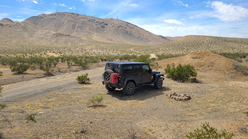
Located entirely within Red Rock Canyon State Park, Roaring Ridge is the connector between Sierra View Road and Opal Trail. Being a simple connector, it offers views into the park's most interesting topography and the Scodie Mountains off to the west. It is suitable for any high-clearance vehicle, as the non-even terrain generally consists of packed dirt with scattered loose rock. 4WD will not be needed under normal circumstances. Dispersed camping is not allowed within the State Park.
Updated: 10/15/2024
Stoddard Valley 6510
Victorville, California
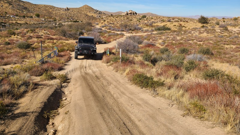
SV6510 follows along the beautiful Ore Grande Canyon formed by Quartzite Mountain and Sparkhule Mountain and serves as a connector to several other trails in the valley.
Mostly on public land, several flat locations are making for good dispersed camping when meeting the BLM Camping Guidelines.
During high fire danger, campfires may be restricted, and if planning to camp here, one should review the current BLM Campire Restrictions and have a Campfire Permit.
SV6510 is a flat, easy trail suitable for two-wheel drive, but surrounding trails may require high clearance four-wheel drive.
Updated: 03/11/2025
Juniper Flats 3275
Fizzben Heights, California
Located in the Juniper Flats area, JF3275 is an easy trek over hard-packed flat dirt with short sections of exposed grapefruit size rocks and wide enough for two vehicles to maneuver and pass by over most of its length. This is the perfect trail for beginning offroaders and can be handled with a 2-wheel drive high clearance vehicle. However, if continuing to explore the area, many trails will require a high clearance 4x4.
This trail connects to a network of trails that cover over 100,000 acres of this desert-to-mountain transition, providing beautiful views and hosting a variety of wildlife. This trail can be used to access the San Bernardino National Forest and trail 3N67, which leads to even more mountain trails, and eventually Big Bear Lake.
JF3275 offers no suitable campsites, but dispersed camping is allowed throughout the area when sites show obvious signs of prior use and lack of vegetation cover and follow the BLM Dispersed Camping Guidelines. This is a high-fire danger area, and campfires may be prohibited. Campers are responsible for knowing and following the current fire restrictions.
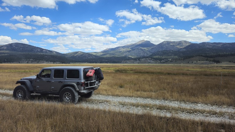
Updated: 08/11/2026
Anchor Ranch Road North
Olancha, California
20S04 is a short spur road off the main Monache Meadows artery that skirts along the meadow and soda springs, leads to a campsite, and eventually deadends at private land. This remote campsite is popular, so you should plan to arrive early if you want to snag it. The campsite is in an open area behind the treeline that is flat-level dirt and can easily support a large group. The trail is easy, and suitable for any high clearance vehicle.
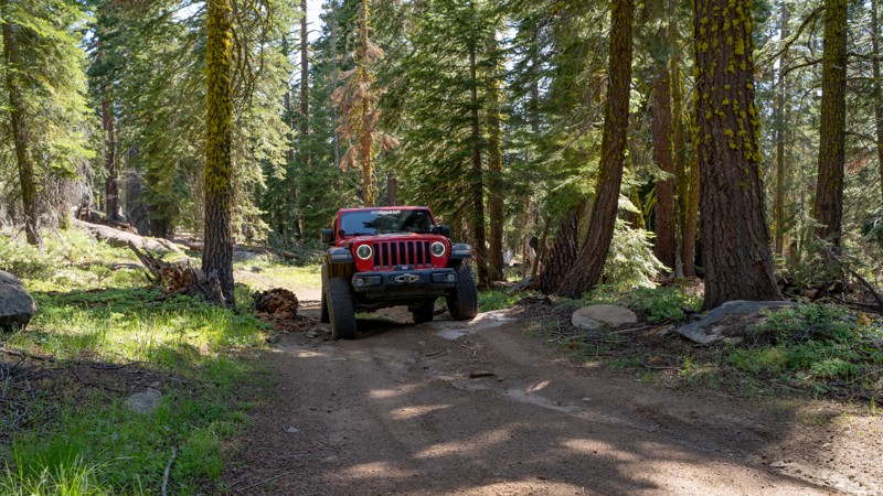
Updated: 01/05/2026
5N04
Dardanelle, California
Forest Route 5N04 is a mostly gentle out-and-back trail that leads to a cell tower station at its terminus. As the trail climbs, it narrows slightly and becomes slightly rougher, but remains easily traversable with minimal experience. Three or four dispersed campsites dot the route, each only large enough for 1-2 vehicles. Visitors new to the area may be interested in the bright green moss that seems to glow on the pine trees. 5N04 also provides general access to the area around Double Dome Rock for those who wish to explore further on foot.
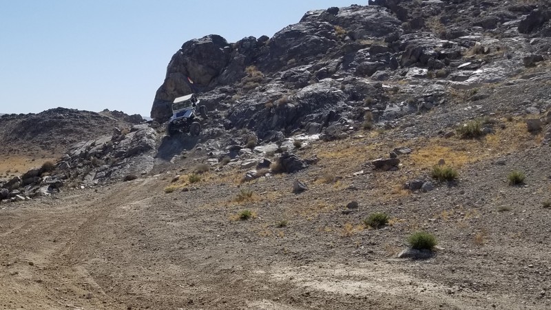
Updated: 09/29/2025
Qualifier Hill
Johnson Valley, California
Part of the King of the Hammers Qualifying course in Johnson Valley California, this steep hillclimb is not for the faint of heart. One side is extremely steep and loose, with rocks in the right spots to make it hard, and on the other side is a drastic drop that is about 4 feet. This is a short straight-through trail only suited for well-built rigs and experienced drivers.
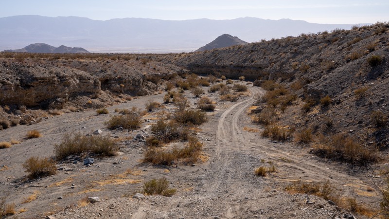
Updated: 03/20/2025
Rickman Road
Lucerne Valley, California
Rickman Road, designated as OM6618 by the Bureau of Land Management (BLM), is a rugged and sometimes rough offroad trail that winds through the heart of the West Ord Mountains. This trail serves as a direct connector between Lucerne Valley and Quill Springs, linking to an expansive network of desert BLM roads. History lingers along the route, with remnants of the area’s rich mining past subtly scattered throughout the mountains. Weathered tailings, forgotten springs, and the ruins of old mining camps appear sporadically, whispering stories of the region’s mining past.
The trail’s terrain is a dynamic mix of sandy stretches, coarse gravel, and scattered grapefruit-sized rocks, making for a bumpy drive. It cuts through winding desert washes on either side of a 3,989-foot pass, offering scenic views and a true sense of remote exploration. At the summit, a secluded campsite awaits, perfect for a solo rig and a tent, providing a peaceful overnight stop under the vast desert sky. For those seeking a larger camping area, an additional site can be found on the east side of the pass, near the remnants of an old building foundation. This spot offers ample space for multiple vehicles.
Updated: 09/29/2025
Stellar Road aka Skull Rock
Lucerne Valley, California
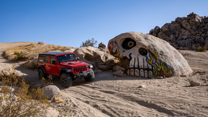
A unique side attraction when visiting Johnson Valley is Skull Rock, which is located on a sandy wash at the end of Stellar Road. The road to get to this hand-painted boulder is an easy, hard-packed dirt road just south of the popular Cougar Buttes area. You first pass several private property parcels before entering the Johnson Valley Open OHV Area, where the road becomes a bit sandier as you continue straight towards the rocky hills. As is typical of routes within Johnson Valley, the trail splits in several directions as you come to the edge of a sand wash, up against the base of the hills. Head northeast to the start of the wash, and there you will find the skull, north-facing, hidden in the desert landscape.
Dispersed camping is allowed throughout Johnson Valley, and there are plenty of wide-open, level areas to fit any type of camp setup and any group size. Cougar Buttes is very close and a popular area for camping, with decent wind protection.

Updated: 04/24/2026
Cottonwood Wash & Granite Pass Camp
Flynn, California
Hugging the eastern edge of the Mojave Wilderness, Cottonwood Wash and Granite Pass Camp Road provide fantastic dispersed camping for a serene escape amongst the stunning granite spires of Granite Pass. At the start of the trail, there are at least eight dispersed campsites with fire rings, each large enough to welcome several vehicles and their tents. These encampments provide a perfect base camp to explore this breathtaking area of the Mojave National Preserve. Located far from any city lights, the black nights are perfect for stargazing and enjoying the annual meteor showers.
As the trail continues, it passes through a beautifully lush Yucca Tree forest and offers even more excellent dispersed camping at the now dry Coyote Springs. As the trail nears its northern end, the Kelso Dunes, rising 650 feet, soar into view, providing a spectacular view of these majestic sand piles that seem to extend forever.
This is an easy trail with occasional ruts and short inclines that can be managed by a two-wheel drive vehicle with some ground clearance.
Updated: 03/13/2025
Horseshoe Meadows Sites 7-8
Lone Pine, California
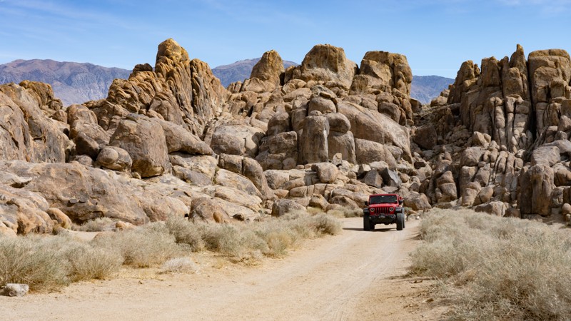
As you pull onto this spur road, a sign reads:
"GUNGA DIN" FILMED HERE"
IN 1938, THIS HILL AREA, AMONG MANY OTHERS IN THESE ALABAMA HILLS, SERVED AS A STAND-IN FOR THE HILL COUNTRY OF NORTHERN INDIA WHEN RKO MADE THE CLASSIC ADVENTURE FILM, 'GUNGA DIN,' ON LOCATION IN LONE PINE. HUNDREDS OF HORSEMEN RACED ACROSS THE HILLS AND ELABORATE SETS WERE BUILT HERE AND NEARBY WHILE THE CAST AND CREW LIVED FOR WEEKS IN A TENT CITY OFF MOVIE ROAD. DIRECTED BY GEORGE STEVENS, THE EPIC STARRED CARY GRANT, DOUGLAS FAIRBANKS JR. VICTOR MCLAGLEN AND JOAN FONTAINE WITH SAM JAFFE AS GUNGA DIN, THE WATERBOY WHO WANTED SO MUCH TO BE A SOLDIER."
The drive starts with dropping into a short canyon with rougher dirt and erosion than the other surrounding roads. The road leads to the designated dispersed sites 7 and 8. Any high clearance vehicle can manage the erosion. Large C-class RVs should be avoided.
About the camping on this route:
All dispersed camping is designated to a specific site and requires a permit. A permit can be obtained online or at the Eastern Sierra Visitor Center or kiosks located on Movie Road and the main entry point in Lone Pine. Permits need to be signed and displayed on your dashboard.
The BLM has created a map showing the site numbers. However, those numbers are not used in the field, but each site is clearly marked with either a camping allowed or no camping allowed symbol on a clearly visible sign. Please be aware that all sites are first come, first served, and a permit does not guarantee you will find a site. Due to the area's popularity, it is best to arrive early.
There are six portable restrooms throughout Alabama Hills. If you do not want to drive or walk to one, you must bring your own system to pack out human waste.
About the sites:
7: Large site suitable for a few vehicles, but the ground is slightly slanted. Well separated from Horseshoe Meadows Road.
8: Large site suitable for a few vehicles, but the ground is slightly slanted. It has a decent separation from site 7, but being in the canyon, voices and sounds could reverberate.
Updated: 03/11/2025
Juniper Flats 3389
Apple Valley Highlands, California
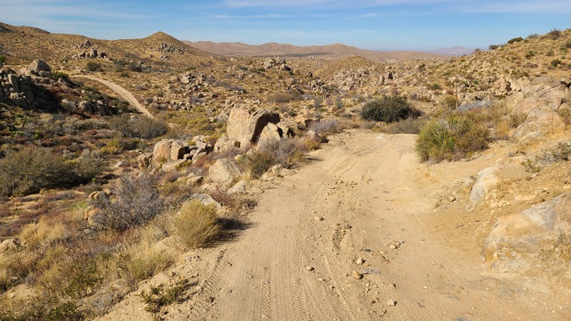
Passing the east side of Round Mountain within the Juniper Flats area, JF3275 is a short connector trail in a much larger network of trails that cover over 100,000 acres of this desert-to-mountain transition. The trail travels through a gorgeous area with swarms of boulder formations, creating stunning views.
The trail can be moderately difficult because of fairly steep, uneven, and rocky slopes. This is a good trail for a beginning off-roader to experience a slightly more rugged trail and should be driven with a 4-wheel drive high clearance vehicle.
JF3275 offers no suitable campsites, but dispersed camping is allowed throughout the area when sites show obvious signs of prior use and lack of vegetation cover, and follow the BLM Dispersed Camping Guidelines. This is a high-fire danger area, and campfires may be prohibited. Campers are responsible for knowing and following the current fire restrictions.
Updated: 03/09/2026
Road to Short Bus and Comp Hill
Johnson Valley, California
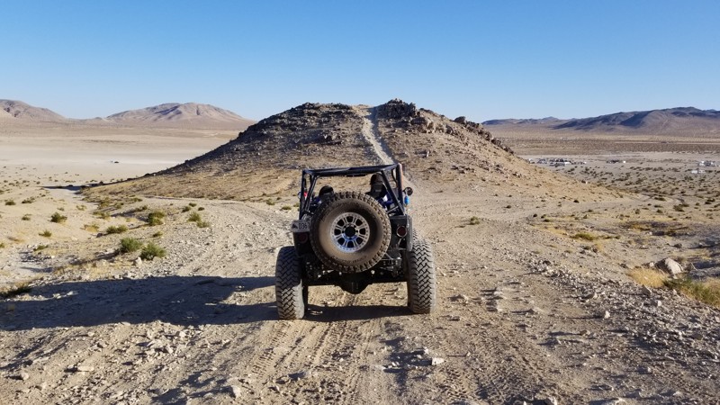
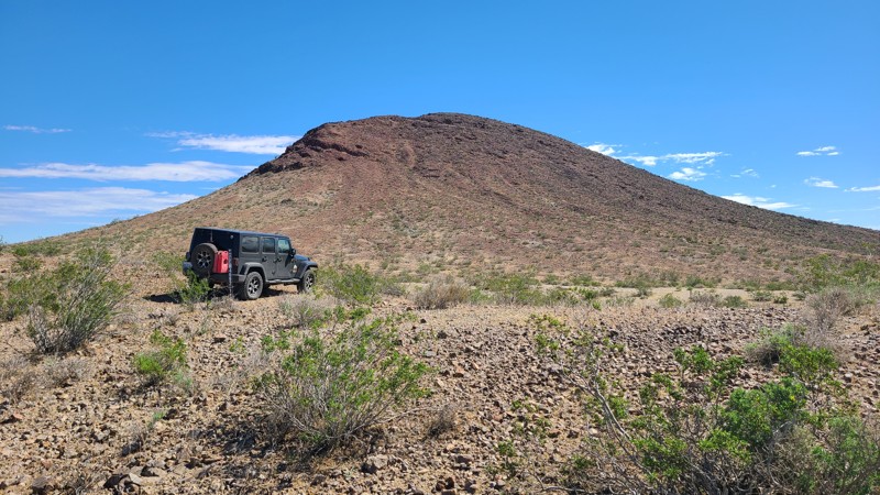
A quick shortcut from Means Dry Lake, The Road to Short Bus, and Comp Hill is a quick path to these two popular areas. So if you are looking for an easy way to get there from means dry lake, this is your shortest route. Camping is not found directly along this trail, but there are endless camping opportunities on surrounding trails.
Updated: 10/15/2024
El Mirage 4692-1
Houze Place, California
EM4692-1 follows a rugged valley formed by the peaks of the Red Buttes that serve as a familiar landmark in this area.
This rough rocky trail has a single suitable campsite with beautiful views across this El Mirage Subregion of the Mojave Desert. Only the westernmost 1/4 mile of this trail is on BLM land, where dispersed camping is allowed when following the BLM Camping Guidelines.
During high fire danger, campfires may be restricted, and if planning to camp, review the current BLM Campfire Restrictions.
EM4692-1 is a rough rocky trail requiring a high clearance four-wheel drive vehicle.
Updated: 06/10/2026
Coxcomb Monument Road
Eagle Mountain, California
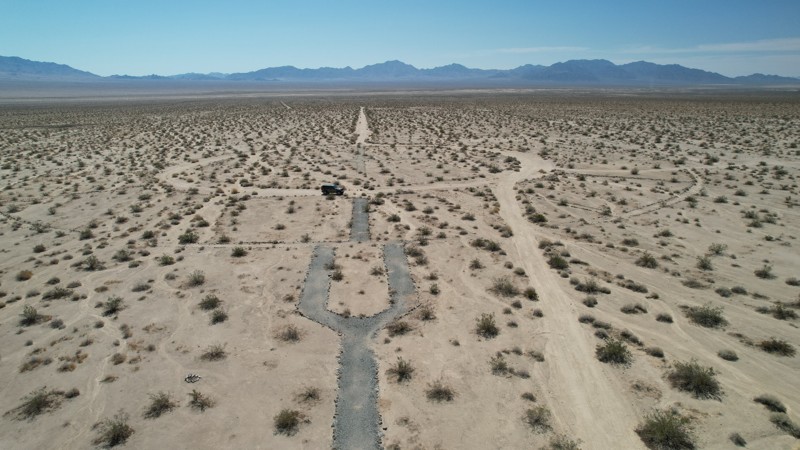
For a short two-year period starting in 1942, Coxcomb Camp became a massive tent city housing 15,000 soldiers training for the North African Campaign. Coxcomb Monument Road cuts through the center of this mile-wide camp, where visitors can view artifacts remaining from 1942. The camps were laid out in grids. Streets and boulevards were bulldozed, and rows of tents were set up on each side of assembly areas. When completed, the camp had 39 shower buildings, 165 latrines, 284 wooden tent frames, an observation/flag tower, and a 40,000-gallon water tank. Officers directed idle soldiers to lay extensive rock alignments along roads, streets, and walkways. These rock alignments can still be seen along this road and throughout the three-mile-long camp. The road passes the camp's flag tower circle, considered the center and most important part of the camp, and can be visited next to this road. A monument to the camp and soldiers who fought, and especially those who gave their lives, is located at the trailhead.
Coxcomb Monument Road is an up-and-back ending at the open Colorado Aqueduct over hard-packed sand and is easily handled by a 2-wheel drive vehicle.
There are no appropriate dispersed camping locations found in the area.
Updated: 08/11/2025
North Delamar
Fawnskin, California
North Delamar Road packs a lot into its 0.9-mile length. Its wonderful mountain scenery and peaceful campsites make it a nice escape from the busier Delamar Mountain road at its trailhead. Pacific Crest Trail hikers may be encountered as the road intersects the hiking trail at its beginning and halfway point.
This up-and-back road offers several flat dispersed campsites along its length. Some sites are in the deep shade of the pine trees, while the best campsite, with a view, is located at the end, offering panoramas across the west end of Holcomb Valley.
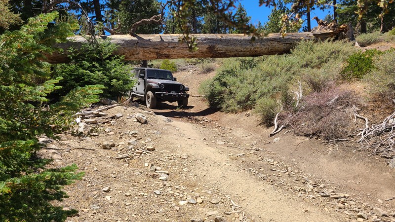
This is an easy drive but still requires a high-clearance 4x4. There is only one obstacle to traverse, over flat embedded boulders, and a bypass provides an easier path. After this obstacle, a huge pine tree has fallen, bridging the trail, creating a tunnel, but with enough space for most vehicles to drive under.
Updated: 01/05/2026
Cougar Buttes Camp Loop
Lucerne Valley, California
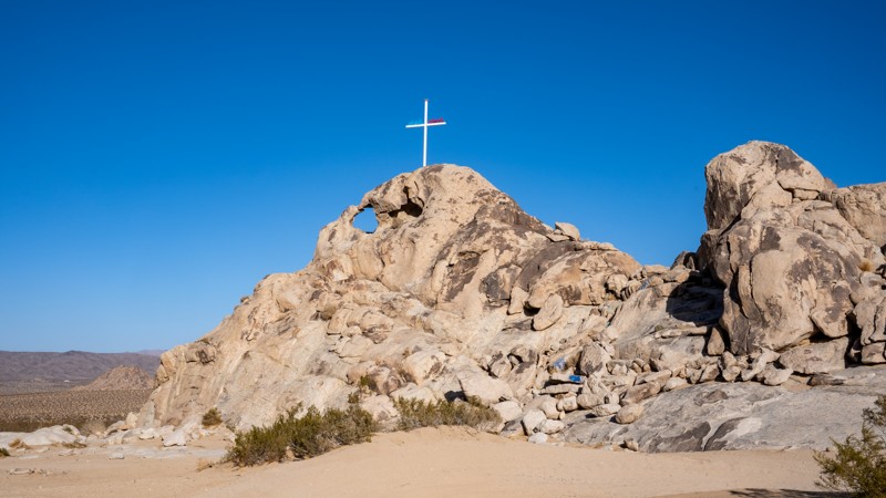
Cougar Buttes sits on the northeast side of California’s Johnson Valley OHV Area and feels like a granite playground dropped into the Mojave Desert. Rocky domes and boulder piles rise out of the open desert, creating everything from mild sandy two-tracks and whooped-out washes to tight canyons and serious rock-crawling lines. Dirt bikes, UTVs, and full-size 4x4s all share the area, with routes that range from easy exploring for newer drivers to extreme obstacles with ledges, waterfalls, and a real risk of body damage for those who want to push their rigs. This loop is an easily accessible area for setting up camp and exploring the surrounding trails. It is suitable for tents, RVs, Toy Haulers, and anything in between.
Camping here is a classic BLM-style boondocking experience. There are no developed campgrounds, no hookups, and no services, just wide-open space where you can dry camp for free as long as you follow BLM rules and respect existing routes. Most groups tend to set up near the rock piles for wind protection, quick trail access, and expansive desert views. You must be fully self-contained, pack out all trash, and plan for changing desert conditions. Cooler fall, winter, and spring months offer the most comfortable seasons to enjoy riding and camping. Pit toilets are available at the north end, close to Transmission Line Road.
Updated: 10/15/2024
Stoddard Valley 6546
Bell Mountain, California
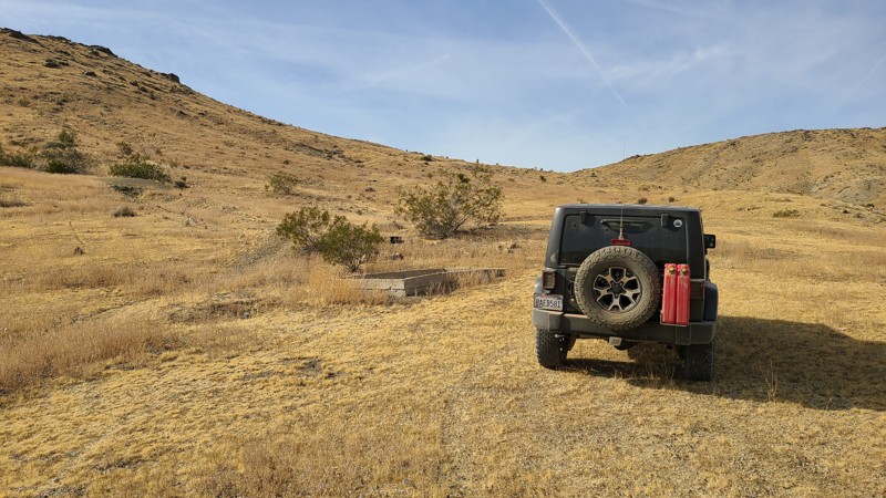
SV6546 follows a wide sandy wash with both ends connecting to other longer trails. Cattle once grazed here, and a concrete water trough engraved with "/X Cattle Co 1904" near the trail collected water from a now dried-up spring up the hill.
The eastern 1/2 mile of the trail is on public land and provides several good camping sites when meeting the BLM Camping Guidelines.
During high fire danger, campfires may be restricted, and if planning to camp here, one should review the current BLM Campfire Restrictions and have a Campfire Permit.
SV6546 is an easy, flat road that requires a high clearance two-wheel drive vehicle.

Upgrade your Membership
Unlock all of the details on every Trail Guide and Scout Route.
Start a 7-day Free TrialBrowse Trails in California by City
Browse every California city with offroad trail guides.
Community
Partners

