




By clicking "ACCEPT", you agree to be the terms and conditions of each policy linked to above. You also agree to the storing of cookies on your device to facilitate the operation and functionality of our site, enhance and customize your user experience, and to analyze how our site is used.
California Off-Road Trails
415
Total Trail Guides 392

4112
Detailed Waypoints 524
Try a Free 7-Day Trial and unlock it all
Start a Free Trial Most Recent Trail Reviews
Rated 5/5
Open
Visited: 09/19/2026
Great beginner trail here for those looking to try out some rockier sections. Starting to trend a little closer to a rating of 4, but still a 3 I’d say

R
Rob
Rated 5/5
Open
Visited: 09/19/2026
I entered this trail from Freeway Ridge 4WD trail (31E77) and ran Black Gulch Jeep Trail up to Rancheria Road, turned around, and ran Black Gulch Jeep Trail all the way down to Keyesville Road in Lake...



Daniel Macioce
Rated 4/5
Open
Visited: 09/19/2026
Took out the vstrom 800de today and this thing was tough for someone like me who is pretty new to offroading motorcycles. I ended up turning around about half way because I wasn't sure if I would be a...
SK
sean kotrola
No Rating
Open
Visited: 09/19/2026
The trial marked by the app here is very difficult with all the recent deep washouts. Proceed at your own risk if you are by yourself with unmodified rigs. However the bypass is maintained and should ...
TB
Timmy Boby
Rated 5/5
Open
Visited: 09/18/2026
Very friendly fire watch tower volunteers and fantastic 360 degree views up top
R
Rob
Rated 5/5
Open
Visited: 09/18/2026
Great views and an easy drive through. Be sure to take the road up to the fire watch tower
R
Rob
Rated 5/5
Open
Visited: 09/17/2026
ran the trail twice last weekend, this is such a better way to go than 3n16...


Josh Noesser
Official Crew
Rated 5/5
Open
Visited: 09/16/2026
It's been 6 years since I visited this trail. It has seen some wear, but the overall difficulty is about the same, probably a bit higher now, as Waypoint 11 has suffered from traffic. Waypoint 11 ha...

Robert
Official Crew
Rated 5/5
Open
Visited: 09/16/2026
Started off from polique canyon at way point 13 and headed east. Its a great trail for most of it with scenic views. A good amount mud puddles that were fun as hell to drive through. Some I decided to...


VM
Victor Manuel Garcia
Rated 5/5
Open
Visited: 09/16/2026
Used this trail to get to Holcomb valley. Super easy and a nice drive, I can see how in the winter it can be a bit more challenging with rain and snow.
VM
Victor Manuel Garcia
No Rating
Open
Visited: 09/16/2026
Mostly easy, but heading NE there's a rock step down just a few miles in that *requires* high clearance. Banged the rear end of my 4runner despite having a 3" lift and 33" tires. A stock SUV would alm...



Carlos H.
Rated 5/5
Open
Visited: 09/15/2026
It's been over 4 years since I was last on this trail, and I was very happy to see that the old car was still there. Some research suggests that it is a 1939 Plymouth Road King 5-window coupe.


Robert
Official Crew
Rated 5/5
Open
Visited: 09/14/2026
A fun little detour off Burns Canyon. I ran this alone and stopped a few times to spot; I also used my grill camera in several places. I brushed my sliders a couple times, but no real issues. Definite...
EB
Ed Boyd
Rated 5/5
Open
Visited: 09/13/2026
easy perfect beginner off roader trail with great views and water crossing during the winter.



Dex Offroad
Rated 5/5
Open
Visited: 09/12/2026
Fenders Ferry kept giving me reasons to slow down and enjoy the ride. I loved winding along mountain ridges, following creeks, and catching glimpses of Shasta Lake's fingers tucked between the hills. ...



Rose Meirs
Official Crew
Rated 5/5
Open
Visited: 09/11/2026
super easy trail over looking the valley and 15fwy. only bad thing is that its super windy.

Dex Offroad
No Rating
Partially Open
Visited: 09/09/2026
Although you can cross the creek from Fordyce if you want, Committee Road is still closed back to the I80, so this has no exit, and you'll be forced back onto Fordyce.

Ryan Boudreau
Official Crew
No Rating
Temporary Closure
Visited: 09/09/2026
Road is still closed. I thought i read somewhere an expected 2030 opening, but can't confirm that info.
Ryan Boudreau
Official Crew
Rated 5/5
Open
Visited: 09/09/2026
This is an awesome trail . This trail is moderate with a few obstacles to make it fun. It also has incredible scenic views with a little bit of shelf roads. You can watch the full video on my YouTube ...


Dex Offroad
Rated 5/5
Open
Visited: 09/07/2026
Pretty spot on with the rating, was a little tough today with the rain but made it through in my 2023 Gladiator Overland with 2.5” lift and 35s with autolynx sway disconnects.


CT
Christopher Tanton

Shaan Heugly
Rated 5/5
Open
Visited: 09/06/2026
Drove reverse from what’s listed to the jasper trail. This is a easy but enjoyable trail with plenty of places to camp at the end of the
Shaan Heugly
Rated 5/5
Open
Visited: 09/06/2026
Bit washed near the top but nothing difficult to navigate. I headed from jasper to the highway and near the highway it did narrow. I got through with my Tacoma but there are a few pinch points I could...
Shaan Heugly
Rated 5/5
Open
Visited: 09/06/2026
Mostly easy trail but when going south to north, I did need to use 4Lo on some of the inclines with a loaded Tacoma
Shaan Heugly
Rated 4/5
Open
Visited: 09/05/2026
It had been five years since I last drove this trail. The long, annoying stretches of moguls are still there, and water erosion has added a touch more difficulty in places. It was nice to see the old ...


Robert
Official Crew
Rated 4/5
Open
Visited: 09/05/2026
This is a nice trail with great views for any 4WD with ground clearance as some sections have ruts that are 12+ inches deep. Things were very dry on my visit, so airing down the tires helped to smooth...


SG
Steve Graham
Rated 3/5
Open
Visited: 09/05/2026
From waypoint 7 to 10 the water damage is pretty bad. Waypoint 13-16 it is rocky. Nothing crazy but a few spots where patience and the right line will go a long way. Good clearance and 4x4 recommended
N
Noah
Rated 5/5
Open
Visited: 09/05/2026
Easy trail with an awesome view at the end. There were three lookouts in the fire tower and each one was super friendly and informative. Must see trail!


N
Noah
Rated 5/5
Open
Visited: 09/05/2026
fun easy trail, Butler Peak lookout is the highlight imo
N
Noah
Rated 5/5
Open
Visited: 09/04/2026
Trail was very well maintained. Thanks for the Fresno 4x4 club. It was very cold at night, into the 30s. We were on the trail two nights, 3 days and two nights at voyager rock due to a breakdown fr...
JD
John Drago
No Rating
Open
Visited: 09/04/2026
Beautiful area, but the trail itself wasn’t very interesting. I’d rate it around a 3/10, with a couple of optional sections that might push a 4.
There’s tons of dispersed camping throughout the area,...


Ryan Smith
Rated 5/5
Open
Visited: 09/01/2026
awesome trail with a lot of water crossings. just be careful of sxs and bikes since its a OHV area.

Dex Offroad
Rated 5/5
Open
Visited: 09/01/2026
Super easy trail and you can over look the high desert. Trail ends at an awesome view point.

Dex Offroad
Dex Offroad
Rated 5/5
Open
Visited: 08/31/2026
This trail is much harder than it used to be. It’s just as breathtakingly beautiful as ever. You are on your own out there. Fuel, parts, spare tire. It’s days from help if you need it so go prepared. ...

CP
Christopher Pepin
No Rating
Open
Visited: 08/30/2026
Ran this trail today and had fun. Easy trail with great views. I wouldn’t hesitate to take an experienced driver in a stock jeep up this. There are lots of trails in this area and way to get off the m...

CP
Christopher Pepin
No Rating
Open
Visited: 08/29/2026
Trail was in good shape, a little less sand makes the boulders a little bigger. People have made the bypass around the sluice a little bit longer than it used to be you miss a lot of the good rocks. O...
C
Campbell
Rated 5/5
Open
Visited: 08/29/2026
An often overlooked and amazing trail. It’s about the length and difficulty of the rubicon if you don’t hit any of the bypasses on the rubicon. We had a group of 3 lj on 40s, a jku on 42s, and an Xj o...
CP
Christopher Pepin
Rated 4/5
Open
Visited: 08/27/2026
This is most definitely a hard trail. Is the entire thing hard? Not at all. The western 7 miles are a hard packed dirt road. Then you run into 3 straight, large boulder obstacles where its clear many ...


Ryan Boudreau
Official Crew
Rated 4/5
Open
Visited: 08/27/2026
Easy drive with beautiful views and . . . Buck Rock! Lots of camping south of Buck Rock, but camping north of the Rock isn't as plentiful. There are a few others on the north, but there's one here: 36...


Carlos H.
Rated 5/5
Open
Visited: 08/26/2026
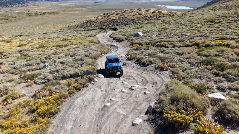
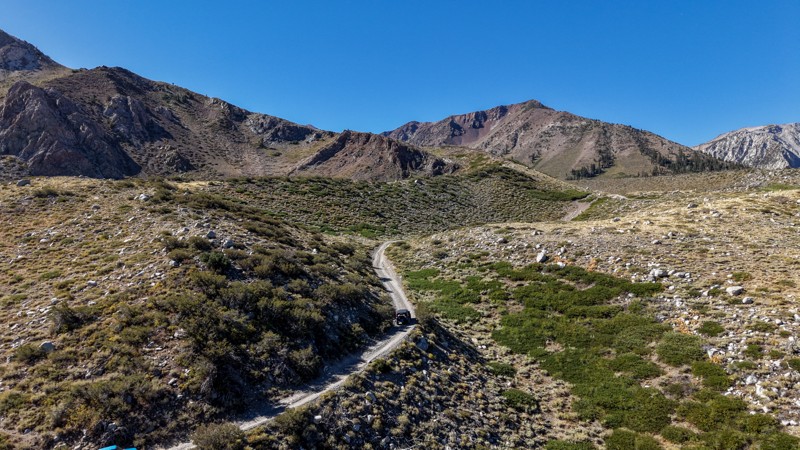
5 stars all day! This trail is absolutely amazing, and one you do not want to miss if you are in a capable vehicle in the area. It is rough, rocky, steep, and narrow enough to weed out the vanlifers a...
Ryan Boudreau
Official Crew
Rated 5/5
Open
Visited: 08/26/2026
I really enjoyed this road. It's super scenic with the sierra's in the background, the white beaches, and the columns are really cool. The road is not anything challenging with a high clearance vehicl...


Ryan Boudreau
Official Crew
Rated 4/5
Open
Visited: 08/25/2026
Fun area. The hot springs are pretty popular and well-known, and because they are small, you'd better hope you are one of the first people there that day if you want to get in. The route is easy, exce...


Ryan Boudreau
Official Crew
Rated 4/5
Open
Visited: 08/25/2026
I liked this trail a lot, but it's not quite a 5-star trail for me. I feel like it's a little overhyped. Is it scenic? Absolutely! Is there tons of great camping? Totally! Is it a crazy busy? You Bet!...


Ryan Boudreau
Official Crew
Rated 4/5
Open
Visited: 08/25/2026
Road to the hot springs parking area is easy. There are regular passenger cars there. The hike is easy too. The tub itself is super scenic, but know that they are not hidden gems by any means and we'l...

Ryan Boudreau
Official Crew
Rated 3/5
Open
Visited: 08/25/2026
It's a simple road, but definitely very scenic and really only used to get from Convict to Laurel Lakes or Mammoth. Road is suitable for anything with decent ground clearance.


Ryan Boudreau
Official Crew
Rated 2/5
Open
Visited: 08/25/2026
Simple dirt road used to access other types of recreation. Many signs remind you that you aren't allowed to camp along it except at the campground.


Ryan Boudreau
Official Crew
Rated 3/5
Open
Visited: 08/23/2026
Simple, straightforward dirt road used for fishing access.


Ryan Boudreau
Official Crew
Rated 5/5
Open
Visited: 08/23/2026
Amazing views at the top of this trail. Erosion looks to be making this trail harder than it probably originally was. Most of the hardest spots are getting bypasses created around them. A short, st...



Dan Jurgella
Rated 5/5
Open
Visited: 08/23/2026
Toad Lake Road 40N64 was a long, slow, and wonderfully remote drive into the Trinity Divide. The changing mix of old pavement, dirt, loose rock and deep ruts kept the journey interesting, while forest...


Rose Meirs
Official Crew
Most Popular

Updated: 11/14/2025
Caruthers Canyon Road
Lanfair, California
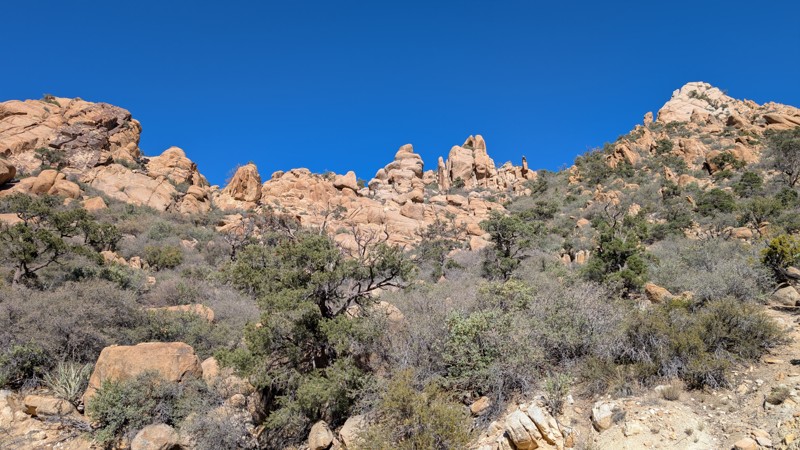
Located deep within the Mojave National Preserve, Caruthers Canyon Road begins at Cedar Canyon Road and winds upward into the rugged New York Mountains. The intersection is unmarked, but a lone stop sign hints at the start of your journey.
The road begins at about 4,400 feet in elevation amid a forest of Joshua Trees and climbs roughly nine miles to about 5,600 feet, where stands of pinyon pines once blanketed the slopes. Sadly, much of this forest was lost in the York Fire of 2023, which originated in Caruthers Canyon and burned over 93,000 acres. Three structures were lost, and the landscape was dramatically altered, yet the canyon retains a striking beauty and a sense of quiet resilience.
As you ascend, granite rock formations and towering spires dominate the horizon, creating a landscape reminiscent of Joshua Tree National Park. The road surface varies between sand, gravel, and hard-packed dirt, typical of desert terrain. While ruts and shallow washes cross the route, it remains passable by a high-clearance 2WD vehicle equipped with good off-road tires. Beyond the main camping area, however, the road becomes washed out and impassable as it climbs steeply toward the Giant Ledge Mine.
There are several areas suitable for dispersed camping, including one large site that can accommodate up to seven vehicles. Groups larger than seven vehicles or more than 25 people must obtain a permit from the National Park Service. One particularly scenic campsite is tucked among granite boulders and features a built-in picnic table and grill, perfect for smaller groups of two or three vehicles.
From the upper camps, you can hike the final mile to the Giant Ledge Mine, where a few open adits remain. Use extreme caution when entering abandoned mines, as it is dangerous and not recommended. Historically, the mine was worked primarily for copper, though traces of silver and gold were also found in quartz veins throughout the area. Mining activity here dates back to the early 1900s, part of the region’s short-lived boom that attracted fortune seekers to the Mojave’s remote corners.
Today, Caruthers Canyon offers a serene escape for explorers seeking solitude, geological beauty, and a touch of history. It’s an excellent overnight stop for those traveling the Mojave Road, offering a short but rewarding detour filled with panoramic views, fascinating rock formations, and the quiet magic of the high desert.
Updated: 09/29/2025
3N56
Fawnskin, California
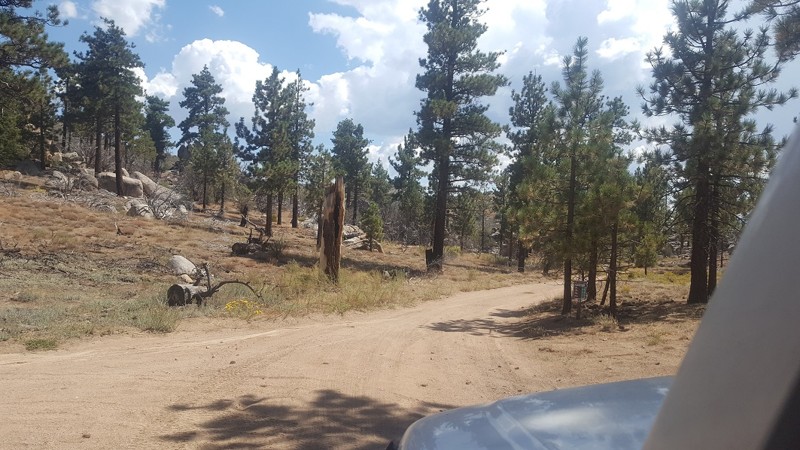
3N56 is a simple and quick connector between 3N17 – White Mountain and 3N16 – Holcomb Valley Road. At roughly 0.2 miles long, it takes no time to get between the trails and continue your day. The trail is mainly packed dirt and suitable for any vehicle.
Updated: 10/15/2024
Johnson Valley 4310
Johnson Valley, California
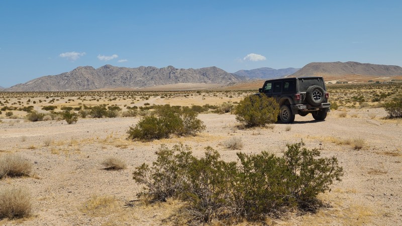
Located in Johnson Valley, JV4310 travels over a checkerboard of private and Bureau of Land Management (BLM) land.
With no existing campsites visible from the trail, several suitable open and flat locations will provide dispersed camping sites when on BLM land and meeting the BLM Camping Guidelines. Campfires are generally prohibited, and it is the responsibility of the camper to know the current BLM Campfire Restrictions.
JV4310 is a sandy trail passing over several washes. A high clearance two-wheel drive vehicle will do well on this trail.
Updated: 03/07/2025
Basin Road
Cronese Valley, California
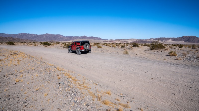
Basin Road is an easy, graded road that provides access to the Rasor Off-Highway Vehicle Area and runs along the western boundary of the open riding area. The surrounding landscape offers abundant rolling hills, open valleys, and sand dunes that invite any type of rider willing to traverse the rugged terrain. The road travels between Interstate 15 and the Mojave Road, ending at the north end of Afton Canyon. Most of the road is hardpacked, but the farther south you travel, the more sand you will encounter. Large RVs and travel trailers should only travel the eastern side of the lollipop and remain on the 8712 road. The western portion of the lollipop, roads 8711 and 8713, have the softest sand and could easily trap a heavy vehicle. Along the northern half of the road, you will find many large camping and OHV staging areas suitable for any type of camp setup and any group size.
Updated: 11/20/2025
Elk Trail
Yucca Valley, California
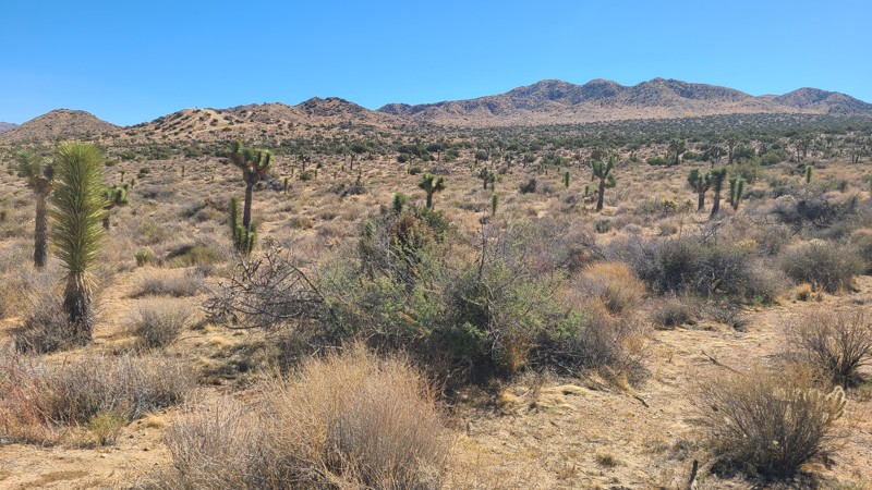
This out-and-back trail passes through a beautiful desert plateau full of Joshua Trees and California Junipers, eventually reaching the fenced border of Joshua Tree National Park. Elk Trail provides access to other driving trails, including Little Morongo Canyon Road, as well as sites for day camps to enjoy the several hiking paths in the north-west corner of Joshua Tree National Park. As the trail advances east, the Joshua Trees' thin and burn scars increase from several fires over the years, with the most recent being the Elk Fire in 2022.
No overnight camping is permitted on this Mojave Desert Land Trust property. However, dispersed camping can be found on BLM property along Little Morongo Canyon Road, or improved camping at the nearby Black Rock Campground within the Joshua Tree National Park.
Elk Trail is an easy trail, flat and wide, and comfortably managed by a two-wheel drive passenger SUV.
Updated: 10/15/2024
Cuyapaipe Tank Road
Mount Laguna, California
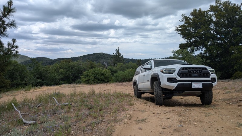
A short branch off of Thing Valley Road that ends at a water tank reservoir. The trail has a few small roots and bumpy ruts that a high clearance 2WD should be able to handle. There is also a campsite closer to the intersection with Thing Valley Road.
This route is in the Cleveland National Forest, so you may need appropriate passes and/or permits, even for gas stove use.
Updated: 03/07/2025
Manix Wash
Manix, California
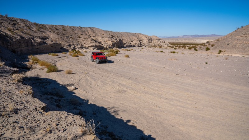
Manix Wash is a straight-through sandy trail that connects I15 to the Mojave River and the Mojave Road Connector. The road traverses its namesake wash, weaving across the soft sandy track and passing towering walls created from centuries of erosion. It intersects and crosses the Mojave River before entering another drainage with more soft sand and towering cliff walls, but also presenting a minefield of exposed, grapefruit-sized lava rock. Along this trail, you can expect to encounter rough sections of deep sand ruts and rolling whoops that your suspension will either eat up or jar your teeth loose. The rocky sections along the southeast end are a bit bumpy, but most rocks are easy to avoid and drive between. The trail is suitable for any high clearance vehicle, but airing down is necessary, and 4WD is highly recommended due to soft sand conditions.
Along the first mile on the northwest end, you will notice several large areas with fire rings. These should not be considered campsites as they are located on private land. At nearly 1.5 miles, just before dropping into the wash, the road enters BLM land, and there are a couple of large areas that show evidence of camping. These are close to the highway, so noise is a definite factor if attempting to camp here. Along the rest of the trail, there are no suitable campsites.
Updated: 10/15/2024
Kramer Hills 6147
Adelanto, California
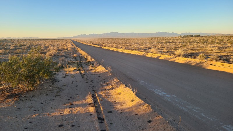
KH6147, also known as Helendale Road, is a maintained dirt road that provides access to many crossing trails in the Kramer Hills Subregion. Any passenger car can travel the road.
Dispersed camping sites are available just off the road near one of the trail crossings when meeting the BLM Camping Guidelines.
During high fire danger, campfires may be restricted, and if planning to camp here, one should review the current BLM Campfire Restrictions and have a Campfire Permit.
Updated: 09/29/2025
Hercules' Finger Access
Lucerne Valley, California
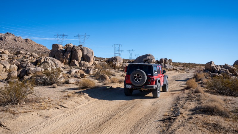
North of Lucern Valley, OM6600 treks along the southern end of the Ord Mountains under the shadow of several high-voltage powerlines. The road cuts straight across the desert, making slight elevation changes as it passes unique granite rock formations popular with rock climbing enthusiasts. One of the signature formations here, known as Hercules' Finger, is a 70-foot-tall, free-standing monolith sculpted by millions of years of erosion. The road is a mixed surface of hardpacked dirt and sand, with several sections of deep sand whoops. In addition, exposed rocks up to baseball size will be encountered along the road. There are many flat areas along the road where camping would be suitable and has been previously used. However, be cautious of private property parcels along the western half, as several campfire rings exist in areas of posted private property, and users should avoid camping there.
This road is suitable for any vehicle with decent ground clearance.
Updated: 01/05/2026
South Gas Line Road
Pisgah, California
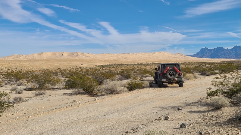
South Gas Line Road is a 71-mile overland adventure that showcases the full spectrum of the Mojave Desert, from open sandy flats and majestic dunes to the rugged flanks of the Providence Mountains. A narrow, vehicle-approved corridor threads between designated wilderness areas, giving travelers front-row views of untouched desert, jagged peaks, and endless horizons. Along the way, dozens of side trails and spurs invite deeper exploration, with standout highlights like the towering Kelso Dunes and the massive pit of the abandoned Vulcan Mine. The route finishes at legendary Route 66, just a few miles from Goffs Ghost Town.
The drive starts out on an easy, sandy desert two-track that a high-clearance 2-wheel-drive vehicle can handle in dry conditions. Beyond Kelbaker Road, the character changes quickly, with rough, uneven stretches and melon-sized rocks that require a lifted 4x4 and an experienced driver. The crossing of the Providence Mountains via Foshay Pass includes long, steep 20-degree climbs and descents over rocky, loose, and sometimes slippery surfaces bordered by deep ditches. Locking differentials greatly improve traction and help keep vehicles on line, and informal bypasses exist around the very worst sections.
Dispersed camping opportunities are scattered along the route, including a standout site roughly halfway up Foshay Pass that overlooks nearby canyons and offers sweeping views across the Providence Mountains. Additional camping can be found near Kelso Dunes, while those seeking amenities can overnight at the Mojave National Preserve’s Hole-in-the-Wall Campground, north along intersecting Black Canyon Road.
Updated: 08/11/2026
Olivas Sping
Olancha, California
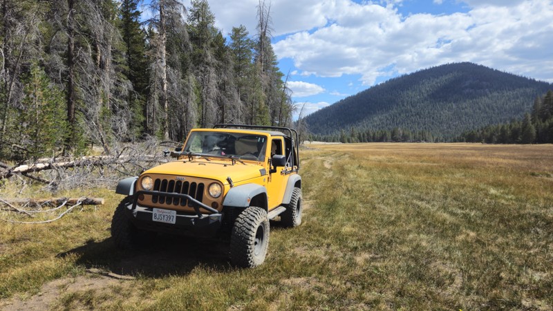
Located near the northwestern corner of Monache Meadows, the 20S06B trail, also known as Olivas Springs, provides access to private ranches that use the area for cattle grazing. While the trail is easily accessible and suitable for any high-clearance offroad vehicle, camping is not ideal along this route due to the treeline being on private property.
Updated: 09/29/2025
2S79A Obsidian Dome Road Dispersed Camping
Crestview, California
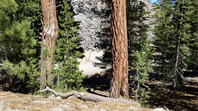
Looking for a super unique campsite? How about camping on the side of a volcano? 2S79A is just that, a campsite that is inside the large caldera of Mammoth but also on the side of one of the many calderas that have erupted out of the ground. The name of this caldera is the Obsidian Dome known for the famous lava glass it has created. So, if you are in the area of Mammoth or June Lake and want to disperse camp somewhere super unique, check out this spot! The trail is a dirt path that any vehicle could do, but there is an overhang from a tree that limits tall vehicles from getting down to the camping spot.
Updated: 08/11/2026
Bickel Camp
Saltdale, California
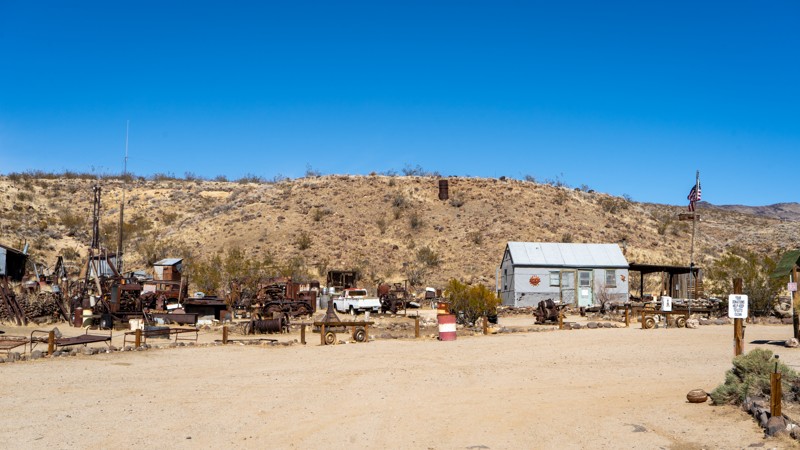
EP 30 is the trail that Bickel Camp resides on, and it's worth the stop. The Camp itself may or may not be open the day you arrive, but if not, you can look in from outside the gate and look at the historical oddities. EP 30 is an easy, hard-packed sand road with occasional ruts and washboard, suitable for any high clearance vehicle. Dispersed camping can be found along the eastern half. At the Camp, there are two picnic tables set up and shade.
Who was Walt Bickel, and Why is this Camp Important?
Walt Bickel's Camp in Last Chance Canyon, California, became a public historical site thanks to dedicated efforts to preserve his legacy. Bickel, a mechanically inclined Kansas native, moved to California in 1923 and worked in demolitions before becoming a prospector. He first visited the canyon in 1927 and returned in 1933, ultimately filing his own mining claim in 1934. Over the decades, he built a small but self-sufficient camp, relying on collected rainwater, salvaged machine parts, and his ingenuity to survive in the harsh desert.
Despite his dreams of striking gold, Bickel primarily supported his family through odd jobs and later served in the Army during World War II, where he invented a tool for rapidly changing machine gun barrels. After his discharge, he returned to Last Chance Canyon, living there full-time and welcoming visitors with stories, home-cooked meals, and lessons in gold panning.
By the late 1980s, government regulations threatened Bickel's way of life. The Bureau of Land Management (BLM) cracked down on long-term residents on public land, and in 1987, they inspected Bickel's Camp to determine whether he could remain. Unfortunately, just hours before the inspection, Bickel suffered a stroke, forcing him into a nursing home. The BLM later deemed his operation too small for residency, putting the Camp at risk of demolition.
In 1989, Bickel's supporters successfully negotiated with the BLM to preserve the site as a museum, allowing a caretaker to reside there. Today, visitors can explore the Camp, which remains much as Bickel left it. Bickel's ingenuity and desert survival legacy endures with a caretaker on-site, offering a glimpse into a bygone era for future generations.
Updated: 08/19/2025
Stetson Hollow
Seven Oaks, California
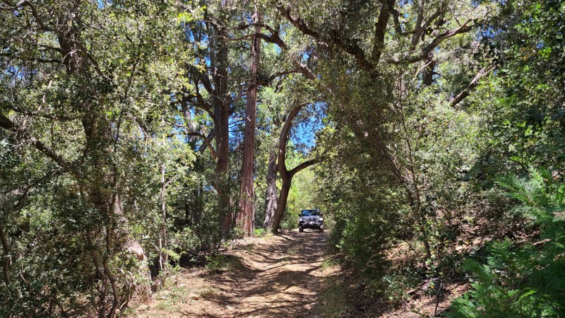
Stetson Hollow is a little-used up-and-back trail through a dense, lush forest, with surrounding meadows, and makes a perfect quiet getaway. While starting only a few hundred feet from Highway 38, the trail feels isolated and remote, with only the sounds of singing birds and the wind whispering through the trees. Trees embrace portions of the trail to form canopies and filter the sunlight to create dark passageways, enhancing the sense of remoteness.
Along the trail, clearings and grassy meadows allow midday sunlight to beam in through the surrounding tall pine trees and provide excellent dispersed camping sites. The trail starts very close to the highway, but the camp locations are far enough away not to hear any traffic noise. These sites have no fire rings as campfires are prohibited in the forest.
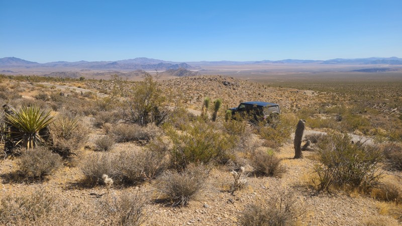
The Forest Service trail makers at the trailhead do not provide a difficulty level, and the road is moderately difficult with a rocky creek crossing, deep ruts, fallen trees, and large rocks to avoid or drive over. The road is not maintained, allowing bushes and trees to crowd the path, which can result in vehicle pin-stripping. A lifted four-wheel drive vehicle with ground clearance is required to navigate this road.
Updated: 10/15/2024
Rattlesnake Canyon 3203
Doble, California
East of Lucerne Valley, RC3203 is entirely on Bureau of Land Management (BLM) land and wanders through the foothills of Round Mountain. Along with the desert scenery, the slight elevation provides distant views out to the north of Lucerne Valley.
This is an easy, straight-through trail, but it still needs a high-clearance vehicle. A new offroad driver will enjoy the twists and turns of this trail and exploring the connecting trails.
Dispersed camping is allowed on this trail when meeting the BLM Camping Guidelines. Campfires are generally prohibited, and if you plan to camp, you are responsible for knowing the current BLM Campfire Restrictions. Operating a camp stove requires a campfire permit. The start of the trail has a dispersed campsite with an overlook of the surrounding valleys.
Updated: 07/17/2026
Elephant Rock Lake
Bear Valley, California
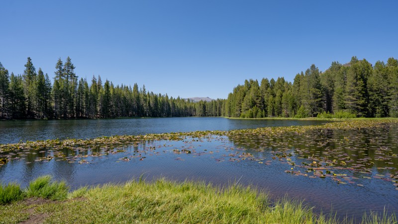
Elephant Rock Lake (7N29Y) is an easy out-and-back route that winds gently through the high, forested landscape, located just slightly north of Union Reservoir. Starting around 6,650 feet and topping out near 7,110 feet, this short drive climbs gradually through shaded pine and fir stands on a graded dirt surface. The path is suitable for any high-clearance two-wheel-drive vehicle, and no prior off-road experience is needed. It’s a peaceful trail ideal for casual exploration. It is slow-paced and scenic, with no obstacles aside from the occasional pothole or shallow rut.
The primary draw is access to Elephant Rock Lake, a small, tranquil body of water nestled in a quiet clearing. It’s also a gateway for adventures beyond the road, including the Union Rock Lake Trail and additional hiking routes that lead into the rugged landscapes of the Carson-Iceberg Wilderness. Along the way, drivers will find a handful of dispersed campsites with fire ring remains, but none offer much privacy or views of the lake. The end of the trail offers three walk-in dispersed sites, one of which is located on the water.
Due to its elevation, the trail is typically snowed-in during the winter months, when it becomes popular with snowmobilers and cross-country skiers rather than wheeled vehicles. In summer, the route sees higher use, especially on weekends, as nearby campgrounds like Spicer Meadow Campground fill up and people seek quieter alternatives.
Although it offers no major landmarks along the way, this trail’s charm lies in its simplicity and still makes for a good addition to a day trip in the Stanislaus National Forest.
Updated: 10/15/2024
Scodie Mountains SC99
Ricardo, California
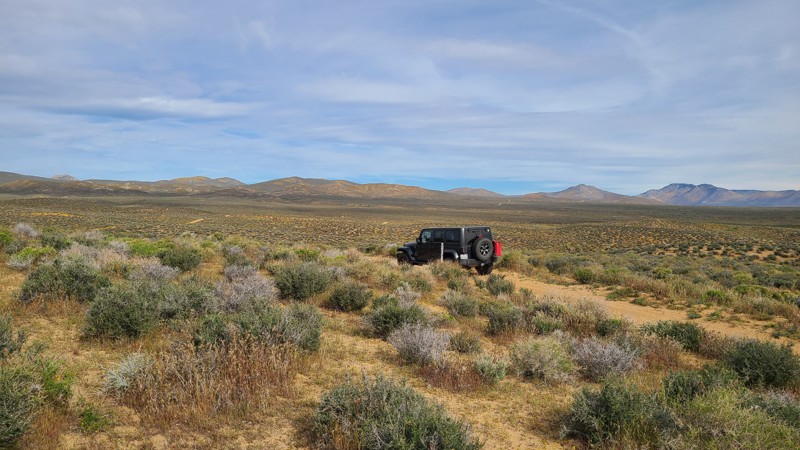
SC99 travels northwest over a well-maintained, wide, sandy road toward the very flat desert towards Pinion Mountain.
The road is wide and well maintained and an easy drive for new offroaders, but it still requires a high clearance 4x4 to manage the soft sand and occasionally exposed rocks.
BLM has prepared primitive campsites at the chosen locations, easily identified by posted signs noting a 15-mile speed limit when campers are present. Camping there or at suitable dispersed sites on BLM land can be enjoyed when meeting the BLM Camping Guidelines. During high fire danger, campfires may be restricted, and if planning to camp here, one should review the current BLM Campfire Restrictions and have a Campfire Permit.
Updated: 03/09/2026
SunBonnet Trail and Hells Gate
Homestead Valley, California
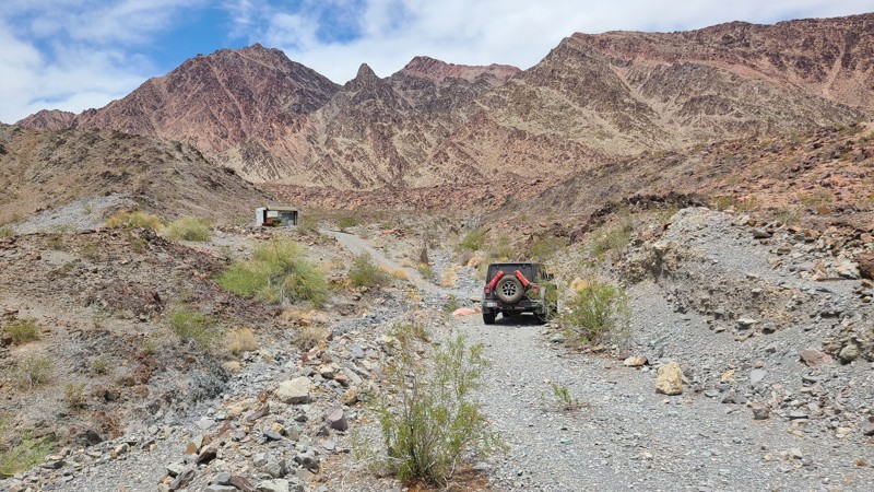
Tucked away in the rugged heart of Johnson Valley, California, the legendary Sunbonnet Trail stands as one of the original and most revered Hammer Trails, branching off the iconic Means Dry Lake, affectionately known to off-roaders as Hammer Town USA. This trail is a true proving ground, drawing thrill-seekers from across the country to the unforgiving expanse of the high desert.
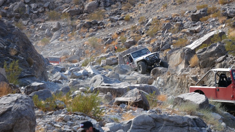
Carved by time and weather, Sunbonnet is a brutal test of driver and machine, packed with massive granite boulders, vehicle-squeezing notches, and extreme features like 4-foot ledges and 7-foot waterfalls. The trail demands precision and grit as it throws one obstacle after another, turning sheer climbs, narrow squeezes, and near-vertical drops into the kind of heart-pounding moments that offroad legends are built on.
Perched at around 3,400 feet above sea level, the climate here is as extreme as the terrain. Blistering summer temperatures can soar to a scorching 115°F, while winter nights plunge toward a bone-chilling 0°F, turning the trail into an entirely different beast with each season.
Due to the sheer intensity of the obstacles and the very real risk of significant body damage, only heavily modified rock crawlers should attempt to conquer Sun Bonnet. This trail isn’t just a drive; it’s a battle of machine versus nature, where every scratch and dent tells a story of grit, determination, and desert conquest.
Updated: 02/05/2026
Arlington Mine/Patton's Cabin Road
Inca, California
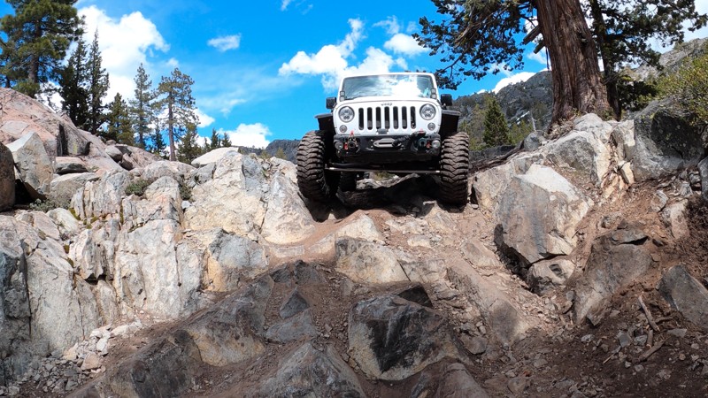
In north-east Riverside County, lying between the Palen-McCoy and Big Maria Wildernesses, is Arlington Mine/Patton's Cabin Road, and it is one of the roads suggested by BLM as a primary route to explore. The road crosses the flat and sandy McCoy Wash until reaching the edge of the Palen Mountains, where a short but rugged climb reaches Patton's Cabin site. Surrounded by the Palen, McCoy, and Little Maria Mountain ranges, the road is never without an ever-changing, picturesque landscape. Arlington Mine Road provides an artery intersecting with a dozen other BLM designated trails to explore, including the Black Diamond rated Palen Pass Road.
The BLM trail markers indicate Arlington Mine Road as "Easiest" over the sandy majority of the road, but the westernmost 3 miles become more difficult, as they are over deep water worn ruts, turning, and then into a rough rocky surface consisting of 6-8" size rocks. A high clearance 4x4 is required to manage this trail.
Almost the entire length of the road is on BLM land, but the most appropriate dispersed camping sites are around Patton's Cabin location. Even in the desert, campfires may be prohibited. Campers are responsible for knowing the campfire restrictions and having a campfire permit. Campfire restriction information can be found at the BLM Palm Springs South Coast Field Office and the Cal Fire websites, along with instructions to obtain an online campfire permit.
This is a very remote area with intermittent or no cell coverage, and drivers should, before leaving, communicate their travel plans to family and friends, should carry adequate water, and be equipped for self-rescue.
Updated: 08/11/2026
Winch Hill 1 Bypass
Baltimore Town, California
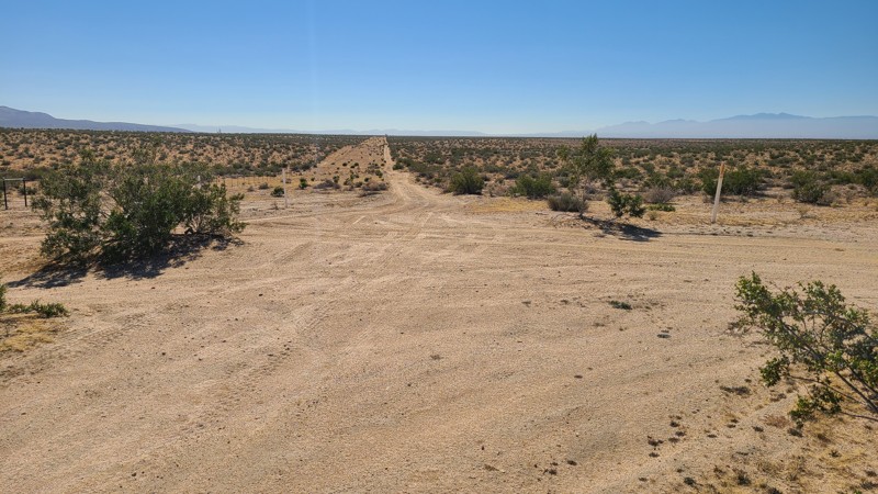
Winch Hill 1 Bypass is just under 7 miles into Fordyce Creek Trail in the Tahoe National Forest. When most hear the word "bypass", they think of an easy, flat forest road around an obstacle. This is not that. The Winch Hill 1 Bypass on Fordyce Creek Trail, while nowhere near as difficult as the straight line up Winch Hill 1, is not easy! This might be the funnest bypass you'll ever run! A challenging rocky ledge followed by a couple of large rocks and some killer mountain views, make this short trail more than any typical bypass. If it's your 1st time through Fordyce, even if you plan to run up Winch Hill 1, it's worth an extra 10 minutes to run up and down this bypass. It also serves as a good way around WH1 when your buddy needs a winch point at the top.
Updated: 10/15/2024
Kramer Hills 6149
Bryman, California
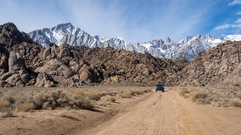
KH6149 passes over very flat desert terrain but still provides wonderful Mojave Desert views all around. The easy sandy trail requires a high clearance two-wheel drive vehicle with all-terrain tires.
Along the way, many flat and clear areas are suitable for dispersed camping when meeting the BLM Camping Guidelines.During high fire danger, campfires may be restricted, and if planning to camp here, one should review the current BLM Campfire Restrictions and have a Campfire Permit.
.
Updated: 03/13/2025
How the West was Won Movie Location
Lone Pine, California
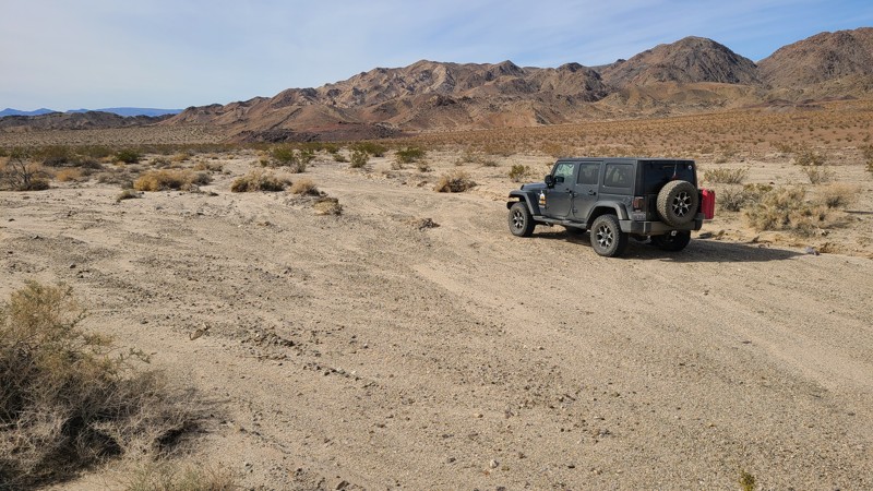
Among the famous Movie Flats, this looping spur guides users beside two famous movie sets: the 1962 film How The West Was Won, which featured a long line of great actors, including John Wayne and James Stewart, and one of the settings for Gunga Din, a 1939 film featuring Cary Grant. This is a well-maintained and well-traveled trail, so just about any vehicle with decent clearance can drive it. Occasional ruts form after rain storms, but most are easily avoidable. Camping is not allowed, but there are many nearby designated sites on the east side of Movie Road.
Updated: 02/05/2026
6N17
Cottage Springs, California
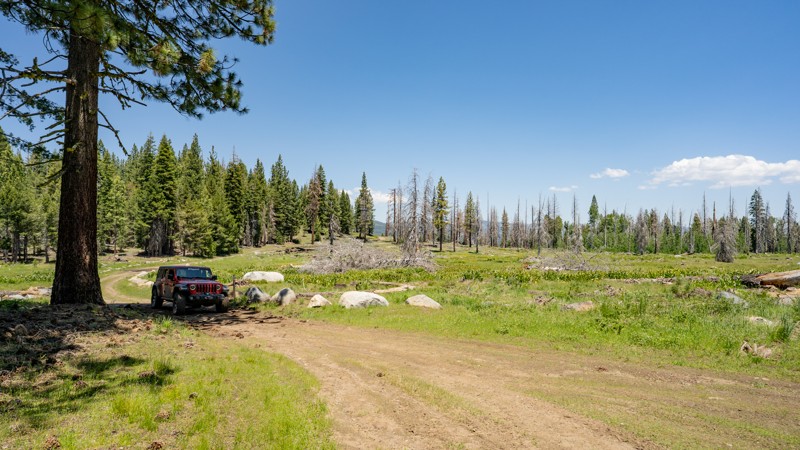
Forest Route 6N17 is a secluded, high-country cruise that branches off 5N14, climbing through thick forest up to Big Prather Meadow. The road is mostly rough dirt throughout, with some sections of bumpy embedded rock, and is friendly to any high-clearance 4WD, making it ideal for new off-roaders or anyone looking to explore without much drama. Although not heavy on the dispersed camping, the trail does offer one large site with direct creek access, shaded by large pine trees, roughly 2 miles in. Another dispersed site is located roughly 3.5 miles from the start, and it is large enough for a couple of vehicles but less picturesque. As you work your way along the trail, you'll also notice two small lakes (Swamp Lake and Lake Moran) hidden among the trees. Both seem shallow and serve as water catchments for snow melt. The end of the trail opens up to the lush meadows the high Sierras are known for, which pop with vibrant wildflowers in late spring and early summer.
Be extremely mindful of where the mapped route ends. Although the road continues on Forest Service maps, it dead-ends at a private property line for a hunting preserve with minimal space to turn around. It is best to end your adventure at the meadows and return the way you came.
Like much of the high Sierras, 6N17 stays buried under heavy snow through winter and typically doesn’t open until mid to late spring, depending on snow pack conditions.
Updated: 10/15/2024
Coyote Lake Area CL8207
Manix, California
Following the southern edge of Alvord Mountain, CL8207 sits on a sandy basin leading to the convergence of several trails and is a shortcut to CL8140. Dispersed camping is available anywhere along the trail with a few established rock fire rings.

Upgrade your Membership
Unlock all of the details on every Trail Guide and Scout Route.
Start a 7-day Free TrialBrowse Trails in California by City
Browse every California city with offroad trail guides.
Community
Partners

