






By clicking "ACCEPT", you agree to be the terms and conditions of each policy linked to above. You also agree to the storing of cookies on your device to facilitate the operation and functionality of our site, enhance and customize your user experience, and to analyze how our site is used.
Arizona Off-Road Trails
373
Total Trail Guides 359

4679
Detailed Waypoints 676
Try a Free 7-Day Trial and unlock it all
Start a Free Trial Most Recent Trail Reviews
Rated 4/5
Open
Visited: 09/22/2026
Hard pack, easy forest service road that is a great back way to the North Rim of the Grand Canyon.


Tyler D’Hulst
Rated 4/5
Open
Visited: 09/22/2026
Spring Canyon is a beautiful drive. We didn’t go out to the cabin but used this western section of road coming back from Crazy Jug

Tyler D’Hulst
Rated 4/5
Open
Visited: 09/22/2026
We took this out to Crazy Jug. The northern section is hard packed forest service road. Not difficult. Very scenic drive through the ponderosas.

Tyler D’Hulst
Rated 5/5
Open
Visited: 09/22/2026
View point is spectacular! Trail was easy going out, no obstacles at all. Saw a Toyota Camery at the viewpoint.


Tyler D’Hulst
Rated 3/5
Open
Visited: 09/22/2026
An alternative route out to Crazy Jug Point. It’s easy and can be scenic in areas. I’d recommend West Ryan out to Crazy Jug though.
Tyler D’Hulst
Rated 3/5
Open
Visited: 09/22/2026
A quick connector trail through the burn patch.
Tyler D’Hulst
Rated 5/5
Open
Visited: 09/20/2026
Leviathan Mine trail is a full day trip. Though it is only 20 miles in length the travel is slow and rough. Majority of the trail you will be going between 5-10 MPH. Then once at the end it connects w...



Eric Gartin
Official Crew
Rated 4/5
Open
Visited: 09/19/2026
Simple road, well graded today. Many mountain bikers coming down from the West out of Breezy Pines. Not too many people out until approaching Senator Hiway. We went East to West as I think thats a bet...



Jeff Burnett
Rated 3/5
Open
Visited: 09/19/2026
The trail itself is not spectacular, it's pretty flat across the plains. However, driving up to the overlook and seeing a huge gaping hole in the ground is a great juxtaposition to the flat trail. The...
Tyler D’Hulst
Rated 3/5
Open
Visited: 09/19/2026
A nice trail ride from the main road down off the plateau. It's graded forest service road until the switchbacks. The switchbacks themselves are not difficult, road is not graded. This section has bee...
Tyler D’Hulst
Rated 3/5
Open
Visited: 09/18/2026
The end of the trail is not well marked, and can cause confusion. Also, vehicle passes are required for all backcountry routes within the Lake Mead National Recreation Area.
Eric Gartin
Official Crew

Ted Whisler
No Rating
Open
Visited: 09/17/2026
Nice ride west side a little rocky but rating is true to #2


Ted Whisler
Rated 3/5
Open
Visited: 09/15/2026
A nice drop off the plateau heading towards Marble Canyon. Not a difficult road. Road is weathered but not challenging.
Tyler D’Hulst
No Rating
Temporary Closure
Visited: 09/15/2026
Road closed due to multiple washed out wash crossings after the turn off to go up the mountain. "Road Closed" sign put out by BLM on trail.
Tyler D’Hulst
No Rating
Temporary Closure
Visited: 09/15/2026
After the turn off to head up the mountain there are multiple washed out wash crossings. A "Road Closed" sign has been put out by the BLM.
Tyler D’Hulst

Ben Ruddell
Official Crew
Rated 4/5
Open
Visited: 09/14/2026
Bogles Ranch Road is a great Sunday afternoon drive type of dirt road that climbs up in elevation and gives some spectacular views of the surrounding area. The first half passes through State and Priv...


Eric Gartin
Official Crew
Ben Ruddell
Official Crew
Rated 3/5
Open
Visited: 09/14/2026
Antares Road is an excellent way to travel from Route 66 to the eastern portion of the Lake Mead National Recreation Area. This wide county road is well maintained with minor washboarding, most of whi...


Eric Gartin
Official Crew
Rated 3/5
Open
Visited: 09/14/2026
Hackberry road is a wide dirt road with minimal erosion damage and washboarding. There are a couple of larger washes that cross Hackberry road creating wide stretches of loose sand which can cause iss...


Eric Gartin
Official Crew
Rated 3/5
Open
Visited: 09/13/2026
This is a very rough, rocky, & slow going trail. Expect around 4+ hours for the trail & another hour to get the highway. One of those trails I'm happy I did but I wont be back personally. High clearan...

Brandon W
No Rating
Open
Visited: 09/12/2026
I think the rating is spot on. The ruts and washouts at the beginning are not as bad and if you hug the inside of the shelf road they can be avoided. The middle part is same general sandy wash with ov...



Greg Page
Rated 4/5
Open
Visited: 09/11/2026
Ran this trail as part of a larger loop. Trail is in great shape. Easy for standard 4x4 with no lift. Passengers can do it until maybe the very end by the lake where the road gets rocky and washed out...


Jeff Burnett
Rated 5/5
Open
Visited: 09/10/2026
This is one of my favorite scenic trails in the area. The trail is easy to travel, but does have some optional short trails that will test your vehicle. The views from the Grand Wash Cliffs of the Hua...


Eric Gartin
Official Crew
Rated 3/5
Open
Visited: 09/07/2026
This trail by itself is nothing special. It is mostly used as an access road to get to the more technical trail such as Homecourt, Twister, and Waynes World. This is a great trail for the beginner to ...


Eric Gartin
Official Crew
Rated 3/5
Open
Visited: 09/07/2026
This trail is an enjoyable alternate route when traveling on Blake Ranch Road (7163). The trail is easy with only a handful of spots with erosion damage. The few established camping sites appear to n...


Eric Gartin
Official Crew
Rated 5/5
Open
Visited: 09/07/2026
Ran this trail from Boynton Pass Road to Loy Butte Road (opposite direction from what is listed). Ran into a few rental ATVs and a couple of Jeeps heading the opposite way. This was a fun trail wit...



Daniel Macioce
Rated 5/5
Open
Visited: 09/07/2026
This trail was a lot of fun, plus the views were amazing. I ran the trail in the order posted, starting at the south trailhead and finishing at the heritage site. Past a motorcycle, a few jeeps and a...


Daniel Macioce
Rated 4/5
Open
Visited: 09/07/2026
Nice trail, ran West to East. For some reason the map shows this a a one-way trial, East to West. That is not the case, it is a two way trail. Was pretty washed out starting around mile 12. Plenty roc...


Jeff Burnett
No Rating
Open
Visited: 09/06/2026
New trail for me. You didn’t know what it would throw at you around every corner which is why you try to find new trails or old forgotten ones
KB
Kory Burden
Rated 5/5
Open
Visited: 09/06/2026
The trail is no joke—steep, narrow, and technical enough that you’ll want to be comfortable with off-camber shelf roads, rocky terrain, and washouts that will test your vehicles articulation. The rew...



Bobby Rumbaugh
Official Crew
Rated 5/5
Open
Visited: 09/06/2026
Fun trail if you don't want to do pyeatt draw itself. Ran this trail 3yrs ago and definitely a little more erosion but, still any truck or suv with good factory ground clearance can do it. From previo...
JM
James m
Rated 4/5
Open
Visited: 09/06/2026
Ran this trail from I-17 to Sedona. Extraordinary views descending into Sedona. As others have noted, there are lots of rock on the trail, making it slow going. Passed a large number of Pink Jeeps ...


Daniel Macioce
Rated 4/5
Open
Visited: 09/05/2026
This one definitely changed over the last few years. The southern section has some legit, steep, off-camber sections. YOU NEED experience, backup, and a capable vehicle on this one now. It's not supe...


.jpg)
Bobby Nelson
Official Crew
Rated 4/5
Open
Visited: 09/05/2026
Another amazing time on this scenic crossover. We came in from Walnut Canyon and finished out on Price Road after about 6 hours. A challenging and hot day for the old TJ. Rincon Road has evolved into ...


Bobby Nelson
Official Crew
Rated 4/5
Open
Visited: 09/05/2026
We started exactly at sunrise to try and beat the heat. We planned to crossover to Box Canyon and out on Price Road. It ended up taking us 6 hours, even with all the photos and filming we did. A chall...


Bobby Nelson
Official Crew
Rated 5/5
Open
Visited: 09/04/2026
We recently ran Four Peaks after the monsoon rains. Here’s what we found and what to expect if you’re planning to run it. Have a GR8 day!

Jeep 4 Dirt
Rated 5/5
Open
Visited: 09/04/2026
Breathtaking views. Definitely don't rush through the trail. Devil's staircase was a bit slippery but awesome. A few tight stops here and there, but a trail that's a must on anyone's to do list.



Christopher Bradley
Rated 4/5
Open
Visited: 08/30/2026
Id say this is a 3.5 to 4 trail. There are some obstacles, but nothing you really need to think hard about how to approach. If you send your vehicle at it in 4 low you'll get through everything.



Justin Holsinger
Rated 4/5
Open
Visited: 08/28/2026
Rim Road (FS300) West to East. Very well groomed gravel forest road. Accessible by just about any vehicle thats not been lowered. Who does that anyway? Scenic views the whole route. Hard to believe on...


Jeff Burnett
Rated 4/5
Open
Visited: 08/28/2026
Not a bad road but it was crowded with sxs and vehicles towing campers. Hard to rate 5 stars for a busy road. Super easy any vehicle can do this. Part is paved near the freeway but the rest is gravel.

Tony Rockwell
Rated 4/5
Open
Visited: 08/28/2026
I rated 4 stars just due to the volume of sxs & camper trailers on the road.
Easy drive, any car can do this.
Ran from sheep springs to munds park, see other reviews for full route.

Tony Rockwell
Rated 4/5
Open
Visited: 08/28/2026
I ran Bar M in reverse to get to this trail. Then headed toward Casner Park Road. (See reviews I did on each of those)
Nice easy trail that is less rough than Bar M.
Nice drive through trees.


Tony Rockwell
Rated 5/5
Open
Visited: 08/28/2026
Very bumpy due to rock infused trail. A few larger rocks, 8-12” tall in places but most stock 4x4’s should be able to navigate around or over them. I would say any 4x4 with all terrain tires could nav...


Tony Rockwell
Rated 3/5
Open
Visited: 08/27/2026
Overall decent little trail; camped out near Committee Tank (not suitable for tent camping - too rocky). Nothing too technical but enough to keep things interesting. High clearance and good line choi...


Bill Ferguson
Rated 3/5
Open
Visited: 08/27/2026
Connector from FS801 (Rock Garden Loop) to FS09494F (Committee Tank Trail); yeah, it lives up to its namesake. Very rocky. High clearance and picking good lines are an absolute must. Car camped at...

Bill Ferguson
Rated 5/5
Open
Visited: 08/27/2026
Nice trail saw some deer it’s a little rough but overall was easy


M
Maddox
Rated 5/5
Open
Visited: 08/23/2026
Great little adventure for the day. Dirt road is pretty rutted up due to monsoons, but easily drivable. Lake itself is extremely low.
LL
Larry Lapp
Rated 4/5
Open
Visited: 08/22/2026
A fun side trip that has a steep hill climb. Due to recent rains, the wildflowers were blooming.


Bobby Rumbaugh
Official Crew
Most Popular

Updated: 07/04/2024
Rim Road
Payson, Arizona
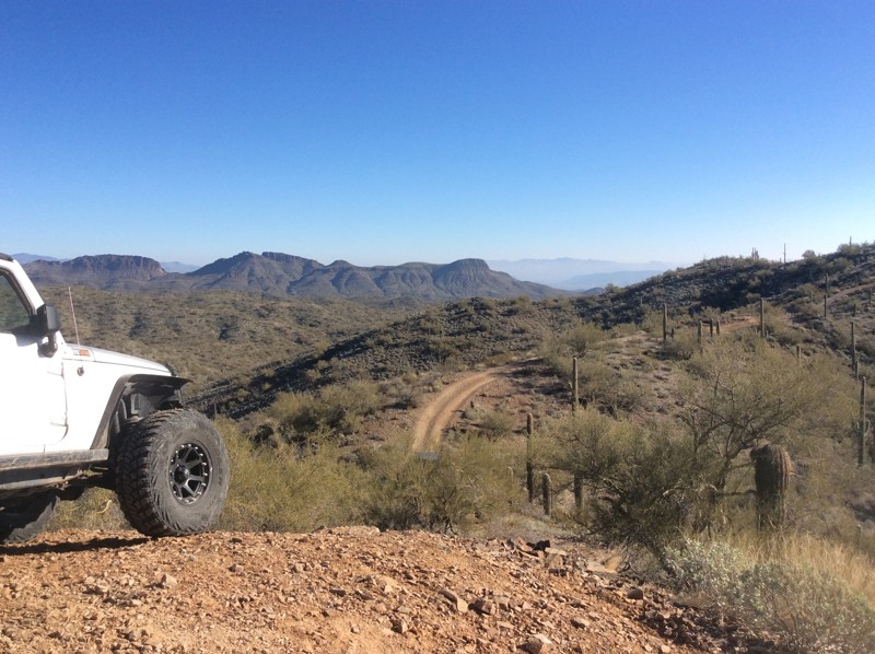
You will not even believe you are in Arizona if you drive on the Rim Road. You will travel through two Arizona national forests but this area looks more like Colorado as you travel along at 7,000+ feet all day. In fact, you'll see sights from the rim that are only surpassed by the Grand Canyon and Sedona. Plan on spending a good long day on this road as you'll stop frequently to smell the pine, listen to the wind rustling through the trees, and be stunned by the scenic vistas that await you.
Just bought a four-wheeler? Looking for a passenger car appropriate adventure? The Rim Trail has everything you need.
Need a cool place to camp? You'll find hundreds of developed, and even more dispersed camping spots in these two forests.
Keep a sharp eye out for the abundant elk, and an elusive black bear that inhabit these woods.
Updated: 04/13/2024
Hieroglyphic Mountain Loop
Wickenburg, Arizona
This route has many highlights. Make sure to bring the camera for great desert scape photos. The Boulder OHV area is free to use and offers camping, bathrooms, and an OHV practice arena for kids. Quickly you'll find an optional obstacle, a small-waterfall for some shenanigans that allows you to get some flex on. Just after the waterfall you will find an old windmill with a larger area to make a stop. This trail takes you through sandy washes and up to the tops of roller-coaster-like peaks with breathtaking views. This is a very narrow trail when climbing the high peaks that give a bit of the pucker factor with little to no room for turn arounds. You descend back down into the wash and end the loop where you began -- making it nice for vehicles that are towed to the trail head or if you are camping out.


Updated: 07/05/2024
Redington Pass
Open
/
Tucson, Arizona/
27.64 miles/
About an hour
The route that became known as Redington Pass has been in existence for hundreds of years. It was originally used by natives and eventually improved to facilitate a military supply route used to commute between the San Pedro River Valley and the booming metropolis of Tucson, Arizona. The overland route cut roughly 70-100 miles off the alternate routes which were to go either north through Oracle and back south, or south through Benson and back north in order to reach Tucson. The route was later used by the small ranching community of Redington, Arizona.
Redington Pass is now a gateway to hiking and Off-Road trails in the Catalina and Rincon Mountains, east of Tucson, Arizona and into the San Pedro River Valley as well. This route is the perfect light day trip to escape the city or just a short drive up a hill to a great view of the Tucson area. During good winters this route can be a nice place to encounter some snow at elevation that hasn't quite reached the desert floor.

Updated: 04/01/2025
Camp Creek to Verde River
Carefree, Arizona
Close to Phoenix and fun! This offroad trail follows the Camp Creek Wash to the Needle Rock Recreation Area on the Verde River. As you progress down the sandy trail, the wash narrows, and cliffs rise above you into a narrow canyon. There are many opportunities to stop and explore by foot or rest for lunch under the towering cliffs. When you reach the end of the trail, you will enter the Needle Rock Recreation Area, a popular swimming hole in the summer. There are plenty of opportunities for fishing, kayaking, or just enjoying the beautiful riparian scenery.

Updated: 04/28/2024
Elvis Trail
Open
/
Florence, Arizona/
5.11 miles/
About 2 hours
The OHV region near Florence, Arizona, is loaded with legendary offroad trails for all types of vehicles. Hidden in one of the many washes, Elvis is widely known for its numerous rock waterfalls that challenge even the best-built rigs. There are many abandoned as well as active mines in the area. Legend has it the trail's name comes from a local miner’s dog that traveled along the route with him many years ago. Along the way, there are towering saguaros clinging to the rocky banks as you twist through a lush Sonoran desert. The terrain along this route is harsh, the rocks are sharp, and everything out there wants to poke or sting you. Continuing that theme, the rocky waterfalls are massive and intimidating, but with careful tire placement and a trusted spotter, navigating through the rocky maze is achievable. Stopping after conquering an obstacle and feeling a sense of accomplishment is the memorable part about Elvis.

Updated: 06/23/2024
Point Sublime
Fredonia, Arizona
The Point Sublime trail, located in the less-visited North Rim of the Grand Canyon National Park and is one of the four offroad trails inside the Park. The awe-inspiring and sublime nature of this point is most likely why it has its given name. The Grand Canyon National Park is 1,902 square miles. Its otherworldly landscape and enormity will leave you feeling small and breathless as you make the drive to Point Sublime. Driving through a timeless forest mixed with rolling meadows is accented with two main viewpoints along the way that act as warm-ups for what lays ahead. Once you make it to Point Sublime, that feeling of being immersed in the splendid magnitude is cemented as the narrow peninsula suspends you over the grandly expansive canyon, with just a sliver of a glimpse of the Colorado River at Boucher Rapids. The Point Sublime campsites offer the most extraordinary views from a tent window that a person could see.
Updated: 07/15/2026
Smiley Rock
Chino Valley, Arizona
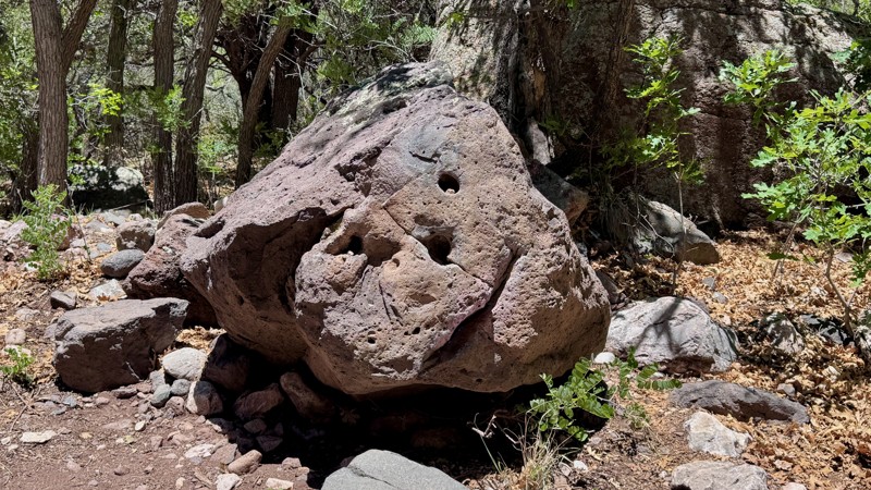
Just outside Jerome, one of Arizona’s most famous and historic mining towns, sits a rock that never stops smiling. Smiley Rock is one of the state’s better-known off-road trails, and for good reason. The route offers a challenging but rewarding experience, with large rocks, boulders, narrow passages, and beautiful scenery along the southern edge of the Woodchute Wilderness Area.
Much of the trail travels through the cool, shaded surroundings of Martin Canyon, providing a welcome contrast to Arizona’s more exposed desert trails. The main attraction is Smiley Rock itself, where a natural stone face appears to grin at passing travelers. After navigating the rugged trail to reach it, you may find yourself smiling back.

Updated: 04/21/2024
Black Canyon OHV Trail
Black Canyon City, Arizona
Trekking between the Table Mesa Recreation Area and Black Canyon City, west of I-17, Black Canyon OHV Trail is a scenic, rocky, and narrow 4x4 trail that follows an ancient pack trail over steep rolling hills and deep dry river beds through thick and thriving high desert vegetation. This trail provides a great mix of challenges and views and is a fantastic adventure-filled day when combined with AZCO Mine Trail.

Updated: 05/25/2024
Charouleau Gap/FR 736
Oracle, Arizona
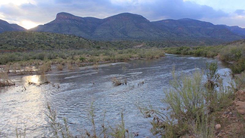
A historic route between Oracle and Tucson, Charouleau Gap (pronounced shar-lou) is the quintessential southern Arizona 4x4 trail and a must-do for anyone with a modified off-road vehicle. It has become kind of an Arizona right of passage. Skirting along the north foothills of the Santa Catalina mountains and in and out of the Canada Del Oro (canyon of gold) canyon, the Charouleau gap trail is a delight.
Updated: 12/01/2023
Cherry Creek
Roosevelt, Arizona
Cherry Creek is an epic adventure! It is somewhat of a schizophrenic trail that seems easy at first but will test you and your equipment. After nearly 40 miles offroad, you will feel like you have accomplished something. The trail is in the middle of Tonto National Forest and brings the best of the desert, as well as the green forest.
The early stages of the trail are easy dirt roads and sprout lots of trails worth exploring. Saguaro cactus is abundant in these lower elevations and during the spring, flowers erupt like a psychedelic carpet. During the rainy season, Cherry Creek is the gatekeeper and you may not be able to cross. Provided that you get through Cherry Creek, you still have 8 miles of easy rolling.
Shortly after passing halfway at mile 20, the trail tightens up and starts rising to run along the eastern edge of the Sierra Ancha wilderness. The mountains rise sharply to the west and are home to numerous ruins. Whether in the morning with the sun radiating off the rock face or in the evening as the sun drops over the ridgeline and creates a silhouette of the mountains, the beauty is remarkable along this trail.
The second half of the journey is full of twisty trails, washed out stream crossings, and a large boulder that may be too much to cross if not prepared. This section is also at a higher elevation and there are more trees that are vibrant in the autumn with the changes in color.

Updated: 12/23/2025
Mount Lemmon Control Road
Oracle, Arizona
This is the trail that many choose to test their rig on for the first time. That being said, it's not a difficult trail at all; in fact, hearty passenger car drivers with little regard for their undercarriage tackle this trail all the time. But don't be fooled, there are still steep climbs, switchbacks, and several spots that get washed out, Designated by many names, the Mount Lemmon Control Road, Oracle Control Road, the Old Mt. Lemmon Road, or USFS 38, this was once the only way to the top of Mount Lemmon. In the 1920s, it was a popular escape from Tucson, but it was woefully inadequate for the amount of traffic attempting to use it. Steep inclines, narrow switchbacks, and occasional rock slides were all real problems for those early travelers. In those early days, the road was so narrow that traffic was only allowed in one direction of travel for an hour and a half at a time. This is where the 'Control' part of the name came from. Today, it's hardly a road needing any 'Control'; however, there is much trepidation about driving on the "Backside of Mount Lemmon." The steepness is still there, the switchbacks are still there (But much wider), and certainly, the same views and towering pines delight those who complete the journey. You can experience multiple biological zones from desert scrub to juniper grasslands and ponderosa pine forest on this wonderful 30-mile trek. There are caves, a quaint town, zip line adventures, mines, and much cooler weather as you climb. In evidence, as you ascend, is damage from multiple major forest fires that have devastated much of the timber but have opened a wider view of the valley floor below.
Updated: 04/28/2024
Loy Butte Road
Sedona, Arizona
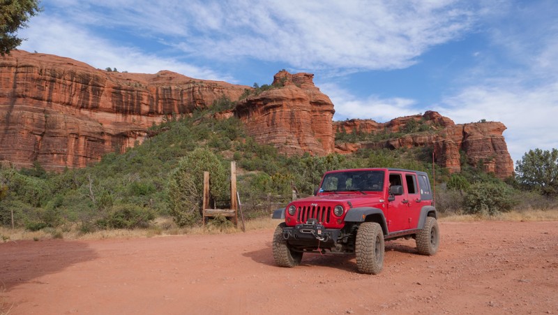
As you drive in, the impressive views of the Red Rock Secret Mountain Wilderness Area and the Sycamore Canyon Wilderness area abound throughout most of this easy dirt road, begging you to drive even deeper. Located near Sedona and named after Loy Butte, the more prominent rock formation nearest the Honanki Ruin, this road also connects to several of the most notable offroad routes near Sedona, including The Outlaw OHV Trail and Diamondback Gulch. You could easily spend a few days in this area, wheeling and hiking many foot trails that lead into the Wilderness Area.

Updated: 12/30/2023
Cottonwood Canyon Road
Florence, Arizona
Cottonwood Canyon Road serves as one of, if not the main entrance to, the famous Florence OHV area. This rugged region is littered with old mines, wagon stops, petroglyphs, and beautiful Sonoran Desert landscapes. During the busy winter months, the early portion of the route is considered the boondockers midway. Countless RVs and large family groups line the well-maintained gravel road. The fun begins once you pass all the traffic. The trail travels through a rocky wash before climbing into the southern foothills of the Superstition Mountains with spectacular panoramas of the surrounding Sonoran Desert. Cottonwood Canyon Road ends at 5 Points, the central hub of the region's trail network. You can choose from various routes, like rock crawling on the Ajax Mine trail for lunch at the ruins or continuing south through the beautiful narrow walls of Box Canyon.

Updated: 04/03/2025
Woody Mountain Road
Kachina Village, Arizona
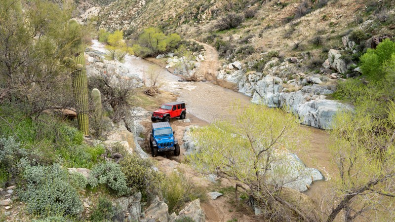
Situated near Flagstaff, Arizona, Woody Mountain Road is a favorite among campers and sightseers, especially near the end as they venture into the East Pocket area atop the Mogollon Rim and the famed Edge of the World camping area. The places it takes you to are scenic and full of potential. As you head south, you can see a radio tower atop Woody Mountain, then past The Arboretum at Flagstaff and Northern Arizona University Centennial Forest, Coconino County's Rogers Lake, through Mill Park with its scenic meadows, and further south to the top of the Mogollon Rim with incredible views and dispersed camping. There are also a lot of other connecting forest roads and trails that give you access to camping and many great places to enjoy the Coconino National Forest.
Updated: 05/26/2024
Turkey Creek Trail Cleator
Cleator, Arizona
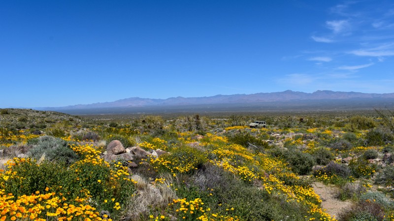
Located about 30 miles north of Phoenix, near Bumble Bee Ranch, scenic Turkey Creek Trail winds like a rollercoaster through and above several canyons, including Black Canyon, Dead Cow Gulch, and Turkey Creek Canyon. This trail along the base of the Bradshaw Mountains passes through many silver and gold mining areas established as far back as the early 1900s. Fantastic views, rocky terrain, and multiple water crossings await those adventurous enough to take the long way to the unique Cleator Bar and Yacht Club.

Updated: 10/15/2024
4356
Lake Havasu City, Arizona
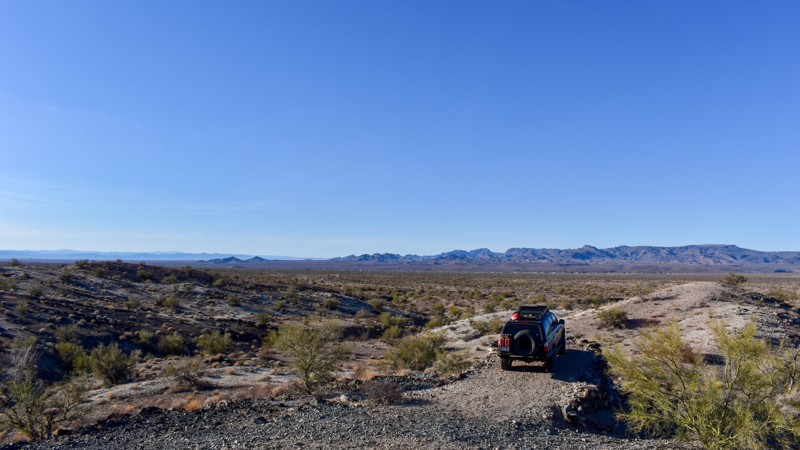
4356 traverses from the foothills of the Mohave Mountains, where flowering cacti and wildflowers bloom in the spring, to the unforgiving rock-embedded, rutted caliche trails and sandy washes in the valley floor. While not as exciting as other trails in the area, 4356 is an important connector trail, typically used with 4359 and 7394 for access to the Dutch Flat side of the valley or 4349 for access to AZ Yucca Mine.
While 4356 may not be a trail you would seek out on its own, it's a great option for those looking to connect to other areas and explore the beauty of the natural desert landscape.
Updated: 09/29/2025
4354
Haviland, Arizona
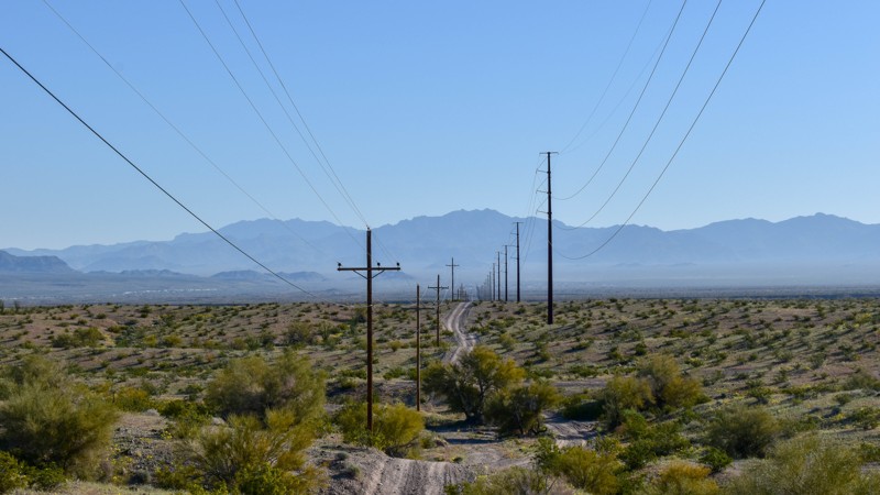
4354 offers wonderful scenery and history, passing through Palo Verde Mine and Ideal Mine. Running between 4352E and Sprirt Ridge Road 4353, this backcountry road originated in the early 1900s, around the same time the National Old Trails Road connected the east and west coasts, also known as the Ocean to Ocean Highway. This trail is about an hour north of Lake Havasu and runs within five Meteorite strewn fields; Buck Mountain, Franconia, Palo Verde, Buck Mountain Wash, and Dutch Flat. As the dirt road gently climbs to the Buck Mountains, the vegetation density increases along with the seasonally blooming Cactus, Ocotillos, and wildflowers. Once in the Buck Mountains, the remnants of Palo Verde and Ideal Mines can be explored along with many prospects. There are several great spots to park and take in the view over the valley toward the Colorado River. The Buck Mountains are a great area to escape the city lights and see the uninterrupted clear night sky. Bring a metal detector or just your eyes and a rare earth magnet to hunt for meteorites!
Updated: 10/15/2024
4342
Franconia, Arizona
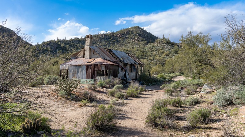
4342 is a utility connector, serving as a powerline road connecting Franconia Road and National Old Trails Road with Havasu Heights and Highway 95. The trail presents numerous ups and downs as it crosses every wash and hill carved between the points mentioned. Stay on the path most traveled with this trail. There are severe blind drop-offs over the hills.
Updated: 02/27/2024
Outlaw Trail
Sedona, Arizona
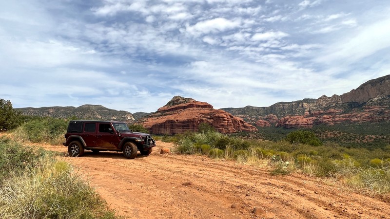
Sedona is a wonderful destination for offroad enthusiasts. It boasts a variety of trails with varying degrees of difficulty, all offering stunning views of the area's famous red rocks. Among the top 10 iconic 4x4 trails in Sedona is the Outlaw Trail.
In addition to the offroad trails in Sedona, the Coconino National Forest extends to Flagstaff, offering endless trails in the pine forests that reach up to 7,000 feet in elevation at the top of the Mogollon Rim. It's a great escape from the summer heat in the Verde Valley.
Sedona has over 200 hiking trails covering more than 400 miles, providing plenty of options for hikers. You can venture deep into the wilderness of Red Rock Secret Mountain or Sycamore Canyon or explore the urban trails just a stone's throw away from downtown Sedona.
If you're interested in history, Sedona is home to several ancient ruin sites, where you can glimpse life in cliff dwellings dating back to AD 1150 - 1350. Honanki, located at the end of the Outlaw Trail, and Palatki, just down Loy Butte Road, are two such sites.
Updated: 10/15/2024
4345
Franconia, Arizona
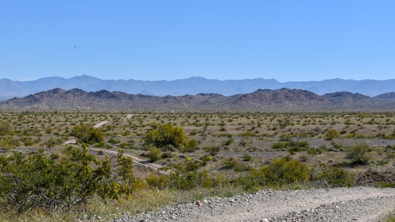
4345, also shown as Rice Road on some maps, traverses over the hills and through the washes like 4342 but with much better scenery. There is more plant life closer to the mountains. The hills are a little taller, and the washes are a bit deeper. The panoramic views of the valleys and surrounding mountains off in the distance with the clear blue sky backdrop make for a great day of exploring. Combine this trail with 4359 for a day trip through one of the prettiest areas on the northern foothills of the Mohave Mountains. This trail used to continue further south and into Havasu Heights, but access has long been blocked off by private property. There is no legal access into Havasu Heights through this trail or any connecting trails.
Updated: 10/27/2023
Diamondback Gulch aka Greasy Spoon
Sedona, Arizona
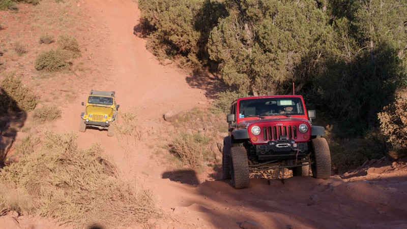
Diamondback Gulch off-road trail is just outside of Sedona and his hidden among the beautiful red rocks of the magical Red Rock Secret Mountain Wildnerness bordering on the north. It isn't just any old boring dirt road; this is an exciting, although slow speed rollercoaster ride of a four-wheel-drive off-road trail. Scenic gives way to fun when you dip into the gulch that the trail is aptly named after. You will experience challenges from small ledges to large rocks, and small washes to massively deep ones. While the rollercoaster type hills provide a bit of anticipation as you survey them with your eyes, it's driving them that will make you want to come back and do it again.
Updated: 12/30/2023
China Dam/Tule Creek Homestead
Anthem, Arizona
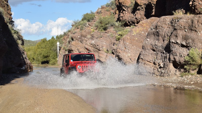
Close to Phoenix, the historical mining areas north of Lake Pleasant, China Dam, and the Tule Creek Homestead are a fascinating look back into the early settlement of the Bradshaw Mountain Foothills. Branching off the popular Backway to Crown King trail, this track leads to the China Dam, built in the late 1880s by immigrant Chinese laborers for hydraulic mining operations on Humbug Creek. The trail continues to an old mining homestead deep in the mountains on Tule Creek, slowly reclaimed by the desert landscape. Be sure to spend a day visiting these fantastic relics of the past before they are forever gone.
Updated: 06/09/2024
Box Canyon - Wickenburg
Wickenburg, Arizona
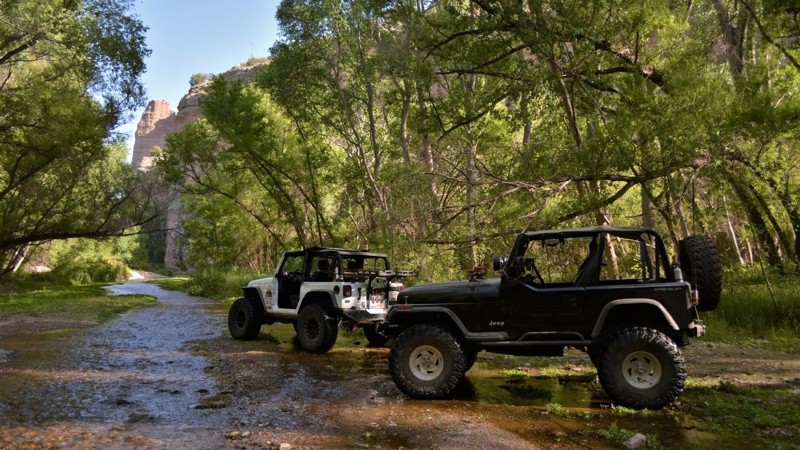
Box Canyon is an Arizona four-wheeler's hidden oasis. It offers a unique four-wheeling experience by allowing users to drive through a wet and sandy cliff-lined canyon. Most times of the year, there is just enough water to let you splash your way through the canyon. You can also explore side trails or hang out under one of the several giant shade trees. The Hassayampa River flows mostly underground. It starts at the Bradshaw Mountains and continues through Wickenburg, Arizona. Depending on the day and recent rainfall, the water depth typically ranges from non-existent to 15" deep (sometimes even deeper).
Updated: 04/27/2024
Rug Road
Mammoth, Arizona
Rug Road has long been known for offering an incredible 4x4 experience while presenting one of Arizona's most scenic and hidden views. This storied trail started as a mining access road for several gold and silver mines in the 1880s and early 1900s. When the mining stopped, local ranchers and visitors would travel along the road and use carpet to help with traction on the steep hills. One particular section, known as Carpet Hill, still has remnants of the rugs used to help with traction over 60 years later. This section and a couple of others are challenging and will push the limits of even the most experienced drivers in modified vehicles. The views from the saddle on Table Mountain are the first scenic reward along this route, offering an excellent spot for a break and stretch after the steep, bumpy climb. You can also visit Table Top Mine, where you can see the old house with a big safe and, within a short walk, the old large mining equipment left behind. Continuing ahead, you encounter the Parson's Grove area. It has an old cabin, corral, and a pond that used to be a popular recreation area for the locals.
The later section of the trail, high above Turkey Creek, has many features similar to Moab, Utah. Although the rocks aren't red, they still offer a rock crawling challenge and incredible panoramas. The descent down into Turkey Creek is a unique experience in Arizona. The trail changes dramatically once you are down into the tight walls of the canyon. The riparian forest immediately encloses you in the much-needed shade and cool air. The abundant wildlife is truly unique, even bears!

Upgrade your Membership
Unlock all of the details on every Trail Guide and Scout Route.
Start a 7-day Free TrialCommunity
Partners

