



By clicking "ACCEPT", you agree to be the terms and conditions of each policy linked to above. You also agree to the storing of cookies on your device to facilitate the operation and functionality of our site, enhance and customize your user experience, and to analyze how our site is used.
California Off-Road Trails
414
Total Trail Guides 391

4102
Detailed Waypoints 523
Try a Free 7-Day Trial and unlock it all
Start a Free Trial Most Recent Trail Reviews
Rated 5/5
Open
Visited: 09/19/2026
Great beginner trail here for those looking to try out some rockier sections. Starting to trend a little closer to a rating of 4, but still a 3 I’d say

R
Rob
Rated 5/5
Open
Visited: 09/19/2026
I entered this trail from Freeway Ridge 4WD trail (31E77) and ran Black Gulch Jeep Trail up to Rancheria Road, turned around, and ran Black Gulch Jeep Trail all the way down to Keyesville Road in Lake...



Daniel Macioce
Rated 4/5
Open
Visited: 09/19/2026
Took out the vstrom 800de today and this thing was tough for someone like me who is pretty new to offroading motorcycles. I ended up turning around about half way because I wasn't sure if I would be a...
SK
sean kotrola
No Rating
Open
Visited: 09/19/2026
The trial marked by the app here is very difficult with all the recent deep washouts. Proceed at your own risk if you are by yourself with unmodified rigs. However the bypass is maintained and should ...
TB
Timmy Boby
Rated 5/5
Open
Visited: 09/18/2026
Very friendly fire watch tower volunteers and fantastic 360 degree views up top
R
Rob
Rated 5/5
Open
Visited: 09/18/2026
Great views and an easy drive through. Be sure to take the road up to the fire watch tower
R
Rob
Rated 5/5
Open
Visited: 09/17/2026
ran the trail twice last weekend, this is such a better way to go than 3n16...


Josh Noesser
Official Crew
Rated 5/5
Open
Visited: 09/16/2026
It's been 6 years since I visited this trail. It has seen some wear, but the overall difficulty is about the same, probably a bit higher now, as Waypoint 11 has suffered from traffic. Waypoint 11 ha...

Robert
Official Crew
Rated 5/5
Open
Visited: 09/16/2026
Started off from polique canyon at way point 13 and headed east. Its a great trail for most of it with scenic views. A good amount mud puddles that were fun as hell to drive through. Some I decided to...


VM
Victor Manuel Garcia
Rated 5/5
Open
Visited: 09/16/2026
Used this trail to get to Holcomb valley. Super easy and a nice drive, I can see how in the winter it can be a bit more challenging with rain and snow.
VM
Victor Manuel Garcia
No Rating
Open
Visited: 09/16/2026
Mostly easy, but heading NE there's a rock step down just a few miles in that *requires* high clearance. Banged the rear end of my 4runner despite having a 3" lift and 33" tires. A stock SUV would alm...



Carlos H.
Rated 5/5
Open
Visited: 09/14/2026
A fun little detour off Burns Canyon. I ran this alone and stopped a few times to spot; I also used my grill camera in several places. I brushed my sliders a couple times, but no real issues. Definite...
EB
Ed Boyd
Rated 5/5
Open
Visited: 09/13/2026
easy perfect beginner off roader trail with great views and water crossing during the winter.



Dex Offroad
Rated 5/5
Open
Visited: 09/11/2026
super easy trail over looking the valley and 15fwy. only bad thing is that its super windy.

Dex Offroad
No Rating
Partially Open
Visited: 09/09/2026
Although you can cross the creek from Fordyce if you want, Committee Road is still closed back to the I80, so this has no exit, and you'll be forced back onto Fordyce.

Ryan Boudreau
Official Crew
No Rating
Temporary Closure
Visited: 09/09/2026
Road is still closed. I thought i read somewhere an expected 2030 opening, but can't confirm that info.
Ryan Boudreau
Official Crew
Rated 5/5
Open
Visited: 09/09/2026
This is an awesome trail . This trail is moderate with a few obstacles to make it fun. It also has incredible scenic views with a little bit of shelf roads. You can watch the full video on my YouTube ...


Dex Offroad
Rated 5/5
Open
Visited: 09/07/2026
Pretty spot on with the rating, was a little tough today with the rain but made it through in my 2023 Gladiator Overland with 2.5” lift and 35s with autolynx sway disconnects.


CT
Christopher Tanton

Shaan Heugly
Rated 5/5
Open
Visited: 09/06/2026
Drove reverse from what’s listed to the jasper trail. This is a easy but enjoyable trail with plenty of places to camp at the end of the
Shaan Heugly
Rated 5/5
Open
Visited: 09/06/2026
Bit washed near the top but nothing difficult to navigate. I headed from jasper to the highway and near the highway it did narrow. I got through with my Tacoma but there are a few pinch points I could...
Shaan Heugly
Rated 5/5
Open
Visited: 09/06/2026
Mostly easy trail but when going south to north, I did need to use 4Lo on some of the inclines with a loaded Tacoma
Shaan Heugly
Rated 4/5
Open
Visited: 09/05/2026
It had been five years since I last drove this trail. The long, annoying stretches of moguls are still there, and water erosion has added a touch more difficulty in places. It was nice to see the old ...


Robert
Official Crew
Rated 4/5
Open
Visited: 09/05/2026
This is a nice trail with great views for any 4WD with ground clearance as some sections have ruts that are 12+ inches deep. Things were very dry on my visit, so airing down the tires helped to smooth...


SG
Steve Graham
Rated 3/5
Open
Visited: 09/05/2026
From waypoint 7 to 10 the water damage is pretty bad. Waypoint 13-16 it is rocky. Nothing crazy but a few spots where patience and the right line will go a long way. Good clearance and 4x4 recommended
N
Noah
Rated 5/5
Open
Visited: 09/05/2026
Easy trail with an awesome view at the end. There were three lookouts in the fire tower and each one was super friendly and informative. Must see trail!


N
Noah
Rated 5/5
Open
Visited: 09/05/2026
fun easy trail, Butler Peak lookout is the highlight imo
N
Noah
Rated 5/5
Open
Visited: 09/04/2026
Trail was very well maintained. Thanks for the Fresno 4x4 club. It was very cold at night, into the 30s. We were on the trail two nights, 3 days and two nights at voyager rock due to a breakdown fr...
JD
John Drago
No Rating
Open
Visited: 09/04/2026
Beautiful area, but the trail itself wasn’t very interesting. I’d rate it around a 3/10, with a couple of optional sections that might push a 4.
There’s tons of dispersed camping throughout the area,...


Ryan Smith
Rated 5/5
Open
Visited: 09/01/2026
awesome trail with a lot of water crossings. just be careful of sxs and bikes since its a OHV area.

Dex Offroad
Rated 5/5
Open
Visited: 09/01/2026
Super easy trail and you can over look the high desert. Trail ends at an awesome view point.

Dex Offroad
Dex Offroad
Rated 5/5
Open
Visited: 08/31/2026
This trail is much harder than it used to be. It’s just as breathtakingly beautiful as ever. You are on your own out there. Fuel, parts, spare tire. It’s days from help if you need it so go prepared. ...

CP
Christopher Pepin
No Rating
Open
Visited: 08/30/2026
Ran this trail today and had fun. Easy trail with great views. I wouldn’t hesitate to take an experienced driver in a stock jeep up this. There are lots of trails in this area and way to get off the m...

CP
Christopher Pepin
No Rating
Open
Visited: 08/29/2026
Trail was in good shape, a little less sand makes the boulders a little bigger. People have made the bypass around the sluice a little bit longer than it used to be you miss a lot of the good rocks. O...
C
Campbell
Rated 5/5
Open
Visited: 08/29/2026
An often overlooked and amazing trail. It’s about the length and difficulty of the rubicon if you don’t hit any of the bypasses on the rubicon. We had a group of 3 lj on 40s, a jku on 42s, and an Xj o...
CP
Christopher Pepin
Rated 4/5
Open
Visited: 08/27/2026
This is most definitely a hard trail. Is the entire thing hard? Not at all. The western 7 miles are a hard packed dirt road. Then you run into 3 straight, large boulder obstacles where its clear many ...


Ryan Boudreau
Official Crew
Rated 4/5
Open
Visited: 08/27/2026
Easy drive with beautiful views and . . . Buck Rock! Lots of camping south of Buck Rock, but camping north of the Rock isn't as plentiful. There are a few others on the north, but there's one here: 36...


Carlos H.
Rated 5/5
Open
Visited: 08/26/2026
I really enjoyed this road. It's super scenic with the sierra's in the background, the white beaches, and the columns are really cool. The road is not anything challenging with a high clearance vehicl...


Ryan Boudreau
Official Crew
Rated 4/5
Open
Visited: 08/25/2026
Fun area. The hot springs are pretty popular and well-known, and because they are small, you'd better hope you are one of the first people there that day if you want to get in. The route is easy, exce...


Ryan Boudreau
Official Crew
Rated 4/5
Open
Visited: 08/25/2026
I liked this trail a lot, but it's not quite a 5-star trail for me. I feel like it's a little overhyped. Is it scenic? Absolutely! Is there tons of great camping? Totally! Is it a crazy busy? You Bet!...


Ryan Boudreau
Official Crew
Rated 4/5
Open
Visited: 08/25/2026
Road to the hot springs parking area is easy. There are regular passenger cars there. The hike is easy too. The tub itself is super scenic, but know that they are not hidden gems by any means and we'l...

Ryan Boudreau
Official Crew
Rated 3/5
Open
Visited: 08/25/2026
It's a simple road, but definitely very scenic and really only used to get from Convict to Laurel Lakes or Mammoth. Road is suitable for anything with decent ground clearance.


Ryan Boudreau
Official Crew
Rated 2/5
Open
Visited: 08/25/2026
Simple dirt road used to access other types of recreation. Many signs remind you that you aren't allowed to camp along it except at the campground.


Ryan Boudreau
Official Crew
Rated 3/5
Open
Visited: 08/23/2026
Simple, straightforward dirt road used for fishing access.


Ryan Boudreau
Official Crew
Rated 5/5
Open
Visited: 08/23/2026
Amazing views at the top of this trail. Erosion looks to be making this trail harder than it probably originally was. Most of the hardest spots are getting bypasses created around them. A short, st...



Dan Jurgella
Rated 5/5
Open
Visited: 08/23/2026
Toad Lake Road 40N64 was a long, slow, and wonderfully remote drive into the Trinity Divide. The changing mix of old pavement, dirt, loose rock and deep ruts kept the journey interesting, while forest...



Rose Meirs
Official Crew
Rated 5/5
Open
Visited: 08/23/2026
North Fork 41N53 was a fun backcountry drive through the forest west of Mount Shasta. Early in the trip, a wrecked motorhome beside the road provides unforgettable confirmation that you are on the rig...


Rose Meirs
Official Crew
No Rating
Partially Open
Visited: 08/23/2026
The trail is still only partially open. I drove it from Old Mill Road to the closed gate. Once I was at the gate, I took the connecting trail back into Big Bear Village.
For exact trail names and n...

John Mantey
Rated 3/5
Open
Visited: 08/22/2026
Nothing really special about the road. It's easy and gets progressively rockier the closer to the lake you get, but it's not challenging, and you will see plenty of small SUVs and crossovers along the...
Ryan Boudreau
Official Crew
Most Popular
Updated: 03/18/2023
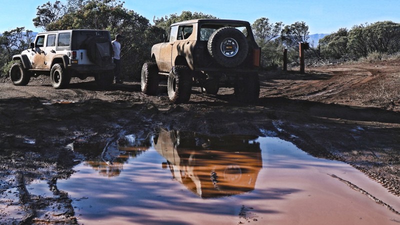
Knoxville - Cement Creek Road
Lower Lake, California
Cement Creek Road is one of many 4x4 trails in the Knoxville Recreation Area just outside of Napa, CA. Mountains, valleys, creeks and mud are a few things you might enjoy in this area. You will find some incredible views of the rolling hills and green farmland in the Pope Valley and surrounding mountain ranges. From the right spot (waypoint 4), you will even see Mount Saint Helena in the distant north end of the Napa Valley.
Updated: 05/26/2024
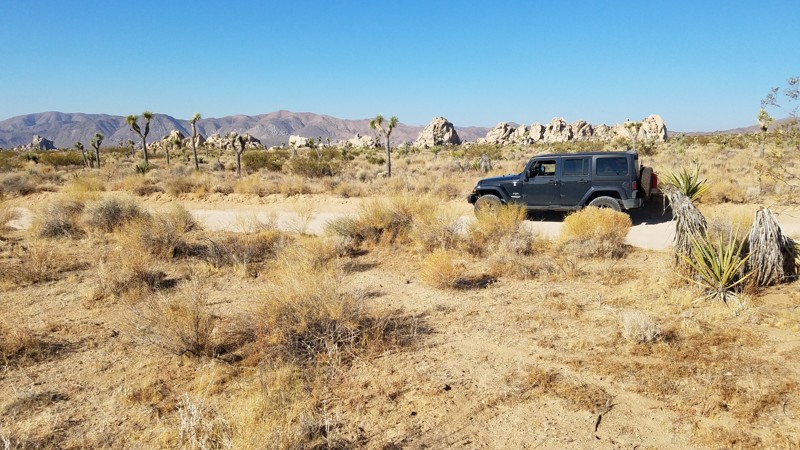
Geology Tour Road
Twentynine Palms, California
Geology Tour Road is located entirely within the Joshua Tree National Park and passes some of the most fascinating scenery that the Park has to offer. The Park Service created a genuinely unique self-driving tour by identifying 16 geologic and manmade features for educational purposes, all of which are pointed out along this backcountry route. These features truly are educating and interesting that include fascinating rock formations, volcanic cinder cones to, abandoned gold mines, and other natural points of interest with unique names such as "Nature's Gutter." This is an excellent trail for a family adventure.
Updated: 09/21/2023
8S05 - Highpoint
Temecula, California
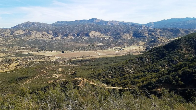
8S05 - Highpoint is in the Cleveland National Forest. It is an ideal 4x4 off-road trail for the newbie wheeler to gain access to the west end of Palomar Divide Trail up at the top of the ridge. The views to the south, of the Aguanga Valley and beyond are spectacular. The Cutca Hiking Trailhead goes off to the west from this trail into the Agua Tibia Wilderness for some fantastic scenery and dispersed camping. You can encounter every forest animal except bear so be watchful and respectful.
Updated: 01/26/2024
Slate Mountain Lookout
Placerville, California
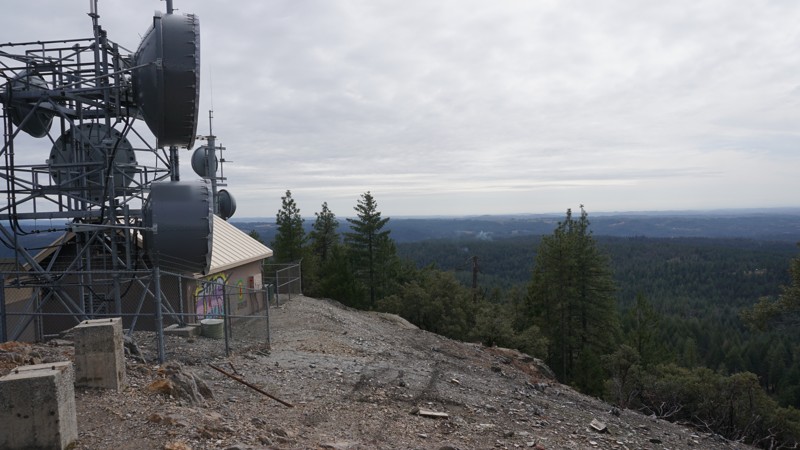
Situated just inside of the western edge of the Eldorado National Forest, about an hour from the greater Sacramento, CA metropolitan area, lies this great little road with scenic views of Slate Canyon and the Sacramento Valley. Although a fire lookout tower once stood on the peak of Slate Mountain, only its concrete footings and a communications building and tower remain. Notwithstanding, the vista offers 180+ degree views of the Sierra Nevada foothills lining the eastern edge of the Sacramento Valley. This is a great beginner road, suitable for stock 4WD vehicles.

Updated: 03/09/2026
Death Valley Road
Old Camp, California
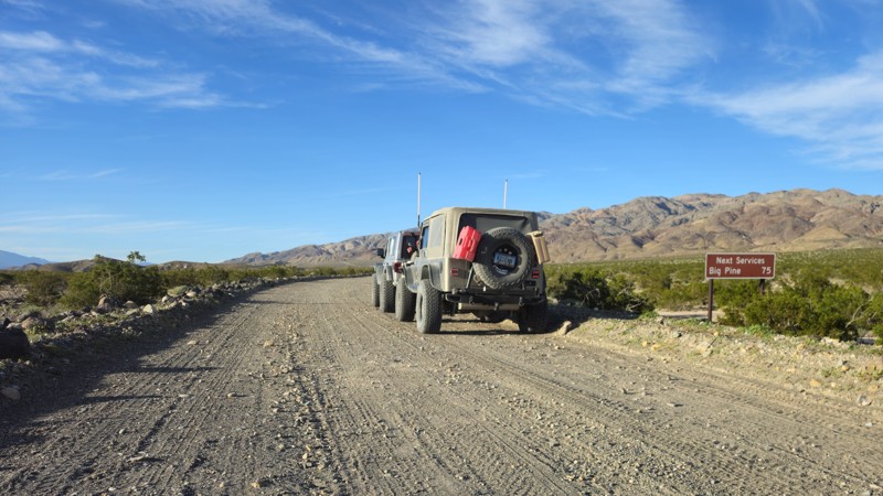
Death Valley Road takes you from Big Pine to close to Furrance Creek Death Valley. This is a common path for people to travel while exploring Death Valley, as this takes you out of the park's exit from the northwest side. People often use this road to access Saline Valley, Steel Pass, and other popular areas on the park's north side. While few people choose to camp along this road, there are several areas big enough for a small group. Check out the mine near the northern turn on the east side for larger groups. It's important to note that camping is not allowed for the first 22 miles along the eastern end.

Updated: 09/24/2024
West Side Road - Death Valley National Park
Furnace Creek, California
Don't be fooled by the easy 4x4 trail rating, this Death Valley National Park backcountry route has a history of being deadly for the unprepared. Almost every year some unfortunate gets stuck, breaks down, and in some cases just wander off and perish along this road. This 37-mile backcountry route runs below sea level for its entire length. It was the original route of the 20 Mule Team Borax wagons out of Death Valley and offers the only access to the east side of the Panamint Mountains south of Furnace Creek. Along the route, mining was active at the Queen of Sheba mine as recently as 1970, Hungry Bill had a small farm and mining operation in Johnson Canyon that he supplied miners with fresh vegetables. The infamous Charles Manson and his followers were captured at Barker Ranch which is on the west side of the Panamint Mountains and accessible from the Butte Valley Road that intersects West Side Road. Death Valley Shorty, a former Buffalo Bill Wild West Show performer and famous flim-flam man for which Scotty's Castle is named, is buried along the road. There are the remains of old borax works and the nearly impassable Devil's Golf Course geologic formation is comprised of evaporated salt.
Updated: 05/13/2025
Mottino Wash
Yucca Valley, California
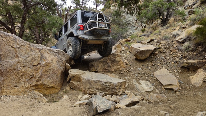
If body damage, brutal lines, and full-send moments are your idea of a good time, then Mottino Wash is the hidden battleground you’ve been looking for. Tucked between Big Bear’s legendary Holcomb Valley and the hardcore madness of Johnson Valley's Hammers, this under-the-radar gem serves up a wild fusion of both worlds—gnarly must-do obstacles, savage optional lines, and relentless rock crawling that will push even the most capable rigs to their limits. With low traffic, remote terrain, and no shortage of bragging rights, Mottino Wash isn’t just another trail, it’s a rite of passage for those bold enough to take it on.
Updated: 06/05/2022
4N56 Pinyon Ridge
Wrightwood, California
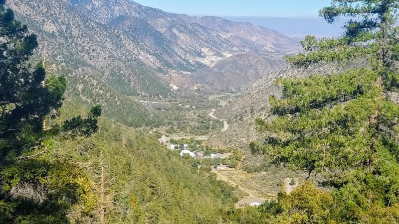
4N56 Pinyon Ridge is in the Angeles National Forest. This trail is literally within two hours of all most anywhere in Southern California. The trail runs east to west offering fantastic views of the San Gabriels to the south with Mount Baden-Powell, at an elevation of 9,400 feet a prominent feature of the skyline. To the north is the High Desert 2000 feet below you with views to Pearblossom, Adelanto, Palmdale, and Lancaster.
Close enough for a morning run and be home for lunch or pack your gear for a two-week campout at the Yellow Post Site. With five Animal Guzzlers (man-made water points) on this ridge, there are many prime locations to watch for bear, mountain lion, bobcat, deer, and other animals which come in for water.
Updated: 12/23/2025
Warm Spring Canyon
Furnace Creek, California
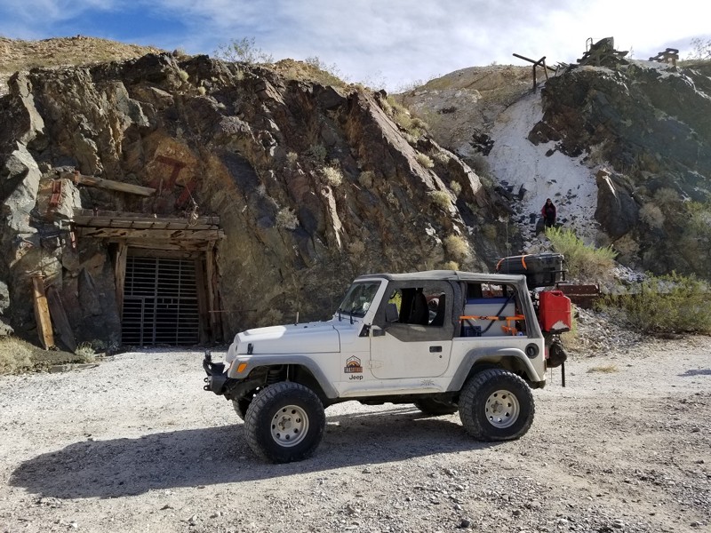
Warm Springs Canyon is a classic Death Valley backcountry road that leaves the wide-open valley floor and climbs into rugged desert terrain shaped by old mining history. It’s a perfect 4x4 adventure for novice off-roaders. Drivers should expect rocky sections, washouts, and the kind of slow, careful driving that teaches good line choice and tire placement without needing to be extreme. Along the way, you’ll pass historic sites and big Mojave panoramas, and when paired with nearby backcountry roads, you can build a full day of exploring. This trail rewards you with a quiet, remote slice of Death Valley that feels worlds away from the pavement.
Updated: 06/29/2024
Strawberry Lake Trail
Shaver Lake, California
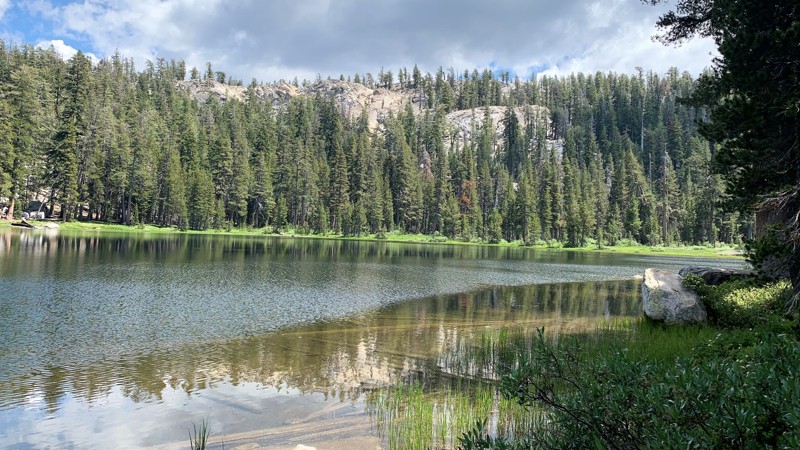
Located in the Sierra National Forest just outside of Shaver Lake, Strawberry Lake is one of the prettiest little lakes you will find. The Sierra National Forest is a popular destination to escape and reconnect with nature, family, and friends. Towering conifers line the trail to the lake where you will pass several small lakes and ponds in the area. The forest is dense, but you catch glimpses of the granite capped mountains in the distance. Once you reach the lake, you will find it surrounded by towering granite mountains. You will immediately feel the charm of its peaceful seclusion. By foot, you can explore many hiking trails around the lake or launch your kayak and even do some fishing. The scenery is breathtaking. Whether you like off-roading, camping, fishing, or playing in the water, Strawberry lake has something for everyone.
Updated: 11/24/2022
Sierra Buttes Lookout
Sierra City, California
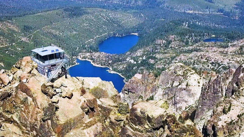
In the Tahoe National Forest, the volcanic Sierra Buttes rise sharply above the North Yuba River Canyon, and at 8,587 feet in elevation watch over the many blue lakes that dot the Lakes Basin landscape. There is a decommissioned fire lookout tower perched on the summit, providing incredible 360 degree views reaching into more than seven different counties. The Buttes are without doubt one of the most distinctive geological features of the northern Sierra Nevada, and the lookout is one of the most popular hiking destinations in the region. Although most hikers reach the lookout from the lower trailhead, 2.5 miles and 1,600 feet of elevation below, those with high-clearance four wheel drive can access the upper trailhead, a mere 3/4 mile from the lookout tower.
Updated: 08/11/2026
Rancheria Road
Tarina, California
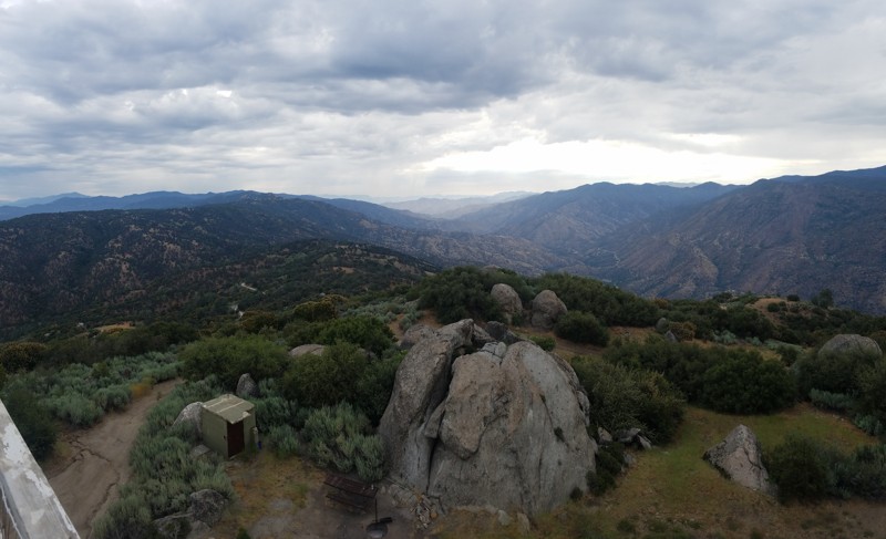
Rancherio Road starts in the lowland oak-covered hills and rises into the majestic Sequoia National Forest. Breathtaking views are abundant along the way. Evans Flats Campground is located about 20 miles along the road and is popular to escape the valley's summer heat and for horseback riders. The road is wide and flat and maintained along its entire route, with the only obstacles being range cattle that crowd the road. For offroaders looking for driving challenges, several forest roads connect to Rancherio.
Updated: 04/06/2024
Arroyo Tapiado
Julian, California
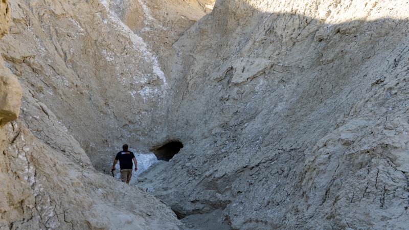
Arroyo Tapiado is a nice drive up a beautiful mudstone canyon within the Anza-Borrego Desert State Park. Outside of the fantastic views, Arroyo Tapiado has the highest density and the longest mud caves in the world, making it a unique place on Earth. It is no wonder why many people flock to see this natural wonder year around. One of the mud caves is over 1,000 feet long, which makes these mud caves seem to last forever once inside. With over 22 known mud caves, this area could provide a weekend of exploring. Just be warned, the mud caves are unstable and susceptible to collapse at any time. The dirt is very soft and will quickly collapse if touched. The park recommends not entering the mud caves.


Updated: 01/20/2024
Oceano Dunes SRVA aka Pismo Beach
Partially Open
/
Pismo Beach, California/
13.41 miles/
About an hour
Oceano Dunes SRVA is a one-of-a-kind destination in southern California. Oceano Dunes SRVA, also called Pismo Beach, is a place for making lasting memories. This is the only area in southern California where you can drive on the beach. If you want to step up the excitement level, head into the dunes for some adrenaline-pumping fun. Bring the toys to go kite surfing, sandcastle building, or having a picnic on the beach. Oceano Dunes SRVA is a must-visit offroad destination.
Help keep this unique and exciting 4x4 adventure destination open. There is increasing pressure to close Pismo Beach to vehicle traffic. It's up to us to fight back. Please do what you can to help the Friends of Oceano Dunes preserve public off-roading open before it is too late.
Updated: 07/08/2024
2N71
Big Bear Lake, California
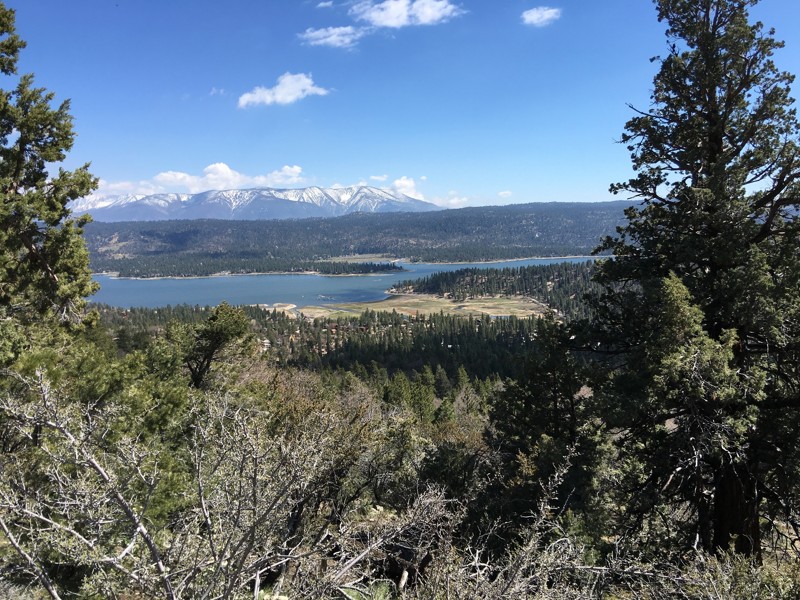
An easy drive in the Big Bear Lake area, 2N71 offers you one of the best off-pavement tours of the lake without having to hike. In addition, you get a perfect view of the city on the south shore of the Lake. Head up this trail for one of the best 4th of July firework displays in the area. The area was once populated by only Native Americans and the grizzly bears, from which the area received its name. Not to worry, grizzly bears have not been found in the region since 1908. Black bears were introduced in the region in 1933. Big Bear Valley grew rapidly during the Southern California Gold Rush from 1861 to 1912. This trail is perfect for an introduction into this beautiful area of Holcomb Valley and Big Bear Lake.

Updated: 03/19/2025
Alabama Hills - Movie Road
Open
/
Lone Pine, California/
6.68 miles/
About 30 minutes
Winding through the rugged and picturesque Alabama Hills, Movie Road is an iconic route that takes travelers through a cinematic landscape of weathered rock formations and stunning Sierra Nevada backdrops. Known for its role in classic Westerns and Hollywood blockbusters, this scenic backcountry drive offers breathtaking views, endless photo opportunities, and access to recognizable filming locations in movie history. Whether you're an overlander, a film buff, or a road trip adventurer, Movie Road is a must-visit destination for its blend of natural beauty and Hollywood magic.

Updated: 07/25/2024
26E213 - Coyote Lake Trail
Shaver Lake, California
A high mountain lake hidden at the end of the Red Lake 4x4 Trail is, literally, only the beginning.
Coyote Lake Trail is a challenging, rock crawling 4x4 trail that runs from Red Lake to Coyote Lake. Rock crawling, swimming, fishing, camping and lake side relaxation in the high mountains of the Sierra National Forest make for one of the most rewarding 1.7 miles you can run.
This is one of many 4x4 trails in the Red Mountain off-road trail network in the Sierra National Forest, northeast of Shaver Lake and Southeast of Huntington Lake.
Rock obstacles, dense forest, and two lakes make Coyote Lake Trail a prime destination for the seasoned wheeler looking to get off the grid.
Updated: 03/05/2025
McIver's Jeep Road
Inyokern, California
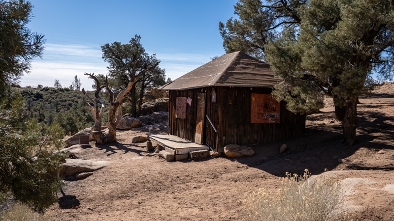
Nestled within the far reaches of California's Sequoia National Forest, McIver's Jeep Road leads to a namesake cabin, a historic site popular among offroad enthusiasts and hikers alike. Constructed in 1938 by miner Murdo George McIver, the cabin was relocated from Sand Canyon to its current location near McIver's Spring, close to his mining claim. Today, it serves as a shelter for Pacific Crest Trail (PCT) hikers and a destination for offroad adventurers. Tackling this trail requires traveling through diverse terrains, including rolling hills with scrub brush and sandy washes, and features narrow sections that require careful navigation.
Updated: 05/12/2024
2N13B - Butler Peak
Fawnskin, California
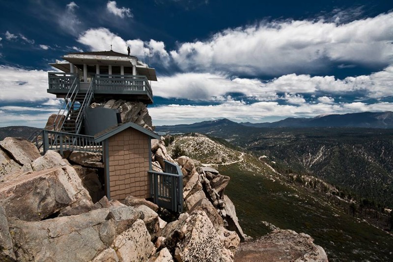
Not just another off-road trail, Butler Peak - 2N13B recently reopened after a forest fire ravaged the area. The trail has been closed for roughly 9 years and has been hiding one of the best views in all of the San Bernardino National Forest. This easy offroad trail takes you up to the fire lookout tower of Butler Peak which upon arriving at the top you have the opportunity to see as far as the eye can see in every direction. You can easily see Calico Mountains to the north, Big Bear Lake to the east, Riverside and Orange County to the south, and Lake Arrowhead and Mountain High to the west. To try and describe the beauty of the view is impossible, thus make plans and enjoy the stunning scenic views of Butler Peak Fire Tower.
Updated: 03/16/2024
Canyon Sin Nombre
Ocotillo, California
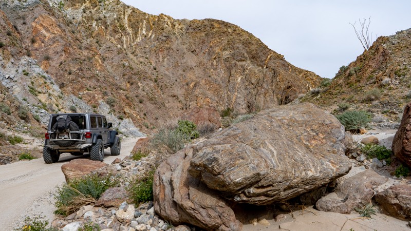
Canyon Sin Nombre is a stunning offroad trail in Anza-Borrego Desert State Park through the San Felipe Fault Network smashed between the Elsinore Fault and San Andres Fault. The upheaval of these faults is evident along the trail. Many call this trail "The Geologist Tour" or "The Journey Through Time" due to the numerous geological formations from the southwestward tilt of the desert sediments. These formations date back hundreds of millions of years and provide a visually impressive drive through this tectonic wonderland.
Updated: 02/25/2024
7S03 - Los Alamos/Wildomar OHV
Murrieta, California
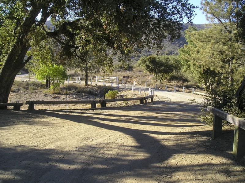
The Wildomar OHV Area is 1 square mile with 8 miles of trails. Los Alamos Trail 7S03 is a shortcut to this area. 7S03 ends at South Main Divide 7S04 and the OHV area is just a short distance to the south. The South Main Divide Road is the route of choice for a low clearance 2wd vehicle, coming south off the Ortega Highway, Hwy74, 9 miles away. Even though I rated Los Alamos at 1-2, I was amazed to see 2wd pickups pulling large trailers filled with quads and bikes. Here is a link for more information. Wildomar OHV
Updated: 04/14/2025
Indian Flats
Holcomb Village, California
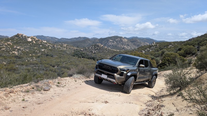
Nestled amongst mountains of untouched wilderness, Indian Flats feels isolated from the developed world. The lower elevations of the trail offer rolling hills and turns that tuck into the landscape, while the upper elevations brandish panoramic views of San Diego County's backcountry. This mild offroad drive is enough to give a novice driver a sense of accomplishment yet is not technical or rough enough for consternation. The one-lane trail connects Warner Springs to Chihuahua Valley, where the Cooper Cienega Truck Trail can be taken as far north as Anza.
Updated: 07/12/2024
1N33 - Meyers Canyon
Fontana, California
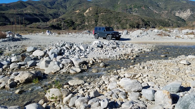
Meyers Canyon offers one of the few places to drive across the entire width of Lytle Creek. While the canyon and the trail are entirely within the San Bernardino National Park, a section of the canyon has been privatized and made into a shooting range. Meyers Canyon Road provides the only access to the shooting range, and a split in the road continues deeper into the park. Once ascending the canyon, great views of the canyon and the shooting range are below. As with most San Bernardino National Forest areas, pets are allowed when kept on a leash.
Updated: 06/08/2024
2N01 - Broom Flat
Big Bear Lake, California
2N01 - Broom Flat is a scenic, winding, forest road leading from CA-38 in Big Bear, CA, to the area at the base of Tip Top Mountain.
2N01 serves as a great access road to this south eastern section of the Big Bear Mountains.
This is a great trail for a beginner looking to explore this open area, or a great connector for more advanced wheelers looking for a quick route to Heartbreak Ridge or Tip Top Mountain. 2N01 - Broom Flats can be run as an out & back, or a connector to the many other off-road trails in this area.

Upgrade your Membership
Unlock all of the details on every Trail Guide and Scout Route.
Start a 7-day Free TrialCommunity
Partners

