




By clicking "ACCEPT", you agree to be the terms and conditions of each policy linked to above. You also agree to the storing of cookies on your device to facilitate the operation and functionality of our site, enhance and customize your user experience, and to analyze how our site is used.
California Off-Road Trails
415
Total Trail Guides 392

4106
Detailed Waypoints 524
Try a Free 7-Day Trial and unlock it all
Start a Free Trial Most Recent Trail Reviews
Rated 5/5
Open
Visited: 09/19/2026
Great beginner trail here for those looking to try out some rockier sections. Starting to trend a little closer to a rating of 4, but still a 3 I’d say

R
Rob
Rated 5/5
Open
Visited: 09/19/2026
I entered this trail from Freeway Ridge 4WD trail (31E77) and ran Black Gulch Jeep Trail up to Rancheria Road, turned around, and ran Black Gulch Jeep Trail all the way down to Keyesville Road in Lake...



Daniel Macioce
Rated 4/5
Open
Visited: 09/19/2026
Took out the vstrom 800de today and this thing was tough for someone like me who is pretty new to offroading motorcycles. I ended up turning around about half way because I wasn't sure if I would be a...
SK
sean kotrola
No Rating
Open
Visited: 09/19/2026
The trial marked by the app here is very difficult with all the recent deep washouts. Proceed at your own risk if you are by yourself with unmodified rigs. However the bypass is maintained and should ...
TB
Timmy Boby
Rated 5/5
Open
Visited: 09/18/2026
Very friendly fire watch tower volunteers and fantastic 360 degree views up top
R
Rob
Rated 5/5
Open
Visited: 09/18/2026
Great views and an easy drive through. Be sure to take the road up to the fire watch tower
R
Rob
Rated 5/5
Open
Visited: 09/17/2026
ran the trail twice last weekend, this is such a better way to go than 3n16...


Josh Noesser
Official Crew
Rated 5/5
Open
Visited: 09/16/2026
It's been 6 years since I visited this trail. It has seen some wear, but the overall difficulty is about the same, probably a bit higher now, as Waypoint 11 has suffered from traffic. Waypoint 11 ha...

Robert
Official Crew
Rated 5/5
Open
Visited: 09/16/2026
Started off from polique canyon at way point 13 and headed east. Its a great trail for most of it with scenic views. A good amount mud puddles that were fun as hell to drive through. Some I decided to...


VM
Victor Manuel Garcia
Rated 5/5
Open
Visited: 09/16/2026
Used this trail to get to Holcomb valley. Super easy and a nice drive, I can see how in the winter it can be a bit more challenging with rain and snow.
VM
Victor Manuel Garcia
No Rating
Open
Visited: 09/16/2026
Mostly easy, but heading NE there's a rock step down just a few miles in that *requires* high clearance. Banged the rear end of my 4runner despite having a 3" lift and 33" tires. A stock SUV would alm...



Carlos H.
Rated 5/5
Open
Visited: 09/15/2026
It's been over 4 years since I was last on this trail, and I was very happy to see that the old car was still there. Some research suggests that it is a 1939 Plymouth Road King 5-window coupe.


Robert
Official Crew
Rated 5/5
Open
Visited: 09/14/2026
A fun little detour off Burns Canyon. I ran this alone and stopped a few times to spot; I also used my grill camera in several places. I brushed my sliders a couple times, but no real issues. Definite...
EB
Ed Boyd
Rated 5/5
Open
Visited: 09/13/2026
easy perfect beginner off roader trail with great views and water crossing during the winter.



Dex Offroad
Rated 5/5
Open
Visited: 09/12/2026
Fenders Ferry kept giving me reasons to slow down and enjoy the ride. I loved winding along mountain ridges, following creeks, and catching glimpses of Shasta Lake's fingers tucked between the hills. ...



Rose Meirs
Official Crew
Rated 5/5
Open
Visited: 09/11/2026
super easy trail over looking the valley and 15fwy. only bad thing is that its super windy.

Dex Offroad
No Rating
Partially Open
Visited: 09/09/2026
Although you can cross the creek from Fordyce if you want, Committee Road is still closed back to the I80, so this has no exit, and you'll be forced back onto Fordyce.

Ryan Boudreau
Official Crew
No Rating
Temporary Closure
Visited: 09/09/2026
Road is still closed. I thought i read somewhere an expected 2030 opening, but can't confirm that info.
Ryan Boudreau
Official Crew
Rated 5/5
Open
Visited: 09/09/2026
This is an awesome trail . This trail is moderate with a few obstacles to make it fun. It also has incredible scenic views with a little bit of shelf roads. You can watch the full video on my YouTube ...


Dex Offroad
Rated 5/5
Open
Visited: 09/07/2026
Pretty spot on with the rating, was a little tough today with the rain but made it through in my 2023 Gladiator Overland with 2.5” lift and 35s with autolynx sway disconnects.


CT
Christopher Tanton

Shaan Heugly
Rated 5/5
Open
Visited: 09/06/2026
Drove reverse from what’s listed to the jasper trail. This is a easy but enjoyable trail with plenty of places to camp at the end of the
Shaan Heugly
Rated 5/5
Open
Visited: 09/06/2026
Bit washed near the top but nothing difficult to navigate. I headed from jasper to the highway and near the highway it did narrow. I got through with my Tacoma but there are a few pinch points I could...
Shaan Heugly
Rated 5/5
Open
Visited: 09/06/2026
Mostly easy trail but when going south to north, I did need to use 4Lo on some of the inclines with a loaded Tacoma
Shaan Heugly
Rated 4/5
Open
Visited: 09/05/2026
It had been five years since I last drove this trail. The long, annoying stretches of moguls are still there, and water erosion has added a touch more difficulty in places. It was nice to see the old ...


Robert
Official Crew
Rated 4/5
Open
Visited: 09/05/2026
This is a nice trail with great views for any 4WD with ground clearance as some sections have ruts that are 12+ inches deep. Things were very dry on my visit, so airing down the tires helped to smooth...


SG
Steve Graham
Rated 3/5
Open
Visited: 09/05/2026
From waypoint 7 to 10 the water damage is pretty bad. Waypoint 13-16 it is rocky. Nothing crazy but a few spots where patience and the right line will go a long way. Good clearance and 4x4 recommended
N
Noah
Rated 5/5
Open
Visited: 09/05/2026
Easy trail with an awesome view at the end. There were three lookouts in the fire tower and each one was super friendly and informative. Must see trail!


N
Noah
Rated 5/5
Open
Visited: 09/05/2026
fun easy trail, Butler Peak lookout is the highlight imo
N
Noah
Rated 5/5
Open
Visited: 09/04/2026
Trail was very well maintained. Thanks for the Fresno 4x4 club. It was very cold at night, into the 30s. We were on the trail two nights, 3 days and two nights at voyager rock due to a breakdown fr...
JD
John Drago
No Rating
Open
Visited: 09/04/2026
Beautiful area, but the trail itself wasn’t very interesting. I’d rate it around a 3/10, with a couple of optional sections that might push a 4.
There’s tons of dispersed camping throughout the area,...


Ryan Smith
Rated 5/5
Open
Visited: 09/01/2026
awesome trail with a lot of water crossings. just be careful of sxs and bikes since its a OHV area.

Dex Offroad
Rated 5/5
Open
Visited: 09/01/2026
Super easy trail and you can over look the high desert. Trail ends at an awesome view point.

Dex Offroad
Dex Offroad
Rated 5/5
Open
Visited: 08/31/2026
This trail is much harder than it used to be. It’s just as breathtakingly beautiful as ever. You are on your own out there. Fuel, parts, spare tire. It’s days from help if you need it so go prepared. ...

CP
Christopher Pepin
No Rating
Open
Visited: 08/30/2026
Ran this trail today and had fun. Easy trail with great views. I wouldn’t hesitate to take an experienced driver in a stock jeep up this. There are lots of trails in this area and way to get off the m...

CP
Christopher Pepin
No Rating
Open
Visited: 08/29/2026
Trail was in good shape, a little less sand makes the boulders a little bigger. People have made the bypass around the sluice a little bit longer than it used to be you miss a lot of the good rocks. O...
C
Campbell
Rated 5/5
Open
Visited: 08/29/2026
An often overlooked and amazing trail. It’s about the length and difficulty of the rubicon if you don’t hit any of the bypasses on the rubicon. We had a group of 3 lj on 40s, a jku on 42s, and an Xj o...
CP
Christopher Pepin
Rated 4/5
Open
Visited: 08/27/2026
This is most definitely a hard trail. Is the entire thing hard? Not at all. The western 7 miles are a hard packed dirt road. Then you run into 3 straight, large boulder obstacles where its clear many ...


Ryan Boudreau
Official Crew
Rated 4/5
Open
Visited: 08/27/2026
Easy drive with beautiful views and . . . Buck Rock! Lots of camping south of Buck Rock, but camping north of the Rock isn't as plentiful. There are a few others on the north, but there's one here: 36...


Carlos H.
Rated 5/5
Open
Visited: 08/26/2026
I really enjoyed this road. It's super scenic with the sierra's in the background, the white beaches, and the columns are really cool. The road is not anything challenging with a high clearance vehicl...


Ryan Boudreau
Official Crew
Rated 4/5
Open
Visited: 08/25/2026
Fun area. The hot springs are pretty popular and well-known, and because they are small, you'd better hope you are one of the first people there that day if you want to get in. The route is easy, exce...


Ryan Boudreau
Official Crew
Rated 4/5
Open
Visited: 08/25/2026
I liked this trail a lot, but it's not quite a 5-star trail for me. I feel like it's a little overhyped. Is it scenic? Absolutely! Is there tons of great camping? Totally! Is it a crazy busy? You Bet!...


Ryan Boudreau
Official Crew
Rated 4/5
Open
Visited: 08/25/2026
Road to the hot springs parking area is easy. There are regular passenger cars there. The hike is easy too. The tub itself is super scenic, but know that they are not hidden gems by any means and we'l...

Ryan Boudreau
Official Crew
Rated 3/5
Open
Visited: 08/25/2026
It's a simple road, but definitely very scenic and really only used to get from Convict to Laurel Lakes or Mammoth. Road is suitable for anything with decent ground clearance.


Ryan Boudreau
Official Crew
Rated 2/5
Open
Visited: 08/25/2026
Simple dirt road used to access other types of recreation. Many signs remind you that you aren't allowed to camp along it except at the campground.


Ryan Boudreau
Official Crew
Rated 3/5
Open
Visited: 08/23/2026
Simple, straightforward dirt road used for fishing access.


Ryan Boudreau
Official Crew
Rated 5/5
Open
Visited: 08/23/2026
Amazing views at the top of this trail. Erosion looks to be making this trail harder than it probably originally was. Most of the hardest spots are getting bypasses created around them. A short, st...



Dan Jurgella
Rated 5/5
Open
Visited: 08/23/2026
Toad Lake Road 40N64 was a long, slow, and wonderfully remote drive into the Trinity Divide. The changing mix of old pavement, dirt, loose rock and deep ruts kept the journey interesting, while forest...


Rose Meirs
Official Crew
Rated 5/5
Open
Visited: 08/23/2026
North Fork 41N53 was a fun backcountry drive through the forest west of Mount Shasta. Early in the trip, a wrecked motorhome beside the road provides unforgettable confirmation that you are on the rig...


Rose Meirs
Official Crew
Most Popular

Updated: 09/29/2025
High Lakes
Glenburn, California
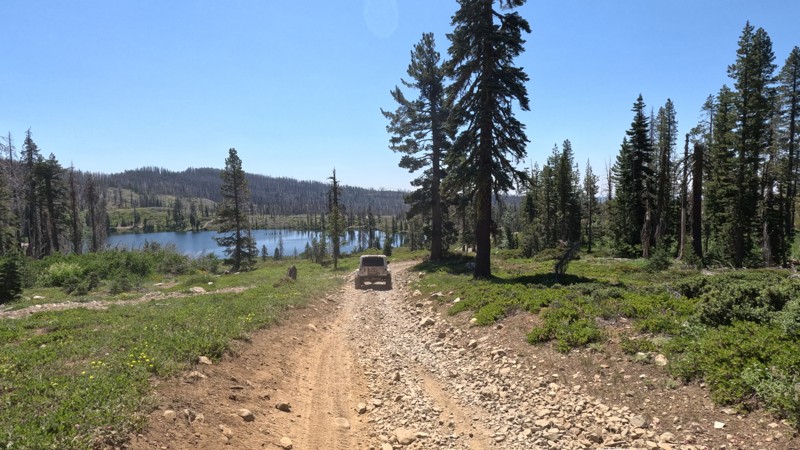
High up in the Lassen National Forest, you will find the High Lakes OHV area. This hardly touched offroading/overlanders' dream is a must-stop location when traveling near Paradise, CA. With dense forests, beautiful snowmelt and spring-fed lakes, never-ending views, it is hard to believe this area is utterly unknown to the majority of the offroad crowd. Running through the center of the area is Trail 611, or High Lakes Trail, which is the main trail that services the area. This connector trail is the primarily into the High Lakes area. But just because it is the main trail, it doesn't mean it is easy. Even though the trail is fine for most high-ground clearance 4x4s, there are a couple of moderate no-named obstacles, so it would be best to have 4WD to ensure you won't have any issues. But don't let the moderate difficulty obstacles stop you from exploring this area; the many lakes, including Long Lake, Cambell Lake, Morris Lake, Spring Valley Lake, and several others, are all just a stone's throw off the trail. This is an excellent trail for dispersed camping because of the unique lake camping opportunities. That is because almost every lake has a moderately improved campsite with a fire ring and a unique but scenic view of its specific lake in the background. Each location is different-sized and can support groups from 2 to 6 vehicles. All the sites are flat-level dirt, making them ideal for ground camping. Just don't forget your fishing license and polls. Also, keep in mind that this area is bear country.
Updated: 03/09/2026
Shell Reef Expressway
Ocotillo Wells, California
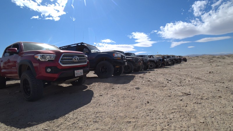
Shell Reef Expressway isn't what it sounds like. This is a dirt road that cuts through Ocotillo Wells, OHV park. The trail is one of the larger dirt roads in the park, making it easy to carry a little speed. But watch out as there is a lot of traffic on this path. The trail is 2WD friendly, meaning you will see people towing down this road and trucks with dirt bikes in the back making their way to the reef.
Now what brings everyone to this trail is the Shell Reef near the eastern end, where you can find ancient shells from millions of years ago when this area was once underwater.
There are lots of camping off this trail on the west side near Blow Sand. But if you are looking for cool places to disperse camp, check out the north side of Ocotillo Well OHV near the hills or off Short Wash.
Updated: 09/09/2026
32E303
Peterson Mill, California
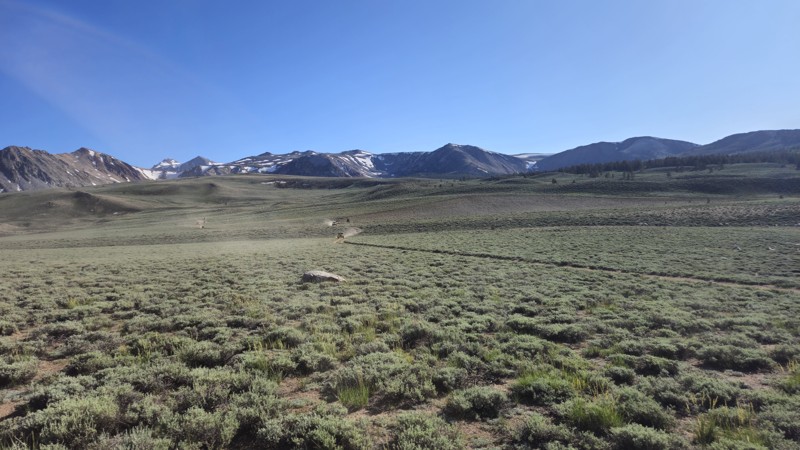
Trail 32E303 is a scenic and rugged trail within California’s Coyote Flats Trail Network, offering a high-altitude adventure for experienced off-roaders. Climbing from Big Pine into the upper reaches of the Inyo National Forest, this trail winds its way up steep, sandy hills before leveling out on a stunning alpine plateau at elevations between 10,000 and 11,000 feet. Along the ascent, drivers will encounter moderately difficult rocky sections, narrow tracks, and exposed shelf roads, making high-clearance 4x4 vehicles with low-range gearing a must.
Once on the plateau, the trail opens up to sweeping views of the Sierra backcountry and provides access to remote lakes like Funnel and Baker, both known for their natural beauty and dispersed camping opportunities. While Trail 32E303 offers plenty of visual reward and historical interest, including remnants of an old airstrip and mining sites, it lacks ideal campsites along its path. For better camping options, consider detouring to Trail 32E304 or the Funnel Lake area.
Remote and largely off the grid, this route is best explored in summer or early fall after snowmelt. With its combination of technical terrain, mountain scenery, and solitude, 32E303 delivers a true backcountry experience for those up to the challenge.
Updated: 02/06/2025
Cahulla Trail
Ocotillo Wells, California
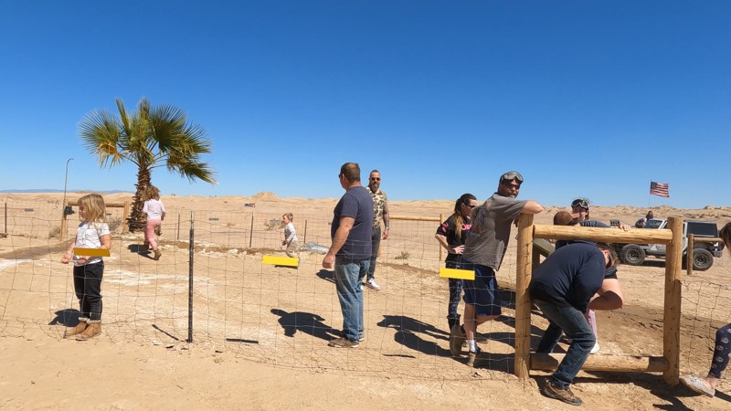
Crossing the desert can be one of the most enjoyable Overlanding adventures you can do. Cahuilla Trail is a great trail that takes you from Highway 78 near Ocotillo Wells to near the old abandoned naval base. The route passes the Atrian Well and gas domes, making this one of the more epic locations in the Ocotillo Wells OHV park. The western end of the trail near the highway has camping suitable for everything up to an RV. But if you want something a bit more epic, check out the hills on the north side of the OHV park. The east end of this trail has some odd camping restrictions that affect when you can camp. So please ask the park before camping on the trail's east end.
Updated: 10/15/2024
Old Palo Verde Road
Palo Verde, California
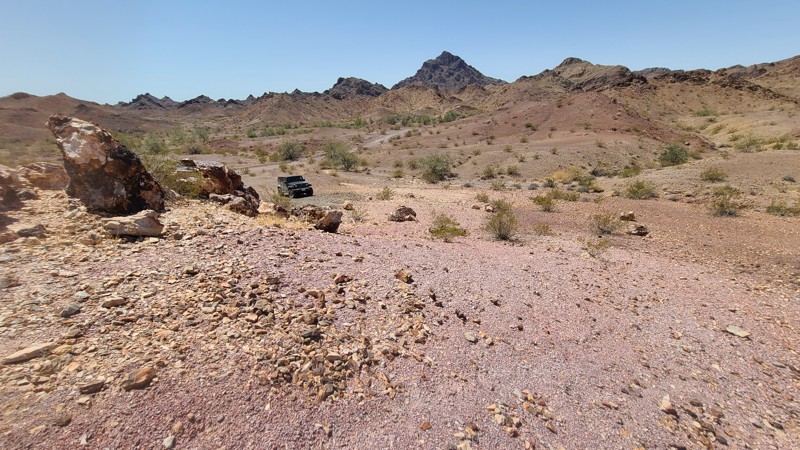
On its west end, Old Palo Verde Road begins amongst the vast, beautiful green cotton and alfalfa fields of Palo Verde and soon finds its way into a narrow ravine cutting through the Palos Verde Mountains Wilderness. The surrounding untouched landscape is rugged but stunning. The minimal road maintenance and failed drainage have led to the road being reclaimed by nature. Annual floods through the gorge have caused large road sections to collapse. Detours around washed-out sections of the road leading down into a rough rocky wash at the bottom of the ravine or upwards on new paths cut into the steep slopes. Only higher clearance four-wheel-drive vehicles should be used on this road. Several camping locations can be found along the way when following the camping guidelines of BLM El Centro Field Office.
Updated: 06/19/2024
2N28Y - Banff OHV Road
Lake Arrowhead, California
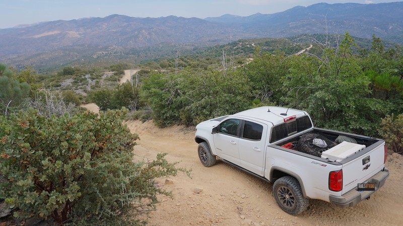
A nice quiet neighborhood street in the mountain lake community of Lake Arrowhead leads into this San Bernardino National Forest trail known as 2N28Y - Banff OHV Road.
Drop in from the blacktop, hit the dirt and start your day off-road with this easy-to-acess off-road trail that connects to numerous other 4x4 trails in the area, including 2N25 - Rouse Ranch Road, 2N27Y - Rouse Meadow and 2N29Y - Stove Flats.
Updated: 06/17/2024
Hungry Valley SVRA - Homestead Trail
Santa Clarita, California
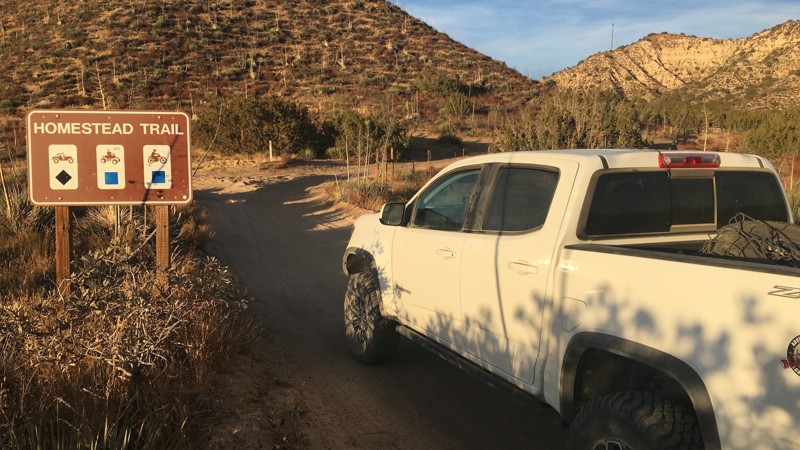
Homestead Trail is one of many off-road trails in the Hungry Valley SVRA (State Vehicular Recreation Area) just outside of the Gorman and Frazier Park mountain communities in Southern California. Over 130 miles of motorcycle, ATV and 4x4 trails spiderweb throughout this 19,000 acre park. To traverse these trails, you will climb over hills, plow through mud pits, shoot down sand washes and at the end of the day, idle into one of the numerous campgrounds. On any given weekend this park will be full of dirt-bikes, side-by-sides, quads, and 4x4s. If it burns gas and flings mud, you will find it here.
Updated: 04/08/2025
Summit Road
Hayfield, California
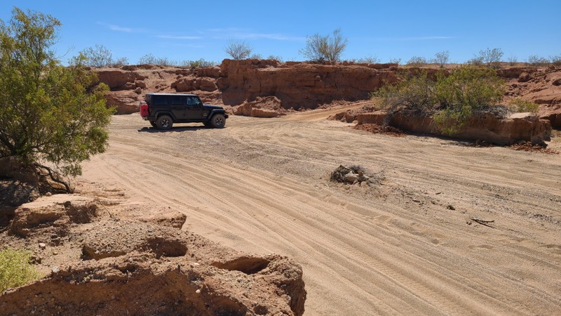
Starting at I10, Summit Road is entirely on BLM land and skirts over its 11 miles southward between the Orocopia Mountains to the west, the eastward Chuckwalla Mountains, and ends at the border of the Chocolate Mountains Bombing Range. The road is on or next to the raised railbed of the now-abandoned Eagle Mountain Railway, which hauled iron ore from nearby the Kaiser Eagle Mountain Mine. The railway carried its last ore in 1986, and it's only in recent years the rails and ties have been harvested for reuse. Portions of the raised railbed have collapsed, and Summit Road diverts down its sides and continues on a deep sandy wash. The road is surrounded by widely spaced Creosote scrub and other bushes native to the Colorado Desert. Military jets may fly overhead and are seen first before the roar of the engines catches up as they maneuver for practice bombing runs. You may see the rising smoke of a successful bomb drop off to the south.
The road surface alternates between flat gravel on the railbed and deep soft sand. The constant erosion has created obstacles, especially where the road diverts off the railbed, and it's these areas that require an experienced off-road driver. This straight-through road provides a connection to at least five other trails to explore including Red Cloud Mine Road with a final connection at the Bradshaw Trail.
Dispersed camping is available anywhere along the trail, and several rock fire rings from previous campsites are visible from the road.
Updated: 07/08/2024
3N10 West - Connector Trail to John Bull West
Big Bear Lake, California
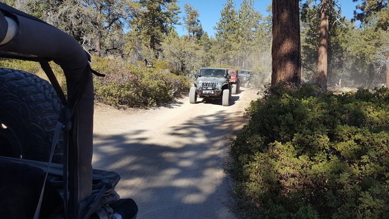
This section of 3N10 is a short connector trail between John Bull West and 3N16. The trail is mostly a dirt road with some scenic views but also provides a loop for several trails that connect back to Holcomb Valley Campground. Along the route, you will pass through the dense forest of Holcomb Valley.
Updated: 06/05/2022
Wild Willies Hot Springs
Mammoth Lakes, California
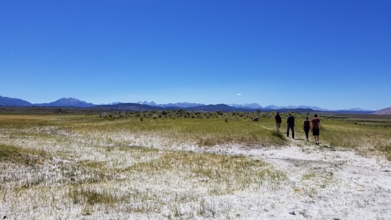
If you plan on a trip to Mammoth and thinking about something to do, hit up this popular Hot Spring on the southside of town. This large hot spring is absolutely amazing. There's no doubt why so many people visit this hot spring. It's almost as famous as Vegas. So if you are driving 395 near Mammoth Lakes, California, and need a place to relax for a few hours Wild Willies Hot Springs and Tub in the scenic caldera of the Mammoth Volcano is just the ticket!
Updated: 08/11/2026
Hull Creek Spring
Long Barn, California
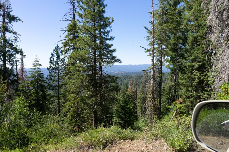
This trail serves its best purpose as a connector running from Dodge Ridge down to the managed Hull Creek Campground. There is one dispersed campsite just off spur 4N33C, although you may get dusted out as the campsite seems to be along an OHV/ATV route. At the intersection of 4N33 and 3N01 (next to the campground entrance), a continuously running spigot provides potable spring water straight from the Hull Creek Spring. This is a fantastic opportunity to refill any potable water containers you may have. Please read the signage and respect the clean drinking water rules.
The hardest part of this trail is after it crosses the Dodge Ridge trail and becomes 4N72Y. The trail becomes more narrow and eventually overgrown as it deadends down a hillside.
OPEN SEASONALLY: 04/15-12/15
Updated: 01/02/2024
Vodkaberry
Barstow, California
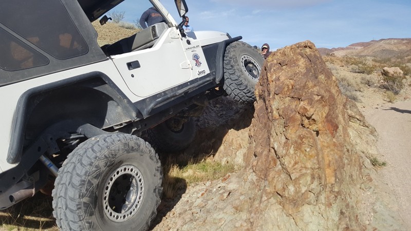
Deep in the mountains near Calico lies trails rarely taken. Vodkaberry is a short but fun 4x4 trail with a couple of obstacles. Vodkaberry's main attraction is a double waterfall with the upper fall comprised of a 6-foot ledge. If you have the skill, this can be a fun trip when cutting across Doran Canyon and Wall Street.
Updated: 07/12/2024
2N79A Penstock Ridge Spur
Fontana, California
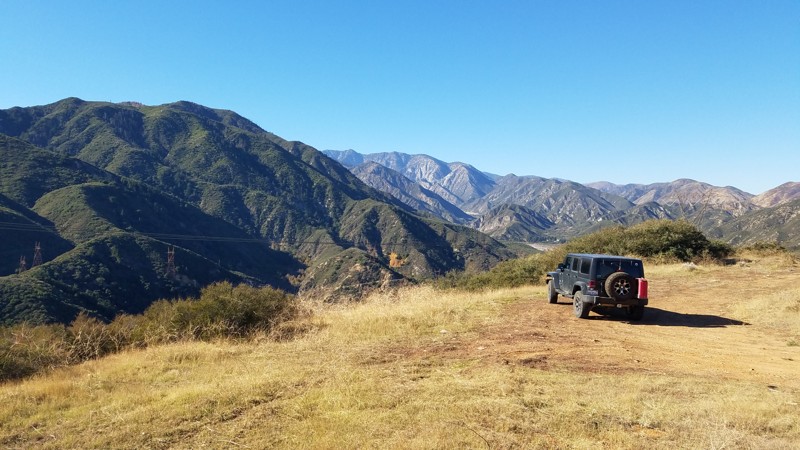
2N79A Penstock Ridge Spur is within the San Bernardino National Forest and is a pleasant escape with views of the surrounding hills and the majestic San Gabrial Mountains to the west. There are beautiful vistas at many spots along the trail dominated in the west by the almost 9000' granite peaks of Cucamonga, Big Horn, and Timber Mountain. This is an excellent trail for a beginning off-roader. Penstock Ridge Spur was built as a service road for the four power line towers along its length. Intersecting roads along the way can be explored and often lead to these towers. Shortly after starting the trail is a large concrete structure in the shape of steps whose purpose is a mystery and that local artists have used as a canvas making this a worthwhile stop to appreciate their work.
Your dog can also enjoy the trail when kept on a leash.
Updated: 10/15/2024
Gas Domes Trail
Kane Spring, California
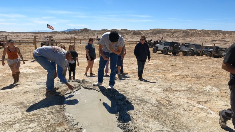
This trail leads to one of the most unique features of the Ocotillo Wells area. Gas domes are where water and natural gas bubble out of the ground in murky mud. This is interesting because they are far from anything, including a water source.
Legends say if you put mud on your face, you will receive the blessing of the desert.
If you are looking to camp in this area, check out the hills just to the west of the gas domes. The park has odd rules about camping in the area. So if you want to camp near the east side of the trail, please get in touch with the park first.
Updated: 10/15/2024
Thing Valley Road
Mount Laguna, California
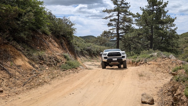
Thing Valley Road is easily accessed off Sunrise Highway (S1) on Mt. Laguna. It parallels and crosses the Pacific Crest Trail (PCT). It is mostly graded with large humps in the road for erosion control. Some of the humps are tall and steep, enough to think twice about bringing a vehicle with a low break-over angle. There are loose rocks, but 2WD vehicles should manage them well enough.
The route is located in the Cleveland National Forest where dispersed camping is allowed, however, the appropriate passes and permits are required. There are several campsites along the way, including one at the intersection with the PCT.
The road exits the Cleveland National Forest at 2.1 miles and is gated at 2.6 miles with a very small space to turn around.
Updated: 09/10/2026
Powerline Road
Cactus City, California
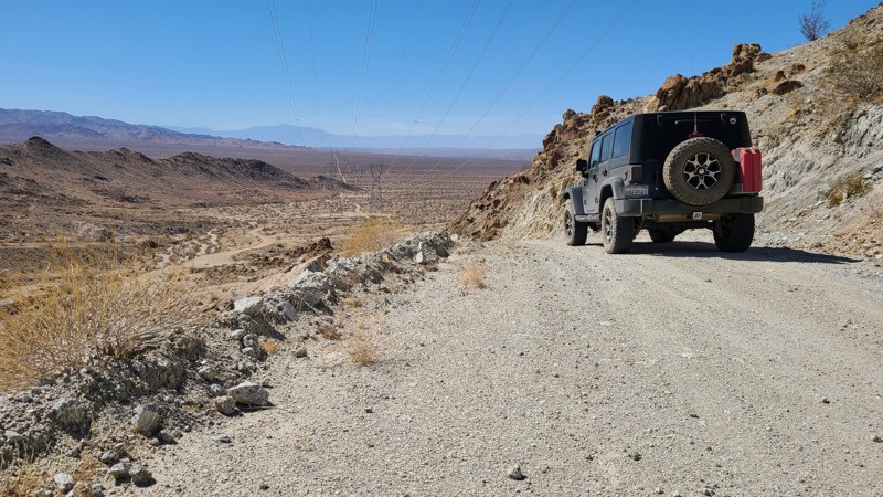
Located just south of Joshua Tree National Park, Powerline Road is a 13-mile service road on desert land managed by the Bureau of Land Management and aimed down the center of a series of tower pairs heading towards the eastern end of the Orocopia Mountains. The road provides a leisurely drive through typical desert terrain and intersects several BLM marked trails that offer more exploration opportunities. The road is an easy drive but rough, consisting of a wide hardpacked rocky trail, and airing down will make the ride more comfortable. In contrast to the previous 13 miles, the last quarter mile suddenly begins a winding and steep climb to the edge of the Orocopia Mountain Range, where the road ends. Dispersed camping is available anywhere on the road, and several existing campsites are seen from the road.
Updated: 10/15/2024
Cherry Gap
Grant Grove, California
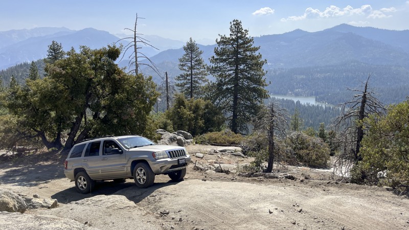
Cherry Gap runs along a ridge above Hume Lake in the Sequoia National Forest to the west of Kings Canyon National Park. The trail is great for those looking for something more challenging than your average maintained forest road. It also offers a great view of the lake below, plus a few welcoming pullouts for dispersed camping. The trail begins off Highway 180 at Cherry Gap, rising and falling between 6,000 and 7,000 feet as it follows the ridge. Driver experience and 4WD are necessary due to steep grades and four rock obstacles near the midpoint. The most challenging section requires traversing the steep face of a boulder or navigating around the boulder in loose dirt while precariously close to the edge of the mountain. Running the trail from northeast to southwest is the most challenging.
Updated: 02/27/2024
Aftershock
Lucerne, California
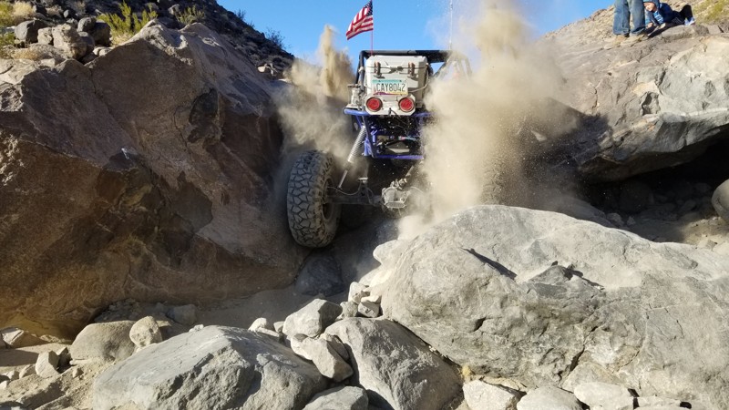
Aftershock is a fun but difficult rock crawling trail. The trail is not as hard as the Hammers but harder than almost anything else most have tried. The trail is a narrow canyon with waterfalls, giant boulders, and soft sand to mix things up. Be ready for some body damage and breakage because, like most of the other Johnson Valley trails, this one isn't forgiving.
Updated: 12/18/2024
North Indian Canyon
Ocotillo, California
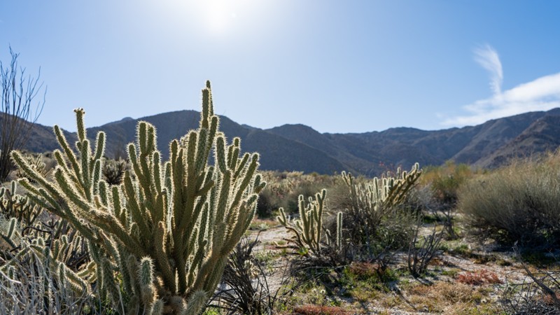
As a continuation of Indian Gorge, South Indian Canyon drives through a much more expansive canyon from Indian Valley. Along this adventure, you are submersed in the cirque-shaped bowls in boulder-laid mountains. This cirque-shaped bowl, however, doesn't include glacier-packed lakes but rather an entire sampling of desert plantlife that includes cholla, agave, creosote, and ocotillo. The drive-in provides one experience, while the drive-out gives you an entirely different perspective of Indian Gorge, which you took to get here.

Updated: 06/05/2022
18N25 - Packsaddle Trail
Upper Lake, California
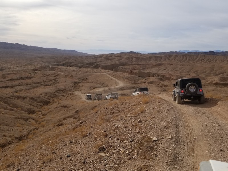
Packsaddle Trail, near Lake Pillsbury in the southwest part of the Mendocino National Forest in Northern California, starts and ends at intersections with M1 - Elk Mountain Road, and thus presents an opportunity to bypass a good portion of the heavily washboarded Elk Mountain Road. It is a quieter, smoother, more peaceful route with one exceptional lookout spot, and spends much of its time winding through deep Ponderosa Pine forest. The lookout spot presents a fine 180 degree view towards the east, with seemingly endless rolling, forested hills disappearing forever into the distance. Hull Mountain is prominent to the northeast.
Updated: 04/27/2024
661202 - Red Canyon Drop In Trail - Chuckwalla Mountains
Blythe, California
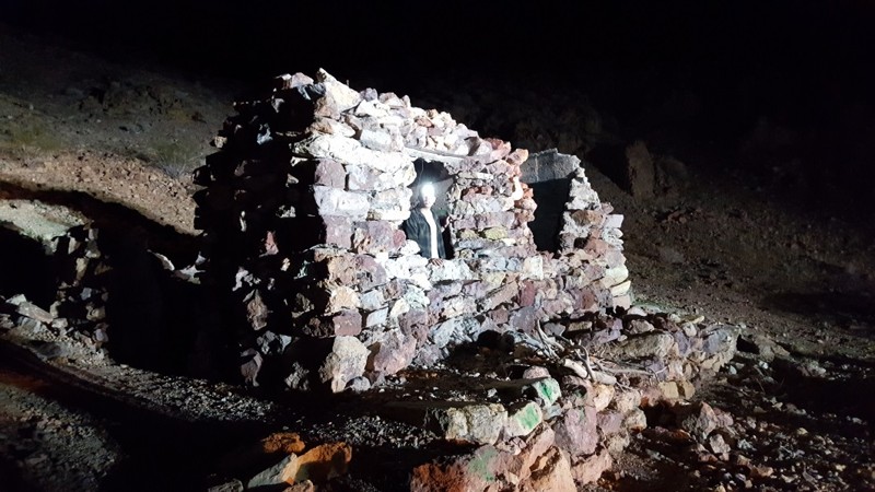
When out on an overland adventure and exploring the Red Canyon Trail in the Wilderness Park of Orocopia Mountains, there is a small trail that gives you a chance to explore the Red Canyon from its floor. The Red Canyon Drop In, trail designation route 661202, will take you from The Red Canyon Trail down into the depths of the canyon below. Once at the bottom, you can gaze up at the magnificent cliff walls that seem to reach the clouds above. The next time you are out exploring Red Canyon, make sure you check out the drop in and experience for yourself the wonders of Red Canyon.
Updated: 01/02/2024
Wall Street
Barstow, California
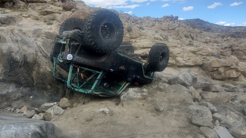
This historic miners route was used back in the big mining boom of Calico in the late 1800's. The miners would ride cable cars up Wall Street to avoid going all the way around through Doran Canyon. The wall of Wall Street is hundreds of feet tall and offers no alternative routes. An awe-inspiring sight to see, this is one of Calico's rare and amazing sites.
Updated: 02/27/2024
Off-Your-Rocker
Landers, California
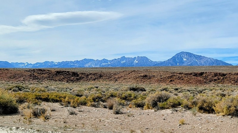
Looking to run something hard that isn't a big name? Check out Off-Your-Rocker Trail in Johnson Valley California, home of the King of the Hammers and hard trails. This wild 4x4 rock crawling trail is a none stop of body damage, waterfalls, and fun. Full of boulders that eat up Jeeps and Toyotas alike, this insane Off-Road trail is something that might just make you go home crying to mommy. If you think you have a built offroad vehicle, can play with the extreme people, and think difficult trails are super easy, than Off-Your-Rocker is probably the trail for you.
Updated: 09/04/2026
Fish Slough Road
Dixon Lane-Meadow Creek, California
Fish Slough Road takes you on a trip through the ages. Volcanic rock lines the road to the south as you go through the Volcanic Tablelands BLM Park. The rock rises from the Earth in long, flat table-like formations called mesas.
In the middle and northern part of the trail, the arid terrain of the Owens Valley gives way to spectacular views of the Sierra Nevada Mountains to the west and The White Mountains to the east.
The road itself is in good condition. It’s a graded dirt road with a couple of sandy spots, but nothing any high-clearance 2WD vehicle can’t handle. Unless there is a bad storm, the road can get washed away and very sandy, so check conditions before going.
Around the halfway mark are the Chidago Canyon Petroglyphs, a short walk from the road. This historic landmark of rock art is believed to date back at least 3500 years. They were created by ancestors of the Paiute-Shoshone peoples. The Red Canyon petroglyphs are also on this trail, which requires a short hike.Chidago Flats and Casa Diablo trails meet up with Fish Slough and are just as incredible and worth the drive, especially driving through the slot canyon in Chidago Flats.

Upgrade your Membership
Unlock all of the details on every Trail Guide and Scout Route.
Start a 7-day Free TrialBrowse Trails in California by City
Browse every California city with offroad trail guides.
Community
Partners

