



By clicking "ACCEPT", you agree to be the terms and conditions of each policy linked to above. You also agree to the storing of cookies on your device to facilitate the operation and functionality of our site, enhance and customize your user experience, and to analyze how our site is used.
California Off-Road Trails
414
Total Trail Guides 391

4102
Detailed Waypoints 523
Try a Free 7-Day Trial and unlock it all
Start a Free Trial Most Recent Trail Reviews
Rated 5/5
Open
Visited: 09/19/2026
Great beginner trail here for those looking to try out some rockier sections. Starting to trend a little closer to a rating of 4, but still a 3 I’d say

R
Rob
Rated 5/5
Open
Visited: 09/19/2026
I entered this trail from Freeway Ridge 4WD trail (31E77) and ran Black Gulch Jeep Trail up to Rancheria Road, turned around, and ran Black Gulch Jeep Trail all the way down to Keyesville Road in Lake...



Daniel Macioce
Rated 4/5
Open
Visited: 09/19/2026
Took out the vstrom 800de today and this thing was tough for someone like me who is pretty new to offroading motorcycles. I ended up turning around about half way because I wasn't sure if I would be a...
SK
sean kotrola
No Rating
Open
Visited: 09/19/2026
The trial marked by the app here is very difficult with all the recent deep washouts. Proceed at your own risk if you are by yourself with unmodified rigs. However the bypass is maintained and should ...
TB
Timmy Boby
Rated 5/5
Open
Visited: 09/18/2026
Very friendly fire watch tower volunteers and fantastic 360 degree views up top
R
Rob
Rated 5/5
Open
Visited: 09/18/2026
Great views and an easy drive through. Be sure to take the road up to the fire watch tower
R
Rob
Rated 5/5
Open
Visited: 09/17/2026
ran the trail twice last weekend, this is such a better way to go than 3n16...


Josh Noesser
Official Crew
Rated 5/5
Open
Visited: 09/16/2026
It's been 6 years since I visited this trail. It has seen some wear, but the overall difficulty is about the same, probably a bit higher now, as Waypoint 11 has suffered from traffic. Waypoint 11 ha...

Robert
Official Crew
Rated 5/5
Open
Visited: 09/16/2026
Started off from polique canyon at way point 13 and headed east. Its a great trail for most of it with scenic views. A good amount mud puddles that were fun as hell to drive through. Some I decided to...


VM
Victor Manuel Garcia
Rated 5/5
Open
Visited: 09/16/2026
Used this trail to get to Holcomb valley. Super easy and a nice drive, I can see how in the winter it can be a bit more challenging with rain and snow.
VM
Victor Manuel Garcia
No Rating
Open
Visited: 09/16/2026
Mostly easy, but heading NE there's a rock step down just a few miles in that *requires* high clearance. Banged the rear end of my 4runner despite having a 3" lift and 33" tires. A stock SUV would alm...



Carlos H.
Rated 5/5
Open
Visited: 09/14/2026
A fun little detour off Burns Canyon. I ran this alone and stopped a few times to spot; I also used my grill camera in several places. I brushed my sliders a couple times, but no real issues. Definite...
EB
Ed Boyd
Rated 5/5
Open
Visited: 09/13/2026
easy perfect beginner off roader trail with great views and water crossing during the winter.



Dex Offroad
Rated 5/5
Open
Visited: 09/11/2026
super easy trail over looking the valley and 15fwy. only bad thing is that its super windy.

Dex Offroad
No Rating
Partially Open
Visited: 09/09/2026
Although you can cross the creek from Fordyce if you want, Committee Road is still closed back to the I80, so this has no exit, and you'll be forced back onto Fordyce.

Ryan Boudreau
Official Crew
No Rating
Temporary Closure
Visited: 09/09/2026
Road is still closed. I thought i read somewhere an expected 2030 opening, but can't confirm that info.
Ryan Boudreau
Official Crew
Rated 5/5
Open
Visited: 09/09/2026
This is an awesome trail . This trail is moderate with a few obstacles to make it fun. It also has incredible scenic views with a little bit of shelf roads. You can watch the full video on my YouTube ...


Dex Offroad
Rated 5/5
Open
Visited: 09/07/2026
Pretty spot on with the rating, was a little tough today with the rain but made it through in my 2023 Gladiator Overland with 2.5” lift and 35s with autolynx sway disconnects.


CT
Christopher Tanton

Shaan Heugly
Rated 5/5
Open
Visited: 09/06/2026
Drove reverse from what’s listed to the jasper trail. This is a easy but enjoyable trail with plenty of places to camp at the end of the
Shaan Heugly
Rated 5/5
Open
Visited: 09/06/2026
Bit washed near the top but nothing difficult to navigate. I headed from jasper to the highway and near the highway it did narrow. I got through with my Tacoma but there are a few pinch points I could...
Shaan Heugly
Rated 5/5
Open
Visited: 09/06/2026
Mostly easy trail but when going south to north, I did need to use 4Lo on some of the inclines with a loaded Tacoma
Shaan Heugly
Rated 4/5
Open
Visited: 09/05/2026
It had been five years since I last drove this trail. The long, annoying stretches of moguls are still there, and water erosion has added a touch more difficulty in places. It was nice to see the old ...


Robert
Official Crew
Rated 4/5
Open
Visited: 09/05/2026
This is a nice trail with great views for any 4WD with ground clearance as some sections have ruts that are 12+ inches deep. Things were very dry on my visit, so airing down the tires helped to smooth...


SG
Steve Graham
Rated 3/5
Open
Visited: 09/05/2026
From waypoint 7 to 10 the water damage is pretty bad. Waypoint 13-16 it is rocky. Nothing crazy but a few spots where patience and the right line will go a long way. Good clearance and 4x4 recommended
N
Noah
Rated 5/5
Open
Visited: 09/05/2026
Easy trail with an awesome view at the end. There were three lookouts in the fire tower and each one was super friendly and informative. Must see trail!


N
Noah
Rated 5/5
Open
Visited: 09/05/2026
fun easy trail, Butler Peak lookout is the highlight imo
N
Noah
Rated 5/5
Open
Visited: 09/04/2026
Trail was very well maintained. Thanks for the Fresno 4x4 club. It was very cold at night, into the 30s. We were on the trail two nights, 3 days and two nights at voyager rock due to a breakdown fr...
JD
John Drago
No Rating
Open
Visited: 09/04/2026
Beautiful area, but the trail itself wasn’t very interesting. I’d rate it around a 3/10, with a couple of optional sections that might push a 4.
There’s tons of dispersed camping throughout the area,...


Ryan Smith
Rated 5/5
Open
Visited: 09/01/2026
awesome trail with a lot of water crossings. just be careful of sxs and bikes since its a OHV area.

Dex Offroad
Rated 5/5
Open
Visited: 09/01/2026
Super easy trail and you can over look the high desert. Trail ends at an awesome view point.

Dex Offroad
Dex Offroad
Rated 5/5
Open
Visited: 08/31/2026
This trail is much harder than it used to be. It’s just as breathtakingly beautiful as ever. You are on your own out there. Fuel, parts, spare tire. It’s days from help if you need it so go prepared. ...

CP
Christopher Pepin
No Rating
Open
Visited: 08/30/2026
Ran this trail today and had fun. Easy trail with great views. I wouldn’t hesitate to take an experienced driver in a stock jeep up this. There are lots of trails in this area and way to get off the m...

CP
Christopher Pepin
No Rating
Open
Visited: 08/29/2026
Trail was in good shape, a little less sand makes the boulders a little bigger. People have made the bypass around the sluice a little bit longer than it used to be you miss a lot of the good rocks. O...
C
Campbell
Rated 5/5
Open
Visited: 08/29/2026
An often overlooked and amazing trail. It’s about the length and difficulty of the rubicon if you don’t hit any of the bypasses on the rubicon. We had a group of 3 lj on 40s, a jku on 42s, and an Xj o...
CP
Christopher Pepin
Rated 4/5
Open
Visited: 08/27/2026
This is most definitely a hard trail. Is the entire thing hard? Not at all. The western 7 miles are a hard packed dirt road. Then you run into 3 straight, large boulder obstacles where its clear many ...


Ryan Boudreau
Official Crew
Rated 4/5
Open
Visited: 08/27/2026
Easy drive with beautiful views and . . . Buck Rock! Lots of camping south of Buck Rock, but camping north of the Rock isn't as plentiful. There are a few others on the north, but there's one here: 36...


Carlos H.
Rated 5/5
Open
Visited: 08/26/2026
I really enjoyed this road. It's super scenic with the sierra's in the background, the white beaches, and the columns are really cool. The road is not anything challenging with a high clearance vehicl...


Ryan Boudreau
Official Crew
Rated 4/5
Open
Visited: 08/25/2026
Fun area. The hot springs are pretty popular and well-known, and because they are small, you'd better hope you are one of the first people there that day if you want to get in. The route is easy, exce...


Ryan Boudreau
Official Crew
Rated 4/5
Open
Visited: 08/25/2026
I liked this trail a lot, but it's not quite a 5-star trail for me. I feel like it's a little overhyped. Is it scenic? Absolutely! Is there tons of great camping? Totally! Is it a crazy busy? You Bet!...


Ryan Boudreau
Official Crew
Rated 4/5
Open
Visited: 08/25/2026
Road to the hot springs parking area is easy. There are regular passenger cars there. The hike is easy too. The tub itself is super scenic, but know that they are not hidden gems by any means and we'l...

Ryan Boudreau
Official Crew
Rated 3/5
Open
Visited: 08/25/2026
It's a simple road, but definitely very scenic and really only used to get from Convict to Laurel Lakes or Mammoth. Road is suitable for anything with decent ground clearance.


Ryan Boudreau
Official Crew
Rated 2/5
Open
Visited: 08/25/2026
Simple dirt road used to access other types of recreation. Many signs remind you that you aren't allowed to camp along it except at the campground.


Ryan Boudreau
Official Crew
Rated 3/5
Open
Visited: 08/23/2026
Simple, straightforward dirt road used for fishing access.


Ryan Boudreau
Official Crew
Rated 5/5
Open
Visited: 08/23/2026
Amazing views at the top of this trail. Erosion looks to be making this trail harder than it probably originally was. Most of the hardest spots are getting bypasses created around them. A short, st...



Dan Jurgella
Rated 5/5
Open
Visited: 08/23/2026
Toad Lake Road 40N64 was a long, slow, and wonderfully remote drive into the Trinity Divide. The changing mix of old pavement, dirt, loose rock and deep ruts kept the journey interesting, while forest...



Rose Meirs
Official Crew
Rated 5/5
Open
Visited: 08/23/2026
North Fork 41N53 was a fun backcountry drive through the forest west of Mount Shasta. Early in the trip, a wrecked motorhome beside the road provides unforgettable confirmation that you are on the rig...


Rose Meirs
Official Crew
No Rating
Partially Open
Visited: 08/23/2026
The trail is still only partially open. I drove it from Old Mill Road to the closed gate. Once I was at the gate, I took the connecting trail back into Big Bear Village.
For exact trail names and n...

John Mantey
Rated 3/5
Open
Visited: 08/22/2026
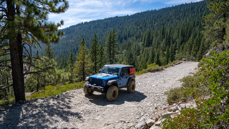
Nothing really special about the road. It's easy and gets progressively rockier the closer to the lake you get, but it's not challenging, and you will see plenty of small SUVs and crossovers along the...
Ryan Boudreau
Official Crew
Most Popular


Updated: 07/21/2024
The Rubicon Trail
Open
/
Tahoma, California/
15.75 miles/
About 2 days
No longer the stagecoach road that connected Georgetown, California, and Lake Tahoe, Nevada, in the 1800s, the Rubicon Trail is a legitimate badge of honor known as one of the most iconic offroad trails in the world! So much so that Jeep has even named its famed Wrangler model after it. Decades have passed without the stagecoach in operation, and what was left of that route has become one gnarly and famous Jeep trail. The trail became famous in 1953 when 55 Jeeps and 155 participants ran what is now known as "Jeepers Jamboree 1". Since then, hundreds of thousands have earned the right to say they have conquered this famous Sierra Nevada offroad trail.
Adding to its popularity, the scenery knocks your socks off with a mesmerizing display of natural beauty. Towering pine trees, crystal-clear streams, and entire hillsides of white granite give the trail even more reasons for its world-renowned status. A word to the wise: you need to read the complete Trails Offroad Trail Guide to plan the logistics for this multi-day trip.

Updated: 09/03/2025
Burns Canyon
Open
/
Yucca Valley, California/
19.06 miles/
About 3 hours
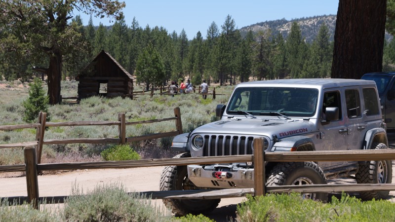
From the high desert floor flush with Joshua trees, Yucca, and crisp blue skies to the green forest of Big Bear, Burns Canyon, also known as Arrastre Creek, is an odyssey waiting for you in Southern California. Rich with history, particularly if you start at the south end and take in Pioneertown, travel through the famous Rose Mine, and find the rare Redwood trees, this trail makes for a great gateway for an epic overland trip close to home. This is the perfect get-away for a day or days when combined with the other amazing trails this area has to offer.
Updated: 12/23/2025
3N16 - Holcomb Valley
Open
/
Green Valley Lake, California/
25.67 miles/
About 2 hours
Holcomb Valley Road, also known as 3N16, is the backbone of Big Bear’s off-road country. It is a 26-mile route winding through pine forests, open meadows, and the storied remains of Southern California’s gold rush. Running west to east across the San Bernardino Mountains, it follows the same paths once traveled by 19th-century miners and settlers. Today, it’s a family-friendly dirt road that invites exploration, with countless opportunities to stop and connect with Big Bear’s rugged backcountry heritage. Along the way, you’ll pass relics of the old Belleville mining district, shady forest campsites, and panoramic overlooks where the air smells of pine and the horizon glows at sunset. More than just a scenic drive, 3N16 links some of the region’s most iconic trails, serving as both an adventure in itself and a gateway to Big Bear’s legendary four-wheel playground.

Updated: 02/05/2025
Mojave Road
Open
/
Baker, California/
112.61 miles/
About 3 days
Filled with oddities, scenic beauty, history, and a sense of adventure, it is no wonder that the Mojave Road has such an iconic stature. Formed as an early Native American trade route and then an east-west passage for settlers, the road has a long and storied history. Passing through the Mojave National Preserve, Mojave Trails National Monument, and the Lanfair Valley, you are remote and far from civilization. Today it is one of the more famous overland routes in the southwest. Although the road is not at all technical, the sense of adventure you get by being so deep in the desert is what makes it worth the trip.

Updated: 01/02/2026
Maple Springs Road
Open
/
Orange, California/
7.49 miles/
About an hour
Maple Springs Road is the backdoor to Saddleback Mountain from Orange County. One of Orange County's few trails, this is a popular overland route for people wanting to get out of the house and stay local. Others say they enjoy this road because it leads to the best view of Orange County. Suppose you are fortunate to have a few hours around sunset. In that case, the view from the top of Saddleback Mountain is known for photographs of the sun setting over Catalina Island in the Pacific Ocean with Orange County in the foreground.
The lower section of the trail has a unique scenery for Orange County. The area is covered in oaks and pines. A nearby creek runs most of the year. It's an excellent place for a picnic. If you are lucky, you can find a swimming hole.

Updated: 07/08/2024
3N69 – Gold Mountain
Open
/
Big Bear City, California/
4.52 miles/
About 2 hours
Gold Mountain Trail, 3N69, is one of those names all Southern California offroaders know. For many, it was their first rock crawling trail. For others, it is their next ambitious goal. Located in the San Bernardino National Forest, near Big Bear Lake, this easily accessed rock crawling trail takes you up and into the mountain range of SoCal, cresting over 8,000 feet above sea level before dropping you near the history-rich Holcomb Valley. Along this scenic wonderland, the trail offers fantastic views of Big Bear Lake, the bustling mountain village below, and the towering San Gorgonio Mountain.
The trail was established in the 1860s during the Big Bear gold rush to facilitate mining operations. Today, the obstacles bring people to this historic trail. With two waterfalls, a rock garden, and several hard corners, this trail tests driver skills and vehicle capability. There is no doubt why Jeep picked this trail as one of its legendary Jeep Badge Of Honor Trails.

Updated: 05/29/2024
Fish Creek Trail - Anza Borrego
Open
/
Ocotillo, California/
18.02 miles/
About 4 hours
There is no other place like Anza-Borrego Desert State Park. Many overlanders and outdoor enthusiasts seek it out for its endless exploration opportunities. Fish Creek Wash is the starting point for many since it connects to many of Anza-Borrego's most famous offroad trails. Wind, rain, powerful earthquakes, landslides, and father time have shaped Fish Creek Wash into a living, geological museum. With its wind caves, dinosaur tracks, fault lines, towering mud hills, sandstone canyons, and wildflowers, Fish Creek is a perfect place to begin your exploration of the astonishing Anza-Borrego.

Updated: 05/12/2024
Pinyon Mountain Road
Open
/
Borrego Springs, California/
10.09 miles/
About 4 hours
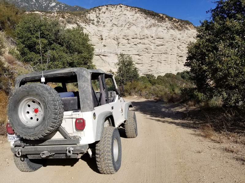
When you hear or read about obstacles named "Heart Attack Hill" and "The Squeeze," you must make excellent adventure decisions before you decide to take them on. Pinyon Mountain is a Jeep Badge of Honor trail in the renowned Anza-Borrego Desert State Park and arguably its most challenging. The Squeeze tests every bit of your precision as you listen to fenders scrape on its narrow passage, while Heart Attack Hill will surely give you that proverbial "heart attack" when you first see it. This isn't a solo-type excursion trail. You will need every bit of your wheeling mates' eyes and collective experience as you conquer what people call "The Secret of the Desert."
Updated: 07/05/2024
1N09 - City Creek
Redlands, California
Whether you are into overlanding, 4x4'ing, or rock crawling, the San Bernardino National Forest is a common area for people to seek adventure and memories. On the front side of Big Bear is an offroad route that is still barely known, even though it is right off Highway 330, the main highway up to Big Bear. 1N09, or City Creek Road as it's also known, is a magical scenic drive that can easily be made into a day trip or weekend adventure. The trail itself is relatively easy, but as you travel east among the dense forests, you are pleasantly surprised by the many water crossings the trail has. So the next time you go up to Big Bear to do a little wheeling, instead of overlanding on 3N16 again, check out 1N09 City Creek Road for a taste of the mountains' lush forest and tranquil beauty.

Updated: 11/01/2023
Dusy-Ershim Trail
Open
/
Shaver Lake, California/
33.48 miles/
About 4 days
If you haven't heard of the Dusy-Ershim trail yet, you will soon. Many believe this is the newest hardest multiday off-road trip you can do today. The trail is comprised of both overland and rock crawling. If you ask someone that has recently done the Rubicon, they will say this trail is about 3-6 times harder. The Dusy-Ershim offers some of the hardest wheeling around, from mile long rocky hill climbs, to very technical obstacles, to some of the most amazing camping & fishing you have ever done in your life. The views have something to be said about too. Just be warned, this isn't an easy trip, even the most built rigs will leave this trail with mechanical failure. Be prepared, because body damage is almost guaranteed, even for the best drivers. If you are up to the challenge, expect the trip to take you in the range of 3-5 days.

Updated: 09/23/2025
Holcomb Creek Trail
Open
/
Big Bear City, California/
5.84 miles/
About 4 hours
Comfortably nestled in the San Bernardino National Forest, Holcomb Creek is a challenging rock-crawling trail that has attracted visitors for decades. It is a Jeep Badge of Honor Trail, and for good reason. It is one of the most demanding trails in the Big Bear Mountain range and provides perhaps the best rock crawling of them all. While traveling the trail, expect everything from water crossings to extensive rock gardens with rocks the size of small cars. You can also expect challenging hill climbs and fantastic views of Holcomb Creek and the Pacific Crest Hiking Trail. Over the years, this trail has claimed many vehicles and should not be underestimated. People often exit this trail with their hopes and vehicles destroyed. If you think you and your vehicle have what it takes to complete this epic 4x4 adventure, then air down your tires, engage those lockers, and be prepared to make unforgettable memories while earning your badge!

Updated: 08/12/2026
John Bull (3N10)
Open
/
Big Bear, California/
4.58 miles/
About 6 hours
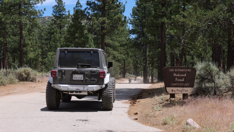
One of the must-do offroad trails in Southern California and maybe even the United States, 3N10 - John Bull is a legendary trail in the offroad community and offers an amazing rock-crawling experience to all users. Often used as a trial run for larger trips such as to the Rubicon or the Dusy-Ershim, this Jeep Badge of Honor trail will test a vehicle to its breaking point. John Bull features large boulders over 36 inches round, loose rocks that love to bend sheet metal, and big trees that seem to jump out of nowhere and kiss your vehicle, leaving behind body damage scars that make for epic campfire stories. If looking for a unique and challenging trail within Big Bear's Holcomb Valley, John Bull will certainly fill the void.
Updated: 08/12/2026
Coxey Road (3N14)
Fizzben Heights, California
Leave the sunbaked Mojave Desert near Hesperia behind and begin an unforgettable journey into the towering forests, cool mountain air, and sparkling blue waters of Big Bear Lake. 3N14 Coxey Road is more than just a scenic dirt road. It is a gateway to adventure, carrying explorers through a dramatically changing landscape where rugged desert terrain and scattered junipers slowly give way to pinyon pines, dense mountain forests, and towering Jeffrey pines as the trail climbs higher into the San Bernardino Mountains.
For those looking for a quick escape, Coxey Road can be traveled from bottom to top in roughly two hours, creating an incredible desert-to-mountain adventure that feels worlds away from where it began. But slow down, pack the camping gear, and the same trail can become the backbone of an unforgettable multi-day overland journey. Numerous camping opportunities along and near the route allow explorers to leave civilization behind, search for a secluded campsite beneath the trees, gather around a crackling campfire, and spend the night beneath a brilliant mountain sky filled with stars. With miles of connecting forest roads and trails waiting to be explored, a simple drive along Coxey Road can easily grow into an entire weekend of backcountry adventure.
When winter arrives, the adventure transforms once again as snow blankets the towering pines, covers the surrounding mountains, and turns this normally relaxing backcountry drive into an entirely different four-wheel-drive experience. Whether you are chasing panoramic desert views, watching the landscape transform from arid Mojave vegetation into lush mountain forests, searching for the perfect campsite,

Updated: 07/08/2024
3S04 - Main Divide South - Santiago Peak (aka Saddleback Mountain)
Lake Elsinore, California
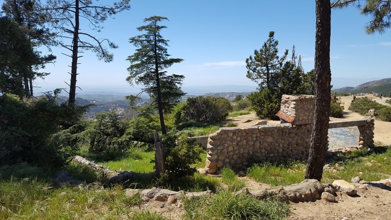
The trail is currently closed due to the Holy Fire. This can last years, so please plan accordingly. This local overland getaway is a great goto for people that live in Orange County and Riverside area. The trails are not known for a challenge but for the amazing views of all of Orange, Los Angeles, and Riverside County. On top of that, there are many great spots to stop which are perfect to relax and get away from the hectic city life.
Updated: 10/15/2024
3S04 - Main Divide North End - Beeks Place
Anaheim, California
The northern section of 3S04 Main Divide Road can easily be one of the best kept secrets of Orange County, CA. This section of the route is one trail every Overlander and 4x4 enthusiast should travel for themselves when in the area. With some of the most rare items in Southern California, it can be pretty easy to say that this is probably the most unique trail in all of Orange County, CA, maybe California. The highlight of this intriguing expedition is the stop at Beeks Place, which was built in 1942 by Joe Beeks. Besides being at over 3400 feet in elevation, Beeks Place has standing gun turrets that were built back in WW2. The idea was if the worst case scenario happened to America at the time, an invasion from a foreign country, Orange County would be ready to defend the United States. As you continue to the north, you will cross many abandon sites, some of them are for water collection while others are abandon buildings. You will also enjoy heli pads, many active radio towers, and Southern California's Doppler Radar Systems. But if the sites are not what brings you to this trail, then the view will easily cover that. As you travel the ridge heading north, you will experience 360 degree views with over 100 miles of visibility in almost any direction. You can easily see things like the Pacific Ocean, Ventura County, Downtown L.A., Orange County, Newport Beach, Riverside, Temecula, snow capped mountains of Big Bear and San Jacinto, plus many more amazing sites.

Updated: 03/24/2026
Berdoo Canyon
Open
/
Coachella, California/
14.11 miles/
About an hour
Berdoo Canyon is home to an old ghost town named Berdoo Camp. Berdoo camp was founded by the water district when California built the Colorado River Aqueduct that still provides water to Southern California. The Camp was built in the early 1930s for the workers and their families to live while the aqueduct was being constructed under the mountain range. The camp was abandoned sometime in 1937 when the project was completed in the area, and the camp was no longer needed. Over the years the camp has been scraped of all the lumber from the roofs of the old concrete buildings. Now all that is left of the old camp are the skeletons of the concrete buildings that once housed the workers and their families. Building the Colorado River Aqueduct was an amazing feat of the time. The workers did not have the type of modern machinery we take for granted in our everyday lives during the construction. Come out and explore the colorful history of the Berdoo Camp as well as Berdoo Canyon. You might even get to see some of the desert wildlife as you head into Joshua Tree, or a ghost or two. Please tread lightly along the trail. I have lived my entire life in this area, and have seen many of these awesome trails closed, due to people making these beautiful desolate trails their personal landfill. Please, if you find trash along the trail, pick it up and help do your part in keeping this trail open for generations to come.

Updated: 06/01/2024
Oriflamme Canyon
Julian, California
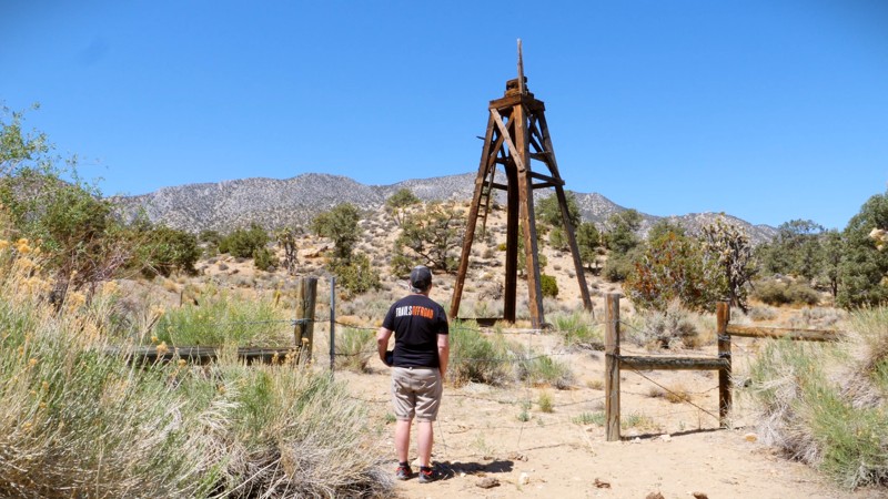
Oriflamme Canyon is an ancient route connecting Anza-Borrego Desert State Park and Banner, California. Long before overlanding and four-wheeling, the Kumeyaay, Spanish, and early settlers used the route for trade, travel, and seasonal dwelling. Oriflamme was the name given to the first mine that worked in the area, and the canyon and mountain soon took on the name as well. It is believed that the name came from the steamship "Oriflamme," which brought miners to San Diego in 1870 during the Julian gold rush. The road became more pronounced during the various mining booms, and today is included in many overland trips through Anza-Borrego. It offers mountain scenery with tall oak trees, adventurous shelf roads, and a chance to see crystal clear fresh running water at the right time of the year.
Updated: 04/30/2026
Rattlesnake Canyon
Landers, California
Known for its incredible views and rich history, Rattlesnake Canyon, or RC3331, is a popular overland route that takes you into the San Bernardino Mountains from Old Women Springs Road in Johnson Valley, California. The experience offers impressive views of Joshua trees, mesquite, and flowing springs that will make great memories. It is the perfect trail to escape Orange and Los Angeles Counties, and if strung together with other trails in the area, it can be an excellent add-on to a multi-day trip.

Updated: 05/19/2024
Azusa Canyon SVRA
Azusa, California
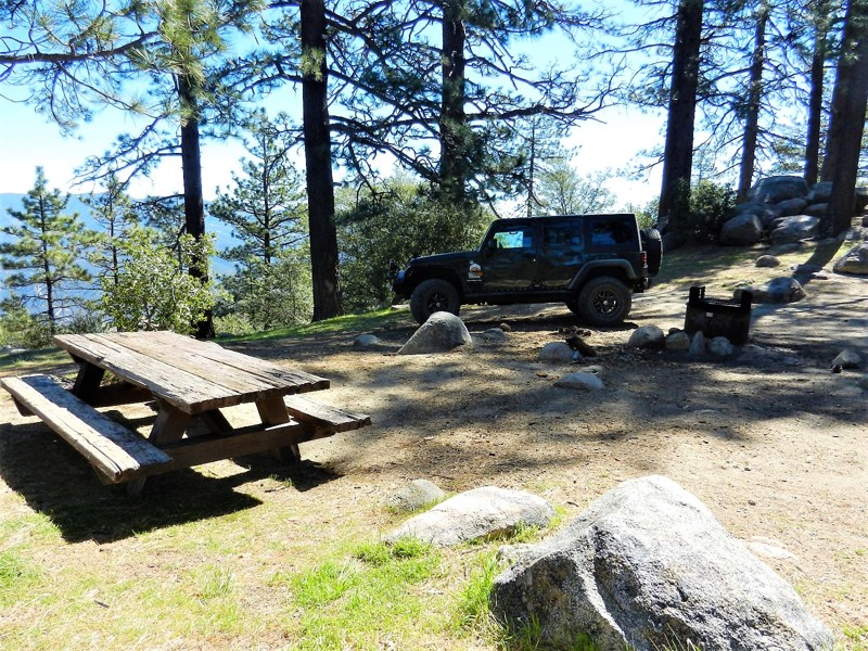
Mud... and lots of it. Azusa Canyon is an infamous OHV area for its very large mud pits that are deep enough to swallow a monster truck. Even though many people go out to this area in their Razors, 4x4, and quads to play in the dirt and hills, most people find themselves heading to the south end of the park to the mud pits where the action is always at. Saturdays in Azusa are rather quiet, but Sundays starting around noon get absolutely crazy.
Updated: 06/22/2024
6S13 - Thomas Mountain
Anza, California
Thomas Mountain is a 6,800 foot peak in the San Bernardino National Forest. 6S13 Thomas Mountain trail is between Anza to the south and Garner Valley to the north. You will have a wide range of plant life in your offroad 2,400 foot climb from the trailhead. Ranging from the scrub brush at the lower elevations to the sage, yucca, mesquite, manzanita, scrub oak, pine and cedar at the peak. Camping on Thomas Mountain is the highlight of this trail with 10-12 Yellow Post Sites dispersed between 6,400 feet and 6,800 feet. Please respect and watch for the critters that make this their home.
Updated: 06/08/2024
2N47 - Cleghorn Ridge
Hesperia, California
Cleghorn Ridge is located near beautiful Lake Silverwood, offering spectacular views overseeing the lake and the San Bernardino National Forest. This trail is great for those looking for a day of adventure. Mostly a graded fire road that any vehicle can pass through, it also offers optional difficult routes for those looking for a more challenging trail. Nearby food, gas, and camping make this an ideal trip for a family weekend. This trail has a rating of "6" which is based on the optional routes, the main trail is easily rated at a "2" and passable by a 2WD SUV or truck.

Updated: 05/20/2026
2N33 - Pilot Rock Truck Trail
Hesperia, California
The Pilot Rock Truck Trail starts at the east side of Silverwood Lake in the San Bernardino Mountains in the San Bernardino National Forest. Possibly the most scenic trail in San Bernardino county, Pilot Rock Truck Trail runs between Silver-wood Lake and the small mountain community of Lake Arrowhead. This long mountain trail serves up one amazing view after another starting with Waypoint 6 which overlooks Silverwood Lake from a steep ledge. From Pilot Rock ( the actual rock ) at Waypoint 18, you will look out to see a panoramic view of the distant desert fading into the forest covered mountains.

Updated: 04/28/2024
The Bradshaw Trail
Open
/
Blythe, California/
75 miles/
About 2 days
The Bradshaw Trail or the Gold Road to La Paz is a popular overland trail in the southeast corner of California in Riverside County. This once-popular overland stage route used to haul miners and other people looking for the wealth of California. Along the route, you will see many unique features to the area including old mining encampments, abandon train tracks, abandon train tussle, and many unique natural wonders. Because of all these amazing scenic stops, this route has become very popular with the overland community and off-roaders that are looking for a great way to escape the hassles of work. One of the amazing opportunities of this scenic trip is you can make it a day trip or multiple days to get to enjoy all the unique locations along the route. Thus, if you are looking for a unique offroad adventure near Palm Springs and Blythe, California, that could be done in 1 to 3 days and is easy enough for a new driver, look no further than the enjoyable 4x4 adventure of the Bradshaw Trail.

Updated: 07/20/2024
Trabuco Canyon - AKA Holy Jim Canyon
Trabuco Canyon, California
Please note, a majority of the area has been closed due to the Holy Fire...
Holy Jim Canyon (AKA Trabuco Canyon Road) is among the most popular off-road trails in all of Southern California. With thousands of visitors a day, this is a great place to get out, have some fun, do a little socializing, and partake in people watching all at the same time. Less than 20 minutes from anywhere in Orange County California, there is no doubt why so many 4x4 enthusiasts can say they have driven this path into Orange County's unknown forest. While Holy Jim is a very mellow off-road trail, there are plenty of challenging options in the area from rock crawling, hill climbs, off-camber areas, a creek to play in, and lots of hiking that lead to some of the tallest waterfalls in the Southern California. If you are in the area, and are looking for a place that is suitable for every type and skill level of off-roader, then check out Holy Jim Canyon aka Trabuco Canyon.

Upgrade your Membership
Unlock all of the details on every Trail Guide and Scout Route.
Start a 7-day Free TrialCommunity
Partners

