




By clicking "ACCEPT", you agree to be the terms and conditions of each policy linked to above. You also agree to the storing of cookies on your device to facilitate the operation and functionality of our site, enhance and customize your user experience, and to analyze how our site is used.
California Off-Road Trails
415
Total Trail Guides 392

4106
Detailed Waypoints 524
Try a Free 7-Day Trial and unlock it all
Start a Free Trial Most Recent Trail Reviews
Rated 5/5
Open
Visited: 09/19/2026
Great beginner trail here for those looking to try out some rockier sections. Starting to trend a little closer to a rating of 4, but still a 3 I’d say

R
Rob
Rated 5/5
Open
Visited: 09/19/2026
I entered this trail from Freeway Ridge 4WD trail (31E77) and ran Black Gulch Jeep Trail up to Rancheria Road, turned around, and ran Black Gulch Jeep Trail all the way down to Keyesville Road in Lake...



Daniel Macioce
Rated 4/5
Open
Visited: 09/19/2026
Took out the vstrom 800de today and this thing was tough for someone like me who is pretty new to offroading motorcycles. I ended up turning around about half way because I wasn't sure if I would be a...
SK
sean kotrola
No Rating
Open
Visited: 09/19/2026
The trial marked by the app here is very difficult with all the recent deep washouts. Proceed at your own risk if you are by yourself with unmodified rigs. However the bypass is maintained and should ...
TB
Timmy Boby
Rated 5/5
Open
Visited: 09/18/2026
Very friendly fire watch tower volunteers and fantastic 360 degree views up top
R
Rob
Rated 5/5
Open
Visited: 09/18/2026
Great views and an easy drive through. Be sure to take the road up to the fire watch tower
R
Rob
Rated 5/5
Open
Visited: 09/17/2026
ran the trail twice last weekend, this is such a better way to go than 3n16...


Josh Noesser
Official Crew
Rated 5/5
Open
Visited: 09/16/2026
It's been 6 years since I visited this trail. It has seen some wear, but the overall difficulty is about the same, probably a bit higher now, as Waypoint 11 has suffered from traffic. Waypoint 11 ha...

Robert
Official Crew
Rated 5/5
Open
Visited: 09/16/2026
Started off from polique canyon at way point 13 and headed east. Its a great trail for most of it with scenic views. A good amount mud puddles that were fun as hell to drive through. Some I decided to...


VM
Victor Manuel Garcia
Rated 5/5
Open
Visited: 09/16/2026
Used this trail to get to Holcomb valley. Super easy and a nice drive, I can see how in the winter it can be a bit more challenging with rain and snow.
VM
Victor Manuel Garcia
No Rating
Open
Visited: 09/16/2026
Mostly easy, but heading NE there's a rock step down just a few miles in that *requires* high clearance. Banged the rear end of my 4runner despite having a 3" lift and 33" tires. A stock SUV would alm...



Carlos H.
Rated 5/5
Open
Visited: 09/15/2026
It's been over 4 years since I was last on this trail, and I was very happy to see that the old car was still there. Some research suggests that it is a 1939 Plymouth Road King 5-window coupe.


Robert
Official Crew
Rated 5/5
Open
Visited: 09/14/2026
A fun little detour off Burns Canyon. I ran this alone and stopped a few times to spot; I also used my grill camera in several places. I brushed my sliders a couple times, but no real issues. Definite...
EB
Ed Boyd
Rated 5/5
Open
Visited: 09/13/2026
easy perfect beginner off roader trail with great views and water crossing during the winter.



Dex Offroad
Rated 5/5
Open
Visited: 09/12/2026
Fenders Ferry kept giving me reasons to slow down and enjoy the ride. I loved winding along mountain ridges, following creeks, and catching glimpses of Shasta Lake's fingers tucked between the hills. ...



Rose Meirs
Official Crew
Rated 5/5
Open
Visited: 09/11/2026
super easy trail over looking the valley and 15fwy. only bad thing is that its super windy.

Dex Offroad
No Rating
Partially Open
Visited: 09/09/2026
Although you can cross the creek from Fordyce if you want, Committee Road is still closed back to the I80, so this has no exit, and you'll be forced back onto Fordyce.

Ryan Boudreau
Official Crew
No Rating
Temporary Closure
Visited: 09/09/2026
Road is still closed. I thought i read somewhere an expected 2030 opening, but can't confirm that info.
Ryan Boudreau
Official Crew
Rated 5/5
Open
Visited: 09/09/2026
This is an awesome trail . This trail is moderate with a few obstacles to make it fun. It also has incredible scenic views with a little bit of shelf roads. You can watch the full video on my YouTube ...


Dex Offroad
Rated 5/5
Open
Visited: 09/07/2026
Pretty spot on with the rating, was a little tough today with the rain but made it through in my 2023 Gladiator Overland with 2.5” lift and 35s with autolynx sway disconnects.


CT
Christopher Tanton

Shaan Heugly
Rated 5/5
Open
Visited: 09/06/2026
Drove reverse from what’s listed to the jasper trail. This is a easy but enjoyable trail with plenty of places to camp at the end of the
Shaan Heugly
Rated 5/5
Open
Visited: 09/06/2026
Bit washed near the top but nothing difficult to navigate. I headed from jasper to the highway and near the highway it did narrow. I got through with my Tacoma but there are a few pinch points I could...
Shaan Heugly
Rated 5/5
Open
Visited: 09/06/2026
Mostly easy trail but when going south to north, I did need to use 4Lo on some of the inclines with a loaded Tacoma
Shaan Heugly
Rated 4/5
Open
Visited: 09/05/2026
It had been five years since I last drove this trail. The long, annoying stretches of moguls are still there, and water erosion has added a touch more difficulty in places. It was nice to see the old ...


Robert
Official Crew
Rated 4/5
Open
Visited: 09/05/2026
This is a nice trail with great views for any 4WD with ground clearance as some sections have ruts that are 12+ inches deep. Things were very dry on my visit, so airing down the tires helped to smooth...


SG
Steve Graham
Rated 3/5
Open
Visited: 09/05/2026
From waypoint 7 to 10 the water damage is pretty bad. Waypoint 13-16 it is rocky. Nothing crazy but a few spots where patience and the right line will go a long way. Good clearance and 4x4 recommended
N
Noah
Rated 5/5
Open
Visited: 09/05/2026
Easy trail with an awesome view at the end. There were three lookouts in the fire tower and each one was super friendly and informative. Must see trail!


N
Noah
Rated 5/5
Open
Visited: 09/05/2026
fun easy trail, Butler Peak lookout is the highlight imo
N
Noah
Rated 5/5
Open
Visited: 09/04/2026
Trail was very well maintained. Thanks for the Fresno 4x4 club. It was very cold at night, into the 30s. We were on the trail two nights, 3 days and two nights at voyager rock due to a breakdown fr...
JD
John Drago
No Rating
Open
Visited: 09/04/2026
Beautiful area, but the trail itself wasn’t very interesting. I’d rate it around a 3/10, with a couple of optional sections that might push a 4.
There’s tons of dispersed camping throughout the area,...


Ryan Smith
Rated 5/5
Open
Visited: 09/01/2026
awesome trail with a lot of water crossings. just be careful of sxs and bikes since its a OHV area.

Dex Offroad
Rated 5/5
Open
Visited: 09/01/2026
Super easy trail and you can over look the high desert. Trail ends at an awesome view point.

Dex Offroad
Dex Offroad
Rated 5/5
Open
Visited: 08/31/2026
This trail is much harder than it used to be. It’s just as breathtakingly beautiful as ever. You are on your own out there. Fuel, parts, spare tire. It’s days from help if you need it so go prepared. ...

CP
Christopher Pepin
No Rating
Open
Visited: 08/30/2026
Ran this trail today and had fun. Easy trail with great views. I wouldn’t hesitate to take an experienced driver in a stock jeep up this. There are lots of trails in this area and way to get off the m...

CP
Christopher Pepin
No Rating
Open
Visited: 08/29/2026
Trail was in good shape, a little less sand makes the boulders a little bigger. People have made the bypass around the sluice a little bit longer than it used to be you miss a lot of the good rocks. O...
C
Campbell
Rated 5/5
Open
Visited: 08/29/2026
An often overlooked and amazing trail. It’s about the length and difficulty of the rubicon if you don’t hit any of the bypasses on the rubicon. We had a group of 3 lj on 40s, a jku on 42s, and an Xj o...
CP
Christopher Pepin
Rated 4/5
Open
Visited: 08/27/2026
This is most definitely a hard trail. Is the entire thing hard? Not at all. The western 7 miles are a hard packed dirt road. Then you run into 3 straight, large boulder obstacles where its clear many ...


Ryan Boudreau
Official Crew
Rated 4/5
Open
Visited: 08/27/2026
Easy drive with beautiful views and . . . Buck Rock! Lots of camping south of Buck Rock, but camping north of the Rock isn't as plentiful. There are a few others on the north, but there's one here: 36...


Carlos H.
Rated 5/5
Open
Visited: 08/26/2026
I really enjoyed this road. It's super scenic with the sierra's in the background, the white beaches, and the columns are really cool. The road is not anything challenging with a high clearance vehicl...


Ryan Boudreau
Official Crew
Rated 4/5
Open
Visited: 08/25/2026
Fun area. The hot springs are pretty popular and well-known, and because they are small, you'd better hope you are one of the first people there that day if you want to get in. The route is easy, exce...


Ryan Boudreau
Official Crew
Rated 4/5
Open
Visited: 08/25/2026
I liked this trail a lot, but it's not quite a 5-star trail for me. I feel like it's a little overhyped. Is it scenic? Absolutely! Is there tons of great camping? Totally! Is it a crazy busy? You Bet!...


Ryan Boudreau
Official Crew
Rated 4/5
Open
Visited: 08/25/2026
Road to the hot springs parking area is easy. There are regular passenger cars there. The hike is easy too. The tub itself is super scenic, but know that they are not hidden gems by any means and we'l...

Ryan Boudreau
Official Crew
Rated 3/5
Open
Visited: 08/25/2026
It's a simple road, but definitely very scenic and really only used to get from Convict to Laurel Lakes or Mammoth. Road is suitable for anything with decent ground clearance.


Ryan Boudreau
Official Crew
Rated 2/5
Open
Visited: 08/25/2026
Simple dirt road used to access other types of recreation. Many signs remind you that you aren't allowed to camp along it except at the campground.


Ryan Boudreau
Official Crew
Rated 3/5
Open
Visited: 08/23/2026
Simple, straightforward dirt road used for fishing access.


Ryan Boudreau
Official Crew
Rated 5/5
Open
Visited: 08/23/2026
Amazing views at the top of this trail. Erosion looks to be making this trail harder than it probably originally was. Most of the hardest spots are getting bypasses created around them. A short, st...



Dan Jurgella
Rated 5/5
Open
Visited: 08/23/2026
Toad Lake Road 40N64 was a long, slow, and wonderfully remote drive into the Trinity Divide. The changing mix of old pavement, dirt, loose rock and deep ruts kept the journey interesting, while forest...


Rose Meirs
Official Crew
Rated 5/5
Open
Visited: 08/23/2026
North Fork 41N53 was a fun backcountry drive through the forest west of Mount Shasta. Early in the trip, a wrecked motorhome beside the road provides unforgettable confirmation that you are on the rig...


Rose Meirs
Official Crew
Most Popular

Updated: 10/15/2024
Claw Hammer and Fissure Connector
Johnson Valley, California
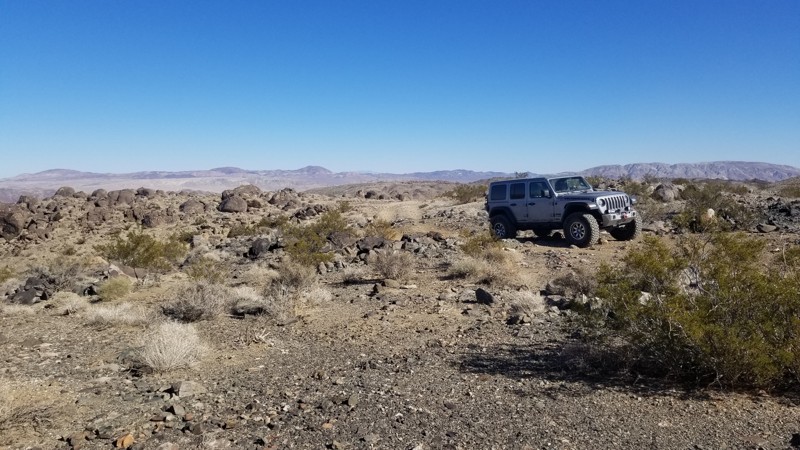
This short connector between Fissure Mountain and Wrecking Ball / Claw Hammer has a ton of dispersed camping. Several areas are large enough for 10 vehicles with ground tents. You will want at least an air mattress due to the small rocks on the ground. This trail is very lightly traveled, making it an ideal place to camp close to the epic crawling trails in the area.
The trail ends at Wrecking Ball, which has a difficult hill climb/drop, depending on how you take it. If going from Fissure Mountain, you will drop down the hill climb.
Updated: 08/11/2026
Forest Service Route 02S17Y
Buck Meadows, California
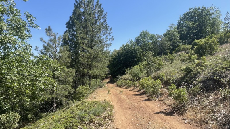
Forest Service Route 02S17Y is an easy trail in the Stanislaus National Forest. The trail connects Forest Service Routes 1S16 and 02S83, providing a less-traveled scenic route through the beautiful national forest. The forest service maintains the road, and although it does have small ruts and hills, it can be easily completed in 2WD. The trail is closed seasonally from December 16th to April 14th to prevent damage to wildlife habitats and the road. Camping is not allowed along the trail.
Updated: 10/15/2024
El Mirage 4652
Helendale, California
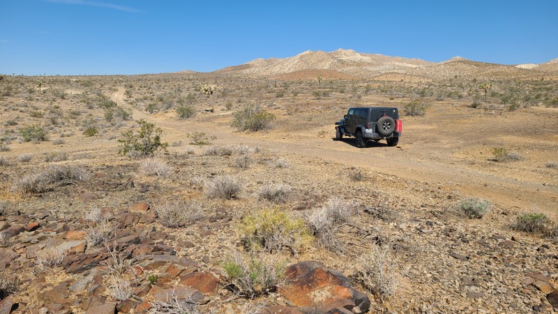
With its trailhead at Highway 395, El Mirage 4652 (EM4652) provides convenient access to the BLM El Mirage Subregion. Following a flat desert basin floor, this trail ends at a confluence of trails leading into and around the rugged Shadow Mountains, home to many old mines.
The El Mirage Subregion is a Limited Use Area requiring vehicles to stay on designated trails. The trails are well marked with frequent BLM signs to recognize if you are on the trail.
A two-wheel drive vehicle with high clearance and a beginning offroader will do fine on this particular trail, but venturing further into the Shadow Mountains trail network will require an experienced driver in a high clearance four-wheel drive vehicle with a low gear range and all-terrain light truck tires.
Many tortoises are in the area, and a vigilant eye is needed to avoid them as they slowly cross the trail.
There are many suitable and flat locations for dispersed camping on this route, but few existing rock campfire rings exist.
Updated: 07/16/2026
Delamar Mountain Road
Fawnskin, California
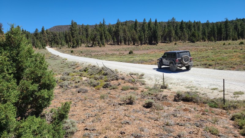
Delamar Mountain Road winds through a densely forested valley framed by Little Bear Peak to the west and Delamar Mountain to the east. Near its midpoint, the road crosses the Pacific Crest Trail, a convenient resupply stop for long-distance hikers. Toward the northern end, it opens into the wide expanse of Holcomb Valley, where it connects with Holcomb Valley Road (3N16) and a network of additional trails to explore.
Just 0.6 miles from the southern entrance lies Yellow Post Campsite #33. Along the first two miles, several other flat, shaded clearings provide excellent dispersed camping opportunities close to the road.
The road itself is an easy drive. It is wide, flat, and heavily traveled by all types of vehicles, making it a popular connector into Holcomb Valley. Suitable even for two-wheel drive vehicles with decent ground clearance, this road offers a relaxed and accessible way to experience the surrounding forest.
Updated: 10/15/2024
Stoddard Valley 6524
Bryman, California
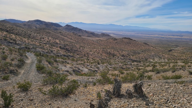
With the trailhead at Route 66, SV6524 (also called Bryman Road) passes east through the rugged Silver Mountains, past the Marter-White Mica Mine and an unnamed gold mine whose rocky mine waste was used to surface the surrounding trails. This difficult trail includes shelf roads and very steep grades, eventually reaching the eastern side of the Silver Mountain range. This is a straight-through trail that provides connections to other trails that surround these mountains.
While in the mountains, one can find many suitable flat dispersed campsites when meeting the BLM Camping Guidelines.
During high fire danger, campfires may be restricted, and if planning to camp here, one should review the current Campfire Restrictions and have a Campfire Permit.
SV6524 is a rough trail with uneven, loose, rocky surfaces, ledge roads with uncomfortable off-camber stretches, and inclines and descents approaching a steep 30 degrees. This trail should only be attempted with a partner vehicle and by experienced offroad drivers. A high clearance, four-wheel drive vehicle with four-low and all-terrain tires should be used to navigate this trail safely.
Updated: 09/10/2026
Little Box Canyon
North Shore, California
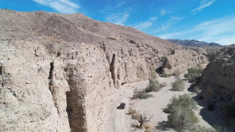
Little Box Canyon Road follows the northern border of the Mecca Hills Wilderness and is just north of the Salton Sea. The trail cuts through a narrow canyon and is often surrounded by near-vertical 40-foot cliffs rising to make for breathtaking scenery on this leisurely drive. To the north of the trail is BLM land with more unmarked trails to explore.
At 2.3 miles long and running west to east, Little Box Canyon Road is on a wide flat wash of loose sandy gravel. Starting at the paved Box Canyon Road, Little Box Canyon Road terminates at another dirt road, Meccacopia trail. There are no obstacles on the trail. This trail is suitable for first-time off-roaders with a four-wheel-drive vehicle.
Updated: 08/10/2026
Owens Gorge Road - North
North Landing, California
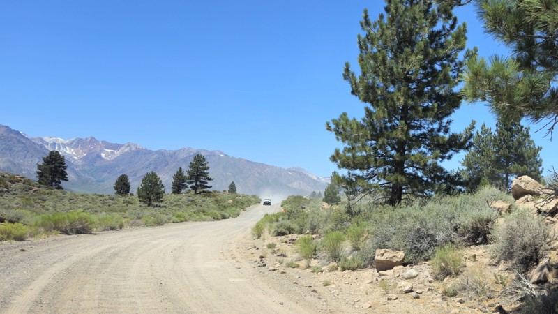
Owens Gorge Road is a scenic, connecting dirt road that runs through the dramatic landscape of the Owens River Area south of Crowley Lake, located north of Bishop, California. The road follows the river as it cuts through steep volcanic cliffs, offering striking views of the rugged canyon walls. While the road is generally graded and accessible to most high-clearance vehicles, some sections can become rough or rutted depending on recent weather conditions. It’s a popular route for sightseeing, photography, and accessing various rock climbing areas along the gorge. Fishing spots along the Owens River are also easily reachable from this road. Owens Gorge Road is also a popular way to reach the Crowley Lake Columns, a unique geological formation along the shoreline of the lake. While it's a beautiful place to explore during the day, there isn't any ideal camping along the route, so most visitors plan short visits or use nearby campgrounds such as Crowley Lake Campground. Owens Gorge Road is a peaceful, less-traveled route that offers a unique perspective on the geological features and natural beauty of the Eastern Sierra.
Please note: The road is closed on the south end at the dam, and you can't proceed any further south.
Updated: 03/09/2026
Miners Road
Guatay, California
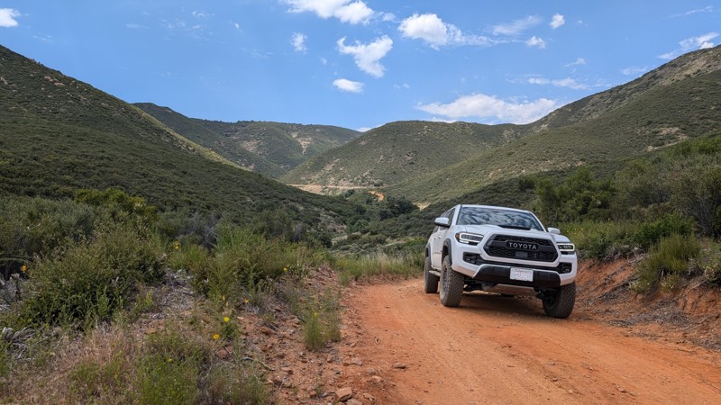
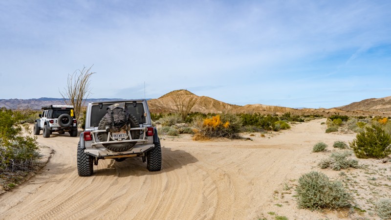
Miners Road is a fun branch off of Pine Valley Road. It meanders back into the mountains following Indian Creek, which often has water in it. The landscape is quite picturesque, and there are multiple mining claims along the route.
There are small climbs with loose rocks, ruts, and turns. It is quite a bit more than just a dirt road, but something a 2WD SUV can handle.
This road is within the Cleveland National Forest, and dispersed camping is allowed with an Adventure Pass.
Updated: 05/23/2024
Dolomite Mine Road
Ocotillo, California
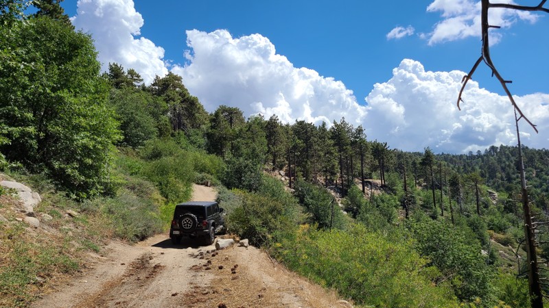
Hidden in the low deserts of Southern California is an area that has been forgotten in time. Just outside Ocotillo, Anza-Borrego State Park has a rich mining history, where travelers once came to mine the area for minerals in the 1930s. The Dolomite Mine Road was part of this area when men of the past were hoping for riches. Today, the mine has been forgotten, but the views are amazing. Off in the distance, you can see the scenic Carrizo Badlands glowing through the haze of the Salton Basin. So whether you are starting your overland adventure or finishing it, make this little blip of history a stop to experience the stunning views and remaining history of what once was.
Updated: 10/13/2025
Little Green Valley Road
Green Valley Lake, California
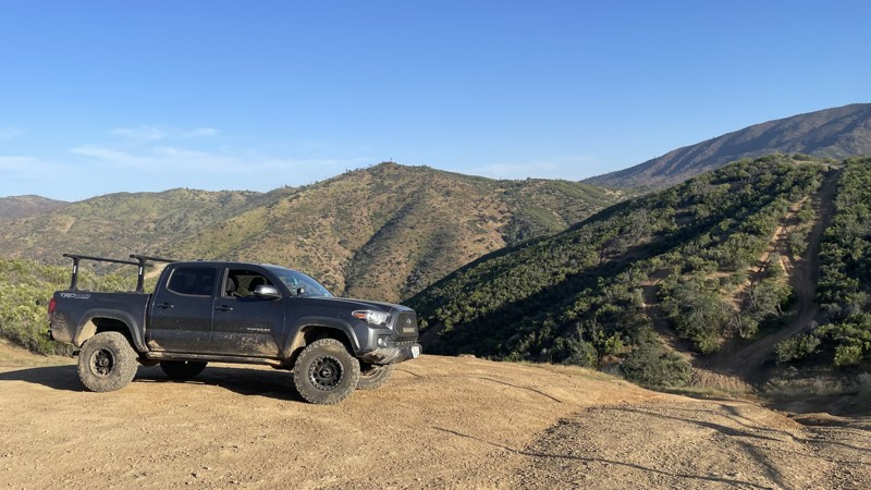
Centered between Lake Arrowhead and Big Bear Lake, Little Green Valley Road take you off the beaten path through the lush forest to provide outstanding dispersed camping, spectacular 100-mile views, connection to hiking trailheads, and driving challenges to scratch your 4x4 itch. This route also explores the up and back spurs 2N19B and C, offering more dispersed camping and leading to a cluster of hiking trails.
Over its length and on the spurs are several excellent, wide, flat areas for dispersed camping and pitching a tent among the pines. Only ½ mile from its northern end is an outstanding dispersed campsite that provides views stretching over 100 miles to the west. Spur C ends at a small meadow, perfect for a basecamp to explore the many hiking trails that connect here. Spur A is closed, open only to authorized vehicles. If improved campsites are preferred, the Green Valley Campground is located just ½ miles east of the north end of the trail.
The dirt road is generally wide and flat, but suffers from several washouts requiring a high clearance 4x4. The most difficult obstacle is located 0.8 miles from the south end of the trail over large boulders, where fallen trees have been positioned by previous travelers, providing ramps to ease over the large rocks. A shelf road makes up some of the road with intimidating descents down the mountainside. Short corridors on the trail are overgrown and can lead to vehicle striping, especially on the little-used spurs.
Updated: 10/15/2024
Frank Raines OHV: West Loop Trail
San Antonio Valley, California
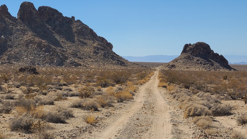
Frank Raines OHV Park is located not far from Patterson, CA. It is open to 4x4s from sunrise to sunset with a $5 admission fee per vehicle. The park is open to all OHV vehicles, so be sure to watch out for dirtbikes, quads, and SXS.
West Loop Trail is a moderately difficult trail in Frank Raines that connects Tip Over Trail to West Trail. The trail can mostly be completed in 2WD, but there are a few short hill climbs that require 4WD or AWD.
Deer Creek Campground is located at the park's entrance. The campground has 34 sites with picnic tables, restrooms, and other amenities. Prices range from $15 to $30 per site.
Updated: 03/11/2025
Ship Mountain Road
Bush, California
Ship Mountain Road is a 75-mile trek, perfect for overlanders, through the beautiful Cadiz Valley's soft sandy desert basin with a sudden change up to the rocky trails of the scenic Ship and Old Women Mountains. When combined with Flat Top Mountain Road, these two trails provide a memorable 100-mile overland adventure.
The trail conditions change dramatically from soft, silty sand to hard-packed and rock-strewn. Washes across the road collect deep silt sand and require 4-wheel drive, and lockers can help climb out of the deeper washes. Cattle wander the trail's eastern portion, and drivers are asked to keep a respectful distance. An experienced desert offroad driver should attempt this trail using a high clearance 4x4 and must be prepared for self-rescue in this remote part of the desert.
Dispersed campsites can be found along the trail but are mainly on the open desert floor.
Updated: 10/15/2024
Frog Creek Road SC47
Harts Place, California
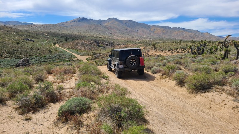
Frog Creek Road (SC47) rambles over a flat, high desert floor at a 5200-foot elevation just south of the Scodie Mountains. A spring drive through here will treat visitors with hills covered in yellow desert flowers and groves of healthy joshua tree. This straight-through trail has several intersecting driving and hiking trails. The road begins at the intersection with Bird Spring Road and ends at the paved Kelso Valley Road. The Pacific Crest Trail intersects Frog Creek Road at about its halfway point.
Frog Creek Road is almost entirely a soft sandy trail with short sections of exposed rock. A beginning offroader would enjoy this easy trail using a high clearance 4WD vehicle.
Suitable spots for dispersed camping spots with existing rock fire rings can be found along this route and enjoyed when meeting the BLM Camping Guidelines. During high fire danger, campfires may be restricted, and if planning to camp here, one should review the Campfire Restrictions and have a Campfire Permit.
Updated: 12/01/2025
Palm Wash
Salton City, California
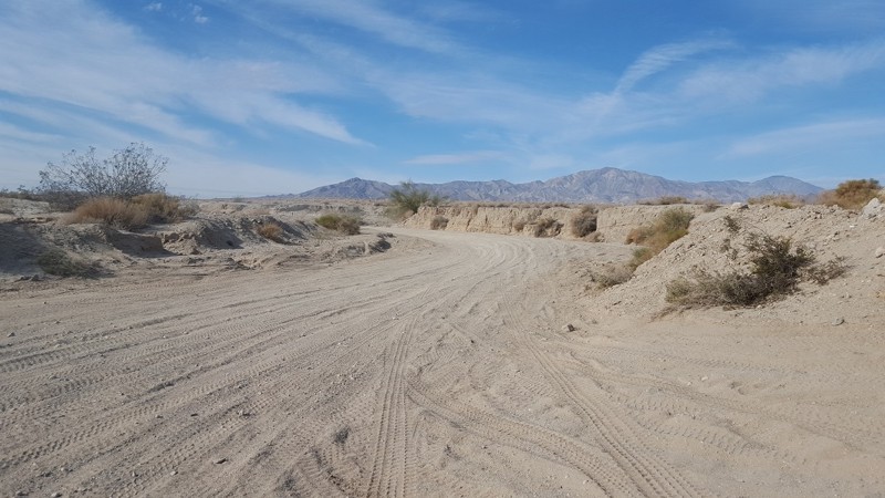
Connecting Truckhaven to Calcite Mine, Palm Wash is a 7-mile trek through deep sand and whoops, with steep wash walls on either side. There are occasional drop-offs and step-ups and plenty of blind spots, so don't travel faster than safe. Like most washes, Palm Wash is a popular area for highspeed users, so be sure to keep your head on swivel around turns. Trail is suitable for any high clearance vehicle.
Updated: 08/11/2026
Burro Schmidt Tunnel Road
Saltdale, California
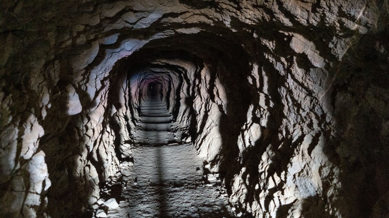
The drive to the tunnel is suitable for any vehicle. As you gain elevation, the dilapidated cabin stands with plenty of graffiti. Continuing around the hill, you will find a large parking area that can hold a dozen vehicles. The tunnel entrance is clearly visible, although if you are of standard height, you will need to hunch down to enter. One small dispersed campsite is at the start on the very northwest end of the trail.
After visiting the tunnel, you can continue your route on the steep and narrow EP 103, which offers outstanding 360-degree views, or return the way you came to connect to many other trail options.
But who was William "Burro" Schmidt"?
William "Burro" Schmidt spent 33 years single-handedly digging a tunnel through Copper Mountain, claiming it was a "shortcut." Using hand tools, explosives, and a wheelbarrow, he removed debris, eventually installing ore car rails. His obsession drove him to complete the tunnel, but he never transported ore through it despite uncovering rich veins of minerals.
Originally from Rhode Island, Schmidt moved to the desert for health reasons and supported himself as a ranch hand while working on the tunnel. After his death in 1954, his partner, Mike Lee, continued giving tours until 1963.
Evelyn Tonie Seger later acquired the property, living in Schmidt's cabin until her death in 2003. A strong-willed woman, she endured hardships, including a violent land dispute.
Today, visitors can explore the tunnel at their own risk. A flashlight is recommended, as the passage is dark and carries a faint stench reminiscent of a stale bar. The tunnel opens to a scenic overlook of Saltdale, making the trek worthwhile.
Updated: 10/15/2024
Stoddard Valley 6265
Victorville, California
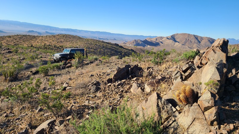
SV6265, also called Victorville Quarry Road, is a maintained road to support the working quarries in the area before transforming into a narrow mountain trail into the Silver Mountains. The high desert landscape is stunning and is greatly enhanced by the endless views from the mountaintops. This straight-through trail connects to several other paths that once accessed the area's many mines.
With no existing campsites visible from the trail, a few flat locations provide good dispersed campsites with views when meeting the BLM Camping Guidelines.
During high fire danger, campfires may be restricted. If planning to camp here, review the current BLM Campfire Restrictions and have a Campfire Permit.
SV6265 is a rocky trail with steep climbs and descents with significant off-camber leaning into the valley below. A high clearance four-wheel drive vehicle with good all-terrain tires and an experienced driver should attempt this trail.
Updated: 10/15/2024
Billers Bailout
North Shore, California
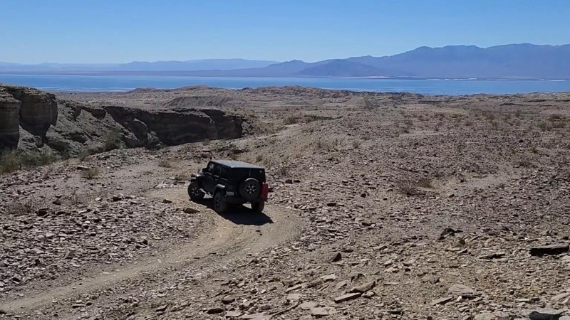
Billers Bailout Trail is a short 1 mile out and back hard-packed gravel road, managed by the BLM and is surrounded by the protected Orocopia Mountains Wilderness. Generally an easy trail but with a couple of climbs that reach inclines up to 21 degrees which may test a 2-wheel drive vehicle, and also has an uncomfortable 15-degree off-camber section. The trail ends at the top of a deep gully where to the south, the altitude affords a beautiful overlook of the expansive Salton Sea. While tire tracks show Billers Bailout continuing down a very steep road into the gully and continuing north, this endpoint marks the legal end of the trail for motorized vehicles.
Updated: 09/10/2026
Morris Lake Trail
Tobin, California
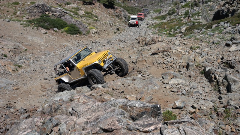
Morris Lake Trail, located in the High Lakes OHV Area, is an extremely difficult in-and-back rock crawling trail. What makes it so difficult is you drop down a loose shale trail upwards of 20 degrees; as you travel down the route, there are ledges and waterfalls along with boulders that find their way into the trail. Once at the lake, a tiny area to turn around and head back out of the trail is just large enough for four vehicles. This trail is for people looking for rock crawling trails and nothing else. In this case, if you have never done it before, it would be wise to inspect the downhills first. The first part of the downhill is doable in most high-ground clearance 4x4s. Lockers would be ideal, along with being aired down low with aggressive tires. The lower portion of the hill is where things get insane. With massive ledges, 3-foot round boulders, and other obstacles, only the most insane and well-built rigs should attempt. Just remember, the only way out is back up the hill.
There is no camping on this trail. But not far from the trail on Trail 616, Long Lake has several areas that would be great for dispersed camping and could easily support a small group of 2-4 vehicles.
Updated: 10/15/2024
Sutherland Dam Road
Mesa Grande, California
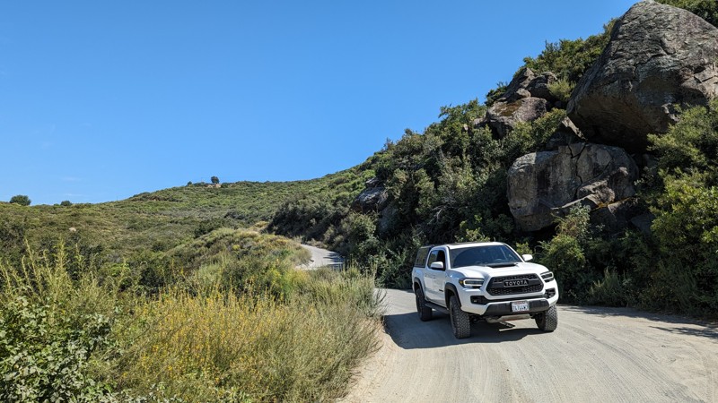
A connecting trail between Lake Sutherland (Dam) and Black Canyon Road. Nicely graded and easy to traverse. Virtually any street-legal vehicle can drive it. The hardest parts are the narrow declines (traveling east to west), as the decomposed granite (DG) on hard-pack dirt doesn't provide the greatest traction. If you have any speed, it may be difficult to stop for oncoming traffic.
At the top (eastern end) is Lake Sutherland Dam, with plenty of room to park and view the dam and/or lake. It's a great place to take a lunch break or just admire the view. It's worth the short trip if you're traversing Black Canyon Road.
Updated: 04/22/2026
Long Valley Loop
Boulder Oaks, California
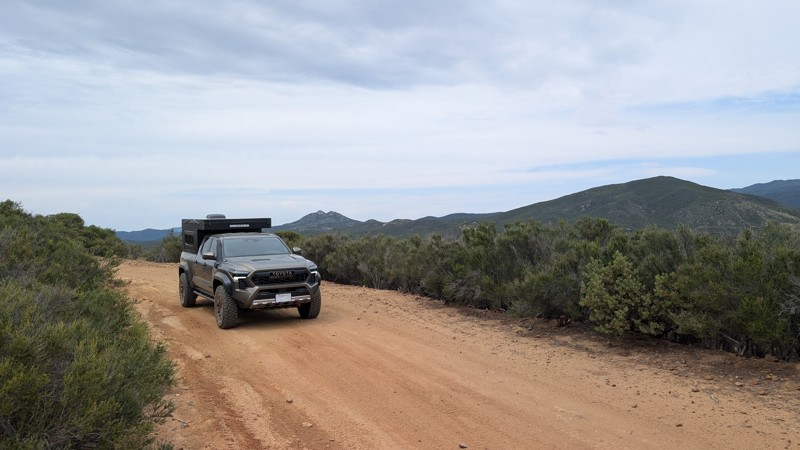
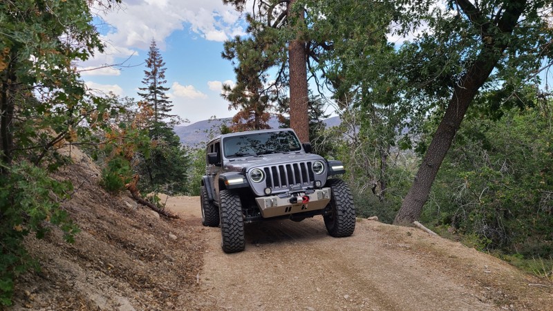
Long Valley is quietly nestled between Long Valley Peak and Los Pinos Mountain, two of the tallest peaks in the area. The trail starts with a scenic 1-mile drive along an easy-to-navigate shelf road, after which the loop begins by heading either west or south. To the west, Eagle Nest Mine can be found along the northern part of the loop, 0.4 miles west of the branch. The entire round trip, starting at and returning to Bear Valley Road, is 5.5 miles. This trail, when combined with Bear Valley Road, makes a great half-day adventure for anyone looking for mountain views, some seclusion, and navigating something more aggressive than a dirt road.
Difficulty
About a tenth of a mile from the start (eastern end) is the hardest part. A roughly 20-foot steep slope with embedded rocks that may place a vehicle at a 20° pitch. The slope and rocks can be easily navigated and have good traction. The trail smooths out at the loop and alternates between dirt and golf ball to baseball-size rocks. High clearance and 4WD is recommended.
Camping
There is a large rocky area at Eagle Nest Mine with a small hand-made fire ring. It is not very level and definitely not soft, but with some carefully placed rocks or blocks and a rooftop tent, it could make for a nice site. Camping does require a dispersed camping permit from the Descanso Ranger District.
Access
The trail starts near the end of Bear Valley Road, which is the only way to access the trail with 4 wheels. Kernan Cycle trail also connects to Long Valley Loop, but it is only open to motorcycles.
Updated: 03/09/2026
Green Valley Bypass
Green Valley Lake, California
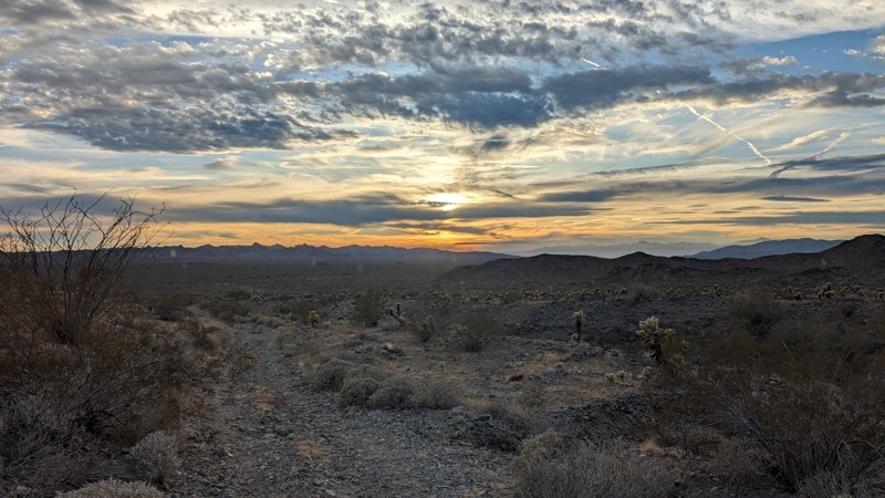
Green Valley Bypass (2N54) is a hard-packed dirt trail that serves as a useful straight-through connector between 3N16 and 2N13 in the San Bernardino National Forest. This lightly trafficked trail gives off-roaders a simple but practical alternative to pavement, allowing drivers to bypass the congestion of Green Valley Lake below when linking up with other trail systems like Snow Slide. Open year-round and generally accessible except during times of deep snow, 2N54 is a solid choice for anyone planning a loop or looking to string together multiple trails in the area.
The trail remains relatively mild throughout, but includes a moderate hillclimb with mild ruts that may require a bit of throttle finesse in slick conditions. The rest of the route is generally flat or gently graded, winding through a mix of sparse pine and chaparral terrain. It’s well within the capability of a stock 4x4, and even drivers without prior offroad experience will find it approachable. While dispersed camping is technically allowed, suitable pull-offs are rare and limited, so this is more of a drive-through than a basecamp destination. All in all, Green Valley Bypass offers a low-effort, high-utility dirt alternative that slots in seamlessly for drivers navigating the surrounding trail network.
Updated: 05/01/2025
Queen Esther Mine Road
Desert Center, California
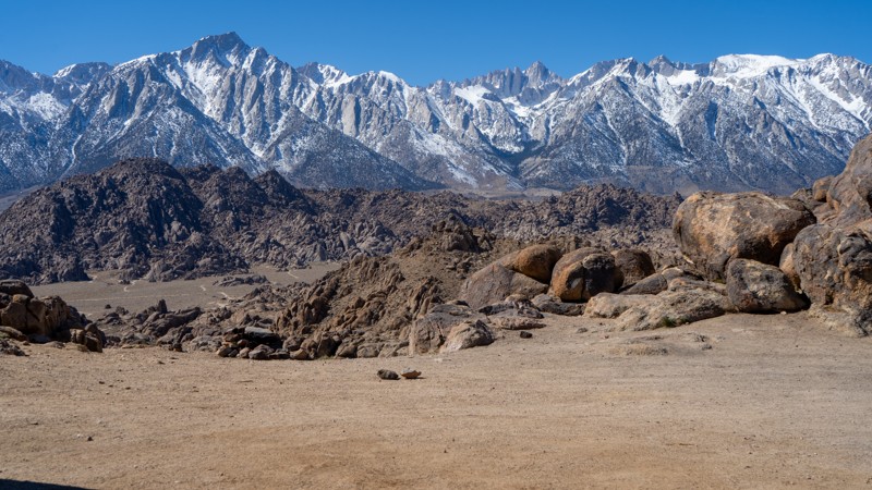
The Queen Esther Mine Road begins off Powerline Road, proceeds southeast to the base of the Chuckwalla Mountains, and ends at the mine site. The road alternates between gravel and soft sand. There are two washouts that a full-sized truck would have trouble with.
Cholla cacti line the narrow road. If you have pets, monitor them closely because these cacti are very sharp and stick to everything they touch. Do not try to remove them with your hands, even with gloves. There are also Ocotillo and Palo Verde trees along the trail. At the end of the road, an opening to the mine extends into the mountain for approximately 100 feet. Use caution if you decide to venture in for a look.
There is no room for camping at the end of the road, but several open areas along the track are suitable for camping.
Updated: 03/13/2025
Contact Flat Sites 34-37
Lone Pine, California
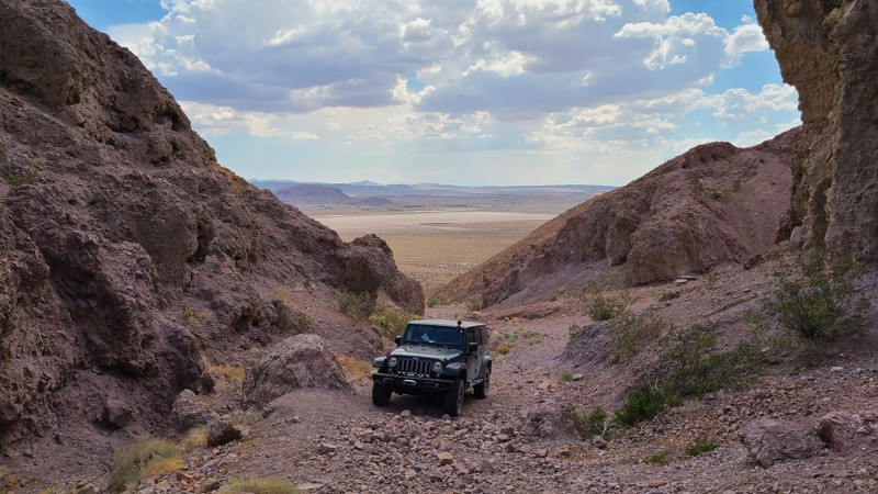
North of the famous Movie Flat is Contact Flat, a short out-and-back spur with four designated campsites. After the first campsite, high clearance and 4WD are needed due to a rocky, undulating surface. Just beyond the last campsite, the trail makes a large loop, providing users with the opportunity to view the incredible rock formations of the Alabama Hills and the towering Sierras and even take a hike along a few short trails connecting back to Movie Flat.
About camping on this route:
All dispersed camping is designated to a specific site and requires a permit. A permit can be obtained online or at the Eastern Sierra Visitor Center or kiosks located on Movie Road and the main entry point in Lone Pine. Permits need to be signed and displayed on your dashboard.
The BLM has created a map showing the site numbers. However, those numbers are not used in the field, but each site is clearly marked with either a camping allowed or no camping allowed symbol on a clearly visible sign. Please be aware that all sites are first come, first served, and a permit does not guarantee you will find a site. Due to the popularity of the area, it is best to arrive early.
There are six portable restrooms throughout Alabama Hills. If you do not want to drive or walk to one, you must bring your own system to pack out human waste.
About the campsites on this route:
- 34: Is a large and open site with easy access often used by vehicles pulling trailers. Beyond site 34, a small obstacle requiring high clearance limits the camping to vehicles with either small adventure trailers or self-contained set-ups.
- 35: It is literally on the edge of the trail and is rather small, but a nearby rock face provides a small amount of shade.
- 36: This large site is located a short distance off the trail and has incredible views to the west over the Sierras. Four to five vehicles should fit comfortably here.
- 37: Located right off the trail against a massive boulder, providing shade in the afternoon and evening and room for three to four rigs.
Updated: 10/15/2024
Calico Mountain 7606
Yermo, California
This short 0.4-mile spur offers inspiring geology at an impassible shear-walled box canyon that looks back over the desert basin. Some maps show CM7606 continuing through to Mule Canyon, but whatever road once existed has long ago disappeared, leaving only an impassible shear wall of rock.
Only a high clearance, four-wheel drive vehicle should attempt this rough rocky trail. The road narrows at its end, requiring a careful turnaround to keep the tires on the road. A spotter is very helpful here.
There is no flat camping area here. The best nearby campsites are on the connecting CM7600.

Upgrade your Membership
Unlock all of the details on every Trail Guide and Scout Route.
Start a 7-day Free TrialBrowse Trails in California by City
Browse every California city with offroad trail guides.
Community
Partners

