







By clicking "ACCEPT", you agree to be the terms and conditions of each policy linked to above. You also agree to the storing of cookies on your device to facilitate the operation and functionality of our site, enhance and customize your user experience, and to analyze how our site is used.
Arizona Off-Road Trails
373
Total Trail Guides 359

4679
Detailed Waypoints 676
Try a Free 7-Day Trial and unlock it all
Start a Free Trial Most Recent Trail Reviews
No Rating
Open
Visited: 09/23/2026
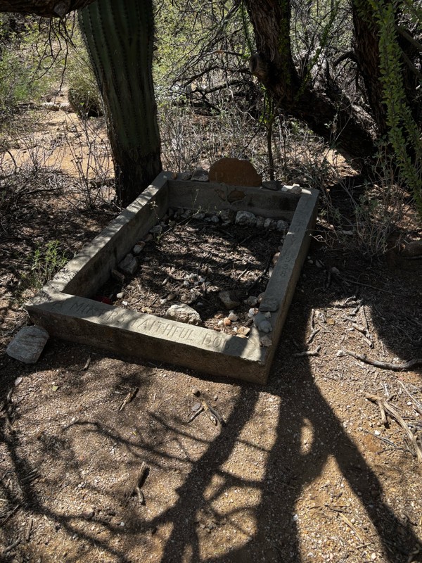
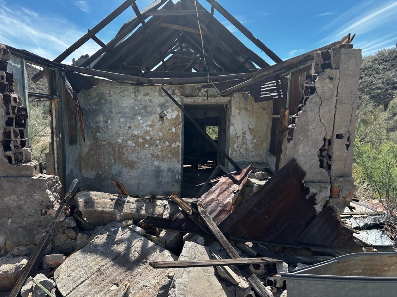
Gets a little technical at the end but the difficulty is spot on.

KR
Keith Ringiesen
Rated 4/5
Open
Visited: 09/22/2026
Hard pack, easy forest service road that is a great back way to the North Rim of the Grand Canyon.

Tyler D’Hulst
Rated 4/5
Open
Visited: 09/22/2026
Spring Canyon is a beautiful drive. We didn’t go out to the cabin but used this western section of road coming back from Crazy Jug

Tyler D’Hulst
Rated 4/5
Open
Visited: 09/22/2026
We took this out to Crazy Jug. The northern section is hard packed forest service road. Not difficult. Very scenic drive through the ponderosas.

Tyler D’Hulst
Rated 5/5
Open
Visited: 09/22/2026
View point is spectacular! Trail was easy going out, no obstacles at all. Saw a Toyota Camery at the viewpoint.


Tyler D’Hulst
Rated 3/5
Open
Visited: 09/22/2026
An alternative route out to Crazy Jug Point. It’s easy and can be scenic in areas. I’d recommend West Ryan out to Crazy Jug though.
Tyler D’Hulst
Rated 3/5
Open
Visited: 09/22/2026
A quick connector trail through the burn patch.
Tyler D’Hulst
Rated 5/5
Open
Visited: 09/20/2026
Leviathan Mine trail is a full day trip. Though it is only 20 miles in length the travel is slow and rough. Majority of the trail you will be going between 5-10 MPH. Then once at the end it connects w...



Eric Gartin
Official Crew
Rated 4/5
Open
Visited: 09/19/2026
Simple road, well graded today. Many mountain bikers coming down from the West out of Breezy Pines. Not too many people out until approaching Senator Hiway. We went East to West as I think thats a bet...



Jeff Burnett
Rated 3/5
Open
Visited: 09/19/2026
The trail itself is not spectacular, it's pretty flat across the plains. However, driving up to the overlook and seeing a huge gaping hole in the ground is a great juxtaposition to the flat trail. The...
Tyler D’Hulst
Rated 3/5
Open
Visited: 09/19/2026
A nice trail ride from the main road down off the plateau. It's graded forest service road until the switchbacks. The switchbacks themselves are not difficult, road is not graded. This section has bee...
Tyler D’Hulst
Rated 3/5
Open
Visited: 09/18/2026
The end of the trail is not well marked, and can cause confusion. Also, vehicle passes are required for all backcountry routes within the Lake Mead National Recreation Area.
Eric Gartin
Official Crew

Ted Whisler
No Rating
Open
Visited: 09/17/2026
Nice ride west side a little rocky but rating is true to #2


Ted Whisler
Rated 3/5
Open
Visited: 09/15/2026
A nice drop off the plateau heading towards Marble Canyon. Not a difficult road. Road is weathered but not challenging.
Tyler D’Hulst
No Rating
Temporary Closure
Visited: 09/15/2026
Road closed due to multiple washed out wash crossings after the turn off to go up the mountain. "Road Closed" sign put out by BLM on trail.
Tyler D’Hulst
No Rating
Temporary Closure
Visited: 09/15/2026
After the turn off to head up the mountain there are multiple washed out wash crossings. A "Road Closed" sign has been put out by the BLM.
Tyler D’Hulst

Ben Ruddell
Official Crew
Rated 4/5
Open
Visited: 09/14/2026
Bogles Ranch Road is a great Sunday afternoon drive type of dirt road that climbs up in elevation and gives some spectacular views of the surrounding area. The first half passes through State and Priv...


Eric Gartin
Official Crew
Ben Ruddell
Official Crew
Rated 3/5
Open
Visited: 09/14/2026
Antares Road is an excellent way to travel from Route 66 to the eastern portion of the Lake Mead National Recreation Area. This wide county road is well maintained with minor washboarding, most of whi...


Eric Gartin
Official Crew
Rated 3/5
Open
Visited: 09/14/2026
Hackberry road is a wide dirt road with minimal erosion damage and washboarding. There are a couple of larger washes that cross Hackberry road creating wide stretches of loose sand which can cause iss...


Eric Gartin
Official Crew
Rated 3/5
Open
Visited: 09/13/2026
This is a very rough, rocky, & slow going trail. Expect around 4+ hours for the trail & another hour to get the highway. One of those trails I'm happy I did but I wont be back personally. High clearan...

Brandon W
No Rating
Open
Visited: 09/12/2026
I think the rating is spot on. The ruts and washouts at the beginning are not as bad and if you hug the inside of the shelf road they can be avoided. The middle part is same general sandy wash with ov...



Greg Page
Rated 4/5
Open
Visited: 09/11/2026
Ran this trail as part of a larger loop. Trail is in great shape. Easy for standard 4x4 with no lift. Passengers can do it until maybe the very end by the lake where the road gets rocky and washed out...


Jeff Burnett
Rated 5/5
Open
Visited: 09/10/2026
This is one of my favorite scenic trails in the area. The trail is easy to travel, but does have some optional short trails that will test your vehicle. The views from the Grand Wash Cliffs of the Hua...


Eric Gartin
Official Crew
Rated 3/5
Open
Visited: 09/07/2026
This trail by itself is nothing special. It is mostly used as an access road to get to the more technical trail such as Homecourt, Twister, and Waynes World. This is a great trail for the beginner to ...


Eric Gartin
Official Crew
Rated 3/5
Open
Visited: 09/07/2026
This trail is an enjoyable alternate route when traveling on Blake Ranch Road (7163). The trail is easy with only a handful of spots with erosion damage. The few established camping sites appear to n...


Eric Gartin
Official Crew
Rated 5/5
Open
Visited: 09/07/2026
Ran this trail from Boynton Pass Road to Loy Butte Road (opposite direction from what is listed). Ran into a few rental ATVs and a couple of Jeeps heading the opposite way. This was a fun trail wit...



Daniel Macioce
Rated 5/5
Open
Visited: 09/07/2026
This trail was a lot of fun, plus the views were amazing. I ran the trail in the order posted, starting at the south trailhead and finishing at the heritage site. Past a motorcycle, a few jeeps and a...


Daniel Macioce
Rated 4/5
Open
Visited: 09/07/2026
Nice trail, ran West to East. For some reason the map shows this a a one-way trial, East to West. That is not the case, it is a two way trail. Was pretty washed out starting around mile 12. Plenty roc...


Jeff Burnett
No Rating
Open
Visited: 09/06/2026
New trail for me. You didn’t know what it would throw at you around every corner which is why you try to find new trails or old forgotten ones
KB
Kory Burden
Rated 5/5
Open
Visited: 09/06/2026
The trail is no joke—steep, narrow, and technical enough that you’ll want to be comfortable with off-camber shelf roads, rocky terrain, and washouts that will test your vehicles articulation. The rew...



Bobby Rumbaugh
Official Crew
Rated 5/5
Open
Visited: 09/06/2026
Fun trail if you don't want to do pyeatt draw itself. Ran this trail 3yrs ago and definitely a little more erosion but, still any truck or suv with good factory ground clearance can do it. From previo...
JM
James m
Rated 4/5
Open
Visited: 09/06/2026
Ran this trail from I-17 to Sedona. Extraordinary views descending into Sedona. As others have noted, there are lots of rock on the trail, making it slow going. Passed a large number of Pink Jeeps ...


Daniel Macioce
Rated 4/5
Open
Visited: 09/05/2026
This one definitely changed over the last few years. The southern section has some legit, steep, off-camber sections. YOU NEED experience, backup, and a capable vehicle on this one now. It's not supe...


.jpg)
Bobby Nelson
Official Crew
Rated 4/5
Open
Visited: 09/05/2026
Another amazing time on this scenic crossover. We came in from Walnut Canyon and finished out on Price Road after about 6 hours. A challenging and hot day for the old TJ. Rincon Road has evolved into ...


Bobby Nelson
Official Crew
Rated 4/5
Open
Visited: 09/05/2026
We started exactly at sunrise to try and beat the heat. We planned to crossover to Box Canyon and out on Price Road. It ended up taking us 6 hours, even with all the photos and filming we did. A chall...


Bobby Nelson
Official Crew
Rated 5/5
Open
Visited: 09/04/2026
We recently ran Four Peaks after the monsoon rains. Here’s what we found and what to expect if you’re planning to run it. Have a GR8 day!

Jeep 4 Dirt
Rated 5/5
Open
Visited: 09/04/2026
Breathtaking views. Definitely don't rush through the trail. Devil's staircase was a bit slippery but awesome. A few tight stops here and there, but a trail that's a must on anyone's to do list.



Christopher Bradley
Rated 4/5
Open
Visited: 08/30/2026
Id say this is a 3.5 to 4 trail. There are some obstacles, but nothing you really need to think hard about how to approach. If you send your vehicle at it in 4 low you'll get through everything.



Justin Holsinger
Rated 4/5
Open
Visited: 08/28/2026
Rim Road (FS300) West to East. Very well groomed gravel forest road. Accessible by just about any vehicle thats not been lowered. Who does that anyway? Scenic views the whole route. Hard to believe on...


Jeff Burnett
Rated 4/5
Open
Visited: 08/28/2026
Not a bad road but it was crowded with sxs and vehicles towing campers. Hard to rate 5 stars for a busy road. Super easy any vehicle can do this. Part is paved near the freeway but the rest is gravel.

Tony Rockwell
Rated 4/5
Open
Visited: 08/28/2026
I rated 4 stars just due to the volume of sxs & camper trailers on the road.
Easy drive, any car can do this.
Ran from sheep springs to munds park, see other reviews for full route.

Tony Rockwell
Rated 4/5
Open
Visited: 08/28/2026
I ran Bar M in reverse to get to this trail. Then headed toward Casner Park Road. (See reviews I did on each of those)
Nice easy trail that is less rough than Bar M.
Nice drive through trees.


Tony Rockwell
Rated 5/5
Open
Visited: 08/28/2026
Very bumpy due to rock infused trail. A few larger rocks, 8-12” tall in places but most stock 4x4’s should be able to navigate around or over them. I would say any 4x4 with all terrain tires could nav...


Tony Rockwell
Rated 3/5
Open
Visited: 08/27/2026
Overall decent little trail; camped out near Committee Tank (not suitable for tent camping - too rocky). Nothing too technical but enough to keep things interesting. High clearance and good line choi...


Bill Ferguson
Rated 3/5
Open
Visited: 08/27/2026
Connector from FS801 (Rock Garden Loop) to FS09494F (Committee Tank Trail); yeah, it lives up to its namesake. Very rocky. High clearance and picking good lines are an absolute must. Car camped at...

Bill Ferguson
Rated 5/5
Open
Visited: 08/27/2026
Nice trail saw some deer it’s a little rough but overall was easy


M
Maddox
Rated 5/5
Open
Visited: 08/23/2026
Great little adventure for the day. Dirt road is pretty rutted up due to monsoons, but easily drivable. Lake itself is extremely low.
LL
Larry Lapp
Most Popular
Updated: 05/20/2024
7422
Wikieup, Arizona
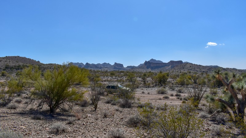
Less than two hours from either Lake Havasu or Wickenberg, this trail skirts the northern boundary of Aubrey Peak Wilderness Area. Once providing access to McCracken Mine, this old trail offers glimpses of the unique rocky bluffs in the Wilderness Area and provides views of several mountain ranges to the west. This secluded trail is rarely traveled compared to surrounding trails, allowing adventurers to take the trail less traveled.

Updated: 05/20/2026
Superstition End of the Line
Gold Canyon, Arizona
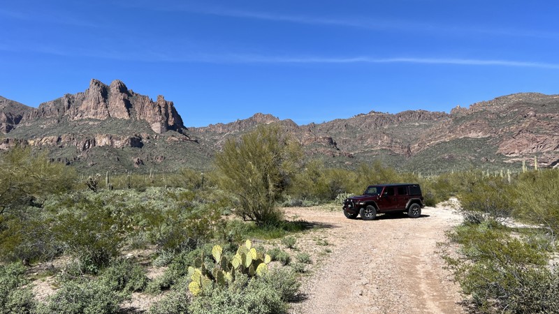
While on the map, it appears this trail connects with Superstition Fence Line Heights on the north end, it does not. A fence without a gate between the two trails makes this an out-and-back trail. There is limited space to turn around at the end of the line. The trail is primarily packed dirt with rocks and a few minor washouts to navigate.
The advantage of this dead-end trail is the dispersed campsites. There are several to choose from that are large enough to accommodate two vehicles. These sites have flat ground perfect for tent camping and feature rock fire rings. All the campsites have outstanding views of the Superstition Mountains.
This area is Arizona State Trust Land. A recreational permit is required.
Updated: 10/15/2024
Milligan Valley
Feaster, Arizona
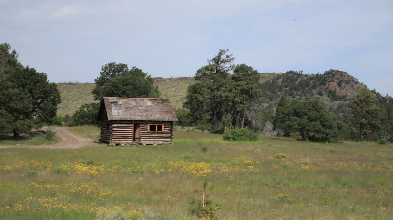
Milligan Valley runs westward from Highway 180 to Water Canyon Road. This scenic trail passes through open prairies, pine forests, and some burned areas. Along the way is a historic cabin with a great campsite nearby. The road briefly passes through a parcel of private property owned by the Grand View Camp. Visitors are welcome. The road is closed seasonally from January 1 to May 31.
Updated: 12/13/2024
Sycamore P1007
Fort McDowell, Arizona
P1007 does not have trail markers. It is a designated motorized trail per the Tonto National Forest Travel Management Plan. Follow the GPX track provided.
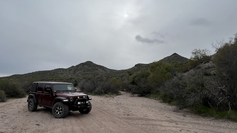
P1007 begins right after the intersection of MT1847 and MT1872 with a steep downhill section. This is the most difficult and rocky part of the trail. Once down the hill, the trail follows a sandy wash alongside Adams Mesa the rest of the way. P1007 ends at the marked intersection with MT1848. There are not any large camping spots along the way, but you could set up camp in one of the wider sections of trail or in a few of the brush clearings. Cattle are present in the area.
Updated: 10/15/2024
Deer Pass
Cornville, Arizona
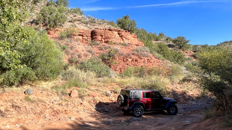
This trail is short and mainly used to access two designated dispersed camping areas. The first area, called Javelina, is closest to Highway 89A. This area is mainly used by RVs, 5th wheels, and bumper trailers. It can accommodate close to 10 vehicles, but the space is tight. There is a sign just after the Javelina site stating that no trailers are allowed past that point. The second designated dispersed camping area is called Angel Valley, and it can accommodate 10-15 vehicles, but again, the space is limited. The ground in these areas is hard-packed dirt and may not be level.
The trail down to the Angel Valley camping area is graded dirt and gravel. Beyond Angel Valley, the road becomes more primitive until it ends in a flooded-out area near the edge of Oak Creek.
At the beginning of the trail, there is a day-use-only parking area for the Deer Pass hiking trailhead. This area has parking for 15-20 vehicles. There is an informational board with local forest information and a pit toilet. This trailhead also provides mid-point access to the Lime Kiln Hiking Trail #82, which leads to Dead Horse Ranch State Park at the southern end of the 15-mile trail.
Updated: 04/22/2026
Jolene
Tonto Basin, Arizona
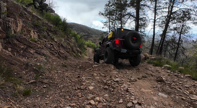
Named after the long-abandoned Jolene Mine, this rugged trail is a true test of skill and nerve. Jolene runs along a narrow shelf road with steep drop-offs into ravines and valleys, offering stunning views and scenery. The terrain is a mix of packed dirt, sharp rocks, scattered boulders, and off-camber sections reaching 25–30 degrees. A lifted vehicle with off-road tires is strongly recommended. While there are no established campsites along the route, it does pass by the old El Oso Mine area. It connects with Big Pine Flat and Edward’s Park Trails to form a challenging and scenic loop.
Updated: 09/05/2025
Sky Hi Road
Pinetop Country Club, Arizona
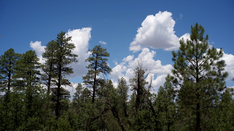
Sky Hi Road provides an easy drive through Ponderosa pine and piñon-juniper forest north of Pinetop-Lakeside. It begins as a paved road veering off from the large Pinetop Lakes community and becomes FS182 just past the small Sky Hi Retreat housing area. FS182 is generally well-maintained but has mild washboards in a number of sections. Sky Hi Road alternates between forest and small forested meadows, but there are very few places to pull off the road to park and explore. It can be used as a connector since the northern terminus is at Porter Mountain Road/CR3144 (parts paved, parts smooth gravel), which can be taken north to eventually connect with US60 or south to return to Pinetop-Lakeside or Show Low.
Two campsites can be observed from the road, but they are less than ideal. A number of spurs along the route—narrower, moderately rutted, and of indeterminate length—may offer additional camping opportunities.
Updated: 10/15/2024
Ajo Scenic Loop
Ajo, Arizona
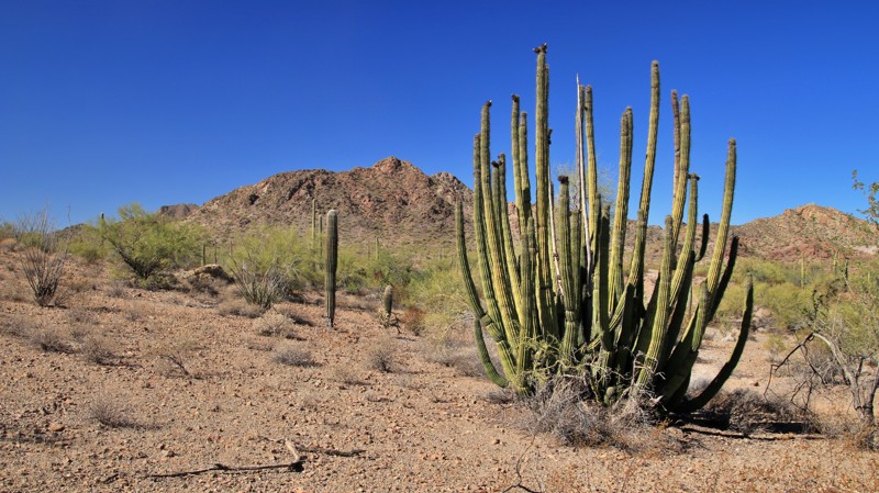
Running around the western side of Ajo and its massive New Cornelia mine, The Ajo Scenic Loop runs through the Little Ajo Mountains and a forest of cacti, including the rare Organ Pipe cactus. The trail begins in Ajo on its northern end and terminates on the historic El Camino del Diablo. The route is a well-maintained graded dirt track. Easily driven by any vehicle when dry, flooded washes make the track impassable after heavy rains.
The mountains make for a wonderfully jagged skyline. The New Cornelia mine's colorful tailings are visible along the most southerly portion of the trail. The now inactive mine was Arizona's first open-pit copper mine. Operations began in 1915. Previously only a tiny village, Ajo sprang up as a mining town. Ajo is named after the Spanish word for garlic. Wild garlic grows in the area.
Dispersed campsites are abundant along the southern half of the trail. The sites range from small one-vehicle tent sites to large areas supporting multiple RVs. This is a popular camping area for winter visitors.
Updated: 10/15/2024
White Horse Lake
Parks, Arizona
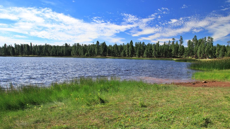
This easy graveled road goes deep into the Kaibab National Forest, passing the Pomeroy and Sycamore Falls hiking trailheads offering vault toilets. The White Horse Lake Campground, with all the amenities you expect, sits beside its namesake lake. Fishing and kayaking are the usual pastimes. The Black Bear Snack Shack has treats and rentals.
For those who prefer dispersed camping, plentiful large shaded campsites line the last few miles to the campground. A 14-day stay limit applies to the dispersed sites.
Updated: 10/15/2024
Gentry Ridge
Kohls Ranch, Arizona
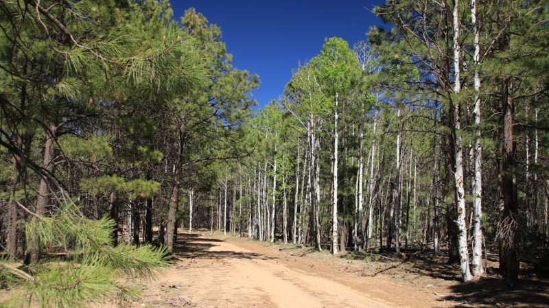
Gentry Ridge, FR 91, is a secondary forest road that receives minimal maintenance. The steep slopes leading down into the McGuire Crossing of Turkey Creek have loose fist-sized rocks that require good tires and 4WD. Aspen groves dot the trail's center and would make a golden tunnel over the road in the fall.
Camping is not abundant on Gentry Ridge, with sites only on the western end. One superb site sits on a small spur to the north, approximately one mile from the trail's western end.
Updated: 05/20/2024
Spirit Ridge Road
Yucca, Arizona
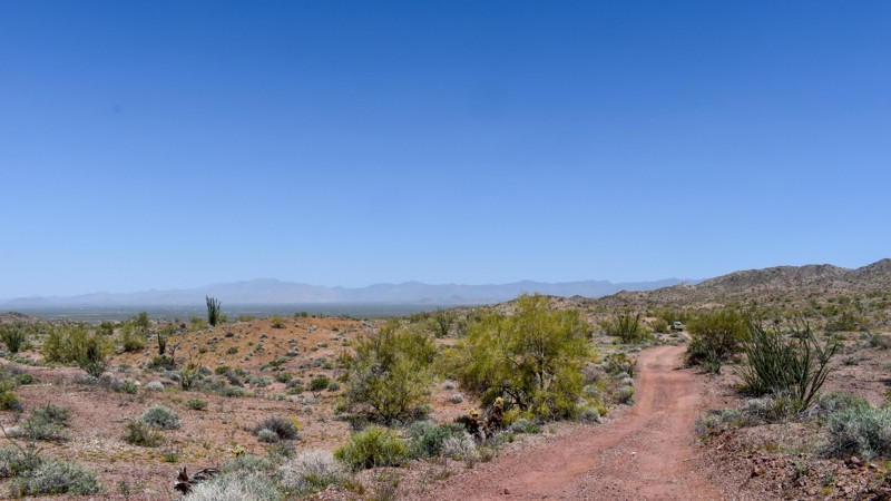
Discover the hidden gems of the desert on Spirit Ridge Road, a short but scenic connector trail located north of the Mohave Mountains. This backcountry road runs east into the Buck Mountains from Franconia Road and joins with 4353B and onto 7387, which runs south to Bill Williams River.
The trailhead for Arizona Yucca Mine is located on Spirit Ridge Road as well, where you can explore a couple of old mines, numerous prospects, and a very well-preserved arrastra. From there, there are a couple of trails that run south and split off both east and west to a variety of other destinations.
Updated: 10/15/2024
Castle Canyon
Jacob Lake, Arizona
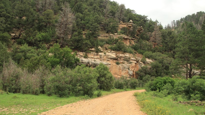
Castle Canyon runs east-west from Highway 67 to West Side Ryan. The trail's eastern end briefly passes through an area burned by the 2006 Warm Fire and the 2019 Castle Fire. There is an active cattle ranch on the east end as well. You will likely see cattle grazing on the open grassy meadows but watch for deer too. The western portion of the trail passes through deep forests and a pretty canyon. There's a nice campsite at the intersection with West Side Ryan and others down many of the spur trails.
Updated: 10/15/2024
Old Hwy 93
Willow Beach, Arizona
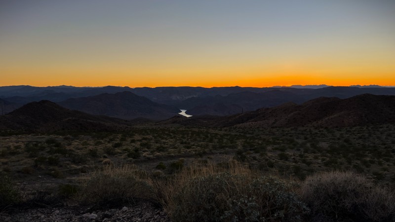
The Old Highway 93 trail runs parallel to US 93. It falls within the Lake Mead National Recreation Area. There is no fee or permit needed to run this trail. The north entrance is an easy right turn off the main highway. The surface is generally a gravel mix. It can be managed by most vehicles having good clearance as an out-and-back trail. Running in one direction and exiting on the south end requires a steep, rocky hill descent into a wash and back up to the main highway.
The views of the Black Canyon area, with glimpses of the Colorado River, are amazing, especially at sunset. A couple of camping spots along the way can accommodate a few vehicles.
Updated: 12/02/2025
Silver King
Superior, Arizona
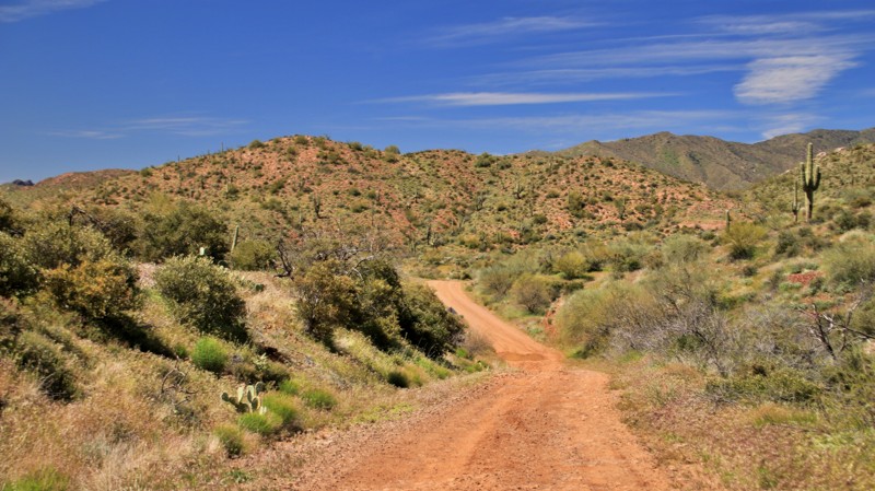
Silver King, FR 229, travels north from Superior along shelf roads and through a small canyon with great views. The easy road is graded dirt until passing a cattle corral and old windmill, where it swings east into the Silver King Wash canyon. The track gets narrower and rougher until it terminates at a Y intersection. FR 2447 runs left and north. The right leg of the Y goes onto private land and is blocked within a few hundred yards with little room to turn around.
The trail provides good mountain views with hillsides that feature a large variety of cacti. Wildflowers dot the landscape in Spring.
Two large campsites suitable for RVs sit near the trailhead but right on the road. One small hunter's camp exists inside the small canyon. Silver King is not a good road for camping. See the connecting Mattie's Grave for better camping options.
Updated: 08/03/2026
Lone Pine Four Peaks
Tonto Basin, Arizona
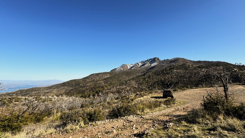
When driving up the Four Peaks Trail, make sure to take the short side trail that not only connects you to great hiking trails to the top of Four Peaks but also ends at a large lookout area offering incredible views of Roosevelt Lake to the east and the Phoenix Valley to the west.
The lookout area is a popular spot for large offroad groups to stop for lunch or take a break before heading back down the mountain. It can accommodate up to 20-25 vehicles.
Several small dispersed campsites along this trail can comfortably fit 1-2 vehicles each. These campsites are relatively flat, although the ground is somewhat rocky. However, there are spots where you could set up a tent.
The Lone Pine Trailhead and the Arizona Trail also cross along this trail. The Arizona Trail is an 800-mile hiking trail that traverses Arizona from the Mexico border to Utah.
Updated: 10/15/2024
Hart Well Canyon
Sedona, Arizona
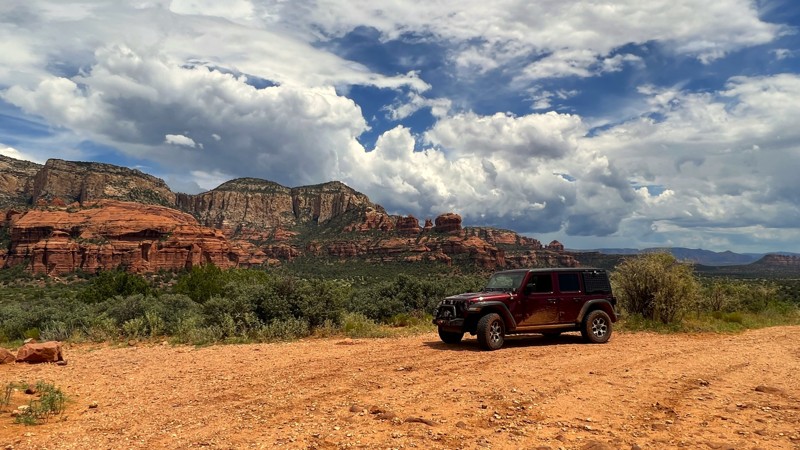
Hart Well Canyon FR525D is a short out-and-back trail that begins at an intersection with FR 525, Loy Butte Road. This easy dirt trail should be manageable by most vehicles in 2WD.
The most challenging section is at the beginning of the trail. A smooth uphill climb leads to a large scenic overlook. From here, you can see the red rocks for miles around, including Casner Mountain to the northwest, Loy Butte to the north, Lost Mountain to the northeast, and Bear Mountain to the east. Catch the sun during the evening golden hour, and you have yourself a magnificent photo backdrop.
The trail then takes you on a quick descent to the bottom of Hart Well Canyon. The trail ends at the Northern Arizona University Southwest Experimental Garden Array. Research is conducted here on the ability of plants and animals to adapt to drought and climate change. This is a closed area, not open to the public.
While no camping or campfires are permitted along this trail, the main trail, FR 525, has multiple designated camping areas available.
Updated: 10/15/2024
Long T
Three Forks, Arizona
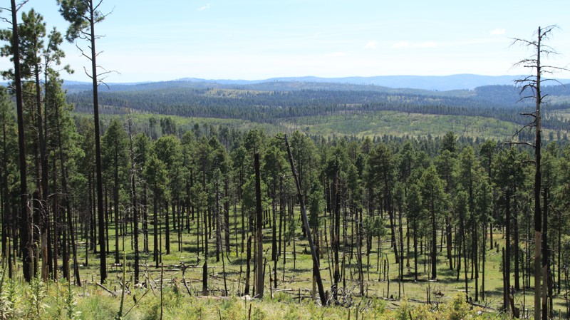
Long T is a bit rougher trail than most of the local well-maintained forest roads. The track is narrow with embedded rocks. The trail alternates between dense mixed conifer forests and areas burned by the 2011 Wallow Fire. The burned areas do open up some nice views, however. There are number ous small dispersed campsites along the way.
Updated: 05/19/2025
Windmill
Lazy Y U, Arizona
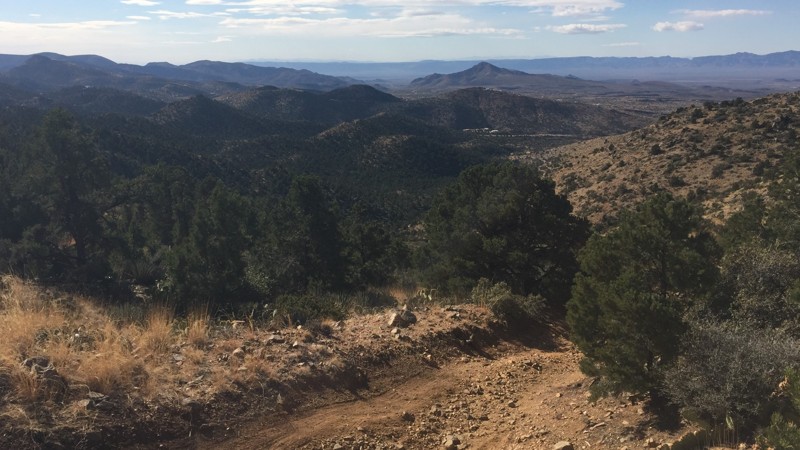
Located just a few minutes outside Kingman, this trail offers a mix of gravelly two-track and rocky climbs. The mountain's front side has points that put your suspension's articulation to the test, winding through deep washouts. The trail transitions from packed dirt to rocky climbs and then loose gravel over packed dirt that acts like marbles. Once you reach the saddle, there are views of the Hualapai mountains to the southwest and I40 to the northeast. There is enough room on the saddle to park several vehicles, making for a nice lunch stop. If continuing to the northeast, be sure to leave the fence gate in the position you found it.
Descending the back side of the mountain is significantly less challenging, but there are points where the trail simultaneously narrows and pitches the vehicle toward the steep downhill drop-off.
As with all trails in this area, carrying a spare tire or being competent with your tire plug and patch kit is recommended.
Updated: 10/15/2024
FR 225
Jacob Lake, Arizona
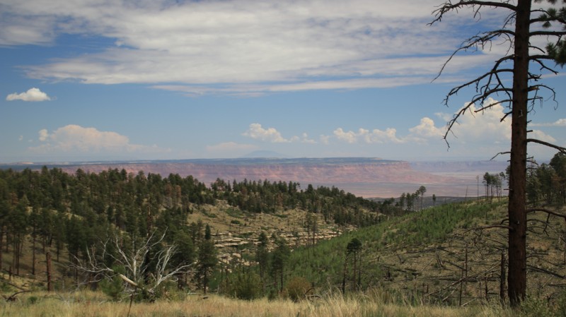
FR 225 runs through the tall pines of the Kaibab National Forest between Highway 89A and FR 205. There are numerous campsites on the northern end of the trail. The middle of the trail offers eastward views of the Vermillion Cliffs. While there are a few ruts and minor washouts, this is an easy road.
Updated: 10/15/2024
Rattlesnake Mesa
Oak Creek Canyon, Arizona
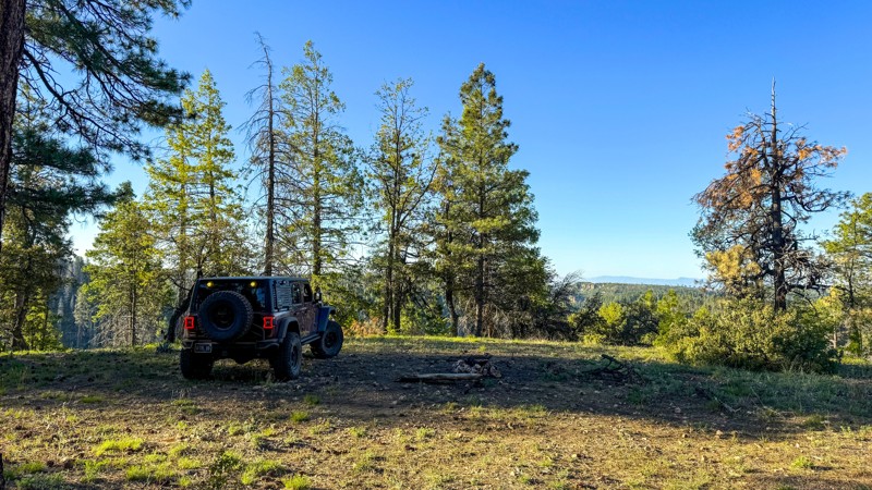
A brief trip to the top of Rattlesnake Mesa will take you to a landscape of fallen and burnt trees that look like another planet. After navigating through the debris field and returning to the woods, you'll find a few excellent campsites at the end of the trail with views overlooking the Red Rock Secret Mountain Wilderness. The trail is moderately difficult due to the need to maneuver over sporadic fallen tree logs and through a narrow tree-lined section. A vehicle with high clearance is required.
Updated: 10/15/2024
Marshall Mountain
Los Burros, Arizona
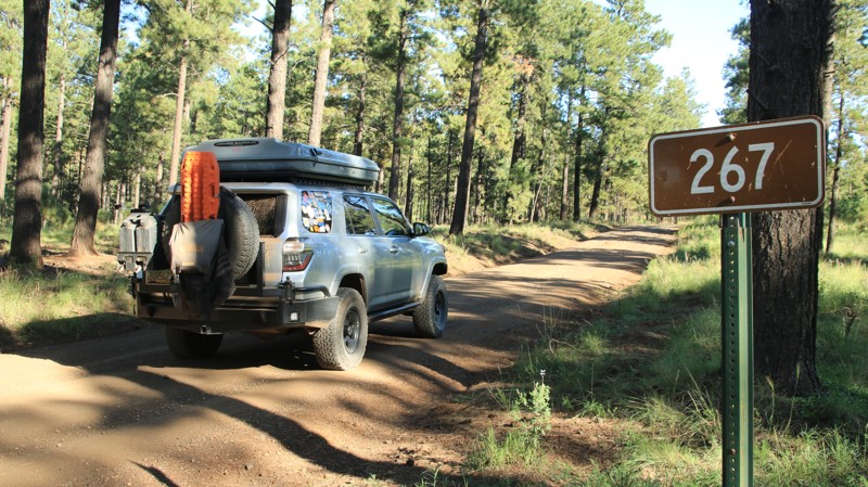
Marshall Mountain passes through a dense pine forest. A nice camp spur near the western end which follows Browns Creek. Near the eastern end, FR 269 goes up to Lake Mountain. Unfortunately, FR 269 is often gated, so you'll have to hike up to see the lake.
Updated: 03/15/2026
Moose Rock Ridge
Queen Valley, Arizona
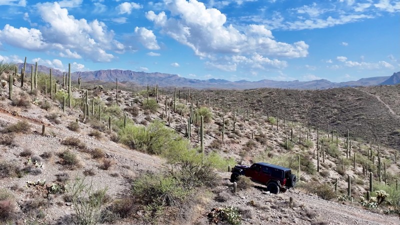
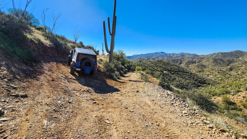
This rugged trail delivers a true test of skill and vehicle capability, featuring steep rocky climbs with grades pushing 20%, narrow shelf roads, and exposed ridgelines with steep drop-offs on both sides. From the higher elevations, the views are nothing short of spectacular—panoramic overlooks of desert valleys and distant peaks reward those who make the climb. The trail takes its name from its most infamous obstacle, Moose Rock, where drivers must carefully navigate a tight shelf-road corner while climbing a large rock ledge—a section that separates the seasoned off roaders from the rest.
When paired with Kat Walk Ridge and Pucker Ridge, this route forms a challenging and highly rewarding loop that’s best tackled by experienced drivers equipped with high-clearance rigs and larger off road tires. While there are no suitable campsites directly along this trail due to the steep and narrow terrain, several nearby trails offer more accessible camping options for those looking to make a weekend of it.
Updated: 10/15/2024
East Yucca Farm Road
Greaterville, Arizona
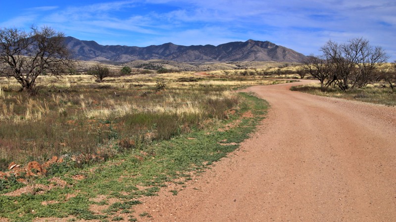
In the Las Cienegas National Conservation Area, East Yucca Farm Road runs between the historic Empire Ranch Headquarters and Highway 82 near Sonoita. The well-maintained track passes through a sea of tall canvas-tan Sacton Grass cut by several shallow sandy washes lined with dense mesquite and the occasional towering cottonwood tree. The Whetstone Mountains dominate the eastern skyline. The Santa Ritas climb skyward to the west, often holding a snow cap well into the Spring. Watch for wild turkeys, pronghorn antelope, and deer alongside the trail. And, of course, this is a working ranch, so watch out for the cows.
The easy road has several nice campsites along the way. It also passes the Cieneguita and Road Canyon Camping Areas.
Updated: 10/15/2024
Orville Cutoff
Reymert, Arizona
Orville Cutoff is a 1.7-mile moderate connecting trail between the Bad Medicine Canyon and Orville's Loop, north of Jack Handle. The trail travels a narrow shelf road as you make your way up to one of the taller ridgelines in the area. The road is steep, rough, rocky, and generally only one vehicle wide the entire length. There are several wide areas to pass oncoming traffic, but backing up a short distance might be required. Take caution along this trail as it crosses several deep washouts reinforced with rebar and railroad ties. They are considerably narrow for full-size vehicles. If narrow roads make you uneasy, avoid this trail. The trail is suitable for stock high clearance 4x4s. Full-size rigs should be prepared for pinstriping.
It is worth noting that although this is a BLM road, it partially passes through private property from mile marker 0.85 to 1.25. Please respect the private land and pass through with care and consideration. As history has shown us from other trails in this area, landowners are not afraid to close off access if users cannot be respectful.
There is no camping along this trail.

Upgrade your Membership
Unlock all of the details on every Trail Guide and Scout Route.
Start a 7-day Free TrialBrowse Trails in Arizona by City
Browse every Arizona city with offroad trail guides.
Community
Partners

