






By clicking "ACCEPT", you agree to be the terms and conditions of each policy linked to above. You also agree to the storing of cookies on your device to facilitate the operation and functionality of our site, enhance and customize your user experience, and to analyze how our site is used.
Arizona Off-Road Trails
373
Total Trail Guides 359

4679
Detailed Waypoints 676
Try a Free 7-Day Trial and unlock it all
Start a Free Trial Most Recent Trail Reviews
Rated 4/5
Open
Visited: 09/22/2026
Hard pack, easy forest service road that is a great back way to the North Rim of the Grand Canyon.


Tyler D’Hulst
Rated 4/5
Open
Visited: 09/22/2026
Spring Canyon is a beautiful drive. We didn’t go out to the cabin but used this western section of road coming back from Crazy Jug

Tyler D’Hulst
Rated 4/5
Open
Visited: 09/22/2026
We took this out to Crazy Jug. The northern section is hard packed forest service road. Not difficult. Very scenic drive through the ponderosas.

Tyler D’Hulst
Rated 5/5
Open
Visited: 09/22/2026
View point is spectacular! Trail was easy going out, no obstacles at all. Saw a Toyota Camery at the viewpoint.


Tyler D’Hulst
Rated 3/5
Open
Visited: 09/22/2026
An alternative route out to Crazy Jug Point. It’s easy and can be scenic in areas. I’d recommend West Ryan out to Crazy Jug though.
Tyler D’Hulst
Rated 3/5
Open
Visited: 09/22/2026
A quick connector trail through the burn patch.
Tyler D’Hulst
Rated 5/5
Open
Visited: 09/20/2026
Leviathan Mine trail is a full day trip. Though it is only 20 miles in length the travel is slow and rough. Majority of the trail you will be going between 5-10 MPH. Then once at the end it connects w...



Eric Gartin
Official Crew
Rated 4/5
Open
Visited: 09/19/2026
Simple road, well graded today. Many mountain bikers coming down from the West out of Breezy Pines. Not too many people out until approaching Senator Hiway. We went East to West as I think thats a bet...



Jeff Burnett
Rated 3/5
Open
Visited: 09/19/2026
The trail itself is not spectacular, it's pretty flat across the plains. However, driving up to the overlook and seeing a huge gaping hole in the ground is a great juxtaposition to the flat trail. The...
Tyler D’Hulst
Rated 3/5
Open
Visited: 09/19/2026
A nice trail ride from the main road down off the plateau. It's graded forest service road until the switchbacks. The switchbacks themselves are not difficult, road is not graded. This section has bee...
Tyler D’Hulst
Rated 3/5
Open
Visited: 09/18/2026
The end of the trail is not well marked, and can cause confusion. Also, vehicle passes are required for all backcountry routes within the Lake Mead National Recreation Area.
Eric Gartin
Official Crew

Ted Whisler
No Rating
Open
Visited: 09/17/2026
Nice ride west side a little rocky but rating is true to #2


Ted Whisler
Rated 3/5
Open
Visited: 09/15/2026
A nice drop off the plateau heading towards Marble Canyon. Not a difficult road. Road is weathered but not challenging.
Tyler D’Hulst
No Rating
Temporary Closure
Visited: 09/15/2026
Road closed due to multiple washed out wash crossings after the turn off to go up the mountain. "Road Closed" sign put out by BLM on trail.
Tyler D’Hulst
No Rating
Temporary Closure
Visited: 09/15/2026
After the turn off to head up the mountain there are multiple washed out wash crossings. A "Road Closed" sign has been put out by the BLM.
Tyler D’Hulst

Ben Ruddell
Official Crew
Rated 4/5
Open
Visited: 09/14/2026
Bogles Ranch Road is a great Sunday afternoon drive type of dirt road that climbs up in elevation and gives some spectacular views of the surrounding area. The first half passes through State and Priv...


Eric Gartin
Official Crew
Ben Ruddell
Official Crew
Rated 3/5
Open
Visited: 09/14/2026
Antares Road is an excellent way to travel from Route 66 to the eastern portion of the Lake Mead National Recreation Area. This wide county road is well maintained with minor washboarding, most of whi...


Eric Gartin
Official Crew
Rated 3/5
Open
Visited: 09/14/2026
Hackberry road is a wide dirt road with minimal erosion damage and washboarding. There are a couple of larger washes that cross Hackberry road creating wide stretches of loose sand which can cause iss...


Eric Gartin
Official Crew
Rated 3/5
Open
Visited: 09/13/2026
This is a very rough, rocky, & slow going trail. Expect around 4+ hours for the trail & another hour to get the highway. One of those trails I'm happy I did but I wont be back personally. High clearan...

Brandon W
No Rating
Open
Visited: 09/12/2026
I think the rating is spot on. The ruts and washouts at the beginning are not as bad and if you hug the inside of the shelf road they can be avoided. The middle part is same general sandy wash with ov...



Greg Page
Rated 4/5
Open
Visited: 09/11/2026
Ran this trail as part of a larger loop. Trail is in great shape. Easy for standard 4x4 with no lift. Passengers can do it until maybe the very end by the lake where the road gets rocky and washed out...


Jeff Burnett
Rated 5/5
Open
Visited: 09/10/2026
This is one of my favorite scenic trails in the area. The trail is easy to travel, but does have some optional short trails that will test your vehicle. The views from the Grand Wash Cliffs of the Hua...


Eric Gartin
Official Crew
Rated 3/5
Open
Visited: 09/07/2026
This trail by itself is nothing special. It is mostly used as an access road to get to the more technical trail such as Homecourt, Twister, and Waynes World. This is a great trail for the beginner to ...


Eric Gartin
Official Crew
Rated 3/5
Open
Visited: 09/07/2026
This trail is an enjoyable alternate route when traveling on Blake Ranch Road (7163). The trail is easy with only a handful of spots with erosion damage. The few established camping sites appear to n...


Eric Gartin
Official Crew
Rated 5/5
Open
Visited: 09/07/2026
Ran this trail from Boynton Pass Road to Loy Butte Road (opposite direction from what is listed). Ran into a few rental ATVs and a couple of Jeeps heading the opposite way. This was a fun trail wit...



Daniel Macioce
Rated 5/5
Open
Visited: 09/07/2026
This trail was a lot of fun, plus the views were amazing. I ran the trail in the order posted, starting at the south trailhead and finishing at the heritage site. Past a motorcycle, a few jeeps and a...


Daniel Macioce
Rated 4/5
Open
Visited: 09/07/2026
Nice trail, ran West to East. For some reason the map shows this a a one-way trial, East to West. That is not the case, it is a two way trail. Was pretty washed out starting around mile 12. Plenty roc...


Jeff Burnett
No Rating
Open
Visited: 09/06/2026
New trail for me. You didn’t know what it would throw at you around every corner which is why you try to find new trails or old forgotten ones
KB
Kory Burden
Rated 5/5
Open
Visited: 09/06/2026
The trail is no joke—steep, narrow, and technical enough that you’ll want to be comfortable with off-camber shelf roads, rocky terrain, and washouts that will test your vehicles articulation. The rew...



Bobby Rumbaugh
Official Crew
Rated 5/5
Open
Visited: 09/06/2026
Fun trail if you don't want to do pyeatt draw itself. Ran this trail 3yrs ago and definitely a little more erosion but, still any truck or suv with good factory ground clearance can do it. From previo...
JM
James m
Rated 4/5
Open
Visited: 09/06/2026
Ran this trail from I-17 to Sedona. Extraordinary views descending into Sedona. As others have noted, there are lots of rock on the trail, making it slow going. Passed a large number of Pink Jeeps ...


Daniel Macioce
Rated 4/5
Open
Visited: 09/05/2026
This one definitely changed over the last few years. The southern section has some legit, steep, off-camber sections. YOU NEED experience, backup, and a capable vehicle on this one now. It's not supe...


.jpg)
Bobby Nelson
Official Crew
Rated 4/5
Open
Visited: 09/05/2026
Another amazing time on this scenic crossover. We came in from Walnut Canyon and finished out on Price Road after about 6 hours. A challenging and hot day for the old TJ. Rincon Road has evolved into ...


Bobby Nelson
Official Crew
Rated 4/5
Open
Visited: 09/05/2026
We started exactly at sunrise to try and beat the heat. We planned to crossover to Box Canyon and out on Price Road. It ended up taking us 6 hours, even with all the photos and filming we did. A chall...


Bobby Nelson
Official Crew
Rated 5/5
Open
Visited: 09/04/2026
We recently ran Four Peaks after the monsoon rains. Here’s what we found and what to expect if you’re planning to run it. Have a GR8 day!

Jeep 4 Dirt
Rated 5/5
Open
Visited: 09/04/2026
Breathtaking views. Definitely don't rush through the trail. Devil's staircase was a bit slippery but awesome. A few tight stops here and there, but a trail that's a must on anyone's to do list.



Christopher Bradley
Rated 4/5
Open
Visited: 08/30/2026
Id say this is a 3.5 to 4 trail. There are some obstacles, but nothing you really need to think hard about how to approach. If you send your vehicle at it in 4 low you'll get through everything.



Justin Holsinger
Rated 4/5
Open
Visited: 08/28/2026
Rim Road (FS300) West to East. Very well groomed gravel forest road. Accessible by just about any vehicle thats not been lowered. Who does that anyway? Scenic views the whole route. Hard to believe on...


Jeff Burnett
Rated 4/5
Open
Visited: 08/28/2026
Not a bad road but it was crowded with sxs and vehicles towing campers. Hard to rate 5 stars for a busy road. Super easy any vehicle can do this. Part is paved near the freeway but the rest is gravel.

Tony Rockwell
Rated 4/5
Open
Visited: 08/28/2026
I rated 4 stars just due to the volume of sxs & camper trailers on the road.
Easy drive, any car can do this.
Ran from sheep springs to munds park, see other reviews for full route.

Tony Rockwell
Rated 4/5
Open
Visited: 08/28/2026
I ran Bar M in reverse to get to this trail. Then headed toward Casner Park Road. (See reviews I did on each of those)
Nice easy trail that is less rough than Bar M.
Nice drive through trees.


Tony Rockwell
Rated 5/5
Open
Visited: 08/28/2026
Very bumpy due to rock infused trail. A few larger rocks, 8-12” tall in places but most stock 4x4’s should be able to navigate around or over them. I would say any 4x4 with all terrain tires could nav...


Tony Rockwell
Rated 3/5
Open
Visited: 08/27/2026
Overall decent little trail; camped out near Committee Tank (not suitable for tent camping - too rocky). Nothing too technical but enough to keep things interesting. High clearance and good line choi...


Bill Ferguson
Rated 3/5
Open
Visited: 08/27/2026
Connector from FS801 (Rock Garden Loop) to FS09494F (Committee Tank Trail); yeah, it lives up to its namesake. Very rocky. High clearance and picking good lines are an absolute must. Car camped at...

Bill Ferguson
Rated 5/5
Open
Visited: 08/27/2026
Nice trail saw some deer it’s a little rough but overall was easy


M
Maddox
Rated 5/5
Open
Visited: 08/23/2026
Great little adventure for the day. Dirt road is pretty rutted up due to monsoons, but easily drivable. Lake itself is extremely low.
LL
Larry Lapp
Rated 4/5
Open
Visited: 08/22/2026
A fun side trip that has a steep hill climb. Due to recent rains, the wildflowers were blooming.


Bobby Rumbaugh
Official Crew
Most Popular

Updated: 10/15/2024
Canal Road
Tonopah, Arizona
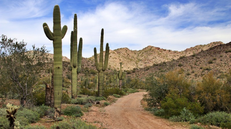
Canal Road begins off the paved Aguila Road. It runs parallel to a major powerline and the Central Arizona Project Canal, which moves water from the Colorado River to Arizona's major cities. Canal Road is a convenient entry point for exploring the ruggedly scenic Belmont Mountains. Canal Road connects with Vulture Mine Road and W. W. Enterprize Mine. The trail is relatively easy, with one hill climb with an 18-degree maximum grade.
Several large flat campsites near the east end of the trail are suitable for large groups and toy haulers.
Updated: 04/19/2023
Signal Road
Wikieup, Arizona
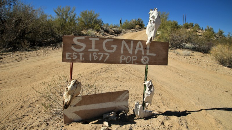
As the California Gold Rush wound down, miners moved eastward along The Bradshaw Trail to prospect in the Arizona Territory. Hardy men found silver in a mine named Signal on the north side of the remote Artillery Mountains near the Big Sandy River. The nearby McCraken Mine also produced silver. The town of Signal sprung up to support both mines. By 1877 it had a post office and approximately 800 residents. Being so remote, it took six months to deliver any goods ordered. By 1932 the town had dwindled, and the post office closed. Today what little remains of the town sits on private land. However, a sometimes caretaker can occasionally be induced to allow access. The remnants of the mine are still present and easily visited. Signal Road provides easy access to a remote and seldom visited part of Arizona and its early history. The Sonoran and Mojave Deserts meet in a rare mix of Joshua trees and saguaro cacti. Dark skies provide incredible stargazing from sandy campsites along the road.
Updated: 09/21/2026
Chino-Perkinsville Road
Chino Valley, Arizona
Running from the Chino Valley in the west across a range of hills to the Verde Valley in the east, Chino-Perkinsville crosses through private property and enters the Prescott National Forest. On the west end, the road begins in the hamlet of Chino Valley. The first few miles are paved. The road transitions to well-maintained dirt with minor washboarding as it traverses vast rolling prairies where pronghorn antelope graze alongside cattle from the region's large ranches.
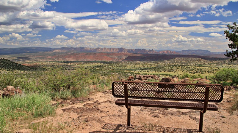
Reaching the foothills, the trail enters the Prescott National Forest snaking through a juniper-dominated chaparral landscape. Atop the range of foothills just before a steep switchback, a surprise pullout with a bench beckons you to stop and admire the views of Verde Valley and the red rocks of the Mogollon Rim. While you can't make out Sedona, it isn't far away.
The road descends in the Verde Valley and intersects the Jerome-Perkinsville Road just south of the one-lane steel bridge over the Verde River.
Camping is scarce along the road. However, an excellent site with views west of the top of the switchbacks can accommodate several vehicles.
Updated: 06/05/2022
Mahan Ranch
Mormon Lake, Arizona
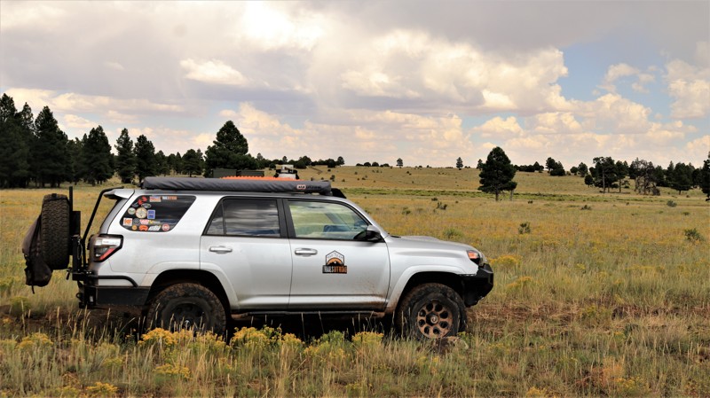
Mahan Ranch starts in the pristine Ponderosa pine woodlands of the Coconino National Forest. The road skirts the forested southern slopes of Hutch Mountain before passing through a section of private property, once the headquarters of the namesake Mahan Ranch. Today the cattle you see grazing summer pastures belong to the Apache Maid ranch, one of Arizona's earliest and most storied ranching operations. Periodically the pines give way to flowery alpine meadows, parks in local parlance. The road is smooth and well-traveled, but that will change. The intersection with Bargaman Park marks a change in the road. At first, the trail just seems narrower. Then the dirt surface turns to a jumble of rock. Then comes the embedded boulders. Loose items in your vehicle begin a journey of their own. Cattle watch you pass with a bit of surprise. Don't despair. It gets a little better after two miles of testing the quality of your dental fillings. Mahan Ranch breaks out onto Anderson Mesa, leaving the pine forest behind in favor of more open savanna grasslands with long views of mountain promontories far away. Here the trail is abasic two-track snaking out ahead. Tall grasses swipe the undercarriage of your vehicle. Cresting a ridge, picturesque Pine Tank leaps into your view. The beauty of Anderson Mesa makes you forget the rough rocky trail behind you. But don't worry, you will be reminded again. Unfortunately, Mahan Ranch, despite what maps may show, comes to an inglorious end at a sign informing the traveler of a locked gate ahead. The gate serves to protect a fragile habitat used by the more permanent residents of the area. The unused roadbed can be traversed on foot. The reverse route back does require enduring the rough section, but the adventure is definitely worth the price.
Updated: 07/21/2024
Fry Lake Trail
Kachina Village, Arizona
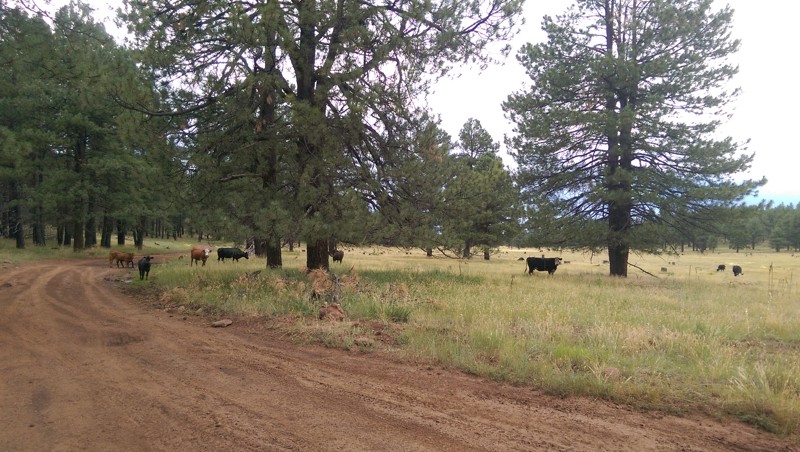
Fry Lake is a popular place for cattle grazing in the summertime. The cows are typically brought up from the Verde Valley via Jerome Road. It's a beautiful meadow full of flowers in the summertime and typically snowed over in the winter.
Updated: 10/15/2024
Fire Point
North Rim, Arizona
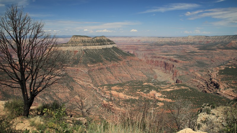
Fire Point goes west through a pine and aspen forest, crosses into the Grand Canyon National Park, and ends with great views down into the Grand Canyon. The trail is well maintained until it crosses into the national park, where deep mudholes and ruts could create issues for 2WD or low clearance vehicles. But it's only a short walk to the end of the trail at that point, so the trail is rated easy. The trail still shows some of the effects of the 2019 Ikes Wildfire. But it is named Fire Point, right?
The MVUM doesn't allow camping along Fire Point, and overnight camping in the Grand Canyon National Park requires a permit.
Updated: 04/01/2025
Rolls 1814
Tortilla Flat, Arizona
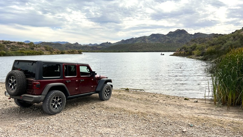
Rolls 1814 will provide access from 1813 to Saguaro Cove #1. The beginning of the trail is rocky, has one small hill climb, then a larger hill descent that leads to a wash. The remaining segment is easy all the way down to the lake. There are some blind, high-banked corners. Use caution here as this is a very popular area, and you will most likely have oncoming traffic. Some pinstripes are likely running closer to the lake. The beach area is fairly large and can be used for camping. If you arrive early, you may be able to acquire a spot under one of the overhanging trees that will provide shade.
Please note that an OHV permit is now required on this trail.
Updated: 02/23/2026
Rolls 3431
Tortilla Flat, Arizona
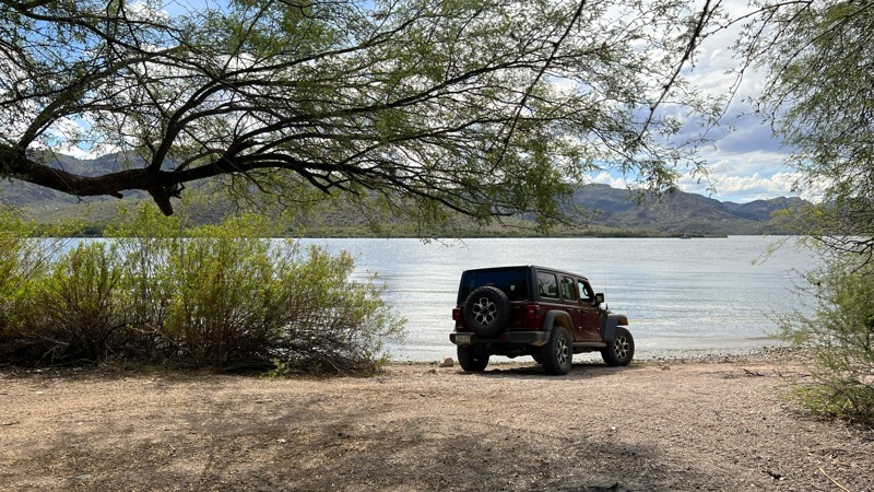
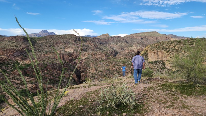
Trail 3431 is an easy trail that starts at a junction with trail 1345 and takes you to Saguaro Lake Cove #4. It is comprised of deep sand with some high-banked turns. You will earn some Arizona pinstripes along the way as the trees and bushes lean into the trail. As you get to the cove, watch for low-hanging branches from the trees above. Once at the lake, you will find multiple areas to camp under the shade of the trees. Numerous fire rings are available for use. This is a wonderful area to swim, fish, kayak, or paddleboard.
Please note that an OHV permit is now required on this trail.
Updated: 03/16/2026
Hoss
Tortilla Flat, Arizona
Hoss takes you to a beautiful scenic camping spot overlooking some of the valleys that run into the Salt River. There's a memorial plaque for a guy named Hoss. The trail has a couple of challenging 20+ degree climbs where 4x4, and possibly rear lockers, may be needed. At the very beginning of the trail, it is overgrown and covered with 12-inch+ boulders that make it very rough and difficult to make out the trail. It is very narrow in spots with a high potential for pinstripes. There is additional camping along FR 3432 at the very beginning.
Updated: 11/20/2025
East Ajax Mine Road
Reymert, Arizona
Ajax Mine Road is a moderately rough and rocky trail that parallels the Lower and Upper Ajax Technical Vehicle trails. The road starts at the Five Points intersection and travels east to connect with Telegraph Canyon Road. The road is the primary exit route from the Ajax TV trails and Highway to Hell. But Ajax Mine Road is a great beginner trail and suitable for any high clearance 4-wheel drive vehicle. The road has a few narrow washout sections, but with careful line choice, they should not be a problem for most 4x4s. The road ends at the Ajax Mine, an abandoned lead mine that ceased operation in 1916.
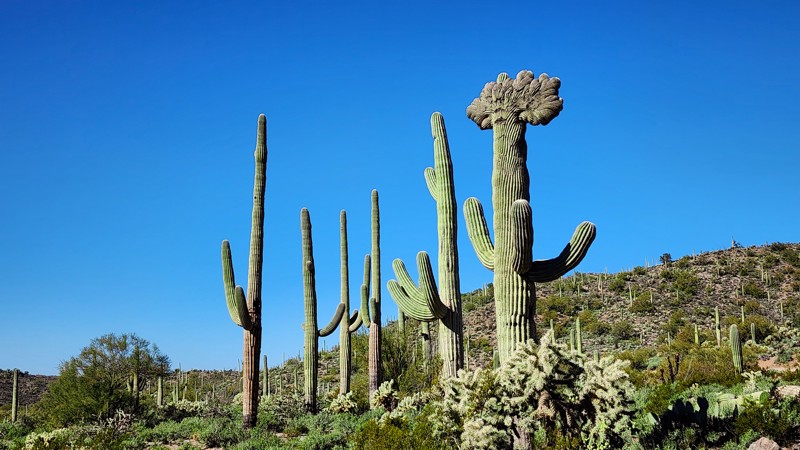
Several spots along the road can be utilized for vehicle camping. Halfway through the trail, one of these wide campsites marks the location of a rare crested saguaro.
Updated: 09/15/2026
Stronghold Canyon Trail
Black Diamond, Arizona
Breathtaking scenery and several historical sites can be found scattered along this trail!
The Chiricahua Apache, led by the famous chief Cochise, utilized this area to evade US Cavalry in the mid-19th century. This location provided a reliable water source and other resources in an otherwise harsh landscape. Today, Stronghold Canyon offers several hiking trails, a plethora of dispersed camping sites, and several historical areas to explore.
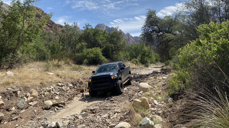
The first quarter-mile features loose rocks that make the ride bumpy. It’s worth stopping early to air down your tires. The road soon evens out and becomes smooth and sandy. During the monsoon season, water flows over the sandy portions of the road and pools in low-lying areas creating muddy conditions.
Approximately 2/3 of the way through the trail is the historical site of Council Rocks. Cochise and his band of Apache populated this area, and evidence of their livelihood can still be seen today. A quick look around the area shows why Cochise chose this area for his Stronghold.
Maps delineate two roads, Slavin 687 and East Stronghold Canyon Road, joining soon after passing the Council Rocks. There is in fact, a single trail here. Those continuing past Council Rocks will pass several homes before reaching a Coronado National Forest Gate. Make sure to close the gate behind you when you enter this area. Road conditions become rough further into Stronghold Canyon and feature large loose rocks.
There are multiple water crossings along the final part of the trail. During dry months, these water crossings are typically dry. However, these crossings may have running water during the summer monsoon season. Those that complete the trek are rewarded with beautiful woodland camping locations.
Updated: 01/21/2023
MST&T
Quartzsite, Arizona
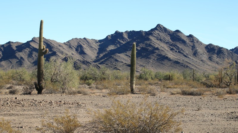
MST&T provides a scenic gateway into the northwestern portion of the 1042 square mile Kofa National Wildlife Refuge. In 1939 this area was designated the Kofa National Wildlife Refuge after an extensive effort by the Arizona Boy Scouts. The purpose of the refuge was to secure habitat for a decreasing population of desert bighorn sheep. Today the desert bighorns are flourishing in the rugged mountain ranges found in the sanctuary. However, you are more likely to see mule deer along the MST&T since most of the road traverses a broad desert valley filled with stately saguaro and prickly cholla cacti. Ironwood and paloverde trees line the numerous sandy washes. Years ago, Mountain States Telephone and Telegraph (MST&T) operated a microwave tower on a hilltop in the Livingston Hills at the end of this road. Today, the tower is gone, but a caretaker trailer and a picnic table remain. The reward for a drive to the top is fantastic views of the northern portion of the vast Kofa National Wildlife Refuge. Kofa is famous for amazing sunsets. Viewing one from this vantage point is a special treat. You can even camp on top of the hill.
Updated: 06/05/2022
The Duke
Parker, Arizona
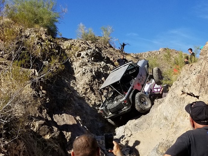
Welcome to near buggy territory! Whether you have a built Jeep Wrangler or an insane Toyota truggy, this trail is going to make you work for that gold star. Even though this off-road trail is a short one, unless your 4wd is working, your lockers are spot on, and your tires are large and deflated, you are not going to make it. With one of the single hardest waterfalls near Parker Arizona, this trail is going to punish your 4x4 like it has never been. This showstopper has one of the most epic 15+ foot tall waterfalls with insane large holes, large enough to swallow a 44 inch tire like it was nothing. Even the most epic offroad enthusiast might turn around for this one and take a different road out. Thus, if you are bit insane, and you are looking for something that will either give you bragging rights or a good, bad story, The Duke near Parker Strip on the Colorado River and more importantly near The Desert Bar is the place for you.
Updated: 06/04/2024
FR 195 - Tonto National Forest
Payson, Arizona
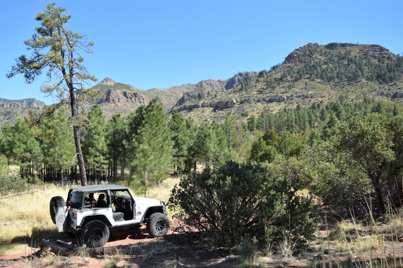
If camping and exploring trails in the pines with your 4x4 sounds like a great time, then this would be the spot to start. Camping in this area makes for a great starting point for exploring the Arizona Mogollon Rim country near Payson, Arizona. The trail is easily accessible from FR64, Control Road and located near the East Verde Creek at Verde Glen. All within an easy trail ride from camp, you can hunt geodes at Brody Hill, rock crawl Pyeatt Draw or go for a hike on the Highline Trail #31. Along this route you can visit an old recreation site where the foundations and walkways are barely visible. The trail has many beautiful dispersed campsites along the way, the one at the end is below the Mogollon Rim, also allowing access to the Highline Hiking Trail.
Updated: 11/27/2023
Titan Missile Silo, Arizona
Vail, Arizona
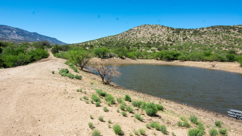
This is a short easy to access trail, about a mile long, with some side roads for 4x4 exploring. The site now belongs to Pima County and is fenced off and marked with abundant "No Trespassing signs. You can still pick your way through the desert and up to the fence, without crossing it, and see the remains of the silo. You can also play around in the mud on the edges of Missile Tank, a cattle pond just to the west. Or you can try out some of the offshoot trails which offer different challenges.
Updated: 02/19/2024
Youtcy Pasture Trail
Tucson, Arizona
If you want to experience what a real working cattle ranch is like, the Youtcy Pasture Trail has what you are looking for. Various cattle tanks alongside the road are usually full or partially full of water. This brings scores of thirsty cattle into the area, and you will likely see many of them on your trip. There's also other ranching infrastructure, including cattle guards and corrals. But this isn't the real reason to run this trail. The white knuckle section, the Plunge, descends 600 feet in approximately 3/4 of a mile. The last portion that drops into the canyon is about 30° of pitch.
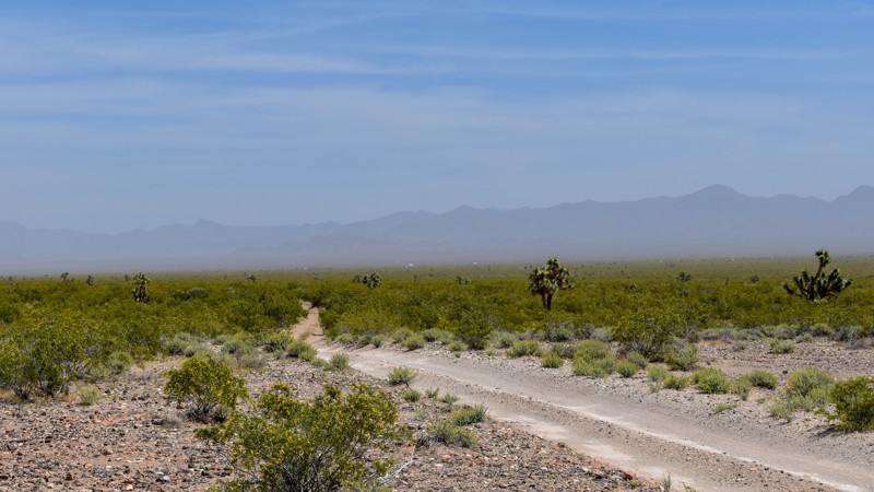
Updated: 05/20/2024
Dutch Flat Road
Lake Havasu City, Arizona
Dutch Flat Road is on BLM land just over the mountains east of Lake Havasu City, Arizona. On this trail, you will see several distinct, unique mountain peaks poking up from the horizon, Castaneda Peak at 2651', McCracken Peak at 3524', and Aubrey Peak at 2569' elevation. To the south is the Aubrey Peak Wilderness Area, which is part of the Rawhide Mountains. To the east is the McCracken Mountains and the home of the historic McCracken silver mine. The views of the mountains and numerous peaks are great! In addition, this beautiful drive provides access to several other trails and intersects with the Arizona Peace Trail (AZPT) and Standard Wash just south of Lake Havasu City. This is an excellent trail for anyone to get out and enjoy and allows access to many other trails and old mines scattered along the south side of the Mohave Mountains.
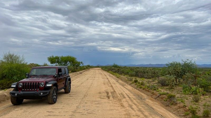
Updated: 10/15/2024
Barkerville Road
Cochran, Arizona
Barkerville Road is a graded dirt and sand road that takes you through private land and Arizona State Trust Land. It winds through pristine sections of the Sonoran Desert ripe with plants, wildlife, and your occasional grazing cow. Be cautious of monsoon rains as this trail crosses multiple large wash areas that have shown signs of high water. There was one camping area on this road located on the Southern end between mile marker 0-1 on the East side of the road. Barkerville Road is a county road so a State Trust permit is only needed if you plan to camp or utilize any trail off of the designated county road.
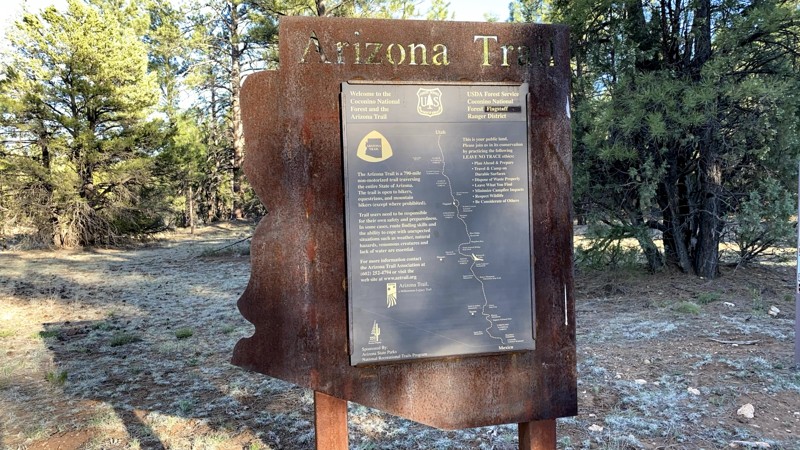
Updated: 12/31/2023
Old Walnut Canyon
Flagstaff, Arizona
Where else can you get in 4x4 (on FR301), a national monument with cliff dwellings, a beer and sandwich on the patio of the country club’s restaurant, prime mountain biking and hiking (Arizona Trail, Fisher Point, Walnut Canyon), and golf, all within a few miles and right off a major interstate? There are hotels at the I-40 / Country Club interchange. So if you find yourself on I-40 on the east side of Flagstaff, consider taking a detour for a couple of hours to avail yourself.
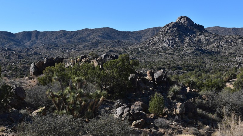
Updated: 04/19/2023
Chicken Springs Road
Wikieup, Arizona
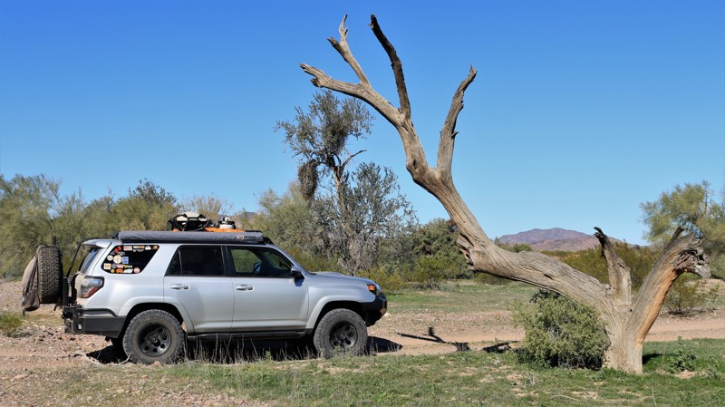
Chicken Springs Road is an easy and popular way to access the desert north of Alamo Lake. The mountain pass offers views to the east and west, Joshua and juniper trees mixed with saguaro and other cacti. From Alamo Road, travelers can take easy roads to Alamo Lake, Yucca, Parker, Bouse, Signal or Swansea Townsite. Stepping up the difficulty rating a notch is access to the Arizona Peace Trail, Lake Havasu, and Areas south of Alamo Lake, Wickenberg, and multiple mountain wilderness areas. There's something out there for everyone, endless camping, mines, cabins, ghost towns, beautiful scenery, and an unpolluted night sky far away from the city lights.
Updated: 06/05/2022
Norton Road
Quartzsite, Arizona
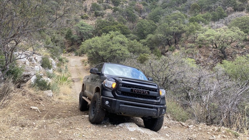
We had long discussed finding a passage that skirted the northeastern corner of the Yuma Proving Grounds. Crossing the Proving Grounds was a no-go for obvious reasons -- no trespassing signs, unexploded ordinance, live weapons firing, and possible death, to name just a few. This trail is called Norton Road because it begins on Norton Road. But Norton eventually goes directly into the Proving Grounds and, in effect, ends at the associated no trespassing sign. So we turn east onto a remnant of the old Red Raven Road and follow it until cornering south on BLM road YE08 and then veering southeast on BLM YE043 at the eastern end of the Tank Mountains. Confusing, isn't it? Not really. Just follow the track, check off the waypoints, and enjoy the adventure! Simply getting to the trailhead on Hovatter Road is a scenic adventure. Norton Road drops out of the ruggedly beautiful Little Horn Mountains onto the broad Palomas Plain, a wide flat valley of stately saguaro, firestick ocotillo, and the omnipresent creosote bushes. The plain is cut by washes large and small, all thickly lined with palo verde, mesquite, and other thorny shrubs, all eager to add more pinstriping to your rig. To the south, hills comprised entirely of jet-black basalt boulders rise ominously from the otherwise level Palomas Plain. Our trail ends by intersecting with the Palomas Harquahala Road, another great trail running through the Palomas Plain up to the Eagletail Wilderness and beyond. Now there is a proven route around the Proving Grounds. All that is left is for you to go explore it. Enjoy.
Updated: 10/15/2024
China Camp
Black Diamond, Arizona
China Peak got its name from Chinese laborers that built the road to the San Juan Mines in the late 19th century.
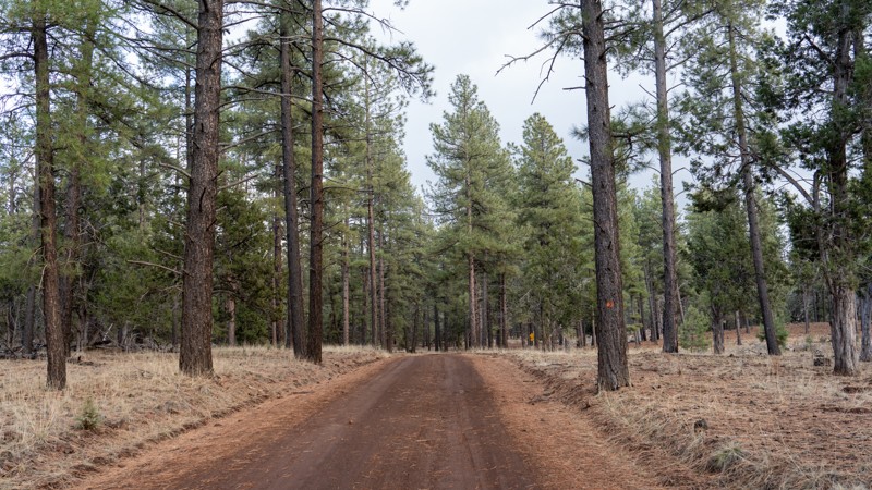
This trail is not for the faint of heart as it features narrow shelf roads, limited passing areas, and steep drops to the valley below. The trail starts as an unmaintained gravel road but increases in difficulty as it gains elevation, moving towards China Peak.
Large rock obstacles, loose rocks, and washed-out areas will test vehicle suspension and limit the types of vehicles that can make it to the top. A high clearance vehicle with four-wheel drive is necessary to reach higher elevations.
After climbing a narrow shelf road, travelers will identify the entrance to China Camp. “The Gate” is a narrow pass cut through massive rock formations. The Gate is large enough for full-sized vehicles to pass.
Several cement foundations can be found in the areas just past the Gate. These are all that remains of China Camp. This is a great area to turn around, but those wishing to reach the peak may continue along FR697.
Following China Camp, FR697 continues to wind toward China Peak. There are several connecting trails leading to abandoned mine locations. The recorded scout route trail culminates at the last major turnaround point before the China Peak summit. The San Juan Mine entrance is accessible from this location.
It is possible to continue all the way to China Peak via vehicle, but the route becomes Severe-Extreme due to steep slopes and very few turnaround points. Off-camber vehicles run a high risk of rolling over. Pinstriping can also be expected in this area.
Several dispersed campsites exist near China Camp. They are first-come, first-serve.
Updated: 04/22/2026
Mount Trumbull Loop - Southern Section
Mount Trumbull, Arizona
Located in northern Arizona, within a vast area known as the Arizona Strip, the Mount Trumbull Scenic Loop is a picturesque drive through the Grand Canyon-Parashant National Monument that takes drivers through nearly every aspect of terrain the monument offers. Cutting through the desert, shrubland, and montane habitats, drivers are rewarded with picturesque views of deep canyons, vast valleys, lonely buttes, and 8,000-foot mountains.
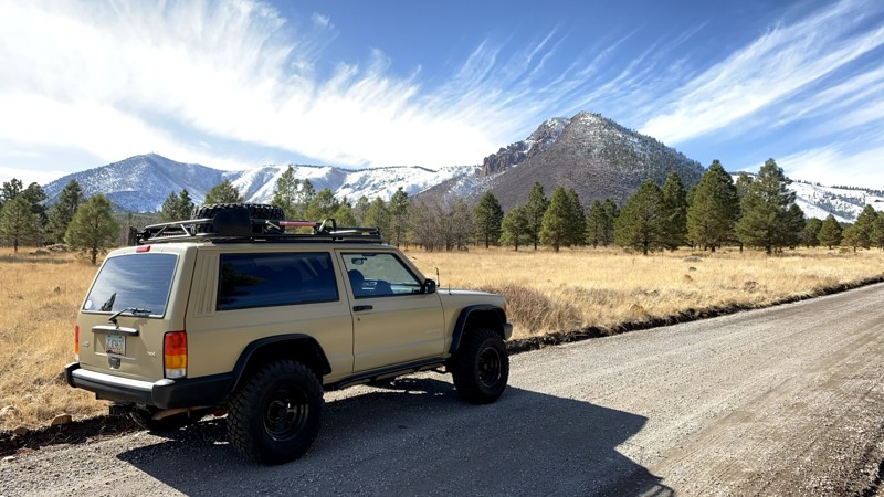
The southern section of CR 5 travels east to west through significantly different terrain than the other two sections of the Mount Trumbull Loop. This section ascends a half-mile-long dugway constructed in the 1930s by the Civilian Conservation Corps into mountainous terrain with a ponderosa pine forest reaching 6,800 feet. The road is continuously rocky and rough, only 1.5 vehicles wide across the dugway. Drivers of this road are rewarded with plenty of scenic views, including the 8,028-foot Mount Trumbull and 7,866-foot Mount Logan. The trail passes a historic sawmill site that once supplied lumber to build the St. George Morman Temple in the 1870s. It also offers a short side trip to petroglyphs at Nampaweap.
There is substantial dispersed camping along this road, with many large sites suitable for groups or multiple vehicles.
This road is suitable for any high clearance 4WD vehicle, and it is highly recommended to air down to make the ride more comfortable due to the roughness of the road surface.
Updated: 01/07/2025
Little Elden Springs
Flagstaff, Arizona
Located in Flagstaff and the Coconino National Forest, Little Elden Springs Road is a short useful connector road up the eastern flank of Mount Elden. It is the faster way to the high-elevation hiking trailheads and mountain biking off Schultz Pass. There is also access to horse trails along Little Elden Springs Road, and a fun rock garden for kids to play on at Waypoint 4.

Upgrade your Membership
Unlock all of the details on every Trail Guide and Scout Route.
Start a 7-day Free TrialCommunity
Partners

