Region

The Black Hills

South Dakota

Offroad Trails in The Black Hills

A Region within South Dakota
3.9/5 (181)

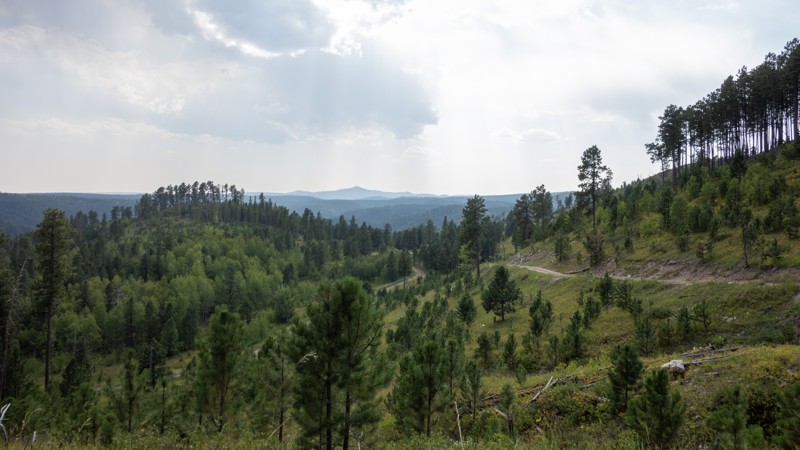
The Black Hills of South Dakota is a rugged, pine-clad mountain range renowned for its breathtaking landscapes, rich history, and diverse outdoor recreation. Sacred to the Lakota Sioux, the region derives its name from the dark appearance of its densely forested slopes. It is home to iconic landmarks such as Mount Rushmore National Memorial, Crazy Horse Memorial, and historic Wild West towns like Deadwood, offering no shortage of roadside attractions.

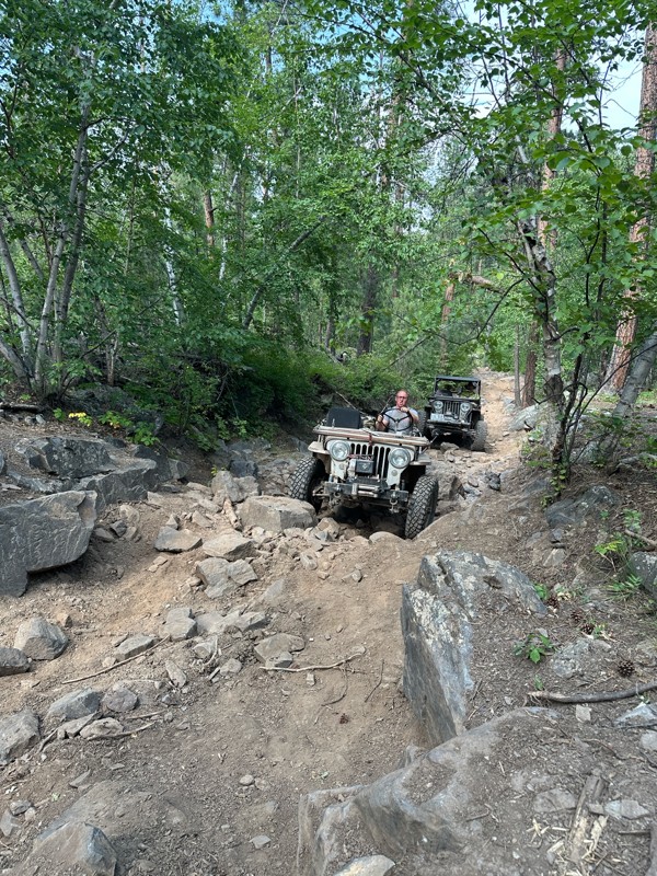
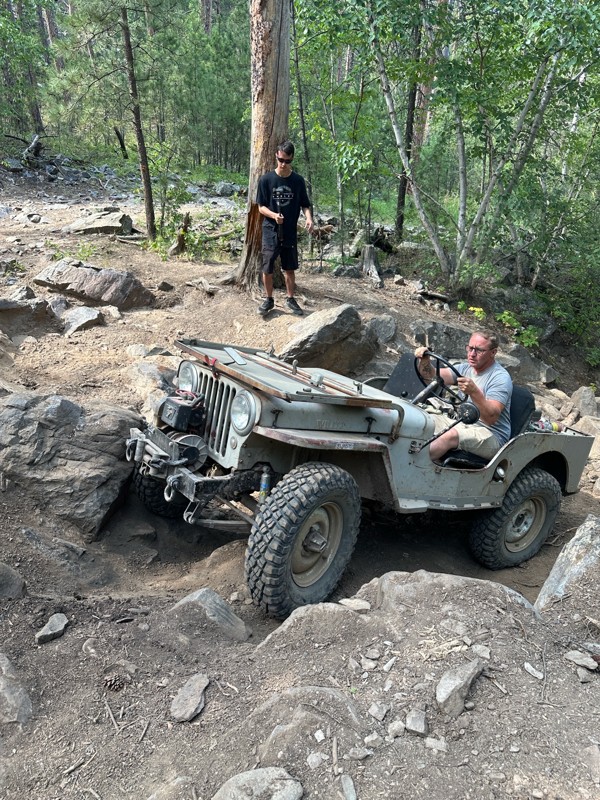
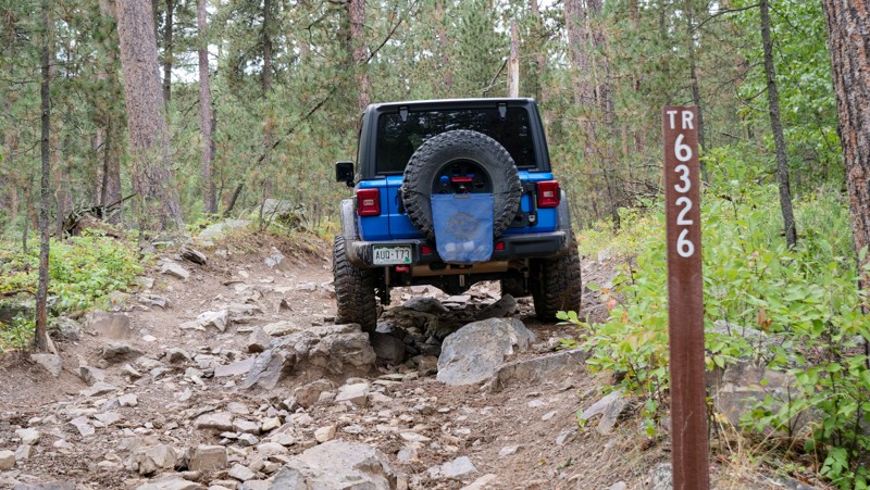
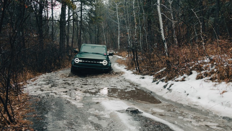
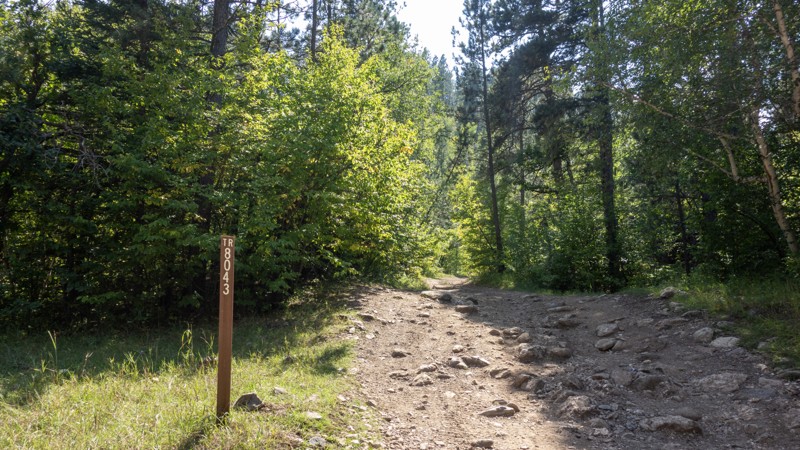
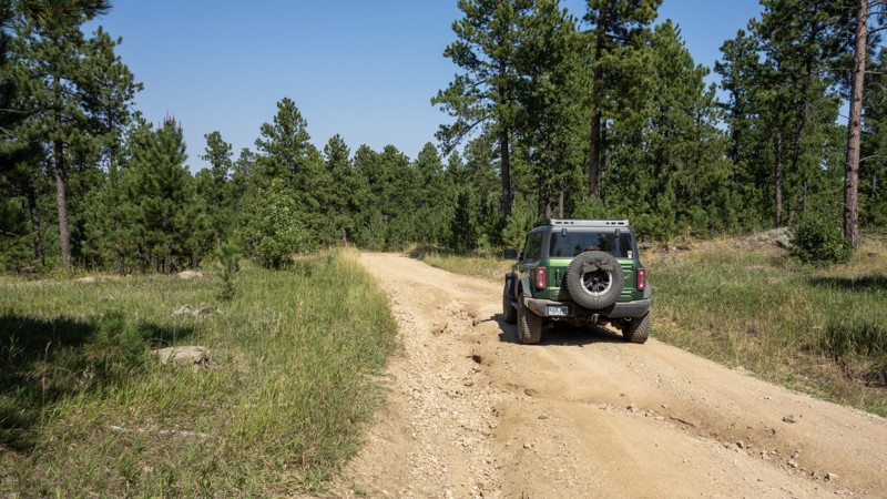
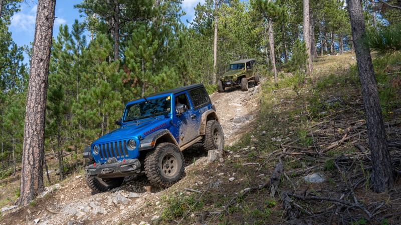
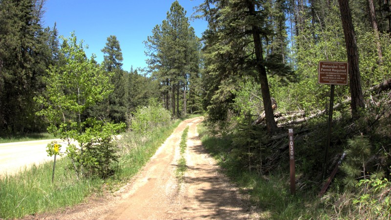
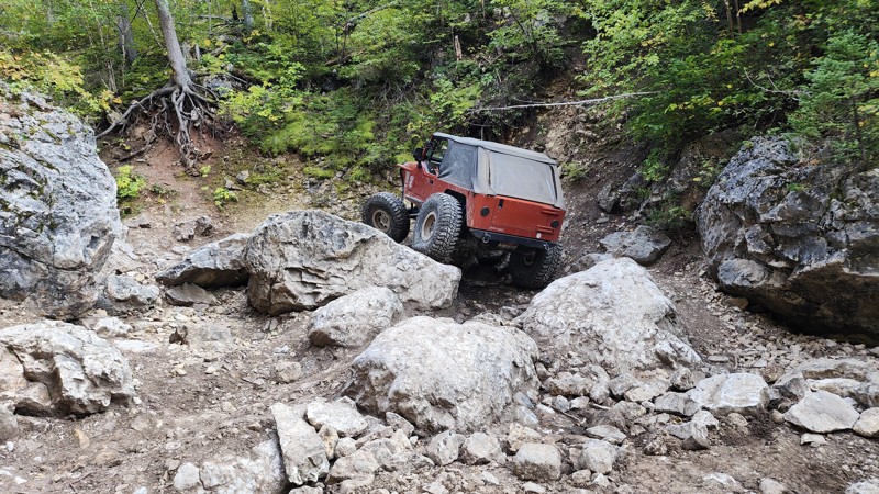
For off-road enthusiasts, the Black Hills boasts over 3,600 miles of roads and trails, winding through scenic valleys, rocky ridges, and dense woodlands. Whether tackling technical rock-crawling routes like Fruity Pebbles and Hal Johns or speeding along dirt paths like Boles Canyon and Galena Road, it's important to understand the distinction between roads and trails in this region. Roads, governed by state laws, are typically numbered with three digits followed by a decimal and another number or letter; they require a valid driver’s license and license plates. Trails, regulated by National Forest rules, are designated with four-digit numbers marked by “TR” on top, and a Motorized Trail Permit is required for vehicle access within the Black Hills National Forest.

Beyond off-roading, the Black Hills is an outdoor playground offering hiking, rock climbing, camping, and fishing. Custer State Park features stunning scenic drives, including the Needles Highway, which winds past towering granite spires, and the Wildlife Loop, where bison, elk, and burros roam freely. Hikers can challenge themselves on the Harney Peak Trail (Black Elk Peak), the highest point east of the Rockies, while rock climbers test their skills on the striking formations of Sylvan Lake and the Cathedral Spires. The region is also home to Jewel Cave and Wind Cave National Parks, which showcase intricate underground formations.

Whether delving into its storied past, conquering its rugged terrain, or immersing yourself in its natural beauty, the Black Hills offers an unforgettable mix of history, adventure, and scenic wonder.


Top Reasons to Explore Here

Basemaps
Go All-Access to Unlock


TRAILS OFFROAD™ TRAIL TYPES
Trail Guide
Full detailed write up with Advanced Rating System, Waypoints, Video, and more.
Scout Route
Lite version with highlights, camping, and hardest part documented. Vetted in person.
TRAIL DIFFICULTY RATINGS
easy (1-2)
Suitable for high clearance 2WD
moderate (3-4)
Best suited for a high clearance 4x4
difficult (5-6)
Best suited for a lightly modified 4x4
severe (7-8)
Best suited for a highly modified 4x4
extreme (9-10)
Best suited for specialized buggy type vehicles
LAYERS

Most Recent Trail Reviews

Most Popular

Search for Trails
South Dakota: Jake Bypass Hero Photo
Scout Route Icon
4/5 (3 reviews)
Updated: 09/23/2026

Jake Bypass

Johnson Siding, South Dakota

Trail 6326 is the primary entry and exit for the much harder Jake trail. It can be run in either direction, but it is best to run northeast to the southwest so that it parallels Jake and gives you options to attempt harder obstacles if you so choose. This trail is a great stand-alone trail for smaller rigs as it can be utilized as an observation trail to watch your more built buddies take on the trail down below. Along the drive, you will encounter several rock gardens consisting of watermelon to beachball-sized boulders that could cause undercarriage damage. This trail is a mild challenge for any built rig but will be significantly challenging for a stock 4WD due to the consistently large rocks. Skid plates and aggressive offroad tires are a must, and a lift is highly recommended.

6326 is bookended by 3-digit forest-numbered roads, but being a 4-digit number trail means it requires a motorized trail permit. Due to the terrain, there is no camping along this trail, but many connecting roads in the area allow dispersed camping.

South Dakota: Bear Den Hero Photo
Scout Route Icon
4/5 (1 reviews)
Updated: 10/15/2024

Bear Den

Boulder Canyon, South Dakota

Bear Den is a 5.71-mile road on the east side of Bear Den Mountain in the Lost Gulch area north of Galena. It offers scenic views of the surrounding Black Hills and the Black Hills National Forest. Bear Den branches off Lost Gulch and ultimately meets back up with Lost Gulch in a junction just south of Bear Den Mountain.

Bear Den is predominately rough dirt and small loose rocks, however there is one area containing large, deep ruts. Good tire placement would keep you on top of them, but the risk of slipping down may make going through the center the wiser choice. An illegal bypass route was present, but please stay on the designated trail and do not avoid mud holes or ruts. This would be an easy route if it weren't for this section. High clearance is recommended to make it through the ruts until they are repaired. The ruts can be bypassed by taking Bear Den 1E.

There is little to offer for camping along Bear Den. There is one small pull out south of the intersection with Camp 5, 8044, but it is only large enough for one vehicle.

South Dakota: Battle Creek Hero Photo
Scout Route Icon
4.7/5 (3 reviews)
Updated: 09/10/2026

Battle Creek

Rockerville, South Dakota

Battle Creek, FR 6501, is a moderately difficult 1.2-mile trail in the central Black Hills near Rockerville. Battle Creek connects South Rockerville Road and Teepee Gulch Road.

The trail is rocky and heavily forested but wide enough to minimize the risk of pinstriping. Expect ruts, embedded and loose rocks, mud, and standing water, especially after rain or in wet seasons. There are two main sections containing larger rocks, generally no more than 12 inches tall and moderate grade. A stock 4x4 can navigate this trail with good tire placement, but scraping a differential or low-hanging running board would be easy.

Due to the heavily wooded area, there are no good campsites along the trail. Nearby Teepee Gulch Road has several campsites suitable for vehicle or tent camping.

South Dakota: Calamity Canyon Bypass Hero Photo
Scout Route Icon
4.5/5 (6 reviews)
Updated: 08/11/2026

Calamity Canyon Bypass

Boulder Canyon, South Dakota

The Calamity Canyon Bypass is a bailout or observation route for the much more intense Calamity Canyon trail, a marked 5/10 rock crawling trail from the Black Hills 4 Wheelers Club. Calamity Canyon runs the creek bed, with the bypass on the road above. The routes share a trail number and sit nearly on top of each other, crossing several times. The Bypass offers those having second thoughts on the main route, a milder option if they feel in over their heads. It also offers access to the eastern entrance of 8044.

The Calamity Canyon Bypass starts just north of the main Calamity Canyon entrance. It does not have a large Black Hills 4 Wheeler sign like the main route, but does have a USFS sign designating it as 8043. Expect to find embedded rocks 12-15" tall in various places, tight trees, and steep uphill climbs. Moderate clearance and skid plates are recommended, along with 4-LO. Calamity Canyon and the Bypass merge toward the end and climb up a long, rocky, relentless hill until kicking out onto FS 170.5I Small mud pits can be found in low sections of the trail nearly year-round. This trail is tight throughout with trees, and pinstriping is likely.

Midway through both the Bypass and main trail, a cave can be found which is large enough to enter. Across from this cave is a small pull-out area, which could also double for vehicle or tent camping. Additionally, a large cleared area where 8043 and FS 170.5I meet would be suitable for camping.

South Dakota: Red Hill Hero Photo
Scout Route Icon
3.7/5 (7 reviews)
Updated: 08/11/2026

Red Hill

Boulder Canyon, South Dakota

Red Hill is a nearly 7-mile-long forest road starting off Galena Road about a mile west of Vanocker Canyon. Red Hill is open May 15 through December 15. Its northern border runs into a gated access to the Marcotte Game Production Area. The path does continue but turns into Red Cut Road, which may be closed during hunting season. When open, this route will continue into Sturgis. Do not bypass the gate if it is closed. Red Cut Road is not part of the Black Hills National Forest and is instead managed by the South Dakota Game, Fish, and Parks.

This road is primarily rough dirt, with a few minor rutted areas. Near the Game Production Area is a 15-20 degree rocky hill, which may require 4-High but is otherwise easy for 4x4s and SUVs. This area has distinctive red dirt, which is likely the namesake for the route and nearby peak.

Camping is mostly limited to a large clearing near the southern end, which would allow RV and trailer access, and another clearing about halfway down the track, which could be used by trucks and SUVs but would be difficult for larger vehicles to access due to the ruts in the road and steep entrance to the clearing. Campers should be aware that campfires are not allowed in the Black Hills National Forest.


South Dakota: East Rim Hero Photo
Scout Route Icon
4/5 (3 reviews)
Updated: 07/28/2026

East Rim

Blucksberg Mountain, South Dakota

East Rim, also known as Bulldog Canyon Road, is a seasonal Forest Service road near Sturgis, South Dakota. It consists mainly of rough dirt, with spots of embedded rock less than a foot tall and spots with loose shale and softball-sized rocks. There are several short hill climbs and descents, with the steepest at 12 degrees. East Rim is suitable for stock 4x4 vehicles. Visitors can expect to see vistas of the surrounding Black Hills, the nearby plains, and views of Bear Butte across the plains. Be sure to look out for the natural arch in the cliffside at the eastern end of this route. The Centennial Hiking trail also crosses East Rim.

East Rim offers multiple small pull-outs suitable for a single vehicle to camp with a ground or vehicle-based tent. Branch 139.1A ends in a large clearing that can accommodate several vehicles and tents. At the intersection of 139.1 and 139.1A, there is a large gravel trailhead also suitable for camping and trailers. 139.1 west from this trailhead to Vanocker Canyon Road is well-maintained gravel, so those wishing to trailer vehicles may find this a suitable area to park. Open fires are not allowed in the Black Hills National Forest. 

South Dakota: Smith Draw Cutoff Hero Photo
All-Access Icon
4/5 (1 reviews)
Updated: 06/20/2024

Smith Draw Cutoff

Hill City, South Dakota

Smith Draw Cutoff is an optional route to exit Smith Draw in the Black Hills National Forest. This short route takes you directly through a grassy valley where the trail can be difficult to see from the green grass, especially in early summer when the vegetation is new and lush. As you travel through the open grass field, you get a sense of what the rancher experiences as he's going to maintain his well and check on his cattle.

South Dakota: Slate Creek Dam Hero Photo
Scout Route Icon
4/5 (4 reviews)
Updated: 06/15/2026

Slate Creek Dam

Mystic, South Dakota

Slate Creek Dam is a well-maintained dirt and gravel road connecting Mystic Road and China Gulch Road, passing a small, peaceful forest lake. Open from May 15 to December 15, it provides access to the Slate Creek Dam, hiking trails off spur 530.1C, and a large parking area suitable for camping. The road is generally accessible to most vehicles, including those with modest clearance, though occasional potholes may be present.

To reach Slate Creek Dam, travel north on China Gulch Road from Highway 16 east of Hill City or enter from Mystic Road near the Red Fern Trailhead. Along Mystic Road, this trail is incorrectly labeled with a street sign as Horse Creek Road. The Slate Creek Dam and spur 530.1C are roughly halfway from either end of the trail. Dispersed camping is available at the end of 530.1C for tents, vehicles, and small RVs or trailers, though there are no amenities, and campfires are restricted to designated fire pits. The area’s highlights include the Slate Creek Dam and its small lake, as well as the ruins of the early 1900s Queen Bee mining town, with remnants of the town and mine visible along the roadside.

South Dakota: Moses Hill Hero Photo
Scout Route Icon
5/5 (7 reviews)
Updated: 09/23/2026

Moses Hill

Bethlehem, South Dakota

Located between Sturgis and Nemo along Vanocker Canyon, Moses Hill is one of the best natural rollercoaster rides you can find in the Black Hills. This trail is only one vehicle wide the entire way but can be run in either direction. The terrain is rocky and loose and traverses three extremely steep hills.

Traveling the trail from south to north, you will climb two 24-degree hills, encounter one rounded rock ledge, and descend a 27-degree hill down the trail's northern end. Pine trees slightly obstruct views from the top of Moses Hill, but this trail offers the best views you can find in the immediate area. There is no camping along the trail, but several nearby roads offer dispersed camping options.

Although new offroaders might find this trail intimidating, it is suitable for beginners in a short-wheelbase high-clearance 4x4 with selectable low-range gearing. Low-clearance 4x4s will have issues with the rock ledge along the southern climb. Thus, long-wheelbase vehicles will require additional clearance over stock or rocker protection.

Be cautious during wet weather as the trail can become very slick, and traction will be difficult.

South Dakota: Captain Crunch Hero Photo
Scout Route Icon
5/5 (1 reviews)
Updated: 08/11/2025

Captain Crunch

Johnson Siding, South Dakota

Listed as a 10 out of 10, Captain Crunch is one of, if not the most difficult, rock-crawling trail in South Dakota. Captain Crunch can be located in the "Cereal Bowl" area off Bogus Jim Road, near Johnson Siding.

Captain Crunch starts near the beginning of Got Milk?, where users can take the smoother northern section down to the bottom of the canyon before climbing back up on the southern section. Dedicated rock crawlers and buggies are required to navigate Captain Crunch. Visitors can expect large, sedan-sized boulders, steep climbs, v-notches, and boulder after boulder.
No camping locations are available on Captain Crunch. A clearing at the entrance of the Cereal Bowl area (Bogus Jim Branch 1B) at its intersection with Bogus Jim Road provides room for trailers and some vehicle-based camping.

South Dakota: Hal Johns Bypass Hero Photo
Scout Route Icon
3.5/5 (7 reviews)
Updated: 07/06/2026

Hal Johns Bypass

Boulder Canyon, South Dakota

Paralleling the most extreme southern sections of the Hal Johns trail, Hal Johns Bypass is a short connector trail from Camp 5 to Galena Road. 99% of this trail is easy, with a hard-packed surface, gentle grades, and a few watery mudholes. However, the moderate rating comes from one short section at the northern end of the trail, at the intersection with Camp 5, Calamity Canyon, and Hal Johns. At this intersection, you are required to traverse a rutty and chunky rock climb out of Bear Butte Creek, with rocks up to 10''-12" in size. The northern quarter of Hal Johns Bypass is trail 8045, which requires a motorized trail permit. The southern three-quarters changes road numbers to 170.4C and offers several connection points to Hal Johns, Fullsize, and Kong. The southern end of the road has some of the best scenery you will find in the Camp 5 area, with several wide-open meadow views. At the southern intersection with Galena Road, you can find a small staging/camping area good for airing up or leaving trucks and trailers. Please remember, per Forest Order BKF-146-2019, campfires are strictly prohibited in the Black Hills.

This trail is suitable for any high clearance vehicle and drivers of any experience level.

South Dakota: Pine Grove Hero Photo
Scout Route Icon
3/5 (6 reviews)
Updated: 08/11/2026

Pine Grove

Rockerville, South Dakota

Pine Grove (FS 718) can be found at the eastern edge of the central Black Hills near Rockerville, South Dakota. It is best accessed by taking Highway 16 to Neck Yoke Road and then turning onto Pine Grove Road. Pine Grove Forestry Road branches off Pine Grove Road, about a mile from Neck Yoke Road.

Pine Grove features a mix of rough dirt with loose and embedded rocks up to six inches in size. It is easily tackled by any vehicle with moderate ground clearance. Pine Grove will expose its visitors to alternating sections of forest and clearings, with numerous chances to see unique Black Hills granite formations. Midway through the trail, views of the surrounding mountains, including Black Elk Peak and the Needles, can be found.

Pine Grove features a moderately sized parking area near its eastern start and a small pullout toward its western end. The parking area would accommodate vehicle trailers for those who may wish to haul their vehicle in. It is also large enough for small campers and trailers. The pullout is large enough for two vehicles or one vehicle with a camper trailer.

Pine Grove's western end is not far from Foster Gulch, which provides access to the extreme rock crawling trails T-Back and Bikini.

South Dakota: Ditch Creek Road Hero Photo
Scout Route Icon
4.5/5 (2 reviews)
Updated: 09/23/2026

Ditch Creek Road

Rochford, South Dakota

Ditch Creek Road is a year-round, well-maintained gravel and dirt road located off Deerfield Road just west of Deerfield Lake, about 20 miles west of Hill City. Ditch Creek Road provides access to several full-width and restricted-width trails, the Ditch Creek Campground, and stunning views of the Black Hills National Forest. A short walk from the main road up trail 6021 leads to an enterable retired silica mine. 6021 is restricted to vehicles under 62 inches in width. The Ditch Creek area is also well-known for elk viewing.

Ditch Creek Road can be traversed by most vehicles, as its most challenging terrain is gravel washboards with the occasional pothole. Ditch Creek Campground offers several dry RV-sized spots and tent locations with fire rings. A large parking area across from the campground provides adequate space for trailer parking and unloading. Ditch Creek Road also offers several suitable spaces for dispersed camping.

South Dakota: Raspberry Ridge 8030 Hero Photo
Scout Route Icon
3.5/5 (6 reviews)
Updated: 08/11/2026

Raspberry Ridge 8030

Merritt, South Dakota

Raspberry Ridge is an entry-level rock crawling trail in the northern Black Hills. The trail is located just east of the Pilot Knob Trailhead on Merritt Estes Road between Highway 385 and Nemo Road. This is a trail rated by Black Hills 4 Wheelers as a 3 out of 10 and is a combination of trails 8030 and 8026. Raspberry Ridge is named for the plethora of wild raspberries found along the trail in the summer.

8030 is the western end of Raspberry Ridge and starts right off of Merritt Estes Road, climbing sharply right away. The first right turn will send you right into the rocks. High clearance and lockers will help as the trail throws rock after rock in your path, all while climbing a 10-20 degree grade. The trail is wide in most spots but does present a few tight areas around trees and rocks. Expect steep climbs and descents, all while navigating around and over medium-sized loose and embedded rock. The trail comes to an end as it transitions into 8026, with no other legal exits available. There are no designated or readily accessible camping locations on 8030.
Like all four-digit trails, an offroad permit is required to access Raspberry Ridge.

South Dakota: Kong Hero Photo
Scout Route Icon
5/5 (4 reviews)
Updated: 07/21/2026

Kong

Galena, South Dakota

King of the trails, Kong is a short, technical rock-crawling trail in the Camp 5 area near the ghost town of Galena. Kong can be found branching off the final section of Fullsize, connecting it to the Hal Johns Bypass.

Kong is a third-mile-long of relentless hardcore rock-crawling. Users will encounter numerous refrigerator-sized to sedan-sized boulders, fallen trees, undercut ledges, and off-camber washes.

Kong has extremely limited room to pass, thus it is best to run the trail from north to south.

South Dakota: Bogus 07 Hero Photo
Scout Route Icon
4.5/5 (2 reviews)
Updated: 09/23/2026

Bogus 07

Merritt, South Dakota

Bogus 07, marked as trail 6307, is a short, straight-through trail in the Bogus Jim Area that follows the powerlines from Nissen to South Bogus. The trail is mostly easy and well-maintained, but one short, moderately steep, and chunky hill will require a high clearance vehicle and could necessitate the need for 4-wheel drive. There are no significant obstacles along the trail, and the hardpacked and rocky trail surface limits any potential mud that could form during rainy periods. This trail is suitable for wheelers of any skill level and offers no camping.

South Dakota: Camp Five 8044 Hero Photo
Scout Route Icon
4/5 (5 reviews)
Updated: 08/11/2026

Camp Five 8044

Galena, South Dakota

Camp Five 8044 is an unnamed connector between Calamity Canyon and Bear Den. It is less than a mile long and has no camping options or beautiful views. This trail is best used as a shortcut to Calamity Canyon as it starts near the northern entrance or as a bailout option if Calamity Canyon and the Calamity Canyon Bypass prove too difficult.

This trail, when started from Bear Den, starts tame with mostly rough dirt. It progressively gets rockier until it drops toward Calamity Canyon, losing altitude fast as the rocks get bigger and the washout gets deeper. High clearance and 4-Lo are recommended, especially when going back up from Calamity Canyon. Expect embedded rocks up to 12" tall.

South Dakota: Pillar Hero Photo
Scout Route Icon
4/5 (6 reviews)
Updated: 07/22/2026

Pillar

Boulder Canyon, South Dakota

Pillar is a trail on the western side of the Camp 5 system composed of trail numbers 8041 and 8040. It can be accessed by taking the north entrance to Camp 5 from Boulder Canyon and taking Lost Gulch until meeting the start of 8041.

8041 is mostly rough dirt with some mild ruts. Near the start of 8040, it is possible to see the Black Hills through the trees. 8041 has a spur to the northwest; however, this spur has little to see and offers no exciting terrain. 8040 starts with the same rough dirt but soon turns rocky, with 6-10" tall embedded rock. The trail gets steeper, reaching 12-14 degrees as the rock becomes loose and 4-wheel drive becomes necessary.

Pillar 8040 offers one pull-out large enough for a vehicle or two to set up a small camp. This trail ends when it meets up with Lost Gulch Branch 1H.

South Dakota: Terry Summit Road Hero Photo
Scout Route Icon
4/5 (2 reviews)
Updated: 07/06/2026

Terry Summit Road

Englewood, South Dakota

At 7,064 feet, Terry Peak is the sixth-highest peak in the Black Hills and the area's most prominent mountain. It is home to a popular ski resort of the same name and a decommissioned fire watchtower that now serves as a viewing platform for visitors. Terry Summit Road is a 3.26-mile gravel road that allows access to Terry Peak and the tower.

Terry Summit Road is a well-maintained gravel road suitable for any vehicle. Its end at the peak offers a gravel parking lot and turn-around, suitable for medium-size campers and trailers to park or change directions. There are no camping options off Terry Summit Road, as it is mostly bordered by private property and housing developments.

The watchtower allows a nearly unobstructed 360-degree view of the plains to the north and surrounding Black Hills in every other direction. Bear Butte stands at the edge of the plains, with Crow Peak to the northwest, Cement Ridge to the west, Custer Peak to the southeast, and Deer Mountain to the south. Spearfish, Lead, Deadwood, and Sturgis are all visible from the peak as well.

South Dakota: Bear Den Branch 1C Hero Photo
Scout Route Icon
5/5 (5 reviews)
Updated: 08/11/2026

Bear Den Branch 1C

Galena, South Dakota

Bear Den 1C starts north of Bear Den Mountain and travels on the west side of the peak. A large portion of this route is rough dirt with small embedded rocks and traverses a single car-wide shelf road. It continues on a spur past trail 8048, which ends at a spectacular lookout point dubbed "Puff Puff Point" by a sign on a tree. The trees on the spur are narrow, and branches are sure to rub on the side of vehicles. There are some small mud puddles on Bear Den 1C, but they have hard bottoms and are shallow.

"Puff Point Point" is the only area suitable for camping, with space for a vehicle tent system or a ground tent. However, the ground is rocky in this area. A short trailer could make it to this point, but it would be difficult to turn around to return down the spur.

The descent down 8048 quickly becomes rocky and high ground clearance is strongly recommended. Expect 6'-10" rocks with step downs and shelves. 8048 is short and ends on 567.1E.

South Dakota: Bald Hill / Taylor Ranch Road Hero Photo
Scout Route Icon
5/5 (1 reviews)
Updated: 03/25/2025

Bald Hill / Taylor Ranch Road

Three Forks, South Dakota

Taylor Ranch Road is a year-round, rough-graded dirt road in the Bald Hills area of the Black Hills. It can be found on the north side of Sheridan Lake Road, between Highway 385 and Rapid City. It is generally accessible to most vehicles with moderate ground clearance. Visitors can expect an easy path with small embedded rocks and the occasional wash or rut on the side of the road. In all instances, the ruts are easily straddled or side-passed. Taylor Ranch Road will present the Bald Hills, a nearly treeless island of rolling hills in an otherwise forested area. This road will connect users from Sheridan Lake Road into Nik Ranch, and then to Victoria Lake Road near the Pactola Dam.  

Taylor Ranch Road does have three short spurs. Spurs 160.1 and 160.2D end at gates to private property and offer little to see. Spur 160.2B offers access to the Centennial Hiking Trail 89.

Taylor Ranch Road has no designated camping spots. However, dispersed camping is allowed in the Black Hills National Forest, and there are ample flat, bare spots on the edges of the road. Open campfires are not permitted in the Black Hills National Forest.

South Dakota: Galena Branch 5H / Camp 5 047 Hero Photo
Scout Route Icon
4/5 (5 reviews)
Updated: 08/11/2026

Galena Branch 5H / Camp 5 047

Galena, South Dakota

Galena Branch 5H starts off Galena Road just west of Forestry Road 180. This route is short and mainly a connector route from Galena Road to the southern end of the main Camp 5 trail. It is a mostly rough dirt road until it turns into trail 8047, where it becomes tighter and rockier, and tree branches are likely to connect with the side of your vehicle. 8047 exits onto Calamity Canyon / Calamity Bypass about 1/8th mile from the start, near the end of Camp 5. Overall, this section is just two miles long and would be accessible by any standard 4x4 and most AWD SUVs with a patient and experienced driver. Expect some loose rock 6-8" and mildly graded hills.

Camping along the road is limited to two pullouts. One would accept a vehicle with a rooftop tent, and the other could accommodate a small trailer. Both are located right on the side of the trail and offer no privacy.

South Dakota: Fruity Pebbles Bypass Hero Photo
Scout Route Icon
4.3/5 (3 reviews)
Updated: 09/23/2026

Fruity Pebbles Bypass

Johnson Siding, South Dakota

Located off Bogus Jim Branch 1B, the Fruity Pebbles Bypass allows users to bypass the Fruity Pebbles rock crawling trail, ending at Forestry Road 6340 near the exit of Fruity Pebbles. Users can expect loose and embedded schoolbook-sized rocks and up to a 14-degree climb to the top.

About halfway up the hill, where FS 201.1E transitions into FS6319, you can expect a washed-out rut to test your flex, followed by a tight switchback ending with a 10-12" ledge.

Camping is sparse on the Fruity Pebbles Bypass, with a pull-off about a quarter of the way from the north end of the trail and a clearing at the top of the climb, about a quarter of the way from the south end. Both would provide room for a few vehicles to park and set up vehicle-based camping if needed.

South Dakota: Power Line Hero Photo
Scout Route Icon
4/5 (1 reviews)
Updated: 10/15/2024

Power Line

Hill City, South Dakota

Forestry Road 425, or "Power Line" is a easy "there and back" dirt forest road southeast of Hill City South Dakota. It can be accessed by taking Highway 16 south from Hill City, turning east onto SD Highway 244, and then taking the first left onto Power Line. Power Line does not require a special permit to access.

There are a few spots within the first half mile of Power Line suitable for camping. These could accommodate a ground tent, vehicle tent, or small trailer and can be found just off the side of the road. While the views are better further down the road, the terrain becomes steeper and rockier.

Power Line is predominately rough dirt, with a few short rutted areas and embedded rocks. It should be little problem for any 4x4 or SUV. The dirt does become slick after a rain but should dry within 24 hours.

Power Line offers many samples of Aspen forests, as well as views of Black Elk Peak and the surrounding granite spires, however most views require looking through the surrounding trees. One of the best views is actually just toward the end of the branch route, 425.1D, just before it ends in a turn-around. This branch can be accessed just before the end of Power Line.