Region

Buena Vista - Collegiate Peaks

Colorado

Offroad Trails in Buena Vista - Collegiate Peaks

A Region within Colorado
4.6/5 (954)

Buena Vista, Colorado – Offroad Gateway to the Collegiate Peaks

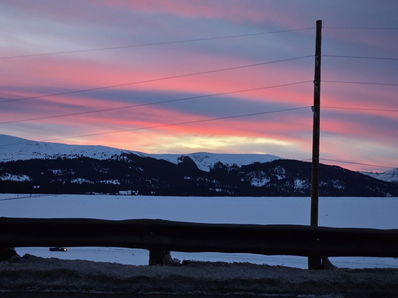
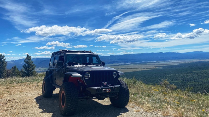
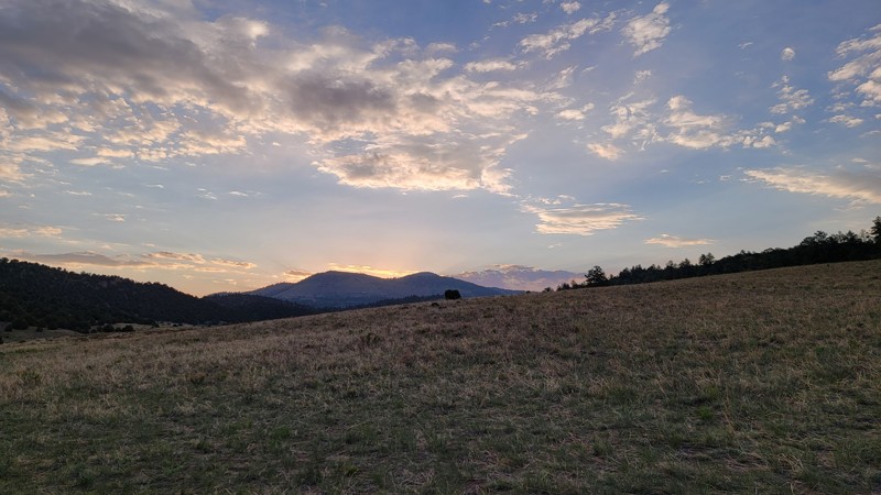
Often overshadowed by the better-known 4WD destinations of Ouray, Silverton, and Telluride, Buena Vista (pronounced BYOO-nuh Vista by locals) is a hidden gem in Colorado's offroad scene—and one that rewards explorers who give it the time it deserves. Nestled along the banks of the Arkansas River in the heart of the Upper Arkansas Valley, this charming mountain town is the launchpad to some of the most impressive alpine routes, scenic byways, and backcountry detours in the state.

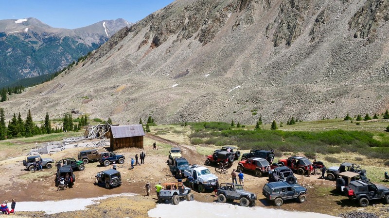
A True 4WD & Overlanding Hub

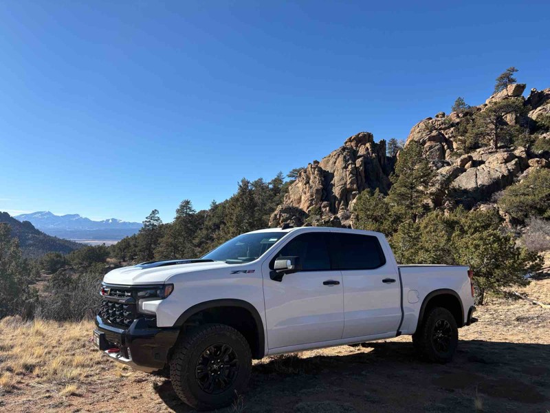
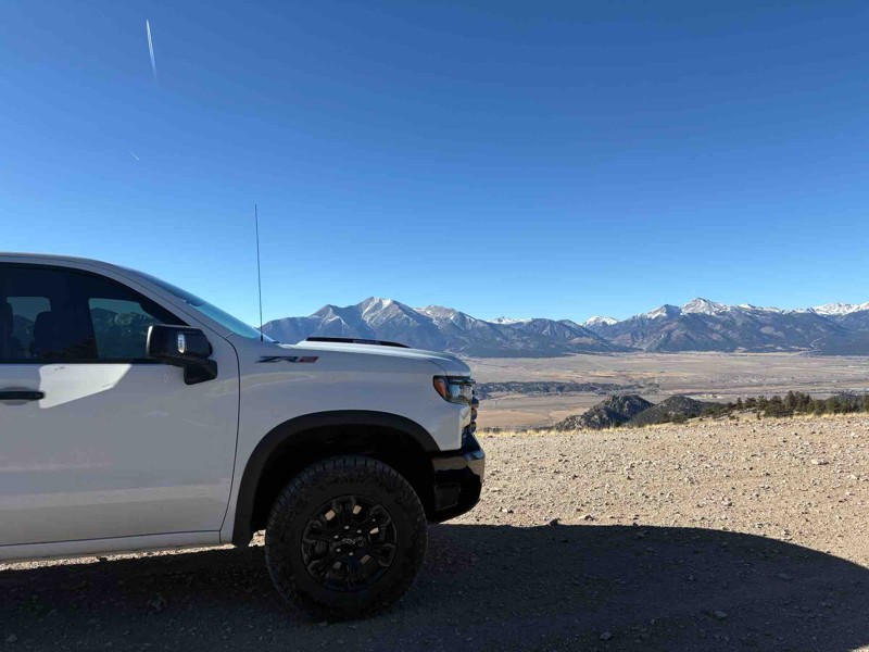
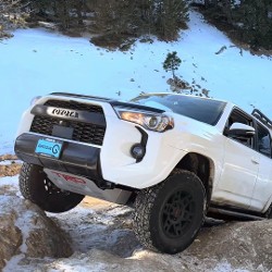
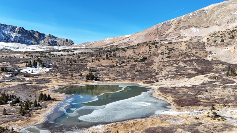
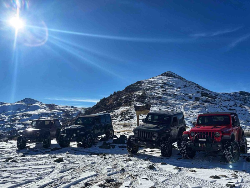
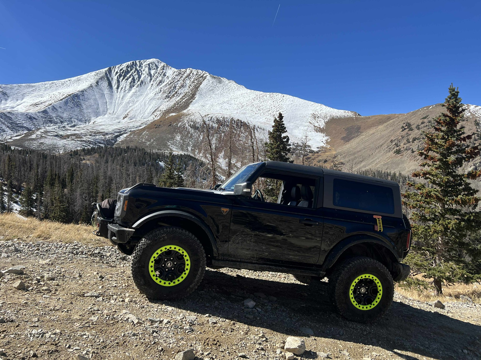
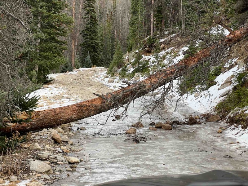
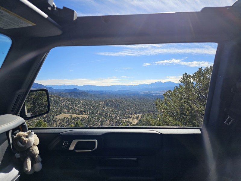
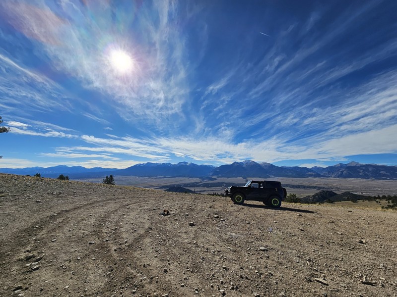
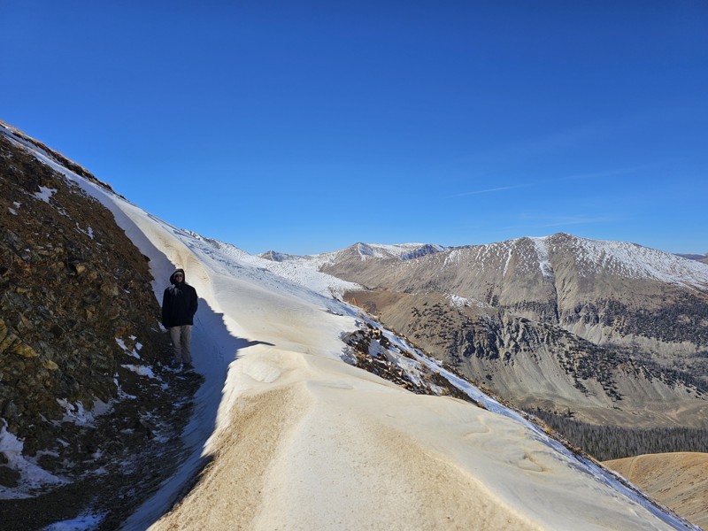
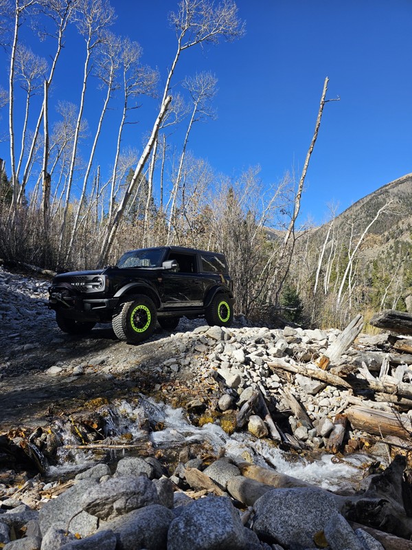
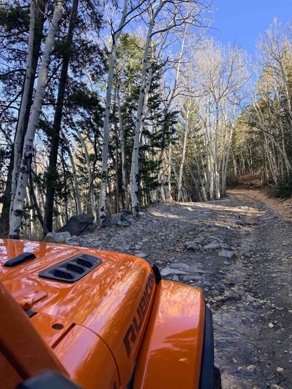
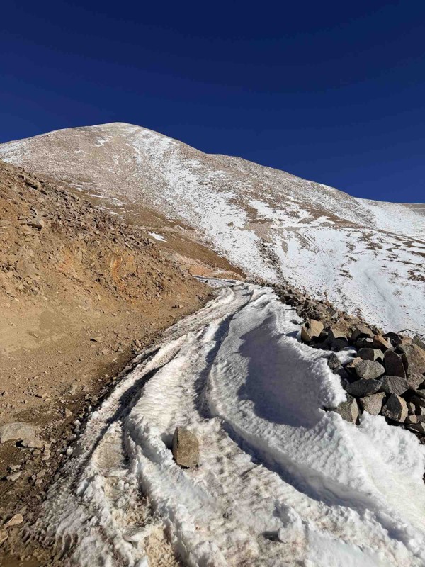
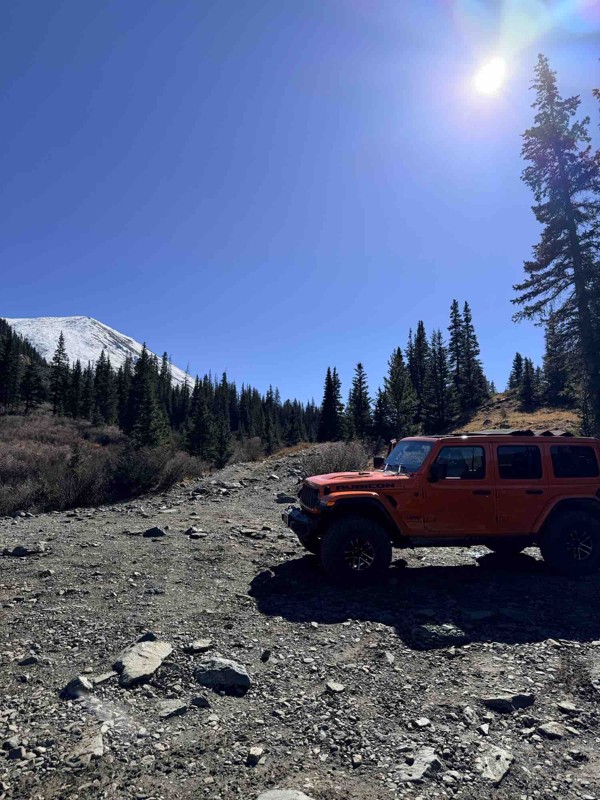
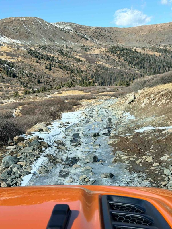
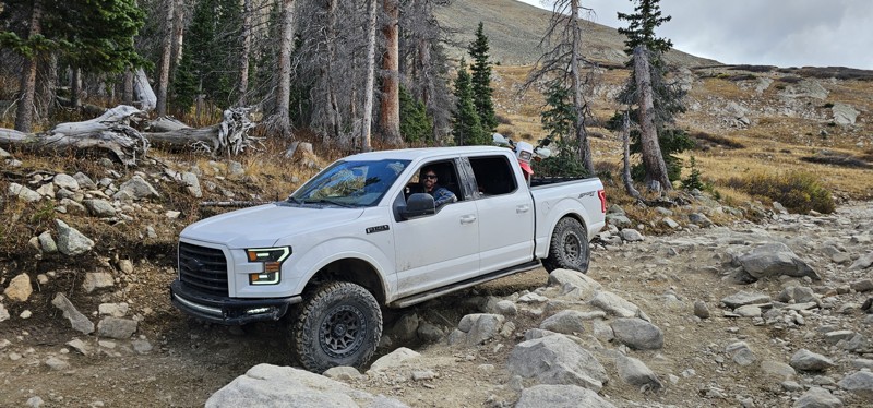
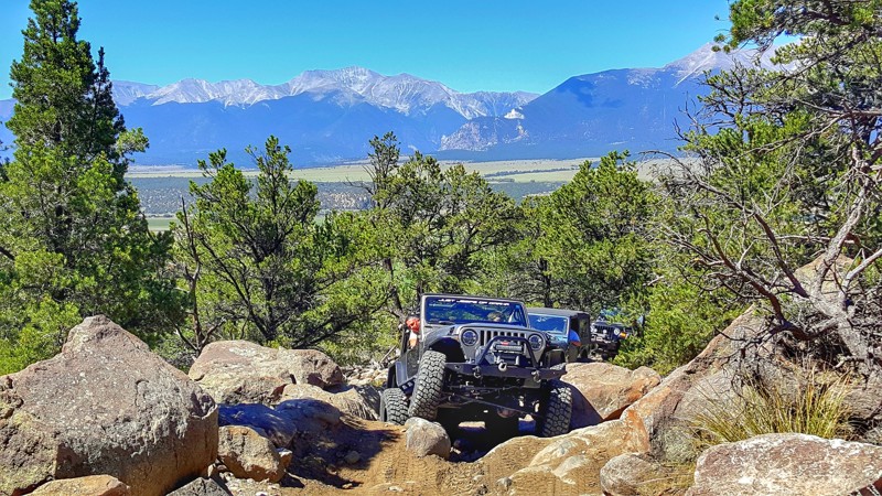
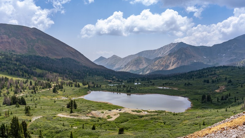
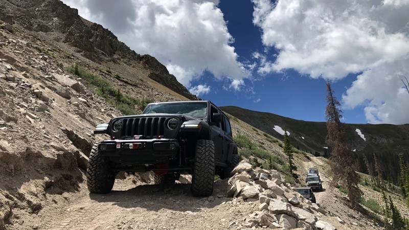
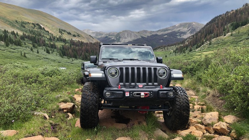
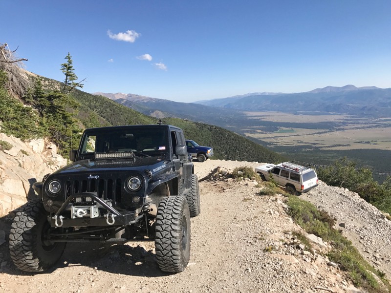
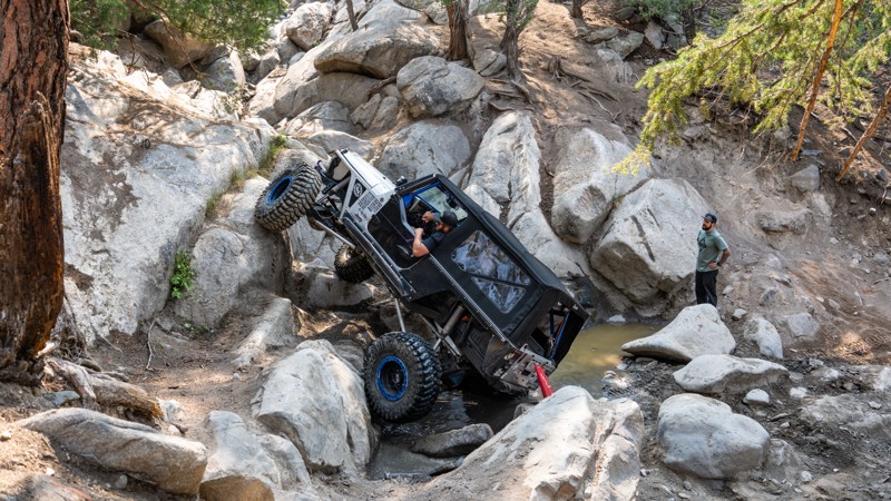
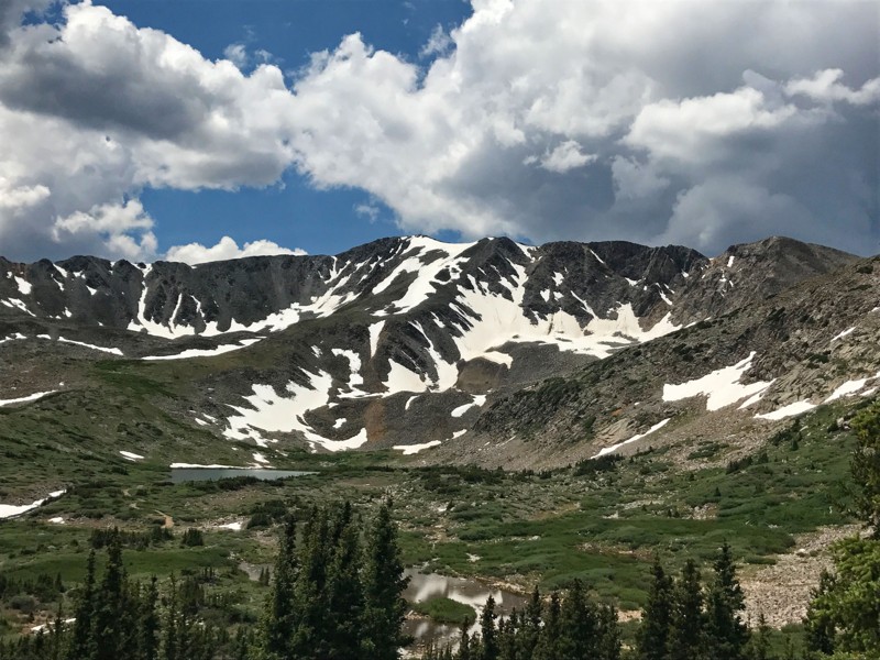
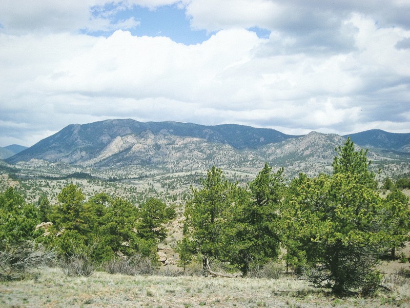
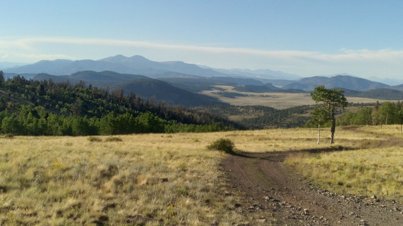
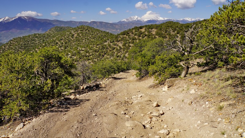
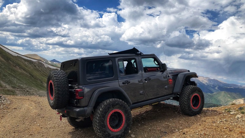
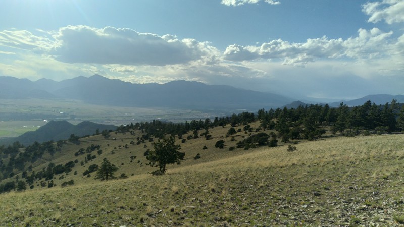
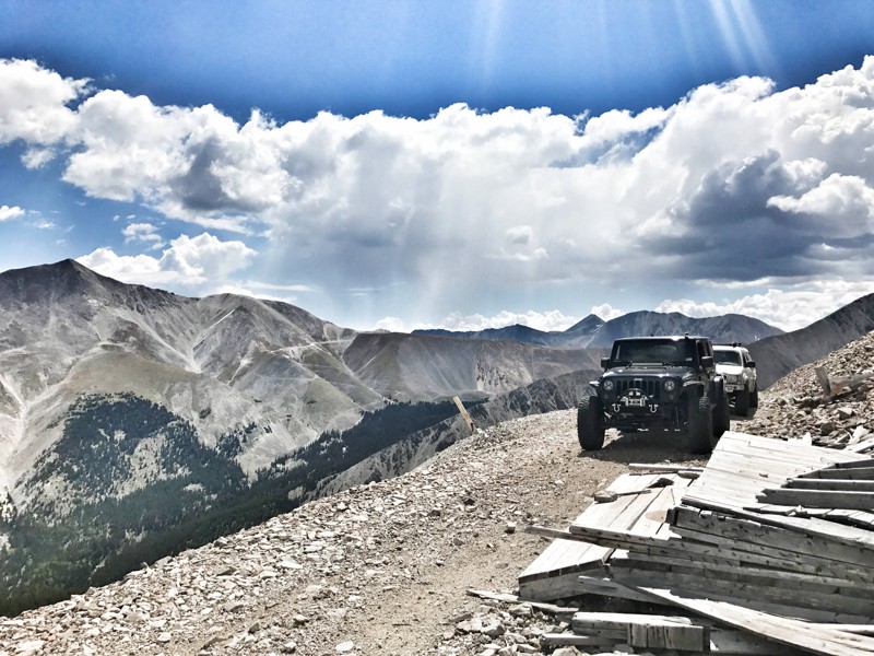
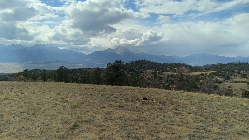
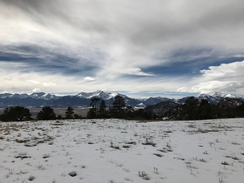
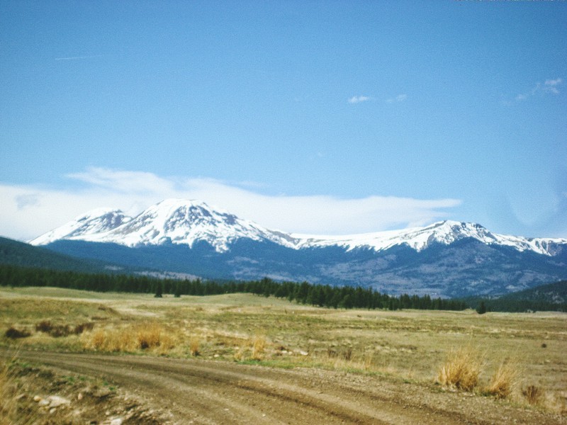
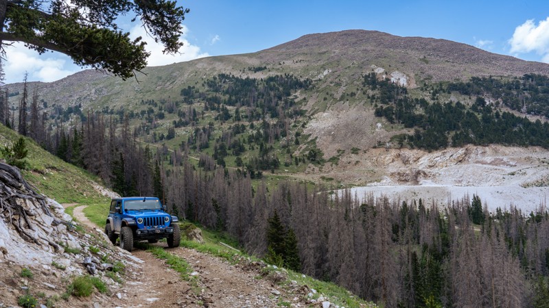
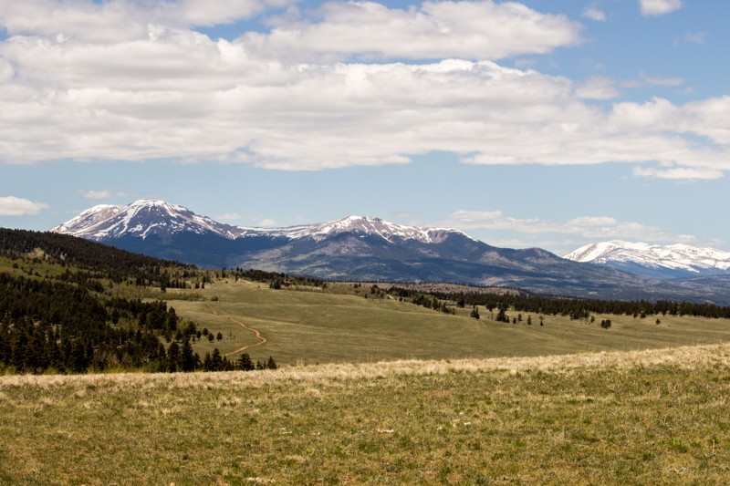
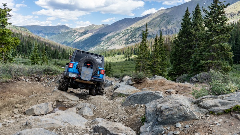
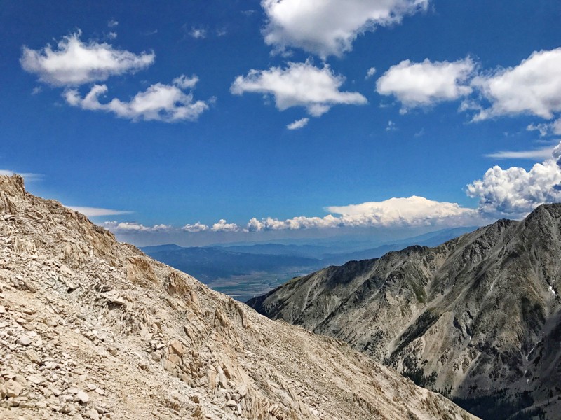
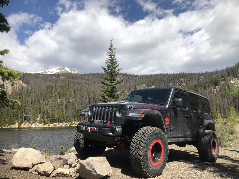
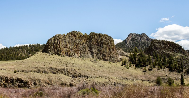
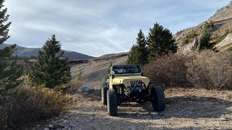
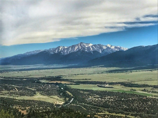
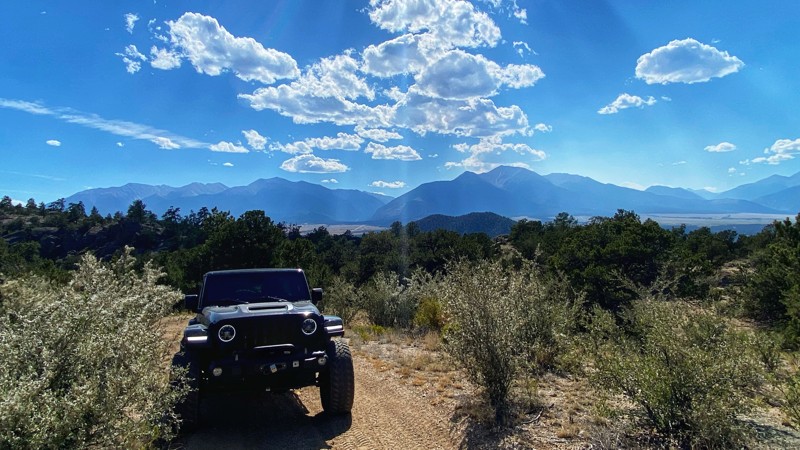
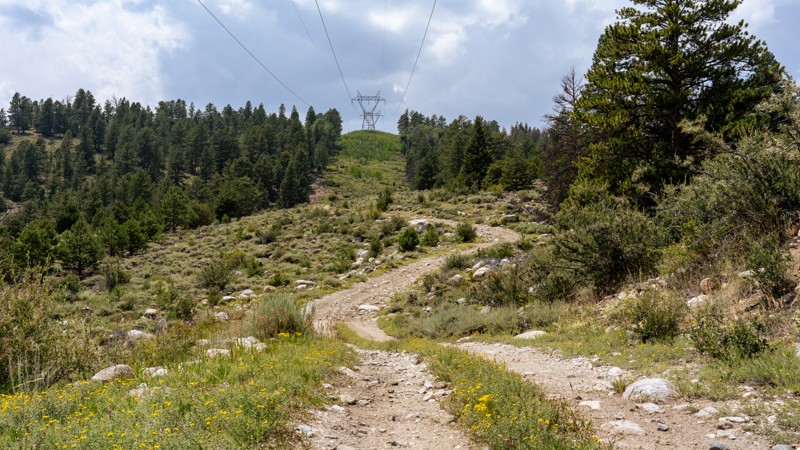
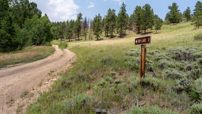
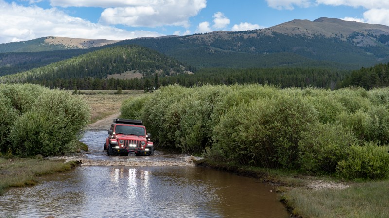
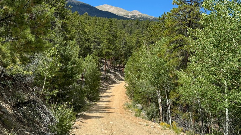
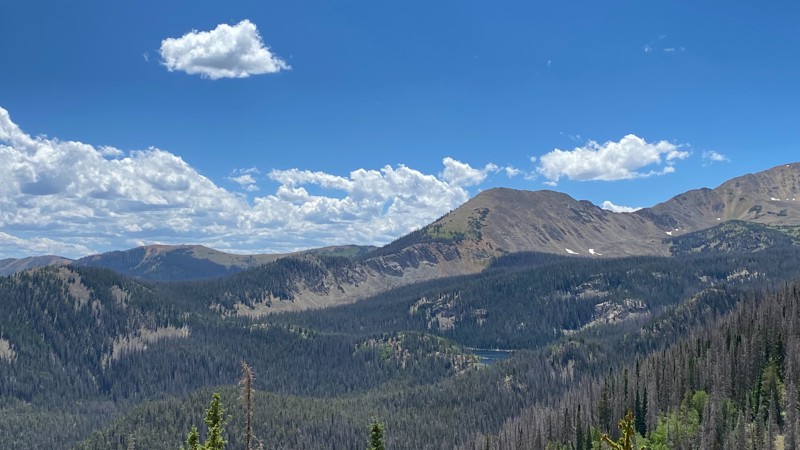
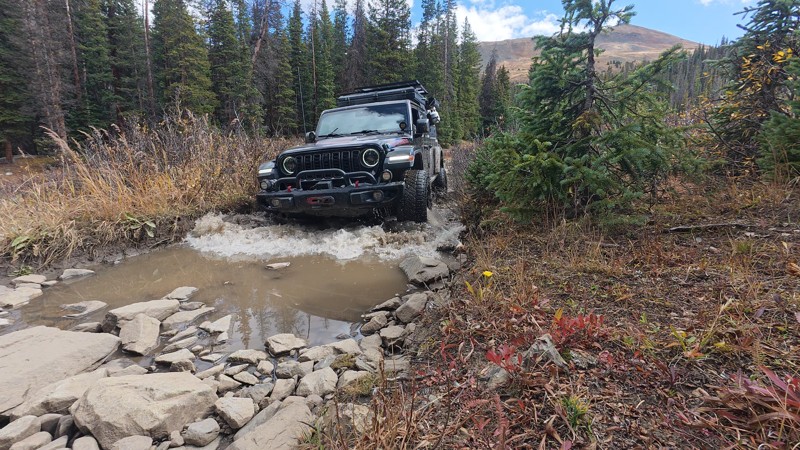
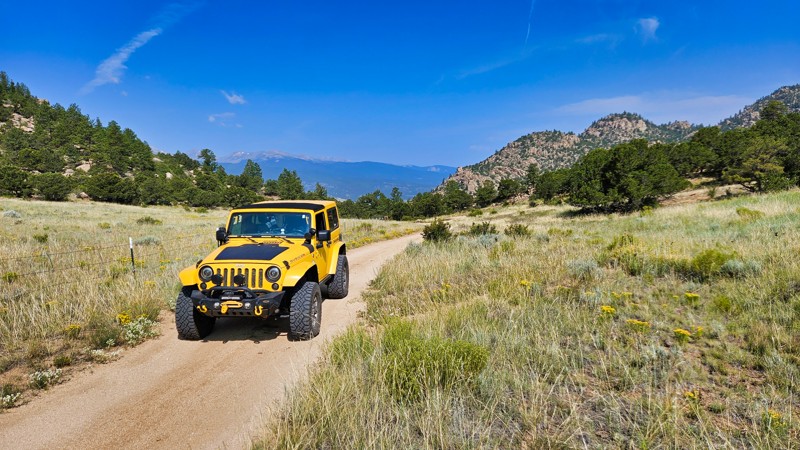
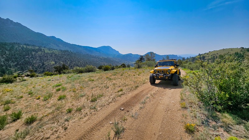
The trail options in the Buena Vista region are nothing short of spectacular. The area is home to both the tallest and third-tallest offroad trails in Colorado. Mount Antero towers at 13,728 feet, followed closely by Mount White at 13,266 feet. These high-elevation routes demand respect—and proper rig prep—but they deliver breathtaking summit views and unmatched alpine experiences.

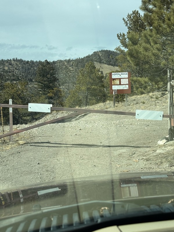
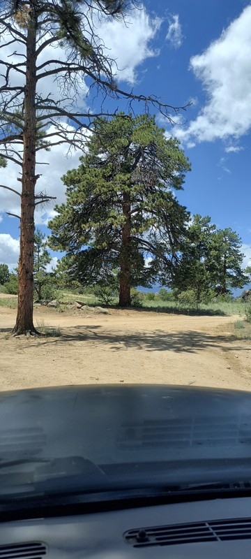
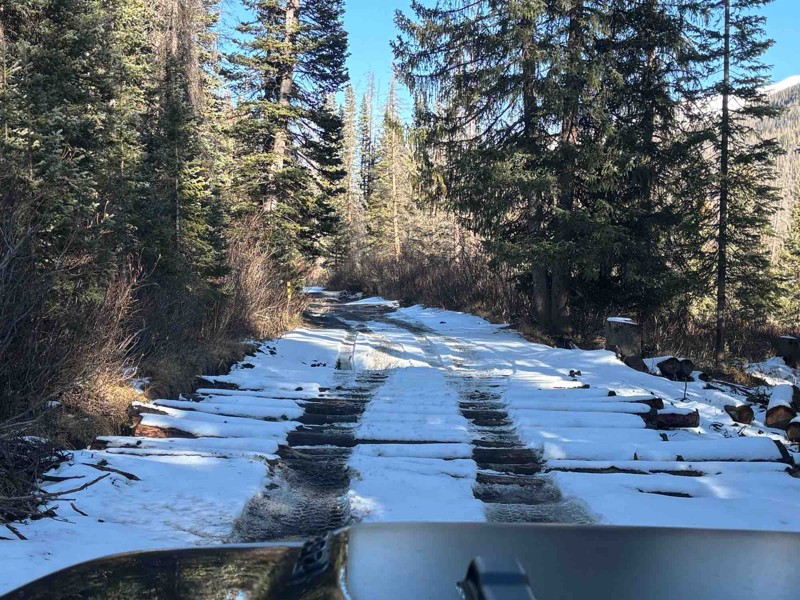
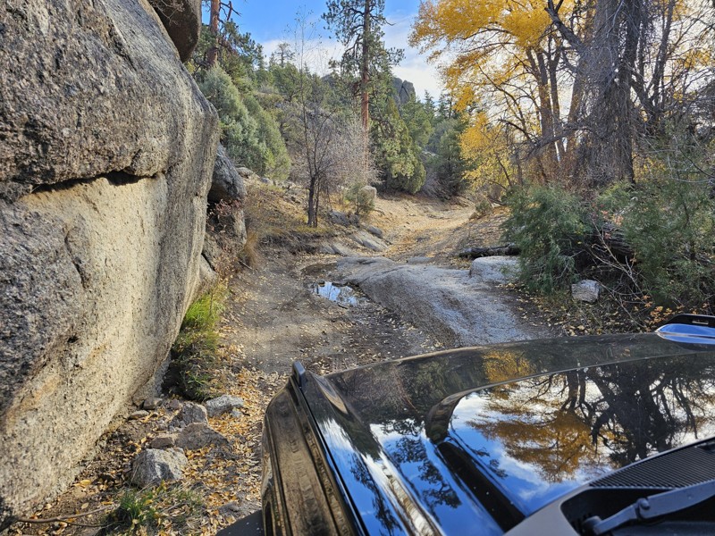
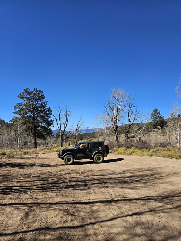
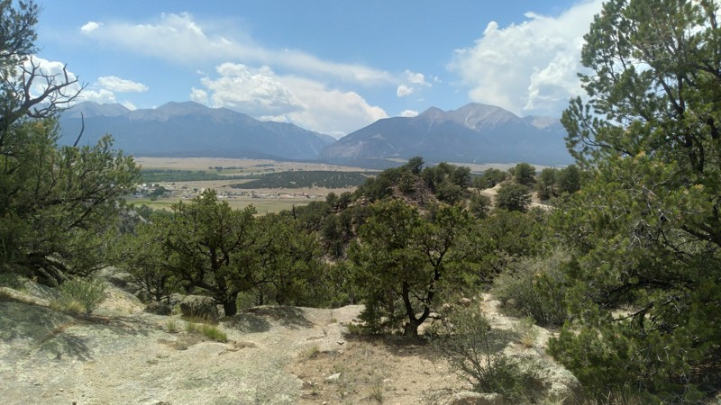
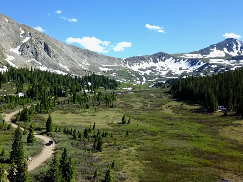
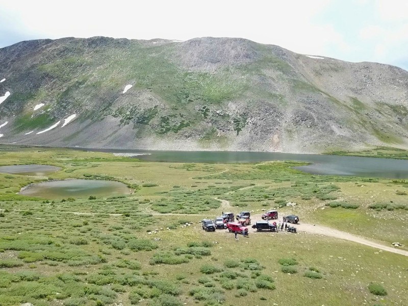
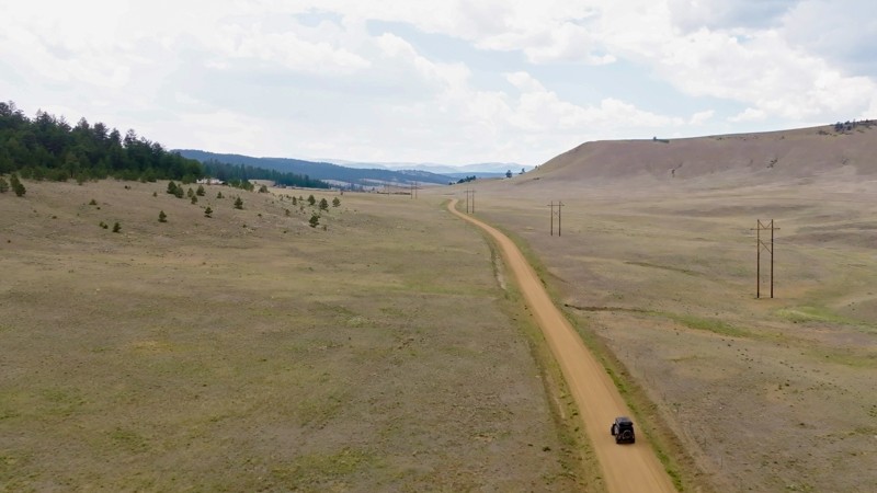
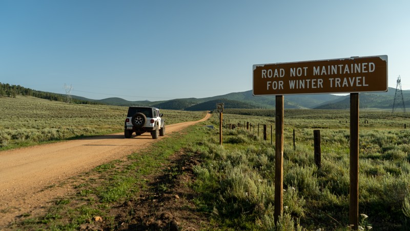
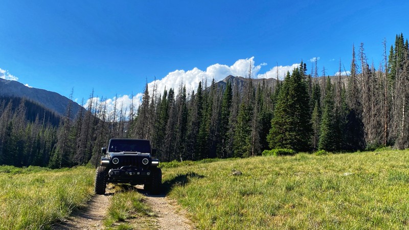
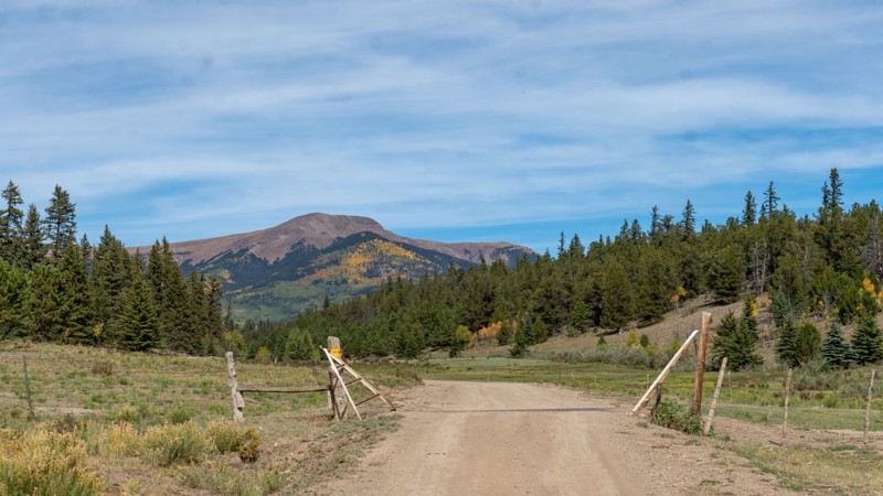
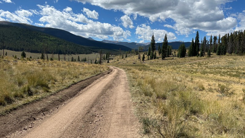
At lower elevations, the Fourmile Recreation Area offers a contrasting vibe. With its mellow terrain, open meadows, and extended season, Fourmile is a go-to spot during the spring and fall when high-country routes are still snowed in. It’s ideal for beginners, locals, and anyone looking for a scenic drive without the lingering snow.

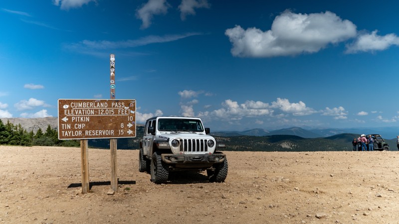
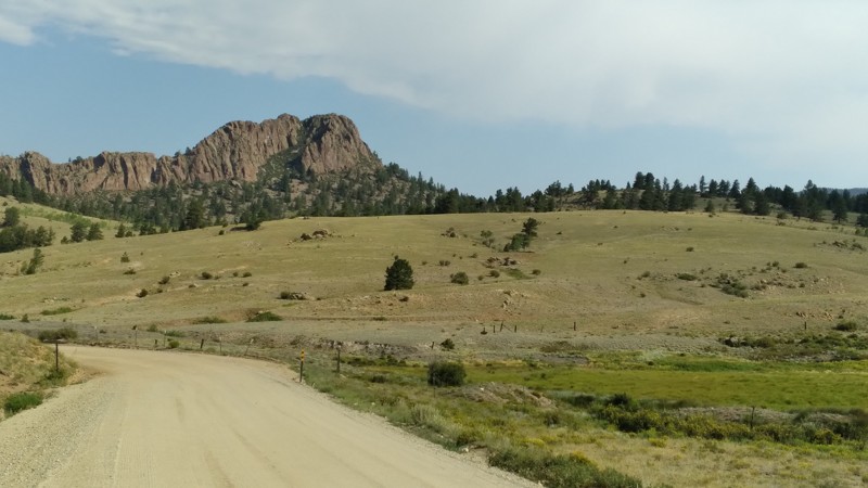
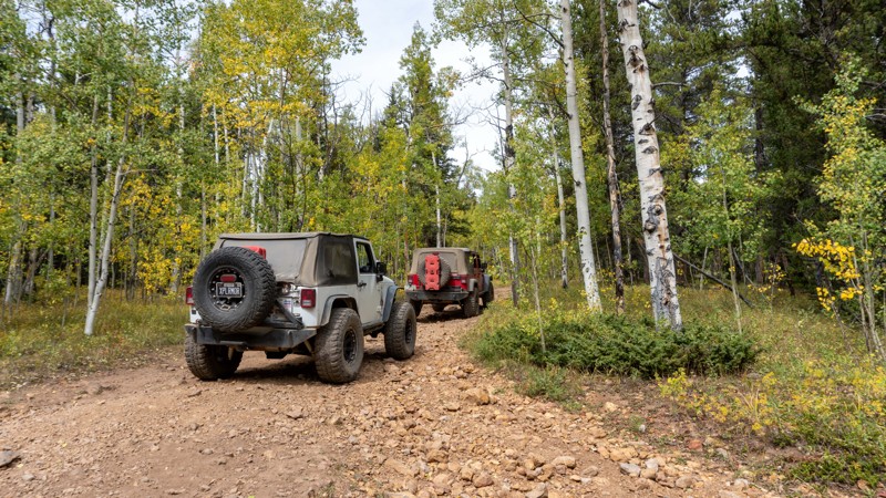
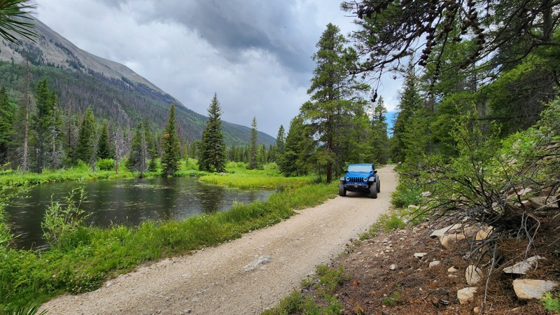
For those weaving together an overlanding route across Colorado, BV sits in a strategic crossroads. Tincup Pass and Hancock Pass to the west cross the Continental Divide into Pitkin and beyond, while the Fourmile zone offers away in or out towards Denver. Whether you’re planning a multi-day trip or just a scenic afternoon outing, this region delivers variety in spades.

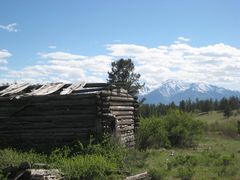
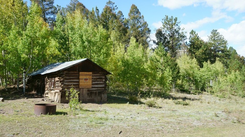
History That Runs Deep

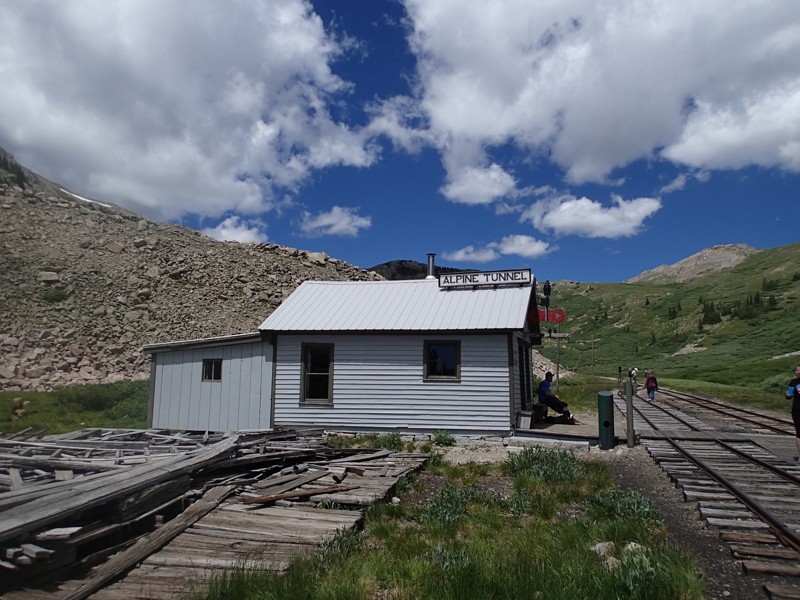
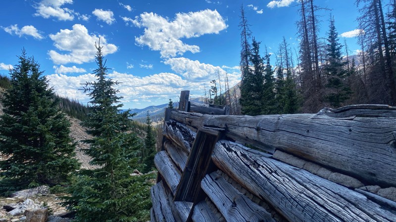
History buffs will appreciate Buena Vista’s proximity to one of Colorado’s most significant feats of railroad engineering: the Alpine Tunnel. Completed in 1882, it was the first tunnel to ever bore beneath the Continental Divide and, at 11,251 feet, once held the title of the highest railroad tunnel in North America. The site is a must-visit for those interested in Colorado’s rugged mining and railroading legacy.

The Whitewater Capital of Colorado

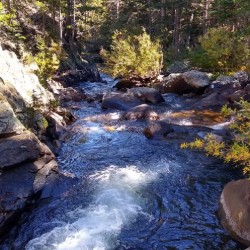
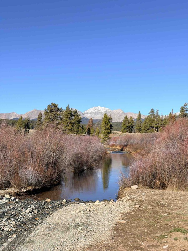
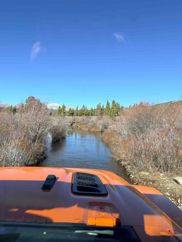
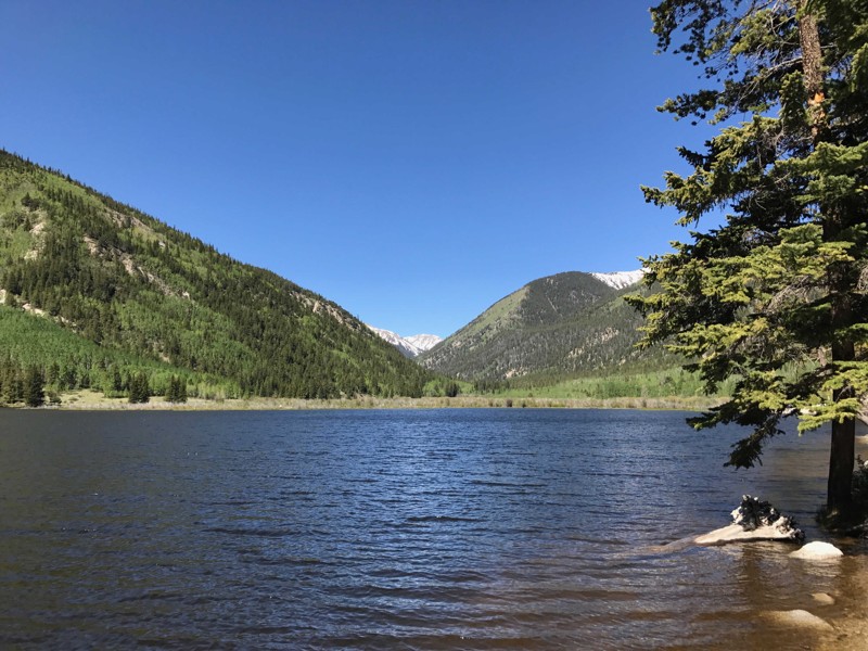
When you're not hitting the trail, take to the water. The Arkansas River runs right through town and is globally known for whitewater rafting, especially through Browns Canyon National Monument. If you prefer a calmer day, there’s excellent fly fishing, kayaking, and paddleboarding along this stretch of river.

A Charming Basecamp for Adventure

Buena Vista retains its small-town charm despite being a launchpad for big adventures. You’ll find a walkable downtown with local coffee shops, breweries, gear outfitters, and boutique lodging. The South Main neighborhood along the river offers a modern twist—featuring trails, a bike park, public events, and easy river access.

Why Buena Vista Belongs on Your Radar

Whether you’re looking to summit a peak in your Jeep, explore scenic forest roads, trace the tracks of Colorado’s mining history, or soak in a hot spring after a long ride—Buena Vista delivers. It's a true offroad basecamp that deserves more than a pit stop. Plan accordingly... you’ll want to stay longer than expected.

Top Reasons to Explore Here
Altitude Category IconAltitude
Beginner Category IconBeginner
Camping Category IconCamping
Forest Category IconForest
Ghost Town Category IconGhost Town
Iconic Category IconIconic
Mine Category IconMine
Mud Category IconMud
Overland Category IconOverland
Rock Category IconRock
Sand Category IconSand
Scenic Category IconScenic
Snow Wheeling Category IconSnow Wheeling
Wash Category IconWash
Water Category IconWater
Trail Types
Scout Route
Full Trail Guide

Preview Trail Icon
Preview Trails
easy
moderate
difficult
severe
extreme

All-Access
Scout Route
Start a 7-day Free Trial

Most Recent Trail Reviews

Most Popular

Search for Trails
Colorado: Tincup Pass Hero Photo
All-Access Preview Icon
4.7/5 (149 reviews)
Updated: 07/22/2024
Tincup Pass
Open
/
St. Elmo, Colorado/
12.69 miles/
About 2 hours

Cutting through two National Forests and crossing the Continental Divide at 12,154 feet, Tincup Pass offers beautiful high alpine views while following the same route used by miners and prospectors searching for their fortunes in the late 1800s. This relatively easy route takes you from one historic mountain town right into another. St. Elmo is a true ghost town built during the mining boom of the 1880s, while Tincup, originally called Virginia City, has been resurrected as a popular summer destination with many historic buildings still in use today.

Colorado: Yansing Gulch aka Chinaman Gulch Hero Photo
All-Access Icon
4.9/5 (46 reviews)
Updated: 02/24/2025
Yansing Gulch aka Chinaman Gulch
Buena Vista, Colorado

Yansing Gulch, previously known as Chinaman Gulch, is a very popular, difficult rock crawling trail ideal for testing the limits of modified vehicles. Minimal snow to the area makes it a great location for winter wheeling. There are many obstacles and rocks to play on along this 4WD trail, many of which provide multiple lines from intermediate to extremely difficult. Although not very scenic, the occasional views of the Collegiate Peaks are astonishing. This trail is a great trail for groups as the main obstacles provide enough room for vehicles to pull out of the way and watch other vehicles attempt the obstacle.

Colorado: Mount Antero Hero Photo
All-Access Icon
4.9/5 (72 reviews)
Updated: 07/16/2024
Mount Antero
Buena Vista, Colorado
It's not every day that a trail can take you within 500' of a 14er summit, but the Mount Antero Trail does just that! Starting low in the valley, the trail climbs through Conifer forests and Aspen groves before continuing above treeline up nine spectacular switchbacks that will leave you wondering how anyone could have built a road up the side of the mountain. Once up the lower switchbacks, the views of Cronin Peak (13,802') and the Baldwin Valley below are panoramic. The upper switchbacks take you near the summit of Mount Antero to an elevation of 13,800'. The views of the Arkansas River Valley here are amazing, and the Mount Antero Summit is only 500' away should you choose to bag a 14er. The Mount Antero Trail is the main trail in the area with several other connecting trails allowing for a multi-day adventure. You can explore the Baldwin Lake Trail, Mount White Trail, Browns Lake Trail or the Boulder Mountain Trail, which are all part of the Mount Antero Trail System.
Colorado: Cumberland Pass Hero Photo
All-Access Icon
4.5/5 (31 reviews)
Updated: 06/16/2024
Cumberland Pass
Pitkin, Colorado
Expansive views of the Collegiates, Napolean Mountain, Green Mountain, Terrible Mountain, and rugged peaks are everywhere you look. Cumberland Pass packs big views of Colorado's mountains and connects two of the most quaint little towns around in Tin Cup and Pitkin while making its way all the way down to Taylor Park and Reservoir. People flock from all over the country for a summer vacation in this area of Colorado, and once you experience it yourself, you will know why. Cumberland Pass is part of the famous Miners Loop that includes Tincup Pass and Hancock Pass and a wonderful route for overlanding on a summer Colorado weekend!
Colorado: Aspen Ridge Hero Photo
All-Access Icon
4.4/5 (44 reviews)
Updated: 07/23/2024
Aspen Ridge
Johnson Village, Colorado

Aspen Ridge features open ranges, dense forests, and expansive views. As the name implies, the 10,000-foot elevation ridge is covered in aspen trees. The Forest Service Road is generally a graded dirt road that travels in a north-south track. The road crosses broad meadows providing expansive views of the Collegiate Peaks. Despite rougher conditions at elevation, the entire road is easily navigable by a stock 4WD vehicle. Aspen Ridge is popular among ATV and motorcycle riders, mountain bikers, and equestrians who enjoy the wide open spaces. There's dispersed camping available along all segments of the road, and nearby towns of Nathrop, Johnson Village, Buena Vista, and Salida offer commercial campgrounds, motel lodging, and outdoor supplies.

Colorado: Bald Mountain Gulch Hero Photo
All-Access Preview Icon
4.7/5 (57 reviews)
Updated: 09/10/2025
Bald Mountain Gulch
Open
/
Johnson Village, Colorado/
8.64 miles/
About 2 hours

Bald Mountain Gulch (FS Road 300) is a 4WD road in the Fourmile area of Colorado, southeast of Johnson Village. It traverses scenic, high-elevation terrain in a northeast to southwest track. It provides the 4x4 enthusiast spectacular rock formations, sandy terrain, and occasional tawny rock and forest-framed views of the Arkansas River valley and the Collegiate Peaks. There are numerous 4WD roads in the vicinity, making Fourmile an ideal destination for a weekend of 4x4 trails, dispersed camping, hiking, and fishing not far from Denver or Colorado Springs. Bald Mountain Gulch is recommended to drive in conjunction with Bald Mountain Loop.

Colorado: Grizzly Lake Hero Photo
All-Access Icon
4.9/5 (36 reviews)
Updated: 06/30/2024
Grizzly Lake
Johnson Village, Colorado

Grizzly Lake is a difficult rock crawling trail that takes you over one demanding challenge at the start to steal your attention, and then never gives that attention back till the trail run is over. This trail combines all aspects of rock crawling into less than 3 miles. With ledge climbs, water crossings, shelf roads, off camber leans, and tight squeezes between trees, the trail finally rewards you for your courage by providing epic Rocky Mountain views at its ending point. Bring your camera, bring your fishing rod, but most importantly, bring a well equipped vehicle as the trek to Grizzly Lake is certainly an adventurous one.

Colorado: Billings Lake Hero Photo
All-Access Icon
4.2/5 (36 reviews)
Updated: 04/30/2025
Billings Lake
Maysville, Colorado

Following the North Fork of the South Arkansas River to its origin beneath Pomeroy Mountain, Billings Lake is a stunning offroad trail providing a true Colorado backcountry experience. Rich with abundant camping, scenic views, historical landmarks, and plenty of activities to entertain outdoorsmen of all types, this slow-burning trail passes iconic hiking trails and world-class fishing lakes, culminating at a spectacular valley just beneath the iconic Pride of the West Tunnel. This Toll Tunnel connecting the Billings Lake Valley to the town of Hancock predates rail travel in the area by two years. The ornate stonework with the keystone engraved with "Pride of the West Tunnel 1880" was used as the backdrop by photographers taking pictures for prospective investors.

Colorado: Hancock Pass Hero Photo
All-Access Icon
4.8/5 (71 reviews)
Updated: 07/22/2024
Hancock Pass
St. Elmo, Colorado
Situated near the famous ghost town of St. Elmo and within the San Isabel and Gunnison National Forests, this trail will lead you up and over Hancock Pass and the continental divide at an elevation of 12,140'. You will also travel through some of the most historic and beautiful country that Colorful Colorado has to offer. If alpine passes, turn-of-the-century railroads, mining history, and ghost towns are what you are looking for; this entire area will not disappoint! It is a must-do.
Colorado: Fourmile Area: Sevenmile Creek Hero Photo
All-Access Icon
4.4/5 (27 reviews)
Updated: 05/29/2024
Fourmile Area: Sevenmile Creek
Buena Vista, Colorado
The Sevenmile Creek Trail follows an old travel route the Native Americans in the area called "Seven Mile Pass." This off-road trail is now part of the Fourmile Travel Management area and connects with several additional trails nearby. The route connects the Natural Bridge Trail to the top of Trout Creek Pass and is also a connector for the Chubb Park Trail. You will also experience the historic site of the Goddard Homestead, which makes for a unique photo opportunity as there are several old buildings still standing with a view of the Collegiate Peaks in the background.
Colorado: Iron Chest Hero Photo
All-Access Icon
4.9/5 (24 reviews)
Updated: 07/26/2024
Iron Chest
St. Elmo, Colorado

Lifts, lockers, driving experience and a set of calm nerves are required to tackle the trip up to the Iron Chest Mine. The rock garden at the beginning of this off-road trail is just one of the unique features, combined with the aerial views of St. Elmo below along the way, that make this one of the most authentic trails in Central Colorado. If you like mining history, rock gardens, shelf roads, epic views and spending time above timberline then this trail should be on your bucket list.

Colorado: Alpine Tunnel East Hero Photo
All-Access Icon
4.7/5 (23 reviews)
Updated: 07/23/2024
Alpine Tunnel East
Buena Vista, Colorado
Situated near the famous ghost town of St. Elmo and within the San Isabel National Forest, this trail will lead you through an area with some of the most historic and beautiful country that Colorful Colorado has to offer. If turn of the century railroads, mining history, and ghost towns are what you are looking for, you will not be disappointed. You will travel through the ghost town of Romley which existed as a service town for the Mary Murphy Mine. Romley was also known as the "red town" because all it's buildings were painted red with white trim. It was originally called Murphy's Switch because of the presence of it's railroad siding. With an even more scenic setting, you come to the ghost town of Hancock, with only its log foundations still showing. Hancock served the workers who built the famous Alpine Tunnel. Its main population peak was in the 1880's and 1890's while the tunnel was being built. The train ran through Hancock carrying miners, passengers and supplies. It is said Mark Twain took the ride one time just for the experience.
Colorado: Mineral Basin Hero Photo
All-Access Icon
4.8/5 (47 reviews)
Updated: 07/23/2024
Mineral Basin
Buena Vista, Colorado
The Mineral Basin Trail allows users to explore the South Cottonwood Drainage above Cottonwood Lake. The trail snakes its way up the valley as it heads toward Mineral Basin and Emma Burr Mountain (13,538'). Along the trail, you will travel close to Cottonwood Creek and pass through open meadows and aspen groves. Along the upper sections of the trail are marshy areas frequented by moose and elk. The trail ends at a large parking area high in the basin with views of Jones Mountain and the South Cottonwood Valley below.
Colorado: Pomeroy Lakes Hero Photo
All-Access Icon
4.8/5 (50 reviews)
Updated: 07/08/2024
Pomeroy Lakes
St. Elmo, Colorado
If you enjoy mining history, alpine fishing and camping then this trail is a must do. You will gain a glimpse of the areas mining history as you begin the trail at the old townsite of Romley. You will then pass several arial tram towers that are still standing before you reach the Mary Murphy Mine area, which offers an opportunity to explore several of the old structures that are still standing. After the mine you will continue through meadows and heavy timber before you reach the parking area at an elevation of 12,109' with a view of Lower Pomeroy Lake. Upper Pomeroy Lake is about a mile hike farther up the basin along an old road and is situated below Pomeroy Mountain (13,151').
Colorado: Tomichi Pass Hero Photo
All-Access Icon
4.9/5 (17 reviews)
Updated: 08/01/2024
Tomichi Pass
Pitkin, Colorado

Tomichi Pass is a high-mountain trail connecting Brittle Silver Basin to the north with the mining town of Whitepine to the south. This trail is often compared to many of the routes in the San Juan Mountains as the north side of the trail is almost fully visible from the start as it cuts across talus slopes under the red mineral deposits of Brittle Silver Mountain. Don't let the beautiful scenery fool you because this is a difficult, hard-core trail not for the faint of heart. An exposed shelf road in Brittle Silver Basin is extremely narrow and off-camber in places and is prone to rockslides.

Colorado: Williams Pass Hero Photo
All-Access Icon
5/5 (17 reviews)
Updated: 09/03/2025
Williams Pass
Saint Elmo, Colorado

Williams Pass follows an old 1880s toll road that ascends and traverses the Continental Divide. It was once the route for travelers and goods from St. Elmo to Pitkin, and it's now used exclusively for outdoor recreation. Topping out at just below 12,000' in elevation, Williams Pass treats visitors to spectacular east and west views as you travel through a pristine alpine meadow. The pass connects both Chaffee and Gunnison Counties and the San Isabel and Gunnison National Forests.

Colorado: Mount Princeton Hero Photo
All-Access Icon
4.7/5 (37 reviews)
Updated: 07/23/2024
Mount Princeton
Buena Vista, Colorado
Mount Princeton (14,196') is the most majestic and popular of the Collegiate Peaks, and the Princeton Chalet road takes you well above timberline on the southern slope of the mountain. The trail is in such close proximity to Buena Vista that you can look up at the mountain from downtown and then two hours later you can be looking down on the valley below giving you views of nearly the entire county. The road will certainly test the nerves of even the most experienced drivers as it switchbacks its way up the mountains and then traverses to the south crossing a large avalanche chute before ending on a ridge below Tigger Peak (13,300'). A chalet built by Young Life in the 60s still stands at the end of the road and is used by hikers and mountaineers during their adventures.
Colorado: Fourmile Area: Natural Bridge Hero Photo
All-Access Icon
4.7/5 (38 reviews)
Updated: 07/24/2024
Fourmile Area: Natural Bridge
Buena Vista, Colorado
The Natural Bridge Loop is a scenic trail with a hiking option located just northeast of Buena Vista. The trail snakes back and forth over small ridges and through steep gullies before reaching the Natural Bridge rock formation. While an impressive photo opportunity from the road, the optional .75 mile hike to the bridge allows for an up close look and an amazing view of the Arkansas River Valley below. The return trip is equally as impressive with panoramic views of the 14,000' Collegiate Peaks as the backdrop. Bring your hiking gear and some water if you plan to hike to the bridge as it's a steep non-maintained trail up the mountainside.
Colorado: Carnage Canyon Hero Photo
All-Access Icon
5/5 (4 reviews)
Updated: 09/17/2024
Carnage Canyon
Johnson Village, Colorado

Carnage Canyon, or Carnage BV as it is sometimes referred to, is an extreme rock crawling trail. Though it is less than a mile long, this trail will take most of the day to complete, depending on the group size and the needed trail repairs. It is impossible to get through without a winch and a minimum of 37'' tires. Lockers are required, and vehicle damage is almost inevitable. This route features huge boulders, daunting waterfall climbs, and a V-notch obstacle that pushes most vehicles onto their side.

This trail should not be attempted if you do not meet the posted requirements at the trailhead.

Colorado: Alpine Tunnel West Hero Photo
All-Access Icon
3.9/5 (21 reviews)
Updated: 07/11/2024
Alpine Tunnel West
Pitkin, Colorado
The main trail of The Alpine Tunnel Historic District. This trail is for anyone interested in ghost towns, mining history, and of course, railroad history. The Alpine Tunnel was the first railroad bore ever drilled in the United States, the first ever to carry tracks under the Continental Divide and, in 1882, the highest point ever reached by a railroad at 11,251' above sea level. Anticipating that the mineral rich area would be the next big mining "bonanza,” as many as 10,000 different men worked to build the line and the tunnel at various times. Laborers, working for $3.50 per day, and explosives men, who worked for $5.00 per day, were often forced to go from their worksite to their cabins in groups in order to avoid being lost in the snow. The only complete structure remaining is the Telegraph Office, which was built in 1890. The railway through the tunnel operated from 1882 to 1910 and cost $300,000 to build. The Alpine Tunnel Historic District was placed on the National Register of Historic Places in April 1996.
Colorado: Baldwin Lake Hero Photo
All-Access Icon
4.5/5 (33 reviews)
Updated: 07/16/2024
Baldwin Lake
Buena Vista, Colorado
The Baldwin Lake Trail follows the Baldwin Creek drainage, gaining elevation as it climbs out of Baldwin Gulch. The trail offers postcard worthy views of Baldwin Lake as it sits in the basin below Grizzly Mountain (13,708'). The trail is part of the Mount Antero Trail system, and is a side trip off the Mount Antero Trail. Baldwin Lake offers the opportunity for high alpine fishing and the trail continues into the basin above giving a glimpse of the areas past mining history. Views of Mount Antero (14,275') are prominent on the return trip down the valley.
Colorado: Hancock Lake Hero Photo
All-Access Icon
4.8/5 (36 reviews)
Updated: 06/24/2024
Hancock Lake
Saint Elmo, Colorado
Alpine tundra, pristine lakes, epic fishing and high mountain valleys are just some of the rewards that await at the end of the Hancock Lake Trail. The trail begins at the old townsite of Hancock, Colorado and from there heads south into the Chalk Creek Pass Valley. You will traverse through conifer forests, willows and tundra on your way toward the parking area that sits at just over 11,600' of elevation. A short hike from the parking area brings Lower Hancock Lake into view, and a more focused hike will take you to Upper Hancock Lake that sits just a bit higher in the valley. Be sure to respect this pristine area and pack out everything you pack in.
Colorado: Fourmile Area: Lenhardy Cutoff Hero Photo
All-Access Icon
4.4/5 (33 reviews)
Updated: 07/18/2024
Fourmile Area: Lenhardy Cutoff
Buena Vista, Colorado
The Lenhardy Cutoff trail follows the route built initially by George Leonhard in 1872. The trail was built as a toll road and mail route bypassing Buena Vista to take a slightly shorter route to Leadville. The trail heads east from the Spanish Mills area and gradually gains elevation until finally making its way to Chubb Park near Highway 285/24 on Trout Creek Pass. Camping is plentiful along the route allowing access to several additional connected trails. From Lenhardy Cutoff, you can access Spanish Mills, Natural Bridge, Big Sandy, Million Dollar View, Shields Gulch, McGee Gulch, and Chubb Park.
Colorado: Cottonwood Lake Hero Photo
All-Access Icon
4.4/5 (15 reviews)
Updated: 06/08/2024
Cottonwood Lake
Buena Vista, Colorado
The Cottonwood Lake Trail is a short, easy drive that allows for campground camping and several recreation opportunities in close proximity to downtown Buena Vista. The Cottonwood Lake Trail follows CR 344 along South Cottonwood Creek until it reaches Cottonwood Lake. The trail then continues around the lake to the Cottonwood Lake Campground and connects to the Mineral Basin Trail. Mineral Basin allows for access to the area above the lake for further exploration and off-roading. Cottonwood Lake offers shore fishing and a boat launch for non-motorized water craft. Many times you will find stand-up paddlers, canoes, kayaks, inflatable rafts and fishermen in float tubes enjoying the water based recreation the lake provides.
Colorado: Ute Trail Hero Photo
Scout Route Icon
4.4/5 (6 reviews)
Updated: 09/18/2025
Ute Trail
Parkdale, Colorado

Winding through the heart of Colorado’s high country, Ute Trail is a classic Central Colorado Mountain traverse that blends sweeping scenery with approachable off-road adventure. Once used by the Ute people and early settlers, this historic route runs east to west between U.S. Highway 9 northwest of Canon City and the Arkansas River Valley near Salida. It rises steadily through ranchland, open meadows, and aspen and pine groves, eventually opening up to broad ridgelines with panoramic views of the Collegiate Peaks to the west and the Sangre de Cristo Wilderness to the south.

The trail itself is a well-defined, mild gravel road, making it a perfect fit for any vehicle, including overlanders, and casual explorers looking to get off the pavement. Expect packed dirt, occasional washboard stretches, and some slight mud depending on the season. Several dispersed campsites along the route offer serene overnight options beneath the stars.

Colorado: Black Dumps Hero Photo
All-Access Icon
4.9/5 (19 reviews)
Updated: 09/10/2025
Black Dumps
Johnson Village, Colorado

Black Dumps Road is a true 4WD road located approximately ten miles east of Johnson Village, known for its rocks, ruts, and seasonal mud. This area of the San Isabel National Forest, commonly referred to as “Fourmile”, contains dozens of roads and spurs that provide a broad spectrum of outdoor recreational opportunities. Black Dumps Road is noted for its high buttes, boulder-strewn meadows, and Aspen forest. It is popular among OHV users, mountain bikers, hikers, and equestrians. Its remoteness, the variety of outdoor activities it invites, and rugged two-track roads are the greatest attractions to Black Dumps Road.

Colorado: Deadhorse Gulch Hero Photo
Scout Route Icon
4.5/5 (11 reviews)
Updated: 07/07/2025
Deadhorse Gulch
Whitehorn, Colorado

Dead Horse Gulch is a challenging connector trail between the Aspen Ridge trail and Spiral Drive in Salida, with gorgeous views of the Arkansas Valley. It's best run downhill for the views of both the Collegiate Peaks and Sangre De Christos as you descend into Salida. The trail is mostly narrow and rocky, with several moderately difficult sections and one optional ledge obstacle that requires a good break-over angle. There are few passing places, but the trail is lightly traveled, so you are unlikely to encounter anyone coming the other way. The trail isn't recommended for full-size trucks due to a couple of narrow, off-camber shelf-road sections.

While most of the trail is unsuitable for camping, there are a handful of small dispersed campsites near both the top and bottom of the trail. More camping is available off connecting roads at the northern end. The lower part of the trail is intertwined with a network of mountain bike trails, so watch for mountain bikers and share the trail.

Colorado: Jones Mountain/Ptarmigan Lake Hero Photo
All-Access Icon
4.8/5 (48 reviews)
Updated: 07/23/2024
Jones Mountain/Ptarmigan Lake
Buena Vista, Colorado
The Cottonwood Creek drainage just west of Buena Vista is an area rich with mining history, alpine lakes, wildlife and an opportunity to travel off the beaten path in Central Colorado. The Jones Mountain/Ptarmigan Lake trail offers unique access to Ptarmigan Lake from an off-road trail and the ascent up Jones Mountain will not disappoint . You will travel to 12,500' of elevation, high on the side of the mountain with incredible views from the backside of Mount Princeton and the South Cottonwood Creek valley below. Make sure to bring your fishing gear as Ptarmigan Lake is a short hike and has a good population of Native Cutthroat trout.
Colorado: Bassam Park Hero Photo
All-Access Icon
4/5 (14 reviews)
Updated: 09/23/2025
Bassam Park
Antero Junction, Colorado

Bassam Park Road, FS Road 187, is located within the San Isabel National Forest, approximately ten miles east of Johnson Village. This area of the National Forest, commonly called "Fourmile" or "the Casles", contains dozens of roads and spurs supporting a broad spectrum of outdoor recreational opportunities. Bassam Park is noted for its high buttes and volcanic stone towers ("castles"), spring-fed creeks, and numerous beaver dam ponds. It is popular among OHV users, mountain bikers, hikers, and equestrians. The area includes maintained dirt roads suitable for stock vehicles (it is not uncommon to see ordinary passenger sedans and minivans on some trails) and more difficult 4WD roads. The greatest attractions in this area are accessibility, a wide variety of outdoor activities, and expansive views of the Collegiate Peaks and the Arkansas River valley.

Colorado: Hope Gulch Hero Photo
All-Access Icon
4.7/5 (16 reviews)
Updated: 07/23/2024
Hope Gulch
Buena Vista, Colorado
The Hope Gulch Trail is a lightly used, 5-mile side trip off the Mineral Basin Trail. The road climbs out of the South Cottonwood Valley and ends on a ridge high above treeline with magnificent views of Mount Antero (14,275') to the south and Mount Yale (14,199') to the north. You can also look down into the Chalk Creek Valley and the South Cottonwood Valley from this ridgeline.
Colorado: Browns Lake Hero Photo
All-Access Icon
4.9/5 (13 reviews)
Updated: 07/23/2024
Browns Lake
Buena Vista, Colorado
The Browns Lake Trail is part of the greater Mount Antero Trail System. This out-and-back side trip features a fun drive into the Browns Creek Valley between Mt. White (13,667') and Mt Shavano (14,231'). The trail ends at a large beaver pond called Browns Lake. Many times this lake is massive in size if beaver activity in the area is high. Browns Lake offers fishing and hiking options at the end of the trail.
Colorado: Boulder Mountain Hero Photo
All-Access Icon
4.4/5 (17 reviews)
Updated: 07/17/2024
Boulder Mountain
Buena Vista, Colorado
Boulder Mountain has all the unique features you typically look for in a Central Colorado trail, and while there are no named obstacles, the steep terrain, and narrowness of trail will keep your focus on the road. The trail starts in dense, thick forests and proceeds to climb the north side of Boulder Mountain. The trail follows a narrow roadbed as it switchbacks up the side of the mountain. You will cross a wide avalanche chute on your way toward timberline. Once out of the trees, the views are unimpeded and you will proceed to cross talus slopes on your way to an abandoned mine site. The terrain at the mine site feels as though you are hanging off the side of the mountain and allows you to look down into the Town of Alpine in the Chalk Creek Valley below.
Colorado: Fourmile Area: Little Cottonwood Creek Hero Photo
All-Access Icon
4.6/5 (26 reviews)
Updated: 07/24/2024
Fourmile Area: Little Cottonwood Creek
Johnson Village, Colorado

Little Cottonwood Creek (FS 185D) is an incredible trail at highlighting the many aspects that the Fourmile Travel Management Area has to offer to the interested traveler. Traveling through sandy soils and cottonwood trees, through beautiful aspen groves, and charming meadows. All Leading you to some of the most captivating views of the surrounding Collegiate Mountain Ranges you will ever enjoy.

Colorado: Bald Mountain Loop Hero Photo
All-Access Icon
4.7/5 (37 reviews)
Updated: 09/10/2025
Bald Mountain Loop
Nathrop, Colorado

Bald Mountain Loop is a spur 4WD road off of Bald Mountain Gulch in the Fourmile area of Colorado, southeast of Johnson Village. It provides expansive views of the Arkansas River valley and the Collegiate Peaks. There are many other 4WD roads in the vicinity, so Fourmile is ideal for a weekend excursion of trails, camping, hiking, and fishing. Be sure to include the panoramic Bald Mountain Loop.

Colorado: Fourmile Area: Shields / McGee Loop Hero Photo
All-Access Icon
3.5/5 (11 reviews)
Updated: 12/31/2024
Fourmile Area: Shields / McGee Loop
Buena Vista, Colorado

Miles of easy, winding roads with amazing views of the collegiate peaks on the west side and dispersed camping for tents, RVs, trailers, whatever you have. Most sites are in fir and aspen forests, but some are in open meadows that can accommodate larger groups. This area is close enough to Denver or Colorado Springs for an overnight camping trip, and the roads are fun for all sorts of off-road vehicles. Shields Gulch features campsites with stunning views of the Collegiate Peaks and the hills and valleys of the Fourmile area. McGee Gulch runs along a small valley with streams and marsh areas, cattle graze along the route. Campsites here offer more protection from wind than the exposed sites on the ridges of Shields Gulch, and are closer to the main route. Small water crossings and muddy spots add diversity to the drive, which is beautiful and easy. This area is popular with ATVs and horses because it is possible to bring large trailers in safely. There are non-motorized trails for mountain bikers, hikers and equestrians.

Colorado: Fourmile Area: Spanish Mills Hero Photo
All-Access Icon
4.1/5 (21 reviews)
Updated: 06/29/2024
Fourmile Area: Spanish Mills
Buena Vista, Colorado
This trail winds back and forth over small washes with magnificent views of the 14,000' Collegiate Peaks before dropping into a sandy wash at a place known as Spanish Mills. Spanish Mills is the name locals have given this route as there is an old arrastra site (an arrastra is a primitive mill for grinding and pulverizing (typically) gold or silver ore) just down stream from where this trail crosses Fourmile Creek. Spanish Mills was built by area miners in the early 1900s and was later named after the mine operation was abandoned. Please respect private property in this area as the mine and old mill site sit on a patented mining claim. Spanish Mills is a connector trail which ends where the Lenhardy Cut-Off trail and the Natural Bridge trail begin.
Colorado: Waunita Pass Hero Photo
All-Access Icon
4/5 (6 reviews)
Updated: 05/28/2024
Waunita Pass
Gunnison, Colorado
When you hear the words "pass" and "Colorado" used in the same sentence, you usually think of massive views, snowfields, and sometimes scary shelf roads. Not Waunita Pass! Waunita Pass is a gentle stroll starting in beautiful ranch land up and over a pass with continuous aspen and pine cover and dropping you into the quaint town of Pitkin. Furthering your adventure, you can go right through Pitken over to Cumberland Pass as part of your discovery route through Colorful Colorado!
Colorado: Fourmile Area: Big Sandy Hero Photo
All-Access Icon
4.6/5 (11 reviews)
Updated: 07/09/2024
Fourmile Area: Big Sandy
Johnson Village, Colorado
This trail is a connector route to the Lenhardy Cutoff Trail/FS 376 and is an access point for several additional trails in the Fourmile Travel Management Area. You can expect amazing panoramic views of the Collegiate Peaks Mountains and an opportunity to take in some of the area's history that won't disappoint. The trailhead is at the south end of Sleeping Indian, a rocky formation directly east of the town of Buena Vista. The first section of the trail travels the old Midland Railroad grade. The Midland Railway was incorporated in 1883. It was the first standard gauge built over the continental divide. It ran from Colorado Springs to Leadville and through the divide at Hagerman Pass to Glenwood Springs and then to Grand Junction. This trail also passes through a section of the Trout Creek Pegmatite Mineral District and offers a short hike to an old quartz quarry. Be sure to bring your camera and a pair of your favorite hiking shoes.
Colorado: Fourmile Area: Fourmile Creek Hero Photo
All-Access Icon
4.9/5 (15 reviews)
Updated: 05/17/2024
Fourmile Area: Fourmile Creek
Buena Vista, Colorado
The Fourmile Creek Trail follows the Fourmile Creek drainage north toward the Buffalo Peaks Wilderness Area. The road zig-zags between rock formations and connects to several other Fourmile Area trails as it climbs in elevation. The views of Buffalo Peaks, West Buffalo at 13,332' and East Buffalo at 13,300', on the way in are plentiful, and the views of the Collegiate Peaks and the Arkansas River Valley on the way out are equally as impressive. Near the end of the road, there are some camping areas, or you can park and hike the trail that leads farther north toward Buffalo Meadows.
Colorado: South Salt Creek Hero Photo
All-Access Icon
2.7/5 (15 reviews)
Updated: 07/23/2024
South Salt Creek
Buena Vista, Colorado
South Salt Creek Road is an excellent side trip when traveling Highway 285 to and from Denver and Buena Vista, allowing you to drive on dirt right into Buena Vista. The dense aspen and pine forest hides the typical epic views of the surrounding peaks. Still, it provides an opportunity to see an old homestead and find a few generously wooded and secluded campsites while avoiding pavement.
Colorado: Fourmile Area: Chubb Park Hero Photo
All-Access Icon
4.1/5 (20 reviews)
Updated: 05/01/2024
Fourmile Area: Chubb Park
Buena Vista, Colorado
Chubb Park is named after Robert Bass Newett, better known as "Chubb" by his friends. He decided to settle in this area in 1867 when he came west from DeKalb, Illinois. Chubb built a hotel, established a ranch, and platted a town called Newett. Today there is nothing left of the old town of Newett, but Chubb Park offers impressive views of Buffalo Peaks and is connected to the numerous trails in the Fourmile Management Area. Chubb Park also provides access to trails leading to the Buffalo Peaks Wilderness area.
Colorado: Fourmile Area: Mushroom Gulch Hero Photo
All-Access Icon
3.8/5 (12 reviews)
Updated: 05/15/2024
Fourmile Area: Mushroom Gulch
Johnson Village, Colorado
Mushroom Gulch is a mellow scenic drive that leads through a number of small aspen groves and travels up along a drainage wash. Culminating in the great views that are awarded by the Kaufman Pasture. Traveling from Waypoint 5 along until the end, you will travel through the Kaufman Pasture, enjoying it's amazing views of the surrounding mountain ranges.
Colorado: Castle Rock Gulch Hero Photo
All-Access Icon
4.2/5 (8 reviews)
Updated: 09/23/2025
Castle Rock Gulch
Nathrop, Colorado

Castle Rock Gulch Road is located within the San Isabel National Forest, approximately ten miles east of Johnson Village. This area of the National Forest, commonly referred to as “Fourmile” or "the Castles", contains dozens of roads and spurs which provide a broad spectrum of outdoor recreational opportunities. Castle Rock Gulch is noted for its rock outcroppings, broad stream-filled meadows, and twisty roads. The rock features offer splendid viewing and photography. This road is popular among OHV users, mountain bikers, hikers, and equestrians. Its accessibility to RVs and horse trailers, the multiple outdoor activities it invites, and the visual contrasts between stone and green meadows are Castle Rock Gulch's greatest attractions.

Colorado: Mount White Hero Photo
All-Access Icon
5/5 (12 reviews)
Updated: 08/26/2024
Mount White
Buena Vista, Colorado

The Mount White Trail is unique in that the entire trail is above timberline. If you love elevation and being in the center of several 14ers and 13ers, this area will not disappoint! The views along the entire route are amazing and perfect for photographing several major Central Colorado Peaks. As you travel toward Mount White (13,667'), to the north, you have Mount Antero (14,275'), to the south are Mount Shavano (14,232') and Mount Tabeguache (14,163'), and to the west is Cronin Peak (13,877'). As you come to the end of the trail the views into the Arkansas River Valley are equally impressive. Mount White is a nice addition to the Mount Antero Trail, making for a full-day adventure.

Colorado: Taylor Mountain Hero Photo
All-Access Icon
4.2/5 (6 reviews)
Updated: 08/06/2024
Taylor Mountain
Maysville, Colorado

Traversing through the southern Sawatch Range, Taylor Mountain is a constantly climbing high alpine road weaving its way through a maze of old mining roads. Dilapidated buildings and mine tailings dot the landscape of an area rich in geological history, dating back to the late 1800s. With productive mines pulling in millions of dollars in silver, gold, lead, and copper, there has been no shortage of abundant natural resources as the area continues to be mined for limestone and quartz to this day. With plenty of scenic views and sights to see, Taylor Mountain will easily sneak its way onto your list of favorite trails within central Colorado.

Colorado: Old Tincup Pass Jeep Trail Hero Photo
All-Access Icon
4.6/5 (7 reviews)
Updated: 07/17/2024
Old Tincup Pass Jeep Trail
Tincup, Colorado

Paralleling Tincup Pass and providing a quick, difficult shortcut along the western end of the Pass, Old Tincup Jeep Trail is a narrow, rock-crawling alternative to an otherwise simple mountain trail. Bouldery terrain along Old Tincup will entertain the modified vehicle crowd and those looking for a much-needed challenge. Expansive valley views along the trail make for excellent action photo opportunities and give your device a perfect new screensaver. Don't take this trail lightly. It has left many users with damaged and inoperable vehicles.

Colorado: Turret Trail Hero Photo
Scout Route Icon
4.5/5 (5 reviews)
Updated: 10/15/2024
Turret Trail
Whitehorn, Colorado

The Turret Trail leads to the old ghost town of Turret, Colorado, and is the only road into, rather than around, Browns Canyon National Monument. The first few miles are a graded county road until you get to the Turret ghost town, which is privately owned and has interesting old buildings you can view from the road. Turning left on the main road through town brings you to the hiking trailhead for the Austin Trail, which goes to one of the main attractions in Browns Canyon National Monument called Railroad Gulch.

Past Turret, Forest Road 184 becomes a one-lane dirt track. Though the road remains easy, the terrain becomes more rugged as you enter Browns Canyon National Monument. The trail winds through a series of scenic hills and valleys with frequent views of towering rock formations nearby and the Collegiate Peaks in the distance. The road eventually dead-ends at a washed-out gully a few hundred yards short of where the endpoint is shown on the MVUM. Beyond that point, it turns into a scenic but seldom-used hiking trail entering the Browns Canyon Wilderness Study Area.

Dispersed camping is allowed along this trail, and there is one notable campsite up a short spur with spectacular views of the Collegiate Peaks and the Arkansas Valley. Even though it's in a national monument, this road is very lightly used and unlikely to be crowded even on holiday weekends. Turret Trail is a true hidden gem in the Salida area.

Colorado: Fourmile Area: Million Dollar View Hero Photo
All-Access Icon
4.2/5 (7 reviews)
Updated: 05/26/2023
Fourmile Area: Million Dollar View
Buena Vista, Colorado
Million Dollar View is a scenic side trip on an easy dirt road in the Fourmile Travel Management Area that offers expansive views of Chaffee County. The road gradually descends a flat mesa until arriving at a turnaround and campsite. Views of the Collegiate Peaks during the descent are endless with numerous photo opportunities. You can see Buffalo Peaks to the north (13,327'/13,332') along with many of the 14'ers in the Sawatch Range to the west. Mt. Harvard (14,423'), Mt. Columbia (14,078'), Mt. Yale (14,199'), Mt. Princeton (14,196'), Mt. Antero (14,275') and Mt. Shavano (14,232').
Colorado: Boss Reservoir Hero Photo
Scout Route Icon
5/5 (6 reviews)
Updated: 09/04/2025
Boss Reservoir
Garfield, Colorado

The Boss Reservoir Trail is a short route off the east side of Monarch Pass. The route will take you two miles into the forest from Highway 50 to the reservoir's banks. Fishing access is convenient, as the trail ends right at the lake. The road surface is mostly dirt with some rocky sections. A stock high-clearance 4x4 can complete the trail. Passing is difficult along the middle of the route so be sure to watch for wide places in case you need to pass another vehicle.

Colorado: Fourmile Area: The Castles Hero Photo
All-Access Icon
3.4/5 (11 reviews)
Updated: 06/05/2022
Fourmile Area: The Castles
Johnson Village, Colorado
This trail highlights some of the best views of the rock formation known as The Castles, from which it takes its name. Along the drive, you will have several opportunities to stop and play in Trout Creek, or float down it in a raft or tube. From here, you will have access to many of the other trails that make up the Fourmile Travel Management Area around Buena Vista and Johnson Village.
Colorado: Old Chalk Creek Road Hero Photo
Scout Route Icon
3.5/5 (5 reviews)
Updated: 09/16/2025
Old Chalk Creek Road
Saint Elmo, Colorado

Paralleling Chalk Creek between Saint Elmo and Mount Princeton Hot Springs, Old Chalk Creek Road is a nearly 6-mile straight-through dirt road through the San Isabel National Forest. The road is dual-managed as Forest Road 292 and County Road 292. The road is primarily packed dirt, 1.5-2 vehicles wide the entire way. The difficulty of the road is divided into three sections: west of Iron City Campground, Iron City to Alpine Lake, and east of Alpine Lake. From the western end to Iron City Campground, the road is very easy, well-maintained, and suitable for any vehicle. East of the campground until Alpine Lake, the road is rough with protruding rocks of several inches and several sharp grades. Low-clearance vehicles, trailers, and RVs are encouraged to avoid this middle section of the road. East of Alpine Lake, you will encounter many private residences, and the road is once again an easy, well-maintained dirt road suitable for any vehicle.

Along the drive, you will see many beaver ponds, old mining buildings, the Iron City Cemetery, and several areas to picnic and enjoy the cool waters of Chalk Creek. Dispersed camping is not allowed along this road, but improved camping can be found for a nightly fee at the Iron City Campground, where you will find a pit toilet, picnic tables, fire rings, and bear boxes.

Colorado: Cave Lake Hero Photo
Scout Route Icon
5/5 (3 reviews)
Updated: 10/15/2024
Cave Lake
Saint Elmo, Colorado
Cave Lake Trail is a short spur off the Mineral Basin Trail that heads north towards Jones Mountain. The old road used to go past Cave Lake and up to the Continental Divide, but that section of road was closed more than 20 years ago. Users can now drive to the treeline and park to walk the old road toward Cave Lake. The trail is easily traversed by any stock high-clearance vehicle with 4WD and a low range. There are numerous private mining claims in the area, so be careful not to trespass. There are a few good dispersed campsites at the beginning of the trail.
Colorado: Bald Mountain Road Hero Photo
Scout Route Icon
4.8/5 (5 reviews)
Updated: 10/15/2024
Bald Mountain Road
Buena Vista, Colorado

Bald Mountain Road goes to the top of a small dome just north of Mount Princeton. The road is used as an access for the communication equipment at the top and is an easy drive. There are great views of the Arkansas River Valley at the end, and the trail has a few campsites along the way. A dead-end camping spur route about 1/3 into the trail offers some dispersed sites, and the camping photo accompanying this write-up is from about halfway into the trail. A parking lot at the last switchback has a hiking trail, which cuts uphill to meet the Colorado Trail. Overall, use on this road is low, and there is plenty of room to pass other vehicles.

Colorado: Fourmile Area: Pipeline Overlook Hero Photo
All-Access Icon
4.8/5 (12 reviews)
Updated: 05/01/2024
Fourmile Area: Pipeline Overlook
Buena Vista, Colorado
The Pipeline Overlook Trail is a short trail that accesses an elevated shelf road once used to build the pipeline connecting the Otero Pump Station below. This trail offers uninhibited panoramic views of the Arkansas River Valley and the Collegiate Peaks to the west. The Otero Pump Station and pipeline were built as part of the original Homestake Project and were completed in 1967. The pump station lifts water from the Arkansas River against 575 feet of vertical head to deliver it to the South Platte River Basin over Trout Creek Pass.
Colorado: Middle Fork Hero Photo
Scout Route Icon
4.3/5 (3 reviews)
Updated: 06/19/2025
Middle Fork
Garfield, Colorado

Middle Fork Trail follows the Middle Fork of the South Arkansas Drainage to an endpoint just below the treeline. This endpoint also intersects the hiking Trailhead for Chalk Creek Pass. The 3.5-mile easy route is a nice, quiet drive without crowds. The trail ends at the edge of a large meadow with a small parking area and trailhead information. Sitting astride the famed Continental Divide Trail, the area is popular with hikers. Several dispersed campsites are located along the route.

Colorado: Fourmile Area: Eagles Roost Hero Photo
All-Access Icon
4.3/5 (8 reviews)
Updated: 06/29/2024
Fourmile Area: Eagles Roost
Buena Vista, Colorado
Eagles Roost (FS 375A) is a short cut, which allows you to access the Fourmile Creek Trail from Waypoint 3 of the Natural Bridge trail. You could also drive this trail in reverse and access the Natural Bridge Trail without driving the Spanish Mills trail first. Several campsites are located along the route and camping in these sites can make for an ideal staging area with central access to the numerous trails in the Fourmile area. The cliff face near the Fourmile Creek crossing is great Eagle habitat so keep an eye on the sky as you travel through the area.
Colorado: CR 183 Hero Photo
Scout Route Icon
4.3/5 (3 reviews)
Updated: 10/15/2024
CR 183
Smeltertown, Colorado
CR 183 is a simple out-track out-and-back trail with amazing views of Tabequache Peak, one of the 14,000-foot peaks in Colorado. There aren't any established campsites along this trail.
Colorado: Chubb Park North Hero Photo
All-Access Icon
2/5 (7 reviews)
Updated: 05/01/2024
Chubb Park North
Buena Vista, Colorado
For a short connector trail in between Buena Vista and Fairplay, Chubb Park North packs a punch with an epic view of The Buffalo Peaks Wilderness Area. The road doesn't lead to anything or challenge you, but it does play a part in a much larger overland route across Colorado. The wide-open space on each side of the road, the view before and behind you is what makes Colorado as special as it is.
Colorado: Futurity Gulch Hero Photo
Scout Route Icon
2/5 (2 reviews)
Updated: 09/29/2025
Futurity Gulch
Nathrop, Colorado
This graded road dead-ends at both forks and is mostly within private property. The draw of this trail is to see an old ghost town named Futurity which was initially a small mining camp. There are no trespassing signs, so there is not much you can do other than look from the vehicle. Suitable for leaf-peeping in the fall.
Colorado: Bald Mountain Gulch Cutoff Hero Photo
Scout Route Icon
3.4/5 (8 reviews)
Updated: 09/29/2025
Bald Mountain Gulch Cutoff
Nathrop, Colorado

Bald Mountain Gulch Cutoff is an out-and-back side spur off the Bald Mountain Gulch main trail. This side route once went through private property and connected to CR 300 at the west end of Arnold Gulch. However, the old route across private property is now closed, making the Bald Mountain Gulch Cutoff an out-and-back trail. There is a large turnaround area where the private land begins.

There is minor erosion damage along the trail and a few rocky sections, but there will be no challenge to a stock high-clearance 4x4.

Dispersed campsites along the route have views of the Arkansas River Valley and the Collegiate Peaks.

Colorado: Hoffman Park Hero Photo
Scout Route Icon
5/5 (1 reviews)
Updated: 10/15/2024
Hoffman Park
Garfield, Colorado

Hoffman Park is a short out-and-back spur trail off Middle Fork Trail. The route follows the drainage to near treeline and ends at a large alpine meadow overlooking the Middle Fork Valley. Near the remnants of several old cabins, there is a nice campsite at the end of the trail and a view of the main mine adit across the basin. The trail has tight switchbacks and rocky sections, making it suitable for stock 4x4 vehicles with high clearance and a low range. This route requires a Colorado OHV sticker.

Colorado: Powerline Hero Photo
Scout Route Icon
3.5/5 (2 reviews)
Updated: 07/14/2025
Powerline
Maysville, Colorado

As the name suggests, Powerline is a straight-through connector road following powerlines between Billings Lake and Taylor Mountain. The eastern end of the trail is extremely rocky, with protruding rocks up to basketball in size and loose rocks the size of softballs. The trail climbs sharply at a consistent 12-degree pitch as you travel west, curving through a half-dozen wide-sweeping switchbacks. Once at the top of the ridgeline, the trail smooths out to a well-maintained road the remainder of the way with no concerns. One campsite can be found at the eastern end of the trail near the intersection with Billings Lake, and another campsite can be found at the halfway mark along the ridgeline.

The loose rocky terrain on the eastern end of the trail is suitable only for high clearance 4WD vehicles. If entering the trail from the west and heading towards Dry Lake, any vehicle is suitable.

Colorado: Dry Lake Hero Photo
Scout Route Icon
2/5 (1 reviews)
Updated: 10/15/2024
Dry Lake
Maysville, Colorado

Deep Lake is an out-and-back trail with two short fingers on its northern end, both leading to campsites. The trail is an easy, hardpacked dirt road with several tall and sharp water bars, where low-clearance, long-wheelbase vehicles such as pickup trucks, RVs, or trailers will need to use caution. The western finger of the trail is primarily used as an access and resupply road for users of the Colorado Trail, as it ends at a large campsite alongside the popular hiking trail. The eastern finger is another access road to a gate at a firewood-cutting permit zone. The eastern finger offers a large campsite next to Dry Lake, just before the gate. The trail is single-lane the entire way but suitable for just about any vehicle.

Colorado: Cow Creek Hero Photo
Scout Route Icon
4/5 (3 reviews)
Updated: 06/23/2025
Cow Creek
Abbeyville, Colorado

Also referred to as Cow Lake Road, Cow Creek follows to the south of its namesake, Cow Creek, and crosses Sandford Creek, another unnamed creek on its southern end. It is a short road that connects Cumberland Pass with Cake Ridge Spur. The water crossings can be deep during spring runoff, so use caution. There are boondock-style campsites closer to Cumberland Pass.

Colorado: Cemetery Hero Photo
Scout Route Icon
4/5 (2 reviews)
Updated: 10/15/2024
Cemetery
Garfield, Colorado

The Cemetary Trail is a short out-and-back side spur off the Middle Fork Trail. This route immediately passes by an old cemetery and offers history enthusiasts the chance to walk around the long-forgotten gravesites tucked away in the dark timber. The trail continues up the drainage for less than a mile through tight timber and larger rocks. The trail is suitable for stock, high-clearance 4x4s with a low range, but the tight brush and trees will make for certain pinstriping. Due to the steep terrain, there are no established dispersed campsites along the route. This route is now a full-size motorized trail and requires a Colorado OHV sticker for plated 4x4s.

Colorado: Cake Ridge Spur Hero Photo
Scout Route Icon
4/5 (2 reviews)
Updated: 06/23/2025
Cake Ridge Spur
Abbeyville, Colorado

Cake Ridge Spur is a short dirt trail connecting three other nearby trails. This trail is part of a network of trails between Cottonwood Pass and Cumberland Pass. Cake Ridge Spur offers a chance to get out of the trees and catch glimpses of the surrounding area. The trail crosses Cow Creek at its south end, but the crossing has a man-made hard bottom that is usually only a few inches deep. It's also common to see cattle on this trail.

Although there are no campsites on this trail, all nearby trails have obvious campsites.

This trail is rated as moderate due to the frequent rutted-out sections along its length. A few of these ruts have bypasses, while others must be driven through. The ruts can be around a foot deep, which poses risks to vehicles with low clearance. However, any vehicle with AWD or 4WD and clearance can easily drive this trail.

Colorado: Frenchman Creek Hero Photo
Scout Route Icon
2/5 (3 reviews)
Updated: 07/01/2025
Frenchman Creek
Americus, Colorado

Frenchman Creek is a narrow, winding trail that climbs into the San Isabel National Forest and approaches the Collegiate Peaks Wilderness. The official trail on the Motor Vehicle Use Map (MVUM) ends at a random, unmarked spot with little room to turn around. However, the road on the ground physically keeps going much further than the MVUM route shows.

There are no notable obstacles on this trail, but there are a few steep sections that reach a maximum of 15 degrees of incline. The trail also has several spots that squeeze between trees, which could pose a problem for larger vehicles and full-size trucks.

There were a handful of campsites along the trail.

Colorado: Fourmile Spur Road Hero Photo
Scout Route Icon
1/5 (4 reviews)
Updated: 05/02/2025
Fourmile Spur Road
Americus, Colorado

Fourmile Spur Road, off Fourmile Creek near Buena Vista, is a short camping spur known for its excellent camp spots that are particularly suited for RV's. This tranquil stretch offers a serene setting complemented by beautiful scenery, making it an ideal choice for those looking to enjoy a peaceful nature retreat. Whether you're setting up a tent or parking an RV, the spots along Fourmile Spur Road provide both convenience and picturesque views that enhance any camping experience.

Colorado: Wagner Road Hero Photo
Scout Route Icon
2/5 (3 reviews)
Updated: 05/01/2025
Wagner Road
Americus, Colorado

Wagner Road is a super short camping spur off the seasonal portion of Fourmile Creek, featuring a single campsite. While this site is entirely exposed, it compensates with breathtaking views, making it a remarkable spot for those who appreciate a scenic backdrop. Ideal for visitors seeking solitude and a direct connection with nature, Wagner Road offers a unique camping experience where the vastness of the landscape can be fully appreciated.